|
Attachment to Report No. PLN30/09 Page 1 |
|
Attachments
Planning Meeting
Wednesday, 6 May, 2009 at 6:30pm
|
|
Attachments |
|
|
|
|
TABLE OF CONTENTS
A Ward
1 PLN30/09 Development Application - Section
96 (1A) - Subdivision of one lot into two
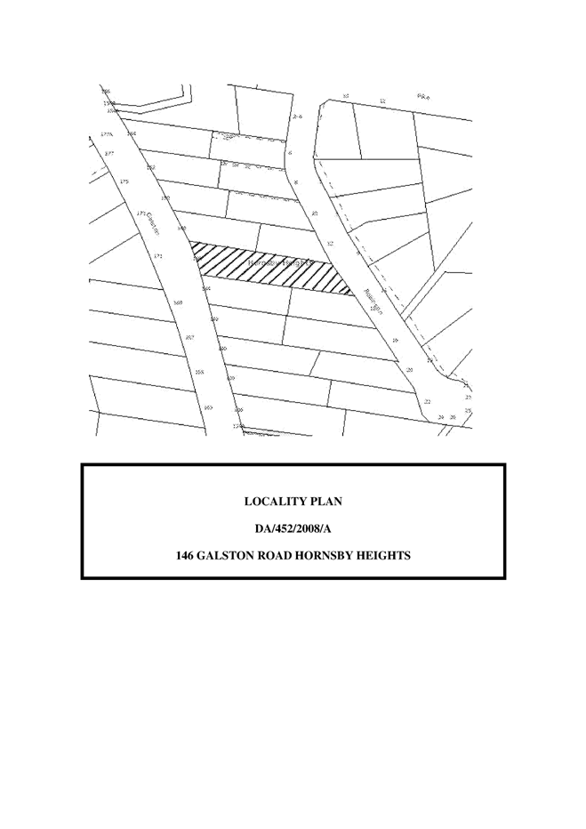
146 Galston Road Hornsby Heights
Attachment 1: ... Locality Plan
Attachment 2: ... Site Plan
Attachment 3: ... Independent Town Planning Consultant's Report
B Ward
2 PLN21/09 Development Application - Two
storey dwelling-house
16B Osborn Road, Normanhurst
Attachment 1: ... Locality Plan
Attachment 2: ... Site Plan
Attachment 3: ... Landscape Plan
Attachment 4: ... Tree Assessment Plan
Attachment 5: ... Floor Plans
Attachment 6: ... Elevations
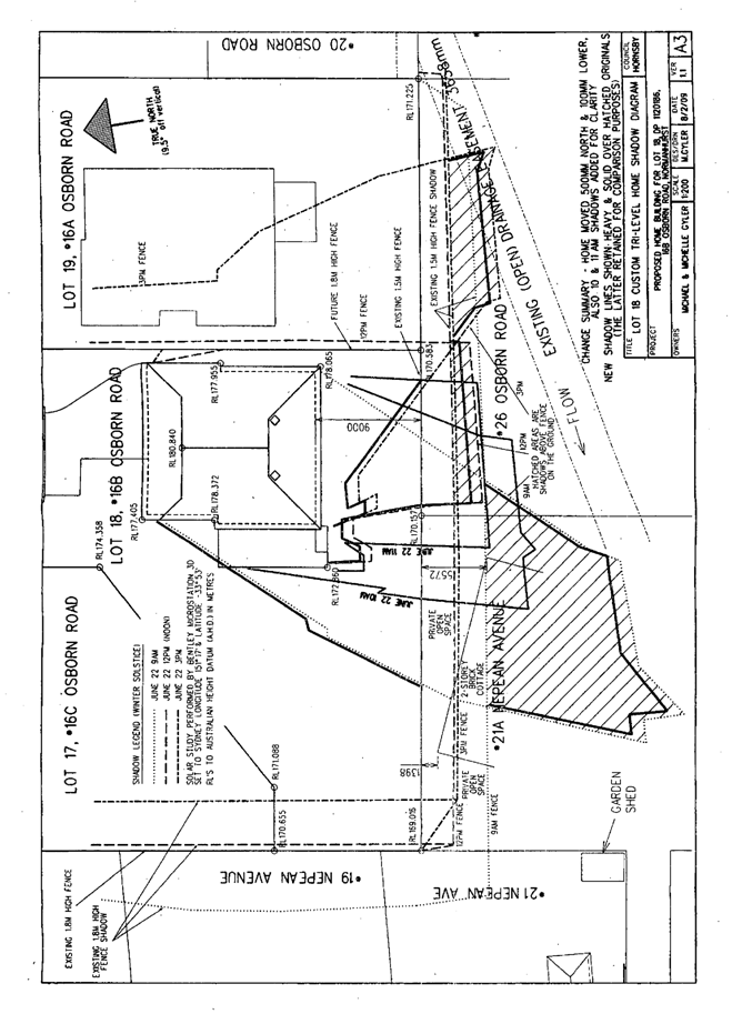
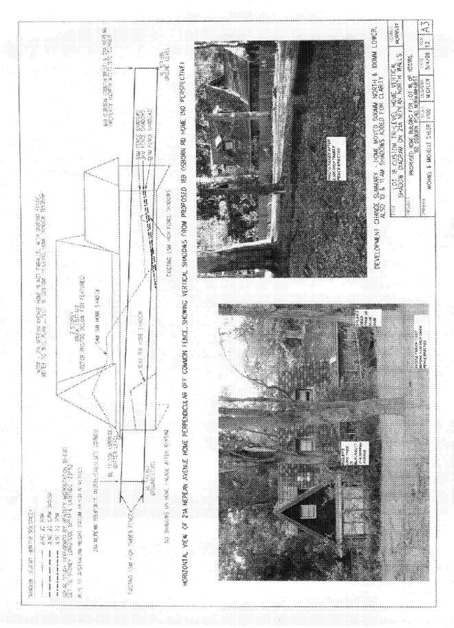
Attachment 7: ... Shadow Diagrams
Attachment 8: ... Vertical Shadow Diagram
C Ward
3 PLN25/09 Development Application - Two
Storey Dwelling-House
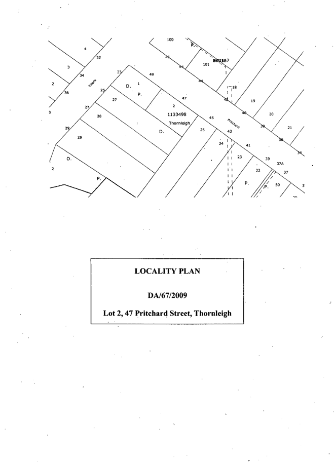
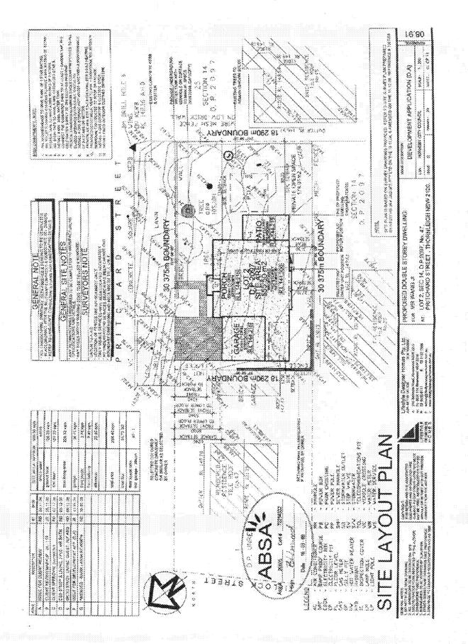
47 Pritchard Street, Thornleigh
Attachment 1: ... Locality Plan
Attachment 2: ... Site Plan
Attachment 3: ... Landscape Plan
Attachment 4: ... Floor Plans
Attachment 5: ... Elevations
Attachment 6: ... Shadow Diagrams
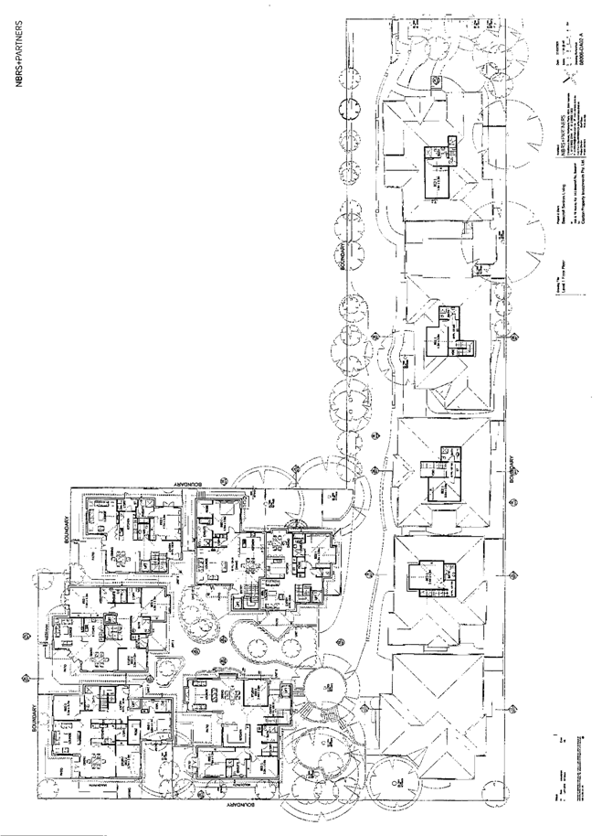
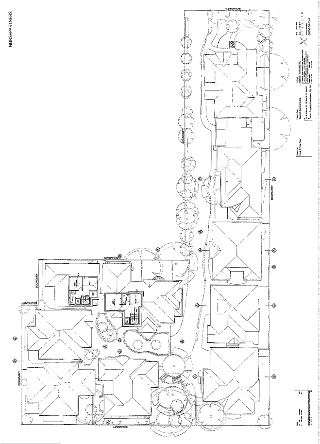
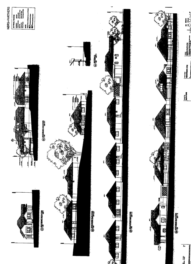
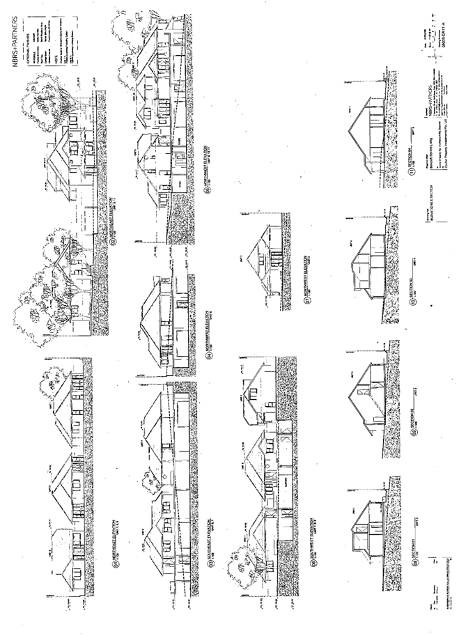
4 PLN26/09 Development Application - Seniors
Living Development
14A And 16 Murray Road Beecroft
Attachment 1: ... Locality Plan
Attachment 2: ... Site Survey Plan
Attachment 3: ... Tree Locations
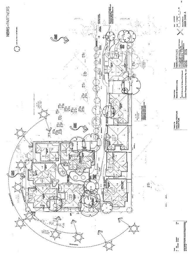
Attachment 4: ... Site Analysis Plan
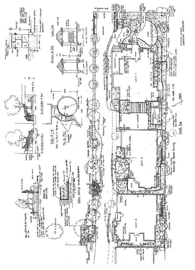
Attachment 5: ... Landscape Plans
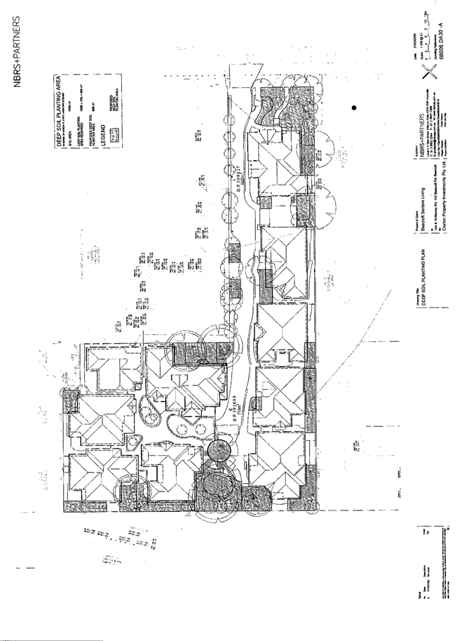
Attachment 6: ... Deep Soil Planting Areas
Attachment 7: ... Floor Plans
Attachment 8: ... Elevations
Attachment 9: ... Shadow Diagrams
Attachment 10: . Stormwater Drainage Plan
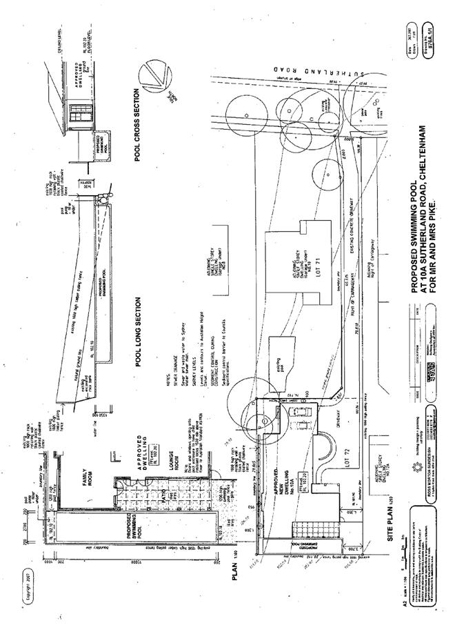
5 PLN29/09 Development Application - Construction of a swimming pool - 10A Sutherland Road, Cheltenham
Attachment 1: ... Locality Plan
|
ATTACHMENT/S
REPORT NO. PLN30/09
ITEM 1
1. Locality Plan 2. Site Plan 3. Independent Town Planning Consultant's Report
|
|
Attachment to Report No. PLN30/09 Page 3 |
Attachment 3
Independent Town Planning Consultant’s Report
EDAW – April 2009
|
Development Application No: |
DA/452/2008A |
|
Description of Proposal: |
Subdivision of one lot into two – (Section 96(1A)) |
|
Property Description: |
Lot 100 DP 1130236 (No. 146) Galston Road, Hornsby Heights |
|
Applicant: |
Jill P Ball |
|
Owner: |
Jill P Ball |
|
Statutory Provisions: |
Hornsby Shire Local Environmental Plan 1994 Residential A (Low Density) Zone |
|
Estimated Value: |
No amendment to original cost of works |
|
Ward: |
A |
RECOMMENDATION
THAT Development Application No. 452/2008/A for the modification of an approved subdivision of one lot into two by adjusting the boundary and amending the conditions of consent at Lot 100 DP1130236, No. 146 Galston Road, Hornsby Heights be approved subject to conditions listed in Schedule 1 of this report.
EXECUTIVE SUMMARY
1. The application proposes a Section 96(1A) modification of an approved development by amending the common boundary and modifying the specified conditions of consent.
2. DA/452/2008 for the subdivision of one allotment into two and dedication of a portion of the land for road widening was approved by Council on 13 June 2008.
3. The proposal complies with the provisions of the Hornsby Shire Local Environmental Plan 1994, Residential Subdivision, Dwelling House, Sustainable Water, Car Parking and Heritage Development Control Plans.
4. It is recommended that the application be approved.
HISTORY OF THE APPLICATION
On 13 June 2009, DA/452/2008 for the Torrens title subdivision of one allotment into two and dedication of a portion of the land for road widening was approved under delegated authority, subject to appropriate conditions and plan amendments. DA/452/2008 approved the following:
· Subdivision of one allotment into two:
- Proposed Lot 101: Irregular shaped allotment with an area of 610m2 fronting Galston Road. Lot 101 retains the existing vehicular access from Galston Road and accommodates an existing single storey residence and two car spaces. No alterations are proposed to the existing residence.
- Proposed Lot 102: Irregular shaped allotment to the east (rear) of proposed Lot 101 with an area of 733m2 and frontage to Robinson Close. The site can accommodate a building envelope of 200m2. Vehicular and pedestrian access is proposed via a driveway off Robinson Close.
· Dedication to Council at no cost of a 120m2 portion of proposed lot 102 which encroaches into the Robinson Close road reserve. Following the excise of this land, the resultant area of Lot 102 is 613m2.
On 11 March 2009, Section 96 (1A) application to modify the development consent by boundary adjustment of the approved subdivision and modification of conditions of consent was submitted to Council. The Section 96 application is the subject of this report.
HISTORY OF THE SITE
The site previously had an area of 1341m2. Following the approval of DA/452/2008 and subsequent dedication of a portion of land for road widening, the balance of Lot 100 is 1220m2.
THE SITE
The site has an area of 1220m2, is located on the eastern side of Galston Road and experiences an average grade of 2.3% from west to east towards the rear (Robinson Close). The site has a dual frontage to Galston Road and Robinson Close.
The current improvements on the site include a single storey clad residence with a garage and a carport adjoining the eastern (side) boundary. Vehicular access is provided via a driveway off Galston Road.
The allotment is located in close proximity to the intersection of Galston Road and Somerville Road. The surrounding land uses comprise low density residential developments. Hornsby Heights Public School is located in the near vicinity.
The property is located within the vicinity of street trees within the road reserve of Galston Road, between Ryan Avenue and Montview Parade, which are listed as a heritage item of local significance under the provisions of Schedule D (Heritage Items) of the Hornsby Shire Local Environmental Plan (HSLEP) 1994.
THE PROPOSAL
The proposal involves a section 96(1A) modification including the following:
1) Boundary adjustment to the common boundary of the approved subdivision with no building works.
The boundary adjustment would alter the approved areas of proposed Lot 101 and Proposed Lot 102 as follows:
Proposed Lot 101
Approved site area: 610m2
Proposed site area: 710m2 (subject to the site survey)
Proposed Lot 102
Approved site area: 611m2 (after road dedication)
Proposed site area: 510m2 (subject to the site survey)
2) Deletion of conditions Nos. 2, 3, 4, 5, 6, 8, 10, 11, 12, 13, 14, 15, 16, 17, 18, 19, 20, 24, 25, 28, 37 and modification to Condition No. 9 of the development consent. The conditions, requested to be removed, relate primarily to building and engineering works.
ASSESSMENT
The development application has been assessed having regard to the ‘2005 City of Cities Metropolitan Strategy’, the ‘North Subregion (Draft) Subregional Strategy’ and the matters for consideration prescribed under Section 79C of the Environmental Planning and Assessment Act 1979 (the Act). Subsequently, the following issues have been identified for further consideration.
1. STRATEGIC CONTEXT
1.1 Metropolitan Strategy – (Draft) North Subregional Strategy
The Metropolitan Strategy is a broad framework to secure Sydney’s place in the global economy by promoting and managing growth. It outlines a vision for Sydney to 2031; the challenges faced, and the directions to follow to address these challenges and achieve the vision. The draft North Subregional Strategy acts as a framework for Council in the preparation of a new Principal LEP by 2011.
The draft Subregional Strategy sets the following targets for the Hornsby LGA by 2031:
· Employment capacity to increase by 9,000 jobs; and
· Housing stock to increase by 11,000 dwellings.
The proposed modification to the development does not seek to create or reduce the number of allotments and therefore, does not have any strategic planning implications.
2. STATUTORY CONTROLS
Section 79C(1)(a) requires Council to consider “any relevant environmental planning instruments, draft environmental planning instruments, development control plans, planning agreements and other prescribed matters.”
2.1 Environmental Planning and Assessment Act, 1979 - Section 96(1A)
Pursuant to Section 96(1A) of the Environmental Planning and Assessment Act 1979, Council may consider an application to amend development consent provided that, inter alia:
“(a) it is satisfied that the proposed modification is of minimal environmental impact, and
(b) it is satisfied that the development to which the consent as modified relates is substantially the same development as the development for which the consent was originally granted and before that consent as originally granted was modified (if any at all) under this section, and
(c) it has notified the application in accordance with the regulations, and
(d) it has considered any submissions made concerning the proposed modification within the period prescribed by the regulations.”
With respect to paragraph (a), it is considered that the proposed modification would have minimal environmental impact as the modifications relate to minor boundary adjustment and amendment to conditions relating to building works.
With respect to paragraph (b), it is satisfied that the development to which the consent as modified relates is substantially the same development.
With respect to paragraph (c), consistent with Council’s policy, the amended application was not advertised as it would not affect any neighbouring property, would not alter the overall appearance of the existing dwelling and would not result in loss of any car parking spaces as originally approved.
Paragraph (d) is not applicable as the application was not notified.
2.2 Hornsby Local Environmental Plan 1994
The subject land is zoned Residential A (Low Density) zone under the Hornsby Local Environmental Plan 1994 (HSLEP). The objectives of the Residential A zone are:
(a) to provide for the housing needs of the population of the Hornsby area.
(b) to promote a variety of housing types and other land uses compatible with a low density residential environment.
(c) to provide for development that is within the environmental capacity of a low density residential environment.
With regard to the zone objectives, the proposed Section 96(1A) modification remains consistent with the original development application (DA/452/2008), which provides for the housing needs of the population and promotes a variety of housing types within a low density context. The proposed modification is consistent with the zone objectives and is permissible in the Residential A zone with Council’s consent.
Clause 14 of HSLEP prescribes that the minimum area per allotment for subdivision within the Residential A zone is 500m2. The proposal complies with these requirements, as outlined in Section 2.4 below.
Clause 15 of HSLEP prescribes that the maximum floor space ratio (FSR) of development within the Residential A zone is 0.4:1. The proposal complies with these requirements, as outlined in Section 2.4 below.
2.3 State Environmental Planning Policy No. Sydney Regional Environmental Plans No. 20 - Hawkesbury-Nepean River (SREP – 20)
A detailed assessment of the proposal against the requirements of State Environmental Planning Policy No. 20 was undertaken as part of the original assessment for DA/452/2008. This Section 96 modification does not propose any changes that would alter the compliance of the original proposal with SREP – 20.
2.4 Residential Subdivision Development Control Plan
The proposed development has been assessed having regard to the relevant performance and prescriptive design standards within Council’s Residential Subdivision Development Control Plan. The following table sets out the proposal’s compliance with the prescriptive standards of the Plan:
|
Subdivision Development Control Plan |
|||
|
Control |
Proposal |
Requirement |
Compliance |
|
Allotment Size |
|||
|
Allotment 101 |
710m2 |
500m2 |
Yes |
|
Allotment 102 |
510m2 |
500m2 |
Yes |
|
Indicative Building Envelope |
|||
|
Allotment 102 |
200m2 |
200m2 |
Yes |
|
Floor Space Ratio |
|||
|
Allotment 101 |
0.16:1 |
0.4:1 |
Yes |
|
Allotment 102 |
0.39:1 |
0.4:1 |
Yes |
|
Height |
|||
|
Allotment 101 |
1 storey |
2 storeys |
Yes |
|
Building Length |
|||
|
Allotment 101 |
Unchanged |
24m |
Yes |
|
Unbroken Wall Length |
|||
|
Allotment 101 |
Unchanged |
10m |
Yes |
|
Private Open Space |
|||
|
Allotment 101 |
Approx 268m2 |
80m2 |
Yes |
|
Allotment 102 |
Approx 101m2 |
120m2 |
No |
|
Car Parking |
|||
|
Allotment 101 |
2 spaces |
2 spaces |
Yes |
|
Allotment 102 |
2 spaces |
2 spaces |
Yes |
|
Setbacks |
|||
|
Allotment 101 - Front/Road - Northern side - Southern Size - Rear |
Unchanged Unchanged Unchanged Approx 17.6m |
6m 1m 1m 5m |
Yes Yes Yes Yes |
|
Allotment 102 - Front/Road - Northern side - Southern Size - Rear |
9m 1m 1m Approx 5.4m |
6m 1m 1m 5m |
Yes Yes Yes Yes |
2.4.1 Private Open Space
Based on an indicative building envelope of 200m2 and siting of the building envelope within the submitted subdivision plan, allotment 102 does not comply with the minimum open space requirement within Council’s Residential Subdivision DCP. The DCP requires the provision of 120m2 private open space on the assumption that any future dwelling on the site would be an ‘extra large dwelling’, If, however, a future dwelling was a ‘large dwelling’ the allotment would only need to provide 100m2 private open space. The proposed development satisfies this development standard. Notwithstanding the numerical non-compliance with the development standard, it is considered that the proposed allotment has sufficient developable area to accommodate the required private open space area of a future dwelling-house. The location and size of private open space, as well as other specific building elements would be more appropriately assessed under any future application for a dwelling house on lot 102.
2.5 Dwelling House Development Control Plan
As indicated in the Development Specifics Table, the existing dwelling on Lot 101 complies with the provisions of Clause 15 of the Hornsby Shire Local Environmental Plan 1994 and Council’s Dwelling House Development Control Plan.
2.6 Car Parking Development Control Plan
Compliance of the proposal with the provisions of Council’s Car Parking Development Control Plan was assessed as part of DA/452/2008 and was found to be satisfactory. With regard to car parking, the Section 96 modification does not propose any changes to the approved car parking and the proposal complies with Council’s Car Parking Development Control Plan.
2.7 Sustainable Water Development Control Plan
Compliance of the proposal with the provisions of Council’s Sustainable Water Development Control Plan was assessed in detail as part of DA/452/2008 and was found to be satisfactory. The Section 96 modification does not propose any changes that would impact on water quality or resources and the proposal is therefore considered consistent with Council’s Sustainable Water Development Control Plan.
2.8 Heritage Development Control Plan
Compliance of the proposal with the provisions of Council’s Heritage Development Control Plan was assessed in detail as part of DA/452/2008 and was found to be satisfactory. The Section 96 modification does not propose any changes that would impact on the heritage provisions and the proposal is therefore considered consistent with Council’s Heritage Development Control Plan.
2.9 Section 94 Contributions Plan
Appropriate Section 94 levies have been calculated for the additional allotment as part of DA/452/2008. No further levies apply as part of the Section 96 modification.
3. ENVIRONMENTAL IMPACTS
Section 79C(1)(b) of the Act requires Council to consider “the likely impacts of that development, including environmental impacts on both the natural and built environments, and social and economic impacts in the locality”.
3.1 Natural Environment
The proposal does not involve the removal of any existing vegetation from the site. Appropriate conditions were recommended as part of DA/452/2008 to prevent soil erosion and protect water quality. These conditions remain as part of this assessment.
3.2 Built Environment
As outlined within the Development Specifics Table and Sections 2.4 and 2.5, the existing dwelling located on allotment 101 complies with the development standards outlined in Council’s Dwelling House DCP. Any future modification to the existing dwelling house would require an assessment under a separate development application.
The size and configuration of allotment 102 complies with the relevant requirements under Council’s Subdivision DCP. Specific building elements including building length, unbroken wall length and height would be assessed as part of a future development application for a dwelling on allotment 102.
An engineering assessment of the proposed modifications has been undertaken and it is considered that the specified conditions in relation to the building and engineering works can be deleted except Condition 22 which read as follows:
“Design and construction of an interallotment stormwater drainage system to service proposed Lot 101. The roof and stormwater drainage system from the existing dwelling shall be connected into the proposed interallotment drainage system. All pits shall be concrete cast in situ.”
The applicant has requested that this condition be modified to exclude the requirement of all pits to be constructed of concrete cast in situ. However, this requirement is specified in Hornsby Council’s Civil Works Specification-Design Series and therefore deletion of this requirement is not considered appropriate unless or until it could be demonstrated that any future dwelling-house on lot 102 would not impact upon the stormwater easement.
3.3 Social Impacts
The proposed development would not have any social impacts on the locality.
3.4 Economic Impacts
The proposed development would not have negative economic impacts on the locality.
4. SITE SUITABILITY
Section 79C(1)(c) of the Act requires Council to consider “the suitability of the site for the development”.
4.1 Bushfire Risk
The site is classified as being bushfire prone. The original application (DA/452/2008) was referred to the NSW Rural Fire Service (RFS) for comment. The RFS raised no objections to the proposal subject to:
37. The development proposal is to comply with the subdivision layout identified on the drawing prepared by David C. Rumble numbered 071002GA dated 10/10/2007.
As part of this Section 96(1A), the applicant has requested that Condition No. 37 be removed on the basis that the condition is merely advice from the Rural Fire Service. The Rural Fire Service was requested to comment on the removal of the condition, however no response to Council’s referral has been received. Essentially, the condition requires compliance with the approved plan, which is already listed as a condition of consent (Condition No. 1). No specific conditions relating to bushfire protection measures were recommended by the RFS, as no building works are proposed as part of this application.
Following the submission of a future application for a dwelling house on lot 102, a separate referral may be made to the Rural Fire Service and appropriate conditions may be recommended with regard to bushfire protection. As such, given the minor nature of this application, it is considered appropriate to remove Condition 37.
5. PUBLIC PARTICIPATION
Section 79C(1)(d) of the Act requires Council to consider “any submissions made in accordance with this Act”.
5.1 Community Consultation
Council’s Notification and Exhibition development Control Plan outlines specific notification requirements for public exhibition of development applications. The subject modification application is classed as a Section 96 (1A), being a modification that is substantially the same development as the development for which the consent was originally granted and involves minimal environmental impact. As per Council’s Notification and Exhibition DCP, Section 96(1A) applications do not require notification or exhibition.
5.2 Public Agencies
The development application is Integrated Development under the Act. Accordingly, the application was referred to the following Agencies for comment:
5.2.1 Rural Fire Service
As discussed in Section 4.1, the application was referred to the Rural Fire Service for comment. A response has not been received.
6. THE PUBLIC INTEREST
Section 79C(1)(e) of the Act requires Council to consider “the public interest”.
The proposal seeks to amend a previously approved subdivision. The original application has been assessed with regard to ‘the public interest’ and was found to be satisfactory. As the amendment proposed by this application is minor in nature, it is not considered that the public interest would be impacted.
7. CONCLUSION
The proposed development seeks approval for Section 96(1A) modification to an approved subdivision. The amendments seek approval for include a boundary adjustment and deletion of a number of conditions relating to building/engineering works. The adjustment of the approved subdivision boundary complies with Council’s controls and involves minimal environmental impact. Conditions requested to be deleted primarily relate to building/engineering works, and as the original proposal involved no building works, it is considered reasonable to delete conditions that are not relevant.
The proposed development is assessed as satisfactory against Section 79C of the Environmental Planning and Assessment Act 1979, Sydney Regional Environmental Plan No. 20, Hornsby Shire Local Environmental Plan 1994 and the Residential Subdivision, Dwelling House, Car Parking, Sustainable Water and Heritage Development Control Plans.
Subject to appropriate conditions, the application is considered to be within the environmental capacity of the site and is recommended for approval.
SCHEDULE 1
1. Addition of the following condition:
39. Sydney Water – s73 Certificate
A s73 Certificate must be obtained from Sydney Water
2. Amendment of conditions 1 and 9 to read as follows:
“1. The development must be carried out in accordance with the following plans and documentation listed below and endorsed with Council’s stamp, except where amended by other conditions of this consent:
|
Plan No. |
Drawn by |
Dated |
|
071002GA.DWG - Plan of Subdivision (Amended version indicating new lot sizes) |
David C.Rumble |
8/04/2008 (submitted to Council on 11/03/2009) |
Subject to final survey, lot 102 must have an area not less than 500m2 and not greater than 520m2.
9. Works to be undertaken within, or connecting to, public infrastructure, are to be designed and constructed in accordance with the current Hornsby Shire Council’s Civil Works – Design and Construction Specification. Details are to be submitted with the application for a construction certificate.”
3. Deletion of the following conditions:
2, 3, 4, 5, 6, 8, 10, 11, 12, 13, 14, 15, 16, 17, 18, 19, 20, 24, 25, 28, 36, 37
4. Addition of the following advisory notes:
ADVISORY NOTES
The following information is provided for your assistance to ensure compliance with the Environmental Planning and Assessment Act 1979, Environmental Planning and Assessment Regulation 2000, other relevant legislation and Council’s policies and specifications. This information does not form part of the conditions of development consent pursuant to Section 80A of the Act.
Environmental Planning and Assessment Act 1979 Requirements
The Environmental Planning and Assessment Act 1979 requires:
a. A construction certificate prior to the commencement of any works. Enquiries regarding the issue of a construction certificate can be made to Council’s Customer Services Branch on 9847 6760.
b. A principal certifying authority to be nominated and Council notified of that appointment prior to the commencement of any works.
c. Council to be given at least two days written notice prior to the commencement of any works.
d. Mandatory inspections of nominated stages of the construction inspected.
e. An occupation certificate issued before occupying any building or commencing the use of the land.
Subdivision Certificate Requirements
A subdivision certificate application is required to be lodged with Council containing the following information:
a. A surveyor’s certificate certifying that all structures within the subject land comply with the development consent in regard to the setbacks from the new boundaries.
b. A surveyor’s certificate certifying that all services, drainage lines or access are located wholly within the property boundaries. Where services encroach over the new boundaries, easements are to be created.
c. Certification that the requirements of relevant utility authorities have been met; and
d. a surveyor’s certificate certifying finished ground levels are in accordance with the approved plans.
Note: Council will not issue a subdivision certificate until all conditions of the development consent have been completed.
Tree Preservation Order
To ensure the maintenance and protection of the existing natural environment, it is an offence to ringbark, cut down, top, lop, remove, wilfully injure or destroy a tree outside three metres of the approved building envelope without prior written consent from Council. Fines may be imposed for non-compliance with Council’s Tree Preservation Order.
Note: A tree is defined as a perennial plant with self supporting stems that are more than 3 metres or has a trunk diameter more than 150mm measured 1 metre above ground level, and excludes any tree declared under the Noxious Weeds Act (NSW).
- END OF CONDITIONS -
|
Natasha Mavlian |
|
|
Environmental Planner - EDAW |
Date: 07/04/09 |
|
|
|
|
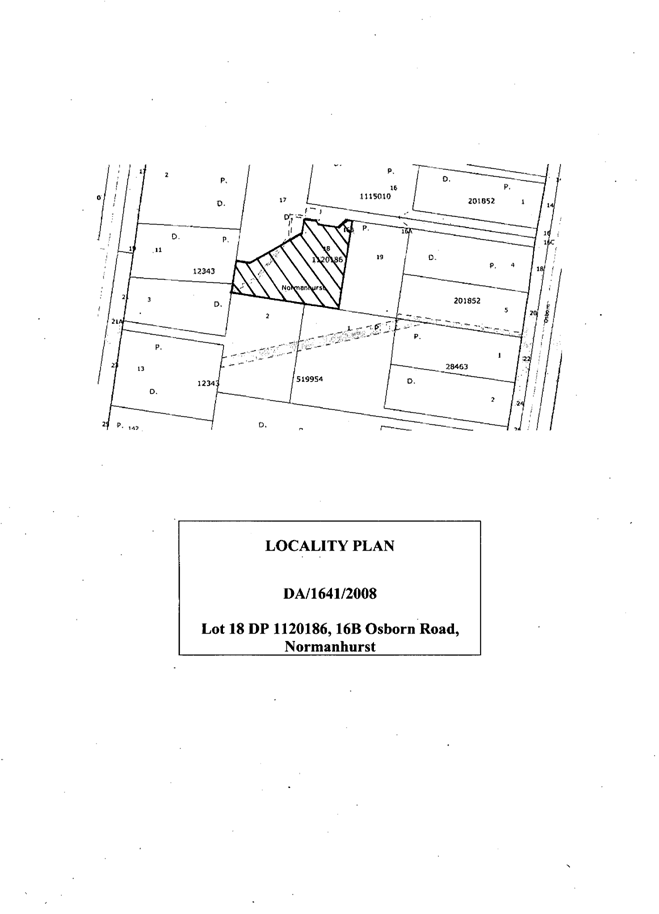
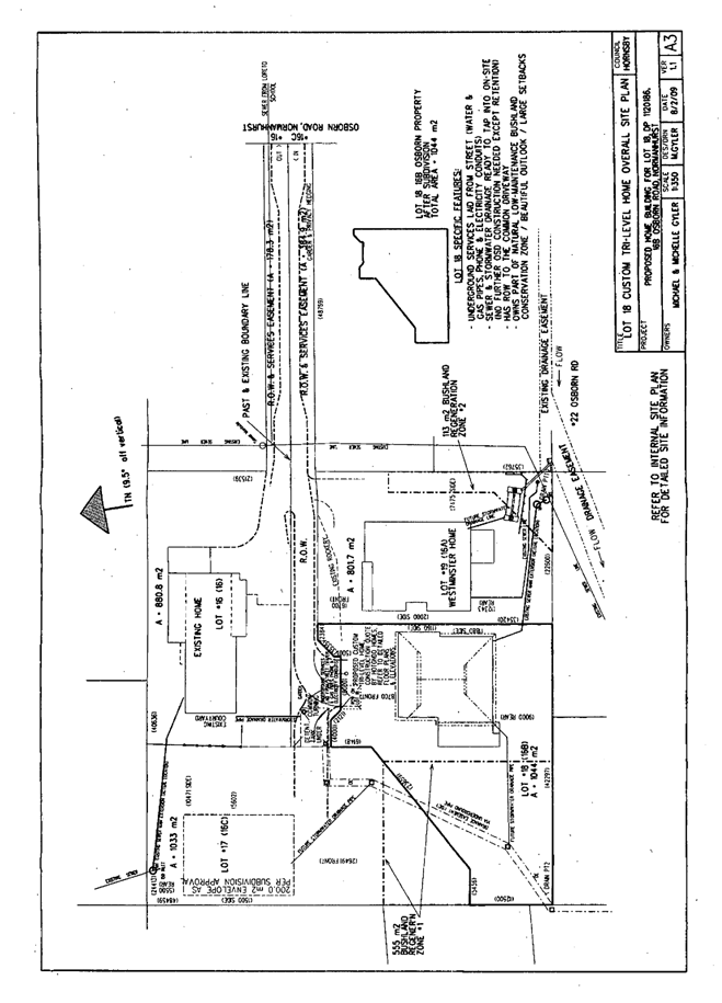
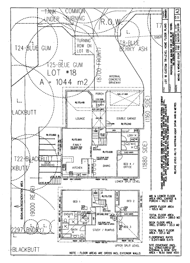
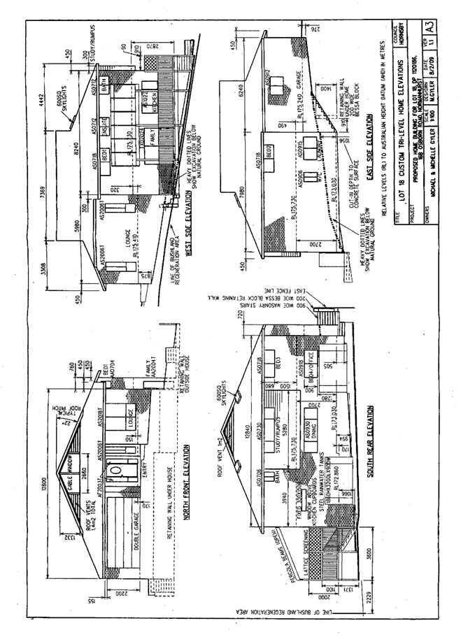
ATTACHMENT/S
REPORT NO. PLN21/09
ITEM 2
1. Locality Plan 2. Site Plan 3. Landscape Plan 4. Tree Assessment Plan 5. Floor Plans 6. Elevations 7. Shadow Diagrams 8. Vertical Shadow Diagram
|
|
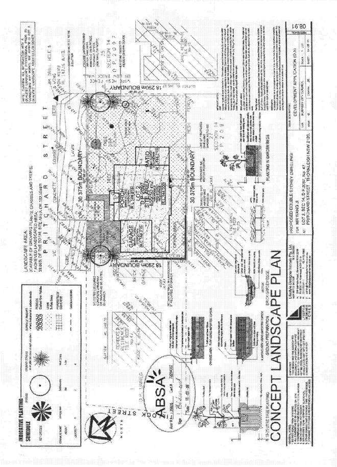
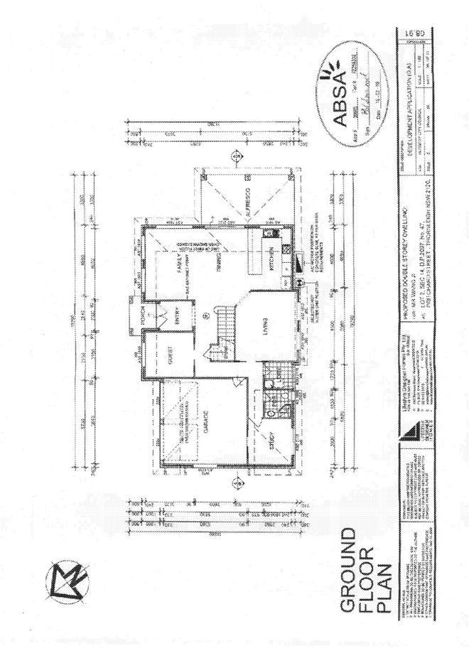
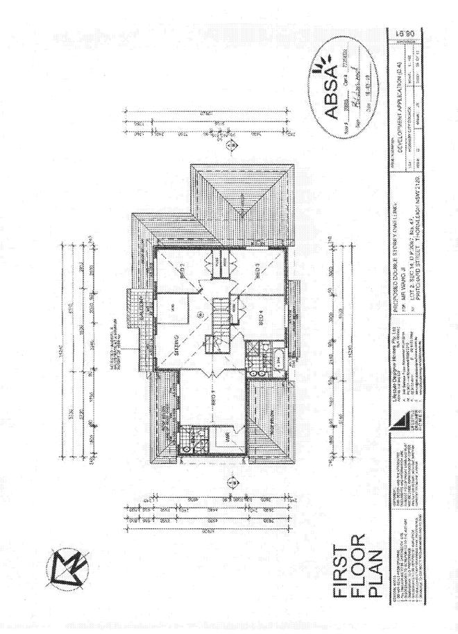
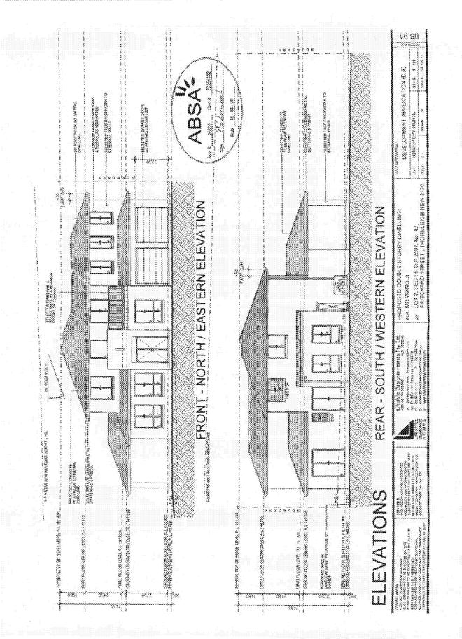
ATTACHMENT/S
REPORT NO. PLN25/09
ITEM 3
1. Locality Plan 2. Site Plan 3. Landscape Plan 4. Floor Plans 5. Elevations 6. Shadow Diagrams
|
|
ATTACHMENT/S
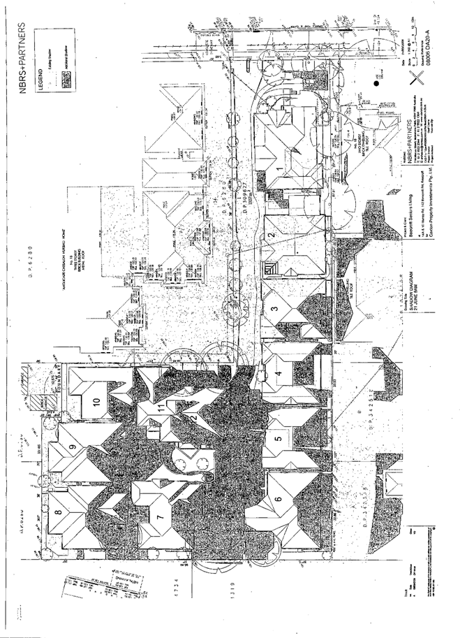
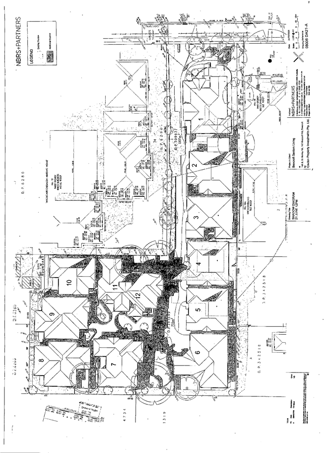
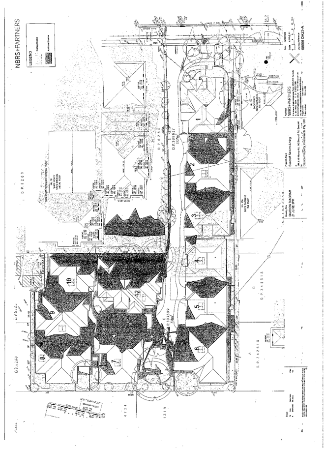
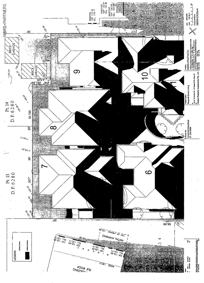
REPORT NO. PLN26/09
ITEM 4
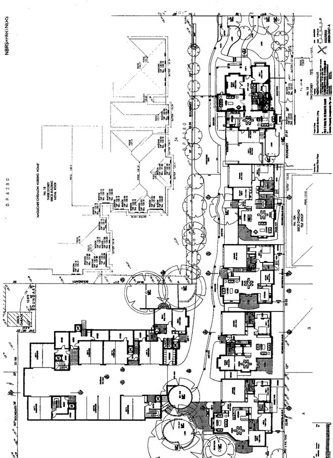
1. Locality Plan 2. Site Survey Plan 3. Tree Locations 4. Site Analysis Plan 5. Landscape Plans 6. Deep Soil Planting Areas 7. Floor Plans 8. Elevations 9. Shadow Diagrams 10. Stormwater Drainage Plan
|