Planning Report No. PLN26/09
Date of Meeting: 6/05/2009
4 DEVELOPMENT APPLICATION
- SENIORS LIVING DEVELOPMENT
14A AND 16 MURRAY ROAD BEECROFT
|
Development Application No: |
DA/1349/2008 |
|
Description of Proposal: |
Construction of a Seniors Living development comprising 11 self-contained dwellings and strata title subdivision. |
|
Property Description: |
Lot 115 DP 1136664 & Lot 1 DP 509627 (No. 14A & No. 16) Murray Road, Beecroft |
|
Applicant: |
Caxton Property (Chester) Pty Ltd C/- Glendinning Minto & Associates Pty Ltd |
|
Owner: |
Ms F J Berger & Mrs B J Berger and Caxton Property (Chester) P/L |
|
Statutory Provisions: |
State Environmental Planning Policy (Housing for Seniors or People with a Disability) 2004 Residential AS (Low Density – Sensitive Lands) |
|
Estimated Value: |
$3,800,000 |
|
Ward: |
C |
|
THAT Development Application No. 1349/2008 for demolition of the existing rear dwelling and construction of a Seniors Living development comprising 11 self-contained dwellings, including refurbishment of the existing dwelling at the frontage, at lot 115 DP 1136664 and lot 1 DP 509627 (No. 14A & No. 16) Murray Road Beecroft, be approved subject to conditions of consent detailed in Schedule 1 of this report.
|
EXECUTIVE SUMMARY
1. The application proposes demolition of an existing rear dwelling and construction of a Seniors Living development comprising 11 self-contained dwellings, including refurbishment of the existing dwelling at the frontage, and strata title subdivision.
2. The proposed development complies with the design principles and development standards contained within State Environmental Planning Policy (Housing for Seniors or People With a Disability) 2004.
3. Fifty five submissions have been received in respect of the application.
4. It is recommended that the application be approved.
HISTORY OF THE APPLICATION
The development application was lodged on 30 September 2008. The application was amended on 22 January 2009 to address concerns raised by Council. The amendments included a reduction in the number of proposed dwellings from 12 to 11 dwellings, revised alterations and additions to the existing dwelling, revised letter box and bin storage area at the frontage, increased separation between the proposed detached dwellings, relocation of private open space areas away from the western boundary and an increased setback from the western boundary.
HISTORY OF THE SITE
On 23 July 2008 Council approved Development Application DA/694/2008 for a boundary adjustment between Nos. 142-142A Beecroft Road and 14A Murray Road to form a large parcel of land which together with No. 16 Murray Road, form the site of the proposed Seniors Living development.
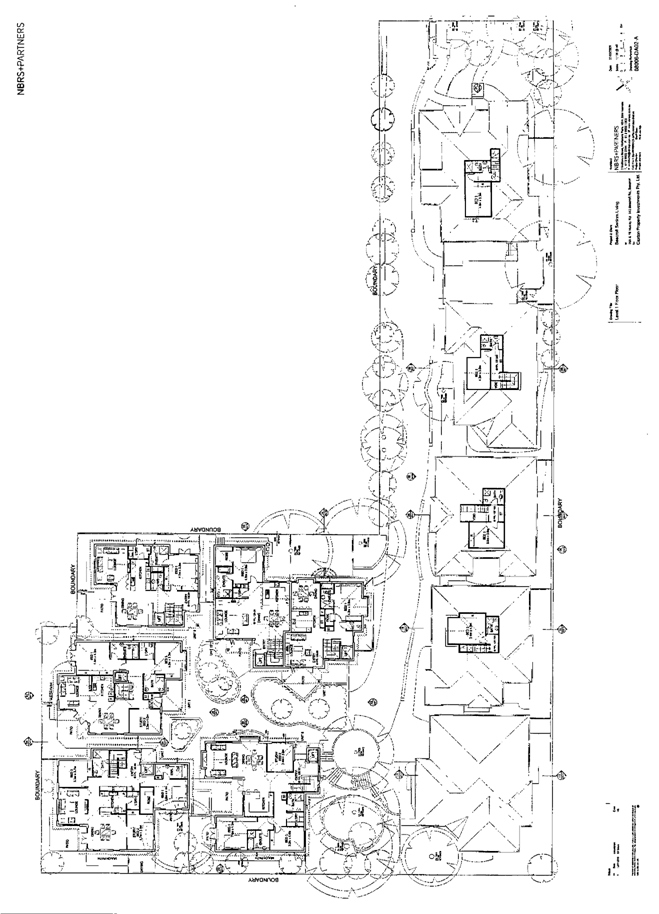
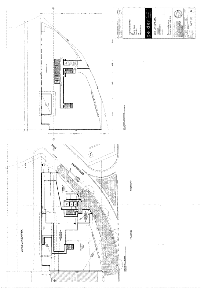
THE SITE
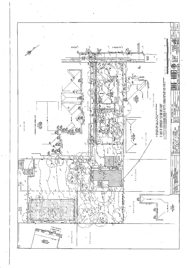
The site has an area of 4,566m2 and forms a large L-shaped parcel comprised of two existing lots. The site contains two existing dwelling houses, one at the Murray Road frontage (No. 16) and one towards the rear of the site (No. 14A) and a cleared area that was formerly an overgrown garden and disused tennis court at the rear of Nos 142 – 142A Beecroft Road. The site has a frontage of 22.8m to Murray Road and a width of 45.7m across the rear part of the site.
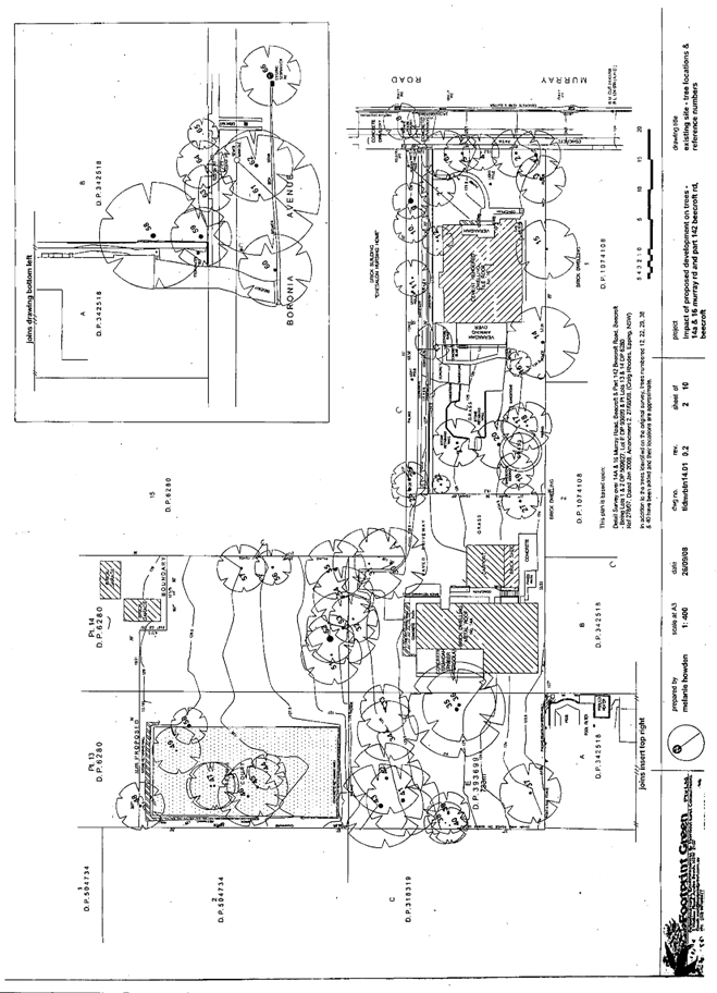
The site contains 62 trees including adjoining trees, trees within the road reserve and the proposed stormwater drainage easement over No. 33 Boronia Avenue. The remnant indigenous trees on the site would have once comprised Sydney Turpentine Ironbark Forest.
The site has an average fall of 8% to the western boundary and is generally of even topography with mainly shale derived soils.
The ‘Chesalon Nursing Home’ adjoins the eastern and rear part of the site and has a dominant visual impact. The nursing home occupies a large area (approx. 6,126m2) on the north-west corner of Beecroft Road and Murray Road and includes the original building ‘Brunoy’ which is an item of local environmental heritage and has been integrated with more recent two and three storey development on the nursing home site. A 3 storey dwelling house on a battle-axe lot (No. 138A Beecroft Road) adjoins the rear northern part of the site and is visually dominant over much of the site. Other properties surrounding the subject site include large single and 2 storey dwelling houses with frontages to Murray Road, Boronia Avenue and Beecroft Road. A tennis court at the rear of No. 31 Boronia Avenue adjoins the rear of the site. Beecroft Nursing Home, at No. 134 Beecroft Road, is located 300m north of the subject site.
The Beecroft Village centre and railway station are located 1.2km north of the site. The site is in the vicinity of Cheltenham Girls High School on Beecroft Road, 150m east of the site. Murray Road and Boronia Avenue are main thoroughfares for access to Cheltenham Oval and sports ground 300m south of the site.
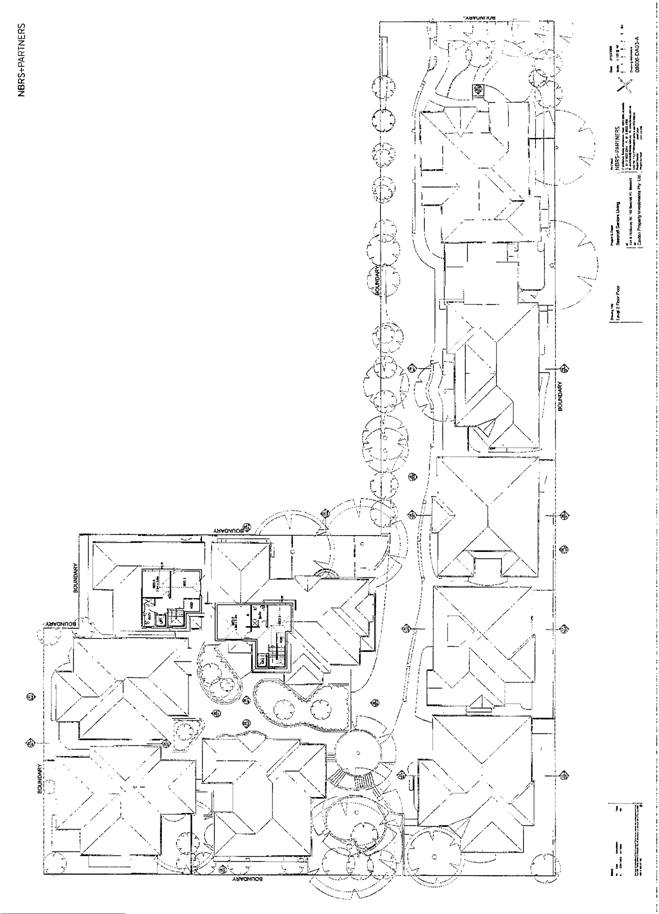
THE PROPOSAL
The proposed Seniors Living development includes the following:
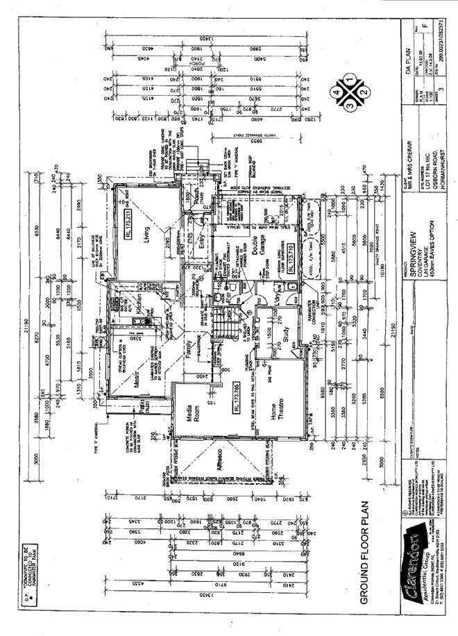
· Alterations and additions to the existing dwelling house at No. 16 Murray Road, to include a first floor area within the roof space, a rear terrace and double carport and to form a 3 bedroom dwelling (Unit 1).
· Demolition of the existing dwelling house at No. 14A Murray Road.
· Erection of 4 x 3br detached dwellings each with double garages (Units 2, 3, 4 and 5). Three of the dwellings include a first floor within the roof space (Units 2, 3 and 4).
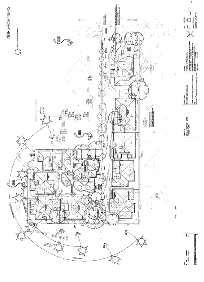
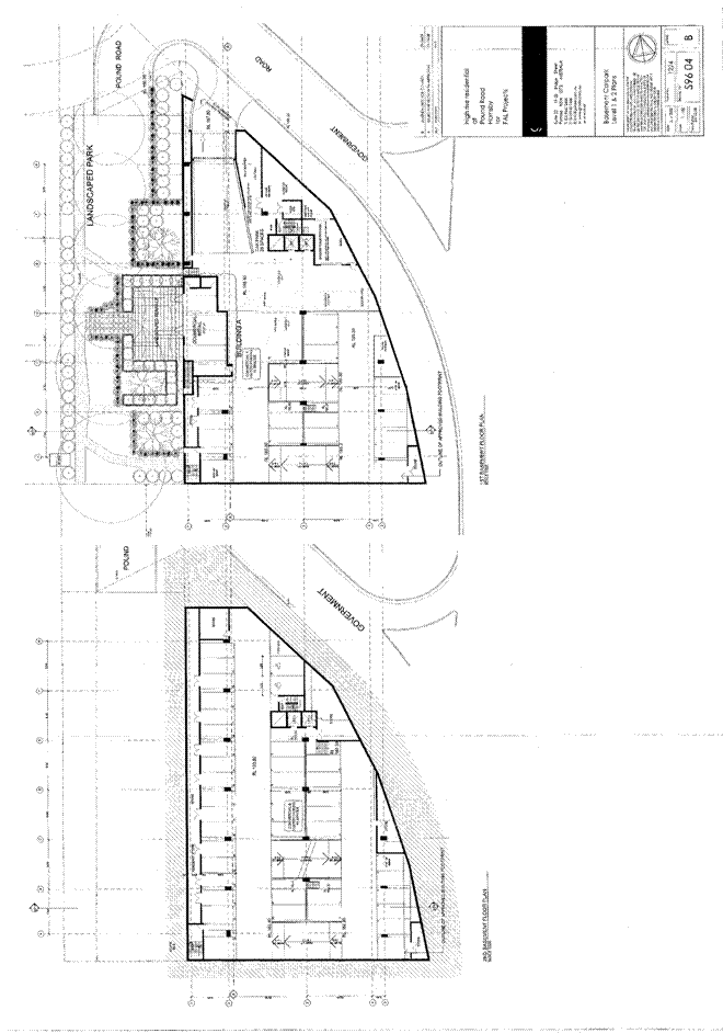
· Erection of a building with a basement level carparking and 4 x 3br detached dwellings (Units 6, 7, 8 and 9) and 2 x 3br semi-detached dwellings (Units 10 and 11), above. Units 9 and 10 include two storey built form. The dwellings are designed around a central courtyard with raised garden beds.
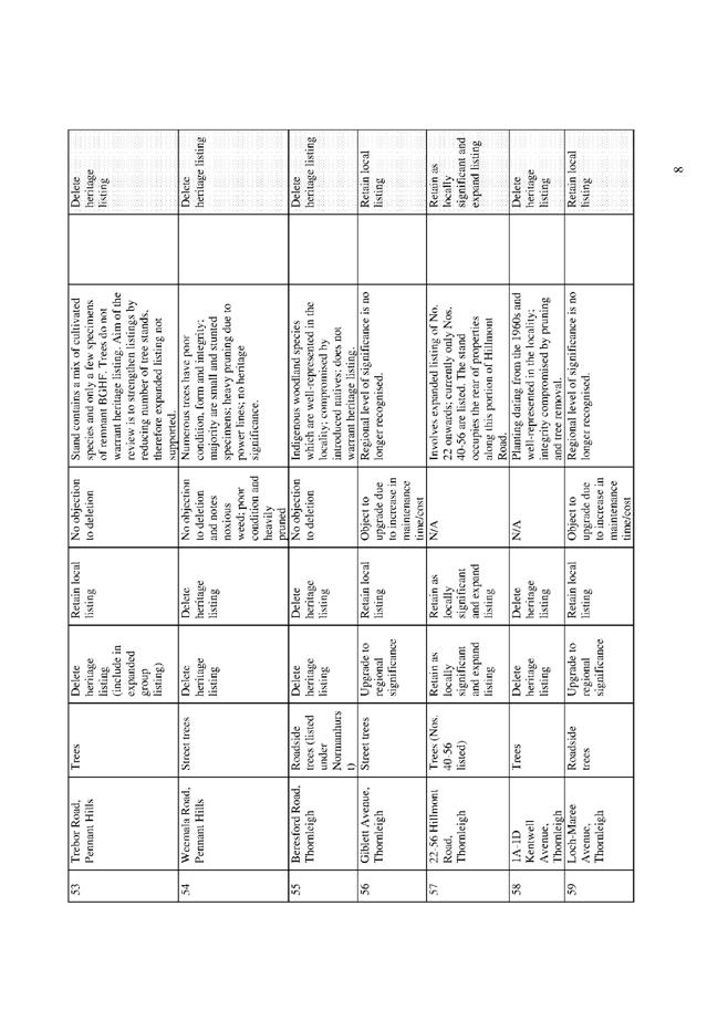
The lower ground floor basement level includes double garaging and a separate dwelling entrance including lift access for each of the 6 dwellings and 4 visitor parking spaces. Unit 11 is a maisonette style dwelling with frontage to the proposed accessway and includes bedroom accommodation at the lower ground floor level.
The proposal includes substantial excavation works to a maximum depth of 4.5m and the removal of approximately 5,000m³ of soil from the site.
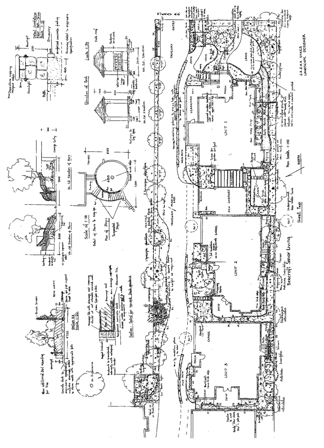
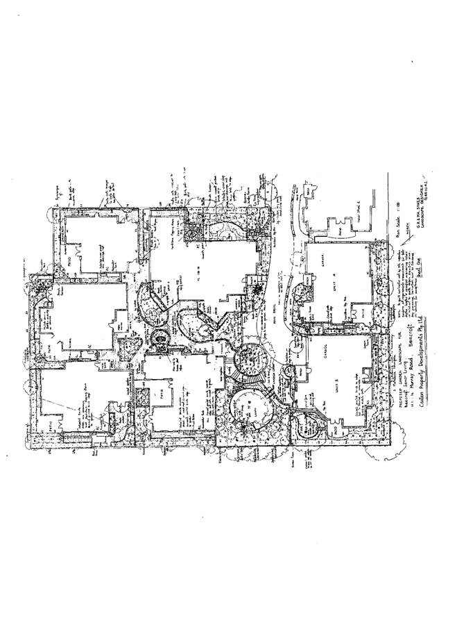
The proposal involves the removal of 39 trees. The landscape plan submitted for the proposal includes replacement of indigenous trees.
ASSESSMENT
The development application has been assessed having regard to the ‘2005 City of Cities Metropolitan Strategy’, the ‘North Subregion (Draft) Subregional Strategy’ and the matters for consideration prescribed under Section 79C of the Environmental Planning and Assessment Act 1979 (the Act). Subsequently, the following issues have been identified for further consideration.
1. STRATEGIC CONTEXT
1.1 Metropolitan Strategy – (Draft) North Subregional Strategy
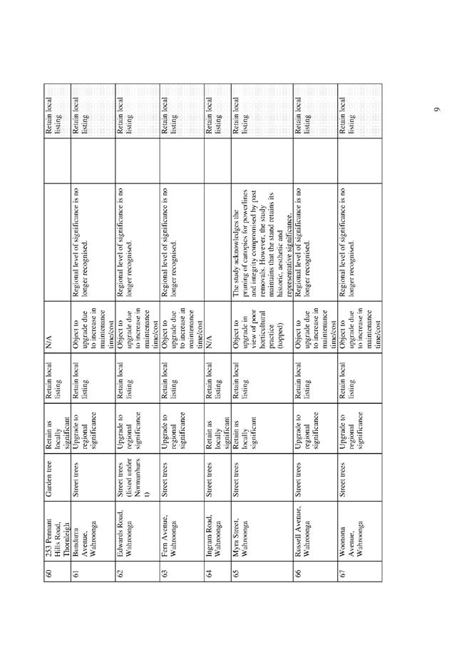
The Metropolitan Strategy is a broad framework to secure Sydney’s place in the global economy by promoting and managing growth. It outlines a vision for Sydney to 2031; the challenges faced, and the directions to follow to address these challenges and achieve the vision. The draft North Subregional Strategy acts as a framework for Council in the preparation of a new Principal LEP by 2011.
The draft Subregional Strategy sets the following targets for the Hornsby LGA by 2031:
· Employment capacity to increase by 9,000 jobs; and
· Housing stock to increase by 11,000 dwellings.
The proposed development would be consistent with the draft strategy by providing an additional 11 self-contained dwellings for Seniors Living and would improve housing choice in the locality.
2. STATUTORY CONTROLS
Section 79C(1)(a) requires Council to consider “any relevant environmental planning instruments, draft environmental planning instruments, development control plans, planning agreements and other prescribed matters.”
2.1 Hornsby Shire Local Environmental Plan 1994
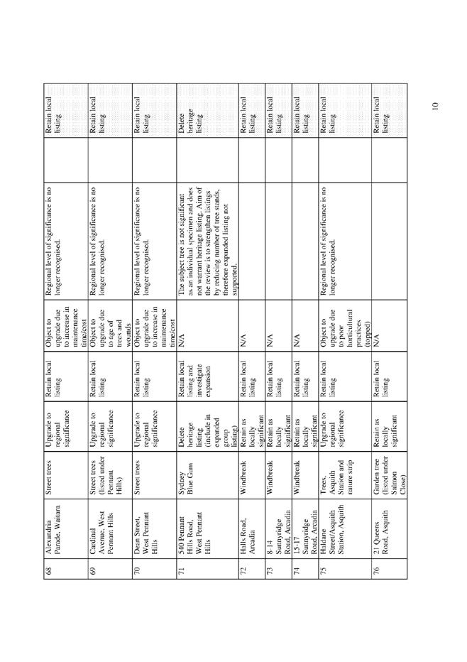
The subject land is zoned Residential AS (Low Density – Sensitive Lands) under the Hornsby Shire Local Environmental Plan 1994 (HSLEP). The objectives of the zone are:
(a) to provide for the housing needs of the population of the Hornsby area.
(b) to promote a variety of housing types and other land uses compatible with a low density residential environment and sensitive to the land capability and established character of this environment.
(c) to provide for development that is within the environmental capacity of a sensitive low density residential environment.
The proposed development is defined as ‘housing for aged or differently abled persons’
under the HSLEP and is permissible in the zone with Council’s consent.
Certain provisions under the HSLEP are not applicable to the proposal as State Environmental Planning Policy (Housing for Seniors or People with a Disability) 2004, prevails to the extent of any inconsistency with the Policy.
2.2 State Environmental Planning Policy (Housing for Seniors or People with a Disability) 2004
The SEPP is the overriding planning instrument for the development of housing for aged and disabled people in NSW and provides for hostels, residential care facilities (nursing homes) self contained dwellings and multi-storey buildings. The SEPP is comprehensive in scope including land use planning provisions, design principles, development standards and standards specifically to meet the housing needs of aged and disabled people. The SEPP also includes design guidelines for infill development such as the proposed development.
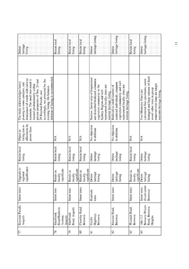
The proposed development has been assessed having regard to the relevant standards within the SEPP. The following table sets out the proposal’s compliance with the SEPP:
|
SEPP (Housing for Seniors or People with a Disability) |
|||
|
Control |
Proposal |
Requirement |
Compliance |
|
Site Area |
4,566m2 |
1,000m2 |
Yes |
|
Site Frontage |
22.8m |
20m |
Yes |
|
Gross Floor Area |
Unit 1 – 217.1m2 Unit 2 – 201.3m2 Unit 3 – 199.8m2 Unit 4 – 194.6m2 Unit 5 – 195.9m2 Unit 6 – 185.7m2 Unit 7 – 199.6m2 Unit 8 – 176.3m2 Unit 9 – 205.0m2 Unit 10 – 212.8m2 Unit 11 – 196.3m2 |
N/A |
N/A |
|
Floor Space Ratio |
0.478:1 |
0.5:1 |
Yes |
|
Height |
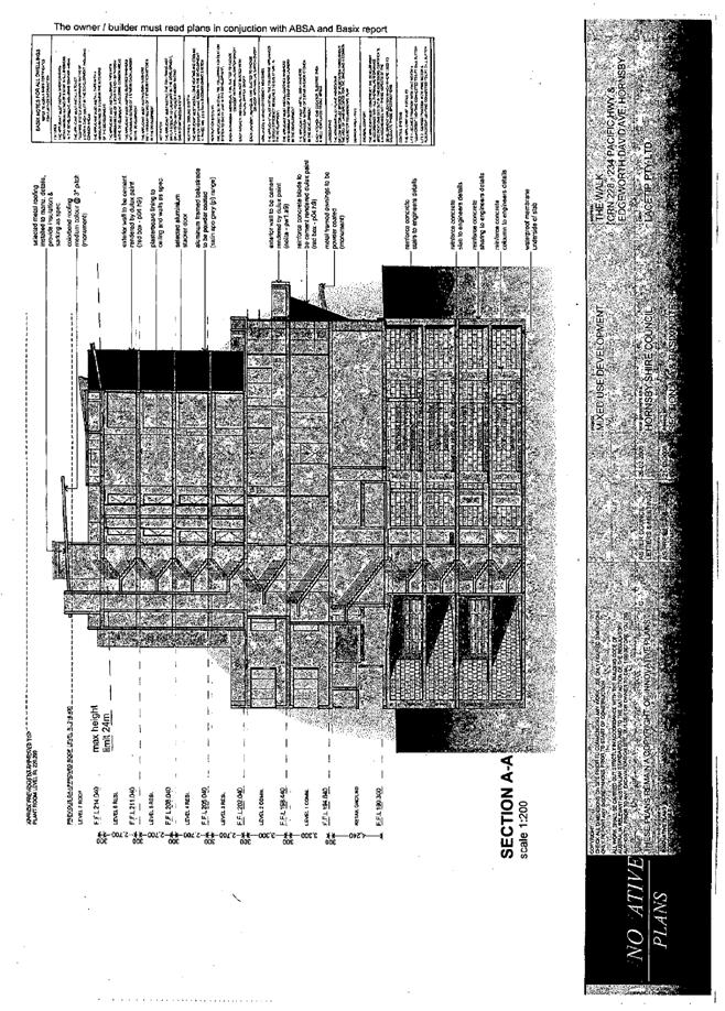
7.225m |
8m |
Yes |
|
Private Open Space |
Unit 1 – 75m2 Unit 2 – 37m2 Unit 3 – 39m2 Unit 4 – 34m2 Unit 5 – 93m2 Unit 6 – 60m2 Unit 7 – 63m2 Unit 8 – 36m2 Unit 9 – 36m2 Unit 10 – 15m2 Unit 11 – 24m2 |
15m2 per unit
|
Yes
|
|
Deep Soil Landscaping |
16% |
15% |
Yes |
|
Solar Access |
90% of dwellings |
70% of dwellings |
Yes |
|
Car parking |
17 spaces |
12 spaces |
Yes |
As noted in the above table, the proposed development complies with the development standards pursuant to Clause 40 and Clause 50 of the SEPP.
The proposal is satisfactory in respect to compliance with the mandatory access requirements of the SEPP pursuant to Clause 26, whereby pathway gradients are suitable for residents to access public transport within 400m of the site. Bus Route 635 on Beecroft Road would enable residents to access shops, bank services, retail, commercial services, recreation and medical facilities located at Beecroft, Epping and Macquarie Commercial Centres.
In accordance with the recommendation of the applicant’s Access Consultant, a condition is recommended for the reconstruction of a kerb ramp on the north-west corner of Murray Road and Beecroft Road to comply with Clause 26.
2.2.1 Minimum site area and building height
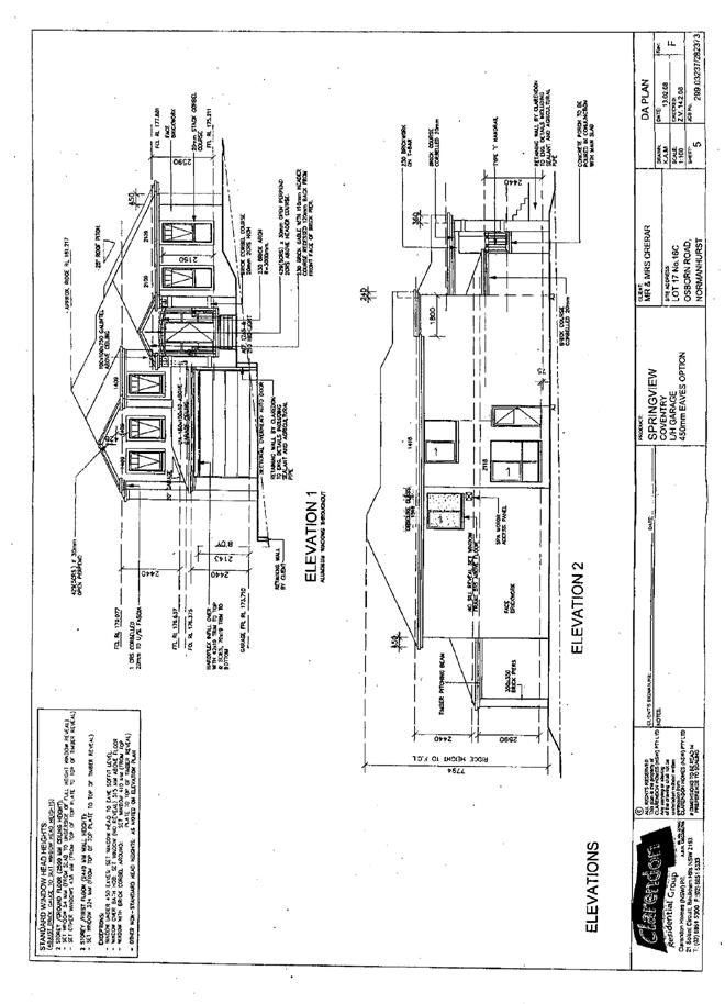
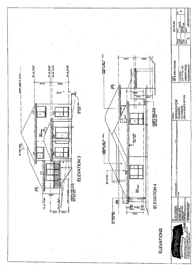
The proposal complies with the minimum site area and frontage requirement of the Seniors Living SEPP, Clause 40. The clause also includes height restrictions for Seniors Living developments on sites where residential flat buildings are not permitted.
The proposed development is designed in compliance with the two storey height development standard and the single storey height standard for buildings within the rear 25% of the site.
The merits of the proposal in respect to the SEPP design principles and design guidelines are discussed below.
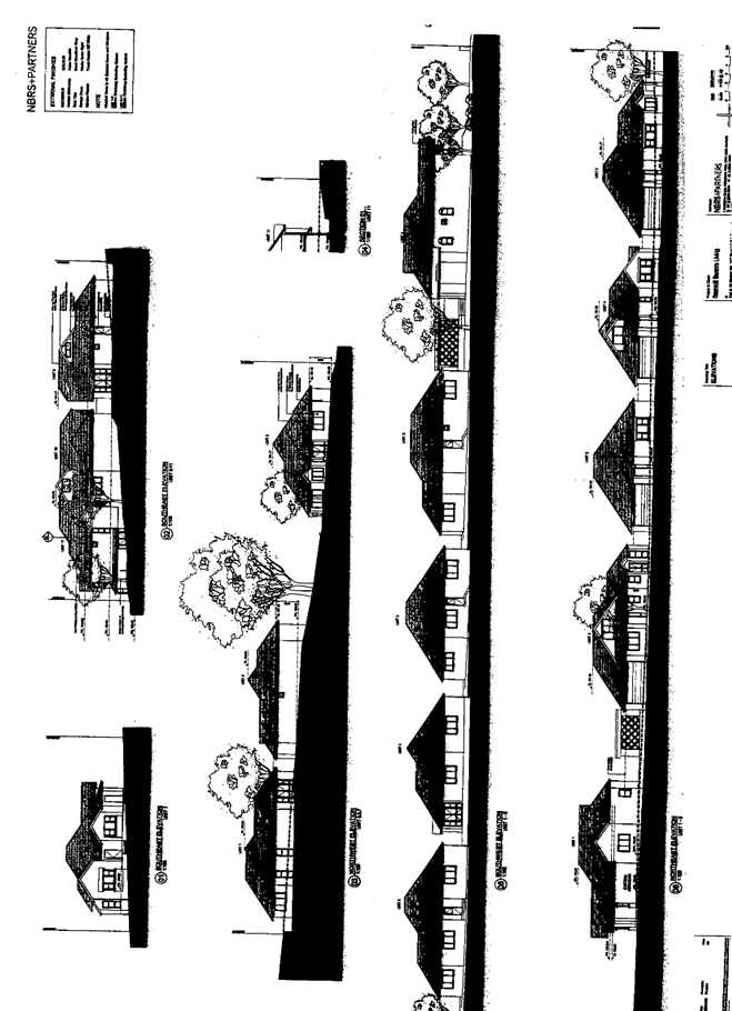
2.2.2 Neighbourhood amenity and streetscape
The proposed development retains the existing dwelling house at the Murray Road frontage and includes alterations and additions to the existing dwelling (Unit 1), construction of an accessway along the eastern side of the dwelling together with a pedestrian pathway and provision of a covered letterbox/bin storage facility at the frontage designed to complement the dwelling in the streetscape.
The proposed works to the front facade of Unit 1 are sympathetic to the federation style of the existing dwelling and would not detract from the Murray Road streetscape. Refer also to comments in Section 3.2.
The four proposed detached dwellings located behind the existing dwelling at the Murray Road frontage are single storey and would not impact on the streetscape (Units 2, 3, 4 & 5). The proposed detached dwellings are setback 2.5m – 3.0m from the western boundary, are well articulated and include a first floor area within the roof space (Units 2, 3 & 4). The western boundary adjoins the side elevation of two adjoining dwellings, No. 18 and No. 18A Murray Road and the rear yard of two adjoining dwellings, No. 33 and No. 35 Boronia Avenue Beecroft.
Units 2, 3 and 5 have laundry doors and windows opening onto the western setback. There are no first floor openings at the western elevation. The setback area mainly provides for clothes drying and landscaping. The proposed setback is considered adequate, in respect to the amenity of adjoining property, subject to the provision of boundary fencing and landscaping. The submitted landscape plan is acceptable in this regard.
At the northern boundary, the proposed development adjoins the tennis court at the rear of a dwelling house at No. 31 Boronia Avenue and a 3 storey dwelling house on a battleaxe lot at No. 138A Beecroft Road. The tennis court has a chainmesh fence located along the boundary which includes an access gate. Proposed Unit 5 is a single storey detached dwelling setback 3.5m – 7.0m from the northern boundary adjoining the tennis court. Subject to the provision of appropriate landscape screening, the tennis court would not adversely impact on the amenity of Unit 5. The submitted landscape plan includes hedge planting along the boundary with the tennis court.
Proposed Units 6 & 7 both comprise single storey detached dwellings. At the northern elevation the dwellings are setback 3m from the boundary. Proposed Unit 6 does not include any openings that would face the northern boundary and would not significantly detract from amenity of the adjoining property at No. 138A Beecroft Road.
Proposed Unit 7 has two narrow dining room windows and a patio opening onto the 3m setback. The finished floor level of Unit 7 is 1.0m – 0.6m below natural ground level. The site of the adjoining 3 storey dwelling house at 138A Beecroft Road is elevated relative to the subject site. The proposed patio and windows of Unit 7 would not be readily visible from the adjoining dwelling house The proposed landscape screening and the existing brick lattice fence on the northern boundary is adequate to maintain privacy.
Proposed Unit 8 has a minimum setback of 2.0m from the eastern boundary with Nos. 142-142A Beecroft Road. The unit includes a patio at the eastern elevation within 6m of the side boundary. The proposed floor level is 1m below the existing ground level of the adjoining property. The proposed unit and patio is considered acceptable in respect to the amenity of the adjoining property.
Proposed Unit 9 has a minimum setback of 2.2m from the eastern boundary and includes a patio similar to Unit 8 in respect to the amenity of the adjoining property. The unit adjoins the southern boundary with the Chesalon Nursing Home and has a 1.5m – 2.8m setback from the boundary. A laundry door and bedroom doors open onto the setback area and a small patio. The proposed unit would not adversely impact on the amenity of the nursing home. The nursing home includes two small upper windows at this elevation and would not significantly detract from the privacy of proposed Unit 9.
Proposed Unit 10 is setback 1.5m – 6.3m from the southern boundary with the Chesalon Nursing Home. No active area is proposed within the setback area. The nursing home is setback 17m at this location and includes 1st and 2nd floor windows. The proposed unit would not detract from neighbourhood amenity and would enjoy reasonable privacy subject to the proposed landscape screening along the southern boundary.
Proposed Unit 11 adjoins Unit 10 and is setback 5.8m – 6.3m from the southern boundary. The unit includes two small narrow windows at this elevation. The proposed unit is satisfactory in respect to neighbourhood amenity and privacy at this elevation.
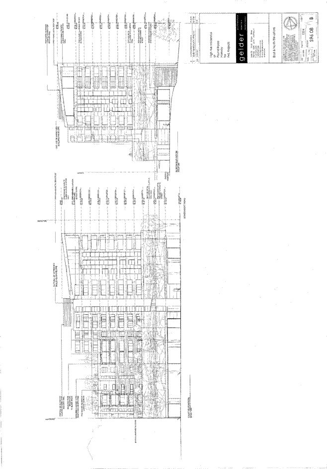
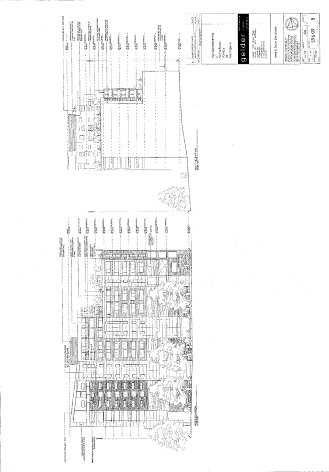
Overall the proposed Seniors Living development is considered an appropriate design response to the site with regard to the adjoining 3 storey and single storey developments and the aspects of the site. The proposed built form involving detached dwellings is in keeping with the residential character of the area. The interface with neighbouring properties is satisfactory in maintaining amenity and privacy.
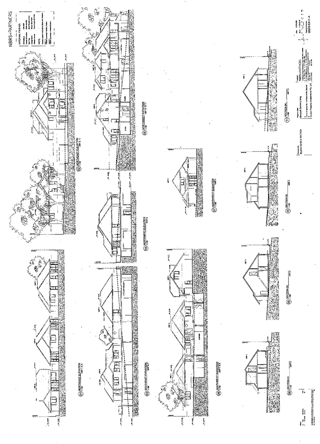
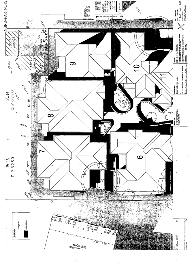
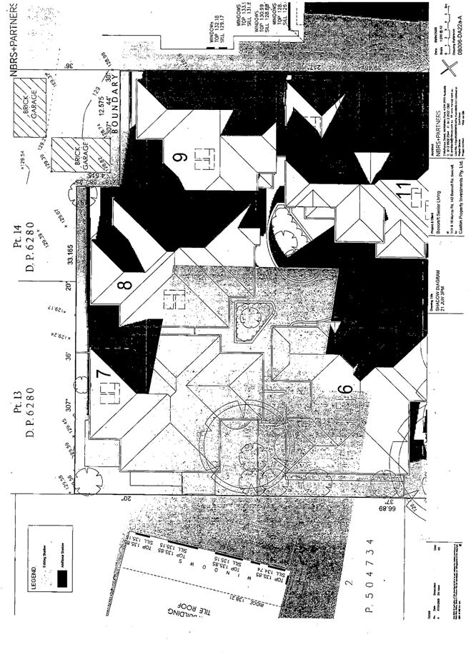
2.2.3 Visual and acoustic privacy
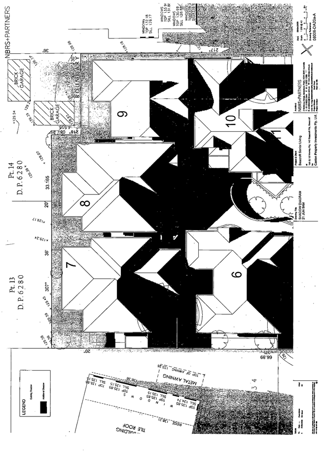
The rear area of the site adjoins the 3 storey Chesalon Nursing Home at the southern boundary and a 3 storey dwelling house at the northern boundary. The adjoining 3 storey developments overlook the site to a significant extent and proposed Units 6, 7, 8, 9, 10 & 11. The proposed units have been configured to provide for visual privacy with the roof ridges effectively screening the adjoining developments from the living areas. The northern patios of Units 10 & 11 remain within a view corridor of some of the upper windows of the adjoining 3 storey dwelling, however, the proposed raised gardens and brush screens would provide adequate privacy.
The driveway and service area of the Chesalon Nursing Home would result in some noise impacts but this would generally be mitigated by fencing and the lower ground floor level of the adjoining service area.
The proposed units 1, 2, 3, 4 and 5 have limited activity areas within the setback area adjoining neighbouring properties and the first floor roof space would not directly overlook the neighbouring properties. These units are considered acceptable with regard to visual and acoustic privacy, subject to a condition for internal pathways of Units 1 – 5 to be brick or stone pavers not gravel or mulch.
The proposed patios at the northern elevation of Units 7, 8 and 9 are situated at a lower level relative to the adjoining property, are screened by fencing and are acceptable in respect to visual and acoustic privacy. The first floor roof space would not directly overlook neighbouring properties.
The proposed raised gardens and brush screening within the forecourt of Units 6, 7, 8, 9, 10 and 11 would provide an acceptable level of privacy between the proposed dwellings.
The roof areas of the development would be overlooked by adjoining 3 storey development. The proposed buildings include dark coloured roof tiles and variation in the roof form which would minimise the visual impact.
2.2.4 Solar Access and design for climate
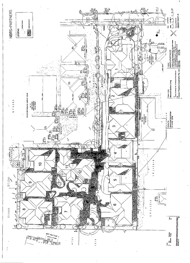
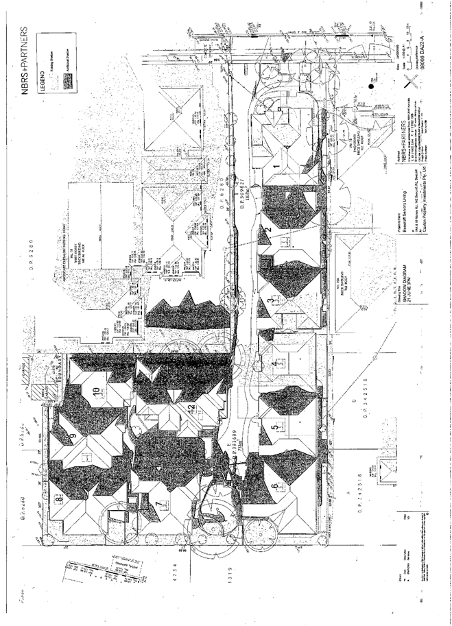
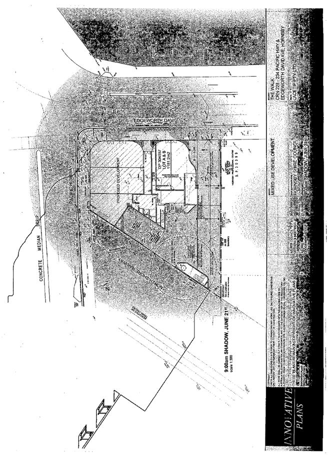
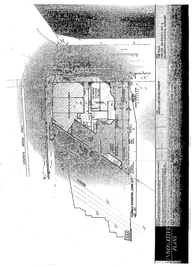
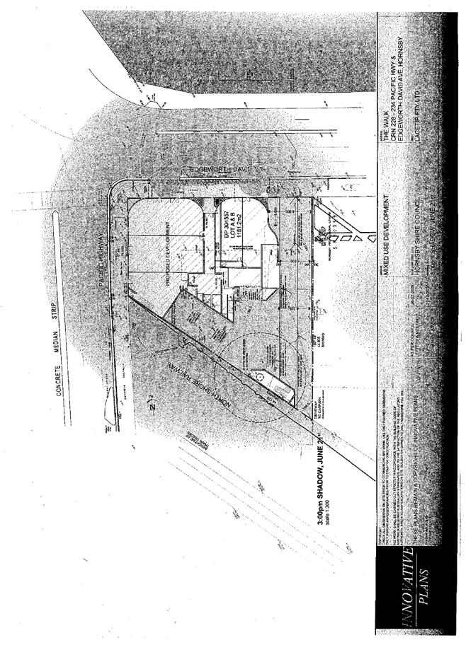
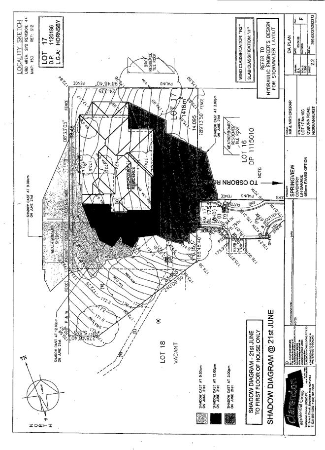
The proposed dwellings are single storey in relation to neighbouring Murray Road properties and would not reduce the amount of sunlight currently received by adjoining properties during Winter.
The proposed living areas and outdoor living areas are located on the north side of the units and comply with the SEPP solar access design principles. The existing 3 storey dwelling adjoining the northern boundary would overshadow proposed Unit 6 during mid-winter. Notwithstanding, the proposed development complies with the SEPP Clause 50 standard for a minimum of 70% of dwellings to receive 3 hours of direct sunlight between 9am and 3pm in mid-winter.
The proposed dwellings comply with BASIX criteria for sustainable design and energy efficiency.
2.2.5 Stormwater
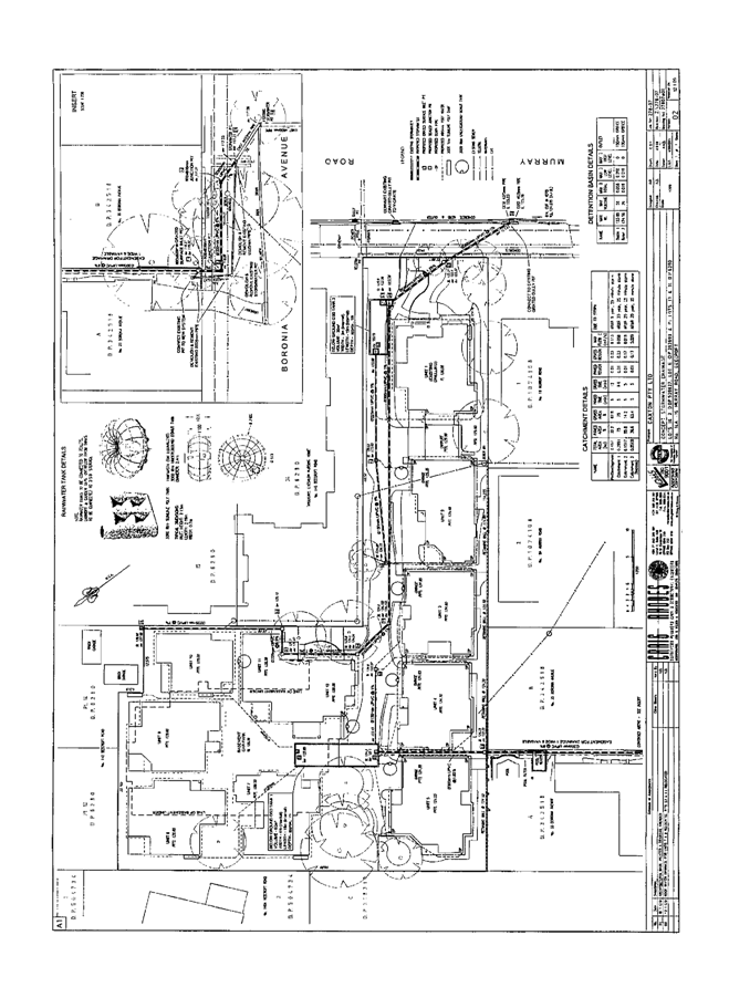
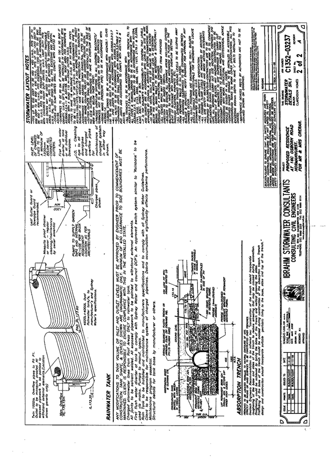
The proposed development includes a proposed easement for stormwater drainage over a downstream property to Boronia Avenue and to Council’s system, which involves a watercourse tributary of Devlins Creek. The proposed development would increase the existing stormwater runoff. A stormwater detention system is recommended as a condition of consent to minimise impact on downstream water quality.
2.2.6 Crime prevention
The proposed dwellings comply with the security and crime prevention design requirements of the Seniors Living SEPP.
2.2.7 Waste management
The proposed waste storage room and bin storage area at the frontage is adequate for the waste generated by the proposed dwellings subject to recommended conditions.
The proposed development involves the demolition of one of the existing dwellings and a condition is recommended for compliance with the Waste Management Plan submitted with the application.
2.2.8 Internal Site Amenity
The proposed dwellings front either a central driveway or a central courtyard area. The building articulation and landscaping ensure individual identity for each of the dwellings with sufficient separation from common areas to provide clear distinction between private and public spaces.
The proposed development includes two common open space areas. At the rear of the site open space areas would be landscaped including lawn areas, seating and paving. At the frontage the proposed covered seating/letterbox structure is integrated with landscaping and pathways. The proposed common open space areas provide functional outdoor spaces for the future residents.
The proposed detached dwellings have been designed with regard to the operation of the central driveway and pedestrian pathway. Habitable rooms are mainly located away from the driveway and landscaping provides separation between the dwellings and the driveway/pathway.
The outlook of the proposed dwellings is primarily internalised with limited orientation to neighbouring properties. The submitted landscape plan is appropriate in creating vistas, garden features and outdoor spaces for dwellings within the development.
The proposed dwellings are relatively large with open plan lounge/dining/kitchen areas oriented north, creating functional living spaces for seniors. The accommodation enables multi-purpose use of space and caters for family and guests. Units 6 to 11 include individual lifts and additional storage areas. Stair access is proposed to first floor accommodation of Units 1, 2, 3 and 4. The units comply with the SEPP requirement for the main bedroom to be at the same level as the entry.
2.2.9 Standards that cannot be used to refuse development consent for self-contained dwellings
The proposed development complies with the SEPP Clause 50 development standards in respect to building height, density and scale, landscaped area, solar access, private open space and car parking provisions.
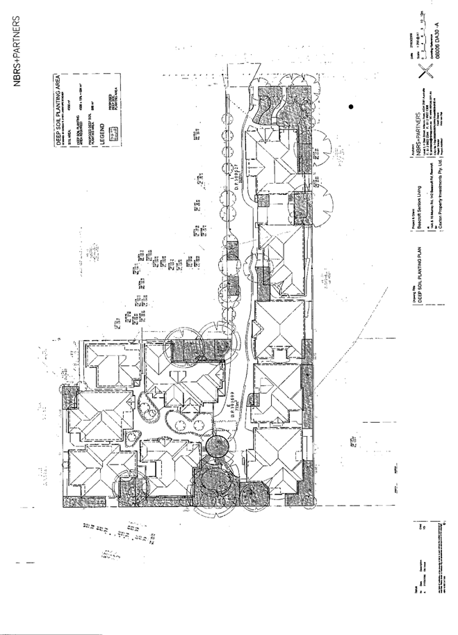
The submitted plan Deep Soil Planting Area Drawing No. DA30-A details a total area of 886m2 for deep soil planting. However, a number of the proposed areas are within 3m setback areas for clothes drying and utility areas or would not contribute to canopy trees planting. Deletion of these areas adjacent to Units 1, 4, 6 and 7, provides a total deep soil landscaping area of 733m2, which is in compliance with the Seniors Living SEPP development standard for a minimum 15% of the site area (684m2).
3. ENVIRONMENTAL IMPACTS
Section 79C(1)(b) of the Act requires Council to consider “the likely impacts of that development, including environmental impacts on both the natural and built environments, and social and economic impacts in the locality”.
3.1 Natural Environment
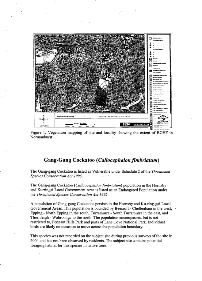
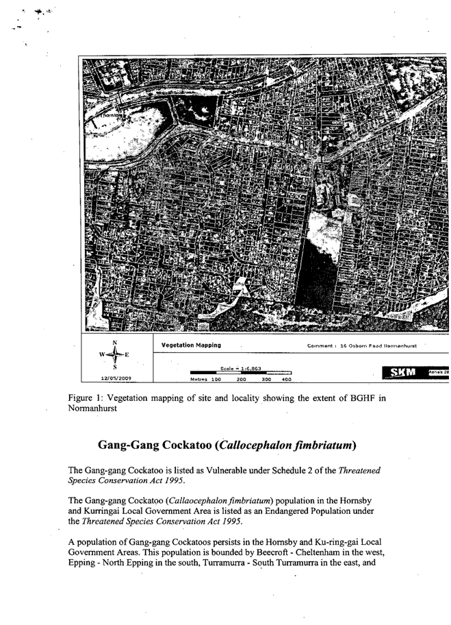
The site includes an area identified by Council’s vegetation mapping as Sydney Turpentine Ironbark Forest which is an endangered ecological community under the Threatened Species Conservation Act 1995. The site is also identified as being within the area of a locally endangered Gang Gang Cockatoo population.
The applicant submitted a Flora and Fauna Assessment prepared by Footprint Green Pty Ltd which included a 7 part test pursuant to Section 5A of the Environmental Planning and Assessment Act, 1979. The report includes the following summary in conclusion:
“Whilst much of the vegetation on the site consists of exotic species and the habitats have been disturbed, several indigenous canopy trees remain that are considered to be components of what was once the endangered Sydney Turpentine Forest ecological community.
It is recognised that these indigenous canopy trees do provide an ecological contribution and assist with the conservation of the Sydney Turpentine Forest within core habitat area. To ensure that there is no net loss to the ecological contribution provided by these trees compensatory replanting using species consistent with those found in the Sydney Turpentine Ironbark Forest will need to be carried out. To compensate for the removal of the 9 indigenous canopy trees the proposed development should include on the landscape plan a minimum of 18 indigenous canopy trees.
Based upon the nature and scope of the development it is considered that the proposed development would have minimal impact on common native fauna currently using the site and provided that the recommended measures to minimise impacts on the ecology are implemented. The proposed development would not have a significant impact on threatened species, populations or the Sydney Turpentine Ironbark Forest community.”
Specifically, the Flora and Fauna Assessment prepared by Footprint Green Pty Ltd recommends a total of 18 indigenous canopy trees for compensatory planting including 8 Eucalyptus paniculata, 2 Eucalyptus resinifera, 1 Angophora costata and 7 Syncarpia glomulifera.
The submitted landscape plan includes a total of 23 indigenous canopy trees. Conditions are recommended to ensure the long term survival of the replacement trees.
The site includes 62 existing trees the majority of which are exotic species (60%). The proposal involves the removal of 54 trees (within 3m of proposed works) including 9 indigenous trees. Of the trees to be removed trees Nos. 35 and 36 are significant trees under Council’s Tree Management Plan and trees Nos. 14, 15, 20, 30, 33, 34, 38, 41, 55, 56, 60, 61, 62 and 66 are trees good and worthy of preservation.
The applicant seeks to remove 39 trees and to retain 23 trees through protection measures, including good and worthy trees Nos. 14, 15, 30, 34, 55, 60, 61, 62 and 66. The tree protection measures include specific design requirements for works within 3m of trees to be retained as detailed in the ‘Impact of Proposed Development on Trees’ report prepared by Footprint Green Pty Ltd. A condition is recommended for the trees to be retained in accordance with the report’s tree retention requirements.
The submitted landscape plan prepared by G. R. & M. A. Sykes includes a mix of indigenous and exotic plant species appropriate to the proposed planting situations and in providing screening for privacy in relation to boundaries and the adjoining tennis court. The submitted plan includes 23 indigenous canopy trees. Correction of the Plant Index for the Landscape Plan is required. A condition is recommended to amend Plant No. 70 from Eucalyptus sideroxylon (Mugga Ironbark) to Eucalyptus paniculata (Grey Ironbark), in accordance with the submitted Flora and Fauna Assessment.
Subject to recommended conditions and implementation of the landscape plan, the proposed removal of the nominated existing trees is considered acceptable.
3.2 Built Environment
The site is within a low density residential area characterised by substantial dwellings on large lots with formal gardens and large remnant trees.
3.2.1 Residential character
The proposed new dwellings are largely at the rear of existing buildings and would have minimal visual impact on the streetscape. The proposal is in keeping with the adjoining two to three storey ‘Chesalon Nursing Home’ and surrounding dwelling houses and includes an appropriate transition in scale between the adjoining three and single storey developments. Whilst the proposed development exceeds the residential density applicable for the area under the HSLEP, the proposal does not change the pattern of development in the streetscape and would not adversely impact on the residential character of the area. Refer also to comments in Section 3.2.2.
While the locality includes many sites that may meet the SEPP’s site selection criteria, the provision of housing in accordance with SEPP is generally at random and would be unlikely to substantially alter the character of the locality or result in an accumulation of similar developments.
3.2.2 Heritage
The Heritage Committee commented on the amended proposal as follows:
“The proposal is for consolidation of allotments, demolition of an existing dwelling-house (No. 14A Murray Road), and construction of a Seniors Living development comprising eleven (formerly twelve) dwellings.
Property Nos. 142-142A Beecroft Road is listed as a heritage item (garden, fence and gate posts) of local significance under the provisions of Schedule D (Heritage Items) of the HSLEP 1994. The property is located within the Beecroft/Cheltenham Heritage Conservation Area listed under the provisions of Schedule E (Heritage Conservation Areas). The property is also within the vicinity of No. 140 Beecroft Road, Beecroft (“Coombanning”) and Nos. 144-146 Beecroft Road, Beecroft (Chesalon Nursing Home) which are listed as heritage items of local significance under the provisions of Schedule D.
The proposal was previously considered by the Heritage Advisory Committee at its meeting on 3 November 2008.
At its meeting on 2 March 2009, the Heritage Advisory Committee generally agreed that the amended plans address the Committee’s earlier concerns in relation to the treatment of the existing Federation dwelling-house at No. 16 Murray Road and its setting. The amended plans provide for an improved streetscape presentation by retaining much of the front yard space and establishing a separate entrance for residents (of the dwellings beyond) in the form of a matching lynch gate. The bin storage area has been moved to be alongside the driveway, thereby reducing built structures within the front yard space.
The Committee also noted that the Pettit and Sevitt house at No. 14A Murray Road has been subject to substantial changes over time, and moreover, is not a contributory element of the streetscape by virtue of its location on a battle-axe allotment. As such, no objection is raised to its demolition on heritage grounds. The amended proposal also provides for the relocation of deep soil planting, which would enhance views along the vehicle accessway. The scale and bulk of the proposed dwellings are predominately single storey in appearance as each is designed to utilise rooms in the roof space. The Committee generally agreed that the proposed development would not have an adverse impact upon the character of the surrounding Conservation Area or the heritage items in the vicinity. Accordingly, the Committee resolved that no objection be raised to the proposal on heritage grounds.”
3.2.3 Traffic and parking
The proposed development requires 12 car parking spaces in accordance with the Seniors Living SEPP criteria. A total of 17 car parking spaces are proposed including 4 visitor spaces. The 4 visitor spaces are located within the basement area of Units 6 to 11 and a condition is recommended for access to the spaces to be made available to Units 1 to 5.
Traffic lights control the intersection of Murray Road and Beecroft Road. The traffic generated by the proposed development is relatively low and would not adversely impact on the local road network.
Council’s Traffic and Road Safety assessment concluded that the proposal would be satisfactory in respect to Cheltenham Girls High School parents set down/pick up on Murray Road and on-street visitor parking associated with the adjoining ‘Chesalon Nursing Home’.
Should the application be approved, construction vehicle access to the site via Boronia Avenue should be avoided due to the narrow width of the roadway. A condition is recommended for the traffic management plan to include site access only from Murray Road and Beecroft Road.
3.2.4 Stormwater Drainage
The proposed drainage of the development involves an easement to Boronia Avenue and Council’s drainage system which connects to Devlins Creek. The drainage system on the lower side of Boronia Avenue involves an open channel through residential property.
The proposed development increases the site coverage from 20% to 80%. A condition is recommended for the stormwater drainage system to be of design not to exceed pre-development flows and include sufficient detention to cater for a 1 in 50 year storm event.
Subject to the recommended condition, stormwater drainage impact on downstream properties and Devlins Creek would be minimal.
3.3 Social Impacts
The proposed self-contained dwellings provide opportunity for eligible households to downsize to well located accommodation with good access to a wide range of services and recreation facilities.
The proposal increases the housing stock for older people or people with a disability and would have a positive social impact.
3.4 Economic Impacts
The proposed development would result in an increase in employment opportunities, in the construction of the development and in the demand for goods and services in the occupation of the development.
4. SITE SUITABILITY
Section 79C(1)(c) of the Act requires Council to consider “the suitability of the site for the development”.
The site is relatively level and is suitable for development subject to replacement planting of indigenous trees remnant of Sydney Turpentine Ironbark Forest (refer to comments in Section 3.1).
The proposal involves substantial excavation works to a depth of 4.5m. Council’s Land Sensitivity Study identifies development constraints of Soil Dispersibility Level 3 and Soil Landscapes Level 2, for the site. The applicant submitted a geotechnical report prepared by Jeffery and Katauskas Pty Ltd which includes recommendations for the proposed demolition and excavation works, including prescribed use of heavy machinery, vibration limits and retaining wall design. The report also includes recommendations for footings and slab construction for the proposed development. A condition is recommended for implementation of the report recommendations to minimise construction impacts on neighbouring properties and to ensure site stability.
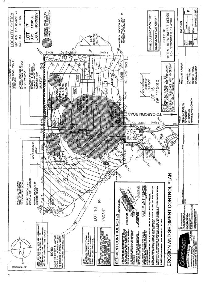
A condition is recommended for the implementation of erosion and sediment control measures in addition to the submitted Soil and Water Management Plan prepared by Craig & Rhodes Pty Ltd, to protect downstream water quality.
5. PUBLIC PARTICIPATION
Section 79C(1)(d) of the Act requires Council to consider “any submissions made in accordance with this Act”.
5.1 Community Consultation
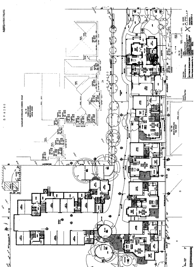
The proposed development was placed on public exhibition and was notified to adjoining and nearby landowners between 15 October and 5 November 2008 in accordance with Council’s Notification and Exhibition Development Control Plan. During this period, Council received 38 submissions. The plans for the amended proposal were notified from 28 January to 11 February 2009 and 19 submissions were received in response. The map below illustrates the location of those nearby landowners who made a submission that are in close proximity to the development site.
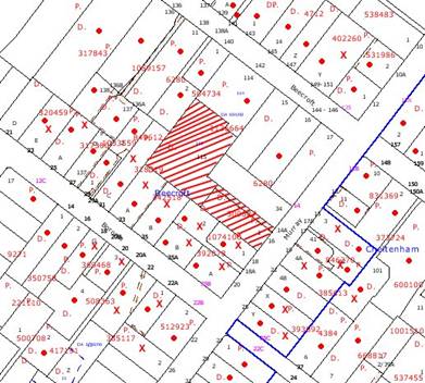
|
NOTIFICATION PLAN |
|
||
|
• PROPERTIES NOTIFIED
|
X SUBMISSIONS RECEIVED |
PROPERTY SUBJECT OF DEVELOPMENT |
|
|
26 SUBMISSIONS RECEIVED OUT OF MAP RANGE |
|||

A total of 55 submissions objected to the development, including submissions from 17 objectors who reiterated previous concerns, generally on the grounds that the development would result in:
· Unacceptable traffic congestion on local streets.
· Unacceptable heritage streetscape impact.
· Unacceptable impact on residential character.
· Unacceptable impacts during construction.
· The removal of the majority of indigenous trees.
· Development that is excessive in density, bulk and scale.
· Precedent for high density development.
· Poor amenity for adjoining properties.
· Lack of communal open space for senior residents.
· Restricted deep soil zones unsuitable for replacement trees.
· Poor outlook for residents of the proposed dwellings.
· Loss of privacy.
· Loss of solar access.
· Internal stairs unsuitable for seniors.
· Extensive excavation.
· Inadequate public transport.
· Accumulation of developments for seniors.
· Exploitation of the Seniors Living Policy.
In response to the original and the amended proposal, 2 submissions were received from the same respondent in support and made the following observations:
· The development would provide additional housing for senior residents.
· The development would result in the removal of dangerous trees.
· The development would provide landscape screening of the existing tennis court.
The merits of the matters raised in community submissions have been addressed in the body of this report.
6. THE PUBLIC INTEREST
Section 79C(1)(e) of the Act requires Council to consider “the public interest”.
The public interest is an overarching requirement, which includes the consideration of the matters discussed in this report. Implicit to the public interest is the achievement of future built outcomes adequately responding to and respecting the future desired outcomes expressed in environmental planning instruments and development control plans.
The application is considered to have satisfactorily addressed Council’s criteria and would provide a development outcome that, on balance, would result in a positive impact for the community. Accordingly, it is considered that the approval of the proposed Seniors Living development would be in the public interest.
CONCLUSION
Consent is sought for the construction of a Seniors Living development comprising 11 self-contained dwellings and strata title subdivision. The proposed development has been amended to address concerns previously raised by Council and is of design compatible with surrounding properties. The proposal complies with the design principles and development standards pursuant to the Seniors Living SEPP.
The proposed development involves a large building footprint, however, complies with the SEPP standard for deep soil landscaping requiring a minimum 15% of the site area. The proposed landscaping is designed to provide a quality living environment for residents and to provide privacy screening. The proposed landscaping includes replacement planting for the indigenous canopy trees to be removed. The site is considered not to support Sydney Turpentine Ironbark Forest, notwithstanding Council’s mapping of the site in this regard. The replacement trees and existing trees to be retained would maintain the visual quality of the area.
The proposed dwellings are relatively large for Seniors Living SEPP developments and are generally of a high standard in terms of amenity. The proposal would provide housing choice in meeting the needs of older people or people with a disability and is well located being in close proximity to a wide range of services and facilities.
The proposal received a total of 55 submissions including two submissions in support. The objections primarily were concerned with the loss of trees, parking congestion on Murray Road, impacts on residential amenity and the heritage character of the area. The majority of the concerns were addressed by the amended plans which reduced the number of dwellings, increased the setbacks to adjoining properties and increased the available area for landscaping and included design elements to complement the heritage streetscape.
The proposed development increases the existing stormwater runoff from the site. Conditions are recommended for the stormwater drainage detention system to be of design capacity for the proposed development, to minimise impact on downstream properties and water quality.
The proposed development involves a battle-axe site and retains the existing dwelling in the streetscape. The development would have minimal impact on the existing heritage streetscape and the residential character of the area. The proposed dwellings are designed with regard to the amenity of the adjoining properties and future residents. The submitted landscape plan includes replacement planting for indigenous canopy trees proposed for removal and would maintain the visual quality of the locality.
The proposed development complies with the Seniors Living SEPP and is recommended for approval.
Note: At the time of the completion of this planning report, no persons have made a Political Donations Disclosure Statement pursuant to Section 147(3) of the Environmental Planning and Assessment Act 1979 in respect of the subject planning application.
|
Rod Pickles Manager - Assessment Team 2 Planning Division |
Scott Phillips Executive Manager Planning Division |
|
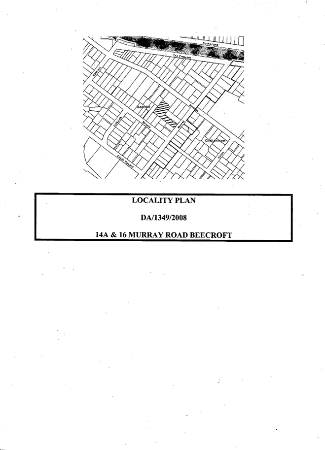
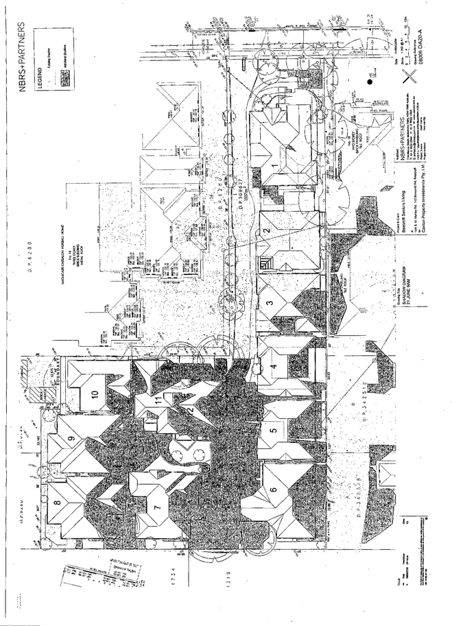
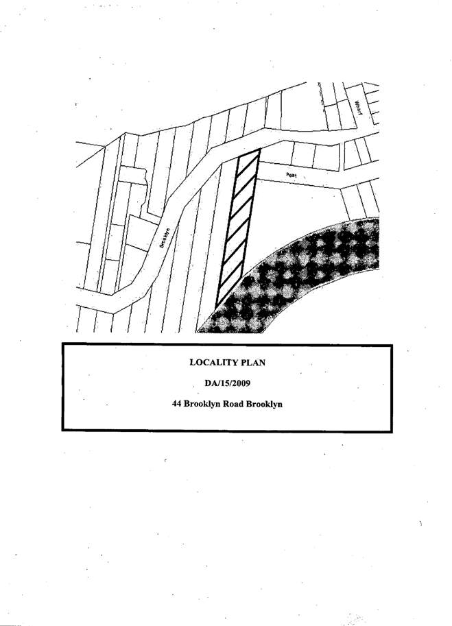
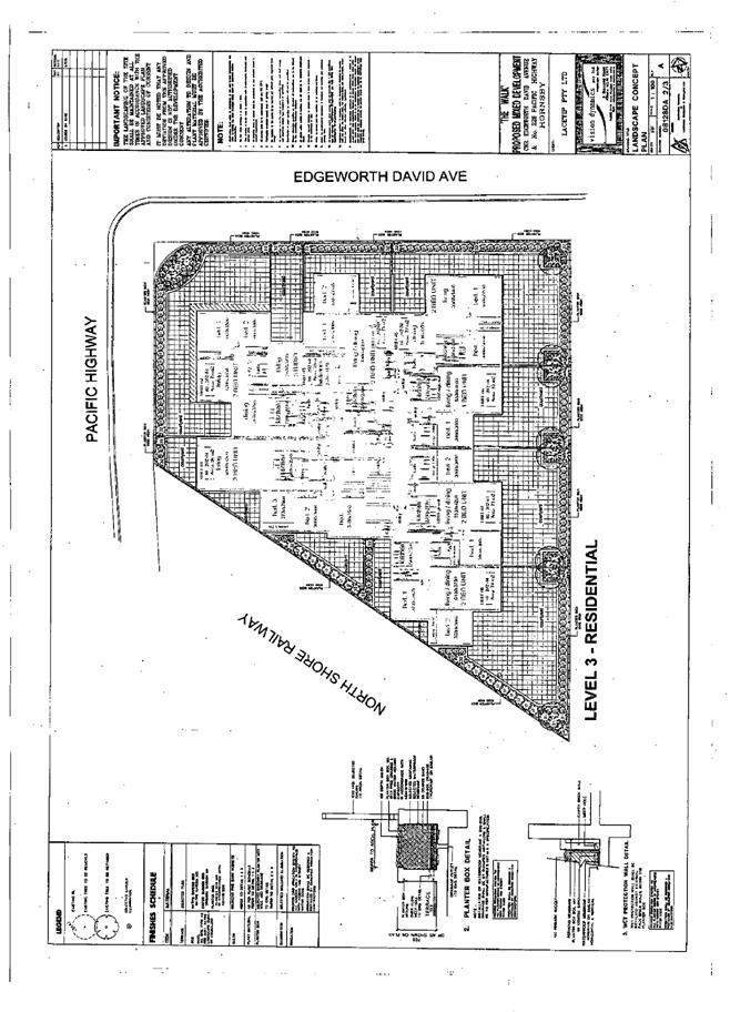
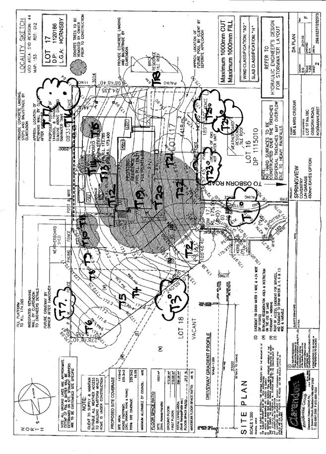
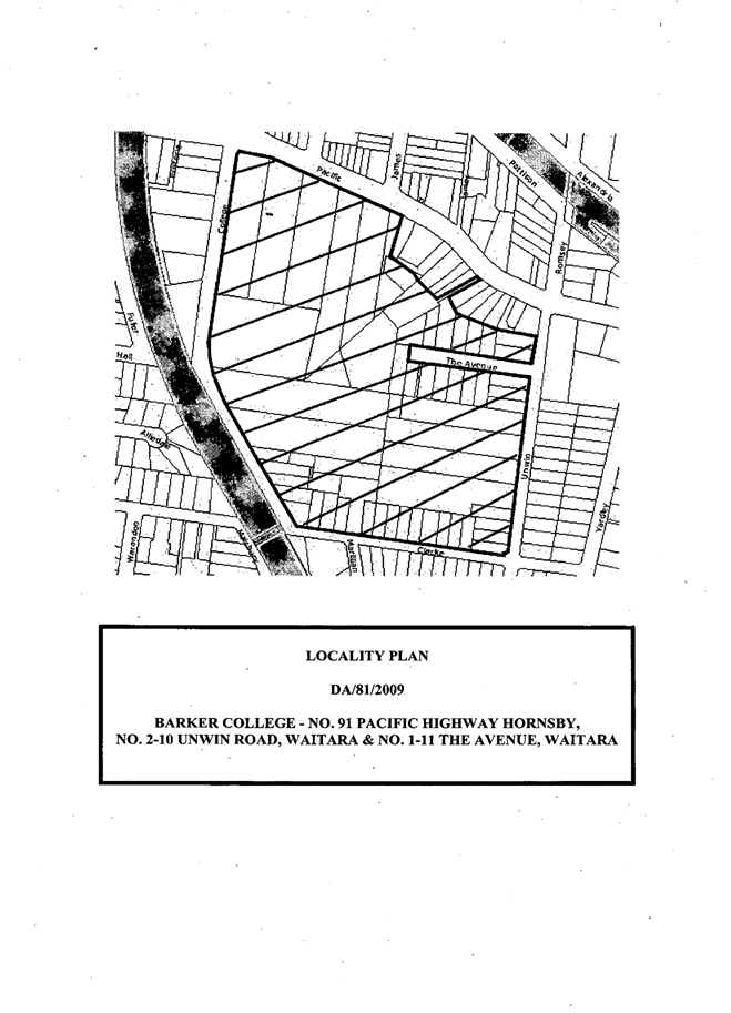
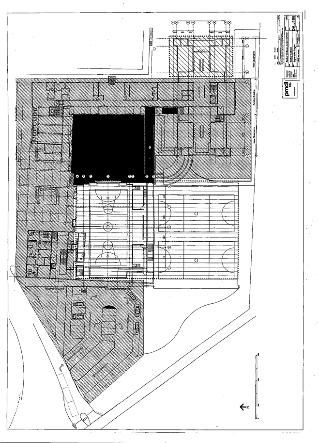
1.View |
Locality Plan |
|
|
|
2.View |
Site Survey Plan |
|
|
|
3.View |
Tree Locations |
|
|
|
4.View |
Site Analysis Plan |
|
|
|
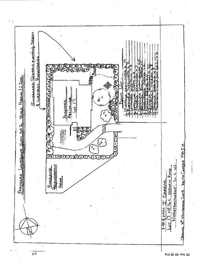
5.View |
Landscape Plans |
|
|
|
6.View |
Deep Soil Planting Areas |
|
|
|
7.View |
Floor Plans |
|
|
|
8.View |
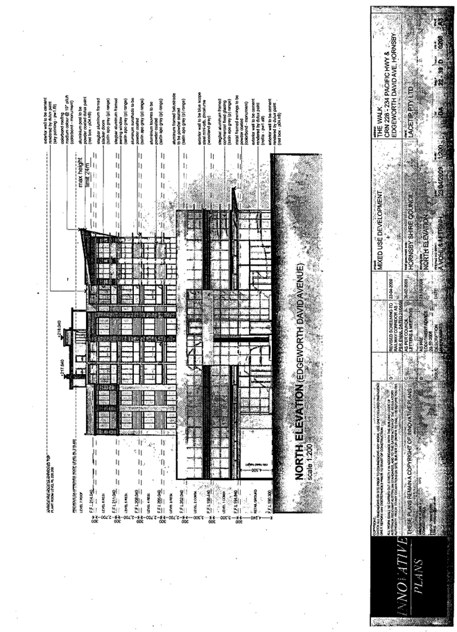
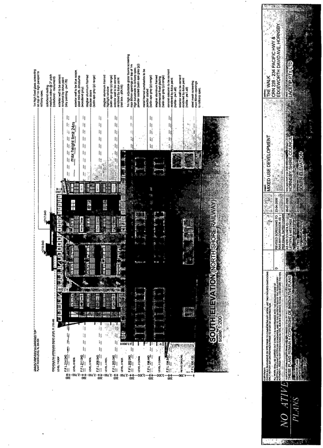
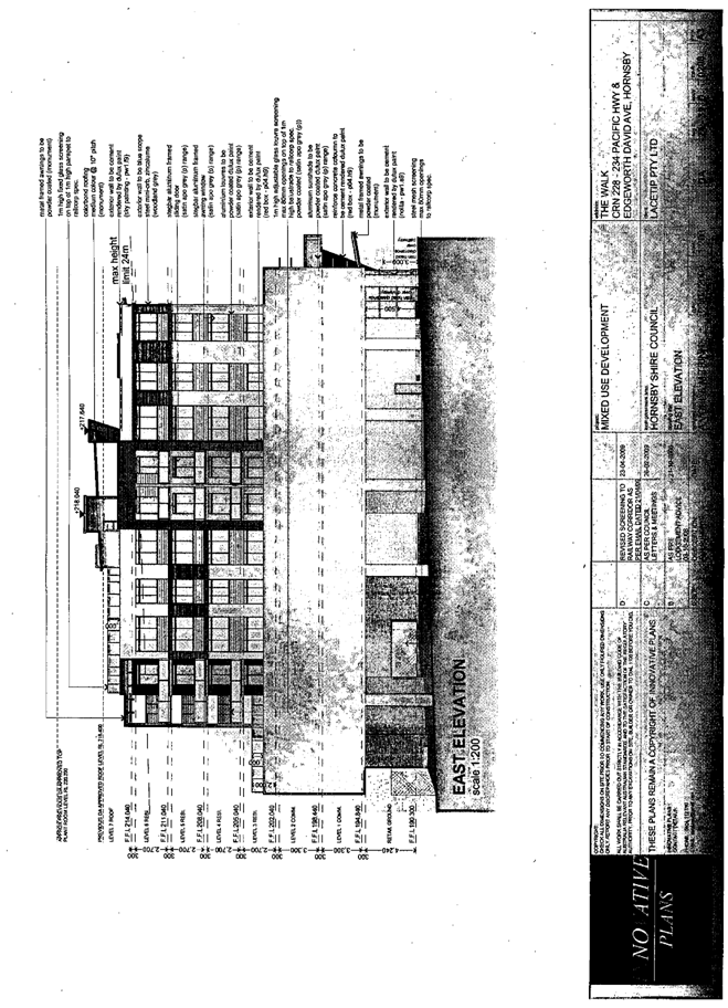
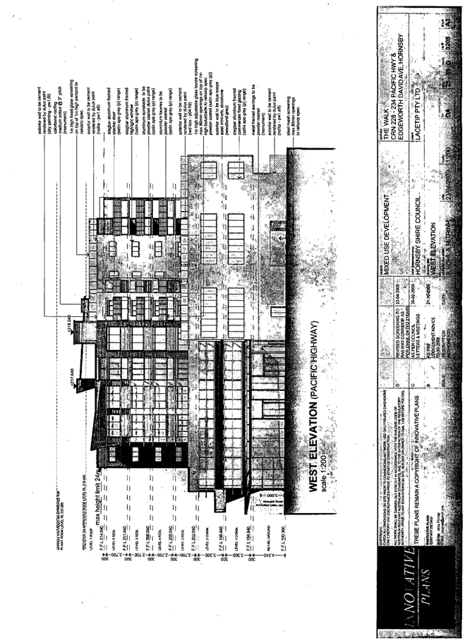
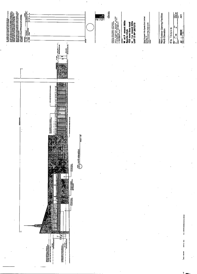
Elevations |
|
|
|
9.View |
Shadow Diagrams |
|
|
|
10.View |
Stormwater Drainage Plan |
|
|
File Reference: DA/1349/2008
Document Number: D01115387
SCHEDULE 1
CONDITIONS OF CONSENT
GENERAL CONDITIONS
The conditions of consent within this notice of determination have been applied to ensure that the use of the land and/or building is carried out in such a manner that is consistent with the aims and objectives of the planning instrument affecting the land.
Note: For the purpose of this consent, the term ‘applicant’ means any person who has the authority to act on or the benefit of the development consent.
Note: For the purpose of this consent, any reference to an Act, Regulation, Australian Standard or publication by a public authority shall be taken to mean the gazetted Act or Regulation, or adopted Australian Standard or publication as in force on the date that the application for a construction certificate is made.
Approved Plans and Supporting Documentation
The development must be carried out in accordance with the plans and documentation listed below and endorsed with Council’s stamp, except where amended by Council and/or other conditions of this consent:
|
Plan No. |
Drawn by |
Dated |
|
DA00-A Site Plan |
NBRS + Partners |
27/03/2009 |
|
DA01-A Gnd Flr Plan |
NBRS + Partners |
8/04/2009 |
|
DA02-A 1st Flr Plan |
NBRS + Partners |
27/03/2009 |
|
DA03-A 2nd Flr Plan |
NBRS + Partners |
27/03/2009 |
|
DA10-A Elevations |
NBRS + Partners |
8/04/2009 |
|
DA11-A Elevations |
NBRS + Partners |
27/03/2009 |
|
|
|
|
|
Landscape Plan 1-2 |
G R & M A Sykes |
Undated |
|
|
|
|
|
Soil & Water Mgmt Plan |
Craig & Rhodes |
8.9.08 |
|
|
|
|
|
Document No. |
Prepared by |
Dated |
|
D01130921 Waste Management Plan |
Craig & Rhodes |
5 Nov 2008 |
|
D01020412 Impact of proposed development on trees |
Footprint Green Pty Ltd |
26 September 2008 |
Retention of Existing Trees
This development consent only permits the removal of trees numbered 3, 4, 6, 7, 9, 10, 11, 12, 13, 16, 17, 18, 19, 20, 21, 22, 27, 31, 32, 33, 34, 35, 36, 37, 39, 41, 44, 45, 46, 47, 48, 49, 50, 51, 52, 53, 54, 56 and 57 as identified on Plan No. tidmrbtn14.01 0.2 prepared by Footprint Green Pty Ltd dated 26/09/08. The removal of any other trees requires separate approval under Council’s Tree Preservation Order.
Amendment of Plans
The approved plans are to be amended as follows:
a. The mulch pathways detailed on the floor plans and landscape plans are to be deleted and replaced with pathways comprising concrete, stone or brick pavers, to provide an uninterrupted surface of travel, other than around Tree No. 38.
b. The landscape plan Plant Index listing for Plant No. 70 is to be amended by the replacement of Eucalyptus sideroxylon with Eucalyptus paniculata.
c. The landscape plan is to be amended by relocation of Plants Nos. 70 from the western side of Unit 2 and Unit 3 to the deep soil area on the eastern side of the accessway. Plant No. 7 is to be relocated from the south eastern side of Unit 9 to the deep soil area south west side of Unit 1.
d. All indigenous canopy trees – Eucalyptus paniculata Grey Ironbark, Eucalyptus resinifera Red Mahogany, Angophora costata Sydney Red Gum, and Syncarpia glomulifera Turpentine, numbered 70, 85, 2 and 7 on the landscape plan, are to be a minimum pot size of 25 litres.
REQUIREMENTS PRIOR TO THE ISSUE OF A CONSTRUCTION CERTIFICATE
The following conditions of consent must be complied with prior to the issue of a ‘Construction Certificate’ by either Hornsby Shire Council or an accredited certifier. All necessary information to demonstrate compliance with the following conditions of consent must be submitted with the application for a construction certificate.
Building Code of Australia
All building work must be carried out in accordance with the requirements of the Building Code of Australia.
5. Access Plan
The construction certificate drawings must be certified by an access consultant, as compliant with the accessibility and useability standards of State Environmental Planning Policy (Housing for Seniors or People with a Disability) 2004.
6. Geotechnical Plan
The construction certificate drawings must be prepared in accordance with the recommendations of the geotechnical engineer, Jeffery and Katauskas Pty Ltd, report dated 1 July 2008 Ref: 22202ZRrpt.
7. Waste Management Plan
The bin storage areas must be designed and constructed in accordance with Hornsby Shire Council’s Waste Minimisation and Management Development Control Plan.
8. Contract of Insurance (Residential Building Work)
In the case of residential building work for which the Home Building Act 1989 requires there to be a contract of insurance in force in accordance with Part 6 of that Act, that such a contract of insurance is in force before any building work authorised to be carried out by the consent commences.
Note: This condition does not apply to the extent to which an exemption is in force under Clause 187 or 188 of the Act, subject to the terms of any condition or requirement referred to in Clause 187(6) or 188(4) of the Act, or to the erection of a temporary building.
9. Dilapidation Report
A ‘Dilapidation Report’ must be prepared by a ‘chartered structural engineer’ detailing the structural condition of the following adjoining properties:
a. No. 138A Beecroft Road, Beecroft; and
b. Nos. 144-146 Beecroft Road (Chesalon Nursing Home) Beecroft.
10. Water/Electricity Utility Services
The applicant must submit written evidence of the following service provider requirements:
a. Energy Australia – a letter of consent demonstrating that satisfactory arrangements have been made to service the proposed development.
b. Sydney Water – the submission of a ‘Notice of Requirements’ under s73 of the Sydney Water Act 1994.
Note: Sydney Water requires that s73 applications are to be made through an authorised Sydney Water Servicing Coordinator. Refer to www.sydneywater.com.au or telephone 13 20 92 for assistance.
REQUIREMENTS PRIOR TO THE COMMENCEMENT OF ANY WORKS
The following conditions of consent must be complied with prior to the commencement of any works on the site. The conditions have been imposed to ensure that the works are carried out in such a manner that complies with relevant legislation and Council’s policies and does not disrupt the amenity of the neighbourhood or impact upon the environment.
11. Erection of Construction Sign
A sign must be erected in a prominent position on any site on which building work, subdivision work or demolition work is being carried out:
a. Showing the name, address and telephone number of the principal certifying authority for the work.
b. Showing the name of the principal contractor (if any) for any demolition or building work and a telephone number on which that person may be contacted outside working hours.
c. Stating that unauthorised entry to the work site is prohibited.
Note: Any such sign is to be maintained while the building work, subdivision work or demolition work is being carried out, but must be removed when the work has been completed.
12. Protection of Adjoining Areas
A temporary hoarding, fence or awning must be erected between the work site and adjoining lands before the works begin and must be kept in place until after the completion of the works if the works:
a. Could cause a danger, obstruction or inconvenience to pedestrian or vehicular traffic.
b. Could cause damage to adjoining lands by falling objects.
c. Involve the enclosure of a public place or part of a public place.
Note: Notwithstanding the above, Council’s separate written approval is required prior to the erection of any structure or other obstruction on public land.
13. Toilet Facilities
Toilet facilities must be available or provided at the works site before works begin and must be maintained until the works are completed at a ratio of one toilet for every 20 persons employed at the site. Each toilet must:
a. be a standard flushing toilet connected to a public sewer; or
b. have an on-site effluent disposal system approved under the Local Government Act 1993; or
c. be a temporary chemical closet approved under the Local Government Act 1993.
14. Erosion and Sediment Control
Erosion and sediment control measures must be provided and maintained throughout the construction period in accordance with the manual ‘Soils and Construction 2004 (Bluebook)’, the approved plans, Council specifications and to the satisfaction of the principal certifying authority. The erosion and sediment control devices must remain in place until the site has been stabilised and revegetated.
Note: On the spot penalties up to $1,500 may be issued for any on-compliance with this requirement without any further notification or warning.
REQUIREMENTS DURING CONSTRUCTION
The following conditions of consent must be complied with during the construction of the development. The conditions have been imposed to ensure that the works are carried out in such a manner that complies with relevant legislation and Council’s policies and does not disrupt the amenity of the neighbourhood or impact upon the environment.
15. Construction Work Hours
All work on site (including demolition and earth works) must only occur between the following hours:
Monday to Saturday 7 am to 5 pm
Sunday & Public Holidays No work
16. Demolition
All demolition work must be carried out in accordance with Australian Standard 2601-2001 – The Demolition of Structures and the following requirements:
a. Demolition material is to be disposed of to an authorised recycling and/or waste disposal site and/or in accordance with an approved waste management plan.
b. Demolition works, where asbestos material is being removed, must be undertaken by a contractor that holds an appropriate licence issued by WorkCover NSW in accordance with Chapter 10 of the Occupational Health and Safety Regulation 2001 and Clause 29 of the Protection of the Environment Operations (Waste) Regulation 1996.
c. On construction sites where buildings contain asbestos material, a standard commercially manufactured sign containing the words ‘DANGER ASBESTOS REMOVAL IN PROGRESS’ measuring not less than 400mm x 300mm must be erected in a prominent position visible from the street.
17. Environmental Management
The site must be managed in accordance with the publication ‘Managing Urban Stormwater – Landcom (March 2004) and the Protection of the Environment Operations Act 1997 by way of implementing appropriate measures to prevent sediment run-off, excessive dust, noise or odour emanating from the site during the construction of the development.
18. Street Sweeping
Street sweeping must be undertaken following sediment tracking from the site along Murray Road during works and until the site is established.
19. Works near Trees
All works (including driveways and retaining walls) within 3 metres of any trees required to be retained (whether or not on the land the subject of this consent), must be carried out under the supervision of an ‘AQF Level 5 Arborist’ or equivalent and a certificate submitted to the principal certifying authority detailing the method(s) used to preserve the tree(s).
Note: Except as provided above, the applicant is to ensure that no excavation, filling or stockpiling of building materials is to occur within 4 metres of any tree to be retained.
20. Council Property
During construction works, no building materials, waste, machinery or related matter is to be stored on the road or footpath. The public reserve is to be kept in a clean, tidy and safe condition at all times.
21. Excavated Material
All excavated material removed from the site must be classified in accordance with the NSW Environment Protection Authority’s Environmental Guidelines – Assessment, Classification and Management of Liquid and Non-Liquid Wastes prior to disposal to an approved waste management facility and reported to the principal certifying authority.
22. Survey Report – Finished Floor Level
A report(s) must be prepared by a registered surveyor and submitted to the principal certifying authority prior to the pouring of concrete at each level of the building certifying that:
a. The building, retaining walls and the like have been correctly positioned on the site.
b. The finished floor level(s) are in accordance with the approved plans.
23. Landscape Works To All Areas
All landscape works must meet the minimum construction standards identified in the Hornsby Shire Council Landscape Code for Development Applications including the construction of mulched planter beds, planting of trees in minimum 25 litre pot sizes, shrubs in minimum 5 litre pot sizes and groundcovers in minimum 150mm pot sizes in the densities identified in the submitted planting specification.
REQUIREMENTS PRIOR TO THE ISSUE OF AN OCCUPATION CERTIFICATE
The following conditions of consent must be complied with prior to the ‘Principal Certifying Authority’ issuing an ‘Occupation Certificate’.
Note: For the purpose of this consent, any reference to ‘occupation certificate’ shall also be taken to mean ‘interim occupation certificate’ unless otherwise stated.
24. Fulfilment of BASIX Commitments
The applicant must demonstrate the fulfilment of BASIX commitments pertaining to the development.
25. Smoke Alarms – Dwelling Additions
Smoke alarms must be installed in the existing building and the proposed additions in accordance with the requirements of the Building Code of Australia.
26. Stormwater Drainage
The stormwater drainage system for the development must be designed and constructed in accordance with Council’s Civil Works – Design and Construction Specification 2005 and the following requirements:
a. Connected to an existing Council piped drainage system.
b. Hornsby Shire Council’s approval for the proposed drainage works within Public Road is required (a construction certificate is to be submitted to Council).
Note: A certificate from a chartered civil engineer together with a works as executed design plan must be submitted to the principal certifying authority to demonstrate the satisfaction of this condition.
27. On Site Stormwater Detention
An on-site stormwater detention system must be designed by a chartered civil engineer and constructed in accordance with the following requirements:
a. The drainage system to control all collected roof and surface stormwater shall be designed with an on-site-detention system. Stormwater discharge from the development site shall be limited to 5 year pre development ARI (average recurrence interval) discharge level. On site detention storage shall be provided for up to 50 year ARI storm events. Detail calculations are to be submitted with a construction certificate application.
b. Have a surcharge/inspection grate located directly above the outlet.
c. Discharge from the detention system to be controlled via 1 metre length of pipe, not less than 50 millimetres diameter or via a stainless plate with sharply drilled orifice bolted over the face of the outlet discharging into a larger diameter pipe capable of carrying the design flow to an approved Council system.
d. Where above ground and the average depth is greater than 0.3 metres, a ‘pool type’ safety fence and warning signs to be installed.
e. Not be constructed in a location that would impact upon the visual or recreational amenity of residents.
f. The creation of an appropriate "Positive Covenant" and "Restriction as to User" over the constructed on-site detention/retention systems and outlet works, within the lots in favour of Council in accordance with Council’s prescribed wording. The position of the on-site detention system is to be clearly indicated on the title.
g. To register the OSD easement, the restriction on the use of land “works-as-executed” details of the on-site-detention system must be submitted verifying that the required storage and discharge rates have been constructed in accordance with the design requirements. The details must show the invert levels of the on site system together with pipe sizes and grades. Any variations to the approved plans must be shown in red on the “works-as-executed” plan and supported by calculations.
28. Vehicular Crossing
A separate application under the Local Government Act 1993 and the Roads Act 1993 must be submitted to Council for the installation of a new vehicular crossing and the removal of the redundant crossing. The vehicular crossing must be constructed in accordance with Council’s Civil Works Design 2005 and the following requirements:
a. Approval obtained from all relevant utility providers that all necessary conduits be provided and protected under the crossing.
b. The grated gully pit must be relocated outside the vehicular footway crossing.
Note: An application for a vehicular crossing can only be made to one of Council’s Authorised Vehicular Crossing Contractors. You are advised to contact Council on 02 9847 6940 to obtain a list of contractors.
29. Internal Driveway/Vehicular Areas
The driveway and parking areas on site must be designed in accordance with Australian Standards 2890.1, 3727 and the following requirements:
a. Design levels at the front boundary be obtained from Council.
b. The driveway grade not exceed 25 percent and changes in grade not exceed 8 percent.
c. Planting of landscaping strips 0.5 metres wide along both sides of the length of the driveway.
d. Passing bays are to be constructed at the intersection of the driveway and Murray Road and at 50m intervals. Entry and exit signs area to be erected for the proposed separation of vehicular entry and exit movements by an island (at the intersection of the driveway and Murray Road).
30. Works as Executed Plan
A works-as-executed plan(s) must be prepared by a registered surveyor and submitted to Council for completed road pavement, public drainage systems, driveways and on-site detention system. The plan(s) must be accompanied by a certificate from a registered surveyor certifying that all pipelines and associated structures lie wholly within any relevant easements.
31. Damage to Council Assets
Any damage caused to Council’s assets as a result of the construction of the development must be rectified in accordance with Council’s written requirements and at the sole cost of the applicant.
32. Traffic Control Plan
A Traffic Control Plan (TCP) must be prepared by a qualified traffic controller in accordance with the Roads & Traffic Authority’s Traffic Control at Worksites Manual 1998 and Australian Standard 1742.3 for all work on a public road and be submitted to Council. The TCP must detail the following:
a. Arrangements for public notification of the works.
b. Temporary construction signage.
c. Permanent post-construction signage.
d. Vehicle movement plans.
e. Construction vehicle access only via Beecroft Road and Murray Road, access via Boronia Avenue is not permitted.
f. Traffic management plans.
g. Pedestrian and cyclist access/safety.
33. Retaining Walls
All required retaining walls must be constructed as part of the development.
34. Boundary Fencing
Fencing must be erected along all property boundaries behind the front building alignment to a height of 1.8 metres at full cost to the developer.
Note: Alternative fencing may be erected subject to the written consent of the adjoining property owner(s).
35. Restriction on Occupation – Housing for Seniors or People with a Disability
A restriction as to user must be created under s88B of the Conveyancing Act 1919 and registered, requiring the dwellings approved under this consent to be solely used for the accommodation of:
a. Seniors (55+ age) or people with a disability.
b. People who live within the same household as seniors or people with a disability.
c. Staff employed to assist the administration and provision of services to housing provided under SEPP (Housing for Seniors or People with a Disability) 2004.
Note: The restriction must nominate Council as the authority to release, vary or modify the restriction.
36. External Lighting
All external lighting must be designed, installed and certified in accordance with Australian Standard AS 4282 – Control of the Obtrusive Effects of Outdoor Lighting.
37. Certification of Landscape Works
The completed landscaping works must be inspected and certified by a registered landscape architect or experienced landscape architect/designer as being in accordance with the requirements of the development consent.
38. S94 Infrastructure Contributions
The payment of a contribution of $63,685.30 for 11 Seniors Living dwellings, towards the cost of transport and traffic management, open space and recreation facilities, library and community facilities, bushland regeneration, stormwater drainage, civic improvements and section 94 plan administration in accordance with sections 94, 94A and 94C of the Environmental Planning and Assessment Act, 1979 and the Hornsby Shire Council’s Development Contributions Plan 2007-2011. The contribution is based on a rate of $9,274.65 per Seniors Living dwelling and it is to be paid by the end of the financial quarter in which the development application was determined and prior to the issuing of a construction certificate. The contribution will be adjusted in accordance with the underlying consumer price index for the subsequent financial quarters. The levied contribution includes a credit of 9,274.65 for each of the two existing detached dwellings.
Note: * The value of contribution is current as at 31 March 2009.
The contribution will be adjusted from this date in accordance with the
underlying consumer price index for subsequent financial quarters.
It is recommended that you contact Council to ascertain the indexed value of
the contribution prior to payment.
OPERATIONAL CONDITIONS
The following conditions have been applied to ensure that the ongoing use of the land is carried out in such a manner that complies with relevant legislation and Council’s policies and does not disrupt the amenity of the neighbourhood or impact upon the environment.
39. Visitors Car Parking
All units approved under this development consent must have access to the visitor car parking spaces.
40. Waste Management
A site caretaker must be engaged to move bins to and from the bin storage area/bin collection point and to maintain bin storage areas and waste management.
41. Maintenance of Landscaping
The landscape works must be maintained in perpetuity to ensure the establishment and successful growth of plant material to meet the intent of the landscape design.
- END OF CONDITIONS -
ADVISORY NOTES
The following information is provided for your assistance to ensure compliance with the Environmental Planning and Assessment Act 1979, Environmental Planning and Assessment Regulation 2000, other relevant legislation and Council’s policies and specifications. This information does not form part of the conditions of development consent pursuant to Section 80A of the Act.
Environmental Planning and Assessment Act 1979 Requirements
· The Environmental Planning and Assessment Act 1979 requires:
· A construction certificate prior to the commencement of any works. Enquiries regarding the issue of a construction certificate can be made to Council’s Customer Services Branch on 9847 6760.
· A principal certifying authority to be nominated and Council notified of that appointment prior to the commencement of any works.
· Council to be given at least two days written notice prior to the commencement of any works.
· Mandatory inspections of nominated stages of the construction inspected.
· An occupation certificate issued before occupying any building or commencing the use of the land.
Long Service Levy
In accordance with Section 34 of the Building and Construction Industry Long Service Payments Act 1986, a ‘Long Service Levy’ must be paid to the Long Service Payments Corporation or Hornsby Council.
Note: The rate of the Long Service Levy is 0.35% of the total cost of the work.
Note: Hornsby Council requires the payment of the Long Service Levy prior to the issue of a construction certificate.
Tree Preservation Order
To ensure the maintenance and protection of the existing natural environment, it is an offence to ringbark, cut down, top, lop, remove, wilfully injure or destroy a tree outside three metres of the approved building envelope without prior written consent from Council. Fines may be imposed for non-compliance with Council’s Tree Preservation Order.
Note: A tree is defined as a perennial plant with self supporting stems that are more than 3 metres or has a trunk diameter more than 150mm measured 1 metre above ground level, and excludes any tree declared under the Noxious Weeds Act (NSW).
Dial Before You Dig
Prior to commencing any works, the applicant is encouraged to contact Dial Before You Dig on 1100 or www.dialbeforeyoudig.com.au for free information on potential underground pipes and cables within the vicinity of the development site.
Asbestos Warning
Should asbestos or asbestos products be encountered during construction or demolition works you are advised to seek advice and information should be prior to disturbing the material. It is recommended that a contractor holding an asbestos-handling permit (issued by Work Cover NSW), be engaged to manage the proper disposal and handling of the material. Further information regarding the safe handling and removal of asbestos can be found at:
Alternatively, telephone the Work Cover Asbestos and Demolition Team on 8260 5885.
House Numbering
House numbering can only be authorised by Council. Before proceeding to number each premise in the development, the allocation of numbers is required to be obtained from Council's Planning Division. The authorised numbers are required to be displayed in a clear manner at or near the main entrance to each premise.