BUSINESS PAPER
Planning
Meeting
Wednesday, 2 December, 2009
at 6:30pm
|
Hornsby Shire Council
|
Table of Contents
|
|
Page
1
|
|
|
|
|
TABLE OF CONTENTS
AGENDA
AND SUMMARY OF RECOMMENDATIONS
Mayoral Minutes
Notices of Motion
Rescission Motions
MATTERS OF URGENCY
ITEMS PASSED BY EXCEPTION / CALL FOR SPEAKERS ON
AGENDA ITEMS
DEVELOPMENT APPLICATIONS
A
Ward Deferred
A
Ward
Item 1 PLN94/09 Development Application - Rural
Subdivision - Boundary Adjustment
2753 & 2785 - 2801 Old Northern Road, Glenorie
B
Ward Deferred
B
Ward
Item 2 PLN90/09 Development Application -
Erection of a 7 storey mixed use building - Section 96(2) - The Walk, 228 - 234
Pacific Highway Hornsby
C
Ward Deferred
C
Ward
Item 3 PLN95/09 Development Application -Alterations
and additions to Brickpit Park
1B Dartford Road and 142-178 Pennant Hills Road Thornleigh
Item 4 PLN96/09 Development Application - Two Lot Subdivision and Demolition
77 Hannah Street Beecroft
General Business
Item 5 PLN98/09 Planning Proposal To Enable
Exhibition Of An Amended Housing Strategy
Questions of Which Notice Has Been Given
SUPPLEMENTARY AGENDA
QUESTIONS WITHOUT NOTICE
|
Hornsby Shire Council
|
Agenda and Summary of
Recommendations
|
|
Page
1
|
|
|
|
|
AGENDA AND SUMMARY OF RECOMMENDATIONS
PRESENT
NATIONAL
ANTHEM
OPENING
PRAYER/S
Acknowledgement
of RELIGIOUS DIVERSITY
Statement by the
Chairperson
“We recognise our Shire's rich
cultural and religious diversity and we acknowledge and pay respect to the
beliefs of all members of our community, regardless of creed or faith."
ABORIGINAL
RECOGNITION
Statement
by the Chairperson:
"We recognise the traditional inhabitants of the land
we are meeting on tonight, the Darug and Guringai Aboriginal people, and
respect is paid to their elders and their heritage."
AUDIO
RECORDING OF COUNCIL MEETING
Statement by the Chairperson:
"I advise all present that
tonight's meeting is being audio recorded for the purpose of assisting in the
accuracy of the Minutes. The recordings may be accessed by members of the
public once the Minutes have been finalised and speakers are requested to
ensure their comments are relevant to the issue at hand and refrain from making
personal comments or criticisms."
APOLOGIES
declarations
of interest
Clause 52 of Council’s Code of
Meeting Practice (Section 451 of the Local Government Act, 1993) requires that
a councillor or a member of a Council committee who has a pecuniary interest in
a matter which is before the Council or committee and who is present at a meeting
of the Council or committee at which the matter is being considered must
disclose the nature of the interest to the meeting as soon as practicable. The
disclosure is also to be submitted in writing (on the form titled “Declaration
of Interest”).
The Councillor or member of a Council committee must not
be present at, or in sight of, the meeting of the Council or committee:
(a) at
any time during which the matter is being considered or discussed by the
Council or committee.
(b) at
any time during which the Council or committee is voting on any question in
relation to the matter.
Clause 51A of Council’s Code
of Meeting Practice provides that a Councillor, Council officer, or a member of
a Council committee who has a non pecuniary interest in any matter with which
the Council is concerned and who is present at a meeting of the Council or
committee at which the matter is being considered must disclose the nature of
the interest to the meeting as soon as practicable. The disclosure is also to
be submitted in writing (on the form titled “Declaration of Interest”).
If the non-pecuniary interest
is significant, the Councillor must:
a) remove the source of conflict, by relinquishing or divesting
the interest that creates the conflict, or reallocating the conflicting duties
to another Council official.
OR
b) have no involvement in the matter by absenting themself from
and not taking part in any debate or voting on the issue as if the provisions
of Section 451(2) of the Act apply.
If the non-pecuniary interest
is less than significant, the Councillor must provide an explanation of why
they consider that the interest does not require further action in the
circumstances.
Political
Donations Disclosure
Statement by the Chairperson:
“I advise all present that a
Political Donations Disclosure Statement pursuant to Section 147(3) of the
Environmental Planning and Assessment Act 1979 must be made in the event that a
person has made or a Councillor or political party has received a gift or
political donation from any person or organisation, including a person or
organisation making a submission to an application or other planning matter,
listed on the Planning Meeting agenda.”
confirmation of minutes
THAT
the Minutes of the Planning Meeting held on 4 November, 2009 be confirmed; a
copy having been distributed to all Councillors.
petitions
Mayoral Minutes
Notices of Motion
Rescission Motions
MATTERS OF URGENCY
ITEMS PASSED BY EXCEPTION / CALL
FOR SPEAKERS ON AGENDA ITEMS
Note:
Persons wishing to address Council on matters which are on
the Agenda are permitted to speak, prior to the item being discussed, and their
names will be recorded in the Minutes in respect of that particular item.
DEVELOPMENT APPLICATIONS
A Ward Deferred
A Ward
Page
Number
Item 1 PLN94/09 Development
Application - Rural Subdivision - Boundary Adjustment - 2753 & 2785 - 2801
Old Northern Road, Glenorie
RECOMMENDATION
THAT Council, seeks the
concurrence of the Director-General of the Department of Planning to approve
Development Application No. 1017/2009 for a boundary adjustment of two existing
allotments to create two new allotments at Lot 149 DP 752014, known as No. 2785
- 2801 (or 1827 - 1837) Old Northern Road, Glenorie and Lot 148 DP 752014,
known as No. 2753 Old Northern Road, Glenorie subject to the conditions of
consent detailed in Schedule 1 of this report.
B Ward Deferred
B Ward
Page
Number
Item 2 PLN90/09 Development
Application - Erection of a 7 storey mixed use building - Section 96(2) - The
Walk, 228 - 234 Pacific Highway Hornsby
RECOMMENDATION
THAT Development Application No.
1564/2008 for the erection of a seven storey mixed use development
incorporating retail and commercial floor space and twenty eight residential
units at Lot A and B DP 304557 (No. 228 – 234) Pacific Highway, Hornsby be
modified pursuant to Section 96(2) of the Environmental Planning and Assessment
Act 1979 and subject to conditions of consent detailed in Schedule 1 of this
report.
C Ward Deferred
C Ward
Page
Number
Item 3 PLN95/09 Development Application
-Alterations and additions to Brickpit Park - 1B Dartford Road and 142-178
Pennant Hills Road Thornleigh
RECOMMENDATION
THAT Development Application No.
1088/2009 for alterations and additions to an existing sports stadium at Lot 3
DP 604958 and Lot 1 DP 633292 (No. 1B) Dartford Road and (Nos. 142-178) Pennant Hills Road, Thornleigh be approved subject to the conditions of consent detailed in
Schedule 1 of this report.
Page
Number
Item 4 PLN96/09 Development
Application - Two Lot Subdivision and Demolition - 77 Hannah Street Beecroft
RECOMMENDATION
THAT Development Application No.
897/2009 for the demolition of an existing dwelling and garage and the Torrens title subdivision of one lot into two lots at Lot 1 DP 231939, No. 77 Hannah Street
Beecroft be approved subject to the conditions of consent detailed in Schedule
1 of this report.
General Business
Page
Number
Item 5 PLN98/09 Planning
Proposal To Enable Exhibition Of An Amended Housing Strategy
RECOMMENDATION
THAT:
- Council
facilitate the exhibition of an amended Housing Strategy by
forwarding the attached Planning Proposal to the Minister for
Planning seeking a “gateway” determination pursuant to Section 56(1) of
the Environmental Planning and Assessment Act, 1979.
- Should
the Minister determine under Section 56(2) of the Environmental
Planning and Assessment Act, 1979 that the matter may proceed, Council
publicly exhibit the amended Housing Strategy in accordance with
the consultation strategy outlined in the Planning Proposal (or as
otherwise directed by the Minister).
- The
General Manager be delegated authority to endorse the exhibition material.
- Following
the exhibition, a report on submissions be presented to Council.
GENERAL
BUSINESS
- Items for which there is a Public Forum Speaker
- Public Forum for non agenda items
- Balance of General Business items
Questions of Which Notice Has Been Given
SUPPLEMENTARY AGENDA
QUESTIONS WITHOUT NOTICE
Planning Report No. PLN94/09
Date of Meeting:
2/12/2009
1 DEVELOPMENT APPLICATION
- RURAL SUBDIVISION - BOUNDARY ADJUSTMENT
2753 & 2785 - 2801 OLD NORTHERN ROAD, GLENORIE
|
Development Application No:
|
DA/1017/2009
|
|
Description of Proposal:
|
Boundary adjustment of two existing allotments to
create two new allotments.
|
|
Property Description:
|
Lot 149 DP 752014, known as No. 2785 - 2801 (or 1827 -
1837) Old Northern Road, Glenorie and Lot 148 DP 752014, known as No. 2753 Old Northern Road, Glenorie
|
|
Applicant:
|
Barrie Green & Associates
|
|
Owners:
|
Mr Thomas Leonard Byrne
Mr Scott Kenneth Alexander
Ms Deborah Anne Harris
|
|
Statutory Provisions:
|
Hornsby Shire Local Environmental
Plan 1994
Rural AR (Large Holdings -
Rural Landscapes) zone and Environmental Protection B (River Catchment) zone
|
|
Estimated Value:
|
Nil
|
|
Ward:
|
A
|
|
RECOMMENDATION
THAT Council, seeks the
concurrence of the Director-General of the Department of Planning to approve
Development Application No. 1017/2009 for a boundary adjustment of two
existing allotments to create two new allotments at Lot 149 DP 752014, known
as No. 2785 - 2801 (or 1827 - 1837) Old Northern Road, Glenorie and Lot 148
DP 752014, known as No. 2753 Old Northern Road, Glenorie subject to the
conditions of consent detailed in Schedule 1 of this report.
|
1. The
application proposes a boundary adjustment between two existing allotments.
2. The
proposal does not comply with the minimum lot size pursuant to Clause 14 of the
Hornsby Shire Local Environmental Plan 1994. The submitted objection to the
minimum lot size development standard is well founded with regard to State
Environmental Planning Policy No. 1 – Development Standards.
3. No
submissions have been received in respect of the application.
4. It
is recommended that the application be referred to the Director-General of the
Department of Planning seeking his concurrence to the approval of the
application.
THE SITE
The site has a total area of
11.31 hectares, which comprises two existing lots; Lot 148 of 9.245 hectares
and Lot 149 of 2.064 hectares. The land is located on the eastern side of Old Northern Road and falls to the east. The site is bounded by Crown land to the east.
Lot 148 contains two buildings
which are located on the northern extremity of the allotment. The plan of
proposed subdivision identifies the two buildings as residences, however, the
applicant has provided further advice stating that the southern building is a
shed. Access is gained via two separate driveways from Old Northern Road. The
remainder of the site is underscrubbed bushland.
Lot 149 has an existing residence
and detached garage which is located on the northern extremity of the allotment
and access is gained via an existing driveway from Old Northern Road. A dam is
located adjacent to the southern boundary. The remainder of the site is underscrubbed
bushland.
THE PROPOSAL
The proposal involves a boundary
adjustment between No. 2785 - 2801 and No. 2753 Old Northern Road, Glenorie,
which involves 8405m2
of land being transferred from No. 2785 - 2801 to No. 2753.
This would result in No. 2753 Old
Northern Road, Glenorie (proposed Lot 482) increasing in area from 2.064 ha to
2.873 ha and No. 2785 - 2801 Old Northern Road, Glenorie (proposed Lot 481)
decreasing in area from 9.245 ha to 8.436 ha. The purpose of the boundary
adjustment, as stated by the applicant, is to increase the usable area of
proposed Lot 482 and to provide a greater side setback to the existing dwelling
and the northern boundary on proposed Lot 482.
ASSESSMENT
The development application has
been assessed having regard to the ‘2005 City of Cities Metropolitan
Strategy’, the ‘North Subregion (Draft) Subregional Strategy’
and the matters for consideration prescribed under Section 79C of the Environmental
Planning and Assessment Act 1979 (the Act). Subsequently, the following
issues have been identified for further consideration.
1. STRATEGIC CONTEXT
1.1 Metropolitan Strategy – (Draft) North Subregional Strategy
The Metropolitan Strategy is a
broad framework to secure Sydney’s place in the global economy by promoting and
managing growth. It outlines a vision for Sydney to 2031; the challenges
faced, and the directions to follow to address these challenges and achieve the
vision. The draft North Subregional Strategy acts as a framework for Council
in the preparation of a new Principal LEP by 2011.
The draft Subregional Strategy
sets the following targets for the Hornsby LGA by 2031:
· Employment capacity
to increase by 9,000 jobs; and
· Housing stock to
increase by 11,000 dwellings.
The proposed development involves
a boundary adjustment of rural land and is generally outside the scope of the
draft Strategy.
2. STATUTORY CONTROLS
Section 79C(1)(a) requires
Council to consider “any relevant environmental planning instruments, draft
environmental planning instruments, development control plans, planning
agreements and regulations”.
2.1 Hornsby Shire Local Environmental Plan 1994
The subject land is partly zoned
Rural AR (Large Holdings - Rural Landscapes) and partly zoned Environmental
Protection B (River Catchment) under Hornsby
Shire Local Environmental Plan 1994 (HSLEP).
The objectives of the Rural AR
(Large Holdings - Rural Landscapes) zone are:
(a) to
restrain population growth and maintain the rural character of the area.
(b) to
provide for a range of compatible land uses, including agriculture, which
maintain the rural environment of the area.
(c) to
ensure development is carried out in a manner that improves the environmental
qualities, and is within the servicing capacity, of the area.
The objectives of the
Environmental Protection B (River Catchment) zone are:
(a) to protect the natural environment of sensitive areas within
the catchment of the Hawkesbury River.
(b) to protect the valleys and escarpments within the catchment
of the Hawkesbury River and accommodate land uses, including housing, that
recognize environmental sensitivity of the area.
(c) to protect the scenic quality of visually prominent areas
and water quality within the catchment of the Hawkesbury River.
The proposed development is
defined as ‘subdivision’ under HSLEP and is permissible in the zone with
Council’s consent.
The proposed development is consistent with the zone
objectives, as the proposed subdivision would not alter the land use within the
area and would maintain the rural character of the area. Further, the boundary
adjustment would not result in an additional dwelling entitlement on either
allotment.
Clause 14 of the HSLEP prescribes
that the minimum area per allotment within the Rural AR zone is 10 hectares and
within the Environmental Protection B zone is 40 hectares. The
existing allotments and the
proposed boundary adjustment do not comply with the minimum lot area
requirements. In this regard the application is the subject of an objection
pursuant to State Environmental Planning Policy No. 1 (SEPP 1) Development
Standards and this matter is addressed in Section 2.2 of this report.
Clause 18 of the HSLEP sets out
heritage conservation provisions within the Hornsby area. The subject site is
not an item of environmental heritage and the proposal is not subject to a
heritage assessment.
2.2 State Environmental Planning Policy No. 1 - Development
Standards
SEPP 1 provides flexibility in
applying development standards and enables a consent authority to vary a
standard where strict compliance would be unnecessary, unreasonable, or tend to
hinder the objectives of the Act. Where there is a variation to a development
standard, the application must be accompanied by a SEPP 1 objection.
The applicant submitted an
objection against Council’s adherence to the minimum 10 hectare lot size
development standard under Clause 14 of the HSLEP. Proposed Lot 481 has an
area of 8.436 hectares including approximately 3.6 hectares within the Rural AR
zone. Proposed Lot 482 has an area of 2.873 including approximately 0.871 hectares
within the Rural AR zone. The remainder of each of the lots is zoned
Environmental Protection B.
The Land and Environment Court
has expressed the view that there are five different ways in which an objection
may be well founded and that approval of the objection may be consistent with
the aims of the Policy:
1. The objectives of the standard are achieved notwithstanding
non-compliance with the standards;
2. The underlying objective or purpose of the standard is not
relevant to the development and therefore compliance is unnecessary;
3. The underlying object of purpose would be defeated or
thwarted if compliance was required and therefore compliance is unreasonable;
4. The development standard has been virtually abandoned or
destroyed by the Council’s own actions in granting consents departing from the
standard and hence compliance with the standard is unnecessary and
unreasonable;
5. The zoning of the particular land is unreasonable or
inappropriate so that a development standard appropriate for that zoning is
also unreasonable and unnecessary as it applies to the land and compliance with
the standard would be unreasonable or unnecessary. That is, the particular
parcel of land should not have been included in the particular zone.
The applicant submits that strict
compliance with the density requirements is unreasonable and unnecessary for
the following reasons:
- The
proposed boundary variation would preserve the rural character and
environmental value of the area. There would be no fragmentation of good
agricultural or environmental land. The distance between any dwelling to be
located
would be such that the rural character would be preserved.
The lots concerned are adjacent to Crown Land and so the area in general is
sparsely populated.
- The
proposed development would provide for the maintenance of the rural environment
by providing a very low density housing situation and an area for agricultural
pursuits which is considered to be compatible with the surrounding rural
residential character of the location. The soil is such that it is difficult
to support any commercial agricultural purposes. The land is most suited to
fruit and vegetable production for household use only. This type of
development is typical of the area where there is a small cleared area
surrounding the dwelling and the dwelling is adjacent to large areas of
uncleared bushland.
- This
boundary variation would only enhance the existing situation in regard to
building location and the general rural environmental feel of the area. It is
not intended to create any additional allotments but rather, is seeking
approval to make optimal and best use of an already existing undersized
allotment.
- The
development would not intensify the use of each parcel and would maintain the
existing character of the Glenorie area.
It is considered that the applicant’s
SEPP 1 submission is well founded and that compliance with the development
standard would be unreasonable and unnecessary in the circumstances of the
case. Accordingly, the SEPP 1 objection is supported.
Pursuant to the SEPP, the
approval of the Director-General of the Department Planning is required for the
proposed subdivision in accordance with Planning Circular PA 08-003 concerning
variation to development standards.
2.3 State Environmental Planning Policy No. 55 - Remediation
of Land
Clause
7 of State Environmental Planning Policy No. 55 - Remediation of Land
requires Council to consider whether land is contaminated prior to granting
consent to the carrying out of any development on that land.
Should
the land be contaminated Council must be satisfied that the land is suitable in
a contaminated state for the proposed use. If the land requires remediation to
be undertaken to make the land suitable for the proposed use, Council must be
satisfied that the land would be remediated before the land is used for that
purpose.
The
site history indicates a history of residential development and a large portion
of the site is undisturbed bushland. It is not likely that the site has
experienced any significant contamination, and further assessment under SEPP 55
is not required.
2.4 Rural Fires Act 1997
The site is identified as
bushfire prone land. The development application for subdivision is ‘integrated
development’ and was referred to the NSW Rural Fire Service (RFS) for
assessment in accordance with Planning For Bushfire Protection NSW 2006
Guidelines.
The RFS raised no objection to
the proposal subject to the imposition of conditions of consent.
2.5 Sydney Regional Environmental Plan No. 20 - Hawkesbury Nepean River
The Plan regulates impacts of
future land uses on the River through implementation of planning policies and
strategies for total catchment management, environmentally sensitive areas,
water quality, water quantity, cultural heritage, flora and fauna, riverine
scenic quality, agriculture/aquaculture and fishing, rural residential
development, urban development, recreation and tourism.
The proposed boundary adjustment
would not adversely impact on the River or its catchment.
2.6 Rural Lands Development Control Plan
The proposed development has been
assessed having regard to the relevant performance and prescriptive design
standards within Council’s Rural Lands Development Control Plan (Rural Lands
DCP). The following table sets out the proposal’s compliance with the prescriptive
standards of the Plan:
|
Rural Lands
Development Control Plan
|
|
Control
|
Proposal
|
Requirement
|
Compliance
|
|
Area
Lot 481
- Rural AR
- Env. Pro. B
- Total
Lot 482
- Rural AR
- Env. Pro. B
- Total
|
3.600 ha
4.836 ha
8.436 ha
0.871 ha
2.002 ha
2.873 ha
|
10 ha
40 ha
10 ha
40 ha
|
No
No
No
No
|
|
Setbacks
Lot 481
- road
- side (north)
- side (south)
- rear
Lot 482
- road
- side (north)
- side (south)
- rear
|
5m
40m
30m
>300m
11m
28m
82m
160m
|
15m
15m
15m
15m
15m
15m
15m
15m
|
No
Yes
Yes
Yes
No
Yes
Yes
Yes
|
The proposed development does not
comply with the minimum lot area prescriptive standard within Council’s Rural
Lands DCP or the minimum front setback requirement. The matters of
non-compliance, as well as a brief discussion on compliance with relevant
performance standards are discussed as follows.
2.6.1 Subdivision
The proposed boundary adjustment
is consistent with the rural holdings in the locality and maintains the pattern
of rural development along Old Northern Road. The proposed boundary adjustment
would not alter the each of the site’s ability to undertake similar rural
activities to that which currently occur.
2.6.2 Setbacks
The existing dwellings on each of
the lots do not comply with the 15 metre front setback requirement. The
boundary adjustment would not alter that situation. Existing vegetation and
the fall of the land screen the dwellings and the non-compliance with the front
setback requirements of the Rural Lands DCP does not warrant refusal of the
application.
2.6.3 Drainage Control
The proposed boundary adjustment
does not alter the existing drainage control on the allotments and would not
have a detrimental impact on the neighbouring creeks.
2.6.4 Fences and Gates
The proposed boundary adjustment
would not warrant the requirement for new fencing due to the bushland setting,
the topography of the land and the bushfire risk.
2.6.5 Contributions
The application does not create
any additional allotments; accordingly Section 94 Contributions are not
required.
3. ENVIRONMENTAL IMPACTS
Section 79C(1)(b) of the Act
requires Council to consider “the likely impacts of that development,
including environmental impacts on both the natural and built environments, and
social and economic impacts in the locality”.
3.1 Natural Environment
The proposed boundary adjustment
does not involve the removal of any existing trees or native vegetation and
maintains physical characteristics of the site. The bushland areas of the site
are within the Environmental Protection B (River Catchment) zone. Existing Lot 148 has a restriction on the use of the land to protect the bushland areas. The
restriction would be retained on the same area within proposed Lot 481 and Lot 482.
3.2 Built Environment
The proposed development includes
the retention of the existing dwellings and buildings on each of the lots.
The boundary adjustment would
increase the setback distance of the existing dwelling on proposed Lot 482 from the side boundary and would provide an effective buffer between the allotments.
As previously stated, the plan of
proposed subdivision identifies two residences on proposed Lot 481. A search
of Council’s records indicates that consent has not been granted for ‘multi-unit
housing’ on proposed Lot 481 and Council sought further clarification from
the applicant with regards to the two buildings.
The applicant provided the
following response: “The southern ‘residence’ appears to be a metal shed”
and included photos of the structure.
A site inspection indicates that
the structure is capable of being used as a separate dwelling. Accordingly it
is recommended that the Plan of Subdivision be amended to delete the reference
to ‘residence’ on the southern structure and that prior to issuing a
subdivision certificate, Council be satisfied that the structure is not capable
of being used as a second dwelling on the allotment.
3.3 Social Impacts
The proposal would not result in
a population increase and would maintain the rural character of the locality.
3.4 Economic Impacts
The proposed boundary adjustment
would not alter each of the existing lots ability to remain viable for a range
of rural pursuits.
4. SITE SUITABILITY
Section 79C(1)(c) of the Act
requires Council to consider “the suitability of the site for the
development”.
There is no known hazard/risk
associated with the site with respect to flooding, landslip and subsidence that
would preclude approval of the proposed development. However, the land is
identified as being subject to bushfire risk. The NSW Rural Fire Service
considered the proposed subdivision and raised no objection to the proposal
subject to the imposition of conditions of consent.
5. PUBLIC PARTICIPATION
Section 79C(1)(d) of the Act
requires Council to consider “any submissions made in accordance with this
Act”.
5.1 Community Consultation
The proposed development was
placed on public exhibition and was notified to adjoining and nearby landowners
between 1 September 2009 and 22 September 2009 in accordance with Council’s
Notification and Exhibition Development Control Plan. During this period,
Council received no submissions. The map over page illustrates the location of
those nearby landowners who where notified of the development.
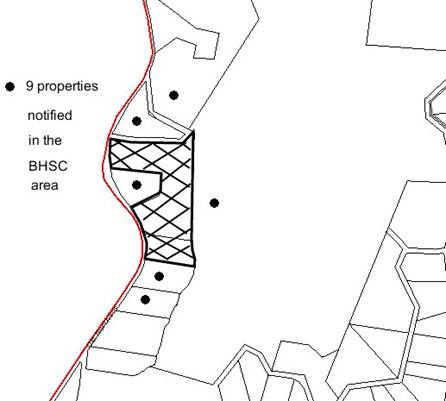
|
NOTIFICATION
PLAN
|
|
|
• PROPERTIES NOTIFIED
|
X SUBMISSIONS
RECEIVED
|

PROPERTY SUBJECT OF DEVELOPMENT
|

|
|
|
|
|
5.2 Public Agencies
The development application is
Integrated Development under the Act in requiring the concurrence of the NSW
Rural Fire Service (RFS). The RFS raised no objection to the proposal subject
to the imposition of conditions of consent.
6. THE PUBLIC INTEREST
Section 79C(1)(e) of the Act
requires Council to consider “the public interest”.
The public interest is an
overarching requirement, which includes the consideration of the matters
discussed in this report. Implicit to the public interest is the achievement
of future built outcomes adequately responding to and respecting the future
desired outcomes expressed in environmental planning instruments and
development control plans.
The application is considered to
have satisfactorily addressed Council’s and relevant agencies’ criteria and
would provide a development outcome that, on balance, would result in a
positive impact for the community. Accordingly, it is considered that the
approval of the proposed description of the proposal would be in the public
interest.
CONCLUSION
Consent is sought for a boundary
adjustment between two existing rural allotments.
The proposed boundary adjustment
is considered satisfactory in maintaining the rural character of the locality,
notwithstanding the minimum lot size applicable for the subject Rural AR zone and Environmental Protection B zone.
The submitted SEPP 1 objection to
the standard is considered well founded in accordance with the planning
principles established by the Land and Environment Court.
The proposed subdivision is
considered acceptable with regard the provisions of the relevant environmental
planning instruments applicable to the rural site, the Rural Lands DCP and the
requirements of the NSW Rural Fire Service.
The application is recommended
for approval subject to the concurrence of the Director-General of the
Department of Planning in accordance with Planning Circular PS 08-003
concerning the variation to development standards.
Note: At the time of the completion of this planning
report, no persons have made a Political Donations Disclosure Statement pursuant
to Section 147(3) of the Environmental Planning and Assessment Act 1979 in
respect of the subject planning application.
|
Rod Pickles
Manager -
Assessment Team 2
Planning Division
|
Paul David
Manager -
Subdivision & Development Engineering Services
Planning Division
|
|
Scott Phillips
Executive Manager
Planning Division
|
|
Attachments:
|
1.View
|
Locality Plan
|
|
|
|
2.View
|
Subdivision Plan
|
|
|
File Reference: DA/1017/2009
Document Number: D01274894
SCHEDULE 1
GENERAL
CONDITIONS
The
conditions of consent within this notice of determination have been applied to
ensure that the use of the land and/or building is carried out in such a manner
that is consistent with the aims and objectives of the relevant legislation,
planning instruments and Council policies affecting the land and does not
disrupt the amenity of the neighbourhood or impact upon the environment.
Note: For the
purpose of this consent, the term ‘applicant’ means any person who has the
authority to act on or the benefit of the development consent.
Note: For the purpose of
this consent, any reference to an Act, Regulation, Australian Standard or
publication by a public authority shall be taken to mean the gazetted Act or
Regulation, or adopted Australian Standard or publication as in force on the
date that the application for a construction certificate is made.
1. Approved
Plans and Supporting Documentation
The development must be carried
out in accordance with the plans and documentation listed below and endorsed
with Council’s stamp, except where amended by Council and/or other conditions
of this consent:
|
Plan No.
|
Plan Title
|
Drawn by
|
Dated
|
|
9696 Sheet 1 Rev A
|
Plan of Proposed Subdivision
|
Barrie Green and Associates
|
20 July 2009
|
|
9696 Sheet 2 Rev A
|
Plan of Proposed Subdivision
|
Barrie Green and Associates
|
20 July 2009
|
2. One
Dwelling per Allotment
Prior to the
issue of a subdivision certificate, the applicant must make arrangements for
Council to inspect the building on Lot 481 identified as ‘outbuilding/shed’
and Council be satisfied that it is not capable of being used as a ‘dwelling-house’.
GENERAL TERMS OF APPROVAL - NSW RURAL FIRE
SERVICE
The following conditions of consent are
General Terms of Approval from the nominated State Agency pursuant to Section
91A of the Environmental Planning and Assessment Act 1979 and must be
complied with to the satisfaction of that Agency.
3. Asset
Protection Zone - Lot 481
At the issue of subdivision certificate and in perpetuity, the land
surrounding the existing dwelling on proposed lot 481, to a distance of 30
metres, or to the property boundary, shall be maintained as an asset protection
zone (APZ) as outlined within section 4.1.3 and Appendix 5 of ‘Planning for
Bush Fire Protection 2006’ and the NSW Rural Fire Service document ‘Standards
for asset protection zones’.
Reason:
The intent of measures is to provide sufficient space and maintain reduced fuel
loads so as to ensure radiant heat levels of buildings are below critical
limits and to prevent direct flame contact with a building.
4. Asset
Protection Zone - Lot 482
At the issue of subdivision certificate and in perpetuity, the land
surrounding the existing dwelling on proposed Lot 481, to a distance of 60
metres, or to the property boundary, shall be maintained as an asset protection
zone (APZ) as outlined within section 4.1.3 and Appendix 5 of ‘Planning for
Bush Fire Protection 2006’ and the NSW Rural Fire Service document ‘Standards
for asset protection zones’.
Reason:
The intent of measures is to provide sufficient space and maintain reduced fuel
loads so as to ensure radiant heat levels of buildings are below critical
limits and to prevent direct flame contact with a building.
5. Water
and Utilities
In recognition that no reticulated water supply exists, a 20,000 litre
water supply shall be provided for the existing dwelling on proposed Lots 481
and 482 for fire fighting purposes.
Reason:
The intent of measures is to provide adequate services of water for the
protection of buildings during and after the passage of bush fire, and to
locate gas and electricity so as not to contribute to the risk of fire to a
building.
6. Design
and Construction
The existing dwelling on proposed Lots 481 and 482 are required to be
upgraded to improve ember protection. This is to be achieved by enclosing all
openings (excluding roof tile spaces) or covering openings with a non-corrosive
metal screen. Where applicable, this includes any sub floor areas, openable
windows, doors, vents, weepholes and eaves.
Reason: The intent of measures is that buildings are designed and
constructed to withstand the potential impacts of bush fire attack.
-
END OF CONDITIONS -
ADVISORY NOTES
The following information is provided for your
assistance to ensure compliance with the Environmental Planning and Assessment
Act, 1979, Environmental Planning and Assessment Regulation 2000, other
relevant legislation and Council’s policies and specifications. This
information does not form part of the conditions of development consent
pursuant to Section 80A of the Act.
Environmental Planning and Assessment Act, 1979
Requirements
· The Environmental Planning and
Assessment Act, 1979 requires:
· The issue of a construction certificate
prior to the commencement of any works. Enquiries regarding the issue of a
construction certificate can be made to Council’s Customer Services Branch on
9847 6760.
· A principal certifying authority to be
nominated and Council notified of that appointment prior to the commencement of
any works.
· Council to be given at least two days
written notice prior to the commencement of any works.
· Mandatory inspections of nominated
stages of the construction inspected.
· An occupation certificate to be issued
before occupying any building or commencing the use of the land.
Tree Preservation Order
To ensure the maintenance and protection of the existing
natural environment, it is an offence to ringbark, cut down, top, lop, remove,
wilfully injure or destroy a tree outside 3 metres of the approved building
envelope without the prior written consent from Council.
Note: A
tree is defined as a single or multi-trunked wood perennial plant having a
height of not less than three (3) metres, and which develops many branches,
usually from a distance of not less than one (1) metre from the ground, but
excluding any plant which, in its particular location, is a noxious plant
declared as such pursuant to the Noxious Weeds Act 1993. This definition of
‘tree’ includes any and all types of Palm trees.
All
distances are determined under British Standard BS 5837: 2005, “Trees in
Relation to Construction – Recommendations”.
Fines may be imposed for non-compliance with Council’s Tree
Preservation Order.
Subdivision Certificate Requirements
A subdivision certificate application is required to be
lodged with Council containing the following information:
a. A
surveyor’s certificate certifying that all structures within the subject land
comply with the development consent in regard to the setbacks from the new
boundaries.
b. A
surveyor’s certificate certifying that all services, drainage lines or access
are located wholly within the property boundaries. Where services encroach
over the new boundaries, easements are to be created.
c. Certification
that the requirements of relevant utility authorities have been met; and
d. a
surveyor’s certificate certifying finished ground levels are in accordance with
the approved plans.
Note: Council
will not issue a subdivision certificate until all conditions of the
development consent have been completed.
Fees and Charges – Subdivision
All fees payable to Council as
part of any construction, compliance or subdivision certificate or inspection
associated with the development (including the registration of privately issued
certificates) are required to be paid in full prior to the issue of the
subdivision certificate. Any additional Council inspections beyond the scope
of any compliance certificate required to verify compliance with the terms of
this consent will be charged at the individual inspection rate nominated in
Council's Fees and Charges Schedule.
NSW Rural Fire Service
This approval is for the
subdivision of the land only. Any further development application for class 1,
2 and 3 buildings as identified by the Building Code of Australia must
be subject to separate application under section 79BA of the Environmental
Planning and Assessment Act and address the requirements of ‘Planning
for Bush Fire Protection 2006’.
Planning Report No. PLN90/09
Date of Meeting:
2/12/2009
2 DEVELOPMENT APPLICATION
- ERECTION OF A 7 STOREY MIXED USE BUILDING - SECTION 96(2)
THE WALK, 228 - 234 PACIFIC HIGHWAY HORNSBY
|
Development Application No:
|
DA/1564/2008/A
|
|
Description of Proposal:
|
Erection of a seven storey mixed
use development incorporating retail and commercial floor space and twenty
eight residential units – (Section 96(2))
|
|
Property Description:
|
The Walk, 228 – 234 Pacific Highway, Hornsby
|
|
Applicant:
|
Lacetip Pty Ltd
|
|
Owner:
|
Lacetip Pty Ltd
|
|
Statutory Provisions:
|
Hornsby Shire Local Environmental
Plan 1994
Business F (Town Centre) Zone
|
|
Estimated Value:
|
$ 10,449,810
|
|
Ward:
|
B
|
|
RECOMMENDATION
THAT Development Application
No. 1564/2008 for the erection of a seven storey mixed use development
incorporating retail and commercial floor space and twenty eight residential
units at Lot A and B DP 304557 (No. 228 – 234) Pacific Highway, Hornsby be
modified pursuant to Section 96(2) of the Environmental Planning and
Assessment Act 1979 and subject to conditions of consent detailed in Schedule
1 of this report.
|
1. The
application proposes to modify an approved development comprising seven storey
mixed use development incorporating retail and commercial floor space and
thirty two residential units by altering the internal layout, reducing the
number of retail tenancies, reducing the number of residential units to
twenty-eight and corresponding external alterations.
2. The
proposal generally complies with the relevant provisions within the Hornsby
Shire Local Environmental Plan 1994, State Environmental Planning Policy No. 65
and the Hornsby Town Centre Development Control Plan.
3. Three
submissions have been received in respect of the application.
4. It
is recommended that the application be approved.
HISTORY
OF THE SITE
On 17 November 2004, Council
approved DA/485/2004 for the erection of an eight
storey mixed use development comprising ground floor commercial and thirty
residential units on the subject property. That application lapsed on 17
November 2009.
THE SITE
The subject site is located on the south-eastern corner of
the Pacific Highway and Edgeworth David Avenue and has an area of 1181.2 sq
metres. It is an irregular shaped allotment with frontages of 19.68m to the Pacific Highway, 36.57m to Edgeworth David Avenue and 39m to the Northshore Railway
corridor. The site falls approximately 2m from the north-western corner to the
south-eastern corner.
The access to the site is provided via a 3.05 metre wide
driveway located along the eastern boundary of the site with vehicular access
provided from Edgeworth David Avenue. This driveway also acts as the right of
carriageway providing access to No. 10 Edgeworth David Avenue, adjoining the
site to the east.
The current improvement on the site includes a two storey
commercial building, known as “The Walk” with at-grade parking provided at the
rear. The commercial building includes shops at the ground level fronting Pacific Highway and Edgeworth David Avenue. Nine commercial suites are located on the first
floor. The pedestrian access to the first floor level is provided off Edgeworth David Avenue.
The site is located in the Hornsby town centre, being
within 1 km of the Hornsby railway station and is surrounded by a mix of land
uses including commercial, residential and educational establishments. The
Westfield Shopping Centre is located to the north of the site on the opposite
side of Edgeworth David Avenue. The adjoining building to the east includes a
medical centre and retail premises. The development is located in close proximity
to a number of high-density residential and mixed use developments. A ten
storey high density residential development exists on the opposite side of the
rail corridor to the south of the site.
THE
APPROVED DEVELOPMENT
On 3 June 2009, Council approved
DA/1564/2008 comprising the following components:
· Five retail
premises on the ground floor to be accessed from Pacific Highway and Edgeworth David Avenue. Three of the units included a mezzanine level for storage of goods.
A disabled unisex toilet was proposed to be located on the ground floor to
cater for the retail premises.
· Two storeys of
commercial premises (first and second floor). The details of uses and the
number of tenancies were not proposed within this application. The proposal
included the delineation of floor space to be dedicated for the purpose of
office or business premises in the future. The commercial floors included a
common lobby with toilets and other services being located on each floor.
· The gross floor
area proposed for employment generating development was 3,148 sq metres.
· Four storeys of
residential development including thirty two units (third to seventh floor).
The development included the following mix of residential units:
· 4 x studio units
· 4 x 1 bedroom units
· 20 x 2 bedroom units
· 4 x 3 bedroom units
Eight units
were proposed to be located on each floor. The units at the third floor
(lowermost residential) level included courtyards for use as private open space
while all the units on the upper floors are provided with balconies. Part of
the roof terrace was proposed to be used as private open space for units
located at the top level of the development. Additional storage areas were
proposed for all units in the upper basement level. The development included
one adaptable unit located on the third floor.
· The gross floor
area for residential development on the site was proposed to be 2,396 sq
metres.
· Provision of a
common recreation area including BBQ facilities located on the terrace for
residents of the premises.
· Provision of four
levels of basement car parking comprising a total of 108 car spaces with 7
vertical bike racks and 4 motorcycle spaces.
· Provision of a
common driveway of variable width along the eastern boundary of the site
providing access to the development. The loading and unloading area was
proposed to be located at the ground level on the western side of the main
driveway. The pedestrian access to the development was proposed from Edgeworth David Avenue.
· The development
proposed to incorporate the existing right-of-carriageway and continue
providing access to the adjoining development at No. 10 Edgeworth David Avenue.
In accordance with the proposal, the right-of-carriageway would, in future,
include the entire width of the widened driveway.
· Both commercial and
residential bin storage areas were proposed to be located at the ground level
adjoining the entrance driveway.
· Provision of a
continuous band of awning over the footpath along both frontages of the
development.
· Landscaping
proposed on the street to activate the street frontage and improve the
streetscape.
· The application
proposed a floor space ratio of 4.6:1
THE PROPOSED MODIFICATION
The current proposal involves the
modification of the approved development in the following ways:
· Two retail premises
on the ground floor to be accessed from Pacific Highway and Edgeworth David
Avenue. No mezzanine floors are included.
· Two storeys of
commercial premises (first and second floor). The commercial floors would
include a common lobby with toilets and other services being located on each
floor.
The details of
the proposed non-residential floor areas are described below:
|
Commercial and
Retail – Gross Floor Area
|
|
|
Ground Floor
|
First Floor
|
Second Floor
|
|
Retail 1
|
293 m2
|
|
|
|
Retail 2
|
81 m2
|
|
|
|
Circulation
|
72 m2
|
|
|
|
Gross Floor Area –
Retail
|
446 m2
|
|
Commercial 1
|
|
921.6 m2
|
|
|
Commercial 2
|
|
|
890 m2
|
|
Circulation and
Services
|
|
35.4 m2
|
|
|
Circulation and
Services
|
|
|
37 m2
|
|
Gross Floor Area –
Commercial
|
1,884 m2
|
|
Gross Floor Area
for Employment generating Uses
|
2,330 m2
|
· Four storeys of
residential development including twenty-eight units (third to seventh floor).
The
development includes the following mix of residential units:
· 8 x 1 bedroom units
· 16 x 2 bedroom units
· 4 x 3 bedroom units
Seven units are proposed to be
located on each floor. The units at the third floor (lowermost residential
level) include courtyards for use as private open space while all the units on
the upper floors are provided with balconies. Part of the roof terrace would be
used as private
open space for units located at
the top level of the development. Additional storage areas are proposed for all
units in the basement. The development includes one adaptable unit located on
the third floor.
The details of gross floor areas
(GFA) of the residential units are described below:
|
Residential
Development gross floor areas
|
GFA per unit
|
Total GFA
|
|
Units 1,8,15 and 22
(2 bedroom units)
|
76m2
|
304m2
|
|
Units 7, 14, 21 and 28
(3 bedroom units)
|
110m2
|
440m2
|
|
Units 6, 13, 20 and 27
(2 bedroom units)
|
77m2
|
308m2
|
|
Units 5, 12, 19 and 26
(2 bedroom units)
|
78m2
|
292m2
|
|
Units 4, 11, 18 and 25
(1 bedroom units)
|
49m2
|
196m2
|
|
Units 3, 10, 17 and 24
(1 bedroom units)
|
49m2
|
196m2
|
|
Units 2, 9, 16 and 23
(2 bedroom units)
|
73m2
|
292m2
|
|
Circulation
|
2m2 / Level
|
88 m2
|
|
Total GFA on all
floors
|
|
2,116m2
|
· Provision of a
common recreation area at the roof level.
· Provision of four
levels of basement car parking.
The three upper levels of the
basement would include the on-site parking spaces for retail, office premises
and visitors to residential units. The lowermost level of basement would be
dedicated to parking for residents of the premises. The basement also includes
bicycle parking spaces and storage areas for residential premises.
The details of car parking
provided on site are described below:
|
Location
|
No of spaces
provided
|
Comments
|
|
Residential
|
|
Basement Level 4
|
26 spaces
|
Includes 1 disabled space
|
|
Basement Level 3
|
3 spaces + 5 visitors
|
|
|
Total Residential
|
34 Spaces
|
|
Retail
|
|
Basement Level 1
|
17 spaces
|
Includes 1 disabled
space
|
|
Total Retail
|
17 spaces
|
|
Commercial
|
|
Basement Level 3
|
15 spaces
|
Includes 1 disabled
space
|
|
Basement Level 2
|
23 spaces
|
Includes 1 disabled
space
|
|
Basement Level 1
|
6 spaces
|
|
|
Total
|
44 spaces
|
|
Bicycle &
Motorcycle Parking
|
|
Basement Level 4
|
2 bicycles + 2 Motorcycles
|
|
Basement Level 3
|
2 bicycles + 2 Motorcycles
|
|
Basement Level 2
|
2 bicycles + 2 Motorcycles
|
|
Basement Level 1
|
2 bicycles + 1 Motorcycle
|
|
Total Bicycle and
Bike spaces
|
15 spaces
|
· Provision of a
common driveway of variable width along the eastern boundary of the site
providing access to the development.
The loading and unloading area would be located at the
ground level on the western side of the main driveway. A turntable with a 9
metre radius has been provided in this area. The pedestrian access to the
development is proposed from Edgeworth David Avenue. The pedestrian entrance
would lead to a common lobby providing access to all floors via lifts.
The modified proposal would not be built over the existing
right-of-way at any stage. Therefore, the proposal would be setback 3.05 metres
from the eastern
boundary at all levels. The development, after completion,
would incorporate the existing right-of-carriageway and continue providing
access to the adjoining development at No. 10 Edgeworth David Avenue. The
right-of-carriageway would, in future, include the entire width of the widened
driveway.
· Both commercial and
residential bin storage areas are proposed to be located at the ground level
adjoining the entrance driveway.
· The design of the
development is a contemporary style and would be simple with two curved walls
along the eastern and western facades.
· Provision of a
continuous band of awning over the footpath along both frontages of the
development.
· Landscaping
proposed on the street to activate the street frontage and improve the
streetscape.
ASSESSMENT
The development application has
been assessed having regard to the ‘2005 City of Cities Metropolitan Strategy’,
the ‘North Subregion (Draft) Subregional Strategy’ and the matters for
consideration prescribed under Section 79C of the Environmental Planning and
Assessment Act 1979 (the Act). Subsequently, the following issues have
been identified for further consideration.
1. STRATEGIC CONTEXT
1.1 Metropolitan Strategy – (Draft) North Subregional Strategy
The Metropolitan Strategy is a
broad framework to secure Sydney’s place in the global economy by promoting and
managing growth. It outlines a vision for Sydney to 2031; the challenges
faced, and the directions to follow to address these challenges and achieve the
vision. The draft North Subregional Strategy acts as a framework for Council
in the preparation of a new Principal LEP by 2011.
The draft Subregional Strategy
sets the following targets for the Hornsby LGA by 2031:
· Employment capacity to
increase by 9,000 jobs; and
· Housing stock to
increase by 11,000 dwellings.
The proposed modification to the
development would not alter the compliance of the development to the original
proposal in respect to the provisions of the draft Strategy.
2. STATUTORY CONTROLS
Section 79C(1)(a) requires
Council to consider “any relevant environmental planning instruments, draft
environmental planning instruments, development control plans, planning
agreements and other prescribed matters.”
2.1 Environmental Planning and Assessment Act 1979 – Section
96(2)
Pursuant to Section 96(2) of the Environmental
Planning and Assessment Act 1979, Council may consider an application to amend
development consent provided that, inter alia:
“(a) it
is satisfied that the development to which the consent as modified relates is
substantially the same development, and
(b) it
has consulted with the relevant Minister, public authority or approval body
(within the meaning of Division 5) in respect of a condition imposed as a
requirement of a concurrence to the consent or in accordance with the general
terms of an approval proposed to be granted by the approval body and that
Minister, authority or body has not, within 21 days after being consulted, objected
to the modification of that consent, and
(c)
it has notified the application in accordance with the regulations, and
(d) it
has considered any submissions made concerning the proposed modification within
the period prescribed by the regulations.”
DA/1564/2008
comprises an approval for a seven storey mixed use development comprising
retail uses on the ground floor, two floors of commercial uses and thirty two
residential units with associated car parking. The proposed modifications
reduce the number of units to twenty eight, reduce the number of retail
tenancies to two and include commercial uses on the first and second floors.
The application also includes basement car parking in four levels.
The height of the building
would remain the same. The building would also retain a similar footprint as
approved except along the eastern boundary where a 3.05 metre setback is
provided clear of the existing right-of-way. The external modifications would
only be cosmetic to reflect the internal changes and to provide a simplified
yet contemporary façade design to comply with the development controls within
the Hornsby Town Centre Development Control Plan and State Environmental
Planning Policy No. 65. It is considered that the proposal as amended is
substantially the same as the development originally approved. The
modifications would result in improved amenity by maximising the number of
units with a northerly aspect and retain the right-of-way at all times.
With
regard to Section 96(2)(b), the original proposal was referred to the State
Rail, NSW Roads and Traffic Authority and NSW Police Force for comments. The
modified proposal was also referred to these agencies. The matters have been
discussed in detail in Section 5.2 of this report.
In
accordance with Section 96(2)(c) and (d) and Council’s Notification Policy,
adjoining owners were notified of the application and three submissions have
been received. The matters raised by the objectors have been discussed in
Section 5.1 of this report.
Despite
the application having an estimated value in excess of $10 million and that the
application was lodged after 1 July 2009, Council remains the consent authority
for the application. The Joint Regional Planning Panel is not the consent
authority for section 96 applications in circumstances where a council was the
consent authority for the original application.
2.2 Hornsby Shire Local Environmental Plan 1994
The subject land is zoned
Business F (Town Centre) Zone under the Hornsby Shire Local Environmental Plan
1994 (HSLEP). The objectives of the zone are:
(a) to encourage economic growth and
employment opportunities.
(b) to accommodate the retail,
commercial, housing and social needs of the local and regional community.
(c) to encourage development that
improves the health, vitality, cultural and social environment within the
Hornsby town Centre.
The proposed uses are defined as “business premises”,
“office premises”, “shops” and “multi-unit housing” under the HSLEP and
are permissible landuses in the zone with Council’s consent.
The proposed modification to the
original consent would not alter the compliance of the development to the zone
objectives.
Clause 15(2) of the HSLEP
prescribes that the maximum floor space ratio (FSR) for a site located within
the Business F Zone should be in accordance with Schedule B. A maximum FSR of
5:1 is permissible on the site provided that the FSR of the residential
component does not exceed 2:1. The bonus FSR should be utilised for employment
generating development only.
The applicant addresses this
requirement by proposing the following FSR:
· FSR for residential component: 1.79:1
· FSR for employment generating
development: 1.97:1
· Proposed FSR on site: 3.76:1
The proposal complies with the
FSR requirements for the site and is less than the approved FSR of 4.06:1 and
is considered acceptable.
2.3 State Environmental
Planning Policy No. 55 – Remediation of Land
State
Environmental Planning Policy No. 55 (SEPP 55) requires
that Council must not consent to the carrying out of any development on land
unless it has considered whether the land is contaminated or requires
remediation for the proposed use.
The
matter was assessed in detail under DA/1564/2008. The proposed modifications
would not alter the compliance of the development with SEPP 55.
2.4 State Environmental Planning
Policy (Infrastructure) 2007
The
modified application has been assessed against the requirements of State
Environmental Planning Policy (Infrastructure) 2007. This Policy contains
State-wide planning controls for developments adjoining rail-corridors and busy
roads.
2.4.1 Development in Rail Corridors
The
development is located immediately adjoining the Northern Rail Corridor and
would require excavation within 25 metres (measured horizontally) of the
corridor. Therefore the original development required (and obtained)
concurrence of the RailCorp under Clause 85 and 86 of the SEPP
(Infrastructure). The modified proposal was also referred to RailCorp for
comments. The following matters are considered in this regard:
2.4.1.1
Impact of excavation
The
development would involve a bulk excavation to a depth of 10 to 11 metres below
the natural ground on land adjoining the Rail Corridor. The excavation would
extend to 4.5 metres below the level of the railway track at a lateral distance
of 17 metres from the railway lines. The structural pylons would require
anchoring with prestressed rock anchors.
The
applicant has submitted a Geotechnical Assessment Report during the assessment
of the original application assessing the impact of the proposed excavation and
the resultant vibration on the structural integrity of the rail corridor. The
proposed modification would not alter the methods of excavation or the depth of
excavation.
State
Rail has reviewed the modified application in this regard and has raised no
objection to the development subject to implementation of conditions of
consent.
2.4.1.2 Impact of Noise
Clause
87 of the SEPP (Infrastructure) applies to the development as it would be
impacted upon by the noise and vibration from the rail corridor and the Pacific Highway. In accordance with the requirements of the SEPP, the modified application
has been assessed against the noise related controls contained within the
Department of Planning’s publication “Development near Rail Corridors and
Busy Roads – Interim Guidelines”.
The
original Noise Assessment Report submitted with DA/1564/2008 detailed the
construction techniques to attenuate rail noise and vibration and concluded
that the development would not exceed the specified noise criteria and Leq
levels within Clause 87 of the SEPP (Infrastructure). The Noise
Assessment Report would apply to the modified proposal as the building would
have similar configuration.
Council’s
assessment of the modified application concluded that the development is
satisfactory subject to the implementation of the previously imposed conditions
under DA/1564/2008. State Rail has also reviewed the current application with
regard to noise and vibration and raised no objection subject to the
maintenance of the conditions of consent under DA/1564/2008.
2.4.1.3
Rail safety issues
The
document “Development near Rail Corridors and Busy Roads – Interim
Guidelines” prescribes guidelines and design elements to be incorporated into
a development adjoining a rail corridor to reduce vandalism and improve safety
of the infrastructure. State Rail had originally recommended the following
conditions in accordance with the guidelines:
· “Given the possibility of objects being thrown onto the
rail corridor from balconies the applicant is required to install adequate
measures or to enclose
balconies that are within 20
metres of the rail corridor. The measures to be utilised are to be endorsed by
RailCorp prior to the issue of the Construction Certificate.
· The Applicant is required to install mechanisms that limit
the opening of windows or provide awning windows to prevent the throwing of
objects onto the rail corridor. The measures to be utilised are to be endorsed
by RailCorp prior to the issue of the Construction Certificate.”
The
application as modified does not include any balconies fronting the rail
corridor and therefore the condition requiring enclosure of balconies would not
be applicable. The requirement regarding restriction to open-able windows is
recommended as a condition of consent.
2.4.2 Development with frontage to a classified road
The modified proposal has been
assessed against the requirements of Clause 101 of the SEPP (Infrastructure) as
it fronts the Pacific Highway. In accordance with the requirements of the
Policy, the development does not propose any vehicular access from Pacific Highway and complies with regard to proposed noise attenuation measures.
Council’s assessment of the
proposal considers that the development is satisfactory subject to the
implementation of recommended conditions.
2.4.3 Traffic Generating
Development
The original development was
classified as a Traffic Generating Development in accordance with Clause 104 of
the SEPP (Infrastructure). The modified development has also been assessed with
regard to this clause of the SEPP.
The development as modified would
involve access from Edgeworth David Avenue via a common driveway for ingress
and egress. A turntable is to be located immediately adjoining the driveway to
the west.
The original development
application included a Traffic Assessment Report which calculated the trip
generation for all components of the development in accordance with the Roads
and Traffic Authority (RTA) guidelines and concluded that the development would
result in a net increase of only 8 trips per hour during the PM peak period,
which is considered negligible. The modified application would reduce the total
floor area and therefore no further assessment with regard to traffic
generation is considered necessary.
The proposal as modified would
retain the approved driveway to facilitate HRV access on site. A turntable is
proposed at the loading dock location for truck manoeuvring. The RTA has
reviewed the modified proposal with regard to traffic generation and raised no
objections to the proposed driveway width (8.6 metres - 9.4 metres). The
original proposal also included a Service Vehicle Management Plan which would
be implemented on site during operation.
Given the above, it is considered
that the current application satisfactorily addresses the requirements in
relation to a Traffic Generating Development and the vehicular access to the
site. The RTA has raised no objection to the development subject to the
implementation of conditions of consent.
2.5 State Environmental Planning Policy No. 65 – Design
Quality of Residential Flat Development
The
modified application has been assessed against the requirements of State
Environmental Planning Policy No. 65 (SEPP 65). This Policy provides State-wide
planning controls for establishing design criteria
for the assessment of residential flat developments and for residential
components of mixed use developments. The
primary aim of SEPP 65 is to “improve the design quality of residential flat
development in New South Wales”.
The
following section of this report includes an assessment of the residential
component of the proposed development against the ten principles provided in
Part 2 of SEPP 65:
2.5.1 Principle 1: Context
This matter was assessed in detail under DA/1564/2008.
The modified development maintains retail, commercial and
residential floor space within a distinctive, contemporary building form in the
core area of the ‘Town Centre’ and is considered to respond suitably to the
‘context’ principle of SEPP 65.
2.5.2 Principle 2: Scale
The modified proposal would involve a seven storey building
with a three storey podium that extends along both frontages of the site. The
proposed modifications would not alter the compliance of the development with
the “scale” component of SEPP 65 as opposed to the original development.
Therefore no further assessment in this regard is necessary.
2.5.3 Principle 3: Built Form
The proposed development, as modified, presents a distinct
architectural design providing an attractive landmark building on this key
‘gateway’ site within the Hornsby Town Centre.
The details of the elements of the built form have been
assessed against the development controls with the Hornsby Town Centre
Development Control Plan in Section 2.9 of this report.
2.5.4 Principle 4: Density
The modified development complies
with the FSR requirement contained within the HSLEP and complies with the
density principle of SEPP 65.
2.5.5 Principle 5: Resource, energy and water efficiency
The modified development includes
a BASIX certificate and complies with the requirements with regard to water,
thermal comfort and energy. The proposed modifications also comply with the
natural ventilation and solar access requirements within the Residential Flat
Design Code (RFDC). The details of the above matters have been discussed in
Sections 2.5.11 and 2.6 of this report.
2.5.6 Principle 6: Landscape
The modified proposal does not alter the street level
planting as approved originally.
The modified proposal does not alter the street level
planting as previously approved.
The modified development includes extensive landscaping
within the common recreational area at the roof level with associated amenity.
The courtyards of the ground level residential units would also incorporate
sufficient landscaping to soften the built form.
Given the above, the application satisfies the intent of
the ‘Landscaping’ principle of SEPP 65.
2.5.7 Principle 7:
Amenity
The
modified application has been assessed against the ‘Building Amenity’ criteria
within the RFDC and is discussed in detail in Section 2.5.11 of this report.
The
application is assessed as satisfactory against the ‘Amenity’ principle of SEPP
65.
2.4.8 Principle 8: Safety and security
The modified proposal features the majority of the
balconies and living areas addressing the street frontages to increase the
level of observation and ‘eyes on the street’. The design has regard to the
‘Crime Prevention through Environmental Design (CPTED)’ principles and does not
include any obvious unobserved areas.
This matter has been discussed in detail in Section 5.2 of
this report.
2.5.9 Principle 9: Social dimensions
The modified proposal would not alter the compliance of the
original proposal with regard to “social dimensions”.
2.5.10 Principle 10:
Aesthetics
The
modified proposal is generally consistent with the design principles contained
within the RFDC. It is considered that the aesthetic quality of the building
contributes to the desired future character of the Hornsby town centre.
The
details of the assessment of the built form and the aesthetics of the
development against the Hornsby Town Centre Development Control Plan controls
are contained in Section 2.9 of this report.
2.5.11 The Residential Flat
Design Code
Clause 30(2) of SEPP 65 requires
consent authorities to consider the design quality of the residential flat
development when evaluated in accordance with the design quality principles,
and the Department of Planning’s Residential Flat Design Code (RFDC). The
following is an assessment of the proposal against the requirements of the
RFDC:
|
Residential Flat
Design Code
|
|
Site Design
|
|
Issue
|
Rule of Thumb
|
Provided
|
Compliance & Comments
|
|
Building Depth
|
10-18 metres
|
27 metres maximum for residential section
|
No
|
|
Building Separation
|
12m increased to 18m from fifth level
|
6m – 8m from boundary
|
No
|
|
Deep Soil Zone
|
Min 25%
|
Not provided
|
No
|
|
Communal open space
|
25-30%
|
25%
|
Yes. Communal open space is provided at the roof top.
|
|
Private Open Space (POS) for Ground floor units
|
Min 25m2 for each unit
|
POS for all units in the lowest level of residential
use exceed 25m2 except Unit 1 (8m2) and Unit 7 (21m2)
|
No
|
|
Min Dimension for POS at Ground Level
|
4m minimum in one direction
|
Primary courtyard area has 4m minimum dimension for
all units
|
Yes
|
|
Pedestrian Access
|
20% of the dwellings should have barrier free access
|
Continuous path of travel via lifts provided from
street to all units
|
Yes
|
|
Unit Depths
|
|
Issue
|
Rule of Thumb
|
Provided
|
Compliance
|
|
Single aspect
one bedroom apartments
|
|
Depth and Kitchen distance
(Single aspect north facing units)
|
8m maximum depth and kitchen distance 8m from window
|
8m maximum depth and kitchen distance maximum 8m from
window.
|
Yes
|
|
Two bedroom
apartments
|
|
Dimensions for two bedroom corner units
( living areas with corner aspects and bedrooms with
single aspect)
|
Maximum
(14.3m x 6.3m)
And 8m depth for single aspect areas
|
1m x (6.2 – 8)m
8m
|
Yes
Yes
|
|
Depth for single aspect two bedroom units (east
facing)
|
8m maximum
|
8m maximum
|
Yes
|
|
Three Bedroom
corner apartment
|
|
Dimensions
|
(16 x 8.6)m
And 8m depth for single aspect areas
|
14m x 8m (living areas including kitchen)
Single aspect areas have a max depth 8m
|
Yes
Yes
|
|
Building Configuration
|
|
Issue
|
Rule of Thumb
|
Provided
|
Compliance
|
|
Balconies
|
One primary balcony/courtyard and secondary balconies
to bedrooms
|
One primary balcony/courtyard provided to living areas
|
No. The bedrooms are not provided with secondary
balconies. The units fronting railway corridor cannot be provided with open
balconies to comply with RailCorp standards. The other units are provided
with balconies along the northern or eastern facades. The bedrooms are well
ventilated; therefore further balconies are not essential for these units.
|
|
Depth of balconies
|
Minimum depth 2m for primary balconies
|
> 2m for primary balconies/courtyards
|
Yes
|
|
Ceiling heights - Residential floors
|
2.7m min height
|
2.7m
|
Yes
|
|
Ceiling heights - Retail/commercial ground floor
|
3.3m
|
4.2m for Ground floor retail and 3 m for Commercial
floors
|
Yes
|
|
No. of units accessed from double corridors
|
Maximum 8
|
7
|
Yes
|
|
Corridors
|
Short and clear sights
Avoid tight corners
|
Corridors lengths are optimised with sufficient foyer
spaces
No corners provided
|
Yes
Yes
|
|
Separation of Uses
|
Separate residential uses from retail by providing
intermediate office space
|
Retail located in ground floor with two floors of
office areas separating the four levels of residential space above
|
Yes
|
|
Total Storage area - One bedroom units
|
6m3 (minimum) with 50% accessible from
apartments
|
8.83 - 9.36m3 in basement and additional 3m3
space accessible from apartment
|
Yes
|
|
Total Storage area - Two bedroom units
|
8m3 (minimum) with 50% accessible from
apartment
|
8.83 - 9.36m3 in basement and additional
4m3 space accessible from apartment
|
Yes
|
|
Total Storage area - Three bedroom units
|
10m3 (minimum) with 50% accessible from
apartment
|
9m3 in basement and additional 5m3
space accessible from apartment
|
Yes
|
|
Building Amenity
|
|
Issue
|
Rule of Thumb
|
Provided
|
Compliance
|
|
Aspect
|
Optimise northern aspect
|
57% have northern aspect
|
Yes
|
|
Solar access
|
70% receive 2 hrs direct sunlight
|
71% receive 2 hrs direct sunlight
|
Yes
|
|
No of single aspect units with SW-SE aspect
|
10% maximum
|
There are no single aspect units that are located to
the south, SW or SE.
|
Yes
|
|
Cross ventilated units
|
60%
|
60%
|
Yes
|
|
Kitchen with access to natural ventilation
|
25%
|
42%
|
Yes
|
|
|
|
|
|
|
|
|
As
detailed in the above table, the proposed development does not comply with some
‘rules of thumb’ within the RFDC. The matters of non-compliance have been
discussed in the above table and/or below as well as a brief discussion on
compliance with relevant performance standards:
2.5.11.1 Building Depth
The RFDC prescribes that the
control over the building depth is important as non-compliance with the above
could result in overshadowing and lack of cross-ventilation to the residential
units.
The approved development included
a building depth of 27 metres and this is unaltered in the modified proposal.
As indicated in the table above, applicant has demonstrated that 60 % of the
units are cross-ventilated and 71% of the units would receive 2 hours of direct
solar access. Further, the submitted shadow diagrams indicate that the building
would not overshadow the private open space areas and the living areas of any
adjoining development due to the building layout and separation by the rail
corridor. Accordingly, it is considered that the proposed development achieves
the objective of the ‘Building Depth’ control within the RFDC and is acceptable
in its current form.
2.5.11.2 Building Separation
The RFDC requires that the
building separation between two adjoining developments be 12m and be increased
to 18m from the fifth level to provide sufficient solar access and cross
ventilation to the upper level units.
The modified proposal would
retain 6m – 8m setback from the boundary, as originally approved under
DA/1564/2008. Therefore no further assessment in this regard is necessary.
2.5.11.3 Deep Soil Zone
The approved proposal does not provide
for any deep soil landscaping area within the site. The modified proposal does
not alter this development outcome. Therefore no further assessment in this
regard is necessary.
2.5.11.4 Solar Access and Natural Ventilation
The applicant has submitted a
detailed SEPP 65 compliance table indicating the compliance of individual units
with solar access and natural ventilation controls within the RFDC. As
indicated in the table, the units would comply with the above requirements and
the proposal is considered acceptable in this regard.
2.5.11.5 Acoustic Privacy
The
internal layouts of the residential units in the modified proposal are designed
such that noise generating areas of a number of units would adjoin each
other. Storage or circulation
zones would act as a buffer
between units. Bedrooms and service areas such as kitchens, bathrooms and
laundries are also proposed to be grouped together wherever possible.
Continuous walls are proposed to
ground level courtyards. Measures to reduce noise transmission from common
corridors have been provided within the unit layouts.
The
modified proposal complies with the ‘Acoustic Privacy’ requirements within the
RFDC and is assessed as satisfactory.
2.5.11.6
Private Open Space Area
As
indicated in the above table, the private open space area for Unit 1 does not
comply with
the
rule of thumb within the RFDC. However, the unit fronts Pacific Highway and the
rail corridor. No courtyards have been provided along the rail corridor due to
rail safety issues as discussed in Section 2.4 of this report. This has
resulted in constraining the useable open space area that can be provided in
the ground level for unit 1. Further, the courtyard fronts Pacific Highway and
the residents would unlikely use it to the same extent as occupants of other
units due to impacts from road noise. Therefore the size of the courtyard for
this unit is considered acceptable.
The
private open space area for Unit 7 also has minor numerical non-compliance with
the requirements of the RFDC. The non-compliance could be mitigated if the
courtyard is extended along the western boundary. However, the building adjoins
the rail-corridor along the western boundary and any extension to the courtyard
would require appropriate screening in the form of a transparent wall or a
security mesh. This would have detrimental impact on the streetscape
presentation of the building and would not result in much additional useable
courtyard area. The courtyard area allocated to this unit would be fully
useable by the occupants and is considered acceptable.
2.6 State Environmental Planning Policy (Building
Sustainability Index – BASIX) - 2004
The
application has been assessed against the requirements of State Environmental
Planning Policy (BASIX) 2004 which seeks to encourage sustainable residential
development.
The
modified proposal includes a BASIX certificate in accordance with the
requirements of the SEPP including the list of commitments to be complied with
at the construction stage and during the use of the premises. The BASIX
certificate achieves the minimum scores for thermal comfort, water and energy.
2.7 State Environmental Planning Policy No. 32 - Urban Consolidation (Redevelopment of Urban
Land)
The
original application was assessed against the requirements of SEPP 32. The
modified proposal would not alter the compliance of the original development
with the provisions of SEPP 32. No further assessment under this Policy is
necessary.
2.8 Sydney Regional Environmental Plan No. 20: Hawkesbury Nepean River
The original application was
assessed against the requirements of Sydney Regional Environmental Plan No. 20
(SREP 20). The modified proposal would not alter the
compliance of the original
proposal with the provisions of SREP 20. Therefore no further assessment is
necessary.
2.9 Hornsby Town Centre Development Control Plan
The modified proposal has been
assessed having regard to the relevant performance and prescriptive design
standards contained within Council’s Hornsby Town Centre Development
Control Plan (Town Centre DCP).
The following table sets out the proposal’s compliance with the prescriptive
standards of the Plan:
|
Hornsby Town Centre Development Control Plan
|
|
Control
|
Proposal
|
Requirement
|
Compliance
|
|
Height
|
27m
|
24m
|
No
|
|
Setbacks
Pacific Highway
(west)
Edgeworth David
Avenue (north)
Railway
Corridor(south)
East
|
0m
0m
3.05m
0m
|
0m
0m
0m
0m
|
Yes
Yes
Yes
Yes
|
As detailed in the above table,
the proposed development does not comply with the prescriptive standard in
relation to height within Council’s Town Centre DCP. The matters of
non-compliance are detailed below, as well as a brief discussion on compliance
with relevant performance standards.
2.9.1 Town Centre Strategy
The modified development does not
alter the compliance of the original proposal with the Town Centre Strategy.
2.9.2 Gateway Point
The corner of Pacific Highway and
Edgeworth David Avenue is identified as a ‘Gateway’ point due to its
prominent location. The modified elevation includes landmark features including
the curved wall and would act as a gateway feature for the town centre.
2.9.3 Views and Vistas
The proposed low rise podium
provides space in between the tall buildings and aligns with the vistas along
the northern axis of the Pacific Highway and east-west axis along Edgeworth David Avenue.
The design of the residential
component of the development on the upper levels would take advantage of views
of the surrounding bushland.
2.9.4 Traffic Management
DA/1564/2008 was assessed as
acceptable against the “traffic management” provision of the Town Centre DCP.
As the FSR of the current modification has been reduced, additional traffic
modelling within the Town Centre is not required.
2.9.5 Solar Access
The development does not adjoin a
residential development or a public open space area. The adjoining footpath to
the north would receive sufficient sunlight between 12 noon and 2 pm on 22 June
in accordance with the Town Centre DCP. The applicant has demonstrated that the
adjoining eastern property would receive 2 hours of sunshine between 9 am and 3
pm on 22 June.
2.9.6 Eastern Precinct
Development Controls
2.9.6.1 Building Design
The modified building design
includes a distinctive top, middle and base. The podium would incorporate
retail and commercial uses and minimise blank facades in the street wall. The
upper floors are proposed to be further set back. Thus the building would step
up from the ground ensuring solar access to pedestrian walkways and provide an
appropriate pedestrian interface with regard to the scale.
The building would incorporate a
curved wall along the Pacific Highway frontage to act as the gateway feature
and also simplify the facade treatment on the upper floors. Louvers are
proposed to be provided along the western frontage to act as sun-control
devices and also provide a variation to the elevation. The materials and
colours provide a balance between the horizontal and vertical elements.
Given the above, it is considered
that the proposed development complies with the prescriptive measures in
relation to building design within the eastern precinct.
2.9.6.2 Height
The original proposal was
approved with a building height of 28 metres. The modified proposal reduces
this building height to 27.4 metres and is acceptable.
2.10 High Density Multi Unit Housing Development Control Plan
The proposed development has been
assessed having regard to the relevant performance and prescriptive design
standards within Council’s High Density Multi Unit Housing
Development Control Plan High Density
Housing DCP. The following table sets out the proposal’s compliance with the
relevant prescriptive standards of the Plan:
|
High Density
Multi Unit Housing Development Control Plan
|
|
Control
|
Proposal
|
Requirement
|
Compliance
|
|
Outdoor Areas – Small units
|
|
|
|
|
Units 3 and 4
|
26m2 and
25m2
|
20m2
|
Yes
|
|
Units 11, 18, 25, 10, 17 and 24
|
15 - 16m2
|
6m2
|
Yes
|
|
Outdoor Areas – Medium Units
|
|
|
|
|
Unit 1
|
8m2
|
30m2
|
No
|
|
Unit 2, 5, 6
|
33 - 63m2
|
30m2
|
Yes
|
|
Units 8, 15, 13, 20, 12, 19, 9, 16
|
8 - 14m2
|
8m2
|
Yes
|
|
Unit 22, 23, 24, 25, 26, 27
|
> 50m2
|
8m2
|
Yes
|
|
Outdoor Areas – Large Units
|
|
|
|
|
Unit 7
Unit 14 and 21
Unit 28
|
21 m2
28m2
59 m2
|
40 m2
10m2
10m2
|
No
Yes
Yes
|
|
Car Parking
Residential
Residential visitor
|
29 spaces
5 spaces
|
28 spaces
5 spaces
|
Yes
Yes
|
As detailed in the above table,
the modified development does not comply with a number of prescriptive
standards within Council’s High Density Housing DCP. A brief discussion on
compliance with the relevant performance standard is discussed below.
2.10.1 Site Coverage Setback
The ‘Site Coverage’ and ‘Setback’
provisions contained within the High Density Housing DCP would not apply to
this development as it is located within the Town Centre. The development
complies with the development controls prescribed by the Town Centre DCP.
2.10.2 Privacy
The High Density Housing DCP
prescribes that windows of habitable areas should not face directly onto the
windows, balconies of adjoining dwellings.
The modified development fronts
two roads and the North Shore rail corridor on the northern western and the
southern sides. The units within the development would not front each other
and would not impact on occupant’s privacy. The ground level courtyards
include continuous walls and only the extended section of these yards would be
visible form the upper floors.
The adjoining property to the
east comprises a commercial development and adequate building separation has
been provided between this and the subject site. The impact of the proposed
development on the site to the east, with regard to privacy would be considered
during the assessment of any future development application on that site.
2.10.3 Private Open space
This matter has been discussed in
detail in Section 2.5.11.6 of this report.
2.11 Car Parking Development
Control Plan
The proposed development has been
assessed having regard to the relevant performance and prescriptive design
standards contained within Council’s Car Parking Development Control Plan (Car
Parking DCP). The following table sets out the proposal’s compliance with the
relevant prescriptive standards of the Plan:
|
Car Parking
Development Control Plan
|
|
Control
|
Proposal
|
Requirement
|
Compliance
|
|
Car Parking
Residential
Residential
visitor
Retail
Commercial
|
29 spaces
5 spaces
17 spaces
44 spaces
|
28 spaces
5 spaces
17 spaces
44 spaces
|
Yes
Yes
Yes
Yes
|
|
Total Car
parking
|
95
|
95
|
Yes
|
|
Minimum
dimension of car spaces
|
2.5 m x 5.4 m
|
2.5 x5.5 m
|
No
|
|
Min headroom for
basement
|
2.4 m
|
2.3 m
|
Yes
|
As indicated in the table above,
the proposal generally complies with the car parking requirements within
Council’s Car Parking DCP.
The proposed development provides
for additional bike and motorcycle parking spaces on all levels. The parking
provision of the modified proposal is an improvement over the approved
development.
A number of car spaces to be used
for commercial and retail purposes do not comply with the minimum dimensions
prescribed by the Town Centre DCP. However, an engineering assessment of the
proposal concludes that the dimensions comply with the relevant Australian
Standards and is considered acceptable.
The applicant has provided swept
path analysis for heavy rigid vehicle access to the site and a turntable for
vehicular manoeuvring. An engineering assessment of the application concludes
that the turntable can provide for appropriate truck turning on the site.
The details regarding traffic
generation and the accessway to the site are discussed in Section 2.4.3 of this
report.
2.12 Access and Mobility
Development Control Plan
The proposed development has been
assessed having regard to the relevant performance and prescriptive design
standards within Council’s Access and Mobility Development Control Plan (the
Mobility DCP). The following table sets out the proposal’s compliance with the
relevant prescriptive standards of the Plan:
|
Access
and Mobility Development Control Plan
|
|
Control
|
Proposal
|
Requirement
|
Compliance
|
|
Lift dimensions
|
1800mm x 2000mm
|
1000 x 1100mm
|
Yes
|
|
Density
|
1 unit
|
1 per 10 – 49 units
|
Yes
|
|
Entrance door width
|
800mm minimum
|
760mm minimum
|
Yes
|
|
Walkway width
|
1.4m (minimum)
|
1350mm minimum
|
Yes
|
|
Disabled car space width
|
3.2m x 5.5m
|
3.2m x 5.5m (minimum)
|
Yes
|
|
No of disabled car spaces
|
4 spaces @ 1 space per level
|
1.9@2% minimum rate
|
Yes
|
As detailed in the above table,
the modified development complies with the prescriptive standards within
Council’s Mobility DCP and would include the requirements of the Access Report
conditioned as part of the original consent.
2.13 Waste Management and
Minimisation Development Control Plan
The original proposal included a
waste management plan and details of on-going waste management on site and was
assessed as satisfactory. The design of the modified development incorporates a
common waste disposal area at the ground level in addition to temporary waste
cupboards being provided for each unit.
The application complies with the
requirements of Council’s Waste Management and Minimisation Development Control
Plan.
2.14 Sustainable Water
Development Control Plan
Subject to sediment and erosion
control measures being implemented on site during construction, the proposal
would comply with the requirements contained within the Sustainable Water
Development Control Plan.
2.15 Section 94
Contributions Plan
Council’s Section 94 Plan applies
to the development as it would result in the generation of additional
commercial and residential floor space and car parking requirements beyond the
existing capacity of the development.
The requirement for a monetary
Section 94 contribution has been imposed as a recommended condition of
development consent.
3. ENVIRONMENTAL IMPACTS
Section 79C(1)(b) of the Act
requires Council to consider “the likely impacts of that development,
including environmental impacts on both the natural and built environments, and
social and economic impacts in the locality”.
3.1 Natural Environment
The matter was discussed in
detail within the assessment of DA/1564/2008. The modified proposal does not
change the impact of the development on the natural environment and no further
assessment in this regard is necessary.
3.2 Built Environment
3.2.1 Built Form
The modified development would
retain the height and bulk of the approved development and therefore would not
alter the impact on the locality with regard to built form.
The matters in relation to built
form of the modified proposal and the impact on the streetscape are discussed
in detail in Sections 2.5 and 2.9 of this report.
3.2.2 Traffic
The proposal is categorised as a
Traffic Generating Development. The details in relation to traffic are
discussed in Section 2.4.3 of this report.
3.3 Social Impacts
The matter has been assessed in
detail within the assessment of DA/1564/2008. No further assessment is
necessary.
3.4 Economic Impacts
The matter has been assessed in
detail within the assessment of DA/1564/2008. No further assessment is
necessary.
4. SITE SUITABILITY
Section 79C(1)(c) of the Act
requires Council to consider “the suitability of the site for the
development”.
The matter has been assessed in
detail within the assessment of DA/1564/2008. No further assessment is
necessary.
5. PUBLIC PARTICIPATION
Section 79C(1)(d) of the Act
requires Council to consider “any submissions made in accordance with this
Act”.
5.1 Community Consultation
The proposed development was
placed on public exhibition and was notified to adjoining and nearby landowners
between 3 September 2009 and 1 October 2009 in accordance with Council’s
Notification and Exhibition Development Control Plan. During this period, Council
received three submissions. The map below illustrates the location of those
nearby landowners who made a submission that are in close proximity to the
development site.
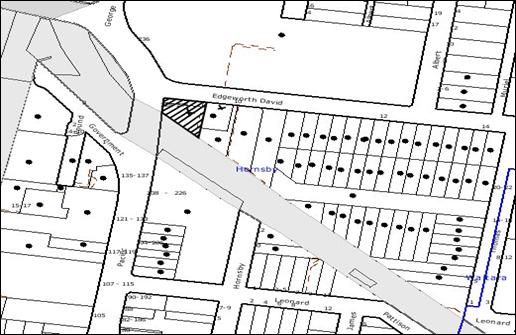
|
NOTIFICATION
PLAN
|
|
|
• PROPERTIES NOTIFIED
|
X SUBMISSIONS
RECEIVED
|
PROPERTY SUBJECT OF DEVELOPMENT
|
|
|
One submission out of map range and one submission
by a tenant within the site.
|
|
|
|
|
Three submissions objected to the
development, generally on the following grounds:
· The application cannot
be considered to be substantially the same development and therefore is not a
Section 96 modification to the approved development.
· The proposal does not
include a BCA compliance letter.
· The entrance to the
ramp would result in vehicular conflict with the access to No. 10 Edgeworth
David Avenue.
· Trucks, which are
longer than 5 metres would not be able to turn within the ROW.
· The parking spaces
that are at right angles to the ramp would not allow proper vehicle manoeuvring.
· The location of the
ramps would result in vehicular conflicts.
· The ramp may be used
by the patients accessing the adjoining eastern property.
· The ROW would be
blocked during construction works and is unacceptable.
· The vehicles egressing
from No. 10 Edgeworth David Avenue would have to travel against the ingressing
traffic.
· The turntable cannot
be utilised as a public area.
The merits of the matters raised
in community submissions have been addressed in the body of the report with the
exception of the following:
5.1.1 Right-of-way during construction & works on
neighbouring property
The application to modify the
consent includes a Construction Management Plan. The Construction Management
Plan provides the following details regarding the right-of-way management
during construction works on site:
· 80% of the bulk
excavation works would carried out starting from the western boundary and
progressing towards the eastern boundary without need to access the ROW.
· A temporary screened
fence would be erected clear of the 3 metres ROW to permit unimpeded and
uninterrupted access to the neighbouring property adjoining the eastern
boundary.
· During this period of
excavation, the trucks would load and unload within the site and the ROW would
only be used for truck egress.
· During excavation,
where the ROW would be impacted, the applicant proposes to construct a “long
neck” appliance located on the triangular piece of land at the south-eastern
corner, clear of the ROW and the basements. The trucks would however park on
the ROW for loading purposes.
· This would cause
temporary disruption to the neighbour’s access to the car parking area at the
rear. In order to resolve this matter, the following options are being proposed
by the applicant:
§ Locating all six spaces
dedicated to the doctors to the basement for uninterrupted access during
construction works. This would require a modification to the strata plan for No. 10 Edgeworth David Avenue.
§ Leasing eleven spaces
within the Westfield shopping complex to accommodate the visitors off site.
Documentary evidence of which has not been provided to Council.
· “B” class hoardings
would be used along both the Pacific Highway and Edgeworth David Avenue
frontages, with the site office and worker’s amenities located above the
hoarding.
· An “A” Class hoarding would
be erected along the southern boundary.
A condition is recommended that
documentary evidence be provided to Council with regard to temporary
arrangement for parking and access for doctors and visitors prior to
commencement of works. Based on these arrangements, the application is assessed
as satisfactory with regard to the right-of-access provision.
5.1.2 Turntable operation
The turntable would be operated
by a licensed person in accordance with the management of the site. A condition
of consent is recommended to ensure that the turntable is operated in
accordance with a management plan.
5.2 Public Agencies
The development application was
referred to the following agencies for comment:
5.2.1 Roads and Traffic
Authority
The Roads and Traffic Authority
has reviewed the current application and has raised no objection to the
development subject to conditions and matters to be considered by Council.
These matters have been discussed in detail in Section 2.4.3 of this report.
5.2.2 State Rail
This matter has been discussed in
detail in Section 2.4 of this report.
5.2.3 New South Wales
Police Force
The development was referred to NSW Police Force, however,
to date no comments have been received.
As
no comments or correspondence has been received within 21 days of the referral,
the application can be determined by Council on the basis that the Police has
no objection to the development.
6. THE
PUBLIC INTEREST
Section 79C(1)(e) of the Act
requires Council to consider “the public interest”.
The public interest is an
overarching requirement, which includes the consideration of the matters
discussed in this report. Implicit to the public interest is the achievement
of future built outcomes adequately responding to and respecting the future
desired outcomes expressed in environmental planning instruments and
development control plans.
The application is considered to
have satisfactorily addressed Council’s and relevant agencies’ criteria and
would provide a development outcome that, on balance, would result in a
positive impact for the community. Accordingly, it is considered that the
approval of the modified development would be in the public interest.
CONCLUSION
The proposal involves a Section 96(2) modification to a
seven storey mixed use development by proposing 2116 sq. metres of commercial
and retail floor space and twenty-eight residential units.
The proposal reduces the height, floor space ratio and
number of retail and residential units. The proposal is considered to be
substantially the same development as the approved development.
The proposed modification would be seven storeys in height
and would present a visually interesting façade and presentation to Edgeworth David Avenue and the Pacific Highway. The development complies with Section 79C of
the Act, the design principles within SEPP 65, the standards within SEPP
(Infrastructure) 2007, the HSLEP and the objectives of the development controls
within Hornsby Town Centre DCP.
Approval of the proposed
modifications to the development is recommended.
Note: At the time of the completion of this planning
report, no persons have made a Political Donations Disclosure Statement pursuant
to Section 147(3) of the Environmental Planning and Assessment Act 1979 in
respect of the subject planning application.
|
Rod Pickles
Manager -
Assessment Team 2
Planning Division
|
Scott Phillips
Executive Manager
Planning Division
|
Attachments:
File Reference: DA/1564/2008/A
Document Number: D01264572
SCHEDULE 1
|
Date of modification:
|
2 December 2009
|
|
Details of modification:
|
Reduce the gross floor
area, reduce the number of residential units to twenty-eight, variation to
the internal layout, driveway access, inclusion of a turntable in the loading
dock and modify external facade.
|
|
|
|
|
Conditions Added:
|
6A, 52
|
|
Condition Deleted:
|
36
|
|
Conditions Modified:
|
1, 18, 29, 34, 35, 37
|
GENERAL CONDITIONS
The conditions of consent within this notice of determination
have been applied to ensure that the use of the land and/or building is carried
out in such a manner that is consistent with the aims and objectives of the
planning instrument affecting the land.
Note: For
the purpose of this consent, the term ‘applicant’ means any person who has the
authority to act on or the benefit of the development consent.
Note:
For the purpose of this consent, any reference to an Act, Regulation,
Australian Standard or publication by a public authority shall be taken to mean
the gazetted Act or Regulation, or adopted Australian Standard or publication
as in force on the date that the application for a construction certificate is
made.
1. Approved
Plans and Supporting Documentation
The development must be carried
out in accordance with the plans and documentation listed below and endorsed
with Council’s stamp, except where amended by Council and/or other conditions
of this consent:
|
Plan No.
|
Drawn by
|
Dated
|
|
Basement 4, DA100-B
|
Jackson Teece
|
22/10/2009
|
|
Basement 3, DA101-B
|
Jackson Teece
|
22/10/2009
|
|
Basement 2, DA102-B
|
Jackson Teece
|
22/10/2009
|
|
Basement 1, DA103-B
|
Jackson Teece
|
22/10/2009
|
|
Ground Floor, DA104-E
|
Jackson Teece
|
9/11/2009
|
|
Level 1 Commercial, DA105-B
|
Jackson Teece
|
22/10/2009
|
|
Level 2 Commercial, DA106-B
|
Jackson Teece
|
22/10/2009
|
|
Level 3 Residential, DA107 - B
|
Jackson Teece
|
22/10/2009
|
|
Level 4 Residential, DA108-B
|
Jackson Teece
|
22/10/2009
|
|
Level 5 Residential, DA109-B
|
Jackson Teece
|
22/10/2009
|
|
Level 6 Residential, DA110-B
|
Jackson Teece
|
22/10/2009
|
|
Level 7 , DA111-B
|
Jackson Teece
|
22/10/2009
|
|
Roof Plan, DA112 - B
|
Jackson Teece
|
22/10/2009
|
|
North Elevation, DA301-B
|
Jackson Teece
|
22/10/2009
|
|
East Elevation, DA300 - B
|
Jackson Teece
|
22/10/2009
|
|
South Elevation,
DA 303-B
|
Jackson Teece
|
22/10/2009
|
|
West Elevation, DA302-B
|
Jackson Teece
|
22/10/2009
|
|
Section AA DA310-B
|
Jackson Teece
|
22/10/2009
|
|
Landscape Plan Ground DA500-A
|
Jackson Teece
|
22/10/2009
|
|
Landscape Plan Residential
DA501-A
|
Jackson Teece
|
22/10/2009
|
|
Landscape Plan Roof Terrace
DA502-A
|
Jackson Teece
|
22/10/2009
|
|
Landscape Plant Schedule DA503-A
|
Jackson Teece
|
22/10/2009
|
|
Adaptable Unit 11 DA600-A
|
Jackson Teece
|
22/10/2009
|
|
Basement Stormwater Drainage
Plan and details Rev – E
|
Australian Consulting Engineers Pty Ltd
|
9/11/2009
|
|
Ground Floor Stormwater Drainage
Plan and details Rev – F
|
Australian Consulting Engineers Pty Ltd
|
9/11/2009
|
|
First Floor OSD Tank location
Rev – F
|
Australian Consulting Engineers Pty Ltd
|
9/11/2009
|
|
Erosion and Sediment Control
Plan and details –Issue D
|
Australian Consulting Engineers
|
09/11/2009
|
|
Document No.
|
Prepared by
|
Dated
|
|
Schedule of Colours and Finishes
|
Jackson Teece
|
1/09/2009
|
|
BASIX certificate No. 271237M
|
-
|
2/11/2009
|
|
Noise and Vibration Intrusion
Report & RailCorp Acoustic Requirements
|
Day Design Pty Ltd
|
6/11/2008 & 23/02/2009
|
|
Geotechnical Review & Assessment
of Geotechnical Affects on the RailCorp Corridor
|
Douglas Partners
|
28/10/2008 & 5/12/2008
|
|
Environmental Review of Site
Contamination
|
Douglas Partners
|
5/11/2008
|
|
Traffic Report
|
Traffix Traffic and Transport
Planners
|
7/11/2008
|
|
Access Compliance Report
|
PSE Access Consulting
|
20/10/2008
|
|
Construction Management Plan
|
Jackson Teece
|
26/10/2009
|
|
Design Verification Statement
|
Jackson Teece
|
1/09/2009
|
|
BCA Compliance Assessment &
BCA Compliance Report
|
Acro Cert
|
4/11/2008 & 24/10/2008
|
|
Operations Management Plan
|
API Property Services
|
March 2009
|
|
Stormwater Drainage Summary
Report Modelled on Drains
|
Australian Consulting Engineers
Pty Ltd
|
October 2008
|
2. Retention
of Existing Trees
This development consent only
permits the removal of tree numbered T1 as identified on the Site Plan dwg # 8
– 39 Issue C prepared by Innovative Plans dated 26 February 2009. The removal
of any other trees requires separate approval under Council’s Tree Preservation
Order.
REQUIREMENTS PRIOR TO THE ISSUE OF A CONSTRUCTION
CERTIFICATE
The following conditions of consent must be complied with
prior to the issue of a ‘Construction Certificate’ by either Hornsby
Shire Council or an accredited certifier. All necessary information to
demonstrate compliance with the following conditions of consent must be
submitted with the application for a construction certificate.
3. Building
Code of Australia
All building work must be
carried out in accordance with the requirements of the Building Code of
Australia.
4. Contract
of Insurance (Residential Building Work)
In the case of residential
building work for which the Home Building Act 1989 requires there to be
a contract of insurance in force in accordance with Part 6 of that Act, that
such a contract of insurance is in force before any building work authorised to
be carried out by the consent commences.
Note: This
condition does not apply to the extent to which an exemption is in force under
Clause 187 or 188 of the Act, subject to the terms of any condition or
requirement referred to in Clause 187(6) or 188(4) of the Act, or to the
erection of a temporary building.
5. Water/Electricity
Utility Services
The applicant must submit
written evidence of the following service provider requirements:
a. Energy
Australia – a letter of consent demonstrating that satisfactory
arrangements have been made to service the proposed development.
b. Sydney
Water – the submission of a ‘Notice of Requirements’ under s73 of the Sydney
Water Act 1994.
Note: Sydney
Water requires that s73 applications are to be made through an authorised
Sydney Water Servicing Coordinator. Refer to www.sydneywater.com.au or telephone
13 20 92 for assistance.
6. Dilapidation
Report
A
‘Dilapidation Report’ is to be prepared by a ‘chartered structural engineer’
detailing the structural condition of all adjoining properties.
6A. Traffic
Management Plan
A Traffic
Management Plan must be submitted to Council for review and approval including
the following:
· Details of maintenance
of rights-of-access for the adjoining property at No. 10 Edgeworth David Avenue
· Provision of parking
for doctors and patients off site during the construction phase when the
right-of-access if is to be blocked.
· Parking provisions for
construction vehicles and the zones dedicated for loading and unloading during
construction
Note: The
parking for the doctors and the patients are to be provided in accordance with
the details within the Construction Management Plan
REQUIREMENTS PRIOR TO THE COMMENCEMENT OF ANY WORKS
The following conditions of consent must be complied with
prior to the commencement of any works on the site. The conditions have been
imposed to ensure that the works are carried out in such a manner that complies
with relevant legislation and Council’s policies and does not disrupt the
amenity of the neighbourhood or impact upon the environment.
7. Erection
of Construction Sign
A sign must be erected in a
prominent position on any site on which building work, subdivision work or
demolition work is being carried out:
a. Showing
the name, address and telephone number of the principal certifying authority
for the work.
b. Showing
the name of the principal contractor (if any) for any demolition or building
work and a telephone number on which that person may be contacted outside
working hours.
c. Stating
that unauthorised entry to the work site is prohibited.
Note: Any
such sign is to be maintained while the building work, subdivision work or
demolition work is being carried out, but must be removed when the work has
been completed.
8. Protection
of Adjoining Areas
A temporary hoarding, fence or
awning must be erected between the work site and adjoining lands before the
works begin and must be kept in place until after the completion of the works
if the works:
a. Could
cause a danger, obstruction or inconvenience to pedestrian or vehicular
traffic.
b. Could
cause damage to adjoining lands by falling objects.
c. Involve
the enclosure of a public place or part of a public place.
Note: Notwithstanding
the above, Council’s separate written approval is required prior to the
erection of any structure or other obstruction on public land.
9. Toilet
Facilities
Toilet facilities must be
available or provided at the works site before works begin and must be
maintained until the works are completed at a ratio of one toilet for every 20
persons employed at the site. Each toilet must:
a. be
a standard flushing toilet connected to a public sewer; or
b. have
an on-site effluent disposal system approved under the Local Government Act
1993; or
c. be
a temporary chemical closet approved under the Local Government Act 1993.
10. Erosion
and Sediment Control
Erosion and sediment control
measures must be provided and maintained throughout the construction period in
accordance with the manual ‘Soils and Construction 2004 (Bluebook)’, the
approved plans, Council specifications and to the satisfaction of the principal
certifying authority. The erosion and sediment control devices must remain in
place until the site has been stabilised and revegetated.
Note: On
the spot penalties up to $1,500 may be issued for any on-compliance with this
requirement without any further notification or warning.
REQUIREMENTS DURING CONSTRUCTION
The following conditions of consent must be complied with
during the construction of the development. The conditions have been imposed
to ensure that the works are carried out in such a manner that complies with
relevant legislation and Council’s policies and does not disrupt the amenity of
the neighbourhood or impact upon the environment.
11. Construction
Work Hours
All
work on site (including demolition and earth works) must only occur between the
following hours:
Monday to Saturday 7 am to 5 pm
Sunday & Public Holidays No work
12. Demolition
All demolition work must be
carried out in accordance with Australian Standard 2601-2001 – The
Demolition of Structures and the following requirements:
a. Demolition
material is to be disposed of to an authorised recycling and/or waste disposal
site and/or in accordance with an approved waste management plan.
13. Environmental
Management
The site must be managed in
accordance with the publication ‘Managing Urban Stormwater – Landcom (March
2004) and the Protection of the Environment Operations Act 1997 by
way of implementing appropriate measures to prevent sediment run-off, excessive
dust, noise or odour emanating from the site during the construction of the
development.
14. Council
Property
During construction works, no building
materials, waste, machinery or related matter is to be stored on the road or
footpath.
15. Excavated
Material
All excavated material removed
from the site must be classified in accordance with the NSW Environment
Protection Authority’s Environmental Guidelines – Assessment, Classification
and Management of Liquid and Non-Liquid Wastes prior to disposal to an
approved waste management facility and reported to the principal certifying
authority.
16. Survey
Report – Finished Floor Level
Reports must be prepared by a
registered surveyor and submitted to the principal certifying authority prior
to the pouring of concrete at each level of the building certifying that:
a. The
building, retaining walls and the like have been correctly positioned on the
site.
b. The
finished floor levels are in accordance with the approved plans.
17. Pile
Anchoring
Piles
must not be anchored to the foundation or structure of the adjoining property
at No. 10 Edgeworth David Avenue.
18. Right
of Access
The
right-of-access for the adjoining property at No. 10 Edgeworth David Avenue is
to be maintained during the construction works. Details submitted under
Condition 8 are to be implemented on the site during the times when the
right-of-access would be blocked or unavailable to the users of the above
property.
REQUIREMENTS PRIOR TO THE ISSUE OF AN OCCUPATION
CERTIFICATE
The following conditions of consent must be complied with
prior to the ‘Principal Certifying Authority’ issuing an ‘Occupation
Certificate’
Note: For
the purpose of this consent, any reference to ‘occupation certificate’ shall
also be taken to mean ‘interim occupation certificate’ unless otherwise stated.
19. Fulfilment
of BASIX Commitments
The applicant must demonstrate
the fulfilment of BASIX commitments pertaining to the development.
20. Sydney
Water – s73 Certificate
A s73 Certificate must be
obtained from Sydney Water.
21. Stormwater
Drainage
The stormwater drainage system
for the development must be designed and constructed in accordance with Council’s
Civil Works – Design and Construction Specification 2005 and the
following requirements:
a. Connected
directly to Council’s street drainage system in accordance with plans prepared
by Australian Consulting Engineers Job No 08AH349 Rev E (as amended under
condition 3).
Note: A
certificate from a chartered civil engineer together with a works as executed
design plan must be submitted to the principal certifying authority to
demonstrate the satisfaction of this condition.
22. On
Site Stormwater Detention
An on-site stormwater detention
system must be designed by a chartered civil engineer and constructed in
accordance with the following requirements:
a. Have
a capacity of not less than 32.6 cubic metres, and a maximum discharge (when
full) of 48 litres per second.
b. The
total site discharge not exceeding 48 litres per second.
c. Have
a surcharge/inspection grate located directly above the outlet.
d. Discharge
from the detention system to be controlled via 1 metre length of pipe, not less
than 50 millimetres diameter or via a stainless plate with sharply drilled
orifice bolted over the face of the outlet discharging into a larger diameter
pipe capable of carrying the design flow to an approved Council system.
23. Footpath
A concrete footpath must be
constructed along the full frontage of the subject site in accordance Council’s
Civil Works Design and Construction Specification, 2005 and the
following requirements:
a. The
existing footpath being removed.
b. The
footpath be constructed with Claypave “Monarch Tan” pavers laid on 125mm thick
20mpa concrete along the full width of the footway over the full frontage to
the site including the implementation of landscape plan.
c. Any
public utility adjustments to be carried out at the cost of the applicant and
to the requirements of the relevant public authority.
24. Road
Works
All road works approved under
this consent must be constructed in accordance with Council’s Civil Works
Design and Construction Specification, 2005 and a separate application under
the Local Government Act 1993 and the Roads Act 1993 must be
submitted to Council. The engineering plans must address the following
requirements:
a. The
existing kerb and gutter be removed and a new kerb and gutter be constructed
across the frontage of site in Edgeworth David Avenue and the Pacific Highway.
b. The
works to include, where required, the construction of perambulator ramps, line
marking, signage and road furnishings.
c. A
new vehicular crossing be constructed.
d. The
existing road pavement to be saw cut a minimum of 300 mm from the existing edge
of the bitumen and reconstructed.
25. Damage
to Council Assets
Any damage caused to Council’s
assets as a result of the construction of the development must be rectified in
accordance with Council’s written requirements and at the sole cost of the
applicant.
26. Traffic
Control Plan
A Traffic Control Plan (TCP)
must be prepared by a qualified traffic controller in accordance with the Roads
& Traffic Authority’s Traffic Control at Worksites Manual 1998 and Australian
Standard 1742.3 for all work on a public road and be submitted to Council.
The TCP must detail the following:
a. Arrangements
for public notification of the works.
b. Temporary
construction signage.
c. Permanent
post-construction signage.
d. Vehicle
movement plans.
e. Traffic
management plans.
f. Pedestrian
and cyclist access/safety.
g. Details
of pedestrian and vehicular access to the property at No. 10 Edgeworth David
Avenue, in accordance with the construction management plan.
27. Creation
of Easements
The following matter(s) must be
nominated on the plan of subdivision under s88B of the Conveyancing Act 1919:
a. A
Right of Access to service No. 10 Edgeworth David Avenue.
b. The
creation of an appropriate "Positive Covenant" and "Restriction
as to User" over the constructed on-site detention/retention systems
(OSD) and outlet works, within the lots in favour of Council in accordance with
Council’s prescribed wording. The position of the on-site detention system is
to be clearly indicated on the title.
c. To
register the OSD easement, the restriction on the use of land “works-as-executed”
details of the on-site-detention system and an engineers certificate must be
submitted verifying that the required storage and discharge rates have been
constructed in accordance with the design requirements. The details must show
the invert levels of the on site system together with pipe sizes and grades.
Any variations to the approved plans must be shown in red on the “works-as-executed”
plan and supported by calculations.
Note: Council
must be nominated as the authority to release, vary or modify any easement,
restriction or covenant.
28. Works
as Executed Plan
A works-as-executed plan
must be prepared by a registered surveyor and submitted to Council for
completed road pavement, kerb & gutter, public drainage systems, driveways
and on-site detention system. The plan must be accompanied by a certificate
from a registered surveyor certifying that all pipelines and associated structures
lie wholly within any relevant easements.
29. Completion
of Landscaping
A certificate
must be provided by a practicing landscape architect, horticulturalist or
person with similar qualifications and experience certifying that all required
landscaping works have been satisfactorily completed in accordance with the
approved landscape plans, the minimum construction standards identified in the
Hornsby Shire Council Landscape Code for development applications and the
following additional requirements for works on the street frontages:
a. The
landscape planter verge be edged with bullnose brick header course raised to
match level of the kerb.
b. The
soil backfill mix around the rootball shall be an organic soil mix.
c. Street
tree planting to include two (2) Leptospermum conferta (Brushbox)
planted at a minimum pot size of 75 litres.
d. Planter
box areas to include automatic drip irrigation, subsoil drainage (proprietary
drainage cell, 50mm sand and filter fabric), and waterproofing.
e. 500 mm additional soil depths be provided for shrubs.
Note: Advice
on suitable species for landscaping can be obtained from Council’s planting
guide ‘Indigenous Plants for the Bushland Shire’, available at www.hornsby.nsw.gov.au.
30. External
Lighting
All external
lighting must be designed and installed in accordance with Australian
Standard AS 4282 – Control of the Obtrusive Effects of Outdoor Lighting.
Certification of compliance with the Standard must be obtained from a suitably
qualified person.
31. Garbage
Collection Easement
For the
purpose of waste collection, an easement entitling Council, its servants and
agents and persons authorised by it to enter upon the subject land and to
operate thereon, vehicles and other equipment for the purposes of garbage
collection must be granted to Council by the owner of the land.
Note: The
easement must be in a form prescribed by Council and must include covenants to
the effect that parties will not be liable for any damage caused to the subject
land or any part thereof or to any property located therein or thereon by
reason of the operation thereon of any vehicle or other equipment used in
connection with the collection of garbage and to the effect that the owner for
the time being of the subject land shall indemnify the Council, its servants,
agents and persons authorised by it to collect garbage against liability in
respect of any such claims made by any person whomsoever.
32. Cooling
Towers
All cooling towers must be
designed and installed in accordance with the Public Health Act 1991, the Public
Health (Microbial Control) Regulation 2000 and Australian/New Zealand Standard
AS/NZS 3666 – Air-Handling and Water Systems
of Buildings.
Certification of compliance with the Standard must be obtained from a suitably
qualified person.
Note:
Under clause 15 of the Public Health (Microbial Control) Regulation 2000 the
occupier of the part of premises where a regulated system is installed must
notify the Council of the following particulars:
a. Type of system.
b. The address of the premises
on which the system is installed.
c. The name, and the
residential and business addresses, of the owner of the premises.
d. If the operation area on
the premises is occupied otherwise than by the owner, those particulars in
relation to the occupier the telephone numbers at which, during business hours and
after business hours, the person or persons referred to in the above point may
be contacted.
33. Car
Park Management Plan
A Car Park Management Plan
must be submitted to Council for approval to ensure that long term parking by
motorists, not occupying or using the development for any purpose, is prevented
during operation of the site.
34. s94
Infrastructure Contributions
The payment to Council of a
contribution of $113753.75* for 50 employees towards the cost of
infrastructure identified in Council’s Development Contributions Plan
2007-2011.
Note: * The
value of contribution is based on a rate of $2,293.40 per employee,
derived from a rate of one employee per 30sqm commercial floor area and is current
as at 11 November 2009. The contribution will be adjusted from this
date in accordance with the underlying consumer price index for subsequent
financial-quarters.
It is recommended that you contact Council to ascertain the indexed value of
the contribution prior to payment.
35. s94
Infrastructure Contributions
The payment to Council of a
contribution of $ 31,4116.50* for thirty two additional dwellings towards the
cost of infrastructure identified in Council’s Development Contributions
Plan 2007-2011.
Note:
* The value of contribution
is current as at 11 November 2009. The
contribution will be adjusted from this date in accordance with the underlying
consumer price index for subsequent financial quarters.
It is recommended that you contact Council to ascertain the indexed value of
the contribution prior to payment.
36. Deleted
OPERATIONAL CONDITIONS
The following conditions have been applied to ensure that the
ongoing use of the land is carried out in such a manner that complies with
relevant legislation and Council’s policies and does not disrupt the amenity of
the neighbourhood or impact upon the environment.
37. Car
Parking and Deliveries
All car parking must be
constructed and operated in accordance with Australian Standard AS 2890.1 –
2004 – Off Street Car Parking and Australian Standard 2890.2 - 2002 –
Off Street Commercial, the submitted Delivery Management Plan and the
following requirements:
a. All
parking areas and driveways are to be sealed to an all weather standard, line
marked and signposted.
b. Car
parking, loading and manoeuvring areas to be used solely for nominated
purposes.
c. Vehicles
awaiting loading, unloading or servicing must be parked on site and not on
adjacent or nearby public roads;
d. All
vehicular entry on to the site and egress from the site shall be made in a
forward direction.
e. No
Parking” / “No Stopping” restrictions are to be provided along the frontages of
the site in consultation with the Roads and Traffic Authority.
38. Noise
All noise generated by the
proposed development must be attenuated to prevent levels of noise being
emitted to adjacent premises which possess tonal, beating and similar
characteristics or which exceeds background noise levels by more than 5dB(A).
39. Fire
Safety Statement - Annual
On at least one occasion in
every 12 month period following the date of the first ‘Fire Safety Certificate’
issued for the property, the owner must provide Council with an annual ‘Fire
Safety Certificate’ to each essential service installed in the building.
40. Dewatering
Following the expiry of the
dewatering licence (12 month period) the owner of the site must either:
a. Dispose
of all ground water and seepage by tanker to an approved liquid waste facility.
or
b. Enter
into a Trade Waste Agreement with Sydney Water for the disposal of all
groundwater.
Note:
Permanent dewatering is not approved by the Department of Water and Energy or
Hornsby Shire Council
41. Waste
Storage area
The waste management on site must
be in accordance with the following requirements:
a. All commercial
and retail tenants to retain written evidence of a valid contract with a
licensed waste contractor for the regular collection and disposal of the waste
and recyclables
b. Each dwelling be
provided with an indoor waste/recycling cupboard for the interim storage of a
minimum one day’s segregated garbage and recycling generation.
c. Site security measures be implemented to prevent
access to the waste storage rooms by waste removal services.
d. No steps be located along any of the bin carting
routes.
CONDITIONS OF CONCURRENCE – STATE RAIL
The following conditions of consent are from the nominated
State Agency pursuant to Section 79B of the Environmental Planning and
Assessment Act 1979 and must be complied with to the satisfaction of that
Agency.
42. Construction
Certificate Plans
The following requirements must
be complied with prior to the issue of a Construction Certificate:
a. A report be prepared by a qualified Electrolysis expert on
the Electrolysis Risk of the development from stray currents and the measures
to be incorporated to control that risk.
b. The recommended measures to control the electrolysis risks
be included in the construction certificate plans.
c. Details of mechanisms that limit the opening of windows or
provision of awning windows along the elevation fronting the southern boundary
of the development (rail corridor) be provided in the construction certificate
plans and be endorsed by RailCorp.
d. All methods to be followed for excavation and construction
works be detailed in the construction certificate plans and specifications, in
accordance with the methodology detailed in the approved Geotechnical Report
prepared by Douglas Partners dated December 2002, Douglas Partners Geotechnical
Review, dated 28 October 2008 and the Assessment of
Geotechnical Affects on the RailCorp Corridor, dated 5 December 2008 and be
endorsed by RailCorp.
Note: The
principal certifying authority must not issue the Construction Certificate or
Occupation Certificate prior to written confirmation from RailCorp, should a
condition of consent require endorsement by RailCorp.
43. Additional
Geotechnical Investigations
The results of the additional
geotechnical investigations on site, to be conducted prior to commencing
construction works and after demolition of the existing building, in accordance
with item 5.9 of the Geotechnical Report prepared by Douglas
Partners dated December 2002 must be provided to RailCorp for further review.
Additional requirements by RailCorp as a result of such investigations must be
complied with at the construction stage of the development.
44. Vibration
Monitoring System
A vibration monitoring system
must be installed on site to monitor the vibration levels on the adjoining rail
corridor for the duration of works. The plan of the proposed method must be
submitted to and be endorsed by RailCorp prior to commencement of works on
site.
45. Hoarding
Owner’s consent must be obtained
from RailCorp prior to installation of hoarding along the southern boundary of
the site.
46. Reflective
materials
Prior to the installation of any
light, sign or reflective material, whether temporary or permanent, in the
proximity of the rail corridor, approval must be obtained from RailCorp.
47. Risk
Assessment Plan
A Risk Assessment/Management Plan
and detailed Safe Work Method Statement (SWMS) for the proposed demolition,
excavation and construction works are to be submitted to RailCorp for
endorsement prior to the commencement of works on site.
Note:
RailCorp’s representatives may require further conditions to be complies with
regard to the above and require the provision of on-site Safe Working
supervision for certain aspects of the works.
48. Aerial
Operations
Plans and documentation must be
submitted to RailCorp incorporating details of all craneage and other aerial
operations prior to works commencing on site.
Note: No loads are to be
carried over RailCorp’s land.
CONDITIONS OF CONCURRENCE – ROADS AND
TRAFFIC AUTHORITY
The following conditions of consent are from the nominated
State Agency pursuant to Section 79B of the Environmental Planning and
Assessment Act 1979 and must be complied with to the satisfaction of that
Agency.
49. Driveway
Layout
The layout of the access
driveway to the site must be in accordance with AS 2890.1 – 2004 and AS
2890.2 – 2002 for heavy vehicle usage.
50. Road
Design
Prior to commencement of
any works, detailed design plans of the proposed gutter crossing on Edgeworth David Avenue, must be submitted to Council for approval.
Note: All
works associated with the proposed development shall be at no cost to RTA
51. Security
Basement
Prior to the release of the
Construction Certificate, details of the security gate for the residential parking
on Basement Level 4 and the means of opening must be submitted to Council.
52. Stormwater
discharge
The post development
stormwater discharge must not exceed the pre-development stage.
-
END OF CONDITIONS -
ADVISORY NOTES
The following information is provided for your assistance to
ensure compliance with the Environmental Planning and Assessment Act 1979,
Environmental Planning and Assessment Regulation 2000, other relevant
legislation and Council’s policies and specifications. This information does
not form part of the conditions of development consent pursuant to Section 80A
of the Act.
Environmental Planning and Assessment Act 1979
Requirements
· The Environmental Planning and
Assessment Act 1979 requires:
· A construction certificate prior to
the commencement of any works. Enquiries regarding the issue of a construction
certificate can be made to Council’s Customer Services Branch on 9847 6760.
· A principal certifying authority
to be nominated and Council notified of that appointment prior to the
commencement of any works.
· Council to be given at least two
days written notice prior to the commencement of any works.
· Mandatory inspections of nominated
stages of the construction inspected.
· An occupation certificate issued
before occupying any building or commencing the use of the land.
Long Service Levy
In accordance with Section 34 of the Building and
Construction Industry Long Service Payments Act 1986, a ‘Long Service Levy’ must be paid to the Long Service
Payments Corporation or Hornsby Council.
Note: The
rate of the Long Service Levy is 0.35% of the total cost of the work.
Note: Hornsby
Council requires the payment of the Long Service Levy prior to the issue of a
construction certificate.
Tree Preservation Order
To ensure the maintenance and protection of the existing
natural environment, it is an offence to ringbark, cut down, top, lop, remove,
wilfully injure or destroy a tree outside three metres of the approved building
envelope without prior written consent from Council. Fines may be imposed for
non-compliance with Council’s Tree Preservation Order.
Note: A
tree is defined as a single or multi-trunked wood perennial plant having a
height of not less than three (3) metres, and which develops many branches,
usually from a distance of not less than one (1) metre from the ground, but
excluding any plant which, in its particular location, is a noxious plant
declared as such pursuant to the Noxious Weeds Act 1993. This definition of
‘tree’ includes any and all types of Palm trees.
All
distances are determined British Standard BS 5837: 2005, “Trees in Relation to
Construction – Recommendations”.
Disability Discrimination Act
The applicant’s attention is drawn to the existence of the Disability
Discrimination Act. A construction certificate is required to be obtained
for the proposed building, which will provide consideration under the Building
Code of Australia, however, the development may not comply with the
requirements of the Disability Discrimination Act. This is the sole
responsibility of the applicant.
Tenancy Fit-Out – Separate DA Required
This consent does not permit the fit-out of individual
tenancies. A separate development application is required for the fit-out of
individual tenancies prior to the occupation of the building.
Advertising Signage – Separate DA Required
This consent does not permit the erection or display of any
advertising signs. Most advertising signs or structures require development
consent. Applicants should make separate enquiries with Council prior to
erecting or displaying any advertising signage.
Dial Before You Dig
Prior to commencing any works, the applicant is encouraged
to contact Dial Before You Dig on 1100 or www.dialbeforeyoudig.com.au for
free information on potential underground pipes and cables within the vicinity
of the development site.
Asbestos Warning
Should asbestos or asbestos products be encountered during
construction or demolition works you are advised to seek advice and information
should be prior to disturbing the material. It is recommended that a contractor
holding an asbestos-handling permit (issued by Work Cover NSW), be
engaged to manage the proper disposal and handling of the material. Further
information regarding the safe handling and removal of asbestos can be found
at:
www.environment.nsw.gov.au
www.nsw.gov.au/fibro
www.adfa.org.au
www.workcover.nsw.gov.au
Alternatively, telephone the Work Cover Asbestos and
Demolition Team on 8260 5885.
Planning Report No. PLN95/09
Date of Meeting:
2/12/2009
3 DEVELOPMENT APPLICATION
-ALTERATIONS AND ADDITIONS TO BRICKPIT PARK
1B DARTFORD ROAD AND 142-178 PENNANT HILLS ROAD THORNLEIGH
|
Development Application No:
|
DA/1088/2009
|
|
Description of Proposal:
|
Alterations and additions to
an existing sports stadium – Brickpit Park
|
|
Property Description:
|
Lot 3 DP 604958 and Lot 1 DP 633292, Brickpit Park, (No. 1B) Dartford Road and (Nos. 142-178) Pennant Hills Road, Thornleigh
|
|
Applicant:
|
Hornsby Shire Council
|
|
Owner:
|
Hornsby Shire Council
|
|
Statutory Provisions:
|
Hornsby Shire Local Environmental
Plan 1994
Open Space A (Public
Recreation - Local)
Industrial A (General)
|
|
Estimated Value:
|
$4,000,000
|
|
Ward:
|
C
|
|
RECOMMENDATION
THAT Development Application
No. 1088/2009 for alterations and additions to an existing sports stadium at
Lot 3 DP 604958 and Lot 1 DP 633292 (No. 1B) Dartford Road and (Nos. 142-178)
Pennant Hills Road, Thornleigh be approved subject to the conditions of
consent detailed in Schedule 1 of this report.
|
1. The
application proposes alterations and additions to Brickpit Sports Stadium to
include two additional courts and associated car parking.
2. The
development involves land owned by Council. In accordance with Council’s
adopted Policy ‘PSA1 Proposed Council Developments’ and ‘Practice Note No. 7
Assessment Practice’ an independent assessment of the development
application has been undertaken by Andrews Neil Pty
Ltd.
3. The application complies with the provisions of the
Hornsby Shire Local Environmental Plan 1994, Industrial Lands Development
Control Plan, Car Parking Development Control Plan and Heritage Development
Control Plan.
4. No
submissions have been received in respect of the application.
5. The report by
Andrews Neil Pty Ltd is attached to this report for Council’s consideration.
The independent consultant’s report recommends approval of the application.
Council officers concur with the consultant’s recommendation.
Note: At the time of the
completion of this planning report, no persons have made a Political
Donations Disclosure Statement pursuant to Section 147(3) of the
Environmental Planning and Assessment Act 1979 in respect of the subject
planning application.
|
Rod Pickles
Manager -
Assessment Team 2
Planning Division
|
Scott Phillips
Executive Manager
Planning Division
|
Attachments:
|
1.View
|
Locality Plan
|
|
|
|
2.View
|
Architectural
Plans
|
|
|
|
3.View
|
Consultant's
Report
|
|
|
File Reference: DA/1088/2009
Document Number: D01278632
SCHEDULE 1
GENERAL
CONDITIONS
The
conditions of consent within this notice of determination have been applied to
ensure that the use of the land and/or building is carried out in such a manner
that is consistent with the aims and objectives of the relevant legislation,
planning instruments and Council policies affecting the land and does not
disrupt the amenity of the neighbourhood or impact upon the environment.
Note: For the
purpose of this consent, the term ‘applicant’ means any person who has the
authority to act on or the benefit of the development consent.
Note: For the purpose of
this consent, any reference to an Act, Regulation, Australian Standard or
publication by a public authority shall be taken to mean the gazetted Act or
Regulation, or adopted Australian Standard or publication as in force on the
date that the application for a construction certificate is made.
1. Approved
Plans and Supporting Documentation
The development must be carried
out in accordance with the plans and documentation listed below and endorsed
with Council’s stamp, except where amended by Council and/or other conditions
of this consent:
|
Plan No.
|
Drawn by
|
Dated
|
|
738-53
A01
|
Peter Hunt Architect
|
August 2009
|
|
738-53 A02
|
Peter Hunt Architect
|
August 2009
|
|
738-53 A03
|
Peter Hunt Architect
|
August 2009
|
|
738-53 A04
|
Peter Hunt Architect
|
August 2009
|
|
Document No.
|
Prepared by
|
Dated
|
|
Statement of
Environmental Effects
Hornsby Shire Council
|
Hornsby Shire Council -
Design and Construction Branch - Works Division
|
August 2009
|
|
Parking and Traffic
Impact Assessment
|
Thompson Sanbury Associates
|
August 2009
|
|
Soil Contamination
and Geotechnical
Investigation
|
Johnstone Environmental
Technologies
|
December 2000
|
2. Retention
of Existing Trees
This development consent does not permit the removal of any tree, as
identified on Plan No. 738-53 A01 prepared by Peter Hunt Architect dated August
2009. The removal of any trees requires separate approval under Council’s Tree
Preservation Order.
REQUIREMENTS PRIOR TO THE ISSUE OF A CONSTRUCTION
CERTIFICATE
3. Building
Code of Australia
All building work must be carried out in accordance with the requirements
of the Building Code of Australia.
4. Sydney Water – Quick Check
The application must be submitted to a Sydney
Water ‘Quick Check Agent’ or ‘Customer Centre’ for approval to determine
whether the development will affect any Sydney Water infrastructure, and
whether further requirements are to be met.
Note: Refer to www.sydneywater.com.au or telephone 13 20 92 for
assistance.
REQUIREMENTS PRIOR TO THE COMMENCEMENT OF ANY WORKS
5. Erection
of Construction Sign
A sign must be erected in a
prominent position on any site on which building work, subdivision work or
demolition work is being carried out:
a. Showing
the name, address and telephone number of the principal certifying authority
for the work,
b. Showing
the name of the principal contractor (if any) for any demolition or building
work and a telephone number on which that person may be contacted outside
working hours, and
c. Stating
that unauthorised entry to the work site is prohibited.
Note: Any
such sign is to be maintained while the building work, subdivision work or
demolition work is being carried out, but must be removed when the work has
been completed.
6. Protection
of Adjoining Areas
A temporary hoarding, fence or awning must be erected between the work
site and adjoining lands before the works begin and must be kept in place until
after the completion of the works if the works:
a. Could cause a danger, obstruction or
inconvenience to pedestrian or vehicular traffic.
b. Could cause damage to adjoining
lands by falling objects.
c. Involve the enclosure of a public
place or part of a public place.
Note: Notwithstanding the above, Council’s
separate written approval is required prior to the erection of any structure or
other obstruction on public land.
7. Toilet
Facilities
Toilet facilities must be available or provided
at the works site before works begin and must be maintained until the works are
completed at a ratio of one toilet for every 20 persons employed at the site.
Each toilet must:
a. be a standard
flushing toilet connected to a public sewer; or
b. be a
temporary chemical closet approved under the Local Government Act, 1993; or
c. have an
on-site effluent disposal system approved under the Local Government Act,
1993
8. Erosion
and Sediment Control
Erosion and sediment control measures must be provided and maintained
throughout the construction period in accordance with the manual ‘Soils and
Construction 2004 (Bluebook)’, the approved plans, Council
specifications and to the satisfaction of the principal certifying authority.
The erosion and sediment control devices must remain in place until the site
has been stabilised and revegetated.
Note: On the spot penalties up to $1,500 may
be issued for any non-compliance with this requirement without any further
notification or warning.
REQUIREMENTS DURING CONSTRUCTION
9. Construction
Work Hours
All work on site (including demolition and earth works) must only occur
between 7.00 am and 5.00 pm Monday to Saturday.
No work is to be undertaken on Sundays or public holidays.
10. Council
Property
During construction works, no building materials, waste, machinery or
related matter is to be stored on the road or footpath. The public reserve is
to be kept in a clean, tidy and safe condition at all times.
REQUIREMENTS PRIOR TO THE ISSUE OF AN OCCUPATION
CERTIFICATE
Note: For the
purpose of this consent, any reference to ‘occupation certificate’ shall also
be taken to mean ‘interim occupation certificate’ unless otherwise stated.
11. Stormwater
Drainage
The stormwater drainage system for the development must be designed and
constructed in accordance with Council’s Civil Works – Design and Construction
Specification 2005 and connected to Council’s drainage system.
12. On
Site Stormwater Detention
An on-site stormwater detention system must be designed by a chartered
civil engineer and constructed in accordance with the following requirements:
a. Have a capacity to store up to 50 year
ARI (average recurrence interval) storm events, and a maximum discharge (when
full) limited to 5 year ARI pre-development rate.
b. Have a surcharge/inspection grate
located directly above the outlet.
c. Where above ground and the average
depth is greater than 0.3 metres, a ‘pool type’ safety fence and warning signs
to be installed.
d. Not be constructed in a location that
would impact upon the visual or recreational amenity of residents.
13. Internal
Driveway/Vehicular Areas
The driveway and parking areas on site must be designed in accordance
with Australian Standards 2890.1 and Hornsby Council Civil Works
Specifications.
14. Car
Parking and Deliveries
All car parking must be constructed and operated in accordance with Australian
Standard AS 2890.1 – 2004 – Off Street Car Parking and Australian
Standard 2890.2 - 2002 – Off Street Commercial and the following
requirement:
a. All parking areas and driveways are to
be sealed to an all weather standard, line marked and signposted.
b. Car parking, loading and manoeuvring
areas to be used solely for nominated purposes.
CONDITIONS OF CONCURRENCE - RAILCORP
The following conditions of consent are from the nominated
State Agency pursuant to Section 79B of the Environmental Planning and
Assessment Act 1979 and must be complied with to the satisfaction of that
Agency.
15. Excavation
All excavation and structural works are to be undertaken in accordance
with the Geotechnical Report prepared by Douglas Partners dated February 2003
and drawings 0301-C1 Rev A, 0301-C2 Rev A, 0301-C3 Rev A and 0301C4-Rev A.
16. Excavation
Along the Rail Corridor
All excavation along the length of the rail corridor is to be supervised
and monitored by an experienced geotechnical engineer.
17. Acoustic
Assessment
An acoustic assessment is to be submitted to Council prior to the issue
of a Construction Certificate demonstrating how the proposed development will
comply with the department of Planning’s Road and Rail Guidelines. A
Construction Certificate must not be issued until the measures recommended in
the Acoustic Report have been incorporated into the design.
18. Electrolysis
Risk
Prior to the issuing of a Construction Certificate the Applicant is to
procure a report on the Electrolysis Risk to the development from stray
currents, and the measures that
will be taken to control that risk. The Applicant is advised to consult
an Electrolysis expert. A Construction Certificate must not be issued until the
measures recommended in the Electrolysis report have been incorporated into the
design.
19. Dilapidation
Surveys
Prior to the commencement of works and prior to the issue of the
Occupation Certificate, a joint inspection of the rail infrastructure and
property in the vicinity of the project is to be carried out by representatives
from RailCorp and the Applicant. These dilapidation surveys will establish the
extent of any existing damage and enable any deterioration during construction
to b observed. The submission of a detailed dilapidation report will be
required unless otherwise notified by Council.
20. Risk
Assessment
Prior to the issue of a Construction Certificate a Risk
Assessment/Management Plan and detailed Safe Work Method Statements (SWMS) for
the proposed works are to be submitted to the RailCorp for review and comment
on the impacts on rail corridor. The Principle Certifying Authority shall not
issue the Construction Certificate until written confirmation has been received
from RailCorp confirming that this condition has been satisfied.
21. Use
of Conductive Material
No metal ladders, tapes and plant/machinery, or conductive material are
to be used within 6 horizontal metres of any live electrical equipment. This
applies to train pantographs and 1500V catenary, contact and pull-off wires of
the adjacent tracks, and to any high voltage aerial supplies within or adjacent
to the rail corridor.
22. Use
of Scaffolding
No scaffolding is to be used within 6 horizontal metres of the rail
corridor unless prior
written approval has been obtained from the rail authority. To obtain
approval the applicant will be required to submit details of the scaffolding,
the means of erecting and securing this scaffolding, the material to be used,
and the type of screening to be installed to prevent objects falling onto the
rail corridor.
23. Drainage
Given the site’s location next to the rail corridor, drainage from the
development must
be adequately disposed of/managed and not allowed to be discharged into
the corridor unless prior approval has been obtained from RailCorp.
24. Fencing
Prior to the commencement of works appropriate fencing may need to be
installed along the rail corridor to prevent unauthorised access to the rail
corridor. Details of the type of fencing and the method of erection are to be
to RailCorp’s satisfaction prior to the fencing work being undertaken. RailCorp
may provide supervision, at the developer’s cost, for the erection of the new
fencing.
25. Cranes
and Aerial Operations
The Applicant is required to submit to RailCorp for its endorsement a
plan showing all craneage and other aerial operations for the development. The
Applicant is advised that no loads are to be carried over RailCorp’s land.
26. Compliance
Where a condition of consent requires RailCorp’s endorsement the
Principle Certifying Authority shall not issue a Construction Certificate or
Occupancy Certificate, as the case may be, until written confirmation has been
received from RailCorp that the particular condition has been complied with.
-
END OF CONDITIONS -
ADVISORY NOTES
The following information is provided for your
assistance to ensure compliance with the Environmental Planning and Assessment
Act, 1979, Environmental Planning and Assessment Regulation 2000, other
relevant legislation and Council’s policies and specifications. This
information does not form part of the conditions of development consent
pursuant to Section 80A of the Act.
Environmental Planning and
Assessment Act, 1979 Requirements
· The Environmental Planning and
Assessment Act, 1979 requires:
· The issue of a construction certificate
prior to the commencement of any works. Enquiries regarding the issue of a
construction certificate can be made to Council’s Customer Services Branch on
9847 6760.
· A principal certifying authority to be
nominated and Council notified of that appointment prior to the commencement of
any works.
· Council to be given at least two days
written notice prior to the commencement of any works.
· Mandatory inspections of nominated
stages of the construction inspected.
· An occupation certificate to be issued
before occupying any building or commencing the use of the land.
Long Service Levy
In accordance with Section 34 of
the Building and Construction Industry Long Service Payments Act 1986, a ‘Long Service Levy’ must be paid to the Long
Service Payments Corporation or Hornsby Council.
Note: The
rate of the Long Service Levy is 0.35% of the total cost of the work.
Note: Hornsby
Council requires the payment of the Long Service Levy prior to the issue of a
construction certificate.
Tree Preservation Order
To ensure the maintenance and
protection of the existing natural environment, it is an offence to ringbark,
cut down, top, lop, remove, wilfully injure or destroy a tree outside 3 metres
of the approved building envelope without the prior written consent from
Council.
Note: A
tree is defined as a single or multi-trunked wood perennial plant having a
height of not less than three (3) metres, and which develops many branches,
usually from a distance of not less than one (1) metre from the ground, but
excluding any plant which, in its particular location, is a noxious plant
declared as such pursuant to the Noxious Weeds Act 1993. This definition of ‘tree’
includes any and all types of Palm trees.
All
distances are determined under British Standard BS 5837: 2005, “Trees in
Relation to Construction – Recommendations”.
Fines may be imposed for
non-compliance with Council’s Tree Preservation Order.
Dial Before You Dig
Prior to commencing any works,
the applicant is encouraged to contact Dial Before You Dig on 1100 or www.dialbeforeyoudig.com.au for
free information on potential underground pipes and cables within the vicinity
of the development site.
Planning Report No. PLN96/09
Date of Meeting:
2/12/2009
4 DEVELOPMENT APPLICATION
- TWO LOT SUBDIVISION AND DEMOLITION
77 HANNAH STREET BEECROFT
|
Development Application No:
|
DA/897/2009
|
|
Description of Proposal:
|
Demolition of an existing dwelling
and garage and Torrens title subdivision of one lot into two lots
|
|
Property Description:
|
Lot 1 DP 231939, No. 77 Hannah Street, Beecroft
|
|
Applicant:
|
PS Graham and Associates
|
|
Owner:
|
Mr S K C Wong and Mrs C L Wong
|
|
Statutory Provisions:
|
Hornsby Shire Local Environmental
Plan 1994
Residential AS (Low Density -
Sensitive Lands)
|
|
Estimated Value:
|
$15,000
|
|
Ward:
|
C
|
|
RECOMMENDATION
THAT Development Application
No. 897/2009 for the demolition of an existing dwelling and garage and the Torrens title subdivision of one lot into two lots at Lot 1 DP 231939, No. 77 Hannah Street
Beecroft be approved subject to the conditions of consent detailed in
Schedule 1 of this report.
|
1. The
application proposes the demolition of the existing dwelling and the Torrens title subdivision of one lot into two lots.
2. The
proposal complies with the Hornsby Shire Local Environmental Plan 1994 and the
Residential Subdivision Development Control Plan.
3. The
proposal is integrated development and the General Terms of Approval have been
received from the Department of Water and Energy.
4. Two
submissions have been received in respect of the application.
5. On
4 November 2009 Council first considered the subject application at its
Planning Meeting and resolved to defer consideration of the matter to allow
interested Councillors to inspect the site and obtain a briefing from Council
officers on the impacts of the development on existing vegetation. The site inspection
meeting occurred on 2 December 2009.
6. It
is recommended that the application be approved.
HISTORY OF THE APPLICATION
On 4 November 2009 Council first
considered the subject application at its Planning Meeting and resolved:
“THAT
consideration of Development Application No. 897/2009 for the demolition of an
existing dwelling and garage and the Torrens title subdivision of one lot into
two lots at Lot 1 DP 231939, (No. 77) Hannah Street, Beecroft be deferred to
allow interested Councillors to inspect the site and obtain a briefing from
Council Officers on the impacts of the development on existing vegetation.”
The applicant was advised of
Council’s resolution and a meeting was scheduled for Wednesday 2 December 2009
prior to the next Planning Meeting. At the time of the preparation of this
report Council officers were scheduled to attend the site inspection to assist
Councillors with their deliberations of the matter.
THE SITE
The site has an area of 1534.7
sqm and is located on the southern side of Hannah Street, 120 metres east of Hull Road. The site is an irregular lot with frontage to Hannah Street of 49.38 metres, a
rear boundary length of 31.19 metres and depths of 38.1 metres and 42.21
metres.
A single dwelling-house and
detached double garage is constructed on the site.
The bulk of the site has a
crossfall from west to east of approximately 10-13%. Devlins Creek is located
adjacent to the eastern boundary with a lower and higher bank with a grade of
approximately 40% and a height of 4-5 metres.
The site comprises a number of
exotic, native planted trees and locally indigenous specimens.
Significant trees are located
adjacent to the creek and the Hannah Street road frontage.
THE PROPOSAL
It is proposed to demolish the
existing dwelling and garage on the site and subdivide one allotment into two
allotments as follows:
· Lot 1: has an
area of 600 sqm
· Lot 2: has an
area of 934.7 sqm and includes a 10 metre wide riparian buffer zone along the
eastern boundary.
Each lot would have separate
access to Hannah Street and would drain to Devlins Creek.
The proposal does not involve the
removal of any vegetation. However, approval of the development would result
in the future removal of vegetation under separate development consents.
ASSESSMENT
The development application has
been assessed having regard to the ‘2005 City of Cities Metropolitan
Strategy’, the ‘North Subregion (Draft) Subregional Strategy’ and
the matters for consideration prescribed under Section 79C of the Environmental
Planning and Assessment Act 1979 (the Act). Subsequently, the following
issues have been identified for further consideration.
1. STRATEGIC CONTEXT
1.1 Metropolitan Strategy – (Draft) North Subregional Strategy
The Metropolitan Strategy is a broad
framework to secure Sydney’s place in the global economy by promoting and
managing growth. It outlines a vision for Sydney to 2031; the challenges
faced, and the directions to follow to address these challenges and achieve the
vision. The draft North Subregional Strategy acts as a framework for Council
in the preparation of a new Principal LEP by 2011.
The draft Subregional Strategy
sets the following targets for the Hornsby LGA by 2031:
· Employment capacity to
increase by 9,000 jobs; and
· Housing stock to
increase by 11,000 dwellings.
The proposed development would be
consistent with the draft Strategy by providing an additional residential lot
and would contribute to housing choice in the locality.
2. STATUTORY CONTROLS
Section 79C(1)(a) requires
Council to consider “any relevant environmental planning instruments, draft
environmental planning instruments, development control plans, planning
agreements and regulations”.
2.1 Hornsby Shire Local Environmental Plan 1994
The subject land is zoned Residential AS (Low Density - Sensitive Lands) under Hornsby Shire Local Environmental
Plan 1994 (HSLEP). The objectives of the zone are:
(a) to
provide for the housing needs of the population of the Hornsby area.
(b) to
promote a variety of housing types and other land uses compatible with a low
density residential environment and sensitive to the land capability and
established character of this environment.
(c) to
provide for development that is within the environmental capacity of a
sensitive low density residential environment.
The proposed development is
defined as ‘demolition’ and ‘subdivision’ under the HSLEP and is
permissible in the zone with Council’s consent.
Clause 14 of the HSLEP prescribes
that the minimum area of an allotment within the Residential AS zone is 600
sqm, excluding the area of any accessway. The proposed lots comply with this
requirement.
Clause 18 of the HSLEP sets out
heritage conservation provisions within the Hornsby area. The property is
located within the vicinity of property No. 86X Hannah Street, Beecroft which
is listed as a heritage item (park) of Local significance under the provisions
of Schedule D (Heritage Items) of the Hornsby Shire Local Environmental Plan
(HSLEP) 1994.
Council’s heritage assessment noted
that the heritage listed park at property No. 86X Hannah Street,
Beecroft is located on the opposite side of the road and would
not be adversely affected by the development proposal.
2.2 State Environmental Planning Policy No. 19 - Bushland in
Urban Areas
The general aim of this Policy is
to protect and preserve bushland within the urban areas because of its value to
the community as part of the natural heritage, its aesthetic value,
and its value as a recreational, educational and scientific resource.
One of the submissions raises
concern that development within or adjacent to a bushland protection area
should be accompanied by a comprehensive assessment of trees likely to be
affected, in accordance with the provisions of SEPP 19.
Clause 9 of SEPP 19 relates to
land adjoining land zoned or reserved for public open space. Fearnley Park (No. 86X Hannah Street) is
located on the opposite side of the road and is zoned Open Space A
(Public Recreation - Local) under HSLEP.
The proposed development would
not impact upon bushland on the adjoining open space land on the opposite side
of the road and the development includes a 10 metre riparian buffer zone to
protect the creek that is located on the land immediately adjacent to
the site to the east, which is privately owned land and zoned
Residential AS (Low Density - Sensitive Lands).
The proposal also includes the
retention of a majority of remnant canopy trees onsite, which would
continue to function as a wildlife corridor and vegetation link with Fearnley Park, which is on the opposite side of Hannah Street.
Accordingly, no further assessment under SEPP 19 is
required.
2.3 State Environmental Planning Policy No. 55 - Contaminated
Lands
Clause 7 of State Environmental Planning Policy No. 55 -
Remediation of Land (SEPP 55) requires Council to consider whether land is
contaminated prior to granting consent to the carrying out of any development
on that land.
Should the land be contaminated Council must be satisfied
that the land is suitable in a contaminated state for the proposed use. If the
land requires remediation to be undertaken to make the land suitable for the
proposed use, Council must be satisfied that the land will be remediated before
the land is used for that purpose.
The site history indicates a history of residential
development, it is not likely that the site has experienced any significant
contamination, and further assessment under SEPP 55 is not required.
2.4 State Environmental Planning Policy (Sydney Harbour Catchment) 2005
The site is located within the
catchment of Sydney Harbour. As such the land is subject to the SREP (Sydney Harbour Catchment) 2005. The aim of the Plan is to ensure that the catchment,
foreshores, waterways and islands of Sydney Harbour are recognised, protected,
enhanced and maintained. The Plan addresses matters related to biodiversity,
ecology and environment protection; public access to, and use of, foreshores
and waterways; maintenance of a working harbour; interrelationship of waterway
and foreshore uses; foreshore and waterways scenic quality; maintenance,
protection and enhancement of views and boat storage facilities.
It is considered that the proposed development is not inconsistent
with the aims and objectives of the
Plan. Notwithstanding, the proposal involves works that would require
specific conditions to be imposed regarding erosion and sediment control
measures. These matters are addressed in Schedule 1.
2.5 Water Management Act 2000
The site
adjoins Devlins Creek.
The Water
Management Act 2000 includes provision for prescribed activities within 40
metres of a watercourse. Subdivision is a controlled activity under the Act and
requires the approval of the Department of Water and Energy. In this regard the
application is ‘integrated development’ and was referred to the Department for
assessment.
The Department
of Water and Energy has granted ‘General Terms of Approval’ for the proposed
development.
2.6 Residential Subdivision Development Control Plan
The proposed development has been
assessed having regard to the relevant performance and prescriptive design
standards within Council’s Residential Subdivision Development Control Plan
(Residential Subdivision DCP). The following table sets out the proposal’s
compliance with the prescriptive standards of the Plan:
|
Residential Subdivision Development Control
Plan
|
|
Control
|
Proposal
|
Requirement
|
Compliance
|
|
Site Area
|
1534.7m2
|
N/A
|
N/A
|
|
Allotment Size
Lot 1
Lot 2
|
600m2
934.7m2
|
600m2
600m2
|
Yes
Yes
|
As detailed in the above table,
the proposed development complies with the prescriptive standards within
Council’s Residential Subdivision DCP. The merits of the proposal, as well as
a brief discussion on compliance with relevant performance standards are
detailed below.
2.6.1 Allotment Layout and Design
Proposed lot 1 can accommodate a
200 sqm indicative building envelope in compliance with the DCP allotment
layout and design performance criteria.
Proposed lot 2 is relatively
large and accommodates a 200 sqm building envelope with a minimum dimension of
10 metres in compliance with the DCP allotment layout and design performance
criteria. It is noted that lot 2 has been
designed to provide a riparian buffer zone to protect the watercourse on the
adjoining property.
2.6.2 Landscaping
The proposed subdivision includes
adequate areas for future landscaping to ensure privacy of future and existing
residents.
A submission received raises the
following concerns:
(a) The plan of subdivision indicated that seven
significant trees will be adversely impacted by the proposed building platforms
and associated driveways / turning areas. This is contrary to the Residential
Subdivision DCP Landscaping- Prescriptive Measures; proposed building envelopes
etc should have a minimum setback of 4m from trees and groups of trees which
have been assessed as significant’.
Council’s assessment of the
proposal included a detailed examination of the existing trees on site which
noted that Trees numbered 1 – 7 would be adversely affected by the proposed
building envelopes and driveway access. None of these trees have been assessed
as significant and Tree number 5 is exempt from Council’s Tree Preservation
Order.
Notwithstanding, no trees are
proposed to be removed as part of the application and recommended conditions of
consent have been imposed to ensure that during site works and construction,
protective barriers will be placed around trees to be retained.
(b) On the basis of professional tree advice, the Trust
believes that the 4 metre setback is insufficient for the larger trees on this
site. Council is urged to adopt and apply the recently released Australian
Standard AS4970 – 2009 Protection of trees on development sites when
assessing this application.
The
recent Australian Standard 4970-2009 Protection of trees on
development sites has been prepared to provide recommendations and guidance
for aborculturists when assessing trees on development sites. This is a
guideline only. Each tree is assessed on its individual merit taking into
account site constraints which may result in the recommended distances being
reduced, whilst still achieving the same outcome of retaining the tree. These
matters would be further considered at development application for dwellings
stage.
(c) The DCP also requires that ‘Applications should be
accompanied by a survey plan indicating the precise location of existing
trees”. The plan of subdivision submitted indicates that the tree positions and
sizes shown are estimated. This raises the question as to how can this plan be
relied upon by Council in any accurate assessment?
The applicant has provided
written advice stating that the survey plan complies with Council’s
requirements and indicates the precise location of the trunks of all existing
trees.
The applicant’s response states
that the notation on the plan, ‘tree positions and sizes shown are estimated’
is necessary to allow for the occasional leaning tree which is most difficult
to show on a plan. The leaning tree may have a spread of 5 metres in one
direction and only two metres in another.
(d) The Beecroft Cheltenham Civic Trust expresses serious
concerns with regard to the extent of crown reduction that may be necessary to
make safe the larger canopy trees proposed for retention, as they will overhang
future dwellings proposed for the site. Extensive pruning may very well destroy
significant healthy native trees not impacted by the ground and building works.
All
trees are protected under Council's Tree Preservation Order and all
applications with regards to these trees will be assessed on there own
merits.
2.6.3 Drainage Control
The proposed stormwater drainage
system is to be piped to the existing watercourse which adjoins the site’s
eastern boundary.
A stormwater detention system is
recommended for the subdivision. The detention system, together with
recommended conditions of the Department of Water and Energy, would ensure no
adverse impact on the watercourse and downstream properties as a result of the
development.
2.6.4 Utility Services
All public utilities are available
on site. A recommended condition requires that the applicant must submit
written evidence that satisfactory arrangements have been made to service the
proposed development from Energy Australia and Sydney Water.
2.6.5 Acoustics
The site is not affected by adverse noise impacts.
2.6.6 Fencing
No fencing is proposed as part of
the application.
2.6.7 Heritage
The heritage listed ‘Fearnley Park’ at property No. 86X Hannah Street,
Beecroft is located on the opposite side of the road and would
not be adversely affected by the development proposal.
2.6.8 Section 94 Contributions
The applicant would be required
to make a payment of a contribution towards the cost of transport and traffic
management, library and community facilities, civic improvements, stormwater
drainage, bushfire protection and Section 94 administration in accordance with
Sections 94, 94B and 94C of the Environmental Planning and Assessment Act 1979
and
Hornsby Shire Council’s
Development Contributions Plan 2007-2011. A condition has been imposed to
ensure the payment of s94 contributions for the development.
2.7 Waste Minimisation and Management Development Control
Plan
The primary purpose of this
Development Control Plan is to provide planning strategies and controls to
promote waste minimisation and management.
The applicant has submitted a
satisfactory waste management plan in accordance with the requirements of the
DCP.
3. ENVIRONMENTAL IMPACTS
Section 79C(1)(b) of the Act
requires Council to consider “the likely impacts of that development,
including environmental impacts on both the natural and built environments, and
social and economic impacts in the locality”.
3.1 Natural Environment
The site and adjacent creek line
of Lot 1 DP 406979 contains trees that are consistent with Council's vegetation
mapping of Blackbutt Gully Forest - Community L (Smith and Smith
2008). The area mapped as containing Sydney Turpentine Ironbark Forest
Endangered Ecological Community comprises the area for the existing dwelling
and does not comprise of remnant canopy species with exception of
large remnant trees at the front of the property which are considered
necessary to be retained.
Council’s assessment of the
proposal included a detailed examination of the existing trees on site which
noted the following:
· Trees numbered 5, 19,
21, 22, 22, 23, 25, 26 located within the property are exempt from Council’s
Tree Preservation Order.
· Trees numbered 1 – 7
may be adversely affected by the proposed building envelopes and driveway
access. None of these trees have been identified as being significant.
In accordance with Section 5A of
the Environmental Planning and Assessment Act 1979, it is considered
that the proposal would not have a significant impact upon species, populations
and communities listed under the Threatened Species Conservation Act 1995
and a Species Impact Statement would not be required. Therefore, no
further information is required from the applicant regarding matters listed
under the Threatened Species Conservation Act 1995.
Notwithstanding the above, no
trees are proposed to be removed as part of the application and recommended
conditions of consent have been imposed to ensure that during site works and
construction, protective barriers would be placed around trees to be retained.
3.2 Built Environment
The site is located within a low
density residential area. The proposed subdivision is of acceptable design in
addressing the street and in providing for residential amenity, private open
space, landscaping, vehicle access and parking.
A submission raises concerns with
regards to the potential loss of on-street car parking as a result of a second
driveway for the newly created lot and the increase in traffic along Hannah Street.
The proposed development would
generate an additional nine daily traffic movements in accordance with the
RTA’s Guide to Traffic Generating Developments. Council’s engineering
assessment of the development considered that the proposed lots are of
sufficient size to cater to off-street parking for any future development and
existing development within the street is well set back to allow for adequate
off-street parking to cater to the residents needs. Accordingly, this
objection does not warrant refusal of the application.
3.3 Social Impacts
The proposed development would
have a positive social impact upon the locality.
3.4 Economic Impacts
The proposal would have a minor
positive impact on the local economy in conjunction with other new low density
residential development in the locality by generating an increase in demand for
local services.
4. SITE SUITABILITY
Section 79C(1)(c) of the Act
requires Council to consider “the suitability of the site for the
development”.
There is no known hazard/risk
associated with the site with respect to bushfire, landslip and subsidence that
would preclude approval of the proposed development. However,
part of the land the subject of the development is identified as being below
the 1:100 year flood level.
The application includes a drainage
report prepared by GJ McDonald Consulting Engineers and Council’s engineering
assessment of the proposal raised concludes that dwelling could be
appropriately constructed on site without being adversely affected by flooding.
The site is located in close
proximity to public transport, shops, schools, sporting and community
facilities and is well located for residential development.
5. PUBLIC PARTICIPATION
Section 79C(1)(d) of the Act
requires Council to consider “any submissions made in accordance with this
Act”.
5.1 Community Consultation
The proposed development was
placed on public exhibition and was notified to adjoining and nearby landowners
between 19 August 2009 and 9 September 2009 in accordance with Council’s
Notification and Exhibition Development Control Plan. During this period,
Council received two submissions. The map below illustrates the location of
those landowners who made a submission that are in close proximity to the
development site.
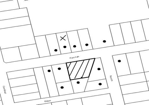
|
NOTIFICATION
PLAN
|
|
|
• PROPERTIES NOTIFIED
|
X SUBMISSIONS
RECEIVED
|
PROPERTY SUBJECT OF DEVELOPMENT
|
|
|
ONE SUBMISSIONS
RECEIVED OUT OF MAP RANGE
|
|
|
|
|
Two submissions objected to the
development, generally on the following grounds:
· Application does not address SEPP 19
· The adverse impact of
the development on significant trees on the site and potential removal of
significant trees;
· Use of recently released Australian
Standards when assessing tree impacts;
· Survey Plan does not show ‘precise’
location of trees;
· Unacceptable traffic on local
streets;
· Loss of on-street car parking.
The merits of the matters raised
in community submissions have been addressed in the body of the report.
5.2 Public Agencies
The development application is
Integrated Development under the Act. Accordingly, the application was
referred to the following Agency for comment:
5.2.1 Department of Water and Energy
The Department of Water and
Energy has raised no objection to the proposal subject to the General Terms of
Approval granted and the issuing of a Controlled Activity Approval prior to
issue of the Construction Certificate.
6. THE PUBLIC INTEREST
Section 79C(1)(e) of the Act
requires Council to consider “the public interest”.
The public interest is an
overarching requirement, which includes the consideration of the matters
discussed in this report. Implicit to the public interest is the achievement
of future built outcomes adequately responding to and respecting the future
desired outcomes expressed in environmental planning instruments and
development control plans.
The application is considered to
have satisfactorily addressed Council’s and relevant agencies’ criteria and
would provide a development outcome that, on balance, would result in a
positive impact for the community. Accordingly, it is considered that the
approval of the proposed development would be in the public interest.
CONCLUSION
The application proposes the
demolition of the existing dwelling and detached garage and the Torrens title subdivision of one allotment into two.
The proposed development
generally maximises the development opportunity of the site available under
Council’s planning controls. The proposal has been assessed as satisfactory
pursuant to Section 79C of the Environmental Planning and Assessment Act, 1979,
the Hornsby Shire Local Environmental Plan, 1994 and Council’s Residential
Subdivision, Development Control Plan.
The development is considered to
be acceptable in relation to environmental impacts and is considered to be in
the public interest.
Approval of the application is recommended.
Note: At the time of the completion of this planning
report, no persons have made a Political Donations Disclosure Statement pursuant
to Section 147(3) of the Environmental Planning and Assessment Act 1979 in
respect of the subject planning application.
|
Rod Pickles
Manager -
Assessment Team 2
Planning Division
|
Paul David
Manager -
Subdivision & Development Engineering Services
Planning Division
|
|
Scott Phillips
Executive Manager
Planning Division
|
|
Attachments:
|
1.View
|
Locality Plan
|
|
|
|
2.View
|
Subdivision Plan
|
|
|
File Reference: DA/897/2009
Document Number: D01280580
SCHEDULE 1
GENERAL
CONDITIONS
The
conditions of consent within this notice of determination have been applied to ensure
that the use of the land and/or building is carried out in such a manner that
is consistent with the aims and objectives of the relevant legislation,
planning instruments and Council policies affecting the land and does not
disrupt the amenity of the neighbourhood or impact upon the environment.
Note: For the
purpose of this consent, the term ‘applicant’ means any person who has the
authority to act on or the benefit of the development consent.
Note: For the purpose of
this consent, any reference to an Act, Regulation, Australian Standard or
publication by a public authority shall be taken to mean the gazetted Act or
Regulation, or adopted Australian Standard or publication as in force on the
date that the application for a construction certificate is made.
1. Approved
Plans and Supporting Documentation
The development must be carried
out in accordance with the plans and documentation listed below and endorsed
with Council’s stamp, except where amended by Council and/or other conditions
of this consent:
|
Plan No.
|
Plan Title
|
Drawn by
|
Dated
|
|
S14660
|
Plan of Proposed Subdivision
|
PS Graham & Associates
|
26 July 2009
|
|
Document No.
|
Prepared by
|
Dated
|
|
Statement of Environmental
Effects
|
PS Graham & Associates
|
28 July 2009
|
|
Waste Management Plan
|
PS Graham & Associates
|
28 July 2009
|
|
Drainage Report Ref: 09012.doc
|
GJ McDonald Consulting Engineers
|
August 2009
|
REQUIREMENTS PRIOR TO THE ISSUE OF A CONSTRUCTION
CERTIFICATE
2. Water/Electricity
Utility Services
The applicant
must submit written evidence of the following service provider requirements:
a. Energy
Australia – a letter of consent demonstrating that satisfactory
arrangements have been made to service the proposed development.
b. Sydney
Water – the submission of a ‘Notice of Requirements’ under s73 of the Sydney
Water Act 1994.
Note: Sydney
Water requires that s73 applications are to be made through an authorised
Sydney Water Servicing Coordinator. Refer to www.sydneywater.com.au or telephone
13 20 92 for assistance.
REQUIREMENTS PRIOR TO THE COMMENCEMENT OF ANY WORKS
3. Erection
of Construction Sign
A sign must be erected in a
prominent position on any site on which building work, subdivision work or
demolition work is being carried out:
a. Showing
the name, address and telephone number of the principal certifying authority
for the work,
b. Showing
the name of the principal contractor (if any) for any demolition or building
work and a telephone number on which that person may be contacted outside
working hours, and
c. Stating
that unauthorised entry to the work site is prohibited.
Note: Any
such sign is to be maintained while the building work, subdivision work or
demolition work is being carried out, but must be removed when the work has
been completed.
4. Erosion
and Sediment Control
Erosion and
sediment control measures must be provided and maintained throughout the
construction period in accordance with the manual ‘Soils and Construction
2004 (Bluebook)’, the approved plans, Council specifications and to the
satisfaction of the principal certifying authority. The erosion and sediment
control devices must remain in place until the site has been stabilised and
revegetated.
Note: On
the spot penalties up to $1,500 may be issued for any non-compliance with this
requirement without any further notification or warning.
5. Tree
Protection Barriers
Tree
protection fencing must be erected around trees numbered 8, 10, 11, 12, 13, 14,
15, 16 and 17 to be retained at a 4 metre setback. The tree fencing must be
constructed of 1.8 metre ‘cyclone chainmesh fence’ or star pickets spaced at 2
metre intervals, connected by a continuous high-visibility barrier/hazard mesh
at a height of 1 metre.
To avoid
injury or damage, trees numbered 1, 2, 3, 6 and 7 must have trunks protected by
2 metre lengths of 75mm x 25mm hardwood timbers spaced at 80mm secured with
galvanised wire (not fixed or nailed to the tree in any way).
REQUIREMENTS DURING CONSTRUCTION
6. Construction
Work Hours
All work on site (including demolition and earth works)
must only occur between 7am and 5pm Monday to Saturday.
No
work is to be undertaken on Sundays or public holidays.
7. Demolition
All demolition work must be
carried out in accordance with Australian Standard 2601-2001 – The
Demolition of Structures and the following requirements:
a. Demolition
material is to be disposed of to an authorised recycling and/or waste disposal
site and/or in accordance with an approved waste management plan.
8. Environmental
Management
The site must
be managed in accordance with the publication ‘Managing Urban Stormwater –
Landcom (March 2004) and the Protection of the Environment Operations
Act 1997 by way of implementing appropriate measures to prevent sediment
run-off, excessive dust, noise or odour emanating from the site during the
construction of the development.
9. Works
near Trees
All required tree protection
measures are to be maintained in good condition for the duration of the
construction period.
All works
(including driveways and retaining walls) within 6 metres of any trees required
to be retained (whether or not on the subject property, and pursuant to this
consent or the Tree Preservation Order), must be carried out under the
supervision of an ‘AQF Level 5 Arborist’ and a certificate submitted to the
principal certifying authority detailing the method(s) used to preserve the
tree(s).
Note: Except as provided
above, the applicant is to ensure that no excavation, filling or stockpiling of
building materials, parking of vehicles or plant, disposal of cement slurry,
waste water or other contaminants is to occur within 4 metres of any tree to be
retained.
10. Bushland
Protection during Construction
To ensure the protection of
bushland during construction, the applicant must ensure that all machinery to
be cleaned of soil and debris before entering the site to prevent the spread of
weeds and fungal pathogens.
Note: The
site contains Blackbutt Gully Forest and Turpentine Ironbark Forest which is listed as an ‘Endangered Ecological
Community’ under the ‘Threatened Species Conservation Act 1995’. The Act
prohibits the disturbance to threatened species, endangered populations and
endangered ecological communities, or their habitat, without the approval of
the ‘Department of Environment and Climate Change’ where such activities are
not authorised by a development consent under the ‘Environmental Planning and
Assessment Act 1979’.
Actions such as tree removal, understorey slashing or mowing, removal of dead
trees within this vegetation would likely impact upon this endangered
ecological community. Such action would qualify as illegally picking or
disturbing
the habitat and could render any person who carried out such action as LIABLE
FOR PROSECUTION.
11. Setback
from Prescribed Stream
A buffer
setback of 10 metres must be provided from the crest of the watercourse to any
construction works. The setback area must be suitably vegetated with native
grasses and groundcovers consistent with Blackbutt Gully Forest (Community
L) species as per the Hornsby Council planting guide, Indigenous Plants
for the Bushland Shire, available at Council or on Council’s web site: www.hornsby.nsw.gov.au – “Native
Vegetation Communities of Hornsby Shire” (Smith and Smith 2008) to facilitate
the filtration of surface runoff.
REQUIREMENTS PRIOR TO THE ISSUE OF A SUBDIVISION
CERTIFICATE
Note: For the
purpose of this consent, any reference to ‘occupation certificate’ shall also
be taken to mean ‘interim occupation certificate’ unless otherwise stated.
12. Sydney
Water – s73 Certificate
A s73 Certificate must be
obtained from Sydney Water.
13. Stormwater
Drainage
The
stormwater drainage system for the development must be designed and constructed
in accordance with Council’s Civil Works – Design and Construction
Specification 2005 and the following requirements:
a. Connected
directly to Devlins Creek in accordance with Council’s Sustainable Water Best
Practices Manual and Development Control Plan.
b. An
inter-allotment stormwater drainage system to service the proposed lot with
pits being constructed in situ.
14. Vehicular
Crossing
A separate
application under the Local Government Act, 1993 and the Roads Act,
1993 must be submitted to Council for the installation of a new vehicular
crossing and the removal of the redundant crossing. The vehicular crossing
must be constructed in accordance with Council’s Civil Works Design, 2005
and the following requirements:
a. Any
redundant crossings to be replaced with integral kerb and gutter.
b. The
footway area to be restored by turfing.
c. Approval
obtained from all relevant utility providers that all necessary conduits be
provided and protected under the crossing.
Note:
An application for a vehicular crossing can only be made to one of Council’s
Authorised Vehicular Crossing Contractors. You are advised to contact Council
on 02 9847 6940 to obtain a list of contractors.
15. Road
Works
All road
works approved under this consent must be constructed in accordance with
Council’s Civil Works Design and Construction Specification, 2005 and
the following requirements:
a. A
kerb and gutter and pavement along the full frontage of the proposed
subdivision, together with footpath formation, necessary drainage and sealing
of road pavement between the existing pavement and lip of the gutter.
b. The
existing road pavement to be saw cut a minimum of 300 mm from the existing edge
of the bitumen and reconstructed.
16. Traffic
Control Plan
A Traffic
Control Plan (TCP) must be prepared by a qualified traffic controller in
accordance with the Roads & Traffic Authority’s Traffic Control at
Worksites Manual 1998 and Australian Standard 1742.3 for all work on
a public road and be submitted to Council. The TCP must detail the following:
a. Arrangements
for public notification of the works.
b. Temporary
construction signage.
c. Permanent
post-construction signage.
d. Vehicle
movement plans.
e. Traffic
management plans.
f. Pedestrian
and cyclist access/safety.
17. Creation
of Easements
The following
matters must be nominated on the plan of subdivision under s88B of the Conveyancing
Act 1919:
a. An
inter-allotment drainage easement(s) over each of the burdened lots.
b. A
restriction over the pipeline and the flow path for a 100 year average
recurrence interval storm. The "Restriction on the Use of Land"
over the affected lots is to prohibit the alteration of the final floodway
shape and the erection of any structures, including fencing, in the floodway
without the written permission of Council. The terms of this restriction must
be obtained from Council.
c. A
"Restriction on the Use of Land" for any lot adjacent to the
floodway, requiring the finished floor level of any habitable room to be not
less than
500mm
and the garage 300mm above the 100 year average recurrence interval storm
level. The levels must be related to Australian Height Datum.
d. The
creation of a “Positive Covenant” over the proposed Lot 1 requiring that
any future development is to provide an on-site detention system. The on-site
detention system is to have a storage capacity of 5 cubic metres and a maximum
discharge of 8 litres per second into Council’s drainage system in accordance
with Council’s prescribed wording.
Note: Council
must be nominated as the authority to release, vary or modify any easement,
restriction or covenant.
18. Works
as Executed Plan
A works-as-executed plan(s)
must be prepared by a registered surveyor and submitted to Council for
completed road pavement, kerb & gutter, interallotment drainage and vehicular
crossings.
19. Damage
to Council Assets
Any damage caused to Council’s
assets as a result of the construction of the development must be rectified in
accordance with Council’s written requirements and at the sole cost of the
applicant.
20. Maintain
Canopy Cover
To maintain canopy cover, four medium to large trees selected from Council’s
booklet ‘Indigenous Plants for the Bushland Shire’ such as Syncarpia
glomulifera or Acmena smithii are to
be planted on the subject site. The planning location shall not be within 4
metres of the foundation walls of a dwelling or in-ground pool. The pot size
is to be a minimum 25 litres and the trees must be maintained until they reach
the height of 3 metres. Trees must be native to Hornsby Shire and reach a
mature height greater than 10 metres.
21. Restriction
as to User - Protection of Land from Future Development
To inform
current and future owners that the areas of native vegetation and habitat on
the site is to be protected from future development, a Restriction as to User
must be created under Section 88B of the Conveyancing Act 1919
identifying that the area of the site identified on the approved plans is
restricted from future development or disturbance of any kind.
Any weed
removal work undertaken in the Riparian Buffer Zone is to be undertaken in
accordance with recognised bush regeneration methods in accordance with ‘Recovering
bushland on the Cumberland Plain: Best practice guidelines for the management
and restoration of bushland – Department of Conservation 2005’;
Note: The
Guideline is available at: www.environment.nsw.gov.au,
publications.
Any plantings
are to comprise of Blackbutt Gully Forest (Community L) species as per
the Hornsby Council planting guide, Indigenous Plants for the Bushland Shire,
available at Council or on Council’s web site: www.hornsby.nsw.gov.au – “Native
Vegetation Communities of Hornsby Shire” (Smith and Smith 2008). Landscape
plants must be
non-invasive and not have the potential to spread into the surrounding
bushland.
Note: The
wording of the Restriction as to User must be to Council’s satisfaction and Council
must be nominated as the authority to release, vary or modify the Restriction.
22. s94
Infrastructure Contributions
The payment to Council of a
contribution of $19263.30* for one additional lot towards the cost of
infrastructure identified in Council’s Development Contributions Plan
2007-2011.
Note:
* The value of contribution is based
on a rate of $19263.30 per additional lot and is current as at 8 October 2009. The contribution will be
adjusted from this date in accordance with the underlying consumer price index
for subsequent financial quarters.
It is recommended that you contact Council to ascertain the indexed value of
the contribution prior to payment.
GENERAL TERMS OF APPROVAL - DEPARTMENT OF
WATER AND ENERGY
The following conditions of consent are
General Terms of Approval from the nominated State Agency pursuant to Section
91A of the Environmental Planning and Assessment Act 1979 and must be
complied with to the satisfaction of that Agency.
23. General
Terms of Approval
These General
Terms of Approval (GTA) only apply to the controlled activities described in the
plans and associated documentation relating to DA/897/2009 and provided by
Council:
(i) Site plan, map and/or surveys
Any amendments or modifications to the proposed controlled activities
may render these GTA invalid. If the proposed controlled activities are
amended or modified the NSW Office of Water must be notified to determine if
any variations to these GTA will be required.
24. Controlled
Activity Approval
Prior to the
commencement of any controlled activity (works) on waterfront land, the consent
holder must obtain a Controlled Activity Approval (CAA) under the Water
Management Act from the NSW Office of Water. Waterfront land for the purposes
of this DA is land and material in or within 40 metres of the top of the bank
or shore of the river identified.
25. Erosion
and Sediment Control Plan
The consent
holder must prepare or commission the preparation of:
(i) Erosion and Sediment Control Plan
26. Discharge
Points
The consent
holder must stabilise drain discharge points to prevent erosion in accordance
with a plan approved by the Office of NSW Water.
27. Erosion
and Sediment Control Works
The consent
holder must establish all erosion and sediment control works and water
diversion structures in accordance with a plan approved by the NSW Office of
Water. These works and structures must be inspected and maintained throughout
the working period and must not be removed until the site has been fully
stabilised.
28. Riparian
Corridor
The consent
holder must establish a riparian corridor along Devlin Creek in accordance with
a plan approved by the NSW Office of Water.
-
END OF CONDITIONS –
ADVISORY
NOTES
The
following information is provided for your assistance to ensure compliance with
the Environmental Planning and Assessment Act, 1979, Environmental Planning and
Assessment Regulation 2000, other relevant legislation and Council’s policies
and specifications. This information does not form part of the conditions of
development consent pursuant to Section 80A of the Act.
Environmental Planning and Assessment Act, 1979
Requirements
· The Environmental Planning and
Assessment Act, 1979 requires:
· The issue of a construction certificate
prior to the commencement of any works. Enquiries regarding the issue of a
construction certificate can be made to Council’s Customer Services Branch on
9847 6760.
· A principal certifying authority to be
nominated and Council notified of that appointment prior to the commencement of
any works.
· Council to be given at least two days
written notice prior to the commencement of any works.
· Mandatory inspections of nominated
stages of the construction inspected.
· An occupation certificate to be issued
before occupying any building or commencing the use of the land.
Tree Preservation Order
To ensure the maintenance and protection of the existing
natural environment, it is an offence to ringbark, cut down, top, lop, remove,
wilfully injure or destroy a tree outside 3 metres of the approved building
envelope without the prior written consent from Council.
Note: A
tree is defined as a single or multi-trunked wood perennial plant having a
height of not less than three (3) metres, and which develops many branches,
usually from a distance of not less than one (1) metre from the ground, but
excluding any plant which, in its particular location, is a noxious plant
declared as such pursuant to the Noxious Weeds Act 1993. This definition of
‘tree’ includes any and all types of Palm trees.
All
distances are determined under British Standard BS 5837: 2005, “Trees in
Relation to Construction – Recommendations”.
Fines may be imposed for non-compliance with Council’s Tree
Preservation Order.
Subdivision Certificate Requirements
A subdivision certificate application is required to be
lodged with Council containing the following information:
a. A
surveyor’s certificate certifying that all structures within the subject land
comply with the development consent in regard to the setbacks from the new
boundaries.
b. A
surveyor’s certificate certifying that all services, drainage lines or access
are located wholly within the property boundaries. Where services encroach
over the new boundaries, easements are to be created.
c. Certification
that the requirements of relevant utility authorities have been met; and
d. A
surveyor’s certificate certifying finished ground levels are in accordance with
the approved plans.
Note: Council
will not issue a subdivision certificate until all conditions of the
development consent have been completed.
Fees and Charges – Subdivision
All fees payable to Council as part of any construction,
compliance or subdivision certificate or inspection associated with the
development (including the registration of privately issued certificates) are
required to be paid in full prior to the issue of the subdivision certificate.
Any additional Council inspections beyond the scope of any compliance
certificate required to verify compliance with the terms of this consent will
be charged at the individual inspection rate nominated in Council's Fees and
Charges Schedule.
Dial Before You Dig
Prior to commencing any works,
the applicant is encouraged to contact Dial Before You Dig on 1100 or www.dialbeforeyoudig.com.au for
free information on potential underground pipes and cables within the vicinity
of the development site.
Asbestos Warning
Should asbestos or asbestos
products be encountered during demolition or construction works you are advised
to seek advice and information prior to disturbing the material. It is
recommended that a contractor holding an asbestos-handling permit (issued by WorkCover
NSW) be engaged to manage the proper handling of the material. Further
information regarding the safe handling and removal of asbestos can be found
at:
www.environment.nsw.gov.au
www.nsw.gov.au/fibro
www.adfa.org.au
www.workcover.nsw.gov.au
Alternatively, telephone the WorkCover Asbestos and
Demolition Team on 8260 5885.
House Numbering
House numbering can only be
authorised by Council. Before proceeding to number each premise in the development,
the allocation of numbers is required to be obtained from Council's Planning
Division. The authorised numbers are required to be displayed in a clear
manner at or near the main entrance to each premise.
Standard Report No. PLN98/09
Planning Division
Date of Meeting:
2/12/2009
5 PLANNING PROPOSAL TO
ENABLE EXHIBITION OF AN AMENDED HOUSING STRATEGY
EXECUTIVE SUMMARY
The Hornsby Shire Housing Strategy was exhibited for public comment earlier this year. Many submissions were
received, raising objections to the Strategy, providing feedback on how
it could be improved, indicating support for the Strategy, and
suggesting other precincts for inclusion.
The submissions provide valuable
feedback which has assisted Council in coming up with potential amendments to
the Strategy, including the deletion of particular precincts, amendments
to precinct boundaries or housing forms, and the addition of new precincts.
This report recommends that
Council endorse the exhibition of an amended Strategy. The exhibition
would occur early next year, allowing further public involvement in the process
of preparing the amended Strategy. In accordance with recent changes to
the local plan making system, the exhibition of an amended Strategy
should be facilitated by the attached planning proposal which sets out
Council’s objectives in preparing the Strategy, the intended outcomes of
the Strategy, justification for the proposal, and the intended community
consultation to be undertaken.
PURPOSE
The purpose of this report is to
present the outcome of the exhibition of the Housing Strategy and to
seek endorsement to exhibit an amended Housing Strategy for public
comment.
BACKGROUND
At its
meeting on 4 February 2009, Council resolved to endorse the exhibition of the Hornsby
Shire Housing Strategy. The Strategy identifies draft precincts
(potential areas suitable for the provision of multi-unit housing) to assist
meet Council’s housing obligations under the State Government’s Metropolitan
Strategy and draft North Subregional Strategy.
In accordance
with Council’s resolution, the Strategy was exhibited for public comment
from 16 March 2009 to 17 July 2009.
DISCUSSION
This report provides a summary of
the outcome of the exhibition of the Housing Strategy, and presents a
planning proposal to enable the exhibition of an amended Housing Strategy.
Exhibition and Review of
Submissions
The Housing Strategy was exhibited for four months from 16 March 2009 to 17 July 2009.
The aim of the public exhibition was to inform residents about why and how the Strategy
was prepared and to present the draft precincts proposed for rezoning.
Advertisements were placed in the Hornsby Advocate, the Northern
District Times, the Hills News and on
Council’s
website. Letters and information packages were sent to property owners within
and near the proposed precincts. Letters were also sent to community groups,
industry groups and statutory authorities. An internet discussion forum was
established, and seven community drop-in sessions were held at various
locations.
A total of
1,546 submissions were received during the exhibition period, including
individually written letters or emails, form letters and petitions. Submissions
received raised objections to the Strategy (or aspects of the Strategy),
provided constructive feedback on how it could be improved, indicated support
for the Strategy, and suggested other precincts for inclusion. The
attached Housing Strategy Volume 3 - Report on Submissions
provides a summary of submissions. The report does not attempt to capture all
of the information put forward in submissions. The report focuses on providing
an overview of submissions, along with a snapshot of the reasoning, key local
issues identified and suggestions made. A copy of all submissions has
previously been provided to Councillors.
The major
reasons for objection to the Strategy are traffic generation, impacts on
character/streetscape, and uncertainty surrounding the provision of
infrastructure. Those that specified reasons for supporting the Strategy
agreed with the methodology for choosing precincts and the location of housing
close to existing infrastructure. The submissions provide valuable feedback
which has assisted Council in formulating potential amendments to the Strategy.
Amendments to the Housing
Strategy
The table below lists proposed
amendments to the precincts originally identified in the Strategy.
|
PRECINCT NAME
|
RECOMMENDATION
|
|
Berowra
|
|
|
Berowra Commercial Centre
|
No change
|
|
Berowra Waters Road
|
Delete
|
|
Goodwyn Road
|
Delete
|
|
Rickard Road
|
Delete
|
|
Mt Kuring-gai
|
|
|
Mt Kuring-gai Commercial Centre
|
Delete
|
|
Mt Colah
|
|
|
Mt Colah Commercial Centre
|
No change
|
|
Pacific Highway
|
No change
|
|
Asquith
|
|
|
Lords Avenue
|
No change
|
|
Royston Parade
|
Delete
|
|
Baldwin Avenue
|
No change
|
|
Stokes Avenue
|
No change
|
|
Jersey Street North
|
No change
|
|
Hyacinth Street
|
Delete 3 storey portion of precinct
|
|
Bouvardia Street
|
Amend boundaries to include the area currently zoned
Special Uses A
|
|
Pacific Highway
|
No change
|
|
Hornsby
|
|
|
Belair Close
|
Allow 8-10 storeys
|
|
Waitara
|
|
|
Balmoral Street
|
No change
|
|
Park Avenue
|
No change
|
|
Palmerston Road
|
No change
|
|
Normanhurst
|
|
|
Normanhurst Road
|
Amend boundaries to include existing business zoned land
only (to allow multi-unit housing above shops)
|
|
Buckingham Avenue
|
Delete
|
|
Thornleigh
|
|
|
Station Street
|
No change
|
|
Pennant Hills Road Commercial Centre
|
No change
|
|
West Pennant Hills
|
|
|
Thompsons Corner
|
No change
|
|
Carlingford
|
|
|
Carlingford Road
|
No change
|
The table below lists proposed
additional precincts for inclusion in the Strategy.
|
PRECINCT NAME
|
RECOMMENDATION
|
|
Mt Colah
|
|
|
Judith Avenue
|
Allow 5 storey residential development
|
|
Asquith
|
|
|
Asquith Shops
|
Allow 8 -10 storey mixed use development
|
|
Hornsby
|
|
|
Galston Road
|
Allow townhouses
|
|
Linda Street*
|
Allow 20 storey, part residential, part mixed use
development
|
|
Pennant Hills
|
|
|
Fisher Avenue
|
Allow 5 storey residential development
|
|
Beecroft
|
|
|
Beecroft Road
|
Allow 5 storey, part residential, part mixed use
development
|
|
Carlingford
|
|
|
Dunrossil Avenue
|
Allow 5 storey residential development
|
|
Fleming Street
|
Allow 5 storey residential development
|
|
Milton Street
|
Allow 5 storey residential development
|
|
Darwin Street
|
Allow 5 storey residential development
|
*This precinct involves
redevelopment of a large number of existing strata units and therefore yields
will be counted against Council’s long term dwelling target.
Maps indicating the boundaries of
the proposed new precincts are included in the planning proposal attached to
this report.
It is recommended that Council
endorse the exhibition of an amended Strategy reflecting the above
changes. The exhibition would occur early next year and allow further public
involvement in the process and comments on the amended Strategy.
PLANNING REFORMS
In July 2009, the State
Government announced changes to local plan making. A new system, known as the
“gateway plan-making process”, has been established.
The first step in the process is
known as a “planning proposal”. Council is responsible for the preparation of a
planning proposal
for submission to the Department of Planning (DOP), which explains the details
of the proposal and outlines the community consultation that is to be
undertaken.
The second step is known as the
“gateway”. The Minister for Planning determines whether a planning
proposal is to proceed. The “gateway” acts as a checkpoint to ensure that the
proposal is justified before further studies are done and resources allocated.
If necessary, the proposal is amended. A community consultation process is
determined, including consultation with relevant public authorities.
The third step is community
consultation. The proposal is publicly exhibited for 14 days if deemed to be a
“low impact proposal” or 28 days for “other proposals”. The Director-General’s
approval must be obtained before any community consultation takes place.
After the exhibition period
Council must consider public submissions and can amend the planning proposal as
necessary. Once the planning proposal is finalised, the legal instrument which
implements the planning proposal (the LEP) is drafted and made by the Minster
for Planning.
To facilitate the exhibition of
an amended Housing Strategy, Council must undertake the first step in
the new plan-making process. Accordingly a planning proposal has been prepared.
The Housing Strategy Planning Proposal (attached) sets out Council’s
objectives in preparing the Strategy, the intended outcomes of the Strategy,
justification for the proposal, and the intended community consultation to be
carried out.
CONSULTATION
The review of submissions and
preparation of the draft amendments to the Housing Strategy was overseen
by the Housing Strategy Steering Committee which comprises all Councillors, the
General Manager, relevant Executive Managers and staff. The Steering Committee
met on four occasions to review submissions and identify potential amendments
to the Housing Strategy. At its meeting on 10 November 2009 the Steering
Committee unanimously agreed that an amended Strategy should be
presented to Council seeking endorsement for public exhibition.
It is proposed to exhibit the
amended Strategy early next year. A
consultation strategy has been prepared as part of the Planning Proposal
for endorsement by the DOP. The Community Relations Branch will be
consulted in the preparation of exhibition material. It
is recommended that the General Manager be delegated authority to endorse the
exhibition material. Following the exhibition
period, a report on submissions would be presented to Council for its
consideration.
STATUTORY CONSIDERATIONS
As part of the consideration of
planning proposals, Council is required to consider the relevance of any State
Environmental Planning Policy (SEPP) or Ministerial Direction under
Section 117 of the Environmental
Planning and Assessment Act, 1979. The proposal is not inconsistent with
any SEPP or relevant Section 117 Directions. An assessment of relevant SEPPs
and Section 117 Directions is contained in the Planning Proposal.
TRIPLE BOTTOM LINE SUMMARY
Triple
Bottom Line is a framework for improving Council decisions by ensuring
accountability and transparency on social, environmental and economic factors.
It does this by reporting upon Council’s strategic themes.
A Triple Bottom Line summary was
provided in respect of the Housing Strategy in Executive Manager's
Report No. PLN5/09 considered by Council on 4 February 2009.
CONCLUSION
A number of changes to the Housing Strategy are proposed based on consideration of submissions received
during the public exhibition period earlier this year. The exhibition of an
amended Strategy should be endorsed by Council to allow further public
involvement in the process of preparing the amended Strategy. The Hornsby
Shire Housing Strategy Planning Proposal should be endorsed and forwarded
to the DOP to facilitate an exhibition period early next year.
RECOMMENDATION
|
THAT:
- Council facilitate the exhibition of an amended Housing
Strategy by forwarding the attached Planning Proposal to the
Minister for Planning seeking a “gateway” determination pursuant to Section
56(1) of the Environmental Planning and Assessment Act, 1979.
- Should the Minister determine under Section 56(2) of the Environmental
Planning and Assessment Act, 1979 that the matter may proceed,
Council publicly exhibit the amended Housing Strategy in
accordance with the consultation strategy outlined in the Planning
Proposal (or as otherwise directed by the Minister).
- The General Manager be delegated authority to endorse the
exhibition material.
- Following the exhibition, a report on submissions be presented to
Council.
|
|
James Farrington
Manager - Town
Planning Services
Planning Division
|
Scott Phillips
Executive Manager
Planning Division
|
Attachments:
|
1.View
|
Housing Strategy
Volume 3 - Report on Submissions
|
|
|
|
2.View
|
Housing Strategy Planning
Proposal
|
|
|
File Reference: F2004/07491-05
Document Number: D01283486