BUSINESS PAPER
Planning
Meeting
Wednesday, 4 August, 2010
at 6.30pm
|
Hornsby
Shire Council
|
Table of Contents
|
|
Page
1
|
|
|
|
|
TABLE OF CONTENTS
AGENDA
AND SUMMARY OF RECOMMENDATIONS
Mayoral Minutes
Notices of Motion
Rescission Motions
MATTERS OF URGENCY
ITEMS PASSED BY EXCEPTION / CALL FOR SPEAKERS ON
AGENDA ITEMS
DEVELOPMENT APPLICATIONS
A
Ward Deferred
A
Ward
Item 1 PLN47/10 Development Application -
Removal of Two heritage listed Bunya Pine Trees - 19C Ethel Street Hornsby
B
Ward Deferred
B
Ward
Item 2 PLN40/10 Development Application -
Erection of a Childcare Centre and Use of an Existing Dwelling as a Manager's Residence
- 206-208 Castle Hill Road Cherrybrook
Item 3 PLN55/10 Development Application -
Construction of Fourteen Independent Living Units - 284 Castle Hill Road Castle
Hill
C
Ward Deferred
C
Ward
Item 4 PLN42/10 Alterations and Additions to an Existing
Dwelling - 24 Barombah Road Epping
Item 5 PLN48/10 Development Application -
Erection of Two Detached Dwellings and Subdivision of One Lot into Two - 48 Ray Road Epping
General Business
Item 6 PLN45/10 Local Heritage Assistance Fund
2010/2011
Item 7 PLN52/10 Reporting Variations to
Development Standards
Questions of Which Notice Has Been Given
SUPPLEMENTARY AGENDA
QUESTIONS WITHOUT NOTICE
|
Hornsby Shire Council
|
Agenda and Summary of
Recommendations
|
|
Page
1
|
|
|
|
|
AGENDA AND SUMMARY OF RECOMMENDATIONS
PRESENT
NATIONAL
ANTHEM
OPENING
PRAYER/S
Rev. Bill Hayward of Dural Anglican Church, Dural will be
opening the Meeting in prayer.
Acknowledgement
of RELIGIOUS DIVERSITY
Statement by the
Chairperson:
“We recognise our Shire's rich
cultural and religious diversity and we acknowledge and pay respect to the
beliefs of all members of our community, regardless of creed or faith."
ABORIGINAL
RECOGNITION
Statement
by the Chairperson:
"We recognise the traditional inhabitants of the land
we are meeting on tonight, the Darug and Guringai Aboriginal people, and
respect is paid to their elders and their heritage."
AUDIO
RECORDING OF COUNCIL MEETING
Statement by the Chairperson:
"I advise all present that
tonight's meeting is being audio recorded for the purpose of assisting in the
accuracy of the Minutes. The recordings may be accessed by members of the
public once the Minutes have been finalised. Speakers are requested to ensure
their comments are relevant to the issue at hand and refrain from making
personal comments or criticisms."
APOLOGIES
/ LEAVE OF ABSENCE
Political
Donations Disclosure
Statement by the Chairperson:
“In
accordance with Section 147 of the Environmental Planning and Assessment Act
1979, any person or organisation who has made a relevant planning application
or a submission in respect of a relevant planning application which is on
tonight’s agenda, and who has made a reportable political donation or gift to a
Councillor or employee of the Council, must make a Political Donations
Disclosure Statement.
If a
Councillor or employee has received a reportable political donation or
gift from a person or organisation who has made a relevant planning application
or a submission in respect of a relevant planning application which is on
tonight’s agenda, they must declare a non-pecuniary conflict of interests to
the meeting, disclose the nature of the interest and manage the conflict of
interests in accordance with Council’s Code of Conduct.”
declarations
of interest
Clause 52 of Council’s Code of
Meeting Practice (Section 451 of the Local Government Act, 1993) requires that
a councillor or a member of a Council committee who has a pecuniary interest in
a matter which is before the Council or committee and who is present at a
meeting of the Council or committee at which the matter is being considered
must disclose the nature of the interest to the meeting as soon as
practicable. The disclosure is also to be submitted in writing (on the form
titled “Declaration of Interest”).
The Councillor or member of a
Council committee must not be present at, or in sight of, the meeting of the
Council or committee:
(a) at any time during which the matter is being considered or
discussed by the Council or committee.
(b) at any time during which the Council or committee is
voting on any question in relation to the matter.
Clause 51A of Council’s Code
of Meeting Practice provides that a Councillor, Council officer, or a member of
a Council committee who has a non pecuniary interest in any matter with which
the Council is concerned and who is present at a meeting of the Council or
committee at which the matter is being considered must disclose the nature of
the interest to the meeting as soon as practicable. The disclosure is also to
be submitted in writing (on the form titled “Declaration of Interest”).
If the non-pecuniary interest
is significant, the Councillor must:
a) remove the source of conflict, by relinquishing or divesting
the interest that creates the conflict, or reallocating the conflicting duties
to another Council official.
OR
b) have no involvement in the matter by absenting themself from
and not taking part in any debate or voting on the issue as if the provisions
of Section 451(2) of the Act apply.
If the non-pecuniary interest
is less than significant, the Councillor must provide an explanation of why
they consider that the interest does not require further action in the
circumstances.
confirmation
of minutes
THAT the Minutes of the Planning Meeting held on 7 July, 2010 be
confirmed; a copy having been distributed to all Councillors.
petitions
Mayoral Minutes
Notices of Motion
Rescission Motions
MATTERS OF URGENCY
ITEMS PASSED BY EXCEPTION / CALL
FOR SPEAKERS ON AGENDA ITEMS
Note:
Persons wishing to address Council on matters which are on
the Agenda are permitted to speak, prior to the item being discussed, and their
names will be recorded in the Minutes in respect of that particular item.
DEVELOPMENT APPLICATIONS
A Ward Deferred
A Ward
Page
Number
Item 1 PLN47/10 Development
Application - Removal of two heritage listed Bunya Pine trees - 19C Ethel Street Hornsby
RECOMMENDATION
THAT Development Application No.
546/2010 for the removal of two heritage listed Bunya Pine trees within a
residential property at Lot 11 DP 853365 be approved subject to the conditions
of consent detailed in Schedule 1 of this report.
B Ward Deferred
B Ward
Page
Number
Item 2 PLN40/10 Development
Application - Erection of a childcare centre and use of an existing dwelling as
a Manager's residence - 206-208 Castle Hill Road Cherrybrook
RECOMMENDATION
THAT Development Application No.
317/2010 for the construction of a child care centre for 48 children and the
change of use of an existing dwelling to a Manager’s residence at Lot 4 DP
14282, Nos. 206 - 208 Castle Hill Road, Cherrybrook be approved subject to the
conditions of consent detailed in Schedule 1 of this report.
Page
Number
Item 3 PLN55/10 Development
Application - Construction of fourteen independent living units - 284 Castle Hill Road Castle Hill
RECOMMENDATION
THAT Development Application No.
505/2010 for the demolition of the existing laundry complex and the
construction of fourteen independent living units, associated car parking,
internal roads, driveways, paths and landscaping works at Lot 2005 DP 1 DP
1068072, No. 284 Castle Hill Road Castle Hill be approved subject to the conditions
of consent detailed in Schedule 1 of this report.
C Ward Deferred
C Ward
Page
Number
Item 4 PLN42/10 Alterations
and Additions to an existing dwelling - 24 Barombah Road Epping
RECOMMENDATION
THAT Council assume the
concurrence of the Director-General of the Department of Planning pursuant to
State Environmental Planning Policy No. 1 and approve Development Application
No. DA/566/2010 for the erection of alterations and additions at Lot 10, DP 841537, No. 24 Barombah Road, Epping subject to the conditions of consent
detailed in Schedule 1 of this report.
Page
Number
Item 5 PLN48/10 Development
Application - Erection of two detached dwellings and subdivision of one lot into two - 48 Ray Road Epping
RECOMMENDATION
THAT Council assume the
concurrence of the Director-General of the Department of Planning pursuant to
State Environmental Planning Policy No. 1 and approve Development Application
No. 620/2010 for the demolition of an existing dwelling, erection of two
detached dwellings and subdivision of one lot into two at Lot 4 DP 9631 (No.
48) Ray Road Epping, subject to the conditions of consent detailed in Schedule
1 of this report.
General Business
Page
Number
Item 6 PLN45/10 Local Heritage
Assistance Fund 2010/2011
RECOMMENDATION
THAT:
1. Council endorse the
expenditure of funds to the value of $60,000 from the Local Heritage Assistance
Fund budget to the following projects (to be completed and reimbursed prior to
30 June 2011).
|
Project No.
|
Property Address
|
Applicant Name
|
Project Description
|
Recommended Funding
Amount and Comment
|
|
1
|
44 Beecroft Road, Beecroft
|
Phillip Backhouse
|
Replacing tin roof to front
room and entry foyer, Facia's gully, guttering
|
$2,245 (subject to hardwood or Oregon timber being used)
|
|
2
|
100 Beecroft Road Beecroft
|
Robert Olsen
|
Removal and replacement of
all front veranda roofing iron. Removal and replacement of roof area above
store and repainting
|
$10,000 (subject to treated pine not being used for works
and documentation being submitted to Council regarding traditional colour
scheme for paintwork)
|
|
3
|
Lot 17 Collingridge Point, Berowra Waters
|
Annette Crowe
|
Restore coach ceiling in
living room and the fascia on the north wall. This includes all necessary
structural works
|
$8,598 (subject to the retention of the timber ceiling
profile and treatment of termites within roof cavity if observed during
construction)
|
|
4
|
106 Bay Road Berrilee
|
Rhonda Ramsey
|
Replace rotten veranda and
posts
|
$8,360 (subject to hardwood or Oregon timber being used)
|
|
5
|
429 Galston Road, Dural
|
Margaret Hunter
|
Replacement of roof
|
$10,000 (subject to appropriate guttering material being
used such as zinculume or galvanised iron)
|
|
6
|
Cnr Chester or Oxford Street , Epping
|
Gordon Herriott
|
Replace pressed pattern
ceiling that has rusted due to leaking roof
|
$6,000
|
|
7
|
241 Pacific Highway, Hornsby
|
Max and Lorraine Lowery
|
Roof and gable repairs to
north elevation. Repair of dormer windows
|
$5,000 (subject to treated pine not being used for works)
|
|
8
|
368 Pacific Highway, Hornsby
|
Kellie Morle
|
Structural repairs to sub
floor and rear veranda area
|
$1,790 (recommended that the apparent inadequate subfloor
drainage/ventilation be investigated by owner to ensure long term stability
of item)
|
|
9
|
62 Malsbury Road Normanhurst
|
Martyn Goundry
|
Footing stabilisation
|
$6,500 (recommended that the apparent inadequate drainage
be investigated to ensure addressed in the long term)
|
|
10
|
14 The Comenarra Parkway,
Thornleigh
|
Sten and Clare Hopkins
|
Replacement/repair of
consumer mains. Replacement of rotten timber window and ledge
|
$1,507 (subject to treated pine not being used for works)
|
2. Applicants be advised of Council’s
resolution.
3. Should any
applicant not accept the offer of financial assistance or the works are unable
to be completed this financial year, the General Manager be authorised to
endorse any additional allocation or redistribution of funds following a
recommendation from the Executive Manager, Planning Division.
Page Number
Item 7 PLN52/10 Reporting
Variations to Development Standards
RECOMMENDATION
THAT Council note the contents of
Executive Manager’s Report No. PLN52/10.
Questions of Which Notice Has Been Given
SUPPLEMENTARY AGENDA
QUESTIONS WITHOUT NOTICE
Planning Report No. PLN47/10
Date of Meeting:
4/08/2010
1 DEVELOPMENT APPLICATION
- REMOVAL OF TWO HERITAGE LISTED BUNYA PINE TREES
19C ETHEL STREET HORNSBY
|
Development Application No:
|
DA/546/2010
|
|
Description of Proposal:
|
Removal of two heritage listed
Bunya Pine trees within a residential property.
|
|
Property Description:
|
Lot 11 DP 853365 (No. 19C) Ethel Street, Hornsby
|
|
Applicant:
|
Mr Robin Peter Gers
|
|
Owner:
|
Mr Robin Peter Gers
Ms Koran Imelda Larkin
|
|
Statutory Provisions:
|
Hornsby Shire Local Environmental
Plan 1994
Residential A (Low Density)
zone
|
|
Estimated Value:
|
Nil
|
|
Ward:
|
A
|
|
RECOMMENDATION
THAT Development Application
No. 546/2010 for the removal of two heritage listed Bunya Pine trees within a
residential property at Lot 11 DP 853365 be approved subject to the
conditions of consent detailed in Schedule 1 of this report.
|
1. The
application proposes the removal of two heritage listed Bunya Pine trees within
a residential property.
2. On
22 October 2008, Council refused Tree Application No. 1062/2008 for the removal
of the two Bunya Pine trees at the subject site due to the health and heritage
significance of the trees.
3. The
removal of the Bunya Pines was considered by Council’s Ordinary Meeting on 17
March 2010 following concerns raised by the residents about the danger presented
by the shedding of cones. At this meeting it was noted that the heritage
listing of the trees requires that a development application be lodged for any
proposed removal.
4. The
proposal demonstrates that the trees are incompatible with a residential environment
having regard to the proximity of the existing dwelling on the site.
5. Five
submissions have been received in respect of the application (four in support
and one in opposition to the removal of the trees).
6. It
is recommended that the application be approved.
HISTORY OF THE SITE
On 29 June 1993, DA/207/1993 was
approved for the erection of two detached dwellings on an allotment known as 34 Galston Road. The site was subsequently subdivided creating the current allotment.
On 22 October 2008, Tree
Application No. 1062/2008 was refused for the removal of two bunya pines on the
property.
THE SITE
The site has an area of 488.6
square metres and is located on the corner of Ethel Street and Galston Road, Hornsby. The site has frontage to Ethel Street to the north, secondary
frontage to Galston Road to the west and adjoins residential properties to the
south and east of the site. The site comprises a single storey brick dwelling
with a tile roof. Colourbond fencing is located along the side and rear
boundaries. Vehicular access to the site is via Ethel Street.
The property is listed as a
heritage item (garden trees) of local significance under the provisions
of Schedule D (Heritage items) of the HSLEP 1994. The garden comprises two Bunya
Pines (Araucaria bidwillii) and a Maritime Pine (Pinus pinaster) that are
located along the Galston Road frontage of the property. The Bunya pines are
estimated to be 80-100 years old and are approximately 27 – 30 metres high.
The first Bunya Pine is located
within the front section of the site, 3.8 metres west of the dwelling and 2.5
metres from the western boundary adjoining Galston Road. The second Bunya Pine
is located 4.7 metres from the dwelling and 0.5 metres from the western
boundary. The canopies of these trees overhang the dwelling on the site and the
Council footpath on Galston Road.
BACKGROUND TO THE PROPOSAL
The current owners purchased the
subject property in May, 2007. In October 2008, the owners applied for
permission to remove the two Bunya Pines within the property under Council’s
Tree Preservation Order (TA/1062/2008). Permission was denied due to the
health and heritage significance of the trees.
The owners contacted Council in
February 2009 reporting that several large cones had fallen from the trees onto
the road and the property. The owners reported damage to the roof of the
dwelling and a car parked in the driveway. The residents reported further fruit
fall in February 2010, which broke through the roof and into the living room of
the dwelling
Council, at its meeting on 17
February 2010, adopted a Matter of Urgency which called for the submission of a
report to the March Ordinary Meeting of Council in relation to the trees. The
matter arose from the current owner’s concerns about the ongoing danger to life
presented by the shedding of cones and the high cost of de-nutting the trees.
At this meeting Council resolved:
‘That the Executive Manager, Environment Division submit a report to
the next Ordinary Meeting of Council providing the following details regarding
the Bunya trees located at 19c Ethel Street, Hornsby:
1. The cost associated with the removal of fruit from the
trees.
2. The heritage value of the trees and the implications of
the associated heritage provisions.
3. The contribution of the trees and the streetscape and the
Hornsby local government area.
At Council’s Ordinary Meeting on
17 March 2010, Report No. EN9/10 was submitted addressing the matters raised in
Council’s resolution. The report advised that the estimated cost associated
with de-nutting the trees would be approximately $2000 to $4500 per annum. The
report noted that the trees contribute significantly to the streetscape. The
report advised that due to the heritage listing of the trees, a development application
would be required to be lodged prior to Council considering whether the trees
should be removed.
In respect of the report, Council
resolved:
“THAT the
contents of the Executive Manager’s Report No. EN9/10 be received and noted.”
On 10 May 2010, the current
application was lodged for the removal of the two Bunya Pines at the subject
site.
THE PROPOSAL
The application proposes the
removal of the two Bunya Pines located within the site to eliminate the danger
presented by the shedding of cones and the high costs associated with the
de-nutting of the trees. The information provided by the applicant in support
of the proposal is summarised as follows:
· In February 2009, approximately 15-20
cones fell from the trees.
· In February 2010 approximately 10 cones fell from the
trees.
· The owners have small children and
fear for their safely as a result of the falling cones.
· Falling braches and cones have
lead to significant roof damage to the dwelling. In February 2010, a cone fell
through the roof of the dwelling into the living room.
· The last time trees were de-nutted
(approximately 5 or 6 years ago), 50- 60 roof tiles were broken in the process.
· The falling cones have damaged
cars parked within the property and on Galston Road.
· The cost of maintaining the trees
ranges from $2000 to $4500. The owners advised they cannot afford the annual
costs to de-nut and maintain the trees.
The application was accompanied
by photographs of the site and the damage incurred to the property as a result
of falling cones.
BUNYA PINES
Araucaria bidwillii (Bunya
Pine) are native to Queensland and grow to a mature height of 35-40 metres.
Mature trees bear pineapple like cones weighing up to 10kgs. The cones are shed
between summer and autumn on an annual basis.
Bunya Pines are not indigenous to
the Hornsby region. They are indigenous to parts of Queensland and appear to
have been planted in the Hornsby Shire on large properties, particularly around
the early 1900’s. They were also used as “marker trees” due to their size and
distinct shape.
Council maintains fourteen Bunya
Pines growing either in parks or on nature strip/footpath areas. They are
“de-nutted” every December/January to address the safety risks presented by the
shedding of cones. It is not known how many exist on private property within
Hornsby Shire, however Council is aware of at least eight properties within the
built up areas of the Shire that contain Bunya Pines. More Bunya Pines are
believed to exist in the rural areas of the Shire.
De-nutting of the trees requires
either a tree climber to scale the tree or an elevated work platform (EWP) to
reach the top of the canopy where the nuts grow. Due to the height of the
mature tree, most tree firms do not carry an EWP large enough to reach this
height and would hire the specific vehicles. This adds to the cost of carrying
out the works. Additional cost is involved if the trees are located near power
lines. Quotes provided indicate the cost of de-nutting can range from $2000 to
$4500.
As evidenced by the incidents at
the subject property in February 2009 and 2010, injury or death to humans and
damage to buildings on vehicles may be caused by the impact of a cone falling
from the tree. At the Queensland Department of Primary Industry forest
plantations, the public is forbidden to enter bunya zones during the cone
falling period. The force of the impact of the cone hitting the ground can be felt
up to 20 metres away.
ASSESSMENT
The development application has
been assessed having regard to the ‘2005 City of Cities Metropolitan
Strategy’, the ‘North Subregion (Draft) Subregional Strategy’ and
the matters for consideration prescribed under Section 79C of the Environmental
Planning and Assessment Act 1979 (the Act). Subsequently, the following
issues have been identified for further consideration.
1. STRATEGIC CONTEXT
1.1 Metropolitan Strategy – (Draft) North Subregional Strategy
The Metropolitan Strategy is a
broad framework to secure Sydney’s place in the global economy by promoting and
managing growth. It outlines a vision for Sydney to 2031; the challenges
faced, and the directions to follow to address these challenges and achieve the
vision. The draft North Subregional Strategy acts as a framework for Council
in the preparation of a new Principal LEP by 2011.
The draft Subregional Strategy
sets the following targets for the Hornsby LGA by 2031:
· Employment capacity to
increase by 9,000 jobs; and
· Housing stock to
increase by 11,000 dwellings.
The proposed development would
not impact on the objectives of the draft Strategy.
2. STATUTORY CONTROLS
Section 79C(1)(a) requires
Council to consider “any relevant environmental planning instruments, draft
environmental planning instruments, development control plans, planning
agreements and regulations”.
2.1 Hornsby Shire Local Environmental Plan 1994
The subject land is zoned
Residential A (Low Density) under the Hornsby Shire Local Environmental Plan
1994 (HSLEP). The objectives of the zone are:
(a)
to provide for the housing needs of the population of the Hornsby area.
(b) to
promote a variety of housing types and other land uses compatible with a low
density residential environment.
(c) to
provide for development that is within the environmental capacity of a low
density residential environment.
The proposal has been considered
with respect to the objectives of the zone and compatibility with the low
density residential environment.
The trees originally formed part
of a much larger garden. The subdivision of the site into smaller lots and the
construction of dwellings beneath the canopy of the trees in the 1990s has
resulted a built environment that is not conducive to the retention to the
trees given the hazard the trees present as a result of falling cones. The
current allotment is 488.5 square metres in area, which does not satisfy the
present density requirements of the Residential A (Low Density) zone where a
minimum allotment size of 500 square metres is required. The canopies of the
trees cover a substantial portion of the landscaped area of the site, a portion
of the dwelling, as well as a section of the Council footpath on Galston Road.
Unless trees are de-nutted and
maintained to a safe standard, they would pose a significant threat to property
and safety and are considered to be incompatible with the residential
environment. In that regard, it is suggested that the trees are incompatible
with the objective of the zone which seeks to promote land uses compatible with
a low density residential environment.
The removal of the Bunya Pines
would permanently eliminate the safety risks presenting by the shedding of
cones to the residents of the property and pedestrians using Council’s public
footpath.
2.1.1 Clause 18 - Heritage
Clause 18 of the HSLEP sets out
heritage conservation provisions within the Hornsby area. The property is
listed as a heritage item (garden trees) of local significance under the
provisions of Schedule D (Heritage items) of the HSLEP 1994. The two Bunya
Pine trees were included as a heritage item when the Hornsby Shire Local
Environmental Plan 1994 was gazetted and were estimated to be between
80-100 years old. They were again identified as being worthy of retention as
part of the Heritage Review Stage 4 currently in draft form.
The recent Heritage Review Stage
4 (2008) reviewed the tree listing and noted that:
The
cluster of two Bunya Pines (Araucaria bidwillii) and a Maritime Pine (Pinus
pinaster) are prominently located along the Galston Road frontage in the small
garden of 19C Ethel Street. These cultivated pines are believed to be the
remnants of a much larger garden dating from the late nineteenth century (prior
to the existing subdivision). This group is considered to have local
significance in terms of its historic/ cultural associations, visual,
aesthetic, landmark and representative values. They are important contextual
elements of considerable scale and integrity. Although planted in large private
gardens and public planting schemes throughout Sydney since the early
nineteenth century, older specimen Bunya Pines are now somewhat rare in the
Hornsby Shire.
The Bunya
Pines appear to be in good condition and health with relatively dense crowns
and minimal dead wood. One specimen Bunya Pine has a damaged upper crown
(possibly storm damage) with dense apical growth and renewed vigour. The
Maritime Pine has a thinning canopy and some dead wood in the lower crown.
A report outlining issues
regarding the trees was considered previously by the Heritage Advisory
Committee at its meeting on 17 March 2010. At its Meeting on 31 May 2010, the
Committee considered the proposal for the removal of the two heritage
listed bunya pines. The Committee noted that a Heritage Impact Assessment has
not been submitted with the development application and that the application
does not justify the removal of the trees on heritage grounds.
The Committee also noted that a
review of the significance of the item was recently undertaken as part of
Heritage Review 4. The Review noted that the cultivated pines are believed to
be the remnants of a much larger garden and the group is considered to have
local significance in terms of its historic/cultural associations, visual,
aesthetic, landmark and representative values. The Committee agreed that no
evidence has been submitted to indicate the significance of the item has
altered since the previous review was completed. Accordingly, the Committee
resolved that objections be raised to the proposal, as there are no heritage
grounds on which removal of the items can be supported.
The applicant has not sought to
argue that the trees do not have local heritage significance. The applicant
requests that the trees be permitted to be removed notwithstanding the heritage
significance.
In assessing the application,
‘heritage significance’ is a matter that must be considered having regard to
the circumstances of the case. Heritage impacts are not necessarily the
determining factor in assessing whether or not the application should be
supported and Council must have regard to the overall merits of the proposal.
In this circumstance, it is
considered that the retention of the trees would pose an unacceptable risk to
the public, notwithstanding their heritage significance. Mitigating measures
such as annual de-nutting of the trees are considered to be an onerous and
unsatisfactory means to ensure the safety of the public. Accordingly it is recommended
that the trees be removed in light of the Heritage Committee’s recommendations.
2.2 Sydney Regional Environmental Plan No. 20 – Hawkesbury
Nepean Catchment
The application has been assessed
against the requirements of Sydney Regional Environmental Plan No. 20 –
Hawkesbury Nepean Catchment. This Policy provides State-wide planning
controls for the protection of the Hawkesbury-Nepean catchment including its
water quality. Subject to conditions, approval of the proposal would not have
any significant impact on the water quality of the Hawkesbury Nepean Catchment.
2.3 Heritage Development
Control Plan
The impact the proposal on the
heritage significance of the site has been addressed in Section 2.1.1 of this
report.
3. ENVIRONMENTAL IMPACTS
Section 79C(1)(b) of the Act
requires Council to consider “the likely impacts of that development,
including environmental impacts on both the natural and built environments, and
social and economic impacts in the locality”.
3.1 Natural Environment
3.1.1 Tree Health
An inspection of the trees has
revealed the Bunya Pines within the site are mature and in good health. It is
recognised the shedding of nuts is part of the trees’ natural process and the
hazard presented by the trees would be alleviated by de-nutting on an annual
basis.
The application was accompanied
by a letter of advice from Bolans Tree Service, who recommend the trees at 19C
Ethel should be inspected annually with the owners willing to take action to
de-nut the trees should seeds be identified. It was advised that the trees on
the property do not seem to seed every year, therefore de-nutting each year may
not be essential. Bolans Tree Service was engaged by the previous owners of the
property to complete the de-nutting/tree maintenance work.
The Bunya Pine trees have been
identified as healthy, mature trees and the shedding of cones is part of the
tree’s natural process. Under Council’s Tree Management Plan, it is stated that
approval for the removal of trees would generally not be given for the shedding
of leaves, fruit, bark, cones or twigs as this is considered a natural process.
In Council’s assessment of the application, concerns were raised that the
removal of the Bunya Pines may set an un-desirable precedent for the removal of
other healthy trees within the Shire.
Notwithstanding Council’s Tree
Management Plan, it is recognised that in this situation, the frequency of the
cones shedding from the trees coupled with the location of the ‘drop zone’ in
relation to the dwelling and public footpath on a busy road that an exception
should be made on this occasion. In this regard, it is considered that
Council’s approval to remove the trees would not set an undesirable precedent
for the removal of other trees within the Shire.
3.1.2 Contribution to the
Streetscape
The Bunya Pines contribute to the
streetscape, aesthetic value and public amenity of the area. The trees are
among the largest in the locality and link both visually and physically with a
Bunya Pine and several Coral Trees located opposite the property. The trees are
also part of a corridor running along Ethel Street into both Galston Road and Ida Street. This corridor is beneficial to both birds and small animals in
allowing safe crossing of Galston Road, a major secondary road linking Hornsby
with Galston.
The removal of the trees would
have an impact upon the existing streetscape. Should Council consent to their
removal, it is recommended that new trees be planted to compensate for their
loss. It is considered that a locally native species such as a Scribbly Gum or
Blueberry Ash would be an appropriate species to contribute to the future
streetscape and co-exist within the residential environment.
3.2 Built Environment
The trees have a positive impact
on the built environment by contributing positively to the streetscape, as
discussed in Section 3.1.1 of this report.
3.2.1 Safety Issues and
Property Damage
Bolans Tree Services confirm that given the location of the trees near the
footpath and the location of the dwelling under the canopy, the failure to
attend to the seeds will result in substantial damage being caused to the home
and possibly a major injury or fatality taking place within the site or on the
footpath.
The photographs submitted as part
of this application demonstrate the damage incurred to the property as a result
of falling cones. It is recognised that the shedding of cones has caused
significant damage to the roof of the dwelling, with an incident of particular
concern where a cone fell through the roof of the dwelling. The photos also
show the damage incurred to parked vehicles and show the locations where cones
have fallen within the property and on Galston Road adjacent to the public
footpath. The serious safety concerns expressed by the owners and nearby
residents are understandable, particularly considering the owners of the
property have young children and a number of children use on the footpath on
their way to and from school.
The applicant has advised the
previous time the trees were de-nutted, approximately 50-60 roof tiles were
broken in the process. The repair work required to the roof was an unforeseen
expense in addition to the expense incurred by the owners for the tree
maintenance. Should the trees be retained, it would be necessary to undertake
measures to ensure the property is not damaged in the process of de-nutting.
The application states that the
last time the trees were de-nutted was approximately 5 or 6 years ago.
Considering that Council recommends de-nutting to occur on an annual basis, the
maintenance of the trees has been significantly neglected by the owners. This
neglect in maintaining the trees attributes to the extensive damage incurred to
the dwelling, parked vehicles and threat to safety presented by shedding nuts
as reported to Council over the past few years. The inability of the owners to
pay for the costs associated with maintaining the trees, as well as the limited
capacity for Council to order the owners to maintain the trees, presents a
situation where the safety of residents and pedestrians would possibly continue
to be jeopardised in the future should the trees be retained. The removal of
the trees presents a permanent solution to address property damage and safety
issues presented by the trees.
3.2.2 Owners Liability
Pursuant to Section 102 of the
Roads Act 1993, the owners of the property would be liable for any damage
incurred to the public footpath or road as a result of the falling cones.
Furthermore, the owners may have personal liability should the falling cones
result in injury or death. Consideration should be made as to whether it is
reasonable for the owners to bear the responsibility for the potential damage
to the footpath and the threat to public safety. Council may also share in the
liability in the knowledge of the hazard presented by the trees and does not
actively seek a maintenance regime.
3.2.3 Residential Environment
The trees originally formed part
of a much larger garden. The subdivision into smaller lots and the construction
of dwellings beneath the canopy of the trees has resulted in a built
environment that is not conducive to the retention to the trees. Given the
small size of the residential allotment, the location of the dwelling under the
canopy and the hazard associated with the trees, the retention of the trees is
considered to be incompatible with the built residential environment.
3.3 Social Impacts
The proposal has been considered
with respect to the social environment.
The trees have a positive impact
on the social environment due to the heritage and landscape significance and
their positive contribution to the streetscape. If the trees are maintained to
a safe standard by the property owners they would not present a significant
safety risk or threat to property and would therefore not have any detrimental
social impact.
Should the Bunya Pines not be
de-nutted and maintained to a safe standard by the property owners, the
retention of the trees would present a risk to public safely which would be
detrimental to the social environment. In this circumstance, the removal of the
trees would have a positive impact on the social environment by improving the
safely for residents and pedestrians by permanently addressing the risk of
falling nuts.
3.4 Economic Impacts
The trees are located within a
residential property and therefore the costs associated with the maintenance or
the removal of the trees (should this application be approved), would be borne
by the owners.
A verbal quote of $2,000 to
remove the nuts was obtained from one of Council’s recommended contractors.
This price includes sheathing the overhead electricity wires and is based on
carrying out the de-nutting at the same time as the de-nutting of Council’s
Bunya Pines. It has been suggested that the cost of de-nutting the trees as a
stand-alone job could cost in excess of $4,500.
The application was accompanied
by a letter from Bolans Tree Service who estimated the costs for the de-nutting
of the trees would be approximately $2500. Should the trees be approved for
removal, Bolans Tree Service estimates that removal would be in the vicinity of
$9000-10,000 for a contractor to complete the operation safely.
The removal of the trees cannot
be justified on financial grounds as this is not a valid planning consideration
under Section 79C of the Environmental Planning and Assessment Act.
Notwithstanding, it is considered reasonable that the owners request the
removal of the trees given the small size of the allotment and the location of
the dwelling under the canopy, to permanently eliminate the threat to safety
and property.
4. SITE SUITABILITY
Section 79C(1)(c) of the Act
requires Council to consider “the suitability of the site for the
development”.
The site is not identified as
flood prone land or subject to bushfire risk.
The canopies of the trees cover a
substantial portion of the landscaped area of the site, the dwelling and a
section of the Council footpath on Galston Road. The site is a small allotment
with an area of 488.5 square metres, less than the current density requirements
of the Residential A (Low Density) zone where a minimum lot area of 500 square
metre is required. The subdivision and the construction of dwellings beneath
the canopy of the trees create a built environment that is not conducive to the
retention to the trees. Given the built residential environment, the removal of
the trees is considered suitable to eliminate the threat to property and
safety.
5. PUBLIC PARTICIPATION
Section 79C(1)(d) of the Act
requires Council to consider “any submissions made in accordance with this
Act”.
5.1 Community Consultation
The proposed development was
placed on public exhibition and was notified to adjoining and nearby landowners
between 17 May 2010 and 27 June 2010 in accordance with Council’s Notification
and Exhibition Development Control Plan. During this period, Council received
five submissions. One submission objected to the removal of the trees and four
submissions supported the removal of the trees. The map below illustrates the
location of those nearby landowners who made a submission that are in close
proximity to the development site.
|
NOTIFICATION
PLAN
|
|
|
• PROPERTIES NOTIFIED
|
X SUBMISSIONS
RECEIVED
|

PROPERTY SUBJECT OF DEVELOPMENT
|

|
|
ONE SUBMISSIONS RECEIVED OUT
OF MAP RANGE
|
|
|
|
|
The issues raised by the resident
in opposition to the removal of the trees are:
· Heritage
· Streetscape
· Health of the trees
· Expense of maintenance not a valid
matter to consider
Four submissions were received in
support of the application. The matters raised in the submissions are
summarised in italics below:
· Threat to lift (public and owners)
· Danger to children walking to
school
· Property damage
· Trees inconsistency with
residential environment
The matters raised in the support
and opposition to the removal of the trees have been addressed in the body of
this report.
5.2 Public Agencies
The application was not required
to be referred to any external agencies.
6. THE PUBLIC INTEREST
Section 79C(1)(e) of the Act
requires Council to consider “the public interest”.
The public interest is an
overarching requirement, which includes the consideration of the matters
discussed in this report. Implicit to the public interest is the achievement
of future built outcomes adequately responding to and respecting the future
desired outcomes expressed in environmental planning instruments and
development control plans.
In this matter, the public
interest is a dominant consideration. The removal of the Bunya Pines would be
in the public interest to permanently eliminate the safety risks to pedestrians
using Council’s public footpath, associated with the shedding of nuts. As the
canopy of the trees overhang the footpath on Galston Road, failure to maintain
the trees would present a risk to public safety.
The loss of the heritage garden
would be unfortunate, but justified in the circumstances. The impact on the
streetscape would be temporary and can be addressed via new plantings.
CONCLUSION
The application proposes the
removal of two heritage listed Bunya Pine trees within a residential property
known as 19C Ethel Street. The canopy of the trees overhangs the dwelling
within the site and the Council footpath on Galston Road. The owners propose to
remove the trees to eliminate the safety risks presented by the shedding of
cones and the high costs associated with the maintenance of the trees.
The application was considered by
Council’s Heritage Committee who noted that a Heritage Impact Assessment has
not been submitted with the development application and that the application
does not justify the removal of the trees on heritage grounds.
The assessment notes that the
trees are healthy and annual de-nutting would alleviate the safety risks
presented by the trees. However, the failure to maintain the trees presents a
serious threat to property and public safety.
Whilst the financial burden
incurred by the owners of the property is not a valid planning consideration to
support the removal of the trees, the inability of the present or future owners
to pay for the de-nutting would jeopardise the safety of residents and
pedestrians using the public footpath.
Having regard to the matters for
consideration under Section 79C of the Environmental Planning and Assessment Act,
it is considered that the removal of the trees would be in the public interest
by permanently eliminating the risk presented to public safety.
Approval of the application is
recommended.
Note: At the time of the completion of this planning report,
no persons have made a Political Donations Disclosure Statement pursuant
to Section 147 of the Environmental Planning and Assessment Act 1979 in respect
of the subject planning application.
|
Rod Pickles
Manager -
Assessment Team 2
Planning Division
|
Scott Phillips
Executive Manager
Planning Division
|
Attachments:
|
1.View
|
Locality Plan
|
|
|
|
2.View
|
Photographs
|
To be Printed
Separately
|
|
File Reference: DA/546/2010
Document Number: D01434166
SCHEDULE 1
GENERAL
CONDITIONS
The
conditions of consent within this notice of determination have been applied to
ensure that the use of the land and/or building is carried out in such a manner
that is consistent with the aims and objectives of the relevant legislation,
planning instruments and Council policies affecting the land and does not
disrupt the amenity of the neighbourhood or impact upon the environment.
Note: For the
purpose of this consent, the term ‘applicant’ means any person who has the
authority to act on or the benefit of the development consent.
Note: For the purpose of
this consent, any reference to an Act, Regulation, Australian Standard or
publication by a public authority shall be taken to mean the gazetted Act or
Regulation, or adopted Australian Standard or publication as in force on the
date that the application for a construction certificate is made.
1. Removal
of Existing Trees
This
development consent only permits the removal of the two Bunya Pine trees within
the site. The removal of any other trees requires separate approval under
Council’s Tree Preservation Order.
REQUIREMENTS PRIOR TO THE COMMENCEMENT OF ANY WORKS
2. Erection
of Construction Sign
A sign must
be erected in a prominent position on any site on which building work,
subdivision work or demolition work is being carried out:
a. Showing
the name, address and telephone number of the principal certifying authority
for the work,
b. Showing
the name of the principal contractor (if any) for any demolition or building
work and a telephone number on which that person may be contacted outside
working hours, and
c. Stating
that unauthorised entry to the work site is prohibited.
Note: Any
such sign is to be maintained while the building work, subdivision work or
demolition work is being carried out, but must be removed when the work has
been completed.
3. Protection
of Adjoining Areas
A temporary
hoarding, fence or awning must be erected between the work site and adjoining
lands before the works begin and must be kept in place until after the
completion of the works if the works:
a. Could
cause a danger, obstruction or inconvenience to pedestrian or vehicular
traffic.
b. Could
cause damage to adjoining lands by falling objects.
c. Involve
the enclosure of a public place or part of a public place.
Note: Notwithstanding
the above, Council’s separate written approval is required prior to the
erection of any structure or other obstruction on public land.
REQUIREMENTS DURING CONSTRUCTION
4. Construction
Work Hours
All work on site (including demolition and earth works)
must only occur between 7am and 5pm Monday to Saturday.
No work is to be undertaken on Sundays or public holidays.
REQUIREMENTS PRIOR TO THE ISSUE OF AN OCCUPATION OR
CERTIFICATE
Note: For the
purpose of this consent, any reference to ‘occupation certificate’ shall also
be taken to mean ‘interim occupation certificate’ unless otherwise stated.
5. Damage
to Council Assets
Any damage
caused to Council’s assets as a result of the construction of the development
must be rectified in accordance with Council’s written requirements and at the
sole cost of the applicant.
6. Maintain
Canopy Cover
To maintain canopy cover, two medium to large trees selected from Council’s
booklet ‘Indigenous Plants for the Bushland Shire’ are to be planted on
the subject site. The planning location shall not be within 4 metres of the
foundation walls of a dwelling. The pot size is to be a minimum 25 litres and
the trees must be maintained until they reach the height of 3 metres. Trees
must be native to Hornsby Shire.
Note:
Consideration should also be given to the selection of a locally native species
as specified in the ‘Street Tree Species Matrix’ within Council’s ‘Tree
Management Plan’. It is recommended the owners consult with Council’s Parks and
Landscape Team to ascertain the most suitable species for the site given the
site’s constraints.
-
END OF CONDITIONS –
ADVISORY NOTES
The following information is provided for your
assistance to ensure compliance with the Environmental Planning and Assessment
Act, 1979, Environmental Planning and Assessment Regulation 2000, other
relevant legislation and Council’s policies and specifications. This
information does not form part of the conditions of development consent
pursuant to Section 80A of the Act.
Dial Before You Dig
Prior to commencing any works,
the applicant is encouraged to contact Dial Before You Dig on 1100 or www.dialbeforeyoudig.com.au for
free information on potential underground pipes and cables within the vicinity
of the development site.
Planning Report No. PLN40/10
Date of Meeting:
4/08/2010
2 DEVELOPMENT APPLICATION
- ERECTION OF A CHILDCARE CENTRE AND USE OF AN EXISTING DWELLING AS A MANAGER'S
RESIDENCE
206-208 CASTLE HILL ROAD CHERRYBROOK
|
Development Application No:
|
DA/317/2010
|
|
Description of Proposal:
|
Construction of a child care centre for 48 children
and change of use of an existing dwelling to a Manager’s residence.
|
|
Property Description:
|
Lot 4 DP 14282, Nos. 206 - 208 Castle Hill Road,
Cherrybrook
|
|
Applicant:
|
Mr Tirandaz Jehangir Kermani
Mrs Hoomayun Tirandaz Kermani
|
|
Owner:
|
Mr Tirandaz Jehangir Kermani
Mrs Hoomayun Tirandaz Kermani
|
|
Statutory Provisions:
|
Hornsby Shire Local Environmental
Plan 1994
Residential A (Low Density)
zone
|
|
Estimated Value:
|
$600,000
|
|
Ward:
|
B
|
|
RECOMMENDATION
THAT Development Application
No. 317/2010 for the construction of a child care centre for 48 children and
the change of use of an existing dwelling to a Manager’s residence at Lot 4
DP 14282, Nos. 206 - 208 Castle Hill Road, Cherrybrook be approved subject to
the conditions of consent detailed in Schedule 1 of this report.
|
1. The
application proposes the construction of a child care centre for 48 children
and the change of use of an existing dwelling to a Manager’s residence.
2. The
proposal complies with the provisions of the Hornsby Shire Local Environmental
Plan and is generally consistent with the provisions of Council’s Community
Uses Development Control Plan and Car Parking Development Control Plan.
3. Fifteen
submissions have been received in respect of the application.
4. It
is recommended that the application be approved.
HISTORY OF THE SITE
On 8 December 2009, Development
Application No. 706/2009 for the demolition of an
existing garage, deck and the subdivision of two allotments into five at Lots 4
and 5 DP 14282 (Nos. 202, 204, 206 and 208) Castle Hill Road, Cherrybrook was
approved under delegated authority as a deferred commencement consent pursuant
to Section 80(3) of the Environmental Planning and Assessment Act, 1979.
THE SITE
The site has a total area of
1,854m2 and is situated on the northern side of Castle Hill Road at
the corner of Robert Road. The site has a splayed corner at the Robert Road and Castle Hill Road and is irregular in shape with a cross fall of
approximately 18% to the north eastern boundary.
There is a single storey brick
dwelling, attached single garage and a detached double garage located on the
land. Access to the existing dwellings is gained via an existing driveway
fronting Castle Hill Road. Castle Hill Road is a classified road under the
care and control of the Roads and Traffic Authority.
The vegetation on the site comprises
a number of exotic and locally indigenous trees. The site is surrounded by one
storey residential dwellings.
THE PROPOSAL
The applicant has provided the
following information in regard to the proposed works:
The
proposal is to:
1. Retain the existing dwelling and use it as a Manager’s
residence associated with the child care centre. Provide two car parking
spaces for the development.
2. Create a curtilage around the Manager’s residence of
sufficient area for it to be used as a single dwelling, but also of sufficient
size that if the residence were to be sold for separate living in the future
and if circumstances change for the child care centre, the resulting lot would
be compliant with Council’s current controls. In the event that this might
occur, the number of children in the child care centre would have to be reduced
in order to comply with Council’s car parking requirements.
3. Construct a child care centre for forty-eight children
in the following age groups:
· 0-2 year olds - 16
children
· 2-3 year olds - 15
children
· 3-5 year olds - 17
children
4. Provision of ten off-street car parking spaces with a
combined entry/exit off Robert Road. An additional two car parking spaces are
provided for the Manager’s residence.
5. Perimeter landscaping and new fencing to be provided to
the allotment boundaries.
The new child care centre is a
single storey L-shaped masonry building with a colourbond skillion/pitched roof
and includes clerestory windows on the northern elevation. Separate rooms are
provided for each age group and proposal includes the erection of shade
structures at the southern and eastern ends of the building.
The new boundary fences along the
Castle Hill Road and Robert Road frontages would be constructed of rendered
blockwork which is not inconsistent with existing fencing in the immediate
vicinity of the development and the locality in general.
The works would also include the
demolition of an existing garage located adjacent to the northern boundary.
The hours of operation of the
proposed child care centre are 7.00am to 6.30pm Monday to Friday with two
scheduled outdoor play times for one hour between 10.00am to 11.00am and 3.30pm
to 4.30pm daily.
Nine full-time staff would be
employed (including the manager who is also a carer) and one part-time cook.
ASSESSMENT
The development application has
been assessed having regard to the ‘2005 City of Cities Metropolitan Strategy’,
the ‘North Subregion (Draft) Subregional Strategy’ and the matters for
consideration prescribed under Section 79C of the Environmental Planning and
Assessment Act 1979 (the Act). Subsequently, the following issues have
been identified for further consideration.
1. STRATEGIC CONTEXT
1.1 Metropolitan Strategy – (Draft) North Subregional
Strategy
The Metropolitan Strategy is a
broad framework to secure Sydney’s place in the global economy by promoting and
managing growth. It outlines a vision for Sydney to 2031; the challenges
faced, and the directions to follow to address these challenges and achieve the
vision. The draft North Subregional Strategy acts as a framework for Council
in the preparation of a new Principal LEP by 2011.
The draft Subregional Strategy
sets the following targets for the Hornsby LGA by 2031:
· Employment capacity to
increase by 9,000 jobs; and
· Housing stock to
increase by 11,000 dwellings.
The proposed development would be
consistent with the draft Strategy by providing an additional nine jobs in the
locality.
2. STATUTORY CONTROLS
Section 79C(1)(a) requires
Council to consider “any relevant environmental planning instruments, draft
environmental planning instruments, development control plans, planning
agreements and regulations”.
2.1 Hornsby Shire Local Environmental Plan 1994
The subject land is zoned
Residential A (Low Density) under Hornsby Shire Local Environmental Plan 1994
(HSLEP). The objectives of the Residential A (Low Denisty) zone are:
(a) to
provide for the housing needs of the population of the Hornsby area.
(b) to
promote a variety of housing types and other land uses compatible with a low
density residential environment.
(c) to
provide for development that is within the environmental capacity of a low
density residential environment.
The proposed development is
defined as a ‘child care centre’ under the HSLEP and is permissible in
the zone with Council’s consent.
Clause 15 of the HSLEP prescribes
that the maximum floor space ratio (FSR) of development within the Residential
(Low Density) zone is 0.4:1. The proposed development would have an FSR of
0.26:1, which satisfies the development standard.
Clause 18 of the HSLEP sets out
heritage conservation provisions within the Hornsby area. The site is not a
heritage item or located in the vicinity of a heritage item. The site is not
located in a heritage conservation area.
2.2 Children’s Services Regulation 2004
Compliance with the Regulation is
required for the licensing of child care centres by the NSW Department of
Community Services.
The proposed development has been
designed for the proposed number of child care centre places in accordance with
the space requirements of the Regulation for the provision of indoor and
outdoor play areas, cot room and staff room. The proposed number of nine staff
exceeds the requirement of the Regulation for the ratio of staff to children
according to age group, i.e.:
|
16 places 0 -
2 years
|
Staff ratio 1
per 5 children
|
= 4
|
|
15 places 2 -
3 years
|
Staff ratio 1
per 8 children
|
= 2
|
|
17 places 3 -
6 years
|
Staff ratio 1
per 10 children
|
= 2
|
|
48 places TOTAL
|
8
|
The prescribed indoor and outdoor
play area requirements under Clause 30 of the Regulation are reiterated under
Council’s Community Uses Development Control Plan (Community Uses DCP).
2.3 State Environmental Planning Policy No. 55 - Contaminated
Lands
Clause 7 of State Environmental Planning Policy No. 55 -
Remediation of Land (SEPP 55) requires Council to consider whether land is
contaminated prior to granting consent to the carrying out of any development
on that land.
Should the land be contaminated Council must be satisfied
that the land is suitable in a contaminated state for the proposed use. If the
land requires remediation to be undertaken to make the land suitable for the
proposed use, Council must be satisfied that the land will be remediated before
the land is used for that purpose.
The
applicant submitted a Stage 1 Preliminary Site Investigation Report prepared by
AD Envirotech Australia Pty Ltd which concluded that
the site is suitable for its proposed used as a child care centre. Council’s
review of the submitted information determined that the required number of
points were sampled as per the Contaminated Sites – Sampling Design Guidelines
produced by the NSW EPA 1995 and tested at the site and based on the information
provided within the report, a Stage 2 - Detailed Environmental Site Assessment
is not required.
2.4 State Environmental Planning Policy (Infrastructure) 2007
The application has been assessed
against the requirements of State Environmental Planning Policy
(Infrastructure) 2007 (SEPP Infrastructure). This Policy contains
State-wide planning controls for developments adjoining rail-corridors and busy
roads.
The development is located
immediately adjoining a classified road corridor (Castle Hill Road) and the
following matters are considered in this regard:
2.4.1 Development with frontage to a classified road
The
proposal is assessed against the requirements of Clause 101 of the SEPP
(Infrastructure) as the site has frontage to Castle Hill Road. In accordance
with the requirements of the Policy, the development does not propose any new
vehicular access from Castle Hill Road and includes an acoustic report
addressing the noise attenuation measures to mitigate the noise from traffic on
this road.
Council’s assessment of the
proposal considers that the development is satisfactory subject to the
implementation of recommended conditions.
2.4.2 Impact of Noise
Clause 102 of the SEPP
(Infrastructure) applies to the development as Castle Hill Road is identified
as a road with an annual average daily traffic volume of more than 40,000
vehicles (based on the traffic volume data published on the website of the RTA)
and the proposed development has the potential to be adversely affected by road
noise or vibration.
In accordance with the
requirements of the SEPP, the application has been assessed against the noise
related controls contained within the Department of Planning’s publication ‘Development
near Rail Corridors and Busy Roads - Interim Guidelines’.
The applicant has addressed this
requirement by submitting an acoustic report which details the construction
techniques to attenuate road noise and vibration and concludes that the
development would satisfy the recommended guidelines for acceptable levels.
Council’s assessment of the
application with regard to noise included a detailed examination of the
acoustic report and is considered satisfactory.
2.4.3 Traffic Generating Development
The proposed development includes
direct vehicular or pedestrian access to a road that connects to a classified
road, where the access is located within 90 metres of the connection.
Notwithstanding, the development is not classified as a Traffic Generating
Development in accordance with Clause 104 and Schedule 3 of the SEPP
(Infrastructure) and referral to the Roads and Traffic Authority is not
required.
Notwithstanding, Council’s
traffic assessment of the proposed development concludes that vehicular access
to the site satisfactory and further discussion is provided in 2.6.4 of this
report.
2.5 Sydney Regional Environmental Plan No. 20 Hawkesbury-Nepean River
Hornsby Shire is located within
the catchment of the Hawkesbury Nepean River. Part 2 of SREP 20 contains
general planning considerations and strategies to be considered by Council as
the consent authority as to the impacts of development on the scenic quality of
the area, water quality, aquaculture, recreation and tourism.
Subject to recommended conditions
of consent relating to sediment and erosion control measures being implemented
and maintained, the proposed development is consistent with the objectives of
the Sydney Regional Environmental Plan No. 20.
2.6 Community Uses Development Control Plan
The proposed development has been
assessed having regard to the relevant performance and prescriptive design
standards within Council’s Community Uses Development Control Plan (Community
Uses DCP). The following table sets out the proposal’s compliance with the
prescriptive standards of the Plan:
|
Community Uses
Development Control Plan
|
|
Control
|
Proposal
|
Requirement
|
Compliance
|
|
Density
|
48 places
|
max. 50 places
|
Yes
|
|
Height
|
1 storey
|
max. 2 storey
|
Yes
|
|
Car parking
|
12 Spaces
|
12 Spaces
|
Yes
|
|
Indoor Play Area
|
171m2
|
156m2
|
Yes
|
|
Outdoor Play Area
|
355m2
|
336m2
|
Yes
|
|
Site cover
|
36%
|
40%
|
Yes
|
|
Setbacks
- Castle Hill Road frontage
- Robert Road frontage
- Side (north)
- Side (east)
|
10.5m
3m
10m
7m
|
9m
6m
1m
1m
|
Yes
No
Yes
Yes
|
As detailed in the above table,
the proposed development does not comply with the Robert Road prescriptive
setback within Council’s Community Uses DCP. The matters of non-compliance are
detailed below, as well as a brief discussion on compliance with relevant
performance standards.
2.6.1 Density
The ‘Density’
element of the DCP aims to control the density and scale and development to
ensure compatibility with the surrounding area.
The proposal
complies with the 0.4:1 floor space ratio for the Residential A zone that applies
to the site. Further, the site coverage is less than the permitted maximum of
40%. The Density element of the DCP states that child care centres on land
zoned Residential should be limited to 50 children. The proposed development
is for 48 children.
Submissions
raised concern in respect of the potential impact on the amenity of the
immediate area through the use of the site as a child care facility in a
residential area. However, it is considered that the scale of the development
is in keeping with the low density scale of the surrounding residential
development and is a lawful use in the zone.
2.6.2 Site Selection
The ‘Site
Selection’ element of the DCP aims to provide site selection criteria that will
encourage the location of special use developments on sites with the lowest
potential social and environmental impacts.
Whilst the DCP
states that it is unlikely that a child care centre will meet all the selection
criteria, the applicant has submitted a Traffic Impact Statement in support of
the development application which demonstrates that access to the site is
appropriate.
Submissions
raised concern in regard to the safety and efficiency of the vehicular access
to the site due to its location on the corner of Robert Road and Castle Hill Road.
The driveway entrance for
the car park allows for the forward entry and exit of vehicles. Council’s
traffic engineering assessment included a review of the Traffic Impact
Statement and concluded that the development is satisfactory on traffic and
safety grounds.
2.6.3 Setbacks
The ‘Setbacks’
elements of the DCP aims to provide setbacks that complement the streetscape,
provide for landscaping and protect the privacy of adjacent dwellings.
The applicant
has demonstrated that sufficient setbacks would be provided to adjacent
development and that acoustic measures would be implemented to mitigate
potential noise impacts from the operation of the child care centre.
The proposal seeks approval for a
secondary street frontage setback of 3 metres to Robert Road. The proposed
development is located on a corner allotment with two street frontages. The
Community Uses DCP does not specify a minimum front setback requirement for
secondary street frontages. Notwithstanding the proposed 3 metre setback from Robert Road provides for sufficient area to landscape and screen the building and the
development exceeds the minimum front setback requirements for the Castle Hill Road frontage. Accordingly, the variation is considered acceptable in this
instance.
2.6.4 Car Parking and Access
The ‘Parking
and Access’ element of the DCP aims to ensure that vehicular access to and
through development is simple, safe and direct.
The
Community Uses DCP requires one space per four children for childcare care
centres. This gives a requirement of twelve car parking spaces. Twelve
off-street car parking spaces have been provided, ten adjacent to the child
care centre and two adjacent to the manager’s residence. The manager is also a
carer, so inclusion of the parking spaces adjacent to the manager’s residence
is appropriate.
Submissions
raised concern regarding access and inadequate off-street parking to cater for
the numbers of children and staff proposed and future impacts from the proposed
North West Rail Link.
Council’s traffic
engineering assessment considered the following in relation to the submissions
received:
· Traffic
Generation
The RTA Guide
to Traffic Generating Developments provides a table of “Environmental capacity
performance standards on residential roads”. For local streets the
environmental goal is a maximum of 200 vehicles per hour (vph) in the AM peak,
with a maximum of 300 vehicles per hour in the PM peak. Traffic counts in
October 2007 show an AM peak of 58 vph and a PM peak of 46 vph. With the
proposed development these flows have been estimated at 78 vph for the AM peak
and 66 vph for the PM peak. This is substantially below the accepted
environmental capacity of a local street.
· Access
The sight
distance to a vehicle waiting to turn right into the child care centre from a
vehicle turning left from Castle Hill Road into Roberts Road is 40 metres.
Stopping sight distance for 40 km/h is 30 metres. From an on-site trial, the
turning speed of a vehicle is about 30 km/h. Stopping sight distance to
vehicles turning into the child care centre is considered adequate.
· North West Rail Link
The State Government has not
finalised the proposal for the North West Rail Link (NWRL). The final location
of station entrances, the location or provision of car parks and the proposed
access routes to car parks is not known at present. Notwithstanding, a review
of the Indicative Precinct Plan for the Franklin Road Station Precinct indicates
that the site has not been identified for acquisition as part of the NWRL
proposal and that the proposed child care centre is a relatively minor
development that would not preclude future planning and implementation of the
NWRL.
2.6.5 Recreation Space
The proposed child care centre
complies with Clause 30 of the Children’s Services Regulation 2004, in respect
to spatial and functional requirements. The proposed outdoor play area exceeds
the regulatory area requirement and meets the Community Uses DCP site selection
requirement for extensive play areas. The proposed floor plan layout includes
sufficient suitable areas for activities and services ancillary to the
operation of the child care centre.
2.6.6 Landscape
The
‘Landscaping’ element of the DCP aims to provide attractive landscapes which
reinforce the function of the street and enhance the amenity of a building and
to preserve significant stands of trees and natural vegetation.
A landscape plan has been
submitted by the applicant which includes appropriate planting to complement
the development in the streetscape and minimise the visual impact of the car
park. Further, an acoustic wall is proposed around the site which would
further screen the development.
2.6.7 Acoustics
The
‘Acoustics’ element of the DCP aims to provide a reasonable acoustic
environment for residents.
Submissions
raised concern regarding potential acoustic impacts arising from the operation
of the child care centre.
The proposed hours of the centre
are weekdays from 7 am to 6.30 pm. The primary sources of noise from the
centre would be vehicle movements at the beginning and end of the day and
outdoor children’s activities periodically throughout the day.
The applicant has submitted an
acoustic report prepared by RSA Acoustics Pty Ltd which includes
recommendations to minimise noise impacts on adjoining residential property.
The applicant proposes to
construct a combination of masonry fencing along the Robert Road and Castle Hill Road frontages and lapped and capped timber fencing to the side boundaries and
the boundary between the Manager’s residence and the child care centre to
mitigate against noise impacts on neighbouring properties. The applicant has
also proposed operational procedures that manage the outdoor play area.
A condition is included for the
implementation of the report recommendations which includes masonry/lapped and
capped timber fencing along the Robert Road and Castle Hill Road frontages and
the side boundaries and the implementation of operational procedures for
outdoor play.
2.6.8 Solar Access
The proposed child care centre
satisfies Council’s requirement for developments to maintain a minimum of 4
hours of sunshine to the open space areas of adjoining residential properties,
in accordance with the Community Uses DCP solar access requirement.
2.6.9 Crime Prevention
The proposed development has been
designed to minimise crime in accordance with CPTED principles by way of clear
sightlines, windows that overlook the car parking area and pedestrian access
and clearly defined building entry and access.
The proposal complies with the
Community Uses DCP crime prevention element objective.
2.7 Dwelling House Development Control Plan
The proposed Manager’s residence
component of the development has been assessed having regard to the relevant
performance and prescriptive design standards within Council’s Dwelling House
Development Control Plan (Dwelling House DCP). The following table sets out
the proposal’s compliance with the prescriptive standards of the Plan:
|
Dwelling House
Development Control Plan
|
|
Control
|
Proposal
|
Requirement
|
Compliance
|
|
Height
|
unchanged
|
9m
|
Yes
|
|
Storeys
|
1 storey
|
2 storeys
|
Yes
|
|
Car parking
|
2 spaces
|
2 spaces
|
Yes
|
|
Private Open Space
|
130m2
|
120m2
|
Yes
|
|
Site cover
|
30%
|
40%
|
Yes
|
|
Setbacks
- Castle Hill Road frontage
- Side (west)
- Side (east)
- Rear (north)
|
10.5m (existing)
1m
700mm (existing)
3m
|
9m
1m
1m
3m
|
Yes
Yes
Yes
Yes
|
As detailed in the above table,
the proposed development complies with the prescriptive standards within Council’s
Dwelling House DCP.
2.8 Car Parking Development Control Plan
The proposed development complies
with the provisions of Council’s Car Parking Development Control Plan.
2.9 Access and Mobility Development Control Plan
The proposed child care centre is
single storey and includes level access from the car parking area to the
building entry. Accordingly, the proposed development is consistent with the
objectives of the Access and Mobility Development Control Plan.
2.10 Waste Minimisation and Management Development Control
Plan
The waste generated by the
operation of the proposed development would be collected by commercial waste
contractor at the street frontage.
A condition is recommended for
compliance with project management best practice during demolition and
construction in accordance with the Waste Minimisation and Management Guide.
3. ENVIRONMENTAL IMPACTS
Section 79C(1)(b) of the Act
requires Council to consider “the likely impacts of that development,
including environmental impacts on both the natural and built environments, and
social and economic impacts in the locality”.
3.1 Natural Environment
The proposed development would
necessitate the removal of four trees from the site. The trees to be removed
are not identified as ‘significant trees’. An appropriate condition to protect
the trees to be retained is recommended in Schedule 1.
3.2 Built Environment
The proposal
is for a single storey child care centre with three internal play areas and two
outdoor areas. The front of the building would be set back approximately 10.5
metres from Castle Hill Road. It is considered that the design approach is
sympathetic to the character and amenity of the area.
In scale and
appearance the proposed child care centre would be consistent with recently
constructed low density residential development in the locality.
A schedule of finishes was
provided that would compliment the existing streetscape and the surrounding
area and the development includes construction of lapped and capped timber
fencing to the side boundaries and masonry fencing to the Castle Hill and
Robert Road frontages to address visual and acoustic privacy for adjoining
properties.
In
accordance with the RTA Guide to Traffic Generating Developments, the proposed
development would generate approximately 40
vehicle trips in the AM peak hour period and 34 vehicle trips in the PM peak
hour period.
From
analysis carried out by the proponent at the intersection of Castle Hill Road and Robert Road, the intersection is currently operating at Level of Service
(LoS) B. The intersection is projected to continue operating at LoS B with the
proposed development.
Council’s engineering assessment
of the traffic impacts of the development concludes that the proposal is
satisfactory.
3.3 Social Impacts
The proposal would have a
positive social impact in the provision of child care places in the Castle Hill
and Cherrybrook area.
3.4 Economic Impacts
The proposal increases employment
opportunities in child care and would contribute to the local economy.
The proposed centre provides
opportunity for parents/carers to return to the workforce, increasing household
income and benefiting the local economy.
Submissions received raised concerns with regard to the
number of childcare centres within close proximity to the site, which may
impact the viability of all businesses. However, the economic impact of a
proposed development upon individual traders is not itself a planning
consideration and what is instead required is a more general consideration of
the impact in the locality.
Consequently, it is not open to Council to refuse an
application for a child care centre on the basis of the threat of economic
competition between similar businesses in the vicinity of the proposal.
4. SITE SUITABILITY
Section 79C(1)(c) of the Act
requires Council to consider “the suitability of the site for the
development”.
There is no known hazard/risk
associated with the site with respect to landslip, subsidence, flooding and
bushfire that would preclude approval of the proposed development.
4.1 Drainage impacts upon downstream properties
The development includes the
provision of an on-site detention system connected
directly to Council’s piped drainage system and appropriate conditions of
consent have been included in Schedule 1 to manage on-site stormwater.
5. PUBLIC PARTICIPATION
Section 79C(1)(d) of the Act
requires Council to consider “any submissions made in accordance with this
Act”.
5.1 Community Consultation
The proposed development was
placed on public exhibition and was notified to adjoining and nearby landowners
between 1 April 2010 and 22 April 2010 in accordance with Council’s
Notification and Exhibition Development Control Plan. During this period,
Council received fifteen submissions. The map below illustrates the location
of those nearby landowners who made a submission that are in close proximity to
the development site.
|
NOTIFICATION
PLAN
|
|
|
• PROPERTIES NOTIFIED
|
X SUBMISSIONS
RECEIVED
|
PROPERTY SUBJECT OF DEVELOPMENT
|
|
|
TWO SUBMISSIONS RECEIVED
OUT OF MAP RANGE
|
|
|
|
|
Fifteen submissions objected to
the development, generally on the following grounds that the development would
result in:
· Unacceptable
traffic on local streets;
· Access
and Parking impact in Robert Road;
· Several
existing child care centre are in close proximity to the site;
· Drainage
impacts upon downstream property;
· Requirement
for a Manager’s residence;
· Unacceptable
noise from activities at the centre including increased traffic;
The
merits of the matters raised in community submissions have been addressed in
the body of the report with the exception of the following:
5.1.1 Requirement for a Manager’s residence
Submissions raised concerns with
regard to the need for an on-site Manager’s residence. This is a matter for
the applicant/ operator of the child care centre to decide and is not a matter
for consideration under section 79C of the Act. Notwithstanding, provision of
a Manager’s residence would ensure a greater level of security is provided for
the child care centre after hours and therefore, is considered to be a positive
element of the development.
5.2 Public Agencies
The application was referred to
the Department of Planning for comment in relation to the proposed North West
Rail Link. No response was received.
6. THE PUBLIC INTEREST
Section 79C(1)(e) of the Act
requires Council to consider “the public interest”.
The public interest is an
overarching requirement, which includes the consideration of the matters
discussed in this report. Implicit to the public interest is the achievement
of future built outcomes adequately responding to and respecting the future
desired outcomes expressed in environmental planning instruments and
development control plans.
The application is considered to
have satisfactorily addressed Council’s criteria and would provide a
development outcome that, on balance, would result in a positive impact for the
community. Accordingly, it is considered that the approval of the proposed
child care centre and manager’s residence would be in the public interest.
CONCLUSION
The application proposes
the construction of a child care centre accommodating forty-eight children and
change of use of an existing dwelling to a Manager’s residence. Fifteen
submissions were received objecting to the proposal on grounds including
traffic and parking, site selection and noise. The issues raised in the
submissions are addressed in the report and by relevant conditions to ensure
any potential impacts are mitigated.
The proposal generally complies with the Community Uses Development
Control Plan and Car Parking Development Control Plan. The application is a
permissible use in the zone and is considered to be within the environmental
capacity of the site and the locality.
On balance,
and having regard to the community benefit of the proposal, it is considered
that the development is worthy of Council’s consent. Accordingly, the proposed
development is recommended for approval.
Note: At the time of the completion of this planning
report, no persons have made a Political Donations Disclosure Statement pursuant
to Section 147 of the Environmental Planning and Assessment Act 1979 in respect
of the subject planning application.
|
Rod Pickles
Manager -
Assessment Team 2
Planning Division
|
Scott Phillips
Executive Manager
Planning Division
|
Attachments:
|
1.View
|
Locality Plan
|
|
2.View
|
Site Plan
|
|
3.View
|
Floor Plan and
Elevations
|
|
4.View
|
Landscape Plan
|
File Reference: DA/317/2010
Document Number: D01424450
SCHEDULE 1
GENERAL
CONDITIONS
The
conditions of consent within this notice of determination have been applied to
ensure that the use of the land and/or building is carried out in such a manner
that is consistent with the aims and objectives of the relevant legislation,
planning instruments and Council policies affecting the land and does not
disrupt the amenity of the neighbourhood or impact upon the environment.
Note: For the
purpose of this consent, the term ‘applicant’ means any person who has the
authority to act on or the benefit of the development consent.
Note: For the purpose of
this consent, any reference to an Act, Regulation, Australian Standard or
publication by a public authority shall be taken to mean the gazetted Act or
Regulation, or adopted Australian Standard or publication as in force on the
date that the application for a construction certificate is made.
1. Approved
Plans and Supporting Documentation
The
development must be carried out in accordance with the plans and documentation
listed below and endorsed with Council’s stamp, except where amended by Council
and/or other conditions of this consent:
Approved Plans
|
Plan No.
|
Title
|
Rev
|
Drawn by
|
Dated
|
|
DA 00
|
Site Analysis Plan
|
-
|
Paris John Spana Design
|
15 March 2010
|
|
DA 01
|
Ground Floor Plan
|
-
|
Paris John Spana Design
|
15 March 2010
|
|
DA 02
|
Roof Plan
|
-
|
Paris John Spana Design
|
15 March 2010
|
|
DA 03
|
Elevations and Sections
|
-
|
Paris John Spana Design
|
15 March 2010
|
|
10.2.2 L1
|
Landscape Plan
|
A
|
Wallman Partners Pty Ltd
|
11 February 2010
|
|
4390-1A
|
Concept Drainage Plan
|
A
|
J & F Designs
|
8 February 2010
|
|
4390-2A
|
Road Drainage Long Section and Details
|
A
|
J & F Designs
|
8 February 2010
|
|
4390-S1
|
Erosion and Sediment Control Plan
|
A
|
J & F Designs
|
8 February 2010
|
|
4390-S2
|
Erosion and Sediment Control Details
|
A
|
J & F Designs
|
8 February 2010
|
Supporting Documentation
|
Document Title
|
Prepared by
|
Dated
|
|
Statement of Environmental Effects (P200005-SEE)
|
BTG Planning
|
March 2010
|
|
Traffic and Parking Assessment Ref: 10011
|
John Coady Consulting Pty Ltd
|
8 March 2010
|
|
Acoustical Assessment Report No. 4663R1
|
RSA Acoustics
|
16 February 2010
|
|
Stage 1 Preliminary Site Investigation v1
|
AD Envirotech Australia Pty ltd
|
17 March 2010
|
|
Ambient Air Quality Assessment Report No. 3974/AAQ
|
AD Envirotech Australia Pty ltd
|
26 May 2010
|
|
Schedule of Finishes
|
Paris John Spana Design
|
undated
|
|
Design Statement
|
Paris John Spana Design
|
15 March 2010
|
|
Plan of Management of Childcare Centre
|
unknown
|
undated
|
2. Removal
of Existing Trees
This
development consent only permits the removal of trees numbered 1, 2, 3 and 4 as marked in red on approved plan No. 10.2.2
L1 Landscape Plan prepared by Wallman
Partners Pty Ltd dated 11 February 2010. The removal of any other trees
requires separate approval under Council’s Tree Preservation Order.
REQUIREMENTS PRIOR TO THE ISSUE OF A CONSTRUCTION
CERTIFICATE
3. Building
Code of Australia
All building
work must be carried out in accordance with the requirements of the Building
Code of Australia.
4. Sydney
Water – Quick Check
The
application must be submitted to a Sydney Water ‘Quick Check Agent’ or
‘Customer Centre’ for approval to determine whether the development will affect
any Sydney Water infrastructure, and whether further requirements are to
be met.
Note: Refer
to www.sydneywater.com.au or
telephone 13 20 92 for assistance.
REQUIREMENTS PRIOR TO THE COMMENCEMENT OF ANY WORKS
5. Erection
of Construction Sign
A sign must
be erected in a prominent position on any site on which building work,
subdivision work or demolition work is being carried out:
a. Showing
the name, address and telephone number of the principal certifying authority
for the work,
b. Showing
the name of the principal contractor (if any) for any demolition or building
work and a telephone number on which that person may be contacted outside
working hours, and
c. Stating
that unauthorised entry to the work site is prohibited.
Note: Any
such sign is to be maintained while the building work, subdivision work or
demolition work is being carried out, but must be removed when the work has
been completed.
6. Protection
of Adjoining Areas
A temporary
hoarding, fence or awning must be erected between the work site and adjoining
lands before the works begin and must be kept in place until after the
completion of the works if the works:
a. Could
cause a danger, obstruction or inconvenience to pedestrian or vehicular
traffic.
b. Could
cause damage to adjoining lands by falling objects.
c. Involve
the enclosure of a public place or part of a public place.
Note: Notwithstanding
the above, Council’s separate written approval is required prior to the
erection of any structure or other obstruction on public land.
7. Toilet
Facilities
Toilet facilities
must be available or provided at the works site before works begin and must be
maintained until the works are completed at a ratio of one toilet for every 20
persons employed at the site. Each toilet must:
a. be
a standard flushing toilet connected to a public sewer; or
b. be
a temporary chemical closet approved under the Local Government Act, 1993;
or
c. have
an on-site effluent disposal system approved under the Local Government Act,
1993
8. Erosion
and Sediment Control
Erosion and
sediment control measures must be provided and maintained throughout the
construction period in accordance with the manual ‘Soils and Construction
2004 (Bluebook)’, the approved plans, Council specifications and to the
satisfaction of the principal certifying authority. The erosion and sediment
control devices must remain in place until the site has been stabilised and
revegetated.
Note: On
the spot penalties up to $1,500 may be issued for any non-compliance with this
requirement without any further notification or warning.
REQUIREMENTS DURING CONSTRUCTION
9. Construction
Work Hours
All work on site (including demolition and earth works)
must only occur between 7am and 5pm Monday to Saturday.
No work is to be undertaken on Sundays or public holidays.
10. Demolition
All
demolition work must be carried out in accordance with Australian Standard
2601-2001 – The Demolition of Structures and the following requirements:
a. Demolition
material is to be disposed of to an authorised recycling and/or waste disposal
site and/or in accordance with an approved waste management plan.
b. Demolition
works, where asbestos material is being removed, must be undertaken by a
contractor that holds an appropriate licence issued by WorkCover NSW in
accordance with Chapter 10 of the Occupational Health and Safety Regulation
2001 and Clause 29 of the Protection of the Environment Operations
(Waste) Regulation 1996.
c. On
construction sites where buildings contain asbestos material, a standard
commercially manufactured sign containing the words ‘DANGER ASBESTOS REMOVAL IN
PROGRESS’ measuring not less than 400mm x 300mm must be erected in a prominent
position visible from the street.
11. Environmental
Management
The site must
be managed in accordance with the publication ‘Managing Urban Stormwater –
Landcom (March 2004) and the Protection of the Environment Operations
Act 1997 by way of implementing appropriate measures to prevent sediment
run-off, excessive dust, noise or odour emanating from the site during the
construction of the development.
12. Works
near Trees
All required
tree protection measures are to be maintained in good condition for the
duration of the construction period.
All works
(including driveways and retaining walls) within four metres of any trees
required to be retained (whether or not on the subject property, and pursuant
to this consent or the Tree Preservation Order), must be carried out
under the supervision of an ‘AQF Level 5 Arborist’ and a certificate
submitted to the principal certifying authority detailing the method(s) used to
preserve the tree(s).
Note:
Except as provided above, the applicant is to ensure that no excavation,
filling or stockpiling of building materials, parking of vehicles or plant,
disposal of cement slurry, waste water or other contaminants is to occur within
4 metres of any tree to be retained.
13. Council
Property
During
construction works, no building materials, waste, machinery or related matter
is to be stored on the road or footpath. The public reserve is to be kept in a
clean, tidy and safe condition at all times.
.
14. Excavated
Material
All excavated
material removed from the site must be classified in accordance with the NSW
Environment Protection Authority’s Environmental Guidelines – Assessment,
Classification and Management of Liquid and Non-Liquid Wastes prior to
disposal to an approved waste management facility and reported to the principal
certifying authority.
REQUIREMENTS PRIOR TO THE ISSUE OF AN OCCUPATION
CERTIFICATE
Note: For
the purpose of this consent, any reference to ‘occupation certificate’ shall
also be taken to mean ‘interim occupation certificate’ unless otherwise stated.
15. Stormwater
Drainage
The
stormwater drainage system for the development must be designed and constructed
in accordance with Council’s Civil Works – Design and Construction
Specification 2005 and connected directly to Council’s piped drainage
system via an On Site Detention tank.
16. On
Site Stormwater Detention
An on-site
stormwater detention system must be designed by a chartered civil engineer and
constructed in accordance with the following requirements:
a. Have
a capacity of not less than 36 cubic metres, and a maximum discharge (when
full) of 50 litres per second.
b. Have
a surcharge/inspection grate located directly above the outlet.
c. Discharge
from the detention system to be controlled via 1 metre length of pipe, not less
than 50 millimetres diameter or via a stainless plate with sharply drilled
orifice bolted over the face of the outlet discharging into a larger diameter
pipe capable of carrying the design flow to an approved Council system.
d. Where
above ground and the average depth is greater than 0.3 metres, a ‘pool type’
safety fence and warning signs to be installed.
e. Not
be constructed in a location that would impact upon the visual or recreational
amenity of residents.
17. Road
Works
All road
works approved under this consent must be constructed in accordance with
Council’s Civil Works Design and Construction Specification, 2005 and
the following requirements:
a. The
verge area of Robert Road is to be reconstructed with a maximum slope of 4%
from the top of kerb to the property boundary. Retaining walls are to be
constructed at the property boundary where required. All utility services are
to be adjusted as necessary and a clearance from the public authorities is to
be submitted to the PCA upon completion of the works certifying that the
services have been adequately relocated.
b. A
concrete footpath must be constructed within the reconstructed road verge of Robert Road with the remaining area turfed.
c. A minimum 375mm diameter
concrete pipeline is to be constructed from the subject site to the existing
stormwater drainage pit located adjacent to 2 Oliver Way. The pipeline is to be
located under the kerb and gutter and the existing kerb, gutter and road
pavement is to be reconstructed. The internal pipework is to discharge into a V
grate located at the kerb line adjacent to the boundary line between Lot 4 DP
14282, No. 206-2208 Castle Hill Road and Lot 5 DP 22429, No. 2 Robert Road. The
existing road pavement to be saw cut a minimum of 300mm from the existing lip
of gutter and reconstructed to facilitate the construction of the drainage
pipeline.
18. Traffic
Control Plan
A Traffic
Control Plan (TCP) must be prepared by a qualified traffic controller in
accordance with the Roads & Traffic Authority’s Traffic Control at
Worksites Manual 1998 and Australian Standard 1742.3 for all work on
a public road and be submitted to Council. The TCP must detail the following:
a. Arrangements
for public notification of the works.
b. Temporary
construction signage.
c. Permanent
post-construction signage.
d. Vehicle
movement plans.
e. Traffic
management plans.
f. Pedestrian
and cyclist access/safety.
19. Damage
to Council Assets
Any damage
caused to Council’s assets as a result of the construction of the development
must be rectified in accordance with Council’s written requirements and at the
sole cost of the applicant.
20. Creation
of Easements
The following
matter(s) must be created on the title of the property in accordance with the Conveyancing
Act 1919:
a. The
creation of an appropriate "Positive Covenant" and "Restriction
as to User" over the constructed on-site detention/retention systems
and outlet works, within the lots in favour of Council in accordance with
Council’s prescribed wording. The position of the on-site detention system is
to be clearly indicated on the title.
b. To
register the OSD easement, the restriction on the use of land “works-as-executed”
details of the on-site-detention system must be submitted verifying that the
required storage and discharge rates have been constructed in accordance with
the design requirements. The details must show the invert levels of the on
site system together with pipe sizes and grades. Any variations to the
approved plans must be shown in red on the “works-as-executed” plan and
supported by calculations.
Note: Council
must be nominated as the authority to release, vary or modify any easement,
restriction or covenant.
21. Completion
of Landscaping
A certificate
must be provided by a practicing landscape architect, horticulturalist or
person with similar qualifications and experience certifying that all required
landscaping works have been satisfactorily completed in accordance with the
approved landscape plans.
Note: Advice
on suitable species for landscaping can be obtained from Council’s planting
guide ‘Indigenous Plants for the Bushland Shire’, available at www.hornsby.nsw.gov.au.
22. Boundary
Fencing
Solid lapped
and capped timber fencing must be erected along the northern and eastern
property boundaries behind the front building alignment to a height of 1.8
metres at the sole cost of the applicant.
Note:
Alternative fencing may be erected subject to the written consent of
the adjoining property owner(s).
23. External
Lighting
All external
lighting must be designed and installed in accordance with Australian
Standard AS 4282 – Control of the Obtrusive Effects of Outdoor Lighting.
Certification of compliance with the Standard must be obtained from a suitably
qualified person.
24. Food
Premises
The fit out and operation
of that part of the building to be used for the manufacture, preparation or
storage of food for sale, must be in accordance with Australian Standard
4674-2004 – Design and fit out of food premises, the Food Act
2003, and the Food Regulation 2004.
Note: Reference should also be made to the Food Safety Standards
and the ‘Safe Food Australia - A guide to the Food Safety Standards 2nd Edition
January 2001’.
25. Use
of Premises
The development approved
under this consent shall be used for a ‘child care centre’ and Manager’s
residence and not for any other purpose without Council’s separate written
consent.
26. Car
Parking and Deliveries
All car parking must be
constructed and operated in accordance with Australian Standard AS 2890.1 –
2004 – Off Street Car Parking and Australian Standard 2890.2 - 2002 –
Off Street Commercial Vehicle Facilities and the following requirement:
a. All
parking areas and driveways are to be sealed to an all weather standard, line
marked and signposted.
b. Car
parking, loading and manoeuvring areas to be used solely for nominated
purposes.
c. Vehicles
awaiting loading, unloading or servicing shall be parked on site and not on
adjacent or nearby public roads;
d. All
vehicular entry on to the site and egress from the site shall be made in a
forward direction.
e. Long stay staff parking must be distinguished from the short
stay visitor parking by suitable signage and/or marking.
27. Hours
of Operation
The hours of operation of
the child care centre are restricted to Monday to
Friday, 7am to 6.30pm.
28. Noise
All noise generated by the
proposed development must be attenuated to prevent levels of noise being
emitted to adjacent premises which possess tonal, beating and similar
characteristics or which exceeds background noise levels by more than 5dB(A).
29. Fire
Safety Statement - Annual
On at least one occasion in
every 12 month period following the date of the first ‘Fire Safety Certificate’
issued for the property, the owner must provide Council with an annual ‘Fire
Safety Certificate’ to each essential service installed in the building.
-
END OF CONDITIONS -
ADVISORY NOTES
The following information is provided for your
assistance to ensure compliance with the Environmental Planning and Assessment
Act, 1979, Environmental Planning and Assessment Regulation 2000, other
relevant legislation and Council’s policies and specifications. This
information does not form part of the conditions of development consent
pursuant to Section 80A of the Act.
Environmental Planning and Assessment Act, 1979
Requirements
The Environmental Planning and
Assessment Act, 1979 requires:
· The issue of a construction certificate
prior to the commencement of any works. Enquiries regarding the issue of a
construction certificate can be made to Council’s Customer Services Branch on
9847 6760.
· A principal certifying authority to be nominated
and Council notified of that appointment prior to the commencement of any
works.
· Council to be given at least two days
written notice prior to the commencement of any works.
· Mandatory inspections of nominated
stages of the construction inspected.
· An occupation certificate to be issued
before occupying any building or commencing the use of the land.
Long Service Levy
In accordance with Section 34 of
the Building and Construction Industry Long Service Payments Act 1986, a ‘Long Service Levy’ must be paid to the Long
Service Payments Corporation or Hornsby Council.
Note: The
rate of the Long Service Levy is 0.35% of the total cost of the work.
Note: Hornsby
Council requires the payment of the Long Service Levy prior to the issue of a construction
certificate.
Tree Preservation Order
To ensure the maintenance and
protection of the existing natural environment, it is an offence to ringbark,
cut down, top, lop, remove, wilfully injure or destroy a tree outside 3 metres
of the approved building envelope without the prior written consent from
Council.
Note: A
tree is defined as a single or multi-trunked wood perennial plant having a
height of not less than three (3) metres, and which develops many branches,
usually from a distance of not less than one (1) metre from the ground, but
excluding any plant which, in its particular location, is a noxious plant
declared as such pursuant to the Noxious Weeds Act 1993. This definition of
‘tree’ includes any and all types of Palm trees.
All
distances are determined under British Standard BS 5837: 2005, “Trees in
Relation to Construction – Recommendations”.
Fines may be imposed for non-compliance with Council’s Tree
Preservation Order.
Disability Discrimination Act
The applicant’s attention is drawn
to the existence of the Disability Discrimination Act. A construction
certificate is required to be obtained for the proposed building/s, which will
provide consideration under the Building Code of Australia, however, the
development may not comply with the requirements of the Disability
Discrimination Act. This is the sole responsibility of the applicant.
Covenants
The land upon which the subject
building is to be constructed may be affected by restrictive covenants.
Council issues this approval without enquiry as to whether any restrictive
covenant affecting the land would be breached by the construction of the
building, the subject of this consent. Applicants must rely on their own
enquiries as to whether or not the building breaches any such covenant.
Advertising Signage – Separate DA Required
This consent does not permit the
erection or display of any advertising signs. Most advertising signs or
structures require development consent. Applicants should make separate
enquiries with Council prior to erecting or displaying any advertising signage.
Dial Before You Dig
Prior to commencing any works,
the applicant is encouraged to contact Dial Before You Dig on 1100 or www.dialbeforeyoudig.com.au for
free information on potential underground pipes and cables within the vicinity
of the development site.
Asbestos Warning
Should asbestos or asbestos
products be encountered during demolition or construction works you are advised
to seek advice and information should be prior to disturbing the material. It
is recommended that a contractor holding an asbestos-handling permit (issued by
WorkCover NSW) be engaged to manage the proper handling of the material.
Further information regarding the safe handling and removal of asbestos can be
found at:
www.environment.nsw.gov.au
www.nsw.gov.au/fibro
www.adfa.org.au
www.workcover.nsw.gov.au
Alternatively, telephone the WorkCover Asbestos and
Demolition Team on 8260 5885.
Rain Water Tank
It is recommended that water
collected within any rainwater tank as part of the development be limited to
non-potable uses. NSW Health recommends that the use of rainwater tanks
for drinking purposes not occur where a reticulated potable water supply is
available.
Food Authority Notification
The NSW Food Authority
requires businesses to electronically notify the Authority prior to the
commencement of its operation.
Note: NSW Food
Authority can be contacted at www.foodnotify.nsw.gov.au.
Council Notification - Food Premises
Prior to the commencement of the
business, the operator is requested to contact Council’s Environmental Health
Team to arrange an inspection for compliance against the relevant legislation
and guidelines outlined in this approval.
Note: Council’s
Environmental Health Officer can be contacted on 02
9847 6745.
Planning Report No. PLN55/10
Date of Meeting:
4/08/2010
3 DEVELOPMENT APPLICATION
- CONSTRUCTION OF FOURTEEN INDEPENDENT LIVING UNITS
284 CASTLE HILL ROAD CASTLE HILL
|
Development Application No:
|
DA/505/2010
|
|
Description of Proposal:
|
Demolition of the existing laundry
complex and the construction of fourteen independent living units, associated
car parking, internal roads, driveways, paths and landscaping works
|
|
Property Description:
|
Lot 2005 DP 1 DP 1088072, No. 284 Castle Hill Road
Castle Hill
|
|
Applicant:
|
Anglican Retirement Villages - Castle Hill
|
|
Owner:
|
Anglican Retirement Villages - Castle Hill
|
|
Statutory Provisions:
|
Hornsby Shire Local Environmental Plan 1994:
Residential A (Low Density) zone and Special Uses A (Community Purposes) zone
|
|
Estimated Value:
|
$5,800,000
|
|
Ward:
|
B
|
|
RECOMMENDATION
THAT Development Application
No. 505/2010 for the demolition of the existing laundry complex and the
construction of fourteen independent living units, associated car parking,
internal roads, driveways, paths and landscaping works at Lot 2005 DP 1 DP
1068072, No. 284 Castle Hill Road Castle Hill be approved subject to the
conditions of consent detailed in Schedule 1 of this report.
|
1. The
application proposes the demolition of the existing laundry complex and the
construction of fourteen independent living units, associated car parking,
internal roads, driveways, paths and landscaping works within the Anglican Retirement Village - Castle Hill.
2. The
proposal complies with the provisions of the Hornsby Shire Local Environmental
Plan 1994 and the design principles of State Environmental Planning Policy
(Housing for Seniors or People with a Disability) 2004.
3. No
submissions have been received in respect of the application.
4. It
is recommended that the application be approved.
HISTORY OF THE SITE
The site has been used as a
retirement village since 1959. The Castle Hill Village supports a range of
independent living units plus a range of residential aged care facilities for
residents needing low and high care services. ARV residents at Castle Hill in
independent living units are supported by a 24 hour medical clinic, therapy
centre, chapel, book library, listening library, hairdressers, bowling green,
kiosks, community halls, hydrotherapy pool, café, restaurant, leisure centres,
an on-site gymnasium, workshops, better balance centre and village bus.
THE SITE
The site is generally known as ‘The Castle Hill Anglican Retirement
Village’ and has an area of approximately 43.672 ha. It comprises 13 separate
land titles including property No. 146-150 David Road (Lot 74 DP 1067989),
property No. 284 Castle Hill Road (Lot 1 DP 177433, Lot 2005 DP 1088072, Lot B
DP 410898, Lot 1 DP 654242, Lot 2 DP 309991, Lot D DP 369584, Lot 72 DP 1067989
and Lot 73 DP 1067989), property No. 284A Castle Hill Road (Lot 10 DP 135926),
property No. 296 Castle Hill Road (Lot E DP 369584), property No. 300 - 302
Castle Hill Road (Lot C DP 369584), and property No. 304 Castle Hill Road (Lot
A DP 410898).
Of the above allotments, only one allotment - Lot 2005 DP 1088072,
comprising an area of approximately 13.9682 hectares is affected by this
application.
The Anglican Retirement Village is bound on the east by David Road, on the west by Old Northern Road and on the south by Castle Hill Road. The land
subject of this proposal is located at the southwest corner of Lot 2005
adjacent to the Broughton Avenue entry road (west) and is bound by Blue Gums Way to the north and Cullen Crescent to the south.
The proposed development is to be located on land upon which the
laundry complex is currently located and which is to be demolished as part of
this proposal.
The existing trees within the site comprise several Eucalyptus
bicostata (Southern Blue Gum) trees along the Broughton Avenue frontage, a
row of Agathis robusta, (Queensland Kauri) at the intersection of Cobblestone Way and Cullen Crescent, together with a mass of approximately 60 evergreen
native plantings comprising Eucalyptus saligna (Sydney Blue Gum), Corymbia
maculate (Spotted Gum) and Corymbia eximia (Yellow Bloodwood).
THE PROPOSAL
The proposal involves the
demolition of the existing laundry complex and the construction of fourteen
independent living units, associated car parking, internal roads, driveways and
paths and landscaping works.
The units include 2 x 2 bedroom
dwellings and 12 x 3 bedroom dwellings. Eleven dwellings have vehicle access
from the proposed new road (Ebbs Lane), two dwellings are accessed from Cullen Crescent and one unit is accessed from Broughton Avenue. All dwellings are single
level and accessible from the adjacent ground level.
The proposed dwellings are
consistent with the character of existing residential development within the
ARV site with pitched roofs and brick walls reflecting the existing ARV villas
adjoining the site.
ASSESSMENT
The development application has
been assessed having regard to the ‘2005 City of Cities Metropolitan
Strategy’, the ‘North Subregion (Draft) Subregional Strategy’ and
the matters for consideration prescribed under Section 79C of the Environmental
Planning and Assessment Act 1979 (the Act). Subsequently, the following
issues have been identified for further consideration.
1. STRATEGIC CONTEXT
1.1 Metropolitan Strategy – (Draft) North Subregional Strategy
The Metropolitan Strategy is a
broad framework to secure Sydney’s place in the global economy by promoting and
managing growth. It outlines a vision for Sydney to 2031; the challenges
faced, and the directions to follow to address these challenges and achieve the
vision. The draft North Subregional Strategy acts as a framework for Council
in the preparation of a new Principal LEP by 2011.
The draft Subregional Strategy
sets the following targets for the Hornsby LGA by 2031:
· Employment capacity
to increase by 9,000 jobs; and
· Housing stock to
increase by 11,000 dwellings.
The proposed development would be
consistent with the draft Strategy by providing an additional 14 seniors living
dwellings and would improve housing choice in the locality.
2. STATUTORY CONTROLS
Section 79C(1)(a) requires
Council to consider “any relevant environmental planning instruments, draft
environmental planning instruments, development control plans, planning
agreements and regulations”.
2.1 Hornsby Shire Local Environmental Plan 1994
The subject land is part
Residential A (Low Density) zone and part Special Uses A (Community Purposes)
zone under Hornsby Shire Local Environmental Plan 1994 (HSLEP).
The objectives of the Residential
A (Low Density) zone are:
(a) to
provide for the housing needs of the population of the Hornsby area.
(b) to
promote a variety of housing types and other land uses compatible with a low
density residential environment.
(c) to
provide for development that is within the environmental capacity of a low
density residential environment.
The objectives of the Special Uses
A (Community Purposes) zone are:
(a) to
provide for the cultural needs of the community.
(b) to
identify land for the provision of community services and facilities.
(c) to
ensure that community uses are compatible with the amenity of the area in which
they are located.
The proposed development is
defined as ‘Housing for Aged and Differently Abled Persons’ under HSLEP
and is permissible in each of the zones with Council’s consent. The proposed development
is located within the Anglican Retirement Village and is an extension of the
current use of the site and complies with the objectives of each of the zones.
Certain provisions under the
HSLEP are not applicable to the proposal as State Environmental Planning Policy
(Housing for Seniors or People with a Disability) 2004, prevails to the extent
of any inconsistency with the Policy.
Clause 18 of HSLEP sets out
heritage conservation provisions within the Hornsby area. The combined
property, generally known as ‘The Castle Hill Villages’, is listed within
Schedule D appended to the HSLEP as containing heritage items listed as being
of Regional significance, which include ‘Lober House’, ‘Tower House’, the ‘Gate
House’ entry gates, the dairy stables and grounds, located within the Mowll
Village group in the western portion of the site.
The proposed development would be
located at a sufficient distance from the heritage items within the property
that the proposal would not result in an adverse impact upon their
significance.
2.2 State Environmental Planning Policy (Housing for
Seniors or People with a Disability) 2004
The SEPP is the
overriding planning instrument for the development of housing for aged and
disabled people in NSW and provides for hostels, residential care facilities
(nursing homes) self contained dwellings and multi-storey buildings. The SEPP
is comprehensive in scope including land use planning provisions, design
principles, development standards and standards specifically to meet the
housing needs of aged and disabled people. The SEPP also includes design
guidelines for infill development.
For the purposes of assessment
against the SEPP the proposed development is defined as ‘self-contained
dwellings’. The following table sets out the proposal’s compliance with
the relevant standards within the SEPP:
|
SEPP (Housing
for Seniors or People with a Disability)
|
|
Control
|
Proposal
|
Requirement
|
Compliance
|
|
Site Area
|
13.95 ha
|
1,000m2
|
Yes
|
|
Site Frontage
|
389m
|
20m
|
Yes
|
|
Floor Space Ratio
|
0.26:1
|
0.5:1
|
Yes
|
|
Height
|
5.4m
|
8m
|
Yes
|
|
Private Open Space
|
15m2 -
30m2
|
15m2
|
Yes
|
|
Deep Soil Landscaping
|
38%
|
15%
|
Yes
|
|
Solar Access
|
90% of dwellings
|
70% of dwellings
|
Yes
|
|
Car parking
|
20 resident spaces
+
17 visitor spaces
|
20 resident spaces
|
Yes
|
As detailed in the above table,
the proposed development complies with the prescriptive standards within the
SEPP. A brief discussion on compliance with the relevant clauses of the SEPP
is provided below.
2.2.1 Location and access to facilities (Clause 25)
The proposed development is
located within ARV’s broader village at Castle Hill which has established a
range of facilities to cater to the needs of the established seniors living
population.
Facilities include a 24 hour
medical clinic, therapy centre, chapel, a book library, listening library,
hairdressers, bowling green, kiosks, community halls, hydro therapy pool, café
restaurant, leisure centres, on site gymnasium, and wood/ metal workshop.
The site is serviced by regular
and frequent public bus services within 400 metres of the proposed
development. A bus stop within the Village is located 180 metres from the
development site which is accessed via Broughton Avenue via a sealed pathway.
These bus services provide direct links to the surrounding commercial centres.
The Anglican Retirement Village also operates a Village bus which transports residents across the site. The ARV bus
service is also used to transport residents to external health and clinical
services provided at Hornsby Hospital and health centres, and clinics in Castle
Hill.
The proposal complies with the
provisions of Clause 25 of the SEPP.
2.2.2 Neighbourhood amenity and streetscape (Clause 31)
The proposed development is
located within the bounds of the ARV site and is screened from Castle Hill Road by existing residential development as well as the masonry boundary fence
and the established vegetation at the Castle Hill Road frontage of the Village.
The proposal has addressed the
neighbourhood amenity and streetscape within the site so as to be compatible
with the existing natural and built environment.
This has been achieved through the
use of single storey buildings, the use of articulated built form; significant
setbacks to adjoining buildings on the site, retention of views to open space
from both the major access road on the site and the adjoining dwellings, and
the significant landscape coverage of the site.
2.2.3 Visual and acoustic privacy (Clause 32)
Visual privacy to new and existing dwellings is achieved by appropriate
layout and design of the units, window location and position of private open
space. Dwellings are single storey and courtyards are separated by dividing
screens to minimise overlooking potential.
The siting of the dwellings away
from Castle Hill Road ensures that road noise would not detract from the
residential acoustic environment. Furthermore, existing development on the site
and the existing masonry fence located along the property boundary, would act
as an acoustic screen, reducing the noise generated by Castle Hill Road.
2.2.4 Solar Access and design for climate (Clause 33)
Adequate consideration has been given for solar access to all dwellings
with the development orientated toward the north to maximise solar access to
individual units. Windows for each unit allow for good cross ventilation.
2.2.5 Stormwater (Clause 34)
In compliance with the SEPP the
proposal includes rainwater storage for recycled water use.
Adequate arrangements have been proposed for the management of stormwater
within the site and Council’s Engineer raised no objections to the
proposal in this regard.
2.2.6 Crime prevention (Clause 35)
The dwellings have been designed
to ensure each unit entry is highly visible and identified clearly from the
street. Front and rear courtyards allow for social interaction and passive
surveillance to the street and the dwelling entries to promote safety and
security for residents. Pathways have been designed to provide safe pedestrian
movement within the site and to individual units using appropriate grading and
are well lit at night.
2.2.7 Accessibility (Clause 36)
An Access Report prepared by
Accessibility Solutions has been submitted with the application. The
development has a series of interlinking walkways and pedestrian tracks, which
are intended to be connected back into existing paths within the Village. In
addition, a private bus is provided by ARV to transport residents to local
shopping facilities and social outings.
Clauses 51 to 73 of the SEPP
address standards concerning access and useability for self-contained dwellings
including wheelchair access, parking space dimensions, dwelling entrances, room
dimensions, bathroom fittings etc. The proposed development complies or can be
appropriately designed to comply with the criteria of the relevant standards.
2.2.8 Waste management (Clause 37)
The proposed development involves
the demolition of the existing laundry complex and a condition is recommended
for compliance with the Waste Management Plan submitted with the application.
Garbage bin enclosures would be
provided across the site and garbage collection and general maintenance would
be undertaken in accordance with the broader Anglican Retirement Village site operations management.
2.2.9 Standards that cannot be used to refuse development
consent for self-contained dwellings
Clause 81 prescribes standards
that cannot be used to refuse development consent for self-contained dwellings.
The proposed buildings are single
storey and comply with the 8 metre height requirement when measured vertically
from any point on the ceiling of the topmost floor of the building to the
ground level immediately below that point. The floor space ratio of the
development is 0.26 and more than 30% of the
site is to be landscaped. The number of car parking spaces provided complies
with the requirements of this provision.
The proposed development
complies, or has been appropriately designed to comply, with the criteria of
the relevant standards of this Policy.
2.3 State Environmental Planning Policy No. 44 Koala Habitat
Protection
The provisions of SEPP No. 44 apply as the site is greater than one (1)
hectare in size. The site is generally cleared land with exotic tree species
prevalent in the plantings and does not represent a potential or core koala
habitat. Accordingly, no further consideration of the policy is required.
2.4 State Environmental Planning Policy No. 55 Remediation of
Land
Clause 7 of State Environmental Planning Policy No. 55 -
Remediation of Land (SEPP 55) requires Council to consider whether land is
contaminated prior to granting consent to the carrying out of any development
on that land.
Should the land be contaminated Council must be satisfied
that the land is suitable in a contaminated state for the proposed use. If the
land requires remediation to be undertaken to make the land suitable for
the proposed use, Council must be satisfied that the land would be remediated
before the land is used for that purpose.
The applicant
submitted a detailed Site Investigation Report prepared by SGA Environmental which concluded that the site is suitable for the proposed residential land
use. Council’s environmental review of the submitted information raised no
objection to the proposed development.
2.5 State Environmental Planning Policy (Building
Sustainability Index: BASIX) 2004
The aim of this Policy is to
ensure consistency in the implementation of the BASIX scheme throughout the
State.
Every development application for
a new home must be submitted to Council with a BASIX Certificate. The
applicant has submitted a BASIX Certificate with the application in accordance
with the requirements of this Policy.
2.6 Sydney Regional Environmental Plans No. 20 - Hawkesbury-Nepean River
The site is located within the
catchment of the Hawkesbury-Nepean River. Council is required to consider the
impact of a proposal, located in the Hawkesbury-Nepean River Catchments, on
water quality, urban and rural residential development, scenic quality,
environmental heritage and recreation and tourism. Conditions of consent are
recommended in relation to the installation and maintenance of sediment and
erosion control devices to protect water quality which would ensure compliance
with SREP No. 20.
2.7 Cherrybrook Development Control Plan
The primary purpose of this DCP
is to provide controls for the Cherrybrook Precinct. The subject site is
included within the precinct and complies with the provisions of the DCP,
particularly the residential strategy which seeks to provide a variety of
housing types and other compatible land uses and protection of residential
amenity.
2.8 Car Parking Development Control Plan
The primary purpose of this DCP
is to provide parking controls for development. The proposed development
complies with the Performance Criteria provisions and Element Objectives of
Council’s Car Parking Development Control Plan.
2.9 Access and Mobility Development Control Plan
The Access and Mobility
Development Control Plan applies to the proposed development. The development
control plan does not provide standards specific to Housing for Older People or
People with a Disability. SEPP (Housing for Seniors or People with a
Disability) 2004 and Australian Standards 1428 and 4299, provides those
standards. Subject to compliance with the recommendations of the submitted
Access Report, the proposed development would comply with the relevant
standards.
2.10 Waste Minimisation and Management Development Control Plan
The primary purpose of this
Development Control Plan is to provide planning strategies and controls to
promote waste minimisation and management.
A waste management plan has
been submitted to provide an overview of anticipated construction management
strategies for works associated with the demolition and construction of the
development.
Several new garbage collection
enclosures would be provided throughout the site and garbage would be collected
by a nominated contractor in keeping with garbage collection across the
existing ARV site. General maintenance would be undertaken in accordance with
the broader site operations management.
To enable the development to
accommodate any future changes to waste collection servicing by either private
contractors or Council, the accessways/internal roads are designed such that
the property is able to be serviced by waste collection vehicles (9.7 metre
long) with 22.5 metre diameter turning circle in accordance with Council’s
Waste Minimisation and Management Development Control Plan..
2.11 Sustainable Water Development Control Plan
The primary objectives of this
Plan, with respect to site specific development, are to adopt sustainable water
practices, improve water quality, prevent flooding and maintain water balance
by appropriate design, and use of natural drainage systems. The proposed development
satisfactorily addresses the provisions of the DCP.
2.12 Section 94 Contributions Plan
The development would result in
the addition of 14 dwellings to the site. The Hornsby Development Contributions
Plan 2007 to 2011 adopts an occupancy ratio of 1.5 persons per dwelling, which
would require the payment of a total contribution of $133,782.10.
The applicant lodged a submission
with Council requesting that all Section 94 Contributions for the development
be waived having regard to the existence of dwelling credits accumulated since
June 2004. The applicant’s justification for the waiver of s94 contributions
is provided below:
“S.94 Contributions & Castle Hill Village History
· Pre-May
2004
Prior to
May 2004 s.94 contributions were waived on development applications for
seniors dwellings in lieu of the dedication of land to Council for widening of
David Road and related road works in 1997. We are advised that DA’s for seniors
dwellings approved between 1997 & May 2004 have expended the s.94 credits
resulting from this land dedication/works in kind.
· Post
May 2004
In May 2004
there were 846 independent living units (ILUs) on the Castle Hill Campus. As
part of ARV’s overall enhancement and renewal of aged accommodation at Castle
Hill, there has been an on-going program of demolition/amalgamation of existing
dwellings which has reduced dwelling numbers at the Castle Hill facility.
· DA/1242/2007
Demolition
of 12 dwellings and construction of 19 dwellings was approved by Council at its
meeting of 5 December 2007. This development is known as ‘Castle Hill Sector
1’.
The
Executive Planner recommendation contained in the addendum Memo to Councillors
dated 29 November 2007 (in part) stated as follows:
“I have
discussed with the applicant's consultant the history of development on the
site since 2004 which appears to be the benchmark for seeking credits. I have
been advised that since 2004, the number of independent living units on the
site has reduced from 846 in 2004 to 796 in 2007: a reduction of 50. Under
these circumstances I consider that while credits could be given for the
current development, it is difficult that the current DA will result in an
increased demand for services. It would therefore be appropriate to waive all
the contributions since the proposal does not result in the intensification of
the use of the site. It would be reasonable that any development that pushed
the threshold beyond 846 would trigger contributions in this case.”
Council
subsequently resolved to approve the recommendation which included a waiver of
s.94 charges. The approval of DA1242/2007 resulted in a net increase of 7
dwellings to achieve a total dwelling figure at the Castle Hill Village of 803 dwellings which is less than the s.94 ‘trigger’ dwelling threshold of 846
dwellings.
· Post
5 December 2007
Further reductions
in dwellings have occurred at the Castle Hill Village as detailed in Table 1
below.
|
Village &
Unit Number
|
DA Consent
|
Approval Date
|
|
Hopetoun Village
|
|
131 Rose Court
|
769/2008
|
9-9-08
|
|
229 Begonia Court
|
1774/2007
|
14-11-07
|
|
237 Begonia Court
|
1541/2008
|
13-1-09
|
|
239 Begonia Court
|
1774/2007
|
14-11-07
|
|
252 Begonia Court
|
769/2008
|
9-9-08
|
|
Nuffield Village
|
|
14 Harriman Court
|
1775/2007
|
19-11-07
|
|
28 Harriman Court
|
1775/2007
|
19-11-07
|
|
32 Lillian Nuffield Court
|
1775/2007
|
19-11-07
|
|
34 Lillian Nuffield Court
|
1775/2007
|
19-11-07
|
|
Mowll Village
|
|
6 Dorothy Mowll Court
|
1859/2007
|
23-11-07
|
|
30 Dorothy Mowll Court
|
769/2008
|
9-9-08
|
|
45 Dorothy Mowll Court
|
1859/2007
|
23-11-07
|
|
Kilvinton Village
|
|
2 units were lost when
converted to a meeting room and village administration office to replace lost
space in neighbouring Phillip Lodge vacated in 2008 when residents were
transferred to the new Brian King Gardens RACF.
|
|
2 Hunter Terraces
|
n/a
|
Sept 2008
|
|
3 Hunter Terraces
|
n/a
|
Sept 2008
|
Table 1:- Summary
Unit Losses (conversions) Dec 2007 – Feb 2010
Hence there has been a net
reduction of 14 units across the Village Campus since December 2007.
Accordingly, the proposed “Castle Hill Sector 2” development comprising 14
additional ILUs would retain the 5 December 2007 dwelling count of
803 ILUs.
On behalf of our client
Anglican Retirement Villages, we respectfully request that all s.94
Contributions for ‘Castle Hill Sector 2’ development be waived having regard to
the overall (proposed) dwellings numbers (total = 803) which do not exceed
those 846 dwellings which existed in 2004.”
Based on the previous
recommendations of Council’s s94 Executive Planner and advice from the
applicant supported by recent development consents issued, the number of
independent living units on the site remains unchanged with this proposal from
the calculated 803 dwellings in 2007. Accordingly, it is recommended
that the requirement to levy s94 contributions be waived as the proposed
development does not result in the intensification of the use of the site.
3. ENVIRONMENTAL IMPACTS
Section 79C(1)(b) of the Act
requires Council to consider “the likely impacts of that development,
including environmental impacts on both the natural and built environments, and
social and economic impacts in the locality”.
3.1 Natural Environment
The site comprises a number of
exotic, native planted trees and locally indigenous specimens. The proposed
development would necessitate the removal of 14 trees from the site that are
not identified as significant trees. The submitted landscape concept plan
includes plant species appropriate to the development and the locality.
3.2 Built Environment
The proposed development would
not have a detrimental impact upon the built environment of the locality.
Council’s engineering assessment
of the traffic impacts of the development concluded that the proposal is
essentially a low traffic generating development and complies with the Seniors
Living SEPP car parking requirements. The proposal does not include any
changes to the existing access points from Castle Hill Road or David Road and would not adversely affect traffic movements on or within the vicinity of Castle Hill Road.
3.3 Social Impacts
The proposed dwellings provide
self care accommodation for independent living of seniors or people with a
disability, in close proximity to shops, medical services, public transport,
community and recreation facilities.
The proposal would be of positive
social benefit in increasing the range of well located housing designed specifically
to meet the housing needs of people over 55 or people with a disability.
3.4 Economic Impacts
The economic
impact of the proposed development on the locality is considered minimal and
the provision of accommodation for older people would have a positive effect on
the local economy.
4. SITE SUITABILITY
Section 79C(1)(c) of the Act
requires Council to consider “the suitability of the site for the
development”.
There is no known hazard/risk
associated with the site with respect to landslip, subsidence, flooding and
bushfire that would preclude approval of the proposed development.
The site gradient is moderate and
there is no evidence that rare or endangered fauna are found in the development
area.
The proposed development is
located within 400m of bus services, which provide transport to surrounding
shopping facilities and services, and community and health facilities and
services at Castle Hill. A wide range of on-site existing retail, banking,
social, recreation, transport, community and health facilities and services are
also within accessible distance of the proposed development. The level of
facilities and services provided by the Anglican Retirement Village is considered sufficient for older or disabled persons in self-care accommodation.
5. PUBLIC PARTICIPATION
Section 79C(1)(d) of the Act
requires Council to consider “any submissions made in accordance with this
Act”.
5.1 Community Consultation
The proposed development was
placed on public exhibition and was notified to adjoining and nearby landowners
(including The Hills Shire Council and adjoining residents within The Hills
Shire local government area) between 11 May 2010 and 12 June 2010 in accordance
with Council’s Notification and Exhibition Development Control Plan. During this
period, Council received no submissions. The map below illustrates the
location of properties notified.
|
NOTIFICATION
PLAN
|
|
|
• PROPERTIES NOTIFIED
|
X SUBMISSIONS
RECEIVED
|
PROPERTY SUBJECT OF DEVELOPMENT
|
|
|
|
|
|
5.2 Public Agencies
No external referrals were
required to be undertaken.
6. THE PUBLIC INTEREST
Section 79C(1)(e) of the Act
requires Council to consider “the public interest”.
The public interest is an
overarching requirement, which includes the consideration of the matters
discussed in this report. Implicit to the public interest is the achievement
of future built outcomes adequately responding to and respecting the future
desired outcomes expressed in environmental planning instruments and
development control plans.
The application is considered to
have satisfactorily addressed Council’s criteria and would provide a
development outcome that, on balance, would result in a positive impact for the
community. Accordingly, it is considered that the approval of the proposed
development would be in the public interest.
CONCLUSION
Consent is sought for the demolition of the existing laundry
complex and the construction of fourteen independent living units, associated
car parking, internal roads, driveways, paths and landscaping works within the Anglican Retirement Village site at Castle Hill.
The proposal is considered to provide a reasonable outcome for the
subject site and surrounding land uses through consideration of height, design
and landscaping provided.
This
application has been assessed having regard to the Heads of Consideration under
Section 79C(1) of the Environmental Planning & Assessment Act 1979 and the
provisions of relevant State Environmental Planning Policies. The
proposed development is satisfactory and would have minimal environmental
impacts. Council did not receive any submissions following the public
notification period and approval of the application is recommended.
Note: At the time of the completion of this planning report, no
persons have made a Political Donations Disclosure Statement pursuant to
Section 147 of the Environmental Planning and Assessment Act 1979 in respect of
the subject planning application.
|
Rod Pickles
Manager -
Assessment Team 2
Planning Division
|
Scott Phillips
Executive Manager
Planning Division
|
Attachments:
|
1.View
|
Locality Plan
|
|
2.View
|
Site Plan and
Demolition Plan
|
|
3.View
|
Floor Plans
|
|
4.View
|
Elevations and
Sections
|
|
5.View
|
Shadow Diagram
|
|
6.View
|
Landscape Plan
|
File Reference: DA/505/2010
Document Number: D01446134
SCHEDULE 1
GENERAL
CONDITIONS
The conditions of consent within this notice of determination have
been applied to ensure that the use of the land and/or building is carried out
in such a manner that is consistent with the aims and objectives of the relevant
legislation, planning instruments and Council policies affecting the land and
does not disrupt the amenity of the neighbourhood or impact upon the
environment.
Note: For the
purpose of this consent, the term ‘applicant’ means any person who has the
authority to act on or the benefit of the development consent.
Note: For the purpose of
this consent, any reference to an Act, Regulation, Australian Standard or
publication by a public authority shall be taken to mean the gazetted Act or
Regulation, or adopted Australian Standard or publication as in force on the
date that the application for a construction certificate is made.
1. Approved
Plans and Supporting Documentation
The
development must be carried out in accordance with the plans and documentation
listed below and endorsed with Council’s stamp, except where amended by Council
and/or other conditions of this consent:
Architectural
Plans by Flower and Samios Architects
|
Drawing No.
|
Title
|
Rev
|
Date
|
|
A 002
|
Site Plan
|
B
|
8 June 2010
|
|
A 003
|
Demolition Plan
|
A
|
29 April 2010
|
|
A 101
|
Site Floor Plans
|
B
|
8 June 2010
|
|
A 102
|
Site Roof Plans
|
B
|
8 June 2010
|
|
A 201
|
Site Elevations 1
|
B
|
8 June 2010
|
|
A 202
|
Site Sections 1
|
B
|
8 June 2010
|
|
A 401
|
Individual Living Units -Units
1, 2 & 6
|
A
|
29 April 2010
|
|
A 402
|
Individual Living Units -Units 3
& 4
|
A
|
29 April 2010
|
|
A 403
|
Individual Living Units -Units
5, 7 & 8
|
A
|
29 April 2010
|
|
A 404
|
Individual Living Units -Units 9
& 10
|
A
|
29 April 2010
|
|
A 405
|
Individual Living Units -Units
11 & 12
|
B
|
8 June 2010
|
|
A 406
|
Individual Living Units -Units
13 & 14
|
B
|
8 June 2010
|
Landscape
Plans by Taylor Brammer
|
Drawing No.
|
Description
|
Rev
|
Date
|
|
LC01
|
Landscape Plan
|
B
|
3 June 2010
|
|
LC02
|
Landscape Finishes and Levels
|
B
|
3 June 2010
|
|
LC03
|
Landscape Details Plan
|
A
|
21 April 2010
|
Civil
Engineering Plans by Hughes Trueman
|
Drawing No.
|
Description
|
Rev
|
Date
|
|
09S713C - DA002
|
General Arrangement Plan
|
D
|
7 June 2010
|
|
09S713C -DA003
|
Stormwater and Grading Plan
|
D
|
7 June 2010
|
|
09S713C -DA004
|
Concept
Erosion and Sediment Control Plan
|
D
|
7 June 2010
|
|
09S713C -DA005
|
Concept
Erosion and Sediment Control Details
|
D
|
7 June 2010
|
Hydraulic
Plans by GDK
|
Drawing No.
|
Description
|
Rev
|
Date
|
|
9166 SKH-01
|
Concept Drawing
|
-
|
February 2010
|
Supporting Documentation
|
Document Title
|
Prepared by
|
Dated
|
|
Statement of Environmental
Effects
|
Smyth Planning
|
April 2010
|
|
ABSA Certificate No. 52583416
|
Peter Waller
|
27 April 2010
|
|
BASIX Certificate No. 307672M
|
|
27 April 2010
|
|
Access Report
|
Accessibility Solutions (NSW)
Pty Ltd
|
27 April 2010
|
|
Detailed Site Investigation -
Project No. 91586
|
SGA Environmental
|
February 2010
|
|
Geotechnical Investigations
Project No. 16958/5528B Report No. 08/1075
|
SMEC Testing Services Pty Ltd
|
September 2008
|
|
Assessment of Traffic and
Parking Implications Ref: 10046
|
Transport and Traffic Planning
Associates
|
April 2010
|
|
Waste Management Plan
|
ARV
|
22 April 2010
|
|
Tree Report
|
Stuart Pittendrigh
|
March 2010
|
|
Stormwater Concept Report
|
Hughes Truman
|
March 2010
|
2. Removal
of Existing Trees
This
development consent only permits the removal of tree(s) numbered 22, 23, 24, 25, 29, 30, 31, 32, 33, 34, 38, 40, 41 and 42
as identified on Plan No. 09S713C-DA004 Concept Erosion and Sediment Control
Plan prepared by Hughes Trueman dated 7 June 2010. The removal of any other
trees requires separate approval under Council’s Tree Preservation Order.
REQUIREMENTS PRIOR TO THE ISSUE OF A CONSTRUCTION
CERTIFICATE
3. Building
Code of Australia
All building
work must be carried out in accordance with the requirements of the Building
Code of Australia.
4. Contract
of Insurance (Residential Building Work)
In the case
of residential building work for which the Home Building Act, 1989 requires
there to be a contract of insurance in force in accordance with Part 6 of that
Act, that such a contract of insurance is in force before any building work
authorised to be carried out by the consent commences.
·
Note: This
condition does not apply to the extent to which an exemption is in force
under Clause 187 or 188 of the Act, subject to the terms of any condition or
requirement referred to in Clause 187(6) or 188(4) of the Act, or to the
erection of a temporary building.
5. Notification
of Home Building Act, 1989 Requirements
Residential
building work within the meaning of the Home Building Act,
1989 must not be carried out unless the principal certifying authority for
the development to which the work relates (not being Council) has given Council
written notice of the following information:
a. In
the case of work for which a principal contractor is required to be appointed:
i. The
name and licence number of the principal contractor.
ii. The
name of the insurer by which the work is insured under Part 6 of that Act.
b. In
the case of work to be done by an owner-builder:
i. The
name of the owner-builder.
ii. If
the owner-builder is required to hold an owner-builder’s permit under that Act,
the number of the owner-builder’s permit.
Note: If
arrangements for doing the residential building work are changed while the work
is in progress so that the information notified becomes out of date, further
work must not be carried out unless the principal certifying authority for the
development to which the work relates (not being Council) has given Council
written notification of the updated information.
6. Sydney
Water – Quick Check
The
application must be submitted to a Sydney Water ‘Quick Check Agent’ or
‘Customer Centre’ for approval to determine whether the development will affect
any Sydney Water infrastructure, and whether further requirements are to
be met.
Note: Refer
to www.sydneywater.com.au or
telephone 13 20 92 for assistance.
REQUIREMENTS PRIOR TO THE COMMENCEMENT OF ANY WORKS
7. Erection
of Construction Sign
A sign must
be erected in a prominent position on any site on which building work,
subdivision work or demolition work is being carried out:
a. Showing
the name, address and telephone number of the principal certifying authority
for the work,
b. Showing
the name of the principal contractor (if any) for any demolition or building
work and a telephone number on which that person may be contacted outside
working hours, and
c. Stating
that unauthorised entry to the work site is prohibited.
Note: Any
such sign is to be maintained while the building work, subdivision work or
demolition work is being carried out, but must be removed when the work has
been completed.
8. Protection
of Adjoining Areas
A temporary
hoarding, fence or awning must be erected between the work site and adjoining
lands before the works begin and must be kept in place until after the completion
of the works if the works:
a. Could
cause a danger, obstruction or inconvenience to pedestrian or vehicular
traffic.
b. Could
cause damage to adjoining lands by falling objects.
c. Involve
the enclosure of a public place or part of a public place.
Note: Notwithstanding
the above, Council’s separate written approval is required prior to the
erection of any structure or other obstruction on public land.
9. Toilet
Facilities
Toilet
facilities must be available or provided at the works site before works begin
and must be maintained until the works are completed at a ratio of one toilet
for every 20 persons employed at the site. Each toilet must:
a. be
a standard flushing toilet connected to a public sewer; or
b. be
a temporary chemical closet approved under the Local Government Act, 1993;
or
c. have
an on-site effluent disposal system approved under the Local Government Act,
1993
10. Erosion
and Sediment Control
Erosion and
sediment control measures must be provided and maintained throughout the construction
period in accordance with the manual ‘Soils and Construction 2004
(Bluebook)’, the approved plans, Council specifications and to the
satisfaction of the principal certifying authority. The erosion and sediment
control devices must remain in place until the site has been stabilised and
revegetated.
Note: On
the spot penalties up to $1,500 may be issued for any non-compliance with this
requirement without any further notification or warning.
11. Tree
Protection Barriers
Tree
protection fencing must be erected around trees numbered 35, 36, 37, 39 and 43 to be retained at a four metre setback.
The tree fencing must be constructed of 1.8 metre ‘cyclone chainmesh fence’ or
star pickets spaced at 2 metre intervals, connected by a continuous high-visibility
barrier/hazard mesh at a height of 1 metre.
REQUIREMENTS DURING CONSTRUCTION
12. Construction
Work Hours
All work on site (including demolition and earth works)
must only occur between 7am and 5pm Monday to Saturday.
No work is to be undertaken on Sundays or public holidays.
13. Demolition
All
demolition work must be carried out in accordance with Australian Standard
2601-2001 – The Demolition of Structures and the following requirements:
a. Demolition
material is to be disposed of to an authorised recycling and/or waste disposal
site and/or in accordance with an approved waste management plan.
b. Demolition
works, where asbestos material is being removed, must be undertaken by a
contractor that holds an appropriate licence issued by WorkCover NSW in
accordance with Chapter 10 of the Occupational Health and Safety Regulation
2001 and Clause 29 of the Protection of the Environment Operations
(Waste) Regulation 1996.
c. On
construction sites where buildings contain asbestos material, a standard commercially
manufactured sign containing the words ‘DANGER ASBESTOS REMOVAL IN PROGRESS’
measuring not less than 400mm x 300mm must be erected in a prominent position
visible from the street.
14. Environmental
Management
The site must
be managed in accordance with the publication ‘Managing Urban Stormwater –
Landcom (March 2004) and the Protection of the Environment Operations
Act 1997 by way of implementing appropriate measures to prevent sediment
run-off, excessive dust, noise or odour emanating from the site during the
construction of the development.
15. Works
near Trees
All required
tree protection measures are to be maintained in good condition for the
duration of the construction period.
All works
(including driveways and retaining walls) within four metres of any trees
required to be retained (whether or not on the subject property, and pursuant
to this consent or the Tree Preservation Order), must be carried out
under the supervision of an ‘AQF Level 5 Arborist’ and a certificate
submitted to the principal certifying authority detailing the method(s) used to
preserve the tree(s).
Note:
Except as provided above, the applicant is to ensure that no excavation,
filling or stockpiling of building materials, parking of vehicles or plant,
disposal of cement slurry, waste water or other contaminants is to occur within
4 metres of any tree to be retained.
16. Council
Property
During
construction works, no building materials, waste, machinery or related matter
is to be stored on the road or footpath. The public reserve is to be kept in a
clean, tidy and safe condition at all times.
17. Excavated
Material
All excavated
material removed from the site must be classified in accordance with the NSW
Environment Protection Authority’s Environmental Guidelines – Assessment,
Classification and Management of Liquid and Non-Liquid Wastes prior to
disposal to an approved waste management facility and reported to the principal
certifying authority.
18. Construction
Vehicle Parking
All
construction vehicles, including private vehicles of
construction workers, must be parked entirely within the confines of No. 284 Castle Hill Road, at all times.
REQUIREMENTS PRIOR TO THE ISSUE OF AN OCCUPATION
CERTIFICATE
Note: For
the purpose of this consent, any reference to ‘occupation certificate’ shall
also be taken to mean ‘interim occupation certificate’ unless otherwise stated.
19. Fulfilment
of BASIX Commitments
The applicant
must demonstrate the fulfilment of BASIX commitments pertaining to the
development.
20. Stormwater
Drainage
The
stormwater drainage system for the development must be designed and constructed
in accordance with Council’s Civil Works – Design and Construction
Specification 2005 and must be connected directly to the existing drainage
system.
21. Internal
Driveway/Vehicular Areas
The driveway and parking
areas on site must be designed in accordance with Australian Standards
2890.1, 2890.2 and 3727.
22. Damage
to Council Assets
Any damage
caused to Council’s assets as a result of the construction of the development must
be rectified in accordance with Council’s written requirements and at the sole
cost of the applicant.
23. Completion
of Landscaping
A certificate
must be provided by a practicing landscape architect, horticulturalist or
person with similar qualifications and experience certifying that all required
landscaping works have been satisfactorily completed in accordance with the
approved landscape plans.
Note: Advice
on suitable species for landscaping can be obtained from Council’s planting
guide ‘Indigenous Plants for the Bushland Shire’, available at www.hornsby.nsw.gov.au.
24. Restriction
on Occupation – Housing for Seniors or People with a Disability
A restriction
as to user must be created under s88B of the Conveyancing Act 1919 and
registered, requiring the dwellings approved under this consent to be solely
used for the accommodation of:
a. Seniors
(55+ age) or people with a disability.
b. People
who live within the same household as seniors or people with a disability.
c. Staff
employed to assist the administration and provision of services to housing
provided under SEPP (Housing for Seniors or People with a Disability) 2004.
Note:
The restriction must nominate Council as the authority to release, vary
or modify the restriction.
25. External
Lighting
All external
lighting must be designed and installed in accordance with Australian
Standard AS 4282 – Control of the Obtrusive Effects of Outdoor Lighting.
Certification of compliance with the Standard must be obtained from a suitably
qualified person.
26. Bin Storage Room Design
a. The bin storage room must be
designed and constructed in accordance with the Waste Minimisation and
Management Development Control Plan with regards to water/hose for
cleansing, graded floors with drainage to sewer, robust door(s),
sealed/impervious surfaces, adequate lighting and ventilation.
b. There must
be no steps along the bin carting routes.
27. Waste Management Plan Compliance
A report covering each stage of the development (either
separately or together), must be prepared by an appropriately qualified person
certifying that:
Either:
a. The Waste
Management Plan Section One – Demolition Stage and Section Three - Construction
Stage was implemented and at least 60% waste generated was reused or recycled;
or
b. If the 60%
diversion from landfill was not achieved in the Demolition Stage and/or
Construction Stage, the Report is to include the reasons why this occurred and
certify that appropriate work practices were employed in the demolition and
construction stages to implement the Waste Management Plan.
The reports must be based on documentary
evidence (i.e. tipping dockets/receipts from recycling depots, transfer
stations and landfills, audits of procedures etc) which have been attached to
the Report.
-
END OF CONDITIONS -
ADVISORY NOTES
The following information is provided for your
assistance to ensure compliance with the Environmental Planning and Assessment
Act, 1979, Environmental Planning and Assessment Regulation 2000, other
relevant legislation and Council’s policies and specifications. This
information does not form part of the conditions of development consent
pursuant to Section 80A of the Act.
Environmental Planning and
Assessment Act, 1979 Requirements
The Environmental Planning and
Assessment Act, 1979 requires:
· The issue of a construction certificate
prior to the commencement of any works. Enquiries regarding the issue of a
construction certificate can be made to Council’s Customer Services Branch on
9847 6760.
· A principal certifying authority to be
nominated and Council notified of that appointment prior to the commencement of
any works.
· Council to be given at least two days
written notice prior to the commencement of any works.
· Mandatory inspections of nominated
stages of the construction inspected.
· An occupation certificate to be issued
before occupying any building or commencing the use of the land.
Long Service Levy
In accordance with Section 34 of
the Building and Construction Industry Long Service Payments Act 1986, a ‘Long Service Levy’ must be paid to the Long
Service Payments Corporation or Hornsby Council.
Note: The
rate of the Long Service Levy is 0.35% of the total cost of the work.
Note: Hornsby
Council requires the payment of the Long Service Levy prior to the issue of a
construction certificate.
Tree Preservation Order
To ensure the maintenance and
protection of the existing natural environment, it is an offence to ringbark,
cut down, top, lop, remove, wilfully injure or destroy a tree outside 3 metres
of the approved building envelope without the prior written consent from
Council.
Note: A
tree is defined as a single or multi-trunked wood perennial plant having a
height of not less than three (3) metres, and which develops many branches,
usually from a distance of not less than one (1) metre from the ground, but
excluding any plant which, in its particular location, is a noxious plant
declared as such pursuant to the Noxious Weeds Act 1993. This definition of ‘tree’
includes any and all types of Palm trees.
All
distances are determined under British Standard BS 5837: 2005, “Trees in
Relation to Construction – Recommendations”.
Fines may be imposed for
non-compliance with Council’s Tree Preservation Order.
Disability Discrimination Act
The applicant’s attention is
drawn to the existence of the Disability Discrimination Act. A
construction certificate is required to be obtained for the proposed
building/s, which will provide consideration under the Building Code of
Australia, however, the development may not comply with the requirements of
the Disability Discrimination Act. This is the sole responsibility of
the applicant.
Covenants
The land upon which the subject
building is to be constructed may be affected by restrictive covenants.
Council issues this approval without enquiry as to whether any restrictive
covenant affecting the land would be breached by the construction of the
building, the subject of this consent. Applicants must rely on their own
enquiries as to whether or not the building breaches any such covenant.
Dial Before You Dig
Prior to commencing any works,
the applicant is encouraged to contact Dial Before You Dig on 1100 or www.dialbeforeyoudig.com.au for
free information on potential underground pipes and cables within the vicinity
of the development site.
Asbestos Warning
Should asbestos or asbestos
products be encountered during demolition or construction works you are advised
to seek advice and information should be prior to disturbing the material. It
is recommended that a contractor holding an asbestos-handling permit (issued by
WorkCover NSW)be engaged to manage the proper handling of the material.
Further information regarding the safe handling and removal of asbestos can be
found at:
www.environment.nsw.gov.au
www.nsw.gov.au/fibro
www.adfa.org.au
www.workcover.nsw.gov.au
Alternatively, telephone the WorkCover
Asbestos and Demolition Team on 8260 5885.
Rain Water Tank
It is recommended that water
collected within any rainwater tank as part of the development be limited to
non-potable uses. NSW Health recommends that the use of rainwater tanks
for drinking purposes not occur where a reticulated potable water supply is
available.
Planning Report No. PLN42/10
Date of Meeting:
4/08/2010
4 ALTERATIONS AND ADDITIONS TO AN EXISTING DWELLING -
24 BAROMBAH ROAD EPPING
|
Development Application No:
|
DA/566/2010
|
|
Description of Proposal:
|
Alterations and additions to
an existing dwelling-house
|
|
Property Description:
|
Lot 10, DP 841537, No. 24 Barombah Road, Epping
|
|
Applicant:
|
Mr George Sanders and Mrs Ruth Sanders
|
|
Owner:
|
Mr George Sanders and Mrs Ruth Sanders
|
|
Statutory Provisions:
|
Hornsby Shire Local Environmental
Plan 1994
Residential A (Low Density)
|
|
Estimated Value:
|
$350 000
|
|
Ward:
|
C Ward
|
|
RECOMMENDATION
THAT Council assume the
concurrence of the Director-General of the Department of Planning pursuant to
State Environmental Planning Policy No. 1 and approve Development Application
No. DA/566/2010 for the erection of alterations and additions at Lot 10, DP 841537, No. 24 Barombah Road, Epping subject to the conditions of consent
detailed in Schedule 1 of this report.
|
1. The
application proposes the demolition of a garage, the erection of alterations
and additions to a dwelling-house and the erection of a carport.
2. The
proposal generally complies with the Hornsby Shire Local Environmental Plan
1994 and Council’s Dwelling House Development Control Plan (DCP).
3. The
proposal does not comply with the 0.4:1 floor space ratio development standard
under the Hornsby Shire Local Environmental Plan (HSLEP). Accordingly, the
application has been supported by a submission under State Environmental
Planning Policy No. 1 (SEPP 1) seeking approval of a variation to the
development standard.
4. No
submissions have been received in respect of the application.
5. It
is recommended that the application be approved.
THE SITE
The site is located on the low,
northern side of Barombah Road, Epping and has an area of 654.2m2.
The site has a 10% fall from the front to the rear allotment boundary with a
15.24m wide frontage to Barombah Road and a 16.61m wide rear boundary. The
eastern boundary is 39.61m in length and the western boundary is 46.22m in
length.
The site is located within a
bushfire prone area.
The M2 Motorway adjoins the site
at the rear. The adjoining property to the east (No. 22 Barombah Road) is
vacant having been resumed as part of the motorway development.
The site contains a
single-storey, brick and tile dwelling-house with a freestanding single space
garage adjacent to the western side boundary. The sub-floor area at the rear
of the dwelling-house is utilised as a storage/workshop area.
The surrounding residential
development is characterised by an eclectic blend of one and two storey
dwelling-houses, ranging from modest, post-war design to houses of a more
contemporary appearance, all surrounded by well established landscaped gardens.
THE PROPOSAL
The application proposes the
demolition of the family room at the rear of the dwelling-house and the
erection of alterations and additions incorporating a laundry/utility area,
toilet and patio area at the lower ground floor level, a toilet, games/family
room and bar at ground floor level and three bedrooms and a bathroom at the
first floor level.
The single space garage in the
rear yard would be demolished and replaced by a double carport.
ASSESSMENT
The development application has
been assessed having regard to the ‘2005 City of Cities Metropolitan
Strategy’, the ‘North Subregion (Draft) Subregional Strategy’ and
the matters for consideration prescribed under Section 79C of the Environmental
Planning and Assessment Act 1979 (the Act). Subsequently, the following
issues have been identified for further consideration.
1. STRATEGIC CONTEXT
1.1 Metropolitan Strategy – (Draft) North Subregional Strategy
The Metropolitan Strategy is a
broad framework to secure Sydney’s place in the global economy by promoting and
managing growth. It outlines a vision for Sydney to 2031; the challenges
faced, and the directions to follow to address these challenges and achieve the
vision. The draft North Subregional Strategy acts as a framework for Council
in the preparation of a new Principal LEP by 2011.
The draft Subregional Strategy
sets the following targets for the Hornsby LGA by 2031:
· Employment capacity to
increase by 9,000 jobs; and
· Housing stock to
increase by 11,000 dwellings.
The proposed development would be
consistent with the draft Strategy by providing housing choice in the locality.
2. STATUTORY CONTROLS
Section 79C(1)(a) requires
Council to consider “any relevant environmental planning instruments, draft
environmental planning instruments, development control plans, planning
agreements and regulations”.
2.1 Hornsby Shire Local Environmental Plan 1994
The subject land is zoned
Residential A (Low Density) under Hornsby Shire Local Environmental Plan 1994
(HSLEP). The objectives of the zone are:
(a) to
provide for the housing needs of the population of the Hornsby area.
(b) to
promote a variety of housing types and other land uses compatible with a low
density residential environment.
(c) to
provide for development that is within the environmental capacity of a low
density residential environment.
The proposed development is
defined as “dwelling house” under HSLEP and is permissible in the zone
with Council’s consent.
Clause 15 of the HSLEP prescribes
that the maximum floor space ratio (FSR) of development within this zone is
0.4:1. The applicant seeks to erect a dwelling-house with an FSR of 0.51:1,
which does not comply with this development standard. The justification for a
variation to this development standard is set out below.
2.2 State Environmental Planning Policy No. 1 – Development
Standards
The application has been assessed
against the requirements of SEPP 1. This Policy provides flexibility in the
application of development standards in circumstances where strict compliance
with those standards would, in any particular case, be unreasonable or
unnecessary, or tend to hinder the attainment of the objectives of the Act.
The Land and Environment Court has expressed the view that
there are five different ways in which an objection may be well founded and
that approval of the objection may be consistent with the aims of the Policy:
1. The objectives of the standard are achieved notwithstanding
non-compliance with the standard;
2. The underlying objective or purpose of the
standard is not relevant to the development and therefore compliance is
unnecessary;
3. The underlying object of purpose would be
defeated or thwarted if compliance was required and therefore compliance is
unreasonable;
4. The development standard has been virtually
abandoned or destroyed by the Council's own actions in granting consents
departing from the standard and hence compliance with the standard is unnecessary
and unreasonable;
5. The zoning of the particular land is
unreasonable or inappropriate so that a development standard appropriate for
that zoning is also unreasonable and unnecessary as it applies to the land and
compliance with the standard would be unreasonable or unnecessary. That is,
the particular parcel of land should not have been included in the particular
zone.
Point
one listed above is the most relevant matter to consider in respect of this
application.
The
applicant’s SEPP 1 submission in support of the proposal is summarised (in
italics) below:
“Clause
15(1) states that consent must not be granted to the carrying out of
residential development if it will result in the floor space ratio exceeding
0.4:1. The purpose of the standard is to ensure that the proposed works are
compatible with the surrounding environment in terms of bulk, scale, amenity,
streetscape, setting, transport and preserving the character of the building
and surrounding conservation area and heritage items.
The proposed
additions, though exceeding the maximum permissible Floor Space Ratio, are
consistent with the existing character of houses in the streetscape; comply
with the height and envelope; allow adequate solar access and privacy to
adjoining development; provide sufficient areas of soft landscaping and private
open space and use materials, colours and forms sympathetic to the existing and
surrounding dwellings. Therefore a variation would still satisfy the purpose
of the standard.
Compliance
with the standard is unreasonable given the many examples of two storey
development in the immediate area and that the proposed additions do not result
in significant negative impacts on adjoining properties or on the streetscape.
Though the proposed works are considered an over-development of the site
according to the standard, the resultant dwelling size is consistent with
typical development in the locality and it is unlikely that further development
would be undertaken in the future.
Furthermore,
the original lot size of the dwelling was previously double the size prior to
the construction of the M2 Motorway. The motorway has also had a significant
noise impact on the usability of outdoor areas, and as a result, additional
indoor and semi-enclosed spaces are required for private recreation.
The impact
of neighbours is limited as land to the east of the dwelling is land resumed
for the M2 Motorway.
The Floor
Space Ratio of 0.5:1 is consistent with the density of the neighbouring suburbs
in the Ryde City Council area.”
The submission addresses the
objective of the floor space ratio provision in Council’s LEP through the
design of additions that would not over intensify the scale of the development
of the land in regard to the land’s environmental capacity and the zone
objectives.
Whilst not applying directly to the site (refer to Section 2.3 of this
report), Council’s assessment has had regard to the provisions of the NSW
Housing Code, which provides that the maximum gross floor area for complying
development within the Epping area (outside bushfire prone lands) as being:
· 330m2, if the lot has an
area of at least 450m2 but less than 600m2
· 380m2, if
the lot has an area of at least 600m2 but less than 900m2
· 430m2, if
the lot has an area of at least 900m2
Accordingly, the development
would satisfy the FSR development standard under the Code if the application
qualified as complying development.
Given that the NSW Housing Code
is now enacted in many parts of the Shire, it is anticipated that more
developments will be approved under this Code, which will change the characteristics
of dwelling-houses. Consequently, whilst Council has traditionally applied a
maximum FSR of 0.4:1 for dwelling-houses in the low density residential zones
within the Shire under the HSLEP, the introduction of the new NSW Housing
Code will change the effect of this standard.
The
proposal takes into consideration the environmental and topographical
constraints of the site. The additional floor space would not impinge on the
environmental and amenity aspects of the site and the underlying objectives of
the zoning. The addition would provide accommodation that would not detract
from the scale and variety of dwelling-houses in the low density areas of the
Shire. As the proposal is considered to meet the zone objectives outlined in
the HSLEP, the “object of purpose” would be undermined if strict compliance of
the prescriptive measure was required.
2.3 State Environmental Planning Policy (Exempt and
Complying Development)
On 27 February 2009, SEPP (Exempt
and Complying Development) commenced operation. Under the SEPP, the Housing
Code outlines how residential developments including detached one and two
storey dwelling-houses, home extensions and other ancillary development, such
as swimming pools, can proceed on lots of greater than 450m2 in size
as complying development with council or accredited certifier approval.
The subject allotment is excluded
from the SEPP on the basis that the land is bushfire prone. However, the
development meets the requirements of “Planning for Bushfire Protection
Guidelines- 2006” and satisfies the numerical development standards under
the SEPP.
2.4 Dwelling House Development Control Plan
The proposed development has been
assessed having regard to the relevant performance and prescriptive design
standards within Council’s Dwelling House DCP. The following table sets out the
proposal’s compliance with the prescriptive standards of the Plan:
|
Dwelling House
Development Control Plan
|
|
Control
|
Proposal
|
Requirement
|
Compliance
|
|
FSR
|
0.51:1
|
0.4:1
|
No
|
|
Site coverage
|
36%
|
40%
|
Yes
|
|
Height
|
9m
|
<9m
|
Yes
|
|
Car parking
|
2 spaces
|
2 spaces
|
Yes
|
|
Length of Building
|
19.5m
|
24 m
|
Yes
|
|
Unbroken Wall length
|
<10m
|
10m
|
Yes
|
|
Private Open Space
|
140m2
|
120 m2
|
Yes
|
|
Landscaping
|
50%
|
45%
|
Yes
|
|
Setbacks (Dwelling)
- Front
- Side (East)
- Side
(West)
- Rear
Setbacks
(Carport)
- Side
(West)
- Rear
|
Unchanged
1.85m
3.6m
10m
0.2m
1.5m
|
6m
1m
1m
3m
1m
3m
|
Yes
Yes
Yes
Yes
No
No
|
As detailed in the above table,
the proposed development does not comply with a number of prescriptive
standards within Council’s Housing DCP. The matters of non-compliance are
detailed below, as well as a brief discussion on compliance with relevant
performance standards.
2.4.1 Scale
The proposal would have a gross
floor area of 332.7m2 which equates to an FSR of 0.51:1. An assessment
of the suitability of the scale of the proposed development has been made under
a previous section of this report.
In summary, it is considered that
in the circumstances of the case, the proposed scale of the development would
not detract from the character of the locality and therefore a variation to the
development standards is acceptable.
2.4.2 Setbacks
The proposed 0.2m side setback
and 1.5m rear setback of the carport does not comply with the prescriptive
measures of the ‘Setbacks’ element which requires a minimum 1m side and 3m rear
setbacks respectively. The carport is proposed to be located adjacent to the
rear yard of the adjoining property, No. 26 Barombah Road and would be
positioned a further 4m towards the rear of the site from the existing single
garage. This garage maintains a similar side setback as the proposed carport
and would be demolished as part of the development. The open design of the
carport would result in negligible adverse visual, privacy or overshadowing
impacts to the adjoining property.
Given that the rear of the
property adjoins the M2 Motorway, the location of the carport to the rear
boundary would not have any adverse impacts.
The proposal meets the objectives
of the Setbacks element and is considered acceptable,
2.4.3 Privacy
The topography of the site falls away from the
street and therefore the floor level of the ground floor increases to the
height consistent with that of a first floor at the rear of the
dwelling-house. As such, the proposed games/family room does not comply with
the prescriptive measures of the Privacy element which requires living and
entertaining areas to be located on the ground floor only.
The games/family room is served
by a window in the western elevation which is provided with a 1.5m sill height,
directing the line of sight from the window over the adjoining property, No. 26 Barombah Road, rather than towards it, resulting in negligible privacy impacts. The
remaining windows face the rear and eastern side of the allotment and overlook
the M2 Motorway and the adjoining vacant site.
The development would provide
reasonable privacy in relation to adjoining properties, meets the objectives of
the Privacy element and is considered acceptable.
3. ENVIRONMENTAL IMPACTS
Section 79C(1)(b) of the Act
requires Council to consider “the likely impacts of that development,
including environmental impacts on both the natural and built environments, and
social and economic impacts in the locality”.
3.1 Natural Environment
The site is not constrained by
significant trees, threatened species, acid sulphate soils, soil contamination,
watercourses, flooding or landslip.
The application was referred to
the NSW Rural Fire Service for comment as the land is identified as being
bushfire prone. The RFS raised no objection to the proposal subject to the
imposition of relevant conditions.
3.2 Built Environment
The proposed alterations and
additions would not be out of character with the established built form of
residential development in the area and would be consistent with the form of
development permitted in the locality.
The approval of this development
would not detract from the character of the area and would not set an
undesirable precedence for similar developments in the immediate neighbourhood.
3.3 Social and Economic Impacts
There are no anticipated adverse social or economic impacts
resulting from the proposed development.
4. SITE SUITABILITY
Section 79C(1)(c) of the Act
requires Council to consider “the suitability of the site for the
development”.
The site is appropriately zoned
to accommodate the proposal and there are no natural or built hazards
preventing the construction of the alterations and additions to the
dwelling-house. The site is considered suitable for the development.
5. PUBLIC PARTICIPATION
Section 79C(1)(d) of the Act
requires Council to consider “any submissions made in accordance with this
Act”.
5.1 Community Consultation
The proposed development was
placed on public exhibition and was notified to adjoining and nearby landowners
between 18 May, 2010 and 1 June, 2010 in accordance with Council’s Notification
and Exhibition Development Control Plan. During this period, Council received
no submissions.
|
NOTIFICATION
PLAN
|
|
|
• PROPERTIES NOTIFIED
|
X SUBMISSIONS
RECEIVED
|
PROPERTY SUBJECT OF DEVELOPMENT
|
|
|
|
|
|
6. THE PUBLIC INTEREST
Section 79C(1)(e) of the Act
requires Council to consider “the public interest”.
The public interest is an
overarching requirement, which includes the consideration of the matters
discussed in this report. Implicit to the public interest is the achievement
of future built outcomes adequately responding to and respecting the future
desired outcomes expressed in environmental planning instruments and development
control plans.
The application is considered to
have satisfactorily addressed Council’s and relevant agencies’ criteria and
would provide a development outcome that, on balance, would result in a
positive impact for the community. Accordingly, it is considered that the
approval of the proposed alterations and additions would be in the public
interest.
CONCLUSION
This application proposes the
demolition of a freestanding garage, the erection of alterations and additions
to a dwelling-house and the construction of a double carport and associated
works in a style that would be in keeping with the surrounding residential
zone.
The development would have a
gross floor area of 332.7m2 which exceeds the 0.4:1 FSR requirement
for the site. The applicant has made a submission
under the provisions of SEPP 1 to vary this development standard. The
application justifies the non-compliance with the relevant provisions within
Clause 15 of the HSLEP and approval of the application would not set an
undesirable precedent for the area.
The
application was publicly notified and no submissions were received during this
period.
Having
regard to the assessment of the proposed development and the circumstances of
the case, it is recommended that the application be approved.
Note: At the time of the completion of this planning report, no
persons have made a Political Donations Disclosure Statement pursuant to
Section 147 of the Environmental Planning and Assessment Act 1979 in respect of
the subject planning application.
|
Scott Phillips
Executive Manager
Planning Division
|
Simon Evans
Manager -
Assessment Team 1
Planning Division
|
Attachments:
File Reference: DA/566/2010
Document Number: D01431104
SCHEDULE 1
CONDITIONS OF
APPROVAL
GENERAL
CONDITIONS
The
conditions of consent within this notice of determination have been applied to
ensure that the use of the land and/or building is carried out in such a manner
that is consistent with the aims and objectives of the relevant legislation,
planning instruments and Council policies affecting the land and does not
disrupt the amenity of the neighbourhood or impact upon the environment.
Note: For the
purpose of this consent, the term ‘applicant’ means any person who has the
authority to act on or the benefit of the development consent.
Note: For the purpose of
this consent, any reference to an Act, Regulation, Australian Standard or
publication by a public authority shall be taken to mean the gazetted Act or
Regulation, or adopted Australian Standard or publication as in force on the
date that the application for a construction certificate is made.
1. Approved
Plans and Supporting Documentation
The development must be carried
out in accordance with the plans and documentation listed below and endorsed
with Council’s stamp, except where amended by Council and/or other conditions
of this consent:
|
Plan No.
|
Drawn by
|
Dated
|
|
01 to 11
|
House Plan by design
|
April 2010
|
|
Document No.
|
Prepared by
|
Dated
|
|
13145-Site plan
|
G K Wilson and Associates
|
12/7/1996
|
REQUIREMENTS PRIOR TO THE ISSUE OF A CONSTRUCTION
CERTIFICATE
2. Building
Code of Australia
All building
work must be carried out in accordance with the requirements of the Building
Code of Australia.
3. Contract
of Insurance (Residential Building Work)
In the case
of residential building work for which the Home Building Act, 1989 requires
there to be a contract of insurance in force in accordance with Part 6 of that
Act, that such a contract of insurance is in force before any building work
authorised to be carried out by the consent commences.
Note: This
condition does not apply to the extent to which an exemption is in force
under Clause 187 or 188 of the Act, subject to the terms of any condition or
requirement referred to in Clause 187(6) or 188(4) of the Act, or to the
erection of a temporary building.
4. Notification
of Home Building Act, 1989 Requirements
Residential
building work within the meaning of the Home Building Act,
1989 must not be carried out unless the principal certifying authority for
the development to which the work relates (not being Council) has given Council
written notice of the following information:
a. In
the case of work for which a principal contractor is required to be appointed:
i. The
name and licence number of the principal contractor.
ii. The
name of the insurer by which the work is insured under Part 6 of that Act.
b. In
the case of work to be done by an owner-builder:
i. The
name of the owner-builder.
ii. If
the owner-builder is required to hold an owner-builder’s permit under that Act,
the number of the owner-builder’s permit.
Note: If
arrangements for doing the residential building work are changed while the work
is in progress so that the information notified becomes out of date, further
work must not be carried out unless the principal certifying authority for the
development to which the work relates (not being Council) has given Council
written notification of the updated information.
5. Sydney
Water – Quick Check
The
application must be submitted to a Sydney Water ‘Quick Check Agent’ or
‘Customer Centre’ for approval to determine whether the development will affect
any Sydney Water infrastructure, and whether further requirements are to
be met.
Note: Refer
to www.sydneywater.com.au or
telephone 13 20 92 for assistance.
6. Design
and Construction - Bushfire Attack Category
New
construction must comply with the current Australian Standard AS3959 – 2009
‘Construction of buildings in bush fire-prone areas’ BAL 12.5 and
the following conditions based on Planning for Bush Fire Protection 2006:-
a. Water,
electricity and gas are to comply with section 4.1.3 of Planning for Bush
Fire Protection 2006.
b. All new fencing
must be constructed from non-combustible materials.
c. The existing
building is required to be upgraded to improve ember protection. This is to be
achieved by enclosing all openings (excluding roof tile spaces) or covering
openings with a non-corrosive metal screen. Where applicable, this includes
any sub-floor areas, openable windows, doors, vents, weepholes and eaves.
d. All
exposed/external timber used in the development shall be bushfire resisting
timber species as identified within AS3959 – 2009 Appendix E or F.
REQUIREMENTS PRIOR TO THE COMMENCEMENT OF ANY WORKS
7. Erection
of Construction Sign
A sign must be erected in a
prominent position on any site on which building work or demolition work is
being carried out:
a. Showing
the name, address and telephone number of the principal certifying authority
for the work,
b. Showing
the name of the principal contractor (if any) for any demolition or building
work and a telephone number on which that person may be contacted outside
working hours, and
c. Stating
that unauthorised entry to the work site is prohibited.
Note: Any
such sign is to be maintained while the building work or demolition work is
being carried out, but must be removed when the work has been completed.
8. Toilet
Facilities
Toilet facilities must be
available or provided at the works site before works begin and must be
maintained until the works are completed at a ratio of one toilet for every 20
persons employed at the site. Each toilet must:
a. be
a standard flushing toilet connected to a public sewer; or
b. be
a temporary chemical closet approved under the Local Government Act, 1993.
9. Erosion
and Sediment Control
Erosion and
sediment control measures must be provided and maintained throughout the
construction period in accordance with the manual ‘Soils and Construction
2004 (Bluebook)’, the approved plans, Council specifications and to the
satisfaction of the principal certifying authority. The erosion and sediment
control devices must remain in place until the site has been stabilised and
revegetated.
Note: On
the spot penalties up to $1,500 may be issued for any non-compliance with this
requirement without any further notification or warning.
REQUIREMENTS DURING CONSTRUCTION
10. Construction
Work Hours
All
work on site (including demolition and earth works) must only occur between 7am and 5pm Monday to Saturday. No work is to be undertaken on Sundays or public
holidays.
11. Demolition
All
demolition work must be carried out in accordance with Australian Standard
2601-2001 – The Demolition of Structures and the following requirements:
a. Demolition
material is to be disposed of to an authorised recycling and/or waste disposal
site and/or in accordance with an approved waste management plan.
b. Demolition
works, where asbestos material is being removed, must be undertaken by a
contractor that holds an appropriate licence issued by WorkCover NSW in
accordance with Chapter 10 of the Occupational Health and Safety Regulation
2001 and Clause 29 of the Protection of the Environment Operations
(Waste) Regulation 1996.
c. On
construction sites where buildings contain asbestos material, a standard
commercially manufactured sign containing the words ‘DANGER ASBESTOS REMOVAL IN
PROGRESS’ measuring not less than 400mm x 300mm must be erected in a prominent
position visible from the street.
12. Council
Property
During construction works, no building
materials, waste, machinery or related matter is to be stored on the road or
footpath. The public reserve is to be kept in a clean, tidy and safe condition
at all times.
13. Disturbance
of Existing Site
During construction works, the
existing ground levels of open space areas must not be altered unless otherwise
nominated on the approved plans.
REQUIREMENTS PRIOR TO THE ISSUE OF AN OCCUPATION
CERTIFICATE
Note: For
the purpose of this consent, any reference to ‘occupation certificate’ shall
also be taken to mean ‘interim occupation certificate’ unless otherwise stated.
14. Fulfilment
of BASIX Commitments
The applicant must demonstrate
the fulfilment of BASIX commitments pertaining to the development.
15. Stormwater
Drainage
The stormwater drainage
system for the development must be designed and constructed for an average
recurrence interval of 20 years and be gravity drained and connected to the
existing internal drainage system.
16. Internal
Driveway/Vehicular Areas
The driveway
and parking areas on site must be designed in accordance with Australian
Standards 2890.1, 2890.2, 3727 and the following requirements:
a. The
driveway be a rigid pavement.
b. The
driveway grade must not exceed 25 percent and changes in grade must not exceed
8 percent.
17. Damage
to Council Assets
Any damage
caused to Council’s assets as a result of the construction of the development
must be rectified in accordance with Council’s written requirements and at the
sole cost of the applicant.
18. Smoke
Alarms – Dwelling Additions
Smoke alarms must be installed
in the existing building and the proposed additions in accordance with the
requirements of the Building Code of Australia.
19. Retaining
Walls
All required retaining walls
must be constructed as part of the development.
20. Bushfire
Management – Protection Zones
The property must be managed
and maintained as an ‘Inner Protection Area’ (IPA) in accordance with
the aim and objectives of the NSW Rural Fire Service publication ‘Planning
For Bush Fire Protection 2006’ and the NSW Rural Fire Service’s document
‘Standards for Asset Protection Zones’.
Note: Further
information concerning planning for bush fire protection can be found at: www.rfs.nsw.gov.au.
-
END OF CONDITIONS -
ADVISORY
NOTES
The
following information is provided for your assistance to ensure compliance with
the Environmental Planning and Assessment Act, 1979, Environmental Planning and
Assessment Regulation 2000, other relevant legislation and Council’s policies
and specifications. This information does not form part of the conditions of
development consent pursuant to Section 80A of the Act.
Environmental Planning and Assessment Act, 1979
Requirements
· The Environmental Planning and
Assessment Act, 1979 requires:
· The issue of a construction certificate
prior to the commencement of any works. Enquiries regarding the issue of a
construction certificate can be made to Council’s Customer Services Branch on
9847 6760.
· A principal certifying authority to be
nominated and Council notified of that appointment prior to the commencement of
any works.
· Council to be given at least two days
written notice prior to the commencement of any works.
· Mandatory inspections of nominated
stages of the construction inspected.
· An occupation certificate to be issued
before occupying any building or commencing the use of the land.
Long Service Levy
In accordance with Section 34 of
the Building and Construction Industry Long Service Payments Act 1986, a ‘Long Service Levy’ must be paid to the Long
Service Payments Corporation or Hornsby Council.
Note: The
rate of the Long Service Levy is 0.35% of the total cost of the work.
Note: Hornsby
Council requires the payment of the Long Service Levy prior to the issue of a
construction certificate.
Tree Preservation Order
To ensure the maintenance and
protection of the existing natural environment, it is an offence to ringbark,
cut down, top, lop, remove, wilfully injure or destroy a tree outside 3 metres
of the approved building envelope without the prior written consent from
Council.
Note: A
tree is defined as a single or multi-trunked wood perennial plant having a
height of not less than three (3) metres, and which develops many branches,
usually from a distance of not less than one (1) metre from the ground, but
excluding any plant which, in its particular location, is a noxious plant
declared as such pursuant to the Noxious Weeds Act 1993. This definition of
‘tree’ includes any and all types of Palm trees.
All
distances are determined under British Standard BS 5837: 2005, “Trees in Relation
to Construction – Recommendations”.
Fines may be imposed for non-compliance with Council’s Tree
Preservation Order.
Dial Before You Dig
Prior to commencing any works,
the applicant is encouraged to contact Dial Before You Dig on 1100 or www.dialbeforeyoudig.com.au for
free information on potential underground pipes and cables within the vicinity
of the development site.
Asbestos Warning
Should asbestos or asbestos
products be encountered during demolition or construction works you are advised
to seek advice and information should be prior to disturbing the material. It
is recommended that a contractor holding an asbestos-handling permit (issued by
WorkCover NSW) be engaged to manage the proper handling of the material.
Further information regarding the safe handling and removal of asbestos can be
found at:
www.environment.nsw.gov.au
www.nsw.gov.au/fibro
www.adfa.org.au
www.workcover.nsw.gov.au
Alternatively, telephone the WorkCover Asbestos and
Demolition Team on 8260 5885.
Planning Report No. PLN48/10
Date of Meeting:
4/08/2010
5 DEVELOPMENT APPLICATION
- ERECTION OF TWO DETACHED DWELLINGS AND SUBDIVISION OF ONE LOT INTO TWO.
48 RAY ROAD EPPING
|
Development Application No:
|
DA/620/2010
|
|
Description of Proposal:
|
Demolition of an existing dwelling, erection of two
detached dwellings and subdivision of one lot into two.
|
|
Property Description:
|
Lot 4 DP 9631 (No. 48) Ray Road Epping
|
|
Applicant:
|
Mr Joseph Younes
|
|
Owner:
|
Mr J Younes
|
|
Statutory Provisions:
|
Hornsby Shire Local Environmental
Plan 1994
Residential A (Low Density)
Zone
|
|
Estimated Value:
|
$500,000
|
|
Ward:
|
C
|
|
RECOMMENDATION
THAT Council assume the
concurrence of the Director-General of the Department of Planning pursuant to
State Environmental Planning Policy No. 1 and approve Development Application
No. 620/2010 for the demolition of an existing dwelling, erection of two
detached dwellings and subdivision of one lot into two at Lot 4 DP 9631 (No.
48) Ray Road Epping, subject to the conditions of consent detailed in
Schedule 1 of this report.
|
1. The
application proposes the demolition of an existing dwelling, erection of two
detached dwellings and subdivision of one lot into two.
2. The
proposal creates two lots less than the minimum 500m2 lot size and
is subject to an objection pursuant to State Environmental Planning Policy No.
1 – Development Standards, which is well founded. The application otherwise
generally complies with the Hornsby Shire Local Environmental Plan and the Low
Density Multi-Unit Housing Development Control Plan.
3. Three
submissions have been received in respect of the application.
4. It
is recommended that the application be approved.
THE SITE
The site is a regular shaped
corner allotment with an area of 975.6m2 and is located on the
north-west corner of Ray Road and Dunmore Road. The site has a frontage of
18.29m to Ray Road and a 53.34m frontage to Dunmore Road. An existing single
storey brick and tile dwelling house is sited on the land. The dwelling is an
inter-war period dwelling.
The surrounding locality is
characterised by older single storey brick and tile dwelling houses with more
recent development involving mainly two storey dwelling houses.
The site has an average fall of
5% to the north east corner of the lot. There are no significant trees on the
site.
THE PROPOSAL
The proposal is for the
demolition of the existing dwelling house, erection of two detached two storey
dwellings and subdivision of one lot into two. Whilst the proposed brick and
tile dwellings differ in design and finishes they would compliment each other
in the streetscape. Each dwelling contains four bedrooms.
Proposed lot 1 is a corner
allotment and has an area of 487.7m2, with dimensions 18.29m x
26.67m. The proposed dwelling on the lot has a floor area of 194m2
resulting in a floor space ratio of 0.39:1.
Proposed lot 2 has an area of
486.1m2 and is of dimensions 26.67m frontage x 18.29m depth. The
proposed dwelling on the lot has a floor area of 194m2 also
resulting in a floor space ratio of 0.39:1.
The proposed lots are less than
the minimum 500m2 lot size pursuant to Clause 14 of the HSLEP. The
development standard is subject of an objection submitted by the applicant
pursuant to State Environmental Planning Policy No. 1 – Development Standards
(SEPP 1).
ASSESSMENT
The development application has
been assessed having regard to the ‘2005 City of Cities Metropolitan
Strategy’, the ‘North Subregion (Draft) Subregional Strategy’ and
the matters for consideration prescribed under Section 79C of the Environmental
Planning and Assessment Act 1979 (the Act). Subsequently, the following
issues have been identified for further consideration.
1. STRATEGIC CONTEXT
1.1 Metropolitan Strategy – (Draft) North Subregional Strategy
The Metropolitan Strategy is a
broad framework to secure Sydney’s place in the global economy by promoting and
managing growth. It outlines a vision for Sydney to 2031; the challenges
faced, and the directions to follow to address these challenges and achieve the
vision. The draft North Subregional Strategy acts as a framework for Council
in the preparation of a new Principal LEP by 2011.
The draft Subregional Strategy
sets the following targets for the Hornsby LGA by 2031:
· Employment capacity to
increase by 9,000 jobs; and
· Housing stock to
increase by 11,000 dwellings.
The proposed development would be
consistent with the draft Strategy by providing an additional dwelling and
would improve housing choice in the locality.
2. STATUTORY CONTROLS
Section 79C(1)(a) requires
Council to consider “any relevant environmental planning instruments, draft
environmental planning instruments, development control plans, planning
agreements and regulations”.
2.1 Hornsby Shire Local Environmental Plan 1994
The subject land is zoned
Residential A (Low Density) the under Hornsby Shire Local Environmental Plan
1994 (HSLEP). The objectives of the zone zone are:
(a) to provide for the housing needs of the population of
the Hornsby area.
(b) to promote a variety of housing types and other land
uses compatible with a low density residential environment.
(c) to provide for development that is within the
environmental capacity of a low density residential environment.
The proposed development is
defined as ‘multi-unit housing’ and ‘subdivision’ under the HSLEP and is
permissible in the zone with Council’s consent.
Clause 14 of the HSLEP prescribes
a minimum area of 500m2 for creation of an allotment within the
Residential A zone. The propose development does not comply with this
requirement and is subject to a variation to the development standard pursuant
to SEPP 1 (refer to discussion in Section 2.2).
Clause 15 of the HSLEP prescribes
that the maximum floor space ratio (FSR) of development within the Residential
A zone is 0.4:1. The proposed development complies with this requirement.
Clause 18 of the HSLEP sets out
heritage conservation provisions within the Hornsby Shire area. The site is not
identified as an item of environmental heritage and is not in the vicinity of a
heritage item.
2.2 State Environmental Planning Policy No. 1 – Development
Standards
The applicant submitted an objection against Council’s development standard for
a minimum 500m2 lot size under Clause 14 of the HSLEP.
The application has been assessed
against the requirements of SEPP 1. This Policy provides flexibility in the
application of development standards in circumstances where strict compliance
with those standards would, in any particular case, be unreasonable or
unnecessary or tend to hinder the attainment of the objectives of the Act.
The Land and Environment Court has expressed the view that
there are five different ways in which an objection may be well founded and
that approval of the objection may be consistent with the aims of the Policy:
1. The objectives of the standard are achieved notwithstanding
non-compliance with the standards;
2. The underlying objective or purpose of the standard is not
relevant to the development and therefore compliance is unnecessary;
3. The underlying object of purpose would be defeated or
thwarted if compliance was required and therefore compliance is unreasonable;
4. The development standard has been virtually abandoned or
destroyed by the Council’s own actions in granting consents departing from the
standard and hence compliance with the standard is unnecessary and
unreasonable;
5. The zoning of the particular land is unreasonable or
inappropriate so that a development standard appropriate for that zoning is
also unreasonable and unnecessary as it applies to the land and compliance with
the standard would be unreasonable or unnecessary. That is, the particular
parcel of land should not have been included in the particular zone.
The applicant’s objection is made with regard to the above 5
point test and the objectives of the Residential A zone.
In summary the applicant submits that:-
· The proposed
variation results in a minor departure of 2.5% to the standard lot size in
meeting the objective of the standard under Clause 14; i.e.: To provide for
the subdivision of land at a density that is in accordance with the land’s
environmental capacity and zone objectives.
· The proposed lots
are of sufficient size to contain dwellings that are of reasonable size and
within the environmental capacity of the land.
· The proposed
dwellings demonstrate compliance with Council’s controls for low density
residential development.
· The proposed
dwellings meet the objectives of the Residential A zone in being designed with
regard to the context of the site in providing good residential accommodation
and in meeting demand for choice in a range of housing type.
The principles expressed in the
Land and Environment Court decision at points 1 & 3 above are considered to
be satisfied by the proposal and the SEPP 1 objection. The objection is
therefore well founded in respect to non-compliance with the floor space ratio
standard. Further, the proposal would not result in an undesirable precedent
as the subdivision layout and building design are specific to a corner site.
The proposed
variation of 2.5% to the development standard would nominally be within the
delegation of Council officers to determine, in accordance with Department of
Planning Circular PS 08-014 dated 14 November 2008.
2.3 State Environmental Planning Policy – Sydney Regional
Environmental Plan (Sydney Harbour Catchment) 2005
The application has been assessed
against the requirements of the Policy which includes planning principles
applicable to the site within the upper part of the harbour catchment. The
principles incorporate measures to protect water quality, minimise urban
runoff, to conserve water and to ensure the catchment watercourses, wetlands,
riparian lands and remnant vegetation are protected.
Subject to the implementation of
erosion control measures and stormwater detention, the proposed subdivision
would not adversely impact on the catchment or water quality.
2.4 Low Density Multi-Unit Housing Development Control Plan
The proposed development has been
assessed having regard to the relevant performance and prescriptive design
standards within Council’s Low Density Multi-Unit Housing Development Control
Plan (Housing DCP). The following table sets out the proposal’s compliance
with the prescriptive standards of the Plan:
|
Low Density
Multi-Unit Housing Development Control Plan
|
|
Control
|
Proposal
|
Requirement
|
Compliance
|
|
Floor Space Ratio
|
Lot 1 – 0.397:1
Lot 2 – 0.399:1
|
0.4:1
|
Yes
|
|
Site Coverage
|
Lot 1 – 32%
Lot 2 – 32%
|
40%
|
Yes
|
|
Height
|
Lot 1 – 7.0m
Lot 2 – 7.1m
|
9m
|
Yes
|
|
Setbacks – Lot 1
|
Ray Rd Front – 6m
Dunmore Rd – 3m
West Side – 1m
Rear – 7.5m
|
6m
3m
1m
3m
|
Yes
Yes
Yes
Yes
|
|
Setbacks – Lot 2
|
Front – 3m-5m
South Side – 5m
North Side – 1m
Rear – 5.9m
|
6m
1m
1m
3m
|
No
Yes
Yes
Yes
|
|
Wall Length
|
Lot 1 – 7.8m
Lot 2 – 10.5m
|
10m
10m
|
Yes
No
|
|
Private Open Space
|
Lot 1 - 120m2
Lot 2 – 195m2
|
120m2
|
Yes
|
|
Car Parking
|
Lot 1 – 2 spaces
Lot 2 – 2 spaces
|
2 spaces
|
Yes
|
|
Landscaping
|
Lot 1 – 64%
Lot 2 – 62%
|
45%
|
Yes
|
As detailed in the above table,
the proposed dwelling on Lot 2 does comply with setback and design prescriptive
measures of the Low Density Multi-unit Housing DCP. The matter of
non-compliance is detailed below as well as a brief discussion on compliance
with relevant performance standards.
2.4.1 Density
The proposed dwellings meet the
density performance criteria and would be in keeping with the bulk and scale of
development in the area whilst providing adequate areas for private open space,
solar access, vehicle access, car parking and landscaping.
2.4.2 Setbacks
The proposed setbacks comply with
the prescriptive measures other than the proposed front setback of the dwelling
on proposed Lot 2. The front elevation of the proposed dwelling features a
stepped design with 5m, 4m and 4.5m setback. The first floor includes 5m, 7.3m,
6.2m and 5.5m setback and is partly within the roof space. The proposed
setback, while mainly forward of the prescriptive 6 metres and existing
adjoining dwelling at No. 1 Dunmore Road, the setback is considered acceptable
as any impact on the streetscape is ameliorated by the dwelling’s stepped
design and built form. Further, the proposed setback provides transition in the
Dunmore Road building alignment from the corner with the secondary and main
street front setbacks.
The proposed setbacks of the
garages at the Dunmore Road frontage would not provide sufficient space for off
street car parking for visitor parking. While not specifically a requirement of
the Housing DCP, the proposed setbacks are considered acceptable as parking on Dunmore Road would be adequate for visitors and an increase in the setback would not result
in a superior design outcome.
The setback of the proposed
development to Dunmore Road is considered satisfactory in contributing to the
streetscape, in providing a transition in the building alignment and allowing
adequate landscaping.
2.4.3 Design
The proposed dwellings feature
individual design and finishes that complement the built form in the locality
and the streetscape.
The proposed corner Lot 1 dwelling is of appropriate design to address both the Dunmore Road and Ray Road street frontages.
The proposed dwelling on Lot 2 includes a wall length of 10.5m at the western elevation in non-compliance with the
prescriptive 10m wall length. The non-compliance is acceptable as the elevation
includes bi-fold doors and pergola to the outdoor living area, moderating any
visual impact.
The proposed dwellings are
satisfactory in meeting the Housing DCP design performance criteria.
2.4.4 Height
The proposed two storey detached
dwellings are in keeping with recent residential development in the locality
and comply with the maximum 9m height limit.
The proposed dwelling on lot 1
would overshadow part of the adjoining dwelling (No. 46 Ray Road) between 9am and 12pm. The overshadowing does not limit solar access to the dwelling’s living areas
or private open space and would comply with the Housing DCP criteria for 3
hours of sunshine to these areas between 9am and 3pm.
2.4.5 Privacy
The proposed dwellings are
designed with regard to privacy. The bedroom accommodation on the first floors
includes highlight windows at the western elevation reducing opportunity for
overlooking adjoining residents. The proposed living room windows at the
northern elevation of the dwelling on Lot 2 are also highlight windows which
maintain privacy of adjoining residents.
The proposed development creates
activity areas at the interface with neighbouring dwellings with pathways
within 1m wide setback areas along the northern and western boundaries. The
existing sheet metal fence along the western boundary is considered acceptable
for the proposal. A condition is recommended for a 1.8m high lapped and capped
timber fence to be provided along the northern boundary to minimise amenity
impacts.
Subject to the imposition of
relevant conditions, the proposed dwellings meet the Housing DCP privacy
performance criteria.
2.4.6 Solar Access
The proposed dwellings feature
passive solar design for winter sun and summer shade to living and outdoor
areas in accordance with the Housing DCP performance criteria.
2.4.7 Private Open Space
The proposed private open space
areas are integrated with the living areas and other areas of the dwellings
maximising functional use of outdoor open space.
The proposed open space areas
meet the performance criteria.
2.4.8 Landscaping
The submitted Landscape Plan
prepared by TGS Landscape Architects integrates the proposed dwellings with the
landscape areas of the site and the streetscape through feature plantings,
masonry courtyard walls and front fencing.
The proposed landscaping includes
locally indigenous plant species and appropriate species for screen planting.
2.4.9 Vehicle Access and
Parking
The proposed double garages and
driveways comply with Council’s prescriptive measures.
The driveway for the dwelling on
proposed Lot 1 provides adequate site distances from the corner of Ray Road and Dunmore Road in accordance with AS2890.1.
2.5 Residential Subdivision Development Control Plan
The proposed development
generally complies with the Residential Subdivision Development Control Plan in
meeting the prescriptive measures within the Low Density Multi-Unit Housing
Development Control Plan other than for the minimum lot size.
The proposed lots (Lot 1 – 487.8m2
and Lot 2 – 487.8m2) do not comply with the 500m2 minimum
lot size. The non-compliance involving a 2.5% variation is considered
acceptable with regard to the design of the two proposed dwellings on the
corner site and the submitted SEPP 1 objection (refer to discussion in Section
2.2).
3. ENVIRONMENTAL IMPACTS
Section 79C(1)(b) of the Act
requires Council to consider “the likely impacts of that development,
including environmental impacts on both the natural and built environments, and
social and economic impacts in the locality”.
3.1 Natural Environment
The trees on the site are exotic
species including Jacaranda, Camphor laurel and Privet. There are two trees on
adjoining properties located in close proximity to the proposed development.
Tree No. 1 is a Red Mahogany (Eucalyptus
resinifera) located within the frontage of No. 1 Dunmore Road and located
4m from the proposed dwelling on proposed lot 2.
Tree No. 2 is a Jacaranda (Jacaranda
mimosifolia) located on the western side of No. 50 Ray Road. A section of
the proposed dwelling on proposed Lot 1 would encroach within 2m of the tree.
The encroachment is relatively minor and acceptable.
Neither of the two trees are
significant trees. Should Council approve the application conditions are
recommended to protect the trees during construction of the development.
It is considered that the removal
of the Camphor laurel tree located on the northern boundary of the site is
acceptable.
3.2 Built Environment
The site is located within an
established low density residential area characterised by one and two storey
detached dwellings. The proposed development is of acceptable design in
addressing the streetscape and in providing for residential amenity, private
open space, landscaping, vehicle access and parking.
3.3 Social Impacts
The proposal would not result in
a social impact.
3.4 Economic Impacts
The proposal would have a minor
positive impact on the local economy in conjunction with other new low density
residential development in the locality by generating an increase in demand for
local services.
4. SITE SUITABILITY
Section 79C(1)(c) of the Act requires
Council to consider “the suitability of the site for the development”.
The site is not subject to
constraints to development that would limit the capacity of the land to
accommodate the proposed dwellings.
5. PUBLIC PARTICIPATION
Section 79C(1)(d) of the Act
requires Council to consider “any submissions made in accordance with this
Act”.
5.1 Community Consultation
The proposed development was
placed on public exhibition and was notified to adjoining and nearby landowners
between 9 June and 30 June 2010 in accordance with Council’s Notification and
Exhibition Development Control Plan. During this period, Council received
three submissions. The map below illustrates the location of those nearby
landowners who made a submission that are in close proximity to the development
site.
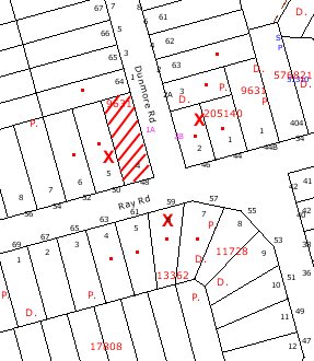
|
NOTIFICATION
PLAN
|
|
|
• PROPERTIES NOTIFIED
|
X SUBMISSIONS
RECEIVED
|
PROPERTY SUBJECT OF DEVELOPMENT
|
|
|
|
|
|
Three submissions objected to the
development, generally on the grounds that the development would result in:
· Unacceptable
overshadowing;
· Loss of sunlight;
· Less than minimum lot
size;
· Precedent for
variation of planning controls;
· Loss of residential
character.
The merits of the matters raised
in community submissions have been addressed in the body of the report with the
exception of the following:
5.1.1 Boundary fence
It is considered to be a
reasonable request that the applicant be required to construct the northern
boundary fence at nil cost to the neighbouring property owner. A recommended
condition of consent has been included in Attachment A.
6. THE PUBLIC INTEREST
Section 79C(1)(e) of the Act
requires Council to consider “the public interest”.
The public interest is an
overarching requirement, which includes the consideration of the matters discussed
in this report. Implicit to the public interest is the achievement of future
built outcomes adequately responding to and respecting the future desired
outcomes expressed in environmental planning instruments and development
control plans.
The application is considered to
have satisfactorily addressed Council’s criteria and would provide a
development outcome that, on balance, would result in a positive impact for the
community. Accordingly, it is considered that the approval of the proposed two
detached dwellings and subdivision would be in the public interest.
CONCLUSION
Consent is sought to demolish an
existing dwelling, erect two detached dwellings and subdivide the site into two
allotments.
The two proposed detached
dwellings are designed with regard to the streetscape, adjoining properties and
the layout of the respective proposed lots. The proposed dwellings are
consistent with recent development in the locality and would contribute to the
residential character of the area.
The proposed dwellings comply
with Council’s low density residential development controls in respect to floor
space ratio, height, privacy, solar access, private open space and landscaping.
The proposed non-compliance with the 6m front setback is acceptable with regard
to the corner frontage and the proposed transition in the Dunmore Road building
alignment from secondary to main street frontage.
The proposed development is
designed to maximise the advantage of the corner site with each lot having full
street frontage. The submitted SEPP 1 objection to the 500m2 lot
size development standard is considered well founded in respect to the minor
variation of 2.5% as the development is within the environmental capacity of
the site, the variation is specific to the corner site and the proposal would
maintain the low density residential character of the locality.
Three submissions were received
following the community consultation process. Each submission raised valid
planning issues. These matters can be addressed via appropriate conditions and
do not warrant Council’s refusal of the application.
The application is therefore
recommended for approval.
|
Rod Pickles
Manager -
Assessment Team 2
Planning Division
|
Paul David
Manager -
Subdivision & Development Engineering Services
Planning Division
|
|
Scott Phillips
Executive Manager
Planning Division
|
|
Attachments:
|
1.View
|
Locality Plan
|
|
2.View
|
Site Plan/Floor
Plan Lot 1
|
|
3.View
|
Elevations
|
|
4.View
|
Site Plan/Floor
Plan Lot 2
|
|
5.View
|
Elevations Lot 2
|
|
6.View
|
Shadow Plans
|
|
7.View
|
Landscape Plan
|
File Reference: DA/620/2010
Document Number: D01436337
SCHEDULE 1
GENERAL
CONDITIONS
The
conditions of consent within this notice of determination have been applied to
ensure that the use of the land and/or building is carried out in such a manner
that is consistent with the aims and objectives of the relevant legislation,
planning instruments and Council policies affecting the land and does not
disrupt the amenity of the neighbourhood or impact upon the environment.
Note: For the purpose
of this consent, the term ‘applicant’ means any person who has the authority to
act on or the benefit of the development consent.
Note: For the purpose of
this consent, any reference to an Act, Regulation, Australian Standard or
publication by a public authority shall be taken to mean the gazetted Act or
Regulation, or adopted Australian Standard or publication as in force on the
date that the application for a construction certificate is made.
1. Approved
Plans and Supporting Documentation
The development
must be carried out in accordance with the plans and documentation listed below
and endorsed with Council’s stamp, except where amended by Council and/or other
conditions of this consent:
|
Plan No.
|
Drawn by
|
Dated
|
|
DA-01 Subdivision Plan Gnd &
First Floor Lot 1
|
JND Architectural Services Pty
Ltd
|
FEB 2010
|
|
DA-02 Elevation/Sections Lot 1
|
JND Architectural Services Pty
Ltd
|
FEB 2010
|
|
DA-03 Subdivision Plan Gnd &
First Floor Lot 2
|
JND Architectural Services Pty
Ltd
|
FEB 2010
|
|
DA-04 Elevation/Sections Lot 2
|
JND Architectural Services Pty
Ltd
|
FEB 2010
|
|
2010.0505DA1 Landscape Plan
|
TGS Landscape Architects
|
19 April 2010
|
|
Document No.
|
Prepared by
|
Dated
|
|
D01419567 – Schedule of Finishes
|
JND Architectural Services Pty
Ltd
|
27/5/2010
|
2. Removal
of Existing Trees
This
development consent only permits the removal of tree(s) identified for removal
on Plan No. 2010.0505DA1 prepared by TGS Landscape Architects dated 19 April
2010. The removal of any other trees requires separate approval under
Council’s Tree Preservation Order.
REQUIREMENTS PRIOR TO THE ISSUE OF A CONSTRUCTION
CERTIFICATE
3. Building
Code of Australia
All building
work must be carried out in accordance with the requirements of the Building
Code of Australia.
4. Contract
of Insurance (Residential Building Work)
In the case
of residential building work for which the Home Building Act, 1989 requires
there to be a contract of insurance in force in accordance with Part 6 of that
Act, that such a contract of insurance is in force before any building work
authorised to be carried out by the consent commences.
Note: This
condition does not apply to the extent to which an exemption is in force
under Clause 187 or 188 of the Act, subject to the terms of any condition or
requirement referred to in Clause 187(6) or 188(4) of the Act, or to the
erection of a temporary building.
5. Notification
of Home Building Act, 1989 Requirements
Residential
building work within the meaning of the Home Building Act,
1989 must not be carried out unless the principal certifying authority for
the development to which the work relates (not being Council) has given Council
written notice of the following information:
a. In
the case of work for which a principal contractor is required to be appointed:
i. The
name and licence number of the principal contractor.
ii. The
name of the insurer by which the work is insured under Part 6 of that Act.
b. In
the case of work to be done by an owner-builder:
i. The
name of the owner-builder.
ii. If
the owner-builder is required to hold an owner-builder’s permit under that Act,
the number of the owner-builder’s permit.
Note: If
arrangements for doing the residential building work are changed while the work
is in progress so that the information notified becomes out of date, further
work must not be carried out unless the principal certifying authority for the
development to which the work relates (not being Council) has given Council
written notification of the updated information.
6. Water/Electricity
Utility Services
The applicant
must submit written evidence of the following service provider requirements:
a. Energy
Australia – a letter of consent demonstrating that satisfactory
arrangements have been made to service the proposed development.
b. Sydney
Water – the submission of a ‘Notice of Requirements’ under s73 of the Sydney
Water Act 1994.
Note: Sydney
Water requires that s73 applications are to be made through an authorised
Sydney Water Servicing Coordinator. Refer to www.sydneywater.com.au or telephone
13 20 92 for assistance.
7. Dilapidation
Report
A
‘Dilapidation Report’ is to be prepared by a ‘chartered structural engineer’
detailing the structural condition of all adjoining properties.
8. On
Site Stormwater Detention
An on-site
stormwater detention system must be designed for one of the proposed dwellings
by a chartered civil engineer and constructed in accordance with the following
requirements:
a. Have
a capacity of not less than 5 cubic metres, and a maximum discharge (when full)
of 8 litres per second.
b. Have
a surcharge/inspection grate located directly above the outlet.
c. Discharge
from the detention system to be controlled via 1 metre length of pipe, not less
than 50 millimetres diameter or via a stainless plate with sharply drilled
orifice bolted over the face of the outlet discharging into a larger diameter
pipe capable of carrying the design flow to an approved Council system.
d. Where
above ground and the average depth is greater than 0.3 metres, a ‘pool type’
safety fence and warning signs to be installed.
e. Not
be constructed in a location that would impact upon the visual or recreational
amenity of residents.
REQUIREMENTS PRIOR TO THE COMMENCEMENT OF ANY WORKS
9. Erection
of Construction Sign
A sign must
be erected in a prominent position on any site on which building work,
subdivision work or demolition work is being carried out:
a. Showing
the name, address and telephone number of the principal certifying authority
for the work,
b. Showing
the name of the principal contractor (if any) for any demolition or building
work and a telephone number on which that person may be contacted outside
working hours, and
c. Stating
that unauthorised entry to the work site is prohibited.
Note: Any
such sign is to be maintained while the building work, subdivision work or
demolition work is being carried out, but must be removed when the work has
been completed.
10. Toilet
Facilities
Toilet
facilities must be available or provided at the works site before works begin
and must be maintained until the works are completed at a ratio of one toilet
for every 20 persons employed at the site. Each toilet must:
a. be
a standard flushing toilet connected to a public sewer; or
b. be
a temporary chemical closet approved under the Local Government Act, 1993;
or
c. have
an on-site effluent disposal system approved under the Local Government Act,
1993
11. Erosion
and Sediment Control
Erosion and
sediment control measures must be provided and maintained throughout the
construction period in accordance with the manual ‘Soils and Construction
2004 (Bluebook)’, the approved plans, Council specifications and to the
satisfaction of the principal certifying authority. The erosion and sediment
control devices must remain in place until the site has been stabilised and
revegetated.
Note: On
the spot penalties up to $1,500 may be issued for any non-compliance with this
requirement without any further notification or warning.
12. Tree
Pruning
Any pruning
work shall be carried out in accordance with Australian Standard AS 4373
“pruning of amenity trees”. Neighbours consent must be obtained prior to
any works being undertaken involving the tree located on the neighbouring
property.
REQUIREMENTS DURING CONSTRUCTION
13. Construction
Work Hours
All work on site (including demolition and earth works)
must only occur between 7am and 5pm Monday to Saturday.
No work is to be undertaken on Sundays or public holidays.
14. Demolition
All
demolition work must be carried out in accordance with Australian Standard
2601-2001 – The Demolition of Structures and the following requirements:
a. Demolition
material is to be disposed of to an authorised recycling and/or waste disposal
site and/or in accordance with an approved waste management plan.
b. Demolition
works, where asbestos material is being removed, must be undertaken by a
contractor that holds an appropriate licence issued by WorkCover NSW in
accordance with Chapter 10 of the Occupational Health and Safety Regulation
2001 and Clause 29 of the Protection of the Environment Operations
(Waste) Regulation 1996.
c. On
construction sites where buildings contain asbestos material, a standard
commercially manufactured sign containing the words ‘DANGER ASBESTOS REMOVAL IN
PROGRESS’ measuring not less than 400mm x 300mm must be erected in a prominent
position visible from the street.
15. Environmental
Management
The site must
be managed in accordance with the publication ‘Managing Urban Stormwater –
Landcom (March 2004) and the Protection of the Environment Operations Act
1997 by way of implementing appropriate measures to prevent sediment
run-off, excessive dust, noise or odour emanating from the site during the
construction of the development.
16. Street
Sweeping
Street sweeping must be undertaken following sediment tracking
from the site along Dunmore Road during works and until the site is
established.
17. Council
Property
During
construction works, no building materials, waste, machinery or related matter
is to be stored on the road or footpath.
18. Works
near Trees
All works on
the site within 4 metres of tree No. 1 (Eucalyptus resinifera) and tree
No. 2 (Jacaranda mimosifolia) located on adjoining property, must be
carried out under the supervision of an ‘AQF Level 5 Arborist’ and a
certificate submitted to the principal certifying authority detailing the
method(s) used to preserve the trees.
Note:
Except as provided above, the applicant is to ensure that no excavation,
filling or stockpiling of building materials, parking of vehicles or plant,
disposal of cement slurry, waste water or other contaminants is to occur within
4 metres of any tree to be retained.
19. Landfill
Landfill must
be constructed in accordance with Council’s ‘Construction Specification,
2005’ and the following requirements:
a. All
fill material imported to the site is to wholly consist of Virgin Excavated
Natural Material (VENM) as defined in Schedule 1 of the Protection of the
Environment Operations Act 1997 or a material approved under the Department
of Environment and Climate Change’s general resource recovery exemption.
b. A
compaction certificate is to be obtained from a geotechnical engineer verifying
that the specified compaction requirements have been met.
20. Excavated
Material
All excavated material removed from the site must be classified in
accordance with the NSW Environment Protection Authority’s Environmental
Guidelines – Assessment, Classification and Management of Liquid and Non-Liquid
Wastes prior to disposal to an approved waste management facility and
reported to the principal certifying authority.
21. Road
Works
All road works approved under this consent must be constructed in
accordance with Council’s Civil Works Design and Construction Specification,
2005 and the following requirements:-
a. Council’s standard 150mm integral kerb and
gutter to be constructed across the frontage of
all lots in Dunmore Rd with a minimum pavement width of 1.0 metres together
with drainage.
b. The footpath verge shall be matched to the
new top of kerb and backfilled and grass seeded or turfed.
c. Construction plans shall be submitted to
Council as Roads Authority for approval and Council’s fees paid, prior to
commencement of Road Work.
22. Vehicular
Crossing
A separate application under the Local Government Act, 1993 and
the Roads Act, 1993 must be submitted to Council for the installation of
two new vehicular crossings and the removal of any redundant crossing. The
vehicular crossing must be constructed in accordance with Council’s Civil
Works Design, 2005 and the following requirements:
a. Any redundant crossings to be replaced with
integral kerb and gutter.
b. The footway area to be restored by turfing.
Note: An application for a vehicular crossing can
only be made to one of Council’s Authorised Vehicular Crossing Contractors.
You are advised to contact Council on 02 9847 6940 to obtain a list of
contractors.
23. Traffic
Control Plan
A Traffic Control Plan (TCP) must be prepared by a qualified traffic
controller in accordance with the Roads & Traffic Authority’s Traffic
Control at Worksites Manual 1998 and Australian Standard 1742.3 for
all work on a public road and be submitted to Council. The TCP must detail the following:
a. Arrangements for public notification of the
works.
b. Temporary construction signage.
c. Permanent post-construction signage.
d. Vehicle movement plans.
e. Construction traffic management plans.
f. Pedestrian and cyclist access/safety.
REQUIREMENTS PRIOR TO THE ISSUE OF AN OCCUPATION OR
SUBDIVISION CERTIFICATE
Note: For
the purpose of this consent, any reference to ‘occupation certificate’ shall
also be taken to mean ‘interim occupation certificate’ unless otherwise stated.
24. Fulfilment
of BASIX Commitments
The applicant must demonstrate the fulfilment of BASIX commitments
pertaining to the development.
25. Sydney
Water – s73 Certificate
A s73 Certificate must be obtained from Sydney Water.
26. Stormwater
Drainage – Dwellings
The stormwater drainage system for the development must be designed and
constructed for an average recurrence interval of 20 years and be gravity
drained and connected directly to Council’s street drainage system.
27. Damage
to Council Assets
Any damage caused to Council’s assets as a result of the construction of
the development must be rectified in accordance with Council’s written
requirements and at the sole cost of the applicant.
28. Creation
of On-Site Detention on Title
The following matter(s) must be nominated on the plan of subdivision
under s88B of the Conveyancing Act 1919:
a. The creation of an appropriate "Positive
Covenant" and "Restriction as to User" over the
constructed on-site detention/retention systems and outlet works, within the
lots in favour of Council in accordance with Council’s prescribed wording. The
position of the on-site detention system is to be clearly indicated on the
title.
b. To register the OSD easement, the
restriction on the use of land “works-as-executed” details of the
on-site-detention system must be submitted verifying that the required storage
and discharge rates have been constructed in accordance with the design
requirements. The details must show the invert levels of the on site system
together with pipe sizes and grades. Any variations to the approved plans must
be shown in red on the “works-as-executed” plan and supported by calculations.
Note: Council must be nominated as the
authority to release, vary or modify any easement, restriction or covenant.
29. Completion
of Landscaping
A certificate must be provided by a practicing landscape architect,
horticulturalist or person with similar qualifications and experience
certifying that all required landscaping works have been satisfactorily
completed in accordance with the approved landscape plans.
Note: Advice on suitable species for
landscaping can be obtained from Council’s planting guide ‘Indigenous Plants
for the Bushland Shire’, available at www.hornsby.nsw.gov.au.
30. Boundary
Fencing
Lapped and capped timber fencing must be erected along the northern
boundary of lot 2 behind the front building alignment to a height of 1.8 metres
at the sole cost of the applicant.
Note: Alternative fencing may be erected
subject to the written consent of the adjoining property owner.
31. Kerb
and Gutter in Dunmore Road
Prior to undertaking any works
in Dunmore Road separate approval must be obtained from Council pursuant to
Section 138 of the Roads Act 1993.
Note: All inspections
of works in Dunmore Road are to be undertaken by Council.
32. s94
Infrastructure Contributions
The
payment to Council of a contribution of $19,748.70* for one additional lot
towards the cost of infrastructure identified in Council’s Development
Contributions Plan 2007-2011.
Note: * The
value of contribution is based on a rate of $19,748.70 per additional
lot and is current as at 5 July 2010. The
contribution will be adjusted from this date in accordance with the underlying
consumer price index for subsequent financial quarters.
It is recommended that you contact Council to ascertain the
indexed value of the contribution prior to payment.
- END OF CONDITIONS -
ADVISORY NOTES
The following information is provided for your
assistance to ensure compliance with the Environmental Planning and Assessment
Act, 1979, Environmental Planning and Assessment Regulation 2000, other
relevant legislation and Council’s policies and specifications. This
information does not form part of the conditions of development consent
pursuant to Section 80A of the Act.
Environmental Planning and Assessment Act, 1979
Requirements
The Environmental Planning and
Assessment Act, 1979 requires:
· The issue of a construction
certificate prior to the commencement of any works. Enquiries regarding the
issue of a construction certificate can be made to Council’s Customer Services
Branch on 9847 6760.
· A principal certifying authority to
be nominated and Council notified of that appointment prior to the commencement
of any works.
· Council to be given at least two days
written notice prior to the commencement of any works.
· Mandatory inspections of nominated
stages of the construction inspected.
· An occupation certificate to be
issued before occupying any building or commencing the use of the land.
Long Service Levy
In accordance with Section 34 of the Building and
Construction Industry Long Service Payments Act 1986, a ‘Long Service Levy’ must be paid to the Long Service
Payments Corporation or Hornsby Council.
Note: The
rate of the Long Service Levy is 0.35% of the total cost of the work.
Note: Hornsby
Council requires the payment of the Long Service Levy prior to the issue of a
construction certificate.
Tree Preservation Order
To ensure the maintenance and protection of the existing
natural environment, it is an offence to ringbark, cut down, top, lop, remove,
wilfully injure or destroy a tree outside 3 metres of the approved building
envelope without the prior written consent from Council.
Note: A
tree is defined as a single or multi-trunked wood perennial plant having a
height of not less than three (3) metres, and which develops many branches,
usually from a distance of not less than one (1) metre from the ground, but
excluding any plant which, in its particular location, is a noxious plant
declared as such pursuant to the Noxious Weeds Act 1993. This definition of
‘tree’ includes any and all types of Palm trees.
All
distances are determined under British Standard BS 5837: 2005, “Trees in
Relation to Construction – Recommendations”.
Fines may be imposed for non-compliance with Council’s Tree
Preservation Order.
Subdivision Certificate Requirements
A subdivision certificate application is required to be
lodged with Council containing the following information:
· A surveyor’s certificate certifying
that all structures within the subject land comply with the development consent
in regard to the setbacks from the new boundaries.
· A surveyor’s certificate certifying
that all services, drainage lines or access are located wholly within the
property boundaries. Where services encroach over the new boundaries,
easements are to be created.
· Certification that the requirements
of relevant utility authorities have been met.
· A surveyor’s certificate certifying
finished ground levels are in accordance with the approved plans.
Note: Council
will not issue a subdivision certificate until all conditions of the
development consent have been completed.
Fees and Charges – Subdivision
All fees payable to Council as part of any construction,
compliance or subdivision certificate or inspection associated with the
development (including the registration of privately issued certificates) are
required to be paid in full prior to the issue of the subdivision certificate.
Any additional Council inspections beyond the scope of any compliance
certificate required to verify compliance with the terms of this consent will
be charged at the individual inspection rate nominated in Council's Fees and
Charges Schedule.
Dial Before You Dig
Prior to commencing any works, the applicant is encouraged
to contact Dial Before You Dig on 1100 or www.dialbeforeyoudig.com.au for
free information on potential underground pipes and cables within the vicinity
of the development site.
Asbestos Warning
Should asbestos or asbestos products be encountered during
demolition or construction works you are advised to seek advice and information
should be prior to disturbing the material. It is recommended that a contractor
holding an asbestos-handling permit (issued by WorkCover NSW)be engaged
to manage the proper handling of the material. Further information regarding
the safe handling and removal of asbestos can be found at:
www.environment.nsw.gov.au
www.nsw.gov.au/fibro
www.adfa.org.au
www.workcover.nsw.gov.au
Alternatively, telephone the WorkCover Asbestos and
Demolition Team on 8260 5885.
House Numbering
House numbering can only be authorised by Council. Before
proceeding to number each premise in the development, the allocation of numbers
is required to be obtained from Council's Planning Division. The authorised
numbers are required to be displayed in a clear manner at or near the main
entrance to each premise.
Standard Report No. PLN45/10
Planning Division
Date of Meeting:
4/08/2010
6 LOCAL HERITAGE
ASSISTANCE FUND 2010/2011
EXECUTIVE SUMMARY
This report presents the recommendations of the Heritage
Advisory Committee concerning the allocation of funds under the Local Heritage
Assistance Fund 2010/11. The Committee recommends the allocation of $60,000 to
assist ten projects relating to the conservation of heritage items within the
Shire.
It is
recommended that Council endorse the expenditure of funds in accordance with
the recommendations of the Committee.
PURPOSE
The purpose of this report is to seek Council’s endorsement
to allocate $60,000 under the Local Heritage Assistance Fund.
BACKGROUND
As part of Council’s commitment to promoting the
conservation of the Shire’s heritage resources, Council has offered an annual
Local Heritage Assistance Fund since 1995. Through the Fund, Council
encourages the conservation of heritage items by contributing financially to
their maintenance. The Fund is allocated on a dollar for dollar basis between
the owner and Council.
The types of work that are eligible for assistance under
the Fund are as follows:
· repair, maintenance or reinstatement of original or missing
items on heritage buildings or structures (e.g. windows, verandas, roofs,
decorative details, traditional fences);
· reinstatement of traditional colour schemes on houses or
commercial buildings;
· structural stabilisation of buildings, ruins or slab barns;
and
· historic garden conservation.
The
following works however, are not eligible:
· additions and alterations;
· routine maintenance (including painting);
· work that has already been completed;
· the purchase or relocation of a building;
· internal decoration; and
· the construction of new outbuildings.
Applicants are requested to provide the
following information with their application:
· historical background information on the property;
· a plan/sketch of the proposed works (if applicable);
· photographs of the existing structure;
· a minimum of two quotes for the proposed work; and
· a schedule of materials and colours (if applicable).
Over
the past sixteen years, Council has provided assistance to 172 projects valued
at a total of approximately $2,113,506. During April and May 2010,
applications were invited from all owners of heritage items within the Shire
for financial assistance to undertake conservation works. A total of seventeen
applications were received. The proposed conservation works totalled $476,955
of which $138,287 was sought from Council. The applications were considered by
the Heritage Advisory Committee at its meeting on 5 July 2010, where a number
of projects were supported.
DISCUSSION
The attached table provides a summary of the applications
received, value of works, the recommendations of the Heritage Advisory
Committee and the proposed funding offers.
The Heritage Committee has recommended that the funds be
allocated to ten projects which are to be completed over the following twelve
month period. The successful projects will be offered funding generally on a
dollar for dollar basis, although some projects will be offered less than the
amount sought due to the limited amount of funding available.
The successful projects recommended by the Committee are as
follows:
|
Project
No.
|
Property Address
|
Applicant Name
|
Project Description
|
Recommended Funding
Amount and Comment
|
|
1
|
44 Beecroft Road, Beecroft
|
Phillip Backhouse
|
Replacing tin roof to front
room and entry foyer, Facia's gully, guttering
|
$2,245 (subject to hardwood or Oregon timber being used)
|
|
2
|
100 Beecroft Road Beecroft
|
Robert Olsen
|
Removal and replacement of
all front veranda roofing iron. Removal and replacement of roof area above
store and repainting
|
$10,000 (subject to treated pine not being used for works
and documentation being submitted to Council regarding traditional colour
scheme for paintwork)
|
|
3
|
Lot 17 Collingridge Point, Berowra Waters
|
Annette Crowe
|
Restore coach ceiling in
living room and the fascia on the north wall. This includes all necessary
structural works
|
$8,598 (subject to the retention of the timber ceiling
profile and treatment of termites within roof cavity if observed during
construction)
|
|
4
|
106 Bay Road Berrilee
|
Rhonda Ramsey
|
Replace rotten veranda and
posts
|
$8,360 (subject to hardwood or Oregon timber being used)
|
|
5
|
429 Galston Road, Dural
|
Margaret Hunter
|
Replacement of roof
|
$10,000 (subject to appropriate guttering material being
used such as zinculume or galvanised iron)
|
|
6
|
Cnr Chester or Oxford Street , Epping
|
Gordon Herriott
|
Replace pressed pattern
ceiling that has rusted due to leaking roof
|
$6,000
|
|
7
|
241 Pacific Highway, Hornsby
|
Max and Lorraine Lowery
|
Roof and gable repairs to
north elevation. Repair of dormer windows
|
$5,000 (subject to treated pine not being used for works)
|
|
8
|
368 Pacific Highway, Hornsby
|
Kellie Morle
|
Structural repairs to sub
floor and rear veranda area
|
$1,790 (recommended that the apparent inadequate subfloor
drainage/ventilation be investigated by owner to ensure long term stability
of item)
|
|
9
|
62 Malsbury Road Normanhurst
|
Martyn Goundry
|
Footing stabilisation
|
$6,500 (recommended that the apparent inadequate drainage
be investigated to ensure addressed in the long term)
|
|
10
|
14 The Comenarra Parkway,
Thornleigh
|
Sten and Clare Hopkins
|
Replacement/repair of
consumer mains. Replacement of rotten timber window and ledge
|
$1,507 (subject to treated pine not being used for works)
|
Clause
18(2) of the Hornsby Local Environmental Plan (HSLEP) provides that
development consent is not required where Council is of the opinion that
development would not adversely affect the heritage significance of the
heritage item. In supporting the applications, the Committee was of the
opinion that the proposed works would either satisfy Clause 18(2) of the HSLEP,
in that they would not adversely affect the heritage significance of the item
or that development consent has been granted for the works. In offering
applicants funds for works where no development consent has been granted,
Council would be endorsing the works to be undertaken without development
consent.
The successful applications would be subject to the
conditions of the Local Heritage Assistance Fund to ensure the projects are
carried out to a high standard and in an appropriate manner. Council’s Town
Planning Services Branch will be responsible for ensuring the projects are
carried out in accordance with the application and special conditions set by
the Heritage Committee.
In the unlikely event that an applicant does not accept the
offer of financial assistance or the works are unable to be completed this
financial year, it is recommended that the General Manager be authorised to
endorse any additional allocation or redistribution of funds following a
recommendation from the Executive Manager, Planning Division. Any allocation
or redistribution would be limited by the criteria and conditions of the Local
Heritage Assistance Fund.
CONSULTATION
During April and May 2010, applications were invited from
all owners of heritage items within the Shire for financial assistance to
undertake conservation works. Information regarding the Local Heritage
Assistance Fund 2010/2011 was also placed on Council’s website.
FINANCIAL
As part of the 2010/2011 Management Plan, Council has
allocated $60,000 towards the Local Heritage Assistance Fund.
TRIPLE BOTTOM LINE SUMMARY
This Triple Bottom Line (TBL) Statement forms part of Council’s
efforts towards “creating a living environment”. The Statement addresses the
strategic themes within Council’s Management Plan that cover social,
environmental and economic factors and the corresponding sustainability
questions contained in the TBL checklist.
· Working with our community: The Local Heritage Assistance Fund is open to owners of
heritage items within the Shire and an application form was sent to all owners
of heritage listed properties. The Fund provides for collaboration and financial
assistance concerning the conservation of heritage items.
· Conserving our natural environment: The Local Heritage Assistance Fund has been established
by Council to assist property owners to conserve identified heritage items
within the Shire. The aim of the fund is to encourage conservation works on
heritage items in the Shire. The program is intended to provide kick-start
funding to encourage the joint funding of projects between Council and local
residents. The Fund encourages interest and concern for the conservation of
other heritage items within the Shire of Hornsby.
· Contributing to community development through sustainable
facilities and services: The Fund does
not relate directly to the provision of services and facilities. Accordingly,
no adverse impact on opportunities for community development would be expected.
· Fulfilling our community’s vision in planning for the
future of the Shire: The Assistance Fund
assists in promoting the conservation of the important heritage values within
the Shire.
· Supporting our diverse economy: The Local Heritage Assistance Fund aims to assist in the
conservation of important character elements and heritage values which enhance
the attractiveness of the Shire as a place to live and work.
· Maintaining sound corporate and financial management: Council has allocated $60,000 towards the Local Heritage
Assistance Fund. Applicants will be required to provide at least matching
finance for the project. In some instances, applicants will need to contribute
more to the project.
· Other Sustainability Considerations: The Allocation of the Fund would not have an adverse
impact on the environment of the Shire.
CONCLUSION
The Local Heritage Assistance Fund 2010/2011 will provide
for the ongoing conservation of ten heritage items in the Shire. In addition,
the provision of financial assistance towards privately owned heritage items
will encourage heritage conservation in the Shire and promote Council’s
commitment to heritage conservation.
|
RECOMMENDATION
THAT:
1. Council endorse
the expenditure of funds to the value of $60,000 from the Local Heritage
Assistance Fund budget to the following projects (to be completed and
reimbursed prior to 30 June 2011).
|
Project No.
|
Property Address
|
Applicant Name
|
Project Description
|
Recommended Funding
Amount and Comment
|
|
1
|
44 Beecroft Road, Beecroft
|
Phillip Backhouse
|
Replacing tin roof to
front room and entry foyer, Facia's gully, guttering
|
$2,245 (subject to hardwood or Oregon timber being used)
|
|
2
|
100 Beecroft Road Beecroft
|
Robert Olsen
|
Removal and replacement
of all front veranda roofing iron. Removal and replacement of roof area
above store and repainting
|
$10,000 (subject to treated pine not being used for works
and documentation being submitted to Council regarding traditional colour
scheme for paintwork)
|
|
3
|
Lot 17 Collingridge Point, Berowra Waters
|
Annette Crowe
|
Restore coach ceiling in
living room and the fascia on the north wall. This includes all necessary
structural works
|
$8,598 (subject to the retention of the timber ceiling
profile and treatment of termites within roof cavity if observed during
construction)
|
|
4
|
106 Bay Road Berrilee
|
Rhonda Ramsey
|
Replace rotten veranda
and posts
|
$8,360 (subject to hardwood or Oregon timber being used)
|
|
5
|
429 Galston Road, Dural
|
Margaret Hunter
|
Replacement of roof
|
$10,000 (subject to appropriate guttering material being
used such as zinculume or galvanised iron)
|
|
6
|
Cnr Chester or Oxford Street , Epping
|
Gordon Herriott
|
Replace pressed pattern
ceiling that has rusted due to leaking roof
|
$6,000
|
|
7
|
241 Pacific Highway, Hornsby
|
Max and Lorraine Lowery
|
Roof and gable repairs to
north elevation. Repair of dormer windows
|
$5,000 (subject to treated pine not being used for works)
|
|
8
|
368 Pacific Highway, Hornsby
|
Kellie Morle
|
Structural repairs to sub
floor and rear veranda area
|
$1,790 (recommended that the apparent inadequate subfloor
drainage/ventilation be investigated by owner to ensure long term stability
of item)
|
|
9
|
62 Malsbury Road Normanhurst
|
Martyn Goundry
|
Footing stabilisation
|
$6,500 (recommended that the apparent inadequate drainage
be investigated to ensure addressed in the long term)
|
|
10
|
14 The Comenarra Parkway, Thornleigh
|
Sten and Clare Hopkins
|
Replacement/repair of
consumer mains. Replacement of rotten timber window and ledge
|
$1,507 (subject to treated pine not being used for works)
|
2. Applicants be advised of Council’s
resolution.
3. Should any
applicant not accept the offer of financial assistance or the works are
unable to be completed this financial year, the General Manager be authorised
to endorse any additional allocation or redistribution of funds following a
recommendation from the Executive Manager, Planning Division.
|
|
Scott Phillips
Executive Manager
Planning Division
|
James Farrington
Manager - Town
Planning Services
Planning Division
|
Attachments:
|
1.View
|
Summary of
Applications
|
File Reference: f2010/00125
Document Number: D01432372
Standard Report No. PLN52/10
Planning Division
Date of Meeting:
4/08/2010
7 REPORTING VARIATIONS TO
DEVELOPMENT STANDARDS
EXECUTIVE SUMMARY
In accordance with the Department
of Planning’s Planning Circular PS 08-14, Council is required to report
variations to development standards for development applications approved under
delegated authority, which relied upon State Environmental Planning Policy No.
1 - Development Standards (SEPP 1).
PURPOSE
The purpose of this report is to advise Council of
determined development applications involving a SEPP 1 variation to a
development standard relating to the period 1 April 2010 to 30 June 2010.
DISCUSSION
The Department of Planning issued Circular PS
08–014 on 14 November 2008. The purpose of the Circular was to remind councils
of their responsibilities to monitor the use of the Director-General’s assumed
concurrence under State Environmental Planning Policy No. 1. Councils were
reminded of the need to keep accurate records of the use of SEPP 1 and to
report on a quarterly basis.
The Circular also provides that Councils are
required to adopt the following four measures:
1. Establish
a register of development applications determined with variations in standards
under SEPP 1.
2. Require
all development applications where there has been a variation greater than 10%
in standards under SEPP 1 to be determined by full council (rather than general
manager or nominated staff member).
3. Provide
a report to each council meeting on the development applications determined
where there had been a variation in standards under SEPP 1.
4. Make
the register of development applications determined with variations in
standards under SEPP 1 available to the public on the council’s website.
In accordance with Point 3 of the Department’s Circular,
attached hereto is a list of development applications determined under
delegated authority involving a SEPP 1
variation to a development standard for the
period 1 April 2010 to 30 June 2010.
A copy of the attachment to this report is also reproduced
on Council’s website.
BUDGET
There are no budget implications.
POLICY
There are no policy implications.
CONSULTATION
There was no consultation in the preparation of this
report.
TRIPLE BOTTOM LINE SUMMARY
Triple Bottom Line is a framework for improving Council
decisions by ensuring accountability and transparency on social, environmental
and economic factors. It does this by reporting upon Council’s strategic
themes.
As this report simply provides Council with information and
does not propose any actions which require a sustainability assessment, no
Triple Bottom Line considerations apply.
|
RECOMMENDATION
THAT Council note the contents
of Executive Manager’s Report No. PLN52/10.
|
|
Rod Pickles
Manager - Assessment
Team 2
Planning Division
|
Scott Phillips
Executive Manager
Planning Division
|
Attachments:
|
1.View
|
SEPP 1 Returns -
Quarter for 1 April 2010 to 30 June 2010
|
File Reference: F2004/07599
Document Number: D01441215