BUSINESS PAPER
Planning
Meeting
Wednesday, 6 October, 2010
at 6.30pm
|
Hornsby
Shire Council
|
Table of Contents
|
|
Page
1
|
|
|
|
|
TABLE OF CONTENTS
AGENDA AND SUMMARY OF RECOMMENDATIONS
Mayoral Minutes
Notices of Motion
Rescission Motions
Item 1 RM1/10
PLN35/10 Development Application - Subdivision of One Lot Into Two
Lot 9, DP 7484 (No. 39) Hannah Street, Beecroft
MATTERS OF URGENCY
ITEMS PASSED BY EXCEPTION / CALL FOR
SPEAKERS ON AGENDA ITEMS
DEVELOPMENT APPLICATIONS
A Ward Deferred
A Ward
Item 2 PLN51/10
Development Application - Medium Density Multi-unit Housing Development - 25 - 29 Turner Road Berowra Heights
Item 3 PLN63/10
Development Application - Alterations and Additions to an Existing Church - 155 - 157 Galston Road Hornsby Heights
Item 4 PLN67/10
Development Application - Mixed Use Building Comprising Nine Residential Units
and One Commercial Unit
1
and 3 Haldane Street, Asquith
B Ward Deferred
B Ward
C Ward Deferred
C Ward
Item 5 PLN39/10
Development Application – Dwelling-House - 54B Beecroft Road, Beecroft
Item 6 PLN24/10
Development Application - Mixed Use Building Comprising of Five Residential Units
and One Commercial Unit - 22 Oxford Street Epping
General Business
Item 7 PLN69/10
Kangaroo Point Planning Proposal - Report on Submissions
supplementary agenda
CONFIDENTIAL ITEMS
Questions of Which Notice Has Been Given
QUESTIONS WITHOUT NOTICE
|
Hornsby Shire Council
|
Agenda and Summary of
Recommendations
|
|
Page
1
|
|
|
|
|
AGENDA AND SUMMARY OF RECOMMENDATIONS
PRESENT
NATIONAL ANTHEM
OPENING PRAYER/S
Rev. Ian Millican of St. Mark’s Anglican Church, Berowra will be opening
the meeting in prayer.
Acknowledgement of RELIGIOUS DIVERSITY
Statement
by the Chairperson:
“We recognise
our Shire's rich cultural and religious diversity and we acknowledge and pay
respect to the beliefs of all members of our community, regardless of creed or
faith."
ABORIGINAL RECOGNITION
Statement
by the Chairperson:
"We recognise the traditional inhabitants of the land
we are meeting on tonight, the Darug and Guringai Aboriginal people, and
respect is paid to their elders and their heritage."
AUDIO RECORDING OF COUNCIL MEETING
Statement by the Chairperson:
"I advise all present that tonight's meeting is being audio
recorded for the purposes of providing a record of public comment at the meeting, supporting the democratic process, broadening knowledge and
participation in community affairs, and demonstrating Council’s commitment to
openness and accountability. The
recordings will be made available on Council’s website once the Minutes have
been finalised. All speakers are requested to ensure their comments are
relevant to the issue at hand and to refrain from making personal comments or
criticisms."
APOLOGIES / LEAVE OF ABSENCE
Political
Donations Disclosure
Statement by the Chairperson:
“In
accordance with Section 147 of the Environmental Planning and Assessment Act
1979, any person or organisation who has made a relevant planning application
or a submission in respect of a relevant planning application which is on
tonight’s agenda, and who has made a reportable political donation or gift to a
Councillor or employee of the Council, must make a Political Donations
Disclosure Statement.
If a
Councillor or employee has received a reportable political donation or
gift from a person or organisation who has made a relevant planning application
or a submission in respect of a relevant planning application which is on
tonight’s agenda, they must declare a non-pecuniary conflict of interests to
the meeting, disclose the nature of the interest and manage the conflict of
interests in accordance with Council’s Code of Conduct.”
declarations of interest
Clause 52 of Council’s Code of
Meeting Practice (Section 451 of the Local Government Act, 1993) requires that
a councillor or a member of a Council committee who has a pecuniary interest in
a matter which is before the Council or committee and who is present at a
meeting of the Council or committee at which the matter is being considered
must disclose the nature of the interest to the meeting as soon as
practicable. The disclosure is also to be submitted in writing (on the form
titled “Declaration of Interest”).
The Councillor or member of a
Council committee must not be present at, or in sight of, the meeting of the
Council or committee:
(a) at any time during which the matter is being considered or
discussed by the Council or committee.
(b) at any time during which the Council or committee is
voting on any question in relation to the matter.
Clause 51A of Council’s Code
of Meeting Practice provides that a Councillor, Council officer, or a member of
a Council committee who has a non pecuniary interest in any matter with which
the Council is concerned and who is present at a meeting of the Council or
committee at which the matter is being considered must disclose the nature of
the interest to the meeting as soon as practicable. The disclosure is also to
be submitted in writing (on the form titled “Declaration of Interest”).
If the non-pecuniary interest
is significant, the Councillor must:
a) remove the source of conflict, by
relinquishing or divesting the interest that creates the conflict, or
reallocating the conflicting duties to another Council official.
OR
b) have no involvement in the matter by absenting themself from
and not taking part in any debate or voting on the issue as if the provisions
of Section 451(2) of the Act apply.
If the non-pecuniary interest
is less than significant, the Councillor must provide an explanation of why
they consider that the interest does not require further action in the
circumstances.
confirmation of minutes
THAT the Minutes of the Planning Meeting held
on 1 September, 2010 be confirmed; a copy having been distributed to all
Councillors.
petitions
Mayoral Minutes
Notices of Motion
Rescission Motions
Page Number
Item 1 RM1/10 PLN35/10 Development Application - Subdivision of One Lot Into Two -
Lot 9, DP 7484 (No. 39) Hannah Street, Beecroft
COUNCILLOR McMurdo TO MOVE
THAT
the resolution adopted at the Planning Meeting
held on 1 September 2010 in respect of Item Number
2, PLN35/10 Development Application –
Subdivision of One Lot Into Two – 39 Hannah Street, Beecroft namely:-
THAT
A. Development Application No. 1470/2009 for the subdivision of
one lot into two at Lot 9 DP 7484 (No. 39) Hannah Street, Beecroft be approved
subject to the conditions of consent detailed in Schedule 1 of Executive
Manager’s Report No. PLN35/10 as amended by the following requirements:
1. Condition No.
15 be amended to read:
15. Screening of
Turning Head
A solid 1.5m high lapped and capped timber fence (or a
similar decorative solid fence to the written satisfaction of the owner of 37A
Hannah Street) measured from the top of the pavement, must be fixed to the
eastern side of the turning head where the turning head is elevated more than
300mm above ground level.
B. The Executive Manager, Environment be requested to review the
appropriateness of the offset values and calculations specified in the Offsets
Code to determine whether they accurately reflect the value for offsetting the
loss of bushland as a result of development proposals.
be, and is hereby rescinded.
NOTE: The above Recission Motion
is supported by COUNCILLORS MARTIN and HUTCHENCE
NOTE: In the event of the
proposed Rescission Motion being adopted, the following motion is proposed.
1. “The proposed subdivision is unsatisfactory in respect to
Section 79C(1)(a)(iii) of the Environmental Planning and Assessment Act, 1979
as the proposal does not comply with the Residential Subdivision Development
Control Plan.
1.1 The proposed removal of trees on the site does not
comply with the landscaping element objective to preserve significant trees,
groups of trees and trees that add to the environmental character of the area
or natural vegetation.
2. The proposed subdivision is unsatisfactory in respect to
Section 79C(1)(b) of the Environmental Planning and Assessment Act, 1979 as the
proposal would result in the loss of a significant group of trees identified as
Blue Gum High Forest, a critically endangered ecological community.
2.2 The proposed offset for the loss of the Blue Gum
High Forest community on the site is inconsistent with Council’s Green Offset
Policy.
2.3 The proposal would effectively negate the viability
of the site to support Blue Gum High Forest.
3. The proposal is unsatisfactory in respect to Section
79C(1)(e) of the Environmental Planning and Assessment Act, 1979 as the
proposal is not in the public interest.
MATTERS OF URGENCY
ITEMS PASSED BY
EXCEPTION / CALL FOR SPEAKERS ON AGENDA ITEMS
Note:
Persons wishing to address Council on matters which are on
the Agenda are permitted to speak, prior to the item being discussed, and their
names will be recorded in the Minutes in respect of that particular item.
DEVELOPMENT
APPLICATIONS
A Ward Deferred
A Ward
Page Number
Item 2 PLN51/10 Development Application - Medium Density Multi-unit Housing
development - 25 - 29 Turner Road Berowra Heights
RECOMMENDATION
THAT Development Application No.
616/2010 for a multi-unit housing development comprising ten townhouses at Lot
100 DP 1043150, Nos. 25 – 29 Turner Road, Berowra Heights be approved subject
to the conditions of consent detailed in Schedule 1 of this report.
Page Number
Item 3 PLN63/10 Development Application - Alterations and Additions to an existing
Church - 155-157 Galston Road Hornsby Heights
RECOMMENDATION
THAT Development Application No.
819/2010 for alterations and additions to an existing church at Lots 1, 2 &
3 DP 221543 (Nos. 155-157) Galston Road, Hornsby Heights be approved subject to
the conditions of consent detailed in Schedule 1 of this report.
Page Number
Item 4 PLN67/10 Development Application - Mixed use building comprising nine
residential units and one commercial unit - 1 and 3 Haldane Street, Asquith
RECOMMENDATION
THAT Council
assume the concurrence of the Director-General of the Department of Planning
pursuant to State Environmental Planning Policy No. 1 and approve Development
Application No. 603/2010 for demolition of existing structures, construction of
a part two and part three storey building comprising nine residential units and
one commercial unit with basement car parking and strata subdivision at Lot 26
and 25 DP 8797, Nos. 1-3 Haldane Street, Asquith subject to the conditions of
consent detailed in Schedule 1 of this report.
B Ward Deferred
B Ward
C Ward Deferred
C Ward
Page Number
Item 5 PLN39/10 DEVELOPMENT APPLICATION –
DWELLING-HOUSE - 54B
BEECROFT ROAD, BEECROFT
RECOMMENDATION
THAT Development Application No.
DA/364/2010 for the erection of a single storey dwelling-house at Lot 11, DP 1123895, No. 54B Beecroft Road, Beecroft, be refused for the reasons detailed in
Schedule 1 of this report.
Page Number
Item 6 PLN24/10 Development application - Mixed use building comprising five
residential units and one commercial unit - 22 Oxford Street Epping
RECOMMENDATION
THAT Council assume the
concurrence of the Director-General of the Department of Planning pursuant to
State Environmental Planning Policy No. 1 and approve Development Application
No. 253/2010 for the demolition of an existing building and the erection of a
four storey building comprising five residential units and one commercial unit
with ground level car parking at Lot 4 DP 10221 (No.
22) Oxford Street Epping, subject to the conditions of consent detailed
in Schedule 1 of this report.
General Business
Page Number
Item 7 PLN69/10 Kangaroo Point Planning Proposal - Report on Submissions
RECOMMENDATION
THAT:
1. Council forward the attached Kangaroo Point Planning
Proposal to the Minister for Planning for gazettal pursuant to Section 59 of
the Environmental Planning and Assessment Act 1979.
2. Council prepare amendments to the Kangaroo Point Community
Masterplan in the Brooklyn Development Control Plan to aim to ensure that any
future commuter berthing facility is limited to a maximum of 25 boats of up to
4.5m in length and within the existing wet lease area (Licence No. L201707).
3. Any future provision of commuter berthing and car parking at
Kangaroo Point be funded by river residents (including the land value
component) and the detailed financial arrangements concerning the acquisition,
construction and occupation of a commuter berthing proposal at Kangaroo Point
be the subject of further discussion and a report to Council.
4. Submitters be advised of Council’s resolution.
SUPPLEMENTARY AGENDA
confidential items
Questions of Which Notice Has Been Given
QUESTIONS WITHOUT NOTICE
Rescission Motion No. RM1/10
Date of Meeting:
6/10/2010
1 PLN35/10 DEVELOPMENT
APPLICATION - SUBDIVISION OF ONE LOT INTO TWO
LOT 9, DP 7484 (NO. 39) HANNAH STREET, BEECROFT
|
COUNCILLOR McMurdo
TO MOVE
THAT the resolution adopted at
the Planning Meeting held on 1
September 2010 in respect of Item Number 2, PLN35/10 Development Application – Subdivision
of One Lot Into Two – 39 Hannah Street, Beecroft
namely:-
THAT
A. Development Application No. 1470/2009 for the subdivision
of one lot into two at Lot 9 DP 7484 (No. 39) Hannah Street, Beecroft be
approved subject to the conditions of consent detailed in Schedule 1 of
Executive Manager’s Report No. PLN35/10 as amended by the following
requirements:
1. Condition
No. 15 be amended to read:
15. Screening
of Turning Head
A solid 1.5m high lapped and capped timber fence (or a
similar decorative solid fence to the written satisfaction of the owner of
37A Hannah Street) measured from the top of the pavement, must be fixed
to the eastern side of the turning head where the turning head is elevated
more than 300mm above ground level.
B. The Executive Manager, Environment be requested to review
the appropriateness of the offset values and calculations specified in the
Offsets Code to determine whether they accurately reflect the value for
offsetting the loss of bushland as a result of development proposals.
be, and is hereby rescinded.
NOTE: The above
Recission Motion is supported by COUNCILLORS MARTIN and HUTCHENCE
NOTE: In the event of the proposed Rescission
Motion being adopted, the following motion is proposed.
1. “The proposed subdivision is unsatisfactory in respect to
Section 79C(1)(a)(iii) of the Environmental Planning and Assessment Act, 1979
as the proposal does not comply with the Residential Subdivision Development
Control Plan.
1.1 The proposed removal of trees on the site does not
comply with the landscaping element objective to preserve significant trees,
groups of trees and trees that add to the environmental character of the area
or natural vegetation.
2. The proposed subdivision is unsatisfactory in respect to
Section 79C(1)(b) of the Environmental Planning and Assessment Act, 1979 as
the proposal would result in the loss of a significant group of trees
identified as Blue Gum High Forest, a critically endangered ecological
community.
2.2 The proposed offset for the loss of the Blue Gum
High Forest community on the site is inconsistent with Council’s Green Offset
Policy.
2.3 The proposal would effectively negate the
viability of the site to support Blue Gum High Forest.
3. The proposal is unsatisfactory in respect to Section
79C(1)(e) of the Environmental Planning and Assessment Act, 1979 as the
proposal is not in the public interest.
|
Attachments:
File Reference: DA/1470/2009
Document Number: D01484947
Planning Report No. PLN51/10
Date of Meeting:
6/10/2010
2 DEVELOPMENT APPLICATION
- MEDIUM DENSITY MULTI-UNIT HOUSING DEVELOPMENT
25 - 29 TURNER ROAD BEROWRA HEIGHTS
|
Development Application No:
|
DA/616/2010
|
|
Description of Proposal:
|
Medium Density Multi-unit Housing Development comprising
ten townhouses and basement carpark
|
|
Property Description:
|
Lot 100 DP 1043150 (Nos. 25 – 29) Turner Road, Berowra Heights
|
|
Applicant:
|
Mr Paul Viscardi
|
|
Owner:
|
Allengreen Apartments Pty Ltd
|
|
Statutory Provisions:
|
Hornsby Shire Local Environmental
Plan 1994 – Business A (General) Zone
|
|
Estimated Value:
|
$ 2.5 million
|
|
Ward:
|
A
|
|
RECOMMENDATION
THAT Development Application
No. 616/2010 for a multi-unit housing development comprising ten townhouses
at Lot 100 DP 1043150, Nos. 25 – 29 Turner Road, Berowra Heights be approved subject to the conditions of consent detailed in Schedule 1 of this report.
|
1. The
application proposes the erection of ten, two-storey townhouses with an
associated basement car park.
2. The
proposal generally complies with the provisions of the Hornsby Shire Local
Environmental Plan 1994 and Council’s Medium-Density Multi-Unit Housing
Development Control Plan.
3. The
proposal does not comply with the provisions of the Turner Road Commercial
Centre Masterplan contained within Council’s Business Lands Development Control
Plan as it does not provide for a mixed-use development on the subject
property.
4. Two
submissions have been received in respect of the application.
5. It
is recommended that the application be approved.
HISTORY OF THE SITE
On 13 November 2001 Council
approved DA/2023/2001 for the subdivision of one allotment into two. The
subject property (Lot 100 DP 1043150) was created as a result of this
subdivision.
On 18 December 2002 Council refused
DA/1838/2002 for the erection of a three-storey residential flat building
comprising twenty-eight units and basement car parking. An appeal was lodged
with the Land and Environment Court against Council’s deemed refusal of the
application. On 11 July 2003 the Land and Environment Court dismissed the
appeal.
On 3 March 2004 Council refused
DA/1906/2003 for the erection of a three-storey mixed use development
comprising ten commercial units, sixteen residential units and basement car
parking.
On 3 August 2005 Council refused
DA/1587/2004 for the erection of a three-storey mixed used development
comprising seven commercial units, fifteen residential units and basement car
park.
On 6 April 2006 Council adopted
the Turner Road Commercial Centre Masterplan. The subject property formed a
part of this Masterplan.
THE SITE
The subject property is a vacant allotment located on the
south-western side of Turner Road at its intersection with Kita Road and Cambewarra Crescent. It has an area of 2458 sq metres.
The site is ‘L’ shaped, with frontages of 88 metres and 51
metres to Turner and Kita Roads, respectively. The allotment slopes gradually
(2.9 % slope) towards the northern corner at the junction of the three roads.
One mature pine tree is located within the road reserve at the northern corner
of the site.
Access to the site is provided via a 11.5 metre wide
driveway along the south-eastern boundary of the property. The driveway narrows
to 6.2 metres and continues across part of the south-western boundary. This
section of the site is burdened by a right-of-carriageway benefitting the
shopping centre that adjoins the southern side of the property. This
right-of-way provides access to the hardware store within the shopping centre
and to a section of the basement carpark.
The site is surrounded by predominantly single and two
storey dwellings and commercial development.
The Berowra Village Centre and Marketplace shopping centre
are within close proximity and the site is adjoined to the rear by a commercial
warehouse development. Commercial development in the business precinct
comprises a mixture of one and two storey buildings.
THE PROPOSAL
The proposal involves the
erection of ten, two-storey townhouses comprising a medium density multi-unit
housing development. The development is proposed to be in three blocks. Six
attached townhouses front Turner Road and four townhouses front Kita Road, located in two separate blocks divided by the proposed driveway. Units 1 to 4
would have a floor area of 127 sq metres and Units 5 to 10 would have a floor
area of 121.5 sq metres.
Each townhouse would have a
typical floor plan with the primary living areas located on the ground floor
and three bedrooms located on the upper floor. Each unit would include
landscaped courtyards with pergolas fronting the street with individual
pedestrian access and private open space areas at the rear. The development
would incorporate one adaptable unit in the complex. The maximum building
height would be 7.5 metres above natural ground level.
Car parking for the development
is provided at the basement level. Vehicular access is provided by a 6 metre
wide driveway off Kita Road. Double garages are provided for each unit. Stairs
would provide access from the garages to the living areas of the individual
units. Two visitors’ parking spaces are provided for the development.
Stormwater is to be collected and
piped to an on-site detention system and drained to Kita Road. The upper
surface of the detention tank would be tiled and landscaped for use as a common
recreation area for the residents of the complex. The area would be accessed
via two pathways from Kita Road and Turner Road.
ASSESSMENT
The development application has
been assessed having regard to the ‘2005 City of Cities Metropolitan Strategy’,
the ‘North Subregion (Draft) Subregional Strategy’ and the matters for
consideration prescribed under Section 79C of the Environmental Planning and
Assessment Act 1979 (the Act). Subsequently, the following issues have
been identified for further consideration.
1. STRATEGIC CONTEXT
1.1 Metropolitan Strategy – (Draft) North Subregional
Strategy
The Metropolitan Strategy is a
broad framework to secure Sydney’s place in the global economy by promoting and
managing growth. It outlines a vision for Sydney to 2031; the challenges
faced, and the directions to follow to address these challenges and achieve the
vision. The draft North Subregional Strategy acts as a framework for Council
in the preparation of a new Principal LEP by 2011.
The draft Subregional Strategy
sets the following targets for the Hornsby LGA by 2031:
· Employment capacity to
increase by 9,000 jobs; and
· Housing stock to
increase by 11,000 dwellings.
The proposed development would be
consistent with the draft Strategy by providing ten additional medium density
residential units and would improve housing choice in the locality.
2. STATUTORY CONTROLS
Section 79C(1)(a) requires
Council to consider “any relevant environmental planning instruments, draft
environmental planning instruments, development control plans, planning
agreements and regulations”.
2.1 Hornsby Shire Local Environmental Plan 1994
The subject land is zoned
Business A (General) Zone under the Hornsby Shire Local Environmental Plan 1994
(HSLEP). The objectives of the zone are:
(a) to
encourage economic growth and employment opportunities.
(b) to
accommodate the retail, commercial and social needs of the community.
(c) to
encourage development that improves the health, vitality, cultural environment
and social environment within the area.
The proposed development is
defined as “multi-unit housing” under the HSLEP and is permissible in the zone
with Council’s consent.
The proposed development involves
medium density residential development in an area which is well serviced by
retail and commercial uses. The proposal would support and strengthen the
economy of the businesses in the locality. It would accommodate the social
needs of the community and improve the health, vitality, cultural and social
environment of this area. Given the above, it is considered that the proposal
is not inconsistent with the zone objectives. (This matter has been discussed
in detail in section 2.7.1 of this report.)
Clause 15(2) of the HSLEP
prescribes that the maximum floor space ratio (FSR) of development for the
purpose of multi-unit housing only within the Business A zone is 0.6:1. The
applicant addresses this requirement by proposing a FSR of 0.5:1.
Clause 18 of the HSLEP sets out
heritage conservation provisions within the Hornsby area. The street trees
within the Turner Road reserve and the property at No. 24 Turner Road are
listed as heritage items of local significance pursuant to Schedule D of the
HSLEP.
An assessment of the impact of
the development on the heritage item identified that no trees within the road
reserve directly adjoin the site. The proposal would not have any impact on the
heritage listed trees. The house at No. 24 Turner Road is located on the
opposite side of the road and at a considerable distance from the proposed
development. Accordingly, it is concluded that the development would not result
in any adverse impact on the heritage significance of this item and is assessed
as satisfactory in this regard.
2.2 State Environmental Planning Policy No. 55 - Remediation
of Land
The application has been assessed
against the requirements of State Environmental Planning Policy No. 55. This
Policy provides State-wide planning controls for soil contamination and
proposed remedies.
The site has been vacant and does
not have a history of land uses which would typically result in soil contamination.
Accordingly no further assessment in this regard is considered necessary.
2.3 State Environmental Planning Policy (Building
Sustainability Index: BASIX) 2004
The application has been assessed
against the requirements of State Environmental Planning Policy (Building
Sustainability Index: BASIX) 2004.
The proposal
includes a BASIX Certificate for the proposed units and is considered to be
satisfactory.
2.4 Sydney Regional Environmental Plan No. 20 – Hawkesbury Nepean River
The application has been assessed
against the requirements of Sydney Regional Environmental Plan No. 20
(SREP-20). This Policy provides controls to protect the environment of the
Hawkesbury-Nepean system, including its water quality. SREP-20 addresses
matters related to water quality, significant vegetation habitats, extraction,
environmental heritage and scenic quality, recreation and tourism, and
agriculture.
The proposal
is consistent with the environmental capability of the site and includes a
satisfactory Stormwater Management Plan. Subject to implementation of
recommended conditions relating to sediment and erosion control, the
development would prevent adverse impacts on water quality. The development
complies with SREP 20 in this regard.
2.5 Berowra Cowan Development Control Plan
The
application has been assessed against the requirements of Berowra Cowan
Development Control Plan. The Plan aims to provide a
detailed planning strategy and development guidelines to protect the natural
and built environment of the Berowra Heights area. The compliance of the
proposal with the relevant strategies within this DCP are discussed below:
2.5.1 Residential
Strategy
The proposed development complies with the Residential
Strategy element of the DCP as it would provide medium density housing in an
area which is connected to a bus route and is located in close proximity to the
commercial, retail and medical facilities of Berowra Heights.
2.5.2 Commercial
Strategy
The Commercial strategy of the DCP identifies that
development should make efficient use of under-utilized land and encourage
integration of housing within the business precincts wherever possible. The
Turner Road Commercial Centre Masterplan, incorporated in the Berowra Cowan
Development Control Plan, applies to the subject site. The matter has been
discussed in section 2.7 of this report.
2.6 Business Lands Development Control Plan
The application has been assessed
against the requirements of the Business Lands Development Control Plan
(BLDCP). The BLDCP applies to the site, being located
in a Business A Zone. The BLDCP provides guidelines primarily for commercial
developments. The relevant matters have been discussed in section 2.7 and 2.8
of this report.
2.7 Turner Road
Commercial Centre Masterplan
The Turner Road Commercial Centre
Masterplan provides planning principles, strategies and the specific
development controls for the locality. Compliance of the proposal with the
development controls within the Masterplan is discussed below:
2.7.1 Desired Future Character
The Masterplan envisages the
continuation of commercial uses within Area 3 of the Turner Road commercial
centre and identifies the subject property to be suitable for two-storey mixed
use (commercial/residential) development with below ground car parking, landscape
treatment and integration with the adjoining IGA shopping complex.
While the proposal incorporates a
two storey development with basement car parking in accordance with the
Masterplan, the proposed medium density townhouse style residential development
does not incorporate mixed use development in accordance with the Masterplan.
The applicant has provided a detailed Economic Assessment report to support
this non-compliance. The report notes the following:
· There is
approximately 6300 sq metres of existing retail floor space in Berowra and Brooklyn at a rate of 550 sq metres per 1000 persons.
· The best performing
speciality retailers would continue to be located within the Berowra Village Shopping Centre on Turner Road, benefitting from their proximity to Coles.
· The subject
property is relatively isolated from both Coles and the existing IGA shopping
centres. The lack of connectivity with these retail anchors would limit the
attractiveness for prospective commercial tenants for the site.
· Due to the
continued “pull” of higher order departmental stores and speciality retail in
Hornsby, there would be limited scope on economic grounds of developing further
speciality retail or commercial development in the area.
On the basis of the above, the
applicant’s economic assessment concludes that Berowra is well supplied with
retail floor space and that the demand for retail or commercial floor space on
the subject site is very limited. The tightly contained urban footprint of
Berowra would result in limited housing and population growth in the future,
equating to limited retail demand. In the event that further retail and
commercial floor space is constructed on the subject site, the tenancies would
experience a high level of vacancy.
In addition to the above report
provided by the applicant, it is noted that the Kuring-Gai and Hornsby
Subregional Employment Study (May 2008) also considers commercial and retail
development prospects in the Berowra and Berowra Heights area. The report
indicates that within the Berowra Heights Commercial Centre, there is a
floorspace supply potential of 13,242 sq metres. In light of the forecast
demand in the 2006-2031 periods, the centre has an excess supply of 13,335 sq
metres, the floorspace supply potential being more than ten times the demand.
The Study recommends that some of the employment lands should be rezoned in the
future to reduce this excess floorspace supply.
It is considered that the
proposal would cater to the current market demand and comply with the
Metropolitan Strategy by improving housing choice in the locality. The proposed
medium density development would integrate well with the existing commercial
and retail floor space within the commercial centre and increase the number of
potential users. The proposal as such complies with the overall vision of the
precinct to introduce townhouse style, low scale developments integrating with
the surrounding low density character of the locality.
Given the above, the non-compliance
with regard to the Masterplan is considered acceptable.
2.7.2 Design Objectives and Height
The development would result in a
two-storey development blending with the adjoining low-density areas in
accordance with the design objectives of the Masterplan. The dwelling units
would not overshadow public areas. The design would result in a well defined
corner treatment and appropriate landscaping along the Turner Road frontage
with space for additional tree planting within the front setback areas of the
dwelling units. The proposal would result in liveable space in accordance with
good environmental practices.
2.7.3 Site Amalgamation
‘Area 3’ comprises an existing
shopping village and the subject property, which is vacant. Amalgamation of the
two sites is not feasible and is inconsistent with Council’s previous decision
to approve the subdivision of the land. The development retains the existing
right-of-way providing access to a section of the adjoining shopping village
and would not prevent the redevelopment of the adjoining sites.
2.7.4 Building Design
The proposed development would
not comply with the desired form within the Masterplan as it would not
incorporate ground floor retail and commercial premises. However, it provides
landscaped areas in accordance with that identified in the Masterplan and
provides active street frontage as pedestrian access to the individual units
have been provided from the street.
The roof form would comprise a
combination of pitched and gabled rooflines. The proposed colours and materials
would be face brickwork as preferred in the Masterplan. The front elevations
of each of the units would incorporate a balcony at the upper level and
pergolas at the lower level fronting the street. The proposal incorporates underground
parking that does not protrude above natural ground, reducing the overall bulk
of the development.
2.7.5 Setbacks
The Masterplan specifies zero
setbacks to street frontages and a 10 metre setback to the corner of Kita Road and Turner Road. The setbacks are specified considering the future developments to
be retail/commercial in nature with shop-top housing. It is noted that the
Medium Density Multi-unit Housing Development Control Plan requires a minimum 6
metres front setback for townhouse style development.
In order to achieve a balance
between the two requirements, the development proposes a front setback of 3 to
3.5 metre to the street frontages. A section of the upper level balcony would
encroach within the front setback and the proposed pergolas would have a zero
setback to the street (Turner Road frontage). This would ensure active street
frontage along with scope for landscaping along the entire frontage of the
site. The proposal also retains a 5 metre setback to the corner which is to be
landscaped. The entrance patio and the upper level balcony of Unit 4 would be
located at this corner to provide a distinct design element for the
development.
2.7.6 Street Level Design
The design of the townhouses
includes a well articulated façade to achieve a varied built form and avoid a
monotonous streetscape. The design would maintain a continuous frontage as
desired in the Turner Road Commercial Centre Masterplan and clearly define the
corner.
The design also includes only one
vehicular access from Kita Road to avoid break up in the streetscape and also
to minimise vehicular conflict within Turner Road.
2.7.7 Safety and Security
The townhouses are designed to
provide an active street frontage. Balconies and windows are provided at the
front and the rear respectively for passive surveillance by residents.
Individual garages have been provided with lock up facilities. Access to the
units is located inside the garages to provide additional safety. The
right-of-way providing access to the shopping complex is separated from the
proposed development to provide additional security for the residents.
The development is assessed as
satisfactory against safety and security provisions as outlined within the
Masterplan.
2.7.8 Acoustics
To maintain acoustic privacy for
future residents, the design of the development and the site layout
incorporates the following acoustic attenuation measures:
· The family areas on
the ground floor and two bedrooms on the first floor have been located fronting
the rear yard.
· A 1.2 metre high
masonry retaining wall (supporting the raised rear yards) topped with a 1.5
metre high timber fence is provided along the southern-western and
south-eastern boundaries.
· The units are setback
3 metres from the Turner Road frontage.
The above design elements would
contribute towards maintaining acoustic privacy to the future occupants and are
considered satisfactory.
2.8 Medium Density Multi-Unit Housing Development Control
Plan
The proposed development is to be
located within a Business Zone and the Medium Density Multi-Unit Housing
Development Control Plan (Housing DCP) does not apply to this site. However the
application proposes medium density residential development only. Therefore, it
has been assessed having regard to the relevant performance and prescriptive
design standards within Council’s Housing DCP as a guide only. The following
table sets out the proposal’s compliance with the prescriptive standards of the
Plan:
|
Medium Density
Multi-Unit Housing Development Control Plan
|
|
Control
|
Proposal
|
Requirement
|
Compliance
|
|
Density
|
10 dwellings/2458m2
|
10 dwellings/2260m2
|
Yes
|
|
Minimum frontage
|
30m (min)
|
81m (Turner Road) and 42m (Kita Road)
|
Yes
|
|
Site Cover
|
31.5%
|
40%
|
Yes
|
|
Height to ceiling
|
5.5m
|
7m
|
Yes
|
|
Open Space
Unit 1
Unit 2
Unit 3
Unit 4
Unit 5
Unit 6
Unit 7
Unit 8
Unit 9
Unit 10
|
84m2
65.8m2
68m2
87m2
70m2
60m2
60m2
60m2
60.4m2
61.4m2
|
80m2
80m2
80m2
80m2
60m2
60m2
60m2
60m2
60m2
60m2
|
Yes
No
No
Yes
Yes
Yes
Yes
Yes
Yes
Yes
|
|
Car parking
|
2 spaces/unit
|
2 spaces/unit
|
Yes
|
|
Visitors’ Parking
|
2 spaces
|
2 spaces@ 1 space/5
dwellings
|
Yes
|
|
Dimension of double garage
|
6m x 5.6m
|
6m x 5.6m
|
Yes
|
|
Minimum headroom for car parking
|
2.4m
|
2.3m
|
Yes
|
As detailed in the above table,
the proposed development does not comply with a number of prescriptive
standards within Council’s Housing DCP. The matters of non-compliance are
detailed below, as well as a brief discussion on compliance with relevant
performance standards.
2.8.1 Density
The proposal involves two types
of medium density residential units. Units 1 to 4 would have gross floor area
of 127 sq metres (extra large dwellings) and Units 5 to 10 would have a gross
floor area of 121.5 sq metres (large dwellings). Council’s Housing DCP requires
the minimum site area for large dwellings to be 210 sq metres and that for
extra large dwellings to be 250 sq metres.
The proposal complies with the
density requirement as detailed in the above table and is acceptable with
regard to density.
2.8.2 Privacy
The design of the development
aims at maintaining visual privacy of the proposed units. The rear sections of the yards of each of the units have
been raised by 1 to 1.2 metres above the level of the primary living areas. A
1.5 to 1.8 metre high fence would be located above this raised area to visually
screen the ground level family and recreational areas from the rear driveway
and the shopping centre. The units do not include balconies to avoid
overlooking opportunities. Screen planting is proposed along the boundaries
separating the private open space areas for the individual units to minimise
overlooking from the first floor of the adjoining units.
The
proposed development is considered acceptable in regard to privacy and
satisfies the element objective.
2.8.3 Solar Access
The DCP requires that all medium
density multi-unit housing developments should provide at least three hours of
solar access to 50% of the private open spaces and to the north facing windows
of the proposed and adjacent dwellings between 9 am and 3 pm during winter
solstice.
Unit 1 and 2 do not comply with
the requirements of the Housing DCP with regard to solar access. Units 3 to 10
would provide satisfactory solar access to the private open space areas during
winter solstice.
The layout of the site is such
that units 5 to 10 would be orientated in a north-south direction and units 1
to 4 would be orientated in an east-west direction. In order to improve the Turner Road and Kita Road streetscape and avoid high fences, the dwelling units cannot be
designed to provide a northerly aspect to the private open space areas.
In this regard, it is noted that
The Australian Model Code for Residential development (AMCORD) requires two
hours of solar access to the ground level private open space areas (for areas
with temperate and cool climate). Given that both Units 1 and 2 would provide
at least two hours of solar access to the ground level private open space and
that the rear yards of 80% of the units would receive in excess of three hours
of solar access during winter solstice, the proposal is considered to be
acceptable.
The living area windows for the
dwelling units have been orientated to the north wherever possible and would
receive more than three hours of solar access during Winter Solstice.
2.8.4 Open Space
The Housing DCP requires that 60
sq metres of private open space be provided to units with gross floor area of
85 to 125 sq metres and 80 sq metres of private open space be provided to units
with gross floor area greater than 125 sq metres.
The private open spaces for Units
2 and 3 are 65.8 and 68 sq metres respectively and do not comply with the
Housing DCP requirement of 80 sq metres. The applicant has argued that the
proposed gross floor area for units 2 and 3 are 127.5 sq metres. Therefore,
they can be considered as large dwellings rather than extra large dwellings as
categorised in the Housing DCP and the provision of private open space in
excess of 60 sq metres is considered to be satisfactory for such units.
Numerical compliance with the 80 sq metres requirement is not considered
necessary in this case.
The above argument is considered
reasonable as proposed Units 1 to 4 are considered to be similar to large dwellings.
Further, the dwelling units maintain landscaped setbacks in the front to
improve the streetscape, which has contributed towards reducing the rear yard
areas.
The proposal is assessed as
satisfactory with regard to open space.
2.8.5 Vehicle Access and
Parking
The development incorporates
underground parking provisions with access from Kita Road in accordance with
the Turner Road Commercial Centre Masterplan. Each unit is provided with two
car spaces located within lock up garages in the basement level. The proposal
also includes provisions for two visitors’ car parking spaces.
The development is provided with
a separate vehicular access and does not intensify the use of the right-of-way
by the shopping centre. This is considered to be suitable as it would reduce
vehicular conflict between the two uses and also maintain acoustic privacy for
the future residents. Vehicular access to the site from Kita Road is considered
to be a preferred design outcome as Turner Road is a busy road and further vehicular
crossings may compromise traffic safety.
2.8.6 Fencing
The proposal does not include a
front fence. However, a section of the fence enclosing the private open space
for Unit 4 would be visible from the Turner Road frontage. A condition is
recommended that the fence be setback a minimum 2 metres from the property
boundary fronting Turner Road and be screened by suitable landscaping.
2.8.7 Waste Management
The applicant proposes that the
waste collection bins to be stored in the garages of the individual units and
then be wheeled to the Kita Road frontage for collection. There is sufficient
street frontage in Kita Road to accommodate the bins for collection.
In addition to the individual
bins, a common bin storage area is also proposed in the basement for recycled
items, white goods and green waste. This area would not have garbage truck
access and would be occasionally used by the future occupants of the site.
2.9 Car Parking
Development Control Plan
The application has been assessed
against the requirements of Council’s Car Parking Development Control Plan. The
application satisfies Council’s requirements with regard to car parking as
discussed in section 2.7 of this report.
2.10 Access and Mobility
Development Control Plan
The proposed development has been
assessed having regard to the relevant performance and prescriptive design
standards within Council’s Access and Mobility Development Control Plan (the
Mobility DCP). The following table sets out the proposal’s compliance with the
relevant prescriptive standards of the Plan:
|
Access
and Mobility Development Control Plan
|
|
Control
|
Proposal
|
Requirement
|
Compliance
|
|
Width of stairs
|
1000mm
|
1250mm
|
Yes
|
|
Density
|
1 unit
|
1 per 5-10 units
|
Yes
|
|
Entrance door width
|
920mm minimum
|
760mm minimum
|
Yes
|
|
Width of car space
|
3.2m
|
3.2m minimum
|
Yes
|
As indicated in the above table
the development includes one adaptable unit. A chair lift is to be installed on
the stairs of this unit to provide barrier free access to all levels of the
unit. Toilet facilities are provided on the ground floor for disabled access.
The unit would include a double garage with sufficient space in between two
cars to accommodate a wheel chair. Should the garage be utilised for parking
one car, the minimum width would be greater than 3.2 metres.
A condition of consent is
recommended to maintain a clear opening of 3.2 metres for the garage of the
adaptable unit. Subject to the implementation of this condition, the
development is considered acceptable with regard to disabled access.
2.11 Waste Management and
Minimisation Development Control Plan
The proposal includes a waste
management plan and details of on-going waste management on site and is
assessed as satisfactory.
2.12 Sustainable Water
Development Control Plan
Subject to sediment and erosion
control measures being implemented on site during construction, the proposal
would comply with the requirements contained within the Sustainable Water
Development Control Plan.
2.13 Section 94
Contributions Plan
Council’s Section 94 Plan applies
to the development as it would result in the generation of additional
residential floor space and car parking requirements on the site.
The requirement for a monetary
Section 94 contribution has been imposed as a recommended condition of
development consent.
3. ENVIRONMENTAL IMPACTS
Section 79C(1)(b) of the Act
requires Council to consider “the likely impacts of that development,
including environmental impacts on both the natural and built environments, and
social and economic impacts in the locality”.
3.1 Natural Environment
3.1.1 Trees
The proposed development would
not necessitate the removal of any trees from the site. A significant pine tree
is located on the landscape verge at the corner of Turner Road and Kita Road. A condition of consent is recommended regarding the retention of this tree.
Subject to the implementation of
the above condition the development would not have any adverse impact on the
natural environment.
3.1.2 Water
The applicant
proposes an on-site-detention system for stormwater management on the site. The
on-site detention system is proposed to be located under the common
recreational area. The townhouse development would include landscaped areas to
minimize the potential of erosion and to re-use stormwater for irrigation purposes.
Subject to compliance with the
conditions regarding stormwater management on the site and appropriate
sediment-erosion control measures being implemented, the proposal would not
have an adverse impact on the water quality of the Hawkesbury-Nepean Catchment.
3.2 Built Environment
The matters in relation to the
impact of the development on the built environment have been discussed in
section 2 of this report.
The development would provide
satisfactory parking arrangements within the site and would not significantly
increase traffic generation in the locality. Council’s engineering assessment
of the traffic impacts of the development is considered to be satisfactory.
3.3 Social Impacts
The development would improve the
housing choice in the locality by providing ten additional townhouses that
blend with the low-density character of the area. This is consistent with the
North Subregion (Draft) Subregional Strategy.
3.4 Economic Impacts
The proposal would have a
positive impact on the local economy by generating an increase in demand for
local services. The application is supported by an economic impact statement.
The matter is discussed in section 2.7 of this report.
4. SITE SUITABILITY
Section 79C(1)(c) of the Act
requires Council to consider “the suitability of the site for the
development”.
The land is not subject to
bushfire risk or flooding. The site is considered to be suitable for the
proposed development. The suitability of the site for the proposed development
is discussed in detail in section 2.7.1 of this report.
5. PUBLIC PARTICIPATION
Section 79C(1)(d) of the Act
requires Council to consider “any submissions made in accordance with this
Act”.
5.1 Community Consultation
The proposed development was
placed on public exhibition and was notified to adjoining and nearby landowners
between 10/06/2010 and 1/07/2010 in accordance with Council’s Notification and
Exhibition Development Control Plan. During this period, Council received two
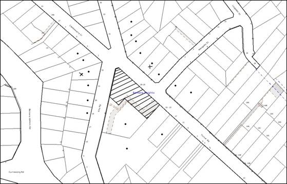
submissions. The map below illustrates the location of those nearby landowners
who made a submission that are in close proximity to the development site.
|
NOTIFICATION
PLAN
|
|
|
• PROPERTIES NOTIFIED
|
X SUBMISSIONS
RECEIVED
|

PROPERTY SUBJECT OF DEVELOPMENT
|

|
|
|
|
|
One submission objected to the
development, generally on the following grounds:
· The driveway access should be
provided from Turner Road rather than Kita Road;
· The proposal would result in further
on-street parking on Kita Road;
· The yellow notice has not been placed
in an appropriate location.
One submission supported the development and made the
following observations:
· The development would provide a
suitable development for the locality within the two storey height limit;
· The design suits the locality and
underground parking is a preferable option.
The merits of the matters raised
in community submissions have been addressed in the body of the report with the
exception of the following:
5.1.1 Yellow Notice
The yellow public exhibition
notice was placed at the corner of Turner Road and Kita Road and is considered
to be in a suitable location to allow interested residents to comment on the
development application.
5.2 Public Agencies
The proposal was not referred to
any public agencies for comments.
6. THE PUBLIC INTEREST
Section 79C(1)(e) of the Act
requires Council to consider “the public interest”.
The public interest is an
overarching requirement, which includes the consideration of the matters
discussed in this report. Implicit to the public interest is the achievement
of future built outcomes adequately responding to and respecting the future
desired outcomes expressed in environmental planning instruments and
development control plans.
The application is considered to
have satisfactorily addressed Council’s criteria and would provide a
development outcome that, on balance, would result in a positive impact for the
community. Accordingly, it is considered that the approval of the proposed
development would be in the public interest.
CONCLUSION
The proposal seeks approval for
the erection of a medium density multi-unit housing development comprising ten,
two-storey townhouses on the subject property. It would incorporate a central
driveway off Kita Road with underground parking for all units and visitors
parking. The proposal retains the existing right-of-way within the site and
does not intensify its usage. A separate driveway access is proposed off Kita Road for the future occupants of the site.
The proposed development is to be
located within a precinct affected by the Turner Road Commercial Centre Masterplan
within Council’s Business Lands Development Control Plan. The nature of the
development does not comply with the Masterplan as it does not incorporate any
commercial or retail uses. It is demonstrated that further retail or commercial
floorspace is not required in Berowra Heights and the proposed development
suits the desired future character of the area.
The proposal is consistent with Sydney Regional
Environmental Plan No. 20, Hornsby Local Environmental Plan 1994, Council’s
Medium Density Multi-unit Housing, Car Parking, Sustainable Water and Access
and Mobility Development Control Plans.
Approval of the application is recommended.
Note: At the time of the completion of this planning
report, no persons have made a Political Donations Disclosure Statement pursuant
to Section 147 of the Environmental Planning and Assessment Act 1979 in respect
of the subject planning application.
|
Rod Pickles
Manager -
Assessment Team 2
Planning Division
|
Scott Phillips
Executive Manager
Planning Division
|
Attachments:
|
1.View
|
Locality Plan
|
|
2.View
|
Survey Plan
|
|
3.View
|
Floor Plans
|
|
4.View
|
Elevations and
Sections
|
|
5.View
|
Landscape Plan
|
|
6.View
|
Stormwater
Management Plans
|
|
7.View
|
Shadow Diagram
|
|
8.View
|
Schedule of
Finishes
|
File Reference: DA/616/2010
Document Number: D01439561
SCHEDULE 1
GENERAL
CONDITIONS
The
conditions of consent within this notice of determination have been applied to
ensure that the use of the land and/or building is carried out in such a manner
that is consistent with the aims and objectives of the relevant legislation,
planning instruments and Council policies affecting the land and does not
disrupt the amenity of the neighbourhood or impact upon the environment.
Note: For the
purpose of this consent, the term ‘applicant’ means any person who has the
authority to act on or the benefit of the development consent.
Note: For the purpose of
this consent, any reference to an Act, Regulation, Australian Standard or
publication by a public authority shall be taken to mean the gazetted Act or
Regulation, or adopted Australian Standard or publication as in force on the
date that the application for a construction certificate is made.
1. Approved
Plans and Supporting Documentation
The development must be carried
out in accordance with the plans and documentation listed below and endorsed
with Council’s stamp, except where amended by Council and/or other conditions
of this consent:
|
Plan No.
|
Drawn by
|
Dated
|
|
Existing Site Plan – 1B
|
Frank Kosztelnik and Associates
|
April 2010
|
|
Basement Plan – 2B
|
Frank Kosztelnik and Associates
|
April 2010
|
|
Ground Floor Plan – 3B
|
Frank Kosztelnik and Associates
|
April 2010
|
|
First Floor Plan – 4B
|
Frank Kosztelnik and Associates
|
April 2010
|
|
Roof Plan – 5B
|
Frank Kosztelnik and Associates
|
April 2010
|
|
Detailed plan, Adaptable unit
details, Elevations and Sections Plan – 6B
|
Frank Kosztelnik and Associates
|
April 2010
|
|
Elevations – 7B
|
Frank Kosztelnik and Associates
|
April 2010
|
|
Bin Storage Detail - 11A
|
Frank Kosztelnik and Associates
|
April 2010
|
|
Landscape Plan
|
Arthur Lathouris
|
May 2010
|
|
Stormwater drainage Plan Ground
Floor – C-1606-01
|
Pavel Kozarovski
|
18/05/2010
|
|
Stormwater drainage Plan Ground
Floor – C-1606-02
|
Pavel Kozarovski
|
18/05/2010
|
|
Shadow Diagrams
|
Frank Kosztelnik and Associates
|
April 2010
|
|
Document No.
|
Prepared by
|
Dated
|
|
External Finishes and Colours
|
-
|
-
|
|
Schedule of Finishes
|
Frank Kosztelnik and Associates
|
Received by Council on 10/9/2010
|
|
BASIX Certificate - 309497M
|
-
|
28/04/2010
|
|
Waste Management Plan
|
-
|
26/05/2010
|
|
Statement of Environmental
Effects
|
Berzins Environmental Planning
Pty Ltd
|
May 2010
|
2. Amendment
of Plans
a. The
approved plan “Bin Storage Detail - 11A” drawn by Frank Kosztelnik and
Associates dated April 2010 is to be amended as follows:
i. A
Bin storage area is to be provided within the garage for each unit in the
basement to house one 140 litre garbage bin (560 mm x 608 mm x 929 mm), one 240
litre recycling bin (715 mm x 580 mm x 1080 mm) and one 240 litre green waste
bin (715 mm x 580 mm x 1080 mm).
b. The
approved “Landscape Plan” drawn by Arthur Lathouris dated May 2010 is to
be amended as follows:
i. The fence enclosing the private open space of unit 4
fronting Turner Road is to be setback a minimum 2 metres from the property
boundary.
ii. The landscape plan is to include the
amened floor plan layout as approved in Condition 1 of this development
consent.
iii. Screen planting along the southern fence of Units 6 to 10 and
western fence of units 1 to 5 (within the private open space areas) must
include Syzigium australie ‘Select Form’ or similar native species
capable of reaching a mature height of 3 metres planted at 1.5 metre centres in
mulched planter beds.
Note:
These shrubs shall be installed at minimum 5 litre pot size.
iv. Replacement of the proposed Hymanesporum flavum species
by Eucalyptus haemastoma species (or similar local native species
capable of reaching a height of 10 metres) within the Kita Road landscape
setback.
Note:
At least five trees must be planted and installed at minimum 45 litre pot
size.
Note: Advice on
suitable species for landscaping can be obtained from Council’s planting guide
‘Indigenous Plants for the Bushland Shire’, available at www.hornsby.nsw.gov.au.
c. The
Adaptable unit included in the proposed development is to be amended to include
a 3.2 metre wide clear opening for the garage.
REQUIREMENTS PRIOR TO THE ISSUE OF A CONSTRUCTION
CERTIFICATE
3. Building
Code of Australia
All building work must be
carried out in accordance with the requirements of the Building Code of
Australia.
4. Contract
of Insurance (Residential Building Work)
In the case
of residential building work for which the Home Building Act, 1989 requires
there to be a contract of insurance in force in accordance with Part 6 of that
Act, that such a contract of insurance is in force before any building work
authorised to be carried out by the consent commences.
Note: This
condition does not apply to the extent to which an exemption is in force
under Clause 187 or 188 of the Act, subject to the terms of any condition or
requirement referred to in Clause 187(6) or 188(4) of the Act, or to the
erection of a temporary building.
5. Notification
of Home Building Act, 1989 Requirements
Residential building work within
the meaning of the Home Building Act, 1989 must not be
carried out unless the principal certifying authority for the development to
which the work relates (not being Council) has given Council written notice of
the following information:
a. In
the case of work for which a principal contractor is required to be appointed:
i. The
name and licence number of the principal contractor.
ii. The
name of the insurer by which the work is insured under Part 6 of that Act.
b. In
the case of work to be done by an owner-builder:
i. The
name of the owner-builder.
ii. If
the owner-builder is required to hold an owner-builder’s permit under that Act,
the number of the owner-builder’s permit.
Note: If
arrangements for doing the residential building work are changed while the work
is in progress so that the information notified becomes out of date, further
work must not be carried out unless the principal certifying authority for the
development to which the work relates (not being Council) has given Council
written notification of the updated information.
6. Water/Electricity
Utility Services
The applicant
must submit written evidence of the following service provider requirements:
a. Energy
Australia – a letter of consent demonstrating that satisfactory
arrangements have been made to service the proposed development.
b. Sydney
Water – the submission of a ‘Notice of Requirements’ under s73 of the Sydney
Water Act 1994.
Note: Sydney
Water requires that s73 applications are to be made through an authorised
Sydney Water Servicing Coordinator. Refer to www.sydneywater.com.au or telephone
13 20 92 for assistance.
7. Traffic
Management Plan
A Traffic management Plan for
the construction phase of the development must be prepared and submitted for
approval by the Principle Certifying Authority.
REQUIREMENTS PRIOR TO THE COMMENCEMENT OF ANY WORKS
8. Erection
of Construction Sign
A sign must be erected in a
prominent position on any site on which building work, subdivision work or
demolition work is being carried out:
a. Showing
the name, address and telephone number of the principal certifying authority
for the work,
b. Showing
the name of the principal contractor (if any) for any demolition or building
work and a telephone number on which that person may be contacted outside
working hours, and
c. Stating
that unauthorised entry to the work site is prohibited.
Note: Any
such sign is to be maintained while the building work, subdivision work or
demolition work is being carried out, but must be removed when the work has been
completed.
9. Protection
of Adjoining Areas
A temporary hoarding, fence or
awning must be erected between the work site and adjoining lands before the
works begin and must be kept in place until after the completion of the works
if the works:
a. Could
cause a danger, obstruction or inconvenience to pedestrian or vehicular
traffic.
b. Could
cause damage to adjoining lands by falling objects.
c. Involve
the enclosure of a public place or part of a public place.
Note: Notwithstanding
the above, Council’s separate written approval is required prior to the
erection of any structure or other obstruction on public land.
10. Toilet
Facilities
Toilet facilities must be
available or provided at the works site before works begin and must be
maintained until the works are completed at a ratio of one toilet for every 20
persons employed at the site. Each toilet must:
a. be
a standard flushing toilet connected to a public sewer; or
b. be
a temporary chemical closet approved under the Local Government Act, 1993;
or
c. have
an on-site effluent disposal system approved under the Local Government Act,
1993
11. Erosion
and Sediment Control
Erosion and sediment control
measures must be provided and maintained throughout the construction period in
accordance with the manual ‘Soils and Construction 2004 (Bluebook)’, the
approved plans, Council specifications and to the satisfaction of the principal
certifying authority. The erosion and sediment control devices must remain in
place until the site has been stabilised and revegetated.
Note: On
the spot penalties up to $1,500 may be issued for any non-compliance with this
requirement without any further notification or warning.
12. Tree
Protection Barriers
Tree
protection fencing must be erected around trees numbered T1 as shown on the
approved “Ground Floor Plan – 3A” to be retained at a 4 metre setback. The tree fencing must be constructed
of 1.8 metre ‘cyclone chainmesh fence’ or star pickets spaced at 2 metre
intervals, connected by a continuous high-visibility barrier/hazard mesh at a
height of 1 metre.
REQUIREMENTS DURING CONSTRUCTION
13. Construction
Work Hours
All
work on site (including demolition and earth works) must only occur between
7:00am and 5:00pm Monday to Saturday.
No
work is to be undertaken on Sundays or public holidays.
14. Environmental
Management
The site must
be managed in accordance with the publication ‘Managing Urban Stormwater –
Landcom (March 2004) and the Protection of the Environment Operations
Act 1997 by way of implementing appropriate measures to prevent sediment
run-off, excessive dust, noise or odour emanating from the site during the
construction of the development.
15. Street
Sweeping
Street
sweeping must be undertaken following sediment tracking from the site along Turner Road and Kita Road during works and until the site is
established.
16. Works
near Trees
All required
tree protection measures are to be maintained in good condition for the
duration of the construction period.
All works
(including driveways and retaining walls) within four metres of any tree
required to be retained (whether or not on the subject property, and pursuant
to this consent or the Tree Preservation Order), must be carried out
under the supervision of an ‘AQF Level 5 Arborist’ and a certificate
submitted to the principal certifying authority detailing the method used to
preserve the tree.
Note:
Except as provided above, the applicant is to ensure that no excavation,
filling or stockpiling of building materials, parking of vehicles or plant,
disposal of cement slurry, waste water or other contaminants is to occur within
4 metres of any tree to be retained.
17. Council
Property
During construction works, no building
materials, waste, machinery or related matter is to be stored on the road or
footpath. The public reserve is to be kept in a clean, tidy and safe condition
at all times.
18. Landfill
Landfill must
be constructed in accordance with Council’s ‘Construction Specification,
2005’ and the following requirements:
a. All
fill material imported to the site is to wholly consist of Virgin Excavated
Natural Material (VENM) as defined in Schedule 1 of the Protection of the
Environment Operations Act 1997 or a material approved under the Department
of Environment and Climate Change’s general resource recovery exemption.
b. A
compaction certificate is to be obtained from a geotechnical engineer verifying
that the specified compaction requirements have been met.
19. Excavated
Material
All excavated
material removed from the site must be classified in accordance with the NSW
Environment Protection Authority’s Environmental Guidelines – Assessment,
Classification and Management of Liquid and Non-Liquid Wastes prior to
disposal to an approved waste management facility and reported to the principal
certifying authority.
20. Right-of-Access
The
right-of-access for the adjoining property at No. 16 Kita Road must be
maintained at all times during the construction works on the site and upon
completion of the development.
REQUIREMENTS PRIOR TO THE ISSUE OF AN OCCUPATION
CERTIFICATE
Note: For the
purpose of this consent, any reference to ‘occupation certificate’ shall also
be taken to mean ‘interim occupation certificate’ unless otherwise stated.
21. Fulfilment
of BASIX Commitments
The applicant must demonstrate the
fulfilment of BASIX commitments pertaining to the development.
22. Sydney
Water – s73 Certificate
A s73 Certificate must be
obtained from Sydney Water.
23. Stormwater
Drainage
The
stormwater drainage system for the development must be designed and constructed
in accordance with Council’s Civil Works – Design and Construction
Specification 2005 and be connected directly to Council’s street drainage
system via the onsite detention system.
24. On
Site Stormwater Detention
An on-site
stormwater detention system must be designed by a chartered civil engineer and
constructed in accordance with the following requirements:
a. Have
a capacity of not less than 30.9 cubic metres for the OSD tank and 12.1 cubic
metres for the above ground basin, and a total maximum discharge (when full) of
35 litres per second.
b. Have
a surcharge/inspection grate located directly above the outlet.
c. Discharge
from the detention system to be controlled via 1 metre length of pipe, not less
than 50 millimetres diameter or via a stainless plate with sharply drilled
orifice bolted over the face of the outlet discharging into a larger diameter
pipe capable of carrying the design flow to an approved Council system.
d. Where
above ground detention is used and the average depth is greater than 0.3
metres, a ‘pool type’ safety fence is to be erected around the perimeter of the
basin and warning signs are to be installed.
e. Not
be constructed in a location that would impact upon the visual or recreational
amenity of residents.
25. Internal
Driveway/Vehicular Areas
The driveway
and parking areas on site must be designed in accordance with Australian
Standards 2890.1, 2890.2, 3727 and the following requirements:
a. Design
levels at the front boundary be obtained from Council.
b. The
driveway be a rigid pavement.
c. The
driveway grade must not exceed 20 percent and changes in grade must not exceed
8 percent.
d. The
access driveway must have a minimum width of 5.5m at the kerb line and this
width is to extend to 6m inside the property boundary at a maximum grade of 5%.
26. Vehicular
Crossing
A separate
application under the Local Government Act, 1993 and the Roads Act,
1993 must be submitted to Council for the installation of a new vehicular
crossing and the removal of the redundant crossing. The vehicular crossing
must be constructed in accordance with Council’s Civil Works Design, 2005
and the following requirements:
a. Any
redundant crossings to be replaced with integral kerb and gutter.
b. The
footway area to be restored by turfing.
Note:
An application for a vehicular crossing can only be made to one of Council’s
Authorised Vehicular Crossing Contractors. You are advised to contact Council
on 02 9847 6940 to obtain a list of contractors.
27. Traffic
Control Plan
A Traffic Control
Plan (TCP) must be prepared by a qualified traffic controller in accordance
with the Roads & Traffic Authority’s Traffic Control at Worksites Manual
1998 and Australian Standard 1742.3 for all work on a public road
and be submitted to Council. The TCP must detail the following:
a. Arrangements
for public notification of the works.
b. Temporary
construction signage.
c. Permanent
post-construction signage.
d. Vehicle
movement plans.
e. Traffic
management plans.
f. Pedestrian
and cyclist access/safety.
28. Damage
to Council Assets
Any damage
caused to Council’s assets as a result of the construction of the development
must be rectified in accordance with Council’s written requirements and at the
sole cost of the applicant.
29. Creation
of Easements
The following matters must be
nominated on the plan of subdivision under s88B of the Conveyancing Act 1919:
a. The
creation of an appropriate "Positive Covenant" and "Restriction
as to User" over the constructed on-site detention/retention systems
and outlet works, within the lots in favour of Council in accordance with
Council’s prescribed wording. The position of the on-site detention system is
to be clearly indicated on the title.
b. To
register the OSD easement, the restriction on the use of land “works-as-executed”
details of the on-site-detention system must be submitted verifying that the
required storage and discharge rates have been constructed in accordance with
the design requirements. The details must show the invert levels of the on site
system together with pipe sizes and grades. Any variations to the approved
plans must be shown in red on the “works-as-executed” plan and supported
by calculations.
Note: Council
must be nominated as the authority to release, vary or modify any easement,
restriction or covenant.
30. Completion
of Landscaping
A certificate
must be provided by a practicing landscape architect, horticulturalist or
person with similar qualifications and experience certifying that all required
landscaping works have been satisfactorily completed in accordance with the
approved landscape plans.
Note: Advice
on suitable species for landscaping can be obtained from Council’s planting
guide ‘Indigenous Plants for the Bushland Shire’, available at www.hornsby.nsw.gov.au.
31. Retaining
Walls
All required retaining walls
must be constructed as part of the development.
32. External
Lighting
All external
lighting must be designed and installed in accordance with Australian
Standard AS 4282 – Control of the Obtrusive Effects of Outdoor Lighting.
Certification of compliance with the Standard must be obtained from a suitably
qualified person.
33. Works
as Executed Plan
A works-as-executed plan
must be prepared by a registered surveyor and submitted to Council for
completed road pavement, kerb & gutter, public drainage systems, driveways
and on-site detention system. The plan must be accompanied by a certificate
from a registered surveyor certifying that all pipelines and associated structures
lie wholly within any relevant easements.
34. Waste
Management
a. A report must be prepared by an appropriately
qualified person, certifying that at least 60% of the waste generated during
the construction phase of the development was reused or recycled.
Note:
If the 60% diversion from landfill cannot be achieved in the Construction
Stage, the Report is to include the reasons why this occurred and certify that
appropriate work practices were employed to implement the approved Waste
Management Plan. The Report must be based on documentary evidence such as
tipping dockets/receipts from recycling depots, transfer stations and
landfills, audits of procedures etc. which are to be attached to the report.
b. The
communal waste/recycling storage area indicated in the approved “Basement
Plan-2A” must include water/hose for cleansing, graded floors with drainage
to sewer, robust doors, sealed/impervious surfaces, adequate lighting and
ventilation.
c. Each
dwelling must be provided with an indoor waste/recycling cupboard for the
interim storage of a minimum one day’s waste generation with separate
containers for general waste and recyclable materials.
35. s94
Infrastructure Contributions
The payment to Council of a
contribution of $127,281.60* for nine additional three-bedroom townhouses towards
the cost of infrastructure identified in Council’s Development Contributions
Plan 2007-2011.
Note:
* The value of contribution is current as at 7
September 2010. The contribution will be adjusted from this date in accordance
with the underlying consumer price index for subsequent financial quarters.
It is recommended that you contact Council to ascertain the indexed value of
the contribution prior to payment.
36. Car
Parking
All car parking must be
constructed and operated in accordance with Australian Standard AS 2890.1 –
2004 – Off Street Car Parking and Australian Standard 2890.2 - 2002 –
Off Street Commercial and the following requirement:
a. All
parking areas and driveways are to be sealed to an all weather standard, line
marked and signposted.
b. Car
parking and manoeuvring areas to be used solely for nominated purposes.
c. Vehicles,
such as removalist trucks awaiting loading, unloading or servicing must be
parked on site and not on Turner Road or Kita Road;
d. All
vehicular entry on to the site and egress from the site must be made in a
forward direction.
e. “No Parking” / “No Stopping” restrictions must be provided
along the Turner Road frontage of the site.
37. Fire
Safety Statement - Annual
On at least one occasion in
every 12 month period following the date of the first ‘Fire Safety Certificate’
issued for the property, the owner must provide Council with an annual ‘Fire
Safety Certificate’ to each essential service installed in the building.
38. Landscape
Establishment
The landscape works must be maintained to ensure the
establishment and successful growth of plant material including (but not be
limited to) watering, weeding, replacement of failed plant material and
promoting the growth of plants through standard industry practices.
-
END OF CONDITIONS -
ADVISORY NOTES
The following information is provided for your
assistance to ensure compliance with the Environmental Planning and Assessment
Act, 1979, Environmental Planning and Assessment Regulation 2000, other
relevant legislation and Council’s policies and specifications. This
information does not form part of the conditions of development consent
pursuant to Section 80A of the Act.
Environmental Planning and
Assessment Act, 1979 Requirements
· The Environmental Planning and
Assessment Act, 1979 requires:
· The issue of a construction certificate
prior to the commencement of any works. Enquiries regarding the issue of a
construction certificate can be made to Council’s Customer Services Branch on
9847 6760.
· A principal certifying authority to be
nominated and Council notified of that appointment prior to the commencement of
any works.
· Council to be given at least two days
written notice prior to the commencement of any works.
· Mandatory inspections of nominated
stages of the construction inspected.
· An occupation certificate to be issued
before occupying any building or commencing the use of the land.
Long Service Levy
In accordance with Section 34 of
the Building and Construction Industry Long Service Payments Act 1986, a ‘Long Service Levy’ must be paid to the Long
Service Payments Corporation or Hornsby Council.
Note: The
rate of the Long Service Levy is 0.35% of the total cost of the work.
Note: Hornsby
Council requires the payment of the Long Service Levy prior to the issue of a
construction certificate.
Tree Preservation Order
To ensure the maintenance and
protection of the existing natural environment, it is an offence to ringbark,
cut down, top, lop, remove, wilfully injure or destroy a tree outside 3 metres
of the approved building envelope without the prior written consent from
Council.
Note: A
tree is defined as a single or multi-trunked wood perennial plant having a
height of not less than three (3) metres, and which develops many branches,
usually from a distance of not less than one (1) metre from the ground, but
excluding any plant which, in its particular location, is a noxious plant
declared as such pursuant to the Noxious Weeds Act 1993. This definition of
‘tree’ includes any and all types of Palm trees.
All
distances are determined under British Standard BS 5837: 2005, “Trees in
Relation to Construction – Recommendations”.
Fines may be imposed for
non-compliance with Council’s Tree Preservation Order.
Disability Discrimination Act
The applicant’s attention is
drawn to the existence of the Disability Discrimination Act. A
construction certificate is required to be obtained for the proposed
building/s, which will provide consideration under the Building Code of
Australia, however, the development may not comply with the requirements of
the Disability Discrimination Act. This is the sole responsibility of
the applicant.
Covenants
The land upon which the subject
building is to be constructed may be affected by restrictive covenants.
Council issues this approval without enquiry as to whether any restrictive
covenant affecting the land would be breached by the construction of the
building, the subject of this consent. Applicants must rely on their own
enquiries as to whether or not the building breaches any such covenant.
Dial Before you Dig
Prior to commencing any works,
the applicant is encouraged to contact Dial Before You Dig on 1100 or www.dialbeforeyoudig.com.au for
free information on potential underground pipes and cables within the vicinity
of the development site.
House Numbering
House numbering can only be
authorised by Council. Before proceeding to number each premise in the
development, the allocation of numbers is required to be obtained from
Council's Planning Division. The authorised numbers are required to be
displayed in a clear manner at or near the main entrance to each premise.
Rain Water Tank
It is recommended that water
collected within any rainwater tank as part of the development be limited to
non-potable uses. NSW Health recommends that the use of rainwater tanks
for drinking purposes not occur where a reticulated potable water supply is
available.
Garbage Area at the Basement
The garbage area at the basement
would not be accessed by a garbage truck
Planning Report No. PLN63/10
Date of Meeting:
6/10/2010
3 DEVELOPMENT APPLICATION
- ALTERATIONS AND ADDITIONS TO AN EXISTING CHURCH
155 - 157 GALSTON ROAD HORNSBY HEIGHTS
|
Development Application No:
|
DA/819/2010
|
|
Description of Proposal:
|
Alterations and additions to
an existing church
|
|
Property Description:
|
Anglican Church, Lots 1, 2 and 3 DP 221543 (Nos.155 –
157) Galston Road, Hornsby Heights.
|
|
Applicant:
|
St Lukes Anglican Church
|
|
Owner:
|
Anglican Church Property Trust
|
|
Statutory Provisions:
|
Hornsby Shire Local Environmental
Plan 1994 – Residential A (Low Density) zone
|
|
Estimated Value:
|
$ 2.01 million
|
|
Ward:
|
A
|
|
RECOMMENDATION
THAT Development Application
No. 819/2010 for alterations and additions to an existing church at Lots 1, 2
& 3 DP 221543 (Nos. 155-157) Galston Road, Hornsby Heights be approved
subject to the conditions of consent detailed in Schedule 1 of this report.
|
1. The
application proposes demolition of the youth hall, alterations to the existing
church and the addition of an education centre ancillary to the church
activities.
2. The
proposal generally complies with the provisions of Hornsby Shire Local
Environmental Plan.
3. The
proposal does not comply with Council’s Community Uses Development Control Plan
with regard to the parking provisions on the site.
3. One
submission has been received in respect of the application.
4. It
is recommended that the application be approved.
HISTORY OF THE SITE
On 21 May 1981, Council approved
a development application for the erection of a new single-storey church hall
on the site (Certificate of consent no. 130/81). The development consent
restricted the capacity of the church to 150 persons. A total of 15 onsite
parking spaces were provided.
On 6 June 1991, Council approved
DA/52/1991for the erection of an additional hall for use by youth groups within
the church premises. Condition No. 3 of the development consent required that
the maximum number of seats within the church be restricted to 210. No
additional parking was required under this development consent.
THE SITE
The subject property is known as
St Luke’s Anglican Church, Hornsby Heights. It has an area of 4180 sq metres
and is located on the western side of Galston Road. The site is irregular in
shape with an average slope of 16 % for a distance of 40 metres from Galston Road towards the rear boundary. The site then falls away steeply accommodating
undisturbed bushland.
The central portion of the site
contains an existing single-storey church with a maximum capacity of 230
patrons, an existing hall and a youth hut. Access to the site is via a driveway
off Galston Road. A sealed car parking area comprising fifteen car spaces, is
located on the southern section of the site. Two informal car spaces are also
located on the site.
The gross floor area of the
existing church is 250.6 sq metres. The church rectory is a single-storey
dwelling house located on the northern boundary of the side adjacent to the
church with separate access from Galston road.
The site comprises a mixture of
exotic species and predominantly native trees consistent with Silvertop Ash
- Scribbly Gum Woodland (Smith and Smith 2008) which is identified as a
regional significant vegetation community. The site is adjacent to and
continuous with bushland of Berowra Valley Regional Park to the west. The
surrounding development generally comprises low density dwelling houses.
THE PROPOSAL
The proposal involves the
demolition of the shed and the youth hall and alterations to the existing
church by relocating the altar and re-arranging the existing seats. No change
to the existing number of patrons is proposed.
Additions to the church building
including the following:
Lower ground floor
· A seminar room to be
used by patrons for meeting before and after the church services or during the
week;
· a meeting room for
small groups;
· toilets; and
· deck adjoining the
seminar rooms.
Ground floor
· The existing church;
· an office and a reception
area for ministry staff;
· a seminar room to be
used as the Christian Education Centre;
· a kitchen;
· a break-out room to be
used by small groups;
· a podium area adjacent
to the church services; and
· a deck at the rear of
the education centre.
Carpark and Landscape Works
· Upgrade the existing
carpark to provide twenty-six off street car spaces within the site including
one accessible car space;
· a formalised covered
walkway to provide access from Galston Road and the carpark; and
· Landscaping works
proposed around the perimeter of the building.
The current activities within the
church are proposed to be continued as per the schedule below:
|
Day
|
Time
|
Activity
|
Average attendance
|
Maximum attendance
|
Frequency
|
|
Sunday
|
8am
- 9:15 am
|
Morning
service
|
|
22
adults
|
Weekly
|
|
Sunday
|
9:30am
– 11 am
|
Mid-morning
service
|
|
80
adults & 25 children
|
Weekly
|
|
Sunday
|
9:30am
– 11:30 am
|
Kids Church
|
25
|
40
|
Weekly
|
|
Tuesday
|
10am
- 12 noon
|
Ladies
Bible Study
|
12
|
15
|
Weekly
|
|
Thursday
|
6:30pm
- 8pm
|
Youth
Group
|
30
|
40
|
Weekly
|
|
Friday
|
7:30pm
- 9:30 pm
|
Youth
Group
|
25
|
35
|
Weekly
|
|
Saturday
|
8am
– 1pm
|
Dance
school (Ballet)
|
20
|
30
|
Weekly
|
|
Saturday
|
2pm
– 5pm
|
Model
Train Club
|
5
|
10
|
Fortnightly
|
In addition to the above the
facility would also be utilised for seminars and meetings throughout the year
as one-off events, ancillary to the church activities.
Twenty three trees would require
removal to facilitate the church additions and car parking area.
ASSESSMENT
The development application has
been assessed having regard to the ‘2005 City of Cities Metropolitan
Strategy’, the ‘North Subregion (Draft) Subregional Strategy’ and
the matters for consideration prescribed under Section 79C of the Environmental
Planning and Assessment Act 1979 (the Act). Subsequently, the following
issues have been identified for further consideration.
1. STRATEGIC CONTEXT
1.1 Metropolitan Strategy – (Draft) North Subregional
Strategy
The Metropolitan Strategy is a
broad framework to secure Sydney’s place in the global economy by promoting and
managing growth. It outlines a vision for Sydney to 2031; the challenges
faced, and the directions to follow to address these challenges and achieve the
vision. The draft North Subregional Strategy acts as a framework for Council
in the preparation of a new Principal LEP by 2011.
The draft Subregional Strategy
sets the following targets for the Hornsby LGA by 2031:
· Employment capacity
to increase by 9,000 jobs; and
· Housing stock to
increase by 11,000 dwellings.
The proposed development would be
consistent with the draft Strategy.
2. STATUTORY CONTROLS
Section 79C(1)(a) requires
Council to consider “any relevant environmental planning instruments, draft
environmental planning instruments, development control plans, planning
agreements and regulations”.
2.1 Hornsby Shire Local Environmental Plan 1994
The subject land is zoned
Residential A (Low Density) zone under the Hornsby Shire Local Environmental
Plan 1994 (HSLEP). The objectives of the zone are:
(a) to
provide for the housing needs of the population of the Hornsby area.
(b) to
promote a variety of housing types and other land uses compatible with a low density
residential environment.
(c) to
provide for development that is within the environmental capacity of a low
density residential environment.
The proposed development is
defined as “place of worship” under the HSLEP and is permissible in the zone with
Council’s consent.
The proposed dance school is
defined as a “recreation facility” under the HSLEP and is also permissible in
the zone with Council’s consent.
Clause 15 of the HSLEP prescribes
that the maximum floor space ratio (FSR) of development within the Residential
A zone is 0.4:1. The applicant addresses this requirement by proposing a gross
floor area of 1039.55 sq metres resulting in a FSR of 0.24:1.
Clause 18 of the HSLEP sets out
heritage conservation provisions within the Hornsby area. The site is not
listed as a heritage item of local significance under the provisions of
Schedule D (Heritage Items) of the Hornsby Shire Local Environmental Plan
(HSLEP) 1994. It is not located in the vicinity of a heritage item. No further
assessment in this regard is necessary.
2.2 State Environmental Planning Policy No. 55 – Remediation
of Land
Clause 7 of State Environmental Planning Policy No. 55 -
Remediation of Land (SEPP 55) requires Council to consider whether land is
contaminated prior to granting consent to the carrying out of any development
on that land.
The subject site has been utilised as a place of worship
since the 1970s. Therefore the land is unlikely to be contaminated and no
further assessment in this regard is necessary.
2.3 State
Environmental Planning Policy (Infrastructure) 2007
The application has been assessed
against the requirements of State Environmental Planning Policy
(Infrastructure) 2007 (SEPP Infrastructure). This Policy contains
State-wide planning controls for developments adjoining rail-corridors and busy
roads.
The development is located
immediately adjoining a classified road corridor (Galston Road) and the
following matters have been considered in this regard:
2.3.1 Development with frontage to a classified road
The
proposal is assessed against the requirements of Clause 101 of the SEPP
(Infrastructure) as the site has frontage to Galston Road. The development does
not require further assessment under this clause as the development does not
propose any new vehicular access from Galston Road.
Council’s assessment of the
proposal concludes that the existing driveway does not comply with AS/NZS
2890.1:2004. Therefore, a condition is recommended to reduce the driveway
gradient to 1:20 for the first six metres within the site (Clause 3.3 Gradients
of Access Driveways). The development is assessed as satisfactory subject to
the implementation of the recommended condition.
2.3.2 Impact of Noise
The application was referred to
the NSW Roads and Traffic Authority (RTA) for comments. The RTA has advised
that the development should be designed to mitigate the traffic and noise
vibration from Galston Road to comply with Clause 102 of the SEPP
(Infrastructure).
It is noted that Clause 102 of
the SEPP (Infrastructure) does not apply to the development as Galston Road is
identified as a road with an annual average daily traffic volume of less than
40,000 vehicles (based on the traffic volume data published on the website of
the RTA). Therefore, no further assessment with regard to impact of road noise
on the development is required.
2.3.3 Traffic Generating
Development
The proposed development provides
direct vehicular and pedestrian access to a classified road. Notwithstanding,
the development is not classified as a Traffic Generating Development in
accordance with Clause 104 and Schedule 3 of the SEPP (Infrastructure) and
referral to the Roads and Traffic Authority in this regard is not required.
2.4 Sydney Regional Environmental Plans No. 20 - Hawkesbury-Nepean River
The site is located within the
catchment of the Hawkesbury-Nepean River. Council is required to consider the
impact of a proposal, located in the Hawkesbury-Nepean River Catchments, on
water quality, urban and rural residential development, scenic quality,
environmental heritage and recreation and tourism. Conditions of consent are
recommended in relation to the installation and maintenance of sediment and
erosion control devices to protect water quality which would ensure compliance
with SREP No. 20.
2.5 Community Uses
Development Control Plan
The proposed development has been
assessed having regard to the relevant performance and prescriptive design
standards within Council’s Community Uses Development Control Plan (Community
Uses DCP). The following table sets out the proposal’s compliance with the
prescriptive standards of the Plan:
|
Community Uses
Development Control Plan
|
|
Control
|
Proposal
|
Requirement
|
Compliance
|
|
Site Coverage
|
20%
|
40%
|
Yes
|
|
Height
|
2 storey
|
Max. 2 storey
|
Yes
|
|
Car parking
|
26 Spaces
|
46 Spaces
(@1 space/5 seats)
|
No
|
|
Landscaping
|
>45%
|
45%
|
Yes
|
|
Setbacks
- Galston Road frontage
- Rear
- Side (north)
- Side (east)
|
11m
10m
3.5m
12m
|
6m
3m
1m
1m
|
Yes
Yes
Yes
Yes
|
As detailed in the above table,
the proposed development does not comply with the car parking prescriptive
measure within Council’s Community Uses DCP. The matters of non-compliance are
detailed below, as well as a brief discussion on compliance with relevant
performance standards.
2.5.1 Density
The ‘Density’
element of the DCP aims to control the density and scale and development to
ensure compatibility with the surrounding area.
It is noted
that DA/52/1991 restricted the seating within the church to 210. No further
development consents have been issued for an increase of the church capacity.
The applicant provides that the existing capacity of the church is 230 and that
the proposal does not include an increase to the church capacity. Given that
230 seats do not comply with the conditions of previous development consents, a
condition is recommended that the number of seats within the church be
restricted to a maximum of 210.
Notwithstanding
the above, it is noted that the church has been operating at a 230 seat
capacity for a number of years without a complaint history. Accordingly, it is
considered appropriate to allow the church to continue operating a 230 seat
capacity on a ‘trial’ basis and Council monitor community feedback. An
appropriate condition has been recommended in this regard.
The
development complies with the FSR and site coverage applicable to the
Residential zone and is considered to be suitable for the subject property.
2.5.2 Site Selection
The ‘Site
Selection’ element of the DCP aims to provide site selection criteria that will
encourage the location of special use developments on sites with the lowest
potential social and environmental impacts.
The site already contains a place of worship. The proposal
involves an up-grade to the existing development and would have a positive
social impact on the locality.
2.5.3 Parking and Access
The proposal is assessed as
satisfactory with regard to vehicular access from Galston Road, as discussed in
section 2.3 of this report. The proposal does not comply with the required
number of car spaces for the proposed development. The applicant has provided a
parking assessment in this regard. The assessment concludes the following:
· The existing
carpark includes 15 formal car spaces and two additional spaces. The existing
church does not comply with Council’s Community Uses DCP provisions for
parking. Should the church reach its full capacity (230 seats), there is a
shortfall of 29 spaces on the site under the current situation.
· The Sunday service
is the peak hour for the church usage and it is noted that a maximum of 39 cars
access the site during that time of which 15 are parked on-site. Up to 24 cars
are parked on the nearby streets.
· The proposed
development does not alter the capacity of the church or the current on-going
activities. The upgrade to the car park would result in the provision of 26
spaces on the site which is an improvement to the current situation without
altering the capacity of the church.
· It is noted that on
Easter Sunday in 2009 a maximum of 118 adults attended the church services
which is equal to 23.6 spaces. The proposed development would have sufficient
car spaces on the site to cater to this attendance in future.
· Should the church
reach its full capacity, there would be a maximum shortfall of 20 spaces on the
site, which is an improvement to the current situation as well.
· The car parking
area cannot be extended further on the site due to significant bushland being
present at the rear.
· The provision of
compliant parking spaces, upgraded driveway entry and disabled spaces would
improve the parking arrangement within the church premise.
The RTA has advised that Council
should ensure that adequate parking provision is made on the site to cater for
all patrons and visitors to the site to avoid on-street parking on Galston Road and Evans Road. In this regard, the number of car spaces should be increased to
46 spaces in accordance with Council’s Car Parking DCP. However, for the
reasons stated in this report, compliance with the RTA’s recommendation is not
possible in this instance.
Council’s traffic assessment of
the proposal concludes the following:
· Traffic
Generation
The RTA Guide
to Traffic Generating Developments provides a table of “Environmental capacity
performance standards on residential roads”. For local streets the environmental
goal is a maximum of 200 vehicles per hour (vph) in the AM peak, with a maximum
of 300 vehicles per hour in the PM peak. The traffic to be generated by the
proposed activities would be substantially lower than the above figures. The
proposed development is considered acceptable in this regard.
· Car
Parking
The original application was approved for a church with 210
seats and fifteen spaces on the site. This situation is not altered under the
proposed development. A condition of this development consent would restrict
the capacity of the church to 210 seats (with 230 seat trial). Pursuant to
Council’s Community Uses DCP, the maximum number of car spaces required on the
site would be 42, the shortfall being a maximum of 16 spaces.
It is considered that the proposed
car spaces within the site would be adequate for the number of patrons
anticipated to attend functions at the Education Centre on a weekly basis due
to the proposed timings, resulting in share parking arrangement.
It is noted that there would be a
shortfall of parking spaces within the site for the 9:30am Sunday service,
however there is a probability that a section of parishioners would be walking
to the church and not travelling by car. Additionally,
there is sufficient parking on the residential streets nearby and a road
reserve in between the property boundary and Galston Road to accommodate the
additional cars that would access the site.
Given
the above, the proposal is considered acceptable with regard to car parking
provisions on the site and it is not considered that full compliance with the
requirements of the Community Uses DCP or the Car Parking DCP is required.
· Access
The matters in relation to
proposed access to the site have been discussed in section 2.3 of this report.
Given that a large number of pedestrians would be accessing the church, Council
considers that a pedestrian refuge would be required on Galston Road at a
suitable location between the church driveway and Evans Road, subject to
approval from the RTA under the provisions of Section 138(2) of the Roads Act
1993.
The
proposal was referred to the RTA in this regard. No objections have been raised
subject to recommended conditions of consent.
2.5.4 Recreation Space
The
proposed development includes an internal foyer area and an outdoor courtyard
area which would serve as informal meeting area for the church patrons. The
outdoor area at the rear of the building overlooking the bushland would also
act as a recreational space in the future.
2.5.5 Acoustics
The proposed development would not result in the increase
of church patronage or intensification of the current activities. The proposed
building would restrict most of the activities to occur indoors, which would
maintain acoustic amenity of the surrounding residential developments. Most of
the church activities would occur during daytime and would not result in
unreasonable transmission of noise.
It is noted that the ‘Youth Group’ activities on Thursday
and Friday would occur in the evening up to 9:30 pm. However, the activities
are currently on-going within the premises and alterations are proposed to such
timings. The proposed development would rather improve the situation by
enclosing all activities within the proposed education centre. Therefore, the
activity itself would not generate unreasonable noise.
The proposed evening activities would require usage of the
car park until 9:30 pm which may result in the generation of noise due to
vehicles accessing the site. In order to maintain a reasonable acoustic
environment in the locality, a condition is recommended requiring all
activities within the premises to be completed by 9:30 pm.
Subject to the implementation of the above conditions, the
proposal would maintain acoustic amenity of the area and is assessed as
satisfactory.
2.5.6 Landscape
The ‘Landscaping’
element of the DCP aims to provide attractive landscapes which reinforce the
function of the street and enhance the amenity of a building and to preserve
significant stands of trees and natural vegetation.
A landscape plan has been
submitted by the applicant which includes appropriate planting to complement
the development in the streetscape and minimise the visual impact of the car
park.
2.5.7 Solar Access
The proposed church satisfies
Council’s requirement for developments to maintain a minimum of four hours of
sunshine to the open space areas of adjoining residential properties, in
accordance with the Community Uses DCP solar access requirement.
2.5.8 Crime Prevention
The proposed development has been
designed to minimise crime in accordance with CPTED principles by way of clear
sightlines, windows that overlook the car parking area and pedestrian access
and clearly defined building entry and access.
The proposal complies with the
Community Uses DCP crime prevention element objective.
2.6 Car Parking Development Control Plan
The proposed development does not
comply with the provisions of Council’s Car Parking Development Control Plan.
The matter has been discussed in section 2.5.3 of this report.
2.7 Access and Mobility Development Control Plan
The church and the adjoining
facilities are single-storey and include level access from Galston Road the car
parking area to the building entry. One disabled car space is provided
complying with the requirements of the DCP. The applicant has submitted an
Access Report which concludes the following:
· The size of the
landing area for the entry ramp to be increased to comply with the Building
Code of Australia (BCA)
· An accessible path
to be provided from the carpark area to the lower level seminar room
· The path is to have
a maximum grade of 1:20 and include landings at 15 metre intervals
· Alterations to the
details of the disabled toilet to comply with the BCA and the Disability
Discrimination Act
· Increase the door
widths to 850mm clear opening
· Provide an
accessible Wc compartment to the lower ground level
An accessible path (ramp) has
been provided for barrier free access to the lower level seminar rooms from the
car park. An accessible bathroom has also been added to the lower level. Subject
to compliance with the recommended conditions, the proposal is consistent with
the objectives of Council’s Access and Mobility Development Control Plan.
2.8 Waste Minimisation and Management Development Control
Plan
The waste generated by the
operation of the proposed development would be collected by commercial waste
contractor at the street frontage.
A condition is recommended for
compliance with project management best practice during demolition and
construction in accordance with the Waste Minimisation and Management Guide.
3. ENVIRONMENTAL IMPACTS
Section 79C(1)(b) of the Act
requires Council to consider “the likely impacts of that development,
including environmental impacts on both the natural and built environments, and
social and economic impacts in the locality”.
3.1 Natural Environment
3.1.1 Trees
The proposed development would
necessitate the removal of twenty-two trees native trees from the site. The
trees are consistent with Silvertop Ash - Scribbly Gum Woodland Regional
Significant Vegetation Community (Smith and Smith 2008). The Rural Fire Service
has prescribed that the entire site be maintained as an Inner Protection Area,
which may require further removal of trees in the future.
Two trees namely, Eucalyptus
sieberi - Silvertop Ash and Eucalyptus eugenioides located in the
landscaped courtyard and the perimeters (marked as T20 and T56 in the Landscape
Planting Plan) are considered to be significant and removal of these trees is
not supported. Subject to the implementation of recommended conditions
regarding the retention of the significant trees on the site, the proposal
would not have a significant adverse impact on the natural environment of the
locality.
3.1.2 Drainage
The proposal would result in the
increase of impervious areas within the site. The application includes a
detailed stormwater management plan for the site and
appropriate conditions of consent have been included in Schedule 1 to manage
on-site stormwater.
3.2 Built Environment
The proposed upgrade to the existing church would be
sympathetic to the existing building in design and form. The building would
follow the natural slope of the land and appear as a single-storey structure
from Galston Road, being screened by the existing vegetation. It is
considered that the design approach is sympathetic to the character and amenity
of the area.
A schedule of finishes was
provided that would compliment the existing streetscape and the surrounding
area.
Council’s engineering assessment
of the traffic impacts of the development concludes that the proposal is
satisfactory. The matter has been discussed in section 2.5.3 of this report. It
is considered that the proposal would have a positive impact on the built
environment of the locality.
3.3 Social Impacts
The development would provide a
formalised building for ancillary church activities and have a positive social
impact on the locality.
3.4 Economic Impacts
The proposal would not have a
negative economic impact on the locality.
4. SITE SUITABILITY
Section 79C(1)(c) of the Act
requires Council to consider “the suitability of the site for the
development”.
4.1 Bushfire Risk
The land is identified as being
subject to bushfire risk. The proposal was referred to NSW Rural Fire Service
(RFS) for comments. No objections are raised subject to recommended conditions
regarding provision of Asset Protection Zone for the site.
5. PUBLIC PARTICIPATION
Section 79C(1)(d) of the Act
requires Council to consider “any submissions made in accordance with this
Act”.
5.1 Community Consultation
The proposed development was
placed on public exhibition and was notified to adjoining and nearby landowners
between 29 July 2010 and 19 August 2010 in accordance with Council’s
Notification and Exhibition Development Control Plan. During this period,
Council received one submission. The map below illustrates the location of the
nearby landowner that made a submission that are in close proximity to the
development site.
|
NOTIFICATION
PLAN
|
|
|
• PROPERTIES NOTIFIED
|
X SUBMISSIONS
RECEIVED
|
PROPERTY SUBJECT OF DEVELOPMENT
|
|
|
|
|
|
One submission objected to the
development, generally on the following grounds:
· Unacceptable noise
from the seminar rooms and the meeting rooms that open out towards the rear
bushland;
· Unacceptable impact on
the security of the property at No. 153A Galston Road, due to the location of
the carpark;
· Unacceptable traffic
on local streets during church activities;
· Development that is
excessive in bulk and scale when viewed from the rear of the site and the
adjoining battleaxe allotments;
The submission indicated that
currently cars leave the premises after 10 pm and generate noise. A noise
barrier or a privacy barrier should be provided to screen the seminar rooms and
the deck. Further, kerb and guttering should be constructed along the entire
frontage of Galston road to formalize on-street parking and a safe footpath
area for pedestrians. The submission has raised concerns that during the annual
model train exhibition show within the church premises, the car park is closed
and the attendees park the cars on the street causing vehicular conflicts.
The merits of the matters raised
in community submission have been addressed in the body of the report with the
exception of the following:
5.1.1 Noise and Privacy
The adjoining property at No.
153A Galston road is located at a distance of 51 metres from Galston Road. The house at No. 153A Galston Road is located at a distance of 28 to 30 metres
from the proposed buildings and the carpark, being separated by dense
vegetation and bushland. Therefore, it is not considered that the proposed
development would have any additional impact on the residents of this property.
The proposal does not intensify
the current on-going activities of the church, but proposes to formalise the
activities to be enclosed within a contemporary building. The schedule of
church operations indicates that most of the activities would be occurring
during daytime. Conditions are recommended requiring that noise generated by the
activities of the centre not exceed 5 db(A) above the background noise at any
time and that the activities do not extend beyond 9:30 pm at night.
Given the above, it is not
considered that any further noise barriers or privacy screens are required for this
development.
5.1.2 Car Parking
The proposal was referred to the
RTA for concurrence to works required on Galston Road and comments regarding
the provision of a pedestrian refuge in front of the Church. No objections are
raised regarding a pedestrian refuge to improve pedestrian access to the
premises. Neither Council nor RTA requires kerb and guttering along this
section of Galston Road.
A condition of consent is
recommended to ensure that the car park be accessible to the church attendees
at all times of the year to reduce vehicular conflict on Galston Road.
5.2 Public Agencies
The development application was
referred to the following Agencies for comment:
5.2.1 Roads and Traffic Authority
The application requires
concurrence from RTA under Section 138 of the Roads Act 1993 as upgrade to the
vehicular access fronting a classified road is proposed. RTA has reviewed the
application and recommended conditions of consent. The relevant matters are
discussed in sections 2 and 3 of this report.
5.2.2 Rural Fire Service
The matter has been discussed in
section 4.1 of this report.
6. THE PUBLIC INTEREST
Section 79C(1)(e) of the Act
requires Council to consider “the public interest”.
The public interest is an
overarching requirement, which includes the consideration of the matters
discussed in this report. Implicit to the public interest is the achievement
of future built outcomes adequately responding to and respecting the future
desired outcomes expressed in environmental planning instruments and development
control plans.
The application is considered to
have satisfactorily addressed Council’s and relevant agencies’ criteria and
would provide a development outcome that, on balance, would result in a
positive impact for the community. Accordingly, it is considered that the
approval of the proposed development would be in the public interest.
CONCLUSION
The application proposes
alterations to an existing church and addition of a Christian education centre
with associated meeting rooms and facilities. The application also involves an
upgrade to the existing carpark. The proposal does not comply with the
requirements of Council’s Community uses Development Control Plan with regard
to car parking. Council’s traffic assessment concludes that the parking
provided on the site is sufficient to cater for the development.
The proposal generally complies with the provisions of the HSLEP,
objectives of the Community Uses Development Control Plan and Car Parking
Development Control Plan. The application is a permissible use in the zone and
is considered to be within the environmental capacity of the site and the
locality.
On balance,
and having regard to the community benefit of the proposal, it is considered
that the development is worthy of Council’s consent. Accordingly, the proposed
development is recommended for approval.
Note: At the time of the completion of this planning report, no
persons have made a Political Donations Disclosure Statement pursuant to
Section 147 of the Environmental Planning and Assessment Act 1979 in respect of
the subject planning application.
|
Rod Pickles
Manager -
Assessment Team 2
Planning Division
|
Scott Phillips
Executive Manager
Planning Division
|
Attachments:
|
1.View
|
Locality Plan
|
|
2.View
|
Site Plan
|
|
3.View
|
Floor Plans
|
|
4.View
|
Survey Plan
|
|
5.View
|
Elevations and
Sections
|
|
6.View
|
Shadow Plans
|
|
7.View
|
Landscape Plans
|
|
8.View
|
Erosion Sediment
Control Plan
|
File Reference: DA/819/2010
Document Number: D01472822
SCHEDULE 1
GENERAL
CONDITIONS
The
conditions of consent within this notice of determination have been applied to
ensure that the use of the land and/or building is carried out in such a manner
that is consistent with the aims and objectives of the relevant legislation,
planning instruments and Council policies affecting the land and does not
disrupt the amenity of the neighbourhood or impact upon the environment.
Note: For the
purpose of this consent, the term ‘applicant’ means any person who has the
authority to act on or the benefit of the development consent.
Note: For the purpose of
this consent, any reference to an Act, Regulation, Australian Standard or
publication by a public authority shall be taken to mean the gazetted Act or
Regulation, or adopted Australian Standard or publication as in force on the
date that the application for a construction certificate is made.
1. Approved
Plans and Supporting Documentation
The development must be carried
out in accordance with the plans and documentation listed below and endorsed
with Council’s stamp, except where amended by Council and/or other conditions
of this consent:
|
Plan No.
|
Drawn by
|
Dated
|
|
Site/Roof Plan Issue B
|
Ridley Smith and Partners Pty
Ltd
|
25/08/2010
|
|
Ground Floor Plan Issue B
|
Ridley Smith and Partners Pty
Ltd
|
25/08/2010
|
|
Lower Ground Floor Plan Issue B
|
Ridley Smith and Partners Pty
Ltd
|
25/08/2010
|
|
South and East Elevations Issue
A
|
Ridley Smith and Partners Pty
Ltd
|
7/04/2010
|
|
North and West Elevations Issue
A
|
Ridley Smith and Partners Pty
Ltd
|
7/04/2010
|
|
Demolition Plan Issue A
|
Ridley Smith and Partners Pty
Ltd
|
7/04/2010
|
|
Sections 1 Issue A
|
Ridley Smith and Partners Pty
Ltd
|
7/04/2010
|
|
Sections 2 Issue A
|
Ridley Smith and Partners Pty
Ltd
|
7/04/2010
|
|
Sections 3 Issue A
|
Ridley Smith and Partners Pty
Ltd
|
7/04/2010
|
|
Landscape Planting Plan - LPP/01/A
|
JCA Landscape Architects
|
29/10/2009
|
|
Landscape Planting Plan - LPP/02/A
|
JCA Landscape Architects
|
29/10/2009
|
|
Landscape Planting Plan -
LPP/03/A
|
JCA Landscape Architects
|
29/10/2009
|
|
Erosion and Sediment Control Plan ES-01
|
Sparks and Partners
|
16/10/2009
|
|
Stormwater Roof and Site Plan SW-01 Issue B
|
Sparks and Partners
|
22/04/2010
|
|
Stormwater Ground Floor Plan SW-02 Issue B
|
Sparks and Partners
|
22/04/2010
|
|
Stormwater Lower Ground Floor Plan SW-03 Issue B
|
Sparks and Partners
|
22/04/2010
|
|
Survey Plan
|
Base Surveying
|
11/05/2009
|
|
Document No.
|
Prepared by
|
Dated
|
|
Waste Management Plan
|
R and F
|
16/10/2009
|
|
Bushfire Hazard Assessment
Report
|
Building Code and Bushfire
hazard Solutions Pty Ltd
|
14/10/2009
|
|
Statement of Environmental
Effects – Appendix D Schedule of External Finishes
|
NBRS + Partners
|
October 2009
|
|
Statement of Environmental
Effects – Appendix C Schedule of Church Operations
|
NBRS + Partners
|
October 2009
|
|
Preliminary Building Access Review
|
NBRS + Partners
|
10/08/2010
|
2. Removal
of Existing Trees
This
development consent only permits the removal of trees numbered 7, 22, 23, 24,
25, 26, 34, 40, 41, 42, 43, 44, 53, 54, 55, 57, 58, 59, 60, 61, 62, 63, 64 as
identified on Landscape Planting Plan LPP/02/A prepared
by JCA Landscape Architects
dated 29/10/2009. The removal of any other trees requires separate approval
under Council’s Tree Preservation Order.
3. Amendment
of Plans
The following approved plans are
to be amended to incorporate the location of the accessible pathway to the
lower ground floor as marked on Site/Roof Plan Issue B dated 25/08/2010:
|
Plan No.
|
Drawn by
|
Dated
|
|
Landscape Planting Plan - LPP/01/A
|
JCA Landscape Architects
|
29/10/2009
|
|
Landscape Planting Plan - LPP/02/A
|
JCA Landscape Architects
|
29/10/2009
|
|
Landscape Planting Plan -
LPP/03/A
|
JCA Landscape Architects
|
29/10/2009
|
|
Erosion and Sediment Control Plan ES-01
|
Sparks and Partners
|
16/10/2009
|
|
Stormwater Roof and Site Plan SW-01 Issue B
|
Sparks and Partners
|
22/04/2010
|
|
Stormwater Ground Floor Plan SW-02 Issue B
|
Sparks and Partners
|
22/04/2010
|
|
Stormwater Lower Ground Floor Plan SW-03 Issue B
|
Sparks and Partners
|
22/04/2010
|
REQUIREMENTS PRIOR TO THE ISSUE OF A CONSTRUCTION
CERTIFICATE
4. Building
Code of Australia
All building work must be
carried out in accordance with the requirements of the Building Code of
Australia.
5. Fire
Safety Upgrade
To ensure the
protection of persons using the building and to facilitate egress from the
building in the event of a fire, the application for a construction certificate
must demonstrate that it will comply with Parts C, D and E of the Building Code of Australia. Details of all associated works required for such compliance (if
any) must be included in the application.
6. Sydney
Water – Quick Check
The
application must be submitted to a Sydney Water ‘Quick Check Agent’ or
‘Customer Centre’ for approval to determine whether the development will affect
any Sydney Water infrastructure, and whether further requirements are to
be met.
Note: Refer
to www.sydneywater.com.au or
telephone 13 20 92 for assistance.
REQUIREMENTS PRIOR TO THE COMMENCEMENT OF ANY WORKS
7. Erection
of Construction Sign
A sign must be erected in a
prominent position on any site on which building work, subdivision work or
demolition work is being carried out:
a. Showing
the name, address and telephone number of the principal certifying authority
for the work,
b. Showing
the name of the principal contractor (if any) for any demolition or building
work and a telephone number on which that person may be contacted outside
working hours, and
c. Stating
that unauthorised entry to the work site is prohibited.
Note: Any
such sign is to be maintained while the building work, subdivision work or
demolition work is being carried out, but must be removed when the work has
been completed.
8. Protection
of Adjoining Areas
A temporary hoarding, fence or
awning must be erected between the work site and adjoining lands before the
works begin and must be kept in place until after the completion of the works
if the works:
a. Could
cause a danger, obstruction or inconvenience to pedestrian or vehicular
traffic.
b. Could
cause damage to adjoining lands by falling objects.
c. Involve
the enclosure of a public place or part of a public place.
Note: Notwithstanding
the above, Council’s separate written approval is required prior to the
erection of any structure or other obstruction on public land.
9. Toilet
Facilities
Toilet facilities must be
available or provided at the works site before works begin and must be
maintained until the works are completed at a ratio of one toilet for every 20
persons employed at the site. Each toilet must:
a. be
a standard flushing toilet connected to a public sewer; or
b. be
a temporary chemical closet approved under the Local Government Act, 1993;
or
c. have
an on-site effluent disposal system approved under the Local Government Act,
1993
10. Erosion
and Sediment Control
Erosion and sediment control
measures must be provided and maintained throughout the construction period in
accordance with the manual ‘Soils and Construction 2004 (Bluebook)’, the
approved plans, Council specifications and to the satisfaction of the principal
certifying authority. The erosion and sediment control devices must remain in
place until the site has been stabilised and revegetated.
Note: On
the spot penalties up to $1,500 may be issued for any non-compliance with this
requirement without any further notification or warning.
11. Tree
Protection Barriers
Tree
protection fencing must be erected around trees numbered 20 and 56 as identified
on Landscape Planting Plan LPP/02/A, LPP/01/A and LPP/03/A prepared by JCA Landscape Architects dated 29/10/2009 to be
retained at a 4 metre setback. The tree fencing must be constructed of 1.8
metre high chain wire fencing (or similar).
REQUIREMENTS DURING CONSTRUCTION
12. Construction
Work Hours
All
work on site (including demolition and earth works) must only occur between
7am and 5pm Monday to Saturday.
No
work is to be undertaken on Sundays or public holidays.
13. Demolition
All demolition work must be
carried out in accordance with Australian Standard 2601-2001 – The
Demolition of Structures and the following requirements:
a. Demolition
material is to be disposed of to an authorised recycling and/or waste disposal
site and/or in accordance with an approved waste management plan.
b. Demolition
works, where asbestos material is being removed, must be undertaken by a
contractor that holds an appropriate licence issued by WorkCover NSW in
accordance with Chapter 10 of the Occupational Health and Safety Regulation
2001 and Clause 29 of the Protection of the Environment Operations
(Waste) Regulation 1996.
c. On
construction sites where buildings contain asbestos material, a standard
commercially manufactured sign containing the words ‘DANGER ASBESTOS REMOVAL IN
PROGRESS’ measuring not less than 400mm x 300mm must be erected in a prominent
position visible from the street.
14. Environmental
Management
The site must
be managed in accordance with the publication ‘Managing Urban Stormwater –
Landcom (March 2004) and the Protection of the Environment Operations
Act 1997 by way of implementing appropriate measures to prevent sediment
run-off, excessive dust, noise or odour emanating from the site during the
construction of the development.
15. Works
near Trees
All required
tree protection measures are to be maintained in good condition for the
duration of the construction period.
All works
(including driveways and retaining walls) within three
metres of any trees required to be retained (whether or not on the
subject property, and pursuant to this consent or the Tree Preservation
Order), must be carried out under the supervision of an ‘AQF Level 5
Arborist’ and a certificate submitted to the principal certifying authority
detailing the methods used to preserve the trees.
Note:
Except as provided above, the applicant is to ensure that no excavation,
filling or stockpiling of building materials, parking of vehicles or plant,
disposal of cement slurry, waste water or other contaminants is to occur within
4 metres of any tree to be retained.
16. Council
Property
During construction works, no building
materials, waste, machinery or related matter is to be stored on the road or
footpath. The public reserve is to be kept in a clean, tidy and safe condition
at all times.
17. Disturbance
of Existing Site
During construction works, the
existing ground levels of open space areas and natural landscape features,
(including natural rock-outcrops, vegetation, soil and watercourses) must not
be altered unless otherwise nominated on the approved plans.
18. Landfill
Landfill must
be constructed in accordance with Council’s ‘Construction Specification,
2005’ and the following requirements:
a. All
fill material imported to the site is to wholly consist of Virgin Excavated
Natural Material (VENM) as defined in Schedule 1 of the Protection of the
Environment Operations Act 1997 or a material approved under the Department
of Environment and Climate Change’s general resource recovery exemption.
19. Excavated
Material
All excavated
material removed from the site must be classified in accordance with the NSW
Environment Protection Authority’s Environmental Guidelines – Assessment,
Classification and Management of Liquid and Non-Liquid Wastes prior to
disposal to an approved waste management facility and reported to the principal
certifying authority.
REQUIREMENTS PRIOR TO THE ISSUE OF AN OCCUPATION
CERTIFICATE
Note: For the
purpose of this consent, any reference to ‘occupation certificate’ shall also
be taken to mean ‘interim occupation certificate’ unless otherwise stated.
20. Sydney
Water – s73 Certificate
A s73 Certificate must be
obtained from Sydney Water.
21. Stormwater
Drainage
The
stormwater drainage system for the buildings and paved areas must be designed
and constructed for an average recurrence interval of 20 years and be gravity
drained in accordance with the following requirements:
a. Roof
water for all buildings is to be connected to a rainwater tank. The overflow
from the rainwater tank and collected surface water must be disposed of in
accordance with Council’s design specification; “On Site Absorption System”,
and the following requirements:
i. The trench located a minimum of 2 metres from any down
stream properties and 1 metre from the side boundaries;
ii. The trench laid on contour;
iii. The trench be a minimum of 0.5 metres wide, 0.5 metres
deep and 2 metres long for every 50 square metres of impervious area; and
iv. Overland flow from the trench be spread evenly over the
site so as not to discharge water in a concentrated manner onto adjoining land.
b. Pavement
and hard stand area water is to be connected to a Council design specification “On
Site Absorption System”, and the following requirements:
i. The trench located a minimum of 2 metres from any down stream
properties and 1 metre from the side boundaries;
ii. The trench laid on contour;
iii. The trench be a minimum of 0.5 metres wide, 0.5 metres
deep and 2 metres long for every 50 square metres of impervious area; and
iv. Overland flow from the trench be spread evenly over the
site so as not to discharge water in a concentrated manner onto adjoining land.
22. Internal
Driveway/Vehicular Areas
The driveway
and parking areas on site must be designed in accordance with Australian
Standards 2890.1, and the following requirements:
a. Design
levels at the front boundary be obtained from Council.
b. The
driveway be constructed as a sealed all-weather pavement designed by a suitably
qualified person.
c. The
driveway grade must not exceed 25 percent and changes in grade must not exceed
8 percent.
d. The driveway gradient must be reduced to
1:20 for the first six metres within the site in accordance with Clause 3.3 “Gradients of Access Driveways” in
AS2890.1.
e. The
pavement provides a drainage system capable of draining a 20 year average
recurrence interval event to an on-site absorption system.
f. Retaining
walls required supporting the carriageway and the compaction of all fill
batters to be in accordance with the requirements of a chartered structural engineer.
g. The
provision of safety rails where there is a level difference more than 0.3
metres and a 1:4 batter can not be achieved.
23. Vehicular
Crossing
A separate
application under the Local Government Act, 1993 and the Roads Act,
1993 must be submitted to Council for the installation of a new vehicular
crossing and the removal of the redundant crossing. The vehicular crossing
must be constructed in accordance with Council’s Civil Works Design, 2005
and the following requirements:
a. Any
redundant crossings to be replaced with graded turf landscaping.
b. The
footway area to be restored by turfing.
c. The
crossing design shall comply with AS2890.1 – 2004, Section 3.2.1 Access
Facility Category 2 minimum, being 6.0m to 9.0m wide.
d. Approval
obtained from all relevant utility providers that all necessary conduits be
provided and protected under the crossing.
Note:
An application for a vehicular crossing can only be made to one of Council’s
Authorised Vehicular Crossing Contractors. You are advised to contact Council
on 02 9847 6940 to obtain a list of contractors.
24. Traffic
Control Plan
A Traffic
Control Plan (TCP) must be prepared by a qualified traffic controller in
accordance with the Roads & Traffic Authority’s Traffic Control at
Worksites Manual 1998 and Australian Standard 1742.3 for all work on
a public road and be submitted to Council. The TCP must detail the following:
a. Arrangements
for public notification of the works.
b. Temporary
construction signage.
c. Permanent
post-construction signage.
d. Vehicle
movement plans.
e. Traffic
management plans.
f. Pedestrian
and cyclist access/safety.
25. Damage
to Council Assets
Any damage
caused to Council’s assets as a result of the construction of the development
must be rectified in accordance with Council’s written requirements and at the
sole cost of the applicant.
26. Completion
of Landscaping
A certificate
must be provided by a practicing landscape architect, horticulturalist or
person with similar qualifications and experience certifying that all required
landscaping works have been satisfactorily completed in accordance with the
approved landscape plans.
Note: Advice
on suitable species for landscaping can be obtained from Council’s planting
guide ‘Indigenous Plants for the Bushland Shire’, available at www.hornsby.nsw.gov.au.
27. External
Lighting
All external
lighting must be designed and installed in accordance with Australian
Standard AS 4282 – Control of the Obtrusive Effects of Outdoor Lighting.
Certification of compliance with the Standard must be obtained from a suitably
qualified person.
28. Consolidation
of Allotments
All allotments the subject
of this consent must be consolidated into one allotment.
Note: The applicant is recommended to submit the plan of
subdivision to consolidate allotments to the NSW Department of Lands at least
4-6 weeks prior to seeking an occupation certificate.
29. Kitchen
Exhaust Installation
A kitchen exhaust system
must be designed and installed to effectively prevent air pollution in
accordance with the Protection of the Environment Operations Act 1997.
30. Pedestrian
Refuge
The pedestrian refuge to be
designed in accordance with Condition No. 42 is to be completed at no cost to
the Council or the Roads and Traffic Authority.
31. Car
Parking and Deliveries
All car parking must be
constructed and operated in accordance with Australian Standard AS 2890.1 –
2004 – Off Street Car Parking and Australian Standard 2890.2 - 2002 –
Off Street Commercial and the following requirement:
a. All
parking areas and driveways are to be sealed to an all weather standard, line
marked and signposted.
b. Car
parking areas to be used solely for nominated purposes.
c. Vehicles
awaiting loading, unloading or servicing shall be parked on site and not on
adjacent or nearby public roads;
d. All
vehicular entry on to the site and egress from the site shall be made in a
forward direction.
e. To
maintain amenity of the adjoining properties, the carpark must be accessible to
the patrons of the premises, at all times of the year.
32. Use
of Premises
The development approved
under this consent must only be used for “a place of worship”, ancillary
activities as identified in Statement of Environmental Effects – Appendix C
Schedule of Church Operations (dated October 2009) and a “ballet dance school” and
not for any other purpose without Council’s separate written consent.
33. Maximum
Capacity of Premises
Except as otherwise
provided in this condition, the total number of patrons to be accommodated on
the subject property at any one time must not exceed 210 (approved under
DA/52/1991).
Notwithstanding the above,
the capacity of the premises may increase to 230 patrons for a 12 month period
(from the date of the occupation certificate) or upon written notice from
Council (whichever occurs first) to monitor the impact of the increased
capacity on the local neighbourhood.
34. Hours
of Operation
The hours of operation of
the premise are restricted to those times listed in the approved “Schedule of
Church Operations” in Appendix C of the Statement of Environmental Effects
prepared by NBRS + Partners dated October 2009.
To maintain amenity of the
adjoining properties, the carpark adjoining the church building must be closed
at the conclusion of activities every day.
35. Noise
All noise generated by the
proposed development must be attenuated to prevent levels of noise being
emitted to adjacent premises which possess tonal, beating and similar
characteristics or which exceeds background noise levels by more than 5dB(A).
36. Bushfire
Management – Protection Zones
The buildings must be
constructed and the land managed in such a manner that is consistent with the
aim and objectives of the NSW Rural Fire Service publication ‘Planning
For Bush Fire Protection 2006’ and in accordance with the following
requirements:
a. The
property around the must be maintained as an ‘Inner Asset Protection Zone’
in accordance with the following:
i. minimise
fine fuel at ground level;
ii. only
retain vegetation that does not provide a continuous path to building/s for the
transfer of fire;
iii. only
retain shrubs and trees that do not form a continuous canopy and vegetation
planted/cleared into clumps rather than continuous rows;
iv. do
not plant vegetation that retains dead material or deposits excessive
quantities of ground fuel.
v. Shrubs
and trees are pruned or removed so they do not touch or overhand the
building/s; and
vi. Vegetation
is maintained at a sufficient setback from the building/s so plants will not
ignite the building/s by direct flam contact or radiant heat emission.
c. Landscaping
works must:
i. use
of low flammability vegetation species comprising maximum tree cover of less
than 30%, and maximum shrub cover less than 20%;
ii. provide
courtyards/pathways/lawns/ and/or ground cover plantings without flammable
woodchips/mulch in close proximity to the building;
iii. restrict
planting in the immediate vicinity of the building which may, over time, and if
not properly maintained, come in contact with the building;
iv. not
provide planting that forms a continuous canopy to the building (i.e. trees or
shrubs be isolated or located in small clusters); and
v. use
smooth bark species of trees species which generally do not carry a fire up the
bark into the crown and avoid deciduous species, climbing species or species
with rough fibrous bark, or which retain/shed bark in long strips or retain
dead material in their canopies.
Note: Further
information concerning planning for bush fire protection can be found at: www.rfs.nsw.gov.au.
37. Ongoing
Protection of Bushland
The natural bushland area
of the site identified on the approved plans must remain undisturbed and be
protected in perpetuity in accordance with the following requirements:
a. The
bushland area to be fenced off with post and wire (or similar) fencing to
prevent vehicular access.
b. The
bushland area to be kept free of environmental and noxious weeds using
recognised bush regeneration methods in accordance with ‘Recovering bushland
on the Cumberland Plain: Best practice guidelines for the management and
restoration of bushland – Department of Conservation 2005’.
c. Machinery
and fertilizer not to be used in the bushland area for maintenance purposes.
38. Fire
Safety Statement - Annual
On at least one occasion in
every 12 month period following the date of the first ‘Fire Safety Certificate’
issued for the property, the owner must provide Council with an annual ‘Fire Safety
Certificate’ to each essential service installed in the building.
39. Landscape
Establishment
The landscape
works must be maintained into the future to ensure the establishment and
successful growth of plant material to meet the intent of the landscape design.
This shall include but not be limited to watering, weeding, replacement of
failed plant material and promoting the growth of plants through standard
industry practices.
CONDITIONS OF CONCURRENCE – NSW RURAL FIRE
SERVICE
The following conditions of consent are from the nominated
State Agency pursuant to Section 79B of the Environmental Planning and
Assessment Act 1979 and must be complied with to the satisfaction of that
Agency.
40. Asset
Protection Zone
To inform
current and future owners that the land surrounding
the approved building must be managed as an Inner Protection Area
(IPA), the following matter must be created under s88B of the Conveyancing
Act 1919 prior to the issue of an Occupation Certificate:
a. The creation of a “Positive Covenant”
over Lots 1, 2 and 3 DP 221543 requiring that the entire property be managed as
an IPA as outlined within Section 4.1.3 and Appendix 5 of ‘Planning for
Bushfire Protection 2006’ and the NSW Rural Fire Service’s document
‘Standards for asset protection zones’.
41. Design and
Construction
a. New construction on
the west, north and south elevations must comply with AS 3959-1999
‘Construction of buildings in bushfire prone areas’ Section 9.
b. Any material,
element of construction or system when tested to the method described in Part
8.2: “Test on elements of construction for buildings exposed to simulated
bushfire attack-large flaming sources” in Australian Standard AS 1530.8.2 “Methods
for fire tests on building materials, components and structures” must
comply with Cluse 13.8 of that Standard except that flaming of the specimen is
not permitted.
c. The window
assemblies must comply with modified Section 9 of AS3959 (as above) or
the following:
i. The window
system must be completely protected by a non-combustible and non-perforated
bushfire shutter that complies with Section 3.7; and
ii. The windows
must comply with the following:
· Window frames and hardware must be metallic
· Glazing is to be of toughened glass, minimum 5 mm
thick;
· Seals to stiles, head and sills or thresholds are to
be manufactured from materials having a flammability index of no greater than
5;
· The openable portions of the window are to be
screened internally or externally using a mesh with an aperture of 2.0 mm, made
from corrosion resistant steel or bronze. The frame supporting the mesh must be
made of metal;
d. External doors must
comply with modified Section 9 of AS 3959 (as above) or the following:
i. The doors must
be completely protected by a non-combustible and non-perforated bushfire
shutter that complies with Section 3.7; and
ii. The doors must
comply with the following:
· Doors are to be made of non-combustible material;
· Externally fitted hardware that supports the panel in
its function of opening and closing are to be made of metal;
· Any glazing incorporated in the doors are to be of
toughened glass, minimum 6 mm thick;
· Seals to stiles, head and sills or thresholds are to
be manufactured from silicone;
· Doorframes are to be constructed of metal;
· Doors are to be tightly fitted to the doorframe or an
abutting door;
· Weather strips, draught excluders or draught seals
are to be installed, if applicable.
e. New construction on
the eastern elevation must comply with AS3959-1999 ‘Construction of buildings
in bushfire prone areas’ BAL 40.
f. Roofing must be
gutterless or the guttering and valleys screened to prevent build up of
flammable material.
g. Any material used
must have a Flammability Index no greater than 5 when tested in accordance with
Australian Standard AS 1530.2 – 1993 ‘Methods for Fire Tests on Building
Materials, Components and Structures – Test for Flammability of Materials.’
h. There must be no
exposed timber on the proposed building.
CONDITIONS OF CONCURRENCE – NSW ROADS AND
TRAFFIC AUTHORITY
The following conditions of consent are from
the nominated State Agency pursuant to Section 79B of the Environmental
Planning and Assessment Act 1979 and must be complied with to the
satisfaction of that Agency.
42. Easement
for batter
All buildings
are to be erected clear of the existing easement for batter.
43. Pedestrian
Refuge
a. A pedestrian refuge is to be constructed on Galston Road in a suitable location (between the church driveway and Evans Road). The refuge
must not hinder sight distance/sight lines for vehicles exiting the church
driveway.
Note: Should sight lines be hindered, a suitable alterative location
for the pedestrian refuge on Galston road must be arranged.
b. The pedestrian refuge must be designed in accordance with
Roads and Traffic Authority (RTA) Technical Direction No. ‘TDT 2002/10’ and be
completed and operational prior to the issue of the Occupation Certificate.
c. The proposed pedestrian refuge must be designed to meet the
RTA’s requirements, and endorsed by a suitably qualified and chartered Engineer
(i.e. who is registered with the Institute of Engineers, Australia). The design requirements shall be in accordance with the RTA’s Road Design Guide and
other Australian Codes of Practice. The certified copies of the civil design
plans are to be submitted to the RTA for consideration and approval prior to
the release of a Construction Certificate and commencement of road works.
d. The RTA fees for administration, plan checking, civil works
inspections and project management must be paid by the development prior to the
commencement of works.
e. The developer may be required to enter into a Works
Authorisation Deed (WAD) for the abovementioned works. Please note that the WAD
is to be executed prior to the RTA’ assessment of the detailed civil design
plans.
f. Any road widening along the frontage of the property required
to accommodate the proposed pedestrian refuge or any boundary realignment
required to facilitate a footway along Galston Road must be dedicated as a road
to RTA at no cost.
g. Any changes to the design and the construction of the gutter
crossing on Galston Road must be in accordance with RTA’s requirements. Details
of these requirements should be obtained from RTA’s Project Services Manager,
Traffic Projects Section, Parramatta.
h. Detailed design plans of any proposed changes to the gutter
crossing must be submitted to RTA for approval prior to the commencement of any
road works.
Note: A plan checking fee (amount to be advised upon submission)
and lodgement of a performance bond may be required from the applicant prior to
the release of the approved road design plans by the RTA.
44. Road
Occupancy License
A Road
Occupancy License must be obtained from the RTA for any works that may impact
on traffic flows on Galston road during construction activities.
45. Construction
works
a. All demolition and construction vehicles are to be contained
within the site and vehicles must enter the site before stopping.
b. A construction zone is not permitted on Galston Road.
c. The developer is responsible for all public utility
adjustment/relocation works, necessitated by the proposed works and as required
by the various public utility authorities and/or their agents.
Note: All works/regulatory signposting associated with the proposed
development are to be at no cost to the RTA.
46. Stormwater
discharge
The post
development Stormwater discharge from the subject site onto the RTA drainage
system (if any) must not exceed the pre-development discharge.
Note:
Should the post development discharge exceed the pre-development discharge,
detailed design plans and hydraulic calculations of any changes to the
Stormwater drainage system are to be submitted to the RTA for approval, prior
to the commencement of any works.
Details
should be forwarded to:
The Sydney
Asset Management
Roads and
Traffic Authority
PO BOX 973 Parramatta CBD 2124
A plan
checking fee is [payable and a performance bond may be required prior to the
issue of RTA approval. With regard to Civil Works please contact RTA’s Project
Engineer, External Works Ph: 8849 2114
-
END OF CONDITIONS -
ADVISORY NOTES
The following information is provided for your
assistance to ensure compliance with the Environmental Planning and Assessment
Act, 1979, Environmental Planning and Assessment Regulation 2000, other
relevant legislation and Council’s policies and specifications. This information
does not form part of the conditions of development consent pursuant to Section
80A of the Act.
Environmental Planning and
Assessment Act, 1979 Requirements
· The Environmental Planning and
Assessment Act, 1979 requires:
· The issue of a construction certificate
prior to the commencement of any works. Enquiries regarding the issue of a
construction certificate can be made to Council’s Customer Services Branch on
9847 6760.
· A principal certifying authority to
be nominated and Council notified of that appointment prior to the commencement
of any works.
· Council to be given at least two days
written notice prior to the commencement of any works.
· Mandatory inspections of nominated
stages of the construction inspected.
· An occupation certificate to be
issued before occupying any building or commencing the use of the land.
Long Service Levy
In accordance with Section 34 of
the Building and Construction Industry Long Service Payments Act 1986, a ‘Long Service Levy’ must be paid to the Long
Service Payments Corporation or Hornsby Council.
Note: The
rate of the Long Service Levy is 0.35% of the total cost of the work.
Note: Hornsby
Council requires the payment of the Long Service Levy prior to the issue of a
construction certificate.
Tree Preservation Order
To ensure the maintenance and
protection of the existing natural environment, it is an offence to ringbark,
cut down, top, lop, remove, wilfully injure or destroy a tree outside 3 metres
of the approved building envelope without the prior written consent from
Council.
Note: A
tree is defined as a single or multi-trunked wood perennial plant having a
height of not less than three (3) metres, and which develops many branches,
usually from a distance of not less than one (1) metre from the ground, but
excluding any plant which, in its particular location, is a noxious plant
declared as such pursuant to the Noxious Weeds Act 1993. This definition of
‘tree’ includes any and all types of Palm trees.
All
distances are determined under British Standard BS 5837: 2005, “Trees in
Relation to Construction – Recommendations”.
Fines may be imposed for
non-compliance with Council’s Tree Preservation Order.
Disability Discrimination Act
The applicant’s attention is
drawn to the existence of the Disability Discrimination Act. A
construction certificate is required to be obtained for the proposed
building/s, which will provide consideration under the Building Code of
Australia, however, the development may not comply with the requirements of
the Disability Discrimination Act. This is the sole responsibility of
the applicant.
Covenants
The land upon which the subject
building is to be constructed may be affected by restrictive covenants.
Council issues this approval without enquiry as to whether any restrictive
covenant affecting the land would be breached by the construction of the
building, the subject of this consent. Applicants must rely on their own
enquiries as to whether or not the building breaches any such covenant.
Advertising Signage – Separate
DA Required
This consent does not permit the
erection or display of any advertising signs except the signs that exist on the
site. Most advertising signs or structures require development consent.
Applicants should make separate enquiries with Council prior to erecting or
displaying any advertising signage.
Dial Before You Dig
Prior to commencing any works,
the applicant is encouraged to contact Dial Before You Dig on 1100 or www.dialbeforeyoudig.com.au for
free information on potential underground pipes and cables within the vicinity
of the development site.
Asbestos Warning
Should asbestos or asbestos
products be encountered during demolition or construction works you are advised
to seek advice and information should be prior to disturbing the material. It
is recommended that a contractor holding an asbestos-handling permit (issued by
WorkCover NSW)be engaged to manage the proper handling of the material.
Further information regarding the safe handling and removal of asbestos can be
found at:
www.environment.nsw.gov.au
www.nsw.gov.au/fibro
www.adfa.org.au
www.workcover.nsw.gov.au
Alternatively, telephone the WorkCover
Asbestos and Demolition Team on 8260 5885.
Planning Report No. PLN67/10
Date of Meeting:
6/10/2010
4 DEVELOPMENT APPLICATION
- MIXED USE BUILDING COMPRISING NINE RESIDENTIAL UNITS AND ONE COMMERCIAL UNIT
1 AND 3 HALDANE STREET, ASQUITH
|
Development Application No:
|
DA/603/2010
|
|
Description of Proposal:
|
Demolition of existing structures,
construction of a part two and part three storey building comprising nine
residential units and one commercial unit with basement car parking and
strata subdivision.
|
|
Property Description:
|
Lot 26 DP 8797, No. 1 Haldane Street, Asquith
Lot 25 DP 8797, No. 3 Haldane Street, Asquith
|
|
Applicant:
|
PS Graham and Associates
|
|
Owner:
|
Laloma Enterprises Pty Ltd
Mr Robert Terry Gilchrist
|
|
Statutory Provisions:
|
Hornsby Shire Local Environmental
Plan 1994
Business C (Neighbourhood)
|
|
Estimated Value:
|
$2,000,000
|
|
Ward:
|
A
|
|
RECOMMENDATION
THAT Council
assume the concurrence of the Director-General of the Department of Planning
pursuant to State Environmental Planning Policy No. 1 and approve Development
Application No. 603/2010 for demolition of existing structures, construction
of a part two and part three storey building comprising nine residential
units and one commercial unit with basement car parking and strata
subdivision at Lot 26 and 25 DP 8797, Nos. 1-3 Haldane Street, Asquith
subject to the conditions of consent detailed in Schedule 1 of this report.
|
1. The
application proposes the demolition of existing structures, the construction of
a mixed use development comprising nine residential units and one commercial
unit and strata subdivision.
2. The
proposal exceeds the permitted floor space ratio under Clause 15 of the Hornsby Shire Local Environmental Plan 1994. The submitted objection under State Environmental
Planning Policy No. 1 - Development Standards, is supported in this regard.
3. The proposal generally complies with
the Business Lands Development Control Plan with the exception of the height of
the building and the number of car parking spaces.
4. Two
submissions have been received in respect of the application.
5. It
is recommended that the application be approved.
HISTORY OF THE SITE
The site is currently used as a
neighbourhood shop, dance studio and residence.
THE SITE
The site is located at the south
western intersection Haldane Street and Sherbrook Road, Asquith and has an area
of approximately 1400 square metres. The site has frontages of 45.33 metres to
Haldane Street and 54.42 metres to Sherbrook Road and is located approximately
100 metres from Asquith Railway Station.
Existing development on the site
comprises a weatherboard and fibrous cement building with galvanised iron roof
with a corner shop, dance studio and residence on No. 1 Haldane Street and a
brick dwelling with pressed metal roof known as ‘Lornama’ on No. 3 Haldane
Street.
Immediately opposite the site to
the north is St Patricks Catholic School and Church, with Asquith Uniting Church diagonally opposite to the north east. Surrounding development to the east,
west and south comprises low and medium density residential development.
The site is located within the
vicinity of Haldane Street (Trees, Asquith Station and nature strip), Corner of Sherbrook Road and Baldwin Avenue (Street tree) and properties No. 178 Sherbrook Road
(House) and Nos. 1 Royston Parade (Grounds - St Patricks Church) which are
listed as heritage items of local significance under the provisions of Schedule
D (Heritage Items) of the HSLEP 1994.
THE PROPOSAL
The proposal
involves the demolition of the existing buildings and the erection of a part
two and part three storey mixed use residential and commercial building. The
development is comprised of the following:
· A
gross floor area of 943m2.
· A
commercial unit on the ground floor fronting Haldane Street and Sherbrook Road
with an area of 85m2.
· Seven,
two-storey, two-bedroom terrace dwellings and one, three storey building comprising the commercial unit with two, two-bedroom units above.
· Basement
car parking is provided for each dwelling accessed via Haldane Street.
· Commercial and
residential bin storage areas are proposed to be located at the ground level for the three storey building, whilst bin storage areas for the seven terrace dwellings are
proposed within the front courtyards screened by the front boundary fence and
associated landscaping.
· The design of the
development is contemporary in style. The materials of construction would
include a combination of render, face brickwork and aluminium panels, ‘Colorbond’ metal roofing, anodised aluminium windows, metal handrails and balusters.
· The design incorporates an awning over the footpath along the Haldane Street and Sherbrook Road frontages of the
development adjacent to the commercial space.
ASSESSMENT
The development application has
been assessed having regard to the ‘2005 City of Cities Metropolitan
Strategy’, the ‘North Subregion (Draft) Subregional Strategy’ and
the matters for consideration prescribed under Section 79C of the Environmental
Planning and Assessment Act 1979 (the Act). Subsequently, the following
issues have been identified for further consideration.
1. STRATEGIC CONTEXT
1.1 Metropolitan Strategy – (Draft) North Subregional
Strategy
The Metropolitan Strategy is a
broad framework to secure Sydney’s place in the global economy by promoting and
managing growth. It outlines a vision for Sydney to 2031; the challenges
faced, and the directions to follow to address these challenges and achieve the
vision. The draft North Subregional Strategy acts as a framework for Council
in the preparation of a new Principal LEP by 2011.
The draft Subregional Strategy
sets the following targets for the Hornsby LGA by 2031:
· Employment capacity to
increase by 9,000 jobs; and
· Housing stock to
increase by 11,000 dwellings.
The proposed development would be
consistent with the draft Strategy by providing additional dwellings that would
improve housing choice in the locality. The development also includes an
employment generating component that would provide jobs in the locality.
2. STATUTORY CONTROLS
Section 79C(1)(a) requires
Council to consider “any relevant environmental planning instruments, draft
environmental planning instruments, development control plans, planning
agreements and regulations”.
2.1 Hornsby Shire Local Environmental Plan 1994
The subject land is zoned
Business C (Neighbourhood) under the Hornsby Shire Local Environmental Plan
1994 (HSLEP). The objectives of the Business C (Neighbourhood) zone are:
(a) to encourage economic growth and employment
opportunities.
(b) to accommodate the retail, service and social needs of
the community within the neighbourhood.
(c) to encourage development that improves the health,
vitality, cultural environment and social environment within neighbourhood
business centres.
The proposed development is
defined as ‘demolition’, ‘multi-unit housing’ and ‘shop’
under the HSLEP and is permissible in the zone with Council’s consent.
The proposed development involves
medium density development in an area which is well serviced by retail and
commercial uses. Therefore, the proposal would support, strengthen and improve
the economy of the businesses in the locality. It would accommodate the social
needs of the community and improve the health, vitality, cultural and social
environment of this area. Given the above, the proposal complies with the zone
objectives.
Clause 15 of the HSLEP prescribes
that the maximum floor space ratio (FSR) of development within the Business C
(Neighbourhood) zone is 0.5:1. The proposed development does not comply with
this requirement and the applicant has submitted a SEPP 1 objection which is
discussed in Section 2.2 of this report.
Clause 18 of the HSLEP sets out
heritage conservation provisions within the Hornsby area. The site is located
within the vicinity of Haldane Street (Trees, Asquith Station and nature
strip), corner of Sherbrook Road and Baldwin Avenue (Street tree) and
properties No. 178 Sherbrook Road (House) and No. 1 Royston Parade (Grounds –
St Patricks Church) which are listed as heritage items of local significance
under the provisions of Schedule D (Heritage Items) of the HSLEP.
Council’s heritage assessment
concluded that the proposal would not have a detrimental impact on the heritage
significance of the above listed items due to the nature of the development and
site separation.
2.2 State Environmental Planning Policy No. 1 Development
Standards
SEPP 1
provides flexibility in applying development standards and enables a consent
authority to vary a standard where strict compliance would be unnecessary,
unreasonable, or tend to hinder the objectives of the Act. Where there is a
variation to a development standard, the application must be accompanied by a
SEPP 1 objection.
The applicant
submitted an objection against Council’s adherence to the 0.5:1 FSR development
standard under Clause 15 of the HSLEP. The proposed development has a FSR of
0.67:1 and exceeds the permitted floor space by 243.15m2.
The Land and
Environment Court has expressed the view that there are five different ways in
which an objection may be well founded and that approval of the objection may
be consistent with the aims of the Policy:
1. The objectives of the standard are
achieved notwithstanding non-compliance with the standards;
2. The underlying objective or purpose
of the standard is not relevant to the development and therefore compliance is
unnecessary;
3. The underlying object of purpose
would be defeated or thwarted if compliance was required and therefore
compliance is unreasonable;
4. The development standard has been
virtually abandoned or destroyed by the Council’s own actions in granting
consents departing from the standard and hence compliance with the standard is
unnecessary and unreasonable;
5. The zoning of the particular land is
unreasonable or inappropriate so that a development standard appropriate for
that zoning is also unreasonable and unnecessary as it applies to the land and compliance
with the standard would be unreasonable or unnecessary. That is, the
particular parcel of land should not have been included in the particular zone.
The applicant
submits that strict compliance with the density requirements is unreasonable
and unnecessary for the following reasons:
“The land is included in the Masterplan: Haldane Street, Asquith and
Residential B – Asquith Plan in the Medium Density Multi-Unit Housing
Development Control Plan. Although the subject land is included in the Residential
B – Asquith Plan the site did not receive Residential B zoning due to the long
standing presence of the neighbourhood shop on the corner of Haldane Street and Sherbrook Road.
Nine of the proposed units are medium density residential units
typical of those in the Residential B (Medium Density) zone. FSR for
Residential B (Medium Density) is 0.6:1.
Maintaining the neighbourhood shop is important to the location as
there are no other convenience stores east of the railway line. The corner
shop caters for staff and school children at Asquith Girls High School, Asquith
Public School, St Patrick’s School and parishioners of St Patrick’s opposite,
Uniting Church in Australia diagonally opposite and St John’s Anglican Church.
It would appear the presence of the corner shop was responsible for
the subject land being zoned Business C (Neighbourhood).
Conclusion
The subject land is included in Council’s Residential B - Asquith Plan
for Multi-Unit Housing. The land would have been zoned Residential B (Medium
Density) but for the existence of a shop located on the corner of Haldane
Street and Sherbrook Road for over fifty years.
The corner shop is one commercial unit in the proposal comprising nine
dwellings. The corner shop should be maintained because of its value to the
community but should not be included in FSR calculations.
Residential development is the dominant part of this proposal and it
would be appropriate that the site should have the floor space ratio of
Residential B (Medium Density) zoned land consistent with land shown in the
Masterplan: Haldane Street being 0.6:1 which includes this land.
In view of the above it is unreasonable and unnecessary that this
proposal should comply with the FSR of land zoned Business C (Neighbourhood) as
the dominant part of the development is residential and fits the Residential B
(Medium Density) zone.
The proposed FSR for residential plus commercial development is 0.67:1
and includes the community shop. The nine residential units have a FSR of
0.6:1 in accordance with the Residential B zone. It is unreasonable and
unnecessary that the FSR of 0.5:1 should apply in this instance.”
The objection
under SEPP 1 accords with the legislative requirements and it is considered
that compliance with the development standard would be unreasonable and
unnecessary in the circumstances of the case. Accordingly, the SEPP 1
objection is supported and it is considered the proposal meets the objective of
Clause 15, that is, “To control the intensity and scale of development of
land so that development will be in accordance with the land’s environmental
capacity and zone objectives.”
2.3 State Environmental Planning Policy No. 55 -
Remediation of Land
The Policy provides
guidelines for the remediation of contaminated land for the purpose of reducing
the risk of harm to human health or any other aspect of the environment.
State Environmental Planning
Policy No. 55 requires that Council must not consent to the carrying out of any
development on land unless it has considered whether the land is contaminated or requires remediation for the proposed use.
The potential of the site to contain lead contaminants as a
result from car fumes is considered minimal, and typical of any allotment
fronting a local road. Given the site history indicates a history of
commercial/ residential development, it is not likely that the site has
experienced any significant contamination.
Notwithstanding, further
investigation of the proposed development site is required following demolition
of the existing structures and prior to the commencement of any construction works on the site and appropriate conditions of consent are
recommended in Schedule 1.
2.4 State Environmental Planning Policy
(Infrastructure) 2007
The application was referred to
the Railcorp pursuant to Clause 85-87 of the Infrastructure SEPP in relation to
development immediately adjacent to rail corridors; excavation in, above or adjacent to rail corridors; and impact of rail noise or vibration on non-rail development of
the Infrastructure SEPP. No response has been received from Railcorp during the consultation period. Accordingly, a recommended condition of development consent
requires compliance with Railcorp guidelines.
2.5 State Environmental Planning Policy (BASIX Building Sustainability Index) 2004
The
application has been assessed against the requirements of State Environmental
Planning Policy (BASIX) 2004 which seeks to encourage sustainable residential
development.
The
proposal includes a BASIX certificate in accordance with the requirements of
the SEPP including the list of commitments to be complied with at the
construction stage and during the use of the premises. The BASIX certificate
achieves the required ‘scores’ for thermal comfort, water and energy. The proposal
is acceptable in this regard.
2.6 State Environmental Planning Policy No. 32 - Urban
Consolidation (Redevelopment of Urban Land)
The application has been assessed
against the requirements of SEPP 32. The SEPP requires Council to implement
the aims and objectives of this Policy to the fullest extent practicable when
considering development applications relating to redevelopment of urban land.
The objectives include promotion of the orderly and economic use of land and
implementation of a policy of urban consolidation which would promote the
social and economic welfare of the State. There are no prescriptive controls
within this Policy.
The application complies with the
objectives of the Policy as it would promote social and economic welfare of the
locality and would result in the orderly and economic use of under utilised
land within the Asquith locality.
2.7 Sydney Regional Environmental Plan No. 20 -
Hawkesbury - Nepean River
The site is located within the
catchment of the Hawkesbury Nepean River. Part 2 of this Plan contains general
planning considerations and strategies requiring Council to consider the
impacts of development of water quality, aquaculture, recreation and tourism.
Water quality is the only
relevant consideration in the assessment of this proposal. The installation and
maintenance of sediment and erosion control devices would minimise affects on
water quality of the catchment. Recommended conditions of consent would ensure
compliance with this Plan.
2.8 Business Lands Development Control Plan
The proposed development has been
assessed having regard to the relevant performance and prescriptive design
standards within Council’s Business Lands Development Control Plan (Business
Lands DCP). The following table sets out the proposal’s compliance with the
prescriptive standards of the Plan:
|
Business Land Development Control Plan
|
|
Control
|
Proposal
|
Requirement
|
Compliance
|
|
Density
|
0.67:1
|
0.5:1
|
No
|
|
Height
|
2 - 3 storeys
|
2 storeys
|
No
|
|
Car parking
|
13 spaces
|
16 spaces
|
No
|
|
Setbacks - Commercial
Haldane Street
Sherbrook Road
Setbacks - Residential
Haldane Street
Sherbrook Road
Side (south)
Side (west)
|
0 metres
0 metres
6 metres
3 metres
3 metres
5 metres
|
Conforms to
existing
Conforms to
existing
|
Yes
Yes
Yes
Yes
Yes
Yes
|
As detailed in the above table,
the proposed development does not comply with a number of prescriptive
standards within Council’s Business Lands DCP. The matters of non-compliance
are detailed below, as well as a brief discussion on compliance with relevant
performance standards.
2.8.1 Density
The proposed
development fails to comply with the FSR requirement contained within the
Business Lands DCP. The proposed 0.67:1 floor space ratio exceeds the
permitted floor space by 243.15m2. The non-compliance is considered
acceptable with regard to the SEPP 1 objection submitted with the application.
The proposal is considered satisfactory with regard to density.
2.8.2 Design
The proposed architectural form and scale is compatible with the surrounding residential developments and is consistent with
business zoning of the land. The building has been designed with a three storey component at the corner of the site with a circular recess treatment such that it gives
form to the intersection of Sherbrook Road and Haldane Street intersection and
provides more circulation space for pedestrians at the corner.
The design of the development
includes stepping down to two storey terrace dwellings at the interface with
the adjoining residential development and contributes to the urban fabric
through articulation of the built form.
2.8.3 Height
The proposed development exceeds
the maximum building height of two storeys prescribed by the Business Lands
DCP. The proposal provides a part three storey building to facilitate the continued
provision of a commercial premise with two residential units above. The top
two storeys are setback from the front boundary through the provision of a
terrace to each unit and would be visually obscured when viewed from Haldane Street and Sherbrook Road.
The non-compliance with regard to
building height is considered acceptable and would result in a positive
contribution to the streetscape.
2.8.4 Solar Access
The applicant has submitted
shadow diagrams demonstrating the extent of shadows cast by the development
between 9.00am and 3.00pm on June 22. The adjoining footpath on Sherbrook Road would receive sufficient sunlight between 9.00am and 2.00pm on 22 June in accordance with the Business Lands DCP. At 9.00am shadows would be cast by the proposed development
over the open space on the adjoining residential development at No. 5 Haldane Street. However, the applicant has demonstrated that the adjoining residential
site, would receive at least two hours of sunshine to living areas and private
open space between 9.00 am and 3.00 pm on 22 June.
The proposal is acceptable with
regard to solar access.
2.8.5 Vehicle Access and Car Parking
The design and access to the
basement car park area has been located where it would have least impact on
traffic movement on the road network and provides for vehicles to enter and
leave in a forward direction. The deficiency in respect to the number of car
parking spaces is discussed in Section 2.9 of this report.
2.8.6 Residential Development
The dwellings have been designed
to promote a mix of housing within close proximity to transport, employment and services.
When the commercial floor area is removed from FSR calculations for the site, the density of the development is
consistent with adjoining medium density multi-unit housing located with Haldane Street and the design of the development provides two storey developments at the
interface of the adjoining residential zones.
To address privacy and
overlooking impacts from the first floor windows of Terraces 7, 8 and 9, a
condition is recommended in Schedule 1 requiring that the first floor bedroom windows on the western elevation of the terraces to have a minimum sill height of
1.5m above the finished floor level.
2.8.7 Commercial Centres Hierarchy
To improve the function of the Sherbrook Road, Asquith Neighbourhood Centre, the development proposes to enlarge and retain
the existing commercial premise (shop) on the site and provide for nine, two-bedroom dwellings which would provide better integration of within the centre and
improve the vitality and urban renewal of the locality.
The proposal ensures the role of
the neighbourhood centre to serve the needs of local residents is maintained
through the retention of the commercial premise in the development, without
undermining the strength of surrounding commercial environments through the
provision of numerous commercial premises.
The proposed development is
consistent with and reinforces the identified role of the Neighbourhood Centre
within the commercial centres hierarchy.
2.9 Car Parking Development Control Plan
The primary purpose of this DCP
is to provide parking controls for the development.
Council’s Car Parking DCP has a parking requirement of one
parking space per 17m2 GLFA for retail development in the Business C
(Neighbourhood) zone, and one parking space per dwelling less than 100m2
with one visitor space per five dwellings. This equates to a parking
requirement of eleven parking spaces for the residential component, including
two visitor spaces, and five spaces for the retail component.
The proposed development initially had a deficit of one
visitor parking space for the residential component and five spaces for the commercial /retail component.
The applicant has subsequently amended the car parking plan
to provide for an additional three car parking spaces which would satisfy the
visitor car parking requirements of the development and provide off-street car
parking for the staff of the commercial/ retail component.
Council’s Traffic and Road Safety assessment considered
that the deficit in three parking space for the commercial component of the
development is acceptable, as the existing shop does not have on-site parking,
there are three existing short stay car parking spaces provided adjacent to the
shop on Haldane Street and the development is located within easy walking
distance of good public transport.
2.10 Access and Mobility Development Control Plan
The proposed development has been
assessed having regard to the relevant performance and prescriptive design
standards within Council’s Access and Mobility Development Control. In accordance with the requirements of the DCP, an adaptable unit is not required to be provided.
Notwithstanding, the proposed development includes provision for an adaptable
unit that would be accessible via a central lift and the development includes a
continuous path of travel to the commercial unit on the ground floor.
Given the above, the proposal is
assessed as satisfactory with regard to access and mobility.
2.11 Sustainable Waters Development Control Plan
The DCP aims to achieve the
implementation of sustainable water practices into the management of
development in the Hornsby Shire.
Subject to sediment and erosion
control measures being implemented on site during construction, the proposal
would comply with the requirements contained within the Sustainable Water
Development Control Plan.
2.12 Waste Minimisation and Management Development Control Plan
The proposal includes a waste
management plan and details of on-going waste management on site. The design of
the development incorporates separate commercial and residential bin storage areas to be located at the ground level for the three storey building, whilst bin storage areas for each of the seven terrace dwellings are proposed within the front courtyard
screened by the front boundary fence and associated landscaping. In addition,
temporary waste cupboards are to be provided for each dwelling.
2.13 Section 94 Contributions Development Control Plan
Section 94 of the Environmental
Planning and Assessment Act, 1979 enables Council to levy development
contributions towards the cost of community facilities, public works, open
space and recreational facilities.
In accordance with Council’s
Section 94 Contributions Plan this application requires a development
contribution for the seven additional dwellings proposed. This is addressed by
a condition of consent in Schedule 1. There is no net increase in the
commercial floor area of the development and Section 94 contributions have not
been levied on this component of the development.
3. ENVIRONMENTAL IMPACTS
Section 79C(1)(b) of the Act
requires Council to consider “the likely impacts of that development,
including environmental impacts on both the natural and built environments, and
social and economic impacts in the locality”.
3.1 Natural Environment
The proposed development would
necessitate the removal of twenty trees from the site. Council’s assessment of
the proposal concluded that none of the trees to be removed are identified as
‘significant trees’. To compensate for the removal of existing trees the
application is supported by a landscape plan that identifies the planting of
new trees and vegetation.
Subject to the implementation of
recommended conditions during construction, the proposed development would not
result in a negative impact on the natural environment.
3.2 Built Environment
The matters in relation to the
impact of the development on the built environment has been addressed in
section 2.8 of this report.
Council’s assessment of the
traffic impacts of the development concludes that the development would be
acceptable with regard to the level of traffic generated on the local road network.
3.3 Social Impacts
The social impacts of the
development on the local and broader community have been considered with
specific reference to the potential employment generation within the complex.
It is estimated that the development would potentially generate a number of
equivalent full time positions post construction. The details of employment
generation would be estimated during the assessment of future development
applications for the first use of the commercial premise. This is consistent
with the North Subregion (Draft) Subregional Strategy that provides a target of
9,000 jobs within the Hornsby LGA by 2031.
The residential component of the
development would improve the housing choice in the locality by providing seven
additional units which is consistent with the North Subregion (Draft)
Subregional Strategy.
3.4 Economic Impacts
The proposal would have a minor positive impact on the local economy in conjunction with other new residential development in
the locality by generating an increase in demand for local services.
4. SITE SUITABILITY
Section 79C(1)(c) of the Act
requires Council to consider “the suitability of the site for the
development”.
The site is
level, does not contain any significant vegetation or natural watercourses and
is not subject to bushfire risk. The property, being located within an
existing commercial centre, is considered appropriate in respect to the
proposed land uses and is suitable for the development.
5. PUBLIC PARTICIPATION
Section 79C(1)(d) of the Act
requires Council to consider “any submissions made in accordance with this
Act”.
5.1 Community Consultation
The proposed development was
placed on public exhibition and was notified to adjoining and nearby landowners
between 10 June 2010 and 1 July 2010 in accordance with Council’s Notification
and Exhibition Development Control Plan. During this period, Council received
two submissions. The map below illustrates the location of those nearby
landowners who made a submission that are in close proximity to the development
site.
|
NOTIFICATION
PLAN
|
|
|
• PROPERTIES NOTIFIED
|
X SUBMISSIONS
RECEIVED
|
PROPERTY SUBJECT OF DEVELOPMENT
|
|
|
|
|
|
Two submissions objected to the
development, generally on the grounds that the development would result in:
· A building that is
excessive in height;
· Overshadowing impacts;
and
· Privacy impacts.
The merits of the matters raised
in community submissions have been addressed in section 2 of this report.
5.2 Public Agencies
The development application is
not Integrated Development under the Act, however the site is adjacent to the Northern Rail Line and was referred to Railcorp for comment. No response was received.
6. THE PUBLIC INTEREST
Section 79C(1)(e) of the Act
requires Council to consider “the public interest”.
The public interest is an
overarching requirement, which includes the consideration of the matters
discussed in this report. Implicit to the public interest is the achievement
of future built outcomes adequately responding to and respecting the future
desired outcomes expressed in environmental planning instruments and
development control plans.
The application is considered to
have satisfactorily addressed Council’s criteria and would provide a
development outcome that, on balance, would result in a positive impact for the community. Accordingly, it is considered that the approval of the proposed development
would be in the public interest.
CONCLUSION
The application proposes
demolition of the existing buildings and erection of a part two and part three
storey mixed use residential and commercial building with basement car parking.
The proposal exceeds the
permitted floor space ratio under Clause 15 of the HSLEP. The submitted
objection under SEPP 1 – Development Standards, is supported in this regard.
The development complies with
Section 79(c) of the Environmental Planning and Assessment Act 1979 and is
generally consistent with the requirements of Council’s Business Lands
Development Control Plan.
Approval of the proposal is
recommended.
Note: At the time of the completion of this planning report, no
persons have made a Political Donations Disclosure Statement pursuant to
Section 147 of the Environmental Planning and Assessment Act 1979 in respect of
the subject planning application.
|
Rod Pickles
Manager -
Assessment Team 2
Planning Division
|
Scott Phillips
Executive Manager
Planning Division
|
Attachments:
|
1.View
|
Locality Plan
|
|
2.View
|
Site Plan
|
|
3.View
|
Floor Plans
|
|
4.View
|
Elevations
|
|
5.View
|
Landscape Plans
|
|
6.
|
Shadow Diagram
|
File Reference: DA/603/2010
Document Number: D01489253
SCHEDULE 1
GENERAL
CONDITIONS
The
conditions of consent within this notice of determination have been applied to
ensure that the use of the land and/or building is carried out in such a manner
that is consistent with the aims and objectives of the relevant legislation,
planning instruments and Council policies affecting the land and does not
disrupt the amenity of the neighbourhood or impact upon the environment.
Note: For the purpose of this consent, the term ‘applicant’ means any person who has the authority to act on or the benefit of the development consent.
Note: For the purpose of this consent, any reference to an Act, Regulation, Australian Standard or publication by a public authority shall be taken to mean the gazetted Act or Regulation, or adopted Australian Standard or publication as in force on the date that the
application for a construction certificate is made.
1. Approved
Plans and Supporting Documentation
The
development must be carried out in accordance with the plans and documentation
listed below and endorsed with Council’s stamp, except where amended by Council
and/or other conditions of this consent:
Survey/ Demolition Plan
prepared by PS Graham and Associates
|
Plan No.
|
Title
|
Rev
|
Dated
|
|
S.14694
|
Detail Survey
|
-
|
7 May 2009
|
Architectural Plans prepared
by Architects Becerra
|
Plan No.
|
Title
|
Ref
|
Dated
|
|
A01
|
Site Plan
|
B
|
10 March 2010
|
|
A02
|
Basement Plan
|
D
|
14 September 2010
|
|
A03
|
Ground Floor Plan
|
D
|
6 August 2010
|
|
A04
|
Level 1 Floor Plan
|
D
|
6 August 2010
|
|
A05
|
Level 2 Floor Plan
|
D
|
6 August 2010
|
|
A06
|
Elevations
|
C
|
6 August 2010
|
|
A07
|
Elevations &
Sections
|
C
|
6 August 2010
|
|
A11
|
Vehicular Ramp Details
|
A
|
6 August 2010
|
Landscape Plans prepared by Conzept Landscape Architects
|
Plan No.
|
Title
|
Ref
|
Dated
|
|
LPDA 10 – 255/1
|
Landscape Plan
|
-
|
March 2010
|
|
LPDA 10 – 255/2
|
Details Plan
|
-
|
March 2010
|
Hydraulic Plans prepared by GJ
McDonald Consulting Engineers
|
Plan No.
|
Title
|
Ref
|
Dated
|
|
09063C.DWG
|
Roof, Surface & Basement Drainage Layout Plans
|
-
|
6 March 2010
|
|
09000C.DWG
|
General Notes, Legend, drainage Calculations &
Pit Details
|
-
|
6 March 2010
|
Concept Strata Subdivision
Plans prepared by
|
Plan No.
|
Title
|
Ref
|
Dated
|
|
Sheet 1 of 1
|
Concept Strata Plan
|
-
|
undated
|
|
Sheet 1 of 4
|
Location Plan
|
-
|
undated
|
|
Sheet 2 of 4
|
Level 1 Basement Car Parking
|
-
|
undated
|
|
Sheet 3 of 4
|
Level 2 Ground Floor
|
-
|
undated
|
|
Sheet 4 of 4
|
Level
3 1st Floor & Level 4 2nd Floor
|
-
|
undated
|
Supporting Documentation
|
Document Title
|
Prepared by
|
Dated
|
|
Statement of Environmental
Effects Ref: S.14694
|
PS Graham and Associates
|
19 March 2010
|
|
DA Noise and Vibration
Assessment Report No. 2010385/1504A/R0/HM
|
Acoustic Logic Consultancy
|
28 April 2010
|
|
Disability Access Report Ref: 1067
|
Lindsay Perry
|
9 August 2010
|
|
BASIX Certificate No. 299136M_02
|
Greenview Consulting Assessor No. 20478
|
17 March 2010
|
|
ABSA Certificate No. 26815634
|
Greenview Consulting Assessor No. 20478
|
17 March 2010
|
|
Waste Management Plan
|
PS Graham and Associates
|
11 March 2010
|
|
External Materials and Finishes
Dwg No. A08 Rev B
|
Architects Becerra
|
10 March 2010
|
2. Amendment
of Plans
The plans are
to be amended as follows:
a. The
first floor bedroom windows on the western elevation of Terraces 7, 8 and 9
must have a minimum sill height of 1.5m above the finished floor level.
b. Provision of street tree planting on the Sherbrook Road frontage of the development site, including a minimum of four street trees in
a minimum 50 litre pot size in one of the following species: Eucalyptus
haemestoma, Gordonia axilaris, or Zelcova serrata.
c. The
minimum clearance from the underside of the awning soffit to the footpath
must be 3 metres.
d. The
minimum setback of the awning from the face of kerb must be 300mm.
3. Removal
of Existing Trees
This
development consent only permits the removal of tree(s) numbered 6, 9, 10, 11,
12, 13, 14, 15, 16, 17, 18, 19, 20, 21, 22, 23, 24, 25, 26 and 27 as identified
on Plan No. S.14694 Detail Survey prepared by PS Graham and Associates dated 7
May 2009. The removal of any other trees requires separate approval under
Council’s Tree Preservation Order.
REQUIREMENTS PRIOR TO THE ISSUE OF A CONSTRUCTION
CERTIFICATE
4. Building
Code of Australia
All building
work must be carried out in accordance with the requirements of the Building
Code of Australia.
5. Fire
Safety Upgrade
To ensure the
protection of persons using the building and to facilitate egress from the
building in the event of a fire, the application for a construction certificate
must demonstrate that it will comply with the following Category 1 fire safety provisions:
a. The
car park is to be ventilated in accordance with AS1668.2 and comply with Part
E2 & E4 of the BCA.
b. The
buildings are to comply with Part C3 and Specification C1.1 of the BCA.
c. The
building is to comply with Part D2 and in-particular clause D2.8 of the BCA.
6. Contract
of Insurance (Residential Building Work)
In the case
of residential building work for which the Home Building Act, 1989 requires
there to be a contract of insurance in force in accordance with Part 6 of that
Act, that such a contract of insurance is in force before any building work authorised to be carried out by the consent commences.
Note: This
condition does not apply to the extent to which an exemption is in force under Clause 187 or 188 of the Act, subject to the terms of any condition or requirement referred to in Clause 187(6) or 188(4) of the Act, or to the erection of a temporary building.
7. Notification
of Home Building Act, 1989 Requirements
Residential
building work within the meaning of the Home Building Act,
1989 must not be carried out unless the principal certifying authority for the development to which the work relates (not being Council) has given Council
written notice of the following information:
a. In
the case of work for which a principal contractor is required to be appointed:
i. The
name and licence number of the principal contractor.
ii. The
name of the insurer by which the work is insured under Part 6 of that Act.
b. In
the case of work to be done by an owner-builder:
i. The
name of the owner-builder.
ii. If
the owner-builder is required to hold an owner-builder’s permit under that Act,
the number of the owner-builder’s permit.
Note: If
arrangements for doing the residential building work are changed while the work is in progress so that the information notified becomes out of date, further work must not be carried out unless the principal certifying authority for the development to
which the work relates (not being Council) has given Council written
notification of the updated information.
8. Sydney
Water – Quick Check
The
application must be submitted to a Sydney Water ‘Quick Check Agent’ or ‘Customer Centre’ for approval to determine whether the development will affect any Sydney
Water infrastructure, and whether further requirements are to be met.
Note: Refer
to www.sydneywater.com.au or telephone 13 20 92 for assistance.
9. Water/Electricity
Utility Services
The applicant
must submit written evidence of the following service provider requirements:
a. Energy
Australia – a letter of consent demonstrating that satisfactory arrangements have been made to service the proposed development.
b. Sydney
Water – the submission of a ‘Notice of Requirements’ under s73 of the Sydney
Water Act 1994.
Note: Sydney
Water requires that s73 applications are to be made through an authorised Sydney Water Servicing Coordinator. Refer to www.sydneywater.com.au
or telephone 13 20 92 for assistance.
10. Dilapidation
Report
A
‘Dilapidation Report’ is to be prepared by a ‘chartered structural engineer’
detailing the structural condition of all adjoining properties.
11. Noise
– Rail Corridor
The
development must be carried out in accordance with the recommendations contained
within the acoustic report submitted with the development application, titled
DA Noise and Vibration Assessment, prepared by Acoustic Logic Consultancy and
dated 28 April 2010 and the requirements of the Department of Planning’s Development
Near Rail Corridors and Busy Roads – Interim Guideline and RailCorp’s Interim Guidelines for Applicants.
Note: The
Department of Planning’s document is available at www.planning.nsw.gov.au (development
assessments). The RailCorp document is available at www.railcorp.nsw.gov.au/publications.
12. Design
of Bin Storage Areas
a. Each bin storage area for Terraces 1, 2, 3, 4, 5, 6, and 7 must be of sufficient area to store a set of 3 bins – one red lidded 140 litre garbage bin (560 mm wide, 608 mm deep, 929 mm
high), one yellow lidded 240 litre recycling bin (580 mm wide, 715 mm deep,
1080 mm high) and one green lidded 240 litre green waste bin (580 mm wide, 715
mm deep, 1080 mm high).
b. The shared bin storage area for Terraces 8 and 9 must be roofed and be of sufficient area to house two sets of 3
bins (total of 6 bins), each set consisting of one red lidded 140 litre garbage
bin (560 mm wide, 608 mm deep, 929 mm high), one yellow lidded 240 litre
recycling bin (580 mm wide, 715 mm deep, 1080 mm high) and one green lidded 240
litre green waste bin (580 mm wide, 715 mm deep, 1080 mm high).
13. Waste
Management Plan
Prior to issue of the Construction Certificate, A Waste
Management Plan Section One – Demolition Stage, Section Two – Design Stage,
Section Three – Construction Stage and Section Four – Use and On-going
Management as applicable, covering the scope of this project is required to
be submitted to Council in accordance with the Waste Minimisation and
Management Development Control Plan. If the target of 60% waste to reuse or recycling will not be met, then the Waste Management Plan must include the reasons why this
will be the case.
14. Detailed
Site Investigation
A detailed
investigation of the proposed development site must be prepared by a suitably
qualified environmental consultant. Such investigation must be undertaken in
accordance with NSW Environment Protection Authority’s Contaminated Sites –
Guidelines for Consultants Reporting on Contaminated Sites and Contaminated
Sites – Sampling Design Guidelines.
15. Remedial
Action Plan
A Remedial
Action Plan (RAP) must be prepared by a suitably qualified environmental
consultant and submitted to Council should the detailed investigation required
reveal contamination exceeding criteria prescribed by the NSW Environment
Protection Authority’s Contaminated Sites – Guidelines for the NSW Site Auditor Scheme.
16. Car
Parking and Deliveries
All car parking must be
constructed and operated in accordance with Australian Standard AS 2890.1 –
2004 – Off Street Car Parking and Australian Standard 2890.2 - 2002 –
Off Street Commercial and the following requirement:
a. All
parking areas and driveways are to be sealed to an all weather standard, line
marked and signposted.
b. Car
parking, loading and manoeuvring areas to be used solely for nominated purposes.
c. Vehicles
awaiting loading, unloading or servicing shall be parked on site and not on
adjacent or nearby public roads;
d. All
vehicular entry on to the site and egress from the site shall be made in a forward direction.
e. An intercom system is required so that the car
park gates can be opened from each unit to allow visitors to access the visitor parking space.
f. The wall on the inside corner to the main car
park is to be splayed to enable this turn to be made in one movement.
g. A convex mirror is to be mounted on the west wall to the
main car park to enable exiting vehicles to see if the one lane driveway is
clear of entering vehicles.
REQUIREMENTS PRIOR TO THE COMMENCEMENT OF ANY WORKS
17. Erection
of Construction Sign
A sign must
be erected in a prominent position on any site on which building work, subdivision work or demolition work is being carried out:
a. Showing
the name, address and telephone number of the principal certifying authority for the work,
b. Showing
the name of the principal contractor (if any) for any demolition or building work and a telephone number on which that person may be contacted outside working hours, and
c. Stating
that unauthorised entry to the work site is prohibited.
Note: Any
such sign is to be maintained while the building work, subdivision work or demolition work is being carried out, but must be removed when the work has been completed.
18. Protection
of Adjoining Areas
A temporary hoarding, fence or awning must be erected between the work site and adjoining lands before the works begin and must be kept in place until after the completion of the works if the works:
a. Could
cause a danger, obstruction or inconvenience to pedestrian or vehicular traffic.
b. Could
cause damage to adjoining lands by falling objects.
c. Involve
the enclosure of a public place or part of a public place.
Note: Notwithstanding
the above, Council’s separate written approval is required prior to the erection of any structure or other obstruction on public land.
19. Toilet
Facilities
Toilet
facilities must be available or provided at the works site before works begin and must be maintained until the works are completed at a ratio of one toilet for every 20 persons employed at the site. Each toilet must:
a. be
a standard flushing toilet connected to a public sewer; or
b. be
a temporary chemical closet approved under the Local Government Act, 1993; or
c. have
an on-site effluent disposal system approved under the Local Government Act,
1993
20. Erosion
and Sediment Control
Erosion and
sediment control measures must be provided and maintained throughout the
construction period in accordance with the manual ‘Soils and Construction
2004 (Bluebook)’, the approved plans, Council specifications and to the
satisfaction of the principal certifying authority. The erosion and sediment
control devices must remain in place until the site has been stabilised and
revegetated.
Note: On
the spot penalties up to $1,500 may be issued for any non-compliance with this
requirement without any further notification or warning.
REQUIREMENTS DURING CONSTRUCTION
21. Construction
Work Hours
All work on site (including demolition and earth works) must only occur between 7am and 5pm Monday to Saturday.
No work is to be undertaken on Sundays or public holidays.
22. Demolition
All
demolition work must be carried out in accordance with Australian Standard
2601-2001 – The Demolition of Structures and the following requirements:
a. Demolition
material is to be disposed of to an authorised recycling and/or waste disposal site and/or in accordance with an approved waste management plan.
b. Demolition
works, where asbestos material is being removed, must be undertaken by a
contractor that holds an appropriate licence issued by WorkCover NSW in accordance with Chapter 10 of the Occupational Health and Safety
Regulation 2001 and Clause 29 of the Protection of the Environment
Operations (Waste) Regulation 1996.
c. On
construction sites where buildings contain asbestos material, a standard
commercially manufactured sign containing the words ‘DANGER ASBESTOS REMOVAL IN
PROGRESS’ measuring not less than 400mm x 300mm must be erected in a prominent
position visible from the street.
23. Environmental
Management
The site must
be managed in accordance with the publication ‘Managing Urban Stormwater – Landcom (March 2004) and the Protection of the Environment Operations Act 1997
by way of implementing appropriate measures to prevent sediment run-off,
excessive dust, noise or odour emanating from the site during the construction
of the development.
24. Council
Property
During
construction works, no building materials, waste, machinery or related matter is to be stored on the road or footpath. The public reserve is to be kept in
a clean, tidy and safe condition at all times.
Note:
This consent does not give right of access to the site via Council’s park or reserve. Should such access be required, separate written approval is to be obtained from
Council.
25. Disturbance
of Existing Site
During
construction works, the existing ground levels of open space areas and natural
landscape features, (including natural rock-outcrops, vegetation, soil and
watercourses) must not be altered unless otherwise nominated on the approved
plans.
26. Excavated
Material
All excavated
material removed from the site must be classified in accordance with the NSW
Environment Protection Authority’s Environmental Guidelines – Assessment,
Classification and Management of Liquid and Non-Liquid Wastes prior to disposal to an approved waste management facility and reported to the principal certifying
authority.
27. Survey
Report – Finished Floor Level
A report(s) must be prepared by a registered surveyor and submitted to the principal certifying authority prior to the pouring of concrete at each level of the building certifying that:
a. The
building, retaining walls and the like have been correctly positioned on the
site.
b. The
finished floor level(s) are in accordance with the approved plans.
28. Waste
Management Plan - Work Practices
Appropriate work practices shall be employed to implement
the Waste Management Plan Section One –
Demolition Stage and Section Three – Construction Stage as applicable.
REQUIREMENTS PRIOR TO THE ISSUE OF A SUBDIVISION
CERTIFICATE
Note: For the purpose of this consent, any reference to ‘occupation certificate’ shall also be taken to
mean ‘interim occupation certificate’ unless otherwise stated.
29. Fulfilment
of BASIX Commitments
The applicant
must demonstrate the fulfilment of BASIX commitments pertaining to the
development.
30. Sydney
Water – s73 Certificate
A s73
Certificate must be obtained from Sydney Water.
31. Stormwater
Drainage
The stormwater drainage system for the development must be designed and constructed for an average recurrence interval of 20 years and be gravity drained and connected directly to
Council’s street drainage system.
32. On
Site Stormwater Detention
An on-site stormwater detention system must be designed by a chartered civil engineer and constructed in accordance with the following requirements:
a. Have
a capacity of not less than 10.1 cubic metres, and the maximum site discharge
must not exceed 30 litres per second.
b. Have
a surcharge/inspection grate located directly above the outlet.
c. Discharge
from the detention system to be controlled via 1 metre length of pipe, not less
than 50 millimetres diameter or via a stainless plate with sharply drilled orifice bolted over the face of the outlet discharging into a larger diameter pipe capable of
carrying the design flow to an approved Council system.
d. Where
above ground and the average depth is greater than 0.3 metres, a ‘pool type’ safety
fence and warning signs to be installed.
e. Not
be constructed in a location that would impact upon the visual or recreational amenity of residents.
33. Internal
Driveway/Vehicular Areas
The driveway
and parking areas on site must be designed in accordance with Australian
Standards 2890.1, 2890.2, 3727 and the following requirements:
a. Design
levels at the front boundary be obtained from Council.
b. The
driveway be a rigid pavement.
c. The
driveway grade must not exceed 25 percent and changes in grade must not exceed
8 percent.
34. Vehicular
Crossing
A separate
application under the Local Government Act, 1993 and the Roads Act,
1993 must be submitted to Council for the installation of a new vehicular
crossing and the removal of the redundant crossing. The vehicular crossing
must be constructed in accordance with Council’s Civil Works Design, 2005 and the following requirements:
a. Any
redundant crossings to be replaced with integral kerb and gutter.
b. The
footway area to be restored by turfing.
c. Approval
obtained from all relevant utility providers that all necessary conduits be
provided and protected under the crossing.
Note:
An application for a vehicular crossing can only be made to one of Council’s
Authorised Vehicular Crossing Contractors. You are advised to contact Council
on 02 9847 6940 to obtain a list of contractors.
35. Road
Works
All road works approved under this consent must be constructed in accordance with Council’s Civil Works Design and Construction Specification, 2005 and the following requirements:
a. The
existing kerb and gutter along the frontage of the development in Haldane Street must be removed and reconstructed with integral kerb and gutter, together
with footpath formation, necessary drainage and sealing of road pavement
between the existing pavement and lip of the gutter.
b. The
existing road pavement to be saw cut a minimum of 300 mm from the existing edge
of the bitumen and reconstructed.
36. Traffic
Control Plan
A Traffic
Control Plan (TCP) must be prepared by a qualified traffic controller in accordance with the Roads & Traffic Authority’s Traffic Control at Worksites Manual 1998
and Australian Standard 1742.3 for all work on a public road and be
submitted to Council. The TCP must detail the following:
a. Arrangements
for public notification of the works.
b. Temporary construction signage.
c. Permanent
post-construction signage.
d. Vehicle
movement plans.
e. Traffic
management plans.
f. Pedestrian
and cyclist access/safety.
37. Damage
to Council Assets
Any damage
caused to Council’s assets as a result of the construction of the development
must be rectified in accordance with Council’s written requirements and at the
sole cost of the applicant.
38. Creation
of Easements
The following
matter(s) must be nominated on the plan of subdivision under s88B of the Conveyancing
Act 1919:
a. The
creation of an appropriate "Positive Covenant" and "Restriction
as to User" over the constructed on-site detention/retention systems
and outlet works, within the lots in favour of Council in accordance with Council’s prescribed wording. The position of the on-site detention system is to
be clearly indicated on the title.
b. To
register the OSD easement, the restriction on the use of land “works-as-executed” details of the on-site-detention system must be submitted verifying that
the required storage and discharge rates have been constructed in accordance with the design requirements. The details must show the invert levels of the on site
system together with pipe sizes and grades. Any variations to the approved
plans must be shown in red on the “works-as-executed” plan and supported by calculations.
Note: Council
must be nominated as the authority to release, vary or modify any easement,
restriction or covenant.
39. Works
as Executed Plan
A works-as-executed plan(s)
must be prepared by a registered surveyor and submitted to Council for completed road pavement, kerb & gutter, public drainage systems, driveways and on-site
detention system.
40. External
Lighting
All external
lighting must be designed and installed in accordance with Australian
Standard AS 4282 – Control of the Obtrusive Effects of Outdoor Lighting. Certification of compliance with the Standard must be obtained from a suitably
qualified person.
41. Planter
Boxes/ On-slab Planting
On slab planter boxes must include automatic irrigation,
subsoil drainage (proprietary drainage cell, 50mm sand and filter fabric)
waterproofing, minimum 500mm planting soil for shrubs and minimum 1000mm
planting soil for trees and palms and 75mm mulch to ensure sustainable
landscape is achieved
42. Completion
of Landscaping
A certificate
must be provided by a practicing landscape architect, horticulturalist or person with similar qualifications and experience certifying that all required landscaping works have been satisfactorily completed in accordance with the approved landscape plans.
Note: Advice
on suitable species for landscaping can be obtained from Council’s planting
guide ‘Indigenous Plants for the Bushland Shire’, available at www.hornsby.nsw.gov.au.
43. Waste
Management Plan Compliance
To confirm compliance with the Waste Management Plans
lodged with this development application, a report(s) must be prepared by an
appropriately qualified person and submitted to the principal certifying authority prior to the issue of the occupation certificate, certifying that either:
a. The Waste
Management Plan Section One – Demolition Stage and Section Three – Construction
Stage were implemented and at least 60 % waste generated was reused or recycled; or
b. If the 60%
diversion from landfill was not achieved in the Demolition Stage and/or Construction Stage, the Report is to include the reasons why this occurred and certify that
appropriate work practices were employed in the demolition and construction
stages to implement the Waste Management Plan.
The Report(s) is based on documentary evidence
(i.e. tipping dockets/receipts from recycling depots, transfer stations and landfills,
audits of procedures etc) which have been attached to the Report.
44. No
Parking Signs
No parking signs must be erected to prohibit parking in the
waste collection vehicle turning area in the Haldane Street cul de sac.
45. s94
Infrastructure Contributions
The payment to Council of a
contribution of $63,960.60* for seven additional dwellings towards the cost of
infrastructure identified in Council’s Development Contributions Plan
2007-2011.
Note:
* The value of contribution
is current as at 13 September 2010. The contribution will be adjusted from
this date in accordance with the underlying consumer price index for subsequent financial quarters.
It is recommended that you contact Council to ascertain the indexed value of
the contribution prior to payment.
46. Validation
Certificate
2
A validation report must be prepared by a suitably qualified
environmental consultant in accordance with the NSW Environment Protection Authority’s Contaminated Sites – Guidelines for Consultants Reporting on Contaminated Sites and
Contaminated Sites – Sampling Design Guidelines validating that the
proposed development has been remediated and is suitable for its intended use.
47. Noise
– Plant and Machinery
The level of total
continuous noise emanating from operation of all the plant, including air
conditioning units and processes in all buildings (LA10) (measured for at least 15 minutes) in or on the above premises, must not exceed the background level
by more than 5dB(A) when measured at all property boundaries.
An acoustic assessment is
to be undertaken by a suitably qualified environmental consultant within 60
days of occupying the site in accordance with the Environment NSW Industrial
Noise Policy (2000), Council’s Policy and Guidelines for Noise and Vibration Generating Development (Acoustic Guidelines V.5, 2000) and the DECC’s
Noise Guide for Local Government (2004). The assessment must be submitted
to Council for review. Should the assessment find that noise from the premise
exceeds 5dB(A) appropriate measures must be employed to rectify excessive
noise.
48. Fire
Safety Statement - Annual
On at least one occasion in
every 12 month period following the date of the first ‘Fire Safety Certificate’
issued for the property, the owner must provide Council with an annual ‘Fire
Safety Certificate’ to each essential service installed in the building.
49. Landscape
Establishment
The landscape works shall be maintained into the future to
ensure the establishment and successful growth of plant material to meet the
intent of the landscape design. This shall include but not be limited to
watering, weeding, replacement of failed plant material and promoting the
growth of plants through standard industry practices.
50. On-Going
Waste Management
The waste
management on the site must be in accordance with the following requirements:
a. Each
dwelling/kitchen must be provided with an indoor waste/recycling cupboard for the interim st orage of a minimum one day’s waste/recycling generation with separate
containers for general waste and recyclable materials.
b. Space must be provided for either individual compost containers for each dwelling or a communal compost container; the
siting of which will have regard for potential amenity impacts.
c. Every bin storage area must be screened from view in
all directions
51. Garbage
Collection
a. The site is to be serviced by
Council or their authorised Contractor (Domestic Waste Only).
b. The
commercial waste can be serviced by any authorised collection contractor, including Council.
c. The
residential component and non-residential component of the development must
have separate and self-contained waste management systems, including separate
bin storage rooms. Commercial tenants must be prevented (via signage and other
means) from using the residential waste/recycling bins and vice versa.
d. All
commercial tenants must keep written evidence on site of a valid contract with
a licensed waste contractor(s) for the regular collection and disposal of the
waste and recyclables that are generated on site.
52. Commercial
Waste Collection Hours
Due to the close proximity of residential dwellings,
commercial waste collection services must only take place within the hours of 9
AM to 7 PM on Sundays and Public Holidays or within the hours of 7 AM to 7 PM
on other days.
-
END OF CONDITIONS -
ADVISORY NOTES
The following information is provided for your assistance to ensure compliance with the Environmental Planning and Assessment Act,
1979, Environmental Planning and Assessment Regulation 2000, other relevant
legislation and Council’s policies and specifications. This information does not form part of the conditions of development consent pursuant to Section 80A of
the Act.
Environmental Planning and
Assessment Act, 1979 Requirements
The Environmental Planning and
Assessment Act, 1979 requires:
· The issue of a construction certificate
prior to the commencement of any works. Enquiries regarding the issue of a
construction certificate can be made to Council’s Customer Services Branch on
9847 6760.
· A principal certifying authority to be nominated and Council notified of that appointment prior to the commencement of any
works.
· Council to be given at least two days
written notice prior to the commencement of any works.
· Mandatory inspections of nominated
stages of the construction inspected.
· An occupation certificate to be issued
before occupying any building or commencing the use of the land.
Long Service Levy
In accordance with Section 34 of
the Building and Construction Industry Long Service Payments Act 1986, a ‘Long Service Levy’ must be paid to the Long
Service Payments Corporation or Hornsby Council.
Note: The
rate of the Long Service Levy is 0.35% of the total cost of the work.
Note: Hornsby Council requires the payment of the Long Service Levy prior to the issue of a construction
certificate.
Tree Preservation Order
To ensure the maintenance and
protection of the existing natural environment, it is an offence to ringbark,
cut down, top, lop, remove, wilfully injure or destroy a tree outside 3 metres
of the approved building envelope without the prior written consent from
Council.
Note: A
tree is defined as a single or multi-trunked wood perennial plant having a
height of not less than three (3) metres, and which develops many branches,
usually from a distance of not less than one (1) metre from the ground, but
excluding any plant which, in its particular location, is a noxious plant
declared as such pursuant to the Noxious Weeds Act 1993. This definition of
‘tree’ includes any and all types of Palm trees.
All
distances are determined under British Standard BS 5837: 2005, “Trees in
Relation to Construction – Recommendations”.
Fines may be imposed for non-compliance with Council’s Tree Preservation Order.
Disability Discrimination Act
The applicant’s attention is
drawn to the existence of the Disability Discrimination Act. A
construction certificate is required to be obtained for the proposed
building/s, which will provide consideration under the Building Code of
Australia, however, the development may not comply with the requirements of
the Disability Discrimination Act. This is the sole responsibility of
the applicant.
Covenants
The land upon which the subject
building is to be constructed may be affected by restrictive covenants.
Council issues this approval without enquiry as to whether any restrictive
covenant affecting the land would be breached by the construction of the
building, the subject of this consent. Applicants must rely on their own
enquiries as to whether or not the building breaches any such covenant.
Tenancy Fit-Out – Separate DA
Required
This consent does not permit the
fit-out of individual tenancies. A separate development application is
required for the fit-out of individual tenancies prior to the occupation of the
building.
Use of Building – Separate DA
Required
This consent does not permit the
use of the premises for any purpose. Separate development consent is required
for the use of the premises prior to the occupation of the building.
Advertising Signage – Separate
DA Required
This consent does not permit the
erection or display of any advertising signs. Most advertising signs or structures require development consent. Applicants should make separate enquiries with
Council prior to erecting or displaying any advertising signage.
Dial Before You Dig
Prior to commencing any works, the applicant is encouraged to contact Dial Before You Dig on 1100 or www.dialbeforeyoudig.com.au for free information on potential underground pipes and cables within the vicinity of the
development site.
Asbestos Warning
Should asbestos or asbestos products be encountered during demolition or construction works you are advised to
seek advice and information should be prior to disturbing the material. It is
recommended that a contractor holding an asbestos-handling permit (issued by WorkCover NSW) be engaged to manage the proper handling of the material. Further information regarding the safe handling and removal of asbestos can be found at:
www.environment.nsw.gov.au
www.nsw.gov.au/fibro
www.adfa.org.au
www.workcover.nsw.gov.au
Alternatively, telephone the WorkCover Asbestos and Demolition Team on 8260 5885.
House Numbering
House numbering can only be authorised by Council. Before proceeding to number each premise in the development, the allocation
of numbers is required to be obtained from Council's Planning Division. The
authorised numbers are required to be displayed in a clear manner at or near the main entrance to each premise.
Rain Water Tank
It is recommended that water
collected within any rainwater tank as part of the development be limited to
non-potable uses. NSW Health recommends that the use of rainwater tanks
for drinking purposes not occur where a reticulated potable water supply is
available.
Planning Report No. PLN39/10
Date of Meeting:
6/10/2010
5 DEVELOPMENT APPLICATION
- DWELLING-HOUSE
54B BEECROFT ROAD, BEECROFT
|
Development Application No:
|
DA/364/2010
|
|
Description of Proposal:
|
Erection of a dwelling-house
|
|
Property Description:
|
Lot 11, DP 1123895, No. 54B Beecroft Road, Beecroft
|
|
Applicant:
|
Whiteway House (No 370) Pty Ltd
|
|
Owner:
|
Whiteway House (No 370) Pty Ltd
|
|
Statutory Provisions:
|
Hornsby Shire Local Environmental
Plan 1994 - Residential AS (Low Density - Sensitive Lands)
|
|
Estimated Value:
|
$250,000
|
|
Ward:
|
C
|
|
RECOMMENDATION
THAT Development Application
No. DA/364/2010 for the erection of a single storey dwelling-house at Lot 11, DP 1123895, No. 54B Beecroft Road, Beecroft, be refused for the reasons detailed in
Schedule 1 of this report.
|
1. The
application proposes the erection of a single storey dwelling-house on a
vacant, battle-axe allotment.
2. The
proposal generally complies with the Hornsby Shire Local Environmental Plan,
1994 (HSLEP).
3. The
siting of the dwelling-house would require the removal of Tree No. 8 a large,
healthy, mature Sydney Blue Gum (Eucalyptus saligna).
4. A
Red Sticker has been placed against the application requiring it to be referred
to Council for determination.
5. Two
submissions have been received in respect of the application.
6. It
is recommended that the application be refused.
HISTORY OF THE SITE
On 25 October 2005, Council
approved DA/2021/2004 for a two lot subdivision, thus creating the subject
allotment. The development consent included an indicative building envelope
within the site to avoid adverse impacts on the existing trees within the site
and on adjoining sites.
THE SITE
The vacant, 768.6m2,
battle-axe site is located on the western side of Beecroft Road, Beecroft. The
site, excluding the access handle, has a 10% fall from the north-eastern to the
south-western corner.
Surrounding residential
development is characterised by an eclectic blend of one and two storey
dwelling-houses, ranging from modest, post-war designs to houses of a more
contemporary appearance, each surrounded by well established trees and
landscaped areas.
The property is located within
the Beecroft/Cheltenham Heritage Conservation Area and is in the vicinity of
property No. 52C Beecroft Road, Beecroft (“Glenbower”) which is listed
as an item of local significance under the provisions of Schedule D (Heritage
Items) of the HSLEP.
The site contains remnant trees
from the Blue Gum Shale Forest which is considered to be an Ecologically
Endangered Community (EEC).
THE PROPOSAL
This application proposes the
erection of a single storey dwelling-house incorporating a double garage, four
bedrooms, a bathroom, study, dining room, family room/kitchen, lounge room,
laundry, alfresco area and an entrance lobby.
The siting of the dwelling-house
would require the removal of a large, mature Sydney Blue Gum (Eucalyptus
saligna), which Council has assessed as being a significant tree.
Given that the development
application seeks consent to erect a dwelling-house which would require the
removal of the large, healthy, mature Sydney Blue Gum located approximately in
the middle and rear half of the site, the applicant was requested to
consider redesigning the development so that the dwelling-house and all
associated works would be located no closer than 5m from this tree (No. 8).
Subsequent discussions revealed
that the applicant is of the view that the height and age of the tree in
question would pose an ongoing physical risk to any dwelling-house and its
occupants, irrespective of the setback provided and that it should be allowed
to be removed.
ASSESSMENT
The development application has
been assessed having regard to the ‘2005 City of Cities Metropolitan
Strategy’, the ‘North Subregion (Draft) Subregional Strategy’ and
the matters for consideration prescribed under Section 79C of the Environmental
Planning and Assessment Act 1979 (the Act). Subsequently, the following
issues have been identified for further consideration.
1. STRATEGIC CONTEXT
1.1 Metropolitan Strategy – (Draft) North Subregional
Strategy
The Metropolitan Strategy is a
broad framework to secure Sydney’s place in the global economy by promoting and
managing growth. It outlines a vision for Sydney to 2031; the challenges
faced, and the directions to follow to address these challenges and achieve the
vision. The draft North Subregional Strategy acts as a framework for Council
in the preparation of a new Principal LEP by 2011.
The draft Subregional Strategy
sets the following targets for the Hornsby LGA by 2031:
· Employment capacity to
increase by 9,000 jobs; and
· Housing stock to
increase by 11,000 dwellings.
The proposed development would be
consistent with the draft Strategy by providing an additional dwelling and
would contribute towards housing choice in the locality.
2. STATUTORY CONTROLS
Section 79C(1)(a) requires
Council to consider “any relevant environmental planning instruments, draft
environmental planning instruments, development control plans, planning
agreements and regulations”.
2.1 Hornsby Shire Local Environmental Plan, 1994
The subject land is zoned Residential AS (Low Density - Sensitive Lands) under Hornsby Shire Local Environmental
Plan, 1994 (HSLEP). The objectives of the Residential AS zone are:
(a) to
provide for the housing needs of the population of the Hornsby area;
(b) to
promote a variety of housing types and other land uses compatible with a low
density residential environment and sensitive to the land capability and
established character of this environment;
(c) to
provide for development that is within the environmental capacity of a
sensitive low density residential environment.
The proposed development is
defined as a “dwelling-house” under the HSLEP and is permissible in the
Residential AS zone with Council’s consent.
Clause 15 of HSLEP prescribes
that the maximum floor space ratio (FSR) of development within the Residential
AS (Low Density - Sensitive Lands) zone is 0.4:1. The applicant addresses this
requirement by proposing to erect a dwelling-house with an FSR of 0.31:1, which
complies with this development standard.
Clause 18 of the HSLEP sets out
heritage conservation provisions within the Hornsby area. The property is
located within the Beecroft/Cheltenham Heritage Conservation Area and is in the
vicinity of property No. 52C Beecroft Road, Beecroft (“Glenbower”) which
is listed as an item of local significance under the provisions of Schedule D
(Heritage Items) of the HSLEP.
The objective of the
Heritage element of the Dwelling House DCP requires “The retention of
heritage items and conservation of the heritage values in heritage conservation
areas to provide continuity with the past”.
It is considered that the
heritage values of the Beecroft Road streetscape and the heritage item at 52C Beecroft Road would not be impacted by the development as it is located on a battle-axe lot
and would not be visible from the street or the item.
2.2 Dwelling House Development Control Plan
The proposed development has been
assessed having regard to Council’s Dwelling House Development Control Plan.
The following table sets out the proposal’s compliance with the prescriptive
measures of the Plan:
|
Dwelling House
Development Control Plan
|
|
Control
|
Proposal
|
Requirement
|
Complies
|
|
Bulk and Scale
|
|
Floor space ratio
|
0.31:1
|
0.4:1
|
Yes
|
|
Site cover
|
40%
|
40%
|
Yes
|
|
Setbacks
|
|
Front (south)
|
4m
|
1m
(battle-axe)
|
Yes
|
|
Side (west)
|
1.45m
|
1m
|
Yes
|
|
Side (east)
|
1.65m
|
1m
|
Yes
|
|
Rear (north)
|
5.25m
|
3m
|
Yes
|
|
Design
|
|
Height
|
7m
|
<9m
|
Yes
|
|
Unbroken Wall length
|
12.2m
|
10m
|
No
|
|
Building length
|
24m
|
24m
|
Yes
|
|
Solar access to living areas
|
|
North-facing
|
Yes
|
|
Cut and fill
|
1m
|
1m
|
Yes
|
|
Private Open Space
|
150m²
|
120m²
|
Yes
|
|
Landscaping
|
45%
|
45%
|
Yes
|
|
Car Parking
|
|
No. of spaces
|
2
|
2
|
Yes
|
|
Garage size
|
double
|
N/A
|
Yes
|
|
Driveway gradient
|
|
Complies with
design template
|
Yes
|
|
Turning Area
|
|
Complies with
design template
|
Yes
|
|
Solar Access
|
|
Windows to north-facing living rooms on adjoining
development to receive 3 hours of sunlight on 22 June (the winter solstice)
|
Yes
|
|
Private open space on adjoining land to receive 4 hours
of sunlight on 22 June
|
Yes
|
|
Privacy
|
|
No overlooking of private open spaces on adjoining land
from active rooms, decks or balconies
|
Yes
|
|
Living areas on the ground floor only
|
N/A
|
|
Drainage Control
|
|
The drainage system would discharge to an easement in
accordance with Council’s design criteria
|
Yes
|
|
Energy Efficiency
|
|
Plans comply with the BASIX Certificate
|
Yes
|
As detailed in the above table,
the proposed development generally complies with the prescriptive elements of
Council’s Dwelling House DCP. The matter of non-compliance is addressed as
follows:
2.2.1 Design
The proposed 12.2m western
unbroken wall does not comply with the 10m prescriptive measure of the Design
element. It is considered that the proposal is acceptable in this instance as
it represents a minor variation to the requirement at ground level. The
western wall has sufficient articulation provided by the chosen building
materials and the positioning of the windows to avoid a symmetrical or
monotonous appearance.
The proposal complies with the
objectives of the Design element and is considered acceptable in this regard.
2.4 Heritage Development
Control Plan
Clause 18 of the HSLEP sets out
heritage conservation provisions within the Hornsby area. The property is
located within the Beecroft/Cheltenham Heritage Conservation Area and is in the
vicinity of property No. 52C Beecroft Road, Beecroft (“Glenbower”) which
is listed as an item of local significance under the provisions of Schedule D
(Heritage Items) of the HSLEP.
The objective of the
Heritage element of the Dwelling House DCP requires “The retention of
heritage items and conservation of the heritage values in heritage conservation
areas to provide continuity with the past”.
It is considered that the
heritage values of the Beecroft Road streetscape and the heritage item at 52C Beecroft Road would not be impacted by the development as it is located on a battle-axe lot
and would not be visible from the street or the item.
3. ENVIRONMENTAL IMPACTS
Section 79C(1)(b) of the Act
requires Council to consider “the likely impacts of that development,
including environmental impacts on both the natural and built environments, and
social and economic impacts in the locality”.
3.1 Natural Environment
One of the objectives of the
Flora and Fauna Protection element of the Dwelling House DCP is “The
conservation of bushland, significant flora and fauna habitats and wildlife
corridors from the impacts of development”.
The site contains indigenous
trees including Eucalyptus saligna (Sydney Blue Gum). These trees form
part of a remnant of Blue Gum High Forest Critically Endangered Ecological
Community listed under the Threatened Species Conservation Act, 1995. A
Sydney Blue Gum (Tree No. 8) located approximately in the middle of the rear
portion of the site, would be removed as part of the proposal. Smaller native Angophora
costata, Eucalyptus pilularis and Eucalyptus saligna trees
occur at rear, north-western corner of the site, away from the proposed
building envelope.
The applicant has submitted an
Ecological Assessment and Assessment of Significance ('Seven Part Test')
prepared by T. J Hawkeswood Scientific Consulting Pty Ltd which
concludes that the removal of Tree No. 8 would be unlikely to have a
significant impact upon the local population of the Blue Gum High Forest
Critically Endangered Ecological Community.
Council officers have considered
the recommendations of the ecological reports and concur that it is unlikely
that the removal of Tree No. 8 would have a significant impact upon threatened
species, populations and endangered ecological communities listed under the Threatened
Species Conservation Act, 1995. However, the tree appears to be in good
health and provides an ecological function amongst the developed urban
landscape.
The tree also contributes to the
character of the surrounding urban landscape which is typified by well
maintained gardens interspersed by large, well established trees. This
contribution was supported by Council when the subdivision was approved in
2005, following an undertaking by the applicant to relocate the 200m2 building
envelope 8 metres away from this tree.
Whilst the proposed single storey
design meets the height requirements for dwelling-houses on battle-axe
allotments, the resultant building envelope unnecessarily requires the removal
of Tree No. 8.
In the circumstance of this case,
the removal of the tree is not supported as Tree No. 8 appears to be in good
health, provides an ecological function amongst the developed urban landscape.
It is considered that a dwelling-house could be designed for the site without
impacting on this tree or the amenity of adjacent properties in terms of bulk
and scale, privacy or overshadowing.
3.2 Built Environment
The proposed dwelling-house would
not be out of character with the established built form of residential
development in the area and would be consistent with the form of development
permitted in the locality.
Should Council adhere to the
officer’s recommendation to retain the tree, it is likely that a two storey
dwelling-house would be proposed on the site. In all likelihood, a two storey
dwelling-house would have a greater impact on the amenity of adjoining
residents. However, that application would need to be assessed having regard
to the individual merits of the case.
3.3 Social and Economic Impacts
There are no anticipated adverse
social or economic impacts resulting from the proposed development.
4. SITE SUITABILITY
Section 79C(1)(c) of the Act
requires Council to consider “the suitability of the site for the
development”.
Whilst the site is appropriately
zoned to accommodate a dwelling-house, there would be an environmental impact
with respect to the removal of a significant tree from the site. Whilst that
impact would not be significant from an ecological perspective, there are
viable options for the construction of a dwelling-house and the retention of
the tree. On that basis, it is considered that the environmental impact is
unacceptable.
5. PUBLIC PARTICIPATION
Section 79C(1)(d) of the Act
requires Council to consider “any submissions made in accordance with this
Act”.
5.1 Community Consultation
The proposed development was
placed on public exhibition and was notified to adjoining and nearby landowners
between 29 March, 2010 and 12 April, 2010 in accordance with Council’s
Notification and Exhibition Development Control Plan. During this period,
Council received two submissions. The map below illustrates the location of
those nearby landowners who made a submission that are in close proximity to
the development site.
|
NOTIFICATION
PLAN
|
|
|
• PROPERTIES NOTIFIED
|
X SUBMISSIONS
RECEIVED
|
PROPERTY SUBJECT OF DEVELOPMENT
|
|
|
|
|
|
|
ONE SUBMISSION RECEIVED OUT OF RANGE
|
Two submissions objected to the
development, generally on the grounds that the development would create
stormwater problems, was unclear with respect to the extent of excavation to
accommodate the garage level and would result in detrimental impacts on trees.
These issues are addressed as follows:
5.1.1 Stormwater Drainage.
A piped stormwater drainage
system has been established adjacent to the southern side boundary alignment as
part of the subdivision. Drawing 934.1/4 demonstrates that all roof and
driveway stormwater would be drained to this system.
The proposal meets the objectives
of the Drainage Control element and is considered acceptable.
5.1.2 Excavation
The plans and elevations indicate
that there would be an excavation up to one metre in depth along the eastern
side boundary, stabilised by suitable retaining walls, to establish the
finished floor level for the development. This proposal complies with the
maximum one metre prescriptive measure of the Design element. The garage floor
level would be supported on a suspended slab. No excavations are proposed in
the vicinity of this room or the adjacent driveway.
The proposal meets the objectives
of the Design element and is considered acceptable.
5.1.3 Removal of trees
The impact of the development on
trees has been discussed under Section 3.1 Natural Environment of this report.
5.2 Public Agencies
The development application is
not “Integrated Development” as defined under the Act and was not
required to be referred to any agencies for comment.
6. THE PUBLIC INTEREST
Section 79C(1)(e) of the Act
requires Council to consider “the public interest”.
The public interest is an
overarching requirement, which includes the consideration of the matters
discussed in this report. Implicit to the public interest is the achievement
of future built outcomes adequately responding to and respecting the future
desired outcomes expressed in environmental planning instruments and
development control plans.
It is considered in this instance
that approval of the proposed dwelling-house would not be in the public
interest, as it unnecessarily proposes the removal of a healthy, significant
tree from the site and that there is scope for a more sensitive design to be
prepared which would allow this tree to be retained.
CONCLUSION
The application proposes the
erection of a single storey dwelling-house. Whilst the dwelling-house
generally complies with Council’s requirements, the application would require
the removal of a Eucalyptus saligna (Sydney Blue Gum) from the site.
This tree has been assessed as significant, as the tree appears to be in good
health and provides an ecological function amongst the developed urban
landscape.
It is considered that there is
adequate scope to design and position a dwelling-house that would meet the
lifestyle expectations of the occupants and the reasonable requirement of
Council to conserve “bushland, significant flora and fauna habitats and
wildlife corridors from the impacts of development”. Council’s officers
have unsuccessfully attempted to negotiate an amendment to the design of the
dwelling-house that would result in the retention of the tree.
The proposal would have an
unacceptable environmental impact in the circumstances and therefore, it is
recommended that the application be refused.
Note: At the time of the completion of this planning report, no
persons have made a Political Donations Disclosure Statement pursuant to
Section 147 of the Environmental Planning and Assessment Act 1979 in respect of
the subject planning application.
|
Scott Phillips
Executive Manager
Planning Division
|
Simon Evans
Manager -
Assessment Team 1
Planning Division
|
Attachments:
File Reference: DA/364/2010
Document Number: D01424175
SCHEDULE 1
REASONS FOR
REFUSAL
1. Pursuant to Section 79(1)(a)(iii) of the Environmental
Planning and Assessment Act, 1979, the proposal fails to meet the
objectives of the Flora and Fauna Protection element of the Dwelling House DCP
and therefore is an inappropriate development of the site.
2. Pursuant to Section 79(1)(b) and (c) of the Environmental
Planning and Assessment Act, 1979, the proposed location of the
dwelling-house would unnecessarily require the removal of a Sydney Blue Gum
tree (Eucalyptus saligna) which appears to be in good health and
provides an ecological function amongst the developed urban landscape.
3. Pursuant to Section 79(1)(e) of the Environmental
Planning and Assessment Act, 1979, it is considered that the proposed
development would set an undesirable precedent for similar inappropriate
development and is not in the public interest.
-
END OF REASON FOR REFUSAL -
Planning Report No. PLN24/10
Date of Meeting:
6/10/2010
6 DEVELOPMENT APPLICATION
- MIXED USE BUILDING COMPRISING FIVE RESIDENTIAL UNITS AND ONE COMMERCIAL UNIT
22 OXFORD STREET EPPING
|
Development Application No:
|
DA/253/2010
|
|
Description of Proposal:
|
Demolition of an existing building
and erection of a four storey building comprising five residential units and
one commercial unit with ground floor level car parking
|
|
Property Description:
|
Lot 4 DP 10221 (No. 22) Oxford Street Epping
|
|
Applicant:
|
Mr P. W. Brooks
|
|
Owner:
|
Civic Grocery Stores Pty Ltd
|
|
Statutory Provisions:
|
Hornsby Shire Local Environmental
Plan 1994
Business A (General)
|
|
Estimated Value:
|
$1,569,148
|
|
Ward:
|
C
|
|
RECOMMENDATION
THAT Council assume the
concurrence of the Director-General of the Department of Planning pursuant to
State Environmental Planning Policy No. 1 and approve Development Application
No. 253/2010 for the demolition of an existing building and the erection of a
four storey building comprising five residential units and one commercial
unit with ground level car parking at Lot 4 DP
10221 (No. 22) Oxford Street Epping, subject to the conditions of
consent detailed in Schedule 1 of this report.
|
1. The
application proposes the demolition of an existing building and the erection of
a four storey mixed use residential and commercial building with ground floor
car parking.
2. On
18 April 2007 Council approved Development Application No. 926/2006 for
the demolition of an existing building and erection of three storey mixed use
building comprising four residential units, one commercial unit and car parking
on the ground floor.
3. The
proposal exceeds the permitted floor space ratio under Clause 15 of Hornsby
Shire Local Environmental Plan 1994. The submitted objection under State
Environmental Planning Policy No. 1 – Development Standards, is supported
in this regard.
4. The proposal
complies with the design principles under SEPP 65 Design Quality of Residential
Flat Buildings and Council’s Business Lands DCP.
5. The
application proposes five car parking spaces which is one less than prescribed
by Council’s Car Parking Development Control Plan. The applicant has proposed
to enter into a Voluntary Planning Agreement to provide a monetary contribution
in lieu of one car parking space.
6. One
submission has been received in respect of the application.
7. It
is recommended that the application be approved.
HISTORY OF THE SITE
On 18 April 2007 Council approved
Development Application No. 926/2006 for the demolition of an existing
building and erection of three storey mixed use development. The approved
development is comprised of the following:
· One ground floor
commercial unit with an area of 40m2.
· Four residential
units.
· Parking for five vehicles
on the ground floor level.
· A total gross floor
area of 372m2.
The floor space ratio (FSR) of
the approved development is 1.1:1 and exceeded Council’s FSR requirements under
Hornsby Shire Local Environmental Plan 1994.
THE SITE
The site is located on the eastern side of Oxford Street, between Pembroke and Essex Street. It is known as No. 22 Oxford Street and
has an area of 339.2 m2. The site is located within the Epping
Commercial Centre and is 150 metres north of Epping Railway Station.
The site is regular in shape and has a frontage of 6.7
metres to Oxford Street and a depth of 50.595 metres. It experiences an average
fall of 3% to the frontage of the site.
The site contains an existing single storey commercial
building with a floor area of 215sqm. The building is currently used for office
printing supplies. A 3.66m wide right of carriageway off Pembroke Street
traverses the rear of the subject site. Car parking provided is at the rear of
the site.
Immediately adjoining the site on its northern boundary is
a single storey commercial building. Further to the north is a part three part
four storey mixed use development with commercial unit on the ground floor and
residential units above. On its southern boundary, the site adjoins a two storey
commercial building with an open ground floor car park at the rear.
To the south and on the western side of Oxford Street,
there is a four storey mixed use building comprising shops, a post office on
the ground floor and residential units on the upper floors. Located opposite
the site and on the western side of Oxford Street, is the Telstra exchange
building. To the rear and on the opposite side of the right of carriageway, the
site adjoins St Albans Anglican Church property.
The property is located within
the vicinity of properties No. 9 Oxford Street (School of Arts), Nos. 10-16
Oxford Street (shops) and Nos. 3-5 Pembroke Street (St Alban’s Anglican Church
and grounds) which are listed as heritage items of local significance under the
provisions of Schedule D (Heritage Items) of the HSLEP 1994.
THE PROPOSAL
The proposal involves the demolition of an existing
building and the erection of a four storey mixed use residential and commercial
building. The development is comprised of the following:
· A gross floor area of 401.9m2 (29.9m2
greater than the approved Development Consent No. 926/2006).
· A commercial unit on the ground floor fronting Oxford Street with an area of 40m2.
· Five dwellings including one, single bedroom unit and four,
two bedroom units. There are two units on each level, apart from the top storey
which contains one unit and the loft bedroom of unit 3.
· Five car parking spaces located on the ground floor level.
These spaces are accessed via the existing right of carriageway located at the
rear of the site. The existing right of carriageway fronts Pembroke Street.
· A turntable is to be provided on the ground floor level to
enable vehicles to exit the site in a forward direction.
· Commercial and
residential bin storage areas are proposed to be located at the ground level.
The residential bin storage area would be located adjacent to the entrance
driveway to the parking area. The commercial bin storage area would be located
within the parking level adjacent to the turntable.
· The design of the
development is contemporary in style. The materials of construction would
include face brickwork, Colorbond roofing, powder coated aluminium windows,
metal handrails and balusters.
· Provision of an awning
over the footpath along the Oxford Street frontage of the development.
ASSESSMENT
The development application has
been assessed having regard to the ‘2005 City of Cities Metropolitan
Strategy’, the ‘North Subregion (Draft) Subregional Strategy’ and
the matters for consideration prescribed under Section 79C of the Environmental
Planning and Assessment Act 1979 (the Act). Subsequently, the following
issues have been identified for further consideration.
1. STRATEGIC CONTEXT
1.1 Metropolitan Strategy – (Draft) North Subregional Strategy
The Metropolitan Strategy is a
broad framework to secure Sydney’s place in the global economy by promoting and
managing growth. It outlines a vision for Sydney to 2031; the challenges
faced, and the directions to follow to address these challenges and achieve the
vision. The draft North Subregional Strategy acts as a framework for Council
in the preparation of a new Principal LEP by 2011.
The draft Subregional Strategy
sets the following targets for the Hornsby LGA by 2031:
· Employment capacity to
increase by 9,000 jobs; and
· Housing stock to
increase by 11,000 dwellings.
The proposed development would be
consistent with the draft Strategy by providing an additional five dwellings
and would improve housing choice in the locality. The development also includes
an employment generating component that would contribute to employment in the
locality.
1.2 EPPING TOWN CENTRE
The Metropolitan Sub-Regional Plan identifies Epping
commercial centre as a ‘Town Centre’. 'A study is currently being
undertaken to explore the potential for the Epping commercial centre to
accommodate increased residential and employment growth to fulfil its role as a
Town Centre in the metropolitan context. The proposed application would not
prejudice options for the Town Centre Study.
2. STATUTORY CONTROLS
Section 79C(1)(a) requires
Council to consider “any relevant environmental planning instruments, draft
environmental planning instruments, development control plans, planning
agreements and regulations”.
2.1 Hornsby Shire Local Environmental Plan 1994
The subject land is zoned
Business A (General) under Hornsby Shire Local Environmental Plan 1994
(HSLEP). The objectives of the Business A (General) zone are:
(a) to
encourage economic growth and employment opportunities.
(b) to
accommodate the retail, commercial and social needs of the community.
(c) to
encourage development that improves the health, vitality, cultural environment
and social environment within the area.
The proposed development is defined
as ‘business premises’ and ‘multi-unit housing’ and is
permissible in the zone with Council’s consent.
The proposed development involves
high density development in an area that is well serviced by retail and
commercial uses. Therefore, the proposal would support, strengthen and improve
the economy of the businesses in the locality. It would accommodate the social
needs of the community and improve the health, vitality, cultural and social
environment of this area. Given the above, the proposal complies with the zone
objectives.
Clause 15 of the HSLEP prescribes
that the maximum floor space ratio (FSR) of development within the Business A
(General) zone is 1:1. The proposal exceeds the 1:1
floor space ratio development standard under Clause 15 by 62.7m2.
The applicant submitted an objection under State Environmental Planning Policy
No. 1 – Development Standards in respect to the non-compliance. This
matter is discussed in Section 2.2 of this report.
Clause 18 of the HSLEP sets out
heritage conservation provisions within the Hornsby area. The site is located in the vicinity of properties No. 9 Oxford Street (School of Arts), Nos. 10-16 Oxford Street (shops) and Nos. 3-5 Pembroke Street (St Alban’s Anglican Church and grounds) which are listed as heritage
items of local significance under the provisions of Schedule D (Heritage Items)
of the HSLEP 1994. The applicant submitted a Heritage Impact Statement in
support of the application.
The application was referred to
the Heritage Advisory Committee for comment. At the time that the Committee
initially considered the proposed development, it raised issues with respect to
the streetscape presentation of the proposed building. To address the issues
raised by the Committee, the applicant amended the proposal to achieve the
following:
· Removal of one car
parking space from the ground floor level, which permits the basement to be
lowered such that the floor level of commercial unit would match the footpath
level.
· The lowering of the
commercial finished floor level to allow the entrance of the commercial unit
and the residential entry foyer to be relocated forward to achieve a zero front
setback. This provides a continuous street wall at the ground level which would
be consistent with adjoining developments and the heritage listed shops at Nos. 10-16 Oxford Street.
· The lowering of the
floor level has resulted in the reduction of the overall building height by
900mm.
The Heritage Advisory Committee
considered the amended proposal and agreed that the amended proposal provides
an improved streetscape presentation. The Committee raised no further concerns
with respect to the proposal.
2.2 State Environmental Planning Policy (SEPP) No. 1 –
Development Standards
The proposed 1.18:1 floor space ratio does not comply with
the maximum 1:1 floor space ratio permitted pursuant to Clause 15 of the
Hornsby Shire LEP and exceeds the permitted floor space by 62.7sqm.
The application has been assessed
against the requirements of SEPP 1.
This Policy provides flexibility
in the application of development standards in circumstances where strict
compliance with those standards would, in any particular case, be unreasonable
or unnecessary or tend to hinder the attainment of the objectives specified in
section 5(a) (i) and (ii) of the Environmental Planning and Assessment Act.
The Act
prescribes that where development could, but for any development standard, be
carried out under the Act the person intending to carry out that development
may make a development application in respect of that development, supported by
a written objection that compliance with that development standard is
unreasonable or unnecessary in the circumstances of the case, and specifying
the grounds of that objection.
The Land and Environment Court has expressed the view that
there are five different ways in which an objection may be well founded and
that approval of the objection may be consistent with the aims of the Policy:
1. the objectives of the
standard are achieved notwithstanding non-compliance with the standard;
2. the underlying objective or
purpose of the standard is not relevant to the development and therefore
compliance is unnecessary;
3. the underlying object of
purpose would be defeated or thwarted if compliance was required and therefore compliance
is unreasonable;
4. the development standard has
been virtually abandoned or destroyed by the Council's own actions in granting
consents departing from the standard and hence compliance with the standard is
unnecessary and unreasonable;
5. the zoning of the particular
land is unreasonable or inappropriate so that a development standard
appropriate for that zoning is also unreasonable and unnecessary as it applies
to the land and compliance with the standard would be unreasonable or unnecessary.
That is, the particular parcel of land should not have been included in the
particular zone.
The applicant provided the
following SEPP 1 objection with respect to the non-compliance with Clause 15 of
the HSLEP:
Grounds for
Objection:
The
proposed variation to the development standard has been considered in light of
the objectives and potential environmental impacts and strict compliance is
considered to be unreasonable and unnecessary for the following reasons:
1. The proposal is not considered to be excessive in terms
of bulk, scale and height and provides a positive contribution to the
streetscape. The amended design, whilst increasing floor space slightly, has in
fact reduced the height of the proposal by 900mm. The proposal is designed to
create a three storey street wall with ground floor level provided with
shopfront on the boundary and the upper two levels containing balconies and a
parapet wall above. Level 4 is set back approximately 10 metres reducing the
presence of the upper level in the streetscape. The building would have a three
storey scale comparable with the height and scale of the surrounding
development on both sides of Oxford Street and consistent with Epping
Commercial Centre Masterplan which aims to provide a 2 to 3 storey height at
the street edge.
The proposed building does not extend to the rear
boundary with the ground floor set-back approximately 5.8m from the rear
boundary with the adjoining Church property. The rear wall of the residential
component is set back between 13 -15 metres from the rear boundary (due to the
rear set back being staggered). This generous setback locates the main bulk of
the building well behind the rear building line of the adjoining properties.
The
proposed building is of considerably less bulk and height than the mixed use
development to the north at 28-30 Oxford Street which extends further east than
the proposed development. The proposed building will have a three storey scale
to the lane, with the fourth level stepped back slightly. The proposed height
would be setback behind the adjoining two storey commercial building
immediately to the south. The proposed setback would create a scale which is
less imposing than the adjoining two storey commercial building.
2. There are examples of relatively recent developments on
nearby properties that would exceed the 1:1 FSR development standard. For
example, the four storey mixed use development at 28-30 Oxford Street and 1-3 Oxford Street would be well in excess of the 1:1 FSR development standard. The proposed
building would be considerably less bulk than these approved developments.
3. The additional FSR does not contribute to unacceptable
height or scale in relation to shadow impacts, with the majority of the shadow
falling over the lane, the adjoining commercial building to the south and Oxford Street. Therefore, no adverse shadow impacts arise as a consequence of the additional
floor space. The shadow impact is consistent with the overshadowing design
objectives of the Epping Commercial Centre Masterplan.
4. The generous rear setback provides good spatial
separation from the adjoining rectory within the St Albans Anglican Church
grounds. The mature vegetation along the western boundary of the Church site
also provides a good vegetative screen between the Church grounds and the
subject site and other development in Oxford Street.
5. The proposal provides five dwellings (being one
additional dwelling than approved under DA926/2006). The proposed dwellings
assist in increasing the residential population in the commercial centre
consistent with one of the principles of the Epping Commercial Centre
Masterplan.
The
proposal is considered to be consistent with the objectives of the development
standard as the intensity and scale of the development is considered to be
within the environmental capacity of the site and surrounding development.
In terms of
the zone objectives the departure from the FSR development standard will assist
in achieving the zone objectives as follows:
1. The additional floor space together with reconfiguration
of the floor planning allows an additional dwelling to be incorporated into the
development in comparison to the approved development. Whilst this increase is
small, it would assist in increasing the residential population within the
Epping Commercial Centre, providing greater population to support the local
business and therefore support the local economy.
2. The proposal would reduce the total commercial floor
space in the existing building. However, the existing commercial floor space is
not high quality and aside from the shop front the other three tenancies are
not readily apparent. Whilst there is a reduction in commercial floor space,
this is not considered to greatly reduce the overall provision of retail commercial
or social in needs of the community. In addition, the amended design provides
good quality commercial/retail floor space to activate the street.
3. The proposal and the additional dwelling achieved by the
additional floor space (in comparison to the approved development) would
increase the residential population within the town centre and add the vitality
of the Epping Commercial Centre.
Variation
of the 1:1 FSR development standard would not hinder the objects of the EP
& A Act as the proposed development (inclusive of the additional floor
space) does not give rise to any adverse impacts to the natural environment,
and as discussed above, there are no adverse bulk, scale or height impacts upon
the surrounding development or streetscape. The proposal is considered to be
consistent with the objectives of the Business A (General) zone, the Business
Lands DCP and in particular the Epping Commercial Centre Masterplan and
therefore contributes to the orderly economic use and development of land.
The proposal
has been amended to address the streetscape concerns raised by Council during
the assessment of the DA. The basement has been lowered by the removal of one
car which in turn has lowered the height of the building and enabled the
provision of a commercial tenancy with direct street access and frontage
improving the streetscape outcome.
It is
considered that the proposed minor increase to the FSR control would not have
detrimental impacts on adjoining properties or streetscape of Oxford Street and
achieves a height, scale and bulk anticipated for the Epping commercial area as
evidenced by more recent developments that have taken place in Oxford Street.”
The objection under SEPP 1 accords with the legislative
requirements and is supported for the applicant’s stated reasons. It is
considered the proposal meets the objective of Clause 15 i.e.:
“To control the intensity and scale of
development of land so that development will be in accordance with the land’s
environmental capacity and zone objectives.”
2.3 State Environmental Planning Policy (SEPP) No. 65 –
Design Quality of Residential Flat Development
The
application has been assessed against the requirements of the State
Environmental Planning Policy No. 65 (SEPP 65). This Policy provides
State-wide planning controls for establishing design
criteria for the assessment of residential flat developments and for
residential components of mixed use developments. The primary aim of SEPP 65 is to “improve the design
quality of residential flat development in New South Wales”.
The
following section of this report includes an assessment of the residential
component of the proposed development against the ten principles provided in
Part 2 of SEPP 65:
2.3.1 Principle 1: Context
The Metropolitan Sub-Regional Plan identifies Epping
Commercial Centre as a Town Centre which may have capacity to
accommodate increased residential densities, taking advantage of its strategic
location on the convergence of various rail lines and its close proximity to
major employment destinations. A study is currently being undertaken for the Epping Commercial Centre.
Oxford Street is located on the eastern side of Epping Station and is a traditional strip
commercial precinct. This street is characterised by a mixture of land uses,
including offices, College of Arts, Telstra exchange building, retail
shopfronts and shop top housing. The proposed
development comprising commercial and residential floor space within the town
centre is not inconsistent with the State Government’s initiative to
increase opportunities in Epping. The proposal responds well to the heritage
items located in the vicinity of the site, whilst having regard to new infill
development within an area that is undergoing renewal and change.
The proposal
is therefore deemed as satisfactory with respect to the surrounding context.
2.3.2 Principle 2: Scale
The proposed development involves erection of a four storey
building with a commercial unit on the ground floor with a zero setback. The
building follows a zero front setback for three storeys and the fourth
storey is setback to minimise the scale and visibility of the building in Oxford Street. The adjoining development at 26-28 Oxford Street is at a similar scale and
the proposal is compatible with the scale of the existing terraces located
along Oxford Street.
At the rear,
the proposed building is setback on each of the levels to provide good spatial
separation from the adjoining St Albans Anglican Church grounds. The
progressive setback of the building at the rear minimises the impact of the
increased bulk of the building when viewed from the Church grounds.
It is considered that the
proposed development responds appropriately to the scale of buildings in the
street and the existing developments to the rear. The proposal is consistent
with the ‘Scale’ principle of SEPP 65.
2.3.3 Principle 3: Built Form
The proposed building is an appropriate response to the
long narrow site in addressing the commercial street frontage and accommodating
residential use on the upper floors. The proposed street wall height and
setback are compatible with neighbouring developments.
The proposed
building includes a light well in the centre of the building, at the northern
elevation, which allows for adequate light and ventilation for the proposed
dwellings. If the adjoining site is redeveloped in the future, the provision
of the light well would allow future redevelopment of the adjoining site to the
boundary. The units have been designed to receive adequate solar access and
natural ventilation and take advantage of an outlook to the east.
The proposal
includes a new awning to be constructed which matches the awning of the
adjoining property and would improve pedestrian amenity. The materials
selection includes the use of face brick work, powder coated aluminium windows,
metal handrails and baluster, and Colorbond roofing. The selection of
materials and finishes would complement the adjoining developments.
The proposal is considered satisfactory with regard to this
‘Design’ principle.
2.3.4 Principle 4: Density
The proposed
development fails to comply with the FSR requirement contained within the HSLEP
1994. The proposed 1.18:1 floor space ratio exceeds the permitted floor space
to a minor extent by 62.7m2. The
non-compliance is considered acceptable with regard to the SEPP 1 objection
submitted with the application. The proposal is
considered satisfactory with regard to the principle of density.
2.3.5 Principle 5: Resource, energy and water efficiency
A BASIX certificate
has been issued for the proposed development which confirms that the proposed
development would meet the NSW Government’s requirements for sustainability.
The proposed development is therefore considered to satisfactorily address
Principle 5.
2.3.6 Principle 6: Landscape
The
site is a commercial site and does not contain any trees or vegetation. The
proposed building does not include any area of landscaping. However, the
balconies of the each of the units are of sufficient size to allow for the placement
of container plantings by residents.
2.3.7 Principle 7:
Amenity
The building
has been designed to provide sufficient solar access to each unit and to ensure
that each unit receives adequate natural ventilation. The provision of a lift
within the development ensures the development is accessible for all age groups
and degrees of mobility.
All
apartments have well-dimensioned private open space areas accessible from the
principal living areas. The dimensions of the proposed apartments generally
satisfy the specific requirements set out in the Residential Flat Design Code
(RFDC). The proposed development provides an acceptable degree of visual and
acoustic privacy, both internally and to residential neighbours.
The front and
rear setbacks of the proposed building generally satisfy the RFDC. The proposal
complies with the minimum building separation requirement with the neighbouring
residential development to the east.
The
application is assessed as satisfactory against the ‘Amenity’ principle of SEPP
65.
2.4.8 Principle 8: Safety and security
The
commercial unit which is located at street level would provide daytime
surveillance of Oxford Street. The terrace areas adjoining the principal living
area of each dwelling would provide the opportunity for casual surveillance of
the surrounding public domain areas.
It is
considered that the proposal is generally satisfactory in regards to ‘Safety
and Security’.
2.3.9 Principle 9: Social dimensions
The
development provides a mix of one and two bedroom apartments. The location of
the site and unit mix/design is considered to be appropriate for a broad
section of the community as the subject site is within Epping Commercial Centre
and is in the close proximity to public transport, recreational opportunities
and community facilities.
It is
considered that the development improves and increases housing choice within
the locality and therefore responds positively to the housing needs of the
local community in terms of lifestyle and access to social facilities.
The development is assessed as satisfactory with regard to
‘Social Dimensions’ principle.
2.3.10 Principle 10:
Aesthetics
The
contemporary design of the building is compatible with the design and scale of
the existing developments within the centre. The external finishes would
complement the surrounding area and the proposal is
generally consistent with the design principles contained within the RFDC. It
is considered that the aesthetic quality of the building would contribute to
the desired future character of the Epping Commercial Centre.
2.3.11 The Residential Flat
Design Code
Clause 30(2) of SEPP 65 requires
consent authorities to consider the design quality of the residential flat
development when evaluated in accordance with the design quality principles,
and the Department of Planning’s Residential Flat Design Code (RFDC). The
following is an assessment of the proposal against the requirements of the
RFDC:
|
SEPP
65
Residential Flat
Design Code
|
|
Part 01
Local Context
|
|
Primary
Development Controls
|
Rule
of Thumb
|
Compliance
& Comments
|
|
Building
Depth
|
In general, an apartment building depth of 10-18
metres is appropriate.
Developments that propose wider than 18 metres must
demonstrate how satisfactory day lighting and natural ventilation are to be
achieved.
|
No. Variation supported.
The residential component of the building has a
maximum depth of approximately 40.6 metres.
The depth of the building is considered satisfactory
given adequate natural ventilation has been provided to each dwelling and a
complying level of solar access to the living area and private open space to
at least 70% of the dwellings is achieved.
|
|
Building
Separation
|
Separation for buildings up to four storeys in
height:
- 12m between habitable rooms/balconies
- 9m between habitable rooms/balconies
and non-habitable rooms.
- 6m between non-habitable rooms.
Allow zero separation in appropriate contexts.
|
Yes
Both the adjoining commercial buildings are built to
the boundary. On this basis the building separation requirement of the RFBC
are not achievable for the development. The surrounding development is
characterised by buildings built to the boundary. Therefore, zero building
separation is appropriate in this context.
The building separation between the site (in
particular the balcony of Unit 2) and the private courtyard area located on
the western side of the adjoining Rectory on the Anglican Church grounds
complies with the minimum 12m separation control. There is existing mature
vegetation along the western boundary of the Church grounds which provides
adequate landscape screening between the site and the adjoining Anglican
Church grounds.
|
Deep
Soil Zone
|
A minimum of 25 percent of the open space area of a
site should be a deep soil zone; more is desirable.
Exceptions may be made in urban areas where sites
are built out and there is no capacity for water infiltration. In these
instances, stormwater treatment measures must be integrated with the design
of the residential flat building.
|
Non-compliance.
A ground floor carpark will be provided to meet the
parking requirements for the residential units, therefore, it is not possible
to provide deep soil landscaping.
|
|
Part 02
Site Design
|
|
Site
Configuration
|
|
Open
space
|
The area of communal open space required should
generally be at least between 25 and 30 percent of the site
area.
|
Non-compliance.
The proposal involves an infill development within a
commercial setting. The communal open space requirement of the RFBC is not
achievable for this development.
|
|
|
The minimum recommended area of private open space
for each apartment at ground level or similar space on a structure, such as
on a podium or car park, is 25m2; the minimum preferred dimension
in one direction is 4 metres.
|
No.
Unit 1 is only a one bedroom apartment. Therefore the 22m2 POS
area is considered sufficient for this unit.
|
|
Safety
|
Carry out a formal crime risk assessment for all
residential developments of more than 20 new dwellings.
|
Not applicable.
The proposed development includes 5 residential
dwellings therefore a formal crime risk assessment is not required.
|
|
Pedestrian
Access
|
20%
of the dwellings should have barrier free access.
|
Yes
Pedestrian access to the residential
component of the development has
been provided from Oxford Street via a lift.
Adequate access from the residential car parking
area to each apartment has also been provided.
|
|
Vehicle
access
|
Generally limit the width of driveways to a maximum
of 6 metres.
|
Yes
The proposal provides for one vehicular access point
off the right of carriage way located at the rear which leads to the ground
floor level car park.
The width of driveway does not exceed 6 metres at
the entrance.
|
|
|
Locate vehicle entries away from main pedestrian
entries and on secondary frontages.
|
Yes
The vehicular entrance is located at the rear, away
from the main pedestrian entrance which is from Oxford Street.
|
|
Part 03
Building Design
|
|
Building
Configuration
|
|
Apartment
layout
|
Single aspect apartments should be limited in depth
to 8 metres from a window.
|
No. Variation supported.
Units 1 and 3 are single aspect apartments and have
a depth of 8.8 metres and 9.5 metres respectively. The non-compliance with regard to depth of these
units are acceptable as habitable
spaces in these instances would receive adequate light and ventilation.
No single south aspect apartments are proposed
within the development.
|
|
|
The back of a kitchen should be no more than 8
metres from a window.
|
No. Variation supported.
The back of the kitchen of Unit 3 is 9.5 m from a
window. The majority of the kitchen is however no more than 8 metres from a
window. The non-compliance is minor and does not result in any residential
amenity impacts. As such, the variation is supported.
|
|
|
The width of crossover or cross through apartments
over 15 metres deep should be 4 metres or greater to avoid deep narrow
apartment layouts.
|
Not applicable.
No crossover or cross-through apartments are
proposed.
|
|
Apartment
Mix
|
Minimum apartment sizes as follows:
- 50m² for 1
bedroom apartment
- 70m² for 2
bedroom apartments
- 95m² for 3+ bedroom apartments
|
Yes
All of the apartments in the proposed development
exceed the minimum apartment sizes.
|
|
Balconies
|
Provide primary balconies for all apartments with a
minimum depth of 2 metres.
|
Yes
Balconies with a depth of 2 metres are provided for
all apartments.
|
|
Ceiling
heights
|
In mixed use buildings:
3.3 metre minimum for
ground floor retail or commercial.
3.3m minimum for residential unit on first floor to
promote future use
flexibility.
2.7 metre minimum height for other residential
floors.
|
No. Variation supported.
The commercial unit on the ground floor has a
ceiling height of 3 metres and the residential unit on the first floor has a
ceiling height of 2.7 metres. All other apartments have ceiling heights at 2.7
metres.
Whilst the proposed commercial unit on the ground
floor and the residential unit on the first floor do not comply, the
non-compliance is considered acceptable on the basis that the proposed
development would receive adequate light and ventilation.
|
|
Ground Floor Apartments
|
Optimise the number of ground floor apartments with
separate entries and consider requiring an appropriate
percentage of accessible units. This relates to the
desired streetscape and topography of the site.
|
Not applicable.
No ground floor apartments are proposed.
|
|
No.
of units accessed from double corridors
|
Where units are arranged off a double loaded
corridor, the number of units accessible from a single core/corridor should
be limited to 8.
|
Yes
Only two units are accessed from the each floor
level corridor, apart from fourth floor corridor which only provides access
to one unit.
|
|
Storage
|
In addition to kitchen cupboards and bedroom
wardrobes, provide accessible storage facilities at the following rates:
Studio apartments - 6m3
One bedroom apartments - 6m3
Two bedroom apartments - 8m3
Three plus bedroom apartments -10m3
|
Yes, subject to condition.
Storage areas are proposed within each residential
unit. However, no storage areas have been provided in the car parking level.
A condition is recommended requiring the provision of additional storage
space for each unit in the ground floor car parking area.
|
|
Part 03
Building Design
|
|
Building Amenity
|
|
Daylight access
|
Living rooms and private open spaces for at least
70% of apartments in a development should receive a minimum of 2 hours direct
sunlight between 9am and 3pm in mid winter.
Limit the number of single aspect apartments with a
southerly
aspect (SW-SE) to a maximum of 10% of the total
number of units proposed.
|
Yes.
The provision of wide balconies and large extent of
glazing, would
ensure that the units receive adequate levels of
daylight. 80% of the units would
receive 2 hours of direct solar access.
No single aspect apartments in the
proposed development face SW or SE.
|
|
Natural ventilation
|
60% of apartments should be naturally cross
ventilated.
|
Yes
60% of apartments would be naturally cross
ventilated.
|
|
Kitchen with access to natural ventilation
|
25% of kitchens should have access to natural
ventilation
|
Yes
The open plan nature of the proposed apartments
combined with large openings would allow for adequate natural cross
ventilation.
|
As
detailed in the above table, the proposed development does not comply with some
‘rules of thumb’ within the RFDC. The matters of non-compliance have been
discussed in the above table and/or below as well as a brief discussion on
compliance with relevant performance standards:
2.3.11.1 Building Depth
The proposal does not comply with
the required 10 to 18 metres maximum building depth for the residential
component. The proposed development would be located in a business zone with
zero setbacks to the boundaries resulting in numerical non-compliance with the
building depth.
The RFDC prescribes that the
control over the building depth is important as non-compliance with the above
could result in overshadowing and lack of cross-ventilation to the residential
units. As indicated in the table above, applicant has demonstrated that 60% of
the units are cross-ventilated and 80% of the units would receive two hours of
direct solar access. Further, the submitted shadow diagrams indicate that the
proposed building would not overshadow the private open space areas and the
living areas of adjoining St Albans Rectory due to the stepping of the building
and separation by right of carriageway.
It is considered that the
proposed development achieves the objective of the ‘Building Depth’ control
within the RFDC and is acceptable in its proposed form.
2.3.11.2 Building Separation
The RFDC requires that the
building separation between two adjoining developments to be a minimum of 12
metres to allow adequate solar access and privacy. The proposal provides a
setback of 6 metres from the terrace of unit 2 to the western boundary of the St Albans Church grounds. Levels 3 and 4 are set back a further 2 metres, increasing the
setback to 8 metres from the western boundary of the Church. The proposed
separation would ensure a 12 metre minimum separation in the event that the
adjoining property to the east is similarly developed.
Adequate
separation of approximately 18 metres is provided between the terrace of unit 2
and the covered private courtyard area located on the western side of the
Rectory. The proposed separation distance and the existing landscaping along
the western boundary of the Church grounds would ensure that the proposal would
not have detrimental privacy impacts on the adjoining property.
The development is assessed as
satisfactory with regard to the ‘Building Separation’ provision.
2.3.11.3 Deep Soil Zone
The proposal does not provide for
any deep soil landscaping area within the site. This conforms to the desired
continuous urban wall on the streetscape of Epping Commercial Centre.
2.3.11.5 Acoustic Privacy
The
internal layouts of the residential units have been designed such that noise
generating areas of majority of the units adjoin each other. Storage spaces,
voids or circulation zones would act as a buffer between units. Bedrooms and
service areas such as kitchens, bathrooms and laundries are also proposed to be
grouped together wherever possible.
The
proposal complies with the ‘Acoustic Privacy’ requirements within the RFDC and
is assessed as satisfactory.
2.4 State Environmental Planning Policy – Sydney Regional
Environmental Plan (Sydney Harbour Catchment) 2005
The application has been assessed
against the requirements of the Policy which includes planning principles
applicable to the site within the upper part of the harbour catchment. The
principles incorporate measures to protect water quality, minimise urban
runoff, to conserve water and to ensure the catchment watercourses, wetlands,
riparian lands and remnant vegetation are protected.
Subject to the implementation of
erosion and sediment control measures and stormwater detention, the proposed
development would not adversely impact on the catchment or water quality.
2.5 State Environmental Planning Policy (Building
Sustainability Index – BASIX) - 2004
The
application has been assessed against the requirements of State Environmental
Planning Policy (BASIX) 2004 which seeks to encourage sustainable residential
development.
The
proposal includes a BASIX certificate in accordance with the requirements of
the SEPP including the list of commitments to be complied with at the
construction stage and during the use of the premises. The BASIX certificate
achieves the minimum scores for thermal comfort, water and energy.
The
proposal is acceptable in this regard.
2.6 State Environmental
Planning Policy No. 55 – Remediation of Land
State Environmental Planning
Policy No. 55 requires that Council must not consent
to the carrying out of any development on land unless it has considered whether
the land is contaminated or requires remediation for the proposed use.
The
applicant has addressed this requirement by providing a Soil Contamination
Report. The report states that the site is likely to be suitable for the
proposed use, subject to a suitably qualified environmental consultant
undertaking a site walkover after demolition works have been completed (when
site soils have been exposed) to address uncertainty associated with potential
contamination identified in the Preliminary Site Contamination Assessment.
A site walkover after demolition
works have been completed (when site soils have been exposed) is not considered
to be sufficient to determine potential site soil contamination. Further
investigation of the proposed development site is required following demolition
of the existing structures and prior to the commencement of any construction
works on the site. (Refer to conditions of consent).
2.7 Section 93F Environmental Planning and Assessment Act,
1979
The application includes a
proposed Planning Agreement submitted pursuant to Section 93F of the Act.
Council has in place a Policy on Planning Agreements which embodies the
legislative criteria and sets the framework governing the use of Planning
Agreements within Council’s area. The Policy includes the following ‘acceptability
test’ of a proper planning purpose to ensure that Planning Agreements:
· Are directed
towards proper of legitimate planning purposes, ordinarily ascertainable from
the statutory planning controls and other adopted planning policies applying to
development.
· Provide for public
benefits that bear a relationship to development that are not wholly unrelated
to the development.
· Produce outcomes
that meet the general values and expectations of the public and protect the
overall public interest.
· Provide for a
reasonable means of achieving the relevant purposes and outcomes and securing
the benefits.
· Protect the
community against harm.
The original proposal provided
six car parking spaces in the basement level. To facilitate the basement level,
the commercial unit on the ground floor was raised appropriately 400mm above
the street level, with a recess to the shopfront in order to provide ramps to
satisfy AS1428.
The Heritage Advisory Committee
initially raised concern with respect to the original proposal with regard to
the streetscape presentation of the proposed building. In particular, concern
was raised that traditional zero shopfront setbacks to Oxford Street have not
been reflected in the facade of the ground floor.
To address the issues raised by
the Committee, the applicant submitted amended plans showing deletion of the
commercial unit car parking space. The amendment allows the basement to be
lowered which results in the reduction of the commercial unit floor level to
match the footpath level. The lowering of the commercial unit floor level
allows the entrance to the proposed commercial unit to be relocated forward to
achieve the requested zero front setback to Oxford Street. The amended proposal
provides a continuous wall at the ground level which is consistent with the
adjoining development and the heritage listed shops located at 10-16 Oxford Street.
Due to the
loss of one car parking space, the applicant has offered to participate in a
Voluntary Planning Agreement whereby a contribution would be paid to Council
for the shortfall of one car parking for the commercial unit for the sum of
$46,000. There is currently no Section 94 Contribution Plan in place for car
parking for the Epping Commercial Centre. The funds would be held in trust by
Council and the funds would be allocated for future parking, civic or urban
improvements in the Epping Commercial Centre.
A copy of the proposed Planning
Agreement forms are attachment to this report.
Section 93G of the Act provides
that a planning agreement cannot be entered into unless a copy of the proposed
planning agreement has been available for inspection by the public for 28 days.
Should Council approve the application, a condition is recommended for the
applicant to enter into a Planning Agreement, prior to the issue of a
construction certificate.
2.8 State Environmental Planning Policy No. 32 - Urban Consolidation (Redevelopment of Urban
Land)
The
application has been assessed against the requirements of SEPP 32. The SEPP
requires Council to implement the aims and objectives of this Policy to
the fullest extent practicable when considering development applications
relating to redevelopment of urban land. The objectives include promotion of
the orderly and economic use of land and implementation of a policy of urban
consolidation which would promote the social and economic welfare of the State.
There are no prescriptive controls within this Policy.
The application complies with the
objectives of the Policy as it would promote social and economic welfare of the
locality and would result in the orderly and economic use of under utilised
land within the Epping Commercial Centre.
2.9 Business Lands Development Control Plan
The proposed development has been
assessed having regard to the relevant performance and prescriptive design
standards within Council’s Business Lands Development Control Plan (Business
Lands DCP). The following table sets out the proposal’s compliance with the
prescriptive standards of the Plan:
|
Business Lands
Development Control Plan
|
|
Control
|
Proposal
|
Requirement
|
Compliance
|
|
Density
|
1.18:1
|
1:1
|
No
|
|
Setbacks (Front/Road)
|
0 metres
|
0 metres
|
Yes
|
|
Height
|
3 storeys
|
4 storeys
|
No
|
|
Car Parking
|
5 spaces
|
6 spaces
|
No
|
As detailed in the above table,
the proposed development does not comply with a number of prescriptive
standards within Council’s Business Lands DCP. The matters of non-compliance
are detailed below, as well as a brief discussion on compliance with relevant
performance standards.
2.9.1 Density
The proposed
development fails to comply with the FSR requirement contained within the Business
Lands DCP. The proposed 1.18:1 floor space ratio exceeds the permitted floor
space by 62.7m2. The non-compliance is considered acceptable with
regard to the SEPP 1 objection submitted with the application. The proposal is considered satisfactory with regard to
density.
2.9.2 Height
The proposed development exceeds
the maximum building height of three storeys prescribed by the Business Lands
DCP. The proposal provides a four storey building with the top storey setback
from the front boundary. Sight line diagrams have been submitted demonstrating
that fourth storey would be visually obscured when viewed from Oxford Street.
The non-compliance with regard to
building height is considered acceptable.
2.9.3 Design
The original proposal provided a
two storey street with the upper two levels stepped back for levels 3 and 4. To
address the Heritage Committee issues, the design of the proposed building was
amended by creating a three storey street wall with the fourth storey stepped
back by approximately 10 metres. The proposed architectural form and scale is
compatible with the surrounding developments and is consistent with Epping
Commercial Centre Masterplan.
2.9.4 Solar Access
The applicant has submitted
shadow diagrams demonstrating shadows cast by the amended development between
9.00am and 3.00pm on June 22. The adjoining footpath on Oxford Street would
receive sufficient sunlight between 12 noon and 2 pm on 22 June in accordance
with the Business Lands DCP. At 3.00pm shadows would be cast by the proposed
development over the rear lane and the open space on the St Albans Church grounds. However, the applicant has demonstrated that the adjoining Church site, in
particular the private courtyard area of the Rectory, would receive two hours
of sunshine between 9.00 am and 3.00 pm on 22 June.
The proposal is acceptable with
regard to solar access.
2.10 Car Parking Development Control Plan
In accordance with the
requirements of Council’s Car Parking Development Control Plan, six car parking
spaces are required to be provided for the proposed development. The amended
proposal provides five car parking spaces for the residential units. With
regard to a shortfall in car parking spaces, the applicant seeks to enter into
a Voluntary Planning Agreement. This matter is discussed in detail in Section
2.7 of this report.
The shortfall of one on-site car
parking space and replacement with one on-street space would not adversely
impact upon the local road network due to the parking upgrade in the Town
Centre and the contribution towards those car parking works via the VPA.
2.11 Access and Mobility
Development Control Plan
The proposed development has been
assessed having regard to the relevant performance and prescriptive design
standards within Council’s Access and Mobility Development Control. In
accordance with the requirements of the DCP, an adaptable unit is not required
to be provided. The proposed development would include a continuous path of
travel to the commercial unit on the ground floor. All other levels of the
development would be accessible via a central lift.
Given the above, the proposal is
assessed as satisfactory with regard to access and mobility.
2.12 Waste Management and
Minimisation Development Control Plan
The proposal includes a waste
management plan and details of on-going waste management on site. The design of
the development incorporates a common waste disposal area at the ground level,
in addition to temporary waste cupboards being provided for each unit.
The application complies with the
requirements of Council’s Waste Management and Minimisation Development Control
Plan.
2.13 Sustainable Water
Development Control Plan
Subject to sediment and erosion
control measures being implemented on site during construction, the proposal
would comply with the requirements contained within the Sustainable Water
Development Control Plan.
2.14 Section 94
Contributions Plan
Council’s Section 94 Plan applies
to the development as it would result in the generation of additional residential
floor space, thus triggering a demand for additional services and
infrastructure.
The requirement for a monetary
Section 94 contribution has been recommended as a condition of development
consent.
3. ENVIRONMENTAL IMPACTS
Section 79C(1)(b) of the Act
requires Council to consider “the likely impacts of that development,
including environmental impacts on both the natural and built environments, and
social and economic impacts in the locality”.
3.1 Natural Environment
The
proposed development is located in a business zone and the construction of the
building would not result in a negative impact on the natural environment,
subject to implementation of recommended conditions during construction.
3.2 Built Environment
The matters in relation to the impact
of the development on the built environment have been discussed in sections 2.3
and 2.9 of this report.
Council’s engineering assessment
of the traffic impacts of the development concludes that the development is
acceptable with regard to the level of traffic generated.
3.3 Social Impacts
The social impacts of the
development on the local and broader community have been considered with
specific reference to the potential employment generation within the complex.
It is estimated that the development would generate a significant number of
equivalent full time positions post construction. The details of employment
generation would be estimated during the assessment of future development
applications for the first use of each premise. This is consistent with the
North Subregion (Draft) Subregional Strategy that provides a target of 9,000
jobs within the Hornsby LGA by 2031.
The residential component of the
development would improve the housing choice in the locality by providing five
additional one and two bedroom units. This is consistent with the North
Subregion (Draft) Subregional Strategy.
3.4 Economic Impacts
The proposal would have a
positive impact on the local economy in conjunction with other new residential
developments in the locality by generating an increase in demand for local
services.
4. SITE SUITABILITY
Section 79C(1)(c) of the Act
requires Council to consider “the suitability of the site for the
development”.
The site is level, does not contain any significant
vegetation or natural watercourses and is not subject to bushfire risk. The
property, being located within an existing commercial centre, is considered
appropriate in respect to the proposed land uses and is suitable for the
development.
5. PUBLIC PARTICIPATION
Section 79C(1)(d) of the Act
requires Council to consider “any submissions made in accordance with this
Act”.
5.1 Community Consultation
The proposed development was
placed on public exhibition and was notified to adjoining and nearby landowners
between 25 March 2010 and 15 April 2010 in accordance with Council’s
Notification and Exhibition Development Control Plan. During this period,
Council received one submission. The map below illustrates the location of the
nearby landowner who made a submission in close proximity to the development
site.
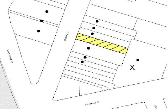
|
NOTIFICATION
PLAN
|
|
|
• PROPERTIES NOTIFIED
|
X SUBMISSIONS
RECEIVED
|
PROPERTY SUBJECT OF DEVELOPMENT
|
|
|
|
|
|
One submission objected to the
development, generally on the following grounds that the development would
result in:
· Overlooking and
overshadowing of the private courtyard area of the Rectory.
· Impact on the existing
right of carriage way.
The merits of the matters raised
in community submission have been addressed in the body of the report with the
exception of the following:
5.1.1 Impact on existing right of carriage way
The objector has raised concern
that the existing right of carriage way is in disrepair and the proposed
development would further exacerbate the existing situation and should be
rectified. It is considered to be a reasonable request that the applicant be
requested remove and reconstruct the existing layback and access crossing to a
commercial standard driveway. A recommended condition of consent has been
included in Schedule 1.
5.2 Public Agencies
The development application is
not Integrated Development under the Act and was not required to be referred to
any public agencies.
6. THE PUBLIC INTEREST
Section 79C(1)(e) of the Act
requires Council to consider “the public interest”.
The public interest is an
overarching requirement, which includes the consideration of the matters
discussed in this report. Implicit to the public interest is the achievement
of future built outcomes adequately responding to and respecting the future
desired outcomes expressed in environmental planning instruments and
development control plans.
The application is considered to
have satisfactorily addressed Council’s criteria and would provide a
development outcome that, on balance, would result in a positive impact for the
community. Accordingly, it is considered that the approval of the proposed
development would be in the public interest.
CONCLUSION
The application proposes
demolition of the existing building and erection of a four storey mixed use
residential and commercial building with ground floor car parking.
The proposal exceeds the
permitted floor space ratio under Clause 15 of the Hornsby Shire LEP. The
submitted objection under SEPP 1 – Development Standards, is supported in this
regard.
The
development complies with Section 79(c) of the Environmental Planning and
Assessment Act 1979, the design principles within SEPP 65 and Business Lands
Development Control Plan.
The
application proposes five car parking spaces which is one less than prescribed
by Council’s Car Parking Development Control Plan. The applicant has proposed
to enter into a Voluntary Planning Agreement to provide a monetary contribution
in lieu of one car parking space. There is currently no Section 94
Contribution Plan in place for car parking for the Epping Commercial Centre.
The funds would be held in trust by Council and the funds would be allocated
for future parking, civic or urban improvements in the Epping Commercial
Centre.
Approval of the proposal is
recommended.
Note: At the time of the
completion of this planning report, no persons have made a Political
Donations Disclosure Statement pursuant to Section 147 of the Environmental
Planning and Assessment Act 1979 in respect of the subject planning
application.
|
Rod Pickles
Manager -
Assessment Team 2
Planning Division
|
Scott Phillips
Executive Manager
Planning Division
|
Attachments:
|
1.View
|
Locality Plan
|
|
2.View
|
Floor Plans
|
|
3.View
|
Elevation and
Sections
|
|
4.View
|
Shadow Diagram
|
|
5.View
|
Draft Voluntary
Planning Agreement
|
File Reference: DA/253/2010
Document Number: D01368896
SCHEDULE 1
GENERAL
CONDITIONS
The
conditions of consent within this notice of determination have been applied to
ensure that the use of the land and/or building is carried out in such a manner
that is consistent with the aims and objectives of the relevant legislation,
planning instruments and Council policies affecting the land and does not
disrupt the amenity of the neighbourhood or impact upon the environment.
Note: For the
purpose of this consent, the term ‘applicant’ means any person who has the
authority to act on or the benefit of the development consent.
Note: For the purpose of
this consent, any reference to an Act, Regulation, Australian Standard or publication
by a public authority shall be taken to mean the gazetted Act or Regulation, or
adopted Australian Standard or publication as in force on the date that the
application for a construction certificate is made.
1. Approved
Plans and Supporting Documentation
The
development must be carried out in accordance with the plans and documentation
listed below and endorsed with Council’s stamp, except where amended by Council
and/or other conditions of this consent:
|
Plan No.
|
Drawn by
|
Dated
|
|
Sk1f – Level 1 and Basement Plan
|
Brooks Projects Architects
|
2.11.09
|
|
Sk2g – Levels 2-4 Plans
|
Brooks Projects Architects
|
2.11.09
|
|
Sk3h – Elevations
|
Brooks Projects Architects
|
2.11.09
|
|
Sk4g – Elevations and Sections
|
Brooks Projects Architects
|
2.11.09
|
|
SD1a – Rendered Street Elevation
|
Brooks Projects Architects
|
2.11.09
|
|
Sediment & Erosion Control
Plan – DA01
|
Ryan Consulting Group
|
16.02.10 (Revision C)
|
|
Site Drainage Plan – DA02
|
Ryan Consulting Group
|
16.02.10 (Revision A)
|
|
Document No.
|
Prepared by
|
Dated
|
|
Voluntary Planning Agreement
|
HLW Ebsworth Lawyers
|
|
|
Schedule of Colours and Finishes
|
Brooks Projects Architects
|
24.08.10
|
|
BASIX Certificate No. 295706M_02
|
|
20.8.10
|
|
Design Verification Statement
|
Brooks Projects Architects
|
16.02.10
|
|
Site Stormwater Drainage Report
|
Ryan Consulting Group
|
17.02.10
|
|
Statement of Heritage Impact
|
Archnex Designs
|
February 2010
|
|
Stage 1 Preliminary Site
Contamination Assessment
|
Coffey Environments Australia
Pty Ltd
|
28.05.10
|
|
Waste Management Plan
|
Horizon Project Solutions
Architects
|
26.06.06
|
2. Amendment
of Plans
The approved
plans are to be amended to provide additional 3m3 storage space for
one bedroom unit and 4m3 of storage space for two bedroom units in
the ground floor car parking level.
REQUIREMENTS PRIOR TO THE ISSUE OF A CONSTRUCTION
CERTIFICATE
3. Voluntary
Planning Agreement
Pursuant to
section 93F of the Environmental Planning and Assessment Act 1979, the
applicant must prepare and enter into a Voluntary Planning Agreement (VPA) with
Hornsby Shire Council for payment of a monetary contribution for the shortfall
of one car parking for the commercial unit.
The terms of
the VPA must include but not be limited to the following:
a. The Applicant agrees to pay Council a monetary
contribution of $46,000 towards the shortfall of one car parking space for the
commercial unit.
b. Hornsby Shire Council agrees to hold in trust the funds
for current or future allocation towards parking, civic or urban improvements
in the Epping Commercial Centre.
c. In addition to the above, the applicant agrees to pay all
costs (including Council’s costs) associated with the preparation, public
notification, legal costs and administration costs of the VPA.
4. Building
Code of Australia
All building work must be
carried out in accordance with the requirements of the Building Code of
Australia.
5. Fire
Safety Upgrade
To ensure the
protection of persons using the building and to facilitate egress from the
building in the event of a fire, the application for a construction certificate
must demonstrate that it will comply with the following Category 1 fire safety
provisions:
a. Two
exits from the basement must comply with section D1.2 of the BCA, and garbage
room if enclosed to D2.8 of the BCA.
b. Openings
within 3m of the Boundary must comply with section D3.2 of the BCA
6. Car
Parking and Deliveries
2
All car parking must be constructed and operated in accordance
with Australian Standard AS 2890.1 – 2004 – Off Street Car Parking and Australian
Standard 2890.2 - 2002 – Off Street Commercial and the following
requirement:
a. All
parking areas and driveways are to be sealed to an all weather standard, line
marked and signposted.
b. Car
parking, loading and manoeuvring areas to be used solely for nominated
purposes.
c. Vehicles
awaiting loading, unloading or servicing shall be parked on site and not on
adjacent or nearby public roads;
d. All
vehicular entry on to the site and egress from the site shall be made in a
forward direction.
7. Contract
of Insurance (Residential Building Work)
In the case
of residential building work for which the Home Building Act, 1989 requires
there to be a contract of insurance in force in accordance with Part 6 of that
Act, that such a contract of insurance is in force before any building work
authorised to be carried out by the consent commences.
Note: This
condition does not apply to the extent to which an exemption is in force
under Clause 187 or 188 of the Act, subject to the terms of any condition or
requirement referred to in Clause 187(6) or 188(4) of the Act, or to the
erection of a temporary building.
8. Notification
of Home Building Act, 1989 Requirements
Residential
building work within the meaning of the Home Building Act,
1989 must not be carried out unless the principal certifying authority for
the development to which the work relates (not being Council) has given Council
written notice of the following information:
a. In
the case of work for which a principal contractor is required to be appointed:
i. The
name and licence number of the principal contractor.
ii. The
name of the insurer by which the work is insured under Part 6 of that Act.
b. In
the case of work to be done by an owner-builder:
i. The
name of the owner-builder.
ii. If
the owner-builder is required to hold an owner-builder’s permit under that Act,
the number of the owner-builder’s permit.
Note: If
arrangements for doing the residential building work are changed while the work
is in progress so that the information notified becomes out of date, further
work must not be carried out unless the principal certifying authority for the
development to which the work relates (not being Council) has given Council
written notification of the updated information.
9. Sydney
Water – Quick Check
The
application must be submitted to a Sydney Water ‘Quick Check Agent’ or
‘Customer Centre’ for approval to determine whether the development will affect
any Sydney Water infrastructure, and whether further requirements are to
be met.
Note: Refer
to www.sydneywater.com.au or
telephone 13 20 92 for assistance.
10. Dilapidation
Report
A
‘Dilapidation Report’ is to be prepared by a ‘chartered structural engineer’
detailing the structural condition of all adjoining properties.
11. Detailed
Site Investigation
A detailed investigation
of the proposed development site must be prepared by a suitably qualified
environmental consultant prior to the commencement of any construction works.
Such investigation must be undertaken in accordance with NSW Environment
Protection Authority’s Contaminated Sites – Guidelines for Consultants
Reporting on Contaminated Sites and Contaminated Sites – Sampling Design
Guidelines.
12. Remedial
Action Plan
A Remedial
Action Plan (RAP) must be prepared by a suitably qualified environmental
consultant and submitted to Council should the detailed investigation required
reveal contamination exceeding criteria prescribed by the NSW Environment
Protection Authority’s Contaminated Sites – Guidelines for the NSW Site
Auditor Scheme.
REQUIREMENTS PRIOR TO THE COMMENCEMENT OF ANY WORKS
13. Erection
of Construction Sign
A sign must
be erected in a prominent position on any site on which building work,
subdivision work or demolition work is being carried out:
a. Showing
the name, address and telephone number of the principal certifying authority
for the work,
b. Showing
the name of the principal contractor (if any) for any demolition or building
work and a telephone number on which that person may be contacted outside
working hours, and
c. Stating
that unauthorised entry to the work site is prohibited.
Note: Any
such sign is to be maintained while the building work, subdivision work or
demolition work is being carried out, but must be removed when the work has
been completed.
14. Protection
of Adjoining Areas
A temporary
hoarding, fence or awning must be erected between the work site and adjoining
lands before the works begin and must be kept in place until after the
completion of the works if the works:
a. Could
cause a danger, obstruction or inconvenience to pedestrian or vehicular
traffic.
b. Could
cause damage to adjoining lands by falling objects.
c. Involve
the enclosure of a public place or part of a public place.
Note: Notwithstanding
the above, Council’s separate written approval is required prior to the
erection of any structure or other obstruction on public land.
15. Toilet
Facilities
Toilet
facilities must be available or provided at the works site before works begin
and must be maintained until the works are completed at a ratio of one toilet
for every 20 persons employed at the site. Each toilet must:
a. be
a standard flushing toilet connected to a public sewer; or
b. be
a temporary chemical closet approved under the Local Government Act, 1993;
or
c. have
an on-site effluent disposal system approved under the Local Government Act,
1993
16. Erosion
and Sediment Control
Erosion and
sediment control measures must be provided and maintained throughout the
construction period in accordance with the manual ‘Soils and Construction
2004 (Bluebook)’, the approved plans, Council specifications and to the
satisfaction of the principal certifying authority. The erosion and sediment
control devices must remain in place until the site has been stabilised and
revegetated.
Note: On
the spot penalties up to $1,500 may be issued for any non-compliance with this
requirement without any further notification or warning.
REQUIREMENTS DURING CONSTRUCTION
17. Construction
Work Hours
All work on site (including demolition and earth works)
must only occur between 7am and 5pm Monday to Saturday.
No work is to be undertaken on Sundays or public holidays.
18. Demolition
All
demolition work must be carried out in accordance with Australian Standard
2601-2001 – The Demolition of Structures and the following requirements:
a. Demolition
material is to be disposed of to an authorised recycling and/or waste disposal
site and/or in accordance with an approved waste management plan.
b. Demolition
works, where asbestos material is being removed, must be undertaken by a
contractor that holds an appropriate licence issued by WorkCover NSW in
accordance with Chapter 10 of the Occupational Health and Safety Regulation
2001 and Clause 29 of the Protection of the Environment Operations
(Waste) Regulation 1996.
c. On
construction sites where buildings contain asbestos material, a standard
commercially manufactured sign containing the words ‘DANGER ASBESTOS REMOVAL IN
PROGRESS’ measuring not less than 400mm x 300mm must be erected in a prominent
position visible from the street.
19. Environmental
Management
The site must
be managed in accordance with the publication ‘Managing Urban Stormwater –
Landcom (March 2004) and the Protection of the Environment Operations
Act 1997 by way of implementing appropriate measures to prevent sediment
run-off, excessive dust, noise or odour emanating from the site during the
construction of the development.
20. Street
Sweeping
Street
sweeping must be undertaken following sediment tracking from the site along Oxford Street during works and until the site is established.
21. Council
Property
During
construction works, no building materials, waste, machinery or related matter
is to be stored on the road or footpath. The public reserve is to be kept in a
clean, tidy and safe condition at all times.
Note:
This consent does not give right of access to the site via Council’s park or
reserve. Should such access be required, separate written approval is to be
obtained from Council.
22. Landfill
Landfill must
be constructed in accordance with Council’s ‘Construction Specification,
2005’ and the following requirements:
a. All
fill material imported to the site is to wholly consist of Virgin Excavated
Natural Material (VENM) as defined in Schedule 1 of the Protection of the
Environment Operations Act 1997 or a material approved under the Department
of Environment and Climate Change’s general resource recovery exemption.
b. A
compaction certificate is to be obtained from a geotechnical engineer verifying
that the specified compaction requirements have been met.
23. Excavated
Material
All excavated
material removed from the site must be classified in accordance with the NSW
Environment Protection Authority’s Environmental Guidelines – Assessment,
Classification and Management of Liquid and Non-Liquid Wastes prior to
disposal to an approved waste management facility and reported to the principal
certifying authority.
24. Survey
Report – Finished Floor Level
A report(s)
must be prepared by a registered surveyor and submitted to the principal
certifying authority prior to the pouring of concrete at each level of the
building certifying that:
a. The
building, retaining walls and the like have been correctly positioned on the
site.
b. The
finished floor levels are in accordance with the approved plans.
25. Waste
Management
Appropriate
work practices must be employed to implement the Waste Management Plan
Section One – Demolition Stage and Section Three – Construction Stage as
applicable.
REQUIREMENTS PRIOR TO THE ISSUE OF AN OCCUPATION
CERTIFICATE
Note: For the
purpose of this consent, any reference to ‘occupation certificate’ shall also
be taken to mean ‘interim occupation certificate’ unless otherwise stated.
26. Fulfilment
of BASIX Commitments
The applicant
must demonstrate the fulfilment of BASIX commitments pertaining to the
development.
27. Sydney
Water – s73 Certificate
A s73
Certificate must be obtained from Sydney Water.
28. Validation
Certificate
A
validation report must be prepared by a suitably qualified environmental
consultant in accordance with the NSW Environment Protection Authority’s Contaminated
Sites – Guidelines for Consultants Reporting on Contaminated Sites and Contaminated
Sites – Sampling Design Guidelines validating that the proposed development
has been remediated and is suitable for its intended use.
29. Stormwater
Drainage
The
stormwater drainage system for the development must be designed and constructed
in accordance with Council’s Civil Works – Design and Construction
Specification 2005 and the following requirements:
a. Connected
directly to Council’s street drainage system in Oxford St. The connection to
Oxford St from the property boundary is to be constructed with a 100mm x 75mm
galvanised section.
30. On
Site Stormwater Detention
An on-site
stormwater detention system must be designed by a chartered civil engineer and
constructed in accordance with the following requirements:
a. Have
a capacity of not less than 2.5 cubic metres, and a maximum discharge (when
full) of 9 litres per second.
b. Have
a surcharge/inspection grate located directly above the outlet.
c. Discharge
from the detention system to be controlled via 1 metre length of pipe, not less
than 50 millimetres diameter or via a stainless plate with sharply drilled
orifice bolted over the face of the outlet discharging into a larger diameter
pipe capable of carrying the design flow to an approved Council system.
31. Damage
to Council Assets
Any damage
caused to Council’s assets as a result of the construction of the development
must be rectified in accordance with Council’s written requirements and at the
sole cost of the applicant.
32. Creation
of Easements
The following
covenants and restrictions are to be placed on the title of the property in
accordance with the Conveyancing Act 1919:
a. The
creation of an appropriate "Positive Covenant" and "Restriction
as to User" over the constructed on-site detention/retention systems
and outlet works, within the lots in favour of Council in accordance with
Council’s prescribed wording. The position of the on-site detention system is
to be clearly indicated on the title.
b. To
register the OSD easement, the restriction on the use of land “works-as-executed”
details of the on-site-detention system must be submitted verifying that the
required storage and discharge rates have been constructed in accordance with
the design requirements. The details must show the invert levels of the on
site system together with pipe sizes and grades. Any variations to the
approved plans must be shown in red on the “works-as-executed” plan and
supported by calculations.
Note: Council
must be nominated as the authority to release, vary or modify any easement,
restriction or covenant.
33. Works
as Executed Plan
3
A works-as-executed plan(s) must be prepared by a registered
surveyor and submitted to Council for completed road pavement, kerb &
gutter, public drainage systems, driveways and on-site detention system. The
plan(s) must be accompanied by a certificate from a registered surveyor
certifying that all pipelines and associated structures lie wholly within any
relevant easements.
34. Vehicular
Crossing
A separate
application under the Local Government Act, 1993 and the Roads Act,
1993 must be submitted to Council for the installation of a new vehicular
crossing and the removal of the redundant crossing. The vehicular crossing
must be constructed in accordance with Council’s Civil Works Design, 2005
and the following requirements:
a. The
existing layback and access crossing must be removed and reconstructed to a
commercial standard driveway.
Note:
An application for a vehicular crossing can only be made to one of Council’s
Authorised Vehicular Crossing Contractors. You are advised to contact Council
on 02 9847 6940 to obtain a list of contractors.
35. Traffic
Control Plan
A Traffic
Control Plan (TCP) must be prepared by a qualified traffic controller in
accordance with the Roads & Traffic Authority’s Traffic Control at
Worksites Manual 1998 and Australian Standard 1742.3 for all work on
a public road and be submitted to Council. The TCP must detail the following:
a. Arrangements
for public notification of the works.
b. Temporary
construction signage.
c. Permanent
post-construction signage.
d. Vehicle
movement plans.
e. Traffic
management plans.
f. Pedestrian
and cyclist access/safety.
36. Retaining
Walls
All required retaining walls
must be constructed as part of the development.
37. External
Lighting
All external
lighting must be designed and installed in accordance with Australian
Standard AS 4282 – Control of the Obtrusive Effects of Outdoor Lighting.
Certification of compliance with the Standard must be obtained from a suitably
qualified person.
38. Bin
Storage Area
Each bin
storage area must be designed and constructed in accordance with Council’s Waste
Minimisation and Management Development Control Plan with regards to
water/hose for cleansing, graded floors with drainage to sewer, robust door(s),
sealed/impervious surfaces, adequate lighting and ventilation.
39. Waste
Management Plan
To confirm compliance with the Waste Management Plans
lodged with this Development Application, a report(s) must be prepared
by an appropriately qualified person certifying that:
a. The
Waste Management Plan Section One – Demolition Stage and Section Three –
Construction Stage were implemented and at least 60 % waste generated was
reused or recycled or if the 60% diversion from landfill was not achieved in
the Demolition Stage and/or Construction Stage, the Report is to include the
reasons why this occurred and certify that appropriate work practices were
employed in the demolition and construction stages to implement the Waste
Management Plan.
b. The
Report(s) is based on documentary evidence (i.e. tipping dockets/receipts from
recycling depots, transfer stations and landfills, audits of procedures etc)
which have been attached to the Report.
c. Each
dwelling/kitchen must be provided with an indoor waste/recycling cupboard for
the interim storage of a minimum one day’s waste/recycling generation with
separate containers for general waste and recyclable materials.
d. The
residential component and non-residential component of the development must
have separate and self-contained waste management systems, including separate
bin storage rooms. Commercial tenants must be prevented (via signage and other
means) from using the residential waste/recycling bins and vice versa.
40. Unit
Numbering
The
allocation of unit numbering must be authorised
by Council prior to the numbering of each unit in the development.
41. s94
Infrastructure Contributions
4
The payment to Council of a contribution of $55,645.75* for five
additional dwellings towards the cost of infrastructure identified in Council’s
Development Contributions Plan 2007-2011.
Note:
* The value of contribution is current as at 7
September 2010. The contribution will be adjusted from this date in
accordance with the underlying consumer price index for subsequent financial
quarters.
It is recommended that you contact Council to ascertain the indexed value of
the contribution prior to payment.
42. Fire
Safety Statement - Annual
5
On at least one occasion in every 12 month period following the
date of the first ‘Fire Safety Certificate’ issued for the property, the owner
must provide Council with an annual ‘Fire Safety Certificate’ to each essential
service installed in the building.
43. Waste
Management
The waste
management on the site must be in accordance with the following requirements:
a. Bins
must be placed in the rear laneway against the eastern fence at the entrance to
the laneway from Pembroke Street for servicing.
b. The
site is to be serviced by Council or their authorised Contractor (Domestic
Waste Only).
c. The
commercial waste can be serviced by any authorised collection contractor, including
Council.
d. All
commercial tenants must keep written evidence on site of a valid contract with
a licensed waste contractor(s) for the regular collection and disposal of the
waste and recyclables that are generated on site.
e. A
site caretaker must be employed and be responsible for moving bins to and from
the bin storage area(s) and the waste collection point (at the entrance to the
laneway from Pembroke Street), washing bins and maintaining bin storage areas,
arranging the prompt removal of dumped rubbish from on and around the site, and
ensuring all occupants (residential and commercial) are informed of the waste
management system.
-
END OF CONDITIONS -
ADVISORY NOTES
The following information is provided for your
assistance to ensure compliance with the Environmental Planning and Assessment
Act, 1979, Environmental Planning and Assessment Regulation 2000, other
relevant legislation and Council’s policies and specifications. This
information does not form part of the conditions of development consent
pursuant to Section 80A of the Act.
Environmental Planning and
Assessment Act, 1979 Requirements
· The Environmental Planning and
Assessment Act, 1979 requires:
· The issue of a construction certificate
prior to the commencement of any works. Enquiries regarding the issue of a
construction certificate can be made to Council’s Customer Services Branch on
9847 6760.
· A principal certifying authority to be
nominated and Council notified of that appointment prior to the commencement of
any works.
· Council to be given at least two days
written notice prior to the commencement of any works.
· Mandatory inspections of nominated
stages of the construction inspected.
· An occupation certificate to be issued
before occupying any building or commencing the use of the land.
Long Service Levy
In accordance with Section 34 of
the Building and Construction Industry Long Service Payments Act 1986, a ‘Long Service Levy’ must be paid to the Long
Service Payments Corporation or Hornsby Council.
Note: The
rate of the Long Service Levy is 0.35% of the total cost of the work.
Note: Hornsby
Council requires the payment of the Long Service Levy prior to the issue of a
construction certificate.
Disability Discrimination Act
The applicant’s attention is
drawn to the existence of the Disability Discrimination Act. A
construction certificate is required to be obtained for the proposed
building/s, which will provide consideration under the Building Code of
Australia, however, the development may not comply with the requirements of
the Disability Discrimination Act. This is the sole responsibility of
the applicant.
Dial Before You Dig
Prior to commencing any works,
the applicant is encouraged to contact Dial Before You Dig on 1100 or www.dialbeforeyoudig.com.au for
free information on potential underground pipes and cables within the vicinity
of the development site.
Tenancy Fit-Out – Separate DA
Required
This consent does not permit the
fit-out of individual tenancies. A separate development application is
required for the fit-out of individual tenancies prior to the occupation of the
building.
Advertising Signage – Separate DA Required
This consent does not permit the
erection or display of any advertising signs. Most advertising signs or
structures require development consent. Applicants should make separate
enquiries with Council prior to erecting or displaying any advertising signage.
Asbestos Warning
Should asbestos or asbestos
products be encountered during demolition or construction works you are advised
to seek advice and information should be prior to disturbing the material. It
is recommended that a contractor holding an asbestos-handling permit (issued by
WorkCover NSW) be engaged to manage the proper handling of the material.
Further information regarding the safe handling and removal of asbestos can be
found at:
www.environment.nsw.gov.au
www.nsw.gov.au/fibro
www.adfa.org.au
www.workcover.nsw.gov.au
Alternatively, telephone the WorkCover Asbestos and
Demolition Team on 8260 5885.
Standard Report No. PLN69/10
Planning Division
Date of Meeting:
6/10/2010
7 KANGAROO POINT PLANNING
PROPOSAL - REPORT ON SUBMISSIONS
EXECUTIVE SUMMARY
In November 2009,
Council resolved that the Hornsby Shire Local Environmental
Plan (HSLEP) 1994 be amended to permit the construction of a commuter
berthing facility at Kangaroo Point. In accordance with Council’s resolution,
the Kangaroo Point Planning Proposal was presented to Council on 7 April 2010
for endorsement for public exhibition.
The Planning Proposal was
exhibited for community comment in July 2010. One hundred and seven
submissions were received in response to the exhibition. Key issues
raised in submissions include the use of public parking to service commuter
berthing, funding of the facility, the approval process, alternative locations
for the provision of commuter berthing and the environmental impacts associated
with establishing a commuter berthing facility at Kangaroo Point.
It
is understood that, in resolving to progress the Planning Proposal, Council was
of the view that it would facilitate the provision of commuter berthing
facilities in the most convenient and accessible location for river residents
compared to commercial marinas at Sandbrook Inlet. Furthermore, the general
community would benefit from improved facilities and a higher quality of open
space as the proceeds from a commercial lease of any commuter berthing facility
could be used to fund refurbishment and maintenance works.
The
submissions do not raise any issues that would prevent the progression of the
Planning Proposal or any new issues that have not previously been evaluated by
Council in considering the future use and management of Kangaroo Point.
Accordingly, based on Council’s most recent resolution concerning commuter
berthing, it is recommended that Council forward
the Planning Proposal to the Department of Planning (DOP) for gazettal and
prepare amendments to the Kangaroo Point Community Masterplan to limit the size
of any future facility.
PURPOSE
The purpose of this report is to review submissions received
in response to the exhibition of the Kangaroo Point Planning Proposal.
BACKGROUND
At its meeting on 11 November
2009, Council considered Executive Manager's Report No. EN47/09 concerning a
Generic Plan of Management for Planning Districts 5 and 7, including Kangaroo
Point. Council resolved (in part) that the HSLEP be
amended to permit, with development consent, the construction of a commuter
berthing facility at Kangaroo Point.
In accordance with Council’s
resolution, the Kangaroo Point Planning Proposal was prepared in accordance
with the State Government’s new plan-making process and presented to Council at
its meeting on 7 April 2010. The Planning Proposal seeks to permit “marinas”
at Kangaroo Point by amending Clause 22(1) – Exceptions of the HSLEP.
The amendment involves replacing the current exception that permits “houseboat
hire premises” with consent at Kangaroo Point with the “marina” land
use. The “houseboat hire premises” land use would be covered by the
definition of a “marina” which is:
a building
or place used or intended to be used to provide moorings for boats and includes
any associated:
(a) slipways, pontoons, jetties, piers or the like; and
(b) facilities for the repair, maintenance and fuelling of,
or for the provision of accessories and parts for boats.
Council resolved to progress the
Kangaroo Point Planning Proposal for public exhibition. In accordance with
Council’s resolution, the Planning Proposal was forwarded to the DOP seeking a
Gateway Determination by the Minister for Planning in accordance with Section
56 of the Environmental Planning and Assessment (EP&A) Act 1979.
On 10 May 2010, Council received
a Gateway Determination indicating that the Planning Proposal should be
exhibited. The Gateway Determination was issued with a condition that the Planning
Proposal be amended to clarify that houseboat hire facilities remain a
permissible use by retaining the “houseboat hire premises” land use and
inserting “marina” as a permissible use on the subject land.
Accordingly, the Planning Proposal was amended and exhibited for public comment
from 1 July 2010 to 30 July 2010.
It is noted that despite the term
“marina” being inserted into the HSLEP to facilitate commuter berthing
at Kangaroo Point, it has been Council’s stated intention that the amending LEP
would facilitate the lodgement of a development application for commuter
berthing facilities and not a commercial marina.
DISCUSSION
This report discusses submissions
received in response to the public exhibition of the Kangaroo Point Planning
Proposal.
Exhibition and review of
submissions
The Kangaroo Point Planning
Proposal was exhibited from 1 July 2010 to 30 July 2010. The Gateway
Determination was subject to conditions including a requirement that the
Proposal be exhibited for 28 days and notified through a local
newspaper, on the Council website and to a number of relevant public
authorities.
The consultation met the
statutory requirements of the Gateway Determination and included the same
methods of consultation undertaken to exhibit the Kangaroo Point Community
Masterplan. Advertisements were placed in the Hornsby Advocate and Bush
Telegraph on 1 July and 15 July 2010. The Planning Proposal and supporting
documentation were also displayed at Council’s Administration Centre, the Brooklyn and District Community Health and Resource Centre, the Hornsby and Berowra branch
libraries and on the Council website.
In accordance with the adopted
consultation strategy, public authorities were consulted prior to the
commencement of the exhibition period. Ten public authorities, including those
stated in the Gateway Determination, were consulted under section 56(2)(d) of
the EP&A Act. Public authorities were provided a copy
of the Planning Proposal and invited to comment from 31 May 2010 to the end of
the exhibition period. Twenty five interested individuals, businesses and
community groups involved in the Kangaroo Point Community Masterplan were also
provided a copy of the Planning Proposal and invited to comment.
A total of one hundred and seven
submissions (including one submission received prior to the exhibition period
and sixteen received after the exhibition period) have been received. The
submissions comprise individually written letters and emails from one hundred
individuals, businesses, community groups, public authorities and Council
branches. Fifty (47%) submissions object, forty eight (45%) submissions
indicate support, and nine (8%) make comment on the Planning Proposal.
Six submissions were received
from public authorities, including the Hawkesbury-Nepean Catchment Management
Authority (HNCMA), Roads and Traffic Authority (RTA), NSW Rural Fire Service,
Industry and Investment (I&I) NSW, NSW Maritime and the Land and Property
Management Authority (LPMA). The following public authorities were notified
but did not make a submission: Metropolitan Local Aboriginal Lands Council
(MLALC), Gosford City Council, Sydney Water Corporation and Department of Sport
and Recreation (Milsons Island).
Eighty nine submissions were received from individuals or local businesses.
Ten submissions were received from community groups, namely Friends of Kangaroo
Point, Kangaroo Point Management Association (KPMA), Bar Point Safe Boating
Rescue and Radio Club, Brooklyn Community Association (BCA) Inc (previously the
Brooklyn Ratepayer’s Association (BRA)), Milsons Passage Progress Association,
Brooklyn Senior Citizens Club, and the Galston Area Residents’ Association Inc.
Relevant Council branches were
also invited to comment on the Kangaroo Point Planning Proposal. Council’s
Water Catchments and Environmental Sustainability and Health Teams made
comment.
Key issues raised in submissions
include the use of public parking to service commuter berthing, funding of the
facility, the approval process, alternative locations for the provision of
commuter berthing and the environmental impacts associated with establishing a
commuter berthing facility at Kangaroo Point. The issues raised in submissions
are addressed below.
Background to the existing
Masterplan
Submitters, including the BCA and
Friends of Kangaroo Point, comment that the Planning Proposal does not consider
the recommendations by consultant town planner, Tony Moody in 2002, who
recommended against commuter berthing, reserved parking for river residents,
reducing the bitumen parking at the top of Kangaroo Point and expansion or
intensification of the existing houseboat operations.
Two submitters, including the BCA
note that in 2005, the issues currently being considered regarding commuter
berthing were extensively addressed in Executive Manager’s Report No.
PLN63/05. A number of submitters, including the Friends of Kangaroo Point
state that the Planning Proposal does not address previous community
consultation on the Kangaroo Point Community Masterplan following which open
space and no commuter berthing was adopted as the preferred option.
Submitters, including the Friends
of Kangaroo Point comment that in 2007, Council hosted a meeting attended by
about seventy residents at the Brooklyn Health Centre. It is suggested that at
the meeting Council stated that the Kangaroo Point matter had been resolved and
the decision was final. Submissions express disappointment that the Planning
Proposal is inconsistent with the commitment given at the meeting.
A number of submitters, including
the Galston Area Residents’ Association Inc and the Friends of Kangaroo Point
express concern that the recommendation for commuter berthing has come from a
few interested parties who have a commercial interest, potentially presenting a
conflict of interest.
Comment: It is
acknowledged that the future of Kangaroo Point has been the subject of analysis
and extensive community consultation. Executive Manager’s Report No. PLN23/10
(presented to Council at its meeting on 7 April 2010) outlined the background
to the preparation of the existing Masterplan and associated Plan of
Management. Specifically, the report acknowledged that, in accordance with the
recommendations of independent planning and heritage consultants, Council previously
resolved not to support commuter berthing at Kangaroo Point.
The Planning Proposal also
acknowledges that in 2004, Council considered two options for progression of
the Kangaroo Point Masterplan and that Council resolved to adopt the Masterplan
option which prohibited commuter berthing at Kangaroo Point. However, the
current Planning Proposal aims to implement Council’s most recent resolution
concerning the provision of commuter berthing at Kangaroo Point.
A chronology outlining the
background to the current Kangaroo Point Community Masterplan is attached. The
majority of issues raised in submissions have been addressed in previous
reports to Council. Relevant extracts from reports to Council are addressed in
this report. Furthermore, a copy of Executive Manager’s Reports Nos. PLN132/99, PLN307/02, PLN305/03, PLN108/04, PLN63/05, PLN145/08 and PLN23/10
concerning planning for Kangaroo Point are attached in electronic format and
have been circulated to Councillors via CD.
In regard to concerns regarding
conflicts of interest, Section 451 of the Local Government Act 1993
requires a member of a Council committee who has a pecuniary interest in any
matter to disclose the nature of the interest as soon as practicable.
Planning Proposal
A couple of submissions question
the use of the term ‘marina’ in the Planning Proposal when the intention
is to permit a commuter berthing facility. The Friends of Kangaroo Point
comments that the use of the term “commuter berthing” is misleading.
Users could be retirees who rarely use their vehicles, owners of weekenders or
proprietors of overnight accommodation. It is stated that Council cannot
guarantee all users of the marina would be landholders, daily commuters or
Hornsby Shire residents.
Comment: The aim of the
Planning Proposal is to permit a commuter berthing facility at Kangaroo
Point. ‘Commuter berthing facility’ is not currently defined in the HSLEP
1994. In the preparation of the Planning Proposal, the DOP advised that
the progression of any Proposal should facilitate the translation of the HSLEP
into the Standard Instrument template. Council is currently drafting a new
Comprehensive LEP based on the Standard Instrument which will supersede the
existing HSLEP.
‘Commuter berthing facility’
is also not defined in the Standard Instrument. However, in the preparation of
Council’s Comprehensive LEP, Council cannot introduce new definitions to those
contained within the Standard Instrument and therefore, must utilise the
definitions contained in the Instrument. The definition that most closely
aligns with commuter berthing is “marina”.
Therefore, the existing land use
term ‘marina’ under the HSLEP is used in the Planning Proposal
and the definition of ‘marina’ under the Standard Instrument will be
implemented when the Comprehensive LEP is progressed. It should be noted that
both definitions of ‘marina’, as defined below, permit a range of uses
not restricted to a commuter berthing facility.
In the HSLEP, a ‘marina’
is defined as:
a building
or place used or intended to be used to provide moorings for boats and includes
any associated:
a) slipways,
pontoons, jetties, piers or the like; and
b) facilities for
the repair, maintenance and fuelling of, or for the provision of accessories
and parts for boats.
In the Standard Instrument, a ‘marina’
means:
a permanent
boat storage facility (whether located wholly on land, wholly on the waterway
or partly on land and partly on the waterway) together with any associated
facilities, including:
a) any facility for the construction, repair, maintenance,
storage, sale or hire of boats, and
b) any facility for providing fuelling, sewage pump-out or
other services for boats, and
c) any facility for launching or landing boats, such as slipways
or hoists, and
d) any associated car parking, commercial, tourist or
recreational or club facility that is ancillary to a boat storage facility, and
e) any associated single mooring.
Commuter berthing facility
A number of submissions comment
on the scale and funding of any future commuter berthing facility as discussed
below.
Scale of the facility
The KPMA suggests a small
facility to cater for existing demand. However, a number of submitters,
including the Galston Area Residents’ Association Inc, BCA and Friends of
Kangaroo Point raise concern that the Planning Proposal would make permissible
with development consent a marina of any size.
The Galston Area Residents’
Association Inc comments that a small marina could develop into a large
commercial marina like in Berowra Waters. The Friends of Kangaroo Point
suggests that there will be pressure to expand the facility beyond the
suggested twenty five river residents who do not have berths on commercial
marinas.
Comment: It is
acknowledged that the Planning Proposal does not limit the size or intensity of
any future commuter berthing facility. Section 117 Direction 6.3 states that
where a Planning Proposal allows a particular use, it should not propose
specific development standards that are additional to those currently contained
in the HSLEP 1994. However, controls to limit the size of any future
berthing facility could be included in the Brooklyn DCP.
The River Settlements DCP
currently identifies a Permissive Occupancy limit for the Berowra Waters Marina
and states that there should be no extensions to the marina unless equivalent
swing moorings are reduced. Should Council support the progression of the
Planning Proposal, it is recommended that an amendment to the Brooklyn DCP
be prepared to limit the size of any commuter berthing facility as discussed
below under the heading “Demand for Commuter Berthing at Kangaroo Point”.
Funding of the facility
A number of submissions comment
that the construction of any commuter berthing facility should be funded by the
end users of the facility. The Friends of Kangaroo Point also suggests that
commercial charges should be levied for the use of the wharf and any parking
area. However, a submission notes that the commuter berths and the adjoining
reclaimed land are on Crown Land and therefore, Council may not be able to
charge rent.
A number of submissions including
the Bar Point Safe Boating and Rescue Radio Club note that river residents are
prepared to self fund a commuter berthing facility.
Furthermore, the land is proposed to be leased on a user pays basis
similar to that at McKell Park and Berowra Waters. However, a submission notes
that where private enterprise is involved, it is reasonable to expect that the
owner would seek to maximise return on investment. This may conflict with
providing commuter berthing at a reasonable cost to river residents.
Comment: The Planning
Proposal does not indicate how any future commuter berthing facility would be
funded. However, at its meeting on 17 September 2003, Council considered
Executive Manager’s Report No. PLN305/03 concerning a commuter berthing
proposal for Kangaroo Point by the KPMA. The report noted that the preferred
commuter berthing option involved provision of up to 48 commuter berths in
addition to the existing houseboat berths and extended beyond the limits of the
existing commercial licence into Seagrass Bay Reserve.
An extension to the commercial
licence would require the revocation of the Reserve status by the Minister for
Lands or for Council to acquire the land. Representatives of the then
Department of Lands advised that the acquisition of the land by Council would
best overcome the difficulties posed by the Reservation. Accordingly, the KPMA
proposed that it would assist Council fund the acquisition of the area of water
required to accommodate the proposed commuter berthing layout by way of paying
rent in advance. The KPMA indicated that it would fund the construction of the
commuter berthing facility but in return, would require the granting of a long
term lease.
The KPMA noted that any car
parking demand generated by the commuter berths would be accommodated on
Council owned or controlled land at Kangaroo Point classified as Community Land under the Local Government Act 1993. However, Community Land cannot be leased or sold for the purposes of secure commuter parking. Commuters would be
competing with recreational and other commercial users of the land for the use
of public car parking.
At its meeting on 16 March 2005,
Council considered Executive Manager’s Report No. PLN63/05 which also noted
that the KPMA had suggested that there would be no cost to Council or any other
government department in the provision of commuter berthing at Kangaroo Point.
The KPMA noted that commuter berthing would be self funded and suggested that
Council would gain, free of cost, a valuable asset.
Should Council resolve to
progress the Planning Proposal, it is recommended the Council also resolve that
any future provision of commuter berthing and car parking at Kangaroo Point be
funded by river residents (including the land value component). Any detailed
financial arrangements concerning the acquisition, construction and occupation
of a commuter berthing proposal at Kangaroo Point would be the subject of
further discussion and a report to Council.
Development application
process
A number of submitters, including
the BCA and Friends of Kangaroo Point raise concern that any future development
application for a marina would not be assessed by Council in the interests of
the local community. It is commented that the application would be assessed by
the Minister for Planning and the DOP through the Part 3A process.
NSW Maritime requests that any
development application for waterside structures, such as marinas, be referred
to NSW Maritime for navigation comment during the assessment process.
Comment: Any proposal for
a commuter berthing facility would require lodgement of a development
application. Depending on the scale of the proposal, the proposal may be
classified as a major project under Part 3A of the Environmental Planning
and Assessment Act 1979 and the Minister for Planning would be the consent
authority. The proposal may be classified as a major project under SEPP
(Major Development) 2005 if it is a marina facility that is:
1. Development for the purpose of marinas or other related land
or water shoreline facilities that moor, berth or store vessels (excluding
dinghies and other small craft) at fixed or floating berths, at freestanding
moorings, alongside jetties or pontoons, within dry storage stacks or on
cradles in hardstand areas and that:
a) moor, berth or store more than 30 vessels in Sydney Harbour,
Middle Harbour, North Harbour, Botany Bay, Port Hacking, Broken Bay or
associated tidal waters, or
b) moor, berth or store more than 80 vessels in other waters,
or
c) are located in environmentally sensitive areas of State
significance but excluding any development that, in the opinion of the
Minister, is only of local environmental planning significance.
2. A reference in this clause to the number of vessels moored,
berthed or stored includes a reference (in the case of an existing facility) to
the additional number of vessels moored, berthed or stored at the facility.
As discussed above, should
Council support the progression of the Planning Proposal, it is recommended
that an amendment to the Brooklyn DCP be prepared to limit the size of
any commuter berthing facility. A limit of commuter berthing spaces may
prevent a commuter berthing facility being classified as a major project under SEPP
(Major Development) 2005.
Alternatively, the proposal may
be classified as regional development under SEPP (Major Development) 2005
and be determined by the Sydney West Joint Regional Planning Panel if it is:
a) development that has a capital investment value of more than
$10 million,
b) development for any of the following purposes if it has a
capital investment value of more than $5 million:
i. ….. including wharf or boating facilities, ……
e) designated development…..
Demand for commuter berthing
at Kangaroo Point
A number of submitters, including
the Friends of Kangaroo Point raise concern that the demand for commuter
berthing at Kangaroo Point is unclear. The Friends of Kangaroo Point note that
no assessment has been made of potential users.
Comment: At its meeting
on 16 March 2005, Council considered Executive Manager’s Report No. PLN63/05
concerning the exhibition of the Kangaroo Point Community Masterplan. The
report included a demand/supply analysis of commuter berthing in the lower Hawkesbury River. The report noted that there is a permanent demand for twenty five river
residents (based on full time occupancy of premises) and potential demand
(based on dwelling entitlements) for up to ninety five river residents of
Hornsby Shire for commuter berthing.
Therefore, should Council support
the progression of the Planning Proposal, it is recommended that an amendment
to the Brooklyn DCP be prepared limiting the size of any commuter berthing
facility at Kangaroo Point to a maximum of twenty five commuter berthing spaces
to meet the current permanent demand of Hornsby Shire river residents.
Council’s responsibility to
provide commuter berthing and parking
A number of submissions comment
that river residents receive limited services in return for their rates. The
submissions note that services normally provided by Council are not available
to river residents including garbage collection, water, sewerage, road and
parking facilities. Submissions comment that river residents are not provided
with equivalent amenity to allow safe access to their houses and, just as
Council is responsible for suburban roads which provide access to properties
throughout Hornsby Shire, the provision of some basic level of commuter
berthing is a Council responsibility. Submissions note that other Hawkesbury River residents in adjacent areas such as Dangar Island, Berowra Waters and Wobby
have commuter berthing facilities and request equity with these river residents.
One submission also states that
some elderly residents on Milsons Passage are not able to afford what the
private marinas charge. A further submission comments that river communities
have been priced out of existing marinas by owners of large luxury recreational
boats who can afford to pay more to berth their boats.
An alternative view is expressed
in submissions that residents bought their cheaper than land based properties
with the knowledge that there was no road access and they had to use other
facilities to access their properties, such as hiring private berthing.
Therefore, Council has no obligation to provide commuter berthing facilities
for people who buy land without road access.
Comment: At its meeting
on 2 June 1999, Council considered Executive Manager’s Report No.
PLN132/99 providing an update report on the Kangaroo Point Masterplan. The
report noted that a comparative analysis of rates and services between river
and mainland residents does not provide justification for partial or full
subsidisation of car parking and commuter berthing for residents of river
settlements.
The report noted that river
residents have purchased property based on market value. The market value of
river settlement properties acknowledges that there is no dedicated public boat
mooring and car parking. The provision of boat moorings and car parking by
Council, whether they be subsidised or partially subsidised, would be likely to
result in an increase in land value for property owners benefited by such an
arrangement.
An increase in rates, resulting
from higher land values, would not offset the increase in land value. The rate
ceiling imposed on rates for local government would not enable a proportionate
rise in rates compared to property values. Accordingly, the report noted that
it would not be appropriate that Council provide subsidised or partially
subsidised boat moorings and car parking for river residents in this instance.
Executive Manager’s Report No.
PLN63/05 contained the recommendations of the independent planning consultant
which also noted that the provision of commuter berthing at Kangaroo Point
(irrespective of whether privately or publicly funded) would be equivalent to
subsidising the provision of commuter berthing. Council has no obligation to
provide dedicated/public car parking and boat moorings for river residents.
The provision of subsidised commuter berthing would create an inequitable
practice between river residents and other ratepayers by providing the former
with a financial advantage. Council only has an obligation to make provision
for commuter berthing and parking for Hornsby Shire river residents in its land
use planning strategies. This is addressed by zoning lands to permit marina
developments in Sandbrook Inlet.
Alternative options for
commuter berthing facilities
A number of submitters, including
the BCA and Friends of Kangaroo Point refer to a survey of river residents by
Gosford City Council in which one hundred and ninety two respondents stated
that they would utilise a berthing and parking facility at Mooney Mooney while
only nine would choose to do so at Kangaroo Point. Submissions comment that
the survey results do not justify the provision of commuter berthing at
Kangaroo Point.
Some submissions comment that
Gosford Council has indicated its support for commuter berthing and car parking
at Mooney Mooney. A number of submitters, including the BCA request that
Council investigate the results of the survey with Gosford Council.
Another submission notes that Council
has already explored the option of Mooney Mooney for commuter berthing and
rejected it. The submission comments that parking problems exist around the
boat ramp at Deerubbin Reserve, major dredging would be required and the site
is exposed to westerly winds.
A submission suggests that a
commuter berthing facility could be provided as an extension to the existing
cooperative adjacent to the baths at McKell Park. However, the Friends of
Kangaroo Point comments that parking problems at McKell Park have been created
by a situation similar to the current proposal, where car storage has been
permitted on public land. Friends of Kangaroo Point notes that this matter
should have been raised prior to the impending sale of Peat Island Hospital on
the northern side of the river which would offer opportunity for the planning
of a berthing facility on the land.
A number of submitters, including
the Friends of Kangaroo Point and the Galston Area Residents’ Association Inc
suggest that there are currently adequate marinas to cater for demand in Brooklyn. Friends of Kangaroo Point notes that there are six marinas operating in
Sandbrook Inlet, all of which provide commuter berths as part of their
facilities. These commercial operators have had to undertake significant
investment in property to accommodate commuters.
One
submission notes that river residents were involved in previous discussions
with Council concerning the provision of parking at Saltpan Reserve in
conjunction with the provision of commuter berthing at nearby commercial
marinas. A submission comments that Council’s resolution not to progress
parking at Saltpan Reserve has resulted in limited parking availability around
Sandbrook Inlet Marina and requests that Council reconsider the proposal.
A number of submitters, including
the KPMA, Milsons Passage Progress Association and Bar Point Safe Boating and
Rescue Radio Club comment that Kangaroo Point is convenient and accessible and
is the only suitable site for commuter berthing. Submitters, including the
KPMA suggest that the public wharf at Kangaroo Point and nearby berthing
facilities do not cater for older people when trying to moor, launch or operate
a boat. Submitters comment that the Proposal would facilitate a commuter
berthing facility that would provide for safe docking with access at the rear
and the side of the boat.
Comment: At its meeting
on 16 March 2005, Council considered Executive Manager’s Report No. PLN63/05
addressing consultation with Gosford Council
regarding regional options for the provision of commuter berthing and parking.
The report noted that Gosford Council has consistently indicated that, although
there is a demand for commuter berthing from its residents, it does not intend
to promote a regional commuter berthing option in the Gosford local government
area or financially supporting a similar facility in Hornsby Shire.
Accordingly, Council noted that it is appropriate that Council investigate
alternative commuter berthing and parking sites within Brooklyn and that it
plan for Hornsby Shire river residents only.
By late 2006, Gosford Council
determined that a site at the road approach to Deerubbun Reserve (Mooney
Mooney) may be suitable for a marina. Discussions between Hornsby and Gosford
Councils culminated in the preparation of a Community Questionnaire which was
distributed to river residents and property owners in late 2009/early 2010.
Gosford Council has provided a compilation of responses and is understood to be
considering its position.
Executive Manager’s Report No.
PLN63/05, considered by Council at its meeting on 16 March 2005 identified that
Kangaroo Point was not suitable for commuter berthing and parking due to the
attributes and pressures associated with the various competing uses of the
site. The report also discussed opportunities within Council’s existing
planning strategies and both regional and local alternatives for the provision
of commuter berthing and parking. The report noted that the provision of
secure parking at Saltpan Reserve, in association with the provision of
commuter berthing at nearby commercial marinas, provides the most appropriate
alternative.
Accordingly, Council resolved to
advise river residents that the Kangaroo Point site is not suitable for
commuter berthing and parking and invite both river residents and commercial
marina proprietors to prepare a joint submission to Council to utilise part of
the Saltpan Reserve site for secure parking.
At its meeting on 2 July 2008,
Council considered Executive Manager’s Report No. PLN145/08 presenting
submissions from commercial proprietors in Brooklyn and a representative of
Hornsby Shire river residents concerning the use of Saltpan Reserve for secure
parking. Commercial marina proprietors advise that they can accommodate the current
commuter berthing and parking needs of Hornsby Shire river residents within
their marinas. However, river residents commented that the proposal for the
use of Saltpan Reserve does not provide a satisfactory alternative to the use
of Kangaroo Point. Council resolved that no further action be taken in respect
of investigations for the establishment of secure commuter parking at Saltpan
Reserve.
Most recently, on 22 September
2010, the Mayor, Councillor Russell and the General Manager met with the Mayor
and General Manager from Gosford Council to discuss the provision of commuter
berthing facilities for river residents. Gosford Council representatives
indicated that Deerubbin Reserve is unsuitable for the provision of commuter
berthing facilities. However, it was indicated that the Council has made
representations to the State Government suggesting that facilities such as a
marina, rural fire services, parks, library/meeting hall and playgrounds should
be considered in plans for the future development of Peat Island. Hornsby
Council was encouraged to make similar representations.
Car parking
A number of submitters, including
the Friends of Kangaroo Point and the Galston Area Residents’ Association Inc
raise concern that a commuter berthing facility would limit parking for other
users, in particular, tourists and recreational users.
A couple of submitters, including
the Friends of Kangaroo Point refer to the recommendation in Tony Moody’s
report that the sealed parking area on the upper level be reduced to provide
more grassed/landscaped areas and improve views of the site from the water. It
is suggested that time limited parking should be applied to the upper area of
Kangaroo Point in accordance with the principle expressed by the Town Planning
consultant that the upper level should not be used for long term commuter
parking.
The Friends of Kangaroo Point
comments that if a marina is built on the site there would be inadequate
provision of car parking due to a number of approved existing, or likely
future, uses including customers of Luxury Afloat, cruise operators,
restaurants, accommodation providers, water taxis and recreational users of the
waterways. The Galston Area Residents’ Association Inc, Friends of Kangaroo
Point and Brooklyn Senior Citizens Club comment that Kangaroo Point should
remain for public recreational use rather than private use as free car storage.
The Friends of Kangaroo Point
suggests that a marina should only be permitted if separate parking can be
identified for the use. It is suggested that should commuter parking be
provided on the site, users should be required to pay for the use of the land
in the same way that marina operators in Brooklyn have purchased land for their
clients.
Comment: The
Kangaroo Point Masterplan identifies the provision of 62 car parking spaces on
the site comprising 30 long stay parking spaces on the lower level and
32 short stay parking spaces on the upper levels. The principle for
identifying long and short term parking is to minimise the visual impact from
the prominent areas of the upper levels of the site.
It is
acknowledged that the introduction of commuter berthing at Kangaroo Point would
generate demand for parking that would place additional pressure on the public
parking arrangements recommended under the Masterplan. The car parking demand
associated with the provision of commuter berthing has been addressed in a
number of reports to Council including Executive Manager’s Reports Nos. PLN132/99, PLN307/02, PLN305/03, PLN108/04 and PLN63/05.
Executive
Manager’s Report No. PLN23/10 presenting the Planning Proposal noted that any
future commuter berthing facility would be reliant on public parking provided
to serve all uses at Kangaroo Point. The allocation of secure parking for
river residents using the commuter berthing facility may sterilise the
opportunity for other uses due to the limited parking available. In
determining whether to progress the Planning Proposal, Council should consider
the competing community benefits of providing commuter berthing facilities for
river residents against the recreational and associated commercial uses
promoted under the existing Masterplan.
Environmental impacts
A number of submissions comment
on the potential environmental implications of any future commuter berthing
facility including impacts on seagrasses, scenic quality and water quality as
discussed below.
Seagrasses
The Friends of Kangaroo Point
comments that the existing arrangement at Kangaroo Point extends beyond the wet
lease boundaries. The provision of a large scale marina would extend these
boundaries placing at risk the fragile seagrass beds located nearby. The
Galston Area Residents’ Association Inc raises concern that seagrass beds would
be affected by marina activities, including anchors and speed boat propellers.
Comment: The Water
Catchments Team acknowledges that seagrasses are important fish habitats which
support recreational and commercial fishing pursuits within the estuary. The
Team notes that a marina presents a significant risk to the longevity of local
seagrass beds by increasing localised boat traffic and subsequent chance of
habitat loss. However, these risks would be reduced comparatively if contained
to a commuter berthing facility, depending on the number and size of the boats
that would be accommodated at such a facility. A commuter berthing facility
would have a degree of environmental impact but not as significant as a
marina. The Team comments that environmental risk would be reduced with the implementation
of adequate channel and seagrass marking; boat size and number restrictions;
and adequate signage at the development application stage.
There are currently no seagrass
areas within the wet lease area occupied by Luxury Afloat. However, seagrasses
are located in the adjacent Seagrass Bay Reserve. Therefore, should Council
support the progression of the Planning Proposal, it is recommended that an
amendment to the Brooklyn DCP be prepared limiting the size of any
commuter berthing facility at Kangaroo Point to within the existing wet lease
area.
Scenic quality
A few submitters, including the
Friends of Kangaroo Point suggest that commuter berthing at Kangaroo Point
would impact on the natural scenic qualities of the land when viewed from the
river and would obscure views of the river from the land.
The Hawkesbury-Nepean Catchment
Management Authority (HNCMA) comments that the Planning Proposal only
mentions the presence of mangrove and seagrass communities. However, the
Authority requests that Council consider the impacts of the Proposal on the
clearing of other native vegetation on site.
Comment: As discussed
above under ‘Car parking’, the Kangaroo Point Masterplan identifies long
and short term parking to minimise the visual impact from the prominent areas
on the upper levels of the site. It is recommended that an amendment to the Brooklyn
DCP be prepared limiting the size of any commuter berthing facility at
Kangaroo Point to within the existing wet lease area to reduce impacts on scenic
quality. The impact of any future commuter berthing facility on scenic quality
would be considered in the assessment of a development application.
Water quality
The Aquaculture Unit of Industry
and Investment NSW (I&I NSW) and Council’s Environmental Sustainability and
Health Team note that there are numerous Priority Oyster Aquaculture Areas in
the Hawkesbury River estuary, many of which are within 1 km of Kangaroo Point.
It is commented that decisions regarding the future development of Kangaroo
Point should ensure that estuarine water quality is protected and there is no
adverse impact on the local oyster industry. Potential impacts include an
increase in the incidence of oil spills and illegal discharge of wastewater
from the washing down of boats. The Environmental Sustainability and Health
Team notes that potential environmental impacts could be addressed at the
development assessment stage.
The Environmental Sustainability
and Health Team comment that should the proposal result in the decommissioning
of existing pump out facilities at Kangaroo Point, an alternate location for
sewage facilities should be identified.
The Bar Point Safe Boating and
Rescue Radio Club states that the proposal would have no adverse environmental
or social impacts. Submitters, including the Milsons Passage Progress
Association suggest that a commuter berthing facility at Kangaroo Point would
shorten travel times and associated fuel consumption, with significant
reductions in carbon emissions and reduced impact on natural grasses and marine
life.
Comment: Given the
potential for water and sediment deterioration, restrictions that would be
required to reduce this environmental risk include limiting a commuter berthing
facility at Kangaroo Point to 25 boats of up to 4.5m in length. As discussed
above, limits to the size of a commuter berthing facility should be implemented
through an amendment to the Brooklyn DCP. The impact of any future
commuter berthing facility on water quality would be considered in the assessment
of a development application.
The Kangaroo Point Community
Masterplan promotes the provision of a sewer pump out facility which is
currently located near the new wharf. A commuter berthing facility would be
contained within the existing wet lease area currently occupied by Luxury
Afloat. Accordingly, the existing pump out facility would not be affected.
Any proposal would require waste management facilities designed in accordance
with Council’s Waste Minimisation and Management DCP.
Aboriginal heritage / Heritage
A number of submitters, including
the Friends of Kangaroo Point note that the aesthetic and historic significance
of Kangaroo Point should be protected for the enjoyment of present and future
generations. The submissions raise concern that commuter parking would be
located in a high value heritage area.
The Friends of Kangaroo Point
notes that the site contains Aboriginal engravings and support the use of the
site to promote Aboriginal culture, including the use of the existing building
as a local Aboriginal information centre combined with other amenities.
Comment: The Brooklyn
DCP promotes recognition of the archaeological and historic values of
Kangaroo Point through the provision of appropriate interpretation facilities.
An interpretation plan should be developed in consultation with relevant
stakeholders and include natural history, Aboriginal heritage and European
heritage. This should be delivered through a central area in the former
restaurant building to directly depict themes; and/or experiential and abstract
interpretation on walking paths around the site, as illustrated in the Kangaroo
Point Community Masterplan.
In accordance with the Gateway
Determination issued by the DOP, the Metropolitan Local Aboriginal Land Council
(MLALC) was consulted concerning the proposal. No submission has been received
from the MLALC in response to Council’s notification of the proposal.
Furthermore, the Hornsby Aboriginal and Torres Strait
Islander Consultative Committee (HATSICC)
was consulted during the exhibition period and raised no objections as the
proposal would have no impact on significant Aboriginal components of the
site.
Community consultation time
frame
The Friends of Kangaroo Point
comment that the Planning Proposal has been expedited to give the impression
that it is a minor issue. The submission requests an extension to the time
frame to consider the Proposal and that Council write to each organisation that
provided feedback on the existing Masterplan.
Comment: The Kangaroo
Point Planning Proposal was endorsed by Council for the purposes of public
exhibition to seek feedback from the community to assist Council in making a
decision concerning the progression of the Proposal. The consultation met the
statutory requirements of the Gateway Determination and included the same
methods of consultation undertaken to exhibit the Kangaroo Point Community
Masterplan. Advertisements were placed in two local newspapers on two
occasions. The Planning Proposal and supporting documentation were also
displayed at Council’s Administration Centre, the Brooklyn and District
Community Health and Resource Centre, the Hornsby and Berowra branch libraries
and on the Council website.
Ten public authorities, including
those stated in the Gateway Determination, were consulted under section
56(2)(d) of the EP&A Act. Twenty five interested
individuals, businesses and community groups involved in the Kangaroo Point
Community Masterplan were also notified of the exhibition of the Planning
Proposal.
The Gateway Determination
required that the Planning Proposal be made publicly available for a period of
28 days and the amending Local Environmental Plan be finalised within 6 months
of the Determination. Accordingly, an extension to the exhibition period would
not enable completion of the Planning Proposal with the DOP time frame.
The public exhibition period
concluded on 30 July 2010 and Council has received over 100 submissions which
are addressed in this report. This report on submissions provides Council with
an understanding of the community’s views to consider when debating the merits
of progressing the Proposal.
Masterplan
implementation / Site management
A number of submissions comment
on the degraded appearance of Kangaroo Point and suggest works be undertaken to
implement the recommendations of the Masterplan. The KPMA and Milsons Passage
Progress Association comment that provision of a commuter berthing facility
would provide a funding opportunity to implement works to the land.
The Friends of Kangaroo Point
notes that the rent Council currently receives from the houseboat business and
Telstra tower should be adequate to fund the refurbishment and maintenance of
the site without the need for monies from any commuter berthing facility.
A submission comments that the
location of Kangaroo Point off the freeway makes it unsuitable for a public
park. It is suggested that the park is a target for vandals and drug users,
requiring full time on site security. However, residents regularly accessing
the area as a legitimate commuter access point would provide necessary passive
surveillance.
The Friends of Kangaroo Point
comments that before any Planning Proposal is discussed, investigations should
be carried out concerning the removal of parking signs at the top level, the
extension of bitumen parking involving the removal of some grassed area, the
removal of the bi-centenary sign erected in 1988 outside the park, and the
relocation of the plaque commemorating the construction of the bridge.
Comment: At its meeting
on 16 March 2005, Council considered Executive Manager’s Report No. PLN63/05
presenting indicative cost estimates for the development of Kangaroo Point in
accordance with the Kangaroo Point Community Masterplan. It was estimated that
the total cost to develop the site would be $1,340,375 (including preliminaries
and overheads) (as at 2004/2005). The estimates assume that the commercial and
community use of the former restaurant building is not viable and that it would
be used to provide facilities and amenities for passive recreation uses. The
estimates also assume that an upgrade of the caretaker's cottage would be
required, and that the disused buildings would be demolished.
Executive Manager’s Report No.
PLN63/05 also identified possible funding sources for carrying out the works
identified in the Masterplan. These include Council revenue funds, Section 94
contributions, State and Federal Government grants, income generated from the
commercial use of the site, public/private partnerships, user fees for use of
public facilities, tax deductible donations and fundraising. Council resolved that an Implementation Plan should be prepared in
consultation with relevant Council Divisions when the future of the former
restaurant building is determined and funding details for the commuter berthing
proposal have been agreed to by Council, the KPMA and the then Department of
Lands. The Implementation Plan should identify:
· the proposed capital works, associated costings and
priorities;
· the responsibilities of Council Divisions in implementing
the Masterplan, including funding; and
· how the income generated from commercial leases at Kangaroo
Point should be used to fund the refurbishment and maintenance of the site.
Executive Manager’s Report No.
PLN23/10 (which presented a Planning Proposal) noted that should Council not be able to secure a commercial use for
the disused restaurant building, it is likely that Council would be required to
fund the demolition and restoration of the area of the disused restaurant
building, construction of new public toilets, a shaded picnic/BBQ area,
associated parking and landscape works. Preliminary costings suggest a budget
of up to $400,000 would be required to complete these works. Council would
also need to identify further funds for undertaking other improvements in the
park.
Development of former
restaurant building
A submission notes that Council
is currently conducting an EOI process for the use of the disused building at
Kangaroo Point which aims to provide some wider community benefit through the
provision of a visitor information and cultural heritage centre. The
submission notes that the current Masterplan indicates a guarantee of car
parking spaces for the use of the building and questions the impact of the
proposal for commuter berthing on the viability of the EOI submissions.
Comment: At its meeting
on 16 March 2005, Council considered Executive Manager’s Report No. PLN63/05
which included a review of Council’s Car Parking DCP to determine the
car parking demand of the main land uses proposed at Kangaroo Point. Council’s
Car Parking DCP requires 1 car parking space per 7m2 of gross
leasable floor area (GLFA) for restaurants with a GLFA greater than 100m2.
The former restaurant building has an upper level footprint of approximately
200m2 that could be refurbished and used for a similar or same use.
Assuming the restaurant building is refurbished and used for same, the use would
generate demand for 29 car parking spaces.
The report determined that, at a
minimum, Council should plan for 25 commuter berthing spaces and 50 car parking
spaces to meet the current permanent demand for Hornsby Shire river residents.
The Kangaroo Point Community Masterplan provides for 62 car parking spaces.
The promotion of commuter berthing at Kangaroo Point would sterilise a
substantial proportion of the public car parking provided over the site and
would impact on the availability of parking for the recreational use of the
site and/or the future commercial use of the former restaurant building.
Unauthorised uses at Kangaroo
Point
Long Island and Wharf Street Marinas and the Friends of Kangaroo Point note that the current houseboat
business operator at Kangaroo Point, being Luxury Afloat, does not have consent
to berth commuter boats at the Point. Furthermore, the current operation
encroaches approximately 17 metres beyond the licensed area with the Land and
Property Management Authority (LPMA).
Comment: Should Council
support the progression of the Planning Proposal, the use of Kangaroo Point and
adjacent commercial license boundaries for commuter berthing would be
permissible with consent and should be regularised by the submission of a development
application. However, should Council not support the Planning Proposal, it is
recommended that Council investigate, and take action where appropriate,
concerning alleged unauthorised uses and development of Kangaroo Point,
including the use of the “Luxury Afloat” marina for commuter berthing
facilities.
CONSULTATION
On 19
April 2010, Council forwarded the Planning Proposal to the DOP seeking a
Gateway Determination by the Minister in accordance with Section 56 of the EP&A
Act. On 10 May 2010, the DOP issued a Gateway Determination
enabling exhibition of the Planning Proposal. Council consulted with relevant
Government agencies and no objections were received.
The Planning Proposal was
exhibited for community comment in July 2010. One hundred and seven
submissions have been received and are addressed in this report.
STATUTORY CONSIDERATIONS
As part of the consideration of
planning proposals, Council is required to consider the relevance of any State
Environmental Planning Policy (SEPP) or Ministerial Direction under Section 117
of the Environmental Planning and Assessment Act 1979. An
assessment of relevant SEPPs and Section 117 Directions is contained within the
attached Kangaroo Point Planning Proposal. The Proposal is not inconsistent
with any SEPP or relevant Section 117 Direction.
To facilitate the gazettal of the
Kangaroo Point Planning Proposal, Council must submit the Proposal to the DOP
for the legal instrument (the LEP) to be drafted and made by the Minster.
Options
Council
has before it the following options:
Option
1 – Progress the Kangaroo Point Planning Proposal
This option is to forward the Planning Proposal to the Minister for Planning
for gazettal to permit marinas with consent at Kangaroo Point.
Option 2 – Not progress the Kangaroo Point Planning
Proposal
This option is to not progress
the Planning Proposal and maintain the prohibition on
commuter berthing at Kangaroo Point consistent with the existing Masterplan. This option would be consistent with previous
resolutions by Council that commuter berthing is not an appropriate land use at
Kangaroo Point. An appropriate resolution for this option would be:
1. Council request that the Minister for Planning not progress
the Kangaroo Point Planning Proposal to permit commuter berthing for the
following reasons:
1.1 The proposal would generate
additional demand for parking that would alienate important public areas at
Kangaroo Point and sterilise public car parking, impacting on the
availability of parking for the recreational use of the site and/or the future
commercial use of the former restaurant building.
1.2 Commuter berthing (irrespective of
whether it is privately or publicly funded) would be tantamount to subsidising
or partially subsidising the provision of commuter berthing as any proposal
would be reliant on public parking at Kangaroo Point.
1.3 The proposal would be inconsistent
with the broader community desires identified through the Kangaroo Point
Community Masterplan.
2. Council investigate, and take action where appropriate,
concerning alleged unauthorised uses and development of Kangaroo Point,
including the use of the “Luxury Afloat” marina for commuter berthing
facilities.
3. Submitters be advised of Council’s resolution.
Option 3 – Defer Progression of the Kangaroo Point
Planning Proposal
This option is to defer the
progression of the Planning Proposal to enable Council to consult with the
State Government concerning the possibility of providing commuter berthing
facilities at Peat Island and to consider the implications of the current EOI
process for the development of the former restaurant building. The State
Government is currently considering options for the future use and development
of Peat Island. Accordingly, Peat Island may provide an alternative option to
Kangaroo Point for the provision of commuter berthing.
Should Council support this
option, it would also be appropriate to consult with the DOP concerning the
timeframe for the progression of the Planning Proposal. The Gateway
Determination requires that the Proposal be finalised within 6 months. Deferral
of the Proposal would result in this timeframe not being met. An appropriate
resolution for this option would be:
1. Council defer the progression of the Kangaroo Point Planning
Proposal to enable Council to:
1.1 consult with the State Government concerning the possibility
of providing commuter berthing facilities at Peat Island; and
1.2 evaluate the outcome of the Expression of Interest process
for the development of the former restaurant building in the context of
competing demand for car parking at Kangaroo Point.
2. Council consult with the Department of Planning concerning
the opportunity to extend the timeframe for the finalisation of the Planning
Proposal to enable Council to undertake the actions outlined in Part 1 of the
resolution.
3. A report be presented to Council following consultation
with the State Government and finalisation of the Expression of Interest
process.
4. Submitters be advised of Council’s resolution.
Council
at its meetings on 11 November 2009 and 7 April 2010 provided direction
that the HSLEP should be amended to facilitate
the construction of a commuter berthing facility at Kangaroo Point. It is understood that, in resolving to progress
the Planning Proposal, Council was of the view that it would facilitate the
provision of commuter berthing facilities in the most convenient and accessible
location for river residents compared to commercial marinas in Sandbrook Inlet.
Furthermore, the general community would benefit from improved facilities and
a higher quality of open space as the proceeds from a commercial lease of any
commuter berthing facility could be used to fund refurbishment and maintenance
works.
The
submissions do not raise any issues that would prevent the progression of the
Planning Proposal or any new issues that have not previously been evaluated by
Council in considering the future use and management of Kangaroo Point.
Accordingly, based on Council’s most recent resolution concerning commuter
berthing, option 1 is recommended and an appropriate resolution is contained in
the Recommendation. An updated Planning Proposal is attached.
TRIPLE BOTTOM LINE SUMMARY
Triple
Bottom Line (TBL) is a framework for improving Council decisions by ensuring
accountability and transparency on social, environmental and economic factors.
It does this by reporting upon Council’s strategic themes.
A Triple Bottom Line summary was
provided in respect of the Kangaroo Point Planning Proposal in Executive
Manager's Report No. PLN23/10 considered by Council on 7 April 2010.
CONCLUSION
A Planning Proposal to amend the HSLEP
1994 to permit the construction of a commuter berthing facility at Kangaroo
Point was exhibited for community comment in July 2010. One hundred and
seven submissions were received in response to the exhibition. Key issues
raised in submissions include the use of public parking to service commuter
berthing, funding of the facility, the approval process, alternative locations
for the provision of commuter berthing and the environmental impacts associated
with establishing a commuter berthing facility at Kangaroo Point.
The
submissions do not raise any issues that would prevent the progression of the
Planning Proposal or any new issues that have not previously been evaluated by
Council in considering the future use and management of Kangaroo Point.
Accordingly, based on Council’s most recent resolution concerning commuter
berthing, it is recommended that Council forward
the Planning Proposal to the DOP for gazettal and prepare amendments to the
Kangaroo Point Community Masterplan to limit the size of any future facility.
|
RECOMMENDATION
THAT:
1. Council
forward the attached Kangaroo Point Planning Proposal to the Minister for
Planning for gazettal pursuant to Section 59 of the Environmental Planning
and Assessment Act 1979.
2. Council prepare amendments to the
Kangaroo Point Community Masterplan in the Brooklyn Development
Control Plan to aim to ensure that any future commuter berthing facility
is limited to a maximum of 25 boats of up to 4.5m in length and within the
existing wet lease area (Licence No. L201707).
3. Any future provision of
commuter berthing and car parking at Kangaroo Point be funded by river
residents (including the land value component) and the detailed financial
arrangements concerning the acquisition, construction and occupation of a
commuter berthing proposal at Kangaroo Point be the subject of further
discussion and a report to Council.
4. Submitters be advised of
Council’s resolution.
|
|
James Farrington
Manager - Town
Planning Services
Planning Division
|
Scott Phillips
Executive Manager
Planning Division
|
Attachments:
|
1.
|
Kangaroo Point
Planning Proposal - October 2010
|
|
2.
|
Chronology of
Kangaroo Point
|
|
3.
|
Report PLN132/99
|
|
4.
|
Report PLN307/02
|
|
5.
|
Report PLN305/03
|
|
6.
|
Report PLN108/04
|
|
7.
|
Report PLN63/05
|
|
8.
|
Report PLN145/08
|
|
9.
|
Report PLN23/10
|
File Reference: F2010/00285
Document Number: D01498480