BUSINESS PAPER
Planning
Meeting
Wednesday, 1 December, 2010
at 6.30 pm
|
Hornsby
Shire Council
|
Table of Contents
|
|
Page
1
|
|
|
|
|
TABLE OF CONTENTS
AGENDA
AND SUMMARY OF RECOMMENDATIONS
Mayoral Minutes
Notices of Motion
Rescission Motions
MATTERS OF URGENCY
ITEMS PASSED BY EXCEPTION / CALL FOR SPEAKERS ON
AGENDA ITEMS
DEVELOPMENT APPLICATIONS
A
Ward Deferred
A
Ward
Item 1 PLN80/10
Development Application - Subdivision - One Lot into Six - 59 Woodcourt Road, Berowra Heights
Item 2 PLN81/10 Development
Application - Industrial - Alterations and Additions - 2A and 4 Kookaburra Road Hornsby Heights
Item 3 PLN90/10
Development Application - Subdivision of One Allotment into Two and Erection of
an Affordable Housing Development Comprising 36 units - 8A Northcote Road
Hornsby
Item 4 PLN68/10
Development Application - Change of use to a Sex Services Premises (Brothel) -
5/142 - 144 and 6/142 - 144 George Street, Hornsby
B
Ward Deferred
B
Ward
C
Ward Deferred
C
Ward
Item 5 PLN72/10
Development Application - Construction Of An Affordable Housing Development
Comprising Eight Townhouses - 3 & 5 Fulbourne Avenue, Pennant Hills
Item 6 PLN82/10
Development Application - Erection of a Dwelling House - 2 Dawson Street,
Epping
Item 7 PLN83/10
Development Application - Subdivision - Two Lots into Four - 11A and 15 Malton Road Beecroft
Item 8 PLN88/10
Development Application - Erection of a Dwelling-House - 40A Beecroft Road, Beecroft
General Business
Item 9 PLN92/10 Draft Comprehensive Local
Environmental Plan
Item 10 PLN93/10 Epping Town Centre Study - Update
Report
Item 11 PLN94/10 Kangaroo Point - Brooklyn Development Control Plan Amendments
SUPPLEMENTARY AGENDA
confidential items
Questions of Which Notice Has Been Given
QUESTIONS WITHOUT NOTICE
|
Hornsby Shire Council
|
Agenda and Summary of
Recommendations
|
|
Page
1
|
|
|
|
|
AGENDA AND SUMMARY OF RECOMMENDATIONS
PRESENT
NATIONAL
ANTHEM
OPENING
PRAYER/S
Rev.
Karina Kreminski of Community Life Church, Cherrybrook will be opening the
meeting in prayer.
Acknowledgement
of RELIGIOUS DIVERSITY
Statement by the
Chairperson:
“We recognise our Shire's rich
cultural and religious diversity and we acknowledge and pay respect to the
beliefs of all members of our community, regardless of creed or faith."
ABORIGINAL
RECOGNITION
Statement
by the Chairperson:
"We recognise the traditional inhabitants of the land
we are meeting on tonight, the Darug and Guringai Aboriginal people, and
respect is paid to their elders and their heritage."
AUDIO
RECORDING OF COUNCIL MEETING
Statement by the Chairperson:
"I advise all present that tonight's meeting is being audio
recorded for the purposes of providing a record of public comment at the meeting, supporting the democratic process, broadening knowledge and
participation in community affairs, and demonstrating Council’s commitment to
openness and accountability. The
recordings will be made available on Council’s website once the Minutes have
been finalised. All speakers are requested to ensure their comments are
relevant to the issue at hand and to refrain from making personal comments or
criticisms."
APOLOGIES
/ LEAVE OF ABSENCE
Political
Donations Disclosure
Statement by the Chairperson:
“In accordance
with Section 147 of the Environmental Planning and Assessment Act 1979, any
person or organisation who has made a relevant planning application or a
submission in respect of a relevant planning application which is on tonight’s
agenda, and who has made a reportable political donation or gift to a
Councillor or employee of the Council, must make a Political Donations
Disclosure Statement.
If a
Councillor or employee has received a reportable political donation or
gift from a person or organisation who has made a relevant planning application
or a submission in respect of a relevant planning application which is on
tonight’s agenda, they must declare a non-pecuniary conflict of interests to
the meeting, disclose the nature of the interest and manage the conflict of
interests in accordance with Council’s Code of Conduct.”
declarations
of interest
Clause 52 of Council’s Code of
Meeting Practice (Section 451 of the Local Government Act, 1993) requires that
a councillor or a member of a Council committee who has a pecuniary interest in
a matter which is before the Council or committee and who is present at a
meeting of the Council or committee at which the matter is being considered
must disclose the nature of the interest to the meeting as soon as practicable.
The disclosure is also to be submitted in writing (on the form titled
“Declaration of Interest”).
The Councillor or member of a
Council committee must not be present at, or in sight of, the meeting of the
Council or committee:
(a) at any time during which the matter is being considered or
discussed by the Council or committee.
(b) at any time during which the Council or committee is
voting on any question in relation to the matter.
Clause 51A of Council’s Code
of Meeting Practice provides that a Councillor, Council officer, or a member of
a Council committee who has a non pecuniary interest in any matter with which
the Council is concerned and who is present at a meeting of the Council or
committee at which the matter is being considered must disclose the nature of
the interest to the meeting as soon as practicable. The disclosure is also to
be submitted in writing (on the form titled “Declaration of Interest”).
If the non-pecuniary interest
is significant, the Councillor must:
a) remove the source of conflict, by relinquishing or divesting
the interest that creates the conflict, or reallocating the conflicting duties
to another Council official.
OR
b) have no involvement in the matter by absenting themself from
and not taking part in any debate or voting on the issue as if the provisions
of Section 451(2) of the Act apply.
If the non-pecuniary interest
is less than significant, the Councillor must provide an explanation of why
they consider that the interest does not require further action in the
circumstances.
confirmation
of minutes
THAT the Minutes of the Planning Meeting held on 3 November,
2010 be confirmed; a copy having been distributed to all Councillors.
petitions
Mayoral Minutes
Notices of Motion
Rescission Motions
MATTERS OF URGENCY
ITEMS PASSED BY EXCEPTION / CALL
FOR SPEAKERS ON AGENDA ITEMS
Note:
Persons wishing to address Council on matters which are on
the Agenda are permitted to speak, prior to the item being discussed, and their
names will be recorded in the Minutes in respect of that particular item.
DEVELOPMENT APPLICATIONS
A Ward Deferred
A Ward
Page
Number
Item 1 PLN80/10 Development
Application - Subdivision - One lot into six - 59 Woodcourt Road, Berowra Heights
RECOMMENDATION
THAT Development Application No.
591/2010 for the demolition of an existing dwelling and outbuildings and the
subdivision of one allotment into six allotments at Lot 2 DP 502390 (No. 59) Woodcourt Road Berowra Heights be refused for the reasons detailed in Schedule 1 of this
report.
Page
Number
Item 2 PLN81/10 Development
Application - Industrial - Alterations and additions - 2A and 4 Kookaburra Road Hornsby Heights
RECOMMENDATION
THAT Development Application No.
1157/2010 for alterations and additions to an existing industrial premise
including the addition of an upper floor level and extension to the rear of the
building at Lot 4 DP 226427 (No 2A) and Lot 11 DP 701852 (No. 4) Kookaburra
Road Hornsby Heights be refused for the reasons detailed in Schedule 1 of this
report.
Page
Number
Item 3 PLN90/10 Development
Application - Subdivision of One allotment into two and erection of an
Affordable Housing development comprising 36 units
8A Northcote Road Hornsby
RECOMMENDATION
THAT Development Application No.
DA/746/2010 for a two lot subdivision and the construction of an affordable
housing development comprising 36 units at Lot A DP 399538 (No. 8A) Northcote
Road Hornsby be refused for the reasons detailed in the independent town
planning consultant’s report – Nexus Environmental Planning Pty Ltd and
reproduced in Schedule 1 of this report.
Page
Number
Item 4 PLN68/10 Development
Application - Change of use to a sex services premises (brothel) - 5/142 - 144
and 6/142 - 144 George Street, Hornsby
RECOMMENDATION
THAT Development Application No.
1027/2010 for change of use to a sex services premises (brothel) at Lot 5 and Lot 6 SP 6089, Units, 5 and 6, Nos. 142-144 George Street, Hornsby be approved subject to the conditions of consent detailed in Schedule 1 of this report.
B Ward
Deferred
B Ward
C Ward
Deferred
C Ward
Page
Number
Item 5 PLN72/10 Development
Application - Construction Of An Affordable Housing Development Comprising
Eight Townhouses - 3 & 5 Fulbourne Avenue, Pennant Hills
RECOMMENDATION
THAT Development Application No.
DA/1021/2010 for the demolition of existing dwellings and the construction of
an affordable housing development comprising eight townhouses at Lot 16 and Lot 15 DP 10203 (Nos 3 & 5) Fulbourne Avenue, Pennant Hills be approved
subject to the conditions of consent detailed in Schedule 1 of this report.
Page
Number
Item 6 PLN82/10 Development
Application - Erection of a dwelling house - 2 Dawson Street, Epping
RECOMMENDATION
THAT Development Application No.
1258/2010 for the demolition of a dwelling-house and the erection of a
dwelling-house and associated works at Lot 1 DP 28300, No. 2 Dawson Street,
Epping be approved subject to the conditions of consent detailed in Schedule 1
of this report.
Page
Number
Item 7 PLN83/10 Development
Application - Subdivision - Two lots into four - 11A and 15 Malton Road
Beecroft
RECOMMENDATION
THAT Development Application No.
521/2010 for the Torrens title subdivision of two allotments into four
allotments and the demolition of an existing dwelling and garage at Lot 5 DP
4551 and Lot 6 DP 4551, Nos. (11A & 15) Malton Road, Beecroft be refused
for the reasons detailed in Schedule 1 of this report.
Page
Number
Item 8 PLN88/10 Development
Application - Erection of a dwelling-house - 40A Beecroft Road, Beecroft
RECOMMENDATION
THAT Development Application No.
DA/1141/2010 for the erection of a dwelling-house on Proposed Lot 101 within
Lot 3 DP 407029, No. 40A Beecroft Road, Beecroft be approved subject the
conditions of consent detailed in Schedule 1 of this report.
General Business
Page
Number
Item 9 PLN92/10 Draft
Comprehensive Local Environmental Plan
RECOMMENDATION
THAT:
1. Council endorse the draft Comprehensive Local Environmental
Plan attached to Executive Manager’s Report No. PLN92/10 for consultation with
relevant authorities and adjoining councils pursuant to Section 62 of the Environmental
Planning and Assessment Act, 1979.
2. Should no objection or comments requiring significant
amendment to the draft LEP be received from adjoining councils and/or the State
Government agencies consulted pursuant to Sections 34A and Section 62 of the Environmental
Planning and Assessment Act, 1979, the General Manager be delegated
authority to make a submission to the Department of Planning pursuant to
Section 64 of the Environmental Planning and Assessment Act, 1979
requesting certification to enable the draft LEP to be placed on public
exhibition.
3. Upon certification for public exhibition, the draft
Comprehensive Local Environmental Plan be exhibited for a minimum of sixty days
in accordance with the consultation strategy attached to Executive Manager’s
Report No. PLN92/10.
4. The General Manager be delegated authority to endorse
exhibition material, including the preparation of an Information Brochure for
distribution to the community.
5. Following exhibition of the draft Comprehensive Local
Environmental Plan, a report on submissions received in response to the public
exhibition be presentation to Council for its consideration.
Page
Number
Item 10 PLN93/10 Epping Town
Centre Study - Update Report
RECOMMENDATION
THAT Council receive and note the
contents of Executive Manager’s Report No. PLN93/10.
Page
Number
Item 11 PLN94/10 Kangaroo
Point - Brooklyn Development Control Plan Amendments
RECOMMENDATION
THAT:
1. Council endorse for public exhibition the draft amendments
to the Brooklyn Development Control Plan attached to Executive Manager’s
Report No. PLN94/10 to limit the size of any future commuter berthing facility
at Kangaroo Point to a maximum of 25 boats of up to 6m in length and within the
existing wet lease area.
2. Public exhibition of the draft Brooklyn Development
Control Plan amendments be undertaken for a minimum of 28 days in
accordance with the consultation strategy contained in Executive Manager’s
Report No. PLN94/10.
3. Following the exhibition, a report on submissions be
presented to Council.
SUPPLEMENTARY
AGENDA
confidential items
Questions of Which Notice Has Been Given
QUESTIONS
WITHOUT NOTICE
Planning Report No. PLN80/10
Date of Meeting:
1/12/2010
1 DEVELOPMENT APPLICATION
- SUBDIVISION - ONE LOT INTO SIX
59 WOODCOURT ROAD, BEROWRA HEIGHTS
|
Development Application No:
|
DA/591/2010
|
|
Description of Proposal:
|
Demolition of Existing Structures and Subdivision of
One Allotment into Six
|
|
Property Description:
|
Lot 2 DP 502390 (No. 59) Woodcourt Road Berowra Heights
|
|
Applicant:
|
McKittrick Fry and O’Hagan
|
|
Owner:
|
Sanjo Constructions Pty Ltd
|
|
Statutory Provisions:
|
Hornsby Shire Local Environmental
Plan 1994 - Residential A (Low Density) Zone
|
|
Estimated Value:
|
Not Applicable
|
|
Ward:
|
A
|
|
RECOMMENDATION
THAT Development Application
No. 591/2010 for the demolition of an existing dwelling and outbuildings and
the subdivision of one allotment into six allotments at Lot 2 DP 502390 (No.
59) Woodcourt Road Berowra Heights be refused for the reasons detailed in
Schedule 1 of this report.
|
1. The
application proposes the demolition of the existing dwelling and outbuildings
and the subdivision one allotment into six allotments.
2. The
proposal does not comply with the “Urban Streams”, “Drainage Control”
and “Vehicular Access” elements of the Residential Subdivision
Development Control Plan. The application does not include adjoining owner’s
consent for construction works to be undertaken on the driveway.
4. Four
submissions have been received in respect of the application.
5. It
is recommended that the application be refused.
HISTORY OF THE SITE
On 11 January 1993 Council
refused DA/567/1992 for the erection of five duplexes and cluster housing on
the subject property.
On 17 July 1996, Council resolved
to adopt the Berowra-Cowan DCP. The proposed extension to Lingellen Street is
embodied in the residential strategy of the Berowra-Cowan DCP. The rear of the
subject site is affected by the proposed extension of Lingellen Street.
On 30 December 1996 Council
refused DA/197/1996 for the subdivision of one allotment into two.
On 7 October 1998 Council
approved DA/27/1998 for the extension of Lingellen Street subject to the
applicant demonstrating lawful drainage over lot 1 DP 502390 (No. 62) Woodcourt
Road. The subject property formed a part of this application. This development
consent was not acted upon and it has subsequently lapsed.
On 15 March 2006 Council refused
DA/1517/2005 for the subdivision of nine allotments to facilitate the extension
of Lingellen Street. The subject property formed a part of this subdivision
proposal.
THE SITE
The site is a battleaxe allotment
with an area of 4502 sq metres (4332 sq metres excluding the access handle).
The site is irregular in shape and has an average fall of 2 % from the southern
corner to the northern corner. An open drainage channel traverses the site
along the north-eastern boundary and the site falls towards this channel. The
watercourse is piped underneath the driveway at its north-eastern corner.
The site is accessed via a 53
metre long driveway off Woodcourt Road which experiences a gentle fall of 4 %
from the street towards the allotment. The width of the access handle for the
site is 3.04 metres. Reciprocal rights-of-ways benefit the access handles for
the subject property and the adjoining property at No. 61 Woodcourt Road (Lot 1
DP 502390). The resultant width of the access way for the subject property and
the adjoining lot is 6.08 metres. The accesses handle tapers to 3 metres at the
intersection of the access handle and the site.
The current improvements on the
site comprise a dwelling house and two sheds. The property contains fifty-one
trees including locally native, exotic and introduced species.
A 4.5m wide section of the site at the rear forms a part of the
proposed extension to Lingellen Street. Council’s Berowra – Cowan DCP identifies
the southern corner of the site as accommodating the turning head for this road
as part of future development. A section of the adjoining properties to the
south-west and south-east would also accommodate the Lingellen Street
extension.
The properties adjoining the site comprise single and two storey low
density residential dwellings constructed over a number of years.
THE PROPOSAL
The proposal involves the
subdivision of one allotment into six allotments. Access to all the allotments
would be gained via the 6 metre wide access handle which tapers to 3 metres at
the entrance to the residual portion of the allotment. A 3 metre wide common
driveway is proposed to be built within Lots 1 and 6 along the north-western
boundary as an extension to the access handle. The driveway would also extend
across the site from the north-western boundary to the south-east to act as
common access for Lots 2, 3, 4 and 5.
A common turning area is proposed
within Lot 6 to facilitate all vehicles to ingress and egress in a forward
direction. A passing bay is also proposed at the entrance to the site, within Lot 1 to facilitate passing of two vehicles. The driveway width in this section would be 5
metres.
The site area for the proposed
allotments (excluding rights-of way and turning areas) is:
· Lot 1: 609 sq
metres
· Lot 2: 587 sq
metres
· Lot 3: 714 sq
metres
· Lot 4: 557.13
sq metres
· Lot 5: 546.83 sq metres
· Lot 6: 544.35 sq metres
The open stormwater channel would
be accommodated within Lots 1, 2 and 3. A new culvert is proposed to be
constructed at the point where the driveway crosses the watercourse. The
proposal would require drainage construction works within the adjoining
property at No.61 Woodcourt Road.
ASSESSMENT
The development application has
been assessed having regard to the ‘2005 City of Cities Metropolitan
Strategy’, the ‘North Subregion (Draft) Subregional Strategy’ and
the matters for consideration prescribed under Section 79C of the Environmental
Planning and Assessment Act 1979 (the Act). Subsequently, the following
issues have been identified for further consideration.
1. STRATEGIC CONTEXT
1.1 Metropolitan Strategy – (Draft) North Subregional Strategy
The Metropolitan Strategy is a
broad framework to secure Sydney’s place in the global economy by promoting and
managing growth. It outlines a vision for Sydney to 2031; the challenges
faced, and the directions to follow to address these challenges and achieve the
vision. The draft North Subregional Strategy acts as a framework for Council
in the preparation of a new Principal LEP by 2011.
The draft Subregional Strategy
sets the following targets for the Hornsby LGA by 2031:
· Employment capacity to
increase by 9,000 jobs; and
· Housing stock to
increase by 11,000 dwellings.
The proposed development would be
consistent with the draft Strategy by providing five additional dwellings and
would contribute towards housing choice in the locality.
2. STATUTORY CONTROLS
Section 79C(1)(a) requires
Council to consider “any relevant environmental planning instruments, draft
environmental planning instruments, development control plans, planning
agreements and regulations”.
2.1 Hornsby Shire Local Environmental Plan 1994
The subject land is zoned Residential A (Low Density) Zone
under the Hornsby Shire Local Environmental Plan 1994 (HSLEP). The objectives
of the zone are:
(a) to
provide for the housing needs of the population of the Hornsby area.
(b) to
promote a variety of housing types and other land uses compatible with a low
density residential environment.
(c) to
provide for development that is within the environmental capacity of a low
density residential environment.
The proposed development is
defined as “demolition” and “subdivision” under the HSLEP and is permissible in
the zone with Council’s consent.
The
development would facilitate the provision of housing for the population of the
area and would be compatible with the low density residential environment. The
proposal complies with objectives (a) and (b) of the zone in this regard.
However, the proposal does not include sufficient driveway width for vehicular
access to the site. It does not include appropriate stormwater drainage control
measures to suit the subdivision and does not result in appropriate garbage
truck turning areas to cater for the future residences on the site. The
proposal in its current form would result in an adverse impact on the
stormwater channel. Given the above, the development is not considered to be
within the environmental capacity of the site and does not comply with objective
(c) in this regard.
Clause 14 of HSLEP prescribes
that the minimum size of allotments within the zone is 500 sq metres. The proposal complies with Clause 14 in this regard and is
assessed as satisfactory.
Clause 18 of the HSLEP sets out
provisions related to Heritage Conservation. The site does not contain a
heritage item and is not located in a heritage conservation area nor is the
site in the vicinity of a heritage item. Therefore no further assessment in
this regard is necessary.
2.2 State
Environmental Planning Policy No. 55 – Remediation of Land
State Environmental Planning
Policy No. 55 (SEPP 55) requires that Council must not consent to the carrying
out of any development on land unless it has considered whether the land is
contaminated or requires remediation for the proposed use.
The land has been historically
used for residential purpose. Therefore it is unlikely that the land would be
contaminated and no further assessment in this regard is necessary.
2.3 Sydney Regional Environmental Plan No. 20 – Hawkesbury Nepean River
The application has been assessed
against the requirements of Sydney Regional Environmental Plan No. 20 (SREP
20). The compliance of the proposal with the Plan is
discussed below.
2.3.1 Total catchment
management, water quality and water quantity
The proposal
has the potential to impact on water quality of the watercourse that traverses
the site along the northern boundary. The applicant is unable to demonstrate
that the development would not have any adverse impact on the open drainage
channel and the adjoining properties with regard to the water quantity. The
application does not include a satisfactory Soil and Water Management Plan for
the site.
No details
have been provided with regard to the creek rehabilitation in the future. Given
the above, the proposal is not assessed as satisfactory against the development
controls within SREP 20.
The matter is
further discussed in section S 2.4.6 and 2.4.9 of this report.
2.4 Residential Subdivision Development Control Plan
The proposed development has been assessed having regard to
the relevant performance and prescriptive design standards within Council’s
Residential Subdivision Development Control Plan (RSDCP). The following table
sets out the proposal’s compliance with the prescriptive measures of the Plan:
|
Residential
Subdivision Development Control Plan
|
|
Control
|
Proposal
|
Requirement
|
Compliance
|
|
Density
Lot 1
Lot 2
Lot 3
Lot 4
Lot 5
Lot 6
|
609 m2
58
7 m2
714 m2
557.13 m2
546.83 m2
544.35 m2
|
500 m2
500 m2
500 m2
500 m2
500 m2
500 m2
|
Yes
Yes
Yes
Yes
Yes
Yes
|
|
Building Envelope
Lot 1
Lot 2
Lot 3
Lot 4
Lot 5
Lot 6
|
200 m2
200 m2
200 m2
200 m2
200 m2
200 m2
|
200 m2
200 m2
200 m2
200 m2
200 m2
200 m2
|
Yes
Yes
Yes
Yes
Yes
Yes
|
|
Private Open Space
Lot 1
Lot 2
Lot 3
Lot 4
Lot 5
Lot 6
|
120 m2
120 m2
120 m2
120 m2
186 m2
120 m2
|
120 m2
120 m2
120 m2
120 m2
120 m2
120 m2
|
Yes
Yes
Yes
Yes
Yes
Yes
|
|
Landscaping
Lot 1
Lot 2
Lot 3
Lot 4
Lot 5
Lot 6
|
45%
45%
45%
45%
45%
45%
|
45%
45%
45%
45%
45%
45%
|
Yes
Yes
Yes
Yes
Yes
Yes
|
|
Setbacks
Lot 1
Front(South-west)
Rear
(watercourse)
North-western
side No Yes
South-eastern side
Lot 2
Front(South-west)
Rear
(watercourse)
North-western
side No Yes
South-eastern side
Lot 3
Front(South-west)
Rear
(watercourse)
North-western
side No Yes
South-eastern side
Lot 4
Front(North-East)
Rear
(proposed street)
Rear
(to boundary)
North-western
side No Yes
South-eastern side
Lot 5
Front(North-East)
Rear
(proposed street)
Rear(
to boundary)
North-western
side No Yes
South-eastern side
Lot 6
Front(North-East)
Rear
(proposed street)
Rear(
to boundary)
North-western
side No Yes
South-eastern side
|
4m
10m
1m
1m
4m
10m
1m
3m
4m
8m
1m
7m
6m
3m
8m
1m
7m
6m
3m
8m
7m
1m
6m
3m
7m
5-7m
4m
|
1m
10m
1m
1m
1m
10m
1m
1m
1m
10m
1m
1m
1m
3m
3m
1m
1m
1m
3m
3m
1m
1m
1m
3m
3m
1m
1m
|
Yes
Yes
Yes
Yes
Yes
Yes
Yes
Yes
Yes
No
Yes
Yes
Yes
Yes
Yes
Yes
Yes
Yes
Yes
Yes
Yes
Yes
Yes
Yes
Yes
Yes
Yes
|
|
Access Provisions
|
3.06m
|
4m (min)
|
No
|
The compliance of the proposal
with the objectives, performance criteria and prescriptive measures of the
various elements within Council’s Residential Subdivision DCP are discussed
below:
2.4.1 Density
The proposed allotments comply
with the minimum allotment sizes and are considered acceptable with regard to
density.
2.4.2 Design
The proposed allotments have
regular shapes and are of sufficient size to accommodate a building envelope of
200 sq metres and the private open space area excluding the access handle,
common driveways and common turning areas. The allotment design is considered
satisfactory.
2.4.3 Setbacks
The proposal includes concept
building envelopes within each lot. The applicant has demonstrated that the
building envelopes within Lots 1 and 2 can maintain a 10 metre setback from the
drainage channel and sufficient setback from the driveway providing access to
the allotments. The proposed building envelope on Lot 3 does not comply with
the setback from the open drainage channel. However, given that the building
envelopes are concept only and could be amended as part of a separate
development application for a dwelling, the non-compliance with regard to the
setback from the watercourse is considered acceptable.
It is proposed that Lots 4, 5,
and 6 would gain access via the access handle off Woodcourt Road. However, the
design of these allotments also includes provision to accommodate the future
road reserve (Lingellen Street) along the south-western setback.
Should the application be
approved, a detailed assessment of the proposed setbacks for the dwellings on
the future allotments would be undertaken under separate development
applications.
2.4.4 Solar access
The allotments are orientated in
a north-south direction. Wherever possible, the private open space areas would
be orientated to receive sufficient solar access in future.
Any impact of overshadowing due
to future dwellings on proposed allotments would be assessed under separate
development applications.
2.4.5 Private Open Space & Landscaping
Each of the proposed allotments
comprise sufficient area for use as private open space and landscaping. The
private open space areas for Lots 3 and 4 are located within the side setback
whereas the proposed area of private open space area for Lot 6 is comprised of
two components.
Given that the building envelope
design is conceptual only, the details of the usability of such areas can be
assessed under separate development applications for dwelling houses on these
allotments.
2.4.6 Drainage Control
Collected stormwater runoff would
drain to the existing channel within the subject site. The application includes
calculations regarding the hydraulic analysis for the catchment. An engineering
assessment of the Stormwater Management Plan has been conducted and the
proposed on-site detention system is not considered to be sufficient to
mitigate flooding to downstream properties as a result of the proposed
development.
The development does not comply
with the “Drainage Control” element of the RSDCP is this regard and is not
acceptable due to adverse impacts on the adjoining properties.
2.4.7 Vehicle Access
The site is accessed via a 53
metre long driveway off Woodcourt Road. The width of the access handle for the
site is 3.04 metres. Reciprocal rights-of-ways benefit part of the access
handles for the subject property and the adjoining property at No. 61 Woodcourt Road (Lot 1 DP 502390). The resultant width of the accessway for the
subject property and the adjoining lot is 6.08 metres for the majority of the
handle. However, as the right-of-way does not extend for the length of the
handle, the ‘legal’ access narrows to 3.04 metres at the southern end of the
handle.
The proposed development would
require works to be undertaken along the entire width of the driveway. It is
considered that due to the absence of a ‘right-of-access’, such works would
require owner’s consent from the owner of No. 61 Woodcourt Road. The applicant
provided legal opinion by a solicitor in this regard indicating that
construction works could be undertaken on a common driveway with reciprocal
‘rights-of-ways’ without owner’s consent from the co-owner. However, the legal
advice is considered to be incomplete as it does not incorporate the relevant case-law
which forms the basis of such advice and has no included details of the
benefits of the R.O.W. under the 88B instrument.
Given the above, it is considered
that driveway works cannot be undertaken on the common driveway to enable
progress of the development due to lack of owners consent from the adjoining
neighbours at No. 61 Woodcourt Road. Pursuant to Section 78A of the Act, it is
considered that the application has not been lawfully made in the absence of
owners consent and therefore Council cannot approve the application.
It is also noted that the
proposal does not include a construction management plan demonstrating how
access would be maintained for both sites during construction works,
specifically, the works required for the culvert over the drainage channel.
2.4.8 Waste Minimisation and Management
The proposed development would
require the provision of garbage truck access to the site to service each of
the proposed allotments as the site does not have a street frontage and
locating the bin collection area on the driveway would have an adverse impact
on the amenity of the neighbouring property.
Garbage trucks are heavy rigid
vehicles with a length of 11.5 metres and a width of 2.5 metres plus side
mirrors. The 6 metre wide driveway is sufficient for the garbage truck access.
However, the access handle tapers to 3 metres at the entrance to the site
before widening again to form a 5 metre wide passing bay. The Australian
Standard AS 2890.2-2002 Parking Facilities Part 2: Off-street commercial
vehicle facilities requires driveways to have a minimum width of 3.5 metres
for garbage truck access.
It is considered that the garbage
trucks would be able to pass through the 3 metre wide section as it is short in
length and the departure from the Australian standard is acceptable in the
circumstances. However, the proposal does not include any details of garbage
truck turning areas within the site and does not demonstrate that the garbage
trucks could ingress and egress the site is a forward direction. The turning
circles would have an impact on the allotment sizes and no further assessment
can be conducted in this regard due to insufficient information. Consequently,
the proposal is not acceptable in the current form.
2.4.9 Urban Streams
An open drainage channel
traverses the northern boundary of the site and is piped further downstream
(west). Details of the watercourse crossing have been provided and are
considered acceptable. A flood analysis has demonstrated that the overland flow
path would not impact on the proposed building envelopes or the private open
space areas. The location of the dwelling houses and the private open space
areas within the future allotments would be assessed under future development
applications.
The following information is
required prior to further assessment of the impact of the proposal on the
drainage channel:
· An open
drainage channel Rehabilitation Plan prepared by a
suitably qualified and experienced consultant.
· A
Vegetation Management Plan.
· A Soil and Water
Management Plan.
· Scaled plans prepared by a suitably
qualified and experienced consultant identifying the location of the piped
drainage system and points of discharge to the open drainage channel system.
The above information has not
been provided to Council and consequently the impact of the development on the
drainage channel cannot be assessed.
2.5 Berowra Cowan Development Control Plan
The proposed development has been
assessed having regard to the relevant performance and prescriptive design
standards within Council’s Berowra Cowan Development Control Plan. The
compliance of the proposal with the strategies of this DCP is discussed below:
2.5.1 Residential
Strategy
The residential release
area masterplan within the residential strategy requires that a 4.5 metre wide
section along the rear boundary of the site be reserved to accommodate the
future extension of Lingellen Street. The rear setbacks of proposed Lots 4, 5
and 6 would be affected by this road reserve.
The applicant has addressed this
requirement by proposing the 4.5 metre wide road reserve along the
south-western boundary of the property. The concept building envelopes within
Lots, 4, 5 and 6 are proposed to be setback 3 metres from this road reserve. A
portion of the turning head is also proposed at the southern corner of the
allotment. The proposal is assessed as satisfactory with regard to the
residential strategy.
Should the residential strategy
not be realised (i.e. the road reserve not be constructed), the development
could proceed subject to the applicant addressing the other deficiencies
identified in this report.
2.5 Car Parking Development Control Plan
The proposed allotments include
sufficient area to accommodate two car spaces in the future and are considered
acceptable in this regard. The matters in relation to vehicular access are
discussed in detail in section 2.4.7 of this report.
2.6 Sustainable
Water Development Control Plan
The matter is discussed in Section
2.4.9 of this report. No further assessment is considered necessary under this
DCP.
2.7 Section
94 Contributions Plan
Council’s Section 94 Contributions
Plan applies to the development as five additional allotments are proposed.
Should the application be approved, a contribution under the Plan would be recommended
as a condition of consent.
3. ENVIRONMENTAL IMPACTS
Section 79C(1)(b) of the Act
requires Council to consider “the likely impacts of that development,
including environmental impacts on both the natural and built environments, and
social and economic impacts in the locality”.
3.1 Natural Environment
3.1.1 Trees
The proposed development would
necessitate the removal of nine trees from the site.
Council’s assessment of the
proposal included a detailed examination of the existing trees on site. None of
the trees proposed to be removed are identified as significant trees. Some
trees along the southern boundary are considered significant and would not be
affected by the development. The retention of these trees would not restrict
future development on any of the proposed allotments. The proposal is assessed
as satisfactory with regard to the impact on existing trees.
3.1.2 Watercourse
This matter has been discussed in section 2.4.9 of this report.
3.2 Built Environment
The impact of the proposed
allotments on the built environment has been discussed in detail in Section 2.4
of this report.
The proposed development would
generate a maximum of fifty four daily traffic movements (at nine per
additional dwelling house) in accordance with the RTA’s Guide to traffic
Generating Developments. Council’s traffic assessment concludes that the
additional traffic generation on the local road network would be satisfactory.
The additional vehicular
movements would have an impact on the acoustic environment of the adjoining
neighbouring properties. Should the application be approved, conditions
requiring the construction of fence along the boundary could mitigate such
impacts.
3.3 Social Impacts
The proposal would not have a negative social impact.
3.4 Economic Impacts
The proposal would have a minor
positive impact on the local economy in conjunction with other new low density
residential development in the locality by generating an increase in demand for
local services.
4. SITE SUITABILITY
Section 79C(1)(c) of the Act
requires Council to consider “the suitability of the site for the
development”.
4.1 Bushfire
The land is not subject to
bushfire risks.
4.2 Flooding
An open drainage channel
traverses the northern boundary of the property. The applicant has prepared a
flood study for the site. It is considered that the proposed subdivision could
be accommodated on the site and would not be adversely impacted by flooding.
However, the proposal does not
include sufficient information for a complete assessment with regard to the
rehabilitation of the open drainage channel. The proposal also does not
demonstrate that a suitable on-site detention system can be provided on the
site to improve the impact of stormwater water lows on the downstream properties.
Given that the proposal, in its
current form, does not demonstrate that it is able to respond appropriately to
the constraints of the site, it is concluded that the development is not
suitable for the site.
5. PUBLIC PARTICIPATION
Section 79C(1)(d) of the Act
requires Council to consider “any submissions made in accordance with this
Act”.
5.1 Community Consultation
The proposed development was
placed on public exhibition and was notified to adjoining and nearby landowners
between date and date in accordance with Council’s Notification and Exhibition
Development Control Plan. During this period, Council received four
submissions. The map below illustrates the location of those nearby landowners
who made a submission that are in close proximity to the development site.
|
NOTIFICATION
PLAN
|
|
|
• PROPERTIES NOTIFIED
|
X SUBMISSIONS
RECEIVED
|

PROPERTY SUBJECT OF DEVELOPMENT
|

|
|
|
|
|
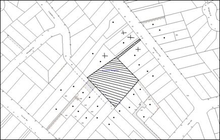
Four submissions were received,
each objecting to the development generally on the grounds that the development
would result in:
· increase traffic flow
along the access handle;
· on-street parking of
vehicles creating nuisance along the street frontage;
· non-compliant width of
access handle with no landscaping provisions or provisions for emergency
vehicle access;
· unacceptable sight
distances for vehicles accessing the driveway;
· reduces safety of
adjoining neighbours due to increased traffic flow on the street;
· unacceptable drainage
provisions;
· unacceptable noise due
to passing vehicles and no fencing provision along the accessway;
· the removal of native
trees;
· no provision of
garbage truck access to the site resulting in bins been stacked along the
frontage of neighbouring properties; and
· unacceptable impact on
neighbouring properties due to vehicle headlights.
In addition, the following
observations have been made within the submissions received:
· The location of the
power lines that would service the future development and the visual impact of
those additional power lines on the adjoining properties.
· The applicant does not
have legal rights to access the common driveway.
· The development would
require stormwater related works to be undertaken within the Council controlled
easement at No. 61 Woodcourt Road. Owner’s consent from the neighbouring
property has not been obtained in this regard.
· The kerb and guttering
works should be undertaken as a part of this application.
· The development would
result in undersized allotments once the restriction as to user (Lingellen Street extension) on each land is excluded from the land area.
· The private open space
areas are proposed to be located on the overland flow path.
· The proposed “V drain”
should not be included as a part of the right-of-carriageway for Lots 1 to 6.
· No landscape plan
submitted with the application.
· Drainage lines must
not impact on the trees proposed to be retained.
· The open drainage
channel traversing the property and the adjoining property should be piped to
improve the flooding situation.
· Details of culvert
have not been provided.
· The erosion and
sediment control plan is not satisfactory.
· No details of proposed
fencing to deflect stormwater has been provided.
· Access to the new lots
should be obtained from Lingellen Street.
· Vehicular access to
the neighbouring property should be provided at all stages of construction
works.
· Adequate lighting and
paved pedestrian accessway should be provided on the accessway.
· Construction work
hours should be specified in the conditions of consent.
· The right-of-way
tapers to 3 metres at the entrance to the battleaxe handle from No. 59 Woodcourt Road.
· The trees and power
pole within No. 61 Woodcourt road cannot be removed/relocated without the
consent of the owner of that allotment.
· The drainage
calculations and the location of the 1:100 year floodline are incorrect.
The merits of the matters raised
in community submissions have been addressed in the body of the report with the
exception of the following:
5.1.1 Owner’s consent for stormwater related works
It is considered that under the
provisions of Section 59A and section 191A of the Local Government Act 1993,
Council has the authority to enter upon privately owned land to undertake
authorised works related to drainage/sewerage etc. Section 193 and 194 of the
Local Government Act 1993 also provides that Council may authorise a person to
perform such functions.
Given that the easement
traversing No. 61 Woodcourt Road is controlled by Council, the developer, being
authorised by Council, could enter the premises to undertake works on behalf of
Council. Consent of owner of No. 61 Woodcourt Road would not be required for
these works.
5.1.2 Construction work hours, noise, fencing, kerb and gutter
Should the application be
approved, conditions of development consent would regularise the construction
work hours, kerb and guttering along Woodcourt Road frontage the noise
generated from the premises and the future fencing along the boundaries.
5.1.3 Landscape plan
A landscape plan has not been
submitted with the development application. Should Council wish to approve the
application, it is recommended that it do so having considered an appropriate
landscape plan.
5.1.4 Piping of the drainage channel
It is considered that the
drainage channel should remain open in future with the 1:100 year flow
contained in it.
5.2 Public Agencies
The development application is
not Integrated Development under the Act. The application was not referred to
any public agencies for comments.
6. THE PUBLIC INTEREST
Section 79C(1)(e) of the Act
requires Council to consider “the public interest”.
The public interest is an
overarching requirement, which includes the consideration of the matters
discussed in this report. Implicit to the public interest is the achievement
of future built outcomes adequately responding to and respecting the future
desired outcomes expressed in environmental planning instruments and
development control plans.
The application has not
satisfactorily addressed Council’s criteria and would not provide a development
outcome that, on balance, would result in a positive impact for the community.
Accordingly, it is considered that the approval of the proposed subdivision
would not be in the public interest.
CONCLUSION
The proposal seeks approval for
the demolition of the existing buildings and the subdivision of one lot into
six lots.
The site gains access via a part
6 metre wide, part 3 metre wide access handle. A watercourse traverses the
northern boundary of the site. The shared access handle partly has reciprocal
rights-of-way with No. 61 Woodcourt Road. The application does not include
owner’s consent from the adjoining neighbour regarding works to be undertaken
within the driveway. Consequently, it is considered that the development
application has not been lawfully made and Council is not in a position in
which it could lawfully approve the development application.
The proposal does not include
details of garbage truck access to the site, details of rehabilitation of the
creek and the proposed on-site-detention system for the development is not
considered suitable. Given the above, a complete assessment of the application
cannot be undertaken and the proposal, in its current form is not considered to
be suitable for the site.
Council officers have made numerous
attempts to achieve a mutually acceptable outcome on the site. The applicant
has not been able to address Council officers’ technical concerns and
consequently, refusal of the development application is recommended.
Note: At the time of the completion
of this planning report, no persons have made a Political Donations
Disclosure Statement pursuant to Section 147 of the Environmental Planning
and Assessment Act 1979 in respect of the subject planning application.
|
Rod Pickles
Manager - Assessment
Team 2
Planning Division
|
Paul David
Manager -
Subdivision & Development Engineering Services
Planning Division
|
|
Scott Phillips
Executive Manager
Planning Division
|
|
Attachments:
|
1.View
|
Locality Plan
|
|
2.View
|
Subdivision Plan
|
|
3.View
|
Stormwater Drainage
Plan
|
File Reference: DA/591/2010
Document Number: D01517528
SCHEDULE 1
1. Pursuant
to the provision of Section 78A of the Environmental Planning and Assessment
Act, 1979, it is considered that the development application has not been
lawfully made as the consent of the owner of 61 Woodcourt Road, Berowra has not
been provided to Council in writing.
2. Pursuant
to the provisions of Section 79C(1)(a)(i) of the Environmental Planning and
Assessment Act, 1979, the proposed development does
not comply with objective (c) of the Residential A (Low Density) zone within
the Hornsby Shire Local Environmental Plan 1994 in that the proposal has not
demonstrated that the site has the environmental capacity to support the
development.
3. Pursuant to the provisions
of Section 79C(1)(a)(i) of the Environmental Planning and Assessment Act, 1979,
the proposal does not comply with Clause 6 of the Sydney Regional Environmental
Plan No. 20 and the “Drainage Control” element of Council’s Residential
Subdivision Development Control Plan as the proposed on-site detention system
is not sufficient for mitigation of flooding to downstream properties.
4. Pursuant to the
provisions of Section 79C(1)(a)(b) of the Environmental Planning and Assessment
Act, 1979, the proposal would require construction works to be undertaken
within the common driveway providing access to the site. Consent of the owner
of the adjoining property at No. 61 Woodcourt Road (Lot 1 DP 502390) has not
been obtained in this regard.
5. Pursuant to the provisions
of Section 79C(1)(b) of the Environmental Planning and Assessment Act, 1979,
the application failed to demonstrate the following:
a. Sufficient garbage
truck access to the site and garbage truck turning areas on the site in
accordance with Australian Standard AS 2890.2-2002 Parking Facilities Part
2: Off-street commercial vehicle facilities.
b. A satisfactory
Rehabilitation Plan for the open drainage channel.
c. A satisfactory
Vegetation Management Plan for the drainage channel traversing the site.
d. A satisfactory Soil and
Water Management Plan for the site.
e. The location of the
piped drainage system the discharge points to the open drainage channel system.
f. A satisfactory
Construction Management Plan relating to the proposed works on the driveway to
demonstrate that access to the neighbouring property at No. 61 Woodcourt Road
would be maintained at all times during construction works.
6. Pursuant to the
provisions of Section 79C(1)(c) of the Act, the proposal, in its current form,
is not considered to be suitable for the site as it does not demonstrate that
an appropriate form of development can be achieved without adverse impact on
the natural and built environment of the locality.
7. Pursuant to the
provisions of Section 79C(1)(e) of the Environmental Planning and Assessment
Act, 1979, it is considered that the proposed development would set an
undesirable precedent for similar inappropriate development and is therefore not in the public interest.
-
END OF REASONS FOR REFUSAL -
Planning Report No. PLN81/10
Date of Meeting:
1/12/2010
2 DEVELOPMENT APPLICATION
- INDUSTRIAL - ALTERATIONS AND ADDITIONS
2A AND 4 KOOKABURRA ROAD HORNSBY HEIGHTS
|
Development Application No:
|
DA/1157/2010
|
|
Description of Proposal:
|
Alterations and additions to an
existing industrial development including the addition of an upper floor
level and extension to the rear of the building
|
|
Property Description:
|
Lot 4 DP 226427 (No 2A) and Lot 11 DP 701852 (No. 4) Kookaburra Road Hornsby Heights
|
|
Applicant:
|
Habitat Australia Pty Ltd
|
|
Owner:
|
Tanran Holdings Pty Ltd
Habitat Australia Pty Ltd
|
|
Statutory Provisions:
|
Hornsby Shire Local Environmental
Plan 1994 -
Industrial B (Light) Zone
|
|
Estimated Value:
|
$ 800,000
|
|
Ward:
|
A
|
|
RECOMMENDATION
THAT Development Application
No. 1157/2010 for alterations and additions to an existing industrial premise
including the addition of an upper floor level and extension to the rear of
the building at Lot 4 DP 226427 (No 2A) and Lot 11 DP 701852 (No. 4)
Kookaburra Road Hornsby Heights be refused for the reasons detailed in
Schedule 1 of this report.
|
1. The
application proposes alterations and additions to an existing industrial
development by adding three industrial units on the upper floor, construction
of an upper level car park and increasing the gross floor area and height of
the premises.
2. The
proposal complies with the provisions of Hornsby Shire Local Environmental Plan
1994, however, does not comply with a number of prescriptive measures within
Council’s Industrial Lands Development Control Plan.
3. A
total of 133 submissions from 123 residents have been received in respect of
the application.
4. It
is recommended that the application be refused.
HISTORY OF THE SITE
On 9 April 1979, Council approved
a development application for a two storey factory building with work/storage
area and amenities located on the ground floor and an office located on first
floor at No. 4 Kookaburra Road. At that time, the property was zoned Industrial
4(b1) under the Hornsby Planning Scheme Ordinance, 1977. The approved building
had a gross floor area of 552.38 sq metres with 11 car spaces. There was no
evidence of physical commencement and the consent subsequently lapsed.
On 15 May 1979, Council approved
DA/94/1979 for the erection of a factory building at No. 2B Kookaburra Road
(located at the rear of No. 4) for the manufacture of timber frames. There was
no evidence of physical commencement and the consent subsequently lapsed.
On 16 November 1981, Council
approved DA/274/1981 for the erection of a factory building on No. 2B and No. 4 Kookaburra Road. The proposal involved the erection of an L shaped single storey
factory building with a total floor area of 848 sq metres and 15 car spaces on
the ground floor. Works under this application were physically commenced on the
site.
In 1984, the properties at No. 4 Kookaburra Road and No. 2B Kookaburra Road were consolidated into one allotment,
thereafter the site was known as No. 4 Kookaburra Road.
On 28 August 1985, Council
approved DA/87/84 for the demolition of the residence that was located on the
site and the erection of three additional factory units on the upper floor of
the existing industrial development at No. 4 Kookaburra Road. The foundations
for the development approved under this development consent were physically
commenced and recognised as such in later Court documents. The details of the
approved development are provided below:
· Alteration to the three factory units
on the ground floor (Approved under DA/274/1981) and provision of 19 car
spaces.
· Mezzanine office spaces adjoining
units 1, 2 and 3
· Three additional industrial units
with mezzanine office spaces on the first floor of the existing development and
10 car spaces.
· The total floor area generated by the
development is 1862 sq metres.
· The resultant floor space ratio (FSR)
of the approved development is 0.97:1.
· A 4.1 metres wide ramp located
adjoining the northern boundary provided vehicular access to the first floor
with a maximum grade of 1:5.
· Units 4 and 5 on the first floor
adjoin the southern boundary of the site.
· The building extends from the
northern to the southern boundary of No. 4 Kookaburra Road.
Physical works have commenced on
the site pursuant to this development consent, which was confirmed in the Land
and Environment Court Judgement pertaining to DA/116/1994.
On 23 March 1995, DA/116/1994 was
lodged with Council for an industrial development at No. 2A and 4 Kookaburra Road.
The proposal involved the
following:
· A single storey addition to the
existing factory building at No. 4 Kookaburra Road (approved under DA/87/1984)
including alterations to the existing awning, provision of 15 car spaces,
landscaping and a loading area.
· Demolition of the dwelling house at
No. 2A Kookaburra Road and extension to the existing factory building with 4
car spaces and loading bay areas.
· The proposed factory building at the
rear to be accessed via the access handle located along the southern boundary
of the site.
· The factory building located at the
front of the site to be used for furniture assembly, wood waste and storage and
the factory building located at the rear to be used for machinery maintenance.
An appeal was subsequently lodged
with the Land and Environment Court against Council’s deemed refusal of this
application. The appeal was upheld on 23 March 1995.
The approved development resulted
in a combined gross floor area of 2062 sq metres with 458 sq metres of
additional area being generated at the rear and an additional 527 sq metres in
the central portion of the site. Physical works under this approval were
commenced within the statutory period. The central portion of the factory
building at No. 4 Kookaburra Road has been completed. The building extensions
to the rear (No. 2A) have not commenced other than preparation/earthworks.
The factory building on the front
allotment (No. 4 Kookaburra Road) is currently used for furniture manufacturing
and assembly.
The site is currently affected by
three operative development consents, DA/274/1981, DA/87/1984 and DA/116/1994.
DA/1245/2008 and DA/87/1984/A
have been previously lodged with Council seeking approval for expansion of
industrial floor area on the site. Both the development applications have
subsequently been withdrawn.
On 7 April 2010, Council resolved
that a report be prepared outlining the potential to rezone the Kookaburra Road
Industrial Precinct to a residential zone.
On 1 September 2010, Council
considered a report regarding the opportunities and constraints concerning the
rezoning of the Kookaburra Road Industrial Precinct at Hornsby Heights for residential uses and resolved the following:
“THAT a
planning proposal to rezone properties Nos. 2A-14 Kookaburra Road, Hornsby Heights
from Industrial B (Light) to Residential be included in the Strategic Planning
Programme for 2011/12 with appropriate funds being allocated to the Town
Planning Services Branch Budget in the September 2010 Quarterly Budget Review.”
On 17 September 2010,
DA/1157/2010 for alterations and additions to the existing industrial building
was lodged with Council.
THE SITE
The site comprises two
allotments, No. 2A and No. 4 Kookaburra Road and is located on the eastern side
of the road. The subject property is rectangular in shape and is generally flat
in the front section with a downward slope towards the rear.
The site area of No. 4 Kookaburra Road is 1904 sq metres. The site area of No. 2A Kookaburra Road is 1367.5
sq metres. The total area of the combined site is 3301 sq metres.
Access to No. 4 Kookaburra Road
(front lot) is via a driveway directly from the street. Access to No. 2A
(located at the rear) is via a 4 metre wide access handle from Kookaburra Road situated along the southern boundary of the site. The access handle comprises
a 3.5 metre wide driveway and a 0.5 metre wide landscape strip.
The current improvements on the
site include a single storey factory building located on No. 4 Kookaburra Road.
The factory building is used for manufacturing and assembly of furniture and
wood storage. The factory building includes the assembly and manufacturing
area, two large temporary mezzanine areas for storage of furniture and an
office area. A loading dock is located in the front section of the building
accessible to heavy rigid vehicles from Kookaburra Road. A car parking area is
also located within the front setback which is currently used for storage of
pallets. A 1.2 metre wide garden bed is located along the front boundary.
The gross floor area of the
existing factory unit (including loading bay and excluding mezzanine areas) is
1373.6 sq metres.
The rear section of the site (No.
2A) is not used for industrial purpose. A storage shed and another enclosed
shed exist in this portion of the site. Both sheds are dilapidated. In
addition, the foundations of an approved factory building are located on the
site. A number of trees are located at the rear of the site, however no trees
are considered to be significant.
The site constitutes the
southernmost portion of a small industrial area located in Hornsby Heights surrounded by low density residential developments. Three residences are
located on the adjoining allotments to the south of the access handle. The
residences at Nos. 2, 2C and 2D Kookaburra Road were constructed after the
industrial building and the issue of development consents for the site. The
allotment located immediately to the south of No. 2A Kookaburra Road is zoned
residential and currently accommodates a residential development close to Galston Road at a considerable distance from the site. It is anticipated that in the future,
a number of additional dwellings will be constructed on the property at 180 Galston Road.
An existing industrial building
is located to the north of the site and is two storeys in height. The
developments at the rear of the site constitute one and two storey residential
dwellings that have access from Koala Place and Somerville Road. The rear yards
of these residences adjoin the site, but are located at a lower level due to
the fall of the land. The developments on the opposite side of the street are
one and two storey dwelling houses.
THE PROPOSAL
The proposal involves the
following:
· Retention of the
existing factory building with internal alterations including demolition of the
mezzanines and the office area.
· Demolition of the
sheds and outbuildings at the rear.
· Construction of an
L shaped single storey factory unit at the rear accessed via the existing
access handle.
· The factory unit
would include a mezzanine office space and a loading bay.
· Erection of three
factory units on the first floor with individual office spaces and loading
bays.
· Units 2 and 3
located on the upper floor level would be located along the northern boundary.
· Unit 1 would be
located on the northern side, being setback 4 metres from the boundary.
· Retention of the
existing loading dock for the factory unit fronting Kookaburra Road.
· Retention of the
existing vehicular access to the ground level.
· Provision of a ramp
along the northern boundary for access to the upper floor.
· Car parking
comprising thirty spaces with seventeen spaces on the upper floor and thirteen
spaces on the ground floor.
· The car parking
spaces and turning bays on the upper floor would be located along the southern
boundary extending over the access handle. This extended section would be
supported by a colonnade at the ground level.
· Provision of
outdoor eating areas on the upper floor.
· The proposed
materials and colours would match the existing building.
· Details of the
first uses of the units, hours of operation of the premises, delivery times,
number of employees and signage are not included in this application.
· The details of the
gross floor areas are described below:
|
Warehouse
|
Industrial
Floor Area
|
Office
and Amenities
|
Loading bay
|
Gross Floor Area
|
|
Unit 1
|
300 m2
|
23.2 m2 = 7.7%
|
30 m2
|
293.2 m2
|
|
Unit 2
|
284.29 m2
|
23.11 m2 = 8.3 %
|
30 m2
|
278.01 m2
|
|
Unit 3
|
361.9 m2
|
46 m2 = 6.6 %
|
30 m2
|
355.41 m2
|
|
Unit 4
|
642.75 m2
|
46 m2 = 6.9 %
|
30 m2
|
658.75 m2
|
|
Existing Area
|
1358.6 m2
|
No office propose
|
30 m2
|
1328.6 m2
|
Proposed Gross Floor Area
: 2913.97 sq metres
Proposed
FSR : 0.88:1
A comparison of the proposed
development and the previously approved developments on the site is provided
below:
· The existing front
setback of the factory building is proposed to be retained, thus deleting the
overhanging section of the upper floor as approved under DA/87/1984. The
proposed front setback would be 22 metres from the frontage of the site instead
of the approved 8.5 metres.
· The rear setback of
the upper floor from the eastern (rear) boundary of No. 2A Kookaburra Road
would be 6 metres instead of the approved 35 metres under DA/87/1984.
· A considerable section
of the upper floor (62 metres in length) is proposed to be extended over the
access handle of No. 2A Kookaburra Road resulting in a zero setback from the
southern boundary of the industrial site. DA/116/1994 proposed a zero setback
to the southern boundary for the single storey building at rear, but for a
length of 18 metres.
· The access ramp to the
upper floor units is proposed to be 6 metres wide with an approximate slope of
1:5.35. DA/87/1984 approved a 4 metre wide ramp with a slope of 1:5 on the same
location.
· Vehicular access to
the upper floor is restricted to Medium Rigid and Small Rigid Vehicles only.
· The height of the
development would be the same as the approved development within No. 4 Kookaburra Road.
· The proposal would
result in an increase of height of the approved development within the rear
allotment (No. 2A Kookaburra Road). The maximum height of development approved
within this allotment was 8 metres (DA/116/1994) adjoining the rear boundary.
The proposed development would result in an increase in the height of the
development to 9 metres adjoining the rear boundary plus a 1.8 metres high
privacy screen.
ASSESSMENT
The development application has
been assessed having regard to the ‘2005 City of Cities Metropolitan
Strategy’, the ‘North Subregion (Draft) Subregional Strategy’ and
the matters for consideration prescribed under Section 79C of the Environmental
Planning and Assessment Act 1979 (the Act). Subsequently, the following
issues have been identified for further consideration.
1. STRATEGIC CONTEXT
1.1 Metropolitan Strategy – (Draft) North Subregional Strategy
The Metropolitan Strategy is a
broad framework to secure Sydney’s place in the global economy by promoting and
managing growth. It outlines a vision for Sydney to 2031; the challenges
faced, and the directions to follow to address these challenges and achieve the
vision. The draft North Subregional Strategy acts as a framework for Council
in the preparation of a new Principal LEP by 2011.
The draft Subregional Strategy
sets the following targets for the Hornsby LGA by 2031:
· Employment capacity
to increase by 9,000 jobs; and
· Housing stock to
increase by 11,000 dwellings.
The proposed development would be
consistent with the draft strategy by providing additional jobs in the
locality. The number of jobs to be generated would be estimated at the time of
assessment of applications for future uses of the units.
1.2 Future Zoning- Kookaburra Road
Council at its meeting on 1
September 2010, resolved that a planning proposal to rezone properties Nos.
2A-14 Kookaburra Road, Hornsby Heights from Industrial B (Light) to Residential
be included in the Strategic Planning Programme for 2011/12.
It is noted that rezoning the
precinct would not require existing industrial operations to cease. Section 106
‘Existing Use Rights’ of the Act, would enable any existing lawful industrial
uses to continue even if the precinct is rezoned. It would also allow such
industrial activities to be altered and expanded in the future.
The resolution for the rezoning
of Kookaburra Road is not yet translated into a Draft Local Environmental Plan.
Therefore, Council’s resolution cannot be taken into consideration during
assessment of the application under the provisions of Section 79(c) of the Act.
2. STATUTORY CONTROLS
Section 79C(1)(a) requires
Council to consider “any relevant environmental planning instruments, draft
environmental planning instruments, development control plans, planning
agreements and regulations”.
2.1 Hornsby Shire Local Environmental Plan 1994
The subject land is zoned
Industrial B (Light) zone under the Hornsby Shire Local Environmental Plan 1994
(HSLEP). The objectives of the Industrial B zone are:
(a) to encourage
economic growth and employment opportunities.
(b) to
allow a broad range of light industrial, warehousing and other compatible land
uses to locate within the area.
(c) to
promote development that does not adversely impact upon the natural and built
environment.
The proposed development is
defined as “Light Industry” under the HSLEP and is permissible in the zone with
Council’s consent.
The development would encourage
economic growth and employment opportunities and complies with objective (a) of
the zone. The development may have a negative impact on the built environment
of the locality due to reasons detailed in this report. The development does
not comply with the zone objectives (b) and (c) of the HSLEP in this regard.
The original development was
assessed under the provisions of the Hornsby Planning Scheme Ordinance as
satisfactory.
Clause 15 of the HSLEP prescribes
that the maximum floor space ratio (FSR) of development within the Industrial B
zone is 1:1. The applicant addresses this requirement by proposing a FSR of
0.88:1 which complies with this requirement.
2.2 State Environmental
Planning Policy No. 55 – Remediation of Land (SEPP 55)
The
application has been assessed having regard to SEPP 55 which requires that
Council must not consent to the carrying out of any development on land unless
it has considered whether the land is contaminated or requires remediation for
the proposed use.
The
site was zoned for industrial purposes in the 1970s and has been used for light
industry since that time. Therefore the allotments are unlikely to be affected
by contamination (other than that associated with light industrial activities)
and it is considered that no further assessment with regard to SEPP 55 is
required.
2.3 Sydney Regional Environmental Plan No. 20 – Hawkesbury – Nepean River
The application has been assessed
having regard to the requirements of Sydney Regional Environmental Plan No. 20
(SREP 20). This Policy provides general planning
considerations and strategies requiring Council to consider the impacts of this
proposal on water and scenic quality, aquaculture, recreation and tourism.
Subject to the imposition of
conditions regarding the implementation of erosion and sediment control
measures on the site, the proposal would be consistent with the requirements of
SREP 20.
2.4 Industrial Lands Development Control Plan
The proposed development has been
assessed having regard to the relevant performance and prescriptive design
requirements within Council’s Industrial Lands DCP. The following table sets
out the proposal’s compliance with the prescriptive measures of the Plan:
|
Industrial Lands
Development Control Plan
|
|
Control
|
Proposal
|
Requirement
|
Compliance
|
|
FSR
|
0.88:1
|
1:1
|
Yes
|
|
Height
|
2 storeys
|
2 storeys
|
Yes
|
|
Car parking (for No. 2A and No. 4)
|
30 spaces
|
30 spaces
|
Yes
|
|
Setbacks of the entire industrial development
Front(Kookaburra Road)
Side (North)
Side (South)
Rear
|
Existing
0 m
0 m
0 m
|
0 m
0 m
0 m
|
Yes
No
No
|
|
Outdoor recreation area
|
Minimum 10 m2
provided
|
Minimum 10 m2
and @1 m2/employee
|
Yes
|
As detailed in the above table,
the proposed development does not comply with some prescriptive measures within
Council’s Industrial Lands DCP. The matters of relevance are detailed below:
2.4.1 Density
The proposal would generate a
gross floor area of 2913.7 sq metres and result in a FSR of 0.88:1 for the
site. Whilst, the development numerically complies with the density
requirements of the Industrial Lands DCP, it must also be assessed against
other criteria and within the context of being located adjoining residential
dwellings.
It is noted that the operative
development consents on the site (DA/87/84 and DA/116/94) approved a total
floor area of 3022 sq metres. The current proposal would generate less floor
area when compared to the total area approved under previous development
applications.
2.4.2 Design
The design of the development would
result in a part two storey structure on No. 2A Kookaburra Road (rear
allotment), which to date only has an approval for a single storey development.
A comparison of the impact of the
design of the current proposal and that previously approved on the site has
been undertaken with regard to the privacy of the adjoining residences, the
streetscape presentation and the visual amenity. The design as approved under
DA/87/84 involved the construction of three units on the upper level of the
allotment at No. 4 Kookaburra Road, with a 4 metres setback from the
residential developments to the south due to the location of the access handle
for the rear allotment.
Under the current application, a
major section of the development is proposed to be extended over the access
handle for No. 2A Kookaburra Road. A single storey colonnade is proposed along
the southern boundary with car parking on the upper deck. Such extension of
the units would result in an insufficient setback from the existing residences
and any future residences within the vacant residential allotment on the
southern side of the site. This would also result in a lack of acoustic privacy
and solar access to future dwelling houses on the adjoining allotments to the
south and an unacceptable bulk and scale of the development when viewed from
those residences. The design of the proposed development is not considered to
be an improvement over the originally approved designs of the industrial
development.
Further, it is also noted that
the proposal includes an 11 metre high structure (9 metres + 1.8 metre high
screen) adjoining the rear boundary, whereas the maximum height approved at the
rear under DA/116/1994 was 8 metres. This is considered to be unacceptable
having regard to the impact that such works would have on the amenity of
adjoining residential properties to the rear of the site.
2.4.3 Setbacks
The proposed development would
alter the front setback approved under DA/87/1984 by excluding the overhanging
section of the first floor of the building. Instead of an 8.5 metre setback,
the building would retain the existing 22 metres front setback from Kookaburra Road. This is considered to be an improvement over the previously approved design
on the site.
The Industrial Lands DCP provides
that the buildings may be built to the side or the rear on a zero building line
except where a setback is required to screen buildings from sensitive areas
such as residential premises. The upper level car park would be located having
a zero setback from the southern boundary of No. 2A Kookaburra Road. It is
considered that the reduced setback to the south would have negative visual and
overshadowing impact on the future residences and is not acceptable.
The eastern boundary of the rear
allotment (No. 2A) has an approved zero building setback for a single storey
industrial development with no openings on the eastern façade, pursuant to
DA/116/1994. The impact of this approved development on the residences within Koala Place has always been considered unacceptable to Council. It was the Land and Environment Court that deemed that the impact is acceptable as it would not result in
overshadowing or negative acoustic impact. The Court further considered that
the fall of the site in this area provides sufficient physical separation
between the residences fronting Koala Place and the building.
DA/87/1984 approved a zero
building setback to the rear boundary of No. 4 Kookaburra Road as the two
storey development backed onto another industrial site and was sufficiently
separated (35 metres) from the residences within Koala Place. The current
development application merges the two development consents by proposing to
extend over the approved roof slab under DA/116/1994. As a result, a two storey
industrial development would now be setback 6 metres from the adjoining
residences rather than 35 metres. The open roof area proposed on top of the
approved building would be accessible from Units 2, 3 and the fire stairs and
part of it would be utilised for employee recreation. The car parking area is
also proposed to be extended to the eastern boundary. A privacy screen (1.8
metre high) has been proposed along the eastern boundary to mitigate negative
privacy impacts on the adjoining residents. The applicant has provided
sightline diagrams to indicate that a person standing on a property adjoining
the eastern boundary would have no opportunities to view the upper level or be
impacted by the visual bulk due to the increased height.
However, it is considered that
the proposed development at the rear, being two metres higher than the Court
approved development, would have a significant negative impact on the visual
amenity of the surrounding residences. Further the use of the roofed area as a
carpark, being so close to the residential premises would have a negative
impact on the acoustic privacy of the adjoining residential properties and is
not acceptable.
2.4.4 Landscaping
The Industrial Lands DCP requires
that a minimum of 10 sqm area be provided for outdoor eating and seating for the
employees.
The current proposal includes
indoor lunch rooms for individual factory units and outdoor employee recreation
areas at the rear of the site and adjoining Units 1 and 2 on the upper level.
The provision of outdoor employee recreation areas in considered satisfactory.
However, the location of the outdoor recreation area at the rear would have an
adverse impact on the residential properties at the rear as discussed in
section 2.4.3 of this report.
2.4.5 Vehicular access and parking
2.4.5.1 Parking
The proposed development would
require thirty on-site car parking spaces (@ 1/ 100 sq metres). The details of
the car parking requirements are as follows:
|
Unit
|
Gross Leasable Floor Area
|
Parking Spaces Required
|
|
Existing factory
|
1328.6 m2
|
13.2 spaces
|
|
1
|
293.2 m2
|
2.93 spaces
|
|
2
|
278.01 m2
|
2.78 spaces
|
|
3
|
355.41 m2
|
3.55 spaces
|
|
4
|
658.75 m2
|
6.58 spaces
|
|
Total
|
|
29 spaces
|
The proposal complies with the
Industrial Lands DCP with regard to the total number of spaces provided on the
site. The proposed modification includes seventeen car spaces on the upper
floor. The number of car parking spaces is considered acceptable. However, the
location of the upper level spaces is not acceptable being placed along the
southern property boundary and against residential properties.
Loading bays are provided for
individual units on the upper level, being directly accessible from the parking
areas. The minimum width of the openings for loading bays is 3 metres which
complies with the requirements of the DCP. This is considered satisfactory.
2.5.5.2
Traffic Generation
The proposed development would
result in a reduction of the gross floor area on the site, when compared to the
previously approved applications. Therefore, no further assessment with regard
to traffic generation is required.
2.4.5.3 Vehicular Access
The modified development proposes
vehicular access to the upper level via the approved ramp. The ramp is proposed
to be 6 metres wide with a gradient of 1:5.35.
An assessment of the scaled plans
has been undertaken and there appears to be a discrepancy in the levels shown
on the submitted site plan which indicates the level at the boundary to be RL
100.52 and the ground and first floor levels being 193.28 and 199.28. No survey
plan has been submitted to verify the levels on the site. The engineering
assessment of the plans has been conducted based on the levels provided.
An engineering assessment of the
proposed vehicular access has been conducted and summarised below:
· The vehicle
manoeuvring was considered on the scaled plans of the upper storey of the
proposal and it is noted that a MRV and a Small Rigid Vehicle (SRV) would be
able to turn within the parking area of the upper floor. Should the application
be approved, a condition would be recommended restricting vehicular access to
the upper floor to MRV only.
· The proposed gradient of the ramp providing access to the
upper floor does not comply with the relevant standards when assessed against
AS2890.2 – 2002. The maximum ramp grade should not exceed 1 in 6.5
(15.4%) with a maximum change of grade of 1 in 16 (6.25%) in 7.0 metres of
travel in accordance with Australian Standards AS 2890.2 for MRVs.
· It is noted that a ramp was approved in the same location
under DA/87/1984. The modified ramp as proposed under this application is wider
than that previously approved on the site under DA/87/1984 and includes a
marginally improved gradient. However, it is also observed that the ramp
gradients complying with the relevant Australians Standards may be achieved on
this site by reducing the floor area of the existing factory building.
Therefore, the proposed ramp grades are not considered acceptable in its
current form.
· The transition in the
ramp grades do not comply with the AS2890.2 requirements. This may result in a
Medium Rigid Vehicle (MRV) scraping at transitions.
Given the above, the proposal is
not considered acceptable with regard to vehicular access to the upper floor of
the industrial building.
2.4.5.4 Pedestrian Access
It is noted that seven car spaces
would be required for Unit 4 at the rear. The car spaces are not provided
adjoining the unit (only three spaces provided at the rear). Similarly, the
existing factory unit requires fourteen spaces which have not been provided in
the front setback area. A number of users of these units would have to either
park on the upper floor or in the front yard and then walk to the industrial
units. No separate pedestrian access is provided to the upper floor which would
result in pedestrians using the vehicular ramp or fire stairs. This is not
considered acceptable with regard to safety of the users.
2.4.6 Waste Management
The proposed development includes
bin storage areas on the upper level located along the southern boundary
adjoining the access handle and separate bin collection areas on the ground
floor for the existing unit and proposed unit 4.
Council’s assessment of waste
management for the development concludes that the bin storage area and the
truck turning area on the ground floor are acceptable with regard to access of
a 12.5 metre long garbage truck. However, the Heavy Rigid Vehicles (HRV) would
not be able to access the upper floor due to non-compliant ramp gradient. The
factory units would require 1.5 cubic metre bins or larger which cannot be
safely manoeuvred up and down ramps or for long distances.
The proposal does not include any
details of garbage truck access to the upper level or alternate garbage
disposal methods for the units on the upper floor. The proposal is not
acceptable with regard to the location of the garbage disposal area on the
upper floor.
2.4.7 Acoustics
The proposal does not include
first uses of the industrial units. Should the current application be
approved, the matters in relation to acoustic, dust and visual impacts would be
assessed in detail under future development applications for the first uses of
the subject property.
The proposed car parking area is
to be located immediately adjoining the residential boundary of developments.
It is considered that residents would be adversely impacted by noise from this
car park, truck turning and loading and unloading of goods on a regular basis.
The development would have a negative amenity impact on the neighbouring
properties with regard to acoustic privacy due to the location of the upper
level car park.
2.4.8 Drainage Control
The site contains an existing
industrial building located on No. 4 Kookaburra Road. The applicant has
advised that stormwater from the proposed first floor additions would be
connected to the existing stormwater system.
Council’s Engineering assessment
in this regard concludes that following:
· A stormwater drainage plan including
an on-site detention system would be required for the proposal. The on-site
detention system should be designed for all storms up to the 50 year ARI with
the permissible site discharge from the developed site being limited to the
pre-developed 1 in 5 year ARI discharge from the site.
· A pipeline is required to be designed
and constructed to connect the site with a Council-controlled drainage system.
In this regard, both the properties at No. 2A and No. 4 Kookaburra Road would
benefit from an interallotment drainage easement. The applicant has not
provided Council with copies of the registered dealings or deposited plans
showing a legal right for No. 4 Kookaburra Road to drain through the pipeline.
The proposal is assessed as
unsatisfactory with regard to stormwater drainage.
2.4.9 Solar Access
The DCP requires that all
industrial developments should provide at least two hours of solar access to
the private open spaces and at least three hours of solar access to the north
facing windows of all adjoining residential properties between 9 am and 3 pm
during winter solstice.
The subject site adjoins
residential properties to its south. The applicant has submitted shadow
diagrams for the proposed development which indicates that the development
would overshadow the adjoining residences during the above period. A
comparative analysis of the shadows cast on the existing dwellings by the
approved development on the site and the proposed modification is provided in
the table below:
|
|
The proposal
|
The Approved Development Applications
|
|
Adjoining residences
|
Solar Access to Private Open Space
|
Solar Access to North facing Windows
|
Solar Access to Private Open Space
|
Solar Access to North Facing Windows
|
|
Dwelling on 2 Kookaburra Road (Lot A)
|
|
|
|
|
|
9 am
|
Yes
|
Overshadowing all north facing windows
|
Yes
|
Yes
|
|
12
noon
|
Yes
|
Yes
|
Yes
|
Yes
|
|
3 pm
|
Yes
|
Yes
|
Yes
|
Yes
|
|
Dwelling
on 2C Kookaburra Road (Lot B)
|
|
|
|
|
|
9
am
|
Yes
|
Overshadowing of north facing lounge room and two
bedroom windows + verandah
|
Yes
|
Yes
|
|
12
noon
|
Yes
|
Yes
|
Yes
|
Yes
|
|
3
pm
|
Yes
|
Yes
|
Yes
|
Yes
|
|
Dwelling
on 2D Kookaburra Road (Lot C)
|
|
|
|
|
|
9
am
|
Yes
|
Overshadowing all north facing windows and verandah
|
Yes
|
Overshadowing of all north facing windows and
verandah
|
|
12
noon
|
Yes
|
Overshadowing all north facing windows
|
Yes
|
Yes
|
|
3
pm
|
Yes
|
Garage and one north facing windows overshadowed
|
Yes
|
Garage and all north facing windows overshadowed
|
The above table indicates that the private open space areas
of all the residences adjoining the development would receive three hours of
solar access during Winter Solstice.
The table also indicates that the
proposed development when compared to the approved industrial development would
increase the overshadowing impacts on the residences adjoining the southern
boundary of the industrial site. It is also noted that the overshadowing of the
vacant residential allotment located at the rear of Lots 2, 2C and 2D Kookaburra Road would be increased as a result of the reduced setbacks and the reorientation
of the units on the upper level.
The proposed development is not
assessed as satisfactory with regard to solar access provisions and does not
improve the design of the approved developments on the site. Further, it has
the potential to deny solar access to a future residential development on the
adjoining allotment and is not considered to be acceptable in this regard.
2.5 Car
Parking Development Control Plan
The proposal has been assessed
having regard to the relevant performance and prescriptive design requirements
within Council’s Car Parking Development Control Plan. The DCP requires that
parking be provided at 1 space per 100 sqm of Gross Leasable Floor Area (GLFA)
for industrial use.
The compliance of the proposal
with the relevant performance criteria is discussed in Section 2.4 of this
report.
2.6 Access
and Mobility Development Control Plan
The proposal has been assessed
having regard to the relevant performance and prescriptive design requirements
within Council’s Access and Mobility Development Control Plan. The development
provides a continuous path of travel on both floors via the ramp.
However, no alterative pedestrian
access is provided to the upper level factory units apart from the vehicular
ramp. This is considered to be unsafe for future users of the site.
2.7 Waste Minimisation and
Management Development Control Plan
The matters in relation to waste
management on the site have been discussed under Section 2.4 of this report.
2.8 Sustainable Water Development
Control Plan
The DCP
aims to achieve the implementation of sustainable water practices into the
management of development in the Hornsby Shire. These matters have been
discussed in Section 2.3 of this report.
2.9 Section 94
Contributions Plan
Council’s Section 94 Plan applies
to the development as it would result in the generation of additional
industrial floor space on the site and section 94 contributions would be
applicable in the event that Council was minded to approve the application.
3. ENVIRONMENTAL IMPACTS
Section 79C (1)(b) of the Act
requires Council to consider “the likely impacts of that development,
including environmental impacts on both the natural and built environments, and
social and economic impacts in the locality”.
3.1 Natural Environment
3.1.1 Trees
The proposal would necessitate
the removal of the trees located at the rear of the site. Council’s assessment
of the existing trees on the site concludes that none of the trees proposed to
be removed are significant.
3.1.2 Air Quality
The proposal is for the
modification to an approved development for construction of industrial units.
It does not include the first occupation and specific uses for the units.
Should the application be approved, the impact of the future uses on the air
quality would be assessed under separate development applications.
3.1.3 Water Quality
This matter has been discussed in
section 2.3 of this report.
3.2 Built Environment
The matters in relation to impact
of the proposed development on the streetscape, views and the traffic
generation are discussed in detail in section 2.4 of this report.
The proposal does not comply with
a number of development controls within Council’s Industrial Lands Development
Control Plan and would not provide a better design outcome when compared to the
approved developments on the site.
The residential developments
adjoining this industrial precinct in Hornsby Heights currently experience some
negative amenity impact due to the mixed land use of the area. The assessment
of this application concludes that the current proposal would have an
additional detrimental impact on the built environment of the locality and
therefore the proposal is not acceptable in its current form.
3.3 Social Impacts
The social impacts of the
development on the local and broader community have been considered with
specific reference to the potential employment generation within the complex.
It is estimated that the development would generate full time positions post
construction. This is consistent with the North Subregion (Draft) Subregional
Strategy that provides a target of 9,000 jobs within the Hornsby LGA by 2031.
3.4 Economic Impacts
The proposed development would
result in an increase in the total industrial floor space within the industrial
estate at Hornsby Heights. As discussed above, the development would result in
employment generation and therefore result in a positive economic impact on the
locality.
4. SITE SUITABILITY
Section 79C (1)(c) of the Act
requires Council to consider “the suitability of the site for the
development”.
4.1 Bushfire Risk
The land is identified as being
subject to bushfire risk. The proposal was referred to the NSW Rural Fire
Service (RFS) for comments. No objections have been raised by the RFS and no
specific conditions are recommended.
5. PUBLIC PARTICIPATION
Section 79C (1)(d) of the Act
requires Council to consider “any submissions made in accordance with this
Act”.
5.1 Community Consultation
The proposed development was
placed on public exhibition and was notified to adjoining and nearby landowners
between 30 September 2010 and 21 October 2010 in accordance with Council’s
Notification and Exhibition Development Control Plan. During this period and
after the completion of notification, Council received 133 written submissions
from 123 residents.
The map below illustrates the
location of those nearby landowners who made an identifiable written submission
that are in close proximity to the development site.
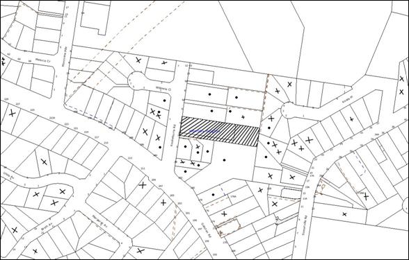
|
NOTIFICATION
PLAN
|
|
|
• PROPERTIES NOTIFIED
|
X SUBMISSIONS
RECEIVED
|
PROPERTY SUBJECT OF DEVELOPMENT
|
|
|
69
Submissions are out of map range and addresses of 13 objectors not provided
|
|
|
|
|
All submissions objected to the
development, generally on the grounds that the development would result in:
· unacceptable upper
level car park, being over 15 metres high;
· unacceptable truck
movements in the locality;
· increased heavy
traffic and accident potential;
· reduced safety of
pedestrians, specially school going children;
· accidents due to heavy
vehicles driving on the upper floor;
· privacy loss of
adjoining residents at the rear due to the open car park and windows of the
upper level factory unit;
· excessive height (five
storeys) with adverse impact on adjoining properties;
· unwanted precedent for
the area;
· overshadowing of
adjoining residences;
· loss of property values;
· removal of trees;
· inappropriate impact
on wild life and flora of the area;
· inappropriate setbacks
from residential properties;
· adverse noise impacts
from garbage disposal;
· building up to
northern boundary and covering the windows of No. 6A Kookaburra Road and
removing natural light;
· overdevelopment for
the area;
· insufficient truck
turning area;
· noise and light
pollution to residences;
· pollution of nearby
creeks and parks from run-off and spills;
· lack of landscaping
along the street frontage; and
· pollution from dust
and vehicle fumes.
In addition a number of
submissions raised the following matters:
· request rezoning of
the site to residential as it is surrounded on three sides by residential
development;
· adverse impact on any
potential residential development within No. 6A Kookaburra Road, should
rezoning happen in the future;
· the development would
not result in any benefit to the community;
· no details of
stormwater management system has been provided;
· the height of the
single storey structure at the rear is higher than that approved in 1994;
· the mezzanine floors
should be counted as a storey;
· the shadow diagrams
are incorrect;
· the height of the
buildings and the rear setback as marked on the plans is incorrect;
· there is no existing
easement at the rear of No. 2A Kookaburra Road;
· the original
development has not commenced on the site;
· the area has no demand
for additional industrial units;
· the existing
industrial unit operates at odd hours and results in adverse impact on the
adjoining residential area;
· the existing
industrial unit does not comply with the conditions of the previously approved
developments;
· basement parking
should be allowed to reduce amenity impact;
· no soil testing has
been done to demonstrate the stability of the foundation; and
· the proposed car
spaces are going to be used to store pallets in the future.
The merits of the relevant
planning matters raised in community submissions have been addressed in the
body of the report with the exception of the following:
5.1.1 Northern boundary
windows
The proposed development would
have a zero building setback to the northern boundary that adjoins an
industrial building located at No. 6A Kookaburra Road. This building is also
built to its southern boundary and includes openings on the southern façade.
The approved plans under DA/39/1994 for the use of the factory as a precision
engineering workshop indicate that the factory should be setback 1 metre from
the southern boundary. Given this, it is considered that northern boundary
windows should receive solar access from the approved development. However,
considering the location of the wall of unit 2 and 3 in the current proposal,
it is accepted that the development would have some detrimental impact on the
solar access to the adjoining factory building.
5.1.2 Consistency of plans
The proposed modification does
not include details of stormwater system on the site. However, the Statement
of Environmental Effects submitted in support of the application indicates that
stormwater from the upper level would be connected to the existing system on
the site.
5.2 Public Agencies
The development application was
referred to the Rural Fire Service for comment. The RFS’s comments have been
discussed in section 4.1 of this report.
6. THE PUBLIC INTEREST
Section 79C(1)(e) of the Act
requires Council to consider “the public interest”.
The public interest is an
overarching requirement, which includes the consideration of the matters
discussed in this report. Implicit to the public interest is the achievement
of future built outcomes adequately responding to and respecting the future
desired outcomes expressed in environmental planning instruments and
development control plans.
The application does not satisfy
Council’s criteria and would provide a development outcome that, on balance,
would not result in a positive impact for the community. Accordingly, it is
considered that the approval of the development would not be in the public
interest.
CONCLUSION
The application proposes
alterations and additions to an existing industrial development by including
upper level units, extending the units towards the rear, including an upper
level carpark and reducing the building setback from the adjoining residential
properties.
The site adjoins residential
properties on the southern and eastern side and the proposal does not comply
with a number of prescriptive measures within Council’s Industrial Lands
Development Control Plan. The site is subject to two previously approved and
operative development consents. The current application would not provide an
improved development outcome when compared to the previously approved
developments on the site.
The
application has been assessed as unsatisfactory against the matters for
consideration under Section 79C(1) of the Act, Hornsby Shire Local
Environmental Plan and relevant State Environmental Planning Policies. The
proposal as modified would not result in a positive impact on the natural and built
environmental of the locality.
Refusal
of the development application is recommended.
|
Rod Pickles
Manager -
Assessment Team 2
Planning Division
|
Scott Phillips
Executive Manager
Planning Division
|
Attachments:
|
1.View
|
Locality Plan
|
|
2.View
|
Site Plan
|
|
3.View
|
Floor Plan
|
|
4.View
|
Elevations
|
|
5.View
|
Vehicle Turning
Circles
|
|
6.View
|
Shadow Diagrams
|
|
7.View
|
Plan Approved
under DA-87-1984
|
|
8.View
|
Plan Approved
under DA-116-1994
|
File Reference: DA/1157/2010
Document Number: D01517538
SCHEDULE 1
REASONS
FOR REFUSAL
1. Pursuant to the provisions of Section 79C(1)(a)(i) of the
Environmental Planning and Assessment Act, 1979, the proposal is inconsistent
with objectives (b) and (c) of Hornsby Shire Local Environmental Plan 1994 as
it would not result in a land use which is compatible within the area and would
have adverse impact on the natural and built environment of the locality. The
proposal is an overdevelopment for the site.
2. Pursuant to the provisions of Section 79C(1)(a)(iii) of the
Environmental Planning and Assessment Act, 1979, the proposal does not comply
with the ‘Setbacks’ element of the Industrial Lands Development Control Plan
with regard to setbacks from sensitive land uses.
3. Pursuant to the provisions of Section 79C(1)(a)(iii) of the
Environmental Planning and Assessment Act, 1979, the proposal does not comply
with the elements: ‘Building Design’ of the Industrial Lands Development
Control Plan as it would not integrate with the surrounding residential
properties due to the bulk and scale of the structure.
4. Pursuant to the provisions of Section 79C(1)(a)(iii) of the
Environmental Planning and Assessment Act, 1979, the proposal does not comply
with the elements: ‘Acoustics’, ‘Solar Access’ and ‘Vehicle Access and Parking’
elements of the Industrial Lands Development Control Plan.
5. Pursuant to the provisions of Section 79C(1)(b) of the
Environmental Planning and Assessment Act, 1979, does not demonstrate
satisfactory management of stormwater drainage in the site and the
interallotment drainage system.
6. Pursuant to the provisions of Section 79C(1)(b) of the
Environmental Planning and Assessment Act, 1979, the application does not
demonstrate satisfactory pedestrian access to the industrial units on the upper
floor, methods of garbage disposal for the upper floor industrial units, survey
plan indicating the property boundaries, the existing contours and the current
improvements on the site.
7. Pursuant to the provisions of Section 79C(1)(e) of the
Environmental Planning and Assessment Act, 1979, it is considered that approval
of the development would set an undesirable precedent for similar inappropriate
development and is therefore not in the public interest.
-
END OF REASONS FOR REFUSAL -
Planning Report No. PLN90/10
Date of Meeting:
1/12/2010
3 DEVELOPMENT APPLICATION
- SUBDIVISION OF ONE ALLOTMENT INTO TWO AND ERECTION OF AN AFFORDABLE HOUSING
DEVELOPMENT COMPRISING 36 UNITS
8A NORTHCOTE ROAD HORNSBY
|
Development Application No:
|
DA/746/2010
|
|
Description of Proposal:
|
Two lot subdivision and construction of an
affordable housing development comprising 36 units.
|
|
Property Description:
|
Lot A DP 399538 (No. 8A) Northcote Road Hornsby
|
|
Applicant:
|
Northcote Trust
|
|
Owner:
|
Arara Properties Pty Ltd
|
|
Statutory Provisions:
|
Hornsby Shire Local Environmental
Plan 1994
Residential A (Low Density)
|
|
Estimated Value:
|
$6.5 million
|
|
Ward:
|
A
|
|
RECOMMENDATION
THAT Development Application
No. DA/746/2010 for a two lot subdivision and the construction of an
affordable housing development comprising 36 units at Lot A DP 399538 (No.
8A) Northcote Road Hornsby be refused for the reasons detailed in the
independent town planning consultant’s report – Nexus Environmental Planning
Pty Ltd and reproduced in Schedule 1 of this report.
|
1. The
application proposes the subdivision of one allotment into two and the construction
of an affordable housing development comprising 36 units.
2. An
objection has been received from a Council employee. In accordance with
Council’s adopted Policy ‘PSA1 Proposed Council Developments’ and
‘Practice Note No. 7 Assessment Practice’, an independent assessment of the
development application has been undertaken by Nexus
Environmental Planning Pty Ltd.
3. The proposal does not comply with the provisions of:
i. The Hornsby Shire Local Environmental Plan 1994.
ii. State Environmental Planning Policy (Affordable Rental
Housing) 2009.
iii. State Environmental Planning Policy No. 65 - Design Quality
of Residential Flat Development.
iv. The Low Density Multi-Unit Housing Development Control Plan.
4. Thirty
seven submissions and one petition containing 75 signatures were received in
opposition to the proposed development and one submission in support of the
proposed development during the public exhibition period.
5. The report by Nexus Environmental Planning is attached to
this report for Council’s consideration. The independent consultant’s report
recommends refusal of the application.
ASSESSMENT
In accordance with Council’s
adopted Policy PS41 Proposed Council Developments and Practice Note
No. 7 – Assessment Practice, the assessment of the development application
has been referred to an independent town planning consultant. The report by
Nexus Environmental Planning is held at Attachment 2 of this report.
CONCLUSION
The proposal seeks to subdivide
one allotment into two and construction of an affordable housing development
comprising 36 units.
Thirty seven submissions and one
petition containing 75 signatures (including 1 petition containing 75
signatures) were received in opposition to the proposed development and one
submission in support of the proposed development during the public exhibition
period.
Council has referred the
application to an independent planning consultancy to carry out an assessment
of the application and to consider public submissions. The assessment concludes
that the application should be refused.
It is recommended that Council
refuse the application in accordance with the recommended reasons for refusal prepared by Nexus Environmental Planning Pty Ltd and
held at Schedule 1 of this report.
Note: At the time of the completion of this planning report, no
persons have made a Political Donations Disclosure Statement pursuant to
Section 147 of the Environmental Planning and Assessment Act 1979 in respect of
the subject planning application.
|
Rod Pickles
Manager -
Assessment Team 2
Planning Division
|
Paul David
Manager -
Subdivision & Development Engineering Services
Planning Division
|
|
Scott Phillips
Executive Manager
Planning Division
|
|
Attachments:
|
1.View
|
Locality Plan
|
|
2.View
|
Consultant's
Report
|
|
3.View
|
Site Plans
|
|
4.View
|
Subdivision Plan
|
|
5.View
|
Landscape Plans
|
|
6.View
|
Floor Plans
|
|
7.View
|
Elevations
|
|
8.View
|
Shadow Plans
|
File Reference: DA/746/2010
Document Number: D01526327
SCHEDULE 1
REASONS
FOR REFUSAL
1. The proposed development is not affordable housing to which
State Environmental Planning Policy (Affordable Rental Housing) 2009 applies.
2. The proposed development would be inconsistent with the
design principles of State Environmental Planning Policy No. 65 - Design
Quality of Residential Flat Development.
3. The proposed development would be in excess of the floor
space ratio development standard of the Hornsby Shire Local Environmental Plan
1994 and no objection to that development standard has been provided pursuant
to State Environmental Planning Policy No.1 - Development Standards.
4. Insufficient information has been provided with regard to
the use and renovation of the heritage item located on the site.
5. The proposed development is inconsistent with the
requirements of the Hornsby Shire Low Density Multi-Unit Housing Development
Control Plan.
6. The proposed development would be an overdevelopment of the
site.
-
END OF REASONS FOR REFUSAL -
Planning Report No. PLN68/10
Date of Meeting:
1/12/2010
4 DEVELOPMENT APPLICATION
- CHANGE OF USE TO A SEX SERVICES PREMISES (BROTHEL)
5/142 - 144 AND 6/142 - 144 GEORGE STREET, HORNSBY
|
Development Application No:
|
DA/1027/2010
|
|
Description of Proposal:
|
Change of use to a Sex
Services Premises (Brothel)
|
|
Property Description:
|
Lot 5 and Lot 6 SP 6089, Units 5 and 6, Nos. 142-144 George Street, Hornsby
|
|
Applicant:
|
Mr Tom Song
|
|
Owner:
|
Cerialis Pty Ltd
|
|
Statutory Provisions:
|
Hornsby Shire Local Environmental
Plan 1994
Business G (Town Centre Support)
|
|
Estimated Value:
|
Nil
|
|
Ward:
|
A
|
|
RECOMMENDATION
THAT Development Application
No. 1027/2010 for change of use to a sex services premises (brothel) at Lot 5 and Lot 6 SP 6089, Units, 5 and 6, Nos. 142-144 George Street, Hornsby be approved subject to the conditions of consent detailed in Schedule 1 of this report.
|
1. The
application proposes the change of use of an existing industrial premise to a
sex services premises (brothel).
2. The
proposal complies with the requirements of the Hornsby Shire Local
Environmental Plan 1994.
4. Eight
submissions have been received in respect of the application.
5. It
is recommended that the application be approved.
HISTORY OF THE SITE
On 11 August 1966, Council
granted Certificate of Consent No. 782 for the erection of a two storey factory at No. 142 George Street Hornsby. Since that time, Council has granted a number of
consents for the use of units, advertising signage and the strata subdivision
of individual units.
THE SITE
The 911.8m2 rectangular site has an east-west axis
and is located on the eastern side of George Street between Linda Street and Hunter Lane. It has a frontage to George Street of 20.2 metres, a variable depth of 44.7 -
45.9 metres and a frontage to Hunter Lane of 20.1 metres.
The site
comprises two, two-storey buildings known as Block ‘A’ and Block ‘B’ containing
six units in total. Units 5 and 6 are located within Block ‘B’ and have a
gross floor area of 326m2.
Six car parking spaces are provided to Block ‘B’ with two spaces accessed via George Street and four spaces in a stacked configuration accessed via Hunter Lane.
Block ‘B’ is setback approximately
8.5 metres from George Street (west), 11.5 metres from Hunter Lane (east) and
0.075 metres from the southern side boundary.
Surrounding development comprises a mix of industrial and
commercial uses, including a printing and copying business, a solar energy
business, vehicle repair stations, motor vehicle industry uses and the like.
THE PROPOSAL
The proposal seeks approval for the change of use of Units 5 and 6 in Block ‘B’ to a sex services premises (brothel) and the
erection of two business identification signs on the western and eastern
elevations fronting George Street and Hunter Lane, respectively. The proposed
development involves internal alterations to link the two units which are over
two levels. The proposed development includes:
· Lower Floor: Reception, waiting area, two toilets, a kitchen and staff room and two service/work
rooms.
· Upper Floor: Laundry, two toilets, and six service/work rooms.
The applicant has advised that
the development proposes ten staff, one manager and one receptionist. The
proposed hours of operation are 24 hours per day, seven days a week. The
application includes a ‘Brothel Management Plan’ for the day to day running of
the premises.
ASSESSMENT
The development application has
been assessed having regard to the ‘2005 City of Cities Metropolitan
Strategy’, the ‘North Subregion (Draft) Subregional Strategy’ and
the matters for consideration prescribed under Section 79C of the Environmental
Planning and Assessment Act 1979 (the Act). Subsequently, the following
issues have been identified for further consideration.
1. STRATEGIC CONTEXT
1.1 Metropolitan Strategy – (Draft) North Subregional Strategy
The Metropolitan Strategy is a
broad framework to secure Sydney’s place in the global economy by promoting and
managing growth. It outlines a vision for Sydney to 2031; the challenges
faced, and the directions to follow to address these challenges and achieve the
vision. The draft North Subregional Strategy acts as a framework for Council in the preparation of a new Principal LEP by 2011.
The draft Subregional Strategy
sets the following targets for the Hornsby LGA by 2031:
· Employment capacity to
increase by 9,000 jobs; and
· Housing stock to
increase by 11,000 dwellings.
The proposed development would be
consistent with the draft Strategy by providing additional jobs in the
locality.
2. STATUTORY CONTROLS
Section 79C(1)(a) requires
Council to consider “any relevant environmental planning instruments, draft
environmental planning instruments, development control plans, planning
agreements and regulations”.
2.1 Hornsby Shire Local Environmental Plan 1994
The subject land is zoned
Business G (Town Centre Support) under Hornsby Shire Local Environmental Plan
1994 (HSLEP). The proposed development is defined as ‘business premises’
under the HSLEP and is permissible in the zone with Council’s consent. The
objectives of the Business G (Town Centre Support) zone are:
(a) to
encourage economic growth and employment opportunities.
(b) to
accommodate the commercial, service, housing and social needs of the local and
regional community.
(c) to
encourage development that supports the Hornsby Town Centre and improves the
vitality, cultural environment and social environment of the Centre.
With regard to objective (a), the
proposed development would encourage economic growth and employment
opportunities in the locality.
With regard to
objective (b), the proposed development would accommodate the commercial,
service, and social needs of the local and regional community.
With regard to objective (c), the
proposed development would supports the Hornsby Town Centre and improve the
vitality, cultural environment and social environment of the Centre.
Accordingly, the proposed
development is consistent with the zone objectives.
Clause 15 of the HSLEP prescribes
that the maximum floor space ratio (FSR) of development within the Business G
(Town Centre Support) zone is 1:1. The proposed development does not alter the
existing footprint of the building on the site and complies with this control.
Clause 18 of the HSLEP sets out
heritage conservation provisions within the Hornsby area. There is no heritage
item located on the site, nor in the immediate vicinity of the site and the
site is not located within a heritage conservation area.
2.2 Restricted Premises Act 1943
Brothels are governed by the Restricted
Premises Act 1943. As a result of the amendments to the Act, it is no
longer a criminal offence to keep a brothel. Council is required to consider a
development application for a brothel in the same way as for other permissible development.
Council has not adopted a DCP or
other planning controls to guide the orderly development of brothels.
Accordingly, guidance has been drawn from the Restricted Premises Act 1943
to determine circumstances in which a brothel may not be appropriate in a
locality. Section 17 of the Act enables Council’s to make application to the
Land and Environment Court for premises not to be used as a brothel under
certain circumstances and to seek an order directly from the Court to close
down a brothel.
To determine whether the location
of the site and the design of the premises is appropriate for the proposed use
(a brothel) the following consideration would be undertaken:
· Whether the
brothel is operating near or within view from a church, hospital, school or any place regularly frequented by children for recreational or cultural activities.
The proposed brothel is not
located within view from a church, hospital, school or any place regularly
frequented by children for recreational or cultural activities. Submissions to
the development application raised concerns that located to the south of the
development on the same street is an AMF Bowling Alley (approximately 90 metres
from the site), a gym (approximately 214 metres from the site), and the PCYC
(approximately 234 metres from the site), which are regularly used by school
children in the area. Concerns were also raised with regard to the proximity
to ‘Studio Artes’ - a community based service for adults with specific needs,
offering arts, prevocational training and recreation located on the corner of Jersey Street and Bridge Street, approximately 260 metres (walking distance) from the
proposed development and also a performance school and martial arts facility
located in Hunter Street (Nos. 93 and 97).
The main entry for the AMF Bowling Alley, the gym and the PCYC is from George Street and there is a large
separation of distance from the proposed brothel. The entry for the performance school and martial arts facility is from Hunter Street and no access is
provided from Hunter Lane which ensures that the brothel would not be operating
within view of any place regularly frequented by children for recreational or cultural activities.
· Whether the
operation of the brothel causes a disturbance in the neighbourhood when taking
into account other brothels operating in the neighbourhood or other land use within the neighbourhood involving similar hours of operation and creating
similar amounts of noise and vehicular and pedestrian traffic.
The character of the area is that
of an industrial/ commercial zone. There are no other brothels operating
within the immediate area. Therefore, the presence of one brothel within the
industrial/commercial building is not considered likely to change the character
of the neighbourhood.
· Whether
sufficient off-street parking has been provided if appropriate in the
circumstances.
The proposal includes the
provision of six car parking spaces, and has a parking shortfall of three car
parking spaces in accordance with the requirements of Council’s Car Parking
Development Control Plan. This matter is discussed further in section 2.4.1 of
this report.
· Whether suitable
access has been provided to the brothel.
Entry and Egress is provided from
the Hunter Lane frontage and an additional exit is also provided at the George Street frontage. Each of the doors are partially screened from the public domain by
the car parking areas.
· Whether the
operation of the brothel causes a disturbance in the neighbourhood because of
its size and the number of people working in it.
The proposed development has
sought 24 hour trading, seven days per week, which is inconsistent with the ‘Acoustics’
element of Council’s Business Lands Development Control Plan. It is envisaged
that the main operating times would be at night. The majority of the
surrounding land uses do not during these hours and are therefore unlikely to conflict with the proposal during these times. In terms of hours of operation
during the day, the proposed development is not considered likely to cause
disturbance in the neighbourhood in that the entry point from Hunter Lane is
set back from the street which results in visitors to the premises being less
conspicuous, and the surrounding land use is predominantly industrial (vehicle
repair stations) with some commercial. The submitted ‘Brothel Management Plan’
would also ensure that the development would not cause a disturbance in the
neighbourhood.
· Whether the
operation of the brothel interferes with the amenity of the neighbourhood.
With regard to the amenity of the
neighbourhood, the proposed development is considered to be acceptable. The
front of the building (George Street) is under stated in that it appears as
part of the overall factory unit development and the building is well set back
from the road reserve. The proposed signage is in accordance with the DCP
requirements with only the street number and directional information to the rear door (as the brothel entry is in Hunter Lane) to be displayed. No other
signage is proposed that would alert a passer-by to the fact that a brothel is
operating in the building.
Based on the above assessment,
the proposed development is considered to be acceptable subject to recommended
conditions of consent.
2.3 State Environmental Planning Policy No. 64 Advertising
and Signage
The proposal
incorporates signage in the form of an illuminated light box adjacent to the door on both the Ge orge Street and Hunter Lane frontages. The proposed sign is considered to
be consistent with the provisions of SEPP 64, in that it meets the objectives
to be compatible with the desired amenity and visual character of the area and
it satisfies the assessment criteria in Schedule 1 of the SEPP and is
considered to be acceptable in terms of its impact.
2.4 Business Lands Development Control Plan
The proposed development has been
assessed having regard to the relevant performance and prescriptive design
standards within Council’s Business Lands Development Control Plan (Business
Lands DCP). The following table sets out the proposal’s compliance with the
prescriptive standards of the Plan:
|
Business Lands
Development Control Plan
|
|
Control
|
Proposal
|
Requirement
|
Compliance
|
|
FSR
|
unchanged
|
1:1
|
Yes
|
|
Car parking
|
6 spaces
|
9 spaces
|
No
|
|
Signage Area
|
Sign 1 – 0.21m2
Sign 1 – 0.14m2
|
4m2
4m2
|
Yes
Yes
|
As detailed in the above table,
the proposed development does not comply with the prescriptive standards for car parking within Council’s Business Lands DCP. The matters of non-compliance are detailed
below, as well as a brief discussion on compliance with relevant performance standards.
2.4.1 Car Parking
The proposed development is for a sex services premise (brothel) which is defined as ‘business premises’ under the
HSLEP. Block ‘B’ has a total floor area of 326m2 and there are six
parking spaces provided for the proposed development.
In accordance with Council’s
Business Lands DCP and the Car Parking DCP, the parking requirement for ‘business premises’ is 1 space per 40m2 GLFA. This gives a parking
requirement of nine car parking spaces, resulting in a short fall of three car
parking spaces for the development.
Previous approved uses in the
Unit 5 include a warehouse and distribution centre which would require a
minimum of two spaces and previous approved uses in Unit 6 include vehicle
repair station, and second hand motor vehicle sales (motor showrooms) which
would require a minimum of six and seven spaces respectively. As a result,
previous approved uses on the site have included a similar parking shortfall
and the proposed development does not exacerbate that situation.
The applicant seeks to justify
the parking shortfall generally on the grounds that during daytime (business
hours) less than six staff/customers would be on site at any one time and that
after hours, on-street car parking is less constrained and some staff would
share transport and/or use public transport.
Having regard to the applicant’s
justification, the previous approved uses of the site, the proximity of the
site to public transport and the proposed transport arrangements for the staff, it is considered that the car parking shortfall of three spaces does not warrant
refusal of the application.
2.4.2 Acoustic
Council’s Business Lands DCP
prescribes that the hours of operation of commercial activities should be
between:
7.00am
to 6.00pm Monday to Wednesday and Friday;
7.00am
to 6.00pm Thursday;
8.00am
to 4.00pm Saturday and
No work on Sundays
The applicant proposes to work outside of these hours, by operating 24 hours a day, seven days a week.
Based on the assessment that peak
operation of the business would be at night, the majority of the surrounding
land uses do not open late at night and therefore the business is unlikely to
conflict with surrounding land uses as they do not operate during these times.
In terms of hours of operation during the day, the proposed development is not
considered likely to cause disturbance in the neighbourhood in that the entry
point from Hunter Lane is set back from the street which results in visitors to the premises being less conspicuous, and the surrounding land use being non-residential
in nature.
The Business G (Town Centre Support) zone primary objectives are “to encourage economic growth and employment
opportunities”. The proposed development is anticipated to provide upward
of thirty employment positions and is likely to contribute to the economic
diversity of the Shire. However, to achieve a level of viability and
sustainability the operating environment must, as with any other business
activity, be tailored to the proposed development. In this regard, the
variation sought in respect of hours of operation is not considered contrary to
the primary objective of the zone for the following reasons:
· Extending the
operating times would have no effect on the land use zoning in facilitating
further economic activity;
· Extending the
operating times would assist in securing the sustainability and viability of
the business, which in turn secures employment positions; and
· Extending the
operating times of the proposed development is not likely to have an impact on
the employment generation capability of other businesses in the locality or the land use zoning.
Council has determined, via the
adoption of prohibitive exclusion in other zones as provided by HSLEP, that
brothels are only suited to the Business zoned lands (except the Business E
zone). In this regard it is considered that unnecessarily restricting the
operating hours would act as an impediment to the development which may
undermine the zoning objectives.
Having regard to the
circumstances of the case it is considered that the hours of operation provided
in the DCP are both unnecessary and unreasonable in this instance.
Accordingly, it is considered acceptable that the hours of operation be
extended to permit 24 hour operation.
A number of submissions to the
development raised objections on the basis of adverse economic impacts on
surrounding businesses. This matter is addressed in Section 3.4 of this
report.
2.4.3 Signage
The proposed signage is small and
inconspicuous, detailing only the street number on each frontage and is not
inconsistent with the requirements of the DCP. Notwithstanding, there is an
existing pole sign and a top hamper sign on the George Street frontage of the
site and it is recommended that if consent is granted that this signs be
removed as they are not required for the development.
2.5 Car Parking Development Control Plan
The primary purpose of the DCP is
to provide car parking controls for development. In accordance with Council’s
Car Parking Development Control Plan, nine car parking spaces are required to
be provided.
The non-compliance with the car
parking requirements of this DCP is discussed in Section 2.4.1 of this report.
2.6 Outdoor Advertising Development Control Plan
The primary purpose of the DCP is
to control the visual impact of advertisements and advertising structures on
the environment and to provide adequate opportunities for the community to
advertise their goods and/or services.
The application involves the
erection of two illuminated wall signs, one on each frontage of the site. The
area of the sign on the George Street frontage is 0.21m2 and the
area of the sign on the Hunter Lane frontage is 0.14m2. The DCP
provides the following development controls for wall signs:
(a) where
it is illuminated, shall not be less than 2.6m above the ground;
(b) shall
not extend laterally beyond the wall of the building to which it is attached;
(c) shall
not project above the top of the wall to which it is attached;
(d) shall
not have an area greater than 4 sqm. This includes window signs (painted or mounted);
(e) shall
not cover any window or architectural projections.
The proposed signage is generally
consistent with the above requirements except for (a) as the proposed signs
would be located less than 2.6 metres above the ground. Accordingly, it is recommended that a condition of consent be imposed requiring the approved
signage to be located not less than 2.6 metres above the ground.
2.7 Access and Mobility Development Control Plan
The primary purpose of this DCP is
to ensure the requirements for equality of access under the Disability Discrimination
Act 1992 (DDA) are satisfied when building work is proposed.
The proposed development includes
the provision of one service room at the ground floor level which is consistent
with the objectives of the Access and Mobility Development Control Plan. In
addition, a construction certificate is required to be obtained for the proposed building works which would provide consideration under the Building Code of
Australia, and it is the applicant’s sole responsibility to comply with the
requirements of the DDA.
2.8 Waste Minimisation and Management Development Control
Plan
The primary purpose of this
Development Control Plan is to provide planning strategies and controls to
promote waste minimisation and management.
The 'Management Plan for the operation of the brothel submitted with application indicates that each room would have
appropriate receptacles for used linen and lined waste containers for contaminated waste. It would be the responsibility of each sex worker to ensure the bagging
and removal of contaminated waste at the conclusion of each consultation.
Bagged waste removed from the work rooms at the conclusion of each consultation
would be deposited in lined garbage receptacles provided within the premises.
These receptacles would be emptied in securely tied liner bags and removed to
the garbage receptacles provided for commercial waste collection. Appropriate
conditions of consent are recommended to ensure compliance with the provisions
of the DCP
3. ENVIRONMENTAL IMPACTS
Section 79C(1)(b) of the Act
requires Council to consider “the likely impacts of that development,
including environmental impacts on both the natural and built environments, and
social and economic impacts in the locality”.
3.1 Natural Environment
The proposed development is confined within the footprint of
the existing building and would not impact on the natural environment.
3.2 Built Environment
The proposed development would
not alter the existing scale and density of development on the site and the
proposed signage is located within the façade of the building.
3.3 Social Impacts
The social impacts of the
development on the local and broader community have been considered with
specific reference to the potential employment generation within the complex.
It is estimated that the development would generate upward of thirty equivalent
full time positions post construction. This is consistent with the North Subregion (Draft) Subregional Strategy that provides a target of 9,000 jobs within the Hornsby LGA by 2031.
There would be a number of
multiplier effects that the development would provide throughout the local and
regional economies. These multiplier effects would result from the sourcing of
goods and services from suppliers to businesses within the complex as well as
the increased consumption generated by the increase of employment in the area.
Despite being a lawful business
in a zone that permits this land use activity, brothels must be carefully
assessed to ensure that they do not result in adverse social impacts. In
assessing the social impact of the development, brothels should not adjoin, or be clearly visible from non compatible land uses which may include residential development,
places of worship, hospitals, schools, educational institutions for young people or places where children and adolescents regularly gather for recreational or cultural activities. The proposed development is not located near any of these land uses and
this matter is discussed further in section 4 of this report.
3.4 Economic Impacts
The
proposal would facilitate development of land within the Town Centre Support area of Hornsby, would create employment opportunities in the area and would have a
positive economic impact on the locality.
Submissions raised concerns that
the proposed brothel has the potential to have adverse economic impacts on
adjoining businesses. Whilst an economic impact assessment was not submitted
with the development application, no evidence has been provided to substantiate
the objectors’ claim that the proposal would restrict or impact upon economic
activity in the locality.
Whilst children and other young
people may visit the adjoining businesses (printing shop and solar energy
shop), both businesses have off street parking and most of their clientele
travel by car. As a result young children are less likely to attend the
businesses alone. Furthermore, the entrance to these business premises are on George Street and the entry to the brothel is on Hunter Lane. Given that brothel clientele
are likely to be discrete, there would be little if any adverse impact on the
adjoining businesses.
4. SITE SUITABILITY
Section 79C(1)(c) of the Act
requires Council to consider “the suitability of the site for the development”.
There is no known hazard or risk associated with the site with respect to landslip, subsidence, flooding and bushfire.
The Land and Environment Court of
New South Wales has established planning principles for the location of
brothels. Those planning principles are discussed below to determine the
suitability of the site for the purposed brothel.
· Brothels are a
legal land use that benefits some sections of the community but offends others.
Most people believe that the exposure of impressionable groups like children
and adolescents to the existence of brothels is undesirable. The aim should
therefore be to locate brothels where they are least likely to offend. However,
criteria for locating brothels should not be so onerous as to exclude them from
all areas of a municipality.
Brothels are defined as ‘business
premises’ under the HSLEP and are only permissible in business zoned land
with the exception of the Business E (Service Centre) zone. The proposal is
considered to be a discreet establishment and would not be identifiable as a brothel.
With the exception of altering the existing business identifications sign to
that of a street address sign, there are no external changes proposed to the
building. The proposed location is considered to be acceptable, in that the
proposal is unlikely to create an adverse impact on any impressionable groups
in the surrounding locality.
· Brothels should
be located to minimise adverse physical impact, such as noise disturbance and
overlooking. In this aspect they are no different from other land uses.
The proposed brothel is located
within ‘Building B’ of an approved factory unit development. The assessment of
the application has not identified any potential noise issues arising from the
development. In terms of overlooking, there are no windows on the southern
elevation to overlook the adjoining premises and the windows on the western
elevation front George Street and the Great Northern Rail Line and on the
eastern elevation front Hunter Lane. The windows on the first floor of the northern elevation front ‘Building A’ on the site. Therefore, noise and overlooking
impacts would not arise in this instance.
· There is no
evidence that brothels in general are associated with crime or drug use. Where crime or drugs are in contention in relation to a particular brothel
application, this should be supported by evidence.
The development application was
referred to the NSW Police for comment. The Police has not identified any
evidence to suggest that this particular brothel would be related to crime or drug use.
· Brothels should
not adjoin areas that are zoned residential, or be clearly visible from them.
Visibility is sometimes a function of distance, but not always.
The subject site is located
centrally within an existing commercial centre. The adjoining land use zone to
the east is Industrial B (Light) zone. The nearest residential property is
approximately 20 metres to the south, this dwelling is located within the
Industrial B (Light) zone whilst the nearest residential property in a
residential zone is approximately 150 metres to the north. The location of
existing industrial/ commercial buildings between the nearest residential area
and the site results in the proposal not being visible from those residential
areas.
· Brothels should
not adjoin, or be clearly visible from schools, educational institutions for young people or places where children and adolescents regularly gather. This does not mean,
however, that brothels should be excluded from every street on which children
may walk.
The site is not visible from
schools, education institutions for young people or places where young people
regularly gather. Submissions raised concerns that located to the south of the
development on the same street is an AMF Bowling Alley (approximately 90 metres
from the site), a gym (approximately 214 metres from the site), and the PCYC
(approximately 234 metres from the site), which are regularly used by school
children in the area. The proposed brothel does not adjoin these properties, nor is it visible from them, which is consistent with the planning principle. Whilst it is
acknowledged that some youths may walk past the site on their way to the AMF
Bowling Alley, the gym and/or the PCYC on George Street, the access to the
premises is considered to be discreet with minimal signage. The planning
principle also states that brothels should not be excluded from every street on
which children may walk.
· The relationship
of brothels to places of worship (which are likely to attract people who are
offended by brothels) is a sensitive one. The existence of a brothel should not
be clearly visible from places where worshippers regularly gather.
There is no known place of worship within the vicinity of the proposed brothel.
· There is no need
to exclude brothels from every stop on a public transport route. However, it
would not be appropriate to locate a brothel next to a bus stop regularly used
by school buses.
There are no bus stops or public transport routes along George Street within the immediate vicinity of the subject
site.
· Where a brothel
is proposed in proximity to several others, it should be considered in the
context that a concentration is likely to change the character of the street or area. In some cases this may be consistent with the desired future character, in others not.
There are no other brothels in
the immediate area. Therefore, the proposed development is not considered
likely to change the character of the street or area.
· The access to
brothels should be discreet and discourage clients gathering or waiting on the street. Apart from areas where brothels, sex shop and strip clubs predominate,
signage should be restricted to the address and telephone number.
Whilst the proposed brothel has a
secondary frontage to a main road, access to the premises for clients and staff is from the frontage in Hunter Lane. The location of the premises would
only be disclosed by a small light box sign that would carry the property
street number ‘142’ on each street frontage.
Based on the above assessment of
the proposal against the planning principles outlined in the Land and
Environment Court of New South Wales for the location of brothels, the proposed
brothel is considered to be suitable for the subject site.
5. PUBLIC PARTICIPATION
Section 79C(1)(d) of the Act
requires Council to consider “any submissions made in accordance with this Act”.
5.1 Community Consultation
The proposed development was
placed on public exhibition and was notified to adjoining and nearby landowners
between 9 September 2010 and 30 September 2010 in accordance with Council’s
Notification and Exhibition Development Control Plan. During this period,
Council received eight submissions. The map below illustrates the location of
those nearby landowners who made a submission that are in close proximity to
the development site.
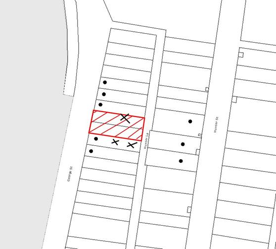
|
NOTIFICATION
PLAN
|
|
|
• PROPERTIES NOTIFIED
|
X SUBMISSIONS
RECEIVED
|
PROPERTY SUBJECT OF DEVELOPMENT
|
|
|
FIVE SUBMISSIONS RECEIVED OUT OF MAP RANGE
|
|
|
|
|
Eight submissions objected to the
development, generally on the following grounds that the development would
result in:
· Inappropriate location
for a brothel;
· Proximity to the
Library, AMF Bowling, a gym and the PCYC which are heavily used by school
children;
· Proximity to Studio
Artes - a community based service for adults with specific needs, offering
arts, prevocational training and recreation;
· Proximity to
residential homes/ units
· Hunter Lanes has
numerous children activities e.g. dance clubs, taekwondo etc
· Potential to impact
upon future plans for development on adjoining sites;
· Insufficient car
parking on-site;
· Traffic and parking
impacts;
· Impact on work experience programs offered by adjoining business to high schools, universities, TAFE
colleges and design schools, and safety of children.
· Moral issues;
· Lack of community
consultation.
The merits of the matters raised
in community submissions have been addressed in the body of the report with the exception of the following:
5.1.1 Potential to impact upon future plans for development on adjoining sites
The proposed development is a
permissible land use in the zone and has been assessed with regard to existing
surrounding development in the locality. Any future land uses in the locality
would be assessed on their merits.
5.1.2 Safety of Children
Submissions raised concerns that
the development would compromise the safety of children particularly the
children of customers and other business owners who may from time to time be in
the street, and also impact on work experience programs offered by businesses.
Although children may at times accompany
parents or guardians to other businesses existing in the street, there is no
evidence that the establishment of a brothel would create a risk for children.
The presentation of the
development is such that people would not be able to identify the use of the
building as a brothel. Suitable off street parking and access is available and
an adequate setback provided to ensure that clients would have no need to wait or gather on the street. Furthermore, most of the brothel’s trade would occur during hours when
other businesses in the street are closed.
5.1.3 Moral Issues
Nearly all submissions received
raise concerns on moral grounds, including statements that the development is
undesirable, degrading to women, erodes community and Christian values, would
be a focal point for undesirable people within community and the like.
There is considered to be two
opposing views on the establishment of sex services premises (including
brothels) with the common view being that they are immoral to some degree. However,
the morality of a development is not a determinative planning consideration.
Sex services premises (including brothels) are legitimate land uses regulated
through environmental planning instruments under the EP&A Act. As such,
the issue to be considered is not the morals of prostitution but whether or not the subject land is a suitable location for the establishment of a brothel.
The assessment of the development
application does not comment on, nor have regard to the morality of the
proposed use.
5.1.4 Lack of community consultation
The application was notified in
accordance with Council’s Notification and Exhibition Development Control Plan
which included an advertisement in the local newspaper. Several residents and
commercial tenants contacted Council and requested additional time to make a
submission. Council officers received and considered submissions received up
to four weeks following the close of the notification period. It is considered
that adequate community consultation of the proposed development has been
undertaken.
5.2 Public Agencies
The application was referred to
the following Agencies for comment:
5.2.1 NSW Police
The NSW Police Service raised no
objections to the DA proposal. The Police noted that when and if a patron is
ejected or refused entry they would be left outside the location presumably
without being monitored by staff and a potential exists for that 'patron' to
become hostile or have a negative impact on the neighbouring community.
Accordingly, the Police recommend that the Brothel Management Plan should
include provisions for staff to maintain visual observations of any 'ejected
patron' and if necessary call the Police for assistance.
6. THE PUBLIC INTEREST
Section 79C(1)(e) of the Act
requires Council to consider “the public interest”.
The public interest is an
overarching requirement, which includes the consideration of the matters
discussed in this report. Implicit to the public interest is the achievement
of future built outcomes adequately responding to and respecting the future
desired outcomes expressed in environmental planning instruments and
development control plans.
The application is considered to
have satisfactorily addressed Council’s and relevant agencies’ criteria and
would provide a development outcome that, on balance, would result in a
positive impact for the community. Accordingly, it is considered that the
approval of the proposed development would be in the public interest.
CONCLUSION
The application proposes the use
of an existing commercial/industrial premise for the purpose of a sex services
premises (brothel).
There has been some community
reaction to the development questioning the morality of such a proposal.
However, morality is not a determinative planning consideration. It is therefore not the role of Council to determine the morals of such a proposal, but to consider the
appropriateness of the proposed location. The issues raised in public
submissions do not give rise to the refusal of the application on planning grounds.
There are community concerns that
the exposure of impressionable groups such as children and adolescents to the
existence of brothels is undesirable and the aim is therefore to locate brothels where they are least likely to offend. The establishment of a brothel on
commercial zoned land is considered appropriate and one where children are less
likely to be exposed to such development.
The subject site is a location
that does not adjoin and is not clearly visible from residential zones, places
of worship, schools, childcare facilities or the like. The presentation of the
building and retention of the industrial façade is such that the building would
not be identifiable as a brothel. The development has been proposed in such a
way as to minimise any offence to the general public and ultimately it is
considered that the development would not create any significant detrimental
impact.
Having regard to the merits of
the proposal, the application is recommended for approval subject to
conditions.
Note: At the time of the completion of this planning report, no
persons have made a Political Donations Disclosure Statement pursuant to
Section 147 of the Environmental Planning and Assessment Act 1979 in respect of
the subject planning application.
|
Rod Pickles
Manager -
Assessment Team 2
Planning Division
|
Scott Phillips
Executive Manager
Planning Division
|
Attachments:
|
1.View
|
Locality Plan
|
|
2.View
|
Architectural
Plans
|
File Reference: DA/1027/2010
Document Number: D01496896
SCHEDULE 1
GENERAL
CONDITIONS
The
conditions of consent within this notice of determination have been applied to
ensure that the use of the land and/or building is carried out in such a manner
that is consistent with the aims and objectives of the relevant legislation, planning
instruments and Council policies affecting the land and does not disrupt the
amenity of the neighbourhood or impact upon the environment.
Note: For the
purpose of this consent, the term ‘applicant’ means any person who has the
authority to act on or the benefit of the development consent.
Note: For the purpose of
this consent, any reference to an Act, Regulation, Australian Standard or
publication by a public authority shall be taken to mean the gazetted Act or
Regulation, or adopted Australian Standard or publication as in force on the
date that the application for a construction certificate is made.
1. Approved
Plans and Supporting Documentation
The
development must be carried out in accordance with the plans and documentation
listed below and endorsed with Council’s stamp, except where amended by Council
and/or other conditions of this consent:
Approved Plans prepared
by 3D Archplan
|
Plan No.
|
Title
|
Issue
|
Dated
|
|
A58-01
|
Site Plan/ Plan Layout
|
01
|
19 September 2009
|
|
A58-02
|
Lower Floor Plan
|
01
|
19 September 2009
|
|
A58-03
|
Upper Floor Plan
|
01
|
19 September 2009
|
|
A58-04
|
West, East & North Elevation
|
01
|
19 September 2009
|
|
A58-05
|
Section A, B & Light Box
Detail
|
01
|
19 September 2009
|
Supporting Information
|
Document Title
|
Prepared by
|
Dated
|
|
Statement of Environmental Effects
|
Boston, Blythe Flemming
|
July 2010
|
|
Brothel Management Plan
|
Boston, Blythe Flemming
|
July 2010
|
REQUIREMENTS PRIOR TO THE ISSUE OF A CONSTRUCTION
CERTIFICATE
2. Building
Code of Australia
All building
work must be carried out in accordance with the requirements of the Building
Code of Australia.
3. Fire
Safety Upgrade
To ensure the protection of persons using the existing
building and to facilitate egress from this building in the event of a fire,
details must be submitted with the application for a construction certificate,
detailing what works are necessary (if any) to bring it into full compliance
with Parts C, D1, D2 and E of the Building Code of Australia.
4. Waste
Management Plan
Prior to issue of the Construction Certificate, A Waste Management Plan Section One –
Demolition Stage, Section Two – Design Stage, Section Three – Construction
Stage and Section Four – Use and On-going Management as applicable,
covering the scope of this project is required to be submitted to Council in
accordance with the Waste Minimisation and Management Development Control
Plan.
REQUIREMENTS PRIOR TO THE COMMENCEMENT OF ANY WORKS
5. Erection
of Construction Sign
A sign must
be erected in a prominent position on any site on which building work, subdivision work or demolition work is being carried out:
a. Showing
the name, address and telephone number of the principal certifying authority for the work,
b. Showing
the name of the principal contractor (if any) for any demolition or building work and a telephone number on which that person may be contacted outside working hours, and
c. Stating
that unauthorised entry to the work site is prohibited.
Note: Any
such sign is to be maintained while the building work, subdivision work or demolition work is being carried out, but must be removed when the work has been completed.
6. Car
Parking and Deliveries
All car parking must be
constructed and operated in accordance with Australian Standard AS 2890.1 –
2004 – Off Street Car Parking and Australian Standard 2890.2 - 2002 –
Off Street Commercial and the following requirement:
a. All
parking areas and driveways are to be sealed to an all weather standard, line
marked and signposted.
b. Car
parking, loading and manoeuvring areas to be used solely for nominated purposes.
7. Waste
Management Plan – Work Practices
Appropriate work practices must be employed to implement
the Waste Management Plan Section One –
Demolition Stage and Section Three – Construction Stage as applicable.
REQUIREMENTS DURING CONSTRUCTION
8. Demolition
All
demolition work must be carried out in accordance with Australian Standard
2601-2001 – The Demolition of Structures and the following requirements:
a. Demolition
material is to be disposed of to an authorised recycling and/or waste disposal site and/or in accordance with an approved waste management plan.
b. Demolition
works, where asbestos material is being removed, must be undertaken by a
contractor that holds an appropriate licence issued by WorkCover NSW in accordance with Chapter 10 of the Occupational Health and Safety
Regulation 2001 and Clause 29 of the Protection of the Environment
Operations (Waste) Regulation 1996.
c. On
construction sites where buildings contain asbestos material, a standard
commercially manufactured sign containing the words ‘DANGER ASBESTOS REMOVAL IN
PROGRESS’ measuring not less than 400mm x 300mm must be erected in a prominent
position visible from the street.
9. Council
Property
During
construction works, no building materials, waste, machinery or related matter is to be stored on the road or footpath. The public reserve is to be kept in
a clean, tidy and safe condition at all times.
REQUIREMENTS PRIOR TO THE ISSUE OF AN OCCUPATION
CERTIFICATE
Note: For the
purpose of this consent, any reference to ‘occupation certificate’ shall also
be taken to mean ‘interim occupation certificate’ unless otherwise stated.
10. External
Lighting
All external
lighting must be designed and installed in accordance with Australian
Standard AS 4282 – Control of the Obtrusive Effects of Outdoor Lighting. Certification of compliance with the Standard must be obtained from a suitably
qualified person.
11. Removal
of Existing Signage
The existing
pole sign and a top hamper sign on the George Street frontage of the site must
be removed.
12. Advertising
Signs
The advertising signage
approved under this consent must not flash, move or display electronic image
and must not be located less than 2.6m above the ground.
13. Noise
All noise generated by the
proposed development must be attenuated to prevent levels of noise being
emitted to adjacent premises which possess tonal, beating and similar
characteristics or which exceeds background noise levels by more than 5dB(A).
14. Operation
of Brothel
The brothel must be
operated in accordance with the NSW Health and WorkCover publication ‘Health
and Safety Guidelines for Brothels in NSW (2001)’.
15. Brothel
Management Plan
The Brothel
Management Plan must include provisions for staff to maintain visual
observations of any 'ejected patron' and if necessary call the Police for assistance.
16. On-Going Waste Management
The waste management on the site must be in accordance with the following requirements:
a. Appropriate waste containers acceptable to the NSW
Department of Health are to be placed in all work rooms for the collection and
disposal of soiled articles such as condoms, tissues, gloves and the like.
Such waste containers must have sliding lids to eliminate odours. All
contaminated sharps, e.g. needles must be placed in non-reusable sharps
containers which comply with Australian Standards AS 4031-1992 Non-reusable
containers for the collection of sharp medical items used in health care areas
for their disposal.
b. Space must be provided for the storage of waste bins prior to collection by a commercial waste contractors; the siting of which must have regard for potential amenity
impacts and must be clear of the approved parking areas on site.
17. Fire
Safety Statement - Annual
On at least one occasion in
every 12 month period following the date of the first ‘Fire Safety Certificate’
issued for the property, the owner must provide Council with an annual ‘Fire
Safety Certificate’ to each essential service installed in the building.
-
END OF CONDITIONS -
ADVISORY NOTES
The following information is provided for your
assistance to ensure compliance with the Environmental Planning and Assessment
Act, 1979, Environmental Planning and Assessment Regulation 2000, other
relevant legislation and Council’s policies and specifications. This
information does not form part of the conditions of development consent
pursuant to Section 80A of the Act.
Environmental Planning and
Assessment Act, 1979 Requirements
The Environmental Planning and
Assessment Act, 1979 requires:
· The issue of a construction certificate
prior to the commencement of any works. Enquiries regarding the issue of a
construction certificate can be made to Council’s Customer Services Branch on
9847 6760.
· A principal certifying authority to be nominated and Council notified of that appointment prior to the commencement of any
works.
· Council to be given at least two days
written notice prior to the commencement of any works.
· Mandatory inspections of nominated
stages of the construction inspected.
· An occupation certificate to be issued
before occupying any building or commencing the use of the land.
Long Service Levy
In accordance with Section 34 of
the Building and Construction Industry Long Service Payments Act 1986, a ‘Long Service Levy’ must be paid to the Long
Service Payments Corporation or Hornsby Council.
Note: The
rate of the Long Service Levy is 0.35% of the total cost of the work.
Note: Hornsby Council requires the payment of the Long Service Levy prior to the issue of a construction
certificate.
Disability Discrimination Act
The applicant’s attention is
drawn to the existence of the Disability Discrimination Act. A
construction certificate is required to be obtained for the proposed
building/s, which will provide consideration under the Building Code of
Australia, however, the development may not comply with the requirements of
the Disability Discrimination Act. This is the sole responsibility of
the applicant.
Covenants
The land upon which the subject
building is to be constructed may be affected by restrictive covenants.
Council issues this approval without enquiry as to whether any restrictive
covenant affecting the land would be breached by the construction of the
building, the subject of this consent. Applicants must rely on their own
enquiries as to whether or not the building breaches any such covenant.
Asbestos Warning
Should asbestos or asbestos products be encountered during demolition or construction works you are advised to
seek advice and information should be prior to disturbing the material. It is
recommended that a contractor holding an asbestos-handling permit (issued by WorkCover NSW) be engaged to manage the proper handling of the material. Further information regarding the safe handling and removal of asbestos can be found at:
www.environment.nsw.gov.au
www.nsw.gov.au/fibro
www.adfa.org.au
www.workcover.nsw.gov.au
Alternatively, telephone the WorkCover Asbestos and Demolition Team on 8260 5885.
Planning Report No. PLN72/10
Date of Meeting:
1/12/2010
5 DEVELOPMENT APPLICATION
- CONSTRUCTION OF AN AFFORDABLE HOUSING DEVELOPMENT COMPRISING EIGHT TOWNHOUSES
3 & 5 FULBOURNE AVENUE, PENNANT HILLS
|
Development Application No:
|
DA/1021/2010
|
|
Description of Proposal:
|
Construction of an affordable housing development
comprising eight townhouses and demolition of existing dwellings
|
|
Property Description:
|
Lot 16 and Lot 15 DP 10203 (Nos 3 & 5) Fulbourne Avenue, Pennant Hills.
|
|
Applicant:
|
Mr Ram Shanker Kangatharan
C/- Glendinning Minto & Associates P/L
|
|
Owner:
|
Mr R S Kangatharan
|
|
Statutory Provisions:
|
Hornsby Shire Local Environmental
Plan 1994
Residential A (Low Density)
Zone
State Environmental Planning
Policy (Affordable Rental Housing) 2009
|
|
Estimated Value:
|
$2.7 million
|
|
Ward:
|
C
|
|
RECOMMENDATION
THAT Development Application
No. DA/1021/2010 for the demolition of existing dwellings and the
construction of an affordable housing development comprising eight townhouses
at Lot 16 and Lot 15 DP 10203 (Nos 3 & 5) Fulbourne Avenue, Pennant Hills
be approved subject to the conditions of consent detailed in Schedule 1 of
this report.
|
1. The
application proposes the demolition of two existing dwelling houses and the
construction of an affordable housing development containing eight townhouses.
2. The
proposal complies with the development standards contained within State
Environmental Housing Policy (Affordable Rental Housing) 2009.
3. Thirteen
submissions have been received in respect of the application.
4. It
is recommended that the application be approved.
THE
SITE
The site comprises two allotments
located on the southern side of Fulbourne Avenue. The site has an area of 2,089.5m2,
is of regular shape with a frontage of 41.5m and depth of 50.5m. The site has
an average fall of 6% to the rear south western corner.
The site includes two existing
single storey dwelling houses. A 1.8m wide stormwater drainage easement is
located over the south east corner of the site. The trees on the site mainly
include previously planted species other than a number of remnant trees in the
western rear part of the site.
The surrounding locality
comprises a low density residential area of single and two storey dwelling
houses. The adjoining property at No. 1 Fulbourne Avenue on the corner of Yarrara Road operates as a child care centre. The adjoining dwelling house at No. 7 Fulbourne Avenue is an item of environmental heritage of local significance. The Main
Northern Rail Corridor is located 45m east of the site parallel to Yarrara Road.
The site is located 500m north
east of Pennant Hills shops and Railway Station.
THE PROPOSAL
The proposal includes the
demolition of the two existing dwelling houses and the construction of eight
townhouses comprising two x 2 storey duplex at the front of the site and a two
storey building containing four townhouses at the rear of the site. The
townhouses include four x 3 bedroom and four x 4 bedroom dwellings. Five
townhouses include attached single storey garaging and living space. Open car
parking spaces at the rear are proposed for three of the dwellings.
The proposal includes a central
accessway that separates the two buildings at the frontage and provides access
to the building at the rear.
ASSESSMENT
The development application has
been assessed having regard to the ‘2005 City of Cities Metropolitan
Strategy’, the ‘North Subregion (Draft) Subregional Strategy’ and
the matters for consideration prescribed under Section 79C of the Environmental
Planning and Assessment Act 1979 (the Act). Subsequently, the following
issues have been identified for further consideration.
1. STRATEGIC CONTEXT
1.1 NSW State Plan
Priority of E6 of the NSW
State Plan is ‘Housing Affordability’. The Plan notes that:
Strong
economic growth for the last 10 years has seen home values rise dramatically
across many parts of NSW. Alongside this however, there has been a
corresponding increase in difficulty for many people in affording housing.
The
Government considers housing affordability from two perspectives. Firstly,
from the perspective of the first home buyer for whom purchasing a home is
increasingly difficult. Secondly, from the perspective of the most vulnerable households
– the frail aged, people with disabilities, people with mental illness and
people at risk of homelessness – who face poor health, educational or other
social outcomes due to high housing costs or overcrowding.
A key lever
of Priority E6 was the introduction of State Environmental Planning Policy
(Affordable Rental Housing) 2009. Being a recent planning initiative, Hornsby
local government area is only now seeing development applications for this type
of housing. Therefore, it is important to carefully consider development
proposals in the context of this strategic planning objective as well as more
established local planning controls.
1.2 Metropolitan Strategy – (Draft) North Subregional Strategy
The Metropolitan Strategy is a
broad framework to secure Sydney’s place in the global economy by promoting and
managing growth. It outlines a vision for Sydney to 2031; the challenges
faced, and the directions to follow to address these challenges and achieve the
vision. The draft North Subregional Strategy acts as a framework for Council
in the preparation of a new Principal LEP by 2011.
The draft Subregional Strategy
sets the following targets for the Hornsby LGA by 2031:
· Employment capacity to
increase by 9,000 jobs; and
· Housing stock to
increase by 11,000 dwellings.
The proposed development would be
consistent with the draft Strategy by providing an additional six dwellings and
would improve housing choice in the locality.
2. STATUTORY CONTROLS
Section 79C(1)(a) requires
Council to consider “any relevant environmental planning instruments, draft
environmental planning instruments, development control plans, planning
agreements and regulations”.
2.1 Hornsby Shire Local Environmental Plan 1994
The subject land is zoned
Residential A (Low Density) under the Hornsby Shire Local Environmental Plan
1994 (HSLEP). The objectives of the zone are:
(a) to provide for the housing needs of the population of the
Hornsby area.
(b) to promote a variety of housing types and other land uses
compatible with a low density residential environment.
(c) to provide for development that is within the
environmental capacity of a low density residential environment.
The compliance of the development
with the zone objectives must be read in the context of the aims of State
Environmental Planning Policy (Affordable Rental Housing) 2009. An assessment
of the application against the SEPP is held at section 2.2 of this
report.
The proposed development is
defined as ‘multi-unit housing’ under the HSLEP and is permissible in the zone
with Council’s consent.
Clause 15 of the HSLEP prescribes
that the maximum floor space ratio (FSR) of development within the Residential
A zone is 0.4:1. The proposal exceeds this requirement and relies on the
provisions of State Environmental Planning Policy (Affordable Rental Housing)
2009 which permits a maximum floor space ratio of 0.75:1. To the extent of any
inconsistency between the HSLEP and the SEPP, the provisions of the SEPP prevail.
Clause 18 of the HSLEP sets out
heritage conservation provisions within the Hornsby area. The site adjoins an
item of environmental heritage at No. 7 Fulbourne Avenue (house). The
application includes a Heritage Impact Assessment of the proposed development.
This matter is addressed in section 2.3 of this report.
2.2 State Environmental Planning Policy (Affordable Rental
Housing) 2009
The application has been assessed
against the requirements of State Environmental Planning Policy (Affordable
Rental Housing) 2009 (SEPP – Affordable Rental Housing). This Policy provides
State-wide planning controls for delivery of affordable rental housing through
planning incentives to increase rental housing close to business centres and to
expand the role of non-profit housing providers. The Policy also provides for
the retention of existing affordable housing and for housing support for
disadvantaged people.
The Policy applies to the
majority of Council’s residential land use zones for sites within 800 metres
walking distance of a railway station or 400 metres of a bus stop with an
hourly bus service.
For the subject site, the Policy
provides for a maximum building height of 8.5m and a maximum floor space ratio
of 0.75:1 with at least 50% of dwellings to be used for affordable rental
housing for a period of 10 years.
Affordable housing is defined
under the Policy according to a household income level being less than 120% of
the median household income (Sydney Statistical Division). The affordable
rental housing accommodation is to be managed by a registered community housing
provider.
The Policy includes development
standards and applies design criteria for low rise and high rise developments.
For the subject site, the Seniors Living Policy: Urban Design Guidelines for
Infill Development is to be taken into consideration, subject to the
provisions being consistent with the Policy. The following table sets out the
proposal’s compliance with the prescriptive standards of the Policy:
|
SEPP -
Affordable Rental Housing
|
|
Control
|
Proposal
|
Requirement
|
Compliance
|
|
Site Area
|
2,089.5m2
|
450m2
|
Yes
|
|
Floor Space Ratio
|
0.60:1
|
0.75:1
|
Yes
|
|
Dwelling Size
|
141m2 –
167m2
|
Min 95m2
– 3 br +
|
Yes
|
|
Height
|
8.5m
|
8.5m
|
Yes
|
|
Car parking
|
10 spaces
|
4 spaces (0.5 per
dwlg)
|
Yes
|
|
Solar Access
|
100%
|
70%
|
Yes
|
|
Deep Soil Zone
|
28%
|
15%
|
Yes
|
|
Landscaped Area
|
717m2
|
280m2
|
Yes
|
As detailed in the above table,
the proposed development complies with the prescriptive standards within the
Policy. Below is a brief discussion on compliance with design principles and
best practice standards within the Urban Design Guidelines for Infill
Development.
2.2.1 Responding to Context
The immediate locality is
characterised mainly by single storey older style detached dwellings with open
landscaped frontages in the streetscape. Front setbacks are variable and there
is a mix of building materials and finishes and housing styles.
The proposed development provides
a contemporary architectural form and includes a mix of materials and
finishes. The development maintains the existing building alignment along the
lower southern side of the street. The proposal introduces a new built form and
style of housing but would maintain the existing pattern of buildings in the
streetscape.
The development makes good use of
internal/external spaces and incorporates sustainable building practices that
are more efficient than the majority of existing dwellings in the locality.
2.2.2 Site Planning and Design
The site is of uniform shape and
is situated on the lower side of the street. The site does not include any
significant constraints to development other than the stormwater drainage
easement across the south eastern corner of the site.
The proposed townhouses are
oriented north south living and open space areas are primarily located on the
northern elevation of the dwellings, to maximise solar access. The proposed
dwelling design would achieve a high level of energy efficiency and amenity.
Separate driveways are provided
for dwellings 1 and 4. A central accessway provides a shared pedestrian and
vehicular access to the proposed rear dwellings and vehicular access for units
2 and 3. The dwellings at the frontage have independent pedestrian access.
2.2.3 Impacts on Streetscape
The proposal includes informal
private open space within the front setback which is inconsistent with the
streetscape.
The proposed buildings have a
minimum front setback of 8.6m. The proposed private open space areas extend to
within 2.8m of the front boundary and are enclosed with 1.2m high tubular steel
fencing with brick piers. Being enclosed by 1.2m high fences, the front
courtyards of units 1 to 4 are not intended to be used as formal private
areas. Instead, the courtyards take advantage of the northern elevation and
improve internal/external living and amenity. This results in a sustainable
and environmentally efficient design outcome.
Landscaping for privacy is
proposed at the immediate frontage. The proposed landscaping would provide
effective screening of the private open space areas. The first floor component
of the two front buildings would present as the dominant element in the
streetscape.
Subject to implementation of the
landscape plan the proposal is considered acceptable in respect to impact on
the existing streetscape.
2.2.4 Impacts on Neighbours
The proposed development is
considered acceptable in respect to privacy and amenity to the adjoining child
care centre and the adjoining heritage listed dwelling subject to the
construction of new boundary fencing. The proposed buildings would not
overshadow neighbouring properties to the extent of any non-compliance with the
Urban Design Guidelines For Infill Development.
The proposed rear townhouse
building is setback 4.9m from the rear boundary. The ground floor levels of the
proposed dwellings are 1.2m above natural ground level at the rear boundary. To
minimise overlooking of adjoining properties from the rear patios, the proposal
includes privacy screens 1.5m above the floor level fixed to the rear boundary
fence. A 3m wide deep soil landscaping area is proposed along the rear of the
development in compliance with the Policy. The proposed landscaping area
includes planting along the boundary which would provide some screening of the
development. The majority of the proposed deep soil zone at the rear of the
site is proposed for lawn area.
To prevent overlooking of the
adjoining rear properties, privacy louvers are proposed for the first floor
windows. The privacy screening reduces the visual amenity impacts of rear open
space areas of adjoining properties in Stevens Street.
The Urban Design Guidelines
For Infill Development include controls for the rear 25% of the site to be
single storey. However, the SEPP – Affordable Rental Housing provides for a
building height of not more than 8.5m which prevails to the extent of the
inconsistency with the Guidelines.
Having regard to the aims of the
SEPP – Affordable Rental Housing, this is considered to be an acceptable
outcome.
2.2.5 Internal Site Amenity
The fin walls of the proposed
buildings give separation and identity to individual dwellings within the
development.
Fences and landscaping provide
suitable screening for proposed private open space areas. The use of louvers
for first floor windows and balcony screens minimises privacy impacts within
the development. The proposed private open space areas comply with the
required 35m2 of landscaping per dwelling.
Five of the eight dwellings have
single car garages. The proposed open car parking spaces in the frontage of
Units 6 and 7 are not allocated to those units and would detract from their
amenity, as the ‘ownership’ of the spaces is in conflict with the front entries
and immediate outlook of these units. Whilst car ownership is reduced for low
income households as recognised by the Policy with the requirement for 0.5
spaces per dwelling, the provision of a separate common parking area should be
of design to minimise amenity impacts. To address this impact, it is
recommended that low height screen fencing be provided between unit 5 car space
and unit 6 as well as unit 8 car space and unit 7.
The proposed design does not
provide adequate space for landscape treatment to provide transition and
separation between the internal driveway/shared pedestrian access and the
dwelling entries, resulting in dominance of the central accessway which
detracts from the architectural style of the development and amenity. It
would be open to Council to require the removal of car parking spaces to
improve this amenity. Whilst that would result in the development maintaining
the required number of car parking spaces under SEPP – Affordable Rental
Housing, a reduction in car parking is considered to be an inferior outcome due
to the density of the development. Therefore on merit, the development is
considered acceptable in its current form.
The proposed dwelling entries at
the frontage and central access to the rear dwellings are clearly defined
access points to the development. Casual surveillance of the access points is
achieved within the development minimising opportunities for crime.
The site is in the vicinity of
the rail corridor. The rail line is elevated in relation to the site and
results in noise impacts. Rail Corp recommends noise mitigation measures for
the proposed development, which have been included as a recommended condition
of consent.
2.3 Heritage Development Control Plan
The site adjoins an item of
environmental heritage at No. 7 Fulbourne Avenue (house) which is an item of
local significance as an Inter-War weatherboard cottage.
Council’s Heritage Committee
raised objections to the proposed development on grounds that the bulk and
scale of the proposed development is out of character and not sympathetic with
the adjoining heritage item.
A Heritage Impact Report
was submitted in support of the application. The report notes:
The new
buildings occupy a site adjoining the item and separated from it by some
distance allowing for appropriate landscape separation. Additionally, the new
buildings are set below the road level and have overall heights that are
compatible with the adjoining development on both sides of the site. The
increased density of development will not be highly obvious from the street due
to the fall of the site and the screening effect of the retained vegetation.
The applicant notes the concerns
of the Heritage Committee. However, the applicant considers that the merits of
the application coupled with the minor impact on the heritage item are such
that the proposal should be supported in its current form.
The officer’s assessment of the
application concurs with the opinion of the applicant and therefore recommends
that Council not require amendments to the design of the buildings. The
development would be set back to enable landscaping to sufficiently screen the
development to minimise impacts and would result in a development that relates
positively to the streetscape.
3. ENVIRONMENTAL IMPACTS
Section 79C(1)(b) of the Act
requires Council to consider “the likely impacts of that development,
including environmental impacts on both the natural and built environments, and
social and economic impacts in the locality”.
3.1 Natural Environment
The site includes twenty trees
comprising a mix of exotic, introduced native and remnant trees.
The proposed development would
necessitate the removal of six trees from the site. None of the trees to be
removed are identified as ‘significant trees’. Tree No. 20, a Brush Box (Lophostemon
confertus) located in the south eastern part of the site, is identified as
good and worthy of preservation and is to be retained.
The submitted landscape plan
includes locally indigenous plant species and is considered acceptable is
respect to replacement of existing trees proposed for removal.
3.2 Built Environment
The design of the proposed
townhouses provides for cost effective construction of energy efficient housing
with functional floor plans and an acceptable standard of accommodation for
large families. The proposed built form however is predicated on reduced car
parking provision in accordance with the provisions of the SEPP – Affordable
Rental Housing.
Given that 50% of the development
is required for this purpose for a relatively short time (10 years) compared to
the economic life of the development, the large 3 and 4 bedrooms dwellings are
compromised by the comparative deficiency of the car parking provision for
accommodation of this size. However, under Clause 14 of the Policy, a consent
authority must not refuse consent to development on car parking grounds when
0.5 spaces per dwelling are provided. It is acknowledged that to facilitate
affordable housing in the strategic context, inconsistencies may arise with
local planning expectations.
The proposal retains the existing
vehicle crossings in the street maintaining this aspect of the streetscape. The
eastern crossing is adjacent to the adjoining child care centre. To ensure
adequate sight distance at the frontage, the floor height of the garage for
Unit 4 and its driveway are at an appropriate level with the footpath.
Bin storage is proposed within
the respective dwelling areas. Collection at the road frontage is considered
acceptable for the proposal.
The proposed development includes
a mix of materials; sheet metal, face brick, weatherboard, aluminium louvers
and privacy shutters. The mix of materials and proposed finishes complement the
architectural style of the development and result in a high quality design that
would enhance the existing streetscape.
3.3 Social Impacts
The proposed development would be
of positive social impact in providing affordable rental accommodation
particularly for large families, thus reducing social disadvantage and
fostering inclusive and diverse communities. This is a key priority of the NSW
State Plan.
3.4 Economic Impacts
The proposal would have a minor
positive impact on the local economy in conjunction with other residential
development in the locality by generating an increase in demand for local
services.
4. SITE SUITABILITY
Section 79C(1)(c) of the Act
requires Council to consider “the suitability of the site for the
development”.
4.1 Flooding
The stormwater drainage easement
over the south eastern part of the site is subject to an overland flow path for
the 1 in 100 year flood. The proposed floor levels would be a minimum of 500mm
above flood height. The submitted flood study recommends minor excavation work
at the rear of proposed Units 7 and 8 to maintain pre-development flood levels.
Subject to implementation of the
recommendations of the flood study the proposal would not adversely impact on
downstream properties.
The development is otherwise
considered suitable for the site.
5. PUBLIC PARTICIPATION
Section 79C(1)(d) of the Act
requires Council to consider “any submissions made in accordance with this
Act”.
5.1 Community Consultation
The proposed development was
placed on public exhibition and was notified to adjoining and nearby landowners
between 7 September and 30 September 2010 in accordance with Council’s
Notification and Exhibition Development Control Plan. During this period,
Council received thirteen submissions. The map below illustrates the location
of those nearby landowners who made a submission that are in close proximity to
the development site.
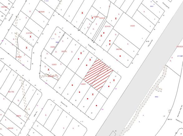
|
NOTIFICATION
PLAN
|
|
|
• PROPERTIES NOTIFIED
|
X SUBMISSIONS
RECEIVED
|
PROPERTY SUBJECT OF DEVELOPMENT
|
|
|
1 SUBMISSION RECEIVED
OUT OF MAP RANGE
|
|
|
|
|
Thirteen submissions objected to
the development, generally on the grounds that the development would result in:
· Lack of car parking.
· Unacceptable
residential density.
· Negative impact on
streetscape and residential character.
· Impact on heritage
item.
· Impact on traffic
safety.
· Overshadowing and
privacy impacts.
· Lack of space for children’s
recreation and for clothes drying.
· Building height >
3.6m.
· Unacceptable number of
bins for waste collection.
The merits of the matters raised
in community submissions have been addressed in the body of the report with the
exception of the following:
5.1.1 Boundary fence
It is considered to be a
reasonable request that the applicant be required to construct the boundary
fence at nil cost to the neighbouring property owner. A recommended condition
of consent has been included in Attachment A.
5.2 Public Agencies
The development application was
referred to NSW Transport (Rail Corp) in respect development in the vicinity of
the rail corridor.
Rail Corp raised no objection to
the proposal subject to a condition for compliance with noise mitigation
measures.
6. THE PUBLIC INTEREST
Section 79C(1)(e) of the Act
requires Council to consider “the public interest”.
The public interest is an
overarching requirement, which includes the consideration of the matters
discussed in this report. Implicit to the public interest is the achievement
of future built outcomes adequately responding to and respecting the future
desired outcomes expressed in environmental planning instruments and
development control plans.
The application is considered to
have satisfactorily addressed Council’s and relevant agencies’ criteria and
would provide a development outcome that, on balance, would result in a
positive impact for the community. Accordingly, it is considered that the
approval of the proposed affordable rental housing development would be in the
public interest.
CONCLUSION
Consent is sought for demolition
of two existing dwelling houses and construction of an affordable housing
development comprising eight townhouses.
The proposed affordable housing development
complies with the development standards prescribed under the SEPP – Affordable
Rental Housing in respect to floor space ratio, car parking, landscaping, deep
soil zones, solar access and dwelling size. The proposed townhouses would
provide accommodation for low income families and conditions are recommended to
ensure the accommodation is managed for this purpose.
The proposed townhouses are
designed for energy efficiency and achieve a cost effective quality design
standard. The non-discretionary development standards to facilitate the
provision of this form of housing result in a shortfall in parking which has
implications for the standard of accommodation and internal site amenity. In
this regard the provisions of the SEPP – Affordable Rental Housing prevail
notwithstanding the concerns raised in public submissions.
The concerns raised in public
submissions concerning privacy are considered to have been addressed by the
provision of fixed screens and landscaping. It is considered the proposed development
would not significantly detract from the residential character of the locality.
The proposed development is
therefore recommended for approval subject to recommended conditions.
|
Rod Pickles
Manager -
Assessment Team 2
Planning Division
|
Scott Phillips
Executive Manager
Planning Division
|
Attachments:
|
1.View
|
Locality Plan
|
|
2.View
|
Demolition Plan
|
|
3.View
|
Survey Plan
|
|
4.View
|
Site Analysis Plan
|
|
5.View
|
Floor Plans
|
|
6.View
|
Elevations
|
|
7.View
|
Perspective Front
Elevation
|
|
8.View
|
Sections
|
|
9.View
|
Landscape Plan
|
|
10.View
|
Overland Flow Path
|
File Reference: DA/1021/2010
Document Number: D01502111
SCHEDULE 1
GENERAL
CONDITIONS
The
conditions of consent within this notice of determination have been applied to
ensure that the use of the land and/or building is carried out in such a manner
that is consistent with the aims and objectives of the relevant legislation,
planning instruments and Council policies affecting the land and does not
disrupt the amenity of the neighbourhood or impact upon the environment.
Note: For the
purpose of this consent, the term ‘applicant’ means any person who has the
authority to act on or the benefit of the development consent.
Note: For the purpose of
this consent, any reference to an Act, Regulation, Australian Standard or publication
by a public authority shall be taken to mean the gazetted Act or Regulation, or
adopted Australian Standard or publication as in force on the date that the
application for a construction certificate is made.
1. Approved
Plans and Supporting Documentation
The development must be carried
out in accordance with the plans and documentation listed below and endorsed
with Council’s stamp, except where amended by Council and/or other conditions
of this consent:
|
Plan No.
|
Drawn by
|
Dated
|
|
DA 00 - Calculations
|
GGF Architects
|
04/11/10
|
|
DA 01 – Site Analysis
|
GGF Architects
|
04/11/10
|
|
DA 02 - Demolition
|
GGF Architects
|
27/07/10
|
|
DA 03 – Gnd Floor Plan
|
GGF Architects
|
04/11/10
|
|
DA 04 – 1st Floor Plan
|
GGF Architects
|
04/11/10
|
|
DA 05 - Elevations
|
GGF Architects
|
04/11/10
|
|
DA 06 - Elevations
|
GGF Architects
|
04/11/10
|
|
DA 07 - Sections
|
GGF Architects
|
04/11/10
|
|
108.10/179 ‘A’
|
ISCAPE Landscape Architecture
|
November 2010
|
|
|
|
|
2. Removal
of Existing Trees
This
development consent only permits the removal of tree(s) numbered T1 –T7, T12, T14, T17 and T19 as identified on Drawing
No. DA 02 prepared by GGF Architects dated 27/07/10. The removal of any other
trees requires separate approval under Council’s Tree Preservation Order.
3. Amendment
of Plans
The approved plans are to be amended
as follows:
a. Screen
fencing 1.2m high is to be erected at the frontage of Unit 7 and Unit 6 to
provide screening of the car parking spaces at the frontage of the units.
REQUIREMENTS PRIOR TO THE ISSUE OF A CONSTRUCTION
CERTIFICATE
4. Building
Code of Australia
All building
work must be carried out in accordance with the requirements of the Building
Code of Australia.
5. Contract
of Insurance (Residential Building Work)
In the case
of residential building work for which the Home Building Act, 1989 requires
there to be a contract of insurance in force in accordance with Part 6 of that
Act, that such a contract of insurance is in force before any building work
authorised to be carried out by the consent commences.
Note: This
condition does not apply to the extent to which an exemption is in force
under Clause 187 or 188 of the Act, subject to the terms of any condition or
requirement referred to in Clause 187(6) or 188(4) of the Act, or to the
erection of a temporary building.
6. Notification
of Home Building Act, 1989 Requirements
Residential
building work within the meaning of the Home Building Act,
1989 must not be carried out unless the principal certifying authority for
the development to which the work relates (not being Council) has given Council
written notice of the following information:
a. In
the case of work for which a principal contractor is required to be appointed:
i. The
name and licence number of the principal contractor.
ii. The
name of the insurer by which the work is insured under Part 6 of that Act.
b. In
the case of work to be done by an owner-builder:
i. The
name of the owner-builder.
ii. If
the owner-builder is required to hold an owner-builder’s permit under that Act,
the number of the owner-builder’s permit.
Note: If
arrangements for doing the residential building work are changed while the work
is in progress so that the information notified becomes out of date, further
work must not be carried out unless the principal certifying authority for the
development to which the work relates (not being Council) has given Council
written notification of the updated information.
7. Water/Electricity
Utility Services
The applicant
must submit written evidence of the following service provider requirements:
a. Energy
Australia – a letter of consent demonstrating that satisfactory
arrangements have been made to service the proposed development.
b. Sydney
Water – the submission of a ‘Notice of Requirements’ under s73 of the Sydney
Water Act 1994.
Note: Sydney
Water requires that s73 applications are to be made through an authorised
Sydney Water Servicing Coordinator. Refer to www.sydneywater.com.au or telephone
13 20 92 for assistance.
8. Noise
– Rail Corridor
An acoustic assessment is to be submitted to Council prior to the issue
of a construction certificate demonstrating how the proposed development will
comply with the Department of Planning’s document titled “Development Near Rail
Corridors and Busy Roads- Interim Guidelines.
9. Foundation
Design
Foundations
are to be designed by a Structural Engineer to extend below the level of the
Council-controlled drainage system.
10. On
Site Stormwater Detention
An on-site
stormwater detention system must be designed by a chartered civil engineer and
constructed in accordance with the following requirements:
a. Have
a capacity of not less than 27 cubic metres, and a maximum discharge (when
full) of 40 litres per second.
b. Have
a surcharge/inspection grate located directly above the outlet and accessible
exterior of the dwellings.
c. Discharge
from the detention system to be controlled via 1 metre length of pipe, not less
than 50 millimetres diameter or via a stainless plate with sharply drilled
orifice bolted over the face of the outlet discharging into a larger diameter
pipe capable of carrying the design flow to an approved Council system.
d. Where
above ground and the average depth is greater than 0.3 metres, a ‘pool type’
safety fence and warning signs to be installed.
e. Not
be constructed in a location that would impact upon the visual or recreational
amenity of residents.
11. Stormwater
Drainage
The
stormwater drainage system for the development must be designed and constructed
in accordance with Council’s Civil Works – Design and Construction
Specification 2005 and the following requirements:
a. Connected
to the on-site detention system and then the existing Council piped drainage
system, using a full depth 900 mm x 900 mm Council standard junction pit
on-line, stepirons and grated pit cover.
b. The
existing depression be constructed to contain the 1 in 100 year Average
Recurrence Interval storm event as per overland flow design prepared by
Acor Appleyard (reference GO100353).
c. Minimum
floor levels are to be set at least 500mm above the 100 year design storm level
as set out by Acor Appleyard.
d. Fencing
in the area affected by the design overland flow shall be constructed as
described by Acor Appleyard.
e. Pier
and beam method construction adjacent to easements to the depth of the invert
of proposed and existing pipes.
Note: A
certificate from a chartered civil engineer together with a works as executed
design plan must be submitted to the principal certifying authority to
demonstrate the satisfaction of this condition.
12. Internal
Driveway/Vehicular Areas
The driveway
and parking areas on site must be designed in accordance with Australian
Standards 2890.1, 3727 and the following requirements:
a. Design
levels at the front boundary be obtained from Council.
b. The
driveway be a rigid pavement.
c. The
driveway grade must not exceed 25 percent and transitions for changes in grade
must not exceed 8 percent per plan metre.
d. The
driveway pavement be a minimum 3 metres wide, 0.15 metres thick reinforced
concrete with F72 steel reinforcing fabric and a 0.15 metre sub-base.
e. The
pavement have a kerb to one side and a one-way cross fall with a minimum
gradient of 2 percent and a lintel and pit provided at the low points and on
grade.
f. Retaining
walls required to support the carriageway and the compaction of all fill
batters to be in accordance with the requirements of a chartered structural
engineer.
g. The
provision of safety rails where there is a level difference more than 0.3
metres and a 1:4 batter can not be achieved.
h. Conduit
for utility services including electricity, water, gas and telephone be
provided.
REQUIREMENTS PRIOR TO THE COMMENCEMENT OF ANY WORKS
13. Erection
of Construction Sign
A sign must
be erected in a prominent position on any site on which building work,
subdivision work or demolition work is being carried out:
a. Showing
the name, address and telephone number of the principal certifying authority
for the work,
b. Showing
the name of the principal contractor (if any) for any demolition or building
work and a telephone number on which that person may be contacted outside
working hours, and
c. Stating
that unauthorised entry to the work site is prohibited.
Note: Any
such sign is to be maintained while the building work, subdivision work or
demolition work is being carried out, but must be removed when the work has
been completed.
14. Erosion
and Sediment Control
Erosion and
sediment control measures must be provided and maintained throughout the
construction period in accordance with the manual ‘Soils and Construction
2004 (Bluebook)’, the approved plans, Council specifications and to the
satisfaction of the principal certifying authority. The erosion and sediment
control devices must remain in place until the site has been stabilised and
revegetated.
Note: On
the spot penalties up to $1,500 may be issued for any non-compliance with this
requirement without any further notification or warning.
15. Dilapidation
Report
A
‘Dilapidation Report’ is to be prepared by a chartered engineer detailing the
condition of adjoining properties and assets in the public road and submitted
to Hornsby Shire Council.
16. Toilet
Facilities
Toilet
facilities must be available or provided at the works site before works begin
and must be maintained until the works are completed at a ratio of one toilet
for every 20 persons employed at the site. Each toilet must:
a. be
a standard flushing toilet connected to a public sewer; or
b. be
a temporary chemical closet approved under the Local Government Act, 1993;
or
c. have
an on-site effluent disposal system approved under the Local Government Act,
1993
17. Tree
Protection Barriers
Tree
protection fencing must be erected around trees numbered 20 to be retained at a 3 metre setback.
The tree fencing must be constructed of 1.8 metre ‘cyclone chainmesh fence’ or
star pickets spaced at 2 metre intervals, connected by a continuous
high-visibility barrier/hazard mesh at a height of 1 metre.
REQUIREMENTS DURING CONSTRUCTION
18. Construction
Work Hours
All work on site (including demolition and earth works)
must only occur between 7am and 5pm Monday to Saturday.
No work is to be undertaken on Sundays or public holidays.
19. Demolition
All
demolition work must be carried out in accordance with Australian Standard
2601-2001 – The Demolition of Structures and the following requirements:
a. Demolition
material is to be disposed of to an authorised recycling and/or waste disposal
site and/or in accordance with an approved waste management plan.
b. Demolition
works, where asbestos material is being removed, must be undertaken by a
contractor that holds an appropriate licence issued by WorkCover NSW in
accordance with Chapter 10 of the Occupational Health and Safety Regulation
2001 and Clause 29 of the Protection of the Environment Operations
(Waste) Regulation 1996.
c. On
construction sites where buildings contain asbestos material, a standard
commercially manufactured sign containing the words ‘DANGER ASBESTOS REMOVAL IN
PROGRESS’ measuring not less than 400mm x 300mm must be erected in a prominent
position visible from the street.
20. Environmental
Management
The site must
be managed in accordance with the publication ‘Managing Urban Stormwater –
Landcom (March 2004) and the Protection of the Environment Operations
Act 1997 by way of implementing appropriate measures to prevent sediment
run-off, excessive dust, noise or odour emanating from the site during the
construction of the development.
21. Council
Property
During
construction works, no building materials, waste, machinery or related matter
is to be stored on the road or footpath. The public reserve is to be kept in a
clean, tidy and safe condition at all times.
22. Vehicular
Crossing
Separate
applications under the Local Government Act, 1993 and the Roads Act,
1993 must be submitted to Council for the installation of a new vehicular
crossings and the removal of any redundant crossing. The vehicular crossings
must be constructed in accordance with Council’s Civil Works Design, 2005
and the following requirements:
a. Any
redundant crossings to be replaced with integral kerb and gutter.
b. The
footway area to be restored by turfing.
Note:
An application for a vehicular crossing can only be made to one of Council’s
Authorised Vehicular Crossing Contractors. You are advised to contact Council
on 02 9847 6940 to obtain a list of contractors.
23. Works
near Trees
All required
tree protection measures are to be maintained in good condition for the
duration of the construction period.
All works
(including driveways and retaining walls) within 5
metres of any trees required to be retained (whether or not on the subject
property, and pursuant to this consent or the Tree Preservation Order),
must be carried out under the supervision of an ‘AQF Level 5 Arborist’
and a certificate submitted to the principal certifying authority detailing the
method(s) used to preserve the tree(s).
Note:
Except as provided above, the applicant is to ensure that no excavation,
filling or stockpiling of building materials, parking of vehicles or plant,
disposal of cement slurry, waste water or other contaminants is to occur within
4 metres of any tree to be retained.
REQUIREMENTS PRIOR TO THE ISSUE OF AN OCCUPATION
CERTIFICATE
Note: For
the purpose of this consent, any reference to ‘occupation certificate’ shall
also be taken to mean ‘interim occupation certificate’ unless otherwise stated.
24. Sydney
Water – s73 Certificate
A s73
Certificate must be obtained from Sydney Water.
25. Damage
to Council Assets
Any damage
caused to Council’s assets as a result of the construction of the development
must be rectified in accordance with Council’s written requirements and at the
sole cost of the applicant.
26. Creation
of Easements
The following
matter(s) must be nominated on the plan of subdivision under s88B of the Conveyancing
Act 1919:
a. A
drainage easement 3 metres wide located centrally over the Council pipeline
within the burdened lot in favour of Council and in accordance with the terms
set out in Memorandum B5341305V filed with the NSW Department of
Lands.
b. A
restriction over the pipeline and the flow path for a 100 year average
recurrence interval storm. The "Restriction on the Use of Land"
over the affected lots is to prohibit the alteration of the final floodway
shape and the erection of any structures, including fencing, in the floodway
without the written permission of Council. The terms of this restriction must
be obtained from Council.
c. A
"Restriction on the Use of Land" for any lot adjacent to the
floodway, requiring the finished floor level of any habitable room to be not
less than 500mm and the garage 300mm above the 100 year average recurrence
interval storm level. The levels must be related to Australian Height Datum.
d. The
creation of an appropriate "Positive Covenant" and "Restriction
as to User" over the constructed on-site detention/retention systems
and outlet works, within the lot in favour of Council in accordance with
Council’s prescribed wording. The position of the on-site detention system is
to be clearly indicated on the title.
e. To
register the OSD, easement, and restriction on the use of land “works-as-executed”
details of the on-site-detention system must be submitted verifying that the
required storage and discharge rates have been constructed in accordance with
the design requirements. The details must show the invert levels of the on
site system together with pipe sizes and grades. Any variations to the
approved plans must be shown in red on the “works-as-executed” plan and
supported by calculations.
Note: Council
must be nominated as the authority to release, vary or modify any easement,
restriction or covenant.
27. Maintain
Canopy Cover
To maintain canopy cover,
10 medium to large trees selected from Council’s booklet ‘Indigenous Plants
for the Bushland Shire’ are to be planted on the subject site. The planning
location shall not be within 4 metres of the foundation walls of a dwelling or
in-ground pool. The pot size is to be a minimum 25 litres and the tree(s) must
be maintained until they reach the height of 3 metres. Trees must be native to
Hornsby Shire and reach a mature height greater than 10 metres.
28. Fulfilment
of BASIX Commitments
The applicant
must demonstrate the fulfilment of BASIX commitments pertaining to the
development.
29. Completion
of Landscaping
A certificate
must be provided by a practicing landscape architect, horticulturalist or
person with similar qualifications and experience certifying that all required
landscaping works have been satisfactorily completed in accordance with the
approved landscape plans.
Note: Advice
on suitable species for landscaping can be obtained from Council’s planting
guide ‘Indigenous Plants for the Bushland Shire’, available at www.hornsby.nsw.gov.au.
30. Boundary
Fencing
Fencing must
be erected along all property boundaries behind the front building alignment to
a height of 1.8 metres at nil cost to adjoining owners.
31. Consolidation
of Allotments
All allotments the subject
of this consent must be consolidated into one allotment.
Note: The applicant is recommended to submit the plan of
subdivision to consolidate allotments to the NSW Department of Lands at least
4-6 weeks prior to seeking an occupation certificate.
32. s94
Infrastructure Contributions
The payment to Council of a
contribution of $99,287.35* for 6 additional dwellings towards the cost of
infrastructure identified in Council’s Development Contributions Plan
2007-2011.
Note:
* The value of contribution
is current as at 9 November 2010. The contribution will be adjusted from this
date in accordance with the underlying consumer price index for subsequent
financial quarters.
It is recommended that you contact Council to ascertain the indexed value of
the contribution prior to payment.
33. Restriction
as to User – Affordable Rental Housing
To inform
current and future owners that the townhouse development on the site is for
affordable rental housing, a Restriction as to User must be created under
Section 88B of the Conveyancing Act 1919 identifying the following:
(a) The development is for affordable rental housing pursuant to
State Environmental Planning Policy (Affordable Rental Housing) 2009 for a
period of 10 years from the date of the issue of the occupation certificate.
(b) The dwellings identified as Units Nos. 2, 3, 5 and 8 on the
approved plans must be used for the purpose of affordable housing pursuant to
Clause 6 of State Environmental Planning Policy (Affordable Rental Housing)
2009.
(c) The dwellings identified as Units Nos. 2, 3, 5 and 8 on the
approved plans must be managed by a registered community housing provider
as defined in the Housing Act 2001.
Note: The
wording of the Restriction as to User must be to Council’s satisfaction and Council
must be nominated as the authority to release, vary or modify the Restriction.
34. Landscaping
Maintenance
All of the
approved landscaping for the development must be continually maintained to
ensure screening for privacy and the presentation of the development.
-
END OF CONDITIONS -
ADVISORY NOTES
The following information is provided for your
assistance to ensure compliance with the Environmental Planning and Assessment
Act, 1979, Environmental Planning and Assessment Regulation 2000, other
relevant legislation and Council’s policies and specifications. This
information does not form part of the conditions of development consent
pursuant to Section 80A of the Act.
Environmental Planning and Assessment Act, 1979
Requirements
· The Environmental Planning and Assessment
Act, 1979 requires:
· The issue of a construction certificate
prior to the commencement of any works. Enquiries regarding the issue of a
construction certificate can be made to Council’s Customer Services Branch on
9847 6760.
· A principal certifying authority to be
nominated and Council notified of that appointment prior to the commencement of
any works.
· Council to be given at least two days
written notice prior to the commencement of any works.
· Mandatory inspections of nominated
stages of the construction inspected.
· An occupation certificate to be issued
before occupying any building or commencing the use of the land.
Long Service Levy
In accordance with Section 34 of the Building and
Construction Industry Long Service Payments Act 1986, a ‘Long Service Levy’ must be paid to the Long Service
Payments Corporation or Hornsby Council.
Note: The
rate of the Long Service Levy is 0.35% of the total cost of the work.
Note: Hornsby
Council requires the payment of the Long Service Levy prior to the issue of a
construction certificate.
Tree Preservation Order
To ensure the maintenance and protection of the existing
natural environment, it is an offence to ringbark, cut down, top, lop, remove,
wilfully injure or destroy a tree outside 3 metres of the approved building
envelope without the prior written consent from Council.
Note: A
tree is defined as a single or multi-trunked wood perennial plant having a
height of not less than three (3) metres, and which develops many branches,
usually from a distance of not less than one (1) metre from the ground, but
excluding any plant which, in its particular location, is a noxious plant
declared as such pursuant to the Noxious Weeds Act 1993. This definition of
‘tree’ includes any and all types of Palm trees.
All
distances are determined under British Standard BS 5837: 2005, “Trees in
Relation to Construction – Recommendations”.
Fines may be imposed for non-compliance with Council’s Tree
Preservation Order.
Dial Before You Dig
Prior to commencing any works, the applicant is encouraged
to contact Dial Before You Dig on 1100 or www.dialbeforeyoudig.com.au for
free information on potential underground pipes and cables within the vicinity
of the development site.
Asbestos
Should asbestos or asbestos products be encountered during
demolition or construction works you are advised to seek advice and information
should be prior to disturbing the material. It is recommended that a contractor
holding an asbestos-handling permit (issued by WorkCover NSW) be engaged
to manage the proper handling of the material. Further information regarding
the safe handling and removal of asbestos can be found at:
www.environment.nsw.gov.au
www.nsw.gov.au/fibro
www.adfa.org.au
www.workcover.nsw.gov.au
Alternatively, telephone the WorkCover Asbestos and
Demolition Team on 8260 5885.
House Numbering
House numbering can only be authorised by Council. Before
proceeding to number each premise in the development, the allocation of numbers
is required to be obtained from Council's Planning Division. The authorised
numbers are required to be displayed in a clear manner at or near the main
entrance to each premise.
Planning Report No. PLN82/10
Date of Meeting:
1/12/2010
6 DEVELOPMENT APPLICATION
- ERECTION OF A DWELLING HOUSE
2 DAWSON STREET, EPPING
|
Development Application No:
|
DA/1258/2010
|
|
Description of Proposal:
|
Demolition and erection of a
dwelling-house
|
|
Property Description:
|
Lot 1 DP 28300, No. 2 Dawson Street, Epping
|
|
Applicant:
|
Mr P G Calf
|
|
Owner:
|
Mr P G Calf
|
|
Statutory Provisions:
|
Hornsby Shire Local Environmental
Plan, 1994
Residential A (Low Density)
|
|
Estimated Value:
|
$450,000
|
|
Ward:
|
C
|
|
RECOMMENDATION
THAT Development Application
No. 1258/2010 for the demolition of a dwelling-house and the erection of a
dwelling-house and associated works at Lot 1 DP 28300, No. 2 Dawson Street,
Epping be approved subject to the conditions of consent detailed in Schedule
1 of this report.
|
1. The
application proposes the demolition of a dwelling-house and the erection of a
dwelling-house and associated works.
2. The
proposal meets the objectives of the Hornsby Shire Local Environmental Plan,
1994 (HSLEP) and generally complies with Council’s Dwelling House Development
Control Plan (DCP).
3. The
application is referred to a Planning Meeting at the request of a Councillor.
4. Six submissions were received during the public exhibition
period.
5. It
is recommended that the application be approved.
THE SITE
The rectangular-shaped, corner
site is located on the northern side of Dawson Street, Epping with a secondary
side boundary adjacent to Midson Road and the rear boundary facing Plympton Road. The allotment has an area of 692.4m2 with a 10% fall from south
to north.
The site contains a post-war, one
and two storey dwelling-house facing Dawson Street with an in-ground swimming
pool in the rear yard adjacent to the rear (Plympton Road) boundary.
There are no significant trees
located on the subject or the neighbouring property that would be affected by
the development.
The surrounding residential
development is characterised by an eclectic blend of one and two storey
dwelling-houses, ranging from modest, post-war design to dwelling-houses of a
contemporary appearance, all surrounded by well established trees and
landscaped areas.
The site is not within a heritage
conservation area or in the vicinity of a heritage-listed item and is not
constrained by bushfire, landslip, flooding or threatened species.
THE PROPOSAL
The application proposes the
demolition of the dwelling-house and the erection of a one and two storey,
split level dwelling-house incorporating a double garage, rumpus room, laundry,
and an area to accommodate a 5,000 litre water tank at the lower ground floor
level.
The ground floor would
incorporate a dining room, living room, kitchen, entry, three bedrooms, a
bathroom and a studio laid out in a “U” shaped design to encircle an open plan
internal deck under a shade sail.
The upper floor would include a
bedroom, walk-in-robe, a study and a bathroom. An area has been set aside for a
lift connecting all three levels and photovoltaic cells and solar hot water
panels are proposed on the north-facing skillion roof above the first floor
level rooms.
A free-standing garden shed with
a studio above is proposed adjacent to the north-east corner of the deck facing
Midson Road.
The development would be clad in
a combination of rendered brickwork, fibre cement cladding with metal deck
roofing.
The stormwater from the
development would be stored in rainwater tanks with the overflow directed to
the street drainage system.
Landscaping works, including
retaining walls and boundary fencing are proposed along the eastern and western
side boundaries.
The swimming pool in the rear
yard would be retained with a shade structure to be erected above the western
end of the pool adjacent to the side boundary adjoining No. 4 Dawson Street.
To establish and secure the
private open space in the rear yard area adjacent to Plympton Road and Midson Road, a retaining wall is proposed along the northern boundary and sections of the
western and eastern side boundaries, topped with a 1.5m high, slatted timber
fence. Similar fencing, interspersed with bagged brick panels, is proposed to
enclose the front yard area facing Dawson Street and Midson Road.
ASSESSMENT
The development application has
been assessed having regard to the ‘2005 City of Cities Metropolitan
Strategy’, the ‘North Subregion (Draft) Subregional Strategy’ and
the matters for consideration prescribed under Section 79C of the Environmental
Planning and Assessment Act 1979 (the Act). Subsequently, the following
issues have been identified for further consideration.
1. STRATEGIC CONTEXT
1.1 Metropolitan Strategy – (Draft) North Subregional Strategy
The Metropolitan Strategy is a
broad framework to secure Sydney’s place in the global economy by promoting and
managing growth. It outlines a vision for Sydney to 2031; the challenges
faced, and the directions to follow to address these challenges and achieve the
vision. The draft North Subregional Strategy acts as a framework for Council
in the preparation of a new Principal LEP by 2011.
The draft Subregional Strategy
sets the following targets for the Hornsby LGA by 2031:
· Employment capacity to
increase by 9,000 jobs; and
· Housing stock to
increase by 11,000 dwellings.
The proposed development would be
consistent with the draft Strategy by providing an additional allotment and
would contribute towards housing choice in the locality.
2. STATUTORY CONTROLS
Section 79C(1)(a) requires
Council to consider “any relevant environmental planning instruments, draft
environmental planning instruments, development control plans, planning
agreements and regulations”.
2.1 Hornsby Shire Local Environmental Plan, 1994
The subject land is zoned
Residential A (Low Density) under Hornsby Shire Local Environmental Plan 1994
(HSLEP). The objectives of the zone zone are:
(a) to
provide for the housing needs of the population of the Hornsby area;
(b) to
promote a variety of housing types and other land uses compatible with a low
density residential environment;
(c) to
provide for development that is within the environmental capacity of a low
density residential environment.
The use is defined as a
“dwelling-house” and is permissible within the Residential A (Low Density) zone
pursuant to Clause 7 of the HSLEP. The development is consistent with the zone
objectives as detailed in the assessment of the application outlined in this
report.
Clause 15 of HSLEP prescribes
that the maximum floor space ratio (FSR) of development within the Residential
A zone is 0.4:1. The proposal achieves an FSR of
0.4:1 which complies with the development
standard contained within Clause 15.
2.2 State Environmental Planning Policy (Exempt and
Complying Development)
The NSW Government, as part of
its ongoing planning reforms released the NSW Housing Code on 27 February 2009.
This Housing Code outlines how
residential developments including:
· detached one and two storey
dwellings,
· home extensions and
· other ancillary
development, such as swimming pools,
can proceed on lots of greater
than 450m2 in size as complying development with council or
accredited certifier approval. Provided that the proposal accords within the
development standards contained within the Code, the application must be
approved.
The proposed development has been
assessed having regard to the NSW Housing Code. The following table sets out
the proposal’s compliance with the prescriptive measures of the Code:
|
NSW Housing Code
|
|
Control
|
Proposal
|
Requirement
|
Complies
|
|
Floor area
|
327m2
|
380m2
|
Yes
|
|
Site cover
|
33%
|
50%
|
Yes
|
|
Height
|
7.9m
|
8.5m
|
Yes
|
|
Number of storeys
|
2
|
2
|
Yes
|
|
Unbroken wall length
|
N/A
|
N/A
|
N/A
|
|
Building length
|
N/A
|
N/A
|
N/A
|
|
Cut
|
1.2m
|
1m
|
No
|
|
Fill
|
1.35m
|
1m
|
No
|
|
Setbacks
- Front
(south)
- Rear
(north)
- Side
(east)
- Side
(west)
|
10m
10m
1.95m
3m
- 1.5m
|
9.5m
8.5m
1.925m
3m
|
Yes
Yes
Yes
No
|
|
Private Open Space
|
205m²
|
25m²
|
Yes
|
|
Landscaping
|
65%
|
24%
|
Yes
|
|
Car parking spaces
|
2
|
1
|
Yes
|
|
Front boundary fencing
|
1.8m
|
1m
|
No
|
Whilst the subject allotment
falls within land the subject of the SEPP, as noted in the above table, the
proposal has minor departures from the Code such that the application
does cannot be determined as complying development. However, the development
standards under The Code have been taken into consideration in the assessment
of the application.
However,
with minor amendments to the design of the dwelling-house, the proposal would
constitute complying development and a development application would not be
required.
2.3 Dwelling House
Development Control Plan
The proposed development has been
assessed having regard to Council’s Dwelling House DCP. The following table
sets out the proposal’s compliance with the prescriptive measures of the Plan:
|
Dwelling
House Development Control Plan
|
|
Control
|
Proposal
|
Requirement
|
Compliance
|
|
Floor Space Ratio
|
0.4:1
|
0.4:1
|
Yes
|
|
Site cover
|
33%
|
40%
|
Yes
|
|
Dwelling Height
|
7.9m
|
9m
|
Yes
|
|
No. of Storeys
|
2
|
2
|
Yes
|
|
Length of Building
|
21m
|
24m
|
Yes
|
|
Unbroken Wall Length
|
14.5m
|
10m
|
No
|
|
Private Open Space
|
205m2
|
120m2
|
Yes
|
|
Landscaping
|
65%
|
45%
|
Yes
|
|
Car parking
|
2 spaces
|
2
spaces
|
Yes
|
|
Cut and Fill
|
1.35m
|
1m
|
Yes
|
|
Solar access to neighbouring
properties
|
4 hrs
|
4
hrs
|
Yes
|
|
Setbacks:
Front -
(South)
Side -
(West)
Side -
(East)
Rear -
(North)
|
10m
1.95m
1.5m
10m
|
6m
1m
3m
3m
|
Yes
Yes
No
Yes
|
As detailed in the above table,
the proposed development does not comply with some prescriptive standards
within Council’s Housing DCP. The matters of non-compliance are detailed
below, as well as a brief discussion on compliance with relevant performance
standards under the NSW Housing Code.
2.3.1 Scale
In assessing the environmental
capacity of the land, Council’s assessment has had regard to Clause 15 of HSLEP
that prescribes a maximum floor space ratio (FSR) of development within the
Residential A zone of 0.4:1. The proposal achieves
an FSR of 0.4:1 which complies with this
development standard.
The development achieves a 33%
site cover which also accords with the DCP 40% site coverage requirement.
It is noted that the NSW
Housing Code, provides a maximum gross floor area of 380m2 for
complying development within the low density residential zones of the Shire.
The proposal’s 327m2 (including the open deck) would comply with the
requirements of the Code.
The
development would provide accommodation that would not detract from the scale
and variety of dwelling-houses in the low density areas of the Shire and is
considered acceptable.
2.3.2 Height
The proposal provides a maximum
height of 7.9m which complies with the 9m prescriptive measure of the Height
element under the DCP.
The development would also
satisfy the requirements of the NSW Housing Code which permits
dwelling-houses to a maximum height of 8.5m.
In assessing the merits of the
application, it is concluded that the proposal would have minimal solar access,
privacy and visual impacts on adjacent properties, meets the objectives of the
Height element of the DCP and is considered acceptable.
2.3.3 Setbacks
The application proposes a 2.4m
setback for the free-standing garden shed/studio to Midson Road and a variable
2.65m to 1.5m setback from the eastern wall of the dwelling-house. These
setbacks do not comply with the 3m prescriptive measure of the Setbacks element
under the DCP which seeks to provide a transition between a development and
other adjoining developments and to establish or maintain an acceptable visual
impact on the surrounding streetscape.
Given that the subject property
is bounded by Dawson Street, Midson Road and Plympton Road, a secondary
building line transition is not applicable in this instance. In assessing the
merits of the application in terms of this reduced setback, it is considered
that the setbacks of the development from the Midson Road boundary would have
minimal visual impacts on the streetscape.
It is noted that the existing two
storey dwelling-house on the subject allotment and the two storey
dwelling-house at the nearby No. 1 Marinda Avenue are both sited within 3m of
the secondary boundary fronting Midson Road and that neither development has a
deleterious effect on the surrounding streetscape.
The siting of the development
meets the objective of the Setbacks element and is considered acceptable.
2.3.4 Design
The contemporary design of the
proposal addresses the environmental and
topographical constraints of the site by way of a split level layout and a
building height of 7.9m which would be consistent with other dwelling-houses in
the area.
A
balance between the horizontal and vertical elements, together with openings
and variations of roof form and pitch in the eastern and western elevations in
particular, would ensure that the development has an acceptable presentation
when viewed from any of the street frontages and the adjacent premises, No. 4 Dawson Street.
In addition, the ‘U’ shaped
layout of the dwelling-house which encircles the ground floor level deck
maximises the northern orientation of the development to support passive solar
design principles and maximise the energy efficiency performance of the
dwelling-house.
In assessing the design of the
proposal, the provisions of the NSW Housing Code have also been
considered, as the Code will significantly influence the future
appearance of dwelling-houses to be erected within the non heritage areas
within Hornsby Shire.
Whilst the design and materials
of the proposal would not be consistent with the design and materials of the
surrounding development, it is considered that the proposal would be acceptable
given it sets a positive precedent for future environmentally responsive
development and with a few minor design changes, the dwelling house would be
acceptable as complying development under the NSW Housing Code.
2.3.5 Cut and Fill
The application proposes an excavation to a maximum depth
of 1.2m which does not comply with the 1m prescriptive measure of the Design
element. The purpose of this control is to minimise amenity impacts as a
consequence of excavating or filling of the land.
It is considered that given the 10% fall towards the
northern side of the site, the 1.2m excavation is acceptable, as it has the
effect of lowering the overall height of the dwelling-house and reducing its
visual impact on the area.
To establish a level area of
private open space it is also proposed to fill the rear yard area adjacent to
the Plympton Road boundary up to 1.35m in height. This fill would be retained
by a masonry retaining wall along the northern boundary and sections of the
western and eastern side boundaries. This would maintain the private open
space area at approximately the same level as the existing swimming pool on
site, which is to be retained as part of the development.
The architectural plans submitted
with the application indicate that the existing land along the eastern (rear)
and northern boundaries is currently supported by a batter slope up to 1.5m
above the level of the adjacent public footpath. The plans also propose a
retaining wall above this sloped batter, topped by a 1.5m high timber slatted
boundary fence.
To reduce the visual impact from
the combined height of the proposal when viewed from Plympton Road and Midson Road, it is recommended that this batter slope be replaced with a retaining wall in
keeping with the retaining wall proposed under this application.
To further reduce the visual
impact, it is also recommended that the proposed timber slatted boundary fence
be set back a minimum 700mm from the Midson Road and Plympton Road frontages
for a distance of 6m from the north-eastern corner of the allotment so as to
create a landscaping strip where screening plants could be established.
With these amendments, the
proposed land form modifications and retaining walls are considered acceptable.
2.3.6 Privacy
The first floor of the
development includes a study which does not comply with the prescriptive
measures of the Privacy element of the DCP, which seeks to have living and
entertaining areas located on the ground floor only.
In this instance, the window
serving the study faces the rear yard only and would not allow a direct line of
sight over the private open spaces of adjoining allotments. The remaining
first floor level windows serve the bedroom, the walk-in-robe and the bathroom
only. The windows located in the western wall serving the living and dining
rooms are both highlight windows.
The proposal meets the
objectives of the Privacy element and is considered acceptable.
2.3.7 Vehicle Access and Parking
The development provides for a
double garage with sufficient space for two motor vehicles in compliance with
the prescriptive measures and objectives of the Vehicle Access and Parking
element of the DCP. Access to the garage would utilize the existing driveway
crossing off Midson Road.
2.3.8 Fencing
The proposed front fence facing Dawson Street, comprising
alternating masonry and timber panels 1.5m in height, does not meet the
prescriptive measures of the Fencing element which states that “where the
street has few or no fences, front fencing should be avoided to maintain an
open streetscape appearance and character of the area.”
Front fences in Dawson Street and the surrounding area are
predominantly low in height or non-existent.
To address this issue of non-compliance, a condition is
recommended requiring the height of the front fence to be reduced to a maximum
height of 1.2m.
With this amendment, the proposal meets the objectives of
the Fencing element of the DCP and would address the concerns raised by the
neighbouring property owners regarding the visual impact of the fence and the
loss of sight lines when exiting their driveway.
The
proposed (modified) fencing and associated retaining walls are consistent in
terms of the height and design of secondary boundary fencing that are typically
erected on corner allotments elsewhere in the residential areas of the Shire,
would not detract from the streetscape and is considered acceptable.
3. ENVIRONMENTAL IMPACTS
Section 79C(1)(b) of the Act
requires Council to consider “the likely impacts of that development,
including environmental impacts on both the natural and built environments, and
social and economic impacts in the locality”.
3.1 Natural Environment
There are
four mature Lophostemon Confertus (Brush
Box), a Cedrus Deodara, a Pittosphorum Undulatum, a Gordonia
axillaris and several Camellia trees that are to be removed from
the site.
The removal of these trees is
considered acceptable as they are not indigenous species and are not
significant.
The concept landscape plan
includes plant species that would be appropriate to the development and the
locality, including five Turpentine trees (Syncarpia Glomulfera) which
are to be planted along the Midson Road nature strip.
3.2 Social and Economic Impacts
There are no anticipated negative
social or economic impacts resulting from the proposed development.
4. SITE SUITABILITY
Section 79C(1)(c) of the Act
requires Council to consider “the suitability of the site for the
development”.
The site is not constrained by
significant trees, threatened species, acid sulphate soils, soil contamination,
watercourses, bushfire, flooding or landslip.
5. PUBLIC PARTICIPATION
Section 79C(1)(d) of the Act requires
Council to consider “any submissions made in accordance with this Act”.
5.1 Community Consultation
The proposed development was
placed on public exhibition and was notified to adjoining and nearby landowners
between 11 October and 25 October, 2010 in accordance with Council’s
Notification and Exhibition Development Control Plan. During this period,
Council received five submissions in relation to the proposal. A further
submission was received after the notification period.
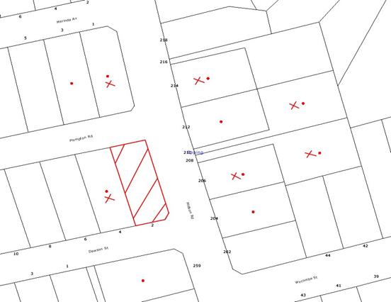
|
NOTIFICATION
PLAN
|
|
|
• PROPERTIES NOTIFIED
|
X SUBMISSIONS
RECEIVED
|
PROPERTY SUBJECT OF DEVELOPMENT
|
|
|
Objections have also been received from the owners of No. 20 Dawson Street and No. 257 Midson Road, Epping. Both these properties are located
outside the map area.
|
|
|
|
|
The submissions have objected to
the proposal, generally on the grounds that the development would have
unacceptable impacts in terms of scale, design, height, privacy, vehicle
access, boundary fencing, use and the removal of trees.
The merits of the matters raised
in community submissions have been addressed in the body of the report.
6. THE PUBLIC INTEREST
Section 79C(1)(e) of the Act
requires Council to consider “the public interest”.
The public interest is an overarching
requirement, which includes the consideration of the matters discussed in this
report. Implicit to the public interest is the achievement of future built
outcomes adequately responding to and respecting the future desired outcomes
expressed in environmental planning instruments and development control plans.
The application is considered to
have satisfactorily addressed Council’s criteria and would provide a
development outcome that, on balance, would result in a positive impact for the
community. Accordingly, it is considered that the approval of the proposed
two-storey, split-level dwelling house would be in the public interest.
CONCLUSION
The application proposes the
erection of a two-storey, split-level dwelling house and associated works in a
style that would set a positive precedent in terms of
its innovative and environmentally sensitive design.
The
proposal meets the relevant requirements of Council’s Dwelling House DCP and
with some minor amendments the dwelling-house would be complying development
under the NSW Housing Code.
Six
submissions were received from neighbouring property owners objecting to the
development on planning grounds. Whilst the grounds for objection are valid,
it is considered that having regard to the merits of the case, they are not
sufficient to warrant Council’s refusal of the application.
Having
regard to the assessment of the proposed development and the circumstances of
the case, it is recommended that the application be approved.
Note: At the time of the completion of this planning report, no
persons have made a Political Donations Disclosure Statement pursuant to
Section 147 of the Environmental Planning and Assessment Act 1979 in respect of
the subject planning application.
|
Simon Evans
Manager - Assessment
Team 1
Planning Division
|
Scott Phillips
Executive Manager
Planning Division
|
Attachments:
|
1.View
|
Locality Plan
|
|
2.View
|
Site Plan
|
|
3.View
|
Demolition Plan
|
|
4.View
|
Floor Plans
|
|
5.View
|
Elevations &
Sections
|
|
6.View
|
Shadow Plan
|
|
7.View
|
Sediment &
Erosion Plan
|
|
8.View
|
Landscape Plans
|
|
9.View
|
Fencing Plan
|
|
10.View
|
Stormwater Plan
|
File Reference: DA/1258/2010
Document Number: D01518461
SCHEDULE 1
CONDITIONS OF
APPROVAL
GENERAL
CONDITIONS
The
conditions of consent within this notice of determination have been applied to
ensure that the use of the land and/or building is carried out in such a manner
that is consistent with the aims and objectives of the relevant legislation,
planning instruments and Council policies affecting the land and does not
disrupt the amenity of the neighbourhood or impact upon the environment.
Note: For the
purpose of this consent, the term ‘applicant’ means any person who has the
authority to act on or the benefit of the development consent.
Note: For the purpose of
this consent, any reference to an Act, Regulation, Australian Standard or
publication by a public authority shall be taken to mean the gazetted Act or
Regulation, or adopted Australian Standard or publication as in force on the
date that the application for a construction certificate is made.
1. Approved
Plans and Supporting Documentation
The development must be carried
out in accordance with the plans and documentation listed below and endorsed
with Council’s stamp, except where amended by Council and/or other conditions
of this consent:
|
Plan No.
|
Drawn by
|
Dated
|
|
GA01(B), GA02(B), GA03(B),
GA04(B), GA05(B), GA06(B),
GA07(B), GA08(B),
GA09(B), GA10(B)
|
Peter Calf
|
25/10/2010
|
|
L01(B) L02(A)
L03(A)
|
Torin Calf
|
October 2010
|
|
2794 (HSC-01)
|
David Buckle & Associates
|
May 2010
|
2. Amendment
of Plans
The development application
plans must be amended as follows:
a. To
maintain consistency with the low scale front fencing in the area, the front
fence forward of the 7.6m Dawson Street building line must not be higher than
1.2m and the fencing along the western side boundary forward of the Dawson
Street building line must taper down from 1.8m height at this point to a 1.2m
maximum height of the front fence.
b. The
proposed garbage enclosure within the front fence must be deleted from the
plans as the doors serving the garbage enclosure open into the road reserve and
the design would not be in keeping with the streetscape.
c. To reduce the visual impact from the combined height
of the batter slope, retaining wall and timber slatted fence along Plympton Road and Midson Road:
(i) the batter slope must be deleted and replaced with a
retaining wall in keeping with the retaining wall proposed under this
application; and
(ii) the timber slatted boundary fence must be set back a minimum
700mm from the Midson Road and Plympton Road frontages for a distance of 6m
from the north-eastern corner of the allotment so as to create a landscaping
strip to allow for the establishment of suitable screening plants.
3. Removal
of Existing Trees
This
development consent only permits the removal of trees numbered T1-T7 as
identified on Plan No. GA02(B) prepared by Peter Calf dated 25/10/2010. The
removal of any other trees requires separate approval under Council’s Tree
Preservation Order.
REQUIREMENTS PRIOR TO THE ISSUE OF A CONSTRUCTION
CERTIFICATE
4. Building
Code of Australia
All building
work must be carried out in accordance with the requirements of the Building
Code of Australia.
5. Contract
of Insurance (Residential Building Work)
In the case
of residential building work for which the Home Building Act, 1989 requires
there to be a contract of insurance in force in accordance with Part 6 of that
Act, that such a contract of insurance is in force before any building work
authorised to be carried out by the consent commences.
6. Notification
of Home Building Act, 1989 Requirements
Residential
building work within the meaning of the Home Building Act,
1989 must not be carried out unless the principal certifying authority for
the development to which the work relates (not being Council) has given Council
written notice of the following information:
a. In
the case of work for which a principal contractor is required to be appointed:
i.
The name and licence number of the principal contractor.
ii. The
name of the insurer by which the work is insured under Part 6 of that Act.
b. In
the case of work to be done by an owner-builder:
i. The
name of the owner-builder.
ii. If
the owner-builder is required to hold an owner-builder’s permit under that Act,
the number of the owner-builder’s permit.
Note: If
arrangements for doing the residential building work are changed while the work
is in progress so that the information notified becomes out of date, further
work must not be carried out unless the principal certifying authority for the
development to which the work relates (not being Council) has given Council
written notification of the updated information.
7. Sydney
Water – Quick Check
The
application must be submitted to a Sydney Water ‘Quick Check Agent’ or
‘Customer Centre’ for approval to determine whether the development will affect
any Sydney Water infrastructure, and whether further requirements are to
be met.
Note: Refer
to www.sydneywater.com.au or
telephone 13 20 92 for assistance.
REQUIREMENTS PRIOR TO THE COMMENCEMENT OF ANY WORKS
8. Erection
of Construction Sign
A sign must
be erected in a prominent position on any site on which building work,
subdivision work or demolition work is being carried out:
a. Showing
the name, address and telephone number of the principal certifying authority
for the work,
b. Showing
the name of the principal contractor (if any) for any demolition or building
work and a telephone number on which that person may be contacted outside
working hours, and
c. Stating
that unauthorised entry to the work site is prohibited.
Note: Any
such sign is to be maintained while the building work, subdivision work or
demolition work is being carried out, but must be removed when the work has
been completed.
9. Toilet
Facilities
Toilet
facilities must be available or provided at the works site before works begin
and must be maintained until the works are completed at a ratio of one toilet
for every 20 persons employed at the site. Each toilet must:
a. be
a standard flushing toilet connected to a public sewer; or
b. be
a temporary chemical closet approved under the Local Government Act, 1993.
10. Erosion
and Sediment Control
Erosion and
sediment control measures must be provided and maintained throughout the
construction period in accordance with the manual ‘Soils and Construction
2004 (Bluebook)’, the approved plans, Council specifications and to the
satisfaction of the principal certifying authority. The erosion and sediment
control devices must remain in place until the site has been stabilised and
revegetated.
Note: On
the spot penalties up to $1,500 may be issued for any non-compliance with this
requirement without any further notification or warning.
REQUIREMENTS DURING CONSTRUCTION
11. Construction
Work Hours
All work on site (including demolition and earth works)
must only occur between 7am and 5pm Monday to Saturday. No work is to be
undertaken on Sundays or public holidays.
12. Demolition
All
demolition work must be carried out in accordance with Australian Standard
2601-2001 – The Demolition of Structures and the following requirements:
a. Demolition
material is to be disposed of to an authorised recycling and/or waste disposal
site and/or in accordance with an approved waste management plan;
b. Demolition
works, where asbestos material is being removed, must be undertaken by a
contractor that holds an appropriate licence issued by WorkCover NSW in
accordance with Chapter 10 of the Occupational Health and Safety Regulation
2001 and Clause 29 of the Protection of the Environment Operations
(Waste) Regulation 1996;
c. On
construction sites where buildings contain asbestos material, a standard
commercially manufactured sign containing the words ‘DANGER ASBESTOS REMOVAL IN
PROGRESS’ measuring not less than 400mm x 300mm must be erected in a prominent
position visible from the street.
13. Council
Property
During construction works, no building
materials, waste, machinery or related matter is to be stored on the road or
footpath. The public reserve is to be kept in a clean, tidy and safe condition
at all times.
14. Survey
Report – Finished Floor Level
A report(s) must be prepared by
a registered surveyor and submitted to the principal certifying authority prior
to the pouring of concrete at each level of the building certifying that:
a. The
building, retaining walls and the like have been correctly positioned on the
site;
b. The
finished floor level(s) are in accordance with the approved plans.
REQUIREMENTS PRIOR TO THE ISSUE OF AN OCCUPATION
CERTIFICATE
Note: For
the purpose of this consent, any reference to ‘occupation certificate’ shall
also be taken to mean ‘interim occupation certificate’ unless otherwise stated.
15. Fulfilment
of BASIX Commitments
The applicant must demonstrate
the fulfilment of BASIX commitments pertaining to the development.
16. Stormwater
Drainage
The
stormwater drainage system for the development must be designed and constructed
for an average recurrence interval of 20 years and be gravity drained and connected
directly to Council’s street drainage system.
17. Internal
Driveway/Vehicular Areas
The driveway
and parking areas on site must be designed in accordance with Australian
Standards 2890.1, 2890.2, 3727 and the following requirements:
a. The
driveway must be a rigid pavement; and
b. The
driveway grade must not exceed 25 percent and changes in grade must not exceed
8 percent.
18. Damage
to Council Assets
Any damage
caused to Council’s assets as a result of the construction of the development
must be rectified in accordance with Council’s written requirements and at the
sole cost of the applicant.
19. Retaining
Walls
All required retaining walls
must be constructed as part of the development.
20. Planting
of trees
a.
To maintain canopy cover, five (5) Syncarpia
glomulifera (Turpentine trees) are to be planted on Council's nature
strip as indicated on the landscape plan numbered L01(B) prepared by
Peter Calf dated August 2010.
b.
The pot size is to be a minimum 25 litres.
21. Maintenance
of Trees
c.
The required five (5) Syncarpia glomulifera (Turpentine trees) to
be planted on Council's nature strip must be maintained until they reach
the height of 3 metres. In the event that the tree dies or is damaged it shall
be replaced and maintained.
-
END OF CONDITIONS -
ADVISORY
NOTES
The following information is provided for your assistance to
ensure compliance with the Environmental Planning and Assessment Act, 1979,
Environmental Planning and Assessment Regulation 2000, other relevant
legislation and Council’s policies and specifications. This information does
not form part of the conditions of development consent pursuant to Section 80A
of the Act.
Environmental Planning and Assessment Act, 1979
Requirements
· The Environmental Planning and
Assessment Act, 1979 requires:
· The issue of a construction certificate
prior to the commencement of any works. Enquiries regarding the issue of a
construction certificate can be made to Council’s Customer Services Branch on
9847 6760;
· A principal certifying authority to be
nominated and Council notified of that appointment prior to the commencement of
any works;
· Council to be given at least two days
written notice prior to the commencement of any works;
· Mandatory inspections of nominated
stages of the construction inspected; and
· An occupation certificate to be issued
before occupying any building or commencing the use of the land.
Long Service Levy
In accordance with Section 34 of the
Building and Construction Industry Long Service Payments Act 1986, a ‘Long Service Levy’ must be paid to the Long
Service Payments Corporation or Hornsby Council.
Note: The
rate of the Long Service Levy is 0.35% of the total cost of the work.
Note: Hornsby
Council requires the payment of the Long Service Levy prior to the issue of a
construction certificate.
Tree Preservation Order
To ensure the maintenance and
protection of the existing natural environment, it is an offence to ringbark,
cut down, top, lop, remove, wilfully injure or destroy a tree outside 3m of the
approved building envelope without the prior written consent from Council.
Note: A
tree is defined as a single or multi-trunked wood perennial plant having a
height of not less than three (3) metres, and which develops many branches,
usually from a distance of not less than one (1) metre from the ground, but
excluding any plant which, in its particular location, is a noxious plant
declared as such pursuant to the Noxious Weeds Act 1993. This definition of
‘tree’ includes any and all types of Palm trees.
All
distances are determined under British Standard BS 5837: 2005, “Trees in
Relation to Construction – Recommendations”.
Fines may be imposed for non-compliance with Council’s Tree
Preservation Order.
Dial Before You Dig
Prior to commencing any works,
the applicant is encouraged to contact Dial Before You Dig on 1100 or www.dialbeforeyoudig.com.au for
free information on potential underground pipes and cables within the vicinity
of the development site.
Asbestos Warning
Should asbestos or asbestos
products be encountered during demolition or construction works you are advised
to seek advice and information should be prior to disturbing the material. It
is recommended that a contractor holding an asbestos-handling permit (issued by
WorkCover NSW) be engaged to manage the proper handling of the material.
Further information regarding the safe handling and removal of asbestos can be
found at:
www.environment.nsw.gov.au
www.nsw.gov.au/fibro
www.adfa.org.au
www.workcover.nsw.gov.au
Alternatively, telephone the WorkCover Asbestos and
Demolition Team on 8260 5885.
Planning Report No. PLN83/10
Date of Meeting:
1/12/2010
7 DEVELOPMENT APPLICATION
- SUBDIVISION - TWO LOTS INTO FOUR
11A AND 15 MALTON ROAD BEECROFT
|
Development Application No:
|
DA/521/2010
|
|
Description of Proposal:
|
Torrens Title Subdivision of Two Allotments into Four
Allotments and the Demolition of an Existing Dwelling and Garage
|
|
Property Description:
|
Lot 5 DP 4551 and Lot 6 DP 4551, Nos. 11A and 15 Malton Road Beecroft
|
|
Applicant:
|
PS Graham and Associates
|
|
Owner:
|
Mr Phillip Anthony Titterton
Mrs Anne Titterton
|
|
Statutory Provisions:
|
Hornsby Shire Local Environmental
Plan 1994
Residential AS (Low Density -
Sensitive Lands) Zone
|
|
Estimated Value:
|
Not relevant
|
|
Ward:
|
C
|
|
RECOMMENDATION
THAT Development Application
No. 521/2010 for the Torrens title subdivision of two allotments into four
allotments and the demolition of an existing dwelling and garage at Lot 5 DP
4551 and Lot 6 DP 4551, Nos. (11A & 15) Malton Road, Beecroft be refused
for the reasons detailed in Schedule 1 of this report.
|
1. The
application proposes the Torrens title subdivision of two allotments into four
allotments and the demolition of an existing dwelling.
2. The
proposal has not received integrated development approval from the NSW Rural
Fire Service as the proposal adjoins a bushland reserve, which is considered to
be a significant and continuous fire hazard. As a consequence, Council is not
able to grant development consent to the application.
4. Two
submissions have been received in respect of the application.
5. It
is recommended that the application be refused.
HISTORY
OF THE SITE
There are no previous
applications relevant to the proposal.
THE SITE
The site comprises two allotments
with a combined area of 5438 sq. metres. The site is located on the northern
side of Malton Road and experiences a variable fall to the rear, north
boundary. There is an average fall of 7% for the southern half of the site and
33% for the northern half of the site.
A significant group of trees
(Group A) is located at the front of 11A Malton Road which is a part of the
Blue Gum Shale Forest, an endangered ecologically community. Another
significant group of trees (Group B) comprising a densely populated Blackbutt
Gully Forest (which is not an endangered ecological community) occupies the
northern half of the site and continues to extend to the north and northwest.
The rear of the site contains a natural watercourse which facilitates water
flows from the upper catchment via a natural drainage gully and bushland to
Byles Creek located less than 100 metres away.
The site has direct frontage to Malton Road. The current improvements on the site include two existing single storey brick
dwelling houses with tiled roofs, which are sited on the two allotments. The
gross floor areas of the existing dwellings are 150 square metres (No. 11A Malton Road) and 265 square metres (No. 15 Malton Road).
Residential properties exist to
the south, east and south west of the site. A public bushland reserve is
located to the north west of the site.
The site is located within the Beecroft/Cheltenham Heritage
Conservation Area and is adjacent to heritage listed items to the east, west
and south.
THE PROPOSAL
The proposal involves the Torrens title subdivision of two allotments into four allotments and the demolition of an
existing dwelling and garage.
Details of each allotment are as
follows:
· Proposed Lot 1
The area of proposed lot 1 is 830
square metres and has a gentle fall of 7% to the rear of the lot. A Blue Gum
Shale Forest (Significant Group A), which is an endangered ecological
community, is located on the street frontage. None of these trees are proposed
to be removed.
An existing dwelling and detached
garage occupies this site, which are proposed to be demolished. The lot has
direct frontage to Malton Road. A future dwelling could be accessed via Malton Road or via a 4 metre wide right of way (ROW) which is proposed to be centrally
located between proposed lots 1 and 4. This right of carriageway would be
shared by proposed lots 1, 2 and 3. A building envelope of 200 square metres
is proposed on the southern half of the lot with two parking spaces allocated
on the south eastern corner of the dwelling.
· Proposed Lot 2
The area of proposed lot 2 is
1609 square metres and has a steep fall of 33% to the rear of the lot. This
allotment is dominated by a densely populated Blackbutt Gully Forest (Significant Group B), which is not considered an endangered ecological community. A
watercourse traverses the site at the rear of the allotment. Access is
proposed via a ROW shared by lots 1, 2 and 3. A building envelope of 200 square
metres is proposed on the southern half of the lot with two parking spaces
allocated on the southern side of the building.
· Proposed Lot 3
The area of proposed lot 3 is
1597 square metres and has a steep fall of 33% to the rear of the lot. As with
proposed lot 2, this allotment is dominated by a densely populated Blackbutt Gully Forest (Significant Group B). The watercourse also traverses the site at
the rear of the allotment. Access is proposed via a right of way shared by
lots 1, 2 and 3. A building envelope of 200 sq. metres is proposed on the
southern half of the lot, with two parking spaces allocated on the south eastern
corner of the building.
· Proposed Lot 4
The area of proposed lot 4 is
1082 square metres and has a gentle fall of 7% to the rear of the lot. No
significant trees exist on this proposed lot. Direct access is provided to Malton Road from this lot. The lot accommodates an existing dwelling and a swimming pool
which are proposed to be retained.
ASSESSMENT
The development application has
been assessed having regard to the ‘2005 City of Cities Metropolitan
Strategy’, the ‘North Subregion (Draft) Subregional Strategy’ and
the matters for consideration prescribed under Section 79C of the Environmental
Planning and Assessment Act 1979 (the Act). Subsequently, the following
issues have been identified for further consideration.
1. STRATEGIC CONTEXT
1.1 Metropolitan Strategy – (Draft) North Subregional Strategy
The Metropolitan Strategy is a
broad framework to secure Sydney’s place in the global economy by promoting and
managing growth. It outlines a vision for Sydney to 2031; the challenges
faced, and the directions to follow to address these challenges and achieve the
vision. The draft North Subregional Strategy acts as a framework for Council
in the preparation of a new Principal LEP by 2011.
The draft Subregional Strategy
sets the following targets for the Hornsby LGA by 2031:
· Employment capacity to
increase by 9,000 jobs; and
· Housing stock to
increase by 11,000 dwellings.
The proposed development would be
consistent with the draft Strategy by providing an additional two dwellings and
would improve housing choice in the locality.
2. STATUTORY CONTROLS
Section 79C(1)(a) requires
Council to consider “any relevant environmental planning instruments, draft
environmental planning instruments, development control plans, planning
agreements and regulations”.
2.1 Hornsby Shire Local Environmental Plan 1994
The subject land is zoned Residential AS (Low Density – Sensitive Lands) under the Hornsby Shire Local
Environmental Plan 1994 (HSLEP). The objectives of the zone are:
(a) to
provide for the housing needs of the population of the Hornsby area.
(b) to
promote a variety of housing types and other land uses compatible with a low
density residential environment and sensitive to the land capability and
established character of this environment.
(c) to
provide for development that is within the environmental capacity of a
sensitive low density residential environment.
The proposed development is
defined as ‘demolition’ and ‘subdivision’ under the HSLEP and is permissible in
the zone with Council’s consent. Notwithstanding, the proposed development
fails to comply with Residential AS (Low Density – Sensitive Lands) Zone
objective (c) as the proposal fails to demonstrate “environmental capacity”
given the fire risk.
Clause 14 of the HSLEP prescribes
that the minimum required of an allotment within the Residential AS zone is 600
square metres. The proposed subdivision complies with this requirement as
proposed Lot 1 is 830 sq. metres, proposed lot 2 is 1609 sq. metres, proposed
lot 3 is 1597 sq. metres and proposed Lot 4 is 1087 sq. metres.
Clause 15 of the HSLEP prescribes
that the maximum floor space ratio (FSR) of development within the Residential
AS (Low Density - Sensitive Lands) zone is 0.4:1. The proposed subdivision
complies with this requirement as proposed Lot 4 (containing the existing
dwelling to be retained) would have a FSR of 0.25:1.
Clause 18 of the HSLEP sets out
heritage conservation provisions. The site is within the Beecroft /Cheltenham
Heritage Conservation Area. The site adjoins heritage listed items and is in
the vicinity of a number of additional heritage listed items. Adjoining and
surrounding heritage listed items include: Kunaware & garden at No. 11 Malton Road, “Eureka” at No. 17 Malton Road, “Linwood” at No. 12 Malton Road and
“Mindaribba” at No. 14-18 Malton Road. These sites are listed as items of
Local Significance under the provisions of Schedule D (Heritage Items) of
HSLEP. Other items of Local Significance listed within the vicinity of the
site include “Loonycarn” at No. 27, “Notrella” at No. 31 and Nos. 2, 5, 28 Malton Road.
The application includes a
heritage statement which indicates that the proposal would not have a
detrimental impact to the Beecroft/Cheltenham Heritage Conservation Area and
surrounding heritage listed items as the application would not result in any
changes to the streetscape. The report notes that an existing Blue Gum Shale
Forest (Significant group A) occupies the street frontage at proposed lot 1.
It is suggested that any future dwelling on this site would be screened by
these trees and would therefore have minimal impact on the streetscape.
It is considered that the
proposed development would have an acceptable impact on the items of local
heritage significance adjoining and nearby the subject site.
2.2 Sydney Regional Environmental Plan (Sydney Harbour Catchment) 2005
The application has been assessed
against the requirements of the Plan which includes planning principles
applicable to the site within the upper part of the harbour catchment. The
principles incorporate measures to protect water quality, minimise urban
runoff, to conserve water and to ensure the catchment watercourses, wetland,
riparian lands and remnant vegetation are protected.
Subject to the implementation of
erosion and sediment control measures, a stormwater infiltration system, a
riparian buffer zone and conditions pertaining to General Terms of Approval by
the NSW Office of Water, the proposed subdivision would not adversely
impact on the catchment or water quality.
2.3 Threatened Species Conservation Act 1995
The Beecroft area provides
habitat for Gang Gang Cockatoos listed as an endangered population under
Schedule 1 of the Threatened Species Conservation Act. The northern half of
the site includes Blackbutt Gully Forest which is a potential habitat for the
endangered population.
The application includes a Flora
and Fauna Report prepared by ecologist Dr Stephen Ambrose, who carried out an
assessment of the site pursuant to Clause 5A of the (EPA), 1979. The report
determined the proposal would not be likely to have a significant effect on the
life cycle of Gang Gang Cockatoos. An assessment of the environmental impact
of the development is held at Section 3.1 of this report.
2.4 Residential Subdivision Development Control Plan
The proposed development has been
assessed having regard to the relevant performance and prescriptive design
standards within Council’s Residential Subdivision Development Control Plan.
The following table sets out the proposal’s compliance with the prescriptive
standards of the Plan:
|
Residential
Subdivision Development Control Plan
|
|
Control
|
Proposal
|
Requirement
|
Compliance
|
|
Density
|
|
Site Area
|
5438m²
|
2400 m²
|
Yes
|
|
Minimum allotment size
|
Lot 1- 830m2
Lot 2 - 1609m2
Lot 3 - 1597m2
Lot 4 - 1082m2
|
600m2
600m2
600m2
600m2
|
Yes
Yes
Yes
Yes
|
|
Minimum allotment size with gradient
|
Lots
1 and 4 = 7%
Lots
2 and 3 = 33%
|
600m2
725m2
|
Yes
Yes
|
|
Existing Dwelling
|
|
Gross Floor Area
|
Lot 4 - 265m2
|
<432m2
|
Yes
|
|
Floor space ratio
|
0.25:1
|
0.4:1
|
Yes
|
|
Site
cover
|
27%
|
40%
|
Yes
|
|
Private
open space
|
450m2
|
120m2
|
Yes
|
|
Setbacks (Lot 4)
|
|
Front (Malton Street)
|
10m
|
7.6m
|
Yes
|
|
Side
(eastern)
|
4m
|
1m
|
Yes
|
|
Side
(western)
|
1.5m
|
1m
|
Yes
|
|
Rear
(swimming pool)
|
2m
|
3m
|
No
|
|
Landscaping
|
|
Landscaped area
|
<45%
|
45%
|
Yes
|
|
Car Parking
|
|
No. of
spaces
|
2 spaces
|
2 spaces
|
Yes
|
|
Driveway
gradient
|
Complies with design template
|
Complies with design template
|
Yes
|
|
Accessway
|
4m
|
4m
|
Yes
|
|
Turning
Area
|
Complies with design template
|
Complies with design template
|
Yes
|
As detailed in the above table,
the proposed development generally complies with the prescriptive standards
within Council’s Subdivision DCP. The matters of non-compliance are detailed
below, as well as a brief discussion on compliance with relevant performance
standards.
2.4.1 Density
The proposed lots comply with the
minimum lot area requirement based on the topography of the land.
2.4.2 Allotment Layout and
Design
Proposed lot 1 contains a
significant group of trees (Group A) at the street frontage and tree numbered
16 located at the rear of the allotment. These trees have been assessed as
worthy of retention. The proposed indicative building envelope is designed to
retain these trees.
Proposed lot 2 has a steep fall
of 33% to the rear. A watercourse traverses the site. The lot is adjacent to
a Council bushland reserve on Garret Road (Lot 40 DP 596659) which has been
identified by the NSW Rural Fire Service as containing vegetation that is a
significant and continuous fire hazard. More than half of the allotment is
populated with a significant group of trees (Group B). These trees are located
in Blackbutt Gully Forest which is contiguous to the adjoining bushland
reserve. Whilst the proposed allotment complies with the minimum allotment
size, the application does not provide adequate information to make an informed
assessment of the total unrestricted building development area. Restrictions
such as setbacks from the significant group of trees (Group B) have not been
identified in the application.
Proposed lot 3 also has a steep
fall of 33% to the rear. The lot contains a significant group of trees (Group
B) and part of the water course traverses the site. It is considered that a
single storey dwelling house could be located generally within the proposed
indicative building envelope in a manner that would retain the significant
group of trees and comply with Council’s design criteria for private open space
and residential amenity.
Proposed lot 4 satisfies the
minimum required size to accommodate the existing dwelling house and swimming
pool. There is a non-compliance with the rear setback of the swimming pool
which is addressed in Section 2.4.3.
2.4.3 Setbacks
The existing swimming pool within
proposed lot 4 is setback 2 metres from the rear property boundary which does
not comply with the 3 metre requirement within the Residential Subdivision
DCP. Notwithstanding, the indicative building envelope on the adjoining
allotment to the north (proposed lot 3) proposes a 6 metre front setback from
the right of carriageway, resulting in a separation distance of 13 metre from
the existing swimming pool. This provides the opportunity for landscaping and
ensures the privacy and amenity to future dwellings. The non-compliance is
minor and is considered acceptable.
2.4.4 Bush Fire Hazard
This matter is addressed in
Section 4.1 of this report.
2.4.5 Private Open Space
The existing dwelling on proposed
lot 4 includes a north facing open space of 450 sq. metres which is well above
the minimal requirement.
Proposed lot 1 includes a large
area of north facing private open space located at the rear. The area is
subject to restriction to retain Tree No. 16 which has been assessed as worthy
of preservation. Given the relatively large lot area, design for private open
space is considered to be a matter that could be satisfactorily addressed in an
application for a future dwelling house.
Proposed lot 2 has a steep fall
to the rear with an average of 33%. The application does not provide adequate
information to make an informed assessment of the total unrestricted building
development area, including the private open space area in relation to the
large population of a significant group of trees (Group B) and the provision of
adequate Asset Protection Zones from the adjoining significant and continuous
fire hazard known as No. 8 Garrett Road. Notwithstanding, having regard to the
size and orientation of the lot, it is considered that sufficient private open
space would be able to be achieved on this lot.
Proposed lot 3 also has a steep
fall with an average grade of 33%. As with proposed lot 2, the application
does not provide adequate information of the total unrestricted building
development area, including the private open space area. Notwithstanding, the
allotment is approximately 22m from the fire hazard and is capable of being
designed to achieve adequate Asset Protection Zones. The design of private
open space is considered to be achievable and is a matter to be addressed in
application for a future dwelling house.
2.4.6 Accessway Design
The proposed accessway and right
of carriageway is 4m wide and is centrally located between proposed lots 1 and
4. The right of carriageway is proposed to benefit lots 1, 2 and 3. The
design complies with accessway design criteria.
The proposed accessway is located
on the southern half of the site, which in that area has a natural gradient of
7%. Adequate space is available for screening of the accessway from
residents.
Subject to recommended
conditions, the proposal would comply with the Accessway Design objective of
the Residential Subdivision DCP.
2.4.7 Drainage Control
The site contains a natural
watercourse which facilitates water flows from the upper catchment via a
sandstone lined drainage gully and bushland to Byles Creek located less than 100m
away. A stormwater infiltration tank and a riparian buffer zone are proposed to
control the impacts of stormwater discharge flows into the watercourse. This
is considered satisfactory, subject to recommended conditions.
2.5 Byles Creek Development Control Plan
The development’s compliance with
the relevant requirements of the Byles Creek DCP is addressed in Section 3.1.2
of this report.
2.6 Heritage Development Control Plan
The development’s compliance with
the relevant requirements of the Heritage DCP is addressed in section 2.1 of
this report.
2.7 Car Parking Development Control Plan
Proposed lot 4 incorporates two
existing parking spaces on the eastern side of the dwelling. Proposed lots 1,
2 and 3 all indicate the provision of two carparking spaces on the respective
building envelopes, which comply with the parking requirements under Council’s
Car Parking Development Control Plan.
2.8 Section 94
Contributions Plan
Council’s Section 94 Contributions
Plan applies to the development as two additional allotments are proposed. This
requirement could be addressed with a condition of consent should Council be in
a position to approve the application.
3. ENVIRONMENTAL IMPACTS
Section 79C(1)(b) of the Act
requires Council to consider “the likely impacts of that development,
including environmental impacts on both the natural and built environments, and
social and economic impacts in the locality”.
3.1 Natural Environment
3.1.1 Flora & Fauna
The applicant submitted a Flora
and Fauna Assessment in support of the proposed subdivision which included a 7
part test of significance for the endangered population of Gang-Gang Cockatoos
and other threatened species that may occur on the site. The report determined
the proposal would not have a significant impact on the life cycle of Gang Gang
Cockatoos.
Council’s assessment of the
proposal included a detailed examination of the existing trees on site. Two
groups of significant trees have been identified on site including a Blue Gum
Shale Forest (Group A), an endangered ecological community which is located at
the front of proposed lot 1 and a Blackbutt Gully Forest (Group B) located at
the Garrett Road side of the property. Group B forms part of a contiguous
vegetation that extends to the north and northwest of the site.
The proposed development would
necessitate the removal of 26 trees from the site. None of these trees to be
removed are identified to be ‘significant trees’ under Council’s Assessment
Sheet 3 – Assessment of Significant Groups of Trees. Council officers have
assessed two trees (numbered 16 and 17) as worthy of preservation and design of
infrastructure should consider the retention of these trees. Tree number 16 is
located at the rear of the private open space in proposed lot 1 and is not
proposed to be removed. Tree number 17 is located on the north western corner
of proposed lot 4 with the trunk abutting the western boundary and right of
carriageway serving proposed lots 1, 2 and 3. Retention of the trees could be
addressed with a condition of consent should Council be in a position to
approve the application.
Despite the above, a large
proportion of Blackbutt Gully Forest (Significant Group B) on proposed lot 2
would be required to be removed to achieve appropriate Asset Protection Zones
from the public bushland reserve considered to be a ‘significant and
continuous’ fire hazard. The removal of these trees would result in a
significant environmental impact. The 7 part test submitted in support of the
application does not envisage this outcome and therefore does not assess the
associated impact. It is considered that the loss of this vegetation is not
acceptable and this constitutes the major deficiency of the application.
3.1.2 Watercourse
The site contains a natural
watercourse which facilitates water flows from the upper catchment via a
sandstone lined drainage gully and bushland to Byles Creek located less than
100m away. Any development approved on this site would increase the stormwater
discharge flows into the watercourse. The application proposes a stormwater
infiltration tank and a riparian buffer zone to control the impacts of this
excess runoff. This is considered satisfactory, subject to recommended
conditions.
3.2 Built Environment
The proposed development retains
the existing dwelling and vehicular crossing at No. 15 Malton Road Beecroft.
The existing significant trees located along the front of proposed lot 1 would
ensure minimal visual impacts associated with the new development. The impact
of the future dwellings on the built environment would be considered to be a
matter to be addressed in future applications.
3.3 Social Impacts
The proposal would not result in
a detrimental social impact.
3.4 Economic Impacts
The proposal would have a minor
positive impact on the local economy in conjunction with other new low density
residential development in the locality by generating an increase in demand for
local services.
4. SITE SUITABILITY
Section 79C(1)(c) of the Act
requires Council to consider “the suitability of the site for the
development”.
4.1 Bushfire Risk
The land is identified as being
subject to bushfire risk in that the site is within a bushfire prone area and
adjoins a bushland reserve which has been identified by the NSW Rural Fire
Service (RFS) as a ‘significant and continuous’ fire hazard as it contains continuous remnant bushland within the site
and north/north western adjoining properties.
Pursuant to Section 91 of the
Act, the application requires the concurrence of the RFS. Authorisation is
required under section 100B of the Rural Fires Act 1997 in respect of
bush fire safety of subdivision of land that could lawfully be used for
residential purposes. The application was referred to the RFS for comment and
the following comments have been received:
“The
Service is not in a position to properly assess the application submitted by
the Council of the Shire of Hornsby on the basis of the information provided.
The service does not agree with the assessment of the vegetation in the
additional report by Australian Bushfire Protection Planners Pty Ltd dated 16
August 2010 reference no. B101331”.
The additional report by
Australian Bushfire Protection Planners Pty Ltd claims that adjoining bushland
reserve (Lot 40 DP 596659) is only a “low level fire hazard”.
In response, the RFS deemed that
the application “does not successfully demonstrate how the proposed building
footprints and appropriate asset protection zones required for ‘Planning for
Bush Fire Protection 2006’ for forest vegetation can be achieved within the
proposed subdivision in relation to the hazard to the northwest”. This is
particularly relevant to proposed lot 2 which is directly adjacent to the
significant and continuous fire hazard known as Lot 40 DP 596659 as the
allotment proposes an indicative building envelope that is setback only 3m from
the fire hazard.
The proposal does not provide for
separation between dwellings and potential bush fire fronts, and does not
minimise the risk to life, property and the environment from bushfires.
Consequently the application cannot be supported in its current form.
5. PUBLIC PARTICIPATION
Section 79C(1)(d) of the Act
requires Council to consider “any submissions made in accordance with this
Act”.
5.1 Community Consultation
The proposed development was
placed on public exhibition and was notified to adjoining and nearby landowners
between 19 May 2010 and 9 June 2010 in accordance with Council’s Notification
and Exhibition Development Control Plan. During this period, Council received
two submissions. The map below illustrates the location of the nearby
landowner who made a submission who is in close proximity to the development
site.
|
NOTIFICATION
PLAN
|
|
|
• PROPERTIES NOTIFIED
|
X SUBMISSIONS
RECEIVED
|
PROPERTY SUBJECT OF DEVELOPMENT
|
|
|
1
SUBMISSION RECEIVED OUT OF MAP RANGE
|
|
|
|
|
Two submissions objected to the development, generally on
the grounds that the development would result in:
· Unacceptable loss of
privacy resulting from the demolition of an existing western brick boundary
wall which is ancillary to the dwelling house proposed to be demolished.
· Whether Council would
enforce the building envelopes shown on subdivision plan.
The merits of the matters raised
in community submissions have been addressed in the body of the report with the
exception of the following:
5.1.1 Privacy
The proposal is for the
demolition of an existing dwelling and detached garage on proposed lot 1 and
the Torrens title subdivision of two allotments into four. In this regard, the
application only indicates the subdivision layout and indicative building
envelopes. Should Council be in a position to approve the application, a
requirement of fencing to be erected along all existing property boundaries
behind the front building alignment to a height of 1.8m could be addressed as a
condition of consent. A boundary fence exceeding 1.8m high is not considered
to be exempt development under Council’s Exempt and Complying Development DCP.
In addition, the provisions of the Diving Fences Act, 1991 would apply.
5.1.2 Building Envelopes
Building envelopes on a plan of
subdivision are indicative and would not form part of the development consent.
Should Council be in a position to approve the application appropriate
conditions would be recommended to ensure that the future location of dwellings
on the proposed lots would located in such a manner to comply with identified
building constraints including setbacks to boundaries, trees, watercourses and
bushland.
5.2 Public Agencies
The development application is
Integrated Development under the Act. Accordingly, the application was
referred to the following Agencies for comment:
5.2.1 Rural Fire Service
The comments of the RFS are
addressed in section 4.1 of this report. As the development application is
Integrated Development under the Act, Council does not have the authority to
approve the proposal without consent from the RFS.
5.2.2 NSW Office of Water
This application was referred to
the NSW Office of Water as the site is within 40m of a ‘prescribed stream’.
The NSW Office of Water raised no objection to the proposal, subject to
adherence to General Terms of Approval.
6. THE PUBLIC INTEREST
Section 79C(1)(e) of the Act
requires Council to consider “the public interest”.
The public interest is an
overarching requirement, which includes the consideration of the matters
discussed in this report. Implicit to the public interest is the achievement
of future built outcomes adequately responding to and respecting the future desired
outcomes expressed in environmental planning instruments and development
control plans.
The application is considered to
have not satisfactorily addressed Council’s and all relevant agencies’ criteria
and would provide a development outcome that, on balance, would result in a
negative impact for the community and would not be in the public interest.
CONCLUSION
This application seeks consent
for the Torrens title subdivision of two allotments into four and the
demolition of a dwelling house and garage.
The site is relatively large, has
a steep fall to the rear and includes two groups of significant trees
identified as Blue Gum Shale Forest (Group A) at the street frontage and Blackbutt Gully Forest (Group B) on the northern half of the site. An unformed Council
owned bushland reserve known as Lot 40 DP 596659, No. 8 Garrett Road has been
identified by the RFS as a significant and continuous fire hazard. The RFS
does not support the proposal as the application does not successfully
demonstrate how the proposed building footprints and appropriate asset
protection zones required for ‘Planning for Bush Fire Protection 2006’ for
forest vegetation can be achieved within the proposed subdivision in relation
to the hazard to the northwest. As the RFS is a ‘concurrence’ authority,
Council is not able to approve the development application in light of the
RFS’s non-concurrence.
The application does not provide
adequate information to make an informed assessment of the total unrestricted
building development area, including private open space areas for proposed lot
2. In particular, the proximity to the fire hazard known as Lot 40 DP 596659
No. 8 Garrett Road” does not allow for the provision of Asset Protection Zones
within the site and cannot therefore be supported.
The application is recommended
for refusal.
Note: At the time of the completion of this planning report, no
persons have made a Political Donations Disclosure Statement pursuant to
Section 147 of the Environmental Planning and Assessment Act 1979 in respect of
the subject planning application.
|
Rod Pickles
Manager -
Assessment Team 2
Planning Division
|
Paul David
Manager -
Subdivision & Development Engineering Services
Planning Division
|
|
Scott Phillips
Executive Manager
Planning Division
|
|
Attachments:
|
1.View
|
Locality Plan
|
|
2.View
|
Subdivision Plan
|
|
3.View
|
Rural Fire Service
Comments
|
|
4.View
|
Drainage Concept
Plan
|
|
5.
|
Tree Locations
Plan
|
File Reference: DA/521/2010
Document Number: D01520561
SCHEDULE 1
1. Pursuant
to Section 79C(1)(a)(iii) of the Environmental Planning and Assessment Act
1979, the proposal does not comply with objective (c) of the Residential AS
(Low Density-Sensitive Lands) zone of the Hornsby Shire Local Environmental
Plan 1994 in that it is not within the environmental capacity of the site.
2. Pursuant
to Section 79C(1)(b) of the Environmental Planning and Assessment Act 1979,
the proposed development would result in an unacceptable environmental impact
due to the need to remove significant vegetation to provide an Asset Protection
Zone.
3. Pursuant to Section 79C(1)(c) of the Environmental
Planning and Assessment Act, 1979, the proposal is unsatisfactory as the
site is not suitable for proposed development due to bushfire hazard.
4. Pursuant to Section 79C(1)(e) of the Environmental
Planning and Assessment Act 1979, the proposal would set an undesirable
precedent for similar inappropriate development and is therefore not in the
public interest.
5. Pursuant to Section 91A of the Environmental Planning
and Assessment Act 1979, the development
application is ‘Integrated Development’ and has not received the General Terms
of Approval of the NSW Rural Fire Service for the issue of a Bushfire
Safety Authority under Section 100B of the Rural Fires Act 1997.
-
END OF REASONS FOR REFUSAL -
Planning Report No. PLN88/10
Date of Meeting: 1/12/2010
8 DEVELOPMENT APPLICATION
- ERECTION OF A DWELLING-HOUSE
40A BEECROFT ROAD, BEECROFT
|
Development Application No:
|
DA/1141/2010
|
|
Description of Proposal:
|
Erection of a dwelling-house
|
|
Property Description:
|
Proposed Lot 101 in Lot 3 DP 407029, No. 40A Beecroft Road , Beecroft
|
|
Applicant:
|
Cosmopolitan Living
|
|
Owners:
|
Mr F and Mrs E M Merhi and Mr M Merhi and Ms G Merhi
|
|
Statutory Provisions:
|
Hornsby Shire Local Environmental
Plan, 1994
Residential AS (Low
Density-Sensitive Lands)
|
|
Estimated Value:
|
$400,000
|
|
Ward:
|
C
|
|
RECOMMENDATION
THAT Development Application
No. DA/1141/2010 for the erection of a dwelling-house on Proposed Lot 101
within Lot 3 DP 407029, No. 40A Beecroft Road, Beecroft be approved subject
the conditions of consent detailed in Schedule 1 of this report.
|
1. The application proposes the erection of
a dwelling-house on a battle-axe allotment which is yet to be registered
with the NSW Land and Property Management Authority.
2. The
proposal meets the objectives of the Hornsby Shire Local Environmental Plan,
1994 (HSLEP) and generally complies with Council’s Dwelling House Development
Control Plan (DCP).
3.
The application is being referred to Council for determination at a
Councillor’s request.
4. One
submission has been received during the public exhibition period.
5. It
is recommended that the application be approved.
HISTORY OF THE SITE
Council, at its Planning Meeting on 20 February
2008, approved DA/516/2007 for a four lot subdivision of the subject property.
On 18 October 2010, a modification to the
subdivision was approved under DA/516/2007/A, deleting condition No. 33 as it
related to foundation design and altering the sizes of the four allotments.
THE SITE
The battle-axe allotment has an
area of 1,871.2m2 (including the area of the right-of-carriageway)
and a 12% fall from the south-east to north-west towards a retaining wall which
runs diagonally across the allotment. The area to the east of this retaining
wall has been designated as a ‘Restricted Development
Area’ for the conservation of native vegetation.
The site contains 41 trees
consisting largely of Eucalyptus saligna (Sydney Blue Gum) and Eucalyptus
pilularis (Blackbutt). The site is currently being rehabilitated in
accordance with the conditions of Development Consent No. 516/2007 for the
subdivision of the existing lot. These rehabilitation works include the
removal of the dead trees, the trees accessed as being in poor health as well
as the 52 species of exotic and noxious weeds that were spread across the
site. A review of the site by Council officers in September 2010 established
that following the primary weeding, a total of 1140 plants were planted into
the remnant Blue Gum High Forest area together with an additional 100 translocated
plants.
Vehicular access to the site is
via a battle axe handle fronting Beecroft Road. The existing allotment also
has legal access to Lloyd Wright Way. The surrounding residential development
is characterised by an eclectic blend of one and two storey dwelling-houses,
ranging from modest, post-war design to dwelling-houses of a more contemporary
appearance, each surrounded by well established trees and landscaped gardens.
The property is located within
the Beecroft/Cheltenham Heritage Conservation Area listed under the provisions
of Schedule E (Heritage Conservation Areas) of the HSLEP 1994. The property is
also located within the vicinity of No. 44 Beecroft Road, which is listed as a
heritage item (garden) of local significance under the provisions of Schedule D
(Heritage Items) of the HSLEP 1994.
THE PROPOSAL
The application proposes the
erection of a two storey dwelling-house incorporating a double garage, front
porch, terrace, entry, family/dining room, kitchen, games room, laundry,
bathroom, and an adjoining patio area on the ground floor. Four bedrooms, an
ensuite, a walk-in-robe, bathroom, gallery, “IT nook”, “MPR” (multi-purpose
room) and 2 balconies would be located at the first floor level.
The building is to be finished in
rendered brickwork with solar panels and photovoltaic cells resting on a tiled
roof.
The dwelling-house would be set
back 7.9m from the northern boundary, 16.3m from the southern side boundary, 3m
from the rear (eastern) side boundary and 1.25m from the existing retaining
wall and the ‘Restricted Development Area’.
The proposal does not require the
removal of any trees or other significant vegetation.
ASSESSMENT
The development application has
been assessed having regard to the ‘2005 City of Cities Metropolitan
Strategy’, the ‘North Subregion (Draft) Subregional Strategy’ and
the matters for consideration prescribed under Section 79C of the Environmental
Planning and Assessment Act, 1979 (the Act). Subsequently, the following
issues have been identified for further consideration.
1. STRATEGIC CONTEXT
1.1 Metropolitan Strategy – (Draft) North Subregional Strategy
The Metropolitan Strategy is a
broad framework to secure Sydney’s place in the global economy by promoting and
managing growth. It outlines a vision for Sydney to 2031; the challenges
faced, and the directions to follow to address these challenges and achieve the
vision. The draft North Subregional Strategy acts as a framework for Council
in the preparation of a new Principal LEP by 2011.
The draft Subregional Strategy
sets the following targets for the Hornsby LGA by 2031:
· Employment capacity to
increase by 9,000 jobs; and
· Housing stock to
increase by 11,000 dwellings.
The proposed development would be
consistent with the draft Strategy by providing an additional dwelling and
would contribute towards the housing choice in the locality.
2. STATUTORY CONTROLS
Section 79C(1)(a) requires
Council to consider “any relevant environmental planning instruments, draft
environmental planning instruments, development control plans, planning
agreements and regulations”.
2.1 Hornsby Shire Local Environmental Plan 1994
The subject land is zoned Residential AS (Low Density-Sensitive Lands) under the Hornsby Shire Local Environmental
Plan 1994 (HSLEP). The objectives of the zone zone are:
(a)
to provide for the housing needs of the population of the Hornsby area.
(b)
to promote a variety of housing types and other land uses compatible with a
low density residential environment and sensitive to the land capability and
established character of this environment.
(c) to
provide for development that is within the environmental capacity of a
sensitive low density residential environment.
The use is defined as a
“dwelling-house” and is permissible within the zone pursuant to Clause 7 of the
HSLEP. The development is consistent with the zone objectives as evidenced by
the assessment of the application detailed in this report.
Clause 15 of HSLEP prescribes
that the maximum floor space ratio (FSR) of development within the Residential
AS (Low Density-Sensitive Lands) zone is 0.4:1.
The proposal achieves an FSR of 0.19:1 which complies with the
development standard contained within Clause 15.
Clause 18 of the HSLEP sets out
heritage conservation provisions within Hornsby Shire. This issue is discussed
in Section 2.3 of this report.
2.2 Dwelling House Development Control Plan
The proposed development has been
assessed having regard to Council’s Dwelling House DCP. The following table
sets out the proposal’s compliance with the prescriptive measures of the Plan:
|
Dwelling
House Development Control Plan
|
|
Control
|
Proposal
|
Requirement
|
Compliance
|
|
Floor Space Ratio
|
0.19:1
|
0.4:1
|
Yes
|
|
Site cover
|
11%
|
40%
|
Yes
|
|
Dwelling Height
|
8m
|
9m
|
Yes
|
|
No. of Storeys
|
2
|
1
|
No
|
|
Length of Building
|
21m
|
24m
|
Yes
|
|
Unbroken Wall Length
|
11.4m
|
10m
|
No
|
|
Private Open Space
|
140m2
|
120m2
|
Yes
|
|
Landscaping
|
68%
|
45%
|
Yes
|
|
Car parking
|
2
spaces
|
2
spaces
|
Yes
|
|
Cut and Fill
|
1m
|
1m
|
Yes
|
|
Solar access to neighbouring
properties
|
4
hrs
|
4
hrs
|
Yes
|
|
Setbacks:
Front -
(West)
Side -
(North)
Side -
(South)
Rear -
(East)
|
18m
7.9m
16.3m
3m
|
6m
1m
1m
3m
|
Yes
Yes
Yes
Yes
|
As detailed in the above table,
the proposed development generally complies with the prescriptive elements of
Council’s Dwelling House DCP. The matters of non-compliance are addressed as
follows:
2.2.1 Design
The
contemporary style of the proposal is consistent with the evolving form of
development in the locality in terms of height, scale, size and the materials
that would be used. Being on a battle-axe handle allotment the dwelling would
not have a ‘street’ presence. Therefore, streetscape impacts are not
applicable.
The architectural form of the proposal, the placement of
windows and variations in roof form would ensure that the dwelling-house
avoids a monotonous or symmetrical appearance when viewed from adjoining
properties.
The proposal
meets the objectives of the Design element and is considered acceptable.
2.2.2 Privacy
The first floor of the
dwelling-house includes an “MPR” (multi-purpose room) with an adjoining balcony
together with a second balcony accessed from the “M bedroom”. This
multi-purpose room and the balconies do not comply with the prescriptive
measures of the Privacy element, which requires active use living rooms and
areas to be located at ground floor level, to minimise overlooking of the
recreational and living areas of neighbouring properties.
In this instance, the
multi-purpose room and the balconies are all oriented towards the front,
north-eastern corner of the site, facing the driveway turning area and the
right-of-carriageway which serves the property. In addition, the siting of the
dwelling-house 7.9m from the nearest (northern) side boundary ensures that
there would be minimal impacts on the amenity of the private open space of the
adjacent premises, No. 38A Beecroft Road.
The proposal meets the objectives
of the Privacy element and is considered acceptable.
2.2.3 Height
The proposal to erect a two storey
high dwelling-house on a battle-axe allotment does not comply with the
prescriptive measures of the Height element which states that “dwelling-houses
on battle axe allotments should not exceed single storey in height”. The
purpose of this control is to ensure that buildings are designed and located so
that they do not cause unacceptable amenity impacts on neighbouring
properties.
In this instance, the 8m height of
the proposal complies with the 9m prescriptive measure and its design and
siting on the allotment ensures that the proposal would allow for reasonable
solar access and privacy to the neighbour properties.
The proposal meets the objectives
of the Height element and is considered acceptable.
2.3 Heritage Development
Control Plan
Clause 18 of the HSLEP sets out
heritage conservation provisions within Hornsby Shire. The property is located
within the Beecroft/Cheltenham Heritage Conservation Area listed under the
provisions of Schedule E (Heritage Conservation Areas) of the HSLEP 1994. The
property is also located within the vicinity of property No. 44 Beecroft Road,
Beecroft which is listed as a heritage item (garden) of local significance
under the provisions of Schedule D (Heritage Items) of the HSLEP 1994.
The objective of the Heritage
element of the Dwelling House DCP requires “the retention of heritage items
and conservation of the heritage values in heritage conservation areas to
provide continuity with the past”.
It is considered that the
proposed development would not impact on the heritage values of the area or the
Beecroft Road streetscape. The contemporary appearance of the building is
consistent with similar structures that have been erected in the area and, as
the development is located on a battle-axe allotment and is effectively screened
by the dwelling-houses at No.s 40, 42 and 44 Beecroft Road, the proposal would
not be visible from the street.
The proposal meets the objectives
of the Heritage DCP and is considered acceptable.
3. ENVIRONMENTAL IMPACTS
Section 79C (1)(b) of the Act
requires Council to consider “the likely impacts of that development,
including environmental impacts on both the natural and built environments, and
social and economic impacts in the locality”.
3.1 Natural Environment
3.1.1 Flora and Fauna Protection
A portion of the subject site
forms part of the Blue Gum High Forest Critically Endangered Ecological
Community listed under the Threatened Species Conservation Act, 1995 and
the Environment Protection and Biodiversity Conservation Act, 1999.
As previously noted, the subject
allotment was approved as part of a four lot subdivision of 40A Beecroft Road under DA/516/2007. During the assessment of the subdivision application,
consideration was given to the flora and fauna assessment report which accompanied
that application.
That report concluded that the
subdivision could proceed subject to the area of the site containing examples
of Blue Gum High Forest trees being preserved, the rehabilitation of the area
in accordance with the accompanying landscape management plan and the creation of a positive covenant on the title of the land to
protect this environmentally sensitive area in perpetuity.
It is noted that the area of Blue
Gum High Forest on the subject site has recently been rehabilitated and that
vegetation regeneration requirements have been satisfactorily complied with in
accordance with the conditions of subdivision consent.
To ensure that the environmental
qualities of this environmentally sensitive area are maintained, specific
conditions are recommended in that consent.
At the time Council’s Heritage
Committee raised no objections to the proposed subdivision on heritage grounds
in relation to the trees on the site in particular. The Committee noted that
the subdivided allotments would be of a sufficient size to accommodate suitable
dwelling-houses, at the same time retaining the significant trees which
contribute to character of the surrounding heritage conservation area.
As the proposed development does
not require the removal of any vegetation and stands clear of the restricted
zone, the proposal meets the objectives of the Flora and Fauna Protection
element of Council’s DCP and is considered acceptable.
3.2 Built Environment
The proposed dwelling-house would
be consistent with the form of development permitted in the locality.
3.3 Social and Economic Impacts
There are no identified adverse
social or economic impacts from the proposed development.
4. SITE SUITABILITY
Section 79C (1) (c) of the Act
requires Council to consider “the suitability of the site for the
development”.
The site is appropriately zoned
to accommodate the proposal and there are no natural or built hazards
preventing the construction of the dwelling-house and associated works. The
site is considered suitable for the development.
5. PUBLIC PARTICIPATION
Section 79C (1) (d) of the Act
requires Council to consider “any submissions made in accordance with this
Act”.
5.1 Community Consultation
The proposed development was
placed on public exhibition and was notified to adjoining and nearby landowners
between 20 September and 4 October, 2010 in accordance with Council’s
Notification and Exhibition DCP. During this period, Council received one
submission. The map below illustrates the location of the nearby landowner who
made the submission.
|
NOTIFICATION
PLAN
|
|
|
• PROPERTIES NOTIFIED
|
X SUBMISSIONS
RECEIVED
|
PROPERTY SUBJECT OF DEVELOPMENT
|
|
|
|
|
|
One submission was received
raising concerns about the potential glare from the photovoltaic cells on the
roof and the visual impact of the proposal.
It is anticipated that any glare
nuisance would be minimal, given the approximate 25m setback of the
photovoltaic panels from the dwelling-house at No. 46 Beecroft Road and the
screening effect of trees on the site.
The concerns about the visual
impact of the proposal have been addressed in Section 2.2.1 of this report
under the heading “Design”.
6. THE PUBLIC INTEREST
Section 79C (1) (e) of the Act
requires Council to consider “the public interest”.
The public interest is an
overarching requirement, which includes the consideration of the matters
discussed in this report. Implicit to the public interest is the achievement
of future built outcomes adequately responding to and respecting the future desired
outcomes expressed in environmental planning instruments and development
control plans.
The application is considered to
have satisfactorily addressed Council’s and relevant agencies’ criteria and
would provide a development outcome that, on balance, would result in a
positive impact for the community. Accordingly, it is considered that the
approval of the proposed description of the proposal would be in the public
interest.
CONCLUSION
The application proposes the erection of a two
storey dwelling-house of contemporary design on a recently subdivided
battle-axe allotment which is yet to be registered with the NSW Land and Property Management Authority.
The
scale of the development meets the prescriptive measures of Council’s Dwelling
House DCP and is in accordance with the objectives of the surrounding low
density zone. The proposal would be consistent in terms of its design with
similar structures that have recently been erected in the area and would have
minimal impacts on adjacent properties in terms of privacy, solar access and
views.
Given
its location on a battle-axe allotment, the proposal would not have any
detrimental impacts on the character of surrounding development or the heritage
values of the Beecroft Road streetscape or the heritage-listed item at No. 44 Beecroft Road.
Having
regard to the assessment of the proposed development, it is recommended that
Council approves the application.
Note: At the time of the completion of this planning report, no
persons have made a Political Donations Disclosure Statement pursuant to
Section 147 of the Environmental Planning and Assessment Act 1979 in respect of
the subject planning application.
|
Scott Phillips
Executive Manager
Planning Division
|
Simon Evans
Manager -
Assessment Team 1
Planning Division
|
Attachments:
|
1.View
|
Locality Plan
|
|
2.View
|
Site Plan
|
|
3.View
|
Floor Plans
|
|
4.View
|
Elevations and
Sections
|
|
5.View
|
Shadow Plan
|
File Reference: DA/1141/2010
Document Number: D01522497
SCHEDULE 1
CONDITIONS OF
APPROVAL
1. Deferred
Commencement
Pursuant to Section 80(3) of
the Environmental Planning and Assessment Act 1979, this consent does not
operate until the following information is submitted to Council:
a. A
registered plan of subdivision from the NSW Department of Lands creating
the proposed lot must be submitted to Council.
Upon Council’s written
satisfaction of the above information, the following conditions of development
consent will apply:
GENERAL
CONDITIONS
The conditions of consent within this notice of determination have
been applied to ensure that the use of the land and/or building is carried out
in such a manner that is consistent with the aims and objectives of the
relevant legislation, planning instruments and Council policies affecting the
land and does not disrupt the amenity of the neighbourhood or impact upon the
environment.
Note: For the
purpose of this consent, the term ‘applicant’ means any person who has the
authority to act on or the benefit of the development consent.
Note: For the purpose of
this consent, any reference to an Act, Regulation, Australian Standard or
publication by a public authority shall be taken to mean the gazetted Act or
Regulation, or adopted Australian Standard or publication as in force on the
date that the application for a construction certificate is made.
2. Approved
Plans and Supporting Documentation
The
development must be carried out in accordance with the plans and documentation
listed below and endorsed with Council’s stamp, except where amended by Council
and/or other conditions of this consent:
|
Plan No.
|
Drawn by
|
Dated
|
|
9100265
(Sheets
020,021,022,023,030,040,050,060,070)
|
Cosmopolitan Living
|
04/08/2010
|
REQUIREMENTS PRIOR TO THE ISSUE OF A CONSTRUCTION
CERTIFICATE
3. Building
Code of Australia
All building
work must be carried out in accordance with the requirements of the Building
Code of Australia.
4. Contract
of Insurance (Residential Building Work)
In the case
of residential building work for which the Home Building Act, 1989 requires
there to be a contract of insurance in force in accordance with Part 6 of that
Act, that such a contract of insurance is in force before any building work
authorised to be carried out by the consent commences.
5. Notification
of Home Building Act, 1989 Requirements
Residential
building work within the meaning of the Home Building Act,
1989 must not be carried out unless the principal certifying authority for
the development to which the work relates (not being Council) has given Council
written notice of the following information:
a. In
the case of work for which a principal contractor is required to be appointed:
i. The
name and licence number of the principal contractor.
ii. The
name of the insurer by which the work is insured under Part 6 of that Act.
b. In
the case of work to be done by an owner-builder:
i. The
name of the owner-builder.
ii. If
the owner-builder is required to hold an owner-builder’s permit under that Act,
the number of the owner-builder’s permit.
Note: If
arrangements for doing the residential building work are changed while the work
is in progress so that the information notified becomes out of date, further
work must not be carried out unless the principal certifying authority for the
development to which the work relates (not being Council) has given Council
written notification of the updated information.
6. Sydney
Water – Quick Check
The
application must be submitted to a Sydney Water ‘Quick Check Agent’ or
‘Customer Centre’ for approval to determine whether the development will affect
any Sydney Water infrastructure, and whether further requirements are to
be met.
Note: Refer
to www.sydneywater.com.au or
telephone 13 20 92 for assistance.
REQUIREMENTS PRIOR TO THE COMMENCEMENT OF ANY WORKS
7. Erection
of Construction Sign
A sign must
be erected in a prominent position on the site on which building work or
demolition work is being carried out:
a. Showing
the name, address and telephone number of the principal certifying authority
for the work;
b. Showing
the name of the principal contractor (if any) for any demolition or building
work and a telephone number on which that person may be contacted outside
working hours; and
c. Stating
that unauthorised entry to the work site is prohibited.
Note: Any
such sign is to be maintained while the building work, subdivision work or
demolition work is being carried out, but must be removed when the work has
been completed.
8. Toilet
Facilities
Toilet
facilities must be available or provided at the works site before works begin
and must be maintained until the works are completed at a ratio of one toilet
for every 20 persons employed at the site. Each toilet must:
a. be
a standard flushing toilet connected to a public sewer; or
b. be
a temporary chemical closet approved under the Local Government Act, 1993.
9. Tree
Protection Barriers
To avoid
injury or damage, trees numbered T11 - T15 must have trunks protected by 2m
lengths of 75mm x 25mm hardwood timbers spaced at 80mm centres and secured with
galvanised wire, not fixed or nailed to the tree in any way.
10. Erosion
and Sediment Control
Erosion and
sediment control measures must be provided and maintained throughout the
construction period in accordance with the manual ‘Soils and Construction
2004 (Bluebook)’, the approved plans, Council specifications and to the
satisfaction of the principal certifying authority. The erosion and sediment
control devices must remain in place until the site has been stabilised and
revegetated.
Note: On
the spot penalties up to $1,500 may be issued for any non-compliance with this
requirement without any further notification or warning.
REQUIREMENTS DURING CONSTRUCTION
11. Construction
Work Hours
All work on site (including demolition and earth works)
must only occur between 7am and 5pm Monday to Saturday. No work is to
be undertaken on Sundays or public holidays.
12. Works
near Trees
All required
tree protection measures are to be maintained in good condition for the
duration of the construction period. All works (including driveways and
retaining walls) within 6m of any trees required to be retained (whether or not
on the subject property, and pursuant to this consent or the Tree
Preservation Order), must be carried out under the supervision of an AQF
level 5 arborist and a certificate submitted to the principal certifying
authority detailing the method(s) used to preserve the trees.
Note: Except as provided above, the applicant is to ensure that
no excavation, filling or stockpiling of building materials, parking of
vehicles or plant, disposal of cement slurry, waste water or other contaminants
is to occur within 4m of any tree to be retained.
13. Bushland
Protection
To ensure the
protection of bushland during construction, the applicant must ensure that:
a. No
building materials or machinery are stored within areas of retained bushland
subject to an existing Restricted Development Area (88b of the Conveyancing
Act, 1919) occurring at the eastern portion of the site; and
b. All
machinery is cleaned of soil and debris before entering the site to prevent the
spread of weeds and fungal pathogens.
Note: Actions such as tree removal, understorey slashing or
mowing, removal of dead trees within this vegetation would likely impact upon
this endangered ecological community. Such action would qualify as illegally
picking or disturbing the habitat and could render any person who carried out
such action as liable for prosecution.
14. Council
Property
During
construction works, no building materials, waste, machinery or related matter
is to be stored on the road or footpath. The public reserve is to be kept in a
clean, tidy and safe condition at all times.
15. Disturbance
of Existing Site
During
construction works, the existing ground levels of open space areas and natural
landscape features, (including natural rock-outcrops, vegetation, soil and
watercourses) must not be altered unless otherwise nominated on the approved
plans.
16. Survey
Report – Finished Floor Level
A report(s)
must be prepared by a registered surveyor and submitted to the principal
certifying authority prior to the pouring of concrete at each level of the
building certifying that:
a. The
building, retaining walls and the like have been correctly positioned on the
site.
b. The
finished floor level(s) are in accordance with the approved plans.
REQUIREMENTS PRIOR TO THE ISSUE OF AN OCCUPATION
CERTIFICATE
Note: For
the purpose of this consent, any reference to ‘occupation certificate’ shall
also be taken to mean ‘interim occupation certificate’ unless otherwise stated.
17. Fulfilment
of BASIX Commitments
The applicant must demonstrate
the fulfilment of BASIX commitments pertaining to the development.
18. Stormwater
Drainage
The stormwater drainage
system for the development must be designed and constructed for an average
recurrence interval of 20 years and be gravity drained and connected to an
existing inter-allotment drainage system.
19. Internal
Driveway/Vehicular Areas
The driveway
and parking areas on site must be designed in accordance with Australian
Standards 2890.1, 2890.2, 3727 and the following requirements:
a. The
driveway be a rigid pavement; and
b. The
driveway grade must not exceed 25 percent and changes in grade must not exceed
8 percent.
20. Damage
to Council Assets
Any damage
caused to Council’s assets as a result of the construction of the development
must be rectified in accordance with Council’s written requirements and at the
sole cost of the applicant.
21. Installation
of Air Conditioner
To protect
the amenity of adjacent properties, the condenser unit for the air conditioner
must be sited a minimum of 3m from the property boundary of any adjoining
residential premises unless a certificate has been prepared by a suitably
qualified person confirming that the unit has been tested for heating and
cooling on the highest settings and that the noise levels generated do not
exceed 5 dB(A) above background noise levels when tested at the property
boundary between 8 pm and 10 pm.
22. Native
Landscaping
All landscaping activities within the “Restricted Development Area”
are to be undertaken in accordance with the approved Vegetation Management Plan
(VMP) prepared by Wirrimbirra Environmental Consultants Pty Ltd (dated
January 2010)
Note: The two year maintenance period of this approved VMP
expires June 2012. The applicant is reminded that Section 3.7 ‘Maintenance,
monitoring and evaluation’ of the approved plan states that all works and
monitoring reporting are to be undertaken by a qualified and experienced bush
regeneration company.
23. Control
of Spread of Weeds or Lawn into Bushland
To ensure that exotic weeds and lawn do not become
invasive in the bushland on the site, the applicant must prevent the spread of
exotic grasses such as turf or weeds into the downslope bushland area of the
property through the erection of a physical barrier along the edge of the
existing turf area using materials such as timber, logs, rock, or concrete.
This barrier is to be installed underground as well as above-ground to provide
a root barrier and to act as a mown strip to delineate the mown area from the
bushland area. The physical barrier must be inserted approximately 20cm below
the soil with a minimum 8cm above the soil.
24. Landscaping
- General
Landscaping
is to be primarily composed of locally occurring native species and must be in
accordance with the Landscape Concept Plan (dated October 2007 by Andrews Neil
Pty Ltd) and in accordance with the covenant which applies to the land, viz:
a. All landscaping/vegetation
management shall be in accordance with the approved Vegetation Management Plan;
b. High use open
space areas shall be limited to land outside the ‘Restricted Development Area’;
c. Trees within
the ‘Restricted Development Area’ must be inspected annually by a qualified
arborist, and treated to maintain tree health to ensure the stand of trees will
be preserved.
-
END OF CONDITIONS -
ADVISORY
NOTES
The
following information is provided for your assistance to ensure compliance with
the Environmental Planning and Assessment Act, 1979, Environmental Planning and
Assessment Regulation 2000, other relevant legislation and Council’s policies
and specifications. This information does not form part of the conditions of
development consent pursuant to Section 80A of the Act.
Environmental Planning and Assessment Act, 1979
Requirements
· The Environmental Planning and
Assessment Act, 1979 requires:
· The issue of a construction certificate
prior to the commencement of any works. Enquiries regarding the issue of a
construction certificate can be made to Council’s Customer Services Branch on
9847 6760.
· A principal certifying authority to be
nominated and Council notified of that appointment prior to the commencement of
any works.
· Council to be given at least two days
written notice prior to the commencement of any works.
· Mandatory inspections of nominated
stages of the construction inspected.
· An occupation certificate to be issued
before occupying any building or commencing the use of the land.
Long Service Levy
In accordance with Section 34 of the Building and
Construction Industry Long Service Payments Act 1986, a ‘Long Service Levy’ must be paid to the Long Service
Payments Corporation or Hornsby Council.
Note: The
rate of the Long Service Levy is 0.35% of the total cost of the work.
Note: Hornsby
Council requires the payment of the Long Service Levy prior to the issue of a
construction certificate.
Tree Preservation Order
To ensure the maintenance and
protection of the existing natural environment, it is an offence to ringbark,
cut down, top, lop, remove, wilfully injure or destroy a tree outside 3m of the
approved building envelope without the prior written consent from Council.
Note: A
tree is defined as a single or multi-trunked wood perennial plant having a
height of not less than three (3) metres, and which develops many branches,
usually from a distance of not less than one (1) metre from the ground, but
excluding any plant which, in its particular location, is a noxious plant
declared as such pursuant to the Noxious Weeds Act 1993. This definition of
‘tree’ includes any and all types of Palm trees.
All
distances are determined under British Standard BS 5837: 2005, “Trees in
Relation to Construction – Recommendations”.
Fines may be imposed for non-compliance with Council’s Tree
Preservation Order.
Dial Before You Dig
Prior to commencing any works,
the applicant is encouraged to contact Dial Before You Dig on 1100 or www.dialbeforeyoudig.com.au for
free information on potential underground pipes and cables within the vicinity
of the development site.
Standard Report No. PLN92/10
Planning Division
Date of Meeting:
1/12/2010
9 DRAFT COMPREHENSIVE
LOCAL ENVIRONMENTAL PLAN
EXECUTIVE SUMMARY
Under
recent NSW Government reforms, all NSW councils are required to prepare a new
comprehensive Local Environment Plan (LEP) in accordance with the State
Government’s standard LEP template (Standard Instrument).
The
preparation of Council’s new Comprehensive LEP has principally been a process
of transferring Council’s existing LEP, the Hornsby Shire Local Environment
Plan 1994 (HSLEP), into the new LEP format. Additional planning studies
have also been undertaken and have informed the new LEP to respond to regional
strategies and the requirements for preparation of a Standard Instrument
based LEP.
The draft LEP will control development and guide planning decisions made by
Council. It also aims to ensure that new development is sustainable and
compatible with the character of the Shire.
It is
recommended that Council endorse the draft Comprehensive LEP and supporting
information for consultation with relevant Government agencies and public
exhibition.
PURPOSE
The purpose of this report is to
present the draft Hornsby Shire Comprehensive LEP for endorsement for
consultation with relevant Government agencies and public exhibition.
BACKGROUND
In September 2005, the NSW
Government introduced a range of reforms aimed at streamlining the planning
system. One of the reforms was the release of the Standard Instrument.
Every local council is required to prepare a new LEP consistent with the form
and content of the Standard Instrument.
On 31 March 2006, the Standard
Instrument (Local Environmental Plans) Order 2006 was gazetted.
Councils were given between two and five years from the gazettal of the Order
to prepare their new comprehensive LEPs. Hornsby Council was given five years
to prepare its new comprehensive LEP as the HSLEP was seen as a
relatively sound environmental planning instrument.
At its meeting on 7 February
2007, Council considered Executive Manager’s Report No. PLN20/07 seeking
endorsement to prepare a comprehensive LEP for Hornsby Shire in accordance with
the Standard Instrument. Council resolved to prepare a new LEP pursuant
to Section 54 of the Environmental Planning and Assessment (EP&A) Act,
1979 and that it be prepared in three stages, namely the:
· waterways;
· rural and open space
lands; and
· urban lands.
Council resolved to advise the
Department of Planning (DOP) of its resolution to prepare a new LEP and seek
“Written Authorisation to Exercise Delegation” to allow Council to exercise
delegation under Sections 65 and 69 of the EP&A Act in progressing
the draft LEP through the public exhibition and reporting stages of its
making. Council also resolved to consult with relevant Government authorities
and adjoining councils pursuant to Section 62 of the EP&A Act.
In June 2007, Council advised the
DOP pursuant to Section 54 of the EP&A Act of its resolution to
prepare a new Comprehensive LEP in accordance with the Standard Instrument.
Council also sought advice from the DOP confirming that:
· the DOP agrees to the
proposed staging of the preparation of the LEP;
· the planning studies and
strategies undertaken, or to be undertaken, by Council and the DOP are adequate
to provide direction for the preparation of the LEP without the need to prepare
a Local Environmental Study (LES); and
· a “Written Authorisation
to Exercise Delegation” will be issued in relation to the Section 65 and 69
stages in the plan making process.
In August 2007, the DOP advised
(letter attached) that a LES is not required in respect of the LEP and the
Director General’s delegated powers are not being extended to councils for
preparing comprehensive LEPs. The DOP also advised that there were practical
difficulties and legal uncertainties in preparing the new LEP in stages.
At its meeting on 5 September
2007, Council considered Executive Manager’s Report No. PLN220/07 presenting
the advice from the DOP concerning the progression of Council’s Comprehensive
LEP and to seek endorsement of a project plan. Council resolved to prepare the
Comprehensive LEP as a single plan, rather than in stages and to adopt a
project plan that sought to deliver the new LEP by March 2011.
In accordance with Council’s
resolution, the project plan was forwarded to the DOP. Confirmation of the
Department’s satisfaction with the work program and key milestones was also
sought. The Department advised that it was generally satisfied with Council’s
project plan but requested the inclusion of formal Section 62 consultation
prior to the public exhibition of the Plan. The DOP advised that this will
provide the opportunity for relevant Government agencies and adjoining councils
to review the implications of the Plan having regard to all strategy work and
the final planning provisions over which preliminary consultation has not been
undertaken.
At its meeting on 5 December
2007, Council considered Executive Manager’s Report No. PLN220/07 presenting
the advice from the DOP concerning Council’s work program. Council resolved to
note the DOP’s general satisfaction with Council’s work program and undertake
formal Section 62 consultation on the draft LEP prior to the public exhibition
of the Plan.
The new LEP has been prepared
generally in accordance with the work program. However, the preparation has
been delayed by the ongoing revision of planning legislation (including the Standard
Instrument) and change in the DOP’s priority for delivery of Council’s new
LEP.
In August 2009, Council was
advised by the DOP that it was focusing its resources to reprioritise the
delivery of comprehensive LEPs from councils across NSW based on preparing the
most outdated council environmental planning instruments in the first
instance. The DOP established a priority list of 67 councils required to
prepare their new LEPs by June 2011. Hornsby Council was not originally
included on the list but was later (December 2009) included after Council made
representations to the DOP that it had undertaken the necessary strategic
planning work and capacity to deliver a new LEP by June 2011.
In early 2010, three Councillor
Workshops were held to present the process, key issues and recommendations for
the preparation of the new LEP. Councillors provided direction on key issues
in the translation of the HSLEP into the Standard Instrument
format. In summary, Councillors confirmed their general satisfaction with the
translation of zones, and adoption of the minimum lot size, height of building
and floor space ratio provisions as the principal development standards.
Councillors also confirmed their satisfaction with inclusion of additional
local provisions to recognise Council’s unique planning circumstances. It was
agreed that the draft Comprehensive LEP should be presented to Council for
endorsement for consultation with relevant Government agencies and public
exhibition.
DISCUSSION
The
preparation of Council’s new Comprehensive LEP has principally been a process
of transferring the HSLEP into the new LEP format. The following
discussion identifies the strategic and statutory context within which the new
LEP has been prepared, presents the main provisions of the new LEP and
identifies how key translation issues have been resolved.
1. Strategic Context
The
planning provisions of the HSLEP have formed the basis of the draft
Comprehensive LEP. These provisions have been supplemented by local planning
studies prepared by Council its obligations under regional planning strategies.
Regional
strategies considered in the preparation of the draft LEP include the Metropolitan
Strategy - City of Cities: A Plan for Sydney’s Future, draft North
Subregional Strategy and Northern Sydney Regional Organisation of
Council’s (NSROC) Regional Planning Strategy. Local studies undertaken to
inform the preparation of the draft LEP include the:
· Hornsby Tourism Provisions Planning Review 2003;
· Waterways Review 2005;
· Review of the draft Waterways LEP 2006;
· Rural Resource Lands Study 2006;
· Open Space Review 2006;
· River Settlements and Foreshores Review 2007;
· Heritage Review (Stage 4) 2008;
· Rural Lands Planning Provisions Review 2009;
· Hornsby and Ku-Ring-Gai Subregional Employment Study 2010;
· Dural Service Centre Study 2010;
· Native Vegetation Planning Review 2010; and
· Housing Strategy 2010.
2. Statutory Context
The preparation of the draft LEP
is guided by the plan making requirements of the EP&A Act, the Standard
Instrument, LEP Mapping Guidelines and Practice Notes, other environmental
planning instruments and Ministerial Directions issued pursuant to Section 117
of the EP&A Act.
Plan Making Requirements
Section 33A of the EP&A
Act requires that all new council LEPs be prepared in accordance with the Standard
Instrument (Local Environmental Plans) Order 2006.
In February 2007, Council
resolved to prepare a new principal LEP based on the Standard Instrument.
Council subsequently advised the DOP pursuant to Section 54 of the EP&A
Act of its resolution. Accordingly, pursuant to savings provisions in the EP&A
Regulations 2000, Council’s Comprehensive LEP is being prepared under
the former LEP Plan Making provisions of the EP&A Act and associated
Regulations.
The next steps in preparation of
the LEP include undertaking formal Section 62 consultation with relevant
Government authorities and adjoining councils and making a submission to the
DOP seeking certification under Section 65 of the EP&A Act to enable
Council to exhibit the draft Plan.
Following the exhibition period,
Council will be required to review the issues raised in submissions received in
response to the exhibition before forwarding the draft Plan to the DOP
requesting that the Minister make the Plan. This will be the subject of a
further report to Council.
Standard Instrument
The Standard Instrument
outlines how Council’s new LEP should be structured. It identifies mandatory
land use zones, specifies permitted and prohibited land uses in the zones, and
identifies compulsory and optional provisions. Council may add other
provisions which are relevant to local planning issues. The Standard
Instrument also contains a standard dictionary and requires maps to be
prepared following specified mapping requirements.
LEP Map Guidelines and
Practice Notes
The DOP has released LEP Mapping
Guidelines “Standard Technical Requirements for LEP Maps (March 2009)”
and Practice Notes for the preparation of Standard Instrument based
LEPs. The LEP Mapping Guidelines specify the map templates, scale and grid,
colours, lines, symbols, codes, map-naming protocols and electronic file
creation requirements. The Practice Notes provide guidance on a range of
maters including the use of the standard zones, zone objectives, definitions
and clauses. The Practice Notes also provide guidance on dealing with key
issues including height and floor space ratio, rezoning of special use zones and
application of environmental protection zones.
Environmental Planning
Instruments and Ministerial Directions
There are a number of State
Environmental Planning Policies (SEPPs) and Regional Environmental Plans
(REPs) that apply to development in Hornsby Shire. The EP&A Act
requires that draft LEPs be prepared to be consistent with relevant SEPPs and
REPs. Of note, a number of new SEPPs have been gazetted in recent years which
have a significant influence on the drafting of the LEP. These include:
· SEPP (Affordable
Rental Housing) 2009;
· SEPP (Exempt and
Complying Development Codes) 2008;
· SEPP (Infrastructure)
2007; and
· SEPP No. 62 -
Sustainable Aquaculture.
Sydney Regional Environmental
Plans (SREPs) of relevance in Hornsby Shire are:
· SREP (Sydney Harbour Catchment) 2005;
· SREP No. 20 - Hawkesbury-Nepean River (No. 2 - 1997); and
· SREP No. 9 (Extractive
Industries).
On 20 July 2007, a new set of
directions issued by the Minister for Planning pursuant to Section 117 of the EP&A
Act came into effect and apply to the preparation of all draft LEPs that
obtain certification for public exhibition under Section 65 of the EP&A
Act, on or after, 19 July 2007. In summary, the Directions provide that
all draft LEPs need to be justified in terms of consistency with the Standard
Instrument, various individual requirements of the directions and
subregional strategies. Each direction also identifies how minor
inconsistencies with requirements may be justified.
The DOP has advised councils that
they will need to demonstrate, as part of their Section 64 submission, that
their new LEPs are consistent with the Standard Instrument, LEP Mapping
Guidelines and relevant practice notes, environmental planning instruments and
Ministerial Directions. Attached is an assessment of the consistency of the
draft LEP to same. The attachment will form part of a submission to be
forwarded to the DOP seeking certification for the exhibition of the draft
LEP. In summary, the draft Comprehensive LEP has been prepared to be consistent
with the Standard Instrument, LEP Mapping Guidelines, and relevant
Practice Notes, SEPPs, REPs and Section 117 Directions.
3. Draft Comprehensive
LEP
The draft Comprehensive LEP
(available for viewing on Council’s website www.hornsby.nsw.gov.au) comprises 6 parts, schedules, a
dictionary and maps. The mandated provisions and notes in the draft Plan are
identified in black text and are consistent in all new LEPs throughout the
State. The local provisions are identified in red text and have been inserted
to respond to local planning circumstances. The draft LEP is supported by a
set of explanatory notes (available for viewing on Council’s website) that presents to the main provisions of the draft LEP and
outlines the translation process.
Part 1 - Preliminary
This part comprises the name of
the Plan, aims of the Plan, land to which the Plan applies, reference to
dictionary definitions, legal status of the notes, relevant consent authority,
reference to the maps adopted by the Plan, repeal of other local planning
instruments, savings provisions relating to development applications,
application of SEPPs and REPs, and the suspension of covenants, agreements and
instruments that may restrict the carrying out of development permitted by the
Plan.
Aims of the Plan
The most important provisions in
this part of the Plan are the overall aims of the Plan. The aims have been
drafted having regard to the HSLEP aims and objectives, aims of adopted
Council studies prepared to inform the new LEP and aims of other gazetted Standard
Instrument based LEPs. The aims of the Plan are based on the following 10
themes:
· Vision
· Method - Triple Bottom
Line
· Residential
· Employment
· Rural
· Recreational
· Social/Cultural
· Environmental
· Heritage
· Hazards/Risks
Part 2 - Permitted or
Prohibited Development
This part comprises a list of the
land use zones used, reference to the land zoning map, the legal context of the
zone objectives and land use tables, land use tables and provisions for unzoned
land, additional permitted uses, subdivision, demolition, temporary use of land
and earthworks.
The translation of the HSLEP
and adopted local planning strategies into the Standard Instrument
format has primarily involved determination of which of the mandated land use
zones should be utilised, land over which these zones should apply, drafting of
additional zone objectives, permitting additional land uses for the zones and
permitting land uses by exception where the zones do not provide the latitude
to recognise local planning strategies.
In summary, there are 34 HSLEP
zones and 34 Standard Instrument zones but they do not simply
translate. Each of the zones has mandated objectives and permitted/prohibited
land uses. Accordingly, 26 Standard Instrument zones that best meet the
intent of the existing HSLEP zones have been utilised. New additional
zone objectives have been prepared based on a combination of mandated and
existing zone objectives under the HSLEP. Land use tables have been
prepared based on amalgamation of existing zones, and inclusion of mandated
land uses and new Standard Instrument definitions that do not have an
equivalent under the HSLEP. The translation of the HSLEP zones
into the new LEP is outlined in more detail below.
Rural Land Use Zones
The DOP advised Council at the
Section 54 stage of preparation of the new LEP that the Rural Lands Study
(1995) and Rural Resource Lands Study (2006) should be reviewed to
provide updated planning controls. Accordingly, Council engaged an independent
planning consultant to review the Studies. The Rural Lands Planning
Provisions Review (2009) informed the selection of zones and included a
land audit to identify land with the highest agricultural potential and other
land units including rural/residential development. The land audit
identified that the rural areas north of Galston Village are the most suitable
for agriculture and the rural areas south of Galston Village are generally
rural-residential in nature. Three new rural zones (i.e. RU1 - Primary
Production, RU2 - Rural Landscapes and RU4 - Rural Small Holdings) have been be
used to accord with the findings of the land audit and existing two and ten
hectare subdivision pattern. The table below identifies the translation of
rural zones.
|
Hornsby Shire LEP 1994
|
Comprehensive LEP 2011
|
|
Rural AA (Large Holdings -
Agricultural Landscapes)
|
RU1 - Primary Production
|
|
Rural AE (Large Holdings -
Extraction)
|
RU1 - Primary Production
|
|
Rural AR (Large Holdings -
Rural Landscapes)
|
RU1 - Primary Production
|
|
Rural BA (Small Holdings -
Agricultural Landscapes)
|
RU2 - Rural Landscape (north of
Galston Village)
RU4 - Rural Small Holdings
(south of Galston Village)
|
|
Rural BR (Small Holdings -
Rural Landscapes)
|
RU2 - Rural Landscape (north of
Galston Village)
RU4 - Rural Small Holdings
(south of Galston Village)
|
Residential Land Use Zones
The HSLEP has 9
residential zones to reflect local planning strategies. The Standard
Instrument does not have equivalent zones. Of note, there are 6 variants
of the low density residential zone in the HSLEP. However, there
is only 1 low density residential zone in the Standard Instrument which
is suitable for application in Hornsby Shire. Accordingly, zones with similar
permitted land uses have been amalgamated and minimum lot size maps and
additional permitted uses prepared to reflect differences. Three residential
(i.e. R2 - Low Density Residential, R3 - Medium Density Residential, R4 - High
Density Residential), 2 special purpose (SP2 - Infrastructure - Health Services
Facility and SP3 - Tourist) and a rural village zone (i.e. RU5 - Village) have
been used. The table below identifies the translation of residential zones.
|
Hornsby Shire LEP 1994
|
Comprehensive LEP 2011
|
|
Residential A (Low Density)
|
R2 - Low Density Residential
|
|
Residential AA (Low Density -
Aquaculture)
|
R2 - Low Density Residential +
Cl. 2.5 Additional permitted uses
|
|
Residential AM (Low Density -
Medical Support)
|
SP2 - Infrastructure - Health
Services Facility
|
|
Residential AR (Low Density -
Rural Village)
|
R2 - Low Density Residential (Arcadia, Galston & Glenorie Villages)
RU5 - Rural Village + Cl. 2.5
Additional permitted uses (Dural Village)
|
|
Residential AS (Low Density -
Sensitive Lands)
|
R2 - Low Density Residential
|
|
Residential AT (Low Density - Tourist Village)
|
SP3 - Tourist
|
|
Residential B (Medium Density)
|
R3 - Medium Density Residential
|
|
Residential C (Medium/High
Density)
|
R4 - High Density Residential
|
|
Residential D (High Density)
|
R4 - High Density Residential
|
The Housing Strategy Planning
Proposal precincts recently adopted by Council have been included in the Land
Zoning Map of the Comprehensive LEP. Should Council adopt the draft Townhouse
Planning Proposal, the adopted precincts will be included in the zoning map for
progression as part of the Comprehensive LEP parallel with the Planning
Proposal.
Business Land Use Zones
The draft North Subregional
Strategy requires Hornsby and Ku-Ring-Gai Councils to prepare zoning
strategies to facilitate employment opportunities that will translate into
13,500 additional jobs by 2031. The Ku-ring-gai and Hornsby Subregional
Employment Study (2010) was undertaken and identifies new zones to be
applied and land uses to be included in Council’s existing business zoned
areas. The Study provides broad guidance on the application of the new
zones and recommends further analysis where numerous zones are recommended for
a commercial centre. The Dural Service Centre Study 2010 was also
undertaken to inform the zones and permitted land uses in the Dural Service
Centre.
Currently, land use tables in the
HSLEP are prohibition based where all permitted land uses are listed as
being permitted with, or without, consent and those not listed become
prohibited. The DOP requires that the land use tables for the business zones
be prepared as permissibility rather than prohibition based to permit newly
emerging undefined commercial land uses of merit without the need for a
rezoning. Accordingly, the land use tables have been formatted to identify
prohibited development. All other development would be permissible with
consent.
Six business zones (B1 -
Neighbourhood Centre, B2 - Local Centre, B3 - Commercial Core, B4 - Mixed Use,
B5 - Business Development and B6 - Enterprise Corridor) and an industrial zone
(IN2 - Light Industrial) are proposed to be used in the commercial centres.
The table below identifies the translation of business zones.
|
Hornsby Shire LEP 1994 +
K&HSES
|
Comprehensive LEP 2011
|
|
Business C (Neighbourhood)
|
B1 - Neighbourhood Centre
|
|
Business A (General)
|
B2 - Local Centre
|
|
Business F (Town Centre)
|
B3 - Commercial Core
|
|
Business G (Town Centre
Support)
|
B4 - Mixed Use
|
|
Business B (Special)
|
B5 - Business Development
|
|
Business A (General) + Business
B - (Special) + Business C (Neighbourhood) + (Business G - Town Centre
Support) + Industrial B (Light)
|
B6 - Enterprise Corridor
|
|
Business D (Aquatic Service
Centre)
|
B2 - Local Centre + Cl. 2.5
Additional permitted uses
|
|
Business E (Service Centre)
|
IN2 - Light Industrial + Cl.
2.5 Additional permitted uses + B2 - Local Centre
|
Note: K&HSES = Ku-Ring-Gai
and Hornsby Subregional Study Recommendations
Council, along with Parramatta
City Council and the DOP, is currently undertaking the Epping Town Centre Study. The aim of the Study is to explore the potential for
the Epping Town Centre to accommodate increased residential and employment
growth to fulfil its role as a Town Centre in the Metropolitan context and to
maximise the benefits arising from State Government infrastructure investment.
The Study will inform future planning controls and infrastructure
requirements to accommodate this growth and aims to provide certainty for
Epping residents and businesses on the future of Epping.
It is anticipated that the Study will be endorsed for public exhibition in
March 2011 and the Study recommendations (including planning controls
for inclusion in Council’s Comprehensive LEP) will be adopted in July 2011. When
adopted by Council, any new land zoning and/or planning controls for the Epping
Town Centre will be likely progressed as a Planning Proposal to amend the
Comprehensive LEP.
Industrial Land Use Zones
The Ku-Ring-Gai and Hornsby
Subregional Study (2010) identifies new zones to be applied and land uses
to be included in Council’s existing industrial zoned areas. The DOP has
identified that the land use tables for industrial zones must be prepared in a
permissibility format for the same reason as required for the business zones.
Two industrial zones (IN1 - General Industrial and IN2 Light Industrial) are
proposed to be used. The zones are almost a direct translation from the
Industrial A (General) and Industrial B (Light) zones under the HSLEP,
with the exception of the Mt Kuring-Gai Industrial Estate, which is currently
zoned Industrial B under the HSLEP and is proposed to be zoned IN1. The
table below identifies the translation of industrial zones.
|
Hornsby Shire LEP 1994 +
K&HSES
|
Comprehensive LEP 2011
|
|
Industrial A (General)
|
IN1 - General Industrial
|
|
Industrial B (Light)
|
IN2 - Light Industrial
|
Note: K&HSES = Ku-Ring-Gai
and Hornsby Subregional Study Recommendations
Special Purpose Land Use
Zones
Currently, the HSLEP
includes Special Uses A (Community Purposes) and Special Uses B (Transport
Corridor) zones. The Special Uses A zone applies to existing infrastructure
uses such as hospitals, schools, telecommunication facilities, water reservoirs
and electricity substations. The Special Uses B zone applies to regional roads
and railway corridors.
The DOP has developed a new
zoning approach for infrastructure sites (aligned with the Infrastructure
SEPP) to promote the opportunity for a change of use without the need for
rezoning the land. The zoning approach is more relevant in the case of other
councils, where the practice is to restrict the use of special uses zoned sites
to the existing use. However, Council’s Special Uses A zone permits a large
number of uses to enable adaptation of existing use.
Notwithstanding, the zoning of
234 special uses sites has been determined having regard to 6 principles for
zoning established by the DOP. Generally it is recommended that the sites be
zoned the same as the adjacent land. However, 11 special uses sites are
proposed to be zoned SP2 - Infrastructure and restricted to the existing use
due to potential contamination. Additional contamination clearance processes
are required to be undertaken in accordance with the Contaminated Lands SEPP
before land may be rezoned to a zone that permits residential and other
sensitive land uses. The table below identifies the translation of special
uses zones.
|
Hornsby Shire LEP 1994
|
Comprehensive LEP 2011
|
|
Special Uses A (Community
Purposes)
|
Generally in accordance with
adjacent land
|
|
Special Uses B (Transport
Corridor)
|
SP2 - Infrastructure - Roads
SP2 - Infrastructure - Railway
|
Recreation Land Use Zones
The HSLEP includes Open
Space A (Public Recreation - Local), Open Space B (Public Recreation -
District) and Open Space C (Private) zones. The Standard Instrument
only provides Recreation RE1 - Public Recreation and RE2 - Private Recreation
zones. The existing open space zones have been translated having regard to the
public/private function. The table below identifies the translation of open
space zones.
|
Hornsby Shire LEP 1994
|
Comprehensive LEP 2011
|
|
Open Space A (Public Recreation
- Local)
|
RE1 - Public Recreation
|
|
Open Space B (Public Recreation
- District)
|
RE1 - Public Recreation
|
|
Open Space C (Private
Recreation)
|
RE2 - Private Recreation
|
The acquisition authority for
open space lands in private ownership is identified on a separate Land
Reservation Acquisition Map.
Environmental Protection
Land Use Zones
There are 5 environmental
protection zones and a National Parks and Nature Reserves zone under the HSLEP.
However, there are only 4 Environmental Protection zones under the Standard
Instrument. The Rural Lands Planning Provisions Review (2009) and Waterways
Review (2006) provide recommendations concerning the translation of the
zones into the Standard Instrument format.
The Waterways Review recommends
the application of the E2 - Environmental Conservation zone to mangrove,
saltmarsh and seagrass communities below the mean high water mark (MHWM) and
that the zone be restrictive in terms of permissible land uses. The Rural
Lands Planning Provisions Review also recommends application of the zone to
the existing Environmental Protection A (Wetland) zones above the MHWM to
protect mangrove, saltmarsh and other wetland vegetation communities. The
extent of the Environmental Protection A zone has been reviewed having regard
to the latest vegetation mapping (i.e. Smith and Smith 2008) to ensure
that no viable agricultural land is unnecessarily restricted. A review of the
application of the zone has also identified that no private landholding is
wholly zoned for environmental protection purposes. The application of E2 -
Environmental Conservation to Environmental Protection A (Wetland) zoned lands
will therefore not extinguish development entitlements but rather delineate
areas with limited development potential. The table below identifies the
translation of environmental protection zones.
|
Hornsby Shire LEP 1994
|
Comprehensive LEP 2011
|
|
National Parks and Nature
Reserves
|
E1 – National Parks and Nature
Reserves
|
|
Environmental Protection A
(Wetlands)
|
E2 - Environmental Conservation
|
|
Environmental Protection B
(River Catchment)
|
E3 - Environmental Management
|
|
Environmental Protection C
(Tourist)
|
E3 - Environmental Management +
Cl. 2.5 Additional permitted uses
|
|
Environmental Protection D
(Recreation)
|
E3 - Environmental Management +
Cl. 2.5 Additional permitted uses
|
|
Environmental Protection E
(River Settlement)
|
E4 - Environmental Living
|
Waterways Land Use Zones
The waterways are currently
unzoned and the Waterways Review (2006) recommends the application of
the W1 - Natural Waterways, W2 - Recreational Waterways zones, E1 - National
Parks and Nature Reserves zones and E2 - Environmental Conservation zones to
the waterways.
The W1 zone is the default zone
and has been applied to the majority of the waterways. The W2 zone permits a
number of tourism uses and has been applied to Brooklyn and Berowra Waters.
The E1 zone has been applied to gazetted National Parks and the E2 zone has
been applied to mangrove, saltmarsh and seagrass communities below the MWHM.
In accordance with a recommendation of the Waterways Review, the extent
of the E2 zones below MHWM has been reviewed against the latest aquatic
vegetation communities mapping provided by NSW Fisheries. The table below
identifies the translation of unzoned lands below MHWM.
|
Hornsby Shire LEP 1994
|
Comprehensive LEP 2011
|
|
Unzoned
|
E1 – National Parks and Nature
Reserves
E2 – Environmental Conservation
W1 – Natural Waterways
W2 – Recreational Waterways
|
Additional Permitted Uses
There are currently 46 exceptions
to permit or prohibit development in certain areas and circumstances under
Clause 22 of the HSLEP. These exceptions were largely formulated to
prevent properties benefiting from existing use rights and the consequential
ability of proponents to seek consent for an alternate non-conforming land
use. Existing use rights legislation has subsequently been changed to no
longer permit a change of use to an alternate non-conforming land use.
The DOP requires that Council
review its exceptions list to ensure that additional permitted land uses are
only included where they cannot be included in a land use zone and there is a
strategic need. Accordingly, the permissibility of the uses identified in the
exceptions and whether the site benefits from existing use rights has been
reviewed. Seventeen additional permitted uses are included in the new LEP to
recognise the existing exceptions not covered by existing use rights and where
the translation of zones does not adequately cover Council’s local planning strategies.
Part 3 - Exempt and Complying
Development
The Standard Instrument contains
mandatory exempt development, complying development and environmentally
sensitive area provisions similar to those contained in the HSLEP. The Standard
Instrument contains exempt and complying development schedules which enable
Council to insert exempt and complying development forms similar to those
contained in Council’s Exempt and Complying Development DCP.
The Exempt and Complying
Development schedules include development contained in Council’s Exempt and
Complying Development DCP not covered by the Standard Instrument, Exempt
and Complying Development Codes SEPP, Infrastructure SEPP and Development
Without Consent SEPP.
The Exempt Development schedule
also contains development carried out by, or on behalf of, Council currently
covered by savings provisions in the HSLEP (i.e. Clause 6) and outdoor
dining to implement a Council resolution.
Part 4 - Principal Development
Standards
The Standard Instrument
provides 3 optional principal development standards (i.e. minimum lot size, FSR
and building heights) that Council can include in its new LEP but cannot
include in its new Comprehensive Development Control Plan (DCP). The
development standards of minimum lot size and FSR are linked to zoning under
the HSLEP. However, they can operate independently in Council’s new
LEP as they are separately mapped. The LEP Mapping Guidelines specify the
colours that must be used for the various standards.
Minimum Subdivision Lot Size
The minimum subdivision lot size
provisions in the draft LEP and corresponding Lot Size Map have been prepared
based on the existing HSLEP provisions.
The Standard Instrument
provision does not address a number of local planning circumstances concerning
minimum lot size provisions. Accordingly, a local clause has been included to
establish the methodology for calculating lot sizes for properties with dual
zonings. A local clause has also been included to exclude the access handle in
calculating the area of a battle axe allotment.
The HSLEP permits
subdivision with minimum lot sizes of 500sqm and 600sqm in the low density
residential zones. The HSLEP also permits multi-unit housing at a
density of 350sqm and 400sqm (without subdivision) in the low density
residential zones. The multi-unit housing density standards were included in
the HSLEP to obtain exemption from the State Government dual occupancy
provisions (i.e. SREP 12 and SEPP 25). Council sought to remove
the density standards when SREP 12 and SEPP 25 were repealed.
However, the then Department of Urban Affairs and Planning required the
standards to be retained to enable relative accommodation, investment rental
properties and multi-unit housing proposals by the Department of Housing.
The Affordable Housing SEPP
was gazetted in 2009 and now permits secondary dwellings (i.e. granny flats),
in-fill affordable housing and residential development by the Land and Housing
Corporation. Accordingly, the draft LEP prohibits “dual occupancies” and “multi-unit
housing” in the R2 and SP3 zones and does not propose to transfer the
multi-unit housing density standards from the HSLEP into the draft LEP.
The HSLEP includes
exceptions to minimum allotment size requirements for a number of sites. Local
provisions have been included in the draft LEP for sites in Dural (i.e. Pacific Hills Christian School), Hornsby (i.e. College Crescent housing precinct) and
Waitara (i.e. Orara Street housing precinct) where development has not been
completed.
The Standard Instrument
includes a mandated rural subdivision clause that allows for the creation of a
lot that is less than the minimum lot size requirement where it is for the
purposes of primary production and no existing or new dwelling-house would be
located on the created lot. The Rural Lands Planning Provisions Review
recommends that Council’s Comprehensive DCP include a requirement for the
submission of a farm sustainability report to justify such a subdivision on an
agricultural basis.
Height of Buildings
The DOP advises that any controls
for building height must be mapped in metres in the LEP and can be supplemented
by storey limits in the DCP. Council’s DCPs identify building heights in
either metres or storeys. A Height of Buildings Map has been prepared based on
existing DCP provisions and, where there are no heights limits referenced in
metres for zones promoting multi-unit housing, building heights recommended by
an urban design consultant have been applied.
The maximum height of a 5 storey
multi-storey residential development is identified as 17.5m in accordance with
Council’s adopted Housing Strategy. The maximum height for other
multi-storey residential development above 4 storeys has been extrapolated
based on the 5 storey height standard. Separate urban design analysis
determined an appropriate height for 2 and 3 storey townhouses (i.e. 9m and
10m, respectively) and 3 storey walk up flats (i.e. 12m). The height of
commercial buildings throughout the Shire’s commercial centres is based on 4
metres per commercial storey.
Council’s Dwelling House DCP
has 2 height controls. It currently permits a 2 storey building up to 9m in
height. However, the DCP restricts the height of dwelling-houses on battleaxe
lots to single storey. The dual controls cannot be incorporated on the
Building Height Map as it is impractical to map every battleaxe lot and it
would not recognise newly subdivided battleaxe lots. Accordingly, the 9m
building height limit has been applied to all low density residential zoned land
and Council’s Comprehensive DCP will include controls to manage impacts
associated with dwellings on battleaxe lots.
Floor Space Ratio
The DOP requires that FSRs must
be identified for commercial centres. The Rivers and Foreshores Review
identifies that the application of a FSR is necessary to control the bulk and
scale of riverside development. Accordingly, the FSRs for all business,
industrial and environmental protection zoned lands under the HSLEP have
been transferred onto the FSR Map.
The HSLEP includes FSR
bonus provisions where a community benefit is provided. Special local
provisions have been drafted to facilitate greater development than would be
ordinarily permitted on specific sites in Epping, Dural, Hornsby, Carlingford,
Beecroft, Pennant Hills, Normanhurst, Asquith, Mount Colah, Berowra and Berowra
Heights where the required community benefit is provided.
The Housing Code permits
dwelling houses as complying development in low, medium and high density
residential zones. The Code contains different complying development
controls (including floor space restrictions) to that applied by the HSLEP
and Council’s DCPs. For example, the HSLEP has traditionally applied a
0.4:1 FSR in the low density residential zones. However, the Housing Code
applies various maximum permitted floor spaces on the basis of the size of the
lot. The application of existing FSRs on the basis of zoning would result in
differing development standards and outcomes.
There are no FSRs for the new 5
and 10 storey housing forms in Council’s adopted Housing Strategy precincts.
Rather, maximum building heights have been included in the HSLEP and
building envelope controls have been included in the Housing Strategy DCP
to manage bulk and scale. Consistent with this approach, the new LEP does not
incorporate FSR controls for any residential zones. Instead a suite of
controls to manage bulk and scale similar to those based on those in the Housing
Code, including site coverage, building heights, setbacks, landscaped area
and outdoor living area will be included in Council’s Comprehensive DCP.
The Standard Instrument
mandates the method of calculating floor space ratio and site area which does
not exclude the access handle. Accordingly, Council cannot retain the existing
control in the HSLEP to exclude the areas of the access handle for the
purpose of calculating FSR on battleaxe lots. However, the suite of building
envelope controls included in Council’s Comprehensive DCP will ensure the bulk
and scale of development is commensurate with the size of the development site.
Exception to Development
Standards
The Standard Instrument
mandates provisions that allow some flexibility in the application of
development standards where the development standard is demonstrated to be unreasonable
or unnecessary in the circumstances of the case. SEPP No. 1 - Development
Standards will be revoked upon gazettal of the Plan.
Part 5 - Miscellaneous
Provisions
The Standard Instrument
contains land acquisition, classification of public land, transitional land
development, miscellaneous land use development controls, coastal zone,
architectural roof feature, waterways, fire alarm, vegetation preservation,
heritage conservation, bushfire hazard reduction and Crown development
provisions. Provisions that have required modification and optional provisions
included in the draft LEP are outlined below.
Relevant Acquisition
Authority and Development on Reserved Land
The HSLEP contains Land
Acquisition provisions that identify the relevant acquisition authority by
zoning. The provisions establish that the:
· Roads and Traffic
Authority (RTA) is required to acquire Special Uses B zoned land for road
widening purposes;
· Council is required to
acquire Open Space A zoned land for inclusion in Council’s local open space
network; and
· DOP is required to
acquire Open Space B zoned and cross hatched land for inclusion in the regional
open space network.
The Standard Instrument
contains similar mandatory provisions that require the preparation of a Land
Reservation and Acquisition map to specifically identify privately owned
parcels to be acquired and the relevant acquisition authority. The Land
Acquisition (Just Terms Compensation) Act 1991 now identifies when
authorities are obliged to acquire land.
The Land Reservation and
Acquisition map has been prepared in consultation with the RTA concerning its
road widening plans and in accordance with the recommendations of Council’s Open Space Land Acquisition Review. Council will also be required to
take into account any requests from the Office of Strategic Lands (formerly the
Land Management Branch of the DOP) for changing the zoning and/or reservation
of regional open space received during the Section 62 consultation stage of
plan preparation. The Office of Strategic Lands has advised Council that it is
currently undertaking a strategic review of its regional open space
reservations.
The HSLEP includes a
provision to control the scale of development on land intended to be acquired
for a public purpose. A similar local clause has been included in the draft
Plan.
Classification and
Reclassification of Public Land
In response to Council’s Section
54 notice, the DOP suggested Council strategically review Council owned land
and make any necessary changes to the classification of land reflected in the
LEP. The new LEP does not seek to reclassify any Council owned land for
operational purposes. Any recommendations from future strategic reviews of
Council owned land would be progressed as a separate Planning Proposal.
Development Near Zone
Boundaries
The HSLEP permits development
that would otherwise be prohibited within 20m of any zone boundary under the
transitional land development provisions. The Standard Instrument
contains similar optional provisions and requires specification of the
transition in metres. The existing 20m transition has been applied.
The new provisions do not apply
to the RE1, E1, E2, E3, W1 and W2 zones under the Standard Instrument. The
W2 zone has been applied to ensure land based development cannot be given
consent over land below the MHWM as recommended by the Waterways Review.
The HSLEP does not exclude
any of the other listed zones from benefiting from the transitional land
provisions. Of note, the clause currently applies to the Environmental
Protection B (River Catchment) zone to apply some flexibility in zone
boundaries due to the technical limitations of mapping same. As the
transitional land provisions will not apply to the E3 Environmental Management
zone (which is based on the extent of the Environmental Protection B zone) the mapping
of the zone has been refined having regard to the latest topographic data (i.e.
accurate to 0.5m levels and a 5m grid) to ensure greater accuracy of zone
boundaries.
Controls Relating to
Miscellaneous Permissible Uses
A number of land use definitions
in the dictionary of the HSLEP specify development controls. The Standard
Instrument contains mandatory provisions that provide the opportunity for
Council to nominate appropriate development controls separate from the
definition for a number of land uses including the size of bed and breakfast
accommodation, home businesses, home industries, industrial retail outlets,
farm stay accommodation, kiosks, neighbourhood shops, roadside stalls and
secondary dwellings. The development controls included in the provision are a
translation of existing controls in the HSLEP or in the case of
previously undefined land uses, based on analysis of the size of similar land
uses and standards applied by other councils.
Development within the
Coastal Zone
The Standard Instrument
mandates the use of the Development within the Coastal Zone clause if the LEP
applies to land in the coastal zone. The clause identifies best practice
coastal management principles and matters for consideration that councils must
consider in determining a development application. Hornsby Shire is not
located in the Coastal Zone. Hornsby Shire is also not identified in the
Schedule for which SEPP No. 71 applies. The Waterways Review 2006
notes that Hornsby Shire is not in the Coastal Zone and recommends that the
clause not be included in draft LEP. Accordingly, the Clause has not been
adopted.
Architectural Roof Features
Building heights are currently
contained in Council’s DCPs and have been translated into the new Height of
Buildings LEP map. The Standard Instrument contains an optional
provision to permit variations to maximum building heights where of
architectural merit. The optional provision has been included in the draft
LEP.
Development Below Mean High
Water Mark
The Standard Instrument
mandates the use of the Development Below MHWM clause if the LEP applies to
land which contains tidal waters. The clause requires development consent to
carry out development below MHWM. It is understood that the provision was
drafted to apply where councils did not zone waterways.
The Waterways Review 2006
recommends the zoning of the waterways and notes that the clause is therefore
not applicable. The E1, E2, W1 and W2 zonings, which have been applied to
waterways, identify development which is permitted with, and without, consent
and development which is prohibited. Accordingly, the provision has not been
included in the draft LEP. This approach is supported by the DOP’s draft
Waterway Zone Practice Notes which requires all land below MHWM to be
zoned.
Preservation of Trees or
Vegetation
The HSLEP contains tree
preservation provisions. The provisions are implemented by Council’s Tree
Preservation Order (TPO). The Standard Instrument contains new optional
vegetation management provisions. The provisions are required to be
supplemented by a DCP which prescribes whether an approval or development
consent is required for the pruning or removal of trees or other vegetation
based on significance, species, size and location.
The Native Vegetation Planning
Review was undertaken to evaluate options to best manage native vegetation
under the Standard Instrument. The Review recommends inclusion
of the optional vegetation management provisions as part of a broader
regulatory regime. Accordingly, the vegetation management provisions have been
included in the draft LEP and tree and vegetation management provisions will be
included in Council’s Comprehensive DCP.
Heritage Conservation
The Standard Instrument
contains similar mandatory heritage provisions to those contained in the HSLEP.
However, the provisions differ in relation to requiring consent for interior
changes to heritage listed buildings.
The Standard Instrument specifies
that the heritage schedule only include items of State and local significance.
Accordingly, items of State significance (not listed on the State Heritage
Register) and regional significance under the HSLEP default to items of
local significance in the draft LEP.
Heritage items, heritage
conservation areas, archaeological sites and places of Aboriginal significance
all have specific conservation provisions as delineated in the LEP. The
classifications of heritage items are included in the Heritage Schedule rather
than a Heritage Map as there are practical difficulties in identifying same. A
Heritage Map has also been prepared to show the location and extent of heritage
items and heritage conservation areas.
Part 6 - Local Provisions
The Standard Instrument
contains an option for the inclusion of local provisions to implement local
planning strategies. Local provisions for foreshore building lines,
restriction on consent for particular sex services premises, acid sulfate
soils, natural resource - biodiversity, flood planning areas, water sensitive
urban design and designated development have been included in the new LEP.
Foreshore Building Line
The HSLEP contains
foreshore building line provisions. The provisions seek to prohibit development
between the foreshore building line (FBL) and the MHWM other than development
which provides a land/water interface. FBLs currently apply to land at
Wisemans Ferry, Brooklyn and Dangar Island.
The Rivers and Foreshores
Controls Review recommends that new FBLs for river settlements be prepared
for inclusion on the Foreshore Building Line map. New FBLs for the river
settlements have been prepared based on existing policy, established setbacks
and topographic constraints. The DOP has released a model FBL provision that
has been included in the draft LEP.
Restriction on Sex Services
Premises
The Standard Instrument defines sex services premises as a brothel but
does not include home occupation (sex services). The HSLEP does not
include a definition of sex services premises or a brothel. Accordingly, sex
services premises by default became a business premises and were permitted with
consent in the business zones.
The translation of business
premises into the new Standard Instrument LEP format means that sex
services premises are permitted with consent in all business zones, excluding
the B1 Neighbourhood Centre zone. B1 zoned land in Hornsby Shire is surrounded
by low density residential zoned land and other land uses likely to be
regularly frequented by children.
The DOP has released a model
provision based on the criteria included in the now repealed Disorderly
Houses Act to restrict sex services to locations that do not adjoin places
where children live or frequent. Other councils have included similar
provisions in their new LEPs to provide greater control than afforded by zoning
only. Accordingly, similar provisions have been included in the Comprehensive
LEP to require a determining authority to consider, on a site by site basis,
where sex service premises can be established.
Acid Sulfate Soils
The HSLEP includes Acid
Sulfate Soils provisions and maps based on the then Department of Lands
model provisions and guidelines for mapping. The provisions require
consent and submission of a plan for major works to manage acid sulfate soil
impacts.
The DOP has released a new set of
model provisions. The model provisions differ to those contained in the HSLEP
in relation to not requiring consent for ploughing associated with
agriculture. Accordingly, amended model provisions have been included in the
draft LEP to address the rural planning issues.
Natural Resource -
Biodiversity
The HSLEP includes
bushland protection provisions to require consent for minor activities such as
clearing of vegetation and erection of a fence. The DOP has released a model
Natural Resources - Biodiversity provision.
The Native Vegetation Planning
Review was undertaken to manage native vegetation having regard to existing
planning tools (including the bushland protection provisions of the HSLEP)
and the planning tools available under the Standard Instrument. Of
note, the Review identifies that the HSLEP requires consent for
“land clearing” in the rural zones of the Shire and that such a use cannot be
included in the rural land use tables of the draft LEP as the Standard
Instrument does not include a similar definition. This could result in
the potential for wholesale land clearing on rural zoned land as “land
clearing” could be considered ancillary to extensive agriculture, which is
permitted without consent.
The Review recommends the
inclusion of the model provision as part of a broader regulatory regime for
tree and vegetation management. The model provision establishes matters for
consideration for development on lands with significant vegetation. A Natural
Resources - Biodiversity Map has been prepared and identifies vegetation of
National, State or regional significance. Tree and vegetation management
provisions will be included in Council’s Comprehensive DCP to prescribe whether
an approval or development consent is required for the pruning or removal of
trees or other vegetation based on significance, species, size and location.
Flood Planning Areas
The HSLEP includes
waterways provisions (in part) to establish controls for flood prone areas.
Flood prone land along the Hawkesbury River in the Wisemans Ferry area is
identified on the HSLEP zoning map. Accordingly, the model flood
planning area provision has been included in the LEP and the flood prone land
maps transferred into the new format.
The NSW Government Flood Policy
establishes that flood prone land maps should be prepared in accordance with
the NSW Government’s Floodplain Development Manual (April 2005). Flood
prone land maps are currently being prepared by Council in accordance with the Manual
to identify lands affected by overland flow in a 1 in 100 year ARI storm
event in both urban areas and areas adjoining the Hawkesbury River. In October 2010, Council endorsed the Hornsby Overland Flow Study 2010 and Flood
Planning Maps for public exhibition. When endorsed, the Maps will be
progressed as a separate Planning Proposal to replace the flood mapping
included in the draft LEP.
Water Sensitive Urban
Design
Council’s Sustainable Water
DCP currently contains principles for water sensitive urban design. The
DOP has released a model provision for Stormwater Management that addresses
employ a number of the same principles. Accordingly, a clause based on the
model provision has been included in the draft LEP. The Clause aims to
minimise the impacts of stormwater on adjoining properties, waterways,
groundwater systems and native bushland, by requiring development to maximise
the use of water permeable surfaces and incorporate on site stormwater
retention.
Designated Development
The HSLEP includes a
clause to declare that reclamation and dredging forms designated development
and therefore, require the submission of an Environmental Impact Statement. A
clause has been included in the draft LEP in accordance with the
recommendations of the Waterways Review 2006 to declare that dredging
involving over 1,000 cubic metres and/or undertaken within 40 metres of
sensitive zones is designated development.
Schedules
Five schedules have been included
to implement the additional permitted uses, exempt and complying development,
classification and reclassification of public land provisions in the draft LEP.
Dictionary
There are a total of 283 general,
land use and group terms listed under the Standard Instrument
dictionary. There are a total of 127 definitions listed under the HSLEP
dictionary. Council cannot add, delete or replace any of the terms listed
under the Standard Instrument.
Maps
A total of 234 maps have been
prepared to implement the draft LEP. They are the Land Application Map, Land
Zoning Map, Additional Permitted Uses Map, Lot Size Map, Floor Space Ratio Map,
Height of Buildings Map, Land Reservation Acquisition Map, Heritage Map, Acid
Sulfate Soils Map, Flood Planning Map, Foreshore Building Line Map and Natural
Resource - Biodiversity Map. All maps have been prepared in a consistent map
grid at a scale of 1:20,000.
STATUTORY CONSIDERATIONS
Statutory considerations have
previously been discussed under the heading of strategic and statutory
context. In summary, the next steps in preparation of the LEP include undertaking
formal Section 62 consultation with relevant Government authorities and
adjoining councils and making a submission to the DOP seeking certification
under Section 65 of the EP&A Act to enable Council to place the
draft Plan on public exhibition. This report presents all information required
under the EP&A Act to enable formal Section 62 consultation and for
the Plan to be placed on public exhibition.
BUDGET
The preparation of Council’s new
Comprehensive LEP has been prepared with resources allocated to the Town
Planning Service Branch under the adopted Strategic Planning Program.
POLICY
The draft Comprehensive LEP will
establish the framework for all future Council planning policy, including the
Comprehensive DCP that is currently being prepared to supplement the LEP.
CONSULTATION
Internal and external
consultation has been undertaken in the preparation of the draft LEP.
Internal Consultation
Consultation with relevant
Council staff from the Planning, Environment and Works Divisions has been undertaken
throughout the process of preparing the new LEP. Consultation has included
workshops with key staff to assist in the preparation of a robust Plan.
In early 2010, three Councillor
Workshops were held to present the process, key issues and recommendations for
the preparation of the draft LEP. Councillors provided direction on key issues
in the translation of the HSLEP into the Standard Instrument
format. In summary, Councillors confirmed their general satisfaction with the
translation of zones, adoption of the minimum lot size, height of building and
floor space ratio provisions as the principal development standards and
inclusion of additional local provisions to recognise Council’s unique planning
circumstances.
External Consultation
A webpage was established on
Council’s website to inform the community of Council’s obligation to prepare a
Comprehensive LEP in accordance with the Standard Instrument and that
the task will principally be a translation of the HSLEP. The webpage
contains an overview of the project, answers to frequently asked questions and
provides a link to the Standard Instrument and relevant Council
reports. The webpage will be used as the main portal for future external
consultation.
Section 62 of the EP&A Act
requires councils to consult during the preparation of a LEP with adjoining
councils and statutory authorities or bodies that Council believes that may be
affected by the draft Plan. When Council advised the DOP of its resolution to
prepare a new LEP, the DOP requested that Council undertake formal Section 62
consultation prior to the public exhibition of the Plan. The DOP advised that
this will provide the opportunity for relevant Government agencies and
adjoining councils to review the implications of the Plan having regard to all
strategy work and the final planning provisions.
Council’s Section 62 consultation
strategy forms an attachment to this report and is anticipated to be undertaken
prior to public exhibition of the Plan. Notwithstanding, preliminary consultation
was undertaken with 45 relevant statutory authorities and adjoining councils to
assist in the preparation of the draft LEP. Responses were received from 33 of
those bodies, many providing detailed comments which have been considered in
the preparation of the draft Plan. A summary of the submissions received and
Council’s response is attached.
Targeted consultation was
undertaken with the RTA and Office of Strategic Lands concerning the
reservation of land for acquisition for the purposes of road widening and
regional open space. The Office of Strategic Lands has advised that it is
currently undertaking a strategic review of the land required for regional open
space purposes and will likely request changes during formal Section 62
consultation.
As part of its response to
Council’s Section 54 notice, the DOP advised that Council should liaise closely
with the Department throughout the preparation of the draft LEP to resolve any
issues prior to certification of the Plan. Accordingly, a series of workshops
with representatives of the DOP have been conducted throughout the preparation
of the Plan. The Department also requires a mandatory pre-submission meeting
prior to the formal Section 64 submission of Council’s LEP. This meeting was
held in July 2010.
CONSULTATION STRATEGY
The Comprehensive LEP is being
prepared under the old provisions of the EP&A Act for the making of
plans. Accordingly, Council is responsible for identifying the consultation
strategy for the draft Plan. Pursuant to Sections 34A and 62 of the EP&A
Act, a letter will be sent to relevant State Government agencies and
adjoining councils seeking comments on the draft Comprehensive LEP prior to
public exhibition. Consistent with Council practice for exhibition of major
studies and plans, the draft Comprehensive LEP is proposed to be
exhibited for a minimum period of 60 days. A detailed consultation strategy is
attached. In summary, notice of the public exhibition of the LEP would be by:
- inclusion of an advertisement in local newspapers at the
start of, and during, the exhibition;
- advertising on the Council website for the duration of the
exhibition period;
- notifying relevant State Government agencies and adjoining
councils by letter at the start of the exhibition period;
- notifying relevant community interest and industry groups
by letter at the start of the exhibition period;
- distribution of an information brochure and dissemination
of exhibition material on the ‘Bang the Table’ website.
Written notice of, and material
displayed during, the exhibition will be generally in accordance with the
community consultation standards identified in the Department of Planning’s
document “A guide to preparing local environmental plans” (2009). A
report on submissions will be presented to Council for its consideration
following the exhibition period.
To ensure the exhibition of the
draft LEP in a timely manner, Council should delegate authority to the General
Manager to endorse exhibition material, including information brochures for
distribution to the community.
TRIPLE BOTTOM LINE SUMMARY
This Triple Bottom Line (TBL)
Statement forms part of Council’s efforts towards “creating a living
environment”. The statement addresses the strategic themes within Council’s
Community Plan that cover social, environmental and economic factors and the
corresponding sustainability questions contained in the TBL checklist.
· Working with our
community: The draft Comprehensive LEP has been prepared in consultation
with relevant public authorities. The preparation of the draft LEP will also
involve extensive community consultation including placing advertisements in
local newspapers and on the Council website, consultation with community and
industry groups and display of exhibition material at Council buildings.
Copies of the draft LEP and supporting information will also be available for
purchase from Council or by downloading information from Council’s website.
Therefore, the public exhibition material will be readily accessible,
understandable and available to all sectors of the community.
· Conserving our natural
environment: The draft LEP aims to protect and enhance the scenic and
biodiversity values of environmentally sensitive lands, including bushland,
river settlements, river catchments, wetlands and waterways. The draft LEP
also aims to protect and enhance the heritage of the Shire, including places of
historic, aesthetic, architectural, natural, cultural and Aboriginal
significance.
· Contributing to
community development through sustainable facilities and services: The
draft LEP aims to provide a range of quality passive and active recreational
areas and facilities that service the leisure needs of both the local and
regional community. The draft LEP also aims to provide for the equitable
distribution of community services and cultural opportunities to promote the
wellbeing of the population of the Shire.
· Fulfilling our
community’s vision in planning for the future of the Shire: The draft LEP
has been informed by a number of strategic planning studies prepared in
consultation with the community, including the Waterways Review 2006, Open
Space Review 2006, River Settlements and Foreshores Review 2007, Rural Lands
Planning Provisions Review 2009, Hornsby and Ku-Ring-Gai Subregional Employment
Study 2010 and Housing Strategy 2010.
· Supporting our diverse
economy: The draft LEP aims to provide business and industrial lands that
service the needs of the community near housing, transport, services, and are
consistent with, and reinforces, the role of centres within the sub-regional
commercial centres hierarchy. The LEP has been informed by recommendations from
the Hornsby and Ku-Ring-Gai Subregional Employment Study 2010.
· Maintaining sound
corporate and financial management: The preparation of Council’s draft LEP
has been prepared with resources allocated to the Town Planning Service Branch
under the adopted Strategic Planning Program.
· Other Sustainability
Considerations: The draft LEP aims to ensure development incorporates
principles of sustainable development through the delivery of balanced social,
economic and environmental outcomes.
CONCLUSION
The
preparation of Council’s draft Comprehensive LEP has principally been a process
of transferring Council’s existing LEP, the HSLEP, into the new LEP
format. Additional planning studies have also been undertaken and have
informed the new LEP to respond to regional strategies and the requirements for
preparation of a Standard Instrument based LEP.
It is
recommended that Council endorse the draft Comprehensive LEP and supporting
information for consultation with relevant Government agencies and public
exhibition.
RECOMMENDATION
|
THAT:
1. Council endorse the draft Comprehensive Local
Environmental Plan attached to Executive Manager’s Report No. PLN92/10 for
consultation with relevant authorities and adjoining councils pursuant to
Section 62 of the Environmental Planning and Assessment Act, 1979.
2. Should no objection or comments requiring significant
amendment to the draft LEP be received from adjoining councils and/or the
State Government agencies consulted pursuant to Sections 34A and Section 62
of the Environmental Planning and Assessment Act, 1979, the General
Manager be delegated authority to make a submission to the Department of
Planning pursuant to Section 64 of the Environmental Planning and
Assessment Act, 1979 requesting certification to enable the draft LEP to
be placed on public exhibition.
3. Upon certification for public exhibition, the draft
Comprehensive Local Environmental Plan be exhibited for a minimum of sixty
days in accordance with the consultation strategy attached to Executive
Manager’s Report No. PLN92/10.
4. The General Manager be delegated authority to endorse
exhibition material, including the preparation of an Information Brochure for
distribution to the community.
5. Following exhibition of the draft Comprehensive Local
Environmental Plan, a report on submissions received in response to the
public exhibition be presentation to Council for its consideration.
|
|
James Farrington
Manager - Town
Planning Services
Planning Division
|
Scott Phillips
Executive Manager
Planning Division
|
Attachments:
|
1.View
|
Section 54 Advice
Letter
|
|
2.View
|
Assessment of
Consistency
|
|
3.View
|
Summary of
Preliminary Consultation
|
|
4.View
|
Consultation
Strategy
|
To view the draft Hornsby Shire Comprehensive Local
Environmental Plan go to:
www.hornsby.nsw.gov.au
File Reference: F2007/00692-03
Document Number: D01534053
Standard Report No. PLN93/10
Planning Division
Date of Meeting:
1/12/2010
10 EPPING TOWN CENTRE STUDY - UPDATE REPORT
EXECUTIVE SUMMARY
In August 2010, Council resolved
to engage JBA Urban Planning to undertake preparation of the Epping Town
Centre Study. The consultants have undertaken and/or completed a number of
tasks to progress the preparation of the Study in accordance with the Workplan
including:
· data collection and
collation;
· base mapping;
· documentation review;
· preparation of a Consultation
Action Plan;
· establishment and
consultation with Government Agencies and Stakeholder Reference groups;
· development of a base
transport model (being finalised);
· development of short and
long term growth scenario assumptions; and
· commencement of the Urban
Design/Planning Analysis, Retail Analysis and Core Structure Plan stages.
The
consultants will commence broad community consultation in December 2010,
through the operation of community stalls within the Epping Town Centre. The
stalls will provide the community with an opportunity to provide comment on, or
hear more about, the Study.
Following calibration of the
transport model and modelling of the growth scenarios, the results will be used
to further inform work completed to date on the Opportunities and Constraints
Analysis, the Retail/Commercial Core Review and the Residential Areas Review
stages of the Study. The result of these stages will be presented to
the Steering Committee at its next meeting scheduled for March 2010.
It is anticipated that the final Study
will be reported to Council in April/May 2010.
PURPOSE
The purpose of this report is to
provide an update on the preparation of the Epping Town Centre Study.
BACKGROUND
At its meeting on 3 February
2010, Council considered Executive Manager’s Report No. PLN108/10, seeking
endorsement of a Memorandum of Understanding (MOU) between Hornsby and
Parramatta City Councils and the Department of Planning (DOP) for funding to prepare
the Epping Town Centre Study. Council resolved (in part) to endorse the
draft MOU and Project Workplan.
The MOU was subsequently
signed by Hornsby and Parramatta City Councils and the DOP. In accordance with
the Project Workplan, tender documentation for consultant involvement in
the Study was prepared in consultation with PCC and DOP. The tender was
advertised as an open tender until 28 May 2010. In response to the
advertisement, seventeen firms lodged conforming tenders.
At its meeting on 18 August 2010,
Council considered Executive Manager’s Report No. PLN60/10, seeking endorsement
of the recommendations of the Epping Town Centre Study Steering
Committee to engage the preferred consultant, JBA Urban Planning to undertake
the Study. In accordance with Council’s resolution and following
endorsement by Parramatta City Council and the DOP, the JBA study team was
engaged on 8 September 2010. In addition to JBA, the consultant team includes
Halcrow (traffic), KJA (community consultation), Hughes Trueman (costs
analysis) and Hill PDA (economic feasibility).
DISCUSSION
The following discussion
indentifies the tasks undertaken under the Workplan to progress the Epping
Town Centre Study up to Week 7 of the Study.
Study Inception and
Establishment
The Study Inception and
Establishment stage has been completed. Details of individual components of
this stage are outlined below.
Inception meeting
Members of the consultant team
met with the Epping Town Centre Study Working Party on 16 September
2010. The meeting was also attended by representatives of the traffic and
transport sections of both Councils. The meeting confirmed:
· the roles of members of
both the Study team and the Working Party;
· key meeting dates and
delivery of tasks throughout the Study;
· study priorities for the
Councils and the DOP, including expectations for short and long term scenario
development;
· consultation with
Government Agencies, data collection and modelling methodology; and
· stakeholder and community
consultation.
Hornsby Council Study priorities
where outlined as follows:
· traffic management will
be a critical factor in determining potential for increased development
opportunities with the Centre;
· consideration should be
given to draft Heritage Conservation Areas (namely East Epping, Essex Street and Rosebank Avenue); and
· Epping should have a
residential role, rather than a commercial role that would compete with Hornsby
Town Centre.
Parramatta Council Study
priorities where outlined as follows:
· the controls proposed as
part of the recently exhibited Parramatta Local Environmental Plan
should be reviewed, particularly in relation to traffic constraints; and
· consideration should be
given to draft Heritage Conservation Areas.
Department of Planning Study
priorities were outlined as follows:
· the Centre should be
considered as a single entity;
· the core area should be
reviewed to determine the maximum capacity; and
· opportunities for
development outside the core should be considered where it is identified there
is spare capacity not met within the core.
Consultation Action Plan
A Consultation Action Plan
was prepared by the consultant team following consultation with the Working
Party. The Plan outlines community consultation and engagement
activities to complement the technical assessment and planning undertaken as
part of the Study to ensure key stakeholders and members of the broader
community have an opportunity to provide input into the planning process. Key
community consultation activities include:
· establishment of, and
consultation with, a Stakeholder Reference Group comprising property owners,
developers, residents, Epping Chamber of Commerce, Epping Civic Trust; and
· broad community
consultation through two street stalls providing members of the community with
an opportunity to gain information about the Study and provide feedback
to the Study team.
Further community consultation
will also be undertaken by the Councils following completion of the Study during
the exhibition period.
Data Collection and
Collation
The consultant has completed the
collection of data from the Councils and the DOP to inform various stages of
the Study including the Transport Capacity Analysis, Opportunities and
Constraints Analysis, Retail Core and Residential Review. The consultant
advises that there has been a 2 -3 week delay in collection of transport and
traffic data from the RTA. However, this is not expected to impact on the
delivery of the final Study.
Base mapping
Base mapping for the Study
has been completed using data collected from the three organisations. Base
mapping has been used to commence the Transport Capacity Analysis, the
Opportunities and Constraints Analysis, the Retail Core and the Residential
Review stages of the Study.
Document Review
Hornsby and Parramatta Councils
and the DOP have provided the consultant with access to relevant documents
prepared in respect of the Study area, the Subregions and the Sydney
Metropolitan area. A review of these documents has been completed.
Transport Capacity Analysis
and Scoping
Transport analysis is discussed
below in terms of the establishment of the Government Agencies Group,
development of the transport model and short and long term growth scenarios.
Government Agencies Group
A Government Agencies Group has
been established to facilitate consultation with key government transport
agencies such as RTA, Railcorp, Sydney Buses and the Transport Construction
Authority (previously the Transport Infrastructure Development Corporation).
On 22 September, a meeting was held with the Government Agencies Group and was
attended by representatives from the RTA and Transport NSW (TNSW), who
represented the other government transport agencies. The meeting was attended
by JBA and Halcrow, who have the project lead for the Transport Capacity
Analysis, Scoping and modelling activities in the Study, as well
representatives of the Councils and the DOP.
At the meeting, the Government
Agencies Group:
· outlined the RTA
expectations for traffic modelling where it will be relied upon to justify
infrastructure spending;
· provided a commitment to
the provision of transport data to the Study team; and
· confirmed the NSW
Government’s commitment to infrastructure projects as documented in the NSW
Metropolitan Transport Plan (2020).
The development of the short and
long term growth scenarios was also discussed. TNSW recommended that the short
term scenario timeframe for modelling be based on existing land use capacity
within the Centre and include projects fully funded as part of the Metropolitan
Transport Plan. This precludes the inclusion of the proposed Parramatta to Epping Rail Link, which is currently unfunded at either the Federal or State
level.
TNSW also recommended that the
long term scenario include the projects identified, but not due to be completed
within the 10 year horizon of the Metropolitan Transport Plan. This
would include completion of the Hills District Line (formerly North West Rail
Link) to Rouse Hill from Epping. TNSW also recommended 2031 as an appropriate
planning horizon for the long term scenario, to align with the Bureau of
Transport Statistics horizon year.
Transport Model
Establishment
As discussed previously, data
collection issues have resulted in delays in establishing the base model.
These issues have now been resolved. However, final data is still being
collated by the RTA for completion of the base model. This may delay delivery
of the draft Study. However, it is expected that the final Study will
be completed in accordance with the Workplan.
Short and Long Term Growth
Scenarios
The base model, as well as short
and long term growth scenarios, was presented at a Steering Committee Meeting
on 3 November 2010. The justification for the development of the assumptions
was also discussed with the Committee. The short and long term growth
assumptions are outlined below:
Short term growth scenario
assumptions include:
· a timeframe of
approximately 10 years (2011–2020) to align with Metropolitan Transport
Plan;
· based on existing rail
network/ capacity;
· does not include the Parramatta to Epping Rail Link or Hills District Line;
· includes new Strategic
Bus Corridor servicing the Epping Town Centre;
· existing local road
network with local improvements as informed by the Councils;
· completion of the M2
Motorway upgrade is undertaken;
· consideration is given to
opportunities to reduce parking rates for new development;
· a mode split based on 35%
of journey to work by non-car modes is applied;
· 5% of local and district
trips are by bicycle;
· an increase of 4,000
dwellings within the identified 800m pedestrian shed*, with a total of 5,000
dwellings in the overall Study area;
· no anticipated demand to
generate an increase in overall commercial floor space within the Town Centre
core; and
· an increase of 3,000m2 of
retail floor space in the Town Centre core including the potential for one
additional supermarket.
* Pedestrian shed - the actual area encompassed by a walkable
distance of 800m of Epping station by public footpath.
Long term growth scenario
assumptions include:
· a timeframe determined by
the opening of the Parramatta to Epping Rail link and/or Hills District Line
North West Rail Link;
· completion of road
network improvements in the short term;
· mode split of 40/50%
journey to work by non car mode;
· an increase to a total of
8,000 dwellings within the Study Area, including a total of 7,000
dwellings within the identified 800m pedestrian shed* (8,000 being the
mid-point between the 4,500 – 9,500 dwelling target for town centres under the Metropolitan
Strategy);
· static or reduction in
commercial floor space due to conversion of sites to mixed use; and
· an increase of 3,000m2 of
retail floor space in the Town Centre core, being a total increase of 6,000m2
since the development of the base case scenario.
Stakeholder Reference Group
Presentation
A meeting with the Stakeholder
Reference Group, facilitated by KJA was held on 4 November 2010. The
Stakeholder Reference Group is comprised of:
· representatives
of the Parramatta Council Community Resident Panel;
· representatives
of the Hornsby Shire Council Community Resident Panel;
· a
representative from the Epping Chamber of Commerce;
· a
representative from the Epping Business Property Group;
· a representative
from the Epping Civic Trust; and
· a
representative from the Boronia Park Committee.
The meeting included an outline
of the purpose and objectives of the Study. The Group provided feedback
on their observations of opportunities and constraints within Epping Town
Centre, as well as its current and future role. A range of views were held by
the Group in relation to the current functioning of the Centre and the future
development of the Centre as follows:
· traffic
would continue to be the major constraint impacting upon the functioning of
the Centre, the source of which is outside the Centre;
· positive
features of cosmopolitan living such as outdoor eating, an active streetscape
and good local shops/office are dependant upon a sustainable local population;
· encouraging
compactness in the Centre would promote pedestrian activity;
· creating
linkages should encourage people to not only walk but to follow a path of
integrated open space which connects the Centre and reduce reliance on cars for
local trips;
· a
diverse range of housing options would encourage a range of residents to the
area, although some members felt there was sufficient housing variety already
available within the locality;
· to
reduce the demand on vehicles, increased housing density should be located
within the immediate vicinity of the station, although others felt that it
should be focused in nodes located outside the Centre core and supported by a
micro transport system serving Epping Station;
· good
higher density development should achieve increased residential floor space
without increasing building footprints, allowing ground level space to be
opened up and providing redevelopment opportunities for existing poor quality
housing stock; and
· development
should be on a “human scale” and ensure that existing open/green space is
protected, particularly from overshadowing, by any new development.
A further presentation is
scheduled with the Stakeholder Reference Group following completion of the
Opportunities and Constraints Analysis, the Retail/Commercial Core Review and
the Residential Area Review stages of the Study.
Opportunities and Constraints
Analysis
The consultant team has completed
data collection, base mapping and the document review. The Urban Planning/Design
Analysis stage has commenced and work on the Retail Analysis has also been
commenced by Hill PDA.
Next Steps
Broad community consultation will
commence from 1 December 2010 with the operation of community stalls. The
stalls will be held at Epping Station, Langston Place and Rawson Street,
Epping. Details of the stall will be published in the Northern District
Times. The stalls will provide members of the community with an opportunity to
gain information about the Study and provide feedback to the Study
team. Feedback forms will be made available at the stalls for community
members to provide input. Feedback forms will also be made available at Epping
Library during that week.
Following completion and
calibration of the transport model, the growth scenarios will be modelled. The
outcome of this modelling will be used to inform the Opportunities and
Constraints Analysis and the Retail/Commercial Core and Residential Areas
stages of the Study. The result of these stages will be presented to the
Steering Committee at its next meeting, anticipated to be scheduled in March
2010. It is anticipated that the final Study will be reported to
Council in April/May next year.
CONSULTATION
A Steering Committee comprising
the Regional Director, DOP and Councillor and staff representation from Hornsby
and Parramatta Councils has been established as an advisory committee to
oversee the progression of the key tasks of the Study.
A Consultation Action Plan
outlines community consultation and engagement activities to complement the
technical assessment and planning undertaken as part of the Epping Town
Centre Study to ensure key stakeholders and members of the broader
community have an opportunity to provide input into the planning process.
Key community consultation
activities include establishment of, and consultation with, a Stakeholder
Reference Group and broad community consultation through two Community Street
Stalls.
Further community consultation
will also be undertaken by the Councils following completion of the Study.
TRIPLE BOTTOM LINE
Triple Bottom Line is a framework
for improving Council decisions by ensuring accountability and transparency on
social, environmental and economic factors. It does this by reporting upon
Council’s strategic themes. As this report presents information but does not
propose any actions which require a sustainability assessment, no Triple Bottom
Line considerations apply.
CONCLUSION
JBA Urban Planning have commenced
and/or undertaken a number of tasks to progress the preparation of the Epping
Town Centre Study in accordance with the Study Workplan. These tasks
include preparation of a consultation plan, establishment of Government Agency
and Stakeholder Reference groups, base traffic modelling and development of short
and long term growth scenarios.
Following completion and
calibration of the transport model, the growth scenarios will be modelled. The
outcome of the modelling will be used to inform the Opportunities and
Constraints Analysis, the Retail/Commercial Core and Residential Areas stages
of the Study. The result of these stages will be presented to the
Steering Committee at it next meeting, anticipated to be scheduled in March
2010. It is anticipated that the final Study will be reported to
Council in April/May next year.
It is recommended that Council
receive and note the contents of this report.
RECOMMENDATION
|
THAT Council receive and note the
contents of Executive Manager’s Report No. PLN93/10.
|
|
James Farrington
Manager - Town
Planning Services
Planning Division
|
Scott Phillips
Executive Manager
Planning Division
|
Attachments:
There are no
attachments for this report.
File Reference: F2010/00546
Document Number: D01535091
Standard Report No. PLN94/10
Planning Division
Date of Meeting:
1/12/2010
11 KANGAROO POINT - BROOKLYN DEVELOPMENT CONTROL PLAN AMENDMENTS
EXECUTIVE SUMMARY
The Kangaroo Point Planning
Proposal has been prepared and forwarded to the Department of Planning (DOP)
for gazettal to permit the construction of a commuter berthing facility at
Kangaroo Point. The Planning Proposal does not limit the size or intensity of
any future commuter berthing facility. Accordingly, when Council adopted the
Planning Proposal, it also resolved to prepare amendments to the Brooklyn
Development Control Plan (DCP) to limit the number of commuter berths and
the size of boats.
In accordance with Council’s
resolution, draft amendments to the Brooklyn DCP have been prepared to
limit the size of any future commuter berthing facility at Kangaroo Point to a
maximum of 25 boats of up to 6m in length and within the existing commercial
wet lease area. It is recommended that Council endorse the draft DCP
amendments for public exhibition.
PURPOSE
The purpose of this report is to
present draft amendments to the Brooklyn DCP to control the location,
size and design of any future commuter berthing facility at Kangaroo Point, Brooklyn.
BACKGROUND
In November 2009,
Council resolved that the Hornsby Shire Local Environmental
Plan (HSLEP) 1994 be amended to permit the construction of a commuter
berthing facility at Kangaroo Point. In accordance with Council’s
resolution, the Kangaroo Point Planning Proposal was presented to Council on 7
April 2010 for endorsement for public exhibition. The Planning Proposal was
exhibited for community comment in July 2010.
At its meeting on 6 October 2010,
Council considered Executive Manager’s Report No. PLN69/10 presenting a report
on submissions received in response to the exhibition of the Kangaroo Point
Planning Proposal. Council resolved that:
1. Council forward the attached
Kangaroo Point Planning Proposal to the Minister for Planning for gazettal
pursuant to Section 59 of the Environmental Planning and Assessment Act 1979.
2. Council prepare amendments to the
Kangaroo Point Community Masterplan in the Brooklyn Development Control Plan to
aim to ensure that any future commuter berthing facility is limited to a
maximum of 25 boats of up to 4.5m in length and within the existing wet lease
area (Licence No. L201707).
3. Any future provision of commuter
berthing and car parking at Kangaroo Point be funded by river residents
(including the land value component) and the detailed financial arrangements
concerning the acquisition, construction and occupation of a commuter berthing
proposal at Kangaroo Point be the subject of further discussion and a report to
Council.
4. Submitters be advised of Council’s
resolution.
5. Council pursue negotiations
with the owners of land within the vicinity of Dolphin Marina and
land between Dolphin Marina and Kangaroo Point to either acquire land and/or
obtain legal rights for public car parking and pedestrian access to facilitate
additional car parking associated with future development at Kangaroo Point.
6. Council pursue grant funding to
facilitate the above.
In accordance with part 1 of
Council’s resolution, the Kangaroo Point Planning Proposal has been forwarded
to the DOP for gazettal. This report presents draft DCP amendments to
supplement the Planning Proposal in accordance with part 2 of Council’s
resolution.
Council is pursuing negotiations
with owners of land within the vicinity of Kangaroo Point to facilitate
additional carparking opportunities in association with future development at
Kangaroo Point and is pursuing grant funding to facilitate same.
DISCUSSION
The Kangaroo Point Planning
Proposal does not limit the size or intensity of any future commuter berthing
facility. Council resolved to limit the size of any future berthing
facility by including appropriate controls in the Brooklyn DCP.
This report presents draft amendments to the Brooklyn DCP to control the
scale and intensity of any future commuter berthing facility.
Brooklyn Development
Control Plan
The Brooklyn DCP applies
to Kangaroo Point and came into force on 1 October 1996. The primary purpose
of the DCP is to provide detailed provisions for the control of development
within Brooklyn and Kangaroo Point, and to implement the findings of the Brooklyn and Environs Management Plan 1990.
Controls concerning the natural
and visual qualities and facilities at Kangaroo Point are contained in the
Recreation Settings and Kangaroo Point Community Masterplan elements. The
Kangaroo Point Community Masterplan seeks to provide direction for the future
community use of Kangaroo Point Reserve and determine its long term role and
function as a community area, having regard to its intrinsic values,
opportunities and constraints. In accordance with Council’s resolution on 6
October 2010, these elements have been revised to include controls limiting the
size and impact of any commuter berthing facility to prevent detraction from
the quality of the environment and amenity of the reserve.
Draft Development Control Plan
Amendments
Draft DCP amendments have been
prepared to limit the number of berths, size of boats and extent of any future
commuter berthing facility as outlined below.
Number of Berths
The amendments propose to limit
any future commuter berthing facility to 25 spaces to meet the current
permanent demand of Hornsby Shire river residents. This figure was derived
from a demand/supply analysis of commuter berthing in the lower Hawkesbury River considered by Council at its meeting on 16 March 2005 (Executive Manager’s
Report No. PLN63/05). The report noted that there is a permanent demand for 25
river residents (based on full time occupancy of premises) and potential demand
(based on dwelling entitlements) for up to 95 river residents of Hornsby Shire
for commuter berthing.
Size of Boats
Council previously resolved that
boats be restricted to 4.5m in length. The length of boats was determined
having regard to the average length of boats in a survey undertaken in 2002 of
boats used by Hornsby Shire river residents. However, it is proposed that the
length of boats permissible be increased to 6m to permit all surveyed river
resident boats access to the berthing facility to commute to, and from the
mainland. The maximum length of 6m would prevent the use of the facility by
pleasure craft.
Scale of the Facility
Executive Manager’s Report No.
PLN69/10 notes that a commuter berthing facility should also be contained
within the boundaries of the commercial licence (Licence No. L201707) issued by
the Land and Property Management Authority (LPMA) to minimise the visual and
environmental impact of boats utilising the facility. The draft DCP amendments
require that any facility be contained within the existing licence area. The
houseboat berths and associated offices of the “Luxury Afloat” marina would
need to be reconfigured to be contained within the licence area.
A copy of the draft amendments to
the Brooklyn DCP are attached to this report.
STATUTORY CONSIDERATIONS
If Council endorses the draft
amendments to the Brooklyn DCP, the draft DCP amendments are required to
be exhibited for a minimum period of 28 days for public comment. Following the
exhibition, an assessment of submissions would be undertaken and a further
report prepared detailing any recommended amendments to the draft DCP
amendments. Following amendments, the draft DCP amendments can be finalised
and adopted in accordance with Section 74 of the Environmental Planning and
Assessment Act 1979. The draft DCP amendments would come into effect on
the date of publication of a notice in local newspapers following gazettal of
the draft LEP.
CONSULTATION STRATEGY
The draft amendments to the Brooklyn
DCP should be exhibited for a minimum period of 28 days. The exhibition of
the draft DCP would include the following:
Advertisements in Local
Newspapers
An advertisement would be placed in the newspapers listed below on two
occasions during the exhibition period.
Hornsby Advocate
Bush Telegraph
The advertisement would identify the purpose of the draft DCP amendments and
where the draft Plan can be viewed.
Advertisement on the Council Website
The draft DCP amendments would be exhibited on the Council website (www.hornsby.nsw.gov.au) under “On Exhibition –
Town Planning”. Council’s libraries have access to the website.
Letter to Local Community Groups and Individuals who made a Submission on the
Kangaroo Point Planning Proposal
Notification letters would be sent to local community groups and individuals,
who made a submission on the Kangaroo Point Planning Proposal, advising of the
exhibition of the draft DCP amendments and inviting submissions.
Displays at the Council Administration Building, Community Centre and Local
Libraries
The draft DCP amendments would be displayed at the Council Administration
Centre, 296 Pacific Highway, Hornsby and the following community centre and
libraries:
Hornsby Library
Berowra Library
Brooklyn and District Community
Health and Resource Centre
Referrals to Statutory
Authorities
Notification letters and a copy of the draft DCP amendments would be sent to
the following statutory authorities advising of the exhibition of the draft
Plan and inviting submissions.
Roads and Traffic Authority
Land and Property Management
Authority
Department of Primary Industries
(Fisheries)
NSW Maritime Authority
Metropolitan Local Aboriginal
Lands Council
NSW Rural Fire Service
Sydney Water Corporation
Hawkesbury Nepean Catchment
Management Authority
Gosford City Council
Referrals to other Divisions/Branches
A copy of the draft DCP amendments would be forwarded to the following
Divisions/Branches of Council for comment.
Environmental Sustainability and Health Team
Parks and Landscape Team
Waste Management Team
Water Catchments Team
Assets Branch
Traffic and Road Safety Branch
Administration Services Branch
Property Development Branch
Review of Consultation Strategy
Where submissions warrant, the consultation strategy may be reviewed to extend
the exhibition period and/or the methods of consultation. This may occur where
a submission provides reasonable justification for a request for an extension
to the exhibition period or where Council is of the opinion an amendment to the
consultation strategy would facilitate greater feedback on the draft DCP.
Following the exhibition period, a report on submissions would be presented to
Council for its consideration.
TRIPLE BOTTOM LINE SUMMARY
Triple Bottom Line (TBL) is a
framework for improving Council decisions by ensuring accountability and
transparency on social, environmental and economic factors. It does this be
reporting upon Council’s strategic themes.
A Triple Bottom Line summary was
provided in respect of the Kangaroo Point Planning Proposal in Executive
Manager’s Report No. PLN23/10 considered by Council on 7 April 2010 and remains
relevant in relation to the inclusion of controls in the Kangaroo Point
Community Masterplan to limit the size and intensity of any future commuter
berthing facility.
CONCLUSION
The Kangaroo Point Planning
Proposal has been prepared and forwarded to the DOP for gazettal to permit the
construction of a commuter berthing facility at Kangaroo Point. The Planning
Proposal does not limit the size or intensity of any future commuter berthing
facility. Accordingly, when Council adopted the Planning Proposal, it also
resolved to prepare amendments to the Brooklyn DCP to limit the number
of commuter berths and the size of boats.
In accordance with Council’s
resolution, draft amendments to the Brooklyn DCP to limit the size of
any future commuter berthing facility at Kangaroo Point to a maximum of 25
boats of up to 6m in length and within the existing commercial wet lease area
have been prepared for endorsement for public exhibition.
RECOMMENDATION
|
THAT:
1. Council endorse for public exhibition the draft
amendments to the Brooklyn Development Control Plan attached to
Executive Manager’s Report No. PLN94/10 to limit the size of any future
commuter berthing facility at Kangaroo Point to a maximum of 25 boats of up
to 6m in length and within the existing wet lease area.
2. Public exhibition of the draft Brooklyn Development
Control Plan amendments be undertaken for a minimum of 28 days in
accordance with the consultation strategy contained in Executive Manager’s
Report No. PLN94/10.
3. Following the exhibition, a report on submissions be
presented to Council.
|
|
James Farrington
Manager - Town
Planning Services
Planning Division
|
Scott Phillips
Executive Manager
Planning Division
|
Attachments:
|
1.View
|
Draft Brooklyn DCP Amendment
|
File Reference: F2010/00285
Document Number: D01535929