BUSINESS PAPER
Planning
Meeting
Wednesday, 6 April, 2011
at 6.30pm
Hornsby Shire Council Table
of Contents
Page
1
TABLE OF CONTENTS
AGENDA AND SUMMARY OF RECOMMENDATIONS
Mayoral Minutes
Notices of Motion
Rescission Motions
MATTERS OF URGENCY
ITEMS PASSED BY EXCEPTION / CALL FOR
SPEAKERS ON AGENDA ITEMS
DEVELOPMENT APPLICATIONS
A Ward Deferred
A Ward
Item
1 PLN2/11 Development Application - Subdivision - One Lot into Six
59 Woodcourt Road, Berowra Heights
Item
2 PLN24/11 Development Application – Erection of a Dwelling House and
Conversion of the Existing Dwelling House to a Rural Structure
27 Bay Road, Arcadia
Item
3 PLN31/11 Development Application - Telecommunications Facility
Arcadia Park, 127X Arcadia Road, Arcadia
B Ward Deferred
B Ward
Item
4 PLN21/11 Development Application - Section 96(2) - Erection of an 11 Storey
Mixed Use Building - 135 - 137 Pacific Highway and Pound Road Reserve, Hornsby
C Ward Deferred
C Ward
Item
5 PLN28/11 Development Application - Erection of a McDonalds Restaurant
361- 365 Pennant Hills Road, Pennant Hills
Item
6 PLN35/11 Development Application - Subdivision of Two Lots into Four
39 and 41 Beecroft Road Beecroft
General
Business
Item
7 PLN33/11 Townhouse Planning Proposal - Development Control Plan
Amendments
Item
8 PLN34/11 Brooklyn DCP Amendments - Kangaroo Point - After Exhibition
Item
9 PLN36/11 Hornsby Town Centre West Precinct Planning Controls
Questions of Which Notice Has Been Given
SUPPLEMENTARY AGENDA
QUESTIONS WITHOUT NOTICE
Hornsby
Shire Council Agenda and
Summary of Recommendations
Page
1
AGENDA AND SUMMARY OF RECOMMENDATIONS
PRESENT
NATIONAL ANTHEM
OPENING PRAYER/S
Rev. Ann Hogan of Hornsby Uniting Church, Hornsby will be opening the meeting in prayer.
Acknowledgement of RELIGIOUS DIVERSITY
Statement
by the Chairperson:
“We recognise
our Shire's rich cultural and religious diversity and we acknowledge and pay
respect to the beliefs of all members of our community, regardless of creed or
faith."
ABORIGINAL RECOGNITION
Statement
by the Chairperson:
"We recognise the traditional inhabitants of the land
we are meeting on tonight, the Darug and Guringai Aboriginal people, and
respect is paid to their elders and their heritage."
AUDIO RECORDING OF COUNCIL MEETING
Statement by the Chairperson:
"I advise all present that tonight's meeting is being audio
recorded for the purposes of providing a record of public comment at the meeting, supporting the democratic process, broadening knowledge and
participation in community affairs, and demonstrating Council’s commitment to
openness and accountability. The
recordings will be made available on Council’s website once the Minutes have
been finalised. All speakers are requested to ensure their comments are
relevant to the issue at hand and to refrain from making personal comments or
criticisms."
APOLOGIES / LEAVE OF ABSENCE
Political
Donations Disclosure
Statement by the Chairperson:
“In
accordance with Section 147 of the Environmental Planning and Assessment Act
1979, any person or organisation who has made a relevant planning application
or a submission in respect of a relevant planning application which is on
tonight’s agenda, and who has made a reportable political donation or gift to a
Councillor or employee of the Council, must make a Political Donations
Disclosure Statement.
If a
Councillor or employee has received a reportable political donation or
gift from a person or organisation who has made a relevant planning application
or a submission in respect of a relevant planning application which is on
tonight’s agenda, they must declare a non-pecuniary conflict of interests to
the meeting, disclose the nature of the interest and manage the conflict of
interests in accordance with Council’s Code of Conduct.”
declarations of interest
Clause 52 of Council’s Code of
Meeting Practice (Section 451 of the Local Government Act, 1993) requires that
a councillor or a member of a Council committee who has a pecuniary interest in
a matter which is before the Council or committee and who is present at a
meeting of the Council or committee at which the matter is being considered
must disclose the nature of the interest to the meeting as soon as
practicable. The disclosure is also to be submitted in writing (on the form
titled “Declaration of Interest”).
The Councillor or member of a
Council committee must not be present at, or in sight of, the meeting of the
Council or committee:
(a) at any time during which the matter is being considered or
discussed by the Council or committee.
(b) at any time during which the Council or committee is
voting on any question in relation to the matter.
Clause 51A of Council’s Code
of Meeting Practice provides that a Councillor, Council officer, or a member of
a Council committee who has a non pecuniary interest in any matter with which
the Council is concerned and who is present at a meeting of the Council or
committee at which the matter is being considered must disclose the nature of
the interest to the meeting as soon as practicable. The disclosure is also to
be submitted in writing (on the form titled “Declaration of Interest”).
If the non-pecuniary interest
is significant, the Councillor must:
a) remove the source of conflict, by
relinquishing or divesting the interest that creates the conflict, or
reallocating the conflicting duties to another Council official.
OR
b) have no involvement in the matter by absenting themself from
and not taking part in any debate or voting on the issue as if the provisions
of Section 451(2) of the Act apply.
If the non-pecuniary interest
is less than significant, the Councillor must provide an explanation of why
they consider that the interest does not require further action in the
circumstances.
confirmation
of minutes
THAT the Minutes of the Planning Meeting held
on 2 March, 2011 be confirmed; a copy having been distributed to all
Councillors.
petitions
Mayoral Minutes
Notices of Motion
Rescission Motions
MATTERS OF URGENCY
ITEMS PASSED BY
EXCEPTION / CALL FOR SPEAKERS ON AGENDA ITEMS
Note:
Persons wishing to address Council on matters which are on
the Agenda are permitted to speak, prior to the item being discussed, and their
names will be recorded in the Minutes in respect of that particular item.
DEVELOPMENT
APPLICATIONS
A Ward Deferred
A Ward
Page Number
Item 1 PLN2/11 Development Application - Subdivision - One lot into six - 59
Woodcourt Road, Berowra Heights
RECOMMENDATION
THAT Development Application No.
591/2010 for the demolition of an existing dwelling and outbuildings and the
subdivision of one allotment into six allotments at Lot 2 DP 502390 No. 59
Woodcourt Road, Berowra Heights be refused for the reasons detailed in Schedule
1 of this report.
Page Number
Item 2 PLN24/11 DEVELOPMENT APPLICATION - ERECTION OF A DWELLING HOUSE &
CONVERSION OF THE EXISTING DWELLING HOUSE TO A RURAL STRUCTURE - 27 BAY ROAD, ARCADIA
RECOMMENDATION
THAT Development Application No. 1634/2010 for the erection
of a dwelling-house and the conversion of the existing dwelling-house to a
rural structure at Lot 2, DP 234025, No 27 Bay Road, Arcadia be approved
subject to the conditions of consent detailed in Schedule 1 of this report.
Page Number
Item 3 PLN31/11 Development Application Telecommunications facility - Arcadia Park, 127X Arcadia Road, Arcadia
RECOMMENDATION
THAT Development Application No.
DA/1436/2010 for the erection of a telecommunications facility including a
mobile phone tower and associated equipment and shelter at Lot 761 DP 1121447
No. 127X Arcadia Road Arcadia be approved in accordance with the recommendation
of the independent town planning consultant’s report – Nexus Environmental
Planning Pty Ltd and the conditions of consent held at Schedule 1 of this
report.
B Ward Deferred
B Ward
Page Number
Item 4 PLN21/11 Development Application - Section 96(2) - Erection of an 11 storey
mixed use building - 135 - 137 Pacific Highway and Pound Road Reserve, Hornsby
RECOMMENDATION
THAT Development Application No. DA/1586/2001/D to modify Development
Consent No. 1586/2001 for the construction of a mixed use development
comprising 104 residential units and one level of commercial and retail units
at Lot 1 DP 606694, Lot 2 DP 606694 Nos. 135-137 Pacific Highway and Pound Road
Reserve, Hornsby be approved subject to the conditions of consent in Schedule 1
of the independent town planning consultant’s report – ADW Johnson.
C Ward Deferred
C Ward
Page Number
Item 5 PLN28/11 Development Application - Erection of a McDonalds restaurant - 361- 365 Pennant Hills Road, Pennant Hills
RECOMMENDATION
THAT Development Application No.
1427/2010 for the demolition of existing structures and the erection of a new
McDonalds restaurant with basement car parking and drive-thru facility,
associated landscape works and erection of twenty-three signs at Lots 35, 34
and 33 DP 262566, Nos. 361-365 Pennant Hills Road, Pennant Hills be refused for
the reasons detailed in Schedule 1 of this report.
Page Number
Item 6 PLN35/11 Development
Application - Subdivision of two lots into four - 39 and 41 Beecroft Road Beecroft
RECOMMENDATION
THAT Development Application No.
1298/2010 for the subdivision of two lots into four at Lot 12 DP 20759 and Lot
13 DP 20759, Nos. 39 and 41 Beecroft Road Beecroft be refused for the reasons
detailed in Schedule 1 of this report.
General Business
Page Number
Item 7 PLN33/11 Townhouse
Planning Proposal - Development Control Plan Amendments
RECOMMENDATION
THAT:
1. Council endorse for public exhibition the draft amendments
to the Medium Density Multi-Unit Housing Development Control Plan
attached to Executive Manager’s Report No. PLN33/11.
2. Public exhibition of the draft Medium Density Multi-Unit
Housing Development Control Plan amendments be undertaken for a minimum of
28 days in accordance with the consultation strategy contained in Executive
Manager’s Report No. PLN33/11.
3. Following the
exhibition, a report on submissions be presented to Council.
Page Number
Item 8 PLN34/11 Brooklyn DCP Amendments - Kangaroo Point - After
Exhibition
RECOMMENDATION
THAT:
1. Council approve the draft amendments to
the Brooklyn Development Control Plan attached to
Executive Manager’s Report No. PLN34/11 to limit the size of any future
commuter berthing facility at Kangaroo Point.
2. Submitters be advised of
Council’s resolution.
Page Number
Item 9 PLN36/11 Hornsby Town Centre West Precinct Planning Controls
RECOMMENDATION
THAT Council determine a position
concerning a review of planning controls for the Hornsby Town Centre West
Precinct based on the options outlined in Executive Manager’s Report No.
PLN36/11.
supplementary agenda
confidential agenda
Questions of Which Notice Has Been Given
QUESTIONS WITHOUT NOTICE
Planning Report No. PLN2/11
Date of Meeting:
6/04/2011
1 DEVELOPMENT APPLICATION
- SUBDIVISION - ONE LOT INTO SIX
59 WOODCOURT ROAD, BEROWRA HEIGHTS
|
Development Application No:
|
DA/591/2010
|
|
Description of Proposal:
|
Subdivision of one allotment into six
|
|
Property Description:
|
Lot 2 DP 502390 No. 59 Woodcourt Road Berowra Heights
|
|
Applicant:
|
McKittrick Fry and O’Hagan
|
|
Owner:
|
Sanjo Constructions Pty Ltd
|
|
Statutory Provisions:
|
Hornsby Shire Local Environmental
Plan 1994
Residential A (Low Density) Zone
|
|
Estimated Value:
|
Not Applicable
|
|
Ward:
|
A
|
|
RECOMMENDATION
THAT Development Application
No. 591/2010 for the demolition of an existing dwelling and outbuildings and
the subdivision of one allotment into six allotments at Lot 2 DP 502390 No.
59 Woodcourt Road, Berowra Heights be refused for the reasons detailed in
Schedule 1 of this report.
|
1. The
application proposes the demolition of the existing dwelling and outbuildings
and the subdivision of one allotment into six allotments.
2. Council
at its Planning Meeting on 1 December 2010, resolved to defer consideration of
the development application to provide the applicant with an opportunity to
address Council’s concerns. The application still does not include the consent
of the adjoining owner for construction works to be undertaken on the driveway.
3. The
proposal complies with the provisions of the Hornsby Shire Local Environmental
Plan 1994 and Council’s Residential Subdivision Development Control Plan.
4. Four
submissions have been received in respect of the application.
5. It
is recommended that the application be refused.
HISTORY OF THE APPLICATION
On 20 May 2010, DA/591/2010 was lodged
for the demolition of the existing structures on the site and the subdivision
of one lot into six lots. Council at its Planning Meeting on 1 December 2010
considered Executive Manager’s Report PLN/80/2010 regarding DA/591/2010 and
resolved as follows:
“THAT
consideration of Development Application No. 591/2010 for the demolition of an
existing dwelling and outbuildings and the subdivision of one allotment into
six allotments at Lot 2 DP 502390 (No. 59) Woodcourt Road, Berowra Heights be
deferred until the 2 February 2011 Planning Meeting to provide the applicant
the opportunity to address the deficiencies in the application as set out in
Executive Manager’s Report No. PLN80/10.”
Subsequent to the Planning
Meeting, Council officers held an on-site meeting with the applicant to discuss
the outstanding matters. Following this meeting the applicant submitted a
construction management plan, an on-site detention system plan and garbage
truck access plan. The plans satisfactorily address Council’s concerns other
than providing the owner’s consent for works on the adjoining land.
Council Officers also attempted
to meet the adjoining property owner to discuss their on-going concerns.
However, Council officers and the neighbouring property owner were unable to
find mutually convenient time to meet and consequently a meeting did not take
place.
HISTORY OF THE SITE
On 11 January 1993 Council
refused DA/567/1992 for the erection of five duplexes and cluster housing on
the subject property.
On 17 July 1996, Council resolved
to adopt the Berowra-Cowan DCP. The proposed extension to Lingellen Street is
embodied in the residential strategy of the Berowra-Cowan DCP. The rear of the
subject site is affected by the proposed extension of Lingellen Street.
On 30 December 1996 Council
refused DA/197/1996 for the subdivision of one allotment into two.
On 7 October 1998 Council
approved DA/27/1998 for the extension of Lingellen Street subject to the
applicant demonstrating lawful drainage over lot 1 DP 502390 (No. 62) Woodcourt
Road. The subject property formed a part of this application. This development
consent was not acted upon and it has subsequently lapsed.
On 15 March 2006 Council refused
DA/1517/2005 for the subdivision of nine allotments to facilitate the extension
of Lingellen Street. The subject property formed a part of this subdivision
proposal.
THE SITE
The site is a battleaxe allotment
with an area of 4502 sq metres (4332 sq metres excluding the access handle).
The site is irregular in shape and has an average fall of 2% from the southern
corner to the northern corner. An open drainage channel traverses the site
along the north-eastern boundary and the site falls towards this channel. The
watercourse is piped underneath the driveway at its north-eastern corner.
The site is accessed via a 53
metre long driveway off Woodcourt Road which experiences a gentle fall of 4%
from the street towards the allotment. The width of the access handle for the
site is 3.04 metres. Reciprocal rights-of-ways benefit the access handles for
the subject property and the adjoining property at No. 61 Woodcourt Road (Lot 1
DP 502390). The resultant width of the access way for the subject property and
the adjoining lot is 6.08 metres. The accesses handle has a width of 3 metres at
the intersection of the access handle and the site.
The current improvements on the
site comprise a dwelling house and two sheds. The property contains fifty-one
trees including locally native, exotic and introduced species.
A 4.5m wide section of the site at the rear forms a part of the
proposed extension to Lingellen Street. Council’s Berowra – Cowan DCP identifies
the southern corner of the site as accommodating the turning head for this road
as part of future development. A section of the adjoining properties to the
south-west and south-east would also accommodate the Lingellen Street
extension.
The properties adjoining the site comprise single and two storey low
density residential dwellings.
THE PROPOSAL
The proposal involves the
subdivision of one allotment into six allotments. Access to all the allotments
would be gained via the 6 metre wide access handle which tapers to 3 metres at
the entrance to the residual portion of the allotment. A 3 metre wide common
driveway is proposed to be built within Lots 1 and 6 along the north-western
boundary as an extension to the access handle. The driveway would also extend
across the site from the north-western boundary to the south-east to act as
common access for Lots 2, 3, 4 and 5.
A common turning area is proposed
within Lot 6 to facilitate all vehicles to ingress and egress in a forward
direction. A 5 metre wide accessway is proposed at the entrance to the site,
within Lot 1 to facilitate passing of two vehicles. The driveway width in this
section would be 5 metres.
The site area for the proposed
allotments (excluding rights-of way and turning areas) is:
· Lot 1: 609 sq
metres
· Lot 2: 587 sq
metres
· Lot 3: 714 sq
metres
· Lot 4: 557.13
sq metres
· Lot 5: 546.83 sq metres
· Lot 6: 544.35 sq metres
The stormwater channel is
proposed to be accommodated within Lots 1, 2 and 3. The proposal would require
drainage construction works within the adjoining property at No. 61 Woodcourt Road.
ASSESSMENT
The development application has
been assessed having regard to the ‘Metropolitan Plan for Sydney 2036’,
the ‘North Subregion (Draft) Subregional Strategy’ and the matters for
consideration prescribed under Section 79C of the Environmental Planning and
Assessment Act 1979 (the Act). Subsequently, the following issues have
been identified for further consideration.
1. STRATEGIC CONTEXT
1.1 Metropolitan Strategy – (Draft) North Subregional Strategy
The Metropolitan Plan for Sydney 2036 is a broad framework to secure Sydney’s place in the global economy by
promoting and managing growth. It outlines a vision for Sydney to 2036; the
challenges faced, and the directions to follow to address these challenges and
achieve the vision. The Draft North Subregional Strategy acts as a
framework for Council in its preparation of the Comprehensive LEP by the
end of 2011.
The draft Subregional Strategy
sets the following targets for the Hornsby LGA by 2031:
· Employment capacity to
increase by 9,000 jobs; and
· Housing stock to
increase by 11,000 dwellings.
The proposed development would be
consistent with the draft Strategy by providing five additional dwellings and would
contribute towards housing choice in the locality.
2. STATUTORY CONTROLS
Section 79C(1)(a) requires
Council to consider “any relevant environmental planning instruments, draft
environmental planning instruments, development control plans, planning agreements
and regulations”.
2.1 Environmental Planning and Assessment Regulation 2000 -
Owners Consent
Pursuant to Clause 49 of the
Environmental Planning and Assessment Regulation 2000, a development
application may be lodged by any person with the consent of the owner of the
land to which the application relates.
The proposed development involves
works on the common driveway servicing the site and the adjoining allotment at No. 61 Woodcourt Road. The proposed development would also require right-of-access over a
section of the adjoining allotment at No. 61 Woodcourt Road.
The applicant has demonstrated
that they have made a number of attempts to achieve a mutual agreement with the
owner of the neighbouring property with regard to owner’s consent. The applicant’s
town planning consultant has advised Council that the applicant has made
written offers to the neighbour seeking to achieve owners consent. However, it
is understood that no positive response has been received from the neighbouring
owner.
The applicant has addressed all
other planning concerns, previously raised by Council.
As the consent of the owner of
the adjoining allotment has not been submitted with the development
application, Council cannot support the proposal in its current form.
2.2 Hornsby Shire Local Environmental Plan 1994
The subject land is zoned Residential A (Low Density) Zone
under the Hornsby Shire Local Environmental Plan 1994 (HSLEP). The objectives
of the zone are:
(a) to
provide for the housing needs of the population of the Hornsby area.
(b) to
promote a variety of housing types and other land uses compatible with a low
density residential environment.
(c) to
provide for development that is within the environmental capacity of a low
density residential environment.
The proposed development is
defined as “demolition” and “subdivision” under the HSLEP and is permissible in
the zone with Council’s consent.
The proposal
complies with the zone objectives as detailed in subsequent sections of this
report.
Clause 14 of the HSLEP prescribes
that the minimum size of allotments within the zone is 500 sq metres. The proposal complies with Clause 14 in this regard and is
assessed as satisfactory.
Clause 18 of the HSLEP sets out
provisions related to Heritage Conservation. The site does not contain a
heritage item and is not located in a heritage conservation area nor is the
site in the vicinity of a heritage item. Therefore no further assessment in
this regard is necessary.
2.3 State
Environmental Planning Policy No. 55 – Remediation of Land
State Environmental Planning
Policy No. 55 (SEPP 55) requires that Council must not consent to the carrying
out of any development on land unless it has considered whether the land is
contaminated or requires remediation for the proposed use.
The land has been historically
used for residential purpose. Therefore it is unlikely that the land would be
contaminated and no further assessment in this regard is necessary.
2.4 Sydney Regional
Environmental Plan No. 20 – Hawkesbury Nepean River
The application has been assessed
against the requirements of Sydney Regional Environmental Plan No. 20 (SREP
20). The compliance of the proposal with the Plan is
discussed below.
2.4.1 Total catchment
management, water quality and water quantity
The proposal
has the potential to impact on water quality of the watercourse that traverses
the site along the northern boundary. The applicant has submitted a Soil and
Water Management Plan and a Stormwater Management Plan to demonstrate that the
development would not have any adverse impact on the water quality of the
catchment.
Council’s
assessment concludes that the development is satisfactory in respect of the
requirements of SREP 20.
2.5 Residential Subdivision Development Control Plan
The proposed development has been assessed having regard to
the relevant performance and prescriptive design standards within Council’s
Residential Subdivision Development Control Plan (RSDCP). The following table
sets out the proposal’s compliance with the prescriptive measures of the Plan:
|
Residential
Subdivision Development Control Plan
|
|
Control
|
Proposal
|
Requirement
|
Compliance
|
|
Density
Lot 1
Lot 2
Lot 3
Lot 4
Lot 5
Lot 6
|
609 m2
587 m2
714 m2
557.13 m2
546.83 m2
544.35 m2
|
500 m2
500 m2
500 m2
500 m2
500 m2
500 m2
|
Yes
Yes
Yes
Yes
Yes
Yes
|
|
Building Envelope
Lot 1
Lot 2
Lot 3
Lot 4
Lot 5
Lot 6
|
200 m2
200 m2
200 m2
200 m2
200 m2
200 m2
|
200 m2
200 m2
200 m2
200 m2
200 m2
200 m2
|
Yes
Yes
Yes
Yes
Yes
Yes
|
|
Private Open Space
Lot 1
Lot 2
Lot 3
Lot 4
Lot 5
Lot 6
|
120 m2
120 m2
120 m2
120 m2
186 m2
120 m2
|
120 m2
120 m2
120 m2
120 m2
120 m2
120 m2
|
Yes
Yes
Yes
Yes
Yes
Yes
|
|
Landscaping
Lot 1
Lot 2
Lot 3
Lot 4
Lot 5
Lot 6
|
45%
45%
45%
45%
45%
45%
|
45%
45%
45%
45%
45%
45%
|
Yes
Yes
Yes
Yes
Yes
Yes
|
|
Setbacks
Lot 1
Front(South-west)
Rear
North-western
side No Yes
South-eastern side
Lot 2
Front(South-west)
Rear
North-western
side No Yes
South-eastern side
Lot 3
Front(South-west)
Rear
North-western
side No Yes
South-eastern side
Lot 4
Front(North-East)
Rear
(proposed street)
Rear
(to boundary)
North-western
side No Yes
South-eastern side
Lot 5
Front(North-East)
Rear
(proposed street)
Rear(
to boundary)
North-western
side No Yes
South-eastern side
Lot 6
Front(North-East)
Rear
(proposed street)
Rear(
to boundary)
North-western
side No Yes
South-eastern side
|
4m
10m
1m
1m
4m
10m
1m
3m
4m
8m
1m
7m
6m
3m
8m
1m
7m
6m
3m
8m
7m
1m
6m
3m
7m
5-7m
4m
|
1m
5m
1m
1m
1m
5m
1m
1m
1m
5m
1m
1m
1m
3m
3m
1m
1m
1m
3m
3m
1m
1m
1m
3m
3m
1m
1m
|
Yes
Yes
Yes
Yes
Yes
Yes
Yes
Yes
Yes
Yes
Yes
Yes
Yes
Yes
Yes
Yes
Yes
Yes
Yes
Yes
Yes
Yes
Yes
Yes
Yes
Yes
Yes
|
|
Access Provisions
|
3.06m
|
4m (min)
|
No
|
The compliance of the proposal
with the objectives, performance criteria and prescriptive measures of the
various elements within Council’s Residential Subdivision DCP are discussed
below:
2.5.1 Density
The proposed allotments comply
with the minimum allotment sizes and are considered acceptable with regard to
density.
2.5.2 Design
The proposed allotments have
regular shapes and are of sufficient size to accommodate a building envelope of
200 sq metres and the private open space area excluding the access handle,
common driveways and common turning areas. The allotment design is considered
satisfactory.
2.5.3 Setbacks
The proposal includes concept
building envelopes within each lot which demonstrates compliance with the DCP’s
setback requirements.
It is proposed that Lots 4, 5,
and 6 would gain access via the access handle off Woodcourt Road. However, the
design of these allotments also includes provision to accommodate the future
road reserve (Lingellen Street) along the south-western setback.
Should the application be
approved, a detailed assessment of the proposed setbacks for the dwellings on
the future allotments would be undertaken under separate development
applications for dwellings.
2.5.4 Solar access
The allotments are orientated in
a north-south direction. Wherever possible, the private open space areas would
be orientated to receive sufficient solar access in the future.
Any impact of overshadowing due
to future dwellings on proposed allotments would be assessed under separate
development applications.
2.5.5 Private Open Space & Landscaping
Each of the proposed allotments
comprise sufficient area for use as private open space and landscaping. The
private open space areas for Lots 3 and 4 are located within the side setback
whereas the proposed area of private open space area for Lot 6 is comprised of
two components.
Given that the building envelope
design is conceptual only, the details of the usability of such areas can be
assessed under separate development applications for dwelling houses on these
allotments.
2.5.6 Drainage Control and Urban Stream
An open Stormwater drainage
channel traverses the north-eastern side of the property. The stormwater from Alan Road discharges into this drainage channel. The drainage system to the north of the
site is known to cause flooding to several downstream properties.
The applicant proposes that the
collected stormwater runoff be drained to the existing channel within the
subject site. The application includes calculations regarding the hydraulic
analysis for the catchment. An engineering assessment of the Stormwater
Management Plan has been conducted and the proposed system is considered to be
sufficient to mitigate flooding to downstream properties as a result of the
proposed development. Considering the flooding and drainage problems downstream
of the subject site, it is considered that the development would require the
construction of an on-site detention (OSD) system to minimise the impact of
flooding on downstream properties. Should the application be approved, a
condition of development consent would recommend that the OSD be constructed
for a permitted maximum site discharge that will be equal to the
pre-development 1 in 5 year storm event and provide storage for all storms up
to and including the 1 in 100 year post development storm event. This condition
would be similar to that recommended for a subdivision proposal, immediately
upstream of the subject site at No. 11 Alan Road.
Council’s engineering assessment
also concludes that the open drainage channel should be piped as part of any development
on site and an overland flowpath be provided though the site. A
Restriction-as-to-User would be required on the title of the property
prohibiting the alteration of the overland flowpath and to ensure that a
minimum floor level of 500mm above the 1 in 100 ARI flood level is applied to
all dwellings that are adjacent to the drainage system.
To provide a compliant drainage
system, the existing piped vehicular crossing that services both No. 61 Woodcourt Road and the subject property would be replaced with a box culvert in the
future ensuring that this portion of the system is designed in accordance with
Council Civil Works Specification. It would also minimise the impact of
flooding during severe storm events.
Further, catch drains would also
be required around the upstream perimeter of the site so that overland flows
can be redirected around the site and then be discharged into the drainage
system in a controlled manner.
Given the above, the development
would comply with the “Drainage Control” element of the RSDCP subject to
owner’s consent being provided by the neighbouring property with regard to the
required drainage construction works required on that land.
2.5.7 Vehicle Access
The site is accessed via a 53
metre long driveway off Woodcourt Road. The width of the access handle for the
site is 3.04 metres. Reciprocal rights-of-ways benefit part of the access
handles for the subject property and the adjoining property at No. 61 Woodcourt Road (Lot 1 DP 502390). The resultant width of the accessway for the
subject property and the adjoining lot is 6.08 metres for the majority of the
handle. However, as the right-of-way does not extend for the length of the
handle, the ‘legal’ access narrows to 3.04 metres at the southern end of the
handle.
The proposed development would
require works to be undertaken along the entire width of the driveway. It is
considered that due to the absence of a ‘right-of-access’, such works would
require owner’s consent from the owner of No. 61 Woodcourt Road. The applicant
provided legal opinion by a solicitor in this regard indicating that
construction works could be undertaken on a common driveway with reciprocal
‘rights-of-ways’ without owner’s consent from the co-owner. However, the legal
advice is considered to be incomplete as it does not incorporate the relevant
case-law which forms the basis of such advice and has not included details of
the benefits of the R.O.W. under the 88B instrument.
Given the above, it is considered
that driveway works cannot be undertaken on the common driveway to enable
progress of the development due to lack of owners consent from the adjoining
neighbours at No. 61 Woodcourt Road. Without that consent, it is considered
that the subdivision could not proceed in an orderly and economic manner.
2.5.8 Waste Minimisation and Management
The applicant has submitted a
construction management plan demonstrating how access would be maintained for
both sites during construction works. The construction management plan is
considered satisfactory subject to owner’s consent being provided from the
neighbouring property regarding construction works and temporary access within
the adjoining property.
The proposed development would
require the provision of garbage truck access to the site to service each of
the proposed allotments as the site does not have a street frontage and
locating the bin collection area on the driveway would have an adverse impact
on the amenity of the neighbouring property.
Garbage trucks are heavy rigid
vehicles with a length of 11.5 metres and a width of 2.5 metres plus side
mirrors. The 6 metre wide driveway is sufficient for the garbage truck access.
However, the access handle tapers to 3 metres at the entrance to the site
before widening again to form a 5 metre wide passing bay. The Australian
Standard AS 2890.2-2002 Parking Facilities Part 2: Off-street commercial
vehicle facilities requires driveways to have a minimum width of 3.5 metres
for garbage truck access.
The proposal includes details of
garbage truck turning areas within the site demonstrating that a garbage truck
could ingress and egress the site is a forward direction. Council’s engineering
assessment of the proposal with regard to truck turning areas concludes that
the turning area would comply subject to minor alterations which can be
recommended as conditions of development consent. However, it is noted that the
proposal requires right-of-way over a section of the adjoining property at No. 61 Woodcourt Road, to achieve the required width of the driveway. Consent from the
adjoining property owner has not been provided, granting the right-of-way.
2.6 Berowra Cowan Development Control Plan
The proposed development has been
assessed having regard to the relevant performance and prescriptive design
standards within Council’s Berowra Cowan Development Control Plan. The
compliance of the proposal with the strategies of this DCP is discussed below:
2.6.1 Residential
Strategy
The residential release
area masterplan within the residential strategy requires that a 4.5 metre wide
section along the rear boundary of the site be reserved to accommodate the
future extension of Lingellen Street. The rear setbacks of proposed Lots 4, 5
and 6 would be affected by this road reserve.
The applicant has addressed this
requirement by proposing the 4.5 metre wide road reserve along the
south-western boundary of the property. The concept building envelopes within
Lots, 4, 5 and 6 are proposed to be setback 3 metres from this road reserve. A
portion of the turning head is also proposed at the southern corner of the
allotment. The proposal is assessed as satisfactory with regard to the
residential strategy.
Should the residential strategy
not be realised (i.e. the road reserve not be constructed), the development
could proceed subject to the applicant addressing the other deficiencies
identified in this report.
2.7 Car Parking
Development Control Plan
The proposed allotments include
sufficient area to accommodate two car spaces in the future and are considered
acceptable in this regard. The matters in relation to vehicular access are
discussed in detail in section 2.5.7 of this report.
2.8 Sustainable Water
Development Control Plan
The matter is discussed in Section
2.5.6 of this report. No further assessment is considered necessary under this
DCP.
2.9 Section 94
Contributions Plan
Council’s Section 94 Contributions
Plan applies to the development as five additional allotments are proposed.
Should the application be approved, a contribution under the Plan would be
recommended as a condition of consent.
3. ENVIRONMENTAL IMPACTS
Section 79C(1)(b) of the Act
requires Council to consider “the likely impacts of that development,
including environmental impacts on both the natural and built environments, and
social and economic impacts in the locality”.
3.1 Natural Environment
3.1.1 Trees
The proposed development would
necessitate the removal of nine trees from the site.
Council’s assessment of the
proposal included a detailed examination of the existing trees on site. None of
the trees proposed to be removed are identified as significant trees. Some
trees along the southern boundary are considered significant and would not be
affected by the development. The retention of these trees would not restrict
future development on any of the proposed allotments. The proposal is assessed
as satisfactory with regard to the impact on existing trees.
3.1.2 Watercourse
This matter has been discussed in section 2.5.6 of this report.
3.2 Built Environment
The impact of the proposed
allotments on the built environment has been discussed in detail in Section 2.4
of this report. The other relevant matters are discussed below.
3.2.1 Traffic
Access to the development site is
via a right of way to Woodcourt Road which is a minor collector road within the
Berowra Heights precinct. Collector roads typically have traffic volumes of
between 2,000 and 15,000 vehicles per day (vpd). In 2004 Council undertook a
traffic count adjacent to No 47 Woodcourt Road. The result determined that the
average vpd for the road was 1790 which is well below the capacity of a
collector road. Furthermore the RTA’s Guide to Traffic Generating
Developments indicates that the environmental capacity of residential
streets should not exceed 2000 vpd.
In accordance with the above, the
proposed development would generate a maximum of forty-five additional daily
traffic movements (at nine per additional dwelling house). This increase in
vehicular movements would only be 2.5% and would not have any noticeable impact
on the traffic movements within Woodcourt Road. It should also be noted that
the total vpds would still be within the environmental capacity of the road
network in this area. Council’s traffic assessment concludes that the
additional traffic generation on the local road network would be satisfactory.
3.2.2 Vehicle sight
distances
AS 2890.1 Off Street Car
Parking provides details regarding the required sight distances for access
driveways. In this regard it is noted that a minimum sight distance of 55
metres is required for roads that have a posted speed limit of between 55 and
64 km/h. The measured sight distances in both directions from the access
driveway exceed 100 metres and it would comply with AS 2890.1. Notwithstanding,
should the application be approved, minor regrading of the access handle at the
intersection of Woodcourt Road would be necessary to ensure that vehicles are
entering and leaving the access handle from a level surface.
3.2.3 Acoustics
The additional vehicular
movements would have an impact on the acoustic environment of the adjoining
neighbouring properties. Should the application be approved, conditions
requiring the construction of a fence along the boundary could mitigate such
impacts.
3.3 Social Impacts
The proposal would not have a negative social impact.
3.4 Economic Impacts
The proposal would have a minor
positive impact on the local economy in conjunction with other new low density
residential development in the locality by generating an increase in demand for
local services.
4. SITE SUITABILITY
Section 79C(1)(c) of the Act
requires Council to consider “the suitability of the site for the
development”.
4.1 Bushfire
The land is not subject to
bushfire risks.
4.2 Flooding
An open drainage channel
traverses the northern boundary of the property. The applicant has prepared a
flood study for the site. It is considered that the proposed subdivision could
be accommodated on the site and would not be adversely impacted by flooding.
5. PUBLIC PARTICIPATION
Section 79C(1)(d) of the Act
requires Council to consider “any submissions made in accordance with this
Act”.
5.1 Community Consultation
The proposed development was
placed on public exhibition and was notified to adjoining and nearby landowners
between 3 June 2010 and 24 June 2010 in accordance with Council’s Notification
and Exhibition Development Control Plan. During this period, Council received
four submissions. The map below illustrates the location of those nearby
landowners who made a submission that are in close proximity to the development
site.
|
NOTIFICATION
PLAN
|
|
|
• PROPERTIES NOTIFIED
|
X SUBMISSIONS
RECEIVED
|

PROPERTY SUBJECT OF DEVELOPMENT
|

|
|
|
|
|
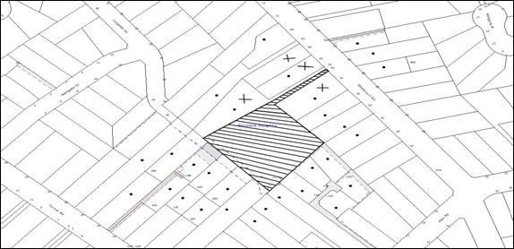
Four submissions were received,
each objecting to the development generally on the grounds that the development
would result in:
· increase traffic flow
along the access handle;
· on-street parking of
vehicles creating nuisance along the street frontage;
· non-compliant width of
access handle with no landscaping provisions or provisions for emergency
vehicle access;
· unacceptable sight
distances for vehicles accessing the driveway;
· reduces safety of
adjoining neighbours due to increased traffic flow on the street;
· unacceptable drainage
provisions;
· unacceptable noise due
to passing vehicles and no fencing provision along the accessway;
· the removal of native
trees;
· no provision of
garbage truck access to the site resulting in bins been stacked along the
frontage of neighbouring properties; and
· unacceptable impact on
neighbouring properties due to vehicle headlights.
In addition, the following
observations have been made within the submissions received:
· The location of the
power lines that would service the future development and the visual impact of
those additional power lines on the adjoining properties.
· The applicant does not
have legal rights to access the common driveway.
· The development would
require stormwater related works to be undertaken within the Council controlled
easement at No. 61 Woodcourt Road. Owner’s consent from the neighbouring
property has not been obtained in this regard.
· The kerb and guttering
works should be undertaken as a part of this application.
· The development would
result in undersized allotments once the restriction as to user (Lingellen Street extension) on each land is excluded from the land area.
· The private open space
areas are proposed to be located on the overland flow path.
· The proposed “V drain”
should not be included as a part of the right-of-carriageway for Lots 1 to 6.
· No landscape plan
submitted with the application.
· Drainage lines must
not impact on the trees proposed to be retained.
· The open drainage
channel traversing the property and the adjoining property should be piped to
improve the flooding situation.
· Details of culvert
have not been provided.
· The erosion and
sediment control plan is not satisfactory.
· No details of proposed
fencing to deflect stormwater has been provided.
· Access to the new lots
should be obtained from Lingellen Street.
· Vehicular access to
the neighbouring property should be provided at all stages of construction
works.
· Adequate lighting and
paved pedestrian accessway should be provided on the accessway.
· Construction work
hours should be specified in the conditions of consent.
· The right-of-way
tapers to 3 metres at the entrance to the battleaxe handle from No. 59 Woodcourt Road.
· The trees and power
pole within No. 61 Woodcourt road cannot be removed/relocated without the
consent of the owner of that allotment.
· The drainage
calculations and the location of the 1:100 year floodline are incorrect.
The merits of the matters raised
in community submissions have been addressed in the body of the report with the
exception of the following:
5.1.1 Owner’s consent for stormwater related works
Under the provisions of Section
59A and Section 191A of the Local Government Act 1993, Council has the
authority to enter upon privately owned land to undertake authorised works
related to drainage/sewerage and the like. Section 193 and 194 of the Act also
provides that Council may authorise a person to perform such functions.
Given that the drainage line
traversing No. 61 Woodcourt Road is controlled by Council, the developer, being
authorised by Council, could enter the premises to undertake works on behalf of
Council. Consent of owner of No. 61 Woodcourt Road would not be required for
these works should Council decide to exercise its right under the Act.
5.1.2 Construction work hours, noise, fencing, kerb and gutter
Should the application be
approved, conditions of development consent would regularise the construction
work hours, kerb and guttering along Woodcourt Road frontage the noise
generated from the premises and the future fencing along the boundaries.
5.1.3 Landscape plan
A landscape plan has not been
submitted with the development application. However, given that this
application is for subdivision only and that the drainage channel is proposed
to be piped, a landscape plan would not be required.
5.2 Public Agencies
The development application is
not Integrated Development under the Act. The application was not referred to
any public agencies for comments.
6. THE PUBLIC INTEREST
Section 79C(1)(e) of the Act
requires Council to consider “the public interest”.
The public interest is an
overarching requirement, which includes the consideration of the matters
discussed in this report. Implicit to the public interest is the achievement
of future built outcomes adequately responding to and respecting the future desired
outcomes expressed in environmental planning instruments and development
control plans.
The application has demonstrated
that the development could proceed in an orderly and economic manner consistent
with Council’s planning requirements. The development would be in the public
interest in so far as providing the opportunity to better utilise residential
land for future housing. The development would meet State and Local planning
strategies and the subdivision of the land is encouraged.
The applicant has demonstrated a
reasonable approach to seeking consent of the adjoining property owner to
obtain access rights over a minor portion o the right of carriageway in a
manner that would not adversely impact upon the amenity of that site. However,
as owner’s consent has not been forthcoming, Council is unable to approve the
application despite the development being in the public interest.
CONCLUSION
The proposal seeks approval for
the demolition of the existing buildings and the subdivision of one lot into
six lots.
The site gains access via a part
6 metre wide, part 3 metre wide access handle. A watercourse traverses the
northern boundary of the site. The shared access handle partly has reciprocal
rights-of-way with No. 61 Woodcourt Road. The application does not include
owner’s consent from the adjoining neighbour regarding works to be undertaken
within the driveway or for garbage truck access. Consequently, it is considered
that the development application has not been lawfully made and Council is not
in a position in which it could lawfully approve the development application.
The proposal includes details of
garbage truck access to the site and details of the proposed on-site-detention
system which have been assessed as satisfactory.
Council, at its planning meeting
on 1 December 2010, resolved to defer the application to provide the applicant
with an opportunity to address Council’s concerns and achieve an acceptable
outcome on the site. The applicant has been able to address all of Council’s
concerns regarding the application except for providing the owner’s consent
from the neighbouring property for the required works on the adjoining
property. Consequently, despite the development being in the public interest
refusal of the development application is recommended.
Note: At the time of the
completion of this planning report, no persons have made a Political
Donations Disclosure Statement pursuant to Section 147 of the Environmental
Planning and Assessment Act 1979 in respect of the subject planning
application.
|
Rod Pickles
Manager -
Assessment Team 2
Planning Division
|
Paul David
Manager -
Subdivision & Development Engineering Services
Planning Division
|
|
Scott Phillips
Executive Manager
Planning Division
|
|
Attachments:
|
1.View
|
Locality Plan
|
|
2.View
|
Subdivision Plan
|
|
3.View
|
Stormwater
Drainage Plan
|
|
4.View
|
Construction
Management Plan
|
|
5.View
|
Garbage Truck
Access Details
|
File Reference: DA/591/2010
Document Number: D01571481
SCHEDULE 1
1. Pursuant to the
provisions of Section 79C(1)(a)(b) of the Environmental Planning and Assessment
Act, 1979, the proposal would require construction works to be undertaken
within the common driveway providing access to the site to ensure the orderly
and efficient access to and egress from the development. The necessary written
consent of the owner of the adjoining property at No. 61 Woodcourt Road (Lot 1
DP 502390) has not been obtained.
-
END OF REASONS FOR REFUSAL -
Planning Report No. PLN24/11
Date of Meeting:
6/04/2011
2 DEVELOPMENT APPLICATION
- ERECTION OF A DWELLING HOUSE & CONVERSION OF THE EXISTING DWELLING HOUSE
TO A RURAL STRUCTURE
27 BAY ROAD, ARCADIA
|
Development Application No:
|
DA/1634/2010
|
|
Description of Proposal:
|
Erection of a dwelling-house and conversion of
existing dwelling-house into a rural structure
|
|
Property Description:
|
Lot 2, DP 234025, No 27 Bay Road, Arcadia
|
|
Applicant:
|
Mr B Waller
|
|
Owners:
|
Mr Bernard Waller and Mrs Waller
|
|
Statutory Provisions:
|
Hornsby Shire Local
Environmental Plan, 1994 - Rural AR (Large Holdings- Rural Landscapes) and
Environmental Protection B (River Catchment)
|
|
Estimated Value:
|
$475,000
|
|
Ward:
|
A
|
|
RECOMMENDATION
THAT Development Application No. 1634/2010 for the
erection of a dwelling-house and the conversion of the existing
dwelling-house to a rural structure at Lot 2, DP 234025, No 27 Bay Road, Arcadia be approved subject to the conditions of consent detailed in Schedule 1 of this
report.
|
1. The application seeks development consent for
the erection of a dwelling-house, a garage and a swimming pool and the
conversion of the existing dwelling-house on the site for use as a “rural
structure”.
2. The
proposal generally complies with the requirements of the Hornsby Shire Local
Environmental Plan, 1994 (HSLEP) and Council’s Development Control Plans
applicable to the development.
3. A
Red Sticker has been placed against the application and accordingly it has been
referred to Council for determination.
4. One
public submission was received during the exhibition period.
5. It
is recommended that the application be approved subject to conditions.
THE SITE
The site is 8.7 hectares in size
and has a relatively long and narrow shape. The site is located on the
northern side of Bay Road, Arcadia between Coolamon Close and Chilcott Road. The site contains a single storey dwelling-house and several small
outbuildings located within a cleared portion adjacent to the Bay Road boundary.
The site slopes steeply to the
rear, draining towards a natural watercourse which is an upper tributary of
Banks Creek. The site is predominantly covered by natural bushland with a
portion of the site in the vicinity of the front boundary identified as an
Endangered Ecological Community (EEC). The site is located within a bushfire
prone area.
The surrounding area is
characterised by allotments of similar shape and size with dwelling-houses,
rural structures, swimming pools and water tanks erected on the cleared
portions of the properties in close proximity to the road.
THE PROPOSAL
The application proposes the erection of a contemporary
styled, two storey dwelling-house incorporating a dining room, family room,
laundry, three bedrooms, a kitchen, powder room, study, living room, and a
pergola with an enclosed walkway accessing another bedroom with an adjacent
walk-in-robe, ensuite and a verandah on the ground floor. Two bedrooms, a
bathroom, a rumpus room and a study are proposed at first floor level. A
double garage is proposed adjacent to the front of the dwelling-house and an
inground pool would be installed behind the dwelling-house.
The new dwelling-house would be set
back approximately 45 metres from the dwelling-house at No. 25 Arcadia Road and
35 metres from the dwelling-house at No. 29 Arcadia Road.
The
application originally proposed the existing dwelling-house be retained for use
as “extended family accommodation”. As this land use would be prohibited
within the rural zone pursuant to Clause 7 of the HSLEP, the applicant has
amended the application seeking consent for the conversion of the existing
dwelling-house to a “rural structure”.
As this development would be
sited within a cleared portion of the site, no trees would be removed.
ASSESSMENT
The development application has
been assessed having regard to the ‘Metropolitan Plan for Sydney 2036’,
the ‘North Subregion (Draft) Subregional Strategy’ and the matters for
consideration prescribed under Section 79C of the Environmental Planning and
Assessment Act 1979 (the Act). Subsequently, the following issues have
been identified for further consideration.
1. STRATEGIC CONTEXT
1.1 Metropolitan Strategy – (Draft) North Subregional Strategy
The Metropolitan Plan for Sydney 2036 is a broad framework to secure Sydney’s place in the global economy by
promoting and managing growth. It outlines a vision for Sydney to 2036, the
challenges faced, and the directions to follow to address these challenges and
achieve the vision. The Draft North Subregional Strategy acts as a
framework for Council in its preparation of the Comprehensive LEP by the
end of 2011.
The Draft North Subregional
Strategy sets the following targets for the Hornsby LGA by 2031:
· Employment capacity to
increase by 9,000 jobs; and
· Housing stock to
increase by 11,000 dwellings.
The propose development would be
consistent with the draft Strategy by contributing towards housing choice in
the locality.
2. STATUTORY CONTROLS
Section 79C(1)(a) requires
Council to consider “any relevant environmental planning instruments, draft
environmental planning instruments, development control plans, planning
agreements and regulations”.
2.1 Hornsby Shire Local Environmental Plan, 1994
The subject land is zoned Rural AR (Large Holdings- Rural Landscapes) and Environmental Protection B (River
Catchment) under the HSLEP.
The objectives of the Rural AR
zone are as follows:
(a) to restrain population growth and maintain the rural
character of the area.
(b) to provide for a compatible range of land uses,
including agriculture, which maintain the rural environment of the area and
support the urban populace.
(c) to ensure that development is carried out in a manner
that improves the environmental qualities, and is within the service capability
of the area.
The objectives of the
Environmental Protection B zone are as follows:
(a) to protect the natural environment of the sensitive area
within the catchment of the Hawkesbury River.
(b) to protect the valleys, and escarpments within the
catchment of the Hawkesbury River and accommodate land uses, including housing,
that recognise environmental sensitivity of the area.
(c ) to protect the scenic quality of visually prominent
areas and water quality within the catchment of the Hawkesbury River.
The proposed developments are
defined as a “dwelling-house” and a “rural structure” under the HSLEP and both
are permissible in the zone with Council’s consent.
A dwelling-house is defined as:
“a dwelling
other than a rural worker’s dwelling or an attached dwelling, that is the only
dwelling on the allotment”.
The conversion of the existing
dwelling-house would be a permitted land use pursuant to the definition of a
“rural structure” under the HSLEP. A “rural structure” is defined as:
“any shed,
barn, outbuilding or the like associated with a dwelling and used by the
permanent residents of the dwelling for storage, hobbies, home occupations and
the like.”
The converted dwelling-house
would be used only for the uses permitted under the HSLEP. The conversion of
the existing dwelling-house to a “rural structure” would also be consistent
with similar developments that Council has permitted in the rural zones, allowing
older structures to be retained for the purposes as defined in the HSLEP.
Consistent with Council’s land
use controls, a condition of consent is recommended requiring that the
bathroom, laundry and kitchen facilities be removed from the existing dwelling-house
so that it can be used as a “rural structure” only.
2.2 Rural Lands Development Control Plan
The proposed development has been assessed having regard to
the relevant performance and prescriptive design standards within Council’s
Rural Lands Development Control Plan. The following table sets out the
proposal’s compliance with the prescriptive standards of the Plan:
|
Rural Lands DCP
|
|
Control
|
Proposal
|
Requirement
|
Complies
|
|
Design
|
|
Character
and Visual impacts
|
Maintains the Rural character of the area
|
Maintains the Rural character of the area
|
Yes
|
|
Setbacks
|
|
Front
|
23.2m
|
30m
|
No
|
|
Western
Side
|
11.3m
|
15m
|
No
|
|
Eastern
Side
|
20.5m
|
3m
|
Yes
|
|
Rear
|
> 50m
|
3m
|
Yes
|
|
Car Parking
|
|
No. of
spaces
|
3 space(s)
|
2 space(s)
|
Yes
|
2.2.1 Design
Whilst the contemporary design of
the proposal, incorporating Corten steel cladding and a low-pitched
roof, is not in keeping with the traditional style of dwelling-houses within
the area, the dwelling would have an acceptable impact on the surrounding rural
zone. The development has been designed to maximise energy and resource
efficiency and would set a positive precedent for future environmentally
responsive development.
The proposal meets the objectives
of the Dwelling Design element and is considered acceptable.
2.2.2 Setbacks
As Bay Road is classified as an “arterial road”,
the proposed 25.4 metre and 23.2 metre front boundary setbacks for the
dwelling-house and garage respectively do not comply with the 30 metre
prescriptive measure.
This variation is considered to
be acceptable in this instance, given that there are numerous structures and
dwelling-houses on adjacent properties which are sited as close as 6 metres
from the front boundary alignment.
Whilst the 11.3 metre western
side boundary setback of the garage does not comply with the 15 metre
prescriptive measure, this variation is also considered acceptable. The
purpose of the side boundary setback requirement is to establish separation
between structures so as to maintain the open rural character of the area. In
this instance, there would be 45 metres of open space between the proposed
garage and the nearest structure on the adjoining land.
The proposal meets the objectives of the Setbacks element
and is considered acceptable.
3. ENVIRONMENTAL IMPACTS
Section 79C(1)(b) of the Act
requires Council to consider “the likely impacts of that development,
including environmental impacts on both the natural and built environments, and
social and economic impacts in the locality”.
3.1 Natural Environment
No trees in the vicinity of the proposed dwelling-house,
garage and swimming pool would be removed from the site.
A portion of the site, in the vicinity of the front
boundary is classified as an Endangered Ecological Community (EEC). In assessing the impact of the driveway that would serve this development, Council
officers have determined that proposed driveway (as amended) would have minimal
impacts on this EEC and that a Seven
Part Test for this aspect of the development is not required.
The development would also have a
minimal impact on the watercourse that traverses the site, given the 95 metre
setback from the development. All stormwater from the development would drain
to an existing dam on the site.
3.2 Built Environment
The character of the area is an
eclectic blend of housing styles surrounded by rural structures. The proposal
would not impact on this character and would set a positive precedent for
future environmentally responsive development.
The conversion of the existing
dwelling-house for use as a rural structure would involve internal alterations
to the building only. Its external appearance and therefore its visual impact
on the surrounding area would remain unchanged.
3.3 Social Impacts and Economic Impacts
There would be no anticipated
social or economic impacts should the proposed development be approved.
4. SITE SUITABILITY
Section 79C(1)(c) of the Act
requires Council to consider “the suitability of the site for the
development”.
4.1 Bushfire Risk
As the land is bushfire prone,
the application was referred to the NSW Rural Fire Service for comment. The RFS does not object to the proposal, subject to appropriate conditions of consent being imposed.
The proposal meets the objectives
of the Fire Hazard element and is considered acceptable.
4.2 Effluent Disposal
The
development would be serviced by an on-site sewage management system which has
been approved by Council on the 6 December, 2010 under application LA/256/10.
5. PUBLIC PARTICIPATION
Section 79C(1)(d) of the Act
requires Council to consider “any submissions made in accordance with this
Act”.
5.1 Community Consultation
The proposed development was
placed on public exhibition and was notified to adjoining and nearby landowners
between 5 January and 24 January, 2011 in accordance with Council’s
Notification and Exhibition DCP. During this period, Council received one
submission. The map below illustrates the location of the nearby landowner who
made the submission and who is in close proximity to the development site.
|
NOTIFICATION
PLAN
|
|
|
• PROPERTIES NOTIFIED
|
X SUBMISSIONS
RECEIVED
|
PROPERTY SUBJECT OF DEVELOPMENT
|
|
|
|
|
|
The submission objected to the
proposal on the grounds that the retention of the existing structure would not
meet with the single dwelling requirement of the surrounding rural zone.
The merits of this submission
have been addressed in Section 2.1 of this report.
6. THE PUBLIC INTEREST
Section 79C(1)(e) of the Act
requires Council to consider “the public interest”.
The public interest is an
overarching requirement, which includes the consideration of the matters
discussed in this report. Implicit to the public interest is the achievement
of future built outcomes adequately responding to and respecting the future
desired outcomes expressed in environmental planning instruments and
development control plans.
The application is considered to
have satisfactorily addressed Council’s and relevant agencies’ criteria and
would provide a development outcome that, on balance, would result in a
positive impact for the community. Accordingly, it is considered that the
approval of the proposed two storey dwelling-house and the conversion of the
existing dwelling into a rural structure would be in the public interest.
CONCLUSION
The application proposes the
erection of a two storey dwelling-house, a garage and a swimming pool and the
retention of the existing dwelling-house on the site to serve as “rural
structure”.
The design and location of the
new dwelling-house, garage and swimming pool generally complies with the
relevant requirements of Council’s Rural Lands DCP and the objectives of the
zone. It is considered that the development would have a positive impact upon
the rural landscape and would set a desirable precedent in terms of its environmentally
sensitive design.
The land owner would occupy the
existing dwelling while the new dwelling is constructed. Upon completion, the
internal layout of the existing dwelling will be modified to convert it for use
as a “rural structure” in accordance with the objectives of the surrounding
rural zone.
Having regard to the merits of
the proposed development, it is recommended that the application be approved.
Note: At the time of the completion of this planning report, no
persons have made a Political Donations Disclosure Statement pursuant to
Section 147 of the Environmental Planning and Assessment Act 1979 in respect of
the subject planning application.
|
Scott Phillips
Executive Manager
Planning Division
|
Simon Evans
Manager - Assessment
Team 1
Planning Division
|
Attachments:
File Reference: DA/1634/2010
Document Number: D01603078
SCHEDULE 1
GENERAL
CONDITIONS
The
conditions of consent within this notice of determination have been applied to
ensure that the use of the land and/or building is carried out in such a manner
that is consistent with the aims and objectives of the relevant legislation,
planning instruments and Council policies affecting the land and does not
disrupt the amenity of the neighbourhood or impact upon the environment.
Note: For the
purpose of this consent, the term ‘applicant’ means any person who has the
authority to act on or the benefit of the development consent.
Note: For the purpose of
this consent, any reference to an Act, Regulation, Australian Standard or
publication by a public authority shall be taken to mean the gazetted Act or
Regulation, or adopted Australian Standard or publication as in force on the
date that the application for a construction certificate is made.
1. Approved
Plans and Supporting Documentation
The
development must be carried out in accordance with the plans and documentation
listed below and endorsed with Council’s stamp, except where amended by Council
and/or other conditions of this consent:
|
Plan No.
|
Drawn by
|
Dated
|
|
0000-00- Pages 1-10
|
Nettletontribe
|
17 Dec., 2010
|
|
0000-002B Pages 1-1
|
Nettletontribe (Revised Driveway
Position Drawing)
|
23 Feb., 2011
|
REQUIREMENTS PRIOR TO THE ISSUE OF A CONSTRUCTION
CERTIFICATE
2. Building
Code of Australia
All building
work must be carried out in accordance with the requirements of the Building
Code of Australia.
3. Contract
of Insurance (Residential Building Work)
In the case
of residential building work for which the Home Building Act, 1989 requires
there to be a contract of insurance in force in accordance with Part 6 of that
Act, that such a contract of insurance is in force before any building work
authorised to be carried out by the consent commences.
4. Notification of Home Building Act, 1989 Requirements
Residential
building work within the meaning of the Home Building Act,
1989 must not be carried out unless the principal certifying authority for
the development to which the work relates (not being Council) has given Council
written notice of the following information:
a. In the case of work for which a principal
contractor is required to be appointed:
i. The name and licence number of the
principal contractor.
ii. The name of the insurer by which the work
is insured under Part 6 of that Act.
b. In the case of work to be done by an
owner-builder:
i. The name of the owner-builder.
ii. If the owner-builder is required to hold
an owner-builder’s permit under that Act, the number of the owner-builder’s
permit.
Note: If arrangements for doing the
residential building work are changed while the work is in progress so that the
information notified becomes out of date, further work must not be carried out
unless the principal certifying authority for the development to which the work
relates (not being Council) has given Council written notification of the
updated information.
REQUIREMENTS PRIOR TO THE COMMENCEMENT OF ANY WORKS
5. Erection
of Construction Sign
A sign must be
erected in a prominent position on any site on which building work is being
carried out:
a. Showing
the name, address and telephone number of the principal certifying authority
for the work;
b. Showing
the name of the principal contractor (if any) for any demolition or building
work and a telephone number on which that person may be contacted outside
working hours; and
c. Stating
that unauthorised entry to the work site is prohibited.
Note: Any
such sign is to be maintained while the building work, subdivision work or
demolition work is being carried out, but must be removed when the work has
been completed.
6. Toilet
Facilities
Toilet
facilities must be available or provided at the site before works begin and
must be maintained until the works are completed at a ratio of one toilet for
every 20 persons employed at the site. Each toilet must:
a. be
a temporary chemical closet approved under the Local Government Act, 1993;
or
b. have
an on-site effluent disposal system approved under the Local Government Act,
1993.
7. Erosion
and Sediment Control
Erosion and
sediment control measures must be provided and maintained throughout the
construction period in accordance with the manual ‘Soils and Construction
2004 (Bluebook)’, the approved plans, Council specifications and to the satisfaction
of the principal certifying authority. The erosion and sediment control
devices must remain in place until the site has been stabilised and
revegetated.
Note: On
the spot penalties up to $1,500 may be issued for any non-compliance with this
requirement without any further notification or warning.
REQUIREMENTS DURING CONSTRUCTION
8. Ongoing
Protection of the Endangered Ecological Community (EEC)
The EEC area of the site identified adjacent to the
front boundary (shown clouded) on the Site Plan No. 0000_002 B must be fenced
off with post and wire (or similar) fencing to prevent vehicular access.
9. Construction
Work Hours
All work on site (including demolition and earth works)
must only occur between 7am and 5pm Monday to Saturday. No work is to be
undertaken on Sundays or public holidays.
10. Council
Property
During
construction works, no building materials, waste, machinery or related matter
is to be stored on the road or footpath. The public reserve is to be kept in a
clean, tidy and safe condition at all times.
11. Disturbance
of Existing Site
During
construction works, the existing ground levels of open space areas and natural
landscape features, (including natural rock-outcrops, vegetation, soil and
watercourses) must not be altered unless otherwise nominated on the approved
plans.
REQUIREMENTS PRIOR TO THE ISSUE OF AN OCCUPATION
CERTIFICATE
Note: For
the purpose of this consent, any reference to ‘occupation certificate’ shall
also be taken to mean ‘interim occupation certificate’ unless otherwise stated.
12. Bush
Fire Protection - Asset Protection Zones
At
the commencement of building works and in perpetuity, the property around the
proposed dwelling-house must be managed as follows:
a. West
to the boundary as an Inner Protection Area;
b. North
for a minimum distance of 61 metres consisting of 30 metres as an Inner
Protection Area and 31 metres as an Outer Protection Area;
c. East
to the boundary as an Inner Protection Area; and
d. South
to within 15m from the boundary as an Inner Protection Area.
Note: The requirements
for an Inner Protection Area are outlined within Section 4.1.3 and Appendix 5
of “Planning for Bush Fire Protection 2006” and the NSW Rural Fire Service’s
document “Standards for asset protection zones”. “Planning for Bush Fire
Protection 2006” Chapter 3.3 section (b) states neither the RFS nor a Council has the power to impose an APZ on an adjoining landowner.
13. Water
and Utilities
Water, electricity and gas
must comply with the following requirements of Section 4.1.3 of “Planning
for Bush Fire Protection 2006”:
a. A
hardened ground surface for truck access must be supplied up to and within 4
metres of the water source;
b. A 65mm metal
Storz outlet with a gate or ball valve must be provided;
c. In
recognition that no reticulated water supply exists, a 20,000 litre water
supply must be provided for fire fighting purposes;
d. Above
ground tanks are manufactured concrete or metal and raised tanks must have
their stands protected. Plastic tanks must not be used;
e. Underground
tanks must have an access hole of 200mm to allow tankers to refill direct from
the tank. A hardened ground surface for truck access must be supplied within 4
metres of the access hole; and
f. A
minimum 5hp of 3kw petrol or diesel powered pump must be made available to the
water supply. A 19mm (internal diameter) fire hose and reel must be connected
to the pump.
14. Design
and Construction - North and East Elevations
New
construction on the northern and eastern elevations must comply with Australian
Standard AS3959-2009 “Construction of buildings in bush fire-prone areas”
Section 9. Any material, element of construction or system when tested to the
method described in Australian Standard AS1530.8.2 “Methods for fire tests
on building materials, components and structures Part 8.2: Tests on elements of
construction for buildings exposed to simulated bushfire attack- Large flaming
sources” must comply with Clause 13.8 of that standard except that flaming
of the specimen is nor permitted.
15. Design
and Construction - South and West Elevations
New
construction on the southern and western elevations must comply with Section 8
(BAL 40) Australian Standard AS3959-2009 ‘Construction of buildings in bush
fire-prone areas’ and Section A3.7 Addendum Appendix 3 of ‘Planning for
Bush Fire Protection’.
16. Fire
Protection - Windows
Windows assemblies must
comply with modified Section 9 of Australian Standard AS3959 or be completely
protected by a non-combustible and non-perforated bushfire shutter that complies
with Section 3.7 excluding (e) and (f) and the following additional
requirements:
a. Window frames
and hardware must be metal;
b. Glazing
must be toughened glass, minimum 5mm thick;
c. The
seals to stiles, head and sills or thresholds must be manufactured from
materials having a flammability index no greater than 5; and
d. The
openable portion of the window must be screened internally or externally with a
mesh with a maximum aperture of 2mm, made from corrosion-resistant steel or
bronze. The frame supporting the mesh must be metal.
17. Fire
Protection - Doors
External
doors, not including garage doors, must comply with modified Section 9 of
Australian Standard AS3959 or they must be completely protected by a
non-combustible and non- perforated bush fire shutter that complies with
Section 3.7 excluding (e) and (f); and the following additional requirements:
a. Doors must be
non combustible;
b. Externally
fitted hardware that supports the panel in its function of opening and closing
must be metal;
c. Where doors
incorporate glazing, the glazing must be toughened glass minimum 6mm;
d. Seals
to stiles, head and sills or thresholds must be manufactured from silicone;
e. Doorframes must
be metal;
f. Doors must be
tight fitting to the doorframe or an abutting door; and
g. Weather strips,
draught excluders or draught seals must be maintained.
18. Fire
Protection - Roofing
Roofing must be gutterless
or guttering and valleys must be screened to prevent the build up of flammable
material. Any materials used must have a Flammability Index of no greater than
5 when tested in accordance with Australian Standard AS1530.2-1993 “ Methods
for Fire Tests on Building Materials, Components and Structures- Test for
Flammability of Materials”.
Note: Timbers treated with an applied
intumescent paint are no longer recognised by the Rural Fire Service as a fire
retardant treated timber or a performance option to increase fire resistance.
19. Conversion
of the existing dwelling-house into a rural structure
To ensure that the existing
dwelling-house is not used as a separate domicile, it must be converted to a
“rural structure” in accordance with the uses permitted under the Hornsby Shire
Local Environmental Plan, 1994 by removing all bathroom, laundry and kitchen
facilities including all the associated fittings and fixtures from within the
structure. Fittings and fixtures include: cupboards, sinks, benches, wall and
floor tiling, cooking equipment, taps and bath and other plumbing.
20. Fulfilment
of BASIX Commitments
The applicant
must demonstrate the fulfilment of BASIX commitments pertaining to the
development.
21. Stormwater
Drainage
The stormwater
drainage system for the development must be designed and constructed for an
average recurrence interval of 20 years.
22. Internal
Driveway/Vehicular Areas
The driveway
and parking areas on site must be designed in accordance with Australian
Standards 2890.1, 2890.2, 3727 and the be located in accordance with the
revised driveway position drawing prepared by Nettletontribe dated 23 February,
2011, reference Site Plan No. 0000_002 B.
23. Vehicular
Crossing
A separate
application under the Local Government Act, 1993 and the Roads Act,
1993 must be submitted to Council for the installation of the new vehicular
crossing and the removal of any redundant crossing. The vehicular crossing
must be constructed in accordance with Council’s Civil Works Design, 2005.
Note:
An application for a vehicular crossing can only be made to one of Council’s
Authorised Vehicular Crossing Contractors. You are advised to contact Council
on 02 9847 6940 to obtain a list of contractors.
24. Damage
to Council Assets
Any damage
caused to Council’s assets as a result of the construction of the development
must be rectified in accordance with Council’s written requirements and at the
sole cost of the applicant.
25. Ongoing
Protection of the Endangered Ecological Community (EEC)
The EEC area of the site identified adjacent to the
front boundary (shown clouded) on the Site Plan No. 0000_002 B must remain
undisturbed and be protected in perpetuity in accordance with the following
requirements:
a. The
EEC area must be kept free of noxious weeds using recognised bush regeneration
methods in accordance with ‘Recovering bushland on the Cumberland Plain:
Best practice guidelines for the management and restoration of bushland –
Department of Conservation 2005’; and
b. Machinery
and fertilizer must not be used in the EEC area for maintenance purposes.
26. Swimming
Pool Requirements
The construction and operation of the swimming pool
must comply with the provisions of the Swimming Pool Act 1992, the Swimming
Pool Regulation, 1998, Australian Standards 1926.1-3 – Swimming Pool
Safety and the following requirements:
a. All
waste water from the pool’s filtration system must be treated by equipment that
does not require backwashing;
b. The
filtration motor and pump unit must be housed in a soundproofed structure.
Sound from the equipment must not exceed 5(dBA) above ambient noise levels at
any residential property boundary;
c. The
swimming pool is to be located a minimum of 6 metres from any wastewater
disposal area as outlined in the Environment & Health Protection
Guidelines – Onsite Sewage Management for Single Households (1998); and
d. The applicant must participate in the ‘Static Water Supply
Project’ initiative of the NSW Fire Brigades and make available the water in
the swimming pool for use as a static water supply for fire fighting purposes
by the NSW Fire Brigades or the NSW Rural Fire Service.
Note: On completion of the swimming pool, the applicant is to
contact the local NSW Fire Brigade Station or NSW Rural Fire Service Station to
arrange the installation of a static water supply identification plate.
27. Use
of Rural Structure
The rural structure
approved under this consent must not be used as a dwelling-house on any
occasion.
-
END OF CONDITIONS –
ADVISORY
NOTES
The
following information is provided for your assistance to ensure compliance with
the Environmental Planning and Assessment Act, 1979, Environmental Planning and
Assessment Regulation 2000, other relevant legislation and Council’s policies
and specifications. This information does not form part of the conditions of
development consent pursuant to Section 80A of the Act.
Environmental Planning and Assessment Act, 1979
Requirements
The Environmental Planning
and Assessment Act, 1979 requires:
· The issue of a construction certificate
prior to the commencement of any works. Enquiries regarding the issue of a
construction certificate can be made to Council’s Customer Services Branch on
9847 6760.
· A principal certifying authority to be
nominated and Council notified of that appointment prior to the commencement of
any works.
· Council to be given at least two days
written notice prior to the commencement of any works.
· Mandatory inspections of nominated
stages of the construction.
· An occupation certificate to be issued
before occupying any building or commencing the use of the land.
Long Service Levy
In accordance with Section 34 of
the Building and Construction Industry Long Service Payments Act 1986, a ‘Long Service Levy’ must be paid to the Long
Service Payments Corporation or Hornsby Council.
Note: The
rate of the Long Service Levy is 0.35% of the total cost of the work.
Note: Hornsby
Council requires the payment of the Long Service Levy prior to the issue of a
construction certificate.
Tree Preservation Order
To ensure the maintenance and
protection of the existing natural environment, it is an offence to ringbark,
cut down, top, lop, remove, wilfully injure or destroy a tree outside 3 metres
of the approved building envelope without the prior written consent from
Council.
Note: A
tree is defined as a single or multi-trunked wood perennial plant having a
height of not less than three (3) metres, and which develops many branches,
usually from a distance of not less than one (1) metre from the ground, but
excluding any plant which, in its particular location, is a noxious plant
declared as such pursuant to the Noxious Weeds Act 1993. This definition of
‘tree’ includes any and all types of Palm trees.
All
distances are determined under Australian Standard AS4970-2009 “Protection of
Trees on Development Sites”.
Fines may be imposed for non-compliance with Council’s Tree
Preservation Order.
Dial Before You Dig
Prior to commencing any works,
the applicant is encouraged to contact Dial Before You Dig on 1100 or www.dialbeforeyoudig.com.au for
free information on potential underground pipes and cables within the vicinity
of the development site.
Asbestos Warning
Should asbestos or asbestos
products be encountered during demolition or construction works you are advised
to seek advice and information prior to disturbing the material. It is
recommended that a contractor holding an asbestos-handling permit (issued by WorkCover
NSW) be engaged to manage the proper handling of the material. Further
information regarding the safe handling and removal of asbestos can be found
at:
www.environment.nsw.gov.au
www.nsw.gov.au/fibro
www.adfa.org.au
www.workcover.nsw.gov.au
Alternatively, telephone the WorkCover Asbestos and
Demolition Team on 8260 5885.
Planning Report No. PLN31/11
Date of Meeting:
6/04/2011
3 DEVELOPMENT APPLICATION
- TELECOMMUNICATIONS FACILITY
ARCADIA PARK, 127X ARCADIA ROAD, ARCADIA
|
Development Application No:
|
DA/1436/2010
|
|
Description of Proposal:
|
Erection of a telecommunications facility including a
mobile phone tower and associated equipment shelter
|
|
Property Description:
|
Lot 761 DP 1121447, Arcadia Park, 127X Arcadia Road, Arcadia
|
|
Applicant:
|
Aurecon Group
|
|
Owner:
|
Hornsby Shire Council
|
|
Statutory Provisions:
|
Hornsby Shire Local Environmental
Plan 1994
Open Space A (Public
Recreation) Zone
|
|
Estimated Value:
|
$250,000
|
|
Ward:
|
A
|
|
RECOMMENDATION
THAT Development Application
No. DA/1436/2010 for the erection of a telecommunications facility including
a mobile phone tower and associated equipment and shelter at Lot 761 DP
1121447 No. 127X Arcadia Road Arcadia be approved in accordance with the
recommendation of the independent town planning consultant’s report – Nexus
Environmental Planning Pty Ltd and the conditions of consent held at Schedule
1 of this report.
|
1. The
application proposes the erection of a 30 metre high telecommunications tower,
including associated antennas and equipment shelter.
2. The
application involves land owned by Hornsby Shire Council. In accordance with
Council’s adopted Policy, ‘PSA1 Proposed Council Developments’ and
‘Practice Note No. 7 Assessment Practice’ an independent assessment of the
development application has been undertaken by Nexus
Environmental Planning Pty Ltd.
3. The proposal complies with the provisions of the
Environmental Planning and Assessment Act 1979, the Telecommunications Act 1997
and the Hornsby Shire Local Environmental Plan 1994.
4. One
submission was received objecting the proposed development.
5. The report by Nexus Environmental Planning is
attached to this report for Council’s consideration. The independent
consultant’s report recommends approval of the application.
ASSESSMENT
In accordance with Council’s
adopted Policy PS41 Proposed Council Developments and Practice Note
No. 7 – Assessment Practice, the assessment of the development application
has been referred to an independent town planning consultant. The report by Nexus
Environmental Planning is held at Attachment 2 of this report.
CONCLUSION
The proposal seeks to erect a
mobile phone tower within Arcadia Park.
Council has referred the
application to an independent planning consultancy to carry out an assessment
of the application. The assessment concludes that the application should be
approved.
One submission was received in
opposition to the proposed development during the public exhibition period.
It is recommended that Council
approve the application in accordance with the recommendation in the report prepared by Nexus Environmental Planning Pty Ltd and
the conditions of consent held at Schedule 1 of this report.
Note: At the time of the completion of this planning report, no
persons have made a Political Donations Disclosure Statement pursuant to
Section 147 of the Environmental Planning and Assessment Act 1979 in respect of
the subject planning application.
|
Rod Pickles
Manager -
Assessment Team 2
Planning Division
|
Scott Phillips
Executive Manager
Planning Division
|
Attachments:
|
1.View
|
Locality Plan
|
|
2.View
|
Consultant's
Report - Nexus Environmental Planning Pty Ltd
|
|
3.View
|
Location Plan
|
|
4.View
|
Elevations
|
File Reference: DA/1436/2010
Document Number: D01613384
SCHEDULE 1
GENERAL
CONDITIONS
The conditions of consent within this notice of determination have
been applied to ensure that the use of the land and/or building is carried out
in such a manner that is consistent with the aims and objectives of the
relevant legislation, planning instruments and Council policies affecting the
land and does not disrupt the amenity of the neighbourhood or impact upon the
environment.
Note: For the
purpose of this consent, the term ‘applicant’ means any person who has the
authority to act on or the benefit of the development consent.
Note: For the purpose of
this consent, any reference to an Act, Regulation, Australian Standard or
publication by a public authority shall be taken to mean the gazetted Act or
Regulation, or adopted Australian Standard or publication as in force on the
date that the application for a construction certificate is made.
1. Approved
Plans and Supporting Documentation
The
development must be carried out in accordance with the plans and documentation
listed below and endorsed with Council’s stamp, except where amended by Council
and/or other conditions of this consent:
|
Plan No.
|
Drawn by
|
Dated
|
|
Sheet 1- Issue 3
Site layout and access
|
Aurecon
|
7/02/2011
|
|
Sheet 3 – Issue 3
North –eastern elevation
|
Aurecon
|
7/02/2011
|
|
Document No.
|
Prepared by
|
Dated
|
|
Statement of Environmental
Effects
|
Aurecon
|
November 2010
|
|
EME Report
|
Telstra
|
17/11/2010
|
2. Removal
of Existing Trees
This
development consent does not permit the removal of any trees on the site. The
removal of any tree requires separate approval under Council’s Tree
Preservation Order.
REQUIREMENTS PRIOR TO THE ISSUE OF A CONSTRUCTION
CERTIFICATE
3. Building
Code of Australia
All building
work must be carried out in accordance with the requirements of the Building
Code of Australia.
REQUIREMENTS PRIOR TO THE COMMENCEMENT OF ANY WORKS
4. Erection
of Construction Sign
A sign must
be erected in a prominent position on any site on which building work,
subdivision work or demolition work is being carried out:
a. Showing
the name, address and telephone number of the principal certifying authority
for the work,
b. Showing
the name of the principal contractor (if any) for any demolition or building work
and a telephone number on which that person may be contacted outside working
hours, and
c. Stating
that unauthorised entry to the work site is prohibited.
Note: Any
such sign is to be maintained while the building work, subdivision work or
demolition work is being carried out, but must be removed when the work has
been completed.
5. Protection
of Adjoining Areas
A temporary
hoarding, fence or awning must be erected between the work site and adjoining
lands before the works begin and must be kept in place until after the
completion of the works if the works:
a. Could
cause a danger, obstruction or inconvenience to pedestrian or vehicular
traffic.
b. Could
cause damage to adjoining lands by falling objects.
c. Involve
the enclosure of a public place or part of a public place.
Note: Notwithstanding
the above, Council’s separate written approval is required prior to the
erection of any structure or other obstruction on public land.
6. Toilet
Facilities
Toilet
facilities must be available or provided at the works site before works begin
and must be maintained until the works are completed at a ratio of one toilet
for every 20 persons employed at the site. Each toilet must:
a. be
a standard flushing toilet connected to a public sewer; or
b. be
a temporary chemical closet approved under the Local Government Act, 1993;
or
c. have
an on-site effluent disposal system approved under the Local Government Act,
1993
7. Erosion
and Sediment Control
Erosion and
sediment control measures must be provided and maintained throughout the
construction period in accordance with the manual ‘Soils and Construction
2004 (Bluebook)’, the approved plans, Council specifications and to the
satisfaction of the principal certifying authority. The erosion and sediment
control devices must remain in place until the site has been stabilised and
revegetated.
Note: On
the spot penalties up to $1,500 may be issued for any non-compliance with this
requirement without any further notification or warning.
8. Tree
Protection Barriers
Tree
protection fencing must be erected around trees numbered T4, T5 to be retained
at a 6 metre setback.
Tree
protection fencing must be erected around trees numbered T1, T3 to be retained
at a 2 metre setback.
The tree
fencing must be constructed of 1.8 metre ‘cyclone chainmesh fence’ or star
pickets spaced at 2 metre intervals, connected by a continuous high-visibility
barrier/hazard mesh at a height of 1 metre.
REQUIREMENTS DURING CONSTRUCTION
9. Construction
Work Hours
All work on site (including demolition and earth works)
must only occur between 7am and 5pm Monday to Saturday.
No work is to be undertaken on Sundays or public holidays.
10. Environmental
Management
The site must
be managed in accordance with the publication ‘Managing Urban Stormwater –
Landcom (March 2004) and the Protection of the Environment Operations
Act 1997 by way of implementing appropriate measures to prevent sediment
run-off, excessive dust, noise or odour emanating from the site during the
construction of the development.
11. Works
near Trees
All required
tree protection measures are to be maintained in good condition for the
duration of the construction period.
Note: The
applicant is to ensure that no excavation, including sub-surface trenching for
stormwater or other services or the filling or stockpiling of building
materials, parking of vehicles or plant, disposal of cement slurry, waste water
or other contaminants is to occur within the Tree Protection Zone (as
determined using the Australian Standard AS 4970-2009) of any tree to be
retained.
12. Council
Property
During
construction works, no building materials, waste, machinery or related matter
is to be stored on the road or footpath. The public reserve is to be kept in a
clean, tidy and safe condition at all times.
13. Landfill
Landfill must
be constructed in accordance with Council’s ‘Construction Specification,
2005’ and the following requirements:
a. All
fill material imported to the site is to wholly consist of Virgin Excavated
Natural Material (VENM) as defined in Schedule 1 of the Protection of the
Environment Operations Act 1997 or a material approved under the Department
of Environment and Climate Change’s general resource recovery exemption.
14. Excavated
Material
All excavated
material removed from the site must be classified in accordance with the NSW
Environment Protection Authority’s Environmental Guidelines – Assessment,
Classification and Management of Liquid and Non-Liquid Wastes prior to
disposal to an approved waste management facility and reported to the principal
certifying authority.
REQUIREMENTS PRIOR TO THE ISSUE OF AN OCCUPATION
CERTIFICATE
Note: For
the purpose of this consent, any reference to ‘occupation certificate’ shall
also be taken to mean ‘interim occupation certificate’ unless otherwise stated.
15. Damage
to Council Assets
Any damage
caused to Council’s assets as a result of the construction of the development
must be rectified in accordance with Council’s written requirements and at the
sole cost of the applicant.
16. Noise
– Plant and Machinery
The level of total
continuous noise emanating from operation of all the plant, including air
conditioning units and processes in all buildings (LA10) (measured for at least
15 minutes) in or on the above premises, must not exceed the background
level by more than 5dB(A) when measured at all property boundaries.
17. Site
Compliance Certificate
A Site
Compliance Certificate issued by a NATA accredited service is to be submitted
to Council for the site at Arcadia Park, 127X Arcadia Road, Arcadia confirming
the operating EME levels, within one month of the commencement of the operation
of the facility. The site is to be assessed and found to comply with the
Australian Radiation Protection and Nuclear Safety Agency (ARPANSA)’s Radiation
Protection Standards and the RF Human Exposure Limits as specified by the
Australian Communications and Media Authority (ACMA).
18. Telecommunications
Facility
The
telecommunications facility on the site must be operated in compliance with,
but not limited to:
a) Australian Radiation Protection and Nuclear Safety Agency’s
(ARPANSA) ‘Radiation Protection Standard for Maximum Exposure Levels to
Radiofrequency Fields – 3kHz to 300 GHz’, (2002).
b) The Australian Communication Industry Forum Code (ACIF), Industry
Code C564:2004, Deployment of Mobile Phone Network Infrastructure, (2002).
c) The Australian Communications Authority (ACA), Radiocommunications
(Electromagnetic Radiation – Human Exposure) Standard, (2003).
- END OF CONDITIONS -
ADVISORY NOTES
The following information is provided for your
assistance to ensure compliance with the Environmental Planning and Assessment
Act 1979, Environmental Planning and Assessment Regulation 2000, other relevant
legislation and Council’s policies and specifications. This information does
not form part of the conditions of development consent pursuant to Section 80A
of the Act.
Environmental Planning and
Assessment Act, 1979 Requirements
· The Environmental Planning and
Assessment Act, 1979 requires:
· The issue of a construction certificate
prior to the commencement of any works. Enquiries regarding the issue of a
construction certificate can be made to Council’s Customer Services Branch on
9847 6760.
· A principal certifying authority to be
nominated and Council notified of that appointment prior to the commencement of
any works.
· Council to be given at least two days
written notice prior to the commencement of any works.
· Mandatory inspections of nominated
stages of the construction inspected.
· An occupation certificate to be issued
before occupying any building or commencing the use of the land.
Tree Preservation Order
To ensure the maintenance and
protection of the existing natural environment, it is an offence to ringbark,
cut down, top, lop, remove, wilfully injure or destroy a tree outside 3 metres
of the approved building envelope without the prior written consent from
Council.
Note: A
tree is defined as a single or multi-trunked wood perennial plant having a height
of not less than three (3) metres, and which develops many branches, usually
from a distance of not less than one (1) metre from the ground, but excluding
any plant which, in its particular location, is a noxious plant declared as
such pursuant to the Noxious Weeds Act 1993. This definition of ‘tree’
includes any and all types of Palm trees.
All
distances are determined under Australian Standard AS4970-2009 ”Protection of
Trees on Development Sites”.
Fines may be imposed for
non-compliance with Council’s Tree Preservation Order.
Bushland Protection
during Construction
The site contains Sydney Turpentine Ironbark Forest (STIF) which is
listed as an ‘Endangered Ecological Community’ under the ‘Threatened Species
Conservation Act 1995’. The Act prohibits the disturbance to threatened
species, endangered populations and endangered ecological communities, or their
habitat, without the approval of the ‘Department of Environment and Climate
Change’ where such activities are not authorised by a development consent under
the ‘Environmental Planning and Assessment Act 1979’.
Actions such as tree removal, understorey slashing or mowing, removal of dead
trees within this vegetation would likely impact upon this endangered
ecological community. Such action would qualify as illegally picking or
disturbing the habitat and could render any person who carried out such action
as LIABLE FOR PROSECUTION.
Covenants
The land upon which the subject
building is to be constructed may be affected by restrictive covenants. Council
issues this approval without enquiry as to whether any restrictive covenant
affecting the land would be breached by the construction of the building, the
subject of this consent. Applicants must rely on their own enquiries as to
whether or not the building breaches any such covenant.
Dial Before You Dig
Prior to commencing any works,
the applicant is encouraged to contact Dial Before You Dig on 1100 or www.dialbeforeyoudig.com.au for
free information on potential underground pipes and cables within the vicinity
of the development site.
Planning Report No. PLN21/11
Date of Meeting:
6/04/2011
4 DEVELOPMENT APPLICATION
- SECTION 96(2) - ERECTION OF AN 11 STOREY MIXED USE BUILDING - 135 - 137 PACIFIC HIGHWAY AND POUND ROAD RESERVE, HORNSBY
|
Development Application No:
|
DA/1586/2001/D
|
|
Description of Proposal:
|
Mixed use building comprising 104 residential units
and one level of commercial and retail units - Section 96 (2) Application
|
|
Property Description:
|
Lot 1 DP
606694, Lot 2 DP 606694 Nos. 135 - 137 Pacific Highway and Pound Road Reserve, Hornsby
|
|
Applicant:
|
TF Investment Trust
|
|
Owners:
|
Fal Management Group Pty Ltd and Hornsby Shire Council
(Pound Road)
|
|
Statutory Provisions:
|
Hornsby Shire Local Environmental
Plan 1994
Residential D (High Density)
|
|
Estimated Value:
|
$22,000,000
|
|
Ward:
|
B
|
|
RECOMMENDATION
THAT Development Application No. DA/1586/2001/D to modify Development
Consent No. 1586/2001 for the construction of a mixed use development
comprising 104 residential units and one level of commercial and retail units
at Lot 1 DP 606694, Lot 2 DP 606694 Nos. 135-137 Pacific Highway and Pound
Road Reserve, Hornsby be approved subject to the conditions of consent in
Schedule 1 of the independent town planning consultant’s report – ADW
Johnson.
|
1. The
application proposes modifications to an existing development consent resulting
in the construction of a mixed use development comprising 104 residential units
and one level of commercial and retail units with basement car parking.
2. A portion of the site is owned by Council. In accordance with
Council’s adopted Policy ‘PSA1 Proposed Council Developments’ and ‘Practice
Note No. 7 Assessment Practice’ an independent assessment of the
development application has been undertaken by ADW Johnson.
3. Three
submissions have been received in respect of the application.
4. The report by ADW Johnson is attached
to this report for Council’s consideration. The independent consultant’s report
recommends approval of the application.
Note: At the time of the completion of this planning report, no
persons have made a Political Donations Disclosure Statement pursuant to
Section 147 of the Environmental Planning and Assessment Act 1979 in respect of
the subject planning application.
|
Rod Pickles
Manager -
Assessment Team 2
Planning Division
|
Scott Phillips
Executive Manager
Planning Division
|
Attachments:
|
1.View
|
Locality Plan
|
|
2.View
|
Consultant's
Report
|
|
3.View
|
Floor Plans
|
|
4.View
|
Elevations and
Sections
|
|
5.View
|
Shadow Diagrams
|
File Reference: DA/1586/2001/D
Document Number: D01598126
SCHEDULE 1
|
Date of 1st modification:
|
3 June 2009
|
|
Details of 1st modification:
|
Mixed use building comprising 70 residential units and
three levels of commercial units - Section 96(2) Application
|
|
|
|
|
Conditions Added:
|
103 to 125
|
|
Conditions Deleted:
|
1, 4, 10-14, 16, 18, 20, 36, 42-45, 53-60, 61-63, 69-71,
74-76 and 88-90.
|
|
Conditions Modified:
|
6, 17, 37, 64, 79, 80, 81, 91, 92, 93 and 99
|
|
Date of 2nd modification:
|
3 March 2010
|
|
Details of 2nd modification:
|
Section 96(1A) modification to amend condition Nos. 82,
91A, 91B, 82 and 102
|
|
|
|
|
Conditions Added:
|
126-130
|
|
Conditions Deleted:
|
101 and 102
|
|
Conditions Modified:
|
82, 91A, 91B and 114
|
|
Date of this modification:
|
6 April 2010
|
|
Details of this modification:
|
Mixed use building comprising 104 residential units and
one level of commercial and retail units - Section 96 (2) Application
The description of the
development should read as follows:
DEVELOPMENT: Erection of a building comprising 104
residential units, one ground level of commercial and retail tenancies and
four levels of basement car parking.
|
|
|
|
|
Conditions Added:
|
131-147
|
|
Conditions Deleted:
|
91B
|
|
Conditions Modified:
|
6, 30, 91A, 125
|
GENERAL
CONDITIONS
The
conditions of consent within this notice of determination have been applied to
ensure that the use of the land and/or building is carried out in such a manner
that is consistent with the aims and objectives of the relevant legislation,
planning instruments and Council policies affecting the land and does not
disrupt the amenity of the neighbourhood or impact upon the environment.
Note: For the
purpose of this consent, the term ‘applicant’ means any person who has the
authority to act on or the benefit of the development consent.
Note: For the purpose of
this consent, any reference to an Act, Regulation, Australian Standard or
publication by a public authority shall be taken to mean the gazetted Act or
Regulation, or adopted Australian Standard or publication as in force on the
date that the application for a construction certificate is made.
1. Deleted
Sediment & Erosion Control
2. Temporary sedimentation and erosion controls shall be
constructed prior to commencement of any work to eliminate the discharge of
sediment from the site. The controls are to be designed and installed in
accordance with the requirements of the NSW Department of Conservation and Land
Management's "Urban Erosion and Sediment Control" manual, Hornsby
Shire Council’s “Sustainable Water Best Practices” manual and shall:-
* be effectively maintained at all times during the course of
construction and shall not be removed until the site has been stabilised or
landscaped to the Principal Certifying Authority’s satisfaction.
* include adequate measures to remove clay from vehicles
leaving the site so as to maintain public roads in a clean condition.
* ensure disturbed areas are rehabilitated with indigenous
plant species, landscaped and treated by approved methods of erosion mitigation
such as, mulching, and revegetation with native grasses or other suitable
stabilising processes within fifteen days of the completion of works.
* No
site works are to commence until the sediment control installation has been
inspected and approved by the Principal Certifying Authority. At least 48
hours notice is to be given for the inspection of such works. A compliance
certificate be submitted to Hornsby Shire Council with the notification for
commencement of works.
Sydney Water
3. A Section 73 compliance certificate under the Sydney Water
Act 1994 must be obtained. Application must be made through an authorised
Water Servicing Coordinator. Please refer to “Your Business” section of Sydney
Water’s web site at www.sydneywater.com.au then the
“e-developer” icon or telephone 13 20 92.
Following
application, a “Notice of Requirements” will detail water and sewer extensions
to be built and charges to be paid. Please make early contact with the
Coordinator, since building of water/sewer extensions can be time consuming and
may impact on other services and building, driveway or landscape design.
The Notice
must be submitted to the Principal Certifying Authority prior to the
Construction Certificate being issued.
The Section 73
Certificate must be submitted to the Principal Certifying Authority prior to
occupation of the development/release of the plan of subdivision.
4. Deleted
Use of Materials
5. If reflective glass is to be used externally in the
construction of the building, the reflectivity index of the glass is to be not
more than 20%.
6. The materials and colours to be used in the construction
must be the same as those samples shown on plan prepared by Woodhead
(Reference: DWG No. W4004 issue A) dated 15 November 2010.
Carparking
7. The commercial car parking spaces shall be signposted and
made available at all times during business hours.
8. The residential visitor parking spaces shall be signposted
and made available at all times.
9. Parking, loading and manoeuvring areas are to be used
solely for such purposes.
10. Deleted
11. Deleted
12. Deleted
13. Deleted
14. Deleted
Energy Efficiency and Services
15. A NatHERS assessment shall be
submitted to the Principal Certifying Authority demonstrating that the building
will achieve a minimum rating of 3.5 stars or greater.
16. Deleted
Access & Mobility
17. A minimum of 2 units within the development must be provided
as adaptable units and shall comply with Australian Standard 1428 Parts 1 and 4
and the Building Code of Australia. Prior to occupation of the building, a
compliance certificate certifying compliance with these requirements must be
obtained and submitted to the Principal Certifying Authority.
18. Deleted
Lighting
19. All
external lighting shall comply with Australian Standard 4282 – 1997 ‘Control
of the obtrusive effects of outdoor lighting’.
20. Deleted
Notifying Council of Commencement of
Works
21. It is a requirement of the
Environmental Planning and Assessment Act (Section 81A(2)(c)) that you notify
Hornsby Council at least two (2) days prior to the intention to commence works.
Where works are to be undertaken in a public place, such
notice must be accompanied by evidence of the contractor's Public Liability and
Workers’ Compensation Insurances. The public risk policy shall be such an
amount as determined by Council (not being less than $10,000,000.00) and shall
cover the owner and the Council against any injury, loss or damage sustained by
any person, firm or company.
Dust Control
22. Measures to prevent the emission
of dust or other impurities into the surrounding environment are to be
implemented during demolition/excavation/construction works.
Inspections
– Engineering
23. All engineering work required by this consent
must be inspected and compliance certificates shall be issued prior to
occupancy or issue of the subdivision certificate, whichever occurs first,
certifying that the works comply with development consent, construction
certificate and Hornsby Shire Council Civil Works - Design and Construction
Specification for the following nominated stages:
- Implementation of erosion control
- Implementation of traffic control
- Replacement of redundant gutter crossing
- At completion of on-site detention system
- Driveways and accessways
- Pavement marking
- Final inspection
Access Way/Driveway
24. A separate application under the Local Government
Act 1993 and Roads Act 1993 shall be submitted to Council for approval for the
following:
(a) The installation of a vehicular footway crossing
servicing the development, and the removal of any redundant crossings.
(b) The undertaking of work within a public road
(this includes Laneways, Public Pathways, Footways).
25. Any redundant gutter and/or footway crossing must
be replaced with integral kerb and gutter. The footway area must be restored
by turfing. Works are to be completed prior to occupancy.
26. The vehicular crossing shall be designed and
constructed in accordance with Council’s Civil Works - Design and Construction
Specification 1999.
27. The concrete vehicular crossing shall be a
minimum of 150mm in depth and reinforced with F72 steel reinforcing fabric.
28. The vehicular crossing shall have a minimum width
of 6.0m at the property boundary alignment. The crossings shall be located no
closer than 6m to the tangent point of the kerb return in Government Rd in
accordance with AS 2890.1.
29. Any damage caused to Council's assets in the
vicinity of the subject site as a result of construction works associated with
the approved development is to be repaired by the applicant/developer prior to
occupation.
30. All car
parking must be constructed and operated in accordance with Australian Standard
AS/NZS 2890.1:2004 – Off-street car parking, and Australian Standard 2890.2 -
2002 – Off-street commercial vehicle facilities and the following requirement:
(a) All
parking areas and driveways are to be sealed to an all weather standard, line
marked and signposted.
(b) Car
parking, loading and manoeuvring areas to be used solely for nominated purposes.
(c) Vehicles
awaiting loading, unloading or servicing shall be parked on site and not on
adjacent or nearby public roads;
(d) All
vehicular entry on to the site and egress from the site shall be made in a
forward direction.
31. A Traffic Control Plan (TCP), prepared by a
qualified work site traffic controller, is to be submitted with any
construction certificate for any works within the road reserve, demonstrating
compliance with the Road & Traffic Authority’s Traffic Control At Worksites
Manual, 1998, and detailing:-
(a) Public notification of proposed works.
(b) Long term signage arrangement.
(c) Short term (during actual works) signage.
(d) Vehicle Movement Plans, where applicable.
(e) Traffic Management Plans.
(f) Pedestrian and cyclist access/safety.
Drainage
32. The drainage system is to be
designed and constructed with an on-site-detention system. Stormwater drainage
from the site shall be designed to satisfactorily drain rainfall intensities
for an average recurrence interval of 20 years. The maximum permitted site
discharge is to be equal to the 1 in 5 year ARI pre development storm event.
Full engineering hydraulic calculations verifying the storage and discharge
rates are to be submitted with the construction certificate plans. The system
shall be designed by a chartered professional civil engineer to the following
requirements:
(a) A surcharge/inspection grate is
to be located directly above the outlet.
(b) Stormwater discharge from the
detention system is to be controlled via a one metre length of pipe not less
than 50mm diameter discharging into a larger diameter pipe capable of carrying
the design flow to Council's gutter/stormwater pit.
(c) Where the on-site detention
system is proposed under the vehicular driveway, the engineer is to certify
that the detention tank is structurally capable of withstanding the maximum
anticipated traffic loads.
(d) The on-site detention systems within private or
common courtyard areas must be designed so they do not impact on the amenity of
the development or the use of such areas.
A compliance certificate is to be submitted to Council
which includes work-as-executed details of the on-site-detention system
prepared by a chartered professional engineer/registered surveyor verifying
that the required storage and discharge volumes have been constructed in
accordance with the design requirements. The details are to show the invert
levels of the on system as well as the pipe sizes and grades. Any variations
to approved plans must be shown in red and supported by calculations.
33. A certificate from a chartered professional civil
engineer/registered surveyor must be obtained prior to release of construction
certificate verifying that the on-site detention system will function
hydraulically in accordance with the approved design plans.
34. The creation of an appropriate "Positive
Covenant" and "Restriction as to User" over the constructed
on-site detention/retention systems and outlet works, within the lots in favour
of Council to ensure the continued maintenance and performance of the
stormwater management system in accordance with Council’s standard wording. The
position of the on-site detention system is to be clearly indicated on the
title of the property.
Works as Executed
35. A works-as-executed plan prepared by a chartered
professional engineer or a registered surveyor must be lodged with Hornsby
Shire Council when the engineering works are complete, prior to the release of
the subdivision certificate.
36. Deleted
Building Code of Australia
37. All building work must be carried out in accordance with the
requirements of the Building Code of Australia.
Council Property
38. The land and adjoining areas are to be kept in a clean and
tidy condition at all times. Litter and rubbish to be placed in containers and
removed from the site. A waste storage container is to be provided at the
commencement of the building work.
39. The cost
of repairing any damage caused to Council's assets as a result of construction
works associated with the approved development is to be met in full by the
applicant/developer prior to the issue of a subdivision certificate.
Hours of Demolition Works
40. In order to maintain the amenity of
adjoining properties, demolition works shall be restricted to between 7.00 am
and 6.00 pm. No demolition works are to be undertaken on Saturdays, Sundays or
Public Holidays. Plant, goods or materials shall not be delivered to the site
outside the approved hours of site works unless written Council gives consent.
Demolition
41. All demolition work is to be carried out in accordance with the
applicable provisions of Australian Standard 2601-2001 ‘The Demolition of
Structures’.
Note:
Applicants are reminded that WorkCover NSW requires all plant and equipment
used in demolition work must comply with the relevant Australian Standards and
manufacturer specifications.
42. Deleted
43. Deleted
44. Deleted
45. Deleted
Signs for Building And
Demolition Sites
46. A
sign must be erected in a prominent position on the premises, on which the erection
or demolition of a building is being carried out, stating that unauthorised
entry to the premises is prohibited and showing the name of the builder or
other person in control of the premises and a telephone number at which the
builder or other person may be contacted during and outside work hours.
The sign is to be removed
when the erection or demolition of the building has been completed. This
condition does not apply to building work carried out inside an existing
building or building work carried out on premises, that is to be occupied
continuously (both during and outside working hours) while the work is being
carried out.
Hours of Construction
47. In
order to maintain the amenity of adjoining properties, site works shall be
restricted to between 7.00 am and 6.00 pm, Monday to Friday and 8.00 am to 1.00
pm Saturday. Site works may extend to 4.00 pm on Saturdays if inaudible on
residential properties. No work shall be undertaken on Sundays or public
holidays. Plant, goods or materials shall not be delivered to the site outside
the approved hours of site works unless otherwise approved by Council.
Engineers certifications –
Building
48. A qualified practising chartered Structural engineer shall
inspect the slab steel reinforcement prior to the pouring of any concrete and
supply the Principal Certifying Authority and copy to Hornsby Shire Council
with a certification of structural adequacy.
Excavation
& Backfilling
49. All
excavations must be properly guarded and protected to prevent them from being
dangerous to life or property.
50. Retaining
walls or other approved methods necessary to prevent the movement of excavated
or filled ground, shall be constructed together with associated stormwater
drainage measures prior to occupation of the development or before where site
conditions require.
Support for Neighbouring
Properties
51. If
an excavation extends below the level of the base of the footings of a building
on an adjoining allotment of land, the person causing the excavation to be made
must:
- preserve and
protect the building from damage;
- if necessary,
underpin and support the building in an approved manner; and
- at least 7 days
before excavating, give notice of intention to do so to the adjoining owner and
furnish particulars to the owner of the proposed work.
52. A Dilapidation Report is to be
prepared by a chartered professional structural engineer at the applicant’s
expense, detailing the structural condition of adjoining properties, including
Council’s property, and their ability to withstand the proposed excavation.
This report must include any measures required to be incorporated to ensure
that no damage will occur during the course of works. The report shall be
submitted to the principal certifying authority prior to any excavation works
taking place. Such works shall take place in accordance with the
recommendations of the report.
53. Deleted
54. Deleted
55. Deleted
56. Deleted
57. Deleted
58. Deleted.
59. Deleted
60. Deleted
61. Deleted
62. Deleted
63. Deleted
Fire Safety
Statement - Annual
64. On at least one occasion
in every 12 month period following the date of the first ‘Fire Safety
Certificate’ issued for the property, the owner must provide Council with an
annual ‘Fire Safety Certificate’ to each essential service installed in the
building.
Survey Reports
65. To ensure that the building and
any associated structures are correctly positioned on the site, a report
prepared by a registered surveyor is to be submitted to the principal
certifying authority at each level of construction of the building (prior to
the pouring of concrete) indicating that the finished floor level is in
accordance with the approved plans.
Cooling Towers
66. All
cooling towers are to be designed and installed in accordance with
Australian/New Zealand Standard AS/NZS 3666.1:1995 Air-Handling & Water
Systems of Buildings – Microbial Control, Part 1: Design, Installation &
Commissioning and a compliance certificate certifying same is to be submitted
to Council with the occupation certificate.
Toilet
Facilities
67. Closet accommodation is to be provided at the work site at
all times at the rate of one closet for every 20 persons and be constructed in
accordance with the requirements of sub clause 3.1 of the BCA, and be located
wholly within the boundaries of the property.
Unit Numbering
68. Unit numbering can only be
authorised by Hornsby Shire Council. Before proceeding to number each
lot/occupancy in your development, approval must be sought from Council’s
Planning Division.
69. Deleted
70. Deleted
71. Deleted.
Environmental
Health & Protection
72. The site shall be sampled by a suitably
qualified/experienced consultant in accordance with NSW Environment Protection
Authority’s Guidelines for Consultants Reporting on Contaminated Sites.
This will take the form of a Stage 2 – Detailed Site Investigation. Each soil
sample shall be assessed to determine whether or not it is carrying impurities
and contaminants including:
(a) Heavy metal (Arsenic, Cadmiun, Lead, Copper, Mercury and
Zinc).
(b) Organochlorins and Organophosphates.
(c) Polycylic Aromatic Hydrocarbons.
(d) Other recognised contaminants.
Sampling shall be carried out in accordance with NSW
Environment Protection Authority’s Sampling Design Guidelines for
Contaminated Sites. Upon sampling a contamination assessment of the site
shall be submitted to the Principal Certifying Authority.
If the findings of the assessment conclude that there is
contamination present and that the levels exceed the provisions of the
contaminant criteria within the NSW Environment Protection Authority’s Guidelines
for NSW Site Auditor Scheme, a site Remedial Action Plan (RAP) shall be
prepared. This RAP shall be prepared by a suitably qualified/experienced
consultant in accordance with NSW Environment Protection Authority’s Guidelines
for Consultants Reporting on Contaminated Sites and be submitted to the
Principal Certifying Authority.
Water Catchments
73. A permanent stormwater treatment device(s) shall be
designed to service the total site during the post development phase. The
device shall screen and capture gross stormwater pollutants that will be
generated during the post development phase.
Accordingly, engineering cross sectional plans and
maintenance/management details shall be provided to the Principal Certifying
Authority with the Soil and Water Management Plan, or the stormwater
engineering plans.
The design criteria for the device shall include the
following:
(a) Performance capture criteria in excess of 90% of gross
stormwater pollutants (e.g. litter, floatable, organic debris, coarse/fine
sediments, suspended solids, oils and road grit) during a 3-6 month/year ARI storm event.
(b) Stormwater pollutants captured shall not be resuspended.
(c) The device shall be non-blocking and not cause impact on
drainage infrastructure.
(d) The device shall have access for inspection and
maintenance and adequately accessible by a vehicle for cleaning, dewatering and
removal of captured pollutants.
(e) Be fully installed and cleaned at the completion of the
development.
(f) The device shall be non-accessible to the general public
and aesthetically non-intrusive.
Traffic
74. Deleted
75. Deleted
76. Deleted
77. Minimum sight lines for pedestrian safety at driveway exit
shall be in accordance with AS 2890.1-1993.
Waste Management
78. The site is to be serviced by
Council or its authorised Contractor. (Domestic Waste Only).
79A. The Commercial waste can be serviced
by any authorised collection contractor, including Council.
79B. All commercial tenants must keep written evidence on site of
a valid contract with a licensed waste contractor(s) for the regular collection
and disposal of the waste and recyclables that are generated on site.
80. An easement entitling the
Council, its servants and agents and persons authorised by it to enter upon the
property and to operate equipment for the purpose of waste and recycling
collection services. This easement must be granted in favour of Council
prior to the occupation of the development and prior to registration of any
plan of subdivision or strata subdivision of the land.
Note: An 88(b) instrument is an acceptable form of
easement subject to the area affected by the easement not requiring renewal
upon sale or transfer at any time.
81. The bin rooms, garbage
chute and related devices must be designed and constructed in accordance with
the provisions of Hornsby Shire Council’s Waste Minimisation and Management
Development Control Plan.
Landscape Architect
82. The Landscape Plan shall be
prepared in accordance with the requirements of the High Density Multi-Unit
Housing Development Control Plan and the Hornsby Shire Council Landscape Code
for Development and Building Approval. The Applicant shall address all requirements
of the code in the submission of a plan to the Principal Certifying Authority
prior to the release of any Construction Certificate for any works other than
excavations, test holes and piling works. The plan shall include the following:
-
General design and plan information
- The scope of proposed
construction works.
- Basic design levels for paving,
pathways and soft landscape areas.
Soft landscape
- Proposed finishes are to be clearly indicated, e.g.
paving, lawn, garden beds, water, and gravel;
- Character or intent of the landscape design proposal,
e.g. plant colour, spatial relationships, sizes;
- List of intended plant species with botanical and common
names, mature heights and spacing, divided into three tiers - trees, shrubs,
groundcovers and ferns;
- Screening of adjoining properties with tree and
shrub plantings
- Numbers of plants and pot sizes,
- Adequate proportion of native tree and shrub
species
- Suitable and appropriate species combinations
and
- Planting densities.
Hard landscape
- Basic
design levels on paving, pathways and soft landscaping;
- Type and heights of any walling;
- All existing information: buildings - and structures and
fences, underground services, boundary lines;
- Outline of adjoining buildings in close proximity.
Pacific Highway
streetscape
83. Council requires street tree plantings, on the kerbside of
Eucalyptus maculata in minimum 75 Litre pot sizes.
84. Street tree/specimen tree planting shall be undertaken
according to Council’s Urban Tree Planting specification and shall include the
following requirements:
- proved soil backfill mix around the tree rootball;
- Structural soils to create an adequate lateral growing
volume below the pavement; and
- Root control barriers.
85. Tree grates shall not be used for any trees in paved areas
due to asset management and risk management issues and shall be substituted
with proprietary tree surrounds such as TerrabondTM or equivalent.
The tree surrounds shall comprise an approved resin bonded aggregate with
feature granite setts to Council selection and in accordance with Council’s
Tree Surrounds specification.
86. The existing street verge paving shall be removed and
replaced with unit paving to match the adjoining development. The
specification of the unit paving shall be Claypave ‘Monarch Tan’ 230x110x60mm
laid in herringbone with headercourse to kerbing and banding at nominated
spacings to match the adjoining paving layout and laid in accordance with
Council’s Unit Paving specification.
87. The paving works adjacent to the top of the proposed and
existing pram ramps shall include a double row of 300x300mm tactile indicator
pavers with 30% luminance contrast to unit paver colour in accordance with AS
1428.
88. Deleted
89. Deleted
90. Deleted
Contributions / Fees
91A. The payment to Council of a contribution of $1,139,409.55 for
104 dwellings towards the cost of infrastructure identified in Council’s
Development Contributions Plan 2007-2011.
The contribution must be
paid prior to the issue of an Occupation Certificate for the dwellings.
Note:
* The value of contribution is current as at 2 March 2010. The
contribution will be adjusted from this date in accordance with the underlying
consumer price index for subsequent financial quarters.
It is
recommended that you contact Council to ascertain the indexed value of the
contribution prior to payment.
91B. Deleted
Dedication of Pound Road
92. Prior
to the release of the occupation certificate, that stratum part of the land
known as Lot 1 DP1077943 comprising the former Pound Road excluding the
stratum required for the basement car parking must be landscaped in accordance
with the requirements of conditions Nos. 4 and 88-90 and be identified as
public open space and the land must be dedicated to Council, at no cost to
Council
Roads
and Traffic Authority
93. No stopping restrictions shall be installed across both Pacific Highway and Government Road.
94. All deliveries to/from the site are not to be undertaken
directly from the Pacific Highway frontage.
95. Suitable provision shall be made to retard stormwater
run-off from the site onto the Pacific Highway.
96. All off-street parking, ramp grades and manoeuvring areas
to Council’s satisfaction. Design of car parking area to conform to AS2890.1-1993
and AS2890.2-1989.
97. The commercial spaces clearly segregated and signposted
away from the residential spaces.
98. The proposed disabled spaces should be located in close
proximity to the elevators/lifts.
99. Noise protection must be provided in accordance with the
Department of Planning’s Developments Near Rail Corridors and Busy Roads
Interim Guideline. The cost of any attenuation measures must be provided at no
cost to the Roads and Traffic Authority.
100. All works/regulatory signposting associated with the
development will be at no cost to the Roads and Traffic Authority.
State Rail
101. Deleted
102. Deleted
103. All demolition work must be carried out in accordance with
Australian Standard 2601-2001 – The Demolition of Structures and the following
requirements
(a) Demolition material is to be disposed of to an authorised
recycling and/or waste disposal site and/or in accordance with an approved
waste management plan.
(b) Demolition works, where asbestos material is being removed,
must be undertaken by a contractor that holds an appropriate licence issued by
WorkCover NSW in accordance with Chapter 10 of the Occupational Health and
Safety Regulation 2001 and Clause 29 of the Protection of the Environment
Operations (Waste) Regulation 1996.
(c) On construction sites where buildings contain asbestos
material, a standard commercially manufactured sign containing the words
‘DANGER ASBESTOS REMOVAL IN PROGRESS’ measuring not less than 400mm x 300mm
must be erected in a prominent position visible from the street.
104. A temporary hoarding, fence or awning must be erected between
the work site and adjoining lands before the works begin and must be kept in
place until after the completion of the works if the works:
(a) Could cause a danger, obstruction or inconvenience to
pedestrian or vehicular traffic.
(b) Could cause damage to adjoining lands by falling objects.
(c) Involve the enclosure of a public place or part of a public
place.
Note:
Notwithstanding the above, Council’s separate written approval is required
prior to the erection of any structure or other obstruction on public land.
105. The floor
to ceiling height must be no less than 4.5 metres in all areas used to
manoeuvre, park and load heavy rigid vehicles, including loading bays/ service
areas.
106. The
manoeuvring path for heavy rigid vehicles must be clear of all structures.
107. To confirm
compliance with the Waste Management Plans lodged with this Development
Application, prior to issue of the subdivision certificate/occupation
certificate, the applicant must submit to Council documentary evidence (i.e.
tipping dockets/receipts from recycling depots, transfer stations and
landfills) and provide a summary report of actual destinations and quantities
of waste generated by the works carried out under this development consent.
This summary report is to be based on and be in the format of the Waste
Management Plan Section One – Demolition Stage and/or Section Three –
Construction Stage. If less than 60% waste was reused or recycled, then the
summary report must include the reasons why the 60% target was not achieved.
108. A site
caretaker must be employed and be responsible for moving bins where and when
required, washing bins and maintaining storage areas, managing the communal
composting area, arranging the prompt removal of dumped rubbish, and ensuring
all residents and commercial tenants are informed of the waste management
system.
109. Each bin room must be designed to comply with the Building
Code of Australia with particular regard to fire prevention provisions.
110. Each dwelling must be provided with an indoor waste/recycling
cupboard for the interim storage of a minimum one day’s garbage and recycling
generation.
111. Space must be provided for a communal compost container; the
siting of which will have regard for potential amenity impacts.
112. Site security measures implemented on the property, including
electronic gates, must not prevent access to the bin room/collection point by
waste removal services.
113. The residential component and non-residential component of
the development must have separate and self-contained waste management systems,
including separate waste/recycling storage rooms. Commercial tenants must be
prevented (via signage and other means) from using the residential
waste/recycling bins and vice versa.
114. Submission to Hornsby Shire Council for approval the Pound Road landscape pedestrian plaza development plans, prior to the issue of any Construction Certificate for any works other than excavations,
test holes and piling works. The plans shall demonstrate the scope of
construction works, consistent with the requirements of the following
conditions. Design requirements shall include:
(a) The park must be developed with clear open sight lines
through the space from Government Road. Areas of shrub planting must not be
included in the central areas. The majority of the area must be grassed.
(b) A central paved space must be provided which relates to the
proposed commercial use of 1 Pound Road and the entry to the existing building
at 4-10 Pound Road.
(c) Paths linking through the site must follow the main
pedestrian movement corridors, in particular the diagonal movement across the
plaza. Emergency exit points of adjacent building must be incorporated into the
plan.
(d) Screen shrub planting to a height of 3-4 metres must be
provided in front of any blank building walls.
115. The applicant must develop the landscape pedestrian plaza on Pound Road including paving, lighting, retaining walls, planting and furnishings to meet the
following requirements:
Paving works to area
(a) All existing concrete and bitumen pavements must be
demolished and removed from the site.
(b) Paving must be constructed to a standard equal to paving in
public areas managed by Council and must include a clay brick paving surface
finish, laid on sand and a concrete base course over a compacted subgrade.
(c) The new paving must provide a consistent paved pathway
treatment through all pedestrian access areas;
(d) The concrete base course to paved areas must consist of a
minimum 100mm thick 25 Mpa reinforced concrete with SL72 centrally placed;
(e) A central paved area must be provided for temporary tables
should an appropriate tenant be established in the adjoining commercial
leasing. Paved areas must be of minimum dimensions 15 x 15 metres.
(f) All new brick paving must be Claypave Regency Tan 230mm x
115mm x 50mm pavers supplied by Claypave Pty Ltd, Chum St Dinmore Queensland,
phone 07 3282 1444 or approved equivalent.
Retaining walls and steps
(g) Retaining walls that may be utilised to define garden bed
areas must have a maximum height of 900mm above the adjacent finished surface
level and must be constructed from reinforced concrete blockwork with a
coloured masonry finish and / or bagged and painted finish with an approved
capping securely fixed to the wall.
(h) It is preferred that turf areas are set at a level nominal
150mm above adjacent paving level with finished block work.
Furniture Works and Lighting
(i) Landscape development works must include the construction
of:
1. Four (4) new park benches;
2. 3.5 metre height pedestrian scale light poles with
luminaires to meet the requirements of the relevant Australian Standards for
pedestrian lighting.
(j) New park benches must be Bench Seat 12 Aluminium (1800mm x
1200mm x 450mm high) supplied by Botton and Gardiner Urban Furniture, 37/34-36
Ralph Street, Alexandria NSW, phone 02 9667 8100. Park benches must be
installed in a paved area, extending a minimum of 200mm beyond the edges of the
bench in all directions.
Landscaping
(k) Landscaping
of all areas must be planted with shrubs, groundcovers or native grasses and
provided with a minimum 400mm depth of topsoil and 100mm depth of mulch.
Topsoil must be suitable for the successful development of native shrubs and
meet the requirements of AS4419 or approved equivalent.
(l) Landscaping
of areas where tree planting is proposed must include a minimum topsoil depth
of 1.0 metre, and topsoil volume of 4.0 cubic metres. The top 400mm of this
topsoil must meet the requirements of AS4419 or approved equivalent.
(m) All turf
areas must be constructed with a minimum 150mm depth of topsoil that meets the
requirements of AS4419 or approved equivalent. Turf shall be Buffalo ‘shade
master’ or approved equivalent.
(n) Tree
planting to the plaza areas must include mature palms with a minimum height of
5 metres. Butia Palm or approved equivalent is to be provided.
(o) Screen planting to eastern edge of plaza must be installed in
a minimum pot size of 25 litres and be Syzigium species.
116. Following completion of construction, the landscape softworks
must be maintained by the applicant for a minimum of 12 months to ensure the
establishment and successful growth of plant material to meet the intent of the
landscape design. Maintenance must include but not be limited to watering,
weeding, replacement of plant material and promoting the growth of all plants
through standard industry practices.
117. A defects liability period of 12 months shall apply to all
hard landscape construction works.
118. Prior to the issuing of the Final Occupancy Certificate, the
completed works must be inspected and certified by a Registered Landscape
Architect as being completed in accordance with the requirements of the
Development Consent.
119. The swept path of the longest vehicle (including garbage
trucks) entering and exiting the subject site, as well as manoeuvrability
through the site, must be in accordance with AUSTROADS. In this regard, a plan
must be submitted to Hornsby Shire Council for approval, which shows that the
proposed development complies with this requirement.
120. The developer must submit detailed design drawings and
geotechnical reports relating to the excavation of the site and support
structures to the Roads and Traffic Authority for assessment (prior to the
issue of any Construction Certificate). The developer must meet full cost of
the assessment by the Roads and Traffic Authority. This report must address the
following key issues:
(a) The impact of excavation/rock anchors on the stability of
the Pacific Highway and detailing how the carriageway would be monitored for
settlement.
(b) The impact of the excavation on the structural stability of
the Pacific Highway.
(c) Any other issues that may need to be addressed to the
satisfaction of the Roads and Traffic Authority. (Contact Geotechnical
Engineer Stanley Yuen on 8837 0246 or Graham Yip 8837 0245 for details).
121. The post development stormwater discharge from the site into
the Roads and Traffic Authority drainage system must not exceed the pre
development discharge. Detailed design plans and hydraulic calculations of any
changes to the stormwater drainage system must be submitted to the Roads and
Traffic Authority for approval, prior to the commencement of any works.
Details shall
be forwarded to:
The Sydney
Asset Management
PO Box 973
Parramatta CBD NSW 2124
A plan checking fee may be payable and a performance bond
may be required before the Roads and Traffic Authority’s approval is issued.
With regard to the civil works requirements, please contact the Roads and
Traffic Authority’s Project External Works on ph: 8849 2114 or fax: 8849 2766.
122. Any proposed landscaping, fencing or signage must not impede
the desired sight lines of all road users including pedestrians and cyclists.
123. All vehicles must be able to enter and exit the site in a
forward direction.
124. All construction vehicles must be accommodated on site.
125. Approved Plans and Supporting Documentation
The
development must be carried out in accordance with the plans and documentation
listed below and endorsed with Council’s stamp, except where amended by Council
and/or other conditions of this consent:
|
Plan No.
|
Issue
|
Drawn by
|
Dated
|
|
W2000 – Ground Floor Plan
& Site Plan
|
B
|
Woodhead
|
10.01.2011
|
|
W2001 – Level 1 Floor Plan
|
A
|
Woodhead
|
15.11.2010
|
|
W2002 – Level 2-8 Floor Plan
|
A
|
Woodhead
|
15.11.2010
|
|
W2009 – Level 9 Floor Plan
|
A
|
Woodhead
|
15.11.2010
|
|
W2010 – Floor Plan
|
A
|
Woodhead
|
15.11.2010
|
|
W2011 – Plant Level Floor Plan
|
A
|
Woodhead
|
15.11.2010
|
|
W2012 – Roof Plan
|
A
|
Woodhead
|
15.11.2010
|
|
W2015 – Basement 1 Floor Plan
|
B
|
Woodhead
|
10.01.2011
|
|
W2016 – Basement 2 Floor Plan
|
A
|
Woodhead
|
15.11.2010
|
|
W2017 – Basement 3 Floor Plan
|
A
|
Woodhead
|
15.11.2010
|
|
W208 Basement 4 – Floor Plan
|
A
|
Woodhead
|
15.11.2010
|
|
W4001 – Elevations
|
A
|
Woodhead
|
15.11.2010
|
|
W4002 – Elevations
|
B
|
Woodhead
|
10.01.2011
|
|
W4003 – Elevations
|
A
|
Woodhead
|
15.11.2010
|
|
W4010 – Sections
|
A
|
Woodhead
|
15.11.2010
|
|
W4011 – Sections
|
A
|
Woodhead
|
15.11.2010
|
|
Supporting Documents
|
Issue
|
Prepared by
|
Dated
|
|
Statement of Environmental
Effects
|
-
|
Wayne Siwak Urban Planning
Consultant
|
November 2010
|
|
W4004 – Finishes
|
A
|
Woodhead
|
15.11.2010
|
|
W6000 – 3D Perspectives
|
A
|
Woodhead
|
15.11.2010
|
|
Architectural Design Statement
|
-
|
Woodhead
|
-
|
|
Building Code of Australia Report
|
-
|
McKenzie Group Consulting
(NSW) Pty Ltd
|
November 2010
|
|
Traffic Report (Reference
08151)
|
-
|
Transport and Traffic Planning
Associates
|
November 2010
|
|
Access Review
|
-
|
Morris-Goding Accessibility
Consulting
|
16 November 2010
|
|
Building Services Statement
(Project No. S10562)
|
-
|
Floth Sustainable Building
Consultants
|
16 November 2010
|
|
Civil Notes & Drawing
Schedule (Drawing No. C0 )
|
A
|
Demlakian Engineers Pty Ltd
|
November 2010
|
|
Sediment & Erosion Control
Plan (Drawing No. C1)
|
A
|
Demlakian Engineers Pty Ltd
|
November 2010
|
|
Sediment & Erosion Control
Details (Drawing No. C2)
|
A
|
Demlakian Engineers Pty Ltd
|
November 2010
|
|
Stormwater Notes & Drawing
Schedule (Drawing No. SW0)
|
A
|
Demlakian Engineers Pty Ltd
|
November 2010
|
|
Basement 4 Stormwater Drainage
Plan (Drawing No. SW1)
|
A
|
Demlakian Engineers Pty Ltd
|
November 2010
|
|
Typical Basement Stormwater
Drainage Plan (Drawing No. SW2)
|
A
|
Demlakian Engineers Pty Ltd
|
November 2010
|
|
Basement 1 Stormwater Drainage
Plan (Drawing No. SW3)
|
-
|
Demlakian Engineers Pty Ltd
|
November 2010
|
|
Stormwater Details (Drawing No.
SW4
|
A
|
Demlakian Engineers Pty Ltd
|
November 2010
|
Railcorp
126. Prior to the issuing of a Construction Certificate, the
Applicant must provide a Geotechnical Engineering report to RailCorp. The
report must demonstrate that the development has no negative impact on the rail
corridor or the integrity of the infrastructure through its loading and ground
deformation and must contain structural design detail/analysis for review by
RailCorp.
127. An acoustic assessment must be submitted to Principal
Certifying Authority prior to the issue of any
Construction Certificate for any works other than excavations and test holes demonstrating
how the proposed development will comply with the Department of Planning’s Road
and Rail Guidelines. A Construction Certificate must not be issued until the
measures recommended in the Acoustic Report have been incorporated into the
design.
128. Prior to the issue of any
Construction Certificate for any works other than excavations and test holes,
the Applicant is to procure a report on the Electrolysis Risk to the
development from stray currents, and the measures that will be taken to control
that risk. The Applicant is advised to consult an Electolysis expert. A Construction Certificate for any works other than
excavations and test holes must not be issued until the measures
recommended in the Electrolysis report have been incorporated into the design.
129. The Applicant is required to submit to RailCorp for its
endorsement a plan showing all carnage and other aerial operations for the
development prior to the issue of any Construction
Certificate for any works other than excavations and test holes. The
Applicant is advised that no loads are to be carried over RailCorp’s land.
130. Where a condition of consent requires RailCorp’s endorsement
the Principal Certifying Authority shall not issue a Construction Certificate
or Occupancy Certificate, as a case may be, until written confirmation has been
received from RailCorp that the particular condition has been complied with.
Traffic
131. A security gate is to be provided to separate residential
parking from residential visitor, retail and commercial parking.
132. Space number 28 on level B3 is a small car space and is not
considered adequate for residential parking. A replacement space is to be
provided for residential parking.
133. All vehicles shall enter and exit the site in forward
direction, 12.5m removalist vehicle excepted.
134. Vertical clearance for MRV access is to be 4.5m in
accordance with AS 2890.2-2002.
135. All deliveries shall be made within the site, under no
circumstances are delivery vehicles to be loaded or unloaded upon the public
road.
136. Parking spaces are not to be used as storage bays.
137. Formulate a car park management plan that prevents long term
parking by motorists not using the development.
138. Prior to occupation, car parking spaces are to be allocated
to each unit in accordance with Hornsby Shire Council’s Car Parking DCP and a
corresponding compliance certificate obtained.
Waste Management
139.
Prior to issue of the Construction Certificate, a Waste Management Plan
Section One – Demolition Stage, Section Two – Design Stage, Section Three –
Construction Stage and Section Four – Use and On-going Management as
applicable, covering the scope of this project (as amended) is required to be
submitted to the Principal Certifying Authority in accordance with the Waste
Minimisation and Management Development Control Plan.
140. The
floor to ceiling height must be no less than 4.5 metres in all areas used to
manoeuvre, park and load waste and recycling collection vehicles, including
loading bays/ service areas.
141. During
Construction, appropriate work practices shall be employed to implement the
Waste Management Plan Section One – Demolition Stage and Section Three –
Construction Stage as applicable.
142. Prior
to issue of an Occupation Certificate a report(s) must be prepared by a
registered surveyor and submitted to the principal certifying authority prior
to the issue of the Subdivision/Occupation Certificate, certifying that:
(a) The
finished road/access way (including vehicle turning area and site entry/exit) complies
with Australian Standard AS2890.2-2002 Parking Facilities Part 2: Off-street
Commercial Vehicle Facilities for heavy rigid vehicles with minimum design
vehicle dimensions of 10.5 metres overall length, width of 2.5 metres, turning
radius of 11.25 metres, and 4.5 metre clearance height; and
(b) The
finished gradient(s), dimensions and geometry of the road/access way (including
vehicle turning area) are in accordance with the approved plans.
143. To
confirm compliance with the Waste Management Plans lodged with this Development
Application, prior to issue of an Occupation Certificate, a report(s) must be
prepared by an appropriately qualified person and submitted to the principal
certifying authority prior to the issue of the Subdivision/Occupation Certificate,
certifying that:
(a) Either
(i) The
Waste Management Plan Section One – Demolition Stage and Section Three –
Construction Stage were implemented and at least 60 % waste generated was
reused or recycled; or
(ii) If
the 60% diversion from landfill was not achieved in the Demolition Stage and/or
Construction Stage, the Report is to include the reasons why this occurred and
certify that appropriate work practices were employed in the demolition and
construction stages to implement the Waste Management Plan.
(b) The
Report(s) is based on documentary evidence (i.e. tipping dockets/receipts from
recycling depots, transfer stations and landfills, audits of procedures etc)
which have been attached to the Report.
144. Prior
to issue of an Occupation Certificate, each dwelling must be provided with an
indoor waste/recycling cupboard for the interim storage of a minimum one day’s
garbage and recycling generation.
145. Prior
to issue of an Occupation Certificate, each kitchen/lunchroom of the
commercial/retail areas must be provided with an indoor waste/recycling
cupboard for the interim storage of a minimum one day’s garbage and recycling
generation.
146. Prior
to issue of an Occupation Certificate, space must be provided for a communal
compost container; the siting of which will have regard for potential amenity
impacts.
147. Prior
to issue of an Occupation Certificate, a recycling bin must be provided on each
residential level next to the garbage chute.
- END OF CONDITIONS –
ADVISORY NOTES
The following information is provided for your assistance to
ensure compliance with the Environmental Planning and Assessment Act 1979,
Environmental Planning and Assessment Regulation 2000, other relevant
legislation and Council’s policies and specifications. This information
does not form part of the conditions of development consent pursuant to Section
80A of the Act.
Advertising Signage – Separate DA Required
This consent does not permit the
erection or display of any advertising signs. Most advertising signs or structures
require development consent. Applicants should make separate enquiries
with Council prior to erecting or displaying any advertising signage.
Environmental Planning and Assessment Act 1979 Requirements
· The
Environmental Planning and Assessment Act 1979 requires:
· A
construction certificate prior to the commencement of any works.
Enquiries regarding the issue of a construction certificate can be made to
Council’s Customer Services Branch on 9847 6760.
· A
principal certifying authority to be nominated and Council notified of that
appointment prior to the commencement of any works.
· Council
to be given at least two days written notice prior to the commencement of any
works.
· Mandatory
inspections of nominated stages of the construction inspected.
· An
occupation certificate issued before occupying any building or commencing the
use of the land.
Transfer of Pound Road
This consent does not commit the
Council in any manner whatsoever, as owner of the land, to any agreement (other
than which currently applies for the future transfer or use of the land. Any
variation to the existing contracts/options will require further negotiation
with the Property Branch of Council’s Works Division and will be subject to a
formal resolution of Council in accordance with Section 377 of the Local
Government Act 1993.
Planning Report No. PLN28/11
Date of Meeting:
6/04/2011
5 DEVELOPMENT APPLICATION
- ERECTION OF A MCDONALDS RESTAURANT
361- 365 PENNANT HILLS ROAD, PENNANT HILLS
|
Development Application No:
|
DA/1427/2010
|
|
Description of Proposal:
|
Demolition of existing structures
and erection of a new McDonald’s restaurant with basement car parking and
drive-thru facility, associated landscape works and erection of twenty-three
signs.
|
|
Property Description:
|
Lots 35, 34
and 33 DP 262566, Nos. 361-365 Pennant Hills Road, Pennant Hills
|
|
Applicant:
|
McDonalds Australia Limited
|
|
Owner:
|
McDonalds Australia Limited
The Shell Company of Australia Ltd
|
|
Statutory Provisions:
|
Hornsby Shire Local Environmental
Plan 1994
Business B (Special) zone
|
|
Estimated Value:
|
$3,000,000
|
|
Ward:
|
C
|
|
RECOMMENDATION
THAT Development Application
No. 1427/2010 for the demolition of existing structures and the erection of a
new McDonalds restaurant with basement car parking and drive-thru facility,
associated landscape works and erection of twenty-three signs at Lots 35, 34
and 33 DP 262566, Nos. 361-365 Pennant Hills Road, Pennant Hills be refused
for the reasons detailed in Schedule 1 of this report.
|
1. The
application proposes the demolition of existing structures and the erection of
a new McDonald’s restaurant with basement car parking and drive-thru facility,
associated landscape works and erection of twenty-three signs.
2. The
proposal complies with the requirements of the Hornsby Shire Local
Environmental Plan 1994 and the relevant Development Control Plans, with the
exception of signage which exceeds the maximum total number of signs for a site and also the maximum total signage area permitted on the site.
3. The
development would result in detrimental traffic impacts upon the locality.
4. Council
has received 113 submissions in respect of the application.
5. It
is recommended that the application be refused on traffic and parking grounds.
HISTORY OF THE SITE
Two of the lots that form part of the development site are currently used for commercial purposes (Pergola Land and Doors Plus), whilst the third lot is vacant and forms part of the Shell
Service Station holdings.
The site was historically subject
to road widening along the Pennant Hills frontage which has subsequently been
acquired by the RTA and the road widening works undertaken.
THE SITE
The site comprises three
allotments, Lots 35, 34 and 33 in DP 262566 and is known as Nos. 361-365
Pennant Hills Road, Pennant Hills. The site is located on the south eastern
intersection of Pennant Hills Road and George Street.
The site has a 49.845 metre
splayed corner frontage to Pennant Hills Road and a 35.495 metre secondary
frontage to George Street. The site has a 39.95 metre south-western boundary
and 56.965 metre rear southern boundary. The total site area is approximately
2011.1 square metres.
The site slopes gradually towards
the north-west with a fall of approximately 3.2 metres. There is an existing
vehicular crossing from Pennant Hills Road to the Doors Plus commercial
showroom. Vehicular access to the Pergola Land showroom is via a driveway from
George Street.
Surrounding development comprises
predominantly commercial development to the north-east and industrial
development along the northern side of Pennant Hills Road. The streetscape
along George Street consists predominantly of residential development to the
south-east and east of the site.
Adjacent to the site on the
northern corner of George Street and Pennant Hills Road is an existing KFC
restaurant with a drive-thru facility and a car parking area.
To the rear of the site the land
is zoned and developed for residential purposes along George Street, Harold Avenue and surrounding residential streets.
The six lanes of Pennant Hills Road and concrete median provide separation to the Pennant Hills commercial
and industrial area which comprises land zoned Business A (General) and
Industrial B (Light) under the HSLEP.
THE PROPOSAL
The proposal is to demolish the
existing commercial showroom buildings and other improvements on the site and
construct a McDonald’s restaurant with car parking area and loading bay at
ground floor level and a lower level basement drive-thru facility with
additional basement car parking as well as stair and lift access to the
restaurant.
The proposed McDonald’s
restaurant building would have a gross floor area (GFA) of 405.51 square
metres. Vehicular access is proposed from George Street with off street car
parking for 38 vehicles (including 4 disabled spaces).
It is also proposed to erect
twenty-three signs as part of the development and undertake associated
landscaping works including an acoustic fence along the eastern boundary.
The proposed hours of operation
are 24 hours, 7 days a week and the applicant has advised that at any given
time there would be approximately 15 to 25 staff on site.
ASSESSMENT
The development application has
been assessed having regard to the ‘Metropolitan Plan for Sydney 2036’, the ‘North Subregion (Draft) Subregional Strategy’ and the matters for consideration prescribed under Section 79C of the Environmental Planning and Assessment
Act 1979 (the Act). Subsequently, the following issues have been
identified for further consideration.
1. STRATEGIC CONTEXT
1.1 Metropolitan Plan for Sydney 2036 and (Draft) North Subregional Strategy
The Metropolitan Plan for Sydney 2036 is a broad framework to secure Sydney’s place in the global economy by
promoting and managing growth. It outlines a vision for Sydney to 2036; the
challenges faced, and the directions to follow to address these challenges and
achieve the vision. The Draft North Subregional Strategy acts as a
framework for Council in its preparation of the Comprehensive LEP by the
end of 2011.
The Draft North Subregional Strategy sets the following targets for the Hornsby LGA by 2031:
· Employment capacity to
increase by 9,000 jobs; and
· Housing stock to
increase by 11,000 dwellings.
The proposed development would be
consistent with the draft Strategy by providing additional jobs in the
locality.
2. STATUTORY CONTROLS
Section 79C(1)(a) requires
Council to consider “any relevant environmental planning instruments, draft
environmental planning instruments, development control plans, planning
agreements and regulations”.
2.1 Hornsby Shire Local Environmental Plan 1994
The subject land is zoned
Business B (Special) under the Hornsby Shire Local Environmental Plan 1994
(HSLEP). The objectives of the Business B (Special) zone are:
(a) to encourage economic growth and employment opportunities.
(b) to accommodate a broad range of commercial and service
related business within the area.
(c) to encourage development that improves the health,
vitality, cultural environment and social environment within the area.
The proposed development is
defined as ‘demolition’, ‘restaurant’ and ‘advertising’
under the HSLEP and is permissible in the zone with Council’s consent.
Clause 15 of the HSLEP prescribes
that the maximum floor space ratio (FSR) of development within the Business B
(Special) zone is 0.5:1. The proposed development complies with this
requirement.
Clause 18 of the HSLEP sets out
heritage conservation provisions within the Hornsby area. The property is in close proximity to property No. 4 Harold Avenue, Pennant Hills which is listed as a heritage item (“House”) of
local significance under the provisions of Schedule D (Heritage Items) of the HSLEP.
A
detailed Heritage Impact Statement (HIS) accompanies the application. The HIS
includes recommendations to assist in mitigating any potential impacts on the
adjoining heritage item. The recommendations include construction of a new
acoustic-rated wall and screen planting along the common boundary. Council’s
Heritage assessment of the application concluded that the proposal would not
adversely affect the setting or heritage significance of the heritage item
subject to the implementation of the recommended measures contained in the HIS
including the provision of an acoustic-rated wall and screen planting and no
substantial objections were raised to the proposal on heritage grounds.
2.2 State Environmental Planning Policy No. 55 - Contaminated
Land
Clause
7 of State Environmental Planning Policy No. 55 - Remediation of Land
requires Council to consider whether land is contaminated prior to granting consent to the carrying out of any development on that land.
Should
the land be contaminated Council must be satisfied that the land is suitable in
a contaminated state for the proposed use. If the land requires remediation to
be undertaken to make the land suitable for the proposed use, Council must be
satisfied that the land would be remediated before the land is used for that purpose.
The applicant submitted an
Environmental Investigation Report (Phases 1 & 2) prepared by Environmental
Strategies Pty Ltd for the proposed development which concluded that the site
is suitable for the proposed commercial use. Council’s environmental review of
the submitted information assessed the development as satisfactory with regard to SEPP 55.
2.3 State Environmental Planning Policy No. 64 - Advertising
and Signage
This Policy aims to improve the amenity of urban and
natural settings by managing the impact of outdoor advertising. In accordance
with Part 3, Clause 9, the proposed signage is defined as a ‘business
identification sign’ and the provisions of Part 3 of the Policy do not apply.
Approximately half of the proposed signs are
located within the basement level of the proposed development and are not
visible from the street. Furthermore, over half of the signage proposed is for directional purposes only. The signage is considered to be consistent with the provisions of
SEPP 64, in that it meets the objectives to be compatible with the desired
amenity and visual character of the area and satisfies the assessment criteria
in Schedule 1 of the SEPP and is considered to be acceptable in terms of its
impact.
2.4 State Environmental Planning Policy (Infrastructure) 2007
The application was referred to
the RTA pursuant to Clause 104 of the Infrastructure SEPP as Schedule 3 applies
to ‘drive-in take away food outlets’. In considering the application, the RTA
requested that Council satisfy itself of certain matters prior to granting
development consent. In the event that Council was satisfied as to the merits
of the application, the RTA recommended the imposition of conditions of
consent. This matter is discussed in more detail in section 5.2.1 of this
report.
2.5 Sydney Regional Environmental Plan (Sydney Harbour Catchment) 2005
The site is located within the
catchment of Sydney Harbour. As such the land is subject to the SREP (Sydney Harbour Catchment) 2005. The aim of the Plan is to ensure that the catchment,
foreshores, waterways and islands of Sydney Harbour are recognised, protected,
enhanced and maintained.
The Plan addresses matters
related to biodiversity, ecology and environment protection; public access to,
and use of, foreshores and waterways; maintenance of a working harbour;
interrelationship of waterway and foreshore uses; foreshore and waterways
scenic quality; maintenance, protection and enhancement of views and boat
storage facilities
It is considered that the proposed development is not inconsistent
with the aims and objectives of the
Plan subject to the imposition of appropriate conditions of consent.
2.6 Business Lands Development Control Plan and Pennant Hills
Commercial Centre Development Control Plan
The proposed development has been
assessed having regard to the relevant performance and prescriptive design
standards within Council’s Business Lands Development Control Plan (Business
Lands DCP) and the Pennant Hills Commercial Centre Development Control Plan
(Pennant Hills DCP). The following table sets out the proposal’s compliance
with the prescriptive standards of the Plan:
|
Business Lands
Development Control Plan and
Pennant Hills
Commercial Centre Development Control Plan
|
|
Control
|
Proposal
|
Requirement
|
Compliance
|
|
FSR
|
0.2:1
|
0.5:1
|
Yes
|
|
Height
|
7.42m (eqv. 2 storey)
|
2 storey
|
Yes
|
|
Car parking
|
38 spaces
|
38 spaces
|
Yes
|
|
Signage
- Total
area
- Total
pole signs
- Total
wall signs
- Total
advert panels
- Total
directional signage
- TOTAL SIGNAGE
|
22.59m2
3 signs
6 signs
6 signs
8 signs
23 signs
|
21.3m2
1 sign
N/A
N/A
N/A
3 signs
|
No
No
N/A
N/A
N/A
No
|
|
Setbacks
- Pennant Hills Road
- George Street
- Side (southwest)
- Side (southeast)
|
0-1.5m
0m
18m
17.7m
|
5m
0m
0m
0m
|
No
Yes
Yes
Yes
|
As detailed in the above table,
the proposed development does not comply with the prescriptive standards for setbacks and signage within Council’s Business Lands DCP and the Pennant Hills DCP. The matters
of non-compliance are detailed below, as well as a brief discussion on
compliance with relevant performance standards.
2.6.1 Setbacks
Other than the front setback to Pennant Hills Road, the proposed development complies with the setback prescriptive measures
of the DCPs. The front setback of the proposed McDonald’s restaurant is
consistent with adjoining commercial buildings located along Pennant Hills Road and the existing commercial buildings located upon the site.
The development has been sited as
far as possible to the north-west of the residential properties located along
the south eastern boundary to reduce potential amenity impacts to these
neighbouring residential properties.
Notwithstanding the
non-compliance with the front setback provision, the proposed development is
considered to satisfy the element objective of the DCP.
2.6.2 Signage
The proposal includes the
erection of twenty-three signs on the site, which exceeds the requirement of a
maximum total of three signs per site. The proposed development also exceeds
the maximum total signage area permitted on the site.
Notwithstanding the above, approximately
half of the proposed signs are located within the basement level of the
proposed development and are not visible from the street and the remaining
signage at street level is consistent with the existing KFC site signage
located on the opposite corner of Pennant Hills Road and George Street and the
signage on surrounding development within the Pennant Hills Commercial
precinct. Furthermore, a number of the signs are for either directional
purposes (including a height bar for the drive-thru) or are to display menu
items within the drive-thru lane and would not be visible from either the Pennant Hills Road or George Street frontages.
Notwithstanding, the
non-compliance with the signage provision, the proposed development is
considered to satisfy the element objective of the DCP.
2.6.3 Acoustics
Submissions received have raised
concerns that the additional traffic, pedestrian activity and associated noise
to be generated around the proposed development would further exacerbate the
loss in residential amenity for adjoining property owners 24 hours a day 7 days
a week.
The application included a Noise
Assessment report, prepared by Atkins Acoustics and Associates Pty Ltd. The
report concluded that:
· The trading hours
considered in the assessment are 24 hours, 7 days;
· The findings of the
assessment have shown that noise emanating from the site mechanical plant can
be controlled through selection and installation to achieve the assessment
noise goals.
· With respect to
outdoor dining activities, the assessment has shown noise emissions are
predicted to satisfy the noise goals; and
· In regard to
transient site activities, the assessment has shown that predicted noise levels
satisfy the night-time disturbance goals.
Council’s assessment of the noise
report raised no concerns to the proposal on acoustic grounds subject to the
implementation of the report’s recommendations.
Whilst the DCP states that the
hours of operation of commercial activities should be between 7am to 6pm Monday to Wednesday and Friday, 7am to 9pm Thursday and 8am to 4pm Saturday with no work to be undertaken on Sunday or Public Holidays, if Council were minded
to grant approval to the development the 24 hour operation of the site could be
implemented on a trial basis to further assess whether the recommended acoustic
measures address the potential amenity impacts of the development.
2.6.4 Solar Access
The proposed development allows for over two hours of sunshine to the private open space for adjacent residential dwellings along
Harold Avenue between 9am and 3pm on 22 June. Additionally, the proposal
allows for all north facing windows to living areas of adjacent residential
dwellings along Harold Avenue to receive three hours of sunshine between 9am and 3pm on 22 June. Finally, the development allows footpaths to receive sunlight
between 12pm and 2pm on June 22.
The proposal meets the
prescriptive measures of the DCP and it is considered that the shadow cast by
the proposed development on the adjoining residential development is not such
as to warrant refusal of the application.
2.6.5 Crime Prevention
The applicant provided the
following information with regard to crime prevention measures for the proposed development:
“The design
of the proposed McDonald’s restaurant and drive-thru optimises safety and
security, both internal to the development and from the public domain. Safety
and security has been considered with incorporation into the design of Crime
Prevention Through Environmental Design (CPTED) principles of surveillance,
access, territorial reinforcement and space management.
The
proposed McDonald’s restaurant and drive-thru development will provide
commercial activity on a 7 day, 24 hour basis, thereby promoting casual
surveillance and security of this area.
The
proposed terrace area, site landscaping and car park areas maintain clear sight
lines and will be appropriately lit. The proposed hours of operation (i.e. 24
hours per day, 7 days a week) and active use of the site will further improve
the safety aspects of the McDonald’s restaurant and drive-thru proposal and the
surrounding area along this section of Pennant Hills Road and nearby streets.”
A number of submissions raised
concern with regard to the potential threat to the safety, security and amenity
of surrounding and nearby residents, and the general public, arising from
people loitering and congregating outside the proposed restaurant especially at
late night opening hours.
The development has been designed
to incorporate a number of features based primarily on crime prevention through
design including increased lighting, CCTV coverage, high quality locking
devices, barriers, door hardware, security awareness programs for staff and defined signage. If Council were minded to grant approval to the proposal, it is
recommended that a condition of consent be imposed which requires a management
plan to be prepared detailing measures to prevent and manage the
specific problem of people loitering and congregating outside the proposed
restaurant during late night opening hours and engaging in unruly and
anti-social behaviour to the detriment of the amenity, safety and security of
adjoining and surrounding local residents and the general public.
2.7 Car Parking Development Control Plan
In accordance with Council’s Car
Parking DCP, the parking requirement for take-away restaurants with
drive-through facilities is the greater of, one space per two seats (internal),
or 1 space per three seats (internal and external). The proposed development
has a combined total of 114 internal and external seats, which results in a
requirement for 38 parking spaces. The development proposes a total of 38
parking spaces which complies with the requirements of the DCP.
Notwithstanding the above, the
compliance with the numerical controls, Council’s engineering assessment raised
concerns with regards to traffic and parking impacts of the development and
this matter is addressed in section 3.2 of this report.
2.8 Outdoor Advertising Development Control Plan
The proposed development has been
assessed having regard to the relevant performance and prescriptive design
standards within Council’s Outdoor Advertising Development Control Plan (Outdoor Advertising DCP). The following table sets out the proposal’s compliance with the
prescriptive standards of the Plan:
|
Outdoor Advertising Development Control Plan
|
|
Control
|
Proposal
|
Requirement
|
Compliance
|
|
Total Signage Area
|
22.59m2
|
21.3m2
|
No
|
|
Building
Signage
|
|
Sign 1 (Wall Sign - McDonald’s)
- Area
- Height above
ground to base
|
1.74m2
2.6m
|
4m2
>2.6m
|
Yes
Yes
|
|
Sign 2 (Wall Sign - small M)
- Area
- Height above
ground to base
|
0.72m2
2.6m
|
4m2
>2.6m
|
Yes
Yes
|
|
Sign 3 (Wall Sign - large M x 2)
- Area
- Height above
ground to base
|
3.52m2
7m
|
4m2
>2.6m
|
Yes
Yes
|
|
Sign 4 (Wall Sign - McCafe)
- Area
- Height above
ground to base
|
1.82m2
4m
|
4m2
>2.6m
|
Yes
Yes
|
|
Sign 5 (Wall Sign - McCafe small)
- Area
- Height above
ground to base
|
0.67m2
4.5m
|
4m2
>2.6m
|
Yes
Yes
|
|
Freestanding
Site Signage
|
|
Sign 7 (rotating menu board) x 6
- Area
- Height
- Height above
ground to base
|
1.19m2
2.2m
400mm
|
4.5m2
8m
>2.6m
|
Yes
Yes
No
|
|
Sign 8 (Pole Sign x 3)
- Area
- Height
- Height
above ground to base
|
1.61m2
2.3m
nil
|
4.5m2
8m
>2.6m
|
Yes
Yes
No
|
|
Directional
Signage
|
|
Sign 6 (Height Clearance Gantry)
- Area
- Height above
ground to base
|
0.4m2
2.2m
|
4m2
>2.6m
|
Yes
No
|
|
Sign 9 (Car Park Signage x 4)
- Area
- Height above
ground to base
|
0.27-0.36m2
1.5m-2.3m
|
4m2
>2.6m
|
Yes
No
|
|
Sign 10 (Hanging Sign - Order Here) x2
- Area
- Height above
ground to base
|
0.105m2
Not specified
|
4m2
>2.6m
|
Yes
|
|
Sign 11 (Wall Sign - Pay Here)
- Area
- Height above
ground to base
|
0.14m2
Not specified
|
4m2
>2.6m
|
Yes
|
|
Sign 13 (Wall Sign - Confined Spaces)
- Area
- Height above
ground to base
|
0.135m2
Not specified
|
4m2
>2.6m
|
Yes
|
As detailed in the above table,
the proposed development does not comply with a number of prescriptive
standards within Council’s Outdoor Advertising DCP. The matters of
non-compliance are detailed below, as well as a brief discussion on compliance
with relevant performance standards.
2.8.1 Total Signage Area
The proposed development exceeds
the maximum total signage area permitted on the site. Notwithstanding, the
signage is consistent with the existing KFC site signage and the signage
located on surrounding commercial development fronting Pennant Hills Road.
Furthermore, a number of the signs are for either directional purposes
(including a height bar for the drive-thru) or are to display menu items within
the drive-thru lane and are located within the basement level of the
development and therefore would not be visible from either the Pennant Hills Road or George Street frontages.
2.8.2 Pole Sign
The proposed pole signs fronting George Street and the rotating menu boards located in the basement drive-thru area do not
comply with the height above ground to base requirement of the DCP. The design
and location of the pole signs and rotating menu boards is such that
pedestrians and vehicles are unable to walk and or drive under the pole sign,
accordingly the non-compliance with the requirement that the sign shall not be
less than 2.6m above the ground would not impact on the safety of pedestrians
and vehicles on the site.
2.8.3 Directional Signage
The directional signage is to be
located within the drive thru lanes such that pedestrians are unable to walk
under and would be positioned so as not to impede the passage of vehicles. Accordingly the non-compliance with the requirement that the sign shall not be less than 2.6m above
the ground would not impact on the safety of pedestrians and vehicles on the
site.
2.8.4 General Comments
The proposed signage for the site whilst inconsistent with the controls for total site signage is consistent with
existing signage currently on the site and is in keeping with commercial
development in the locality.
2.9 Access and Mobility Development Control Plan
The primary purpose of this DCP is
to assist proponents and Council in ensuring the requirements for equality of access in the Anti Discrimination Act 1977 are satisfied when building work is proposed.
The proposed development has been
designed for accessible street access paths from Pennant Hills Road and
accessible car parking at both the basement and ground level car park areas. A
lift provides access from the basement car park level to the restaurant.
Furthermore, the applicant has advised that the plans and documentation would
be audited by an Accessibility Consultant at the construction certificate
stage.
Accordingly, the proposed
development is consistent with the objectives of the Access and Mobility
Development Control Plan.
2.10 Waste Minimisation and Management Development Control Plan
The primary purpose of this
Development Control Plan is to provide planning strategies and controls to
promote waste minimisation and management.
The applicant has submitted a
waste management plan in accordance with the requirements of the DCP. Subject
to recommended conditions of consent relating to disposal of waste being implemented,
the proposed development is consistent with the objectives of the Plan.
2.11 Sustainable Waters Development Control Plan
The DCP aims to achieve the
implementation of sustainable water practices into the management of
development in the Hornsby Shire.
The relevant issues in this DCP
are discussed in section 2.5 under the heading Sydney Regional Environmental
Plan (Sydney Harbour Catchment) 2005.
2.12 Section 94 Development Contributions Plan 2007 - 2011
Section 94 of the Environmental Planning
and Assessment Act, 1979 enables Council to levy development contributions
towards the cost of community facilities, public works, open space and
recreational facilities.
The proposed re-development of
the site for use as a McDonald’s restaurant would not result in a net increase
in the commercial floor area of existing development on the site. Therefore, no s94 contribution is payable as the proposed development would not result in the
intensification of the use of the site.
3. ENVIRONMENTAL IMPACTS
Section 79C(1)(b) of the Act
requires Council to consider “the likely impacts of that development,
including environmental impacts on both the natural and built environments, and
social and economic impacts in the locality”.
3.1 Natural Environment
The site comprises a number of exotic, native planted trees
and locally indigenous specimens. The application has been supported by an Arboricultural Impact Assessment Report & Tree
Protection Specification (Rev A), prepared by Integrated Vegetation Management,
dated 27 October 2010
The proposed
development would necessitate the removal of eight trees from the site. None
of the trees to be removed are identified as ‘significant trees’ under
Council’s assessment.
In addition
to the above, it is possible that trees
numbered 9, 11 and 12 which are located on the neighbouring properties to the
rear would be removed or adversely affected by the proposed development. There
is an existing masonry wall located along the boundary between the development
site and the properties containing trees numbered 9, 11 and 12. Council’s
assessment concluded that it is unclear as to the depth of the footings of this
wall which may restrict the growth of roots in the direction of the proposed
development. To determine the full impacts that the proposed development would
have on the trees the location and distribution of the roots would have to be
determined and inspected by an AQF5 Arborist.
Notwithstanding,
Councils assessment concluded that it is reasonable to permit the removal and
replacement of trees numbered 9, 11 and 12 subject to consent being obtained
from the owners of the properties that the trees are located on.
3.2 Built Environment
3.2.1 Visual impact
The proposed development is two
storeys and replaces an existing commercial development (Pergola land and Doors Plus) on the site. Landscape planting around the perimeter of the site in conjunction with
the articulation of the building façade would lessen the visual impact of the
development from the Pennant Hills Road and George Street frontages.
3.2.2 Traffic Volume and Distribution
The proposed restaurant would be
located on the national road network and for that reason, the development
cannot be considered as a typical suburban McDonald’s outlet. The restaurant
would be the only McDonald’s outlet encountered by south bound traffic between
Wyong and Winton along the National Highway network (F3, Pennant Hills Road,
M2, M7, F5). Therefore, visitation patterns would be influenced by State and
National holiday periods and the types of vehicles that would visit the
restaurant would not be typical of a suburban McDonald’s restaurant.
In addition, the proposed
development would be in the vicinity of one of the Shire’s major sporting
complexes. Consequently, it is considered that the proposed development is not
reflective of the other nominated restaurants used to justify the traffic
volume and distribution outlined in the applicant’s submitted traffic report.
Council’s engineering assessment
of the traffic impacts of the development concludes that the applicant has not
provided adequate vehicle circulation within the site nor fully considered
traffic generation of the site. Furthermore, the applicant has not fully
considered the operation of George Street, in particular its use by local
residents, nor has the applicant had regard to the redistribution of local
traffic when users of Pennant Hills Park access the site.
Additional information received from applicant states that recent surveys undertaken at Belmont, Cremorne and Campbelltown have found peak hour traffic generations of some 180 to 200 vehicles per
hour two-way.
It is not stated whether the
restaurants surveyed are within close proximity to a major sporting complex like Pennant Hills Park. The proximity of the Park is likely to result in an
undefined number of visits to McDonald’s before and after sporting events. This additional traffic does not appear to have been taken into account when
assessing traffic volumes to/from the restaurant.
The predicted traffic volumes by
the applicant have been mainly attributed to southbound entry and exit from Pennant Hills Road. While the volumes nominated would include visits from the local
community, the distribution of resident traffic does not appear to take this
into account.
The Saturday traffic counts were
undertaken when netball and soccer were being played at Pennant Hills Park. However the redistribution of Park related traffic via George Street which would
occur when McDonald’s is operating appears not to have been taken into account.
3.2.3 Vehicle Access
Vehicle access to the site was
considered in the assessment of the application and is addressed below:
· Left turn from Pennant Hills Road
into George Street.
Sight distance
to turning vehicles on Pennant Hills Road is considered inadequate due to the
bend in the road. However, sight distance for vehicles travelling in the kerb
side lane to vehicles turning left at George Street has been estimated at 155
metres which is adequate and meets the standard for 70 km/h.
Whilst there
is adequate stopping sight distance to a stopped vehicle, if there are
queues forming in George Street as vehicles wait to enter McDonalds,
then Pennant Hills Road would be reduced from three to two lanes, with a
resultant likely increase in rear enders or side swipe crashes. This
problem is not due to sight distance but the fact that the kerbside lane is
blocked causing erratic driver behaviour.
· Emergency access to/from “The
Peninsular”
There are over
five hundred residences in ‘The Peninsular’* catchment having access to
and from Pennant Hills Road via The Crescent and George Street. If the closure
of the Pennant Hills Road median restricts George Street to a left in, left out
access, only one entry from the south and one exit to the north would remain.
*(Note: The
Peninsular is the informal name of the residential catchment on the Eastern
side of Pennant Hills Road accessed via George Street and The Crescent.)
If the
residential area and Pennant Hills Park are required to be evacuated in a bush
fire emergency, the entry and exit points need to be maintained for emergency vehicle entry and civilian evacuation. The provision of a median to limit George Street to left in and left is a matter for the RTA who would need to consult with
emergency service agencies and local residents and businesses.
· Vehicles using local streets to
access McDonald’s.
It is
anticipated that a number of local residents would use the McDonald’s
restaurant, and those vehicles approaching from the south and north during peak periods would access the site via residential streets. The right turn into George Street from Pennant Hills Road is a safety concern at peak times.
The right turn
out of George Street onto Pennant Hills Road is seldom used, as evidenced by
the lack of debris at the intersection in George Street. Therefore it is probable that vehicles wishing to proceed to the north from the site would use local
streets to turn onto Pennant Hills Road via The Crescent.
· Operation of KFC and Car
dealership driveways opposite McDonald’s driveway.
Residents have
reported that when turning left from Pennant Hills Road into George Street they often have to stop suddenly due to delays as vehicles enter and depart the
KFC and the car dealership sites. Residents are concerned that with the
McDonald’s driveway being located opposite these driveways, any further delays
could result in a dangerous situation with vehicles queuing back onto Pennant Hills Road. The SIDRA analysis has averaged vehicle movements over an hour which is
unlikely to reflect the above scenario when a platoon of vehicles arrives from Pennant Hills Park at end of each game approximately every hour on a Saturday.
3.2.4 Service Vehicles
Concern is raised that with the
proposed restaurant operating 24/7, deliveries and garbage collection would
occur at night time. Delivery vehicles have to manoeuvre over allocated car
parking spaces and therefore delivery could not occur during busy trading
times.
In the event that the application
is approved, it is considered that deliveries should be limited to 7am to 9pm Monday to Friday and 7am to 6pm Saturday, with no deliveries on Sunday or public holidays to preserve residential amenity.
3.2.5 Parking Provision
Although car parking has been
provided in accordance with surveys of selected McDonald’s restaurants, there
is concern that there is no overflow parking available generally on the
surrounding residential streets. During week days these spaces are used by
local businesses and commuters, to the extent that parking restrictions have
had to be installed on Harold Street.
Internal circulation within the
car park has not been addressed to Council officers satisfaction. If the upper
level is full, large cars and 4 wheel drives have to make a three-point turn to
exit this level and enter the lower level. At 11.5 metres the U turn diameter
is close to the theoretical 11.0 metre diameter of many large passenger
vehicles and would be difficult for many drivers to achieve.
Cars with boats or caravans would need to be prohibited from entering either car park. There is a height
restriction on the lower level which prevents these vehicles entering the drive
through facility or to park on site. On the upper level these vehicles would
not be able to turn around. In addition to cars and trailers, the 2.2 metre
vertical clearance for vehicles to the drive through and underground car park
would preclude most 4WD vehicles with roof racks from entering the site.
Observation of car and trailer
parking at Thornleigh McDonald’s shows that these vehicles generally use three
to four car parking spaces. On the limited number of observations made, there
was always at least one car and trailer present, with one combination observed
entering, circulating, and departing as sufficient adjoining spaces were
unavailable.
No provision has been made for staff parking. If staff parking is included in the 38 parking spaces provided, the location
staff car parking areas should be detailed. If staff parking is not included
in the 38 parking spaces it is assumed that staff would park on residential
streets. Car parking on residential streets is not acceptable for the 24/7 operation of the restaurant. Although it may be argued that many employees do not
drive due to their age, the McDonald restaurant in Waitara provides ten staff
car parking spaces to address Council’s enforcement of car parking time limits
at that site.
3.2.6 Pedestrian Access
Concerns have been raised
regarding young pedestrians from the rail station and bus interchange, and
hotel patrons, crossing Pennant Hills Road at George Street instead of using
the pedestrian facilities at Railway Street.
Due to increased turning movement
into and out of George Street at Pennant Hills Road as a result of this
development, concerns have also been raised about pedestrian safety crossing George Street at Pennant Hills Road.
However, it is noted that
dedicated pedestrian access is available directly from Pennant Hills Road and
is considered satisfactory.
3.2.7 Traffic Signals
To provide safe access to the
site, it is considered that traffic signals are required at the intersection of
George Street and Pennant Hills Road. The provision of traffic signals at
this intersection is subject to approval by the RTA.
Submissions in relation to
traffic and parking impacts are addressed in section 5.1 of this report and
further comment from the RTA is provided in section 5.2.1 of this report.
3.3 Social Impacts
The proposal would have a
positive social impact on the locality through the provision of causal
employment and part-time employment opportunities for local young people.
3.4 Economic Impacts
The proposal would not have a
detrimental economic impact on the locality.
4. SITE SUITABILITY
Section 79C(1)(c) of the Act
requires Council to consider “the suitability of the site for the development”.
There is no known hazard or risk associated with the site
with respect to landslip, subsidence, flooding and bushfire that would preclude
development of the site.
However, for the reasons detailed
in section 3.2 of this report, it is considered that the applicant has failed
to demonstrate that the site is suitable for the development having regard to
traffic congestion and the generation of traffic to the development.
5. PUBLIC PARTICIPATION
Section 79C(1)(d) of the Act
requires Council to consider “any submissions made in accordance with this Act”.
5.1 Community Consultation
The proposed development was
placed on public exhibition and was notified to adjoining and nearby landowners
between 23 November 2010 and 16 December 2010 in accordance with Council’s
Notification and Exhibition Development Control Plan. During this period,
Council received 38 submissions. A further 75 submissions were received after
the notification period had ended (as at the date of the finalisation of this
report). The map below illustrates the location of those nearby landowners who
made a submission (within the reporting period) that are in close proximity to
the development site.
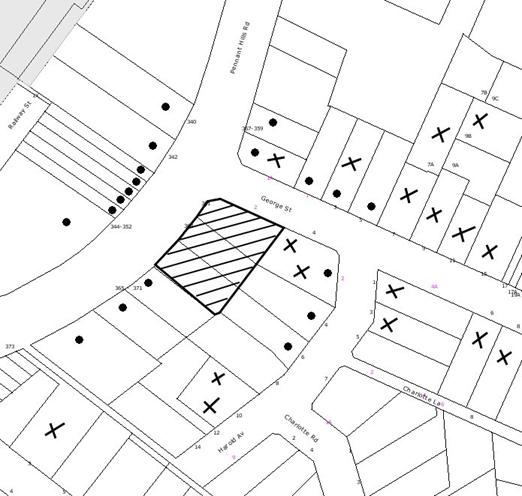
|
NOTIFICATION
PLAN
|
|
|
• PROPERTIES NOTIFIED
|
X SUBMISSIONS
RECEIVED
|
PROPERTY SUBJECT OF DEVELOPMENT
|
|
|
96 SUBMISSIONS RECEIVED OUT OF MAP RANGE
|
|
|
|
|
113 submissions objected to the
development, generally on the following grounds:
· Traffic
volume and distribution.
· Vehicle
Access.
· Service
vehicles.
· Parking
provision.
· Pedestrian
access.
· The
removal of trees.
· Amenity
impacts, including an increase of rubbish/litter on surrounding streets.
· Social
and Economic Impacts.
· Unacceptable
overshadowing of adjoining properties.
· Acoustic
impacts and 24 hour operation.
· Close
proximity to existing McDonald’s
at Thornleigh.
· Impact
of nearby heritage items.
· Increase
in vermin in the area.
· Loss of
property values.
· Increase
in crime in the area and general safety and security issues.
· Odours.
The merits of the matters raised
in community submissions have been addressed in the body of the report with the exception of the following:
5.1.1 TSA submission on behalf of KFC
In addition to resident
submissions, a submission opposing the proposed McDonald’s Restaurant was made
by KFC, supported by a report prepared by Thompson Stanbury Associates (TSA). The TSA rep ort addressed various issues as summarised below.
· Traffic generation:
Ø TSA notes that the RTA recommends a
sensitivity test be undertaken for developments having a generation of 230
vehicles per hour. This test was not carried out.
Ø TSA carried out a traffic generation
survey at Thornleigh McDonald’s on Wednesday 19 January 2011 between 4pm and 7pm in which it surveyed drive through and groups of people walking between
vehicles and the restaurant. A peak traffic generation of 280 vehicle trips
per hour was found. Council officers note that the TSA submission estimated
the peak traffic generation of the Thornleigh restaurant which exceeded the
CBHK assumptions.
Ø Traffic generation is “some 55%
greater than addressed within” the DA and “20% higher” than RTA
sensitivity test.
Ø Delays at the access driveway are likely
to result in traffic queues back onto Pennant Hills Road using the TSA surveyed volumes.
Ø Travel time for emergency vehicles is
likely to increase.
· Internal Circulation
Ø Internal circulation between car park
levels is not possible and requires re-entering George Street.
· Site Servicing
Ø Service vehicle turn paths encroach on
parking spaces, resulting in servicing having to be carried out outside peak
trading periods.
Ø Possibility of service vehicles using
local streets.
· Pedestrians
Ø No independent pedestrian access from George Street is available (T&RS comment –direct pedestrian access is available from Pennant Hills Road).
5.1.2 Littering and potential rodent problem
Submissions received raise
concern that the development would result in public littering and a potential
rodent problem. The proposal would be required to manage waste disposal and
litter control in accordance with Council’s waste management policy. Furthermore, littering and pest control is an operational matter that could be dealt with through
appropriate Council regulatory and compliance measures when the need arises.
5.1.3 Loss of property values
Submissions received raised
concern that property values would be affected by the establishment of a
McDonald’s restaurant on the site.
The loss or otherwise of property
values due to a development proposal is not a matter for consideration in the
assessment of a development application.
5.1.4 Odours
Submissions raised concerns with
the potential for odours to emanate from the site.
The
application has been assessed utilising the Protection of the Environment
Operations Act 1997, and Council’s public health assessment raised no
concerns with the proposal on this ground.
5.2 Public Agencies
The development application was
referred to the following Agencies for comment:
5.2.1 Roads and Traffic Authority
The application was referred to
the RTA pursuant to the provisions of Clause 104 and Schedule 3 of SEPP
(Infrastructure).
The RTA has informed Council that it is currently reviewing the closure of the central median in Pennant Hills Road, thus preventing right turn movements into or out of George Street. To mitigate access issues into this area, improvements to the intersection of Pennant Hills Road and The Crescent would need to be implemented. No indication is given as
to what the improvements might be.
It is noted that any changes to
the intersection of George Street and Pennant Hills Road is the responsibility
of the RTA and no details of any proposal are available at this stage. Until
the RTA can provide traffic modelling showing the consequences of any proposed
changes, George Street should remain open to all traffic movements at its
intersection with Pennant Hills Road to allow adequate access to the precinct
due to the current problems at the alternative access point, The Crescent. The
right turn movement from Pennant Hills Road north bound into The Crescent is
prone to queue back into the through traffic lane on Pennant Hills Road during
weekday AM peak periods and more so on Saturdays when there are sporting events at Pennant Hills Park.
With regard to the proposed
development, the RTA requires the applicant to dedicate as road reserve, a
minimum 3.5m footway for the full frontage of the property. Upon clarifying
the RTA’s advice, it is noted that the RTA is referring to that 3.5 metre wide
strip along Pennant Hills Road on the original Deposited Plan known as Lots 62,
63 and 64. The illustration below highlights the land referred to by the RTA.
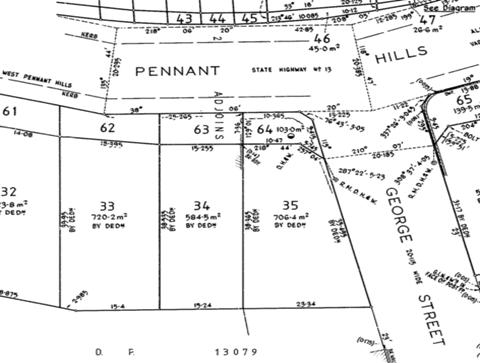
As this land has already been
dedicated as road reserve, no further action is required in respect of the
RTA’s requirement.
The RTA provided the following
advisory comments to Council for consideration in its determination of the DA:
1. Council
will need to be satisfied that vehicles accessing this development will not
create queues out onto Pennant Hills Road. It is noted that queues are already
evident on Pennant Hills Road and the sight distance is compromised by the
alignment of the road.
Having
assessed the results of the TSA traffic surveys the Council’s officers are not
satisfied that traffic accessing the proposed development, KFC and car yard
would not queue back onto Pennant Hills Road.
2. The
location of the driveway may impact on the adjacent businesses. Vehicles
queuing to turn right into this development will block vehicles wishing to exit
the adjacent businesses.
Council’s
officers concur with this comment and considers that this would result in an
unacceptable outcome.
3. To
mitigate some of this impact ‘NO STOPPING’ parking restrictions could be
installed on both sides of George Street from Pennant Hills Road to Harold Street. These restrictions would need to be approved by the local traffic committee
prior to installation.
In
the event that Council approves the development application, Council’s officers
concur with this recommendation.
4. Council
will need to be satisfied that this development will not have an adverse impact
on the local road network
Council’s
officers are not satisfied that this development would not have an adverse
impact on the local road network for the reasons detailed in this report.
a. There
is no internal link between the upper and lower car parks. If there are
insufficient parking spaces, this will force vehicles to exit the property and
use the local road network to turn around to re-enter the property.
Council’s officers concur
with this statement for movement between upper to lower deck only. It is
physically possible for 85 percentile vehicles to circulate from the lower to
upper deck.
The electronic signage may
be of some benefit in assisting visitors locating vacant parking however it may
also cause some visitors to hesitate in the critical areas of George Street or the entry driveway as they try and determine which route to take,
particularly if the numbers are changing when vehicles are preceding the
entering vehicle.
b. Vehicles
that enter the lower car park and do not find parking cannot access the drive
through facility without exiting the site, (painted pavement arrows force vehicles to turn left and exit the site).
The
revised car park circulation plans submitted (Plan Nos. A001 (Rev C) and A002
(Rev C), dated 14 March 2011) show right turn arrows allowing movement from
lower to upper deck and upper deck to lower deck. The turning paths do not
confirm that a 99 percentile vehicle can perform the u-turn from the upper to
lower ramp at this critical location.
c. No
long parking spaces have been provided to cater for cars towing trailers or boats, which would be expected as this is the first McDonald’s restaurant for vehicles heading south from the F3.
Council’s
officers concur with this comment.
5. The
delivery vehicle is required to encroach on some parking spaces to access the
loading dock, therefore, deliveries will need to occur outside peak business
periods to reduce this conflict and the likelihood of a manoeuvring vehicle
causing queues.
In
the event that Council approves the development application, Council’s officers
concur with this recommendation.
6. Detailed
design plans and hydraulic calculations of any changes to the stormwater drainage system are to be submitted to the RTA for approval, prior to the commencement
of any works.
In
the event that Council approves the development application, Council’s officers
concur with this recommendation.
7. Any
redundant driveways shall be removed and replaced with kerb and gutter to match
existing.
In
the event that Council approves the development application, Council’s officers
concur with this recommendation.
8. A
Construction Traffic Management Plan detailing construction vehicle routes,
number of trucks, hours of operation, access arrangements and traffic control
should be submitted to council prior to the issue of a construction
certificate.
In
the event that Council approves the development application, Council’s officers
concur with this recommendation.
9. If
not already in place, full time ‘No Stopping’ parking restrictions are to be
implemented along the full Pennant Hills Road frontage of the development site.
This restriction should be implemented prior to the commencement of any
demolition works relating to the proposed development. Prior to the installation of the parking restrictions the applicant is to contact the RTA’s Traffic
Management Services on Ph: (02) 8849 2294 for a works instruction.
In
the event that Council approves the development application, Council’s officers
concur with this recommendation.
10. Council
should ensure that post development storm water discharge from the subject site
into the RTA drainage system does not exceed the pre-development discharge.
In
the event that Council approves the development application, Council’s officers
concur with this recommendation.
11. The
developer shall be responsible for all public utility adjustment/relocation works necessitated by the above work and as required by the various public utility authorities and/or their agents.
In
the event that Council approves the development application, Council’s officers
concur with this recommendation.
12. Car
parking provision is to be to Council’s satisfaction.
For the reasons detailed in this report, Council’s officers are not satisfied with the car
parking provision.
13. The
layout of the proposed car parking areas associated with the subject
development (including, driveways, grades, turn paths, sight distance
requirements, aisle widths, aisle lengths, and parking bay dimensions) should
be in accordance with AS 2890.1 – 2004 and AS 2890.2 – 2002 for heavy vehicle usage.
In
the event that Council approves the development application, Council’s officers
concur with this recommendation.
14. All
vehicles are to enter and leave the site in a forward direction.
In the event that Council
approves the development application, Council’s officers concur with this
recommendation.
15. The
proposed turning areas are to be kept clear of any obstacles, including parked
cars, at all times.
In
the event that Council approves the development application, Council’s officers
concur with this recommendation.
16. All
vehicles are to be wholly contained on site before being required to stop.
In
the event that Council approves the development application, Council’s officers
concur with this recommendation.
17. Any
proposed landscaping and/or fencing must not restrict sight distance to
pedestrians and cyclists travelling along the footpath of George Street.
In the event
that Council approves the development application, Council’s officers concur
with this recommendation.
5.2.2 NSW Police
The
application was referred to the NSW Police in accordance with the requirements
of the RTA ‘Guide to traffic generating development’. At the time of
writing this report, no response has been received from the Police.
6. THE PUBLIC INTEREST
Section 79C(1)(e) of the Act
requires Council to consider “the public interest”.
The public interest is an
overarching requirement, which includes the consideration of the matters
discussed in this report. Implicit to the public interest is the achievement
of future built outcomes adequately responding to and respecting the future
desired outcomes expressed in environmental planning instruments and
development control plans.
In Double Bay Marina Pty Ltd v
Woollahra Council [2009] NSWLEC 1001, the Commissioner suggested a
relatively new planning principal: discerning the public interest in development
applications. The Commissioner noted that consideration of the public interest
ought to be broken into three steps:
1. Defining the public whose interest is being invoked.
2. Defining the benefit towards which a proposal claims to
make a contribution (or from which it is claimed to detract).
3. Making explicit the weight given to the public interest
relative to other considerations.
It could be argued that there is
a public benefit for the establishment of the development by way of providing
customers the convenience of a McDonald’s outlet on the southbound side when
travelling on the National Highway network and providing jobs for young people
in the local community. In addition, the development could improve
competition, as there is an existing fast food outlet on the adjacent corner.
Submissions raised concerns that
the proposed development could result in a proliferation of rubbish and vermin
in the surrounding streets, noise and odour impacts which would be to the
public detriment. However, there is no indication that the proposed
development would result in these impacts.
However, as previously stated the
proposed development would have detrimental traffic and parking impacts which
have not been addressed as part of the application. In this regard, the public
dis-benefit of the development is grounds for the refusal of the application.
The proposed development would
provide private benefit to owners/shareholders in the company.
Similar to the public dis-benefit
of the development, it could be argued that there is an indirect private
dis-benefit of the development by way of immediate neighbours experiencing
increased traffic in local residential streets and parking and access impacts
directly affecting their property as a result of the proposal.
Having regard to the above, the
application is not considered to have satisfactorily addressed Council’s and
the relevant agencies’ criteria and would provide a development outcome that,
on balance, would not result in a positive impact for the community. Accordingly, it is considered that refusal of the proposed development would be in the public
interest.
CONCLUSION
The application proposes the
demolition of existing structures and erection of a new McDonald’s restaurant
with basement car parking and drive-thru facility, associated landscape works
and erection of twenty-three signs.
The proposed development is
consistent with the objectives of the Business B (Special) zone and generally
complies with the control elements of the Business Lands Development Control
Plan, the Pennant Hills Commercial Centre Development Control Plan, the Car
Parking Development Control Plan and the Outdoor Advertising Development
Control Plan.
However it is considered that the
site is not suitable for the development having regard to the likely traffic
generated by the development, the constraints on the local road network and the lack of availability of overflow on and off-street car parking.
Council received 38 submissions
during the public notification period, with a further 75 submissions received
prior to the preparation of this report and having regard to the circumstances
of the case, refusal of the application is recommended.
Note: At the time of the completion of this planning report, no persons have made a Political Donations Disclosure Statement pursuant to Section
147 of the Environmental Planning and Assessment Act 1979 in respect of the
subject planning application.
|
Rod Pickles
Manager -
Assessment Team 2
Planning Division
|
Scott Phillips
Executive Manager
Planning Division
|
Attachments:
|
1.View
|
Locality Plan
|
|
2.View
|
Site Plans
|
|
3.View
|
Floor Plans,
Elevations and Sections
|
|
4.View
|
Signage Plans
|
|
5.View
|
Landscape Plans
|
|
6.View
|
Shadow Diagrams
|
File Reference: DA/1427/2010
Document Number: D01608033
SCHEDULE 1
1. Pursuant
to the provisions of Section 79C(1)(b), it is considered that the development
fails to demonstrate that it:
a. Would
not result in unacceptable queuing of vehicles on Pennant Hills Road seeking to
enter the site.
b. Would
not result in unacceptable traffic generation on George Street within the
vicinity of Pennant Hills Road having regard to the number of vehicles entering
and exiting George Street.
c. Would
not result in unacceptable impacts on the amenity of the residential
neighbourhood as a result of larger vehicles and vehicles with trailers being
required to park on the street in order to visit the site.
d. Would
not result in unacceptable impacts on the amenity of the residential
neighbourhood as a result of staff being required to park cars on the street at
night and on weekends.
e. Provides
efficient internal circulation of vehicles.
f. Would
not result in a conflict between on-site car parking spaces and manoeuvring
areas for delivery vehicles.
2. Pursuant
to the provisions of Section 79C(1)(c), it is considered that the site is not
suitable for the development having regard to the likely traffic generated by
the development, the constraints on the local road network and the lack of
availability of overflow on-street car parking.
3. Pursuant
to the provisions of Section 79C(1)(d), it is considered that the development
fails to overcome the concerns raised by the Roads and Traffic Authority in
respect of the impact of the development on the national highway network and
the relevant concerns made by, or on behalf of neighbouring businesses and the
community in respect of the impact of the development on the local road
network.
-
END OF REASONS FOR REFUSAL -
Planning Report No. PLN35/11
Date of Meeting:
6/04/2011
6 DEVELOPMENT APPLICATION
- SUBDIVISION OF TWO LOTS INTO FOUR
39 AND 41 BEECROFT ROAD BEECROFT
|
Development Application No:
|
DA/1298/2010
|
|
Description of Proposal:
|
Subdivision of two lots into
four.
|
|
Property Description:
|
Lot 12 DP 20759 and Lot 13 DP 20759, Nos. 39 and 41 Beecroft Road, Beecroft
|
|
Applicant:
|
P S Graham & Associates
|
|
Owner:
|
Estate Late Mrs S Porter and Mr V Odhavj and Mrs S
Odhavj
|
|
Statutory Provisions:
|
Hornsby Shire Local Environmental
Plan 1994
Residential AS (Low Density –
Sensitive Lands) Zone
|
|
Estimated Value:
|
Nil
|
|
Ward:
|
C
|
|
RECOMMENDATION
THAT Development Application
No. 1298/2010 for the subdivision of two lots into four at Lot 12 DP 20759
and Lot 13 DP 20759, Nos. 39 and 41 Beecroft Road Beecroft be refused for the
reasons detailed in Schedule 1 of this report.
|
1. The
application proposes the subdivision of two lots into four.
2. The
proposal complies with the provisions of the Hornsby Shire Local Environmental
Plan 1994. The proposal does not comply with the Residential Subdivision
Development Control Plan requirements for lot size, private open space,
accessway design and drainage control.
3. Seven
submissions have been received in respect of the application.
4. It
is recommended that the application be refused.
THE SITE
The site comprises two existing
allotments each with a dwelling house having frontage to the eastern side of Beecroft Road, which is a four lane RTA classified road.
The site has an area of 3,064m2
with a diagonal frontage of 41.65m, northern boundary 81.54m, southern boundary
70.765m and rear boundary 40.23m. The site has an average fall of 14% to the
rear boundary. A number of locally indigenous trees are located at the rear of
the site which form part of an area identified as Blue Gum High Forest.
The two existing dwelling houses
are single storey with lower ground floor areas including garaging at the rear.
The houses are post-war construction in brick and tile.
The site is located within the
Beecroft-Cheltenham Heritage Conservation Area. There are no items of heritage
in the vicinity of the site other than a house and garden at No. 45 Beecroft Road on the corner with Albert Road.
The surrounding area is
characterised by single and two storey dwelling houses on relatively large lots
containing large indigenous trees. The site adjoins the rear of properties with
frontage to Wongala Crescent which is a ‘No Through Road’ at a small
watercourse and deep gully 90m north east of the site. The area within the road
reserve and gully includes Blue Gum High Forest. The small watercourse flows
through a culvert under the rail corridor and forms a tributary of Byles
Creek.
The Main Northern Rail Corridor
is located 85m east of the site. Beecroft Railway Station and shops are located
650m south of the site.
THE PROPOSAL
The proposal is for the
subdivision of two lots into four with the existing dwelling houses being
retained on the proposed two front lots. A central accessway is proposed to
the two rear lots.
Proposed Lot 1 has an area of
848m2 (excl. ROC) with dimensions 22.205m frontage, 48.88m northern
boundary, 43.15m southern boundary and 20.115m rear boundary. The lot includes
the existing dwelling house No. 39 Beecroft Road. The lot has an average fall
of 8% to the rear boundary.
Proposed Lot 2 has an area of
756m2 (excl. ROC) with dimensions 19.45m frontage, 43.15m northern
boundary, 42.085m southern boundary and 20.31m rear boundary. The lot includes
the existing dwelling house No. 41 Beecroft Road. The lot has an average fall
of 7% to the rear boundary.
Proposed Lot 3 has an area of
601m2 (excl. ROC) with dimensions 20.115m western boundary, 32.66m
northern boundary, 32.71m southern boundary and 18.375m rear boundary. A 1m
wide stormwater drainage easement is proposed along the northern and southern
boundary. The lot has an average fall of 22% to the rear boundary. Tree No. 22A
on adjoining land is identified as significant.
Proposed Lot 4 has an area of
601m2 (excl. ROC) with dimensions 20.31m western boundary, 32.71m
northern boundary, 28.68m southern boundary and 21.855m rear boundary. A 1m
wide drainage easement is proposed along the northern boundary. The lot has an
average fall of 27% to the rear boundary. The lot includes significant trees
Nos. 15 and 16.
The proposed central accessway
provides vehicular access to existing lower ground floor garages located at the
rear of the two existing dwellings. The accessway includes a common turning
area.
The proposal requires the
creation of a drainage easement over the adjoining property for connection to
an existing stormwater drainage line which flows to the small watercourse north
east of the site.
ASSESSMENT
The development application has
been assessed having regard to the ‘Metropolitan Plan for Sydney 2036’,
the ‘North Subregion (Draft) Subregional Strategy’ and the matters for
consideration prescribed under Section 79C of the Environmental Planning and
Assessment Act 1979 (the Act). Subsequently, the following issues have
been identified for further consideration.
1. STRATEGIC CONTEXT
1.1 Metropolitan Plan for Sydney 2036 and (Draft) North
Subregional Strategy
The Metropolitan Plan for Sydney 2036 is a broad framework to secure Sydney’s place in the global economy by
promoting and managing growth. It outlines a vision for Sydney to 2036; the
challenges faced, and the directions to follow to address these challenges and
achieve the vision. The Draft North Subregional Strategy acts as a
framework for Council in its preparation of the Comprehensive LEP by the
end of 2011.
The Draft North Subregional
Strategy sets the following targets for the Hornsby LGA by 2031:
· Employment capacity to
increase by 9,000 jobs; and
· Housing stock to
increase by 11,000 dwellings.
The proposed development would be
consistent with the draft Strategy by providing additional housing opportunities
and would contribute towards housing choice in the locality.
The proposed development would be
consistent with the Metropolitan Plan for Sydney 2036.
2. STATUTORY CONTROLS
Section 79C(1)(a) requires
Council to consider “any relevant environmental planning instruments, draft
environmental planning instruments, development control plans, planning
agreements and regulations”.
2.1 Hornsby Shire Local Environmental Plan 1994
The subject land is zoned Residential AS (Low Density –
Sensitive Lands) under the Hornsby Local Environmental Plan 1994 (HSLEP). The
objectives of the zone are:
(a) to provide for the housing needs of the population of the
Hornsby area.
(b) to promote a variety of housing types and other land uses
compatible with a low density residential environment and sensitive to the land
capability and established character of this environment.
(c) to provide for development that is within the
environmental capacity of a sensitive low density residential environment.
The proposed development is
defined as ‘subdivision’ under the HSLEP and is permissible in the zone with
Council’s consent.
Clause 14 of the HSLEP prescribes
that a minimum lot area of 600m2 applies for subdivision within the
zone. The proposed lots comply with this requirement.
Clause 15 of the HSLEP prescribes
that the maximum floor space ratio (FSR) of development within the zone is
0.4:1. The existing dwellings on the proposed lots comply with this
requirement.
Clause 18 of the HSLEP sets out
heritage conservation provisions within the Hornsby area. The applicant
submitted a Heritage Impact Assessment concerning the proposed subdivision
within the Beecroft Cheltenham Heritage Conservation Area. This matter is
further addressed in subsequent sections of this report.
2.2 State Environmental Planning Policy – Sydney REP (Sydney Harbour Catchment) 2005
The application has been assessed
against the requirements of the Sydney REP which includes planning principles
applicable to the site within the upper part of the catchment. The principles
incorporate measures to protect water quality, to minimise urban runoff,
conserve water and to ensure the catchment watercourses, wetlands, riparian
lands and remnant vegetation are protected.
The proposed subdivision would
not adversely impact on downstream water quality subject to appropriate
conditions for stormwater detention.
2.3 Threatened
Species Conservation Act 1995
The site includes trees
identified and mapped as Blue Gum High Forest a critically endangered
ecological community under Schedule 1A of the Act.
Council officers assessment,
which included an inspection of the site concluded that the proposal is
unlikely to have a significant impact on the endangered ecological community.
This matter is further addressed
in Section 3.1 of this report.
2.4 Residential Subdivision Development Control Plan
The proposed development has been
assessed having regard to the relevant performance and prescriptive design
standards within Council’s Residential Subdivision Development Control Plan
(Residential Subdivision DCP). The following table sets out the proposal’s
compliance with the prescriptive standards of the Plan:
|
Residential
Subdivision Development Control Plan
|
|
Control
|
Proposal
|
Requirement
|
Compliance
|
|
Lot Size
|
Lot 1 – 958m2
Lot 2 – 856m2
Lot 3 – 628m2
Lot 4 – 622m2
|
600m2
600m2
672m2
702m2
|
Yes
Yes
No
No
|
|
Floor Space ratio
|
Lot 1 – 0.23:1
Lot 2 – 0.27:1
|
0.4:1
|
Yes
|
|
Car parking
|
Lot 1 – 2 spaces
Lot 2 – 2 spaces
|
2 spaces
|
Yes
|
|
Private Open Space
|
Lot 1 - 350m2
Lot 2 – 270m2
Lot 3 – 186m2
Lot 4 – 215m2
|
120m2
|
Yes
|
|
Rear Setback
|
Lot 1 – 7.8m
Lot 2 - 3m
|
3m
|
Yes
|
As detailed in the above table,
the proposed development does not comply with a number of prescriptive
standards within Council’s Residential Subdivision DCP. The matters of non-compliance
are detailed below, as well as a brief discussion on compliance with relevant
performance standards.
2.4.1 Density
Proposed lots 3 & 4 have an
average gradient of 22% and 27% respectively and the DCP identifies that
additional area is required for the proposed lots to achieve compliance with
the density prescriptive measures.
The proposed indicative building
envelopes are lower in elevation to the level of the proposed accessway turning
head. Vehicle access at grade would not be possible to the proposed parking
spaces. The location of the proposed indicative building envelopes is therefore
uncertain in respect to impacts on significant trees, provision of a 200m2
buildable area, vehicle access and parking, as proposed lots 3 & 4 may be
of insufficient size to accommodate future development in compliance with
Council’s development controls.
It is considered the proposed
lots do not comply with the density element objective:
To promote
a low density residential environment and provide for lots of sufficient size
to satisfy user requirements.
2.4.2 Solar Access
The proposed vacant lots would not be disadvantaged by
existing buildings in respect to solar access.
2.4.3 Private Open Space
The proposed private open space
areas meet the prescriptive numeric area requirement, however, are considered
unsatisfactory in respect to performance criteria.
The proposal is for private open
space areas at the frontage of the existing dwelling houses which present
formally in the streetscape. No details have been submitted to demonstrate the
open space areas are readily accessible from the dwelling living areas and have
acceptable privacy in relation to the street frontage and the proposed
accessway. The existing dwelling on proposed lot 2 would have insufficient rear
setback for provision of private open space at the rear of the dwelling. The
existing rear balconies do not have sufficient area to provide for outdoor
activities in accordance with the performance criteria.
The proposed indicative building
envelopes on proposed lots 3 and 4 would allow sufficient areas for private
open space at the rear, however, the proposed driveway turning head is elevated
in relation to the building envelopes and allows virtually no transition in
grade for vehicle access. The proposed location of the building envelopes is
therefore uncertain for the siting of future dwelling houses and the provision
of private open space.
It is considered the proposed
subdivision does not meet the Residential Subdivision DCP private open space
performance criteria, i.e.:
Part of the
private open space should be capable of enabling an extension of the function
of existing and future dwelling houses for relaxation, dining, entertainment,
recreation and children’s play, and be directly accessible from the dwelling
house.
2.4.4 Landscaping
The proposed subdivision as
submitted would not adversely impact on significant trees located along the
rear boundary of the site. Refer also to comments in Section 3.1.
2.4.5 Land Sensitivity
The rear area of the site
includes a number of locally indigenous trees and is identified under Council’s
mapping as Blue Gum High Forest, a critically endangered ecological community
under the Threatened Species Conservation Act 1995.
The proposal would not impact
upon the critically endangered ecological community. Refer also to comments in
Section 3.1.
2.4.6 Drainage Control
The proposed subdivision requires
the granting of a stormwater drainage easement by downstream property owners
for access to an existing stormwater drainage easement. The downstream owners
are objecting to the proposed subdivision.
The application as submitted
included the adjoining owner’s agreement to terms for the granting of an
easement. The adjoining owner has subsequently objected to the proposal and
withdrawn owner’s consent for the easement. The applicant’s solicitor has
advised the agreement is legally binding.
The existing easement provides
connection to Council’s stormwater drainage system at the watercourse north
east of the site. The easement is over No. 37A Beecroft Road and No. 77, No. 79
and No. 81 Wongala Crescent. Details of the hydraulic capacity of the existing
drainage line have not been submitted to Council. The consent of the owners of
Nos. 77, 79 and 81 Wongala Crescent also has not been obtained for the proposed
easement connection. The required details were requested by Council letter
dated 25 November 2010.
Consequently, Council officers
have not been able to determine the adequacy of the existing drainage line for
the proposed subdivision, the potential impacts should upgrading of the
existing drainage line be required and the impacts on downstream properties and
the existing watercourse.
The proposed subdivision is
therefore uncertain in respect to the drainage control element objective of the
Residential Subdivision DCP, i.e.:
To control
the flow of water into the natural drainage system and mitigate impacts from
stormwater runoff.
2.4.7 Accessway Design
The proposed accessway is 6m wide
for a length of 6m at the frontage and complies with Council’s and the Roads
and Traffic Authority’s (RTA) design specification for sites fronting a busy
road. The two existing vehicle crossings would be replaced with a single
crossing and reinstated with kerb and gutter.
The proposed accessway between
the two existing dwellings is satisfactory in respect to amenity of the two
existing dwellings, provision for visitor car parking and design to avoid
lengthy straight sections.
The two existing dwelling houses include
lower ground floor garages located at the rear of the respective dwellings.
Details of height clearance and turning area provisions, in compliance with AS
2890.1, have not been submitted to Council.
The proposed vehicular turning
area within proposed Lots 2, 3 and 4 is elevated in relation to the proposed
indicative building envelopes and car parking spaces on Lot 3 and Lot 4. Details of the gradient for vehicle access to the indicative building envelopes has
not been submitted to Council. The proposed subdivision is uncertain in respect
to future vehicular access, car parking provision and buildable area for Lot 3
and Lot 4 due to the difference in levels.
The proposed subdivision does not
meet the accessway design element objective of the Residential Subdivision DCP,
i.e.:
To ensure
vehicular access to all lots within the subdivision is simple, safe, direct and
creates a pleasant environment.
2.5 Dwelling House Development Control Plan
The Plan is applicable to the two
existing dwellings on the proposed lots at the frontage of the site.
The proposal would result in
non-compliance with the Plan in respect to private open space and vehicle
access which are subject to the same consideration pursuant to the Residential
Subdivision DCP. Refer to discussion in Section 2.4.3 and Section 2.4.7.
2.6 Byles Creek Development Control Plan
The site is located within the
catchment of Byles Creek.
The Plan is to protect the
amenity, water quality and scenic quality of Byles Creek. The proposed
development is inconsistent with the element objectives of the Plan in respect
to drainage control. Refer also to comments in Section 2.4.7.
2.7 Heritage Development Control Plan
The site is located within the
Beecroft-Cheltenham Heritage Conservation Area. There are no items of heritage
significance located in the vicinity of the site other than a house and garden
at No. 45 Beecroft Road.
The proposed subdivision retains
the two existing dwelling houses and avoids duplication of driveways in the streetscape.
The significant indigenous trees on the site contribute to the significance of
the heritage conservation area are proposed for retention. Replacement tree
planting is recommended to maintain the tree canopy. Refer also to comments in
Section 3.1.
The proposal is therefore
acceptable in respect to the significance of the Beecroft-Cheltenham Heritage
Conservation Area.
3. ENVIRONMENTAL IMPACTS
Section 79C(1)(b) of the Act
requires Council to consider “the likely impacts of that development, including
environmental impacts on both the natural and built environments, and social
and economic impacts in the locality”.
3.1 Natural Environment
The existing trees at the rear of
the site are located within Council’s mapped area of Blue Gum High Forest, a critically endangered ecological community. The proposed development seeks to
retain the existing trees identified as Blue Gum High Forest species and would
be unlikely to have a significantly impact on the ecological community.
The proposal would necessitate
the removal of 17 trees from the site. None of the trees to be removed are
identified as significant and mainly involve exotic species. The application
has been supported by an arborist report which identified Trees Nos. 15 &
16 as significant trees and subject to a recommended setback of 8 metres. The
proposed indicative building envelope on Lot 4 is partially within the
recommended setback of Tree No. 15.
Council’s assessment of the
proposal included a detailed examination of the existing trees on site. The
assessment recommended tree protection measures for Trees Nos. 14, 15, 16 and
No. 22A (on adjoining land) and the planting of 8 replacement trees to maintain
the tree canopy.
The location of the proposed
indicative building envelope on Lot 4 is uncertain in respect to future access,
car parking provision and buildable area. The potential impact on significant
Tree No. 15 is unable to be determined.
3.2 Built Environment
The proposed development would
maintain the existing streetscape.
3.3 Social Impacts
The proposal would not result in
social impact.
3.4 Economic Impacts
The proposal would have a minor
positive impact on the local economy in conjunction with other new low density
residential development in the locality by generating an increase in demand for
local services.
4. SITE SUITABILITY
Section 79C(1)(c) of the Act
requires Council to consider “the suitability of the site for the
development”.
The proposed subdivision would be
unlikely to have a significant effect on Blue Gum High Forest on the site.
5. PUBLIC PARTICIPATION
Section 79C(1)(d) of the Act
requires Council to consider “any submissions made in accordance with this
Act”.
5.1 Community Consultation
The proposed development was
placed on public exhibition and was notified to adjoining and nearby landowners
between 20 October and 17 November 2010 in accordance with Council’s
Notification and Exhibition Development Control Plan. During this period,
Council received seven submissions. The map below illustrates the location of
those nearby landowners who made a submission that are in close proximity to
the development site.
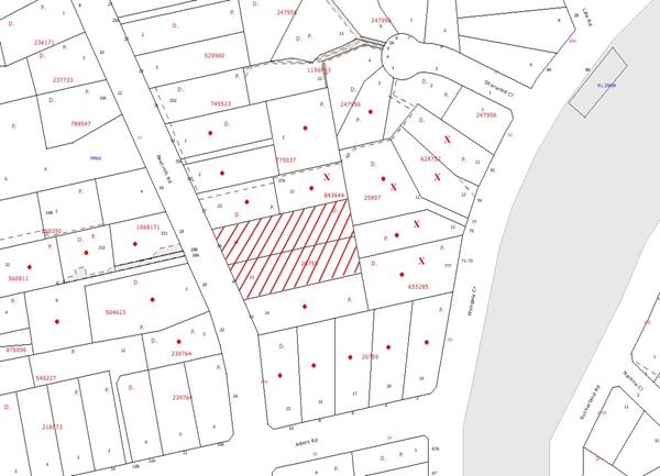
|
NOTIFICATION
PLAN
|
|
|
• PROPERTIES NOTIFIED
|
X SUBMISSIONS
RECEIVED
|
PROPERTY SUBJECT OF DEVELOPMENT
|
|
|
1 SUBMISSION RECEIVED
OUT OF MAP RANGE
|
|
|
|
|
Seven submissions objected to the
development, generally on the following grounds:
· Insufficient
capacity of existing stormwater drainage line;
· Owner’s
consent for stormwater drainage easement withdrawn;
· Loss
of trees and visual amenity;
· Privacy
and overshadowing;
· Non-compliance
with open space requirement;
· Erosion
of watercourse from increased flows;
· Traffic
safety on Beecroft Road;
· Heritage
impact from tree loss.
The merits of the matters raised
in community submissions have been addressed in the body of the report.
5.2 Public Agencies
The development application was
referred to the RTA for comment in respect to the proposed works within Beecroft Road.
The RTA granted concurrence to
the proposal pursuant to Section 138 of the Roads Act 1993 subject to
conditions and Council approval of the proposed development.
6. THE PUBLIC INTEREST
Section 79C(1)(e) of the Act
requires Council to consider “the public interest”.
The public interest is an
overarching requirement, which includes the consideration of the matters
discussed in this report. Implicit to the public interest is the achievement
of future built outcomes adequately responding to and respecting the future
desired outcomes expressed in environmental planning instruments and
development control plans.
The application fails to address
Council’s criteria for residential subdivision within the Residential AS (Low
Density – Sensitive Lands) Zone and would not be in the public interest.
CONCLUSION
The proposal is for subdivision
of two lots into four with the existing dwelling houses being retained.
The proposed lots at the rear of
the existing dwellings are insufficient in area to accommodate low density
residential development in compliance with Council’s development controls.
Access to the proposed indicative building envelopes and car parking spaces
would not be possible due to the gradient difference with the proposed
accessway turning area. Impacts of future residential development on significant
trees and the amenity of neighbouring residents is therefore uncertain.
The proposal does not demonstrate
that the private open space areas at the frontage are readily accessible from
the dwelling’s living areas and have acceptable privacy in relation to the
street frontage and the proposed accessway. There is insufficient rear setback
for provision of private open space at the rear of the dwelling on proposed Lot 2. The existing dwelling’s rear balconies do not have sufficient area.
The proposal relies on downstream
owner’s consent for access to an existing stormwater drainage easement. The
downstream owners are objecting to the proposal. Council officers have been
unable to determine the adequacy of the existing drainage line for the proposed
subdivision, the potential impacts should upgrading of the existing drainage
line be required and the impacts on downstream properties and the existing
watercourse.
The proposal does not comply with
the Residential Subdivision DCP requirements in respect to density, private
open space, accessway design and drainage control.
It is recommended that Council
refuse the application.
|
Rod Pickles
Manager -
Assessment Team 2
Planning Division
|
Paul David
Manager -
Subdivision & Development Engineering Services
Planning Division
|
|
Scott Phillips
Executive Manager
Planning Division
|
|
Attachments:
|
1.View
|
Locality Plan
|
|
|
|
2.View
|
Subdivision Plan
|
|
|
|
3.View
|
Tree Plan
|
|
|
File Reference: DA/1298/2010
Document Number: D01627432
SCHEDULE 1
1. The proposal is unsatisfactory in respect to Section
79C(1)(a)(iii) of the Environmental Planning and Assessment Act, 1979, as the
proposal does not comply with the Residential Subdivision Development Control
Plan as follows:
1.1 The proposal does not comply with the allotment density
prescriptive measure for a larger lot size on steeply sloping sites.
1.2 The proposal does not comply with the private open space
performance criteria.
1.3 The proposal does not meet the drainage control element
objective.
1.4 The proposal does not meet the accessway design element
objective.
2. The proposal is unsatisfactory in respect to Section
79(1)(e) of the Environmental Planning and Assessment Act, 1979, as the
proposal is not in the public interest.
-
END OF REASONS FOR REFUSAL -
Standard Report No. PLN33/11
Planning Division
Date of Meeting:
6/04/2011
7 TOWNHOUSE PLANNING
PROPOSAL - DEVELOPMENT CONTROL PLAN AMENDMENTS
EXECUTIVE SUMMARY
In July 2010, Council resolved to
prepare a Townhouse Planning Proposal to rezone certain precincts in Mount Colah, Asquith and Hornsby to permit townhouses. The Proposal was placed on
public exhibition from 23 September 2010 to 22 October 2010. At its meeting on
2 February 2011, Council considered a report on submissions and resolved (in
part) to forward the Townhouse Planning Proposal to the Department of
Planning (DOP) for gazettal and that supplementary draft development control
plan (DCP) amendments be prepared and reported
to Council for adoption for exhibition.
This report presents draft
amendments to the existing Medium Density Multi-Unit Housing DCP to
supplement the rezonings proposed as part of the Townhouse Planning
Proposal. It is recommended that Council endorse the draft DCP amendments
attached to this report for public exhibition.
PURPOSE
The purpose of this report is to
present draft amendments to the Medium Density Multi-Unit Housing DCP to supplement the rezonings proposed as part of the Townhouse Planning
Proposal.
BACKGROUND
In July 2010,
Council resolved to prepare a Townhouse Planning Proposal to assist meet
Council’s dwelling obligations under the Metropolitan Strategy. The Townhouse
Planning Proposal was forwarded to the DOP in July 2010 seeking a Gateway
Determination to permit exhibition. The Gateway Determination was received in
August indicating that the Proposal could be exhibited. Accordingly,
the Townhouse Planning Proposal was placed on public exhibition from 23
September 2010 to 22 October 2010.
At its meeting on 2 February
2011, Council considered Executive Manager’s Report No. PLN16/11 presenting a
report on submissions received in response to the exhibition. Council resolved
that:
1. Council forward the Townhouse Planning Proposal attached to
Executive Manager’s Report No. PLN16/11 to the Minister for Planning for
gazettal pursuant to Sections 58 and 59 of the Environmental Planning and
Assessment Act 1979, as amended by the following requirements:
a. Delete the proposed
boundary extension for the Mount Colah Commercial Centre Housing Strategy precinct; and
b. Include a section of
road reserve at the frontage of property Nos. 396-398 Pacific Highway, Hornsby
in the Mildred Street, Hornsby townhouse precinct.
2. Draft amendments to the Medium
Density Multi-Unit Housing Development Control Plan including key
principles diagrams identifying local traffic improvements be prepared and
presented to Council for adoption for the purpose of exhibition.
3. Council write to the Department of Planning requesting
a response to Council's letter of 21 October
2010 seeking clarification of the implications of the advice from the
Rural Fire Service advising that it now objects to the inclusion of
precincts in Mount Colah and Berowra in the Housing Strategy.
4. Submitters be advised of Council’s resolution.
In accordance with part 1 of
Council’s resolution, the Planning Proposal has been forwarded to the
DOP for gazettal. In accordance with part 3, a letter was sent to the
Department concerning advice from the Rural Fire Service on the progression of
the Housing Strategy. A response has been received advising that
the Department intends to recommend that the Minister defer the inclusion of
the Mount Colah and Berowra precincts from the Housing Strategy
Planning Proposal. This report presents draft DCP amendments to supplement
the Townhouse Planning Proposal in accordance with part 2 of
Council’s resolution.
DISCUSSION
This report presents draft
amendments to the Medium Density Multi-Unit Housing DCP including key
principles diagrams identifying local traffic improvements for precincts
proposed to be rezoned for townhouse development.
Draft Development Control Plan
Amendments
Council’s existing Medium
Density Multi-Unit Housing DCP will apply to the precincts proposed to be
rezoned in the Townhouse Planning Proposal. The existing DCP contains
elements outlining density, setbacks, height, open space, design, landscaping
and car parking requirements which would assist control the scale and density
of future townhouse development within the precincts. New key principles
diagrams have been prepared to supplement the existing controls and should be
inserted within the DCP in the “Housing Strategy – Precinct Masterplans”
element. The key principles diagrams have been prepared by an urban design
consultant and include local traffic improvements recommended by the RTA and
Council’s Traffic and Road Safety Branch. The key principles diagrams include
draft controls for each precinct as outlined below.
Pacific Highway
(north), Mount Colah and Asquith
This precinct spans both sides of
the Pacific Highway, with the southern portion located in Asquith and the
northern portion located in Mount Colah. The key principles diagram identifies
heritage items and large groups of vegetation which should retained. The
diagram identifies that a signalised pedestrian crossing should be installed between
Rupert Street and Mills Avenue, along with a continuous footpath along the
eastern side of the Pacific Highway.
Old Berowra Road, Hornsby
This precinct is located between
Asquith Bowling Club, Old Berowra Road and Pacific Highway, Hornsby. The key
principles diagram identifies large groups of vegetation for retention and a
new median on the Pacific Highway at the intersection with Old Berowra Road to
limit traffic movements to left in, left out of Old Berowra Road.
Mildred Avenue,
Hornsby
This precinct is bounded by Mildred Avenue, Citrus Avenue and the Pacific Highway. The key principles diagram identifies
existing townhouse developments (including a retirement village) which are
unlikely to be redeveloped, heritage items and large groups of vegetation which
should be retained. The diagram identifies that a speed platform and pedestrian
refuge should be installed near Mildred Avenue Park and the intersection of Mildred Avenue and Jersey Street North.
A copy of the draft amendments to
the Medium Density Multi-Unit Housing DCP are attached to this report.
STATUTORY CONSIDERATIONS
Should Council endorse the draft
amendments to the Medium Density Multi-Unit Housing DCP, the draft DCP
amendments are required to be exhibited for a minimum period of 28 days for
public comment. Following the exhibition, an assessment of submissions would be
undertaken and a further report prepared detailing any recommended amendments
to the draft DCP amendments. The draft DCP amendments can then be finalised
and adopted. The draft DCP amendments would come into effect on the date of
publication of a notice in local newspapers following gazettal of the Townhouse
Planning Proposal.
CONSULTATION STRATEGY
The draft amendments to the Medium
Density Multi-Unit Housing DCP should be exhibited for a minimum period of
28 days. The exhibition of the draft DCP amendments would include the
following:
Advertisements in Local
Newspapers
An advertisement would be placed in the Hornsby Advocate on two occasions
during the exhibition period. The advertisement would identify the purpose of
the draft DCP amendments and where they can be viewed.
Advertisement on the Council Website
The draft DCP amendments would be exhibited on the Council website (www.hornsby.nsw.gov.au) under “On Exhibition –
Town Planning”. Council’s libraries have access to the website.
Letters to submitters
Letters would be sent to persons
who made a submission on the Townhouse Planning Proposal, advising of
the exhibition of the draft DCP amendments and inviting submissions.
Displays at the Council Administration Building, Community Centre and Local Libraries
The draft DCP amendments would be displayed at the Council Administration
Centre, 296 Pacific Highway, Hornsby and at Hornsby library.
Referrals to Statutory Authorities
Notification letters and a copy of the draft DCP amendments would be sent to
the following statutory authorities advising of the exhibition of the draft DCP
amendments and inviting submissions.
· Department of Education
and Training
· Department of
Environment, Climate Change and Water
· Department of Housing
· Energy Australia
· NSW Rural Fire Service
· NSW Transport and
Infrastructure
· Roads and Traffic
Authority
Referrals to other Divisions/Branches
A copy of the draft DCP amendments would be forwarded to the following
Divisions/Branches of Council for comment.
· Environment Division
· Works Division
Review of Consultation Strategy
Where submissions warrant, the consultation strategy may be reviewed to extend
the exhibition period and/or the methods of consultation. This may occur where
a submission provides reasonable justification for a request for an extension
to the exhibition period or where Council is of the opinion an amendment to the
consultation strategy would facilitate greater feedback on the draft DCP.
Following the exhibition period, a report on submissions would be presented to
Council for its consideration.
TRIPLE BOTTOM LINE SUMMARY
Triple Bottom Line (TBL) is a framework for improving Council decisions by ensuring accountability and transparency
on social, environmental and economic factors. It does this be reporting upon
Council’s strategic themes. A Triple Bottom Line summary was provided in
respect of the Townhouse Planning Proposal in Executive Manager’s Report
No. PLN16/11 considered by Council on 2 February 2011.
CONCLUSION
The Townhouse Planning
Proposal has been exhibited and forwarded to the DOP for gazettal to rezone
certain land in Mount Colah, Hornsby and Asquith to allow townhouse
development. Associated draft DCP amendments have been prepared and are
attached to this report. It is recommended that Council endorse the draft DCP
amendments for public exhibition.
RECOMMENDATION
|
THAT:
1. Council endorse for public exhibition the draft
amendments to the Medium Density Multi-Unit Housing Development Control
Plan attached to Executive Manager’s Report No. PLN33/11.
2. Public exhibition of the draft Medium Density
Multi-Unit Housing Development Control Plan amendments be undertaken for
a minimum of 28 days in accordance with the consultation strategy contained
in Executive Manager’s Report No. PLN33/11.
3. Following the
exhibition, a report on submissions be presented to Council.
|
|
James Farrington
Manager - Town
Planning Services
Planning Division
|
Scott Phillips
Executive Manager
Planning Division
|
Attachments:
|
1.View
|
Draft Medium
Density Multi-Unit Housing DCP Amendments
|
File Reference: F2010/00389
Document Number: D01624613
Standard Report No. PLN34/11
Planning Division
Date of Meeting:
6/04/2011
8 BROOKLYN DCP
AMENDMENTS - KANGAROO POINT - AFTER EXHIBITION
EXECUTIVE SUMMARY
In October
2010, the Kangaroo Point Planning Proposal was forwarded to the Department of
Planning (DOP) for gazettal to permit the construction of a commuter berthing
facility at Kangaroo Point, Pacific Highway, Brooklyn. In December 2010, Hornsby
Shire Local Environmental Plan (HSLEP) 1994 (Amendment No. 100) was
gazetted.
The Planning Proposal does not
limit the size or intensity of any future commuter berthing facility. Accordingly,
Council resolved to prepare amendments to the Brooklyn Development Control
Plan (DCP) to limit the number of commuter berths and the size of boats.
In accordance with Council’s resolution, the amendments
were presented to Council on 1 December 2010 for endorsement for public
exhibition.
The draft amendments were
exhibited for community comment in January and February 2011. Five submissions
were received in response to the exhibition. Key issues raised in submissions
include the use of public parking to service commuter berthing, environmental
impacts associated with establishing a commuter berthing facility at Kangaroo
Point, and restrictions to the licence (wet lease) area and boat size.
Many of the issues raised in
submissions were previously considered by Council in resolving to progress the
associated Kangaroo Point Planning Proposal. Accordingly, it is recommended
that Council adopt the amendments to the Brooklyn DCP subject to minor
amendments detailed in this report.
PURPOSE
The purpose of this report is to
review submissions received in response to the exhibition of amendments to the Brooklyn
DCP.
BACKGROUND
On 17 December 2010, the Kangaroo
Point Planning Proposal was gazetted permitting the construction of a commuter
berthing facility at Kangaroo Point. The Planning Proposal does not limit
the size or intensity of any future commuter berthing facility. Accordingly,
when Council adopted the Planning Proposal, it also resolved to prepare
amendments to the Brooklyn DCP to limit the number of commuter berths
and the size of boats.
Draft amendments were prepared
and presented to Council at its meeting on 1 December 2010 in Executive
Manager’s Report No. PLN94/10. Council endorsed draft amendments to the Brooklyn
DCP for public exhibition that limit the size of any future commuter
berthing facility at Kangaroo Point to a maximum of 25 boats of up to 6m in
length and within the existing wet lease area. The draft amendments to the Brooklyn
DCP were exhibited for public comment from 27 January to 25 February
2011.
DISCUSSION
This report discusses submissions
received in response to the public exhibition of draft amendments to the Brooklyn
DCP.
Exhibition and review of
submissions
The draft amendments to the Brooklyn
DCP were exhibited from 27 January to 25 February 2011. The amendments
were exhibited for 30 days in accordance with the consultation strategy
contained in Executive Manager’s Report No. PLN94/10.
Advertisements were placed in the
Hornsby Advocate on two occasions and in the Bush Telegraph on
one occasion. The amendments to the Brooklyn DCP and supporting
documentation were also displayed at Council’s Administration Centre, the Brooklyn and District Community Health and Resource Centre, the Hornsby and Berowra branch
libraries and on the Council website.
In accordance with the adopted
consultation strategy, seven branches of Council, nine public authorities, and
98 local community groups and individuals who made a submission on the Kangaroo
Point Planning Proposal were provided with a copy of the draft DCP amendments
and invited to comment.
A total of five submissions have
been received. The submissions comprise individually written letters and
emails from one public authority (Roads and Traffic Authority (RTA)), three
individuals and one community group (Friends of Kangaroo Point). Comments were
also received from Council’s Water Catchments Team.
Key issues raised in submissions
include the use of public parking to service commuter berthing, environmental
impacts associated with establishing a commuter berthing facility at Kangaroo
Point, and restrictions to the licence (wet lease) area and boat size. These
issues are addressed below.
Car parking
The Friends of Kangaroo Point
raise concern that a commuter berthing facility at Kangaroo Point may result in
a loss of parkland for car parking. The submission requests that the DCP state
that the park cannot be used for commuter car parking, or for any other use in
connection with any future marina development. Furthermore, all parking in the
designated parking area should be limited to two hours. The Friends of
Kangaroo Point support the proposal to secure additional land between Kangaroo
Point and the Dolphin boatshed to ease the parking problems at Kangaroo Point.
The Friends of Kangaroo Point
also request that the Kangaroo Point Community Masterplan be altered to
prohibit buses from parking on the upper level of the park. It is argued that
the buses are likely associated with commercial cruise operations and not the
primary use of the park.
The Friends of Kangaroo Point
request that the launching of boats at Kangaroo Point be discontinued as the
storage of boat trailers at Kangaroo Point occupies excessive space and
intrudes into the designated park area. Furthermore, alternative facilities
exist at Parsley Bay, Deerubbin Park and the Dolphin Boatshed. A submitter
believes that the Masterplan Steering Committee rejected a public boat
launching ramp at Kangaroo Point because of the limited space for vehicular
movement and trailer parking.
Comment: The impact of
commuter berthing at Kangaroo Point on the limited parking available has been
addressed in a number of reports to Council including Executive Manager’s
Reports Nos. PLN132/99, PLN307/02, PLN305/03, PLN108/04 and PLN63/05.
Any proposal for a commuter
berthing facility would require lodgement of a development application. The
commuter berthing proposal would require a statement of environmental effects
including an analysis of environmental, traffic and parking impacts. As part
of the assessment of a development application, parking restrictions at
Kangaroo Point could be considered by Council’s Traffic and Parking Committee.
The Kangaroo Point Community
Masterplan identifies the provision of three coach parking spaces on the upper
level. During the masterplanning process, it was recognised that it would be
preferable to locate coach parking associated with commercial ferries off site
rather than at Kangaroo Point. Options for the provision of coach parking were
investigated. The Roads and Traffic Authority (RTA) was approached to seek
approval for the parking of coaches on the shoulder of the Pacific Highway, but
no agreement was reached. Distant parking arrangements were identified as
being not commercially viable for tourism operators. Accordingly, three coach
parking spaces are provided on-site.
The Kangaroo Point Community
Masterplan identifies the provision for a boat ramp. The Kangaroo Point
Community Masterplan Report adopted by Council in 2005 identifies a heavy
reliance on Kangaroo Point for access to the water by river residents,
commercial operators and the general public. The Report notes that this
function is part of the heritage significance of Kangaroo Point. Godden Mackay
Logan, in its heritage review of Kangaroo Point, notes that “the reclaimed land
spit and boat ramp have historical values in their shape, layout and some of
their fabric. Land at the water edge should be conserved.” Accordingly, the
Masterplan Report recommends retention of the boat ramp and public vehicular
access as principles of the Masterplan.
Recommendation: It is
recommended that no amendment be made to the draft DCP in response to
submissions commenting on car parking, coach parking and public access to the
water.
Environmental impacts
Council’s Water Catchments Team
supports the amendments to the Brooklyn DCP but raises concern that
seagrass beds may be affected by marina activities. The Team provides aerial
images as evidence that current boating activities have had a detrimental
impact on seagrass beds. To ensure there is a community benefit, the Team
recommends that users of any berthing facility contribute towards seagrass
protection activities with the proceeds from the commercial lease of the
facility allocated for seagrass protection activities.
Comment: The Brooklyn
DCP amendments limit the size of any commuter berthing facility to within
the licence (wet lease) area issued by the Land and Property Management Authority
(LPMA). There are currently no seagrass areas within the wet lease area
occupied by Luxury Afloat. However, seagrasses are located directly south of
the commercial licence in Seagrass Bay Reserve.
Seagrass Bay Reserve is reserved
for environmental conservation purposes and does not permit the extension of
the marina. Should a proposal be submitted to extend the marina into Seagrass
Bay Reserve, the LPMA would either have to seek a revocation of the reserve
status from the Minister for Lands or require Council to acquire part of
Seagrass Bay Reserve. Council would be consulted regarding any change to the
wet lease area and its impact on the environmental values of Seagrass Bay
Reserve.
The impact of a commuter berthing
facility on the seagrass communities would also be the subject of consideration
with the lodgement of a development application. Environmental risk may be
addressed at the development application stage with conditions of consent to
implement adequate channel and seagrass marking, buffer areas and signage.
At its meeting on 6 October 2010,
Council also resolved (in part) that:
3. Any future provision of commuter
berthing and car parking at Kangaroo Point be funded by river residents
(including the land value component) and the detailed financial arrangements
concerning the acquisition, construction and occupation of a commuter berthing
proposal at Kangaroo Point be the subject of further discussion and a report to
Council.
5. Council pursue grant funding to
facilitate the above.
Funding arrangements for seagrass
protection activities should be considered as part of the investigation of
financial arrangements of any commuter berthing facility.
Recommendation: It is
recommended that arrangements for seagrass protection activities be considered
at the development application stage and as part of the investigation of
financial arrangements for any commuter berthing facility.
Licence area
A submission notes that
discussions have occurred with the LPMA regarding the issuing of a new wet
lease at Kangaroo Point, Brooklyn. Council has not been consulted regarding
any new lease. However, to ensure the Brooklyn DCP remains accurate
when a new licence is issued, the submission requests that the boundaries of
the commuter berthing facility be more flexible.
Comment: The Brooklyn
DCP amendments state that the existing houseboat berths and associated
offices of the “Luxury Afloat” marina should be reconfigured with a commuter
berthing facility to be contained within the boundaries of the commercial
licence (Licence No. L201707). The DCP refers to the existing licence to
provide certainty of the surveyed boundary of the area in which a future
berthing facility should be located. The purpose of the control is to protect
seagrasses, maintain boat channels and retain views to and from the water. To
ensure the Brooklyn DCP remains current should a new licence be issued,
the licence numbers in the Kangaroo Point Community Masterplan should be
removed and wording in the DCP amended. However, wording should be included to
reinforce the objective of the control to minimise impacts on seagrasses, boat
channels and the visual environment.
Recommendation: It is
recommended that the licence numbers in the Masterplan be removed and the
wording in the DCP amended as follows:
To protect
seagrass, maintain boat channels and retain views to and from the water, any
commuter berthing facility should be:
1. limited to a maximum of 25 boats of up to 6m in length; and
2. within the area shown on the Masterplan or an approved licence
area.
Boat size
A submitter supports the 6 metre
boat length limit for any future commuter berthing facility as boats larger
than 4.5 metres are safer and more appropriate for use in the vicinity of
Kangaroo Point. However, concern is raised that specifying a size limit
presents a risk of litigation if the boat size is determined to have been a
factor in a commuter boat accident. It is recommended that to avoid this risk,
the DCP should not specify a boat size and NSW Maritime should instead assess
this aspect of a development application.
The submitter also recommends
that the DCP specify that the commuter berthing facility only be used by
‘commuter’ boats. It is suggested that a ‘commuter’ boat be defined in the DCP
as a boat that is authorised to carry no more than 6 passengers in terms of NSW
Maritime regulation.
The submitter notes that
liability incurred by commuter boat owners using the facility is not covered by
the public liability insurance required by licensees. Accordingly, it is
suggested that all vessels authorised to use the commuter berthing facility be
required to have third party insurance.
Comment: At its meeting
on 6 October 2010, Council resolved that boats be restricted to 4.5m in
length. The length of boats was determined having regard to the average length
of boats in a survey undertaken in 2002 of boats used by Hornsby Shire river
residents. However, at its meeting on 1 December 2010, Council considered
Executive Manager’s Report No. PLN94/10 which presented the draft DCP
amendments for exhibition and proposed that the length of boats permissible be
increased to 6m to permit all surveyed river resident boats access to the
berthing facility to commute to, and from the mainland. The maximum length of
6m would prevent the use of the facility by larger pleasure craft. The
intention of this restriction is three fold. It minimises the adverse
environmental impact associated with potential scouring of the river
bed/aquatic vegetation by a boat with a deep draft, visual impacts when viewed
to and from the waterway associated with larger boats and the potential
reduction in availability of berthing spaces for genuine use by river residents
for commuter berthing in preference to mainland residents mooring large
pleasure craft (thereby accommodating a desire rather than an identified need).
Any proposal for a commuter
berthing facility would require the lodgement of a development application. As
requested by NSW Maritime in its submission to Council on the Kangaroo Point
Planning Proposal, any development application for waterside structures, such
as marinas, would be referred to NSW Maritime for navigation comment.
The purpose of a development
control plan is to contain guidelines, more detailed controls for development,
and provide explanations of the relevant controls in the HSLEP. It is
ultimately the responsibility of boat owners to ensure they are covered by
insurance and observe boating rules and regulations to ensure safe navigation.
Recommendation: It is
recommended that no amendment be made to the 6m maximum boat length in the
draft DCP in response to the submission commenting on boat size.
A copy of the draft amendments to
the Brooklyn DCP are attached to this report.
CONSULTATION
On 6
December 2010, Council resolved to exhibit draft amendments to the Brooklyn
DCP. The draft amendments were exhibited for community comment in
January and February 2011. Five submissions have been received and are
addressed in this report.
STATUTORY CONSIDERATIONS
On 17 December 2010, HSLEP
1994 (Amendment No. 100) was gazetted to permit the construction of a
commuter berthing facility at Kangaroo Point, Pacific Highway, Brooklyn.
In accordance with Clause 21 of
the Environmental Planning and Assessment Regulation 2000, should
Council adopt the draft amendments to the Brooklyn DCP, the amendments
would come into effect on the date of publication of a notice in local
newspapers.
TRIPLE BOTTOM LINE SUMMARY
Triple
Bottom Line (TBL) is a framework for improving Council decisions by ensuring
accountability and transparency on social, environmental and economic factors.
It does this by reporting upon Council’s strategic themes.
A Triple Bottom Line summary was
provided in respect of the Kangaroo Point Planning Proposal in Executive
Manager's Report No. PLN23/10 considered by Council on 7 April 2010. The
summary remains relevant in relation to the inclusion of controls in the
Kangaroo Point Community Masterplan to limit the size and intensity of any
future commuter berthing facility.
CONCLUSION
In December
2010, HSLEP 1994 (Amendment No. 100) was gazetted permitting the
construction of a commuter berthing facility at Kangaroo Point, Pacific Highway, Brooklyn. The LEP amendment does not limit the size or intensity of any
future commuter berthing facility.
The
amendments to the Brooklyn DCP provide controls to limit the size of any
future facility and were exhibited for community comment in January and
February 2011. Five submissions were received in response to the
exhibition. Key issues raised in submissions include the use of public
parking to service commuter berthing, environmental impacts associated with
establishing a commuter berthing facility at Kangaroo Point, and restrictions to
the licence (wet lease) area and boat size.
Many of the
issues raised have previously been evaluated by Council in considering the
future use and management of Kangaroo Point or will be addressed in the
assessment of a development application. The only amendment required to the
draft amendments is to remove the licence numbers on the Kangaroo Point
Community Masterplan and associated provisions in the Brooklyn DCP. Accordingly, it is recommended that Council adopt the amendments to the Brooklyn DCP attached
to Executive Manager’s Report No. PLN34/11.
RECOMMENDATION
|
THAT:
1. Council approve the draft amendments
to the Brooklyn Development Control Plan attached to
Executive Manager’s Report No. PLN34/11 to limit the size of any future
commuter berthing facility at Kangaroo Point.
2. Submitters be advised of
Council’s resolution.
|
|
James Farrington
Manager - Town
Planning Services
Planning Division
|
Scott Phillips
Executive Manager
Planning Division
|
Attachments:
|
1.View
|
Draft Brooklyn DCP Amendment - After Exhibition
|
File Reference: F2010/00285
Document Number: D01625764
Standard Report No. PLN36/11
Planning Division
Date of Meeting:
6/04/2011
9 HORNSBY TOWN CENTRE WEST PRECINCT PLANNING CONTROLS
EXECUTIVE SUMMARY
This report discusses the
existing controls and vision for the Hornsby Town Centre and specifically, for
a particular area within the Town Centre known as the West Precinct or “Hornsby
Westside”. The report also presents opportunities and constraints to future
development within the West Precinct and discusses the following options for a
review of planning controls:
- Increase residential and
employment development opportunities;
- Increase employment
development opportunities; or
- Retain the current
controls.
The advantages and disadvantages
of each option are outlined in the report. Should Council resolve to undertake
a review, the first step in the process would require a resolution to prepare a
planning proposal. This would enable Council to obtain preliminary advice from
the Department of Planning by means of a Gateway Determination prior to
undertaking the necessary supporting studies.
The Hornsby Town Centre has been
the subject of considerable study and analysis by Council and consultants. The
studies undertaken address many of the issues relevant to the progression of a
planning proposal for the West Precinct. Given the work conducted to date, the
most cost effective and timely method of progressing any review would be for
the work to be done in-house with the assistance of urban design, traffic and
economic feasibility consultants. Should Council resolve to progress a study
and planning proposal, Council would need to allocate $100,000 in the Budget
for 2011/2012.
This report recommends that
Council determine a position concerning a review of planning controls for the
West Precinct based on one of the options presented.
PURPOSE
The purpose of this report is to:
1. outline the current and proposed planning controls for the
Hornsby West Precinct under the Hornsby Shire Local Environmental Plan
(HSLEP) 1994 and the draft Comprehensive LEP; and
2. present options for progressing a review of the controls.
BACKGROUND
At its meeting on 2 February
2011, Council considered Notice of Motion No. NOM2/11 requesting a report
concerning the Hornsby West Precinct and resolved that:
A report be
presented to an upcoming Planning Meeting outlining the proposed planning
controls under the Comprehensive LEP for the area commonly known as ‘Hornsby
Westside’.
The report
should include options for alternative planning controls that may facilitate a
range of viable built forms including commercial, retail and residential
development consistent with the draft North Subregional Strategy. The report
should also include a preliminary analysis of any constraints to future
development, including (but not limited to) urban design, heritage controls,
traffic constraints and car parking demand.
This report provides the above
information in accordance with Council’s resolution.
DISCUSSION
This report discusses the
existing controls and vision for Hornsby Town Centre and specifically, for the
West Precinct. The report also presents opportunities and constraints to future
development within the Precinct and options for a review of planning controls.
Hornsby Town Centre Current Vision
The current vision for the
Hornsby Town Centre is contained within the Hornsby Town Centre Development Control Plan (HTC DCP). The DCP divides the
Town Centre into three distinct precincts, namely the North, East and West
Precincts. The West Precinct, commonly known as Hornsby Westside, is the
subject of this report. A map of the West Precinct is attached.
The current vision for the West
Precinct is embodied in the Strategy element of the HTC DCP and
in the masterplan for the Town Centre. The DCP identifies that
development should preserve and enhance the ‘Old Town Centre’ character on the
western side of the railway line to provide an alternate experience and urban
form to the commercial/retail core on the eastern side. Development within the
Precinct should increase the range of retail shops, food outlets and employment
opportunities within the Town Centre to support the commercial/retail core and
service the working and residential populations.
West Precinct Planning
Strategy
The existing planning strategy
for the West Precinct is discussed below in terms of urban design, traffic, car
parking and heritage.
Urban Design
The urban design strategy for the
West Precinct is to promote building design that is consistent with the ‘Old
Town Centre’ character and amenity of the Precinct, to promote development
which contributes to the establishment of an entertainment and restaurant
district of the Upper North Shore, and to encourage pedestrian comfort and
amenity through the design of buildings.
The HTC DCP
requires the design of new buildings to reinforce the existing traditional
shopping centre character of the Precinct which includes two storey parapeted
buildings. Footpath widening along the southern side of Coronation Street
should allow for outdoor dining at cafes and restaurants to encourage more
active use of the public domain.
Traffic and Car parking
The traffic and car parking
strategy for the West Precinct is to limit the number of access points to the Pacific Highway and to provide parking in a public car park where vehicular access to
development sites is limited.
The Parking and Access element
within the HTC DCP requires vehicular access to the Pacific Highway and Coronation Street to be avoided. The DCP allows a monetary
contribution per parking space to be paid for sites unable to provide all
required parking on site. Additional parking to meet future demand is to be
provided through the construction of decked parking above the existing Council
car parks in William and Dural Streets and the Hornsby RSL Club and Community
car park.
Heritage
Served by the main entrance to
the railway station and at the point where the Highway crosses the railway
line, the West Precinct began to develop at the end of the 19th Century and
continued as the primary commercial centre of Hornsby until the 1970s. The
area therefore contains the oldest commercial buildings in Hornsby, as well as
representing development that has occurred over the 20th century.
The current heritage strategy is
to provide for continuity with the past by retaining and enhancing heritage
items within the Hornsby Town Centre. Development within, or adjacent to,
heritage items are required to demonstrate the means proposed to conserve and
respect such items. The majority of the West Precinct is located within the
Hornsby West Side Heritage Conservation Area. Development is required to be
designed in keeping with the heritage characteristics of the area including
front setbacks, materials and colours, scale, roof form, facades, and heritage
themes.
Current Controls
The current controls applying to
the area are outlined in the HSLEP 1994 and the HTC DCP as
follows:
Hornsby Shire Local
Environmental Plan 1994
The West Precinct is zoned
Business F (Town Centre) under the HSLEP 1994. The objectives of the zone
are to:
(a) encourage economic growth and employment opportunities;
(b) accommodate the retail, commercial, housing and social needs
of the local and regional community; and
(c) encourage development that improves the health, vitality,
cultural environment and social environment within the Hornsby Town Centre.
Land uses permissible in the zone
include bulky goods retail premises, business premises, car parks, child care
centres, convenience stores, dwellings, entertainment facilities, hotels,
medical centres, motels, multi-unit housing, office premises, recreation
facilities, registered clubs, restaurants, service stations, and shops.
The HSLEP specifies a
maximum floor space ratio for the Business F zone of 2:1. However, the HSLEP
also includes bonus provisions for land within the Hornsby Town Centre. Land
within the West Precinct is permitted to have a floor space ratio of up to 3:1
if the floor area that results in a floor space ratio in excess of 2:1 is used
exclusively for the purpose of employment generating development.
Hornsby Town Centre DCP
The HTC DCP
contains general controls for the Hornsby Town Centre, along with specific
controls for the West Precinct. The DCP controls include an overall
maximum height limit of 16m (approximately 4-5 storeys), with a height limit at
the street and adjacent to residential development of 8m (approx 2 storeys).
Zero setbacks are permitted from the roadway, with 5m setbacks required
adjacent to residential development. Other controls specific to the West Precinct
include building design, landscaping and parking elements.
Proposed Controls
The Comprehensive Local
Environmental Plan (CLEP) has been drafted and is awaiting
authorisation from the Department of Planning (DOP) for exhibition. The
preparation of the CLEP has principally been a process of transferring
Council’s existing HSLEP 1994 into the new Local Environmental Plan
template format set out by the State Government.
The CLEP proposes to
rezone the West Precinct to Zone B4 Mixed Use. The objectives of the zone are
to:
- Provide a mixture of
compatible land uses;
- Integrate suitable
business, office, residential, retail and other development in accessible
locations so as to maximise public transport patronage and encourage walking
and cycling; and
- Encourage development
that supports the town centre in serving the needs of the local and wider
community.
The land use table for the B4
Mixed Use zone is similar to the existing Business F (Town Centre) zone.
However, bulky goods premises, dwellings and other residential accommodation
(excluding residential flat buildings as part of mixed use developments) would
be prohibited.
The CLEP retains the same
floor space ratio for the West Precinct of 2:1, with the bonus of up to 3:1 if
the floor area that results in a floor space ratio in excess of 2:1 is used
exclusively for the purpose of employment generating development. The CLEP also
translates the existing 16m height control currently contained within the HTC DCP, which would permit development of 4-5 storeys in height.
Planning Context
There are a number of State and
Subregional planning strategies which set a framework for change and growth
into the future, as discussed below.
Metropolitan Strategy
The State Government’s Metropolitan
Plan for Sydney 2036 updates the Metropolitan Strategy and
integrates it with the Metropolitan Transport Plan to provide a
framework for the sustainable growth of Sydney over the next 25 years. The Plan
proposes the growth and renewal of centres and identifies a hierarchy of
centres including Major Centres and Specialised Centres, and includes future
directions to inform their planning.
Hornsby Town Centre is identified
in the Metropolitan Plan as a Major Centre and future directions
outlined in the Plan include:
- Provide for increased
employment in retail and office uses;
- Provide for residential
development within walking catchment of the Centre;
- Investigate opportunities
for better pedestrian links between eastern and western sides of the Centre;
- Revitalise the
traditional Centre to the west of the station; and
- Investigate development
opportunities to the west of the station.
The Metropolitan Plan
updates the housing and employment capacity targets for each subregion,
requiring 29,000 new dwellings and 15,000 new jobs to be provided within the
North Subregion (Hornsby and Ku-ring-gai Local Government Areas). This is an
increase of 8,000 dwellings and 1,500 jobs from the Metropolitan Strategy.
Subregional Strategy
The draft North Subregional
Strategy was released in 2007. It is anticipated that Subregional
Strategies will be reviewed and finalised based on the new Metropolitan
Plan and will break down the dwelling and employment targets for each
Council area. Currently, the draft Strategy identifies that Hornsby Council
must provide 11,000 new dwellings and 9,000 new jobs (including 3,000 within
the Hornsby Town Centre) by 2031. These targets are expected to increase when
the North Subregional Strategy is finalised.
Ku-ring-gai and Hornsby
Subregional Employment Study
The Ku-ring-gai and Hornsby
Subregional Employment Study reviews employment lands within the North
Subregion and provides strategic direction for the future role and function of
those lands. The Study confirms the hierarchy of centres outlined in the
Metropolitan Strategy and the draft North Subregional Strategy,
provides recommendations on the future function of employment lands and the
application of zones from the State Government’s Standard Instrument Template
for Council’s CLEP.
The Study finds that there
is adequate floor space within the Hornsby Town Centre to meet future demand
without the need to rezone additional business land. However, there is a need
to increase the amount of office floor space. A key recommendation is to reinforce
the role of the Hornsby Town Centre as the major town centre in the Subregion
by preserving a commercial core and identifying adjacent business development
areas to facilitate future growth in the Centre.
Opportunities and Constraints
to Development within the West Precinct
The Hornsby Town Centre has a
number of strengths including its location at a transport node, proximity to a
workforce on the Central Coast, proximity to the Sydney CBD and other centres,
development opportunities including Council owned sites, and cultural
attributes. However, the Town Centre, including the West Precinct, is unlikely
to attract significant employment generating development in the short to medium
term. Constraints include the promotion of the global arc by the State
Government which provides employment opportunities that compete with the role
and function of the Hornsby Town Centre. Based on the findings of the Subregional
Employment Study, any vision for the Town Centre should incorporate a 20-30
year horizon to ensure employment lands are preserved for the future.
Council’s Housing
Strategy identifies that, subject to the making of the current Planning
Proposal awaiting gazettal by the DOP, Council will be required to prepare
planning controls to facilitate a further 3,900 dwellings under the next stage
of the Housing Strategy. This long term target is likely to
increase with the allocation of an additional 8,000 dwellings to be provided by
2036 within the North Subregion under the revised Metropolitan Plan. There
may be opportunity to promote future development within the West Precinct in
the form of both commercial and residential development, to assist meet
Council’s dwelling target while also reinforcing the role of the Hornsby Town
Centre as the major town centre with adequate employment opportunities.
Other opportunities and
constraints to development within the West Precinct include:
Property Ownership Patterns
Property ownership within the
West Precinct is fragmented, although there are approximately seven groups of
up to four parcels in the same ownership. Council is also a major land owner
within the Precinct, with nine properties in Council ownership. Buildings
within the business area are located on small sites, are mostly two storeys in
height and form a traditional streetscape. The average parcel size is
approximately 350sqm, and the average street frontage is approximately 8m.
However, the building stock in the area has suffered from a lack of investment
over time which presents a timely opportunity for redevelopment.
Economic Feasibility –
Property Nos. 1 - 11 Coronation Street
In 2010, Council commissioned a
consultant study to review the current planning controls and investigate the
feasibility of development in relation to specific Council owned land within
the West Precinct, being property Nos. 1-11 Coronation Street, Hornsby. The
study concludes that heritage constraints and car parking requirements rather
than height controls are the major factors impacting on the economic feasibility
of development. The study also comments that as the scale of development
increases, higher risk may be perceived in presales, selling periods and
finance risk, all counteracting increased profits and land value and
potentially reducing feasibility.
Council Properties
There are nine properties within
the West Precinct owned by Council. These include the car parks in Dural Street and William Street and the child care centre in Dural Street, along with the
properties discussed above in Coronation Street and adjoining property Nos. 1 –
5 Jersey Street, Hornsby.
Constraints to Council properties
are discussed above in terms of heritage and car parking requirements. Existing
staff car parking within the Coronation Street properties is also a factor in
future development considerations. Council is also reviewing the efficiency of
the Dural Street car park and the costs/benefits of relocating the car parking
in a more efficient configuration elsewhere within the Town Centre. A
significant constraint to development on Council’s car park sites is the
identified demand for these sites as locations for additional parking for
properties unable to provide parking on-site as part of their redevelopment.
Urban Design
As discussed above, the current
urban design strategy for the West Precinct is to reinforce the existing
traditional shopping centre character. Urban design controls have been drafted
on the basis of retaining the ‘Old Town Centre’ character of the area and
establishing an entertainment and restaurant district. Although heights of
existing buildings are predominantly two storeys, the existing planning
controls allow development to a height of 4-5 storeys which is promoted as an
appropriate built form in the context of the existing vision and urban design
strategy. Any consideration of increased heights as part of future development
should reassess the desired urban design outcomes and the impacts of heights in
excess of 5 storeys.
Car parking
Car parking rates are contained
within the HTC DCP. Current requirements include the provision of
1 space per 22.7sqm of gross leasable floor area (GLFA) for shops, and 1 space
per 40sqm of GLFA for commercial development. As discussed above, the DCP allows
a monetary contribution per parking space (currently $22,000) to be paid for
development unable to provide all required parking on site. Feasibility and
planning studies prepared for Council owned sites within the West Precinct
indicate that the current car parking rates are a constraint to development and
may be considered onerous when compared to precincts near railway stations in
other local government areas. There is opportunity for consideration of whether
car parking requirements can be reduced due to proximity of sites to the
railway station.
Council is currently preparing a
Car Parking Study for the Hornsby Town Centre. The findings of the Study should
inform revised parking rates to encourage future development within the West
Precinct.
Traffic
The West Precinct is bisected by
the Pacific Highway, which has historically been a State Road under the care
and control of the Roads and Traffic Authority (RTA). In 2005, a modification
to the road hierarchy was implemented leading to a swap in the care and control
of the Pacific Highway and George Street, Hornsby. The classification of the Pacific Highway between George Street and Bridge Road was changed to Local Road and the
classification of George Street between the Pacific Highway and Bridge Road was changed from Regional Road to State Road.
The reclassification of George Street as the State Arterial Route through Hornsby presents an opportunity to
increase development within the West Precinct while also reinforcing the
pedestrian network and formalising pedestrian links to connect public spaces
and retail/commercial activities. In considering additional development within
the West Precinct, traffic modelling would be required to assess the impacts of
increased traffic generation and any traffic improvements which may be
required.
Council is currently utilising
the services of Cardno to undertaking traffic modelling works through and
around the Hornsby Town Centre associated with the proposed filling of Hornsby
Quarry. There may be opportunity to extend the scope of traffic modelling to
including a review of the traffic management and parking issues associated with
increased development opportunities within the West Precinct.
Heritage
The majority of the West Precinct
is located within the Hornsby West Side Heritage Conservation Area. There are
also seventeen heritage items located within the Precinct, including the War
Memorial, Hornsby Cinema and a number of shops.
In summary, the development of
the West Precinct is currently constrained by heritage issues and fragmented
ownership and is guided by a vision to preserve and enhance the ‘Old Town
Centre’ character and increase employment opportunities to support the
commercial core. The emphasis on increasing employment opportunities represents
a long term strategy to reserve land for future demand for employment
generating land uses. However, the revised employment and residential targets
contained within the Metropolitan Plan may present an opportunity to
promote future development within the West Precinct in the form of both
commercial and residential development to assist meet Council’s new targets.
OPTIONS FOR A REVIEW OF
PLANNING CONTROLS
Council has the following options
for consideration regarding a review of planning controls for the West
Precinct.
Option 1: Increase residential and employment development
opportunities
The Metropolitan Plan for
Sydney 2036 identifies increased housing and employment capacity targets
for the North Subregion. These revised targets represent an increase of 8,000
dwellings and 1,500 jobs from the Metropolitan Strategy. Accordingly,
this option would involve a review of planning controls to contribute to the
achievement of the revised housing and employment targets.
Council’s existing controls for
the West Precinct currently allow development up to a height of approximately 5
storeys. Although it is premature to pre-empt the findings of any review of
planning controls, it should be noted that Council has received a number of
enquiries and submissions from land owners within the Precinct suggesting that
heights of up to 12 storeys should be facilitated to encourage amalgamation and
promote economically feasible development. A significant increase in height
limits would likely be required to fund necessary improvements to the public
domain and to provide a substantial contribution to the achievement of
Council’s dwelling and employment obligations under the Metropolitan Plan.
Under this option, a
comprehensive planning study would need to be progressed to inform a planning
proposal including an evaluation of the proposal, the likely strategic and land
use implications and demonstrating the community benefits arising from the
proposal. The Hornsby Town Centre has been the subject of considerable study
and analysis in the past. This work would provide a significant foundation for
any planning study. Accordingly, urban design, traffic and economic
feasibility would be the main issues for further analysis in progressing the
study.
The advantages and disadvantages
of this option are outlined below.
Advantages
- Retention of the
character of existing residential areas within the Shire by providing housing
opportunities within the Hornsby Town Centre.
- Promotion of
redevelopment of undercapitalised sites.
- Maintains commercial core
on the eastern side of the Town Centre and provides additional employment
opportunities within the West Precinct.
- Provide funding through
developer contributions towards improvements to the public domain including
streetscape works and traffic control measures.
Disadvantages
- Potential loss of
heritage qualities including heritage items and streetscapes. (However, it is
acknowledged that, subject to further urban design analysis, there may be
potential to retain some items and/or heritage facades.)
- Possible reduction in
increased office based development in the West Precinct.
- Hornsby’s place as a
Major Centre in the planning hierarchy may not be as strong if substantial
residential development takes place in favour of office development.
Should Council be of a mind to
support this option, an appropriate resolution would be as follows:
1. Council endorse progression of a
planning proposal for the Hornsby West Precinct to provide revised planning
controls that facilitate development to contribute to the achievement of the
revised housing and employment targets identified under the Metropolitan Plan
for Sydney 2036.
2. Pursuant to Section 56(1) of the Environmental
Planning and Assessment Act 1979, Council forward the planning proposal to the
Minister for Planning seeking “gateway determination” to progress the
preparation of the planning proposal.
3. Should the Minister for Planning support the progression of
the planning proposal, Council consider the allocation of $100,000 in the
2011/2012 Budget to the Town Planning Services Branch Annual Operating Plan for
consultants to assist prepare the necessary studies to support the proposal.
4. A planning consultant be engaged to provide urban design
input into a review of the West Precinct.
5. A traffic consultant be engaged to undertake traffic
modelling of the traffic management and parking issues associated with
increased development opportunities within the West Precinct.
6. An economic development consultant be engaged to undertake
feasibility analysis associated with increased development opportunities within
the West Precinct.
Option 2: Increase
employment development opportunities
As indicated in option 1 above,
the Metropolitan Plan for Sydney 2036 has increased the
employment target for the North Subregion by 1,500 jobs from the Metropolitan
Strategy. Accordingly, this option would involve a review of planning
controls to contribute to the achievement of the revised employment targets.
This option would build on the
findings of the Ku-ring-gai and Hornsby Subregional Employment Study that
incentives should be provided for office activity and that properties in public
ownership may provide opportunity for additional commercial office floor
space. Although the allocation of the additional 1,500 jobs has not yet been
identified in the North Subregional Strategy, the potential allocation
of the total job target to the Hornsby Town Centre would equate to demand for
an additional 45,000 square metres of floor space (based on 30 square
metres/job as recommended by the Employment Densities Research, SGS
Economics and Planning for Council, 2008).
It should be noted that Council
has received representations from land owners within the Precinct that stand
alone commercial development within the Town Centre is not viable. Previous
consultant reports on the Town Centre comment that past experience has
indicated that the regional demand for major office floor space has been
capable of being satisfied in other centres throughout the broader North Shore. This trend is unlikely to change in the foreseeable future. Accordingly,
this option would be a long-term strategy aimed at ensuring the limited
opportunities for development within the Town Centre are reserved for
employment generating land uses. This option acknowledges that to ensure that
the Hornsby Town Centre fulfils a Major Centre role as a place to work in
addition to a place to shop and live, appropriate controls should be prepared
to promote employment opportunities within the Centre.
Under this option, a
comprehensive planning study would need to be progressed to inform a planning
proposal including an evaluation of the proposal, the likely strategic and land
use implications and demonstrating the community benefits arising from the
proposal. As indicated in option 1 above, the Hornsby Town Centre has been the
subject of considerable study and analysis in the past. This work would
provide a significant foundation for any planning study. Accordingly, urban
design, traffic and economic feasibility would be the main issues for further
analysis in progressing the study.
The advantages and disadvantages
of this option area outlined below.
Advantages
- Increases the commercial
core to provide additional employment opportunities to facilitate the Town
Centre fulfilling its Major Centre role as a place to work in addition to a
place to shop and live.
- Provide funding through
developer contributions towards improvements to the public domain including
streetscape works and traffic control measures.
Disadvantages
- Lack of development in the short/medium term as demand for
office floor space is currently being met by other centres on the North Shore.
- Potential loss of heritage qualities including heritage items
and streetscapes. However, it is acknowledged that, subject to further urban
design analysis, there may be potential to retain some items and/or heritage
facades.
Should Council be of a mind to
support this option, an appropriate resolution would be as follows:
1. Council endorse progression of a
planning proposal for the Hornsby West Precinct to provide revised planning
controls that facilitate development to contribute to the achievement of the
revised employment targets identified under the Metropolitan Plan for Sydney 2036.
2. Pursuant to Section 56(1) of the Environmental
Planning and Assessment Act 1979, Council forward the planning proposal to the
Minister for Planning seeking “gateway determination” to progress the
preparation of the planning proposal.
3. Should the Minister for
Planning support the progression of the planning proposal, Council consider the
allocation of $100,000 in the 2011/2012 Budget to the Town Planning Services
Branch Annual Operating Plan for consultants to assist prepare the necessary
studies to support the proposal.
4. A planning consultant be engaged to provide urban design
input into a review of the West Precinct.
5. A traffic consultant be engaged to undertake traffic
modelling of the traffic management and parking issues associated with
increased development opportunities within the West Precinct.
6. An economic development consultant be engaged to undertake
feasibility analysis associated with increased development opportunities within
the West Precinct.
Option 3: Retain the
Current Controls
This option would involve
retaining the existing controls for the West Precinct as contained in the HSLEP
1994 and Hornsby Town Centre DCP. The exiting controls would be
translated into the CLEP and Comprehensive DCP.
The advantages and disadvantages
of this option area outlined below.
Advantages
- Retains employment opportunities to facilitate the Town Centre
fulfilling its Major Centre role as a place to work in addition to a place to
shop and live.
- Conserves heritage qualities including heritage items and
streetscapes providing an alternative experience and urban form to the
commercial/retail core within the East and North Precincts.
- Ensures car parking is provided either on-site or in public car
parks to meet the demand of employees, residents and visitors.
Disadvantages
- Lack of development in the short/medium term as demand for
office floor space is currently being met by other centres on the north shore.
- Lack of developer contributions in the short/medium term towards
improvements to the public domain including streetscape works, traffic control
measures and provision of additional car parking.
Should Council be of a mind to
support this option, an appropriate resolution would be as follows:
Council not
undertake a review of planning controls for the Hornsby West Precinct as the current
controls provide an appropriate planning strategy to:
1. Retain employment opportunities to facilitate the Town
Centre fulfil its Major Centre role as a place to work in addition to a place
to shop and live.
2. Conserve heritage qualities including heritage items and
streetscapes providing an alternative experience and urban form to the
commercial/retail core within the East and North Precincts.
3. Ensure car parking is provided either on-site or in public
car parks to meet the demand of employees, residents and visitors.
It is recommended that Council
determine a position concerning a review of planning controls for the Hornsby
Town Centre West Precinct based on the options outlined above.
STATUTORY CONSIDERATIONS
As indicated in the discussion of
options above, should Council resolve to undertake a review, the first step in
the process would require a resolution to prepare a planning proposal to
prepare revised planning controls for the West Precinct. This would enable
Council to obtain preliminary advice from the DOP by means of a Gateway
Determination prior to undertaking the necessary supporting studies. The
planning proposal should outline the community consultation and scope of
studies to be undertaken to justify the proposal including, at a minimum, the
following:
1. Strategic Justification in the Subregional and Metropolitan
Context: Identification of the net community benefit arising from the review.
2. Transport Capacity Analysis and Scoping: Traffic modelling
and car parking analysis.
3. Opportunities and Constraints Analysis: Including land
ownership, heritage, urban design, building type and condition, economic
feasibility, services and utilities, visual environment, public domain and open
space.
4. Urban Structure Plan: Identification of appropriate building
footprints, envelopes and zonings.
5. Community Consultation: Implementation of a community
consultation process, including consultation with relevant public authorities
and key stakeholders.
6. Implementation Plan: Preparation of draft planning controls
and contributions plan.
The Minister for Planning
determines whether a planning proposal is to proceed. The “gateway” acts as a
checkpoint to ensure that the proposal is justified before further studies are
done and resources allocated. The Minister determines requirements for further
technical studies and investigations, consultation required to be undertaken,
whether a public hearing is required and the timeframes for the various stages
in the plan making process. If necessary, the planning proposal is amended to
meet the requirements of the gateway determination.
FINANCIAL IMPLICATIONS
The following discussion outlines
the financial implications associated with the progression of options 1 or 2.
The Hornsby Town Centre has been
the subject of considerable study and analysis by Council and consultants
concerning opportunities and constraints for development and land management.
The studies undertaken to date address many of the issues relevant to the
progression of a planning proposal for the West Precinct. Specifically, such
studies include:
- Hornsby Town Centre Car Parking Study
currently being prepared by Council’s Traffic and Road Safety Branch;
- Traffic Modelling for the Hornsby Quarry Landfill Proposal
currently being prepared by consultants for Council; and
- Coronation Street Economic Feasibility Study.
Given the work conducted to date,
the most cost effective and timely method of progressing any review would be
for the work to be done in-house with the assistance of urban design
consultant, traffic consultant and economic feasibility consultants that are
currently, or have recently, provided consultancy services to Council relevant
to the Hornsby Town Centre.
It is anticipated that the cost
of consultant input into any review would be as follows:
|
Urban design analysis
|
Approximately
$60,000
|
|
Traffic modelling
|
Approximately
$30,000
|
|
Economic feasibility analysis
|
Approximately
$10,000
|
|
Total
|
$100,000
|
Accordingly, should Council
resolve to progress a study and planning proposal, Council would need to
allocate $100,000 in the Budget for 2011/2012.
TRIPLE BOTTOM LINE SUMMARY
Triple
Bottom Line (TBL) is a framework for improving Council decisions by ensuring
accountability and transparency on social, environmental and economic factors.
It does this by reporting upon Council’s strategic themes. As this report
provides Council with information and options, a TBL summary is not required.
CONCLUSION
This report discusses the current
controls for the Hornsby West Precinct, the opportunities and constraints to
future development within the area, and outlines the advantages and
disadvantages of options for a review of planning controls. It is recommended
that Council determine a position concerning a review of planning controls for
the West Precinct based on one of the options presented.
RECOMMENDATION
|
THAT Council determine a position
concerning a review of planning controls for the Hornsby Town Centre West
Precinct based on the options outlined in Executive Manager’s Report No.
PLN36/11.
|
|
James Farrington
Manager - Town
Planning Services
Planning Division
|
Scott Phillips
Executive Manager
Planning Division
|
Attachments:
|
1.View
|
Map of West
Precinct
|
|
|
File Reference: F2011/00441
Document Number: D01632481