
Page 1
TABLE OF CONTENTS
AGENDA AND SUMMARY OF RECOMMENDATIONS
Rescission Motions
ITEMS PASSED BY EXCEPTION / CALL FOR SPEAKERS ON AGENDA ITEMS
GENERAL BUSINESS
General Manager's Division
Item 1 GM13/12 Organisation Structure and Contractual Conditions of Senior Staff
Corporate Support Division
Item 2 CS30/12 Investments and Borrowings for 2012/13 - Status for Period Ending 31 October 2012
Item 3 CS31/12 Outstanding Council Resolutions - Period Until 31 August 2012
Item 4 CS32/12 Pecuniary Interest and Other Matters Returns - Disclosures by Councillors and Designated Persons
Item 5 CS33/12 Review of Local Government Act and City of Sydney Act
Environment and Human Services Division
Item 6 EH11/12 Catchments Remediation Rate (CRR) Annual Expenditure Report 2011/2012
Item 7 EH12/12 Report on Annual General Meetings - Community Centre Management Committees
Planning Division
Item 8 PL6/12 Development Application - Five Storey Residential Flat Building Comprising 32 Units - 231 and 233 Carlingford Road, Carlingford
Item 9 PL47/12 Development Application - Five Storey Residential Flat Building Comprising 39 Units - 447, 449 and 451 Pacific Highway Asquith
Item 10 PL37/12 Development Application - Five Storey Residential Flat Building Comprising 32 Units - 213 & 215 Carlingford Road, Carlingford
Item 11 PL34/12 Development Application - Five Storey Residential Flat Building Comprising 45 Units - 223-227 Carlingford Road, Carlingford
Item 12 PL46/12 Development Application - Rural subdivision - 9 and 11 Crosslands Road Galston
Item 13 PL49/12 Development Application - Alterations and Additions to the Existing Church Buildings - 134 Pennant Hills Road, Normanhurst
Item 14 PL51/12 Development Application - Five Storey Residential Flat Building Comprising 35 Units and Strata Title Subdivision - 40, 42 and 42A Keeler Street, Carlingford
Item 15 PL52/12 Local Environmental Plan Making Process - Delegation of Minister's Powers
Item 16 PL53/12 Development Application - Five Storey Residential Flat Building Comprising 35 Units and Strata Title Subdivision - 44 - 46 Keeler Street Carlingford
Item 17 PL54/12 Draft Hornsby Local Environmental Plan - Review of Submissions
Item 18 PL55/12 Draft Hornsby Development Control Plan - Review of Submissions
Infrastructure and Recreation Division
Item 19 IR20/12 Tender RFT25/2012: Receiving of Recycling Materials from the Domestic Waste Service
Item 20 IR22/12 Request to Remove Tree at 22 Milson Parade Normanhurst
Confidential Items
Item 21 PL56/12 Update Report in Respect of Legal Actions Concerning Hornsby Quarry
PUBLIC FORUM – NON AGENDA ITEMS
Questions of Which Notice Has Been Given
Mayor's Notes
Mayoral Minutes
Item 22 MM11/12 Master Plan for Brooklyn
Notices of Motion
MATTERS OF URGENCY
SUPPLEMENTARY AGENDA
QUESTIONS WITHOUT NOTICE
Page 1
AGENDA AND SUMMARY OF RECOMMENDATIONS
PRESENT
NATIONAL ANTHEM
OPENING PRAYER/S
Acknowledgement of RELIGIOUS DIVERSITY
Statement by the Chairperson:
"We recognise our Shire's rich cultural and religious diversity and we acknowledge and pay respect to the beliefs of all members of our community, regardless of creed or faith."
ABORIGINAL RECOGNITION
Statement by the Chairperson:
"We acknowledge we are on the traditional lands of the Darug and Guringai Peoples. We pay our respects to elders past and present."
AUDIO RECORDING OF COUNCIL MEETING
Statement by the Chairperson:
"I advise all present that tonight's meeting is being audio recorded for the purposes of providing a record of public comment at the meeting, supporting the democratic process, broadening knowledge and participation in community affairs, and demonstrating Council’s commitment to openness and accountability. The recordings will be made available on Council’s website once the Minutes have been finalised. All speakers are requested to ensure their comments are relevant to the issue at hand and to refrain from making personal comments or criticisms."
APOLOGIES / LEAVE OF ABSENCE
political donations disclosure
Statement by the Chairperson:
“In accordance with Section 147 of the Environmental Planning and Assessment Act 1979, any person or organisation who has made a relevant planning application or a submission in respect of a relevant planning application which is on tonight’s agenda, and who has made a reportable political donation or gift to a Councillor or employee of the Council, must make a Political Donations Disclosure Statement.
If a Councillor or employee has received a reportable political donation or gift from a person or organisation who has made a relevant planning application or a submission in respect of a relevant planning application which is on tonight’s agenda, they must declare a non-pecuniary conflict of interests to the meeting, disclose the nature of the interest and manage the conflict of interests in accordance with Council’s Code of Conduct.”
presentations
declarations of interest
Clause 52 of Council’s Code of Meeting Practice (Section 451 of the Local Government Act, 1993) requires that a councillor or a member of a Council committee who has a pecuniary interest in a matter which is before the Council or committee and who is present at a meeting of the Council or committee at which the matter is being considered must disclose the nature of the interest to the meeting as soon as practicable. The disclosure is also to be submitted in writing (on the form titled “Declaration of Interest”).
The Councillor or member of a Council committee must not be present at, or in sight of, the meeting of the Council or committee:
(a) at any time during which the matter is being considered or discussed by the Council or committee.
(b) at any time during which the Council or committee is voting on any question in relation to the matter.
Clause 51A of Council’s Code of Meeting Practice provides that a Councillor, Council officer, or a member of a Council committee who has a non pecuniary interest in any matter with which the Council is concerned and who is present at a meeting of the Council or committee at which the matter is being considered must disclose the nature of the interest to the meeting as soon as practicable. The disclosure is also to be submitted in writing (on the form titled “Declaration of Interest”).
If the non-pecuniary interest is significant, the Councillor must:
a) remove the source of conflict, by relinquishing or divesting the interest that creates the conflict, or reallocating the conflicting duties to another Council official.
OR
b) have no involvement in the matter by absenting themself from and not taking part in any debate or voting on the issue as if the provisions of Section 451(2) of the Act apply.
If the non-pecuniary interest is less than significant, the Councillor must provide an explanation of why they consider that the interest does not require further action in the circumstances.
confirmation of minutes
THAT the Minutes of the General Meeting held on 21 November, 2012 be confirmed; a copy having been distributed to all Councillors.
Petitions
Rescission Motions
ITEMS PASSED BY EXCEPTION / CALL FOR SPEAKERS ON AGENDA ITEMS
Note:
Persons wishing to address Council on matters which are on the Agenda are permitted to speak, prior to the item being discussed, and their names will be recorded in the Minutes in respect of that particular item.
Persons wishing to address Council on non agenda matters, are permitted to speak after all items on the agenda in respect of which there is a speaker from the public have been finalised by Council. Their names will be recorded in the Minutes under the heading "Public Forum for Non Agenda Items".
GENERAL BUSINESS
· Items for which there is a Public Forum Speaker
· Public Forum for non agenda items
· Balance of General Business items
General Manager's Division
Page Number
Item 1 GM13/12 Organisation Structure and Contractual Conditions of Senior Staff
RECOMMENDATION
THAT:
1. Council’s Organisation Structure be re-determined as consisting of the Office of the General Manager and four Divisions - Corporate Support; Infrastructure and Recreation; Environment and Human Services; and Planning.
2. The Senior Staff Positions in the Organisation Structure be re-determined as the General Manager; Deputy General Manager, Corporate Support Division; Deputy General Manager, Infrastructure and Recreation Division; Group Manager, Environment and Human Services Division; and Group Manager, Planning Division.
3. The contractual conditions of current Senior Staff (as set out in General Manager’s Report No. GM13/12) be noted.
Corporate Support Division
Page Number
Item 2 CS30/12 Investments and Borrowings for 2012/13 - Status for Period Ending 31 October 2012
RECOMMENDATION
THAT:
1. The contents of Deputy General Manager’s Report No. CS30/12 be received and noted
2. The updated Investment Strategy attached to Deputy General Manager’s Report No. CS30/12 be adopted.
Page Number
Item 3 CS31/12 Outstanding Council Resolutions - Period Until 31 August 2012
RECOMMENDATION
THAT the contents of Deputy General Manager’s Report No. CS31/12 be received and noted.
Page Number
Item 4 CS32/12 Pecuniary Interest and Other Matters Returns - Disclosures by Councillors and Designated Persons
RECOMMENDATION
THAT Council note the Disclosure of Pecuniary Interests and Other Matters Returns recently lodged with the General Manager have been tabled as required by the Local Government Act.
Page Number
Item 5 CS33/12 Review of Local Government Act and City of Sydney Act
RECOMMENDATION
THAT the contents of Deputy General Manager’s Report No. CS33/12 be received and noted.
Environment and Human Services Division
Page Number
Item 6 EH11/12 Catchments Remediation Rate (CRR) Annual Expenditure Report 2011/2012
RECOMMENDATION
THAT the contents of Group Manager’s Report No. EH11/12 be received and noted.
Page Number
Item 7 EH12/12 Report on Annual General Meetings - Community Centre Management Committees
RECOMMENDATION
1. THAT staff continue to work to enhance the functioning of the volunteer management committees to ensure that appropriate governance standards are met.
Planning Division
Page Number
Item 8 PL6/12 Development Application - Five Storey Residential Flat Building Comprising 32 Units - 231 and 233 Carlingford Road, Carlingford
RECOMMENDATION
THAT Development Application No. 542/2012 for the demolition of existing structures and the construction of a five storey residential flat building comprising 32 units, basement car parking and strata title subdivision at Lot 4 DP 31556, Lot 3 DP 31556, Nos. 231 and 233 Carlingford Road, Carlingford be approved subject to the conditions of consent detailed in Schedule 1 of Group Manager’s Report No. PL6/12.
Page Number
Item 9 PL47/12 Development Application - Five Storey Residential Flat Building Comprising 39 Units - 447, 449 and 451 Pacific Highway Asquith
RECOMMENDATION
THAT Development Application No. 810/2012 for the demolition of existing structures and construction of a five storey residential flat building comprising 39 units and basement car parking at Lots 5, 6 and 7 DP 14476,Nos. 447, 449 and 451 Pacific Highway, Asquith be approved subject to the conditions of consent detailed in Schedule 1 of Group Manager’s Report No. PL4712.
Page Number
Item 10 PL37/12 Development Application - Five Storey Residential Flat Building Comprising 32 Units - 213 & 215 Carlingford Road, Carlingford
RECOMMENDATION
THAT Development Application No. 729/2012 for the demolition of existing structures and the construction of a five storey residential building comprising 32 units and strata subdivision at Lot 2 DP 27412 and Lot C DP 397954, Nos. 213 and 215 Carlingford Road, Carlingford be approved subject to the conditions of consent detailed in Schedule 1 of Group Manager’s Report No. PL37/12.
Page Number
Item 11 PL34/12 Development Application - Five Storey Residential Flat Building Comprising 45 Units - 223-227 Carlingford Road, Carlingford
RECOMMENDATION
THAT Development Application No. 719/2012 for construction of a five storey residential flat building containing 45 units and basement car park at Lot 5 DP 29798, Lot 6 DP 29798, Lot 7 DP 29798, Nos. 223-227 Carlingford Road, Carlingford be approved subject to the conditions of consent detailed in Schedule 1 of Group Manager’s Report No. PL34/12.
Page Number
Item 12 PL46/12 Development Application - Rural subdivision - 9 and 11 Crosslands Road Galston
RECOMMENDATION
THAT Council seek the concurrence of the Director-General of the Department of Planning and Infrastructure pursuant to State Environmental Planning Policy No. 1 and approve Development Application No. DA/806/2012 for boundary adjustment between two existing allotments to create two new allotments at Lots 1 and 2 DP 538325, Nos. 9 and 11 Crosslands Road, Galston subject to the conditions of consent detailed in Schedule 1 of Group Manager’s Report No. PL46/12.
Page Number
Item 13 PL49/12 Development Application - Alterations and Additions to the Existing Church Buildings - 134 Pennant Hills Road, Normanhurst
RECOMMENDATION
THAT Council assume the concurrence of the Director-General of the Department of Planning and Infrastructure pursuant to State Environmental Planning Policy No. 1 and approve Development Application No. DA/708/2012 for alterations and additions to the existing church buildings at Lot 1 DP 965848, No. 134 Pennant Hills Road, Normanhurst subject to the conditions of consent detailed in Schedule 1 of Group Manager’s Report No. PL49/12.
Page Number
Item 14 PL51/12 Development Application - Five Storey Residential Flat Building Comprising 35 Units and Strata Title Subdivision - 40, 42 and 42A Keeler Street, Carlingford
RECOMMENDATION
THAT Development Application No. DA/687/2012 for demolition of existing structures and the construction of a five storey residential flat building comprising 35 units with basement car parking and strata subdivision at Lot 6 DP 30015, Lots 1 and 2 DP 866744, Nos. 40, 42 and 42A Keeler Street Carlingford be approved subject to the conditions of consent detailed in Schedule 1 of Group Manager’s Report No. PL51/12.
Page Number
Item 15 PL52/12 Local Environmental Plan Making Process - Delegation of Minister's Powers
RECOMMENDATION
THAT:
1. Council formally accept the delegation of plan making functions from the Minister for Planning and Infrastructure under Section 23 of the Environmental Planning and Assessment Act, 1979.
2. Council delegate to the General Manager, the plan making functions from the Minister for Planning and Infrastructure under Section 23 of the Environmental Planning and Assessment Act, 1979.
Page Number
Item 16 PL53/12 Development Application - Five Storey Residential Flat Building Comprising 35 Units and Strata Title Subdivision - 44 - 46 Keeler Street Carlingford
RECOMMENDATION
THAT Development Application No. DA/688/2012 for a five storey residential flat building comprising 35 units at Lots 1 and DP 212705, No. 44 and 46 Keeler Street Carlingford be approved subject to the conditions of consent detailed in Schedule 1 of Group Manager’s Report No. PL53/12.
Page Number
Item 17 PL54/12 Draft Hornsby Local Environmental Plan - Review of Submissions
RECOMMENDATION
THAT
1. Council endorse the draft Hornsby Local Environmental Plan for forwarding to the Department of Planning and Infrastructure for its making subject to amendments listed in Schedule A - Items 1.1 to 1.10 of Group Manager’s Report No. PL54/12.
2. Pursuant to Section 68(4) of the Environmental Planning and Assessment Act, 1979, Council advise the Director General of the Department of Planning and Infrastructure that:
2.1 Council requests the Director-General of the Department of Planning and Infrastructure to advise the Minister to make the plan in accordance with Council’s submission; and
2.2 Council has fulfilled its responsibilities under Section 68(4) of the Environmental Planning and Assessment Act, 1979 by submitting to the Director-General:
- Details of all submissions made to the exhibition of the draft Hornsby Local Environmental Plan;
- The draft Hornsby Local Environmental Plan as amended in accordance with the recommendations of Group Manager’s Report No. PL54/12; and
- Group Manager’s Report No. PL54/12.
3. The General Manager be authorised to make minor content and formatting changes to the written instrument and maps in response to requests from Parliamentary Counsel and the Department of Planning and Infrastructure to satisfy legal drafting requirements.
4. Council make amendments to the draft Hornsby Development Control Plan listed in Schedule A – Item 2.1 of Group Manager’s Report No. PL54/12.
5. Council prepare a Planning Proposal to progress amendments to the draft Hornsby Local Environmental Plan listed in Schedule A - Items 3.1 to 3.6 of Group Manager’s Report No. PL54/12.
6. Council undertake further analysis as part of, or by way of including projects on, the Strategic Planning Program listed in Schedule A - Items 4.1 to 4.9 of Group Manager’s Report No. PL54/12.
7. Invite the submission of a formal Planning Proposal to be accompanied by the necessary studies and fees for consideration on its merits in relation to the requests for rezoning/changes to development standards listed in Schedule A - Items 5.1 to 5.6 of Group Manager’s Report No. PL54/12.
8. Submitters be advised of Council’s resolution in relation to this matter.
Page Number
Item 18 PL55/12 Draft Hornsby Development Control Plan - Review of Submissions
RECOMMENDATION
THAT:
1. Council adopt the draft Hornsby Development Control Plan, subject to the amendments detailed in Schedule A of Group Manager’s Report No.PL55/12.
2. After the gazettal of the draft Hornsby Local Environmental Plan, notification be placed in the local newspapers to make the draft Hornsby Development Control Plan Plan come into effect.
3. The General Manager be authorised to make changes to the draft Hornsby Development Control Plan to correct minor errors, omissions, formatting or any other changes required to reflect changes made to the draft Hornsby Local Environmental Plan by Parliamentary Counsel and the Department of Planning and Infrastructure to satisfy legal drafting requirements.
4. Should draft amendments to the NSW Housing Code be gazetted to ensure that a consistent street pattern is maintained, a review of the draft HDCP minimum lot width controls be undertaken and a report be presented to Council for its consideration.
5. Submitters be advised of Council’s resolution in relation to this matter.
Infrastructure and Recreation Division
Page Number
Item 19 IR20/12 Tender RFT25/2012: Receiving of Recycling Materials from the Domestic Waste Service
RECOMMENDATION
THAT Council accept the tender from VISY Recycling for Tender RFT25/2012: The Receiving of Recycling Materials from the Domestic Waste Service in line with the terms and conditions set out in the tender document.
Page Number
Item 20 IR22/12 Request to Remove Tree at 22 Milson Parade Normanhurst
RECOMMENDATION
THAT Council refuse application TA/96/2012 to remove one Eucalyptus saligna (Sydney Blue Gum) from the property at 22 Milson Parade, Normanhurst.
Confidential Items
Item 21 PL56/12 Update Report in Respect of Legal Actions Concerning Hornsby Quarry
This report should be dealt with in confidential session, under Section 10A (2) (g) of the Local Government Act, 1993. This report contains advice concerning litigation, or advice that would otherwise be privileged from production in legal proceedings on the ground of legal professional privilege.
PUBLIC FORUM – NON AGENDA ITEMS
Questions of Which Notice Has Been Given
Mayor's Notes
Mayoral Minutes
Page Number
Item 22 MM11/12 Master Plan for Brooklyn
RECOMMENDATION
THAT Council write to Mr Matt Kean, MP requesting that he seek financial support and active involvement of Government agencies to partner with Council in establishing a Project Control Group which will engage with the local community and investigate and prepare a new master plan for Brooklyn.
Notices of Motion
SUPPLEMENTARY AGENDA
MATTERS OF URGENCY
QUESTIONS WITHOUT NOTICE
General Manager's Report No. GM13/12
General Manager's Division
Date of Meeting: 19/12/2012
1 ORGANISATION STRUCTURE AND CONTRACTUAL CONDITIONS OF SENIOR STAFF
EXECUTIVE SUMMARY
· On 14 March 2012, the previous Council adopted a new Organisation Structure which became effective from 4 June 2012. The Structure comprises the Office of the General Manager and four Divisions - Corporate Support; Infrastructure and Recreation; Environment and Human Services; and Planning. The Structure has operated successfully since 4 June 2012 and no changes are considered necessary.
· On 16 May 2012, Council resolved that the following Senior Staff Positions exist in the Organisation Structure - Deputy General Manager, Corporate Support Division; Deputy General Manager, Infrastructure and Recreation Division; Group Manager, Environment and Human Services Division; and Group Manager, Planning Division. The Senior Staff Positions have operated successfully sine 4 June 2012 and no changes are considered necessary. It is noted that all current Senior Staff Contracts are in accordance with Standard Contracts issued by the Division of Local Government.
· It is recommended that the current Organisation Structure and Senior Staff Positions be re-determined and the contractual conditions in respect of the current Senior Staff Positions be noted.
|
THAT:
1. Council’s Organisation Structure be re-determined as consisting of the Office of the General Manager and four Divisions - Corporate Support; Infrastructure and Recreation; Environment and Human Services; and Planning.
2. The Senior Staff Positions in the Organisation Structure be re-determined as the General Manager; Deputy General Manager, Corporate Support Division; Deputy General Manager, Infrastructure and Recreation Division; Group Manager, Environment and Human Services Division; and Group Manager, Planning Division.
3. The contractual conditions of current Senior Staff (as set out in General Manager’s Report No. GM13/12) be noted. |
PURPOSE
The purpose of this Report is to allow Council to meet legislative requirements associated with its Organisation Structure and Senior Staff Positions.
BACKGROUND
Section 332 of the Local Government Act requires Council to determine an Organisation Structure and those positions within the Organisation Structure which are Senior Staff Positions. (N.B. Under Section 334, the position of General Manager is automatically a Senior Staff Position).
Section 333 of the Act allows Council to re-determine its Organisation Structure from time to time but a re-determination must at least be done within 12 months after any ordinary election.
Section 339 of the Act requires that the General Manager must at least annually report to Council on the contractual conditions of Senior Staff.
DISCUSSION
Organisation Structure
Following a review by independent consultants of Council’s Internal Services (in 2011) and External Services (in 2012), and the appointment of the current General Manager in 2011, the previous Council adopted a new Organisation Structure which became effective from 4 June 2012 (refer General Manager’s Report No. GM10/12 considered at the 14 March 2012 Workshop Meeting). The new Structure comprises the Office of the General Manager and four Divisions - Corporate Support; Infrastructure and Recreation; Environment and Human Services; and Planning.
In the short period from 4 June 2012 until now, the Structure has operated successfully and no changes to the Structure are considered necessary. As a consequence, it is recommended that the existing Organisation Structure be re-determined by Council.
Senior Staff Positions
At its Ordinary Meeting on 16 May 2012 (refer Mayoral Minute No. MM5/12 - Confirmation of Appointments – Senior Staff Positions) Council resolved that the following be determined as Senior Staff Positions in the Organisation Structure - Deputy General Manager, Corporate Support Division; Deputy General Manager, Infrastructure and Recreation Division; Group Manager, Environment and Human Services Division; and Group Manager, Planning Division.
In the short period from 4 June 2012 until now, the Senior Staff Positions in the Structure have operated successfully and no changes are considered necessary. As a consequence, it is recommended that the existing Senior Staff Positions be re-determined by Council.
Contractual Conditions of Senior Staff
Appointments to Council’s current Senior Staff Positions took effect on the following dates for the periods shown:
Senior Staff Position Appointment Date Period
General Manager 18 October 2011 4 years
Deputy General Manager, Corporate Support 4 June 2012 5 years
Deputy General Manager, Infrastructure and Recreation 4 June 2012 5 years
Group Manager, Environment and Human Services 4 June 2012 5 years
Group Manager, Planning 4 June 2012 5 years
(N.B. In accordance with Division of Local Government (DLG) requirements, all Senior Staff contracts are in accordance with Standard Contracts issued by the DLG)
It is recommended the above contractual conditions of Senior Staff be received and noted.
BUDGET
There are no budgetary implications associated with this Report.
POLICY
There are no policy implications associated with this Report.
CONCLUSION
Council’s consideration of this Report ensures that relevant legislative requirements have been met in respect of the Organisation Structure and Senior Staff Positions.
RESPONSIBLE OFFICER
The officer responsible for the preparation of this Report is the Risk and Audit Manager – Scott Allen - who can be contacted on 9847-6609.
|
Scott Phillips General Manager General Manager's Division |
|
There are no attachments for this report.
File Reference: F2005/00481
Document Number: D02056132
Deputy General Manager's Report No. CS30/12
Corporate Support Division
Date of Meeting: 19/12/2012
2 INVESTMENTS AND BORROWINGS FOR 2012/13 - STATUS FOR PERIOD ENDING 31 OCTOBER 2012
EXECUTIVE SUMMARY
· Council may invest funds that are not, for the time being, required for any other purpose. The investments must be in accordance with relevant legislative requirements and Council’s policies. The Chief Financial Officer must report monthly on the details of funds invested.
· This Report provides details of Council’s investment performance for the period ending 31 October 2012. It indicates that for total investments, the annualised return for the month of October was 4.49% compared to the benchmark of 3.28%.
· On a financial year to date basis, the performance of the portfolio is 4.83% compared to the benchmark of 3.74%.
· In respect of Council’s borrowings, the weighted average interest rate payable on loans taken out from June 2002 to October 2012, based on the principal balances outstanding, is 6.96%.
· All investments have been made in accordance with the Local Government Act, the Local Government (General) Regulation 2005 and Council's Investment of Surplus Funds Policy and Investment Strategy.
· Council’s current Investment Strategy has recently been updated as part of an annual review process, with the new Strategy proposed to be effective from 1 January 2013. The main change to the Strategy has been to place greater emphasis on counterparty and credit quality targets and limits as a consequence of the removal of the Federal Government’s Deposit Guarantee Scheme on 1 February 2012 for invested amounts up to $1 million.
|
THAT:
1. The contents of Deputy General Manager’s Report No. CS30/12 be received and noted
2. The updated Investment Strategy attached to Deputy General Manager’s Report No. CS30/12 be adopted. |
PURPOSE
The purpose of this Report is to advise Council of funds invested in accordance with Section 625 of the Local Government Act; to provide details as required by Clause 212(1) of the Local Government (General) Regulation 2005 and Council's Investment of Surplus Funds Policy; and to table an updated Investment Strategy document for adoption by Council.
BACKGROUND
Each month, a report is provided for Council’s consideration which details Council's investments and borrowings and highlights the monthly and year to date performance of the investments. Initial investments and reallocation of funds are made, where appropriate, after consultation with Council's financial investment adviser and fund managers.
DISCUSSION
Council may invest funds which are not, for the time being, required for any other purpose. Such investment must be in accordance with relevant legislative requirements and Council’s Policies, and the Chief Financial Officer must report monthly to Council on the details of the funds invested.
Council’s investment performance for the period ending 31 October 2012 is detailed in the attached documents and summarised below:
· The At-Call and Term Deposits achieved an annualised return of 4.95% for October 2012 compared to a benchmark of 3.25%.
· The Capital Guaranteed Notes achieved an annualised return of 0% for this period. No interest will be accrued for the remaining life of the securities. Capital Protected Note Deutsche Bank - Longreach Liquidity matures on 20 November 2012.
· For total investments, the annualised return for October 2012 was 4.49% compared to the benchmark of 3.28%.
· On a financial year to date basis as at the end of October 2012, the performance of the portfolio is 4.83% compared to the benchmark of 3.74%.
In respect of Council borrowings, the weighted average interest rate payable on loans taken out from June 2002 to June 2012, based on the principal balances outstanding, is 6.96%. The Borrowings Schedule as at 31 October 2012 is attached for Council’s information.
CONSULTATION
Appropriate consultation has occurred with Council's financial investment adviser and fund managers.
BUDGET
Total year to date investment income for the period ending 31 October 2012 was $712,000. The budgeted income for the period was $513,000. Approximately 24% of the total income relates to externally restricted funds and is required to be allocated to those funds.
POLICY
All investments have been made in accordance with the Local Government Act, the Local Government (General) Regulation 2005 and Council's Investment of Surplus Funds Policy and Investment Strategy.
It should be noted that Council’s current Investment Strategy has recently been updated as part of an annual review process, with the new Strategy proposed to be effective from 1 January 2013. The main change to the Strategy has been to place greater emphasis on counterparty and credit quality targets and limits as a consequence of the removal of the Federal Government’s Deposit Guarantee Scheme on 1 February 2012 for invested amounts up to $1 million.
CONCLUSION
The investment of Council funds for the period ending 31 October 2012 is detailed in the documents attached to this Report. Council’s consideration of the Report and its attachments ensures that the relevant legislative requirements and Council protocols have been met in respect of those investments.
RESPONSIBLE OFFICER
The officer responsible for the preparation of this Report is the Chief Financial Officer – Glen Magus - who can be contacted on 9847 6635.
|
Glen Magus Chief Financial Officer - Financial Services Corporate Support Division |
Gary Bensley Deputy General Manager Corporate Support Division |
|
1.View |
HSC Investment Portfolio as at 31 October 2012 |
|
|
|
2.View |
HSC Borrowings Schedule as at 31 October 2012 |
|
|
|
3.View |
HSC Investment Strategy - Jan 2013 |
|
|
File Reference: F2004/06987
Document Number: D02059473
Deputy General Manager's Report No. CS31/12
Corporate Support Division
Date of Meeting: 19/12/2012
3 OUTSTANDING COUNCIL RESOLUTIONS - PERIOD UNTIL 31 AUGUST 2012
EXECUTIVE SUMMARY
· Council’s Policy dealing with Council Resolutions requires that a quarterly report be prepared detailing resolutions which have not been substantially implemented within two months of being adopted, and the reason/s why they are not finalised.
· In accordance with the Policy, each Division has carried out a review of any resolutions adopted by Council up until the end of August 2012 which have not been substantially implemented.
· Council should consider the comments provided in the attachment to this Report in respect of each of the outstanding resolutions and determine if any further action is required.
|
THAT the contents of Deputy General Manager’s Report No. CS31/12 be received and noted. |
PURPOSE
The purpose of this Report is to comply with the Council Resolutions Policy and provide details in respect of resolutions adopted by Council up until the end of August 2012 which have not been substantially implemented.
BACKGROUND
Council’s Policy dealing with Council Resolutions requires that a quarterly report be prepared for Council’s consideration detailing resolutions which have not been substantially implemented within two months of being adopted, and the reason/s why they are not finalised. The reports are generally submitted for Council’s consideration at the General Meetings in March, June, September and December each year.
DISCUSSION
In accordance with the Council Resolutions Policy, each Division has carried out a review of any resolutions adopted by Council up until the end of August 2012 which have not been substantially implemented. This has resulted in the attached spreadsheet being prepared which shows a list of outstanding resolutions per Division. Details are provided about the:
· Report Number and Name
· Outstanding Resolution
· Latest Status
· Comment
In preparing Outstanding Council Resolutions reports, Divisional Managers give special consideration to any long outstanding resolutions and, where such resolutions exist, provide comments about whether further action may be unlikely or impractical. In these cases, Council may wish to determine whether or not the item should be removed from further reporting in the Outstanding Council Resolutions report.
BUDGET
Any budgetary implications are included in the relevant report or in the “Latest Status” column of the attached spreadsheet.
POLICY
The preparation of this Report meets the requirements of the Council Resolutions Policy.
CONCLUSION
Council should consider the comments provided in the attachment in respect of each of the outstanding resolutions and, if necessary, determine if any further action is required.
RESPONSIBLE OFFICER
The officer responsible for the preparation of this Report is the Manager Governance and Customer Service – Robyn Abicair, who can be contacted on 9847 6608.
|
Robyn Abicair Manager - Governance and Customer Service Corporate Support Division |
Gary Bensley Deputy General Manager Corporate Support Division |
|
1.View |
Outstanding Council Resolutions - Period until 31 August 2012 |
|
|
File Reference: F2005/00112
Document Number: D02061803
Deputy General Manager's Report No. CS32/12
Corporate Support Division
Date of Meeting: 19/12/2012
4 PECUNIARY INTEREST AND OTHER MATTERS RETURNS - DISCLOSURES BY COUNCILLORS AND DESIGNATED PERSONS
EXECUTIVE SUMMARY
· Section 449 of the Local Government Act (the Act) details the statutory requirements in respect of the lodgement of Disclosure of Pecuniary Interests and Other Matters Return/s by Councillors and Designated Persons.
· Section 450A(2) of the Act requires that Returns lodged under Section 449 are to be tabled at the next available Council meeting.
· In line with Section 450A(2), this Report seeks to table the Return/s recently lodged with the General Manager.
|
THAT Council note the Disclosure of Pecuniary Interests and Other Matters Returns recently lodged with the General Manager have been tabled as required by the Local Government Act. |
PURPOSE
The purpose of this Report is to table the Disclosure of Pecuniary Interests and Other Matters Returns lodged by Councillors/Designated Persons who have left, commenced with, or internally transferred to a relevant position within Council.
BACKGROUND
Section 449(1) of the Act requires a Councillor or Designated Person to complete and lodge with the General Manager a Disclosure of Pecuniary Interests and Other Matters Return within three months after becoming a Councillor or a Designated Person. Section 449(3) requires a Councillor or Designated Person holding that position at 30 June in any year to complete and lodge with the General Manager a Return within three months after that date. Section 449(5) states that nothing prevents a Councillor or Designated Person from lodging more than one Return in any year.
Section 450A(2) of the Act requires that Returns lodged under Section 449 are to be tabled at a meeting of Council. Returns lodged under Sections 449(1) and 449(3) are to be tabled at the first meeting held after the last day for lodgement under those Sections; and Returns lodged for any other reason are to be tabled at the first meeting after their lodgement.
Council's procedures in respect of the disclosing of interests have been developed to cater for the election/appointment/employment/retirement/resignation/etc of Councillors or Designated Persons. These procedures:
· Require all Councillors and Designated Persons who hold that position at 30 June in any year to submit Returns to the General Manager by 30 September in that year (i.e. they are lodged under S449(3)). These Returns are tabled at the October General Meeting of Council in that year.
· Require newly elected Councillors or newly appointed Designated Persons to lodge Returns to the General Manager within three months of their election/appointment (i.e. they are lodged under S449(1). These Returns are tabled at the next available General Meeting of Council.
· Require those Councillors or Designated Persons who are leaving Council (because of retirement, resignation, etc) to lodge Returns to the General Manager by their last day with Council. These Returns are tabled at the next available General Meeting of Council.
DISCUSSION
Returns Lodged in Accordance with Section 449(1) and/or 449(5) of the Local Government Act and Council's Procedures
Council last considered the tabling of Disclosure of Pecuniary Interests and Other Matters Returns under these Sections of the Act at the General Meeting held on 21 November 2012 (see Deputy General Manager’s Report No. CS27/12). Since that Report was prepared, 13 additional Returns have been lodged with the General Manager and are now tabled as required by the Act.
|
Date Lodged |
Councillor/Designated Person (Position) |
Reason for Lodgement |
|
30 Oct 2012 |
Senior Environmental Protection Officer |
New designated person |
|
30 Oct 2012 |
Asset Maintenance Engineer |
New designated person |
|
31 Oct 2012 |
Town Planner |
New designated person |
|
1 Nov 2012 |
Compliance Officer |
New designated person |
|
1 Nov 2012 |
Environmental Officer |
New designated person |
|
1 Nov 2012 |
Environmental Officer |
New designated person |
|
1 Nov 2012 |
Coordinator, Bushland Community Programs |
New designated person |
|
1 Nov 2012 |
Program Director, Children’s Services |
New designated person |
|
1 Nov 2012 |
Events Coordinator, Community Services |
New designated person |
|
1 Nov 2012 |
Technical Officer Asset Management |
New designated person |
|
7 Nov 2012 |
Community Facilities Officer |
New designated person |
|
7 Nov 2012 |
Community Facilities Officer |
New designated person |
|
9 Nov 2012 |
Animal Control Officer |
New designated person |
|
9 Nov 2012 |
Program Director |
New designated person |
|
12 Nov 2012 |
GIS Coordinator |
New designated person |
|
20 Nov 2012 |
Booking Officer – Roselea Community Centre |
New designated person |
|
21 Nov 2012 |
Antony Anisse |
Newly elected Councillor |
|
22 Nov 2012 |
Michael Gallagher |
Newly elected Councillor |
|
23 Nov 2012 |
Booking Officer, Thornleigh Community Centre |
New designated person |
|
26 Nov 2012 |
Community Facilities Officer, Community Services |
New designated person |
|
27 Nov 2012 |
Jerome Cox |
Newly elected Councillor |
|
6 Dec 2012 |
Nathan Tilbury |
Newly elected Councillor – updated return |
|
6 Dec 2012 |
Gurdeep Singh |
Newly elected Councillor |
BUDGET
There are no budgetary implications associated with this Report.
POLICY
There are no policy implications associated with this Report.
CONCLUSION
In line with the requirements of the Act, it is necessary that the 13 Returns lodged with the General Manager be tabled at this General Meeting.
RESPONSIBLE OFFICER
The officer responsible for the preparation of this Report is the Manager, Governance and Customer Service – Ms Robyn Abicair - who can be contacted on 9847 6608.
|
Robyn Abicair Manager - Governance and Customer Service Corporate Support Division |
Gary Bensley Deputy General Manager Corporate Support Division |
There are no attachments for this report.
File Reference: F2012/00606
Document Number: D02061853
Deputy General Manager's Report No. CS33/12
Corporate Support Division
Date of Meeting: 19/12/2012
5 REVIEW OF LOCAL GOVERNMENT ACT AND CITY OF SYDNEY ACT
EXECUTIVE SUMMARY
· In August 2012, the Minister for Local Government announced that the legislative framework for local government in NSW is to be rewritten and modernised. The Minister also appointed a Local Government Acts Taskforce to lead the process.
· The Taskforce has now completed an initial round of workshops across NSW and heard from councillors and council officials who work within the industry. The Taskforce has also invited submissions from interested parties in response to five questions posed in the Taskforce’s “Preliminary Ideas Paper”. The questions are designed to gather information and ideas that will assist the Taskforce to develop a framework for the new legislation.
· Council was represented at the Taskforce’s Willoughby workshop by the General Manager and Deputy General Manager, Corporate Support who passed on any comments which had been received from Councillors and Managers in respect of the questions posed in the “Preliminary Ideas Paper”.
· As Council’s responses to the questions have already been recorded by the Taskforce in the notes that were taken at the Willoughby workshop, it is not proposed to submit a formal submission at this stage. It is noted, however, that there will be a further opportunity for Council to make a submission in April/May 2013 following the Taskforce’s release in March 2013 of a “Discussion Paper” on its findings from the review process.
|
THAT the contents of Deputy General Manager’s Report No. CS33/12 be received and noted. |
PURPOSE
The purpose of this Report is to provide Council with details of the review of the Local Government Act which is being undertaken by a Taskforce established by the Minister for Local Government.
BACKGROUND
In August 2012, the Minister for Local Government, the Hon Don Page MP, announced that the legislative framework for local government in NSW is to be rewritten and modernised.
The Minister appointed the Local Government Acts Taskforce to consult with stakeholders and the public to make recommendations for a new Local Government Act that is responsive to the current and future needs of the community. The Act applies to the operations of general purpose councils and county councils across the vast majority of NSW. The Taskforce brief also includes a review of the operation of the City of Sydney Act 1988 which applies to Sydney City Council’s area.
The Taskforce members are Mr John Turner (Chair), Mrs Gabrielle Kibble AO, Dr Ian Tiley and Mr Stephen Blackadder. The Taskforce is supported by staff from the Division of Local Government in the Department of Premier and Cabinet.
DISCUSSION
General
The Local Government Acts Taskforce has now completed an initial round of workshops across NSW and heard from councillors and council officials who work within the framework of the Local Government and City of Sydney Acts on a regular basis. The workshops were held to allow the Taskforce to gather ideas about:
· What principles should underpin a new Local Government Act
· What in the current Local Government Act works well and what needs to be changed or removed from the Act
· How new legislation could enable councils to better deliver services and infrastructure efficiently
In addition to the workshops, the Taskforce has invited submissions from interested parties in response to five questions posed in the Taskforce’s “Preliminary Ideas Paper” (copy attached). In this regard, the Taskforce is required to ensure that new legislation:
· Meets the current and future needs of local government
· Is streamlined and designed so as to strengthen local government so that it can deliver to its community in an efficient and effective manner
· Is modern and written in plain language, and while providing a comprehensive framework, unnecessary red tape is avoided
· Recognises the diversity of local government in NSW
· Provides greater clarity on the role and responsibility of local government
The questions from the “Preliminary Ideas Paper”, which are listed below, are designed to gather information and ideas that will assist the Taskforce to develop a framework for the new legislation, following which a more detailed examination of the content of the new legislation will occur:
· What top five principles should underpin the content of the new Local Government Act?
· What is currently working well in the Local Government Act and why, and should be retained in the new Act?
· Are there areas in the Local Government Act that are working well but should be moved to another Act or into Regulations, Codes or Guidelines?
· What is not working well in the Local Government Act (barriers and weaknesses) and should either be modified or not carried forward to the new Act?
· Should the City of Sydney Act be retained and if so, how can it be improved?
Council’s Approach to the Review
When Council received advice about the establishment of the Taskforce, the release of the Preliminary Ideas Paper and the scheduling of workshops, advice was provided to Councillors (via the Councillors’ Weekly Communication) and to ExCo and Branch Managers across the organisation indicating the opportunity to attend a workshop and/or to provide comments in respect of the questions posed by the Taskforce in the Preliminary Ideas Paper. The comments received from Councillors and Managers were subsequently provided to the Taskforce by the General Manager and Deputy General Manager, Corporate Support when they attended the Taskforce’s workshop which was held at Willoughby on 14 November 2012.
As no further comments have been forthcoming from Councillors or Managers since the workshop, and as Council’s responses to the questions have already been recorded by the Taskforce in the notes that were taken at the workshop, it is not proposed to submit a formal submission. It is noted, however, that there will be a further opportunity for Council to make a submission in April/May 2013 following the Taskforce’s release in March 2013 of a “Discussion Paper”.
(N.B. The Taskforce advised on 7 December 2012 that the notes taken at all of the workshops across the State will be posted to the Taskforce’s website in the near future – refer www.dlg.nsw.gov.au. When this occurs, details will be provided to Councillors.)
CONSULTATION
In the preparation of this Report, there has been consultation with members of the Local Government Acts Taskforce.
BUDGET
There are no budgetary implications associated with this Report.
POLICY
There are no policy implications associated with this Report.
CONCLUSION
Council’s consideration of this Report ensures that it is up to date with the deliberations of the Local Government Acts Taskforce in respect of the review of the Local Government and City of Sydney Acts.
RESPONSIBLE OFFICER
The officer responsible for the preparation of this Report is the Deputy General Manager, Corporate Support – Mr Gary Bensley - who can be contacted on 9847-6605.
|
Gary Bensley Deputy General Manager Corporate Support Division |
Scott Phillips General Manager General Manager's Division |
|
1.View |
Preliminary Ideas Paper |
|
|
File Reference: F2004/07217
Document Number: D02075998
Group Manager's Report No. EH11/12
Environment and Human Services Division
Date of Meeting: 19/12/2012
6 CATCHMENTS REMEDIATION RATE (CRR) ANNUAL EXPENDITURE REPORT 2011/2012
EXECUTIVE SUMMARY
· Revenue received for the Catchments Remediation Rate (CRR) in 2011/12 was $2,829,000 with the balance of funds at 30 June 2012 being $527,000. This was as a result of income generated, $2,829,000 plus $367,000 brought forward from 2010/11, less expenditure of $2,669,000.
· At the CRR Expenditure Review Panel (the Panel) meeting held on 13 November 2012, the Panel noted that it had sighted and discussed the financial details of CRR expenditure as of 30 June 2012 and considered all reports acceptable and reasonable.
· The Panel confirmed its support for the funding of Bushcare training costs by CRR. This support was premised by the evidence put forward outlining the environmental, financial and social benefits of funding Bushcare training costs, in particular the important role that ‘healthy’ riparian vegetation has on maintaining and improving the water quality and health of creeks and waterways.
· The Panel noted that recent maintenance, renewal and repair costs have been relatively low in comparison to new capital expenditure, and concluded that there was no need for a CRR sinking fund for asset renewal/repair provided the current practices of ‘responsible asset management’, including the auditing protocols were continued.
|
THAT the contents of Group Manager’s Report No. EH11/12 be received and noted. |
PURPOSE
The purpose of this Report is to inform Council about the expenditure of CRR funds for the 2011/12 financial year and to table the comments of the external CRR Expenditure Review Panel.
DISCUSSION
Catchments Remediation Capital Works
Capital works projects undertaken across the Shire during 2011/12 include bioretention systems, stormwater harvesting and reuse schemes, creek stabilisation/remediation and gross pollutant traps.
As of 30 June 2012, $1,054,000 was spent on capital works with nine new catchments remediation projects being completed. The new projects involved the construction of:
· Six end-of-pipe bioretention systems in Hornsby Heights, Hornsby, Cherrybrook, Mount Colah and North Epping (2)
· Three creek stabilisation projects in Epping, Cherrybrook, Hornsby Heights
· One car park raingarden and bioswale in Dural
· Two large trash racks in Cherrybrook
In addition:
· Four projects from previous years had minor residual expenditure
· Six projects on the 2012/13 works schedule had survey and design work done
Non-capital Expenditure
Non-capital expenditure during 2011/2012 supported various Council operations that contributed to improving water quality Shire-wide including:
· Pro-active maintenance of all stormwater improvement assets
· Water quality research and monitoring
· Street sweeping
· Community project support, e.g. Streamwatch and various committees
· Implementation of a Geographic Information System (GIS)
· Emergency response to spills
· Riparian restoration works
· Salaries, wages, overheads and associated administrative costs for project management
CRR Expenditure Review Panel
Council’s CRR Expenditure Review Panel was initially established in 1997 to provide public accountability and transparency to CRR expenditure and it continues to perform this function.
On 13 November 2012, the CRR Expenditure Review Panel met to discuss expenditure for the 2011/12 financial year. The Panel noted that it had sighted and discussed the financial details of the CRR expenditure and considered all reports presented by council officers as acceptable and accountable.
The Panel confirmed its support for the funding of Bushcare training costs by CRR. This support was premised by the evidence put forward outlining the environmental, financial and social benefits of funding Bushcare training costs, in particular the important role that ‘healthy’ riparian vegetation has on maintaining and improving the water quality and health of creeks and waterways.
The Panel was also informed that Council had placed a focus on auditing (condition rating) its assets over the previous 12 month period. The audits were undertaken using a risk assessment approach which included assessing: public safety, contractor and staff WHS requirements and performance – both functionality and structural integrity of assets.
The Panel noted that recent maintenance, renewal and repair costs have been relatively low in comparison to new capital expenditure, and concluded that there was no need for a CRR sinking fund for asset renewal/repair provided the current practices of ‘responsible asset management’, including the auditing protocols were continued.
The Panel’s report is included as Attachment 1.
BUDGET
The relevant budget and incurred expenditure for the CRR is shown in Attachments 2, 3 and 4.
POLICY
There are no policy implications arising as a result of this Report.
CONCLUSION
$2,669,000 in CRR funds were spent throughout 2011/12 on a range of capital and non-capital projects designed to improve water quality across the Shire.
In line with its Charter, the CRR Expenditure Review Panel has sighted and discussed the financial details of CRR expenditure as of 30 June 2012, and considers all reports to be acceptable and reasonable.
RESPONSIBLE OFFICER
The officer responsible for the preparation of this Report is the Manager Natural Resources - Diane Campbell - who can be contacted on 9847 6903.
|
Diane Campbell Manager - Natural Resources Environment and Human Services Division |
Stephen Fedorow Group Manager Environment and Human Services Division |
|
1.View |
CRR Panel Report |
|
|
|
2.View |
CRR 2011/12 Balance |
|
|
|
3.View |
CRR 2011/12 Non Capital Expenditure |
|
|
|
4.View |
CRR 2011/12 Summary Total Expenditure |
|
|
File Reference: F2005/00829-02
Document Number: D02062397
Group Manager's Report No. EH12/12
Environment and Human Services Division
Date of Meeting: 19/12/2012
7 REPORT ON ANNUAL GENERAL MEETINGS - COMMUNITY CENTRE MANAGEMENT COMMITTEES
EXECUTIVE SUMMARY
· There are currently eleven Community Centres managed by a volunteer management committee. These centres are located in Beecroft, Cherrybrook, Cowan, Dangar Island, Epping (Creative Centre), Galston, Glenorie, Gumnut (Cherrybrook), Mt Kuring-gai, Roselea (Beecroft) and Thornleigh.
· Volunteer management committee’s are responsible for the day to day operation of their various community centres including bookings, finances and general administration in accordance with Finance, Procedures and Work Health and Safety Manuals that have been developed by Council in consultation with the Committees.
· Whilst volunteer managed community centres generally met agreed performance standards with respect to financial and non-financial reporting, there were a number of committees who were late in their submission of key reports. In addition, both the Galston and Glenorie committees did not return Council’s annual financial package, instead submitted incomplete financial information in an incompatible format.
· Additional focus on the financial management and governance arrangements of all committees is required over the coming 12 months. This would include an independent audit of both financial management and governance arrangements along with a review of the delegations provided to each committee. It is intended that these processes be undertaken in consultation with each committee.
|
THAT staff continue to work to enhance the functioning of the volunteer management committees to ensure that appropriate governance standards are met.
|
PURPOSE
The purpose of this Report is to provide Council with an update on the operations of the community centres managed by volunteer management committees in the period between their 2011 and 2012 Annual General Meetings (AGM’s).
BACKGROUND
Over time, Council has established community centres in the various suburbs around the Shire, often using funds derived from levies placed on local residents for this specific purpose. Operation of Council’s community centres is either carried out by Council officers, or by volunteer management committees who are responsible for operating 11 of these community centres on behalf of Council and for the benefit of the local community.
Since 2004, Council has been reviewing and monitoring the model of management that it uses to manage these community facilities to ensure that appropriate governance standards and its legislative requirements under the Local Government Act 1993 and the Work Health and Safety Act 2011 are met.
In this regard, Council’s approach has been to establish key requirements or performance standards that volunteer management committees need to meet in order to continue to undertake their voluntary management role.
The results of each Committee’s performance have been reported to Council after the Committees have had their AGM’s.
DISCUSSION
There are currently eleven community centres managed by a volunteer management committee. These centres are located in Beecroft, Cherrybrook, Cowan, Dangar Island, Epping (Creative Centre), Galston, Glenorie, Gumnut (Cherrybrook), Mt Kuring-gai, Roselea (Beecroft) and Thornleigh. Volunteer management committees are responsible to day operation of their various community centres including bookings, finances and general administration.
Since 2009, volunteer management committees have been required to operate their community centre in accordance with the Finance, Procedures and Work Health and Safety Manuals that were developed in consultation with the volunteer management committees. Agreed performance standards include the submission of quarterly financial and non-financial reports, along with an annual financial package that enables Council to assess the functioning of the centre and account for public monies held by the various committees.
Timely submission of these reports is essential due to the amount of public money involved in the operation of community centres. For example, at the end of the 2011/12 financial year over $745,000 in public monies was held by volunteer management committees.
During 2011/12, volunteer managed community centres generally met Council’s requirements and performed well during the review period. Council is appreciative of the work undertaken by volunteers in the service of their community and acknowledges that the tasks being undertaken in the management of community facilities can be onerous and repetitive.
Notwithstanding the above, it should be noted that a number of committees were late in their submission of key reports. In addition, both the Galston and Glenorie committees did not return Council’s annual financial package, instead submitted incomplete financial information in an incompatible format. Incomplete or non submission of such information is of significant concern and senior Council officers will meet with the Galston and Glenorie volunteer management committees to address this issue.
It is clear that over the coming 12 months additional focus on the financial management and governance arrangements of all committees is required. This would include an independent audit of the financial management and governance arrangements, along with a review of the delegations provided to each committee, and would be undertaken in consultation with each committee.
Attachment 1 to this Report details the key reporting documents and financial operations of each volunteer management committee during the review period.
CONSULTATION
Broad consultation has taken place with volunteer management committees over the course of the year. Council officers have particularly focussed on committees that have not provided agreed reporting documentation to Council in a timely fashion. In such situations, a Council officer has followed up with the relevant Committee member and then with other committee members so that the entire committee has been made aware of any outstanding issues.
BUDGET
There are no budgetary implications associated with this Report.
POLICY
There are no policy implications arising as a result of this Report.
CONCLUSION
Volunteer management committees can provide an effective way of operating community centres on behalf of Council and are responsible for the stewardship of significant public resources in the form of both the community centre and its finances. Accordingly, over the past three years Council has placed a focus on ensuring that appropriate finance, procedures and work health and safety practices and reporting requirements are in place and complied with. These issues remain relevant and Council will need to maintain its focus on ensuring that appropriate financial management and governance standards and Council’s legislative requirements are met.
RESPONSIBLE OFFICER
The officer responsible for the preparation of this Report is the Manager Community Services – Mr David Johnston - who can be contacted on 9847 6800.
|
David Johnston Manager - Community Services Environment and Human Services Division |
Stephen Fedorow Group Manager Environment and Human Services Division |
|
1.View |
Management Committeee Reporting Summary |
|
|
File Reference: F2005/00829-02
Document Number: D02063975
Planning Report No. PL6/12
Date of Meeting: 19/12/2012
8 DEVELOPMENT APPLICATION - FIVE STOREY RESIDENTIAL FLAT BUILDING COMPRISING 32 UNITS - 231 AND 233 CARLINGFORD ROAD, CARLINGFORD
EXECUTIVE SUMMARY
|
DA No: |
DA/542/2012 (Lodged 1 June 2012) |
|
Description: |
Demolition of existing structures and construction of a five storey residential flat building comprising 32 units, basement car parking and strata title subdivision |
|
Property: |
Lot 4 DP 31556, Lot 3 DP 31556, Nos. 231 and 233 Carlingford Road, Carlingford |
|
Applicant: |
Australian Consultant Architects |
|
Owners: |
Mr K Rahmanian-Koshkaki, Ms G Niktavakoli, Mr G Abel, Mrs S Abel |
|
Estimated Value: |
$6,895,365 |
|
Ward: |
C |
· The application proposes the demolition of existing structures and construction of a five storey residential flat building comprising 32 units, basement car parking and strata subdivision.
· The proposal complies with Hornsby Shire LEP 1994, State Environmental Planning Policy No. 65 – Design Quality Residential Flat Building and Council’s Housing Strategy Development Control Plan.
· Two submissions from two nearby properties owners were received in respect of the application.
· It is recommended that the application be approved.
|
THAT Development Application No. 542/2012 for the demolition of existing structures and the construction of a five storey residential flat building comprising 32 units, basement car parking and strata title subdivision at Lot 4 DP 31556, Lot 3 DP 31556, Nos. 231 and 233 Carlingford Road, Carlingford be approved subject to the conditions of consent detailed in Schedule 1 of Group Manager’s Report No. PL6/12. |
BACKGROUND
The subject land was rezoned from Residential A (Low Density) to Residential C (Medium-High Density) on 2 September 2011 as part of Council’s Housing Strategy.
THE SITE
The site comprises Nos. 231 and 233 Carlingford Road, Carlingford. The site has an area of 1,764.10 square metres and is located on the southern side of Carlingford Road. The site is rectangular in shape, with a 33 metres frontage to Carlingford Road and a depth of 54 metres.
The site has a cross fall towards Carlingford Road in a north-easterly direction with an average grade of 3%. A Council drainage easement traverses the site from the site’s south-western corner to the north-eastern corner. The site is identified as flood prone land.
Each allotment comprising the development site contains a single storey dwelling-house of brick and tile roof construction. A number of trees are located within the development site, none of which are identified as significant.
The site forms part of the ‘Carlingford Road, Carlingford’ precinct rezoned for medium-high density housing in accordance with the Hornsby Shire Housing Strategy in September 2011. The precinct is bounded by Carlingford Road, Pennant Hills Road, Keeler Street and Hepburn Avenue.
The surrounding development within the rezoned precinct includes single and two storey residential dwellings to the east and southeast of the site. The site is located within close proximity to Carlingford Court shopping centre located on the northern side of Carlingford Road.
THE PROPOSAL
The proposal is for the demolition of two existing dwelling-houses, construction of a five storey residential flat building comprising 32 dwellings, basement car parking and strata title subdivision.
The unit configuration includes 5 x 1 bedroom units, 16 x 2 bedroom units and 11 x 3 bedroom units. The units include balconies fronting the street, rear and side setbacks.
The development would be accessed from Carlingford Road via a driveway located adjacent to the eastern boundary of the site. A separate pedestrian entry is located on the Carlingford Road frontage of the site. A total of 40 residential spaces and 8 visitor’s parking spaces are proposed in two basement levels.
ASSESSMENT
The development application has been assessed having regard to the ‘Metropolitan Plan for Sydney 2036’, the ‘North Subregion (Draft) Subregional Strategy’ and the matters for consideration prescribed under Section 79C of the Environmental Planning and Assessment Act 1979 (the Act). The following issues have been identified for further consideration.
1. STRATEGIC CONTEXT
1.1 Metropolitan Plan for Sydney 2036 and (Draft) North Subregional Strategy
The Metropolitan Plan for Sydney 2036 is a broad framework to secure Sydney’s place in the global economy by promoting and managing growth. It outlines a vision for Sydney to 2036; the challenges faced, and the directions to follow to address these challenges and achieve the vision. The Draft North Subregional Strategy acts as a framework for Council in its preparation of the Comprehensive LEP by the end of 2012.
The Draft North Subregional Strategy sets the following targets for the Hornsby LGA by 2031:
· Employment capacity to increase by 9,000 jobs; and
· Housing stock to increase by 11,000 dwellings.
The proposed development would be consistent with the draft Strategy by providing an additional 30 dwellings and would contribute towards housing choice in the locality.
2. STATUTORY CONTROLS
Section 79C(1)(a) requires Council to consider “any relevant environmental planning instruments, draft environmental planning instruments, development control plans, planning agreements and regulations”.
2.1 Hornsby Shire Local Environmental Plan 1994
The subject land is zoned Residential C (Medium/High Density) under the Hornsby Shire Local Environmental Plan 1994 (HSLEP). The objectives of the zone are:
(a) to provide for the housing needs of the population of the Hornsby area.
(b) to promote a variety of housing types and other land uses compatible with a medium to high density residential environment.
(c) to provide for development that is within the environmental capacity of a medium to high density residential environment.
The proposed development is defined as ‘multi-unit housing’ under the HSLEP and is permissible in the zone with Council’s consent.
Clause 15 of the HSLEP prescribes the maximum floor space ratio (FSR) of development within the Residential C zone. Subclause (5) of clause 15 states that “This clause does not apply to land shown edged heavy black on diagrams 1-8 in Schedule BB.” The site is identified in Diagram 8 of Schedule BB of the HSLEP. Therefore, clause 15 does not apply to the subject site.
Clause 15A of the HSLEP prescribes that the maximum building height within the area detailed under Schedule BB is not to exceed 17.5 metres. The proposed building complies with this requirement.
Clause 18 of the HSLEP sets out heritage conservation provisions for Hornsby Shire. The site is not in the vicinity of a heritage item or conservation area and is not subject to consideration for heritage conservation. Therefore, no further assessment in this regard is necessary.
2.2 Draft Comprehensive Hornsby Local Environmental Plan
The draft Comprehensive Local Environmental Plan (HLEP) was placed on exhibition on 5 June 2012. The draft HLEP essentially reiterates the current land use zoning and height control applicable to the site as outlined below:
2.2.1 Zoning
The site would be zoned R4 (High Density Residential) zone pursuant to the Land Use Table of the draft HLEP. The proposed development is defined as a ‘residential flat building’ and would be a permissible use in the zone with Council’s consent.
2.2.2 Height of Building
Clause 4.3 of the draft HLEP provides that the height of a building on any land is not to exceed the maximum height shown for the land on the Height of Buildings Map. The maximum permissible height for the subject site is 17.5 metres. The proposal complies with this provision.
2.3 State Environmental Planning Policy No. 55 – Remediation of Land
State Environmental Planning Policy No. 55 (SEPP 55) requires that Council must not consent to the carrying out of any development on land unless it has considered whether the land is contaminated or requires remediation for the proposed use.
The site has been used for residential purposes and is unlikely to be contaminated. No further assessment is considered necessary in this regard. A condition is recommended should any contamination be found during construction.
2.4 State Environmental Planning Policy No. 65 – Design Quality Residential Flat Development
The Policy provides for design principles to improve the design quality of residential flat development and for consistency in planning controls across the State.
The applicant has submitted a design verification statement prepared by a qualified designer stating how the proposed development achieves the design principles of SEPP 65. The design principles of SEPP 65 and the submitted design verification statement are addressed below.
2.4.1 Principle 1 - Context
Design Principle 1 is as follows:
Good design responds and contributes to its context. Context can be defined as the key natural and built features of an area.
Responding to context involves identifying the desirable elements of a location’s current character or, in the case of precincts undergoing a transition, the desired future character as stated in planning and design policies. New buildings will thereby contribute to the quality and identity of the area.
The subject site is located within a precinct zoned for five storey residential flat buildings in close proximity to Pennant Hills Road and the Carlingford Court shopping centre. The desired future character of the area, as outlined in Council’s Housing Strategy Development Control Plan, is that of a high density residential precinct incorporating five storey developments in a landscape setting.
The ‘Design Verification Statement’ submitted with the application states that the proposal responds to the desired future character of the precinct as envisaged by Council. Once the precinct is redeveloped, the development would integrate with the surrounding sites and would be in keeping with the desired urban form. It is considered that the proposed building would contribute to the identity and future character of the precinct.
2.4.2 Principle 2 - Scale
Design Principle 2 is as follows:
Good design provides an appropriate scale in terms of the bulk and height that suits the scale of the street and the surrounding buildings.
Establishing an appropriate scale requires a considered response to the scale of existing development. In precincts undergoing a transition, proposed bulk and height needs to achieve the scale identified for the desired future character of the area.
The scale of the development is in keeping with the objectives of Council’s planning controls in terms of building height, width, setbacks and building envelope. The scale of the development is considered appropriate for the site and consistent with the desired future character of the precinct.
2.4.3 Principle 3 – Built Form
Design Principle 3 is as follows:
Good design achieves an appropriate built form for a site and the building’s purpose, in terms of building alignments, proportions, building type and the manipulation of building elements.
Appropriate built form defines the public domain, contributes to the character of streetscape and parks, including their views and vistas, and provides internal amenity and outlook.
The proposed building is appropriately articulated to minimise the perceived scale and to add to the visual interest of the development. The proposed development presents a distinct architectural design which would set an appropriate precedent for the locality and is considered acceptable in terms of built form.
2.4.4 Principle 5 – Resource, energy and water efficiency
Design Principle 5 is as follows:
Good design makes efficient use of natural resources, energy and water throughout its full life cycle, including construction.
Sustainability is integral to the design process. Aspects include demolition of existing structures, recycling of materials, selection of appropriate and sustainable materials, adaptability and reuse of buildings, layouts and built form, passive solar design principles, efficient appliances and mechanical services, soil zones for vegetation and reuse of water.
The applicant has submitted a BASIX Certificate for the proposed development. In achieving the required BASIX targets for sustainable water use, thermal comfort and energy efficiency, the proposed development achieves the design criteria.
2.4.5 Principle 6 – Landscape
Design Principle 6 is as follows:
Good design recognises that together landscape and buildings operate as an integral and sustainable system, resulting in greater aesthetic quality and amenity for both occupants and the adjoining public domain.
Landscape design builds on the existing site’s natural and cultural features in responsible and creative ways. It enhances the development’s natural environmental performance by co-ordinating water and soil management, solar access, micro-climate, tree canopy and habitat values. It contributes to the positive image and contextual fit of development through respect for streetscape and neighbourhood character, or desired future character.
Landscape design should optimise useability, privacy and social opportunity, equitable access and respect for neighbour’s amenity, and provide for practical establishment and long term management.
The application includes a landscape plan providing landscaping along the front, side and rear boundaries. Large trees proposed along the frontage would soften the appearance of the development when viewed from the street. Deep soil zones are provided around the building envelope which would enhance the development’s natural environmental performance and provide an appropriate landscaped setting.
2.4.6 Principle 7 – Amenity
Design Principle 7 is as follows:
Good design provides amenity through the physical, spatial and environmental quality of a development.
Optimising amenity requires appropriate room dimensions and shapes, access to sunlight, natural ventilation, visual and acoustic privacy, storage, indoor and outdoor space, efficient layouts and service areas, outlook and ease of access for all age groups and degrees of mobility.
The proposed unit are designed to achieve natural ventilation, solar access and acoustic privacy. All units incorporate balconies accessible from living areas and privacy has been achieved through appropriate design. Adequate storage has been provided within units and within the basement levels. The proposal would provide convenient and safe access to the development via a central lift connecting the basement and all other levels. The application is supported with respect to this Principal.
2.4.7 Principle 8 – Safety and security
Design Principle 8 is as follows:
Good design optimises safety and security, both internal to the development and for the public domain.
This is achieved by maximising overlooking of public and communal spaces while maintaining internal privacy, avoiding dark and non-visible areas, maximising activity on streets, providing clear, safe access points, providing quality public spaces that cater for desired recreational uses, providing lighting appropriate to the location and desired activities, and clear definition between public and private spaces.
Design initiatives have been included in the proposal to optimise safety and security. The development includes the provision of a security roller door to secure the residential parking area; a ‘swipe card’ security system for access to the main foyers and upper level residential units; lighting for the front access doors; and low level lighting to be integrated into the communal landscaped areas. Apartment layouts optimize occupant surveillance by orienting habitable spaces and rooms with outlook over the communal areas. The application is supported with respect to this Principal.
2.4.8 Principle 9 – Social dimensions and housing affordability
Design Principle 9 is as follows:
Good design responds to the social context and needs of the local community in terms of lifestyles, affordability, and access to social facilities.
New development should optimise the provision of housing to suit the social mix and needs in the neighbourhood or, in the case of precincts undergoing transition, provide for the desired future community.
New development should address housing affordability by optimising the provision of economic housing choices and providing a mix of housing types to cater for different budgets and housing needs.
The site adjoins the Carlingford commercial centre and is opposite Carlingford Court shopping centre which allows direct access to retail, educational, health and recreational facilities. The proposed development includes a mix of dwelling types and adaptable housing to meet the needs of the community. The application is supported in respect to this Principle.
2.4.9 Principle 10 – Aesthetics
Design Principle 10 is as follows:
Quality aesthetics require the appropriate composition of building elements, textures, materials and colours and reflect the use, internal design and structure of the development. Aesthetics should respond to the environment and context, particularly to desirable elements of the existing streetscape or, in precincts undergoing transition, contribute to the desired future character of the area.
The proposed building facade is articulated to break into smaller elements. The combination of varied materials, colour selection and surface articulation provide for contemporary design consistent with the design principles contained within the RFDC. The aesthetic quality of the building contributes to the desired future character of the precinct.
2.5 SEPP 65 - Residential Flat Design Code
SEPP 65 also requires consideration of the Residential Flat Design Code, NSW Planning Department 2002. The Code includes development controls and best practice benchmarks for achieving the design principles of the SEPP 65. The following table sets out the proposal’s compliance with the Code:
|
Residential Flat Design Code |
|||
|
Control |
Proposal |
Requirement |
Compliance |
|
Deep Soil Zone |
25% |
25% |
Yes |
|
Communal Open Space |
30% |
25-30% |
Yes |
|
Minimum Dwelling Size |
1 br – 50m2 2 br –73m2 3 br – 91m2 |
1 br – 50m2 2 br – 70m2 3 br – 95m2 |
Yes Yes No |
|
Maximum Kitchen Distance |
9m |
8m |
No |
|
Minimum Balcony Depth |
2.5m |
2m |
Yes |
|
Cross Ventilation |
60% |
60% |
Yes |
|
Adaptable Housing |
30% |
10% |
Yes |
|
Ceiling heights Residential floors |
2.7m
|
2.7m (Min)
|
Yes
|
|
Total Storage area
|
1 br - > 6m3 2 br - > 8m3 3 br - > 10m3 |
6m3 (Min) 8m3 (Min) 10 m3 (Min) |
Yes Yes Yes |
As detailed in the above table, the proposed development complies with the Residential Flat Design Code (RFDC) other than the maximum kitchen distance and minimum dwelling size requirements. Below is a brief discussion regarding the relevant development controls and best practice guidelines:
2.5.1 Apartment Layout
The layout of the proposed apartments includes a combination of single aspect units and dual aspect corner units. The unit layouts would provide for housing choice and a range of household types.
Three of the proposed units do not satisfy with the minimum floor area requirements prescribed by the RFDC. A minimum floor area of 95 square metres is required for three bedroom units. Unit G.7 comprises a floor area of 91 square metres, whilst units 1.7 and 2.7 comprise a floor area of 93 square metres. These units are dual aspect apartments located within the front north-western corner of the development and have been designed to achieve solar access and comprise large open space areas. The unit areas are marginally below the recommended unit areas and are considered acceptable with respect to residential amenity.
The RFDC requires that the back of a kitchen should be no greater than 8 metres from a window. Of the 32 units proposed, six units contain kitchens where the back wall is up to 9 metres from a window. These units offer an open layout with natural ventilation and accordingly, the minor non-compliance is acceptable with respect to residential amenity.
The proposed apartment layouts are functional and satisfy the RFDC requirements for internal privacy, access to sunlight, natural ventilation and acoustic privacy. It is considered that the apartment layout and mix achieve the intent of the best practice requirements of the RFDC and is acceptable in this regard.
2.5.2 Internal Circulation
The proposal includes access to all floors via a lift. The ground floor corridors connect to the communal open space at the rear of the site. The proposal is acceptable with respect to the requirements of the RFDC requirements for internal circulation.
2.5.3 Acoustic Privacy
The internal layout of the residential units is designed such that noise generating areas would mainly adjoin each other. Storage or circulation zones would act as a buffer between units. Bedrooms and service areas such as kitchens, bathrooms and laundries would be grouped together wherever possible. The proposal is consistent with the requirements within the RFDC for acoustic privacy.
2.5.4 Storage
The proposed development includes resident storage areas within the units and the basement in accordance with the minimum requirements prescribed by the RFDC.
2.5.5 Building Separation
The majority of the living areas and all principal balconies would be setback 6 metres from the side boundaries increasing to 9 metres at the top level, facilitating a future building separation of 12 - 18 metres with the adjoining sites in accordance with the RFDC. The building separation and privacy matters are addressed in Section 2.10.10 of this report.
In summary, the proposed residential flat building has been designed in accordance with the design principles of SEPP 65 and generally complies in respect to the RFDC subject to the imposition of appropriate conditions of consent. It is considered the proposal would achieve good residential amenity and contribute to the desired future residential character of the Carlingford Road Precinct.
2.6 State Environmental Planning Policy (Building Sustainability Index – BASIX) - 2004
The application has been assessed against the requirements of State Environmental Planning Policy (Building Sustainability Index: BASIX) 2004. The applicant has submitted a BASIX Certificate for the proposed units and is considered to be satisfactory.
2.7 State Environmental Planning Policy No. 32 - Urban Consolidation (Redevelopment of Urban Land) (SEPP 32)
The application has been assessed against the requirements of SEPP 32, which requires Council to implement the aims and objectives of this Policy to the fullest extent practicable when considering development applications relating to redevelopment of urban land. The application complies with the objectives of the Policy as it would promote social and economic welfare of the locality and would result in the orderly and economic use of under utilised land within the Shire.
2.8 State Environmental Planning Policy (Infrastructure) 2007
The application has been assessed against the requirements of State Environmental Planning Policy (Infrastructure) 2007. This Policy contains State-wide planning controls for developments adjoining busy roads.
Clause 101 of the Policy applies to the proposed development as the site has frontage to a classified road (Carlingford Road). The Clause prescribes that the consent authority, before granting consent to an application, must be satisfied that safety, efficiency and ongoing operation of the classified road would not be adversely affected by the development. The NSW Roads and Maritime Services (RMS) considered the proposal and raised no objection subject to conditions for vehicular access, truck safety and driveway construction requirements. Council’s traffic and engineering assessment of the proposal has determined that the proposed vehicular access arrangements are acceptable. This matter is further addressed in Sections 2.10.13 and 3.2.2 of this report.
2.9 Sydney Regional Environmental Plan (Sydney Harbour Catchment) 2005
The application has been assessed against the requirements of Sydney Regional Environmental Plan (Sydney Harbour Catchment) 2005. This Plan provides general planning considerations and strategies to ensure that the catchment, foreshores, waterways and islands of Sydney Harbour are recognised, protected, enhanced and maintained.
The proposal includes details of stormwater management of the site by providing an on-site detention system. Council’s assessment of the proposal in this regard concludes that the development is satisfactory. A condition is recommended with respect to installation of sediment and erosion control measures prior to, and during, construction.
The proposed development would have minimal potential to impact on the Sydney Harbour Catchment subject to implementation of recommended conditions.
2.10 Housing Strategy Development Control Plan
The proposed development has been assessed having regard to the desired outcomes and prescriptive measures within Council’s Housing Strategy Development Control Plan (Housing Strategy DCP). The following table sets out the proposal’s compliance with the prescriptive measures of the Plan:
|
Housing Strategy Development Control Plan |
|||
|
Control |
Proposal |
Requirement |
Compliance |
|
Site Width |
33m |
30m |
Yes |
|
Height |
17.5m |
5 storeys – 17.5m |
Yes |
|
Lowest Residential Floor Above Ground |
NW + 1.28m NE + 1.76m SE + 0.69m SW + 0.77m |
Max - 1m |
No No Yes Yes |
|
Maximum Floorplate Dimension |
35m |
35m |
Yes |
|
Front Setback |
10m
8.3m (for 1/3 building length) |
10m
8m (1/3 of building length) |
Yes
Yes |
|
East Side Setback |
6m
4m (for 1/3 m length) |
6m
4m (1/3 of the building length) |
Yes
Yes
|
|
West Side Setback |
6m
4m (for 1/3 of building length) |
6m
4m (1/3 of the building length) |
Yes
Yes |
|
Rear Setback |
10m
9m (for 1/3 of building length) |
10m
8m (1/3 of building length) |
Yes
Yes |
|
Top Storey Setback From Ground Floor |
1-3m |
3m |
No |
|
Balcony Setback |
Front – 6m Rear – 7m E Side – 4m W Side – 4m |
7m front 7m rear 4m side 4m side |
No Yes Yes Yes |
|
Underground Parking Setback |
Front: 6 - 7.015m Rear: 7m East: 4m West: 4m |
7m front 7m rear 4m side 4m side |
No Yes Yes Yes |
|
Basement Ramp Setback |
2m |
2m |
Yes |
|
Parking |
40 resident car spaces 8 visitor car spaces 8 bicycle spaces |
38 resident car spaces 7 visitor car spaces 7 bicycle spaces |
Yes Yes Yes |
|
Landscaping |
Front – 6-7m Rear – 6m Eastern side – 2-4m Western side – 4m |
7m front 7m rear 4m side 4m side |
No No No Yes |
|
Private Open Space Min Width 2.5m |
1 bed -10 m2 2 bed - 11 m2 3 bed - 15 m2 |
1 bed- 10m2 2 bed - 12m2 3 bed - 16m2 |
Yes No Yes |
|
Communal Open Space |
30% |
25% |
Yes |
|
Sunlight Access |
72% |
70% |
Yes |
|
Housing Choice |
1 bed - 15.6% 2 bed - 50% 3 bed - 33.3% |
1 bed – 10% 2 bed – 10% 3 bed - 10% |
Yes Yes Yes |
|
Adaptable Units |
30% |
30% |
Yes |
As detailed in the above table, the proposed development does not comply with a number of prescriptive measures within Council’s Housing Strategy DCP. The matters of non-compliance are detailed below, as well as a brief discussion regarding the desired outcomes and the prescriptive measures.
2.10.1 Desired Future Character
The proposed building is in accordance with required key principles for the future character of the precinct for well articulated five storey residential flat buildings in garden settings with basement car parking.
2.10.2 Design Quality – SEPP 65
The proposed development is designed in accordance with the design principals of SEPP 65. Refer to discussion in Section 2.3.
2.10.3 Site Requirements
The proposal has been considered with regard to the consolidated development pattern likely to occur within the Carlingford Road Housing Strategy Precinct.
The proposed development subject of this application, combined with another development proposed at Nos. 223-227 Carlingford Road (DA/719/2012), would effectively isolate No. 229 Carlingford Road. No. 229 Carlingford Road adjoins the eastern boundary of the subject site and comprises a single dwelling.
The subject site comprises a Council stormwater drainage easement along the eastern side boundary. Any proposed building work is required to be clear of this easement. The location of the easement constrains the ability of the subject site to consolidate with No. 229 for redevelopment. As a result of this constraint, the isolation of No. 229 is a matter to be addressed in the assessment of DA/719/2012 for Nos. 223-227 Carlingford Road.
2.10.4 Height
The height of the proposed building is in accordance with the 17.5m maximum building height requirement for five storey development. The height of the lowest residential floor above the natural ground level is proposed to be 1.76 metres in the north-eastern corner and 1.26 metres within the north-western corner of the development, which exceeds the 1 metre requirement of the ‘Height’ element. The site is a flood affected lot and the floor levels are required to be elevated 500mm above the 1 in 100 year flood level to protect against flooding. The height of the lowest residential floor (RL 112.65) is in accordance with the minimum floor levels recommended in the flood study submitted with the application. Having regard to the flooding constraints and Council’s engineering assessment of the proposal, the non compliance with the prescriptive measure is supported. The height of the ground level is considered to be acceptable with respect to the streetscape given that landscaping would soften the appearance of the building from the street and sufficient articulation has been incorporated into the building design.
2.10.5 Setbacks
In accordance with the prescriptive measures of the ‘Setbacks’ element, balconies and basements are required to be setback 7 metres from the front and rear boundaries. The balcony for unit G.1 and a section of the basement directly below, located within the north-eastern section of the development, are proposed to be setback 6 metres from the front boundary and therefore, are not consistent with this measure. The balcony encroachment is for a width of 4.7 metres (being 1/5 of the building width), whilst the basement encroachment is for a width of 6 metres (representing 1/4 of the building width).
The balcony encroachment is considered acceptable given that landscaping in front of the unit would screen the balcony from the street. The basement encroachment is minor with respect to the 33 metre site width and it is considered that sufficient area for landscaping and deep soil planting would be achieved. The remainder of the development complies with Council’s setback requirements and it is considered that the proposal achieves the desired outcomes for articulated built forms and provision for landscaping.
Minor sections of unit Nos. 4.1, 4.2, 4.3 and 4.4 (all upper floor units) do not comply with the prescriptive measure of the ‘Setbacks’ element that requires the exterior wall of the top most storey to be setback 3 metres from the exterior wall of the lowest storey. The encroachments are confined to the side elevations of the building, whilst the front and rear elevations of the building satisfy the 3 metre top setback measure. The encroachments are considered to be negligible from the east and west as the proposed building provides the required separation from the adjoining properties. The majority of the development complies with this setback measure and the development provides for an articulated built form with reduced bulk on the top floor.
The mailbox is proposed to be setback 1 metre from the front boundary adjacent to the entrance path to the building. This is inconsistent with Council’s prescriptive measure requiring mailboxes to be setback 2 metres. Planting along the site’s frontage would screen the mailbox area from the street and the location of the mailbox is considered acceptable in this regard.
The overall intent of the ‘Setbacks’ element is achieved given that the proposal includes a well articulated built form that is set back to achieve landscaping, open space and separation between dwellings. The non-compliances are considered acceptable in this regard.
2.10.6 Landscaping
The ‘Landscaping’ element of the Housing Strategy DCP prescribes that a 7 metre wide landscaped area is to be provided at the front and rear of the development and a 4 metre wide landscaped area is provided along the side boundaries.
A 7 metre wide landscaped area is achieved in the front setback apart from a section where the balcony of unit G.1 encroaches to 6 metres (as discussed in Section 2.10.5 of this report). The front landscaped area comprises hard stand areas, retaining walls and a nominated location for an electricity substation, which limits the area available for deep soil planting. The applicant submits that the location of the path from the street to the building entry is necessary to achieve the gradients required for disabled access. It is also submitted that the retaining walls proposed are necessary and have been designed to contain the overland flow path in the event of a flood. As for the nominated location of the electrical substation at the front of the building, the applicant submits that relocating this to the side of the development is not feasible due to flooding constraints. Notwithstanding, an electrical substation may not be required for the development, in which case the nominated area will be landscaped. Despite the extent of hard stand areas proposed, it is considered that reasonable provision has been made for deep soil areas to accommodate mature canopy trees and achieve a landscape setting.
The Council drainage easement that traverses the site is proposed to be relocated in part to the rear and eastern side boundary of the site. Retaining walls proposed along the side and rear boundaries have been designed in accordance with the flood report to contain the overland flow path. The landscape plan submitted with the application demonstrates that shrubs and trees would be established within the side and rear setbacks to achieve a landscape setting.
The submitted landscape plan includes a range of plant species including Angophora costata (Smooth barked apple), Elaeocarpus reticulates (Blue berry ash) and Eucalyptus maculata (Spotted gum). A condition is recommended for the four proposed Eucalyptus maculata (Spotted gum) proposed within the rear of the site to be replaced with four Angophora costata (Sydney Red Gum) evenly spaced plus three Tristaniopsis laurina (Watergum) located in between. Conditions for the planting of additional locally indigenous species are recommended within the side and front landscaped areas. Subject to conditions and on-going maintenance of the landscaped areas, the development would achieve a landscape setting and that is generally consistent with the desired future character of the precinct. The proposal is assessed as acceptable with respect to the ‘Landscaping’ element.
2.10.7 Floorplates and Separations
The proposed building has an appropriate articulation in achieving the required pavilion built form, landscaping and common open space areas. The proposal complies with the design requirements of SEPP 65.
2.10.8 Articulation
The articulation of the building facades has been achieved by stepping 50% of the front façade and including vertical panels generally no greater than 8 metres wide. The proposal includes indentations on the side elevations to create the appearance of two separate building pavilions. The design includes the provision of wrap around balconies, a flat roof and a varied use of colours and materials to break up the built form. The proposed building complies with the Housing Strategy DCP articulation prescriptive measures and meets the key principles for built form within the Carlingford Road precinct.
2.10.9 Open Space
The proposed units comply with the open space areas prescribed by the ‘Open Space’ element of the Housing Strategy DCP, apart from units G.1, 1.3 and 2.3.
Unit G.1 is a two bedroom unit that requires a 12 m2 open space area with a minimum dimension of 2.5m. The principal balcony of G.1 is 11 m2 with a minimum dimension of 2.5m. Unit G.1 incorporates a secondary balcony off a bedroom that is 6 square metres in area with a minimum dimension of 2 metres. The 1 m2 short fall of the principal balcony area is not significant and the open space areas proposed are considered sufficient to meet user requirements.
Units 1.3 and 2.3 are three bedroom units that require 16 m2 of open space with a minimum dimension of 2.5m in accordance with Council’s prescriptive measures. The units include a principal balcony 15 m2 in area with a minimum dimension of 2.5 metres and a secondary balcony accessible from the living area with an area of 9 m2 with minimum dimension of 2.2 metres. The separate open space areas would both be accessible from living areas and are considered sufficient to meet user requirements.
The proposal provides for a communal open space within a landscaped area at the rear of the building in accordance with the DCP requirements. The proposed private and communal open space areas would provide for a range of outdoor activities and maximise useable outdoor space.
2.10.10 Privacy
The majority of the living areas and all principal balconies would be setback 6 metres from the side boundaries increasing to 9 metres at the top level, facilitating a future building separation of 12 - 18 metres with the adjoining sites in accordance with the RFDC and the ‘Privacy element’ of the Housing Strategy DCP.
Units on the ground level include balconies and living areas setback 4 metres from the side boundaries. The ground floor balconies on the western elevation would be screened by boundary fencing and are considered satisfactory in respect to setbacks and landscaping. The ground floor units at the eastern elevation are elevated to the adjoining site. The balconies of units G.1 and G.2 comprise planter boxes to minimise the opportunity for overlooking onto the adjoining property. Windows that are 4 metres from the side boundaries include highlight windows to minimise privacy impacts for adjoining properties.
Levels 1 – 3 of the development include some balconies that are located within the 6 metres of a side boundary and include privacy screening. These balconies provide an open aspect to the north and achieve solar access and natural ventilation to living areas. All windows that are 4 metres from the side boundaries include highlight windows to minimise privacy impacts for adjoining properties.
On level 4, all principal balconies and living areas are setback 9 metres from the side boundaries in accordance with the building separation requirements.
The proposal has been designed to provide reasonable privacy to the adjacent properties and is assessed as satisfactory with respect to the ‘Privacy element’ of the Housing Strategy DCP.
2.10.11 Sunlight and Ventilation
The applicant has submitted solar access diagrams demonstrating compliance of individual units with solar access requirements. As the site is located within a redevelopment precinct, the solar access analysis has taken into account the overshadowing impacts of indicative five storey developments on adjoining sites. The applicant submits that 72% of the units would receive a minimum 2 hours solar access between 9am and 3 pm on June 22nd. Based on Council’s assessment, the proposal would comply with the sunlight access requirements for units under the Housing Strategy DCP and is acceptable in this regard.
The solar access diagrams submitted with the application demonstrate the overshadowing impacts of the development at 9am, 12pm and 3pm on June 22nd. The proposed building would overshadow a portion of the western adjoining property, No. 235 Carlingford Road, between 9am and midday however, north facing windows would maintain existing solar access. The development would overshadow a small portion of the southern adjoining property, No. 62 and 64 Keeler St, between 11am and 1pm. The development would overshadow a portion of the eastern adjoining property, No. 229 Carlingford Road after 1pm however, the north facing windows of this property would maintain solar access. The overshadowing that would result from the development is considered acceptable with regard to residential amenity and the Housing Strategy DCP prescriptive measures.
2.10.12 Housing Choice
The proposed development includes a mix of one, two and three bedroom dwellings. Four of the units have been designed to be accessible by people with impaired mobility and 6 units have been designed to be adaptable to meet the needs of residents as they age. The ranges of dwelling types and the provision for accessible and adaptable housing satisfy the prescriptive measures of the Housing Strategy DCP.
2.10.13 Vehicle Access and Parking
The proposed basement level car park is over two levels and is accessed via a driveway from Carlingford Road. The proposed car parking provision includes parking for residents, visitors, people with a disability in accordance with the minimum number of car spaces prescribed by the Housing Strategy DCP. The driveway width, ramp gradients and aisle widths have assessed as satisfactory. The basement levels include storage for residents and a bicycle parking area.
The development would allow Small Rigid Vehicle (SRV) access to the upper basement to facilitate garbage collection. The turning area at the upper basement level would allow the SRV to manoeuvre and egress the site in a forward direction. The width of the driveway would allow two way vehicular movement to, and from, the site at all times, thus reducing queuing possibilities on Carlingford Road.
The application was referred to the RMS in accordance with Section 138 of the Roads Act. No objections are raised to the proposal subject to conditions.
2.10.14 Carlingford Road, Carlingford Precinct
The strategy for redevelopment of this precinct is to incorporate five storey residential flat buildings in garden settings with parking in basements. The development would provide for a landscaped setting and a built-form that is consistent with the desired outcome for the Carlingford Precinct.
2.11 Waste Minimisation & Management Development Control Plan (WMMDCP)
The proposed waste management for the development includes a bin storage room on each floor to house two garbage bins and one recycling bin. A site caretaker would be employed and be responsible for moving bins to, and from, the bin storage rooms and the waste collection point within the basement. A garbage chute system has not been included in the proposal however, the provision of garbage rooms on each floor, the waste collection location within the basement and management the waste by a caretaker, have been assessed as an acceptable alternative in this instance. A condition is recommended that requires a caretaker to be employed and responsible for moving bins to, and from, the waste rooms on each level to the waste collection point; washing bins and maintaining waste storage areas; arranging the prompt removal of dumped rubbish; and ensuring all residents are informed concerning the use of the waste management system.
The proposed driveway and basement have been designed to enable a Small Rigid Vehicle for garbage collection to enter and leave the basement in a forward direction and comply with Australian Standard AS 2890.2-2002 Parking Facilities Part 2: Off-street Commercial Vehicle Facilities. The proposed truck parking bay for waste collection is satisfactory for the efficient operation of the waste management system and the operation of the basement car parking spaces.
The submitted Waste Management Plans for the demolition of the existing dwelling-houses and for the construction of the proposed development are in compliance with best practice and the prescriptive measures of the WMMDCP for maximising reuse and recycling of materials. Subject to conditions, the proposal is considered acceptable in regards to waste minimisation and management.
2.12 Access and Mobility Development Control Plan
The proposed development has been assessed having regard to the relevant performance and prescriptive design requirements within Council’s Access and Mobility Development Control Plan.
The development proposes continuous barrier free access to all floors via a lift and complies with the requirements of the Housing Strategy DCP with regard to the provision of adaptable and accessible units. The disabled car spaces within the basement levels are designed to comply with AS2890.6 -2009 Parking facilities – Off street parking for people with a disability.
The application is assessed as satisfactory with regard to the Access and Mobility Development Control Plan.
2.13 Car Parking Development Control Plan
The proposed development has been assessed having regard to the relevant performance and prescriptive design requirements contained within Council’s Car Parking Development Control Plan. The matter has been discussed in Section 2.10.13 of this report.
2.14 Sustainable Water Development Control Plan
Subject to sediment and erosion control measures being implemented on site during construction, the proposal would comply with the requirements contained within the Sustainable Water Development Control Plan.
2.15 Section 94 Contributions Plan
Council’s Section 94 Plan applies to the development as it would result in 30 additional residential units. Accordingly, the requirement for a monetary Section 94 contribution is recommended as a condition of development consent.
3. ENVIRONMENTAL IMPACTS
Section 79C(1)(b) of the Act requires Council to consider “the likely impacts of that development, including environmental impacts on both the natural and built environments, and social and economic impacts in the locality”.
3.1 Natural Environment
The proposed development would necessitate the removal of exotic trees from the site that are not protected under Council’s Tree Preservation Order.
A landscape plan has been submitted with the application that includes a range locally native plant species to achieve canopy trees, a shrub layer and ground covers. The landscaping of the site has been discussed in Section 2.10.6 of this report. Subject to conditions and on-going maintenance of the landscaped areas, the development would achieve a landscape setting and would be acceptable with respect to the natural environment.
3.2 Built Environment
3.2.1 Built Form
The buildings would be located within a precinct indentified with a future character of five storey residential flat buildings in landscaped setting with underground car parking. The built form of the proposal would be consistent with the desired future character of the precinct.
3.2.2 Traffic
Council has undertaken an assessment of the overall traffic impact of the redeveloped precinct on the locality.
In the preparation of Council’s Housing Strategy transport modelling was undertaken to determine the traffic impact precincts to be rezoned as part of the Strategy. Traffic modelling and assessment for the Carlingford Precinct established that additional traffic that would be generated in the Precinct would not have a significant impact on existing roadway conditions and intersection performance in the area. The most significant traffic increase is envisaged to occur on arterial routes such as Pennant Hills Road and Carlingford Road. These increases are mainly attributed to anticipated growth and developments in other regions and to a greater extent to the re-distribution effect arising from the growth in through traffic from other regions of Sydney.
The modelling also established that the existing performance of the intersection of Carlingford Road with Hepburn Avenue is unsatisfactory during the morning peak period. This is mainly due to peak hour traffic congestion in Carlingford Road which limits the number of vehicles that can turn right out Hepburn Avenue. Signalising this junction would facilitate and improve access for the Precinct. However, it is considered that this would encourage ‘rat runs’ from Marsden Road via Rickard Street and possibly into Pennant Parade and North Rocks Road, Murray Farm Road and Kirkham Street. Signalisation of the intersection of Carlingford Road with Hepburn Avenue is not supported at this stage due to envisaged adverse impact on the amenity of the area. Eastbound traffic that turns right out of Hepburn Avenue has an option of using other roads to exit the area via the traffic signals at the intersection of Carlingford Road with Midson Road. Notwithstanding, review and monitoring of traffic conditions will be required to determine if any traffic management strategies are required in the area after the precinct has been redeveloped. In this regard, Council on 18 July 2012 considered DA/236/2012 for a five storey residential flat building at Nos. 48-52 Keeler Street Carlingford and made the following resolution:
Council undertake further traffic and dwelling yield modelling of the Carlingford Housing Strategy Precinct to confirm the road and other improvements required to facilitate future development within the Precinct and specifically taking into consideration issues including yield of developments being proposed within the Precinct, impact of the North West Rail Link and identified traffic improvements at Epping.
In accordance with Council’s resolution, modelling of the traffic generation associated with the development of the precinct is currently being progressed by Council.
A Traffic and Parking Impact Assessment prepared by McClaren Traffic has been submitted with the proposal. The report concludes that the Level of Service (LoS) for Carlingford Road and the nearby intersections would be negligibly affected by the traffic generated due to the proposed development (17 peak hour vehicular trips). Council’s engineering assessment of the traffic impacts of the development concludes that the proposal is satisfactory.
3.2.3 Noise
The application submits that equipment and machinery used for construction would comply with the relevant Australian Standards with regard to noise emissions. A condition is recommended for an Acoustic Report to be submitted prior to the issue of a Construction Certificate addressing the impact of noise and vibration arising from the demolition, excavation and construction works associated with the development on the locality. The report is to include any recommendations to mitigate adverse impacts on the neighbouring properties due to noise generated by building works. Subject to fulfilment of this condition, the proposed development would not have any adverse impact on the built environment due to noise.
3.2.4 Stormwater Management
The application proposes the relocation and reconstruction of the Council storm water drainage easement that traverses the site. The relocated drainage easement is to be located along the rear and side eastern boundary of the site. Storm water from the proposed development would be connected to Council’s street drainage system via an on-side detention (OSD) system. The proposed re-construction of Council’s drainage easement and the method of storm water drainage from the development is assessed as satisfactory subject to recommended conditions of consent.
3.3 Social Impacts
The residential development would improve housing choice in the locality by providing a range of household types. The location of the development is in close Proximity to Carlingford Court Shopping Centre and Carlingford Commercial Centre, allowing direct access to retail, business, recreational, health and educational facilities for future residents.
3.4 Economic Impacts
The proposal would have a minor positive impact on the local economy in conjunction with other new residential development in the locality by generating an increase in demand for local services.
4. SITE SUITABILITY
Section 79C(1)(c) of the Act requires Council to consider “the suitability of the site for the development”.
4.1 Flooding
The site comprises a Council drainage easement and is subject to flood risk. The application proposes to re-align the drainage easement to the rear and eastern boundary to accommodate the proposed development. A flood study was submitted with the application and the application has demonstrated that the proposed development has been designed to minimise the potential impacts of flooding.
The site is not identified as bushfire prone land. The site’s attributes are conducive to the proposed development.
5. PUBLIC PARTICIPATION
Section 79C(1)(d) of the Act requires Council to consider “any submissions made in accordance with this Act”.
5.1 Community Consultation
The proposed development was placed on public exhibition and was notified to adjoining and nearby landowners between 3 June 2012 and 4 July 2012 in accordance with Council’s Notification and Exhibition Development Control Plan. During this period, Council received two submissions. The map below illustrates the location of those landowners who made a submission.
|
NOTIFICATION PLAN |
|
||
|
• PROPERTIES NOTIFIED
|
X SUBMISSIONS RECEIVED |
PROPERTY SUBJECT OF DEVELOPMENT |
|
Amended plans were received and were notified to the eastern adjoining property between 10 October 2012 and 24 October 2012. A submission was received from property owner raising the same matters of concern as were outlined in the owner’s original submission.
The two submissions received object to the development, generally on the following grounds:
· Traffic congestion, safety concerns at intersections.
· Inadequate parking for residents on site.
· Garbage collection from Carlingford Road and storage of bins on the road side is not practical.
· The scale and height of the development is out of character with the area.
· Loss of solar access for adjoining properties.
· Unacceptable impacts on privacy for adjoining properties.
· Acoustic impacts in relation to construction works.
· Acoustic impacts in relation to an increase in the number of residents and the increase in vehicles entering and leaving the site.
· Loss of development potential of an isolated site.
A submission received for two other proposed multi-unit housing developments in Keeler Street (DA/587/2012 and DA688/2012) referenced the subject application at Nos. 231 and 233 Carlingford Road. The submission objected to the development on the grounds that vehicular access should be via a rear lane and not Carlingford Road.
The merits of the matters raised in community submissions are addressed in the body of the report with the exception of the following:
5.1.1 Vehicular Access from Carlingford Road.
Council’s Housing Strategy DCP does not require the provision of a rear lane for vehicular access to developments within the Carlingford Road precinct. The key principles diagram for the Carlingford Road precinct promotes vehicular access from local streets including Hepburn and Keeler Street. Where this cannot be achieved the Housing Strategy DCP promotes the consolidation of vehicle entrances from Carlingford Road. Council’s assessment of the traffic impacts of the development and an assessment by RMS has concluded that the proposed driveway from Carlingford Road to access the site is acceptable.
5.2 Public Agencies
The application was referred to the following Agencies for comment:
5.2.1 Roads and Maritime Services
The application was referred to the Roads and Maritime Services (RMS) for comments under the provisions of Section 138 of the Roads Act 1993. The RMS has raised no objections subject to the implementation of recommended conditions of consent.
6. THE PUBLIC INTEREST
Section 79C(1)(e) of the Act requires Council to consider “the public interest”.
The public interest is an overarching requirement, which includes the consideration of the matters discussed in this report. Implicit to the public interest is the achievement of future built outcomes adequately responding to and respecting the future desired outcomes expressed in environmental planning instruments and development control plans.
The application is considered to have satisfactorily addressed Council’s and relevant agencies’ criteria and would provide a development outcome that, on balance, would result in a positive impact for the community. Accordingly, it is considered that the approval of the proposed residential flat building would be in the public interest.
CONCLUSION
The application seeks approval for the demolition of existing structures and the construction of a five storey residential flat building comprising 32 dwellings, basement car parking and strata title subdivision.
The application has been assessed having regard to Section 79C of the Environmental Planning and Assessment Act 1979, the design principles within SEPP 65 Design Quality Residential Flat Development, the standards within the Hornsby Shire Local Environmental Plan 1994 and the objectives of the development controls within Council’s Housing Strategy DCP.
The proposal would result in a development this is compatible with the desired future character of the Carlingford Road housing strategy precinct.
Approval of the application is recommended.
Note: At the time of the completion of this planning report, no persons have made a Political Donations Disclosure Statement pursuant to Section 147 of the Environmental Planning and Assessment Act 1979 in respect of the subject planning application.
|
Rod Pickles Manager - Development Assessment Planning Division |
James Farrington Group Manager Planning Division |
|
1.View |
Locality Map |
|
|
|
2.View |
Site Plan |
|
|
|
3.View |
Floor Plans |
|
|
|
4.View |
Elevations and Section Plan |
|
|
|
5.View |
Shadow Diagram |
|
|
|
6.View |
Landscape Plan |
|
|
File Reference: DA/542/2012
Document Number: D01950063
SCHEDULE 1
GENERAL CONDITIONS
The conditions of consent within this notice of determination have been applied to ensure that the use of the land and/or building is carried out in such a manner that is consistent with the aims and objectives of the relevant legislation, planning instruments and Council policies affecting the land and does not disrupt the amenity of the neighbourhood or impact upon the environment.
Note: For the purpose of this consent, the term ‘applicant’ means any person who has the authority to act on or the benefit of the development consent.
Note: For the purpose of this consent, any reference to an Act, Regulation, Australian Standard or publication by a public authority shall be taken to mean the gazetted Act or Regulation, or adopted Australian Standard or publication as in force on the date that the application for a construction certificate is made.
1. Approved Plans and Supporting Documentation
The development must be carried out in accordance with the plans and documentation listed below and endorsed with Council’s stamp, except where amended by Council and/or other conditions of this consent:
|
Plan No. |
Rev |
Drawn by |
Dated |
|
C4.0 – Site Plan |
C |
Australian Consulting Architects |
November 2012 |
|
C5.1 – Basement 1 Plan |
C |
Australian Consulting Architects |
November 2012 |
|
C5.0 – Basement 2 Plan |
C |
Australian Consulting Architects |
November 2012 |
|
C5.2 – Ground Floor Plan |
C |
Australian Consulting Architects |
November 2012 |
|
C5.3 – First Floor Plan |
C |
Australian Consulting Architects |
November 2012 |
|
C5.4 – Level 2 Floor Plan |
C |
Australian Consulting Architects |
November 2012 |
|
C5.5 – Level 3 Floor Plan |
C |
Australian Consulting Architects |
November 2012 |
|
C5.6 – Level 4 Floor Plan |
C |
Australian Consulting Architects |
November 2012 |
|
C5.7 – Roof Plan |
C |
Australian Consulting Architects |
November 2012 |
|
C7.0 – Section A-A |
C |
Australian Consulting Architects |
November 2012 |
|
C6.0 – Elevations |
C |
Australian Consulting Architects |
November 2012 |
|
C6.1 – Elevations |
C |
Australian Consulting Architects |
November 2012 |
|
C7.1 – Section – Swale Designs |
C |
Australian Consulting Architects |
November 2012 |
|
C9.0 – Accessible and Adaptable Units |
C |
Australian Consulting Architects |
November 2012 |
|
C9.1 – Adaptable Units |
C |
Australian Consulting Architects |
November 2012 |
|
C10 – (privacy screen detail) |
C |
Australian Consulting Architects |
November 2012 |
|
AF.1 – Schedule of Finishes |
A |
Australian Consulting Architects |
May 2012 |
|
L-01/2 – Landscape Plan |
B |
Ray Fuggle Associates |
22 November 2012 |
|
L-02/2 – Landscape Plan |
B |
Ray Fuggle Associates |
22 November 2012 |
|
Document No. |
Prepared by |
Dated |
|
Flood Study and Storm Water Management Plan |
Martens Consulting Engineers |
October 2012 |
|
Swept Turning Path Tests |
McLaren Traffic Engineering |
14 November 2012 |
|
Traffic and Parking Impact Assessment |
McLaren Traffic Engineering |
September 2012 |
|
Waste Management Plan |
Australian Consultant Architects |
30 May 2012 |
|
Access Report |
Accessibility Solutions |
31 May 2012 |
|
BASIX Certificate |
NSW Department of Planning |
|
|
ABSA Assessor Certificate |
|
|
|
SEPP 65 Design Verification Statement |
Australian Consultant Architects |
May 2012 |
|
SEPP 65 Compliance Analysis – Issue C |
Australian Consultant Architects |
November 2012 |
|
Statement of Environmental Effects |
Planning Ingenuity Pty Ltd |
25 May 2012 |
|
CZ.0 – CZ.4 – Solar Access Analysis - Issue C |
Australian Consultant Architects |
November 2012 |
2. Removal of Existing Trees
This development consent only permits the removal of trees identified on the approved Landscape Plan No. L-02/2 prepared by Ray Fuggle Associates dated 22 November 2012. The removal of any other trees requires separate approval under Council’s Tree Preservation Order.
REQUIREMENTS PRIOR TO THE ISSUE OF A CONSTRUCTION CERTIFICATE
3. Building Code of Australia
All building work must be carried out in accordance with the requirements of the Building Code of Australia.
4. Contract of Insurance (Residential Building Work)
In the case of residential building work for which the Home Building Act, 1989 requires there to be a contract of insurance in force in accordance with Part 6 of that Act, that such a contract of insurance is in force before any building work authorised to be carried out by the consent commences.
5. Water/Electricity Utility Services
The applicant must submit written evidence of the following service provider requirements:
a) Energy Australia – a letter of consent demonstrating that satisfactory arrangements have been made to service the proposed development.
b) Sydney Water – the submission of a ‘Notice of Requirements’ under s73 of the Sydney Water Act 1994.
Note: Sydney Water requires that s73 applications are to be made through an authorised Sydney Water Servicing Coordinator. Refer to www.sydneywater.com.au or telephone 13 20 92 for assistance.
6. Accessible Units
The details of fit-outs of all accessible units (Unit G.2, 1.2, 2.2 and 3.2) and details of adaptable units must be provided with the Construction Certificate Plans.
7. Dilapidation Report
A ‘Dilapidation Report’ is to be prepared by a ‘chartered structural engineer’ detailing the structural condition of all adjoining properties.
8. Triangular Island
Details of the design of the triangular island as required by RMS and specified in Condition No. 54 of this development consent must be submitted to the RMS for approval.
9. Vehicular Crossing
A separate application under the Local Government Act, 1993 and the Roads Act, 1993 must be submitted to Council for the installation of a new vehicular crossing and the removal of the redundant crossing. The vehicular crossing must be constructed in accordance with Council’s Civil Works Design, 2005 and the following requirements:
a) Any redundant crossings to be replaced with integral kerb and gutter.
b) The footway area to be restored by turfing.
c) The concurrence and approval of the RMS is required prior to the approval of the access crossing. Details of the RMS approval are to be submitted with the application.
Note: An application for a vehicular crossing can only be made to one of Council’s Authorised Vehicular Crossing Contractors. You are advised to contact Council on 02 9847 6940 to obtain a list of contractors.
10. Stormwater Drainage
The stormwater drainage system for the development must be designed and constructed in accordance with Council’s Civil Works – Design and Construction Specification 2005 and the following requirements:
a) Connected to the existing Council piped drainage system.
b) The existing drainage system is to be removed and reconstructed generally in accordance with the Martens and Associates Flood Study dated May 2012.
c) Council’s drainage system be piped to contain the 20 year Average Recurrence Interval storm event with an overland flow provided above it.
d) All stormwater drainage pits in the public drainage system being constructed in situ.
e) A separate application for the reconstruction of the stormwater drainage is to be submitted for approval to Hornsby Shire Council. No work is to occur on site until such time as the Council has approved the reconstruction of the public drainage system.
11. On Site Stormwater Detention
An on-site stormwater detention system must be designed and constructed in accordance with Council’s Civil Works – Design and Construction Specification 2005 and the following requirements:
a) Have a capacity of not less than 20m3 and a maximum discharge (when full) of 59 litres per second.
b) Have a surcharge/inspection grate located directly above the outlet.
c) Discharge from the detention system to be controlled via 1 metre length of pipe, not less than 50 millimetres diameter or via a stainless plate with sharply drilled orifice bolted over the face of the outlet discharging into a larger diameter pipe capable of carrying the design flow to an approved Council system.
d) Not be constructed in a location that would impact upon the visual or recreational amenity of residents.
Note: A Construction Certificate must be issued for these works.
12. Internal Driveway/Vehicular Areas
The driveway and parking areas on site must be designed in accordance with Australian Standards 2890.1, 2890.2, 3727 and the following requirement:
a) Design levels at the front boundary be obtained from Council and the RMS prior to the issue of a Construction Certificate.
13. Construction Traffic Management Plan
A Construction Traffic Management Plan is to be submitted and approved by Hornsby Shire Council detailing construction management routes, number of trucks, hours of operation, access arrangements and traffic control. The traffic control plans is to be approved by the RMS prior to Council’s approval of the plan.
14. Traffic Control Plan
A Traffic Control Plan (TCP) must be prepared by a qualified traffic controller in accordance with the Roads & Traffic Authority’s Traffic Control at Worksites Manual 1998 and Australian Standard 1742.3 for all work on a public road and be submitted to Council. The TCP must detail the following:
a) Arrangements for public notification of the works.
b) Temporary construction signage.
c) Permanent post-construction signage.
d) Vehicle movement plans.
e) Traffic management plans.
f) Pedestrian and cyclist access/safety.
15. Car Parking and Deliveries
All car parking must be constructed and operated in accordance with Australian Standard AS 2890.1 – 2004 – Off Street Car Parking and Australian Standard 2890.2 - 2002 – Off Street Commercial and the following requirement:
a) All parking areas and driveways are to be sealed to an all weather standard, line marked and signposted.
b) Car parking, loading and manoeuvring areas to be used solely for nominated purposes.
c) Vehicles awaiting loading, unloading or servicing shall be parked on site and not on adjacent or nearby public roads;
d) All vehicular entry on to the site and egress from the site shall be made in a forward direction.
16. Acoustic Report
An Acoustic Report is to be submitted prior to the Principal Certifying Authority addressing the impact of noise and vibration arising from the demolition, excavation and construction works associated with the development on the locality. The report is to include any recommendations to mitigate adverse impacts on the neighbouring properties due to noise generated by building works.
REQUIREMENTS PRIOR TO THE COMMENCEMENT OF ANY WORKS
17. Erection Of Construction Sign
A sign must be erected in a prominent position on any site on which building work, subdivision work or demolition work is being carried out:
a) Showing the name, address and telephone number of the principal certifying authority for the work,
b) Showing the name of the principal contractor (if any) for any demolition or building work and a telephone number on which that person may be contacted outside working hours, and
c) Stating that unauthorised entry to the work site is prohibited.
Note: Any such sign is to be maintained while the building work, subdivision work or demolition work is being carried out, but must be removed when the work has been completed.
18. Protection of Adjoining Areas
A temporary hoarding, fence or awning must be erected between the work site and adjoining lands before the works begin and must be kept in place until after the completion of the works if the works:
a) Could cause a danger, obstruction or inconvenience to pedestrian or vehicular traffic.
b) Could cause damage to adjoining lands by falling objects.
c) Involve the enclosure of a public place or part of a public place.
Note: Notwithstanding the above, Council’s separate written approval is required prior to the erection of any structure or other obstruction on public land.
19. Toilet Facilities
Toilet facilities must be available or provided at the works site before works begin and must be maintained until the works are completed at a ratio of one toilet for every 20 persons employed at the site. Each toilet must:
a) be a standard flushing toilet connected to a public sewer; or
b) be a temporary chemical closet approved under the Local Government Act, 1993; or
c) have an on-site effluent disposal system approved under the Local Government Act, 1993
20. Erosion and Sediment Control
Erosion and sediment control measures must be provided and maintained throughout the construction period in accordance with the manual ‘Soils and Construction 2004 (Bluebook)’, the approved plans, Council specifications and to the satisfaction of the principal certifying authority. The erosion and sediment control devices must remain in place until the site has been stabilised and revegetated.
Note: On the spot penalties up to $1,500 may be issued for any non-compliance with this requirement without any further notification or warning.
REQUIREMENTS DURING CONSTRUCTION
21. Construction Work Hours
All work on site (including demolition and earth works) must only occur between 7am and 5pm Monday to Saturday.
No work is to be undertaken on Sundays or public holidays.
22. Demolition
All demolition work must be carried out in accordance with Australian Standard 2601-2001 – The Demolition of Structures and the following requirements:
a) Demolition material is to be disposed of to an authorised recycling and/or waste disposal site and/or in accordance with an approved waste management plan.
b) Demolition works, where asbestos material is being removed, must be undertaken by a contractor that holds an appropriate licence issued by WorkCover NSW in accordance with Chapter 10 of the Occupational Health and Safety Regulation 2001 and Clause 29 of the Protection of the Environment Operations (Waste) Regulation 2005.
c) On construction sites where buildings contain asbestos material, a standard commercially manufactured sign containing the words ‘DANGER ASBESTOS REMOVAL IN PROGRESS’ measuring not less than 400mm x 300mm must be erected in a prominent position visible from the street.
23. Environmental Management
The site must be managed in accordance with the publication ‘Managing Urban Stormwater – Landcom (March 2004) and the Protection of the Environment Operations Act 1997 by way of implementing appropriate measures to prevent sediment run-off, excessive dust, noise or odour emanating from the site during the construction of the development.
24. Street Sweeping
Street sweeping must be undertaken following sediment tracking from the site along Keeler Street during works and until the site is established.
25. Council Property
During construction works, no building materials, waste, machinery or related matter is to be stored on the road or footpath. The public reserve is to be kept in a clean, tidy and safe condition at all times.
26. Spoil Route
To protect Council’s assets, all vehicular access to and from the site during all stages of the development is to be via the shortest route to the nearest State of Regional road.
27. Landfill
Landfill must be constructed in accordance with Council’s ‘Construction Specification, 2005’ and the following requirements:
a) All fill material imported to the site is to wholly consist of Virgin Excavated Natural Material (VENM) as defined in Schedule 1 of the Protection of the Environment Operations Act 1997 or a material approved under the Department of Environment and Climate Change’s general resource recovery exemption.
b) A compaction certificate is to be obtained from a geotechnical engineer verifying that the specified compaction requirements have been met.
28. Excavated Material
All excavated material removed from the site must be classified in accordance with the Department of Environment, Climate Change and Water NSW Waste Classification Guidelines prior to disposal to an approved waste management facility and reported to the principal certifying authority.
29. Contamination During Construction Works
Should the presence of asbestos or soil contamination, not recognised during the application process be identified during demolition, the applicant must immediately notify the Principal Certifying Authority and Council.
30. Works Near Trees
All works (including driveways and retaining walls) within 4m of any trees required to be retained (whether or not on the subject property, and pursuant to this consent or the Tree Preservation Order), must be carried out under the supervision of an ‘AQF Level 5 Arborist’ and a certificate submitted to the principal certifying authority detailing the method(s) used to preserve the tree(s).
Note: Except as provided above, the applicant is to ensure that no excavation, filling or stockpiling of building materials, parking of vehicles or plant, disposal of cement slurry, waste water or other contaminants is to occur within 4 metres of any tree to be retained.
31. Survey Report – Finished Floor Level
A report(s) must be prepared by a registered surveyor and submitted to the principal certifying authority prior to the pouring of concrete at each level of the building certifying that:
a) The building, retaining walls and the like have been correctly positioned on the site.
b) The finished floor level(s) are in accordance with the approved plans.
32. Waste Management Details
Waste management during the demolition and construction phase of the development must be undertaken in accordance with the approved Waste Management Plan. Additionally, written records of the following items must be maintained during the removal of any waste from the site and such information submitted to the Principal Certifying Authority within fourteen days of the date of the completion of the works:
a) The identity of the person removing the waste.
b) The waste carrier vehicle registration.
c) Date and time of waste collection.
d) A description of the waste (type of waste and estimated quantity).
e) Details of the site to which the waste is to be taken.
f) The corresponding tip docket/receipt from the site to which the waste is transferred (noting date and time of delivery, description (type and quantity) of waste).
g) Whether the waste is expected to be reused, recycled or go to landfill.
Note: In accordance with the Protection of the Environment Operations Act 1997, the definition of waste includes any unwanted substance, regardless of whether it is reused, recycled or disposed to landfill.
REQUIREMENTS PRIOR TO THE ISSUE OF AN OCCUPATION OR SUBDIVISION CERTIFICATE
Note: For the purpose of this consent, a reference to ‘occupation certificate’ shall not be taken to mean an ‘interim occupation certificate’ unless otherwise stated.
33. Fulfilment of Basix Commitments
The applicant must demonstrate the fulfilment of BASIX commitments pertaining to the development.
34. Sydney Water – S73 Certificate
A s73 Certificate must be obtained from Sydney Water.
35. Footpath
A separate application under the Local Government Act, 1993 and the Roads Act, 1993 must be submitted to Council for the construction of a footpath within the road reserve. The concrete footpath must be constructed along the full frontage of the subject site in accordance Council’s Civil Works Design and Construction Specification, 2005 and the following requirements:
a) The existing footpath being removed.
b) Pouring of the concrete footpath across full frontage of the subject site in Carlingford Road.
c) Any public utility adjustments to be carried out at the cost of the applicant and to the requirements of the relevant public authority.
Note: A Construction Certificate must be issued for these works.
36. Creation of Easements
The following matter(s) must be nominated on the plan of subdivision under s88B of the Conveyancing Act 1919:
a) A drainage easement 3 metres is to created over the relocated public drainage pipeline in favour of Council and in accordance with the terms set out in Memorandum B5341305V filed with the NSW Department of Lands.
b) The creation of an appropriate "Positive Covenant" and "Restriction as to User" over the constructed on-site detention/retention systems and outlet works, within the lots in favour of Council in accordance with Council’s prescribed wording. The position of the on-site detention system is to be clearly indicated on the title.
c) To register the OSD easement, the restriction on the use of land “works-as-executed” details of the on-site-detention system must be submitted verifying that the required storage and discharge rates have been constructed in accordance with the design requirements. The details must show the invert levels of the on site system together with pipe sizes and grades. Any variations to the approved plans must be shown in red on the “works-as-executed” plan and supported by calculations.
Note: Council must be nominated as the authority to release, vary or modify any easement, restriction or covenant.
37. Garbage Collection Easement
For the purpose of waste collection, an easement entitling Council, its servants and agents and persons authorised by it to enter upon the subject land and to operate thereon, vehicles and other equipment for the purposes of garbage collection must be granted to Council by the owner of the land.
Note: The easement must be in a form prescribed by Council and must include covenants to the effect that parties will not be liable for any damage caused to the subject land or any part thereof or to any property located therein or thereon by reason of the operation thereon of any vehicle or other equipment used in connection with the collection of garbage and to the effect that the owner for the time being of the subject land shall indemnify the Council, its servants, agents and persons authorised by it to collect garbage against liability in respect of any such claims made by any person whomsoever.
38. Damage to Council Assets
Any damage caused to Council’s assets as a result of the construction of the development must be rectified in accordance with Council’s written requirements and at the sole cost of the applicant.
39. Waste Management
The following waste management requirements must be complied with:
a) The bin placement area at the basement level must include water or a hose for cleaning, graded floors with drainage to sewer, sealed and impervious surface, adequate lighting and ventilation. The bin rooms at each residential level must include sealed and impervious surface, adequate lighting and ventilation.
b) A report must be prepared by an appropriately qualified person, certifying the following:
i) A comparison of the estimated quantities of each waste type against the actual quantities of each waste type.
Note: Explanations of any deviations to the approved Waste Management Plan is required to be included in this report.
ii) That at least 60% of the waste generated during the demolition and construction phase of the development was reused or recycled.
Note: If the 60% diversion from landfill was not achieved in the Demolition and Construction Stage, the Report is to include the reasons why this occurred and certify that appropriate work practices were employed to implement the approved Waste Management Plan. The Report must be based on documentary evidence such as tipping dockets/receipts from recycling depots, transfer stations and landfills, audits of procedures etc. which are to be attached to the report.
c) Each unit must be provided with an indoor waste/recycling cupboard for the interim storage of a minimum one day’s waste generation with separate containers for general waste and recyclable materials.
d) Space must be provided for either individual compost containers for each unit or a communal compost container;
Note: The location of the compost containers should have regard for potential amenity impacts.
e) The bin carting route must be devoid of any steps.
Note: Ramps between different levels are acceptable.
f) No parking signs must be erected to prohibit parking in the waste collection vehicle turning area and loading bay.
g) A report(s) must be prepared by a registered surveyor and submitted to the principal certifying authority prior to the issue of the Subdivision/Occupation Certificate, certifying that:
i) The finished access way (including ramp, vehicle turning area, loading bay and site entry/exit) to be used by waste collection vehicles, complies with Australian Standard AS 2890.2-2002 Parking Facilities Part 2: Off-street Commercial Vehicle Facilities for small rigid vehicles with minimum design vehicle dimensions of 6.4 metres overall length, width of 2.3 metres, and 3.5 metre clearance height; and
ii) The finished gradient(s), dimensions and geometry of the road/access way (including vehicle turning area) are in accordance with the approved plans.
h) The 3.5 metre clearance height within the truck travel path must not be reduced by ducting, pipes or anything else.
40. Planter Boxes / on Slab Planting
On slab planter boxes must include waterproofing, subsoil drainage (proprietary drainage cell, 50mm sand and filter fabric) automatic irrigation, minimum 500mm planting soil for shrubs and minimum 1000mm planting soil for trees and palms and 75mm mulch to ensure sustainable landscape is achieved.
41. Landscaping - Boundary Screen Planting
Additional boundary screen planting is required along the front, sides and rear boundary as detailed below:
a) Planting within the front landscape setback areas along Carlingford Road must include three additional Tristaniopsis laurina (Watergum). Trees shall be installed at minimum 45 litre pot size.
b) Planting along the eastern boundary within the on grade landscape areas is to include four additional Waterhousia floribunda (Waterhousia) in planter beds. Trees shall be installed at minimum 25 litre pot size.
c) Planting on the western boundary within the on grade landscape areas is to include four additional Waterhoiusia floribunda (Waterhousia) in planter beds. Trees shall be installed at minimum 25 litre pot size.
d) The four proposed Eucalyptus maculata (Spotted gum) proposed within the rear of the site as indicated in the landscape plan, are to be replaced with four Angophora costata (Sydney Red Gum) evenly spaced plus three Tristaniopsis laurina (Watergum) located in between. Trees shall be installed at minimum 45 litre pot size.
42. Completion of Landscaping
A certificate must be provided by a practicing landscape architect, horticulturalist or person with similar qualifications and experience certifying that all required landscaping works have been satisfactorily completed in accordance with the approved landscape plans and condition No. 41 of this consent.
43. Retaining Walls
All required retaining walls must be constructed as part of the development.
44. Boundary Fencing
Fencing must be erected along all property boundaries behind the front building alignment to a height of 1.8 metres.
Note: Alternative fencing may be erected subject to the written consent of the adjoining property owner(s).
45. External Lighting
All external lighting must be designed and installed in accordance with Australian Standard AS 4282 – Control of the Obtrusive Effects of Outdoor Lighting. Certification of compliance with the Standard must be obtained from a suitably qualified person.
46. Car Parking Allocation and Resident Storage
The basement resident storage areas are to be allocated in accordance with the size requirements of the SEPP 65 - Residential Flat Design Code for the respective units and proximity to the unit car parking space.
47. Section 94 Infrastructure Contributions
The payment to Council of a contribution of $421,127.25 for 30 additional dwellings towards the cost of infrastructure identified in Council’s Development Contributions Plan 2007-2011 in accordance with the following table:
Note: The value of contribution is current as at 24 November 2012. The contribution will be adjusted from this date in accordance with the underlying consumer price index for subsequent financial quarters.
It is recommended that you contact Council to confirm the value of the contribution
prior to payment.
48. Safety and Security
a) Fire exist doors to the development must be fitted with single cylinder locksets (Australia and New Zealand Standard – Lock Sets) to restrict unauthorized access to the development.
b) Ground floor windows must be fitted with window locks that can be locked with a key.
c) A graffiti management plan must be incorporated into the maintenance plan for the development for graffiti to be removed within a forty-eight hour period.
d) The basement car park entry must be secured by security gates/roller shutters and controlled by secure access located at the top of the driveway.
49. Works as Executed Plan
A works-as-executed plan(s) must be prepared by a registered surveyor and submitted to Council for completed road pavement, kerb & gutter, public drainage systems, driveways and on-site detention system. The plan(s) must be accompanied by a certificate from a registered surveyor certifying that all pipelines and associated structures lie wholly within any relevant easements.
OPERATIONAL CONDITIONS
50. Disabled Parking
All parking spaces for people with disabilities must be constructed and operated in accordance with Australian Standard AS/NZS 2890.6:2009 – Off-street parking for people with disabilities.
51. Visitor Access
Visitors are to have access to the parking area at all times. Visitors are to be able to access the basement car park by an audio/visual intercom system located at the top of the ramped driveway.
52. Waste Management
A site caretaker must be employed and be responsible for moving bins to and from the waste facility on each level and the waste collection point, washing bins and maintaining waste storage areas, managing the communal composting area, arranging the prompt removal of dumped rubbish, and ensuring all residents are informed in the use of the waste management system.
53. Landscape Establishment
The landscape works must be maintained into the future to ensure the establishment and successful growth of plant material to meet the intent of the landscape design. This must include but not be limited to watering, weeding, replacement of failed plant material and promoting the growth of plants through standard industry practices.
54. Fire Safety Statement - Annual
On at least one occasion in every 12 month period following the date of the first ‘Fire Safety Certificate’ issued for the property, the owner must provide Council with an annual ‘Fire Safety Certificate’ to each essential service installed in the building.
CONDITIONS OF CONCURRENCE – ROADS & MARITIME SERVICES
The following conditions of consent are from the nominated State Agency pursuant to Section 79B of the Environmental Planning and Assessment Act 1979 and must be complied with to the satisfaction of that Agency.
55. Swept Path Analysis
The Construction Certificate plans must be submitted and approved by the Roads and Maritime Services (RMS) to demonstrate that the swept path of the longest vehicle including garbage trucks entering and existing the site are in accordance with AUSTROADS.
56. RMS Requirements Prior to Issue of Construction Certificate
a) To allow safe vehicular entry and exit to and from the site, a raised concrete triangular island must be constructed within the access driveway to channelize vehicular movements and restrict the right turn movements into and out of the site. The triangular island must be designed so that the largest vehicle accessing the site can enter and leave from the kerbside lane and does not cross the triangular island or the other side of the access driveway. Details of the design of the island and the swept turning path must be submitted to RMS for approval prior to the issue of the Construction Certificate.
b) A Construction Traffic Management Plan detailing construction vehicular routes, number of trucks, hours of operation, access arrangements and traffic control arrangements associated with the demolition and/or remediation of the site must be submitted to Council and RMS for approval prior to the issue of a Construction Certificate.
c) A Demolition Traffic Management Plan detailing vehicular routes, number of trucks, hours of operation, access arrangements and traffic control arrangements associated with the demolition and/or remediation of the site must be submitted and approved by RMS prior to the issue of the Construction certificate.
57. Works within Easement
a) To allow future access to the easement land and to maintain integrity of the easement, no buildings or structures are permitted to be built within the variable width easement for batter affecting the entire frontage of the property.
Note: RMS has previously dedicated by Government Gazette 28 April 1995, land as road along the Carlingford Road frontage. The subject property is affected by an easement for batter which benefits RMS. RMS has no other approved proposal that requires any other part of the subject property for road purposes.
b) All structures must be clear of the road reserve of Carlingford Road (unlimited in height and depth).
58. Requirements Prior to the Commencement of any Works
Prior to the commencement of any works including demolition and remediation works, the following requirements are to be complied with:
· Detailed design plans for the proposed gutter crossing in accordance with RMS requirements must be submitted to RMS for approval;
Note: The details of RMS requirements must be obtained from RMS’s Project Services Manager, Traffic Projects Section, Parramatta (telephone 8849 2496).
A plan checking fee (amount to be advised) and lodgement of a performance bond may be required from the applicant prior to the release of the approved road design plans by RMS.
· The developer may be required to enter into a Work Authorisation Deed (WAD) for the above mentioned works relating to gutter crossing. The WAD will need to be executed prior to RMS’s assessment of the detailed civil design plans;
· Detailed design plans and hydraulic calculations of any changes to the stormwater drainage system must be submitted to RMS for approval;
Note: Details should be forwarded to:
The Sydney Asset Management
Roads and Maritime Services
PO BOX 973 Parramatta CBD 2124.
A plan checking fee will be payable and a performance bond may be required prior to issue of the approval. With regard to Civil Works requirement please contact RMS’s Project Engineer, External Works on 88462114 or Fax: 8849 2766.
· Detailed design drawings and geotechnical reports related to excavation of the site and support structures to assess the impact of the excavation on the structural stability of Carlingford Road must be submitted to RMS for approval;
Note: The report and enquiries should be forwarded to:
Project Engineer, External Works
Sydney Asset Management
Roads and Maritime Services
PO BOX 973 Parramatta CBD 2124
Telephone 8848 2114
Fax 8849 2766
The developer/applicant is required to pay the assessment cost.
· If it is necessary to excavate below the level of the base of the footings of the adjoining roadways, the person acting on the consent must ensure that the owner/s of the roadway is/are given at least 7 days notice of intention to excavate below the base of the footing. The notice must include complete details of the work.
· Full time “No Stopping” restrictions are to be implanted along the full Carlingford Road frontage of the site (unless already in place);
Note: Prior to installation of the restrictions the applicant must contact RMS’s Traffic Engineering Services on phone: (02) 8849 2928 for a Works Instruction.
59. Conditions to be complied with during Construction Works and Operation of the Site
· All building maintenance vehicles and removalist vehicles must be parked within the site at all times.
· Any proposed landscaping or fencing must not restrict sight distance to pedestrians and cyclists travelling along Carlingford Road.
· During construction works, all demolition and construction vehicles are to be parked wholly within the site and vehicles must enter the site before stopping. A construction zone is not permitted on Carlingford Road.
· All works/regulatory signposting are to be at no cost to RMS.
Note: The applicant/developer is responsible for all public utility adjustment/relocation works, necessitated by the above work and as required by the various public utility authorities and/or their agents.
- END OF CONDITIONS -
ADVISORY NOTES
The following information is provided for your assistance to ensure compliance with the Environmental Planning and Assessment Act 1979, Environmental Planning and Assessment Regulation 2000, other relevant legislation and Council’s policies and specifications. This information does not form part of the conditions of development consent pursuant to Section 80A of the Act.
Environmental Planning and Assessment Act, 1979 Requirements
· The Environmental Planning and Assessment Act, 1979 requires:
· The issue of a construction certificate prior to the commencement of any works. Enquiries regarding the issue of a construction certificate can be made to Council’s Customer Services Branch on 9847 6760.
· A principal certifying authority to be nominated and Council notified of that appointment prior to the commencement of any works.
· Council to be given at least two days written notice prior to the commencement of any works.
· Mandatory inspections of nominated stages of the construction inspected.
· An occupation certificate to be issued before occupying any building or commencing the use of the land.
Long Service Levy
In accordance with Section 34 of the Building and Construction Industry Long Service Payments Act 1986, a ‘Long Service Levy’ must be paid to the Long Service Payments Corporation or Hornsby Council.
Note: The rate of the Long Service Levy is 0.35% of the total cost of the work.
Note: Hornsby Council requires the payment of the Long Service Levy prior to the issue of a construction certificate.
Tree Preservation Order
To ensure the maintenance and protection of the existing natural environment, it is an offence to ringbark, cut down, top, lop, remove, wilfully injure or destroy a tree outside 3 metres of the approved building envelope without the prior written consent from Council.
Note: A tree is defined as a single or multi-trunked wood perennial plant having a height of not less than three (3) metres, and which develops many branches, usually from a distance of not less than one (1) metre from the ground, but excluding any plant which, in its particular location, is a noxious plant declared as such pursuant to the Noxious Weeds Act 1993. This definition of ‘tree’ includes any and all types of Palm trees.
All distances are determined under Australian Standard AS4970-2009 ”Protection of Trees on Development Sites”.
Fines may be imposed for non-compliance with Council’s Tree Preservation Order.
Disability Discrimination Act
The applicant’s attention is drawn to the existence of the Disability Discrimination Act. A construction certificate is required to be obtained for the proposed building/s, which will provide consideration under the Building Code of Australia, however, the development may not comply with the requirements of the Disability Discrimination Act. This is the sole responsibility of the applicant.
Dial Before You Dig
Prior to commencing any works, the applicant is encouraged to contact Dial Before You Dig on 1100 or www.dialbeforeyoudig.com.au for free information on potential underground pipes and cables within the vicinity of the development site.
Asbestos Warning
Should asbestos or asbestos products be encountered during demolition or construction works you are advised to seek advice and information should be prior to disturbing the material. It is recommended that a contractor holding an asbestos-handling permit (issued by WorkCover NSW)be engaged to manage the proper handling of the material. Further information regarding the safe handling and removal of asbestos can be found at:
Alternatively, telephone the WorkCover Asbestos and Demolition Team on 8260 5885.
House Numbering
House numbering can only be authorised by Council. Before proceeding to number each premise in the development, the allocation of numbers is required to be obtained from Council's Planning Division. The authorised numbers are required to be displayed in a clear manner at or near the main entrance to each premise.
Planning Report No. PL47/12
Planning Division
Date of Meeting: 19/12/2012
9 DEVELOPMENT APPLICATION - FIVE STOREY RESIDENTIAL FLAT BUILDING COMPRISING 39 UNITS - 447, 449 AND 451 PACIFIC HIGHWAY ASQUITH
EXECUTIVE SUMMARY
|
DA No: |
DA/810/2012 (Lodged 6 August 2012) |
|
Description: |
Demolition of existing structures and construction of a five storey residential flat building comprising 39 units and basement car parking. |
|
Property: |
Lots 5, 6 and 7 DP 14476 Nos. 447, 449 and 451 Pacific Highway, Asquith. |
|
Applicant: |
Mackenzie Architects |
|
Owners: |
Mr E. E. Cleveland, Mr K. E. Cleveland; Mr K. E. Lowe and Mrs G. M. Lowe; and Mr D R Witherdin |
|
Estimated Value: |
$11,113,300 |
|
Ward: |
A |
· The application proposes the demolition of existing structures and the construction of a five storey residential flat building comprising 39 units and basement car parking.
· The proposal generally complies with the Hornsby Shire LEP 1994, State Environmental Planning Policy No. 65 – Design Quality Residential Flat Building and the Housing Strategy Development Control Plan.
· Three submissions have been received in respect of the application.
· It is recommended that the application be approved.
|
THAT Development Application No. 810/2012 for the demolition of existing structures and construction of a five storey residential flat building comprising 39 units and basement car parking at Lots 5, 6 and 7 DP 14476,Nos. 447, 449 and 451 Pacific Highway, Asquith be approved subject to the conditions of consent detailed in Schedule 1 of Group Manager’s Report No. PL4712. |
BACKGROUND
The subject land was rezoned from Residential A (Low Density) to Residential C (Medium-High Density) on 2 September 2011 as part of Council’s Housing Strategy.
SITE
The site comprises three allotments, Lots 5, 6 and 7 DP 14476, Nos. 447, 449 and 451 Pacific Highway and is located on the western side of the road. The site is irregular in shape and has an area of 2,222m2. The site has a 46.3 metre frontage to Pacific Highway and a length of 47.92 metres on the southern boundary and 49.09 metres on the northern boundary. The site has a moderate slope from the north-eastern corner of the site to the south-west (rear).
Existing improvements on the allotments include three dwelling-houses with associated garages and carports. Vehicular access to the site is gained via existing driveways fronting Pacific Highway.
The site contains a number of exotic, native planted and locally indigenous trees.
The surrounding developments include single and two storey residential dwellings. The site is located in close proximity to Asquith Railway Station and the Asquith Commercial precinct.
PROPOSAL
The proposal involves the demolition of all the existing structures within the site and construction of a five storey residential flat building comprising thirty-nine units with two levels of basement car parking.
The unit mix would comprise of 7 x 1-bedroom units, 27 x 2-bedroom units and 5 x 3-bedroom units. The units would be accessed via a lift.
The development would be accessed from Pacific Highway via a driveway located along the southern boundary of the site. A separate pedestrian entry would provide access to the foyer and the lift for vertical circulation. A total of 51 residential car parking spaces, including 8 visitor parking spaces are proposed in two basement levels. The basement levels include car parking spaces for persons with a disability and adaptable spaces.
An electrical substation is proposed on the north eastern corner of the site within the landscaped area fronting Pacific Highway.
ASSESSMENT
The development application has been assessed having regard to the ‘Metropolitan Plan for Sydney 2036’, the ‘North Subregion (Draft) Subregional Strategy’ and the matters for consideration prescribed under Section 79C of the Environmental Planning and Assessment Act 1979 (the Act). The following issues have been identified for further consideration.
1. STRATEGIC CONTEXT
1.1 Metropolitan Plan for Sydney 2036 and (Draft) North Subregional Strategy
The Metropolitan Plan for Sydney 2036 is a broad framework to secure Sydney’s place in the global economy by promoting and managing growth. It outlines a vision for Sydney to 2036; the challenges faced, and the directions to follow to address these challenges and achieve the vision. The Draft North Subregional Strategy acts as a framework for Council in its preparation of the Comprehensive LEP by the end of 2012.
The Draft North Subregional Strategy sets the following targets for the Hornsby LGA by 2031:
· Employment capacity to increase by 9,000 jobs; and
· Housing stock to increase by 11,000 dwellings.
The proposed development would be consistent with the draft Strategy by providing an additional 36 dwellings and would contribute towards housing choice in the locality.
The proposed development would be consistent with the Metropolitan Plan for Sydney 2036.
2. STATUTORY CONTROLS
Section 79C(1)(a) requires Council to consider “any relevant environmental planning instruments, draft environmental planning instruments, development control plans, planning agreements and regulations”.
2.1 Hornsby Shire Local Environmental Plan 1994
The subject land is zoned Residential C (Medium/High Density) under the Hornsby Shire Local Environmental Plan 1994 (HSLEP). The objectives of the zone are:
(a) to provide for the housing needs of the population of the Hornsby area.
(b) to promote a variety of housing types and other land uses compatible with a medium to high density residential environment.
(c) to provide for development that is within the environmental capacity of a medium to high density residential environment.
The proposed development is defined as ‘multi-unit housing’ under the HSLEP and is permissible in the zone with Council’s consent. The land is identified within the area detailed on Diagram 8 under Schedule BB of the HSLEP. Clause 15A of the HSLEP prescribes that the maximum building height within the area detailed under Schedule BB is not to exceed 17.5 metres. The proposed building complies with this requirement.
Clause 18 of the HSLEP sets out heritage conservation provisions for Hornsby Shire. The site is not in the vicinity of a heritage item or conservation area and is not subject to consideration for heritage conservation. Therefore, no further evaluation is required in this regard.
2.2 Draft Comprehensive Hornsby Local Environmental Plan
The draft Comprehensive Local Environmental Plan (HLEP) was exhibited from 5 June 2012 to 7 August 2012. The draft HLEP essentially reiterates the current land use zoning and height control applicable to the site as outlined below:
2.2.1 Zoning
The site would be zoned R4 (High Density Residential) zone pursuant to the Land Use Table of the draft HLEP. The proposed development is defined as a ‘Residential Flat Building’ and would be a permissible use in the zone with Council’s consent.
2.2.2 Height of Building
Clause 4.3 of the draft HLEP provides that the height of a building on any land is not to exceed the maximum height shown for the land on the Height of Buildings Map. The maximum permissible height for the subject site is 17.5 metres. The proposal complies with this provision.
2.3 State Environmental Planning Policy No. 55 – Remediation of Land
State Environmental Planning Policy No. 55 (SEPP 55) requires that Council must not consent to the carrying out of any development on land unless it has considered whether the land is contaminated or requires remediation for the proposed use.
The site has been used for residential purposes and is unlikely to be contaminated. No further assessment is considered necessary in this regard. A condition is recommended should any contamination be found during construction.
2.4 State Environmental Planning Policy No. 65 – Design Quality Residential Flat Development
The Policy provides design principles to improve the design quality of residential flat development and consistent planning controls across the State.
The applicant has submitted a design verification statement prepared by a qualified designer stating the proposed development achieves the design principles of SEPP 65. The design principles of SEPP 65 and the submitted design verification statement are noted addressed below:
2.4.1 Principle 1: Context
Design Principle 1 is as follows:
Good design responds and contributes to its context. Context can be defined as the key natural and built features of an area.
Responding to context involves identifying the desirable elements of a location’s current character or, in the case of precincts undergoing a transition, the desired future character as stated in planning and design policies. New buildings will thereby contribute to the quality and identity of the area.
The site is located within a precinct zoned for five storey residential flat buildings fronting Pacific Highway, in close proximity to Asquith Railway Station and the Asquith Commercial Precinct. The desired future character of the area, as outlined in Council’s Housing Strategy Development Control Plan, is that of a high density residential precinct incorporating five storey developments in a landscaped setting.
The Housing Strategy Development Control Plan sets the vision for the redevelopment of the ‘Lords Avenue, Asquith precinct’ and that the proposed development is designed in accordance with the intended future character of the precinct.
The development responds suitably to the ‘context’ principle of SEPP 65, considering the desired future character of the area.
2.4.2 Principle 2 - Scale
Design Principle 2 is as follows:
Good design provides an appropriate scale in terms of the bulk and height that suits the scale of the street and the surrounding buildings.
Establishing an appropriate scale requires a considered response to the scale of existing development. In precincts undergoing a transition, proposed bulk and height needs to achieve the scale identified for the desired future character of the area.
The proposed development is designed in accordance with the setback, building height and articulation requirements of the Hornsby Strategy DCP. The scale of the development is consistent with the desired future character for the precinct of five storey residential flat buildings. The application is assessed as satisfactory in this regard.
2.4.3 Principle 3 – Built Form
Design Principle 3 is as follows:
Good design achieves an appropriate built form for a site and the building’s purpose, in terms of building alignments, proportions, building type and the manipulation of building elements.
Appropriate built form defines the public domain, contributes to the character of streetscape and parks, including their views and vistas, and provides internal amenity and outlook.
The proposed building is well articulated on each elevation with recessed walls, balcony projections and the use of materials and finishes. A flat roof form has been adopted for the building with an increased setback to minimise bulk and height of the building and to mitigate amenity impacts to adjoining properties. The proposal complies with the built form principle of SEPP 65.
2.4.4 Principle 4 – Density
Design Principle 4 is as follows:
Good design has a density appropriate for a site and its context, in terms of floor space yields (or number of units or residents).
Appropriate densities are sustainable and consistent with the existing density in an area or in precincts undergoing a transition, are consistent with the stated desired future density. Sustainable densities respond to the regional context, availability of infrastructure, public transport, community facilities and environmental quality.
The proposed development is designed in accordance with the density requirements of the Housing Strategy DCP. The proposal complies with the density principle of SEPP 65.
2.4.5 Principle 5 – Resource, Energy and Water Efficiency
Design Principle 5 is as follows:
Good design makes efficient use of natural resources, energy and water throughout its full life cycle, including construction.
Sustainability is integral to the design process. Aspects include demolition of existing structures, recycling of materials, selection of appropriate and sustainable materials, adaptability and reuse of buildings, layouts and built form, passive solar design principles, efficient appliances and mechanical services, soil zones for vegetation and reuse of water.
The applicant has submitted a BASIX Certificate for the proposed 39 dwellings. In achieving the required BASIX targets for sustainable water use, thermal comfort and energy efficiency, the proposed development achieves the design criteria.
2.4.6 Principle 6 – Landscape
Design Principle 6 is as follows:
Good design recognises that together landscape and buildings operate as an integral and sustainable system, resulting in greater aesthetic quality and amenity for both occupants and the adjoining public domain.
Landscape design builds on the existing site’s natural and cultural features in responsible and creative ways. It enhances the development’s natural environmental performance by co-ordinating water and soil management, solar access, micro-climate, tree canopy and habitat values. It contributes to the positive image and contextual fit of development through respect for streetscape and neighbourhood character, or desired future character.
Landscape design should optimise useability, privacy and social opportunity, equitable access and respect for neighbour’s amenity, and provide for practical establishment and long term management.
The application includes a landscape concept plan providing landscaping along the street frontage and the property boundaries. This planting would activate the street frontage and provide a landscaped setting for the proposed development.
The proposed development also incorporates deep soil planting within the rear setback area. Given the above, the proposal satisfies the intent of the ‘Landscaping’ principle of SEPP 65.
2.4.7 Principle 7 – Amenity
Design Principle 7 is as follows:
Good design provides amenity through the physical, spatial and environmental quality of a development.
Optimising amenity requires appropriate room dimensions and shapes, access to sunlight, natural ventilation, visual and acoustic privacy, storage, indoor and outdoor space, efficient layouts and service areas, outlook and ease of access for all age groups and degrees of mobility.
The proposed units are designed to achieve natural ventilation, solar access, and acoustic privacy. All units incorporate balconies accessible from living areas and privacy has been achieved through appropriate design. Adequate storage has been provided in the units and within the basement levels. The proposal would provide convenient and safe access to the development via a central lift connecting the basement and all other levels. The proposal satisfies the amenity principle of SEPP 65.
2.4.8 Principle 8 – Safety and Security
Design Principle 8 is as follows:
Good design optimises safety and security, both internal to the development and for the public domain.
This is achieved by maximising overlooking of public and communal spaces while maintaining internal privacy, avoiding dark and non-visible areas, maximising activity on streets, providing clear, safe access points, providing quality public spaces that cater for desired recreational uses, providing lighting appropriate to the location and desired activities, and clear definition between public and private spaces.
The RFDC requires the preparation of a formal Crime Assessment Report for development that comprises more than twenty residential units. The applicant submitted an analysis of the design of the proposed development with regard to Crime Prevention Through Environmental Design Principles (CPTED) including surveillance, access/egress control, territorial reinforcement and space management. Subject to the imposition of conditions of consent, the proposal is supported in respect of safety and security.
2.4.9 Principle 9 – Social Dimensions and Housing Affordability
Design Principle 9 is as follows:
Good design responds to the social context and needs of the local community in terms of lifestyles, affordability, and access to social facilities.
New development should optimise the provision of housing to suit the social mix and needs in the neighbourhood or, in the case of precincts undergoing transition, provide for the desired future community.
New development should address housing affordability by optimising the provision of economic housing choices and providing a mix of housing types to cater for different budgets and housing needs.
A reasonable mix of dwelling types and sizes has been proposed complying with the requirements within the RFDC improving the housing choice in the locality. Accordingly, the development is assessed as satisfactory with regard to social dimensions.
2.4.10 Principle 10 – Aesthetics
Design Principle 10 is as follows:
Quality aesthetics require the appropriate composition of building elements, textures, materials and colours and reflect the use, internal design and structure of the development. Aesthetics should respond to the environment and context, particularly to desirable elements of the existing streetscape or, in precincts undergoing transition, contribute to the desired future character of the area.
The proposal is generally consistent with the design principles contained within the RFDC. It is considered that the aesthetic quality of the building contributes to the desired future character of the precinct. The building is well articulated and incorporates a variety of materials and finishes including exposed face brick, painted render, metal sheeting, aluminium privacy screens and colorbond roof sheeting.
2.5 SEPP 65 Residential Flat Design Code
Clause 30(2) of SEPP 65 requires consent authorities to consider the design quality of residential flat development when evaluated in accordance with the design quality principles, and the Department of Planning’s Residential Flat Design Code (RFDC). The following is an assessment of the proposal against the requirements of the RFDC:
|
Residential Flat Design Code |
|||
|
Control |
Proposal |
Requirement |
Compliance |
|
Deep Soil Zone |
31% |
Min 25% |
Yes |
|
Communal Open Space |
39% |
25-30% |
Yes |
|
Ground Level Private Open Space |
19.57m2 Min Dimension 4m2 |
25m2 Min Dimension 4m2 |
No Yes |
|
Minimum Dwelling Size |
1 br – 67m2 2 br – 81m2 3 br – 108m2 |
1 br – 50m2 2 br – 70m2 3 br – 95 m2 |
Yes Yes Yes |
|
Unit depth and maximum Kitchen Distance |
8m |
8m |
Yes |
|
Minimum Balcony Depth |
2m |
2m |
Yes |
|
Ceiling heights - Residential floors |
2.7m |
2.7m (Min) |
Yes |
|
Total Storage area
|
1 br - > 6m3 2 br - > 8m3 3 br - > 10m3 |
6m3 (Min) 8m3 (Min) 10 m3 (Min) |
Yes Yes Yes |
|
Dual Aspect & Cross Ventilation |
61.5% |
60% |
Yes |
|
Adaptable Housing |
31% |
10% |
Yes |
As detailed in the above table, the proposed development complies with the prescriptive measures within the Residential Flat Design Code other than the minimum dimension for ground level open space. Below is a brief discussion regarding the relevant development controls and best practice guidelines:
2.5.1 Apartment Layout
The proposed unit layouts are generally satisfactory in achieving functional, well proportioned spaces with access to natural light and open space. The unit layouts would provide for housing choice and a range of household types.
The proposal includes a range of dwelling sizes with one bedroom + study, two bedroom and three bedroom units.
The apartments include storage areas in accordance with the requirements of the RFDC. The storage areas are provided at the basement levels and additional storage areas are also provided within the apartments.
The layouts of the apartments and the building configuration comply with the rules of thumb of the RFDC.
2.5.2 Ground Floor Apartments and Private Open Space
All the ground floor units have been provided with 25m2 of courtyard space with the exception of unit 4. However, the provision of additional private courtyard area within the side and rear setbacks would compromise the pedestrian access to the building and communal open space provisions for the site.
Notwithstanding the above, the private open space areas for all units comply with the minimum area requirement of the Housing Strategy DCP. The proposed development includes sufficient landscaped communal open space areas to compensate for this non-compliance.
2.5.3 Internal Circulation
The proposed building includes a central lift with five to nine units on the respective levels of the building accessing the lift. The Code’s best practice requires up to eight units per lift. However, it is considered that the location of unit entries and articulation of internal passage ways would ensure appropriate circulation space and amenity.
2.5.4 Acoustic Privacy
The proposed apartment layouts are designed such that noise generating areas would mainly adjoin each other. Storage or circulation zones would act as a buffer between units. Bedrooms and service areas such as kitchens, bathrooms and laundries would be grouped together wherever possible.
The applicant has submitted a Noise and Vibration Assessment report which includes recommendations and design advice for the external wall system, roof system, glazing and residential entry doors to achieve the required compliance with recommended design sound levels for internal spaces. A condition is recommended for compliance with the Noise and Vibration Assessment report.
The proposal complies with the ‘Acoustic Privacy’ requirements within the RFDC and is assessed as satisfactory.
2.6 State Environmental Planning Policy (Building Sustainability Index – BASIX) - 2004
The application has been assessed against the requirements of State Environmental Planning Policy (Building Sustainability Index: BASIX) 2004. The proposal includes a BASIX Certificate for the proposed units and is considered to be satisfactory.
2.7 State Environmental Planning Policy No. 32 - Urban Consolidation (Redevelopment of Urban Land) (SEPP 32)
The application has been assessed against the requirements of SEPP 32, which requires Council to implement the aims and objectives of this Policy to the fullest extent practicable when considering development applications relating to redevelopment of urban land. The application complies with the objectives of the Policy as it would promote social and economic welfare of the locality and would result in the orderly and economic use of under utilised land within the Shire.
2.8 State Regional Environmental Plan No. 20 – Hawkesbury Nepean River
The application has been assessed against the requirements of Sydney Regional Environmental Plan No. 20 (SREP-20). This Policy provides controls to protect the environment of the Hawkesbury-Nepean system, including its water quality. The Plan addresses matters related to water quality, significant vegetation habitats, extraction, environmental heritage and scenic quality, recreation and tourism, and agriculture.
The proposed development includes a stormwater management plan and is consistent with the objectives of the SREP-20 subject to implementation of conditions regarding erosion and sediment control measures on site.
2.9 State Environmental Planning Policy (Infrastructure) 2007
The application has been assessed against the requirements of State Environmental Planning Policy (Infrastructure) 2007. This Policy contains State-wide planning controls for developments adjoining busy roads. The development is located immediately adjoining a classified road corridor (Pacific Highway) and rail corridor. The following matters are required to be considered with the SEPP:
2.9.1 Impact of Noise
Clause 87 of SEPP (Infrastructure) applies to the development as it would be impacted upon by the noise and vibration from the rail corridor and the Pacific Highway. In accordance with the requirements of the SEPP, the application has been assessed against the noise related controls contained within the Department of Planning’s publication “Development near Rail Corridors and Busy Roads – Interim Guidelines”.
The applicant has addressed this requirement by submitting a detailed Noise and Vibration Assessment report. The report provides details of construction techniques and measures to attenuate rail noise and vibration. The report concludes that the development would not exceed the specified noise criteria and LAeq levels within Clause 87 of the SEPP (Infrastructure) subject to adherence to the recommendations and by conditions of Consent.
2.9.2 Development with Frontage to a Classified Road
The proposal has been assessed against the requirements of Clause 101 of SEPP (Infrastructure) as the site has frontage to Pacific Highway and proposes new vehicular access from the road.
The proposed development was referred to the NSW Roads and Maritime Services (RMS) for concurrence under Section 138 of the Roads Act 1993. No objections have been raised regarding the driveway location. Council’s engineering assessment in this regard concludes that the width of the driveway is satisfactory.
2.9.3 Traffic Generating Development
The development is not classified as a Traffic Generating Development in accordance with Clause 104 and Schedule 3 of SEPP (Infrastructure) as it would not result in more than 75 dwellings fronting a classified road. No objections have been raised by RMS with regard to traffic generation.
2.10 Housing Strategy Development Control Plan
The proposed development has been assessed having regard to the relevant performance and prescriptive design requirements within Council’s Housing Strategy Development Control Plan (Housing Strategy DCP). The following table sets out the compliance of the proposal with the various elements of the Housing Strategy DCP:
|
Housing Strategy Development Control Plan |
|||
|
Control |
Proposal |
Requirement |
Compliance |
|
Site Width |
46.27m |
30m |
Yes |
|
Height |
5 storeys – 17.5m |
5 storeys – 17.5m |
Yes |
|
Lowest Residential Floor Above Ground |
0.09m |
Max - 1.5m |
Yes |
|
Maximum Floorplate Dimension |
37.9m |
35m |
No |
|
Building Indentation |
4m x 4m |
4m x 4m |
Yes |
|
Front Setback |
10m 8m (1/3 of building length) |
10m 8m (1/3 of building length) |
Yes Yes |
|
Northern Side Setback |
6m 4m (1/3 of the building length) |
6m 4m (1/3 of the building length) |
Yes Yes |
|
Southern Side Setback |
6m 4m (1/3 of the building length) |
6m 4m (1/3 of the building length) |
Yes Yes |
|
Rear Setback |
10m 8.4m (1/3 of building length) |
10m 8m (1/3 of building length) |
Yes
|
|
Top Storey Setback From Ground Floor |
Front - 3m North side - 3m South side – Nil to 3m Rear – 3m |
3m 3m 3m 3m |
Yes Yes No Yes |
|
Underground Parking Setback |
Front & Rear - 7m Sides - 4m |
7m 4m |
Yes Yes |
|
Balcony setback |
Front & Rear - 7m Sides - 4m (min) |
7m 4m |
Yes Yes |
|
Basement Ramp Setback (6m wide) |
2m |
2m |
Yes |
|
Parking |
43 resident spaces 8 visitor spaces 12 bicycle spaces |
42 resident spaces 8 visitor spaces 12 bicycle spaces |
Yes Yes Yes |
|
Landscaped areas |
Front & Rear – 7m wide Sides – 4m wide |
7m wide 4m wide |
Yes Yes |
|
Private Open Space with Min Width 2.5m |
1 br units > 10 m2 2 br units >12 m2 3 br units >30 m2 |
1 br units 10m2 (min) 2 br units 12m2 (min) 3 br units 16m2 (min) |
Yes Yes Yes |
|
Communal Open Space with minimum dimension 2.5m |
25% |
25% |
Yes |
|
Solar Access |
71.8% |
70% |
Yes |
|
Housing Choice |
10% of each type |
10% of each type (min)
|
Yes |
|
Adaptable Units |
31% (12 units) |
30% (12 units) |
Yes |
|
Accessible units |
10% |
10% |
Yes |
As detailed in the above table, the proposed development does not comply with two of the prescriptive measures within Council’s Housing Strategy DCP. The matters of non-compliance and an assessment of the proposal against the various relevant elements of the Housing Strategy DCP are discussed below.
2.10.1 Site Requirements
The proposed development complies with the minimum 30m site width requirement. The proposal would not result in an isolated site or compromise development in accordance with the Housing Strategy DCP.
2.10.2 Height
The proposed building complies with the 17.5m maximum height limit and is acceptable.
2.10.3 Setbacks
The proposed top floor storey (Fourth Floor) has a varied setback to the required 3m setback to the ground floor exterior wall. The non-compliance is only confined to a portion of the southern side elevation and the proposed development provides the required 3 metre top floor setback on the front, northern side and rear elevations. The encroachment is considered to be negligible as the proposed building provides the required 9 metre separation from the adjoining property to the south.
The proposal otherwise complies with the prescriptive measures for front, rear, side, basement car park and basement ramp setbacks. The overall intent of the Setbacks element including the articulation of the building and reduced bulk on the top storey floor and incorporation of landscaping, open space and separation between buildings has been achieved. The non-compliances are considered acceptable in this regard.
2.10.4 Landscaping
There are no existing trees on the site having landscape significance.
A landscape plan has been submitted demonstrating deep spoil planting areas to be provided within the front and rear setback areas. However, an amended stormwater management plan has been submitted showing the relocation of the proposed onsite detention system from the front setback area to the south-western corner of the site. Accordingly, a condition is recommended requiring the amendment of the landscape plan.
2.10.5 Floorplates and Separations
The proposed building has appropriate articulation in achieving the required pavilion built form, landscaping and common open space areas. The proposal complies with the design requirements of SEPP 65. It is considered that the proposed non-compliance with the maximum 35m floorplate dimension by 2.9m would not detract from the desired pattern of development in the streetscape. In addition, the non-compliance is confined to only a minor rear portion of the proposed building.
The proposed building includes the necessary indentations and individual roofs required to form two separate building pavilions in accordance with the prescriptive measure contained within the Housing Strategy DCP. The proposed development is considered acceptable with regard to the proposed articulation which breaks the massing of the building.
2.10.6 Articulation
The prescriptive measure for articulation which requires at least two steps between the ground level setback and the penthouse façade across 50% of the width of the façade. A 4 storey elevation is permitted across a maximum of 50% of the façade. The proposed building does not include the required stepping of the third floor. The applicant submitted amended plans and the following statement addressing this prescriptive measure:
“The elevations have been designed to meet the articulation controls in Part 1 of the Housing Strategy DCP. This is achieved by the framed elements and wrap around balconies with a recessed balustrade at Level 3 creating a step in the upper levels, noting the penthouse façade is setback a minimum of 3 metres from the level below.
Further, the framing elements, recessed form and balconies ensure that the vertical panels are less than 8 metres in width and the façade elements are not repetitive.”
Notwithstanding the non-compliance, the building complies with the required floorplate lengths/widths and indentation requirements of the Housing Strategy DCP. The indentations would create two separate “building pavilions” rather than a single building mass. This is accentuated by the proposed roof form. The design of the floor plates, the proposed indentations and the articulation of the facades have been assessed as satisfactory.
2.10.7 Open Space
The proposed units comply with the required minimum area for open space accessible off living areas. The proposal includes a communal open space area in accordance with the minimum requirement.
2.10.8 Privacy
The matters in relation to acoustic privacy of the units have been discussed in detail under “Residential Flat Design Code” in Section 2.5.4 of this report. The proposed design of the building achieves the ‘building separation’ requirements as required by SEPP 65.
The living areas of the residential units have been positioned to face the front and the rear wherever possible. The ground floor balconies fronting the communal open space would be suitably screened by landscaping including planter boxes. The proposal has been assessed as satisfactory in this regard and would not compromise the privacy of the future occupants.
2.10.9 Housing Choice
The proposed development includes a range of housing types and provision for people with disabilities and for aging in place in accordance Housing Strategy DCP prescriptive measures.
A condition is recommended for four units to be accessible for people with a disability and for eight dwellings to be adaptable for disabled access.
2.10.10 Solar Access
The applicant has submitted detailed hourly solar access diagrams for elevations demonstrating compliance of individual units with solar access requirements. The applicant submits that 71.8% of the units would receive a minimum 2 hours solar access between 9am and 3 pm during Winter Solstice. Council’s assessment in this regard concludes that the units would comply with the above requirements and the proposal is acceptable in this regard.
The communal area would be orientated towards the northern, western and eastern boundaries. The components of the communal open space located on the eastern and western setbacks would receive 2 hours of solar access between 9am and 3pm during Winter Solstice.
2.10.11 Vehicular Access and Parking
The development proposes two levels of basement for residents and visitors’ car parking with access via a 6 metre wide driveway from Pacific Highway. The driveway width, ramp gradients, aisle widths, location and number of car parking spaces are assessed as satisfactory.
The proposed number of car spaces and visitors’ spaces comply with the requirements of Housing Strategy DCP. In addition, the proposal includes sufficient bicycle spaces in the basement level.
The development would allow Small Rigid Vehicle (SRV) access to the upper basement to facilitate garbage collection. The turning area at the upper basement level would allow the SRV to reverse and egress the site in a forward direction.
2.11 Waste Management and Minimisation Development Control Plan
The proposal includes a waste management plan with details of waste management during the demolition phase and the construction phase of building works.
A garbage room would be provided at the basement level 1 capable of accommodating 10 x 240 litre garbage bins plus 9 x 240 litre recycling bins. Each residential level would include a garbage chute and a recycling bin. The chute would empty into a room with carousel/volume handling equipment. The bins would then be placed in the bin room located at the same level, for servicing. The basement also includes a room for placement of unwanted bulky items awaiting collection.
The proposal is assessed as satisfactory against the provisions of the Waste Management and Minimisation Development Control Plan.
2.12 Access and Mobility Development Control Plan
The applicant has submitted an Access Report which demonstrates that the units are capable of being adapted for people with a disability in accordance with AS4299-1995 Adaptable housing. A condition is recommended for four of the units to be wheelchair accessible units in accordance with AS1428.1 – Design for Access and Mobility.
The development proposes continuous barrier free access to all floors via a lift and complies with the requirements of the Housing Strategy DCP with regard to the provision of adaptable and accessible units. The width of the corridors and the lift would be suitable for wheelchair access.
Subject to recommended conditions, the application is assessed as satisfactory with regard to the Access and Mobility DCP.
2.13 Car Parking Development Control Plan
The proposed development has been assessed having regard to the relevant performance and prescriptive design requirements contained within Council’s Car Parking Development Control Plan. The matter has been discussed in detail under Section 2.10.11 of this report.
2.14 Sustainable Water Development Control Plan
Subject to sediment and erosion control measures being implemented on site during construction, the proposal would comply with the requirements contained within the Sustainable Water Development Control Plan.
2.15 Section 94 Contributions Plan
Council’s Section 94 Plan applies to the development as it would result in an additional 36 residential units on the site. Accordingly, the requirement for a monetary Section 94 Contribution is recommended as a condition of development consent.
3. ENVIRONMENTAL IMPACTS
Section 79C(1)(b) of the Act requires Council to consider “the likely impacts of that development, including environmental impacts on both the natural and built environments, and social and economic impacts in the locality”.
3.1 Natural Environment
The proposed development would necessitate the removal of 20 trees from the site. The trees to be removed are not significant or are exempt from Council’s Tree Preservation Order. The application is supported by an arborist report that assesses existing trees and provides recommendations for the trees to be retained. Council’s assessment of the application with regard to the impact on trees concludes that the proposal is satisfactory.
3.2 Built Environment
The buildings would be located within a precinct indentified with a future character of five storey residential flat buildings in landscaped setting with underground car parking. The built form of the proposal would be consistent with the desired future character of the precinct.
3.2.2 Traffic
The applicant has submitted a Traffic and Parking Assessment Report. The report concludes that the proposed development would generate 17 vehicle trips in peak hour traffic which is considered acceptable regarding the capacity of the road network.
Council’s engineering assessment of the traffic impacts of the development concludes that the proposal is satisfactory.
3.2.4 Stormwater Management
The stormwater from the development would be collected and drained to the existing Council-controlled drainage system in Lords Avenue via an on-site detention system (OSD). The OSD tank would be located in the south western corner of the site.
An interallotment drainage easement would be required to be created from the site over downstream properties Nos. 42 and 44 Lords Avenue, Asquith. The written consent from registered proprietors of Nos. 42 and 44 Lords Avenue, Asquith for the creation of an interallotment drainage easement on their property has not been submitted. Therefore, a deferred commencement condition is recommended requiring the registration and creation of the proposed drainage easement over the downstream properties.
The proposed stormwater drainage system is assessed as satisfactory by Council’s engineer subject to recommended conditions of consent.
3.3 Social Impacts
The social impacts of the development on the local and broader community have been considered in detail. The residential development would improve the housing choice in the locality by providing thirty-six additional units that a range of sizes from one bedroom to three bedroom units. This is consistent with the North Subregion (Draft) Subregional Strategy.
3.4 Economic Impacts
The development would result in a positive economic impact on the locality via employment generation during construction.
4. SITE SUITABILITY
Section 79C(1)(c) of the Act requires Council to consider “the suitability of the site for the development”.
There is no known hazard or risk associated with the site with respect to landslip, subsidence, flooding and bushfire that would preclude development of the site. For the reasons detailed in this report, it is considered that the site is suitable to accommodate the development.
5. PUBLIC PARTICIPATION
Section 79C(1)(d) of the Act requires Council to consider “any submissions made in accordance with this Act”.
5.1 Community Consultation
The proposed development was placed on public exhibition and was notified to adjoining and nearby landowners between 8 August 2012 and 13 September 2012 in accordance with Council’s Notification and Exhibition Development Control Plan. During this period, Council received three submissions. The map below illustrates the location of those nearby landowners who made a submission that are in close proximity to the development site.
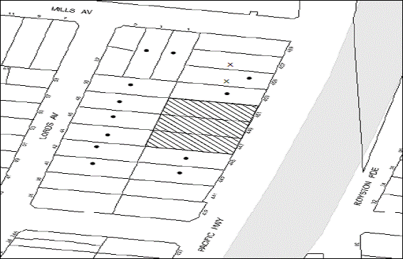
|
NOTIFICATION PLAN |
|
||
|
• PROPERTIES NOTIFIED
|
X SUBMISSIONS RECEIVED |
PROPERTY SUBJECT OF DEVELOPMENT |
|
|
ONE SUBMISSION RECEIVED OUT OF MAP RANGE |
|||
Three submissions object to the development, generally on the grounds that the development would result in:
· Loss of privacy;
· Unacceptable overshadowing of adjoining properties;
· Unacceptable noise impacts;
· Loss of trees;
· Development that is out of character with the area;
· Insufficient car parking provided for the development;
· Environmental problems and traffic congestion; and
· Overdevelopment for the site.
The merits of the matters raised in community submissions have been addressed in the body of the report with the exception of the following:
5.1.1 Conditions of consent
The following issue would be resolved via recommended conditions of consent:
· Removal of asbestos
Conditions regarding the demolition of the building would ensure that asbestos is removed in an appropriate way.
5.2 Public Agencies
The development application was referred to the following Agencies for comment:
5.2.1. Roads and Maritime Services
The application was referred to the Roads and Maritime Services (RMS) for comments under the provisions of Section 138 of the Roads Act 1993. RMS raises no objections subject to the implementation of recommended conditions of consent.
5.2.2. RailCorp
The application was referred to the RailCorp for comments. RailCorp raises no objections to the proposal and recommends conditions of consent.
6. THE PUBLIC INTEREST
Section 79C(1)(e) of the Act requires Council to consider “the public interest”.
The public interest is an overarching requirement, which includes the consideration of the matters discussed in this report. Implicit to the public interest is the achievement of future built outcomes adequately responding to and respecting the future desired outcomes expressed in environmental planning instruments and development control plans.
The application is considered to have satisfactorily addressed Council’s and relevant agencies’ criteria and would provide a development outcome that, on balance, would result in a positive impact for the community. Accordingly, it is considered that the approval of the proposed development would be in the public interest.
CONCLUSION
The application seeks approval for the demolition of the existing structures and the construction of a five storey residential flat building comprising thirty-nine units with basement car parking. The proposed development would be located on a site within a locality zoned as a high density residential precinct.
The proposed development is satisfactory in respect to the design principles under SEPP 65 and the best practice guidelines of the SEPP 65 – Residential Flat Design Code, subject to recommended conditions. The proposed development has regard to the requirements of the Housing Strategy DCP and is considered acceptable in respect to the desired future character of the Lords Avenue, Asquith precinct.
The application is recommended for approval.
Note: At the time of the completion of this planning report, no persons have made a Political Donations Disclosure Statement pursuant to Section 147 of the Environmental Planning and Assessment Act 1979 in respect of the subject planning application.
|
Rod Pickles Manager - Development Assessment Planning Division |
James Farrington Group Manager Planning Division |
|
1.View |
Locality Plan |
|
|
|
2.View |
Site Plan |
|
|
|
3.View |
Landscape Plan |
|
|
|
4.View |
Floor Plans |
|
|
|
5.View |
Elevations |
|
|
|
6.View |
Shadow Diagrams |
|
|
|
7.View |
Sections |
|
|
|
8.View |
Photomontage |
|
|
File Reference: DA/810/2012
Document Number: D02056134
SCHEDULE 1
1. Deferred Commencement
Pursuant to Section 80(3) of the Environmental Planning and Assessment Act 1979, this consent does not operate until the following information is submitted to Council:
a) The registration and creation of an Easement To Drain Water from the site over downstream properties 42 and 44 Lords Avenue, Asquith, to connect the subject site with a Council-controlled drainage system.
Such proof of registration of Transfers Granting Easement shall be submitted to Hornsby Council within 24 months of the date of this Consent.
Upon Council’s written satisfaction of the above information, the following conditions of development consent will apply:
GENERAL CONDITIONS
The conditions of consent within this notice of determination have been applied to ensure that the use of the land and/or building is carried out in such a manner that is consistent with the aims and objectives of the relevant legislation, planning instruments and Council policies affecting the land and does not disrupt the amenity of the neighbourhood or impact upon the environment.
Note: For the purpose of this consent, the term ‘applicant’ means any person who has the authority to act on or the benefit of the development consent.
Note: For the purpose of this consent, any reference to an Act, Regulation, Australian Standard or publication by a public authority shall be taken to mean the gazetted Act or Regulation, or adopted Australian Standard or publication as in force on the date that the application for a construction certificate is made.
2. Approved Plans and Supporting Documentation
The development must be carried out in accordance with the plans and documentation listed below and endorsed with Council’s stamp, except where amended by Council and/or other conditions of this consent:
Architectural Plans prepared by Mackenzie Architects
|
Plan No. |
Issue |
Plan Title |
Dated |
|
100 |
A |
Site/Roof Plan |
08.11.2012 |
|
101 |
A |
Car Park 02 |
08.11.2012 |
|
102 |
A |
Car Park 01 |
08.11.2012 |
|
103 |
A |
Ground Floor |
08.11.2012 |
|
104 |
A |
First Floor |
08.11.2012 |
|
105 |
A |
Second Floor |
08.11.2012 |
|
106 |
A |
Third Floor |
08.11.2012 |
|
107 |
A |
Penthouse |
08.11.2012 |
|
200 |
A |
East Elevation |
08.11.2012 |
|
201 |
A |
North and South Elevation |
08.11.2012 |
|
202 |
A |
West Elevation and Section AA |
08.11.2012 |
|
301 |
A |
Section BB and Section CC |
08.11.2012 |
Landscape Plans prepared by Conzept Landscape Architects
|
Plan No. |
Issue |
Plan Title |
Dated |
|
LPDA 12 -371/1 |
D |
Landscape Plan |
09.11.2012 |
|
LPDA 12 – 162/2 |
C |
Landscape Details |
09.11.2012 |
Stormwater Management Plans prepared by Northrop
|
Plan No. |
Revision |
Plan Title |
Dated |
|
C1.01 |
1 |
Cover Sheet. Drawing Schedule and Locality Plan |
16.11.2012 |
|
C4.01 |
1 |
Concept Stormwater Management Plan Sheet 1 of 2 |
16.11.2012 |
|
C4.02 |
1 |
Concept Stormwater Management Plan Sheet 2 of 2 |
16.11.2012 |
|
C4.03 |
1 |
Concept Stormwater Management Plan Basement Level 2 |
16.11.2012 |
|
C5.01 |
1 |
On-Site Detention Plan, Section and Details |
16.11.2012 |
|
Document Title |
Prepared by |
Dated |
|
Sun Views (Reference No. 502 Issue A) |
Mackenzie Architects |
08.11.2012 |
|
Shadow Diagrams (Reference DWG Nos. 500 and 501) |
Mackenzie Architects |
30.05.2012 |
|
Concept Sediment and Erosion Control Plan and Details (Reference No. C2.01 Revision 1) |
Northrop |
16.11.2012 |
|
Site Analysis (Reference No. 400) |
Mackenzie Architects |
30.05.2012 |
|
Survey plan (Reference No. 1749) |
Geographical Solution Surveyors |
15.03.2012 |
|
Statement of Environmental Effects |
Chapman Planning Pty Ltd |
11.07.2012 |
|
Traffic and Parking Assessment Report (Reference No. 12151) |
Varga Traffic Planning |
09.11.2012 |
|
Access Report |
Accessibility Solutions (NSW) Pty Ltd |
02.07.2012 |
|
Waste Management Plan |
Mackenzie Architects |
08.11.2012 |
|
DA Rail and Noise Vibration Assessment (Reference No. 20120538.1) |
Acoustic Logic Consultancy Pty Ltd |
22.06.2012 |
|
BASIX Certificate No. 434848M_02 |
Planning Principles |
15.11.2012 |
|
Arboricultural Impact Assessment |
Advanced Treescape Consulting |
02.11.2012 |
|
Photomontage |
Mackenzie Architects |
Received by Council 6 August 2012 |
|
External Building Materials and Finishes |
Mackenzie Architects |
Received by Council 6 August 2012 |
|
Crime Risk Assessment |
Chapman Planning |
10.07.2012 |
3. Removal of Existing Trees
This development consent only permits the removal of trees numbered 1,2,3,4,5,6,7,13,14,15,16,17,19,20,24,29,30,31,32 and 33 as identified in Arboricultural Impact Assessment prepared by Advanced Treescape Consulting dated 2 July 2012. The removal of any other trees requires separate approval under Council’s Tree Preservation Order.
4. Amendment of Plans
a) The following plan must be amended in accordance with the approved Concept Stormwater Management Plan Sheet 1 of 2 (C4.01 Issue 1 prepared by Northrop) in Condition 1 of this development consent:
|
Plan No. |
Issue |
Plan Title |
Dated |
|
LPDA 12 -371/1 |
D |
Landscape Plan |
09.11.2012 |
REQUIREMENTS PRIOR TO THE ISSUE OF A CONSTRUCTION CERTIFICATE
5. Building Code of Australia
All building work must be carried out in accordance with the requirements of the Building Code of Australia.
6. Contract of Insurance (Residential Building Work)
In the case of residential building work for which the Home Building Act 1989 requires there to be a contract of insurance in force in accordance with Part 6 of that Act, that such a contract of insurance is in force before any building work authorised to be carried out by the consent commences.
Note: This condition does not apply to the extent to which an exemption is in force under Clause 187 or 188 of the Act, subject to the terms of any condition or requirement referred to in Clause 187(6) or 188(4) of the Act, or to the erection of a temporary building.
7. Notification of Home Building Act, 1989 Requirements
Residential building work within the meaning of the Home Building Act, 1989 must not be carried out unless the principal certifying authority for the development to which the work relates (not being Council) has given Council written notice of the following information:
a) In the case of work for which a principal contractor is required to be appointed:
i) The name and licence number of the principal contractor.
ii) The name of the insurer by which the work is insured under Part 6 of that Act.
b) In the case of work to be done by an owner-builder:
i) The name of the owner-builder.
ii) If the owner-builder is required to hold an owner-builder’s permit under that Act, the number of the owner-builder’s permit.
Note: If arrangements for doing the residential building work are changed while the work is in progress so that the information notified becomes out of date, further work must not be carried out unless the principal certifying authority for the development to which the work relates (not being Council) has given Council written notification of the updated information.
8. Water/Electricity Utility Services
The applicant must submit written evidence of the following service provider requirements:
a) Energy Australia – a letter of consent demonstrating that satisfactory arrangements have been made to service the proposed development.
b) Sydney Water – the submission of a ‘Notice of Requirements’ under s73 of the Sydney Water Act 1994.
Note: Sydney Water requires that s73 applications are to be made through an authorised Sydney Water Servicing Coordinator. Refer to www.sydneywater.com.au or telephone 13 20 92 for assistance.
9. Stormwater Drainage
The stormwater drainage system for the development must be designed and constructed in accordance with Council’s Civil Works – Design and Construction Specification 2005 and the following requirements:
a) An inter-allotment stormwater drainage system to service the lots with pits being constructed in situ.
b) Pursuant to Section 68 of the Local Government Act 1993, application shall be made to Council and payment of Council’s fees for the construction of the drainage connection to Council’s stormwater drainage pit in Lords Avenue.
10. On Site Stormwater Detention
An on-site stormwater detention system must be designed by a chartered civil engineer and constructed in accordance with the following requirements:-
a) Have a capacity of not less than 23.5 cubic metres, and a maximum discharge (when full) of 50 litres per second.
b) Have a surcharge/inspection grate located directly above the outlet.
c) Discharge from the detention system to be controlled via 1 metre length of pipe, not less than 50 millimetres diameter or via a stainless plate with sharply drilled orifice bolted over the face of the outlet discharging into a larger diameter pipe capable of carrying the design flow to an approved Council system.
d) An overflow system at the detained volume emergency weir level shall be incorporated into the detention system to permit basin overflows to flow to the proposed interallotment drainage system.
e) Where above ground and the average depth is greater than 0.3 metres, a ‘pool type’ safety fence and warning signs to be installed.
f) Not be constructed in a location that would impact upon the visual or recreational amenity of residents, and allows for the provision of deep screen planting if required by DCP requirements.
11. Internal Driveway/Vehicular Areas
The driveway and parking areas on site must be designed in accordance with Australian Standards 2890.1, 2890.2 and the following requirements:-
a) Design levels at the front boundary be obtained from Council.
b) The driveway be a rigid pavement.
c) The driveway pavement be designed by a chartered structural engineer.
d) The pavement have a kerb to at least one side and cross fall with a minimum gradient of 2 percent, with kerb inlet pits provided on grade and at low points.
12. Accessible Units
The details of fit-outs of all accessible units (4 units) and details of adaptable units (8 units) must be provided with the Construction Certificate Plans.
13. Letter Boxes
The details of letter boxes and meter enclosures must be provided with the Construction Certificate Plans. The letter boxes and meter enclosures must be provided with a minimum setback of 2 metres from all boundaries and must be suitably screened.
14. Dilapidation Report
A ‘Dilapidation Report’ is to be prepared by a ‘chartered structural engineer’ detailing the structural condition of all adjoining properties.
15. Noise – Rail Corridor
The development must be carried out in accordance with the recommendations contained within the acoustic report submitted with the development application, titled, DA Rail and Noise Vibration Assessment prepared by Acoustic Logic Consultancy Pty Ltd and dated 22.06.2012 and the requirements of the Department of Planning’s Development Near Rail Corridors and Busy Roads – Interim Guideline and RailCorp’s Interim Guidelines for Applicants.
Note: The Department of Planning’s document is available at www.planning.nsw.gov.au (development assessments). The RailCorp document is available at www.railcorp.nsw.gov.au/publications.
16. Traffic Control Plan
A Traffic Control Plan (TCP) must be prepared by a qualified traffic controller in accordance with the Roads & Traffic Authority’s Traffic Control at Worksites Manual 1998 and Australian Standard 1742.3 for all work on a public road and be submitted to Council. The TCP must detail the following:
a) Arrangements for public notification of the works.
b) Temporary construction signage.
c) Permanent post-construction signage.
d) Vehicle movement plans.
e) Traffic management plans.
f) Pedestrian and cyclist access/safety.
17. Acoustic Details
The Construction certificate plans must demonstrate compliance with the recommendations in the DA Rail and Noise Vibration Assessment (Reference No. 20120538.1) prepared by Acoustic Logic Consultancy Pty Ltd dated 22 June 2012.
REQUIREMENTS PRIOR TO THE COMMENCEMENT OF ANY WORKS
18. Erection of Construction Sign
A sign must be erected in a prominent position on any site on which building work, subdivision work or demolition work is being carried out:
a) Showing the name, address and telephone number of the principal certifying authority for the work.
b) Showing the name of the principal contractor (if any) for any demolition or building work and a telephone number on which that person may be contacted outside working hours.
c) Stating that unauthorised entry to the work site is prohibited.
Note: Any such sign is to be maintained while the building work, subdivision work or demolition work is being carried out, but must be removed when the work has been completed.
19. Protection of Adjoining Areas
A temporary hoarding, fence or awning must be erected between the work site and adjoining lands before the works begin and must be kept in place until after the completion of the works if the works:
a) Could cause a danger, obstruction or inconvenience to pedestrian or vehicular traffic.
b) Could cause damage to adjoining lands by falling objects.
c) Involve the enclosure of a public place or part of a public place.
Note: Notwithstanding the above, Council’s separate written approval is required prior to the erection of any structure or other obstruction on public land.
20. Toilet Facilities
Toilet facilities must be available or provided at the works site before works begin and must be maintained until the works are completed at a ratio of one toilet for every 20 persons employed at the site. Each toilet must:
a) be a standard flushing toilet connected to a public sewer; or
b) have an on-site effluent disposal system approved under the Local Government Act 1993; or
c) be a temporary chemical closet approved under the Local Government Act 1993.
21. Erosion and Sediment Control
Erosion and sediment control measures must be provided and maintained throughout the construction period in accordance with the manual ‘Soils and Construction 2004 (Bluebook)’, the approved plans, Council specifications and to the satisfaction of the principal certifying authority. The erosion and sediment control devices must remain in place until the site has been stabilised and revegetated.
Note: On the spot penalties up to $1,500 may be issued for any on-compliance with this requirement without any further notification or warning.
REQUIREMENTS DURING CONSTRUCTION
22. Construction Work Hours
All work on site (including demolition and earth works) must only occur between the following hours:
Monday to Saturday 7 am to 5 pm
Sunday & Public Holidays No work
23. Demolition
All demolition work must be carried out in accordance with Australian Standard 2601-2001 – The Demolition of Structures and the following requirements:
a) Demolition material is to be disposed of to an authorised recycling and/or waste disposal site and/or in accordance with an approved waste management plan.
b) Demolition works, where asbestos material is being removed, must be undertaken by a contractor that holds an appropriate licence issued by WorkCover NSW in accordance with Chapter 10 of the Occupational Health and Safety Regulation 2001 and Clause 29 of the Protection of the Environment Operations (Waste) Regulation 2005.
c) On construction sites where buildings contain asbestos material, a standard commercially manufactured sign containing the words ‘DANGER ASBESTOS REMOVAL IN PROGRESS’ measuring not less than 400mm x 300mm must be erected in a prominent position visible from the street.
24. Environmental Management
The site must be managed in accordance with the publication ‘Managing Urban Stormwater – Landcom (March 2004) and the Protection of the Environment Operations Act 1997 by way of implementing appropriate measures to prevent sediment run-off, excessive dust, noise or odour emanating from the site during the construction of the development.
25. Council Property
During construction works, no building materials, waste, machinery or related matter is to be stored on the road or footpath.
26. Vehicular Crossing
A separate application under the Local Government Act, 1993 and the Roads Act, 1993 must be submitted to Council for the installation of a new vehicular crossing and the removal of the redundant crossing. The vehicular crossing must be constructed in accordance with Council’s Civil Works Design, 2005 and the following requirements:
a) Any redundant crossings to be restored back to the existing surface treatment.
b) The footway area to be restored by turfing.
Note: An application for a vehicular crossing can only be made to one of Council’s Authorised Vehicular Crossing Contractors. You are advised to contact Council on 02 9847 6940 to obtain a list of contractors.
27. Excavated Material
All excavated material removed from the site must be classified in accordance with the NSW Environment Protection Authority’s Environmental Guidelines – Assessment, Classification and Management of Liquid and Non-Liquid Wastes prior to disposal to an approved waste management facility and reported to the principal certifying authority.
28. Spoil Route
To protect Council’s assets, all vehicular access to and from the site during all stages of the development is to be via the shortest route to the nearest State or Regional Road.
29. Landfill
Landfill must be constructed in accordance with Council’s ‘Construction Specification, 2005’ and the following requirements:
a) All fill material imported to the site is to wholly consist of Virgin Excavated Natural Material (VENM) as defined in Schedule 1 of the Protection of the Environment Operations Act 1997 or a material approved under the Department of Environment and Climate Change’s general resource recovery exemption.
b) A compaction certificate is to be obtained from a geotechnical engineer verifying that the specified compaction requirements have been met.
30. Survey Report – Finished Floor Level
Reports must be prepared by a registered surveyor and submitted to the principal certifying authority prior to the pouring of concrete at each level of the building certifying that:
a) The building, retaining walls and the like have been correctly positioned on the site.
b) The finished floor levels are in accordance with the approved plans.
31. Contamination during construction works
Should the presence of asbestos or soil contamination, not recognised during the application process be identified during demolition, the applicant must immediately notify the Principal Certifying Authority and Council.
32. Waste Management
Waste management during the demolition and construction phase of the development must be undertaken in accordance with the approved Waste Management Plan. Additionally written record of the following items must be maintained during the removal of any waste from the site and such information submitted to the Principal Certifying Authority within fourteen days of the date of completion of the works:
a) The identity of the person removing the waste.
b) The waste carrier vehicle registration.
c) Date and time of waste collection.
d) A description of the waste (type of waste and estimated quantity).
e) Details of the site to which the waste is to be taken.
f) The corresponding tip docket/receipt from the site to which the waste is transferred (noting date and time of delivery, description (type and quantity) of waste).
g) Whether the waste is expected to be reused, recycled or go to landfill.
Note: In accordance with the Protection of the Environment Operations Act 1997, the definition of waste includes any unwanted substance, regardless of whether it is reused, recycled or disposed to landfill.
33. Street Sweeping
Street sweeping must be undertaken following sediment tracking from the site along Pacific Highway during works and until the site is established.
34. Works near Trees
All works (including driveways and retaining walls) within 6 metres of any trees required to be retained (whether or not on the subject property, and pursuant to this consent or the Tree Preservation Order), must be carried out under the supervision of an ‘AQF Level 5 Arborist’ and a certificate submitted to the principal certifying authority detailing the method(s) used to preserve the tree(s).
Note: Except as provided above, the applicant is to ensure that no excavation, filling or stockpiling of building materials, parking of vehicles or plant, disposal of cement slurry, waste water or other contaminants is to occur within 4 metres of any tree to be retained.
REQUIREMENTS PRIOR TO THE ISSUE OF AN OCCUPATION CERTIFICATE
Note: For the purpose of this consent, a reference to ‘occupation certificate’ shall not be taken to mean an ‘interim occupation certificate’ unless otherwise stated.
35. Fulfilment of BASIX Commitments
The applicant must demonstrate the fulfilment of BASIX commitments pertaining to the development.
36. Sydney Water – s73 Certificate
A s73 Certificate must be obtained from Sydney Water.
37. Resident Storage
The basement resident storage areas are to be allocated in accordance with the size requirements of the SEPP 65 - Residential Flat Design Code for the respective units and proximity to the unit car parking space.
38. Creation of Easements
The following matter(s) must be nominated on the plan of subdivision under either s88B or 88E of the Conveyancing Act 1919:
a) Consolidation of subject lots.
b) The creation of an appropriate "Positive Covenant" and "Restriction as to User" over the constructed on-site detention system and outlet works, within the lots in favour of Council in accordance with Council’s prescribed wording. The position of the on-site detention system is to be clearly indicated on the title.
c) To register the OSD easement, the restriction on the use of land “works-as-executed” details of the on-site-detention system must be submitted verifying that the required storage and discharge rates have been constructed in accordance with the design requirements. The details must show the invert levels of the on site system together with pipe sizes and grades. Any variations to the approved plans must be shown in red on the “works-as-executed” plan and supported by calculations.
Note: Council must be nominated as the authority to release, vary or modify any easement, restriction or covenant.
39. External Lighting
All external lighting must be designed and installed in accordance with Australian Standard AS 4282 – Control of the Obtrusive Effects of Outdoor Lighting. Certification of compliance with the Standard must be obtained from a suitably qualified person.
40. Maintain Canopy Cover
To maintain canopy cover, 4 medium to large trees selected from Council’s booklet ‘Indigenous Plants for the Bushland Shire’ such as Eucalyptus pilularis are to be planted on the subject site. The planning location shall not be within 4 metres of the foundation walls of a dwelling or in-ground pool. The pot size is to be a minimum 25 litres and the tree(s) must be maintained until they reach the height of 3 metres. Trees must be native to Hornsby Shire and reach a mature height greater than 10 metres.
41. Planter Boxes / On slab planting
On slab planter boxes must include waterproofing, subsoil drainage (proprietary drainage cell, 50mm sand and filter fabric) automatic irrigation, minimum 500mm planting soil for shrubs and minimum 1000mm planting soil for trees and palms and 75mm mulch to ensure sustainable landscape is achieved.
42. Completion of Landscaping
A certificate must be provided by a practicing landscape architect, horticulturalist or person with similar qualifications and experience certifying that all required landscaping works have been satisfactorily completed in accordance with the approved landscape plans.
Note: Advice on suitable species for landscaping can be obtained from Council’s planting guide ‘Indigenous Plants for the Bushland Shire’, available at www.hornsby.nsw.gov.au.
43. Retaining Walls
All required retaining walls must be constructed as part of the development.
44. Boundary Fencing
Fencing must be erected along all property boundaries behind the front building alignment to a height of 1.8 metres.
Note: Alternative fencing may be erected subject to the written consent of the adjoining property owner(s).
45. Unit Numbering
The allocation of unit numbering must be authorised by Council prior to the numbering of each unit in the development.
46. Garbage Collection Easement
For the purpose of waste collection, an easement entitling Council, its servants and agents and persons authorised by it to enter upon the subject land and to operate thereon, vehicles and other equipment for the purposes of garbage collection must be granted to Council by the owner of the land.
Note: The easement must be in a form prescribed by Council and must include covenants to the effect that parties will not be liable for any damage caused to the subject land or any part thereof or to any property located therein or thereon by reason of the operation thereon of any vehicle or other equipment used in connection with the collection of garbage and to the effect that the owner for the time being of the subject land shall indemnify the Council, its servants, agents and persons authorised by it to collect garbage against liability in respect of any such claims made by any person whomsoever.
47. Construction for a safe environment
Prior to the issue of the Occupation Certificate, the site must include the following elements:
a) An intercom system be installed at gate locations to ensure screening of persons entering the units;
b) The entryway to the site be illuminated in high luminance at all times;
c) The communal open space at the rear of the site be illuminated with high luminance by motion sensor lighting;
d) The service areas of the ground floor and the garbage room at the basement be illuminated with high luminance by motion sensor lighting;
e) The driveway and the basement carpark is to be illuminated with low luminance at all times;
f) Robust materials which cannot be forced or breached with minimised maintenance requirements are to be used for construction work in the common areas;
g) The lamps and lighting levels must comply with Australian and New Zealand Lighting Standard 1158.1;
h) Effective signage be provided to guide visitors to the main areas and parking areas;
i) The communal area must include a clear sign to restrict access for non-residents;
j) Units numbers, entry and exit signs must be legible and clear;
k) Fire exit doors to be fitted with single cylinder locksets (Australia New Zealand Standard-Locksets); and
l) Doors must include laminated glass to increase safety.
48. Waste Management
The following waste management requirements must be complied with:
a) The bin storage rooms at the basement level must include water or a hose for cleaning, graded floors with drainage to sewer, a robust door, sealed and impervious surface, adequate lighting and ventilation.
b) A report must be prepared by an appropriately qualified person, certifying the following:
- A comparison of the estimated quantities of each waste type against the actual quantities of each waste type.
Note: Explanations of any deviations to the approved Waste Management Plan is required to be included in this report
- That at least 60% of the waste generated during the demolition and construction phase of the development was reused or recycled.
Note: If the 60% diversion from landfill cannot be achieved in the Construction Stage, the Report is to include the reasons why this occurred and certify that appropriate work practices were employed to implement the approved Waste Management Plan. The Report must be based on documentary evidence such as tipping dockets/receipts from recycling depots, transfer stations and landfills, audits of procedures etc. which are to be attached to the report.
c) Each unit must be provided with an indoor waste/recycling cupboard for the interim storage of a minimum one day’s waste generation with separate containers for general waste and recyclable materials.
d) Space must be provided for either individual compost containers for each unit or a communal compost container;
Note: The location of the compost containers should have regard for potential amenity impacts.
e) The bin carting route must be devoid of any steps.
Note: Ramps between different levels are acceptable
49. s94 Infrastructure Contributions
The payment to Council of a contribution of $419,076.25 for thirty-six additional residential units towards the cost of infrastructure identified in Council’s Development Contributions Plan 2007-2011 in accordance with the following table:
7 x 1-bedroom units,
27 x 2-bedroom units and
5 x 3-bedroom units.
Note: The value of contribution is current as at 27 November 2012. The contribution will be adjusted from this date in accordance with the underlying consumer price index for subsequent financial quarters.
It is recommended that you contact Council to confirm the value of the contribution prior to payment.
OPERATIONAL CONDITIONS
50. Car Parking and Deliveries
All car parking must be operated in accordance with Australian Standard AS 2890.1 – 2004 – Off Street Car Parking and Australian Standard 2890.2 - 2002 – Off Street Commercial and the following requirements:
a) Car parking, loading and manoeuvring areas to be used solely for nominated purposes.
b) Vehicles awaiting loading, unloading or servicing must be parked on site and not on adjacent or nearby public roads;
c) All vehicular entry on to the site and egress from the site must be made in a forward direction.
51. Visitor Parking
Visitors are to have access to the parking area at all times. Visitors are to be able to access the basement car park by an audio/visual intercom system located at the top of the ramped driveway.
52. Disabled Parking
All parking spaces for people with disabilities must be constructed and operated in accordance with Australian Standard AS/NZS 2890.6:2009 – Off-street parking for people with disabilities
53. Noise
The level of total continuous noise emanating from operation of the premises including all the plants and air conditioning units (LA10) (measured for at least 15 minutes) in or on the above premises, must not exceed the background level by more than 5dB(A) when measured at all property boundaries.
54. Fire Safety Statement - Annual
On at least one occasion in every 12 month period following the date of the first ‘Fire Safety Certificate’ issued for the property, the owner must provide Council with an annual ‘Fire Safety Certificate’ to each essential service installed in the building.
55. Waste Storage area and waste management
The waste management on site must be in accordance with the following requirements:
a) Each unit be provided with an indoor waste/recycling cupboard for the interim storage of a minimum one day’s segregated garbage and recycling generation.
b) Site security measures be implemented to prevent access to the waste storage rooms by the residents.
c) A site manager or caretaker must be employed and be responsible for moving bins from the bin storage area/compactor to the waste collection point, washing bins and maintaining storage areas, arranging the prompt removal of dumped rubbish, and ensuring all residents are informed of the waste management system.
56. Landscape Establishment
The landscape works must be maintained to ensure the establishment and successful growth of plant material including (but not be limited to) watering, weeding, replacement of failed plant material and promoting the growth of plants through standard industry practices.
GENERAL TERMS OF APPROVAL - NSW ROADS AND MARITIME SERVICES
The following conditions of consent are General Terms of Approval from the nominated State Agency pursuant to Section 91A of the Environmental Planning and Assessment Act 1979 and must be complied with to the satisfaction of that Agency.
57. Swept Path analysis
The construction certificate plans must be submitted and approved by the Roads and Maritime Services (RMS) to demonstrate that the swept path of the longest vehicle including garbage trucks entering and exiting the site are in accordance with AUSTROADS.
58. Requirements prior to the issue of the Construction Certificate
A Construction Management Plan detailing construction vehicle routes, number of trucks, hours of operation, access arrangements and traffic control should be submitted to Council prior to the issue of a construction certificate.
59. Requirements prior to the commencement of any works
Prior to the commencement of any works including demolition and remediation works, the following requirements are to be complied with:
a) Detailed design plans and hydraulic calculations of any changes to the stormwater drainage system must be submitted to RMS for approval;
Note: Details should be forwarded to:
The Sydney Asset Management
Roads and Maritime Services
PO BOX 973 Parramatta CBD 2124.
A plan checking fee will be payable and a performance bond may be required prior to issue of the approval. With regard to Civil Works requirement please contact RMS’s Project Engineer, External Works on 88462114 or Fax: 8849 2766.
b) Detailed design drawings and geotechnical reports related to e xcavation of the site and support structures to RMS for assessment and concurrence.
The report would need to address the following key issues:
i) The impact of excavation/rock anchors on the stability of Pacific Highway and detailing how the carriageway would be monitored for settlement.
ii) The impact of excavation on the structural stability of Pacific Highway.
Note: The report and enquiries should be forwarded to:
Project Engineer, External Works
Sydney Asset Management
Roads and Maritime Services
PO BOX 973 Parramatta CBD 2124
Telephone 8848 2114
Fax 8849 2766
The developer/applicant is required to pay the assessment cost.
c) Full time “No Stopping” restrictions are to be implanted along the full Pacific Highway frontage of the site (unless already in place);
Note: Prior to installation of the restrictions the applicant must contact RMS’s Traffic Engineering Services on phone: (02) 8849 2928 for a Works Instruction.
60. Conditions to be complied with during Construction Works and Operation of the Site
a) All vehicles are to enter and leave the site in a forward direction.
b) Vegetation and proposed landscaping/fencing must not hinder sight lines to and from the proposed access driveways to motorists, pedestrians and cyclists.
c) All demolition and construction vehicles shall be contained wholly within the site as a work zone permit will not be approved for the Pacific Highway.
d) All work associated with the proposed development is to be at no cost to the RMS.
CONDITIONS OF CONCURRENCE - RAILCORP
The following conditions of consent are from the nominated State Agency pursuant to Section 79b of the Environmental Planning and Assessment Act 1979 and must be complied with to the satisfaction of that Agency.
61. Requirements prior to the issue of the Construction Certificate
a) The applicant must engage an Electrolysis Expert to prepare a report on the Electrolysis Risk to the development from stray currents. The Applicant must incorporate in the development all the measures recommended in the report to control that risk. A copy of the report must be provided to the Principal Certifying Authority with the application for the Construction Certificate.
b) The applicant must submit to RailCorp a plan showing all craneage and other aerial operations for the development and must comply with all RailCorp requirements. The Principal Certifying Authority must not issue the Construction Certificate until written confirmation has been received from RailCorp confirming that this condition has ben satisfied.
- END OF CONDITIONS -
ADVISORY NOTES
The following information is provided for your assistance to ensure compliance with the Environmental Planning and Assessment Act, 1979, Environmental Planning and Assessment Regulation 2000, other relevant legislation and Council’s policies and specifications. This information does not form part of the conditions of development consent pursuant to Section 80A of the Act.
Environmental Planning and Assessment Act 1979 Requirements
The Environmental Planning and Assessment Act 1979 requires:
· A construction certificate prior to the commencement of any works. Enquiries regarding the issue of a construction certificate can be made to Council’s Customer Services Branch on 9847 6760.
· A principal certifying authority to be nominated and Council notified of that appointment prior to the commencement of any works.
· Council to be given at least two days written notice prior to the commencement of any works.
· Mandatory inspections of nominated stages of the construction inspected.
· An occupation certificate issued before occupying any building or commencing the use of the land.
Long Service Levy
In accordance with Section 34 of the Building and Construction Industry Long Service Payments Act 1986, a ‘Long Service Levy’ must be paid to the Long Service Payments Corporation or Hornsby Council.
Note: The rate of the Long Service Levy is 0.35% of the total cost of the work.
Note: Hornsby Council requires the payment of the Long Service Levy prior to the issue of a construction certificate.
Tree Preservation Order
To ensure the maintenance and protection of the existing natural environment, it is an offence to ringbark, cut down, top, lop, remove, wilfully injure or destroy a tree outside three metres of the approved building envelope without prior written consent from Council. Fines may be imposed for non-compliance with Council’s Tree Preservation Order.
Note: A tree is defined as a single or multi-trunked wood perennial plant having a height of not less than three (3) metres, and which develops many branches, usually from a distance of not less than one (1) metre from the ground, but excluding any plant which, in its particular location, is a noxious plant declared as such pursuant to the Noxious Weeds Act 1993. This definition of ‘tree’ includes any and all types of Palm trees.
All distances are determined British Standard BS 5837: 2005, “Trees in Relation to Construction – Recommendations”.
Disability Discrimination Act
The applicant’s attention is drawn to the existence of the Disability Discrimination Act. A construction certificate is required to be obtained for the proposed building, which will provide consideration under the Building Code of Australia, however, the development may not comply with the requirements of the Disability Discrimination Act. This is the sole responsibility of the applicant.
Dial Before You Dig
Prior to commencing any works, the applicant is encouraged to contact Dial Before You Dig on 1100 or www.dialbeforeyoudig.com.au for free information on potential underground pipes and cables within the vicinity of the development site.
Rain Water Tank
It is recommended that water collected within any rainwater tank as part of the development be limited to non-potable uses. NSW Health recommends that the use of rainwater tanks for drinking purposes not occur where a reticulated potable water supply is available.
House Numbering
House numbering can only be authorised by Council. Before proceeding to number each premise in the development, the allocation of numbers is required to be obtained from Council's Planning Division. The authorised numbers are required to be displayed in a clear manner at or near the main entrance to each premise.
Planning Report No. PL37/12
Planning Division
Date of Meeting: 19/12/2012
10 DEVELOPMENT APPLICATION - FIVE STOREY RESIDENTIAL FLAT BUILDING COMPRISING 32 UNITS - 213 & 215 CARLINGFORD ROAD, CARLINGFORD
EXECUTIVE SUMMARY
|
DA No: |
DA/729/2012 (Lodged 18 July 2012) |
|
Description: |
Demolition of existing structures and construction of a five storey residential flat building comprising 32 units with basement carpark and strata subdivision |
|
Property: |
Lot 2 DP 27412 and Lot C DP 397954, Nos. 213 and 215 Carlingford Road, Carlingford |
|
Applicant: |
Mr William Karavelas |
|
Owner: |
Mr Shaofan Jin, Ms Chun Xiang Jiang, Mr Elie Minassian |
|
Estimated Value: |
$5.9 million |
|
Ward: |
C |
· The application proposes the demolition of existing structures and the construction of a five storey residential flat building comprising 32 units with basement car parking and strata subdivision.
· The proposal generally complies with the requirements of the Hornsby Shire LEP 1994, State Environmental Planning Policy No. 65 – Design Quality of Residential Flat Development and the Hornsby Shire Housing Strategy DCP.
· Four submissions have been received in respect of the application.
· It is recommended that the application be approved.
|
THAT Development Application No. 729/2012 for the demolition of existing structures and the construction of a five storey residential building comprising 32 units and strata subdivision at Lot 2 DP 27412 and Lot C DP 397954, Nos. 213 and 215 Carlingford Road, Carlingford be approved subject to the conditions of consent detailed in Schedule 1 of Group Manager’s Report No. PL37/12. |
BACKGROUND
The subject land was rezoned from Residential A (Low Density) to Residential C (Medium-High Density) on 2 September 2011 as part of Council’s Housing Strategy.
SITE
The subject site comprises two allotments, Nos. 213 and 215 Carlingford Road located on the southern side of the road with a total area of 1740.1 m2. The site has an average downward slope of 4% towards the front from the south-western corner (rear) to the north-eastern corner (front).
Existing improvements on the two allotments include two dwelling houses with garages and carports.
One large tree is located within the front setback of No. 215 Carlingford Road.
The site forms part of the ‘Carlingford Road, Carlingford’ precinct rezoned for medium-high density housing in accordance with the Hornsby Shire Housing Strategy in September 2011. The precinct is bounded by Carlingford Road, Pennant Hills Road, Keeler Street and Hepburn Avenue.
The surrounding developments include single and two storey residential dwellings. A shopping centre, Carlingford Court, is located in the near vicinity of the site.
THE PROPOSAL
The proposal involves the demolition of two existing dwellings and the construction of a five storey residential flat building comprising 32 units with two levels of basement carpark and strata subdivision. The details of the development are provided below:
Residential
The development involves the construction of 32 residential units in five levels. The unit configuration comprises 8 x 1-bedroom units, 21 x 2-bedroom units and 3 x 3-bedroom units. The units would be accessed via a lift. The units would include balconies fronting the street, the rear and the side setbacks.
The gross floor area of the development is 2699.25 m2.
Car parking and access
The development would be accessed from Carlingford Road via a driveway located on the southern boundary of the site. A separate pedestrian entry would provide access to the foyer and the lift for vertical circulation. A total of 32 residential spaces and 7 visitor’s parking spaces are proposed in two basement levels including accessible parking spaces.
Landscaping
The development would include landscaped areas along the front, rear and side setback areas. The communal open space area is proposed to be located at the rear of the site. An electrical substation is proposed on the western side of the building within the landscaped area fronting Carlingford Road.
ASSESSMENT
The development application has been assessed having regard to the ‘Metropolitan Plan for Sydney 2036’, the ‘North Subregion (Draft) Subregional Strategy’ and the matters for consideration prescribed under Section 79C of the Environmental Planning and Assessment Act 1979 (the Act). The following issues have been identified for further consideration.
1. STRATEGIC CONTEXT
1.1 Metropolitan Plan for Sydney 2036 and (Draft) North Subregional Strategy
The Metropolitan Plan for Sydney 2036 is a broad framework to secure Sydney’s place in the global economy by promoting and managing growth. It outlines a vision for Sydney to 2036; the challenges faced, and the directions to follow to address these challenges and achieve the vision. The Draft North Subregional Strategy acts as a framework for Council in its preparation of the Comprehensive LEP by the end of 2012.
The Draft North Subregional Strategy sets the following targets for the Hornsby LGA by 2031:
· Employment capacity to increase by 9,000 jobs; and
· Housing stock to increase by 11,000 dwellings.
The proposed development would be consistent with the draft Strategy by providing an additional 32 dwellings and would contribute towards housing choice in the locality.
2. STATUTORY CONTROLS
Section 79C(1)(a) requires Council to consider “any relevant environmental planning instruments, draft environmental planning instruments, development control plans, planning agreements and regulations”.
2.1 Hornsby Shire Local Environmental Plan 1994
The subject land is zoned Residential C (Medium/High Density) under the Hornsby Shire Local Environmental Plan 1994 (HSLEP). The objectives of the Residential C zone are:
(a) to provide for the housing needs of the population of the Hornsby area.
(b) to promote a variety of housing types and other land uses compatible with a medium to high density residential environment.
(c) to provide for development that is within the environmental capacity of a medium to high density residential environment.
The proposed development is defined as “multi-unit housing” under the HSLEP and is permissible in the zone with Council’s consent.
Clause 15 of the HSLEP prescribes the maximum floor space ratio (FSR) for development within the Residential C zone. Subclause (5) of Clause 15 states that “This clause does not apply to land shown edged heavy black on diagrams 1-8 in Schedule BB.” The site is identified in Diagram 8 of Schedule BB of the HSLEP. Therefore, Clause 15 does not apply to the subject site.
Clause 15A of the HSLEP prescribes that the maximum building height within the area detailed under Schedule BB is not to exceed 17.5 metres. The proposed development complies with this requirement.
Clause 18 of the HSLEP sets out heritage conservation provisions for Hornsby Shire. The subject site does not include a heritage item and is not located in a Heritage Conservation Area. Therefore, no further assessment in this regard is necessary.
2.2 Draft Comprehensive Hornsby Local Environmental Plan
The draft Comprehensive Local Environmental Plan (HLEP) was placed on exhibition on 5 June 2012. The draft HLEP essentially reiterates the current land use zoning and height control applicable to the site as outlined below:
2.2.1 Zoning
The site would be zoned R4 (High Density Residential) zone pursuant to the Land Use Table of the DHLEP. The proposed development is defined as a ‘Residential Flat Building’ and would be a permissible use in the zone with Council’s consent.
2.2.2 Height of Building
Clause 4.3 of the DHLEP provides that the height of a building on any land is not to exceed the maximum height shown for the land on the Height of Buildings Map. The maximum permissible height for the subject site is 17.5 metres. The proposal complies with this provision.
2.3 State Environmental Planning Policy No. 55 – Remediation of Land
State Environmental Planning Policy No. 55 (SEPP 55) requires that Council must not consent to the carrying out of any development on land unless it has considered whether the land is contaminated or requires remediation for the proposed use.
The site has been used for residential purposes and is unlikely to be contaminated. No further assessment is considered necessary in this regard. A condition is recommended should any contamination be found during construction.
2.4 State Environmental Planning Policy No. 65 – Design Quality of Residential Flat Development
The application has been assessed against the requirements of State Environmental Planning Policy No. 65 (SEPP 65). This Policy provides State-wide planning controls for the assessment of residential flat developments and for residential components of mixed use developments. The primary aim of SEPP 65 is to “improve the design quality of residential flat development in New South Wales”.
An assessment of the design of the proposed development against the ten principles provided in Part 2 of SEPP 65 is detailed below:
2.4.1 Principle 1: Context
Design Principle 1 is as follows:
Good design responds and contributes to its context. Context can be defined as the key natural and built features of an area.
Responding to context involves identifying the desirable elements of a location’s current character or, in the case of precincts undergoing a transition, the desired future character as stated in planning and design policies. New buildings will thereby contribute to the quality and identity of the area.
The subject site is located within a precinct zoned for five storey residential flat buildings fronting Carlingford Road, in close proximity to Pennant Hills Road and the Carlingford Court shopping centre. The desired future character of the area, as outlined in Council’s Housing Strategy Development Control Plan, is that of a high density residential precinct incorporating five storey developments in a landscaped setting.
The submitted “Design Verification Statement” indicates that the proposal responds to the desired future character of the area visualised by Council. Once the development of the precinct is completed, the development would integrate with the surrounding sites and would be in keeping with the desired urban form.
The development responds suitably to the ‘context’ principle of SEPP 65, considering the desired future character of the area.
2.4.2 Principle 2: Scale
Design Principle 2 is as follows:
Good design provides an appropriate scale in terms of the bulk and height that suits the scale of the street and the surrounding buildings.
Establishing an appropriate scale requires a considered response to the scale of existing development. In precincts undergoing a transition, proposed bulk and height needs to achieve the scale identified for the desired future character of the area.
The proposed development complies with the maximum height limit permitted in the precinct and provides a building envelope which is in accordance with the setbacks required by Council’s Housing Strategy Development Control Plan.
The scale of the development is consistent with the desired future character of the precinct. The application is assessed as satisfactory in this regard.
2.4.3 Principle 3: Built Form
Design Principle 3 is as follows:
Good design achieves an appropriate built form for a site and the building’s purpose, in terms of building alignments, proportions, building type and the manipulation of building elements.
Appropriate built form defines the public domain, contributes to the character of streetscape and parks, including their views and vistas, and provides internal amenity and outlook.
The proposed development presents a distinct architectural design which would set a desirable precedent for the locality. The details of the elements of the built form are assessed in Section 2.10 of this report.
2.4.4 Principle 4: Density
Design Principle 4 is as follows:
Good design has a density appropriate for a site and its context, in terms of floor space yields (or number of units or residents).
Appropriate densities are sustainable and consistent with the existing density in an area or in precincts undergoing a transition, are consistent with the stated desired future density. Sustainable densities respond to the regional context, availability of infrastructure, public transport, community facilities and environmental quality.
The HSLEP does not incorporate any floor space ratio requirements for the subject site. The density of development on the site is guided by the height of the building and the required setbacks from the boundaries. The matter has been discussed in detail in Sections 2.1 and 2.10 of this report.
It is considered that the proposed density is sustainable as it responds to the regional context, availability of infrastructure, public transport, community facilities and environmental quality. The proposal complies with the density principle of SEPP 65.
2.4.5 Principle 5: Resource, energy and water efficiency
Design Principle 5 is as follows:
Good design makes efficient use of natural resources, energy and water throughout its full life cycle, including construction.
Sustainability is integral to the design process. Aspects include demolition of existing structures, recycling of materials, selection of appropriate and sustainable materials, adaptability and reuse of buildings, layouts and built form, passive solar design principles, efficient appliances and mechanical services, soil zones for vegetation and reuse of water.
The proposed development includes a BASIX certificate and complies with the requirements with regard to water, thermal comfort and energy. The proposal also complies with the natural ventilation and solar access requirements within the Residential Flat Design Code (RFDC). The details of the above matters are discussed in Section 2.5 of this report.
2.4.6 Principle 6: Landscape
Design Principle 6 is as follows:
Good design recognises that together landscape and buildings operate as an integral and sustainable system, resulting in greater aesthetic quality and amenity for both occupants and the adjoining public domain.
Landscape design builds on the existing site’s natural and cultural features in responsible and creative ways. It enhances the development’s natural environmental performance by co-ordinating water and soil management, solar access, micro-climate, tree canopy and habitat values. It contributes to the positive image and contextual fit of development through respect for streetscape and neighbourhood character, or desired future character.
Landscape design should optimise useability, privacy and social opportunity, equitable access and respect for neighbour’s amenity, and provide for practical establishment and long term management.
The application includes a landscape concept plan providing landscaping along the street frontage and the side boundaries. This planting would activate the street frontage and provide a landscaped setting for the proposed development.
The proposed development incorporates deep soil planting wherever possible with associated amenity in the recreational area within the rear setback. In this regard, the proposal satisfies the intent of the ‘Landscaping’ principle of SEPP 65.
2.4.7 Principle 7: Amenity
Design Principle 7 is as follows:
Good design provides amenity through the physical, spatial and environmental quality of a development.
Optimising amenity requires appropriate room dimensions and shapes, access to sunlight, natural ventilation, visual and acoustic privacy, storage, indoor and outdoor space, efficient layouts and service areas, outlook and ease of access for all age groups and degrees of mobility.
The proposal would provide convenient and safe access to the development via a central lift connecting the basement and all other levels. The application has been assessed against the ‘Building Amenity’ criteria within the RFDC and is discussed in detail in Section 2.5 of this report.
2.4.8 Principle 8: Safety and security
Design Principle 8 is as follows:
Good design optimises safety and security, both internal to the development and for the public domain.
This is achieved by maximising overlooking of public and communal spaces while maintaining internal privacy, avoiding dark and non-visible areas, maximising activity on streets, providing clear, safe access points, providing quality public spaces that cater for desired recreational uses, providing lighting appropriate to the location and desired activities, and clear definition between public and private spaces.
The proposed development is located on a road that experiences a medium level of pedestrian movements. The design has regard to ‘Crime Prevention through Environmental Design (CPTED)’ principles and does not include any obvious unobserved areas.
The RFDC requires the preparation of a formal Crime Assessment Report for development that comprises more than twenty residential units. The proposal includes an assessment of the development against crime prevention controls in the Design Verification Statement. The applicant submits that the safety of the public domain is enhanced by the following design elements:
· Apartment layouts optimize occupant surveillance by orienting habitable spaces and rooms with outlook over the public domain around and within the site;
· Entry lobbies, garden paths and public areas are incorporated and will be well-lit to meet the minimum public lighting standards. Car-park entry will be secure and controlled by card-key access only; and
· On ground floor, the entry lobby is available as a waiting area for visitors. Access to the lift is restricted by key only.
The application was referred to NSW Police Force for comments. NSW Police Force raises no objections subject to conditions of consent regarding the following:
· Sufficient lighting of the service areas of the ground floor, the garbage room and the communal open space at the rear;
· Access control within the site;
· Maintenance policies regarding usage of common areas and graffiti; and
· Signage in various areas of the site.
Subject to the imposition of conditions of consent addressing the above matters, the proposal is supported in respect of safety and security.
2.4.9 Principle 9: Social dimensions
Design Principle 9 is as follows:
Good design responds to the social context and needs of the local community in terms of lifestyles, affordability, and access to social facilities.
New development should optimise the provision of housing to suit the social mix and needs in the neighbourhood or, in the case of precincts undergoing transition, provide for the desired future community.
New development should address housing affordability by optimising the provision of economic housing choices and providing a mix of housing types to cater for different budgets and housing needs.
The site is located within close proximity to a variety of shopping, recreation and educational facilities. A reasonable mix of dwelling types and sizes has been proposed complying with the requirements within the RFDC and improving the housing choice in the locality. Accordingly, the development is assessed as satisfactory with regard to social dimensions.
2.4.10 Principle 10: Aesthetics
Design Principle 10 is as follows:
Quality aesthetics require the appropriate composition of building elements, textures, materials and colours and reflect the use, internal design and structure of the development. Aesthetics should respond to the environment and context, particularly to desirable elements of the existing streetscape or, in precincts undergoing transition, contribute to the desired future character of the area.
The proposal is consistent with the design principles contained within the RFDC. It is considered that the aesthetic quality of the building contributes to the desired future character of the precinct. The details of the assessment of the built form and the aesthetics of the development are contained in Section 2.10 of this report.
2.5 SEPP 65 Residential Flat Design Code
Clause 30(2) of SEPP 65 requires consent authorities to consider the design quality of residential flat development when evaluated in accordance with the design quality principles, and the Department of Planning’s Residential Flat Design Code (RFDC). The following is an assessment of the proposal against the requirements of the RFDC:
|
Residential Flat Design Code |
|||
|
Control
|
Proposal |
Requirement |
Compliance |
|
Deep Soil Zone |
25% |
Min 25% |
Yes |
|
Communal Open Space |
38% |
25-30% |
Yes |
|
Minimum Dwelling Size |
1 br – 50m2 2 br – 70m2 3 br – 95m2 |
1 br – 50m2 2 br – 70m2 3 br – 95 m2 |
Yes Yes Yes |
|
Maximum Kitchen Distance |
8m |
8m |
Yes |
|
Minimum Balcony Depth |
2m |
2m |
Yes |
|
Ceiling heights - Residential floors |
2.7m |
2.7m (Min) |
Yes |
|
Total Storage area
|
1 br - > 6m3 2 br - > 8m3 3 br - > 10m3 |
6m3 (Min) 8m3 (Min) 10 m3 (Min) |
Yes Yes Yes |
|
Dual Aspect & Cross Ventilation |
62.5% |
60% |
Yes |
|
Adaptable Housing |
31% |
10% |
Yes |
The matters of non-compliance have been discussed in the above table and/or below as well as a brief discussion on compliance with the relevant performance requirements.
2.5.1 Building Depth and Separation
The proposed building depth is in accordance with the requirements of Council’s Housing Strategy Development Control Plan as discussed in Section 2.10.
The design of the building façades is in accordance with the requirements of Council’s Housing Strategy Development Control Plan. The majority of the primary living areas and all single aspect balconies would be setback 6 metres from the side boundaries increasing to 9 metres at the top level, facilitating a future building separation of 12 - 18 metres with the adjoining sites in accordance with the RFDC. Privacy screens are proposed where the living area are located at a setback of 4m from the side boundary. The design of the future developments adjoining the subject site would also need to ensure that 12 - 18 metre building separations are maintained at all points between habitable rooms/balconies.
The proposed building separation would not result in unreasonable compromise to natural ventilation and solar access to the proposed or the adjoining future developments.
2.5.2 Apartment Layout
The proposed development includes a mix of single aspect and corner units including one, two and three bedroom apartments. All units would be well ventilated with some units would be provided with secondary balconies in addition to primary balconies. A total of 62.5% of units would receive cross ventilation with no single aspect units facing the southern side. The ceiling heights would be a minimum of 2.7 metres.
The apartments include storage areas in accordance with the requirements of the RFDC. The storage areas are provided at the basement levels and additional storage areas are also provided within the apartments. It is noted that the three bedroom units (No. 8, 15 and 22) do not include internal storage areas within the apartments other than cupboards and wardrobes. A condition of consent is recommended that storage areas be included within the units as marked in red on the approved plans.
The layout of the apartments and the building configuration comply with the rules of thumb of the RFDC.
2.5.3 Internal Circulation
The proposal includes barrier free access to all floors via a lift. A maximum of 7 units would be accessed from a doubly loaded corridor.
2.5.4 Acoustic Privacy
The internal layout of the residential units is designed such that noise generating areas would mainly adjoin each other. Storage and circulation zones would act as a buffer between units. Bedrooms and service areas such as kitchens, bathrooms and laundries would be grouped together wherever possible. Measures to reduce noise transmission from common corridors have been provided within the unit layouts. Two ground level balconies fronting Carlingford Road would be setback 7 metres with landscape screening for privacy of future occupants.
The proposal complies with the ‘Acoustic Privacy’ requirements within the RFDC and is assessed as satisfactory.
2.6 State Environmental Planning Policy (Building Sustainability Index – BASIX) - 2004
The application has been assessed against the requirements of State Environmental Planning Policy (Building Sustainability Index: BASIX) 2004. The proposal includes a BASIX Certificate for the proposed units and is considered to be satisfactory.
2.7 State Environmental Planning Policy No. 32 - Urban Consolidation (Redevelopment of Urban Land) (SEPP 32)
The application has been assessed against the requirements of SEPP 32, which requires Council to implement the aims and objectives of this Policy to the fullest extent practicable when considering development applications relating to redevelopment of urban land. The application complies with the objectives of the Policy as it would promote social and economic welfare of the locality and would result in the orderly and economic use of under utilised land within the Shire.
2.8 State Environmental Planning Policy (Infrastructure) 2007
The application has been assessed against the requirements of State Environmental Planning Policy (Infrastructure) 2007. This Policy contains State-wide planning controls for developments adjoining busy roads. The development is located immediately adjoining a classified road corridor (Carlingford Road) and the following matters have been considered in this regard:
2.8.1 Development with frontage to a classified road
The proposal has been assessed against the requirements of Clause 101 of SEPP (Infrastructure) as the site has frontage to Carlingford Road and proposes new vehicular access from the road.
Council’s assessment of the proposal concludes that the existing driveway complies with AS/NZS 2890.1:2004 and the location of the driveway is satisfactory. The proposed development was referred to the NSW Roads and Maritime Services (RMS) for concurrence under Section 138 of the Roads Act 1993. No objections have been raised regarding the driveway location. RMS requires the provision of a 6m wide driveway facilitating two way vehicle flows from the entrance of the site to the basement level. The proposal has been amended to comply with this requirement. Council’s engineering assessment in this regard concludes that the width of the driveway is satisfactory.
RMS also comments that the driveway and turning areas should be designed to cater for light and heavy vehicles. However, Council requires Small Rigid Vehicle access only for such developments fronting Carlingford Road. The proposal complies with this requirement and is assessed as satisfactory.
The subject property is affected by a variable width easement for batter which benefits the RMS. The easement is located along the entire frontage of the property. RMS raises no objections to the proposal subject to maintenance of this easement. The easement would be located in the landscaped front setback and the proposal complies with this requirement.
2.8.2 Impact of Noise
The application was referred to the RMS for comment. The RMS advises that the development should be designed to mitigate the traffic noise and vibration from Carlingford Road by using durable materials in accordance with Environmental Criteria for Road Traffic Noise, May 1999.
It is noted that Clause 102 of SEPP (Infrastructure) does not apply to the development as Carlingford Road is identified as a road with an annual average daily traffic volume of less than 40,000 vehicles (based on the traffic volume data published on the website of the RMS). Therefore, no further assessment with regard to impact of road noise on the development is required.
Notwithstanding the above, the application includes a Traffic Acoustic Report which provides details of construction techniques and measures to attenuate road noise and vibration and concludes that the development would not exceed the specified noise criteria and LAeq levels within Clause 102 of the SEPP (Infrastructure) subject to adherence to the recommendations. The report has been assessed as satisfactory.
The Construction Certificate Plans would be required to demonstrate compliance with the recommendations of the acoustic report via use of appropriate materials for glazing and construction.
2.8.3 Traffic Generating Development
The development is not classified as a Traffic Generating Development in accordance with Clause 104 and Schedule 3 of SEPP (Infrastructure) as it would not result in more than 75 dwellings fronting a classified road. No objections have been raised by RMS with regard to traffic generation.
2.9 Sydney Regional Environmental Plan (Sydney Harbour Catchment) 2005
The application has been assessed against the requirements of Sydney Regional Environmental Plan (Sydney Harbour Catchment) 2005. This Policy provides general planning considerations and strategies to ensure that the catchment, foreshores, waterways and islands of Sydney Harbour are recognised, protected, enhanced and maintained.
The proposal includes details of stormwater management of the site by providing an on-site detention system. Council’s assessment of the proposal in this regard concludes that the development is satisfactory. A condition is recommended with respect to installation of sediment and erosion control measures prior to, and during, construction.
The proposed development would have minimal potential to impact on the Sydney Harbour Catchment.
2.10 Housing Strategy Development Control Plan
The proposed development has been assessed having regard to the relevant performance and prescriptive design requirements within Council’s Housing Strategy Development Control Plan (Housing Strategy DCP). The following table sets out the compliance of the proposal with the various elements of the Housing Strategy DCP:
|
Housing Strategy Development Control Plan |
|||
|
Control |
Proposal |
Requirement |
Compliance |
|
Site Width |
33.5m |
30m |
Yes |
|
Height |
5 storeys – 17.5m |
5 storeys – 17.5m |
Yes |
|
Lowest Residential Floor Above Ground |
2m |
Max - 1.5m |
No |
|
Maximum Floorplate Dimension |
34.5m |
35m |
Yes |
|
Building Indentation |
4m x 4m |
4m x 4m |
Yes |
|
Front Setback |
10m 8.5m (1/3 of building length) |
10m 8m (1/3 of building length) |
Yes Yes |
|
Western Side Setback |
6.5m 4.2m (1/3 of the building length) |
6m 4m (1/3 of the building length) |
Yes Yes |
|
Eastern Side Setback |
6.5m 4.2m (1/3 of the building length) |
6m 4m (1/3 of the building length) |
Yes Yes |
|
Rear Setback |
10m 8.4m (1/3 of building length) |
10m 8m (1/3 of building length) |
Yes
|
|
Top Storey Setback From Ground Floor |
3m |
3m |
Yes |
|
Underground Parking Setback |
Front & Rear - 7m Sides - 4m |
7m 4m |
Yes Yes |
|
Balcony setback |
Front & Rear - 7m Sides - 4m (min) |
7m 4m |
Yes Yes |
|
Basement Ramp Setback (6m wide) |
2m |
2m |
Yes |
|
Parking |
32 resident spaces 7 visitor spaces Number of bicycle spaces not specified |
32 resident spaces 7 visitor spaces 11 bicycle spaces |
Yes Yes No |
|
Landscaped areas |
Front & Rear – 7m wide Sides – 4m wide |
7m wide 4m wide |
Yes Yes |
|
Private Open Space with Min Width 2.5m |
1 br units > 10 m2 2 br units >12 m2 3 br units >30 m2 |
1 br units 10m2 (min) 2 br units 12m2 (min) 3 br units 16m2 (min) |
Yes Yes Yes |
|
Communal Open Space with minimum dimension 2.5m |
25% |
25% |
Yes |
|
Solar Access |
71.8% |
70% |
Yes |
|
Housing Choice |
10% of each type |
10% of each type (min)
|
Yes |
|
Adaptable Units |
30% (10 units) |
30% |
Yes |
As detailed in the above table, the proposal generally complies with all numerical requirements of the Housing Strategy DCP. The matters of non-compliance and an assessment of the proposal against the various relevant elements of the Housing Strategy DCP are discussed below.
2.10.1 Site Requirements
The Housing Strategy DCP requires sites to have a minimum frontage of 30 metres. The subject site has a frontage of 33.5 metres and complies with this requirement. The site does not result in isolation of the adjoining blocks and would not restrict orderly and economic development of any land in the precinct.
2.10.2 Height
The height of the building complies with the 17.5m height requirement of the HSLEP. However, the lowest residential floor protrudes 2m above the natural ground level on the eastern elevation.
The site slopes down towards the eastern side. The non-compliance with height above ground arises from the requirement to accommodate Small Rigid Vehicle access to the basement which requires a vehicle height clearance of 3.5 metres. Given that this is a compulsory requirement for all similar developments fronting Carlingford Road and that the overall height complies with the provisions of the HSLEP, this non-compliance is considered acceptable.
2.10.3 Setbacks
The proposed building setbacks comply with the requirements of the Housing Strategy DCP. The living and bedroom areas for two units at each level would have a setback of 4m from the side boundary. Privacy screens have been provided to mitigate adverse privacy impacts upon adjoining developments in the future.
The front and rear setbacks comply with the requirements and are acceptable.
2.10.4 Landscaping
The landscaped areas within the front and side setbacks comply with the requirements of the Housing Strategy DCP and have been designed to accommodate mature canopy trees. The on-site detention system (OSD) is proposed to be suspended over the basement carpark to avoid encroachment within the deep soil area.
The rear and part of the side setbacks would be utilised as communal open space with seating areas. The proposed landscaping is considered satisfactory subject to conditions of consent requiring further planting of canopy trees.
2.10.5 Floorplates, Separations and Articulation
The building complies with the required floorplate lengths/widths and the indentations. The indentations would create two separate “building pavilions” rather than a single building mass. This is accentuated by the proposed roof form.
The articulation of the building facades has been achieved in the following ways:
· The building has been vertically stepped, two steps being provided on the ground and the fifth storey across 50% of the width of each façade.
· Four storey high vertical solid planes have been provided intercepting the balconies on all facades.
· The facades have been divided into vertical ‘panels’, no wider than 8 metres. Such panels have been visually separated by indentations and projections across the alignment of the exterior walls, balconies, terraces and pergolas to achieve the desired articulation.
· Wrap around balconies have been provided at the building corners. The balustrades of the balconies would incorporate a mixture of solid painted masonry and light weight materials such as glass and steel.
· A flat roof has been provided without parapet.
· Sunscreens and pergolas have been provided at prominent corners.
· The top storey would incorporate penthouses with a large proportion of openings.
· The façade would display a varied pattern of solid to void.
· The building would incorporate contemporary colours.
The design of the floor plates, the proposed indentations and the articulation of the facades have been assessed as satisfactory.
2.10.6 Privacy
The matters in relation to acoustic privacy of the units have been discussed in detail under “Residential Flat Design Code” in Section 2.5.5 of this report. The proposed design of the building achieves the ‘building separation’ requirements required by SEPP 65.
The living areas of the residential units have been positioned to face the front and the rear wherever possible. The ground floor balconies fronting the communal open space at the rear would be elevated and suitably screened by landscaping including planter boxes. The proposal has been assessed as satisfactory in this regard and would not compromise the privacy of the future occupants.
2.10.7 Housing Choice
Ten units are proposed to be adaptable. The submitted plans include details of typical “Accessible Units” and the relevant fit outs. However, the proposal does not specify the units which would be accessible in the future. The application is assessed as satisfactory with regard to housing choice subject to a condition requiring at least three units to be designed to be accessible prior to the issue of the Construction Certificate.
2.10.8 Solar Access
Solar access to units
The applicant has submitted detailed hourly solar access diagrams for elevations demonstrating compliance of individual units with solar access requirements. The applicant submits that 71.8% of the units (23 out of 32) would receive a minimum 2 hours solar access between 9am and 3 pm during Winter Solstice. Council’s assessment in this regard concludes that the units would comply with the above requirements and the proposal is acceptable in this regard.
Solar Access to Communal Area
The communal area would be orientated towards the northern, western and eastern boundaries. The components of the communal open space located within the eastern and western setbacks would receive 2 hours of solar access between 9am and 3pm during Winter Solstice.
Overshadowing
The submitted solar access diagrams indicate that the proposal would not compromise the solar access provisions to the units and communal open space for the approved development on the adjoining site at Nos. 44 – 46 Keeler Street or any future developments on the eastern and western side of the site fronting Carlingford Road.
2.10.9 Vehicular Access and Parking
The development proposes two levels of basement parking for residents and visitors with access via a 6 metre wide driveway from Carlingford Road. The driveway width, ramp gradients, aisle widths, location and number of car parking spaces have been assessed as satisfactory.
The proposed number of car spaces and visitors spaces comply with the requirements of the Housing Strategy DCP. The proposal includes a bicycle room however, does not specify the number of bicycle spaces. A condition of consent is recommended requiring that 11 eleven bicycle spaces be accommodated within the basement.
Ten adaptable resident car spaces with shared zones have been demarcated on the basement plan satisfying the requirements of the Housing Strategy DCP.
The development would allow Small Rigid Vehicle (SRV) access to the upper basement to facilitate garbage collection. The turning area at the upper basement level would allow the SRV to reverse and egress the site in a forward direction. It is noted that during garbage collection, the SRV would block access to a number of spaces. However, given that this would be infrequent, the proposal is considered acceptable in this regard. The width of the driveway would allow two way vehicular movement to, and from, the site at all times, thus reducing queuing possibilities on Carlingford Road. Given that reversing onto Carlingford Road would not be permitted by the RMS, it is anticipated that only SRV removalist vehicles could access the site in the future. It is anticipated that the Strata Management Plan would incorporate rules and regulations to notify residents of the time and dates when such disruptions would occur and the type of vehicles to be hired for this purpose.
RMS also requires the construction of a raised triangular island at the entrance to act as a median. This requirement is recommended as a condition of consent.
2.10.10 Carlingford Road, Carlingford Precinct
The strategy for redevelopment of this precinct is to predominantly incorporate five storey residential flat buildings in garden settings with parking in basements. The proposal complies with this strategy for the precinct.
The development would provide a landscaped setback along the entire frontage and the built-form would achieve the articulation as desired in the Housing Strategy DCP. The proposed development would achieve the desired outcome for the Carlingford Precinct and is assessed as satisfactory in this regard.
2.11 Waste Management and Minimisation Development Control Plan
The proposal includes a waste management plan with details of waste management during the demolition phase and the construction phase of building works.
A garbage room would be provided at the upper basement level capable of accommodating 20 x 240 litre bins. Each residential level would include a garbage chute and a recycling bin. The chute would empty into a room with carousel/volume handling equipment. The bins would then be placed in the bin room located at the same level, for servicing. The basement also includes a room for placement of unwanted bulky items awaiting collection.
The noise and odour from the garbage collection area in the basement would be eliminated via the mechanical exhaust system.
The proposal is assessed as satisfactory against the provisions of the Waste Management and Minimisation Development Control Plan.
2.12 Access and Mobility Development Control Plan
The proposed development has been assessed having regard to the relevant performance and prescriptive design requirements within Council’s Access and Mobility Development Control Plan.
The development proposes continuous barrier free access to all floors via a lift and complies with the requirements of the Housing Strategy DCP with regard to the provision of adaptable and accessible units. A platform lift has been provided for disabled access to the ground floor lobby. The width of the corridors and the lift would be suitable for wheelchair access.
The application is assessed as satisfactory with regard to the Access and Mobility DCP.
2.13 Car Parking Development Control Plan
The proposed development has been assessed having regard to the relevant performance and prescriptive design requirements contained within Council’s Car Parking Development Control Plan. The matter has been discussed in detail under Section 2.10.9 of this report.
2.14 Sustainable Water Development Control Plan
Subject to sediment and erosion control measures being implemented on site during construction, the proposal would comply with the requirements contained within the Sustainable Water Development Control Plan.
2.15 Section 94 Contributions Plan
Council’s Section 94 Plan applies to the development as it would result in the addition of 32 residential units in lieu of the two existing residences. Accordingly, the requirement for a monetary Section 94 contribution has been recommended as a condition of development consent.
3. ENVIRONMENTAL IMPACTS
Section 79C(1)(b) of the Act requires Council to consider “the likely impacts of that development, including environmental impacts on both the natural and built environments, and social and economic impacts in the locality”.
3.1 Natural Environment
The site comprises a number of exotic, native planted trees and locally indigenous specimens. The proposed development would necessitate the removal of ten trees from the site, nine of which are exempt species under Council’s Tree Preservation Order (TPO). None of the trees identified for removal are significant. The application is supported by an arborist report that assesses the existing trees on the site and provides recommendations for retaining the trees located on the neighbouring property at the rear. Council’s assessment of the application with regard to its impact on trees concurs with the recommendations of the arborist report and concludes that the proposal is satisfactory with respect to tree removal.
The proposed development is located in a precinct that would be developed to a dense urban area in the future. The construction of the building would not result in a negative impact on the natural environment subject to implementation of recommended conditions during construction.
3.2 Built Environment
3.2.1 Built Form
The buildings would be located within a precinct indentified with a future character of five storey residential flat buildings in landscaped setting with underground car parking. The built form of the proposal would be consistent with the desired future character of the precinct.
3.2.2 Traffic
The applicant has conducted a traffic volume analysis for Carlingford Road. The analysis concludes that the Level of Service (LoS) for Carlingford Road and the nearby intersections would be negligibly affected by the traffic generated due to the proposed development (16 peak hour vehicular trips).
Council’s engineering assessment of the traffic impacts of the development concludes that the proposal is satisfactory.
3.2.3 Noise
The application includes a report assessing the impact of noise and vibration arising from the demolition, excavation and construction works associated with the development on the locality. The report includes recommendations to mitigate any adverse impact on the neighbouring properties due to noise generated by building works in accordance with DECCW’s Interim Construction Noise Guidelines.
Subject to implementation of the recommendations during demolition and construction works, the proposed development would not have any adverse impact on the built environment due to noise.
3.2.4 Stormwater Management
The stormwater from the development would be collected and drained to the existing drainage system at Carlingford Road via an on-site detention system (OSD). The OSD tank would be suspended over the basement to avoid encroachment on to the deep soil area. The design and location of the tank are assessed as satisfactory subject to recommended conditions of consent.
3.3 Social Impacts
The residential development would improve the housing choice in the locality by providing thirty-two additional units that a range of sizes from one bedroom to three bedroom units. This is consistent with the North Subregion (Draft) Subregional Strategy.
3.4 Economic Impacts
The development would result in a positive economic impact on the locality via employment generation during construction.
4. SITE SUITABILITY
Section 79C(1)(c) of the Act requires Council to consider “the suitability of the site for the development”.
There is no known hazard or risk associated with the site with respect to landslip, subsidence, flooding and bushfire that would preclude development of the site. For the reasons detailed in this report, it is considered that the site is suitable to accommodate the development.
5. PUBLIC PARTICIPATION
Section 79C(1)(d) of the Act requires Council to consider “any submissions made in accordance with this Act”.
5.1 Community Consultation
The proposed development was placed on public exhibition and was notified to adjoining and nearby landowners between 1/08/2012 and 22/08/2012 in accordance with Council’s Notification and Exhibition Development Control Plan. During this period, Council received 4 submissions from the owners of three properties. The map below illustrates the location of those nearby landowners who made a submission that are in close proximity to the development site.
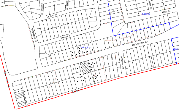
|
NOTIFICATION PLAN |
|
||
|
• PROPERTIES NOTIFIED
|
X SUBMISSIONS RECEIVED |
PROPERTY SUBJECT OF DEVELOPMENT |
|
|
One submission received out of map range |
|||
The submissions object to the development, generally on the following grounds:
· The development would have detrimental impact on the surrounding area;
· The development would result in unacceptable traffic impact on Carlingford Road due to vehicular access to, and from, the road rather than Keeler Street which is contradictory to the requirements within the Housing Strategy DCP;
· The development would cause environmental problems and traffic congestion;
· The development would increase accidents on Carlingford Road;
· The proposal is an overdevelopment of the site; and
· The development does not include sufficient landscape screening and would result in adverse impact on the privacy of the neighbouring properties;
Additionally, the residents made the following observations:
· Carlingford Road should be declared to have a maximum speed limit of 50 KMPH;
· Heavy rigid vehicular access should not be allowed on Carlingford Road;
· A fly over arrangement should be planned for Carlingford Road over Pennant Hills Road for West/South traffic;
· The proposal does not include any information about the capacity of the electrical substation;
· The submitted schedule of colours and finishes are not appropriate;
· The application does not include any details of solar access diagrams or details of impacts on the privacy of neighbouring properties;
· The development would result in increase of population in the area without any job opportunities;
· The development would result in enormous energy usage;
· The site is not well serviced by existing infrastructure;
· The development only includes one and two bedroom units;
· The proposal does not include an air quality assessment report;
· The proposal does not include calculations providing an estimate of the air pollution that would arise due to removal of trees and excavation works;
· No details of volumes of soil removed due to excavation have been provided;
· Energy efficient devices have not been used; and
· The developer is required to pay the cost of any damages to the road due to the development.
The merits of the matters raised in community submissions have been addressed in the body of the report with the exception of the following:
5.1.1. Traffic Matters
Council has undertaken an assessment of the overall traffic impact of the redeveloped precinct on the locality.
In the preparation of Council’s Housing Strategy transport modelling was undertaken to determine the traffic impact precincts to be rezoned as part of the Strategy. Traffic modelling and assessment for the Carlingford Precinct established that additional traffic that would be generated in the Precinct would not have a significant impact on existing roadway conditions and intersection performance in the area. The most significant traffic increase is envisaged to occur on arterial routes such as Pennant Hills Road and Carlingford Road. These increases are mainly attributed to anticipated growth and developments in other regions and to a greater extent to the re-distribution effect arising from the growth in through traffic from other regions of Sydney.
The modelling also established that the existing performance of the intersection of Carlingford Road with Hepburn Avenue is unsatisfactory during the morning peak period. This is mainly due to peak hour traffic congestion in Carlingford Road which limits the number of vehicles that can turn right out Hepburn Avenue. Signalising this junction would facilitate and improve access for the Precinct. However, it is considered that this would encourage ‘rat runs’ from Marsden Road via Rickard Street and possibly into Pennant Parade and North Rocks Road, Murray Farm Road and Kirkham Street. Signalisation of the intersection of Carlingford Road with Hepburn Avenue is not supported at this stage due to envisaged adverse impact on the amenity of the area. Eastbound traffic that turns right out of Hepburn Avenue has an option of using other roads to exit the area via the traffic signals at the intersection of Carlingford Road with Midson Road. Notwithstanding, review and monitoring of traffic conditions will be required to determine if any traffic management strategies are required in the area after the precinct has been redeveloped. In this regard, Council on 18 July 2012 considered DA/236/2012 for a five storey residential flat building at Nos. 48-52 Keeler Street Carlingford and made the following resolution:
Council undertake further traffic and dwelling yield modelling of the Carlingford Housing Strategy Precinct to confirm the road and other improvements required to facilitate future development within the Precinct and specifically taking into consideration issues including yield of developments being proposed within the Precinct, impact of the North West Rail Link and identified traffic improvements at Epping.
In accordance with Council’s resolution, modelling of the traffic generation associated with the development of the precinct is currently being progressed by Council.
The applicant submitted a traffic impact assessment report (as discussed in section 3.2.2 of this report), which confirms the findings of Council’s traffic modelling that the development would not change the Level of Service (LoS) of the nearby intersections.
5.1.2. Increase in Density
The proposed development is within the ‘Carlingford Road, Carlingford’ precinct rezoned for medium-high density housing in accordance with the Housing Strategy in September 2011. The concerns raised in the submission regarding detrimental social, health and educational impacts resulting from the development are addressed in the Housing Strategy.
The Housing Strategy included a detailed study on the identification of centres, selection of precincts and evaluation of precincts and consulted with various External Agencies including the Department of Planning (Regional Team), Department of Housing, Transport Infrastructure Development Corporation, NSW Police, Sydney Water, NSW Health, Department of Community Services and NSW Department of Education and Training.
5.1.3. Matters Not Relevant to the Assessment of This Application
The following matters raised in the submissions are not considered to be relevant to the assessment of the application:
· Road works required and speed zones to be enforced;
· Heavy vehicle truck access along Carlingford Road; and
· Amount of air pollution caused due to removal of trees and excavation; and
· Capacity of the electrical substation which would be determined by the relevant Public Authority.
5.1.4 Conditions of Consent
The following issues would be resolved via recommended conditions of consent:
· Conditions regarding excavation works would ensure that the soil is removed in an appropriate way;
· The developer is required to pay the cost for any damages on the road reserve; and
· The energy efficiency of the development is determined by the submitted BASIX certificate and the fulfilment of BASIX commitments would ensure that the resultant development is energy efficient.
5.1.5 Vehicular Access from the Rear Lane
Council’s Housing Strategy DCP requires the provision of a rear lane only for mixed use developments in the precinct located near the shopping centre. The provision does not apply to this site.
5.2 Public Agencies
The development application was referred to the following Agencies for comment:
5.2.1. Roads and Maritime Services
The application was referred to the Roads and Maritime Services (RMS) for comments under the provisions of Section 138 of the Roads Act 1993. RMS raises no objections subject to the implementation of recommended conditions of consent. The matters have been discussed in Sections 2.8 and 2.10 of this report.
5.2.2. NSW Police Force
The application was referred to NSW Police Force. No objections have been raised subject to recommended conditions of consent.
6. THE PUBLIC INTEREST
Section 79C(1)(e) of the Act requires Council to consider “the public interest”.
The public interest is an overarching requirement, which includes the consideration of the matters discussed in this report. Implicit to the public interest is the achievement of future built outcomes adequately responding to and respecting the future desired outcomes expressed in environmental planning instruments and development control plans.
The application is considered to have satisfactorily addressed Council’s and relevant agencies’ criteria and would provide a development outcome that, on balance, would result in a positive impact for the community. Accordingly, it is considered that the approval of the proposed development would be in the public interest.
CONCLUSION
The application seeks approval for the demolition of two existing dwellings and the construction of a five storey residential flat building comprising 32 units with basement car parking. The proposed development would be located on a site within a locality which has been recently rezoned as a high density residential precinct.
The application has been assessed having regard to Section 79C of the Environmental Planning and Assessment Act 1979, the design principles within SEPP 65, the standards within the Hornsby Shire Local Environmental Plan 1994 and the objectives of the development controls within Council’s Housing Strategy Development Control Plan.
The proposal would result in the expansion of an urban built form in keeping with the desired character of the precinct.
Approval of the proposal is recommended.
Note: At the time of the completion of this planning report, no persons have made a Political Donations Disclosure Statement pursuant to Section 147 of the Environmental Planning and Assessment Act 1979 in respect of the subject planning application.
|
Rod Pickles Manager - Development Assessment Planning Division |
James Farrington Group Manager Planning Division |
|
1.View |
Locality Map |
|
|
|
2.View |
Floor Plans |
|
|
|
3.View |
Landscape Plan |
|
|
|
4.View |
Elevations and Sections |
|
|
|
5.View |
Shadow Diagrams |
|
|
|
6.View |
Photomontage |
|
|
File Reference: DA/729/2012
Document Number: D02034077
SCHEDULE 1
GENERAL CONDITIONS
The conditions of consent within this notice of determination have been applied to ensure that the use of the land and/or building is carried out in such a manner that is consistent with the aims and objectives of the relevant legislation, planning instruments and Council policies affecting the land and does not disrupt the amenity of the neighbourhood or impact upon the environment.
Note: For the purpose of this consent, the term ‘applicant’ means any person who has the authority to act on or the benefit of the development consent.
Note: For the purpose of this consent, any reference to an Act, Regulation, Australian Standard or publication by a public authority shall be taken to mean the gazetted Act or Regulation, or adopted Australian Standard or publication as in force on the date that the application for a construction certificate is made.
1. Approved Plans and Supporting Documentation
The development must be carried out in accordance with the plans and documentation listed below and endorsed with Council’s stamp, except where amended by Council and/or other conditions of this consent:
|
Plan No. |
Rev |
Drawn by |
Dated |
|
Survey Plan |
- |
J P Bates and Inwood |
19/04/2012 |
|
DA:01 Site Analysis Plan |
A |
Cornerstone Design |
10/09/2012 |
|
DA:02 Lower Basement Plan |
A |
Cornerstone Design |
10/09/2012 |
|
DA:03 Upper Basement Plan |
C |
Cornerstone Design |
20/10/2012 |
|
DA:04 Ground Floor Plan |
C |
Cornerstone Design |
20/10/2012 |
|
DA:05 First Floor Plan |
A |
Cornerstone Design |
10/09/2012 |
|
DA:06 Second Floor Plan |
A |
Cornerstone Design |
10/09/2012 |
|
DA:07 Third Floor Plan |
A |
Cornerstone Design |
10/09/2012 |
|
DA:08 Fourth Floor Plan |
- |
Cornerstone Design |
July 2012 |
|
DA:09 Roof Plan |
A |
Cornerstone Design |
2/10/2012 |
|
DA:10 Elevations |
B |
Cornerstone Design |
20/10/2012 |
|
DA:11 Elevations |
A |
Cornerstone Design |
10/09/2012 |
|
DA:12 Sections |
A |
Cornerstone Design |
10/09/2012 |
|
DA: 15 Adaptable unit |
- |
Cornerstone Design |
September 2012 |
|
L01 - Landscape Plan |
B |
Zenith Landscape Designs |
10/09/2012 |
|
L02 – Existing Tree Plan and details |
B |
Zenith Landscape Designs |
10/09/2012 |
|
H1: Hydraulic Details – Site Plan |
4 |
ANA Civil Pty Ltd |
4/10/2012 |
|
H2: Hydraulic Details – OSD Details |
4 |
ANA Civil Pty Ltd |
4/10/2012 |
|
H3: Hydraulic Details – Soil and Water Management Plans |
4 |
ANA Civil Pty Ltd |
4/10/2012 |
|
Draft Strata Plans – Sheets 1 to 8 |
- |
Barry James Inwood |
October 2012 |
|
Document No. |
Prepared by |
Dated |
|
DA:13B Shadow Diagrams -AM |
Cornerstone Design |
20/10/2012 |
|
DA:14B Shadow Diagrams -PM |
Cornerstone Design |
20/10/2012 |
|
DA:16 Shadow Elevations |
Cornerstone Design |
October 2012 |
|
Access Report |
Accessible Building Solutions |
18/06/2012 |
|
Noise and Vibration Management Plan |
Acoustic Solutions Pty Ltd |
16/07/2012 |
|
Traffic Acoustic Report |
Acoustic Solutions Pty Ltd |
13/07/2012 |
|
Statement of Environmental Effects |
Wayne Siwak Urban Design Consultant |
July 2012 |
|
BASIX Certificate 434083M_03 |
Max Brightwell |
10/09/2012 |
|
Traffic, Access and Car Parking Assessment 12082r |
Transport and Urban Planning |
June 2012 |
|
SEPP 65 Design Verification Statement |
N.Lycenko |
17/07/2012 |
|
Schedule of Finishes and photomontage |
- |
Received by Council on 18/07/2012 |
|
Waste Management Plan |
Cornerstone Design |
Received by Council on 18/07/2012 |
|
Arboricultural Impact Assessment Report |
Jacksons Nature Works |
27/05/2012 |
2. Removal of Existing Trees
This development consent permits the removal of trees numbered 1,2,3,4,5,6,7,8,9,10 as identified in the Tree Location Plan within the Arboricultural Impact Assessment Report prepared by Jacksons Nature Works dated 27/5/2012. The removal of any other trees requires separate approval under Council’s Tree Preservation Order.
3. Amendment of Plans
a) The following plans must be amended in accordance with the approved Ground Floor Plan (DA04C) in Condition 1 of this development consent:
|
Plan No. |
Rev |
Drawn by |
Dated |
|
L01 - Landscape Plan |
B |
Zenith Landscape Designs |
10/09/2012 |
|
H1: Hydraulic Details – Site Plan |
4 |
ANA Civil Pty Ltd |
4/10/2012 |
|
H3: Hydraulic Details – Soil and Water Management Plans |
4 |
ANA Civil Pty Ltd |
4/10/2012 |
b) The approved plan DA:02 Lower Basement Plan prepared by Cornerstone Design dated 20/10/2012 must include provisions for 11 bicycle parking spaces. The design of the spaces must be in accordance with Australian Standard AS/NZS 2890.3:1993 – Bicycle Parking Facilities.
c) The approved floor plans for units 8, 15 and 22 (in drawing Nos. DA05A, DA06A and DA07A) must be amended to include a storage area as marked in red on the approved plans.
REQUIREMENTS PRIOR TO THE ISSUE OF A CONSTRUCTION CERTIFICATE
4. Building Code of Australia
All building work must be carried out in accordance with the requirements of the Building Code of Australia.
5. Contract of Insurance (Residential Building Work)
In the case of residential building work for which the Home Building Act 1989 requires there to be a contract of insurance in force in accordance with Part 6 of that Act, that such a contract of insurance is in force before any building work authorised to be carried out by the consent commences.
Note: This condition does not apply to the extent to which an exemption is in force under Clause 187 or 188 of the Act, subject to the terms of any condition or requirement referred to in Clause 187(6) or 188(4) of the Act, or to the erection of a temporary building.
6. Water/Electricity Utility Services
The applicant must submit written evidence of the following service provider requirements:
a) Energy Australia – a letter of consent demonstrating that satisfactory arrangements have been made to service the proposed development.
b) Sydney Water – the submission of a ‘Notice of Requirements’ under s73 of the Sydney Water Act 1994.
Note: Sydney Water requires that s73 applications are to be made through an authorised Sydney Water Servicing Coordinator. Refer to www.sydneywater.com.au or telephone 13 20 92 for assistance.
7. Accessible Units
The details of fit-outs of all accessible units (3 units) and details of adaptable units must be provided with the Construction Certificate Plans.
8. Letter Boxes
The details of letter boxes and meter enclosures must be provided with the Construction Certificate Plans. The letter boxes and meter enclosures must be provided with a minimum setback of 2 metres from all boundaries and must be suitably screened.
9. Dilapidation Report
A ‘Dilapidation Report’ is to be prepared by a ‘chartered structural engineer’ detailing the structural condition of all adjoining properties.
10. Acoustic Details
The Construction certificate plans must demonstrate compliance with the recommendations in the Traffic Acoustic Report prepared by Acoustic Solutions Pty Ltd dated 13/07/2012.
11. Triangular Island
Details of the design of the triangular island as required by RMS and specified in Condition 52 of this development consent must be submitted to the RMS for approval.
12. Stormwater Drainage
The stormwater drainage system for the development must be designed and constructed in accordance with Council’s Civil Works – Design and Construction Specification 2005 and the following requirements:
a) All details be provided with the Construction Certificate Plans;
b) Connected via galvanised rectangular hollow sections, 125mm x 75mm x 3mm thick, to the kerb line in Carlingford Road; and
c) The roof and upstream paved areas of the proposal shall be connected to the proposed detention system.
13. On Site Stormwater Detention
An on-site stormwater detention system must be designed and constructed for the development. An on-site stormwater detention system must be designed by a chartered civil engineer and constructed in accordance with the following requirements:
a) Details of the design be provided with the Construction Certificate plans;
b) Have a capacity of not less than 18.0 cubic metres, and a maximum discharge (when full) of 39 litres per second;
c) Have a 900 mm x 900 mm square access grate located directly above the on-site detention outlet;
d) The invert of the outlet orifice or pipe shall be set lower than the level of the graded tank floor.
e) The system must drain dry not requiring sumps;
f) An additional tank overflow system designed to convey all high level flows from the tank to the final grated pit adjacent the kerb outlet; and
g) Discharge from the detention system to be controlled via 1 metre length of pipe, not less than 50 mm diameter or via a stainless plate with sharply drilled orifice bolted over the face of the outlet discharging into a larger diameter pipe capable of carrying the design flow to the street drainage disposal system.
14. Internal Driveway/Vehicular Areas
The driveway and parking areas on site must be designed in accordance with Australian Standards 2890.1, AS2890.2, AS2890.6, and the following requirements:
a) Details of design be submitted with the Construction Certificate Plans;
b) Design levels at the front boundary to be obtained from Council;
c) The driveway be a rigid pavement;
d) The driveway grade for the design waste vehicle must not exceed 15.4% and transitions for changes in grade must not exceed requirements of AS2890.2;
e) Provision must be made for a turning area for Council’s Waste Services design vehicle and permanently marked out in the basement;
f) Driveway structure, retaining walls required to support the carriageway as required and the protection of all drops as per the requirements of a chartered Structural Engineer;
g) Planting of landscaping strips to enhance the visual amenity of the driveway;
h) The access way (including ramp, vehicle turning area and site entry/exit) to be used by waste collection vehicles, must comply with Australian Standard AS2890.2-2002 Parking Facilities Part 2: Off-street Commercial Vehicle Facilities for Small Rigid Vehicles with minimum design vehicle dimensions of 6.4 metres overall length, width of 2.3 metres, and 3.5 metre clearance height; and
i) Parking spaces for people with disabilities are to comply with AS/NZS 2890.6:2009.
j) The triangular island at the entrance to the site, as required by Roads and Maritime Services, must be completed.
15. Vehicular Crossing
A separate application under the Local Government Act, 1993 and the Roads Act, 1993 must be submitted to Council for the installation of a new vehicular crossing and the removal of the redundant crossing. The vehicular crossing must be constructed in accordance with Council’s Civil Works Design Specification 2005 and the following requirements:
a) Any redundant crossings to be replaced with integral kerb and gutter;
b) The footway area to be restored by turfing;
c) Provision for all relevant utility authorities’ necessary conduits, installed and protected under the crossing;
d) Adjustment of all regulatory signage and all services and street furniture made necessary by the proposed works;
Note1: A separate construction certificate is required to be issued prior to the commencement of any work.
Note2: An application for a vehicular crossing can only be made to one of Council’s Authorised Vehicular Crossing Contractors. You are advised to contact Council on 02 9847 6940 to obtain a list of contractors.
16. Traffic Control Plan
A Traffic Control Plan (TCP) must be prepared by a qualified traffic controller in accordance with the Roads & Traffic Authority’s Traffic Control at Worksites Manual 1998 and Australian Standard 1742.3 for all work on a public road and be submitted to Council. The TCP must detail the following:
a) Arrangements for public notification of the works.
b) Temporary construction signage.
c) Permanent post-construction signage.
d) Vehicle movement plans.
e) Traffic management plans.
f) Pedestrian and cyclist access/safety.
REQUIREMENTS PRIOR TO THE COMMENCEMENT OF ANY WORKS
17. Erection of Construction Sign
A sign must be erected in a prominent position on any site on which building work, subdivision work or demolition work is being carried out:
a) Showing the name, address and telephone number of the principal certifying authority for the work.
b) Showing the name of the principal contractor (if any) for any demolition or building work and a telephone number on which that person may be contacted outside working hours.
c) Stating that unauthorised entry to the work site is prohibited.
Note: Any such sign is to be maintained while the building work, subdivision work or demolition work is being carried out, but must be removed when the work has been completed.
18. Protection of Adjoining Areas
A temporary hoarding, fence or awning must be erected between the work site and adjoining lands before the works begin and must be kept in place until after the completion of the works if the works:
a) Could cause a danger, obstruction or inconvenience to pedestrian or vehicular traffic.
b) Could cause damage to adjoining lands by falling objects.
c) Involve the enclosure of a public place or part of a public place.
Note: Notwithstanding the above, Council’s separate written approval is required prior to the erection of any structure or other obstruction on public land.
19. Toilet Facilities
Toilet facilities must be available or provided at the works site before works begin and must be maintained until the works are completed at a ratio of one toilet for every 20 persons employed at the site. Each toilet must:
a) be a standard flushing toilet connected to a public sewer; or
b) have an on-site effluent disposal system approved under the Local Government Act 1993; or
c) be a temporary chemical closet approved under the Local Government Act 1993.
20. Erosion and Sediment Control
Erosion and sediment control measures must be provided and maintained throughout the construction period in accordance with the manual ‘Soils and Construction 2004 (Bluebook)’, the approved plans, Council specifications and to the satisfaction of the principal certifying authority. The erosion and sediment control devices must remain in place until the site has been stabilised and revegetated.
Note: On the spot penalties up to $1,500 may be issued for any on-compliance with this requirement without any further notification or warning.
21. Tree Protection Barriers
Tree protection fencing must be erected around T11 as identified in the Tree Location Plan within the Arboricultural Impact Assessment Report prepared by Jacksons Nature Works dated 27/5/2012 to be retained at a 4.5 metre setback. The tree fencing must be constructed of 1.8 metre ‘cyclone chainmesh fence.
REQUIREMENTS DURING CONSTRUCTION
22. Construction Work Hours
All work on site (including demolition and earth works) must only occur between the following hours:
Monday to Saturday 7 am to 5 pm
Sunday & Public Holidays No work
23. Demolition
All demolition work must be carried out in accordance with Australian Standard 2601-2001 – The Demolition of Structures and the following requirements:
a) Demolition material is to be disposed of to an authorised recycling and/or waste disposal site and/or in accordance with an approved waste management plan.
b) Demolition works, where asbestos material is being removed, must be undertaken by a contractor that holds an appropriate licence issued by WorkCover NSW in accordance with Chapter 10 of the Occupational Health and Safety Regulation 2001 and Clause 29 of the Protection of the Environment Operations (Waste) Regulation 2005.
c) On construction sites where buildings contain asbestos material, a standard commercially manufactured sign containing the words ‘DANGER ASBESTOS REMOVAL IN PROGRESS’ measuring not less than 400mm x 300mm must be erected in a prominent position visible from the street.
24. Environmental Management
The site must be managed in accordance with the publication ‘Managing Urban Stormwater – Landcom (March 2004) and the Protection of the Environment Operations Act 1997 by way of implementing appropriate measures to prevent sediment run-off, excessive dust, noise or odour emanating from the site during the construction of the development.
25. Waste Management
Waste management during the demolition and construction phase of the development must be undertaken in accordance with the approved Waste Management Plan. Additionally written record of the following items must be maintained during the removal of any waste from the site and such information submitted to the Principal Certifying Authority within fourteen days of the date of completion of the works:
a) The identity of the person removing the waste.
b) The waste carrier vehicle registration.
c) Date and time of waste collection.
d) A description of the waste (type of waste and estimated quantity).
e) Details of the site to which the waste is to be taken.
f) The corresponding tip docket/receipt from the site to which the waste is transferred (noting date and time of delivery, description (type and quantity) of waste).
g) Whether the waste is expected to be reused, recycled or go to landfill.
Note: In accordance with the Protection of the Environment Operations Act 1997, the definition of waste includes any unwanted substance, regardless of whether it is reused, recycled or disposed to landfill.
26. Street Sweeping
Street sweeping must be undertaken following sediment tracking from the site along Keeler Street during works and until the site is established.
27. Spoil Route
To protect Council’s assets, all vehicular access to and from the site during all stages of the development is to be via the shortest route to the nearest State or Regional Road.
28. Council Property
During construction works, no building materials, waste, machinery or related matter is to be stored on the road or footpath.
29. Excavated Material
All excavated material removed from the site must be classified in accordance with the NSW Environment Protection Authority’s Environmental Guidelines – Assessment, Classification and Management of Liquid and Non-Liquid Wastes prior to disposal to an approved waste management facility and reported to the principal certifying authority.
30. Landfill
Landfill must be constructed in accordance with Council’s ‘Construction Specification, 2005’ and the following requirements:
a) All fill material imported to the site is to wholly consist of Virgin Excavated Natural Material (VENM) as defined in Schedule 1 of the Protection of the Environment Operations Act 1997 or a material approved under the Department of Environment and Climate Change’s general resource recovery exemption.
b) A compaction certificate is to be obtained from a geotechnical engineer verifying that the specified compaction requirements have been met.
31. Survey Report – Finished Floor Level
Reports must be prepared by a registered surveyor and submitted to the principal certifying authority prior to the pouring of concrete at each level of the building certifying that:
a) The building, retaining walls and the like have been correctly positioned on the site.
b) The finished floor levels are in accordance with the approved plans.
32. Contamination During Construction Works
Should the presence of asbestos or soil contamination, not recognised during the application process be identified during demolition, the applicant must immediately notify the Principal Certifying Authority and Council.
33. Construction Noise Management
The construction works must be undertaken in accordance with the “Interim Construction Noise Guidelines – 2009” published by DECCW and the recommendations in Section 10 of the Noise and Vibration Management Plan prepared by Acoustic Solutions Pty Ltd dated 16/07/2012.
34. Works Near Trees
All required tree protection measures are to be maintained in good condition for the duration of the construction period.
All works (including driveways and retaining walls) within 4.5m of any trees required to be retained (whether or not on the subject property, and pursuant to this consent or the Tree Preservation Order), must be carried out under the supervision of an ‘AQF Level 5 Arborist’ and a certificate submitted to the principal certifying authority detailing the method(s) used to preserve the tree(s).
Note: Except as provided above, the applicant is to ensure that no excavation, filling or stockpiling of building materials, parking of vehicles or plant, disposal of cement slurry, waste water or other contaminants is to occur within 4 metres of any tree to be retained.
REQUIREMENTS PRIOR TO THE ISSUE OF AN OCCUPATION CERTIFICATE
Note: For the purpose of this consent, a reference to ‘occupation certificate’ shall not be taken to mean an ‘interim occupation certificate’ unless otherwise stated.
35. Fulfilment of BASIX Commitments
The applicant must demonstrate the fulfilment of BASIX commitments pertaining to the development.
36. Sydney Water – s73 Certificate
A s73 Certificate must be obtained from Sydney Water.
37. Car Parking Allocation & Resident Storage
The basement resident storage areas are to be allocated in accordance with the size requirements of the SEPP 65 - Residential Flat Design Code for the respective units and proximity to the unit car parking space.
38. Damage to Council Assets
Any damage caused to Council’s assets as a result of the construction of the development must be rectified in accordance with Council’s written requirements and at the sole cost of the applicant.
39. Creation of Easements
The following matters must be nominated on the plan of subdivision under s88B of the Conveyancing Act 1919:
a) Consolidation of the subject lots.
b) The creation of an appropriate "Positive Covenant" and "Restriction as to User" over the constructed on-site detention systems and outlet works, within the lots in favour of Council in accordance with Council’s prescribed wording. The position of the on-site detention system is to be clearly indicated on the title.
c) To register the OSD easement, the restriction on the use of land “works-as-executed” details of the on-site-detention system must be submitted verifying that the required storage and discharge rates have been constructed in accordance with the design requirements. The details must show the invert levels of the on site system together with pipe sizes and grades. Any variations to the approved plans must be shown in red on the “works-as-executed” plan and supported by calculations.
Note: Council must be nominated as the authority to release, vary or modify any easement, restriction or covenant.
40. Garbage Collection Easement
For the purpose of waste collection, an easement entitling Council, its servants and agents and persons authorised by it to enter upon the subject land and to operate thereon, vehicles and other equipment for the purposes of garbage collection must be granted to Council by the owner of the land.
Note: The easement must be in a form prescribed by Council and must include covenants to the effect that parties will not be liable for any damage caused to the subject land or any part thereof or to any property located therein or thereon by reason of the operation thereon of any vehicle or other equipment used in connection with the collection of garbage and to the effect that the owner for the time being of the subject land shall indemnify the Council, its servants, agents and persons authorised by it to collect garbage against liability in respect of any such claims made by any person whomsoever.
41. Retaining Walls
All required retaining walls must be constructed as part of the development.
42. Boundary Fencing
Fencing must be erected along all property boundaries behind the front building alignment to a height of 1.8 metres.
Note: Alternative fencing may be erected subject to the written consent of the adjoining property owner(s).
43. External Lighting
All external lighting must be designed and installed in accordance with Australian Standard AS 4282 – Control of the Obtrusive Effects of Outdoor Lighting. Certification of compliance with the Standard must be obtained from a suitably qualified person.
44. Unit Numbering
The allocation of unit numbering must be authorised by Council prior to the numbering of each unit in the development.
45. Works as Executed Plan
A works-as-executed plan(s) must be prepared by a registered surveyor and submitted to Council for completed road pavement, kerb & gutter, public drainage systems, driveways and on-site detention system. The plan(s) must be accompanied by a certificate from a registered surveyor certifying that all pipelines and associated structures lie wholly within any relevant easements.
46. s94 Infrastructure Contributions
The payment to Council of a contribution of $34,5242.30 for thirty additional residential units towards the cost of infrastructure identified in Council’s Development Contributions Plan 2007-2011 in accordance with the following table:
Note: The value of contribution is current as at 8/11/2012. The contribution will be adjusted from this date in accordance with the underlying consumer price index for subsequent financial quarters.
It is recommended that you contact Council to confirm the value of the contribution prior to payment.
47. Accessibility Requirements
a) Tactile ground surface indicators are to be positioned at the top and bottom of the pedestrian entrance to the building.
b) Kitchen cupboards and equipments must not obstruct wheelchair access around doors.
c) The accessible units must include all necessary fit outs.
48. Waste Management Details
The following waste management requirements must be complied with:
a) The bin storage rooms at the basement level must include water or a hose for cleaning, graded floors with drainage to sewer, a robust door, sealed and impervious surface, adequate lighting and ventilation.
b) A report must be prepared by an appropriately qualified person, certifying the following:
- A comparison of the estimated quantities of each waste type against the actual quantities of each waste type.
Note: Explanations of any deviations to the approved Waste Management Plan is required to be included in this report
- That at least 60% of the waste generated during the demolition and construction phase of the development was reused or recycled.
Note: If the 60% diversion from landfill cannot be achieved in the Construction Stage, the Report is to include the reasons why this occurred and certify that appropriate work practices were employed to implement the approved Waste Management Plan. The Report must be based on documentary evidence such as tipping dockets/receipts from recycling depots, transfer stations and landfills, audits of procedures etc. which are to be attached to the report.
c) Each unit must be provided with an indoor waste/recycling cupboard for the interim storage of a minimum one day’s waste generation with separate containers for general waste and recyclable materials.
d) Space must be provided for either individual compost containers for each unit or a communal compost container;
Note: The location of the compost containers should have regard for potential amenity impacts.
e) The bin carting route must be devoid of any steps.
Note: Ramps between different levels are acceptable
49. Completion of Landscaping
A certificate must be provided by a practicing landscape architect, horticulturalist or person with similar qualifications and experience certifying that all required landscaping works have been satisfactorily completed in accordance with the approved Landscape plans, the minimum construction standards identified in the Hornsby Shire Council Landscape Code for development applications and the following additional requirements for works within the site:
a) To maintain canopy cover, 2 large trees such as Eucalyptus pilularis are to be planted on the subject site within the rear setback area. The planting location must not be within 4 metres of the foundation walls of the building. The pot size is to be a minimum 25 litres and the tree(s) must be maintained until they reach the height of 3 metres. Trees must be native to Hornsby Shire and reach a mature height greater than 12 metres.
b) Rear landscape setback area (southern boundary) – Two (2) additional Corymbia gummifera (Red Bloodwood) be installed at minimum 45 litre pot size and Four additional Waterhoiusia floribunda (Waterhousia) be installed at minimum 25 litre pot size.
c) Eastern and western boundary screen planting (within the landscape setback areas adjoining the boundaries) - Eight additional Waterhousia floribunda (Waterhousia). Trees installed at minimum 25 litre pot size.
d) On slab planter boxes to include automatic drip irrigation, subsoil drainage (proprietary drainage cell, 50mm sand and filter fabric), and waterproofing.
e) 500 mm soil depth and 75mm mulch be provided for shrubs.
f) 1000 mm soil depth and 75 mm mulch be provided for trees and palms.
Note: Any proposed landscaping or fencing must not obstruct the clear sightlines of pedestrians or cyclists travelling along the footpath of Keeler Street.
Note: Advice on suitable species for landscaping can be obtained from Council’s planting guide ‘Indigenous Plants for the Bushland Shire’, available at www.hornsby.nsw.gov.au.
50. Construction for a safe environment
Prior to the issue of the Occupation Certificate, the site must include the following elements:
a) An intercom system be installed at gate locations to ensure screening of persons entering the units;
b) The entryway to the site be illuminated in high luminance at all times;
c) The communal open space at the rear of the site be illuminated with high luminance by motion sensor lighting;
d) The service areas of the ground floor and the garbage room at the basement be illuminated with high luminance by motion sensor lighting;
e) The driveway and the basement carpark is to be illuminated with low luminance at all times;
f) Robust materials which cannot be forced or breached with minimised maintenance requirements are to be used for construction work in the common areas;
g) The lamps and lighting levels must comply with Australian and New Zealand Lighting Standard 1158.1;
h) Effective signage be provided to guide visitors to the main areas and parking areas;
i) A street sign be prominently displayed in front of the site in accordance with Order No. 8, Section 124 Local Government Act 1993;
j) The communal area must include a clear sign to restrict access for non-residents;
k) Units numbers, entry and exit signs must be legible and clear;
l) Fire exit doors to be fitted with single cylinder locksets (Australia New Zealand Standard-Locksets); and
m) Doors must include laminated glass to increase safety.
OPERATIONAL CONDITIONS
51. Landscape Establishment
The landscape works must be maintained to ensure the establishment and successful growth of plant material including (but not be limited to) watering, weeding, replacement of failed plant material and promoting the growth of plants through standard industry practices.
52. Visitor Access
Visitors are to have access to the parking area at all times. Visitors are to be able to access the basement car park by an audio/visual intercom system located at the top of the ramped driveway.
53. Car Parking and Deliveries
All car parking must be constructed and operated in accordance with Australian Standard AS 2890.1 – 2004 – Off Street Car Parking and Australian Standard 2890.2 - 2002 – Off Street Commercial and the following requirements:
a) All parking areas and driveways are to be sealed to an all weather standard, line marked and signposted.
b) Car parking, loading and manoeuvring areas to be used solely for nominated purposes.
c) Vehicles awaiting loading, unloading or servicing must be parked on site and not on adjacent or nearby public roads;
d) All vehicular entry on to the site and egress from the site must be made in a forward direction.
e) Visitors must be able to access the basement car park at all times by an audio/visual intercom system located at the top of the ramped driveway at all times.
54. Noise
The level of total continuous noise emanating from operation of the premises including all the plants and air conditioning units (LA10) (measured for at least 15 minutes) in or on the above premises, must not exceed the background level by more than 5dB(A) when measured at all property boundaries.
55. Fire Safety Statement - Annual
On at least one occasion in every 12 month period following the date of the first ‘Fire Safety Certificate’ issued for the property, the owner must provide Council with an annual ‘Fire Safety Certificate’ to each essential service installed in the building.
56. Waste Storage Area and Waste Management
The waste management on site must be in accordance with the following requirements:
a) Each unit be provided with an indoor waste/recycling cupboard for the interim storage of a minimum one day’s segregated garbage and recycling generation.
b) Site security measures be implemented to prevent access to the waste storage rooms by the residents.
c) A site manager or caretaker must be employed and be responsible for moving bins from the bin storage area/compactor to the waste collection point, washing bins and maintaining storage areas, arranging the prompt removal of dumped rubbish, and ensuring all residents are informed of the waste management system.
CONDITIONS OF CONCURRENCE – NSW ROADS AND MARITIME SERVICES
The following conditions of consent are from the nominated State Agency pursuant to Section 79B of the Environmental Planning and Assessment Act 1979 and must be complied with to the satisfaction of that Agency.
57. Swept Path Analysis
The construction certificate plans must be submitted and approved by the Roads and Maritime Services (RMS) to demonstrate that the swept path of the longest vehicle including garbage trucks entering and exiting the site are in accordance with AUSTROADS.
58. Requirements Prior to the Issue of the Construction Certificate
a) To allow safe vehicular entry and exit to and from the site, a raised concrete triangular island must be constructed within the access driveway to channelize vehicular movements and restrict right turn movements into and out of the site. The triangular island must be designed so that the largest vehicle accessing the site can enter and leave from the kerbside lane and does not cross the triangular island or the other side of the access driveway. Details of the design of the island and the swept path plan must be submitted to RMS for approval prior to the issue of the Construction Certificate.
b) A Construction Traffic Management Plan detailing construction vehicular routes, number of trucks, hours of operation, access arrangements and traffic control arrangements associated with the demolition and/or remediation of the site must be submitted to Council and RMS for approval prior to the issue of the Construction Certificate,
c) A Demolition Traffic Management Plan detailing vehicular routes, number of trucks, hours of operation, access arrangements and traffic control arrangements associated with the demolition and/or remediation of the site must be submitted and approved by RMS prior to the issue of the Construction certificate;
59. Works Within Easement
a) To allow future access to the easement land and to maintain integrity of the easement, no buildings or structures are permitted to be built within the variable width easement for batter affecting the entire frontage of the property.
Note: RMS has previously dedicated by Government Gazette 28 April 1995, land as road along the Carlingford Road frontage. The subject property is affected by an easement for batter which benefits RMS. RMS has no other approved proposal that requires any other part of the subject property for road purposes.
b) All structures must be clear of the road reserve of Carlingford Road (unlimited in height and depth).
60. Requirements Prior to the Commencement of Any Works
Prior to the commencement of any works including demolition and remediation works, the following requirements are to be complied with:
a) Detailed design plans for the proposed gutter crossing in accordance with RMS requirements must be submitted to RMS for approval;
Note: The details of RMS requirements must be obtained from RMS’s Project Services Manager, Traffic Projects Section, Parramatta (telephone 8849 2496).
A plan checking fee (amount to be advised) and lodgement of a performance bond may be required from the applicant prior to the release of the approved road design plans by RMS.
b) The developer may be required to enter into a Work Authorisation Deed (WAD) for the above mentioned works relating to gutter crossing. The WAD will need to be executed prior to RMS’s assessment of the detailed civil design plans;
c) Detailed design plans and hydraulic calculations of any changes to the stormwater drainage system must be submitted to RMS for approval;
Note: Details should be forwarded to:
The Sydney Asset Management
Roads and Maritime Services
PO BOX 973 Parramatta CBD 2124.
A plan checking fee will be payable and a performance bond may be required prior to issue of the approval. With regard to Civil Works requirement please contact RMS’s Project Engineer, External Works on 88462114 or Fax: 8849 2766.
d) Detailed design drawings and geotechnical reports related to excavation of the site and support structures to assess the impact of the excavation on the structural stability of Carlingford Road must be submitted to RMS for approval;
Note: The report and enquiries should be forwarded to:
Project Engineer, External Works
Sydney Asset Management
Roads and Maritime Services
PO BOX 973 Parramatta CBD 2124
Telephone 8848 2114
Fax 8849 2766
The developer/applicant is required to pay the assessment cost.
e) If it is necessary to excavate below the level of the base of the footings of the adjoining roadways, the person acting on the consent must ensure that the owner/s of the roadway is/are given at least 7 days notice of intention to excavate below the base of the footing. The notice must include complete details of the work.
f) Full time “No Stopping” restrictions are to be implanted along the full Carlingford Road frontage of the site (unless already in place);
Note: Prior to installation of the restrictions the applicant must contact RMS’s Traffic Engineering Services on phone: (02) 8849 2928 for a Works Instruction.
61. Conditions to be Complied With During Construction Works and Operation of the Site
a) All building maintenance vehicles and removalist vehicles must be parked within the site at all times.
b) Any proposed landscaping or fencing must not restrict sight distance to pedestrians and cyclists travelling along Carlingford Road.
c) During construction works, all demolition and construction vehicles are to be parked wholly within the site and vehicles must enter the site before stopping. A construction zone is not permitted on Carlingford Road.
d) All works/regulatory signposting are to be at no cost to RMS.
Note: The applicant/developer is responsible for all public utility adjustment/relocation works, necessitated by the above work and as required by the various public utility authorities and/or their agents.
- END OF CONDITIONS -
ADVISORY NOTES
The following information is provided for your assistance to ensure compliance with the Environmental Planning and Assessment Act, 1979, Environmental Planning and Assessment Regulation 2000, other relevant legislation and Council’s policies and specifications. This information does not form part of the conditions of development consent pursuant to Section 80A of the Act.
Environmental Planning and Assessment Act 1979 Requirements
· The Environmental Planning and Assessment Act 1979 requires:
· A construction certificate prior to the commencement of any works. Enquiries regarding the issue of a construction certificate can be made to Council’s Customer Services Branch on 9847 6760.
· A principal certifying authority to be nominated and Council notified of that appointment prior to the commencement of any works.
· Council to be given at least two days written notice prior to the commencement of any works.
· Mandatory inspections of nominated stages of the construction inspected.
· An occupation certificate issued before occupying any building or commencing the use of the land.
Long Service Levy
In accordance with Section 34 of the Building and Construction Industry Long Service Payments Act 1986, a ‘Long Service Levy’ must be paid to the Long Service Payments Corporation or Hornsby Council.
Note: The rate of the Long Service Levy is 0.35% of the total cost of the work.
Note: Hornsby Council requires the payment of the Long Service Levy prior to the issue of a construction certificate.
Tree Preservation Order
To ensure the maintenance and protection of the existing natural environment, it is an offence to ringbark, cut down, top, lop, remove, wilfully injure or destroy a tree outside three metres of the approved building envelope without prior written consent from Council. Fines may be imposed for non-compliance with Council’s Tree Preservation Order.
Note: A tree is defined as a single or multi-trunked wood perennial plant having a height of not less than three (3) metres, and which develops many branches, usually from a distance of not less than one (1) metre from the ground, but excluding any plant which, in its particular location, is a noxious plant declared as such pursuant to the Noxious Weeds Act 1993. This definition of ‘tree’ includes any and all types of Palm trees.
All distances are determined British Standard BS 5837: 2005, “Trees in Relation to Construction – Recommendations”.
Disability Discrimination Act
The applicant’s attention is drawn to the existence of the Disability Discrimination Act. A construction certificate is required to be obtained for the proposed building, which will provide consideration under the Building Code of Australia, however, the development may not comply with the requirements of the Disability Discrimination Act. This is the sole responsibility of the applicant.
Dial Before You Dig
Prior to commencing any works, the applicant is encouraged to contact Dial Before You Dig on 1100 or www.dialbeforeyoudig.com.au for free information on potential underground pipes and cables within the vicinity of the development site.
Asbestos Warning
Should asbestos or asbestos products be encountered during construction or demolition works you are advised to seek advice and information should be prior to disturbing the material. It is recommended that a contractor holding an asbestos-handling permit (issued by Work Cover NSW), be engaged to manage the proper disposal and handling of the material. Further information regarding the safe handling and removal of asbestos can be found at:
Alternatively, telephone the Work Cover Asbestos and Demolition Team on 8260 5885.
Rain Water Tank
It is recommended that water collected within any rainwater tank as part of the development be limited to non-potable uses. NSW Health recommends that the use of rainwater tanks for drinking purposes not occur where a reticulated potable water supply is available.
House Numbering
House numbering can only be authorised by Council. Before proceeding to number each premise in the development, the allocation of numbers is required to be obtained from Council's Planning Division. The authorised numbers are required to be displayed in a clear manner at or near the main entrance to each premise.
Planning Report No. PL34/12
Planning Division
Date of Meeting: 19/12/2012
11 DEVELOPMENT APPLICATION - FIVE STOREY RESIDENTIAL FLAT BUILDING COMPRISING 45 UNITS - 223-227 CARLINGFORD ROAD, CARLINGFORD
EXECUTIVE SUMMARY
|
DA No: |
DA/719/2012 (Lodged 16 July 2012) |
|
Description: |
Construction of a five storey residential flat building containing 45 units and basement car park |
|
Property: |
Lot 5 DP 29798, Lot 6 DP 29798, Lot 7 DP 29798, Nos. 223-227 Carlingford Road, Carlingford |
|
Applicant: |
CBD Core Pty Ltd |
|
Owner: |
Mr M Esmailpour and Mrs Z Azizi: Mr M K Lee and Mrs H K Lee; Mr S W Yun and Mrs B Y Choi |
|
Estimated Value: |
$5,400,000 |
|
Ward: |
C |
· The application proposes the construction of a five storey residential flat building comprising 45 units and basement car park.
· The proposal generally complies with the Hornsby Shire LEP 1994 and State Environmental Planning Policy No. 65 – Design Quality Residential Flat Building. The proposal complies with the Housing Strategy Development Control Plan and is considered acceptable in respect to the Plan requirements regarding isolated sites.
· One submission has been received in respect of the application.
· It is recommended that the application be approved.
|
THAT Development Application No. 719/2012 for construction of a five storey residential flat building containing 45 units and basement car park at Lot 5 DP 29798, Lot 6 DP 29798, Lot 7 DP 29798, Nos. 223-227 Carlingford Road, Carlingford be approved subject to the conditions of consent detailed in Schedule 1 of Group Manager’s Report No. PL34/12. |
BACKGROUND
The proposed development was the subject of a Pre-DA Meeting on 17 May 2012. At the meeting, the applicant was advised the proposed development would result in isolation of the adjoining property at No. 229 Carlingford Road and would not comply in respect to the requirements of the Housing Strategy Development Control Plan for the consolidation of allotments to ensure the orderly and economic development of land within the Housing Strategy Precinct.
SITE
The site has an area of 2,706.93m2 and is generally a uniform shaped site with a frontage of 51.1m to the southern side of Carlingford Road. The site has a north-easterly aspect with an average fall of 4% to the frontage.
There are three existing dwelling-houses on the site and several trees. The site includes an easement for road batter at the frontage.
Carlingford Road at the frontage is a four lane State Road link between the Cumberland Highway and the Epping Highway and carries a high volume of traffic. The road includes a west bound right turn lane at the frontage for access to Carlingford Court Shopping Centre 130m north-west of the site. The Shopping Centre building is a dominant landmark building in the locality.
The site forms part of the ‘Carlingford Road, Carlingford’ precinct rezoned for medium-high density housing in accordance with the Hornsby Shire Council Housing Strategy in September 2011. The precinct is bounded by Carlingford Road, Pennant Hills Road, Keeler Street and Hepburn Avenue.
The surrounding developments within the precinct and opposite the site, east of the Shopping Centre include single and two storey dwelling-houses. Carlingford is undergoing transition to higher density developments particularly within the Hills Shire Council area west of Pennant Hills Road.
The site is within walking distance of Carlingford Commercial Centre and a bus stop on Sydney Bus Route M54 with connection to Parramatta, Epping and Macquarie Centre.
PROPOSAL
The proposal is for the demolition of the existing dwelling-houses and construction of a five storey residential flat building containing 45 units and basement car park.
The proposed units include 5 x 1 bedroom, 34 x 2 bedroom and 6 x 3 bedroom units. The single level basement car park includes 56 car parking spaces including 9 visitor spaces. The proposed building is designed for garbage truck access within the frontage.
Strata subdivision is not included in the proposal.
ASSESSMENT
The development application has been assessed having regard to the ‘Metropolitan Plan for Sydney 2036’, the ‘North Subregion (Draft) Subregional Strategy’ and the matters for consideration prescribed under Section 79C of the Environmental Planning and Assessment Act 1979 (the Act). The following issues have been identified for further consideration.
1. STRATEGIC CONTEXT
1.1 Metropolitan Plan for Sydney 2036 and (Draft) North Subregional Strategy
The Metropolitan Plan for Sydney 2036 is a broad framework to secure Sydney’s place in the global economy by promoting and managing growth. It outlines a vision for Sydney to 2036; the challenges faced, and the directions to follow to address these challenges and achieve the vision. The Draft North Subregional Strategy acts as a framework for Council in its preparation of the Comprehensive LEP by the end of 2012.
The Draft North Subregional Strategy sets the following targets for the Hornsby LGA by 2031:
· Employment capacity to increase by 9,000 jobs; and
· Housing stock to increase by 11,000 dwellings.
The proposed development would be consistent with the draft Strategy by providing an additional 42 dwellings and would contribute towards housing choice in the locality.
The proposed development would be consistent with the Metropolitan Plan for Sydney 2036.
2. STATUTORY CONTROLS
Section 79C(1)(a) requires Council to consider “any relevant environmental planning instruments, draft environmental planning instruments, development control plans, planning agreements and regulations”.
2.1 Hornsby Shire Local Environmental Plan 1994
The subject land is zoned Residential C (Medium/High Density) under the Hornsby Shire Local Environmental Plan 1994 (HSLEP). The objectives of the zone are:
(a) to provide for the housing needs of the population of the Hornsby area.
(b) to promote a variety of housing types and other land uses compatible with a medium to high density residential environment.
(c) to provide for development that is within the environmental capacity of a medium to high density residential environment.
The proposed development is defined as ‘multi-unit housing’ under the HSLEP and is permissible in the zone with Council’s consent. The land is identified within the area detailed on Diagram 8 under Schedule BB of the HSLEP.
Clause 15A of the HSLEP prescribes that the maximum building height within the area detailed under Schedule BB is not to exceed 17.5 metres. The proposed building complies with this requirement.
Clause 18 of the HSLEP sets out heritage conservation provisions for Hornsby Shire. The site is not in the vicinity of a heritage item or conservation area and is not subject to consideration for heritage conservation. Therefore, no further assessment in this regard is necessary.
2.2 Draft Hornsby Local Environmental Plan
The Draft Hornsby Local Environmental Plan (Draft HLEP) was exhibited from 5 June 2012 to 7 August 2012. The Draft HLEP essentially reiterates the current land use zoning and height control applicable to the site as outlined below:
2.2.1 Zoning
The site would be zoned R4 (High Density Residential) zone pursuant to the Land Use Table of the Draft HLEP. The proposed development is defined as a ‘Residential Flat Building’ and would be a permissible use in the zone with Council’s consent.
2.2.2 Height of Building
Clause 4.3 of the draft HLEP provides that the height of a building on any land is not to exceed the maximum height shown for the land on the Height of Buildings Map. The maximum permissible height for the subject site is 17.5 metres. The proposal complies with this provision.
2.3 State Environmental Planning Policy No. 55 – Remediation of Land
State Environmental Planning Policy No. 55 (SEPP 55) requires that Council must not consent to the carrying out of any development on land unless it has considered whether the land is contaminated or requires remediation for the proposed use.
The site has been used for residential purposes and is unlikely to be contaminated. No further assessment is considered necessary in this regard. A condition is recommended should any contamination be found during construction.
2.4 State Environmental Planning Policy No. 65 – Design Quality Residential Flat Development
The Policy provides for design principles to improve the design quality of residential flat development and for consistency in planning controls across the State.
The applicant has submitted a design verification statement prepared by a qualified designer stating how the proposed development achieves the design principles of SEPP 65. The design principles of SEPP 65 and the submitted design verification statement are addressed below.
2.4.1 Principle 1 - Context
Design Principle 1 is as follows:
Good design responds and contributes to its context. Context can be defined as the key natural and built features of an area.
Responding to context involves identifying the desirable elements of a location’s current character or, in the case of precincts undergoing a transition, the desired future character as stated in planning and design policies. New buildings will thereby contribute to the quality and identity of the area.
The context of the site is defined by the Desired Future Character Statement of the Housing Strategy Development Control Plan (Housing Strategy DCP). The desired future character of the area is that of a high density residential precinct incorporating five storey developments in a landscaped setting. The applicant states the proposal is a contemporary interpretation of the Housing Strategy DCP taking into consideration modern aesthetics and amenity standards.
The submitted statement is supported in respect to this Principle.
2.4.2 Principle 2 - Scale
Design Principle 2 is as follows:
Good design provides an appropriate scale in terms of the bulk and height that suits the scale of the street and the surrounding buildings.
Establishing an appropriate scale requires a considered response to the scale of existing development. In precincts undergoing a transition, proposed bulk and height needs to achieve the scale identified for the desired future character of the area.
The precinct is undergoing transition. The scale of the future built environment is commensurate with Council’s planning controls which promote five storey residential flat buildings with a maximum height of 17.5 metres. The scale of the proposed development is appropriate for the site and in accordance with the planning controls and desired future character of the precinct. The elevations achieve an appropriate aesthetic outcome and composition and create the appearance of two pavilions.
2.4.3 Principle 3 – Built Form
Design Principle 3 is as follows:
Good design achieves an appropriate built form for a site and the building’s purpose, in terms of building alignments, proportions, building type and the manipulation of building elements.
Appropriate built form defines the public domain, contributes to the character of streetscape and parks, including their views and vistas, and provides internal amenity and outlook.
The Housing Strategy DCP includes planning controls for height, setbacks, building footprints and articulation which prescribe the future built form of the precinct. The details of the elements of the built form are assessed in Section 2.10 of this report. The proposed building is appropriately modulated and articulated to reduce bulk and scale and express residential character.
2.4.4 Principle 4 – Density
Design Principle 4 is as follows:
Good design has a density appropriate for a site and its context, in terms of floor space yields (or number of units or residents).
Appropriate densities are sustainable and consistent with the existing density in an area or in precincts undergoing a transition, are consistent with the stated desired future density. Sustainable densities respond to the regional context, availability of infrastructure, public transport, community facilities and environmental quality.
The site density is regulated by the statutory height control of 17.5m and the Housing Strategy DCP. The proposal is within the DCP prescriptive measures as addressed in Sections 2.1 and 2.10 of this report.
2.4.5 Principle 5 – Resource, Energy and Water Efficiency
Design Principle 5 is as follows:
Good design makes efficient use of natural resources, energy and water throughout its full life cycle, including construction.
Sustainability is integral to the design process. Aspects include demolition of existing structures, recycling of materials, selection of appropriate and sustainable materials, adaptability and reuse of buildings, layouts and built form, passive solar design principles, efficient appliances and mechanical services, soil zones for vegetation and reuse of water.
The applicant has submitted BASIX Certificate No. 436383M for the proposed 45 dwellings. In achieving the required BASIX targets for sustainable water use, thermal comfort and energy efficiency, the proposed development achieves the design criteria. The building design achieves an efficient use of natural resources, includes sustainable materials and passive solar design principles.
2.4.6 Principle 6 – Landscape
Design Principle 6 is as follows:
Good design recognises that together landscape and buildings operate as an integral and sustainable system, resulting in greater aesthetic quality and amenity for both occupants and the adjoining public domain.
Landscape design builds on the existing site’s natural and cultural features in responsible and creative ways. It enhances the development’s natural environmental performance by co-ordinating water and soil management, solar access, micro-climate, tree canopy and habitat values. It contributes to the positive image and contextual fit of development through respect for streetscape and neighbourhood character, or desired future character.
Landscape design should optimise useability, privacy and social opportunity, equitable access and respect for neighbour’s amenity, and provide for practical establishment and long term management.
The application includes a landscape concept plan providing landscaping along the street frontage, side and rear boundaries. The planting would provide an appropriate landscape setting for the development. In this regard, the proposed development is in accordance with the Landscaping principle of SEPP 65 and the Housing strategy DCP objective for buildings within landscaped settings.
2.4.7 Principle 7 – Amenity
Design Principle 7 is as follows:
Good design provides amenity through the physical, spatial and environmental quality of a development.
Optimising amenity requires appropriate room dimensions and shapes, access to sunlight, natural ventilation, visual and acoustic privacy, storage, indoor and outdoor space, efficient layouts and service areas, outlook and ease of access for all age groups and degrees of mobility.
The amenity design principle is prescribed by the Residential Flat Design Code (refer to discussion in Section 2.5). The proposed development is in accordance with the requirements of the Residential Flat Design Code in respect to solar access, visual and acoustic privacy, apartment layouts, private open spaces and natural ventilation.
2.4.8 Principle 8 – Safety and Security
Design Principle 8 is as follows:
Good design optimises safety and security, both internal to the development and for the public domain.
This is achieved by maximising overlooking of public and communal spaces while maintaining internal privacy, avoiding dark and non-visible areas, maximising activity on streets, providing clear, safe access points, providing quality public spaces that cater for desired recreational uses, providing lighting appropriate to the location and desired activities, and clear definition between public and private spaces.
The applicant’s statement includes the following comment:
Proposed orientation of buildings, floor layouts and provision of balconies provide natural passive surveillance of public domain and common open space. Appropriate security arrangements are incorporated at pedestrian entry lobby and access to common open spaces. All pedestrian areas are designed to provide clear sight lines and minimise potential for “hiding” places for attacks. Storage cages will be of chain wire partitioning to allow visual sight lines.
The proposed development is considered satisfactory in respect to Crime Prevention Through Environmental Design principles (CPTED). The applicant’s statement is supported in respect to this Principle. Refer also to comments in Section 2.5.4.
2.4.9 Principle 9 – Social Dimensions and Housing Affordability
Design Principle 9 is as follows:
Good design responds to the social context and needs of the local community in terms of lifestyles, affordability, and access to social facilities.
New development should optimise the provision of housing to suit the social mix and needs in the neighbourhood or, in the case of precincts undergoing transition, provide for the desired future community.
New development should address housing affordability by optimising the provision of economic housing choices and providing a mix of housing types to cater for different budgets and housing needs.
The Housing Strategy DCP includes prescriptive measures for housing choice and for adaptable housing to provide for aging in place. The proposal meets the prescriptive measures and extends the range and diversity of residential accommodation available in the area.
2.4.10 Principle 10 – Aesthetics
Design Principle 10 is as follows:
Quality aesthetics require the appropriate composition of building elements, textures, materials and colours and reflect the use, internal design and structure of the development. Aesthetics should respond to the environment and context, particularly to desirable elements of the existing streetscape or, in precincts undergoing transition, contribute to the desired future character of the area.
The applicant’s statement includes the following comment:
An appropriate composition of building elements, material textures and colours has been utilised to reflect the building’s residential use character. The external appearance of the building reflects the “base, middle and top” typology encouraged by the SEPP 65 guidelines. The articulation of the building facades, the design’s massing composition seek to find balance with its surroundings. Selected materials also compliment required and desired materials as set out in the DCP.
The proposed building composition, colours, textures and materials would contribute to the quality of the residential environment of the ‘Carlingford Road, Carlingford precinct’. The applicant’s statement is supported in respect to this Principle.
2.5 SEPP 65 - Residential Flat Design Code
SEPP 65 also requires consideration of the Residential Flat Design Code, NSW Planning Department 2002. The Code includes development controls and best practice benchmarks for achieving the design principles of the SEPP 65. The following table sets out the proposal’s compliance with the Code:
|
Residential Flat Design Code |
|||
|
Control |
Proposal |
Requirement |
Compliance |
|
Deep Soil Zone |
27% |
25% |
Yes |
|
Communal Open Space |
32% |
25-30% |
Yes |
|
Gnd Level Private Open Space |
16.8m2 to 23.4m2 1.2m to 5.3m |
25m2 Min Dimension 4m2 |
No No |
|
Minimum Dwelling Size |
1 br – 57m2 2 br – 74m2 3 br – 94m2 |
1 br – 50m2 2 br – 70m2 3 br – 95m2 |
Yes Yes No |
|
Maximum Kitchen Distance |
9.8m |
8m |
No |
|
Minimum Balcony Depth |
2.2m |
2.0m |
Yes |
|
Dual Aspect & Cross Ventilation |
70% |
60% |
Yes |
|
Adaptable Housing |
30% |
10% |
Yes |
As detailed in the above table, the proposed development complies with the prescriptive measures within the Residential Flat Design Code other than the ground floor open space areas and the maximum kitchen distance. Below is a brief discussion regarding the relevant development controls and best practice guidelines.
2.5.1 Apartment Layout and Mix
The proposal includes a range of apartment sizes and layouts. Of the 34 x 2 bedroom units, 13 units also include media/study areas. The proposed apartment layouts are functional, well appointed spaces. The depth and width of the apartments ensures adequate natural light and ventilation. The majority of kitchen spaces either include a window, or are located within 8m of a window.
The proposal includes a range of smaller units providing for housing choice.
It is considered the proposed units meet the best practice requirements of the Code.
2.5.2 Ground Floor Apartments
The Code encourages separate entries for ground floor apartments and private gardens areas at ground level.
The proposed ground floor of the building includes large private open space terrace areas accessible from the open podium. At the street frontage, the courtyards of the two ground floor apartments have separate access off the pedestrian entry. The submitted landscaping plan includes planter boxes and screen planting for privacy for the large terrace areas.
The proposed ground floor open space areas are considered appropriate for the respective ground floor units in respect to dwelling size, aspect, unit configuration and amenity. Accordingly, the non-compliance with the best practice 25m2 open space area and 4m dimension is considered acceptable.
It is considered the proposed ground floor design is satisfactory in meeting the user requirements of future residents and the requirements of the Code for ground floor apartments.
2.5.3 Internal Circulation
Each floor includes an open foyer/corridor that divides the floor and forms part of the articulation of the building to form separate pavilions. The lift access is within a central foyer opening onto the floor corridors. The proposed corridors meet the Code’s requirements for the number units accessed (less than 8) and design for amenity. All unit entries are a relatively short distance from the lift.
The proposed internal circulation spaces provide interest in contributing to the communal spaces of the building and would promote resident interaction and a sense of community. The open foyer/corridors form the building indentations and contribute to the articulation of the building.
It is considered the proposed internal circulation spaces achieve the best practice requirements of the Code.
2.5.4 Safety and Visual Privacy
The proposed development is designed to enable casual surveillance of public access to the development and communal open space areas without compromising resident privacy.
Appropriate conditions for building and unit security and graffiti management, are recommended for the safety and security of residents of the proposed development.
2.5.5 Acoustic Privacy
The site is affected by road traffic noise at the Carlingford Road frontage of the site.
The applicant has submitted an acoustic consultant’s report which includes recommendations for noise mitigation measures for the building to comply with Council’s Code of Practice for Sound Insulation of Residential Buildings.
The proposed floor plan layout ensures effective grouping and separation of noise generating kitchen, bathroom and laundry areas from the quieter bedroom areas of the units.
Subject to recommended conditions for noise mitigation, the proposed development meets the Code’s best practice requirements for acoustic privacy.
2.5.6 Storage
The proposed units include built-in robes and linen cupboard storage. The basement includes caged storage areas. To ensure appropriate storage areas are allocated for each unit, a condition is recommended for compliance with the Code’s best practice storage area requirements for storage areas to be sized according to one, two and three bedroom units.
2.6 State Environmental Planning Policy (Building Sustainability Index – BASIX) - 2004
The application has been assessed against the requirements of State Environmental Planning Policy (Building Sustainability Index: BASIX) 2004. The proposal includes a BASIX Certificate for the proposed units and is considered to be satisfactory.
2.7 State Environmental Planning Policy No. 32 - Urban Consolidation (Redevelopment of Urban Land) (SEPP 32)
The application has been assessed against the requirements of SEPP 32, which requires Council to implement the aims and objectives of this Policy to the fullest extent practicable when considering development applications relating to redevelopment of urban land. The application complies with the objectives of the Policy as it would promote social and economic welfare of the locality and would result in the orderly and economic use of under utilised land within the Shire.
2.8 State Environmental Planning Policy (Infrastructure) 2007
The proposed development has frontage to a classified road (Carlingford Road) and is subject to concurrence of Roads and Maritime Services (RMS) pursuant to Clauses 100 and 101 of the Policy.
RMS considered the proposed development and raised no objection to the proposal subject to conditions for truck access and traffic safety on Carlingford Road. Refer to comments in Section 2.10.13 and Section 3.2.2.
2.9 Sydney Regional Environmental Plan (Sydney Harbour Catchment) 2005
The application has been assessed against the requirements of Sydney Regional Environmental Plan (Sydney Harbour Catchment) 2005. This Policy provides general planning considerations and strategies to ensure that the catchment, foreshores, waterways and islands of Sydney Harbour are recognised, protected, enhanced and maintained.
The proposal includes details of stormwater management of the site by providing an on-site detention system. Council’s assessment of the proposal in this regard concludes that the proposed development would have minimal potential to impact on the Sydney Harbour Catchment. A condition is recommended with respect to installation of sediment and erosion control measures prior to, and during, construction.
2.10 Housing Strategy Development Control Plan
The proposed development has been assessed having regard to the desired outcomes and prescriptive measures within Council’s Housing Strategy Development Control Plan (Housing Strategy DCP). The following table sets out the proposal’s compliance with the prescriptive measures of the Plan:
|
Housing Strategy Development Control Plan |
|||
|
Control |
Proposal |
Requirement |
Compliance |
|
Site Width |
51m |
Min – 30m |
Yes |
|
Height |
5 storeys – 17.5m |
5 storeys – 17.5m |
Yes |
|
Lowest Residential Floor Above Ground |
1.4m |
Max - 1.50m |
Yes |
|
Maximum Floorplate Dimension |
35m |
35m |
Yes |
|
Building Indentation |
4m |
4m |
Yes |
|
Front Setback |
10m 8m < 1/3rd frontage Balc. 7m < 1/3rd |
10m 8m < 1/3rd frontage Balc. 7m < 1/3rd |
Yes Yes Yes |
|
W Side Setback |
6.6m 4.3m < 1/3rd frontage |
6m 4m < 1/3rd frontage |
Yes Yes |
|
E Side Setback |
9.4m 4m < 1/3rd frontage |
6m 4m < 1/3rd frontage |
Yes Yes |
|
Rear Setback |
9.3m-10m Balc. 7.2m > 1/3rd boundary |
10m Balc 7m < 1/3rd boundary |
No Yes |
|
Top Storey Setback From Ground Floor |
Front – 3m W Side - 2m–3.8m E Side - 2.5m-3.8m Rear – 2.5m-5.1m |
3m 3m 3m 3m |
Yes No No No |
|
Underground Parking Setback |
Front - 7m-7.3m W Side - 4m E Side – 2.1m-4m Rear – 6.3m-7.5m |
7m 4m 4m 7m |
Yes Yes No No |
|
Basement Ramp Setback |
2m |
2m |
Yes |
|
Car Parking |
47 resident spaces 9 visitor spaces |
45 resident spaces 9 visitor spaces |
Yes Yes |
|
Landscaping |
Front & Rear – 7m W Side – 4m E Side – 2m-4m |
7m 4m 4m |
Yes Yes No |
|
Private Open Space Min Width 2.5m |
1 br units - > 16.2+m2 2 br units - > 15.8+m2 3 br units - > 52.6+m2 |
10m2 12m2 16m2 |
Yes Yes Yes |
|
Communal Open Space |
32% |
25% |
Yes |
|
Sunlight Access |
71% |
70% |
Yes |
|
Housing Choice |
1 br units – 11% 2 br units - 76% 3 br units – 13% |
10% 10% 10% |
Yes Yes Yes |
|
Adaptable Units |
30% |
30% |
Yes |
As detailed in the above table, the proposed development does not comply with a number of prescriptive measures within Council’s Housing Strategy DCP. The matters of non-compliance are detailed below, as well as a brief discussion regarding the desired outcomes and the prescriptive measures.
2.10.1 Desired Future Character
The proposed building is in accordance with required key principles for the future character of the precinct for well articulated five storey residential flat buildings in garden settings with basement car parking.
2.10.2 Design Quality – SEPP 65
The proposed development accords with the design principles of SEPP 65 as discussed in Sections 2.4 and 2.5 of this report.
2.10.3 Site Requirements
The site is relatively large with a width of 51m. The proposed development would effectively isolate No. 229 Carlingford Road from development in accordance with the provisions of the Housing Strategy DCP. The adjacent site at Nos. 231-233 Carlingford Road (subject of DA/542/2012) is subject to a stormwater drainage easement along the eastern side boundary. The drainage easement would effectively negate consolidation of No. 229 Carlingford Road with Nos. 231-233 Carlingford Road, as a building could not be constructed over the drainage easement.
The applicant has submitted documentation in respect to the Housing Strategy DCP requirement for isolated sites, to establish that a genuine and reasonable attempt has been made to purchase the adjoining land at No. 229 Carlingford Road.
The Land and Environment Court’s established Planning Principles for development proposals that would result in an isolated site include the following:
1. Negotiations should commence at an early stage and prior to the lodgement of the development application.
2. The development application should include details of the offers made to the owner of the isolated site based on at least one recent independent valuation.
3. The level of negotiation and any offers made for the isolated site are matters that can be given weight in the consideration of the development application. The amount of weight will depend on the level of negotiation, whether any offers are deemed reasonable or unreasonable, any relevant planning requirements and the provisions of Section 79C of the Environmental Planning and Assessment Act 1979.
The applicant’s submitted documentation includes the following evidence:
· Letter dated 17 May 2012 - the applicant, CBD Core Pty Ltd made an offer of $1,200,000 to Hai Lu Zheng C/- Andrew Oh, Tracy Yap Reality, to purchase No. 229 Carlingford Road, Carlingford.
· Email sent 22 May 2012 to CBD Core Pty Ltd – from Andrew Oh, Tracy Yap Realty rejecting the offer (having spoken to the owners of 229 Carlingford Road), as it was considered that the offer was not within the market price range.
· Valuation Report dated 4 June 2012, prepared by Danny Sukkar, Registered Valuer for CBD Core Pty Ltd. Reported a current market value of $1,170,000 for 229 Carlingford Road Carlingford, as a development site consolidated with 223-227 Carlingford Road.
· Valuation Report dated 5 June 2012, prepared by Jeff Younis, Registered Valuer for CBD Core Pty Ltd. Reported a current market value of $1,235,000 for 229 Carlingford Road Carlingford, as a development site amalgamated with the adjoining property 223-227 Carlingford Road.
· Letter dated 14 June 2012 - the applicant CBD Core Pty Ltd made a second offer of $1,235,000 to Hai Lu Zheng C/- Andrew Oh, Tracy Yap Reality, to purchase 229 Carlingford Road. The offer being time limited to 72 hours from the date of the letter. The letter included the following matter:
Given that my previous offers to purchase your property have been rejected, outright with no formal reasons provided, I sincerely ask you to objectively consider this offer. Both my legal and town planning advice confirms that should this final offer be rejected, I am legally entitled to proceed with developing my land at 223, 225 and 227 Carlingford Road on its own given I have followed the process identified by the Land and Environment Court of NSW when consolidation of all development sites is not able to occur.
· Email sent 18 June 2012 to CBD Core Pty Ltd – from Andrew Oh, Tracy Yap Realty stating the vendor is willing to negotiate but not on 72 hours notice and that the vendor will have an independent valuation with regard to recent sales ($1.4m to $1.6m).
The subject development application was lodged on 16 July 2012. The adjoining owner, Mr H L Zheng, in a submission dated 15 August 2012 objecting to the proposed development, made the following statement:
We have received an offer to purchase our site from CBD Core in June. However, we do not think it was a genuine and reasonable priced offer. We have responded to CBD Core and have been looking forward to any further discussion.
On 15 October 2012, the applicant submitted an indicative plan of a five storey residential flat building on the No. 229 Carlingford Road site. Notwithstanding non-compliance with the Housing Strategy DCP in respect to site requirements, floorplates and separations, the indicative plan demonstrates that a five storey residential flat building, setback 10m from the front boundary and 10m from the rear boundary and with basement car park, could be accommodated on the No. 229 Carlingford Road site. The plan indicates a development containing 13 units.
The owner of the isolated site made a late submission to Council dated 22 November 2012 advising reasons why the applicant’s offer was rejected and that a valuation report had been obtained with a range of $1.490 - $1.575m for No. 229 Carlingford Road. A copy of the valuation report dated 9 November 2012 prepared by Independent Property Valuations Pty Ltd was subsequently submitted to Council. The objectors valuation report together with the two valuation reports submitted by the applicant, were referred to an independent valuer engaged by Council (BEM Property Consultants & Valuers) for assessment. The independent valuer assessed the submitted valuations and determined as follows:
Our review of the valuation reports suggests the property should be worth from $1,260,000 to $1,350,000 based on a development yield of 14 to 15 units at $90,000 each.
On receipt of this advice, Council in a letter dated 6 December 2012 to the owners of the potentially isolated site, requested advice of their preparedness to renegotiate as follows:
The purpose of this letter is to seek your current position concerning negotiations for the sale of property No. 229 Carlingford Road, Carlingford.
As you are aware, the applicant for the above application has submitted two valuations for property No. 229 Carlingford Road as part of the supporting documentation for the application. Upon receipt of your recent valuation for your property, Council referred all these valuations to an independent valuer to review. The independent review (copy attached) concludes that the property should be valued from $1,260,000 to $1,350,000 based on a development yield of 14 to 15 units at $90,000 each. Accordingly, the valuation you have submitted indicates a valuation higher than the range assessed as reasonable market value by the independent valuer.
As you are also aware, in evaluating any development application that may result in the isolation of a property, Council must consider whether the applicant has made a genuine and reasonable attempt to purchase an isolated site based on a fair market value. In this instance, the independent review confirms that the offer made by the applicant to date is at the low end of a reasonable value range but is not unreasonable.
Council officers are currently finalising the assessment report on the development application for consideration by Council. However, prior to finalisation of the report, your current position concerning the sale of your property is sought. Your response will enable Council to balance the applicant’s expectations for the progression of a development in accordance with the desired future character of the precinct for 5 storey development, against your expectations for a reasonable purchase price for your property. Please note that a similar letter has been sent to the applicant to confirm their position.
The same letter was referred to the applicant in respect to the applicant’s position.
In response, the applicant in a letter dated 7 December 2012, advised they did not wish to enter into any further negotiations and cited the history of the negotiations to acquire No. 229 Carlingford Road, the offers made and the valuation reports relied upon and legal precedent including the judgement in the Land and Environment Court decision in Karavella v Sutherland Shire Council which stated:
I do not see it as the role of the Court to enter into negotiations on a final purchase price but rather to be satisfied that a reasonable offer has been made. Given the history of negotiations between the parties and the evidence before the Court I am satisfied that a reasonable offer has been made and that Mr Khoury is fully aware that access through his site is not required and the implications for re-development of his site in the event that it is not amalgamated with the adjoining sites.
The owners of the adjoining site, in an email dated 10 December 2012, advised Council of their position and willingness to negotiate. The email acknowledges that there would be a loss in value of the property if it is not amalgamated. However, the submission notes that a premium should be applied to the purchase. The submission indicates that, based on a higher dwelling yield achieved on similar sites with the precinct and with the application of a premium, the property should attract a value of $1,505,000 - $1,655,000. However, the property owner confirms his willingness to negotiate a price outside these numbers.
In summary, the proposed development would result in an isolated site at No. 229 Carlingford Road. Notwithstanding, it is considered that the applicant has made a reasonable attempt to negotiate to purchase No. 229 Carlingford Road. The applicant has made two offers (on 17 May 2012 for $1,200,000 and on 14 June 2012 for $1,235,000) to purchase the adjoining property. The offers were not accepted and are considered to be within a reasonable valuation range by an independent valuer engaged by Council. The applicant has also demonstrated that the development potential of the adjoining site would not be necessarily thwarted by the proposed development.
Therefore, in accordance with the principles established by the Land and Environment Court, although agreement has note been reached on the purchase of the isolated site, reasonable endeavours have been made by the applicant. Furthermore, the adjoining property owner has confirmed that he is aware of the implications of agreement not being reached.
In respect to the Housing Strategy DCP it is considered the applicant has satisfied the requirements in relation to isolated site.
2.10.4 Height
The height of the proposed building is in accordance with the Housing Strategy DCP maximum 17.5m building height. The proposed basement car park would not project above finished ground level. Accordingly, the proposed development is satisfactory in respect to five storey built form.
2.10.5 Setbacks
The proposed five storey building is setback from the site boundaries in accordance with the prescriptive measures other than the required 10m setback from the rear boundary where a section of the building encroaches to 9.3m. The encroachment is a result of the slightly angular rear boundary and is minor in nature. Accordingly, the encroachment is considered acceptable.
The proposed top floor (4th storey) has a varied setback to the required 3m setback to the ground floor exterior wall. The non-compliance is considered acceptable with regard to the building articulation and variation which is deeper than the setback requirement.
The proposed basement car park encroaches on the required 4m setback at the eastern elevation. The 2m encroachment at the vehicle entry to the building extends 6.8m to the proposed bicycle storage facility at ground level and basement car park. The encroachment forms an extension of the driveway ramp and is considered acceptable. Refer also to comments in Section 2.9.9.
The proposed driveway is setback 2m from the eastern side boundary. A triangular median within the driveway is recommended by RMS. The median would result in the widening of the driveway at the frontage. The necessary widening for the RMS requirement is considered acceptable in respect to the encroachment within the 2m setback. Refer also to discussion in Section 2.10.13.
2.10.6 Landscaping
The submitted landscaping plan includes planting of ground covers, shrubs and trees. Conditions are recommended for planting of canopy trees and additional screen planting.
The majority of existing trees on the site are exempt under Council’s Tree Preservation Order. The proposed removal of an indigenous tree Melaleuca quinquinervia (Broad Leaf Paperbark) is considered acceptable subject to a condition for implementation of the submitted landscape plan.
Subject to recommended conditions the proposed landscaping complies with the landscaping prescriptive measures.
2.10.7 Floorplates and Separations
The proposed building floorplate includes 4m x 4m indentations and complies with the maximum 35m floorplate dimension. The proposed building achieves the appearance of two building pavilions in accordance with the prescriptive measures.
2.10.8 Articulation
The proposed building is designed to form two pavilions. The façade treatment, size and placement of windows, protruding balconies, vertical panels and stepped levels of the building, minimises the bulk and scale and would contribute to the streetscape.
The proposed building complies with the Housing Strategy DCP articulation prescriptive measures and meets the key principles for built form within the ‘Carlingford Road, Carlingford precinct’.
2.10.9 Open Space
The proposed unit open space areas comply with the prescriptive area requirements and include a range of configurations with access off living areas and would provide for different outdoor activities.
The proposed communal open space area includes a pergola with BBQ facilities. The communal open space area complies with the prescriptive area requirement and would provide for larger gatherings and family groups.
The proposal includes a facility for cyclists with separate access off the driveway along the eastern boundary of the building that includes stair access. There are implications for privacy, safety and ease of use. The applicant has agreed for the facility to be relocated to the area at the frontage adjacent to Unit 03 which would provide more convenient direct access to the street for cyclists and less impact on amenity. Conditions are recommended for replacement of the facility with planter box landscaping and for replacement of the bicycle access to the facility along the eastern side boundary with landscaping.
Subject to recommended conditions, it is considered the proposed open space provision is in accordance with the prescriptive measures to provide for a range of outdoor activities and to encourage active living.
2.10.10 Privacy
The proposal includes units at the western side and eastern side elevations of the building with implications for privacy of future residents.
The ground floor unit terrace areas at the western elevation would be screened by boundary fencing and are considered satisfactory in respect to setbacks and landscaping. The ground floor units at the eastern elevation are more elevated to the adjoining site. A condition is recommended for replacement of the bicycle storage facility with additional planter box landscaping to reinforce the proposed screen planting for privacy at the ground floor eastern elevation.
The first and second floor balconies of Unit 15 and Unit 25 at the western elevation are set back 4.4m from the western boundary. The Housing Strategy DCP requirement is for a 12m separation between opposing building balconies to ensure adequate privacy. The balcony for Unit 35 on the third floor at the same elevation is setback 5.5m and has the same floor plan. A condition is recommended for the balconies of Unit 15 and Unit 25 to be setback 5.5m to ensure adequate privacy for future residents, in accordance with the privacy prescriptive measures.
Subject to the recommended conditions, the proposed building is considered satisfactory for privacy in compliance with the Housing Strategy DCP prescriptive measures.
2.10.11 Sunlight and Ventilation
The applicant submitted a solar access analysis with regard to shadows cast by indicative similar buildings on adjoining land. The analysis demonstrates that 71% of dwellings within the proposed building would receive a minimum of 2 hours of sunlight between 9am and 3pm 22 June in accordance with the Housing Strategy DCP sunlight prescriptive measures.
The majority of units within the building are dual aspect units with natural cross ventilation (70%).
The proposed building would overshadow the majority of the adjoining dwelling house at No. 229 Carlingford Road during mid winter mornings, other than the dwelling’s north facing windows which would maintain the existing solar access. The proposed overshadowing is considered acceptable with regard to residential amenity and the Housing Strategy DCP prescriptive measures.
2.10.12 Housing Choice
The proposed building includes a mix of one, two and three bedroom dwellings together with provision for accessible housing for disabled persons and for adaptable housing for aging in place, in accordance with the prescriptive measures of the Housing Strategy DCP.
2.10.13 Vehicle Access and Parking
The proposed building includes a single level basement car park with driveway access off Carlingford Road. The frontage of the building includes garbage truck access and a waste collection area at the driveway entry. The applicant has submitted details to demonstrate access for garbage trucks is in accordance with requirements of RMS.
The proposed development complies with the required car parking provision and bicycle provision for residents and visitors subject to recommended conditions.
Subject to recommended conditions for appropriate sizing the proposed storage areas comply with the requirements of the Residential Flat Design Code and are acceptable.
2.11 Waste Minimisation and Management Development Control Plan (WMMDCP)
The applicant has submitted a Waste Management Plan which addresses reuse and recycling of materials from the demolition of the three existing dwellings on the site, in accordance with the WMMDCP.
The proposed 45 dwellings will require 11 x 240 litre garbage bins or 4 x 660 litre garbage bins serviced twice weekly, plus 10 x 240 litre recycling bins serviced weekly. A garbage chute and space for 2 recycling bins are proposed on each residential floor of the building.
The bin chute room includes sufficient space to house the volume handling equipment (such as a compactor, linear or carousel) as well as the required number of garbage bins and aisle space to manoeuvre the bins, subject to recommended conditions.
The proposed accessway and basement ramp are designed to allow a small rigid garbage truck to enter and leave the site in a forward direction.
The proposed truck parking bay for waste collection is satisfactory for the efficient operation of the waste management system and the operation of the basement car park access.
The proposed waste management system complies with the requirements of the WMMDCP subject to recommended conditions.
2.12 Access and Mobility Development Control Plan
The proposed development includes 14 adaptable housing units including:
Ground Floor Units Nos. 1, 2, 4, 7 & 9
First Floor Units Nos. 10, 15 & 18
Second Floor Units Nos. 20, 25 & 28
Third Floor Units Nos. 30, 35 & 38.
The applicant has submitted an Access Report which demonstrates that the units are capable of being adapted for people with a disability in accordance with AS4299-1995 Adaptable housing. A condition is recommended for five of the units to be wheelchair accessible units in accordance with AS1428.1 – Design for Access and Mobility.
The proposed disabled car parking spaces within the basement levels are designed to comply with AS2890.6-2009 Parking facilities – Off street parking for people with disability.
The proposed building includes separate ramp access at the frontage for people with a disability. A condition is recommended for the proposed direct street access, the access to the community garden area and the letter box to be compliant with the design and technical specifications of AS1428.1-2009 Clause 10 Walkways, ramps and landings.
Subject to recommended conditions, the proposed development complies with the Access and Mobility Development Control Plan.
2.13 Car Parking Development Control Plan
The proposed development has been assessed having regard to the relevant performance and prescriptive design requirements contained within Council’s Car Parking Development Control Plan and is in compliance with Council’s car parking requirements. Refer also to discussion in Section 2.10.13.
2.14 Sustainable Water Development Control Plan
Subject to sediment and erosion control measures being implemented on site during construction, the proposal would comply with the requirements contained within the Sustainable Water Development Control Plan.
2.15 Section 94 Development Contributions Plan 2007-2012
Council’s Section 94 Plan applies to the development as it would result in an additional 42 dwellings on the site. Accordingly, the requirement for a monetary Section 94 Contribution is recommended as a condition of development consent.
3. ENVIRONMENTAL IMPACTS
Section 79C(1)(b) of the Act requires Council to consider “the likely impacts of that development, including environmental impacts on both the natural and built environments, and social and economic impacts in the locality”.
3.1 Natural Environment
The majority of the existing vegetation on the site includes exotic trees and shrubs not subject to Council’s Tree Preservation Order.
The proposed development involves the removal of an indigenous tree, Tree No. 1 Melaleuca quinquinervia (Broad Leafed Paperbark). The tree is not identified as significant and removal of the tree is considered acceptable with regard to the submitted landscape plan.
The submitted landscape plan includes a range of indigenous plant species including Backhousia myrtifolia (Grey Myrtle), Acmena smithii (Lilly Pilly) and Elaeocarpus reticulates (Blueberry Ash). A condition is recommended for additional indigenous tree planting including Angophora costata (Sydney Red Gum). Subject to additional indigenous tree planting, the submitted landscape plan is considered acceptable with regard to the natural environment.
3.2 Built Environment
3.2.1 Carlingford Road Precinct
The site has frontage to the wide thoroughfare of Carlingford Road. The Carlingford Court Shopping Centre and buildings within the Carlingford Commercial Centre dominate the built environment within the immediate locality.
The proposed five storey building is consistent with the desired built form for five storey residential flat building within the Carlingford Road Precinct which is undergoing transition in built form. It is considered the proposed building would contribute to the streetscape and the emerging built form of the locality.
3.2.2 Traffic Generation and Car Parking
In the preparation of Council’s Housing Strategy transport modelling was undertaken to determine the traffic impacts of precincts to be rezoned as part of the Strategy.
Traffic modelling and assessment for the Carlingford Precinct established that additional traffic that would be generated in the Precinct would not have a significant impact on existing roadway conditions and intersection performance in the area. The most significant traffic increase is envisaged to occur on arterial routes such as Pennant Hills Road and Carlingford Road. These increases are mainly attributed to anticipated growth and developments in other regions and to a greater extent to the re-distribution effect arising from the growth in through traffic from other regions of Sydney.
The modelling also established that the existing performance of the intersection of Carlingford Road with Hepburn Avenue is unsatisfactory during the morning peak period. This is mainly due to peak hour traffic congestion in Carlingford Road which limits the number of vehicles that can turn right out Hepburn Avenue. Signalising this junction would facilitate and improve access for the Precinct. However, it is considered that this would encourage ‘rat runs’ from Marsden Road via Rickard Street and possibly into Pennant Parade and North Rocks Road, Murray Farm Road and Kirkham Street. Signalisation of the intersection of Carlingford Road with Hepburn Avenue is not supported at this stage due to envisaged adverse impact on the amenity of the area. Eastbound traffic that turns right out of Hepburn Avenue has an option of using other roads to exit the area via the traffic signals at the intersection of Carlingford Road with Midson Road. Notwithstanding, review and monitoring of traffic conditions will be required to determine if any traffic management strategies are required in the area after the precinct has been redeveloped. In this regard, Council on 18 July 2012 considered DA/236/2012 for a five storey residential flat building at Nos. 48-52 Keeler Street Carlingford and made the following resolution:
Council undertake further traffic and dwelling yield modelling of the Carlingford Housing Strategy Precinct to confirm the road and other improvements required to facilitate future development within the Precinct and specifically taking into consideration issues including yield of developments being proposed within the Precinct, impact of the North West Rail Link and identified traffic improvements at Epping.
In accordance with Council’s resolution, modelling of the traffic generation associated with the development of the precinct is currently being progressed by Council.
The applicant has submitted a Traffic and Parking Assessment Report which confirms the findings of Council’s traffic model that the development would not change the level of service of the nearby intersections. The proposed development would generate 11 vehicle trips in peak hour traffic which is considered acceptable regarding the capacity of the road network. In light of the existing magnitude of traffic on Pennant Hills Road, the proposed traffic generation is considered statistically insignificant and will not have unacceptable traffic implications in terms of road network capacity.
Roads and Maritime Services has reviewed the application and raises no objection to concurrence to the proposed development subject to recommended conditions. The conditions include the submission of design details for swept paths for the largest vehicles accessing the site and for a triangular median at the driveway frontage. The applicant has submitted design details which demonstrate compliance with the concurrence requirements.
The proposed building includes a single level of basement car parking with 56 car parking spaces (47 resident spaces and 9 visitor spaces). The proposed car parking exceeds the required 54 spaces (45 resident spaces and 9 visitor spaces) in accordance with the Housing Strategy Development Control Plan and the Car Parking Development Control Plan.
3.2.3 Stormwater Drainage
The proposed stormwater drainage is to Council’s drainage system in Carlingford Road. Appropriate conditions are recommended for the stormwater drainage system to be constructed in accordance with Council’s Civil Works – Design and Construction Specification 2005.
3.3 Social Impacts
The proposed development provides for a range of household types and for aging in place and would be of positive social impact.
3.4 Economic Impacts
The proposal would have a minor positive impact on the local economy in conjunction with other new residential development in the locality by generating an increase in demand for local services.
4. SITE SUITABILITY
Section 79C(1)(c) of the Act requires Council to consider “the suitability of the site for the development”.
The site is not subject to constraints to residential development subject to the provision of stormwater drainage.
5. PUBLIC PARTICIPATION
Section 79C(1)(d) of the Act requires Council to consider “any submissions made in accordance with this Act”.
5.1 Community Consultation
The proposed development was placed on public exhibition and was notified to adjoining and nearby landowners between 1 August and 22 August 2012 in accordance with Council’s Notification and Exhibition Development Control Plan. During this period, Council received one submission. The map below illustrates the properties notified of the proposed development and the subject site.
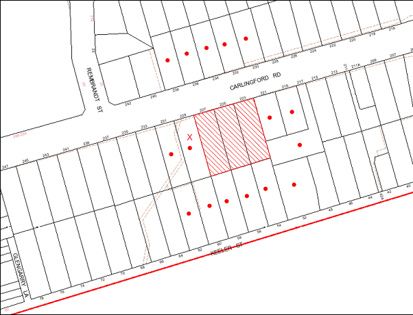
|
NOTIFICATION PLAN |
|
||
|
• PROPERTIES NOTIFIED
|
X SUBMISSIONS RECEIVED |
PROPERTY SUBJECT OF DEVELOPMENT |
|
One submission has been received objecting to the development, generally on the following grounds:
· Loss in property value of isolated site;
· Loss of residential character; and
· Loss of solar access.
The merits of the matters raised in community submission have been addressed in the body of the report.
5.2 Public Agencies – Roads and Maritime Services (RMS)
The proposed development has frontage to a State Road with high traffic flows (Carlingford Road) and is subject to the concurrence requirements of the RMS. The RMS raises no objection to the proposed development subject to recommended conditions.
6. THE PUBLIC INTEREST
Section 79C(1)(e) of the Act requires Council to consider “the public interest”.
The public interest is an overarching requirement, which includes the consideration of the matters discussed in this report. Implicit to the public interest is the achievement of future built outcomes adequately responding to and respecting the future desired outcomes expressed in environmental planning instruments and development control plans.
The application is considered to have satisfactorily addressed Council’s criteria and would provide a development outcome that, on balance, would result in a positive impact for the community. Accordingly, it is considered that the approval of the proposed residential flat building would be in the public interest.
CONCLUSION
The application proposes the demolition of three existing dwelling houses and construction of a five storey residential flat building containing 45 units and single level basement car park with 56 car parking spaces.
The proposed development is in accordance with the design principles of SEPP 65 Design Quality Residential Flat Development and generally meets the best practice guidelines of the Residential Flat Design Code.
The proposed development would result in an isolated site at No. 229 Carlingford Road Carlingford. The applicant has submitted evidence that reasonable offers to purchase the site have not been accepted. In this regard, it is considered the prescriptive measures of the Housing Strategy DCP concerning isolated sites, and the relevant planning principles of the Land and Environment Court have been met by the applicant.
The proposed development generally complies with the requirements of the Housing Strategy DCP in respect to height, setbacks, landscaping, floorplates and separations, articulation, open space, privacy, sunlight and ventilation, housing choice and vehicle access and parking. The proposal is considered satisfactory in respect to the Access and Mobility DCP, Car Parking DCP, Sustainable Water DCP and Waste Minimisation and Management DCP.
The proposed development has frontage to a State Road with high traffic flows. Roads and Maritime Services would grant concurrence to the proposal subject to recommended conditions.
One submission has been received concerning the proposed development.
The application is recommended for approval.
|
Rod Pickles Manager - Development Assessment Planning Division |
James Farrington Group Manager Planning Division |
|
1.View |
Locality Plan |
|
|
|
2.View |
Site Plan |
|
|
|
3.View |
Floor Plans |
|
|
|
4.View |
Elevations and Sections |
|
|
|
5.View |
Roof Plan |
|
|
|
6.View |
Shadow Plans |
|
|
|
7.View |
Landscape Plan |
|
|
|
8.View |
Indicative Plan Isolated Site |
|
|
File Reference: DA/719/2012
Document Number: D02028305
SCHEDULE 1
GENERAL CONDITIONS
The conditions of consent within this notice of determination have been applied to ensure that the use of the land and/or building is carried out in such a manner that is consistent with the aims and objectives of the relevant legislation, planning instruments and Council policies affecting the land and does not disrupt the amenity of the neighbourhood or impact upon the environment.
Note: For the purpose of this consent, the term ‘applicant’ means any person who has the authority to act on or the benefit of the development consent.
Note: For the purpose of this consent, any reference to an Act, Regulation, Australian Standard or publication by a public authority shall be taken to mean the gazetted Act or Regulation, or adopted Australian Standard or publication as in force on the date that the application for a construction certificate is made.
1. Approved Plans and Supporting Documentation
The development must be carried out in accordance with the plans and documentation listed below and endorsed with Council’s stamp, except where amended by Council and/or other conditions of this consent:
|
Plan No. |
Drawn by |
Dated |
|
DA-A:00 Issue A Cover Page |
Zhinar Architects |
Jul’12 |
|
DA-A:01 Issue A Site Analysis |
Zhinar Architects |
Jul’12 |
|
DA-A:02 Issue A Urban Context Analysis |
Zhinar Architects |
Jul’12 |
|
DA-B:03 Issue B Basement Plan |
Zhinar Architects |
Aug’12 |
|
DA-A:04 Issue A Ground Floor + Site Plan |
Zhinar Architects |
Jul’12 |
|
DA-A:05 Issue A Ground Floor Plan |
Zhinar Architects |
Jul’12 |
|
DA-A:06 Issue A First Floor Plan |
Zhinar Architects |
Jul’12 |
|
DA-A:07 Issue A Second Floor Plan |
Zhinar Architects |
Jul’12 |
|
DA-A:08 Issue A Third Floor Plan |
Zhinar Architects |
Jul’12 |
|
DA-A:09 Issue A Fourth Floor Plan |
Zhinar Architects |
Jul’12 |
|
DA-A:10 Issue A Roof Plan |
Zhinar Architects |
Jul’12 |
|
DA-A:11 Issue A North+South Elevations |
Zhinar Architects |
Jul’12 |
|
DA-A:12 Issue A East+West Elevations |
Zhinar Architects |
Jul’12 |
|
DA-A:13 Issue A Section+Fence Details |
Zhinar Architects |
Jul’12 |
|
12099DA 1 Rev 1 Landscape Concept Plan |
Vision Dynamics |
4.7.12 |
|
Document No. |
Prepared by |
Dated |
|
D01971563 BASIX Certificate No. 436383M |
Design View |
5 July 2012 |
|
D01971564 Arborist Assessment |
Redgum |
12 June 2012 |
|
D01971569 Acoustic Report |
Acoustic Logic |
10/07/2012 |
|
D02008674 Waste Management Plan |
CBD Core Pty Ltd |
Undated |
|
D02018942 Traffic & Parking Assessment |
Traffic Solutions Pty Ltd |
6 July 2012 |
|
D02056079 Access Report |
Certified Building Specialists |
5 July 2012 |
2. Amendment of Plans
The approved plans are to be amended as follows:
a) The proposed bicycle storage facility is to be relocated to the western side of the building adjacent to Unit 03 and replaced with additional planter box landscaping.
b) The bicycle facility paved access along the eastern side boundary is to be replaced with landscaping.
c) The driveway is to include a raised concrete triangular island to restrict right hand turn movements into, and out of, the site in accordance with Condition No. 55.
d) The balcony of Unit 15 and the balcony of Unit 25 are to be setback 5.5m from the western side boundary.
REQUIREMENTS PRIOR TO THE ISSUE OF A CONSTRUCTION CERTIFICATE
3. Building Code of Australia
All building work must be carried out in accordance with the requirements of the Building Code of Australia.
4. Contract of Insurance (Residential Building Work)
In the case of residential building work for which the Home Building Act, 1989 requires there to be a contract of insurance in force in accordance with Part 6 of that Act, that such a contract of insurance is in force before any building work authorised to be carried out by the consent commences.
5. Water/Electricity Utility Services
The applicant must submit written evidence of the following service provider requirements:
a) Energy Australia – a letter of consent demonstrating that satisfactory arrangements have been made to service the proposed development.
b) Sydney Water – the submission of a ‘Notice of Requirements’ under s73 of the Sydney Water Act 1994.
Note: Sydney Water requires that s73 applications are to be made through an authorised Sydney Water Servicing Coordinator. Refer to www.sydneywater.com.au or telephone 13 20 92 for assistance.
6. Accessible Units
a) The details of the adaptable units (Units 1, 2, 4, 7, 9, 10, 15, 18, 20, 25, 28, 30, 35 and 38) must be provided with the Construction Certificate Plans.
b) Five of the adaptable units must be in compliance with AS1428.1 – Design for Access and Mobility.
7. Dilapidation Report
A ‘Dilapidation Report’ is to be prepared by a ‘chartered structural engineer’ detailing the structural condition of all adjoining properties.
8. Noise – Carlingford Road
The development must be carried out in accordance with the recommendations contained within the acoustic report submitted with the development application, titled DA Environmental Noise Assessment, prepared by Acoustic Logic and dated 10/07/2012.
9. Stormwater Drainage
The stormwater drainage system for the development must be designed and constructed and a construction Certificate issued for these works. The stormwater drainage system is to be designed in accordance with Council’s Civil Works – Design and Construction Specification 2005 and the following requirements:
a) Connected directly to the street drainage system in Carlingford Rd via an On Site Detention (OSD) tank.
10. On Site Stormwater Detention
The on site detention system for the development must be designed and constructed and a construction Certificate issued for these works. The stormwater drainage system is to be designed in accordance with Council’s Civil Works – Design and Construction Specification 2005 and the following requirements:
a) Have a capacity of not less than 17.1m3 cubic metres, and a maximum discharge (when full) of 65 litres per second.
b) Have a surcharge/inspection grate located directly above the outlet.
c) Discharge from the detention system to be controlled via 1 metre length of pipe, not less than 50 millimetres diameter or via a stainless plate with sharply drilled orifice bolted over the face of the outlet discharging into a larger diameter pipe capable of carrying the design flow to an approved Council system.
d) The OSD system is to be an underground tank located under the driveway.
11. Internal Driveway/Vehicular Areas
The driveway and parking areas on site must be designed, constructed and a Construction Certificate issued in accordance with Australian Standards 2890.1, 2890.2, 3727 and the following requirements:
a) Design levels at the front boundary be obtained from Council.
12. Footpath
Prior to the issue of a Construction Certificate for these works a separate application under the Local Government Act, 1993 and the Roads Act, 1993 must be submitted to Council for the construction of footpaths within the road reserve. A concrete footpath must be constructed along the full frontage of the subject site in accordance Council’s Civil Works Design and Construction Specification, 2005 and the following requirements:
a) The existing footpath being removed and reconstructed.
b) Pouring of the concrete footpath to the full frontage of the subject site.
c) The land adjoining the footpath to be fully turfed.
d) Any public utility adjustments to be carried out at the cost of the applicant and to the requirements of the relevant public authority.
13. Vehicular Crossing
Prior to the issue of a Construction Certificate for these works a separate application under the Local Government Act, 1993 and the Roads Act, 1993 must be submitted to Council for the installation of a new vehicular crossing and the removal of the redundant crossing. The vehicular crossing must be constructed in accordance with Council’s Civil Works Design, 2005 and the following requirements:
a) Any redundant crossings to be replaced with integral kerb and gutter.
Note: An application for a vehicular crossing can only be made to one of Council’s Authorised Vehicular Crossing Contractors. You are advised to contact Council on 02 9847 6940 to obtain a list of contractors.
14. Traffic Control Plan
A Traffic Control Plan (TCP) must be prepared by a qualified traffic controller in accordance with the Roads & Traffic Authority’s Traffic Control at Worksites Manual 1998 and Australian Standard 1742.3 for all work on a public road and be submitted to Council. The TCP must detail the following:
a) Arrangements for public notification of the works.
b) Temporary construction signage.
c) Permanent post-construction signage.
d) Construction vehicle movement plans.
e) Traffic management plans.
f) Pedestrian and cyclist access/safety.
REQUIREMENTS PRIOR TO THE COMMENCEMENT OF ANY WORKS
15. Erection of Construction Sign
A sign must be erected in a prominent position on any site on which building work, subdivision work or demolition work is being carried out:
a) Showing the name, address and telephone number of the principal certifying authority for the work,
b) Showing the name of the principal contractor (if any) for any demolition or building work and a telephone number on which that person may be contacted outside working hours, and
c) Stating that unauthorised entry to the work site is prohibited.
Note: Any such sign is to be maintained while the building work, subdivision work or demolition work is being carried out, but must be removed when the work has been completed.
16. Protection of Adjoining Areas
A temporary hoarding, fence or awning must be erected between the work site and adjoining lands before the works begin and must be kept in place until after the completion of the works if the works:
a) Could cause a danger, obstruction or inconvenience to pedestrian or vehicular traffic.
b) Could cause damage to adjoining lands by falling objects.
c) Involve the enclosure of a public place or part of a public place.
Note: Notwithstanding the above, Council’s separate written approval is required prior to the erection of any structure or other obstruction on public land.
17. Toilet Facilities
Toilet facilities must be available or provided at the works site before works begin and must be maintained until the works are completed at a ratio of one toilet for every 20 persons employed at the site. Each toilet must:
a) be a standard flushing toilet connected to a public sewer; or
b) be a temporary chemical closet approved under the Local Government Act, 1993; or
c) have an on-site effluent disposal system approved under the Local Government Act, 1993
18. Erosion and Sediment Control
Erosion and sediment control measures must be provided and maintained throughout the construction period in accordance with the manual ‘Soils and Construction 2004 (Bluebook)’, the approved plans, Council specifications and to the satisfaction of the principal certifying authority. The erosion and sediment control devices must remain in place until the site has been stabilised and revegetated.
Note: On the spot penalties up to $1,500 may be issued for any non-compliance with this requirement without any further notification or warning.
REQUIREMENTS DURING CONSTRUCTION
19. Construction Work Hours
All work on site (including demolition and earth works) must only occur between 7am and 5pm Monday to Saturday.
No work is to be undertaken on Sundays or public holidays.
20. Demolition
All demolition work must be carried out in accordance with Australian Standard 2601-2001 – The Demolition of Structures and the following requirements:
a) Demolition material is to be disposed of to an authorised recycling and/or waste disposal site and/or in accordance with an approved waste management plan.
b) Demolition works, where asbestos material is being removed, must be undertaken by a contractor that holds an appropriate licence issued by WorkCover NSW in accordance with Chapter 10 of the Occupational Health and Safety Regulation 2001 and Clause 29 of the Protection of the Environment Operations (Waste) Regulation 2005.
c) On construction sites where buildings contain asbestos material, a standard commercially manufactured sign containing the words ‘DANGER ASBESTOS REMOVAL IN PROGRESS’ measuring not less than 400mm x 300mm must be erected in a prominent position visible from the street.
21. Waste Management
Prior to commencement of works, a revised and detailed Waste Management Plan Section One – Demolition Stage, Section Two – Design Stage, and Section Three – Construction as applicable, covering the scope of this project is required to be submitted to Council in accordance with the Waste Minimisation and Management Development Control Plan.
22. Environmental Management
The site must be managed in accordance with the publication ‘Managing Urban Stormwater – Landcom (March 2004) and the Protection of the Environment Operations Act 1997 by way of implementing appropriate measures to prevent sediment run-off, excessive dust, noise or odour emanating from the site during the construction of the development.
23. Street Sweeping
Street sweeping must be undertaken following sediment tracking from the site along Keeler Street during works and until the site is established.
24. Spoil Route
To protect Council’s assets, all vehicular access to and from the site during all stages of the development is to be via the shortest route to the nearest State or Regional Road
25. Council Property
During construction works, no building materials, waste, machinery or related matter is to be stored on the road or footpath.
26. Landfill
Landfill must be constructed in accordance with Council’s ‘Construction Specification, 2005’ and the following requirements:
a) All fill material imported to the site is to wholly consist of Virgin Excavated Natural Material (VENM) as defined in Schedule 1 of the Protection of the Environment Operations Act 1997 or a material approved under the Department of Environment and Climate Change’s general resource recovery exemption.
b) A compaction certificate is to be obtained from a geotechnical engineer verifying that the specified compaction requirements have been met.
27. Excavated Material
All excavated material removed from the site must be classified in accordance with the Department of Environment, Climate Change and Water NSW Waste Classification Guidelines prior to disposal to an approved waste management facility and reported to the principal certifying authority.
28. Survey Report – Finished Floor Level
A report(s) must be prepared by a registered surveyor and submitted to the principal certifying authority prior to the pouring of concrete at each level of the building certifying that:
a) The building, retaining walls and the like have been correctly positioned on the site.
b) The finished floor level(s) are in accordance with the approved plans.
29. Contamination During Construction Works
Should the presence of asbestos or soil contamination, not recognised during the application process be identified during demolition, the applicant must immediately notify the Principal Certifying Authority and Council.
30. Waste Management
Waste management during the demolition and construction phase of the development must be undertaken in accordance with the approved Waste Management Plan. Additionally written record of the following items must be maintained during the removal of any waste from the site and such information submitted to the Principal Certifying Authority within fourteen days of the date of completion of the works:
a) The identity of the person removing the waste.
b) The waste carrier vehicle registration.
c) Date and time of waste collection.
d) A description of the waste (type of waste and estimated quantity).
e) Details of the site to which the waste is to be taken.
f) The corresponding tip docket/receipt from the site to which the waste is transferred (noting date and time of delivery, description (type and quantity) of waste).
g) Whether the waste is expected to be reused, recycled or go to landfill.
Note: In accordance with the Protection of the Environment Operations Act 1997, the definition of waste includes any unwanted substance, regardless of whether it is reused, recycled or disposed to landfill.
REQUIREMENTS PRIOR TO THE ISSUE OF AN OCCUPATION CERTIFICATE
Note: For the purpose of this consent, a reference to ‘occupation certificate’ shall not be taken to mean an ‘interim occupation certificate’ unless otherwise stated.
31. Fulfilment of BASIX Commitments
The applicant must demonstrate the fulfilment of BASIX commitments pertaining to the development.
32. Sydney Water – s73 Certificate
A s73 Certificate must be obtained from Sydney Water.
33. Car Parking Allocation and Resident Storage
The basement resident storage areas are to be allocated in accordance with the size requirements of the SEPP 65 - Residential Flat Design Code for the respective units and proximity to the unit car parking space.
34. Damage to Council Assets
Any damage caused to Council’s assets as a result of the construction of the development must be rectified in accordance with Council’s written requirements and at the sole cost of the applicant.
35. Creation of Easements
The following matter(s) must be nominated on the plan of subdivision under s88B of the Conveyancing Act 1919:
a) The creation of an appropriate "Positive Covenant" and "Restriction as to User" over the constructed on-site detention systems and outlet works, within the lots in favour of Council in accordance with Council’s prescribed wording. The position of the on-site detention system is to be clearly indicated on the title.
b) To register the OSD easement, the restriction on the use of land “works-as-executed” details of the on-site-detention system must be submitted verifying that the required storage and discharge rates have been constructed in accordance with the design requirements. The details must show the invert levels of the on site system together with pipe sizes and grades. Any variations to the approved plans must be shown in red on the “works-as-executed” plan and supported by calculations.
Note: Council must be nominated as the authority to release, vary or modify any easement, restriction or covenant.
36. Garbage Collection Easement
For the purpose of waste collection, an easement entitling Council, its servants and agents and persons authorised by it to enter upon the subject land and to operate thereon, vehicles and other equipment for the purposes of garbage collection must be granted to Council by the owner of the land.
Note: The easement must be in a form prescribed by Council and must include covenants to the effect that parties will not be liable for any damage caused to the subject land or any part thereof or to any property located therein or thereon by reason of the operation thereon of any vehicle or other equipment used in connection with the collection of garbage and to the effect that the owner for the time being of the subject land shall indemnify the Council, its servants, agents and persons authorised by it to collect garbage against liability in respect of any such claims made by any person whomsoever.
37. Planter Boxes / On Slab Planting
On slab planter boxes must include waterproofing, subsoil drainage (proprietary drainage cell, 50mm sand and filter fabric) automatic irrigation, minimum 500mm planting soil for shrubs and minimum 1000mm planting soil for trees and palms and 75mm mulch to ensure sustainable landscape is achieved.
38. Planting (Northern Boundary) Carlingford Road frontage
Planting to the front landscape setback areas along Carlingford Road must include:
a) Six additional Tristaniopsis laurina (Watergum). Trees shall be installed at minimum 45 litre pot size. Boundary (Screen) planting (Eastern Boundary) Screen planting to the on-grade landscape setback areas adjacent to the boundary must include:
b) Eight additional Waterhousia
floribunda (Waterhousia) in planter beds. Trees shall be installed at
minimum 25 litre pot size.
Boundary (Screen) planting (Western Boundary)
c) Screen planting to the on-grade landscape setback areas must include:
d) Eight additional Waterhoiusia floribunda (Waterhousia) in planter beds. Trees shall be installed at minimum 25 litre pot size.
e) Six additional Acmenia smithii (Lilly Pilly) in planter beds. Trees shall be installed at minimum 25 litre pot size.
39. Boundary Planting (Southern Boundary)
Planting to the rear landscape setback areas must include:
a) Four additional Angophora costata (Sydney Red Gum). Trees shall be installed at minimum 45 litre pot size.
40. Completion of Landscaping
A certificate must be provided by a practicing landscape architect, horticulturalist or person with similar qualifications and experience certifying that all required landscaping works have been satisfactorily completed in accordance with the approved landscape plans.
41. Retaining Walls
All required retaining walls must be constructed as part of the development.
42. Boundary Fencing
Fencing must be erected along all property boundaries behind the front building alignment to a height of 1.8 metres.
Note: Alternative fencing may be erected subject to the written consent of the adjoining property owner(s).
43. External Lighting
All external lighting must be designed and installed in accordance with Australian Standard AS 4282 – Control of the Obtrusive Effects of Outdoor Lighting. Certification of compliance with the Standard must be obtained from a suitably qualified person.
44. Unit Numbering
The allocation of unit numbering must be authorised by Council prior to the numbering of each unit in the development.
45. Section 94 Infrastructure Contributions
The payment to Council of a contribution of $504,010.65 for 42 additional dwellings towards the cost of infrastructure identified in Council’s Development Contributions Plan 2007-2011 in accordance with the following table:
Note: The value of contribution is current as at 22 November 2012. The contribution will be adjusted from this date in accordance with the underlying consumer price index for subsequent financial quarters.
It is recommended that you contact Council to confirm the value of the contribution prior to payment.
46. Safety and Security
a) Fire exist doors to the development must be fitted with single cylinder locksets (Australia and New Zealand Standard – Lock Sets) to restrict unauthorized access to the development.
b) Ground floor windows must be fitted with window locks that can be locked with a key.
c) A graffiti management plan must be incorporated into the maintenance plan for the development for graffiti to be removed within a forty-eight hour period.
d) The basement car park entry must be secured by security gates/roller shutters and controlled by secure access located at the top of the driveway.
47. Waste Management
a) The garbage chute must be fitted with volume handling equipment.
b) Each dwelling/kitchen must be provided with an indoor waste/recycling cupboard for the interim storage of a minimum one day’s waste/recycling generation with separate containers for general waste and recyclable materials.
c) Space must be provided for either individual compost containers for each dwelling or a communal compost container; the siting of which will have regard for potential amenity impacts.
d) The bin carting route must be devoid of any steps.
Note: Ramps between different levels are acceptable
e) “No parking” signs must be erected to prohibit cars parking in the waste collection vehicle loading bay.
f) Site security measures implemented on the property, including electronic gates, must not prevent access to the bin room/collection point by waste removal services.
g) The garbage chute room must be fitted with water/hose for cleansing, graded floors with drainage to sewer, robust door(s), sealed/impervious surfaces, adequate lighting and ventilation.
h) A report(s) must be prepared by a registered surveyor and submitted to the principal certifying authority prior to the issue of the Subdivision/Occupation Certificate, certifying that:
i) The finished access way (including ramp, vehicle turning area, loading bay and site entry/exit) to be used by waste collection vehicles, complies with Australian Standard AS2890.2-2002 Parking Facilities Part 2: Off-street Commercial Vehicle Facilities for small rigid vehicles with minimum design vehicle dimensions of 6.4 metres overall length, width of 2.3 metres, and 3.5 metre clearance height; and
ii) The finished gradient(s), dimensions and geometry of the road/access way (including vehicle turning area) are in accordance with the approved plans.
48. Works as Executed Plan
A works-as-executed plan(s) must be prepared by a registered surveyor and submitted to Council for completed road pavement, kerb & gutter, public drainage systems, driveways and on-site detention system.
OPERATIONAL CONDITIONS
49. Landscape Establishment
The landscape works must be maintained into the future to ensure the establishment and successful growth of plant material to meet the intent of the landscape design. This must include but not be limited to watering, weeding, replacement of failed plant material and promoting the growth of plants through standard industry practices.
50. Visitor Access
Visitors are to have access to the parking area at all times. Visitors are to be able to access the basement car park by an audio/visual intercom system located at the top of the ramped driveway.
51. Noise
All noise generated by the proposed development must be attenuated to prevent levels of noise being emitted to adjacent premises which possess tonal, beating and similar characteristics or which exceeds background noise levels by more than 5dB(A).
52. Disabled Parking
All parking spaces for people with disabilities must be constructed and operated in accordance with Australian Standard AS/NZS 2890.6:2009 – Off-street parking for people with disabilities
53. Fire Safety Statement - Annual
On at least one occasion in every 12 month period following the date of the first ‘Fire Safety Certificate’ issued for the property, the owner must provide Council with an annual ‘Fire Safety Certificate’ to each essential service installed in the building.
54. Waste Management
A site caretaker must be employed and be responsible for moving bins to and from the bin room(s) and the waste collection point, washing bins and maintaining waste storage areas, ensuring the chute system and related devices are maintained in effective and efficient working order, managing the communal composting area, arranging the prompt removal of dumped rubbish, and ensuring all residents are informed and trained in the use of the waste management system. The caretaker must also be responsible for ensuring no unwanted bulky items are in the truck loading bay on garbage and recycling collection days.
CONDITIONS OF CONCURRENCE – ROADS & MARITIME SERVICES
55. Roads & Maritime Services (RMS)
The following conditions of consent are from the nominated State Agency pursuant to Section 79B of the Environmental Planning and Assessment Act 1979 and must be complied with to the satisfaction of that Agency.
a) All works/regulatory signposting associated with the proposed development are to be at no cost to RMS.
b) The developer shall be responsible for all public utility adjustments/relocation works, necessitated by the above work and as required by the various public utility authorities and/or their agents.
c) The subject property (part Lots 6 & 7 DP 29798) is affected by an easement for batter which benefits RMS. RMS has no other approved proposal that requires any or part of the subject property for road purposes. Therefore, there are no objections to the development proposal on property grounds provided all structures and works are clear of the road reserve (unlimited in height or depth) and provided access to the easement is not denied and the integrity of the easement is not compromised.
d) The swept path of the longest vehicle (including garbage trucks) entering and exiting the subject site, as well as manoeuvrability through the site, shall be in accordance with AUSTROADS. In this regard, a plan shall be submitted to Council and RMS for approval, which shows that the proposed development complies with this requirement.
e) All ingress and egress to the site shall be bt left in/left out vehicular movements only, A raised concrete triangular island shall be constructed within the access driveway to channelize these vehicular movement and restrict right turn movements into and out of the site. The triangular island shall be designed so that the largest vehicle accessing the site can enter and leave from the kerbside lane and does not cross the triangular island or to the other side of the access driveway. A swept path plan is to be submitted to Council and RMS for approval which shows that the development meets this requirement.
f) All vehicles are to enter and leave the site in a forward direction.
g) The design and construction of the gutter crossing on Carlingford Road shall be in accordance with RMS’s requirements. Details of these requirements should be obtained from RMS’s Project Services Manager, Traffic Projects Section, Parramatta (telephone 8849 2496)
Detailed design plans of the proposed gutter crossing are to be submitted to RMS for approval prior to the commencement of any road works.
A plan checking fee (amount to be advised) and lodgement of a performance bond may be required from the applicant prior to the release of the approved road design by RMS.
The developer may be required to enter into a Works Authorisation Deed (WAD) for the abovementioned works. Please note that the Works Authorisation Deed (WAD) will need to be executed prior to the RMS’s assessment of the detailed civil design plans.
h) Detailed design plans and hydraulic calculations of any changes to the stormwater drainage system are to be submitted to RMS for approval, prior to the commencement of any works.
Details should be forwarded to:
The Sydney Asset Management
Roads and Maritime Services
PO Box 973
Parramatta CBD 2124
A plan checking fee will be payable and a performance bond may be required before RMS’s approval is issued. With regard to the Civil Works requirement please contact the RMS’s Project Engineer, External Works Ph: 8849 2114 or Fax: 8849 2766.
i) The developer is to submit detailed design drawings and geotechnical reports relating to the excavation of the site and support structures to RMS for assessment. The developer is to meet the full cost of the assessment by RMS.
This report would need to address the impact of the excavation on the structural stability of Carlingford Road.
The report and any enquiries should be forwarded to:
Project Engineer, External Works
Sydney Asset Management
Roads and Maritime Services
PO Box 973
Parramatta CBD 2124
Telephone 8848 2114 Fax 8849 2766
j) If it is necessary to excavate below the level of the base of the footings of the adjoining roadways, the person acting on the consent shall ensure that the owner/s of the roadway is/are given at least seven (7) days notice of the intention to excavate below the base of the footings. The notice is to include complete details of the work.
k) Provision for building maintenance vehicles and removalists needs to be provided on site.
l) If not already in place, full time ‘No Stopping’ restrictions are to be implemented along the full Carlingford Road frontage of the development site. This restriction should be implemented prior to the commencement of any demolition works relating to the proposed development. Prior to the installation of the parking restrictions the applicant is to contact RMS’s Traffic Engineering Services on phone (02) 8849 2928 for a Works Instruction.
m) Any proposed landscaping and/or fencing must not restrict sight distance to pedestrians and cyclists travelling along the footpath of Carlingford Road.
n) All demolition and construction vehicles are to be contained wholly within the site and vehicles must enter the site before stopping. A construction zone will not be permitted on Carlingford Road.
o) No demolition, remediation or other work is to occur on site until such time as RMS have been provided with, and approved, a Demolition Traffic Management Plan detailing vehicle routes, number of trucks, hours of operation, access arrangements and traffic control arrangements associated with the demolition and/or remediation of the site.
p) No Construction Certificate is to be issued by a Certifying Authority until such time as evidence is received by the Certifier confirming that the Traffic Management Plan referred to in Condition o above has been approved by RMS.
- END OF CONDITIONS -
ADVISORY NOTES
The following information is provided for your assistance to ensure compliance with the Environmental Planning and Assessment Act, 1979, Environmental Planning and Assessment Regulation 2000, other relevant legislation and Council’s policies and specifications. This information does not form part of the conditions of development consent pursuant to Section 80A of the Act.
Environmental Planning and Assessment Act, 1979 Requirements
· The Environmental Planning and Assessment Act, 1979 requires:
· The issue of a construction certificate prior to the commencement of any works. Enquiries regarding the issue of a construction certificate can be made to Council’s Customer Services Branch on 9847 6760.
· A principal certifying authority to be nominated and Council notified of that appointment prior to the commencement of any works.
· Council to be given at least two days written notice prior to the commencement of any works.
· Mandatory inspections of nominated stages of the construction inspected.
· An occupation certificate to be issued before occupying any building or commencing the use of the land.
Long Service Levy
In accordance with Section 34 of the Building and Construction Industry Long Service Payments Act 1986, a ‘Long Service Levy’ must be paid to the Long Service Payments Corporation or Hornsby Council.
Note: The rate of the Long Service Levy is 0.35% of the total cost of the work.
Note: Hornsby Council requires the payment of the Long Service Levy prior to the issue of a construction certificate.
Tree Preservation Order
To ensure the maintenance and protection of the existing natural environment, it is an offence to ringbark, cut down, top, lop, remove, wilfully injure or destroy a tree outside 3 metres of the approved building envelope without the prior written consent from Council.
Note: A tree is defined as a single or multi-trunked wood perennial plant having a height of not less than three (3) metres, and which develops many branches, usually from a distance of not less than one (1) metre from the ground, but excluding any plant which, in its particular location, is a noxious plant declared as such pursuant to the Noxious Weeds Act 1993. This definition of ‘tree’ includes any and all types of Palm trees.
All distances are determined under Australian Standard AS4970-2009 ”Protection of Trees on Development Sites”.
Fines may be imposed for non-compliance with Council’s Tree Preservation Order.
Disability Discrimination Act
The applicant’s attention is drawn to the existence of the Disability Discrimination Act. A construction certificate is required to be obtained for the proposed building/s, which will provide consideration under the Building Code of Australia, however, the development may not comply with the requirements of the Disability Discrimination Act. This is the sole responsibility of the applicant.
Dial Before You Dig
Prior to commencing any works, the applicant is encouraged to contact Dial Before You Dig on 1100 or www.dialbeforeyoudig.com.au for free information on potential underground pipes and cables within the vicinity of the development site.
Asbestos Warning
Should asbestos or asbestos products be encountered during demolition or construction works you are advised to seek advice and information should be prior to disturbing the material. It is recommended that a contractor holding an asbestos-handling permit (issued by WorkCover NSW)be engaged to manage the proper handling of the material. Further information regarding the safe handling and removal of asbestos can be found at:
Alternatively, telephone the WorkCover Asbestos and Demolition Team on 8260 5885.
House Numbering
House numbering can only be authorised by Council. Before proceeding to number each premise in the development, the allocation of numbers is required to be obtained from Council's Planning Division. The authorised numbers are required to be displayed in a clear manner at or near the main entrance to each premise.
Planning Report No. PL46/12
Planning Division
Date of Meeting: 19/12/2012
12 DEVELOPMENT APPLICATION - RURAL SUBDIVISION - 9 AND 11 CROSSLANDS ROAD GALSTON
EXECUTIVE SUMMARY
|
DA No: |
DA/806/2012 (Lodged 3 August 2012) |
|
Description: |
Boundary adjustment between two existing allotments to create two new allotments |
|
Property: |
Lots 1 and 2 DP 538325 Nos. 9 and 11 Crosslands Road, Galston |
|
Applicant: |
Survey Plus Pty Ltd |
|
Owner: |
Mrs M. Belmonte |
|
Estimated Value: |
Nil |
|
Ward: |
A |
· The application proposes a boundary adjustment between two existing allotments.
· The proposal does not comply with the minimum lot size pursuant to Clause 14 of the Hornsby Shire Local Environmental Plan 1994. The applicant has made a submission pursuant to State Environmental Planning Policy No. 1 – Development Standards to vary the 2 hectare minimum allotment size development standard. The submission is considered well founded and is supported.
· No submissions have been received in respect of the application.
· It is recommended that the application be referred to the Director-General of the Department of Planning and Infrastructure seeking concurrence to the approval of the application.
|
THAT Council seek the concurrence of the Director-General of the Department of Planning and Infrastructure pursuant to State Environmental Planning Policy No. 1 and approve Development Application No. DA/806/2012 for boundary adjustment between two existing allotments to create two new allotments at Lots 1 and 2 DP 538325, Nos. 9 and 11 Crosslands Road, Galston subject to the conditions of consent detailed in Schedule 1 of Group Manager’s Report No. PL46/12. |
SITE
The site is known as Lots 1 and 2 in DP 538325, Nos. 9 and 11 Crosslands Road, Galston and is located on the corner of Crosslands Road and Bevans Road. The site is generally rectangular in shape and has a total area of 2.159ha. The site is situated on top of a low rise, with the land sloping away from the site to varying degrees.
Lot 1 is irregular in shape and contains an existing dwelling and is situated on the corner of Bevans Road and Crosslands Road. Access to the lot is via an existing driveway fronting Bevans Road. There is a long linear strip of vegetation, predominantly native shrubs located along the Bevans Road boundary.
Lot 2 is a battleaxe allotment and contains an existing dwelling, outbuildings and a swimming pool. Access to the allotment is via a driveway fronting Crosslands Road.
PROPOSAL
The proposal involves a boundary adjustment between Nos. 9 and No. 11 Crosslands Road, Galston which involves 7,136m2 of land being transferred from No. 9 to No. 11.
The proposal would result in No. 11 Crosslands Road (proposed Lot 22) increasing in area from 2,616m2 to 9,752m2 and No. 9 Crosslands Road (proposed Lot 21) decreasing in area from 1.896 ha to 1.184 ha. The purpose of the boundary adjustment, as stated by the applicant, is to regularise the layout of the two existing allotments to create conventional rural allotments. The proposal would not result in an increase in the number of lots.
ASSESSMENT
The development application has been assessed having regard to the ‘Metropolitan Plan for Sydney 2036’, the ‘North Subregion (Draft) Subregional Strategy’ and the matters for consideration prescribed under Section 79C of the Environmental Planning and Assessment Act 1979 (the Act). Subsequently, the following issues have been identified for further consideration.
1. STRATEGIC CONTEXT
1.1 Metropolitan Plan for Sydney 2036 and (Draft) North Subregional Strategy
The Metropolitan Plan for Sydney 2036 is a broad framework to secure Sydney’s place in the global economy by promoting and managing growth. It outlines a vision for Sydney to 2036; the challenges faced, and the directions to follow to address these challenges and achieve the vision. The Draft North Subregional Strategy acts as a framework for Council in its preparation of the Comprehensive LEP by the end of 2012.
The Draft North Subregional Strategy sets the following targets for the Hornsby LGA by 2031:
· Employment capacity to increase by 9,000 jobs; and
· Housing stock to increase by 11,000 dwellings.
The proposed development involves a boundary adjustment of rural land and would retain the existing number of allotments. Accordingly, the proposal is not inconsistent with the draft Strategy.
2. STATUTORY CONTROLS
Section 79C(1)(a) requires Council to consider “any relevant environmental planning instruments, draft environmental planning instruments, development control plans, planning agreements and other prescribed matters.”
2.1 Hornsby Shire Local Environmental Plan 1994
The subject land is zoned Rural BA (Small Holdings—Agricultural Landscapes) under the Hornsby Shire Local Environmental Plan 1994 (HSLEP).
The objectives of the Rural BA (Small Holdings—Agricultural Landscapes) zone are:
(a) to restrain population growth, maintain the rural character of the area and ensure that existing or potentially productive agricultural land is preserved.
(b) to promote agricultural use of land and provide for a range of compatible land uses which maintain the agricultural and rural environment of the area.
(c) to ensure development is carried out in a manner that improves the environmental qualities, and is within the servicing capacity, of the area.
The proposed development is defined as ‘subdivision’ under the HSLEP and is permissible in the zone with Council’s consent.
The proposed development is consistent with the zone objectives, as the proposed subdivision would not alter the land use within the area and would maintain the rural character of the area. Further, the boundary adjustment would not result in an additional dwelling entitlement on either allotment.
Clause 14 of the HSLEP prescribes that the minimum area per allotment within the Rural BA zone is 2 hectares. The existing allotments and the allotments that would result from the proposed boundary adjustment do not comply with the minimum lot area requirement. In this regard, the application is supported by a submission pursuant to State Environmental Planning Policy No. 1 (SEPP 1) Development Standards to vary the minimum allotment size development standard and this matter is addressed in Section 2.3 of this report.
Clause 18 of the HSLEP sets out heritage conservation provisions for Hornsby Shire. The subject site is not an item of environmental heritage and is not located within a heritage conservation area. Therefore, no further assessment in this regard is necessary.
2.2 Draft Comprehensive Hornsby Local Environmental Plan
The draft Comprehensive Local Environmental Plan (HLEP) was placed on exhibition on 5 June 2012. The draft HLEP essentially reiterates the current land use zoning.
2.2.1 Zoning
The site would be zoned RU4 Primary Production Small Lots zone pursuant to the Land Use Table of the draft HLEP. The proposed development is defined as ‘subdivision’ and would be permissible in the zone.
2.2.2 Lot Size
The “Lot Size” map of the HLEP specifies a minimum lot size of 2ha for the site. The proposal would not comply with this requirement.
2.3 State Environmental Planning Policy No. 1 - Development Standards
State Environmental Planning Policy No. 1 provides flexibility in applying development standards and enables a consent authority to vary a standard where strict compliance would be unnecessary, unreasonable, or tend to hinder the objectives of the Act. Where there is a variation to a development standard, the application must be accompanied by a State Environmental Planning Policy No. 1 objection.
The applicant has submitted an objection against Council’s adherence to the minimum 2 hectare lot size development standard under Clause 14 of the HSLEP. Proposed Lot 21 has an area of 1.184 hectares. Proposed Lot 22 has an area of 9,752m2.
The Land and Environment Court has expressed the view that there are five different ways in which an objection may be well founded and that approval of the objection may be consistent with the aims of the Policy as follows:
1. The objectives of the standard are achieved notwithstanding non-compliance with the standards;
2. The underlying objective or purpose of the standard is not relevant to the development and therefore compliance is unnecessary;
3. The underlying object of purpose would be defeated or thwarted if compliance was required and therefore compliance is unreasonable;
4. The development standard has been virtually abandoned or destroyed by the Council’s own actions in granting consents departing from the standard and hence compliance with the standard is unnecessary and unreasonable;
5. The zoning of the particular land is unreasonable or inappropriate so that a development standard appropriate for that zoning is also unreasonable and unnecessary as it applies to the land and compliance with the standard would be unreasonable or unnecessary. That is, the particular parcel of land should not have been included in the particular zone.
The applicant submits that strict compliance with the density requirement is unreasonable and unnecessary for the following reasons:
· The proposal does not increase the total number of lots.
· The proposal merely adjusts the boundary within 2 existing lots less than 2 hectares.
· The proposed subdivision is considered to be compatible within the existing surrounding subdivision pattern which contains lots similar or smaller size, namely 1 Bevans Road which has an area of 4,047m2 and 5 Bevans Road which has an area of 5,513m2.
· The proposal will enhance the rural nature of the area by increasing the smaller lot size from 2,616m2 to 9,752m2. The proposal will enhance the prospect of proposed Lot 22 engaging in agriculture or other rural pursuits, and will not significantly diminish those of proposed Lot 21.
· Requiring the lots to comply strictly within the numerical requirement of this clause would serve no beneficial purpose to the development, surrounding properties or the character of the locality given that two undersized lots already exist.
· The departure from the minimum allotment requirement will not impact upon the density of this area and will not modify the existing streetscape or character of the locality.
The applicant’s objection to the 2 hectare minimum lot size development standard is considered well founded and is supported for the following reasons: -
(a) The proposed subdivision would not alter the physical relationship of the approved development with the surrounding rural environment;
(b) The proposal results in the regulation of the current allotment layout to create viable lot sizes to maximise the usability of areas of the lots for rural uses;
(c) the majority of rural lots in the vicinity of the site are less than 2 hectares in size notwithstanding the Rural BA zoning; and
(d) the proposal would not result in a precedent for similar developments given the unique circumstances of the case.
The approval of the Director-General of the Department Planning and Infrastructure is required for the proposed subdivision in accordance with Planning Circular PA 08-003 concerning variation to the development standard as the proposal involves a variation greater than 10%.
2.4 State Environmental Planning Policy No. 55 - Remediation of Land
Clause 7 of State Environmental Planning Policy No. 55 - Remediation of Land requires Council to consider whether land is contaminated prior to granting consent to the carrying out of any development on that land.
Should the land be contaminated, Council must be satisfied that the land is suitable in a contaminated state for the proposed use. If the land requires remediation to be undertaken to make the land suitable for the proposed use, Council must be satisfied that the land would be remediated before the land is used for that purpose.
The site history indicates a history of residential development and agricultural activities. However, it is not likely that the site has experienced any significant contamination, and further assessment under SEPP 55 is not required. Furthermore, the proposal would alter the boundary between two existing dwellings. The proposal would not intensity the residential use of the site.
2.4 Rural Fires Act 1997
The site is identified as bushfire prone land. The development application for subdivision is ‘integrated development’ and was referred to the NSW Rural Fire Service (RFS) for assessment in accordance with Planning For Bushfire Protection NSW 2006 Guidelines. The RFS raised no objections to the proposal.
2.5 Sydney Regional Environmental Plan No. 20 - Hawkesbury Nepean River
The Plan regulates impacts of future land uses on the River through implementation of planning policies and strategies for total catchment management, environmentally sensitive areas, water quality, water quantity, cultural heritage, flora and fauna, riverine scenic quality, agriculture/aquaculture and fishing, rural residential development, urban development, recreation and tourism. The proposed boundary adjustment would not adversely impact on the River or its catchment.
2.6 Rural Lands Development Control Plan
The proposed development has been assessed having regard to the relevant performance and prescriptive design requirements within Council’s Rural Lands Development Control Plan (Rural Lands DCP). The following table sets out the proposal’s compliance with the prescriptive requirements of the Plan:
|
Rural Lands Development Control Plan |
|||
|
Control |
Proposal |
Requirement |
Compliance |
|
Area Lot 21
Lot 22 |
1.184 ha
9,752m2
|
2 ha
2 ha |
No
No |
|
Setbacks Lot 21 - road - side (north) - side (south – Crossland Road) - rear
Lot 22
- road - side (east) - side (west) - rear |
No change No change No change
9m
>15m >15m >15m >15m
|
15m 15m 15m
15m
15m 15m 15m 15m |
Yes Yes Yes
No
Yes Yes Yes Yes |
The proposed development does not comply with the minimum lot area prescriptive requirement within Council’s Rural Lands DCP or the minimum rear setback requirement. The matters of non-compliance, as well as a brief discussion on compliance with relevant performance requirements are discussed as follows.
2.6.1 Setbacks
The existing dwelling on proposed Lot 21 would not comply with the 15 metre rear setback requirement. Currently, the existing dwelling has a 9 metre rear setback. Therefore, the proposed boundary adjustment would not alter the existing rear setback and is therefore supported.
2.6.2 Subdivision
The existing pattern of development along Crosslands and Bevans Roads would not be altered by the proposal as the existing frontages physically remain the same. In this regard, the proposed subdivision is considered acceptable in maintaining the rural character of the area and would provide for greater opportunity for rural activities.
2.6.3 Drainage Control
The proposed boundary adjustment does not alter the existing drainage control on the allotments.
2.6.4 Contributions
The application does not create any additional allotments. Accordingly, a Section 94 Contribution is not required.
3. ENVIRONMENTAL IMPACTS
Section 79C(1)(b) of the Act requires Council to consider “the likely impacts of that development, including environmental impacts on both the natural and built environments, and social and economic impacts in the locality”.
3.1 Natural Environment
The proposed boundary adjustment does not involve the removal of any existing trees or native vegetation and maintains the physical characteristics of the site.
3.2 Built Environment
The proposed development includes the retention of the existing dwellings and buildings on each of the lots.
The boundary adjustment would increase the setback distance of the existing dwelling on proposed Lot 22 from the side boundary and would provide an effective buffer between the allotments.
3.3 Social Impacts
The proposal would not result in a population increase and would maintain the rural character of the locality.
3.4 Economic Impacts
The proposed boundary adjustment would regularise the layout of each of the existing lots facilitating the opportunity for the use of the lots for a range of rural pursuits.
4. SITE SUITABILITY
Section 79C(1)(c) of the Act requires Council to consider “the suitability of the site for the development”.
There is no known hazard/risk associated with the site with respect to flooding, landslip and subsidence that would preclude approval of the proposed development. However, the land is identified as being subject to bushfire risk. The NSW Rural Fire Service considered the proposed subdivision and raised no objection to the proposal.
5. PUBLIC PARTICIPATION
Section 79C(1)(d) of the Act requires Council to consider “any submissions made in accordance with this Act”.
5.1 Community Consultation
The proposed development was placed on public exhibition and was notified to adjoining and nearby landowners between 13 August 2012 and 4 September 2012 in accordance with Council’s Notification and Exhibition Development Control Plan. During this period, Council received no submissions. The map over page illustrates the location of those nearby landowners who where notified of the development.

|
NOTIFICATION PLAN |
|
||
|
• PROPERTIES NOTIFIED
|
X SUBMISSIONS RECEIVED |
PROPERTY SUBJECT OF DEVELOPMENT |
|
5.1.1. Public Agencies
The development application is Integrated Development under the Act in requiring the concurrence of the NSW Rural Fire Service (RFS). The RFS raised no objection to the proposal.
6. THE PUBLIC INTEREST
Section 79C(1)(e) of the Act requires Council to consider “the public interest”.
The public interest is an overarching requirement, which includes the consideration of the matters discussed in this report. Implicit to the public interest is the achievement of future built outcomes adequately responding to and respecting the future desired outcomes expressed in environmental planning instruments and development control plans.
The application is considered to have satisfactorily addressed Council’s and relevant agencies’ criteria and would provide a development outcome that, on balance, would result in a positive impact for the community. Accordingly, it is considered that the approval of the proposed boundary adjustment would be in the public interest.
CONCLUSION
Consent is sought for a boundary adjustment between two existing rural allotments.
The proposed boundary adjustment is considered satisfactory in maintaining the rural character of the locality, notwithstanding the minimum lot size applicable for the subject Rural BA zone.
The submitted SEPP 1 objection to the standard is considered well founded in accordance with the planning principles established by the Land and Environment Court.
The proposed subdivision is considered acceptable with regard the provisions of the relevant environmental planning instruments applicable to the rural site, the Rural Lands DCP and the requirements of the NSW Rural Fire Service.
The application is recommended for approval subject to the concurrence of the Director-General of the Department of Planning and Infrastructure in accordance with Planning Circular PS 08-003 concerning the variation to development standards.
Note: At the time of the completion of this planning report, no persons have made a Political Donations Disclosure Statement pursuant to Section 147 of the Environmental Planning and Assessment Act 1979 in respect of the subject planning application.
|
Rod Pickles Manager - Development Assessment Planning Division |
James Farrington Group Manager Planning Division |
|
1.View |
Locality Plan |
|
|
|
2.View |
Subdivision Plan |
|
|
File Reference: DA/806/2012
Document Number: D02055019
SCHEDULE 1
GENERAL CONDITIONS
The conditions of consent within this notice of determination have been applied to ensure that the use of the land and/or building is carried out in such a manner that is consistent with the aims and objectives of the relevant legislation, planning instruments and Council policies affecting the land and does not disrupt the amenity of the neighbourhood or impact upon the environment.
Note: For the purpose of this consent, the term ‘applicant’ means any person who has the authority to act on or the benefit of the development consent.
Note: For the purpose of this consent, any reference to an Act, Regulation, Australian Standard or publication by a public authority shall be taken to mean the gazetted Act or Regulation, or adopted Australian Standard or publication as in force on the date that the application for a construction certificate is made.
1. Approved Plans and Supporting Documentation
The development must be carried out in accordance with the plans and documentation listed below and endorsed with Council’s stamp, except where amended by Council and/or other conditions of this consent:
|
Plan No. |
Plan Title |
Drawn by |
Dated |
|
8898 Revision B |
Plan of Proposed Subdivision |
SurveyPlus Pty Ltd |
22.05.2012 |
|
Document Title |
Prepared by |
Dated |
|
Statement of Environmental Effects |
SurveyPlus Pty Ltd |
20 July 2012 |
|
State Environmental Planning Policy No. 1 Objection |
SurveyPlus Pty Ltd |
20 July 2012 |
REQUIREMENTS PRIOR TO THE ISSUE OF A SUBDIVISION CERTIFICATE
2. Sydney Water – s73 Certificate
A s73 Certificate must be obtained from Sydney Water.
- END OF CONDITIONS -
ADVISORY NOTES
The following information is provided for your assistance to ensure compliance with the Environmental Planning and Assessment Act, 1979, Environmental Planning and Assessment Regulation 2000, other relevant legislation and Council’s policies and specifications. This information does not form part of the conditions of development consent pursuant to Section 80A of the Act.
Environmental Planning and Assessment Act, 1979 Requirements
The Environmental Planning and Assessment Act, 1979 requires:
· The issue of a construction certificate prior to the commencement of any works. Enquiries regarding the issue of a construction certificate can be made to Council’s Customer Services Branch on 9847 6760.
· A principal certifying authority to be nominated and Council notified of that appointment prior to the commencement of any works.
· Council to be given at least two days written notice prior to the commencement of any works.
· Mandatory inspections of nominated stages of the construction inspected.
· An occupation certificate to be issued before occupying any building or commencing the use of the land.
Tree Preservation Order
To ensure the maintenance and protection of the existing natural environment, it is an offence to ringbark, cut down, top, lop, remove, wilfully injure or destroy a tree outside 3 metres of the approved building envelope without the prior written consent from Council.
Note: A tree is defined as a single or multi-trunked wood perennial plant having a height of not less than three (3) metres, and which develops many branches, usually from a distance of not less than one (1) metre from the ground, but excluding any plant which, in its particular location, is a noxious plant declared as such pursuant to the Noxious Weeds Act 1993. This definition of ‘tree’ includes any and all types of Palm trees.
All distances are determined under Australian Standard AS4970-2009 ”Protection of Trees on Development Sites”.
Fines may be imposed for non-compliance with Council’s Tree Preservation Order.
Subdivision Certificate Requirements
A subdivision certificate application is required to be lodged with Council containing the following information:
· A surveyor’s certificate certifying that all structures within the subject land comply with the development consent in regard to the setbacks from the new boundaries.
· A surveyor’s certificate certifying that all services, drainage lines or access are located wholly within the property boundaries. Where services encroach over the new boundaries, easements are to be created.
· Certification that the requirements of relevant utility authorities have been met.
· A surveyor’s certificate certifying finished ground levels are in accordance with the approved plans.
Note: Council will not issue a subdivision certificate until all conditions of the development consent have been completed.
Fees and Charges – Subdivision
All fees payable to Council as part of any construction, compliance or subdivision certificate or inspection associated with the development (including the registration of privately issued certificates) are required to be paid in full prior to the issue of the subdivision certificate. Any additional Council inspections beyond the scope of any compliance certificate required to verify compliance with the terms of this consent will be charged at the individual inspection rate nominated in Council's Fees and Charges Schedule.
Dial Before You Dig
Prior to commencing any works, the applicant is encouraged to contact Dial Before You Dig on 1100 or www.dialbeforeyoudig.com.au for free information on potential underground pipes and cables within the vicinity of the development site.
House Numbering
House numbering can only be authorised by Council. Before proceeding to number each premise in the development, the allocation of numbers is required to be obtained from Council's Planning Division. The authorised numbers are required to be displayed in a clear manner at or near the main entrance to each premise.
Planning Report No. PL49/12
Planning Division
Date of Meeting: 19/12/2012
13 DEVELOPMENT APPLICATION - ALTERATIONS AND ADDITIONS TO THE EXISTING CHURCH BUILDINGS - 134 PENNANT HILLS ROAD, NORMANHURST
EXECUTIVE SUMMARY
|
DA No: |
DA/708/2012 (Lodged 12 July 2012) |
|
Description: |
Alterations and additions to the existing church buildings |
|
Property: |
Lot 1 DP 965848, No. 134 Pennant Hills Road, Normanhurst |
|
Applicant: |
Anglican Church Property Trust |
|
Owner: |
Anglican Church Property Trust |
|
Estimated Value: |
$2,034,230 |
|
Ward: |
B |
· The application proposes alterations and additions to St Stephen’s Anglican Church.
· The proposal does not comply with the Hornsby Shire LEP 1994 with regard to Clause 15 (Floor Space Ratio). The applicant has made a submission pursuant to State Environmental Planning Policy (SEPP) No. 1 to vary the standard. The submission is considered well founded and is supported
· One submission has been received in respect of the application.
· It is recommended that the application be approved.
|
THAT Council assume the concurrence of the Director-General of the Department of Planning and Infrastructure pursuant to State Environmental Planning Policy No. 1 and approve Development Application No. DA/708/2012 for alterations and additions to the existing church buildings at Lot 1 DP 965848, No. 134 Pennant Hills Road, Normanhurst subject to the conditions of consent detailed in Schedule 1 of Group Manager’s Report No. PL49/12. |
BACKGROUND
The existing brick church building was approved on 26 July 1962 under Certificate of Consent No. 165/62. Council granted consent for an extension to the building under Certificate of Consent No. 152/64 on 31 January 1964.
A detached single storey dwelling was approved on site (Certificate of Consent No. 886/65) which was intended as the church rectory and is currently used as office space. A Christian Education Centre was also approved by Council on 19 July 1971, Certificate of Consent No. 1537/71.
The site also includes a childcare centre. The childcare centre and existing hall were approved under Certificate of Consent No. 71/71 on 22 April 1971. The kindergarten operates Monday to Friday 8:45am to 4:00pm and has capacity for 50 children with up to 13 staff.
SITE
The subject site has an area of 3,070m² with a frontage of 40m to Pennant Hills Road. The site slopes from north to south away from Pennant Hills Road and has a frontage of approximately 65m to Kenley Road. Access to the site is via Kenley Road. Two crossings provide vehicular access to the primary parking area on site.
The following improvements exist on the site:
· Main church hall with associated foyer area;
· Attached building providing a multi-purpose room, meeting room and kitchen at ground floor level and kindergarten at the lower ground floor level;
· Detached single storey dwelling, currently used as a rectory; and
· Informal car parking area to the west of the site.
The site is surrounded by predominantly residential properties and is abounded directly to the north and east by residential development. Kenley Park is located opposite the site to the west with the Railway line running east/west at the end of Kenley Road.
The site currently operates as a church facility which provides for church services, youth group services, aged-care meetings and a kindergarten.
Eight parking spaces exist on site which were approved as part of Certificate of Consent No. 71/71. Six of the off-street parking spaces are located on the western side of the building fronting Kenley Road. Vehicular access is provided via two separate driveways providing an internal loop and drop off area.
Two off-street parking spaces exist for the dwelling-house to the north-west of the property in a stacked arrangement. Access is provided via a third driveway.
THE PROPOSAL
The application proposes alterations and additions to the existing church buildings. This comprises of demolition, works to the ground floor, lower ground floor and exterior of the church buildings in the form of:
Demolition
· Removal of the existing corridor linking the church building to the multi-purpose hall.
· Demolition of internal walls on both the ground floor and lower ground floor throughout the site to facilitate the proposed additions.
Ground Floor
The application proposes an additional floor area of 288.57m² to the existing ground floor area. This would be provided in the form of:
· Construction of a new foyer and concrete decking with BBQ area at the entrance, fronting Kenley Road.
· An extension to the existing hall leading from the proposed new foyer.
· Construction of a meeting room, new rector and offices to the rear of the church building in the south-eastern corner of the site, connected by a corridor with kitchenette.
· A reception area connecting to the proposed hall extension.
· Male and female toilets and accessible toilets.
· Lift access to the lower ground floor.
· A 20m² cry room to the fore of the existing church building.
Lower Ground Floor
The application proposes an additional floor area of 215.97m² to the lower ground floor comprising of:
· An extension of 176.48m² to the existing hall including storage, access way and lift.
· An accessible toilet.
· An office and administration room and access lobby.
External Works
· Replacement of the ground floor hall roof.
· Access ramp to the main ground floor entry.
· A formalised parking area comprising of two accessible parking spaces and four parking spaces.
Earthworks are proposed to address the slope of the site and maintain the existing finished floor level on the lower ground floor.
It is indicated that the existing church rectory with an area of 183.09m² would return to its intended use as a residence. It is currently being used as office space. The new additions propose offices and administration rooms connecting to the church and hall buildings which would accommodate the transfer from the rectory building.
There would be no change to the operating hours or capacity of the childcare centre or the church. The application indicates that no works have been undertaken to the church building or church hall since 1971 and the proposed additions would provide improved facilities for the existing patrons. At the peak operating time, Sunday mornings 8am – 11am, Sunday School and youth groups currently use smaller rooms for group activities. The proposed additions would allow additional space for the existing groups to work with improved functionality and amenity.
A shared arrangement also exists between the different age-group categories in relation to the use of the hall. On Sunday mornings, all age-groups commence activities on-site, the groups are then separated and older groups use off-site facilities at Kenley Park Scout Hall located opposite the site in Kenley Park. The groups then reconvene onsite for conclusion of Sunday School activities. The proposed additional floor space would allow all groups to remain on-site for the entirety of Sunday School activities. In this regard, the application does not propose any increase in the number of church patrons as part of this proposal but the consolidation of all activities on-site.
Car parking
Off-street parking for 6 cars would be retained but is to be reconfigured to incorporate two accessible spaces. A more formalised arrangement is proposed. No change is proposed to the existing arrangement of 2 off-street parking spaces catering for the dwelling-house.
Landscaping
The application proposes landscaping works mainly along the western and south-eastern boundaries, incorporating existing trees into new landscaped garden areas.
ASSESSMENT
The development application has been assessed having regard to the ‘Metropolitan Plan for Sydney 2036’, the ‘North Subregion (Draft) Subregional Strategy’ and the matters for consideration prescribed under Section 79C of the Environmental Planning and Assessment Act 1979 (the Act). The following issues have been identified for further consideration.
1 STRATEGIC CONTEXT
1.1 Metropolitan Plan for Sydney 2036 and (Draft) North Subregional Strategy
The Metropolitan Plan for Sydney 2036 is a broad framework to secure Sydney’s place in the global economy by promoting and managing growth. It outlines a vision for Sydney to 2036; the challenges faced, and the directions to follow to address these challenges and achieve the vision. The Draft North Subregional Strategy acts as a framework for Council in its preparation of the Comprehensive LEP by the end of 2012.
The Draft North Subregional Strategy sets the following targets for the Hornsby LGA by 2031:
· Employment capacity to increase by 9,000 jobs; and
· Housing stock to increase by 11,000 dwellings.
The proposed development would not be inconsistent with the Metropolitan Plan for Sydney 2036.
2. STATUTORY CONTROLS
Section 79C(1)(a) requires Council to consider “any relevant environmental planning instruments, draft environmental planning instruments, development control plans, planning agreements and regulations”.
2.1 Hornsby Shire Local Environmental Plan 1994
The subject land is zoned Residential A (Low Density) under the Hornsby Shire Local Environmental Plan 1994 (HSLEP). The objectives of the Residential A (Low Density) zone are:
(a) to provide for the housing needs of the population of the Hornsby area.
(b) to promote a variety of housing types and other land uses compatible with a low density residential environment.
(c) to provide for development that is within the environmental capacity of a low density residential environment.
The proposed development is defined as a ‘place of worship’ under the HSLEP and is permissible in the zone with Council’s consent. The proposed development also relates to a ‘child care centre’ which is also permissible in the zone with Council’s consent.
Clause 15 of the HSLEP prescribes that the maximum floor space ratio (FSR) of development within the Residential A (Low Density) zone is 0.4:1. The proposed development results in a FSR of 0.51:1 and therefore, does not comply with the above requirement. The applicant addresses the requirement by submitting an objection to the development standard pursuant to State Environmental Planning Policy No. 1 Development Standards (SEPP 1) as discussed further under Section 2.3 of this report.
Clause 18 of the HSLEP sets out heritage conservation provisions for Hornsby Shire. Clause 18 (5) requires Council to consider the likely effect of the proposed development on the heritage significance of a heritage item and its setting, when determining an application for consent to carry out development on land in its vicinity. The subject site is located adjacent to ‘Kenley Park and Hornsby Shire Historical Society drill hall’, an identified heritage item under Schedule D (Heritage Items) of the HSLEP.
The works proposed by this application are mainly to the east of the existing church buildings. Therefore, the proposed additions would be shielded from view of the neighbouring heritage site by the existing buildings. The proposed works to the west of the subject site are minor in nature and relate mainly to roof alterations, cry room, lobby additions and parking. These works are unlikely to have an adverse effect on the heritage significance of Kenley Park or Hornsby Shire Historical Society drill hall. The proposal is considered acceptable in this regard.
2.2 Draft Comprehensive Hornsby Local Environmental Plan
At its meeting on 7 March 2012, Council resolved to endorse the draft Hornsby Local Environmental Plan (DHLEP) for public exhibition. The draft Plan has subsequently been exhibited and submissions are currently being reviewed. Under the DHLEP, the subject land would be zoned R2 - Low Density Residential. The land use is defined as ‘place of public worship’ and is permissible in the zone with Council’s consent. The land use defined as ‘child care centre’ is also permissible within the R2 - Low Density Residential Zone with Council’s consent.
2.3 State Environmental Planning Policy No. 1 – Development Standards (SEPP 1).
The application has been assessed against the requirements of State Environmental Planning Policy No. 1 – Development Standards (SEPP 1). This Policy provides flexibility in the application of development standards in circumstances where strict compliance with those standards would, in any particular case, be unreasonable or unnecessary or tend to hinder the attainment of the objectives of the Act. The applicant made a written submission in accordance with SEPP 1.
The Land and Environment Court has expressed the view that there are five different ways in which an objection may be well founded and the approval of the objection may be consistent with the aims of the Policy as follows:
1. The objectives of the standard are achieved notwithstanding non-compliance with the standard;
2. The underlying objective or purpose of the standard is not relevant to the development and therefore compliance is unnecessary;
3. The underlying object of purpose would be defeated or thwarted if compliance was required and therefore compliance is unreasonable;
4. The development standard has been virtually abandoned or destroyed by the Council’s own actions in granting consents departing from the standard and hence compliance with the standard is unnecessary and unreasonable;
5. The zoning of the particular land is unreasonable or inappropriate so that a development standard appropriate for that zoning is also unreasonable and unnecessary, as it applies to the land and compliance with the standard would be unreasonable and unnecessary. That is, the particular parcel of land should not have been included in the particular zone.
The objective of Clause 15 is “to control intensity and scale of development of land so that development will be in accordance with the land’s environmental capacity and zone objectives.”
The proposed development would result in a FSR of 0.51:1 in the Residential A (Low Density) zone. In regard to whether the objection may be well founded, the applicant (in summary) submits that the underlying purpose of the floor space ratio standard is achieved as follows:
· The purpose and role of a place of worship is considered different to that of a low density residential development. In this regard, particular consideration should be given to the variation of the FSR given that the development would have no significant adverse impact, including solar access, on the adjoining properties.
· The additional floor area would not result in the intensification of the use of the site. The objective of the development is to improve existing facilities for current users and no increase in church attendees is proposed. The additional floor area would enable the current office use of the rectory and use of the adjoining scout hall to be relocated and undertaken within the subject site by consolidating the uses. It is considered that the proposed development would provide a buffer between the primary church building and the adjoining residential properties. Therefore, the proposed additions would not result in any adverse acoustic impacts on the adjoining residential area.
· The application proposes a 2 metre setback from the eastern boundary to attain adequate separation. New and replacement landscaping would also be implemented to further reduce any potential privacy impacts. It is considered that this increase in floor space area would not have an adverse impact on visual privacy of the neighbouring properties.
· The proposal is considered to demonstrate good urban design and is not excessive in terms of bulk and scale. The majority of the new built form would be contained to the south-east of the site, resulting in little or no change to perceived bulk when viewed from Pennant Hills Road or Kenley Road. The additions would provide a positive contribution to both road frontages.
· Potential impacts of the new built form on the neighbouring residential property at No. 132 Pennant Hills Road would be addressed through:
Stepping of the building façade;
- Inclusion of new and replacement landscaping along the eastern boundary to provide screening; and.
- The provision of raised sill heights and privacy screen to a prevent overlooking.
It is therefore considered that the proposed additional floor space would have a negligible impact on the adjoining property.
Point 1 above provides grounds for which the SEPP 1 objection may be considered well founded as addressed below.
As set out in the HSLEP, the main objective of the floor space ratio standard is as follows:
“To control the intensity and scale of development so that development will be in accordance with the land’s environmental capacity and zone objectives.”
The scale of the additions on the subject site in regards to height and visual impact do not adversely impact upon existing development in the area. The site is not constrained by land sensitivity factors and is capable of both the land use and the proposed FSR.
The proposed additions would not alter the physical relationship of the approved development with the surrounding low density residential environment. Furthermore, there is no intensification of the site proposed. Accordingly, the proposed alterations and additions are in accordance with the objectives of the Residential A (Low Density) zone and the floor space ratio objective of the HSLEP.
In conclusion, strict compliance with the floor space ratio for the proposed additions would not achieve any benefit in respect to the character of the locality. Accordingly, it is unreasonable to insist on compliance with the numerical floor space provision in this instance.
2.4 State Environmental Planning Policy (Infrastructure) 2007
Schedule 3 of the State Environmental Planning Policy (Infrastructure) 2007 (SEPP Infrastructure) sets out provisions in relation to traffic generating development. It requires that such development be referred to the NSW Roads and Maritime Services.
The purpose of the proposed alterations and additions is to improve existing conditions and increase amenity for current users. The application does not propose to generate additional numbers as the proposed works would accommodate existing groups only. It is anticipated that the proposal would not generate any further parking demand. There are 37 parking spaces provided on Kenley Road which are currently used by the church. Youth group activities which had previously been accommodated (in part) in the Kenley Park Scout Hall would be accommodated on the subject site. These groups currently congregate on-site and then move to the Scout Hall. The groups then reconvene on-site for the conclusion of activities. Therefore, the same parking spaces would be utilised when all activities remain on site. The spaces provided are adjoining Kenley Park and opposite the church buildings and cater for both sites. Therefore, no increased parking demand would be generated through this proposal.
The proposal does not trigger the size or capacity of the development requirements indicated in Schedule 3, and therefore does not necessitate referral to NSW Roads and Maritime Services. Council’s traffic and road safety assessment of the proposal is discussed in Section 2.6.1 of this report.
The objectives of Clause 101 of the SEPP Infrastructure are:
(a) to ensure that new development does not compromise the effective and ongoing operation and function of classified roads, and
(b) to prevent or reduce the potential impact of traffic noise and vehicle emission on development adjacent to classified roads.
The application as proposed would not adversely impact upon the effective operation of Pennant Hills Road (a classified road) as vehicular access to the site is gained from Kenley Road. Furthermore, there is no increase in numbers or capacity of the church facility or childcare centre proposed. A traffic assessment of the application was satisfied that no increased generation of traffic would be resultant from this application as the proposed development proposes improved amenity for existing patrons only.
At present, a brick wall separates the facility and the adjoining Pennant Hills Road. This would remain in place and continue to act as a buffer between the existing and proposed structures on site. In addition to this, further landscaping is proposed to act as an increased buffer and screen the additions and alterations.
The application is assessed as satisfactory in relation to the objectives of Clause 101.
2.5 State Environmental Planning Policy No. 20 – Hawkesbury – Nepean River
The application has been assessed against the requirements of Sydney Regional Environmental Plan No. 20 Hawkesbury-Nepean River (SREP 20). This Policy provides controls to protect the environment of the Hawkesbury-Nepean system, including its water quality. The plan addresses matters relating to water quality, significant vegetation habitats, extraction, environmental heritage and scenic quality, recreation and tourism, and agriculture.
The proposal includes details of stormwater management of the site and provides for an on-site detention system. Conditions are recommended with respect to installation of sediment and erosion control measures prior to, and during, construction.
Subject to implementation of the recommended conditions in Schedule 1, the proposed development would be consistent with the objectives of SREP 20.
2.6 Community Uses Development Control Plan
The proposed development has been assessed having regard to the relevant performance and prescriptive design requirements within Council’s Community Uses Development Control Plan (Community Uses DCP). The following table sets out the proposal’s compliance with the prescriptive requirements of the Plan:
|
Community Uses Development Control Plan |
|||
|
Control |
Proposal |
Requirement |
Complies |
|
Site Area |
3092.76m² |
N/A |
N/A
|
|
Existing building |
|||
|
Total Existing Floor Area |
1070.98m² |
N/A |
N/A |
|
Existing Ground Floor area Existing Lower Ground Floor area Existing Church Offices/Rectory area |
627.27m 260.62m 183.09m |
N/A N/A N/A |
N/A N/A N/A |
|
Proposed Additional Floor Area |
504.54m² |
N/A |
N/A |
|
Ground Floor Area Lower Ground Floor Area Church Offices/Rectory Area |
288.57m² 215.97m² 183.09m² (unchanged) |
N/A N/A N/A |
N/A N/A N/A |
|
Floor space ratio |
0.51:1 |
0.4:1 |
No |
|
Site cover |
45% |
40% |
No |
|
Setbacks |
|||
|
To Pennant Hills Road |
<6m (Existing) |
6 m |
No |
|
To Kenley Road |
>3m (Existing) |
3m |
Yes |
|
Eastern Boundary |
2m |
1m |
Yes |
|
Northern Boundary |
Existing (Unchanged) |
3m |
Yes |
|
Landscaping |
|||
|
Landscaped area |
<45% |
45% |
No |
2.6.1 Landscaping
The application proposes a reduction in the landscaping requirement of the Community Uses DCP. The proposal is accompanied by a Landscape Plan prepared by NRBS+P which improves landscaping on the subject site by implementing a more formalised arrangement that addresses the boundary of the site. Landscaping on the eastern boundary would comprise of three new garden areas designed to screen the visual bulk of the proposed additions and to provide privacy from the windows on the eastern façade. Improved landscaping on the western boundary (to Kenley Road) would retain the majority of existing trees and incorporate them into the new landscaped areas. This would address the site entrance and Kenley Road at the access points. Garden bedding is also proposed to distinguish the main entrance way from Kenley Road and also retains the existing trees. Additional landscaping will also provide buffering from Pennant Hills Road to the southern boundary. The proposed landscaping is consistent with the surrounding low density residential area.
The objective of the ‘Landscaping’ element of the Community Uses DCP is to; ‘reinforce the function of a street and enhance the amenity of the building and to preserve significant stands of trees or natural vegetation’. Notwithstanding the reduction in the landscaping requirement, it is considered that the above objective would be achieved through this proposal.
2.6.2 Car parking
The parking provisions for a place of worship require 1 space per 5 seats and 1 space per 4 children for a childcare centre. A total of eight spaces were approved on-site as part of the original consent for the childcare centre (Certificate of Consent 71/71). Council also approved the church without any parking spaces on-site but provided a parking bay for 23 cars on Kenley Road opposite the subject site. It is acknowledged that it was intended that the parking bays would be used by visitors to the park and by church patrons. A total of 37 spaces are currently available in the 90º parking adjoining Kenley Park and additional kerb-side parking is also available on the eastern-side of Kenley Road.
As this application proposes alterations and additions to the existing church buildings (to improve functionality and consolidation of uses within the site) but proposes no increase in numbers attending the church, no additional car parking was proposed as part of this application. Notwithstanding this, it is proposed to provide a more formalised parking arrangement of the existing parking area on site, including two accessible parking spaces.
A Traffic and Parking Assessment Report was submitted in support of the application compiled by Varga Traffic planning. This report concludes that; as there is no change proposed to the capacity of the church and as the parking accumulation study indicates that sufficient on street parking is available, the car parking needs of the site have been accommodated.
Council’s traffic assessment raised no objections to the proposal subject to conditions in Schedule 1 of this report. The car parking provisions for the development are considered acceptable.
2.6.3 Site Coverage
The development would have a site coverage of 45%. This does not satisfy the 40% requirement provided in the Community Uses DCP. The submitted Statement of Environmental Effects addresses this variation stating that the proposal would not result in an over development of the site or excess bulk. This is achieved through the siting of the proposed alterations and additions being contained within the bulk of the existing Church buildings. Stepping of the eastern façade through 2m and 3m setbacks would also reduce the perceived bulk of the development. This variation is considered acceptable as the proposal is sufficiently setback from Kenley Road and would result in a positive contribution to the Kenley Road and Pennant Hills Road area.
The application also proposes additional stormwater management measures across the site to provide for the increase in impervious surface area. This includes the addition of a new on-site detention tank.
It is considered that the site is capable of providing for the scale of development in this instance and the increased site coverage is acceptable.
2.6.4 Setbacks
As stated in the above table, the proposal does not comply with the setback element of the DCP. The application proposes works within the 6m setback from Pennant Hills Road. The proposed offices would be setback 2.9m from the existing boundary wall at the minimum point. The offices would be single storey in height and would be screened from Pennant Hills Road by the existing boundary wall. Additional tree planting is proposed along the boundary wall to provide a further buffer to Pennant Hills Road. This is considered adequate to address this non compliance given the existing setback from the boundary is non-complying and the proposed works would not impact on the streetscape.
2.6.5 Overshadowing
The application has been assessed against the Solar Access Element of the Community Uses DCP. Shadow diagrams submitted as part of this application address this issue and indicate that the proposal will not result in adverse over shadowing impacts on the adjoining property. The extent of any overshadowing will be compliant with Council’s requirement for 4 hours of sunshine to private open space areas of adjoining properties between 9am and 3pm 22 June. There will be no impact on north facing windows. Accordingly, the proposed development is assessed as satisfactory in respect to solar access to neighbouring residents.
2.6.6 Privacy
The Community Uses DCP does not have a requirement in relation to privacy, notwithstanding, the application has been assessed on its merits regarding potential impact on the privacy of adjoining properties. Community consultation resulted in one submission regarding the proximity of the proposed windows on the eastern façade to the existing eastern boundary. This issue has been addressed by the applicant through the provision of raised sill heights preventing overlooking and privacy glass on the windows in question. The application presents an improved arrangement of the eastern façade as the existing windows do not incorporate any privacy glass. The application also proposes the removal of the existing window of the hall. This will enhance the privacy of adjoining residents and reduce overlooking. As discussed in Section 2.6.1 of the report, the application proposes replanting on the eastern boundary to screen the eastern windows and the visual bulk of the development.
The submission also requested the erection of a 2.4m brick fence on the boundary between 132 Pennant Hills Road and the subject site. This proposal is considerately higher than the standard boundary fence height of 1.8m and the measures proposed in the form of landscaping and privacy glass, as discussed above, are considered adequate to minimise any privacy impacts.
The proposal is assessed as satisfactory with regard to its impact on the privacy of the neighbouring properties.
2.6.7 Acoustics
The application has been assessed as satisfactory in relation to Clause 101 of SEPP Infrastructure in Section 2.4 of this report. The application proposes no change to the operating hours of the church or the childcare centre. Proposed replanting addressing the boundary would provide an increased buffer to minimise acoustic issues. Having considered these measures, the development is therefore considered acceptable in relation to any acoustic issues. Condition No. 29 has been recommended in Schedule 1 of this report to minimise any additional acoustic impacts.
2.6.8 Design
The existing 1960’s church building presents an ‘A-frame’ built form which addresses both Kenley Road and Pennant Hills Road. Pitched roof forms have been proposed on the western façade above the foyer and church building entries. This would further compliment the existing design and add to the distinct feature roof design. The additions to the ground floor level would maintain the existing finished floor levels (FFL) and propose no increase in height.
2.7 Access and Mobility Development Control Plan
The application proposes to upgrade accessibility within the site. A new access ramp is proposed at the entrance to the building and a lift providing access to the lower ground floor. The application incorporates two new accessible parking spaces on site for use by its patrons. Accessible toilets would be constructed on both the ground floor and lower ground floor levels. The vehicle entrance way to the site creates an internal loop which would allow for set down inside the church grounds.
The proposed upgrades are consistent with the objectives of the Access and Mobility DCP.
3 ENVIRONMENTAL IMPACTS
Section 79C(1)(b) of the Act requires Council to consider “the likely impacts of that development, including environmental impacts on both the natural and built environments, and social and economic impacts in the locality”.
3.1 Natural Environment
The site comprises a number of locally indigenous and significant specimens. The application is supported by an arborist report that provides an assessment of the existing trees. The proposed development would necessitate the removal of 9 trees from the site and 3 significant trees have been noted as being in close proximity to the proposed works. Council’s assessment of the proposal includes a detailed examination of the existing trees on site and it is considered that the removal of these trees is acceptable in this case. Four of the trees that are to be removed have been identified as being under-developed or termite damaged and therefore, their removal is considered acceptable. The remaining trees were not affected by Council’s Preservation Order and their removal is considered satisfactory under Council’s tree assessment.
Subject to compliance with the recommended conditions in Schedule 1 pertaining to tree protection fencing and the erection of erosion and sediment control measures, the proposed development would not have a detrimental impact on the natural environment.
3.2 Built Environment
The accompanying statement of environmental effects addresses the built form of the proposed development. It is noted that the majority of the alterations and additions would occur within the existing built area and would resolve configuration and functionality issues. Works visible from the adjoining roads include the addition of a ‘cry room’ and pitched roof structure. The built form is single storey and is in keeping with surrounding residential character.
The additional floor area of 504.54m² would be predominantly infill development, contained mainly to the south-eastern section of the site. Therefore, the proposal would have a negligible effect on the perceived bulk of the development from the views of the property from Pennant Hills Road and Kenley Street.
The design has attempted to minimise the visual impact on the adjoining residential property to the east at No. 132 Pennant Hills Road. The addition of new and replacement landscaping along the boundary line and the provision of raised sill heights on windows facing the property are proposed to address over-looking issues. The development would provide stepping on the eastern façade varying from 2 metres and 3 metres off the boundary. These measures would ensure that the development would not minimise any negative visual impact to the adjoining property. The visual amenity of this development would be negligible to the character of the surrounding area.
No increase in building height is proposed.
3.3 Traffic and Parking
It is acknowledged that the proposal would result in an increase in the overall floor area of the church however, no intensification of the use would result as the proposal would enable the consolidation of all groups onsite and accommodating those groups who currently use off-site facilities at Kenley Park Scout Hall. As discussed in Section 2.6.2 of this report, the same car parking spaces would be utilised when all activities occur on site with no increase in current church patrons. The proposed additions seek to improve facilities for current users only, which use smaller rooms within the existing buildings at present. It is not anticipated that the proposal would generate any additional traffic or car parking requirements. Also, there is no scope to provide additional car parking on the site or within Kenley Road and ‘no parking’ is permitted on Pennant Hills Road.
As discussed earlier in this report, the proposal does not meet requirements on site for ‘child care centres’ or ‘places of worship’. However, as there is off-site parking provided on the adjacent Kenley Road, this is considered acceptable. This arrangement has existed under previous approvals for the child care centre and for the church buildings and is considered adequate.
The provision of car parking on site is to be reconfigured to include two accessible parking spaces and a more formal parking arrangement.
3.4 Stormwater Drainage
A Stormwater Management Plan prepared by Sparks and Partners was submitted as part of the application. It is proposed that all stormwater flows from impervious and soft landscape surfaces be directed to an on-site detention (OSD) tank. The tank would have a capacity of 12m³. Stormwater would be directed from the tank via two new pipes to Council’s stormwater system on Kenley Road. Council’s engineering assessment of the report and application concludes that the proposal is satisfactory subject to the attached conditions in Schedule 1 of this report.
3.5 Social Impacts
The development would make a positive social contribution to the local community by providing improved facilities for this community use.
3.6 Economic Impacts
The proposal would have no impact on the local economy.
4. SITE SUITABILITY
Section 79C(1)(c) of the Act requires Council to consider “the suitability of the site for the development”.
There is no known hazard or risk associated with the site with respect to bushfire, landslip, subsidence and flooding.
5. PUBLIC PARTICIPATION
Section 79C(1)(d) of the Act requires Council to consider “any submissions made in accordance with this Act”.
5.1 Community Consultation
The proposed development was placed on public exhibition and was notified to adjoining and nearby landowners between 26 July 2012 and 16 August 2012 in accordance with Council’s Notification and Exhibition Development Control Plan. During this period, Council received 1 submission. The map below illustrates the location of those nearby landowners who made a submission.
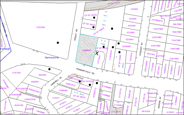
|
NOTIFICATION PLAN |
|
||
|
• PROPERTIES NOTIFIED
|
X SUBMISSIONS RECEIVED |
PROPERTY SUBJECT OF DEVELOPMENT |
|
One submission objected to the development, generally on the grounds that the development would result in:
· Unacceptable overshadowing of adjoining properties;
· Unacceptable noise from activities at the centre; and
· Overlooking causing adverse privacy impacts.
The merits of the matters raised in community submissions have been addressed in the body of the report.
5.2 Public Agencies
The development application does not constitute Integrated Development under the Act and accordingly, the application was not referred to any public agencies.
6. THE PUBLIC INTEREST
Section 79C(1)(e) of the Act requires Council to consider “the public interest”.
The public interest is an overarching requirement, which includes the consideration of the matters discussed in this report. Implicit to the public interest is the achievement of future built outcomes adequately responding to and respecting the future desired outcomes expressed in environmental planning instruments and development control plans.
The application is considered to have satisfactorily addressed Council’s criteria and would provide a development outcome that, on balance, would result in a positive impact for the community. Accordingly, it is considered that the approval of the development would be in the public interest.
CONCLUSION
The application proposes alterations and additions to the
existing church buildings.
The application does not comply with the Hornsby Shire Local Environmental
Plan 1984 in respect to Clause 15 ‘Floor Space Ratio’. A SEPP 1
objection to the development standard contained within Clause 15 has been
submitted. The proposal, when taking into consideration the SEPP 1
objection, is considered to be acceptable.
Council received one submission during the public notification period and appropriate conditions are recommended to minimise disruption to the amenity of adjoining land uses.
Having regard to the circumstances of the case, approval of the application is recommended, pursuant to State Environmental Planning Policy No. 1.
Note: At the time of the completion of this planning report, no persons have made a Political Donations Disclosure Statement pursuant to Section 147 of the Environmental Planning and Assessment Act 1979 in respect of the subject planning application.
|
Rod Pickles Manager - Development Assessment Planning Division |
James Farrington Group Manager Planning Division |
|
1.View |
Locality Plan |
|
|
|
2.View |
Site Plan |
|
|
|
3.View |
Landscape Plan |
|
|
|
4.View |
Floor Plans |
|
|
|
5.View |
Elevations |
|
|
File Reference: DA/708/2012
Document Number: D02058267
SCHEDULE 1
GENERAL CONDITIONS
The conditions of consent within this notice of determination have been applied to ensure that the use of the land and/or building is carried out in such a manner that is consistent with the aims and objectives of the relevant legislation, planning instruments and Council policies affecting the land and does not disrupt the amenity of the neighbourhood or impact upon the environment.
Note: For the purpose of this consent, the term ‘applicant’ means any person who has the authority to act on or the benefit of the development consent.
Note: For the purpose of this consent, any reference to an Act, Regulation, Australian Standard or publication by a public authority shall be taken to mean the gazetted Act or Regulation, or adopted Australian Standard or publication as in force on the date that the application for a construction certificate is made.
1. Approved Plans and Supporting Documentation
The development must be carried out in accordance with the plans and documentation listed below and endorsed with Council’s stamp, except where amended by Council and/or other conditions of this consent:
|
Plan Title |
Drawing No. |
Drawn by |
Dated |
|
Elevations |
10014-DA05-p10 |
NBRS+Partners |
Revised 01/11/2012 |
|
Proposed Ground Floor Plan |
10014-DA03-p21 |
NBRS+Partners |
Revised 01/11/2012 |
|
Stormwater Management/ Lower Ground Floor Plan |
11444-SW-04 C |
NBRS+Partners |
Revised 31/10/2012 |
|
Proposed Site and Roof Plan |
10014-DA02-p9 |
NBRS+Partners |
Revised 01/11/2012 |
|
Landscape Plan |
10014 LDA p4 |
NBRS+Partners |
23/10/2012 |
|
Tree Location Plan |
N/A |
Hornsby Shire Council |
14/11/2012 |
|
Amended Plan 10014-DA-p21-amended |
N/A |
NBRS+Partners |
20/11/2012 |
|
Document Title |
Prepared by |
Dated |
|
Statement of Environmental Effects |
Don Fox Planning |
12/7/2012 |
|
Arboricultural Assessment |
Stuart Pittendrigh |
May 2012 |
|
Waste Management Plan |
NBRS+Parteners |
10/5/2012 |
|
Traffic and Parking Assessment Report |
Varga Traffic Planning |
17/5/2012 |
|
Shadow Diagrams |
NBRS+Partners |
24/5/2012 |
|
Stormwater Management Roof/Site Plan 11444-SW-02 C |
NBRS+Partners |
Revised 01/11/2012 |
|
Storm11444-SW-06 D |
NBRS+Partners |
Revised 31/10/2012 |
2. This consent does not permit an increase in the number of church patrons or children attending the child care centre
3. This consent does not approve any change to the approved hours of use of the church or child care centre.
4. Removal of Existing Trees
This development consent only permits the removal of trees numbered 5,6,9,10,11,15,17,20 and 21 as identified on Site Tree Location Plan prepared by Hornsby Council dated 14 November 2012. The removal of any other trees requires separate approval under Council’s Tree Preservation Order.
5. Assess Way
A one metre separation between the pedestrian access way and vehicle access way shall be provided at the southern vehicle/pedestrian access as per amended plan 10014-DA-p21-amended.
REQUIREMENTS PRIOR TO THE ISSUE OF A CONSTRUCTION CERTIFICATE
6. Building Code of Australia
All building work must be carried out in accordance with the requirements of the Building Code of Australia.
REQUIREMENTS PRIOR TO THE COMMENCEMENT OF ANY WORKS
7. Erection of Construction Sign
A sign must be erected in a prominent position on any site on which building work, subdivision work or demolition work is being carried out:
a) Showing the name, address and telephone number of the principal certifying authority for the work,
b) Showing the name of the principal contractor (if any) for any demolition or building work and a telephone number on which that person may be contacted outside working hours, and
c) Stating that unauthorised entry to the work site is prohibited.
Note: Any such sign is to be maintained while the building work, subdivision work or demolition work is being carried out, but must be removed when the work has been completed.
8. Protection of Adjoining Areas
A temporary hoarding, fence or awning must be erected between the work site and adjoining lands before the works begin and must be kept in place until after the completion of the works if the works:
a) Could cause a danger, obstruction or inconvenience to pedestrian or vehicular traffic.
b) Could cause damage to adjoining lands by falling objects.
c) Involve the enclosure of a public place or part of a public place.
Note: Notwithstanding the above, Council’s separate written approval is required prior to the erection of any structure or other obstruction on public land.
9. Toilet Facilities
Toilet facilities must be available or provided at the works site before works begin and must be maintained until the works are completed at a ratio of one toilet for every 20 persons employed at the site. Each toilet must:
a) be a standard flushing toilet connected to a public sewer; or
b) be a temporary chemical closet approved under the Local Government Act, 1993; or
c) have an on-site effluent disposal system approved under the Local Government Act, 1993
10. Erosion and Sediment Control
Erosion and sediment control measures must be provided and maintained throughout the construction period in accordance with the manual ‘Soils and Construction 2004 (Bluebook)’, the approved plans, Council specifications and to the satisfaction of the principal certifying authority. The erosion and sediment control devices must remain in place until the site has been stabilised and revegetated.
Note: On the spot penalties up to $1,500 may be issued for any non-compliance with this requirement without any further notification or warning.
11. Tree Protection Barriers
Tree protection fencing must be erected around trees numbered 1,2,3,4,7,8,16,18 and 19 to be retained at a 4metre setback. The tree fencing must be constructed of 1.8 metre ‘cyclone chainmesh fence’.
To avoid injury or damage, trees numbered 1,2,3,4,7,8,16,18 and 19 must have trunks protected by 2 meter lengths of 75mm x 25mm hardwood timbers spaced at 80mm secured with galvanised wire (not fixed or nailed to the tree in any way.
REQUIREMENTS DURING CONSTRUCTION
12. Construction Work Hours
All work on site (including demolition and earth works) must only occur between 7am and 5pm Monday to Saturday.
No work is to be undertaken on Sundays or public holidays.
13. Demolition
All demolition work must be carried out in accordance with Australian Standard 2601-2001 – The Demolition of Structures and the following requirements:
a) Demolition material is to be disposed of to an authorised recycling and/or waste disposal site and/or in accordance with an approved waste management plan.
b) Demolition works, where asbestos material is being removed, must be undertaken by a contractor that holds an appropriate licence issued by WorkCover NSW in accordance with Chapter 10 of the Occupational Health and Safety Regulation 2001 and Clause 29 of the Protection of the Environment Operations (Waste) Regulation 2005.
c) On construction sites where buildings contain asbestos material, a standard commercially manufactured sign containing the words ‘DANGER ASBESTOS REMOVAL IN PROGRESS’ measuring not less than 400mm x 300mm must be erected in a prominent position visible from the street.
14. Environmental Management
The site must be managed in accordance with the publication ‘Managing Urban Stormwater – Landcom (March 2004) and the Protection of the Environment Operations Act 1997 by way of implementing appropriate measures to prevent sediment run-off, excessive dust, noise or odour emanating from the site during the construction of the development.
15. Works near Trees
All required tree protection measures are to be maintained in good condition for the duration of the construction period.
All works (including driveways and retaining walls) within 5 metres of any trees required to be retained (whether or not on the subject property, and pursuant to this consent or the Tree Preservation Order), must be carried out under the supervision of an ‘AQF Level 5 Arborist’ and a certificate submitted to the principal certifying authority detailing the method(s) used to preserve the tree(s).
The applicant is to ensure that no excavation, filling or stockpiling of building materials, parking of vehicles or plant, disposal of cement slurry, waste water or other contaminants is to occur within 5 metres of any tree to be retained.
16. Council Property
During construction works, no building materials, waste, machinery or related matter is to be stored on the road or footpath. The public reserve is to be kept in a clean, tidy and safe condition at all times.
17. Disturbance of Existing Site
During construction works, the existing ground levels of open space areas and natural landscape features, (including natural rock-outcrops, vegetation, soil and watercourses) must not be altered unless otherwise nominated on the approved plans.
18. Landfill
Landfill must be constructed in accordance with Council’s ‘Construction Specification, 2005’ and the following requirements:
a) All fill material imported to the site is to wholly consist of Virgin Excavated Natural Material (VENM) as defined in Schedule 1 of the Protection of the Environment Operations Act 1997 or a material approved under the Department of Environment and Climate Change’s general resource recovery exemption.
b) A compaction certificate is to be obtained from a geotechnical engineer verifying that the specified compaction requirements have been met.
19. Excavated Material
All excavated material removed from the site must be classified in accordance with the Department of Environment, Climate Change and Water NSW Waste Classification Guidelines prior to disposal to an approved waste management facility and reported to the principal certifying authority.
REQUIREMENTS PRIOR TO THE ISSUE OF AN OCCUPATION OR SUBDIVISION CERTIFICATE
Note: For the purpose of this consent, a reference to ‘occupation certificate’ shall not be taken to mean an ‘interim occupation certificate’ unless otherwise stated.
20. Stormwater Drainage
The stormwater drainage system for the development must be designed and constructed for an average recurrence interval of 20 years and be gravity drained to Council’s street drainage system.
21. On Site Stormwater Detention
An on-site stormwater detention system must be designed by a chartered civil engineer and constructed in accordance with the following requirements:
a) Discharge from the site shall be limited to 5 year pre development ARI discharge rate and storage volume provided for up to 50 years ARI storm events. All calculations are to shown with a construction certificate application.
b) Have a surcharge/inspection grate located directly above the outlet.
c) Discharge from the detention system to be controlled via 1 metre length of pipe, not less than 50 millimetres diameter or via a stainless plate with sharply drilled orifice bolted over the face of the outlet discharging into a larger diameter pipe capable of carrying the design flow to an approved Council system.
d) Where above ground and the average depth is greater than 0.3 metres, a ‘pool type’ safety fence and warning signs to be installed.
e) Not be constructed in a location that would impact upon the visual or recreational amenity of residents.
f) A road opening permit is to be obtained from Council’s Infrastructure and Recreation Division for works within the nature strip (ramp and outlet pipe from OSD).
Note: If the discharge exceeds 60 litres per second, the outlet is to be connected to Council’s stormwater pipe in Kenley Road through a junction pit. Details are to be provided with the construction certificate application. A compliance certificate is to be obtained from Council for connection to Council’s stormwater pipe.
22. Footpath, Kerb and Ramp
a) All damaged sections of footpath and kerb (including any gap) shall be replaced/constructed.
b) All scoured/damaged sections of the nature strip in front of the property shall be levelled and turfed.
c) The existing pedestrian ramp at the intersection of Pennant Hills Road and Kenley Road shall be removed and built in accordance with Council Civil Works Specifications 2005. A compliance certificate is to be obtained from Council.
23. Vehicular Crossing
A separate application under the Local Government Act, 1993 and the Roads Act, 1993 must be submitted to Council for the installation of a new vehicular crossing and the removal of the redundant crossing. The vehicular crossing must be constructed in accordance with Council’s Civil Works Design, 2005 and the following requirements:
a) The cracked /damaged vehicular crossings are to be replaced.
b) Any redundant crossings to be replaced with integral kerb and gutter.
c) The footway area to be restored by turfing.
d) Approval obtained from all relevant utility providers that all necessary conduits be provided and protected under the crossing.
Note: An application for a vehicular crossing can only be made to one of Council’s Authorised Vehicular Crossing Contractors. You are advised to contact Council on 02 9847 6940 to obtain a list of contractors.
24. Traffic Control Plan
A Traffic Control Plan (TCP) must be prepared by a qualified traffic controller in accordance with the Roads & Traffic Authority’s Traffic Control at Worksites Manual 1998 and Australian Standard 1742.3 for all work on a public road and be submitted to Council. The TCP must detail the following:
a) Arrangements for public notification of the works.
b) Temporary construction signage.
c) Permanent post-construction signage.
d) Vehicle movement plans.
e) Traffic management plans.
f) Pedestrian and cyclist access/safety.
25. Damage to Council Assets
Any damage caused to Council’s assets as a result of the construction of the development must be rectified in accordance with Council’s written requirements and at the sole cost of the applicant.
26. Creation of Easements
The following matter(s) must be nominated on the plan of subdivision under s88B of the Conveyancing Act 1919: A right of access and easement for services over the access corridor.
a) The creation of an appropriate "Positive Covenant" and "Restriction as to User" over the constructed on-site detention/retention systems and outlet works, within the lots in favour of Council in accordance with Council’s prescribed wording. The position of the on-site detention system is to be clearly indicated on the title.
b) To register the OSD easement, the restriction on the use of land “works-as-executed” details of the on-site-detention system must be submitted verifying that the required storage and discharge rates have been constructed in accordance with the design requirements. The details must show the invert levels of the on site system together with pipe sizes and grades. Any variations to the approved plans must be shown in red on the “works-as-executed” plan and supported by calculations.
Note: Council must be nominated as the authority to release, vary or modify any easement, restriction or covenant.
OPERATIONAL CONDITIONS
27. Car Parking
All car parking must be constructed and operated in accordance with Australian Standard AS/NZS 2890.1:2004 – Off-street car parking
a) All parking areas and driveways are to be sealed to an all weather standard, line marked and signposted;
b) Car parking, loading and manoeuvring areas to be used solely for nominated purposes;
c) Vehicles awaiting loading, unloading or servicing shall be parked on site and not on adjacent or nearby public roads;
d) All vehicular entry on to the site and egress from the site shall be made in a forward direction.
28. Vehicular Access
The northern and southern vehicle accesses are to be retained to allow vehicle circulation through the site.
29. Noise
All noise generated by the proposed development must be attenuated to prevent levels of noise being emitted to adjacent premises which possess tonal, beating and similar characteristics or which exceeds background noise levels by more than 5dB(A).
- END OF CONDITIONS –
ADVISORY NOTES
The following information is provided for your assistance to ensure compliance with the Environmental Planning and Assessment Act, 1979, Environmental Planning and Assessment Regulation 2000, other relevant legislation and Council’s policies and specifications. This information does not form part of the conditions of development consent pursuant to Section 80A of the Act.
Environmental Planning and Assessment Act, 1979 Requirements
· The Environmental Planning and Assessment Act, 1979 requires:
· The issue of a construction certificate prior to the commencement of any works. Enquiries regarding the issue of a construction certificate can be made to Council’s Customer Services Branch on 9847 6760.
· A principal certifying authority to be nominated and Council notified of that appointment prior to the commencement of any works.
· Council to be given at least two days written notice prior to the commencement of any works.
· Mandatory inspections of nominated stages of the construction inspected.
· An occupation certificate to be issued before occupying any building or commencing the use of the land.
Long Service Levy
In accordance with Section 34 of the Building and Construction Industry Long Service Payments Act 1986, a ‘Long Service Levy’ must be paid to the Long Service Payments Corporation or Hornsby Council.
Note: The rate of the Long Service Levy is 0.35% of the total cost of the work.
Note: Hornsby Council requires the payment of the Long Service Levy prior to the issue of a construction certificate.
Tree Preservation Order
To ensure the maintenance and protection of the existing natural environment, it is an offence to ringbark, cut down, top, lop, remove, wilfully injure or destroy a tree outside 3 metres of the approved building envelope without the prior written consent from Council.
Note: A tree is defined as a single or multi-trunked wood perennial plant having a height of not less than three (3) metres, and which develops many branches, usually from a distance of not less than one (1) metre from the ground, but excluding any plant which, in its particular location, is a noxious plant declared as such pursuant to the Noxious Weeds Act 1993. This definition of ‘tree’ includes any and all types of Palm trees.
All distances are determined under Australian Standard AS4970-2009 ”Protection of Trees on Development Sites”.
Fines may be imposed for non-compliance with Council’s Tree Preservation Order.
Dial Before You Dig
Prior to commencing any works, the applicant is encouraged to contact Dial Before You Dig on 1100 or www.dialbeforeyoudig.com.au for free information on potential underground pipes and cables within the vicinity of the development site.
Asbestos Warning
Should asbestos or asbestos products be encountered during demolition or construction works you are advised to seek advice and information should be prior to disturbing the material. It is recommended that a contractor holding an asbestos-handling permit (issued by WorkCover NSW)be engaged to manage the proper handling of the material. Further information regarding the safe handling and removal of asbestos can be found at:
Alternatively, telephone the WorkCover Asbestos and Demolition Team on 8260 5885.
Planning Division
Date of Meeting: 19/12/2012
14 DEVELOPMENT APPLICATION - FIVE STOREY RESIDENTIAL FLAT BUILDING COMPRISING 35 UNITS AND STRATA TITLE SUBDIVISION - 40, 42 AND 42A KEELER STREET, CARLINGFORD
EXECUTIVE SUMMARY
|
DA No: |
DA/687/2012 (Lodged 9 July 2012) |
|
Description: |
Demolition of existing structures and construction of a five storey residential flat building comprising 35 units with basement car parking and strata title subdivision |
|
Property: |
Lot 6 DP 30015, Lots 1 and 2 DP 866744, Nos. 40, 42 and 42A Keeler Street Carlingford |
|
Applicant: |
I C Homes Pty Ltd |
|
Owners: |
Mr A. Senel and Mrs S. Senel; Mr P. Manchanayake and Mrs S. C. Manchanayake |
|
Estimated Value: |
$7,875,000 |
|
Ward: |
C |
· The application proposes the demolition of existing structures and construction of a five storey residential flat building comprising 35 units with two levels of basement car parking and strata title subdivision.
· The proposal generally complies with the Hornsby Shire LEP 1994, State Environmental Planning Policy No. 65 – Design Quality Residential Flat Building and the Housing Strategy Development Control Plan.
· Four submissions have been received in respect of the application.
· It is recommended that the application be approved.
|
THAT Development Application No. DA/687/2012 for demolition of existing structures and the construction of a five storey residential flat building comprising 35 units with basement car parking and strata subdivision at Lot 6 DP 30015, Lots 1 and 2 DP 866744, Nos. 40, 42 and 42A Keeler Street Carlingford be approved subject to the conditions of consent detailed in Schedule 1 of Group Manager’s Report No. PL51/12. |
BACKGROUND
The site is within the ‘Carlingford Road, Carlingford precinct’, rezoned for five storey residential flat development as part of Council’s Housing Strategy on 2 September 2011.
The site adjoins the site of a proposed five storey residential flat building under consideration by Council at Nos. 44 - 46 Keeler Street. The proposed building is essentially the same design as the subject proposal with different treatment in the street elevation (DA/688/2012).
SITE
The site has an area of 1,761m2 and is located on the northern side of Keeler Street. The site is regular in shape and has a frontage of 33.53 metres to Keeler Street and a length of 52.665 metres on the eastern boundary and 52.555 metres on the western boundary. The site has an average fall of 5% to the north-eastern corner of the site.
The site includes three existing dwelling-houses. Access to the site is currently via two existing driveways fronting Keeler Street.
The site forms part of the ‘Carlingford Road, Carlingford precinct’ rezoned for medium-high density housing in accordance with the Hornsby Shire Housing Strategy in September 2011. The precinct is bounded by Carlingford Road, Pennant Hills Road, Keeler Street and Hepburn Avenue. A number of properties have been approved for residential flat development or are under assessment by Council.
The surrounding developments within the precinct mainly include dwelling-houses on suburban lots. There is a mix of low density and medium density housing on the opposite side of Keeler Street within the Parramatta City Council area. Keeler Street forms the boundary between the Hornsby and Parramatta local government areas in this location at Carlingford.
The area on the western side of Pennant Hills Road, Carlingford, within The Hills Shire Council area is undergoing transition for higher density housing developments.
The site is within walking distance (120m) of the Carlingford commercial centre on Pennant Hills Road and is located 800m north-east of Carlingford Railway Station.
PROPOSAL
The proposal involves the demolition of all the existing structures within the subject site and the construction of a five storey residential flat building comprising thirty-five units with two levels of basement car parking and strata title subdivision.
The unit mix would comprise of 11 x 1-bedroom units, 21 x 2-bedroom units and 3 x 3-bedroom units. The units would be accessed via a lift.
The development would be accessed from Keeler Street via a driveway located on the eastern boundary of the site. A separate pedestrian entry would provide access to the foyer and the lift for vertical circulation. A total of 42 residential car parking spaces, including 7 visitor’s parking spaces are proposed in two basement levels. The basement levels include accessible car parking spaces.
ASSESSMENT
The development application has been assessed having regard to the ‘Metropolitan Plan for Sydney 2036’, the ‘North Subregion (Draft) Subregional Strategy’ and the matters for consideration prescribed under Section 79C of the Environmental Planning and Assessment Act 1979 (the Act). The following issues have been identified for further consideration.
1. STRATEGIC CONTEXT
1.1 Metropolitan Plan for Sydney 2036 and (Draft) North Subregional Strategy
The Metropolitan Plan for Sydney 2036 is a broad framework to secure Sydney’s place in the global economy by promoting and managing growth. It outlines a vision for Sydney to 2036; the challenges faced, and the directions to follow to address these challenges and achieve the vision. The Draft North Subregional Strategy acts as a framework for Council in its preparation of the Comprehensive LEP by the end of 2012.
The Draft North Subregional Strategy sets the following targets for the Hornsby LGA by 2031:
· Employment capacity to increase by 9,000 jobs; and
· Housing stock to increase by 11,000 dwellings.
The proposed development would be consistent with the draft Strategy by providing an additional 32 dwellings and would contribute towards housing choice in the locality.
The proposed development would be consistent with the Metropolitan Plan for Sydney 2036.
2. STATUTORY CONTROLS
Section 79C(1)(a) requires Council to consider “any relevant environmental planning instruments, draft environmental planning instruments, development control plans, planning agreements and regulations”.
2.1 Hornsby Shire Local Environmental Plan 1994
The subject land is zoned Residential C (Medium/High Density) under the Hornsby Shire Local Environmental Plan 1994 (HSLEP). The objectives of the zone are:
(a) to provide for the housing needs of the population of the Hornsby area.
(b) to promote a variety of housing types and other land uses compatible with a medium to high density residential environment.
(c) to provide for development that is within the environmental capacity of a medium to high density residential environment.
The proposed development is defined as ‘multi-unit housing’ and ‘subdivision’ under the HSLEP and is permissible in the zone with Council’s consent. The land is identified within the area detailed on Diagram 8 under Schedule BB of the HSLEP. Clause 15A of the HSLEP prescribes that the maximum building height within the area detailed under Schedule BB is not to exceed 17.5 metres. The proposed building complies with this requirement.
Clause 18 of the HSLEP sets out heritage conservation provisions for Hornsby Shire. The site is not in the vicinity of a heritage item or conservation area and is not subject to consideration for heritage conservation. Therefore, no further assessment in this regard is necessary.
2.2 Draft Hornsby Local Environmental Plan
The Draft Hornsby Local Environmental Plan (Draft HLEP) was exhibited from 5 June 2012 to 7 August 2012. The Draft HLEP essentially reiterates the current land use zoning and height control applicable to the site as outlined below:
2.2.1 Zoning
The site would be zoned R4 (High Density Residential) zone pursuant to the Land Use Table of the Draft HLEP. The proposed development is defined as a ‘Residential Flat Building’ and would be a permissible use in the zone with Council’s consent.
2.2.2 Height of Building
Clause 4.3 of the draft HLEP provides that the height of a building on any land is not to exceed the maximum height shown for the land on the Height of Buildings Map. The maximum permissible height for the subject site is 17.5 metres. The proposal complies with this provision.
2.3 State Environmental Planning Policy No. 55 – Remediation of Land
State Environmental Planning Policy No. 55 (SEPP 55) requires that Council must not consent to the carrying out of any development on land unless it has considered whether the land is contaminated or requires remediation for the proposed use.
The site has been used for residential purposes and is unlikely to be contaminated. No further assessment is considered necessary in this regard. A condition is recommended should any contamination be found during construction.
2.4 State Environmental Planning Policy No. 65 – Design Quality Residential Flat Development
The Policy provides design principles to improve the design quality of residential flat development and consistent planning controls across the State.
The applicant has submitted a design verification statement prepared by a qualified designer stating how the proposed development achieves the design principles of SEPP 65. The design principles of SEPP 65 and the submitted design verification statement are addressed below.
2.4.1 Principle 1 - Context
Design Principle 1 is as follows:
Good design responds and contributes to its context. Context can be defined as the key natural and built features of an area.
Responding to context involves identifying the desirable elements of a location’s current character or, in the case of precincts undergoing a transition, the desired future character as stated in planning and design policies. New buildings will thereby contribute to the quality and identity of the area.
The site is located within a precinct zoned for five storey residential flat buildings in close proximity to Pennant Hills Road and the Carlingford Court Shopping Centre. The desired future character of the area, as outlined in Council’s Housing Strategy DCP, is that of a high density residential precinct incorporating five storey developments in a landscape setting. It is considered that the proposed building would contribute to the identity and future character of the precinct.
2.4.2 Principle 2 - Scale
Design Principle 2 is as follows:
Good design provides an appropriate scale in terms of the bulk and height that suits the scale of the street and the surrounding buildings.
Establishing an appropriate scale requires a considered response to the scale of existing development. In precincts undergoing a transition, proposed bulk and height needs to achieve the scale identified for the desired future character of the area.
The proposed development complies with the maximum height limit permitted in the precinct and provides a building envelope which is in accordance with the setbacks required by Council’s Housing Strategy Development Control Plan.
The scale of the development is consistent with the desired future character of the precinct. The application is assessed as satisfactory in this regard.
2.4.3 Principle 3 – Built Form
Design Principle 3 is as follows:
Good design achieves an appropriate built form for a site and the building’s purpose, in terms of building alignments, proportions, building type and the manipulation of building elements.
Appropriate built form defines the public domain, contributes to the character of streetscape and parks, including their views and vistas, and provides internal amenity and outlook.
The proposed built form is designed to be consistent with the requirements of the Residential Flat Design Code and Council’s Housing Strategy DCPin relation to the building alignment, setbacks and building type. The articulation of the proposed building has been achieved by the provision of horizontal and vertical architectural elements and by the use of contrasting finishes, colours and textures.
2.4.4 Principle 4 – Density
Design Principle 4 is as follows:
Good design has a density appropriate for a site and its context, in terms of floor space yields (or number of units or residents).
Appropriate densities are sustainable and consistent with the existing density in an area or in precincts undergoing a transition, are consistent with the stated desired future density. Sustainable densities respond to the regional context, availability of infrastructure, public transport, community facilities and environmental quality.
The density of development on the site is guided by the height of the building and the required setbacks from the boundaries. The matter has been discussed in detail in Sections 2.1 and 2.9 of this report.
It is considered that the proposed density is sustainable as it responds to the regional context, availability of infrastructure, public transport, community facilities and environmental quality. The proposal complies with the density principle of SEPP 65.
2.4.5 Principle 5 – Resource, Energy and Water Efficiency
Design Principle 5 is as follows:
Good design makes efficient use of natural resources, energy and water throughout its full life cycle, including construction.
Sustainability is integral to the design process. Aspects include demolition of existing structures, recycling of materials, selection of appropriate and sustainable materials, adaptability and reuse of buildings, layouts and built form, passive solar design principles, efficient appliances and mechanical services, soil zones for vegetation and reuse of water.
The applicant has submitted BASIX Certificate for the proposed 35 dwellings. In achieving the required BASIX targets for sustainable water use, thermal comfort and energy efficiency, the proposed development achieves the design criteria.
2.4.6 Principle 6 – Landscape
Design Principle 6 is as follows:
Good design recognises that together landscape and buildings operate as an integral and sustainable system, resulting in greater aesthetic quality and amenity for both occupants and the adjoining public domain.
Landscape design builds on the existing site’s natural and cultural features in responsible and creative ways. It enhances the development’s natural environmental performance by co-ordinating water and soil management, solar access, micro-climate, tree canopy and habitat values. It contributes to the positive image and contextual fit of development through respect for streetscape and neighbourhood character, or desired future character.
Landscape design should optimise useability, privacy and social opportunity, equitable access and respect for neighbour’s amenity, and provide for practical establishment and long term management.
The application includes a landscape concept plan providing landscaping along the street frontage, side and rear boundaries. The planting would provide an appropriate landscape setting for the development. The proposed development is in accordance with the Landscaping principle of SEPP 65 and Housing Strategy DCP objective for buildings within landscaped settings.
2.4.7 Principle 7 – Amenity
Design Principle 7 is as follows:
Good design provides amenity through the physical, spatial and environmental quality of a development.
Optimising amenity requires appropriate room dimensions and shapes, access to sunlight, natural ventilation, visual and acoustic privacy, storage, indoor and outdoor space, efficient layouts and service areas, outlook and ease of access for all age groups and degrees of mobility.
The proposed unit are designed to achieve natural ventilation, solar access and acoustic privacy. All units incorporate balconies accessible from living areas and privacy has been achieved through appropriate design. Adequate storage has been provided within units and within the basement levels. The proposal would provide convenient and safe access to the development via a central lift connecting the basement and all other levels.
2.4.8 Principle 8 – Safety and Security
Design Principle 8 is as follows:
Good design optimises safety and security, both internal to the development and for the public domain.
This is achieved by maximising overlooking of public and communal spaces while maintaining internal privacy, avoiding dark and non-visible areas, maximising activity on streets, providing clear, safe access points, providing quality public spaces that cater for desired recreational uses, providing lighting appropriate to the location and desired activities, and clear definition between public and private spaces.
The proposal affords good casual surveillance of the street frontage through the visual interaction with the main entrance to the building on the ground floor. With regard to the car parking areas, security garage doors are to be installed with access being provided via an intercom system for visitors and residents to the building.
The RFDC requires the preparation of a formal Crime Assessment Report for development that comprises more than twenty residential units. The proposal includes a Crime Risk Assessment. The application was referred to the NSW Police. The NSW Police raises no objections to the proposal. Conditions are recommended for lighting, territorial re-enforcement, environmental maintenance and access control. Subject to the imposition of conditions of consent addressing the above matters, the proposal is supported in respect of safety and security.
2.4.9 Principle 9 – Social Dimensions and Housing Affordability
Design Principle 9 is as follows:
Good design responds to the social context and needs of the local community in terms of lifestyles, affordability, and access to social facilities.
New development should optimise the provision of housing to suit the social mix and needs in the neighbourhood or, in the case of precincts undergoing transition, provide for the desired future community.
New development should address housing affordability by optimising the provision of economic housing choices and providing a mix of housing types to cater for different budgets and housing needs.
The Housing Strategy DCP includes prescriptive measures for housing choice and for adaptable housing to provide for aging in place. The proposal meets the prescriptive measures and extends the range and diversity of residential accommodation available in the area.
2.4.10 Principle 10 – Aesthetics
Design Principle 10 is as follows:
Quality aesthetics require the appropriate composition of building elements, textures, materials and colours and reflect the use, internal design and structure of the development. Aesthetics should respond to the environment and context, particularly to desirable elements of the existing streetscape or, in precincts undergoing transition, contribute to the desired future character of the area.
The proposal is consistent with the design principles contained within the RFDC. It is considered that the aesthetic quality of the building contributes to the desired future character of the precinct. The details of the assessment of the built form and the aesthetics of the development are contained in Section 2.9 of this report.
2.5 SEPP 65 - Residential Flat Design Code
SEPP 65 also requires consideration of the Residential Flat Design Code, NSW Planning Department 2002. The Code includes development controls and best practice benchmarks for achieving the design principles of the SEPP 65. The following table sets out the proposal’s compliance with the Code:
|
Residential Flat Design Code |
|||
|
Control |
Proposal |
Requirement |
Compliance |
|
Deep Soil Zone |
31.35% |
25% |
Yes |
|
Communal Open Space |
25% |
25-30% |
Yes |
|
Ground Level Private Open Space |
12m2 + Min dimension 4m |
25m2 Min Dimension 4m |
No Yes |
|
Minimum Dwelling Size |
1 br – 50m2 2 br – 70m2 3 br – 95m2 |
1 br – 50m2 2 br – 70m2 3 br – 95m2 |
Yes Yes Yes |
|
Maximum Kitchen Distance |
8m |
8m |
Yes |
|
Minimum Balcony Depth |
2m |
2m |
Yes |
|
Ceiling heights - Residential floors |
2.7m |
2.7m (Min) |
Yes |
|
Dual Aspect & Cross Ventilation |
60% |
60% |
Yes |
|
Adaptable Housing |
30% |
10% |
Yes |
As detailed in the above table, the proposed development complies with the prescriptive measures within the Residential Flat Design Code (RFDC) other than the minimum area for ground level open space. Below is a brief discussion regarding the relevant development controls and best practice guidelines.
2.5.1 Apartment Layout
The layout of the proposed apartments includes a combination of single aspect units and dual aspect corner units. The proposal includes a range in the size of dwellings with one bedroom + study, two bedroom and three bedroom units. The unit layouts would provide for housing choice and a range of household types.
The proposed apartment layouts are functional and satisfy the RFDC requirements for internal privacy, access to sunlight, natural ventilation and acoustic privacy. It is considered that the apartment layout and mix achieve the intent of the best practice requirements of the RFDC and is acceptable in this regard.
2.5.2 Ground Floor Apartments and Private Open Space
The majority of the proposed units located on the ground floor do not comply with the Code’s best practice for a 25m2 of courtyard space. However, the proposed ground floor open space areas are considered appropriate for the respective ground floor units in respect to dwelling size, aspect, unit configuration and amenity.
Notwithstanding the above, the private open space areas for all units comply with the minimum area requirements of Council’s Housing Strategy DCP. The proposed development includes sufficient landscaped communal open space areas to compensate for this non-compliance.
2.5.3 Internal Circulation
The proposed building includes four to eight units with lift access on the respective levels in accordance with the Code’s best practice guidelines for up to eight units per lift. The location of unit entries and articulation of internal passage ways would ensure appropriate amenity.
The proposed recycling bins are located adjacent to the entries to Units 26, 27, 32 and 33. To ensure appropriate amenity, a condition is recommended so that the recycling bins are not located immediately adjacent to the unit entries similar to the second and first floor levels of the building.
The front entry includes an entry foyer on the western elevation of the proposed building. The ground floor includes access to communal open space areas from the frontage and at the western elevation. A condition is recommended for the access to comply with AS1428.1 – Design for Access and Mobility.
Subject to recommended conditions, the proposal is considered acceptable in respect to the Code’s requirements for internal circulation.
2.5.4 Acoustic Privacy
The units within the proposed building are configured for separation and acoustic privacy in accordance with the Code’s best practice guidelines. The application included an Acoustic Report which provides details of construction techniques and measures to attenuate road noise and vibration. The report is assessed as satisfactory.
The Construction Certificate Plans would be required to demonstrate compliance with the recommendations of the acoustic report via use of appropriate materials for glazing and construction.
2.5.5 Storage
The proposed building includes resident storage areas for all units within the building and storage areas would be located within the basement levels. A condition is recommended for the storage areas to be allocated in accordance with the size requirements of the Code for the respective units.
In summary, the proposed residential flat building has been designed in accordance with the design principles of SEPP 65 and generally complies in respect to the Residential Flat Design Code subject to the imposition of appropriate conditions of consent. It is considered the proposal would achieve good residential amenity and contribute to the desired future residential character of the Carlingford Road Precinct.
2.6 State Environmental Planning Policy (Building Sustainability Index – BASIX) - 2004
The application has been assessed against the requirements of State Environmental Planning Policy (Building Sustainability Index: BASIX) 2004. The proposal includes a BASIX Certificate for the proposed units and is considered to be satisfactory.
2.7 State Environmental Planning Policy No. 32 - Urban Consolidation (Redevelopment of Urban Land) (SEPP 32)
The application has been assessed against the requirements of SEPP 32, which requires Council to implement the aims and objectives of this Policy to the fullest extent practicable when considering development applications relating to redevelopment of urban land. The application complies with the objectives of the Policy as it would promote social and economic welfare of the locality and would result in the orderly and economic use of under utilised land within the Shire.
2.8 Sydney Regional Environmental Plan (Sydney Harbour Catchment) 2005
The application has been assessed against the requirements of Sydney Regional Environmental Plan (Sydney Harbour Catchment) 2005. This Policy provides general planning considerations and strategies to ensure that the catchment, foreshores, waterways and islands of Sydney Harbour are recognised, protected, enhanced and maintained.
The proposal includes details of stormwater management of the site by providing an on-site detention system. Council’s engineering assessment of the proposal in this regard concludes that the development is satisfactory. A condition is recommended with respect to installation of sediment and erosion control measures prior to, and during, construction.
The proposed development would have minimal potential to impact on the Sydney Harbour Catchment.
2.9 Housing Strategy Development Control Plan
The proposed development has been assessed having regard to the desired outcomes and prescriptive measures within Council’s Housing Strategy Development Control Plan (Housing Strategy DCP). The following table sets out the proposal’s compliance with the prescriptive measures of the Plan:
|
Housing Strategy Development Control Plan |
|||
|
Control |
Proposal |
Requirement |
Compliance |
|
Site Width |
33.53m |
30m |
Yes |
|
Height |
5 storeys – 17.5m |
5 storeys – 17.5m |
Yes |
|
Lowest Residential Floor Above Ground |
1.01m |
Max - 1.50m |
Yes |
|
Maximum Floorplate Dimension |
35m |
35m |
Yes |
|
Building Indentation |
4m x 4m |
4m x 4m |
Yes |
|
Front Setback |
10m 8.13m (for 7m length) |
10m 8m < 1/3rd frontage
|
Yes Yes Yes |
|
W Side Setback |
6m 4m < 1/3rd frontage |
6m 4m < 1/3rd frontage |
Yes Yes |
|
E Side Setback |
6m 4m < 1/3rd frontage |
6m 4m < 1/3rd frontage |
Yes Yes |
|
Rear Setback |
10m 8m < 1/3rd boundary 7m |
10m 8m < 1/3rd boundary 7m balc encr |
Yes Yes Yes |
|
Top Storey Setback From Ground Floor |
Front - 3m East side 1m – 3m West side Nil – 4.4m Rear – 3m |
3m 3m 3m 3m |
Yes No No Yes |
|
Underground Parking Setback |
Front - 7m W Side - 4m E Side – 4m Rear – 7m |
7m 4m 4m 7m |
Yes Yes Yes Yes |
|
Basement Ramp Setback |
2m |
2m |
Yes |
|
Car Parking |
35 resident spaces 7 visitor spaces 11 bicycle racks |
35 resident spaces 7 visitor spaces 11 bicycle racks |
Yes Yes Yes
|
|
Landscaping |
Front & Rear – 7m W Side – 4m E Side – 4m |
7m 4m 4m |
Yes Yes Yes |
|
Private Open Space Min Width 2.5m |
1 br units - > 10m2 2 br units - > 12m2 3 br units - 16m2 |
10m2 12m2 16m2 |
Yes Yes Yes |
|
Communal Open Space |
30% |
25% |
Yes |
|
Sunlight Access |
71% |
70% |
Yes |
|
Housing Choice |
1 br units – 30% 2 br units - 60% 3 br units – 10% |
10% 10% 10% |
Yes Yes Yes |
|
Adaptable Units |
30% |
30% |
Yes |
As detailed in the above table, the proposed development does not comply with the top storey setback measure within Council’s Housing Strategy DCP. The matter of non-compliance is detailed below, as well as a brief discussion of the proposal in regards to the various elements of the DCP.
2.9.1 Desired Future Character
The proposed building is in accordance with required key principles for the future character of the precinct for well articulated five storey residential flat buildings in garden settings with basement car parking.
2.9.2 Design Quality – SEPP 65
The proposed development is generally satisfactory in meeting the design principles of SEPP 65 (refer to discussion in Sections 2.4 and 2.5).
2.9.3 Site Requirements
The proposed development complies with the minimum 30m site width requirement. The proposal would not result in an isolated site or compromise development in accordance with the Housing Strategy DCP.
2.9.4 Height
The proposed building complies with the 17.5 metre maximum height limit. The proposed height of the basement above ground level complies with the Housing Strategy DCP.
2.9.5 Setbacks
The proposed top floor storey (Fourth Floor) has a varied setback to the required 3m setback to the ground floor exterior wall. This non-compliance has occurred as a result of the indents provided on the lower levels to facilitate solar access to the ground floor units. The non-compliance is only confined to the side elevations and the proposed development provides the required 3 metre top floor setback on both the front and rear elevations. The encroachments are considered to be negligible from the east and west as the proposed building provides the required separation from the adjoining properties.
The proposal otherwise complies with the prescriptive measures for front, rear, side, basement car park and basement ramp setbacks. The overall intent of the Setbacks element including the articulation of the building and reduced bulk on the top storey floor and incorporation of landscaping, open space and separation between buildings has been achieved. The non-compliances are considered acceptable in this regard.
2.9.6 Landscaping
The amended landscape plan provides a 1.2 metre wide pedestrian access path which is located 2 metres from the western property boundary. The path leads to the main entrance of the building and communal open space at the rear of the site. To enable greater area for soft landscaping and to accommodate mature canopy trees, the extent of hard paving along the north-western boundary of the site has been reduced and the ground floor courtyard paving within the side setback area along the eastern boundary has been removed.
The landscape plan includes locally indigenous canopy trees, native shrubs and ground covers together with exotic species. The plan complies with the Housing Strategy DCP prescriptive measures. Conditions are recommended for planting of additional locally native trees and for planting of Callistemon viminalis (Weeping Bottlebrush) in the nature strip.
The proposed landscaping is considered satisfactory subject to conditions of consent requiring further planting of canopy trees, the removal of the stairs and fencing of courtyards of Units 2 and 3 and replacement with communal landscaping.
2.9.7 Floorplates and Separations
On the western elevation there is an encroachment of the balcony of proposed Unit 25 within the 4 metre x 4 metre indentation area. The encroachment is considered minor as the proposed building includes the necessary indentations and individual roofs required to form two separate building pavilions in accordance with the prescriptive measure of the Housing Strategy DCP. The non-compliance is considered acceptable with regard to the proposed articulation which breaks the massing of the building.
2.9.8 Articulation
The proposed building complies with the Housing Strategy DCP required elements for articulation including: wrap-around balconies, facades divided into vertical panels separated by indentations and projecting balconies, sheer vertical elements limited to 50% of façade, wide eaves and flat pitched roof without parapets.
The proposed building is essentially the same design as the adjoining proposed building under DA/688/2012. The applicant has submitted a photomontage of the two proposed buildings in the streetscape which demonstrates the different treatment of the two facades in the streetscape.
The proposed building articulation complies with the articulation prescriptive measures.
2.9.9 Open Space
The proposed units comply with the required minimum area for private open space accessible from main living areas. The proposal includes a communal open space area in accordance with the minimum requirement.
The proposed private and communal open space provision is in accordance with the prescriptive measures to provide for a range of outdoor activities and to encourage active living.
2.9.10 Privacy
The proposed development does not comply with the Housing Strategy DCP and RFDC which requires a 12m separation for up to four storeys and 18m separation required for a fifth storey. The proposal provides 4 metre to 5.2 metre setback for levels 1-4 and 8m setback for the fifth storey from the western and eastern property boundaries. The proposal includes privacy provisions for levels 1-4 including louvred privacy screens to balconies and 1.8 metre highlight windows to main living rooms. However, on the eastern elevation, privacy screens have not been provided to the balcony of proposed Units 12, 13, 20, 21 and 29. To ensure adequate privacy for future residents, a condition is recommended for the balcony of Units 12, 13, 20, 21 and 29 to be provided with fixed louvred privacy screens to a height of 1.5 metre with a 1 metre high solid parapet. To provide for improved access to sunlight and outlook from the living areas of the apartments, the fixed louvered screen would be required to be recessed by 1 metre from the northern edge of the balconies of Unit 12 and Unit 20.
The fifth level does not comply with the required 9m setback requirement of the Housing Strategy DCP and RFDC. The non-compliance relates only to an encroachment of the balcony of the fifth level Units by 1 metre. However, the orientation of the living areas and primary balconies of the fifth level units are to the front and rear. The encroachment within the side setback is for only a narrow non-trafficable secondary balcony.
The proposal is assessed as satisfactory in this regard and would not compromise the privacy of future occupants.
2.9.11 Sunlight and Ventilation
The applicant has submitted detailed hourly solar access diagrams for elevations demonstrating compliance of individual units with solar access requirements. The applicant submits that 70% of the units would receive a minimum 2 hours solar access between 9am and 3 pm during Winter Solstice. Council’s assessment concludes that the units would comply with the above requirements and the proposal is acceptable in this regard.
The communal area would be orientated towards the northern, western and eastern boundaries. The components of the communal open space located on the eastern and western setbacks would receive 2 hours of solar access between 9am and 3pm during Winter Solstice.
The submitted solar access diagrams indicate that the proposal would not compromise solar access to the units and communal open space for the proposed development on the adjoining site at Nos. 44 – 46 Keeler Street or any future developments on the eastern side of the site fronting Keeler Street.
2.9.12 Housing Choice
Eleven units are proposed to be adaptable. The submitted plans include details of typical “Adaptable Units”. However, the plan does not specify the units which would be accessible in the future. The application is assessed as satisfactory with regard to housing choice subject to a condition requiring at least three units to be designed to be accessible prior to the issue of the Construction Certificate.
2.9.13 Vehicle Access and Parking
The proposed development complies with the required car parking and bicycle provisions for residents and visitors subject to recommended conditions.
The proposed storage areas comply with the requirements of the Residential Flat Design Code and are acceptable subject to a recommended condition.
A condition is recommended for intercom security access at the top of the driveway for visitors to access the building.
2.10 Waste Minimisation & Management Development Control Plan (WMMDCP)
The applicant submitted a Waste Management Plan which is satisfactory in meeting criteria for recycling and reuse of materials in the proposed demolition of the three existing dwelling-houses. The plan includes appropriate project management measures for waste minimisation in the construction of the building.
A garbage chute and recycling bins are to be provided on each level. For 35 dwellings, the site would require 8 x 240 litre garbage bins serviced twice weekly plus 8 x 240 litre recycling bins serviced weekly. The basement bin room is sufficient size to house the required number of bins. The proposed bin collection area at the frontage is of sufficient area for the number of bins required for the proposed dwellings.
The proposed development would require a waste collection vehicle to reverse onto the site and park on the driveway to service the bins then move forward out of the property. This is considered acceptable for the traffic conditions of Keeler Street. An easement is recommended covering all drive way/access way areas to be used by waste collection vehicles.
Subject to recommended conditions, the proposed development is satisfactory in respect to the WMMDCP.
2.11 Access and Mobility Development Control Plan
The proposed development has been assessed having regard to the relevant performance and prescriptive design requirements within Council’s Access and Mobility Development Control Plan.
The development proposes continuous barrier free access to all floors via a lift and complies with the requirements of the Housing Strategy DCP with regard to the provision of adaptable and accessible units subject to conditions.
The application is assessed as satisfactory with regard to the Access and Mobility DCP.
2.12 Car Parking Development Control Plan
The proposed development has been assessed having regard to the relevant performance and prescriptive design requirements contained within Council’s Car Parking Development Control Plan and is generally in compliance with Council’s car parking requirements. Refer also to discussion in Section 2.9.13.
2.13 Sustainable Water Development Control Plan
Subject to sediment and erosion control measures being implemented on site during construction, the proposal would comply with the requirements contained within the Sustainable Water Development Control Plan.
2.14 Section 94 Contributions Plan
Council’s Section 94 Plan applies to the development as it would result in the addition of thirty-two residential units in lieu of the three existing residences. Accordingly, the requirement for a monetary Section 94 contribution is recommended as a condition of development consent.
3. ENVIRONMENTAL IMPACTS
Section 79C(1)(b) of the Act requires Council to consider “the likely impacts of that development, including environmental impacts on both the natural and built environments, and social and economic impacts in the locality”.
3.1 Natural Environment
The proposed development would necessitate the removal of three exotic trees from the site that are not protected under Council’s Tree Preservation Order. The application is supported by an Arborist report that assesses existing trees and provides recommendations for retention of two trees located at the front of the site. One of the trees is located on the site and the other tree is located on the nature strip. Council’s assessment of the application with regard to its impact on trees concludes that the proposal is satisfactory.
3.2 Built Environment
3.2.1 Built Form - Carlingford Road Precinct
The buildings would be located within a precinct indentified with a future character of five storey residential flat buildings in a landscaped setting with underground car parking. The built form of the proposal would be consistent with the desired future character of the precinct.
3.2.2 Traffic
In the preparation of Council’s Housing Strategy, transport modelling was undertaken to determine the traffic impacts of precincts to be rezoned as part of the Strategy.
Traffic modelling and assessment for the Carlingford Precinct established that additional traffic that would be generated in the Precinct would not have a significant impact on existing roadway conditions and intersection performance in the area. The most significant traffic increase is envisaged to occur on arterial routes such as Pennant Hills Road and Carlingford Road. These increases are mainly attributed to anticipated growth and developments in other regions and to a greater extent to the re-distribution effect arising from the growth in through traffic from other regions of Sydney.
The modelling also established that the existing performance of the intersection of Carlingford Road with Hepburn Avenue is unsatisfactory during the morning peak period. This is mainly due to peak hour traffic congestion in Carlingford Road which limits the number of vehicles that can turn right out Hepburn Avenue. Signalising this junction would facilitate and improve access for the Precinct. However, it is considered that this would encourage ‘rat runs’ from Marsden Road via Rickard Street and possibly into Pennant Parade and North Rocks Road, Murray Farm Road and Kirkham Street. Signalisation of the intersection of Carlingford Road with Hepburn Avenue is not supported at this stage due to envisaged adverse impact on the amenity of the area. Eastbound traffic that turns right out of Hepburn Avenue has an option of using other roads to exit the area via the traffic signals at the intersection of Carlingford Road with Midson Road. Notwithstanding, review and monitoring of traffic conditions would be required to determine if any traffic management strategies are required in the area after the precinct has been redeveloped. In this regard, Council on 18 July 2012 considered DA/236/2012 for a five storey residential flat building at Nos. 48-52 Keeler Street Carlingford and made the following resolution:
Council undertake further traffic and dwelling yield modelling of the Carlingford Housing Strategy Precinct to confirm the road and other improvements required to facilitate future development within the Precinct and specifically taking into consideration issues including yield of developments being proposed within the Precinct, impact of the North West Rail Link and identified traffic improvements at Epping.
In accordance with Council’s resolution, modelling of the traffic generation associated with the development of the precinct is currently being progressed by Council.
The applicant has submitted a Traffic and Parking Assessment Report which confirms the findings of Council’s traffic models that the development would not change the level of service of the nearby intersections. The proposed development would generate 15 vehicle trips in peak hour traffic which is considered acceptable regarding the capacity of the road network. In light of the existing magnitude of traffic on Pennant Hills Road, the proposed traffic generation is considered statistically insignificant and will not have unacceptable traffic implications in terms of the road network capacity.
The proposed building includes two levels of basement car parking with 35 resident spaces and 7 visitor spaces. The proposal complies with the car parking provisions of the Housing Strategy DCP and the Car Parking DCP.
3.2.4 Stormwater Drainage
The stormwater from the development would be collected and drained to an existing easement located at the north eastern corner of the site via an on-site detention system (OSD). The OSD tank would be suspended over the basement to avoid encroachment onto the deep soil area. The design and location of the tank are assessed as satisfactory by Council subject to recommended conditions of consent.
Appropriate conditions are recommended for the stormwater drainage system to be constructed in accordance with Council’s Civil Works – Design and Construction Specification 2005.
3.3 Social Impacts
The social impacts of the development on the local and broader community have been considered in detail. The residential development would improve the housing choice in the locality by providing thirty-five additional units that range in size from one bedroom to three bedroom units. This is consistent with the North Subregion (Draft) Subregional Strategy.
3.1 Economic Impacts
The development would result in a positive economic impact on the locality via employment generation during construction.
4. SITE SUITABILITY
Section 79C(1)(c) of the Act requires Council to consider “the suitability of the site for the development”.
There is no known hazard or risk associated with the site with respect to landslip, subsidence, flooding and bushfire that would preclude development of the site. For the reasons detailed in this report, it is considered that the site is suitable to accommodate the development.
5. PUBLIC PARTICIPATION
Section 79C(1)(d) of the Act requires Council to consider “any submissions made in accordance with this Act”.
5.1 Community Consultation
The proposed development was placed on public exhibition and was notified to adjoining and nearby landowners between 24 July 2012 and 15 August 2012 in accordance with Council’s Notification and Exhibition Development Control Plan. During this period, Council received four submissions. The map below illustrates the location of those nearby landowners who made a submission that are in close proximity to the development site.
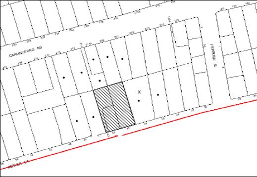
|
NOTIFICATION PLAN |
|
||
|
• PROPERTIES NOTIFIED
|
X SUBMISSIONS RECEIVED |
PROPERTY SUBJECT OF DEVELOPMENT |
|
|
THREE SUBMISSIONS RECEIVED OUT OF MAP RANGE |
|||
Four submissions object to the development, generally on the following grounds:
· Insufficient car parking would be provided for the development.
· Traffic congestion and road safety issues.
· The development would exacerbate flooding issues caused by stormwater runoff.
· Exceed estimated dwelling yields for the Carlingford Road precinct.
· The proposal does not encompass sustainable development initiatives.
The merits of the matters raised in community submissions have been addressed in the body of the report with the exception of the following:
5.1.1. Exceed estimated dwelling yields for the Carlingford Road precinct
The submission raises concern that the dwelling yield for the Carlingford Road precinct may be greater than the estimates. The submission makes reference to dwelling yields that were provided by Council as estimates only and are not contained within the supporting documentation for the Housing Strategy DCP. However, these estimates are provided within Volume 2, prepared as part of the Housing Strategy Planning Proposal. Volume 2 identifies precincts which were proposed to be rezoned and contains an evaluation of the precincts, along with draft key principles diagrams, which were transferred to the Housing Strategy DCP.
The estimated dwelling yield applied for 5 storey development proposed as part of the Housing Strategy was 75 dwellings per hectare. This figure has been used to provide estimates for each 5 storey precinct, excluding existing dwellings. The figure is based on a number of factors, including an analysis of recent development outcomes observed within the Ku-ring-gai Local Government area and a review of historical yields and take up rates achieved through Council's previous Housing Strategies. Confirmation was sought from the Department of Planning and Infrastructure concerning the appropriateness of the dwelling yields to be relied upon under the Housing Strategy. The Department advised that it was satisfied that the yield assessment has been undertaken on a sound basis.
Recent development applications within the Carlingford Road precinct have indicated that the actual dwelling yield capacity for the Carlingford Road precinct may be greater than the estimates. This would have little impact in regards to built form as the building controls, such as height, setbacks, floorplates, separation, landscaping would remain unchanged. Notwithstanding, Council's Traffic Branch is currently undertaking revised traffic modelling in light of the actual dwelling yields being achieved within the precinct to ensure that additional traffic infrastructure requirements that may be needed can be identified.
5.1.2. The development would exacerbate flooding issues caused by stormwater runoff.
The proposed stormwater drainage for the proposed development intend to utilise an existing stormwater drainage easement that was created and piped to service the subdivision that created Nos. 40 and 40A Keeler Street.
The proposed development would be conditioned to construct an On Site Detention (OSD) system in accordance with Council requirements for these types of developments. The OSD is to be designed for a permitted site discharge that is less than, or equal to, the pre development 1 in 5 year storm event. The system has been designed to provide storage for the post development 1 in 20 year storm event. The interallotment drainage system is constructed with a 300mm stormwater pipeline connecting into the Council drainage system within No. 38 Keeler Street. The size of this pipeline is more than adequate to convey the flows generated by the development. Furthermore, the applicant’s consulting engineer has provided calculations determining that the size of the existing and proposed pipelines would comply with Councils Civil Works Specification.
The interallotment drainage pipeline discharges into the Council drainage system within No. 38 Keeler Street. This part of Keeler Street is located within the sag point of the street and is known to have suffered from nuisance flooding in the past. The proposed OSD would ensure that the post development flows would be less than or equal to the pre development flows and that there would be no additional impact on the drainage system including nuisance flooding in this area due to this development.
5.1.3. Matters not relevant to the assessment of this application
The following matters raised in the submissions are not considered to be relevant to the assessment of the application:
· The requirement for an internal road.
· Car parking not provided for the commercial precinct.
5.1.3.1 Requirement for an internal Road
A submission raises concern that an internal road from Hepburn Avenue running to Glengarry Lane has not been provided and that vehicle access from Carlingford Road would be restricted. Council has not proposed an internal road beginning in Hepburn Avenue and running to Glengarry Lane within the Carlingford Road precinct. Part 1 of the Housing Strategy DCP contains controls and key principle diagrams for 5 storey residential development. The Housing Strategy DCP does not make reference to an internal road. Similarly, the Housing Strategy DCP does not expressly prohibit vehicular access from Carlingford Road. The key principles diagram for the Carlingford Road precinct promotes vehicular access from local streets including Hepburn and Keeler Streets. Where this cannot be achieved, the Housing Strategy DCP promotes the consolidation of vehicle entrances from Carlingford Road.
5.1.3.2 Car Parking Not Provided for Commercial Precinct
A submission raises concern that the parking required for the commercial precinct has not been provided as part of approved redevelopment of Nos. 245-247 Carlingford Road, Carlingford for construction of a five storey residential flat building comprising 30 units.
The key principles diagram for the Carlingford Road precinct indicates that a rear laneway should be established to provide parking for customers and deliveries and access to basement parking. The lane is to be established along the rear of properties fronting Pennant Hills Road within the boundaries of the commercial properties. The key principles diagram depicts a row of trees along the boundary of the properties zoned for commercial purposes and No. 247 Carlingford Road and No. 78 Keeler Street which are zoned for residential uses. The commercial parking and the trees would be required to be provided as part of the future applications for the properties fronting Pennant Hills Road.
5.2 Public Agencies
The development application was referred to the NSW Police for comment. The NSW Police raises no objections to the proposal.
6. THE PUBLIC INTEREST
Section 79C(1)(e) of the Act requires Council to consider “the public interest”.
The public interest is an overarching requirement, which includes the consideration of the matters discussed in this report. Implicit to the public interest is the achievement of future built outcomes adequately responding to and respecting the future desired outcomes expressed in environmental planning instruments and development control plans.
The application is considered to have satisfactorily addressed Council’s and relevant agencies’ criteria and would provide a development outcome that, on balance, would result in a positive impact for the community. Accordingly, it is considered that the approval of the proposed development would be in the public interest.
CONCLUSION
The proposal is for the demolition of two existing dwelling-houses and construction of a five storey residential flat building comprising 35 units with basement parking and strata title subdivision.
The proposed development has been assessed with regard to a proposed residential flat building on the adjoining site at Nos. 44 - 46 Keeler Street.
The proposed development is generally satisfactory in respect to the design principles under SEPP 65 and the best practice guidelines of the SEPP 65 – Residential Flat Design Code, subject to recommended conditions.
The proposed development has regard to the requirements of the Housing Strategy DCP and is considered acceptable in respect to the desired future character of the Carlingford Road, Carlingford Precinct. The proposal complies with the site requirements, height, setbacks, landscaping, articulation, open space, privacy, sunlight and ventilation, housing choice and vehicle access and parking criteria subject to recommended conditions.
The application is recommended for approval.
Note: At the time of the completion of this planning report, no persons have made a Political Donations Disclosure Statement pursuant to Section 147 of the Environmental Planning and Assessment Act 1979 in respect of the subject planning application.
|
Rod Pickles Manager - Development Assessment Planning Division |
James Farrington Group Manager Planning Division |
|
1.View |
Locality Plan |
|
|
|
2.View |
Site Plan |
|
|
|
3.View |
Landscape Plan |
|
|
|
4.View |
Floor Plans |
|
|
|
5.View |
Elevations |
|
|
|
6.View |
Shadow Diagrams |
|
|
|
7.View |
Site Analysis Plans |
|
|
|
8.View |
Sections |
|
|
|
9.View |
Photomontage |
|
|
File Reference: DA/687/2012
Document Number: D02064725
SCHEDULE 1
GENERAL CONDITIONS
The conditions of consent within this notice of determination have been applied to ensure that the use of the land and/or building is carried out in such a manner that is consistent with the aims and objectives of the relevant legislation, planning instruments and Council policies affecting the land and does not disrupt the amenity of the neighbourhood or impact upon the environment.
Note: For the purpose of this consent, the term ‘applicant’ means any person who has the authority to act on or the benefit of the development consent.
Note: For the purpose of this consent, any reference to an Act, Regulation, Australian Standard or publication by a public authority shall be taken to mean the gazetted Act or Regulation, or adopted Australian Standard or publication as in force on the date that the application for a construction certificate is made.
1. Approved Plans and Supporting Documentation
The development must be carried out in accordance with the plans and documentation listed below and endorsed with Council’s stamp, except where amended by Council and/or other conditions of this consent:
Architectural Plans prepared by Design Cubicle Pty Ltd
|
Plan No. |
Issue |
Plan Title |
Dated |
|
120484 DA100 |
F |
Site Plan |
20.11.2012 |
|
120484 DA200 |
F |
Basement Level 2 Plan |
20.11.2012 |
|
120484 DA201 |
F |
Basement Level 1 |
20.11.2012 |
|
120484 DA202 |
F |
Ground Floor Plan |
20.11.2012 |
|
120484 DA203 |
F |
First Floor Plan |
20.11.2012 |
|
120484 DA204 |
F |
Second Floor Plan |
20.11.2012 |
|
120484 DA205 |
F |
Third Floor Plan |
20.11.2012 |
|
120484 DA206 |
F |
Fourth Floor Plan |
20.11.2012 |
|
120484 DA207 |
F |
Roof Plan |
20.11.2012 |
|
120484 DA400 |
F |
Elevations 1 |
20.11.2012 |
|
120484 DA401 |
F |
Elevations 2 |
20.11.2012 |
|
120484 DA402 |
F |
Sections |
20.11.2012 |
Landscape Plan prepared by Vision Dynamics Pty Ltd
|
Plan No. |
Revision |
Plan Title |
Dated |
|
12085DA 1 |
B |
Landscape Concept Plan |
20.09.2012 |
Stormwater management plans prepared by Northrop
|
Plan No. |
Revision |
Plan Title |
Dated |
|
C3.02 |
2 |
Stormwater Management Plan |
05.07.2012 |
|
C3.01 |
2 |
Catchment Plan |
05.07.2012 |
|
Document Title
|
Prepared by
|
Dated
|
|
Site Analysis 1 (Reference Drawing No. 120484 UA100 Issue F) |
Design Cubicle Pty Ltd |
20.11.2012 |
|
Site Analysis 2 (Reference Drawing No. 120484 UA101 Issue F) |
Design Cubicle Pty Ltd |
20.11.2012 |
|
Site Analysis 3 and Streetscape (Reference Drawing No. 120484 U102 Issue F) |
Design Cubicle Pty Ltd |
20.11.2012 |
|
Shadow Diagrams (Reference Drawing No. 120484 DA600 Issue F) |
Design Cubicle Pty Ltd |
20.11.2012 |
|
Elevational Shadow Diagrams (Reference Drawing No. 120484 DA601 Issue F) |
Design Cubicle Pty Ltd |
20.11.2012 |
|
Elevational Shadow Diagrams 2 (Reference Drawing No. 120484 DA602 Issue F) |
Design Cubicle Pty Ltd |
20.11.2012 |
|
Cross Ventilation Diagram (Reference Drawing No. 120484 DA701 Issue F) |
Design Cubicle Pty Ltd |
20.11.2012 |
|
Storage Calculation Table (Reference No. 120484 DA702 Issue F) |
Design Cubicle Pty Ltd |
20.11.2012 |
|
Solar Access Table (Reference No. 120484 DA703 Issue F) |
Design Cubicle Pty Ltd |
20.11.2012 |
|
Precinct Shadows (Reference Drawing No. 120484 DA704 Issue F) |
Design Cubicle Pty Ltd |
20.11.2012 |
|
Precinct Shadows (Reference Drawing No. 120484 DA705 Issue F) |
Design Cubicle Pty Ltd |
20.11.2012 |
|
North Elevation Precinct Shadows (Reference Drawing No. 120484 DA706 Issue F) |
Design Cubicle Pty Ltd |
20.11.2012 |
|
Sun Penetration Plan 1/5 (Reference Drawing No. 120484 DA801 Issue F) |
Design Cubicle Pty Ltd |
20.11.2012 |
|
Sun Penetration Plan 2/5 (Reference Drawing No. 120484 DA802 Issue F) |
Design Cubicle Pty Ltd |
20.11.2012 |
|
Sun Penetration Plan 3/5 (Reference Drawing No. 120484 DA803 Issue F) |
Design Cubicle Pty Ltd |
20.11.2012 |
|
Sun Penetration Plan 4/5 (Reference Drawing No. 120484 DA804 Issue F) |
Design Cubicle Pty Ltd |
20.11.2012 |
|
Sun Penetration Plan 5/5 (Reference Drawing No. 120484 DA805 Issue F) |
Design Cubicle Pty Ltd |
20.11.2012 |
|
Statement of Environmental Effects |
Think Planners |
4 July 2012 |
|
Photomontage (Reference No. 120484) |
Design Cubicle Pty Ltd |
Received by Council on 23.11.2012
|
|
Sampleboard (Reference No. 120484 – CS101) |
Design Cubicle Pty Ltd |
Received by Council on 18.09.2012 |
|
BASIX Certificate No. 436111M_03 |
Planning Principles |
29 November 2012 |
|
ABSA Assessor Certificate (Reference No. 7712) |
Planning Principles |
03.07.2012
|
|
Cover Sheet Drawing Schedule and Locality Plan (Reference Drawing No. C1.01 Revision 2) |
Northrop |
05.07.2012 |
|
Sediment and Erosion Control Plan (Reference Drawing No. C2.01 Revision 2) |
Northrop |
05.07.2012 |
|
Arboricultural Impact Assessment |
Advance Treescape Consulting |
18.06.2012 |
|
Acoustic Report (Reference No. 122591) |
Far West Consulting Engineers |
12.06.2012 |
|
Traffic and Parking Assessment Report (Reference No. 12193) |
Varga Traffic Planning Pty Ltd |
4.07.2012 |
|
Proposed Accessibility and Adaptable Housing requirement |
Design Cubicle Pty Ltd |
July 2012 |
|
Design Verification Statement |
Design Cubicle Pty Ltd |
Received by Council on 06.07.2012 |
|
Waste Management Plan |
Design Cubicle Pty Ltd |
July 2012 |
|
Crime Risk Assessment |
Think Planners |
05.07.2012 |
2. Removal of Existing Trees
This development consent only permits the removal of trees numbered 1, 2 and 3 as identified in the Arboricultural Impact Assessment prepared by Advance Treescape Consulting dated 18 June 2012. The removal of any other trees requires separate approval under Council’s Tree Preservation Order.
3. Amendment of Plans
a) The following plans must be amended in accordance with the approved Ground Floor Plan (120484 DA202 prepared by Design Cubicle Pty Ltd dated 20.11.2012) in Condition 1 of this development consent:
|
Plan No. |
Plan Title |
Drawn by |
Dated |
|
12085DA 1 – Revision B |
Landscape Concept Plan |
Vision Dynamics Pty Ltd
|
20.09.2012 |
|
C3.02 Revision 2 |
Stormwater Management Plan |
Northrop |
05.07.2012 |
b) The approved third and fourth floor plans (Drawing Nos. 120484 DA205 and 120484 DA206 prepared by Design Cubicle Pty Ltd dated 20.11.2012) must amended by repositioning of the entries of Units 26, 27, 32 and 33 such that the recycling bins are not located immediately adjacent to the unit entries.
c) The approved ground floor plan for Unit 2 and Unit 3 (Drawing No. 120484 DA202 prepared by Design Cubicle Pty Ltd dated 20.11.2012) and the approved landscape plan must be amended to delete the ground level open space areas, stairs and fencing in the rear setback and the areas to be replaced with communal landscaping.
d) The balcony of Units 12, 13, 20, 21 and 29 to be provided with fixed louvered privacy screens to a height of 1.5 metre with a 1 metre high solid parapet. To provide for improved access to sunlight and outlook from the living areas of the apartments, the fixed louvered screen must be recessed by 1 metre from the northern edge of the balconies of Unit 12 and Unit 20.
REQUIREMENTS PRIOR TO THE ISSUE OF A CONSTRUCTION CERTIFICATE
4. Building Code of Australia
All building work must be carried out in accordance with the requirements of the Building Code of Australia.
5. Contract of Insurance (Residential Building Work)
In the case of residential building work for which the Home Building Act, 1989 requires there to be a contract of insurance in force in accordance with Part 6 of that Act, that such a contract of insurance is in force before any building work authorised to be carried out by the consent commences.
Note: This condition does not apply to the extent to which an exemption is in force under Clause 187 or 188 of the Act, subject to the terms of any condition or requirement referred to in Clause 187(6) or 188(4) of the Act, or to the erection of a temporary building.
6. Water/Electricity Utility Services
The applicant must submit written evidence of the following service provider requirements:
a) Energy Australia – a letter of consent demonstrating that satisfactory arrangements have been made to service the proposed development.
b) Sydney Water – the submission of a ‘Notice of Requirements’ under s73 of the Sydney Water Act 1994.
Note: Sydney Water requires that s73 applications are to be made through an authorised Sydney Water Servicing Coordinator. Refer to www.sydneywater.com.au or telephone 13 20 92 for assistance.
7. Stormwater Drainage
The stormwater drainage system for the development must be designed and constructed and a construction Certificate issued for these works. The stormwater drainage system is to be designed in accordance with Council’s Civil Works – Design and Construction Specification 2005 and the following requirements:
a) Connected directly to the existing interallotment drainage system.
8. On Site Stormwater Detention
The on site detention system for the development must be designed and constructed and a construction Certificate issued for these works. The stormwater drainage system is to be designed in accordance with Council’s Civil Works – Design and Construction Specification 2005 and the following requirements:
a) Have a capacity of not less than 26.9m3, and a maximum discharge (when full) of 21 litres per second.
b) Have a surcharge/inspection grate located directly above the outlet.
c) Discharge from the detention system to be controlled via 1 metre length of pipe, not less than 50 millimetres diameter or via a stainless plate with sharply drilled orifice bolted over the face of the outlet discharging into a larger diameter pipe capable of carrying the design flow to an approved Council system.
d) Not be constructed in a location that would impact upon the visual or recreational amenity of residents.
9. Internal Driveway/Vehicular Areas
The driveway and parking areas on site must be designed, constructed and a Construction Certificate issued in accordance with Australian Standards 2890.1, 2890.2, 3727, Councils Civil Works Specification and the following requirements:
a) Design levels at the front boundary be obtained from Council.
b) The driveway be a rigid pavement.
c) The driveway grade must not exceed 5 percent for the first 6m from the property boundary and shall have a minimum width of 5.5m.
10. Footpath
Prior to the issue of a Construction Certificate for these works a separate application under the Local Government Act, 1993 and the Roads Act, 1993 must be submitted to Council for the construction of footpaths within the road reserve. A concrete footpath must be constructed along the full frontage of the subject site in accordance Council’s Civil Works Design and Construction Specification, 2005 and the following requirements:
a) The existing footpath being removed and reconstructed.
b) Any public utility adjustments to be carried out at the cost of the applicant and to the requirements of the relevant public authority.
11. Vehicular Crossing
Prior to the issue of a Construction Certificate for these works a separate application under the Local Government Act, 1993 and the Roads Act, 1993 must be submitted to Council for the installation of a new vehicular crossing and the removal of the redundant crossing. The vehicular crossing must be constructed in accordance with Council’s Civil Works Design, 2005.
12. Road Works
Prior to the issue of a Construction Certificate for these works a separate application under the Local Government Act, 1993 and the Roads Act, 1993 must be submitted to Council for all works within the road reserve. All road works approved under this consent must be constructed in accordance with Council’s Civil Works Design and Construction Specification, 2005 and the following requirements:
a) The existing kerb and gutter is to be removed and reconstructed.
b) The existing road pavement to be saw cut a minimum of 300 mm from the existing lip of gutter and reconstructed.
13. Traffic Control Plan
A Traffic Control Plan (TCP) must be prepared by a qualified traffic controller in accordance with the Roads & Traffic Authority’s Traffic Control at Worksites Manual 1998 and Australian Standard 1742.3 for all work on a public road and be submitted to Council. The TCP must detail the following:
a) Arrangements for public notification of the works.
b) Temporary construction signage.
c) Permanent post-construction signage.
d) Vehicle movement plans.
e) Traffic management plans.
f) Pedestrian and cyclist access/safety.
g) Approval of the RMS where required.
14. Accessible and Adaptable units
a) The details of fit-outs of all accessible units (3 units) and details of adaptable units must be provided with the Construction Certificate Plans.
b) The adaptable units must be in compliance with AS1428.1 – Design for Access and Mobility.
15. Dilapidation Report
A ‘Dilapidation Report’ is to be prepared by a ‘chartered structural engineer’ detailing the structural condition of all adjoining properties.
16. Letter Boxes
The details of letter boxes and meter enclosures must be provided with the Construction Certificate Plans. The letter boxes and meter enclosures must be provided with a minimum setback of 2 metres from all boundaries and must be suitably screened.
17. Acoustic Details
The Construction Certificate plans must demonstrate compliance with the recommendations in the Acoustic Report prepared by Far West Consulting Engineers dated 12 June 2012.
REQUIREMENTS PRIOR TO THE COMMENCEMENT OF ANY WORKS
18. Erection of Construction Sign
A sign must be erected in a prominent position on any site on which building work, subdivision work or demolition work is being carried out:
a) Showing the name, address and telephone number of the principal certifying authority for the work,
b) Showing the name of the principal contractor (if any) for any demolition or building work and a telephone number on which that person may be contacted outside working hours, and
c) Stating that unauthorised entry to the work site is prohibited.
Note: Any such sign is to be maintained while the building work, subdivision work or demolition work is being carried out, but must be removed when the work has been completed.
19. Protection of Adjoining Areas
A temporary hoarding, fence or awning must be erected between the work site and adjoining lands before the works begin and must be kept in place until after the completion of the works if the works:
a) Could cause a danger, obstruction or inconvenience to pedestrian or vehicular traffic.
b) Could cause damage to adjoining lands by falling objects.
c) Involve the enclosure of a public place or part of a public place.
Note: Notwithstanding the above, Council’s separate written approval is required prior to the erection of any structure or other obstruction on public land.
20. Toilet Facilities
Toilet facilities must be available or provided at the works site before works begin and must be maintained until the works are completed at a ratio of one toilet for every 20 persons employed at the site. Each toilet must:
a) be a standard flushing toilet connected to a public sewer; or
b) be a temporary chemical closet approved under the Local Government Act, 1993; or
c) have an on-site effluent disposal system approved under the Local Government Act, 1993
21. Erosion and Sediment Control
Erosion and sediment control measures must be provided and maintained throughout the construction period in accordance with the manual ‘Soils and Construction 2004 (Bluebook)’, the approved plans, Council specifications and to the satisfaction of the principal certifying authority. The erosion and sediment control devices must remain in place until the site has been stabilised and revegetated.
Note: On the spot penalties up to $1,500 may be issued for any non-compliance with this requirement without any further notification or warning.
22. Tree Protection Barriers
Tree protection fencing must be erected around trees numbered 6 to be retained at a 2 metre setback except where bound by the footpath and roadway. The barrier is to be erected along these and shall not impede these areas. The tree fencing must be constructed of 1.8 metre ‘cyclone chainmesh fence’
REQUIREMENTS DURING CONSTRUCTION
23. Construction Work Hours
All work on site (including demolition and earth works) must only occur between 7am and 5pm Monday to Saturday.
No work is to be undertaken on Sundays or public holidays.
24. Demolition
All demolition work must be carried out in accordance with Australian Standard 2601-2001 – The Demolition of Structures and the following requirements:
a) Demolition material is to be disposed of to an authorised recycling and/or waste disposal site and/or in accordance with an approved waste management plan.
b) Demolition works, where asbestos material is being removed, must be undertaken by a contractor that holds an appropriate licence issued by WorkCover NSW in accordance with Chapter 10 of the Occupational Health and Safety Regulation 2001 and Clause 29 of the Protection of the Environment Operations (Waste) Regulation 2005.
c) On construction sites where buildings contain asbestos material, a standard commercially manufactured sign containing the words ‘DANGER ASBESTOS REMOVAL IN PROGRESS’ measuring not less than 400mm x 300mm must be erected in a prominent position visible from the street.
25. Environmental Management
The site must be managed in accordance with the publication ‘Managing Urban Stormwater – Landcom (March 2004) and the Protection of the Environment Operations Act 1997 by way of implementing appropriate measures to prevent sediment run-off, excessive dust, noise or odour emanating from the site during the construction of the development.
26. Council Property
During construction works, no building materials, waste, machinery or related matter is to be stored on the road or footpath.
27. Street Sweeping
Street sweeping must be undertaken following sediment tracking from the site along Keeler Street during works and until the site is established.
28. Spoil Route
To protect Council’s assets, all vehicular access to and from the site during all stages of the development is to be via the shortest route to the nearest State or Regional Road
29. Works near Trees
All required tree protection measures are to be maintained in good condition for the duration of the construction period.
All works (including driveways and retaining walls) within 2 metres of any trees required to be retained (whether or not on the subject property, and pursuant to this consent or the Tree Preservation Order), must be carried out under the supervision of an ‘AQF Level 5 Arborist’ and a certificate submitted to the principal certifying authority detailing the method(s) used to preserve the tree(s).
Note: Except as provided above, the applicant is to ensure that no excavation, filling or stockpiling of building materials, parking of vehicles or plant, disposal of cement slurry, waste water or other contaminants is to occur within 4 metres of any tree to be retained.
30. Landfill
Landfill must be constructed in accordance with Council’s ‘Construction Specification, 2005’ and the following requirements:
a) All fill material imported to the site is to wholly consist of Virgin Excavated Natural Material (VENM) as defined in Schedule 1 of the Protection of the Environment Operations Act 1997 or a material approved under the Department of Environment and Climate Change’s general resource recovery exemption.
b) A compaction certificate is to be obtained from a geotechnical engineer verifying that the specified compaction requirements have been met.
31. Excavated Material
All excavated material removed from the site must be classified in accordance with the NSW Environment Protection Authority’s Environmental Guidelines – Assessment, Classification and Management of Liquid and Non-Liquid Wastes prior to disposal to an approved waste management facility and reported to the principal certifying authority.
32. Contamination during construction works
Should the presence of asbestos or soil contamination, not recognised during the application process be identified during demolition, the applicant must immediately notify the Principal Certifying Authority and Council.
33. Waste Management
Waste management during the demolition and construction phase of the development must be undertaken in accordance with the approved Waste Management Plan. Additionally written record of the following items must be maintained during the removal of any waste from the site and such information submitted to the Principal Certifying Authority within fourteen days of the date of completion of the works:
a) The identity of the person removing the waste.
b) The waste carrier vehicle registration.
c) Date and time of waste collection.
d) A description of the waste (type of waste and estimated quantity).
e) Details of the site to which the waste is to be taken.
f) The corresponding tip docket/receipt from the site to which the waste is transferred (noting date and time of delivery, description (type and quantity) of waste).
g) Whether the waste is expected to be reused, recycled or go to landfill.
Note: In accordance with the Protection of the Environment Operations Act 1997, the definition of waste includes any unwanted substance, regardless of whether it is reused, recycled or disposed to landfill.
34. Survey Report – Finished Floor Level
A report(s) must be prepared by a registered surveyor and submitted to the principal certifying authority prior to the pouring of concrete at each level of the building certifying that:
a) The building, retaining walls and the like have been correctly positioned on the site.
b) The finished floor level(s) are in accordance with the approved plans.
REQUIREMENTS PRIOR TO THE ISSUE OF AN OCCUPATION CERTIFICATE
Note: For the purpose of this consent, a reference to ‘occupation certificate’ shall not be taken to mean an ‘interim occupation certificate’ unless otherwise stated.
35. Fulfilment of BASIX Commitments
The applicant must demonstrate the fulfilment of BASIX commitments pertaining to the development.
36. Sydney Water – s73 Certificate
A s73 Certificate must be obtained from Sydney Water.
37. Resident Storage
The basement resident storage areas are to be allocated in accordance with the size requirements of the SEPP 65 - Residential Flat Design Code for the respective units and proximity to the unit car parking space.
38. Damage to Council Assets
Any damage caused to Council’s assets as a result of the construction of the development must be rectified in accordance with Council’s written requirements and at the sole cost of the applicant.
39. Creation of Easements
The following matter(s) must be created on the title of the property under the Conveyancing Act 1919:
a) The creation of an appropriate "Positive Covenant" and "Restriction as to User" over the constructed on-site detention/retention systems and outlet works, within the lots in favour of Council in accordance with Council’s prescribed wording. The position of the on-site detention system is to be clearly indicated on the title.
b) To register the OSD easement, the restriction on the use of land “works-as-executed” details of the on-site-detention system must be submitted verifying that the required storage and discharge rates have been constructed in accordance with the design requirements. The details must show the invert levels of the on site system together with pipe sizes and grades. Any variations to the approved plans must be shown in red on the “works-as-executed” plan and supported by calculations.
Note: Council must be nominated as the authority to release, vary or modify any easement, restriction or covenant.
40. Works as Executed Plan
A works-as-executed plan(s) must be prepared by a registered surveyor and submitted to Council for completed road pavement, kerb & gutter, public drainage systems, driveways and on-site detention system.
41. Garbage Collection Easement
For the purpose of waste collection, an easement entitling Council, its servants and agents and persons authorised by it to enter upon the subject land and to operate thereon, vehicles and other equipment for the purposes of garbage collection must be granted to Council by the owner of the land.
Note: The easement must be in a form prescribed by Council and must include covenants to the effect that parties will not be liable for any damage caused to the subject land or any part thereof or to any property located therein or thereon by reason of the operation thereon of any vehicle or other equipment used in connection with the collection of garbage and to the effect that the owner for the time being of the subject land shall indemnify the Council, its servants, agents and persons authorised by it to collect garbage against liability in respect of any such claims made by any person whomsoever.
42. Maintain Canopy Cover
To maintain canopy cover, 4 medium to large trees selected from Council’s booklet ‘Indigenous Plants for the Bushland Shire’ such as Eucalyptus pilularis are to be planted on the subject site. The planning location shall not be within 4 metres of the foundation walls of a dwelling or in-ground pool. The pot size is to be a minimum 25 litres and the tree(s) must be maintained until they reach the height of 3 metres. Trees must be native to Hornsby Shire and reach a mature height greater than 10 metres.
43. Planter Boxes / On slab planting
On slab planter boxes must include waterproofing, subsoil drainage (proprietary drainage cell, 50mm sand and filter fabric) automatic irrigation, minimum 500mm planting soil for shrubs and minimum 1000mm planting soil for trees and palms and 75mm mulch to ensure sustainable landscape is achieved.
44. Completion of landscaping
A certificate must be provided by a practicing landscape architect, horticulturalist or person with similar qualifications and experience certifying that all required landscaping works have been satisfactorily completed in accordance with the approved landscape plans.
45. Retaining Walls
All required retaining walls must be constructed as part of the development.
46. Boundary Fencing
Fencing must be erected along all property boundaries behind the front building alignment to a height of 1.8 metres.
Note: Alternative fencing may be erected subject to the written consent of the adjoining property owner(s).
47. External Lighting
All external lighting must be designed and installed in accordance with Australian Standard AS 4282 – Control of the Obtrusive Effects of Outdoor Lighting. Certification of compliance with the Standard must be obtained from a suitably qualified person.
48. Unit Numbering
The allocation of unit numbering must be authorised by Council prior to the numbering of each unit in the development.
49. Construction for a safe environment
Prior to the issue of the Occupation Certificate, the site must include the following elements:
a) An intercom system be installed at gate locations to ensure screening of persons entering the units;
b) The entryway to the site be illuminated in high luminance at all times;
c) The communal open space at the rear of the site be illuminated with high luminance by motion sensor lighting;
d) The service areas of the ground floor and the garbage room at the basement be illuminated with high luminance by motion sensor lighting;
e) The driveway and the basement carpark is to be illuminated with low luminance at all times;
f) Robust materials which cannot be forced or breached with minimised maintenance requirements are to be used for construction work in the common areas;
g) The lamps and lighting levels must comply with Australian and New Zealand Lighting Standard 1158.1;
h) Effective signage be provided to guide visitors to the main areas and parking areas;
i) The communal area must include a clear sign to restrict access for non-residents;
j) Units numbers, entry and exit signs must be legible and clear;
k) Fire exist doors to the development must be fitted with single cylinder locksets (Australia and New Zealand Standard – Lock Sets) to restrict unauthorized access to the development;
l) Doors must include laminated glass to increase safety;
m) Ground floor windows must be fitted with window locks that can be locked with a key; and
n) A graffiti management plan must be incorporated into the maintenance plan for the development for graffiti to be removed within a forty-eight hour period.
50. Waste Management
a) The basement bin storage room must include water connection for cleaning, graded floors with drainage to sewer, a robust door, sealed and impervious surfaces, adequate lighting and ventilation.
b) Each dwelling/kitchen must be provided with an indoor waste/recycling cupboard for the interim storage of a minimum one day’s waste/recycling generation with separate containers for general waste and recyclable materials.
c) Space must be provided for either individual compost containers for each dwelling or a communal compost container.
Note: The location of the compost containers should have regard for potential amenity impacts.
d) The bin carting route(s) must be devoid of steps.
Note: Ramps between different levels are acceptable
e) A report(s) must be prepared by the principal contractor and submitted to the principal certifying authority certifying that:
i) A comparison of the estimated quantities of each waste type against the actual quantities of each waste type has been made;
ii) Any deviations from the Waste Management Plan (including, but not limited to, types of waste, quantities of waste, destinations of waste, reuse and recycling achieved) have been explained;
iii) All waste was taken to site(s) that were lawfully permitted to accept that waste;
iv) Either
a) The Waste Management Plan Section One – Demolition Stage and Section Three – Construction Stage were implemented and at least 60 % waste generated was reused or recycled; or
b) If the 60% diversion from landfill was not achieved in the Demolition Stage and/or Construction Stage, the Report is to include the reasons why this occurred and certify that appropriate work practices were employed in the demolition and construction stages to implement the Waste Management Plan.
v) The Report(s) is based on documentary evidence (i.e. tipping dockets/receipts from recycling depots, transfer stations and landfills, audits of procedures, Licence and/or development consent of site(s) receiving waste, etc) which have been attached to the Report.
vi) The author(s) of the report declared that the report is true in every particular and is not misleading.
51. s94 Infrastructure Contributions
The payment to Council of a contribution of $354,813.25 for thirty-two additional residential units towards the cost of infrastructure identified in Council’s Development Contributions Plan 2007-2011 in accordance with the following table:
11 x 1-bedroom units,
21 x 2-bedroom units and
3 x 3-bedroom units.
Note: The value of contribution is current as at 27 November 2012. The contribution will be adjusted from this date in accordance with the underlying consumer price index for subsequent financial quarters.
It is recommended that you contact Council to confirm the value of the contribution prior to payment.
OPERATIONAL CONDITIONS
52. Car Parking
All car parking must be operated in accordance with Australian Standard AS/NZS 2890.1:2004 – Off-street car parking and Australian Standard AS 2890.2:2002 – Off-street commercial vehicle facilities.
a) Car parking, loading and manoeuvring areas to be used solely for nominated purposes;
b) Vehicles awaiting loading, unloading or servicing shall be parked on site and not on adjacent or nearby public roads;
c) All vehicular entry on to the site and egress from the site shall be made in a forward direction.
53. Visitor Parking
Visitors are to be able to access the basement car park by the proposed audio/visual intercom system located at the top of the ramped driveway.
54. Disabled Parking
All parking spaces for people with disabilities must be constructed and operated in accordance with Australian Standard AS/NZS 2890.6:2009 – Off-street parking for people with disabilities
55. Fire Safety Statement - Annual
On at least one occasion in every 12 month period following the date of the first ‘Fire Safety Certificate’ issued for the property, the owner must provide Council with an annual ‘Fire Safety Certificate’ to each essential service installed in the building.
56. Noise
The level of total continuous noise emanating from operation of the premises including all the plant, air conditioning units and processes (LA10) (measured for at least 15 minutes) in or on the above premises, must not exceed the background level by more than 5dB(A) when measured at all property boundaries.
57. Waste Management
a) A site caretaker must be employed and be responsible for moving bins to and from the bin storage room(s) and the waste collection point, washing bins and maintaining waste storage areas, ensuring the chute system and related devices are maintained in effective and efficient working order, managing the communal composting area, arranging the prompt removal of dumped rubbish, and ensuring all residents are informed and trained in the use of the waste management system.
b) Bins must be removed from the bin collection point each time after collection.
58. Landscape establishment
The landscape works must be maintained into the future to ensure the establishment and successful growth of plant material to meet the intent of the landscape design. This must include but not be limited to watering, weeding, replacement of failed plant material and promoting the growth of plants through standard industry practices.
- END OF CONDITIONS -
ADVISORY NOTES
The following information is provided for your assistance to ensure compliance with the Environmental Planning and Assessment Act, 1979, Environmental Planning and Assessment Regulation 2000, other relevant legislation and Council’s policies and specifications. This information does not form part of the conditions of development consent pursuant to Section 80A of the Act.
Environmental Planning and Assessment Act 1979 Requirements
· The Environmental Planning and Assessment Act 1979 requires:
· A construction certificate prior to the commencement of any works. Enquiries regarding the issue of a construction certificate can be made to Council’s Customer Services Branch on 9847 6760.
· A principal certifying authority to be nominated and Council notified of that appointment prior to the commencement of any works.
· Council to be given at least two days written notice prior to the commencement of any works.
· Mandatory inspections of nominated stages of the construction inspected.
· An occupation certificate issued before occupying any building or commencing the use of the land.
Long Service Levy
In accordance with Section 34 of the Building and Construction Industry Long Service Payments Act 1986, a ‘Long Service Levy’ must be paid to the Long Service Payments Corporation or Hornsby Council.
Note: The rate of the Long Service Levy is 0.35% of the total cost of the work.
Note: Hornsby Council requires the payment of the Long Service Levy prior to the issue of a construction certificate.
Tree Preservation Order
To ensure the maintenance and protection of the existing natural environment, it is an offence to ringbark, cut down, top, lop, remove, wilfully injure or destroy a tree outside three metres of the approved building envelope without prior written consent from Council. Fines may be imposed for non-compliance with Council’s Tree Preservation Order.
Note: A tree is defined as a single or multi-trunked wood perennial plant having a height of not less than three (3) metres, and which develops many branches, usually from a distance of not less than one (1) metre from the ground, but excluding any plant which, in its particular location, is a noxious plant declared as such pursuant to the Noxious Weeds Act 1993. This definition of ‘tree’ includes any and all types of Palm trees.
All distances are determined British Standard BS 5837: 2005, “Trees in Relation to Construction – Recommendations”.
Disability Discrimination Act
The applicant’s attention is drawn to the existence of the Disability Discrimination Act. A construction certificate is required to be obtained for the proposed building, which will provide consideration under the Building Code of Australia, however, the development may not comply with the requirements of the Disability Discrimination Act. This is the sole responsibility of the applicant.
Dial Before You Dig
Prior to commencing any works, the applicant is encouraged to contact Dial Before You Dig on 1100 or www.dialbeforeyoudig.com.au for free information on potential underground pipes and cables within the vicinity of the development site.
Rain Water Tank
It is recommended that water collected within any rainwater tank as part of the development be limited to non-potable uses. NSW Health recommends that the use of rainwater tanks for drinking purposes not occur where a reticulated potable water supply is available.
House Numbering
House numbering can only be authorised by Council. Before proceeding to number each premise in the development, the allocation of numbers is required to be obtained from Council's Planning Division. The authorised numbers are required to be displayed in a clear manner at or near the main entrance to each premise.
Group Manager's Report No. PL52/12
Planning Division
Date of Meeting: 19/12/2012
15 LOCAL ENVIRONMENTAL PLAN MAKING PROCESS - DELEGATION OF MINISTER'S POWERS
EXECUTIVE SUMMARY
· Changes came into affect on 2 November 2012 aimed at improving plan making processes under the Environmental Planning and Assessment (EP&A) Act, 1979. The Minister for Planning and Infrastructure advises that the changes increase transparency, provide greater certainty and increase councils’ roles and responsibilities in plan making by:
- delegating the making of some local environmental plans (LEPs) to councils, and
- allowing for independent reviews of some decisions in the plan making process.
· Previously, only the Minister could make a LEP. The Department of Planning and Infrastructure (DP&I) has streamlined the LEP making process by delegating the Minister’s plan making powers to councils in certain circumstances. Councils will be given the power to finalise LEPs where the matter is considered routine.
· The Minister has written to all councils advising that the new plan making powers are to be delegated to councils under Section 23 of the EP&A Act and that each council will need to formally accept this delegation should it wish to accept these powers.
· It is recommended that Council formally accept the delegation from the Minister and delegate same to the General Manager.
|
THAT:
1. Council formally accept the delegation of plan making functions from the Minister for Planning and Infrastructure under Section 23 of the Environmental Planning and Assessment Act, 1979.
2. Council delegate to the General Manager, the plan making functions from the Minister for Planning and Infrastructure under Section 23 of the Environmental Planning and Assessment Act, 1979. |
PURPOSE
The purpose of this report is to identify proposed changes to the plan making process under Part 3 of the EP&A Act and outline their implications for Hornsby Shire.
BACKGROUND
In July 2011, the Minister for Planning and Infrastructure announced the establishment of a Planning Review Panel (PRP) to oversee a review of the EP&A Act with the intent of providing independent advice to the NSW Government in drafting new planning legislation for the State. The Review is being conducted in four stages, namely the Listening and Scoping, Issues Paper, Green Paper and White Paper (accompanied by draft legislation). The last stage is yet to be completed.
In May 2012 the NSW Government sought feedback on proposed changes to the LEP making process. At its meeting on 16 May 2012, Council considered Executive Manager's Report No. PLN33/12 identifying the proposed changes to the plan making process and outlining implications for Hornsby Shire. Council resolved that a submission be forwarded to the Department noting that the proposed changes may be premature given the status of the independent review of the EP&A Act. A submission was subsequently forwarded to the Department in accordance with Council’s resolution.
In October 2012, the Minister for Planning and Infrastructure announced changes aimed at improving plan making processes under Part 3 of the EP&A Act. The changes came into affect from 2 November 2012.
DISCUSSION
The following discussion provides a summary of the delegation requirements of the local plan making process, identifies the recent changes and their implications for Hornsby Shire.
Local Plan Making
Part 3 of the EP&A Act provides the requirements for the making of a LEP. A LEP is usually initiated by a council but can also be initiated by the Minister for Planning and Infrastructure. For council initiated LEPs, council is the relevant planning authority (RPA) responsible for preparing the Plan.
The first step in preparing a LEP is the preparation of a planning proposal. A planning proposal is a document that explains the intended effect of the proposed LEP and also justifies the making of the Plan. The planning proposal can be prepared by the RPA, or by a proponent for the proposed LEP. In either event, the RPA must be satisfied with the planning proposal such that it is agreeable to forward it to the Department for review, known as Gateway Determination.
The purpose of a Gateway Determination is to ensure there is sufficient justification early in the process to proceed with the planning proposal. The Gateway Determination is intended as a check point for planning proposals before significant resources are committed to carrying out technical studies and investigations. A specialist LEP Review Panel within the Department reviews the planning proposal and makes recommendations as to its merit. A Gateway Determination is then issued by the Minister for Planning and Infrastructure (or delegate) and specifies whether a planning proposal is to proceed, and if so, in what circumstances.
At the conclusion of the public exhibition period, the RPA must consider any submission made regarding the planning proposal. The RPA can vary the proposal as a consequence of its consideration of submissions made during the public exhibition, or for any other reason. Determination of whether the planning proposal should be re-exhibited will be made by the Department. Otherwise, upon submission of the planning proposal to the Department, the next step in preparing a LEP is its legal drafting. The drafting of a LEP is undertaken by PC upon receipt of instructions from the Department. After the legal instrument has been drafted, the Minister for Planning and Infrastructure (or delegate) may make a LEP. The decision to make a LEP is given effect by publishing the LEP (including maps) on the NSW legislation website.
Changes to the Local Environmental Plan Making Process
According to the Minister, the changes introduced from 2 November 2012, will increase transparency, provide greater certainty and increase council’s roles and responsibilities in plan making by:
· delegating the making of some LEPs to councils, and
· allowing for independent reviews of some council and departmental decisions in the plan making process.
The changes are explained in the Planning Circular (PS 12-006) issued to councils, as well as in two online publications – A guide to preparing local environmental plans and A guide to preparing planning proposals available on the Department of Planning and Infrastructure web site.
A range of LEP amendments will be delegated back to councils to finalise. The requirement to prepare and submit a planning proposal will remain, as will the step of obtaining a Gateway determination from the Department for all proposed amendments. Following the initial steps, councils will be given the power to finalise the LEP where the matter is considered routine. Delegation of plan making powers to Council and the implications to Council are outlined in detail later in this report under the heading of “Delegating Plan Making Powers to Councils”.
With respect to reviews, landowners or developers who ask a council to prepare a planning proposal to rezone land or amend development controls will now have the ability to request a review if the council has refused to progress their proposal or has not determined it within 90 days. This is referred to as a ‘pre-Gateway review’.
When a planning proposal is supported by a council, it is forwarded to the DP&I for a Gateway decision to allow the council to progress the proposal. The proponent or the council will also now be able to seek a review if they do not agree with the Department’s Gateway decision. This is referred to as a ‘Gateway determination review’. A ‘Gateway determination review’ can be requested if the Gateway decision is that the planning proposal should either not proceed or if requirements or variations are imposed that the applicant or council does not support.
The changes to the legislation announced by the Minister are generally the same as that exhibited and reviewed by Council in May 2012 and respond to a number of matters identified in Council’s submission. The proposed timeframes for councils to determine whether to progress a planning proposal were extended from 60 days to 90 days and should provide adequate time for Council to continue its current practice of holding an informal exhibition prior to seeking a Gateway Determination.
The amendments do not address Council’s position regarding the exhibited amendments, namely that:
· PC should be removed from the plan drafting process for all minor LEPs to expedite the plan making process; and
· Pre-Gateway reviews are not appropriate mechanism as Council is best placed to balance local interests against State and regional interests.
Delegating Plan Making Powers to Councils
Previously, only the Minister could make a LEP following the process outline above. The Minister has written to all councils (letter attached) advising that new plan making powers are to be delegated to councils and that each council will need to formally accept this delegation should it wish to accept these powers.
The Department has streamlined the plan making process by delegating the Minister’s plan making powers to councils in certain circumstances. LEPs that will be routinely delegated to councils to finalise include:
· spot rezonings consistent with an endorsed strategy or surrounding zones or in accordance with broader Government policy;
· mapping alterations or corrections that do not alter strategy endorsed development standards;
· amending references to documents/agencies, minor errors and anomalies (Section 73A of the EP&A Act);
· reclassifications of land consistent with a strategy/supported by an adopted Open Space study; and
· heritage LEPs supported by an Office of Environment and Heritage endorsed study.
The requirement to prepare and submit a planning proposal will remain, as will the step of obtaining a Gateway Determination from the Department for all proposed amendments. However, a range of LEP amendments will be handed back to council to finalise. Councils will be given the power to finalise the LEP where the matter is considered routine. This includes the power to make the plan at the end of the process, speeding up the plan making process. This function will be delegated to councils at the time a Gateway Determination is made for individual Planning Proposals, meaning councils will not need to resubmit the plan to the Department to be finalised. When submitting a planning proposal, councils will be required to identify whether they wish to exercise the Authorisation for each planning proposal.
The Department will continue to direct PC to draft the legal instrument. However, as a result of the changes to the delegations above, councils will deal directly with PC throughout the drafting process, including agreeing to the final wording of a Plan. Council would advise the Department when the Plan is made and the Department would request notification on the NSW legislation webpage through PC.
The Department will generally play no further role in the process once the LEP is delegated to a council, other than routine monitoring of the process to ensure that Gateway Determination timeframes continue to be met. Councils will also have obligations to report quarterly to the Department on processing times for delegated LEPs.
Issue of Delegation
Section 23 of the EP&A Act allows the Minister and the Director General of the DP&I to delegate functions to a council and/or an officer or employee of a council. The Minister has written to all councils advising that plan making powers are to be delegated under Section 23 of the EP&A Act. Councils must formally accept the delegation before the Department will issue an Authorisation in respect of any individual draft LEP.
If a council chooses to accept the delegation, it may sub delegate the function to an officer within council (usually the general manager or executive planning officer) who will exercise the delegation. If a council chooses to sub-delegate the function, the council must advise the Department at the same time it accepts the delegation. Additionally, when submitting a planning proposal for Gateway Determination, a council should advise the Department whether the council or an officer will be exercising the delegated function. The changes to delegations will not apply to current Planning Proposals.
Implications for Hornsby Shire
Council’s submission in response to the Listening and Scoping Stage of the NSW Planning System Review identified that the plan making provisions of the EP&A Act at that time were not adequately responsive to the need to address minor local planning issues. Previous experience has shown that it often takes a year to make a minor LEP such as correcting obvious anomalies. There are pinch points in the current plan making process, such as the need to obtain drafting advice from PC, that result in significant time delays with minimal added value. Council’s submission identified that the new planning system should:
· include delegation of plan making powers to local government for minor LEPs; and
· remove PC from the process where local plans are consistent with model plans. Alternatively, independent legal advice should be able to be obtained instead of having to obtain PC advice for minor LEPs.
The amendments do not address Council’s position that PC should be removed from the plan drafting process for minor LEPs. Notwithstanding, the delegation of minor LEP amendments would assist in reducing the time taken to make a LEP.
Council has previously accepted delegations from the Minister for Planning and Infrastructure in respect of various aspects of Local Plan making activities. If Council resolves to accept the Minister’s delegation, it must formally accept the delegation before the Department will issue an Authorisation in respect of any individual draft LEP. Council may, by resolution pursuant to Section 377 of the Local Government Act (LG), 1993, delegate to the General Manager any of the functions of the Council (other than specific matters set out in Section 377 of the LG Act).
The General Manager may also consider handing down delegation to an appropriate planning officer. The General Manager may, pursuant to Section 378 of the LG Act, delegate, or sub-delegate, any of the functions of a General Manager, other than this power of delegation, to any person or body, including another employee of the Council. Council has previously granted to the General Manager authority to sub-delegate plan making authority under the EP&A Act to another employee of Council. Previously, local plan making delegations handed down to Council from the Minister have been delegated to the General Manager and then sub-delegated to the Group Manager, Planning Division.
BUDGET
There are no budgetary implications associated with this Report.
POLICY
There are no policy implications associated with this Report.
CONCLUSION
Acceptance of recent delegations from the Minister for Planning and Infrastructure to Council to progress minor LEPs would assist in providing for efficient and effective decision making and delivery of Council’s local plan making functions under the EP&A Act. The acceptance of the delegations has the following benefits:
· It would reduce instances of delays in the plan making process for Council dealing with the DP&I;
· It would reduce administrative procedures required for progression of planning proposals; and
· It would reduce the time frame for the overall plan making process.
The acceptance of the Minister’s delegations and the granting of plan making delegations to the General Manager and/or his sub delegate will not impact upon the elected Council’s current authority to determine, by approval or otherwise, the progression of planning proposals. Therefore, it is recommended that Council accept the delegation of plan making functions from the Minister.
RESPONSIBLE OFFICER
For further information concerning this matter, please contact Jason Rawlin, Acting Manager, Strategic Planning Branch on 9847 6737.
|
Jason Rawlin Acting Manager - Strategic Planning Planning Division |
James Farrington Group Manager Planning Division |
|
1.View |
Minister's Correspondence - Changes to Plan Making Process |
|
|
File Reference: F2004/07218-03
Document Number: D02064985
Planning Report No. PL53/12
Planning Division
Date of Meeting: 19/12/2012
16 DEVELOPMENT APPLICATION - FIVE STOREY RESIDENTIAL FLAT BUILDING COMPRISING 35 UNITS AND STRATA TITLE SUBDIVISION - 44 - 46 KEELER STREET CARLINGFORD
EXECUTIVE SUMMARY
|
DA No: |
DA/688/2012 (Lodged 6 July 2012) |
|
Description: |
Construction of a five storey residential flat building comprising 35 units with basement car parking and strata title subdivision |
|
Property: |
Lots 1 and DP 212705, No. 44 and 46 Keeler Street Carlingford |
|
Applicant: |
I C Homes Pty Ltd |
|
Owners: |
Ms C. H. Aashour, Mr W. Chen and Ms M. A. A. Myint |
|
Estimated Value: |
$7,875,000 |
|
Ward: |
C |
· The application proposes the demolition of existing structures and construction of a five storey residential flat building comprising 35 units with two levels of basement car parking and strata title subdivision.
· The proposal generally complies with the Hornsby Shire LEP 1994, State Environmental Planning Policy No. 65 – Design Quality Residential Flat Building and the Housing Strategy Development Control Plan.
· Two submissions have been received in respect of the application.
· It is recommended that the application be approved.
|
THAT Development Application No. DA/688/2012 for a five storey residential flat building comprising 35 units at Lots 1 and DP 212705, No. 44 and 46 Keeler Street Carlingford be approved subject to the conditions of consent detailed in Schedule 1 of Group Manager’s Report No. PL53/12. |
BACKGROUND
The site is within the ‘Carlingford Road, Carlingford precinct’, rezoned for five storey residential flat development as part of Council’s Housing Strategy on 2 September 2011.
The site adjoins the site of a proposed five storey residential flat building under consideration by Council at Nos. 40, 42 and 42A Keeler Street. The proposed building is essentially the same design as the subject proposal with different treatment in the street elevation (DA/687/2012).
SITE
The site has an area of 1,776m2 and is located on the northern side of Keeler Street. The site is regular in shape and has a frontage of 31.98 metres Keeler Street and a length of 52.555 metres on the eastern boundary and 53.425 metres on the western boundary. The site has an average fall of 5% to the north-eastern corner of the site.
The site includes two existing dwelling-houses and access to the site is via two existing driveways fronting Keeler Street.
The site forms part of the ‘Carlingford Road, Carlingford’ precinct rezoned for medium-high density housing in accordance with the Hornsby Shire Council Housing Strategy in September 2011. The precinct is bounded by Carlingford Road, Pennant Hills Road, Keeler Street and Hepburn Avenue. A number of properties have been approved for residential flat development or are under assessment by Council.
The surrounding developments within the precinct mainly include dwelling-houses on suburban lots. There is a mix of low density and medium density housing on the opposite side of Keeler Street within the Parramatta City Council area. Keeler Street forms the boundary between the Hornsby and Parramatta local government areas in this location at Carlingford.
The area on the western side of Pennant Hills Road, Carlingford, within The Hills Shire Council area is undergoing transition for higher density housing developments.
The site is within walking distance (120m) of the Carlingford commercial centre on Pennant Hills Road and is located 800m north-east of Carlingford Railway Station.
PROPOSAL
The proposal involves the demolition of all the existing structures within the subject site and the construction of a five storey residential flat building comprising thirty-nine units with two levels of basement car park and strata title subdivision.
The unit mix would comprise of 11 x 1-bedroom units, 21 x 2-bedroom units and 3 x 3-bedroom units. The units would be accessed via a lift.
The development would be accessed from Keeler Street via a driveway located on the eastern boundary of the site. A separate pedestrian entry would provide access to the foyer and the lift for vertical circulation. A total of 42 residential car parking spaces, including 7 visitor’s parking spaces are proposed in two basement levels. The basement levels include accessible car parking spaces.
ASSESSMENT
The development application has been assessed having regard to the ‘Metropolitan Plan for Sydney 2036’, the ‘North Subregion (Draft) Subregional Strategy’ and the matters for consideration prescribed under Section 79C of the Environmental Planning and Assessment Act 1979 (the Act). Subsequently, the following issues have been identified for further consideration.
1. STRATEGIC CONTEXT
1.1 Metropolitan Plan for Sydney 2036 and (Draft) North Subregional Strategy
The Metropolitan Plan for Sydney 2036 is a broad framework to secure Sydney’s place in the global economy by promoting and managing growth. It outlines a vision for Sydney to 2036; the challenges faced, and the directions to follow to address these challenges and achieve the vision. The Draft North Subregional Strategy acts as a framework for Council in its preparation of the Comprehensive LEP by the end of 2012.
The Draft North Subregional Strategy sets the following targets for the Hornsby LGA by 2031:
· Employment capacity to increase by 9,000 jobs; and
· Housing stock to increase by 11,000 dwellings.
The proposed development would be consistent with the draft Strategy by providing an additional 32 dwellings and would contribute towards housing choice in the locality.
The proposed development would be consistent with the Metropolitan Plan for Sydney 2036.
2. STATUTORY CONTROLS
Section 79C(1)(a) requires Council to consider “any relevant environmental planning instruments, draft environmental planning instruments, development control plans, planning agreements and regulations”.
2.1 Hornsby Shire Local Environmental Plan 1994
The subject land is zoned Residential C (Medium/High Density) under the Hornsby Shire Local Environmental Plan 1994 (HSLEP). The objectives of the zone are:
(a) to provide for the housing needs of the population of the Hornsby area.
(b) to promote a variety of housing types and other land uses compatible with a medium to high density residential environment.
(c) to provide for development that is within the environmental capacity of a medium to high density residential environment.
The proposed development is defined as ‘multi-unit housing’ and ‘subdivision’ under the HSLEP and is permissible in the zone with Council’s consent. The land is identified within the area detailed on Diagram 8 under Schedule BB of the HSLEP. Clause 15A of the HSLEP prescribes that the maximum building height within the area detailed under Schedule BB is not to exceed 17.5 metres. The proposed building complies with this requirement.
Clause 18 of the HSLEP sets out heritage conservation provisions for Hornsby Shire. The site is not in the vicinity of a heritage item or conservation area and is not subject to consideration for heritage conservation. Therefore, no further assessment in this regard is necessary.
2.2 Draft Hornsby Local Environmental Plan
The Draft Hornsby Local Environmental Plan (Draft HLEP) was exhibited from 5 June 2012 to 7 August 2012. The Draft HLEP essentially reiterates the current land use zoning and height control applicable to the site as outlined below:
2.2.1 Zoning
The site would be zoned R4 (High Density Residential) zone pursuant to the Land Use Table of the Draft HLEP. The proposed development is defined as a ‘Residential Flat Building’ and would be a permissible use in the zone with Council’s consent.
2.2.2 Height of Building
Clause 4.3 of the draft HLEP provides that the height of a building on any land is not to exceed the maximum height shown for the land on the Height of Buildings Map. The maximum permissible height for the subject site is 17.5 metres. The proposal complies with this provision.
2.3 State Environmental Planning Policy No. 55 – Remediation of Land
State Environmental Planning Policy No. 55 (SEPP 55) requires that Council must not consent to the carrying out of any development on land unless it has considered whether the land is contaminated or requires remediation for the proposed use.
The site has been used for residential purposes and is unlikely to be contaminated. No further assessment is considered necessary in this regard. A condition is recommended should any contamination be found during construction.
2.4 State Environmental Planning Policy No. 65 – Design Quality Residential Flat Development
The Policy provides design principles to improve the design quality of residential flat development and consistent planning controls across the State.
The applicant has submitted a design verification statement prepared by a qualified designer stating how the proposed development achieves the design principles of SEPP 65. The design principles of SEPP 65 and the submitted design verification statement are addressed below.
2.4.1 Principle 1 - Context
Design Principle 1 is as follows:
Good design responds and contributes to its context. Context can be defined as the key natural and built features of an area.
Responding to context involves identifying the desirable elements of a location’s current character or, in the case of precincts undergoing a transition, the desired future character as stated in planning and design policies. New buildings will thereby contribute to the quality and identity of the area.
The site is located within a precinct zoned for five storey residential flat buildings in close proximity to Pennant Hills Road and the Carlingford Court Shopping Centre. The desired future character of the area, as outlined in Council’s Housing Strategy Development Control Plan (Housing Strategy DCP), is that of a high density residential precinct incorporating five storey developments in a landscape setting. It is considered that the proposed building would contribute to the identity and future character of the precinct.
2.4.2 Principle 2 - Scale
Design Principle 2 is as follows:
Good design provides an appropriate scale in terms of the bulk and height that suits the scale of the street and the surrounding buildings.
Establishing an appropriate scale requires a considered response to the scale of existing development. In precincts undergoing a transition, proposed bulk and height needs to achieve the scale identified for the desired future character of the area.
The proposed development complies with the maximum height limit permitted in the precinct and provides a building envelope which is in accordance with the setbacks required by Council’s Housing Strategy DCP.
The scale of the development is consistent with the desired future character of the precinct. The application is assessed as satisfactory in this regard.
2.4.3 Principle 3 – Built Form
Design Principle 3 is as follows:
Good design achieves an appropriate built form for a site and the building’s purpose, in terms of building alignments, proportions, building type and the manipulation of building elements.
Appropriate built form defines the public domain, contributes to the character of streetscape and parks, including their views and vistas, and provides internal amenity and outlook.
The proposed built form is designed to be consistent with the requirements of the Residential Flat Design Code and Council’s Housing Strategy DCP in relation to the building alignment, setbacks and building type. The articulation of the proposed building has been achieved by the provision of horizontal and vertical architectural elements and by the use of contrasting finishes, colours and textures.
2.4.4 Principle 4 – Density
Design Principle 4 is as follows:
Good design has a density appropriate for a site and its context, in terms of floor space yields (or number of units or residents).
Appropriate densities are sustainable and consistent with the existing density in an area or in precincts undergoing a transition, are consistent with the stated desired future density. Sustainable densities respond to the regional context, availability of infrastructure, public transport, community facilities and environmental quality.
The density of development on the site is guided by the height of the building and the required setbacks from the boundaries. The matter has been discussed in detail in Sections 2.1 and 2.9 of this report.
It is considered that the proposed density is sustainable as it responds to the regional context, availability of infrastructure, public transport, community facilities and environmental quality. The proposal complies with the density principle of SEPP 65.
2.4.5 Principle 5 – Resource, Energy and Water Efficiency
Design Principle 5 is as follows:
Good design makes efficient use of natural resources, energy and water throughout its full life cycle, including construction.
Sustainability is integral to the design process. Aspects include demolition of existing structures, recycling of materials, selection of appropriate and sustainable materials, adaptability and reuse of buildings, layouts and built form, passive solar design principles, efficient appliances and mechanical services, soil zones for vegetation and reuse of water.
The applicant has submitted BASIX Certificate for the proposed 35 dwellings. In achieving the required BASIX targets for sustainable water use, thermal comfort and energy efficiency, the proposed development achieves the design criteria.
2.4.6 Principle 6 – Landscape
Design Principle 6 is as follows:
Good design recognises that together landscape and buildings operate as an integral and sustainable system, resulting in greater aesthetic quality and amenity for both occupants and the adjoining public domain.
Landscape design builds on the existing site’s natural and cultural features in responsible and creative ways. It enhances the development’s natural environmental performance by co-ordinating water and soil management, solar access, micro-climate, tree canopy and habitat values. It contributes to the positive image and contextual fit of development through respect for streetscape and neighbourhood character, or desired future character.
Landscape design should optimise useability, privacy and social opportunity, equitable access and respect for neighbour’s amenity, and provide for practical establishment and long term management.
The applicant has submitted a landscape plan which includes landscaping along the street frontage, side and rear boundaries, providing an appropriate landscape setting for the development. The proposed development is in accordance with the Landscaping principle of SEPP 65 and Housing Strategy DCP objective for buildings within landscaped settings.
2.4.7 Principle 7 – Amenity
Design Principle 7 is as follows:
Good design provides amenity through the physical, spatial and environmental quality of a development.
Optimising amenity requires appropriate room dimensions and shapes, access to sunlight, natural ventilation, visual and acoustic privacy, storage, indoor and outdoor space, efficient layouts and service areas, outlook and ease of access for all age groups and degrees of mobility.
The proposed unit are designed to achieve natural ventilation, solar access and acoustic privacy. All units incorporate balconies accessible from living areas and privacy has been achieved through appropriate design. Adequate storage has been provided within units and within the basement levels. The proposal would provide convenient and safe access to the development via a central lift connecting the basement and all other levels.
2.4.8 Principle 8 – Safety and Security
Design Principle 8 is as follows:
Good design optimises safety and security, both internal to the development and for the public domain.
This is achieved by maximising overlooking of public and communal spaces while maintaining internal privacy, avoiding dark and non-visible areas, maximising activity on streets, providing clear, safe access points, providing quality public spaces that cater for desired recreational uses, providing lighting appropriate to the location and desired activities, and clear definition between public and private spaces.
The proposal affords good casual surveillance of the street frontage through the visual interaction with the main entrance to the building on the ground floor. With regard to the car parking areas, security garage doors are to be installed with access being provided via an intercom system for visitors and residents to the building.
The RFDC requires the preparation of a formal Crime Assessment Report for development that comprises more than twenty residential units. The proposal includes a Crime Risk Assessment. The application was referred to the NSW Police. The NSW Police raises no objections to the proposal. Conditions are recommended for lighting, territorial re-enforcement, environmental maintenance and access control. Subject to the imposition of conditions of consent addressing the above matters, the proposal is supported in respect of safety and security.
2.4.9 Principle 9 – Social Dimensions and Housing Affordability
Design Principle 9 is as follows:
Good design responds to the social context and needs of the local community in terms of lifestyles, affordability, and access to social facilities.
New development should optimise the provision of housing to suit the social mix and needs in the neighbourhood or, in the case of precincts undergoing transition, provide for the desired future community.
New development should address housing affordability by optimising the provision of economic housing choices and providing a mix of housing types to cater for different budgets and housing needs.
The Housing Strategy DCP includes prescriptive measures for housing choice and for adaptable housing to provide for aging in place. The proposal meets the prescriptive measures and extends the range and diversity of residential accommodation available in the area.
2.4.10 Principle 10 – Aesthetics
Design Principle 10 is as follows:
Quality aesthetics require the appropriate composition of building elements, textures, materials and colours and reflect the use, internal design and structure of the development. Aesthetics should respond to the environment and context, particularly to desirable elements of the existing streetscape or, in precincts undergoing transition, contribute to the desired future character of the area.
The proposal is consistent with the design principles contained within the RFDC. It is considered that the aesthetic quality of the building contributes to the desired future character of the precinct. The details of the assessment of the built form and the aesthetics of the development are contained in Section 2.9 of this report.
2.5 SEPP 65 - Residential Flat Design Code
SEPP 65 also requires consideration of the Residential Flat Design Code, NSW Planning Department 2002. The Code includes development controls and best practice benchmarks for achieving the design principles of the SEPP 65. The following table sets out the proposal’s compliance with the Code:
|
Residential Flat Design Code |
|||
|
Control |
Proposal |
Requirement |
Compliance |
|
Deep Soil Zone |
31% |
25% |
Yes |
|
Communal Open Space |
31.4% |
25-30% |
Yes |
|
Ground Level Private Open Space |
12m2 + Min dimension 4m |
25m2 Min Dimension 4m2 |
No Yes |
|
Minimum Dwelling Size |
1 br – 50m2 2 br – 70m2 3 br – 95m2 |
1 br – 50m2 2 br – 70m2 3 br – 95m2 |
Yes Yes Yes |
|
Maximum Kitchen Distance |
8m |
8m |
Yes |
|
Minimum Balcony Depth |
2m |
2m |
Yes |
|
Ceiling heights - Residential floors |
2.7m |
2.7m (Min) |
Yes |
|
Dual Aspect & Cross Ventilation |
60% |
60% |
Yes |
|
Adaptable Housing |
30% |
10% |
Yes |
As detailed in the above table, the proposed development complies with the prescriptive measures within the Residential Flat Design Code other than the minimum area for ground level open space. Below is a brief discussion regarding the relevant development controls and best practice guidelines.
2.5.1 Apartment Layout
The layout of the proposed apartments includes a combination of single aspect units and dual aspect corner units. The proposal includes a range in the size of dwellings with one bedroom + study, two bedroom and three bedroom units. The unit layouts would provide for housing choice and a range of household types.
The proposed apartment layouts are functional and satisfy the RFDC requirements for internal privacy, access to sunlight, natural ventilation and acoustic privacy. It is considered that the apartment layout and mix achieve the intent of the best practice requirements of the RFDC and is acceptable in this regard.
2.5.2 Ground Floor Apartments and Private open Space
The majority of the proposed units located on the ground floor do not comply with the Code’s best practice for a 25m2 of courtyard space. However, the proposed ground floor open space areas are considered appropriate for the respective ground floor units in respect to dwelling size, aspect, unit configuration and amenity.
Notwithstanding the above, the private open space areas for all units comply with the minimum area requirements of Council’s Housing Strategy DCP. The proposed development includes sufficient landscaped communal open space areas to compensate for this non-compliance.
2.5.3 Internal Circulation
The proposed building includes four to eight units with lift access on the respective levels in accordance with the Code’s best practice guidelines for up to eight units per lift. The location of unit entries and articulation of internal passage ways would ensure appropriate amenity.
The proposed recycling bins are located adjacent to the entries to Units 26, 27, 32 and 33. To ensure appropriate amenity, a condition is recommended so that the recycling bins are not located immediately adjacent to the unit entries similar to the second and first floor levels of the building.
The front entry includes an entry foyer on the western elevation of the proposed building. The ground floor includes access to communal open space areas from the frontage and at the western elevation. A condition is recommended for the access to comply with AS1428.1 – Design for Access and Mobility.
Subject to recommended conditions, the proposal is considered acceptable in respect to the Code’s requirements for internal circulation.
2.5.4 Acoustic Privacy
The units within the proposed building are configured for separation and acoustic privacy in accordance with the Code’s best practice guidelines. The application included an Acoustic Report which provides details of construction techniques and measures to attenuate road noise and vibration. The report is assessed as satisfactory.
The Construction Certificate Plans would be required to demonstrate compliance with the recommendations of the acoustic report via use of appropriate materials for glazing and construction.
2.5.5 Storage
The proposed building includes resident storage areas for all units within the building and storage areas would to be located within the basement levels. A condition is recommended for the storage areas to be allocated in accordance with the size requirements of the Code for the respective units.
In summary, the proposed residential flat building has been designed in accordance with the design principles of SEPP 65 and generally complies in respect to the Residential Flat Design Code subject to the imposition of appropriate conditions of consent. It is considered the proposal would achieve good residential amenity and contribute to the desired future residential character of the Carlingford Road Precinct.
2.6 State Environmental Planning Policy (Building Sustainability Index – BASIX) - 2004
The application has been assessed against the requirements of State Environmental Planning Policy (Building Sustainability Index: BASIX) 2004. The proposal includes a BASIX Certificate for the proposed units and is considered to be satisfactory.
2.7 State Environmental Planning Policy No. 32 - Urban Consolidation (Redevelopment of Urban Land) (SEPP 32)
The application has been assessed against the requirements of SEPP 32, which requires Council to implement the aims and objectives of this Policy to the fullest extent practicable when considering development applications relating to redevelopment of urban land. The application complies with the objectives of the Policy as it would promote social and economic welfare of the locality and would result in the orderly and economic use of under utilised land within the Shire.
2.8 Sydney Regional Environmental Plan (Sydney Harbour Catchment) 2005
The application has been assessed against the requirements of Sydney Regional Environmental Plan (Sydney Harbour Catchment) 2005. This Policy provides general planning considerations and strategies to ensure that the catchment, foreshores, waterways and islands of Sydney Harbour are recognised, protected, enhanced and maintained.
The proposal includes details of stormwater management of the site by providing an on-site detention system. Council’s assessment of the proposal in this regard concludes that the development is satisfactory. A condition is recommended with respect to installation of sediment and erosion control measures prior to, and during, construction.
The proposed development would have minimal potential to impact on the Sydney Harbour Catchment.
2.9 Housing Strategy Development Control Plan
The proposed development has been assessed having regard to the desired outcomes and prescriptive measures within Council’s Housing Strategy Development Control Plan (Housing Strategy DCP). The following table sets out the proposal’s compliance with the prescriptive measures of the Plan:
|
Housing Strategy Development Control Plan |
|||
|
Control |
Proposal |
Requirement |
Compliance |
|
Site Width |
31.98m |
30m |
Yes |
|
Height |
5 storeys – 17.5m |
5 storeys – 17.5m |
Yes |
|
Lowest Residential Floor Above Ground |
1.01m |
Max - 1.50m |
Yes |
|
Maximum Floorplate Dimension |
34.2m |
35m |
Yes |
|
Building Indentation |
4m x 4m |
4m x 4m |
Yes |
|
Front Setback |
10m 8.13m (for 7m length) |
10m 8m < 1/3rd frontage
|
Yes Yes Yes |
|
W Side Setback |
6m 4m < 1/3rd frontage |
6m 4m < 1/3rd frontage |
Yes Yes |
|
E Side Setback |
6m 4m < 1/3rd frontage |
6m 4m < 1/3rd frontage |
Yes Yes |
|
Rear Setback |
10m 8m < 1/3rd boundary 7m |
10m 8m < 1/3rd boundary 7m balcony encroachment |
Yes Yes Yes |
|
Top Storey Setback From Ground Floor |
Front - 3m East side 1m – 3m West side Nil – 4.4m Rear – 3m |
3m 3m 3m 3m |
Yes No No Yes |
|
Underground Parking Setback |
Front - 7m W Side - 4m E Side – 4m Rear – 7m |
7m 4m 4m 7m |
Yes Yes Yes Yes |
|
Basement Ramp Setback |
2m |
2m |
Yes |
|
Car Parking |
35 resident spaces 7 visitor spaces 11 bicycle racks |
35 resident spaces 7 visitor spaces 11 bicycle racks |
Yes Yes Yes |
|
Landscaping |
Front & Rear – 7m W Side – 4m E Side – 4m |
7m 4m 4m |
Yes Yes Yes |
|
Private Open Space Min Width 2.5m |
1 br units - > 10m2 2 br units - > 12m2 3 br units - 16m2 |
10m2 12m2 16m2 |
Yes Yes Yes |
|
Communal Open Space |
30% |
25% |
Yes |
|
Sunlight Access |
71% |
70% |
Yes |
|
Housing Choice |
1 br units – 30% 2 br units - 60% 3 br units – 10% |
10% 10% 10% |
Yes Yes Yes |
|
Adaptable Units |
30% |
30% |
Yes |
As detailed in the above table, the proposed development does not comply with the top storey setback measure within Council’s Housing Strategy DCP. The matter of non-compliance is detailed below, as well as a brief discussion of the proposal in regard to the various relevant elements of the DCP.
2.9.1 Desired Future Character
Subject to recommended conditions discussed in Section 2.5, the proposed development meets the prescriptive measures for setbacks and landscaping and generally achieves the desired future character for well articulated five storey residential flat buildings in a landscaped setting.
2.9.2 Design Quality – SEPP 65
The proposed development is generally satisfactory in meeting the design principles of SEPP 65 (refer to discussion in Sections 2.4 and 2.5).
2.9.3 Site Requirements
The proposed development occupies a consolidated site and complies with the minimum 30m site width requirement.
The proposal would not result in an isolated site or compromise development in accordance with the Housing Strategy DCP.
2.9.4 Height
The proposed building complies with the 17.5m maximum height limit. The proposed height of the basement above ground level complies with the Housing Strategy DCP.
2.9.5 Setbacks
The proposed top floor storey (Fourth Floor) has a varied setback to the required 3m setback to the ground floor exterior wall. This non-compliance has occurred as a result of the indents provided on the lower levels to facilitate solar access to the ground floor units. The non-compliance is only confined to the side elevations and the proposed development provides the required 3 metre top floor setback on both the front and rear elevations. The encroachments are considered to be negligible from the east and west as the proposed building provides the required separation from the adjoining properties.
The proposal otherwise complies with the prescriptive measures for front, rear, side, basement car park and basement ramp setbacks. The overall intent of the Setbacks element including the articulation of the building and reduced bulk on the top storey floor and incorporation of landscaping, open space and separation between buildings has been achieved. The non-compliances are considered acceptable in this regard.
2.9.6 Landscaping
The amended landscape plan provides a 1.2 metre wide pedestrian access path which is located 2 metres from the western property boundary. The path leads to the main entrance of the building and communal open space at the rear of the site. To enable greater area for soft landscaping and to accommodate mature canopy trees, the extent of hard paving along the north-western boundary of the site has been reduced and the ground floor courtyard paving within the side setback area along the eastern boundary has been removed.
The proposed landscaping is considered satisfactory subject to conditions of consent requiring further planting of canopy trees, the removal of the stairs and fencing of courtyard of Units 2 and 3 and replacement with communal landscaping.
2.9.7 Floorplates and Separations
On the western elevation there is an encroachment of the balcony of proposed Unit 25 within the 4 metre x 4 metre indentation area. The encroachment is considered minor as the proposed building includes the necessary indentations and individual roofs required to form two separate building pavilions in accordance with the prescriptive measure of the Housing Strategy DCP. The non-compliance is considered acceptable with regard to the proposed articulation which breaks the massing of the building.
2.9.8 Articulation
The proposed building complies with the Housing Strategy DCP elements for articulation including: wrap-around balconies, facades divided into vertical panels separated by indentations and projecting balconies, sheer vertical elements limited to 50% of façade, wide eaves and flat pitched roof without parapets.
The proposed building is essentially the same design as the adjoining proposed building under DA/687/2012. The applicant has submitted a photomontage of the two proposed buildings in the streetscape which demonstrates the different treatment of the two facades in the streetscape.
The proposed building articulation complies with the articulation prescriptive measures.
2.9.9 Open Space
The proposed units comply with the required minimum area for open space accessible from main living areas. The proposal includes a communal open space area in accordance with the minimum requirement.
The proposed private and communal open space provision is in accordance with the prescriptive measures to provide for a range of outdoor activities and to encourage active living.
2.9.10 Privacy
The proposed development does not comply with the Housing Strategy DCP and RFDC which requires a 12m separation for up to four storeys and 18m separation required for a fifth storey. The proposal provides 4 metre to 5.2 metre setback for levels 1-4 and 8m setback for the fifth storey from the western and eastern property boundaries. The proposal includes privacy provisions for levels 1-4 including louvered privacy screens to balconies and 1.8 metre highlight windows to main living rooms. On the eastern elevation, privacy screens have not been provided to the balcony of proposed Units 12, 13, 20, 21 and 29. However, to ensure adequate privacy for future residents, the units located on the western elevation of the proposed adjoining development (DA/687/2012) have been provided with fixed louvered privacy screens to a height of 1.5 metres with a 1 metre high solid parapet and highlight windows to main living rooms. .
The fifth level does not comply with the required 9m setback requirement of the Housing Strategy DCP and RFDC. The non-compliance relates only to an encroachment of the balcony of the fifth level Units by 1 metre. However, the orientation of the living areas and primary balconies of the fifth level units are to the front and rear. The encroachment within the side setback is for only a narrow non-trafficable secondary balcony.
The proposal is assessed as satisfactory in this regard and would not compromise the privacy of future occupants.
2.9.11 Sunlight and Ventilation
The applicant has submitted detailed hourly solar access diagrams for elevations demonstrating compliance of individual units with solar access requirements. The applicant submits that 70% of the units would receive a minimum 2 hours solar access between 9am and 3 pm during Winter Solstice. Council’s assessment concludes that the units would comply with the above requirements and the proposal is acceptable in this regard.
The communal area would be orientated towards the northern, western and eastern boundaries. The components of the communal open space located on the eastern and western setbacks would receive 2 hours of solar access between 9am and 3pm during Winter Solstice.
The submitted solar access diagrams indicate that the proposal would not compromise solar access to the units and communal open space for the proposed development on the adjoining site at No. 40, 42 and 42A Keeler Street or the approved development on the western side of the site fronting Keeler Street.
2.9.12 Housing Choice
Eleven units are proposed to be adaptable. The submitted plans include details of typical “Adaptable Units”. However, the plan does not specify the units which would be accessible in the future. The application is assessed as satisfactory with regard to housing choice subject to a condition requiring at least three units to be designed to be accessible prior to the issue of the Construction Certificate.
2.9.13 Vehicle Access and Parking
The proposed development complies with the required car parking provision and bicycle provision for residents and visitors subject to recommended conditions.
The proposed storage areas comply with the requirements of the Residential Flat Design Code and are acceptable subject to a recommended condition.
To provide for site security a condition is recommended for the driveway ramp to be designed to prevent pedestrian access from the driveway to the western side of the building.
2.10 Waste Minimisation & Management Development Control Plan (WMMDCP)
The applicant submitted a Waste Management Plan which is satisfactory in meeting criteria for recycling and reuse of materials in the proposed demolition of the three existing dwelling-houses. The plan includes appropriate project management measures for waste minimisation in the construction of the building.
A garbage chute and recycling bins are to be provided on each level. For 35 dwellings, the site would require 8 x 240 litre garbage bins serviced twice weekly plus 8 x 240 litre recycling bins serviced weekly. The basement bin room is sufficient size to house the required number of bins. The proposed bin collection area at the frontage is of sufficient area for the number of bins required for the proposed dwellings.
The proposed development would require a waste collection vehicle to reverse onto the site and park on the driveway to service the bins then move forward out of the property. This is considered acceptable for the traffic conditions of Keeler Street. An easement is recommended covering all drive way/access way areas to be used by waste collection vehicles.
Subject to recommended conditions, the proposed development is satisfactory in respect to the WMMDCP.
2.11 Access and Mobility Development Control Plan
The proposed development has been assessed having regard to the relevant performance and prescriptive design requirements within Council’s Access and Mobility Development Control Plan.
The development proposes continuous barrier free access to all floors via a lift and complies with the requirements of the Housing Strategy DCP with regard to the provision of adaptable and accessible units subject to conditions.
The application is assessed as satisfactory with regard to the Access and Mobility DCP.
2.12 Car Parking Development Control Plan
The proposed development has been assessed having regard to the relevant performance and prescriptive design requirements contained within Council’s Car Parking Development Control Plan and is generally in compliance with Council’s car parking requirements. Refer also to discussion in Section 2.9.13.
2.13 Sustainable Water Development Control Plan
Subject to sediment and erosion control measures being implemented on site during construction, the proposal would comply with the requirements contained within the Sustainable Water Development Control Plan.
2.14 Section 94 Contributions Plan
Council’s Section 94 Plan applies to the development as it would result in the addition of thirty-two residential units in lieu of the three existing residences. Accordingly, the requirement for a monetary Section 94 contribution is recommended as a condition of development consent.
3. ENVIRONMENTAL IMPACTS
Section 79C(1)(b) of the Act requires Council to consider “the likely impacts of that development, including environmental impacts on both the natural and built environments, and social and economic impacts in the locality”.
3.1 Natural Environment
The proposed development would necessitate the removal of seven trees from the site. The trees to be removed are not significant and are exempt from Council’s Tree Preservation Order. The proposal retains a significant tree (No. 10) at the front of the site which is identified as Eucalyptus saligna (Sydney Blue Gum) a locally indigenous tree. A condition is recommended to protect this tree. Council’s assessment of the application with regard to its impact on trees concludes that the proposal is satisfactory.
3.2 Built Environment
3.1.1 Built Form
The buildings would be located within a precinct indentified with a future character of five storey residential flat buildings in landscaped setting with underground car parking. The built form of the proposal would be consistent with the desired future character of the precinct.
3.2.2 Traffic
In the preparation of Council’s Housing Strategy transport modelling was undertaken to determine the traffic impacts of precincts to be rezoned as part of the Strategy.
Traffic modelling and assessment for the Carlingford Precinct established that additional traffic that would be generated in the Precinct would not have a significant impact on existing roadway conditions and intersection performance in the area. The most significant traffic increase is envisaged to occur on arterial routes such as Pennant Hills Road and Carlingford Road. These increases are mainly attributed to anticipated growth and developments in other regions and to a greater extent to the re-distribution effect arising from the growth in through traffic from other regions of Sydney.
The modelling also established that the existing performance of the intersection of Carlingford Road with Hepburn Avenue is unsatisfactory during the morning peak period. This is mainly due to peak hour traffic congestion in Carlingford Road which limits the number of vehicles that can turn right out Hepburn Avenue. Signalising this junction would facilitate and improve access for the Precinct. However, it is considered that this would encourage ‘rat runs’ from Marsden Road via Rickard Street and possibly into Pennant Parade and North Rocks Road, Murray Farm Road and Kirkham Street. Signalisation of the intersection of Carlingford Road with Hepburn Avenue is not supported at this stage due to envisaged adverse impact on the amenity of the area. Eastbound traffic that turns right out of Hepburn Avenue has an option of using other roads to exit the area via the traffic signals at the intersection of Carlingford Road with Midson Road. Notwithstanding, review and monitoring of traffic conditions would be required to determine if any traffic management strategies are required in the area after the precinct has been redeveloped. In this regard, Council on 18 July 2012 considered DA/236/2012 for a five storey residential flat building at Nos. 48-52 Keeler Street Carlingford and made the following resolution:
Council undertake further traffic and dwelling yield modelling of the Carlingford Housing Strategy Precinct to confirm the road and other improvements required to facilitate future development within the Precinct and specifically taking into consideration issues including yield of developments being proposed within the Precinct, impact of the North West Rail Link and identified traffic improvements at Epping.
In accordance with Council’s resolution, modelling of the traffic generation associated with the development of the precinct is currently being progressed by Council.
The applicant has submitted a Traffic and Parking Assessment Report which confirms the findings of Council’s traffic models that the development would not change the level of service of the nearby intersections. The proposed development would generate 15 vehicle trips in peak hour traffic which is considered acceptable regarding the capacity of the road network. In light of the existing magnitude of traffic on Pennant Hills Road, the proposed traffic generation is considered statistically insignificant and will not have unacceptable traffic implications in terms of road network capacity.
The proposed building includes two levels of basement car parking with 35 resident spaces and 7 visitor spaces. The proposal complies with the car parking provisions of the Housing Strategy DCP and the Car Parking DCP.
3.2.4 Stormwater Drainage
The stormwater from the development would be collected and drained to an existing drainage easement over downstream properties 42A Keeler Street (Lot 2 DP 866744), 40 Keeler Street (Lot 6 DP 30015) & 38 Keeler Street (SP 48410) via an on-site detention system (OSD). The OSD tank would be suspended over the basement to avoid encroachment on to the deep soil area. The design and location of the tank are assessed as satisfactory by Council subject to recommended conditions of consent.
3.3 Social Impacts
The social impacts of the development on the local and broader community have been considered in detail. The residential development would improve the housing choice in the locality by providing thirty-five additional units in range of sizes from one bedroom to three bedroom units. This is consistent with the North Subregion (Draft) Subregional Strategy.
3.4 Economic Impacts
The development would result in a positive economic impact on the locality via employment generation during construction.
4. SITE SUITABILITY
Section 79C(1)(c) of the Act requires Council to consider “the suitability of the site for the development”.
There is no known hazard or risk associated with the site with respect to landslip, subsidence, flooding and bushfire that would preclude development of the site. For the reasons detailed in this report, it is considered that the site is suitable to accommodate the development.
5. PUBLIC PARTICIPATION
Section 79C(1)(d) of the Act requires Council to consider “any submissions made in accordance with this Act”.
5.1 Community Consultation
The proposed development was placed on public exhibition and was notified to adjoining and nearby landowners between 24 July 2012 and 15 August 2012 in accordance with Council’s Notification and Exhibition Development Control Plan. During this period, Council received two submissions, including two from the same property. The map below illustrates the location of those nearby landowners who were notified of the application. Submissions were received from persons outside at the map range.
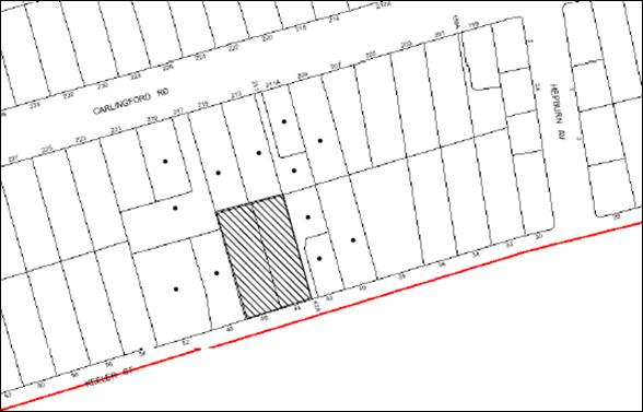
|
NOTIFICATION PLAN |
|
||
|
• PROPERTIES NOTIFIED
|
X SUBMISSIONS RECEIVED |
PROPERTY SUBJECT OF DEVELOPMENT |
|
|
TWO SUBMISSIONS RECEIVED OUT OF MAP RANGE |
|||
Two submissions objected to the development, generally on the following grounds:
· Increased traffic generation; and
· The proposal does not encompass sustainable development initiatives.
The merits of the matters raised in community submission have been addressed in the body of the report.
5.2 Public Agencies - NSW Police
NSW Police commented on the proposed residential flat building in respect to Crime Prevention Through Environmental Design principles and raised no objection to the proposal subject to recommended conditions.
6. THE PUBLIC INTEREST
Section 79C(1)(e) of the Act requires Council to consider “the public interest”.
The public interest is an overarching requirement, which includes the consideration of the matters discussed in this report. Implicit to the public interest is the achievement of future built outcomes adequately responding to and respecting the future desired outcomes expressed in environmental planning instruments and development control plans.
The application is considered to have satisfactorily addressed Council’s and relevant agencies’ criteria and would provide a development outcome that, on balance, would result in a positive impact for the community. Accordingly, it is considered that the approval of the proposed development would be in the public interest.
CONCLUSION
The proposal is for the demolition of two existing dwelling houses, construction of a five storey residential flat building comprising 35 dwellings with basement car parking and including strata title subdivision.
The proposed development has been assessed with regard to a proposed residential flat building on the adjoining site at Nos. 40, 42 and 42A Keeler Street.
The proposed development is generally satisfactory in respect to the design principles under SEPP 65 and the best practice guidelines of the SEPP 65 – Residential Flat Design Code, subject to recommended conditions.
The proposed development is generally in accordance with the development controls for the ‘Carlingford Road, Carlingford’ precinct of the Housing Strategy DCP and would contribute to the residential character of the precinct.
The application is recommended for approval.
Note: At the time of the completion of this planning report, no persons have made a Political Donations Disclosure Statement pursuant to Section 147 of the Environmental Planning and Assessment Act 1979 in respect of the subject planning application.
|
Rod Pickles Manager - Development Assessment Planning Division |
James Farrington Group Manager Planning Division |
|
1.View |
Locality Plan |
|
|
|
2.View |
Site Analysis |
|
|
|
3.View |
Site Plan |
|
|
|
4.View |
Floor Plans |
|
|
|
5.View |
Elevations |
|
|
|
6.View |
Shadow Diagrams |
|
|
|
7.View |
Photomontage |
|
|
|
8.View |
Landscape Plan |
|
|
File Reference: DA/688/2012
Document Number: D02066867
SCHEDULE 1
GENERAL CONDITIONS
The conditions of consent within this notice of determination have been applied to ensure that the use of the land and/or building is carried out in such a manner that is consistent with the aims and objectives of the relevant legislation, planning instruments and Council policies affecting the land and does not disrupt the amenity of the neighbourhood or impact upon the environment.
Note: For the purpose of this consent, the term ‘applicant’ means any person who has the authority to act on or the benefit of the development consent.
Note: For the purpose of this consent, any reference to an Act, Regulation, Australian Standard or publication by a public authority shall be taken to mean the gazetted Act or Regulation, or adopted Australian Standard or publication as in force on the date that the application for a construction certificate is made.
1. Approved Plans and Supporting Documentation
The development must be carried out in accordance with the plans and documentation listed below and endorsed with Council’s stamp, except where amended by Council and/or other conditions of this consent:
Architectural Plans prepared by Design Cubicle Pty Ltd
|
Plan No. |
Issue |
Plan Title |
Dated |
|
120485 DA100 |
F |
Site Plan |
20.11.2012 |
|
120485 DA200 |
F |
Basement Level 2 Plan |
20.11.2012 |
|
120485 DA201 |
F |
Basement Level 1 |
20.11.2012 |
|
120485 DA202 |
F |
Ground Floor Plan |
20.11.2012 |
|
120485 DA203 |
F |
First Floor Plan |
20.11.2012 |
|
120485 DA204 |
F |
Second Floor Plan |
20.11.2012 |
|
120485 DA205 |
F |
Third Floor Plan |
20.11.2012 |
|
120485 DA206 |
F |
Fourth Floor Plan |
20.11.2012 |
|
120485 DA207 |
F |
Roof Plan |
20.11.2012 |
|
120485 DA400 |
F |
Elevations 1 |
20.11.2012 |
|
120485 DA401 |
F |
Elevations 2 |
20.11.2012 |
|
120485 DA402 |
F |
Sections |
20.11.2012 |
Landscape Plan prepared by Vision Dynamics Pty Ltd
|
Plan No. |
Revision |
Plan Title |
Dated |
|
12084DA 1 |
B |
Landscape Concept Plan |
20.09.2012 |
Stormwater Management Plans prepared by Northrop
|
Plan No. |
Revision |
Plan Title |
Dated |
|
C3.01 |
2 |
Catchment Plan |
05.07.2012 |
|
C3.02 |
3 |
Stormwater Management Plan sheet 1 of 2 |
08.11.2012 |
|
C3.03 |
1 |
Stormwater Management Plan sheet 2 of 2 |
09.11.2012 |
|
C3.04 |
1 |
Stormwater Management Plan Basement Level 2 |
26.07.2012 |
|
Document Title |
Prepared by |
Dated |
|
Site Analysis 1 (Reference Drawing No. 120484 UA100 Issue F) |
Design Cubicle Pty Ltd |
20.11.2012 |
|
Site Analysis 2 (Reference Drawing No. 120484 UA101 Issue F) |
Design Cubicle Pty Ltd |
20.11.2012 |
|
Site Analysis 3 and Streetscape (Reference Drawing No. 120484 U102 Issue F) |
Design Cubicle Pty Ltd |
20.11.2012 |
|
Shadow Diagrams (Reference Drawing No. 120484 DA600 Issue F) |
Design Cubicle Pty Ltd |
20.11.2012 |
|
Elevational Shadow Diagrams (Reference Drawing No. 120484 DA601 Issue F) |
Design Cubicle Pty Ltd |
20.11.2012 |
|
Elevational Shadow Diagrams 2 (Reference Drawing No. 120484 DA602 Issue F) |
Design Cubicle Pty Ltd |
20.11.2012 |
|
Cross Ventilation Diagram (Reference Drawing No.120484 DA701 Issue F) |
Design Cubicle Pty Ltd |
20.11.2012 |
|
Storage Calculation Table (Reference No. 120484 DA702 Issue F) |
Design Cubicle Pty Ltd |
20.11.2012 |
|
Solar Access Table (Reference No. 120484 DA703 Issue F) |
Design Cubicle Pty Ltd |
20.11.2012 |
|
Precinct Shadows (Reference Drawing No. 120484 DA704 Issue F) |
Design Cubicle Pty Ltd |
20.11.2012 |
|
Precinct Shadows (Reference Drawing No. 120484 DA705 Issue F) |
Design Cubicle Pty Ltd |
20.11.2012 |
|
North Elevation Precinct Shadows (Reference Drawing No. 120484 DA706 Issue F) |
Design Cubicle Pty Ltd |
20.11.2012 |
|
Sun Penetration Plan 1/5 (Reference Drawing No. 120484 DA801 Issue F) |
Design Cubicle Pty Ltd |
20.11.2012
|
|
Sun Penetration Plan 2/5 (Reference Drawing No. 120484 DA802 Issue F) |
Design Cubicle Pty Ltd |
20.11.2012 |
|
Sun Penetration Plan 3/5 (Reference Drawing No. 120484 DA803 Issue F) |
Design Cubicle Pty Ltd |
20.11.2012 |
|
Sun Penetration Plan 4/5 (Reference Drawing No. 120484 DA804 Issue F) |
Design Cubicle Pty Ltd |
20.11.2012 |
|
Sun Penetration Plan 5/5 (Reference Drawing No. 120484 DA805 Issue F) |
Design Cubicle Pty Ltd |
20.11.2012 |
|
Photomontage (Reference No. 120485) |
Design Cubicle Pty Ltd |
Received by Council on 23.11.2012
|
|
Statement of Environmental Effects |
Think Planners |
04.07.2012 |
|
Cover Sheet Drawing Schedule and Locality Plan (Reference No. C1.01 Revision 2) |
Northrop |
05.07.2012 |
|
Sediment and Erosion Control Plan (Reference No. C2.01 Revision 2) |
Northrop |
05.07.2012 |
|
Sampleboard (Reference No. 120485 – CS101) |
Design Cubicle Pty Ltd |
Received by Council on 18.09.2012 |
|
BASIX Certificate No. 436098M_03 |
Planning Principles |
29 November 2012 |
|
ABSA Assessor Certificate (Reference No. 7612) |
Planning Principles |
03.07.2012 |
|
Arboricultural Impact Assessment |
Advance Treescape Consulting |
18.06.2012 |
|
Acoustic Report (Reference No. 122592) |
Far West Consulting Engineers |
18.06.2012 |
|
Traffic and Parking Assessment Report (Reference No. 12193) |
Varga Traffic Planning Pty Ltd |
4.07.2012 |
|
Proposed Accessibility and Adaptable Housing requirement |
Design Cubicle Pty Ltd |
July 2012 |
|
Design Verification Statement |
Design Cubicle Pty Ltd |
Received by Council on 06.07.2012 |
|
Waste Management Plan |
Design Cubicle Pty Ltd |
July 2012 |
|
Crime Risk Assessment |
Think Planners |
05.072012 |
2. Removal of Existing Trees
This development consent only permits the removal of trees numbered 7, 8, 9, 14, 15, 16 and 17 as identified in the Arboricultural Impact Assessment prepared by Advance Treescape Consulting dated 18 June 2012. The removal of any other trees requires separate approval under Council’s Tree Preservation Order.
3. Amendment of Plans
a) The following plans must be amended in accordance with the approved Ground Floor Plan (120485 DA202 prepared by Design Cubicle Pty Ltd dated 20.11.2012) in Condition 1 of this development consent:
|
Plan No. |
Plan Title |
Drawn by |
Dated |
|
12084DA 1 – Revision B |
Landscape Concept Plan |
Vision Dynamics Pty Ltd
|
20.09.2012 |
|
C3.02 Revision 3 |
Stormwater Management Plan sheet 1 of 2 |
Northrop |
08.11.2012 |
b) The approved third and fourth floor plans (Drawing Nos. 120485DA205 and 120484 DA206) prepared by Design Cubicle Pty Ltd dated 20.11.2012) must amended by repositioning of the entries of Units 26, 27, 32 and 33) such that the recycling bins are not located immediately adjacent to the unit entries.
c) The approved ground floor plan for Unit 2 and Unit 3 (Drawing No. 120485DA202 prepared by Design Cubicle Pty Ltd dated 20.11.2012) and the approved landscape plan must be amended to delete the ground level open space areas, stairs and fencing and the areas to be replaced with communal landscaping.
REQUIREMENTS PRIOR TO THE ISSUE OF A CONSTRUCTION CERTIFICATE
4. Building Code of Australia
All building work must be carried out in accordance with the requirements of the Building Code of Australia.
5. Contract of Insurance (Residential Building Work)
In the case of residential building work for which the Home Building Act, 1989 requires there to be a contract of insurance in force in accordance with Part 6 of that Act, that such a contract of insurance is in force before any building work authorised to be carried out by the consent commences.
Note: This condition does not apply to the extent to which an exemption is in force under Clause 187 or 188 of the Act, subject to the terms of any condition or requirement referred to in Clause 187(6) or 188(4) of the Act, or to the erection of a temporary building.
6. Water/Electricity Utility Services
The applicant must submit written evidence of the following service provider requirements:
a) Energy Australia – a letter of consent demonstrating that satisfactory arrangements have been made to service the proposed development.
b) Sydney Water – the submission of a ‘Notice of Requirements’ under s73 of the Sydney Water Act 1994.
Note: Sydney Water requires that s73 applications are to be made through an authorised Sydney Water Servicing Coordinator. Refer to www.sydneywater.com.au or telephone 13 20 92 for assistance.
7. Accessible and Adaptable units
a) The details of fit-outs of all accessible units (3 units) and details of adaptable units must be provided with the Construction Certificate Plans.
b) The adaptable units must be in compliance with AS1428.1 – Design for Access and Mobility.
8. Dilapidation Report
A ‘Dilapidation Report’ is to be prepared by a ‘chartered structural engineer’ detailing the structural condition of all adjoining properties.
9. Easement Over Downstream Land
The proposed drainage easement over downstream properties 42A Keeler St (Lot 2 DP 866744), 40 Keeler St (Lot 6 DP 30015) & 38 Keeler St (SP 48410) must be registered with the NSW Department of Lands. Evidence of the registration is to be provided to the PCA prior to the issue of any Construction Certificate.
10. Stormwater Drainage
The stormwater drainage system for the development must be designed and constructed and a construction Certificate issued for these works. The stormwater drainage system is to be designed in accordance with Council’s Civil Works – Design and Construction Specification 2005 and the following requirements:
a) Connected directly to the existing interallotment drainage system generally in accordance with the plans prepared by Northrop Consulting Engineers 9 Nov 12.
b) All new interallotment pits are to be cast in situ.
11. On Site Stormwater Detention
The on site detention system for the development must be designed and constructed and a construction Certificate issued for these works. The stormwater drainage system is to be designed in accordance with Council’s Civil Works – Design and Construction Specification 2005 and the following requirements:
a) Have a capacity of not less than 26.9m3, and a maximum discharge (when full) of 18 litres per second.
b) Have a surcharge/inspection grate located directly above the outlet.
c) Discharge from the detention system to be controlled via 1 metre length of pipe, not less than 50 millimetres diameter or via a stainless plate with sharply drilled orifice bolted over the face of the outlet discharging into a larger diameter pipe capable of carrying the design flow to an approved Council system.
d) Not be constructed in a location that would impact upon the visual or recreational amenity of residents.
12. Internal Driveway/Vehicular Areas
The driveway and parking areas on site must be designed, constructed and a Construction Certificate issued in accordance with Australian Standards 2890.1, 2890.2, 3727, Councils Civil Works Specification and the following requirements:
a) Design levels at the front boundary be obtained from Council.
b) The driveway be a rigid pavement.
c) The driveway grade must not exceed 5 percent for the first 6m from the property boundary and shall have a minimum width of 5.5m.
13. Footpath
Prior to the issue of a Construction Certificate for these works a separate application under the Local Government Act, 1993 and the Roads Act, 1993 must be submitted to Council for the construction of footpaths within the road reserve. A concrete footpath must be constructed along the full frontage of the subject site in accordance Council’s Civil Works Design and Construction Specification, 2005 and the following requirements:
a) The existing footpath being removed and reconstructed.
b) Any public utility adjustments to be carried out at the cost of the applicant and to the requirements of the relevant public authority.
14. Vehicular Crossing
Prior to the issue of a Construction Certificate for these works a separate application under the Local Government Act, 1993 and the Roads Act, 1993 must be submitted to Council for the installation of a new vehicular crossing. The vehicular crossing must be constructed in accordance with Council’s Civil Works Design, 2005.
15. Road Works
Prior to the issue of a Construction Certificate for these works a separate application under the Local Government Act, 1993 and the Roads Act, 1993 must be submitted to Council for all works within the road reserve. All road works approved under this consent must be constructed in accordance with Council’s Civil Works Design and Construction Specification, 2005 and the following requirements:
a) The existing kerb and gutter is to be removed and reconstructed.
b) The existing road pavement to be saw cut a minimum of 300 mm from the existing lip of gutter and reconstructed.
16. Traffic Control Plan
A Traffic Control Plan (TCP) must be prepared by a qualified traffic controller in accordance with the Roads & Traffic Authority’s Traffic Control at Worksites Manual 1998 and Australian Standard 1742.3 for all work on a public road and be submitted to Council. The TCP must detail the following:
a) Arrangements for public notification of the works.
b) Temporary construction signage.
c) Permanent post-construction signage.
d) Vehicle movement plans.
e) Traffic management plans.
f) Pedestrian and cyclist access/safety.
g) Approval of the RMS where required.
17. Letter Boxes
The details of letter boxes and meter enclosures must be provided with the Construction Certificate Plans. The letter boxes and meter enclosures must be provided with a minimum setback of 2 metres from all boundaries and must be suitably screened.
18. Acoustic Details
The Construction Certificate plans must demonstrate compliance with the recommendations in the Acoustic Report prepared by Far West Consulting Engineers dated 18 June 2012.
REQUIREMENTS PRIOR TO THE COMMENCEMENT OF ANY WORKS
19. Erection of Construction Sign
A sign must be erected in a prominent position on any site on which building work, subdivision work or demolition work is being carried out:
a) Showing the name, address and telephone number of the principal certifying authority for the work,
b) Showing the name of the principal contractor (if any) for any demolition or building work and a telephone number on which that person may be contacted outside working hours, and
c) Stating that unauthorised entry to the work site is prohibited.
Note: Any such sign is to be maintained while the building work, subdivision work or demolition work is being carried out, but must be removed when the work has been completed.
20. Protection of Adjoining Areas
A temporary hoarding, fence or awning must be erected between the work site and adjoining lands before the works begin and must be kept in place until after the completion of the works if the works:
a) Could cause a danger, obstruction or inconvenience to pedestrian or vehicular traffic.
b) Could cause damage to adjoining lands by falling objects.
c) Involve the enclosure of a public place or part of a public place.
Note: Notwithstanding the above, Council’s separate written approval is required prior to the erection of any structure or other obstruction on public land.
21. Toilet Facilities
Toilet facilities must be available or provided at the works site before works begin and must be maintained until the works are completed at a ratio of one toilet for every 20 persons employed at the site. Each toilet must:
a) be a standard flushing toilet connected to a public sewer; or
b) be a temporary chemical closet approved under the Local Government Act, 1993; or
c) have an on-site effluent disposal system approved under the Local Government Act, 1993
22. Erosion and Sediment Control
Erosion and sediment control measures must be provided and maintained throughout the construction period in accordance with the manual ‘Soils and Construction 2004 (Bluebook)’, the approved plans, Council specifications and to the satisfaction of the principal certifying authority. The erosion and sediment control devices must remain in place until the site has been stabilised and revegetated.
Note: On the spot penalties up to $1,500 may be issued for any non-compliance with this requirement without any further notification or warning.
23. Tree Protection Barriers
Tree protection fencing must be erected around tree numbered 10 to be retained at a 4 metre setback. The tree fencing must be constructed of 1.8 metre ‘cyclone chainmesh fence’ or star pickets spaced at 2 metre intervals, connected by a continuous high-visibility barrier/hazard mesh at a height of 1 metre.
REQUIREMENTS DURING CONSTRUCTION
24. Construction Work Hours
All work on site (including demolition and earth works) must only occur between 7am and 5pm Monday to Saturday.
No work is to be undertaken on Sundays or public holidays.
25. Demolition
All demolition work must be carried out in accordance with Australian Standard 2601-2001 – The Demolition of Structures and the following requirements:
a) Demolition material is to be disposed of to an authorised recycling and/or waste disposal site and/or in accordance with an approved waste management plan.
b) Demolition works, where asbestos material is being removed, must be undertaken by a contractor that holds an appropriate licence issued by WorkCover NSW in accordance with Chapter 10 of the Occupational Health and Safety Regulation 2001 and Clause 29 of the Protection of the Environment Operations (Waste) Regulation 2005.
c) On construction sites where buildings contain asbestos material, a standard commercially manufactured sign containing the words ‘DANGER ASBESTOS REMOVAL IN PROGRESS’ measuring not less than 400mm x 300mm must be erected in a prominent position visible from the street.
26. Environmental Management
The site must be managed in accordance with the publication ‘Managing Urban Stormwater – Landcom (March 2004) and the Protection of the Environment Operations Act 1997 by way of implementing appropriate measures to prevent sediment run-off, excessive dust, noise or odour emanating from the site during the construction of the development.
27. Council Property
During construction works, no building materials, waste, machinery or related matter is to be stored on the road or footpath.
28. Street Sweeping
Street sweeping must be undertaken following sediment tracking from the site along Keeler Street during works and until the site is established.
29. Spoil Route
To protect Council’s assets, all vehicular access to and from the site during all stages of the development is to be via the shortest route to the nearest State or Regional Road
30. Works Near Trees
All required tree protection measures are to be maintained in good condition for the duration of the construction period.
All works (including driveways and retaining walls) within 5 metres of any trees required to be retained (whether or not on the subject property, and pursuant to this consent or the Tree Preservation Order), must be carried out under the supervision of an ‘AQF Level 5 Arborist’ and a certificate submitted to the principal certifying authority detailing the method(s) used to preserve the tree(s).
Note: Except as provided above, the applicant is to ensure that no excavation, filling or stockpiling of building materials, parking of vehicles or plant, disposal of cement slurry, waste water or other contaminants is to occur within 4 metres of any tree to be retained.
31. Landfill
Landfill must be constructed in accordance with Council’s ‘Construction Specification, 2005’ and the following requirements:
a) All fill material imported to the site is to wholly consist of Virgin Excavated Natural Material (VENM) as defined in Schedule 1 of the Protection of the Environment Operations Act 1997 or a material approved under the Department of Environment and Climate Change’s general resource recovery exemption.
b) A compaction certificate is to be obtained from a geotechnical engineer verifying that the specified compaction requirements have been met.
32. Excavated Material
All excavated material removed from the site must be classified in accordance with the NSW Environment Protection Authority’s Environmental Guidelines – Assessment, Classification and Management of Liquid and Non-Liquid Wastes prior to disposal to an approved waste management facility and reported to the principal certifying authority.
33. Contamination during construction works
Should the presence of asbestos or soil contamination, not recognised during the application process be identified during demolition, the applicant must immediately notify the Principal Certifying Authority and Council.
34. Waste Management
Waste management during the demolition and construction phase of the development must be undertaken in accordance with the approved Waste Management Plan. Additionally written record of the following items must be maintained during the removal of any waste from the site and such information submitted to the Principal Certifying Authority within fourteen days of the date of completion of the works:
a) The identity of the person removing the waste.
b) The waste carrier vehicle registration.
c) Date and time of waste collection.
d) A description of the waste (type of waste and estimated quantity).
e) Details of the site to which the waste is to be taken.
f) The corresponding tip docket/receipt from the site to which the waste is transferred (noting date and time of delivery, description (type and quantity) of waste).
g) Whether the waste is expected to be reused, recycled or go to landfill.
Note: In accordance with the Protection of the Environment Operations Act 1997, the definition of waste includes any unwanted substance, regardless of whether it is reused, recycled or disposed to landfill.
35. Survey Report – Finished Floor Level
A report(s) must be prepared by a registered surveyor and submitted to the principal certifying authority prior to the pouring of concrete at each level of the building certifying that:
a) The building, retaining walls and the like have been correctly positioned on the site.
b) The finished floor level(s) are in accordance with the approved plans.
REQUIREMENTS PRIOR TO THE ISSUE OF AN OCCUPATION CERTIFICATE
Note: For the purpose of this consent, a reference to ‘occupation certificate’ shall not be taken to mean an ‘interim occupation certificate’ unless otherwise stated.
36. Fulfilment of BASIX Commitments
The applicant must demonstrate the fulfilment of BASIX commitments pertaining to the development.
37. Sydney Water – s73 Certificate
A s73 Certificate must be obtained from Sydney Water.
38. Resident Storage
The basement resident storage areas are to be allocated in accordance with the size requirements of the SEPP 65 - Residential Flat Design Code for the respective units and proximity to the unit car parking space.
39. Damage to Council Assets
Any damage caused to Council’s assets as a result of the construction of the development must be rectified in accordance with Council’s written requirements and at the sole cost of the applicant.
40. Creation of Easements
The following matter(s) must be created on the title of the property under the Conveyancing Act 1919:
a) The creation of an appropriate "Positive Covenant" and "Restriction as to User" over the constructed on-site detention/retention systems and outlet works, within the lots in favour of Council in accordance with Council’s prescribed wording. The position of the on-site detention system is to be clearly indicated on the title.
b) To register the OSD easement, the restriction on the use of land “works-as-executed” details of the on-site-detention system must be submitted verifying that the required storage and discharge rates have been constructed in accordance with the design requirements. The details must show the invert levels of the on site system together with pipe sizes and grades. Any variations to the approved plans must be shown in red on the “works-as-executed” plan and supported by calculations.
Note: Council must be nominated as the authority to release, vary or modify any easement, restriction or covenant.
41. Garbage Collection Easement
For the purpose of waste collection, an easement entitling Council, its servants and agents and persons authorised by it to enter upon the subject land and to operate thereon, vehicles and other equipment for the purposes of garbage collection must be granted to Council by the owner of the land.
Note: The easement must be in a form prescribed by Council and must include covenants to the effect that parties will not be liable for any damage caused to the subject land or any part thereof or to any property located therein or thereon by reason of the operation thereon of any vehicle or other equipment used in connection with the collection of garbage and to the effect that the owner for the time being of the subject land shall indemnify the Council, its servants, agents and persons authorised by it to collect garbage against liability in respect of any such claims made by any person whomsoever.
42. Works as Executed Plan
A works-as-executed plan(s) must be prepared by a registered surveyor and submitted to Council for completed road pavement, kerb & gutter, public drainage systems, driveways and on-site detention system.
43. Maintain Canopy Cover
To maintain canopy cover, 4 medium to large trees selected from Council’s booklet ‘Indigenous Plants for the Bushland Shire’ are to be planted on the subject site. The planning location shall not be within 4 metres of the foundation walls of a dwelling or in-ground pool. The pot size is to be a minimum 25 litres and the tree(s) must be maintained until they reach the height of 3 metres. Trees must be native to Hornsby Shire and reach a mature height greater than 10 metres.
44. Planter Boxes / On slab planting
On slab planter boxes must include waterproofing, subsoil drainage (proprietary drainage cell, 50mm sand and filter fabric) automatic irrigation, minimum 500mm planting soil for shrubs and minimum 1000mm planting soil for trees and palms and 75mm mulch to ensure sustainable landscape is achieved.
45. Completion of Landscaping
A certificate must be provided by a practicing landscape architect, horticulturalist or person with similar qualifications and experience certifying that all required landscaping works have been satisfactorily completed in accordance with the approved landscape plans.
46. External Lighting
All external lighting must be designed and installed in accordance with Australian Standard AS 4282 – Control of the Obtrusive Effects of Outdoor Lighting. Certification of compliance with the Standard must be obtained from a suitably qualified person.
47. Retaining Walls
All required retaining walls must be constructed as part of the development.
48. Boundary Fencing
Fencing must be erected along all property boundaries behind the front building alignment to a height of 1.8 metres.
49. Unit Numbering
The allocation of unit numbering must be authorised by Council prior to the numbering of each unit in the development.
50. Construction for a safe environment
Prior to the issue of the Occupation Certificate, the site must include the following elements:
a) An intercom system be installed at gate locations to ensure screening of persons entering the units;
b) The entryway to the site be illuminated in high luminance at all times;
c) The communal open space at the rear of the site be illuminated with high luminance by motion sensor lighting;
d) The service areas of the ground floor and the garbage room at the basement be illuminated with high luminance by motion sensor lighting;
e) The driveway and the basement carpark is to be illuminated with low luminance at all times;
f) Robust materials which cannot be forced or breached with minimised maintenance requirements are to be used for construction work in the common areas;
g) The lamps and lighting levels must comply with Australian and New Zealand Lighting Standard 1158.1;
h) Effective signage be provided to guide visitors to the main areas and parking areas;
i) The communal area must include a clear sign to restrict access for non-residents;
j) Units numbers, entry and exit signs must be legible and clear;
k) Fire exist doors to the development must be fitted with single cylinder locksets (Australia and New Zealand Standard – Lock Sets) to restrict unauthorized access to the development;
l) Doors must include laminated glass to increase safety;
m) Ground floor windows must be fitted with window locks that can be locked with a key; and
n) A graffiti management plan must be incorporated into the maintenance plan for the development for graffiti to be removed within a forty-eight hour period.
51. Waste Management
a) The basement bin storage room must include water connection for cleaning, graded floors with drainage to sewer, a robust door, sealed and impervious surfaces, adequate lighting and ventilation.
b) Each dwelling/kitchen must be provided with an indoor waste/recycling cupboard for the interim storage of a minimum one day’s waste/recycling generation with separate containers for general waste and recyclable materials.
c) Space must be provided for either individual compost containers for each dwelling or a communal compost container.
Note: The location of the compost containers should have regard for potential amenity impacts.
d) The bin carting route(s) must be devoid of steps.
Note: Ramps between different levels are acceptable
e) A report(s) must be prepared by the principal contractor and submitted to the principal certifying authority certifying that:
i) A comparison of the estimated quantities of each waste type against the actual quantities of each waste type has been made;
ii) Any deviations from the Waste Management Plan (including, but not limited to, types of waste, quantities of waste, destinations of waste, reuse and recycling achieved) have been explained;
iii) All waste was taken to site(s) that were lawfully permitted to accept that waste;
iv) Either
a) Waste Management Plan Section One – Demolition Stage and Section Three – Construction Stage were implemented and at least 60 % waste generated was reused or recycled; or
b) If the 60% diversion from landfill was not achieved in the Demolition Stage and/or Construction Stage, the Report is to include the reasons why this occurred and certify that appropriate work practices were employed in the demolition and construction stages to implement the Waste Management Plan.
v) The Report(s) is based on documentary evidence (i.e. tipping dockets/receipts from recycling depots, transfer stations and landfills, audits of procedures, Licence and/or development consent of site(s) receiving waste, etc) which have been attached to the Report.
vi) The author(s) of the report declared that the report is true in every particular and is not misleading.
52. Section 94 Infrastructure Contributions
The payment to Council of a contribution of $376,006.40for thirty-three additional residential units towards the cost of infrastructure identified in Council’s Development Contributions Plan 2007-2011 in accordance with the following table:
11 x 1-bedroom units,
21 x 2-bedroom units and
3 x 3-bedroom units.
Note: The value of contribution is current as at 28 November 2012. The contribution will be adjusted from this date in accordance with the underlying consumer price index for subsequent financial quarters.
It is recommended that you contact Council to confirm the value of the contribution prior to payment.
OPERATIONAL CONDITIONS
53. Car Parking
All car parking must be operated in accordance with Australian Standard AS/NZS 2890.1:2004 – Off-street car parking and Australian Standard AS 2890.2:2002 – Off-street commercial vehicle facilities.
a) Car parking, loading and manoeuvring areas to be used solely for nominated purposes;
b) Vehicles awaiting loading, unloading or servicing shall be parked on site and not on adjacent or nearby public roads;
c) All vehicular entry on to the site and egress from the site shall be made in a forward direction.
54. Visitor Parking
Visitors are to be able to access the basement car park by the proposed audio/visual intercom system located at the top of the ramped driveway.
55. Disabled Parking
All parking spaces for people with disabilities must be constructed and operated in accordance with Australian Standard AS/NZS 2890.6:2009 – Off-street parking for people with disabilities.
56. Fire Safety Statement - Annual
On at least one occasion in every 12 month period following the date of the first ‘Fire Safety Certificate’ issued for the property, the owner must provide Council with an annual ‘Fire Safety Certificate’ to each essential service installed in the building.
57. Noise
The level of total continuous noise emanating from operation of the premises including all the plant, air conditioning units and processes (LA10) (measured for at least 15 minutes) in or on the above premises, must not exceed the background level by more than 5dB(A) when measured at all property boundaries.
58. Waste Management
a) A site caretaker must be employed and be responsible for moving bins to and from the bin storage room(s) and the waste collection point, washing bins and maintaining waste storage areas, ensuring the chute system and related devices are maintained in effective and efficient working order, managing the communal composting area, arranging the prompt removal of dumped rubbish, and ensuring all residents are informed and trained in the use of the waste management system.
b) Bins must be removed from the bin collection point each time after collection.
59. Landscape establishment
The landscape works must be maintained into the future to ensure the establishment and successful growth of plant material to meet the intent of the landscape design. This must include but not be limited to watering, weeding, replacement of failed plant material and promoting the growth of plants through standard industry practices.
- END OF CONDITIONS -
ADVISORY NOTES
The following information is provided for your assistance to ensure compliance with the Environmental Planning and Assessment Act, 1979, Environmental Planning and Assessment Regulation 2000, other relevant legislation and Council’s policies and specifications. This information does not form part of the conditions of development consent pursuant to Section 80A of the Act.
Environmental Planning and Assessment Act 1979 Requirements
The Environmental Planning and Assessment Act 1979 requires:
· A construction certificate prior to the commencement of any works. Enquiries regarding the issue of a construction certificate can be made to Council’s Customer Services Branch on 9847 6760.
· A principal certifying authority to be nominated and Council notified of that appointment prior to the commencement of any works.
· Council to be given at least two days written notice prior to the commencement of any works.
· Mandatory inspections of nominated stages of the construction inspected.
· An occupation certificate issued before occupying any building or commencing the use of the land.
Long Service Levy
In accordance with Section 34 of the Building and Construction Industry Long Service Payments Act 1986, a ‘Long Service Levy’ must be paid to the Long Service Payments Corporation or Hornsby Council.
Note: The rate of the Long Service Levy is 0.35% of the total cost of the work.
Note: Hornsby Council requires the payment of the Long Service Levy prior to the issue of a construction certificate.
Tree Preservation Order
To ensure the maintenance and protection of the existing natural environment, it is an offence to ringbark, cut down, top, lop, remove, wilfully injure or destroy a tree outside three metres of the approved building envelope without prior written consent from Council. Fines may be imposed for non-compliance with Council’s Tree Preservation Order.
Note: A tree is defined as a single or multi-trunked wood perennial plant having a height of not less than three (3) metres, and which develops many branches, usually from a distance of not less than one (1) metre from the ground, but excluding any plant which, in its particular location, is a noxious plant declared as such pursuant to the Noxious Weeds Act 1993. This definition of ‘tree’ includes any and all types of Palm trees.
All distances are determined British Standard BS 5837: 2005, “Trees in Relation to Construction – Recommendations”.
Disability Discrimination Act
The applicant’s attention is drawn to the existence of the Disability Discrimination Act. A construction certificate is required to be obtained for the proposed building, which will provide consideration under the Building Code of Australia, however, the development may not comply with the requirements of the Disability Discrimination Act. This is the sole responsibility of the applicant.
Dial Before You Dig
Prior to commencing any works, the applicant is encouraged to contact Dial Before You Dig on 1100 or www.dialbeforeyoudig.com.au for free information on potential underground pipes and cables within the vicinity of the development site.
Rain Water Tank
It is recommended that water collected within any rainwater tank as part of the development be limited to non-potable uses. NSW Health recommends that the use of rainwater tanks for drinking purposes not occur where a reticulated potable water supply is available.
House Numbering
House numbering can only be authorised by Council. Before proceeding to number each premise in the development, the allocation of numbers is required to be obtained from Council's Planning Division. The authorised numbers are required to be displayed in a clear manner at or near the main entrance to each premise.
Group Manager's Report No. PL54/12
Planning Division
Date of Meeting: 19/12/2012
17 DRAFT HORNSBY LOCAL ENVIRONMENTAL PLAN - REVIEW OF SUBMISSIONS
EXECUTIVE SUMMARY
· The draft Hornsby Local Environmental Plan (HLEP) was exhibited for community comment between 5 June and 7 August 2012. The draft Hornsby Development Control Plan (HDCP) was exhibited concurrently with the draft HLEP. A total of 155 submissions were received on the draft HLEP and/or draft DHCP during the two month exhibition period.
· The issues identified in the submissions in relation to the draft HLEP are addressed in this report. A number of minor amendments are required to be made to the draft HLEP. The recommended amendments are inconsequential and do not warrant the re-exhibition of the Plan.
· Issues identified in submissions that are beyond the scope of a translation or would delay the making of the Plan are recommended to be dealt with by various other methods. These methods include preparing a planning proposal to inform an amendment to the draft HLEP, considering the matter further as part of a future strategic planning project, or inviting the submission of a planning proposal accompanied by the necessary studies and fees for consideration on its merits.
· It is recommended that Council endorse the draft HLEP subject to minor amendments indentified in this report and forward the draft HLEP to the Department of Planning and Infrastructure (DP&I) for its making.
|
THAT
1. Council endorse the draft Hornsby Local Environmental Plan for forwarding to the Department of Planning and Infrastructure for its making subject to amendments listed in Schedule A - Items 1.1 to 1.10 of Group Manager’s Report No. PL54/12.
2. Pursuant to Section 68(4) of the Environmental Planning and Assessment Act, 1979, Council advise the Director General of the Department of Planning and Infrastructure that:
2.1 Council requests the Director-General of the Department of Planning and Infrastructure to advise the Minister to make the plan in accordance with Council’s submission; and
2.2 Council has fulfilled its responsibilities under Section 68(4) of the Environmental Planning and Assessment Act, 1979 by submitting to the Director-General:
- Details of all submissions made to the exhibition of the draft Hornsby Local Environmental Plan; - The draft Hornsby Local Environmental Plan as amended in accordance with the recommendations of Group Manager’s Report No. PL54/12; and - Group Manager’s Report No. PL54/12.
3. The General Manager be authorised to make minor content and formatting changes to the written instrument and maps in response to requests from Parliamentary Counsel and the Department of Planning and Infrastructure to satisfy legal drafting requirements.
4. Council make amendments to the draft Hornsby Development Control Plan listed in Schedule A – Item 2.1 of Group Manager’s Report No. PL54/12.
5. Council prepare a Planning Proposal to progress amendments to the draft Hornsby Local Environmental Plan listed in Schedule A - Items 3.1 to 3.6 of Group Manager’s Report No. PL54/12.
6. Council undertake further analysis as part of, or by way of including projects on, the Strategic Planning Program listed in Schedule A - Items 4.1 to 4.9 of Group Manager’s Report No. PL54/12.
7. Invite the submission of a formal Planning Proposal to be accompanied by the necessary studies and fees for consideration on its merits in relation to the requests for rezoning/changes to development standards listed in Schedule A - Items 5.1 to 5.6 of Group Manager’s Report No. PL54/12.
8. Submitters be advised of Council’s resolution in relation to this matter. |
PURPOSE
The purpose of this report is to review submissions received in response to the public exhibition of the draft HLEP and seek endorsement of a revised Plan for its making.
BACKGROUND
In September 2005, the NSW Government began introducing a range of reforms aimed at streamlining the planning system. One of the reforms was the release of the Standard Instrument in March 2006. Every local council is required to prepare a new LEP consistent with the form and content of the Standard Instrument.
At its meeting on 7 February 2007, Council considered Executive Manager’s Report No. PLN20/07 and resolved to prepare a new LEP in accordance with the Standard Instrument pursuant to Section 54 of the Environmental Planning and Assessment (EP&A) Act, 1979. Council subsequently advised the then Department of Planning (DOP) of its resolution to prepare a new LEP. Accordingly, pursuant to the savings provisions of the EP&A Regulations 2000, Council’s new LEP is being prepared under the former LEP Plan Making provisions of the EP&A Act and associated Regulations.
Since then, Council has progressed the preparation of a new Standard Instrument based LEP which has included reports on the matter for Council’s consideration on a number of occasions. Most notably, Council considered Executive Manager’s Report No. PLN92/10 at its meeting on 1 December 2010 where it resolved to endorse a draft Plan for consultation with relevant authorities pursuant to Section 62 of the EP&A Act. At its meeting on 1 June 2011, Council considered Executive Manager’s Report No. PLN46/11 reviewing submissions received on the draft Plan in response to consultation with public authorities. Council resolved to endorse a revised draft HLEP for public exhibition. Council subsequently sought certification from the then DOP to enable the draft HLEP to be placed on public exhibition.
Council last considered the draft HLEP at its meeting on 7 March 2012, when it considered Executive Manager’s Report No. PLN19/12. The Report advised of the Section 65 Certificate issued by the Department of Planning and Infrastructure (DP&I) and sought endorsement of a revised draft HLEP for public exhibition that addressed the conditions of the Certificate. Council resolved that:
1. Council endorse the revised draft Comprehensive Local Environmental Plan (as discussed in Executive Manager’s Report No. PLN19/12 and available for viewing at www.hornsby.nsw.gov.au\hlep) for public exhibition.
2. A submission be made to the Department of Planning and Infrastructure requesting the Section 65 Certificate be re-issued to enable the revised Plan to be placed on public exhibition.
3. Should conditions of the re-issued certificate only require minor amendment to the draft Comprehensive Local Environmental Plan, the General Manager be delegated authority to endorse and exhibit the Plan for a minimum of sixty days in accordance with the consultation strategy attached to Executive Manager’s Report No. PLN92/10.
4. Following exhibition of the draft Comprehensive Local Environmental Plan, a report on submissions be presented to Council for its consideration.
A submission was subsequently made to the DP&I requesting the Section 65 certificate be reissued to enable the revised draft LEP to be placed on exhibition.
At its meeting on 16 May 2012, Council considered Executive Manager’s Report No. PLN34/12 presenting the draft Hornsby Development Control Plan (HDCP) for endorsement for public exhibition. The Report notes that changes to the EP&A Act require that only one DCP apply to a parcel of land. The Report notes that all of Council’s existing 32 DCPs are therefore required to be amalgamated into one comprehensive DCP within the same timeframe for the preparation of Council’s new Standard Instrument based LEP. The Report also notes that the draft HDCP has been prepared to complement the draft HLEP. Council resolved to endorse the draft HDCP for public exhibition, it be exhibited for a minimum of 60 days concurrently with the draft HLEP in accordance with Council’s endorsed consultation strategy and that following exhibition, a report on submissions received in response to the public exhibition be presented to Council for its consideration.
On 10 April 2012, the Department of Planning and Infrastructure (DP&I) issued a Section 65 Certificate (copy attached) to enable Council’s Standard Instrument based LEP, the draft HLEP, to be placed on public exhibition. The Section 65 Certificate is unconditional. However, the DP&I noted that the Earthworks clause in Council’s draft Plan seeks to prohibit earthworks in certain zones (i.e. E1 - National Parks and Nature Reserves, E2 - Environmental Conservation, W1 - Natural Waterways and W2 - Recreational Waterways zones). The Department expressed concern that this prohibition may conflict with the application of other clauses in the Plan and that pending resolution of the issue, the Department’s model Earthworks clause was required to be placed on exhibition with the Plan. The Department’s model Earthworks clause seeks to permit earthworks with development consent in all zones.
The DP&I also noted that Parliamentary Counsel may make changes after exhibition to satisfy legal drafting requirements and there are a number of minor formatting changes that will have to be made to the written instrument and maps.
The draft HLEP and draft HDCP were exhibited for community comment between 5 June and 7 August 2012. This report reviews submissions received in response to the public exhibition of the draft HLEP. Group Manager’s Report No. PL55/12 reviews submissions received in response to the public exhibition of the draft HDCP.
DISCUSSION
This report provides an overview of the public exhibition of the draft HLEP, provides a methodology for progressing the making of the draft Plan and addresses issues identified in submissions received.
1. PUBLIC EXHIBITION
The draft HLEP and HDCP were exhibited for community comment between 5 June and 7 August 2012 in accordance with Council’s endorsed consultation strategy. A Report on Submissions (available for viewing on Council’s website hornsby.nsw.gov.au\hlep) was prepared to provide a summary of submissions received during the exhibition of the draft Plans and a statistical analysis to assist Council in making a decision concerning how to progress the draft Plans.
Consultation Strategy
The public exhibition involved placement of an advertisement in local newspapers on two occasions. The advertisement identified the purpose of the draft Plans and where they could be viewed. An article was also placed in the Bushland Shire E News identifying the purpose, key features and public exhibition of the draft HLEP and HDCP.
An information brochure (copy attached) was prepared and distributed to all property owners in Hornsby Shire. Copies of the brochure were also available to the public at all public exhibition display locations. The brochure informed the community of Council’s obligation to prepare the LEP and DCP in accordance with the required formats and that the task has principally been a translation of existing planning instruments. The brochure included information on the key features of the draft Plans, how Council resolved key translation issues, where the draft Plans could be viewed and how submissions could be made.
Notifications letters, a copy of the brochure and the draft Plans on CD was sent to relevant public authorities, infrastructure providers, and community and industry groups advising of the draft Plans and inviting submissions.
Hard copies of the draft Plans and supporting material were displayed at Council’s Administration Centre and Council libraries. An interactive display at Council’s Administration Centre, including a computer with a dedicated link to Council’s exhibition website and a computer with the draft HLEP maps downloaded onto Council’s GIS system, was made available for viewing by interested persons.
An exhibition webpage with a virtual web address was established on Council’s website to direct the public to information concerning the draft Plans, including background information, pdf copies of the draft Plans and supporting material, and frequently asked questions. A consultation space was also set up on the “Your Say” website to provide an alternate location to disseminate the exhibition material and seek feedback.
Report on Submissions
The Report on Submissions focuses on providing an overview of submissions, along with a snapshot of the reasoning, key issues identified and suggestions made. The report also presents the usage statistics for Council’s exhibition webpage and internet discussion forum.
In summary, a total of 155 submissions were received on the draft HLEP and/or draft DHCP during the two month exhibition period. The majority of submissions “Object with Suggestions for Specific Sites” (35%), “Support with Suggested Amendments” (21%) or “Object with Suggested amendments” (17%).
Of the 155 submissions, there were a total of 128 that commented on the draft HLEP. The majority of comments made on the draft HLEP related to the land zoning, development standards or constraints identified in the maps. There were also a considerable number of comments made in relation to permitted land uses under the various zone land use tables. The key issues identified in the submissions related to the zoning of Special Uses Sites - particularly the Hornsby Rifle range, the earthworks provision and the height of buildings on various sites.
A detailed summary of the 155 submissions received forms an attachment to the Report on Submissions. The summary of submissions identifies a submission number, the submission topic, the author views and the issues by Plan section. Pursuant to Section 68 of the EP&A Act, Council is required to consider the issues identified in the submissions and address relevant matters. The matters that need to be addressed are discussed by Plan section below under the heading “Review of Submission Issues”.
2. METHODOLOGY FOR PROGRESSING DRAFT PLAN
The draft HLEP is principally a translation of Council’s existing Plan, the HSLEP, into the Standard Instrument LEP format. The objective and recommendation of this report is that Council adopt the draft HLEP for submission to the DP&I for its making. For this to occur, consistent with the Land and Environment Court judgment Minister for Planning vs. Friends of Turramurra, the extent of change made to the draft Plan following the exhibition period should be limited both on an individual and cumulative basis. Any changes that are considered significant should be the subject of further public exhibition and consultation.
The Department of Planning and Infrastructure has provided the following guide as to what changes can generally be made to the draft HLEP without triggering the need for further public exhibition. Changes can be made to the LEP in the future and it is generally recommended that these be pursued as planning proposals that would amend the draft HLEP once it is gazetted. This would allow a full and proper public consultation to occur for any changes without further delaying the progression of the draft HLEP.
In all instances, minor changes should result in development that is substantially similar, have no substantial direct impact on other private properties or significant public space, and not have a substantial cumulative impact when added to other changes.
In terms of the land zoning or land constraints mapping (eg. heritage, acid sulphate soils, flood prone land and biodiversity), it is generally recommended that only the exhibited draft land zoning and land constraints mapping be considered. Amendment to the land zoning and land constraints mapping is possible where there is a clear mapping anomaly or when minor boundary adjustment is required within the same parcel of land. In terms of development standards (eg. lot size, FSR and height of building), the exhibited standards can be adopted or minor adjustments to the draft standard that generally do not involve more than a 20% change (as a ‘rule of thumb’). Change not exceeding a 20% increase would generally imply not more than a 0.3:1 increase or decrease in FSRs or a 3m (one storey) increase or decrease in building height in the High Density Residential and some Business zoned land.
Having regard to the above, each suggested amendment has been considered having regard to the following methodology for progression.
· Amend the draft HLEP and/or draft HDCP - where the amendment(s) requested is of merit and is minor in nature;
· Prepare a Planning Proposal to inform an amendment to the draft HLEP and/or draft HDCP - where the amendment(s) is of merit, is more than minor in nature and/or could not be progressed without re-exhibition and/or a public hearing. Further, maintaining the status quo would not result in a deleterious impact on Council's planning strategies;
· Defer making of part of the draft HLEP and/or draft HDCP and prepare a Planning Proposal to inform an amendment to the draft HLEP and/or draft HDCP - where the amendment(s) is of merit, is more than minor in nature and/or could not be progressed without re-exhibition and/or a public hearing. Further, maintaining the status quo would result in a deleterious impact on Council's planning strategies;
· Undertake further analysis as part of, or by way of including, a project on the Strategic Planning Program - where the amendment(s) may be of merit, has broader implications for Council’s planning strategies than a specific site but requires further analysis to confirm the amendment is of merit and to determine the planning controls to be used to effect the amendment;
· Invite the submission of a formal Planning Proposal to be accompanied by the necessary studies and evaluation fees for consideration on its merits - where the amendment(s) may be of merit but requires detailed justification to confirm the amendment is of merit and/or clarification of the planning controls to be used to effect the amendment; and
· Not support the request to amend the draft HLEP and/or draft HDCP - where the amendment(s) are not of merit. This should include the reasons why the proposal does not have and/or maintaining the status quo is of merit.
The overall cumulative impact of minor changes must also be considered when adopting the draft HLEP. Overall, having regard to the recommendations, significant changes are not required to the draft Plan in response to submissions. Any changes recommended in this report do not result in a cumulative impact on matters such as the resulting future character, environmental impact, traffic circulation and parking availability to that promoted by the land use and development control strategy in the exhibited draft HLEP.
3. REVIEW OF SUBMISSION ISSUES
The draft HLEP (available for viewing on Council’s website hornsby.nsw.gov.au\hlep) comprises 6 parts, schedules, a dictionary and maps. The mandated provisions and notes in the draft Plan are identified in black text and are consistent in all new LEPs throughout the State. The local provisions are identified in red text and have been inserted to respond to local planning circumstances. The LEP is supported by a set of explanatory notes (also available for viewing on Council’s website) that presents the main provisions of the draft LEP and outlines the translation process.
PART 1 - PRELIMINARY
This Part comprises the name of the Plan, aims of the Plan, land to which the Plan applies, reference to dictionary definitions, legal status of notes, relevant consent authority, reference to maps adopted by the Plan, repeal of other local planning instruments, savings provisions relating to development applications, application of SEPPs and REPs, and suspension of covenants, agreements and instruments that may restrict the carrying out of development permitted by the Plan. Submissions identify issues in relation to three clauses in the Preliminary Part of the Plan as follows.
(i) Name of Plan
The Clause identifies the name of the Plan is Hornsby Local Environmental Plan 2011. There was one issue identified in relation to the Clause.
Plan Date: The Plan date does not correlate with its latest version.
The Plan was originally endorsed by Council in draft form in December 2010, was anticipated to be made in 2011 and was dated accordingly. The draft Plan has since been revised and is likely to be made in 2013. The Plan date should correlate with its likely making date.
Recommendation
It is recommended that the Name of Plan clause be amended to include the year date 2013.
(ii) Aims of Plan
The Clause outlines the overall aims of the Plan, which have been written based on the aims and objectives of the HSLEP and the aims of adopted Council studies which inform the new LEP. The aims of the Plan reflect ten themes, namely: vision, method - triple bottom line, residential, employment, rural, recreational, social/cultural, environmental, heritage and hazards/risks. There were two issues identified in relation to the Clause.
Government Agency Interests: A number of submissions suggest amendment to the existing, and the inclusion of additional, Aims of Plan to address individual Government Agency interests. A submission (No. 14) from the NSW Office of Water suggests amendment of the environmental aim to protect and enhance riparian land, surface water and ground water resources, and ground water dependent ecosystems. A submission (No. 123) from Northern Sydney Local Health District suggests the inclusion of an additional aim that promotes healthy design principles in development. A submission (No. 52) from the Department of Primary Industries suggests amendment of the rural aim by the inclusion of the term “agriculture” to provide certainty for the type of “rural activity” being supported.
The proposed aims have been drafted so as to be inclusive rather than exhaustive. The provision of additional references in existing, or including new, aims that represent individual Government Agency interests are not required and may be counter-productive resulting in the aims being interpreted as exhaustive. Further, the term “agriculture” is defined by the LEP and does not cover all the “rural activities” that Council is seeking to protect such as “extractive industries” and “rural industries”.
Residential Character: A submission (No. 47) suggests that the residential aim does not protect the value and character of the low density residential areas.
The aims of the Plan provide an overall vision for the Shire. The zone objectives identify how each of the individual aims can be achieved. The R2 Low Density Residential Zone objectives protect the value and character of the low density residential areas.
Recommendation
It is recommended that no amendment be made to the Aims of Plan clause as a result of the submissions commenting on Government Agency Interests and Residential Character.
(iii) Suspension of Covenants, Agreements and Instruments
The Clause suspends any private agreement, covenant or other similar instrument that would restrict the carrying out of development. Certain circumstances in which the Clause does not apply are also listed to ensure that public authorities can carry out their duties. There was one issue identified in relation to the Clause.
Heritage Agreements: A submission (No. 18) from the Heritage Council of NSW notes that the Heritage Act 1977 provides for the creation of heritage agreements and requests that the Clause be amended to exempt heritage agreements from the provisions of the clause.
The Clause is based on a model provision that has been settled by the Parliamentary Counsel’s Office. It is not necessary to exempt heritage agreements from the Clause. Clause 46 of the Heritage Act 1977 already provides that a LEP cannot suspend a heritage agreement.
Recommendation
It is recommended that no amendment be made to the Suspension of Covenants, Agreements and Instruments clause as a result of the submission commenting on Heritage Agreements.
PART 2 - PERMITTED OR PROHIBITED DEVELOPMENT
This Part comprises a list of the land use zones, reference to the land zoning map, the legal context of the zone objectives and land use tables, land use tables and provisions for unzoned land, additional permitted uses, subdivision, demolition and temporary use of land. Submissions identify issues in relation to ten clauses of the Permitted or Prohibited Development Part of the Plan as follows.
(i) Additional Permitted Uses for Particular Land
The Clause refers to a Schedule at the end of the Plan and states that certain development on certain land nominated in the Schedule and identified on the Map is permitted even though the development is not included in the Land Use Table for the zone. There were two issues identified in relation to the Additional Permitted Uses Schedule and the Map.
Additional Permitted Uses Schedule
Remote Parking at Berrilee: A number of submissions (Nos. 64, 122 and 127) request the removal of the additional permitted use for the remote car park at property Nos. 69-73 Bay Road, Berrilee. The submissions suggest that a development application lodged to establish a remote car park at the subject property to service overflow parking from the Berowra Waters Marina has lapsed and that the need to accommodate such parking is redundant based on the completion of the decked car park at Dusthole Bay, Berowra Waters. The submissions suggest that retention of the opportunity for remote parking would facilitate over development of Berowra Waters and shift a number of adverse impacts associated with parking to a neighbouring suburb with a rural environment.
Alternatively, a submission (No. 68) prepared by a planning consultant acting on behalf of the owner of the property and other associated properties in Berowra Waters, Cameron Brae Pty Ltd, supports the retention of the additional permitted use for the remote car park at property Nos. 69-73 Bay Road, Berrilee.
There is currently an exception to permit remote parking at property Nos. 69-73 Bay Road, Berrilee under the HSLEP. The draft HLEP is principally a translation of the HSLEP into the Standard Instrument format. As part of the translation, the DP&I required Council to review its exceptions list to ensure that additional permitted land uses are only included where they cannot be included in a land use zone and there is a strategic need. Accordingly, the permissibility of the use and whether the site benefits from existing use rights was reviewed. The additional permitted use for remote parking at Berrilee was included in the draft HLEP to recognise that it would not be covered by existing use rights should the exception be removed and is not permitted under the RU1 Primary Production zone, which has been applied to the land. In relation to the question of existing use rights, development approval for the remote car park (i.e. DA/953/2003) has lapsed as physical works did not commence within the five year consent period.
Notwithstanding its inclusion as an Additional Permitted Use under the draft HLEP, the use was originally included to accommodate overflow car parking associated with Berowra Waters Marina and the merit of continuing to permit the use is questionable. It appears that the need for the overflow car parking is redundant based on the completion of the decked car park at Lot 700, DP 1057993, Bay Road, Berowra Waters under DA/1827/2007.
Council wrote to the planning consultant acting on behalf of the owner of the property and associated properties in Berowra Waters, Cameron Brae Pty Ltd, seeking advice whether there was any intention to lodge a new DA for overflow car parking associated with the marina and whether there was an in principle objection to the removal of the Additional Permitted Use from the draft HLEP. As identified above, Submission 68 supports the retention of the additional permitted use for the remote car park for various reasons, including that the provision of the remote car parking at the subject site is linked to the original consent for the marina and that the additional permitted use should be retained to provide commercial security for the marina business in accordance with the consent until the handover arrangements for Dusthole Bay (including the decked car park) have been finalised between the Department of Crown Lands and Council. The submission also suggests that retention of the possible car park provides flexibility to address parking problems within Berowra Waters over the longer term.
Once the handover arrangements for Dusthole Bay have been finalised between the Department of Crown Lands and Council and the marina business obtains commercial security, Council can reconsider whether there is a continued need to permit the remote car park or whether there is a longer term strategic need for the remote car park to address parking problems in Berowra Waters. The preparation of a Planning Proposal to remove the Remote Parking at Berrilee Item from the Additional Permitted Uses Schedule would also provide procedural fairness to both the owner of the affected property and interested community members by providing the opportunity for further comment.
Recommendation
It is recommended that a Planning Proposal be prepared to remove Remote Parking at Berrilee from the Additional Permitted Uses Schedule.
Additional Permitted Uses Map
Identification of all Additional Permitted Uses: The Schedule of Additional Permitted Uses contains seven items, five of which are mapped on the Additional Permitted Uses Map and two of which are only referenced by property address and legal title in the Schedule. The philosophy of the Standard Instrument is to be map based.
The Schedule was drafted in consultation with the DP&I having regard to best practice at the time. The DP&I recently released a draft Practice Note for Additional Permitted Uses that provides additional flexibility for Council to reference and/or map properties that benefit from Additional Permitted Uses. All seven items should be mapped to provide greater transparency.
Recommendation
It is recommended that the Additional Permitted Uses Map be amended to identify all additional permitted uses in the Schedule.
(ii) Temporary Use of Land
The Clause allows for the temporary use of land, subject to development consent, where it does not compromise future development of the land or have detrimental impacts. The temporary use of land has been limited to 28 days. The type of development anticipated to be considered under this clause would be circuses, special market days or other short term or intermittent community activities. Submissions identify one issue in relation to the Clause as follows.
Government Agency Interests: A submission (No. 14) from the NSW Office of Water notes that the Clause states that development consent must not be granted for the temporary use where it impacts on environmental attributes or features of land and requests that it specifically reference waterways, riparian land and ground water.
The Temporary Use of Land clause is a mandatory clause within the Standard Instrument. Accordingly, it cannot be amended other than where prompted by the Standard Instrument (i.e. specifying the maximum number of days that a temporary use can operate).
Recommendation
It is recommended that no amendment be made to the Temporary Use of Land clause as a result of the submission commenting on Government Agency Interests.
(iii) Rural Land Use Zones
The Rural Lands Planning Provisions Review 2009 informed the application of zones and corresponding land use strategies in the rural areas of the Shire. The RU1 (Primary Production) zone has been applied to land with agricultural potential north of Glenorie. The RU2 (Rural Landscape) zone has been applied to land south of Galston Village to recognise the rural-residential nature of the land. The RU4 (Primary Production Small Lots) zone has been applied to land north of Galston Village in recognition that the land is most suitable for agriculture and is characterised by a two hectare subdivision pattern. The RU5 (Village) zone has been applied to Dural Village in recognition of the mixed residential/commercial nature of the area. Submissions identify three issues in relation to the Rural Land Use Tables and Land Zoning Map as follows.
Rural Land Use Tables
Zone Objectives: A number of submissions have been received requesting additional zone objectives that represent individual Government Agency interests. A submission (No. 123) from the Northern Sydney Local Health District requests that an additional objective promoting food security and the accessibility to healthy food be included for the RU1, RU2 and RU4 zones. A submission (No. 14) from the NSW Office of Water requests that an additional objective be included for the RU1, RU2 and RU4 zones to protect water catchments.
The proposed zone objectives have been drafted so as to be inclusive rather than exhaustive. The inclusion of additional objectives that represent individual Government Agency interests is not required and may be counter-productive, resulting in the objectives being interpreted as exhaustive.
Merit of Permissible Land Uses: A number of submissions request amendment to the rural land use strategy suggesting that the permissible land uses are, on merit, inappropriate.
A number of submissions (Nos. 38, 77, 79 and 125) request that “garden centres”, “landscaping material supplies”, “extractive industries”, “open cut mining”, “tourist and visitor accommodation”, “secondary dwellings”, “schools” and “places of public worship” be prohibited in the RU2 and RU4 zones for various reasons, including that they are not compatible with other uses in the rural zones. A submission (No. 52) from the Department of Primary Industries queries the compatibility of permitting sensitive land uses, such as “child care centres” and “respite day care centres”, in the RU1 and RU4 zones, creating the potential for land use conflict with nearby agricultural activities. A submission (No. 106) notes that the Outdoor Advertising SEPP prohibits “advertisements” in certain areas which does not specifically include rural areas and therefore, requests that “signage” be permitted with consent in the RU1 zone.
The preparation of the Rural Land Use Tables has principally been a translation of the existing zones of the HSLEP and the recommendations of Council endorsed planning strategies, such as the Hornsby Tourism Provisions Planning Review 2003 and Rural Resource Land Study 2006, into the Standard Instrument format. The Rural Lands Planning Provisions Review 2009 was also undertaken at the direction of the DP&I and assisted inform the application of rural zones and their corresponding land use strategies. The Rural Land Use Tables have also been informed by various Council resolutions responding to contemporary planning issues. Of note, Council resolved to include “secondary dwellings” as a permissible land use in the Rural Land Use Tables to provide affordable housing opportunities in the rural areas of the Shire. The submissions do not provide adequate justification for amendment to the Rural Land Use Tables. Accordingly, permissible land uses in the Rural Land Use Tables should not be amended as they are supported by considerable study and Council debate.
Inconsistency with State Policy: Two submissions request amendment to the rural land use strategy suggesting that the permissible land uses are inconsistent with State Policy. A submission (No. 10) from the NSW Rural Fire Service notes that “home based child care” is permitted without consent in the rural zones and requests that it be made permissible with consent in same. The submission notes that “home based child care” requires a bush fire safety authority certificate from the Rural Fire Service under Section 100B of the Rural Fires Act 1997. A submission (No. 15) from the Department of Primary Industries requests not to list “aquaculture” as being permitted with consent in the RU1, RU2 and RU4 zones as the permissibility of “aquaculture” is governed by the Sustainable Aquaculture SEPP .
“Home based child care” is permitted without consent in various rural, residential and business zones in accordance with the recommendations of the Child Care Centres Review 2006. The Review identified the need to provide home based child care without consent in various zones to meet the community demand for same.
It is appropriate to permit “home based child care” with consent in the Rural Land Use Tables. Since first drafted “home based child care” has become permitted as exempt development under the Exempt and Complying Development Codes SEPP, except where identified as bush fire prone land. Further, there is a draft amendment to the Exempt and Complying Development Codes SEPP which seeks to permit “home based child care” in “low risk bushfire prone areas” as complying development. Accordingly, there will be adequate opportunity to establish the use without the need for development consent and the associated costs in obtaining same.
“Aquaculture” is identified as a defined land use under the Standard Instrument. Unlike the Sustainable Aquaculture SEPP, the Standard Instrument does not contain any subset land use terms of “aquaculture”. Accordingly, only “aquaculture” can be permitted or prohibited by its inclusion in the Land Use Tables. The Sustainable Aquaculture SEPP recognises “pond based aquaculture”, “tank based aquaculture” and “natural water based aquaculture” as subset land use terms of “aquaculture” and specifies where such land uses are permissible by zone. Further, the SEPP includes additional qualifiers relating to the size and potential for the use to have an impact on the environment.
“Aquaculture” is an important industry in Hornsby Shire and is currently permitted in the rural and river settlement areas. Accordingly, “aquaculture” is permitted with consent in the RU1, RU2 and RU4 zones as a local land use strategy under the draft HLEP. Aquaculture industries should not be limited to the restrictions contained in the Sustainable Aquaculture SEPP. Accordingly, “aquaculture” should continue to be permitted with consent in the Rural Land Use Tables.
Recommendation
It is recommended that:
· No amendment be made to the Rural Land Use Tables as a result of the submissions commenting on Zone Objectives and the Merit of Permissible Land Uses; and
· The Rural Land Use Tables be amended to only permit “home based child care” with development consent as a result of the submission commenting on Inconsistency with State Policy.
Land Zoning Map - Rural Zones
Primary Production Lands: Six submissions (Nos. 38, 77, 79, 99, 125 and 132) object to the application of the RU2 (Rural Landscape) zone to lands south of Galston Village. The submissions note that these lands currently contain primary production, such as orchards and vegetable gardens, or provide the opportunity for the establishment of agricultural undertakings and suggest that the lands should be zoned RU4 (Primary Production Small Lots) in recognition of same.
The Rural Lands Planning Provisions Review 2009 informed the application of zones and corresponding land use strategies in the rural areas of the Shire. It was a comprehensive review undertaken by an independent planning consultant in conjunction with Council and relevant public authorities. The Review determined the appropriate rural zoning of the land having regard to land use surveys, lot size analysis and the zones available under the Standard Instrument. The land use surveys included both a review of aerial mapping and field inspections.
It is acknowledged that some lands south of Galston Village contain agricultural uses. However, based on the findings of the Review, the RU2 zone has been applied to land south of Galston Village to recognise the dominantly rural-residential nature of the land. Also, the RU4 zone has been applied to land north of Galston Village and south of Glenorie Village in recognition that the land is most suitable for agriculture and is characterised by a two hectare subdivision pattern.
Recommendation
It is recommended that no amendment be made to the Rural Zones applied to the Land Zoning Map as a result of the submissions commenting on Primary Production Lands.
(iv) Residential Land Use Zones
The R2 (Low Density Residential) zone has been applied to various existing low density residential zones and the land use strategy has primarily been informed by the Residential A (Low Density) zone under the HSLEP. The R3 (Medium Density Residential) zone has been applied to, and the land use strategy informed by, the existing Medium Density zone under the HSLEP. The R4 (High Density Residential) zone has been applied to two existing zones, the Medium/High and High Density zones under the HSLEP. The difference between medium/high and high density development is distinguished through development controls in the draft HLEP and HDCP. Submissions identify three issues in relation to the Residential Land Use Tables and Land Zoning Map as follows.
Residential Land Use Tables
Zone Objectives: A number of submissions request additional objectives that represent individual Government Agency interests. A submission (No. 123) from the Northern Sydney Local Health District suggests a number of additional objectives should be applied to the R2, R3 and R4 zones to promote healthy design issues such as affordable housing and accessibility to work, services and infrastructure.
The proposed zone objectives have been drafted so as to be inclusive rather than exhaustive. The inclusion of additional objectives that represent individual Government Agency interests is not required and may be counter-productive resulting in the objectives being interpreted as exhaustive.
Housing Choice: Two submissions (Nos. 41 and 152), including one from Housing NSW, suggest that “dual occupancy” and “multi-dwelling housing” should be permitted in the R2 zone so as to improve housing choice that accommodates the changing demands of existing and future residents of the Shire.
The HSLEP currently permits multi unit housing at a density of 350sqm and 400sqm (without subdivision) in the low density residential zones. The standards were included in the HSLEP in 1994 to obtain exemption from the State Government dual occupancy policy at the time and were retained to provide opportunities for relative accommodation, investment rental properties and multi unit housing proposals by the Department of Housing in which dwellings are not sold. The Affordable Housing SEPP was gazetted in 2009 and permitted “secondary dwellings” (i.e. granny flats), “infill affordable housing” and “residential development by the Land and Housing Corporation” on R2 zoned land. Accordingly, “dual occupancy” and “multi dwelling housing” are proposed to be prohibited in the R2 zone and the existing provisions allowing smaller lot sizes without subdivision in low density zones have not been carried over into the new LEP.
The Affordable Housing SEPP has subsequently been amended to only permit “infill affordable housing” and “residential development by the Land and Housing Corporation” on land upon which “dual occupancy” and “multi dwelling housing” is permitted. Accordingly, they have now become prohibited in the R2 zone. While “secondary dwellings” are still permitted in the zone (which provides adequate opportunity for relative accommodation) there is no opportunity for the establishment of multi unit housing proposals on new land by either private land owners or Housing NSW to support the demand for social, key worker and affordable housing.
The DP&I has mooted that it will soon release the Affordable Housing Choice SEPP. The SEPP will give local councils the opportunity to prepare their own affordable housing strategies to provide for the social, key worker and affordable housing demands having regard to their local population and urban form characteristics. An Affordable Housing Initiatives Review is included on Council’s Strategic Planning Program. Accordingly, it is appropriate that Council undertake further analysis and determine an appropriate planning response as part of the Affordable Housing Initiatives Review.
Inconsistency with State Policy: A submission (No. 10) from the NSW Rural Fire Service notes that “home based child care” is permitted without consent in the residential zones and requests that it be made permissible with consent in same. The submission notes that “home based child care” requires a bush fire safety authority certificate from the Rural Fire Service under Section 100B of the Rural Fires Act 1997.
As previously reported, “home based child care” is permitted without consent in various rural, residential and business zones in accordance with the recommendations of the Child Care Centres Review 2006. It is appropriate to permit “home based child care” with consent in the Residential zones as “home based child care” has become permitted as exempt development under Exempt and Complying Development Codes SEPP, except where identified as bush fire prone land. Further, there is a draft amendment to the Exempt and Complying Development Codes SEPP which seeks to permit “home based child care” in “low risk bushfire prone areas” as complying development.
Recommendation
It is recommended that:
· No amendment be made to the Residential Land Use Tables as a result of submissions commenting on Zone Objectives;
· Council determine an appropriate planning response to the prohibition of “infill affordable housing” and “residential development by the Land and Housing Corporation” on R2 Low Density Residential zoned land by the Affordable Housing SEPP as part of the Affordable Housing Initiatives Review; and
· The Residential Land Use Tables be amended to only permit “home based child care” with development consent as a result of the submission commenting on Inconsistency with State Policy.
Land Zoning Map - Residential Zones
Housing Strategy Precincts: Two submissions (Nos. 33 and 93) object to the zoning of land in neighbourhood precincts in Waitara that promote higher density residential housing development. A submission (No. 120) notes that the community opposes 5 storey residential flat buildings and expresses concern in relation to the construction of higher density residential development north of Hornsby due to the limited capacity for residents to evacuate the area during a bush fire.
In September 2011, the Minister for Planning and Infrastructure gazetted the Hornsby Shire Housing Strategy amendments to the HSLEP, providing opportunities for the development of over 2,690 new dwellings in Hornsby Shire. The gazetted Housing Strategy includes precincts to facilitate a mix of townhouse, five-storey and eight to ten-storey residential and mixed-used developments in parts Asquith, Beecroft, Carlingford, Hornsby, Mount Colah, Normanhurst, Pennant Hills, Thornleigh, Waitara and West Pennant Hills. The Berowra and Mount Colah Commercial Centre Precincts exhibited as part of the original Strategy were removed from the gazetted Housing Strategy after the Rural Fire Service raised concerns.
The draft HLEP is principally a translation of the existing zonings and development standards into the Standard Instrument format. Accordingly, a review of the land zoning and associated development standards applied in the draft HLEP to facilitate higher density residential housing development in the Housing Strategy precincts is outside the scope of the preparation of the HLEP.
Housing NSW Properties: A submission (No. 152) from Housing NSW notes that properties on R2 zoned land throughout the Shire containing villas, townhouses and units should be rezoned to the R3 zone. Alternatively, the submission suggests that relevant land use terms be included under the Additional Permitted Uses Schedule of the draft Plan to reflect the existing use and enable redevelopment of “multi unit housing”.
As reported, “dual occupancy” and “multi-dwelling housing” is proposed to be prohibited in the R2 zone under the draft HLEP. The prohibition was in response to the Affordable Housing SEPP originally providing adequate opportunity for the erection of same in the R2 zone. As also reported, the Affordable Housing SEPP has subsequently been amended which effectively prohibits social, key worker and affordable housing types. It is recommended that Council undertake further analysis and determine an appropriate planning response to the prohibition of “infill affordable housing” and “residential development by the Land and Housing Corporation” on R2 zoned land by the Affordable Housing SEPP as part of the Affordable Housing Initiatives Review.
Rezoning of the Housing NSW properties to facilitate higher development potential could be considered as part of Council’s Affordable Housing Initiatives Strategy. Notwithstanding, Housing NSW may benefit from existing use rights over R2 zoned properties where multi unit housing has been approved and constructed. Accordingly, it is not appropriate to amend the residential zones in the draft HLEP over Housing NSW properties unless supported by an endorsed Affordable Housing Strategy.
Recommendation
It is recommended that no amendment be made to the Residential Zones applied to the Land Zoning Map as a result of submissions commenting on Housing Strategy Precincts and Housing NSW Properties.
(v) Business Land Use Zones
The Ku-Ring-Gai and Hornsby Subregional Employment Study 2010 and Dural Services Centre Study 2010 informed the application of the zones and corresponding land use strategies in the commercial areas of the Shire. Six business zones (B1 Neighbourhood Centre, B2 Local Centre, B3 Commercial Core, B4 Mixed Use, B5 Business Development and B6 Enterprise Corridor) are proposed to be used in the commercial centres and would replace the seven business zones from the HSLEP. The Land Use Tables for business zones have been prepared as permissibility based zones rather than the current prohibition based format to permit newly emerging undefined commercial land uses of merit without the need for a rezoning. Accordingly, the Land Use Tables for the Business zones have been formatted to identify development which is not permitted. All other development not identified is permissible with consent. Submissions identify three issues in relation to the Business Land Use Tables and Land Zoning Map as follows.
Business Land Use Tables
Zone Objectives: A number of submissions request additional objectives that represent individual Government Agency interests. A submission (No. 123) from the Northern Sydney Local Health District suggests the modification of an existing objective, and that a number of additional objectives should be applied, to the Business zones to promote healthy design issues such as accessibility to work, services and infrastructure.
The proposed zone objectives have been drafted so as to be inclusive rather than exhaustive. The inclusion of additional objectives that represent individual Government Agency interests is not required and may be counter-productive resulting in the objectives being interpreted as exhaustive.
Merit of Permissible Uses: A submission (No. 106) notes that the Outdoor Advertising SEPP prohibits “advertisements” in certain areas which does not specifically include business areas. Accordingly, the submission requests that “signage” be permitted with consent in the B1 zone.
The preparation of the Business Land Use zones has principally been a translation of the existing zones of the HSLEP and the recommendations of Council endorsed planning strategies, such as the Ku-Ring-Gai and Hornsby Subregional Employment Study 2010 and Dural Services Centre Study 2010, into the Standard Instrument format. The submissions do not provide adequate justification for amendment to the Business Land Use Tables. Accordingly, permissible land uses in the Business Land Use zones should not be amended as they are supported by considerable study and Council debate.
Clarity of Permissible Uses: A number of submissions comment in relation to the clarity of whether uses are permitted under the LEP or State Policy. A submission (No. 51) suggests that albeit that “shop top housing” is listed as being permitted with consent in the Land Use Table, there is doubt as to its permissibility in the B2 zone as the group term “residential accommodation” is listed as a prohibited use in the Land Use Table. The submission suggests that a note be included to clarify the interrelationships between group terms and land use terms.
A submission (No. 104) notes that “seniors housing” is currently permitted with consent in the business zones of the HSLEP 1994 and that it is no longer referenced as a permitted land use under the business zones. The submission suggests that it is not acceptable to rely on it being permitted under the Housing for Seniors or People with a Disability SEPP as seniors housing under the SEPP is only permitted on land where a number of development forms are permitted and they are not explicitly listed in the land use table.
The Zone Objectives and Land Use Table clause of the draft HLEP is mandated by the Standard Instrument and relates to the interpretation of the Land Use Table. Accordingly, Council cannot include additional provisions or notes in the draft HLEP that clarify the way Land Use Tables are to be interpreted having regard to the interrelationships between group and land use terms. The draft HLEP Explanatory Notes includes information on “determining the permissibility of development in a zone”. The Notes also include a Land Use Matrix to assist in determining same.
“Seniors housing” has been removed as a permissible form of development under the draft HLEP as it would be necessary to replicate all of the development standards and guidelines contained in the Housing for Seniors or People with a Disability SEPP within the draft HLEP and/or draft HDCP. While “seniors housing” and the land use terms referred to in the SEPP (eg. hospitals) are not explicitly referred to, seniors housing is permitted with consent because the Standard Instrument land use terms contained in the draft HLEP and other SEPPs permit same. For example, “health services facilities” is permitted with consent in the B2 zone by the Infrastructure SEPP. Accordingly, it permits “hospitals” and consequentially “seniors housing” in the B2 zone.
Recommendation
It is recommended that no amendment be made to the Business Land Use Tables as a result of submissions commenting on the Zone Objectives, Merit of Permissible Uses and Clarity of Permissible Uses.
Land Zoning Map - Business Zones
Pennant Hills Commercial Centre Retail Precinct: A submission (No. 48) suggests that B6 zoned land within the Pennant Commercial Centre located within the area defined as a Retail Precinct in the Pennant Hills Commercial Centre Masterplan should be rezoned B2 Local Centre.
The Ku-Ring-Gai and Hornsby Subregional Employment Study 2010 informed the application of business zones throughout the Shire’s commercial centres. As its name suggests, the B6 zone was introduced by the DP&I to stimulate the redevelopment and/or better utilisation of commercial lands along busy road spines, including Pennant Hills Road and the Pacific Highway. The B6 zone seeks to permit a wide variety of land uses found throughout the majority of commercial centres in the Shire, including B2 zoned lands. Accordingly, the B6 zoned land along Pennant Hills Road and within the Pennant Commercial Centre is appropriate.
Recommendation
It is recommended that no amendment be made to the Business Zones applied to the Land Zoning Map as a result of the submission commenting on the Pennant Hills Commercial Centre Retail Precinct.
(vi) Industrial Land Use Zones
The Ku-Ring-Gai and Hornsby Subregional Employment Study 2010 and Dural Services Centre Study 2010 informed the application of the zones and corresponding land use strategies in the commercial areas of the Shire. Three industrial zones (IN1 General Industrial, IN2 Light Industrial and IN4 Working Waterfront) are proposed to be used in the commercial centres and would replace the two industrial zones from the HSLEP. The Land Use Tables for industrial zones have been prepared as permissibility based zones rather than the current prohibition based format to permit newly emerging undefined commercial land uses of merit without the need for a rezoning. Accordingly, the Land Use Tables for the Industrial zones have been formatted to identify development which is not permitted. All other development not identified is permissible with consent. Submissions identify four issues in relation to the Industrial Land Use Tables as follows.
Industrial Land Use Tables
Zone Objectives: A submission (No. 123) from the Northern Sydney Local Health District suggests the modification of an existing and a number of additional objectives should be applied to the Industrial zones to promote a healthy design issues such as accessibility to work, services and infrastructure.
The proposed zone objectives have been drafted so as to be inclusive rather than exhaustive. The inclusion of additional objectives that represent individual Government Agency interests is not required and may be counter-productive resulting in the objectives being interpreted as exhaustive.
Merit of Permissible Uses: A number of submissions request amendment to the industrial land use strategy suggesting that there should, on merit, be a number of additional permitted land uses included. A submission (No. 106) notes that the Outdoor Advertising SEPP prohibits “advertisements” in certain areas which does not specifically include industrial areas. Accordingly, the submission requests that “signage” be permitted with consent in the IN1, IN2 and IN4 zones. A submission (No. 52) from Department of Primary Industries suggests that “rural industries” are employment generating and could be permitted in the IN1 zone. A submission (No. 68) also requests that “sewerage systems” and “mooring pens” be permitted with consent in the IN4 zone.
The preparation of the Industrial Land Use zones has principally been a translation of the existing zones of the HSLEP and the recommendations of Council endorsed planning strategies, such as the Ku-Ring-Gai and Hornsby Subregional Employment Study 2010 and Dural Services Centre Study 2010, into the Standard Instrument format. The submissions do not provide adequate justification for amendment to the Industrial Land Use Tables. Accordingly, permissible land uses in the Industrial Land Use zones should not be amended as they are supported by considerable study and Council debate.
Sex Services Premises: A number of submissions (Nos. 89, 91, 100 and 143) note that the Hornsby Heights Industrial Area at Kookaburra Road is surrounded by low density residential development and request that sex services premises be prohibited from the Area.
As reported, the preparation of the Industrial Land Use zones has principally been a translation of the existing zones. However, at its meeting on 1 December 2010, Council considered a development application for a brothel in the Hornsby Town Centre and resolved to prohibit sex services premises from the business zones and permit same with consent in the Industrial zones under the draft HLEP, it being noted that the DP&I requires that sex services premises be permitted in at least one zone in a local government area. To minimise any potential land use conflicts, Council included the “Location of Sex Services Premises” clause within the draft HLEP and “Sex Services Premises” element within the draft HDCP. In relation to the former, the Clause requires consideration of the impacts of the proposed development on land that adjoins residential zones or any place likely to be frequented by children prior to a determining authority granting consent. In relation to the latter, the DCP element seeks to limit the scale of premises to a maximum of gross floor area (GFA) of 160sqm and 5 workrooms.
The DP&I has confirmed its requirement that sex services premises be permitted in at least one zone in a local government area. “Sex services premises” are permitted with consent in both the IN1 and IN2 zones in the Shire under the draft HLEP. IN1 zoned lands are located within the Asquith, Mt Ku-Ring-Gai and Thornleigh Industrial Areas and contain both large and small industrial units. In addition to Hornsby Heights, IN2 zoned lands are located in the Asquith and Dural Service Centre Industrial Areas and generally contain smaller industrial units with less intense industrial uses. These characteristics are more conducive to the establishment of smaller non industrial uses such as “sex service premises” which are limited to a maximum GFA of 160sqm by the draft HDCP.
Notwithstanding the protection afforded by the Sex Services Premises provisions included in the draft HLEP and draft HDCP, should Council be of a mind to want to provide increased transparency and prohibit sex services premises from the Hornsby Heights Industrial Area, it would be necessary to prohibit them in all IN2 zoned lands. Such an amendment is minor and would not warrant re-exhibition. Should Council be of a mind to facilitate this change, an appropriate resolution would be:
· The IN2 (Light Industrial) zone Land Use Table be amended to prohibit “sex services premises” and make corresponding changes to the draft HDCP by removing reference to the IN2 zone.
Inconsistency with State Policy: A submission (No. 15) from the Department of Primary Industries requests not to list “aquaculture” as being permitted with consent in the IN4 zone as the permissibility of “aquaculture” is governed by the Sustainable Aquaculture SEPP.
As previously reported, “aquaculture” is identified as a defined land use under the Standard Instrument but does not contain any subset land use terms of aquaculture. The Sustainable Aquaculture SEPP recognises “pond based aquaculture”, “tank based aquaculture” and “natural water based aquaculture” as subset land use terms of “aquaculture” and specifies where such land uses are permissible by zone. Further, the SEPP includes additional qualifiers relating to the size and potential for the use to have an impact on the environment. “Aquaculture” is an important industry in Hornsby Shire and should not be limited to the restrictions contained in the Sustainable Aquaculture SEPP. Accordingly, “aquaculture” should continue to be permitted with consent in the IN4 zone Land Use Table.
Recommendation
It is recommended that no amendment be made to the Industrial Land Use Tables as a result of submissions commenting on Zone Objectives, Merit of Permissible Uses, Inconsistency with State Policy and Sex Service Premises.
(vii) Special Purpose Land Use Zones
The HSLEP includes a Special Uses A (Community Purposes) zone and Special Uses B (Transport Corridor) zone. The Special Uses A zone applies to hospitals, schools, telecommunication facilities, water reservoirs and electricity substations. The Special Use B zone applies to regional roads and railway corridors.
The DP&I has developed a new zoning approach for Special Uses sites (aligned with the Infrastructure SEPP) to promote the opportunity for a change of use after the cessation of use for infrastructure without the need for rezoning. In accordance with this approach, most of the 234 sites currently zoned Special Uses under the HSLEP have been zoned generally in accordance with the zone applied to the adjoining land. However, there are 11 existing special uses sites which have been zoned SP2 Infrastructure. Additional potential contamination clearance processes are required to be undertaken in accordance with the Remediation of Land SEPP prior to these sites being zoned in accordance with the adjoining zones that permit residential and other sensitive land uses.
The SP3 Tourist zone has been applied to Residential AT (Low Density - Tourist Village) and Environmental Protection C (Tourist) zones under the HSLEP and the land use strategy based on same. Submissions identify six issues in relation to the Special Purpose Land Use Tables and Land Zoning Maps as follows.
Special Purpose Land Use Tables
Merit of Permissible Uses: A submission (No. 11) notes that “multi dwelling housing” is prohibited under the SP3 zone and suggests that it would not enable the “old convent”, properties Nos. 55A and 55C Brooklyn Road, Brooklyn, to convert the approved tourist facility into residential use.
Multi unit housing is currently permissible with consent in the Residential AT (Low Density - Tourist Village) zone under the HSLEP and a development application could still be submitted for consideration on its merits up until gazettal of the draft HLEP.
“Dual occupancy” and “multi-dwelling housing” is proposed to be prohibited in the SP3 zone, consistent with the land use strategy for the R2 Low Density Residential zone. They were prohibited from the zone in response to the gazettal of the Affordable Housing SEPP. As previously recommended, Council should determine an appropriate position regarding the provision of affordable housing forms for all low density residential based zones, including the SP3 zone as part of the Affordable Housing Initiatives Review.
Notwithstanding, it is noted that the “old convent” would be classed as a “residential flat building” under the Standard Instrument land use terms, a land use term not contemplated for the zone because it promotes a housing form inconsistent with the generally low density residential character of the SP3 zone. Should the submitter wish to permit the relevant form of multi unit housing on the site under the new LEP to facilitate conversion of the building into separate residential units, it would require the submission of a planning proposal to permit the residential flat buildings at the “old convent” by way of amendment to an Additional Permitted Use Schedule, to be accompanied by the necessary studies and evaluation fees, and for consideration on its merits.
Clarity of Permissible Uses: A submission (No. 106) notes that the display of an advertisement is recognised as being appropriate on freeways, tollways, transitways, National Highways and major roads under Outdoor Advertising SEPP and that should be reflected in the zone under the draft Hornsby LEP. Accordingly, the submission requests that “signage” be permitted with consent in the SP2 zone.
The SP2 zone is mandated by the Standard Instrument. The Standard Instrument prescribes that land uses permitted with development consent can only be identified on the Land Zoning Map. Signage ancillary to the permitted use or identified in the Outdoor Advertising SEPP is permitted. Accordingly, “signage” should not be referenced as a permitted land use in the SP2 zone.
Inconsistency with State Policy: A submission (No. 10) from the NSW Rural Fire Service notes that “home based child care” is permitted without consent in the Special Purpose zones and requests that it be made permissible with consent in same. The submission notes that “home based child care” requires a bush fire safety authority certificate from the Rural Fire Service under Section 100B of the Rural Fires Act 1997.
As previously reported, “home based child care” is permitted without consent in various rural, residential and business zones in accordance with the recommendations of the Child Care Centres Review 2006. It is appropriate to permit “home based child care” with consent in the Special Purpose zones as “home based child care” has become permitted as exempt development under Exempt and Complying Development Codes SEPP, except where identified as bush fire prone land. Further, there is a draft amendment to the Exempt and Complying Development Code SEPP which seeks to permit “home based child care” in “low risk bushfire prone areas” as complying development.
Recommendation
It is recommended that:
· Council determine an appropriate planning response to the prohibition of “infill affordable housing” and “residential development by the Land and Housing Corporation” on SP3 Tourist zoned land under the Affordable Housing SEPP as part of the Affordable Housing Initiatives Review;
· The Special Purpose Land Use Tables be amended to only permit “home based child care” with development consent as a result of the submission commenting on Inconsistency with State Policy; and
· Council invite the submission of a formal planning proposal to permit the “residential flat buildings” at the “old convent”, properties Nos. 55A and 55C Brooklyn Road, Brooklyn, by way of amendment to the Additional Permitted Use Schedule, to be accompanied by necessary studies and evaluation fees, and for consideration on its merits.
Land Zoning Map - Special Purpose Zones
Philosophy of Zoning Special Uses Sites: There were 43 submissions that comment on the zoning of Special Uses sites. Of these, 7 submissions (Nos. 38, 77, 79, 99, 125, 132 and 142) provided a general or broad objection to the zoning approach for all Special Uses sites to the adjoining zone. These submissions suggest that the change of zone could facilitate a quick sell off of Government Assets without the scrutiny that a spot rezoning would afford.
There were 3 submissions (Nos. 1, 21 and 31) that suggest a change in zoning from a Special Use zone would have various other impacts, including that a church property would result in additional rates having to be paid to Council or the zoning would not reflect the use of the site for electricity transmission or distribution networks.
An Issues Paper on the Special Uses zoning (copy attached) has been prepared by an independent planning consultant (SJB) and individually addresses the issues identified in the submissions. In summary, the Issues Paper notes that:
A number of the submissions identified that they do not support the rezoning of special uses sites in accordance with the principles contained in the Department’s Practice Notes. A review of other gazetted LEPs across the State has identified varying interpretations of the Practice Notes resulting in various zonings being applied to similar types of infrastructure. Further, the Department’s LEP Review Panel recommended that councils be allowed the flexibility to zone infrastructure sites according to the adjoining land use zoning, or as SP2 Infrastructure. The Panel also recommended councils permit a wider range of complementary land uses within the SP2 Infrastructure zone where appropriate and that DP&I provide advice to councils on suitable uses for inclusion. These recommendations have not been formalised. It is appropriate to broadly review Council’s response to the zoning of Special Uses sites having particular reference to those specifically identified in the submissions.
The Issues Paper addresses the submissions identified above individually. The Issues Paper contains the following conclusion and recommendation:
Notwithstanding the DP&I’s LEP Review Panel recommendations that councils have some flexibility in zoning infrastructure and special uses sites, there does not appear to be any compelling reason in this instance not to zone the special uses sites in accordance with the principles contained in the DP&I Practice Note PN10-00.
The recommendation is as follows:
· Not support the request to amend the draft HLEP.
Hornsby Rifle Range: Of the 43 submissions commenting on Special Uses sites, 32 of these (Submission Nos. 26, 27, 28, 35, 39, 43, 45, 46, 53, 55, 56, 57, 58, 60, 61, 62, 63, 70, 71, 73, 82, 87, 96, 97, 102, 103, 107, 115, 118, 140, 151 and 155) specifically commented on the zoning of the Hornsby Rifle Range. The submissions suggested that the part R2 (Low Density Residential) and part E3 (Environmental Management) zoning is inappropriate having regard to the existing use of the land and that a SP1 (Special Activity - Rifle Range) or RE1 (Public Recreation) zone is appropriate.
The Issues Paper on the Special Uses zoning prepared by SJB addresses the issues identified by the submissions. In summary, the Issues Paper notes that:
The proposed E3 zoning of the majority of the site would allow the continuation of the rifle range activities currently carried out on that part of the site and the retention of a Special Purpose Uses zone for the rifle range land contrary to the DP&I Practice Note PN10-001(Zoning for Infrastructure in LEPs). Nonetheless, and in accordance with the advice from the DP&I, it is considered that the RE2 Private Recreation zone is an appropriate zone to be applied to the entire site.
The site is privately managed for recreation purposes and rifle ranges are specifically nominated as one of the uses for which the RE2 is the appropriate zone. Additionally, RE2 zoning would prohibit residential and other forms of urban development, thereby confirming that there is no intention to change the existing use through the draft HLEP.
The proposed change in zoning from E3 Environmental Management and R2 Low Density Residential to RE2 Private Recreation for the site is a minor change and will not trigger a requirement to re-exhibit the draft HLEP as it is consistent with submissions made. The recommendation is as follows:
· Amend the draft HLEP by changing the zoning of the entire Hornsby Rifle Range site to Zone RE2 Private Recreation Zone.
Road Realignment Review: The Roads and Maritime Services (RMS) previously requested Council to make a series of amendments to the Land Zoning Map to include the SP2 zoning over additional land in recognition of its use or intended use and remove the SP2 zoning of various lands in recognition that it does not form part of a Classified Road corridor.
The majority of recommended changes are minor and are to include or remove the SP2 zoning along the road frontage of properties to create a straight alignment along Classified Roads throughout the Shire. No justification has been provided by the RMS to support the recommended changes in zoning. The accuracy of Council’s cadastre base is lacking for a number of older properties throughout the Shire and the zoning may not accurately represent the extent of private and public lands. Accordingly, there is potential for change to the zoning. A detailed review of relevant deposited plans and their dimensions as they relate to cadastre on Council’s Geographic Information System is currently being undertaken in consultation with the RMS to ensure accurate zoning. The outcomes of the review will be implemented by the preparation of a Planning Proposal to inform an amendment to the draft HLEP.
Minor Zoning Anomalies: A submission (No. 134) notes that property No. 9 John Hughes Place, Wahroonga is part zoned SP2 zone and should be zoned R2 (Low Density Residential) as the property does not form part of a road or railway corridor. This request represents a minor zoning anomaly. Accordingly, the Land Zoning Map should be amended to rectify same.
Recommendation
It is recommended that:
· The Land Zoning Map be amended by zoning:
- the Hornsby Rifle Range site RE2 (Private Recreation); and
- property No. 9 John Hughes Place, Wahroonga R2 (Low Density Residential).
· The findings of the Road Realignment Review be implemented by the preparation of a Planning Proposal to inform an amendment to the draft HLEP.
(viii) Recreation Land Use Zones
The RE1 (Public Recreation) zone has been applied to the Open Space A (Public Recreation - Local) and Open Space B (Public Recreation - District) zones under the HSLEP and the land use strategy has been informed by same. Previously, the public recreation zones were split to differentiate between local or district open space and to identify the relevant acquisition authority. Land reserved for acquisition and the relevant acquisition authority is now identified on the Land Reservation Acquisition Map. The RE2 (Private Recreation) zones have been applied to the Open Space C (Private Recreation) zones under the HSLEP and the land use strategy has been informed by same. Submissions identify five issues in relation to the Recreation Land Use Tables and Land Zoning Maps as follows.
Zone Objectives: A submission (No. 123) from the Northern Sydney Local Health District suggests a number of additional objectives should be applied to the RE1 (Public Recreation) zone to promote healthy design issues such as walkability. A submission (No. 14) notes that riparian areas are located in the RE1 zone and suggests that an additional objective and local provision be included to ensure land uses permitted in the zone (eg. “caravan parks”, “car parks”, “recreation facilities (indoor)” and “recreation facilities (major)”) are located outside the riparian areas.
The proposed zone objectives have been drafted so as to be inclusive rather than exhaustive. The inclusion of additional objectives that represent individual Government Agency interests is not required and may be counter-productive resulting in the objectives being interpreted as exhaustive.
Merit of Permissible Uses: A number of submissions request amendment to the industrial land use strategy suggesting that there should, on merit, be a number of additional permitted land uses included. A submission (No. 106) notes that the Outdoor Advertising SEPP prohibits “advertisements” in certain areas which does not specifically include recreation areas. Accordingly, the submission requests that “signage” be permitted with consent in the RE1 and RE2 zones. A submission (No. 68) requests that “sewerage systems” be permitted with consent in the RE1 zone.
The preparation of the Recreation Land Use zones has principally been a translation of the existing zones of the HSLEP into the Standard Instrument format. The submissions do not provide adequate justification for amendment to the Recreation Land Use Tables. Accordingly, permissible land uses in the Recreational Land Use zones should not be amended as they are supported by considerable study and Council debate.
Recommendation
It is recommended that:
· No amendment be made to the Recreation zone objectives as a result of submissions commenting on Zone Objectives; and
· No amendment be made to the Recreation Land Use Table as a result of submissions commenting on the Merit of Permissible Uses.
Land Zoning Map - Recreation Zones
Local Open Space Network: Two submissions (Nos. 12 and 135) identify 44 properties that form part of Council’s local open space network that are zoned for alternate purposes, primarily residential zonings. The submissions suggest that these properties should be rezoned and the associated development standards removed to accord with the existing use of the land.
These lands are in Council ownership and have been identified as part of Council’s local open space network in various Plans of Management. The current and future designated use of the land is inconsistent with the zoning under the draft HLEP. This constitutes a zoning anomaly and a change in zoning to RE1 would not adversely impact on the development potential or amenity of any privately owned lands. Accordingly, the zoning of these properties should be changed to the RE1 zone to reflect the function of the land.
Environmentally Sensitive Lands: A submission (No. 151) from the Department of Crown Lands notes that Wood Street Oval, North Epping is zoned for recreation purposes but suggests that it should be zoned E2 (Environmental Conservation) to recognise the existence of an ecologically endangered vegetation community. Further, the submission suggests that “recreation area” be permitted as an Additional Permitted Use to recognise the existing use of the land. Similarly, a submission (No. 121) notes that “Kiparra Park”, D angar Island is zoned RE1 but suggests that it should be rezoned E2 (Environmental Conservation) to better protect the regionally significant vegetation community, remnant Blackbutt Rough Barked Apple Forest.
The RE1 zone has been applied to land that either forms part of Council’s local open space network or the Department of Planning’s regional open space network. The zone permits a range of land uses to promote the use of the land for recreation purposes. The E2 (Environmental Conservation) zone has only been applied to wetland communities and a specific land use strategy applied in recognition of their level of significance.
The proposed zone is appropriate having regard to the function and environmental sensitivities of the land, it being noted that other legislation adequately protects National, State and/or regionally significant vegetation communities. The ecologically endangered vegetation communities located at Wood Street Oval are subject to provisions of the Threatened Species Conservation Act, 1995. The Biodiversity Map has been applied to lands comprising “Kiparra Park” to protect the regionally significant vegetation community.
Waitara Village Green: A submission (No. 149) notes that property No. 26 Orara Street, Waitara is zoned Residential D (High Density) under the HSLEP and is subject to the Orara Street Precinct High Density Residential Masterplan which identifies that 2/3 of the property is nominated for incorporation into the Village Green. The submission also notes that the same 2/3 of the property identified as Village Green is proposed to be zoned RE1 and is subject to Land Acquisition provisions under the draft HLEP. The submission expresses concern that the change to a RE1 zoning would prejudice a fair compensation price based on a high density residential zoning.
The Orara Street Precinct High Density Residential Masterplan promotes the amalgamation of a number of lots within the precinct to facilitate the dedication of land for the purposes of a Village Green which will service the recreational needs of the local community. Under the current Plan, the dedication of the subject land to Council would be offset by transfer of floor space potential to the balance of the site and potential reduction in Section 94 Development Contributions. To provide greater transparency regarding the stated intention for the use of the land, the Village Green land is proposed to be zoned RE1 and reserved for acquisition by Council. Any land acquired by Council would be subject to the Land Acquisition (Just Terms Compensation Act) 1991 and would be based on the highest and best use of the land had it not been zoned RE1 (i.e. R4 High Density Residential).
Recommendation
It is recommended that:
· The Land Zoning Map be amended by rezoning 44 properties that form part of Council’s local open space network RE1 (Public Recreation) to reflect the function of the land; and
· No amendment be made to the Recreation Zones applied to the Land Zoning Map as a result of the submissions commenting on Environmentally Sensitive Lands and Waitara Village Green.
(ix) Environment Protection Land Use Zones
The E1 (National Parks and Nature Reserves) zone has been applied to the equivalent zone under the HSLEP. The E2 (Environmental Conservation) zone has been applied to the Environmental Protection A (Wetlands) zone under the HSLEP. The E3 (Environmental Management) zone has been applied to the Environmental Protection B (River Catchment) and Environmental Protection D (Recreation) zones under the HSLEP and the land use strategy has been informed by same. Additional uses are permitted by the Additional Permitted Uses Clause on land previously zoned Environmental Protection D as there is a strategic need. Submissions identify five issues in relation to the Environmental Protection Land Use Tables and Land Zoning Maps as follows.
Environmental Protection Land Use Tables
Extensive Agriculture: A submission (No. 14) from the Office of Water expresses concern that “extensive agriculture” is permitted without consent in the E3 zone and suggests that consideration of the availability of a water supply needs to be given should Council wish to permit same. A submission (No. 144) notes that the E3 zoned lands are steep and highly erodible and does not support “extensive agriculture” as being permitted without consent in the E3 zone. The submission suggests that there is the potential for “land clearing” to be undertaken as ancillary development, resulting in adverse impact on the environment, and that “extensive agriculture” should be permitted with consent in the E3 zone.
“Agriculture” is currently permitted without consent in the Environmental Protection B, C and D zones under the HSLEP. The preparation of the Environmental Protection Land Use zones has principally been a translation of the existing zones of the HSLEP into the Standard Instrument format. Accordingly, “extensive agriculture” is permitted without consent.
The lack of a land use definition for “land clearing” and the subsequent inability for Council to be able to require development consent for same under the Land Use Tables resulted in the preparation of a suite of alternate planning controls to require approval for “land clearing” from Council. The Native Vegetation Planning Review was undertaken to evaluate options to best manage native vegetation under the Standard Instrument and informed the preparation of provisions included in the draft HLEP and HDCP (i.e. “Preservation of Trees or Vegetation” and “Biodiversity” provisions).
“Extensive agriculture” involves the growing of crops, grazing of livestock and bee keeping. It would not be pragmatic to only permit “extensive agriculture” with development consent in the E3 zone as it would potentially require approval from Council for any new agricultural undertaking and because of the unnecessary delays associated with obtaining approval would make both existing and possible future agriculture use unviable. Accordingly, “agriculture” should be retained as being permitted without consent in the E3 zone.
Extractive Industries and Mining: A submission (No. 42) notes that extractive industries are prohibited under the E3 zone. The submission suggests they should be permitted with consent or the land rezoned RU1 (Primary Production) in recognition that “extractive industries” are deemed appropriate within lands identified in Extractive Industry SREP and zoned E3 under the draft HLEP.
A submission (No. 59) from the Resources and Energy Division of the NSW Department of Trade and Investment notes that “mining” and “extractive industry” are permissible with consent on land where development for the purposes of agriculture or industry may be carried out under the Mining, Petroleum and Extractive Industries SEPP but requests that the land uses of “mining” and “extractive industry” be included in the zones that permit same.
“Extractive industries” are prohibited in the E3 zone under the draft HLEP. Notwithstanding, the Extractive Industries SREP identifies that “extractive industries” are permissible with consent on land identified in the map showing the Maroota sand and clay/shale resource and the SREP prevails to the extent of any inconsistency between it and a LEP.
The Maroota sand and clay/shale resource area includes E3 zoned land in recognition of the slope of the land, bushland coverage and its consequent environmental sensitivity. The Extractive Industries SREP notes that the Plan aims to promote the carrying out of development for the purpose of extractive industries in an environmentally acceptable manner. Specific to extractive industry at Maroota, the SREP specifies special matters for consideration, including that the council must not grant consent to the carrying out of extractive industry unless it is satisfied that the proposed development “will conserve the environmentally sensitive and significant areas and features of the Maroota locality, including the environment of threatened species, populations and ecological communities”.
Further, whilst “extractive industries” and “mining” are prohibited in the E3 zone under the draft HLEP, they are permitted with consent under Mining, Petroleum and Extractive Industries SEPP by virtue of “extensive agriculture” being permitted without consent and “aquaculture” being permitted with consent in the E3 zone under the draft HLEP. Both land use terms are a form of “agriculture” as defined by the draft HLEP. The SEPP contains a series of matters that are required to be considered by a consent authority prior to granting consent, including matters relating to natural resource and environmental management. Similar to the Extractive Industries SREP, the SEPP prevails to the extent of any inconsistency between it and a LEP.
The prohibition of “extractive industries” and “mining” in the E3 zone under the draft HLEP would not override the Extractive Industries SREP and Mining, Petroleum and Extractive Industries SEPP which both permit extractive industries. “Extractive industries” and “mining” should not be included as permissible forms of development in the E3 zone under the draft HLEP as it would be necessary to replicate all of the matters for consideration contained in the Extractive Industries SREP and Mining, Petroleum and Extractive Industries SEPP in the draft HLEP and/or draft HDCP.
Inconsistency with State Policy: A submission (No. 10) from the NSW Rural Fire Service notes that “home based child care” is permitted without consent in the Environmental Protection zones and requests that it be made permissible with consent in same. The submission notes that “home based child care” requires a bush fire safety authority certificate from the Rural Fire Service under Section 100B of the Rural Fires Act 1997.
A submission (No. 15) from the Department of Primary Industries requests not to list “aquaculture” as being permitted with consent in the E3 zone as the permissibility of “aquaculture” is governed by the Sustainable Aquaculture SEPP.
As previously reported, “home based child care” is permitted without consent in various rural, residential and business zones in accordance with the recommendations of the Child Care Centres Review 2006. It is appropriate to permit “home based child care” with consent in the Environmental Protection zones as “home based child care” has become permitted as exempt development under Exempt and Complying Development Codes SEPP, except where identified as bush fire prone land. Further, there is a draft amendment to the Exempt and Complying Development Code SEPP which seeks to permit “home based child care” in “low risk bushfire prone areas” as complying development.
As previously reported, “aquaculture” is identified as a defined land use under the Standard Instrument but does not contain any subset land use terms of aquaculture. The Sustainable Aquaculture SEPP recognises “pond based aquaculture”, “tank based aquaculture” and “natural water based aquaculture” as subset land use terms of “aquaculture” and specifies where such land uses are permissible by zone. Further, the SEPP includes additional qualifiers relating to the size and potential for the use to have an impact on the environment. “Aquaculture” is an important industry in Hornsby Shire and should not be limited to the restrictions contained in the Sustainable Aquaculture SEPP. Accordingly, “aquaculture” should continue to be permitted with consent in the E3 zone Land Use Table.
Recommendation
It is recommended that:
· No amendment be made to the Environmental Protection Land Use Tables as a result of submissions commenting on Extensive Agriculture, and Extractive Industries and Mining; and
· The Environmental Protection Land Use Tables be amended to only permit “home based child care” with development consent as a result of the submission commenting on Inconsistency with State Policy.
Land Zoning Map - Environmental Protection Zones
Brooklyn Waterways: A number of submissions (Nos. 29, 30, 81, 110, 112 and 136) note that lands below the MHWM in Sandbrook Inlet and adjacent to Hawkesbury Marina, Brooklyn are zoned E2 and object to the zoning. The submissions question the environmental sensitivity of the E2 zoned lands within Sandbrook Inlet noting that there are number of oyster leases located within the zone. The submissions suggest that the E2 zoning on the eastern side of the causeway would prohibit the extension of the existing marina, which in turn would attract increased tourism and economic benefit for Brooklyn. The submissions also note that Brooklyn is the main interface for land and water based activities in the Shire and suggest that there is a need to better balance environmental conservation against development opportunities.
The Waterways Review recommended the application of the E2 zone to mangrove, saltmarsh and seagrass communities below the MHWM and that the zone be restrictive in terms of permissible land uses. In accordance with the recommendations from the Waterways Review, the extent of the E2 zone recommended by SJB has been reviewed having regard to the latest seagrass mapping undertaken by the Department of Fisheries and in consultation with Council’s Estuary Management Team.
Having regard to the above, the zoning accurately reflects the environmentally sensitive estuarine communities and there has been no detailed evidence submitted to demonstrate otherwise. Further, the application of the E2 zone over a number of oyster lease areas identified in the Oyster Industry Sustainable Aquaculture Strategy also protects the areas from inappropriate development, consistent with the principles of the Sustainable Aquaculture SEPP.
Land Zoning Anomalies: Two submissions suggest that there is an incorrect zoning applied to land. A submission (No. 37) suggests that the E2 (Environmental Conservation) and W1 (Natural Waterways) zonings adjoining Calabash Point, Berowra Creek do not align with the intertidal mudflats and navigable channels, respectively. The submission includes detailed bathymetry and aerial mapping to demonstrate same and requests modification of the zone boundaries to facilitate the establishment of jetties at a number of proposed properties that will have water only access.
The evidence submitted adequately demonstrates that the E2 and W1 zoning of land below MHWM adjacent to Calabash Point, Berowra Creek should be modified to align with the intertidal mudflats and navigable channels.
A submission (No. 16) notes that property No. 42 Quarry Road, Dural is currently zoned Environmental Protection B (River Catchment) under the HSLEP and such lands are ordinarily zoned E3 under the draft HLEP. The submission also notes that the property is proposed to be zoned E1 (National Parks and Nature Reserves) under the draft HLEP and suggests that it is incorrectly zoned.
A review of the zoning applied to the subject property and lands in the general vicinity confirms that the lands are privately owned and do not form part of the National Park. Accordingly, it is appropriate to zone the lands, including the subject property, E3 Environmental Management.
Recommendation
It is recommended that:
· No amendment be made to the Environmental Protection zones applied to the Land Zoning Map as a result of submissions commenting on Brooklyn Waterways;
· The Land Zoning Map be amended by zoning land below MHWM adjacent to Calabash Point, Berowra Creek E2 and W1 to align with the intertidal mudflats and navigable channels as a result of a submission commenting on Land Zoning Anomalies; and
· The Land Zoning Map be amended by zoning E1 zoned lands in the Dural area that have been identified as being land zoning anomalies to the appropriate zone.
(x) Waterways Land Use Zones
The waterways have been zoned and land use strategies prepared in accordance with the recommendations of the Waterways Review 2006. The majority of the waterways have been zoned W1 (Natural Waterways). Parts of Brooklyn and Berowra Waters have been zoned W2 (Recreational Waterways) which permits a number of tourism uses. Gazetted National Parks extending over the waterway have been zone E1 (National Parks and Nature Reserves). Mangrove, saltmarsh and seagrass communities below mean high water mark have been zoned E2 (Environmental Conservation). Submissions identify one issue in relation to the Waterways Land Use Tables as follows.
Merit of Permissible Uses: A number of submissions request amendment to the waterways land use strategy suggesting that the permissible land uses are, on merit, inappropriate. A submission (No. 15) from the Department of Primary Industries notes that the W1 (Natural Waterways) zone is a zone that is applied to protect the ecological and scenic values of the waterways and suggests that “boat launching ramps” and “water recreation structures” are land uses more appropriately permitted with consent under another waterway zone. The submission also expresses concerns regarding a number of land uses permitted under the W2 (Recreational Waterways) zone. Two submissions (Nos. 86 and 135) note that the W1 and W2 zones permit “moorings” without development consent but suggests that they be permitted with development consent because uncontrolled they could damage seagrasses and the aquatic environment.
The waterways have been zoned and land use strategies prepared in accordance with the recommendations of the Waterways Review 2006. The submissions do not provide adequate justification for amendment to the Waterways Land Use Tables. Accordingly, permissible land uses in the Waterway Land Use zones should not be amended as they are supported by considerable study and Council debate.
Recommendation
It is recommended that:
· No amendment be made to the Waterways Land Use Table as a result of submissions commenting on the Merit of Permissible Land Uses.
PART 3 - EXEMPT AND COMPLYING DEVELOPMENT
This Part comprises exempt development, complying development and environmentally sensitive area provisions. There were issues identified in relation to the following clauses of the exempt and complying development provisions of the Plan.
(i) Exempt Development
This Clause allows certain minor development to be undertaken without development consent in addition to development specified by the State Government’s Exempt and Complying Development Policy. The Clause refers to a Schedule at the back of the Plan which lists development considered to have minimal environmental impact. The development listed in the Schedule is permitted without the need to obtain development consent provided that it meets certain standards. There was one issue identified in relation to the Exempt Development Schedule as follows.
Exempt Development Schedule
Signage and Outdoor Dining Areas: A submission (No. 106) notes that the Advertising and Signage SEPP permits the RMS to remove or modify existing signage where required to meet occupational health and safety standards and where such modifications do not increase the display area of the signage. The submission suggests that an additional exempt development type should be included for such signage modifications, irrespective of who carries out the work.
A submission (No. 123) suggest that additional controls be included for the exempt development types of “outdoor dining areas” and “signage” relating to the prohibition of smoking, and not promoting fast food outlets or alcohol signage close to child sensitive locations, respectively.
The Exempt Development Schedule includes development contained in Council’s Exempt and Complying Development DCP not covered by the Standard Instrument, Exempt and Complying Development Codes SEPP, Infrastructure SEPP and Development Without Consent SEPP. The “signage” and “outdoor dining areas” exempt development types in the Exempt Development Schedule are likely to be overridden in the not too distant future when the draft amendment to the Exempt and Complying Development Codes SEPP is gazetted. The draft amendment includes new exempt development types for “signage” and “outdoor dining areas”. Accordingly, it is not appropriate to amend same in the draft HLEP.
Recommendation
It is recommended that no amendment be made to the Exempt Development Schedule as a result of the submissions commenting on Signage and Outdoor Dining Areas.
(ii) Complying Development
This Clause allows certain development (in addition to development specified by the State Government’s Exempt and Complying Development Policy) to be undertaken with certification by Council or an Accredited Certifier instead of going through the more time consuming development application process. The Clause refers to a Schedule at the back of the Plan which lists development which is considered to be routine, low impact development. The development listed in the Schedule can be assessed as Complying Development provided that it meets certain standards. There was one issue identified in relation to the Complying Development Schedule as follows.
Complying Development Schedule
Signage: A submission (No. 106) suggests that wall and bridge advertisements that comply with the Advertising and Signage SEPP and that are no greater than 20sqm should be classified as complying development as such development is low impact.
A submission (No. 123) suggests that additional controls be included for the complying development types of “signage” relating to not promoting fast food outlets or alcohol signage close to child sensitive locations.
The Complying Development Schedule includes development contained in Council’s Exempt and Complying Development DCP not covered by the Standard Instrument, Exempt and Complying Development Codes SEPP, Infrastructure SEPP and Development Without Consent SEPP. As previously reported, the “signage” complying development types in the Complying Development Schedule are likely to be overridden in the not too distant future when the draft amendment to the Exempt and Complying Development Codes SEPP is gazetted. The draft amendment includes new complying development types for “signage”. Accordingly, it is not appropriate to amend same in the draft HLEP.
Recommendation
It is recommended that no amendment be made to the Complying Development Schedule as a result of the submissions commenting on Signage.
(iii) Environmentally sensitive areas excluded
The Clause specifies that exempt or complying development cannot be carried out on land within an environmentally sensitive area. An environmentally sensitive area is defined and includes wetlands, conservation areas and critical habitat. There was one issue identified in relation to the Clause.
Government Agency Interests: A submission (No. 14) from the NSW Office of Water suggests that the Environmentally Sensitive Areas excluded provision should also reference “waterways or riparian land” as not benefiting from exempt of complying development under the Plan to prevent the proliferation and potential impact of such development in these areas.
The Clause is mandated by the Standard Instrument. Accordingly, it cannot be amended.
Recommendation
It is recommended that no amendment be made to the Environmentally Sensitive Areas Excluded clause as a result of the submission commenting on Government Agency Interests.
PART 4 - PRINCIPAL DEVELOPMENT STANDARDS
This Part comprises the principal development standards of minimum subdivision lot size, (including special standards for strata plans and land containing split zones), special rural subdivision standards, height of buildings and floor space ratio (including the method to calculate floor space ratio), and exceptions to development standards.
There were issues identified in relation to the following clauses of the principal development standard provisions of the Plan.
(i) Minimum Subdivision Lot Size
The Clause indicates that there are minimum lot size requirements for the subdivision of land. The various minimum lot sizes are shown on the Lot Size Map. A local subclause has been added to reflect existing provisions in the HSLEP clarifying that the access handle of a battle axe allotment is to be excluded in lot size calculations. Submissions identify three issues in relation to the Clause and Lot Size Map as follows.
Government Agency Interests: A submission (No. 14) from the NSW Office of Water suggests the inclusion of an additional objective to reference the need for lot sizes and dimensions to protect waterways and riparian land.
The proposed zone objectives have been drafted so as to be inclusive rather than exhaustive. The inclusion of additional objectives that represent individual Government Agency interests is not required and may be counter-productive resulting in the objectives being interpreted as exhaustive.
Further, river settlements and waterside rural communities have a 40ha minimum lot size and do not have further development potential which would necessitate a minimum lot dimension to ensure dwellings built on new lots do not adversely impact on the scenic qualities of the waterways. The scenic qualities for urban lands adjoining the River are adequately protected by the scenic protection provisions contained in the Hawkesbury Nepean SREP.
Recommendation
It is recommended that no amendment be made to the Minimum Subdivision Lot Size clause as a result of the submission commenting on Government Agency Interests.
Lot Size Map
Reduction of Minimum Lot Sizes: A number of submissions suggest that there should be a reduction in minimum lot sizes. A submission (No. 41) suggests that the 500sqm and 600sqm lot sizes applied to low density residential zoned land should be reduced as the current lot sizes promote the construction of large houses but do not provide an opportunity for the construction of small houses with separate title. The submission suggests that such an initiative would promote an alternate housing form not currently provided by the market.
A submission (No. 147) suggests that the 2ha (5 acre) lot size applied to rural lands in the Galston area should be reduced to 2 acres to enable a more rational use of the non agriculturally viable 5 acre lots. The submission also suggests that introduction of a reduced lot size would increase the population in the Galston area and consequently, improve the commercial viability of the Galston Village. A further submission (No. 153) also suggests a reduction of the 2ha lot size but to 1,000sqm to provide a transition between the 500sqm lots within the Galston Village and surrounding rural lands.
An Affordable Housing Initiatives Review is included on Council’s Strategic Planning Program and is due to commence upon the release of the DP&Is long awaited release of the Affordable Housing Choice SEPP. The DP&I has mooted that the SEPP will give local councils the ability to determine its own Affordable Housing Strategy. Council could consider the reduction of residential lot sizes in low density areas as part of the Strategy to provide for more affordable housing. Furthermore, a reduction in allotment sizes could be considered as part of the next stage of Council’s Housing Strategy.
The Galston and Glenorie Subdivision Review has been included on Council’s Strategic Planning Program and is due to commence in 2014. The Review will involve canvassing the opinion of the local community regarding the reduction of rural lot sizes in the Galston and Glenorie areas to assist Council in determining whether to progress with a more comprehensive planning review investigating the opportunities for same.
Environmental Conservation Zoned Land: The HSLEP includes a 40ha minimum lot size for lands zoned Environmental Protection A (Wetlands). The zone is applied to wetland communities above the MHWM and prohibited “subdivision”. The draft HLEP applies the E2 (Environmental Conservation) zone to these lands and sensitive aquatic environments (eg. seagrass communities) below MHWM. The E2 zone contains a restrictive land use strategy and prohibits any form of “residential accommodation”. Accordingly, a minimum lot size is not included in the draft HLEP. However, the draft HLEP includes a mandated provision which permits subdivision on any land with consent.
Albeit that approval for a subdivision of land is unlikely on land within the E2 Environmental Conservation zone as there would be no commercial gain for private land holders in doing same, it is appropriate to apply the same development standard applied under the HSLEP as a safety net. This change is more than a minor in nature and maintaining the status quo would not result in a deleterious impact on Council’s planning strategies. Accordingly, a planning proposal should be prepared to effect the amendment.
Lot Size Anomalies: There are a number of minor anomalies that have been identified on the Lot Size Map in relation to various properties in Hornsby Shire because of cadastre shifts and mapping glitches. Of note, the 40ha minimum lot size is generally applied to E3 (Environmental Management) zoned land. However, due to a mapping glitch, the minimum lot size on the Lot Size Map does not correctly align with the E3 zoning to the east of the Dural Service Centre. Realignment of the lot size is consistent with a translation of controls, is minor in nature and can be made as an amendment to the draft HLEP.
Recommendation
It is recommended that:
· Council consider a reduction of the minimum lot sizes as part of the Affordable Housing Initiatives Review, the next age of Council’s Housing Strategy and Galston and Glenorie Subdivision Review;
· Council prepare a Planning Proposal to inform an amendment to the Lot Size Map which will include a 40ha minimum lot size over E2 (Environmental Conservation) zoned lands above MHWM; and
· The Lot Size Map be amended by realigning the 40ha minimum lot size with the E3 (Environmental Management) zoned land to the east of the Dural Service Centre.
(ii) Height of Buildings
The Clause indicates that development must not exceed the height shown on the Height of Buildings Map. Heights are shown in metres on the Height of Buildings Map. Height requirements have been transferred from existing DCP provisions. Where heights are specified in storeys in an existing DCP, the height has been extrapolated by an urban design consultant for insertion in the Height of Buildings Map. Submissions identify seven issues in relation to the Clause and Height of Buildings Map.
Special Uses Sites: Two submissions (Nos. 72 and 105) comment on the application of height limits on Special Uses sites. The submissions note that the HSLEP does not prescribe any maximum building heights or FSR for land zoned Special Uses A (Community Purposes) under the HSLEP but that the draft HLEP proposes a maximum building height of 8.5m, the same height control applied to low density residential properties. The submissions indicate that the maximum height of building does not accord with the existing and/or owner’s intended future plans for the sites and is inappropriate in the context of a large site capable of supporting a large built form. The submissions suggest alternate solutions, including amendment of the maximum height limit, deletion of the height control or drafting of local provisions that provide an exemption from the height limit for Special Uses.
The independent planning consultant (SJB) has prepared an Issues Paper on Special Uses Sites and provides a series of recommendations for Council’s consideration. The Special Uses Sites Issues Paper contains a discussion of issues associated with the application of development standards to Special Uses sites. In summary, the Issues Paper notes that:
A number of submissions with respect to Special Uses sites identified that they do not support the application of the same development standards that apply to adjacent lands, particularly the height of building standard applied to R2 Low Density Residential Lands (i.e. 8.5m). The submissions indicated that the maximum height of building provisions proposed do not accord with the existing and/or owner’s intended future plans for the sites. Typically, these are from institutions and owners of facilities such as hospitals, schools and churches.
The submissions suggest that it is not satisfactory to rely on the “exceptions to development standards” provisions within the draft LEP to seek a variation to the development standard. As the draft LEP does not include a floor space ratio control over residential zoned lands, it is necessary to include a development standard that will control the scale of permitted development. Given the above context, it is appropriate to review Council’s response to the application of development standards to special uses sites having particular reference to those specifically identified in the submissions.
The Issues Paper also notes that SJB Planning has previously recommended a solution to this issue in its 18 October 2011 drafting instructions, namely:
“To maintain the current flexibility of sites that are currently zoned special uses, consideration could be given to not imposing a height limit on those sites. These sites could instead be subject to clause 4.3(3) that is noted on the map stating that:
(3) The height of any development on land subject to this clause is not to exceed at the boundary of the site the maximum height applicable to adjoining or opposite land.”
This control could be reinforced with a DCP provision to address the interface between affected sites and adjoining lands. The use and application of DCP provisions is however in a state of flux given the recent draft legislation passed in Parliament to alter the status of DCP provisions.
The DP&I did not support the introduction of an additional height of building provision at such a late stage in drafting the Plan for public exhibition but have subsequently advised that they are not averse to reconsideration of the issue as part of an amendment to the Plan.
The submissions concerns relating to building height have merit. It is recommended that these sites and similar sites more generally be considered for the application of a varied height control. It is recommended that:
· A Planning Proposal be prepared to form part of an amendment to the draft HLEP.
Recommendation
It is recommended that Council prepare a Planning Proposal to inform an amendment to the Height of Buildings Clause to provide flexibility on sites currently zoned Special Uses A (Community Purposes) of as a result of submissions commenting on Special Uses Sites.
Height of Buildings Map
Housing Strategy Precincts: A submission (No. 44) from the Hills Council suggests that maximum building heights established for the Carlingford and West Pennant Hills Commercial Centre precincts should be higher to make the most of opportunities and better respond to the NSW Government dwelling targets. A submission (No.4) also suggests that the 23.5m height limit on lands in the Orara Street Housing Precinct should be increased to 26.5m to be consistent with adjoining height limits.
Five storey (17.5m) mixed use buildings were promoted as a new housing form throughout a number of commercial precincts, including Carlingford and West Pennant Hills Commercial Centre precincts, as part of Council’s Housing Strategy. The five storey building form was favoured by Council (in part) because it could be accommodated within a predominantly low density urban form. Should the commercial Housing Strategy precincts not deliver the housing yields anticipated, Council has the opportunity to reconsider the density so as to provide a greater impetus for redevelopment as part of the next Housing Strategy Review.
The maximum height of building limits (in metres) applied to lands that form the Orara Street Housing Precinct reflect the existing storey height controls for the Precinct identified by the Orara Street Masterplan in Council’s High Density Residential Multi Unit Housing DCP. The building heights differ across the Precinct due to amalgamation principles promoted in the Masterplan, associated property dealings and urban design principles. Accordingly, it is not appropriate to amend the 23.5m (7 storeys) maximum height limit for lands within the precinct to 26.5m (8 storeys).
Business Development and Enterprise Corridor Zone: A submission (No. 5) suggests that the 8.5m height limit applied over B5 (Business Development) zoned land is inappropriate given that it largely comprises light industrial development and that the same height limit is applied to low density residential areas. The submission suggests applying a 10.5m height limit, similar to that applied to other industrial zoned lands that have a two storey height limit.
A 10.5m (2 storey) height limit has been applied to IN1 (General Industrial) and IN2 (Light Industrial) zoned land. The B5 and B6 zones contains lands located along Pennant Hills Road, the Pacific Highway, and George Street and Jersey Street North, Hornsby that are currently used for industrial purposes and other land uses (eg. “vehicle sales or hire premises”) that require increased height to facilitate warehousing and access by large delivery vehicles. The B5 and B6 zones continue to promote these uses. Accordingly, an increase in height would recognise the land use strategy and would not be of a magnitude that would adversely impact on the amenity of adjoining lands. The amendments are minor in nature and could form an amendment to the draft HLEP.
Environmental Protection Zones: A submission (No. 86) notes that a 10.5m height limit has been applied to all E3 (Environmental Management) zoned lands and suggests they are not appropriate in urban areas where they adjoin low density residential areas and dwellings of 8.5m in height. Similarly, a submission (No. 88) notes that a 10.5m height limit has been applied to all E4 (Environmental Living) zoned lands on Dangar Island, irrespective of whether the lands are sloping or flat. The submissions suggest that the height limit be reduced for these areas.
Dwelling-houses in the E4 (Environmental Living) zone (properties within the River Settlements) have been identified on the Height of Building Map at a maximum height of 10.5m for a two storey building. This height was recommended by the River Settlements and Foreshores Review 2007 in recognition of steeply sloping sites and the need to minimise cut and fill. Similarly, a 10.5m maximum height of building has been applied to dwelling-houses in the E3 (Environmental Management) zone (urban and rural areas with gradients of 20% or greater). Dangar Island is however, an atypical river settlement as it has both steeply sloping sites and flat areas. Accordingly, the Height of Building Map should be revised by applying an 8.5m height limit to land on Dangar Island with a slope less than 20% and applying the 10.5m height limit to land with a slope greater than 20%.
Battle Axe Lots: A submission (No. 90) notes that a single storey height limit has not been placed on battleaxe lots and suggests that this change, combined with changes to Council’s FSR and Tree Preservation controls, will result in a significant change to the character of the Shire.
Dwelling-houses have been identified on the Height of Buildings Map at a maximum height of 8.5m for low density residential zoned land. The existing controls in Council’s Dwelling-House DCP restrict the height of dwelling-houses on battleaxe lots to single storey. This cannot be incorporated on the Building Height Map as it is impractical to map every battle axe lot and newly subdivided lots would not be included. Accordingly, the 2 storey/8.5m building height limit has been applied. Further, the existing building height controls contained in the Dwelling-House DCP can no longer be incorporated in the new DCP as the DP&I has advised that to place a more onerous control in the DCP is ‘ultra vires’. Instead, the draft HDCP includes a suite of controls (ie. Setbacks, Scale, Sunlight Access and Privacy) to manage impacts associated with dwellings on battleaxe lots.
Building Height Transitions: A submission (No. 41) suggests that there should only be a one storey (or 3 to 4m) transition in height between different housing forms to minimise impacts on privacy and solar access.
The heights included in the draft HLEP represent a translation of controls applied to Council’s Housing Strategy Precincts which promote townhouses, 3 storey walk up flats and 5 storey residential flat buildings. These Housing Strategy precincts were chosen for various reasons, including that they are predominantly surrounded by local roads and provide continuity in urban form, so as to minimise impacts on nearby low density residential development. Further, the draft HDCP includes development guidelines for the various housing forms, including setbacks and staggered building heights to provide a transition in building height and minimise impacts on privacy and solar access.
Pennant Hills Commercial Centre: A submission (No. 95) on behalf of Coles requests an increase in the 8.5m height of building and maximum 1:1 FSR to a minimum 0.5:1 commercial/retail FSR with “shop top housing” permitted to a height of 40m to facilitate a mixed use development comprising retail floor space, particularly food retailing, and medium to high density residential accommodation. It is suggested the development site is strategically located near Pennant Hills Railway station, would revitalise the Pennant Hills Commercial Centre and go towards meeting the housing and employment targets of the draft North Subregional Strategy.
The independent planning consultants (SJB) Issues Paper - Rezonings notes that:
The proposal has some merit however requires further investigation. Consideration should be given to potential traffic impacts, architectural modelling, acoustic impacts and the like. Such changes should not be undertaken without exhibition of amendments and consultation with adjoining residents. Ideally, the review of this proposal would form part of a broader review of the locality and not these landholdings in isolation.
It is understood from Council that the Pennant Hills Masterplan Review has been placed on the Strategic Planning Program and it is considered that that is the appropriate forum for the subject proposal to be considered. The recommendation is as follows:
· Not support the request to amend the draft HLEP; and
· Council could undertake further analysis as part of a project on the Strategic Planning Program.
The Pennant Hills Masterplan Review has been included on the current Strategic Planning Program as a future project to commence in 2014. The scope of the Review is yet to be endorsed but would likely be a comprehensive review of the Pennant Hills Business, Retail and Civic precincts. The submission should be considered as part of any Review.
Recommendation
It is recommended that:
· No amendment be made to the Height of Building Map as a result of the submissions commenting on Housing Strategy Precincts, Battle-Axe Lots and Building Height Transitions;
· The Height of Building Map be amended by applying a 10.5m height limit to B5 (Business Development) and B6 (Enterprise Corridor) zoned lands as a result of the submission commenting on the Business Development and Enterprise Corridor Zone;
· The Height of Building Map be amended by applying an 8.5m height limit to E4 (Environmental Living) zoned land on Dangar Island with a slope less than 20% and applying the 10.5m height limit to land with a slope greater than 20% as a result of the submission commenting on Environmental Protection Zones; and
· Council consider the submission commenting on land within the Pennant Hills Commercial Centre as part of any Pennant Hills Masterplan Review.
(iii) Floor Space Ratio
The Clause specifies that development must not exceed the maximum floor space ratio (FSR) shown on the Floor Space Ratio Map.
A local subclause has been included to translate existing HSLEP FSR bonus provisions for certain sites in Hornsby Town Centre, Epping, Berowra Heights and Housing Strategy precinct locations. There were seven issues identified in relation to the Clause and Floor Space Ratio Map.
Hornsby Town Centre Commercial Core: A submission (No. 36) notes that a site (i.e. 21 Hunter Street and 33-41 Florence Street) within the Hornsby Town Centre is zoned B3 (Commercial Core), which prohibits multi unit housing, and sets a maximum FSR of 5:1. The submission notes that the draft HLEP has been prepared in accordance with the Ku-Ruing-gai and Hornsby Subregional Study 2008 but challenges the findings and recommendations of the Study.
In summary, the submission suggests that the Study is flawed as it is based on the assumption that there is an underlying demand for commercial office space in Hornsby CBD. The submission identifies a number of factors that negatively impact on the marketability of Hornsby as a commercial office centre, including competition from larger nearby commercial centres, its comparative isolation from the Sydney workforce and lack of economic drivers. The submission identifies that retail development already has a strong presence in the centre and that demand for additional floor space may no longer be relevant having regard to the current economic climate. The submission also identifies that Hornsby CBD is attractive for the high density residential market.
The submission requests rezoning of the subject site to B4 (Mixed Use), or that “shop top housing” be permitted on the site as an additional permitted use, and the insertion of a local provision in the draft LEP that enables a residential FSR of 2:1, consistent with that of the adjoining B4 (Mixed Use) zone.
The independent planning consultant has prepared an Issues Paper on Rezoning Requests that contains an evaluation of rezoning submissions and provides a series of recommendations for Council’s consideration. In summary, the Issues Paper provides the following comments in relation to Submission No. 36, it being noted that recommendations as they relate to the individual nominated sites are also identified later in this report.
The request is inconsistent with Council’s adopted strategies. The basis of this request should only be considered in conjunction with a comprehensive review of the Town Centre which should not be undertaken on a site by site basis. The recommendation is as follows:
· Not support the request to amend the draft HLEP and draft HDCP; and
· Council could undertake further analysis by way of including a project on the Strategic Planning Program.
In relation to the latter recommendation, the prohibition of “shop top housing” and retention of the existing commercial/retail FSR within the B3 (Commercial Core) zone is still considered an appropriate land use and development strategy to conserve the opportunity for larger office development in the longer term. The Strategy is supported by the findings of the Ku-Ruing-gai and Hornsby Subregional Study 2008. Notwithstanding, should Council be of a mind that development should be facilitated within the B3 (Commercial Core) zoned land of the Hornsby Town Centre in the short to medium term, Council could include a project on the Strategic Planning Program to further evaluate permitting “shop top housing” and the appropriate commercial/retail/residential mix.
Hornsby Town Centre East Mixed Use Precinct: A submission (No. 76) notes that the PCYC site is proposed to be zoned B4 (Mixed Use) and have a maximum FSR of 5:1 but is also restricted to a maximum FSR for residential accommodation of 2:1 or 40% of the building. The submission notes that the DCP requires a 3 storey commercial podium and suggests that such an urban form would allow 75% of the building to be used for residential purposes. The submission requests that additional flexibility be introduced into the FSR controls for mixed use development so that an urban form consistent with the draft HDCP can be achieved.
The independent planning consultant has prepared an Issues Paper on Rezoning Requests that contains an evaluation of rezoning submissions and provides a series of recommendations for Council’s consideration. In summary, the Issues Paper provides the following comments in relation to Submission No. 76, it being noted that recommendations as they relate to the individual nominated sites are also identified later in this report.
Significant increases in the residential component of the density provisions should not be considered on an ad hoc basis.
The intent of the controls is to maintain Hornsby as a regional Centre with a commercial core. Departure from this approach should not be considered without appropriate justification and consideration of the role of the centre as a whole. Processing of such a review will delay the standard LEP and drafting of the DCP. The recommendation is as follows:
· Not support the request to amend the draft HLEP and draft HDCP; and
· Council could undertake further analysis by way of including a project on the Strategic Planning Program.
The existing minimum commercial/retail FSR within the B4 (Mixed Use) Zone to conserve the opportunity for larger office development on the east side of the Hornsby Town Centre in the longer term is supported by the findings of the Ku-Ruing-gai and Hornsby Subregional Study 2008. Notwithstanding, a recent commercial viability study prepared for the Hornsby West Side Planning Proposal identifies that a mixed use development requiring a minimum commercial/retail FSR of 2:1 is unlikely to be achieved on B4 (Mixed Use) zoned land on the west side of the Hornsby Town Centre.
The commercial viability study identifies that there is not adequate demand currently to achieve full occupancy and that buildings of 16 to 20 storeys in height would be required to make such a project viable. The Study identifies that a 1:1 minimum commercial/retail FSR of 1:1 is more realistic and a more modest building height of 12 to 15 storeys would be required to make such a project viable. Accordingly, at its meeting on 21 November 2012, Council resolved to endorse an amendment to the Hornsby West Side Precinct Planning Proposal to provide revised planning controls, including a requirement for a minimum floor space ratio of 1:1 employment generating development, and that the strategic planning studies be progressed on this basis.
The findings of the Study bring into question the feasibility of the minimum commercial/retail FSR of 3:1 for mixed use development on the east side of the Hornsby Town Centre in the short to medium term. However, it should be noted that the B4 zone on the east side of the Centre forms an extension to the commercial core, has different attractants to commercial/retail development and therefore should continue to provide a more commercial/retail function.
The PCYC site currently has a maximum height limit of 40m (roughly equivalent to a 5:1 FSR) and site specific residential bonus controls of 3:1 FSR under the HSLEP 1994. These standards were prepared on the basis that a community facility of 1:1 FSR would be developed and provided a cost offset for same, leaving a balance of 1:1 commercial/retail FSR. However, in recognition that there is no longer an intention to develop a community facility at the PCYC site, the standard controls applied to the B4 (Mixed Use) zoned land on the east side of the Hornsby Town Centre described above were also applied to the site (i.e. 3:1 commercial/retail FSR and 2:1 residential FSR).
The submitter is mistaken in believing the controls contained in the draft HDCP, which promote a 3 storey podium level, restrict a 3:1 commercial/retail FSR from being obtained as commercial development could also be developed above the podium level. However, it is acknowledged that a 3 storey podium is better matched to a minimum 2:1 commercial/retail FSR than a minimum 3:1 commercial/retail FSR.
It is understood that the PCYC has requested that the FSR mix be reviewed as it has a desire to sell the subject property and use the funds to develop a community facility on another property in Hornsby. The establishment of a PCYC community facility would provide a community benefit. Accordingly, should Council be of a mind that a community benefit would be provided by facilitating a sale and stimulating redevelopment on the PCYC site in the short to medium term, Council could amend the special FSR provision and FSR Map to change the minimum commercial/retail FSR for the PCYC site to 2:1, with the 3:1 FSR balance being able to be developed for residential purposes.
Such a change is consistent with Section 117 Direction 1.1 - Business and Industrial Zones, it being noted that the 2:1 commercial/retail FSR would not reduce the total potential floor area for employment uses and related public services in business zones from that currently permissible under the HSLEP. Such a change is also minor in nature and could be made as an amendment to the draft HLEP. Should Council be of a mind to facilitate a site specific change, an appropriate resolution would be:
· The Floor Space Ratio clause be amended to include the following subclause under Clause 4.4(2A)
(d) 3:1 if the building is in Area 7 as shown on the Floor Space Ratio Map.
and to make corresponding changes to the Floor Space Ratio Map by identifying the PCYC site as Area 7.
However, as previously reported the independent planning consultant recommends that a site specific change to development standards should not be made to the PCYC site as part of the draft HLEP without further analysis by way of including a project on the Strategic Planning Program. Any change would effectively establish the land use and development strategy for the entire B4 (Mixed Use) zone on the Hornsby East Side by way of precedent. Other land owners within this area would expect to be provided the same development opportunity. Accordingly, should Council be of a mind to support the submission, it is recommended that an evaluation of the appropriate minimum commercial/retail FSR for mixed use development within the precinct should be included as a project on the Strategic Planning Program.
Recommendation
It is recommended that:
· No amendment be made to the Floor Space Ratio Clause as a result of the submission commenting on Hornsby Town Centre Commercial Core; and
· Council evaluate the minimum commercial/retail FSR for mixed use development in the B4 (Mixed Use) zoned land on the east side of the Hornsby Town Centre by including a project on the Strategic Planning Program.
Floor Space Ratio Map
No Residential FSRs: Five submissions (Nos. 47, 49, 90, 125 and 142) note that there are no residential FSR controls for residential zones and that instead a suite of controls will be included in the draft Hornsby DCP to control bulk and scale. A number of the submissions suggest that up until now, FSR has provided a simple and definitive control that the community understands and that the relegation of controls to a DCP would result in a loss of community safeguards. A number of submissions suggest that a new FSR should be applied in the LEP rather than placing reliance on a suite of DCP controls.
The independent planning consultant was engaged to review (amongst other matters) the continued merit of the strategy to include no FSR in the draft HLEP for residential zones in the context of the passing of the Environmental Planning and Assessment Bill 2012 (Housing Supply Bill) by Parliament. It is understood that these amendments will come into force early next year when proclaimed by the Governor. The independent planning consultants’ (SJB) Issues Paper - Development Control Plans notes that:
The Housing Supply Bill aimed to “clarify the purpose, status and content of development control plans and how they are to be taken into account during the development assessment process. It allows applicants to provide alternative design solutions to meet identified outcomes and have these alternatives considered on merit.
Specifically, Section 74C(5) of the EP&A Act currently provides that a DCP is of no effect if it is inconsistent with a provision of an environmental planning instrument (EPI). Section 74C(5) is to be expanded as follows:
“(5) A provision of a development control plan (whenever made) has no effect to the extent that:
(a) It is the same or substantially the same as a provision of an environmental planning instrument applying to the same land, or
(b) It is inconsistent or incompatible with a provision of any such instrument.”
Further, a new section, Section 79C(3A) specifies that DCPs cannot impose a more onerous standard than an EPI already does and is to be “flexible” and allow “reasonable alternative solutions” to deal with the issue the DCP addresses.
The amendments do not remove the need for a broad assessment of the impacts of a development to be undertaken under the provisions of Section 79C(1).
These changes potentially have a number of implications for the drafting of Council’s LEP and DCP. Of particular note, the new Hornsby LEP has been drafted to remove FSRs from residential areas and rely on a suite of building envelope controls in the new DCP to manage bulk and scale, including site coverage, building heights, setbacks, landscaped area and outdoor living area. In relation to the R2 Low Density Residential zone, the controls are generally based on the NSW Housing Code, which is also an EPI.
The proposed DCP controls are essentially building envelope controls. As there is no FSR for the R2 zoned land, the DCP is not inconsistent with the provisions of the LEP relative to FSR.
In summary, SJB considers the strategy of including no Residential FSRs in the draft HLEP but to instead include a suite of building envelope controls in the new DCP to manage bulk and scale is sound. The strategy can continually be reviewed having regard to the future implementation of the changes to the EP&A Act.
Pennant Hills Commercial Centre: A submission (No. 48) suggests that the FSR exception for the commercial properties within Pennant Hills bounded by Pennicook Lane and Yarrarra, Ramsay and Hillcrest Roads, and the 1:1 FSR over the Fisher Avenue car park should be removed so as to not pre-empt the findings the Pennant Hills Commercial Centre Masterplan Review.
The FSRs applied to the commercial properties within Pennant Hills Commercial Centre are principally a translation of existing controls in the HSLEP and Pennant Hills Commercial Centre DCP into the new Standard Instrument format, it being noted that a 1:1 FSR has been applied over the Fisher Avenue car park where no FSR previously existed. The site is currently a Special Uses zoned site. Consistent with the principles for zoning Special Uses sites under the LEP, the zone and development standards of the adjoining lands were applied. The application of the FSRs provides the appropriate safeguard to inappropriate development and do not prejudice any future recommendations of the Pennant Hills Commercial Centre Masterplan Review.
Dangar Island: A submission (No. 88) notes that the FSR for the steep lands on Dangar Island is 0.25:1 and the balance is 0.3:1 under the Dangar Island DCP but expresses concern that all lands on Dangar Island is 0.3:1 under the draft HLEP.
The 0.3:1 FSR for Dangar Island represents a transfer of the existing controls in the HSLEP into the new LEP. The existing controls were introduced into the HSLEP in accordance with the recommendations of the River Settlements and Foreshores Review 2007 which applied the 0.3:1 FSR standard across all river settlements. Accordingly, the FSR controls in the Dangar Island DCP no longer have any relevance.
Thornleigh and Waitara Commercial Centres: Two submissions (Nos. 23 and 34) request that the 8.5m height of building and 0.5:1 FSR development standards be increased to have regard to the development standards applied to surrounding development. In relation to the Asquith Rugby Leagues site in Waitara, a submission requests that the development standards be increased to 26.5m with a complementary FSR so as to be consistent with the adjoining R4 (High Density) Residential zoned lands. In relation to an existing office complex site on the corner of Pennant Hills Road and Bellevue Street, Thornleigh, a submission requests that the development standards be increased to have regard to the adjoining Parkway Plaza Shopping Centre and recently gazetted Housing Strategy precincts located nearby that have 17.5m and 32m height of building development standards.
The independent planning consultants’ (SJB) Issues Paper - Rezonings contains similar discussion and recommendations on both submissions. In relation to Submission No. 23, the Issues Paper notes that:
The proposal as requested would re-notification and delay the processing of the draft HLEP because it would require re-exhibition. The proposal has some merit for further consideration as the site adjoins sites with higher density potential and is adjacent to a railway station.
It is understood that Council has undertaken to review the commercial floor space and height limits within the Thornleigh and Waitara commercial areas as a result of the recommendations of the Ku-ring-gai and Hornsby Subregional Employment Study. Further consideration of the development standards affecting the site should not be undertaken in isolation of the adjacent land, but instead should form part of the wider Waitara review already envisaged by Council.
The recommendation is as follows:
· Not support the request to amend the draft HLEP; and
· Council could undertake further analysis as part of a project on the Strategic Planning Program.
The Subregional Employment Study identifies that the Thornleigh Commercial Centre has an employment lands shortfall of 9,000sqm of employment generating lands and the Waitara Commercial Centre has an employment lands shortfall of 10,000sqm. The purpose of the Thornleigh and Waitara Employment Floor Space Reviews are to address the supply shortfall of employment lands in the Centres and are proposed to commence in early 2013. The two submissions should be considered as part of these reviews.
Carlingford Court Shopping Centre: A submission (No. 113) on behalf of the owners of the Carlingford Court Shopping Centre, the GPT Group, notes that they wish to explore future development opportunities at Carlingford for additional retail or commercial uses, or for mixed use purposes (i.e. a mix of retail commercial uses with residential above). Specifically, the submission requests the maximum 1:1 FSR and maximum height of building of 16m be increased to have regard to the 2:1 FSR and 21m building height limit for the Carlingford Village Shopping Centre, 2:1 to 4:1 FSR and 57m building height around Carlingford Station. The submission also requests the “Stand Alone Shopping Centre” commercial centre classification be changed to a “Village” or “Town Centre”.
The Ku-ring-gai and Hornsby Subregional Employment Study notes that Carlingford Court is a stand alone shopping centre with 45,500sqm of floor space. In light of forecast demand in the 2006-2031 period, the Centre has a supply shortfall of 5,900sqm. The Study recommends that no change be made to the FSR controls as this will limit the amount of office activity as the centre is already close or at capacity. The Study also notes that the designation of Carlingford Court as a stand alone shopping centre acknowledges that whilst this facility provides the functions of a local or subregional centre, it does not have the spatial structure, public domain quality or civic character of a traditional local centre.
The independent planning consultants’ (SJB) Issues Paper - Rezonings notes that:
Various aspects of the submission may have merit however further investigation is required with respect to such matters as traffic impacts and architectural/urban design outcomes.
The preference would be a joint investigation between the various councils, similar to Epping with Parramatta and Hornsby Councils or St Leonards between three Councils. The further public exhibition and consultation with adjoining Councils would delay the processing of the draft HLEP. In the absence of an inter-Council investigation, a Planning Proposal could be invited in the future but not as part of the current round of amendments. The recommendation is to:
· Not support the request to amend the draft HLEP; and
· Council could undertake further analysis by way of including a project on the Strategic Planning Program.
As the subject site is located in close proximity to both the Parramatta and the Hills LGAs and would likely have significant impacts on structure planning, traffic and parking, and infrastructure and community service provision in all three council areas, it is appropriate that discussion occurs between the councils to enable a proper evaluation and determination as to whether a review of planning controls for the Centre is of merit. Should such a review be of merit, it would be appropriate to include the project on Council’s Strategic Planning Program. The inclusion of the project on the Program could involve the nomination of the Centre under any future round of the Urban Activation Precincts (UAP) Program.
Recommendation
It is recommended that:
· No amendment be made to the Floor Space Ratio Map as a result of submissions commenting on No Residential FSRs, Pennant Hills Commercial Centre and Dangar Island;
· Council consider the submissions requesting an increase in FSR for land within the Thornleigh and Waitara Commercial Centres as part of the Thornleigh and Waitara Employment Floor Space Reviews; and
· Council hold discussions with Parramatta and the Hills Councils regarding whether a review of planning controls for the Carlingford Court Shopping Centre is of merit and a report be presented to Council advising whether to include a project on the Strategic Planning Program, it being noted that the inclusion of the project on the Program could involve the nomination of the Centre under any future round of the Urban Activation Precinct Program.
(iv) Calculation of Floor Space Ratio and Site Area
The Clause provides the definition of FSR and explains how FSR is calculated. There was one issue identified in relation to the Clause.
FSR Transfer: A submission (No. 51) suggests that the Clause should be amended to clarify that the site area is the “combined” area of lots having at least one common boundary. The submission also suggests that the Clause should be amended to enable the transfer of FSR from an adjoining lot containing a heritage item.
The Standard Instrument mandates the method of calculating FSR and site area. Accordingly, the Clause cannot be amended.
Recommendation
It is recommended that no amendments be made to the Calculation of FSR and Site Area Clause as a result of the submission commenting on FSR Transfer.
PART 5 - MISCELLANEOUS PROVISIONS
This Part comprises land acquisition, classification of public land, transitional land development, miscellaneous land use development controls, coastal zone, architectural roof feature, waterways, fire alarm, vegetation preservation, heritage conservation, bushfire hazard reduction, Crown development and eco-tourist facility provisions.
There were issues identified in relation to the following clauses of the miscellaneous provisions of the Plan.
(i) Relevant Acquisition Authority
The Clause identifies the relevant authority responsible for the acquisition of land reserved for certain public purposes. The Clause also specifies that development for any purpose permitted in the zone may be carried out by a public authority with the consent of Council before it is used for the purpose for which it is reserved. Submissions identify two issues in relation to the Land Reservation and Acquisition Map as follows.
Land Reservation and Acquisition Map
Land off the Pacific Highway, Cowan: A submission (No. 139) from the Office of Strategic Lands notes that land off the Pacific Highway, Cowan was the subject of an Aboriginal Land Claim but has now been confirmed as being in Government ownership and requests that the Regional Open Space reservation be removed.
The Aboriginal Lands Rights Act, 1983 provides the opportunity for Aboriginal Lands Councils to claim unused Crown land. There are a number of criteria that have to be considered by the Minister for Lands in making a determination, including whether that the land is not required for a public purpose. The Minister’s decision is appealable at the Land and Environment Court. It is therefore appropriate to ensure the former claimants are provided procedural fairness in being able to comment on the proposed removal of the Land Reservation Acquisition obligation from land off the Pacific Highway, Cowan by way of the preparation of a Planning Proposal.
Hornsby Town Centre Laneway: The Traffic Management Improvement Plan in the Hornsby Town Centre DCP shows the construction of a one way lane through Lot 9 DP 29926 between Hunter Lane and George Street, Hornsby. The draft HLEP does not include a Land Reservation over the land for this purpose. Council’s road and safety assessment of the proposal has confirmed that the lane is still required. However, it has been identified that the lane should in fact be over Lot 10, DP 29926. As there is a change in the properties affected by this proposal, there has been no submission from the property owner, it is appropriate that a planning proposal be prepared to make the amendment for procedural fairness reasons.
Recommendation
It is recommended that Council prepare a Planning Proposal to inform an amendment to the Land Reservation and Acquisition Map which will:
· remove the Land Reservation Acquisition obligation from the land off the Pacific Highway, Cowan; and
· include a Land Reservation for road widening purposes to facilitate the construction of a one way lane through Lot 10, DP 29926 between Hunter Lane and George Street, Hornsby.
(ii) Development on Land Intended to be Acquired for a Public Purpose
This Clause works in concert with the Relevant Acquisition Authority clause and seeks to control the scale of development on land intended to be acquired for a public purpose. The Clause identifies that development consent must not be granted on land intended to be acquired unless it is for a purpose specified in the clause (i.e. roads or recreation areas). There was one issue identified in relation to the Clause as follows.
Additional Permitted Land Uses: A submission (No. 66) notes that the Interim Development provisions under Clause 17(8) of the HSLEP provides the opportunity for Council to consent to additional uses to that prescribed by the land use tables subject to having regard to a number of specified matters. The submission notes that the new clause within the draft HLEP restricts development to the intended use of the land only and requests that Council reinstate the provisions contained within the HSLEP.
The draft HLEP was first presented to Council in December 2010. Similar to the HSLEP, the draft HLEP included a clause that included a provision to control the scale of development on land intended to be acquired for a public purpose. However, the DP&I did not support the inclusion of this clause and in accordance with direction from the Department, the development on land intended to be acquired for a public purpose clause was amended based on similar provisions used in recently gazetted LEPs.
The independent planning consultant (SJB) in its Issues Paper – Rezonings evaluated the above submission and notes that:
It is understood that Council has raised the acquisition provisions issue with the DP&I previously and been advised that the model clause is to be used. Notwithstanding, it is generally considered that there is merit in Council undertaking a further review of the acquisitions provisions to allow sites identified in the Land Reservation Acquisition Map to have greater potential for development, commensurate with their current use and the current acquisition controls.
In absence of a further review of the acquisition provisions and in light of the DP&I’s advice to Council, the recommendation is as follows:
· Not support the request to amend the draft HLEP; and
· Council could undertake further analysis by way of including a project on the Strategic Planning Program.
Recommendation
It is recommended that Council review the Development on Land Intended to be Acquired for a Public Purpose clause to provide additional permitted land uses to those currently specified by including a project on the Strategic Planning Program.
(iii) Development Near Zone Boundaries
The Clause allows flexibility between the boundary of two zones. The Clause applies to land within 20m of a boundary between two zones and allows consent to be granted for a use allowed on the other side of the zone boundary if it would enable a more logical and appropriate form of development. The Clause does not apply to the RE1 (Pubic Recreation), E1 (National Parks and Nature Reserves), E2 (Environmental Conservation), E3 (Environmental Management), W1 (Natural Waterways) or W2 (Recreational Waterway) zones. There was one issue identified in relation to the Clause as follows.
Riparian Lands: A submission (No. 14) from the NSW Office of Water supports the zones where the clause does not apply but suggests that it should be expanded to also not apply to riparian lands.
The Development Near Zone Boundaries clause is a mandatory clause within the Standard Instrument and cannot be amended other than where prompted by the Standard Instrument (i.e. specifying the distance between any two zones where the clause applies and specific zones where the clause does not apply).
Notwithstanding, the Clause does not need to apply to riparian lands along the Hawkesbury River as it already does not apply to the majority of zones that apply to land adjacent to the waterway. The balance of zones where it does apply are affected by the Foreshore Building Line clause which prohibits all development between the MHWM and foreshore building line other than limited land/water interface development types. Further, the draft HDCP includes the “Biodiversity” and “Watercourses” elements to require development to be designed and located to maintain an effective watercourse riparian zone comprising native vegetation both adjacent to the Hawkesbury River and other smaller watercourses throughout the Shire.
Recommendation
It is recommended that no amendment be made to the Clause as a result of the submission commenting on Riparian Lands.
(iv) Controls Relating to Miscellaneous Permissible Uses
The Clause provides numerical standards for various land uses (which are defined in the dictionary). The Clause specifies the number of bedrooms or provides square metre limits for bed and breakfast accommodation, home businesses, homes industries, industrial retail outlets, farm stay accommodation, kiosks, neighbourhood shops, roadside stalls and secondary dwellings. There was one issue identified in relation to the Clause as follows.
Secondary Dwellings: A submission (No. 20) supports the proposed establishment of “secondary dwellings” in the rural zones but suggests that the controls that restrict the size of secondary dwellings are too restrictive. The submission suggests that a more appropriate size restriction is 230sqm. On the other hand, a submission (No. 38) suggests that 60sqm is the appropriate size and that providing the opportunity for a secondary dwelling up to 20% of the size of the principal dwelling will result in a dwelling larger than found on urban properties.
The size of “secondary dwellings” has been determined having regard to the average size of principal dwellings that are constructed on properties (est. 400sqm), the existing size of rural workers dwellings (i.e. 110sqm), what has been permitted by adjoining councils (eg. 20% by The Hills Council) and the capacity of rural lands to support larger secondary dwellings than residential zoned land. Based on the 20% development standard, a secondary dwelling would only exceed the size of rural workers dwellings if the principal dwelling exceeds 550sqm in floor space.
Recommendation
It is recommended that no amendment be made to the Clause as a result of the submissions commenting on Secondary Dwellings.
(v) Development within the Coastal Zone
The Clause identifies best practice coastal management issues and matters for consideration that a council must consider in determining an application for development within the coastal zone. Hornsby Council has been identified as a coastal council. There was one issue identified in relation to the Clause as follows.
Government Agency Interests: A submission (No. 14) from the NSW Office of Water suggests that the objective and requirements of the Clause be amended to require Council to consider the impacts on coastal waterways, riparian land and groundwater prior to granting consent.
The Development within the Coastal Zone clause is a mandatory clause within the Standard Instrument. Accordingly, it cannot be amended. The “coastal council” maps are available for viewing on the DP&I website and identify that Dangar Island and Milsons Passage are within the coastal zone.
Recommendation
It is recommended that no amendment to the Clause be made as a result of submissions commenting on individual Government Agency Interests.
(vi) Heritage Conservation
The Clause provides for the
protection of heritage items, conservation areas and Aboriginal objects and places
by requiring consent for certain activities that may harm an item or an area.
A heritage item or any item or area listed in Schedule 5 may also be shown on
the Heritage Map. The Clause lists instances where consent is not required,
including minor works for maintenance or the creation of a new grave or
monument in a cemetery. The Clause also includes conservation incentives,
allowing development otherwise not permitted, provided it meets conservation
criteria and is undertaken in accordance with a heritage management plan.
Submissions identify six issues in relation to the Environmental Heritage
Schedule and Heritage Map as follows.
Environmental Heritage Schedule
Heritage Schedule Format: The DP&I in its Section 65 Certificate and a submission (No. 18) from the Heritage Council of NSW note that the Environmental Heritage Schedule is not in the prescribed format as it does not include a separate list for archaeological sites to built and landscape heritage items. Both request that the Schedule be reformatted to the Department’s specifications for Standard LEPs.
Heritage items, heritage conservation areas, archaeological sites and places of Aboriginal significance all have specific conservation provisions delineated in the draft HLEP. The draft HLEP was prepared to include the classifications of heritage items in a single schedule to assist readership. In recognition that the DP&I will not progress the draft Plan in the exhibited format, it should be reformatted to be consistent with the Department’s specifications for Standard LEPs.
State Heritage Listing: A submission (No. 18) from the Heritage Council of NSW notes that there are differences between State significant heritage items listed under the Environmental Heritage Schedule of the draft Plan and the State Heritage Register (SHR) and requests the following amendments be made to be consistent with the SHR:
· The 1889 rail bridge, 1946 rail bridge and the Long Island Railway tunnels be included as a singular listing “Hawkesbury River Rail Bridge and Long Island Group”;
· The “Hornsby Railway Division Engineers furniture” be included; and
· The “Ahimsa” property reference be amended.
The requests for amendment to the Environmental Heritage Schedule by the NSW Heritage Council should be made to provide consistency with the SHR, except the inclusion of reference to the “Hornsby Railway Division Engineers furniture” as the NSW Heritage Council has subsequently advised that it is reviewing whether to remove the item from the SHR.
Inclusion or Removal of Items: A number of submissions suggest the inclusion or removal of Items. Two submissions (Nos. 77 and 132) suggest that property No. 12 The Glade, Galston should be included as a heritage item under Schedule 5 as it is the original farmhouse located on the fruit orchard belonging to the “Miller Family”. A submission (No. 154) suggests that the archaeological sites contained under the “Waddell Ridge Group” heritage listing are not located on property No. 95 Calabash Road, Arcadia and therefore, the heritage listing should be removed from such property.
The request for the inclusion of an additional heritage item on a property should only be progressed after proper heritage evaluation. Accordingly, the request for the inclusion of “The Glade” on the heritage list should be considered as part of Council’s next Heritage Review. However, a site inspection revealed that there were no archaeological sites contained under the “Waddell Ridge Group” that were located on property No. 95 Calabash Road, Arcadia. Accordingly, the draft HLEP Heritage Schedule and Map should be updated accordingly.
There are also a number of other properties that have been identified by Council as being required to be amended or removed for various reasons, including that they were an anomaly, the properties have been subject to a recent subdivision or they have burnt down.
Recommendation
It is recommended that the Environmental Heritage Schedule be amended:
· To be consistent with the Department of Planning and Infrastructure’s specified format;
· To accurately reference State Heritage listed Items to provide consistency with the State Heritage Register;
· By amending the property reference for the “Waddell Ridge Group”, "Beecroft Railway Station and garden" and “Woodlands”, “Sutherland Road Bushland Reserve”, “Collingridge House”, “St Columbus Church and Grounds” and “Barker College” to apply to the correct lands; and
· By removal of property No. 406, Pacific Highway, Hornsby and property No. 1015 Pacific Highway, Berowra as heritage listed items in recognition of the items having being burnt down.
It is also recommended that Council include the request for the inclusion of “The Glade” as a heritage item in the Environmental Heritage Schedule be considered as part of Council’s next Heritage Review.
Heritage Map
Mapping Guidelines: The DP&I in its Section 65 Certificate and a submission (No. 18) from the NSW Heritage Council identified the need to update the draft HLEP to include a separate archaeological schedule and that corresponding mapping amendments be made in accordance with the DP&I’s Mapping Guidelines. This and another submission (No. 88) also noted that many heritage items on the maps are illegible given the number of heritage items and scale of mapping. The submissions suggest either the preparation of inset maps or the insertion of pointers.
The classifications of heritage items were included in the Environmental Heritage Schedule rather than the Heritage Map as there are practical difficulties in identifying same where an item contains multiple classifications. In recognition that the DP&I will not progress the draft Plan in the exhibited format, the Heritage Map should be amended to reference heritage items of built, landscape and archaeological significance by shading heritage listed properties alternate colours and including markers on the map. The scale of maps, including the preparation of inset maps will be the subject of continued negotiation with the DP&I but will not change the content of the maps.
Minor Mapping Anomalies: A minor mapping anomaly has been identified by two submissions. Submission (Nos. 88 and 121) suggest that all lots (including lots created by a subdivision in the 1920’s) that make up “Kiparra Park”, Dangar Island should be identified on the map.
The property description for “Kiparra Park” in the Environmental Heritage Schedule references all the lots that make up the Park but the map only identifies the main lot as a heritage item. Accordingly, the Heritage Map should be amended to rectify the mapping anomaly.
Recommendation
It is recommended that:
· The Heritage Map be amended to reference heritage items in accordance with the Department of Planning and Infrastructure’s Mapping Guidelines;
· The Heritage Map be amended to rectify the “Kiparra Park”, Dangar Island mapping anomaly.
(vii) Eco-tourist Facilities
The Clause requires the consent authority to be satisfied that the eco-tourist facility is sympathetic to and maintains the environmental and cultural values of land, and is designed and managed to have minimal impact on the environment. There was one issue identified in relation to the Clause as follows.
Government Agency Interests: A submission (No. 14) from the NSW Office of Water suggests that the clause be amended to require Council to consider the impact on waterways, surface water and groundwater resources, riparian land and water quality prior to granting consent for an eco-tourist facility.
The Eco-tourist Facilities clause is a mandatory clause within the Standard Instrument. Accordingly, it cannot be amended.
Recommendation
It is recommended that no amendment be made to the Clause as a result of the submission commenting on individual Government Agency Interests.
PART 6 - LOCAL PROVISIONS
This Part comprises foreshore building line, location of sex services premises, acid sulfate soils, biodiversity, flood planning areas, earthworks, and floor space controls for certain development in Dural Village provisions.
There were issues identified in relation to the following clauses of the local provisions of the Plan.
(i) Foreshore Building Line
The Clause establishes that a foreshore building line applies and is shown on the Foreshore Building Line (FBL) Map. The Clause specifies that only certain development is permissible in the foreshore area (between the foreshore building line and the mean high water mark). Foreshore Building Lines apply at Brooklyn, Dangar Island, Wisemans Ferry and along the River Settlements. The Rivers and Foreshores Controls Review recommended that new FBLs for river settlements be prepared for inclusion on the FBL map. The new FBLs have been prepared based on existing policy, established setbacks and topographic constraints. Submissions identify two issues in relation to the Clause and Foreshore Building Line Map as follows.
Government Agency Interests: A submission (No. 14) from the NSW Office of Water suggests that the Clause be amended to require Council to consider the impact of development on remnant native vegetation and the rehabilitation of native vegetation prior to granting consent.
The Clause is based on a model provision that has been settled by the Parliamentary Counsel’s Office. A review of other recently gazetted LEPs identified that there have been no additional matters for consideration included in the Foreshore Building Line clause that represent individual Government Agency interests. The Clause has been drafted to be inclusive rather than exhaustive and already contains broad matters of consideration under subclause (4)(f) that would adequately address the representations made.
Recommendation
It is recommended that no amendment be made to the Clause as a result of the submission commenting on Government Agency Interests.
Foreshore Building Line Map
Mapping Guidelines: The FBL Map includes a minor variation from the DP&I’s Standard Technical Requirements for LEP Maps. Due to the scale and the need to limit the number of maps, multiple colours have been used to delineate different FBLs in the river settlements. The Department in its Section 65 Certificate stated that further minor changes to the format of LEP maps may be required to be undertaken by Council after exhibition to ensure consistency with the Mapping Guidelines. Notwithstanding these variations have previously been the subject of consultation with the DP&I, the Department now requires the FBL Map to be revised in accordance with Mapping Guidelines.
An independent planning consultant (SJB) has been engaged to review Council’s response to the mapping of FBLs in the river settlements having regard to the Mapping Guidelines and other gazetted LEPs throughout the State. SJB has produced an Issues Paper - Foreshore Building Line Maps. In summary, the Issues Paper states:
“The identification of FBLs down to 2m with increments as proposed provides landowners and Council with the clarity regarding appropriate locations for future development and the construction of structures. It is also the result of detailed investigation and consideration by Council to specifically inform the planning controls.
An alternate approach is to impose more broad setbacks and consider site by site variations. This is considered a poor outcome given the level of detail Council has prepared. Putting affected applicants through a variation of Standards process is considered highly undesirable and onerous.
It is acknowledged that if the DP&I is unwilling to allow the mapping proposed or additional tiles required to support that scale of mapping, then there are three options to consider.
· Alter the FBL Maps so that the entire lot affected by the FBL is coloured, rather than just showing a line across the site;
· Provide maps for the FBL maps at a more legible scale; and
· Accept the standard FBL mapping guidelines from the DP&I and set 10m and 30m FBLs.
Meetings have been held with DP&I officers and there is an understanding of the issues and support to have the detailed work undertaken by Council reflected in the LEP controls. It is therefore recommended that Council continue to negotiate an outcome with the DP&I based on Options 1 or 2.”
Progression of either option would not result in a change to the FBL standards applied. It would only result in an alternate format for their presentation and could be the subject of negotiations after the draft HLEP has been submitted to the DP&I for gazettal.
Notwithstanding which option is pursued by the DP&I, Council has the ability to present the mapping in an alternate format on the Council website for use as a non statutory guide to the community. Such mapping would not be restricted to the DP&I mapping constraints and would allow Council to provide the detail of the FBL mapping to the community in the preferred, and most legible, manner.
Recommendation
It is recommended that no amendments be made to the Foreshore Building Line Maps prior to referral of the draft HLEP to the Department of Planning and Infrastructure for its making. Council’s Group Manager, Planning Division continue to negotiate concerning the preferred formatting option which should be pursued to ensure better consistency with the Mapping Guidelines.
(ii) Acid Sulfate Soils
This Clause aims to ensure that development does not disturb, expose or drain acid sulphate soils and cause environmental damage. The Acid Sulfate Soils Map identifies classes of acid sulphate soil and the Clause specifies what type of works requires consent and an acid sulfate soils management plan. There was one issue identified in relation to the Acid Sulfate Soils Map as follows.
Acid Sulfate Soils Map
Accuracy of Mapping: A submission (No. 88) queries the existence of Acid Sulfate Soils around Dangar Island and suggests that the mapping needs to be confirmed as being accurate as the cost of preparing an Acid Sulfate Soil Management Plan is significant.
The Acid Sulfate Soil Maps are the same as those previously gazetted under the HSLEP and are based on the Acid Sulfate Soils Maps produced in 1998 by the then Department of Urban Affairs and Planning and the Department of Land and Water Conservation. The mapping undertaken remains the most accurate available.
Recommendation
It is recommended that no amendment be made to the Acid Sulfate Soils Map as a result of the submission commenting on the Accuracy of Mapping.
(iii) Biodiversity
The Clause aims to protect native flora and fauna and their habitats. The Clause refers to “Biodiversity” on the Biodiversity Map. Development Consent must not be granted on the land unless potential adverse impacts are considered and the development is designed to avoid, minimise or mitigate adverse impact and includes restoration of disturbed or modified areas. Submissions identify two issues in relation to the Clause and the Acid Sulfate Soils Map as follows.
Extractive Industries: A submission (No. 42) suggests that the biodiversity provisions are in conflict with extractive industry operations and that a note should be included specifying that extractive industries located within the Maroota sand and clay/shale resource area are exempt from the biodiversity provisions. The submission references provisions in the Extractive Industries SREP advising that a council should not prepare a draft LEP to prohibit development for the purpose of an extractive industry on land in the Maroota area identified as forming part of the sand and clay/shale resource.
The Biodiversity clause does not prohibit the expansion or establishment of a new extractive industry in the Maroota area. It provides additional matters for consideration relating to biodiversity conservation that an extractive industry must address, consistent with Clause 11 of the Extractive Industries SREP. Clause 11 states that the council must not grant consent to the carrying out of development for the purpose of extractive industry on land within the Maroota sand and clay/shale resource area unless the proposed development “will conserve the environmentally sensitive and significant areas and features of the Maroota locality, including the environment of threatened species, populations and ecological communities”.
Recommendation
It is recommended that no amendment be made to the Clause as a result of the submission commenting on Extractive Industries.
Biodiversity Map
Extent of Biodiversity Areas: Two submissions suggest amendment to the extent of biodiversity areas identified on the Biodiversity Map. A submission (No. 144) notes that the Biodiversity Map has been informed by the latest vegetation community mapping but does not include areas of remnant vegetation, including Endangered Ecologically Communities (EECs). The submission notes that the Biodiversity Map is linked to Council’s Tree and Vegetation Preservation DCP provisions and suggests that areas of EECs and threatened species habitat may be cleared without the need for Council approval because they are not identified on the Map. The submission suggests that all native vegetation, including core bushland areas and wildlife corridors, should be included on the Map.
The Native Vegetation Planning Review 2010 was undertaken to manage native vegetation having regard to existing planning tools (including the bushland protection provisions of the HSLEP) and the planning tools available under the Standard Instrument. The Review recommended the inclusion of the Biodiversity model provision and preparation of a corresponding map as part of a broader regulatory regime for tree and vegetation management. The Biodiversity Map identifies vegetation of National, State or regional significance. The Tree and Management Provisions in the draft HDCP have been prepared to prescribe whether an approval or development consent is required for the pruning or removal of other trees or other vegetation based on significance, species, size and location.
Of note, the Vegetation Preservation provisions of the draft HDCP specify that the removal of 10sqm of vegetation in urban areas and 30sqm in rural areas is exempt development to provide limited clearing around dwellings where it also meets additional specified criteria. The criteria identify that clearing located within 20 metres of, and including, land identified as “Biodiversity” on the Biodiversity Map and land located within 20 metres of, and including, land that contains native vegetation which is habitat for species, populations or ecological communities listed under the Threatened Species Conservation Act, 1979, is not exempt development.
Therefore, vegetation communities of National, State or regional significance along with EECs and threatened species habitat require either approval or development consent and would be subject to appropriate environmental assessment.
Recommendation
It is recommended that no amendment be made to the Biodiversity Map as a result of submissions commenting of the Extent of Biodiversity Areas.
(iii) Flood Planning Areas
The Clause aims to minimise risk of flood to life and property. The Clause applies to land shown as “Flood planning area” on the Flood Planning Map, as well as other land at or below the flood planning level. The Clause requires that development be compatible with the flood risk of the land and not affect flood behaviour. Submissions identify two issues in relation to the Clause and the Flood Planning Map as follows.
Government Agency Interests: Two submissions comment on individual Government Agency interests. A submission (No. 14) from the NSW Office of Water suggests that the Clause be amended to require Council to consider the impact of development on riparian vegetation and waterways prior to granting consent.
The Clause is based on a model provision that has been settled by the Parliamentary Counsel’s Office. A review of other recently gazetted LEPs identified that there have been no additional matters for consideration included in the Flood Planning Areas clause that represent individual Government Agency interests. The Clause has been drafted to be inclusive rather than exhaustive and already contains broad matters of consideration under subclause (3)(d) that will adequately address the representations made.
Recommendation
It is recommended that no amendment be made to the Clause as a result of the submission commenting on individual Government Agency Interests.
Flood Planning Map
Sea Level Rise: A submission (No. 144) from the Office of Environment and Heritage notes that the Flood Planning Map is limited to mainstream flooding and that Council is currently preparing an Overland Flood Study to inform the revision of the Flood Planning Maps. The submission suggests that Council should also model sea level rise impacts and incorporate the necessary revision to the Flood Planning Map.
Council is currently preparing revised Flood Planning Maps for the urban lands, river settlements and waterside rural areas having regard to the 1 in 100 year ARI flood event as a first stage in refining the flood planning controls that apply to the Shire. The Maps will be recalibrated having regard to sea level rise impacts at a future stage. The future stage will include the review of sea level rise mapping recently prepared by the CSIRO on behalf of the Sydney Coastal Council’s Group to determine its value in establishing Council’s policy position. Any flood planning mapping endorsed by Council would be implemented by the preparation of a Planning Proposal and inform an amendment to the draft HLEP.
Recommendation
It is recommended that no amendment be made to the Flood Planning Maps as a result of the submission commenting on Sea Level Rise.
(iv) Earthworks
The Clause requires consent for earthworks in appropriate zones so that impacts may be lessened or avoided, it being noted that earthworks in sensitive environments such as wetlands and waterways are prohibited. Submissions identify two issues in relation to the Clause as follows.
Prohibition of Earthworks Below MHWM: The Earthworks clause in the draft LEP includes a variation to the Departments model clause. The modified clause aims to prohibit earthworks in the E1 (National Parks and Nature Reserves), E2 (Environmental Conservation), W1 (Natural Waterways) and W2 (Recreational Waterways) zones, consistent with the recommendations from the Waterways Review 2006.
The Section 65 Certificate issued by the DP&I was unconditional. However, the DP&I noted that the Earthworks clause in Council’s draft Plan seeks to prohibit earthworks in certain zones (i.e. E1, E2, W1 and W2 zones). The Department expressed concern that this prohibition may conflict with the application of other clauses in the Plan and that pending resolution of the issue, the Department’s model Earthworks clause must be placed on exhibition with the Plan. The Department’s model Earthworks clause seeks to permit earthworks with development consent in all zones.
Five submissions (Nos. 29, 30, 81, 112 and 137) do not support the inclusion of Council’s Earthworks clause but rather support the DP&I’s model clause. The submissions suggest earthworks should not be prohibited in the E1, E2, W1 and W2 zones but rather applications for dredging and reclamation should be able to be submitted and considered on their merit. The submissions note that prohibition of same would not address the siltation problems on either side of the causeway, the need to create car parking by reclamation works and the need to the need to improve recreational and tourist infrastructure such as marinas in the Brooklyn area.
Other submissions support the prohibition of earthworks in the said zones. Four submissions (Nos. 14, 15, 18, 135) support the inclusion of Council’s Earthworks clause. These submissions note that the Clause promotes conservation of the waterways, including important aquatic habitats, to maintain sustainable aquaculture and fishing industries.
In response to the Department’s advice and the concerns expressed by submissions, independent planning consultants were engaged to review Council’s Earthworks clause, the submissions on same and advise whether there are any alternate methods available under the draft LEP and draft DCP to achieve a similar outcome of conserving sensitive waterways environments.
The independent planning consultants (SJB) have prepared an Issues Paper - Earthworks Provisions on the matter. In summary, the Issues Paper states that:
Maintenance dredging and reclamation can be undertaken by local authorities and public authorities under the Infrastructure SEPP and the Fisheries Management Act 1994. However, the clause provisions may hinder this being undertaken.
There is merit to considering amending clause 6.6 to exclude from prohibition maintenance dredging and reclamation works undertaken by Council or a public authority, particularly relating to navigable waterways as it would clarify opportunities available under State legislation and policy. This may not be a pressing issue to be resolved immediately as the works are covered by the Infrastructure SEPP but could be an issue addressed and considered in detail in a Planning Proposal for future updates and revisions to the LEP.
It is understood that there may be resistance from the DP&I to amendment of the model provision. An alternative therefore may be to impose the model earthworks provision which would remove the prohibition element, and make earthworks permitted in all zones subject to a Section 79C merit assessment.
Supplementary action should then be taken to amend the draft HDCP. This would include a section detailing considerations for earthworks above MHWM and a separate section for earthworks below MHWM.
The Issues Paper concludes that “there is merit to amending the provision to permit dredging and reclamation works by public authorities to clarify opportunities available under State legislation and policy. This would provide a mechanism for maintaining navigation channels as raised in submissions. The recommendation is that:
· A Planning Proposal be prepared to inform an amendment to the draft HLEP”.
The DP&I has now received legal advice that has confirmed that the retention of the existing Earthworks clause in the draft LEP that prohibits earthworks in the E1, E2, W1 and W2 zones would conflict with the operation of Clause 5.7 Development below Mean High Water Mark of the draft HLEP which requires development consent for any development below MHWM. The Department has confirmed its support for the inclusion of the model Earthworks clause and the preparation of DCP controls to guide the merit based assessment of dredging and reclamation below the MHWM.
Accordingly, Council should include the DP&I’s model clause in the draft HLEP so that proposals for earthworks below MHWM can be considered on their merits. Council can make the amendment to the draft HLEP as the DP&I’s model provision was exhibited concurrently with the draft HLEP and would represent a minor amendment. To supplement the Department’s model Earthworks clause, it would be appropriate to amend the draft HDCP by including a section detailing considerations for earthworks below MHWM and that it be based on the suggested provisions contained in the Issues Paper - Earthworks Provisions.
The Issues Paper suggests a provision which seeks to ensure that proposals for Earthworks below MHWM are accompanied by the submission of environmental documentation that demonstrates there is no significant environmental harm. The provision also seeks to require a level of detail in the environmental documentation commensurate with an Environmental Impact Statement and demonstrate community benefit for earthworks below MHWM where of a size, or located within environmentally sensitive locations, which have a higher potential for causing significant environmental impact.
Government Agency Interests: A submission (No. 14) from the NSW Office of Water suggests that the clause be amended to require Council to consider the impact of development on waterways, riparian land, groundwater and groundwater dependent ecosystem prior to granting consent. A submission (No. 18) from the NSW Heritage Office also suggests that the clause be amended by requiring consideration of how earthworks will impact on the any heritage item, archaeological site or heritage conservation area prior to granting consent. A submission (No. 51) also suggests a minor wording amendment to clarify that various specified works do not require consent.
The Issues Paper - Earthworks Provisions reviews suggestions for minor amendment to the wording of the clause to have regard to individual Government Agency interests, including the NSW Office of Water that request use of the term “waterway and riparian land” instead of “watercourse”. The Issues Paper notes that:
“The change to the more encompassing term of “waterway” from the LEP dictionary is appropriate and is recommended. However, it is noted that this represents a further variation from a model provision already settled by the Parliamentary Counsel’s Office.”
To include the more encompassing term “waterway” in the Earthworks clause, Council should prepare a Planning Proposal to inform an amendment to the draft HLEP. Such an amendment would represent a further amendment to the DP&I’s model provision.
Recommendation
It is recommended that the existing Earthworks clause be replaced with the Department of Planning and Infrastructures model Earthworks clause.
It is also recommended that the draft HDCP be amended by inserting new controls for Earthworks below MHWM based on the suggested provisions contained in SJB Planning Consultant’s Issues Paper - Earthworks Provisions that seek to ensure that proposals for Earthworks below MHWM are accompanied by the submission of environmental documentation that demonstrates there is no significant environmental harm.
(v) Additional Local Provisions
The Standard Instrument provides the opportunity for inclusion of local provisions to address local planning matters. Submissions identify three issues in relation to inclusion of additional local provisions as follows.
Dural Service Centre: A submission (No. 44) from The Hills Council suggests that the area zoned B2 (Local Centre) in the Dural Service Centre is excessive and has the potential to undermine the operation of Round Corner Dural as a town centre. The submission notes the target commercial and retail floor space that the Dural Service Centre Study advises is appropriate but suggests that consideration be given to either an alternative zone or utilising a local provision to restrict retail provision.
At its meeting on 3 March 2010, Council resolved to adopt the Subregional Employment Study. The resolution also included introducing a B2 (Local Centre) zone within part of the Dural Service Centre to facilitate an additional 4,500sqm commercial and 2,250sqm retail space.
A land audit was undertaken and identified that the focus of approved commercial/retail use is in the northern area of the Dural Service Centre between the intersections of Old Northern Road and Quarry Road. Property Nos. 282-284 New Line Road, Dural (located directly to the south of the core area) is the first non commercial/retail use (i.e. Hills Bus Depot) However, by itself, the property would be unlikely to satisfy Council’s resolution to facilitate an additional 6,750sqm of commercial/retail floor space. The current land use fulfils a local strategic need and is unlikely to be redeveloped for commercial/retail purposes. Property No. 280 New Line Road (the next property located to the south) has been developed for industrial units with an approximate floor space of 7,000sqm. The existing units have the potential for conversion to commercial/retail use.
Therefore, the industrial land from Quarry Road (in the north) to property No. 280 New Line Road (in the south) is proposed to be rezoned for business purposes. The zoning recognises ownership patterns and provides a logical transition from industrial zoned land to rural zoned land to the north. The 7,000sqm of floor space in the existing industrial units at property No. 280 New Line Road provides adequate control over the amount of retail provision likely to be established in the area.
Government Agency Interests: A submission (No. 14) from the Office of Water suggests that a Waterways and Riparian Land Clause and riparian mapping in the draft HLEP would provide upfront planning and certainty for the protection of waterways and riparian lands. The submission references a number of provisions from gazetted Standard Instrument based LEPs. A submission (No. 15) from the Department of Primary Industries - Aquatic Habitat Protection Unit promotes the inclusion of similar local provision and map.
There is no need to include an additional local provision to protect Waterways and Riparian Land as the E1 (National Parks and Nature Reserves) and E2 (Environmental Conservation) zones have been applied to large areas of land adjacent to the Hawkesbury River. These zones contain restrictive land use strategies to protect the environmental sensitivity and recognised importance of these areas. The balance of zones applied to land adjacent to Hawkesbury River are affected by the Foreshore Building Line clause which prohibits all development between the MHWM and foreshore building line other than limited land/water interface development types. Further, the draft HDCP includes the “Biodiversity” and “Watercourses” elements to require development to be designed and located to maintain an effective watercourse riparian zone comprising native vegetation both adjacent to the Hawkesbury River and other smaller watercourses throughout the Shire.
Unstable Lands: A submission (No. 94) notes that geotechnical advice provided to Council in relation to Hornsby Quarry and parts of Old Man’s Valley identifies that parts of the land constitute “unstable land”. The submission notes that there is no formally recognised definition of “unstable lands” in the Standard Instrument or other planning related legislation but a verbal definition of same has been offered by a representative of the then Department of Planning in relation to the interpretation of Section 117 Direction 4.2 Mine Subsidence and Unstable Land. The submission suggests that the Department be requested to include a definition for same in the dictionary of the Standard Instrument. The submission requests that Council request the State Government as part of the reforms to the EP&A Act to provide the planning tools required to enable all councils to identify and include “unstable land” provisions in their LEPs. It is understood that the submitter would like planning controls included in the draft HLEP to impose appropriate planning controls over the parts of Hornsby Quarry and Old Man’s Valley identified as being unstable.
A search of recently gazetted Standard Instrument based LEPs has not identified any local provisions directly relating to “unstable lands”. This may be symptomatic of there being no definition “unstable lands” in the Standard Instrument dictionary. The Warringah Local Environmental Plan 2011 includes does however include a “Development on sloping land” clause. “A search of LEPs gazetted prior to the introduction of the Standard Instrument identified one LEP that has provisions directly relating to “unstable lands”.
The Fairfield Local Environmental Plan 1994 includes a provision that a determining authority must not grant consent to a development application on land shown on “the unstable land map” unless it has considered a geophysical report prepared by an appropriately qualified geotechnical engineer indicating:
(a) whether the land is sufficiently stable and suitable for development, and
(b) the appropriate measures required to reduce the risk of slope failure to an acceptable standard.
The existence of these provisions in gazetted LEPs suggests that there may be an opportunity to map unstable lands in the Shire and include a local provision in the HLEP to control the development of these lands. The inclusion of such a provision is beyond the scope of a translation of controls from the HSLEP into the draft HLEP. Accordingly, it is appropriate that Council hold discussions with the DP&I concerning the opportunity to include similar local provisions within the draft HLEP by way of preparing a future planning proposal and that a report on the matter be presented to Council for its consideration.
Recommendation
It is recommended that no amendment be made to include an additional local clause in response to the submissions commenting on the Dural Service Centre and Government Agency Interests.
It is also recommended that Council hold discussions with the Department of Planning and Infrastructure concerning the opportunity to include local “Unstable Land” provisions within the draft HLEP by way of preparing a planning proposal and that a report on the matter be presented to Council for its consideration.
SCHEDULES
There are five schedules to implement the additional permitted uses, exempt and complying development, classification and reclassification of public land provisions in the draft HLEP.
The issues identified in relation to the Schedules have been addressed earlier in this report under the relevant clause name.
DICTIONARY
The Dictionary defines words and expressions used in the Plan. There are a total of 289 mandated general, land use and group terms listed under the Dictionary. There was one issue identified in relation to the Dictionary as follows.
General, Land Use and Group Terms: A submission (No. 123) requests the inclusion of the general terms “health”, “healthy design”, “healthy planning” and “public interest”. A number of submissions (No. 77, 79 and 132) also request amendment to the land use terms of “Roadside Stall”, “Garden Centres” and “Plant Nursery” so as to restrict sale of items to those produced on the property.
The Standard Instrument mandates the use of general, land use and group terms in the Dictionary. These terms cannot be deleted, amended or added to the Dictionary.
Recommendation
It is recommended that no amendments be made to the Dictionary as a result of submissions requesting amendment to, or inclusion of, various land use and general terms.
MAPS
There are twelve map types comprising a total of 234 map sheets prepared to implement the draft Hornsby LEP. They are the Land Application Map, Land Zoning Map, Additional Permitted Uses Map, Lot Size Map, Floor Space Ratio Map, Height of Buildings Map, Land Reservation and Acquisition Map, Heritage Map, Acid Sulfate Soils Map, Flood Planning Map, Foreshore Building Line Map and Biodiversity Map. All maps have been prepared in a consistent map grid (33 maps cover the entire Shire) at a scale of 1:20,000.
The issues identified in relation to the Maps have been addressed earlier in this report under the relevant clause name.
MATTERS BEYOND SCOPE OF A TRANSLATION
A number of submissions contain matters that are beyond the scope of a translation and have been evaluated to determine the appropriate method for progression of the request. The submissions have been categorised into rezoning submissions, submissions requesting a change to development standards, submissions requesting implementation of the Epping Town Centre Study recommendations and other issues beyond scope.
(i) Rezoning Submissions
As part of the exhibition of the draft HLEP and draft HDCP, 15 submissions (Nos. 19, 24, 25, 36, 66, 75, 83, 109, 111, 116, 124, 133, 148, 150 and 151) request a rezoning of land and a significant change to the development standards on specific sites. These suggestions generally provided material supporting their request.
These submissions are beyond the scope of a translation and have been evaluated to determine the appropriate method for progression of the request. An Issues Paper on the Rezoning Requests has been prepared by the independent planning consultant (SJB) and individually addresses the issues identified by the submissions. A summary of the rezoning request and recommendations for same from the Issues Paper is identified in the following table. Discussion on the broader implications regarding Council’s land use planning and development strategies for an area are discussed under relevant headings in this report.
|
Rezoning Requests
|
Recommendation |
|
9-11 Hillcrest Road, Pennant Hills - Requests rezoning of the R2 (Low Density Residential) zoned land to B2 (Local Centre) or inclusion of an Additional Permitted Use to recognise the approved use of health consulting rooms rather than rely on existing use rights which in turn would require continuous use of the site as a health consulting room.
|
Not support the request to amend the draft HLEP
|
|
111-113 New Line Road, Cherrybrook - Requests reclassification of Council owned land to Operational land to facilitate its sale to the West Pennant Hills Sports Club. The Club intends to construct an additional tennis court over part of the land.
|
Prepare a Planning Proposal to inform an amendment to the draft HLEP
|
|
97-99 New Line Road, Cherrybrook - Requests rezoning of the R2 (Low Density Residential) zoned land to RE2 (Private Recreation) to facilitate the construction of an at grade car park that supplements existing parking at the West Pennant Hills Sports Club.
|
Invite the submission of a formal Planning Proposal to be accompanied by the necessary studies and evaluation fees
|
|
21 Hunter Street and 33-41 Florence Street, Hornsby - Requests rezoning B3 (Commercial Core) zoned land to B4 (Mixed Use) or to permit shop top housing as an additional permitted use and provision of a 2:1 residential FSR.
|
Not support the request to amend the draft HLEP
Note: Recommendation No. 4 of Group Manager’s Report No. PL55/12 recommends inclusion of a project on the Strategic Planning Branch Program
|
|
1069 Pacific Highway, Cowan - Requests rezoning RE1 (Public Recreation) zone to RU4 (Primary Production - Small Lots) to recognise the agricultural use, and enable the retention of a moveable dwelling and erection of a new dwelling house on the property. Should Council not support the rezoning, requests “dwelling houses” be permitted on the property under Additional Permitted Uses Schedule of the draft Plan. Also requests that the property not be nominated as Regional Open Space (RE1) Land Reservation and Acquisition on the map.
|
Not support the request to amend the draft HLEP
Note: Item 4.7 of Schedule A recommends inclusion of a project on the Strategic Planning Program
|
|
8 Crusader Road, Galston - Requests expansion of the RE2 (Private Recreation) zone to recognise the extent of the Crusader Union of Australia’s Conference and Recreation Centre operations, rezoning of RE1 (Public Recreation) zoned land to E4 (Environmental Living) to facilitate seven, 5,000sqm lots and retention of the RE1 (Public Recreation) zone (as an interim zone) over the balance of the land. Requests that the balance of the land later be zoned E1 (National Parks and Nature Reserves) upon its dedication to the State Government and incorporation into the National Park.
|
Invite the submission of a formal Planning Proposal to be accompanied by the necessary studies and evaluation fees
|
|
897-905 Old Northern Road, Dural - Requests rezoning of the part RU5 (Village) and part RU2 (Rural Landscape) zoned land to either RU5 (Village), B2 (Local), B4 (Mixed Use) or B5 (Business Development) zone.
|
Not support the request to amend the draft HLEP
|
|
42 Brooklyn Road, Brooklyn - Requests rezoning E3 (Environmental Management) zoned land to part R2 (Low Density Residential) and part E3 (Environmental Management) and the application of the corresponding lot size, FSR and height of building standards. Suggests that the proposal represents a down zoning.
|
Not support the request to amend the draft HLEP |
|
232 New Line Road, Dural - Requests rezoning IN2 (Light Industry) zoned land to R4 (High Density Residential) and to increase the Height of Building development standard from 10.5m to 12m to facilitate the conversion of a seniors living development into a residential flat building approval.
|
Not support the request to amend the draft HLEP
|
|
40-50 Pennant Hills Road and 1-7 Frith Avenue, Normanhurst - Requests rezoning R2 (Low Density Residential) zoned land to R3 (Medium Density Residential) and to increase the Height of Building development standard from 8.5m to 20.5m to recognise the density and height of an existing seniors living development and approved extension of same on the site.
|
Invite the submission of a formal Planning Proposal to be accompanied by the necessary studies and evaluation fees
|
|
26 Quarry Road, Dural - Requests rezoning of the part RU2 (Rural Landscape) and part E3 (Environmental Management) zoned land to the RU2 (Rural Landscape) zone and reduction of the minimum lot size development standards of 10ha and 40ha to 5,000sqm to rural/residential development.
|
Not support the request to amend the draft HLEP
|
|
Lot 1 DP 368108 Gentleman’s Halt, Canoelands - Requests rezoning of the E2 (Environmental Conservation) zoned land below mean high water mark to the W1 (Natural Waterways) zone to facilitate the construction of a jetty on a landlocked property in the river settlements.
|
Amend the draft HLEP
|
|
16-24 Roberts Road, Dural - Requests rezoning of the R2 (Low Density Residential) zoned land to a R3 (Medium Density Residential) or a R4 (High Density Residential) zone and application of corresponding development standards, including a masterplan, to facilitate a new residential flat building precinct.
|
Not support the request to amend the draft HLEP
|
|
2X Beecroft Road, Pennant Hills and 130-146 Malton Road, Cheltenham - Requests rezoning of the RE1 (Public Recreation) zoned and RE2 (Private Recreation) zoned lands to an E3 (Environmental Management) zone in recognition of their current and future use.
|
Amend the draft HLEP
|
|
Lots 356 and 442, DP 752026 and Lot 100, DP 865249, Brooklyn: Requests rezoning of the W2 (Recreational Waterways) and E2 (Environmental Conservation) zoned land over an area of waterway, including part of Seagrass Bay Reserve, to an IN4 (Working Waterfront) or SP3 (Tourist zone) to facilitate the expansion of the Dolphin Marina.
|
Invite the submission of a formal Planning Proposal to be accompanied by the necessary studies and evaluation fees
|
Recommendation
It is recommended that Council endorse the recommendations of the Issues Paper as they relate to the rezoning requests for the nominated sites.
(ii) Change to Development Standards
Seven submissions (Nos. 23, 34, 68, 76, 95, 113 and 129) support the zoning of the land but requesting a significant change to the development standards on specific site. The suggestions generally provided material supporting their request.
The submissions are beyond the scope of a translation and have been evaluated to determine the appropriate method for progression of the request. An Issues Paper on the Requests to Change Development Standards has been prepared by an independent planning consultant and individually addresses the issues identified by the submissions. A summary of the request for change to development standards and recommendations for same from the Issues Paper is identified in the following table. Discussion on the broader implications regarding Council’s land use planning and development strategies for an area are discussed under relevant headings in this report.
|
Requests to Change Development Standards
|
Recommendation
|
|
11-37 Alexandria Parade, Waitara - Requests the 8.5m height of building and 0.5:1 FSR development standards be increased to be 26.5m and a complementary FSR so as to be consistent with that of the adjoining R4 (High Density) Residential zoned lands.
|
Not support the request to amend the draft HELP
Note: Item 4.5 of Schedule A recommends consideration as part of a project on the Strategic Planning Program
|
|
265 -271 Pennant Hills Road, Thornleigh - Requests the 8.5m height of building and 0.5:1 FSR development standards be increased to have regard to the adjoining shopping centre, and recently gazetted Housing Strategy precincts located nearby that have 17.5m and 32m height of building development standards.
|
Not support the request to amend the draft HLEP and/or draft HDCP
Note: Item 4.5 of Schedule A recommends consideration as part of a project on the Strategic Planning Program
|
|
69 - 73 Bay Road, Berrilee and Berowra Waters - Requests IN4 (Working Waterways) zone be amended to fit the building footprints of the east side marina and “Boatshed” and west side marina, and that the 0.5:1 FSR be increased to 1:1 FSR over same. Also requests permitting “sewerage systems” and “mooring pens” in the RE1 (Public Recreation) and IN4 (Working Waterfront) zones.
|
Invite the submission of a formal Planning Proposal to be accompanied by the necessary studies and evaluation fees
Note: Item 3.1 of Schedule A recommends preparation of a planning proposal |
|
94 George Street, Hornsby - Requests that the maximum 5:1 FSR be retained but the minimum commercial/retail FSR of 3:1 and maximum residential FSR of 2:1 be changed to allow a greater proportion of high density residential development. Also requests that the draft HDCP provisions are amended to be consistent with the draft HLEP.
|
Not support the request to amend the draft HLEP and/or draft HDCP
Note: Item 4.4 of Schedule A recommends inclusion of a project on the Strategic Planning Program |
|
356 - 366 Pennant Hills Road and 2 and 8 Fisher Avenue, Pennant Hills - Requests an increase in the 8.5m height of building and maximum 1:1 FSR to a minimum 0.5:1 commercial/retail FSR with “shop top housing” permitted to a height of 40m to facilitate a mixed use development comprising retail floor space, particularly food retailing (Coles), and medium to high density residential accommodation.
|
Not support the request to amend the draft HELP
Note: Item 4.3 of Schedule A recommends consideration as part of a project on the Strategic Planning Program |
|
801-809 Pennant Hills Road, Carlingford - Requests the maximum 1:1 FSR and maximum height of building of 16m be increased to have regard to the 2:1 FSR and 21m building height limit for the Carlingford Village Shopping Centre, 2:1 to 4:1 FSR and 57m building height around Carlingford Station. Also requests its “Stand Alone Shopping Centre” commercial centre classification be changed to a “Village” or “Town Centre”. Notes that the owners of the Carlingford Court Shopping Centre wish to explore future development opportunities for additional retail or commercial uses, or for mixed use purposes (i.e. a mix of retail commercial uses with residential above).
|
Not support the request to amend the draft HELP
Note: Item 4.6 of Schedule A recommends further consideration for possible inclusion as a project on the Strategic Planning Program |
|
180-188 Pennant Hills Road, Thornleigh - Requests the maximum 0.5:1 FSR be increased to 1:1 to be more consistent with surrounding commercial FSRs.
|
Not support the request to amend the draft HLEP
|
Recommendation
It is recommended that Council endorse the recommendations of the Issues Paper as they relate to the requests for change to development standards for the nominated sites.
(iii) Epping Town Centre Study
The Epping Town Centre Study was undertaken to explore the potential for the Town Centre to accommodate increased residential and employment growth. In summary, the Study recommends the delivery of a compact high density Town Centre Core with mixed use building heights between 4 and 20 storeys, including opportunities for between 1,125 and 1,835 dwellings. The Study also recommends the delivery of opportunity for 1,300 new dwellings outside the Town Centre Core in the form of town houses and residential flat buildings within five new housing precincts.
Six submissions (Nos. 9, 51, 78, 80, 104 and 114) comment on the Epping Town Centre Study recommendations, including some that requested the recommendations be implemented as part of the draft HLEP and draft HDCP.
At its meeting on 20 June 2012, Council resolved to endorse the recommendations of the Epping Town Centre Study subject to further review of specified matters and to forward a Planning Proposal to the Department to implement the recommendations.
At its meeting on 15 August 2012, Council resolved to nominate the Epping Town Centre for consideration by the Department under the Urban Activation Precinct Program as an alternate mechanism to progress legislative changes to facilitate redevelopment of the Centre. Council also resolved to advise that the nomination is on the basis that planning controls be progressed in accordance with the Epping Town Centre Study recommendations and the findings of further review of the specified matters.
The DP&I has advised that it has declared the Epping Town Centre as one of Sydney’s first Urban Activation Precincts (UAP) and that the inclusion of Epping under the UAP will provide opportunities within the Centre for increased growth whilst ensuring the provision of necessary infrastructure and high quality urban environments to support the growth.
The DP&I is currently reviewing the Epping Town Centre Study recommendations and undertaking further review of the specified matters. The UAP Guidelines identify that the Epping Town Centre Study recommendations will be implemented by way of a stand alone SEPP or amending SEPP and be accompanied by any associated complying development code and DCP provisions.
Recommendation
It is recommended that no amendment be made to the draft HLEP as a result of submissions commenting on the Epping Town Centre Study.
(iv) Other Issues Beyond Scope
The preparation of the draft HLEP has principally been a translation of Council’s existing Plan, the HSLEP 1994, into the new Local Environmental Plan format. Nine submissions (Nos. 2, 7, 84, 85, 92, 94, 101, 119, 120) primarily raise issues beyond the scope of a translation. Issues identified in the submissions include:
· Draft flood prone land map;
· Capacity of sewerage treatment plant;
· Prohibition of wood fire heaters;
· Lack of infrastructure and community services;
· Economic feasibility of multi unit housing developments;
· Alternate housing strategy is second storey units and decentralisation;
· Opposes Housing Strategy of five storey residential flat buildings; and
· Bushfire prone land north of Hornsby.
These issues would either require Council to form a new policy position or are matters that could not be addressed by amendment to the draft HLEP and/or draft HDCP as they do not form the appropriate tools for addressing the issue. Many issues relate to an increase in residential density and need for the determination of appropriate location and building scales which will require careful consideration in preparation of the next stage of the Housing Strategy. In relation to wood fire heaters, they cannot be prohibited by the draft HLEP or draft HDCP. Wood fire heaters are not a defined land use term in, and cannot be included to, the dictionary of the draft HLEP. Accordingly, they cannot be listed as a prohibited land use under zone land use tables or in a local provision. Also, wood fire heaters cannot be prohibited under the draft HDCP as it is a policy document that provides guidelines to control development permitted by the draft HLEP.
Recommendation
It is recommended that no amendment be made to the draft HLEP as a result of submissions commenting on Other Issues Beyond Scope.
STATUTORY CONSIDERATIONS
Statutory considerations for the preparation of a new principal LEP for the Shire were addressed in Executive Manager’s Report No. PLN92/10 considered at Council meeting on 1 December 2010. This report identifies the statutory considerations relating to the public exhibition and plan making phases of the preparation of the draft HLEP.
On 10 April 2012, the DP&I issued a Section 65 Certificate to enable Council’s Standard Instrument based LEP, the draft HLEP, to be placed on public exhibition. The Section 65 Certificate issued by the DP&I is unconditional. However, the DP&I required the Department’s model Earthworks clause to be placed on exhibition with the Plan. The Department’s clause seeks to permit earthworks with development consent in all zones.
Pursuant to Section 66 of the EP&A Act, the draft HLEP and a copy of the Department’s model Earthworks clause were placed on public exhibition for two months between 5 June and 7 August 2012. The draft HDCP was exhibited concurrently with the draft HLEP. Details of the exhibition are discussed under the headings “Public Exhibition” and “Consultation Strategy”.
Pursuant to the Section 68 of the EP&A Act, this report presents a review of submissions for Council’s consideration. As part of Council’s consideration of a draft LEP, it is required to consider the relevance of any SEPP, REP or Ministerial Direction under Section 117 of the EP&A Act 1979. Council has addressed the consistency of the draft HLEP with relevant SEPPs, REPs and Section 117 at various stages throughout the preparation of the Plan. Given the draft HLEP has been subject to a number of revisions, an updated “assessment of consistency” against the Standard Instrument, Model Provisions, LEP Mapping Guidelines and Practice Notes, other environmental planning instruments and Ministerial Directions issued pursuant to Section 117 of the EP&A Act was exhibited with the draft HLEP and is attached to this report.
In August 2007, the DP&I advised that the Director General’s delegated powers have not been extended to Council for the preparation of the draft HLEP. Accordingly, should Council resolve to endorse the draft HLEP for its making, it will be necessary to submit a report to the DP&I pursuant to Section 68(4) of the EP&A Act. The matters identified under Section 68(4) of the EP&A Act, including addressing issues identified in the submissions that concern the draft LEP, have been addressed in this report, the Issue Papers prepared by SJB Planning Consultants and the “Report on Submissions”. Minor amendments are recommended to be made to the draft Plan which are inconsequential and do not warrant the re-exhibition of the Plan.
Upon submission of a Section 68(4) Report to the DP&I, the Director of the DP&I can submit the final report prepared pursuant to Section 69 of the EP&A Act to the Minister requesting the gazettal of the Plan.
CONSULTATION
Internal and external consultation has been undertaken in the exhibition phase of the preparation of the draft HLEP and has been discussed under the headings “Public Exhibition” and “Consultation Strategy”.
After the exhibition, in November 2012, a Councillor Briefing was held to present the draft HLEP and HDCP, summary of their public exhibition and recommended response to submissions received.
Councillors were also advised of the need to submit a Special Disclosure of Pecuniary Interest Form to obtain exemption from compliance with the requirements of the pecuniary interest provisions of the Local Government Act 1993 at meetings in relation to adoption of principal LEPs. Special Disclosures must be made before the commencement of the meeting and recorded in the minutes of the meeting.
BUDGET
The preparation of the draft HLEP has been prepared with resources allocated to the Strategic Planning Branch under the adopted Strategic Planning Program.
In March 2011, $89,600 was granted for Council for additional planning and GIS mapping services to assist with the accelerated delivery of its Plan. The funding agreement includes a timeframe to submit the draft Plan to the Department for gazettal (i.e. end of December 2012). SJB Planning Consultants were engaged to undertake a peer review of the draft Plan prior to public exhibition and to prepare a series of Issues Papers responding to key issues identified in submissions received in response to the public exhibition of the draft Plan. Legal Stream Pty Ltd were also engaged to provide title search information to assist Council’s GIS officers in verifying the cadastral accuracy of various properties in the Shire. Monies have been expended from the grant to fund these works.
CONCLUSION
The draft HLEP was exhibited for community comment between 5 June and 7 August 2012. The draft HDCP was exhibited concurrently with the draft HLEP. A total of 155 submissions were received on the draft HLEP and/or draft DHCP during the two month exhibition period.
The issues identified in submissions in relation to the draft HLEP are addressed in this report. A number of minor amendments are required to be made to the draft HLEP. The recommended amendments are inconsequential and do not warrant the re-exhibition of the Plan.
Issues identified in submissions that are beyond the scope of a translation or would delay the making of the Plan are recommended to be dealt with by various other methods. These methods include preparing a planning proposal to inform an amendment to the draft HLEP, considering the matter further as part of a future strategic planning project, or inviting the submission of a planning proposal accompanied by the necessary studies and fees for consideration on its merits.
It is recommended that Council endorse the draft HLEP subject to minor amendments indentified in this report and forward the draft LEP to the DPI for its making.
RESPONSIBLE OFFICER
The officer responsible for the preparation of this Report is the Acting Manager, Strategic Planning Branch – Jason Rawlin - who can be contacted on 9847 6737.
|
Jason Rawlin Acting Manager - Strategic Planning Planning Division |
James Farrington Group Manager Planning Division |
|
1.View |
Schedule A - Recommendations to Progress Draft Hornsby LEP |
|
|
|
2.View |
Section 65 Certificate |
|
|
|
3.View |
Information Brochure |
|
|
|
4.View |
Assessment of Consistency |
|
|
File Reference: F2007/00692-05
Document Number: D02075551
Group Manager's Report No. PL55/12
Planning Division
Date of Meeting: 19/12/2012
18 DRAFT HORNSBY DEVELOPMENT CONTROL PLAN - REVIEW OF SUBMISSIONS
EXECUTIVE SUMMARY
· State Government Planning Reforms require that only one Development Control Plan (DCP) apply to a parcel of land and that it be available when a council’s Standard Instrument based LEP is prepared. Accordingly, Council’s existing 32 DCPs are required to be amalgamated into one comprehensive DCP. The draft Hornsby Development Control Plan (HDCP) has also been prepared to complement the draft Hornsby Local Environmental Plan (HLEP).
· At its meeting on 16 May 2012, Council resolved to endorse the draft HDCP for public exhibition for a minimum of sixty days in accordance with Council’s endorsed consultation strategy.
· The draft HDCP was placed on public exhibition from 5 June to 7 August 2012, concurrently with the exhibition of the draft HLEP. The public exhibition included mailing a brochure to all property owners within the Shire. A total of 155 submissions were received, of which 65 submissions include reference to issues with the draft HDCP.
· Submissions object the draft HDCP, provide feedback on how the draft HDCP could be improved, indicate support for the draft HDCP and suggest amendments. The submissions provide valuable feedback to assist in the progression of the draft HDCP.
· It is recommended that Council adopt the Hornsby Development Control Plan, subject to a number of minor amendments which respond to issues identified in submissions received in response to the exhibition of the draft HDCP.
|
THAT:
1. Council adopt the draft Hornsby Development Control Plan, subject to the amendments detailed in Schedule A of Group Manager’s Report No.PL55/12.
2. After the gazettal of the draft Hornsby Local Environmental Plan, notification be placed in the local newspapers to make the draft Hornsby Development Control Plan Plan come into effect.
3. The General Manager be authorised to make changes to the draft Hornsby Development Control Plan to correct minor errors, omissions, formatting or any other changes required to reflect changes made to the draft Hornsby Local Environmental Plan by Parliamentary Counsel and the Department of Planning and Infrastructure to satisfy legal drafting requirements.
4. Should draft amendments to the NSW Housing Code be gazetted to ensure that a consistent street pattern is maintained, a review of the draft HDCP minimum lot width controls be undertaken and a report be presented to Council for its consideration.
5. Submitters be advised of Council’s resolution in relation to this matter. |
PURPOSE
The purpose of this report is to review submissions received in response to the exhibition of the draft HDCP.
BACKGROUND
In September 2005, the NSW Government began introducing a range of reforms aimed at streamlining the planning system. One of the reforms was the release of the Standard Instrument in March 2006. Every local council is required to prepare a new LEP consistent with the form and content of the Standard Instrument.
Another of the State Government planning reforms is that only one DCP may apply to a parcel of land. The purpose is to reduce the complexity of development controls by ensuring that DCPs do not conflict with each other or with the relevant LEP. Clause 289A of the Environmental Planning and Assessment (EP&A) Regulation 2000 requires that these provisions be complied with when a council’s Standard Instrument based LEP is prepared.
At its meeting on 16 May 2012, Council considered Executive Manager’s Report No. PLN34/12 presenting the draft HDCP for endorsement for public exhibition. The Report notes that in accordance with new State Government requirements for DCPs, all of Council’s existing 32 DCPs have been amalgamated into one comprehensive DCP and that the draft HDCP has been prepared to complement the draft HLEP. Council resolved that:
1. Council endorse the draft Hornsby Development Control Plan 2012 for public exhibition.
2. The draft Hornsby Development Control Plan 2012 be exhibited for a minimum of 60 days concurrently with the draft Hornsby Local Environmental Plan in accordance with the consultation strategy attached to Executive Managers Report No. PLN34/12.
3. The General Manager be delegated authority to endorse exhibition material, including the preparation of an Information Brochure for distribution to the community.
4. The General Manager be authorised to make changes to the draft Hornsby Development Control Plan 2012 prior to exhibition to correct minor errors, omissions or formatting.
5. Following exhibition of the draft Hornsby Development Control Plan 2012, a report on submissions received in response to the public exhibition be presented to Council for its consideration.
On 10 April 2012, the Department of Planning and Infrastructure (DP&I) issued a Section 65 Certificate to enable Council’s Standard Instrument based LEP, the draft HLEP, to be placed on public exhibition. The draft HLEP and HDCP were exhibited concurrently for community comment between 5 June and 7 August 2012.
This report reviews submissions received in response to the public exhibition of the draft HDCP. Group Manager’s Report No. PL54/12 reviews submissions received in response to the public exhibition of the draft HLEP.
DISCUSSION
This report provides an overview of the public exhibition of the draft HDCP (available for viewing on Council’s website hornsby.nsw.gov.au/hdcp), identifies the methodology for preparation of the draft Plan and addresses issues identified in the submissions received.
1. PUBLIC EXHIBITION
The draft HLEP and HDCP were exhibited for community comment between 5 June and 7 August 2012 in accordance with Council’s endorsed consultation strategy. A Report on Submissions (available for viewing on Council’s website hornsby.nsw.gov.au/hdcp) was prepared to provide a summary of submissions received during the exhibition of the draft Plans and statistical analysis to assist Council in making a decision concerning how to progress the draft Plans.
Consultation Strategy
The public exhibition involved placement of an advertisement in local newspapers on two occasions. The advertisement identified the purpose of the draft Plans and where they could be viewed. An article was also placed in the Bushland Shire E News identifying the purpose, key features and public exhibition of the draft HLEP and HDCP.
An information brochure (copy attached) was prepared and distributed to all property owners in Hornsby Shire. Copies of the brochure were also available to the public at all public exhibition display locations. The brochure informed the community of Council’s obligation to prepare the draft Plans in accordance with the required formats and that the task has principally been a translation of existing planning controls and instruments. The brochure included information on the key features of the draft Plans, how Council resolved key translation issues, where the draft Plans could be viewed and how submissions could be made.
Notifications letters, a copy of the brochure and the draft Plans on CD were sent to relevant public authorities, infrastructure providers, and community and industry groups advising of the draft Plans and inviting submissions.
Hard copies of the draft Plans and supporting material were displayed at Council’s Administration Centre and Council libraries. An interactive display at Council’s Administration Centre, including a computer with a dedicated link to Council’s exhibition website was made available for viewing by interested persons.
An exhibition webpage with a virtual web address was established on Council’s website to direct the public to information concerning the draft Plans, including background information, pdf copies of the draft Plans and supporting material, and frequently asked questions. A consultation space was also set up on the “Your Say” website to provide an alternate location to disseminate the exhibition material for the draft Plans and feedback sought.
Report on Submissions
The Report on Submissions focuses on providing an overview of submissions, along with a snapshot of the reasoning, key issues identified and suggestions made. The report also presents the usage statistics for Council’s exhibition webpage and internet discussion forum.
In summary, a total of 155 submissions were received on the draft HLEP and/or draft DHCP during the two month exhibition period. A total of 47 submissions make references to both the draft HLEP and the draft HDCP and 18 make reference to the draft HDCP. The majority of comments made on the draft HDCP related to the Residential Chapter, the General Chapter and the Rural Chapter. The comments were generally evenly dispersed across all controls under these chapters. However, issues of note relate to amending tree and vegetation preservation controls, maintaining existing dwelling house controls and restricting building heights on battle axe lots to single storey.
A detailed summary of the 155 submissions received forms an attachment to the Report on Submissions. The summary of submissions identifies a submission number, the submission topic, the author views and the issues by Plan section. Pursuant to Clause 21 of the EP&A Regulations, Council is required to consider the issues in submissions and address relevant matters. The matters that need to be addressed are discussed under each part of the DCP below under the heading “Review of Submission Issues”.
2. METHODOLOGY FOR PROGRESSING DRAFT DCP
The draft HDCP seeks to provide development guidelines to promote sustainable development. It is a comprehensive new document that has been prepared to complement the new draft HLEP. Although not every prescriptive measure from the Council’s existing DCPs has been transferred to draft HDCP, the intent and desired outcome of these provisions has been.
The planning provisions of Council’s existing 32 DCPs have formed the basis of the draft HDCP. However, the provisions have been reviewed to:
· Provide consistency with the draft HLEP;
· Reflect recent planning studies and legislation changes;
· Respond to forecast changes to the EPA Act;
· Consolidate controls and delete repetition;
· Remove outdated or obsolete controls and references; and
· Provide links to policy and legislation.
Accordingly, the following review of submission considers the philosophy of preparing the draft HDCP in recommending any modifications to the controls.
3. REVIEW OF SUBMISSION ISSUES
The draft HLEP comprises 6 parts, schedules, a dictionary and maps. The draft HLEP is supported by a set of explanatory notes that presents the main provisions of the draft HLEP and outlines the translation process.
The draft HDCP comprises 9 parts and annexures. The DCP structure incorporates general environmental controls for all applications in one part (Part 1 – General), while the remaining 8 parts provide land use and area based controls. A summary of the new structure is provided below.
|
DCP Part |
Applicability |
|
Part 1 – General |
All land |
|
Part 2 – Rural |
Land in Rural Areas |
|
Part 3 – Residential |
Land in Residential Zones |
|
Part 4 – Business |
Land in Business Zones |
|
Part 5 – Industrial |
Land in Industrial Zones |
|
Part 6 – Subdivision |
Subdivision of all land |
|
Part 7 – Community |
Development involving childcare centres, schools, places of public worship, community housing, telecommunications, temporary events, and health service facilities |
|
Part 8 – River Settlements |
Land in River Settlements |
|
Part 9 – Heritage |
Development involving heritage items, conservation areas and aboriginal archaeology |
|
Annexures |
Contains detailed provisions referenced in the DCP |
Each DCP Part is divided into sections and comprises desired outcomes and prescriptive measures. Desired outcomes are statements that describe the outcome sought by the control. Prescriptive measures are requirements that are likely to achieve the desired outcome.
In summary, a development application would be required to address Part1 - General of the DCP and typically address at least one other part. For example, an application for a dwelling house on an existing lot in the R2 (Low Density Residential) zone would address Part 1 - General and Part 3.1 -Dwelling House.
The issues raised in submissions to the draft HDCP are addressed below under the relevant part or section headings.
PART 1 – GENERAL
Part 1 provides general controls that apply to all Development Applications. Part 1A explains the purpose of the DCP, including the objectives, strategic context and relationships to other plans and policies. Part 1B provides administrative provisions including how to use the DCP, Notification and Exhibition requirements and Tree and Vegetation Preservation controls. Part 1C establishes the general development controls for all development, including controls for the natural environment, built environment and hazards. A total of 15 submissions were received concerning this Part, as discussed below.
Part 1A Introduction
1A.3 Objectives: A submission (No. 123) from Northern Sydney Local Health suggests a variety of modifications to provide explicit references to the promotion of a healthy environment. The objectives of the draft HDCP are adequately broad to be all encompassing, rather than exhaustive providing specific references to all elements of the environment. No changes are recommended to the draft HDCP to address this issue.
1A.6 Development Contributions and Planning Agreements: One submission (No. 42) advises that the Hornsby Shire Council Development Contributions Plan 2007-2011 has expired. This is incorrect as there is no expiration date for the Plan. Notwithstanding, the current plan is currently under review in accordance with the Strategic Planning Programme. No changes are recommended to the draft HDCP to address this issue.
Recommendation
It is recommended that no amendments be made to Part 1A Introduction as a result of the submissions commenting on the Objectives, and Development Contributions and Planning Agreements.
Part 1B Administration
1B.2 Desired Outcome, Prescriptive Measures, Figures and Notes: One submission (No. 141) objects to the exclusion of performance criteria within the draft HDCP. It is commented that the exclusion of performance criteria removes the flexibility to provide for an design alternative to the draft HDCP prescriptive measures. The draft HDCP advises in Section 1B.2(d) that applications can propose variations to the prescriptive measures. Furthermore, the ability to vary the prescriptive measures is reinforced by the recent Environmental Planning and Assessment Amendment (Housing Supply) Bill 2012 amendments to the EP&A Act. No changes are recommended to the draft HDCP to address this issue.
1B.6 Tree and Vegetation Preservation: The Section is required to satisfy the Tree and Vegetation provisions of the draft HLEP. The draft HLEP requires a DCP to prescribe trees and vegetation that are protected and to outline the approval regime for work to same. At its meeting on 20 April 2011, Council considered Executive Manager’s Report No. EN2/11 concerning the tree and vegetation chapter of the draft HDCP and resolved to adopt tree and vegetation management principles for inclusion in the draft Plan. This Section of the draft HDCP is generally consistent with the adopted principles.
Tree Preservation: A submission (No. 90) expresses concern that the character of Hornsby’s suburban areas will change significantly and resemble a new urban release area devoid of trees. Another submission (No. 108) raises concern that the new tree preservation controls provide no protection to existing non-indigenous trees that provide habitat and corridors for wildlife and that the Council should amend its HLEP Biodiversity Map to identify biodiversity corridors that contain non-indigenous trees. The Tree Preservation provisions within the draft HDCP reflect the resolution made by Council at its meeting in April 2011 to protect indigenous tree species and trees on heritage listed properties. Any amendment to the Biodiversity Map would need to be undertaken as a separate project that may require future amendments to the draft HLEP. Furthermore, any significant modification to the Tree Preservation provisions should be undertaken as a separate project. Therefore, there are no changes proposed to the draft HDCP at this stage to address this issue.
A submission (No. 121) from the Dangar Island Bushcare Group recommends the inclusion of Monotoca eliptica in the indigenous tree Schedule. The submission notes that while the species usually presents as heath, older specimens grow as trees exceeding 5-6 metres on Dangar Island. Councils tree assessment of this submission notes that the species is a shrub when growing in its natural habitat. Therefore, no changes are recommended to the draft HDCP to address this issue.
A submission (No. 8) expresses concern that the draft HDCP requires Council approval for tree removal on a heritage listed rural property that operates as an orchard. The draft HDCP reflects the mandated provisions in Clause 5.10 of the draft HLEP that requires minor work to any tree on a heritage listed site to obtain a tree permit or major work to trees to obtain development consent. There are no changes recommended to the draft HDCP as the compulsory mandated provisions in the Standard Instrument are unable to be altered.
The Table identifying the “Type of Tree Application Required” notes that minor work and major work to any “indigenous” tree in a Heritage Conservation Area (as described by Clause 5.10(3) of the HLEP) requires a permit and development application, respectively. Clause 5.10(2) of the draft HLEP requires a development application to be submitted for any works to any tree within a Heritage Conservation Area (HCA). Clause 5.10(3) of the draft HLEP provides Council the discretion to waive the need to lodge a development application if the proposed work is of a minor nature and would not adversely affect the heritage significance of the HCA but only if the applicant has notified Council of the works and Council has advised in writing that a development application is not required. The appropriate mechanism for same is a tree permit. Accordingly, minor amendments are recommended to the “Type of Tree Application Required” Table in the Tree and Vegetation Preservation element to address this issue.
Vegetation Preservation: The Office of Environment and Heritage (OEH) (No. 144) raises concerns regarding vegetation removal without consent. Firstly, the draft HDCP prescribes that vegetation removal as exempt development is not to occur within 20 metres of land that contains habitat for threatened or endangered species. The OEH advises that this buffer may be inadequate for certain species such as the habitat for the Powerful Owl. It is recommended that the draft HDCP be amended to increase this buffer from 20 metres to 50 metres to address this issue. This is proposed to be modified in the schedule of amendments to the draft HDCP. Secondly, the OEH raises concerns that vegetation clearing that is permitted as exempt development may be contrary to land clearing that otherwise requires consent under the Native Vegetation Regulation 2005 (NVR). The NVR requires development consent for clearing ‘State Protected Land’ that includes land sloped at over 18 degrees, riparian land and sensitive land. The draft HDCP includes a range of criteria where the ‘exempt’ development provisions do not apply that is generally consistent with the definition of “State Protected Land”. Minor changes are proposed to the draft HDCP to clarify that the exempt provisions do not apply to land defined as ‘State Protected Land’ under the Native Vegetation Regulation 2005.
The Office of Water (No. 14) suggests that the provisions be amended to make it clear that rehabilitated riparian land is protected by the vegetation preservation provisions. A concern is raised that once a developer has rehabilitated riparian land in accordance with a consent, the owners of newly subdivided lots then proceed to remove the riparian vegetation. While this practice is of concern, this is a compliance matter as the removal of such vegetation would be contrary to the development consent. Furthermore, the draft HDCP advises that work that is contrary to development consent is not exempt development. Minor amendments are recommended to the draft HDCP definition of ‘bushland’ to include rehabilitated riparian land to avoid any confusion.
Recommendation
It is recommended that minor changes to Part 1B – Administration (as detailed in Schedule A - copy attached) be made, including changes to:
· Delete the word “indigenous” from the “Type of Tree Application Required” Table in the Tree and Vegetation Preservation element where relating to tree works within a HCA;
· Clarifiy that the exempt provisions do not apply to land defined as ‘State Protected Land’ under the Native Vegetation Regulation 2005; and
· Reference rehabilitated riparian land in the definition of ‘bushland’.
Part 1C General Controls
1C.1.1 Biodiversity: The Section replaces Council’s existing controls on sensitive land and flora and fauna protection. A key additional provision is the introduction of prescribed minimum buffer zones for significant vegetation types. Development should not include buildings, structures and earthworks within the minimum buffer zones.
Riparian Land: The Office of Water (No. 14) suggests that the provisions be amended to require the rehabilitation of riparian land. Minor changes are recommended to the draft HDCP to include specific references to riparian land.
Landscaping adjacent to Bushland: A submission (No. 108) suggests specific controls prohibiting the use of barb wire fencing adjacent to bushland. Minor changes are recommended to the draft HDCP to address this issue.
Buffer Zones to Vegetation: A submission (No. 42) objects to the application of all biodiversity controls to extractive industries at Maroota. The Biodiversity controls are not inconsistent with the provisions of the Extractive Industry Sydney Regional Environmental Plan (SREP) and the Mining, Petroleum Production and Extractive Industries State Environmental Planning Policy (SEPP) which requires developments to avoid impacts on threatened species and biodiversity. No changes are recommended to the draft HDCP to address this issue.
1C.1.2 Stormwater Management: The Section replaces Council’s existing controls on drainage, soil and water management and the Sustainable Water DCP. This includes new stormwater quality targets to replace the Sustainable Water DCP.
The Office of Water (No. 14) suggests additional prescriptive measures regarding work in the vicinity of watercourses, such as the location and design of outlets adjacent to a stream. Minor changes are proposed to the watercourse controls at 1C.1.3 of the draft HDCP to address this matter. Minor changes are also recommended to the draft HDCP to include a reference to Council’s Sustainable Water Best Practice (1997) document.
1C.1.3 Watercourses: The Section replaces Council’s existing controls for urban streams. Development in the vicinity of streams may be Integrated Development under the Water Management Act, 2000 requiring approval from The Office of Water. The erection of, or alterations to, a dwelling house on an existing lot is not Integrated Development. Accordingly, Council’s controls would apply. In comparison, more significant development such as subdivision of land that involves work in the vicinity of a waterway requires approval from the Office of Water.
The Office of Water (No. 14) suggests additional desired outcomes and prescriptive measures regarding work in the vicinity of a watercourse. Minor changes to this section are recommended to include additional controls on riparian areas. Secondly, a significant modification suggested by the Office of Water is that all waterways be redesigned to emulate a natural system, including the provision of floodplains. This is not supported in the absence of an analysis determining the implications of such a policy change. Thirdly, it is suggested that Council develop a riparian land map that identifies the minimum riparian widths required adjacent to all waterways in the local government area and develop associated planning controls. This suggestion is beyond the scope of the current project to translate Council’s existing planning controls.
1C.1.4 Earthworks and Slope: The Section replaces general controls on earthworks or cut and fill that is included in a number of Council’s existing DCPs.
A submission (No. 51) objects to the inclusion of any earthwork controls for urban areas. This is not supported as the proposed controls reflect Council’s existing policies. The Office of Water (No. 14) suggests a minor amendment to clarify that fill or excavation should not occur on riparian land and wetlands. Minor changes to the draft HDCP are recommended to address the matter raised by the Office of Water.
In addition, it is recommended that this Section be amended to include additional controls on earthworks below mean high water mark in response to the proposed modifications to the draft HLEP for such works to be made permissible with development consent. The recommended additional controls in the draft HDCP detailed in Schedule A largely reflect and expand upon the existing development assessment controls that apply in accordance with Sydney Regional Environmental Plan No.20.
1C.2.1 Transport and Parking: The Section replaces existing controls for vehicle access and parking and the Car Parking DCP. However, a modification is proposed to the car parking rates. There are two parking rates proposed, one for land within 800 metres of a railway station and another for all other sites. The parking rates require less parking near railway stations to promote the use of sustainable modes of transport. The parking rate for residential accommodation has been modified to reflect the number of bedrooms in any unit, rather than the total floor space. In addition, the parking rate for a restaurant within 800 metres of a railway station has been modified to reflect the retail rate to facilitate changes of use. The amended parking rates have been developed in accordance with the recommendations of Council’s Integrated Landuse and Transport Strategy.
A submission (No. 51) suggests a further substantial relaxation of the parking rates in the draft HDCP for town centre locations. This is beyond the scope of the current project. No changes are recommended to the draft HDCP to address this issue. However, a review of parking rates for Epping and the Hornsby West Side is currently being progressed as part of separate projects on the Strategic Planning Program.
The Health Promotion team from Northern Sydney Local Health (No. 123) suggests modifications to the outcomes to reference bicycle parking and an additional prescriptive measure regarding bicycle parking and associated facilities. Minor changes are recommended to the draft HDCP to respond to the issue raised.
1C.2.2 Accessible Design: The Section replaces the Access and Mobility DCP. The detailed provisions in the existing DCP are no longer required as most new building work is required to comply with the accessibility provisions of the Building Code of Australia (BCA) and the Disability (Access to Premises – Buildings) Standards 2010. This new section also includes controls on accessible and adaptable housing, consistent with the controls in the Housing Strategy DCP.
A submission (No. 54) suggests that the requirement to fitout 10% of units for people with disabilities is not supported by market demand. The owner of the unit may not require disabled features such as grab rails installed and will choose to remove them after they occupy the premises. The submission argues that the provision of adaptable housing is more appropriate, where the building is designed and constructed to be easily adapted for disabled access at a later date, when and if this is required. For example, an adaptable dwelling is required to be provided with an accessible path of travel from the street and car park to the unit, a disabled parking space, increased circulation areas within the unit, and provision for the bathroom to be adapted for disabled access pursuant to AS4299.
The submission (No. 54) also suggests that the requirement for 30% adaptable housing is unreasonable as it requires the construction of an excessive basement to provide disabled parking. Hornsby Shire Housing Strategy 2009 notes that the number of older persons and persons with a disability who reside in multi-unit housing is likely to be in excess of 25% and it is reasonable to increase the minimum requirement for the provision of adaptable dwellings to 30%. This aims to encourage older residents to relocate from larger dwellings as they would have the benefit of knowing that they were able to age in place. It is recommended that the controls for accessible and adaptable housing be amended throughout the draft HDCP to require 30% adaptable housing, and not require 10% of units to be fitted out for disabled access prior to occupation.
1C.2.10 Services and Lighting: The Section replaces the existing controls for tennis courts (lighting) and satellite dishes. New controls have been included on the integration of services within a development.
Transgrid (No. 21) suggests that its guidelines on development in the vicinity of high voltage transmission network infrastructure be incorporated into the draft HDCP. It is recommended that a reference to Transgrid’s guidelines be included as a note in Section 1C.2.10.
1C.2.11 Signage: The Section replaces the Outdoor Advertising DCP. A number of the existing controls have been superseded by the provisions of the Advertising and Signage SEPP.
A submission (No. 106) suggests that signage should be subject to a merit assessment, consistent with the provisions of the Advertising and Signage SEPP. The draft HDCP provides for a merit assessment consistent with the SEPP.
1C.2.12 Avoiding Isolated Sites: The Section includes new controls to reflect the NSW Land and Environment Court Planning Principles on isolated sites.
A submission (No. 51) objects to the controls on avoiding isolated sites in redevelopment areas as it is perceived as interfering with the economic viability of redevelopment projects. The draft HDCP controls reflect the existing Land and Environment Court Planning Principles on Isolated Sites. Accordingly, incorporating these controls in the draft HDCP is recommended as it informs the community of a key issue that will be considered for development applications in redevelopment areas. No changes are recommended to the draft HDCP to address this issue.
1C.3 Hazards: The Section replaces existing controls on fire hazard, flooding, acid sulphate soils and contamination.
Bushfire Hazard: The NSW Rural Fire Service (No. 10) advises that it does not support the wording in Section 1C.3.1 (d) as higher construction standards should not be required in lieu of required asset protection zones (APZ). Section 1C.3.1(d) advises that higher fire resistant construction standards should be considered where they would reduce the need for removal of native vegetation. For example, significant native vegetation should not be removed to reduce the calculated Bushfire Attack Level (BAL) to limit construction costs. A minor amendment is recommended to the draft HDCP clarifying that higher fire resistant construction standards should be considered for infill development where they would reduce the need for removal of significant native vegetation and if the development can still comply with Planning for Bushfire Protection 2006.
Two submissions (Nos. 41, 88) contend that there is nothing in the document regarding bush fire risk. Bushfire Hazard is addressed at Section 1C.3.1 of the draft HDCP, which cross references the requirements of “Planning for Bushfire Protection” which is a document referenced as a matter for consideration in Section 79BA of the EP&A Act and the Rural Fires Act. No changes are recommended to the draft HDCP to address this issue.
Flooding: The Dangar Island League (No. 88) contends that there are no provisions relating to land affected by Council’s flood maps. Flooding controls are provided within the draft HLEP and Section 1C.3.2 of the draft HDCP. The Office of Environment and Heritage (No. 144) suggests that the draft HDCP controls be updated when Council completes a broad overland flood study for the local government area. No changes are recommended to the draft HDCP to address this issue.
Recommendation
It is recommended that minor changes to Part 1C General Controls (as detailed in Schedule A) be made, including changes to:
· Address issues regarding buffer zones to habitat;
· Include specific references and controls for riparian land;
· Address the use of wire fencing adjacent to bushland;
· Address references to “The Blue Book” and Council’s Sustainable Water Best Practice (1997) document;
· Supplement watercourse controls;
· Reference managed land;
· Include additional controls on earthworks below mean high water mark;
· Address bicycle parking;
· Amend existing prescriptive measures for adaptable housing and units to be fitted out for disabled access prior to occupation;
· Amend prescriptive measures for waste collection requirements;
· Reference Transgrid Guidelines for development in the vicinity of easements; and
· Reference measures for consideration of fire resistant construction standards where significant native vegetation may be compromised by fuel reduction.
PART 2 – RURAL
Part 2 provides controls for development of land in Rural areas. This includes controls for rural buildings, rural land uses, village masterplans, controls for Dural Village and Extractive Industries. A total of 13 submissions were received concerning this Part, as discussed in the following.
2.1 Rural Buildings: The Section replaces the existing controls for buildings within the Rural Lands DCP. The controls generally reflect the NSW Rural Housing Code. This ensures that the building controls that apply to complying development and a development application are similar. No submissions were received providing specific comments on these controls.
2.2 Rural Landuses: The Section replaces the existing controls for rural land uses within the Rural Lands DCP.
Intensive Plant Agriculture: The Health Promotion team from Northern Sydney Local Health (No. 123) suggests the inclusion of additional desired outcomes to reference the need to provide access to healthy food. As detailed in Section 1B.1 of the draft HDCP, each chapter includes an introductory statement that identifies the strategic context for the planning controls that follow. The Introduction to the Rural Lands chapter includes a reference to protect productive agricultural land given its importance for food supply. No changes are recommended to the draft HDCP to address this issue.
Rural Workers Dwellings: The Department of Primary Industries (No. 52) has advised that it is unable to assist in the assessment of the need for a rural workers dwelling. The draft HDCP is recommended to be amended to address this matter.
Secondary Dwellings: One submission (No. 20) suggests that the secondary dwelling controls be amended to increase the maximum size of the dwelling from 60sqm to 25 squares (230sqm). Conversely, a number of submissions to the draft HLEP object to the inclusion of secondary dwellings in the rural zone. The intent of the planning controls is to permit a small, affordable rental unit or granny flat as an alternative form of accommodation within the rural area. The prescriptive controls in the draft HDCP reflect the provisions in the draft HLEP. Any changes to the draft HDCP secondary dwelling provisions would need to be consistent with the draft HLEP. No changes are recommended to the draft HDCP to address this issue.
Other Provisions: The Department of Primary Industries (No. 52) advises that Council should consider including a new section on intensive livestock agriculture, such as poultry farms and feedlots. The existing Rural Lands DCP does not include such controls. If an application was submitted for such a land use, the draft HDCP includes General environmental controls, such as on water quality, noise and air quality that would apply. No changes are recommended to the draft HDCP to address this issue.
2.3 Village Masterplans: The Section includes masterplans for Dural Village, Galston and Wisemans Ferry.
Galston Village Masterplan: A number of submissions (Nos. 38, 40, 77, 79, 132), including the Galston Area Residents Association, suggest that a number of changes should be undertaken to the Galston Village Masterplan, including the following:
· Incorporate a footpath between the angle parking on Galston Road and the shops;
· Include a row of turpentines in a median along Galston Road;
· Replace the proposed hedge around the Village Green with a fence to improve visibility;
· Provide public toilets in the commercial centre;
· Identify a park in Galston Village for children to play; and
· Use the Johnson Road pony club site as a passive recreation park.
The Galston Village Commercial Masterplan was redrafted as part of the draft HDCP to update the provisions taking into account development what has occurred since it was drawn. The Masterplan also indicates an updated concept for any future redevelopment at property No.350-352 Galston Road and a concept plan for road work at Galston Road. The submissions request that a footpath be constructed along Galston Road in front of the shops to align with the existing footpath in front of the Cali building to the west and the Bendigo Bank in the east. The northern kerb of the existing 90 degree parking at Galston Road currently encroaches 3.8 metres into property No.350-352 Galston Road. The roadwork concept plan in the updated Masterplan relocates the northern kerb of the existing carparking to the south so that it is sited entirely within the road reserve. Therefore, any new footpath would be reconstructed on private land as part of any redevelopment of property No.350-352 Galston Road. The roadworks are indicative concepts only that would require approval from the Council, the Local Traffic Committee and the RMS as the roads authority.
Taking into account the above, it is recommended that the Masterplan in the draft HDCP be amended to:
· Advise that the roadwork concept is subject to final design and RMS approval;
· Amend the public frontages provision to require a footpath to the south of property No. 350-352 Galston Road that links into the adjacent existing footpaths to the east and west; and
· Identify that a hedge or fence could be constructed around the Village Green.
The suggestion that the Masterplan identify new public facilities such as public toilets and children’s playgrounds is beyond the scope of the current project to translate and update the existing DCP provisions. Furthermore, proposed work to a public park is better located within a Plan of Management prepared in accordance with the Local Government Act, 1993 rather than within a DCP.
The Hills Rural Business Chamber (No. 147) suggests that the Galston Village Masterplan be reviewed to allow for further subdivision to increase the population density in the locality. This is beyond the scope of the current project to translate the existing DCP provisions. No changes are recommended to the draft HDCP to address this issue.
2.4 Dural Village: The Section replaces the Dural Village DCP. The controls have been drafted to generally reflect the updated provisions for Dwelling Houses in Section 3.1 of the draft HDCP.
One submission (No. 83) suggests that the existing Dural Village Masterplan should be reviewed and updated and the area rezoned to a B2 or B4 Business zone. This is beyond the scope of the current project to translate the existing DCP provisions. No changes are recommended to the draft HDCP to address this issue.
2.5 Extractive Industries: The Section replaces the Extractive Industries Maroota DCP.
The Office of Water (No. 14) supports the extractive industry controls that protect surface water and ground water resources.
The NSW Department of Trade and Investment (No. 59) queries the prescribed setback to land zoned E3 (Environmental Management) in Table 2.5.1(a) as mining is permissible within this zone with consent by virtue of the Mining, Petroleum Production and Extractive Industries SEPP. It is recommended that the controls in Table 2.5.1(a) requiring a setback to the E3 zone be deleted as it acts to prohibit a land use that is otherwise permissible. However, it is relevant to note that the Biodiversity controls in the draft HLEP and the controls requiring setbacks to significant vegetation in Part 1 and Section 2.5.1 of the draft HDCP would still apply.
A submission (No. 42) objects to a number of the draft HDCP controls and requests further relaxation or elimination of the provisions relating to environmental protection. There have been some minor amendments to the existing extractive industry controls to delete duplication and increase consistency with the extractive industry controls that apply nearby, in The Hills LGA. The setback controls within the draft HDCP are similar, or less than the setback controls that already exist in the Extractive Industries DCP. Any further variation proposed to the extractive industry controls in the draft HDCP would need to be justified as part of a Development Application taking into account the desired outcomes for the locality and the controls within the Extractive Industry SREP and the Mining, Petroleum Production and Extractive Industries SEPP, such as avoiding impacts on threatened species and biodiversity. No changes are recommended to the draft HDCP to address this issue.
Recommendation
It is recommended that minor changes to Part 2 Rural (detailed in Schedule A) be made, including changes to:
· Provide prescriptive measures for sites with more than one frontage;
· Reference water quality management measures for dam construction;
· Reference prescriptive measures regarding support documentation for rural works dwellings in recognition of the Department of Primary Industries being unable to assist in assessing rural productivity;
· Galston Village Masterplan with respect hedging, fencing, angled parking, pedestrian footpath relocation;
· Delete the control related to land zoned E3 Environmental Management in Table 2.5.1(a); and
· Make reference to Hornsby Council Civil Works Design Specification and/or Roads and Maritime Services.
PART 3 – RESIDENTIAL
Part 3 provides controls for development within residential zones including controls for dwelling houses, medium density housing and residential flat buildings. A total of 20 submissions were received concerning this Part, as discussed in the following.
3.1 Dwelling Houses: The Section replaces the Dwelling House DCP and applies to the R2 (Low Density Residential) Zone. The controls are designed to generally reflect the NSW Housing Code. This ensures that the building controls that apply to complying development and a development requiring development consent are similar. There were 12 submissions received concerning this section, as described below.
The Pennant Hills District Civic Trust (PHDCT), Community Voice and other submissions (Nos. 47, 125) provide general comments that developments should be consistent with the existing character of the area. Similarly, a number of submissions request that many of the existing performance and prescriptive criteria in the Dwelling House DCP be maintained. In accordance with the Planning Principles from the Land and Environment Court, a key test for Council to consider is whether a development be compatible with the local context. Project Venture Developments Pty Ltd v Pittwater Council [2005] NSWLEC 191 provides a planning principle for the compatibility of a proposal with surrounding development.
“There are many dictionary definitions of compatible. The most apposite meaning in an urban design context is capable of existing together in harmony. Compatibility is thus different from sameness. It is generally accepted that buildings can exist together in harmony without having the same density, scale or appearance, though as the difference in these attributes increases, harmony is harder to achieve.”
As detailed above, achieving a development that is compatible with the locality is different to sameness. Council’s existing controls in the Dwelling House DCP are inconsistent with the provisions for complying development in the NSW Housing Code. Therefore, the existing dwelling house controls are frequently varied to reflect the controls for a complying dwelling house. Retaining DCP controls that will be frequently varied is not within the public interest. Furthermore, the NSW Housing Code sets the State Government’s direction for dwelling-houses which aim to maintain the character of neighbours while streamlining the approval process. The Code outlines the State Government’s standards for the intensity of development that is consistent with a “suburban” environment. No changes are recommended to the draft HDCP to address this issue.
Building Height: Four submissions (Nos. 17, 32, 47, 90) contend that building heights on battleaxe lots should be limited to single storey, consistent with the existing provisions in the Dwelling House DCP. The draft HLEP limits building heights in the low density residential area to 8.5 metres. This is consistent with the NSW Housing Code that permits an 8.5 metre two storey dwelling house on a battleaxe lot as complying development. The draft HDCP cannot include a height control that is inconsistent with the draft HLEP. Therefore, the draft HDCP provides controls to address the potential impacts of two storey buildings on battleaxe lots such as provisions relating to privacy, overshadowing and views. No changes are recommended to the height control in the draft HDCP.
Three submissions raise concerns about the building height controls generally. One submission (No. 98) objects to the controls limiting the floor level of the lowest residential storey to a maximum of 1.5 metres above natural ground level and the roof pitch to 35 degrees as it was considered too onerous. However, conversely two submissions (Nos. 138, 141) raise concern that a building height of 8.5 metres is excessive, would be inconsistent with existing development in the area and may have privacy and overshadowing impacts. The proposed building height is consistent with the NSW Housing Code and the definition of building height is provided in the draft HLEP. No changes are recommended to the height control in the draft HDCP.
Site Coverage: Two submissions (Nos. 47, 141), including the Pennant Hills District Civic Trust, object to the site coverage controls. The site coverage controls in Table 3.1.1(b) are identical to that provided within the NSW Housing Code for complying development. Therefore, the proposed controls in the draft HDCP provide equity between dwelling houses approved as complying development under the NSW Housing Code and dwelling houses approved as a development application. No changes are recommended to the site coverage control in the draft HDCP.
Floor Area: Three submissions (Nos. 47, 90, 141), including the Pennant Hills District Civic Trust, object to the dwelling house floor area control as it is perceived to provide a significant increase in the 0.4:1 Floor Space Ratio (FSR) currently permitted under the HSLEP. The maximum floor area for dwelling houses in Table 3.1.1(c) of the draft HDCP is identical to that provided within the NSW Housing Code. The existing FSR control of 0.4:1 in the HSLEP is not directly comparable to the floor area permitted under the NSW Housing Code as they have disparate definitions. However, in order to understand the equivalent FSR that is now permitted on typical lots in the Shire under the NSW Housing Code, four examples are provided in the table below:
|
Equivalent FSR permitted under NSW Housing Code |
500sqm lot
|
750sqm lot
|
900sqm lot
|
1200sqm lot
|
|
Dwelling House (Cl. 3.10) |
330sqm |
380sqm |
430sqm |
430sqm |
|
ex garage (not FSR) |
-36sqm (est) |
-36sqm (est) |
-36sqm (est) |
-36sqm (est) |
|
Plus outbuildings (Cl. 3.11) |
+45sqm |
+60sqm |
+100sqm |
+100sqm |
|
Equivalent gross floor area |
339sqm |
403sqm |
494sqm |
494sqm |
|
Equivalent FSR |
0.68:1 |
0.54:1 |
0.55:1 |
0.41:1 |
As detailed in the above table, complying development under the NSW Housing Code is currently permitted in the low density zone with an equivalent FSR in the order of 0.4:1 to 0.68:1. The floor area controls within the exhibited draft HDCP do not include maximum areas for outbuildings. To limit the total potential floor space on a lot, a floor area control on outbuildings is proposed to be introduced in the draft HDCP to reflect the NSW Housing Code provisions, as detailed in Schedule A .
Two submissions (Nos. 3, 137) contend that Table 3.1.1(c) should be amended to increase the maximum dwelling house floor area for large allotments, such as lots greater than 1,300sqm. A review of the historical minimum allotment sizes permitted under the Hornsby Planning Scheme Ordinance and the HSLEP indicates that the majority of allotments in the low density residential areas of the Shire are less than 1,300sqm. The proportion of abnormally large lots in the Shire’s low density residential zone is insignificant. Any development application for a dwelling house on an abnormally large lot could propose to vary the maximum floor area control by demonstrating that, notwithstanding the proposed variation to the prescriptive measure for floor area, the development still complies with the desired outcome for the element. This is consistent with the proposed changes to the status of DCPs identified within the Housing Supply Bill that advises that Council is not to require more onerous standards than established by the DCP and any fixed standards are to be applied flexibly.
Setbacks: A submission (No. 69) requests that the existing 15 metre setback control to Arcadia Road be reduced. The draft HDCP proposes a 9 metre setback to main roads, consistent with the setback controls in the NSW Housing Code. An additional clause is recommended in the draft HDCP to clarify that this 9 metre road frontage setback applies to parallel roads, consistent with Clause 3.15 of the NSW Housing Code.
One submission (No. 141) objects to the setback controls and requests that objectives be included to protect privacy and sunlight to neighbouring properties, not require the retention of canopy trees, that secondary boundary controls be reduced, that controls be more flexible and that encroachments be permitted where neighbours approve the work. This is not supported as Section 1B.2(d) of the draft HDCP advises how applications can propose variations to the prescriptive measures. Conversely, Community Voice (No. 125) requests that new buildings should be setback behind the existing building line. The front boundary setbacks proposed in the draft HDCP are consistent with the existing front setback controls within the Dwelling House DCP, while the side and rear boundary setbacks are similar to the NSW Housing Code. Minor changes are proposed to the draft HDCP to clarify the front setback controls.
Landscaping: The Pennant Hills District Civic Trust (No. 47) contends that the extent of landscaping required is inadequate. The minimum landscaped area controls are identical to that provided within the NSW Housing Code for complying development. Therefore, the proposed controls in the draft HDCP provide equity between dwelling houses approved as complying development under the NSW Housing Code and dwelling houses approved as a development application. One submission (No. 47) objects to the absence of a prescribed setback to significant trees. This is incorrect, as the draft HDCP references the setbacks required by Australian Standard AS 4970, which often prescribe greater setbacks to significant trees than provided in the existing Dwelling House DCP. No changes are recommended to the draft HDCP to address this issue.
One submission (No. 141) suggests that the fencing controls be amended to permit higher and more solid fencing forward of the building line. The proposed fencing controls reflect development that is otherwise permitted as exempt development. The draft HDCP advises in Section 1B.2(d) that applications can propose variations to the prescriptive measures. Furthermore, the Housing Supply Bill amendments to the EP&A Act mean that Council is unlikely to be able to refuse an application if it complies with these fencing controls but it can vary the provisions to permit an alternative measure if it is consistent with the desired outcome. No changes are recommended to the draft HDCP to address this issue.
Open Space: Two submissions (Nos. 47, 141), including the Pennant Hills District Civic Trust, contend that the private open space requirements are inadequate. The minimum principle private open space area required is identical to that provided within the NSW Housing Code for complying development. Therefore, the proposed controls in the draft HDCP provide equity between dwelling houses approved as complying development under the NSW Housing Code and dwelling houses approved as a development application. No changes are recommended to the open space controls.
Sunlight Access: Two submissions (Nos. 47, 141), including the Pennant Hills District Civic Trust, object to the sunlight access controls. The submissions contend that the sunlight access controls should be equivalent to, or more stringent than, the existing Dwelling House DCP controls. The draft HDCP modifies the existing sunlight access requirements to focus on sunlight access to principal private open space areas for existing and proposed dwellings. This was recommended taking into account that BASIX now addresses energy efficiency of dwellings and that there is no sunlight access/overshadowing test required for dwelling houses that are constructed as complying development. No changes are recommended to the sunlight access controls.
Privacy: One submission (No. 141) objects to the privacy controls and suggests that any privacy screen required be 1.8 metres rather than 1.5 metes high, as prescribed in the draft HDCP. This is contrary to the NSW Housing Code that defines a privacy screen as a fixed 1.5 metre high screen. In addition, it is submitted that the controls should require living areas, entertaining areas and all decks to be located on the ground floor level. Minor changes are recommended to the draft HDCP to require living and entertaining areas on the ground floor.
Vehicle Access and Parking: The Pennant Hills District Civic Trust (No. 47) raises concern that the draft HDCP does not prescribe a driveway width. This is addressed in Part 1 General of the draft HDCP that requires driveways to comply with Australian Standard AS2890.1. Furthermore, landscaping widths adjacent to the driveway reflect what has been previously been endorsed by Council. No changes are recommended to the draft HDCP to address this issue.
Design Details: One submission (No. 141) objects to the requirement for dwelling houses on corner allotments to address both street frontages. This control requires buildings to address the public domain and is recommended for retention. No changes are recommended to the draft HDCP to address this issue.
3.3 Medium Density Housing: The Section replaces the Medium Density Multi-Unit Housing DCP and applies to the R3 (Medium Density Residential) Zone. The Section includes form based controls for medium density housing, similar to the strategic approach adopted for the Housing Strategy DCP.
Desired Future Character: Community Voice (No. 125) objects to the desired future character statements through the draft HLEP and contends that developments should reflect the character of the surrounding area. In areas undergoing a transition, such as land that has been rezoned for higher density, Land and Environment Court Planning Principles expect development to reflect the future character established by the planning controls for the area. The draft HDCP defines the future character of the medium density zone as comprising 2 storey town houses and apartment buildings in a landscaped setting, where the buildings have low pitched roofs with wide eaves.
The Health Promotion team from Northern Sydney Local Health (No. 123) suggests a variety of minor modifications regarding details such as signage, lighting and bicycle parking. A number of the suggestions are duplicating existing provisions within the draft HDCP. In addition, the structure of the draft HDCP includes a reference to best practice documents, such as NSW Health’s Healthy Urban Development Checklist, rather than include the detailed provisions within the draft HDCP. No changes are recommended to the draft HDCP to address this issue.
3.4 Residential Flat Buildings (5 Storeys): The Section replaces the part of the Housing Strategy DCP relating to 5 Storey Residential Development. There have been some formatting changes to the planning controls to reflect the structure of the draft HDCP. In addition, there are some modifications proposed to the controls that address issues identified during the preparation of the DCP. These amendments have increased side setbacks and building separation provisions. There were 8 submissions received concerning this section, as described below.
Density: The Pennant Hills District Civic Trust (No. 49) and Community Voice (No. 125) object to the omission of a FSR control. There is currently no FSR control for the Housing Strategy precincts in the HSLEP or the draft HLEP because built form controls were developed to prescribe a permissible 3 dimensional building envelope comprised of a maximum building height, footprint, setback and separation controls. The building envelope controls within the draft HDCP require a smaller envelope for the 5 storey precincts that is currently permitted under the Housing Strategy DCP. Converting the adopted building envelope control to an FSR control would not achieve the outcome envisaged by the PHDCT to limit unit numbers within the 5 storey precincts as unit mix and size can vary significantly. Furthermore, the inclusion of a FSR control for these precincts is a draft HLEP matter. No changes are recommended to the draft HDCP to address this issue.
Desired Future Character: The Pennant Hills District Civic Trust (No. 49) and Community Voice (No. 125) object to the desired future character statement and suggest that development should reflect the existing character of the surrounding area. In areas undergoing a transition, such as land that has been rezoned for higher density, Land and Environment Court Planning Principles anticipate development to reflect the future character established by the planning controls for the area. The submissions also object to increasing residential densities in areas already suffering traffic congestion. The draft HDCP reflects the existing Housing Strategy DCP controls which is consistent with the scope of this project to consolidate Council’s existing DCPs. No changes are recommended to the draft HDCP to address this issue.
Setbacks: The Pennant Hills District Civic Trust (No. 49) suggests that the setback controls should be further increased. In particular, that the draft HDCP be amended to require a minimum building setback of 10 metres to all streets and that this setback apply to all street frontages on large consolidated sites. While the draft HDCP has not adopted the setback controls requested by the submitter, the draft HDCP has increased setbacks as compared to the recently adopted Housing Strategy DCP. If more onerous controls were introduced for large consolidated sites, this will result in a disincentive to consolidate sites in excess of the minimum 30 metre width required in the draft HDCP. No changes are recommended to the draft HDCP to address this issue.
Building Form and Separation: The Pennant Hills District Civic Trust (No. 49) contends that the maximum floor plate control should be reduced from 35 metres to 25 metres for facades parallel to a street frontage. This is contrary to the adopted built form controls for the Housing Strategy precincts and would prejudice the amalgamation of larger lots. The PHDCT also contends that the building separation controls should be further increased and that the controls are contrary to the Residential Flat Design Code (RFDC). The RFDC prescribes a minimum building separation of 6 metres for Levels 1 to 4, increasing to 12 metres between habitable rooms. It is proposed to increase building separations from a minimum of 6 metres (existing Housing Strategy DCP) to 9 metres (draft HDCP) for large sites requiring more than one building. Any development application would also need to address the provisions of the RFDC that requires larger separations between habitable rooms/ balconies. Some minor drafting amendments are proposed to Table 3.4.6(a) of the draft HDCP.
Landscaping and Open Space: The Pennant Hills District Civic Trust (No. 49) contends that the prescriptive control that requires 25% of the site area to be communal open space should have a minimum dimension. The open space controls prescribe a minimum dimension for communal boundary landscaping (existing control of 2.5 metres) and a minimum dimension for the principal communal open space area (new control of 4 metres). Therefore, the draft HDCP enhances the existing communal open space provisions that apply to the Housing Strategy precincts. A minor amendment is recommended to the draft HDCP to relocate the prescriptive 25% communal open space control from Section 3.4.7 to 3.4.8 for clarity.
Vehicle Access and Parking: The Office of Water (No. 14) objects to the requirement for basement parking as a fundamental requirement for the development of medium and high density residential developments as it may impact on groundwater. The requirement for basement parking in the draft HDCP is a preferable requirement, not a mandatory requirement. No changes are recommended to the draft HDCP to address this issue.
Fisher Avenue Key Development Principles Diagram: The Pennant Hills District Civic Trust (PHDCT) (No. 50) objects to the inclusion of the new Traffic Management Improvement Plan for the precinct. The PHDCT requests that the laneway between Trebor Road and Fisher Avenue be widened and include a public verge and footpath. During the preparation of the draft HDCP, the PHDCT raised concerns regarding traffic management around the redevelopment precinct. It was agreed at a meeting with the PHDCT in November 2011, that the Strategic Planning Branch would undertake a number of tasks, including to:
1. Consult with the Traffic and Road Safety Branch to confirm if road widening is currently needed along the lane between Trebor Road and Fisher Avenue to service the existing centre or the new 5 storey multi-unit housing precinct.
2. Amend the Fisher Avenue Key Principles Diagram to incorporate a servicing element in consultation with the Council's Traffic and Road Safety Branch.
Accordingly, a plan was prepared as part of the draft HDCP, in consultation with Council’s Traffic and Road Safety Branch in response to the above. The proposed new servicing element on the Fisher Avenue Key Development Principles (KDP) diagram seeks to promote vehicular access to Fisher Avenue and, if that is not available, to restrict vehicular access to Trebor Road to left in/ left out. The plan identifies a median to restrict access to left in/left out to the precinct from Trebor Road. This reflects advice provided in Council's Housing Strategy. In addition, the draft HDCP that was publicly exhibited proposed to increase the minimum building setback to the laneway from 4 to 6 metres.
The PHDCT submission to the draft HDCP now requests that road widening occur along Trebor Road, Fisher Avenue and the laneway. The road reserve for Trebor Road and Fisher Avenue is approximately 20 metres wide and the laneway is 6 metres wide. Road widening has not been recommended by Council’s Traffic and Road Safety Branch to service the existing centre or the new 5 storey multi-unit housing precinct. Furthermore, any required road widening would need to be identified on the draft HLEP Land Reservation Acquisition Map. A review of the Pennant Hills Masterplan is currently scheduled to occur in 2014, at which time any future road works could be considered. No further changes are recommended to the draft HDCP to address this issue.
Belair Close Key Development Principles Diagram: The Office of Water (No. 14) suggests modifications to the Key Development Principles Diagram for Belair Close to reference the requirement for the rehabilitation of riparian land adjacent to the creek. Any Office of Water requirement will need to be addressed as part of the Integrated Development approval process under the Water Management Act. Furthermore, the waterways element in Section 1C.1.3 of the draft HDCP applies. No changes are recommended to the draft HDCP to address this issue.
Pacific Highway, Mount Colah Key Development Principles Diagram: A submission (No. 93) objects to the rezoning of land for 5 storey developments north of Yirra Road at Mount Colah due to potential traffic congestion during bushfire emergencies. This land has been rezoned and the draft HDCP is required to be consistent with the draft HLEP. No changes are recommended to the draft HDCP to address this issue.
3.5 Residential Flat Buildings (6 or more Storeys): The Section replaces the High Density Multi Unit Housing DCP. This Section includes form based controls for residential flat buildings of 6 or more storeys, similar to the strategic approach adopted for the Housing Strategy DCP.
One submission (No. 149) raises concern that their property in Orara Street may become isolated with the rezoning of part of their property to public open space. The HSLEP and High Density Residential Multi Unit Housing DCP identified lot amalgamation requirements to provide for the delivery of a public park within the Orara Street Precinct. The draft HLEP now proposes to zone the public park RE1 and to include a land reservation to provide for the compulsory acquisition of the land to facilitate the delivery of the park. Accordingly, there is no longer a need for the masterplan. Isolated site controls are provided within Part 1 – General of the draft HDCP. No changes are recommended to the draft HDCP to address this issue.
Recommendation
It is recommended that minor changes to Part 3 Residential (detailed in Schedule A) be made, including changes to:
· Amend prescriptive measures for the maximum floor area for a dwelling house to reflect the NSW Housing Code;
· Reference the definition of outbuilding as defined by the NSW Housing Code;
· Amend front and waterfront setback controls, as well as setback controls for sites with more than one frontage;
· Amend prescriptive measures for adaptable dwellings and dwellings with disabled access;
· Clarify setback requirements for more than one than one residential flat building on a site;
· Clarify requirements for vertical steps in buildings; and
· Clarify sunlight access requirements.
PART 4 – BUSINESS
Part 4 provides controls for development of land in a Business Zone. This includes general controls for Business lands, controls for the Mixed Use (Housing Strategy) precincts, Town Centre Masterplans and controls for Hornsby Town Centre. There were 9 submissions received concerning this Part, as described below.
4.1 Commercial Centres Hierarchy: The Section replaces the Commercial Centres Hierarchy element in the Business Lands DCP. The hierarchy is similar to the existing controls, albeit updated to reflect new terminology in the Metropolitan Strategy and the Hornsby Kuring-gai Subregional Employment Study.
A submission (No. 51) objects to the description of how the Epping Town Centre currently operates, namely “operates predominantly as a Village and this role should be maintained.” The draft HDCP controls for Epping reflect the existing situation. If the Metropolitan Strategy and statutory planning controls are amended for the Epping Town Centre, then the DCP controls for Epping would need to be modified. The controls are currently being reviewed as part of the Urban Activation Precinct Program for Epping. No changes are recommended to the draft HDCP to address this issue.
4.2 Business Lands: The Section replaces the Business Lands DCP, part of the Industrial Land DCP and some area based DCPs (Dural Service Centre, Berowra Cowan, Brooklyn, and Pennant Hills DCPs). The controls apply to all business zoned lands, with the exception of the Housing Strategy Precincts and Hornsby Town Centre. The existing DCP controls have been modified taking into account the controls adopted for the Mixed Use (Housing Strategy) precincts.
Open Spaces and Landscaping: Northern Sydney Local Health (No. 123) suggests controls requiring some shade protection to communal open space. In addition, it suggests more detailed controls regarding tree species selection along retail frontages. Minor changes are recommended to address the matter of shade in summer. Landscape species selection would be addressed by Council as part of the merit assessment of any development application.
Privacy and Security: Northern Sydney Local Health (No. 123) suggests additional controls on lighting to provide safety. Safety is addressed in Part 1 – General of the draft HDCP. A submission (No. 51) objects to the inclusion of any controls that are otherwise provided within the Residential Flat Design Code (RFDC). The draft HDCP references to the RFDC have been included for consistency with the planning controls Council has adopted for the Housing Strategy Mixed Use Precincts. No changes are recommended to the draft HDCP to address this issue.
Setbacks: A submission (No. 51) objects to the setback controls in Epping. The controls reflect the existing DCP provisions. It is recommended that the existing setback controls be retained, and any modification occur as part of the Epping Town Centre Urban Activation Precinct program. A submission (No. 129) requests that the setback controls at Thornleigh be extended for the properties to the north of Duffy Avenue. The existing setback diagram for Thornleigh (Figure 4.2(i)) was inadvertently cropped to remove the existing setback controls for land north of Duffy Avenue. It is proposed to correct this error within the draft HDCP.
Vehicle Access and Parking: Northern Sydney Local Health (No. 123) recommends a control requiring bicycle parking close to building entrances. The need for bicycle parking is provided in Part 1 – General of the DCP and the location parking is able to be addressed as part of the merit assessment of any application. No changes are recommended to the draft HDCP to address this issue.
Public Domain and Traffic Management Works: Northern Sydney Local Health (No. 123) suggests increased references to safety and health. A specific suggestion that all outdoor dining areas be smoke free and that cycling routes be provided to link with public transport is beyond the scope of the current project. The identification of cycling routes is a matter that would typically be considered as part the review of a town centre masterplan. Accordingly, this is beyond the scope of the current project to translate and consolidate the existing planning controls. No changes are recommended to the draft HDCP to address this issue.
Design Details: A submission (No. 51) suggests that a control should be included to retain all heritage facades in Epping. The matter of heritage is addressed in detail in Part 9 of the draft HDCP. No changes are recommended to the draft HDCP to address this issue.
4.3 Town Centre Masterplans: The Section replaces the town centre masterplans within the Business Lands DCP and some area based DCPs. The town centre masterplans that have been retained include Berowra (Pacific Highway), Galston, Mount Colah and Pennant Hills. The Asquith, Beecroft, Berowra Heights (Turner Road), Brooklyn, Epping and Mount Kuring-gai masterplans have been deleted as they have been superseded by subsequent plans, development consents or are areas under review. Key issues such as heights, street setbacks and design principles for infill development in the Business zones have been included in the DCP.
Pennant Hills Masterplan: The Pennant Hills District Civic Trust (No. 48) suggests that an updated Masterplan is required for the centre. The draft HDCP includes the existing masterplan diagrams for the centre. A review of the Masterplan is scheduled to occur in 2014 in accordance with the Strategic Planning Program. No changes are recommended to the draft HDCP to address this issue.
4.4 Mixed Use Precincts: The Section replaces the part of the Housing Strategy DCP relating to Mixed Use Development.
Palmerston Road, Waitara Key Development Principles Diagram: A submission (No. 67) objects to the rezoning, and the controls for the redevelopment, of this precinct. The concerns include building height, privacy, inadequate setbacks to the north, the need for a buffer between the commercial and residential zone and the inadequacy of fencing controls. In response to the matters raised, it should be noted that the property is zoned for 5 storey mixed-use development, the building separation and privacy controls reflect the Residential Flat Design Code and the controls require a landscape buffer and residential style fencing at the residential zone interface boundary. A minor amendment is proposed to the draft HDCP to clarify the location of the required landscape buffer.
4.5 Hornsby Town Centre: The Section replaces the Hornsby Town Centre DCP. There have been some formatting changes to the planning controls to reflect the structure of the draft HDCP. Key changes include the introduction of Desired Future Character Statements for the three precincts in the Hornsby Town Centre. These have been derived from the existing strategy and precinct design elements in the existing DCP.
Scale: One submission (No. 76) objects to the built form controls for the North Precinct. Concern is raised that a maximum 3 storey commercial podium control for mixed-use buildings would be contrary to the draft HLEP as the maximum FSR would be unachievable. It is recommended that the wording in the draft HDCP be amended to clarify that a commercial podium for a mixed-use building is to have a minimum height of 3 storeys. This is consistent with the existing and proposed controls that do not require a podium element for a commercial building in this locality. This amendment would also ensure consistency with the FSR controls in the draft HLEP and the intent of the FSR controls to encourage commercial development. The submission also objects to the inclusion of storey controls within the draft HDCP. The inclusion of storey controls provides the community with a level of certainty as to the likely built form within the locality. The draft HDCP includes provisions for variation of these prescriptive measures, as detailed in Section 1B.2 of the draft HDCP. Minor changes are recommended to the draft HDCP to address this issue.
Setbacks and Sunlight Access to Hornsby Mall: One submission (No. 36) objects to the upper level setback and sunlight access controls for developments on the northern side of Hornsby Mall as there are concerns that this would limit the ability to achieve the maximum FSR and building heights prescribed as permissible in the draft HLEP. The existing DCP requires the upper levels of buildings to be setback to ensure that “shadows not extend beyond the centre line of the Mall at 12 noon on June 22. In comparison, the draft HDCP provides for a minor relaxation of these provisions to “50% of Hornsby Mall to receive 2 hours of sunlight between 9am and 3pm at 21 June”.
Notwithstanding the application of a more lenient standard, it is acknowledged that there is still a potential conflict between the maximum draft HLEP height control and the sunlight access provisions within the draft HDCP. The setback controls require “merit assessment of upper levels setbacks subject to sunlight access controls”, albeit the draft HLEP provides a maximum FSR of 5:1 and height of building of 32.5m (i.e 8 storeys). The changes to the status of DCP controls within the EP&A Act, resultant of recent passing of the Housing Supply Bill by Parliament, makes the sunlight access controls untenable as they would be open to challenge. Accordingly, it would be appropriate to delete reference to sunlight controls which conflict with the HLEP floor space provisions. Sunlight access would require detailed urban design and solar access modelling as part of any future development application adjacent to the mall.
Public Domain and Traffic Management Works: One submission (No. 76) queries when and how the road widening of Hunter Lane is to occur. The land required for road widening is identified within the draft HLEP land reservation and acquisition map and is subject to the compulsory acquisition provisions within the HLEP. No changes are recommended to the draft HDCP to address this issue.
Recommendation
It is recommended that minor changes to Part 4 Business (detailed in Schedule A) be made, including changes to:
· Address requirements for shade provisions for open space and landscape buffers;
· Correct a drafting error in the setback controls diagram with respect to land north of Duffy Avenue;
· Clarify the commercial podium for mixed use is to have a minimum height of 3 storeys; and
· Clarify the provisions for variation with respect to the number of storeys prescriptive measure.
PART 5 – INDUSTRIAL
Part 5 provides controls for development of land in the IN1 (General Industrial) and IN2 (Light Industrial) zones. The Part includes general controls for Industrial lands and controls for Sex Services Premises. There were 7 submissions received concerning this Part, as described below.
5.1 Industrial Land: The Section replaces the Industrial Lands DCP and part of the Dural Service Centre DCP. These controls apply to all IN1 and IN2 zoned land.
Scale: Four submissions (Nos. 89, 91, 100, 143) contend that any building foundation with a height of greater than 1 metre should be counted as a storey for the purposes of the height control. The overall maximum building height is prescribed within the draft HLEP. Furthermore, it is inappropriate to adopt an alternative definition of storey within the draft HDCP than is provided within the draft HLEP. Such an amendment would be ‘ultra vires’. No changes are recommended to the draft HDCP to address this issue.
Setbacks: Four submissions (Nos. 89, 91, 100, 143) contend that the provision prescribing a minimum setback to sensitive areas be modified to ensure that it applies to all industrial developments in the vicinity of such land. It is proposed to amend the draft HDCP to address this matter.
Landscaping: One submission (No. 135) suggests that remnant indigenous vegetation should be incorporated into the site landscaping. The planning controls require the retention of existing significant bushland. No changes are recommended to the draft HDCP to address this issue.
Open Space: Northern Sydney Local Health (No. 123) recommends a control that all outdoor eating areas be smoke free. This is beyond the scope of the draft HDCP to control.
5.2 Sex Services Premises: The Section includes new controls that apply to Sex Services Premises (brothels) that are proposed to be permitted with consent in IN1 and IN2 zones under the draft HLEP.
Location: Four submissions (Nos. 89, 91, 100, 143) contend that all brothels should be explicitly banned from the Kookaburra Road Industrial area. The draft HDCP can not prohibit land uses as this is a function of the draft HLEP. The report on submissions on the draft HLEP addresses this matter. If the Council resolves to modify the draft HLEP, then appropriate corresponding amendments would need to be included in the draft HDCP.
Recommendation
It is recommended that minor changes to Part 5 Industrial (detailed in Schedule A) be made, including changes to:
· Clarify setback requirements from sensitive lands.
PART 6 – SUBDIVISION
Part 6 provides specific additional controls for the subdivision of land and a masterplan for Cherrybrook. There were 4 submissions received concerning this Part, as described below.
6.1 General Provisions: The Section includes new general subdivision controls that would apply to any subdivision application. The Section requires that any proposed subdivision should demonstrate that the newly created allotments would be capable of accommodating the construction of land uses permitted within that zone and in accordance with the controls within the DCP.
The Office of Water (No. 14) suggests minor changes to the desired outcomes to reference riparian land. Minor changes to wording in the draft HDCP are recommended in response to this issue.
6.2 Residential Subdivision: The Section replaces the Residential Subdivision DCP. The controls have been modified to reflect the amended DCP controls for dwelling houses in the draft HDCP.
The Pennant Hills District Civic Trust (No. 47) objects to all of the controls that reflect the updated controls for dwelling houses in the draft HDCP. As previously discussed, the dwelling house controls at Section 3.1 of the draft HDCP are designed to reflect the NSW Housing Code. This ensures that the building controls that apply to complying development and a development requiring development consent are similar. There are no changes proposed in response to this issue.
Lot Shape: A submission (No. 98) objects to the controls for 500sqm lots and requested a reduced lot width of 10 metres, a reduced building envelope width of 8 metres and no requirement for parking behind the building line. The draft HDCP control requires a minimum lot width of 12 metres, which is consistent with the existing provisions in the Residential Subdivision DCP. There are no changes proposed in response to this issue.
However, since the preparation of the draft HDCP, the State Government has placed on exhibition amendments to the NSW Housing Code, including controls that would permit buildings on the side boundary as complying development on lots less than 12.5 metres wide. If the amendments to the NSW Housing Code are gazetted, then it may be appropriate to review the draft HDCP minimum lot width controls to maintain the existing streetscape pattern in Hornsby.
6.3 Rural Subdivision: The Section replaces the subdivision provisions within the Rural Lands DCP. These controls have been modified to reflect the amended DCP controls for rural buildings in the draft HDCP.
Northern Sydney Local Health (No. 123) suggests that specific controls should be included that subdivision density should provide for the retention of agricultural land and market gardening. The ability of a rural area to be further subdivided is principally guided by the draft HLEP minimum lot size controls, not the draft HDCP. There are no changes proposed in response to this issue.
6.4 Accessway Design: The Section consolidates the existing controls on accessway design that applies to subdivisions in the R2 (Low Density) Residential zone and Rural zones.
Northern Sydney Local Health (No. 123) suggests that a control be included that subdivision should make provision for bicycle racks at public transport locations. This is beyond the scope of the draft HDCP. However, this issue could be taken into account as part of any future review of a Business Lands Masterplan. There are no changes proposed in response to this issue.
A submission (No. 128) requests that the control prescribing that no new direct vehicle access be provided to Arcadia Road (between Arcadia Road and Nancy Place, Galston) be deleted. This control reflects the Council’s existing policy. Any modification to this policy is beyond the scope of the current project to translate the existing DCP provisions and would require consultation with the RMS and re-notification to affected property owners. There are no changes proposed in response to this issue.
6.5 Road Design: The Section requires any public road to be designed in accordance with Council’s Civil Work Specifications.
6.6 Subdivision Masterplans: The Section replaces the Subdivision Masterplans provided within the area based DCPs. The subdivision masterplan for Cherrybrook has been retained. The Berowra Crown land masterplans are no longer appropriate and have been deleted as they were prepared prior to current environmental legislation, including Planning for Bushfire Protection and updated Biodiversity provisions. The subdivision masterplans provide an unrealistic expectation as to the likely subdivision pattern that could be approved. The Lingellen Street (Berowra) and Westleigh masterplans are no longer required as properties in the vicinity are now largely developed.
One submission (No. 148) suggests that the Cherrybrook Masterplan be updated to increase residential densities in the vicinity of the future Cherrybrook Railway Station. This is beyond the scope of the current project to translate the existing DCP provisions. There are no changes proposed to the draft HDCP in response to this issue.
Recommendation
It is recommended that minor changes to Part 6 Subdivision (detailed in Schedule A) be made, including changes to:
· Clarify requirements for the development of riparian lands.
It is also recommended that a review of the HDCP minimum lot width controls be undertaken and a report be presented to Council for its consideration, should draft amendments to the NSW Housing Code be gazetted.
PART 7 – COMMUNITY
Part 7 provides specific controls for developments such as childcare centres, schools, places of public worship, community housing, telecommunications, temporary events, and health service facilities. There were 3 submissions received concerning this Part, as described below.
7.1 Community Uses: The Section replaces the Community Uses DCP and applies to childcare centres, schools and places of public worship. The key changes include modification to building scale and child care centre intensity provisions.
Site Requirements: A submission (No. 72) suggests that the control prescribing a maximum site width of 50 metres for “places of public worship” in a residential area is unduly restrictive. This provision reflects the existing controls within the Community Uses DCP. It is agreed that this control should be deleted taking into account that many large special use sites have now been zoned low density residential and the proposed changes to DCPs in the EP&A Act, resultant of the passing of the Housing Supply Bill. The suitability of a site to accommodate a place of public worship can be adequately addressed via a merit assessment.
Northern Sydney Local Health (No. 123) suggests that a control be included that advertisements for fast food, alcohol or tobacco not be located in the vicinity of child care centres and schools. This is beyond the scope of the draft HDCP controls as the content of an approved advertising structure is able to be amended as exempt development. There are no changes proposed to the draft HDCP in response to this issue.
Scale: A submission (No. 72) suggests that it is inappropriate to apply the same height and built form controls for “dwelling houses” to “places of public worship” (i.e. churches) in the low density residential area. The proposed height controls reflect the draft HLEP that includes a provision to allow architectural roof features, such as church spires, to exceed the height control. The proposed application of the dwelling house site coverage controls to a development application for a church is consistent with the existing policy approach in the Community Uses DCP. Other dwelling house controls such as maximum floor areas for dwelling houses are not proposed to apply. Accordingly, the controls do not require a church to resemble a dwelling house. There are no changes proposed to the draft HDCP in response to this issue.
Open Space: Northern Sydney Local Health (No. 123) suggests minor changes to terminology relating to gross motor skills. The draft HDCP has been amended accordingly.
Vehicle Access and Parking: Northern Sydney Local Health (No. 123) suggests changes to require references to cycling, walking and controls on bicycle parking. Adequate controls are provided at Part 1 General of the draft HDCP regarding alternative modes of transport. There are no changes proposed to the draft HDCP in response to this issue.
Recommendation
It is recommended that minor changes to Part 7 Community (detailed in Schedule A) be made, including changes to:
· Clarify terminology referencing gross motor skills.
PART 8 – RIVER SETTLEMENTS
Part 8 provides controls for development of land in the River Settlements, including general controls for buildings, river settlement landuses (boat sheds, jetties and seawalls) and River Settlement Masterplans (Berowra Waters and Kangaroo Point). The controls replace the existing River Settlements DCP, Dangar Island DCP and part of the Brooklyn DCP. The controls respond to the recommendations of the River Settlements and Foreshores Review (RSFR) 2007. The draft HLEP building height of 10.5 metres has been supplemented by a maximum height of 2 storeys. The draft HLEP has retained a 0.3:1 FSR to control the intensity of development for land zoned E4 (Environmental Living). New controls are provided on view sharing and Tourist and Visitor Accommodation. There were 6 submissions received concerning this Part, as described below.
8.1 River Settlement Land: This Section provides controls for the development of land primarily used for residential purposes within the River Settlements along the Hawkesbury River and along Berowra Creek between Marra Marra Creek and Berowra Waters.
Height: The Dangar Island League (No. 88) objects to a height control of 10.5 metres applying to the flatter areas of Dangar Island. The maximum height is a draft HLEP provision and cannot be varied by the draft HDCP. Group Manager’s Report No. PL54/12, concerning the draft HELP, recommends that the maximum height controls on Dangar Island be amended by applying an 8.5m height limit to E4 (Environmental Living) zoned land on Dangar Island with a slope less than 20% and applying a 10.5m height limit to land with a slope greater than 20%. To complement the maximum height in the draft HLEP, the draft HDCP prescribes a maximum building height of 2 storeys and that dwellings should have a maximum floor to floor height of 3.5 metres, which should address any built form conflicts in the flatter portions of the Island. There are no changes proposed to the draft HDCP in response to this issue.
Floor Area: The Dangar Island League (No. 88) objects to the FSR controls. This is a HLEP matter and is also addressed in Group Manager’s Report No. PL54/12. There are no changes proposed to the draft HDCP in response to this issue.
Site Coverage: The Dangar Island League (No. 88) objects to the maximum footprint of any single element of 90sqm and advised that larger elements should be considered on merit. The footprint control is generally consistent with the recommendations of the River Settlements and Foreshores Review. All the draft HDCP controls are subject to a merit assessment.
Landscaping: The Dangar Island League (No. 88) suggests specific controls regarding the regionally significant vegetation community on the Island. The River Settlement controls are necessarily general in order to apply to all the River Settlement locations, such as requiring planting of indigenous species but not referencing the exact species to be planted. This is consistent with the objective to develop a concise draft HDCP document. The League is also concerned about fencing, in particular the potential for poor fencing outcomes such as colorbond. The draft HDCP has fencing controls that specify that fences should be constructed from lightweight materials and dark neutral tones. It is proposed to modify this control to further elaborate that colorbond sheet metal is discouraged. However, it is relevant to note that most fencing is exempt development pursuant to the Exempt and Complying Development Codes SEPP.
The Dangar Island Bushcare Group (No. 121) suggests some amendments to terminology, including significant bushland and significant trees. Minor changes are recommended where consistent with terminology used elsewhere in the draft HDCP. The Group also suggests the inclusion of local species lists for Dangar Island and other River Settlements. This is best addressed by a brochure or educational material, rather then prescribed within the draft HDCP. There are no changes proposed to the draft HDCP in response to this issue.
Privacy and Views: The Dangar Island League (No. 88) suggests that the view sharing controls are unclear. The proposed controls reflect the Land and Environment Court’s planning principles on view sharing which are cross-referenced in the notes to the draft HDCP. There are no changes proposed to the draft HDCP in response to this issue.
Design Details: The Dangar Island League (No. 88) is concerned that the cut and fill control is too restrictive, there is inadequate provision for energy and water conservation, and inadequate controls for building in bushfire prone areas. The controls on cut and fill reflect Council’s existing policy position, energy and water efficiency is addressed by BASIX and bushfire controls are provided in Part 1 General of the draft HDCP. There are no changes proposed to the draft HDCP in response to this issue.
8.2 River Settlement Uses: This Section provides controls for ancillary uses and works in the River Settlements.
Water Recreation Structures: The Office of Water (No. 14) suggests that a new policy be introduced that recreation structures (eg. jetties) be limited to public structures where the site has alternative access to a road. For example, this would have significant implications for waterfront properties in Brooklyn. The proposed modification to the draft HDCP is contrary to Council’s current policy, would require re-notification to affected property owners and is beyond the scope of the current project. As water recreation structures are located on Crown Land, the State Government is required to provide owners consent for the erection of any new jetty prior to the approval of any development application. If the State Government has concerns with the erection of additional structures in the waterway, it can choose to withhold owners consent. There are no changes proposed to the draft HDCP in response to this issue.
8.3 River Settlement Masterplans: This Section provides masterplans which contain principles for the development of land within Berowra Waters and Kangaroo Point.
Kangaroo Point Masterplan: The Office of Water (No. 14) suggests that the Kangaroo Point Masterplan be amended to increase setbacks to the waterfront. There are no changes proposed in the draft HDCP to the existing Kangaroo Point Masterplan that was first adopted by Council in 2005 and later updated in 2011 after extensive community consultation. The proposed modification to the Kangaroo Point Masterplan suggested by the Office of Water is contrary to Council’s current policy, would require re-notification to affected property owners and is beyond the scope of the current project. There are no changes proposed to the draft HDCP in response to this issue.
Other Masterplans: The Dangar Island League (No. 88) suggests that Council develop a masterplan for Dangar Island to guide the management of flora and fauna, heritage, assets, fire services, car parking at Brooklyn, commuter berthing facilities and the like. The preparation of a Dangar Island Masterplan is not warranted as adequate planning controls are in place to guide development applications. Furthermore, it is beyond the scope of the project to translate the existing planning controls.
Recommendation
It is recommended that minor changes to Part 8 River Settlements (detailed in Schedule A) be made, including changes to:
· Clarify floor area requirements;
· Supplement existing controls regarding retention of indigenous trees;
· Clarify fencing requirements; and
· Address the need to avoid interference with commercial fishing operational area.
PART 9 – HERITAGE
Part 9 provides controls for development that may impact on heritage items or areas. This includes controls for heritage administrative matters, heritage items, heritage conservation areas, land in the vicinity of heritage, development of land (including undisturbed land) that may contain an Aboriginal relic or place. The Part also provides specific controls for the Beecroft Heritage Precinct (Housing Strategy) area. There were 4 submissions received concerning this Part, as described below.
One submission (No. 6) generally supports the controls in Part 9 and provides general comments relating to definitions, clarification of controls and some suggested alternative wording. The comments provided relating to clarification of controls have been taken into account and some minor modifications are proposed where appropriate. In addition, the submission argues that Part 9 should stand on its own and not rely on other sections of the draft HDCP. The draft HDCP needs to be read in its entirety and it would be inappropriate to duplicate all of the controls elsewhere within the draft HDCP in Part 9. Lastly, the submission argues that new controls should be prepared to address disabled access and fire safety to heritage listed properties. This is beyond the scope of the current project and these matters would be addressed on a merits basis as part of any development application. There are minor changes proposed to the draft HDCP in response to this submission.
9.1 Heritage Administration: The Section provides controls for heritage conservation including when development consent is required and when a heritage assessment report or conservation management plan is required.
The Hornsby Shire Historical Society (No. 126) raises concerns regarding the list of minor work that does not require consent. However, pursuant to 9.1.1(b), the draft HDCP advises applicants to contact Council’s Planning Division to confirm whether development consent is required. There are minor changes proposed to the draft HDCP in response to this issue.
9.2 Heritage Items: The Section provides detailed controls for the development of heritage items. The Section includes new controls on adaptive re-use, subdivision, rural heritage items and commercial heritage items.
9.3 Heritage Conservation Areas: The Section provides detailed controls for development within heritage conservation areas (HCAs). This includes new controls for the Wahroonga (North) HCA. It also includes amended controls for the Beecroft HCA, where new precinct boundaries and controls have been developed. New controls have been included for demolition and subdivision applications within a HCA.
The Hornsby Shire Historical Society (HSHS) (No. 126) has provided detailed comments on the Hornsby West Side Heritage Conservation Area controls. The HSHS contends that specific controls should be developed to prevent modern two storey dwelling-houses being constructed within Nursery Street in the Pretoria Parade Precinct. Council’s Heritage Consultant has advised that Nursery Street can accommodate two storey buildings. The planning controls provided in Part 1, Part 2 and the general design controls in Part 9.3 of the draft HDCP would apply to any such development applications and would be subject to a merit assessment. The HSHS also contends that specific controls should be included to ensure the Peats Ferry Road Precinct remains a one to two storey commercial precinct. This would be contrary to Council’s existing controls and the draft HLEP that permits buildings with a height of up to 16 metres. Furthermore, Council’s current review of controls for the Hornsby West Precinct provides on appropriate opportunity to consider this issue. There are no changes proposed to the draft HDCP in response to this issue.
9.5 Aboriginal Heritage: The Section provides new controls to guide development of land that may contain an Aboriginal relic. The Section replaces the aboriginal heritage provisions that are currently in the HSLEP 1994 and are unable to be transferred into the draft HLEP as the Heritage Conservation provisions are mandated by the Standard Instrument.
The Office of Environment and Heritage (OEH) (No. 144) identifies the importance of identifying that an approval may be required under the National Parks and Wildlife Act for work to Aboriginal Heritage. The draft HDCP references the approval required and references the Best Practice guidelines produced by the OEH. There are no changes proposed to the draft HDCP in response to this issue.
9.6 Beecroft Heritage Precinct: The Section replaces the part of the Housing Strategy DCP relating to Heritage Precinct Development. There have been some formatting changes to the planning controls to reflect the structure of the draft HDCP. In addition, there have been some modifications to the controls to ensure compatibility with changes proposed to the other housing strategy precincts. In general, these controls require increased building setbacks and separations. There were no significant issues raised as part of the draft HDCP exhibition other than minor suggestions on wording.
Recommendation
It is recommended that minor changes to Part 9 Heritage (detailed in Schedule A) be made, including changes to:
· Clarify that advice is required from Council’s Planning Division to confirm what minor heritage relates works do not require consent;
· Provide additional notes with respect to State significant heritage items;
· Amend prescriptive measures regarding the construction of garages and carports adjacent heritage item; and
· Provide new controls for demolition and subdivision with HCAs.
STATUTORY CONSIDERATIONS
In October 2012, the Environmental Planning and Assessment Amendment Bill 2012 (Housing Supply Bill) was introduced which aimed to “remove impediments to the supply of housing”. Specifically, the Bill aimed to “clarify the purpose, status and content of development control plans and how they are to be taken into account during the development assessment process”. It also allows applicants to provide alternative design solutions to meet identified outcomes and have these alternatives considered on merit.
After debate in Parliament, the Bill was passed with amendments. Generally, the impact of the amended Bill is that DCP provisions which are inconsistent or incompatible with State Environmental Planning Policies (SEPPs) or LEPs or which have the practical effect of preventing or "unreasonably restricting" otherwise permissible development that complies with development standards set out in SEPPs and LEPs, will have no effect.
The new laws will take effect after the Bill is proclaimed by the Governor of NSW and some amendments are made to the Environmental Planning and Assessment Regulation. The State Government advises that it anticipates these steps will be completed early in 2013.
CONSULTATION
Internal and external consultation has been undertaken in the exhibition phase of the preparation of the draft HLEP and has been discussed under the headings “Public Exhibition” and “Consultation Strategy”.
After the exhibition, in November 2012, a Councillor Briefing was held to present the draft HLEP and HDCP, summary of their public exhibition and recommended response to submissions received.
BUDGET
As previously discussed, the draft HDCP includes new stormwater quality targets in place of the existing Sustainable Water Development Control Plan. Implementing this policy will require relevant Council officers within the Planning Division to undertake training in the use of the Model for Urban Stormwater Improvement Conceptualisation (MUSIC) model. Funding is available in the Strategic Planning Branch consultant budget to fund the purchase of a copy of the MUSIC model.
POLICY
Part 3 of the Environmental Planning and Assessment (EP&A) Regulation 1994 applies to the making of DCPs. Clause 21 requires that after considering any submissions about the draft development control plan that have been duly made, the council must give public notice of its decision in a local newspaper within 28 days of the decision being made.
A development control plan comes into effect on the date that public notice of its approval is given in a local newspaper, or on a later date specified in the notice. The draft HDCP complements the draft HLEP. Accordingly, Council will need to provide further public notice of the coming into effect of the draft HDCP following gazettal of the draft HLEP.
CONCLUSION
In accordance with Council’s adopted consultation strategies, the draft HLEP and draft HDCP were exhibited concurrently for a period of two months between 5 June and 7 August 2012. A total of 155 submissions were received, of which 65 submissions include reference to issues with the draft HDCP. A number of amendments to the DCP have been made as a result of submissions and discussions with interest groups.
It is recommended that Council adopt the Hornsby Development Control Plan 2012 subject to the amendments detailed in Schedule A attached to Executive Manager’s Report No. PLN55/12.
RESPONSIBLE OFFICER
The officer responsible for the preparation of this Report is the Acting Manager, Strategic Planning – Jason Rawlin - who can be contacted on 9847 6737.
|
Jason Rawlin Acting Manager - Strategic Planning Planning Division |
James Farrington Group Manager Planning Division |
|
1.View |
Information Brochure |
|
|
|
2.View |
Schedule A - Table of Amendments to Draft HDCP |
|
|
File Reference: F2007/00707
Document Number: D02075635
Deputy General Manager's Report No. IR20/12
Infrastructure and Recreation Division
Date of Meeting: 19/12/2012
19 TENDER RFT25/2012: RECEIVING OF RECYCLING MATERIALS FROM THE DOMESTIC WASTE SERVICE
EXECUTIVE SUMMARY
· Tender RFT25/2012 is for the receiving and processing of recyclables collected each year from Council’s domestic waste services.
· The tender is for a period of three years with an option for Council to extend, at its discretion, for a further two periods of 12 months.
· Council recently called open tenders in accordance with the Local Government Act and four tenders were received.
· VISY Recycling has been assessed as providing the best overall outcome for Council.
|
THAT Council accept the tender from VISY Recycling for Tender RFT25/2012: The Receiving of Recycling Materials from the Domestic Waste Service in line with the terms and conditions set out in the tender document. |
PURPOSE
The purpose of this Report is to provide a recommendation for the acceptance of Tender RFT25/2012: The Receiving of Recycling Materials from the Domestic Waste Service.
BACKGROUND
Council collects and recycles, on average, approximately 17,500 tonnes of recyclables annually.
DISCUSSION
Tender RFT25/2012 is for the recycling of comingled recyclables collected from the domestic waste service for a period of three years with an option for Council to extend at its discretion, for a further two periods of twelve months. Excepting this report the summary and details of the tenders received are to be considered confidential in accordance with the Local Government Act.
A summary of tenders, together with full evaluation details are in folder F2012/00792.
Tender RFT25/2012 is a Schedule of Rates tender. Tender documents were prepared and the tender called in line with Council’s adopted Tendering Policy.
A total of four conforming tenders were received from the following companies:-
· PolyTrade Recycling
· SITA Australia
· Transpacific Cleanaway
· VISY Recycling
The tenders were evaluated in accordance with the following criteria as provided in the tender document:-
· Price
· Past performance
· Skills, qualifications, experience and performance of staff
· Sustainability
· Quality assurance systems
· Work, health and safety
· Financial capacity
· References
The tendered Schedule of Rates were evaluated for each tender by applying them to an estimated annual tonnage at compaction and contamination rates slightly higher than that currently provided for in the current contract.
The other criteria were assessed for the short listed tenders based on information submitted with each tender, information gained from the tenderer’s references and past performance.
Based on the tonnages expected each year and the rates provided, the successful tender will provide an income that will be restricted to the Domestic Waste Reserve for use on domestic waste activities. The attached “Confidential memo” provides the evaluated value of each tender for a period of twelve months and a summary of the evaluation.
The results of the evaluation indicate that the most advantageous tender is from VISY Recycling.
BUDGET
There are no budgetary implications associated with this Report.
POLICY
There are no policy implications associated with this Report.
CONCLUSION
The results of the evaluation indicate that the most advantageous tender is from VISY Recycling. This tender will provide an income that will be restricted to the Domestic Waste Reserve for use on domestic waste activities.
RESPONSIBLE OFFICER
The officer responsible for the preparation of this Report is the Manager, Waste Management Services, Rob Holliday who can be contacted on 9847 4816.
|
Robert Stephens Deputy General Manager Infrastructure and Recreation Division |
|
|
Refer to Confidential Attachment to IR20/12, located in the Confidential Section of the Business Paper, Confidential Memo dated 4 December 2012 - This attachment should be dealt with in confidential session, under Section 10A (2) (d) of the Local Government Act, 1993. This report contains commercial information of a confidential nature that would, if disclosed (i) prejudice the commercial position of the person who supplied it; or (ii) confer a commercial advantage on a competitor of the council; or (iii) reveal a trade secret. |
|
|
File Reference: F2012/00792
Document Number: D02063778
Deputy General Manager's Report No. IR22/12
Infrastructure and Recreation Division
Date of Meeting: 19/12/2012
20 REQUEST TO REMOVE TREE AT 22 MILSON PARADE NORMANHURST
EXECUTIVE SUMMARY
· This matter was originally the subject of Deputy General Manager’s Report No. IR14/12, considered at the 21 November 2012 General Meeting. At that meeting, Council resolved to defer the matter pending a site inspection by Councillors. The site meeting was held on 7 December 2012 and the matter is now presented for a decision.
· In February 2012, Council received an application from the owner of 22 Milson Parade, Normanhurst to remove a Eucalyptus saligna (Sydney Blue Gum) located at the rear of the property on the grounds that the tree was dropping branches and presented a safety risk to the neighbouring property at 1 Knox Place, Normanhurst.
· The tree is considered to form part of the surrounding critically endangered Sydney Blue Gum High Forest (BGHF) vegetation community.
· Inspections undertaken by separate Council officers noted that the tree was in good health and condition at the time of inspection. However, they were unable to determine the extent of decay caused by a bracket fungus located in the central leader of the tree.
· Advice from a consulting arborist commissioned by the applicant recommended that the tree be removed based on the discovery of the bracket fungus fruiting body.
· The application was refused by Council officers on the basis that insufficient information had been provided regarding the bracket fungus or whether it had caused significant decay.
· Council recommended additional investigation of the tree by stem sounding using Picus Tomographic Imaging and/or Resistograph Testing be undertaken to determine the level/extent of decay. To date these investigations have not been undertaken.
· This report recommends that Council refuse the application for consent to remove one Eucalyptus saligna (Sydney Blue Gum) located at the rear of the property at 22 Milson Parade, Normanhurst (TA/96/2012).
|
THAT Council refuse application TA/96/2012 to remove one Eucalyptus saligna (Sydney Blue Gum) from the property at 22 Milson Parade, Normanhurst. |
PURPOSE
The purpose of this report is to provide Council with the information required to consider an application by the owner of 22 Milson Parade, Normanhurst to remove one Eucalyptus saligna (Sydney Blue Gum), located at the rear of the property.
BACKGROUND
In February 2012, Council received an application from the owner of 22 Milson Parade, Normanhurst to remove a Sydney Blue Gum, on the grounds that the tree was dropping branches and presented a safety risk to the neighbouring property at 1 Knox Place, Normanhurst.
The subject tree, a Sydney Blue Gum, is a species that is indigenous to Hornsby Shire and forms part of the Blue Gum High Forest Critically Endangered Ecological Community listed under NSW Threatened Species Conservation Act 1995 and Commonwealth Environment Protection and Biodiversity Conservation Act 1999.
In February 2012 a ground based visual inspection of the tree was conducted by a Council officer who, whilst noting that the tree was healthy and stable at the time of inspection, also noted that excessive lower branch pruning of the tree had been undertaken. The application was refused on the grounds that a visual inspection of the tree failed to find evidence to determine that the tree was dangerous and that additional information such as an arborist report was required to establish a further case for removal.
In February 2012 correspondence was received by the resident at 1 Knox Place, Normanhurst concerned about the damage caused by the tree to her dwelling. A second inspection occurred in April 2012. The application was again refused as a visual assessment could not determine that the tree was dangerous. The applicant had not supplied additional evidence such as an arborist report as requested by Council’s officers.
In July 2012 the applicant submitted a field note statement from an arborist outlining that the tree contained bracket fungus and support for removal was scientifically sound. The applicant stated that she could not afford a full inspection and report due to the upcoming operation for her husband.
In July 2012 after reviewing the information provided from the applicant’s arborist the application was again refused to remove the Sydney Blue Gum. The applicant was advised that the supplied arborist statement did not indicate the level/extent of decay in the trunk of the tree caused by the bracket fungus which could be determined by Picus Tomographic Imaging and/or Resistograph Testing.
DISCUSSION
Tree Details:
Species: Eucalyptus saligna
Common Name: Sydney Blue Gum
Height: 25 metres
Age Class: Mature
Photographs of the tree have been included for Council’s consideration (Attachments 1 - 4).
Following receipt of the third refusal letter requesting additional information, the owner has requested consideration of the matter to be heard at a meeting of Council (Attachment 5). The consulting arborist’s field notes stated the tree displays a five year established bracket fungus and support for removal is scientifically sound. It should be noted that the recommendations were not based upon the results of additional testing undertaken by Picus Tomographic Imaging and/or Resistograph Testing.
Although bracket fungus is noted as being present within the central leader of the tree, the extent of its growth or whether it has caused significant decay is yet to be determined.
Some trees such as Sydney Blue Gums are susceptible to decay caused by bracket fungus. The decay occurs slowly and weakens parts of the tree possibly causing branches to fail. The decay is a slow process and does not cause the death of the tree but may make it dangerous if close to buildings or streets. In assessing how dangerous a fungus-affected tree may be, it is necessary to determine the extent of decayed wood and of the remaining sound wood.
The extent of decay within a tree cannot be assessed visually and therefore further investigations of the tree such as Picus Tomographic Imaging and/or Resistograph Testing is generally undertaken to determine the level/extent of decay caused by the bracket fungus. Where only minor decay is identified that has not affected the structural integrity of the tree, bracket fungus can be managed through physical removal of the fruiting body thus limiting further spread of the pathogen to other hosts.
The costs likely to be incurred for a report prepared by a consulting arborist detailing the result of a Resistograph Test are between $700 – $850 and approximately $600 – $1200 for a Picus Tomographic Image Test.
The owner of 1 Knox Place, Normanhurst has also written to Council in support of the applicant’s request for the tree to be removed. It is unclear to what extent, if any, the subject tree is responsible for the issues associated with the damage sustained to the resident’s dwelling as there are four other Sydney Blue Gum trees located in close proximity to the west of this dwelling.
The subject tree is located 3.75 metres from the dwelling of 1 Knox Place, Normanhurst and a distance of 9 metres from the applicant’s garage.
Sydney Blue Gum typically grows in groups in forest form (tall and tightly spaced) where a group of trees collectively provides mutually beneficial functions as a result of sheltering one and another against environment conditions. The subject tree provides inter-canopy connectivity to other remnants of BGHF in the locality.
The subject tree is considered to be part of a nearby BGHF vegetation community and where possible, avenues to retain and manage trees within BGHF communities are explored. Where removal is being considered, full justification should be provided.
BUDGET
There are no budgetary implications associated with this Report.
POLICY
The recommendation of the report is consistent with Council’s Tree Preservation Order that provides protection to trees that are indigenous to Hornsby Shire such as the Sydney Blue Gum.
CONCLUSION
Visual inspections undertaken by Council officers have noted the presence of bracket fungus within the tree however, the extent of its growth or whether it has caused significant decay is not clear. The removal of trees which are considered to be part of a nearby BGHF vegetation community is not taken lightly. It is recommended that Council seek further information from the applicant regarding the internal trunk condition of the tree to ascertain whether the decay associated with the bracket fungus is sufficient to warrant removal of the tree.
The lack of additional supporting evidence in the form of an arborist report containing the results of a Picus Tomographic Imaging Test and/or Resistograph Testing or the like has led Council officers to again recommend that Council refuse the application for consent to remove a Sydney Blue Gum, a locally indigenous tree located at the rear of 22 Milson Parade, Normanhurst.
RESPONSIBLE OFFICER
The officer responsible for the preparation of this Report is the Manager, Parks and Recreation – Peter Kemp - who can be contacted on 9847 6792
|
Peter Kemp Manager - Parks and Recreation Infrastructure and Recreation Division |
Robert Stephens Deputy General Manager Infrastructure and Recreation Division |
|
1.View |
Attachment 1 - Photo 1 - 22 Milson Parade Normanhurst |
|
|
|
2.View |
Attachment 2 - Photo 2 - 22 Milson Parade Normanhurst |
|
|
|
3.View |
Attachment 3 - Photo 3 - 22 Milson Parade Normanhurst |
|
|
|
4.View |
Attachment 4 - Photo 4 - 22 Milson Parade Normanhurst |
|
|
|
5.View |
Attachment 5 - Request Reconsideration at Council Meeting - 22 Milson Parade Normanhurst |
|
|
File Reference: TA/96/2012
Document Number: D02078533
Mayoral Minute No. MM11/12
Date of Meeting: 19/12/2012
22 MASTER PLAN FOR BROOKLYN
Brooklyn forms the northern gateway to the Hornsby Shire. Aside from its ample natural beauty, the area comprises important tourism, river commerce and aquiculture functions.
A large number of individuals and interest groups rely upon Brooklyn including local residents, shop keepers, river settlement communities, aqua farmers, commercial marinas and tourism operators. In addition, several government agencies have a presence in Brooklyn including the Office of Communities Sport and Recreation which uses Brooklyn Harbour to ferry thousands of children to and from Broken Bay Sport and Recreation Centre, the NSW Police Force Marine Area Command and Transport for NSW’s Maritime Services and Rail Corporation.
Council maintains a number of serviced parks in the area as well as a public wharf, jetty and boat ramp. Several Council managed public car parking areas are heavily utilised during weekend and holiday periods and the number of visitors to the area is increasing every year.
Whilst Council has considered Brooklyn as part of its Business Lands DCP in 2006 and the River Settlements and Foreshores Review in 2007, Council has never solely focused on the preparation of a comprehensive master plan for Brooklyn. Given the number of community, commercial and government stakeholders with an interest in Brooklyn and the popularity of the area as a tourism destination, I believe that it is time that Council seeks government assistance to properly plan for the future of Brooklyn in consultation with the local community.
I am pleased to see that Mr Matt Kean MP, Member for Hornsby has also taken a proactive approach to engage with the various stakeholders in and around Brooklyn, which has included inviting The Hon. Graham Annesley, MP Minister for Sport and Recreation to Brooklyn to view the competing interests around Brooklyn and the local harbour. I believe that by involving the NSW Government in efforts to further improve the facilities and public amenities in Brooklyn, Council can enhance residential, tourism and commercial opportunities that this area has to offer.
|
THAT Council write to Mr Matt Kean, MP requesting that he seek financial support and active involvement of Government agencies to partner with Council in establishing a Project Control Group which will engage with the local community and investigate and prepare a new master plan for Brooklyn. |
STEVE RUSSELL
Mayor
There are no attachments for this report.
File Reference: F2004/07447
Document Number: D02077125

