
Hornsby Shire Council Table of Contents
Page 1
AGENDA AND SUMMARY OF RECOMMENDATIONS
Rescission Motions
Mayoral Minutes
ITEMS PASSED BY EXCEPTION / CALL FOR SPEAKERS ON AGENDA ITEMS
GENERAL BUSINESS
Office of the General Manager
Nil
Corporate Support Division
Item 1 CS19/15 Local Government NSW - 2015 Annual Conference - Submission of Motions and Determination of Voting Delegates.............................................................................. 1
Item 2 CS27/15 Infor Public Sector User Forum 2015 - Approval to Attend............................... 6
Item 3 CS26/15 Investments and Borrowings for 2014/15 (Pre-Audited) - Status for Period Ending 30 June 2015........................................................................................................................... 9
Environment and Human Services Division
Item 4 EH21/15 Draft Community and Cultural Facilities Strategic Plan - Feedback from Community Consultations............................................................................................................ 12
Item 5 EH20/15 Community Infrastructure Supporting Beecroft and Cheltenham..................... 23
Item 6 EH22/15 Community Donations Program - Assessment of Applications....................... 27
Planning Division
Item 7 PL57/15 Development Application - Three Residential Flat Buildings Comprising 73 Units - 530-532 Pacific Highway and 2-4 Werombi Road, Mount Colah................................................ 31
Item 8 PL59/15 Development Application - Residential Flat Building Comprising 80 Units - 301-303 Peats Ferry Road, Asquith and 2, 2A and 4 Lodge Street, Hornsby....................................... 84
Item 9 PL58/15 Development Application - Residential Flat Building Comprising 69 Units - 305-307 Peats Ferry Road, Asquith, 4 Lodge Street and 9 Bell Street, Hornsby................................ 127
Item 10 PL62/15 Development Application - Residential Flat Buildings Comprising 55 Units - 27, 29 and 31 Forest Grove Road, Epping..................................................................................... 169
Item 11 PL60/15 Development Application - Residential Flat Building Comprising 35 Units - 18-20 Cliff Road, Epping................................................................................................................... 211
Item 12 PL56/15 Development Application - Section 96 (2) - Seven Storey Mixed Use Development - Nos. 228-234 Pacific Highway, Hornsby........................................................................... 256
Item 13 PL63/15 Reporting Variations to Development Standards.......................................... 296
Item 14 PL61/15 Review of Section 94 and Section 94A Development Contributions Plans..... 299
Item 15 PL64/15 Brooklyn Improvement Masterplan.............................................................. 305
Infrastructure and Recreation Division
Item 16 IR14/15 Epping Town Centre Public Domain Guidelines............................................. 311
PUBLIC FORUM – NON AGENDA ITEMS
Questions of Which Notice Has Been Given
Mayor's Notes
Item 17 MN8/15 Mayor's Notes - 1 to 31 July 2015................................................................ 318
Notices of Motion
SUPPLEMENTARY AGENDA
MATTERS OF URGENCY
QUESTIONS WITHOUT NOTICE
Hornsby Shire Council Agenda and Summary of Recommendations
Page 1
AGENDA AND SUMMARY OF RECOMMENDATIONS
PRESENT
NATIONAL ANTHEM
OPENING PRAYER/S
Reverend Neil Flower, formerly of St Mark’s Anglican Church, Pennant Hills, will open the meeting in prayer.
Acknowledgement of RELIGIOUS DIVERSITY
Statement by the Chairperson:
"We recognise our Shire's rich cultural and religious diversity and we acknowledge and pay respect to the beliefs of all members of our community, regardless of creed or faith."
ABORIGINAL RECOGNITION
Statement by the Chairperson:
"We acknowledge we are on the traditional lands of the Darug and Guringai Peoples. We pay our respects to elders past and present."
AUDIO RECORDING OF COUNCIL MEETING
Statement by the Chairperson:
"I advise all present that tonight's meeting is being audio recorded for the purposes of providing a record of public comment at the meeting, supporting the democratic process, broadening knowledge and participation in community affairs, and demonstrating Council’s commitment to openness and accountability. The recordings of the non-confidential parts of the meeting will be made available on Council’s website once the Minutes have been finalised. All speakers are requested to ensure their comments are relevant to the issue at hand and to refrain from making personal comments or criticisms. No other persons are permitted to record the Meeting, unless specifically authorised by Council to do so."
APOLOGIES / LEAVE OF ABSENCE
political donations disclosure
Statement by the Chairperson:
“In accordance with Section 147 of the Environmental Planning and Assessment Act 1979, any person or organisation who has made a relevant planning application or a submission in respect of a relevant planning application which is on tonight’s agenda, and who has made a reportable political donation or gift to a Councillor or employee of the Council, must make a Political Donations Disclosure Statement.
If a Councillor or employee has received a reportable political donation or gift from a person or organisation who has made a relevant planning application or a submission in respect of a relevant planning application which is on tonight’s agenda, they must declare a non-pecuniary conflict of interests to the meeting, disclose the nature of the interest and manage the conflict of interests in accordance with Council’s Code of Conduct.”
declarations of interest
Clause 52 of Council’s Code of Meeting Practice (Section 451 of the Local Government Act, 1993) requires that a councillor or a member of a Council committee who has a pecuniary interest in a matter which is before the Council or committee and who is present at a meeting of the Council or committee at which the matter is being considered must disclose the nature of the interest to the meeting as soon as practicable. The disclosure is also to be submitted in writing (on the form titled “Declaration of Interest”).
The Councillor or member of a Council committee must not be present at, or in sight of, the meeting of the Council or committee:
(a) at any time during which the matter is being considered or discussed by the Council or committee.
(b) at any time during which the Council or committee is voting on any question in relation to the matter.
Clause 51A of Council’s Code of Meeting Practice provides that a Councillor, Council officer, or a member of a Council committee who has a non pecuniary interest in any matter with which the Council is concerned and who is present at a meeting of the Council or committee at which the matter is being considered must disclose the nature of the interest to the meeting as soon as practicable. The disclosure is also to be submitted in writing (on the form titled “Declaration of Interest”).
If the non-pecuniary interest is significant, the Councillor must:
a) remove the source of conflict, by relinquishing or divesting the interest that creates the conflict, or reallocating the conflicting duties to another Council official.
OR
b) have no involvement in the matter by absenting themself from and not taking part in any debate or voting on the issue as if the provisions of Section 451(2) of the Act apply.
If the non-pecuniary interest is less than significant, the Councillor must provide an explanation of why they consider that the interest does not require further action in the circumstances.
confirmation of minutes
THAT the Minutes of the General Meeting held on 8 July 2015 be confirmed; a copy having been distributed to all Councillors.
Petitions
presentations
Cherrybrook Movies Under the Stars
Representatives from the 1st Cherrybrook Scout Group will present a brief report on the funds raised at Cherrybrook Movies Under the Stars, held on 7 March 2015.
Rescission Motions
Mayoral Minutes
ITEMS PASSED BY EXCEPTION / CALL FOR SPEAKERS ON AGENDA ITEMS
Note:
Persons wishing to address Council on matters which are on the Agenda are permitted to speak, prior to the item being discussed, and their names will be recorded in the Minutes in respect of that particular item.
Persons wishing to address Council on non agenda matters, are permitted to speak after all items on the agenda in respect of which there is a speaker from the public have been finalised by Council. Their names will be recorded in the Minutes under the heading "Public Forum for Non Agenda Items".
GENERAL BUSINESS
· Items for which there is a Public Forum Speaker
· Public Forum for non agenda items
· Balance of General Business items
Office of the General Manager
Nil
Corporate Support Division
Page Number 1
Item 1 CS19/15 Local Government NSW - 2015 Annual Conference - Submission of Motions and Determination of Voting Delegates
RECOMMENDATION
THAT:
1. The motions dealing with the Redevelopment of Strategic Land Within Town Centres and the Funding of Infrastructure Associated with New Development which are detailed in Deputy General Manager’s Report No. CS19/15 be submitted for consideration at the 2015 Local Government NSW (LGNSW) Annual Conference.
2. Council advise LGNSW that Council’s voting delegates for voting on motions at the 2015 LGNSW Annual Conference are Councillors Anisse, Azizi, Berman, Browne, Cox, Gallagher, Hutchence, Russell, Singh and Tilbury.
3. Council advise LGNSW that Council’s voting delegates for voting in the election of LGNSW Office Bearers and the Board are Councillors Anisse, Azizi, Berman, Browne, Cox, Gallagher, Hutchence, Russell, Singh and Tilbury.
Page Number 6
Item 2 CS27/15 Infor Public Sector User Forum 2015 - Approval to Attend
RECOMMENDATION
THAT Council approve the attendance of the Business Information Systems Manager and Business Information Systems Officer at the Infor Public Sector User Forum to be held from 8 to 10 September 2015 in Wellington, New Zealand.
Page Number 9
Item 3 CS26/15 Investments and Borrowings for 2014/15 (Pre-Audited) - Status for Period Ending 30 June 2015
RECOMMENDATION
THAT the contents of Deputy General Manager’s Report No. CS26/15 be received and noted.
Environment and Human Services Division
Page Number 12
Item 4 EH21/15 Draft Community and Cultural Facilities Strategic Plan - Feedback from Community Consultations
RECOMMENDATION
THAT Council adopt the draft Community and Cultural Facilities Strategic Plan shown as Attachment 2 to Group Manager’s Report No. EH21/15.
Page Number 23
Item 5 EH20/15 Community Infrastructure Supporting Beecroft and Cheltenham
RECOMMENDATION
THAT Council conduct a targeted consultation process regarding community infrastructure priorities supporting Beecroft and Cheltenham as outlined in Group Manager’s Report No. EH20/15.
Page Number 27
Item 6 EH22/15 Community Donations Program - Assessment of Applications
RECOMMENDATION
THAT Council:
1. Allocate $1,960 to Beecroft and Cheltenham Civic Trust to deliver a community movie night.
2. Assist unsuccessful applicants to identify alternative funding opportunities for their programs.
Planning Division
Page Number 31
Item 7 PL57/15 Development Application - Three Residential Flat Buildings Comprising 73 Units - 530-532 Pacific Highway and 2-4 Werombi Road, Mount Colah
RECOMMENDATION
THAT Development Application No. DA/708/2014 for demolition of existing structures and erection of three, five storey residential flat buildings comprising 73 units with basement car parking at Lots 1, 2 and 3 DP 566802 and Lot E DP 365243, Nos. 530-532 Pacific Highway and Nos. 2-4 Werombi Road, Mount Colah be approved as a deferred commencement pursuant to Section 80(3) of the Environmental Planning and Assessment Act 1979 subject to the conditions of consent detailed in Schedule 1 of Group Manager’s Report No. PL57/15.
Page Number 84
Item 8 PL59/15 Development Application - Residential Flat Building Comprising 80 Units - 301-303 Peats Ferry Road, Asquith and 2, 2A and 4 Lodge Street, Hornsby
RECOMMENDATION
THAT Development Application No. DA/215/2015 for demolition of existing structures, construction of 2 x five storey residential flat buildings comprising 80 units and basement car parking and subdivision of 4 Lodge Street into two lots at Lot A and B DP 349047, Lot 1 and 2 DP 840373 and Lot 1 DP385418, Nos. 301-303 Peats Ferry Rd, Asquith and Nos. 2, 2A and No. 4 Lodge Street, Hornsby be approved as a deferred commencement pursuant to Section 80(3) of the Environmental Planning and Assessment Act 1979 subject to the conditions of consent detailed in Schedule 1 of Group Manager’s Report No. PL59/15.
Page Number 127
Item 9 PL58/15 Development Application - Residential Flat Building Comprising 69 Units - 305-307 Peats Ferry Road, Asquith, 4 Lodge Street and 9 Bell Street, Hornsby
RECOMMENDATION
THAT Development Application No. DA/214/2015 for demolition of existing structures, construction of 2 x five storey residential flat buildings comprising 69 units and basement car parking and subdivision of No. 4 Lodge Street into two lots at Lots A DP 340410 and Lot 4 DP 136071, Nos. 305 and 307 Peats Ferry Rd, Asquith and 9 Bell Street and 4 Lodge Street, Hornsby be approved as a deferred commencement pursuant to Section 80(3) of the Environmental Planning and Assessment Act 1979 subject to the conditions of consent detailed in Schedule 1 of Group Manager’s Report No. PL58/15.
Page Number 169
Item 10 PL62/15 Development Application - Residential Flat Buildings Comprising 55 Units - 27, 29 and 31 Forest Grove Road, Epping
RECOMMENDATION
THAT Development Application No. DA/153/2015 for demolition of existing structures and the erection of two, five storey residential flat buildings comprising 55 units with basement car parking at Lot 1 and 2 in DP 946309, Lot 1 in DP 972454, Nos. 27, 29 and 31 Forest Grove, Epping be approved subject to the conditions of consent detailed in Schedule 1 of Group Manager’s Report No. PL62/15.
Page Number 211
Item 11 PL60/15 Development Application - Residential Flat Building Comprising 35 Units - 18-20 Cliff Road, Epping
RECOMMENDATION
THAT Development Application No. DA/1602/2014 for demolition of existing structures and the erection of a five storey residential flat building comprising 35 units with basement parking at Lot 58 and 59 DP 12051, Nos. 18 and 20 Cliff Road, Epping be approved as a deferred commencement pursuant to Section 80(3) of the Environmental Planning and Assessment Act 1979 subject to the conditions of consent detailed in Schedule 1 of Group Manager’s Report No. PL60/15.
Page Number 256
Item 12 PL56/15 Development Application - Section 96 (2) - Seven Storey Mixed Use Development - Nos. 228-234 Pacific Highway, Hornsby
RECOMMENDATION
THAT pursuant to Section 96 (2) of the Environmental Planning and Assessment Act 1979, Development Application No. DA/1564/2008 for the erection of a seven storey mixed use development incorporating retail and commercial floor space and 28 residential units at Lot A and B DP 304557, Nos. 228-234 Pacific Highway, Hornsby be amended as detailed in Schedule 1 of Group Manager’s Report No.PL56/15.
Page Number 296
Item 13 PL63/15 Reporting Variations to Development Standards
RECOMMENDATION
THAT the contents of Group Manager’s Report No. PL63/15 be received and noted.
Page Number 299
Item 14 PL61/15 Review of Section 94 and Section 94A Development Contributions Plans
RECOMMENDATION
THAT:
1. Council exhibit the draft Section 94 Contributions Plan 2014 - 2023 and draft Section 94A Contributions Plan 2014 - 2023 attached to Group Manager’s Report No. PL61/15 for a period of 28 days.
2. Following the exhibition, a report on submissions be presented to Council.
Page Number 305
Item 15 PL64/15 Brooklyn Improvement Masterplan
RECOMMENDATION
THAT Council:
1. Authorise the General Manager to finalise tender specifications and proceed to tender for a consultant to develop a Masterplan for Brooklyn as outlined in Group Manager’s Report PL64/15.
2. Allocated funds to the Strategic Planning Branch Annual Operating Budget at the next quarterly budget review to cover the costs of the project.
3. Endorse the establishment of a Brooklyn Masterplan Project Control Group of Council officers, the lead consultant, the Mayor and three Councillors (Councillors to nominate).
4. Endorse the establishment of a Community Reference Group and an Agency Reference Group with membership to be sought by expressions of interest.
5. A further report be presented to Council about Masterplan tenders received and submissions for membership on the Community Reference Group and Agency Reference Group.
Infrastructure and Recreation Division
Page Number 311
Item 16 IR14/15 Epping Town Centre Public Domain Guidelines
RECOMMENDATION
THAT:
1. Council endorse the Draft Epping Town Centre Public Domain Guidelines for exhibition.
2. The Draft Epping Town Centre Public Domain Guidelines be placed on public exhibition and a response to the exhibition be reported back to Council.
PUBLIC FORUM – NON AGENDA ITEMS
Questions of Which Notice Has Been Given
Mayor's Notes
Page Number 318
Item 17 MN8/15 Mayor's Notes - 1 to 31 July 2015
Notices of Motion
SUPPLEMENTARY AGENDA
MATTERS OF URGENCY
QUESTIONS WITHOUT NOTICE
Deputy General Manager's Report No. CS19/15
Corporate Support Division
Date of Meeting: 12/08/2015
1 LOCAL GOVERNMENT NSW - 2015 ANNUAL CONFERENCE - SUBMISSION OF MOTIONS AND DETERMINATION OF VOTING DELEGATES
EXECUTIVE SUMMARY
· The 2015 Annual Conference of Local Government NSW (LGNSW) will be held at the Rosehill Gardens Racecourse from Sunday 11 to Tuesday 13 October 2015.
· The Conference provides the opportunity for Council delegates to network and be involved in discussions and consideration of motions about matters which affect local government across NSW. As this year’s Conference is also a LGNSW election year, there will be two types of voting - one associated with the election of LGNSW Office Bearers and the Board; the other with voting at Conference Business Sessions when motions are debated.
· In considering the submission of motion/s by Council, regard has been given to resolutions made by Council over the past 12 months, discussions between Councillors and members of the Executive Committee (ExCo) and recommendations emanating from ExCo members in respect of matters for which their Divisions are responsible. Based on the feedback received, it is proposed that two motions be submitted by Council for consideration at the Conference. The motions deal with the Redevelopment of Strategic Land Within Town Centres and the Funding of Infrastructure Associated with New Development.
· As LGNSW has advised that Council is entitled to 10 voting delegates at the 2015 Conference for both voting on motions and for the election of Office Bearers and the Board, it is proposed that all Councillors be formally nominated as Council’s voting delegates for both types of voting at the Conference.
|
THAT: 1. The motions dealing with the Redevelopment of Strategic Land Within Town Centres and the Funding of Infrastructure Associated with New Development which are detailed in Deputy General Manager’s Report No. CS19/15 be submitted for consideration at the 2015 Local Government NSW (LGNSW) Annual Conference. 2. Council advise LGNSW that Council’s voting delegates for voting on motions at the 2015 LGNSW Annual Conference are Councillors Anisse, Azizi, Berman, Browne, Cox, Gallagher, Hutchence, Russell, Singh and Tilbury. 3. Council advise LGNSW that Council’s voting delegates for voting in the election of LGNSW Office Bearers and the Board are Councillors Anisse, Azizi, Berman, Browne, Cox, Gallagher, Hutchence, Russell, Singh and Tilbury. |
PURPOSE
The purpose of this Report is to provide an opportunity for Council to submit matters for consideration and debate at the 2015 LGNSW Annual Conference and for Council to determine its voting delegates for the Conference.
BACKGROUND
The 2015 LGNSW Annual Conference is to be held at Rosehill Gardens Racecourse from Sunday 11 to Tuesday 13 October 2015. The Conference provides the opportunity for Council delegates to network and be involved in discussions and consideration of motions about matters which affect local government across NSW.
Councils have recently been invited to submit motions for consideration at the Annual Conference. Motions proposed by councils will be grouped under one of the five categories of Industrial Relations and Employment; Economic; Environmental; Governance/Civic Leadership; or Social Policy and will be included in the Conference Business Paper where the LGNSW Board determines that the motions:
· are consistent with the objects of the Association (see Rule 4 of the Association’s rules)
· relate to local government in NSW and/or across Australia
· concern or are likely to concern local government as a sector
· seek to advance the local government policy agenda of the Association and/or improve governance of the Association
· have a lawful purpose (a motion does not have a lawful purpose if its implementation would require or encourage non-compliance with prevailing laws)
· are clearly worded and unambiguous in nature
· do not express preference for one or several members over one or several other members
and the relevant council has provided evidence of its support for the motion to be included e.g. in the form of an attachment or addendum such as an extract of the minutes of the meeting at which the council resolved to submit the motion for consideration by the Conference.
Motions for the 2015 Conference are to be submitted online and must include the following details:
· the relevant category
· a heading or title
· details of the issue
· motion or proposed solution.
As this year’s Conference is also a LGNSW election year, there will be two types of voting – one associated with the election of LGNSW Office Bearers and the Board; the other with voting on motions at Conference Business Sessions. In this regard, councils are required to nominate the names of their voting delegates for each type of voting.
DISCUSSION
Motions
In considering the development of draft motion/s, regard has been given to resolutions made by Council over the past 12 months, discussions between Councillors and members of the Executive Committee (ExCo) and recommendations emanating from ExCo members in respect of matters for which their Divisions are responsible. Based on the feedback received, it is proposed that the following motion be submitted by Council for consideration at the 2015 Annual Conference:
Category - Economic
Heading or Title – Redevelopment of Strategic Land Within Town Centres
Details of Issue:
For many years, Hornsby Shire Council has acted responsibly and in cooperation with both sides of State Government by undertaking housing strategies that up-zone land in town centres and in close proximity to public transport. Consistent with sound planning principles, Council has attempted to concentrate the bulk of the additional housing density within town centres which lessens the burden on existing residents in lower density suburbs. However, as appears to be the case in many town centres across Sydney, Council finds that the orderly redevelopment of up-zoned land in several of its town centres is frustrated by a minor number of land owners who refuse to facilitate the redevelopment of their land. Often these land holdings are in the middle of a strip of tired, low rise commercial buildings and the development of a whole precinct is sterilised.
Council believes that land owners in these precincts have a wider social responsibility to facilitate rather than frustrate the redevelopment of their land. On some occasions this can only be achieved through financial incentives, or disincentives as the case may be. Accordingly, Council seeks the support of delegates to ask the NSW Government to provide a range of incentives that facilitate the orderly and economic redevelopment of strategic land in town centres.
Motion or Proposed Solution:
THAT Local Government NSW write to the NSW Treasurer and the Minister for Planning and Environment requesting the NSW Government investigate changes to legislation which has the effect of financially discouraging land owners from unreasonably delaying the redevelopment of strategic land within town centres after land is up-zoned to achieve housing and employment generating development targets consistent with local and subregional planning strategies.
__________________________
Category - Economic
Heading or Title – Funding of Infrastructure Associated with New Development
Details of Issue:
Council’s introduction of housing strategies which facilitate additional housing and employment generating development are often opposed by existing communities. Residents rightly and reasonably ask Council why they should shoulder the burden of increased densities without the necessary infrastructure being provided in parallel to the development. As a consequence of the $20,000 Section 94 cap per dwelling (which has been in place and not indexed since 2008), Council must supplement the cost of providing infrastructure and services made necessary as a direct result of the new development, via general revenue. Therefore, communities must wear the burden of increased development and pay for it.
Council believes that a fairer way of sharing the infrastructure cost burden is to partly fund the infrastructure from capturing a part of the uplift in property values after strategic lands in town centres is up-zoned. The land owners (who make no contribution to the uplift in the value of their properties following rezoning) will not be placed in financial hardship and the policy will not place upward pressure on housing affordability. Accordingly, Council seeks the support of delegates to ask the NSW Government to introduce legislation that facilitates councils sharing in the value in the uplift in properties in such circumstances.
Motion or Proposed Solution:
THAT Local Government NSW write to the NSW Treasurer and the Minister for Planning and Environment requesting the NSW Government investigate changes to legislation which has the effect of councils capturing a share in the uplift in property values after strategic land within town centres is up-zoned to supplement the cost of delivering infrastructure and community services due to the funding gap created by an artificial cap on Section 94 levies.
Voting Delegates
As LGNSW has advised that Council is entitled to 10 voting delegates at the 2015 Conference for both voting on motions and for the election of Office Bearers and the Board, it is proposed that all Councillors be formally nominated as Council’s voting delegates for both types of voting at the Conference.
BUDGET
Funds have been allocated in the 2015/16 budget for attendance by Councillors and relevant staff at the 2015 LGNSW Annual Conference.
POLICY
Councillor attendance at the 2015 LGNSW Annual Conference is in accordance with the Councillors' Expenses and Facilities Policy.
CONCLUSION
The 2015 LGNSW Annual Conference provides the opportunity for Council delegates to network and be involved in discussions and consideration of motions about matters which affect local government across NSW. In this regard, motions dealing with the Redevelopment of Strategic Land Within Town Centres and the Funding of Infrastructure Associated with New Development are proposed to be submitted by Council for consideration at the Conference. As LGNSW has advised that Council is entitled to 10 voting delegates at the 2015 Conference for both voting on motions and for the election of LGNSW Office Bearers and Board, it is proposed that all Councillors be formally nominated as Council’s voting delegates at the Conference for both types of voting.
RESPONSIBLE OFFICER
The officer responsible for the preparation of this Report is the Manager Governance and Customer Service – Robyn Abicair, who can be contacted on 9847 6608.
|
Robyn Abicair Manager - Governance and Customer Service Corporate Support Division |
Gary Bensley Deputy General Manager Corporate Support Division |
There are no attachments for this report.
File Reference: F2015/00290
Document Number: D05535651
Deputy General Manager's Report No. CS27/15
Corporate Support Division
Date of Meeting: 12/08/2015
2 INFOR PUBLIC SECTOR USER FORUM 2015 - APPROVAL TO ATTEND
EXECUTIVE SUMMARY
· The Infor Public Sector User Forum is conducting its 2015 annual conference from 8 to 10 September in Wellington, New Zealand.
· The Forum, which has over 100 member councils from across Australia and New Zealand, will be attended by staff representatives from those councils as well as Infor senior management, technical and functional specialists. The Forum is conducted through specific sessions, management and technical business streams, customer presentations, panel sessions and informal networking opportunities.
· In line with its practice for previous Infor annual conferences, it is recommended that the Business Information Systems Manager and Business Information Systems Officer be approved by Council to attend this conference.
· The cost of attendance at the conference for the Manager will be covered from the professional development component of her employment contract while the costs of the Officer will be covered by the Corporate Support Division annual training allocation. These costs are net of the amount covered by Council’s membership of Infor and total approximately $500 for each attendee.
· In respect of Council borrowings, the weighted average interest rate payable on loans taken out from June 2006 to June 2015, based on the principal balances outstanding, is 5.77%.
|
THAT Council approve the attendance of the Business Information Systems Manager and Business Information Systems Officer at the Infor Public Sector User Forum to be held from 8 to 10 September 2015 in Wellington, New Zealand. |
PURPOSE
The purpose of this Report is to seek, in accordance with the Interstate and Overseas Travel Determination, Council’s approval for two staff to attend the annual Infor Public Sector User Forum which will be held in Wellington, New Zealand from 8 to 10 September 2015.
BACKGROUND
The Infor Public Sector User Forum Inc is an incorporated entity whose membership is made up of Local Government, Water Authorities and other organisations in Australia and New Zealand who utilise the Pathway PPR & Hansen Asset Management applications, owned and developed by Infor Public Sector. Membership of the Forum is open to any organisation or group which has installed, contracted to install, or uses bureau facilities utilising any portion of the Infor Public Sector products.
The Forum Executive consists of a Chairperson, Deputy Chairperson, Secretary, Treasurer, Australian & New Zealand Pathway Special Interest Group (SIG) Co-ordinator, Australia Hansen SIG Co-ordinator and New Zealand Hansen SIG Co-ordinator. There is also a structure of state based Special Interest Groups (SIGs) to enable effective communication between users both within the state, nationally and internationally where appropriate. These are co-ordinated by the state and national SIG Co-ordinators to maximise benefits to users. State SIGs meet on a regular basis and their activities include information dissemination within the group, communication with other SIGs as required and group submissions to Infor for system modifications or enhancements. There have also been occasions where the Forum has supported national activities in conjunction with Infor for issues which have more global impact on the user base.
The Forum conducts one conference each year at a location in Australia or New Zealand. The conference locations are rotated to maximise the opportunities for member organisations to participate effectively by ensuring that one is held in reasonably close proximity at least every several years. A small discounted conference fee applies for financial members to assist with covering costs. Financial member organisations are also eligible for reimbursement of airfares (currently up to $500 or $1,000 dependent upon location) for up to four representatives to attend the conference.
The annual conference targets topical issues for users from both a user perspective as well as a provider perspective. The conference content is based on feedback from members at the annual general meeting of members held at the conference each year. Real life examples are provided through user presentations, product updates and user feedback sessions. Suppliers of goods or services that supplement or compliment the relevant Infor products also attend the conference as sponsors and attendees have the opportunity to liaise with them and obtain more information. The conference also provides an opportunity for like-minded users to interact and network, thus opening the opportunity for ongoing communication between member organisations.
DISCUSSION
For the past 25 years, Council has been using the Infor Land Information System which includes software related to Revenue, Regulatory, Bookings and Online Services. Through its membership of the Infor Forum, Council staff have attended the annual conferences held in Australian States and in New Zealand (the last three years have been in Adelaide, Perth and Hobart respectively), gaining first hand experiences on how the emerging systems, tools and functionality can be used to enhance the overall customer experience and service to the Council and wider community.
The Infor Public Sector User Forum is conducting its 2015 annual conference from 8 to 10 September in Wellington, New Zealand. The Forum, which has over 100 member councils from across Australia and New Zealand, will be attended by staff representatives from those councils as well as Infor senior management, technical and functional specialists. The Forum will be conducted through specific sessions, management and technical business streams, customer presentations, panel sessions and informal networking opportunities (see attached Forum outline). The theme for the Forum is “optimise and deliver” with a focus on optimising service delivery and engaged customers.
In line with practice for previous Infor annual conferences, it is recommended that the Business Information Systems Manager and Business Information Systems Officer attend the 2015 annual conference as it will assist Council in facing the short and long term challenges relating to corporate systems continuous improvement, mobility and ongoing management.
BUDGET
The cost of attendance at the conference for the Business Information Systems Manager will be covered from the professional development component of her Special Terms and Conditions Manager’s agreement and for the Business Information Systems Officer will be covered by the Corporate Support Division annual training allocation. These costs are net of the contribution covered by Council’s membership of Infor and total approximately $500 for each attendee.
POLICY
Council’s Interstate and Overseas Travel Determination is the policy document which governs attendance at this Conference. The Determination requires that interstate and overseas travel on Council business by staff members (exclusive of those arrangements for professional development incorporated into the employment contracts for staff employed under the Manager’s Special Terms and Conditions Agreement) are to be included in Council’s Business Papers and considered by Council in an open meeting where Council will resolve whether or not the travel is to take place. Professional development is an important and essential component of the personal development of Council staff and it is crucial that information systems specialist staff are kept up-to-date with current and best practice relating to the corporate application systems solution that Council operates and supports.
RESPONSIBLE OFFICER
The officer responsible for the preparation of this Report is the Manager, Information, Communication and Technology – Craig Munns, who can be contacted on 9847 6983.
|
Craig Munns Manager - Information, Communication and Technology Corporate Support Division |
Gary Bensley Deputy General Manager Corporate Support Division |
|
1.View |
2015 Infor Public Sector User Forum Agenda |
|
|
File Reference: F2004/07369-02
Document Number: D06254083
Deputy General Manager's Report No. CS26/15
Corporate Support Division
Date of Meeting: 12/08/2015
3 INVESTMENTS AND BORROWINGS FOR 2014/15 (PRE-AUDITED) - STATUS FOR PERIOD ENDING 30 JUNE 2015
EXECUTIVE SUMMARY
· Council may invest funds that are not, for the time being, required for any other purpose. The investments must be in accordance with relevant legislative requirements and Council’s policies and the Chief Financial Officer must report monthly to Council on the details of funds invested.
· This Report provides details of Council’s investment performance for the period ending 30 June 2015 as well as the extent of its borrowings at the end of the same period.
· All of the investments have been made in accordance with the Local Government Act, the Local Government (General) Regulation and Council's Investment of Surplus Funds Policy and Investment Strategy.
· In respect of cash and term deposit investments, the annualised return for the month of June 2015 was 3.09% compared to the benchmark of 2.00%. The 2014/15 year to date annualised return on total investments as at 30 June 2015 (including investments that expired during the year) was 3.48%, compared to the benchmark of 2.36%.
· In respect of Council borrowings, the weighted average interest rate payable on loans taken out from June 2006 to June 2015, based on the principal balances outstanding, is 5.77%.
|
THAT the contents of Deputy General Manager’s Report No. CS26/15 be received and noted. |
PURPOSE
The purpose of this Report is to advise Council of funds invested in accordance with Section 625 of the Local Government Act; to provide details as required by Clause 212(1) of the Local Government (General) Regulation and Council's Investment of Surplus Funds Policy; and to advise on the extent of Council’s current borrowings.
BACKGROUND
A report is required to be submitted for Council’s consideration each month detailing Council's investments and borrowings and highlighting the monthly and year to date performance of the investments. Initial investments and reallocation of funds are made, where appropriate, after consultation with Council's financial investment adviser and fund managers.
DISCUSSION
Council may invest funds which are not, for the time being, required for any other purpose. Such investment must be in accordance with relevant legislative requirements and Council Policies, and the Chief Financial Officer must report monthly to Council on the details of the funds invested.
Council’s investment performance for the month ending 30 June 2015 is detailed in the attached document. In summary:
· The At-Call and Term Deposits achieved an annualised return of 3.09% for June 2015, compared to the benchmark of 2.00%.
· The 2014/15 year to date annualised return for total investments (including expired investments) as at 30 June 2015 was 3.48%, compared to the benchmark of 2.36%.
In respect of Council borrowings, the weighted average interest rate payable on outstanding loans taken out from June 2006 to June 2015, based on the principal balances outstanding, was 5.77%. The Borrowings Schedule as at 30 June 2015 is also attached for Council’s information.
CONSULTATION
Appropriate consultation has occurred with Council's financial investment adviser and fund managers.
BUDGET
Budgeted investment income for 2014/15 is $1,764,000, with an average budgeted monthly income of $147,000. Actual 2014/15 year to date investment income for the period ended 30 June 2015 was $2,443,000. Approximately 46% of the investment income received by Council relates to externally restricted funds (e.g. Section 94 monies) and is required to be allocated to those funds. All investments have been made in accordance with the Local Government Act, the Local Government (General) Regulation and Council's Investment of Surplus Funds Policy and Investment Strategy.
CONCLUSION
The investment of Council funds and the extent of its borrowings as at 30 June 2015 are detailed in the documents attached to this Report. Council’s consideration of the Report and its attachments ensures that the relevant legislative requirements and Council protocols have been met in respect of those investments.
RESPONSIBLE OFFICER
The officer responsible for the preparation of this Report is the Chief Financial Officer – Glen Magus, who can be contacted on 9847 6635.
|
Glen Magus Chief Financial Officer - Financial Services Corporate Support Division |
Gary Bensley Deputy General Manager Corporate Support Division |
|
1.View |
HSC Investment Holdings Report - as at 30 June 2015 |
|
|
|
2.View |
HSC Borrowings Schedule as at 30 June 2015 |
|
|
File Reference: F2004/06987
Document Number: D06086693
Group Manager's Report No. EH21/15
Environment and Human Services Division
Date of Meeting: 12/08/2015
4 DRAFT COMMUNITY AND CULTURAL FACILITIES STRATEGIC PLAN - FEEDBACK FROM COMMUNITY CONSULTATIONS
EXECUTIVE SUMMARY
· The draft Community and Cultural Facilities Strategic Plan (the Plan) was produced to establish a long term strategic approach to Council’s provision of community and cultural facilities across the Shire and placed on public exhibition for three months from 13 March to 12 June 2015.
· A total of 470 submissions were received from the community during the public exhibition process, primarily focused on the specific district strategies, and kindergartens or preschools leasing Council property.
· Following analysis, some amendments are recommended to the specific strategies identified for the Glenorie and Mount Kuring-gai Community Centres, the Epping Creative Centre and the Waitara Guide Hall.
· It is recommended that Council adopt the revised Community and Cultural Facilities Strategic Plan attached to Group Manager’s Report No. EH21/15.
|
THAT Council adopt the draft Community and Cultural Facilities Strategic Plan shown as Attachment 2 to Group Manager’s Report No. EH21/15. |
PURPOSE
The purpose of this Report is to provide Council with a summary of the community feedback received in respect of the draft Community and Cultural Facilities Strategic Plan and to seek the adoption of the revised plan.
BACKGROUND
At the March 2015 General Meeting, Council considered Group Manager’s Report No. EH2/15 and resolved that:
1. ‘Council adopt the draft Community and Cultural Facilities Strategic Plan for the purposes of public exhibition.’
The Plan was placed on exhibition from 13 March 2015 to 12 June 2015. During the exhibition period 470 submissions were received, a number of which were petitions containing numerous signatures.
A summary of submissions can be found in Attachment 1. This report considers the feedback received during the exhibition period and makes recommendations with respect to changes.
DISCUSSION
Elton Consulting have prepared the draft Plan to provide Council with strategic direction in respect of the management and administration of Council’s community and cultural facilities over the next 10 years. The draft Plan is focussed on the following questions:
· What principles and directions should guide planning for facilities?
· Where should facilities be located?
· What spaces and services should they include?
· What size should facilities be?
· How could management of facilities, including leases and licences, be improved?
· What is a sustainable approach to fees and charges?
· What strategies should Council prioritise?
A series of nine principles has been used to guide the planning and provision of community facilities in the Shire. These include:
· A coordinated network
· Centrally located within districts and regions
· Serving identified social and cultural needs
· Making best use of existing facilities
· Financially sustainable
· Multipurpose and flexible
· Friendly and welcoming
· Accessible
· Near public space.
The draft Plan provides 10 high level, long term directions which form the foundation of the draft Plan’s strategic intent. Those directions are:
|
|
Direction |
|
1 |
Locate sub-regional facilities in Hornsby with: · additional multipurpose community, cultural, library and civic space in the CBD · further development of existing community arts space at Wallarobba. |
|
2 |
Focus on multipurpose district hubs at: · Epping · Pennant Hills · Cherrybrook · Berowra · Galston. |
|
3 |
Increase use of and access to village level facilities operated by other organisations and maintain village level facilities where the market is thin. Investigate an alternative management model for village level facilities which are locally valued but underutilised. This could involve leasing of facilities to community associations or similar entities and include responsibilities for reactive and planned maintenance, as well as transparent financial and other reporting and compliance with work health and safety and other legal requirements. Where appropriate, rationalise other low performing facilities to fund improvements to district hubs. |
|
4 |
Adopt a commercial approach to the offer of leased kindergartens and preschools such that market rental rates are adopted and asset rationalisation is considered when economic considerations warrant. Accompany the process with excellent communications, to ensure lessees have sufficient time to understand and prepare for the changes. |
|
5 |
Work with Scouts NSW and Girl Guides NSW to renew leases on scout and guide halls, except: · Waitara Guide Hall · halls not maintained to a safe standard · halls without active and regular use. Work with Waitara Girl Guides to enable them to continue as a regular and long term user of the Wallarobba cluster of facilities, moving to shared use of facilities. |
|
6 |
In accordance with the principles of making the best use of existing facilities, improving financial sustainability and providing facilities that are multipurpose and flexible, do not create or provide land for new single purpose, stand-alone facilities. |
|
7 |
Review the support and assistance to volunteer management committees to better meet their needs. |
|
8 |
Improve the current booking system to enhance usability for customers and staff, including online functionality. |
|
9 |
Review the Lease/Licence of Council Land and Buildings to Community Groups Policy and associated conditions in leases and licences. Address shortfalls in respect of asset management and exclusive use arrangements. Investigate alternative management arrangements with NSW Government (Crown Lands) in relation to the care, control and management of community facilities located on Crown Land. |
|
10 |
Increase the consistency and sustainability of fees and charges to: · simplify the structure · state the discount against standard rate · increase fees and charges over time to reflect industry benchmarks ensuring commercial hirers are not subsidised · introduce fees for storage · review PLI policy to facilitate use by uninsured, grass roots, community groups. Support the process with transition strategy, including fee modelling and ongoing communications. |
Summary of Strategic Direction Feedback
The community raised a number of concerns with the various strategic directions listed above. However, on balance and following consideration, it is recommended that Council adopt the strategic directions as exhibited with minor amendments to number three and nine as described below.
Key Direction Three
Include the following “Investigate an alternative management model for village level facilities which are locally valued but underutilised. This could involve leasing of facilities to community associations or similar entities and include responsibilities for reactive and planned maintenance, as well as transparent financial and other reporting and compliance with work health and safety and other legal requirements”.
In some circumstances it may be appropriate for Council to lease a facility to another entity such as a community group who then assume responsibility for all aspects of running the facility including maintenance. Examples include the Berowra District Hall that is currently managed by the Berowra Lions Club and the Arcadia Community Hall which has previously been managed by the Arcadia Public School.
Key Direction Nine
Include the following “Investigate alternative management arrangements with the NSW Government (Crown Lands) in relation to the care, control and management of community facilities on Crown Land”.
Council has care, control and management of a number of community facilities that are located on Crown Land. This floor space provision comes at substantial annual asset maintenance cost. Council may wish to consider relinquishing care control and management of community assets on Crown Land and allow the community to liaise directly with Crown Lands. Such a situation could only arise if a suitably constituted community group were willing to lease an asset directly with the Crown.
As an example, during the consultation process the Glenorie Preschool management committee approached Council to discuss their plans to extend the centre in order to provide care for babies and to better service the community. Key to their proposal is the ability of the management committee to secure finance, something that they are only able to do once they have long term security of tenure. In this instance a direct lease arrangement with the Crown would provide this security and allow the management committee to progress their plans. In order to facilitate this outcome, Council would need to relinquish its care, control and management of the land that the preschool is situated on.
The amendment proposed to key direction nine allows Council to progress the request from Glenorie Preschool. A further report would be required for Council to formally relinquish care control and management of the existing parcel of land occupied by the preschool as well as to excise a portion of land from the adjoining parcel in order to respond to the Preschools request. Crown Lands would also need to agree to this request.
More broadly, it is recommended that Council explore opportunities to relinquish care control and management with various communities in the Shire where an asset sits on Crown Land. A further Council report would be required should opportunities such as that described above be amenable to both the community and Crown Lands.
Online Bookings and Decentralised Key Collection
During the consultation period, feedback was received regarding perceived difficulties associated with key collection and bookings of community centres. Over recent years, Council has undertaken a process of reform with respect to how community centres are managed in order to ensure compliance with various legislative requirements. A consequence of this process has been Council taking on the administration of more and more community centres. The net effect of this has been a detachment of the centre from the local community and a centralised management model for the majority of community centres. All bookings take place via either a central booking number or (recently) a web page and key collection occurs through Council’s Community Services Offices which are attached to Hornsby Library.
Increasingly people are choosing their initial point of contact with Council through its website. Modern expectation is that Council’s systems would provide a simple, easy to use and streamlined way to book a facility online. This would enable potential hirers to view the centre, check its availability and book a facility without being constrained by Council’s operating hours or having to physically come in to Council offices. Council’s current systems, whilst providing some online capability are not very user friendly. Key direction nine recognises the need for improvement to Council’s booking system to enhance usability for customers and staff (including volunteer management committees) with a key focus on online functionality.
The Community and Cultural Facilities Strategic Plan also recommends the creation of service hubs, attached to libraries, across the Shire. This service hub model presents an opportunity to decentralise the bookings of Council’s community centres which could also provide a local payment and key pick up point.
Specific District Recommendations
The draft Plan also makes specific district based recommendations. The majority of community feedback received through the consultation period was focussed on these district based recommendations. This feedback is summarised in the attached consultation report.
Having considered the community feedback, it is recommended that a number of specific district based recommendations are amended as follows:
|
Area |
Original Recommendation |
Revised Recommendation |
Comment |
|
North West |
Dispose of the Glenorie Community Centre and use the funds to improve other community and cultural facilities (e.g. Galston Community Hub) |
Work with the Glenorie community to investigate an alternative management model for the Glenorie Community Centre. It should include responsibilities for reactive and planned maintenance, as well as financial and other reporting and compliance with work health and safety and other legal requirements. Review the strategic direction for the centre in three years’ time, taking into account its operating and financial performance and other performance measures agreed with the Glenorie community. |
Throughout the course of the consultation, an historic agreement relating to the 1976 transfer of the Glenorie Community Centre from the Trustees of the Glenorie Community Hall to Council was identified. Conditions associated with the transfer limit Council’s ability to dispose of the property without providing an alternative facility in Glenorie. An alternate operating model is required to minimise the asset maintenance liability that Council has for a poorly utilised facility. |
|
North East |
Dispose of the Mount Kuring-gai Community Centre and use the funds to improve community and cultural facilities within the district. |
Actively monitor and manage Mount Kuring-gai Community Centre to increase the number of casual and regular hirers, improve the net financial result and ensure yearly maintenance work is scheduled and undertaken. Review the strategic direction for the centre in three years’ time, taking into account its operating and financial performance and other performance measures agreed with the Mount Kuring-gai community. Subject to the development of a central library and multipurpose community and civic centre in the Hornsby CBD and the creation of a multipurpose community and recreation facility at Storey Park, review the strategic need for the centre. |
The integrated service model promoted by Elton requires that facilities work as a network to service community need. It is appropriate that the strategic direction of the Mount Kuring-gai Community Centre is reviewed once new, additional, nearby community floor space is provided at Storey Park (Asquith) in the short term and in the Hornsby CBD in the longer term. |
|
South |
Consult with the Epping Seniors Club to identify opportunities for increasing Library and broader community use of the Epping Leisure and Learning Centre. This may include increasing storage and transitioning to moveable furniture and room dividers to enable multiple concurrent uses of the space. |
Delete recommendation |
Since the draft Plan was prepared, Council has resolved to seek Expressions of Interest for the redevelopment of the Epping Library Site to include an expanded library and community centre. |
|
South |
N/A
|
Include an additional recommendation relating to the Epping Creative Centre. “Consider the long term future of the Epping Creative Centre when planning for the Epping District Community Hub and as part of the master planning process for Dence Park. This process should include consultation with the Epping community, the Volunteer Management Committee and users of the Centre. Any consultation should seek to gain a detailed understanding of existing user needs relating to access, parking, storage, lighting, sound mitigation, space requirements and other design elements”.
|
Concerns raised through the consultation process related to parking, traffic, fees and management structure associated with a new Epping District Community Hub as opposed to the current arrangements for the Epping Creative Centre. The recommendation does not ask Council to make a definitive decision on the location of the floor space, rather it allows for the consideration of a new, purpose built, co-located community facility in Epping that accommodates the users from the Epping Creative Centre; or retains the centre in its current location in Dence Park. Any decision in respect of the long term future of the Epping Creative Centre would be the subject of further Council reports. |
|
Waitara Guide Hall |
Work with Girl Guides NSW to increase community use of the Waitara Guide Hall, to gain maximum benefit from the highly sought after Wallarobba cluster of facilities. |
Work with Girl Guides NSW to review community use of the Waitara Guide Hall, to gain maximum benefit from the highly sought after Wallarobba cluster of facilities within the context of a site master plan. Enable Waitara Girl Guides to continue as a regular and long term user of the Wallarobba cluster of facilities, moving to shared use of facilities. |
Further investigative and design work is required to be undertaken on Wallarobba/Willow Park precinct in order to make the best use of limited space. It is appropriate that this work be undertaken prior to renewing a long term lease for the Guides. |
Leased Kindergartens
The draft Plan recommends that Council adopt a commercial approach to the offer of leased kindergartens/preschools such that market rental rates are adopted and asset rationalisation is considered when economic considerations warrant.; and that this should be accompanied by excellent communication to ensure that lessees have sufficient time to understand and prepare for the changes.
It is noted that the principle of applying market rates to childcare centres has already been established by Council in respect of its own long day care centres. In this example the transition from the same subsidised rate applied to leased kindergartens/preschools to a site specific market rent took place over a period of three years. These centres will continue to provide a market rental to Council as their operation transitions to private operators later this year.
Community feedback opposed the recommendation to transition leased kindergartens/preschools from heavily subsidised rents to market rates, amid widespread concern that increasing rental costs will make the services unviable and/or unaffordable for parents. The fact that the fees are currently kept as low as possible is seen as a benefit to parents who are not eligible for the Child Care Rebate and Child Care Benefit by virtue of their children being enrolled in a traditional kindergarten/preschool as opposed to an extended hours preschool/kindergarten or long day care centre.
Stakeholder feedback on this recommendation needs to be considered within the context of changing industry regulations and funding policies from State and Federal Governments. The children’s services industry has undergone significant change over recent years as the National Quality Framework and regulatory reform has been rolled out.
The current status of the quality focused reform is that preschools/kindergartens (including extended hours) operate under an identical regulatory framework to long day care services. Functionally, this means that clients can expect a similar level of educational quality in either a long day care service or a preschool/kindergarten.
Where the two services types differ is in how fee subsidies are provided. Traditional preschools/kindergartens receive state funding that is provided directly to the service. This funding, which varies between centres based on the children in care, serves to offset operating costs and therefore the costs passed on to service users. It is noted that most kindergartens/preschools tend to be operated by not for profit, parent based committees or larger not for profit groups such as KU Children’s Services or SDN Children’s Services. It is often the case that these groups occupy properties owned by local government who provide substantial rental subsidies to further ease the cost of care for service users.
In contrast to this, services users of extended hours kindergartens/preschools and long day care centres, depending upon the service’s funding history with the State, will primarily receive fee subsidies directly from the Federal Government in the form of Child Care Benefit and/or the Child Care Rebate. All service clients are eligible for Child Care Rebate, a non-means tested payment which offsets 50% of the cost of care to a total value of up to $7,500 per annum. Child Care Benefit is a means tested payment in addition to the rebate.
Announcements from the State Government’s Office of Education, regarding changes in funding for traditional kindergartens/preschools are expected to have a major impact on this type of service offering. In 2016/17, funding will reduce to 50% of total current funding, be based on the socio‑economic characteristics of a particular suburb, and be attributable to only four and five year olds. Services providing care to children with disabilities or “at risk” groups will be entitled to full funding support for that child irrespective of the location of the service.
In 2017/18, funding in higher socio-economic areas will be further diminished to the point that most services located in the Hornsby Shire will receive base rate funding of $1,250 per child per annum for 15 hours of care (for 4-5 year olds only). This compares to a funding for children in lower socio‑economic areas of $2,950 per child per annum. It is not possible to compare the new forecast rates to existing funding arrangements at each service. It is noted that the policy platform announced by the Office of Education is one of redistributing the existing funding bucket in a more equitable manner. The consequence of this will be reduced State funding for traditional kindergartens/preschools in Hornsby Shire due to the socio-economic status of its residents.
It is considered that these changes will place the traditional kindergarten/preschool service model under pressure and that it will likely push services into an extended hours kindergarten/preschool model or a long day care in order to access Federal subsidies for service users. Traditional kindergartens/preschools tend to operate for seven hours a day and for 40 weeks of the year (aligned with school terms), whilst the extended hours kindergarten/preschools and long day care centres are open for more than eight hours per day and 48 weeks per year.
It is understood that once the Federal subsidies are factored in, most users of an extended hours kindergarten/preschool or long day care centre would be functionally paying the same out of pocket cost as they presently do at a traditional kindergarten/preschool.
Council is aware that at least two of the preschools (Glenorie Preschool and Montessori Preschool) that lease Council premises have already independently made this transition to an extended hours kindergarten/preschool or long day care centre such that users of the service are eligible for the Federal rebates.
Given the forthcoming period of significant industry change, it is recommended that Council delay the roll out of any proposed changes to its Council Buildings – Use by Kindergartens Policy so that it can better understand the actual impact the funding policy changes at a State level prior to formalising and implementing a revised Council policy on kindergartens.
To this end, it is recommended that Council signal its strategic intent to apply a market rental to leased kindergartens but that it delay the formal review and roll out of the Kindergartens Policy until such time as the impacts of the State funding changes are understood. Current leases would be kept on their holding over provisions.
CONSULTATION
In the preparation of this Report there was consultation with all stakeholders referenced in the draft Plan and attached submission report.
BUDGET
There are no immediate budgetary implications associated with the adoption of this Report.
POLICY
The draft Plan sets the high level strategic direction for Council’s ongoing provision of community facilities. Specific policy matters referred to the in the Plan will be dealt with in forthcoming policy reviews.
CONCLUSION
Elton Consulting have produced the draft Plan which details a strategy for Council’s future provision of community facilities. The recommendations contained in the draft Plan have been the subject of extensive community consultation over a period of three months. A number of changes have been made to detailed recommendations in the Plan on the basis of this consultation. The overall ten key strategic directions of the Plan remain unchanged. If adopted, the draft Plan will inform future Delivery Programs and Operational Plans such that the goals of the draft Plan are achieved.
RESPONSIBLE OFFICER
The officer responsible for the preparation of this Report is the Manager Community Services – David Johnston, who can be contacted on 9847 6800.
|
David Johnston Manager - Community Services Environment and Human Services Division |
Stephen Fedorow Group Manager Environment and Human Services Division |
|
1.View |
Draft Community and Cultural Facilities Strategic Plan Submissions Report |
|
|
|
2.View |
Draft Community and Cultural Facilities Strategic Plan |
|
|
File Reference: F2009/00391-03
Document Number: D06076887
Group Manager's Report No. EH20/15
Environment and Human Services Division
Date of Meeting: 12/08/2015
5 COMMUNITY INFRASTRUCTURE SUPPORTING BEECROFT AND CHELTENHAM
EXECUTIVE SUMMARY
· Associated with the recent sale of 179 Beecroft Road, Cheltenham, Council has expressed a desire to consult with the Beecroft and Cheltenham communities in respect of local community infrastructure priorities.
· At an overarching level, strategic priorities have been identified in Council’s suite of strategic plans such as the Community Strategic Plan, Delivery Program, Operational Plan, and draft Community and Cultural Facilities Strategic Plan and draft Active Living Hornsby Strategy. It is recommended that the consultation be based on a range of projects likely to be used by the Beecroft and Cheltenham communities that have been drawn out from these plans.
· It is recommended that Council conduct a targeted consultation process regarding infrastructure priorities via web survey, e-newsletter and liaison with local community groups such as the Beecroft Cheltenham Civic Trust.
·
|
THAT Council conduct a targeted consultation process regarding community infrastructure priorities supporting Beecroft and Cheltenham as outlined in Group Manager’s Report No. EH20/15. |
PURPOSE
The purpose of this Report is to outline a consultation strategy and a list of projects for Council’s consideration in respect of the proceeds arising from the sale of 179 Beecroft Road, Cheltenham.
BACKGROUND
At the February 2015 General Meeting, Council considered Matter of Urgency No. MOU1/15 and resolved that:
1. Any proceeds from the sale of 179 Beecroft Road, Cheltenham be used to fund community and cultural facilities used by the Beecroft and Cheltenham communities.
2. Prior to the allocation of any funds from the sale of 179 Beecroft Road, Cheltenham being expended, the General Manager bring a report to Council that outlines opportunities for the Beecroft/Cheltenham community to provide Councillors with ideas on the best use of the funds for local community infrastructure projects. The report should outline an effective consultation strategy and provide a list of projects that Council could undertake to enhance the amenity of Beecroft/Cheltenham and compensate for the loss of this property.
3. Any future Development Application regarding the church building at Cheltenham be referred for consideration at a physical meeting of Council’s Heritage committee.
4. Council continue to consult with the wider community regarding its strategic direction in the provision of community and cultural facilities.
The net proceeds arising from the sale of 179 Beecroft Road, Cheltenham are $2.8 million.
DISCUSSION
Council delivers a range of services and infrastructure on behalf of the community in line with the strategic priorities set out in the Community Strategic Plan, Delivery Program and Operational Plan. The three elements work together such that:
· The Community Strategic Plan identifies the community’s main priorities and aspirations for the future and sets the direction for where the people of Hornsby Shire want to be in 10 years.
· The Delivery Program is Council’s commitment to its community over 4 years – the length of Council’s term – and is the point at which the community’s priorities are translated into the services Council will undertake to achieve the outcomes described by the Community Strategic Plan within the resources available.
· The Operational Plan is the annual plan which defines the key actions Council will undertake each year within the allocated budget.
In addition, Council has recently conducted extensive community consultation in respect of community infrastructure priorities as part of its draft Community and Cultural Facilities Strategic Plan and Active Living Hornsby Strategy.
Notwithstanding Council’s existing plans and strategies that broadly identify community infrastructure priorities, Council has expressed a desire to consult in further detail regarding community and cultural facilities likely to be used by the Beecroft and Cheltenham communities. To facilitate this discussion Council officers have drawn out a range of relevant projects from the abovementioned plans. These are listed below for Council’s consideration.
|
Location |
Description of Project |
|
Epping Community Hub |
Redevelopment of the library site to deliver a new, significantly expanded library and community centre. |
|
Pennant Hills Community Hub |
Significant expansion of the library and community centre. |
|
Beecroft Community Centre |
Upgrade works including provision of a car parking/drop-off area, air conditioning and accessible toilet facilities. |
|
Beecroft Station Park |
New landscaping works associated with Beecroft Station Park following disturbance associated with the Epping to Thornleigh Third Track project. |
|
West Epping Oval |
Major redevelopment of West Epping Oval to provide a synthetic surface to the oval and a community recreation hub. |
|
Cheltenham Oval |
Irrigation and surface renewals following disturbance associated with the North West Rail Line project. |
|
Local Road and Footpath Improvements |
Various local road and footpath improvements. |
|
Bushland Walking Track Improvements |
Various bushland walking track improvements. |
CONSULTATION
To enable the Beecroft and Cheltenham communities to provide input to Councillors regarding local infrastructure projects, targeted consultation utilising the following methods is recommended:
· Web survey
· E-Newsletter
· Liaison with local community groups e.g. Beecroft Cheltenham Civic Trust
It is recommended that the consultation be based on the list of strategic projects included earlier in this Report and that the consultation period be conducted over a period of 28 days.
BUDGET
The community consultation outlined in this Report is able to be conducted within existing budget allocations.
POLICY
There are no policy implications associated with this Report.
CONCLUSION
Council has expressed a desire to consult with the Beecroft and Cheltenham communities in respect of local community infrastructure priorities. It is recommended that Council conduct a targeted consultation process based on the strategic priorities identified in Council’s suite of strategic plans such as the Community Strategic Plan, Delivery Program, Operational Plan, and draft Community and Cultural Facilities Strategic Plan and draft Active Living Hornsby Strategy.
RESPONSIBLE OFFICER
The officer responsible for the preparation of this Report is the Manager, Community Services – David Johnston, who can be contacted on 9847 6800.
|
David Johnston Manager - Community Services Environment and Human Services Division |
Stephen Fedorow Group Manager Environment and Human Services Division |
There are no attachments for this report.
File Reference: F2011/00854
Document Number: D06067989
Group Manager's Report No. EH22/15
Environment and Human Services Division
Date of Meeting: 12/08/2015
6 COMMUNITY DONATIONS PROGRAM - ASSESSMENT OF APPLICATIONS
EXECUTIVE SUMMARY
· Council’s Community Donations Program provides financial assistance to local community groups or organisations to deliver projects that address identified needs and provide support to Hornsby Shire residents.
· A budget of $52,000 is allocated for the Community Donations Program and two applications for funding in the current round were received, totalling $4,960.
· The Beecroft and Cheltenham Civic Trust has requested funding assistance to run a community movie event. The application aligns with Council’s policy and funding of $1960 is recommended.
· HHH Radio has requested funding support to purchase rounds of golf as part of a fund raising event. The assessment panel considered this particular approach was not in keeping with the intent of Council’s policy and funding is not recommended.
· In addition to the Community Donations Program, Council provides significant annual support to community and sporting groups in areas such as foregone rental on the use of Council buildings and subsidies to sporting groups in respect of their use of sports grounds. During the 2014/15 financial year, such subsidies were estimated at approximately $3,000,000.
· Other Council initiatives to assist community groups include a Community Fundraising Barbeque Trailer that is available for use by community groups as part of their fundraising activities.
|
THAT Council: 1. Allocate $1,960 to Beecroft and Cheltenham Civic Trust to deliver a community movie night. 2. Assist unsuccessful applicants to identify alternative funding opportunities for their programs. |
PURPOSE
The purpose of this Report is to provide Council with the information required to allocate funds from the Community Donations Program.
BACKGROUND
Council’s Community Donations Program (the Donations Program) is designed to reflect Council’s commitment to its community development role and to encourage participation in creative and relevant community driven events and activities within the Shire that address the diverse needs identified in Council’s Community Plan.
It does this by providing financial assistance to local community groups or organisations in accordance with Council’s Donations and Grants – Council Cash and Non-Cash Policy (http://hsconline.hornsby.nsw.gov.au/appenquiry/user/policy).
The Donations Program policy objectives are:
· To create a vibrant culture within the Shire by supporting cultural and community based projects, events and activities occurring throughout the year. Priority will be given to groups that deliver an event within Council’s Healthy Living Festival and/or Festival of the Arts.
· To improve awareness and use of cultural and community services and resources within the Shire.
· To increase participation at local events and community development activities within the local community, building a sense of community and promoting social inclusion.
Two applications have been received in this funding round. Attachment 1 provides an overview of the applications and an officer recommendation.
DISCUSSION
Council officers with expertise in the relevant policy areas have assessed the community applications for financial assistance in accordance with Council’s Donations and Grants – Council Cash and Non Cash Policy and made recommendations for funding.
The Beecroft and Cheltenham Civic Trust has sought $2,330 in funding support from Council to organise a community movie night at the Beecroft Community Centre. Funds raised will be used to promote natural and built heritage. Following assessment, the application from the Beecroft and Cheltenham Civic Trust is considered to have met the policy criteria and funding totalling of $1,960 is recommended. The recommended funding amount factors in a fee waiver that has previously been provided for hire of the Beecroft Community Centre.
HHH Radio has sought $3,000 to purchase rounds of golf as part of a fund raising event. Whilst the notion of groups engaging in local fund raising is supported, it was considered by the grant assessment panel that this particular approach was not in keeping with the intent of this funding program and was not considered to have adequately satisfied the policy criteria.
Council staff remain available to assist the unsuccessful applicant to identify alternative funding opportunities that may better align with their proposed projects, or advise on how to revise their submissions to satisfy Council’s policy framework for future applications.
Other Council Donations to the Community
In 2006, Council resolved in respect of Report No. CC24/06, that:
“As part of its consideration of the annual donations program, Council be provided with relevant information regarding:
a) Foregone rental for community groups’ use of Council buildings.
b) Subsidies to sporting groups in respect of their use of sports grounds.
c) Any other financial assistance provided by Council to community groups.”
During the 2014/2015 financial year, Council subsidies to community and sporting groups were estimated at approximately $3,000,000.
Other Council initiatives to assist community groups include a Community Fundraising Barbeque Trailer that is available for use by community groups as part of their fundraising activities. Further details regarding the trailer including bookings can be found at http://www.hornsby.nsw.gov.au/my-lifestyle/events/community-barbeque-trailer.
BUDGET
Sufficient funds are available in the community donations program budget to meet the recommended funding.
POLICY
The 2014/15 Donations Program has been conducted in accordance with Council’s Donations and Grants – Council Cash and Non Cash Policy.
CONCLUSION
Funding applications to Council’s Community Donations Program have been received from the Beecroft and Cheltenham Civic Trust ($2,330) and HHH Radio ($3,000).
The Beecroft and Cheltenham Civic Trust has requested funding assistance to run a community movie event. The application aligns Council’s policy and funding of $1960 is recommended.
HHH Radio has requested funding support to purchase rounds of golf as part of a fund raising event. The assessment panel considered this particular approach was not in keeping with the intent of Council’s policy and funding is not recommended. Council staff are available to assist HHH Radio to identify alternative funding opportunities that may better align with their proposed projects, or advise on how to revise their submission in order to satisfy Council’s policy framework for future applications.
Other Council initiatives to assist community groups include a Community Fundraising Barbeque Trailer that is available for use by community groups as part of their fundraising activities.
RESPONSIBLE OFFICER
The officer responsible for the preparation of this Report is the Manager, Community Services – David Johnston, who can be contacted on 9847 6800.
|
David Johnston Manager - Community Services Environment and Human Services Division |
Stephen Fedorow Group Manager Environment and Human Services Division |
|
1.View |
Donations Program Staff Recommendations - Fourth Quarter 2014/15 |
|
|
File Reference: F2013/00283
Document Number: D06087030
Group Manager’s Report No. PL57/15
Planning Division
Date of Meeting: 12/08/2015
7 DEVELOPMENT APPLICATION - THREE RESIDENTIAL FLAT BUILDINGS COMPRISING 73 UNITS - 530-532 PACIFIC HIGHWAY AND 2-4 WEROMBI ROAD, MOUNT COLAH
EXECUTIVE SUMMARY
|
DA No: |
DA/708/2014 (Lodged 27 June 2014) |
|
Description: |
Demolition of existing structures and erection of three, five storey residential flat buildings comprising 73 units with basement car parking |
|
Property: |
Lots 1, 2 and 3 DP 566802 and Lot E DP 365243, Nos. 530-532 Pacific Highway and Nos. 2-4 Werombi Road, Mount Colah |
|
Applicant: |
Mr Eric Bernard |
|
Owner: |
Mr Ralph Estherby, Mrs Narelle Estherby, Mrs Yuwen Li, Mr Leslie Lloyd, Mrs Lorraine Lloyd, Ms Lara Bird |
|
Estimated Value: |
$15,640,410 |
|
Ward: |
A |
· The application involves demolition of existing structures and the erection of three five storey residential flat buildings comprising 73 units with basement car parking.
· The proposal generally complies with the Hornsby Local Environmental Plan 2013, State Environmental Planning Policy No. 65 – Design Quality Residential Flat Building, Residential Flat Design Code and the Hornsby Development Control Plan 2013.
· Eight submissions from five residents have been received in respect of the application.
· It is recommended that the application be approved as a deferred commencement requiring submission of a Geotechnical report, structural drawings and survey plans to the satisfaction of RailCorp.
|
THAT Development Application No. DA/708/2014 for demolition of existing structures and erection of three, five storey residential flat buildings comprising 73 units with basement car parking at Lots 1, 2 and 3 DP 566802 and Lot E DP 365243, Nos. 530-532 Pacific Highway and Nos. 2-4 Werombi Road, Mount Colah be approved as a deferred commencement pursuant to Section 80(3) of the Environmental Planning and Assessment Act 1979 subject to the conditions of consent detailed in Schedule 1 of Group Manager’s Report No. PL57/15. |
BACKGROUND
The subject land was rezoned from Residential A (Low Density) to R4 (High Density Residential) on 2 September 2011 as part of Council’s Housing Strategy.
On 27 June 2014, DA/708/2014 was lodged with Council. The application proposed demolition of existing structures and construction of three residential flat buildings comprising 74 units and basement car park.
Following issues raised by Council officers in the assessment of the application, the proposal was amended by reducing the number of units to 73.
Following submission of amended plans, Council officers raised further concerns regarding the design of the development and meetings were held to discuss design amendments. Consequently, the applicant submitted amended plans on 9 July 2015, which addressed Council’s concerns.
SITE
The site comprises four allotments, Nos. 530-532 Pacific Highway and Nos. 2-4 Werombi Road. The site is an irregular shaped parcel of land (L-shaped) with a 40 metre frontage to the Pacific Highway, 24.6m frontage to Werombi Road and a total site area of 3,432 square metres. Properties Nos. 530 and 532 Pacific Highway are located on the eastern side of the road whereas No. 4 Werombi Road is located on the southern side of the street at the end of the residential cul-de-sac, approximately 75 metres east of the intersection of Werombi Road and Pacific Highway. Property No. 2 Werombi Road is a battle-axe allotment that adjoins the rail corridor and forms the eastern boundary of the site.
The site experiences a minor fall from the north-western corner (Pacific Highway) to the south-eastern corner (rear) of the site with an average grade of 5%. The site also falls away from the Werombi Road frontage to the south-eastern corner adjoining the rail-corridor with an average grade of 5%. The site contains four dwelling-houses with associated outbuildings and landscaping and a number of exotic, native and locally indigenous trees.
The site is located within walking distance of Mount Colah Train Station, which is approximately 400 metres north-east of the site. Bus stops with regular services to Hornsby are located along the Pacific Highway in close proximity to the site.
The site is located within an established residential area that is characterised by a mix of 1 and 2 storey residential dwellings. The western and northern boundaries of the site adjoin a site which accommodates a dwelling house listed as a heritage item under the Hornsby Local Environmental Plan 2013.
The site forms part of a redevelopment precinct which is zoned for five storey development. The following development applications, relating to properties in the near vicinity of the site, have been approved or, are under assessment:
· DA/629/2014 for construction of a five storey residential flat building comprising 41 units with two levels of basement car parking at Nos. 1-3 Werombi Road (opposite side of the road) was approved by Council on 10 December 2014.
· DA/571/2015 for construction of a five storey residential flat buildings comprising 50 units with 2 levels of basement car parking at Nos. 526-528 Pacific Highway (adjoining the site to the south) is currently under assessment.
· DA/525/2015 for the construction of a five storey residential flat building comprising 35 units with basement car parking at Nos. 522-524 Pacific Highway (south of the site) is currently under assessment.
PROPOSAL
The proposal involves the demolition of existing structures and construction of three, five storey residential flat buildings comprising 73 units with two levels of basement car parking and associated landscaping works. Block C would front the Pacific Highway and Block A would front Werombi Road. Block B would be located in between the two buildings facing the rail corridor. The buildings would be separated by landscaped open spaces.
The unit mix would comprise the following:
· Block A: 8 x 1 bedroom, 5 x 2 bedroom units and 4 x 3 bedroom units;
· Block B: 10 x 1 bedroom and 8 x 2 bedroom units; and
· Block C: 14 x 1 bedroom, 20 x 2 bedroom units and 4 x 3 bedroom units.
The development would be accessed from Werombi Road via a driveway located in the north-western corner of the site. The pedestrian access to Blocks A and B is proposed via a common pathway from Werombi Road. The pathway leads to a foyer with access to all levels via a lift. A separate pedestrian entry to the foyer for Block C is proposed off the Pacific Highway. A total of 88 car parking spaces including 12 visitor parking spaces, bicycle and motorbike parking spaces are proposed over two basement levels.
ASSESSMENT
The development application has been assessed having regard to ‘A Plan for Growing Sydney’, the ‘North Subregion (Draft) Subregional Strategy’ and the matters for consideration prescribed under Section 79C of the Environmental Planning and Assessment Act 1979 (the Act). The following issues have been identified for further consideration.
1. STRATEGIC CONTEXT
1.1 A Plan for Growing Sydney and (Draft) North Subregional Strategy
A Plan for Growing Sydney has been prepared by the NSW State Government to guide land use planning decisions for the next 20 years. The Plan sets a strategy for accommodating Sydney’s future population growth and identifies the need to deliver 689,000 new jobs and 664,000 new homes by 2031. The Plan identifies that the most suitable areas for new housing are in locations close to jobs, public transport, community facilities and services.
The NSW Government will use the subregional planning process to define objectives and set goals for job creation, housing supply and choice in each subregion. Hornsby Shire has been grouped with Hunters Hill, Ku-ring-gai, Lane Cove, Manly, Mosman, North Sydney, Pittwater, Ryde, Warringah and Willoughby to form the North Subregion. The Draft North Subregional Strategy will be reviewed and the Government will set housing targets and monitor supply to ensure planning controls are in place to stimulate housing development.
The proposed development would be consistent with ‘A Plan for Growing Sydney’, by providing additional dwellings and would contribute to housing choice in the locality.
2. STATUTORY CONTROLS
Section 79C(1)(a) requires Council to consider “any relevant environmental planning instruments, draft environmental planning instruments, development control plans, planning agreements and regulations”.
2.1 Hornsby Local Environmental Plan 2013
The proposed development has been assessed having regard to the provisions of the Hornsby Local Environmental Plan 2013 (HLEP).
2.1.1 Zoning of Land and Permissibility
The subject land is zoned R4 (High Density Residential) zone under the Hornsby Local Environmental Plan 2013 (HLEP). The objectives of the zone are:
(a) To provide for the housing needs of the community within a high density residential environment.
(b) To provide a variety of housing types within a high density residential environment.
(c) To enable other land uses that provide facilities or services to meet the day to day needs of residents.
The development proposed is a high density residential development and complies with the zone objectives. The proposed development is defined as a “Residential flat building” under the HLEP and is permissible in the zone with Council’s consent.
2.1.2 Height of Buildings
Clause 4.3 of the HLEP provides that the height of a building on any land should not exceed the maximum height show for the land on the Height of Buildings Map. The maximum permissible height for the subject site is 17.5 metres. The proposal complies with this provision.
2.1.3 Heritage Conservation
Clause 5.10 of the HLEP sets out heritage conservation provisions for Hornsby Shire. The site does not include a heritage item and is not located in a heritage conservation area.
The adjoining property (to the immediate west and north of the subject site) at No. 534 Pacific Highway, Mount Colah is listed as an item of local heritage significance (item 580) pursuant to Schedule 5 (Environmental Heritage) of the HLEP. The primary heritage values of the item have not been identified in the Hornsby Shire Heritage Inventory. However, it is considered that the values would comprise a retained Federation cottage form, materials of the existing dwelling house including its face brickwork, landscape setting, and relatively early construction (1913/1915).
The applicant has submitted a Statement of Heritage Impact prepared by NBRS + Partners assessing the impact of the development on the heritage significance of the item. Council’s Heritage Committee has assessed the proposal against the provisions of the Hornsby Development Control Plan 2013 and provided the following comments:
· The development represents a significant scale, form, orientation and style change from that of the adjacent heritage item. However, the proposed setbacks along the common boundaries, well-articulated facades, unobtrusive finishes and palette, flat roof, retention of existing mature plantings and proposed landscape screening would assist to minimise and mitigate any adverse visual effect.
· The proposed development would not affect the allotment size and garden features of the heritage item, which would still be recognised as a residential house with its own landscape settings. Adequate space would be provided to allow for its potential interpretation.
· The current public domain views to No. 534 Pacific Highway are limited because of existing mature plantings and a paling fence along the Pacific Highway frontage and side boundaries. The proposed development would form a relatively distant, screened backdrop to these limited views. There are no significant views from the heritage item to the public domain of the surrounding area that would be affected by the proposal.
The following amendments to the design of the development have been proposed to improve the interface with the heritage item:
· The setback of the proposed driveway to the western boundary has been increased to 2m. This would allow further screen planting acting as a buffer between the item and Block A.
· A 9m x 14m deep soil pocket is proposed within that section of the site adjoining the south-eastern corner of the property at No. 534 Pacific Highway. An existing tree at this location would be retained and further landscaping added to soften the visual impact.
· Screen planting is proposed along the northern boundary of Block C. The number of north-facing balconies has been reduced wherever possible and a minimum setback of 6m provided at the upper levels.
· The colour palette of the amended proposal does not include face bricks, but includes materials and finishes with dark tones that satisfactorily blend with the adjoining heritage item.
Given the above, it is considered that proposed development would result in a substantial scale change compared to the existing scale of the heritage item. However, the development has been designed to respect the heritage values of the item and would not result in a significant adverse effect on the heritage significance of the adjoining heritage listed property.
2.1.4 Earthworks
Clause 6.2 of the HLEP states that consent is required for proposed earthworks on site. Before granting consent for earthworks, Council is required to assess the impacts of the works on adjoining properties, drainage patterns and soil stability of the locality. The site adjoins residential properties to the west and north of the site and the rail corridor to the east. The application was referred to RailCorp who requested construction details to demonstrate that the excavation works required for the development would not adversely impact on RailCorp infrastructure. In response, the applicant has submitted a preliminary Geotechnical Investigation Report for the site that recommended further inspections during construction works. RailCorp has agreed to apply a deferred commencement condition requiring the submission of a final Geotechnical Report based on actual borehole testing complying with the above recommendation.
Council’s assessment of the proposed works and excavation concludes that the proposal is satisfactory subject to conditions regarding submission of a dilapidation report assessing the impact of the excavation on the adjoining properties.
2.2 State Environmental Planning Policy No. 55 - Remediation of Land
State Environmental Planning Policy No. 55 (SEPP 55) requires that Council must not consent to the carrying out of any development on land unless it has considered whether the land is contaminated or requires remediation for the proposed use.
The site has been used for residential purposes and is unlikely to be the contaminated. Further assessment in this regard is not warranted.
2.3 State Environmental Planning Policy (Building Sustainability Index – BASIX)
The application has been assessed against the requirements of State Environmental Planning Policy (Building Sustainability Index: BASIX) 2004. The proposal includes a BASIX Certificate for the proposed units and is considered to be satisfactory.
2.4 State Environmental Planning Policy No. 32 – Urban Consolidation (Redevelopment of Urban Land) (SEPP 32)
The application has been assessed against the requirements of SEPP 32, which requires Council to implement the aims and objectives of this Policy to the fullest extent practicable when considering development applications relating to redevelopment of urban land. The application complies with the objectives of the Policy as it would promote social and economic welfare of the locality and would result in the orderly and economic use of under-utilised land within the Shire.
2.5 State Environmental Planning Policy (Infrastructure) 2007
The application has been assessed against the requirements of State Environmental Planning Policy (Infrastructure) 2007. This Policy contains State-wide planning controls for developments adjoining busy roads and railways. The development is located immediately adjacent to a rail corridor and has a frontage to a classified road corridor (Pacific Highway). The following matters are required to be considered pursuant to the SEPP.
2.5.1 Excavation Adjacent to Rail Corridors
Clause 86 of the SEPP Infrastructure applies to the development as the proposal involves the penetration of ground to a depth of at least 2 metres within 25 metres of a rail corridor. The application was referred to RailCorp for concurrence in accordance with the provisions of this clause. RailCorp agreed to grant concurrence subject to a deferred commencement condition requiring the submission of the final structural drawings, geotechnical report, ground movement details and detailed survey plans.
Subject to the fulfilment of this condition, the proposal is acceptable with respect to this clause.
2.5.2 Impact of Noise
Assessment of the impact of road noise on a residential use is required pursuant to Clause 102 of SEPP Infrastructure where a development fronts a road with an annual average daily traffic volume of more than 40,000 vehicles. The subject site has frontage to Pacific Highway. However, the average daily traffic volume on the Pacific Highway in the vicinity of the site does not exceed 40,000 vehicles and therefore, this clause does not apply to the proposal. Notwithstanding, the Noise and Vibration Assessment submitted with the application demonstrates that the development is capable of achieving reasonable amenity and acoustic privacy. The application was referred to the Roads and Maritime Service (RMS) who recommends a condition for the development to incorporate measures to mitigate against noise to habitable rooms in accordance with the criteria set out within clause 102(3) of the SEPP.
2.5.3 Traffic Generating Developments
The development is not classified as a Traffic Generating Development in accordance with Clause 104 and Schedule 3 of SEPP (Infrastructure) as it would not result in more than 75 dwellings fronting a classified road. No objections are raised by RMS with regard to traffic generation.
2.6 State Environmental Planning Policy No. 65 – Design Quality of Residential Flat Development
The Policy provides for design principles to improve the design quality of residential flat development and for consistency in planning controls across the State.
2.6.1 State Environmental Planning Policy No. 65 – Design Quality of Residential Flat Development Amendment 3
SEPP 65 was amended on 19 June 2015 following review of the policy by the Department of Planning and Environment. The amendments replace the Residential Flat Design Guidelines with the Apartment Design Guide which prevails in the event of any inconsistency with a Development Control Plan.
Clause 31 (Transitional provisions for SEPP 65 – Amendment No. 3) states that “If a development application or an application for the modification of a development consent has been made before the notification on the NSW legislation website of the making of State Environmental Planning Policy No 65—Design Quality of Residential Flat Development (Amendment No 3) and the application has not been finally determined before the commencement of that amendment, the application must be determined as if the amendment had not commenced.”
Pursuant to the above provision, this amendment would not apply to the subject application and the previous version (Amendment 2) of the SEPP is required to be considered.
2.6.2 Design Principles
The applicant has submitted a “Design Verification Statement” prepared by a qualified Architect stating how the proposed development achieves the design principles of SEPP 65. The design principles of SEPP 65 and the submitted design verification statement are addressed in the following table.
|
Principle |
Compliance |
|
1. CONTEXT |
Yes |
|
Comment: The site is located within a precinct planned for five storey residential flat buildings in close proximity to Mount Colah Railway Station. The proposal responds to the desired future character of the precinct as envisaged by Council for residential flat buildings in landscaped settings with underground car parking whilst respecting the heritage significance of the adjoining heritage item at No. 534 Pacific Highway. Once the development of the precinct is completed, the proposal would integrate with the surrounding sites and would be in keeping with the future urban form. The proposed building would contribute to the identity and future character of the precinct. |
|
|
2. SCALE |
Yes |
|
Comment: The scale of the development is in accordance with the height control and setbacks for the precinct prescribed within the HDCP. The building footprints also comply with the maximum floorplate of 35m prescribed within the HDCP. The development achieves a scale consistent with the desired outcome for well-articulated buildings that are set back to incorporate landscaping, open space and separation between buildings. |
|
|
3. BUILT FORM |
Yes |
|
Comment: The proposed building achieves an appropriate built form for the site and its purpose, in terms of building alignments, proportions, and the manipulation of building elements. The buildings would appropriately contribute to the character of the desired future streetscape and include articulation to minimise the perceived scale. The proposed materials and finishes would add to the visual interest of the development. Flat roof forms have been adopted with an increased top storey setback on the external facades to minimise the perceived bulk and height of the building as required by the HDCP. |
|
|
4. DENSITY |
Yes |
|
Comment: The HLEP does not incorporate floor space ratio requirements for the site. The density of the development is governed by the height of the building and the required setbacks. The proposed density is considered to be sustainable as it responds to the regional context, availability of infrastructure, public transport, community facilities and environmental quality and is acceptable in terms of density. |
|
|
5. RESOURCE, ENERGY AND WATER EFFICIENCY |
Yes |
|
Comment: The applicant has submitted a BASIX Certificate for the proposed development. In achieving the required BASIX targets for sustainable water use, thermal comfort and energy efficiency, the proposed development would achieve efficient use of natural resources, energy and water throughout its full life cycle, including demolition and construction. |
|
|
6. LANDSCAPE |
Yes |
|
Comment: The application includes a landscape concept plan which provides landscaping along the street frontages, side and rear boundaries and includes two deep soil landscaped areas between the buildings. The proposal has been designed to facilitate the retention of existing trees within the site and the adjoining properties, wherever possible. Large trees are proposed along the street frontages intercepted by shrubs and hedges which would soften the appearance of the development when viewed from the streets. Deep soil areas that incorporate canopy trees are provided around the building envelopes which would enhance the development’s natural environmental performance and provide an appropriate landscaped setting. It is noted that a wide hardstand area would be located fronting the Werombi Road frontage to facilitate garbage collection. The matter is discussed in Section 2.10 of this report. |
|
|
7. AMENITY |
Yes |
|
Comment: The proposed units are designed with appropriate room dimensions and layout to maximise amenity for future residents. The proposal incorporates good design in terms of achieving natural ventilation, solar access and acoustic privacy. All units incorporate balconies accessible from living areas and privacy has been achieved through appropriate design and orientation of balconies and living areas. Storage areas have been provided within each unit and in the basement levels. The proposal would provide convenient and safe access via three central lifts connecting the basement and all other levels. |
|
|
8. SAFETY AND SECURITY |
Yes |
|
Comment: The design orientates the balconies and windows of individual apartments towards the street, side boundaries and facing the landscaped areas providing passive surveillance of the public domain and communal open space areas. Both the pedestrian and vehicular entry points are secured and visibly prominent from the Pacific Highway and Werombi Road. The proposal includes an assessment of the development against crime prevention controls in the Statement of Environmental Effects (SEE). The SEE has regard to Crime Prevention Through Environmental Design Principles (CPTED) and includes details of surveillance, access control, territorial reinforcement and space management such as artificial lighting in public places; attractive landscaping whilst maintaining clear sight lines; security coded door lock or swipe card entry; physical or symbolic barriers to attract, channel or restrict the movement of people; security controlled access to basement car park; intercom access for pedestrians; and security cameras located at the entrance of the building. Appropriate conditions of consent are recommended to require compliance with the above matters. Details regarding pedestrian access to the individual apartments are discussed in Section 2.10 of this report. |
|
|
9. SOCIAL DIMENSIONS AND HOUSING AFFORDABILITY |
Yes |
|
Comment: The proposal incorporates a range of unit sizes to cater for different budgets and housing needs. The development complies with the housing choice requirements of the HDCP by providing a component of adaptable housing and a mix of 1, 2 and 3 bedroom dwellings. The proposal responds to the social context in terms of providing a range of dwelling sizes with good access to social facilities and services as the site is located in close proximity to Mount Colah Railway Station and shops. |
|
|
10. AESTHETICS |
Yes |
|
Comment: The architectural treatment of the buildings incorporate indentations and projections in the exterior walls with balcony projections to articulate the facades. The roof is flat to minimise building height and incorporates eaves which would cast shadows across the top storey wall. The articulation of the buildings, composition of building elements, textures, materials and colours would achieve a built form generally consistent with the design principles contained within the Residential Flat Design Code and the HDCP. |
|
2.7 State Environmental Planning Policy No. 65 – Residential Flat Design Code
SEPP 65 (Amendment 2) requires consideration of the Residential Flat Design Code, NSW Planning Department 2002. The Code includes development controls and best practice benchmarks for achieving the design principles of SEPP 65. The following table sets out the proposal’s compliance with the Code:
|
Residential Flat Design Code |
|||
|
Control |
Proposal |
Requirement |
Compliance |
|
Deep Soil Zone |
80% of the open space area |
25% of the open space area |
Yes |
|
Communal Open Space |
25% |
25-30% |
Yes |
|
Ground Level Private Open Space |
25m2
Min Dimension 4m |
25m2
Min Dimension 4m |
Yes
Yes |
|
Minimum Dwelling Size |
1 br – 52m2 -64m2 2 br – 70m2 -89m2 3 br – 95m2 -116m2 |
1 br – 50m2 2 br – 70m2 3 br – 95m2 |
Yes Yes Yes |
|
Maximum Kitchen Distance |
8m
|
8m |
Yes |
|
Minimum Balcony Depth |
2.5m |
2m |
Yes |
|
Minimum Ceiling Height |
2.7m |
2.7m |
Yes |
|
Total Storage Area |
1 bed - 6m3 (Min) 2 bed - 8m3 (Min) 3 bed - 10m3 (Min)
50% accessible from the apartments
|
1 bed - 6m3 (Min) 2 bed - 8m3 (Min) 3 bed - 10m3 (Min)
50% accessible from the apartments |
Yes Yes Yes
Yes |
|
Dual Aspect and Cross Ventilation |
76.3% |
60% |
Yes |
|
Adaptable Housing |
34.7% |
10% |
Yes |
As detailed in the above table, the proposed development complies with the prescriptive measures within the Residential Flat Design Code (RFDC). Below is a brief discussion regarding the relevant development controls and best practice guidelines.
2.7.1 Apartment Layout
The proposed development includes a mix of single aspect and corner units including one, two and three bedroom apartments. Block C includes single aspect units whereas Block A and B include corner units only. The majority of units would be well ventilated and some corner units would be provided with dual aspect balconies. The RFDC requires that not more than 10% of apartments be south facing single aspect units.
As stated in the table, the development includes a varied range of unit sizes. Approximately 69% of the units would comply with the internal areas and unit configurations recommended by the RFDC guidelines. The balance of the units meets the requirements of the Code for affordable housing unit sizes.
With consent conditions, the apartment layouts of the amended proposal are functional and satisfy the RFDC objectives for internal privacy, access to sunlight, natural ventilation and acoustic privacy. It is considered that the apartment layout and mix achieve the intent of the best practice requirements of the RFDC and are acceptable in this regard.
2.7.2 Internal Circulation
The proposed development includes access to all floors via a lift for each building. The internal corridors meet the Code’s requirements for the number of units accessed (up to 8) and design for amenity. The ground floor foyer for Blocks A and B would also provide direct, level access to communal open space at the centre of the site. Block C does not provide direct access to the active communal area. A separate pathway along the southern boundary would provide access from this building to the landscaped areas within the site. This is not considered ideal however, given the irregular shape of the site and the siting of the buildings, the proposed access is acceptable.
The proposal complies with the requirements of the RFDC with regard to internal circulation.
2.7.3 Acoustic Privacy
The internal layout of the residential units is designed such that noise generating areas would adjoin each other wherever possible. Storage or circulation zones would act as a buffer between units. Bedroom and service areas such as kitchens, bathrooms and laundries would be grouped together wherever possible. The apartments facing the rail corridor have been designed to minimise the number of balconies and openings on the eastern façade to retain acoustic privacy of the occupiers. As such, the application includes an acoustic report recommending noise mitigation measures to comply with the acoustic aims of SEPP Infrastructure. The consent conditions require the installation of acoustic attenuation measures to achieve the standards in the SEPP. The proposal is consistent with the RFDC for acoustic privacy.
2.7.4 Storage
The proposed building includes resident storage areas for the apartments, accessed from a hall or living room. A condition is recommended to ensure that each dwelling within the development must have a minimum area for storage of 6m³ for one bedroom units, 8m³ for two bedroom units and 10m³ for three bedroom units, where at least 50% is required to be located within the apartment and provided in addition to bedroom and kitchen cupboards.
In summary, the proposed residential flat buildings have been designed in accordance with the design principles of SEPP 65 and generally comply in respect to the Residential Flat Design Code. It is considered the proposal would achieve good residential amenity and contribute to the desired future character of the precinct.
2.8 Sydney Regional Environmental Plan No. 20 – Hawkesbury – Nepean River
The site is located within the catchment of the Hawkesbury Nepean River. Part 2 of this Plan contains general planning considerations and strategies requiring Council to consider the impacts of development on water quality, aquaculture, recreation and tourism.
Subject to the implementation of sediment and erosion control measures and stormwater management to protect water quality, the proposal would comply with the requirements of the Policy.
2.9 Clause 74BA Environmental Planning and Assessment Act, 1979 - Purpose and Status of Development Control Plans
Clause 74BA of the Environmental Planning and Assessment Act, 1979 states that a DCP provision will have no effect if it prevents or unreasonably restricts development that is otherwise permitted and complies with the development standards in relevant Local Environmental Plans and State Environmental Planning Policies.
The principal purpose of a development control plan is to provide guidance on the aims of any environmental planning instrument that applies to the development; facilitate development that is permissible under any such instrument; and achieve the objectives of land zones. The provisions contained in a DCP are not statutory requirements and are for guidance purposes only. Consent authorities have flexibility to consider innovative solutions when assessing development proposals, to assist achieve good planning outcomes.
2.10 Hornsby Development Control Plan 2013
The proposed development has been assessed having regard to the relevant desired outcomes and prescriptive requirements within the Hornsby Development Control Plan 2013 (HDCP). The following table sets out the proposal’s compliance with the prescriptive requirements of the Plan:
|
Hornsby Development Control Plan 2013 |
|||
|
Control |
Proposal |
Requirement |
Compliance |
|
Site Width |
40m – Pacific Highway 24.6m – Werombi Road |
30m |
Yes No |
|
Height |
5 storeys including mezzanine – 17.5m |
5 storeys – 17.5m |
Yes |
|
Maximum Floor-plate Dimension |
Block A – 33m and 16m Block B – 25m and 15m Block C – 30m and 29m |
35m 35m 35m |
Yes Yes Yes |
|
Building Indentation |
4m x 4m on each façade over 25m in length |
4m x 4m |
Yes |
|
Height of Basement Above Ground |
1.8m |
1m (max) |
No |
|
Front Setback Pacific Highway
Werombi Road
|
10m – 12m 8m (for 10m) < 1/3 frontage 7m (balconies)
12m 8m (for 4m) < 1/3 frontage 8m (balconies) |
10m 8m (for 10m) < 1/3 frontage 7m (balconies)
10m 8m (for 5.3m) < 1/3 frontage 7m (balconies)
|
Yes Yes Yes
Yes Yes Yes
|
|
Rail Corridor (side) Block A
Block B |
6m 4m (for 7m) < 1/3 frontage 6m (balconies)
6m 4m (for 6m) < 1/3 frontage 6m (balconies) |
6m 4m (for 11m) < 1/3 frontage 6m (balconies)
6m 4m (for 6m) < 1/3 frontage 6m (balconies) |
Yes Yes Yes
Yes Yes Yes |
|
Side Setback (North Block C) |
6m 4m (for 9m) < 1/3 frontage 6m (balconies) 2m – Ground level terraces |
6m 4m (for 11m) < 1/3 frontage 6m (balconies)
|
Yes Yes Yes No |
|
Side Setback (West Block A) |
6m 4m (for 7m) < 1/3 frontage 6m (balconies) |
6m 4m (for 11m) < 1/3 frontage 6m (balconies) |
Yes Yes Yes |
|
Side Setback (South) Block B
Block C
|
6m 4m (for 5m) < 1/3 frontage No balconies
6m 4m (for 9m) < 1/3 frontage 6m (balconies) 4m – Ground level terraces |
6m 4m (for 5m) < 1/3 frontage 6m (balconies)
6m 4m (for 11m) < 1/3 frontage 6m (balconies)
|
Yes Yes Yes Yes Yes Yes No |
|
Top Storey Setback from Ground Floor |
3m – Block A, B and C <3m above lifts/stairs and in one section of the southern façade for Block C |
3m
|
No
|
|
Building Separation |
Block A and Block B – 9m Block B and Block C - 9m |
9m 9m |
Yes Yes |
|
Underground Parking Setback |
7m-Pacific Highway 8m – Werombi Road 4m – Rail corridor (east) 4m – Northern side 4m – Southern side |
7m 7m 4m 4m 4m |
Yes Yes Yes Yes Yes |
|
Basement Ramp Setback |
2m |
2m |
Yes |
|
Deep Soil Landscaped Areas |
7m-Pacific Highway 8m – Werombi Road 4m – Rail corridor (east) 4m – Northern side 4m – Southern side 9m x 14m and 9m x 8m |
7m 7m 4m 4m 4m 7m x 7m between buildings |
Yes Yes Yes Yes Yes Yes |
|
Private Open Space With min width 2.5m |
1br units >10m2 2 br units >12m2 3 br units >16m2 |
1br units 10m2 2 br units 12m2 3 br units 16m2 |
Yes
|
|
Communal Open Space with Minimum Dimensions 4m |
50m2 (min) 37% |
50m2 (min) 25% |
Yes
|
|
Parking |
76 resident spaces 12 visitor spaces 15 bicycle tracks 8 visitor bicycle racks 2 motorbike space |
69 resident spaces 11 visitor spaces 15 bicycle tracks 8 visitor bicycle racks 2 Motorbike space |
Yes Yes Yes Yes Yes |
|
Solar Access 2 hours between 9am – 3pm Solar Access 2 hours between 8am – 4pm |
57.5%
80.8% |
70%
N/A |
No |
|
Housing Choice |
1br – units – 37% 2br – units – 52% 3br – units – 11% |
10% of each type (min) |
Yes |
|
Adaptable Units |
34.7% |
30% |
Yes |
As detailed in the above table, the proposed development does not comply with a number of prescriptive requirements within the HDCP. The matters of non-compliance are detailed below, as well as a brief discussion on compliance with relevant desired outcomes.
2.10.1 Desired Future Character
The site is included in the Pacific Highway, Mount Colah precinct which was rezoned from Residential A (Low Density) to R4 (High Density Residential) as part of Council’s Housing Strategy.
The proposed building is in accordance with the key principles for the future character of the precinct for well-articulated five storey residential flat buildings in garden settings with basement car parking.
2.10.2 Site Requirements
The HDCP requires sites to have a minimum frontage of 30 metres. Whilst the subject site has a frontage of 40m to the Pacific Highway, the frontage to Werombi Road is 24.6m, which does not comply with this requirement. Council’s assessment concludes that the proposal is satisfactory in this regard for the following reasons:
· The proposal amalgamates four sites. The amalgamation pattern is consistent with the Key Principles Diagram for the precinct which indicates possible amalgamation of Nos. 2 and 4 Werombi Road and the development of No.536 Pacific Highway (at the corner) in isolation;
· Nos. 2 and 4 Werombi Road are constrained due to the adjoining heritage item and the battle-axe allotment with no frontage to the street. The non-compliance with the frontage to Werombi Road arises due to this reason; and
· The proposed development does not isolate No. 536 as it has a frontage of 59m to Werombi Road. The development in its current form would allow possible amalgamation of No. 536 with No. 534 Pacific Highway in the future for redevelopment.
2.10.3 Height
The proposed five storey building complies with the maximum 17.5m building height.
As stated in the above table, the basement would project up to 1.8m above the natural ground level at the south-eastern corner of the Block B (rear). The non-compliance has resulted due to the slope of the land. However, the overall height of the building at this point is within the 17.5m height limit and does not incorporate any additional levels. Being located at the rear, this non-compliance would be imperceptible from the public domain and is considered acceptable.
The basement under Block A and Block C would not protrude beyond 1m above the natural ground level.
2.10.4 Setbacks
As noted in the table above, the proposal generally complies with most of the building setback controls. The eastern boundary of the site is along the rail corridor. The front setback requirements have been applied to the Pacific Highway and Werombi Road frontages and side setbacks requirements have been applied to all other boundaries including the eastern boundary, which is the rear of the site. The compliance of the setbacks with the prescriptive measures within the HDCP is discussed below.
East Side Setback
The setback encroachment to the east is assessed as satisfactory due to the following reasons:
· The site is irregular in shape. The eastern boundary forms the side boundary for Nos. 2 and 4 Werombi Road as No. 530 and 532 Pacific Highway do not adjoin the rail corridor. Post amalgamation of the properties, this setback would be considered as the side setback for the entire development.
· A minimum setback of 6m to the rail corridor (east), reduced to 4m for a maximum 1/3 of the building width has been consistently applied to the following development applications on the adjoining properties:
o DA/629/2014 (approved by Council with a setback varying between 4m and 6m);
o DA/571/2015 and DA/525/2015 (currently under assessment on the southern side of the site);
· The proposed setbacks would have no adverse impact on the privacy or amenity of adjoining properties as the site adjoins the rail corridor;
· Generous landscaping with canopy trees intercepted by shrubs and hedges are proposed along the eastern boundary to screen the development;
· A provision of 8m-10m setback would compromise the built form fronting Werombi Road significantly, given the narrow frontage of 24.6m and the requirement of buffer with the heritage item to the west;
· A minimum 9m separation is proposed between Block B and Block C which has resulted in the current siting of Block B (being 6m from the eastern boundary). Provision of a 8m-10m setback from Block B along the eastern boundary would result in either:
o Non-compliance with the building separation requirements between Block B and Block C; or
o Unreasonable reduction of the building length for Block C which currently complies with the HDCP controls with regard to building length and setbacks.
· Given the substantial scale of all the developments along the western side of the rail corridor, this setback encroachment would be imperceptible from the public domain, being the residences within the R2 zone on the eastern side of Belmont Parade (opposite side of the rail corridor). Therefore, the proposed setback would not set an undesirable precedent for the locality.
It is considered that the proposal complies with the intent of the prescriptive measures which is to provide for landscaping, open space and separation between buildings and the proposal is acceptable in this regard.
Top Storey Setbacks
The HDCP requires 5 storey residential flat buildings to incorporate a 3m additional setback for the top storey on all elevations. The majority of the development complies with the top storey setback requirement. However, the following encroachments are noted at the top storeys of the three buildings:
· Block C: A building length of 4m, each on the northern and southern façades of Block C, does not include the additional 3m setback at the topmost level. This section has a setback of 8m from the southern boundary and is located above the indent;
· Block A: A minor section of the building, above the lift and stairs does not include the top storey setback; and
· Block B: A minor section of the building, above the lift and stairs does not include the top storey setback.
The non-compliances with the top storey setbacks relate to minor sections of the buildings, when compared to the overall scale of the development. Notwithstanding the non-compliances, the buildings appear as two pavilions, accentuated by the roof form. As the facades provide 4m x 4m indentations (where applicable), a balanced juxtaposition of horizontal and vertical blade elements, interesting fenestration and wrap around balconies pavilion effects, the overall built-forms are considered to be well articulated.
For Block A and B, the non-compliant sections at the topmost levels do not constitute habitable rooms and therefore, would not impact on building separation requirements of the RFDC or HDCP. At the topmost level, Block C includes habitable rooms within the non-compliant areas. The matter is addressed in Section 2.10.5 of this report. In this regard, it is considered that the intent of the prescriptive measure is achieved and that the minor non-compliances are acceptable.
2.10.5 Built Form and Separation
Built form is discussed below in terms of separation, floor-plates and articulation.
Building Separation
The RFDC and HDCP require a building separation of 12m between unscreened habitable areas or balconies increasing to 18m from the fifth level, for two residential buildings on adjoining sites. Accordingly, all proposed developments are required to provide half of the building separation, as setbacks from boundaries. Further, a 9m separation between buildings on the same site is allowed, where no unscreened habitable areas facing each other.
The northern, western and southern facades of the buildings would potentially adjoin five storey developments in the future. The development complies with the building separation requirements along these boundaries by proposing a minimum boundary setback of 6m for balconies and unscreened habitable areas up to the fourth level. Highlight windows and screens have been added to the habitable rooms with a 4m setback from the relevant boundaries.
Two bedrooms within Unit 38 of Block C (located at the topmost level) would have a setback of 8m from the southern boundary in lieu of the required 9m setback at this level. To address this, privacy screens have been added to the two rooms and are considered acceptable.
Additionally, a minimum 9m separation is maintained between the buildings within the site. Highlight windows, additional privacy screens and 1200mm high glass balustrades to balconies have been added in sections of the buildings where unscreened habitable areas of two buildings face each other, internally within the site.
Given the above, the proposal is acceptable with regard to building separation.
Floor-Plates
The proposed buildings have a maximum floor-plate of 35m which complies with the HDCP. The proposal includes 4m x 4m indentations on facades that exceed 25m in length and the buildings appear as two pavilions. It is noted that a clear 4m x 4m indentation has not been proposed for the eastern elevation of Block A (facing the rail corridor). However, the building has been significantly indented along this elevation which creates the pavilion effect and is considered a better outcome, compared to an indent at one location.
Articulation
The articulation of the building facades has been achieved in the following ways:
· The facades have been divided into vertical ‘panels’.
· The inclusion of wrap around balconies, vertical and horizontal blade elements, stepped levels of the building, flat roof and large proportion of openings at the topmost storey.
· The buildings would incorporate a varied use of finishes including acrylic render paint finishes, metal cladding, timber screens and a dark toned colour palette with lightweight balconies.
The design of the floor-plates, the proposed indentations and the articulation of the facades has been addressed as satisfactory.
2.10.6 Landscaping
The landscaping provisions of the HDCP prescribe that a 7m wide landscaped area is to be provided at the front and a 4m wide landscaped area provided along the side boundaries. The design of the basement generally achieves the prescribed setbacks.
A 10m wide hardstand area is proposed along the front setback of Werombi Road due to the 6m wide driveway and the garbage truck standing area. The initial proposal included garbage truck access to the basement to increase landscaping along the street frontage. However, this resulted in reducing the setback along the western boundary and inadequate screen planting in relation to the heritage item.
In response to Council’s concerns, the applicant revised the design of Block A and proposes a common garbage collection area at the ground level. This creates a 2m wide landscape buffer along the western boundary at the interface of the development with the heritage item. Given the narrow frontage to Werombi Road, the functional requirement of the hardstand area and the landscape buffer with the heritage item, the proposal is acceptable. The remaining frontage along Werombi Road has been landscaped with trees and shrubs. Furthermore, the site falls away from the street at this location and the hardstand area would not be prominently visible from Werombi Road. The Pacific Highway setback, eastern, southern and northern setbacks include deep soil planting with a variety of medium to large sized native trees and shrubs to provide privacy and screen and peripheral landscaping.
As stated in the table above, two deep soil pockets are proposed at strategic locations between Block B and C to contribute towards deep soil planting, communal open space and screening of the heritage item.
Council’s assessment concludes that the proposal is satisfactory with regard to landscaping subject to the following:
· The size of the terrace to Unit 3 at the ground level of Block A (fronting the heritage item) be reduced to provide for a 4m wide landscaped buffer at this location;
· An additional large tree be added along the northern boundary of the communal open space to provide further screening for the heritage item; and
· Additional native trees be planted along the setbacks to improve the landscaped setting in accordance with the Key Principles Diagram for the precinct.
2.10.7 Open Space
The proposed private open space areas generally comply with the prescriptive area requirements, include a range of layouts with access off living areas and would provide for a range of outdoor activities. All units comply with the minimum open space areas prescribed by the HDCP.
The proposed communal open space areas comply with the prescriptive area requirements and would provide for larger gatherings between the buildings. Block A and B provide direct access to the common area from the respective foyer areas. Block C is not directly linked to this area from the foyer due to the design and orientation of the ground floor units. A separate pathway, proposed along the southern boundary of the site, provides access which is considered acceptable as it would be subject to surveillance by the adjoining units and would be clearly visible from the upper level units.
It is noted that the children’s play area is located immediately adjoining Unit 2 of Block B. Conditions of consent recommend a minimum 1.2m high screen planting at this location to avoid any adverse impact on the amenity of the residents. It is considered the proposed open space provision would provide for a range of outdoor activities and encourage active living.
2.10.8 Privacy and Security
The proposed development is appropriately designed for privacy with all of the units having an external outlook. The northern, western and southern boundaries of the site adjoin land capable of being redeveloped in the future for 5 storey buildings. The proposal is generally consistent with the separation requirements of the HDCP with conditions requiring screens where appropriate. As a result, the development would not compromise the privacy of future occupants or adjoining neighbours.
In terms of security, the proposal comprises identity safe, clear and direct pedestrian entrances from Pacific Highway and Werombi Road. Passive surveillance is achieved by the orientation of private open space and living room windows of units being oriented to the street and rear, communal open spaces on the site.
2.10.9 Sunlight and Ventilation
HDCP requires that at least 70% of dwellings should receive 2 or more hours of sunlight to the living room windows and private open space. In this regard, the applicant has submitted solar access diagrams and a Solar Access and Cross Ventilation Report prepared by Steve King Consultant, demonstrating solar access for individual units.
The applicant submits that 70% (51 units) would receive a minimum 2 hours solar access between 9am and 3pm during the Winter Solstice. The submitted solar access report indicates that a further 10 units would achieve solar access between 8am until 4pm.
Council’s assessment in this regard concludes that 57.5% (42/73 units) would receive 2 hours of unobstructed solar access to the living room windows and private open space between 9am and 3pm during the Winter Solstice, which does not comply with the HDCP requirements. However, an additional 17 units (59/73), constituting 80.82% of the dwellings, would achieve 2 hours of direct solar access between 8am until 4pm. This is considered acceptable due to the following reasons:
· The relationship of True North to the side boundaries is such that two hours of unobstructed solar access is not available to the eastern and western elevations of the proposed buildings.
· The site adjoins the rail corridor to the east. Therefore, the eastern elevations of Block A and B would receive unobstructed solar access from 8am with no overshadowing impacts.
· Similarly, the western elevations of Block A and Block C would receive unobstructed solar access up to 4pm with no overshadowing impacts due to adjoining developments.
Based on Council’s assessment with the extended hours, the proposal complies with the requirements of the HDCP. The proposal complies with the requirement for at least 60% of dwellings to have dual aspect and natural cross ventilation.
The application is assessed as satisfactory with regard to sunlight access and natural ventilation.
2.10.10 Housing Choice
As stated in the above table, the proposed development includes a mix of one, two and three bedroom units including adaptable units complying with the prescriptive measures of the HDCP.
2.10.11 Vehicular Access and Parking
The proposed basement car park is over two levels and is accessed via a 6.1m wide driveway from the Werombi Road. Council’s assessment in this regard concludes that Werombi Road would require upgrading to accommodate the additional traffic and comply with the relevant Australian Standards. A condition of consent requires the applicant to complete the required road works along the entire frontage of the site, prior to the issue of the Occupation Certificate.
Parking provision within the basement levels is in accordance with the minimum number of car spaces prescribed by the HDCP. The basement level includes storage areas for residents, bicycle/motor cycle parking areas and twelve accessible car spaces.
Subject to recommended conditions, the proposal is considered satisfactory in respect to the HDCP requirements for vehicle access and parking.
2.10.12 Waste Management
The proposal includes a waste management plan with details of waste management during the demolition phase and the construction phase of building works. The site will require 8 x 660 litre garbage bins serviced two times per week, 18 x 240 litre recycling bins serviced weekly and one 3 x 660 litre paper/cardboard bin.
An accessible garbage room with a chute and a recycling bin has been proposed at each residential level of each building. Three common garbage rooms are proposed at the upper basement level below the chutes. The garbage room for Block C would include a volume handling equipment being 2 x 660 litres linear or bin carousel. Bulky waste storage areas have not been delineated, however, there is sufficient space within the garbage rooms below Block B and C for this purpose. Both waste rooms are to be fitted with roller doors to screen the bins.
A separate ground level bin storage and collection area is proposed at the northern end of the site fronting Werombi Road. A service lift would carry the garbage from the basement to the ground level for collection. The waste collection vehicle (being a Small Rigid Vehicle) would reverse on to the truck standing area and egress in a forward direction. The collection area is sufficiently separated from the ground floor units and would not result in adverse amenity impacts due to noise and odour.
Subject to conditions of consent, the proposed development is assessed as satisfactory with regard to on-going waste management operations on site and service vehicle access.
2.10.13 Pacific Highway, Mount Colah Precinct
The strategy for redevelopment of this precinct is to incorporate five storey residential flat buildings in garden settings with parking in basements. The development would provide for a landscaped setting and a built form that is consistent with the desired outcome for the Pacific Highway, Mount Colah precinct. The development is consistent with the servicing strategy to promote access from local streets. The scheme is also consistent with the residential amenity principle to minimise the width of facades and communal recreation areas that directly face or adjoin the railway.
The proposal maintains setbacks generally in accordance with the HDCP and the amalgamation is generally consistent with the Key Principles Diagram. The development would provide a landscaped setting and a built form that is consistent with the desired future outcome for the precinct.
2.10.14 Heritage
The matter is discussed in Section 2.1.3 of this report.
2.11 Section 94 Contributions Plans
Hornsby Shire Council Section 94 Contributions Plan 2012-2021 applies to the development as it would result in an additional 68 residential dwellings in lieu of the 4 existing residences. Accordingly, the requirement for a monetary Section 94 contribution is recommended as a condition of consent.
3. ENVIRONMENTAL IMPACTS
Section 79C(1)(b) of the Act requires Council to consider “the likely impacts of that development, including environmental impacts on both the natural and built environments, and social and economic impacts in the locality”.
3.1 Natural Environment
3.1.1 Tree and Vegetation Preservation
The site comprises a number of exotic, native planted trees and locally indigenous specimens.
The applicant submitted an Arboricultural Impact Report which identifies 46 trees on, or adjacent to, the proposed development site, including street trees along the Pacific Highway frontage. The development footprint would require removal of 31 trees. 15 trees are proposed to be retained including trees within the adjoining site at No. 534 Pacific Highway and a large “Cinnamomum camphora” (Camphor laurel), located on the setback fronting the Pacific Highway, with a setback of 12m. Given the setback of the basement from the front boundary, the Camphor laurel cannot be retained. This tree is not listed as indigenous under HDCP. Accordingly, removal of this tree is recommended subject to replacement planting being undertaken.
A landscape plan has been submitted with the application that includes replacement planting with a range of locally native plant species with a mix of small, medium and large canopy trees (32 in total), shrub layers and ground covers. Subject to conditions requiring four additional large canopy trees, screen planting at specified locations and on-going maintenance of the landscaped areas, the development would achieve a landscape setting and would be acceptable with respect to the natural environment.
3.1.2 Stormwater Management
The development would connect to Council’s drainage system located on the Pacific Highway and Werombi Road via an onsite detention tank located at the rear of the site to control the discharge of water from the site.
The stormwater concept plan incorporates a water quality treatment system in the form of a bio-retention system on the eastern boundary of the site. The details of the system and the associated MUSIC model, prepared by an accredited person, have been submitted and assessed as satisfactory by Council, subject to the implantation of recommended conditions of consent.
3.2 Built Environment
3.2.1 Built Form
The buildings would be located within a precinct identified with a future character of five storey residential flat buildings in a garden setting with underground car parking. The built form of the proposal would be consistent with the desired future character of the precinct.
3.2.2 Traffic
A Traffic and Parking Impact Assessment submitted with the proposal has estimated the traffic generation of the existing site and proposed development using RMS traffic generation rates. The net traffic generation is estimated to be 11 and 7 vehicle trips per hour in the AM and PM peak hours respectively, which is negligible when compared with the traffic volumes on the adjacent road network.
In the vicinity of the development site, the Pacific Highway has two travel lanes per direction. In terms of carriageway capacity, this equates to 3,800 vehicles per hour. Based on the observed traffic flows, the estimated V/C ratio or Volume to Capacity Ratio (the degree of congestion) of the Pacific Highway has been established to be less than 0.50 which is less than 50% of nominal capacity.
Council has undertaken an assessment of the overall traffic impact of the redeveloped precinct on the locality. Council’s traffic assessment notes that if all sites in the precinct are redeveloped for future housing, the existing traffic management facilities provided at the intersections of the Pacific Highway with Cowan Road and Werombi Road will require replacement with an alternative traffic management solution. Any works to the Pacific Highway to improve the intersections would be required to be reported to the Local Traffic Committee for approval and inclusion in Council’s Section 94 Contributions Plan.
3.3 Social Impacts
The residential development would improve housing choice in the locality by providing a range of house hold types. This is consistent with Council’s Housing Strategy which identifies the need to provide a mix of housing options to meet future demographic needs in Hornsby Shire.
The location of the development is in close proximity to the Mount Colah Railway station allowing direct access to commercial centres, recreational, health and education facilities for future residents.
3.4 Economic Impacts
The proposal would have a minor positive impact on the local economy in conjunction with other new low density residential development in the locality by generating an increase in demand for local services.
4. SITE SUITABILITY
Section 79C(1)(c) of the Act requires Council to consider “the suitability of the site for the development”.
The subject site has not been identified as bushfire prone or flood prone land. The site is considered to be capable of accommodating the proposed development. The scale of the proposed development is consistent with the capability of the site and is considered acceptable.
5. PUBLIC PARTICIPATION
Section 79C(1)(d) of the Act requires Council to consider “any submissions made in accordance with this Act”.
5.1 Community Consultation
The proposed development was placed on public exhibition and was notified to adjoining and nearby landowners between 18/07/2014 and 31/07/2014 in accordance with the Notification and Exhibition requirements of the HDCP. During this period, Council received seven submissions from five residents. Following submission of amended plans, the application was re-notified between 9/03/2015 and 23/03/2015 whereby one submission was received. The map below illustrates the location of those nearby landowners who made a submission that are in close proximity to the development site.
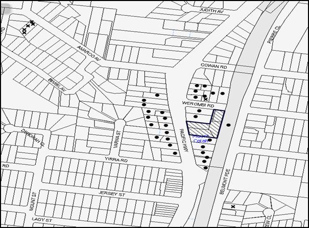
|
NOTIFICATION PLAN |
|
||
|
• PROPERTIES NOTIFIED
|
X SUBMISSIONS RECEIVED |
PROPERTY SUBJECT OF DEVELOPMENT |
|
|
ONE SUBMISSION RECEIVED OUT OF MAP RANGE |
|||
Eight submissions objected to the development, generally on the grounds that the development would result in:
· Unacceptable traffic on Werombi Road and local streets;
· Inadequate parking on the site for the residents;
· Unacceptable overshadowing of adjoining properties; and
· Development that is excessive in bulk and scale and out of character with the 2-storey buildings in the area.
The submissions also made the following observations:
· Werombi Road is not capable of accommodating the proposed developments;
· The cumulative traffic impact and disruptions in the event of emergency situations due to multiple development application for five storey developments within the precinct should be considered;
· The traffic survey submitted with the proposal is inadequate as it does not address the effects of emergency incidents on the Pacific Highway, including road accidents or bushfires;
· Mount Colah does not have adequate infrastructure to cater for this development;
· The proposal does not include any 3-br units; and
· The development would result in accumulation of garbage along the frontage of the site.
The merits of the matters raised in community submissions have been addressed in the body of the report with the exception of the following:
5.1.1 Inadequate Infrastructure
Concerns are raised that existing infrastructure is inadequate to cater for an increased population. In particular, the traffic assessment did not consider the impact of the additional units when there was an emergency/ closure on the M1 and traffic was rerouted to the Pacific Highway. In addition, concerns were raised that additional units would increase on-street parking and traffic congestion.
The suitability of the locality for high density residential development was considered by Council and the Department of Planning during the rezoning of the precinct. Weight must be given to the applicable zoning of the land in the resolution of a dispute as to the appropriate development of any site.
The volume of on-site parking provided is in accordance with the HDCP and meets the demand of future residents plus visitors. Additionally conditions of consent are recommended requiring the upgrade of Werombi Road to accommodate the additional traffic. The matter is discussed in Section 2.10.11 of this report.
Conditions of consent require the applicant to demonstrate that the satisfactory arrangements have been made with Telstra and Ausgrid to service the proposed development. A Certificate from Sydney Water is also required to be provided demonstrating the development has been connected to the exiting sewer infrastructure in the locality.
5.1.2 Development Inconsistent with the Existing Character of the Area
Concerns are raised that the development’s built form is not consistent with the existing village character of the area. The Land and Environment Court planning principle regarding the “assessment of height and bulk” as described in Veloshin v Randwick Council [2007] NSWLEC 428 advises that the appropriateness of a proposal’s height and bulk is most usefully assessed against planning controls related to these attributes, such as maximum height, floor space ratio, site coverage and setbacks. The planning controls for the five storey precinct are aimed at creating a new character for the precinct. Therefore, the planning principle requires that the development be consistent with the bulk and character intended by the planning controls. As previously discussed, the development is consistent with the desired future character for the precinct identified in the HDCP.
5.1.3 Unit Mix
Concerns are raised regarding the exclusion of 3-bedroom units. The initial proposal did not include any 3-bedrom units. Following Council’s concerns regarding the unit mix, the application has been amended to include eight x 3-bedroom units to comply with the unit mix requirements of the HDCP.
5.2 Public Agencies
The development application was referred to the following Public Agencies for comment.
5.2.1 RailCorp
The application was referred to RailCorp pursuant to the provisions of SEPP Infrastructure as the development involves excavation of land adjacent to a railway corridor. RailCorp raised no objections subject to the recommendation of a deferred commencement condition requiring the submission of the following information:
· Detailed Geotechnical Report and Structural Drawings;
· Detailed Survey Plans; and
· Detailed cross-sectional drawings showing relationship of the land and the railway infrastructure.
Additionally RailCorp has also recommended conditions requiring awning windows, louvres, enclosed balconies, window restrictors etc. within 20m of rail corridor to restrict throwing of objects; submission of an electrolysis report and aerial craneage details.
5.2.2 Roads and Maritime Services
The proposal was referred to the Roads and Maritime Services for comments pursuant to the provisions of SEPP (Infrastructure). No objections were raised subject to recommended conditions of consent.
6. THE PUBLIC INTEREST
Section 79C(1)(e) of the Act requires Council to consider “the public interest”.
The public interest is an overarching requirement, which includes the consideration of the matters discussed in this report. Implicit to the public interest is the achievement of future built outcomes adequately responding to and respecting the future desired outcomes expressed in environmental planning instruments and development control plans.
The application is considered to have satisfactorily addressed Council’s and relevant agencies’ criteria and would provide a development outcome that, on balance, would result in a positive impact for the community. Accordingly, it is considered that the approval of the proposed development would be in the public interest.
CONCLUSION
The application seeks approval for the demolition of existing structures and construction of three, five storey residential flat buildings comprising 73 units and basement car parking. The site adjoins a heritage item to the north and west.
The proposed development is generally in accordance with the development controls for the ‘Pacific Highway, Mount Colah’ Precinct of the HDCP and would contribute to the future desired five storey residential character of the precinct whilst retaining the heritage values of the adjoining item. The proposal complies with the design principles of SEPP 65 and the Residential Flat Design Code.
The proposal would result in a development that would be in keeping with the desired future character of the precinct. Approval of the application as a deferred commencement is recommended.
Note: At the time of the completion of this planning report, no persons have made a Political Donations Disclosure Statement pursuant to Section 147 of the Environmental Planning and Assessment Act 1979 in respect of the subject planning application.
RESPONSIBLE OFFICER
The officer responsible for the preparation of this Report is the Manager – Development Assessments – Rodney Pickles, who can be contacted on 9847 6731.
|
Rod Pickles Manager - Development Assessment Planning Division |
James Farrington Group Manager Planning Division |
|
1.View |
Locality Map |
|
|
|
2.View |
Site Plan |
|
|
|
3.View |
Floor Plans |
|
|
|
4.View |
Elevations and Sections |
|
|
|
5.View |
Landscape Plan |
|
|
|
6.View |
Shadow Diagram Plans |
|
|
|
7.View |
Photomontage |
|
|
File Reference: DA/708/2014
Document Number: D05971694
SCHEDULE 1
GENERAL CONDITIONS
The conditions of consent within this notice of determination have been applied to ensure that the use of the land and/or building is carried out in such a manner that is consistent with the aims and objectives of the relevant legislation, planning instruments and council policies affecting the land and does not disrupt the amenity of the neighbourhood or impact upon the environment.
Note: For the purpose of this consent, the term ‘applicant’ means any person who has the authority to act on or the benefit of the development consent.
Note: For the purpose of this consent, any reference to an Act, Regulation, Australian Standard or publication by a public authority shall be taken to mean the gazetted Act or Regulation, or adopted Australian Standard or publication as in force on the date that the application for a construction certificate is made.
1. Deferred Commencement
Pursuant to Section 80(3) of the Environmental Planning and Assessment Act 1979, this consent does not operate until the applicant satisfies the Council that it has obtained approval/certification from Sydney Trains as to the following matters:
a) Final Geotechnical and Structural report/drawings: The Geotechnical Report must be based on actual borehole testing conducted on the site closest to the rail corridor. The Structural drawings/report shall include excavation and construction sequencing, revised retaining wall design indicating sectional forces, pressures behind the wall and wall deflections, and footing layout plan showing the type of footings, founding depths and founding materials.
b) Final Construction methodology with construction details pertaining to structural support during excavation.
c) Final cross sectional drawings showing ground surface, rail tracks, sub soil profile, proposed basement excavation and structural design of sub ground support adjacent to the Rail Corridor. All measurements are to be verified by a Registered Surveyor.
d) Detailed Survey Plan showing the relationship of the proposed developed with respect to Sydney Trains land and infrastructure.
e) A numerical (i.e. finite element) analysis which assesses the different stages of loading-unloading of the site, ground movement and its effect on the rock mass surrounding the rail corridor.
Such information shall be submitted within 24 months of the date of this notice.
Upon Council’s written satisfaction of the above information, the following conditions of development consent will apply:
2. Approved Plans and Supporting Documentation
The development must be carried out in accordance with the plans and documentation listed below and endorsed with Council’s stamp, except where amended by Council and/or other conditions of this consent:
|
Plan No. |
Plan Title |
Drawn by |
Dated |
|
DA-100 D |
Site/Roof Plan |
Laurie Liskoswski Architect |
9/07/2015 |
|
DA-101 D |
Carpark B1 and B2 |
Laurie Liskoswski Architect |
9/07/2015 |
|
DA-102 D |
Ground Floor Plan |
Laurie Liskoswski Architect |
9/07/2015 |
|
DA-103 D |
First Floor Plan |
Laurie Liskoswski Architect |
9/07/2015 |
|
DA-104 D |
Second Floor Plan |
Laurie Liskoswski Architect |
9/07/2015 |
|
DA-105 D |
Third Floor Plan |
Laurie Liskoswski Architect |
9/07/2015 |
|
DA-106 D |
Fourth Floor Plan |
Laurie Liskoswski Architect |
9/07/2015 |
|
DA-107 D |
Fifth Floor Plan |
Laurie Liskoswski Architect |
9/07/2015 |
|
DA-200 D |
Elevations |
Laurie Liskoswski Architect |
9/07/2015 |
|
DA-201 D |
Elevations |
Laurie Liskoswski Architect |
9/07/2015 |
|
DA-300 D |
Sections |
Laurie Liskoswski Architect |
9/07/2015 |
|
DA-301 D |
Sections |
Laurie Liskoswski Architect |
9/07/2015 |
|
LPDA 14-349/1 D |
Landscape Plan |
Conzept Architects |
18/06/2015 |
|
LPDA 14-349/2 A |
Landscape Details |
Conzept Architects |
13/06/2014 |
|
SK000 - C |
Cover Sheet |
Martens And Associates |
25/05/2015 |
|
SK001 - C |
Concept Stormwater-Ground Level |
Martens And Associates |
10/06/2015 |
|
SK002 - C |
Concept Stormwater-Basement Level 1 |
Martens And Associates |
25/05/2015 |
|
SK003 - C |
Concept Stormwater-Basement Level 2 |
Martens And Associates |
25/05/2015 |
|
SK004 - C |
OSD 1 and 2 Plan Detail |
Martens And Associates |
25/05/2015 |
|
SK005 - C |
OSD 1 Section Detail |
Martens And Associates |
25/05/2015 |
|
SK006 - C |
OSD 2 Section Plan Detail |
Martens And Associates |
25/05/2015 |
|
SK007 - C |
Drains Modelling |
Martens And Associates |
25/05/2015 |
|
SK008 - C |
Typical Drainage Details |
Martens And Associates |
25/05/2015 |
|
Document Title |
Prepared by |
Dated |
|
Traffic and Parking Assessment Report |
Terrafic Pty Ltd |
25/06/2014 |
|
Acoustic Noise and Vibration Report |
Acoustic Solutions Pty Ltd |
30/05/2014 |
|
Arboricultural Impact Report |
Landscape Matrix Pty Ltd |
5/06/2014 |
|
Waste Management Plan |
Mackenzie Architects International |
13/06/2014 |
|
Statement of Compliance Access for People with a Disability |
Accessible Building Solutions |
23/05/2014 |
|
Statement of Heritage Impact |
NBRS + Partners |
June 2014 |
|
SEPP 65 Amenity Compliance Report Rev A |
Steve King |
23/04/2015 |
|
Shadow Diagrams DA 500-502 A |
Mackenzie Architects |
Received by Council on 7/07/2014 |
|
Statement of Environmental Effects |
Think Planners |
25/06/2014 |
|
Design Verification Statement |
Laurie Liskoswski |
30/06/2015 |
|
BASIX Certificate 648113M |
Eco Certificates Pty Ltd |
14/07/2015 |
|
Nathers Certificate |
Eco Certificates Pty Ltd |
12/07/2015 |
|
Photomontage |
Laurie Liskoswski Architect |
Received by Council on 30/06/2015 |
|
Schedule of Materials and Finishes |
Laurie Liskoswski Architect |
Received by Council on 30/06/2015 |
|
Water Quality Assessment Report |
Martens And Associates |
12/06/2015 |
3. Removal of Existing Trees
This development consent permits the removal of 32 trees numbered 1, 2, 3, 4, 5, 6, 7, 8, 15, 16, 23, 24, 26, 27, 28, 29, 30, 31, 32, 33, 34, 35, 36, 37, 38, 39, 40, 41, 42, 43, 44 and 46 as identified on the approved Landscape Plan LPDA-14-349/1 Issue D prepared by Conzept Landscape Architects dated 18/06/2015. The removal of any other trees requires separate approval in accordance with the Tree and Vegetation Chapter 1B.6 Hornsby Development Control Plan 2013 (HDCP).
4. Amendment of Plans
a) The approved ‘Basement Plan’ must be amended by adding a ‘Volume handling equipment’ such as a minimum of 2x660L bins (linear or carousel), to the garbage chute system of Building C.
b) The size of the terrace to Unit 3 at the ground level of Block A (fronting the heritage item) be reduced, as marked on the approved Ground Floor Plan, to provide for a 4m wide landscaped area at this location.
c) An additional large tree, “Toona cillata” (minimum pot size 1 litre) is to be added along the northern boundary of the communal open space to provide further screening for the heritage item, as marked on the approved Landscape Plan.
d) 1.2m high screen planting is to be provided in between the children’s play area and the terrace to Unit 2 of Block B.
5. Construction Certificate
a) A Construction Certificate is required to be approved by Council or a Private Certifying Authority prior to the commencement of any works under this consent.
b) The Construction Certificate plans must not be inconsistent with the Development Consent plans.
6. Section 94 Development Contributions
a) In accordance with Section 80A(1) of the Environmental Planning and Assessment Act 1979 and the Hornsby Shire Council Section 94 Development Contributions Plan 2012-2021, the following monetary contributions shall be paid to Council to cater for the increased demand for community infrastructure resulting from the development:
|
Description |
Contribution (4) |
|
Roads |
$ 32,785.00 |
|
Open Space and Recreation |
$ 788,716.60 |
|
Community Facilities |
$ 109,929.65 |
|
Plan Preparation and Administration |
$ 3,267.55 |
|
TOTAL |
$934,698.80 |
being for 32 x 1-br, 33 x 2-br and 8 x 3-br units with a credit for 4 existing lots.
b) The value of this contribution is current as at 9 July 2015. If the contributions are not paid within the financial quarter that this condition was generated, the contributions payable will be adjusted in accordance with the provisions of the Hornsby Shire Council Section 94 Development Contributions Plan and the amount payable will be calculated at the time of payment in the following manner:
$CPY = $CDC x CPIPY
CPIDC
Where:
$CPY is the amount of the contribution at the date of Payment
$CDC is the amount of the contribution as set out in this Development Consent
CPIPY is the latest release of the Consumer Price Index (Sydney – All Groups) at the date of Payment as published by the ABS.
CPIDC is the Consumer Price Index (Sydney – All Groups) for the financial quarter at the date applicable in this Development Consent Condition.
c) The monetary contributions shall be paid to Council:
i) prior to the issue of the Subdivision Certificate where the development is for subdivision; or
ii) prior to the issue of the first Construction Certificate where the development is for building work; or
iii) prior to issue of the Subdivision Certificate or first Construction Certificate, whichever occurs first, where the development involves both subdivision and building work; or
iv) prior to the works commencing where the development does not require a Construction Certificate or Subdivision Certificate.
It is the professional responsibility of the Principal Certifying Authority to ensure that the monetary contributions have been paid to Council in accordance with the above timeframes.
Council’s Development Contributions Plan may be viewed at www.hornsby.nsw.gov.au or a copy may be inspected at Council’s Administration Centre during normal business hours.
REQUIREMENTS PRIOR TO THE ISSUE OF A CONSTRUCTION CERTIFICATE
7. Building Code of Australia
All building work must be carried out in accordance with the relevant requirements of the Building Code of Australia.
8. Contract of Insurance (Residential Building Work)
In the case of residential building work for which the Home Building Act 1989 requires there to be a contract of insurance in force in accordance with Part 6 of that Act, that such a contract of insurance is in force before any building work authorised to be carried out by the consent commences.
9. Notification of Home Building Act, 1989 Requirements
Residential building work within the meaning of the Home Building Act 1989 must not be carried out unless the principal certifying authority for the development to which the work relates (not being Council) has given Council written notice of the following information:
a) In the case of work for which a principal contractor is required to be appointed:
i) The name and licence number of the principal contractor; and
ii) The name of the insurer by which the work is insured under Part 6 of that Act.
b) In the case of work to be done by an owner-builder:
i) The name of the owner-builder; and
ii) If the owner-builder is required to hold an owner-builder’s permit under that Act, the number of the owner-builder’s permit.
Note: If arrangements for doing the residential building work are changed while the work is in progress so that the information notified becomes out of date, further work must not be carried out unless the principal certifying authority for the development to which the work relates (not being Council) has given Council written notification of the updated information.
10. Noise
The development must be carried out in accordance with the recommendations contained within the acoustic report submitted with the development application, titled, prepared by SLR and dated 05.12.2014 and the requirements of the Department of Planning’s Development Near Rail Corridors and Busy Roads – Interim Guideline and RailCorp’s Interim Guidelines for Applicants.
Note: The Department of Planning’s document is available at www.planning.nsw.gov.au (development assessments).
11. Utility Services
The applicant must submit written evidence of the following service provider requirements:
a) Ausgrid (formerly Energy Australia) – a letter of consent demonstrating that satisfactory arrangements have been made to service the proposed development.
b) Telstra – a letter of consent demonstrating that satisfactory arrangements have been made to service the proposed development.
12. Dilapidation Report
A ‘Dilapidation Report’ is to be prepared by a ‘chartered structural engineer’ detailing the structural condition of No. 534 Pacific Highway, Mount Colah.
13. Adaptable Units/Letter Boxes/Acoustics
The following details must be provided with the Construction Certificate plans.
a) The development is required to provide 25 units designed as adaptable housing pursuant to the requirements of 1C.2.2 of the Hornsby Development Control Plan 2013. In this regard, eight (8) car parking spaces are to be designed for people with a disability and allocated to 8 adaptable units.
b) The waste facility provided at each residential level for all the three buildings must be accessible by persons with a disability.
c) The letter boxes must be located as shown on the approved LPDA 14-349/1 Issue D.
d) The recommendations within the Acoustic Noise and Vibration Report prepared by Acoustic Solutions Pty Ltd dated 30/05/2014 must be incorporated.
14. Storage
Each dwelling within the development must have a minimum area for storage (not including kitchen and bedroom cupboards) for 6m3 for one bedroom units, 8m3 for two bedroom units and 10m3 for three bedroom units, where 50% is required to be located within the apartment and accessible from either the hall or living area. Details must be submitted with the Construction Certificate plans.
15. Traffic Control Plan
A Traffic Control Plan (TCP) must be prepared by a qualified traffic controller in accordance with the Roads & Traffic Authority’s Traffic Control at Worksites Manual 1998 and Australian Standard 1742.3 for all work on a public road. The Traffic Management Plan shall be submitted and approved by Council’s Manager Traffic and Road Safety prior to the issue of a construction certificate. The TCP must detail the following:
a) Arrangements for public notification of the works;
b) Temporary construction signage;
c) Permanent post-construction signage;
d) Vehicle movement plans;
e) Traffic management plans;
f) Pedestrian and cyclist access/safety.
The Traffic Control Plan shall be submitted to Council for approval prior to the issue of the Construction Certificate.
16. Construction Management Plan
A Construction Management Plan (CMP), prepared by a suitably qualified consultant, must be submitted for approval by Council. The CMP must be include, but not be limited, details of the following:
a) Noise attenuation measures be implemented along the northern and eastern boundary of the site (adjoining No. 534 Pacific Highway) including a hoarding height not less than 3m from the existing ground level;
b) During excavation works, rock removal must be undertaken by sawing instead of rock hammering, wherever practicable;
c) All construction vehicles associated with the proposed development are to be contained on site as no construction zones will be permitted on Pacific Highway or Werombi Road in the vicinity of the site;
d) The construction works must be undertaken in accordance with the “Interim Construction Noise Guidelines – 2009” published by DECCW and achieve compliance with the relevant noise levels; and
e) The delivery times and vehicular movements related to demolition, excavation and construction works must be restricted to the construction hours only.
17. Internal Driveway/Vehicular Areas
The driveway and parking areas on site must be designed in accordance with Australian Standards 2890.1, 2890.2, 3727 and the following requirements:
a) Design levels at the front boundary must be obtained from Council;
b) The driveway must be a rigid pavement;
c) Conduit for utility services including electricity, water, gas and telephone must be provided; and
d) The first 6m of the driveway and ramp between the waste collection vehicle (Small Rigid Vehicle) parking area and the garbage collection room must not have a gradient steeper than 1:20 (5%).
18. Driveway Longitudinal Sections
Longitudinal sections along both sides of the access driveway shall be submitted to the principal certifying authority in accordance with the relevant sections of AS 2890.1 and the following requirements:
a) The maximum grade shall not exceed 1 in 4 (25%) with the maximum changes of grade of 1 in 8 (12.5%) for summit grades and 1 in 6.7 (15%) for sag grades. Any transition grades shall have a minimum length of 2 metres. The longitudinal sections shall incorporate the design levels obtained by Council.
Note: A construction certificate shall be obtained prior to the commencement of these works and are to be completed prior to the issue of an occupation certificate.
19. Sydney Water – Quick Check
This application must be submitted to a Sydney Water ‘Quick Check Agent’ or ‘Customer Centre’ for approval to determine whether the development would affect any Sydney Water infrastructure, and whether further requirements are to be met.
Note: Refer to www.sydneywater.com.au or telephone 13 20 92 for assistance.
20. Waste Management Plan
Waste Management Plan Section One – Demolition Stage and Section Three – Construction Stage, covering the scope of this project and including the following details, is required to be submitted to Council:
a) An estimate of the types and volumes of waste and recyclables to be generated;
b) A site plan showing sorting and storage areas for demolition and construction waste and the vehicle access to these areas;
c) How excavation, demolition and construction waste materials will be reused or recycled and where residual wastes will be disposed; and
d) The total percentage (by weight) of demolition and construction waste that will be reused or recycled.
REQUIREMENTS PRIOR TO THE COMMENCEMENT OF ANY WORKS
21. Erection of Construction Sign
A sign must be erected in a prominent position on any site on which building work, subdivision work or demolition work is being carried out:
a) Showing the name, address and telephone number of the principal certifying authority for the work;
b) Showing the name of the principal contractor (if any) for any demolition or building work and a telephone number on which that person may be contacted outside working hours; and
c) Stating that unauthorised entry to the work site is prohibited.
Note: Any such sign is to be maintained while the building work, subdivision work or demolition work is being carried out, but must be removed when the work has been completed.
22. Protection of Adjoining Areas
A temporary hoarding, fence or awning must be erected between the work site and adjoining lands before the works begin and must be kept in place until after the completion of the works if the works:
a) Could cause a danger, obstruction or inconvenience to pedestrian or vehicular traffic.
b) Could cause damage to adjoining lands by falling objects.
c) Involve the enclosure of a public place or part of a public place.
Note: Notwithstanding the above, Council’s separate written approval is required prior to the erection of any structure or other obstruction on public land.
23. Toilet Facilities
Toilet facilities must be available or provided at the works site before works begin and must be maintained until the works are completed at a ratio of one toilet for every 20 persons employed at the site. Each toilet must:
a) be a standard flushing toilet connected to a public sewer; or
b) be a temporary chemical closet approved under the Local Government Act 1993; or
c) have an on-site effluent disposal system approved under the Local Government Act 1993.
24. Erosion and Sediment Control
Erosion and sediment control measures must be provided and maintained throughout the construction period in accordance with the manual ‘Soils and Construction 2004 (Bluebook)’, the approved plans, Council specifications and to the satisfaction of the principal certifying authority. The erosion and sediment control devices must remain in place until the site has been stabilised and revegetated.
Note: On the spot penalties may be issued for any non-compliance with this requirement without any further notification or warning.
25. Tree Protection Barriers
Tree protection fencing must be erected around trees numbered 9, 10, 11, 12, 13, 14, 17, 18, 19, 20, 21, 22 and 25 to be retained at setbacks specified below.
The tree fencing must be constructed of 1.8 metre ‘cyclone chainmesh fence’ or star pickets spaced at 2 metre intervals, connected by a continuous high-visibility barrier/hazard mesh at a height of 1 metre.
|
Tree No. |
Tree Species |
Tree Protection Zone (TPZ) |
|
9 |
Archontophoenix alexandrae |
3 metres |
|
10 |
Pittosporum eugenioides |
3 metres |
|
11 |
Cedrus atlantica |
3.6 metres |
|
12 |
Jacaranda mimosifolia |
4 metres |
|
13 |
Grevillea robusta |
6 metres |
|
14 |
Lophostemon confertus |
6 metres |
|
17 |
Juniperus chinensis |
10.8 metres |
|
18 |
Chamaecyparis obtuse |
4 metres |
|
19 |
Populus deltoides |
6 metres |
|
20 |
Populus deltoides |
6 metres |
|
21 |
Populus deltoides |
6 metres |
|
22 |
Populus deltoides |
3 metres |
|
25 |
Lagerstroemia indica |
4 metres |
26. Project Arborist
A Project Arborist is to be appointed in accordance with AS 4970-2009 (1.4.4) to provide monitoring and certification throughout the development process.
REQUIREMENTS DURING CONSTRUCTION
27. Construction Work Hours
All work on site (including demolition and earth works) must only occur between 7am and 5pm Monday to Saturday. No work is to be undertaken on Sundays or public holidays. No excavation or rock sawing/breaking is to occur on Saturdays.
28. Demolition
All demolition work must be carried out in accordance with “Australian Standard 2601-2001 – The Demolition of Structures” and the following requirements:
a) Demolition material must be disposed of to an authorised recycling and/or waste disposal site and/or in accordance with an approved waste management plan;
b) Demolition works, where asbestos material is being removed, must be undertaken by a contractor that holds an appropriate licence issued by WorkCover NSW in accordance with Chapter 10 of the Occupational Health and Safety Regulation 2001 and Clause 29 of the Protection of the Environment Operations (Waste) Regulation 2005 ;and
c) On construction sites where buildings contain asbestos material, a standard commercially manufactured sign containing the words ‘DANGER ASBESTOS REMOVAL IN PROGRESS’ measuring not less than 400mm x 300mm must be erected in a prominent position visible from the street.
29. Environmental Management
The site must be managed in accordance with the publication ‘Managing Urban Stormwater – Landcom (March 2004) and the Protection of the Environment Operations Act 1997 by way of implementing appropriate measures to prevent sediment run-off, excessive dust, noise or odour emanating from the site during the construction of the development.
30. Asbestos and Soil Contamination
Should the presence of asbestos or soil contamination, not recognised during the application process be identified during works, the applicant must immediately notify the principal certifying authority and Council.
31. Street Sweeping
Street sweeping must be undertaken following sediment tracking from the site along Pacific Highway and Werombi Road during works and until the site is established.
The street cleaning services must undertake a street ‘scrub and dry’ method of service and not a dry sweeping service that may cause sediment tracking to spread or cause a dust nuisance.
32. Works Near Trees
a) All required tree protection measures are to be maintained in good condition for the duration of the construction period.
b) All works (including driveways and retaining walls) within the specified Tree Protection zones any trees required to be retained (whether or not on the subject property, and pursuant to this consent or the Tree Preservation Order), must be carried out under the supervision of an ‘AQF Level 5 Arborist’ and a certificate submitted to the principal certifying authority detailing the method(s) used to preserve the tree(s).
c) All personnel (the applicant, contractors, service providers, principal certifying authority) involved with this development are to ensure that no excavation, including sub-surface trenching for stormwater or other services or the filling or stockpiling of building materials, parking of vehicles or plant, the use of machinery other than hand held, disposal of cement slurry, waste water or other contaminants is to occur within the Tree Root Zones as prescribed in the HDCP Section 1B.6.1(i) of any tree to be retained.
33. Project Arborist
During the construction phase of the development the Project Arborist must regularly (monthly) assess the condition of trees and the growing environment and make recommendations for, and if necessary carry out remedial action to ensure the health and vigour of the trees. A certificate must be submitted by the Project Arborist to the principal certifying authority detailing why remedial action is being undertaken and the methods used to preserve the trees.
34. Council Property
During construction works, no building materials, waste, machinery or related matter is to be stored on the road or footpath. The public reserve must be kept in a clean, tidy and safe condition at all times.
35. Disturbance of Existing Site
During construction works, the existing ground levels of open space areas and natural landscape features, (including natural rock-outcrops, vegetation, soil and watercourses) must not be altered unless otherwise nominated on the approved plans.
36. Landfill
Landfill must be constructed in accordance with Council’s ‘Construction Specification 2005’ and the following requirements:
a) All fill material imported to the site is to wholly consist of Virgin Excavated Natural Material (VENM) as defined in Schedule 1 of the Protection of the Environment Operations Act 1997 or a material approved under the Department of Environment and Climate Change’s general resource recovery exemption.
b) A compaction certificate is to be obtained from a geotechnical engineer verifying that the specified compaction requirements have been met.
37. Excavated Material
All excavated material removed from the site must be classified in accordance with the Department of Environment, Climate Change and Water NSW Waste Classification Guidelines prior to disposal to an approved waste management facility and reported to the principal certifying authority.
38. Survey Report
A report(s) must be prepared by a registered surveyor and submitted to the principal certifying authority:
a) Prior to the pouring of concrete at each level of the building certifying that:
i) The building, retaining walls and the like have been correctly positioned on the site; and
ii) The finished floor level(s) are in accordance with the approved plans.
b) Confirming that the waste collection vehicle turning area complies with AS2890.1 – 2004 and AS20890.2 – 2002 for small rigid vehicles (SRV).
39. Waste Management Details
Waste management during the demolition and construction phase of the development must be undertaken in accordance with the approved Waste Management Plan. Additionally written records of the following items must be maintained during the removal of any waste from the site and such information submitted to the Principal Certifying Authority within fourteen days of the date of completion of the works:
a) The identity of the person removing the waste.
b) The waste carrier vehicle registration.
c) Date and time of waste collection.
d) A description of the waste (type of waste and estimated quantity).
e) Details of the site to which the waste is to be taken.
f) The corresponding tip docket/receipt from the site to which the waste is transferred (noting date and time of delivery, description (type and quantity) of waste).
g) Whether the waste is expected to be reused, recycled or go to landfill.
Note: In accordance with the Protection of the Environment Operations Act 1997, the definition of waste includes any unwanted substance, regardless of whether it is reused, recycled or disposed to landfill.
REQUIREMENTS PRIOR TO THE ISSUE OF AN OCCUPATION CERTIFICATE
Note: For the purpose of this consent, a reference to ‘occupation certificate’ shall not be taken to mean an ‘interim occupation certificate’ unless otherwise stated.
40. Fulfilment of BASIX Commitments
The applicant must demonstrate the fulfilment of BASIX commitments pertaining to the development.
41. Sydney Water – s73 Certificate
An s73 Certificate must be obtained from Sydney Water.
Note: Sydney Water requires that s73 applications are to be made through an authorised Sydney Water Servicing Coordinator. Refer to www.sydneywater.com.au or telephone 13 20 92 for assistance.
42. Stormwater Drainage
The stormwater drainage system for the development must be designed and constructed for an average recurrence interval of 20 years and be gravity drained in accordance with in the approved plans, Council’s Civil Works – Design and Construction Specification 2005 and the following requirements:
a) Connected directly to the street drainage systems at Werombi Road and Pacific Highway via an on-site detention system and the approved water quality treatment facility.
b) Details must be submitted with the Construction Certificate Plans.
Note 1: A separate construction certificate is to be submitted to Council for connection of the stormwater pipe from the development site to the Council system.
Note 2: Council is the only authority to approve works within the Road Reserve.
43. On Site Stormwater Detention
An on-site stormwater detention system must be designed by a chartered civil engineer and constructed in accordance with the following requirements:
a) Have a storage capacity to accommodate volume up to 20 years ARI (average recurrence interval) and a maximum discharge (when full) limited to 5 years pre development rate.
b) Have a surcharge/inspection grate located directly above the outlet.
c) Discharge from the detention system to be controlled via 1 metre length of pipe, not less than 50 millimetres diameter or via a stainless plate with sharply drilled orifice bolted over the face of the outlet discharging into a larger diameter pipe capable of carrying the design flow to an approved Council system.
d) Where above ground and the average depth is greater than 0.3 metres, a ‘pool type’ safety fence and warning signs to be installed.
e) Not be constructed in a location that would impact upon the visual or recreational amenity of residents.
f) Details must be submitted with the Construction Certificate Plans.
44. Water Quality Treatment/Bio-Retention System
a) Stormwater discharging from the development site is to be treated to achieve the quality specified in Council’s Development Control Plan 2012 (table 1C.1.2(b) Urban Stormwater Quality Targets).
b) Prior to occupation of the premises, a Chartered Civil/Hydraulic Engineer of the Institution of Engineers, Australia is to certify that works have been completed in accordance with the approved construction plan and the measures will achieve the targets specified in the condition.
45. Internal Driveway/Vehicular Areas
The driveway and parking areas on site must be designed in accordance with Australian Standards 2890.1, 2890.2, 3727 and the following requirements:
a) The driveway to be designed in accordance with Condition 19 of this development consent;
b) All parking areas and driveways are to be sealed to an all-weather standard, line marked and signposted;
c) Residential parking spaces are to be secure spaces with access controlled by card or numeric pad;
d) Visitors are to be able to access the basement car park by an audio/visual intercom system located at the top of the ramped driveway.
e) Twenty-three bicycle spaces (resident and visitor) are to be provided in the basement car park. Bicycle parking spaces are to be designed in accordance with AS 2890.3-1993;
f) Two motorcycle parking spaces are to be provided within the basement car park, designed in accordance with AS 2890.5-1993;
g) All parking for people with disabilities is to comply with AS/NZS 2890.6:2009 Off-street parking for people with disabilities; and
h) Garbage Truck access to the site be provided in accordance with the approved plans.
46. Vehicular Crossing
A separate application under the Local Government Act 1993 and the Roads Act 1993 must be submitted to Council for the installation of a new vehicular crossing and the removal of the redundant crossing. The vehicular crossing must be constructed in accordance with Council’s Civil Works Design 2005 and the following requirements:
a) Any redundant crossings must be replaced with integral kerb and gutter;
b) The footway area must be restored by turfing;
c) Approval must be obtained from all relevant utility providers that all necessary conduits be provided and protected under the crossing; and
d) Details must be submitted with the Construction Certificate Plans.
Note: An application for a vehicular crossing can only be made to one of Council’s Authorised Vehicular Crossing Contractors. You are advised to contact Council on 02 9847 6940 to obtain a list of contractors.
47. Road Works
a) The length of Werombi Road fronting the site needs to be reconstructed/upgraded to the following standards:
i) Half width of the 11m carriageway (from kerb to kerb) is to be constructed and centred between road boundaries;
ii) Half of the 15m diameter cul-de-sac is to be constructed;
iii) The existing road pavement to be saw cut a minimum of 300mm from the existing edge of the bitumen and reconstructed;
iv) Existing pavement must be replaced where inadequate;
v) Existing kerb and gutter are to be replaced and new footpath constructed;
vi) Appropriate transition must be made to adjoining kerb and gutter; and
b) All road works approved under this consent must be constructed in accordance with Council’s Civil Works Design and Construction Specification 2005
c) A construction certificate is to be submitted to Council for approval
d) All details must be submitted with the Construction Certificate Plans.
48. Creation of Easements
The following matter(s) must be nominated on the plan of subdivision under s88B of the Conveyancing Act 1919:
a) The creation of an appropriate "Positive Covenant" and "Restriction as to User" over the constructed on-site detention and bio-retention systems and outlet works, within the lots in favour of Council in accordance with Council’s prescribed wording. The position of the on-site detention and bio-retention systems are to be clearly indicated on the title.
b) To register the OSD easement, the restriction on the use of land “works-as-executed” details of the on-site-detention and bio-retention systems must be submitted verifying that the required storage and discharge rates have been constructed in accordance with the design requirements. The details must show the invert levels of the onsite system together with pipe sizes and grades and details of the bio-retention system. Any variations to the approved plans must be shown in red on the “works-as-executed” plan and supported by calculations.
Note: Council must be nominated as the authority to release, vary or modify any easement, restriction or covenant.
49. Works as Executed Plan
A works-as-executed plan(s) must be prepared by a registered surveyor and submitted to Council for completed road pavement, kerb & gutter, public drainage systems, driveways and on-site detention system.
50. Damage to Council Assets
Any damage caused to Council’s assets as a result of the construction or demolition of the development must be rectified in accordance with Council’s Civil Works Specifications. Council’s Restorations Supervision must be notified for a formwork inspection prior to pouring concrete.
51. Garbage Collection Easement
For the purpose of waste collection, an easement entitling Council, its servants and agents and persons authorised by it to enter upon the subject land and to operate thereon, vehicles and other equipment for the purposes of garbage collection must be granted to Council by the owner of the land.
Note: The easement must be in a form prescribed by Council and must include covenants to the effect that parties will not be liable for any damage caused to the subject land or any part thereof or to any property located therein or thereon by reason of the operation thereon of any vehicle or other equipment used in connection with the collection of garbage and to the effect that the owner for the time being of the subject land shall indemnify the Council, its servants, agents and persons authorised by it to collect garbage against liability in respect of any such claims made by any person whomsoever.
52. Waste Management
The following waste management requirements must be complied with:
a) The bin storage rooms at the basement level must include water or a hose for cleaning, graded floors with drainage to sewer, robust doors, sealed and impervious surface, adequate lighting and ventilation, and must be lockable. The waste facility rooms/cupboards at each residential level must include sealed and impervious surface, adequate lighting and ventilation.
b) A report must be prepared by an appropriately qualified person, certifying the following:
i) A comparison of the estimated quantities of each waste type against the actual quantities of each waste type.
Note: Explanations of any deviations to the approved Waste Management Plan is required to be included in this report.
ii) That at least 60% of the waste generated during the demolition and construction phase of the development was reused or recycled.
Note: If the 60% diversion from landfill cannot be achieved in the Construction Stage, the Report is to include the reasons why this occurred and certify that appropriate work practices were employed to implement the approved Waste Management Plan. The Report must be based on documentary evidence such as tipping dockets/receipts from recycling depots, transfer stations and landfills, audits of procedures etc. which are to be attached to the report.
iii) All waste was taken to site(s) that were lawfully permitted to accept that waste.
c) Each unit must be provided with an indoor waste/recycling cupboard for the interim storage of a minimum one day’s waste generation with separate containers for general waste and recyclable materials.
d) Space must be provided for either individual compost containers for each unit or a communal compost container;
Note: The location of the compost containers should have regard for potential amenity impacts.
e) A bulky waste storage area of at least 8m2 is to be identified and marked with paint and signage.
f) The bin carting routes must be devoid of any steps.
Note: Ramps between different levels are acceptable.
g) The bin carting route between the garbage collection area and the truck parking location must not be steeper than 1:20 (5%).
h) Prior to an Occupation Certificate being issued or the use commencing, whichever is earlier, the Principal Certifying Authority must obtain Council’s approval of the waste and recycling management facilities provided in the development and ensure arrangements are in place for domestic waste collection by Council.
53. External Lighting
All external lighting must be designed and installed in accordance with Australian Standard AS 4282 – Control of the Obtrusive Effects of Outdoor Lighting. Certification of compliance with the Standard must be obtained from a suitably qualified person.
54. Unit Numbering
The allocation of unit numbering must be authorised by Council prior to the numbering of each unit in the development.
55. Safety and Security
This site must include the following elements:
a) An intercom system must be installed at gate locations to ensure screening of persons entering the units.
b) The entry doors to the pedestrian foyer is to be constructed of safety rated glass to enable residents a clear line of site before entering or exiting the residential apartments.
c) Lighting is to be provided to pathways, building foyer entries, driveways and common external spaces.
d) Security gate access is to be provided to the car parking areas allowing residents-only access to private car spaces.
e) CCTV cameras must be installed at the entry and exit point and the around the mailbox.
f) The communal open spaces within the site must be illuminated with high luminance by motion sensor lighting.
g) The driveway and basement car parking must be illuminated with low luminance at all times.
h) Security deadlocks are to be provided to each apartment door.
i) Peep holes are to be provided to individual apartment doors to promote resident safety.
56. Retaining Walls
All required retaining walls must be constructed as part of the development.
57. Unit Numbering
The allocation of unit numbering must be authorised by Council prior to the numbering of each unit in the development.
58. Provision for National Broadband Network (NBN)
Provision must be made for fibre ready passive infrastructure (pits and pipes) generally in accordance with NBN Co's pit and pipe installation guidelines to service the proposed development. A certificate from NBN Co or Telstra must be submitted to the PCA that the fibre optic cabling provided for the development complies with MDU Building Design Guides for Development.
59. Boundary Fencing
Fencing must be erected along all property boundaries behind the front building alignment to a height of 1.8 metres.
The carport, located on the eastern boundary of the site, must be removed with permission from RailCorp, prior to the erection of the fencing along the rail corridor.
Note: Alternative fencing on the side and rear boundaries may be erected subject to the written consent of the adjoining property owner(s).
60. Completion of Landscaping
A certificate must be provided by a practicing landscape architect, horticulturalist or person with similar qualifications and experience certifying that all required landscaping works have been satisfactorily completed in accordance with the approved Landscape plans and the following requirements:
a) On slab planter boxes including any planting proposed over the bio-retention system, must include waterproofing, subsoil drainage (proprietary drainage cell, 50mm sand and filter fabric) automatic irrigation, minimum 500mm planting soil for shrubs and minimum 1000mm planting soil for trees and palms and 75mm mulch to ensure sustainable landscape is achieved;
b) 1.2m high screen planting to be added in between the children’s play area and the north of the terrace to Unit 2 of Building B; The additional tree to be planted on the northern boundary of the communal pen space at its interface with the heritage item; and
c) Proposed planting of Jacaranda, within the setback to Pacific Highway, be replaced by three (3) native tree species (large canopy trees), to be installed in 100Litre pot size.
Note: Advice on suitable species for landscaping can be obtained from Council’s planting guide ‘Indigenous Plants for the Bushland Shire’, available at www.hornsby.nsw.gov.au.
61. Final Certification
Where works have been undertaken within the Tree Root Zone of a tree the project arborist must assess the condition of tree(s) and the growing environment and make recommendations for, and carry out remedial actions where necessary.
Following the final inspection and the completion of any remedial works, the project arborist must submit to the Principal Certifying Authority documentation stating that the completed works have been carried out in compliance with the approved plans and specifications for tree protection as above and AS 4970-2009.
62. Final Certification Acoustic Consultant
A final certificate must be provided by the Acoustic Consultant stating that the recommended measures within the approved Acoustic Report, have been complied with.
63. Consolidation of Allotments
All allotments the subject of this consent must be consolidated into one allotment.
Note: The applicant is recommended to submit the plan of subdivision to consolidate allotments to the NSW Department of Lands at least 4-6 weeks prior to seeking an occupation certificate.
OPERATIONAL CONDITIONS
64. Noise
All noise generated by the proposed development must be attenuated to prevent levels of noise being emitted to adjacent premises which possess tonal, beating and similar characteristics or which exceeds background noise levels by more than 5dB(A).
65. Landscape Establishment
The landscape works must be maintained into the future to ensure the establishment and successful growth of plant material to meet the intent of the landscape design. This must include but not limited to watering, weeding, replacement of failed plant material and promoting the growth of plants through standard industry practices.
66. Car Parking and Deliveries
All car parking must be operated in accordance with Australian Standard AS 2890.1 – 2004 – Off Street Car Parking and Australian Standard 2890.2 - 2002 – Off Street Commercial and the following requirements:
a) All parking areas and driveways are to be sealed to an all-weather standard, line marked and signposted at all times.
b) Car parking, loading and manoeuvring areas to be used solely for nominated purposes.
c) Vehicles awaiting loading, unloading or servicing shall be parked on site and not on adjacent or nearby public roads;
d) All vehicular entry on to the site and egress from the site shall be made in a forward direction.
67. Sight Lines
Minimum sight lines for pedestrian safety are to be provided at the driveway. Any proposed landscaping and/or fencing must not restrict sight distance to pedestrians and cyclists travelling along the footpath.
68. Waste Management
The waste management on site must be in accordance with the following requirements:
a) Site security measures implemented on the property, including electronic gates, must not prevent access to the collection points by waste removal services.
b) Access to the automatic waste volume handling equipment by unauthorised persons (including residents and waste collectors) must be prevented.
c) A site caretaker must be employed and be responsible for moving bins where and when necessary, washing bins and maintaining waste storage areas, ensuring the chute system and related devices are maintained in effective and efficient working order, managing the communal composting area, managing the bulky item storage area, arranging the prompt removal of dumped rubbish, and ensuring cars do not park in the loading bay and that all residents are informed of the use of the waste management system.
d) The approved on-going waste management practise for the site must not be amended without consent from Council.
69. Fire Safety Statement - Annual
On at least one occasion in every 12 month period following the date of the first ‘Fire Safety Certificate’ issued for the property, the owner must provide Council with an annual ‘Fire Safety Certificate’ to each essential service installed in the building.
GENERAL TERMS OF APPROVAL – SYDNEY TRAINS
The following conditions of consent are General Terms of Approval from the nominated State Agency pursuant to Section 91A of the Environmental Planning and Assessment Act 1979 and must be complied with to the satisfaction of that Agency.
70. Operational Conditions
a) The applicant shall comply with the requirements contained in the RailCorp land owner’s consent dated 22 April 2015.
b) The existing carport encroaching into the rail corridor shall not be removed until further approval is obtained from the Sydney Trains Rail Corridor Management Group Interface Manager External Projects (Mr Richard Grant ph.: 8575 0262).
c) All excavation, shoring and piling works within 25m of the rail corridor are to be supervised by a geotechnical engineer experienced with such excavation projects.
d) No rock anchors/bolts are to be installed into RailCorp's property.
e) Drainage shall not be discharged within the rail corridor.
f) The following are to be submitted to Sydney Trains for review and endorsement prior to the issuing of a Construction Certificate:
i) Machinery to be used during excavation construction;
ii) If required by Sydney Trains, Track/vibration monitoring plan detailing the proposed method of track monitoring during excavation and construction phases; and
iii) If required by Sydney Trains, a rail safety plan including instrumentation and the monitoring regime.
The Principal Certifying Authority is not to issue the Construction Certificate until it has received written confirmation from Sydney Trains that this condition has been complied with.
g) No modifications are to be made to that approved design without the consent of Sydney Trains
h) No work is permitted within the rail corridor, or rail easements, at any time unless prior approval or an Agreement has been entered into with Sydney Trains.
i) Prior to the commencement of works and prior to the issue of the Occupation Certificate, a joint inspection of the rail infrastructure and property in the vicinity of the project is to be carried out by representatives from Sydney Trains and the Applicant. These dilapidation surveys will establish the extent of any existing damage and enable any deterioration during construction to be observed. The submission of a detailed dilapidation report will be required unless otherwise notified by Sydney Trains.
j) Prior to the commencement of works, the Applicant shall peg-out the common boundary with the rail corridor and/or rail easement to ensure that there is no encroachment. This work is to be undertaken by a registered surveyor.
k) Prior to the issuing of a Construction Certificate, the Applicant shall submit an Acoustic Report to Council demonstrating how the proposed development will comply with the Department of Planning’s document titled “Development near Rail Corridors and Busy Roads-Interim Guidelines”. The applicant must incorporate in the development all the measures recommended in the report.
l) Prior to the issuing of a Construction Certificate, the Applicant must engage an Electrolysis Expert to prepare a report on the Electrolysis Risk to the development from stray currents. The Applicant must incorporate in the development all the measures recommended in the report to control that risk. A copy of the report is to be provided to the Principal Certifying Authority with the application for a Construction Certificate.
m) Given the possible likelihood of objects being dropped or thrown onto the rail corridor from balconies, windows and other external features (e.g. roof terraces and external fire escapes) that are within 20m and face the rail corridor, the Applicant shall provide Sydney Trains for endorsement details of the measures to be installed (e.g. awning windows, louvres, enclosed balconies, window restrictors etc.) which prevent the throwing of objects onto the rail corridor. These measures are to comply with Sydney Trains' requirements. The Principal Certifying Authority is not to issue the Construction Certificate until it has confirmed that these measures are to be installed and have been indicated on the Construction Drawings.
n) The design, installation and use of lights, signs and reflective materials, whether permanent or temporary, which are (or from which reflected light might be) visible from the rail corridor must limit glare and reflectivity to the satisfaction of Sydney Trains.
The Principal Certifying Authority is not to issue the Construction Certificate until written confirmation has been received from Sydney Trains confirming that this condition has been satisfied.
o) Prior to the issue of a Construction Certificate a Risk Assessment/Management Plan and detailed Safe Work Method Statements (SWMS) for the proposed works are to be submitted to Sydney Trains for review and comment on the impacts on rail corridor.
The Principal Certifying Authority is not to issue the Construction Certificate until written confirmation has been received from Sydney Trains confirming that this condition has been satisfied.
p) No metal ladders, tapes and plant/machinery, or conductive material are to be used within 6 horizontal metres of any live electrical equipment. This applies to the train pantographs and 1500V catenary, contact and pull-off wires of the adjacent tracks, and to any high voltage aerial supplies within or adjacent to the rail corridor.
q) Prior to the issuing of a Construction Certificate the Applicant is to submit to Sydney Trains a plan showing all craneage and other aerial operations for the development and must comply with all Sydney Trains requirements. The Principal Certifying Authority is not to issue the Construction Certificate until written confirmation has been received from the Sydney Trains confirming that this condition has been satisfied.
r) The Applicant is to obtain Sydney Trains endorsement prior to the installation of any hoarding or scaffolding facing the common boundary with the rail corridor.
s) Prior to the issuing of an Occupation Certificate the Applicant is to submit as-built drawings to Sydney Trains and Council.
The Principal Certifying Authority is not to issue the final Occupation Certificate until written confirmation has been received from Sydney Trains confirming that this condition has been satisfied.
t) Copies of any certificates, drawings, approvals given to or issued by Sydney Trains must be submitted to Council for its records. If required by Sydney Trains, prior to the issue of a Construction Certificate the Applicant is to provide Sydney Trains with a report from a qualified structural engineer demonstrating that the structural design of the development satisfies the requirement of Australian Standard AS1500.
The Principal Certifying Authority is not to issue the Construction Certificate until written confirmation has been received from Sydney Trains confirming that it has received this report and the Principal Certifying Authority has also confirmed that the measures recommended in engineers report have been indicated on the Construction Drawings.
u) The Applicant must provide a plan of how future maintenance of the development (including the wall on the boundary) along the rail corridor is to be undertaken. The maintenance plan is to be submitted to Sydney Trains prior to the issuing of an Occupation Certificate. The Principal Certifying Authority is not to issue an Occupation Certificate until written confirmation has been received from Sydney Trains advising that the maintenance plan has been prepared to its satisfaction.
v) There is a need to ensure that the roots and foliage of trees being planted beside the rail corridor do not have an impact on the rail corridor. The development's landscaping and planting plan should be submitted to Sydney Trains for review.
w) Prior to the commencement of works appropriate fencing is to be installed along the rail corridor to prevent unauthorised access to the rail corridor during construction. Details of the type of fencing and the method of erection of any new fencing are to be to Sydney Trains satisfaction prior to the fencing work being undertaken.
x) The development shall have appropriate fencing fit for the future usage of the development site to prevent unauthorised access to the rail corridor by future occupants of the development. Prior to issuing of an Occupation Certificate the Applicant shall liaise with Sydney Trains regarding the adequacy of any existing fencing along the rail corridor boundary. Details of the type of new fencing to be installed and the method of erection are to be to Sydney Train's satisfaction prior to the fencing work being undertaken.
y) Prior to the issue of a Construction Certificate the Applicant must hold current public liability insurance cover for a sum to be determined by Sydney Trains. This insurance shall not contain any exclusion in relation to works on or near the rail corridor, rail infrastructure. The Applicant is to contact Sydney Trains Rail Corridor Management Group to obtain the level of insurance required for this particular proposal. Prior to issuing the Construction Certificate the Principal Certifying Authority must witness written proof of this insurance in conjunction with Sydney Trains written advice to the Applicant on the level of insurance required.
z) Prior to the issue of a Construction Certificate the Applicant is to contact Sydney Trains Rail Corridor Management Group to determine the need for the lodgement of a Bond or Bank Guarantee for the duration of the works. The Bond/Bank Guarantee shall be for the sum determined by Sydney Trains. Prior to issuing the Construction Certificate the Principal Certifying Authority must witness written advice from Sydney Trains confirming the lodgement of this Bond/Bank Guarantee.
CONDITIONS OF CONCURRENCE – ROADS AND MARITIME SERVICES
The following conditions of consent are from the nominated State Agency pursuant to Section 79B of the Environmental Planning and Assessment Act 1979 and must be complied with to the satisfaction of that Agency.
71. Redundant Driveways
The redundant driveways on Pacific Highway shall be removed and replaced with kerb and gutter to match existing. The design and construction of the kerb and gutter on Pacific Highway shall be in accordance with RMS requirements. Details of these requirements shall be obtained from Roads and Maritime Project Services Manager, Traffic Projects Section, Parramatta (Telephone 8840 2496).
Detailed design plans of the proposed kerb and gutter are to be submitted to Roads and Maritime for approval prior to the commencement of any road works.
A plan checking fee (amount to be advised) and lodgement of a performance bond may be required from the applicant prior to the release of the approved road design plans by Roads and Maritime.
Reason: All access to be removed from Pacific Highway.
72. Car Parking
The layout of the proposed car parking areas associated with the subject development (including, driveways, grades, turn paths, sight distance requirements, aisle widths, aisle lengths, and parking bay dimensions) should be in accordance with AS 2890.1-2004 and AS 2890.2-2002.
73. Parking Restrictions
If not already in place, full time “No Stopping” restrictions are to be implemented along the full Pacific Highway frontage of the development site. This restriction should be implemented prior to the commencement of any demolition works relating to the proposed development. Prior to the installation of the parking restrictions the applicant is to contact Roads and Maritime traffic Management Services on phone: (02) 8849 2294 for a works instruction.
74. Construction Work Zone
A Construction zone will not be permitted on Pacific Highway.
75. Excavation
The developer is to submit design drawings and documents relating to the excavation of the site and support structures to Roads and Maritime for assessment, in accordance with Technical Direction GTD2012/001.
The developer is to submit all documentation at least six (6) weeks prior to commencement of construction and is to meet the full cost of assessment by RMS.
The report and any enquiries should be forwarded to:
Project Engineer, External Works
Sydney Asset Management
Roads and Maritime Services
PO Box 973 Parramatta CBD 2124
Telephone 8849 2114
Fax 8843 2766
If it is necessary to excavate below the level of the base of the footings of the adjoining roadways, the person acting on the consent shall ensure that the owner/s of the roadway is/are given at least seven (7) day notice of intention to excavate below the base of the footings. The notice is to include complete details of the work.
76. Stormwater Discharge
The post development stormwater discharge from the subject site into the RMS drainage system must not exceed the pre-development discharge.
77. Noise
The proposed development should be designed such that road traffic noise from pacific Highway is mitigated by durable materials in order to satisfy the requirements for habitable rooms under Clause 102(3) of the SEPP (Infrastructure) 2007.
78. Works and Signage
All works/regulatory signposting associated with the proposed development are to be at no cost to Roads and Maritime.
- END OF CONDITIONS -
ADVISORY NOTES
The following information is provided for your assistance to ensure compliance with the Environmental Planning and Assessment Act, 1979, Environmental Planning and Assessment Regulation 2000, other relevant legislation and Council’s policies and specifications. This information does not form part of the conditions of development consent pursuant to Section 80a of the Act.
Environmental Planning and Assessment Act 1979 Requirements
The Environmental Planning and Assessment Act 1979 requires:
· The issue of a construction certificate prior to the commencement of any works. Enquiries can be made to Council’s Customer Services Branch on 9847 6760.
· A principal certifying authority to be nominated and Council notified of that appointment prior to the commencement of any works.
· Council to be given at least two days written notice prior to the commencement of any works.
· Mandatory inspections of nominated stages of the construction inspected.
· An occupation certificate to be issued before occupying any building or commencing the use of the land.
Long Service Levy
In accordance with Section 34 of the Building and Construction Industry Long Service Payments Act 1986, a ‘Long Service Levy’ must be paid to the Long Service Payments Corporation or Hornsby Council.
Note: The rate of the Long Service Levy is 0.35% of the total cost of the work.
Note: Hornsby Council requires the payment of the Long Service Levy prior to the issue of a construction certificate.
Tree and Vegetation Preservation
In accordance with Clause 5.9 of the Hornsby Local Environmental Plan 2013 a person must not ringbark, cut down, top, lop, remove, injure or wilfully destroy any tree or other vegetation protected under the Hornsby Development Control Plan 2013 without the authority conferred by a development consent or a permit granted by Council.
Notes: A tree is defined as a long lived, woody perennial plant with one or relatively few main stems with the potential to grow to a height greater than three metres (3M). (HDCP 1B.6.1.c).
Tree protection measures and distances are determined using the Australian Standard AS 4970:2009, “Protection of Trees on Development Sites”.
Fines may be imposed for non-compliance with both the Hornsby Local Environmental Plan 2013 and the Hornsby Development Control Plan 2013.
Disability Discrimination Act
The applicant’s attention is drawn to the existence of the Disability Discrimination Act. A construction certificate is required to be obtained for the proposed building/s, which will provide consideration under the Building Code of Australia, however, the development may not comply with the requirements of the Disability Discrimination Act. This is the sole responsibility of the applicant.
Covenants
The land upon which the subject building is to be constructed may be affected by restrictive covenants. Council issues this approval without enquiry as to whether any restrictive covenant affecting the land would be breached by the construction of the building, the subject of this consent. Applicants must rely on their own enquiries as to whether or not the building breaches any such covenant.
Dial Before You Dig
Prior to commencing any works, the applicant is encouraged to contact Dial Before You Dig on 1100 or www.dialbeforeyoudig.com.au for free information on potential underground pipes and cables within the vicinity of the development site.
Telecommunications Act 1997 (Commonwealth)
If you are aware of any works or proposed works which may affect or impact on Telstra’s assets in any way, you are required to contact: Telstra’s Network Integrity Team on Phone Number 1800810443.
House Numbering
House numbering can only be authorised by Council. Before proceeding to number each premise in the development, the allocation of numbers is required to be obtained from Council's Planning Division prior to the issue of a Subdivision Certificate. The authorised numbers are required to comply with Council’s Property Numbering Policy and be displayed in a clear manner at or near the main entrance to each premise.
Subdivision Certificate Requirements
A subdivision certificate application is required to be lodged with Council containing the following information:
· A certificate by a Registered Surveyor shall be submitted to the Principal Certifying Authority, certifying that there has been no removal, damage, destruction, displacement or defacing of the existing survey marks in the vicinity of the proposed development, or otherwise certifying that the necessary re-establishment of any damaged, removed or displaced survey marks has been undertaken in accordance with the Surveyor General’s Direction No. 11 – “Preservation of Survey Infrastructure”.
· Certification that the requirements of relevant utility authorities - such as Ausgrid and Telstra - have been met.
Note: The PCA will not issue an Occupation Certificate until all conditions of the development consent have been completed.
Group Manager’s Report No. PL59/15
Planning Division
Date of Meeting: 12/08/2015
8 DEVELOPMENT APPLICATION - RESIDENTIAL FLAT BUILDING COMPRISING 80 UNITS - 301-303 PEATS FERRY ROAD, ASQUITH AND 2, 2A AND 4 LODGE STREET, HORNSBY
EXECUTIVE SUMMARY
|
DA No: |
DA/215/2015 (Lodged 26 February 2015) |
|
Description: |
Demolition of existing structures and construction of 2 x five storey residential flat buildings comprising 80 units and basement car parking and subdivision of No. 4 Lodge Street into two lots |
|
Property: |
Lot A and B DP 349047, Lot 1 and 2 DP 840373 and Lot 1 DP385418, Nos. 301-303 Peats Ferry Road, Asquith and 2, 2A and 4 Lodge Street, Hornsby |
|
Applicant: |
Mr Jian Liao, Ms Zhi Jun Qi, Asquith Bowling and Recreation Club Ltd, Mr Robert Reynolds, Mrs Kathleen Reynolds, Mr Jing Gao, Ms Jiayi Tan, Mr Tuo Liu, Ms Hongjun Song |
|
Owner: |
Asquith Property Developments Pty Ltd |
|
Estimated Value: |
$17,200,000 |
|
Ward: |
A |
· The application involves demolition of existing structures, construction of 2 x five storey residential flat buildings comprising 80 units and basement car parking and subdivision of No. 4 Lodge Street into two lots.
· The proposal generally complies with the Hornsby Local Environmental Plan 2013, State Environmental Planning Policy No. 65 – Design Quality Residential Flat Building and the Hornsby Development Control plan 2013.
· Two submissions have been received in respect of the application.
· It is recommended that the application be approved subject to a deferred commencement for the registration of the subdivision of No. 4 Lodge Street into two lots.
|
THAT Development Application No. DA/215/2015 for demolition of existing structures, construction of 2 x five storey residential flat buildings comprising 80 units and basement car parking and subdivision of 4 Lodge Street into two lots at Lot A and B DP 349047, Lot 1 and 2 DP 840373 and Lot 1 DP385418, Nos. 301-303 Peats Ferry Rd, Asquith and Nos. 2, 2A and No. 4 Lodge Street, Hornsby be approved as a deferred commencement pursuant to Section 80(3) of the Environmental Planning and Assessment Act 1979 subject to the conditions of consent detailed in Schedule 1 of Group Manager’s Report No. PL59/15. |
BACKGROUND
The subject land was rezoned from Residential A (Low Density) to Residential C (Medium-High Density) on 2 September 2011 as part of Council’s Housing Strategy.
The subject application for demolition of existing structures, construction of 2 x five storey residential flat buildings comprising 80 units and basement car parking and subdivision of 4 Lodge Street into two lots was lodged on 26 February 2015.
On 26 May 2015, Council sent a letter to the applicant raising concerns regarding landscaping, waste, communal open space, setbacks, water quality, unit sizes and mezzanines. On 4 June 2015, the applicant submitted amended plans addressing Council’s concerns. On 7 July 2015, Council raised further concerns regarding building form and articulation, landscaping and unit sizes.
On 14 July 2015, the applicant submitted amended plans addressing these concerns. The amended design is the subject of this report.
SITE
The site comprises five lots (Lot A and B DP 349047, Nos. 301 - 303 Peats Ferry Rd, Asquith and Lot 1 and 2 DP 840373, 2 and 2A Lodge Street, Hornsby) and a portion of Lot 1 DP385418, No. 4 Lodge Street, Hornsby. The site has a combined area of 3,390m² and is located on the northern side of Peats Ferry Road and contains three street frontages of 35m to Peats Ferry Road, 100.955m to Lodge Street and 33m to Bell Street. The site has a gentle slope to the south western corner of the site of approximately 3%. A drainage easement and restriction as to user for on-site detention is located on the Lodge Street frontage of Nos. 2A and 4 Lodge Street.
Existing improvements on the allotments include a dwelling house on each lot and associated structures including vehicular access driveways from Peats Ferry Road, Lodge Street and Bell Street. The site and adjoining properties contain exotic and native (exempt) tree species.
The site forms part of the ‘Hyacinth Street, Asquith’ precinct rezoned for medium-high density residential development in accordance with Council’s Housing Strategy in September 2011. The precinct is bounded by Lodge Street, Pacific Highway, Hyacinth Street and Bouvardia Street.
The surrounding developments include single and two storey residential dwelling houses. The site adjoins the R2 – Low Density zone to the north on Bell Street and to the west on Lodge Street. A five storey residential development is currently being constructed on the southern side of Peats Ferry Road at Nos. 422-426 Peats Ferry Road. The site is opposite the Asquith Bowling Club on Lodge Street in close proximity to Asquith Boys High School to the south east. The adjacent western site is subject to a development application also included on the business paper for consideration by Council for 2 x five storey residential flat buildings comprising 69 units at Nos. 305-307 Peats Ferry Road, 9 Bell Street and 4 Lodge Street.
The site is located in close proximity to Asquith Railway Station and Asquith Commercial Centre.
PROPOSAL
The proposal involves the demolition of existing structures, construction of 2 x five storey residential flat buildings comprising 80 units and basement car parking and subdivision of No. 4 Lodge Street into two lots.
The unit mix would comprise of 31 x 1 bedroom units, 41 x 2 bedroom units and 8 x 3 bedroom units. Each building would be accessed via 2 lifts in each building. The buildings would include balconies fronting Lodge Street, Peats Ferry Road, Bell Street and the eastern setback.
Vehicular access to the development would be centrally located via Lodge Street. Pedestrian access to both buildings would also be via Lodge Street. A pedestrian path would provide linkages though the site to all levels connecting the foyers of both buildings at the rear of the site.
A total of 95 car spaces are provided, including 12 visitor’s parking spaces proposed in two basement levels.
The site would drain to Peats Ferry Road with a below ground detention tank proposed over the south western corner of the upper basement (B1).
ASSESSMENT
The development application has been assessed having regard to ‘A Plan for Growing Sydney’, the ‘North Subregion (Draft) Subregional Strategy’ and the matters for consideration prescribed under Section 79C of the Environmental Planning and Assessment Act 1979 (the Act). The following issues have been identified for further consideration.
1. STRATEGIC CONTEXT
1.1 A Plan for Growing Sydney and (Draft) North Subregional Strategy
A Plan for Growing Sydney has been prepared by the NSW State Government to guide land use planning decisions for the next 20 years. The Plan sets a strategy for accommodating Sydney’s future population growth and identifies the need to deliver 689,000 new jobs and 664,000 new homes by 2031. The Plan identifies that the most suitable areas for new housing are in locations close to jobs, public transport, community facilities and services.
The NSW Government will use the subregional planning process to define objectives and set goals for job creation, housing supply and choice in each subregion. Hornsby Shire has been grouped with Hunters Hill, Ku-ring-gai, Lane Cove, Manly, Mosman, North Sydney, Pittwater, Ryde, Warringah and Willoughby to form the North Subregion. The Draft North Subregional Strategy will be reviewed and the Government will set housing targets and monitor supply to ensure planning controls are in place to stimulate housing development.
The proposed development would be consistent with ‘A Plan for Growing Sydney’, by providing additional dwellings and would contribute to housing choice in the locality.
2. STATUTORY CONTROLS
Section 79C(1)(a) requires Council to consider “any relevant environmental planning instruments, draft environmental planning instruments, development control plans, planning agreements and regulations”.
2.1 Hornsby Local Environmental Plan 2013
The proposed development has been assessed having regard to the provisions of the Hornsby Local Environmental Plan 2013 (HLEP).
2.1.1 Zoning of Land and Permissibility
The subject land is zoned R4 (High Density) Residential - under the HLEP. The objectives of the zone are:
(a) To provide for the housing needs of the community within a high density residential environment.
(b) To promote a variety of housing types within a high density residential environment.
(c) To enable other land uses that provide facilities or services to meet the day to day needs of residents.
The proposed development is defined as ‘residential flat building’ under the HLEP and is permissible in the zone with Council’s consent.
2.1.2 Height of Buildings
Clause 4.3 of the HLEP provides that the height of a building on any land should not exceed the maximum height shown for the land on the Height of Buildings Map. The maximum permissible height for the subject site is 17.5m. The proposal complies with this provision.
2.1.3 Heritage Conservation
Clause 5.10 of the HLEP sets out heritage conservation provisions for Hornsby Shire. The site does not include a heritage item and is not located in a heritage conservation area. The proposal is within the vicinity of a heritage listed item of local significance at No. 31 Lodge Street and Nos. 269, 384 and 394 Peats Ferry Road, Hornsby. The heritage listed items are zoned R2 Low Density Residential and the site is over 320m south of No. 31 Lodge Street and over 220m north east of the items at Peats Ferry Road. As such, the proposal would pose minimal impacts to the heritage significance of the items. Accordingly, no further assessment regarding heritage is necessary.
2.1.4 Minimum Subdivision Lot Size
Clause 4.1 of the HLEP sets out provisions for subdivision of land. The objectives of the clause are to provide for the subdivision of land at a density that is appropriate for the site constraints, development potential and infrastructure capacity of the land, and to ensure that lots are of a sufficient size to accommodate development.
A proposed subdivision plan has been submitted with the application that seeks consent to subdivide Lot 1 DP 385418, No. 4 Lodge Street to 2 separate allotments to allow a western portion of the lot (approximately 707.5m²) to be consolidated with the subject five storey development (Lots A and B DP 349047 and Lots 1 and 2 DP 840373) and the remaining eastern portion of the lot (approximately 221.6m²) to be consolidated with the proposed five storey development under DA/214/2015 305 – 307 Peats Ferry Road, Bell Street Asquith and 4 Lodge Street, Hornsby (Lot A DP 340410, Lot 4 DP 136071 and Lot 2 DP 385418).
As no applicable minimum allotment size is required under the HLEP for the site, the proposed boundary adjustment is supported as this would result in a more regular shaped development site that would facilitate more compliant residential flat development schemes and overall planning outcome. In this regard, a deferred commencement condition is recommended requiring the registration of No. 4 Lodge Street to be subdivided into two lots prior to the consent for the five storey development being operative.
2.1.5 Earthworks
Clause 6.2 of the HLEP states that consent is required for proposed earthworks on site. Before granting consent for earthworks, Council is required to assess the impacts of the works on adjoining properties, drainage patterns and soil stability of the locality.
Council’s assessment of the proposed works and excavation concludes that the proposal is satisfactory subject to conditions regarding submission of a dilapidation report to identify any impact of excavation on adjoining properties.
2.2 State Environmental Planning Policy No. 55 – Remediation of Land
State Environmental Planning Policy No. 55 (SEPP 55) requires that Council must not consent to the carrying out of any development on land unless it has considered whether the land is contaminated or requires remediation for the proposed use.
The site has been used for residential purposes and is unlikely to be contaminated. No further assessment is considered necessary in this regard. A condition is recommended should any contamination be found during construction requiring that the Principle Certifying Authority be notified.
2.3 State Environmental Planning Policy (Building Sustainability Index – BASIX) 2004
The application has been assessed against the requirements of State Environmental Planning Policy (Building Sustainability Index – BASIX) 2004. The proposal includes a BASIX Certificate for the proposed units and is considered to be satisfactory.
2.4 State Environmental Planning Policy No. 32 – Urban Consolidation (Redevelopment of Urban Land)
The application has been assessed against the requirements of SEPP 32, which requires Council to implement the aims and objectives of this Policy to the fullest extent practical when considering development applications relating to redevelopment of urban land. The application complies with the objectives of the Policy as it would promote the social and economic welfare of the locality and would result in the orderly and economic use of under-utilised land within the Shire.
2.5 State Environmental Planning Policy No. 65 – Design Quality of Residential Flat Development
The Policy provides for design principles to improve the design quality of residential flat development and for consistency in planning controls across the State.
2.5.1 State Environmental Planning Policy No. 65 – Design Quality of Residential Flat Development – Amendment No. 3
SEPP 65 has been amended on 19 June 2015 following review of the policy by the Department of Planning and Environment. The amendments replace the Residential Flat Design Guidelines with the Apartment Design Guide which prevails in the event of any inconsistency with a Development Control Plan. The amendments include objectives to meet housing and population targets, affordable housing and to facilitate timely and efficient assessment of development applications. The amendments make further provision for design review panels; include additional provisions for the determination of development application and for standards for ceiling height, apartment area and car parking, which cannot be used as grounds for refusal of development consent.
Clause 31 (Transitional provisions for SEPP 65 – Amendment No. 3) states that “If a development application or an application for the modification of a development consent has been made before the notification on the NSW legislation website of the making of State Environmental Planning Policy No 65—Design Quality of Residential Flat Development (Amendment No 3) and the application has not been finally determined before the commencement of that amendment, the application must be determined as if the amendment had not commenced.”
Pursuant to the above provision, this amendment does not apply to the subject application and the previous version (Amendment 2) of the SEPP is required to be considered. However, it is noted that the minimum apartment sizes proposed are in accordance with The Apartment Design Guide under Amendment No.3 which requires 50m² for 1 bedroom units, 70m² for 2 bedroom units and 90m² for 3 bedroom units and includes 5m² for additional bathrooms. The proposed apartment sizes are considered acceptable as this is in keeping with the desired future direction of SEPP 65.
The applicant has submitted a “Design Verification Statement” prepared by a qualified Architect stating how the proposed development achieves the design principles of SEPP 65. The design principles of SEPP 65 and the submitted design verification statement are addressed in the following table.
|
Principle |
Compliance |
|
1. CONTEXT |
Yes |
|
Comment: The site is located within a precinct planned for five storey residential flat buildings in close proximity to Asquith Railway Station, Asquith commercial centre and Hornsby Town Centre. The proposal responds to the desired future character of the precinct as envisaged by Council for residential flat buildings in landscaped settings with underground car parking. Once the development of the precinct is completed, the proposal would integrate with the surrounding sites and would be in keeping with the future urban form. The proposed building would contribute to the identity and future character of the precinct. |
|
|
2. SCALE |
Yes |
|
Comment: The scale of the development is in accordance with the height control and setbacks for the precinct prescribed within the Hornsby DCP. The development achieves a scale consistent with the desired outcome for well-articulated buildings that are set back to incorporate landscaping, open space and separation between buildings. |
|
|
3. BUILT FORM |
Yes |
|
Comment: The proposed building achieves an appropriate built form for the site and its purpose, in terms of building alignments, proportions, and the manipulation of building elements. The building would appropriately contribute to the character of the desired future streetscape and includes articulation to minimise the perceived scale. The proposed materials and finishes including the use of face brickwork, rendered and painted masonry with natural earthy colour tones would add to the visual interest of the development. Flat roof forms have been adopted with an increased top storey setback on the external facades to minimise bulk and height of the building as required by the HDCP. |
|
|
4. DENSITY |
Yes |
|
Comment: The HLEP does not incorporate floor space ratio requirements for the site. The density of the development is governed by the height of the building and the required setbacks. The proposed density is considered to be sustainable as it responds to the regional context, availability of infrastructure, public transport, community facilities and environmental quality and is acceptable in terms of density. |
|
|
5. RESOURCE, ENERGY AND WATER EFFICIENCY |
Yes |
|
Comment: The applicant has submitted a BASIX Certificate for the proposed development. In achieving the required BASIX targets for sustainable water use, thermal comfort and energy efficiency, the proposed development would achieve efficient use of natural resources, energy and water throughout its full life cycle, including demolition and construction. |
|
|
6. LANDSCAPE |
Yes |
|
Comment: The application includes a landscape concept plan which provides landscaping along the street frontages, side and rear boundaries and includes adequate deep soil landscaping between the buildings. No significant trees have been identified on site. Large trees are proposed along the street frontages intercepted by shrubs and hedges which would soften the appearance of the development when viewed from the streets. Deep soil areas that incorporate canopy trees are provided around the building envelope which would enhance the development’s natural environmental performance and provide an appropriate landscaped setting. |
|
|
7. AMENITY |
Yes |
|
Comment: The proposed units are designed with appropriate room dimensions and layout to maximise amenity for future residents. The proposal incorporates good design in terms of achieving natural ventilation, solar access and acoustic privacy. All units incorporate balconies accessible from living areas and privacy has been achieved through appropriate design and orientation of balconies and living areas. Storage areas have been provided within each unit and in the basement levels. The proposal would provide convenient and safe access via a central lift connecting the basement and all other levels. |
|
|
8. SAFETY AND SECURITY |
Yes |
|
Comment: The design orientates the balconies and windows of individual apartments towards the street, rear and side boundaries, providing passive surveillance of the public domain and communal open space areas. Both the pedestrian and vehicular entry points are secured and visibly prominent from Lodge Street. The proposal includes an assessment of the development against crime prevention controls in the Statement of Environmental Effects (SEE). The SEE has regard to Crime Prevention Through Environmental Design Principles (CPTED) and includes details of surveillance, access control, territorial reinforcement and space management such as artificial lighting in public places; attractive landscaping whilst maintaining clear sight lines; security coded door lock or swipe card entry; physical or symbolic barriers to attract, channel or restrict the movement of people and security controlled access to basement car park. Appropriate conditions of consent are recommended to require compliance with the above matters. |
|
|
9. SOCIAL DIMENSIONS AND HOUSING AFFORDABILITY |
Yes |
|
Comment: The proposal incorporates a range of unit sizes to cater for different budgets and housing needs. The development complies with the housing choice requirements of the Hornsby DCP by providing a component of adaptable housing and a mix of 1, 2 and 3 bedroom dwellings. The proposal responds to the social context in terms of providing a range of dwelling sizes with good access to social facilities and services as the site is located in close proximity to Asquith railway station, shops and the Hornsby Town Centre. |
|
|
10. AESTHETICS |
Yes |
|
Comment: The architectural treatment of the buildings incorporate indentations and projections in the exterior walls with balcony projections to articulate the facades. The roof is flat to minimise building height and incorporates eaves which would cast shadows across the top storey wall. The articulation of the buildings, composition of building elements, textures, materials and colours would achieve a built form generally consistent with the design principles contained within the Residential Flat Design Code and the Hornsby DCP. |
|
2.6 State Environmental Planning Policy No. 65 – Residential Flat Design Code
SEPP 65 also requires consideration of the Residential Flat Design Code, NSW Planning Department 2002. The Code includes development controls and best practice benchmarks for achieving the design principles of SEPP 65. The following table sets out the proposal’s compliance with the Code:
|
Residential Flat Design Code |
|||
|
Control |
Proposal |
Requirement |
Compliance |
|
Deep Soil Zone |
25% |
25% |
Yes |
|
Communal Open Space |
28% |
25-30% |
Yes |
|
Ground Level Private Open Space |
<25m2
Min Dimension 2m |
25m2
Min Dimension 4m |
No
No |
|
Minimum Dwelling Size |
1 br – 50m2 - 68m2 2 br – 70m2 - 84m2 3 br – 95m2 -100m2 |
1 br – 50m2 2 br – 70m2 3 br – 95m2 |
Yes Yes Yes |
|
Maximum Kitchen Distance |
8m
|
8m |
Yes |
|
Minimum Balcony Depth |
2m |
2m |
Yes |
|
Minimum Ceiling Height |
2.7m |
2.7m |
Yes |
|
Total Storage Area |
1 bed - 6m3 (Min) 2 bed - 8m3 (Min) 3 bed - 10m3 (Min)
50% accessible from the apartments
Basement storage - 332m3
|
1 bed - 6m3 (Min) 2 bed - 8m3 (Min) 3 bed - 10m3 (Min)
50% accessible from the apartments
Basement storage requirement - 305m3 |
Yes Yes Yes |
|
Dual Aspect and Cross Ventilation |
55/80 units = 68% |
60% |
Yes |
|
Adaptable Housing |
31% |
10% |
Yes |
As detailed in the above table, the proposed development complies with the prescriptive measures within the Residential Flat Design Code (RFDC) other than a ground level private open space. Below is a brief discussion regarding the relevant development controls and best practice guidelines.
2.6.1 Ground Floor Apartments and Private Open Space
The proposal does not comply with the Code’s best practice for the 4 metre minimum width dimension for ground floor open spaces and the minimum 25m² area requirement. However, the proposed ground floor open space areas are appropriate for the respective ground floor units in respect to dwelling size, unit configuration and amenity and have been designed in accordance with the requirements of Council’s HDCP. The HDCP requires that the deep soil area within the setbacks of the development should be retained as communal open space. The objective of this control is to provide a landscape setting to the development. As such, the numerical non-compliance is considered minor and is acceptable.
2.6.2 Apartment Layout
Proposed buildings 1 and 2 include a mix of single aspect and corner units, including one, two and three bedroom apartments. The majority of these units would be well ventilated and provided with balconies that permit direct access from living areas that comply with the required private open space areas as required by the HDCP.
2.6.3 Internal Circulation
The proposed development includes access to all floors via two lifts in each building. Each lift would service up to five units. The internal corridors meet the Code’s requirements for the number of units accessed and design for amenity. The ground floor corridors also provide level access to the communal open space areas. The proposal is acceptable with respect to accessibility requirements of the RFDC.
2.6.4 Acoustic Privacy
The internal layout of the residential units is designed such that noise generating areas would adjoin each other wherever possible. Circulation zones, communal services and corridors or fire stairs would act as a buffer between units. Bedrooms and service areas such as kitchens and bathrooms would be grouped together wherever possible. The proposal is consistent with the RFDC for acoustic privacy.
2.6.5 Storage
The RFDC requires that 50% of storage areas are to be accessible from the apartments with a minimum of 6m³ for 1 bedroom units, 8m³ for 2 bedroom units and 10m³ for 3 bedroom units. The proposed development meets these requirements and provides the balance of the required storage areas within the basement. The proposal is considered to be acceptable.
2.7 Sydney Regional Environmental Plan No. 20 – Hawkesbury – Nepean River
The site is located within the catchment of the Hawkesbury Nepean River. Part 2 of this Plan contains general planning considerations and strategies requiring Council to consider the impacts of development on water quality, aquaculture, recreation and tourism.
Subject to the implementation of sediment and erosion control measures and stormwater management to protect water quality, the proposal would comply with the requirements of the Policy.
2.8 Clause 74BA Environmental Planning and Assessment Act, 1979 - Purpose and Status of Development Control Plans
Clause 74BA of the Environmental Planning and Assessment Act, 1979 states that a DCP provision will have no effect if it prevents or unreasonably restricts development that is otherwise permitted and complies with the development standards in relevant Local Environmental Plans and State Environmental Planning Policies.
The principal purpose of a development control plan is to provide guidance on the aims of any environmental planning instrument that applies to the development; facilitate development that is permissible under any such instrument; and achieve the objectives of land zones. The provisions contained in a DCP are not statutory requirements and are for guidance purposes only. Consent authorities have flexibility to consider innovative solutions when assessing development proposals, to assist achieve good planning outcomes.
2.9 Hornsby Development Control Plan 2013
The proposed development has been assessed having regard to the relevant desired outcomes and prescriptive requirements within the Hornsby Development Control Plan 2013 (HDCP). The following table sets out the proposal’s compliance with the prescriptive requirements of the Plan:
|
Hornsby Development Control Plan 2013 |
|||
|
Control |
Proposal |
Requirement |
Compliance |
|
Site Width |
35m (Peats Ferry Road) 100.955m (Lodge Street) 33m (Bell Street) |
30m |
Yes |
|
Height |
5 storeys + Mezzanine – 17.5m |
5 storeys + Mezzanine – 17.5m |
Yes |
|
Lowest Residential Floor Above Ground |
0.3m (south western corner Building 1) |
1m |
Yes |
|
Maximum Floorplate Dimension |
39m (Building 1) 37m (Building 2) |
35m 35m |
No No |
|
Building Indentation |
Buildings 1 & 2 4m x 4m for eastern elevations 8m x (3m to 4m) for western elevations |
4m x 4m
4m x 4m |
Yes
No |
|
Height of Basement Above Ground |
Below ground level (<1m) |
1m (max) |
Yes |
|
Front Setback (Peats Ferry Road) |
8.2m – 13m Between 8m – 10m for a building length of 10m > 1/3 frontage
7m – 8m balconies |
10m 8m < 1/3 building width (8.3m building length)
7m balconies |
Yes No
Yes |
|
Rear Setback (Bell Street) |
10m 8m for 7.5m building length
7m |
10m 8m < 1/3 building width (max 7.8m)
7m balconies |
Yes Yes
Yes |
|
Side Setback (Lodge Street) |
Building 1 6m 4m for a length of 8.7m Building 2 6m 4m for a length of 8.7m |
6m 4m < 1/3 frontage (14m for Building 1)
6m 4m < 1/3 frontage (12.6m for Building 2) |
Yes Yes
Yes Yes |
|
Side Setback (East) |
Building 1 6m 4m for a length of 11.5m Building 2 6m 4m for a length of 11.5m
|
6m 4m < 1/3 frontage (13m for Building 1)
6m 4m < 1/3 frontage (12.6m for Building 2) |
Yes Yes
Yes Yes |
|
Top Storey Setback from Ground Floor |
3m additional provided except for minor encroachments |
3m |
Yes, with negligible encroachments. |
|
Underground Parking Setback |
8m to 13m-front 7m-rear 4m to 9.5m-side (east) 4m to 6m -side (Lodge Street) |
7m-front 7m-rear 4m-side (east)
4m-side (west) |
Yes Yes Yes
Yes |
|
Basement Ramp Setback |
N/A as basement is at the centre of the development |
2m |
N/A |
|
Deep Soil Landscaped Areas |
7m-front and rear 4m-side (east) 4m-side (Lodge Street) |
7m-front and rear 4m sides |
Yes Yes Yes |
|
Private Open Space |
1br units – 10m² 2br units – 12m² 3br units – 16m² |
1br units – 10m² 2br units – 12m² 3br units – 16m² |
Yes Yes Yes |
|
Communal Open Space with Minimum Dimensions 4m |
28% |
25% |
Yes |
|
Parking (site within 800m of railway station) |
83 resident spaces 12 visitor spaces 17 bicycle tracks 9 visitor bicycle racks 2 motorbike spaces |
77 resident spaces 12 visitor spaces 16 bicycle tracks 8 visitor bicycle racks 2 motorbike spaces |
Yes Yes Yes Yes
Yes |
|
Solar Access |
70% |
70% |
Yes |
|
Housing Choice |
1 BR – 31/80 = 39% 2BR – 41/80 = 51% 3BR – 8/80 = 10% |
10% of each type (min) |
Yes |
|
Adaptable Units |
25/80 = 31% |
30% |
Yes |
As detailed in the above table, the proposed development generally complies with the prescriptive requirements within the HDCP. The matters of non-compliance are detailed below, as well as a brief discussion on compliance with relevant desired outcomes.
2.9.1 Desired Future Character
The proposed five storey residential flat buildings would be sited within the Hyacinth Street, Asquith Precinct which was rezoned from Residential A (Low Density) to R4 (High Density Residential) as part of Council’s Housing Strategy.
The proposed building is in accordance with required key principles for the future character of the precinct for well-articulated five storey residential flat buildings in garden settings with basement car parking. The proposal complies with the desired outcome for the precinct.
2.9.2 Design Quality – SEPP 65
The proposed development is designed in accordance with the design principles of SEPP 65. Refer to discussion in Sections 2.5 and 2.6.
2.9.3 Site Requirements
The HDCP requires sites to have a minimum frontage of 30 metres. The subject site has a frontage of 35 metres to Peats Ferry Road and 100.96m to Lodge Street and complies with this requirement. The proposal would not result in the isolation of any site for future development as the adjacent site is subject to a development application also included on the business paper for Council’s consideration for a residential flat development comprising 69 units at Nos. 305-307 Peats Ferry Road, 9 Bell Street and 4 Lodge Street.
2.9.4 Height
The proposed building complies with the 17.5 metre maximum height limit. The proposed basement car park would not project more than 1m above finished ground level. Accordingly, the proposed development is satisfactory with regard to five storey built form.
2.9.5 Setbacks
As noted in the above table, sections of the building do not comply with the setback requirements as follows:
Front Setback
The front setback varies between 8.2 metres to 13 metres with a varying setback of between 8m – 10m for a building length of 10 metres. This does not technically comply with the HDCP which requires that only 1/3 of the building width (8.3 metre) can be reduced to an 8 metre front setback. However, this is a result of the irregular shape of the site with the Peats Ferry Road frontage forming an acute angle with Lodge Street. The front façades consist of varying architectural projections, varying setbacks, indentations and the buildings have been designed to achieve the required ‘pavilion’ effect as required by the HDCP. The buildings present a well-articulated form when viewed from both Peats Ferry Road and Lodge Street. In this regard, the numerical non-compliance is considered to be acceptable.
Top Storey Setback
The majority of the building incorporates a 3 metre building setback for the top storey on all sides. Minor encroachments exist within the front, rear, western and eastern side setbacks. The majority of these encroachments are not visible from the streetscape and the top storey setbacks that are visible have been reduced to minimise floor plate dimension. In addition, the building design provides adequate articulation including a balanced juxtaposition of horizontal and vertical projections, wrap around balconies, the use of a variety of textures including face brickwork, painted and rendered masonry, timber cladding combined with a neutral, earthy colour palette, the minor top storey setbacks is considered to be acceptable.
2.9.6 Built Form and Separation
The HDCP requires a 4m x 4m building indentation to be provided on all buildings with a floorplate dimension of 25m and a maximum floorplate dimension of 35m. Proposed Buildings 1 and 2 do not technically comply with these provisions as Building 1 and 2 comprise maximum floorplate dimensions of 39m and 37m respectively. Both buildings provide indentations of 7.5m wide and between 3m to 4m in depth on the western, Lodge Street elevations. Notwithstanding, the 1m non-compliance in depth was required to achieve the solar access requirements of the HDCP. Additionally, the building indentations, architectural projections and use of textures create the desired outcome of two separate pavilion forms for each building. In this regard, the minor non-compliance is considered satisfactory.
A 9m building separation is provided between Buildings 1 and 2 and the buildings are well articulated in compliance with the HDCP prescriptive measures with a variety of setbacks, materials, finishes and design elements to break up the massing of the building. Whilst levels 1 to 3 do not comply with the minimum 12m building separation required by the RFDC for habitable room, the majority of opposing windows serving habitable rooms are screened or are highlight windows thus minimising privacy impacts. However, the north western corner units of Building 1 and south western corner units of Building 2 contain 1.675m wide unscreened opposing windows. In this regard, a condition is recommended requiring all south facing windows opposing habitable spaces on south western corner units in Building 2 to be installed with privacy screens.
With conditions, the proposal is satisfactory in achieving the desired outcome of the HDCP for building form and separation.
2.9.7 Landscaping
The site does not include the removal of any significant trees. However there are 3 street trees including tree numbered 1, a Jacaranda mimosifolia (Jacaranda), tree numbered 2 Brachychiton acerifolius and tree numbered 3 Jacaranda mimosifolia (Jacaranda) located in close proximity to the proposed driveway on Lodge Street which are proposed for removal. Council’s Tree Assessment concludes that these are average to poor specimens and that Council and the community would benefit from the removal and replacement of these trees. The landscape plan submitted indicates that there are adequate large canopy trees provided along the Peats Ferry Road frontage and medium canopy trees provided along the Lodge Street frontage interspersed with ground covers and shrubs to achieve a residential flat development within a landscaped setting.
The HDCP requires a 7m x 7m deep soil landscaped area in between buildings on larger sites. A deep soil area of 9m wide and varying depth of 3m – 5m has been provided in between the buildings. This does not technically comply with this measure. However this numerical non-compliance is a result of driveway grades and vehicular access to the basement levels. To compensate for this non-compliance, a suspended planter above the driveway of approximately 7m x 9m is proposed adjoining the deep soil area which enhances the amenity of the development. The proposed development provides for landscaping that integrates the built form with the locality and enhances the tree canopy and is thus considered to be satisfactory.
2.9.8 Open Space
The proposed communal open space areas comply with the prescriptive area requirements and a principle open space area of at least 50 square metres with a minimum dimension of 4m has been provided in between the buildings for Building 1 and at the north western corner of the site for Building 2. The principle communal open space areas would receive at least 2 hours of sunlight between 9am – 3pm during mid-winter and can be accessed from the foyer of Building 1 via a rear, eastern side access door and via a front entrance door and eastern side access door from the foyer of Building 2. In addition, passive surveillance from side and rear facing balconies results in high visibility.
The proposed provide open space areas comply with the required dimensions and areas in accordance with the HDCP. The majority of balconies exceed the minimum area requirements and would provide for adequate screened outdoor clothes drying areas.
2.9.9 Privacy and Security
The proposed development is appropriately designed for privacy with the majority of units having an orientation towards the street frontages or eastern boundary. Appropriate privacy mitigation measures including movable privacy screens on balconies and highlight windows have been implemented on the eastern façades where the building separation is less than the minimum 12m as required by the RFDC. However, there are a number of opposing windows serving habitable areas in between Buildings 1 and 2. This has been addressed in Part 2.9.6.
The proposed development would provide for casual surveillance of the public domain and communal open space areas. Appropriate conditions are recommended for security access and crime prevention.
Subject to conditions, the proposal complies with the requirements of the HDCP.
2.9.10 Sunlight and Ventilation
The applicant has submitted solar access diagrams demonstrating compliance of individual units with solar access requirements. As the site is located within a redevelopment precinct, the solar access analysis has taken into consideration the overshadowing impacts from a future five storey development on the eastern adjoining site (which is currently being assessed under DA/214/2015). The solar access diagrams submitted indicate that 70% of dwellings would receive at least 2 hours of sunlight to living room windows and private open space areas on 22 June. Council’s assessment concludes that the proposal is satisfactory in providing solar access for future occupants of the units.
The applicant submits that 65% of units would provide for dual aspect and natural cross ventilation. Whilst there are limited numbers of dual aspect units, there is a high proportion of cross through apartments that would also allow natural cross ventilation. The proposed development is considered to be satisfactory with regard in providing natural ventilation for future occupants of the units.
2.9.11 Housing Choice
The proposed development includes a range of housing types and provision for people with disabilities in accordance with the requirements of the HDCP. 25 out of 80 units (31%) are designed as adaptable units which complies with the requirement of both the HDCP and RFDC.
2.9.12 Vehicular Access and Parking
Vehicle access is proposed on Lodge Street for both Buildings 1 and 2. The proposal includes 83 residential car spaces, 12 visitors car spaces, 17 residential bicycle spaces, 9 visitor bicycle spaces and 2 motor bicycle spaces. This complies with the HDCP which requires 77 residential car spaces, 12 visitor car spaces, 16 residential bicycle spaces, 8 visitor bicycle spaces and 2 motor bicycle spaces for the site as it located less than 800m from a railway station.
2.9.13 Hyacinth Street, Asquith Precinct
The strategy for redevelopment of this precinct is to incorporate five storey residential flat buildings in garden settings with parking in basements.
The development would provide for a landscaped setting and a built form that is consistent with the desired future outcome for the Hyacinth Street, Asquith Precinct.
2.9.14 Waste Management
The submitted Waste Management Plans for the demolition, construction stage and on-going use of the proposed development are acceptable subject to recommended conditions.
Four garbage rooms would be provided at the basement level. These bin rooms would be capable of accommodating 8 x 660L garbage bins, 20 x 240L recycling bins, 2 x 660L paper/cardboard bins. On each residential level, 2 x garbage chutes and recycling rooms are provided in a cupboard next to each lift. There are two lifts on each level. The chutes would empty into the garbage rooms in the upper basement. The basement also includes a bulky waste storage area near the bottom of the ramp.
The proposal waste management system would require a Small Rigid Vehicle (SRV) waste collection vehicle to reverse in, park on the driveway while servicing the bins, then forward out of the site. The proposed system would also require a site caretaker to transfer the bins with a motorised trolley or similar via a bin carting route from the basement and vehicular ramp to the ground floor bin collection area.
The proposed waste management system is satisfactory in respect to the HDCP controls subject to recommended conditions.
2.9.15 Heritage
The proposed development is not within a site that contains a heritage listed item or a heritage conservation area. Heritage listed items are located within the vicinity of the site. This has been addressed in Part 2.1.3 of this report.
2.9.16 Accessible Design
The applicant has submitted an Access Report which demonstrates that the units are capable of being adapted for people with a disability in accordance with AS1428.1 – Design for Access and Mobility. The development provides for continuous, barrier free access to all floors via two lifts for each building and complies with the requirements of the HDCP.
2.10 Section 94 Contributions Plans
Hornsby Shire Council Section 94 Contributions Plan 2012-2021 applies to the development as it would result in an additional 75 residential dwellings in lieu of the 5 existing residences. Accordingly, the requirement for a monetary Section 94 contribution is recommended as a condition of consent.
3. ENVIRONMENTAL IMPACTS
Section 79C(1)(b) of the Act requires Council to consider “the likely impacts of that development, including environmental impacts on both the natural and built environments, and social and economic impacts in the locality”.
3.1 Natural Environment
3.1.1 Tree and Vegetation Preservation
The proposed development would necessitate the removal of 3 street trees on Lodge Street numbered 1 Jacaranda mimosifolia (Jacaranda), 2 Brachychiton acerifolius and 3 Jacaranda mimosifolia (Jacaranda). None of these trees to be removed are identified as ‘significant trees’ in accordance with the Tree and Vegetation provisions of the HDCP. Council’s assessment of the proposal included a detailed examination of the existing trees on site and concluded that trees numbered 1, 2 and 3 are exempt species that are average to poor specimens and Council and the community would benefit from the proposed removal and replacement of these trees. In this regard, the removal of the trees is supported.
Subject to conditions and on-going maintenance of the landscaped areas, the development would achieve a landscape setting and would be acceptable with respect to the natural environment.
3.1.2 Stormwater Management
The development would connect to Council’s drainage system located on Peats Ferry Road via below ground on-site detention (OSD) system at the south western corner above the upper basement level to control the discharge of water from the site. Council’s engineering assessment concludes that the OSD system is satisfactory, subject to conditions recommended in Schedule 1.
3.2 Built Environment
3.2.1 Built Form
The buildings would be located within a precinct identified with a future character of five storey residential flat buildings in a landscaped setting with basement car parking. The built form would be consistent with the desired future character of the precinct.
3.2.2 Traffic
A traffic and parking assessment has been submitted with the proposal and assessed having regard to the RMS Guide to Traffic Generating Development Updated Traffic Surveys – Technical Direction 04a dated August 2013. The traffic and parking assessment estimates that the proposed development would produce a net traffic generation of 11 vehicles during the AM peak hours and 7 vehicles during the PM peak hours which is considered to be negligible when compared with the traffic volumes on the adjacent road network for the proposed development. In this regard, the traffic volume on Peats Ferry Road is currently in the order of 1000 vehicles per hour two way in peak hours. In the vicinity of the development site, Peats Ferry Road has one travel lane per direction. In terms of carriageway capacity, this equates to 1,800 vehicles per hour per lane. Based on the observed traffic flows, the estimated degree of congestion of Peats Ferry Road has been established to be less than 27% of nominal capacity.
Council’s engineering assessment of the traffic impacts of the development concludes that the proposal is satisfactory.
3.3 Social Impacts
The residential development would improve housing choice in the locality by providing a range of household types. This is consistent with Council’s Housing Strategy which identifies the need to provide a mix of housing options to meet future demographic needs in Hornsby Shire.
The location of the development is in close proximity to Asquith Railway station, Asquith shops and Hornsby Town Centre which would provide for the recreational, health and education facilities for future residents.
3.4 Economic Impacts
The proposal would have a positive economic impact on the locality via employment generation during construction and minor increase in demand for local services following completion of the development.
4. SITE SUITABILITY
Section 79C(1)(c) of the Act requires Council to consider “the suitability of the site for the development”.
The subject site has not been identified as bushfire prone or flood prone land. The site is considered to be capable of accommodating the proposed development. The scale of the proposed development is consistent with the capability of the site and is considered acceptable.
5. PUBLIC PARTICIPATION
Section 79C(1)(d) of the Act requires Council to consider “any submissions made in accordance with this Act”.
5.1 Community Consultation
The proposed development was placed on public exhibition and was notified to adjoining and nearby landowners between 12 March 2015 and 26 March 2015 in accordance with the Notification and Exhibition requirements of the HDCP. During this period, Council received two submissions. The map below illustrates the location of those nearby landowners who made a submission that are in close proximity to the development site.
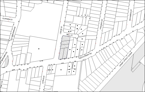
|
NOTIFICATION PLAN |
|
||
|
• PROPERTIES NOTIFIED
|
X SUBMISSIONS RECEIVED |
PROPERTY SUBJECT OF DEVELOPMENT |
|
Two submissions objected to the development, generally on the grounds that the development would result in:
· Unacceptable air and noise pollution including concerns regarding asbestos and dust during demolition and construction;
· Unacceptable traffic, accessibility and parking on local streets i.e. trucks on Bell Street;
· Increased crime generated from the development;
· Unacceptable waste management on local roads;
· Development that is excessive in height; and
· The development would result in an increase in abandoned shopping trolleys.
Additional requests included:
· Restriction to work hours due to neighbouring resident’s work shift/sleep patterns;
· Request that Council impose a condition requiring the applicant to provide waste management services on Peats Ferry Road rather than Lodge Street.
The merits of the matters raised in community submissions have been addressed in the body of the report with the exception of the following:
5.1.1 Air Pollution and Noise During Demolition and Construction
Concerns were raised regarding air pollution and noise generated from the demolition and construction of the proposed development. In particular a concern was raised regarding the demolition and construction hours and resultant noise disruption for neighbouring residents.
Council recommends that a Construction Management Plan (CMP) be prepared by a suitably qualified consultant, must be submitted for approval by Council. The CMP would require noise attenuation measure to be implemented along the Bell Street property boundary of the site including a hoarding height not less than 3m from the existing ground level, during excavation works, rock removal must be undertaken by sawing instead of rock hammering, wherever practicable and that the construction works must be undertaken in accordance with the “Interim Construction Noise Guidelines – 2009” published by DECCW and achieve compliance with the relevant noise levels. In addition, Council’s standard noise condition would restrict all work on site (including demolition and earth works) to occur between 7am and 5pm Monday to Saturday (unless otherwise approved by Council due to extenuating circumstances) with no work to be undertaken on Sundays or public holidays.
In terms of air pollution and asbestos disposal and contamination, Council recommends standard conditions requiring that all demotion work is to be carried out in accordance with Australian Standard 2601 – 2002 – The Demolition of Structures and that where asbestos material is being removed, must be undertaken by a contractor that holds an appropriate licence issued by WorkCover NSW in accordance with Chapter 10 of the Occupational Health and Safety Regulation 2001 and Clause 29 of the Protection of the Environment Operations (Waste) Regulation 2005. In addition, a standard commercial manufactured sign warning of asbestos removal is to the erected in a prominent position visible from the street.
5.1.2 Waste Management
As addressed in the body of the report, Waste Management would be via Lodge Street whereby Council’s Waste Collection Vehicle would reverse into the site and forward out of the driveway collection rubbish from the garbage collection room located adjacent to the driveway. The waste collection room has been integrated to the design of the front façade and is screened by landscaping and is thus assessed as satisfactory. The request for waste collection and therefore vehicular access to be via Peats Ferry Road would not be supported as Clause 101 of SEPP Infrastructure states that the consent authority must not grant consent to development on land that has a frontage to a classified road unless it is satisfied that where practical, vehicular access is to be provided by a road other than a classified road. As Peats Ferry Road is a secondary classified road, RMS would not support this request.
5.1.3 Parking
Concerns were raised regarding construction vehicles and tradesperson vehicles parking on Bell Street. This is a compliance issue. In general, heavy vehicles are limited to 1 hour parking on residential streets. Council’s Parking Rangers are available for patrols to ensure that no illegal parking occurs in the streets surrounding the proposed development. In addition, a condition is recommended that all construction vehicles are to access the site via Lodge Street only. This is to be included in the traffic management plan and complied with during the works phase.
5.1.4 Shopping Trolleys
This is not a matter for consideration for the proposed development under Section 79C of the Environmental Planning and Assessment Act, 1979.
5.2 Public Agencies – Roads and Maritime Services
The application was referred to Roads and Maritime Services (RMS) in accordance with State Environmental Planning Policy (Infrastructure) 2007. RMS reviewed the submitted documentation and raised no objections to the application subject to recommended conditions included under Schedule 1 of this consent.
6. THE PUBLIC INTEREST
Section 79C(1)(e) of the Act requires Council to consider “the public interest”.
The public interest is an overarching requirement, which includes the consideration of the matters discussed in this report. Implicit to the public interest is the achievement of future built outcomes adequately responding to and respecting the future desired outcomes expressed in environmental planning instruments and development control plans.
The application is considered to have satisfactorily addressed Council’s and relevant agencies’ criteria and would provide a development outcome that, on balance, would result in a positive impact for the community. Accordingly, it is considered that the approval of the proposed development would be in the public interest.
CONCLUSION
The application seeks approval for the demolition of existing structures and the construction of two, five storey residential flat buildings comprising 80 units with two levels of basement car parking and subdivision of No. 4 Lodge Street into two lots.
The proposed development is generally in accordance with the development controls for the ‘Hyacinth Street, Asquith’ precinct of the Hornsby Development Control Plan and would contribute to the future desired five storey residential character of the precinct. With conditions, the minor non-compliances to do with prescriptive measures for setbacks, floorplate dimension, building indentation and landscaping are considered to be acceptable. The proposal complies with the design principles of SEPP 65 and the Residential Flat Design Code.
A deferred commencement condition is recommended for the registration of the subdivision of No. 4 Lodge Street into two lots.
Two submissions were received regarding the proposal. The concerns raised have been addressed in the body of the report.
Note: At the time of the completion of this planning report, no persons have made a Political Donations Disclosure Statement pursuant to Section 147 of the Environmental Planning and Assessment Act 1979 in respect of the subject planning application.
RESPONSIBLE OFFICER
The officer responsible for the preparation of this Report is the Manager – Development Assessments – Rodney Pickles, who can be contacted on 9847 6731.
|
Rod Pickles Manager - Development Assessment Planning Division |
James Farrington Group Manager Planning Division |
|
1.View |
Locality Map |
|
|
|
2.View |
Floor Plans |
|
|
|
3.View |
Elevations and Sections |
|
|
|
4.View |
Subdivision Plan |
|
|
|
5.View |
Site Plan |
|
|
|
6.View |
Shadow Diagram |
|
|
|
7.View |
Landscape Plan |
|
|
File Reference: DA/215/2015
Document Number: D05972218
SCHEDULE 1
GENERAL CONDITIONS
The conditions of consent within this notice of determination have been applied to ensure that the use of the land and/or building is carried out in such a manner that is consistent with the aims and objectives of the relevant legislation, planning instruments and council policies affecting the land and does not disrupt the amenity of the neighbourhood or impact upon the environment.
Note: For the purpose of this consent, the term ‘applicant’ means any person who has the authority to act on or the benefit of the development consent.
Note: For the purpose of this consent, any reference to an Act, Regulation, Australian Standard or publication by a public authority shall be taken to mean the gazetted Act or Regulation, or adopted Australian Standard or publication as in force on the date that the application for a construction certificate is made.
1. Deferred Commencement
Pursuant to Section 80(3) of the Environmental Planning and Assessment Act 1979, this consent does not operate until the following information is submitted to Council:
a) A registered plan of subdivision from the NSW Department of Lands creating a new lot from Lot 1 DP385418 to form part of the development.
Such information shall be submitted within 12 months of the date of this notice.
Upon Council’s written satisfaction of the above information, the following conditions of development consent will apply:
2. Approved Plans and Supporting Documentation
The development must be carried out in accordance with the plans and documentation listed below and endorsed with Council’s stamp, except where amended by Council and/or other conditions of this consent:
|
Plan No. |
Plan Title |
Drawn by |
Dated |
|
Ref 17387 |
Survey Plan |
Norton Survey Partners |
24/10/10 |
|
Ref 17387 |
Plan showing existing and proposed lot layouts |
Norton Survey Partners |
27/1/15 |
|
A30 - B |
Plan B2 & B1 |
Mijollo International |
3/6/15 |
|
A32-E |
Plans L1 to L3 |
Mijollo International |
10/7/15 |
|
A35-E |
Plans L4 & L5 |
Mijollo International |
10/7/15 |
|
A37-D |
Plans Attic & Roof |
Mijollo International |
10/7/15 |
|
A401-D |
North, East, South & West Elevations |
Mijollo International |
16/7/15 |
|
A501-C |
Section A-A + Internal Elevations |
Mijollo International |
13/7/15 |
|
A611-A |
Shadow diagrams |
Mijollo International |
6/2/15 |
|
|
Solar Access for Eastern Facade |
Mijollo International |
Received on 1 7/15 |
|
LPDA15-286/1-E |
Landscape Plan |
Conzept Landscape Architects |
20/7/15 |
|
LPDA15-286/2-B |
Landscape plan (level 4 & 5) |
Conzept Landscape Architects |
9/2/15 |
|
LPDA15-286/3-A |
Landscape Details |
Conzept Landscape Architects |
4/2/15 |
|
|
DA/215/2015 – Tree Location Plan |
Modified by Tree Management Team (Hornsby Shire Council) |
7/5/15 |
|
14051-C201 Rev P1 |
Erosion & Sediment Control Plan |
TDL Engineering Consultants |
14/1/15 |
|
14051-C101 Rev P1 |
Stormwater Management Plan Level 1 Layout |
TDL Engineering Consultants |
14/1/15 |
|
|
Site Access – SRV Swept Path Analysis |
Ason Group |
11/6/15 |
|
Document Title |
Prepared by |
Dated |
|
Statement of Environmental Effects |
Caladines Town Planning P/L |
Feb 2015 |
|
Waste Management Plan |
Ben Hewlett |
25/2/15 |
|
Music Model – Stormwater pollutant targets |
Unnamed |
Submitted 4/6/15 |
|
Traffic & Parking Report |
Ason Group |
11/2/15 |
|
SEPP 65 Certification |
Matthew Cumming (Mijollo International P/L) |
24/2/15 |
|
Accessibility Report |
Abe Consulting |
10/2/15 |
|
Basix Assessment Report No. ES20141124_00 |
ESD Synergy P/L |
27/7/15 |
|
Basix Certificate No. 607598M_02 |
ESD Synergy P/L |
27/7/15 |
|
Cost Summary Report |
QS1 P/L |
2/2/15 |
|
1410-A Materials Schedule |
Mijollo International P/L |
6/2/15 |
3. Amendment of Plans
The approved plans are to be amended as follows:
a) To ensure future occupants within the development maintain an appropriate level of privacy, all south facing windows opposing habitable spaces on south western corner units in Building 2 are to be installed with privacy screens.
4. Removal of Existing Trees
This development consent permits the removal of trees numbered 1, 2 and 3 as identified on plan named Site Tree Location Plan prepared by Council’s Tree Management Team, dated 7 May 2015. The removal of any other trees requires separate approval in accordance with the Tree and Vegetation Chapter 1B.6 Hornsby Development Control Plan (HDCP).
5. Acoustic Report
An acoustic report is to be provided prior to the issue of a construction certificate demonstrating that appropriate measures will be taken to ensure that the following LAeq levels are not exceeded:
a) In any bedroom in the building – 35dB(A) at any time between 10pm and 7am,
b) Anywhere else in the building (other than a garage, kitchen, bathroom or hallway) 40dB(A) at any time.
The report is to provide details of construction techniques and measure to attenuate road noise and vibration. The development must not exceed the specified noise criteria and LAeq levels within Clause 102 of the SEPP (Infrastructure).
6. Driveway Longitudinal Sections
Longitudinal sections along both sides of the access driveway shall be submitted to the principal certifying authority in accordance with the relevant sections of AS 2890.1 and the following requirements:
a) The maximum grade shall not exceed 1 in 4 (25%) with the maximum changes of grade of 1 in 8 (12.5%) for summit grades and 1 in 6.7 (15%) for sag grades. Any transition grades shall have a minimum length of 2 metres. The longitudinal sections shall incorporate the design levels obtained by Council.
Note: A construction certificate shall be obtained prior to the commencement of these works and are to be completed prior to the issue of an occupation certificate.
7. Construction Certificate
a) A Construction Certificate is required to be approved by Council or a Private Certifying Authority prior to the commencement of any works under this consent.
b) The Construction Certificate plans must not be inconsistent with the Development Consent plans.
8. Section 94 Development Contributions
a) In accordance with Section 80A(1) of the Environmental Planning and Assessment Act 1979 and the Hornsby Shire Council Section 94 Development Contributions Plan 2012-2021, the following monetary contributions shall be paid to Council to cater for the increased demand for community infrastructure resulting from the development:
|
Description |
Contribution (4) |
|
Roads |
$91,881.10 |
|
Open Space and Recreation |
$871,642.90 |
|
Community Facilities |
$121,500.90 |
|
Plan Preparation and Administration |
$3,636.05 |
|
TOTAL |
$1,088,660.95 |
being for 31 x 1 bedroom units, 41 x 2 bedroom units, 8 x 3 bedroom units and including a credit for five existing dwelling houses.
b) The value of this contribution is current as at 16 July 2015. If the contributions are not paid within the financial quarter that this condition was generated, the contributions payable will be adjusted in accordance with the provisions of the Hornsby Shire Council Section 94 Development Contributions Plan and the amount payable will be calculated at the time of payment in the following manner:
$CPY = $CDC x CPIPY
CPIDC
Where:
$CPY is the amount of the contribution at the date of Payment
$CDC is the amount of the contribution as set out in this Development Consent
CPIPY is the latest release of the Consumer Price Index (Sydney – All Groups) at the date of Payment as published by the ABS.
CPIDC is the Consumer Price Index (Sydney – All Groups) for the financial quarter at the date applicable in this Development Consent Condition.
c) The monetary contributions shall be paid to Council:
i) prior to the issue of the Subdivision Certificate where the development is for subdivision; or
ii) prior to the issue of the first Construction Certificate where the development is for building work; or
iii) prior to issue of the Subdivision Certificate or first Construction Certificate, whichever occurs first, where the development involves both subdivision and building work; or
iv) prior to the works commencing where the development does not require a Construction Certificate or Subdivision Certificate.
It is the professional responsibility of the Principal Certifying Authority to ensure that the monetary contributions have been paid to Council in accordance with the above timeframes.
Council’s Development Contributions Plan may be viewed at www.hornsby.nsw.gov.au or a copy may be inspected at Council’s Administration Centre during normal business hours.
REQUIREMENTS PRIOR TO THE ISSUE OF A CONSTRUCTION CERTIFICATE
9. Building Code of Australia
All building work must be carried out in accordance with the relevant requirements of the Building Code of Australia.
10. Contract of Insurance (Residential Building Work)
In the case of residential building work for which the Home Building Act 1989 requires there to be a contract of insurance in force in accordance with Part 6 of that Act, that such a contract of insurance is in force before any building work authorised to be carried out by the consent commences.
11. Notification of Home Building Act, 1989 Requirements
Residential building work within the meaning of the Home Building Act 1989 must not be carried out unless the principal certifying authority for the development to which the work relates (not being Council) has given Council written notice of the following information:
a) In the case of work for which a principal contractor is required to be appointed:
i) The name and licence number of the principal contractor; and
ii) The name of the insurer by which the work is insured under Part 6 of that Act.
b) In the case of work to be done by an owner-builder:
i) The name of the owner-builder; and
ii) If the owner-builder is required to hold an owner-builder’s permit under that Act, the number of the owner-builder’s permit.
Note: If arrangements for doing the residential building work are changed while the work is in progress so that the information notified becomes out of date, further work must not be carried out unless the principal certifying authority for the development to which the work relates (not being Council) has given Council written notification of the updated information.
12. Utility Services
The applicant must submit written evidence of the following service provider requirements:
a) Ausgrid (formerly Energy Australia) – a letter of consent demonstrating that satisfactory arrangements have been made to service the proposed development.
b) Telstra – a letter of consent demonstrating that satisfactory arrangements have been made to service the proposed development.
13. Sydney Water – Quick Check
This application must be submitted to a Sydney Water ‘Quick Check Agent’ or ‘Customer Centre’ for approval to determine whether the development would affect any Sydney Water infrastructure, and whether further requirements are to be met.
Note: Refer to www.sydneywater.com.au or telephone 13 20 92 for assistance.
14. Dilapidation Report
A ‘Dilapidation Report’ is to be prepared by a ‘chartered structural engineer’ detailing the structural condition of the adjoining property at No. 305 Peats Ferry Road, Asquith.
15. Traffic Control Plan
A Traffic Control Plan (TCP) must be prepared by a qualified traffic controller in accordance with the Roads & Traffic Authority’s Traffic Control at Worksites Manual 1998 and Australian Standard 1742.3 for all work on a public road. The Traffic Management Plan shall be submitted and approved by Council’s Manager Traffic and Road Safety prior to the issue of a construction certificate. The TCP must detail the following:
a) Arrangements for public notification of the works;
b) Temporary construction signage;
c) Permanent post-construction signage;
d) Vehicle movement plans;
e) Traffic management plans;
f) Pedestrian and cyclist access/safety.
The TCP is to be submitted to Council for approval prior to the issue of the construction certificate.
16. Construction Management Plan
A Construction Management Plan (CMP), prepared by a suitably qualified consultant, must be submitted for approval by Council. The CMP must be include, but not be limited, details of the following:
a) Noise attenuation measures are to be implemented along the Bell Street property boundary of the site including a hoarding height not less than 3m from the existing ground level;
b) During excavation works, rock removal must be undertaken by sawing instead of rock hammering, wherever practicable;
c) The construction works must be undertaken in accordance with the “Interim Construction Noise Guidelines – 2009” published by DECCW and achieve compliance with the relevant noise levels; and
d) The delivery times and vehicular movements related to demolition, excavation and construction works must be restricted to the construction hours only.
17. Adaptable Units
The details of the fit-outs of all accessible and adaptable units must be provided with the Construction Certificate Plans.
18. Construction Vehicles
All construction vehicles associated with the proposed development are to be contained on site or in an approved “Work Zone”. Construction zones will not be permitted on Lodge Street, Bell Street or Peats Ferry Road.
19. Construction Traffic Management Plan
A Construction Traffic Management Plan (CTMP) detailing construction vehicle routes, number of trucks, hours of operation, access arrangements and traffic control should be submitted to Council prior to the issue of a Construction Certificate. Council will review the CTMP, agree to any modifications with the proponent and enforce the CTMP during construction.
20. Pedestrian Access Management Plan
A Pedestrian Access Management Plan (PAMP) detailing how pedestrian movements will be changed and managed during various stages of development, particularly during any partial or total closure of footpaths on Peats Ferry Road and Lodge Street. Council will review the PAMP, agree to any modifications with the proponent and enforce the PAMP during construction.
21. Preservation of Survey Infrastructure
Prior to the issue of a construction certificate, a registered surveyor shall identify all survey marks in the vicinity of the proposed development. Any survey marks required to be removed or displaced as a result of the proposed development shall be undertaken by a registered surveyor in accordance with Section 24(1) of the Surveying and Spatial Information Act 2002 and following the Surveyor General’s Directions No. 11 – “Preservation of Survey Infrastructure”.
22. Water Quality/Bio Retention System
Stormwater discharging from the development site is to be treated to achieve the quality specified in the HDCP 2013 (table 1C.1.2(b) Urban Stormwater Quality Targets). Details are to be provided with the construction certificate. A Chartered Civil/Hydraulic Engineer of the Institution of Engineers, Australia is to certify that works have been completed in accordance with the approved construction plan and the measures will achieve the targets specified in the condition.
23. Waste Management
The following waste management requirements must be complied with:
a) The approved on-going waste management system must not be amended without the written consent of Council.
b) The Volume handling equipment (2 x 660L bin linear), to automatically change the bin under the chute when it becomes full, must not be fitted with a compactor.
24. Acoustic Report
The Construction Certificate plans must demonstrate compliance with the recommendations in the submitted Acoustic Report (required as per condition No. 5) including materials of construction and glazing details.
25. Stormwater Drainage
The stormwater drainage system for the development must be designed and constructed for an average recurrence interval of 20 years and be gravity drained in accordance with the following requirements:
a) Connected directly to an existing Council drainage system/street gutter via an on-site detention and water quality treatment system. Capacity of the street gutter is to be verified prior to discharging to the gutter.
b) Be designed by a Chartered Professional Engineer/Civil Engineer of the Institution of Engineers, Australia.
c) A construction certificate application is to be submitted to Council for discharging stormwater to Council pit/drainage line.
d) The stormwater system with on-site detention and water quality treatment facilities is to be constructed in accordance with Drainage Nos. 14051-C101-C104 Revision P1 dated 14.01.15 prepared by TDL Engineering Consulting Pty Ltd (Council Document No. D04948248).
26. On Site Stormwater Detention
An on-site stormwater detention system must be designed by a chartered civil engineer and constructed in accordance with the following requirements:
a) Storage capacity to accommodate volume from up to 20 years ARI (average recurrence interval) and a maximum discharge (when full) limited to 5 years pre development rate.
b) Have a surcharge/inspection grate located directly above the outlet.
c) Discharge from the detention system to be controlled via 1 metre length of pipe, not less than 50 millimetres diameter or via a stainless plate with sharply drilled orifice bolted over the face of the outlet discharging into a larger diameter pipe capable of carrying the design flow to an approved Council system.
d) Where above ground and the average depth is greater than 0.3 metres, a ‘pool type’ safety fence and warning signs to be installed.
e) Not be constructed in a location that would impact upon the visual or recreational amenity of residents.
f) Detail calculations are to be shown in construction certificate plan.
27. Vehicular Crossing
A separate application under the Local Government Act 1993 and the Roads Act 1993 must be submitted to Council for the installation of a new vehicular crossing and the removal of the redundant crossing. The vehicular crossing must be constructed in accordance with Council’s Civil Works Design 2005 and the following requirements:
a) Any redundant crossings must be replaced with integral kerb and gutter;
b) The footway area must be restored by turfing;
c) Approval must be obtained from all relevant utility providers that all necessary conduits be provided and protected under the crossing.
Note: An application for a vehicular crossing can only be made to one of Council’s Authorised Vehicular Crossing Contractors. You are advised to contact Council on 02 9847 6940 to obtain a list of contractors.
28. Internal Driveway/Vehicular Areas
The driveway and parking areas on site must be designed in accordance with Australian Standards 2890.1, 2890.2, 3727 and the following requirements:
a) Design levels at the front boundary must be obtained from Council;
b) The driveway must be a rigid pavement.
29. Road Works
All road works approved under this consent must be constructed in accordance with Council’s Civil Works Design and Construction Specification 2005 and the following requirements:
a) A concrete footpath along Bell and Lodge Streets are to be constructed. Old sections of the footpath along Peats Ferry Road are to be replaced.
b) The kerb and gutter fronting Bell Street and 31m along Lodge Street (from the intersection of Lodge and Bell Streets) are to be constructed. The existing road pavement is to be saw cut a minimum of 300 mm from the existing edge of the bitumen and reconstructed.
c) A construction certificate is to be submitted to Council for approval.
Note: Council is the only authority to approve works within Council roads.
REQUIREMENTS PRIOR TO THE COMMENCEMENT OF ANY WORKS
30. Erection of Construction Sign
A sign must be erected in a prominent position on any site on which building work, subdivision work or demolition work is being carried out:
a) Showing the name, address and telephone number of the principal certifying authority for the work;
b) Showing the name of the principal contractor (if any) for any demolition or building work and a telephone number on which that person may be contacted outside working hours; and
c) Stating that unauthorised entry to the work site is prohibited.
Note: Any such sign is to be maintained while the building work, subdivision work or demolition work is being carried out, but must be removed when the work has been completed.
31. Protection of Adjoining Areas
A temporary hoarding, fence or awning must be erected between the work site and adjoining lands before the works begin and must be kept in place until after the completion of the works if the works:
a) Could cause a danger, obstruction or inconvenience to pedestrian or vehicular traffic.
b) Could cause damage to adjoining lands by falling objects.
c) Involve the enclosure of a public place or part of a public place.
Note: Notwithstanding the above, Council’s separate written approval is required prior to the erection of any structure or other obstruction on public land.
32. Toilet Facilities
Toilet facilities must be available or provided at the works site before works begin and must be maintained until the works are completed at a ratio of one toilet for every 20 persons employed at the site. Each toilet must:
a) be a standard flushing toilet connected to a public sewer; or
b) be a temporary chemical closet approved under the Local Government Act 1993; or
c) have an on-site effluent disposal system approved under the Local Government Act 1993.
33. Erosion and Sediment Control
Erosion and sediment control measures must be provided and maintained throughout the construction period in accordance with the manual ‘Soils and Construction 2004 (Bluebook)’, the approved plans, Council specifications and to the satisfaction of the principal certifying authority. The erosion and sediment control devices must remain in place until the site has been stabilised and revegetated.
Note: On the spot penalties may be issued for any non-compliance with this requirement without any further notification or warning.
REQUIREMENTS DURING CONSTRUCTION
34. Construction Work Hours
All work on site (including demolition and earth works) must only occur between 7am and 5pm Monday to Saturday (unless otherwise approved by Council due to extenuating circumstances). No work is to be undertaken on Sundays or public holidays. No excavation or rock sawing/breaking is to occur on Saturdays.
35. Demolition
All demolition work must be carried out in accordance with “Australian Standard 2601-2001 – The Demolition of Structures” and the following requirements
a) Demolition material must be disposed of to an authorised recycling and/or waste disposal site and/or in accordance with an approved waste management plan;
b) Demolition works, where asbestos material is being removed, must be undertaken by a contractor that holds an appropriate licence issued by WorkCover NSW in accordance with Chapter 10 of the Occupational Health and Safety Regulation 2001 and Clause 29 of the Protection of the Environment Operations (Waste) Regulation 2005 ;and
c) On construction sites where buildings contain asbestos material, a standard commercially manufactured sign containing the words ‘DANGER ASBESTOS REMOVAL IN PROGRESS’ measuring not less than 400mm x 300mm must be erected in a prominent position visible from the street.
36. Environmental Management
The site must be managed in accordance with the publication ‘Managing Urban Stormwater – Landcom (March 2004) and the Protection of the Environment Operations Act 1997 by way of implementing appropriate measures to prevent sediment run-off, excessive dust, noise or odour emanating from the site during the construction of the development.
37. Street Sweeping
Street sweeping must be undertaken following sediment tracking from the site along Peats Ferry Road and Lodge Street during works and until the site is established.
The street cleaning services must undertake a street ‘scrub and dry’ method of service and not a dry sweeping service that may cause sediment tracking to spread or cause a dust nuisance.
38. Council Property
During construction works, no building materials, waste, machinery or related matter is to be stored on the road or footpath. The public reserve must be kept in a clean, tidy and safe condition at all times.
39. Landfill
Landfill must be constructed in accordance with Council’s ‘Construction Specification 2005’ and the following requirements:
a) All fill material imported to the site is to wholly consist of Virgin Excavated Natural Material (VENM) as defined in Schedule 1 of the Protection of the Environment Operations Act 1997 or a material approved under the Department of Environment and Climate Change’s general resource recovery exemption.
b) A compaction certificate is to be obtained from a geotechnical engineer verifying that the specified compaction requirements have been met.
40. Excavated Material
All excavated material removed from the site must be classified in accordance with the Department of Environment, Climate Change and Water NSW Waste Classification Guidelines prior to disposal to an approved waste management facility and reported to the principal certifying authority.
41. Survey Report
A report(s) must be prepared by a registered surveyor and submitted to the principal certifying authority:
a) Prior to the pouring of concrete at each level of the building certifying that:
i) The building, retaining walls and the like have been correctly positioned on the site; and
ii) The finished floor level(s) are in accordance with the approved plans.
b) Confirming that the waste collection vehicle turning area complies with AS2890.1 – 2004 and AS20890.2 – 2002 for small rigid vehicles (SRV).
42. Waste Management
Waste management during the demolition and construction phase of the development must be undertaken in accordance with the approved Waste management Plan. Additionally written records of the following items must be maintained during the removal of any waste from the site and such information submitted to the Principle Certifying Authority within fourteen days of the date of completion of the works:
a) The identity of the person removing the waste.
b) The waste carrier vehicle registration.
c) Date and time of waste collection.
d) A description of the waste (type of waste and estimated quantity).
e) Details of the site to which the waste is to be taken.
f) The corresponding tip docket/receipt from the site to which the waste is transferred (noting date and time of delivery, description (type and quantity) of waste.
g) Whether the waste is expected to be reused, recycled or go to landfill.
Note: In accordance with the Protection of the Environment Operations Act 1997, the definition of waste includes any unwanted substance, regardless of whether it is reused, recycled or disposed to landfill.
43. Traffic Control Plan Compliance
The development must be carried out in accordance with the submitted Traffic Control Plan (TCP).
44. Disturbance of Existing Site
During construction works, the existing ground levels of open space areas and natural landscape features, (including natural rock-outcrops, vegetation, soil and watercourses) must not be altered unless otherwise nominated on the approved plans.
45. Construction Noise Management
The construction works must be undertaken in accordance with the “Interim Construction Noise Guidelines – 2009” published by NSW Environmental Protection Authority.
46. Contamination During Construction Works
Should the presence of asbestos or soil contamination, not recognised during the application process be identified during demolition, the applicant must immediately notify the Principal Certifying Authority and Council.
47. Construction Vehicle Access
All construction vehicles associated with the proposed development are to access the site from Lodge Street only. No construction vehicle access is permitted on Bell Street or Peats Ferry Road.
REQUIREMENTS PRIOR TO THE ISSUE OF AN OCCUPATION CERTIFICATE
Note: For the purpose of this consent, a reference to ‘occupation certificate’ shall not be taken to mean an ‘interim occupation certificate’ unless otherwise stated.
48. Fulfilment of BASIX Commitments
The applicant must demonstrate the fulfilment of BASIX commitments pertaining to the development.
49. Sydney Water – s73 Certificate
An s73 Certificate must be obtained from Sydney Water.
Note: Sydney Water requires that s73 applications are to be made through an authorised Sydney Water Servicing Coordinator. Refer to www.sydneywater.com.au or telephone 13 20 92 for assistance.
50. Works as Executed Plan
A works-as-executed plan(s) must be prepared by a registered surveyor and submitted to Council for completed road pavement, kerb and gutter, drainage systems, with water quality measures, driveways and on-site detention system.
51. Damage to Council Assets
Any damage caused to Council’s assets as a result of the construction or demolition of the development must be rectified in accordance with Council’s Civil Works Specifications. Council’s Restorations Supervision must be notified for a formwork inspection prior to pouring concrete.
52. Creation of Easements
The following matter(s) must be nominated on the plan of subdivision under s88B of the Conveyancing Act 1919:
a) The creation of an appropriate "Positive Covenant" and "Restriction as to User" over the constructed on-site detention and bio retention system and outlet works within the lots in favour of Council in accordance with Council’s prescribed wording. The position of the on-site detention and bio retention systems are to be clearly indicated on the title.
b) To register the positive covenant and the restriction on the use of land, “works as executed” details of the on-site detention and bio retention system must be submitted verifying that the required storage and discharge rates will be achieved and water quality control measures have been constructed in accordance with the design requirements. The details must show the invert levels of the on-site system together with pipe sizes and grades and details of the bio retention system. Any variations to the approved plans must be shown in red on the “works-as-executed” plan and supported by calculations.
Note: Council must be nominated as the authority to release, vary or modify any easement, restriction or covenant.
53. Consolidation of Allotments
All allotments the subject of this consent must be consolidated into one allotment.
Note: The applicant is recommended to submit the plan of subdivision to consolidate allotments to the NSW Department of Lands at least 4-6 weeks prior to seeking an occupation certificate.
54. Certificate of Preservation Survey Marks
A certificate by a Registered Surveyor shall be submitted to the Principal Certifying Authority, certifying that there has been no removal, damage, destruction, displacement or defacing of the existing survey marks in the vicinity of the proposed development or otherwise the reestablishment of damaged, removed or displaced survey marks has been undertaken in accordance with the Surveyor General’s Direction No. 11 – “Preservation of Survey Infrastructure”.
55. Garbage Collection Easement
For the purpose of waste collection, an easement entitling Council, its servants and agents and persons authorised by it to enter upon the subject land and to operate thereon, vehicles and other equipment for the purposes of garbage collection must be granted to Council by the owner of the land.
Note: The easement must be in a form prescribed by Council and must include covenants to the effect that parties will not be liable for any damage caused to the subject land or any part thereof or to any property located therein or thereon by reason of the operation thereon of any vehicle or other equipment used in connection with the collection of garbage and to the effect that the owner for the time being of the subject land shall indemnify the Council, its servants, agents and persons authorised by it to collect garbage against liability in respect of any such claims made by any person whomsoever.
56. Waste Management Details
The following waste management requirements must be complied with:
a) Prior to an Occupation Certificate being issued or the use commencing, whichever is earlier, the Principal Certifying Authority must obtain Council’s approval of the waste and recycling management facilities provided in the development and ensure arrangements are in place for domestic waste collection by Council.
Note: Waste and recycling management facilities includes everything required for on-going waste management on the site. For example the garbage chute system, volume handling equipment, bin lifter, motorised bin trolley or similar, recycling bin storage on each residential level, bin storage areas, bulky waste storage area, bin collection area, waste collection vehicle access etc.
b) The garbage rooms at the basement level must include water or a hose for cleaning, graded floors with drainage to sewer, a robust door, sealed and impervious surface, adequate lighting and ventilation, and must be lockable. The waste facility at each residential level must include sealed and impervious surface, adequate lighting and ventilation.
c) A report must be prepared by an appropriately qualified person, certifying the following:
i) A comparison of the estimated quantities of each waste type against the actual quantities of each waste type.
Note: Explanations of any deviations to the approved Waste Management Plan is required to be included in this report.
ii) That at least 60% of the waste generated during the demolition and construction phase of the development was reused or recycled.
Note: If the 60% diversion from landfill cannot be achieved in the Construction Stage, the Report is to include the reasons why this occurred and certify that appropriate work practices were employed to implement the approved Waste Management Plan. The Report must be based on documentary evidence such as tipping dockets/receipts from recycling depots, transfer stations and landfills, audits of procedures etc. which are to be attached to the report.
iii) All waste was taken to site(s) that were lawfully permitted to accept that waste.
d) Each unit must be provided with an indoor waste/recycling cupboard for the interim storage of a minimum one day’s waste generation with separate containers for general waste and recyclable materials.
e) Space must be provided for either individual compost containers for each unit or a communal compost container.
Note: The location of the compost containers should have regard for potential amenity impacts.
f) The bin carting routes must be devoid of any steps.
Note: Ramps between different levels are acceptable.
g) Access to the automatic waste volume handling equipment by authorised persons (including residents and waste collectors) must be prevented.
Note: Caging of the automatic volume handling equipment is acceptable.
57. Planter Boxes/ On Slab Planting
On slab planter boxes must include waterproofing, subsoil drainage (proprietary drainage cell, 50mm sand and filter fabric) automatic irrigation, minimum 500mm planting soil for shrubs and minimum 1000mm planting soil for trees and palms and 75mm mulch.
58. Planting to Peats Ferry Road Setback
Tree planting to the Peats Ferry Road landscape setback area must include:
a) 1 x Angophora costata or Syncarpia glomulifera, installed at minimum 25 litre pot size.
59. Completing of Landscaping
A certificate must be provided by a practicing landscape architect, horticulturalist or person with similar qualifications and experience certifying that all required landscaping works have been satisfactorily completed in accordance with the approved landscape plans.
Note: Applicants are advised to pre-order plant material required in pot sizes 45 litre or larger to ensure nurseries have stock available at the time of install.
60. Location of Plantings
Tree plantings for low density must be located 4m or greater than from foundation walls of a dwelling or in-ground pool. The pot size must be a minimum 25L.
All replacement trees must be maintained until they reach the height of 3m. Trees must be native to Hornsby Shire and reach a mature height greater than 9m.
All plant stock must meet the specifications outlined in ‘Specifying Trees’ (Ross Clark, NATSPEC Books) and that the planting methods are current, professional (best practice) industry standards at the time of planting.
61. Final Certification
a) A certificate from suitably qualified and experienced Horticulturalist must be submitted to the Principal Certifying Authority stating compliance with the provided conditions of this consent.
b) A certificate from a suitably qualified and experienced Acoustic Consultant must be submitted to the Principal Certifying Authority stating compliance with the provided conditions of this consent.
62. Boundary Fencing
Fencing must be erected along all property boundaries behind the front building alignment to a height of 1.8 metres.
Note: Alternative fencing may be erected subject to the written consent of the adjoining property owner(s).
63. Provision for National Broadband Network (NBN)
Provision must be made for fibre ready passive infrastructure (pits and pipes) generally in accordance with NBN Co's pit and pipe installation guidelines to service the proposed development. A certificate from NBN Co or Telstra must be submitted to the PCA that the fibre optic cabling provided for the development complies with MDU Building Design Guides for Development.
64. External Lighting
All external lighting must be designed and installed in accordance with Australian Standard AS 4282 – Control of the Obtrusive Effects of Outdoor Lighting. Certification of compliance with the Standard must be obtained from a suitably qualified person.
65. Unit Numbering
The allocation of unit numbering must be authorised by Council prior to the numbering of each unit in the development.
66. Construction of a Safe Environment
Prior to the issue of an Occupation Certificate, the site must include the following elements:
a) An intercom system be installed at gate locations to ensure screening of persons entering the units;
b) The entryway to the site be illuminated in high luminance at all times;
c) The communal open space areas are to be illuminated with high luminance by motion sensor lighting;
d) The service areas of the ground floor and the garbage room at the basement be illuminated with low luminance at all times;
e) The driveway and the basement car park is to be illuminated with low luminance at all times;
f) Robust materials which cannot be forced or breached with minimised maintenance requirements are to be used for construction work in the common areas;
g) Effective signage be provided to guide visitors to the main areas and parking areas;
h) A street sign be prominently displayed in front of the site in accordance with Order No. 8, Section 124 Local Government Act 1993;
i) The communal area must include a clear sign to restrict access for non-residents;
j) Unit numbers, entry and exit signs must be legible and clear;
k) Fire exit doors to be fitted with single cylinder locksets (Australia New Zealand Standard – Locksets);
l) The entry doors to the pedestrian foyers are to be constructed of safety rated glass to enable residents a clear line of site before entering or exiting the residential apartments;
m) Security deadlocks are to be provided to each apartment door;
n) Peep holes are to be provided to individual apartment doors to promote resident safety; and
o) Residential parking spaces are to be secure spaces with access controlled by card or numeric pad.
OPERATIONAL CONDITIONS
67. Waste Management
The waste management on site must be in accordance with the following requirements:
a) A site caretaker must be employed and be responsible for moving bins where and when necessary, washing bins and maintaining waste storage areas, ensuring the chute systems and related devices are maintained in effective and efficient working order, managing the communal composting area, managing the bulky item storage area, arranging the prompt removal of dumped rubbish, and ensuring all residents are informed of the use of the waste management system. The site caretaker must be employed for a sufficient number of hours each week to allow all waste management responsibilities to be carried out to a satisfactory standard.
68. Car Parking
All car parking must be constructed and operated in accordance with Australian Standard AS/NZS 2890.1:2004 – Off-street car parking and Australian Standard AS 2890.2:2002 – Off-street commercial vehicle facilities.
a) All parking areas and driveways are to be sealed to an all-weather standard, line marked and signposted;
b) Car parking, loading and manoeuvring areas to be used solely for nominated purposes;
c) Vehicles awaiting loading, unloading or servicing shall be parked on site and not on adjacent or nearby public roads;
d) All vehicular entry on to the site and egress from the site shall be made in a forward direction.
69. Sight Distance to Pedestrians and Cyclists
Any proposed landscaping and/or fencing must not restrict sight distance to pedestrians and cyclists travelling along the footpath.
70. Residential Parking Spaces
Residential parking spaces are to be secure spaces with access controlled by card or numeric pad.
71. Visitors Access
Visitors must be able to access the visitor parking spaces in the basement car park at all times.
72. Parking for People with Disabilities
All parking for people with disabilities is to comply with AS/NZS 2890.6:2009 Off-street parking for people with disabilities.
73. Bicycle Parking Spaces
Bicycle parking spaces are to be designed in accordance with AS 2890.3-1993 Bicycle parking facilities.
74. Motorcycle Parking Spaces
Motorcycle parking spaces are to be designed in accordance with AS 2890.5-1993.
75. Landscape Establishment
The landscape works must be maintained into the future to ensure the establishment and successful growth of plant material to meet the intent of the landscape design. This must include but not be limited to watering, weeding, replacement of failed plant material and promoting the growth of plants through standard industry practices.
76. Noise
All noise generated by the proposed development must be attenuated to prevent levels of noise being emitted to adjacent premises which possess tonal, beating and similar characteristics or which exceeds background noise levels by more than 5dB(A).
77. Fire Safety Statement - Annual
On at least one occasion in every 12 month period following the date of the first ‘Fire Safety Certificate’ issued for the property, the owner must provide Council with an annual ‘Fire Safety Certificate’ to each essential service installed in the building.
CONDITIONS OF CONCURRENCE – ROADS & MARITIME SERVICE
The following conditions of consent are from the nominated State Agency pursuant to Section 79B of the Environmental Planning and Assessment Act 1979 and must be complied with to the satisfaction of that Agency.
75. All redundant driveways on Peats Ferry Road should be removed and replaced with kerb and gutter to Council’s satisfaction.
76. A Construction Traffic Management Plan detailing construction vehicle routes, number of trucks, hours of operation, access arrangements and traffic control should be submitted to Council prior to the issue of a construction certificate.
77. The swept path of the longest vehicle (to service the site) entering and exiting the subject site, as well as manoeuvrability through the site, shall be in accordance with AUSTROADS. In this regard, a plan shall be submitted to Council for approval, which shows that the proposed development complies with this requirement.
78. The layout of the proposed car parking areas associated with the subject development (including driveways, grades, turn paths, sight distance requirements, aisle widths, aisle lengths, and parking bay dimensions) should be in accordance with AS2890.1-2004, AS2890.6-2009 and AS2890.2-2002 for heavy vehicle usage.
79. Any proposed landscaping and/or fencing must not restrict sight distance to pedestrians and cyclists travelling along the footpath.
- END OF CONDITIONS -
ADVISORY NOTES
The following information is provided for your assistance to ensure compliance with the Environmental Planning and Assessment Act, 1979, Environmental Planning and Assessment Regulation 2000, other relevant legislation and Council’s policies and specifications. This information does not form part of the conditions of development consent pursuant to Section 80a of the Act.
Environmental Planning and Assessment Act 1979 Requirements
The Environmental Planning and Assessment Act 1979 requires:
· The issue of a construction certificate prior to the commencement of any works. Enquiries can be made to Council’s Customer Services Branch on 9847 6760.
· A principal certifying authority to be nominated and Council notified of that appointment prior to the commencement of any works.
· Council to be given at least two days written notice prior to the commencement of any works.
· Mandatory inspections of nominated stages of the construction inspected.
· An occupation certificate to be issued before occupying any building or commencing the use of the land.
Long Service Levy
In accordance with Section 34 of the Building and Construction Industry Long Service Payments Act 1986, a ‘Long Service Levy’ must be paid to the Long Service Payments Corporation or Hornsby Council.
Note: The rate of the Long Service Levy is 0.35% of the total cost of the work.
Note: Hornsby Council requires the payment of the Long Service Levy prior to the issue of a construction certificate.
Tree and Vegetation Preservation
In accordance with Clause 5.9 of the Hornsby Local Environmental Plan 2013 a person must not ringbark, cut down, top, lop, remove, injure or wilfully destroy any tree or other vegetation protected under the Hornsby Development Control Plan 2013 without the authority conferred by a development consent or a permit granted by Council.
Notes: A tree is defined as a long lived, woody perennial plant with one or relatively few main stems with the potential to grow to a height greater than three metres (3M). (HDCP 1B.6.1.c).
Tree protection measures and distances are determined using the Australian Standard AS 4970:2009, “Protection of Trees on Development Sites”.
Fines may be imposed for non-compliance with both the Hornsby Local Environmental Plan 2013 and the Hornsby Development Control Plan 2013.
Disability Discrimination Act
The applicant’s attention is drawn to the existence of the Disability Discrimination Act. A construction certificate is required to be obtained for the proposed building/s, which will provide consideration under the Building Code of Australia, however, the development may not comply with the requirements of the Disability Discrimination Act. This is the sole responsibility of the applicant.
Dial Before You Dig
Prior to commencing any works, the applicant is encouraged to contact Dial Before You Dig on 1100 or www.dialbeforeyoudig.com.au for free information on potential underground pipes and cables within the vicinity of the development site.
Telecommunications Act 1997 (Commonwealth)
If you are aware of any works or proposed works which may affect or impact on Telstra’s assets in any way, you are required to contact: Telstra’s Network Integrity Team on Phone Number 1800810443.
Asbestos Warning
Should asbestos or asbestos products be encountered during demolition or construction works, you are advised to seek advice and information prior to disturbing this material. It is recommended that a contractor holding an asbestos-handling permit (issued by WorkCover NSW) be engaged to manage the proper handling of this material. Further information regarding the safe handling and removal of asbestos can be found at:
Alternatively, telephone the WorkCover Asbestos and Demolition Team on 8260 5885.
House Numbering
House numbering can only be authorised by Council. Before proceeding to number each premise in the development, the allocation of numbers is required to be obtained from Council's Planning Division prior to the issue of a Subdivision Certificate. The authorised numbers are required to comply with Council’s Property Numbering Policy and be displayed in a clear manner at or near the main entrance to each premise.
Group Manager’s Report No. PL58/15
Planning Division
Date of Meeting: 12/08/2015
9 DEVELOPMENT APPLICATION - RESIDENTIAL FLAT BUILDING COMPRISING 69 UNITS - 305-307 PEATS FERRY ROAD, ASQUITH, 4 LODGE STREET AND 9 BELL STREET, HORNSBY
EXECUTIVE SUMMARY
|
DA No: |
DA/214/2015 (Lodged 26/2/2015) |
|
Description: |
Demolition of existing structures, the construction of 2 x five storey residential flat buildings comprising 69 units and basement car parking and subdivision of 4 Lodge Street into two lots |
|
Property: |
Lot A DP 340410 and Lot 4 DP 136071305, Nos. 305-307 Peats Ferry Road, Asquith and No. 9 Bell Street and No. 4 Lodge Street, Hornsby |
|
Applicant: |
Asquith Property Developments Pty Ltd |
|
Owner: |
Ms Jennifer Garlick, Mr Stan Stokes, Mr Edward Black, Mrs Barbara Black, Mr Tuo Liu, Ms Hongjun Song |
|
Estimated Value: |
$14,740,000 |
|
Ward: |
A |
· The application involves the demolition of existing structures and construction of two, five storey residential flat buildings comprising 69 units with basement car park and subdivision of No. 4 Lodge Street into two lots.
· The proposal generally complies with the Hornsby Local Environmental Plan 2013, State Environmental Planning Policy No. 65 – Design Quality Residential Flat Building and the Hornsby Development Control Plan 2013.
· Two submissions have been received in respect of the application.
· It is recommended that the application be approved subject to a deferred commencement for the registration of the subdivision of No. 4 Lodge Street into two lots.
|
THAT Development Application No. DA/214/2015 for demolition of existing structures, construction of 2 x five storey residential flat buildings comprising 69 units and basement car parking and subdivision of No. 4 Lodge Street into two lots at Lots A DP 340410 and Lot 4 DP 136071, Nos. 305 and 307 Peats Ferry Rd, Asquith and 9 Bell Street and 4 Lodge Street, Hornsby be approved as a deferred commencement pursuant to Section 80(3) of the Environmental Planning and Assessment Act 1979 subject to the conditions of consent detailed in Schedule 1 of Group Manager’s Report No. PL58/15. |
BACKGROUND
The subject land was rezoned from Residential A (Low Density) to R4 (High Density Residential) on 2 September 2011 as part of Council’s Housing Strategy.
The subject application for demolition of existing structures, construction of 2 x five storey residential flat buildings comprising 69 units and basement car parking and subdivision of 4 Lodge Street into two lots was lodged on 26 February 2015.
On 27 May 2015, Council sent a letter to the applicant raising concerns regarding setbacks, privacy, landscaping, water quality, unit sizes and waste management. On 4 June 2015, the applicant submitted amended plans to address the concerns raised.
On 7 July 2015, further concerns were raised by Council regarding the building form, articulation, landscaping and unit sizes. On 16 July 2015, the applicant submitted amended plans to address these concerns. These amended plans are the subject of this assessment report.
SITE
The site comprises four irregular lots, Lot A DP 340410, Lot 4 DP 136071, Nos. 305-307 Peats Ferry Road, Asquith and Lot 2 DP 385418, No. 9 Bell Street and a portion of Lot 1 DP385418 No. 4 Lodge Street, Hornsby. The site has a combined area of approximately 2,894m² and is located on the northern side of Peats Ferry Road and contains dual street frontages of 35.5m to Peats Ferry Road and 27m to Bell Street. The site has a gentle slope to Peats Ferry Road of approximately 3%.
Existing improvements on the allotments include a dwelling house on each lot and associated structures. Vehicular access is via driveways from Peats Ferry Road and Bell Street. The site, including adjoining properties, contains exotic and native (exempt) tree species.
The site forms part of the ‘Hyacinth Street, Asquith’ precinct rezoned for medium-high density residential development in accordance with Council’s Housing Strategy in September 2011. The precinct is bounded by Lodge Street, Pacific Highway, Hyacinth Street and Bouvardia Street.
The surrounding developments include single and two storey residential dwelling houses. The site adjoins the R2 – Low Density zone to the north on Bell Street. The adjoining eastern property was approved for five storey development on 3 September 2014 under DA/370/2014. A five storey residential development is currently being constructed on the southern side of Peats Ferry Road at Nos. 422 - 426 Peats Ferry Road. The site is opposite the Asquith Boys High School to the south of Peats Ferry Road. The adjacent western site is subject to a development application also on business paper for consideration by Council for the construction of 2 x five storey residential flat buildings comprising 80 units.
The site is located in close proximity to Asquith Railway Station and Asquith Commercial Centre.
PROPOSAL
The proposal involves the demolition of existing structures, construction of 2 x five storey residential flat buildings comprising 69 units and basement car parking and subdivision of 4 Lodge Street into two parcels.
The unit mix would consist of 25 x 1 bedroom units, 37 x 2 bedroom units and 7 x 3 bedroom units. Building 1 would be accessed by 1 lift and Building 2 would be accessed by 2 lifts. The buildings would include balconies fronting Peats Ferry Road, Bell Street and the eastern and western side setbacks.
Vehicular access to the development would be via Peats Ferry Road, along the western property boundary. Pedestrian access would be via Peats Ferry Road for building 1 with a pedestrian path would provide a linkage to Building 2. In addition, a separate pedestrian access for Building 2 would be via Bell Street.
A total of 75 car spaces are provided, including 11 visitor’s car spaces proposed in two basement levels.
The site would drain to Peats Ferry Road with a below ground onsite detention system proposed over the south western corner of the site, on the driveway.
ASSESSMENT
The development application has been assessed having regard to ‘A Plan for Growing Sydney’, the ‘North Subregion (Draft) Subregional Strategy’ and the matters for consideration prescribed under Section 79C of the Environmental Planning and Assessment Act 1979 (the Act). The following issues have been identified for further consideration.
1. STRATEGIC CONTEXT
1.1 A Plan for Growing Sydney and (Draft) North Subregional Strategy
A Plan for Growing Sydney has been prepared by the NSW State Government to guide land use planning decisions for the next 20 years. The Plan sets a strategy for accommodating Sydney’s future population growth and identifies the need to deliver 689,000 new jobs and 664,000 new homes by 2031. The Plan identifies that the most suitable areas for new housing are in locations close to jobs, public transport, community facilities and services.
The NSW Government will use the subregional planning process to define objectives and set goals for job creation, housing supply and choice in each subregion. Hornsby Shire has been grouped with Hunters Hill, Ku-ring-gai, Lane Cove, Manly, Mosman, North Sydney, Pittwater, Ryde, Warringah and Willoughby to form the North Subregion. The Draft North Subregional Strategy will be reviewed and the Government will set housing targets and monitor supply to ensure planning controls are in place to stimulate housing development.
The proposed development would be consistent with ‘A Plan for Growing Sydney’, by providing additional dwellings and would contribute to housing choice in the locality.
2. STATUTORY CONTROLS
Section 79C(1)(a) requires Council to consider “any relevant environmental planning instruments, draft environmental planning instruments, development control plans, planning agreements and regulations”.
2.1 Hornsby Local Environmental Plan 2013
The proposed development has been assessed having regard to the provisions of the Hornsby Local Environmental Plan 2013 (HLEP).
2.1.1 Zoning of Land and Permissibility
The subject land is zoned R4 (High Density Residential) under the HLEP. The objectives of the zone are:
(a) To provide for the housing needs of the community within a high density residential environment.
(b) To promote a variety of housing types within a high density residential environment.
(c) To enable other land uses that provide facilities or services to meet the day to day needs of residents.
The proposed development is defined as a ‘residential flat building’ and is permissible in the zone with Council’s consent.
2.1.2 Height of Buildings
Clause 4.3 of the HLEP provides that the height of a building on any land should not exceed the maximum height shown for the land on the Height of Buildings Map. The maximum permissible height for the subject site is 17.5m. The proposal complies with this provision.
2.1.3 Heritage Conservation
Clause 5.10 of the HLEP sets out heritage conservation provisions for Hornsby Shire. The site does not include a heritage item and is not located in a heritage conservation area. The proposal is within the vicinity of a heritage listed item of local significance at No. 31 Lodge Street and Nos. 269, 384 and 394 Peats Ferry Road, Hornsby. The heritage listed items are zoned R2 Low Density Residential and the site is over 350m south of No. 31 Lodge Street and over 250m north east of the items at Peats Ferry Road. As such, the proposal would pose minimal impacts to the heritage significance of the items. Accordingly, no further assessment regarding heritage is necessary.
2.1.4 Minimum Subdivision Lot Size
Clause 4.1 of the HLEP sets out provisions for subdivision of land. The objectives of the clause are to provide for the subdivision of land at a density that is appropriate for the site constraints, development potential and infrastructure capacity of the land, and to ensure that lots are of a sufficient size to accommodate development.
A proposed subdivision has been submitted with the application that seeks consent to subdivide Lot 1 DP 385418, No. 4 Lodge Street to 2 separate allotments to allow a western portion of the lot (approximately 707.5m²) to be consolidated with the adjoining western five storey development DA/215/2015 (Lots A & B DP 349047 and Lots 1 & 2 DP 840373, Nos. 301-303 Peats Ferry Road and 2-4 Lodge Street) and the remaining eastern portion of the lot (approximately 221.6m²) to be consolidated with the subject five storey development.
The proposed boundary adjustment is supported as this would result in a more regular shaped development site that would facilitate more compliant residential flat development schemes and overall planning outcome. In addition, no applicable minimum allotment size has been made under the HLEP for the site. In this regard, a deferred commencement condition is recommended requiring the registration of No. 4 Lodge Street to be subdivided into two lots prior to the consent for the five storey development being operative.
2.1.5 Earthworks
Clause 6.2 of the HLEP states that consent is required for proposed earthworks on site. Before granting consent for earthworks, Council is required to assess the impacts of the works on adjoining properties, drainage patterns and soil stability of the locality.
Council’s assessment of the proposed works and excavation concludes that the proposal is satisfactory subject to conditions regarding submission of a dilapidation report to identify any impact of excavation on adjoining properties.
2.2 State Environmental Planning Policy No. 55 – Remediation of Land
State Environmental Planning Policy No. 55 (SEPP 55) requires that Council must not consent to the carrying out of any development on land unless it has considered whether the land is contaminated or requires remediation for the proposed use.
The site has been used for residential purposes and is unlikely to be contaminated. No further assessment is considered necessary in this regard. A condition is recommended should any contamination be found during construction requiring that the Principle Certifying Authority be notified.
2.3 State Environmental Planning Policy (Building Sustainability Index – BASIX) 2004
The application has been assessed against the requirements of State Environmental Planning Policy (Building Sustainability Index – BASIX) 2004. The proposal includes a BASIX Certificate for the proposed units and is considered to be satisfactory.
2.4 State Environmental Planning Policy No. 32 – Urban Consolidation (Redevelopment of Urban Land)
The application has been assessed against the requirements of SEPP 32, which requires Council to implement the aims and objectives of this Policy to the fullest extent practical when considering development applications relating to redevelopment of urban land. The application complies with the objectives of the Policy as it would promote the social and economic welfare of the locality and would result in the orderly and economic use of under-utilised land within the Shire.
2.5 State Environmental Planning Policy No. 65 – Design Quality of Residential Flat Development
The Policy provides for design principles to improve the design quality of residential flat development and for consistency in planning controls across the State.
2.5.1 State Environmental Planning Policy No. 65 – Design Quality of Residential Flat Development – Amendment No. 3
SEPP 65 has been amended on 19 June 2015 following review of the policy by the Department of Planning and Environment. The amendments replace the Residential Flat Design Guidelines with the Apartment Design Guide which prevails in the event of any inconsistency with a Development Control Plan. The amendments include objectives to meet housing and population targets, affordable housing and to facilitate timely and efficient assessment of development applications. The amendments make further provision for design review panels; include additional provisions for the determination of development application and for standards for ceiling height, apartment area and car parking, which cannot be used as grounds for refusal of development consent.
Clause 31 (Transitional provisions for SEPP 65 – Amendment No. 3) states that “If a development application or an application for the modification of a development consent has been made before the notification on the NSW legislation website of the making of State Environmental Planning Policy No 65—Design Quality of Residential Flat Development (Amendment No 3) and the application has not been finally determined before the commencement of that amendment, the application must be determined as if the amendment had not commenced.”
Pursuant to the above provision, this amendment does not apply to the subject application and the previous version (Amendment 2) of the SEPP is required to be considered. However, it is noted that the minimum apartment sizes proposed are in accordance with The Apartment Design Guide under Amendment No.3 which requires 50m² for 1 bedroom units, 70m² for 2 bedroom units and 90m² for 3 bedroom units and includes 5m² for additional bathrooms. The proposed apartment sizes are considered acceptable as this is in keeping with the desired future direction of SEPP 65.
The applicant has submitted a “Design Verification Statement” prepared by a qualified Architect stating how the proposed development achieves the design principles of SEPP 65. The design principles of SEPP 65 and the submitted design verification statement are addressed in the following table.
|
Principle |
Compliance |
|
1. CONTEXT |
Yes |
|
Comment: The site is located within a precinct planned for five storey residential flat buildings in close proximity to Asquith Railway Station, Asquith Commercial Centre and Hornsby Town Centre. The proposal responds to the desired future character of the precinct as envisaged by Council for residential flat buildings in landscaped settings with underground car parking. Once the development of the precinct is completed, the proposal would integrate with the surrounding sites and would be in keeping with the future urban form. The proposed building would contribute to the identity and future character of the precinct. |
|
|
2. SCALE |
Yes |
|
Comment: The scale of the development is in accordance with the height control and setbacks for the precinct prescribed within the HDCP. The development achieves a scale consistent with the desired outcome for well-articulated buildings that are set back to incorporate landscaping, open space and separation between buildings. |
|
|
3. BUILT FORM |
Yes |
|
Comment: The proposed building achieves an appropriate built form for the site and its purpose, in terms of building alignments, proportions, and the manipulation of building elements. The building would appropriately contribute to the character of the desired future streetscape and includes articulation to minimise the perceived scale. The proposed materials and finishes including the use of stone finishes, painted masonry, metal cladding, timber louvres with natural earthy colour tones would add to the visual interest of the development. Flat roof forms have been adopted with an increased top storey setback on the external facades to minimise bulk and height of the building as required by the HDCP. |
|
|
4. DENSITY |
Yes |
|
Comment: The HLEP does not incorporate floor space ratio requirements for the site. The density of the development is governed by the height of the building and the required setbacks. The proposed density is considered to be sustainable as it responds to the regional context, availability of infrastructure, public transport, community facilities and environmental quality and is acceptable in terms of density. |
|
|
5. RESOURCE, ENERGY AND WATER EFFICIENCY |
Yes |
|
Comment: The applicant has submitted a BASIX Certificate for the proposed development. In achieving the required BASIX targets for sustainable water use, thermal comfort and energy efficiency, the proposed development would achieve efficient use of natural resources, energy and water throughout its full life cycle, including demolition and construction. |
|
|
6. LANDSCAPE |
Yes |
|
Comment: The application includes a landscape concept plan which provides landscaping along the street frontages and side boundaries and includes adequate deep soil landscaping between the buildings. No significant trees have been identified on site. Large trees are proposed along the street frontages intercepted by shrubs and hedges which would soften the appearance of the development when viewed from the streets. Deep soil areas that incorporate canopy trees are provided around the building envelope which would enhance the development’s natural environmental performance and provide an appropriate landscaped setting. |
|
|
7. AMENITY |
Yes |
|
Comment: The proposed units are designed with appropriate room dimensions and layout to maximise amenity for future residents. The proposal incorporates good design in terms of achieving natural ventilation, solar access and acoustic privacy. All units incorporate balconies accessible from living areas and privacy has been achieved through appropriate design and orientation of balconies and living areas. Storage areas have been provided within each unit and in the basement levels. The proposal would provide convenient and safe access via a central lift connecting the basement and all other levels. |
|
|
8. SAFETY AND SECURITY |
Yes |
|
Comment: The design orientates the balconies and windows of individual apartments towards the street and side boundaries, providing passive surveillance of the public domain and communal open space areas. Both the pedestrian and vehicular entry points are secured and visibly prominent from Peats Ferry Road and Bell Street. The proposal includes an assessment of the development against crime prevention controls in the Statement of Environmental Effects (SEE). The SEE has regard to Crime Prevention Through Environmental Design Principles (CPTED) and includes details of surveillance, access control, territorial reinforcement and space management such as artificial lighting in public places; attractive landscaping whilst maintaining clear sight lines; security coded door lock or swipe card entry; physical or symbolic barriers to attract, channel or restrict the movement of people and security controlled access to basement car park. Appropriate conditions of consent are recommended to require compliance with the above matters. |
|
|
9. SOCIAL DIMENSIONS AND HOUSING AFFORDABILITY |
Yes |
|
Comment: The proposal incorporates a range of unit sizes to cater for different budgets and housing needs. The development complies with the housing choice requirements of the Hornsby DCP by providing a component of adaptable housing and a mix of 1, 2 and 3 bedroom dwellings. The proposal responds to the social context in terms of providing a range of dwelling sizes with good access to social facilities and services as the site is located in close proximity to Asquith railway station, shops and the Hornsby Town Centre. |
|
|
10. AESTHETICS |
Yes |
|
Comment: The architectural treatment of the buildings incorporate indentations and projections in the exterior walls with balcony projections to articulate the facades. The roof is flat to minimise building height and incorporates eaves which would cast shadows across the top storey wall. The articulation of the buildings, composition of building elements, textures, materials and colours would achieve a built form generally consistent with the design principles contained within the Residential Flat Design Code and the HDCP. |
|
2.6 State Environmental Planning Policy No. 65 – Residential Flat Design Code
SEPP 65 also requires consideration of the Residential Flat Design Code, NSW Planning Department 2002. The Code includes development controls and best practice benchmarks for achieving the design principles of SEPP 65. The following table sets out the proposal’s compliance with the Code:
|
Residential Flat Design Code |
|||
|
Control |
Proposal |
Requirement |
Compliance |
|
Deep Soil Zone |
28% |
25% |
Yes |
|
Communal Open Space |
30% |
25-30% |
Yes |
|
Ground Level Private Open Space |
10m² -20m2
Min Dimension 2.5m |
25m2
Min Dimension 4m |
No
No |
|
Minimum Dwelling Size |
1 br – 50m2 -56m2 2 br – 70m2 -92m2 3 br – 96m2 -102m2 |
1 br – 50m2 2 br – 70m2 3 br – 95m2 |
Yes Yes Yes |
|
Maximum Kitchen Distance |
9m (Units 221, 231, 241, 325 and 335)
|
8m |
No |
|
Minimum Balcony Depth |
2m |
2m |
Yes |
|
Minimum Ceiling Height |
2.7m |
2.7m |
Yes |
|
Total Storage Area |
1 bed - 6m3 (Min) 2 bed - 8m3 (Min) 3 bed - 10m3 (Min)
50% accessible from the apartments Total Basement Storage - 205m³ |
1 bed - 6m3 (Min) 2 bed - 8m3 (Min) 3 bed - 10m3 (Min)
50% accessible from the apartments Basement storage area required – 127.5m³ |
Yes |
|
Dual Aspect and Cross Ventilation |
45/69 = 65% |
60% |
Yes |
|
Adaptable Housing |
22/69 = 30% |
10% |
Yes |
As detailed in the above table, the proposed development complies with the prescriptive measures within the Residential Flat Design Code (RFDC) other than a ground level private open space and maximum kitchen distance. Below is a brief discussion regarding the relevant development controls and best practice guidelines.
2.6.1 Ground Floor Apartments and Private Open Space
The proposal does not comply with the Code’s best practice for the 4 metre minimum width dimension for ground floor open spaces and the minimum 25m² area requirement. However, the proposed ground floor open space areas are appropriate for the respective ground floor units in respect to dwelling size, unit configuration and amenity and have been designed in accordance with the requirements of Council’s HDCP. The HDCP requires that the deep soil area within the setbacks of the development should be retained as communal open space. The objective of this control is to provide a landscape setting to the development. As such, the numerical non-compliance is considered minor and is acceptable.
2.6.2 Apartment Layout
Whilst five out of sixty nine units exceed the 8m maximum distance for kitchens from windows by 1m, these are cross through units with a width of between 4m to 7m. These units have been designed to ensure they are well ventilated and the spatial arrangement is functional and well organised. In this regard, the minor non-compliance is considered acceptable.
Proposed buildings 1 and 2 include a mix of single aspect and corner units, including one, two and three bedroom apartments. The majority of units would be well ventilated and be provided with balconies that permit direct access from living areas that comply with the required private open space areas as required by the HDCP.
2.6.3 Internal Circulation
The proposed development includes access to all floors via a lift in Building 1 and two lifts in Building 2. Each lift would service up to seven units. The internal corridors meet the Code’s requirements for the number of units accessed and design for amenity. The ground floor corridors also provide level access to the communal open space areas. The proposal is acceptable with respect to accessibility requirements of the RFDC.
2.6.4 Acoustic Privacy
The internal layout of the residential units is designed such that noise generating areas would adjoin each other wherever possible. Circulation zones, communal services and corridors or fire stairs would act as a buffer between units. Bedrooms and service areas such as kitchens and bathrooms would be grouped together wherever possible. The proposal is consistent with the RFDC for acoustic privacy.
2.6.5 Storage
The RFDC requires that 50% of storage areas are to be accessible from the apartments with a minimum of 6m³ for 1 bedroom units, 8m³ for 2 bedroom units and 10m³ for 3 bedroom units. The proposed development meets these requirements and provides the balance of the required storage areas within the basement. The proposal is considered to be acceptable.
2.7 Sydney Regional Environmental Plan No. 20 – Hawkesbury – Nepean River
The site is located within the catchment of the Hawkesbury Nepean River. Part 2 of this Plan contains general planning considerations and strategies requiring Council to consider the impacts of development on water quality, aquaculture, recreation and tourism.
Subject to the implementation of sediment and erosion control measures and stormwater management to protect water quality, the proposal would comply with the requirements of the Policy.
2.8 Clause 74BA Environmental Planning and Assessment Act, 1979 - Purpose and Status of Development Control Plans
Clause 74BA of the Environmental Planning and Assessment Act, 1979 states that a DCP provision will have no effect if it prevents or unreasonably restricts development that is otherwise permitted and complies with the development standards in relevant Local Environmental Plans and State Environmental Planning Policies.
The principal purpose of a development control plan is to provide guidance on the aims of any environmental planning instrument that applies to the development; facilitate development that is permissible under any such instrument; and achieve the objectives of land zones. The provisions contained in a DCP are not statutory requirements and are for guidance purposes only. Consent authorities have flexibility to consider innovative solutions when assessing development proposals, to assist achieve good planning outcomes.
2.9 Hornsby Development Control Plan 2013
The proposed development has been assessed having regard to the relevant desired outcomes and prescriptive requirements within the Hornsby Development Control Plan 2013 (HDCP). The following table sets out the proposal’s compliance with the prescriptive requirements of the Plan:
|
Hornsby Development Control Plan 2013 |
|||
|
Control |
Proposal |
Requirement |
Compliance |
|
Site Width |
35.5m |
30m |
Yes |
|
Height |
5 storeys + mezzanine – 17.5m |
5 storeys + mezzanine – 17.5m |
Yes |
|
Lowest Residential Floor Above Ground |
-0.5m (SW corner Building 1) -0.15m (SW corner Building 2) |
1m |
Yes |
|
Maximum Floorplate Dimension |
21m (Building 1 N - S) 38m (Building 2 N-S) |
35m |
Yes
No |
|
Building Indentation |
7.5m x (3m to 4m) (West elevation Building 2) 4m x 4m (for east elevation Building 2) |
4m x 4m
4m x 4m |
No
Yes |
|
Height of Basement Above Ground |
<1m |
1m (max) |
Yes |
|
Front Setback (Peats Ferry Road) |
10m Between 8m – 10m for a building length of 13m
7m balconies |
10m 8m < 1/3 of building width
7m (balconies) |
Yes No
Yes |
|
Front Setback (Bell Street) |
10m 8m for 7m building length
7m balconies |
10m 8m < 1/3 of building width (8.3m)
7m (balconies) |
Yes Yes
Yes |
|
Western Side Setback |
Building 1 6m 4m for 9.8m building length
Building 2 6m 4m for 12.5m building length |
6m 4m < 1/3 of building width (10m)
6m 4m < 1/3 of building width (12.7m)
|
Yes Yes
Yes Yes |
|
Eastern Side Setback |
Building 1 6m 4m for 8m building length
Building 2 2.5m - 6m 4m for 12m building length
|
6m 4m < 1/3 of building width (10m)
6m 4m < 1/3 of building width (12.7m)
|
Yes Yes
No Yes |
|
Top Storey Setback from Ground Floor |
3m additional provided except for minor encroachments |
3m |
Yes, with negligible encroachments |
|
Underground Parking Setback |
7m – 11m-front 5m – 7m – front (Bell Street) 2.5m – 9m -side (east) 4m-side (west) |
7m-front 7m-front 4m-side (east)
4m-side (west) |
Yes No No
Yes |
|
Basement Ramp Setback |
2m |
2m |
Yes |
|
Deep Soil Landscaped Areas |
7m -11m - front 5m – 7m – front (Bell Street) 2.5m – 8m - side (east) 4m-side (west) |
7m-front
4m sides
|
Yes No No
Yes |
|
Private Open Space |
1br units – 10m² 2br units – 12m² 3br units – 16m² - |
1br units – 10m² 2br units – 12m² 3br units – 16m² |
Yes Yes Yes |
|
Communal Open Space with Minimum Dimensions 4m |
30% |
25% |
Yes |
|
Parking |
75 resident spaces 11 visitor spaces 16 bicycle tracks 8 visitor bicycle racks 2 motorbike spaces |
68 resident spaces 11 visitor spaces 15 bicycle tracks 8 visitor bicycle racks 2 motorbike space |
Yes Yes Yes Yes
Yes |
|
Solar Access |
70% |
70% |
Yes |
|
Housing Choice |
1BR – 25/69 = 36% 2BR – 37/69 = 54% 3BR – 7/69 = 10% |
10% of each type (min) |
Yes |
|
Adaptable Units |
22/69 = 32% |
30% |
Yes |
As detailed in the above table, the proposed development generally complies with the prescriptive requirements within the HDCP. The matters of non-compliance are detailed below, as well as a brief discussion on compliance with relevant desired outcomes.
2.9.1 Desired Future Character
The proposed five storey residential flat buildings would be sited within the Hyacinth Street, Asquith Precinct which was rezoned from Residential A (Low Density) to R4 (High Density Residential) as part of Council’s Housing Strategy.
The proposed building is in accordance with required key principles for the future character of the precinct for well-articulated five storey residential flat buildings in garden settings with basement car parking. The proposal complies with the desired outcome for the precinct.
2.9.2 Design Quality – SEPP 65
The proposed development is designed in accordance with the design principles of SEPP 65. Refer to discussion in Sections 2.5 and 2.6.
2.9.3 Site Requirements
The HDCP requires sites to have a minimum frontage of 30 metres. The subject site has a frontage of 35.5 metres to Peats Ferry Road and complies with this requirement. The proposal would not result in the isolation of any site for future development as the western site is subject to development application also included on the business paper for consideration by Council for 2 x five storey residential flat buildings comprising 80 units.
2.9.4 Height
The proposed building complies with the 17.5 metre maximum height limit. The proposed basement car park would not project more than 1m above finished ground level. Accordingly, the proposed development is satisfactory with regard to five storey built form.
2.9.5 Setbacks – Peats Ferry Road
As noted in the above table, sections of the building do not comply with the setback requirements as follows:
Front Setback
The front setback varies between 8 metres to 10 metres for a building length of 12 metres. This does not technically comply with the HDCP which requires that only 1/3 of the building width (8.3 metre) can be reduced to an 8 metre front setback. However, this is a result of the irregular shape of the site with the Peats Ferry Road frontage forming an acute angle with the eastern property boundary. The front façade consists of varying architectural projections with a variety of textures and finishes so the varying setbacks presents a well-articulated from when viewed from both Peats Ferry Road and Bell Street. In this regard, the numerical non-compliance is considered to be acceptable.
Top Storey Setback
The majority of the building incorporates a 3 metre building setback for the top storey on all sides. Minor encroachments exist within the front and side setbacks. The majority of these encroachments are not visible from the streetscape and the top storey setbacks that are visible have been reduced to minimise floor plate dimension. In addition, the building design provides adequate articulation including a balanced juxtaposition of horizontal and vertical projections, wrap around balconies, the use of a variety of textures including face brickwork, painted and rendered masonry, timber cladding combined with a neutral, earthy colour palette, the minor top storey setbacks is considered to be acceptable.
2.9.6 Built Form and Separation
Proposed Building 2 has a maximum floorplate of 38m which does not comply with the provisions of the HDCP which require a maximum floorplate dimension of 35m and a 4m x 4m building indentation to be provided on all buildings with a floorplate dimension over 25m. Notwithstanding, the eastern elevation includes a 4m x 4m building indentation and the western elevation includes a 7.5m wide and between 3m – 4m building indentation. The 1m non-compliance in depth was required to achieve the solar access measures of the HDCP. The building indentations, architectural projections and use of textures create the desired outcome of the separate pavilion forms. In this regard, the minor non-compliance is considered satisfactory. In addition, the non-compliance of maximum floorplate dimension occurs within the side facades which are not prominent when viewed from Bell Street or Peats Ferry Road.
A 9m building separation is provided between Buildings 1 and 2 and the buildings are well articulated in compliance with the HDCP prescriptive measures with a variety of setbacks, materials, finishes and design elements to break up the massing of the building. Whilst levels 1 to 3 do not comply with the minimum 12m building separation required by the RFDC for habitable rooms, the majority of opposing windows serving habitable rooms are screened or are highlight windows thus minimising privacy impacts. However, the north western corner units of Building 1 and south western corner units of Building 2 contain 1.675m wide unscreened opposing windows. In this regard, a condition is recommended requiring all south facing windows opposing habitable spaces on south western corner units in Building 2 to be installed with privacy screens.
With conditions, the proposal is satisfactory in achieving the desired outcome of the HDCP for building form and separation.
2.9.7 Landscaping
The site does not include the removal of any significant trees. The HDCP requires a 7m x 7m deep soil landscaped area in between buildings on larger sites. A deep soil area of 9m x 7m deep soil landscaped area has been provided in between the buildings which complies with this control. A minor non-compliance occurs at the north eastern corner of the site where a deep soil area of between 2.5m to 5.5m is evident due to an irregular property boundary line on the north eastern corner. Notwithstanding, the proposed development provides for landscaping that integrates the built form with the locality and enhances the tree canopy and is thus considered to be satisfactory.
2.9.8 Open Space
The proposal includes a 100m² communal open space area which complies with the prescriptive area requirements and a principle open space area of at least 50 square metres per building with a minimum dimension of 4m has been provided in between the buildings 1 and 2. The principle communal open space area would receive at least 2 hours of sunlight between 9am – 3pm during mid-winter and can be accessed from the foyer of Building 1 and 2 via the front entrance doors. In addition, passive surveillance from side and rear facing balconies results in high visibility.
The proposed provide open space areas comply with the required dimensions and areas in accordance with the HDCP. The majority of balconies exceed the minimum area requirements and would provide for adequate screened outdoor clothes drying areas.
2.9.9 Privacy and Security
The proposed development is appropriately designed for privacy with the majority of units having an orientation towards the street frontages. However, a number of units are single aspect units facing the eastern and western boundary. Appropriate privacy mitigation measures including movable privacy screens on balconies and highlight windows have been implemented on these façades where the building separation is less than the minimum 12m as required by the RFDC. However, there are a number of opposing windows serving habitable areas in between Buildings 1 and 2. This has been addressed in Part 2.9.6.
The proposed development would provide for casual surveillance of the public domain and communal open space areas. Appropriate conditions are recommended for security access and crime prevention.
Subject to conditions, the proposal complies with the requirements of the HDCP.
2.9.10 Sunlight and Ventilation
The applicant has submitted solar access diagrams demonstrating compliance of individual units with solar access requirements. As the site is located within a redevelopment precinct, the solar access analysis has taken into consideration the overshadowing impacts from future five storey development on the western adjoining site (which is currently being assessed under DA/215/2015) and approved five storey development on the eastern adjoining site which was approved under DA/340/2014.
The applicant submits that 65% of dwellings would provide for dual aspect and natural cross ventilation. Whilst there is only a limited number of dual aspect units, there are a number of cross through apartments that would also allow natural cross ventilation for future occupants of the units. Council’s assessment concludes that the proposal is satisfactory in providing solar access for future occupants of the units.
2.9.11 Housing Choice
The proposed development includes a range of housing types and provision for people with disabilities in accordance with the requirements of the HDCP. 22 out of 69 units (32%) are designed as adaptable units which complies with the requirement of both the HDCP and RFDC.
2.9.12 Vehicular Access and Parking
Vehicle access is proposed on Peats Ferry Road for both Buildings 1 and 2. The proposal includes 75 residential car spaces, 11 visitors car spaces, 17 residential bicycle spaces, 9 visitor bicycle spaces and 2 motor bicycle spaces. This complies with the HDCP which requires 79 residential car spaces, 17 residential bicycle spaces, 9 visitor bicycle spaces and 2 motor bicycle spaces for the site which is located less than 800m from a railway station.
2.9.13 Hyacinth Street, Asquith Precinct
The strategy for redevelopment of this precinct is to incorporate five storey residential flat buildings in garden settings with parking in basements.
The development would provide for a landscaped setting and a built form that is consistent with the desired future outcome for the Hyacinth Street, Asquith Precinct.
2.9.14 Waste Management
The submitted Waste Management Plans for the demolition, construction stage and on-going use of the proposed development are acceptable subject to recommended conditions.
Three garbage rooms and a garbage collection room, recycling collection room and bulky waste storage room are near the bottom of the ramp would be provided at the basement level. These rooms would be capable of accommodating a total of 7 x 660L garbage bins, 16 x 240L recycling bins, 2 x 660L paper/cardboard bins, 3 x spare 660L garbage bins and 15 x spare 240L recycling bins. However, whilst the bin collection rooms are large enough to house the required number of bins, the proposed doors are outward swinging doors which take space within the carting route to the rear of the truck. To ensure that the carting route is not compromised, a condition is recommended that the doors to the bin collection rooms are to be converted to roller doors 3m wide.
On each residential level of Building 1, a garbage chute and recycling room is provided in a cupboard next to the fire stairs. On each residential level of Building 2, garbage chutes and recycling rooms are provided in a cupboard next to the fire stairs, totalling two bin rooms on each level as there are two lifts. The chutes would empty into the garbage rooms in the upper basement.
The proposed waste management system would require a Small Rigid Vehicle (SRV) waste collection vehicle to forward in, turn around and forward out of the site. Vehicle turning paths were submitted with the application that demonstrates that there is sufficient space for the SRV waste collection vehicle to do this.
The proposed waste management system is satisfactory in respect to the HDCP controls subject to recommended conditions.
2.9.15 Heritage
The proposed development is not within a site that contains a heritage listed item or a heritage conservation area. Heritage listed items are located within the vicinity of the site. This has been addressed in Part 2.1.3 of this report.
2.10 Section 94 Contributions Plans
Hornsby Shire Council Section 94 Contributions Plan 2012-2021 applies to the development as it would result in an additional 66 residential dwellings in lieu of the 3 existing residences. Accordingly, the requirement for a monetary Section 94 contribution is recommended as a condition of consent.
3. ENVIRONMENTAL IMPACTS
Section 79C(1)(b) of the Act requires Council to consider “the likely impacts of that development, including environmental impacts on both the natural and built environments, and social and economic impacts in the locality”.
3.1 Natural Environment
3.1.1 Tree and Vegetation Preservation
The proposed development would not necessitate the removal of any ‘significant trees’ from the site. The submitted landscape plan includes a number of locally indigenous trees including 6 x Corymbia maculata (Spotted Gum), 7 x Backhousia citriodora (Lemon Scented Gum) and 10 x Elaeocarpus reticulatus (Blue Berry Ash) and incorporates a variety of groundcovers and low and tall shrubs. Subject to conditions requiring the on-going maintenance of landscaping, the submitted landscape plan would increase the local tree canopy and contribute to the natural environment.
3.1.2 Stormwater Management
The development is proposed to connect to Council’s drainage system located on Peats Ferry Road via below ground on-site detention (OSD) system located on the south western corner of the site on the driveway to control the discharge of water from the site. Council’s engineering assessment concludes that the OSD system is satisfactory, subject to conditions recommended in Schedule 1.
3.2 Built Environment
3.2.1 Built Form
The buildings would be located within a precinct identified with a future character of five storey residential flat buildings in a landscaped setting with basement car parking. The built form would be consistent with the desired future character of the precinct.
3.2.2 Traffic
A traffic and parking assessment has been submitted with the proposal which estimates that the proposed development would produce a net traffic generation of 11 vehicles during the AM peak hours and 8 vehicles during the PM peak hours which is considered to be negligible when compared with the traffic volumes on the adjacent road network for the proposed development. In this regard, the traffic volume of the development site, Peats Ferry Road has one travel lane per direction. In terms of carriageway capacity, this equates to 1,800 vehicles per hour per lane. Based on the observed traffic flows, the estimated degree of congestion of Peats Ferry Road has been established to be less than 27% nominal capacity.
Council’s engineering assessment of the traffic impacts of the development concludes that the proposal is satisfactory.
3.3 Social Impacts
The residential development would improve housing choice in the locality by providing a range of house hold types. This is consistent with Council’s Housing Strategy which identifies the need to provide a mix of housing options to meet future demographic needs in the Hornsby Shire.
The location of the development is in close proximity to Asquith Railway Station, Asquith shops and Hornsby Town Centre which would provide adequate recreational, health and educational facilities for future residents.
3.4 Economic Impacts
The proposal would have a positive economic impact on the locality via employment generation during construction and minor increase in demand for local services following completion of the development.
4. SITE SUITABILITY
Section 79C(1)(c) of the Act requires Council to consider “the suitability of the site for the development”.
The subject site has not been identified as bushfire prone or flood prone land. The site is considered to be capable of accommodating the proposed development. The scale of the proposed development is consistent with the capability of the site and is considered acceptable.
5. PUBLIC PARTICIPATION
Section 79C(1)(d) of the Act requires Council to consider “any submissions made in accordance with this Act”.
5.1 Community Consultation
The proposed development was placed on public exhibition and was notified to adjoining and nearby landowners between 12 March 2015 and 26 March 2015 in accordance with the Notification and Exhibition requirements of the HDCP. During this period, Council received 2 submissions. The map below illustrates the location of those nearby landowners who made a submission that are in close proximity to the development site.
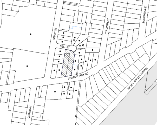
|
NOTIFICATION PLAN |
|
||
|
• PROPERTIES NOTIFIED
|
X SUBMISSIONS RECEIVED |
PROPERTY SUBJECT OF DEVELOPMENT |
|
Two submissions objected to the development, generally on the grounds that the development would result in:
· Unacceptable air and noise pollution including concerns regarding asbestos and dust during demolition and construction;
· Unacceptable traffic, accessibility and parking on local streets i.e. trucks on Bell Street;
· Increased crime generated from the development;
· Unacceptable waste management on local roads;
· Development that is excessive in height; and
· The development would result in an increase in abandoned shopping trolleys.
Additional requests included:
· Restriction to work hours due to neighbouring resident’s work shift/sleep patterns.
5.1.1 Air Pollution and Noise During Demolition and Construction
Concerns were raised regarding air pollution and noise generated from the demolition and construction of the proposed development. In particular a concern was raised regarding the demolition and construction hours and resultant noise disruption for neighbouring residents.
Council recommends that a Construction Management Plan (CMP) be prepared by a suitably qualified consultant, must be submitted for approval by Council. The CMP would require noise attenuation measure to be implemented along the Bell Street property boundary of the site including a hoarding height not less than 3m from the existing ground level, during excavation works, rock removal must be undertaken by sawing instead of rock hammering, wherever practicable and that the construction works must be undertaken in accordance with the “Interim Construction Noise Guidelines – 2009” published by DECCW and achieve compliance with the relevant noise levels. In addition, Council’s standard noise condition would restrict all work on site (including demolition and earth works) to occur between 7am and 5pm Monday to Saturday (unless otherwise approved by Council due to extenuating circumstances) with no work to be undertaken on Sundays or public holidays.
In terms of air pollution and asbestos disposal and contamination, Council recommends standard conditions requiring that all demotion work is to be carried out in accordance with Australian Standard 2601 – 2002 – The Demolition of Structures and that where asbestos material is being removed, must be undertaken by a contractor that holds an appropriate licence issued by WorkCover NSW in accordance with Chapter 10 of the Occupational Health and Safety Regulation 2001 and Clause 29 of the Protection of the Environment Operations (Waste) Regulation 2005. In addition, a standard commercial manufactured sign warning of asbestos removal is to the erected in a prominent position visible from the street.
5.1.2 Parking
Concerns were raised regarding construction vehicles and tradesperson vehicles parking on Bell Street. This is a compliance issue. Generally, heavy vehicles are limited to 1 hour parking on residential streets. Council’s Parking Rangers are available for patrols to ensure that no illegal parking occurs in the streets surrounding the proposed development. In addition, a condition is recommended that all construction vehicles are to access the site via Peats Ferry Road only. This is to be included in the traffic management plan and complied with during the works phase.
5.1.3 Shopping Trolleys
Abandoned shopping trolleys would be considered a waste management compliance matter and is not a matter for consideration for the proposed development under Section 79C of the Environmental Planning and Assessment Act, 1979.
5.2 Public Agencies – Roads and Maritime Services
The application was referred to Roads and Maritime Services (RMS) for concurrence under Section 138 of the Roads Act, 1993. RMS reviewed the application and provides concurrence under Section 138 of Roads Act 1993 to the proposed driveway and the removal of the redundant driveway at 305-307 Peats Ferry Road, Asquith provided it is constructed to Council’s satisfaction. Concurrence was provided subject to recommended conditions as included under Schedule 1.
6. THE PUBLIC INTEREST
Section 79C(1)(e) of the Act requires Council to consider “the public interest”.
The public interest is an overarching requirement, which includes the consideration of the matters discussed in this report. Implicit to the public interest is the achievement of future built outcomes adequately responding to and respecting the future desired outcomes expressed in environmental planning instruments and development control plans.
The application is considered to have satisfactorily addressed Council’s and relevant agencies’ criteria and would provide a development outcome that, on balance, would result in a positive impact for the community. Accordingly, it is considered that the approval of the proposed development would be in the public interest.
CONCLUSION
The application seeks approval for the demolition of existing structures and the construction of two, five storey residential flat buildings comprising 69 units with two levels of basement car parking.
The proposed development is generally in accordance with the development controls for the ‘Hyacinth Street, Asquith’ precinct of the Hornsby Development Control Plan and would contribute to the future desired five storey residential character of the precinct. With conditions, the minor non-compliances to do with prescriptive measures for setbacks, floorplate dimension, deep soil landscaping are considered to be acceptable. The proposal complies with the design principles of SEPP 65 and the Residential Flat Design Code.
Two submissions were received regarding the proposal. The concerns raised have been addressed in the body of the report.
Note: At the time of the completion of this planning report, no persons have made a Political Donations Disclosure Statement pursuant to Section 147 of the Environmental Planning and Assessment Act 1979 in respect of the subject planning application.
RESPONSIBLE OFFICER
The officer responsible for the preparation of this Report is the Manager – Development Assessments – Rodney Pickles, who can be contacted on 9847 6731.
|
Rod Pickles Manager - Development Assessment Planning Division |
James Farrington Group Manager Planning Division |
|
1.View |
Locality Map |
|
|
|
2.View |
Site Plan |
|
|
|
3.View |
Floor Plans |
|
|
|
4.View |
Elevations and Sections |
|
|
|
5.View |
Subdivision Plan |
|
|
|
6.View |
Shadow Diagram |
|
|
|
7.View |
Landscape Plan |
|
|
File Reference: DA/214/2015
Document Number: D05972038
SCHEDULE 1
GENERAL CONDITIONS
The conditions of consent within this notice of determination have been applied to ensure that the use of the land and/or building is carried out in such a manner that is consistent with the aims and objectives of the relevant legislation, planning instruments and council policies affecting the land and does not disrupt the amenity of the neighbourhood or impact upon the environment.
Note: For the purpose of this consent, the term ‘applicant’ means any person who has the authority to act on or the benefit of the development consent.
Note: For the purpose of this consent, any reference to an Act, Regulation, Australian Standard or publication by a public authority shall be taken to mean the gazetted Act or Regulation, or adopted Australian Standard or publication as in force on the date that the application for a construction certificate is made.
1. Deferred Commencement
Pursuant to Section 80(3) of the Environmental Planning and Assessment Act 1979, this consent does not operate until the following information is submitted to Council:
a) A registered plan of subdivision from the NSW Department of Lands creating a new lot from Lot 1 DP385418 to form part of the development.
Such information shall be submitted within 12 months of the date of this notice.
Upon Council’s written satisfaction of the above information, the following conditions of development consent will apply:
2. Approved Plans and Supporting Documentation
The development must be carried out in accordance with the plans and documentation listed below and endorsed with Council’s stamp, except where amended by Council and/or other conditions of this consent:
|
Plan No. |
Plan Title |
Drawn by |
Dated |
|
Ref 17387 |
Survey Plan |
Norton Survey Partners |
24/10/10 |
|
Ref 17387 |
Plan showing existing and proposed lot layouts |
Norton Survey Partners |
27/1/15 |
|
A50 - C |
Plan B2 & B1 |
Mijollo International |
1/7/15 |
|
A52- C |
Plans L1 to L3 |
Mijollo International |
1/7/15 |
|
A55- D |
Plans L4 & L5 |
Mijollo International |
10/7/15 |
|
A57- C |
Plans Attic & Roof |
Mijollo International |
10/7/15 |
|
A401- C |
North, East, South & West Elevations |
Mijollo International |
13/6/15 |
|
A501- C |
Section A-A + Internal Elevations |
Mijollo International |
13/6/15 |
|
A611- A |
Shadow diagrams |
Mijollo International |
6/2/15 |
|
|
Solar Access for Eastern and Western Facades |
Mijollo International |
Received on 2 7/15 |
|
LPDA15-287/1 E |
Landscape Plan |
Conzept Landscape Architects |
20/7/15 |
|
LPDA15-287/2 A |
Landscape plan (level 4 & 5) |
Conzept Landscape Architects |
9/9/14 |
|
LPDA15-287/3 A |
Landscape Details |
Conzept Landscape Architects |
9/2/15 |
|
14051-C201 Rev P1 |
Erosion & Sediment Control Plan |
TDL Engineering Consultants |
14/1/15 |
|
14051-C101- 104 Rev P1 |
Stormwater Management Plan Level 1 Layout |
TDL Engineering Consultants |
14/1/15 |
|
Document Title |
Prepared by |
Dated |
|
Statement of Environmental Effects |
Caladines Town Planning P/L |
Feb 2015 |
|
Waste Management Plan |
Ben Hewlett |
25/2/15 |
|
Music Model – Stormwater pollutant targets |
Unnamed |
Submitted 4/6/15 |
|
Traffic & Parking Report |
Ason Group |
11/2/15 |
|
SEPP 65 Certification |
Matthew Cumming (Mijollo International P/L) |
24/2/15 |
|
Accessibility Report |
Abe Consulting |
10/2/15 |
|
Basix Assessment Report No. ES20141125_00 |
ESD Synergy P/L |
27/7/15 |
|
Basix Certificate No. 607563M_02 |
ESD Synergy P/L |
27/7/15 |
|
Cost Summary Report |
QS1 P/L |
2/2/15 |
|
1410-A Materials Schedule |
Mijollo International P/L |
6/2/15 |
3. Amendment of Plans
The approved plans are to be amended as follows:
a) To ensure that future occupants within the proposed development maintain an appropriate level of privacy, all south facing windows opposing habitable spaces on south western corner units in Building 2 are to be installed with privacy screens.
4. Acoustic Report
An acoustic report is to be provided prior to the issue of a construction certificate demonstrating that appropriate measures will be taken to ensure that the following LAeq levels are not exceeded:
a) In any bedroom in the building – 35dB(A) at any time between 10pm and 7am,
b) Anywhere else in the building (other than a garage, kitchen, bathroom or hallway) 40dB(A) at any time.
The report is to provide details of construction techniques and measure to attenuate road noise and vibration. The development must not exceed the specified noise criteria and LAeq levels within Clause 102 of the SEPP (Infrastructure).
5. Construction Certificate
a) A Construction Certificate is required to be approved by Council or a Private Certifying Authority prior to the commencement of any works under this consent.
b) The Construction Certificate plans must not be inconsistent with the Development Consent plans.
6. Section 94 Development Contributions
a) In accordance with Section 80A(1) of the Environmental Planning and Assessment Act 1979 and the Hornsby Shire Council Section 94 Development Contributions Plan 2012-2021, the following monetary contributions shall be paid to Council to cater for the increased demand for community infrastructure resulting from the development:
|
Description |
Contribution (4) |
|
Roads |
$81,645.80 |
|
Open Space and Recreation |
$782,077.30 |
|
Community Facilities |
$109,031.15 |
|
Plan Preparation and Administration |
$3,267.45 |
|
TOTAL |
$976,021.70 |
being for 25 x 1 bedroom units, 37 x 2 bedroom units and 7 x 3 bedroom units and including a credit for three existing dwelling houses.
b) The value of this contribution is current as at 22 July 2015 If the contributions are not paid within the financial quarter that this condition was generated, the contributions payable will be adjusted in accordance with the provisions of the Hornsby Shire Council Section 94 Development Contributions Plan and the amount payable will be calculated at the time of payment in the following manner:
$CPY = $CDC x CPIPY
CPIDC
Where:
$CPY is the amount of the contribution at the date of Payment
$CDC is the amount of the contribution as set out in this Development Consent
CPIPY is the latest release of the Consumer Price Index (Sydney – All Groups) at the date of Payment as published by the ABS.
CPIDC is the Consumer Price Index (Sydney – All Groups) for the financial quarter at the date applicable in this Development Consent Condition.
c) The monetary contributions shall be paid to Council:
i) prior to the issue of the Subdivision Certificate where the development is for subdivision; or
ii) prior to the issue of the first Construction Certificate where the development is for building work; or
iii) prior to issue of the Subdivision Certificate or first Construction Certificate, whichever occurs first, where the development involves both subdivision and building work; or
iv) prior to the works commencing where the development does not require a Construction Certificate or Subdivision Certificate.
It is the professional responsibility of the Principal Certifying Authority to ensure that the monetary contributions have been paid to Council in accordance with the above timeframes.
Council’s Development Contributions Plan may be viewed at www.hornsby.nsw.gov.au or a copy may be inspected at Council’s Administration Centre during normal business hours.
REQUIREMENTS PRIOR TO THE ISSUE OF A CONSTRUCTION CERTIFICATE
7. Building Code of Australia
All building work must be carried out in accordance with the relevant requirements of the Building Code of Australia.
8. Contract of Insurance (Residential Building Work)
In the case of residential building work for which the Home Building Act 1989 requires there to be a contract of insurance in force in accordance with Part 6 of that Act, that such a contract of insurance is in force before any building work authorised to be carried out by the consent commences.
9. Notification of Home Building Act, 1989 Requirements
Residential building work within the meaning of the Home Building Act 1989 must not be carried out unless the principal certifying authority for the development to which the work relates (not being Council) has given Council written notice of the following information:
a) In the case of work for which a principal contractor is required to be appointed:
i) The name and licence number of the principal contractor; and
ii) The name of the insurer by which the work is insured under Part 6 of that Act.
b) In the case of work to be done by an owner-builder:
i) The name of the owner-builder; and
ii) If the owner-builder is required to hold an owner-builder’s permit under that Act, the number of the owner-builder’s permit.
Note: If arrangements for doing the residential building work are changed while the work is in progress so that the information notified becomes out of date, further work must not be carried out unless the principal certifying authority for the development to which the work relates (not being Council) has given Council written notification of the updated information.
10. Utility Services
The applicant must submit written evidence of the following service provider requirements:
a) Ausgrid (formerly Energy Australia) – a letter of consent demonstrating that satisfactory arrangements have been made to service the proposed development.
b) Telstra - a letter of consent demonstrating that satisfactory arrangements have been made to service the proposed development.
11. Sydney Water – Quick Check
This application must be submitted to a Sydney Water ‘Quick Check Agent’ or ‘Customer Centre’ for approval to determine whether the development would affect any Sydney Water infrastructure, and whether further requirements are to be met.
Note: Refer to www.sydneywater.com.au or telephone 13 20 92 for assistance.
12. Dilapidation Report
A ‘Dilapidation Report’ is to be prepared by a ‘chartered structural engineer’ detailing the structural condition of all adjoining properties including Nos. 303 and 309 Peats Ferry Road and Nos 2 2A Lodge Street.
13. Traffic Control Plan
A Traffic Control Plan (TCP) must be prepared by a qualified traffic controller in accordance with the Roads & Traffic Authority’s Traffic Control at Worksites Manual 1998 and Australian Standard 1742.3 for all work on a public road. The Traffic Management Plan shall be submitted and approved by Council’s Manager Traffic and Road Safety prior to the issue of a construction certificate. The TCP must detail the following:
a) Arrangements for public notification of the works;
b) Temporary construction signage;
c) Permanent post-construction signage;
d) Vehicle movement plans;
e) Traffic management plans;
f) Pedestrian and cyclist access/safety.
The TCP is to be submitted to Council for approval prior to the issue of the construction certificate.
14. Construction Management Plan
A Construction Management Plan (CMP), prepared by a suitably qualified consultant, must be submitted for approval by Council. The CMP must be include, but not be limited, details of the following:
a) Noise attenuation measures be implemented along the eastern boundary of the site including a hoarding height not less than 3m from the existing ground level;
b) During excavation works, rock removal must be undertaken by sawing instead of rock hammering, wherever practicable;
c) The construction works must be undertaken in accordance with the “Interim Construction Noise Guidelines – 2009” published by DECCW and achieve compliance with the relevant noise levels; and
d) The delivery times and vehicular movements related to demolition, excavation and construction works must be restricted to the construction hours only.
15. Adaptable Units
The details of the fit-outs of all accessible and adaptable units must be provided with the Construction Certificate Plans.
16. Construction Vehicles
All construction vehicles associated with the proposed development are to be contained on site or in an approved “Work Zone”. Construction zones will not be permitted on Bell Street.
17. Construction Traffic Management Plan
A Construction Traffic Management Plan (CTMP) detailing construction vehicle routes, number of trucks, hours of operation, access arrangements and traffic control should be submitted to Council prior to the issue of a Construction Certificate. Council will review the CTMP, agree to any modifications with the proponent and enforce the CTMP during construction.
18. Pedestrian Access Management Plan
A Pedestrian Access Management Plan (PAMP) detailing how pedestrian movements will be changed and managed during various stages of development, particularly during any partial or total closure of footpaths on Peats Ferry Road and Bell Street. Council will review the PAMP, agree to any modifications with the proponent and enforce the PAMP during construction.
19. Preservation of Survey Infrastructure
Prior to the issue of a construction certificate, a registered surveyor shall identify all survey marks in the vicinity of the proposed development. Any survey marks required to be removed or displaced as a result of the proposed development shall be undertaken by a registered surveyor in accordance with Section 24(1) of the Surveying and Spatial Information Act 2002 and following the Surveyor General’s Directions No. 11 – “Preservation of Survey Infrastructure”.
20. Waste Management
The following waste management requirements must be complied with:
a) The approved on-going waste management system must not be amended without the written consent of Council.
b) The access way (including ramp, vehicle turning area, loading bay and site entry/exit) to be used by waste collection vehicles, must be designed in compliance with Australian Standard AS2890.2-2002 Parking Facilities Part 2:Off-Street Commercial Vehicle Facilities for small rigid vehicles.
c) Storage space must be provided for motorised bin carting equipment
d) The doors to the recycling and garbage collection rooms are to be approximately 3m side roller doors.
21. Waste Management Details
Waste management during the demolition and construction phase of the development must be undertaken in accordance with the approved Waste Management Plan. Additionally written records of the following items must be maintained during the removal of any waste from the site and such information submitted to the Principal Certifying Authority within fourteen days of the date of completion of the works:
a) The identity of the person removing the waste.
b) The waste carrier vehicle registration.
c) Date and time of waste collection.
d) A description of the waste (type of waste and estimated quantity).
e) Details of the site to which the waste is to be taken.
f) The corresponding tip docket/receipt from the site to which the waste is transferred (noting date and time of delivery, description (type and quantity) of waste).
g) Whether the waste is expected to be reused, recycled or got to landfill.
Note: In accordance with the Protection of the Environment Operations Act 1997, the definition of waste includes any unwanted substance, regardless of whether it is reused, recycled or disposed to landfill.
22. Acoustic Report
The Construction Certificate plans must demonstrate compliance with the recommendations in the submitted Acoustic Report (required as per condition No. 4) including materials of construction and glazing details.
23. Driveway Longitudinal Sections
Longitudinal sections along both sides of the access driveway shall be submitted to the principal certifying authority in accordance with the relevant sections of AS 2890.1 and the following requirements:
a) The maximum grade shall not exceed 1 in 4 (25%) with the maximum changes of grade of 1 in 8 (12.5%) for summit grades and 1 in 6.7 (15%) for sag grades. Any transition grades shall have a minimum length of 2 metres. The longitudinal sections shall incorporate the design levels obtained by Council.
Note: A construction certificate shall be obtained prior to the commencement of these works and are to be completed prior to the issue of an occupation certificate.
24. Stormwater Drainage – Dwellings
The stormwater drainage system for the development must be designed and constructed for an average recurrence interval of 20 years and be gravity drained in accordance with the following requirements:
a) Connected directly to an existing Council drainage system/street gutter via an on-site detention and water quality treatment system. Capacity of the street gutter is to be verified prior to discharging to the gutter.
b) Be designed by a Chartered Professional Engineer/Civil Engineer of the Institution of Engineers, Australia
c) A construction certificate application is to be submitted to Council for discharging stormwater to Council pit. All works are to be carried out in accordance with Council’s Civil Works Specifications 2005.
d) The stormwater system with on-site detention and water quality treatment facilities is to be constructed in accordance with Drainage Nos. 14051-C101-C104 Revision P1 dated 14.01.15 prepared by TLD Engineering Consulting Pty Ltd (Council Document No. D04948248).
25. On Site Stormwater Detention
An on-site stormwater detention system must be designed by a chartered civil engineer and constructed in accordance with the following requirements:
a) Storage capacity to accommodate volume from up to 20 years ARI (average recurrence interval) and a maximum discharge (when full) limited to 5 years pre development rate.
b) Have a surcharge/inspection grate located directly above the outlet.
c) Discharge from the detention system to be controlled via 1 metre length of pipe, not less than 50 millimetres diameter or via a stainless plate with sharply drilled orifice bolted over the face of the outlet discharging into a larger diameter pipe capable of carrying the design flow to an approved Council system.
d) Where above ground and the average depth is greater than 0.3 metres, a ‘pool type’ safety fence and warning signs to be installed.
e) Not be constructed in a location that would impact upon the visual or recreational amenity of residents.
f) Detail calculations are to be shown in construction certificate plan.
26. Water Quality/Bio Retention System
Stormwater discharging from the development site is to be treated to achieve the quality specified in the HDCP 2013 (table 1C.1.2(b) Urban Stormwater Quality Targets). A Chartered Civil/Hydraulic Engineer of the Institution of Engineers, Australia is to certify that works have been completed in accordance with the approved construction plan and the measures will achieve the targets specified in the condition.
27. Vehicular Crossing
A separate application under the Local Government Act 1993 and the Roads Act 1993 must be submitted to Council for the installation of a new vehicular crossing and the removal of the redundant crossing. The vehicular crossing must be constructed in accordance with Council’s Civil Works Design 2005 and the following requirements:
a) Any redundant crossings must be replaced with integral kerb and gutter;
b) The footway area must be restored by turfing;
c) Approval must be obtained from all relevant utility providers that all necessary conduits be provided and protected under the crossing.
Note: An application for a vehicular crossing can only be made to one of Council’s Authorised Vehicular Crossing Contractors. You are advised to contact Council on 02 9847 6940 to obtain a list of contractors.
28. Internal Driveway/Vehicular Areas
The driveway and parking areas on site must be designed in accordance with Australian Standards 2890.1, 2890.2, 3727 and the following requirements:
a) Design levels at the front boundary must be obtained from Council;
b) The driveway must be a rigid pavement.
29. Road Works
All road works approved under this consent must be constructed in accordance with Council’s Civil Works Design and Construction Specification 2005 and the following requirements:
a) A concrete footpath along Bell and Lodge Streets are to be constructed. Old sections of the footpath along Peats Ferry Road are to be replaced.
b) The kerb and gutter fronting Bell Street and 31m along Lodge Street (from the intersection of Lodge and Bell Streets) are to be constructed. The existing road pavement is to be saw cut a minimum of 300 mm from the existing edge of the bitumen and reconstructed.
c) A construction certificate is to be submitted to Council for approval.
Note: Council is the only authority to approve works within Council roads.
REQUIREMENTS PRIOR TO THE COMMENCEMENT OF ANY WORKS
30. Erection of Construction Sign
A sign must be erected in a prominent position on any site on which building work, subdivision work or demolition work is being carried out:
a) Showing the name, address and telephone number of the principal certifying authority for the work;
b) Showing the name of the principal contractor (if any) for any demolition or building work and a telephone number on which that person may be contacted outside working hours; and
c) Stating that unauthorised entry to the work site is prohibited.
Note: Any such sign is to be maintained while the building work, subdivision work or demolition work is being carried out, but must be removed when the work has been completed.
31. Protection of Adjoining Areas
A temporary hoarding, fence or awning must be erected between the work site and adjoining lands before the works begin and must be kept in place until after the completion of the works if the works:
a) Could cause a danger, obstruction or inconvenience to pedestrian or vehicular traffic.
b) Could cause damage to adjoining lands by falling objects.
c) Involve the enclosure of a public place or part of a public place.
Note: Notwithstanding the above, Council’s separate written approval is required prior to the erection of any structure or other obstruction on public land.
32. Toilet Facilities
Toilet facilities must be available or provided at the works site before works begin and must be maintained until the works are completed at a ratio of one toilet for every 20 persons employed at the site. Each toilet must:
a) be a standard flushing toilet connected to a public sewer; or
b) be a temporary chemical closet approved under the Local Government Act 1993; or
c) have an on-site effluent disposal system approved under the Local Government Act 1993.
33. Erosion and Sediment Control
Erosion and sediment control measures must be provided and maintained throughout the construction period in accordance with the manual ‘Soils and Construction 2004 (Bluebook)’, the approved plans, Council specifications and to the satisfaction of the principal certifying authority. The erosion and sediment control devices must remain in place until the site has been stabilised and revegetated.
Note: On the spot penalties may be issued for any non-compliance with this requirement without any further notification or warning.
REQUIREMENTS DURING CONSTRUCTION
34. Construction Work Hours
All work on site (including demolition and earth works) must only occur between 7am and 5pm Monday to Saturday (unless otherwise approved by Council due to extenuating circumstances). No work is to be undertaken on Sundays or public holidays. No excavation or rock sawing/breaking is to occur on Saturdays.
35. Demolition
All demolition work must be carried out in accordance with “Australian Standard 2601-2001 – The Demolition of Structures” and the following requirements
a) Demolition material must be disposed of to an authorised recycling and/or waste disposal site and/or in accordance with an approved waste management plan;
b) Demolition works, where asbestos material is being removed, must be undertaken by a contractor that holds an appropriate licence issued by WorkCover NSW in accordance with Chapter 10 of the Occupational Health and Safety Regulation 2001 and Clause 29 of the Protection of the Environment Operations (Waste) Regulation 2005 ;and
c) On construction sites where buildings contain asbestos material, a standard commercially manufactured sign containing the words ‘DANGER ASBESTOS REMOVAL IN PROGRESS’ measuring not less than 400mm x 300mm must be erected in a prominent position visible from the street.
36. Environmental Management
The site must be managed in accordance with the publication ‘Managing Urban Stormwater – Landcom (March 2004) and the Protection of the Environment Operations Act 1997 by way of implementing appropriate measures to prevent sediment run-off, excessive dust, noise or odour emanating from the site during the construction of the development.
37. Street Sweeping
Street sweeping must be undertaken following sediment tracking from the site along Peats Ferry Road and Bell Street during works and until the site is established.
The street cleaning services must undertake a street ‘scrub and dry’ method of service and not a dry sweeping service that may cause sediment tracking to spread or cause a dust nuisance.
38. Council Property
During construction works, no building materials, waste, machinery or related matter is to be stored on the road or footpath. The public reserve must be kept in a clean, tidy and safe condition at all times.
39. Landfill
Landfill must be constructed in accordance with Council’s ‘Construction Specification 2005’ and the following requirements:
a) All fill material imported to the site is to wholly consist of Virgin Excavated Natural Material (VENM) as defined in Schedule 1 of the Protection of the Environment Operations Act 1997 or a material approved under the Department of Environment and Climate Change’s general resource recovery exemption.
b) A compaction certificate is to be obtained from a geotechnical engineer verifying that the specified compaction requirements have been met.
40. Excavated Material
All excavated material removed from the site must be classified in accordance with the Department of Environment, Climate Change and Water NSW Waste Classification Guidelines prior to disposal to an approved waste management facility and reported to the principal certifying authority.
41. Survey Report
A report(s) must be prepared by a registered surveyor and submitted to the principal certifying authority;
a) Prior to the pouring of concrete at each level of the building certifying that:
i) The building, retaining walls and the like have been correctly positioned on the site; and
ii) The finished floor level(s) are in accordance with the approved plans.
b) The waste collection vehicle turning area complies with AS2890.1 – 2004 and AS20890.2 – 2002 for small rigid vehicles (SRV).
42. Waste Management
Waste management during the demolition and construction phase of the development must be undertaken in accordance with the approved Waste management Plan. Additionally written records of the following items must be maintained during the removal of any waste from the site and such information submitted to the Principle Certifying Authority within fourteen days of the date of completion of the works:
a) The identity of the person removing the waste.
b) The waste carrier vehicle registration.
c) Date and time of waste collection.
d) A description of the waste (type of waste and estimated quantity).
e) Details of the site to which the waste is to be taken.
f) The corresponding tip docket/receipt from the site to which the waste is transferred (noting date and time of delivery, description (type and quantity) of waste.
g) Whether the waste is expected to be reused, recycled or go to landfill.
Note: In accordance with the Protection of the Environment Operations Act 1997, the definition of waste includes any unwanted substance, regardless of whether it is reused, recycled or disposed to landfill.
43. Traffic Control Plan Compliance
The development must be carried out in accordance with the submitted Traffic Control Plan (TCP).
44. Disturbance of Existing Site
During construction works, the existing ground levels of open space areas and natural landscape features, (including natural rock-outcrops, vegetation, soil and watercourses) must not be altered unless otherwise nominated on the approved plans.
45. Construction Noise Management
The construction works must be undertaken in accordance with the “Interim Construction Noise Guidelines – 2009” published by NSW Environmental Protection Authority.
46. Contamination During Construction Works
Should the presence of asbestos or soil contamination, not recognised during the application process be identified during demolition, the applicant must immediately notify the Principal Certifying Authority and Council.
47. Construction Vehicle Access
All construction vehicles associated with the proposed development are to access the site from Peats Ferry Road only. No construction vehicle access is permitted on Bell Street.
48. Work Zone
All construction vehicles associated with the proposed development are to be contained on site or in a Local Traffic Committee (LTC) approved “Work Zone”.
REQUIREMENTS PRIOR TO THE ISSUE OF AN OCCUPATION CERTIFICATE
Note: For the purpose of this consent, a reference to ‘occupation certificate’ shall not be taken to mean an ‘interim occupation certificate’ unless otherwise stated.
49. Fulfilment of BASIX Commitments
The applicant must demonstrate the fulfilment of BASIX commitments pertaining to the development.
50. Sydney Water – s73 Certificate
An s73 Certificate must be obtained from Sydney Water.
Note: Sydney Water requires that s73 applications are to be made through an authorised Sydney Water Servicing Coordinator. Refer to www.sydneywater.com.au or telephone 13 20 92 for assistance.
51. Works as Executed Plan
A works-as-executed plan(s) must be prepared by a registered surveyor and submitted to Council for completed road pavement, kerb & gutter, drainage systems, with water quality measures, driveways and on-site detention system.
52. Damage to Council Assets
Any damage caused to Council’s assets as a result of the construction or demolition of the development must be rectified in accordance with Council’s Civil Works Specifications. Council’s Restorations Supervision must be notified for a formwork inspection prior to pouring concrete.
53. Creation of Easements
The following matter(s) must be nominated on the plan of subdivision under s88B of the Conveyancing Act 1919:
a) The creation of an appropriate "Positive Covenant" and "Restriction as to User" over the constructed on-site detention and bio retention system and outlet works within the lots in favour of Council in accordance with Council’s prescribed wording. The position of the on-site detention and bio retention systems are to be clearly indicated on the title.
b) To register the positive covenant and the restriction on the use of land, “works as executed” details of the on-site detention and bio retention system must be submitted verifying that the required storage and discharge rates will be achieved and water quality control measures have been constructed in accordance with the design requirements. The details must show the invert levels of the on-site system together with pipe sizes and grades and details of the bio retention system. Any variations to the approved plans must be shown in red on the “works-as-executed” plan and supported by calculations.
Note: Council must be nominated as the authority to release, vary or modify any easement, restriction or covenant.
54. Consolidation of Allotments
All allotments the subject of this consent must be consolidated into one allotment.
Note: The applicant is recommended to submit the plan of subdivision to consolidate allotments to the NSW Department of Lands at least 4-6 weeks prior to seeking an occupation certificate.
55. Certificate of Preservation Survey Marks
A certificate by a Registered Surveyor shall be submitted to the Principal Certifying Authority, certifying that there has been no removal, damage, destruction, displacement or defacing of the existing survey marks in the vicinity of the proposed development or otherwise the reestablishment of damaged, removed or displaced survey marks has been undertaken in accordance with the Surveyor General’s Direction No. 11 – “Preservation of Survey Infrastructure”.
56. Garbage Collection Easement
For the purpose of waste collection, an easement entitling Council, its servants and agents and persons authorised by it to enter upon the subject land and to operate thereon, vehicles and other equipment for the purposes of garbage collection must be granted to Council by the owner of the land.
Note: The easement must be in a form prescribed by Council and must include covenants to the effect that parties will not be liable for any damage caused to the subject land or any part thereof or to any property located therein or thereon by reason of the operation thereon of any vehicle or other equipment used in connection with the collection of garbage and to the effect that the owner for the time being of the subject land shall indemnify the Council, its servants, agents and persons authorised by it to collect garbage against liability in respect of any such claims made by any person whomsoever.
57. Waste Management Details
The following waste management requirements must be complied with:
a) Prior to an Occupation Certificate being issued or the use commencing, whichever is earlier, the Principal Certifying Authority must obtain Council’s approval of the waste and recycling management facilities provided in the development and ensure arrangements are in place for domestic waste collection by Council.
Note: Waste and recycling management facilities includes everything required for on-going waste management on the site. For example the garbage chute system, volume handling equipment, bin lifter, motorised bin trolley or similar, recycling bin storage on each residential level, bin storage areas, bulky waste storage area, bin collection area, waste collection vehicle access etc.
b) The garbage rooms at the basement level must include water or a hose for cleaning, graded floors with drainage to sewer, a robust door, sealed and impervious surface, adequate lighting and ventilation, and must be lockable. The waste facility at each residential level must include sealed and impervious surface, adequate lighting and ventilation.
c) A report must be prepared by an appropriately qualified person, certifying the following:
i) A comparison of the estimated quantities of each waste type against the actual quantities of each waste type.
Note: Explanations of any deviations to the approved Waste Management Plan is required to be included in this report.
ii) That at least 60% of the waste generated during the demolition and construction phase of the development was reused or recycled.
Note: If the 60% diversion from landfill cannot be achieved in the Construction Stage, the Report is to include the reasons why this occurred and certify that appropriate work practices were employed to implement the approved Waste Management Plan. The Report must be based on documentary evidence such as tipping dockets/receipts from recycling depots, transfer stations and landfills, audits of procedures etc. which are to be attached to the report.
iii) All waste was taken to site(s) that were lawfully permitted to accept that waste.
d) Each unit must be provided with an indoor waste/recycling cupboard for the interim storage of a minimum one day’s waste generation with separate containers for general waste and recyclable materials.
e) Space must be provided for either individual compost containers for each unit or a communal compost container;
Note: The location of the compost containers should have regard for potential amenity impacts.
f) The bin carting routes must be devoid of any steps.
Note: Ramps between different levels are acceptable.
g) A survey of the finished access way (including ramp, waste collection, vehicle turning area, loading bay and site entry/exit) to be used by SRV waste collection vehicle, must be carried out by a registered surveyor and submitted to the principal certifying authority. Written confirmation must be submitted to the Principal certifying authority from a qualified Traffic Engineer, that this survey confirms the finished access way within the waste collection vehicle turning path was designed and constructed in compliance with Australian Standard AS2890.2-2002 Parking Facilities Part 2:Off-street Commercial Vehicle Facilities for small rigid vehicles.
h) The 3.5 metre clearance height within the waste collection vehicle travel path must not be reduced by ducting, lights, pipes or anything else.
i) Site security measures implemented on the property, including electronic gates, must not prevent access to the collection point by waste removal services.
j) Access to the automatic waste volume handling equipment by authorised persons (including residents and waste collectors) must be prevented.
Note: Caging of the automatic volume handling equipment is acceptable.
k) The 2 x 660L bin liner fitted to each garbage chute to automatically change the bin under the chute when it becomes full must not include compaction.
58. Planter Boxes/ On Slab Planting
On slab planter boxes must include waterproofing, subsoil drainage (proprietary drainage cell, 50mm sand and filter fabric) automatic irrigation, minimum 500mm planting soil for shrubs and minimum 1000mm planting soil for trees and palms and 75mm mulch.
59. Planting to Peats Ferry Road Setback
Tree planting to the Peats Ferry Road landscape setback area must include:
a) 1 x Angophora costata or Syncarpia glomulifera, installed at minimum 25 litre pot size.
60. Completing of Landscaping
A certificate must be provided by a practicing landscape architect, horticulturalist or person with similar qualifications and experience certifying that all required landscaping works have been satisfactorily completed in accordance with the approved landscape plans.
Note: Applicants are advised to pre-order plant material required in pot sizes 45 litre or larger to ensure nurseries have stock available at the time of install.
61. Location of Plantings
Tree plantings for low density must be located 4m or greater than from foundation walls of a dwelling or in-ground pool. The pot size must be a minimum 25L.
All replacement trees must be maintained until they reach the height of 3m. Trees must be native to Hornsby Shire and reach a mature height greater than 9m.
All plant stock must meet the specifications outlined in ‘Specifying Trees’ (Ross Clark, NATSPEC Books) and that the planting methods are current, professional (best practice) industry standards at the time of planting.
62. Final Certification
A certificate from suitably qualified Acoustic consultant must be submitted to the Principal Certifying Authority stating compliance with the provided conditions of this consent.
63. Boundary Fencing
Fencing must be erected along all property boundaries behind the front building alignment to a height of 1.8 metres.
Note: Alternative fencing may be erected subject to the written consent of the adjoining property owner(s).
64. External Lighting
All external lighting must be designed and installed in accordance with Australian Standard AS 4282 – Control of the Obtrusive Effects of Outdoor Lighting. Certification of compliance with the Standard must be obtained from a suitably qualified person.
65. Provision for National Broadband Network (NBN)
Provision must be made for fibre ready passive infrastructure (pits and pipes) generally in accordance with NBN Co's pit and pipe installation guidelines to service the proposed development. A certificate from NBN Co or Telstra must be submitted to the PCA that the fibre optic cabling provided for the development complies with MDU Building Design Guides for Development.
66. Unit Numbering
The allocation of unit numbering must be authorised by Council prior to the numbering of each unit in the development.
67. Construction of a Safe Environment
Prior to the issue of an Occupation Certificate, the site must include the following elements:
a) An intercom system be installed at gate locations to ensure screening of persons entering the units;
b) The entryway to the site be illuminated in high luminance at all times;
c) The communal open space areas are to be illuminated with high luminance by motion sensor lighting;
d) The service areas of the ground floor and the garbage room at the basement be illuminated with low luminance at all times;
e) The driveway and the basement car park is to be illuminated with low luminance at all times;
f) Robust materials which cannot be forced or breached with minimised maintenance requirements are to be used for construction work in the common areas;
g) Effective signage be provided to guide visitors to the main areas and parking areas;
h) A street sign be prominently displayed in front of the site in accordance with Order No. 8, Section 124 Local Government Act 1993;
i) The communal area must include a clear sign to restrict access for non-residents;
j) Unit numbers, entry and exit signs must be legible and clear;
k) Fire exit doors to be fitted with single cylinder locksets (Australia New Zealand Standard – Locksets);
l) The entry doors to the pedestrian foyers are to be constructed of safety rated glass to enable residents a clear line of site before entering or exiting the residential apartments;
m) Security deadlocks are to be provided to each apartment door;
n) Peep holes are to be provided to individual apartment doors to promote resident safety; and
o) Residential parking spaces are to be secure spaces with access controlled by card or numeric pad.
OPERATIONAL CONDITIONS
68. Waste Management
The waste management on site must be in accordance with the following requirements:
a) A site caretaker must be employed and be responsible for moving bins where and when necessary, washing bins and maintaining waste storage areas, ensuring the chute systems and related devices are maintained in effective and efficient working order, managing the communal composting area, managing the bulky item storage area, arranging the prompt removal of dumped rubbish, and ensuring all residents are informed of the use of the waste management system. The site caretaker must be employed for a sufficient number of hours each week to allow all waste management responsibilities to be carried out to a satisfactory standard.
69. Car Parking
All car parking must be constructed and operated in accordance with Australian Standard AS/NZS 2890.1:2004 – Off-street car parking and Australian Standard AS 2890.2:2002 – Off-street commercial vehicle facilities.
a) All parking areas and driveways are to be sealed to an all-weather standard, line marked and signposted;
b) Car parking, loading and manoeuvring areas to be used solely for nominated purposes;
c) Vehicles awaiting loading, unloading or servicing shall be parked on site and not on adjacent or nearby public roads;
d) All vehicular entry on to the site and egress from the site shall be made in a forward direction.
70. Sight Distance to Pedestrians and Cyclists
Any proposed landscaping and/or fencing must not restrict sight distance to pedestrians and cyclists travelling along the footpath.
71. Residential Parking Spaces
Residential parking spaces are to be secure spaces with access controlled by card or numeric pad.
72. Visitors Access
Visitors must be able to access the visitor parking spaces in the basement car park at all times.
73. Parking for People with Disabilities
All parking for people with disabilities is to comply with AS/NZS 2890.6:2009 Off-street parking for people with disabilities. In particular note that clearance height 2500 min. is to be maintained from entry to parking space. Refer to Figure 2.7 of AS/NZS 2890.6:2009.
74. Bicycle Parking Spaces
Bicycle parking spaces are to be designed in accordance with AS 2890.3-1993 Bicycle parking facilities.
75. Motorcycle Parking Spaces
Motorcycle parking spaces are to be designed in accordance with AS 2890.5-1993.
76. Access for Garbage Vehicles
Access for garbage vehicles is to satisfy the requirements of Council’s Waste Management Branch.
77. Landscape Establishment
The landscape works must be maintained into the future to ensure the establishment and successful growth of plant material to meet the intent of the landscape design. This must include but not be limited to watering, weeding, replacement of failed plant material and promoting the growth of plants through standard industry practices.
78. Noise
All noise generated by the proposed development must be attenuated to prevent levels of noise being emitted to adjacent premises which possess tonal, beating and similar characteristics or which exceeds background noise levels by more than 5dB(A).
79. Fire Safety Statement - Annual
On at least one occasion in every 12 month period following the date of the first ‘Fire Safety Certificate’ issued for the property, the owner must provide Council with an annual ‘Fire Safety Certificate’ to each essential service installed in the building.
CONDITIONS OF CONCURRENCE – ROADS & MARITIME SERVICE
The following conditions of consent are from the nominated State Agency pursuant to Section 79B of the Environmental Planning and Assessment Act 1979 and must be complied with to the satisfaction of that Agency.
75. All redundant driveways on Peats Ferry Road should be removed and replaced with kerb and gutter to Council’s satisfaction.
76. A Constriction Traffic Management Plan detailing construction vehicle routes, number of trucks, hours of operation, access arrangements and traffic control should be submitted to Council prior to the issue of a construction certificate.
77. The swept path of the longest vehicle (to service the site) entering and exiting the subject site, as well as manoeuvrability through the site, shall be in accordance with AUSTROADS. IN this regard, a plan shall be submitted to Council for approval, which shows that the proposed development complies with this requirement.
78. The layout of the proposed car parking areas associated with the subject development (including driveways, grades, turn paths, sight distance requirements, aisle widths, aisle lengths, and parking bay dimensions) should be in accordance with AS2890.1-2004, AS2890.6-2009 and AS2890.2-2002 for heavy vehicle usage.
79. Any proposed landscaping and/or fencing must not restrict sight distance to pedestrians and cyclists travelling along the footpath.
- END OF CONDITIONS -
ADVISORY NOTES
The following information is provided for your assistance to ensure compliance with the Environmental Planning and Assessment Act, 1979, Environmental Planning and Assessment Regulation 2000, other relevant legislation and Council’s policies and specifications. This information does not form part of the conditions of development consent pursuant to Section 80a of the Act.
Environmental Planning and Assessment Act 1979 Requirements
The Environmental Planning and Assessment Act 1979 requires:
· The issue of a construction certificate prior to the commencement of any works. Enquiries can be made to Council’s Customer Services Branch on 9847 6760.
· A principal certifying authority to be nominated and Council notified of that appointment prior to the commencement of any works.
· Council to be given at least two days written notice prior to the commencement of any works.
· Mandatory inspections of nominated stages of the construction inspected.
· An occupation certificate to be issued before occupying any building or commencing the use of the land.
Long Service Levy
In accordance with Section 34 of the Building and Construction Industry Long Service Payments Act 1986, a ‘Long Service Levy’ must be paid to the Long Service Payments Corporation or Hornsby Council.
Note: The rate of the Long Service Levy is 0.35% of the total cost of the work.
Note: Hornsby Council requires the payment of the Long Service Levy prior to the issue of a construction certificate.
Tree and Vegetation Preservation
In accordance with Clause 5.9 of the Hornsby Local Environmental Plan 2013 a person must not ringbark, cut down, top, lop, remove, injure or wilfully destroy any tree or other vegetation protected under the Hornsby Development Control Plan 2013 without the authority conferred by a development consent or a permit granted by Council.
Notes: A tree is defined as a long lived, woody perennial plant with one or relatively few main stems with the potential to grow to a height greater than three metres (3M). (HDCP 1B.6.1.c).
Tree protection measures and distances are determined using the Australian Standard AS 4970:2009, “Protection of Trees on Development Sites”.
Fines may be imposed for non-compliance with both the Hornsby Local Environmental Plan 2013 and the Hornsby Development Control Plan 2013.
Disability Discrimination Act
The applicant’s attention is drawn to the existence of the Disability Discrimination Act. A construction certificate is required to be obtained for the proposed building/s, which will provide consideration under the Building Code of Australia, however, the development may not comply with the requirements of the Disability Discrimination Act. This is the sole responsibility of the applicant.
Dial Before You Dig
Prior to commencing any works, the applicant is encouraged to contact Dial Before You Dig on 1100 or www.dialbeforeyoudig.com.au for free information on potential underground pipes and cables within the vicinity of the development site.
Telecommunications Act 1997 (Commonwealth)
If you are aware of any works or proposed works which may affect or impact on Telstra’s assets in any way, you are required to contact: Telstra’s Network Integrity Team on Phone Number 1800810443.
Asbestos Warning
Should asbestos or asbestos products be encountered during demolition or construction works, you are advised to seek advice and information prior to disturbing this material. It is recommended that a contractor holding an asbestos-handling permit (issued by WorkCover NSW)be engaged to manage the proper handling of this material. Further information regarding the safe handling and removal of asbestos can be found at:
Alternatively, telephone the WorkCover Asbestos and Demolition Team on 8260 5885.
House Numbering
House numbering can only be authorised by Council. Before proceeding to number each premise in the development, the allocation of numbers is required to be obtained from Council's Planning Division prior to the issue of a Subdivision Certificate. The authorised numbers are required to comply with Council’s Property Numbering Policy and be displayed in a clear manner at or near the main entrance to each premise.
Group Manager’s Report No. PL62/15
Planning Division
Date of Meeting: 12/08/2015
10 DEVELOPMENT APPLICATION - RESIDENTIAL FLAT BUILDINGS COMPRISING 55 UNITS - 27, 29 AND 31 FOREST GROVE ROAD, EPPING
EXECUTIVE SUMMARY
|
DA No: |
DA/153/2015 (Lodged 13/2/2015) |
|
Description: |
Demolition of existing structures and erection of two, five storey residential flat buildings comprising 55 units with basement car parking. |
|
Property: |
Lot 1 and 2 DP 946309, Lot 1 DP 972454, Nos. 27, 29 and 31 Forest Grove, Epping |
|
Applicant: |
Romeciti Project Management |
|
Owner: |
Mr Ramin Samali, Mr Xianyong Gao, Ms Lan Li, Mr Neville Goldsmith and Mrs Karen Goldsmith. |
|
Estimated Value: |
$12,105,000 |
|
Ward: |
C |
· The application proposes demolition of existing structures and the erection of two, five storey residential flat buildings comprising 55 units with basement car parking.
· The proposal generally complies with the Hornsby Local Environmental Plan 2013, State Environmental Planning Policy No. 65 – Design Quality of Residential Flat Buildings and the Hornsby Development Control Plan 2013.
· Two public submissions have been received in respect of the application.
· It is recommended that the application be approved.
|
THAT Development Application No. DA/153/2015 for demolition of existing structures and the erection of two, five storey residential flat buildings comprising 55 units with basement car parking at Lot 1 and 2 in DP 946309, Lot 1 in DP 972454, Nos. 27, 29 and 31 Forest Grove, Epping be approved subject to the conditions of consent detailed in Schedule 1 of Group Manager’s Report No. PL62/15. |
BACKGROUND
The site forms part of the Epping Urban Activation Precinct (Epping UAP).
On 14 March 2014, the Department of Planning and Environment finalised amendments to the Hornsby Local Environmental Plan 2013 (HLEP 2013) to implement the Epping UAP via State Environmental Planning Policy (Epping Town Centre) 2013 (“the SEPP Amendment”).
The Epping Town Centre amendments to the HLEP 2013 involved rezoning of low density residential areas for the purpose of medium to high density residential and mixed use developments. The site is within the Forest Grove (Epping) Precinct, which was rezoned R4 (High Density Residential) to permit residential flat buildings to a height of 5 storeys.
Amendments to the HDCP were consequently prepared by Council to translate design controls recommended by the Department of Planning and Environment and provided planning controls to be read in conjunction with the HLEP 2013 amendments. The DCP amendments were exhibited and endorsed by Council on 8 October 2014.
On 13 February 2015, Development Application No. 153/2015 was lodged for the demolition of existing structures and construction of two, five storey residential flat buildings comprising fifty-five units with basement car parking.
From April to June 2015, Council officers raised a number of planning concerns with respect to the application.
On 3 July 2015, the applicant forwarded the final set of amended plans addressing the matters raised by Council.
SITE
The site comprises three lots and is located on the eastern side of Forest Grove and the northern side of Maida Road. The site is regular in shape and has an area of 2679.2 square metres with a 40.23 metre frontage to Maida Road and a 64.12m frontage to Forest Grove. The site has a gentle slope from Forest Grove to the eastern side boundary with a cross fall from the south-western corner to the north eastern corner of 2.5m.
Existing improvements on the allotments include three dwelling-houses with their respective garages and carports. Vehicular access to the sites is via existing driveways from Forest Grove.
The site contains a number of exotic, native and local indigenous trees. A number of street trees are located on the road verge fronting the subject site. An Arboriculture Assessment and Impact Report has been provided, which identifies six trees on the subject site and adjoining properties that are to be retained and twenty one shrubs or small trees that will be removed as they are exempt under the HDCP.
The site forms part of a precinct, which is undergoing redevelopment. The surrounding developments currently include predominately single storey residential dwellings. A development application DA/304/2015 was lodged in March 2015 for the neighbouring site to the north, Nos. 23 - 25 Forest Grove, for a five storey development which is currently under assessment by Council. The development site adjoins an R2 - Low Density Residential zone to the north-east.
The property is located in the vicinity of the Essex Street Heritage Conservation Area (HCA) to the east of the site.
The site is located approximately 500 metres south-east from Epping Railway Station and Epping commercial town centre.
PROPOSAL
The proposal involves the demolition of existing structures on the site and construction of two, five storey residential flat buildings comprising fifty-five units with two levels of basement car parking and associated landscaping works.
The unit mix would comprise of the following:
· Twenty-four x 1 bedroom units,
· Twenty-five x 2 bedrooms units,
· Six x 3 bedrooms
The units would be accessed via a lift centrally located in the buildings and would include balconies fronting the street, rear and side property boundaries.
The development would be accessed from Maida Road via a driveway located towards the eastern boundary of the site. Pedestrian access to the development is positioned in the middle of site via the Forest Grove frontage. A total of 69 car parking spaces, including 8 visitors’ parking spaces are proposed in two basement levels.
The site would drain to a detention tank adjacent to the eastern boundary of the property under the driveway, and thereafter to the south towards a Council stormwater drainage pipeline on Maida Road.
ASSESSMENT
The development application has been assessed having regard to ‘A Plan for Growing Sydney’, the ‘North Subregion (Draft) Subregional Strategy’ and the matters for consideration prescribed under Section 79C of the Environmental Planning and Assessment Act 1979 (the Act). The following issues have been identified for further consideration.
1. STRATEGIC CONTEXT
1.1 A Plan for Growing Sydney and (Draft) North Subregional Strategy
A Plan for Growing Sydney has been prepared by the NSW State Government to guide land use planning decisions for the next 20 years. The Plan sets a strategy for accommodating Sydney’s future population growth and identifies the need to deliver 689,000 new jobs and 664,000 new homes by 2031. The Plan identifies that the most suitable areas for new housing are in locations close to jobs, public transport, community facilities and services.
The NSW Government will use the subregional planning process to define objectives and set goals for job creation, housing supply and choice in each subregion. Hornsby Shire has been grouped with Hunters Hill, Ku-ring-gai, Lane Cove, Manly, Mosman, North Sydney, Pittwater, Ryde, Warringah and Willoughby to form the North Subregion. The Draft North Subregional Strategy will be reviewed and the Government will set housing targets and monitor supply to ensure planning controls are in place to stimulate housing development.
The proposed development would be consistent with ‘A Plan for Growing Sydney’, by providing fifty-two additional dwellings and would contribute to housing choice in the locality.
2. STATUTORY CONTROLS
Section 79C(1)(a) requires Council to consider “any relevant environmental planning instruments, draft environmental planning instruments, development control plans, planning agreements and regulations”.
2.1 Hornsby Local Environmental Plan 2013
The proposed development has been assessed having regard to the provisions of the Hornsby Local Environmental Plan 2013 (HLEP).
2.1.1 Zoning of Land and Permissibility
The subject land is zoned R4 (High Density Residential) under the Hornsby Local Environmental Plan 2013 (HLEP). The objectives of the zone are:
(a) To provide for the housing needs of the community within a high density residential environment.
(b) To promote a variety of housing types within a high density residential environment.
(c) To enable other land uses that provide facilities or services to meet the day to day needs of residents.
The development proposed is a high density residential development and complies with the zone objectives. The proposed development is defined as a “Residential flat building” under the HLEP and is permissible in the zone with Council’s consent.
2.1.2 Height of Buildings
Clause 4.3 of the HLEP provides that the height of a building on any land should not exceed the maximum height show for the land on the Height of Buildings Map. The maximum permissible height for the subject site is 17.5m. The proposal complies with this provision.
2.1.3 Heritage Conservation
Clause 5.10 of the HLEP sets out heritage conservation provisions for Hornsby Shire. The development site is located in the vicinity of the Essex Street Heritage Conservation Area (HCA) (east) under Schedule 5 (Environmental Heritage) of the HLEP.
The proposed development would not have an adverse impact on the heritage significance of the Heritage Conservation Area given its separation and setbacks from the Conservation Area. The views to and from within the HCA, are not considered to be adversely affected. However, it is acknowledged that the visual setting will be altered to varying degrees as the western HCA backdrop will be one of high rise buildings visible above the low density housing of the HCA.
The rear eastern elevation which is orientated to the HCA has stepped wall lengths and a combination of white and brown render finishes proposed on some of the walls and mid-levels. The eastern elevation also includes a mix of glazed balconies and louvres which break up the facades to be more visually recessive. The neighbouring properties Nos. 9, 9a and 11 Maida Road are also zoned R4 residential and a future 5 storey building on these lots would restrict the views of the proposed building from the Conservation Area.
In summary, the proposed five storey high residential flat buildings will have a visual impact on the western backdrop to the Essex Street HCA, but it is considered that the view will be mitigated by a future 5 storey building on the adjacent property.
2.1.4 Earthworks
Clause 6.2 of the HLEP states that consent is required for proposed earthworks on site. Before granting consent for earthworks, Council is required to assess the impacts of the works on adjoining properties, drainage patterns and soil stability of the locality.
The proposal is satisfactory subject to conditions regarding submission of a ‘Dilapidation Report’ assessing the impact of the excavation on the adjoining properties and ‘Environment Management’ to implement appropriate measures to prevent sediment run-off, excessive dust, noise and the like emanating from the site during the construction of the development.
2.2 State Environmental Planning Policy No. 55 – Remediation of Land
State Environmental Planning Policy No. 55 (SEPP 55) requires that Council must not consent to the carrying out of any development on land unless it has considered whether the land is contaminated or requires remediation for the proposed use.
The site has been used for residential purposes and is unlikely to be contaminated. Further assessment in this regard is not warranted.
2.3 State Environmental Planning Policy No. 65 – Design Quality of Residential Flat Development (Amendment No. 3)
SEPP 65 was amended on 19 June 2015 following review of the policy by the department of planning and environment. The amendments replace the Residential Fat Design Guidelines with the Apartment Design Guide which prevails in the event of any inconsistency with a Development Control Plan.
Clause 31 (Transitional provisions for SEPP 65 – Amendment No. 3) states that “if a development application or an application for the modification of a development consent has been made before the notification on the NSW legislation website of the making of State Environmental Planning ) Policy No 65—Design Quality of Residential Flat Development (Amendment No. 3) and the application has not been finally determined before the commencement of that amendment, the application must be determined as if the amendment had not commenced.”
Pursuant to the above provision, this amendment would not apply to the subject application and the previous version (Amendment 2) of the SEPP is required to be considered.
2.4 State Environmental Planning Policy No. 65 – Design Quality of Residential Flat Development
The Policy provides for design principles to improve the design quality of residential flat development and for consistency in planning controls across the State.
The applicant has submitted a “Design Verification Statement” prepared by a qualified Architect stating how the proposed development achieves the design principles of SEPP 65. The design principles of SEPP 65 and the submitted design verification statement are addressed in the following table:
|
State Environmental Planning Policy No. 65 |
|
|
Principle |
Compliance |
|
1. CONTEXT |
Yes |
|
Comment: The site is located within a planned five storey residential flat building precinct in close proximity to Epping Railway Station and the Epping Commercial Town Centre. The applicant’s ‘Design Verification Statement’ indicates that the proposal responds to the desired future character of the precinct as envisaged by Council. Once the development of the precinct is completed, the proposal would integrate with the surrounding sites and would be in keeping with the future urban form. It is considered that the proposed building would contribute to the identity and future character of the precinct. The development responds suitably to the “context” principle of SEPP 65, considering the desired future character of the area. |
|
|
2. SCALE |
Yes |
|
Comment: The scale of the development is in accordance with the height control for the precinct prescribed within the Hornsby DCP. The building footprints also comply with the maximum floorplate of 35m prescribed within the DCP. The development achieves a scale consistent with the desired outcome for well-articulated buildings that are set back to incorporate landscaping, open space and separation between buildings. |
|
|
3. BUILT FORM |
Yes |
|
Comment: The proposed building achieves an appropriate built form for the site and its purpose, in terms of building alignments, proportions, and the manipulation of building elements. The building would appropriately contribute to the character of the desired future streetscape and includes articulation to minimise the perceived scale. The proposed materials and finishes including timber, render and glazing would add to the visual interest of the development. Flat roof forms have been adopted with an increased top storey setback on the external facades to minimise bulk and height of the building as required by the Hornsby DCP. |
|
|
4. DENSITY |
Yes |
|
Comment: The HLEP does not incorporate floor space ratio requirements for the site. The density of the development is governed by the height of the building and the required setbacks. The proposed density is considered to be sustainable as it responds to the regional context, availability of infrastructure, public transport, community facilities and environmental quality and is acceptable in terms of density. |
|
|
5. RESOURCE, ENERGY AND WATER EFFICIENCY |
Yes |
|
Comment: The applicant has submitted a BASIX Certificate for the proposed development. In achieving the required BASIX targets for sustainable water use, thermal comfort and energy efficiency, the proposed development would achieve efficient use of natural resources, energy and water throughout its full life cycle, including demolition and construction. |
|
|
6. LANDSCAPE |
Yes |
|
Comment: The application includes a Landscape Concept Plan, which provides landscaping along the street frontage, sides and rear boundaries and a 7m x 7m landscaped area between the two buildings. The proposal does not require the removal of any significant trees and seeks to retain large trees surrounding the site, where possible. Additionally, large trees are proposed along the street frontage intercepted by shrubs and hedges which would soften the appearance of the development when viewed from the street. A 1.2 metre high timber fence is proposed along the front property boundary, which is complementary to the proposed landscaping. Deep soil zones are provided around the building envelope to the front, sides and rear which would enhance the natural environmental performance of the development and provide an appropriate landscaped setting. Given the above, the proposal satisfies the intent of the ‘Landscaping’ principle of SEPP 65. |
|
|
7. AMENITY |
Yes |
|
Comment: The proposed units are designed with appropriate layout to maximise amenity for future residents. The proposal incorporates good design in terms of achieving natural ventilation, solar access and acoustic privacy. All units incorporate balconies accessible from living areas and privacy has been achieved through appropriate design and orientation of balconies and living areas. Storage areas have been provided within each unit and in the basement levels. The proposal would provide convenient and safe access in each building via a central lift connecting the basement and all other levels. |
|
|
8. SAFETY AND SECURITY |
Yes |
|
Comment: The design orientates the balconies and windows of individual apartments towards the street, rear and side boundaries, providing passive surveillance of the public domain and communal open space areas. Both the pedestrian and vehicular entry points are secured and visibly prominent from Forest Grove and Maida Road. The proposal includes an assessment of the development against crime prevention controls in the Crime Risk Assessment Report. The report has regard to Crime Prevention Through Environmental Design Principles (CPTED) and includes details of surveillance, access control, territorial reinforcement and space management such as artificial lighting in public places; attractive landscaping whilst maintaining clear sight lines; security coded door lock or swipe card entry; physical or symbolic barriers to attract, channel or restrict the movement of people; security controlled access to basement car park; intercom access for pedestrians; and security cameras located at the entrance of the building. Appropriate conditions of consent are recommended to require compliance with the above matters. |
|
|
9. SOCIAL DIMENSIONS AND HOUSING AFFORDABILITY |
Yes |
|
Comment: The site is located in close proximity to Epping Railway Station and commercial precinct. The location of the site allows direct access to services and facilities. The proposed development includes a mix of dwelling types and sizes, which complies with the requirement within the RFDC to improve housing choice in the locality. Consent conditions require compliance with Council’s adaptable housing controls. In this regard, the development is considered acceptable in terms of social dimensions. |
|
|
10. AESTHETICS |
Yes |
|
Comment: The architectural treatments of the buildings are generally consistent with the design principles contained within the Residential Flat Design Code and the HDCP. It is considered that the aesthetic quality of the buildings would contribute to the desired future character of the precinct. The details of the assessment of the built form and the aesthetics of the development are contained in Section 2.11 of this report. |
|
2.5 State Environmental Planning Policy No. 65 – Residential Flat Design Code
SEPP 65 also requires consideration of the Residential Flat Design Code, NSW Planning Department 2002. The Code includes development controls and best practice benchmarks for achieving the design principles of SEPP 65. The following table sets out the proposal’s compliance with the Code:
|
Residential Flat Design Code |
|||
|
Control |
Proposal |
Requirement |
Compliance |
|
Deep Soil Zone |
>25% |
25% |
Yes |
|
Communal Open Space |
>25% |
25-30%
|
Yes |
|
Ground Level Private Open Space |
Courtyards range from 20m2 – 77m2 with a minimum dimension <4m |
25m2
Min Dimension 4m |
No
No |
|
Minimum Dwelling Size |
1 br – 50m2 - 70m2 2 br – 70m2 - 80m2 3 br – 96m2 - 124m2 |
1 br – 50m2 2 br – 70m2 3 br – 95m2 |
Yes Yes Yes |
|
Maximum Kitchen Distance |
9 units >8m
|
8m |
No |
|
Minimum Balcony Depth |
2m |
2m |
Yes |
|
Minimum Ceiling Height |
2.7m - 3m |
2.7m |
Yes |
|
Total Storage Area |
1 bed - >6m3 (Min) 2 bed - >8m3 (Min) 3 bed – >10m3 (Min)
|
1 bed - 6m3 (Min) 2 bed - 8m3 (Min) 3 bed - 10m3 (Min)
50% accessible from the apartments |
Yes |
|
Dual Aspect and Cross Ventilation |
>60% |
60% (33 units) |
Yes |
|
Adaptable Housing |
30% (17 units) |
10% (6 units) |
Yes |
As detailed in the above table, the proposed development complies with the prescriptive measures within the Residential Flat Design Code (RFDC) other than the minimum dimensions of the ground floor open space and kitchen distance requirement. Below is a brief discussion regarding the relevant development controls and best practice guidelines.
2.5.1 Ground Floor Apartments and Private Open Space
The Code encourages separate entries for ground floor apartments and private garden areas at the ground floor area.
The proposed ground floor unit open spaces include courtyards contained within the building footprints. These areas do not meet the stipulated prescriptive measures under the RFDC, however the unit open space areas are considered appropriate for the respective ground floor units in respect to dwelling size, aspect, function, unit configuration and amenity. The non-compliance with the best practice of 25 square metre open space area with a minimum dimension of 4 metres is considered acceptable in this regard, as larger open space areas would be lost to private use and not contribute to the overall landscaping with regard to the Hornsby Development Control Plan key principle for five storey residential flat buildings in garden settings. The units however, comply with the minimum requirements of the Hornsby Development Control Plan with regard to the private open space areas. The proposal is assessed as satisfactory in this regard.
In addition the adaptable dwellings benefit from convenient access via continuous paths of travel and lifts to common outdoor open space areas. It is considered that the design of the proposed ground floor units is satisfactory in meeting the objectives of the Code.
2.5.2 Apartment Layout
The layout of the proposed apartments includes a combination of single aspect units and dual aspect corner units. The unit layouts would provide for housing choice and a range of household types.
The RFDC requires that not more than 10% of apartments (being 6 units) be south facing. The application complies with this requirement and provides one unit, being Unit B407, with a solely south facing aspect.
The RFDC requires that the back of a kitchen should be no greater than 8 metres from a window. Of the 55 units proposed, 9 units contain kitchens where the back wall is up to 10 metres from a window. However, these units offer an open layout with natural ventilation and accordingly, the minor non-compliance is acceptable with respect to residential amenity.
The proposed apartment layouts are overall functional and satisfy the RFDC objectives for internal privacy, access to sunlight, natural ventilation and acoustic privacy. It is considered that the apartment layout and mix achieve the intent of the best practice requirements of the RFDC and is acceptable in this regard.
2.5.3 Internal Circulation
The RFDC prescribes that units accessible from a single core/corridor should be limited to eight. The number of units per floor ranges from 6-7 units. The proposal is acceptable with respect to the requirements of the RFDC for internal circulation.
2.5.4 Acoustic Privacy
The site is not in close proximity to road or rail noise impacts that would require noise mitigation measures. The internal layout of the proposed units is satisfactory for acoustic privacy to ensure separation of activity areas from bedroom areas.
2.5.5 Building Separation
The proposed setbacks would enable future developments of adjoining sites to meet the best practice requirements of the SEPP 65 Code for building separation.
2.5.6 Storage
The proposed units include built-in robes and linen cupboard storage. The basement includes residential storage areas of various sizes. The proposal would comply with the Codes best practice storage area requirements (i.e. for a minimum of 6m3 of storage area for one bedroom units, 8m3 for two bedroom units and 10m3 for three bedroom units).
2.6 State Environmental Planning Policy (Building Sustainability Index – BASIX) 2004
The application has been assessed against the requirements of State Environmental Planning Policy (Building Sustainability Index: BASIX) 2004. The proposal includes a BASIX Certificate for the proposed units and is considered to be satisfactory.
2.7 State Environmental Planning Policy No. 32 – Urban Consolidation (Redevelopment of Urban Land)
The application has been assessed against the requirements of SEPP 32, which requires Council to implement the aims and objectives of this Policy to the fullest extent practicable when considering development applications relating to redevelopment of urban land. The application complies with the objectives of the Policy as it would promote social and economic welfare of the locality and would result in the orderly and economic use of under-utilised land within the Shire.
2.8 Sydney Regional Environmental Plan (Infrastructure) 2007
The application has been assessed against the requirements of State Environmental Planning Policy (Infrastructure) 2007. This Policy contains State-wide planning controls for developments adjoining busy roads. The development is not categorized as a ‘Traffic Generating Development’ in accordance with Clause 104 and Schedule 3 of SEPP (Infrastructure).
2.9 Sydney Regional Environmental Plan (Sydney Harbour Catchment) 2005
The application has been assessed against the requirements of Sydney Regional Environmental Plan (Sydney Harbour Catchment) 2005. This Policy provides general planning considerations and strategies to ensure that the catchment, foreshores, waterways and islands of Sydney Harbour are recognised, protected, enhanced and maintained.
Subject to the implementation of installation of sediment and erosion control measures and stormwater management to protect water quality, the proposal would have minimal potential to impact on the Sydney Harbour Catchment.
2.10 Clause 74BA Environmental Planning and Assessment Act, 1979 - Purpose and Status of Development Control Plans
Clause 74BA of the Environmental Planning and Assessment Act, 1979 states that a DCP provision will have no effect if it prevents or unreasonably restricts development that is otherwise permitted and complies with the development standards in relevant Local Environmental Plans and State Environmental Planning Policies.
The principal purpose of a development control plan is to provide guidance on the aims of any environmental planning instrument that applies to the development; facilitate development that is permissible under any such instrument; and achieve the objectives of land zones. The provisions contained in a DCP are not statutory requirements and are for guidance purposes only. Consent authorities have flexibility to consider innovative solutions when assessing development proposals, to assist achieve good planning outcomes.
2.11 Hornsby Development Control Plan 2013
The proposed development has been assessed having regard to the relevant desired outcomes and prescriptive requirements within the Hornsby Development Control Plan 2013 (HDCP). The following table sets out the proposal’s compliance with the prescriptive requirements of the Plan:
|
Hornsby Development Control Plan 2013 |
|||
|
Control |
Proposal |
Requirement |
Compliance |
|
Site Width |
64.21m Forest Grove 40.23m Maida Road |
30m |
Yes |
|
Height |
5 storeys including mezzanine – 17.5m |
5 storeys – 17.5m |
Yes |
|
Lowest Residential Floor Above Ground |
1m |
Max 1.5m |
Yes |
|
Maximum Floorplate Dimension |
Building A 32.8m (E–W) 22m (N-S) Building B 25m (E-W) 24m (N-S) |
35m |
Yes |
|
Building Indentation |
Building A 4m x 4m
|
4m x 4m |
Yes
|
|
Height of Basement Above Ground |
1m |
1m (max) |
Yes |
|
Front Setback Maida Road Building A |
10m 8m <1/3 of frontage |
10m 8m <1/3 of building length |
Yes |
|
Transitional Side-Front Setback Forest Grove Building A and Building B |
4m -10m |
6m 4m 1/3 building length 10m 8m <1/3 of building length |
Yes |
|
Rear Setback Building B |
<10m 8m >1/3 of building length |
10m 8m <1/3 of building length |
No |
|
Side Setback Building A |
6m 4m <1/3 building length |
6m 4m 1/3 building length |
Yes |
|
Side Setback Building B |
6m 4m >1/3 building length |
6m 4m 1/3 building length |
No |
|
Top Storey Setback from Ground Floor |
1.7m |
3m |
No |
|
Minimum Separation between buildings |
6.2m-9m |
9m |
No |
|
Articulation |
8m |
8m |
Yes |
|
Underground Parking Setback |
7m-front 4-7m-rear 4m-side (east) 4m-side (west) |
7m-front 7m-rear (east) 4m-side (east) 4m-side (north) |
Yes No Yes Yes |
|
Basement Ramp Setback |
>2m |
2m |
Yes |
|
Deep Soil Landscaped Areas |
4-7m-front and rear 4m-side (east) 4m-side (north) |
7m-front and rear 4m sides |
Yes and No Yes Yes |
|
Private Open Space With a minimum width of 2.5m |
1br units - >10m2 2 br units >12m2 2 br units >16m2 |
10m2 12m2 16m2 |
Yes |
|
Communal Open Space with Minimum Dimensions 4m |
>25% >4m |
25% |
Yes |
|
Parking |
61 resident spaces 8 visitor spaces 14 bicycle tracks 6 visitor bicycle racks 2 motorbike space |
54 resident spaces 8 visitor spaces 11 bicycle tracks 6 visitor bicycle racks 2 Motorbike space |
Yes Yes Yes Yes Yes |
|
Solar Access |
73% (40 units) |
70% |
Yes |
|
Housing Choice |
43.6% (24 x 1 Bed) 45.4% (25 x 2 Bed) 11% (6 x 3 Bed) |
10% of each type (min) |
Yes |
|
Adaptable Units |
30% (17 Units) |
30% |
Yes |
As detailed in the above table, the proposed development does not comply with a number of prescriptive requirements within the HDCP. The matters of non-compliance are detailed below, as well as a brief discussion on compliance with relevant desired outcomes.
2.11.1 Desired Future Character
The proposed five storey residential flat buildings would be sited within the Forest Grove housing precinct in accordance with required key principles for the precinct, namely for well-articulated five storey residential flat buildings in garden settings with basement car parking.
The elevations indicate a combination of timber composite cladding, render and painted walls in brown tones and grey and white colour panels. The buildings incorporate a flat roof without parapets to minimise the exterior walls, and provide eaves which cast shadows across the top storey walls. The modern design of the building is in keeping with the desired future character of the area.
2.11.2 Site Requirements
The HDCP requires sites to have a minimum frontage of 30 metres. The subject site comprises three lots which when combined creates one elongated lot with a frontage of 64.21 metres to Forest Grove and 40.23m to Maida Road. The proposal would comply with the HDCP.
2.11.3 Height
The proposed five storey buildings range from 17m to 17.5m in height in compliance with HDCP requirement for five storey buildings with a maximum height of 17.5m. The proposed basement would extend 1m above ground and complies with the HDCP.
The buildings incorporate flat pitched roofs without parapets to minimise the exterior walls, and provide eaves which cast shadows across the top storey walls.
2.11.4 Floorplates
Building A has a maximum floorplate depth of 32.8m (East to West) which complies with the maximum 35m prescribed within the HDCP. Building A also includes two 4m x 4m indentations on the north and south elevations. Building B has a maximum floorplate of 25m (East to West) and 24m (North -South). Building A consists of a break in the roof on the Maida Road elevation which creates two distinct forms, derived from and reflecting the natural topography of the east sloping site. The combination of a curved and skillion roof enhances the perceived division of the building volume into two pavilions, benefits the building's articulation, all while staying within the prescribed height limit.
2.11.5 Setbacks
As noted in the table above, the proposal generally complies with the building setback controls. There are some encroachments into the setbacks which are addressed as follows:
Front/Side Setback (Forest Grove)
The subject site is a corner block and provides a front setback to Maida Road and a transitional side to front setback to Forest Grove. For Building A, a side setback of 4-6m is provided adjacent to Forest Gove, which increases to a front setback of 8-10m for Building B. The transitional setback is considered an acceptable approach given the elongated boundary to Forest Grove and the siting of future development on the adjoining property to the north.
Rear
Building B provides a rear setback of 9m from the eastern boundary with 1/3 of the building setback 7m. This non-compliance is considered acceptable as the building envelope provides a well-articulated building and allows for sufficient deep-soil areas to ensure the establishment of canopy trees, which will soften the presentation of the building. Further, any future development located on the adjacent properties at Nos. 9, 9a -11 Maida Road, would more than likely treat the boundary as a side boundary and therefore, separation between the two buildings would be adequate. The development achieves a scale consistent with the desired character of the precinct of residential flat buildings in landscaping settings in accordance with the desired outcomes of the HDCP 2013.
Top Storey Setback
The majority of the buildings incorporate a 3m building setback for the top storey on all sides. However, there is a small non-compliance of 1.3m on the internal southern elevation of Building B. This non-compliance is not readily visible when viewed from the street and would not detrimentally impact upon the visual amenity of the streetscape and adjoining development. Additionally, the building design provides appropriate building indentations on the front and rear elevations, a balanced juxtaposition of horizontal and vertical blade elements, a variety of materials and wrap around balconies. The overall building is considered to be well articulated. In this regard, the minor variation to the top storey setback is considered acceptable.
Basement Parking Setback
The basement parking for Building B would be setback 4m from the rear eastern boundary; a non-compliance of 3m. The non-compliance is considered acceptable as the basement would provide for a 7m x 7m deep soil landscape planting area in the rear/side eastern boundary. It is considered that the development achieves a scale consistent with the desired character of the precinct of residential flat buildings in landscaping settings with underground car parking facility in accordance with the desired outcomes of the HDCP 2013.
2.11.6 Built Form and Separation
The proposed separation distance between the proposed buildings does not comply with Council’s minimum setback between buildings requirement of 9m on levels 1 to 3. The proposal would provide a minimum separation ranging from 6.2m-9m between buildings A and B. The non-compliance is only for a length of 9m and is predominantly balconies which are open structures. The 0.6m non-compliance towards the Forest Grove front elevation is considered to be minor and is acceptable as the proposal would achieve the setback desired outcome of the precinct controls in terms of providing appropriate privacy mitigation and landscaping for the site.
The RFDC and HDCP require a building separation of 12 metres between unscreened habitable areas or balconies increasing to 18 metres from the fifth level.
The proposed residential flat building’s northern and eastern elevations face future undeveloped residential flat building sites. Along these facades, wrap around balconies serving corner units provide 4 to 6 metre side setbacks, which comply with the minimum separation requirements to the boundary. It is noted that the wrap-around balconies provide articulation and privacy mitigation measures. The extent of overlooking should be addressed when future development applications are lodged for the adjoining sites.
2.11.7 Landscaping
The landscaping provisions for the HDCP prescribe that a 7 metres wide landscaped area is to be provided at the front and rear setback and a 4 metre side landscaped area is provided along the side boundaries. The design of the basement generally achieves the prescribed setbacks, with a minor non-compliance with the rear setback as noted above.
A total of 30% equivalent to 821square metres of the development site has been provided for landscaping and communal open spaces. Tree planting (endemic canopy trees as indicated in the conceptual landscape plan) is provided within each setback to contribute to the quality of the streetscape and reduce the impact of the bulk and scale of the development. The setbacks include deep soil planting of a variety of medium to large sized native trees and shrubs including Grevillia to Prickly Leaved Paperbark Trees to Mat Rush shrubs to provide privacy and screen walls. Lower level planting including Native Fuchsia and Guinea Flowers is used to demarcate the front boundary with ornamental planting to highlight the main pedestrian entry to the site.
The extent of hard paved areas proposed are considered to be minimal, as reasonable provision has been made for deep soil areas to accommodate significant natural ornamentation, retention of trees and achieve landscape settings.
The communal open space complies with the HDCP requirements for minimum dimensions and is embellished to support use and interaction within the space.
The on-site detention system (OSD) for the scheme is located under the driveway. The tank has been located in an appropriate location considering the slope of the site, location of Council’s stormwater inlet pit on Maida Road and the relevant engineering requirements.
For the rest of the boundary line, trees capable of reaching 6 metres at maturity are proposed. In addition, landscaping has been provided within the 7 metre by 7 metre indent to the rear of the site to further articulate the perceived bulk of the development. Landscaping also provides screening to the private open space areas that front the common open space to the rear. The proposal is considered acceptable in terms of the prescriptive measures of the landscaping element of the HDCP.
2.11.8 Open Space
The proposed private open space areas generally comply with the prescriptive area requirements, include a range of layouts with access off living areas and would provide for a range of outdoor activities.
The proposed communal open space area to the rear and front of the proposed buildings is readily accessible for residents and complies with the required minimum of 25% of the site area and minimum 2 hours sunlight during mid-winter.
It is considered that the proposed private and communal open space areas achieve the desired outcome for active recreation areas with privacy and access to sunlight.
2.11.9 Privacy and Security
The proposed units are primarily oriented at the front, side and rear boundaries and are satisfactory in respect to privacy. The balconies of proposed Units B204, B304, B404 at the northern elevation are setback 4m from the northern boundary and include privacy screens in compliance with the HDCP requirement concerning building separation. A condition is recommended for privacy screening as indicated on the plans.
Concerns have been raised regarding visual and privacy impacts from the eastern elevation of the proposed building to the low density residential interface. The neighbouring site Nos. 9-11 Maida Road forms a part of the 5 storey rezoning precinct and it is anticipated that a future 5 storey building will be built on this site. It is acknowledged that the proposal would result in visual impact on the adjoining low density residential development to the east and north east. However, the proposal is consistent with the objectives of the zone and is acceptable with regard to compliance with the HDCP for built form and setbacks. The proposed development would be acceptable in respect to privacy of adjoining residents, subject to conditions for installation of stackable privacy screens, landscaping and boundary fencing.
The proposed building would enable passive surveillance of the pedestrian entry off Forest Grove and common open space areas. The proposal includes appropriate fencing of the frontage and landscaping for privacy and security of private open space areas of ground floor units. Appropriate conditions are recommended for security access and crime prevention.
Subject to recommended conditions the proposal would meet the HDCP desired outcome for privacy and security.
2.11.10 Sunlight and Ventilation
The site is generally advantaged by the northerly aspect however, the proposed units are predominantly oriented to the east and the west. The proposed units would achieve 73% solar access for 2 hours between 9am and 3pm 22 June.
The proposed units would comply with the HDCP minimum requirement for 60% of units to be designed for cross ventilation and dual aspect.
2.11.11 Housing Choice
The proposed dwelling mix complies with the HDCP prescriptive measure for a minimum of 10% of 1, 2 and 3 bedroom units and for a minimum of 30% of units to be adaptable for access for people with a disability.
2.11.12 Vehicular Access and Parking
The HDCP permits a car parking reduction for developments located within 800 metres of a railway station. The proposed car parking complies with the required spaces for residents 54 and visitor spaces 8 and provides for 2 motor cycle space. The proposed basement car park is over two levels and is accessed via a 6.1 metre wide driveway from Maida Road. The driveway width, ramp gradients and aisle widths have been assessed as satisfactory. The basement level includes sufficient storage areas for residents and bicycle parking areas and complies with the prescriptive measures of the HDCP.
2.11.13 Epping Urban Activation Precinct
The rezoning proposal for the Epping Town Centre Priority Precinct was finalised in March 2014.
The Department of Planning considered issues that were raised in the submissions and worked closely with Parramatta and Hornsby Councils, NSW Government agencies and other stakeholders to develop the plans for the precinct.
The strategy for redevelopment of this precinct is to incorporate five storey residential flat buildings in garden settings with parking in basements. The development would provide for a landscaped setting and a built form that is consistent with the desired outcome for the Epping Urban Activation Precinct. The scheme is consistent with the built form controls to provide for design quality for all facades that are visible from the street frontages.
The proposal maintains setbacks generally in accordance with the HDCP and provides for extensive tree planting and landscaping around the building. The development would provide a landscaped setting and a built form that is consistent with the desired future outcome for the precinct.
2.11.14 Waste Management
Concerns have been raised regarding waste management. The proposal includes a waste management plan with details of waste management during the construction stage and use and on-going management of waste. However, further details are required prior to the issue of a Construction Certificate as addressed by a condition in Schedule 1 of this report.
The site will require six of 660 Litre garbage bins (3 per building) serviced twice weekly plus twelve of 240 Litre recycling bins (six per building) serviced weekly plus one - 1100 Litre paper/cardboard bin shared between the two buildings serviced weekly.
For Building A, all residential levels have a garbage chute and a recycling bin in a cupboard. The cupboard doors on level 3 are too narrow and have been conditioned to be widened.
For Building B, all residential levels have a garbage chute, and all residential levels except level 4 have a recycling bin in a cupboard. Level 4 would also include a recycling bin in a cupboard as per recommended conditions of consent. All waste facilities are accessible by persons with a disability.
There is sufficient space within the basement to store the required garbage bins, recycling bins, a bin lifter and bin carting equipment. Additionally a bulky waste storage area has been provided between the two lifts which is considered acceptable. A waste collection point is provided next to the driveway.
A SRV waste collection vehicle would be able to reverse into the site and forward out, with parking on the driveway.
Subject to recommended conditions, the proposed development is satisfactory in respect to the waste management.
2.11.15 Accessible Design
The applicant provided an Access Report. The development proposes continuous barrier free access to all floors via a lift in each building. Two inclined lifts are also provided at the main entrance fronting Forest Grove and between the two buildings, which provides access and egress for wheelchairs to the front and rear of the property. The proposal complies with the requirements of the HDCP with regard to the provision of adaptable and accessible units. The disabled car spaces within the basement levels are designed to comply with AS 2890.3-2009 Parking facilities – Off street parking for people with a disability.
Subject to recommended conditions, the application is assessed as satisfactory with regard to the HDCP.
2.12 Section 94 Contributions Plans
Hornsby Shire Council Section 94 Contributions Plan 2012-2021 applies to the development as it would result in an additional 52 residential dwellings in lieu of the 3 existing residences. Accordingly, the requirement for a monetary Section 94 contribution is recommended as a condition of consent.
3. ENVIRONMENTAL IMPACTS
Section 79C(1)(b) of the Act requires Council to consider “the likely impacts of that development, including environmental impacts on both the natural and built environments, and social and economic impacts in the locality”.
3.1 Natural Environment
3.1.1 Tree and Vegetation Preservation
The site and adjoining properties contain exotic and non-locally indigenous tree species. The proposed development would necessitate the removal of 21 trees and shrubs from the site. None of the trees to be removed are identified as ‘significant trees’ in accordance with the Tree and Vegetation provisions of the HDCP. The application has been supported by an Arborist report that identifies six trees (Nos.1-6) for retention within the property, neighbouring properties and adjacent road reserve. These trees include Jacarandas, Willow Bottlebrush, a Grey gum and a Silky Oak. The proposal includes plantation of 40 small to medium sized trees on the site such as Water Gums and Tropical Birch Trees, plus shrubs and grasses in accordance with the landscape plan.
The report concludes that the trees require Tree Protection Zones which are to be adhered to and the trees are to be maintained subject to condition. The proposed landscaping and recommended conditions for additional locally indigenous tree planting would contribute to the natural environment.
3.1.2 Stormwater Management
The development would connect to Council’s drainage system located in Maida Road via an on-site detention tank (OSD). Council’s engineering assessment concludes that subject to conditions recommended in Schedule 1, the OSD and stormwater management system would minimise the effects of flooding and maintain natural environmental flows. Additionally, subject to sediment and erosion control measures being implemented on site during construction, the proposal would comply with the desired outcomes of the HDCP.
3.2 Built Environment
3.2.1 Built Form
The site forms part of the Epping Activation Precinct recently rezoned for five storey residential flat development. The future built form envisaged by Council is provided for in Council’s planning controls as discussed in Section 2.11. The proposed development is consistent with the built form envisaged for the area.
3.2.2 Traffic
Concerns have been raised regarding traffic generation. A traffic and parking assessment has been submitted with the proposal. The estimated traffic generation of the existing site and proposed development has been determined using Roads and Maritime Services traffic generation rates with the Guide to Traffic Generating Developments – Technical Direction TDT 2013-04 (May 2013). The net traffic generation of the proposed development is estimated to be 10 vehicle trips in the AM and 8 vehicle trips in the PM peak periods.
Although this additional traffic may appear to be negligible when compared with the traffic volumes on the adjacent road network for this development alone, the cumulative traffic impacts of all sites earmarked for redevelopment in the precinct will be significant. The cumulative impact has been considered in the strategic transport model for Epping Town Centre Urban Activation Precinct (ETCUAP). The NSW Government has committed over $16 million in funds to address regional traffic growth to assist traffic flows. Planned works include realignment of the Essex Street / Epping Road intersection and widening of the Bridge over the railway line.
The location and design of the proposed driveway provides for servicing by waste collection vehicle and access for residents and visitors and would not detract from road safety.
3.3 Social Impacts
The residential development would improve housing choice in the locality by providing a range of household types. The location of the development is in close proximity to Epping Railway Station and shops allowing direct access to retail facilities and transportation.
3.4 Economic Impacts
The development would result in a positive economic impact on the locality via employment generation during construction and minor increase in demand for local services following completion of the development.
The proposal would have a minor positive impact on the local economy in conjunction with other new low density residential development in the locality by generating an increase in demand for local services.
4. SITE SUITABILITY
Section 79C(1)(c) of the Act requires Council to consider “the suitability of the site for the development”.
The subject site is zoned for five storey apartment buildings and the proposal involves the erection of two five storey apartment buildings. The site is not identified as bushfire prone, flood prone or bushland. The scale of the proposed development is consistent with the capability of the site and is considered satisfactory.
5. PUBLIC PARTICIPATION
Section 79C(1)(d) of the Act requires Council to consider “any submissions made in accordance with this Act”.
5.1 Community Consultation
The proposed development was placed on public exhibition and was notified to adjoining and nearby landowners between 2 March and 16 March 2015 in accordance with the Notification and Exhibition requirements of the HDCP. During this period, Council received two submissions. The map below illustrates the location of those nearby landowners who made a submission that are in close proximity to the development site.
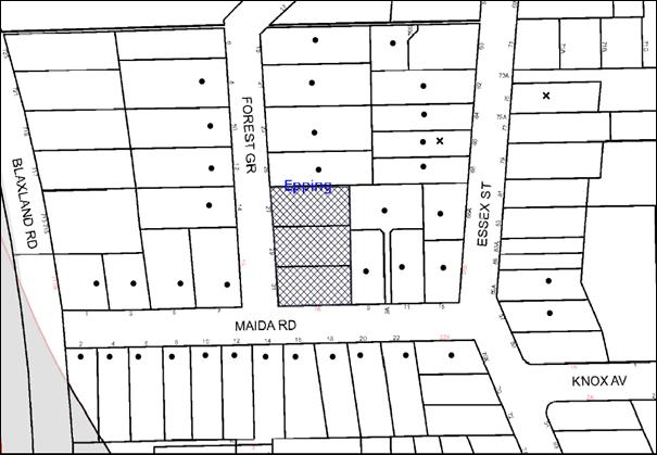
|
NOTIFICATION PLAN |
|
||
|
• PROPERTIES NOTIFIED |
X SUBMISSIONS RECEIVED |
PROPERTY SUBJECT OF DEVELOPMENT |
|
Two submissions objected to the development, generally on the grounds that the development would result in:
· Unacceptable traffic on local streets;
· Adverse impact on the adjacent Heritage Conservation Area;
· Impact on privacy of adjoining low density properties;
· Noise and pollution during construction;
· An increase in general noise from the residents of the proposed buildings; and
· Problems with waste management collection.
The merits of the matters raised in community submissions have been addressed in the body of the report with the exception of the following:
5.1.1 Heritage Conservation
The proposal is consistent with the objectives of Council’s DCP regarding heritage. At its meeting on 8 October 2014, Council considered Group Manager’s Report No. PL72/14 concerning submissions received to the exhibition of the draft Epping Town Centre amendments to the Hornsby Development Control Plan (HDCP) 2013. Council resolved (in part) to review the heritage significance of the Essex Street and Rosebank Avenue Heritage Conservation Areas in a future stage of Council’s Heritage Review to follow development of the adjacent five storey residential precincts.
5.1.2 Noise and Pollution During Construction
A condition is recommended for an Environmental Management Plan where the site must be managed in accordance with the publication ‘Managing Urban Stormwater – Landcom (March 2004) and the Protection of the Environment Operations Act 1997 by way of implementing appropriate measures to prevent sediment run-off, excessive dust, noise or odour emanating from the site during the construction of the development.
6. THE PUBLIC INTEREST
Section 79C(1)(e) of the Act requires Council to consider “the public interest”.
The public interest is an overarching requirement, which includes the consideration of the matters discussed in this report. Implicit to the public interest is the achievement of future built outcomes adequately responding to and respecting the future desired outcomes expressed in environmental planning instruments and development control plans.
The application is considered to have satisfactorily addressed Council’s and relevant agencies’ criteria and would provide a development outcome that, on balance, would result in a positive impact for the community. Accordingly, it is considered that the approval of the proposed development would be in the public interest.
CONCLUSION
The application seeks approval for the demolition of existing structures and construction of two, five storey residential flat buildings comprising fifty-five units and basement car parking.
The proposed development is generally in accordance with the objectives for the ‘Epping Urban Activation’ Precinct and stipulated controls under the Hornsby DCP and would contribute to the future desired five storey residential character of the precinct. With conditions, the minor non-compliances with prescriptive measures for setbacks are considered acceptable. The proposal complies with the design principles of SEPP 65 and the Residential Flat Design Code.
The proposal would result in a development that would be in keeping with the desired future character of the precinct.
Note: At the time of the completion of this planning report, no persons have made a Political Donations Disclosure Statement pursuant to Section 147 of the Environmental Planning and Assessment Act 1979 in respect of the subject planning application.
RESPONSIBLE OFFICER
The officer responsible for the preparation of this Report is the Manager – Development Assessments – Rodney Pickles, who can be contacted on 9847 6731.
|
Rod Pickles Manager - Development Assessment Planning Division |
James Farrington Group Manager Planning Division |
|
1.View |
Locality Map |
|
|
|
2.View |
Site Plan |
|
|
|
3.View |
Landscape Plan |
|
|
|
4.View |
Floor Plans |
|
|
|
5.View |
Elevations |
|
|
|
6.View |
Shadow Plan |
|
|
|
7.View |
Stormwater Plan |
|
|
File Reference: DA/153/2015
Document Number: D06097970
SCHEDULE 1
GENERAL CONDITIONS
The conditions of consent within this notice of determination have been applied to ensure that the use of the land and/or building is carried out in such a manner that is consistent with the aims and objectives of the relevant legislation, planning instruments and council policies affecting the land and does not disrupt the amenity of the neighbourhood or impact upon the environment.
Note: For the purpose of this consent, the term ‘applicant’ means any person who has the authority to act on or the benefit of the development consent.
Note: For the purpose of this consent, any reference to an Act, Regulation, Australian Standard or publication by a public authority shall be taken to mean the gazetted Act or Regulation, or adopted Australian Standard or publication as in force on the date that the application for a construction certificate is made.
1. Approved Plans and Supporting Documentation
The development must be carried out in accordance with the plans and documentation listed below and endorsed with Council’s stamp, except where amended by Council and/or other conditions of this consent:
|
Plan No. |
Plan Title |
Drawn by |
Dated |
|
DA101 Issue C |
Site Plan |
RJK Architects |
13 July 2015 |
|
DA101 Issue B |
Lower Basement |
RJK Architects |
July 2015 |
|
DA103 Issue C |
Upper Basement |
RJK Architects |
13 July 2015 |
|
DA104 Issue D |
Ground Floor |
RJK Architects |
13 July 2015 |
|
DA105 Issue B |
Level 1 Floor Plan |
RJK Architects |
July 2015 |
|
DA106 Issue B |
Level 2 Floor Plan |
RJK Architects |
July 2015 |
|
DA 107 Issue C |
Level 3 Floor Plan |
RJK Architects |
July 2015 |
|
DA 108 Issue B |
Level 4 Floor Plan |
RJK Architects |
July 2015 |
|
DA 108B Issue A |
Mezzanine Level |
RJK Architects |
July 2015 |
|
DA 109 Issue B |
Roof Plan |
RJK Architects |
July 2015 |
|
DA 110 Issue B |
Adaptable Units and Nathers |
RJK Architects |
July 2015 |
|
DA201 Issue B |
Elevations |
RJK Architects |
July 2015 |
|
DA202 Issue B |
Elevations |
RJK Architects |
July 2015 |
|
DA203 Issue B |
Elevations |
RJK Architects |
July 2015 |
|
DA204 Issue B |
Section |
RJK Architects |
July 2015 |
|
DA205 Issue B |
Section |
RJK Architects |
July 2015 |
|
DA206 Issue B |
Driveway Sections |
RJK Architects |
July 2015 |
|
DA300 Issue B |
External Finished Schedule |
RJK Architects |
July 2015 |
|
DA301 Issue C |
Shadow Diagrams |
RJK Architects |
July 2015 |
|
LP01/C |
Landscape Plan |
Black Beetle |
2 July 2015 |
|
01306_201 Issue 2 |
Stormwater Drainage Basement Level 2 Plan |
C&M Consultancy |
3 July 2015 |
|
01306_202 Issue 2 |
Stormwater Drainage Basement Level 1 Plan |
C&M Consultancy |
3 July 2015 |
|
01306_203 Issue 2 |
Stormwater Drainage Ground Floor Plan |
C&M Consultancy |
3 July 2015 |
|
01306_204 Issue 2 |
Stormwater Drainage First to Third Floor Plan |
C&M Consultancy |
3 July 2015 |
|
01306_205 Issue 2 |
Stormwater Drainage Fourth Floor Plan |
C&M Consultancy |
3 July 2015 |
|
01306_621_02 Issue 2 |
OSD Tank Section and Details |
C&M Consultancy |
3 July 2015 |
|
01306_701 Issue 2 |
Sediment and Erosion Control Plan |
C&M Consultancy |
3 July 2015 |
|
01306_702 Issue 2 |
Sediment and Erosion Details |
C&M Consultancy |
3 July 2015 |
|
Document Title |
Prepared by |
Dated |
|
Arboricultural Impact Assessment |
Redgum Arboricultural and Horticultural Consultants |
12 July 2015 |
|
Traffic and Parking Assessment |
Traffic Solutions Pty Ltd |
12 February 2015 |
|
Crime Risk Assessment Report |
Planning Ingenuity |
12 February 2015 |
|
SEPP 65 Design Verification Statement Issue B |
RJK Architects |
July 2015 |
|
Registered Quantity Surveyors Cost Report |
Quantity Surveyors Project Managers |
11 February 2015 |
|
Basix Certificate Number: 606787M_2 Nationwide House Energy Rating Scheme |
AGA Consultants |
13 July 2015 |
|
Statement of Environmental Effects |
Planning Ingenuity |
11 February 2015 |
|
Stormwater Management Plan Report No. RO1306-WQ Revision A |
C&M Consultants |
February 2015 |
|
Access Report |
BIO-Building Design |
18 June 2015 |
2. Construction Certificate
a) A Construction Certificate is required to be approved by Council or a Private Certifying Authority prior to the commencement of any works under this consent.
b) The Construction Certificate plans must not be inconsistent with the Development Consent plans.
3. Section 94 Development Contributions
a) In accordance with Section 80A(1) of the Environmental Planning and Assessment Act 1979 and the Hornsby Shire Council Section 94 Development Contributions Plan 2012-2021, the following monetary contributions shall be paid to Council to cater for the increased demand for community infrastructure resulting from the development:
|
Description |
Contribution (4) |
|
Roads |
$38,150.50 |
|
Open Space and Recreation |
$594,416.65 |
|
Community Facilities |
$82,886.50 |
|
Plan Preparation and Administration |
$2,458.45 |
|
TOTAL |
$717,912.10 |
being for 24 x 1 bedroom units, 25 x 2 bedroom units and 6 x 3 bedroom units and including a credit for 3 existing dwelling houses.
b) The value of this contribution is current as at 16 July 2015. If the contributions are not paid within the financial quarter that this condition was generated, the contributions payable will be adjusted in accordance with the provisions of the Hornsby Shire Council Section 94 Development Contributions Plan and the amount payable will be calculated at the time of payment in the following manner:
$CPY = $CDC x CPIPY
CPIDC
Where:
$CPY is the amount of the contribution at the date of Payment
$CDC is the amount of the contribution as set out in this Development Consent
CPIPY is the latest release of the Consumer Price Index (Sydney – All Groups) at the date of Payment as published by the ABS.
CPIDC is the Consumer Price Index (Sydney – All Groups) for the financial quarter at the date applicable in this Development Consent Condition.
c) The monetary contributions shall be paid to Council:
i) prior to the issue of the Subdivision Certificate where the development is for subdivision; or
ii) prior to the issue of the first Construction Certificate where the development is for building work; or
iii) prior to issue of the Subdivision Certificate or first Construction Certificate, whichever occurs first, where the development involves both subdivision and building work; or
iv) prior to the works commencing where the development does not require a Construction Certificate or Subdivision Certificate.
It is the professional responsibility of the Principal Certifying Authority to ensure that the monetary contributions have been paid to Council in accordance with the above timeframes.
Council’s Development Contributions Plan may be viewed at www.hornsby.nsw.gov.au or a copy may be inspected at Council’s Administration Centre during normal business hours.
4. Tree Removal
This development consent permits the removal of tree(s) identified on the Landscape Plan (Drawing No. LP01/C, Revision C), prepared by Black Beetle Landscape Architecture and Design, dated 13-07-15.
The removal of any other trees requires separate approval in accordance with the Tree & Vegetation Chapter 1B.6 Hornsby Development Control Plan (HDCP).
5. Tree Canopy Pruning
Pruning must be carried out under the direction and supervision of the Project Arborist and in accordance with the Australian Standard, Pruning of Amenity Trees (AS 4373-2007).
REQUIREMENTS PRIOR TO THE ISSUE OF A CONSTRUCTION CERTIFICATE
6. Building Code of Australia
All building work must be carried out in accordance with the relevant requirements of the Building Code of Australia.
7. Contract of Insurance (Residential Building Work)
In the case of residential building work for which the Home Building Act 1989 requires there to be a contract of insurance in force in accordance with Part 6 of that Act, that such a contract of insurance is in force before any building work authorised to be carried out by the consent commences.
8. Notification of Home Building Act, 1989 Requirements
Residential building work within the meaning of the Home Building Act 1989 must not be carried out unless the principal certifying authority for the development to which the work relates (not being Council) has given Council written notice of the following information:
a) In the case of work for which a principal contractor is required to be appointed:
i) The name and licence number of the principal contractor; and
ii) The name of the insurer by which the work is insured under Part 6 of that Act.
b) In the case of work to be done by an owner-builder:
i) The name of the owner-builder; and
ii) If the owner-builder is required to hold an owner-builder’s permit under that Act, the number of the owner-builder’s permit.
Note: If arrangements for doing the residential building work are changed while the work is in progress so that the information notified becomes out of date, further work must not be carried out unless the principal certifying authority for the development to which the work relates (not being Council) has given Council written notification of the updated information.
9. Utility Services
The applicant must submit written evidence of the following service provider requirements:
a) Ausgrid (formerly Energy Australia) – a letter of consent demonstrating that satisfactory arrangements have been made to service the proposed development.
b) Telstra – a letter of consent demonstrating that satisfactory arrangements have been made to service the proposed development.
10. Letterboxes
The details of letter boxes and meter enclosures must be provided with the Construction Certificate Plans. The letter boxes and meter enclosures must be provided with a minimum setback of 2 metres from all boundaries and must be suitably screened.
11. Sydney Water – Quick Check
This application must be submitted to a Sydney Water ‘Quick Check Agent’ or ‘Customer Centre’ for approval to determine whether the development would affect any Sydney Water infrastructure, and whether further requirements are to be met.
Note: Refer to www.sydneywater.com.au or telephone 13 20 92 for assistance.
12. Dilapidation Report
A ‘Dilapidation Report’ is to be prepared by a ‘chartered structural engineer’ detailing the structural condition of 25 Forest Grove and 9 and 9a Maida Road, Epping.
13. Construction Vehicles
a) All construction vehicles associated with the proposed development are to be contained on site or in a Local Traffic Committee (LTC) approved “Work Zone”.
b) A Construction Traffic Management Plan (CTMP) detailing construction vehicle routes, number of trucks, hours of operation, access arrangements and traffic control should be submitted to Council prior to the issue of a construction certificate. Council will review the CTMP, agree any modifications with the proponent and enforce the CTMP during construction.
14. Waste Management Details
The following waste management requirements must be complied with:
a) There is to be a garbage chute and a recycling bin (in a cupboard or a room) on each residential level of both buildings, including level 4 of building B.
b) The waste facility cupboard door opening on level 3 of building A is to be widened so it is the same as the waste cupboard on the other residential levels of this building.
c) The internal dimensions of the bin collection room at the ground level are to be increased from 2.8 m x 6.5 m to 2.8 m by 7.0 m. Note that internal dimensions exclude wall thickness.
15. Construction Management Plan
A Construction Management Plan (CMP), prepared by a suitably qualified consultant, must be submitted for approval by Council. The CMP must be include, but not be limited, details of the following:
a) Noise attenuation measures be implemented along the eastern boundary of the site including a hoarding height not less than 3m from the existing ground level;
b) During excavation works, rock removal must be undertaken by sawing instead of rock hammering, wherever practicable;
c) The construction works must be undertaken in accordance with the “Interim Construction Noise Guidelines – 2009” published by DECCW and achieve compliance with the relevant noise levels; and
d) The delivery times and vehicular movements related to demolition, excavation and construction works must be restricted to the construction hours only.
16. Stormwater Drainage
The stormwater drainage system for the development must be designed and constructed in accordance with Council’s Civil Works – Design and Construction Specification 2005 and the following requirements:-
a) The internal drainage system shall be connected to an existing Council piped drainage system and a new 1.8m extended kerb inlet and cast in-situ pit on the Maida Road frontage of No. 31 Forest Grove, Epping.
b) The on-site detention system shall be designed to be drained to the proposed kerb inlet pit. The overflow drainage system shall be connected to the Maida Road kerb and gutter. Details of drainage system and pit to be shown on the Engineer’s plans.
c) In order to design check, the Construction Certificate for the street drainage system shall be approved and work constructed, prior to fixing levels for internal OSD and drainage system.
d) Pursuant to s138 Roads Act 1993, construction of drainage works in the public road shall be the subject of a Subdivisions Construction Certificate (SCC) Application to Hornsby Council as Roads Authority. The Applicant shall pay Council’s fee for SCC Assessment and Compliance Inspections prior to the construction of that drainage work.
17. On Site Stormwater Detention
An on-site stormwater detention and water quality treatment system must be designed by a chartered civil engineer and constructed in accordance with the approved plan and following requirements:-
a) The on-site detention (OSD) shall have a capacity of not less than 40 cubic metres, and a maximum discharge (when full) of 46 litres per second.
b) Have a 900 mm x 900 mm surcharge/inspection grate located directly above the outlet.
c) Discharge from the detention system to be controlled via 1 metre length of pipe, not less than 50 millimetres diameter or via a stainless plate with sharply drilled orifice bolted over the face of the outlet discharging into a larger diameter pipe capable of carrying the design flow to an approved Council system.
d) Not be constructed in a location that would impact upon the visual or recreational amenity of residents.
18. Road Works
All road works approved under this consent must be constructed in accordance with Council’s Civil Works Design and Construction Specification 2005 and the following requirements: -
a) Council’s standard 150 mm integral kerb and gutter is to be designed and constructed along the entire Forest Grove frontage and Maida Road frontage, with 8m radius kerb return to apply. The proposed kerb and gutter generally follow the existing kerb alignment.
b) Council’s standard 300 mm thickness sealed flexible road shoulder pavement shall be removed, designed and reconstructed at least 3.0m wide on the Forest Grove frontage, and 600 mm wide on the Maida Road frontages.
c) Council’s standard 80 mm thickness 1.2m wide concrete footpath shall be designed and constructed on the footpath alignment along the Forest Grove and Maida Road frontages. Provision shall be made for construction of Council’s standard pram ramps at the intersection of Forest Grove and Maida Road.
d) Existing drainage pit ductile iron double grates shall be removed and replaced with standard 450mm x 900mm galvanised single leaf steel grates and frames (supported on three sides). Kerb inlets and pit bodies must be adjusted by the Applicant for galvanised grates.
e) The applicant must adjust all utilities, services, signage, topsoiling, verge turfing and street furniture to suit the proposed works and replace and restore them during road works.
f) The submission of a compaction certificate from a geotechnical engineer for any fill within road reserves, and all road sub-grade and road pavement materials.
g) Pursuant to s138 Roads Act 1993, construction of public road works shall be the subject of a Subdivisions Construction Certificate (SCC) Application to Hornsby Council as Roads Authority. The Applicant shall pay Council’s fee for SCC Assessment and Compliance Inspections prior to the construction of that work.
19. Water Quality/Bio Retention System
Stormwater discharging from the development site is to be treated to achieve the quality specified in the HDCP 2013 (table 1C.1.2(b) Urban Stormwater Quality Targets). A Chartered Civil/Hydraulic Engineer of the Institution of Engineers, Australia is to certify that works have been completed in accordance with the approved construction plan and the measures will achieve the targets specified in the condition.
20. Vehicular Crossing
A separate application under the Local Government Act 1993 and the Roads Act 1993 must be submitted to Council for the installation of a new vehicular crossing and the removal of the redundant crossing. The vehicular crossing must be constructed in accordance with Council’s Civil Works Design 2005 and the following requirements: -
a) Any redundant crossings must be removed and restored.
b) Crossing levels shall be obtained from Council by separate Application.
Note: An application for a vehicular crossing can only be made to one of Council’s Authorised Vehicular Crossing Contractors or be the subject of a Construction Certificate to Council as Roads Authority. You are advised to contact Council on 02 9847 6940 to obtain a list of contractors.
21. Traffic Control Plan
A Traffic Control Plan (TCP) must be prepared by a qualified traffic controller in accordance with the Roads & Traffic Authority’s Traffic Control at Worksites Manual 1998 and Australian Standard 1742.3 for all work on a public road. The Traffic Management Plan shall be submitted and approved by Council’s Manager Traffic and Road Safety prior to the issue of a construction certificate. The TCP must detail the following:
a) Arrangements for public notification of the works.
b) Temporary construction signage.
c) Permanent post-construction signage.
d) Vehicle movement plans.
e) Traffic management plans.
f) Pedestrian and cyclist access/safety.
22. Internal Driveway/Vehicular Areas
The driveway and parking areas on site must be designed in accordance with Australian Standards 2890.1, 2890.2, 3727 and the following requirements:
a) Design levels at the front boundary or crossing must be obtained from Council;
b) The driveway must be a rigid pavement.
c) The driveway grade must not exceed 25 per cent where designed for cars and transitions for changes in grade must not exceed 8 per cent per plan metre.
d) The driveway pavement must be a minimum 3 metres wide, 0.2 metres thick reinforced concrete with SL72 steel reinforcing fabric and a 0.15 metre sub-base.
23. Driveway Longitudinal Sections
Longitudinal sections along both sides of the access driveway shall be submitted to the principal certifying authority in accordance with the relevant sections of AS 2890.1 and the following requirements:
a) The maximum grade shall not exceed 1 in 4 (25%) with the maximum changes of grade of 1 in 8 (12.5%) for summit grades and 1 in 6.7 (15%) for sag grades. Any transition grades shall have a minimum length of 2 metres. The longitudinal sections shall incorporate the design levels obtained by Council.
Note: A construction certificate shall be obtained prior to the commencement of these works and are to be completed prior to the issue of an occupation certificate.
REQUIREMENTS PRIOR TO THE COMMENCEMENT OF ANY WORKS
24. Erection of Construction Sign
A sign must be erected in a prominent position on any site on which building work, subdivision work or demolition work is being carried out:
a) Showing the name, address and telephone number of the principal certifying authority for the work;
b) Showing the name of the principal contractor (if any) for any demolition or building work and a telephone number on which that person may be contacted outside working hours; and
c) Stating that unauthorised entry to the work site is prohibited.
Note: Any such sign is to be maintained while the building work, subdivision work or demolition work is being carried out, but must be removed when the work has been completed.
25. Protection of Adjoining Areas
A temporary hoarding, fence or awning must be erected between the work site and adjoining lands before the works begin and must be kept in place until after the completion of the works if the works:
a) Could cause a danger, obstruction or inconvenience to pedestrian or vehicular traffic.
b) Could cause damage to adjoining lands by falling objects.
c) Involve the enclosure of a public place or part of a public place.
Note: Notwithstanding the above, Council’s separate written approval is required prior to the erection of any structure or other obstruction on public land.
26. Toilet Facilities
Toilet facilities must be available or provided at the works site before works begin and must be maintained until the works are completed at a ratio of one toilet for every 20 persons employed at the site. Each toilet must:
a) be a standard flushing toilet connected to a public sewer; or
b) be a temporary chemical closet approved under the Local Government Act 1993; or
c) have an on-site effluent disposal system approved under the Local Government Act 1993.
27. Erosion and Sediment Control
Erosion and sediment control measures must be provided and maintained throughout the construction period in accordance with the manual ‘Soils and Construction 2004 (Bluebook)’, the approved plans, Council specifications and to the satisfaction of the principal certifying authority. The erosion and sediment control devices must remain in place until the site has been stabilised and revegetated.
Note: On the spot penalties may be issued for any non-compliance with this requirement without any further notification or warning.
28. Project Arborist
A Project Arborist is to be appointed in accordance with AS 4970-2009 (1.4.4) to provide monitoring and certification throughout the development process.
29. Tree Protection Zones
The following tree protection zones and requirements must be complied with:
|
Specified Tree |
SRZ(Radius) |
TPZ(Radius) |
|
T5 |
4m |
13m |
|
T6 |
3m |
8m |
|
T1, T2, T3, T4 |
2.5m |
5m |
a) Tree protection fencing must be erected onsite around a Specified Tree in accordance with the Arboricultural Impact Assessment (Appendix F – Site Plan B, Tree protection Plan), prepared by Redgum Horticultural, dated 12 July 2015. The tree fencing must be contiguous and constructed of 1.8 metre ‘cyclone chainmesh fence’ and must be erected in accordance with AS 4970-2009 (4.3 - Fig.3).
b) Tree fencing may be repositioned around a Specified Tree in accordance with the Arboricultural Impact Assessment (Appendix F – Site Plan B, Tree protection Plan), prepared by Redgum Horticultural, dated 12 July 2015 only where appropriate root protection is applied in accordance with AS 4970, Section 4.5 under the direction of the project Arborist.
c) A certificate must be submitted by the Project Arborist to the principal certifying authority detailing the methods used to preserve the trees.
d) The Tree Protection Zone (located on the property) of a Specified Tree is to be protected by the use of wood-chip mulch. Wood-chip mulch is to be installed on top of a geotextile landscape fabric, placed over the root zone of the tree. The mulch is to be maintained at a depth of 150mm – 300mm using material that complies with AS 4454.
e) Prior to any works all tree protection measures must be in place and a certificate from the site supervisor must be provided to the Principal Certifying Authority stating that all tree protection measures are in accordance with the above and consistent with the intentions of the Australian Standard ‘Protection of Trees on Development Sites (AS 4970-2009).
REQUIREMENTS DURING CONSTRUCTION
30. Construction Work Hours
All work on site (including demolition and earth works) must only occur between 7am and 5pm Monday to Saturday. No work is to be undertaken on Sundays or public holidays. No excavation or rock sawing/breaking is to occur on Saturdays.
31. Demolition
All demolition work must be carried out in accordance with “Australian Standard 2601-2001 – The Demolition of Structures” and the following requirements:
a) Demolition material must be disposed of to an authorised recycling and/or waste disposal site and/or in accordance with an approved waste management plan;
b) Demolition works, where asbestos material is being removed, must be undertaken by a contractor that holds an appropriate licence issued by WorkCover NSW in accordance with Chapter 10 of the Occupational Health and Safety Regulation 2001 and Clause 29 of the Protection of the Environment Operations (Waste) Regulation 2005 ;and
c) On construction sites where buildings contain asbestos material, a standard commercially manufactured sign containing the words ‘DANGER ASBESTOS REMOVAL IN PROGRESS’ measuring not less than 400mm x 300mm must be erected in a prominent position visible from the street.
32. Environmental Management
The site must be managed in accordance with the publication ‘Managing Urban Stormwater – Landcom (March 2004) and the Protection of the Environment Operations Act 1997 by way of implementing appropriate measures to prevent sediment run-off, excessive dust, noise or odour emanating from the site during the construction of the development.
33. Street Sweeping
Street sweeping must be undertaken following sediment tracking from the site along Nos. 9, 9a and 11 Maida Road and 25 Forest Grove during works and until the site is established.
The street cleaning services must undertake a street ‘scrub and dry’ method of service and not a dry sweeping service that may cause sediment tracking to spread or cause a dust nuisance.
34. Landfill
Landfill must be constructed in accordance with Council’s ‘Construction Specification 2005’ and the following requirements:
a) All fill material imported to the site is to wholly consist of Virgin Excavated Natural Material (VENM) as defined in Schedule 1 of the Protection of the Environment Operations Act 1997 or a material approved under the Department of Environment and Climate Change’s general resource recovery exemption.
b) A compaction certificate is to be obtained from a geotechnical engineer verifying that the specified compaction requirements have been met.
35. Excavated Material
All excavated material removed from the site must be classified in accordance with the Department of Environment, Climate Change and Water NSW Waste Classification Guidelines prior to disposal to an approved waste management facility and reported to the principal certifying authority.
36. Work Zone
All construction vehicles associated with the proposed development are to be contained on site or in a Local Traffic Committee (LTC) approved “Work Zone”.
37. Council Property
During construction works, no building materials, waste, machinery or related matter is to be stored on the road or footpath. The public reserve must be kept in a clean, tidy and safe condition at all times.
38. Survey Report
A report(s) must be prepared by a registered surveyor and submitted to the principal certifying authority;
a) Prior to the pouring of concrete at each level of the building certifying that:
i) The building, retaining walls and the like have been correctly positioned on the site; and
ii) The finished floor level(s) are in accordance with the approved plans.
b) Confirming that the waste collection vehicle turning area complies with AS2890.1 – 2004 and AS20890.2 – 2002 for small rigid vehicles (SRV).
39. Waste Management Details
Waste management during the demolition and construction phase of the development must be undertaken in accordance with the approved Waste Management Plan. Additionally written records of the following items must be maintained during the removal of any waste from the site and such information submitted to the Principal Certifying Authority within fourteen days of the date of completion of the works:
a) The identity of the person removing the waste.
b) The waste carrier vehicle registration.
c) Date and time of waste collection.
d) A description of the waste (type of waste and estimated quantity).
e) Details of the site to which the waste is to be taken.
f) The corresponding tip docket/receipt from the site to which the waste is transferred (noting date and time of delivery, description (type and quantity) of waste).
g) Whether the waste is expected to be reused, recycled or go to landfill.
Note: In accordance with the Protection of the Environment Operations Act 1997, the definition of waste includes any unwanted substance, regardless of whether it is reused, recycled or disposed to landfill.
40. Works Near Trees
All required tree protection measures are to be maintained in good condition for the duration of the construction period.
a) All work must be located outside the Structural Root Zone of a tree unless stated in this consent.
b) Machinery other than hand held must remain outside the Tree Protection Zone.
41. Works in Tree Protection Zones
Consent is granted to carry out the following works within Tree Protection Zone of a Specified Tree only:
a) Project Arborist: Specified Trees – All Trees
i) All works must be carried out under the direct supervision of the Project Arborist. The project Arborist must assess the condition of tree and the growing environment and make recommendations for, and if necessary carry out remedial action during construction to ensure the health and vigour of the tree.
b) Excavation: Specified Trees – T5
i) Excavation to a depth of 600mm to facilitate construction of the basement and to install the individual stormwater pits shall be carried out by hand excavation ONLY.
ii) Works must be carried out in accordance with Arboricultural Impact Assessment (Section 5.9 – Development Impacts), prepared by Redgum Horticultural, dated 12 July 2015.
c) Root Pruning: Specified Trees – T5
i) Roots located greater than six metres (6m) from the edge of the trunk required to be severed for the purposes of this consent shall be undertaken in accordance with AS 4970-2009 Sections 3.3.4, 4.5.4 and 4.5.5.
ii) A certificate must be submitted by the Project Arborist to the principal certifying authority detailing the methods used to preserve the trees.
d) Drilling/ Boring: Specified Trees – All Trees
i) The installation of any underground services shall utilise the horizontal drilling method. Horizontal drilling shall be carried out so that ‘top of pipe’ is a minimum 600mm depth beneath existing ground level.
42. Traffic Control Plan Compliance
The development must be carried out in accordance with the submitted Traffic Control Plan (TCP).
43. Disturbance of Existing Site
During construction works, the existing ground levels of open space areas and natural landscape features, (including natural rock-outcrops, vegetation, soil and watercourses) must not be altered unless otherwise nominated on the approved plans.
44. Construction Noise Management
The construction works must be undertaken in accordance with the “Interim Construction Noise Guidelines – 2009” published by NSW Environmental Protection Authority.
45. Contamination During Construction Works
Should the presence of asbestos or soil contamination, not recognised during the application process be identified during demolition, the applicant must immediately notify the Principal Certifying Authority and Council.
46. Construction Vehicle Access
All construction vehicles associated with the proposed development are to access the site from Peats Ferry Road only. No construction vehicle access is permitted on Bell Street.
REQUIREMENTS PRIOR TO THE ISSUE OF AN OCCUPATION CERTIFICATE
Note: For the purpose of this consent, a reference to ‘occupation certificate’ shall not be taken to mean an ‘interim occupation certificate’ unless otherwise stated.
47. Fulfilment of BASIX Commitments
The applicant must demonstrate the fulfilment of BASIX commitments pertaining to the development.
48. Sydney Water – s73 Certificate
An s73 Certificate must be obtained from Sydney Water.
Note: Sydney Water requires that s73 applications are to be made through an authorised Sydney Water Servicing Coordinator. Refer to www.sydneywater.com.au or telephone 13 20 92 for assistance.
49. Damage to Council Assets
Any damage caused to Council’s assets as a result of the construction or demolition of the development must be rectified in accordance with Council’s Civil Works Specifications. Council’s Restorations Supervision must be notified for a formwork inspection prior to pouring concrete.
50. Creation of Easements
The following matter(s) must be nominated on the plan of subdivision under s88 of the Conveyancing Act 1919:
a) Consolidation of all lots.
b) The creation of an appropriate "Positive Covenant" and "Restriction as to User" over the constructed on-site detention/retention systems and outlet works, within the lots in favour of Council in accordance with Council’s prescribed wording. The position of the on-site detention system is to be clearly indicated on the title.
c) To register the OSD easement, the restriction on the use of land “works-as-executed” details of the on-site-detention system must be submitted verifying that the required storage and discharge rates have been constructed in accordance with the design requirements. The details must show the invert levels of the onsite system together with pipe sizes and grades. Any variations to the approved plans must be shown in red on the “works-as-executed” plan and supported by calculations.
Note: Council must be nominated as the authority to release, vary or modify any easement, restriction or covenant.
51. Certificate of Preservation Survey Marks
A certificate by a Registered Surveyor shall be submitted to the Principal Certifying Authority, certifying that there has been no removal, damage, destruction, displacement or defacing of the existing survey marks in the vicinity of the proposed development or otherwise the reestablishment of damaged, removed or displaced survey marks has been undertaken in accordance with the Surveyor General’s Direction No. 11 – “Preservation of Survey Infrastructure”.
52. Works as Executed Plan
A works-as-executed plan(s) must be prepared by a registered surveyor and submitted to Council for completed road pavement, kerb and gutter, public drainage systems, driveways and on-site detention system. The plan(s) must be accompanied by a certificate from a registered surveyor certifying that all pipelines and associated structures lie wholly within any relevant easements.
53. Consolidation of Allotments
All allotments the subject of this consent must be consolidated into one allotment.
Note: The applicant is recommended to submit the plan of subdivision to consolidate allotments to the NSW Department of Lands at least 4-6 weeks prior to seeking an occupation certificate.
54. Boundary Fencing
Fencing must be erected along all property boundaries behind the front building alignment to a height of 1.8 metres.
Note: Alternative fencing may be erected subject to the written consent of the adjoining property owner(s).
55. Installation of Privacy Devices
The following device(s) must be installed to maintain an element of privacy towards the adjoining property:
a) Full height, stackable louvres to be erected on the balconies of units A201, A202, A204, A205, B201, B202, B204, B205, B206, A301, A302, A303, A304, A305, B301, B302, B304, B305, B306, A401, A402, A403, A404, A405, B401, B402, B404, B405 and B406.
56. External Lighting
All external lighting must be designed and installed in accordance with Australian Standard AS 4282 – Control of the Obtrusive Effects of Outdoor Lighting. Certification of compliance with the Standard must be obtained from a suitably qualified person.
57. Garbage Collection Easement
For the purpose of waste collection, an easement entitling Council, its servants and agents and persons authorised by it to enter upon the subject land and to operate thereon, vehicles and other equipment for the purposes of garbage collection must be granted to Council by the owner of the land.
Note: The easement must be in a form prescribed by Council and must include covenants to the effect that parties will not be liable for any damage caused to the subject land or any part thereof or to any property located therein or thereon by reason of the operation thereon of any vehicle or other equipment used in connection with the collection of garbage and to the effect that the owner for the time being of the subject land shall indemnify the Council, its servants, agents and persons authorised by it to collect garbage against liability in respect of any such claims made by any person whomsoever.
58. Unit Numbering
The allocation of unit numbering must be authorised by Council prior to the numbering of each unit in the development.
59. Provision for National Broadband Network (NBN)
Provision must be made for fibre ready passive infrastructure (pits and pipes) generally in accordance with NBN Co's pit and pipe installation guidelines to service the proposed development. A certificate from NBN Co or Telstra must be submitted to the PCA that the fibre optic cabling provided for the development complies with MDU Building Design Guides for Development.
60. Completion of Landscaping
A certificate must be provided by a practicing landscape architect, horticulturalist or person with similar qualifications and experience certifying that all required landscaping works have been satisfactorily completed in accordance with the approved landscape plans.
Note: Advice on suitable species for landscaping can be obtained from Council’s planting guide ‘Indigenous Plants for the Bushland Shire’, available at www.hornsby.nsw.gov.au.
61. Waste Management Details
The following waste management requirements must be complied with:
a) The bin storage rooms at the basement level must include water or a hose for cleaning, graded floors with drainage to sewer, a robust door, sealed and impervious surface, adequate lighting and ventilation, and must be lockable. The waste facility rooms/cupboards at each residential level must include sealed and impervious surface, adequate lighting and ventilation.
b) A report must be prepared by an appropriately qualified person, certifying the following:
i) A comparison of the estimated quantities of each waste type against the actual quantities of each waste type.
Note: Explanations of any deviations to the approved Waste Management Plan is required to be included in this report.
c) That at least 60% of the waste generated during the demolition and construction phase of the development was reused or recycled.
Note: If the 60% diversion from landfill cannot be achieved in the Construction Stage, the Report is to include the reasons why this occurred and certify that appropriate work practices were employed to implement the approved Waste Management Plan. The Report must be based on documentary evidence such as tipping dockets/receipts from recycling depots, transfer stations and landfills, audits of procedures etc. which are to be attached to the report.
d) All waste was taken to site(s) that were lawfully permitted to accept that waste.
e) Each unit must be provided with an indoor waste/recycling cupboard for the interim storage of a minimum one day’s waste generation with separate containers for general waste and recyclable materials.
f) Space must be provided for either individual compost containers for each unit or a communal compost container.
Note: The location of the compost containers should have regard for potential amenity impacts.
g) The bin carting routes must be devoid of any steps.
Note: Ramps between different levels are acceptable.
h) Access to the automatic waste volume handling equipment by unauthorised persons (including residents and waste collectors) must be prevented.
Note: Caging of the automatic volume handling equipment is acceptable.
62. Replacement Planting
a) Shall be in accordance with the approved landscape plan.
b) Native replacement trees must be grown from seed, not a hybrid, grafted or a cutting.
c) Plantings that fail to survive or do not exhibit normal health and vigour growth characteristics for their species prior to reaching a height greater than three metres (3m), must be replaced at the expense of the property owner.
d) A suitably qualified and experienced Horticulturalist must provide a certificate to the Principal Certifying Authority stating the above requirements have been met, that all plant stock meet the specifications outlined in ‘Specifying Trees’ (Ross Clark, NATSPEC Books) and that the planting methods are current, professional (best practice) industry standards at the time of planting.
63. Final Certification
Where works have been undertaken within the Tree Protection Zone of a tree the project Arborist must assess the condition of tree(s) and the growing environment and make recommendations for, and carry out remedial actions where necessary.
a) Following the final inspection and the completion of any remedial works, the project Arborist must submit to the Principal Certifying Authority documentation stating that the completed works have been carried out in compliance with the approved plans and specifications for tree protection as above and AS 4970-2009.
OPERATIONAL CONDITIONS
64. Car Parking
a) All car parking must be constructed and operated in accordance with Australian Standard AS/NZS 2890.1:2004 – Off-street car parking and Australian Standard AS 2890.2:2002 – Off-street commercial vehicle facilities.
i) All parking areas and driveways are to be sealed to an all-weather standard, line marked and signposted;
ii) Car parking, loading and manoeuvring areas to be used solely for nominated purposes;
iii) Vehicles awaiting loading, unloading or servicing shall be parked on site and not on adjacent or nearby public roads;
iv) All vehicular entry on to the site and egress from the site shall be made in a forward direction.
b) Any proposed landscaping and/or fencing must not restrict sight distance to pedestrians and cyclists travelling along the footpath.
c) Residential parking spaces are to be secure spaces with access controlled by card or numeric pad.
d) Visitors must be able to access the visitor parking spaces in the basement car park at all times.
e) All parking for people with disabilities is to comply with AS/NZS 2890.6:2009 Off-street parking for people with disabilities.
65. Waste Management
A site caretaker must be employed and be responsible for moving bins where and when necessary, washing bins and maintaining waste storage areas, ensuring the chute system and related devices are maintained in effective and efficient working order, managing the communal composting area, managing the bulky item storage area, arranging the prompt removal of dumped rubbish, and ensuring all residents are informed of the use of the waste management system. The site caretaker must be employed for a sufficient number of hours each week to allow all waste management responsibilities to be carried out to a satisfactory standard.
66. Noise
All noise generated by the proposed development must be attenuated to prevent levels of noise being emitted to adjacent premises which possess tonal, beating and similar characteristics or which exceeds background noise levels by more than 5dB(A).
67. Fire Safety Statement - Annual
On at least one occasion in every 12 month period following the date of the first ‘Fire Safety Certificate’ issued for the property, the owner must provide Council with an annual ‘Fire Safety Certificate’ to each essential service installed in the building.
- END OF CONDITIONS -
ADVISORY NOTES
The following information is provided for your assistance to ensure compliance with the Environmental Planning and Assessment Act, 1979, Environmental Planning and Assessment Regulation 2000, other relevant legislation and Council’s policies and specifications. This information does not form part of the conditions of development consent pursuant to Section 80a of the Act.
Environmental Planning and Assessment Act 1979 Requirements
The Environmental Planning and Assessment Act 1979 requires:
· The issue of a construction certificate prior to the commencement of any works. Enquiries can be made to Council’s Customer Services Branch on 9847 6760.
· A principal certifying authority to be nominated and Council notified of that appointment prior to the commencement of any works.
· Council to be given at least two days written notice prior to the commencement of any works.
· Mandatory inspections of nominated stages of the construction inspected.
· An occupation certificate to be issued before occupying any building or commencing the use of the land.
Long Service Levy
In accordance with Section 34 of the Building and Construction Industry Long Service Payments Act 1986, a ‘Long Service Levy’ must be paid to the Long Service Payments Corporation or Hornsby Council.
Note: The rate of the Long Service Levy is 0.35% of the total cost of the work.
Note: Hornsby Council requires the payment of the Long Service Levy prior to the issue of a construction certificate.
Tree and Vegetation Preservation
In accordance with Clause 5.9 of the Hornsby Local Environmental Plan 2013 a person must not ringbark, cut down, top, lop, remove, injure or wilfully destroy any tree or other vegetation protected under the Hornsby Development Control Plan 2013 without the authority conferred by a development consent or a permit granted by Council.
Notes: A tree is defined as a long lived, woody perennial plant with one or relatively few main stems with the potential to grow to a height greater than three metres (3M). (HDCP 1B.6.1.c).
Tree protection measures and distances are determined using the Australian Standard AS 4970:2009, “Protection of Trees on Development Sites”.
Fines may be imposed for non-compliance with both the Hornsby Local Environmental Plan 2013 and the Hornsby Development Control Plan 2013.
Disability Discrimination Act
The applicant’s attention is drawn to the existence of the Disability Discrimination Act. A construction certificate is required to be obtained for the proposed building/s, which will provide consideration under the Building Code of Australia, however, the development may not comply with the requirements of the Disability Discrimination Act. This is the sole responsibility of the applicant.
Dial Before You Dig
Prior to commencing any works, the applicant is encouraged to contact Dial Before You Dig on 1100 or www.dialbeforeyoudig.com.au for free information on potential underground pipes and cables within the vicinity of the development site.
Telecommunications Act 1997 (Commonwealth)
If you are aware of any works or proposed works which may affect or impact on Telstra’s assets in any way, you are required to contact: Telstra’s Network Integrity Team on Phone Number 1800810443.
Asbestos Warning
Should asbestos or asbestos products be encountered during demolition or construction works, you are advised to seek advice and information prior to disturbing this material. It is recommended that a contractor holding an asbestos-handling permit (issued by WorkCover NSW)be engaged to manage the proper handling of this material. Further information regarding the safe handling and removal of asbestos can be found at:
Alternatively, telephone the WorkCover Asbestos and Demolition Team on 8260 5885.
House Numbering
House numbering can only be authorised by Council. Before proceeding to number each premise in the development, the allocation of numbers is required to be obtained from Council's Planning Division prior to the issue of a Subdivision Certificate. The authorised numbers are required to comply with Council’s Property Numbering Policy and be displayed in a clear manner at or near the main entrance to each premise.
Occupation Certificate Requirements
An Occupation Certificate Application is required to be lodged containing the following information:
A certificate by a Registered Surveyor shall be submitted to the Principal Certifying Authority, certifying that there has been no removal, damage, destruction, displacement or defacing of the existing survey marks in the vicinity of the proposed development, or otherwise certifying that the necessary re-establishment of any damaged, removed or displaced survey marks has been undertaken in accordance with the Surveyor General’s Direction No. 11 – “Preservation of Survey Infrastructure”.
Note: The PCA will not issue an Occupation certificate until all conditions of the development consent have been completed.
Group Manager’s Report No. PL60/15
Planning Division
Date of Meeting: 12/08/2015
11 DEVELOPMENT APPLICATION - RESIDENTIAL FLAT BUILDING COMPRISING 35 UNITS - 18-20 CLIFF ROAD, EPPING
EXECUTIVE SUMMARY
|
DA No: |
DA/1602/2014 (Lodged 19 December 2014) |
|
Description: |
Demolition of existing structures and construction of a residential flat building comprising 35 units and basement car park |
|
Property: |
Lots 58 and 59 DP 12051, Nos. 18 and 20 Cliff Road, Epping |
|
Applicant: |
Olsson and Associates Architects Pty Ltd |
|
Owner: |
Hongdi Investment Pty Ltd |
|
Estimated Value: |
$9,182,905 |
|
Ward: |
C |
· The application involves demolition of existing structures and the erection of a five storey residential flat building comprising 35 units with basement car parking.
· The proposal generally complies with the Hornsby Local Environmental Plan 2013, State Environmental Planning Policy No. 65 – Design Quality Residential Flat Building and is generally satisfactory in respect of the requirements of the Residential Flat Design Code and the Hornsby Development Control Plan.
· Seven submissions have been received in respect of the application.
· It is recommended that the application be approved as a deferred commencement to enable an easement for stormwater to be obtained through No. 15A Ray Road.
|
THAT Development Application No. DA/1602/2014 for demolition of existing structures and the erection of a five storey residential flat building comprising 35 units with basement parking at Lot 58 and 59 DP 12051, Nos. 18 and 20 Cliff Road, Epping be approved as a deferred commencement pursuant to Section 80(3) of the Environmental Planning and Assessment Act 1979 subject to the conditions of consent detailed in Schedule 1 of Group Manager’s Report No. PL60/15. |
BACKGROUND
The site forms part of the Epping Urban Activation Precinct (Epping UAP).
On 14 March 2014, the Department of Planning and Environment finalised amendments to the Hornsby Local Environmental Plan 2013 (HLEP 2013) to implement the Epping UAP via State Environmental Planning Policy (Epping Town Centre) 2013 (“the SEPP Amendment”).
The Epping Town Centre amendments to the HLEP 2013 involved rezoning of low density residential areas for the purpose of medium to high density residential and mixed use developments. The site is within the Forest Grove (Epping) Precinct, which was rezoned R4 (High Density Residential) to permit residential flat buildings to a height of 5 storeys.
Amendments to the HDCP were consequently prepared by Council to translate design controls recommended by the Department of Planning and Environment and provided planning controls to be read in conjunction with the HLEP 2013 amendments. The DCP amendments were exhibited and endorsed by Council on 8 October 2014.
On 11 July 2014, a pre-Lodgement application (PL/85/2014) for a five storey residential flat building was submitted to Council. Advice was provided by Council dated 8 August 2014.
On 2 December 2014, Development Application No. 1602/2014 was lodged for the demolition of the existing structures and construction of a five storey residential flat development comprising 36 units with basement car parking. Subsequently, one unit has been removed from the scheme in response to issues raised by Council officers.
SITE
The site is located on the corner of Cliff Road and Rosebank Avenue and consists of two lots containing single storey residential homes. The site is regular in shape and has an area of 1,794 square metres with a 37.5 metre frontage to Cliff Road and a depth of 46.6 metres. The site has a gentle slope of 4.6% downwards from the south-western to north-eastern boundary.
The site contains a number of exotic trees. There is one street tree located on the road verge fronting Cliff Road, and two street trees on the road verge fronting Rosebank Avenue including a 16 metre high Southern Blue Gum.
To the north, the site borders the Rosebank Avenue Heritage Conservation Area and the property at No.2 Rosebank Avenue.
To the east, the site borders Nos. 15A Ray Road and 16A Cliff Road which contain two residential homes. Both lots have been zoned for R4 high density residential development. To the east, on the opposite side of Rosebank Avenue, is a single storey residential property at No. 22 Cliff Road which is also zoned R4 high density.
PROPOSAL
The proposal involves demolition of existing structures on the site and construction of a five storey residential flat building comprising thirty five units with two levels of basement car parking and associated landscaping works. The unit mix would comprise 18 x 1 bedroom, 14 x 2 bedroom and 3 x 3 bedroom units. The development would be accessed from Rosebank Avenue via a driveway located 4m from the southern boundary with No.2 Rosebank Avenue.
The development would be serviced by a garbage truck reversing into the driveway for collection from Rosebank Avenue.
Stormwater would drain from the north-east corner of the site and then via an easement through No. 15A Ray Road to Council’s stormwater system on Ray Road.
ASSESSMENT
The development application has been assessed having regard to ‘A Plan for Growing Sydney’, the ‘North Subregion (Draft) Subregional Strategy’ and the matters for consideration prescribed under Section 79C of the Environmental Planning and Assessment Act 1979 (the Act). The following issues have been identified for further consideration.
1. STRATEGIC CONTEXT
1.1 A Plan for Growing Sydney and (Draft) North Subregional Strategy
A Plan for Growing Sydney has been prepared by the NSW State Government to guide land use planning decisions for the next 20 years. The Plan sets a strategy for accommodating Sydney’s future population growth and identifies the need to deliver 689,000 new jobs and 664,000 new homes by 2031. The Plan identifies that the most suitable areas for new housing are in locations close to jobs, public transport, community facilities and services.
The NSW Government will use the subregional planning process to define objectives and set goals for job creation, housing supply and choice in each subregion. Hornsby Shire has been grouped with Hunters Hill, Ku-ring-gai, Lane Cove, Manly, Mosman, North Sydney, Pittwater, Ryde, Warringah and Willoughby to form the North Subregion. The Draft North Subregional Strategy will be reviewed and the Government will set housing targets and monitor supply to ensure planning controls are in place to stimulate housing development.
The proposed development would be consistent with ‘A Plan for Growing Sydney’, by providing thirty three additional dwellings and would contribute to housing choice in the locality.
2. STATUTORY CONTROLS
Section 79C(1)(a) requires Council to consider “any relevant environmental planning instruments, draft environmental planning instruments, development control plans, planning agreements and regulations”.
2.1 Hornsby Local Environmental Plan 2013
The proposed development has been assessed having regard to the provisions of the Hornsby Local Environmental Plan 2013 (HLEP).
2.1.1 Zoning of Land and Permissibility
The subject land is zoned R4 (High Density Residential) under the Hornsby Local Environmental Plan 2013 (HLEP). The objectives of the zone are:
(a) To provide for the housing needs of the community within a high density residential environment.
(b) To provide a variety of housing types within a high density residential environment.
(c) To enable other land uses that provide facilities or services to meet the day to day needs of residents.
The development is defined as a “residential flat building” under the HLEP and is permissible in the zone with Council’s consent.
2.1.2 Height of Buildings
Clause 4.3 of the HLEP provides that the height of a building on any land should not exceed the maximum height show for the land on the Height of Buildings Map. The maximum permissible height for the subject site is 17.5m. The proposal complies with this provision.
2.1.3 Heritage Conservation
Clause 5.10 of the HLEP sets out heritage conservation provisions for Hornsby Shire. The development site adjoins the Rosebank Avenue Heritage Conservation Area (HCA) under Schedule 5 (Environmental Heritage) of the HLEP.
The proposed development would not have an unacceptable impact on the heritage significance of the heritage conservation area given its separation and setbacks from the adjacent Conservation Area. However, it is acknowledged that the visual setting will be altered to varying degrees as the southern HCA backdrop will be one of residential flat buildings visible above the low density housing of the HCA.
This issue is addressed in more detail in section 2.10.6.
2.1.4 Earthworks
Clause 6.2 of the HLEP states that consent is required for proposed earthworks on site. Before granting consent for earthworks, Council is required to assess the impacts of the works on adjoining properties, drainage patterns and soil stability of the locality.
The site has a gradual fall of 2m west to east and the soil is of the Colluvial Type. The proposed excavation works are unlikely to result in impacts on adjoining properties or the surrounding environment subject to recommended safeguards. Appropriate conditions are recommended to address site stability, downstream water quality, fill quality and amenity of adjoining properties.
Subject to recommended conditions, the proposal is satisfactory in addressing the provisions under Clause 6.2 of the HLEP.
2.2 State Environmental Planning Policy No. 55 – Remediation of Land
State Environmental Planning Policy No. 55 (SEPP 55) requires that Council must not consent to the carrying out of any development on land unless it has considered whether the land is contaminated or requires remediation for the proposed use.
The site has been used for residential purposes and is unlikely to be contaminated. No further assessment is considered necessary in this regard.
2.3 State Environmental Planning Policy No. 65 – Design Quality of Residential Flat Development
The Policy provides for design principles to improve the design quality of residential flat development and for consistency in planning controls across the State.
SEPP 65 has been amended on 19 June 2015 following review of the policy by the Department of Planning and Environment. The amendments replace the Residential Flat Design Guidelines with the Apartment Design Guide which prevails in the event of any inconsistency with a Development Control Plan.
Clause 31 (Transitional provisions for SEPP 65 – Amendment No. 3) states that “If a development application or an application for the modification of a development consent has been made before the notification on the NSW legislation website of the making of State Environmental Planning Policy No 65—Design Quality of Residential Flat Development (Amendment No 3) and the application has not been finally determined before the commencement of that amendment, the application must be determined as if the amendment had not commenced.”
Pursuant to the above provision, this amendment would not apply to the subject application and the previous version (Amendment 2) of the SEPP is required to be considered.
The following section of this report includes an assessment of the residential component of the modified development against the ten principles provided in Part 2 of SEPP 65.
|
Principle |
Compliance |
|
1. CONTEXT |
Yes |
|
Comment: The site is located within a planned five storey residential flat building precinct in close proximity to Epping Railway Station and the Epping Commercial Town Centre. The applicant’s ‘Design Verification Statement’ indicates that the proposal responds to the desired future character of the precinct as envisaged by Council. Once the development of the precinct is completed, the proposal would integrate with the surrounding sites and would be in keeping with the future urban form. It is considered that the proposed building would contribute to the identity and future character of the precinct. The scale and design of the building, with the use of modern materials and reference to the existing vernacular and materials within the HCA is considered a sensitive and appropriate design response to this important gateway to the HCA. The development responds suitably to the “context” principle of SEPP 65, considering the desired future character of the area. |
|
|
2. SCALE |
Yes |
|
Comment: The scale of the development is generally in accordance with the height control and setbacks for the precinct prescribed under Part 3.4 of the Hornsby Development Control Plan (HDCP). The building footprint along the north-south axis is a maximum 29.9 metres in length which complies with the maximum floor-plate dimension of 35 metres prescribed within the DCP. The length of the building relates to the length of the lots. The design has provided an additional setback of up to 1.8m beyond the HDCP requirements to the northern boundary with the Rosebank Avenue Heritage Conservation Area (HCA). To offset the increased setback to the heritage precinct, the southern setback to Cliff Road has been reduced to between 5.8 – 7.8m. Given the generous width of the Cliff Road verge (between 5 – 13m) this reduced setback is appropriate and maintains the streetscape setting. The development achieves a scale consistent with the desired future character of the precinct of residential flat buildings in landscaped settings with underground car parking. |
|
|
3. BUILT FORM |
Yes |
|
Comment: The proposed building achieves an appropriate built form for the site and its purpose, in terms of building alignments, proportions, and the manipulation of building elements. The building would appropriately contribute to the character of the desired future streetscape and includes articulation to minimise the perceived scale. The proposed materials and finishes would add to the visual interest of the development and the use of red brickwork and dark panelling relates to the character of the Rosebank Avenue Heritage Conservation Area (HCA). Flat roof forms have been adopted with an increased top storey setback on the external facades to minimise the bulk and height of the building as required by the HDCP. |
|
|
4. DENSITY |
Yes |
|
Comment: The HLEP does not incorporate floor space ratio requirements for the site. The density of the development is governed by the height of the building and the required setbacks. The proposed density is considered to be sustainable as it responds to the regional context, availability of infrastructure, public transport, community facilities and environmental quality and is acceptable in terms of density. |
|
|
5. RESOURCE, ENERGY AND WATER EFFICIENCY |
Yes |
|
Comment: The applicant has submitted a BASIX Certificate for the proposed development. In achieving the required BASIX targets for sustainable water use, thermal comfort and energy efficiency, the proposed development would achieve efficient use of natural resources, energy and water throughout its full life cycle, including demolition and construction. |
|
|
6. LANDSCAPE |
Yes |
|
Comment: The application includes a landscape concept plan which provides landscaping along the street frontages, side and rear boundaries and includes a 10m x 4m deep soil landscaped area to the south-western corner. The proposal has been designed to facilitate the retention of three significant street trees. However, two of these trees are in poor condition and can be removed and replaced. Large canopy trees are proposed along the street frontages and to neighbouring properties intercepted by shrubs and hedges which would soften the appearance of the development when viewed from the streets. Deep soil areas that incorporate canopy trees are provided around the building envelope to the north and west with neighbouring properties, which would enhance the development’s natural environmental performance and provide an appropriate landscaped setting. |
|
|
7. AMENITY |
Yes |
|
Comment: The proposed units are designed with appropriate room dimensions and layout to maximise amenity for future residents. The proposal incorporates good design in terms of achieving natural ventilation, solar access and acoustic privacy. All units incorporate balconies accessible from living areas and privacy has been achieved through appropriate design and orientation of balconies and living areas and the use of moveable privacy screens to the balconies. Storage areas have been provided within each unit and in the basement levels. The proposal would provide convenient and safe access via a central lift connecting the basement and all other levels. The proposal satisfies the ‘Amenity’ principle of SEPP 65. |
|
|
8. SAFETY AND SECURITY |
Yes |
|
Comment: The design orientates the balconies and windows of individual apartments towards the street, rear and side boundaries, providing passive surveillance of the public domain and communal open space areas. Both the pedestrian and vehicular entry points are secured and visibly prominent from Rosebank Avenue and Cliff Road. The proposal includes an assessment of the development against crime prevention controls in the Statement of Environmental Effects (SEE). The SEE has regard to Crime Prevention Through Environmental Design Principles (CPTED). Appropriate conditions of consent are recommended to require compliance with the above matters. |
|
|
9. SOCIAL DIMENSIONS AND HOUSING AFFORDABILITY |
Yes |
|
Comment: The site is located in close proximity to Epping Railway Station and commercial precinct. The location of the site allows direct access to services and facilities. The proposal incorporates a range of unit sizes to cater for different budgets and housing needs. The development generally complies with the housing choice requirements of the Hornsby DCP by providing a component of adaptable housing and a mix of 1, 2 and 3 bedroom dwellings. The proposal responds to the social context in terms of providing a range of dwelling sizes with good access to social facilities and services as the site is located in close proximity to Epping Railway Station and shops. |
|
|
10. AESTHETICS |
Yes |
|
Comment: The architectural treatment of the building incorporates indentations and projections in the exterior walls with balcony projections to articulate the facades. The roof is flat to minimise building height and incorporates eaves which would cast shadows across the top storey wall. The articulation of the building, composition of building elements, textures, materials and colours would achieve a built form generally consistent with the design principles contained within the Residential Flat Design Code and the Hornsby DCP. |
|
2.4 State Environmental Planning Policy No. 65 – Residential Flat Design Code
SEPP 65 also requires consideration of the Residential Flat Design Code, NSW Planning Department 2002. The Code includes development controls and best practice benchmarks for achieving the design principles of SEPP 65. The following table sets out the proposal’s compliance with the Code:
|
Residential Flat Design Code |
|||
|
Control |
Proposal |
Requirement |
Compliance |
|
Deep Soil Zone |
27% |
25% |
Yes |
|
Communal Open Space |
27% |
25-30% |
Yes |
|
Ground Level Private Open Space |
Courtyards range from 10m2 – 21.5m2 with a minimum dimension <4m
|
25m2
Min Dimension 4m |
No
|
|
Minimum Dwelling Size |
1 br – 51m2 - 70m2 2 br – 70m2 - 88m2 3 br – 92m2 - 98m2 |
1 br – 50m2 2 br – 70m2 3 br – 95m2 |
Yes Yes Yes |
|
Maximum Kitchen Distance |
8m
|
8m |
Yes |
|
Minimum Balcony Depth |
2m |
2m |
Yes |
|
Minimum Ceiling Height |
2.7m |
2.7m |
Yes |
|
Total Storage Area |
1 bed - >6m3 (Min) 2 bed - >8m3 (Min) 3 bed - >10m3 (Min)
|
1 bed - 6m3 (Min) 2 bed - 8m3 (Min) 3 bed - 10m3 (Min)
50% accessible from the apartments |
Yes Yes Yes |
|
Dual Aspect and Cross Ventilation |
54% |
60% |
No |
|
Adaptable Housing |
42% |
10% |
Yes |
As detailed in the above table, the proposed generally complies with the prescriptive measures within the Residential Flat Design Code (RFDC). Below is a brief discussion regarding the relevant development controls and best practice guidelines.
2.4.1 Ground Floor Apartments and Private Open Space
The Code encourages separate entries for ground floor apartments and private garden areas at the ground floor area.
The proposed ground floor unit open spaces include courtyards contained within the building’s footprint. These areas do not meet the stipulated prescriptive measures under the RFDC. However, the unit open space areas are considered appropriate for the respective ground floor units in respect to dwelling size, aspect, function, unit configuration and amenity. The non-compliance with the best practice of 25 square metre open space area with a minimum dimension of 4 metres is considered acceptable in this regard, as larger open space areas would reduce the area available for communal landscaping around the development as encouraged by the Hornsby Development Control Plan key principle for five storey residential flat buildings in garden settings. The units however, comply with the minimum requirements of the Hornsby DCP with regard to the private open space areas. The proposal is assessed as satisfactory in this regard.
In addition, the adaptable dwellings benefit from convenient access via continuous paths of travel and lifts to common outdoor open space areas. It is considered that the design of the proposed ground floor units is satisfactory in meeting the objectives of the Code.
2.4.2 Dual Aspect and Cross Ventilation
The proposal includes provision for 54% of units with dual access and naturally cross ventilated. This represents a shortfall of 2 units to comply with the 60% requirement within the RFDC.
Generally, balconies and main living areas of units have been oriented away from the sensitive northern frontage bordering the Rosebank Avenue Heritage Conservation Area (HCA). Also a number of units have been being oriented to strictly face west and east. Although these units do not strictly comply, they provide some degree of cross ventilation and dual aspect by orientating windows in alternate directions and otherwise provide a high level of amenity.
Given the desirability of preserving the northern aspect from further privacy issues, this shortfall is considered justified.
2.5 Sydney Regional Environmental Plan (Sydney Harbour Catchment) 2005
The application has been assessed against the requirements of Sydney Regional Environmental Plan (Sydney Harbour Catchment) 2005. This Policy provides general planning considerations and strategies to ensure that the catchment, foreshores, waterways and islands of Sydney Harbour are recognised, protected, enhanced and maintained.
Subject to the implementation of installation of sediment and erosion control measures and stormwater management to protect water quality, the proposal would have minimal potential to impact on the Sydney Harbour Catchment.
2.6 Sydney Regional Environmental Plan (Infrastructure) 2007
The application has been assessed against the requirements of State Environmental Planning Policy (Infrastructure) 2007. This Policy contains State-wide planning controls for developments adjoining busy roads. The development is not categorized as a ‘Traffic Generating Development’ in accordance with Clause 104 and Schedule 3 of SEPP (Infrastructure).
2.7 State Environmental Planning Policy (Building Sustainability Index – BASIX) 2004
The application has been assessed against the requirements of State Environmental Planning Policy (Building Sustainability Index: BASIX) 2004. The proposal includes a BASIX Certificate for the proposed units and is considered to be satisfactory.
2.8 State Environmental Planning Policy No. 32 – Urban Consolidation (Redevelopment of Urban Land)
The application has been assessed against the requirements of SEPP 32, which requires Council to implement the aims and objectives of this Policy to the fullest extent practicable when considering development applications relating to redevelopment of urban land. The application complies with the objectives of the Policy as it would promote social and economic welfare of the locality and would result in the orderly and economic use of under-utilised land within the Shire.
2.9 Clause 74BA Environmental Planning and Assessment Act, 1979 - Purpose and Status of Development Control Plans
Clause 74BA of the Environmental Planning and Assessment Act, 1979 states that a DCP provision will have no effect if it prevents or unreasonably restricts development that is otherwise permitted and complies with the development standards in relevant Local Environmental Plans and State Environmental Planning Policies.
The principal purpose of a development control plan is to provide guidance on the aims of any environmental planning instrument that applies to the development; facilitate development that is permissible under any such instrument; and achieve the objectives of land zones. The provisions contained in a DCP are not statutory requirements and are for guidance purposes only. Consent authorities have flexibility to consider innovative solutions when assessing development proposals, to assist achieve good planning outcomes.
2.10 Hornsby Development Control Plan 2013
The proposed development has been assessed having regard to the relevant desired outcomes and prescriptive requirements within the Hornsby Development Control Plan 2013 (HDCP). The following table sets out the proposal’s compliance with the prescriptive requirements of the Plan:
|
Hornsby Development Control Plan 2013 |
|||
|
Control |
Proposal |
Requirement |
Compliance |
|
Site Width |
38.5m |
30m |
Yes |
|
Height |
5 storeys – 17.2m |
5 storeys – 17.5m |
Yes |
|
Lowest Residential Floor Above Ground |
1.2m |
1.5m |
Yes |
|
Maximum Floorplate Dimension |
East – 29.8m West – 26.0m
|
35m |
Yes |
|
Building Indentation |
East - 4m x 4m West – 2.6 x 1.3m |
4m x 4m |
Yes No |
|
Height of Basement Above Ground |
0.8m |
1m (max) |
Yes |
|
Front Setback (South) |
8% at 10m 35% at 8 – 10m 57% at 7.9 – 5.8m Balconies 4.8 – 6.8m |
10m 8m <1/3rd of frontage 7m (balconies) |
No |
|
Rear Setback (North) |
10 - 11.8m No balconies |
10m 8m <1/3rd of frontage 7m (balconies) |
Yes |
|
Side Setback (West) |
6m 4m balconies |
6m 4m <1/3rd building length 4m balconies |
Yes |
|
Side Setback (East) |
6m 4m balconies |
6m 4m <1/3rd building length 4m balconies |
Yes |
|
Top Storey Setback from Ground Floor |
3 – 3.5m |
3m |
Yes |
|
Underground Parking Setback |
4.8m - front 4.3m - rear 4m - 5.4m side 4m – side |
7m-front 7m-rear 4m-side (west) 4m-side (east) |
No No Yes Yes |
|
Basement Ramp Setback |
4m |
2m |
Yes |
|
Deep Soil Landscaped Areas |
4 - 5m - front 4 - 7m - rear 4m-side (east) 4m-side (west) |
7m - front 7m - rear 4m sides |
No No Yes Yes |
|
Private Open Space |
1 br units - >10m2 2 br units - >12m2 3 br units - >16m2 |
10m² 12m² 16m² |
Yes |
|
Communal Open Space with Minimum Dimensions 4m |
31% |
25% |
Yes |
|
Parking |
33 resident spaces 5 visitor spaces 14 (total) bicycle
1 motorbike spaces |
33 resident 5 visitor spaces 6 bicycle tracks 4 visitor bicycle 1 motorbike space |
Yes Yes Yes Yes Yes
|
|
Solar Access |
71% |
70% |
Yes |
|
Housing Choice |
18 x 1 bed - 51% 14 x 2 bed - 40% 3 x 3 bed - 9%
|
10% of each type (min) |
No |
|
Adaptable Units |
40% |
30% |
Yes |
As detailed in the above table, the proposed development does not comply with a number of prescriptive requirements within the HDCP. The matters of non-compliance are detailed below, as well as a brief discussion on compliance with relevant desired outcomes.
2.10.1 Desired Future Character
The proposed 5 storey residential flat building would be sited within the Cliff Road, Epping housing precinct in accordance with required key principles for the precinct, namely for well-articulated five storey residential flat buildings in garden settings with basement car parking.
The elevations indicate face brickwork in dark brown tones with beige, grey, olive green and maroon cladding / panelling with grey and black fascia, window and door frames. The building is articulated into two pavilions along the north - south axis and incorporates a flat roof.
2.10.2 Height
The proposed five storey building ranges in height from 15.5m to 17.2m above ground level complying with the maximum building height control. The roof design incorporates a flat roof without parapets and wide eaves as required by the HDCP. The basement is positioned entirely below ground level.
The proposed development is satisfactory in respect to five-storey built form.
2.10.3 Setbacks
The design has provided an additional setback of up to 1.8m beyond the HDCP requirements to the northern boundary with the Rosebank Avenue Heritage Conservation Area. To offset the larger setback, the southern (front) setback to Cliff Road has been reduced to between 5.8 – 7.8m with the 5.8m setback in the south-east corner which also includes a reduction in the basement setback to the front. Given the generous width of the Cliff Road verge front west to east of between 5 – 13m, this reduced setback is appropriate and the streetscape setting is maintained.
2.10.4 Built Form and Separation
To the rear facing boundary with No. 2 Rosebank Avenue, the HDCP requires a transition in setbacks to be provided at sensitive interface areas adjacent to heritage items. In this regard, there is a minimum 12.2m separation from ground to fourth floor (north facing) bedroom windows to windows at No. 2 Rosebank Avenue, and 16.2m from the fifth floor. There is no overlooking from the fifth floor bedroom windows and the fifth floor balconies have been orientated to the east and west and mitigated by privacy screens. In combination with proposed canopy trees, this separation is considered sufficient to maintain privacy and minimise impacts on the qualities of the HCA.
The adjacent properties to the east at No. 16 A Cliff Road and 15A Ray Road have been zoned R4 high density residential. However, the RFDC and HDCP require a building separation to undeveloped sites of 6 metres between unscreened habitable areas or balconies increasing to 9 metres from the fifth level. There is an 8m separation between east facing balconies at first to fourth floor to the residential garden at No.15A Ray Road, and 6m from balconies to the dwelling at No. 16A Cliff Road. At fifth floor level there is a separation of 11m to the residential garden at No.15A Ray Road and no overlooking is possible from the fifth floor bedroom windows to No. 16A Cliff Road and this elevation is fully compliant with the HDCP. In addition, all balconies incorporate moveable privacy screens, and in combination with proposed canopy trees, this separation is considered sufficient to maintain privacy.
2.10.5 Articulation
The proposed building is articulated with the façade treatment, size and placement of windows, wrap-around balconies, vertical panels, indentations and setback variations to minimise the bulk and scale of the building. The proposed facades include a mix of contrasting materials including face red brickwork Colorbond panels, finishes and fenestration that contribute to the building articulation.
The eastern façades are designed to appear as two separate pavilions with a central 4m wide indentation. The building is divided into vertical panels by including indentations in the alignment of the external walls and the inclusion of balconies that project forward of the walls. The maximum sheer vertical rise of the building is limited to 4 stories and the facades are expressed as 2 or 3 distinct levels.
A 4 x 4m indentation has not been provided to the western elevation. However, this elevation only exceeds the 25m building length by 1m and sufficient articulation has been achieved through a combination of a building indent, the pulling of balconies forward of the building line and a change in form to the central element of the top floor.
The proposed buildings comply with the Hornsby DCP and meet the desired outcome for development of a scale and bulk which enhances the streetscape character.
2.10.6 Heritage
The proposed building is positioned at the entrance to the Rosebank Avenue Heritage Conservation Area (HAC) to the north. Whilst it is acknowledged that the existing dwellings make a contribution to the setting of the HCA, they were not determined to be worthy of inclusion and demolition is acceptable.
Following Councils heritage assessment of the proposal, a number of amendments have been made to the scheme. In particular, the position of the building has been set back an additional 2m south away from No. 2 Rosebank Avenue. This provides extra separation from the HCA, enabling additional deep soil planting and canopy trees to acting as a “green buffer”. Changes to the northern elevation have been made providing greater articulation (and reducing apparent bulk) and a greater use of dark brickwork and darker panelling has been incorporated within the building’s design. The applicant has also confirmed they will incorporate existing brickwork from the boundary wall within the landscaping scheme and there is a requirement to re-use existing bricks within the new boundary wall and a condition is recommended.
The scale and design of the building, with the use of modern materials and reference to the existing vernacular and materials within the HCA is considered a sensitive and appropriate design response to this important gateway to the HCA.
2.10.7 Landscaping
The landscaping provisions of the Hornsby DCP prescribe that a 7m wide landscaped area is to be provided at the front and rear and a 4m wide landscaped area provided along the side boundaries.
To the northern and southern boundaries of the site, the proposed development would provide a reduced landscaping depth. However, the landscaped area is of high quality for the presentation of the proposed buildings in the streetscape, for the provision of active and passive open space areas and for screen planting. The landscaping would include planting of locally indigenous trees in suitable locations that would contribute to the streetscape setting and the local tree canopy.
The Council’s landscaping officer has recommended additional screen planting to the Rosebank Avenue frontage and advised of the removal and replacement of two Council street trees (6 and 12) in poor condition. Subject to recommended conditions, the proposed landscaping complies with the landscaping prescriptive measures.
2.10.8 Open Space
The proposed private open space areas generally comply with the prescriptive area requirements, include a range of layouts with access off living areas and would provide for a range of outdoor activities. A resident’s clothes drying area has now been provided within the north-east corner of the site.
2.10.9 Privacy and Security
The proposed development is appropriately designed for privacy with the majority of units having an orientation towards the sides (west and east) and southern boundaries.
The proposed building would have the potential to impact upon adjoining residents at No.2 Rosebank Avenue to the North. However, this elevation is dominated by bedroom windows and there are no balconies orientated to the north. In addition, there is generous separation between both buildings and 6 large canopy trees (10 – 15 metres) and 3 medium sized trees (4 - 6 metres) proposed along the northern boundary providing additional screening.
The proposed building would have the potential to impact upon adjoining residents at No.15A Ray Road and 16A Cliff Road to the east. However, there is generous separation between both buildings, provision of moveable screens to balconies. There are 3 large canopy trees (10 - 15 metres) and 3 medium sized trees (4 - 8 metres) and shrubs proposed along the eastern boundary providing additional screening.
In terms of security, the proposal comprises a safe, clear and direct pedestrian entrance to the foyer of the building from Cliff Road. Passive surveillance is achieved by the orientation of private open space and living room windows of units being oriented to the street and communal open spaces on the site. The applicant addressed the “Crime Prevention through Environmental Design Assessment” issues in the Statement of Environmental Effects. This was referred to Eastwood Local Police Area Command for perusal. No comments were received. Subject to a recommended condition of consent, the proposed development would ensure a high standard of safety and security for occupants.
2.10.10 Noise and Disturbance
The building has been designed to provide additional separation to the neighbouring residential property at No. 2 Rosebank Avenue and orientate units away from this aspect. Privacy screens have been provided to all balconies and the main communal open space areas have been positioned adjacent to Cliff Road. To further mitigate noise impact from vehicles, the application proposes a 4 – 4.6m high acoustic “greenwall” facing north to No. 2 Rosebank Avenue. In combination with the 4m vegetation buffer and future boundary fencing on the other side of the “greenwall” this is considered sufficient to maintain residential amenity.
No details of air conditioning have been provided. However, subject to conditions of consent noise and disturbance to neighbouring residential occupiers would be minimised.
2.10.11 Sunlight and Ventilation
The proposed development complies with the Hornsby DCP prescriptive measure for at least 70% of dwellings to receive 2 or more hours of sunlight to living room windows and private open space. There is a shortfall of 6% (2 units) with the requirement for at least 60% of dwellings to have dual aspect and natural cross ventilation. However, this minor non-compliance does not warrant refusal of the application given that the proposal generally complies with the balance of controls in the RFDC and HDCP.
The solar access diagrams submitted indicate the overshadowing impacts of the development to adjoining properties at 9am, 12pm and 3pm on June 22. The extent of overshadowing likely to occur would generally be consistent with that expected within the redevelopment precinct.
2.10.12 Housing Choice
The proposed building includes a mix of one, two and three bedroom units that range in size and style. The proposal is for 18 x 1 bed, 14 x 2 bed and 3 x 3 bed units. The mix includes 9% three bedroom units and the proposed housing mix does not comply with the HDCP requirement for at least 10% of each dwelling type. However, this minor non-compliance is acceptable as a good mix of units has been provided.
It is proposed to provide 40% (10) adaptable dwellings exceeding the required HDCP provision of 30%.
2.10.13 Vehicular Access and Parking
Vehicle access to the proposed basement car park is via a driveway off Rosebank Avenue. Other alternative locations for the driveway were explored on Cliff Road. However, the frontage would be unsuitable due to the proximity of the Rosebank Avenue and Cliff Road junction and the adjacent road bend.
The driveway is designed to accommodate Council’s SRV garbage truck to collect waste at the front of the site and complies with the Australian Standard in terms of gradients and widths.
The basement includes 38 car parking spaces including 5 accessible parking spaces and 14 bicycle spaces and 1 motorcycle spaces.
Subject to recommended conditions, the proposal is considered satisfactory in respect to the Hornsby DCP requirements for vehicle access and parking.
2.10.14 Accessible Design
The applicant provided an Access Compliance Report which contains a number of detailed recommendations regarding general access, car-parking, signage, ramps, glazing, internal configuration of units and lifts. The development proposes continuous barrier free access to all floors via a lift and provides access and egress for wheelchairs to the front and rear of the property. The disabled car spaces within the basement levels are designed to comply with AS 2890.3-2009 Parking facilities – Off street parking for people with a disability.
Subject to recommended conditions, the application is assessed as satisfactory with regard to the HDCP.
2.10.15 Section 94 Contributions Plans
Hornsby Shire Council Section 94 Contributions Plan 2012-2021 applies to the development as it would result in an additional 33 residential dwellings in lieu of the 2 existing residences. Accordingly, the requirement for a monetary Section 94 contribution is recommended as a condition of consent.
3. ENVIRONMENTAL IMPACTS
Section 79C(1)(b) of the Act requires Council to consider “the likely impacts of that development, including environmental impacts on both the natural and built environments, and social and economic impacts in the locality”.
3.1 Natural Environment
3.1.1 Tree and Vegetation Preservation
The site comprises a number of exotic specimens comprising an Elm, Cherry, 6 Cypress, a false Cypress, 2 Jacarandas and a Blue Atlas Cedar. None of the trees are protected pursuant to Clause 5.9 of the HLEP.
The application is supported by an Arborist report that assessed 12 existing trees on site and 3 trees on neighbouring properties. The report recommends the removal of the existing on-site trees and the protection of the existing street trees.
A landscape plan has been submitted with the application that includes a range of locally native plant species including 10 medium and 18 large sized canopy trees, shrub layer and ground covers. In particular, there are 7 large canopy trees (10 - 15 metres) and 3 medium sized trees (4 - 6 metres) Scribbly Gum, Claret Ash and Christmas Bush, proposed along the northern boundary providing additional screening.
There is an existing 16m Sydney Blue Gum on Rosebank Avenue which makes a substantial contribution to the streetscape and would provide screening to the western face of the building.
Council’s tree assessment recommends additional screen planting to the Rosebank Avenue frontage and the removal and replacement of two Council street trees (6 and 12) in poor condition. Subject to conditions and on-going maintenance of the landscaped area, the development would achieve a landscape setting and would be acceptable with respect to the natural environment.
Council’s tree assessment also notes that the proposed easement through No.15 Ray Road impacts on a number of existing off site trees at Nos. 17-19, 15 and 15A Ray Road some of which are mature native species. Conditions are recommended to ensure the protection of these trees to comply with the desired outcomes of the HDCP.
3.1.2 Stormwater Management
The development would connect to Council’s drainage system located on Ray Road connected by an easement through 15A Ray Road. An on-site detention tank (OSD) and rainwater tank located along the eastern side of the site will control the discharge of water from the site. Council’s engineering assessment concludes that subject to a deferred commencement to obtain an easement, conditions recommended in Schedule 1, the OSD and stormwater management system would minimise the effects of flooding and maintain natural environmental flows. Subject to sediment and erosion control measures being implemented on site during construction, the proposal would comply with the desired outcomes of the HDCP.
3.2 Built Environment
3.2.1 Built Form
The site forms part of the Epping Activation Precinct recently rezoned for five storey residential flat development. The future built form envisage by Council is provided for in Council’s planning controls as discussed in Section 2.11.
The eastern elevation of the proposed development has been designed with regard to the interface with the adjoining low density residential development in respect to compliant setbacks to habitable space and balconies and additional planting minimizing overlooking of adjoining residents.
The building would be located within a precinct identified with a future character of five storey residential flat buildings in a landscaped setting with underground car parking. The built form of the proposal would be consistent with the desired future character of the precinct.
3.2.2 Traffic
The applicant provided a ‘Traffic and Parking Report’ prepared by McLaren Traffic Engineering. A Traffic and Parking Impact Assessment submitted with the proposal has estimated traffic generation of the existing site and proposed development using RMS traffic generation rates. The report concludes that the proposal would be consistent and compatible with intent of redevelopment in the area.
Concerns have been raised regarding the cumulative impact of traffic generation within the area, the lack of two-way passing on Rosebank Avenue, parking stress for occupants of Rosebank Avenue, the lack of loading and unloading facilities on site and construction vehicle traffic.
Council has undertaken an assessment of the overall traffic impact of the redeveloped precinct on the locality. Council’s traffic assessment notes that the TAPI has estimated traffic generation of the existing site and proposed development using RMS data. The net traffic generation is estimated to be 8 additional vehicle trips in the morning and afternoon peak hours.
Although this additional traffic may appear to be negligible when compared with the traffic volumes on the adjacent road network for this development alone, the cumulative traffic impacts of all sites earmarked for redevelopment in the precinct will be significant. The cumulative impact has been considered in the strategic transport model for ETCUAP. The NSW Government has committed funding to address short term (to 2016) regional traffic growth. The traffic study acknowledged that although the works identified would assist traffic flows, strategies to manage demand by reducing car usage will be more critical than strategies to increase capacity of existing roads.
In response to residents’ concerns regarding the extent of construction traffic in Cliff Road and Hazelwood Place, on 16 June 2015, a proposal was forwarded to the Local Traffic Committee proposing a temporary “No Parking” zone along the southern side of Cliff Road and western side of Hazelwood Place. The “No Parking Zone” will be reviewed but it is likely that it will be converted into a “Works Zone” once construction of the remaining properties on Cliff Road, including the subject property, commence. An existing “No parking” zone is in place in Cliff Road between the right angle bend and Carlingford Road. The proposal is pending determination, but if approved, would alleviate significant access issues for local residents.
Appropriate conditions are recommended requiring that full details of construction vehicle movement be provided within a Construction Traffic Management Plan. During the construction phase, it is further recommended that all construction vehicles be maintained on site or within a Local Traffic Committee (LTC) approved “Work Zone” on Cliff Road.
It is acknowledged that Council garbage vehicles and other delivery vehicles would need to reverse onto the site. This can be achieved by widening the kerb to 7m at the Rosebank Avenue roadside and tapering the access width to the property. This would be secured by condition.
3.3 Social Impacts
The residential development would improve housing choice in the locality by providing a range of household types. The location of the development is in close proximity to Epping Railway Station and shops allowing direct access to retail facilities and transportation.
3.4 Economic Impacts
The development would result in a positive economic impact on the locality via employment generation during construction and minor increase in demand for local services following completion of the development.
4. SITE SUITABILITY
Section 79C(1)(c) of the Act requires Council to consider “the suitability of the site for the development”.
The subject site has not been identified as bushfire prone or flood prone land. The site is considered to be capable of accommodating the proposed development. The scale of the proposed development is consistent with the capability of the site and is considered acceptable.
5. PUBLIC PARTICIPATION
Section 79C(1)(d) of the Act requires Council to consider “any submissions made in accordance with this Act”.
5.1 Community Consultation
The proposed development was placed on public exhibition and was notified to adjoining and nearby landowners between the 14 January and 28 January in accordance with the Notification and Exhibition requirements of the HDCP. During this period, Council received 7 submissions. The map below illustrates the location of those nearby landowners who made a submission that are in close proximity to the development site. There was one further submission (addressee unknown).
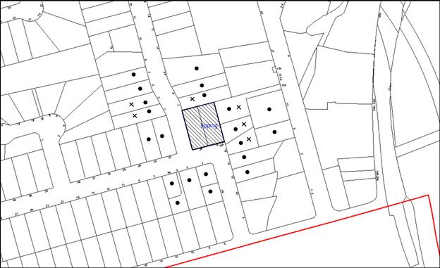
|
NOTIFICATION PLAN |
|
||
|
• PROPERTIES NOTIFIED
|
X SUBMISSIONS RECEIVED |
PROPERTY SUBJECT OF DEVELOPMENT |
|
Seven 7 submissions objected to the development, generally on the grounds that the development would result in:
· Unacceptable increase in traffic on local streets;
· Lack of two way passing on Rosebank Avenue due to commuter parking;
· Parking stress for occupants of No. 1 Rosebank Avenue;
· Loading and unloading on-street unrealistic as there is little on-street parking;
· Overshadowing of No. 16A Cliff Road and further setback sought to eastern boundary;
· Unacceptable loss of privacy and noise from north facing windows and balconies;
· Details of noise from generators cooling units have not been provided;
· Overlooking concerns from balconies to the east;
· Retaining wall to be built adjacent to No. 16A to prevent potential land slippage;
· The building is an eyesore;
· The building has a detrimental impact upon the Rosebank Avenue Heritage Conservation Area;
· There are insufficient trees to screen the property;
· Noise from large commercial bins;
· Noise from intercoms at the entrance will impact on neighbouring properties;
· Flat roof form inappropriate;
· Use of aluminium windows is inappropriate;
· The buildings construction could cause damage to neighbouring properties;
· This and other 5 storey developments would cause devaluation of properties;
· Rosebank Avenue should be re-zoned for high density residential development; and
· The development would contribute to land-locking No.15A Ray Road and Nos. 16 and 16A Cliff Road.
The merits of the matters raised in community submissions have been addressed in the body of the report with the exception of the following:
5.1.1 Construction Damage to Neighbouring Properties - Land Slippage and Retaining Wall to No. 16A Cliff Road
Council’s engineering assessment concludes that there is minimal potential for land-slippage to the neighbouring property at No. 16A Cliff Road.
A condition is recommended for the applicant to provide a ‘Dilapidation Report’ prepared by a chartered structural engineer detailing the condition of adjoining properties prior to the issue of a Construction Certificate and in particular to neighbouring properties at No. 2 Rosebank Avenue and 16A Cliff Road which are adjacent to the site.
In addition, a condition will be imposed for the protection of adjoining areas by temporary hoarding, fence or awning erected between the work site and adjoining lands before works begin and to be kept in place until the completion of works.
5.1.2 Devaluation of Neighbouring Properties
A concern was raised regarding the detrimental impacts to the economic value of adjoining properties.
It is acknowledged that there may be an adjustment to the development value of adjoining properties as a result of Council’s Housing Strategy. However, under the current freehold tenure system, landowners may redevelop land on the basis of individual decisions. The application has been assessed in accordance to Section 79C of the Environmental Planning and Assessment Act 1979 with regard to the economic impacts to the locality.
5.1.3 Re-zoning of Rosebank Avenue
At its meeting on 8 October 2014, Council considered Group Manager’s Report No. PL72/14 concerning submissions received to the exhibition of the draft Epping Town Centre amendments to the Hornsby Development Control Plan (HDCP) 2013. Council resolved (in part) to review the heritage significance of the Essex Street and Rosebank Avenue Heritage Conservation Areas in a future stage of Council’s Heritage Review to follow development of the adjacent five storey residential precincts.
5.1.4 Land-locking / Isolation, and Reduction in Development Potential
The potential isolation of adjoining sites has been considered in respect to the HDCP prescriptive measure ‘where a development proposal results in an adjoining site within the precinct with no street frontage or primary street frontage of less than 30 metres’ as discussed below.
Property Nos. 15A Ray Road, 16 and 16A Cliff Road have the potential to amalgamate to form a consolidated site with a width of 36.5m and a length of 63.5m that could accommodate a five storey residential flat building in accordance with HDCP and form a consolidated site with access from Cliff road or Ray Road.
In this regard, the approval of the subject application would not result in the isolation of any adjoining properties as there is scope for the amalgamation of adjoining undeveloped lots for five storey development.
5.1.5 Noise from Large Refuse Collection Vehicles / Intercoms
Collection of residential refuse will take place by a SRV reversing onto the site from Rosebank Avenue collecting waste from the holding room (located adjacent to the driveway entrance) and then leaving in forward gear. It is acknowledged that on refuse collection days there will be noise and disturbance from the site. However, this operation is anticipated to occur sporadically and for short periods on allocated refuse collection days.
There is a 4m high acoustic “greenwall” between the hardstand for refuse collection, loading / unloading and use of the intercoms system by visitors. In combination with the increased setback to No. 2 Rosebank Avenue and the provision of landscaping and fencing to the northern boundary, noise and disturbance would be minimised.
5.2 Public Agencies
The development application was not referred to any Public Agencies for comment.
6. THE PUBLIC INTEREST
Section 79C(1)(e) of the Act requires Council to consider “the public interest”.
The public interest is an overarching requirement, which includes the consideration of the matters discussed in this report. Implicit to the public interest is the achievement of future built outcomes adequately responding to and respecting the future desired outcomes expressed in environmental planning instruments and development control plans.
The application is considered to have satisfactorily addressed Council’s and relevant agencies’ criteria and would provide a development outcome that, on balance, would result in a positive impact for the community. Accordingly, it is considered that the approval of the proposed development would be in the public interest.
CONCLUSION
The application seeks approval for the demolition of existing structures and construction of a five storey residential flat building comprising 35 units with basement car parking and strata subdivision.
The proposed development is generally in accordance with the development controls for the Cliff Road / Epping Road’ Precinct of the Hornsby DCP and would contribute to the future desired five storey residential character of the precinct. The proposal generally complies with the design principles of SEPP 65 and the Residential Flat Design Code. With conditions, the minor non-compliances with prescriptive measures for setbacks, height of basement, landscaping, minimum dwelling size, maximum kitchen distance and storage areas is considered acceptable.
The proposal would result in a development that would be in keeping with the desired future character of the precinct.
Note: At the time of the completion of this planning report, no persons have made a Political Donations Disclosure Statement pursuant to Section 147 of the Environmental Planning and Assessment Act 1979 in respect of the subject planning application.
RESPONSIBLE OFFICER
The officer responsible for the preparation of this Report is the Manager – Development Assessments – Rodney Pickles, who can be contacted on 9847 6731.
|
Rod Pickles Manager - Development Assessment Planning Division |
James Farrington Group Manager Planning Division |
|
1.View |
Locality Map |
|
|
|
2.View |
Site Analysis Plan |
|
|
|
3.View |
Floor Plans |
|
|
|
4.View |
Elevations and Sections |
|
|
|
5.View |
3D Image |
|
|
File Reference: DA/1602/2014
Document Number: D06041086
SCHEDULE 1
GENERAL CONDITIONS
The conditions of consent within this notice of determination have been applied to ensure that the use of the land and/or building is carried out in such a manner that is consistent with the aims and objectives of the relevant legislation, planning instruments and council policies affecting the land and does not disrupt the amenity of the neighbourhood or impact upon the environment.
Note: For the purpose of this consent, the term ‘applicant’ means any person who has the authority to act on or the benefit of the development consent.
Note: For the purpose of this consent, any reference to an Act, Regulation, Australian Standard or publication by a public authority shall be taken to mean the gazetted Act or Regulation, or adopted Australian Standard or publication as in force on the date that the application for a construction certificate is made.
1. Deferred Commencement
Pursuant to Section 80(3) of the Environmental Planning and Assessment Act 1979, this consent does not operate until the following information is submitted to Council:
a) A drainage design by a qualified engineer for the proposed inter-allotment drainage system through Lot 1 DP 575254, 15A Ray Road, Epping in accordance with Council’s Civil Works Design Specification. The design shall include flow rate calculations of the catchment area draining through the system and pipe capacity.
b) A longitudinal section of the proposed inter-allotment drainage system with existing and proposed ground levels, pit and pipe invert levels and pipe grade.
c) The registration and creation of an easement to drain water from the site over downstream properties.
Such information shall be submitted within 12 months of the date of this notice.
Upon Council’s written satisfaction of the above information, the following conditions of development consent will apply:
2. Approved Plans and Supporting Documentation
The development must be carried out in accordance with the plans and documentation listed below and endorsed with Council’s stamp, except where amended by Council and/or other conditions of this consent:
|
Plan No. |
Plan Title |
Drawn by |
Dated |
|
2884-D-01 |
Contour and Detail Survey |
Urban Surveys |
22.05.2014 |
|
DA00 Rev G |
Site Analysis Plan |
Olsson and Associates |
July 2015 |
|
DA01 Rev E |
Level 1 (Plan) Ground Floor |
Olsson and Associates |
July 2015 |
|
DA02 Rev E |
Level 2 – 4 Plan (Typical) |
Olsson and Associates |
July 2015 |
|
DA03 Rev E |
Level 5 Plan |
Olsson and Associates |
July 2015 |
|
DA04 Rev D |
Roof Plan |
Olsson and Associates |
June 2015 |
|
DA05 Rev E |
Level Basement 1 |
Olsson and Associates |
July 2015 |
|
DA06 Rev E |
Level Basement 2 |
Olsson and Associates |
July 2015 |
|
DA07 Rev D |
South and West Elevations |
Olsson and Associates |
June 2015 |
|
DA08 Rev G |
North and East Elevations |
Olsson and Associates |
July 2015 |
|
DA09 Rev D |
Section A – A |
Olsson and Associates |
June 2015 |
|
DA10 Rev E |
Materials and Finishes |
Olsson and Associates |
June 2015 |
|
DA11.1B |
Shadow Diagram |
Olsson and Associates |
October 2014 |
|
DA11.2B |
Shadow Diagram |
Olsson and Associates |
October 2014 |
|
DA11.3B |
Shadow Diagram |
Olsson and Associates |
October 2014 |
|
DA14 Rev D |
Waste Management and Fence Details |
Olsson and Associates |
June 2015 |
|
DA15 Rev C |
3D Image |
Olsson and Associates |
July 2015 |
|
L01 D |
Landscape Plan |
Jane Irwin Landscape Architects |
13.07.2015 |
|
L02 C |
Elevation and Plant Schedule |
Jane Irwin Landscape Architects |
25.05.2015 |
|
Document Title |
Prepared by |
Dated |
|
Statement of Environmental Effects |
Elton Consultants |
19.12.2014 |
|
Traffic and Parking Report |
McLaren Traffic Engineering |
21.11.2014 |
|
Statement of Heritage Impact |
Archnex Designs |
December 2014 |
|
Acoustic Report |
SLR |
5.12.2014 |
|
Arborist Report |
Advanced Treescape Consulting |
16.12.2014 |
|
Costs Summary Report |
MMDCC |
15.12.2014 |
|
Access Compliance Report |
Vista Access Architects |
20.11.2014 |
|
BASIX Certificate |
SLR Consulting |
03.12.2014 |
|
SEPP 65 Design Verification Statement |
Olsson and Associates |
December 2014 |
|
Waste Management Plan |
Elton Consulting |
June 2015 |
|
Building Code of Australia Report |
Kudos Building Certification |
16.12.2014 |
|
Proposed Easement Layout Rev 3 |
ANAcivil |
10.07.2015 |
|
Stormwater Levels Roof Plan, 2 – 4 Plans, Level 5 Plan Rev 3 |
ANAcivil |
10.07.2015 |
|
Stormwater Upper / Lower Basement Plan / Easement Layout Rev 3 |
ANAcivil |
10-07-2015 |
|
Stormwater Level 1 (Ground Floor) Plan Rev 3 |
ANAcivil |
10-07-2015 |
3. Amendment of Plans
The approved plans are to be amended as follows:
a) The Tree Location Plan within the Arboricultural Impact Assessment prepared by Russel Kingdom, dated 16-12-14 shall be amended to include trees adjacent to the easement as shown on the Tree Location Addendum (TRIM-D06210914) DA/1602/2014, Aerial 15A Ray Rd Epping, prepared by Hornsby Council, dated 22-07-15.
b) The sediment and erosion plan include show one (1) silt arrester pit within the 15m Tree Protection Zone of tree T27, located at a distance greater than 6m from the trunk of the tree and designed in accordance with the recommendations of the project Arborist.
4. Removal of Existing Trees
This development consent permits the removal of trees numbered 1,2,3,4,5,6,7,8,9,10, 12,13,14,15 as identified in the Arboricultural Impact Assessment prepared by Russell Kingdom dated 16th December 2014. The removal of any other trees requires separate approval in accordance with the Tree and Vegetation Chapter 1B.6 Hornsby Development Control Plan (HDCP).
5. Construction Certificate
a) A Construction Certificate is required to be approved by Council or a Private Certifying Authority prior to the commencement of any works under this consent.
b) The Construction Certificate plans must not be inconsistent with the Development Consent plans.
6. Section 94 Development Contributions
a) In accordance with Section 80A(1) of the Environmental Planning and Assessment Act 1979 and the Hornsby Shire Council Section 94 Development Contributions Plan 2012-2021, the following monetary contributions shall be paid to Council to cater for the increased demand for community infrastructure resulting from the development:
|
Description |
Contribution (4) |
|
Roads |
$24,610.35 |
|
Open Space and Recreation |
$359,378.05 |
|
Community Facilities |
$50,115.65 |
|
Plan Preparation and Administration |
$1506.20 |
|
TOTAL |
$435,610.25 |
being for 35 units with 2 credits.
b) The value of this contribution is current as at 13th July 2015 If the contributions are not paid within the financial quarter that this condition was generated, the contributions payable will be adjusted in accordance with the provisions of the Hornsby Shire Council Section 94 Development Contributions Plan and the amount payable will be calculated at the time of payment in the following manner:
$CPY = $CDC x CPIPY
CPIDC
Where:
$CPY is the amount of the contribution at the date of Payment
$CDC is the amount of the contribution as set out in this Development Consent
CPIPY is the latest release of the Consumer Price Index (Sydney – All Groups) at the date of Payment as published by the ABS.
CPIDC is the Consumer Price Index (Sydney – All Groups) for the financial quarter at the date applicable in this Development Consent Condition.
c) The monetary contributions shall be paid to Council:
i) prior to the issue of the Subdivision Certificate where the development is for subdivision; or
ii) prior to the issue of the first Construction Certificate where the development is for building work; or
iii) prior to issue of the Subdivision Certificate or first Construction Certificate, whichever occurs first, where the development involves both subdivision and building work; or
iv) prior to the works commencing where the development does not require a Construction Certificate or Subdivision Certificate.
It is the professional responsibility of the Principal Certifying Authority to ensure that the monetary contributions have been paid to Council in accordance with the above timeframes.
Council’s Development Contributions Plan may be viewed at www.hornsby.nsw.gov.au or a copy may be inspected at Council’s Administration Centre during normal business hours.
7. Heritage
The existing decorative brick wall to Rosebank Avenue shall be either retained, or the bricks incorporated into the landscaping features and proposed boundary walls of the new development to provide a reference to the Inter-war character of the conservation area.
REQUIREMENTS PRIOR TO THE ISSUE OF A CONSTRUCTION CERTIFICATE
8. Building Code of Australia
All building work must be carried out in accordance with the relevant requirements of the Building Code of Australia.
9. Contract of Insurance (Residential Building Work)
In the case of residential building work for which the Home Building Act 1989 requires there to be a contract of insurance in force in accordance with Part 6 of that Act, that such a contract of insurance is in force before any building work authorised to be carried out by the consent commences.
10. Notification of Home Building Act, 1989 Requirements
Residential building work within the meaning of the Home Building Act 1989 must not be carried out unless the principal certifying authority for the development to which the work relates (not being Council) has given Council written notice of the following information:
a) In the case of work for which a principal contractor is required to be appointed:
i) The name and licence number of the principal contractor; and
ii) The name of the insurer by which the work is insured under Part 6 of that Act.
b) In the case of work to be done by an owner-builder:
i) The name of the owner-builder; and
ii) If the owner-builder is required to hold an owner-builder’s permit under that Act, the number of the owner-builder’s permit.
Note: If arrangements for doing the residential building work are changed while the work is in progress so that the information notified becomes out of date, further work must not be carried out unless the principal certifying authority for the development to which the work relates (not being Council) has given Council written notification of the updated information.
11. Utility Services
The applicant must submit written evidence of the following service provider requirements:
a) Ausgrid (formerly Energy Australia) – a letter of consent demonstrating that satisfactory arrangements have been made to service the proposed development.
b) Telstra – a letter of consent demonstrating that satisfactory arrangements have been made to service the proposed development.
12. Sydney Water – Quick Check
This application must be submitted to a Sydney Water ‘Quick Check Agent’ or ‘Customer Centre’ for approval to determine whether the development would affect any Sydney Water infrastructure, and whether further requirements are to be met.
Note: Refer to www.sydneywater.com.au or telephone 13 20 92 for assistance.
13. Dilapidation Report
A ‘Dilapidation Report’ is to be prepared by a ‘chartered structural engineer’ detailing the structural condition of adjoining properties at No. 2 Rosebank Avenue and No. 16A Cliff Road.
14. Traffic Control Plan
A Traffic Control Plan (TCP) must be prepared by a qualified traffic controller in accordance with the Roads and Traffic Authority’s Traffic Control at Worksites Manual 1998 and Australian Standard 1742.3 for all work on a public road. The Traffic Management Plan shall be submitted and approved by Council’s Manager Traffic and Road Safety prior to the issue of a construction certificate. The TCP must detail the following:
a) Arrangements for public notification of the works;
b) Temporary construction signage;
c) Permanent post-construction signage;
d) Vehicle movement plans;
e) Traffic management plans;
f) Pedestrian and cyclist access/safety.
15. Noise
The development must be carried out in accordance with the recommendations contained within the acoustic report submitted with the development application, titled, prepared by SLR and dated 05.12.2014 and the requirements of the Department of Planning’s Development Near Rail Corridors and Busy Roads – Interim Guideline and RailCorp’s Interim Guidelines for Applicants.
Note: The Department of Planning’s document is available at www.planning.nsw.gov.au (development assessments).
16. Letterboxes
The details of letter boxes and meter enclosures must be provided with the Construction Certificate Plans. The letter boxes and meter enclosures must be provided with a minimum setback of 2 metres from all boundaries and must be suitably screened.
17. Waste Management Details
The following waste management requirements must be complied with:
a) The approved on-going waste management system must not be amended without the written consent of Council.
b) The waste facility (garbage chute and recycling bin) on each residential level must be accessible by persons with a disability.
c) Volume handling equipment (a 2x660L bin linear or 4x660L bin carousel), to automatically change the bin under the chute when it becomes full, must be provided for the garbage chute system. The volume handling equipment must not be fitted with a compactor.
d) The door(s) to the basement garbage room must be located and sufficiently wide to allow for bins to be stored throughout the room after the volume handling equipment has been installed.
18. Stormwater Drainage
The stormwater drainage system for the development must be designed and constructed in accordance with Council’s Civil Works – Design and Construction Specification 2005 and the following requirements:
a) Connected directly to Council’s pit in Ray Road, via an inter-allotment drainage system.
b) An inter-allotment stormwater drainage system to service the proposed development with pits being a minimum 600 x 600 mm cast in situ or pre-cast concrete pits being used.
Note: A construction certificate shall be obtained prior to the commencement of these works and are to be completed prior to the issue of an occupation certificate.
19. Rainwater Reuse Tank
In order to meet the water quality targets specified in Part 1C.1.2 – Stormwater Drainage in Council’s Development Control Plan 2013 the following shall be provided:
a) A minimum 80% of the roof water must be connected to a rainwater tank having a minimum capacity of 3,000 litres per 100 m2 of roof area of the development. The tank is to be connected to the communal water system and to all dwellings for toilet flushing and laundry. The overflow from the rainwater tank and collected surface water must be discharged to the on-site detention system
Note: A construction certificate shall be obtained prior to the commencement of these works and are to be completed prior to the issue of an occupation certificate.
20. On Site Stormwater Detention
An on-site stormwater detention system must be designed by a chartered civil engineer and constructed in accordance with the following requirements:
a) Have a capacity of not less than 27.4 cubic metres, cubic metres, and a maximum discharge (when full) of 22 litres per second.
b) Have a surcharge/inspection grate located directly above the outlet.
c) Discharge from the detention system to be controlled via 1 metre length of pipe, not less than 50 millimetres diameter or via a stainless plate with sharply drilled orifice bolted over the face of the outlet discharging into a larger diameter pipe capable of carrying the design flow to an approved Council system.
d) Where above ground and the average depth is greater than 0.3 metres, a ‘pool type’ safety fence and warning signs to be installed.
e) Not be constructed in a location that would impact upon the visual or recreational amenity of residents.
Note: A construction certificate shall be obtained prior to the commencement of these works and are to be completed prior to the issue of an occupation certificate.
21. Connection to Council Drainage Pit
Prior to the issue of a construction certificate, an application shall be made to Council and all fees paid to connect to Council’s drainage pit.
a) The connection to Council’s pit / pipe shall be in accordance with Council’s Civil Works Specification and inspected by a Council Engineer in the Planning Division. An inspection booking can be made by calling Council on 9847 6787.
Note: A construction certificate shall be obtained prior to the commencement of these works and are to be completed prior to the issue of an occupation certificate.
22. Internal Driveway/Vehicular Areas
The driveway and parking areas on site must be designed in accordance with Australian Standards 2890.1, 2890.2, 3727 and the following requirements:
a) Design levels at the front boundary must be obtained from Council;
b) The driveway must be a rigid pavement;
c) Prior to the issue of a construction certificate, a certificate from a qualified engineer shall be submitted to the principal certifying authority certifying that the access driveway, parking and services areas have been designed in accordance with Australian Standards AS 2890.1 and AS 2890.2.
Note: A construction certificate shall be obtained prior to the commencement of these works and are to be completed prior to the issue of an occupation certificate.
23. Driveway Longitudinal Sections
Longitudinal sections along both sides of the access driveway shall be submitted to the principal certifying authority in accordance with the relevant sections of AS 2890.1 and the following requirements:
a) The maximum grade shall not exceed 1 in 4 (25%) with the maximum changes of grade of 1 in 8 (12.5%) for summit grades and 1 in 6.7 (15%) for sag grades. Any transition grades shall have a minimum length of 2 metres. The longitudinal sections shall incorporate the design levels obtained by Council.
Note: A construction certificate shall be obtained prior to the commencement of these works and are to be completed prior to the issue of an occupation certificate.
24. Vehicular Crossing
A separate application under the Local Government Act 1993 and the Roads Act 1993 must be submitted to Council for the installation of a new vehicular crossing and the removal of the redundant crossing. The vehicular crossing must be constructed in accordance with Council’s Civil Works Design 2005 and the following requirements:
a) Any redundant crossings must be replaced with integral kerb and gutter;
b) The accessway must be at least 7m wide at the kerb to accommodate a rigid SRV vehicle reversing onto the site and leaving in forward gear;
c) The footway area must be restored by turfing;
d) Approval must be obtained from all relevant utility providers that all necessary conduits be provided and protected under the crossing.
Note: An application for a vehicular crossing can only be made to one of Council’s Authorised Vehicular Crossing Contractors. You are advised to contact Council on 02 9847 6940 to obtain a list of contractors.
25. Road Works
A separate application under the Local Government Act, 1993 and the Roads Act, 1993 must be submitted to Council for approval of all works within the public road reserve. All road works approved under this consent must be constructed in accordance with Council’s Civil Works Design and Construction Specification 2005 and the following requirements:
a) A concrete footpath to be constructed along the full frontage of the development site in Cliff Road and Rosebank Avenue within the road verge with the remaining area turfed.
b) The existing kerb and gutter and pavement along the full frontage of the development site in Cliff Road and Rosebank Avenue shall be removed and reconstructed.
c) The existing road pavement to be saw cut a minimum of 300 mm from the existing edge of the bitumen and reconstructed.
d) Detailed design drawings by a qualified engineer shall be submitted to Council for approval with the construction certificate application for public road works.
Note: A separate Construction Certificate is required to be submitted and approval obtained by Hornsby Shire Council prior to the commencement of these works.
26. Construction and Traffic Management Plan
In order to enable unencumbered movement of traffic in the public road during construction works, a Construction Management Plan, including a Traffic Management Plan and scaled construction plan prepared by a suitably Chartered and Qualified Chartered Engineer and Qualified Worksite Traffic Controller shall be prepared and submitted with the Construction Certificate according to the following requirements:-
a) A copy of the plans shall be submitted for consideration and written approval by Hornsby Shire Council’s Manager of Traffic & Road Safety Branch prior to the release of the Construction Certificate.
b) The plans shall detail the order of construction works and arrangement of all construction machines and vehicles being used at the same time during all stages.
c) In order to prevent injury, accident and loss of property, no building materials, work sheds, vehicles, machines or the like shall be allowed to remain in the road reserve area without written consent of Hornsby Shire Council.
d) The Plan shall be generally in compliance with the requirements of the Road and Traffic Authority’s “Traffic Control at Worksites Manual 1998” and detailing:-
i) Public notification of proposed works;
ii) Long term signage requirements;
iii) Short term (during actual works) signage;
iv) Vehicle Movement Plans, where applicable;
v) Traffic Management Plans;
vi) Pedestrian and Cyclist access and safety;
e) The plans shall indicate traffic controls including those used during non-working hours and shall provide pedestrian access and two-way traffic in the public road to be facilitated at all times.
f) The Applicant and all employees of contractors on the site must obey any direction or notice from the Prescribed Certifying Authority or Hornsby Shire Council in order to ensure the above.
REQUIREMENTS PRIOR TO THE COMMENCEMENT OF ANY WORKS
27. Erection of Construction Sign
A sign must be erected in a prominent position on any site on which building work, subdivision work or demolition work is being carried out:
a) Showing the name, address and telephone number of the principal certifying authority for the work;
b) Showing the name of the principal contractor (if any) for any demolition or building work and a telephone number on which that person may be contacted outside working hours; and
c) Stating that unauthorised entry to the work site is prohibited.
Note: Any such sign is to be maintained while the building work, subdivision work or demolition work is being carried out, but must be removed when the work has been completed.
28. Protection of Adjoining Areas
A temporary hoarding, fence or awning must be erected between the work site and adjoining lands before the works begin and must be kept in place until after the completion of the works if the works:
a) Could cause a danger, obstruction or inconvenience to pedestrian or vehicular traffic.
b) Could cause damage to adjoining lands by falling objects.
c) Involve the enclosure of a public place or part of a public place.
Note: Notwithstanding the above, Council’s separate written approval is required prior to the erection of any structure or other obstruction on public land.
29. Toilet Facilities
Toilet facilities must be available or provided at the works site before works begin and must be maintained until the works are completed at a ratio of one toilet for every 20 persons employed at the site. Each toilet must:
a) be a standard flushing toilet connected to a public sewer; or
b) be a temporary chemical closet approved under the Local Government Act 1993; or
c) have an on-site effluent disposal system approved under the Local Government Act 1993.
30. Erosion and Sediment Control
Erosion and sediment control measures must be provided and maintained throughout the construction period in accordance with the manual ‘Soils and Construction 2004 (Bluebook)’, the approved plans, Council specifications and to the satisfaction of the principal certifying authority. The erosion and sediment control devices must remain in place until the site has been stabilised and revegetated.
Note: On the spot penalties may be issued for any non-compliance with this requirement without any further notification or warning.
31. Project Arborist
a) A Project Arborist is to be appointed in accordance with AS 4970-2009 (1.4.4) to provide monitoring and certification throughout the development process. The name of the Arborist is to be forwarded to Council prior to commencing any of the works.
b) Prior to any works, tree protection measures must be in place around the trees in the following table and a certificate from the project Arborist provided to the Principal Certifying Authority stating that all tree protection measures are in accordance with the intentions of the Australian Standard ‘Protection of Trees on Development Sites (AS 4970-2009).
Tree Protection Zones (TPZ)
|
Specified Tree |
SRZ(Radius) |
TPZ(Radius) |
|
T27, T11 |
5m |
15m |
|
T33, T32, T30, T26, T25, T24, |
3m |
6m |
|
T28, T29 |
2.5m |
5m |
|
T31 |
2m |
3m |
REQUIREMENTS DURING CONSTRUCTION
32. Construction Work Hours
All work on site (including demolition and earth works) must only occur between 7am and 5pm Monday to Saturday. No work is to be undertaken on Sundays or public holidays. No excavation or rock sawing/breaking is to occur on Saturdays.
33. Demolition
All demolition work must be carried out in accordance with “Australian Standard 2601-2001 – The Demolition of Structures” and the following requirements:
a) Demolition material must be disposed of to an authorised recycling and/or waste disposal site and/or in accordance with an approved waste management plan;
b) Demolition works, where asbestos material is being removed, must be undertaken by a contractor that holds an appropriate licence issued by WorkCover NSW in accordance with Chapter 10 of the Occupational Health and Safety Regulation 2001 and Clause 29 of the Protection of the Environment Operations (Waste) Regulation 2005 ;and
c) On construction sites where buildings contain asbestos material, a standard commercially manufactured sign containing the words ‘DANGER ASBESTOS REMOVAL IN PROGRESS’ measuring not less than 400mm x 300mm must be erected in a prominent position visible from the street.
34. Environmental Management
The site must be managed in accordance with the publication ‘Managing Urban Stormwater – Landcom (March 2004) and the Protection of the Environment Operations Act 1997 by way of implementing appropriate measures to prevent sediment run-off, excessive dust, noise or odour emanating from the site during the construction of the development.
35. Works in Tree Protection Zones
a) All works within the TPZ must be carried out under the direct supervision of the Project Arborist. The project Arborist must assess the condition of the trees and their growing environment and make recommendations for, and if necessary carry out remedial action during construction to ensure the health and vigour of the trees.
b) The installation of underground services within the TPZ shall utilise the horizontal drilling method. Horizontal drilling shall be carried out so that ‘top of pipe’ is a minimum 600mm depth beneath existing ground level.
36. Construction Work Hours
All work on site (including demolition and earth works) must only occur between 7am and 5pm Monday to Saturday (unless otherwise approved by Council due to extenuating circumstances). No work is to be undertaken on Sundays or public holidays
37. Demolition
All demolition work must be carried out in accordance with “Australian Standard 2601-2001 – The Demolition of Structures” and the following requirements:
a) Demolition material must be disposed of to an authorised recycling and/or waste disposal site and/or in accordance with an approved waste management plan;
b) Demolition works, where asbestos material is being removed, must be undertaken by a contractor that holds an appropriate licence issued by WorkCover NSW in accordance with Chapter 10 of the Occupational Health and Safety Regulation 2001 and Clause 29 of the Protection of the Environment Operations (Waste) Regulation 2005 ;and
c) On construction sites where buildings contain asbestos material, a standard commercially manufactured sign containing the words ‘DANGER ASBESTOS REMOVAL IN PROGRESS’ measuring not less than 400mm x 300mm must be erected in a prominent position visible from the street.
38. Street Sweeping
Street sweeping must be undertaken following sediment tracking from the site along Rosebank Avenue and Cliff Road during works and until the site is established.
The street cleaning services must undertake a street ‘scrub and dry’ method of service and not a dry sweeping service that may cause sediment tracking to spread or cause a dust nuisance.
39. Council Property
During construction works, no building materials, waste, machinery or related matter is to be stored on the road or footpath. The public reserve must be kept in a clean, tidy and safe condition at all times.
Note: This consent does not give right of access to the site via Council’s park or reserve. Should such access be required, separate written approval is to be obtained from Council.
40. Disturbance of Existing Site
During construction works, the existing ground levels of open space areas and natural landscape features, (including natural rock-outcrops, vegetation, soil and watercourses) must not be altered unless otherwise nominated on the approved plans.
41. Landfill
Landfill must be constructed in accordance with Council’s ‘Construction Specification 2005’ and the following requirements:
a) All fill material imported to the site is to wholly consist of Virgin Excavated Natural Material (VENM) as defined in Schedule 1 of the Protection of the Environment Operations Act 1997 or a material approved under the Department of Environment and Climate Change’s general resource recovery exemption.
b) A compaction certificate is to be obtained from a geotechnical engineer verifying that the specified compaction requirements have been met.
42. Excavated Material
All excavated material removed from the site must be classified in accordance with the Department of Environment, Climate Change and Water NSW Waste Classification Guidelines prior to disposal to an approved waste management facility and reported to the principal certifying authority.
43. Work Zone
All construction vehicles associated with the proposed development are to be contained on site or in a Local Traffic Committee (LTC) approved “Work Zone”.
44. Survey Report
A report(s) must be prepared by a registered surveyor and submitted to the principal certifying authority;
a) Prior to the pouring of concrete at each level of the building certifying that:
i) The building, retaining walls and the like have been correctly positioned on the site; and
ii) The finished floor level(s) are in accordance with the approved plans.
b) Confirming that the waste collection vehicle turning area complies with AS2890.1 – 2004 and AS20890.2 – 2002 for small rigid vehicles (SRV).
45. Waste Management
Waste management during the demolition and construction phase of the development must be undertaken in accordance with the approved Waste Management Plan. Additionally written records of the following items must be maintained during the removal of any waste from the site and such information submitted to the Principal Certifying Authority within fourteen days of the date of completion of the works:
a) The identity of the person removing the waste.
b) The waste carrier vehicle registration.
c) Date and time of waste collection.
d) A description of the waste (type of waste and estimated quantity).
e) Details of the site to which the waste is to be taken.
f) The corresponding tip docket/receipt from the site to which the waste is transferred (noting date and time of delivery, description (type and quantity) of waste)
g) Whether the waste is expected to be reused, recycled or go to landfill.
Note: In accordance with the Protection of the Environment Operations Act 1997, the definition of waste includes any unwanted substance, regardless of whether it is reused, recycled or disposed to landfill.
REQUIREMENTS PRIOR TO THE ISSUE OF AN OCCUPATION CERTIFICATE
Note: For the purpose of this consent, a reference to ‘occupation certificate’ shall not be taken to mean an ‘interim occupation certificate’ unless otherwise stated.
46. On Slab Planting – Green Roof
On slab planter boxes and green roofs must include waterproofing, subsoil drainage (proprietary drainage cell, 50mm sand and filter fabric) automatic irrigation, minimum 500mm planting soil for shrubs and minimum 1000mm planting soil for trees and palms and 75mm mulch to ensure sustainable landscape is achieved.
47. Additional Landscape Planting – Rosebank Avenue Frontage
Additional screen planting is to be provided to the setback area on the Rosebank Avenue frontage where the private courtyard fences are located for units U103 and U102. This shall as a minimum include:
a) Ten (10) Ceratopetalum gummiferum (NSW Christmas Bush trees) shall be installed at minimum 25 litre pot size.
48. Street Tree Plantings
The existing street trees Eucalyptus sideroxylon and Jacaranda mimosifolia (trees 6 and 12 in Arborist Report by Advanced Treescape consulting dated 6/12/15) are to be removed.
Replacement planting to the Rosebank Avenue verge shall be two (2) Tristaniopsis laurina ‘luscious’ (Water gums). Replacement planting to the Cliff Road verge shall be one (1) Tristaniopsis laurina ‘luscious’ (Water gums) under overhead wires and one (1) Lophostemnon confertus (brush box) where there are no overhead wires. Trees are to be located in mulched planted beds 1000mm long and min 600mm wide, have 3 x hardwood stakes and be installed at minimum 200 Litre pot size. Trees are to be located to ensure sight lines for cars leaving driveway are safe.
49. Noise
Provide to Council a Certificate from a Noise Consultant in compliance with condition 15.
50. Fulfilment of BASIX Commitments
The applicant must demonstrate the fulfilment of BASIX commitments pertaining to the development.
51. Sydney Water – s73 Certificate
An s73 Certificate must be obtained from Sydney Water.
Note: Sydney Water requires that s73 applications are to be made through an authorised Sydney Water Servicing Coordinator. Refer to www.sydneywater.com.au or telephone 13 20 92 for assistance.
52. Damage to Council Assets
Any damage caused to Council’s assets including the removal, damage, destruction, displacement or defacing of the existing survey marks as a result of the construction of the development must be rectified in accordance with Council’s Civil Works Specifications. Council’s Restorations Supervision must be notified for a formwork inspection prior to pouring concrete
53. Works as Executed Plan
A works-as-executed plan(s) must be prepared by a registered surveyor and submitted to Council for completed road pavement, kerb & gutter, public drainage systems, driveways and on-site detention system. The plan(s) must be accompanied by a certificate from a registered surveyor certifying that all pipelines and associated structures lie wholly within any relevant easements.
54. Easement Over Downstream Land
The proposed drainage easement over downstream Lot 1/575254 at 15A Ray Road, Epping must be registered with the NSW Department of Lands.
55. Boundary Fencing
Fencing must be erected along all property boundaries behind the front building alignment to a height of 1.8 metres. Fences to the primary frontage in front of the building alignment are to retain visual transparency (not lapped / solid) and be 1.2 metres in height.
Note: Alternative fencing may be erected subject to the written consent of the adjoining property owner(s).
56. Planter Boxes/On Slab Planting
On slab planter boxes must include waterproofing, subsoil drainage (proprietary drainage cell, 50mm sand and filter fabric) automatic irrigation, minimum 500mm planting soil for shrubs and minimum 1000mm planting soil for trees and palms and 75mm mulch to ensure sustainable landscape is achieved.
57. Completion of Landscaping
A certificate must be provided by a practicing landscape architect, horticulturalist or person with similar qualifications and experience certifying that all required landscaping works have been satisfactorily completed in accordance with the approved landscape plans.
Note: Advice on suitable species for landscaping can be obtained from Council’s planting guide ‘Indigenous Plants for the Bushland Shire’, available at www.hornsby.nsw.gov.au.
58. Final Certification
Where works have been undertaken within the Tree Protection Zone of a tree the project Arborist must assess the condition of tree(s) and the growing environment and make recommendations for, and carry out remedial actions where necessary.
Following the final inspection and the completion of any remedial works, the project Arborist must submit to the Principal Certifying Authority documentation stating that the completed works have been carried out in compliance with the approved plans and specifications for tree protection as above and AS 4970-2009.
59. External Lighting
All external lighting must be designed and installed in accordance with Australian Standard AS 4282 – Control of the Obtrusive Effects of Outdoor Lighting. Certification of compliance with the Standard must be obtained from a suitably qualified person.
60. Garbage Collection Easement
For the purpose of waste collection, an easement entitling Council, its servants and agents and persons authorised by it to enter upon the subject land and to operate thereon, vehicles and other equipment for the purposes of garbage collection must be granted to Council by the owner of the land.
Note: The easement must be in a form prescribed by Council and must include covenants to the effect that parties will not be liable for any damage caused to the subject land or any part thereof or to any property located therein or thereon by reason of the operation thereon of any vehicle or other equipment used in connection with the collection of garbage and to the effect that the owner for the time being of the subject land shall indemnify the Council, its servants, agents and persons authorised by it to collect garbage against liability in respect of any such claims made by any person whomsoever.
61. Waste Management Details
The following waste management requirements must be complied with:
a) Prior to an Occupation Certificate being issued or the use commencing, whichever is earlier, the Principal Certifying Authority must obtain Council’s approval of the waste and recycling management facilities provided in the development and ensure arrangements are in place for domestic waste collection by Council.
Note: Waste and recycling management facilities includes everything required for on-going waste management on the site. For example the garbage chute system, volume handling equipment, bin lifter, motorised bin trolley or similar, recycling bin storage on each residential level, bin storage areas, bulky waste storage area, bin collection area, waste collection vehicle access, etc.
b) The garbage room at the basement level must include water or a hose for cleaning, graded floors with drainage to sewer, a robust door, sealed and impervious surface, adequate lighting and ventilation, and must be lockable. The waste facility rooms/cupboards at each residential level must include sealed and impervious surface, adequate lighting and ventilation.
c) A report must be prepared by an appropriately qualified person, certifying the following:
i) A comparison of the estimated quantities of each waste type against the actual quantities of each waste type.
Note: Explanations of any deviations to the approved Waste Management Plan is required to be included in this report.
ii) That at least 60% of the waste generated during the demolition and construction phase of the development was reused or recycled.
Note: If the 60% diversion from landfill cannot be achieved in the Construction Stage, the Report is to include the reasons why this occurred and certify that appropriate work practices were employed to implement the approved Waste Management Plan. The Report must be based on documentary evidence such as tipping dockets/receipts from recycling depots, transfer stations and landfills, audits of procedures etc. which are to be attached to the report.
iii) All waste was taken to site(s) that were lawfully permitted to accept that waste.
d) Each unit must be provided with an indoor waste/recycling cupboard for the interim storage of a minimum one day’s waste generation with separate containers for general waste and recyclable materials.
e) Space must be provided for either individual compost containers for each unit or a communal compost container.
Note: The location of the compost containers should have regard for potential amenity impacts.
f) The bin carting routes must be devoid of any steps.
Note: Ramps between different levels are acceptable.
g) Access to the automatic waste volume handling equipment by unauthorised persons (including residents and waste collectors) must be prevented.
Note: Caging of the automatic volume handling equipment is acceptable.
62. Unit Numbering
The allocation of unit numbering must be authorised by Council prior to the numbering of each unit in the development.
63. Consolidation of Allotments
All allotments the subject of this consent must be consolidated into one allotment.
Note: The applicant is recommended to submit the plan of subdivision to consolidate allotments to the NSW Department of Lands at least 4-6 weeks prior to seeking an Occupation Certificate.
64. Safety and Security
This site must include the following elements:
a) An intercom system must be installed at gate locations to ensure screening of persons entering the units.
b) The entry doors to the pedestrian foyer is to be constructed of safety rated glass to enable residents a clear line of site before entering or exiting the residential apartments.
c) Lighting is to be provided to pathways, building foyer entries, driveways and common external spaces.
d) Security gate access is to be provided to the car parking areas allowing residents-only access to private car spaces.
e) The communal open space, at the rear and north of the site must be illuminated with high luminance by motion sensor lighting.
f) The driveway and basement car parking must be illuminated with low luminance at all times.
g) Security deadlocks are to be provided to each apartment door.
h) Peep holes are to be provided to individual apartment doors to promote resident safety.
65. Provision for National Broadband Network (NBN)
Provision must be made for fibre ready passive infrastructure (pits and pipes) generally in accordance with NBN Co's pit and pipe installation guidelines to service the proposed development. A certificate from NBN Co or Telstra must be submitted to the PCA that the fibre optic cabling provided for the development complies with MDU Building Design Guides for Development.
66. Vehicular Crossing
A separate application under the Local Government Act, 1993 and the Roads Act, 1993 must be submitted to Council for the installation of a new vehicular crossing and the removal of the redundant crossing. The vehicular crossing must be constructed in accordance with Council’s Civil Works Design, 2005 and the following requirements:
a) Any redundant crossings to be replaced with integral kerb and gutter.
b) The footway area to be restored by turfing.
c) Approval obtained from all relevant utility providers that all necessary conduits be provided and protected under the crossing.
Note: An application for a vehicular crossing can only be made to one of Council’s Authorised Vehicular Crossing Contractors. You are advised to contact Council on 02 9847 6940 to obtain a list of contractors.
67. Internal Driveway/Vehicular Areas
The driveway and parking areas on site must be designed in accordance with Australian Standards 2890.1, 2890.2, and the following requirements:
a) Design levels at the front boundary must be obtained from Council;
b) The driveway must be a rigid pavement;
c) The driveway grade for SRV access must not exceed 15.4 per cent and changes in grade must not exceed 8.3 per cent per 4.0m of travel, with provision of 3.5m of SRV clearance in servicing and manoeuvring areas;
d) The driveway ramp shall have suitable provision for drainage; and
e) Retaining walls required to support the basement ramp and the compaction of all fill batters must be in accordance with the requirements of a chartered structural engineer.
68. Installation of Air Conditioner
To protect the amenity of adjacent properties, the condenser unit for the air conditioner must be sited a minimum of 3 metres from the property boundary of any adjoining residential premises unless a certificate has been prepared by a suitably qualified person confirming that the unit has been tested for heating and cooling on the highest settings and that the noise levels generated do not exceed 5 dB(A) above background noise levels when tested at the property boundary between 8 pm and 10 pm.
69. Preservation of Survey Marks
Prior to the issue of an occupation certificate, a certificate by a Registered Surveyor shall be submitted to the Principal Certifying Authority, certifying that there has been no removal, damage, destruction, displacement or defacing of the existing survey marks in the vicinity of the proposed development or otherwise the re-establishment of damaged, removed or displaced survey marks has been undertaken in accordance with the Surveyor General’s Direction No.11 – “Preservation of Survey Infrastructure”.
70. Creation of Easements
The following matter(s) must be nominated on the plan of subdivision under s88B of the Conveyancing Act 1919:
a) The creation of an appropriate "Positive Covenant" and "Restriction as to User" over the constructed on-site detention/retention systems and outlet works, within the lots in favour of Council in accordance with Council’s prescribed wording. The position of the on-site detention system is to be clearly indicated on the title.
b) To register the OSD easement, the restriction on the use of land “works-as-executed” details of the on-site-detention system must be submitted verifying that the required storage and discharge rates have been constructed in accordance with the design requirements. The details must show the invert levels of the onsite system together with pipe sizes and grades. Any variations to the approved plans must be shown in red on the “works-as-executed” plan and supported by calculations.
Note: Council must be nominated as the authority to release, vary or modify any easement, restriction or covenant.
71. Final Certification
Where works have been undertaken within the Tree Protection Zone of a tree the project Arborist must assess the condition of tree(s) and the growing environment and make recommendations for, and carry out remedial actions where necessary.
Following the final inspection and the completion of any remedial works, the project Arborist must submit to the Principal Certifying Authority documentation stating that the completed works have been carried out in compliance with the approved plans and specifications for tree protection as above and AS 4970-2009.
OPERATIONAL CONDITIONS
72. Waste Management
The waste management on site must be in accordance with the following requirements:
a) A site caretaker must be employed and be responsible for moving bins where and when necessary, washing bins and maintaining waste storage areas, ensuring the chute system and related devices are maintained in effective and efficient working order, managing the communal composting area, managing the bulky item storage area, arranging the prompt removal of dumped rubbish, and ensuring all residents are informed of the use of the waste management system. The site caretaker must be employed for a sufficient number of hours each week to allow all waste management responsibilities to be carried out to a satisfactory standard.
73. Noise
All noise generated by the proposed development must be attenuated to prevent levels of noise being emitted to adjacent premises which possess tonal, beating and similar characteristics or which exceeds background noise levels by more than 5dB(A).
74. Landscape Establishment
The landscape works must be maintained into the future to ensure the establishment and successful growth of plant material to meet the intent of the landscape design. This must include but not limited to watering, weeding, replacement of failed plant material and promoting the growth of plants through standard industry practices.
75. Car Parking
All car parking must be constructed and operated in accordance with Australian Standard AS/NZS 2890.1:2004 – Off-street car parking and Australian Standard AS 2890.2:2002 – Off-street commercial vehicle facilities and:
a) All parking areas and driveways are to be sealed to an all-weather standard, line marked and signposted;
b) Car parking, loading and manoeuvring areas to be used solely for nominated purposes;
c) Vehicles awaiting loading, unloading or servicing shall be parked on site and not on adjacent or nearby public roads;
d) Residential parking spaces are to be secure spaces with access controlled by card or numeric pad;
e) Visitors are to have access to the parking area at all times. Visitors are to be able to access the basement car park by an audio/visual intercom system located at the top of the ramped driveway; and
f) All vehicular entry on to the site and egress from the site shall be made in a forward direction.
76. Sight Lines
Minimum sight lines for pedestrian safety are to be provided at the driveway. Any proposed landscaping and/or fencing must not restrict sight distance to pedestrians and cyclists travelling along the footpath.
77. Disabled Parking
All parking spaces for people with disabilities must be constructed and operated in accordance with Australian Standard AS/NZS 2890.6:2009 – Off-street parking for people with disabilities
78. Bicycle Parking
a) All bicycle parking spaces are to be designed in accordance with Australian Standard 2890.3-1993 – Bicycle parking facilities.
b) 6 resident and 4 visitor bicycle parking spaces are to be provided in the basement.
79. Motorcycle Parking Spaces
One motorcycle parking space is to be provided in accordance with AS 2890.5-1993
80. Fire Safety Statement - Annual
On at least one occasion in every 12 month period following the date of the first ‘Fire Safety Certificate’ issued for the property, the owner must provide Council with an annual ‘Fire Safety Certificate’ to each essential service installed in the building.
- END OF CONDITIONS -
ADVISORY NOTES
The following information is provided for your assistance to ensure compliance with the Environmental Planning and Assessment Act, 1979, Environmental Planning and Assessment Regulation 2000, other relevant legislation and Council’s policies and specifications. This information does not form part of the conditions of development consent pursuant to Section 80a of the Act.
Environmental Planning and Assessment Act 1979 Requirements
The Environmental Planning and Assessment Act 1979 requires:
· The issue of a construction certificate prior to the commencement of any works. Enquiries can be made to Council’s Customer Services Branch on 9847 6760.
· A principal certifying authority to be nominated and Council notified of that appointment prior to the commencement of any works.
· Council to be given at least two days written notice prior to the commencement of any works.
· Mandatory inspections of nominated stages of the construction inspected.
· An occupation certificate to be issued before occupying any building or commencing the use of the land.
Long Service Levy
In accordance with Section 34 of the Building and Construction Industry Long Service Payments Act 1986, a ‘Long Service Levy’ must be paid to the Long Service Payments Corporation or Hornsby Council.
Note: The rate of the Long Service Levy is 0.35% of the total cost of the work.
Note: Hornsby Council requires the payment of the Long Service Levy prior to the issue of a construction certificate.
Tree and Vegetation Preservation
In accordance with Clause 5.9 of the Hornsby Local Environmental Plan 2013 a person must not ringbark, cut down, top, lop, remove, injure or wilfully destroy any tree or other vegetation protected under the Hornsby Development Control Plan 2013 without the authority conferred by development consent or a permit granted by Council.
Notes: A tree is defined as a long lived, woody perennial plant with one or relatively few main stems with the potential to grow to a height greater than 3 metres. (HDCP 1B.6.1.c)
Tree protection measures and distances are determined using the Australian Standard AS 4970:2009, “Protection of Trees on Development Sites”.
Fines may be imposed for non-compliance with both the Hornsby Local Environmental Plan 2013 and the Hornsby Development Control Plan 2013.
Disability Discrimination Act
The applicant’s attention is drawn to the existence of the Disability Discrimination Act. A construction certificate is required to be obtained for the proposed building/s, which will provide consideration under the Building Code of Australia; however, the development may not comply with the requirements of the Disability Discrimination Act. This is the sole responsibility of the applicant.
Dial Before You Dig
Prior to commencing any works, the applicant is encouraged to contact Dial before You Dig on 1100 or www.dialbeforeyoudig.com.au for free information on potential underground pipes and cables within the vicinity of the development site.
Telecommunications Act 1997 (Commonwealth)
If you are aware of any works or proposed works which may affect or impact on Telstra’s assets in any way, you are required to contact: Telstra’s Network Integrity Team on Phone Number 1800810443.
Asbestos Warning
Should asbestos or asbestos products be encountered during demolition or construction works, you are advised to seek advice and information prior to disturbing this material. It is recommended that a contractor holding an asbestos-handling permit (issued by WorkCover NSW) be engaged to manage the proper handling of this material. Further information regarding the safe handling and removal of asbestos can be found at:
Alternatively, telephone the WorkCover Asbestos and Demolition Team on 8260 5885.
Group Manager’s Report No. PL56/15
Planning Division
Date of Meeting: 12/08/2015
12 DEVELOPMENT APPLICATION - SECTION 96 (2) - SEVEN STOREY MIXED USE DEVELOPMENT - NOS. 228-234 PACIFIC HIGHWAY, HORNSBY
EXECUTIVE SUMMARY
|
DA No: |
DA/1564/2008E (Lodged 17 March 2015) |
|
Description: |
Section 96(2) application to amend an approved seven storey mixed use development by adding additional residential units |
|
Property: |
Lot A and B DP 304557, The Walk, Nos. 228-234 Pacific Highway, Hornsby |
|
Applicant: |
The Walk Pty Ltd |
|
Owner: |
The Walk Pty Ltd |
|
Estimated Value: |
$1,000,000 |
|
Ward: |
B |
· The application involves a Section 96(2) modification to an approved seven storey mixed use development comprising retail/commercial floor space with shop-top housing by adding seven units at the roof level. The proposal would result in an eight storey building.
· The proposal complies with the provisions of Section 96(2) of the Environmental Planning and assessment Act 1979 and State Environmental Planning Policy No. 65. The development does not comply with ‘Clause 4.4- Floor Space Ratio’ within the Hornsby Local Environmental Plan 2013.
· One submission has been received in respect of the application.
· It is recommended that the application be approved.
|
THAT pursuant to Section 96 (2) of the Environmental Planning and Assessment Act 1979, Development Application No. DA/1564/2008 for the erection of a seven storey mixed use development incorporating retail and commercial floor space and 28 residential units at Lot A and B DP 304557, Nos. 228-234 Pacific Highway, Hornsby be amended as detailed in Schedule 1 of Group Manager’s Report No.PL56/15. |
BACKGROUND
On 3 June 2009, Council approved DA/1564/2008 for construction of a seven storey development comprising one level of retail on the ground floor, two floors of commercial and four floors of residential comprising 32 units. The approved development included the provision of four levels of basement car parking comprising 108 car spaces with 7 bicycle racks and 4 motorcycle spaces.
On 2 December 2009, Council approved a Section 96(2) application for the modification of the development by reducing the gross floor area and number of residential units to 28, variation to the internal layout and driveway access, inclusion of a turntable in the loading dock and amendment to the external facade. The approved development included 95 car spaces with 8 bicycle racks and 7 motorcycle spaces.
On 20 February 2013, Council approved a Section 96(2) application for the amendment of the approved plans by removing one basement level, variation to the internal layout of the retail and commercial levels and deletion of the turntable from the ground floor level. The modified development included 86 car spaces including two tandem allocations. The deletion of the turntable was allowed on the basis that the design vehicle had been reduced to an 8.8 metre truck (Medium Rigid Vehicle). Pursuant to this modification, the commercial floor space on levels 1 and 2 was divided into 8 commercial units at each level.
On 1 May 2013, Council approved a Section 96(1A) application to amend the approved plans by deleting one basement level and allocating the tandem car spaces to the 3-bedroom units.
On 1 July 2013, Council approved a Section 96(1A) application to amend Condition No. 49 in accordance with the previous approvals that restricted truck access within the site to a Medium Rigid Vehicle instead of a Heavy Rigid Vehicle.
SITE
The site is located on the south-eastern corner of the Pacific Highway and Edgeworth David Avenue and has an area of 1181.2m2. It is an irregular shaped allotment with frontages of 19.68 metres to the Pacific Highway, 36.57 metres to Edgeworth David Avenue and 39 metres to the Northern Railway corridor. The site falls approximately 2 metres from the north-western corner to the south-eastern corner. The existing improvements on the site have been demolished and the site is currently vacant.
Access to the site is provided via a 3.05 metre wide driveway located along the eastern boundary of the site with vehicular access from Edgeworth David Avenue. This driveway also acts as the right of carriageway providing access to No. 10 Edgeworth David Avenue, adjoining the site to the east.
The site is located in the Hornsby town centre, being within 1 km of the Hornsby railway station and is surrounded by a mix of land uses including commercial, residential and educational establishments. The Westfield Shopping Centre is located to the north of the site on the opposite side of Edgeworth David Avenue. The adjoining building to the east includes a medical centre and retail premises. The development is located in close proximity to a number of high-density residential and mixed use developments. A ten storey high density residential development exists on the opposite side of the rail corridor to the south of the site.
APPROVED DEVELOPMENT
The approved proposal involves a seven storey mixed use development comprising three floors of retail/commercial developments with shop-top housing over three levels of basement car-park. The approved development has a height of 27.4m. The details of the development are provided below:
· Three levels of basement car-park comprising 86 car spaces, 10 bicycle spaces and residential storage areas;
· The commercial/retail floor spaces and residential visitors’ spaces are to be located on the two upper basement levels;
· Five retail premises with a gross floor area of 358.49m2, at the ground level, accessed off the Pacific Highway and Edgeworth David Avenue;
· The ground level would also include the access driveway along the eastern boundary, a loading dock for Medium Rigid Vehicle access, separate garbage rooms for commercial and residential uses and a common entry foyer for pedestrian access to the building;
· Both the pedestrian and vehicular accesses to the site are provided from Edgeworth David Avenue;
· Two levels of commercial developments on the first and second floor, with eight commercial units on each floor;
· The gross floor area of the commercial units is 1650.91m2;
· Four levels of shop-top housing with 28 units (third floor to seventh floor) comprising 8 x 1-br, 16 x 2-br and 4 x 3-br units;
· The gross floor area of the residential development is 2116m2;
· The units at the third floor (lowermost residential level) include courtyards for use as private open space while all the units on the upper floors include balconies.
· Part of the roof terrace is proposed for use as private open space for the topmost level units;
· A common recreational area at the roof level;
· A continuous band of awning over the footpath along both frontages of the development; and
· Landscaping proposed on the street to activate the street frontage and improve the streetscape.
PROPOSED MODIFICATION
The proposed modification involves the deletion of the roof top terraces and the common recreational area and the addition of an eighth storey comprising seven units. The height of the building would remain unchanged as the proposed additional level would be at the same height as the approved lift overrun. No additional overrun area is proposed.
The floor plan of the eighth level would be the same as the approved residential floor plate below. The resultant development would include a total of 35 residential units comprising 10 x 1-br, 20 x 2-br and 5 x 3-br units. The modification would result in 2628 m2 of total residential floor space on the site. An adaptable unit is proposed on the eighth floor.
Minor modifications are proposed to the internal layout of the common circulation area on each residential level by including accessible garbage cute rooms and recycling bin cupboards. Additional service areas are also proposed.
The basement car park layout has been altered to include 14 bicycle spaces and 2 motorcycle spaces in addition to the 86 car spaces. Additional storage areas would be provided for the seven units.
The floor area for one of the retail units at the ground level is proposed to be marginally reduced to accommodate a fire exit to the Pacific Highway.
The table below provides a comparison of the approved development and modified development.
|
Comparison of the Approved and Modified Development Proposal |
|||
|
|
Approved Development |
Modified Proposal |
Net Change |
|
No. of storeys
|
Seven (7) |
Eight (8) |
+ 1 |
|
Height
|
27.4m |
27.4m |
No change |
|
Unit Mix 1-bed 2-bed 3-bed Total Units
|
8 16 4 28 units |
10 20 5 35 units |
+2 +4 +1 +7 units
|
|
Gross Floor Area Retail Commercial Residential
|
358.49m2 1650.91m2 2116m2 |
332.42m2 1650.91m2 2630m2
|
-26.07m2 No change +514 m2
|
|
FSR Residential Commercial/retail Total
|
1:79:1 1.97:1 3.76:1 |
2.2:1 1.97:1 4.17:1 |
+0.41 No change +0.41 |
|
Community Facility |
At the roof top level |
No facility proposed |
|
|
Total Parking |
86 car spaces 10 bicycle spaces |
86 car spaces 14 bicycle spaces 2 motorbikes |
No change +4 spaces + 2 spaces |
It is noted that the original application (DA/1564/2008) approved 32 units for the site and was subsequently modified by reducing the yield to 28 (pursuant to DA/1564/2008/A). The current modification would increase the yield to 35 residential units.
When compared to the original approval, there would be a net increase of three units.
ASSESSMENT
The development application has been assessed having regard to ‘A Plan for Growing Sydney’, the ‘North Subregion (Draft) Subregional Strategy’ and the matters for consideration prescribed under Section 79C of the Environmental Planning and Assessment Act 1979 (the Act). The following issues have been identified for further consideration.
1. STRATEGIC CONTEXT
1.1 A Plan for Growing Sydney and (Draft) North Subregional Strategy
A Plan for Growing Sydney has been prepared by the NSW State Government to guide land use planning decisions for the next 20 years. The Plan sets a strategy for accommodating Sydney’s future population growth and identifies the need to deliver 689,000 new jobs and 664,000 new homes by 2031. The Plan identifies that the most suitable areas for new housing are in locations close to jobs, public transport, community facilities and services.
The NSW Government will use the subregional planning process to define objectives and set goals for job creation, housing supply and choice in each subregion. Hornsby Shire has been grouped with Hunters Hill, Ku-ring-gai, Lane Cove, Manly, Mosman, North Sydney, Pittwater, Ryde, Warringah and Willoughby to form the North Subregion. The Draft North Subregional Strategy will be reviewed and the Government will set housing targets and monitor supply to ensure planning controls are in place to stimulate housing development.
The proposed development would be consistent with ‘A Plan for Growing Sydney’, by providing additional dwellings and would contribute to housing choice in the locality. The proposed modification would increase the supply of dwellings.
2. STATUTORY CONTROLS
Section 79C(1)(a) requires Council to consider “any relevant environmental planning instruments, draft environmental planning instruments, development control plans, planning agreements and regulations”.
2.1 Environmental Planning and Assessment Act 1979 – Section 96(2)
Pursuant to Section 96(2) of the Environmental Planning and Assessment Act 1979, Council may consider an application to amend development consent provided that, inter alia:
a) it is satisfied that the development to which the consent as modified relates is substantially the same development, and
b) it has consulted with the relevant Minister, public authority or approval body (within the meaning of Division 5) in respect of a condition imposed as a requirement of a concurrence to the consent or in accordance with the general terms of an approval proposed to be granted by the approval body and that Minister, authority or body has not, within 21 days after being consulted, objected to the modification of that consent, and
c) it has notified the application in accordance with the regulations, and
d) it has considered any submissions made concerning the proposed modification within the period prescribed by the regulations.
With regard to Section 96(2)(a), the modified proposal would be a mixed use development with three levels of basement, retail on the ground floor, two levels of commercial uses and five levels of residential development above in lieu of the approved four levels of residential development with roof-top terraces and communal open space area. The additional units would be located within the overall building envelope and would not substantially modify the built form. Accordingly, it is considered that the modified application is substantially the same as the development originally approved.
With regard to Section 96(2)(b), the original proposal was referred to State Rail, NSW Roads and Maritime Service and NSW Police Force for comment. The modified proposal was referred to RailCorp and Roads and Maritime Services for comments whereby no objections were raised.
In accordance with Section 96(2)(c) and (d), adjoining owners were notified of the application and one submission has been received. The matters raised in submissions are discussed in Section 5 of this report.
2.2 Hornsby Local Environmental Plan 2013
The original development was assessed and approved pursuant to the provisions of the Hornsby Shire Local Environmental Plan 1994 (HSLEP 1994), which has since been repealed and replaced by the Hornsby Local Environmental Plan 2013 (HLEP). Accordingly, the current application has been assessed having regard to the provisions of the HLEP.
2.2.1 Zoning of Land and Permissibility
The subject land is zoned B4 Mixed Use under the HLEP. The objectives of the B4 zone are:
(a) To provide a mixture of compatible land uses.
(b) To integrate suitable business, office, residential, retail and other development in accessible locations so as to maximise public transport patronage and encourage walking and cycling.
The proposed development is defined as “Commercial premises” and “Shop top housing” and is permissible in the zone with Council’s consent.
2.2.2 Height of Buildings
Clause 4.3 of the HLEP provides that the height of a building on any land should not exceed the maximum height show for the land on the Height of Buildings Map. The maximum permissible height for the subject site is 23.5m. The proposal does not comply with this provision.
As stated above, the original development was assessed pursuant to the provisions of the HSLEP 1994 which did not include a maximum height provision. The maximum permissible height within the zone at that time was 24.5m pursuant to the Hornsby Town Centre Development Control Plan. The approved building had a height of 27.4m (the highest point being at RL 218.25). The non-compliance was assessed as satisfactory on merits at the time of assessment.
The current modification would not increase the height of the building and would maintain the maximum height at RL 218.25. The modified design would add further building bulk at the topmost level in lieu of the lift overrun, plant rooms and terraces. Given that the height remains unchanged, no further assessment in this regard is considered necessary.
2.2.3 Floor Space Ratio
Clause 4.4(2) of the HLEP provides that the floor space ratio (FSR) on any land is not to exceed the maximum shown for the land on the Floor Space Ratio Map. The maximum permissible FSR for the precinct in accordance with the map is 5:1. Clause 4.4(2A) states the following:
Despite subclause (2), the floor space ratio for residential accommodation in an area identified as “Area 1” on the Floor Space Ratio Map must not exceed 2:1.
The approved development complied with this provision as the residential accommodation had a FSR of 1.79:1 and the overall FSR for the site was 3.76:1. The modified development would result in a FSR of 4.17:1 and the residential accommodation would have a FSR of 2.2:1 which does not comply with Clause 4.4 of the HLEP. The applicant has made a submission in support of a variation to the development standard in accordance with Clause 4.6 of the HLEP and is discussed in Section 2.2.4 of this report.
2.2.4 Exceptions to Development Standards
Clause 4.6 of the HLEP provides flexibility in the application of the development standards in circumstances where strict compliance with those standards would, in any particular case, be unreasonable or unnecessary or tender to hinder the attainment of the objectives of the zone.
As stated above, the modified proposal would exceed the FSR requirements of 2:1 for the residential component of the development (being 2.2:1). The objective of this Clause is:
· to permit development of a bulk and scale that is appropriate for the site constraints, development potential and infrastructure capacity of the locality.
The applicant has made a submission in support of a variation to the development standard by 0.2:1 in accordance with Clause 4.6 of the HLEP.
The amended development has a floor space ratio of 2.2:1 for the residential component, which exceeds the 2:1 development standard contained in the HLEP. Under circumstances where the proposal was submitted as a development application, any variation to the 2:1 development standard would need to be considered by the Council having regard to an objection to that development standard, in accordance with Clause 4.6. However, the proposal to be considered is a Section 96(2) modification to amend development consent No.1564/2008.
The purpose and objective of Clause 4.6 is similar to State Environmental Planning Policy No.1 – Development Standards (SEPP 1) which previously provided flexibility in applying development standards. The issue of whether SEPP 1 applies in the assessment of a Section 96(2) application was addressed in the judgement of Justice Lloyd of the Land and Environment Court in the matter Gann and Anor v Sutherland Shire Council (2008) NSWLEC 157 where Justice Lloyd concluded that:
"The fact that s 96 is a free-standing provision means that the restriction under s 76A which requires development to be carried out in accordance with the development consent and an environmental planning instrument, does not apply to an application under that section. This conclusion is reinforced by s 96(4), which states that the modification of development consent in accordance with this section is taken not to be the granting of development consent..."
The above decision confirmed that SEPP 1 did not apply in the assessment of the section 96(2) application. Given that Clause 4.6 is based on the same principle as SEPP 1, it is considered that a Clause 4.6 variation does not apply to a Section 96 application.
Notwithstanding, as stated above, sub-clause 96(3) states:
"(3) In determining an application for modification of a consent under this section, the consent authority must take into consideration such of the matters referred to in section 79(C) (1) as are of relevance to the development the subject of the application."
The 2:1 floor space ratio development standard is thus a matter for consideration of the Council in its assessment of the Section 96(2) application. The variation has been assessed on its merits and discussed below.
The applicant states the proposed variation is considered to be consistent with the objectives of Clause 4.4 control and is justified as follows:
· The height of the development would not alter as a result of the proposed modification and the bulk and scale of the built form would not alter to any significant extent to warrant refusal of the application.
· The result of the above non-compliance is that a development form has been designed which is "…..appropriate for the site constraints, development potential and infrastructure capacity of the locality…." while resulting in a development which meets the expectations of market forces.
· The modification proposed would provide for a better residential solution than that which has been approved and would "achieve a better outcome" than a development which conforms with clause 4.4 of the HLEP.
· The modified development would provide additional residential accommodation in the Hornsby area which is consistent with State government and Council planning for the area.
· There is public benefit in setting aside planning controls where the objectives of both the standard and the overarching zone are met in particular circumstances.
Comment: It is considered that the FSR of the modified proposal complies with the intent of Subclause 2A of Clause 4.4 – Floor Space Ratio of the HLEP, which limits the residential FSR to be 2:1, notwithstanding the permissible FSR of 5:1 for the site. The applicant’s submission in this regard is considered acceptable due to the following reasons:
· The development includes three levels of commercial and retail facilities with a FSR of 1.97:1. The remaining FSR is dedicated for residential use, being 1.79:1. The approved FSR for the development was 3.76:1. The modified development would increase the FSR to 4.17:1 by increasing the residential FSR to be 2.2:1. However, it would not reduce the employment generating component of the development. The proposed development would therefore comply with the objectives of the B4 zone which aims to “….integrate suitable business, office, residential, retail and other developments” in accessible locations.
· The modified development would result in orderly and economic development of underutilised land within the town centre, without further increasing the height of the building or impacting on the approved commercial or retail facilities. The approved building included underutilised roof space with plant rooms and roof terraces for topmost level units. The modified development intends to utilise this roof space by adding seven additional residential units.
· The additional units would contribute towards housing choice in the locality, without compromising the employment generating component of the development.
· The additional building bulk would be located within the approved building envelope. The topmost level would be imperceptible from the public domain at the street level.
· The gateway site is located within the Hornsby Town Centre and is surrounded by mixed use developments including the Westfield Shopping Centre on the opposite side of Edgeworth David Avenue. A ten-storey residential flat building is located to the south of the site adjoining the rail corridor while the Pound Road precinct, comprising ten to eleven storey residential flat buildings, is located on the opposite side of the Pacific Highway (west). High density residential precincts comprising five storey residential flat buildings are located further east along Edgeworth David Avenue. The northern precinct of the Hornsby Town Centre includes ten to eleven storey residential flat buildings. Given the character of the locality and the future character of the town centre comprising high density residential and mixed use developments, it is considered that the modified development would be appropriate for the character and infrastructure of the locality.
· The additional floor space would result in a parking requirement of 87 spaces. The development currently includes 86 spaces. The non-compliance is minimal and acceptable, given the proximity to public transport, as discussed in Section 2.11.6 of this report.
Based on this assessment, the non-compliance with the development standard is supported.
2.2.5 Heritage Conservation
Clause 5.10 of the HLEP sets out heritage conservation provisions for Hornsby Shire. The site does not include a heritage item and is not located in a heritage conservation area. The site is located in close proximity to Hornsby Girls’ High School, listed as heritage item of local significance pursuant to Schedule 5 of the HLEP. The site is sufficiently separated from the school by existing buildings and tennis courts. As such, the modification to the development would not materially impact on the heritage item in the vicinity.
2.2.6 Earthworks
Clause 6.2 of the HLEP states that consent is required for proposed earthworks on site. Before granting consent for earthworks, Council is required to assess the impacts of the works on adjoining properties, drainage patterns and soil stability of the locality.
The matter was assessed at the time of the original approval. The modified proposal does not include any further excavation. Accordingly, no further assessment in this regard is necessary.
2.3 State Environmental Planning Policy No.55 – Remediation of Land
State Environmental Planning Policy No. 55 (SEPP 55) requires that consent must not be granted to the carrying out of any development on land unless it has considered whether the land is contaminated or requires remediation for the proposed use.
The matter was assessed in detail under DA/1564/2008. The proposed modifications would not alter the compliance of the development with SEPP 55.
2.4 State Environmental Planning Policy (Building Sustainability Index – BASIX) - 2004
The application has been assessed against the requirements of State Environmental Planning Policy (Building Sustainability Index: BASIX) 2004. The amended proposal includes a BASIX Certificate for the proposed units and is considered to be satisfactory.
2.5 State Environmental Planning Policy (Infrastructure) 2007
The modified application has been assessed against the requirements of State Environmental Planning Policy (Infrastructure) 2007. This Policy contains State-wide planning controls for developments adjoining rail-corridors and busy roads. The relevant clauses of the Policy are addressed below.
2.5.1 Development in Rail Corridors
The development is located immediately adjoining the Northern Rail Corridor and would require excavation within 25 metres (measured horizontally) of the corridor. The original development required concurrence of RailCorp under Clause 85 and 86 of SEPP (Infrastructure). The modified proposal was also referred to RailCorp for comment. Since further excavation works are not proposed as part of this modification, no objections were raised.
2.5.2 Development with Frontage to a Classified Road
The modified proposal has been assessed against the requirements of Clause 101 of SEPP (Infrastructure) as it fronts the Pacific Highway. In accordance with the requirements of the Policy, the proposed modification was referred to Roads and Maritime Services (RMS) for comments. Given that the proposed modification would not amend the existing access arrangements from Edgeworth David Avenue, no objections have been raised to the increase residential units from 28 to 35.
2.5.3 Traffic Generating Development
The original development was classified as a Traffic Generating Development in accordance with Clause 104 of the SEPP (Infrastructure). The modified development has also been assessed with regard to this clause of the SEPP. As discussed above, the application was referred to the RMS for comments, whereby no objections were raised.
2.6 State Environmental Planning Policy No. 65 – Design Quality of Residential Flat Development
The Policy provides for design principles to improve the design quality of residential flat development and for consistency in planning controls across the State.
SEPP 65 has been amended on 19 June 2015 following review of the policy by the Department of Planning and Environment. The amendments replace the Residential Flat Design Guidelines with the Apartment Design Guide which prevails in the event of any inconsistency with a Development Control Plan.
Clause 31 (Transitional provisions for SEPP 65 – Amendment No. 3) states that “If a development application or an application for the modification of a development consent has been made before the notification on the NSW legislation website of the making of State Environmental Planning Policy No 65 - Design Quality of Residential Flat Development (Amendment No 3) and the application has not been finally determined before the commencement of that amendment, the application must be determined as if the amendment had not commenced.”
Pursuant to the above provision, this amendment would not apply to the subject application and the previous version (Amendment 2) of the SEPP is required to be considered.
The following section of this report includes an assessment of the residential component of the modified development against the ten principles provided in Part 2 of SEPP 65.
|
Principle |
Compliance |
|
1. CONTEXT |
Yes |
|
Comment: This matter was assessed in detail under DA/1564/2008/A. The modified development maintains retail, commercial and residential floor space within a distinctive, contemporary building form in the core area of the ‘Hornsby Town Centre’ and is considered to respond suitably to the ‘context’ principle of SEPP 65. |
|
|
2. SCALE |
Yes |
|
Comment: The proposed modification would result in the addition of seven residential units. However, the additional units would be located within the approved building envelope and therefore, would not alter the compliance of the development with the “scale” component of SEPP 65 as compared to the original development. The development achieves a scale consistent with the desired outcome for the ‘East Precinct’ of the Town Centre. |
|
|
3. BUILT FORM |
Yes |
|
Comment: The proposed modification would result in additional building bulk at the topmost level. However, it would retain the approved built form under DA/1564/2008/A. The proposed building achieves an appropriate built form for the site and its purpose, in terms of building alignments, proportions, and the manipulation of building elements. The building would appropriately contribute to the character of the desired future streetscape. |
|
|
4. DENSITY |
Yes |
|
Comment: The proposed density is considered to be sustainable as it responds appropriately to the regional context, availability of infrastructure, public transport and community facilities. The matter is discussed in Section 2.2.4 of this report. |
|
|
5. RESOURCE, ENERGY AND WATER EFFICIENCY |
Yes |
|
Comment: The applicant has submitted a BASIX Certificate for the amended development. In achieving the required BASIX targets for sustainable water use, thermal comfort and energy efficiency, the development would achieve efficient use of natural resources, energy and water throughout its full life cycle, including demolition and construction. |
|
|
6. LANDSCAPE |
Yes |
|
Comment: The modified proposal does not alter the street level planting as previously approved. Given the above, the application satisfies the intent of the ‘Landscaping’ principle of SEPP 65. |
|
|
7. AMENITY |
Yes |
|
Comment: The modified development would provide seven additional residential units at the topmost level of the development. The floor plan of the topmost level would be the same as the approved typical floor plans of the residential levels below. The units are designed with appropriate room dimensions and layout to maximise amenity for future residents. The proposal incorporates good design in terms of achieving natural ventilation, solar access and acoustic privacy. All units incorporate balconies accessible from living areas and privacy has been achieved through appropriate design and orientation of balconies and living areas. Storage areas have been provided within each unit and in the basement levels. The proposal would provide convenient and safe access via two central lifts connecting the basement and all other levels. |
|
|
8. SAFETY AND SECURITY |
Yes |
|
Comment: The modified proposal would not alter the compliance of the original proposal with regard to “safety and security”. |
|
|
9. SOCIAL DIMENSIONS AND HOUSING AFFORDABILITY |
Yes |
|
Comment: The modified proposal incorporates a range of unit sizes to cater for different budgets and housing needs. The development complies with the housing choice requirements of the Hornsby Development Control Plan by providing a component of adaptable housing and a mix of 1, 2 and 3 bedroom dwellings. The proposal responds to the social context in terms of providing a range of dwelling sizes with good access to social facilities and services as the site is located in close proximity to Hornsby railway station and shops. |
|
|
10. AESTHETICS |
Yes |
|
Comment: The proposed modification involves addition of one level which would have a similar design to the residential levels below. The modified building would achieve a built form generally consistent with the approved design and with the design principles contained within the Residential Flat Design Code (RFDC) and the HDCP. |
|
2.7 State Environmental Planning Policy No. 65 – Residential Flat Design Code
SEPP 65 also requires consideration of the Residential Flat Design Code, NSW Planning Department 2002. The Code includes development controls and best practice benchmarks for achieving the design principles of SEPP 65. The following table sets out the modified proposal’s compliance with the Code:
|
Residential Flat Design Code |
|||
|
Control |
Proposal |
Requirement |
Compliance |
|
Deep Soil Zone |
As approved |
N/A |
N/A |
|
Communal Open Space |
Not provided |
25-30% |
No |
|
Ground Level Private Open Space |
As approved |
N/A |
N/A |
|
Minimum Dwelling Size |
1 br – 50m2 2 br – 73m2 -79m2 3 br – 110m2 |
1 br – 50m2 2 br – 70m2 3 br – 95m2 |
Yes Yes Yes |
|
Maximum Kitchen Distance |
8m
|
8m |
Yes |
|
Minimum Balcony Depth |
2.8m |
2m |
Yes |
|
Minimum Ceiling Height |
2.7m |
2.7m |
Yes |
|
Total Storage Area |
1 bed - 6m3 (Min) 2 bed - 8m3 (Min) 3 bed - 10m3 (Min)
50% accessible from the apartments |
1 bed - 6m3 (Min) 2 bed - 8m3 (Min) 3 bed - 10m3 (Min)
50% accessible from the apartments |
Yes |
|
Dual Aspect and Cross Ventilation |
68.5% |
60% |
Yes |
|
Adaptable Housing |
2.8% (1 unit) |
10% |
No |
As detailed in the above table, the modified development generally complies with the prescriptive measures within the Residential Flat Design Code (RFDC) other than the provision of adaptable units. Below is a brief discussion regarding the relevant development controls and best practice guidelines.
2.7.1 Apartment Layout
The apartment layouts of the additional units at the topmost level are similar to the approved floor plans for levels three to seven with minor alterations to accommodate the garbage chute system and the recycling bin cupboard on each floor. The layouts of the proposed dwellings include a combination of single and dual aspect corner units that provide for housing choice and a range of household types. The development would not include any single aspect south-facing units.
The apartment layouts of the amended proposal are functional and satisfy the RFDC objectives for internal privacy, access to sunlight, natural ventilation and acoustic privacy. It is considered that the apartment layout and mix achieve the intent of the best practice requirements of the RFDC and are acceptable in this regard.
It is noted that the RFDC requires 10% of the units to be adaptable. The original proposal was approved as per the requirements of Council’s Access and Mobility Development Control Plan which required 1 unit per 10 – 49 units to be adaptable. Accordingly, Unit No. 5 on Level 3 was proposed to be adaptable. The Access and Mobility Development Control Plan has since been repealed and replaced by Hornsby Development Control Plan (HDCP) which requires 30% of the units to be adaptable. Given the unit layouts, compliance with HDCP cannot be achieved in this regard. However, 12, 19, 26 and 33 (being similar to unit 5) are capable of being converted to adaptable units constituting 14.5% of the total yield. Consequently, a condition of consent is recommended requiring units 12, 19, 26 and 33 to be adaptable, complying with the provisions of RFDC.
2.7.2 Internal Circulation
The RFDC prescribes that units accessible from a single core/corridor should be limited to eight. Seven units are accessible from a single core and the development complies with the RFDC in this regard.
2.7.3 Acoustic Privacy
The internal layout of the residential units is designed such that noise generating areas would adjoin each other wherever possible. Circulation zones, communal areas or fire stairs would act as a buffer between units. Bedrooms and service areas such as kitchens, bathrooms and laundries would be grouped together wherever possible. It is noted that bedrooms would adjoin the balcony of the adjoining dwelling in certain sections of the building. Solid walls are proposed as buffers in these areas to retain acoustic privacy for future occupants.
2.7.4 Communal Open Space
The modified development excludes the provision of communal open space at the roof top level. This is in accordance with the requirements of the HDCP and discussed in Section 2.11.3 of this report.
2.7.5 Storage
The proposed building includes resident storage areas for the apartments accessed from a hall or living room. In addition, storage cages are provided in the basement for each unit. The total storage area for each unit complies with the requirement of RFDC. A condition is recommended that each dwelling within the development must have a minimum area for storage of 6m³ for one bedroom units, 8m³ for two bedroom units and 10m³ for three bedroom units, where at least 50% is required to be located within the apartment and provided in addition to bedroom and kitchen cupboards.
In summary, the modified development is designed in accordance with the design principles of SEPP 65 and generally complies in respect to the Residential Flat Design Code subject to the imposition of appropriate conditions of consent. It is considered the proposal would achieve good residential amenity and contribute to the desired future character of the East precinct within the Hornsby Town Centre.
2.8 Sydney Regional Environmental Plan No. 20 – Hawkesbury – Nepean River
The site is located within the catchment of the Hawkesbury Nepean River. Part 2 of this Plan contains general planning considerations and strategies requiring Council to consider the impacts of development on water quality, aquaculture, recreation and tourism.
Subject to the implementation of sediment and erosion control measures and stormwater management to protect water quality, the modified proposal would comply with the requirements of the Policy.
2.9 State Environmental Planning Policy No. 32 - Urban Consolidation (Redevelopment of Urban Land)
The original application was assessed against the requirements of SEPP 32. The modified proposal would not alter the compliance of the original development with the provisions of SEPP 32. No further assessment under this Policy is necessary.
2.10 Clause 74BA Environmental Planning and Assessment Act, 1979 - Purpose and Status of Development Control Plans
Clause 74BA of the Environmental Planning and Assessment Act, 1979 states that a DCP provision will have no effect if it prevents or unreasonably restricts development that is otherwise permitted and complies with the development standards in relevant Local Environmental Plans and State Environmental Planning Policies.
The principal purpose of a development control plan is to provide guidance on the aims of any environmental planning instrument that applies to the development; facilitate development that is permissible under any such instrument; and achieve the objectives of land zones. The provisions contained in a DCP are not statutory requirements and are for guidance purposes only. Consent authorities have flexibility to consider innovative solutions when assessing development proposals, to assist achieve good planning outcomes.
2.11 Hornsby Development Control Plan 2013
The original application was assessed and approved having regard to the relevant performance and prescriptive design requirements contained within Council’s Hornsby Town Centre Development Control Plan (Hornsby Town Centre DCP), the High Density Multi-Unit Housing DCP, the Car Parking DCP, the Access and Mobility DCP and the Waste Management and Minimisation DCP. The documents have since been replaced by the Hornsby Development Control Plan 2013 (HDCP).
The modified development has been assessed having regard to the relevant desired outcomes and prescriptive requirements within the Hornsby Development Control Plan 2013 (HDCP). The following table sets out the proposal’s compliance with the prescriptive requirements of the Plan:
|
Hornsby Development Control Plan 2013 |
|||
|
Control |
Proposal |
Requirement |
Compliance |
|
FSR Residential Commercial Total |
2.2:1 As approved 4.17:1 |
2:1 As approved 5:1 |
No N/A Yes |
|
No of storeys |
8 storeys |
7 storeys |
No |
|
Height Basement Above Ground Setbacks Deep Soil Private Open Space |
Unchanged as approved |
N/A |
N/A |
|
Parking |
32 resident spaces 35 Commercial spaces 13 Retail spaces 6 visitor spaces 7 bicycle racks 4 commercial bike racks 3 visitor bicycle racks 2 motorbike spaces |
36 resident spaces 35 Commercial spaces 11 Retail spaces 5 visitor spaces 7 bicycle racks 4 commercial bike racks 3 visitor bicycle racks 2 Motorbike spaces |
No Yes Yes Yes Yes Yes Yes Yes |
|
2 hours Solar Access |
82.8%(29/35) |
70% |
Yes |
|
Housing Choice |
57% - 2 br 28% - 1br 15% - 3 br |
10% of each type (min) |
Yes |
|
Adaptable Units |
2.8% |
30% |
No |
As detailed in the above table, the modified development generally complies with the prescriptive requirements within the HDCP except for the number of storeys and the adaptability requirements. The matters of non-compliance are detailed below, as well as a brief discussion on compliance with relevant desired outcomes.
2.11.1 Desired Future Character
The site is located within the “East Precinct” of the Hornsby Town Centre. The proposed modification would add seven units at the topmost level of the approved mixed use development. The development would be consistent with the desired character for the precinct as outlined in the HDCP which requires buildings to focus on commercial activities at the podium level, shop-top housing at the upper levels and retail facilities at the ground level to activate the street frontage and encourage active use of the public domain.
2.11.2 Height
The HDCP requires that the number of storeys for a mixed use building, with a height limit of 23.5m be restricted to seven. As noted in the table above, the development would result in an eight storey building which does not comply with the HDCP requirements.
As discussed in Section 2.2.2 of this report, the approved height of the building is 27.4m, which exceeds the permissible height of the site (being 23.5m) pursuant to the provisions of HLEP. The eighth storey would be accommodated within the additional height approved by the original application. Therefore, the non-compliance is acceptable.
2.11.3 Setbacks/Built Form/Separation/Private Open Space/Privacy and Security
The modified proposal would retain the setbacks, built form, separation, private open space areas, privacy and security as approved under DA/1564/2008/A. The application is assessed as satisfactory in this regard.
2.11.4 Communal Open Space
The proposal would exclude the communal open space located at the roof top of the approved development. This is consistent with the provisions of HDCP, which requires the provision of a principal communal open space for buildings over 8-storeys.
Podium level landscaping was approved under DA/1564/2008/A and would be retained by the modified proposal. The application is assessed as satisfactory in this regard.
2.11.5 Sunlight and Ventilation
The modified development complies with the HDCP prescriptive measure for at least 70% of dwellings to receive 2 or more hours of direct sunlight to living room windows and private open space. The modified proposal complies with the requirement for at least 60% of dwellings to have dual aspect and natural cross ventilation.
2.11.6 Housing Choice
The development includes a range of housing types and provision for people with disabilities and for aging in place in accordance HDCP prescriptive measures.
As discussed in Section 2.7.1 of this report, the development as approved is not capable of providing 30% adaptable units. However, a condition of consent is recommended requiring 5 units to be accessible for people with a disability. This would constitute 14.5% of the total yield. Given that the proposal is for modification to an approved development, the application is assessed as satisfactory in this regard.
2.11.7 Vehicular Access and Parking
As stated in the table, the modified proposal would require 87 car spaces in total. The basement currently includes 86 car spaces thus resulting in the shortfall of one car space. The site being located in close proximity to public transport, this shortfall is considered acceptable.
The application includes a Traffic Report in support of the proposal. The report estimates the residential parking requirement based on Census data 2011 for vehicle ownership for various residential dwelling types in Hornsby. The Census data reflects that the residential component of the proposal would require 35 car spaces. The proposed basement layout can accommodate 35 residential car spaces and 5 visitors’ spaces.
Notwithstanding, it is considered that the development should achieve compliance with the HDCP wherever possible. Accordingly, the current car parking arrangement is required to be altered to allocate 36 residential spaces, 35 commercial spaces, 11 retail spaces and 4 visitors’ spaces. This would ensure that adequate parking spots are allocated to the commercial, retail and residential uses. The shortfall of car parking would relate to residential visitor’s parking only which is acceptable, given the location of the site. A condition of consent is recommended regarding allocation of car spaces.
Subject to recommended conditions, the proposal is considered satisfactory in respect to the HDCP requirements for vehicle access and parking.
2.11.8 Waste Management
The proposed modification involves minor modifications to the floor layouts to accommodate the garbage chute room and the recycling bins at each residential level. The approved development includes separate garbage rooms for commercial and residential uses at the ground level and allows MRV access within the site as per the requirements of the RMS. The modified development would retain this arrangement.
2.12 Section 94 Contributions Plans
Given that the proposal would result in a modified unit mix and includes seven additional residential units, the applicable Section 94 contributions have been amended in accordance with the Hornsby Shire Council Section 94 Contributions Plan 2012-2021. The original approval required the Section 94 contributions to be paid prior to the issue of the Occupation Certificate. The timing of payment would remain unchanged.
The Section 94 contributions applicable for the commercial component of the development would remain unchanged.
3. ENVIRONMENTAL IMPACTS
Section 79C(1)(b) of the Act requires Council to consider “the likely impacts of that development, including environmental impacts on both the natural and built environments, and social and economic impacts in the locality”.
3.1 Natural Environment
The matter was discussed in detail within the assessment of DA/1564/2008. The modified proposal does not change the impact of the development on the natural environment and no further assessment in this regard is necessary.
3.2 Built Environment
3.2.1 Built Form
The modified development would retain the height of the approved development and therefore, would not alter the impact on the locality with regard to built form. The additional bulk would be located within the approved building envelope and would be appropriate considering the character of the Town Centre.
The matters in relation to built form of the modified proposal and the impact on the streetscape are discussed in detail in Sections 2.6 and 2.11 of this report.
3.2.2 Traffic
DA/1564/2008 approved 32 units for the site. At the time of assessment of this application, the proposal was classified as a Traffic Generating Development and the impact of the development on the traffic network of the locality was considered in detail by Council and RMS. The application was assessed as satisfactory with regard to traffic generation, subject to recommended conditions of consent.
Whilst the application was subsequently modified by reducing the total number of units to be 28, the modified proposal for 35 units would result in a net increase of 3 units when compared to the original approval. It is considered that the additional traffic generation would be negligible having regard to the traffic volumes on the adjacent road network.
3.3 Social Impacts
The matter has been assessed in detail within the assessment of DA/1564/2008. The proposed modification would improve the housing choice in the locality and have a positive social impact.
3.4 Economic Impacts
The matter has been assessed in detail within the assessment of DA/1564/2008. The proposed modification would provide additional residential units without reducing the employment generating component on the site. The modification would not have any impact on the approved commercial and retail facilities. Therefore, the proposal would not have a negative economic impact on the locality.
4. SITE SUITABILITY
Section 79C(1)(c) of the Act requires Council to consider “the suitability of the site for the development”.
The matter has been assessed in detail within the assessment of DA/1564/2008. No further assessment is necessary.
5. PUBLIC PARTICIPATION
Section 79C(1)(d) of the Act requires Council to consider “any submissions made in accordance with this Act”.
5.1 Community Consultation
The proposed development was placed on public exhibition and was notified to adjoining and nearby landowners between 2/04/2015 and 15/04/2015 in accordance with the Notification and Exhibition requirements of the HDCP. During this period, Council received one submission. The map below illustrates the location of the nearby landowner who made a submission.
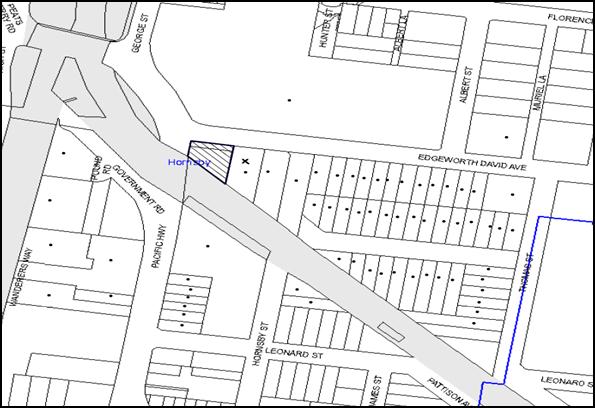
|
NOTIFICATION PLAN |
|
||
|
• PROPERTIES NOTIFIED
|
X SUBMISSIONS RECEIVED |
PROPERTY SUBJECT OF DEVELOPMENT |
|
One submission objected to the development, generally on the grounds:
· The proposed modification is not substantially the same development;
· Seven additional units have been proposed with no additional parking within the premises;
· There is no agreement with the owners of adjoining property to utilise the right of way during construction works. The right of way must be available for use by the adjoining owners at all times; and
· The development would result in major traffic disruption during construction works.
The merits of the matters raised in community submissions have been addressed in the body of the report with the exception of the following:
5.1.1 Right-of-Way of Neighbouring Property
This matter has been considered in detail as part of the original application. Conditions of consent have been imposed with respect to maintenance of the right-of-access for the adjoining property at No. 10 Edgeworth David Avenue during the construction works.
5.2 Public Agencies
The development application was referred to the following Agencies for comment:
5.2.1 Roads and Maritime Services
The Roads and Maritime Services has reviewed the current application and raises no objection to the development subject to conditions and matters to be considered by Council. These matters have been discussed in detail in Section 2.5.3 of this report.
5.2.2 RailCorp
RailCorp has reviewed the application and raises no objections.
6. THE PUBLIC INTEREST
Section 79C(1)(e) of the Act requires Council to consider “the public interest”.
The public interest is an overarching requirement, which includes the consideration of the matters discussed in this report. Implicit to the public interest is the achievement of future built outcomes adequately responding to and respecting the future desired outcomes expressed in environmental planning instruments and development control plans.
The modification is considered to have satisfactorily addressed Council’s and relevant agencies’ criteria and would provide a development outcome that, on balance, would result in a positive impact for the community. Accordingly, it is considered that the approval of the modification would be in the public interest.
CONCLUSION
The application proposes to amend the approved seven storey mixed use development by providing seven residential units at the roof level. The resultant development would be eight storeys.
The proposed modification would increase residential floor space within the building and would result in non-compliance with ‘Clause 4.4 – Floor Space Ratio’ of the HLEP. The resultant increase of the residential floor space and the non-compliance with the FSR for the residential component is considered acceptable on merits. The proposal would be consistent with Section 96(2) of the Environmental Planning and Assessment Act, 1979 and is substantially the same development.
The modified proposal is assessed as satisfactory having regard to matters for consideration pursuant to Section 79C of the Environmental Planning and Assessment Act, 1979.
Having regard to the circumstances of the case, approval of the modification is recommended.
Note: At the time of the completion of this planning report, no persons have made a Political Donations Disclosure Statement pursuant to Section 147 of the Environmental Planning and Assessment Act 1979 in respect of the subject planning application.
RESPONSIBLE OFFICER
The officer responsible for the preparation of this Report is the Manager – Development Assessments – Rodney Pickles, who can be contacted on 9847 6731.
|
Rod Pickles Manager - Development Assessment Planning Division |
James Farrington Group Manager Planning Division |
|
1.View |
Locality Plan |
|
|
|
2.View |
Floor Plans |
|
|
|
3.View |
Elevations and Sections |
|
|
|
4.View |
Photomontage of Approved and Modified Development |
|
|
|
5.View |
Solar Access Plan |
|
|
File Reference: DA/1564/2008/E
Document Number: D05971376
SCHEDULE 1
|
Date of 1st modification: |
2 December 2009 |
|
Details of 1st modification: |
Reduce the gross floor area, reduce the number of residential units to twenty-eight, variation to the internal layout, driveway access, and inclusion of a turntable in the loading dock and modify external facade. |
|
Conditions Added: |
6A, 52 |
|
Conditions Deleted: |
36 |
|
Conditions Modified: |
1, 18, 29, 34, 35, 37 |
|
Date of 2nd modification: |
20 February 2013 |
|
Details of 2nd modification: |
Section 96(2) application to amend the approved plans by removing one basement level, variation to the internal layout of the retail and commercial levels and deletion of the turntable from the ground floor level. |
|
Conditions Added: |
6B and 18A |
|
Conditions Deleted: |
Nil |
|
Conditions Modified: |
1, 33, 37, 41 |
|
Date of 3rd modification: |
1 May 2013 |
|
Details of 3rd modification: |
Section 96(1A) application to replace approved elevation and section plans and to modify condition 37. |
|
Conditions Added: |
Nil |
|
Conditions Deleted: |
Nil |
|
Conditions Modified: |
1, 37 |
|
Date of 4th modification: |
1 July 2013 |
|
Details of 4th modification: |
Section 96(1A) application to modify condition 49. |
|
Conditions Added: |
Nil |
|
Conditions Deleted: |
Nil |
|
Conditions Modified: |
49 |
|
Date of this modification: |
12 August 2015 |
|
Details of this modification: |
Section 96(2) application to provide an additional level comprising seven residential units (total 35 units), amend the basement and residential floor layouts, add bicycle and motorbike parking, amend garbage room dimensions. |
|
Amended Description: |
Eight storey mixed use development incorporating retail and commercial floor space and thirty five residential units as shop-top housing. |
|
Conditions Added: |
1A, 1B, 6C, 6D, 10A |
|
Conditions Deleted: |
26 |
|
Conditions Modified: |
1, 2, 6A, 6B, 11,18, 35, 37, 41(e) |
CONDITIONS OF APPROVAL
GENERAL CONDITIONS
The conditions of consent within this notice of determination have been applied to ensure that the use of the land and/or building is carried out in such a manner that is consistent with the aims and objectives of the relevant legislation, planning instruments and council policies affecting the land and does not disrupt the amenity of the neighbourhood or impact upon the environment.
Note: For the purpose of this consent, the term ‘applicant’ means any person who has the authority to act on or the benefit of the development consent.
Note: For the purpose of this consent, any reference to an Act, Regulation, Australian Standard or publication by a public authority shall be taken to mean the gazetted Act or Regulation, or adopted Australian Standard or publication as in force on the date that the application for a construction certificate is made.
1. Approved Plans and Supporting Documentation
The development must be carried out in accordance with the plans and documentation listed below and endorsed with Council’s stamp, except where amended by Council and/or other conditions of this consent:
|
Plan Title |
Rev No. |
Drawn by |
Dated |
|
Basement 3, A-CC-101 |
B |
PSEC Project Services |
01/07/2015 |
|
Basement 2, A-CC-102 |
B |
PSEC Project Services |
01/07/2015 |
|
Basement 1, A-CC-103 |
B |
PSEC Project Services |
01/07/2015 |
|
Ground Floor, A-CC-104 |
B |
PSEC Project Services |
01/07/2015 |
|
Level 1 Commercial Floor Plan, 1111 CC9.2 |
- |
Antonio Caminiti Design Pty Ltd |
9/7/2012 Received by Council on 28/12/2012 |
|
Level 2 Commercial Floor Plan A-DA-105 |
C |
PSEC Project Services |
01/07/2015 |
|
L3 Residential Floor Plan, A-CC-106 |
C |
PSEC Project Services |
01/07/2015 |
|
L4 Residential Floor Plan, A-CC-107 |
C |
PSEC Project Services |
01/07/2015 |
|
L5 Residential Floor Plan, A-CC-108 |
C |
PSEC Project Services |
01/07/2015 |
|
L6 Residential Floor Plan, A-CC-109 |
C |
PSEC Project Services |
01/07/2015 |
|
L7 Residential Floor Plan, A-CC-110 |
C |
PSEC Project Services |
01/07/2015 |
|
L8 Roof Plan, A-CC-111 |
A |
PSEC Project Services |
01/07/2015 |
|
East elevation A-DA-401 |
A |
PSEC Project Services |
02/12/2014 |
|
South elevation A-DA-402 |
A |
PSEC Project Services |
02/12/2014 |
|
West elevation A-DA-403 |
A |
PSEC Project Services |
02/12/2014 |
|
North elevation A-DA-404 |
A |
PSEC Project Services |
02/12/2014 |
|
Section AA, A-DA-301 |
A |
PSEC Project Services |
02/12/2014 |
|
Landscape Plan Ground DA500 |
A |
Jackson Teece |
22/10/2009 |
|
Landscape Plan Ground DA501 |
A |
Jackson Teece |
22/10/2009 |
|
Landscape Plan Ground DA503 |
A |
Jackson Teece |
22/10/2009 |
|
Basement Stormwater Drainage Plan and details |
E |
Australian Consulting Engineers Pty Ltd |
9/11/2009 |
|
Ground Floor Stormwater Drainage Plan and details |
F |
Australian Consulting Engineers Pty Ltd |
9/11/2009 |
|
First Floor OSD Tank location |
F |
Australian Consulting Engineers Pty Ltd |
9/11/2009 |
|
Erosion and Sediment Control Plan and details |
D |
Australian Consulting Engineers |
09/11/2009 |
|
Document Title |
Prepared by |
Dated |
|
Detail Survey Rev 2 |
Craig and Rhodes |
28/11/2008 |
|
Solar Access and Unit Mix A-DA-500 Rev B |
PSEC Project Services |
01/07/2015 |
|
GFA calculations A-DA-901 Rev A |
PSEC Project Services |
01/07/2015 |
|
Schedule of Colours and Finishes |
Jackson Teece |
1/09/2009 |
|
BASIX Certificate No. 601587M_02 |
Ecocorp Consulting Pty Ltd |
2/03/2015 |
|
Noise and Vibration Intrusion Report & RailCorp Acoustic Requirements |
Day Design Pty Ltd |
6/11/2008 & 23/02/2009 |
|
Geotechnical Review & Assessment of Geotechnical effects on the RailCorp Corridor |
Douglas Partners |
28/10/2008 & 5/12/2008 |
|
Environmental Review of Site Contamination |
Douglas Partners |
5/11/2008 |
|
Traffic Report |
Traffix Traffic and Transport Planners |
7/11/2008 |
|
Access Compliance Report |
PSE Access Consulting |
20/10/2008 |
|
Construction Management Plan |
Jackson Teece |
26/10/2009 |
|
Design Verification Statement |
Jackson Teece |
1/09/2009 |
|
BCA Compliance Assessment & BCA Compliance Report |
Acro Cert |
4/11/2008 & 24/10/2008 |
|
Operations Management Plan |
API Property Services |
March 2009 |
|
Stormwater Drainage Summary Report Modelled on Drains |
Australian Consulting Engineers Pty Ltd |
October 2008 |
|
Planning Report –Section 96 application |
Nexus Environmental Planning Pty Ltd |
9/03/2015 |
|
Traffic Report Section 96 application |
McLaren Traffic Engineers |
5/02/2015 |
1A. Amendment of Plans
The following plans are to be amended in accordance with the approved plans/elevations/sections in Condition 1 of this development consent:
|
Plan Title |
Rev No. |
Drawn by |
Dated |
|
Landscape Plan Ground DA500 |
A |
Jackson Teece |
22/10/2009 |
|
Landscape Plan Ground DA501 |
A |
Jackson Teece |
22/10/2009 |
|
Landscape Plan Ground DA503 |
A |
Jackson Teece |
22/10/2009 |
|
Basement Stormwater Drainage Plan and details |
E |
Australian Consulting Engineers Pty Ltd |
9/11/2009 |
|
Ground Floor Stormwater Drainage Plan and details |
F |
Australian Consulting Engineers Pty Ltd |
9/11/2009 |
|
First Floor OSD Tank location |
F |
Australian Consulting Engineers Pty Ltd |
9/11/2009 |
|
Erosion and Sediment Control Plan and details |
D |
Australian Consulting Engineers |
09/11/2009 |
|
Landscape Plan Ground DA500 |
A |
Jackson Teece |
22/10/2009 |
1B. Amendment of Plans
a) The approved plans ‘Level 1 Commercial Floor Plan, 1111 CC9.2’ drawn by Antonio Caminiti Design Pty Ltd, received by Council on 28/12/2012 and ‘Level 2 Commercial Floor Plan, A-DA-105 Rev C’ drawn by PSEC Project Services dated 1/07/2015 must be amended by delineating the garbage room with the location for the recycling bin and the chute area marked.
b) Unit Nos. 5, 12, 19, 26 and 33 must be designed as “Adaptable” units.
c) The approved basement plans A-CC-101, A-CC-102 and A-CC-103 Issue B drawn by PSEC Project Services and received by Council on 06/06/2015 must be amended by allocating the car spaces as follows:
i) 36 residential car spaces
ii) 35 commercial car spaces
iii) 11 retail car spaces and
iv) 4 visitors’ car spaces.
2. Retention of Existing Trees
This development consent only permits the removal of tree numbered T1 as identified on the “Detail Survey Rev 2” prepared by Craig and Rhodes dated 28/11/2008. The removal of any other trees requires separate approval under Council’s Tree Preservation Order.
2A. Construction Certificate
A Construction Certificate is required to be approved by Council or a Private Certifying Authority prior to the commencement of any works under this consent. The Construction Certificate plans must not be inconsistent with the approved plans consent unless required by conditions of this development consent.
REQUIREMENTS PRIOR TO THE ISSUE OF A CONSTRUCTION CERTIFICATE
3. Building Code of Australia
All building work must be carried out in accordance with the requirements of the Building Code of Australia.
4. Contract of Insurance (Residential Building Work)
In the case of residential building work for which the Home Building Act 1989 requires there to be a contract of insurance in force in accordance with Part 6 of that Act, that such a contract of insurance is in force before any building work authorised to be carried out by the consent commences.
Note: This condition does not apply to the extent to which an exemption is in force under Clause 187 or 188 of the Act, subject to the terms of any condition or requirement referred to in Clause 187(6) or 188(4) of the Act, or to the erection of a temporary building.
5. Water/Electricity Utility Services
The applicant must submit written evidence of the following service provider requirements:
a) Energy Australia – a letter of consent demonstrating that satisfactory arrangements have been made to service the proposed development.
b) Sydney Water – the submission of a ‘Notice of Requirements’ under s73 of the Sydney Water Act 1994.
Note: Sydney Water requires that s73 applications are to be made through an authorised Sydney Water Servicing Coordinator. Refer to www.sydneywater.com.au or telephone 13 20 92 for assistance.
6. Dilapidation Report
A ‘Dilapidation Report’ is to be prepared by a ‘chartered structural engineer’ detailing the structural condition of all adjoining properties.
6A. Construction Traffic Management Plan
A Traffic Management Plan must be submitted to Council for review and approval including the following:
a) Details of maintenance of rights-of-access for the adjoining property at No. 10 Edgeworth David Avenue;
b) Provision of parking for doctors and patients off site during the construction phase when the right-of-access if is to be blocked; and
c) Parking provisions for construction vehicles and the zones dedicated for loading and unloading during construction.
Note: The parking for the doctors and the patients are to be provided in accordance with the details within the Construction Management Plan.
6B. Car Parking and Deliveries
All car parking must be constructed in accordance with Australian Standard AS 2890.1 – 2004 – Off Street Car Parking and Australian Standard 2890.2 - 2002 – Off Street Commercial, the submitted Delivery Management Plan and the following requirements:
a) All parking areas and driveways are to be sealed to an all-weather standard, line marked and signposted.
b) All vehicular entry on to the site and egress from the site shall be made in a forward direction.
c) “No Parking” / “No Stopping” restrictions are to be provided along the frontages of the site in consultation with the Roads and Maritime Services.
d) Vertical clearance for MRV access is to be 4.5m in accordance with AS 2890.2-2002.
e) Car parking spaces for people with disabilities to comply with AS/NZS 2890.6:2009.
f) Bicycle parking spaces are to be designed in accordance with AS 2890.3-199 Bicycle parking facilities.
g) Motorcycle parking spaces are to be designed in accordance with AS 2890.5-1993.
6C. Accessible Units and Storage
a) The development is required to provide five units designed as adaptable housing pursuant to the requirements of 1C.2.2 of the Hornsby Development Control Plan 2013. In this regard, a minimum four (4) car parking spaces are to be designed for people with a disability and allocated to 4 adaptable units. The details of all adaptable units must be provided with the Construction Certificate plans.
b) Each dwelling within the development must have a minimum area for storage (not including kitchen and bedroom cupboards) of 6m³ for one bedroom units, 8m³ for two bedroom units and 10m³ for three bedroom units, where 50% is required to be located within the apartment and accessible from either the hall or living area. Details must be submitted with the Construction Certificate plans.
6D. Waste Management
The residential garbage chute system is to be fitted with a 2 x 660 litre bin linear to automatically change the bin under the chute when it becomes full. Details are to be submitted with the Construction Certificate plans.
Note: Compaction is not required.
REQUIREMENTS PRIOR TO THE COMMENCEMENT OF ANY WORKS
7. Erection of Construction Sign
A sign must be erected in a prominent position on any site on which building work, subdivision work or demolition work is being carried out:
a) Showing the name, address and telephone number of the principal certifying authority for the work.
b) Showing the name of the principal contractor (if any) for any demolition or building work and a telephone number on which that person may be contacted outside working hours.
c) Stating that unauthorised entry to the work site is prohibited.
Note: Any such sign is to be maintained while the building work, subdivision work or demolition work is being carried out, but must be removed when the work has been completed.
8. Protection of Adjoining Areas
A temporary hoarding, fence or awning must be erected between the work site and adjoining lands before the works begin and must be kept in place until after the completion of the works if the works:
a) Could cause a danger, obstruction or inconvenience to pedestrian or vehicular traffic.
b) Could cause damage to adjoining lands by falling objects.
c) Involve the enclosure of a public place or part of a public place.
Note: Notwithstanding the above, Council’s separate written approval is required prior to the erection of any structure or other obstruction on public land.
9. Toilet Facilities
Toilet facilities must be available or provided at the works site before works begin and must be maintained until the works are completed at a ratio of one toilet for every 20 persons employed at the site. Each toilet must:
a) be a standard flushing toilet connected to a public sewer; or
b) have an on-site effluent disposal system approved under the Local Government Act 1993; or
c) be a temporary chemical closet approved under the Local Government Act 1993.
10. Erosion and Sediment Control
Erosion and sediment control measures must be provided and maintained throughout the construction period in accordance with the manual ‘Soils and Construction 2004 (Bluebook)’, the approved plans, Council specifications and to the satisfaction of the principal certifying authority. The erosion and sediment control devices must remain in place until the site has been stabilised and revegetated.
Note: The spot penalties up to $1,500 may be issued for any on-compliance with this requirement without any further notification or warning.
10A. Traffic Control Plan
A Traffic Control Plan (TCP) must be prepared by a qualified traffic controller in accordance with the Roads & Traffic Authority’s Traffic Control at Worksites Manual 1998 and Australian Standard 1742.3 for all work on a public road and be submitted to Council. The TCP must detail the following:
a) Arrangements for public notification of the works.
b) Temporary construction signage.
c) Permanent post-construction signage.
d) Vehicle movement plans.
e) Traffic management plans.
f) Pedestrian and cyclist access/safety.
g) Details of pedestrian and vehicular access to the property at No. 10 Edgeworth David Avenue, in accordance with the construction management plan.
REQUIREMENTS DURING CONSTRUCTION
11. Construction Work Hours
All work on site (including demolition and earth works) must only occur between 7am and 5pm Monday to Saturday (unless otherwise approved by Council due to extenuating circumstances). No work is to be undertaken on Sundays or public holidays.
12. Demolition
All demolition work must be carried out in accordance with Australian Standard 2601-2001 – The Demolition of Structures and the following requirements:
a) Demolition material is to be disposed of to an authorised recycling and/or waste disposal site and/or in accordance with an approved waste management plan.
13. Environmental Management
The site must be managed in accordance with the publication ‘Managing Urban Stormwater – Landcom (March 2004) and the Protection of the Environment Operations Act 1997 by way of implementing appropriate measures to prevent sediment run-off, excessive dust, noise or odour emanating from the site during the construction of the development.
14. Council Property
During construction works, no building materials, waste, machinery or related matter is to be stored on the road or footpath.
15. Excavated Material
All excavated material removed from the site must be classified in accordance with the NSW Environment Protection Authority’s Environmental Guidelines – Assessment, Classification and Management of Liquid and Non-Liquid Wastes prior to disposal to an approved waste management facility and reported to the principal certifying authority.
16. Survey Report – Finished Floor Level
Reports must be prepared by a registered surveyor and submitted to the principal certifying authority prior to the pouring of concrete at each level of the building certifying that:
a) The building, retaining walls and the like have been correctly positioned on the site.
b) The finished floor levels are in accordance with the approved plans.
17. Pile Anchoring
Piles must not be anchored to the foundation or structure of the adjoining property at No. 10 Edgeworth David Avenue.
18. Right of Access
The right-of-access for the adjoining property at No. 10 Edgeworth David Avenue is to be maintained during the construction works. Details submitted under Condition 6A are to be implemented on the site during the times when the right-of-access would be blocked or unavailable to the users of the above property.
18A. Waste Management
Waste management during the demolition and construction phase of the development must be undertaken in accordance with the approved Waste Management Plan. Additionally written records of the following items must be maintained during the removal of any waste from the site and such information submitted to the Principal Certifying Authority within fourteen days of the date of completion of the works:
a) The identity of the person removing the waste.
b) The waste carrier vehicle registration.
c) Date and time of waste collection.
d) A description of the waste (type of waste and estimated quantity).
e) Details of the site to which the waste is to be taken.
f) The corresponding tip docket/receipt from the site to which the waste is transferred (noting date and time of delivery, description (type and quantity) of waste).
g) Whether the waste is expected to be reused, recycled or go to landfill.
Note: In accordance with the Protection of the Environment Operations Act 1997, the definition of waste includes any unwanted substance, regardless of whether it is reused, recycled or disposed to landfill.
REQUIREMENTS PRIOR TO THE ISSUE OF AN OCCUPATION CERTIFICATE
19. Fulfilment of BASIX Commitments
The applicant must demonstrate the fulfilment of BASIX commitments pertaining to the development.
20. Sydney Water – s73 Certificate
An s73 Certificate must be obtained from Sydney Water.
21. Stormwater Drainage
The stormwater drainage system for the development must be designed and constructed in accordance with Council’s Civil Works – Design and Construction Specification 2005 and the following requirements:
a) Connected directly to Council’s street drainage system in accordance with plans prepared by Australian Consulting Engineers Job No 08AH349 Rev E (as amended under condition 3).
Note: A certificate from a chartered civil engineer together with a works as executed design plan must be submitted to the principal certifying authority to demonstrate the satisfaction of this condition.
22. On Site Stormwater Detention
An on-site stormwater detention system must be designed by a chartered civil engineer and constructed in accordance with the following requirements:
a) Have a capacity of not less than 32.6 cubic metres, and a maximum discharge (when full) of 48 litres per second.
b) The total site discharge not exceeding 48 litres per second.
c) Have a surcharge/inspection grate located directly above the outlet.
d) Discharge from the detention system to be controlled via 1 metre length of pipe, not less than 50 millimetres diameter or via a stainless plate with sharply drilled orifice bolted over the face of the outlet discharging into a larger diameter pipe capable of carrying the design flow to an approved Council system.
23. Footpath
A concrete footpath must be constructed along the full frontage of the subject site in accordance Council’s Civil Works Design and Construction Specification, 2005 and the following requirements:
a) The existing footpath being removed.
b) The footpath be constructed with Claypave “Monarch Tan” pavers laid on 125mm thick 20mpa concrete along the full width of the footway over the full frontage to the site including the implementation of landscape plan.
c) Any public utility adjustments to be carried out at the cost of the applicant and to the requirements of the relevant public authority.
24. Road Works
All road works approved under this consent must be constructed in accordance with Council’s Civil Works Design and Construction Specification, 2005 and a separate application under the Local Government Act 1993 and the Roads Act 1993 must be submitted to Council. The engineering plans must address the following requirements:
a) The existing kerb and gutter be removed and a new kerb and gutter be constructed across the frontage of site in Edgeworth David Avenue and the Pacific Highway.
b) The works to include, where required, the construction of perambulator ramps, line marking, signage and road furnishings.
c) A new vehicular crossing be constructed.
d) The existing road pavement to be saw cut a minimum of 300 mm from the existing edge of the bitumen and reconstructed.
25. Damage to Council Assets
Any damage caused to Council’s assets as a result of the construction of the development must be rectified in accordance with Council’s written requirements and at the sole cost of the applicant.
26. Deleted
27. Creation of Easements
The following matter(s) must be nominated on the plan of subdivision under s88B of the Conveyancing Act 1919:
a) A Right of Access to service No. 10 Edgeworth David Avenue.
b) The creation of an appropriate "Positive Covenant" and "Restriction as to User" over the constructed on-site detention/retention systems (OSD) and outlet works, within the lots in favour of Council in accordance with Council’s prescribed wording. The position of the on-site detention system is to be clearly indicated on the title.
c) To register the OSD easement, the restriction on the use of land “works-as-executed” details of the on-site-detention system and an engineer’s certificate must be submitted verifying that the required storage and discharge rates have been constructed in accordance with the design requirements. The details must show the invert levels of the onsite system together with pipe sizes and grades. Any variations to the approved plans must be shown in red on the “works-as-executed” plan and supported by calculations.
Note: Council must be nominated as the authority to release, vary or modify any easement, restriction or covenant.
28. Works as Executed Plan
A works-as-executed plan must be prepared by a registered surveyor and submitted to Council for completed road pavement, kerb and gutter, public drainage systems, driveways and on-site detention system. The plan must be accompanied by a certificate from a registered surveyor certifying that all pipelines and associated structures lie wholly within any relevant easements.
29. Completion of Landscaping
A certificate must be provided by a practicing landscape architect, horticulturalist or person with similar qualifications and experience certifying that all required landscaping works have been satisfactorily completed in accordance with the approved landscape plans, the minimum construction standards identified in the Hornsby Shire Council Landscape Code for development applications and the following additional requirements for works on the street frontages:
a) The landscape planter verge be edged with bullnose brick header course raised to match level of the kerb.
b) The soil backfill mix around the rootball shall be an organic soil mix.
c) Street tree planting to include two (2) Leptospermum conferta (Brushbox) planted at a minimum pot size of 75 litres.
d) Planter box areas to include automatic drip irrigation, subsoil drainage (proprietary drainage cell, 50mm sand and filter fabric), and waterproofing.
e) 500 mm additional soil depths be provided for shrubs.
Note: Advice on suitable species for landscaping can be obtained from Council’s planting guide ‘Indigenous Plants for the Bushland Shire’, available at www.hornsby.nsw.gov.au.
30. External Lighting
All external lighting must be designed and installed in accordance with Australian Standard AS 4282 – Control of the Obtrusive Effects of Outdoor Lighting. Certification of compliance with the Standard must be obtained from a suitably qualified person.
31. Garbage Collection Easement
For the purpose of waste collection, an easement entitling Council, its servants and agents and persons authorised by it to enter upon the subject land and to operate thereon, vehicles and other equipment for the purposes of garbage collection must be granted to Council by the owner of the land.
Note: The easement must be in a form prescribed by Council and must include covenants to the effect that parties will not be liable for any damage caused to the subject land or any part thereof or to any property located therein or thereon by reason of the operation thereon of any vehicle or other equipment used in connection with the collection of garbage and to the effect that the owner for the time being of the subject land shall indemnify the Council, its servants, agents and persons authorised by it to collect garbage against liability in respect of any such claims made by any person whomsoever.
32. Cooling Towers
All cooling towers must be designed and installed in accordance with the Public Health Act 1991, the Public Health (Microbial Control) Regulation 2000 and Australian/New Zealand Standard AS/NZS 3666 – Air-Handling and Water Systems of Buildings. Certification of compliance with the Standard must be obtained from a suitably qualified person.
Note: Under clause 15 of the Public Health (Microbial Control) Regulation 2000 the occupier of the part of premises where a regulated system is installed must notify the Council of the following particulars:
· Type of system.
· The address of the premises on which the system is installed.
· The name, and the residential and business addresses, of the owner of the premises.
If the operation area on the premises is occupied otherwise than by the owner, those particulars in relation to the occupier the telephone numbers at which, during business hours and after business hours, the person or persons referred to in the above point may be contacted.
33. Car Park Management Plan
A Car Park Management Plan must be submitted to Council for approval to ensure that long term parking by motorists, not occupying or using the development for any purpose, is prevented during operation of the site.
The Car Park Management Plan must also include provisions for preventing vehicles parking within the waste collection vehicle turning paths.
34. Section 94 Infrastructure Contributions
Payment to Council of a contribution of $113,753.75* for 50 employees towards the cost of infrastructure identified in Council’s Development Contributions Plan 2007-2011 is required.
Note: The value of contribution is based on a rate of $2,293.40 per employee, derived from a rate of one employee per 30sqm commercial floor area and is current as at 11 November 2009. The contribution will be adjusted from this date in accordance with the underlying consumer price index for subsequent financial-quarters.
It is recommended that you contact Council to ascertain the indexed value of the contribution prior to payment.
35. Section 94 Contributions
a) In accordance with Section 80A(1) of the Environmental Planning and Assessment Act 1979 and the Hornsby Shire Council Section 94 Development Contributions Plan 2012-2021, the following monetary contributions shall be paid to Council to cater for the increased demand for community infrastructure resulting from the development:
|
Description |
Contribution (4) |
|
Roads |
$ 44,428.30 |
|
Open Space and Recreation |
$438,765.00 |
|
Community Facilities |
$61,186.25 |
|
Plan Preparation and Administration |
$1,838.85 |
|
TOTAL |
$546,218.40 |
being for 10 x 1-br, 20 x 2-br and 5 x 3-br units.
b) The value of this contribution is current as at 1/07/2015. If the contributions are not paid within the financial quarter that this condition was generated, the contributions payable will be adjusted in accordance with the provisions of the Hornsby Shire Council Section 94 Development Contributions Plan and the amount payable will be calculated at the time of payment in the following manner:
$CPY = $CDC x CPIPY
CPIDC
Where:
$CPY is the amount of the contribution at the date of Payment
$CDC is the amount of the contribution as set out in this Development Consent
CPIPY is the latest release of the Consumer Price Index (Sydney – All Groups) at the date of Payment as published by the ABS.
CPIDC is the Consumer Price Index (Sydney – All Groups) for the financial quarter at the date applicable in this Development Consent Condition.
It is the professional responsibility of the Principal Certifying Authority to ensure that the monetary contributions have been paid to Council in accordance with the above timeframes.
Council’s Development Contributions Plan may be viewed at www.hornsby.nsw.gov.au or a copy may be inspected at Council’s Administration Centre during normal business hours.
36. Deleted
OPERATIONAL CONDITIONS
37. Car Parking and Deliveries
All car parking must be operated in accordance with Australian Standard AS 2890.1 – 2004 – Off Street Car Parking and Australian Standard 2890.2 - 2002 – Off Street Commercial, the submitted Delivery Management Plan and the following requirements:
a) Car parking, loading and manoeuvring areas to be used solely for nominated purposes.
b) Car Parking spaces would be allocated in the following order:
i) 36 residential car spaces including 4 disabled spaces
ii) 35 commercial car spaces
iii) 11 retail car spaces
iv) 4 visitors’ car spaces
v) 14 bicycle spaces
vi) 2 motorbike spaces.
b) Vehicles awaiting loading, unloading or servicing must be parked on site and not on adjacent or nearby public roads.
c) All vehicular entry on to the site and egress from the site shall be made in a forward direction.
d) “No Parking” / “No Stopping” restrictions are to be provided along the frontages of the site in consultation with the Roads and Maritime Services.
e) Parking spaces are not to be used as storage bays.
f) The tandem car parking space located on basement level 3, are to be allocated to the three bedroom residential units. Each pair of tandem car space must be allocated to a single residential unit.
38. Noise
All noise generated by the proposed development must be attenuated to prevent levels of noise being emitted to adjacent premises which possess tonal, beating and similar characteristics or which exceeds background noise levels by more than 5dB(A).
39. Fire Safety Statement - Annual
On at least one occasion in every 12 month period following the date of the first ‘Fire Safety Certificate’ issued for the property, the owner must provide Council with an annual ‘Fire Safety Certificate’ to each essential service installed in the building.
40. Dewatering
Following the expiry of the dewatering licence (12 month period) the owner of the site must either:
a) Dispose of all ground water and seepage by tanker to an approved liquid waste facility.
or
b) Enter into a Trade Waste Agreement with Sydney Water for the disposal of all groundwater.
Note: Permanent dewatering is not approved by the Department of Water and Energy or Hornsby Shire Council.
41. Waste Storage Area
The waste management on site must be in accordance with the following requirements:
a) All commercial and retail tenants to retain written evidence of a valid contract with a licensed waste contractor for the regular collection and disposal of the waste and recyclables.
b) Each dwelling be provided with an indoor waste/recycling cupboard for the interim storage of a minimum one day’s segregated garbage and recycling generation.
c) Site security measures must not prevent access to the waste storage rooms by waste removal services. However, Commercial tenants must be prevented (for example by signage, keyed locks and other means) from using the residential waste/recycling bins and vice versa.
d) No steps be located along any of the bin carting routes.
e) A site caretaker must be employed for a sufficient number of hours to allow waste management responsibilities and be responsible for moving bins as required, washing bins and maintaining waste storage areas, ensuring the chute system and related devices are maintained in effective and efficient working order, managing the communal composting area, managing the bulky item storage area, arranging the prompt removal of dumped rubbish, and ensuring all residents and commercial tenants are informed of the waste management system.
CONDITIONS OF CONCURRENCE – RAILCORP
The following conditions of consent are from the nominated State Agency pursuant to Section 79B of the Environmental Planning and Assessment Act 1979 and must be complied with to the satisfaction of that Agency.
42. Construction Certificate Plans
The following requirements must be complied with prior to the issue of a Construction Certificate:
a) A report be prepared by a qualified Electrolysis expert on the Electrolysis Risk of the development from stray currents and the measures to be incorporated to control that risk.
b) The recommended measures to control the electrolysis risks be included in the construction certificate plans.
c) Details of mechanisms that limit the opening of windows or provision of awning windows along the elevation fronting the southern boundary of the development (rail corridor) be provided in the construction certificate plans and be endorsed by RailCorp.
d) All methods to be followed for excavation and construction works be detailed in the construction certificate plans and specifications, in accordance with the methodology detailed in the approved Geotechnical Report prepared by Douglas Partners dated December 2002, Douglas Partners Geotechnical Review, dated 28 October 2008 and the Assessment of Geotechnical Effects on the RailCorp Corridor, dated 5 December 2008 and be endorsed by RailCorp.
Note: The principal certifying authority must not issue the Construction Certificate or Occupation Certificate prior to written confirmation from RailCorp, should a condition of consent require endorsement by RailCorp.
43. Additional Geotechnical Investigations
The results of the additional geotechnical investigations on site, to be conducted prior to commencing construction works and after demolition of the existing building, in accordance with item 5.9 of the Geotechnical Report prepared by Douglas Partners dated December 2002 must be provided to RailCorp for further review. Additional requirements by RailCorp as a result of such investigations must be complied with at the construction stage of the development.
44. Vibration Monitoring System
A vibration monitoring system must be installed on site to monitor the vibration levels on the adjoining rail corridor for the duration of works. The plan of the proposed method must be submitted to and be endorsed by RailCorp prior to commencement of works on site.
45. Hoarding
Owner’s consent must be obtained from RailCorp prior to installation of hoarding along the southern boundary of the site.
46. Reflective Materials
Prior to the installation of any light, sign or reflective material, whether temporary or permanent, in the proximity of the rail corridor, approval must be obtained from RailCorp.
47. Risk Assessment Plan
A Risk Assessment/Management Plan and detailed Safe Work Method Statement (SWMS) for the proposed demolition, excavation and construction works are to be submitted to RailCorp for endorsement prior to the commencement of works on site.
Note: RailCorp’s representatives may require further conditions to be complies with regard to the above and require the provision of on-site Safe Working supervision for certain aspects of the works.
48. Aerial Operations
Plans and documentation must be submitted to RailCorp incorporating details of all craneage and other aerial operations prior to works commencing on site.
Note: No loads are to be carried over RailCorp’s land.
CONDITIONS OF CONCURRENCE – ROADS AND MARITIME SERVICE
The following conditions of consent are from the nominated State Agency pursuant to Section 79B of the Environmental Planning and Assessment Act 1979 and must be complied with to the satisfaction of that Agency.
49. Driveway Layout
The layout of the access driveway to the site must be in accordance with AS 2890.1 – 2004 and AS 2890.2 – 2002 for Medium Rigid Vehicle (MRV) usage.
50. Road Design
Prior to commencement of any works, detailed design plans of the proposed gutter crossing on Edgeworth David Avenue, must be submitted to Council for approval.
Note: All works associated with the proposed development shall be at no cost to RMS.
51. Security Basement
Prior to the release of the Construction Certificate, details of the security gate for the residential parking on Basement Level 4 and the means of opening must be submitted to Council.
52. Stormwater Discharge
The post development stormwater discharge must not exceed the pre-development stage.
- END OF CONDITIONS -
ADVISORY NOTES
The following information is provided for your assistance to ensure compliance with the Environmental Planning and Assessment Act 1979, Environmental Planning and Assessment Regulation 2000, other relevant legislation and Council’s policies and specifications. This information does not form part of the conditions of development consent pursuant to Section 80A of the Act.
Environmental Planning and Assessment Act 1979 Requirements
The Environmental Planning and Assessment Act 1979 requires:
· A construction certificate prior to the commencement of any works. Enquiries regarding the issue of a construction certificate can be made to Council’s Customer Services Branch on 9847 6760.
· A principal certifying authority to be nominated and Council notified of that appointment prior to the commencement of any works.
· Council to be given at least two days written notice prior to the commencement of any works.
· Mandatory inspections of nominated stages of the construction inspected.
· An occupation certificate issued before occupying any building or commencing the use of the land.
Long Service Levy
In accordance with Section 34 of the Building and Construction Industry Long Service Payments Act 1986, a ‘Long Service Levy’ must be paid to the Long Service Payments Corporation or Hornsby Council.
Note: The rate of the Long Service Levy is 0.35% of the total cost of the work.
Note: Hornsby Council requires the payment of the Long Service Levy prior to the issue of a construction certificate.
Tree Preservation Order
To ensure the maintenance and protection of the existing natural environment, it is an offence to ringbark, cut down, top, lop, remove, wilfully injure or destroy a tree outside three metres of the approved building envelope without prior written consent from Council. Fines may be imposed for non-compliance with Council’s Tree Preservation Order.
Note: A tree is defined as a single or multi-trunked wood perennial plant having a height of not less than three (3) metres, and which develops many branches, usually from a distance of not less than one (1) metre from the ground, but excluding any plant which, in its particular location, is a noxious plant declared as such pursuant to the Noxious Weeds Act 1993. This definition of ‘tree’ includes any and all types of Palm trees.
All distances are determined British Standard BS 5837: 2005, “Trees in Relation to Construction – Recommendations”.
Disability Discrimination Act
The applicant’s attention is drawn to the existence of the Disability Discrimination Act. A construction certificate is required to be obtained for the proposed building, which will provide consideration under the Building Code of Australia, however, the development may not comply with the requirements of the Disability Discrimination Act. This is the sole responsibility of the applicant.
Tenancy Fit-Out – Separate DA Required
This consent does not permit the fit-out of individual tenancies. A separate development application is required for the fit-out of individual tenancies prior to the occupation of the building.
Advertising Signage – Separate DA Required
This consent does not permit the erection or display of any advertising signs. Most advertising signs or structures require development consent. Applicants should make separate enquiries with Council prior to erecting or displaying any advertising signage.
Dial Before You Dig
Prior to commencing any works, the applicant is encouraged to contact Dial Before You Dig on 1100 or www.dialbeforeyoudig.com.au for free information on potential underground pipes and cables within the vicinity of the development site.
Asbestos Warning
Should asbestos or asbestos products be encountered during construction or demolition works you are advised to seek advice and information should be prior to disturbing the material. It is recommended that a contractor holding an asbestos-handling permit (issued by Work Cover NSW), be engaged to manage the proper disposal and handling of the material. Further information regarding the safe handling and removal of asbestos can be found at:
Alternatively, telephone the Work Cover Asbestos and Demolition Team on 8260 5885.
Group Manager's Report No. PL63/15
Planning Division
Date of Meeting: 12/08/2015
13 REPORTING VARIATIONS TO DEVELOPMENT STANDARDS
EXECUTIVE SUMMARY
· In accordance with Department of Planning and Environment’s Planning Circular PS 08‑14, Council is required to report variations to development standards for development applications approved under delegated authority, which relied upon State Environmental Planning Policy No. 1 – Development Standards (SEPP 1) or Clause 4.6 of the Hornsby Local Environmental Plan - 2013 (HLEP).
· Council’s consideration of this report ensures Council’s obligation to monitor variations to development standards is complied with.
|
THAT the contents of Group Manager’s Report No. PL63/15 be received and noted. |
PURPOSE
The purpose of this report is to advise Council of determined development applications under delegated authority involving a SEPP 1 or Clause 4.6 variation to a development standard for the period 1 April 2015 to 30 June 2015.
DISCUSSION
Department of Planning and Environment’s Circular B1, issued in March 1989, requested that councils monitor the use of the Secretary’s assumed concurrence under SEPP 1 on a quarterly basis. This reporting requirement remains effective.
Monitoring of variations to development standards is important to provide the Department and councils with an overview of the manner in which established development standards are being varied and whether the assumed concurrence is being used as intended. This enables Council and the Department to determine whether development standards are appropriate, or whether changes are required.
The Department issued Circular PS 08–014 on 14 November 2008. The purpose of the Circular was to remind councils of their responsibilities to monitor the use of the Secretary’s assumed concurrence under SEPP 1. Councils were reminded of the need to keep accurate records of the use of SEPP 1 and to report on a quarterly basis.
The Circular also provides that councils are required to adopt the following four measures:
1. Establish a register of development applications determined with variations in standards under SEPP 1.
2. Require all development applications where there has been a variation greater than 10% in standards under SEPP 1 to be determined by full council (rather than General Manager or nominated staff member).
3. Provide a report to Council on the development applications determined where there had been a variation in standards under SEPP 1.
4. Make the register of development applications determined with variations in standards under SEPP 1 available to the public on the council’s website.
In accordance with Point 3 of Department Circular, attached is a list of development applications determined between 1 April 2015 and 30 June 2015.
A copy of the attachment to this report is also reproduced on Council’s website.
BUDGET
There are no budget implications.
POLICY
This report addresses Council’s reporting obligations for development applications determined where there has been a variation in standards under SEPP 1. Under the HLEP 2013, the application of the provisions of SEPP 1 has been replaced by Clause 4.6 (exceptions to development standards). The Department of Planning and Environment has advised that the current reporting practice for variation to development standards will continue to apply for applications involving a submission pursuant to Clause 4.6 of the HLEP 2013.
CONCLUSION
Council is required to monitor the manner in which development standards are being varied. This assists in determining whether changes are required to relevant standards. This report provides advice to Council on standards varied under delegated authority which relied upon SEPP 1 or Clause 4.6 of the HLEP during the reporting period from 1 April 2015 to 30 June 2015.
RESPONSIBLE OFFICER
The officer responsible for the preparation of this report is the Group Manager Planning Division – James Farrington, who can be contacted on 9847 6750.
|
James Farrington Group Manager Planning Division |
|
|
1.View |
SEPP 1 Returns Quarter - 1 April 2015 to 30 June 2015 |
|
|
File Reference: F2004/07599
Document Number: D06138061
Group Manager's Report No. PL61/15
Planning Division
Date of Meeting: 12/08/2015
14 REVIEW OF SECTION 94 AND SECTION 94A DEVELOPMENT CONTRIBUTIONS PLANS
EXECUTIVE SUMMARY
· The Hornsby Shire Council Section 94 Development Contributions Plan 2012-2021 (Section 94 Plan) and Hornsby Shire Council Section 94A Development Contributions Plan 2012-2021 (Section 94A Plan) commenced on 5 September 2013.
· Since the Section 94 Plan came into force, additional planning strategies such as the Epping Urban Activation Precinct and Hornsby West Side have been finalised which increase the forecast development opportunities and the demand for infrastructure to service the needs of the future population.
· A review of the dwelling forecasts within the Section 94 Plan indicates an updated prediction of 7,075 additional dwellings (and approximately 14,500 people) between 2014 and 2023.
· A revised works schedule has been prepared to support the additional growth and to include or remove projects consistent with Council’s draft Active Living Hornsby Strategy and draft Community and Cultural Facilities Strategic Plan.
· The works schedule for the Section 94A Plan has also been revised to focus on a reduced number of high priority projects with associated allocation of funds to deliver the works.
· It is recommended that the attached updated Section 94 and Section 94A Plans be endorsed for public exhibition.
|
THAT: 1. Council exhibit the draft Section 94 Contributions Plan 2014 - 2023 and draft Section 94A Contributions Plan 2014 - 2023 attached to Group Manager’s Report No. PL61/15 for a period of 28 days. 2. Following the exhibition, a report on submissions be presented to Council. |
PURPOSE
The purpose of this report is to present an amended Section 94 Plan and Section 94A Plan to Council for endorsement for exhibition.
BACKGROUND
At its meeting on 21 August 2013, Council considered Group Manager’s Report No. PL77/13 concerning the exhibition of a new Section 94 Development Contributions Plan and Section 94A Development Contributions Plan. Council resolved to adopt the Plans, which commenced on 5 September 2013. A subsequent amendment to the Section 94 Plan was adopted by Council in June 2014 which reduced the contribution rate for secondary dwellings (granny flats) by approximately 50%. The Plans aim to cater for the forecast increase in development and population within the Shire over the 10 years from 2012.
DISCUSSION
This report discusses proposed changes to Council’s Section 94 and Section 94A Development Contributions Plans. Copies of the amended plans are provided in Attachments 1 and 2.
1. Section 94 Plan
Since the implementation of the Section 94 Contributions Plan in 2013, additional planning strategies have been finalised which increase the forecast development opportunities and the demand for essential infrastructure. A review of the dwelling forecasts and the works schedule associated with the Section 94 Plan has therefore been undertaken.
a. Dwelling and Population Forecasts
The current Section 94 Plan is based on forecast development of 4,280 additional dwellings (and approximately 10,000 additional people) between 2012 and 2021. However, in 2014, the Department of Planning and Environment finalised the Epping Urban Activation Precinct (UAP) and the Hornsby West Side Planning Proposal, which provide opportunities for a combined total of approximately 4,000 additional dwellings.
Along with these new dwelling opportunities, a review of approved development applications associated with the 2011 Housing Strategy has revealed additional forecast development within Housing Strategy precincts due to high take-up rates and increased density associated with State Environmental Planning Policy (SEPP) 65 – Design Quality of Residential Apartment Development. Recent amendments to SEPP 65 have reinforced the trend toward providing small apartments by adopting minimum apartment sizes which override Council’s controls and cannot be used as grounds for refusal.
Although the new planning strategies discussed above indicate an increase in development capacity within Hornsby Shire, it is unlikely that Council would dramatically increase its average per annum dwelling production. It is anticipated that the long term trend would remain similar, as Council’s contribution to dwelling completions over the past 20 years has averaged 565 dwellings per annum, or 15% of the total housing supply for adjoining local government areas.
It is assumed that Council would continue to provide 15% to 20% per annum of the area’s supply into the future. As Council’s approach is to fund the delivery of essential infrastructure over a 10 year period, an updated residential development forecast of 7,075 additional dwellings (14,500 people) is predicted. Beyond this period, future plan amendments would address the remaining growth and infrastructure priorities.
b. Works Schedule
To cater for the revised growth forecast, an updated works schedule has been prepared. Since the implementation of the current Section 94 Development Contributions Plan in 2013, $4.5 Million worth of projects on the works schedule have been completed or are anticipated for completion with funds committed. These projects can therefore be removed from the works schedule. Works valued at a total of $6.4 Million have been identified to be deferred from the works schedule based on the revised growth forecast, as they are long term projects unlikely to be completed in the 10 year planning horizon of the Section 94 plan.
In accordance with Council’s draft Active Living Hornsby Strategy (ALHS) and draft Community and Cultural Facilities Strategic Plan, $52 Million worth of projects have been identified to be deleted from the works schedule. These strategies recommend a fundamental change in how Council provides open space and community infrastructure. The draft ALHS recommends Council shift its focus towards the development of major destination parks that can contribute to providing a greater variety of recreation opportunities. The draft Community and Cultural Facilities Strategic Plan recommends centrally locating facilities that are financially sustainable, multipurpose and flexible, accessible and near public space.
A summary of the works items from the current plan that have been completed, proposed for deferral or removal is provided in Attachment 3.
The updated works schedule continues to be based on the provision of local road improvements, new and embellished open space and recreation facilities and library and community centres. However, the value of works attributable to the new population has increased from $79 Million to $126 Million. This increase is partly due to the expanded scope and value of projects currently listed in the Section 94 Plan, or the addition of new projects. The value of new projects added to the works schedule is summarised below:
|
Additional Development/Population |
Value of additional works attributed to new population |
|
Hornsby West Side |
$27 Million |
|
Epping UAP |
$31 Million |
|
Housing Strategy |
$38 Million |
|
TOTAL |
$96 Million |
The total value of the updated works schedule is $164 Million, of which approximately $126 Million is expected to be collected through development contributions. The remaining value of the works program will need to be funded through rates, grants, and asset rationalisation. This is a smaller funding shortfall for Council compared to the current plan, as indicated below.
|
|
Current Plan |
Proposed Plan |
|
Total Works |
$149 Million |
$164 Million |
|
Attributable to new development |
$79 Million (53%) |
$126 Million (77%) |
|
Shortfall to be funded by Council |
$70 Million (47%) |
$38 Million (23%) |
The table below shows the contributions rates which would be applicable based on the updated development forecasts and works schedule, including an indication of the percentage change from the current plan.
|
DEVELOPMENT TYPE |
LOCALITY |
|||||
|
North |
North % Change |
Central |
Central % Change |
South |
South % Change |
|
|
Dwelling House / Lot / Exhibition Home |
$25,058.66 ($20,000 capped) |
5% |
$25,337.59 ($20,000 capped) |
0% |
$25,174.85 ($20,000 capped) |
4% |
|
Residential Accommodation (attached, semi-detached dwellings, townhouses) |
$19,468.82 |
6% |
$19,747.74 |
0% |
$19,585.01 |
4% |
|
Granny Flats (Secondary Dwellings) |
$9,911.49 |
3% |
$9,960.71 |
1% |
$9,931.99 |
3% |
|
Residential Flat Buildings and Shop Top Housing with 1 bedroom / bedsit |
$10,480.56 |
6% |
$10,628.23 |
0% |
$10,542.07 |
4% |
|
Residential Flat Buildings and Shop Top Housing with 2 bedrooms |
$16,536.23 |
4% |
$16,683.89 |
0% |
$16,579.74 |
3% |
|
Residential Flat Buildings and Shop Top Housing with 3 or more bedrooms |
$22,052.64 ($20,000 capped) |
5% |
$22,241.32 ($20,000 capped) |
1% |
$22,131.24 ($20,000 capped) |
3% |
|
Seniors Housing |
$12,551.14 |
3% |
$12,600.36 |
2% |
$12,571.64 |
3% |
|
Retail Premises |
$13,301.86 |
80% |
$15,598.86 |
-18% |
$14,258.70 |
25% |
|
Business Premises |
$3,833.01 |
77% |
$4,489.29 |
-18% |
$4,106.39 |
24% |
In general, the rates increase slightly across all categories and catchments. There is a large increase for commercial development (retail and business) in the north catchment, due to an increase in road projects in the catchment. However, despite the large percentage increase, the new rate is now consistent with the rates for the central and south catchments for commercial development.
A Ministerial Direction sets a maximum $20,000 levy for residential development. This means that when a development consent is issued, a condition of development consent cannot require payment of more than $20,000 per dwelling. Application of the cap would result in a shortfall of approximately $5 million (4.2%) over the 10 year plan period, meaning Council will have to fund approximately $500,000 per year to make up the shortfall from the cap.
As with the current plan, the updated Plan has been drafted to show uncapped contribution rates in the event that the cap is increased or removed.
2. Section 94A Plan
The Section 94A Plan imposes a fixed rate levy based on the cost of development and applies to additions and alterations, alterations to commercial development, industrial development, residential care facilities, hostels, boarding houses, group homes, hospitals, educations establishments and tourist and visitor accommodation. Currently, the works schedule attached to the Section 94A Plan includes 29 different projects, with nominal amounts funded by the plan, to a total value of $7 Million. Works valued at $3.4 Million within the works schedule have been completed or are anticipated for completion with funds committed.
It is proposed that the works schedule be amended to focus on a reduced number of high priority projects with associated allocation of funds to deliver the works. This approach would also reduce the shortfall to be funded by Council as outlined below. Funding of $9.5 Million rather than $7 Million is now anticipated based on a review of the value of development for applications determined over the past five years.
|
|
Current Plan |
Proposed Plan |
|
DA revenue |
$7 Million |
$9.5 Million |
|
Total Works |
$71 Million |
$18 Million |
|
Estimated to be met by S94A income |
$7 Million (10%) |
$9 Million (50%) |
|
Shortfall to be funded by Council |
$64 Million (90%) |
$9 Million (50%) |
A summary of the works items from the current plan that have been completed or proposed for removal is provided in Attachment 3.
CONSULTATION
The Environmental Planning and Assessment Act 1979 requires that Council publicly exhibit a draft contributions plan for 28 days through public notice in a local newspaper. Should Council endorse the amended Plans attached to this report for exhibition, a notice will be placed in local newspapers setting out where the draft Plans can be viewed and the period during which submissions may be made. A notice will also be placed on Council’s website, along with electronic copies of the draft Plans.
BUDGET
Costs associated with the preparation, monitoring and review of Council’s Section 94 and Section 94A Plans are recouped through the Contributions Plan under Plan Administration.
POLICY
There are no policy implications associated with this Report.
CONCLUSION
This report presents an updated Section 94 Development Contributions Plan and Section 94A Development Contributions Plan based on increased development forecasts. The Plans are based on forecast development to 2023, including the Epping UAP, Hornsby West Side and Housing Strategy precincts, with an amended works schedule to support the predicted growth. It is recommended that Council endorse the attached draft Section 94 and Section 94A Plans for public exhibition.
RESPONSIBLE OFFICER
The officer responsible for the preparation of this Report is the Manager, Strategic Planning – Fletcher Rayner, who can be contacted on 9847 6744.
|
Fletcher Rayner Manager - Strategic Planning Planning Division |
James Farrington Group Manager Planning Division |
|
1.View |
Draft Section 94 Contributions Plan July 2015 |
|
|
|
2.View |
Draft Section 94A Contributions Plan July 2015 |
|
|
|
3.View |
Summary of Works Complete, Deferred or Removed from Plans |
|
|
File Reference: F2010/00015-03
Document Number: D06094544
Group Manager's Report No. PL64/15
Planning Division
Date of Meeting: 12/08/2015
15 BROOKLYN IMPROVEMENT MASTERPLAN
EXECUTIVE SUMMARY
· Brooklyn residents and business interests have raised concerns about Brooklyn’s residential, tourism and commercial opportunities, the conservation of its heritage character and environmental values and the adequacy of its facilities, public domain and parking.
· In response to these concerns, in late 2014, Council undertook a survey to identify the community’s vision for Brooklyn and what they value about it. The survey results identified that the community values Brooklyn’s village character and natural environment, supports revitalising the town centre and seeks infrastructure and public domain improvements.
· This report recommends a draft Masterplan for Brooklyn be prepared that identifies constraints and opportunities and develops appropriate land use, public domain and infrastructure solutions consistent with the community’s vision.
· It is proposed to establish a Project Control Group comprised of relevant staff, the lead consultant and Councillors to oversee the Masterplan’s preparation and to establish a Community Reference Group and an Agency Reference Group to provide advice from project commencement.
· It is recommended that Council proceed to invite submissions for the preparation of the draft Masterplan for Brooklyn and funds be allocated for the project. It is further recommended that the Mayor and three Councillors be nominated to participate on the Project Control Group and to seek expressions of interest for participation on the Community Reference Group and Agency Reference Group with nominations to be subject of a further report to Council.
|
THAT Council: 1. Authorise the General Manager to finalise tender specifications and proceed to tender for a consultant to develop a Masterplan for Brooklyn as outlined in Group Manager’s Report PL64/15. 2. Allocated funds to the Strategic Planning Branch Annual Operating Budget at the next quarterly budget review to cover the costs of the project. 3. Endorse the establishment of a Brooklyn Masterplan Project Control Group of Council officers, the lead consultant, the Mayor and three Councillors (Councillors to nominate). 4. Endorse the establishment of a Community Reference Group and an Agency Reference Group with membership to be sought by expressions of interest. 5. A further report be presented to Council about Masterplan tenders received and submissions for membership on the Community Reference Group and Agency Reference Group. |
PURPOSE
The purpose of this Report is to present the outline of a project brief to develop a Brooklyn Improvement Masterplan and to seek Council’s endorsement to invite tender submissions and to establish a project governance, community and agency participation framework.
BACKGROUND
In November and December 2014, Council undertook Brooklyn’s Future – A Community Survey (the survey) to identify landowner values, issues and vision for Brooklyn. A survey of selected peak-time visitors to Brooklyn was also undertaken.
Analysis of the survey results indicated that the community highly values the village character and look of Brooklyn, the river and the surrounding natural environment, and that it wants those values conserved. Most respondents also agreed that some commercial revitalisation of the town centre is needed as well as public domain, foreshore and community facility improvements such as a lift at the station, more and better parking and traffic circulation and waterway access.
At its meeting on 11 March 2015, Council considered Group Manager’s Report No. PL18/15, which reported on responses to the community and visitor surveys. Council resolved that:
1. The Brooklyn’s Future – A Community Survey – Summary of Response Report (attached to Group Manager’s Report No. PL18/15) be received and noted.
2. The Summary of Response Report be made available for viewing on Council’s website to inform the community of the findings.
3. A project brief for a planning strategy for Brooklyn be prepared that addresses the key findings of the survey as well as project scope, issues, resources and governance arrangements including, but not limited to, key stakeholder and community reference groups.
4. The project brief be reported to Council by August 2015.
Councillors were briefed about the Brooklyn Improvement Masterplan project brief on 15 July 2015. It was agreed that a report to Council should proceed based on the aims, scope of work, tender process, project governance and consultation framework outlined.
DISCUSSION
This report outlines a planning strategy for Brooklyn that focuses on the key findings of the survey undertaken in 2014. In particular, the majority of survey respondents agreed that Brooklyn’s heritage character needs to be protected, that public facilities and road and water parking are a priority and that some modest residential and business growth, more tourism and commercial activity would provide local employment and re-activate the town centre.
Accordingly, an outline of a brief to prepare a Brooklyn Improvement Masterplan and associated project governance and community stakeholder participation mechanisms is summarised below. As the project is likely to exceed $150,000, fee proposals to develop the Masterplan would be sought by open tender.
The Masterplan Area
The Brooklyn Improvement Masterplan area would include all urban, parkland, public domain, town centre and transport corridor land extending from the Pacific Highway in west to the McKell Park headland in the east. It would also include the southern (Brooklyn) foreshore of Sandbrook Inlet and associated marina and mooring areas.
Aims and Objectives
The primary aims and objectives of the Brooklyn Improvement Masterplan would be to:
· Develop a clear vision for Brooklyn’s desired character and its economic, environmental, cultural and social future;
· Develop planning concepts and frameworks (planning amendments and development controls) to stimulate and encourage the realisation of that vision while maintaining and supporting Brooklyn’s environmental values, village character and scenic qualities;
· Identify priorities to improve and enhance facilities, infrastructure, the environment and the public domain; and
· Establish a clear nexus between Masterplan initiatives and the funding of improvements.
Project Consultant
As the project would involve the coordination of various specialisations, it is proposed to tender for a lead consultant to develop the draft Masterplan. The consultant would be required to have extensive experience and be supported by a multi-disciplinary team with skills in the following areas:
· consultation and community participation;
· urban design;
· transport, traffic and parking (both land and water based);
· public domain and landscape planning and management;
· land economics and development feasibility; and
· quantity survey.
The above specialisations may be subcontracted to ensure that a coordinated and iterative approach is adopted in the preparation of the draft Masterplan.
Scope of Work
The Masterplan consultant would be responsible for coordinating and delivering a range of tasks that would inform the development of the draft Masterplan. These tasks would include:
Consultation Plan
The preparation of a comprehensive consultation plan that would include the preparation of advertising/ information material and attending, presenting at, recording and reporting on feedback from workshops and stakeholder participation throughout the project.
Council would establish a website for the project and print and distribute flyers. The website would provide project updates and access to written documents that are publicly available.
Opportunities and Constraints Analysis
The analysis would define where opportunities exist and where constraints may limit the feasibility of change or improvements. This task would involve collating and analysing background environmental, social, urban form, services and facilities (sewer, water and power), heritage, economic and other information to inform a ‘base-case’ that would inform future steps.
Tourism and Economic Growth Analysis
The analysis would document the existing demographic and economic profile of Brooklyn and projected demand for development related to tourism, commercial and residential development. Demand would be benchmarked against project feasibility having regard to environmental, traffic and parking constraints and opportunities.
Traffic and Parking Analysis
The analysis would investigate existing traffic and parking issues in Brooklyn and identification of potential solutions. The primary aim of the analysis would be to reduce existing land use conflict by managing the competing parking demands of visitors, locals and business operators. The analysis would also seek to address the opportunity for public domain improvements where existing parking is in conflict with waterfront access and opportunity for economic development.
Quantity Survey Estimates
To ensure that draft Masterplan initiatives may be reasonably funded, a strategic cost assessment would be undertaken to estimate the cost of improvements. A funding model would be prepared that identifies priorities and responsibility for the delivery of key initiatives.
As consultant costs for developing the Masterplan are likely to exceed $150,000, fee proposals would be sought by open tender.
Masterplan Document
The Masterplan consultant would be responsible for consolidating the outcomes of the constraints and opportunities analysis, specialist investigations, consultation and advice and feedback from reference groups. The consultant would be required to publish the key findings as a cohesive draft Masterplan.
It is anticipated that the draft Masterplan would include, among other things:
· Background information, context and analysis of opportunities and constraints;
· The results of consultation with key stakeholders as referred to in this report and confirmation of key priorities;
· Planning strategies and options for encouraging and stimulating the appropriate tourism, commercial and residential revitalisation of the Town Centre and selected areas;
· Recommendations and concept plans for addressing parking and traffic issues for both land and water activities;
· Concept plans and priorities for improving the public domain, recreational areas, and community facilities;
· Concept plans and key design principles for each precinct, the Town Centre and the land/water interface and suggested land uses and key development standards; and
· A schedule clearly establishing the nexus between Masterplan initiatives and the funding of improvements and services.
A Masterplan would not immediately resolve and initiate the improvements and change required to realise the overall vision for Brooklyn. This process would occur as future steps in relation to Council’s Community and Strategic Plan, State Agency priorities and private development activity. Options for how these may be progressed would be explored in the final stages of the project.
Project Governance
The opportunity for community participation in the preparation of a draft Masterplan for Brooklyn is likely to have benefits in relation to fostering a shared idea of the challenge and vision. Early involvement and the right to be informed are essential elements of successful plans and participation and consultation should be proportionate to the significance of the plan.
To address the need for orderly decision making and an appropriate level of public participation and consultation, the following three-part governance structure is proposed:
Project Control Group
A Project Control Group (PCG) is proposed to oversee the Brooklyn Improvement Masterplan project. The PCG would include Council officers, the consultant and nominated Councillors. Additional Council personnel such as administrative or specialist officers would attend meetings when required, but would not be part of the PCG.
The primary tasks of the PCG would be to pro-actively monitor the progress of the project to meet its objectives, review, assess and comment on draft documents and consider and make recommendations to Council.
Community Reference Group
A Community Reference Group (CRG) is proposed to provide advice and feedback about the project. The CRG would not be a decision making forum and would assist to increase community awareness of the project and focus comment on relevant issues to be addressed.
CRG membership would be sought by expression of interest with one representative per interest group. Meetings would be held approximately 3 times during the project at a venue in Brooklyn. Membership invitations would be issued by letter to all land owners and occupiers, and notification would be published in the local newspaper and on Council’s website.
Project consultants would attend meetings and provide project updates, present Masterplan drafts, discuss issues and collate and report on written and verbal feedback.
Agency Reference Group
An Agency Reference Group (ARG) is proposed that would include key State Agencies such as Transport for NSW, State Rail, Tourism NSW, Rural Fire Service and National Parks and Wildlife Service.
ARG meetings would be held approximately 2 times at Council. Project consultants would attend meetings and provide project updates, present Masterplan drafts, discuss issues and collate and report on written and verbal feedback
Program and Next Steps
Advertisement of the Masterplan Tender is proposed in September 2015 and would be followed by a further report to select the preferred submission. During this period, it is proposed to seek expressions of interest for membership to the Community Reference Group and to inform relevant agencies of the project.
Subject to the completion of this process before Christmas, the project could commence in February 2016 and would take approximately 12 months to prepare the draft Masterplan.
BUDGET
Funds from the Strategic Planning Branch Annual Operating Budget are sufficient to meet the tendering costs for advertising of the brief. However, the total funds required to engage an appropriate consultant will exceed the Strategic Planning Branch consultant budget. Accordingly, this report recommends that sufficient funds be allocated for the project in the next quarterly budget review.
To supplement these funds, grant funding from Transport for NSW under the NSW Boating Now funding initiative has been sought. Informal advice from Transport for NSW indicates that a dollar for dollar grant of $75,000 is likely to be offered to Council.
POLICY
There are no policy implications associated with this Report.
CONCLUSION
The community values the small village character and look of Brooklyn but wants some revitalisation of the town centre and public domain, foreshore and community facility improvements. The preparation of a draft Masterplan is considered appropriate to crystallise these ideas and should be prepared with a deliberate focus on community participation and consultation.
As the project is likely to exceed $150,000, it is recommended that the General Manager be authorised to finalise consultancy and tender specifications, and a further report be submitted to Council following evaluation of the tenders received. It is further recommended that Council endorse the establishment of a Project Control Group to oversee the project and nominate Councillor representation. It is further recommended that Council seek expressions of interest from interested members of the Brooklyn community to participate in a Community Reference Group to provide feedback during development of the Masterplan and write to Agencies concerning participation in the Agency Reference Group.
RESPONSIBLE OFFICER
The officer responsible for the preparation of this Report is the Manager, Strategic Planning – Fletcher Rayner, who can be contacted on 9847 6744
|
Fletcher Rayner Manager - Strategic Planning Planning Division |
James Farrington Group Manager Planning Division |
There are no attachments for this report.
File Reference: F2014/00264
Document Number: D06208077
Deputy General Manager's Report No. IR14/15
Infrastructure and Recreation Division
Date of Meeting: 12/08/2015
16 EPPING TOWN CENTRE PUBLIC DOMAIN GUIDELINES
EXECUTIVE SUMMARY
· The Epping Town Centre Public Domain Guidelines set out a vision in response to the rezonings under the Hornsby Local Environmental Plan that permit significant increases in density. The guidelines provide a set of specific objectives and technical information to guide the design and construction of the streetscape and public domain works within the Epping Town Centre.
· The guidelines support the revitalisation of the public domain to create a lively centre where people enjoy spending time. They allow for improved connections for pedestrians and cyclists, ensuring design and on-going management of a high quality public domain.
· The guidelines shall be used by stakeholders involved in the planning, design and approval of public domain works including Council, utility providers, other public authorities, private developers and residents to ensure uniformity across the different stages of growth and development.
· An implementation plan outlines key projects including the creation of a new Town Square and Shared Zone as well as upgrades to existing parks and streetscapes. These works may be implemented by developers under Consent Conditions or through Voluntary Planning Agreements, or by Council through Section 94 funding or other capital funding sources.
· Hornsby Shire Council is working closely with Parramatta City Council to ensure a unified character for the entire precinct.
· Traffic modelling studies have shown that there will be very minimal adverse effects to local traffic by the proposed public domain works. The model demonstrates support for a pedestrian friendly Town Centre core set within a well-functioning overall transport network.
|
THAT: 1. Council endorse the Draft Epping Town Centre Public Domain Guidelines for exhibition. 2. The Draft Epping Town Centre Public Domain Guidelines be placed on public exhibition and a response to the exhibition be reported back to Council. |
PURPOSE
The purpose of this Report is to present the Draft Epping Town Centre Public Domain Guidelines and seek endorsement to place it on public exhibition.
BACKGROUND
In 2014 the NSW State Government awarded funding for the preparation of the Epping Public Domain Guidelines (as part of the Urban Activation Precinct program) to guide future development within the precinct. These guidelines are supported by the Epping Town Centre Urban Activation Precinct Structure Plan along with an Epping Town Centre Public Domain Strategy, released by the NSW State Government in March 2013.
In March 2014, the Epping Town Centre Urban Activation Precinct (UAP) Amendments to the Hornsby Local Environmental Plan (HELP) came into force. These amendments provided for significant increases in density for properties located within and surrounding the Epping CBD. These land zoning changes have led to recent developer activity in the Epping Town Centre area. It is recognised that there is a parallel need to have a unified vision for the public domain, accompanied by a strict set of guidelines to be used by stakeholders involved in the planning, design and approval of public domain works.
Subsequent to the decision to prepare the Public Domain Guidelines for Epping, Council, at its General Meeting on 10 December 2014 (Report No. IR33/14), resolved in part that:
“4. Planning for the implementation of a long term streetscape and public domain improvement program for Pennant Hills, Beecroft, Asquith and Epping be completed and reported to Council by June 2015”.
This report provides a response through the preparation of Public Domain Guidelines for Epping Town Centre.
DISCUSSION
The Draft Epping Town Centre Public Domain Guidelines have been developed to provide a set of specific objectives and technical information to guide the design and construction of the streetscape and public domain works within the Epping Town Centre. They set out a vision for the revitalisation of the public domain to create a lively centre where people enjoy spending time and which allows for improved connections for pedestrians and cyclists. The guidelines extend beyond details contained in the Local Environmental Plan (LEP) or Development Control Plan (DCP) policy documents, providing a clear direction for the development of public lands including parks and road reserves in the Town Centre, complementing what is expected to be substantial redevelopment.
The guidelines apply to land within Epping Town Centre that falls within the Hornsby Shire Local Government Area. As the Epping Town Centre straddles both the Hornsby and Parramatta Local Government Areas, Council has been working closely with Parramatta to ensure a unified character to the Town Centre. Parramatta City Council has indicated in-principle support for the guidelines as drafted (See Attachment 2).
The document addresses the following key headings which are further explained below:
· Design Principles
· Street Typology
· Street Composition
· Materials Palette
· Key Public Domain Works/Implementation Plan.
Design Principles
The Key Design Principles outlined in the guidelines ensure that there is a balanced approach applied to the design and construction of the public domain which accommodates both social and pedestrian amenity alongside the more traditional vehicular linking and transport corridor functions.
The Design Principles are as follows:
· Promote pedestrian amenity and public life
· Promote accessible design and safety
· Promote sustainability
· Promote active transport
· Promote sense of place and local identity.
Street Typology
The Town Centre is divided into the following Street Types (based broadly on existing streetscape hierarchy). Each Street Type have set conditions including typical street layouts, showing zones, footpath widths, carriageway widths and arrangement of urban elements based on individual requirements for pedestrian, cycle, transit and vehicle movement. The Street Types include:
· Arterial Roads
· Collector Roads Type A and B
· Local Streets Type A and B
· Village Streets
· Laneways
· Shared Zones.
The creation of Village Streets and a Shared Zone, (along Oxford Street, Langston Place, Cambridge Street and Pembroke Street respectively) as additional street types within the Council Road Hierarchy is recommended in direct response to the need for the creation of a more pedestrian friendly environment to support future high density development within the Town Centre Core.
Village Streets are typically characterised by high levels of pedestrians and a widened footpath zone which can be utilised for removable café tables and chairs, permanent seating, opportunities for bicycle parking and planted areas creating meeting places for locals.
A Shared Zone is a low speed environment of 10km/h, designed to support pedestrian and public life through the removal of raised kerbs and the creation of a flush paved environment for pedestrians. As a consequence, pedestrians, cyclists and low speed vehicles can safely share the same space. Seating, landscape treatments, and pedestrian lighting are used collectively to create a strong differentiation from traditional vehicle priority streets.
Street Composition
The guidelines set out a carefully considered and co-ordinated design approach to manage the integration of public domain components. This includes key considerations and standards for the siting and spacing of each of the physical components of the street to ensure a consistent, legible and safe pathway for pedestrians and vehicles alike. The elements which have been considered include:
· Footpaths and Kerbs
· Raised Pedestrian Crossing
· Shared Zones
· Street Trees and Landscaping
· Cycleways
· Street Furniture
· Signage and Wayfinding
· Street Lighting
· Public Art.
Materials Palette
A detailed materials palette has been created to provide a simple, durable, manageable and consistent palette that is appropriate to different character zone and streets types. The following two character zones have been identified:
1. Town Centre Activity Strips
2. Local Areas.
The materials palette unifies street types, while allowing variations in some elements to distinguish the different character zones and reinforce local identity. The materials palette also provides strict standards for managing design quality and the ongoing management and maintenance of the public domain.
Traffic Management Issues
Public Domain works that specifically address traffic management issues in the Town Centre and support the identified streetscape upgrades include:
· No right turn from Langston Place into Pembroke Road
· Closure of Chambers Court
· Rerouting of outbound bus service via Cambridge Street, Chester Street and Essex Street
· Provision of a scramble pedestrian crossing to optimise operation of intersection at Langston Place with Pembroke Street/Cambridge Street
· Rerouting of outbound traffic from North Epping.
Traffic modelling has been undertaken to ascertain the traffic impact of the proposed Public Domain Works alongside the adopted traffic management works funded by Roads and Maritime Services NSW (RMS). These studies have shown that there will be very minimal adverse effects to local vehicular traffic by the proposed Public Domain Works. The model demonstrates support for a pedestrian friendly Town Centre core set within a well-functioning overall transport network.
The guidelines also identify opportunities to enhance and supplement existing/ pedestrian/ cycle linkages between activity nodes to activate streets as well as provide new streets/ laneways for vehicle access.
Key Public Domain Works/Implementation Plan
The Public Domain Guidelines contain an Implementation Plan which identifies a number of Key Projects and Public Domain Works to illustrate and guide the delivery of the Public Domain. These include the creation of a new Town Square and Shared Zone as well as upgrades to existing parks and streetscapes. Costing and targets for each project have also been provided.
Key projects/improvements that have been included in the implementation plan are as follows:
· Pembroke Street Town Square and Cultural Hub (short term)
· Langston Place - upgrade to Village Street (short term)
· Pembroke Street West - upgrade to 10 km/h Shared Zone (short term)
· Transport Place/ Station Entry - upgrade to provide additional wayfinding/ public art (long term)
· Oxford Street – includes the extension of existing Village Street (long term)
· Forest Park and Rockleigh Park (long term).
The intent is that the guidelines will be implemented progressively as the town centre redevelops. The mechanism for implementation shall be either:
· Council capital works projects or
· Private sector delivery via application of development consent conditions or Voluntary Planning Agreements.
Pembroke Street Town Square and Cultural Hub and Pembroke Street Shared Zone are proposed to be identified as capital works projects in the draft Section 94 (S94) plan.
Next Steps
The Draft Public Domain Guidelines propose a significant shift in the construction requirements for the public domain, particularly where Village Streets, Shared Zones or key public domain projects are proposed. These include revised streetscape layouts and new higher standards of construction for paving, street furniture, tree planting, street lighting, street planting.
Extending from the adoption of this guideline, it is proposed that Council:
· Prepare similar guidelines for other town centres and housing strategy precincts including Beecroft, Pennant Hills, Thornleigh and Hornsby, setting out public domain development strategies and construction requirements
· Update the current DA information pack to include a reference to the Epping Public Domain Guidelines when applying development consent conditions for any future development within the Epping Town Centre
· Update relevant Technical Specifications (including civil works specification) to include additional construction details for town centre paving, footpaths, kerbs, ramps, furniture and other fixtures, lighting standards, tree planting, planting zones and Water Sustainable Urban Design
· Review and adopt specific furniture and fixtures including bins, seating, bollards, signage, bus shelters, kiosks, lighting after considering design, asset management and procurement criteria
· Apply bonds, certification, inspection and approval regime for works in public domain areas, to ensure all of these works are completed in accordance with identified construction standards and technical specifications.
CONSULTATION
There has been extensive consultation internally across Council, as well as externally with Parramatta City Council. It is proposed that the attached document is placed on public exhibition.
BUDGET
Implementation of streetscape upgrades, key projects and improved connections will be delivered either by developers or Council through the S94 program. It is expected that as the proposed measures are implemented that there will be a need to increase asset management and maintenance budgets to match higher level of service requirements.
POLICY
Once adopted, the Epping Public Domain Guidelines will represent a new policy that will guide the approval, development and management of public land in Epping Town Centre.
CONCLUSION
The Epping Town Centre Urban Activation Precinct (UAP) Amendments to the Hornsby Local Environmental Plan (HLEP) 2013 have led to significant developer activity in the Epping Town Centre area. This rezoning has resulted in a need for a strong vision for the public domain to support future growth. This vision includes the creation of a revitalised public domain with improved connections for pedestrian and cyclists along with the creation of key public spaces for community gathering including a new Pembroke Street Town Square and Pembroke Street Shared Zone. Implementation of the guidelines will be via developer agreements or through Council’s works program.
The development of the Public Domain Guidelines applies consistent standards to manage the integration of all public domain components, and will help to support a vibrant and integrated Epping Town Centre.
RESPONSIBLE OFFICER
The officer responsible for the preparation of this Report is the Landscape Coordinator – Kurt Henkel, who can be contacted on 9847 6887.
|
Robert Stephens Deputy General Manager Infrastructure and Recreation Division |
|
|
1.View |
Attachment 1 - Draft Epping Town Centre Public Domain Guidelines |
|
|
|
2.View |
Attachment 2 - Letter from Parramatta City Council - Epping Public Domain Guidelines |
|
|
File Reference: F2014/00343
Document Number: D05335476
Mayor's Note No. MN8/15
Date of Meeting: 12/08/2015
17 MAYOR'S NOTES - 1 TO 31 JULY 2015
Thursday 2 July 2015 – The Mayor officially opened the North Shore Craft Group 58th Annual Exhibition and Sale at Thornleigh Community Centre.
Friday 3 July 2015 – The Mayor officially opened the Hornsby Ku-ring-gai Community College Annual Art Exhibition at the College.
Wednesday 8 July 2015 – The Mayor attended a Morning Tea to introduce the new KNC-Galston Neighbour Aid at Galston Community Health Centre.
Wednesday 8 July 2015 – The Mayor attended the Hornsby Business Alliance (Chamber of Commerce) meeting at Asquith Golf Club.
Saturday 11 July 2015 – The Mayor attended Epping Scouts Centenary Celebrations at St Alban's Church Hall, Epping.
Tuesday 14 July 2015 – The Mayor attended the Launch of Bungee Bidgel Aboriginal Health Clinic at Hornsby Hospital.
Tuesday 14 July 2015 – The Mayor attended the Hornsby Lions Club Annual Change-Over Dinner at the Event Cinemas Function Room, Hornsby.
Wednesday 15 July 2015 – The Mayor attended the 100 Years of Women in Policing Relay in Hornsby Mall.
Friday 17 July 2015 – The Mayor attended the Annual Knit In event at Hornsby Library.
Monday 20 July 2015 – The Mayor attended the Indigenous Garden Trail event at Asquith Public School.
Tuesday 21 July 2015 – The Mayor officiated at three Citizenship Ceremonies in the Council Chambers.
Wednesday 22 July 2015 – The Mayor attended the Grange Village Fete at Waitara.
Friday 24 July 2015 – The Mayor attended Galston High School’s Musical Night “Back to the 80s” at the School.
Tuesday 28 July 2015 – The Mayor officially opened the Hornsby North Public School Art Show.
Friday 31 July 2015 – The Mayor and Councillors Anisse, Azizi, Browne, Gallagher, Singh and Tilbury hosted the Hornsby/Ku-ring-gai NSW Rural Fire Service Mayoral Dinner at Hornsby RSL Club.
Note: These are the functions that the Mayor, or his representative, has attended in addition to the normal Council Meetings, Workshops, Mayoral Interviews and other Council Committee Meetings.
File Reference: F2004/07053
