|
Attachments
General Meeting
Wednesday 14 September 2016 at 6:30PM
|
|
Attachments
General Meeting
Wednesday 14 September 2016 at 6:30PM
|
Hornsby Shire Council Attachments
Corporate Support Division
1 CS33/16 Election of Deputy Mayor
Attachment 1: Nomination Form - Deputy Mayoral Election - September 2016.............. 2
2 CS32/16 Schedule of Council Meetings and Order of Business to Apply at Those Meetings - October 2016 to September 2017
Attachment 1: Schedule of Council Meetings October 2016-September 2017............... 4
Attachment 2: Council Meetings Order of Business - October 2016-September 2017.... 5
3 CS34/16 Councillor Representation on Committees, Working Parties and Other Relevant Groups - October 2016 to September 2017
Attachment 1: Councillor Representation on Committees - October 2016 - September 2017 7
6 CS37/16 Local Government NSW - 2016 Annual Conference - Determination of Attendees and Voting Delegates
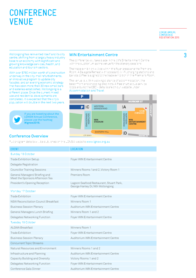
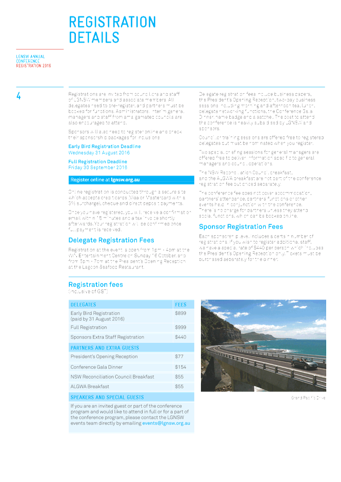
Attachment 1: LGNSW Annual Conference 2016 - Registration Brochure..................... 15
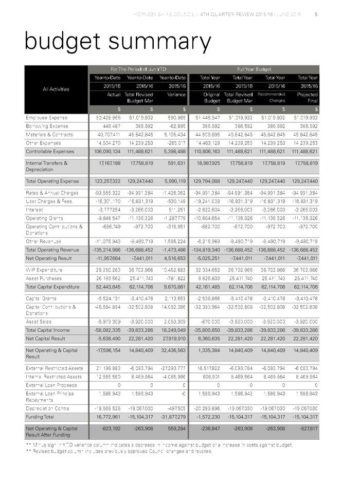
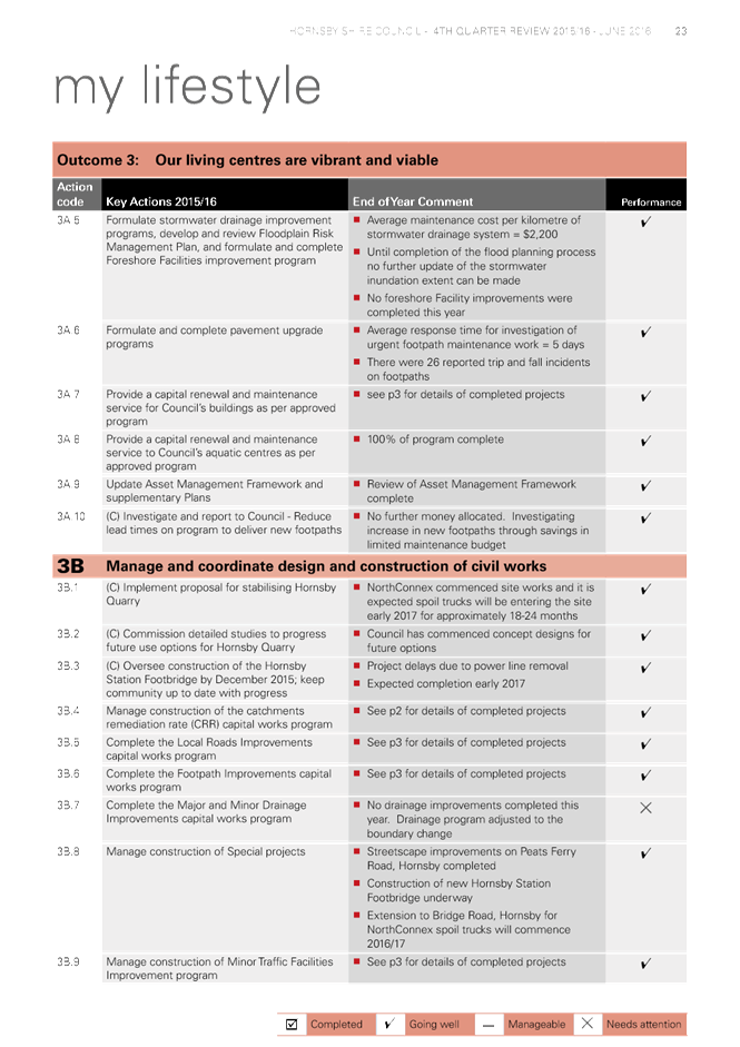
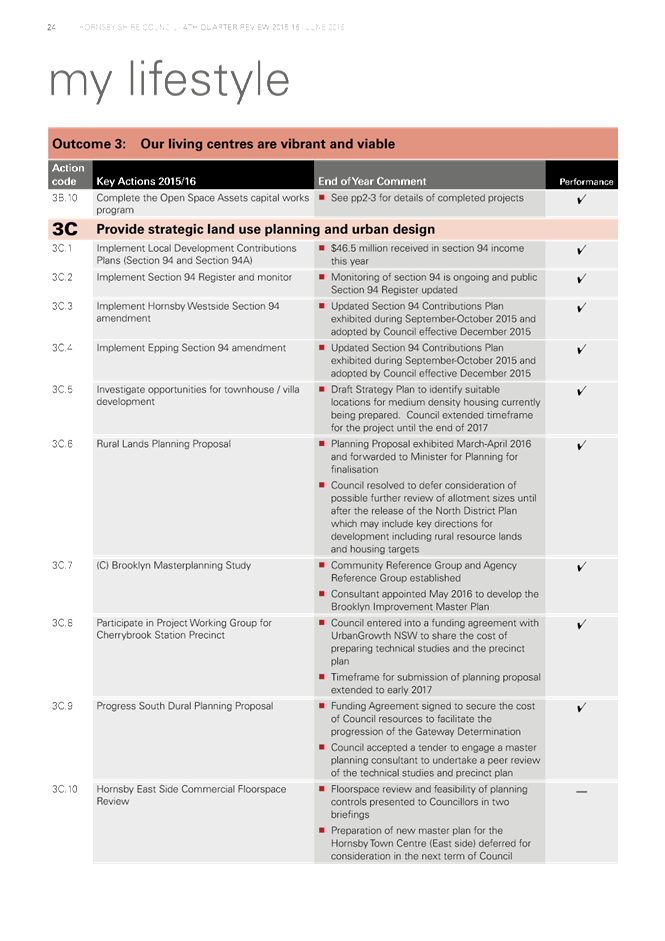
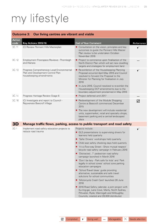
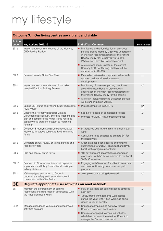
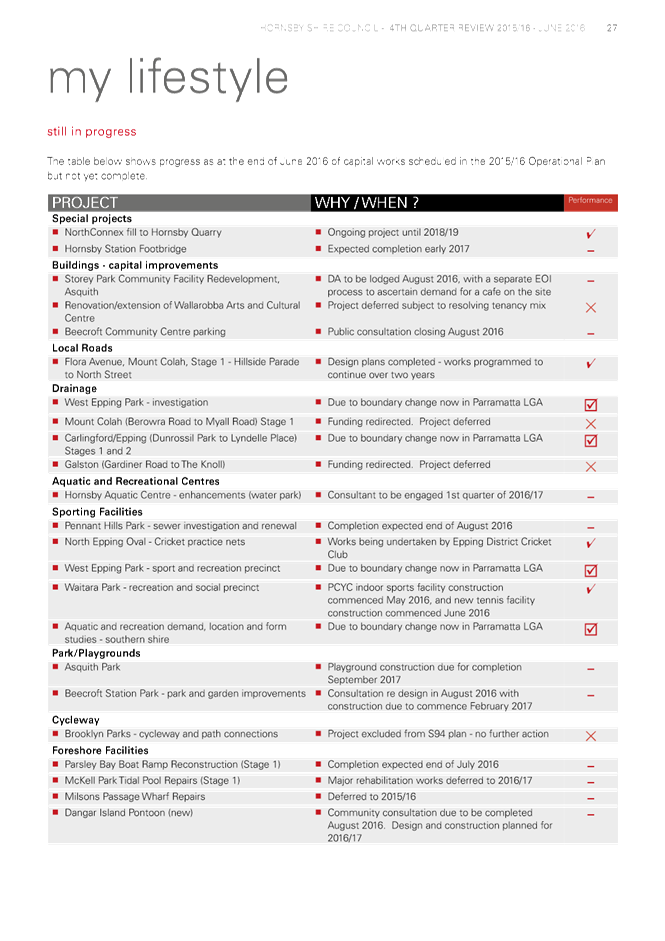
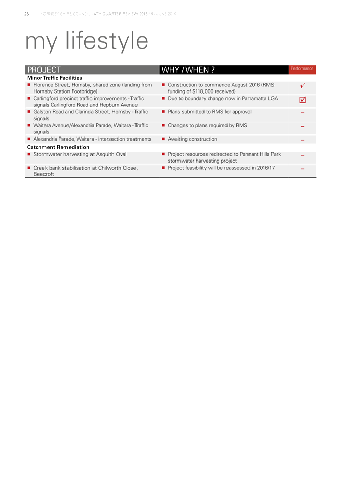
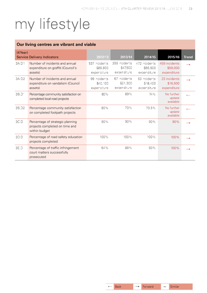
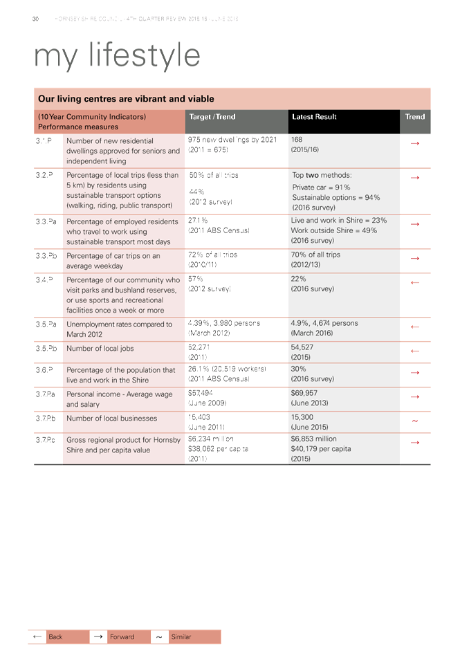
7 CS30/16 Delivery Program 2013-17 including Operational Plan (Budget) for 2015/16 - June 2016 Quarter Review
Attachment 1: June 2016 Quarter Review.................................................................. 26
Attachment 2: Quarterly Budget Review Statement 30 June 2016............................... 72
8 CS31/16 Investments and Borrowings for 2016/17- Status for Period Ending 31 July 2016
Attachment 1: HSC Investment Holdings Report - July 2016...................................... 85
Attachment 2: HSC Borrowings - July 2016............................................................... 90
Planning Division
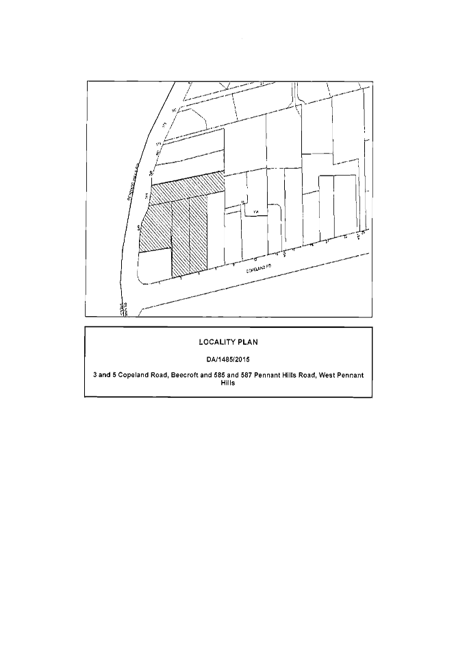
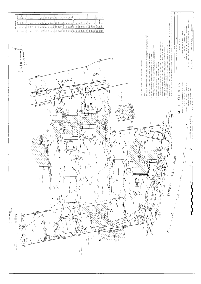
9 PL44/16 Development Application - Seniors Living Development Comprising 19 Units - 3-5 Copeland Road, Beecroft and 585-587 Pennant Hills Road, West Pennant Hills
Attachment 1: Locality Map..................................................................................... 92
Attachment 2: Survey Plan....................................................................................... 93
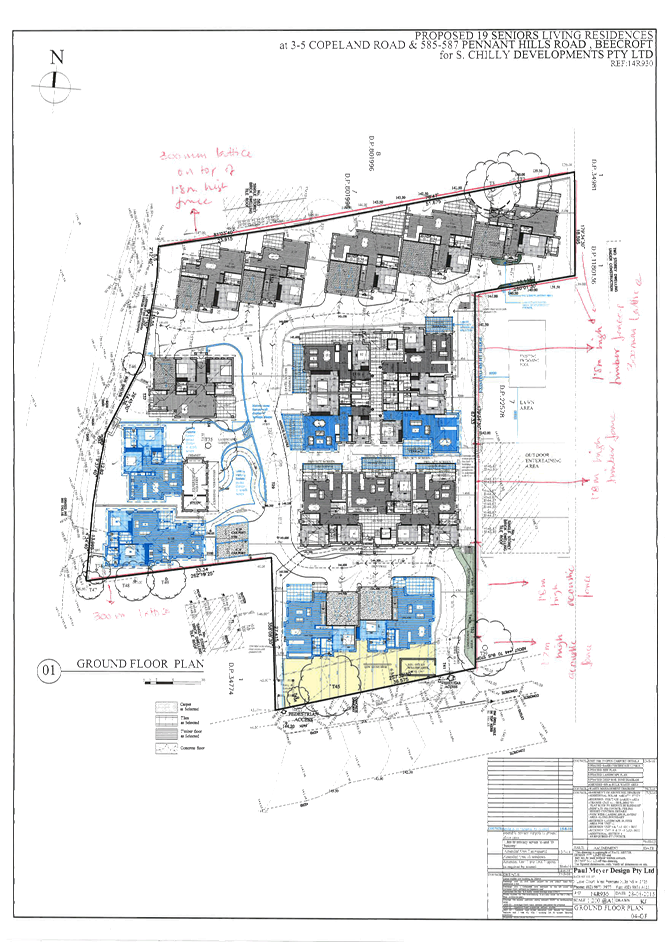
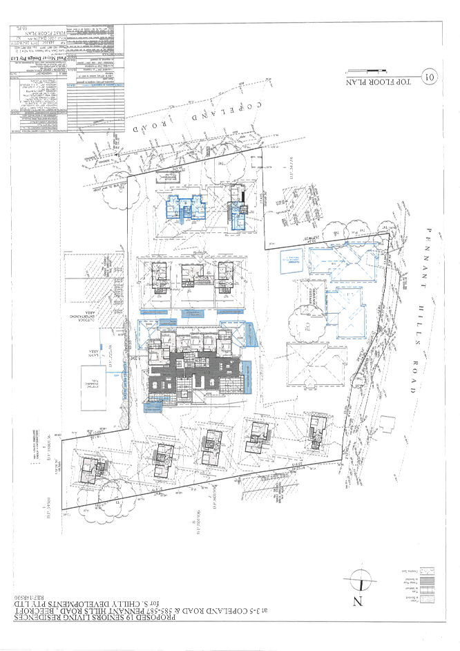
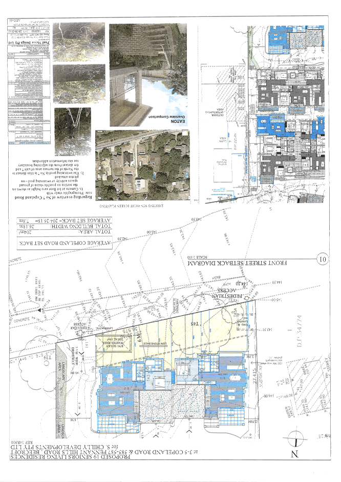
Attachment 3: Floor Plans....................................................................................... 94
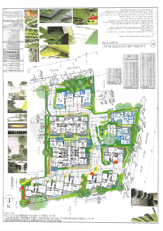
Attachment 4: Landscape Plan................................................................................. 98
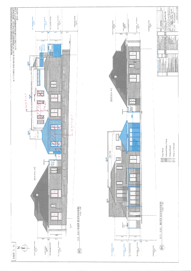
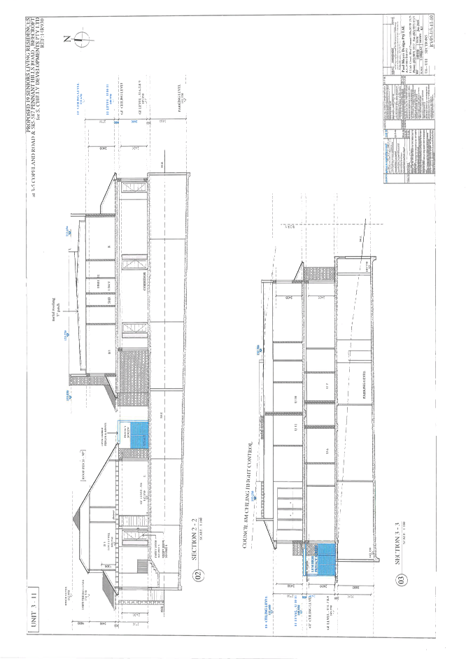
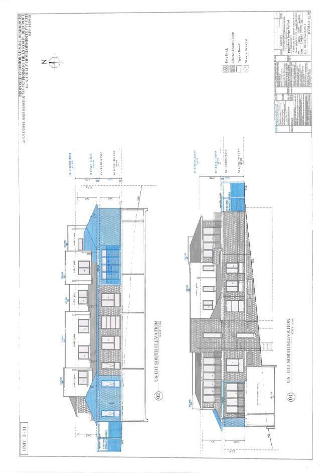
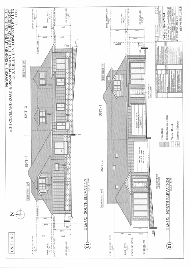
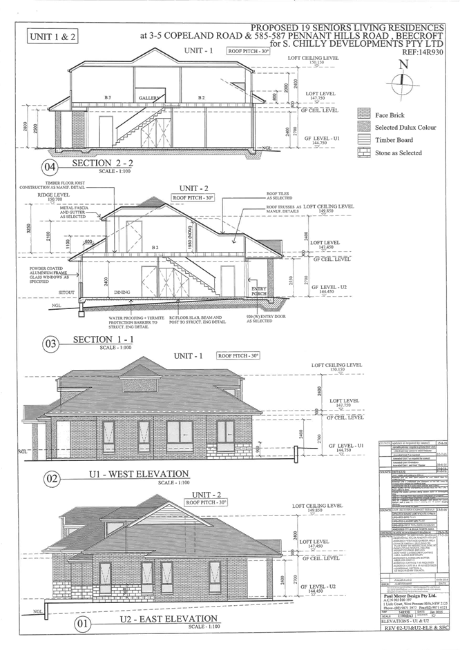
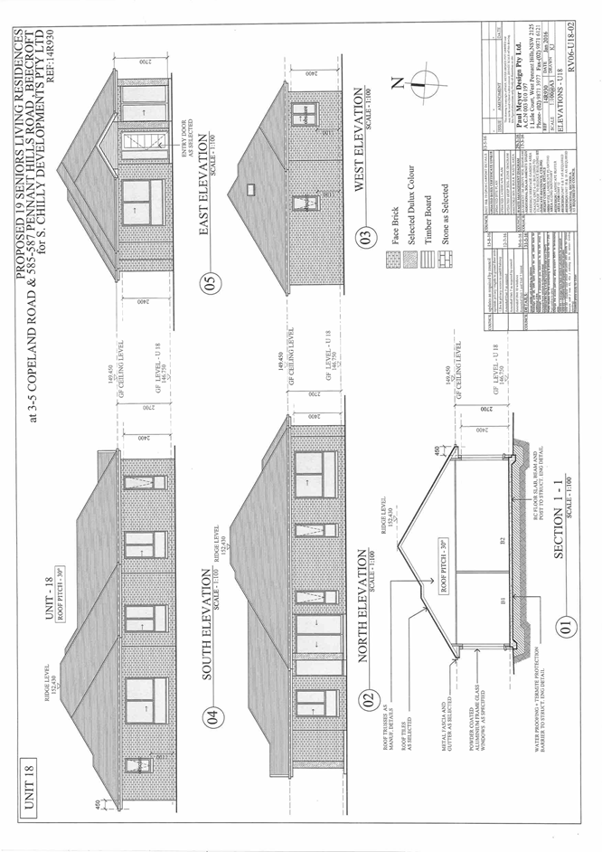
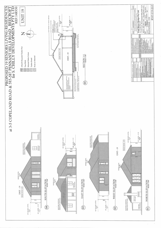
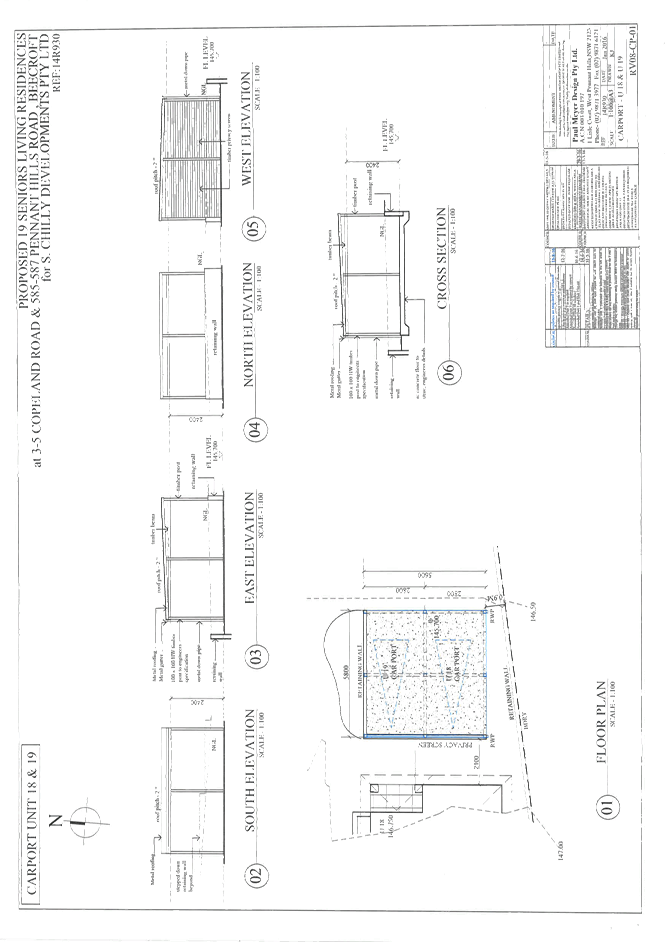
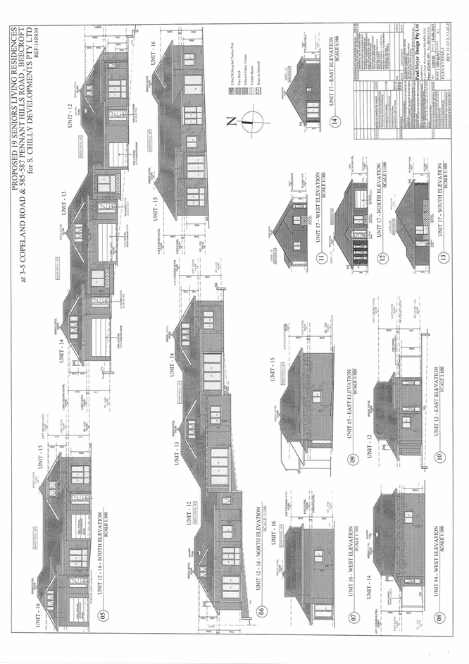
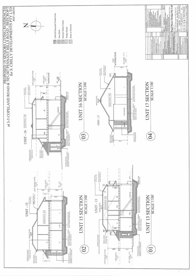
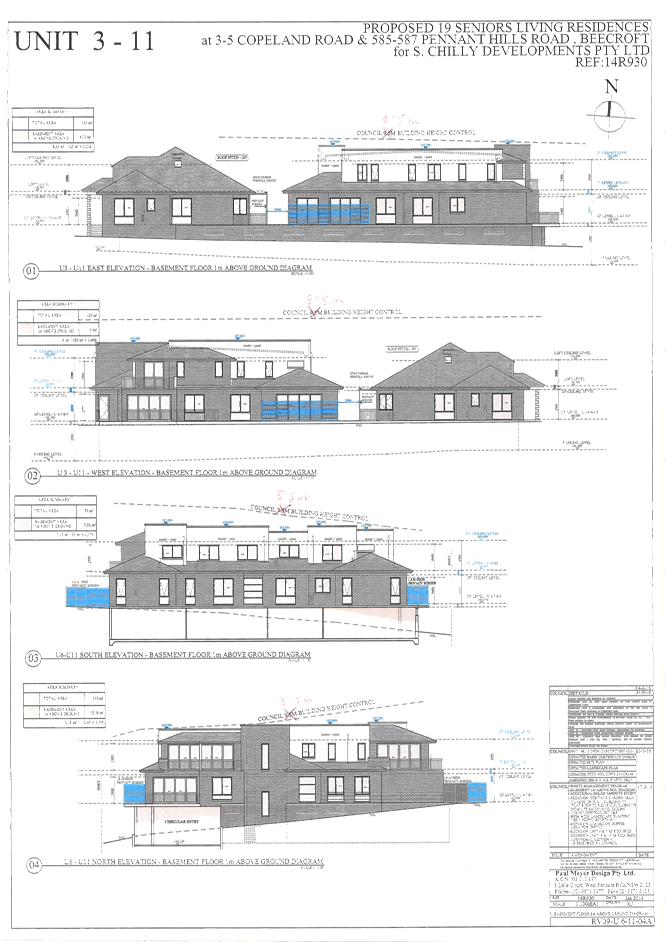
Attachment 5: Elevations and Sections.................................................................... 99
Attachment 6: Height Diagram................................................................................ 109
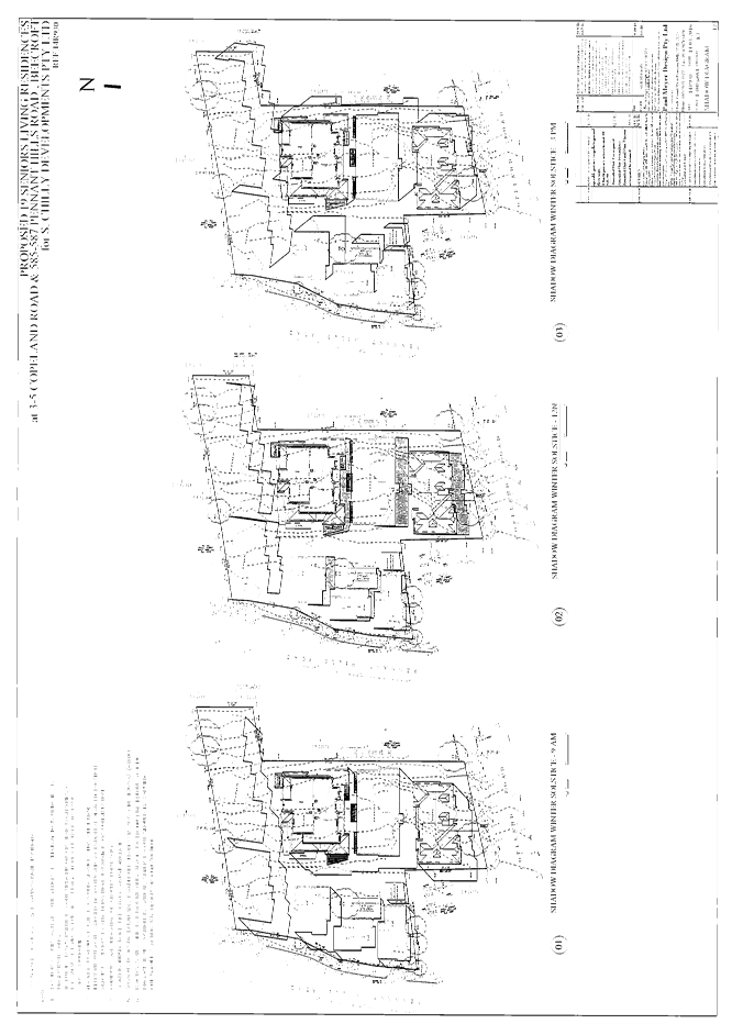
Attachment 7: Shadow Diagram............................................................................. 110
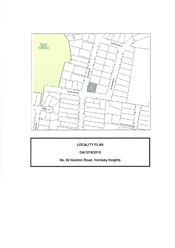
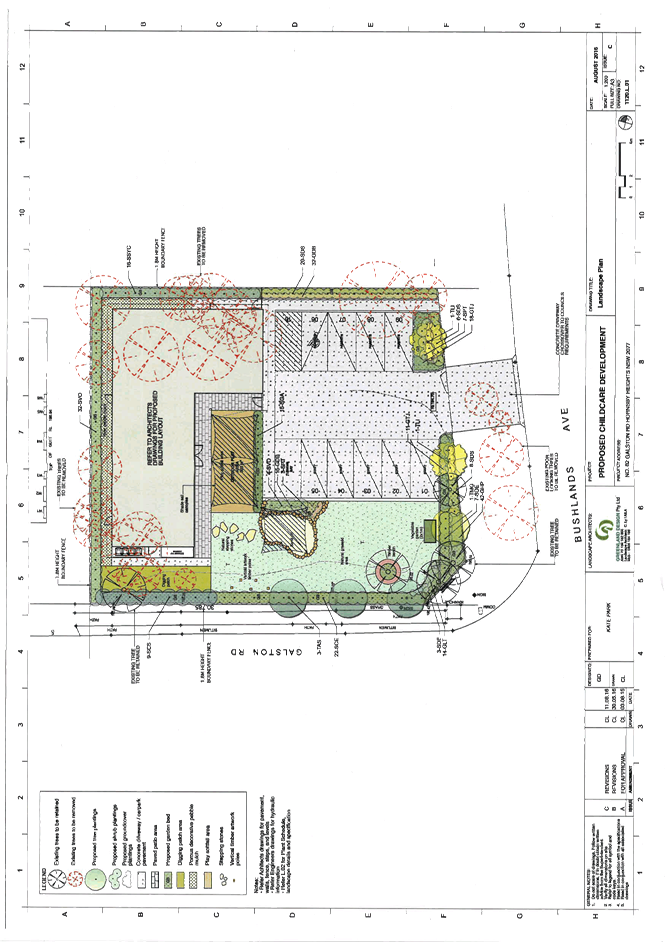
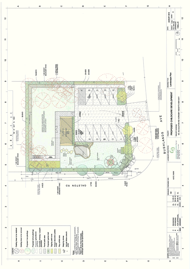
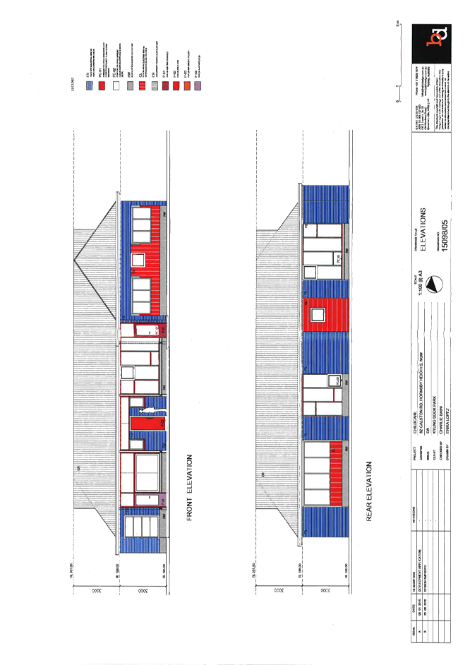
10 PL60/16 Development Application - Childcare Centre - 82 Galston Road, Hornsby Heights
Attachment 1: Locality Map.................................................................................... 112
Attachment 2: Floor Plan....................................................................................... 113
Attachment 3: Landscape Plan............................................................................... 114
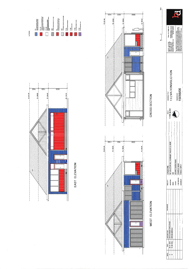
Attachment 4: Elevations and Sections................................................................... 115
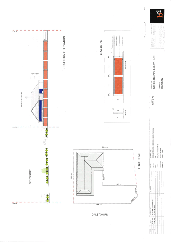
Attachment 5: Streetscape Elevation...................................................................... 117
11 PL63/16 Development Application - Alterations and Additions to a Hardware and Building Supplies Establishment and Erection of Signage - 246-250 New Line Road, Dural
Attachment 1: Locality Map.................................................................................... 119
Attachment 2: Site Plan......................................................................................... 120
Attachment 3: Existing Floor Plan.......................................................................... 121
Attachment 4: Floor Plan....................................................................................... 122
Attachment 5: Elevations and Sections................................................................... 123
Attachment 6: Shadow Plan................................................................................... 125
Attachment 7: Landscape Plans............................................................................. 126
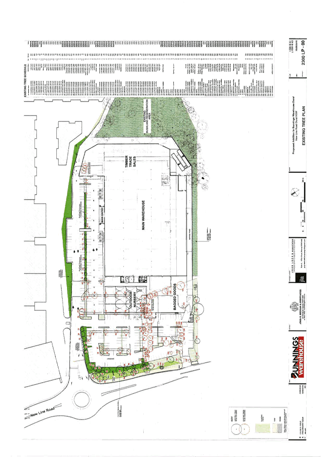
Attachment 8: Existing Tree Plan............................................................................ 129
Attachment 9: Stormwater Plans............................................................................. 130
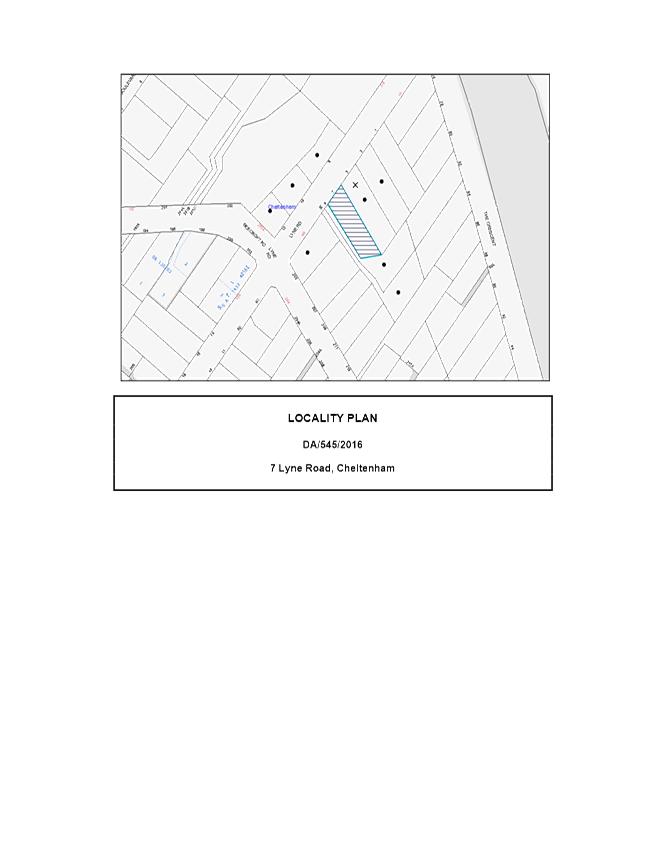
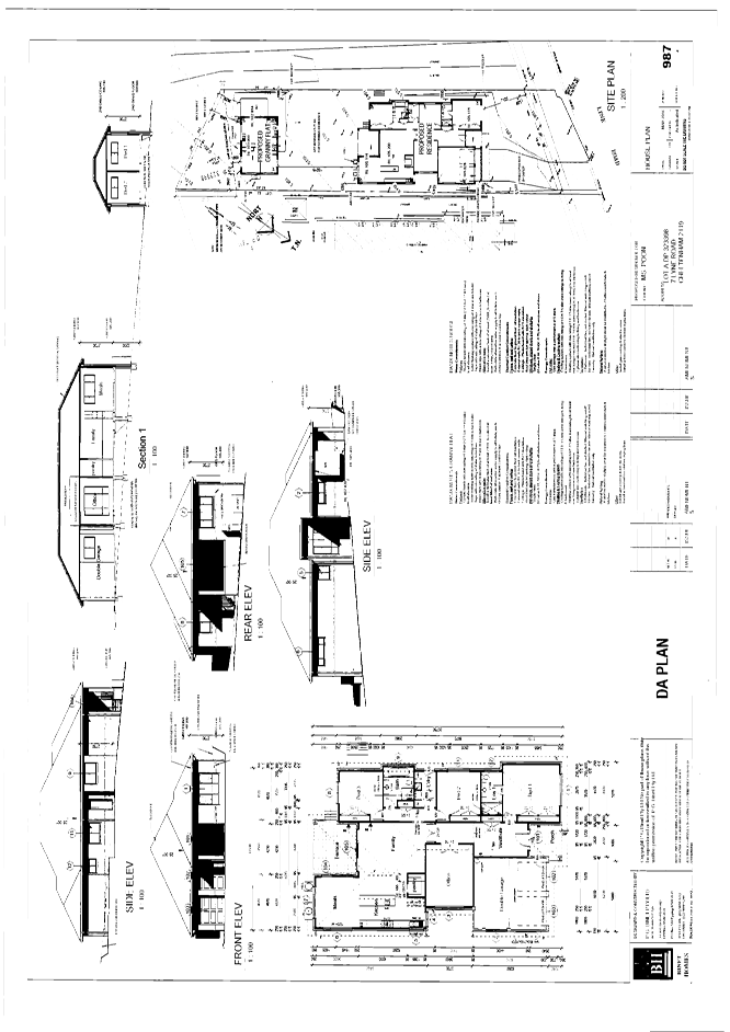
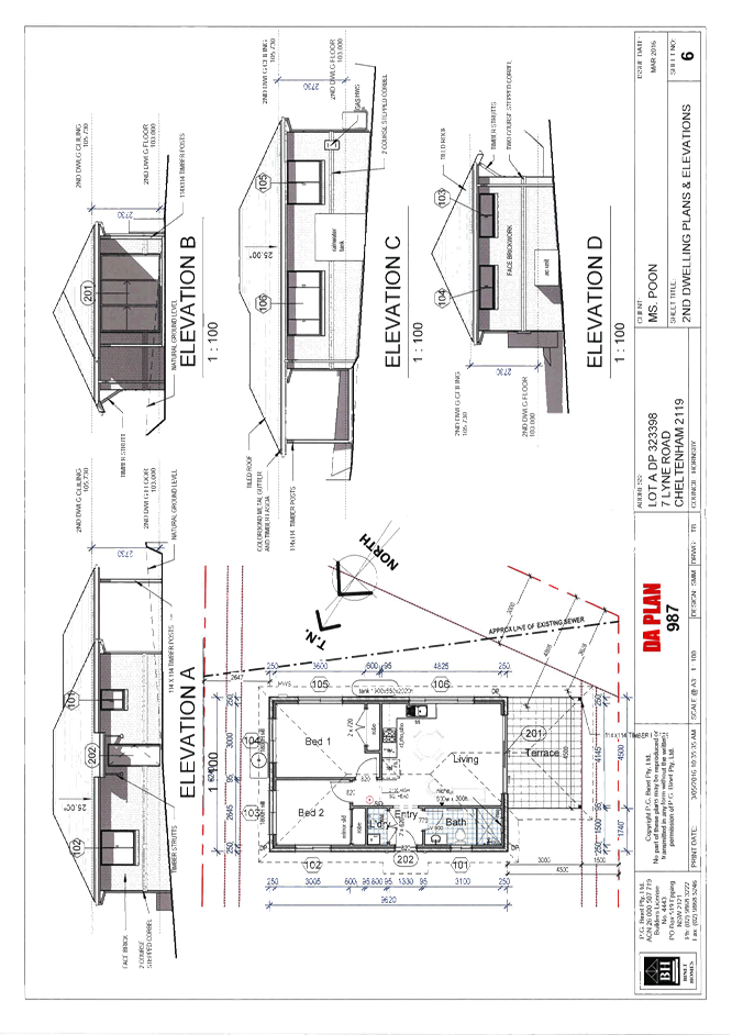
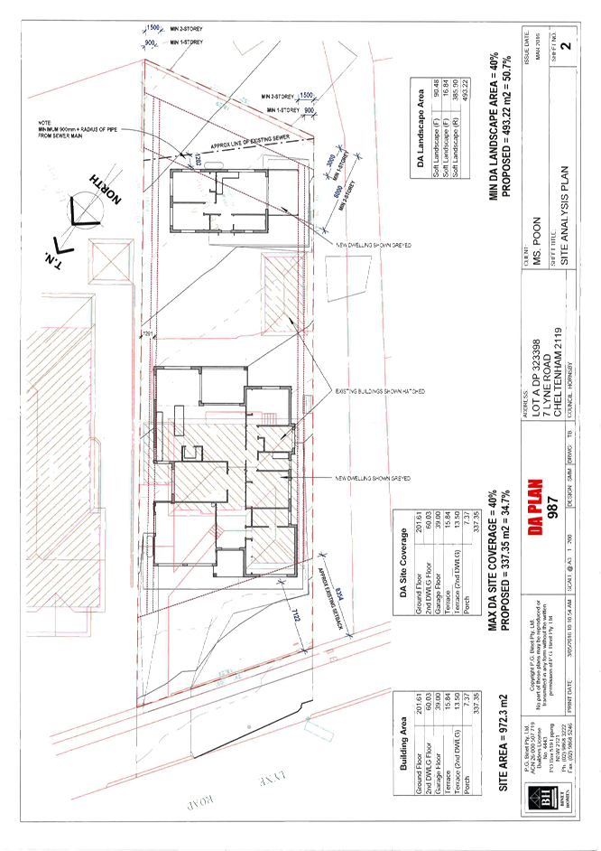
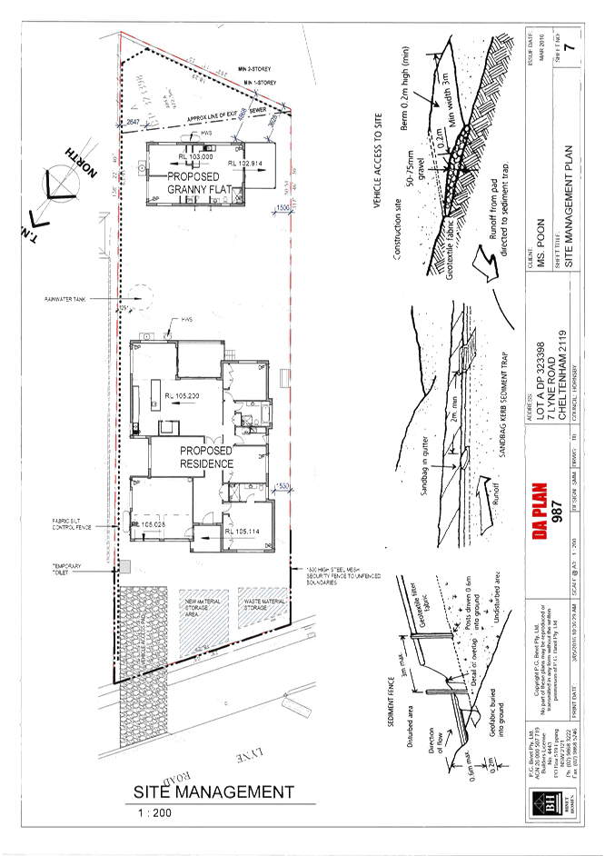
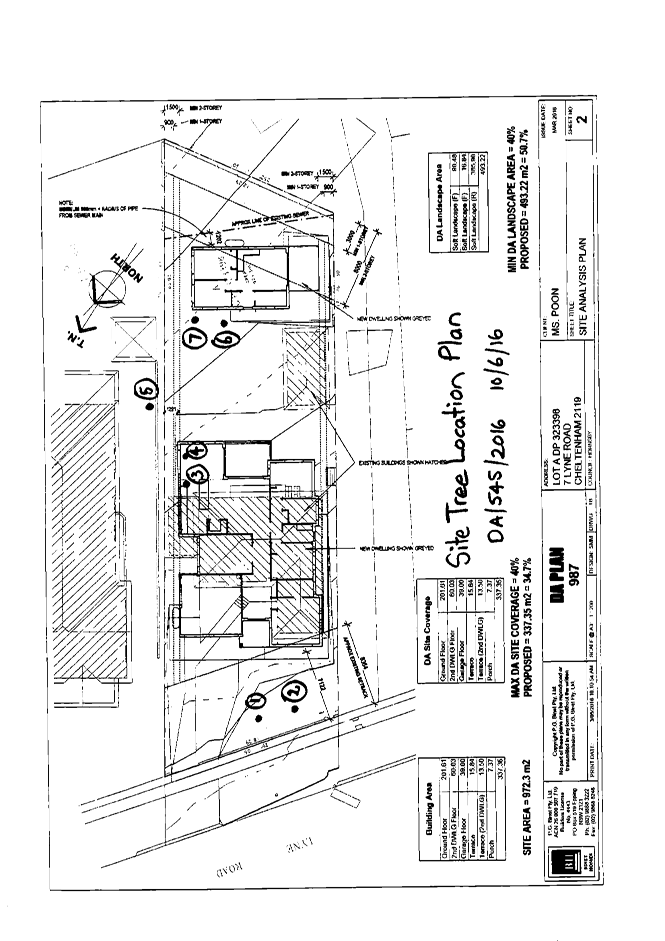
12 PL53/16 Development Application - Dwelling House and Secondary Dwelling - 7 Lyne Road, Cheltenham
Attachment 1: Locality Map.................................................................................... 133
Attachment 2: Floor Plan....................................................................................... 134
Attachment 3: Elevation Plan................................................................................. 135
Attachment 4: Site Analysis Plan............................................................................ 136
Attachment 5: Site Sediment Control Plan............................................................... 137
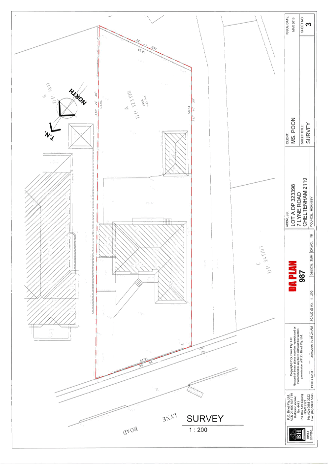
Attachment 6: Survey Plan..................................................................................... 138
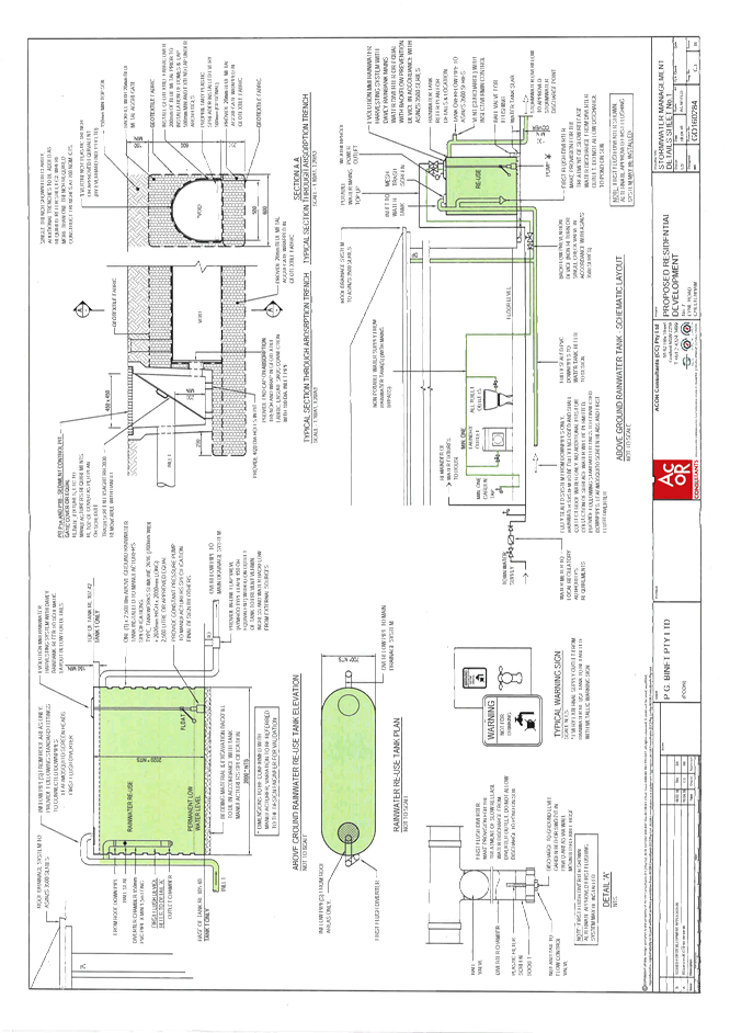
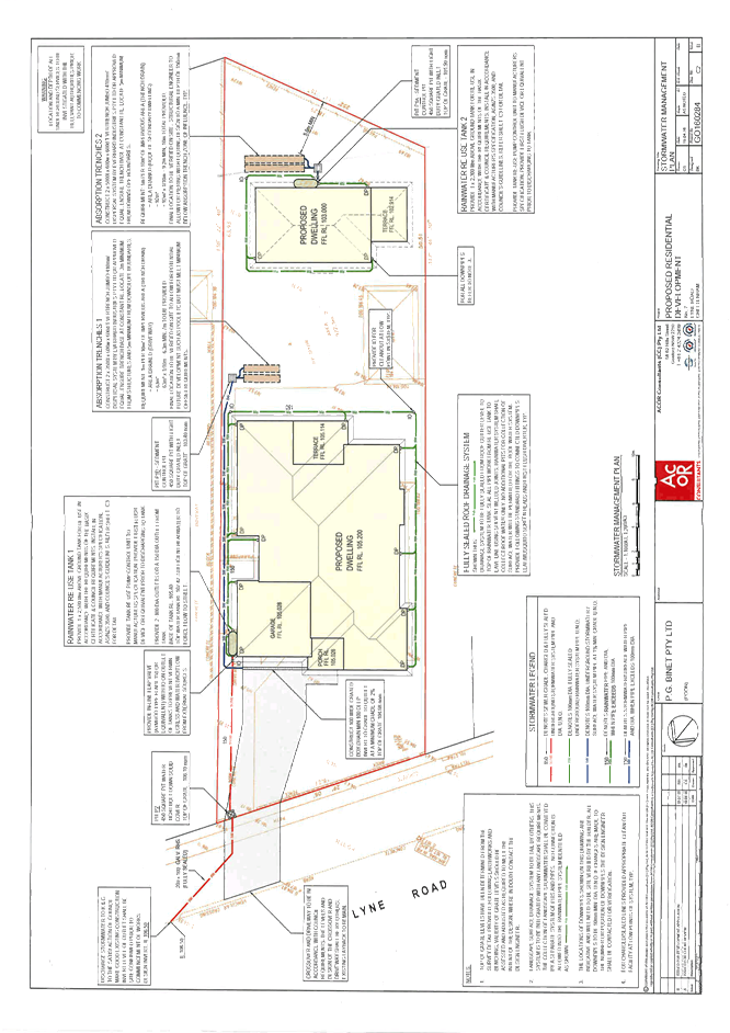
Attachment 7: Stormwater Plans............................................................................. 139
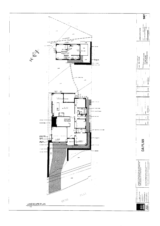
Attachment 8: Landscape Plan............................................................................... 141
Attachment 9: Tree Plan......................................................................................... 142
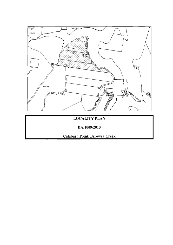
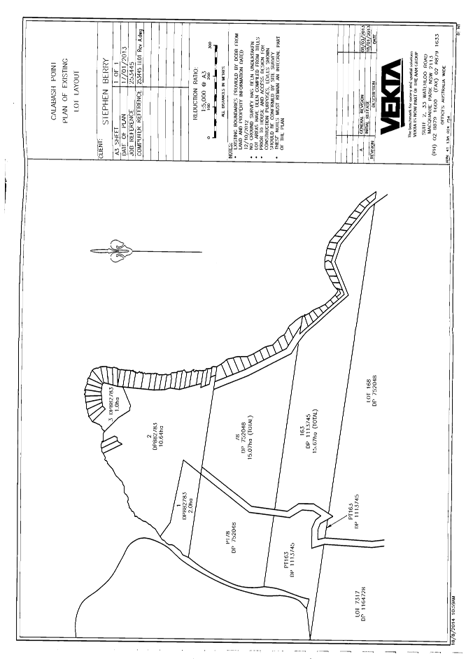
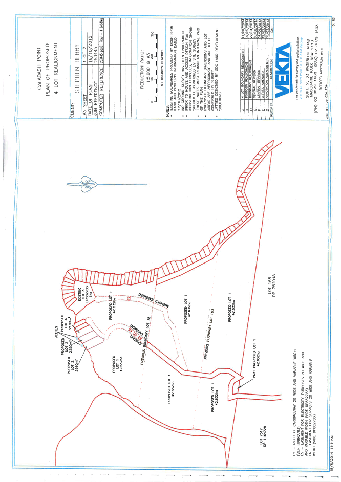
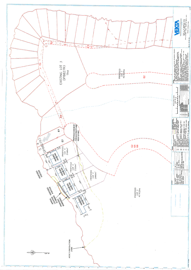
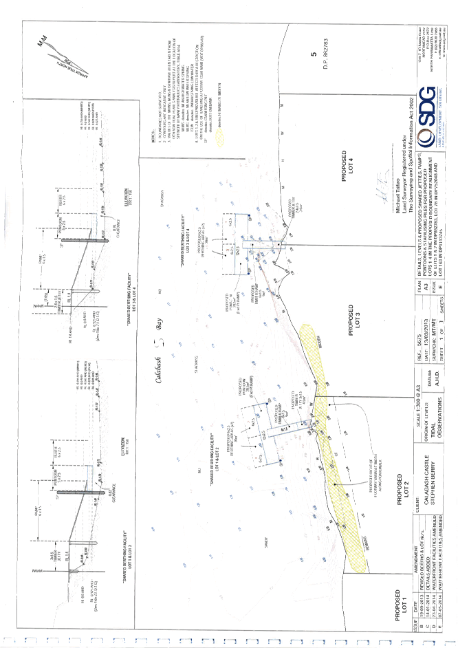
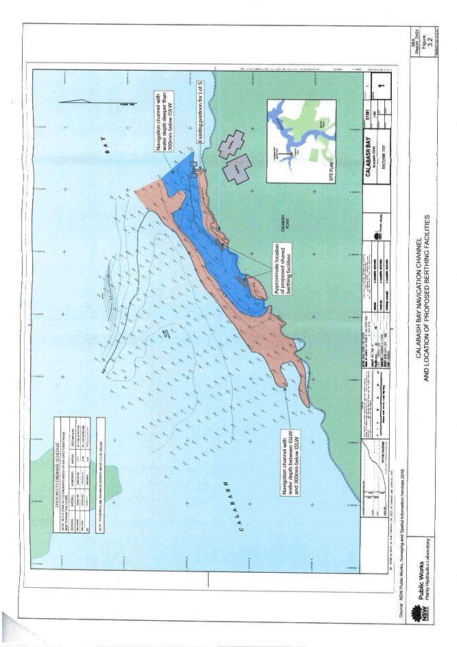
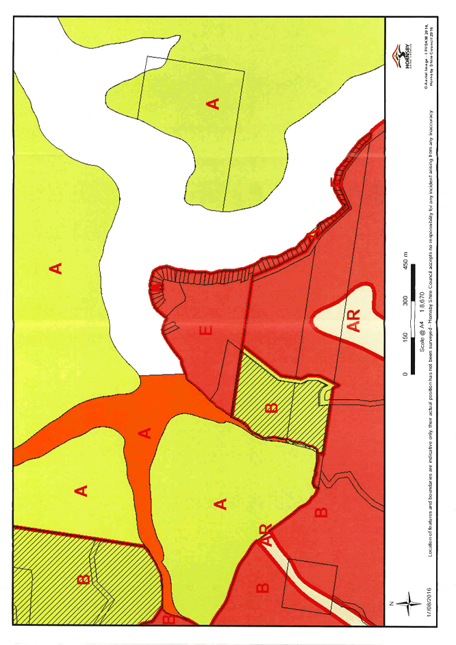
13 PL61/16 Development Application - Subdivision of Four Allotments into Four Lots - Calabash Point, Berowra Creek
Attachment 1: Locality Map.................................................................................... 144
Attachment 2: Existing Lot Layout.......................................................................... 145
Attachment 3: Subdivision Plan.............................................................................. 146
Attachment 4: House Pad Plan............................................................................... 147
Attachment 5: Jetties, Ramps and Pontoons.......................................................... 148
Attachment 6: Water Access Plan........................................................................... 149
Attachment 7: Zoning Map..................................................................................... 150
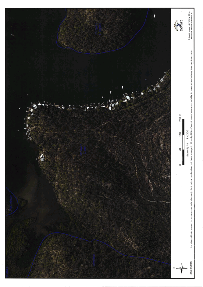
Attachment 8: Aerial Photo.................................................................................... 151
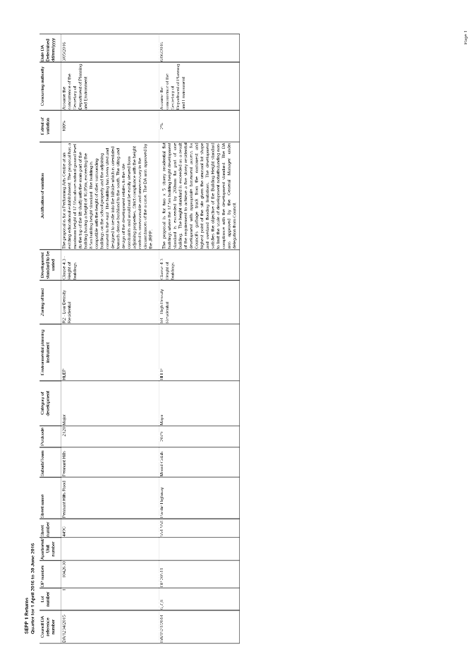
14 PL64/16 Reporting Variations to Development Standards
Attachment 1: SEPP 1 Returns Quarter - 1 April 2016 to 30 June 2016...................... 153
|
ATTACHMENT/S
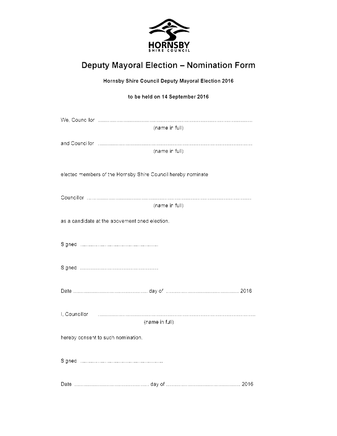
REPORT NO. CS33/16
ITEM 1
1. Nomination Form - Deputy Mayoral Election - September 2016
|
|
ATTACHMENT/S
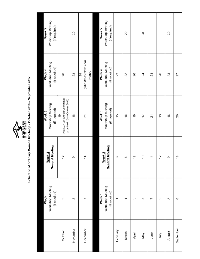
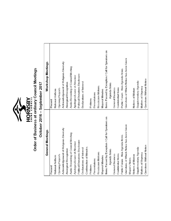
REPORT NO. CS32/16
ITEM 2
1. Schedule of Council Meetings October 2016-September 2017 2. Council Meetings Order of Business - October 2016-September 2017
|
|
ATTACHMENT/S
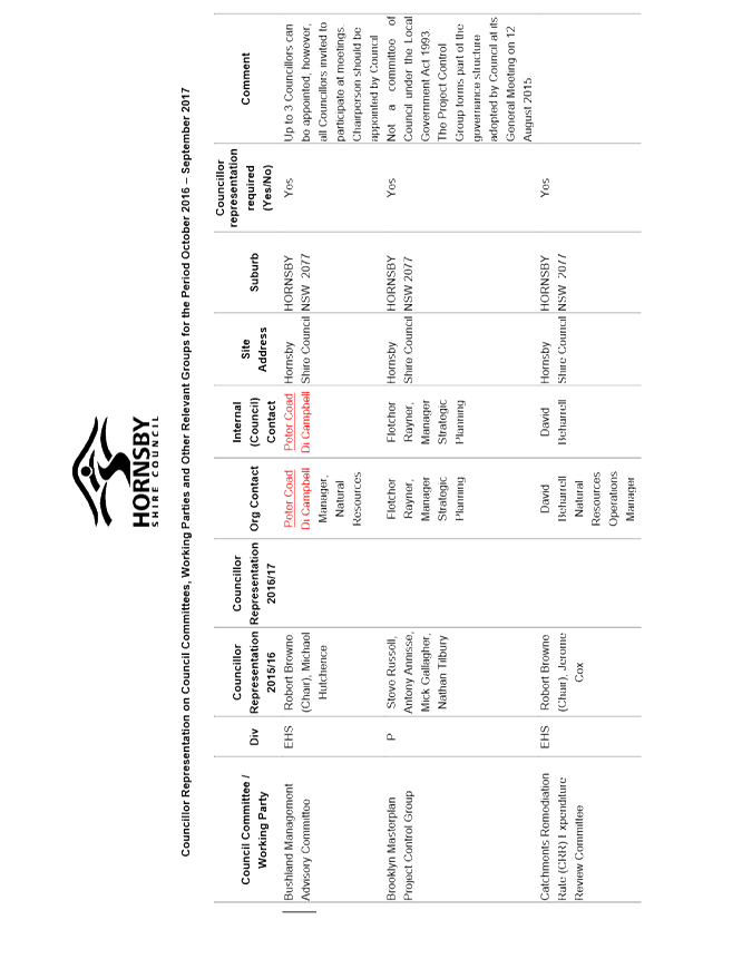
REPORT NO. CS34/16
ITEM 3
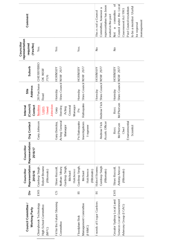
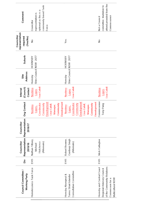
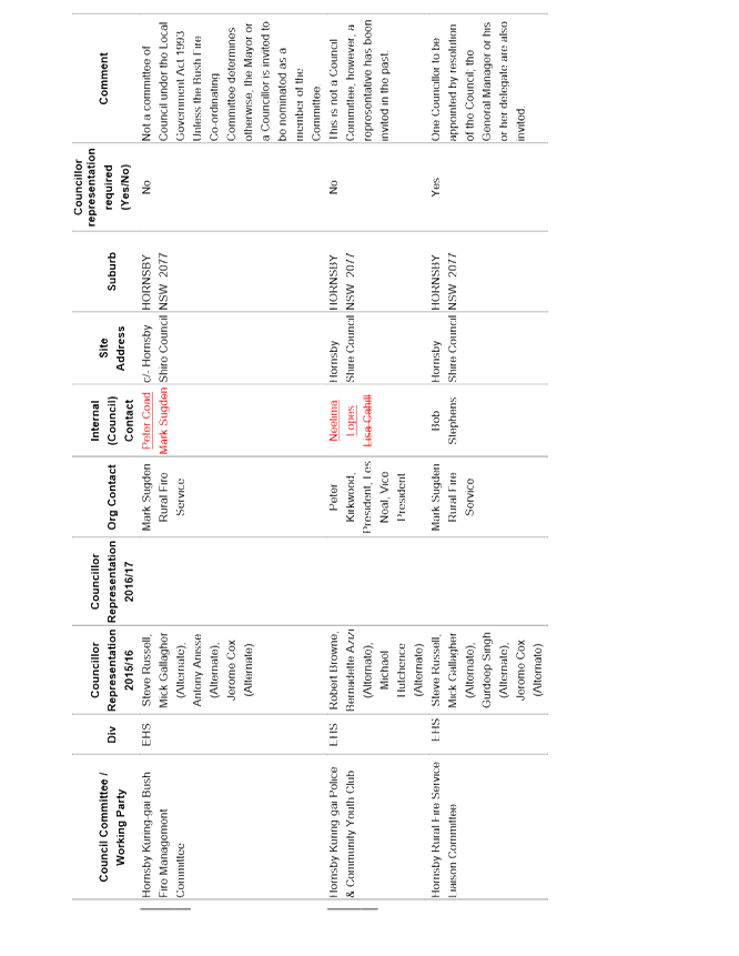
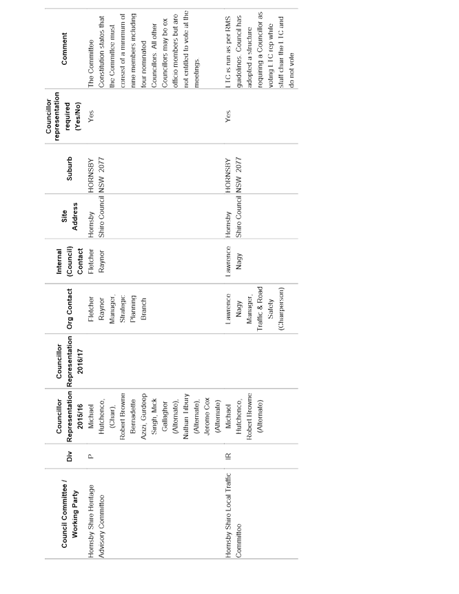
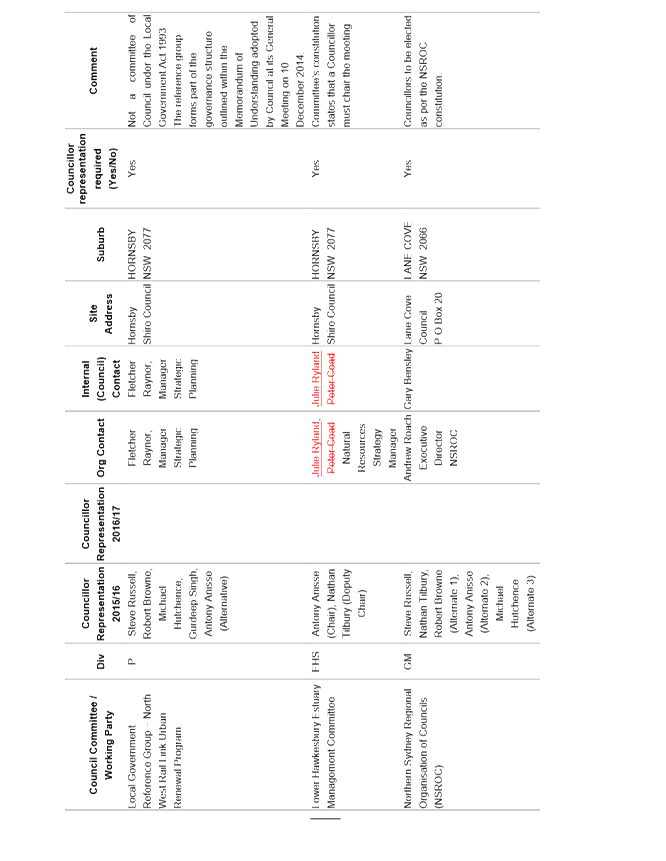
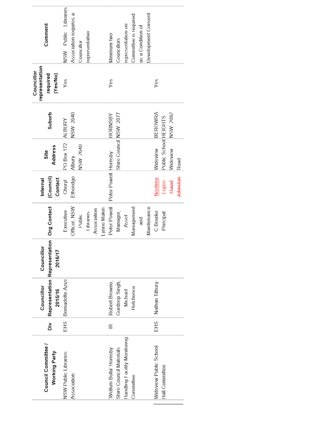
1. Councillor Representation on Committees - October 2016 - September 2017
|
|
ATTACHMENT/S
REPORT NO. CS30/16
ITEM 7
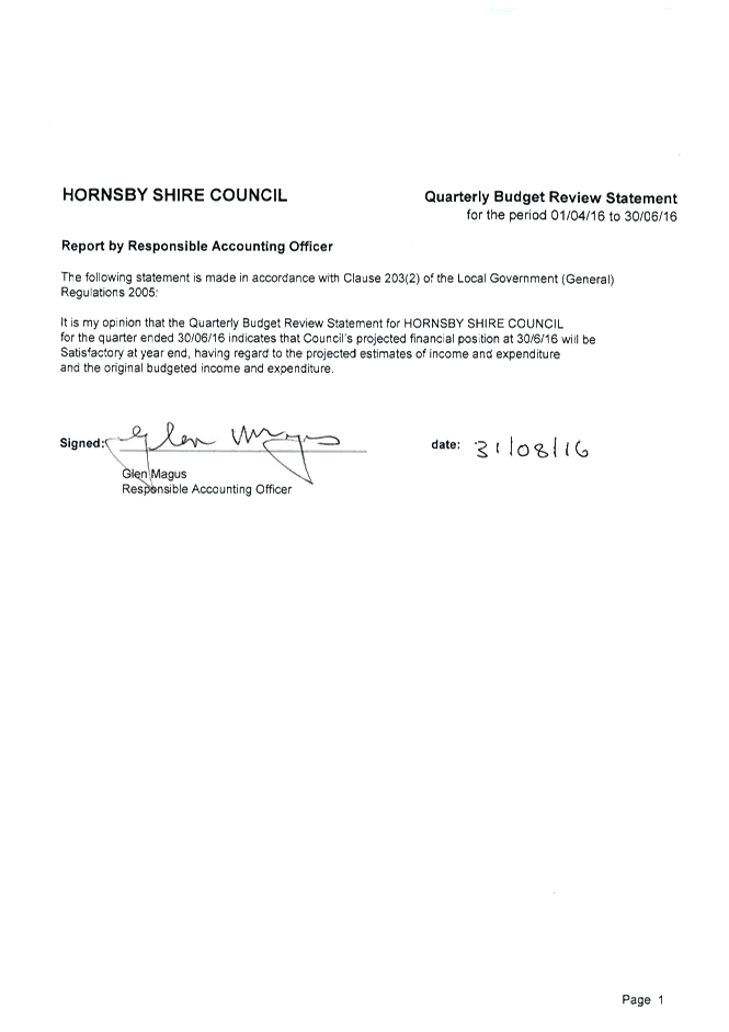
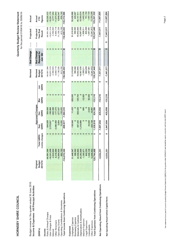
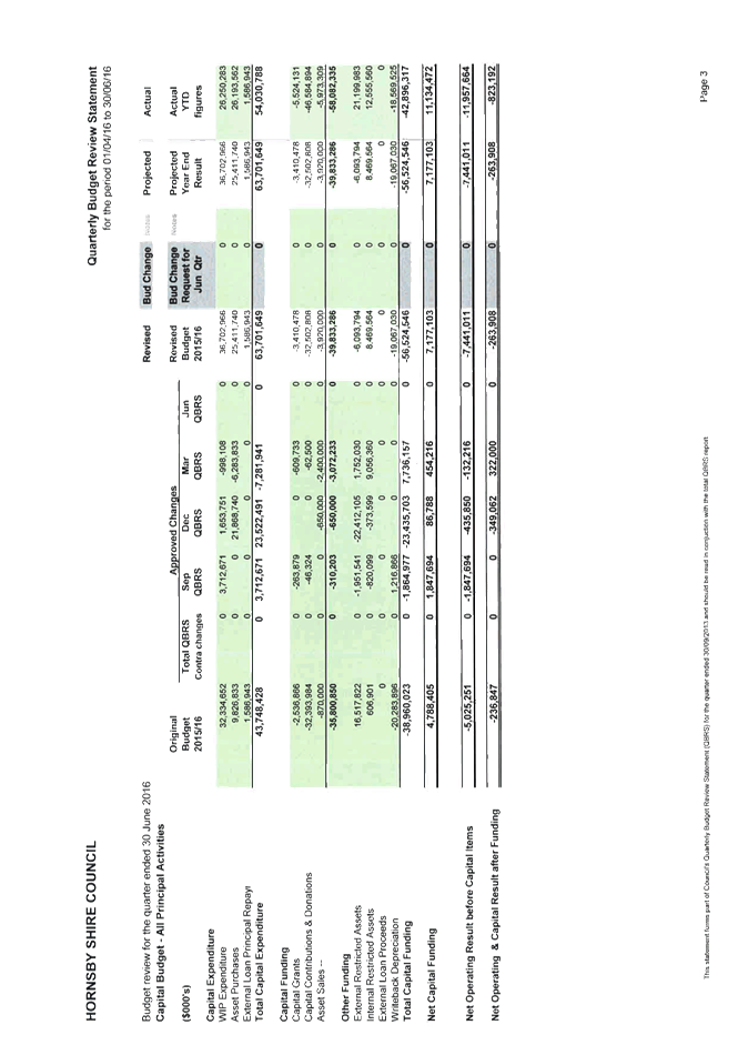
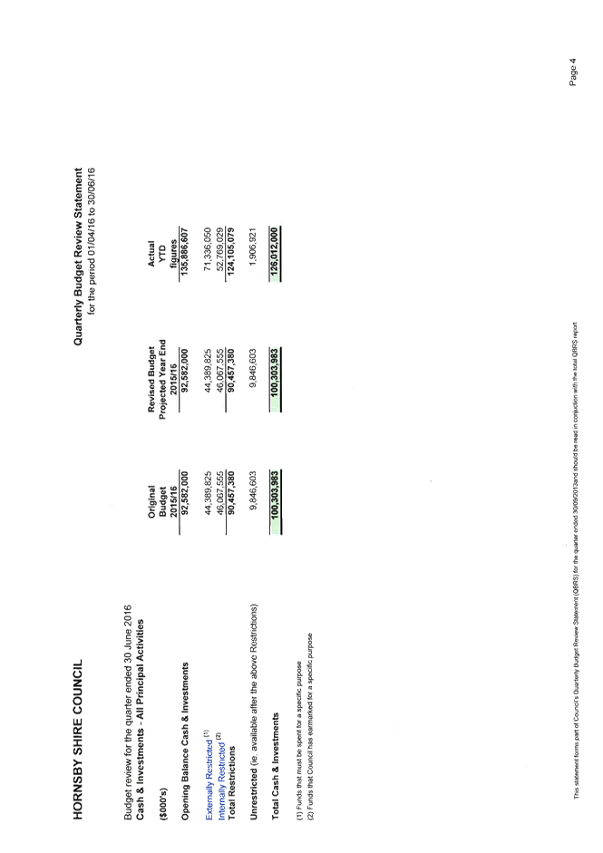
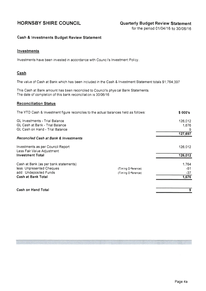
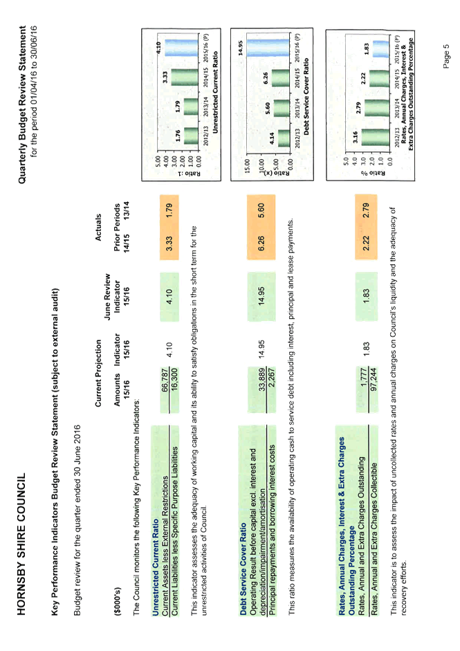
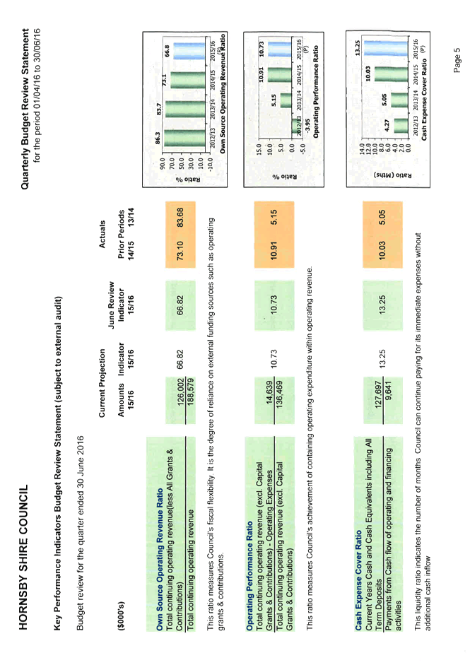
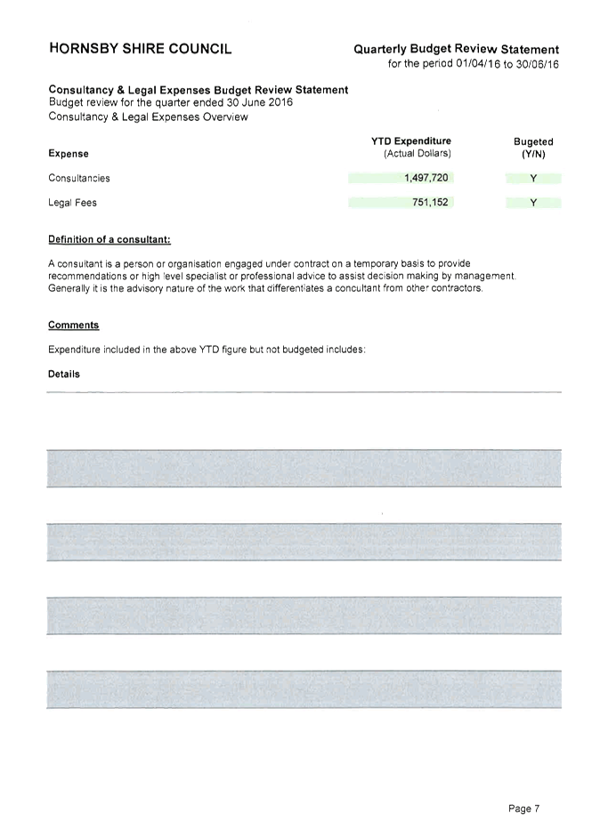
1. June 2016 Quarter Review 2. Quarterly Budget Review Statement 30 June 2016
|
|
ATTACHMENT/S
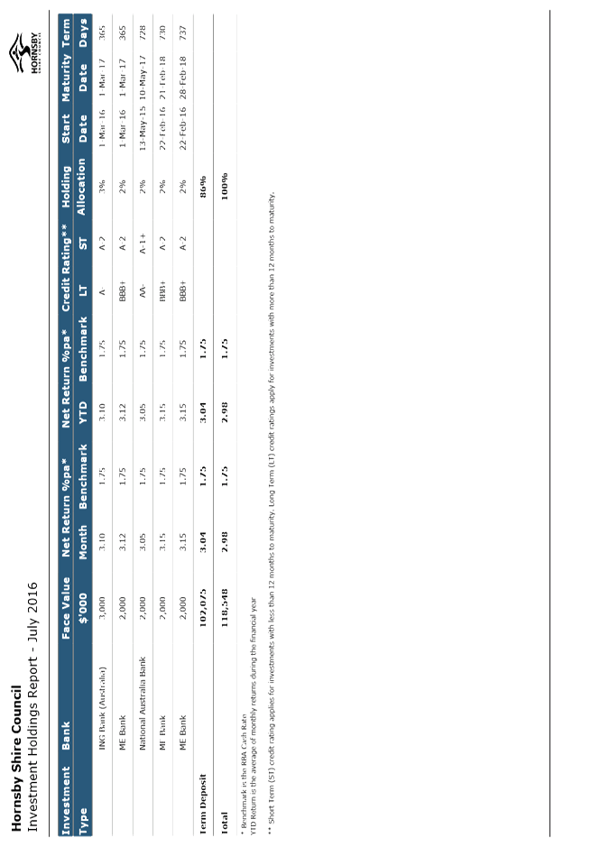
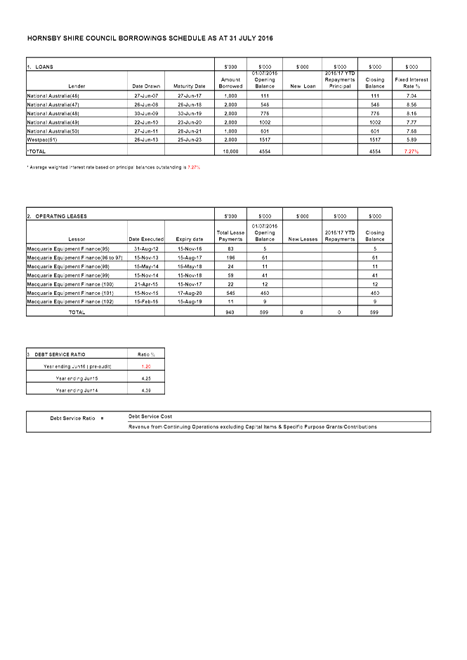
REPORT NO. CS31/16
ITEM 8
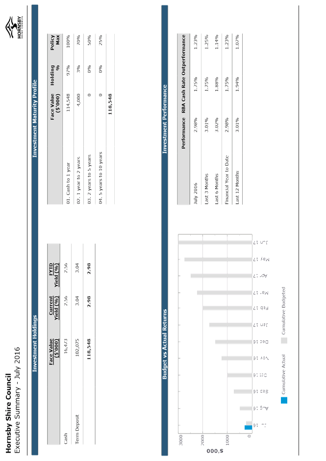
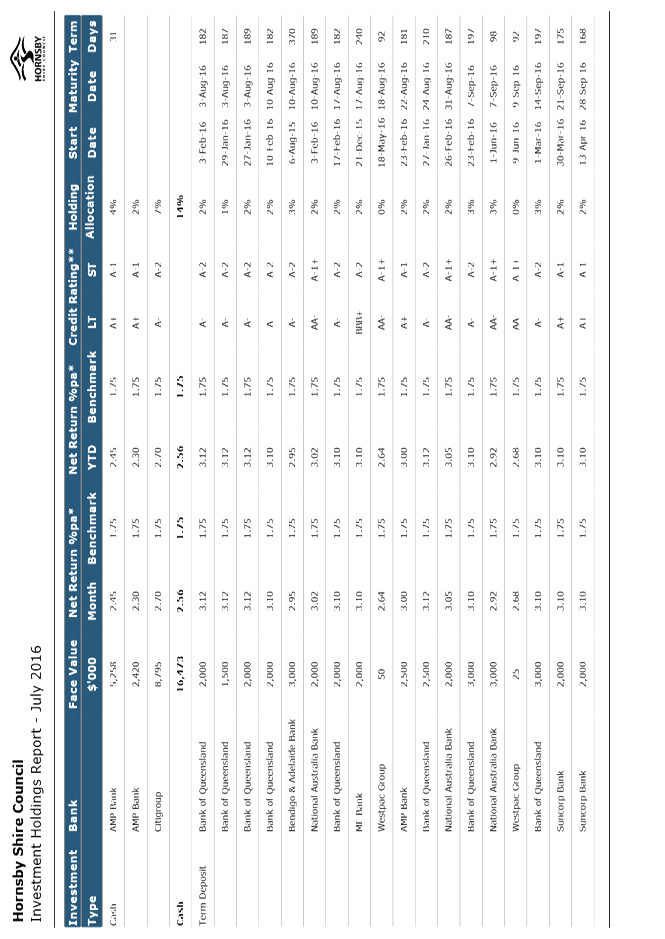
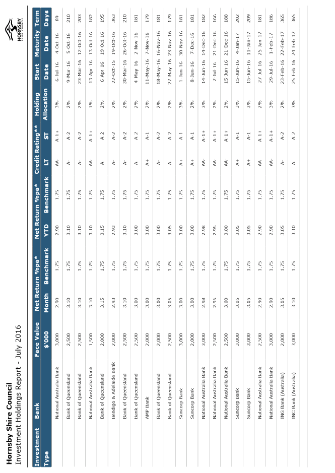
1. HSC Investment Holdings Report - July 2016 2. HSC Borrowings - July 2016
|
|
ATTACHMENT/S
REPORT NO. PL44/16
ITEM 9
1. Locality Map 2. Survey Plan 3. Floor Plans 4. Landscape Plan 5. Elevations and Sections 6. Height Diagram 7. Shadow Diagram
|
|
ATTACHMENT/S
REPORT NO. PL60/16
ITEM 10
1. Locality Map 2. Floor Plan 3. Landscape Plan 4. Elevations and Sections 5. Streetscape Elevation
|
|
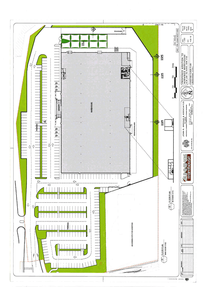
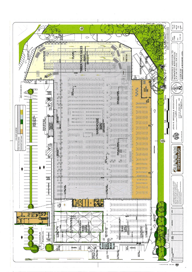
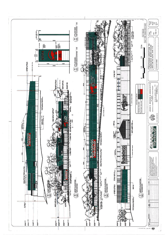
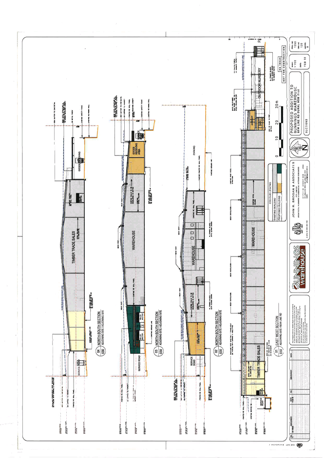
ATTACHMENT/S
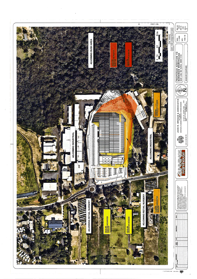
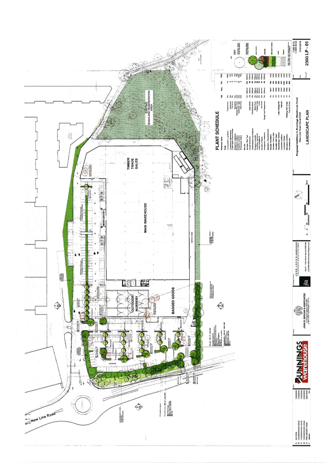
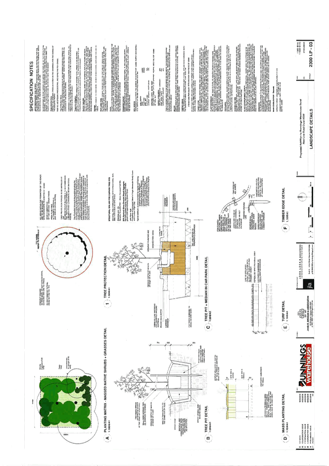
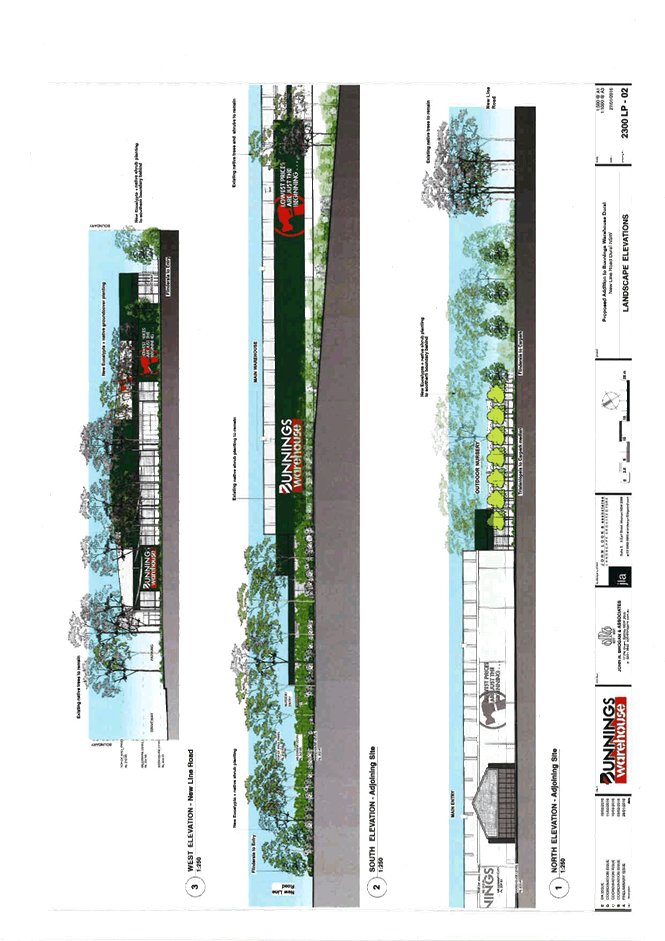
REPORT NO. PL63/16
ITEM 11
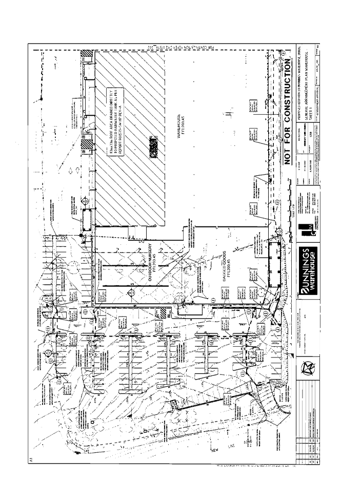
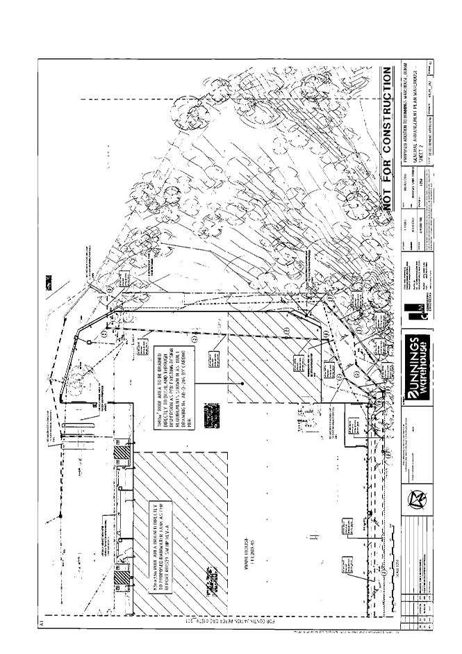
1. Locality Map 2. Site Plan 3. Existing Floor Plan 4. Floor Plan 5. Elevations and Sections 6. Shadow Plan 7. Landscape Plans 8. Existing Tree Plan 9. Stormwater Plans
|
|
ATTACHMENT/S
REPORT NO. PL53/16
ITEM 12
1. Locality Map 2. Floor Plan 3. Elevation Plan 4. Site Analysis Plan 5. Site Sediment Control Plan 6. Survey Plan 7. Stormwater Plans 8. Landscape Plan 9. Tree Plan
|
|
ATTACHMENT/S
REPORT NO. PL61/16
ITEM 13
1. Locality Map 2. Existing Lot Layout 3. Subdivision Plan 4. House Pad Plan 5. Jetties, Ramps and Pontoons 6. Water Access Plan 7. Zoning Map 8. Aerial Photo
|