
BUSINESS PAPER
Local Planning Panel meeting
Wednesday 22 August 2018
at 6:30pm
BUSINESS PAPER
Local Planning Panel meeting
Wednesday 22 August 2018
at 6:30pm
Hornsby Shire Council Table of Contents
Page 1
GENERAL BUSINESS
Local Planning Panel
Item 1 LPP27/18 Development Application - Construction of two dwellings on proposed lots 2 and 3 - 88 Malton Road, Beecroft................................................................................................ 1
Item 2 LPP30/18 Development Application - Torrens title subdivision of one lot into two and demolition of a deck - 101 - 103 Wongala Crescent, Pennant Hills.................................................... 20
Item 3 LPP32/18 Section 8.2 Review - Two residential flat buildings comprising 29 units and a basement car park - 29 - 31A Balmoral Street, waitara................................................................. 40
Item 4 LPP28/18 Development Application - Subdivision of Three Alotments into Two - 1 George Street Brooklyn................................................................................................................... 79
LPP Report No. LPP27/18
Local Planning Panel
Date of Meeting: 22/08/2018
1 DEVELOPMENT APPLICATION - CONSTRUCTION OF TWO DWELLINGS ON PROPOSED LOTS 2 AND 3 - 88 MALTON ROAD, BEECROFT
EXECUTIVE SUMMARY
|
DA No: |
DA/398/2018 (Lodged 1 May 2018) |
|
Description: |
Construction of two dwellings on proposed lots 2 and 3 |
|
Property: |
Lot 41 DP 714483 - 88 Malton Road, Beecroft |
|
Applicant: |
Mr Mohammed Oboodi-Mehr |
|
Owner: |
Mr Mohammed Oboodi-Mehr and Mrs Samiheh Oboodi-Mehr |
|
Estimated Value: |
$1,540,000 |
|
Ward: |
C |
· The application involves the erection of two, 2-storey detached dwellings on proposed Lots 2 and 3 of an approved subdivision at 88 Malton Road, Beecroft being DA/320/2015.
· The applicant has commenced appeal proceedings in the Land & Environment Court on the basis of a “deemed refusal”. In the circumstances, an independent assessment of the development application has been undertaken by Kerry Nash of KN Planning Pty Limited.
· The proposal does not comply with the height of buildings development standard in respect to the dwelling on Lot 3. The applicant has made a submission in accordance with Clause 4.6 “Exceptions to development standards” of the Hornsby Local Environmental Plan 2013 to vary the height development standard. The submission is considered to be not well-founded and is not supported.
· Twenty-four submissions have been received objecting to the application. The application is required to be determined by the Hornsby Shire Council Local Planning Panel as 10 or more unique submissions were received by way of objection.
· It is recommended that the application be refused.
|
THAT Development Application No. DA/398/2018 for the erection of two detached dwellings on proposed Lots 2 and 3 at Lot 41, DP 714483, No. 88 Malton Road, Beecroft, be refused subject to the reasons for refusal detailed in Schedule 1 of Report No. LPP27/18. |
BACKGROUND
Council approved Development Application No DA/320/2015 for the subdivision of Lot 41, DP 714483, known as 88 Malton Road into three allotments on 12 October 2016.
The subdivision provided Lot 1 with frontage to Malton Road and an access handle 4.0 metres wide adjacent to the dwelling at 90 Malton Road to two allotments located at the rear.
A two-storey detached dwelling has been constructed on Lot 1.
The approved subdivision has not been registered with the Land Titles Office and therefore any consent for the proposed dwellings prior to the registration of the subdivision would need to be in the form of deferred commencement consent.
SITE
The site is described as Lot 41 in DP 714483 and is known as 88 Malton Road, Beecroft. It has an area of 3777m 2 and is accessed by an existing driveway from Malton Road. The site has an average fall of 18% from the north-eastern front boundary to the south-western rear boundary and contains a newly constructed two-storey dwelling house.
The existing driveway from Malton Road is approximately 3 metres wide and comprises asphalt construction from the street for approximately 10 - 15 metres. The remainder of this accessway is unsealed. A separate concrete accessway runs from the edge of the asphalt to the new dwelling on proposed Lot 1. The accessway to approved Lots 2 and 3 is proposed to be 4 metres in width and runs along the eastern boundary of the site adjacent to the new two-storey brick residence (which would be on proposed Lot 1). Approved Lots 2 and 3 are heavily vegetated and also comprise a number of rock outcrops.
The approved Torrens Title subdivision of one allotment into three lots comprises the following lots:-
· Lot 1: 964m2 (934m2 excluding row) contains existing two-storey dwelling house
· Lot 2: 1350m2 (1186m2 excluding row)
· Lot 3: 1452m2 (1303m2 excluding row)
The site also benefits from a right of carriageway 3.5 metres wide over Lot 42, DP 714483 being 90 Malton Road. The development application proposes to use the right of carriageway to provide vehicular access to the proposed double garage for the dwelling on Lot 3 of the approved subdivision.
The site is located within the Beecroft-Cheltenham Heritage Conservation Area and is in the vicinity of a heritage item, namely the street trees and bushland located within the road reserve of Malton Road, which is listed as Item No 114 in Schedule 5 of the Hornsby Local Environmental Plan 2013.
PROPOSAL
The application seeks approval to construct a two-storey dwelling on proposed Lots 2 and 3 which were approved within a three lot subdivision of the site in Development Consent No. 320/2015.
The proposal provides for the construction of a two-storey dwelling on proposed Lot 2 which would be constructed of a combination of rendered brickwork and cladding materials with a series of low pitched skillion Colorbond roofs. The proposed dwelling comprises the following:-
· Lower ground floor: three (3) bedrooms (bed 2 with an ensuite and walk-in-robe), lounge room and bathroom;
· Ground floor: entry foyer, study, powder room, laundry, kitchen, pantry, dining area and living room, together with a double car garage;
· First floor: one (1) bedroom with an ensuite and walk-in-robe.
The proposal provides for the construction of a two-storey dwelling on proposed Lot 3 which would be constructed of a combination of rendered brickwork and cladding materials with a series of low pitched skillion Colorbond roofs. The proposed dwelling comprises the following:-
· Ground floor: lounge room, laundry, bathroom and two bedrooms (bed 3 with an ensuite and walk-in-robe) together with a double car garage;
· First floor: entry foyer, study, bathroom, kitchen, pantry, dining area and two bedrooms (bed 1 with an ensuite and walk-in-robe). A single hardstand car parking space accessed from the common access handle under the approved subdivision is also proposed.
ASSESSMENT
The development application has been assessed having regard to the ‘Greater Sydney Region Plan - A Metropolis of Three Cities’, the ‘North District Plan’ and the matters for consideration prescribed under Section 4.15 of the Environmental Planning and Assessment Act 1979 (the Act). The following issues have been identified for further consideration.
1. STRATEGIC CONTEXT
1.1 Greater Sydney Region Plan - A Metropolis of Three Cities and North District Plan
The Greater Sydney Region Plan - A Metropolis of Three Cities has been prepared by the NSW State Government to guide land use planning decisions for the next 40 years (to 2056). The Plan sets a strategy and actions for accommodating Sydney’s future population growth and identifies dwelling targets to ensure supply meets demand. The Plan also identifies that the most suitable areas for new housing are in locations close to jobs, public transport, community facilities and services.
The NSW Government would use the subregional planning process to define objectives and set goals for job creation, housing supply and choice in each subregion. Hornsby Shire has been grouped with Hunters Hill, Ku-ring-gai, Lane Cove, Mosman, North Sydney, Ryde, Northern Beaches and Willoughby Councils to form the North District. The Greater Sydney Commission has released the North District Plan which includes priorities and actions for Northern District for the next 20 years. The identified challenge for Hornsby Shire would be to provide an additional 4,350 dwellings by 2021 with further strategic supply targets to be identified to deliver 97,000 additional dwellings in the North District by 2036.
The proposed development would be consistent with the Greater Sydney Region Plan - A Metropolis of Three Cities and the North District Plan, by contributing to achieving the dwelling targets for the region.
2. STATUTORY CONTROLS
Section 4.15(1)(a) requires Council to consider “any relevant environmental planning instruments, draft environmental planning instruments, development control plans, planning agreements and regulations”.
2.1 Environmental Planning and Assessment Regulation 2000
The development application is incomplete in that it fails to provide owner’s consent from the adjoining property at No. 90 Malton Road.
The proposed development relies on access to the off-street parking for the proposed dwelling on Lot 3 via an existing right-of-carriageway 3.5 metres wide over the adjoining allotment Lot 42, DP 714483 (No. 90 Malton Road).
Whilst the right-of-carriageway provides for full and free movement of vehicles over the easement, it does not provide for maintenance and repair of the bitumen carriageway.
For completeness, the development application needs to include Lot 42, DP 714483 as land forming part of the development site and the consent of the owners of Lot 42 to the lodgement of the development application.
In the circumstances, it is considered that, in the absence of owner’s consent from No. 90 Malton Road, the development application is incomplete and fails to satisfy Clause 1(i) of Schedule 1 of the Environmental Planning and Assessment Regulation 2000.
2.2 Hornsby Local Environmental Plan 2013
The proposed development has been assessed having regard to the provisions of the Hornsby Local Environmental Plan 2013 (HLEP).
2.2.1 Zoning of Land and Permissibility
The subject land is zoned R2 Low Density Residential under the HLEP. The objectives of the zone are:-
· “To provide for the housing needs of the community within a low density residential environment.
· To enable other land uses that provide facilities or services to meet the day to day needs of residents.”
The proposed development is defined as “dwelling houses” and is permissible in the R2 Low Density Residential zone with Council’s consent. The proposed development would be consistent with the objectives of the zone to provide additional housing in the locality.
2.2.2 Height of Buildings
Clause 4.3 of the HLEP provides that the height of a building on any land should not exceed the maximum height show for the land on the Height of Buildings Map.
The maximum permissible height for the subject site is 8.5 metres. The proposed dwelling on Lot 2 complies with the building height standard, however the proposed dwelling on Lot 3 does not, exceeding the building height standard by 0.68 metres, based on the survey plan lodged with the subdivision application (DA/320/2015). The applicant states that the extent of non‑compliance is 93mm.
The development application is accompanied by a Clause 4.6 submission to request a variation to the standard.
2.2.3 Exceptions to Development Standards
The application has been assessed against the requirements of Clause 4.6 of the HLEP. This clause provides flexibility in the application of the development standards in circumstances where strict compliance with those standards would, in any particular case, be unreasonable or unnecessary or tender to hinder the attainment of the objectives of the zone.
The proposal exceeds the maximum permissible height of buildings, as defined by the height of buildings map.
The objective of Clause 4.6 of the HLEP is “to permit a height of buildings that is appropriate for the site constraints, development potential and infrastructure capacity of the locality.”
The applicant has made a submission in support of a variation to the development standard in accordance with Clause 4.6 of the HLEP. The development application seeks to vary the development standard by 8% to permit a maximum building height of 9.18 metres for the dwelling on Lot 3.
The applicant states that the proposed variation is consistent with the objectives of the standard and is justified as follows:-
“It is my opinion that compliance with the requirements of Clause 4.3 is both unreasonable and unnecessary in the circumstances of this case for the following reasons:-
· The proposed non-compliance is considered to be of a minor nature being only 93mm of 1.09% of the overall height control.
· The proposed non-compliance comprises only a small part of the proposed built form (36.7m2), noting that the remainder of the building is compliant.
· The proposed non-compliance applies to approximately 13.5% of the overall building footprint.
· The proposed non-compliance is associated with the steep topography of the site which falls to the rear.
· The proposed non-compliances would not in my opinion result in any amenity impacts upon adjoining properties including unreasonable overshadowing or a loss of privacy.
· The proposal in my opinion would not result in any unreasonable visual impacts upon either adjoining properties or the streetscape as a result of the non-compliance.
On this basis strict compliance with the standard is unreasonable and unnecessary in the circumstances of this case.”
State Government Guidelines on varying development standards recommend considering the provisions of Clause 4.6 of the LEP and the ‘five part test’ established by the Land and Environment Court as follows:-
1. the objectives of the standard are achieved notwithstanding noncompliance with the standard;
2. the underlying objective or purpose of the standard is not relevant to the development and therefore compliance is unnecessary;
3. the underlying object of purpose would be defeated or thwarted if compliance was required and therefore compliance is unreasonable;
4. the development standard has been virtually abandoned or destroyed by the council’s own actions in granting consents departing from the standard and hence compliance with the standard is unnecessary and unreasonable;
5. the compliance with development standard is unreasonable or inappropriate due to existing use of land and current environmental character of the particular parcel of land. That is, the particular parcel of land should not have been included in the zone.
The applicant’s submission to vary the height of building development standard fails to demonstrate that compliance with this development standard is unreasonable or unnecessary in the circumstances of this case or that there are sufficient environmental planning grounds to justify contravening the development standard to the extent requested.
The Applicant’s justification to vary the 8.5 metre building height standard is not supported for the following reasons:-
(i) the extent of non-compliance in terms of overall height is significantly understated and consequently the Clause 4.6 submission has not addressed the adverse amenity impacts on adjoining residential properties;
(ii) the non-complying element of the building on Lot 3 would contribute to adverse amenity impacts on the adjoining dwellings at No.94 Malton Road in terms of:-
(a) increase in overshadowing from 1.00pm to 3.00pm mid-winter;
(b) increase in the height, bulk and visual dominance of the dwelling when viewed from the residence and private open space of No.94 given that there is a physical separation between the dwellings of 7 metres and No.94 is located on the lower side of the site.
(iii) the non-complying element of the dwelling on Lot 3 would also contribute to the visual dominance of the proposed built form when viewed from the residence and private open space at No.92A Malton Road.
(iv) the non-complying element of the dwelling on Lot 3 would also contribute to its visual prominence within the Beecroft-Cheltenham Heritage Conservation Area when viewed from Kethel Road and Argyll Place.
(v) the reliance on the topography of the site to justify the non-compliance is not reasonable given that the applicant has moved the building footprint on Lot 3 further south than that proposed and approved under the subdivision application DA/320/2015, thereby bringing the slope of the site into play. However, the design of the dwelling on Lot 3 has not responded to the fall of the site by stepping levels down the slope, as evident on Drawing No L3-A105. As a result, the floor level in the south-east corner of the dwelling is elevated over 2.5 metres above the natural ground level.
(vi) in the circumstances, a more responsive design to the site constraints would achieve a built form that did not require a variation to the height of the building standard.
(vii) the Clause 4.6 variation is not well-founded in the context of the Land & Environment Court’s decision in Four2Five Pty Limited v. Ashfield Council [2015] NSWLEC 1009 as there are insufficient environmental planning grounds to justify contravening the building height development standard.
2.2.5 Heritage Conservation
Clause 5.10 of the HLEP sets out heritage conservation provisions for Hornsby Shire. The site is located within the Beecroft-Cheltenham Heritage Conservation Area (HCA) and is within the vicinity of a heritage item, namely the street trees and bushland located within the road reserve of Malton Road, which are listed as Heritage Item No. 114 in Schedule 5 of the HLEP.
Whilst the dwelling houses on Lots 2 and 3 are of a contemporary design and would have no visual connection to any building or structure of heritage significance when viewed from Malton Road, the scale of the proposed dwelling houses would likely have a detrimental visual impact when viewed from Kethel Road and Argyll Place, inconsistent with the heritage values of the HCA, particularly in respect to the proposed dwelling on Lot 3.
The Applicant has not provided relevant information in respect to the visibility of the proposed dwellings on the character of the precinct which is further discussed later in this report.
The proposal does not adequately conserve the environmental heritage of Hornsby Shire or the heritage significance of the HCA, including the associated fabric, settings and views.
2.2.6 Earthworks
Clause 6.2 of the HLEP states that consent is required for proposed earthworks on site. Before granting consent for earthworks, Council is required to assess the impacts of the works on adjoining properties, drainage patterns and soil stability of the locality.
Council’s assessment of the proposed works and excavation associated with the dwellings on Lots 2 and 3 are relatively minor, however, insufficient information has been provided in respect to the impacts on trees and the site generally from proposed stormwater and drainage works associated with the new dwellings. This matter is further discussed later in this report.
2.3 State Environmental Planning Policy (Building Sustainability Index: BASIX) 2004
The application has been assessed against the requirements of State Environmental Planning Policy (Building Sustainability Index: BASIX) 2004 and the application has been supported with BASIX Certificates indicating compliance with the SEPP.
2.4 Sydney Regional Environmental Plan (Sydney Harbour Catchment) 2005
The application has been assessed against the requirements of Sydney Regional Environmental Plan (Sydney Harbour Catchment) 2005. This Policy provides general planning considerations and strategies to ensure that the catchment, foreshores, waterways and islands of Sydney Harbour are recognised, protected, enhanced and maintained.
Subject to the implementation of installation of sediment and erosion control measures and stormwater management to protect water quality, the proposal would have minimal potential to impact on the Sydney Harbour Catchment.
2.5 Section 3.42 Environmental Planning and Assessment Act, 1979 - Purpose and Status of Development Control Plans
In accordance with Section 3.42 of the Environmental Planning and Assessment Act, 1979 a DCP provision would have no effect if it prevents or unreasonably restricts development that is otherwise permitted and complies with the development standards in relevant Local Environmental Plans and State Environmental Planning Policies.
The principal purpose of a development control plan is to provide guidance on the aims of any environmental planning instrument that applies to the development; facilitate development that is permissible under any such instrument; and achieve the objectives of land zones. The provisions contained in a DCP are not statutory requirements and are for guidance purposes only. Consent authorities have flexibility to consider innovative solutions when assessing development proposals, to assist achieve good planning outcomes.
2.6 Hornsby Development Control Plan 2013
The proposed development has been assessed having regard to the relevant desired outcomes and prescriptive requirements within the Hornsby Development Control Plan 2013 (HDCP). The following table sets out the proposal’s compliance with the prescriptive requirements of the Plan:-
|
Hornsby Development Control Plan 2013 |
|||
|
Control |
Proposal |
Requirement |
Compliance |
|
Site Width |
Lot 2 – 19.795m Lot 3 – 21.125m |
15m |
Yes |
|
Height |
Lot 2 – 2 storeys – 8.464m Lot 3 – 2 storeys – 9.18m |
2 storeys – 8.5m |
Lot 2 – Yes Lot 3 - No |
|
Lowest Residential Floor Above Ground |
Lot 2 – 2.64m Lot 3 – 2.543m |
1.5m |
No |
|
Site Coverage |
Lot 2 – 345.71m2 (25.06%) Lot 3 – 418.5m2 (28.8%) |
Lot 2 – 540m2 (40%) Lot 3 – 580m2 (40%) |
Yes |
|
Floor Area |
Lot 2 – 362.5m2 Lot 3 – 305.3m2 |
430m2 |
Yes |
|
Height of Basement Above Ground |
N/A |
N/A |
N/A |
|
Front Setback |
Lot 2 – 1.5m Lot 3 – 8.0m |
1.5m (max) Battle-axe allotments |
Yes |
|
Rear Setback |
Lot 2 – 35.878m Lot 3 – 32.488m |
8m |
Yes |
|
Side Setback |
Lot 2 – 1.539m (W) 1.0m (E) Lot 3 – 1.5 (W) 2.168 (E)
|
1.5m |
Lot 2 – No Lot 3 – Yes |
|
Top Storey Setback from Ground Floor |
N/A |
N/A |
N/A |
|
Underground Parking Setback |
N/A |
N/A |
N/A |
|
Basement Ramp Setback |
N/A |
N/A |
N/A |
|
Deep Soil Landscaped Areas |
Lot 2 – 74.39% 1m setback east Lot 3 – 68.2% |
40% 1.5m 40% |
Yes No Yes |
|
Private Open Space |
Lot 2 – 24m Lot 3 – 24m |
24m |
Yes Yes |
|
Communal Open Space with Minimum Dimensions 4m |
N/A |
N/A |
N/A |
|
Parking |
Lot 2 – 2 spaces Lot 3 – 3 spaces |
2 spaces |
Yes Yes |
|
Solar Access |
Lot 2 – POS – 0% (Balcony) Lot 3 – POS < 1 hour (Balcony) |
3 hours 50% POS |
No
No |
|
Solar Access – Adjoining POS |
Lot 2 (86A) 3 hours – 50% Lot 3 (94) 3 hours – 50% |
3 hours 50% POS |
Yes |
|
Privacy |
As detailed below |
Controls in 3.1.6(a)-(d) |
No |
As detailed in the above table, the proposed development does not comply with a number of prescriptive requirements within the HDCP. The matters of non-compliance are detailed below, as well as a brief discussion on compliance with relevant desired outcomes.
2.6.1 Height
The proposed dwelling on Lot 3 exceeds the 8.5m height control by 0.68m. A Clause 4.6 submission to vary the standard has been submitted with the application however, it is considered that the submission is not well-founded, as detailed in 2.1.2 above.
The dwellings on Lots 2 and 3 also do not comply with the control in 3.1.1 requiring the floor level of the lowest residential storey being a maximum of 1.5 metres above natural ground level. The dwelling at Lot 2 achieves 2.64 metres and Lot 3 achieves 2.543 metres.
The design of the dwelling on Lot 3 can be modified to respond to the fall in the site to enable compliance with the height standard and the floor level control.
2.6.2 Setbacks
The dwelling on Lot 2 has a side setback of 1.0 metre to its eastern boundary, thereby not complying with the 1.5 metre side setback control for a 2-storey dwelling. Given that the allotment has a width of 19+ metres and an area of 1350m2, there is no justification for the design and footprint of the dwelling not complying with the side setback.
2.6.3 Built Form and Separation
The non-compliance with the side setback control for Lot 2 provides for inadequate building separation between the dwellings on Lots 2 and 3, particularly given the dimensions and area of the two allotments.
2.6.4 Landscaping
The 1.0 metre side setback on the eastern side of the dwelling on Lot 2 prevents compliance with the 1.5 metre minimum width for landscape area purposes.
2.6.5 Privacy and Security
The proposed dwellings do not comply with the privacy controls under 3.1.6 of the HDCP in the following terms:-
(i) the living and entertainment areas for dwellings on Lots 2 and 3 and associated balconies are located on the upper levels of the 2-storey dwellings;
(ii) the dwelling on Lot 2 would provide direct overlooking of the residence at No.86A Malton Road from the Laundry Door/Window (D2) at ground level and from Window (W8) to Bedroom 1 on the first floor level;
(iii) the dwelling on Lot 3 would provide direct overlooking of the residence at No,94 Malton Road from the balconies on the ground and first floor levels and from Window (W10) in the Living Room and W9 in Bedroom 1.
2.6.6 Solar Access
The proposed balconies off the Living Areas of dwellings on Lots 2 and 3 fail to achieve 3 hours of sunlight to 50% of the area of private open space in mid-winter. It is also noted that the principal living room for the dwelling in Lot 3 does not receive direct solar access between 9.00am and 3.00pm in mid-winter.
2.6.7 Heritage
The proposed dwellings on Lots 2 and 3 fall within the Beecroft-Cheltenham Heritage Conservation Area under Part 9 – Heritage of the HDCP. The contemporary design of the two dwellings is not compatible with the heritage values for the Conservation Area set out in Part 9.3.6 of the HDCP.
The subject site is located within the Beecroft-Cheltenham plateau which is characterised by a predominately single storey scale character, including dwellings with hipped and gabled roofs. The proposed two storey contemporary dwellings are not characteristic of the precinct, including bulk, scale and roof form.
The height of the new dwellings’ roof levels range from RL97.95 to R.96.33 on Lot 3 and RL101.38 to RL98.31 on Lot 2. The roof levels proposed are higher than the land within Argyll Place and due to the loss of tree cover on the site required for the proposed dwellings, the height, mass and scale of the dwellings are likely to be visible within the HCA, in particular from Argyll Place and Kethel Road and are likely to adversely impact on the heritage value of the precinct.
A Heritage Impact Statement was not submitted with the Development Application.
2.7 Section 7.11 Contributions Plans
Hornsby Shire Council Section 94 Contributions Plan 2014-2024 applies to the development as it would result in two additional residential dwellings. Contributions fees were levied on the subdivision of the site under Development Application No. DA/320/2015. Accordingly, the requirement for a monetary Section 94 contribution for the dwelling houses is not applicable.
3. ENVIRONMENTAL IMPACTS
Section 4.15(1)(b) of the Act requires Council to consider “the likely impacts of that development, including environmental impacts on both the natural and built environments, and social and economic impacts in the locality”.
3.1 Natural Environment
3.1.1 Tree and Vegetation Preservation
The information provided in the development application for the erection of two dwellings on Lots 2 and 3 is inadequate to enable a proper assessment of the proposed development.
To compensate for the tree removal for the two new dwellings, additional tree planting of native trees are required to be provided, details of which are to be shown on the Landscape Plans.
Amendments to the Stormwater, Landscape and Survey Plans are required to include all trees (on the subject site, neighbouring properties and Council land) being impacted by this proposal (DA/398/2018) to allow for an appropriate assessment of potential tree impacts. Council would also require additional information of the construction methodology proposed for the restoration of the right-of-carriageway driveway to ensure that the avoid, minimise and mitigate principles have been applied from the HDCP/HLEP.
Insufficient survey information has been provided and there are inconsistencies between the Landscape Plan and the Stormwater Management Plans provided by CRISP Consulting:-
a) The Stormwater Management Plans do not show trees accurately plotted on the plans. This needs to be clarified in reference to the information contained in the Arboricultural Impact Assessment (AIA) for Lot 3.
b) The AIA for Lot 3 has indicated no Tree Protection Zone (TPZ) impacts for T32. A review of the Stormwater Management Plans indicate placement of the pits along the boundary of Lot 2 then progresses towards the spreader, one pit and a section of the stormwater piping transects the TPZ.
c) The Landscape Plan indicates that the stormwater spreader is within the 10m wide vegetation buffer zone which is inconsistent with the Subdivision Construction Certificate stormwater plans certified by the Private Certifier. This plan would need to be amended to reflect to the SW plan to provide document consistency.
d) The Landscape Plan notes refer to the planting schedule from the previous Development Application documentation. Details of the planting schedule should be provided on the new Landscape Plan.
e) Not all of the trees and vegetation that may be impacted by this proposal have been mapped on the submitted survey. An updated Survey Plan is required to be provided which includes all trees that may be impacted by the proposal.
Landscaping south (downslope) of the approved dwellings, the subdivision application included an approved Landscape Plan (prepared by Aspect Design dated August 2016) that would form part of the 10m Inner Protection Area and a landscaped buffer to the Restricted Development Area. It also provided “replenishment” or “offset” planting to compensate the anticipated loss of trees for future development. ‘The planting schedule included numerous locally native species and quantities required.
However, the latest Landscape Plan (prepared by Aspect Design dated March 2018) does not show this in the planting schedule, and therefore the plan needs to be amended accordingly.
The plan requires the following:-
a) installation of lawn edging and specify how it would be constructed (such as retaining walls) to prevent lawn spreading into areas below;
b) a Schedule of Works that is consistent with the development approval milestones for compliance purposes;
c) cross reference to the approved Vegetation Management Plan that forms a positive covenant on the title of the property for the Restricted Development Area;
d) cross reference to the latest bushfire assessment report for fuel management and other Planning for Bushfire requirements;
e) revised location of any stormwater management structures and related landscaping requirements;
f) revised “trees approved for removal/retention” markings once confirmed by the Council Tree Management Team (there are some trees shown on the plan that are shown as proposed for removal (dashed). They may not survive the development (to be confirmed by Council’s Tree Management Team).
The applicant is to provide an updated Flora and Fauna Assessment to reflect the changes proposed with additional tree removals on Lots 2 and 3.
3.1.2 Stormwater Management
There is inadequate information relating to stormwater management on Lots 2 and 3, including:-
a) The need for a revised hydraulic assessment that caters for the proposed hard surface runoff areas;
b) Whether additional pits/spreaders or other devices are required and, if so, where would these be located and what would be the construction and operational biodiversity impacts of these devices;
c) Insufficient information has been provided on how these devices would be constructed, noting that there are sandstone rock outcrops throughout the site.
3.2 Built Environment
3.2.1 Built Form
To enable assessment of the impact of the new dwellings on the heritage character of the precinct, it is required that the applicant provide additional information to clearly demonstrate the degree of visibility of the new dwellings from surrounding streets and how the contemporary dwellings fit with the character of the plateau precinct of the Heritage Conservation Area.
3.2.2 Traffic and Access
The approved subdivision provides for vehicular access to Lots 2 and 3 via a 4.0 metre wide access handle off Malton Road. The proposal to utilise the existing right-of-carriageway over No.90 Malton Road to provide access to a double garage on Lot 3 in addition to a hardstand single car space off the access handle. This is considered unacceptable for the following reasons:-
a) The difference in levels between the southern end of the right-of-carriageway over No.90 Malton Road (RL92.04) and the proposed garage (RL90.2) and the constrained size and shape of the driveway area would impede safe and efficient manoeuvring of vehicles in and out of the space in a forward direction.
b) The width of the right-of-carriageway over No.90 Malton Road at 3.5 metres is inadequate to enable Rural Fire Service access in the event of a bushfire.
c) The car parking arrangements for Lot 3 should be redesigned for access via the approved 4.0 metre wide access handle consistent with the subdivision consent and the proposed parking arrangement for Lot 2.
In addition, the following information is required in order to assess the safe operation of the proposed access to Lot 3, namely:-
a) A longitudinal section of driveway ramp for Lot 3, including the right-of-carriageway over No.90 Malton Road, in order to check compliance with relevant standard.
b) The provision of turning movements for two vehicles exiting the garage in accordance with the 85% car turning template of AS2890.1, 2004.
3.3 Social Impacts
The residential development would improve housing choice in the locality by providing a range of house hold types. This is consistent with Council’s Housing Strategy which identifies the need to provide a mix of housing options to meet future demographic needs in Hornsby Shire.
3.4 Economic Impacts
The proposal for two additional dwellings would have a minor positive impact on the local economy in conjunction with other new low density residential development in the locality by generating an increase in demand for local services.
4. SITE SUITABILITY
Section 4.15(1)(c) of the Act requires Council to consider “the suitability of the site for the development”.
4.1 Bushfire Risk
The site is bushfire prone. Submissions have raised concerns regarding the risk of bushfire on the subject site.
The application was accompanied by a Bushfire Protection Assessment Report, prepared by Australian Bushfire Protection Planners Pty Limited, dated 9 January 2018. The application was referred to the NSW Rural Fire Service (RFS) for comment.
The bushfire assessment report concludes that “the whole of the property, except for the Restricted Development Area, is being managed as an Inner Protection Area and the development site would contain landscaped gardens with the existing vegetation retained in the Restricted Development Area and as there is no additional requirement to remove vegetation for bushfire protection, there would be no environment impact related to the provision of bushfire protection measures”.
Comments from the RFS were not available at the time this report was finalised. Notwithstanding, the dwellings on proposed Lots 2 and 3 would be required to maintain the APZ footprint/extent as that approved in Development Application No. DA/320/2015.
5. PUBLIC PARTICIPATION
Section 4.15(1)(d) of the Act requires Council to consider “any submissions made in accordance with this Act”.
5.1 Community Consultation
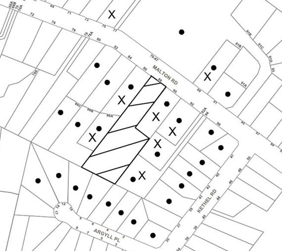
The proposed development was placed on public exhibition and was notified to adjoining and nearby landowners between 17 May 2018 and 7 June 2018 in accordance with the Notification and Exhibition requirements of the HDCP. During this period, Council received 24 submissions objecting to the development. The map below illustrates the location of those nearby landowners who made a submission that are in close proximity to the development site.
|
NOTIFICATION PLAN |
|
||
|
• PROPERTIES NOTIFIED
|
X SUBMISSIONS RECEIVED |
PROPERTY SUBJECT OF DEVELOPMENT |
|
|
16 SUBMISSIONS RECEIVED OUT OF MAP RANGE |
|||
The issues raised in the objections included:-
(a) bushfire protection concerns;
(b) tree removal;
(c) heritage considerations;
(d) non-compliance with building height;
(e) overshadowing of adjoining properties;
(f) overlooking/privacy impacts on adjoining properties;
(g) visual dominance;
(h) biodiversity impacts
(i) use of the right-of-carriageway;
(j) flooding risks for downstream properties;
(k) inconsistencies with approved subdivision;
(l) vehicle manoeuvring problems with Lot 3;
(m) DCP non-compliances;
(n) Inconsistencies with information provided with Development Application.
The merits of the matters raised in community submissions have been addressed in the body of the report.
5.2 Public Agencies
The development application was referred to the following public agency for comment:
5.2.1 Rural Fire Service
The site is bushfire prone. The application was referred to the NSW Rural Fire Service (RFS) for comments. Referral comments from RFS have not been received at the time this report was finalised. Notwithstanding, the Hornsby Shire Council Local Planning Panel can determine the Development Application as the proposal is not integrated development.
6. THE PUBLIC INTEREST
Section 4.15(1)(e) of the Act requires Council to consider “the public interest”.
The public interest is an overarching requirement, which includes the consideration of the matters discussed in this report. Implicit to the public interest is the achievement of future built outcomes adequately responding to and respecting the future desired outcomes expressed in environmental planning instruments and development control plans.
The application does not satisfy the built form outcomes envisaged under the HLEP and HDCP, as detailed herein, and approval of the application would not be in the public interest.
CONCLUSION
The development application for the proposed development is considered to be incomplete by the absence of owner’s consent from No.90 Malton Road, Beecroft to enable works, repairs and maintenance to be undertaken to the existing right-of-carriageway proposed to be used for vehicular access to the dwelling on Lot 3.
The non-compliance with the height of building standard for the dwelling on Lot 3 and the Clause 4.6 submission justifying a variation of the standard is not supported as it is not well-founded and there are insufficient environmental planning grounds to justify contravening of the height control.
The proposed development fails to satisfy numerous controls within the HDCP relating to setbacks, privacy, solar access, heritage and access and safe manoeuvring of vehicles entering and exiting Lot 3 in a forward direction.
The applicant has provided inadequate information to properly assess environmental, landscape and stormwater considerations.
Twenty four submissions have been received by Council objecting to the proposal.
The application is recommended for refusal.
Note: At the time of the completion of this planning report, no persons have made a Political Donations Disclosure Statement pursuant to Section 10.4 of the Environmental Planning and Assessment Act 1979 in respect of the subject planning application.
RESPONSIBLE OFFICER
The consultant responsible for the preparation of this report is Kerry Nash of KN Planning Pty Limited. Please contact Caroline Maeshian on 9847 6760.
|
Cassandra Williams Team Leader - Major Applications Planning Division |
Rod Pickles Manager - Development Assessment Planning Division |
|
1.⇨ |
Locality Plan |
|
|
|
2.⇨ |
Plans Architectural |
|
|
|
3.⇨ |
Landscape Plan |
|
|
|
4.⇨ |
Clause 4.6 Variation |
|
|
File Reference: DA/398/2018
Document Number: D07478041
SCHEDULE 1
1 The proposal contains insufficient information in respect to Clause 1(i) of Schedule 1 of the Environmental Planning and Assessment Regulation 2000 as consent from the owners of No. 90 Malton Road, Beecroft has not been provided for construction works within the right-of-carriageway.
2. The proposal is unsatisfactory in respect to Section 4.15(1)(a)(i) of the Environmental Planning and Assessment Act 1979 as the variation under Clause 4.6 of the Hornsby Local Environmental Plan 2013 does not demonstrate that there are sufficient environmental planning grounds to justify the contravention of the height of buildings development standard within Clause 4.3 of the Hornsby Local Environmental Plan 2013.
3. The proposal is unsatisfactory in respect to Section 4.15(1)(a)(i) of the Environmental Planning and Assessment Act 1979 as the development does not comply with Clause 5.10 Heritage Conservation of the Hornsby Local Environmental Plan 2013 which aims to conserve the environmental heritage of Hornsby.
4. The proposal is unsatisfactory in respect to Section 4.15(1)(a)(i) of the Environmental Planning and Assessment Act 1979 as the development fails comply with the provisions of Clause 6.2 Earthworks of the Hornsby Local Environmental Plan 2013.
5. The proposal is unsatisfactory in respect to the provisions of Section 4.15(1)(a)(iii) of the Environmental Planning and Assessment Act 1979, as the proposal does not comply with the requirements of the Hornsby Development Control Plan 2013 (HDCP) as outlined below:
a) The dwelling on Lot 3 does not comply with the building height control under 3.1.1 (a), exceeds the maximum cut and fill control and the floor level of the lowest residential storey exceeds the 1500mm above natural ground level under 3.1.1(b) of the HDCP.
b) The dwelling on Lot 2 contravenes the minimum side setback controls under 3.1.2 of the HDCP
c) The proposed principal private open space for the dwellings on Lots 2 and 3 fail to achieve 3 hours of unobstructed sunlight access under 3.1.5(a) of the HDCP.
d) The proposed dwellings do not comply with the privacy and solar access controls under 3.1.6 of the HDCP, in that proposed development is likely to introduce adverse amenity impacts on the adjoining residences at 86A, 92A and 94 Malton Road, Beecroft in terms of overlooking, overshadowing and visual dominance.
e) The proposed driveway to Lot 3 via the right of carriageway over No. 90 Malton Road, Beecroft has inadequate area adjacent to the proposed double garage to enable safe manoeuvring in order for vehicles to enter and leave the site in a forward direction.
f) The proposed contemporary design of the two dwellings is not compatible with the heritage values for the Beecroft-Cheltenham Heritage Conservation Area set out in Part 9.3.6 of the HDCP.
6. Pursuant to Section 4.15(1) (e) of the Environmental Planning and Assessment Act 1979, the development is considered not to be in the public interest.
7. The proposal is unsatisfactory as insufficient information has been submitted to allow proper assessment of the application, as follows:
a) Insufficient information has been provided to determine the heritage impacts of the new dwellings on the surrounding streets, including Argyll Place.
b) To compensate for the tree removal for the two new dwellings, details of additional tree planting of native trees on a revised landscape plan have not been provided.
c) There is insufficient information to make an appropriate assessment of the potential tree impacts.
d) Sufficient information has not been provided on the proposed landscape plan.
e) Insufficient survey information has been provided and there are inconsistencies between the Landscape Plan and the Stormwater Management Plans provided by CRISP Consulting.
f) An updated Flora and Fauna Assessment to reflect the changes proposed with additional tree removals on Lots 2 and 3 has not been provided.
g) There is inadequate information relating to storm water management on Lots 2 and 3.
- END OF REASONS FOR REFUSAL -
LPP Report No. LPP30/18
Local Planning Panel
Date of Meeting: 22/08/2018
2 DEVELOPMENT APPLICATION - TORRENS TITLE SUBDIVISION OF ONE LOT INTO TWO AND DEMOLITION OF A DECK - 101 - 103 WONGALA CRESCENT, PENNANT HILLS
EXECUTIVE SUMMARY
|
DA No: |
DA/1202/2017 (Lodged 1/1/2017) |
|
Description: |
Torrens title subdivision of one lot into two and demolition of a deck. |
|
Property: |
Lot 15 DP 10463, Nos. 101 - 103 Wongala Crescent, Pennant Hills |
|
Applicant: |
Mr Jeremy Lung |
|
Owner: |
Mr Jeremy Lung and Ms Megan Neumann |
|
Estimated Value: |
$50,000 |
|
Ward: |
C |
· The application involves the Torrens title subdivision of one lot into two lots and demolition of a deck.
· The proposed residential subdivision is inconsistent with the provisions and objectives of the Hornsby Local Environmental Plan 2013 for land zoned R2 Low Density Residential.
· The proposal does not meet the prescriptive measures of the Hornsby Development Control 2013 for urban subdivision, accessway design, tree and vegetation preservation, biodiversity and heritage.
· 12 submissions have been received in respect of the application.
· The application is required to be determined by the Hornsby Shire Council Local Planning Panel as 10 or more unique submissions were received by way of objection.
· It is recommended that the application be refused.
|
THAT Development Application No. DA/1202/2017 for Torrens title subdivision of one lot into two and demolition of a deck at Lot 15 DP 10463, Nos.101 - 103 Wongala Crescent, Pennant Hills be refused subject to the reasons for refusal detailed in Schedule 1 of Report No.LPP30/18 |
BACKGROUND
On 22 February 2017, a pre-lodgement meeting was held at Council to discuss a proposal for subdivision and construction of a new dwelling. Written advice was provided to the applicant on 7 April 2017.
On 1 November 2017, the subject application DA/1202/2017 was lodged at Council for the Torrens title subdivision of one lot into two and demolition of a deck.
On 27 November 2017, Council requested a 7-day speed survey along the frontage of Wongala Crescent. The information was requested by Council due to potential vehicle safety concerns as a result of modifying the safety guard rail along Wongala Crescent and a natural depression in the road.
On 10 January 2018, the applicant submitted a speed survey and Traffic Impact Assessment to Council for review. Council was satisfied that, subject to compliance with conditions the proposal would be acceptable on traffic safety grounds.
On 12 February 2018, Council wrote to the applicant raising concerns over the channelisation of the drainage line, changing soil moisture levels for trees and vegetation, and biodiversity on the site. The applicant requested a meeting with Council officers to discuss these issues in detail.
On 21 March 2018, a meeting was held with Council staff, the applicant and accompanying specialists to discuss Council’s concerns regarding tree and biodiversity protection, engineering issues regarding flooding and accessway design and heritage.
On 25 May 2018, the applicant submitted additional information in response to the issues raised at the meeting regarding flooding and accessway design, tree protection and biodiversity. The applicant submitted a letter of response addressing maintenance of soil around retained trees, an assessment of significance, amended engineering plans showing additional pre and post development flood modelling and details of the earthworks surrounding the drainage channel.
On 29 May 2018 Council’s engineer requested further information with regard to the design of the suspended driveway and internal vehicular turning arrangement over proposed Lot 151.
On 21 June 2018, the applicant submitted a Heritage Impact Statement.
SITE
The 1446m2 site is located on the northern side of Wongala Crescent and contains a one and two storey split level dwelling on the site.
The site experiences a fall of 6 metres to southern, front boundary of Wongala Crescent and has a natural depression through the middle of the site.
The site contains an existing drainage channel through the middle of the site which is not identified as a natural watercourse by NSW Department of Primary Industries. The intermittent drainage line discharges stormwater to a pipe and headwall directing flow under Wongala Crescent then into Blyes Creek. The site is identified as flood prone land. .
The site is heavily vegetated with numerous mature trees across the western half of the site. Trees on the site comprise mostly locally-indigenous species.
The site contains a Critically Endangered Ecological vegetation community, Blue Gum High Forest (BGHF).
The site is located within 100 metres of the Byles Creek bushland reserve and is bushfire prone.
The site is adjacent to the Northern Railway line on the southern side of Wongala Crescent.
The site is located within the Beecroft North Precinct of the Beecroft/Cheltenham Heritage Conservation Area listed under Schedule 5 (Environmental Heritage) of the Hornsby Local Environmental Plan 2013 (HLEP). The property is also located in the immediate vicinity of Heritage Item No. 688, a remnant section of indigenous Bushland located within the roadside of Wongola Crescent, Pennant Hills.
The site is not burdened or benefitted by any easements or restrictions on the title of the land.
PROPOSAL
The development application proposes the Torrens title subdivision of one lot into two and demolition of a deck and associated works. The application comprises the following:
· Subdivision of one lot into two allotments:
o Proposed Lot 152 would be 809m2 in area and accommodate the existing dwelling with existing vehicular access from Wongala Crescent;
o Proposed Lot 151 would be a vacant allotment and 637m2 in area. The lot would have direct vehicular access via a new driveway from Wongala Crescent.
· Construction of a suspended driveway giving access to Lot 151 from Wongala Crescent;
· Demolition of the existing deck attached to the western side of the existing dwelling to accommodate the subdivision.
· Road and guardrail works along Wongala Crescent which includes removing part of the existing guard rail to create a gap for the driveway entrance to proposed Lot 151.
· Flood mitigation and drainage earthworks along the drainage channel within proposed Lot 151.
Four trees would be removed to accommodate the drainage channel works and construction of the driveway.
ASSESSMENT
The development application has been assessed having regard to the Greater Sydney Region Plan - A Metropolis of Three Cities, the North District Plan and the matters for consideration prescribed under Section 4.15 of the Environmental Planning and Assessment Act 1979 (the Act). The following issues have been identified for further consideration.
1. STRATEGIC CONTEXT
1.1 Greater Sydney Region Plan - A Metropolis of Three Cities and North District Plan
The Greater Sydney Region Plan - A Metropolis of Three Cities has been prepared by the NSW State Government to guide land use planning decisions for the next 40 years (to 2056). The Plan sets a strategy and actions for accommodating Sydney’s future population growth and identifies dwelling targets to ensure supply meets demand. The Plan also identifies that the most suitable areas for new housing are in locations close to jobs, public transport, community facilities and services.
The NSW Government will use the subregional planning process to define objectives and set goals for job creation, housing supply and choice in each subregion. Hornsby Shire has been grouped with Hunters Hill, Ku-ring-gai, Lane Cove, Mosman, North Sydney, Ryde, Northern Beaches and Willoughby to form the North District. The Greater Sydney Commission has released the North District Plan which includes priorities and actions for Northern District for the next 20 years. The identified challenge for Hornsby Shire will be to provide an additional 4,350 dwellings by 2021 with further strategic supply targets to be identified to deliver 97,000 additional dwellings in the North District by 2036.
While the proposed development would not provide for an additional residential allotment the proposal would not be consistent with the Planning Priority N16 of the North District Plan to protect and enhance bushland and biodiversity as the development would result in a loss of critically endangered vegetation, Bluegum High Forest.
2. STATUTORY CONTROLS
Section 4.15(1)(a) requires Council to consider “any relevant environmental planning instruments, draft environmental planning instruments, development control plans, planning agreements and regulations”.
2.1 Hornsby Local Environmental Plan 2013
The proposed development has been assessed having regard to the provisions of the Hornsby Local Environmental Plan 2013 (HLEP).
2.1.1 Zoning of Land and Permissibility
The subject land is zoned R2 Low Density Residential under the HLEP. The objectives of the zone are:
· To provide for the housing needs of the community within a low density residential environment.
· To enable other land uses that provide facilities or services to meet the day to day needs of residents.
The proposed development is defined as “subdivision” and is permissible in the zone with Council’s consent.
The proposal fails to satisfy the objectives of the zone. Whilst the proposed development would provide for an additional lot and future dwelling on site, there would be adverse impacts on the environment and residential amenity of the locality.
The applicant has failed to demonstrate that a future dwelling could be built on the proposed vacant allotment that complies with vehicular access and tree and vegetation preservation requirements of the HDCP.
2.1.2 Minimum Lot Size
Clause 4.1 of the HLEP provides that the minimum allotment size for the subject site within the R2 Low Density Residential zone is 600m2. The proposal complies with this provision.
Proposed Lots 151 would have an area of 637m2 and proposed Lot 152 would have an area for 809m2, which would comply with the minimum lot size requirement under the HLEP.
2.1.3 Heritage Conservation
Clause 5.10 of the HLEP sets out heritage conservation provisions for Hornsby Shire.
The site does not include a heritage item; however, it is located in a heritage conservation area. The property is located within the Beecroft North Precinct of the Beecroft/Cheltenham Heritage Conservation Area listed under Schedule 5 (Environmental Heritage) of the Hornsby Local Environmental Plan 2013 (HLEP).
The property is also located in the immediate vicinity of Heritage Item No. 688, a remnant section of indigenous Bushland located within the roadside of Wongala Crescent, Pennant Hills.
Council’s heritage assessment was undertaken in accordance with Part 9 – Heritage within the Hornsby Development Control Plan 2013 (HDCP). Council notes the following with respect to the proposal:
The additional information contained within the Heritage Impact Statement does not adequately address or rectify the heritage concerns raised.
The indicative building envelope could lead to a garage that would dominate the street elevation of any future building façade and permit an excessive driveway and hard stand area within the front landscape setback.
The Heritage Impact Statement has provided examples of neighbouring houses with garages at street level, but fails to identify that they do not extend over 50% of the front façade or contain a driveway and hardstand area covering over 50% of the front garden landscape. To permit the proposed suspended driveway, guard rail safety measures are required to extend into the front landscape setback of the already compromised front garden landscape.
Overall, the proposal retains an undesirable impact on the visual setting of the conservation area, the character of the built form and its dominant influence of generous garden landscapes which are prominent in the character of the local area.
In summary, the proposed subdivision would have a detrimental impact on the built character of the Beecroft/Cheltenham Heritage Conservation Area.
The proposed subdivision in its current form would have detrimental impacts on the streetscape character of the HCA by virtue of a restricted and narrow building envelope at the street front which could lead to an uncharacteristic placement of a garage and driveway.
Insufficient information has been provided with regard to the appearance of the suspended driveway and future garage on the streetscape. There is also a lack of information on the impacts of the driveway and guardrail works on the heritage listed bushland identified as item No.688 along Wongala Crescent.
Council’s heritage assessment concludes that the proposed subdivision would have a negative impact on the character of the heritage conservation area and setting of the heritage listed bushland within Wongala Crescent.
2.1.4 Earthworks
Clause 6.2 of the HLEP states that consent is required for proposed earthworks on site. Before granting consent for earthworks, Council is required to assess the impacts of the works on adjoining properties, drainage patterns and soil stability of the locality.
Channelisation of the Drainage Line
The proposed formalisation of the drainage channel would involve the construction of a 2 metre wide channel that would vary in depth due to the variation in soil levels along the existing drainage line. The maximum height of the proposed retaining walls to run along either side of the drainage line would reach a maximum height of 1.2 metres. In order to achieve this there would be maximum excavation of 1.2 metres.
There is also a lack of information regarding the type of soil that exists along the channel interface and the existence of rock beneath the topsoil is unknown.
A Geotechnical report was not provided with the application. As such there is insufficient information with respect to the impact of these earthworks on the structural stability of the existing dwelling located at proposed Lot 152 and the extent of these works on existing trees at the rear of the site to be retained.
Driveway
The proposed driveway would be laid on grade along the northern and western sides of the driveway and partially suspended above ground on the northern side using piers. In order to limit potential impacts of water flow through the soil, drainage patterns and impacts on tree 3; the driveway slab would be designed and constructed above existing ground level to avoid earthworks in this location. The construction of piers would require minor excavation in the location of the piers.
On-Site detention
The proposed on-site detention (OSD) basin is to be constructed partly below existing ground, underneath the suspended slab of the driveway.
The OSD system is proposed to be 5 cubic metres in size and be constructed underneath the proposed slab and entrance into the garage. In order to achieve an accessible depth of 1 metre, part of the OSD tank will be constructed below the existing natural levels. This would result in an incursion into the Tree Protection Zone (TPZ) of tree 3 to be retained. Council also anticipates that the OSD would have impact on the flow of water through the topsoil.
In terms of soil stability Council has determined that the OSD would not adversely impact adjoining neighbours or existing soil stability.
Council’s assessment of the proposed works and excavation concludes that there is a lack of information to adequately assess the structural stability of the land, proposed channelisation of the drainage line and works involved in the suspended driveway.
2.1.5 Terrestrial Biodiversity
The subject site is identified as “Biodiversity” on the HLEP Terrestrial Biodiversity Map. Whilst only a small portion of the rear boundary is identified to include Terrestrial Biodiversity, Clause 6.4 of the HLEP would still apply to the development.
The objective of Clause 6.4 of the HLEP is to maintain terrestrial biodiversity by:
· protecting native fauna and flora,
· protecting the ecological processes necessary for their continued existence, and
· encouraging the conservation and recovery of native fauna and flora and their habitats.
Before determining a development application for development on land to which this clause applies, the consent authority must consider:
(a) whether the development is likely to have:
i) any adverse impact on the condition, ecological value and significance of the fauna and flora on the land, and
ii) any adverse impact on the importance of the vegetation on the land to the habitat and survival of native fauna, and
iii) any potential to fragment, disturb or diminish the biodiversity structure, function and composition of the land, and
iv) any adverse impact on the habitat elements providing connectivity on the land, and
(b) any appropriate measures proposed to avoid, minimise or mitigate the impacts of the development.
Additionally, development consent must not be granted to development on land to which this clause applies, unless the consent authority is satisfied that:
(a) the development is designed, sited and will be managed to avoid any significant adverse environmental impact, or
(b) if that impact cannot be reasonably avoided by adopting feasible alternatives—the development is designed, sited and will be managed to minimise that impact, or
(c) if that impact cannot be minimised—the development will be managed to mitigate that impact.
The application was accompanied by an Assessment of Significance prepared by Cumberland Ecology, dated 25 May 2018. This report details the impacts of the proposal on the critically endangered Blue Gum High Forest located on the site and adjoining properties.
The report states that “…BGHF is a critically endangered ecological community, and is greatly at risk from development in general”. The NSW Scientific Committee have identified small-scale clearing associated with residential subdivision as posing a threat of ongoing decline in the extent of this community. While it is determined that 4 trees will be removed as a result of this application consideration has not been given to the indirect and cumulative impacts of development
Further, the report does not take into consideration the additional environmental impacts as a consequence of construction a dwelling house and establishing an Asset Protection Zone (APZ) in accordance with the requirements of the NSW Rural Fire Service.
As the immediate and long term effects of tree, vegetation and habitat removal have not been adequately quantified, a detailed assessment in accordance with the requirements of Clause 6.4 cannot be undertaken.
2.2 State Environmental Planning Policy No. 55 – Remediation of Land
The application has been assessed against the requirements of State Environmental Planning Policy No. 55 – Remediation of Land under which consent must not be granted to the carrying out of any development on land unless the consent authority has considered whether the land is contaminated or requires remediation for the proposed use.
A search of Council records including aerial photographs reveals that the property has been used exclusively for residential purposes with no record of site contamination.
No further assessment is warranted in this regard.
2.3 State Environmental Planning Policy (Vegetation in Non-Rural Areas) 2017
State Environmental Planning Policy (Vegetation in Non-Rural Areas) 2017 (Vegetation SEPP) commenced 25 August 2017 and aims to protect the biodiversity and amenity values of trees within non-rural areas of the state.
Part 3 of the Vegetation SEPP states that a development control plan may make a declaration in any manner relating to species, size, location and presence of vegetation. Accordingly, Part 1B.6.1 of the Hornsby Development Control Plan 2013 (HDCP) prescribes works that can be undertaken with or without consent to trees.
Part 3.1.1 and 3.1.2 of this report provides an assessment in accordance with Part 1B.6.1 of the HDCP.
2.4 Sydney Regional Environmental Plan (Sydney Harbour Catchment) 2005
The application has been assessed against the requirements of Sydney Regional Environmental Plan (Sydney Harbour Catchment) 2005. This Policy provides general planning considerations and strategies to ensure that the catchment, foreshores, waterways and islands of Sydney Harbour are recognised, protected, enhanced and maintained.
Subject to the installation and maintenance of sediment and erosion control measures and stormwater management to protect water quality, impacts on the water quality of the Sydney Harbour Catchment during construction can be minimised.
2.5 Rural Fires Act 1997
The proposed development is within a bushfire prone area and is subject to the approval of the NSW Rural Fire Service (RFS) for the issue of a Bushfire Safety Authority pursuant to Section 100B of the Rural Fire Act 1997.
The proposal involves the creation of an Asset Protection Zone (APZ) for Bush Fire Protection, is to be placed on proposed Lot 151 within the subdivision requiring an 8 metre wide APZ from the northern boundary of the lot. The RFS also recommended that the construction of buildings other than Class 10b structures shall be prohibited in the APZ.
The standards for an Inner Protection Area (IPA) provides that there should not be a continuous tree canopy between the hazard and the house and tree crowns should be separated by two to five metres. Planning for Bushfire Protection (PBP) 2006 also states that an IPA must have a tree canopy cover of less than 15%. As such, pruning and removal of trees is also likely to be required to achieve compliance with APZ requirements.
With respect to the existing dwelling on proposed Lot 152, the RFS recommend that the dwelling be upgraded to improve ember protection.
Subject to compliance with RFS conditions the proposal is considered satisfactory in this regard, however this would result in detrimental impacts on the natural environment.
2.6 Section 3.42 Environmental Planning and Assessment Act, 1979 - Purpose and Status of Development Control Plans
In accordance with Section 3.42 of the Environmental Planning and Assessment Act, 1979 a DCP provision will have no effect if it prevents or unreasonably restricts development that is otherwise permitted and complies with the development standards in relevant Local Environmental Plans and State Environmental Planning Policies.
The principal purpose of a development control plan is to provide guidance on the aims of any environmental planning instrument that applies to the development; facilitate development that is permissible under any such instrument; and achieve the objectives of land zones. The provisions contained in a DCP are not statutory requirements and are for guidance purposes only. Consent authorities have flexibility to consider innovative solutions when assessing development proposals, to assist achieve good planning outcomes.
2.7 Hornsby Development Control Plan 2013
The proposed development has been assessed having regard to the relevant desired outcomes and prescriptive requirements within the Hornsby Development Control Plan 2013 (HDCP). The following table sets out the proposal’s compliance with the prescriptive requirements of the Plan:
|
HDCP – Part 6 – Subdivision |
|||
|
Control |
Proposal |
Requirement |
Complies |
|
Lot Size |
|
|
|
|
- Lot 151 |
637m2 |
600m2 |
Yes |
|
- Lot 152 |
809m2 |
600m2 |
Yes |
|
Minimum Lot Width |
|
|
|
|
- Lot 151 |
13.2m |
15m |
No |
|
- Lot 152 |
17.3m |
15m |
Yes |
|
Indicative Setbacks Lot 151 |
|
|
|
|
- Front |
10.2m |
6m |
Yes |
|
- Side (east) |
2.2m |
0.9m |
Yes |
|
- Side (west) |
0.9m |
0.9m
|
Yes |
|
- Rear -
|
11m |
5m |
Yes
|
|
Indicative Setbacks Lot 152 |
|
|
|
|
- Front |
14.3m |
6m |
Yes |
|
- Side (north) |
1.2m |
0.9m |
Yes |
|
- Side (south) |
0.9m |
0.9m
|
Yes |
|
- Rear -
|
14.1m |
5m |
Yes
|
|
Potential Landscaped Area |
|
|
|
|
- Lot 151 |
46% (295m2) |
30% (180m2) |
Yes |
|
- Lot 152 |
65% (529m2) |
30% (180m2) |
Yes |
|
Potential Private Open Space |
|
|
|
|
- Lot 151 |
24m2 (min width 4m) |
24m2 (min width 3m) |
Yes |
|
- Lot 152 |
65% (529m2) |
24m2 (min width 3m) |
Yes |
|
Car Parking |
2 spaces |
2 spaces |
Yes |
As detailed in the above table, the proposed development does not comply with a number of prescriptive requirements within the HDCP. The matters of non-compliance are detailed below, as well as a brief discussion on compliance with relevant desired outcomes.
2.7.1 Residential Lands Subdivision
Whilst the proposed lots meet the HDCP minimum lot size area requirement of 600m2 and are a rectangular in shape, proposed Lot 151 would not meet the minimum lot width requirement of 15 metres.
The site is characterised by a number of large significant trees and a drainage channel that runs through the middle of the site. The existing dwelling is proposed to be retaining on proposed Lot 152 which requires adequate side setbacks resulting in a larger lot width of 17.3 metres at the frontage.
As a result, Lot 151 is restricted to a lot width of 13.2 metres which does not comply with the HDCP. Whilst a 200m2 building envelope has been demonstrated on Lot 151, the presence of the drainage channel and overland flow path limits car parking to within the front setback and in front of the building line.
The proposed lot design would be inconsistent with the pattern of adjoining residential lots and, given the site constraints, development inconsistent with the residential character of the area.
2.7.2 Accessway Design
The proposal involves the construction of an accessway to Lot 151 which would include partial demolition of the guardrail along Wongala Crescent and the construction of an internal driveway suspended by piers. As the driveway is suspended above ground there would be a protective guardrail proposed on either side.
Concerns were raised in the submissions with regard to the proposed driveway access to Lot 151 and vehicle safety entering and exiting site.
Part 1C.2.1 and Part 6.4.1 of the HDCP requires accessway and turning paths to be designed in accordance with the Australian Standard, AS 2890.1 and AS 2890.2.
Council has determined that the proposed turning bay would not allow for two standard vehicles to enter and exit the site in a forward direction. The design of the turning area and the proposed car safety barriers would constrain the turning ability of vehicles which would likely result in vehicles reversing onto Wongala Crescent.
The manoeuvring of vehicles within the site is not “simple, safe and direct” as required under Part 1C.2.1 (c) and cannot be supported.
The proposed accessway design and turning area would not comply with the design requirements under HDCP and design standards in accordance with AS 2890.1 and AS 2890.2.
Part 3.2.2 provides an assessment with regards to Traffic and Vehicle Safety.
2.7.3 Heritage
The proposal is inconsistent with the desired outcomes and requirements under the HDCP with regards to Part 9 Heritage Conservation Area and Heritage Item in the Vicinity. Refer to section 2.1.3 of this report.
2.8 Section 7.11 Contributions Plans
Hornsby Shire Council Section 94 Contributions Plan 2014-2024 applies to the development as it would result in the creation of one additional allotment. Should the application be approved a condition would be required for the payment of a monetary Section 7.11 contribution in accordance with Council’s Plan.
3. ENVIRONMENTAL IMPACTS
Section 4.15(1)(b) of the Act requires Council to consider “the likely impacts of that development, including environmental impacts on both the natural and built environments, and social and economic impacts in the locality”.
3.1 Natural Environment
3.1.1 Tree and Vegetation Preservation
Concerns were raised in submissions over the detrimental impacts of development on protected trees and vegetation on the site.
A total of 22 trees were assessed on the site. Trees numbered 2, 3, 4, 13, 15, and 19 satisfy Council’s criteria for being individually significant species and are also identified as a ‘significant group’. The proposed development would necessitate the removal of approximately 4 trees from the site in order to accommodate works involving the channelisation of the drainage line and construction of the driveway.
The application has been accompanied by a Tree report prepared by Stuart Pittendrigh, dated October 2017. The Tree report has provided sufficient information to confirm that it would be feasible to construct a future dwelling and driveway using piers and suspended slabs consistent with sensitive methods of construction as prescribed in AS 4970-2009 Protection of trees on development sites.
However, there are concerns raised to the detrimental changes in hydrology and soil moisture levels associated with the channelisation of the drainage channel and the long term impacts of these works on trees to be retained.
Channelisation of the Drainage Line
The channelisation of the drainage line will have impacts on the movement and availability of water which in turn will have a negative impact on tree health. The formalisation of the embankments and channel would require excavation and construction having a direct impact on Trees 5, 6, 21 and 20.
Water modelling indicates that post development flow velocity through the channel would increase when compared to existing velocity (PS05-K110, Rev A & PS05-K210, Rev A); this increase in flow velocity, for 1 in 100 year conditions would have an associated reduction in residence time in the upper reach of the drainage channel altering potential for recharging of groundwater across the site.
The reduced potential for recharge in the upper part of the channel and potentially increasing it in the lowest part of the channel, changes the distribution of soil moisture content and hence the availability of soil moisture for the remnant trees. This will then increase drought like conditions and exacerbate any period of drought which may occur; whilst these species are adapted to surviving periods of drought often it results in reduced health, resistance to pest and disease and shedding of limbs.
Increased water velocity is also likely to impact on several trees including Tree 3 (Eucalyptus pilularis), Tree 4 (Eucalyptus saligna) and Tree 6 (Angophora costata). While the modelling indicates that flow velocity adjacent to trees 4 and 6 would be similar both pre and post-development it should be noted that the modelling relies on water backing up from the drainage pipe under Wongala Crescent to slow flows out of the channel. The transferral of energy into the pooled water is likely to dissipate through the creation of turbulence and eddy currents increasing the erosive potential of the water around the base of these trees. It should also be noted that during more regular rain conditions (1 in 2 or 5 years) that this ‘pooling’ effect would not occur and the dissipation of energy from water leaving the channel will likely be transferred into the eastern bank adjacent to Tree 4. This has potential to scour soil and compromise the root plate of this tree.
Council also considers the cumulative impacts of this proposed subdivision and the future potential dwelling, associated services and works necessary to comply with RFS requirements in relation to Planning for Bushfires will have a negative impact on the trees.
The trees onsite are identified as protected significant trees which form part of an endangered vegetation community and are in good condition with high SULE rating and worthy of retention.
Council considers that the outcomes of this proposal are inconsistent with the requirements under the HDCP and HLEP which aims to ensure development explores all options to avoid, minimise and mitigate impacts to trees.
3.1.2 Biodiversity
Submissions raised concerns over the detrimental impacts on existing flora and fauna as a result of the proposed subdivision.
The site contains Blue Gum High Forest (BGHF) which is listed as Critically Endangered under the Commonwealth Environment Protection and Biodiversity Conservation Act 1995 and a Critically Endangered Ecological Community under the NSW Biodiversity Conservation Act 2016. BGHF species on the site include Smooth-barked Apple (Angophora costata), Blackbutt (Eucalyptus pilularis), Sydney Blue Gum (E. saligna), Grey Ironbark (E. paniculata) and Grey Myrtle (Backhousia myrtifolia).
An Assessment of Significance was prepared by Cumberland Ecology, dated 25 May 2018 that demonstrated the impact of the development on the BGHF community.
The channelisation of the drainage channel would have numerous impacts on several ecological factors. The formalisation of the embankments and channel bed will require excavation and construction having a direct impact on flora and fauna within and adjacent to the drainage line.
The removal of snags, riffles and other features within the drainage channel reduces potential habitat for local flora and fauna. No aquatic assessment of the drainage channel has been undertaken. It is likely that the drainage channel supports a diverse array of local fauna (including frogs and benthic macroinvertebrates) and flora (including algae and grasses) which will all be removed or impacted upon by the proposed works.
The Bushfire Hazard Assessment Report (Building Code & Bushfire Hazard Solutions Pty Limited, dated 30th October 2017) notes the site is mapped as bushfire prone lands and future development will require compliance with Planning for Bushfire Protection. In accordance with PBP the applicant is required to demonstrate that a future dwelling on the subdivided land can meet the APZ requirements for compliance with BAL 29 construction standards. The report states that an appropriate APZ can be provided and that the entire property would be required to comply with the RFS document Standards for Asset Protection Zones, specifically related to the requirements for an Inner Protection Area. The standards for an IPA include that there should not be a continuous tree canopy between the hazard and the house and tree crowns should be separated by 2m to 5m. PBP also states that an IPA must have a tree canopy cover of less than 15%.
The placement of a dwelling and associated open space and the parking of cars underneath the canopy of mature trees will require ongoing management of deadwood and pruning of trees on the site and potentially on adjoining properties. Pruning and removal of trees is also likely to be required to achieve compliance with APZ requirements and to gain suitable solar access.
Despite the use of piers, for the driveway and tree sensitive construction proposed for the dwelling, the construction of a dwelling and driveway on the site would still have an impact on these trees. Excavation and compaction of soil during construction and changes to surface water and soil moisture content due to increased impermeable surfaces post construction will affect the viability of trees and ecosystem services within the forest.
The site may also support several threatened species identified in the NSW Wildlife Atlas including Grey-headed Flying-fox, Swift Parrot and Powerful Owl previously recorded in the vicinity of the site. There is also a record of Gang-gang Cockatoo of which the endangered Hornsby-Ku-ring-gai population encompasses the subject property. There are several hollow bearing trees on the site which may support current and future hollow dependent species. However no ecological assessment has been provided assessing impacts on threatened species, populations and ecological communities. As a result there is insufficient information for Council to assess the potential impacts of development on fauna.
The proposed development is not consistent with the objectives of the NSW Biodiversity Conservation Act, and would result in the following threatening processes:
· Alteration to natural flow regimes of rivers and streams and their floodplains and wetlands
· Clearing of native vegetation
· Loss of hollow bearing trees
· Removal of deadwood and dead trees
The proposal is found to be inconsistent with the desired outcomes and requirement under Part 1C.1.1 Biodiversity of the HDCP and is considered unacceptable.
3.1.3 Flooding
Concerns were raised in submissions regarding the potential flooding impacts of the proposed development and channelisation of the drainage line.
The site is identified as a flood control lot that features an overland path through the middle where the natural depression occurs. The lot is considered to have a larger area than many other lots in the vicinity due to environmental constraints extending to the 1 in 100 year average recurrence interval (ARI) storm flow.
The proposed accessway is in close proximity to the drainage channel and requires significant structural design and construction work, including changes to natural ground levels. As a result the garage and driveway would be constructed above existing ground level to limit impact on the natural water flow through the site.
Amended Stormwater and Flood Plans were submitted on 28 May 2018 that achieved a solution to convey the 100 year ARI storm through the site in a safe manner.
Council’s engineering assessment concludes that the depth of water in the vehicle crossover area near Wongala Crescent would allow for safe access to and from the site by vehicles.
Whilst the proposal has demonstrated it could achieve compliance with desired outcomes of Part 1C.3.2 Flooding, changing the movement of water and channelisation of the drainage line would lead to detrimental impact on growing conditions for trees and vegetation on site.
3.1.4 Stormwater Management
Concerns were raised in submissions regarding the stormwater management of the site.
The formalisation of the drainage channel would provide adequate stormwater drainage through to the property and out to Wongala Crescent.
The proposal is consistent with the desired outcomes of Part 1C.1.2 Stormwater Management and is considered acceptable.
3.2 Built Environment
3.2.1 Built Form
The proposed subdivision is inconsistent with the pattern of residential subdivision in the locality and would result in a future built form inconsistent with the character of the area given the width of proposed lot 151 and the dominance of the paved driveway and turning area in the streetscape.
3.2.2 Traffic
The site is located at the base of a ‘dip’ on Wongala Crescent. The site has an existing guard rail barrier along the road frontage.
A Speed Survey prepared by Trans Traffic and Survey and a Review of Road Use Safety Implications (RRUSI) prepared by Winning Traffic Solutions was submitted with the application.
The speed survey shows 85% of vehicles are travelling westbound at approximately 55 km/h. This is 5km/h over the posted speed limit of 50km/h and as a result, Council supports the RRUSI recommendation which states:
Safety in approach to the proposed driveway would be enhanced with the provision of traffic calming. For example the provision of “speed humps” on both approaches at the start of the dip and adjacent to the current street lights would slow traffic in the immediate vicinity of the driveway and lessen the potential for a vehicle to enter the gap in or impact the guardrail end terminals. The design and location of “speed humps” (if employed) should be designed to Council requirements.
The construction of speed humps in Wongala Crescent would need to be approved by the Local Traffic Committee prior to determination of the development application to ensure that traffic safety is not compromised in this location.
3.3 Social Impacts
The proposed subdivision would not provide additional housing opportunities that would be suitable in the locality.
3.4 Economic Impacts
The proposal would not have a positive impact on the local economy as the site is not capable of accommodating an additional dwelling.
4. SITE SUITABILITY
Section 4.15(1)(c) of the Act requires Council to consider “the suitability of the site for the development”.
The subject site is bushfire prone and flood prone and features critically endangered tree and vegetation communities. The site is considered to be constrained in accommodating the proposed development due to the need to protect significant trees, vegetation and biodiversity whilst provide bushfire protection measures with regard to the natural environment.
5. PUBLIC PARTICIPATION
Section 4.15(1)(d) of the Act requires Council to consider “any submissions made in accordance with this Act”.
5.1 Community Consultation
The proposed development was placed on public exhibition and was notified to adjoining and nearby landowners between 16 November 2017 and 16 December 2017 in accordance with the Notification and Exhibition requirements of the HDCP. During this period, Council received twelve submissions. The map below illustrates the location of those nearby landowners who made a submission that are in close proximity to the development site.

|
NOTIFICATION PLAN |
|||
|
• PROPERTIES NOTIFIED
|
X SUBMISSIONS RECEIVED |
PROPERTY SUBJECT OF DEVELOPMENT |
|
|
3 submission received out of map range |
|||
Twelve submissions objected to the development, generally on the grounds that the development would result in:
5.1.1 Loss of Trees, Biodiversity and Habitat
The submissions raised concerns the proposed loss of trees and vegetation would result in unacceptable impacts on biodiversity and natural habitat. A submission raised specific concern over the Gang-gang cockatoo species previously found on the subject site.
The proposed subdivision would result in removal of trees, modifying the drainage channel and long term impacts to threatened species and potential loss of habitat. Insufficient information has been submitted regarding fauna species and habitat loss within the submitted Assessment of Significance.
The matter has been discussed in detail at Section 3.1.2 and 3.1.3 of the report.
5.1.2 Loss Visual Quality
The submissions raised concerns the proposed removal of significant and mature trees would detract from the visual quality and residential amenity of the area.
The proposal would have detrimental impacts on the existing natural landscape which in turn would not be consistent with the heritage character of the Beecroft-Cheltenham Conservation Area.
This matter has been addressed in Section 2.1.3 and Section 3.1.1 of the report.
5.1.3 Residential Character and Amenity
The submissions raised concerns the proposed lot width and layout would be inconsistent with the residential character of the area and impact on residential amenity.
The proposed subdivision would be inconsistent with the character of the area as discussed in Section 2.7.1 of the report.
5.1.4 Devaluation of adjoining properties;
The submissions raised concerns over the devaluation of neighbouring properties as a result of the development.
This is not a matter for consideration under the Section 4.15 of the Environmental Planning and Assessment Act 1979.
5.2 Public Agencies
The development application was referred to any Public Agencies for comment.
5.2.1 NSW Rural Fire Service
The integrated development application was referred to the NSW Rural Fire Service pursuant to Section 100B of the Rural Fires Act 1997.
As discussed in Section 2.5 the Rural Fire Service has provided General Terms of Approval if this application was to be approved.
6. THE PUBLIC INTEREST
Section 4.15(1)(e) of the Act requires Council to consider “the public interest”.
The public interest is an overarching requirement, which includes the consideration of the matters discussed in this report. Implicit to the public interest is the achievement of future built outcomes adequately responding to and respecting the future desired outcomes expressed in environmental planning instruments and development control plans.
The proposed residential subdivision is contrary to Council’s planning controls and would result in development that would have a negative impact on the community.
Accordingly, it is considered that the proposed development would not be in the public interest.
CONCLUSION
The proposal is for the Torrens title subdivision of one lot into two, demolition of the existing deck and associated works.
The proposal would result in unacceptable impacts on trees, biodiversity and habitat for threatened species, heritage and traffic safety.
The proposed subdivision lot width and accessway design is unsatisfactory in respect to the prescriptive measures for residential subdivision in accordance with HDCP.
Twelve submissions have been received by Council objecting to the proposal.
The application is recommended for refusal.
Note: At the time of the completion of this planning report, no persons have made a Political Donations Disclosure Statement pursuant to Section 10.4 of the Environmental Planning and Assessment Act 1979 in respect of the subject planning application.
RESPONSIBLE OFFICER
The officer responsible for the preparation of this report is Jasmin Blazevic.
|
Cassandra Williams Team Leader - Major Applications Planning Division |
Rod Pickles Manager - Development Assessment Planning Division |
|
1.⇨ |
Locality Plan |
|
|
|
2.⇨ |
Plans Architectural |
|
|
|
3.⇨ |
Flood Study |
|
|
|
4.⇨ |
Tree Location Plan |
|
|
File Reference: DA/1202/2017
Document Number: D07491178
SCHEDULE 1
1. The proposed development is unsatisfactory in respect to Section 4.15(1)(a)(i) of the Environmental Planning and Assessment Act 1979, as the proposed development does not comply with the objectives of the R2 Low Density Residential Zone of the Hornsby Local Environmental Plan 2013 in that the proposal would not cater for the housing needs of the community within the environmental capacity of the low density zone.
2. The proposed development is unsatisfactory in respect to Section 4.15(1)(a)(i) of the Environmental Planning and Assessment Act 1979, as the proposal is inconsistent with the objectives of Clause 5.10 Heritage Conservation under the Hornsby Local Environmental Plan 2013 as:
a) The proposed subdivision size and density is out of character with the subdivision size and pattern in the locality.
b) The subdivision does not prevent intrusive development within the streetscape.
c) The design and form of the driveway would be out of character with the streetscape within the Beecroft Cheltenham Heritage Conservation Area.
d) The tree removal and landform changes proposed would result in a negative impact on the bushland character of the Beecroft Cheltenham Heritage Conservation Area and setting of the heritage listed bushland in the vicinity of the site.
3. The proposed development is unsatisfactory in respect to Section 4.15(1)(a)(i) of the Environmental Planning and Assessment Act 1979 as the proposal is inconsistent with the objectives of Clause 6.2 Earthworks under the Hornsby Local Environmental Plan 2013 as:
a) Information has been submitted regarding the likely impact of excavation on soil stability as a result of modifying the drainage channel and construction of the driveway.
4. The proposed development is unsatisfactory in respect to Section 4.15(1)(a)(i) of the Environmental Planning and Assessment Act 1979 as the proposal is inconsistent with the objectives of Clause 6.4 Terrestrial Biodiversity under the Hornsby Local Environmental Plan 2013 as:
a) There is insufficient information to demonstrate the proposal would protect ecological processes necessary for the retention of the Blue Gum High Forest which is listed as critically endangered.
b) The proposed subdivision would not encourage conservation and recovery of native fauna and flora and their natural habitats.
c) The proposed subdivision would have detrimental impacts on existing critically endangered vegetation communities that exist on site.
d) The proposed construction and earthworks would alter the soil moisture levels and growing conditions of vegetation on site.
e) There is insufficient information regarding the impact of earthworks on existing fauna.
5. The proposed subdivision is unsatisfactory in respect to Section 4.15(1)(a)(iii) of the Environmental Planning and Assessment Act 1979 as the proposed residential subdivision does not meet the requirements of the Hornsby Development Control Plan 2013.
a) Proposed Lot 151 would have a lot width less than 15 metres which is the minimum width for urban residential subdivision in accordance with Part 6.2 of the Hornsby Development Control Plan 2013.
b) The proposed lot size does not have adequate regard to the site constraints to accommodate future dwellings in accordance with the NSW Housing Code and HDCP on the proposed lot.
c) The proposed subdivision would result in considerable land form modification in the form of driveway construction and works within the drainage channel with substantial loss of trees and amenity impacts on adjoining residents.
d) The proposed accessway and turning area of Lot 151 would not comply with Part 1C.2.1 and Part 6.4 of the Hornsby Development Control Plan 2013.
e) The proposed driveway turning head would not provide safe and easy manoeuvring of two standard vehicles to enter and exit in a forward direction.
6. In accordance with Section 4.15(1)(a)(iii) of the Environmental Planning and Assessment Act 1979, the proposal does not comply with the prescriptive measures of Part 1B.6.1 and 1B.6.2 Tree and Vegetation Preservation Clauses of the Hornsby Development Control Plan 2013 (HDCP) as:
a) The removal of, or work to, trees is not consistent with the provision of the HLEP, Vegetation SEPP and HDCP.
b) The proposal has not considered cumulative impacts on threatened species, populations and ecological communities.
7. The proposed subdivision is unsatisfactory in respect to Section 4.15(c) of the Environmental Planning and Assessment Act 1979 as the site is within a bushfire prone area and is unsuitable for the proposed development.
a) The proposed subdivision is integrated development and requires an Asset Protection Zone to be established which would result in the removal of critically endangered vegetation.
i) The Asset Protection Zone for bushfire mitigation involves tree clearing inconsistent with the objectives of the zone to protect and maintain areas of bushland that have ecological value.
8. Pursuant to Section 4.15(1) (e) of the Environmental Planning and Assessment Act 1979, the development is considered not to be in the public interest.
LPP Report No. LPP32/18
Local Planning Panel
Date of Meeting: 22/08/2018
3 SECTION 8.2 REVIEW - TWO RESIDENTIAL FLAT BUILDINGS COMPRISING 29 UNITS AND A BASEMENT CAR PARK - 29 - 31A BALMORAL STREET, WAITARA
EXECUTIVE SUMMARY
|
DA No: |
Section 8.2 Review of DA/1549/2016 (Lodged on 04 April 2018) |
|
Description: |
Demolition of existing structures and erection of two x 4-5 storey residential flat buildings comprising 29 units and a basement car park |
|
Property: |
Lot 211 and Lot 212 DP 868605, Lot 202 DP 1097256, Nos. 29 - 31A Balmoral Street and No. 5 Park Lane, Waitara |
|
Applicant: |
Dugald Mackenzie |
|
Owner: |
Mr Yuchen Yang, Ms Mi Ran Park, Mr Farsad Safie-Zadeh, Mrs Noushin Kebriti |
|
Estimated Value: |
$8,489,479 |
|
Ward: |
B |
· The proposal is unsatisfactory with respect to the Hornsby Shire Local Environmental Plan 2013, State Environmental Planning Policy No. 65 – Design Quality of Residential Apartment Development, the Apartment Design Guide and the Hornsby Development Control Plan 2013.
· 2 submissions were received in respect of the application.
· The application is required to be determined by the Hornsby Shire Council Local Planning Panel as the development is for a residential flat building to which SEPP 65 applies.
· It is recommended that the application be refused.
|
THAT the Section 8.2 Review of Development Application No. DA/1549/2016 for demolition of existing structures and erection of two x 4-5 storey residential flat buildings comprising 29 units and a basement car park at Lot 211 and Lot 212 DP 868605 and Lot 202 DP 1097256, Nos. 29, 31A Balmoral Street and No. 5 Park Lane, Waitara, be refused subject to the reasons for refusal detailed in Schedule 1 of LPP Report No. LPP/32/18. |
BACKGROUND
DA/1549/2016 was lodged on 21 December 2016 for the erection of two x 4 - 5 storey residential flat buildings with basement car park and vehicular access from Park Lane. The application was notified for 25 days from 22 February 2017 to 16 March 2017. There were 8 submissions received in response to the notification of the application. The matters raised in the objections can be summarized as follows:
· The proposal would be an overdevelopment of the site.
· The proposal would isolate and land-lock No. 31 Balmoral Street.
· The proposal would isolate No. 33 and 33A Balmoral Street.
· The site is narrow in width as 30m frontage requirement to Balmoral Street is not achieved.
· The housing mix does not comply with the HDCP.
· Ceiling Heights do not comply with the ADG.
· Inadequate setbacks and deep soil verges and non-compliance with the HDCP
· Inadequate building separation from the northern adjoining properties and non-compliance with the Apartment Design Guideline.
· Inadequate setback of the top floor and non-compliance with the HDCP.
· The shadow analysis has not factored in the future showing impacts of a development on 33, 33A and 31 Balmoral Street.
· Building B is four storeys in height and does not achieve the 5 storey development permitted in the zone. This indicates the site width does not achieve a satisfactory development outcome consistent with the objectives of the HDCP and the zoning of the site.
· Most of the unit sizes are very close to the minimum size permitted.
· The basement design is highly inefficient and an unrealistic outcome.
· The viability of a 2 unit per floor development is questionable and is not orderly and economic development.
· Approval of the application would result in a challenging task of consolidating the remaining lots, being Nos. 33, 33A & 31 Balmoral Street and obtaining the access handle separating Nos. 31 and 33.
· Approval of the application on an awkward L-shaped site would have ramifications for the remaining sites (Nos. 33, 33A and 31) which would be forced to develop on a similarly awkward L-shaped lot, which is not considered to deliver an orderly development.
· Approval of the application with a number of non-compliance would force Nos. 33, 33A and 31 Balmoral Street to adopt a similar design.
· The proposed development would result in significantly less density than the recently approved developments on adjoining lots. As the proposal is for 30 units, this would result in the remaining lots achieving up to 30 units. This is a lower yield than adjoining developments on amalgamated sites which have achieved a yield of 90-91 units.
On 05 May 2017, an independent valuation report was submitted on behalf of Council for the current market value of the following properties:
· Lot 201 DP 1097256, No. 31 Balmoral Street Waitara
· Lot 192 DP 869077, No. 33 Balmoral Street Waitara
· Lot 202 DP 1097256, No. 33A Balmoral Street Waitara
On 8 August 2017, an additional independent valuation report was submitted on behalf of Council following further offers by the applicant to purchase No. 31, 33, 33A Balmoral Street. The offers made were within the value ranges provided by Council’s appointed valuer. The owners of No. 33 and 33A Balmoral accepted the offer of purchase, however the owner of No. 31 declined.
On 15 August 2017, Council advised that the offers made to purchase the adjoining lots were considered acceptable, however concerns were maintained regarding developing the site in isolation and non-compliance with development controls, relating to setbacks, landscaping, top floor setback, vehicular access and parking, waste, privacy, building separation and apartment layout.
On 14 September 2017, amended plans were submitted which included a reduction in the number of units from 31 to 30 units. The amended proposal involved the provision of vehicular access and waste collection from Balmoral Street.
On 31 October 2017, a meeting was held with Council and the Applicant to discuss concerns, including the driveway dominating the Balmoral Street frontage, inadequate deep soil zones for landscaping, inadequate rear boundary setbacks, inadequate setbacks from Park Lane, non-compliance with building separation and internal design issues. Council advised the Applicant that the proposal is an overdevelopment of the site and could not be supported.
On 13 December 2017, DA/1549/2016 was refused on the following grounds:
a) The proposal does not comply with the objectives of the Environmental Planning and Assessment Act 1979 in Section 5(a)(ii), as it does not promote and co-ordinate orderly development of land within the Balmoral Street, Waitara Precinct.
b) The proposed development is unsatisfactory in respect to Section 79C(a)(i) of the Environmental Planning and Assessment Act, 1979 as the proposal is not consistent with the design quality principles contained within Schedule 1 of State Environmental Planning Policy No. 65 – Design Quality of Residential Apartment Development.
c) The proposed development is unsatisfactory in respect to Section 79C(a)(i) of the Environmental Planning and Assessment Act, 1979 as the proposal does not satisfy the requirements of the Apartment Design Guide as follows:
i) The communal open space area does not enhance residential amenity and provide adequate opportunities for landscaping per Objective 3D-1.
ii) The deep soil zones do not satisfy the minimum dimension requirement and is inadequate per Objective 3E-1.
iii) Separation between the top floor balconies and the western adjoining property is inadequate and does not provide for adequate building separation to achieve visual privacy as per Objective 3F-1.
iv) The proposal exceeds the maximum habitable room depths and does not enhance environmental performance as per Objective 4D-2.
v) Minimum bedroom sizes and widths are not achieved per Objective 4D-3.
d) The proposed development is unsatisfactory in respect to Section 79C(a)(iii) of the Environmental Planning and Assessment Act, 1979 as the proposal does not meet the requirements of the Hornsby Development Control Plan 2013 as follows:
i) The proposal is contrary to Section 3.4.1 Desired Future Character as the proposal would result in a residential flat building with inadequate setbacks from adjoining properties, a compromised landscape setting and an inappropriate built form.
ii) The proposal is contrary to Design Quality – State Environmental Planning Policy 65 as the proposal does not achieve a built form appropriate for the site, would not achieve the design quality principals of SEPP 65 and is not consistent with the objectives of the Apartment Design Guide.
iii) The proposal is contrary to Section 3.4.3 Site Requirements as the site does not comply with the minimum site frontage requirement and does satisfy the desired outcome of a consolidated development site with soft landscaping surrounding the building and limited driveway crossings.
iv) The proposal is contrary to Section 3.4.5 Setbacks as the building does not satisfy the requirements for rear boundary setbacks, basement setbacks, fifths storey setback from the ground floor and setbacks from the secondary frontage.
v) The proposal is contrary to Section 3.4.6 Building Form and Separation as the building at the rear of the site does not include a 4m x 4m recession to achieve the appearance of two separate building pavilions and the top floor does not achieve adequate building separation.
e) The proposal is contrary to Section 3.4.7 Landscaping as the deep soil areas are inadequate as follows:
i) The landscaping along the narrow frontage to Balmoral Street is compromised by the driveway.
ii) The rear boundary does not achieve the required 7m wide deep soil verge to achieve a landscape setting.
iii) The proposal does not satisfy the required 6m deep soil verge from Park Lane to provide a landscape setting and to maintain the integrity of the laneway.
iv) The proposal does not achieve the required 8m landscape area between the two proposed buildings to achieve a component of deep soil area.
f) The proposal is contrary to Section 3.4.8 Open Spaces as the proposal does not indicate a principal communal open space area.
g) The proposal is contrary to Section 3.4.11 Housing Choice as the development does not achieve a development with 10% of all units being three bedroom, 10% of units being adaptable or 20% of units satisfying Universal Housing Design Requirements.
h) The proposal is contrary to Section 3.4.12 Vehicular Access and Parking as the basement car park layout does not demonstrate compliance with AS2890.1 and does not achieve safe and efficient parking for residents.
i) The proposal is contrary to Section 3.4.14 Key Development Principles as the proposal does not achieve orderly development with an appropriate landscape setting in accordance with the Key Development Principles Diagram for the Balmoral Street, Waitara precinct.
j) The proposal does not satisfy Section 1C.1.2 Stormwater Management as sufficient detail has not been provided to demonstrate appropriate stormwater disposal from the site.
k) Pursuant to the to the provisions of Section 79C(1)(b) of the Act, the likely impacts of the development would be unsuitable with respect to the built environment as the proposal would not achieve a built form consistent with the desired future character of the Balmoral Street, Waitara Precinct.
l) Pursuant to the to the provisions of Section 79C(1)(b) of the Act, the proposal would not have a positive social impact due to the extent of non-compliances with the HDCP, including housing choice, landscaping and setbacks.
m) Pursuant to the provisions of Section 79C(1)(c) of the Act, the site attributes, including the size and dimensions, are not suitable for the scale of the development proposed.
n) Pursuant to the provisions of Section 79C(1)(e) of the Environmental Planning and Assessment Act, 1979, approval of an application with insufficient setbacks, insufficient landscaping and inappropriate built form would not be in the public interest.
On 04 April 2018, the applicant requested a Section 8.2(1)(a) review of determination of DA/1549/2016 for demolition of existing structures and erection of two x 4 - 5 storey residential flat buildings comprising 30 units and a basement car park. Amended plans were submitted as part of the Section 8.2(1)(a) review, reducing the number of units to 29.
On 5 June 2018, the Applicant filed an appeal in the Land and Environment Court against the deemed refusal of the application.
SITE
The site is irregular in shape and is located on the western side of Balmoral Street at the corner of Park Lane. The site comprises three allotments known as Nos. 29, 31A Balmoral Street and No. 5 Park Lane Waitara. Each lot accommodates an existing detached dwelling house.
The site has a frontage of 18.29m to Balmoral Street (along the frontage of No. 29 Balmoral St), plus a 4m frontage where an existing access handle is located (serving No. 31A Balmoral St). The site has a secondary frontage of 37.13m to Park Lane and a total area of 1,897m2.
The site has an average gradient of 2m from the front eastern boundary to the rear. The site contains a mix of exotic and locally native species.
The site is located within the Balmoral Street Waitara Precinct zoned for 5 storey residential flat buildings. The site adjoins Nos. 31, 33 and 33A Balmoral Street which each contain a dwelling-house and forms part of the redevelopment precinct. To the north of these properties at Nos. 35-39 Balmoral Street, is a 5 storey residential flat development approved under DA1062/2013, containing 90 units. The western adjoining property, Nos. 16-20 Park Avenue, contains 4 x 5 storey residential flat buildings approved under DA/1001/2013, containing 91 units.
The southern side of Park Lane contains land that forms part of the redevelopment precinct. The property directly opposite the site on Park Lane has not been developed. Opposite the site, on the eastern side of Balmoral Street comprises, low density residential development comprising one and two storey dwellings.
The site is located approximately 350m from Waitara Railway Station. The site is not bushfire prone or flood prone land. The site is not located within a heritage conservation area and does not adjoin a heritage item.
PROPOSAL
The application proposes demolition of existing structures, lot consolidation and construction of 2 x 4 - 5 storey residential flat buildings with a basement car park.
The residential flat buildings would comprise 29 units with two levels of basement car parking. The development comprises two distinct buildings (A and B) with each building provided with a separate core consisting of a lift and stairwell. Building A is located to the rear of the site and comprises 21 units. Building B is a smaller and narrow building located near the Balmoral Street frontage and contains 8 units, with two units being provided on each level.
The unit mix comprises 8 x 1 bedroom units, 17 x 2 bedroom units and 4 x 3 bedroom units. A total of 33 car parking spaces are proposed in two basement levels. Vehicular access is proposed via a vehicular crossing and driveway from Balmoral Street, with a graded ramp providing access to the basement levels. Central lifts provide internal access from the basement car park to each building. A pedestrian entry path to each building is provided from Park lane.
ASSESSMENT
The development application has been assessed having regard to the ‘Greater Sydney Region Plan - A Metropolis of Three Cities’, the North District Plan’ and the matters for consideration prescribed under Section 4.15 of the Environmental Planning and Assessment Act 1979 (the Act). The following issues have been identified for further consideration.
1. STRATEGIC CONTEXT
1.1 Greater Sydney Region Plan - A Metropolis of Three Cities and North District Plan
The Greater Sydney Region Plan - A Metropolis of Three Cities has been prepared by the NSW State Government to guide land use planning decisions for the next 40 years (to 2056). The Plan sets a strategy and actions for accommodating Sydney’s future population growth and identifies dwelling targets to ensure supply meets demand. The Plan also identifies that the most suitable areas for new housing are in locations close to jobs, public transport, community facilities and services.
The NSW Government will use the subregional planning process to define objectives and set goals for job creation, housing supply and choice in each subregion. Hornsby Shire has been grouped with Hunters Hill, Ku-ring-gai, Lane Cove, Mosman, North Sydney, Ryde, Northern Beaches and Willoughby to form the North District. The Greater Sydney Commission has released the North District Plan which includes priorities and actions for the Northern District for the next 20 years. The identified challenge for Hornsby Shire will be to provide an additional 4,350 dwellings by 2021 with further strategic supply targets to be identified to deliver 97,000 additional dwellings in the North District by 2036.
The proposed development would be consistent with the Greater Sydney Region Plan - A Metropolis of Three Cities and the North District Plan by contributing to achieving the dwelling targets for the region. Notwithstanding, the proposed residential flat buildings are not supported for reasons outlined below in this report.
2. STATUTORY CONTROLS
Section 4.15(1)(a) requires Council to consider “any relevant environmental planning instruments, draft environmental planning instruments, development control plans, planning agreements and regulations”.
2.1 Hornsby Local Environmental Plan 2013
The proposed development has been assessed having regard to the provisions of the Hornsby Local Environmental Plan 2013 (HLEP).
2.1.1 Zoning of Land and Permissibility
The subject land is zoned R4 (High Density Residential) under the HLEP. The objectives of the zone are as follows:
· To provide for the housing needs of the community within a high density residential environment.
· To promote a variety of housing types within a high density residential environment.
· To enable other land uses that provides facilities or services to meet the day to day needs of residents. The proposed development is defined as and is permissible in the zone with Council’s consent.
The proposed development is a high density residential development and complies with the zone objectives by providing a variety of housing types and new housing stock. The proposed development is defined as a ‘residential flat building’ under the HLEP and is permissible in the zone with the consent of Council.
2.1.2 Height of Buildings
Clause 4.3 of the HLEP provides that the height of a building on any land should not exceed the maximum height shown for the land on the Height of Buildings Map. Building A would have a maximum height of 16.7m and Building B would have a maximum height of 16.5m which complies with the maximum permissible height for the subject site of 17.5 metres.
2.1.3 Heritage Conservation
Clause 5.10 of the HLEP sets out heritage conservation provisions for Hornsby Shire. The site does not include a heritage item and is not located in a heritage conservation area. Accordingly, no further assessment regarding heritage is necessary.
2.1.4 Earthworks
Clause 6.2 of the HLEP states that consent is required for proposed earthworks on site. Before granting consent for earthworks, Council is required to assess the impacts of the works on adjoining properties, drainage patterns and soil stability of the locality.
Council’s assessment of the proposed earthworks and excavation concludes that the proposal is satisfactory subject to conditions regarding submission of a dilapidation report assessing the impact of the excavation on the adjoining properties. Should the application be approved, a condition would be required to ensure that excavated material removed from the site is classified by a suitably qualified person in accordance with the Department of Environment, Climate Change and Water NSW Waste Classification Guidelines prior to disposal to an approved waste management facility. A further condition would be imposed requiring certification to be obtained from a suitable qualified environmental consultant confirming all fill imported to the site consists of Virgin Excavated Natural Material (VENM).
2.2 Sydney Regional Environmental Plan No. 20 – Hawkesbury – Nepean River
The site is located within the catchment of the Hawkesbury Nepean River. Part 2 of this Plan contains general planning considerations and strategies requiring Council to consider the impacts of development on water quality, aquaculture, recreation and tourism.
Subject to the implementation of sediment and erosion control measures and stormwater management to protect water quality, the proposal would comply with the requirements of the Policy.
2.3 State Environmental Planning Policy No. 55 – Remediation of Land
State Environmental Planning Policy No. 55 (SEPP 55) requires that Council must not consent to the carrying out of any development on land unless it has considered whether the land is contaminated or requires remediation for the proposed use.
A search of Council’s records and aerial images reveals that the property has been used exclusively for residential purposes with no record of site contamination. Given this, the site would be suitable for the proposed use and no further assessment in relation to SEPP 55 is required.
2.4 State Environmental Planning Policy (Vegetation in Non-Rural Areas) 2017
The application has been assessed against the requirements of State Environmental Planning Policy (Vegetation in Non-Rural Areas) 2017 (Vegetation SEPP). This Policy seeks to protect the biodiversity values of trees and other vegetation in non-rural areas of the State, and to preserve the amenity of non-rural areas of the State through the preservation of trees and other vegetation.
Part 3 of the Vegetation SEPP states that a 444 undertaken with or without consent to trees.
Part 4.1.1 of this report provides an assessment in accordance with Part 1B.6.1 of the HDCP.
2.5 State Environmental Planning Policy (Building Sustainability Index – BASIX) 2004
The application has been assessed against the requirements of State Environmental Planning Policy (Building Sustainability Index – BASIX) 2004. A BASIX Certificate was not provided with the amended plans lodged with the Section 8.2 review. The amended plans reconfigured the layout of units within the building and reduced the number of units, accordingly an amended BASIX Certificate would be required to address the amended proposal.
2.5.1 State Environmental Planning Policy No. 65 – Design Quality of Residential Flat Development
The Policy provides for design principles to improve the design quality of residential flat development and for consistency in planning controls across the State.
SEPP 65 adopts the Apartment Design Guide which prevails in the event of any inconsistency with a Development Control Plan. The SEPP includes objectives to meet housing and population targets, affordable housing and to facilitate timely and efficient assessment of development application. The SEPP makes further provision for design review panels; include additional provisions for the determination of development application and for standards for car parking, visual privacy, solar and daylight access, common circulation and spaces, apartment size and layout, ceiling heights, private open space and balconies, natural ventilation and storage, which cannot be used as grounds for refusal of development consent.
Design Quality Principles
The applicant has submitted a “Design Verification Statement” prepared by a qualified Architect stating how the amended development lodged with the Section 8.2 review achieves the design principles of SEPP 65. The design principles of SEPP 65 and the submitted design verification statement are addressed in the following table.
|
Principle |
Compliance |
|
1. CONTEXT |
No |
|
Comment: The site is located within the Balmoral Street Waitara precinct planned for five storey residential flat buildings in close proximity to Waitara Railway Station. The desired future character of the area, as outlined in the Hornsby Development Control Plan 2013, is that of a locality characterised by residential flat buildings of 5 storeys in height in landscape settings with basement car parking. The minimum frontage requirement for sites accommodating such developments should be 30 metres. The subject site does not comply with this requirement. Further, the proposal does not reflect the desired urban form outlined in the HDCP. The proposed driveway in the front setback and possible hydrant boosters and electrical substation would result in minimal landscaping opportunities within the front setback and as a result, the development would not appropriately address the Balmoral Street frontage. The overall built form would not contribute positively to the identity and future character of the precinct. |
|
|
2. SCALE |
No |
|
Comment: The height of the development is in accordance with the required building height for the precinct. However, the architectural composition does not achieve the desired built form as a result of the irregular shape of the site and the narrow side width at the Balmoral Street frontage. The proposal does not comply with the minimum 30m site frontage requirements and does not satisfy minimum setbacks, building separation and landscaping. The fifth floor of the building is not appropriately recessed in accordance with the setback requirements of the HDCP. This non-compliance would result in additional bulk and scale at the top floor which is not acceptable. The rear setback of building B significantly departs from Council’s controls and results in additional floor area. The built form and scale of the development is considered inappropriate for the site and inconsistent with the desired future character of the precinct. The proposal does not comply with the setback requirements and the facades lack articulation with a poor selection of materials and finishes. The scale of the development is therefore considered inappropriate for the site and inconsistent with the desired future character of the precinct. Minimal landscaping could be achieved throughout the site that could break up the building mass which limits the ability to integrate the buildings with landscaping and tree canopy. The proposal results in unsatisfactory composition and articulation and is considered unacceptable. |
|
|
3. BUILT FORM |
No |
|
Comment: The proposed building does not achieve an appropriate built form for the site and its purpose. The proposal is not considered a good design response to the buildings purpose as it provides unacceptable building proportions and has manipulated building elements and setbacks to achieve greater density. Minimal landscaping can be achieved throughout the site to break up the mass of the building due to the narrowness of the site frontage, shadowing of the southern frontage and reduced deep soil areas. The design is considered a poor response to the public domain and would not contribute to the desired future streetscape character. |
|
|
4. DENSITY |
No |
|
Comment: The HLEP does not incorporate any floor space ratio or site coverage development standards for the precinct. The bulk, scale and density of a five storey residential flat building are regularised by the ‘Setbacks’ and the ‘building envelope’ related planning controls in the HDCP. It is essential that the proposed development complies with the above development controls to achieve an appropriate development outcome on the site and avoid over development. The proposal does not satisfy the requirements for setbacks from the rear boundary. Deep soil areas required under the HDCP are compromised by building encroachments. Given that the proposal does not comply with the setback requirements and includes insufficient landscaped areas, the proposed density would not be appropriate for the site or the precinct and is unacceptable with respect to the ‘Density’ Principal. |
|
|
3. RESOURCE, ENERGY AND WATER EFFICIENCY |
No |
|
Comment: The amended plans proposed as part of the Section 8.2 Review did not include a BASIX Certificate for the amended design. |
|
|
6. LANDSCAPE |
No |
|
Comment: The driveway and potential future services within the Balmoral Street frontage would significantly compromise the areas available for landscaping in the front setback. The proposal does not provide for an adequate deep soil verge along the rear boundary of Building B or towards the side boundary of Building A adjoining the isolated site as prescribed by the HDCP. Constant shadowing from both buildings to the southern boundary would also diminish the sites ability to achieve a landscape setting. Accordingly, the application does not demonstrate that the future residential flat building would be sited within an integrated landscaped setting. Given the above, the proposal would not satisfy the intent of the ‘Landscaping’ principle of SEPP 65. |
|
|
7. AMENITY |
No |
|
Comment: The majority of units are designed with appropriate room dimensions and layout to maximise amenity for future residents. However, the entry hallway areas for units 6, 13 and 20, reduce the usable area of the apartments by 3m2. If this area was deducted from the unit floor area, these units would be below the recommended unit sizes prescribed by the ADG. This non-compliance together with compromised building setbacks, building separation and insufficient landscaping would not achieve a development outcome with reasonable amenity for future occupants. |
|
|
8. SAFETY AND SECURITY |
No |
|
Comment: The proposal includes a report assessing the development against the Crime Prevention Through Environmental Design Principles (CPTED) principles. The report concludes that the development would provide a safe environment for the future occupants. The design orientates the balconies and windows of individual apartments towards the street, rear and side boundaries, providing passive surveillance of the public domain and communal open space areas. Both the pedestrian and vehicular entry points are secured and visibly prominent from Park Lane and Balmoral Street. |
|
|
9. SOCIAL DIMENSIONS AND HOUSING AFFORDABILITY |
Yes |
|
Comment: The proposal incorporates a range of unit sizes to cater for different budgets and housing needs. The development complies with the housing choice requirements of the HDCP by providing a component of adaptable housing and a mix of 1, 2 and 3 bedroom dwellings. The proposal responds to the social context in terms of providing a range of dwelling sizes with good access to social facilities and services as the site is located in close proximity to Waitara Railway Station and shops. |
|
|
10. AESTHETICS |
No |
|
Comment: The architectural treatment of the building is not consistent with the design principles contained within the Apartment Design Guideline and Hornsby Development Control Plan 2013. The architectural treatment would result in monotonous facades and lack of articulation in the built form. As a result, the building would detract from the desired future character of the area. The proposal is not supported with regard to the principle “Aesthetics”. The building has not incorporated a minimum 30% of brickwork in accordance with the HDCP and proposes repetitive fibre cement and rendered walls along each elevation. The submitted plans include a green wall on the southern elevation, however it is unclear how this could work given the lack of sunlight along this elevation, a detailed schedule of finishes is required along each elevation to clearly demonstrate the materials and finishes proposed for the development. The narrow frontage results in a narrow building presenting to Balmoral Street with a driveway dominating the street frontage and compromises landscaped areas. For this reason, the proposal does not provide for a built form that has good proportions or responds to the desired future context of the precinct. |
|
3.1 State Environmental Planning Policy No. 65 – Apartment Design Guide
SEPP 65 also requires consideration of the Apartment Design Guide (ADG). The ADG includes development controls and best practice benchmarks for achieving the design principles of SEPP 65. The following table sets out the proposal’s compliance with the ADG:
|
Apartment Design Guide |
|||
|
Control |
Proposal |
Requirement |
Compliance |
|
Deep Soil Zone |
22% Min Dimension 2-6m |
7% of site area Min Dimension 6m |
Yes No |
|
Communal Open Space |
25% No principal area indicated |
25% 50% direct sunlight to principal area |
Yes No |
|
Ground Level Private Open Space |
>15m2
Min Depth of 3m |
15m2
Min Depth of 3m |
Yes (with exception of Unit 6) Yes |
|
Solar Access (Living rooms and private open space areas) |
70% |
2 hours for 70% of units |
Yes |
|
No Solar Access allowable for units |
3% |
15% of units (max) |
Yes |
|
Natural Cross Ventilation |
85% (25/29) |
60% |
Yes |
|
Minimum Dwelling Size |
1 br – 50m2 - 57m2 2 br – 75m2 - 92m2 3 br – 95m2- 110m2 |
1 br – 50m2 2 br – 70m2 3 br – 90m2 + 5m2 for additional bathrooms |
Yes Yes Yes
Yes |
|
Habitable room depth from a window for open plan layout |
8m |
8m from a window (max) |
Yes |
|
Bedroom Size Master bedroom Bedroom Minimum depth |
9-10m2 9m2 3m |
10m2 9m2 3m |
No Yes Yes |
|
Minimum Ceiling Height |
2.7m |
2.7m (habitable rooms) 2.4m (non-habitable rooms) |
Yes |
|
Minimum Balcony Size
|
1 bedroom 8m² 2 bedroom 10m² 3 bedroom 12m² |
1 bedroom 8m² 2 bedroom 10m² 3 bedroom 12m² |
Yes Yes Yes |
|
Maximum Number of Units on a Single Level |
5 units |
8 units off a circulation core |
Yes |
|
Total Storage Area |
1 bed - 6m3 (Min) 2 bed - 8m3 (Min) 3 bed - 10m3 (Min)
50% accessible from the apartments |
1 bed - 6m3 (Min) 2 bed - 8m3 (Min) 3 bed - 10m3 (Min)
50% accessible from the apartments |
Yes Yes Yes
Yes |
As detailed in the above table, the proposed development does not satisfy some of the prescriptive measures within the ADG. Below is a brief discussion regarding the relevant development controls and best practice guidelines.
3.1.1 Private open space and balconies Objective 4E-1
The ADG and HDCP prescribes that for apartments at ground floor unit, a private open space of a minimum 15m2 and depth of 3m should be provided. Unit No.6 proposes a 14.5m2 courtyard which does not comply with this requirement.
3.1.2 Communal Open Space
The ADG prescribes that 25% of the site is available for communal open space. The proposal complies with this provision as communal open space around the buildings represents 25% of the total site area.
The ADG further prescribes that developments are to achieve a minimum of 50% of direct sunlight to the principal useable part of the communal open space for a minimum of two hours between 9am and 3pm on June 22nd. The plans do not indicate a principal useable part of the communal open space available for use by residents and 4 separate areas of communal open space have been proposed, 2 of which are located within the Park Lane frontage which would not achieve 50% sunlight and 1 area is located on the rooftop of building A which is would not be easily accessed for residents of building B.
In this regard, the communal open space would not enhance residential amenity for future occupants and does not satisfy the objectives of 3D-1 of the ADG.
3.1.3 Solar Access
The application does not include a concept design for orderly and economic development potential for the site at No.31 Balmoral Street developed in isolation or with Nos. 33 and 33A Balmoral Street. No building envelope for the individual isolated sites have been prepared which indicates height, setbacks, resultant site coverage to understand the relationship between the subject application and the isolated site and the likely impacts the developments will have on each other, particularly solar access which could be further reduced by a future development.
In addition, the sunlight diagrams do not take into account the existing residential flat building to the west of the site which could further reduce sunlight access to the subject site.
Given the above, it is unclear whether or not the living rooms and private open spaces would achieve the minimum ADG requirement that 70% of apartments receive 2 hours of direct sunlight between 9am and 3pm during mid-winter.
3.1.4 Deep Soil Zones
The ADG Prescribes that deep soil planting represents a minimum of 7% of the site area and has a minimum dimension of 6m to facilitate tree growth.
The proposal provides for a 4m wide deep soil verge along the southern boundary adjoining Park Lane, a 0.7m - 4m deep soil verge along the rear boundary and a 2m- 4m deep soil verge along the northern boundary. A 6m wide deep soil zone is available in the front setback from Balmoral Street adjacent to the driveway, however this portion does not represent 7% of the site area and could be compromised by building services.
The proposal does not achieve adequate deep soil areas to support tree growth and enhance residential amenity. In this respect, the proposal does not satisfy objective 3A-1 of the ADG.
3.1.5 Apartment Size and Layout
The following design concerns are raised with respect to apartment size and layout.
Apartment Size
All units comply with the minimum floor area required for 1, 2 and 3 bedroom Units. However, concern is raised with respect to the entry hallway areas for Units Nos. 6, 13 and 20, which reduce the usable area of the apartments by 3m2. If this area was deducted from the unit floor area, these units would be below permitted unit areas prescribed by the ADG.
Bedroom Dimensions
Master bedrooms are required to have a minimum area of 10m2 and other bedrooms 9m2 (excluding wardrobe space), with a minimum dimension of 3m. The master bedrooms for units Nos. 2, 3, 5, 6, 9, 10, 12, 13, 16, 17, 19, 20, 23 and 24 have an area of 9m2 and do not meet this requirement.
The non-compliances with the ADG are not supported. The above mentioned matters could be resolved through a reduction in the number of apartments and design changes.
3.2 Section 3.42 Environmental Planning and Assessment Act 1979 - Purpose and Status of Development Control Plans
In accordance with Section 3.42 of the Environmental Planning and Assessment Act, 1979, a DCP provision will have no effect if it prevents or unreasonably restricts development that is otherwise permitted and complies with the development standards in relevant Local Environmental Plans and State Environmental Planning Policies.
The principal purpose of a development control plan is to provide guidance on the aims of any environmental planning instrument that applies to the development; facilitate development that is permissible under any such instrument; and achieve the objectives of land zones. The provisions contained in a DCP are not statutory requirements and are for guidance purposes only. Consent authorities have flexibility to consider innovative solutions when assessing development proposals, to assist achieve good planning outcomes.
3.3 Hornsby Development Control Plan 2013
The proposed development has been assessed having regard to the relevant desired outcomes and prescriptive requirements within the Hornsby Development Control Plan 2013 (HDCP). The following table sets out the proposal’s compliance with the prescriptive requirements of the Plan:
|
Hornsby Development Control Plan 2013 |
||||
|
Control |
Proposal |
Requirement |
Compliance |
|
|
Site Width |
18.29m |
30m |
No |
|
|
Height Building A Building B |
16.7m 16.5m |
17.5m 17.5m |
Yes Yes |
|
|
Lowest Residential Floor Above Ground |
1m |
1m |
Yes |
|
|
Maximum Floorplate Dimension Building A
Building B |
10.3m (N/S) 22m (E/W) 26m (N/S) 22m (E/W) |
35m 35m 35m 35m |
Yes Yes Yes Yes |
|
|
Building Indentation |
None |
4m x 4m |
No |
|
|
Height of Basement Above Ground |
1m |
1m (max) |
Yes |
|
|
Front Setback (Building A only) |
10m 8m (for 3.6m) < 1/3 frontage 7m (balconies) |
10m 8m (for 3.6m) < 1/3 frontage 7m (balconies) |
Yes Yes
Yes |
|
|
Secondary Frontage – Park Lane (Both Building A and B) |
6m 4m for 1/3 of building width |
6m for entire building width. 6m (balconies) |
No |
|
|
Side Setback – North Building A
Building B
|
6m 4m (for 10m) < 1/3 frontage 6m 6m |
6m 4m (for 7.3m) < 1/3 frontage 6m 4m (for 7.3m) < 1/3 frontage |
Yes No
Yes Yes |
|
|
Side Setback – East Building B |
6m |
6m |
Yes |
|
|
5th Storey Setback from Ground Floor |
0-3m |
3m |
No (Eastern elevation of Building B doesn’t comply) |
|
|
Underground Parking Setback |
7m-front 0.7 - 4m-rear 4m -southern side 2 - 4m-northern side 4m -eastern side |
7m-front 7m-rear 4m-side 4m-side 4m-side |
Yes No Yes No Yes |
|
|
Basement Ramp Setback |
2m |
2m |
Yes |
|
|
Deep Soil Landscaped Areas |
7m-front 4m-rear 4m-side (south) 2 - 4m-side (north) 4m-side (east) |
7m-front 7m – rear 4m –side 4m-side 4m-side |
Yes No Yes No Yes |
|
|
Private Open Space |
1 br – 8m2 2 br – 10m2 3 br – 12m2 |
1 br – 8m2 2 br – 10m2 3 br – 12m2 |
Yes Yes |
|
|
Minimum Balcony Depth |
2m 2.4m |
2m – 1 & 2 bedroom 2.4m – 3 bedroom |
Yes
Yes |
|
|
Ground Level Private Open Space |
15m2
Min Dimension 3m |
15m2
Min Dimension 3m |
Yes (With exception of Unit 6 which is 0.5m2 under)
Yes |
|
|
Communal Open Space with Minimum Dimensions 4m |
Not provided for building B |
50m2 25% |
No |
|
|
Parking |
29 resident spaces 4 visitor spaces 6 bicycle racks 3 visitor bicycle racks 1 motorbike space |
29 resident 4 visitor 6 bicycle racks 3 visitor bicycle 1 motorbike space |
Yes Yes Yes Yes Yes |
|
|
Solar Access |
70% of units achieve 2hrs |
70% of units achieve 2hrs |
Yes |
|
|
Housing Choice |
1 bed – (8/29) 2 bed – 17/29) 3 bed – (4/29) |
Minimum 10% Minimum 10% Minimum 10% |
Yes Yes Yes |
|
|
Adaptable Housing Universal Housing |
10% (3/29) 10% (6/29) |
10% 20% |
Yes Yes |
|
As detailed in the above table, the proposed development does not comply with a number of prescriptive requirements within the HDCP. The matters of non-compliance are detailed below, as well as a brief discussion on compliance with relevant desired outcomes.
3.3.1 Desired Future Character
The site is included in the Balmoral Street, Waitara redevelopment precinct. The HDCP states that a development should demonstrate compatibility with the ‘Desired Future Character Statement’ which includes the following:
· ‘The locality is characterised by 5 storey residential flat buildings in landscaped settings with underground car parking. Development footprints maintain landscape corridors around and through the development sites.’
The front setback would be dominated by a 6.1m wide driveway and bin enclosure when viewed from Balmoral Street and could be potentially dominated by an electricity substation enclosure and fire hydrant booster enclosure (these structures are not shown on the plans). Due to lack of frontage and non-compliance with site width requirements, deep soil areas would be significantly limited and a landscaped setting would not be achievable.
The deep soil zone areas along the rear boundary are compromised due to the building encroachment and on site detention. A landscape corridor would not be achieved along the rear boundary. This would be inconsistent with the landscaped corridors established along the other rear boundaries of other 5 storey developments near the site.
The ‘Desired Future Character Statement’ for all 5 storey residential flat buildings in Hornsby Shire also includes the following:
· ‘Roofs are flat pitched without parapets to minimise the height of the exterior walls, incorporating eaves which cast shadows across the top storey walls’.
· ‘Balconies provide outdoor living areas which wrap around the corners of the buildings, providing usable open space as well as articulation in built form.’
· ‘Facades are not fully rendered and masonry walls are confined to low level facades. Mid level and upper storey building facades incorporate a range of materials and finishes including walls of windows, steel framed balconies with balustrades of steel or glass and operable louvres for privacy, shade and glare control.’
The plans do not indicate eaves on the top floor of building B in accordance with the character statement. The inclusion of eaves and greater articulation in the built form would alleviate the box like appearance of the development.
The proposed balconies along Levels 1-3 of building B do not wrap around the corners of the building and appear as slab-like structures that do not project off the building and do not provide articulation to the building.
A minimum 30% of brickwork is not provided in accordance with the HDCP resulting in repetitive fibre cement and rendered walls along each elevation. The provision of green walls along the southern elevation proposed to break up the building to Park Lane is questionable as marginal sunlight would occur along this elevation. Without the green wall the building would not include a varied pattern of building elements to break up the visual mass.
An appropriate landscape setting and built form would not be achieved by the development. The proposal does not satisfy the desired future character statement of Part 3.4.1 of the HDCP.
3.3.2 Site Requirements
The site does not comply with the 30m frontage requirement of the HDCP. The site frontage to Balmoral Street is 18.29m.
Clause 1C.2.12 of HDCP contains the following definition of ‘isolated site’:
‘an isolated site means a site whose size and location could potentially significantly limit development as a result of not being included in an adjoining development proposal. Sites may not be defined as isolated if they have the future potential to amalgamate with an alternate adjoining property.’
The subject site is not an isolated site as the site has future potential to amalgamate with adjoining properties. The proposal seeks consent to develop in isolation. In this regard, the following is noted:
· The proposed development would result in isolation of Nos. 31, 33 and 33A Balmoral Street, Waitara, as the site width built in isolation would be less than 30 metres and would not satisfy the site requirements of the HDCP.
· The proposal does not demonstrate that a compliant development would be achieved on the adjoining isolated sites and is unacceptable with respect to the planning principles established by Karavellas v Sutherland Shire Council (Case No. 11658 of 2003) and CSA Architects v Randwick City Council [2004] NSWLEC 179 for isolated sites. The site has future potential to amalgamate with adjoining properties.
· The developments built in isolation would be unsuitable with respect to the built environment as the proposal would not achieve a built form consistent with the desired future character of the Balmoral Street, Waitara Precinct.
· The proposal does not comply with Part 1C2.12 of the HDCP ‘Avoiding Isolated Sites’ which adopts the planning principles established by the Land and Environment Court in the decision Karavellas v Sutherland Shire Council (Case No. 11658 of 2003). Nos. 33A and 33 accepted an offer of purchase and are willing to amalgamate with the subject development site, however No. 31 declined. Five out of the six allotments have, in principal, reached an agreement for amalgamation. The remaining property, No. 31, is located centrally within the six lots and the failure of this site to amalgamate significantly limits the development potential of the remaining 5 lots and results in No. 31 being land-locked. No concept design for the development of No.31 Balmoral Street has been provided.
· The isolated sites do not achieve a development consistent with the planning controls and variations to the HDCP and Apartment Design Guideline is required to accommodate any future development at No. 31 Balmoral Street and Nos. 33A and 33A Balmoral Street.
· The proposal does not include an accurate concept design for orderly and economic development potential for the isolated site at No. 31 Balmoral Street and Nos. 33 and 33A Balmoral Street and has overlooked the access handle serving No. 31A Balmoral Street which isolates and land-locks No. 31 Balmoral Street. No building envelope for the isolated sites has been prepared which indicates height, setbacks, resultant site coverage (both building and basement) to ascertain the relationship between the subject application and the isolated site and the likely impacts the developments will have on each other, particularly solar access and privacy impacts for residential development and the traffic impacts of separate driveways. The potential building envelope does not provide a practical building design of the development potential for the isolated sites and the subject site.
· There are no site constraints (such as heritage items, easements, flooding issues or the like) that would preclude an amalgamation of the 6 lots from occurring in the future should all parties come to an agreement.
· Amalgamation of 6 lots would achieve a development site compatible with developments on surrounding sites and a better planning outcome than would result from the current proposal.
In considering the non-compliance with the minimum site requirement, consideration is made to relevant planning principles established in NSW Land and Environment Court decisions. The planning principles established in CSA Architects v Randwick City Council [2004] NSWLEC 179 are relevant and applicable to the current application. In this case, the Court considered a development application for a residential flat building on a narrow parcel of land with setback non-compliances from side boundaries. The planning principle for “development on small or narrow sites” as set out in the CSA Architects case is addressed in the following table.
|
CSA Architects v Randwick City Council |
||
|
|
Planning Principle |
Comment |
|
15. |
Where the council has a policy for small or narrow sites, the Court should, where reasonable, apply that policy. (This is a valid principle for all matters before the Court.) In the absence of a council policy, the assessment of a proposal on a site that is below the preferred area or width should be considered both as a development on its own site as well as in the context of possible developments on neighbouring sites. The following questions should be asked: |
There is no Council policy for small or narrow sites in the HDCP. Part 3.4.3 of the HDCP prescribes the minimum site frontage to be 30m. In accordance with this principal, the site should be considered as both a development on its own site as well as in the context of possible developments on neighbouring sites.
|
|
|
· Would approval of the application result in the isolation of neighbouring sites? |
Yes. The approval of the application would result in the isolation of No. 33A Balmoral Street, as the site width would be less than 30 metres and would not satisfy the site requirements of the HDCP. Nos. 31 and 33 and the access handle of No. 31A combined would satisfy the site width requirement and as a result, these properties are not considered isolated. |
|
|
· Would it render the reasonable development of neighbouring sites difficult? |
Yes. Approval of this application would limit the development potential of Nos. 31, 33 and 33A Balmoral Street. An access handle which forms part of the site at No. 31A is located between Nos. 31 and 33 Balmoral Street and would need to be amalgamated with this site to facilitate a development. Should this consolidation occur, the adjoining site would be an ‘L’ shaped allotment with a narrow rear portion. It is considered that due to the irregular shape of the allotment and the narrow width at the rear, it would be difficult to achieve a development outcome which provides sufficient setbacks and landscaping in accordance with the HDCP and building separation under the ADG. The owners of these properties have expressed concern in submissions over the built form and relatively low yield that they would be forced to adopt should the current application be supported. |
|
|
· Can orderly, economic and appropriate development of the subject site as well as neighbouring sites be achieved? |
The allotment size and layout does not facilitate orderly, economic and appropriate development of the site as well as the neighbouring sites based on the proposed dwelling yields. If the development was substantially amended to reduce the scale of the development and achieve compliance with the setback, landscaping and building separation controls, the dwelling yields would be substantially lower than currently proposed. Further, the built outcome of the development is not considered orderly and appropriate development due to the number of non-compliances with the HDCP and ADG. |
|
16. |
The main criterion for assessing the proposal on its own site is whether it meets other planning controls, e.g.: · Does the proposal meet density, setback and landscaping controls? The most critical control for small and narrow sites is that for setbacks. |
There is no density control that applies to development standards for the precinct. The bulk and scale of a building is regularised by the planning controls for setbacks and landscaping. The proposal does not meet setback requirements and landscaping controls of the HDCP. These non-compliances result in over development of the site. |
|
|
||
|
· Is its impact on adjoining properties and the streetscape worse because the development is on a small or narrow site? |
Yes, the narrow site frontage limits area for landscaping. A double width vehicular crossing and driveway ramp to the basement from Balmoral Street would dominate the frontage and limit opportunities for landscaping. The compromised setback from the rear boundary limits opportunities for landscaping and building separation from adjoining properties. In this regard, its impact on adjoining properties and the streetscape is compromised because the development is on a narrow site. |
|
|
17. |
Where an application meets other planning controls and the area and width of the site does not exacerbate its impacts, the failure of the site to meet the preferred area or width would usually not be a reason for refusal. |
The application does not meet controls for setbacks and landscaping under the HDCP. As a result, the scale of the development proposed on the narrow site is not considered appropriate. |
The proposal does not demonstrate that a reasonable development would be achieved on the narrow site and is unacceptable with respect to the principles established by CSA Architects v Randwick City Council.
The Statement of Environmental Effects addresses the planning principal established in Cornerstone Property Group Pty Ltd v Warringah Council (2004) NSW LEC 189 and Melissa Grech v Auburn Council [2004] NSWLEC 40. The judgement outlines principles to be considered when a development will result in the isolation of an adjoining lot. These principles are relevant considerations for the proposal given that the proposed development would result in the isolation of No. 31 Balmoral Street as well as Nos. 33 and 33A Balmoral Street, as the minimum site width requirement of 30m would not be achieved.
In the Cornerstone decision the key questions or tests were established that built upon the previous judgement in Grech. The relevant extracts of the judgement are addressed in the following table.
|
Cornerstone Property Group Pty Ltd v Warringah Council (2004) NSW LEC 189 |
||
|
|
Principle |
Comment |
|
31 |
Firstly, where a property will be isolated by a proposed development and that property cannot satisfy the minimum lot requirements then negotiations between the owners of the properties should commence at an early stage and prior to the lodgement of the development application. |
Negotiations commenced prior to lodgement of the development application to purchase No. 31 Balmoral Street. Following lodgement of the application and discussions with Council, offers were also made to purchase No. 33 and 33A Balmoral Street and further offers to purchase No. 31 Balmoral Street. |
|
|
Secondly, and where no satisfactory result is achieved from the negotiations, the development application should include details of the negotiations between the owners of the properties. These details should include offers to the owner of the isolated property. A reasonable offer, for the purposes of determining the development application and addressing the planning implications of an isolated lot, is to be based on at least one recent independent valuation and may include other reasonable expenses likely to be incurred by the owner of the isolated property in the sale of the property. |
Details of the negotiations between the owners of the properties were provided at lodgement of the original development application as well as a valuation of each isolated property. No additional valuations or details on negotiations were provided with the Section 8.2 Review. A submission was received during notification of the Section 8.2 Review from the adjoining property owner at No.33 and 33A confirming that no recent offer to purchase their property has been received. |
|
|
Thirdly, the level of negotiation and any offers made for the isolated site are matters that can be given weight in the consideration of the development application. The amount of weight will depend on the level of negotiation, whether any offers are deemed reasonable or unreasonable, any relevant planning requirements and the provisions of s 79C of the Environmental Planning and Assessment Act 1979. |
The level of negotiation and offers made for the purchase of Nos. 31, 33 and No. 33A since lodgement of the application has been considered reasonable. Council’s appointed valuer has confirmed that the offers made by the applicant were of fair market value. |
|
32. |
While amalgamation of the sites is likely to achieve a better planning outcome, I accept that this may not be feasible. However, I do not accept that because the sites are in different ownerships and have separate applications that the likely impacts of each of the developments upon the other should not be assessed and consider that a co-ordinated approach to development on both of the sites should be undertaken. |
Amalgamation of six lots would achieve a development site compatible with developments on surrounding sites and a better planning outcome than would result from the current proposal. Nos. 33A and 33 accepted an offer of purchase, however No. 31 declined. Five out of the six allotments have, in principal, reached an agreement for amalgamation. The remaining property, No. 31, is located centrally within the 6 lots and the failure of this site to amalgamate significantly limits the development potential of the remaining 5 lots. Consideration was made to a ‘U’ shaped development comprising 5 lots and excluding No. 31 Balmoral Street. No. 31 Balmoral Street has advised of the intention to lodge a development application in isolation for 15 Units. Nos. 33 and 33A Balmoral Street have advised of the intention to lodge an application for the redevelopment of the two lots. If Nos. 33, 33A and 31 Balmoral Street amalgamate for redevelopment, the proposal would result in a similar development outcome and yield to that proposed under the current application. However an existing access handle serving No.31A restricts this opportunity. Consideration has been made of the likely impacts of each of the possible developments upon each other, with respect to building separation, setbacks, landscaping, privacy and vehicular access. Concerns are raised regarding the number of non-compliances with the current application, which would be repeated in an adjoining development on Nos. 31, 33 and 33A Balmoral Street should the current application be supported. |
|
|
I do not accept the approach taken in the council planning report or by the experts for both council and the applicant that the Cornerstone application should be considered in the context of what currently exists on the Koumana site. Essentially on a first come first served basis. |
The site is located within a redevelopment precinct. None of the owners of the site and adjacent properties object to the redevelopment of their properties for five storey residential flat buildings. Consideration is made of likely impacts of each future residential flat building upon each other. |
|
34. |
Two questions need to be answered: Firstly, is amalgamation of the sites feasible? In determining the answer to this question the principles set out by Brown C are relevant. |
In considering the principles set out by Brown C (See point 31 in this table), a reasonable attempt was made to amalgamate all six lots during the assessment of the application and this has been unsuccessful as No. 31 has declined the offer of purchase. Although amalgamation of the 6 lots has not been achieved, there are no site constraints (such as heritage items, easements, flooding issues or the like) that would preclude an amalgamation of the 6 lots from occurring in the future should all parties come to an agreement. |
|
Secondly, can orderly and economic use and development of the separate sites be achieved if amalgamation is not feasible? · In answering this question the key principle is whether both sites can achieve a development that is consistent with the planning controls. If variations to the planning controls would be required, such as non-compliance with a minimum allotment size, will both sites be able to achieve a development of appropriate urban form and with acceptable level of amenity. |
It is not considered that both sites would achieve a development of appropriate urban form and with an acceptable level of amenity. This is due to the extent of non-compliance with the HDCP and the ADG. |
|
|
· To assist in this assessment, an envelope for the isolated site may be prepared which indicates height, setbacks, resultant site coverage (both building and basement). This should be schematic but of sufficient detail to understand the relationship between the subject application and the isolated site and the likely impacts the developments will have on each other, particularly solar access and privacy impacts for residential development and the traffic impacts of separate driveways if the development is on a main road. |
The SEE included a schematic envelope for the isolated site which indicated setbacks however it did not indicate height and relied on the existing access handle serving No.31A being dedicated to adjoining properties to avoid isolation. No details of how the access handle could be dedicated to form part of an adjoining development has been submitted to Council. |
|
|
· The subject application may need to be amended, such as by a further setback than the minimum in the planning controls, or the development potential of both sites reduced to enable reasonable development of the isolated site to occur while maintaining the amenity of both developments. |
Amended plans were provided to increase the setbacks from the northern adjoining site, No. 33A. Although these amendments would be an improvement, concern is maintained over the non-compliant setbacks from the rear boundary and the inadequate top floor setbacks as well as the 4m side setback to No.31 Balmoral Street. Development on Nos. 31 as well as 33 and 33A would need to be narrow buildings to satisfy the required setbacks. |
|
Based on the above discussion, it can be seen that both of the relevant tests or questions within Cornerstone have not been satisfied. The proposal would isolate No. 31 Balmoral Street and it has not been demonstrated that Nos. 31, 33 and 33A Balmoral Street can be developed together in an orderly and economic manner in the future. The unresolved access handle serving No.31A Balmoral Street restricts the ability for a combined U shaped development similar to the subject development at Nos.31, 33 and 33A Balmoral Street and would lead to a detrimental planning outcome.
No. 31 and 33A would not be isolated if combined with the subject development.
The owner of No. 33 and 33A (which are in the same ownership) objected to the development based on concerns about becoming an isolated site. The applicant’s offer to purchase this property in June 2017 was accepted by this owner. However, the purchase and amalgamation of this property was not pursued by the applicant, on the basis that No. 31 did not accept an offer.
Various scenarios have been discussed with the applicant, including:
1. The possibility of combining 4 lots (the subject site plus 33A). This would leave No. 31 to develop with No. 33 Balmoral Street, which combined, would satisfy the 30m site frontage requirement, however the dedication of access handle serving No.33A remains unresolved.
2. The possibility of leaving No. 29 Balmoral Street out of the development site, and pursuing an application for a development over No. 5 Park Lane, Nos. 31A, No. 33 and 33A Balmoral St. This would enable No. 29 to develop with No. 31 Balmoral Street, which combined would satisfy the 30m site frontage requirement.
Should all 6 lots amalgamate, an appropriate development site would be achieved which would be of similar size to the western adjoining property. If this cannot be achieved, development in accordance with the second point above would not result in site isolation and would likely result in a better development outcome than the current proposal. This would also involve development of the site in isolation, as the frontage to Balmoral Street, would be less than 30m. The frontage would measure 22 metres, which combines No. 33 with the access handle serving No. 31A. Although the 30m site width would not be satisfied, this would be considered an improvement to the site frontage of the current proposal which is 18.29m. This option was not pursued by the applicant.
The applicant has resolved to continue with the current proposal over the existing three lots. Regardless of amendments made to the design and layout of the development, significant non-compliances with the HDCP and ADG remain. It is considered that that the site’s narrow width and regular shape, does not facilitate a development consistent with the intent for development in the precinct, being a five storey residential flat building in a landscape setting.
The proposal in its current form does not encourage orderly development of the precinct as development is proposed on a site with a narrow frontage. Accordingly, it is not accepted that the ‘Site requirement’ clause of the HDCP has been satisfactorily addressed and therefore, the application is not supported.
3.3.3 Built Form and Separation
Building separation
The ADG and HDCP require a building separation of 6m between non-habitable rooms, 9m between habitable and non-habitable rooms, 12m between habitable rooms or balconies increasing to 18m from the fifth level, for two residential buildings on adjoining sites. Accordingly, all proposed developments are required to provide half of the building separation, as setbacks from boundaries.
The development would adjoin future five storey developments to the north and eastern side boundaries. Building B at the rear proposes a 6m setback to all boundaries adjoining residential properties and would comply with the above requirement. Building A at the front proposes a 4m building separation which would not comply should No.31 Balmoral Street be built in isolation.
Articulation
The proposal results in excessive scale and bulk from the unsatisfactory composition and articulation of proposed building forms which are accentuated by facades which have not been carefully-designed.
The bulk and scale is accentuated by the uniformity of setbacks facing the western boundary and northern boundary of Building B which result in a 'slab-like' building form that is poorly-articulated with balconies that do not project from the building. The bulk and scale of these elevations is accentuated by the unbroken wall lengths and uniformity of the northern and western elevation of building B. Balconies along the western elevation of building B do not appear as open structures with lightweight balustrades and appear as part of the building which contributes to unacceptable bulk and scale.
The materials and finishes are unacceptable and do not visually break up the built form as the building has not incorporated a minimum 30% of brickwork in accordance with the HDCP articulation requirements and proposes repetitive fibre cement and rendered walls along each elevation. No detail was provided from a landscape architect on how the provision of green walls along the southern elevation could be achieved with marginal sunlight and without the green wall the building would not include a varied pattern of building elements to break up the visual mass.
Minimal landscaping would be achieved throughout the site that could break up the building mass which limits the ability to integrate the two buildings with landscaping and a tree canopy.
Whilst no eastern elevation plan was provided for building B, the floor plans indicate that the fifth floor would not be visually recessive as it is setback 0m from the ground floor and provides an excessive blank wall on Level 5 with only 1 highlight window opening proposed to avoid negative privacy impacts to adjoining properties.
The proposal results in unsatisfactory composition and articulation and is considered unacceptable.
3.3.4 Setbacks
The main objective of the “Setbacks” clause is to achieve:
‘Well-articulated building forms that are setback to incorporate landscaping, open space and separation between buildings.’
The setbacks are assessed under the relevant headings:
Front Setback (Balmoral Street)
The proposal has a primary frontage to Balmoral Street where a setback control of 10m applies, which can be reduced to 8m for 1/3 of the building width. Balconies are permitted to encroach to 7m. The building line and balconies of the proposal comply with this requirement.
Secondary Frontage (Park Lane)
The HDCP prescribes that where a secondary frontage adjoins an existing laneway with no verge, all structures should be setback 6m from the boundary. The proposal has treated Park Lane as a side boundary for the purpose of applying the setback controls. The building is proposed at a 6m setback, however, there are encroachments to 4m for 1/3 of the building width which is permitted for side setbacks.
Although the proposal does not adhere to the prescriptive requirement for laneway setbacks, the proposal would be consistent with the setbacks approved for other nearby developments on Park Lane located to the west of the site. These developments comprise a 6m setback reduced to 4m for 1/3 of the building width in accordance with the side setback requirements. In considering the established built form of developments in Park Lane, the proposed setbacks would not adversely impact on the Park Lane streetscape and is acceptable.
Notwithstanding the above, there are encroachments within the setback area, including an awning over the entry path and letter box enclosures and fire stairs from the basement. The awnings indicated on the plans measure 3m x 4m (Building B) and 2.7m x 4m (Building A). These awnings are excessive in size and would appear dominant in the Park Lane frontage and reduce landscaping within this area. Awnings are not permissible encroachments in the HDCP and should be deleted.
The emergency fire stairs from the basement encroach to within 0.5m from the Park Lane boundary (at the top of the stairs). This should be amended to be set back from the Park Lane frontage and screened with landscaping.
Side Boundary (North and East)
The side boundary setback controls apply to northern boundary adjoining No. 33A Balmoral Street, as well as the eastern and northern boundary adjoining No. 31 Balmoral Street.
The building is setback 6m from the northern and eastern boundaries, with encroachments to 4m for less than 1/3 of the building width. The proposal satisfies the setback requirements from the north and eastern boundary.
Rear Boundary (West)
The proposal does not satisfy the rear boundary setback requirement of the HDCP which requires a 10m setback with the building encroaching to 8m for 1/3 of the building width. Balconies are permitted to encroach to 7m from the rear boundary.
The proposal is setback 6m from the rear boundary for the entire width of the building, which is a significant departure from Council’s rear setback control. This is unacceptable as the setback requirement does not achieve adequate landscape verges along the rear boundary and/or reasonable separation from the adjoining development and is not consistent with approved residential flat buildings throughout the Waitara locality.
This non-compliance results in additional floor area on the Ground Level to Level 4 of Building B totalling 248m2 in area compared to a compliant scheme, this has been calculated as follows:
· The building length of Building B from a north-south orientation is 24m which could result in 8m of the building being setback 8m from the rear boundary and 16m of the building being setback 10m from the rear boundary to comply with Councils setback controls. The proposed setbacks to the rear would be 6m across the entire length of the building which would result in an additional floor area of 320m2 from the Ground Level to Level 4, Should balconies be excluded from these calculations, it would result in an additional floor area of 248m2 or 5 x 1 bedrooms.
The non-compliance with the rear setback results in an over development of the site.
Fifth Storey Setback
The HDCP prescribes a 3m additional setback from the exterior walls of the fifth storey, measured from the exterior walls of the lowest storey. The purpose of this control is ensure the top most floors are visually recessive with a setback from the storeys below.
The front building (Building B) is four storeys in height and therefore, no consideration of fifth floor setbacks are required.
The rear building (Building A) contains a fifth level and does not comply with the fifth floor setback HDCP controls for the eastern elevation as the exterior walls are setback 0m for 13m of the building length and do not incorporate a 3m recess to the lowest storey, additionally the fifth floor of the eastern elevation provides an unarticulated blank wall with one highlight window opening to a bathroom which is a poor design outcome. The setback non-compliance of the fifth floor eastern elevation would result in 54m2 in additional floor area resulting in an additional 1 bedroom being accommodated.
In addition, given that the HDCP requires the rear setback of the building to be 10m with the building encroaching to 8m for 1/3 of the building width, the fifth floor should technically be setback a minimum 13m from the rear, western boundary, encroaching to 11m for 1/3 of the building width. The rear setback non-compliance has resulted in an additional floor area of 26m2.
In total, the setback non-compliances of Building B to the rear boundary and fifth floor Level would result in an additional floor area of 328m2 which represents 5 x 1 bedrooms and 1 x 2 bedroom. As the HLEP does not incorporate any floor space ratio or site coverage development standards for the precinct, the bulk and scale of a building on any site in these precincts are regularised by the planning controls for setbacks and landscaping. It is essential that the proposed development complies with the above development controls to achieve a development outcome on the site which has been intended in Section 3.5 of the HDCP to avoid over development for the site. The non-compliance of the rear setback and fifth floor setback results in over development of the site and results in additional floor area on each level to achieve additional bedrooms and is not supported.
3.3.5 Landscaping
In accordance with the HDCP, a 7m wide deep soil verge is required along the front and rear boundaries and a 4m wide deep soil verge along the side boundaries.
A 7m wide deep soil zone is provided along the 18m Balmoral Street frontage only, which is compromised by the 6.1m driveway and bin storage area and would be further compromised should the electricity substation and hydrant boosters be co-located within the front setback. The rear boundary does not satisfy the required 7m deep soil verge, with only a 4m wide verge proposed which is reduced to 700mm in the location of the on-site detention tank. The basement would need to be reduced to achieve the required deep soil areas.
No detail was provided from a landscape architect on how the provision of green walls along the southern elevation could be achieved with marginal sunlight and it has not been properly demonstrated how satisfactory landscaping could be achieved along the southern frontage to Park Lane given shadowing cast throughout the day by both buildings which comprise a building length of 47m of the 67m frontage to Park Lane.
The proposal does not achieve adequate deep soil areas to support tree growth and enhance residential amenity. In this respect, the proposal does not satisfy objective 3A-1 of the ADG. The ADG requires 6m wide deep soil zones where the site area is greater than 1,500m2.
The proposal does not achieve the required 8m landscape area between the two proposed buildings in accordance with the HDCP provisions as only 3m is proposed due to provision of courtyards at ground level which does not allow for any canopy trees to separate both buildings.
Due to the narrowness, uniformity of proposed setbacks as well as the non-compliant rear setback, the majority of proposed landscaping comprises single rows of widely-spaced trees and shrubs that extend around the site's perimeter, and that present a consistently-bland streetscape character across the entire street frontage.
The non-compliance with the deep soil areas along the rear boundary and the compromised deep soil areas on the Balmoral Street frontage are unacceptable. The proposal would not achieve a landscape setting envisaged for the 5 storey precinct and is inconsistent with the desired future character of the precinct. The proposal is not supported in this regard.
3.3.6 Sunlight and Ventilation
The applicant submits that 70% of the units would receive a minimum 2 hours of unobstructed sunlight access between 9am and 3pm on June 22. Shadow analysis diagrams would be required to demonstrate the overshadowing impacts of a development on No. 33A, 33 and No. 31 Balmoral Street to demonstrate compliance with the sunlight access requirements.
In addition, the proposal does not include an accurate solar impact assessment that takes into account shading to units from a future residential flat building to the north.
3.3.7 Vehicular Access and Parking
The proposal provides for a sufficient number of resident, visitor and accessible car parking spaces along with adequate bicycle racks and motorcycle parking in accordance with the HDCP.
Parking provision within the basement levels is in accordance with the minimum number of car spaces prescribed by the HDCP. The basement level includes storage areas for residents, bicycle/motor cycle parking areas, visitors and resident parking spaces and 4 accessible car spaces.
3.3.8 Housing Choice
As stated in the above table, the proposed development includes a mix of 1, 2 and 3 bedroom units including adaptable units complying with the prescriptive measures of the HDCP.
3.3.9 Waste Collection
The original proposal involved waste collection on Park Lane. This option was not supported in Council’s Traffic and Waste assessment.
The amended proposal provides a bin storage room within the basement. These bins would be transported to the bin standing area on the northern side of the driveway adjacent to Balmoral Street for collection. Council’s waste assessment concludes that the proposed waste management arrangements are acceptable subject to minor amendments to increase the size of the garbage chutes.
3.3.10 Errors and omissions in documentation
The architectural plans do not contain information that is sufficient or sufficiently-accurate to satisfy subclause 2(3) of Schedule 1 to the Environmental Planning and Assessment Regulation and consequently, to enable proper assessment. The Section 8.2 Review did not provide the following documents:
· Amended BASIX Certificate.
· The elevation plans are unclear as they do not indicate which buildings they apply to, In addition, No eastern elevation was provided for Building B and no western and northern elevation was provided for Building A.
· The ground floor plan does not nominate finished levels for outdoor areas (including landscaped and paved areas) and does not include an outline for the basement or Level 1.
· There is no streetscape elevation which confirms proposed heights for fences and the garbage store, or which demonstrates proposed heights in the context of neighbouring buildings.
· The landscape plan does not nominate finished levels for boundary walls or fences and has omitted the garbage storage area from the plans.
· Insufficient detail has been provided to demonstrate appropriate stormwater disposal from the site. No detailed calculation on capacity of downstream stormwater pipe to which development site is proposed to be connected has been submitted. No evidence and owners consent that the development site has an easement to drain stormwater through downstream properties has been provided. Details of stormwater connection into Council’s piped drainage system has not been provided.
· The proposal does not include an accurate concept design for the orderly and economic development potential for the isolated site at No.31 Balmoral Street. No building envelope for the isolated site has been prepared which indicates height, setbacks, resultant site coverage (both building and basement) to understand the relationship between the subject application and the isolated site and the likely impacts the developments will have on each other, particularly solar access and privacy impacts for residential development and the traffic impacts of separate driveways.
· The proposal does not include an accurate solar impact assessment that takes into account shading from a future residential flat building to the north.
· No structural supports or engineering details were provided to support the units in Building A which overhang the basement ramp.
· The proposal includes insufficient information to assess the impacts on the existing Eucalyptus tree identified as Tree No.1 located in the south east corner of the development on Council’s footpath as a result of the building encroachment on the tree canopy which would require canopy modifications and result in on going management issues and potential electricity substation and hydrant booster located close to the tree.
· The location of the electricity substation and hydrant booster to service the buildings has not been plotted on the site plan or landscape plan. Given this lack of detail, it is unclear whether the substation or hydrant boosters would require a reinforced blast wall which would dominate the streetscape.
3.3.11 Key Principles Diagram
The HDCP include strategies and a Key Principles Diagram for the Balmoral Street, Waitara precinct.
The strategy for redevelopment of this precinct is to incorporate residential flat buildings with varying heights in garden settings. The proposed development does not comply with the landscape strategy as it would not provide a landscape buffer around the building, given the encroachments within the setbacks.
3.4 Section 7.11 Contributions Plans
Hornsby Shire Council Section 94 Contributions Plan 2014-2024 applies to the development as it would result in an additional 29 residential dwellings in lieu of 3 existing dwellings. Accordingly, the requirement for a monetary Section 7.11 contribution would be recommended as a condition of consent, should the application be approved.
4. ENVIRONMENTAL IMPACTS
Section 4.15(1)(b) of the Act requires Council to consider “the likely impacts of that development, including environmental impacts on both the natural and built environments, and social and economic impacts in the locality”.
4.1 Natural Environment
4.1.1 Tree and Vegetation Preservation
An Arboricultural Impact Assessment (AIA) has been provided with the proposal addressing the development’s impact on trees. The site contains 6 trees, 5 of which would be removed to accommodate the development. The 5 trees to be removed are identified as Camellia, Crepe Myrtle and Liquidambar species. Whilst tree loss is not ideal, there is sufficient space on the site to provide compensatory plantings of locally occurring species to maintain the local amenity.
There is a large Angophora Costata (Sydney Red Gum) within the Council reserve and the subject site at the corner of Park Lane and Balmoral Street which is to be retained. The excavation for the development would result in a minor incursion to the tree protection of this tree. Council’s tree assessment raises no objections to this incursion subject to conditions for an arborist to monitor the works. However, concerns are raised with respect to the impact the development would have on the canopy of this tree. The building and the associated erection of scaffolding during construction may necessitate significant canopy pruning which could result in on going management issues for Council. Due to this issue, Council’s tree assessment concludes that consideration be made to increasing the setback from the tree to reduce the extent of canopy pruning that may be required. This matter would need to be addressed through amended plans and/or further arboricultural details addressing the canopy impact.
In addition, the location of the electricity substation and fire hydrants required to service the development were not plotted on the plans, it is likely that there location would be within the tree protection area of the Sydney Red Gum given it is the most practical location for these structures to be located being, within the front setback and 10m away from Building A. Should these elements be located within the tree protection area of this tree, it would likely result in removal of the tree due to significant impacts to the trees health.
4.1.2 Stormwater Management
Insufficient information has been provided for Council to assess the disposal of stormwater from the site. During Council’s original assessment, additional information was requested to detail the method of stormwater drainage, including details of easements over downstream properties. This matter has not been addressed by the applicant as part of the Section 8.2 review. As a result, the proposal is not satisfactory with respect to stormwater management as sufficient detail has not been provided to demonstrate appropriate stormwater disposal from the site.
4.2 Built Environment
4.2.1 Built Form
The built form and scale of the development is considered inappropriate for the site and inconsistent with the desired future character of the precinct.
4.2.2 Traffic
The site has frontage to local roads, Balmoral Street and Park Lane. A Traffic and Parking Impact Assessment submitted with the proposal has estimated the traffic generation of the existing site and proposed development using RMS traffic generation rates. The net traffic generation is estimated to be 2-3 vehicle trips per hour in the AM and PM peak hours, which is negligible when compared with the traffic volumes on the adjacent road network.
The proposal provides for sufficient resident, visitor and accessible car parking spaces along with adequate bicycle racks and motorcycle parking in accordance with the HDCP.
4.3 Social Impacts
The location of the development is in close proximity to Waitara Railway Station and the Hornsby Town Centre allowing direct access to retail, business, recreational, health and educational facilities for future residents. Whilst the proposal would provide additional housing supply, approval of an application with reduced setbacks and insufficient landscaping, would not achieve a positive development outcome for future occupants and in this respect, the proposal would not have a positive social impact.
4.4 Economic Impacts
The proposal will not give rise to any adverse economic impacts.
5. SITE SUITABILITY
Section 4.15(1)(c) of the Act requires Council to consider “the suitability of the site for the development”.
The site comprises a narrow street frontage and an irregular shape. The scale of the development would result in compromised setbacks and deep soil areas and would not achieve a landscape setting consistent with the desired future character of the Balmoral Street, Waitara precinct.
The scale of the proposal is not compatible with site attributes and therefore, the site cannot be considered suitable for the proposed development.
6. PUBLIC PARTICIPATION
Section 4.15(1)(d) of the Act requires Council to consider “any submissions made in accordance with this Act”.
6.1 Community Consultation
The proposed development was placed on public exhibition and was notified to adjoining and nearby landowners between 19 April 2018 and 3 May 2018 in accordance with the Notification and Exhibition requirements of the HDCP. During this period, Council received 2 submissions. The map below illustrates the location of those nearby landowners who made a submission that are in close proximity to the development site.
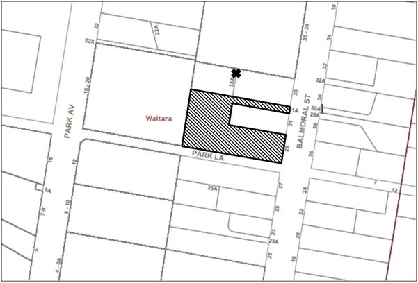
|
NOTIFICATION PLAN |
|
||
|
• PROPERTIES NOTIFIED
|
2 SUBMISSIONS RECEIVED |
PROPERTY SUBJECT OF DEVELOPMENT |
|
|
1 SUBMISSION RECEIVED OUT OF MAP RANGE |
|||
Two submissions objected to the development on the following grounds:
· The proposal would isolate No. 31 Balmoral Street.
· The proposal would isolate Nos. 33 and 33A Balmoral Street.
· The owner’s of 33 and 33A are willing to accept monetary offer to purchase both properties however the proponent did not proceed to purchase both properties.
· No.33 and 33A is below minimum width permissible to build an apartment block which would result in non-compliances to planning controls if left isolated.
· Approval of the application with a number of non-compliance would force Nos. 33, 33A and 31 Balmoral Street to adopt a similar design.
· Amalgamating each site would result in a better outcome for the rezoned area.
· The proposal would be an overdevelopment of the site.
· Amended plans do not substantially modify the plans which were refused.
· Insufficient communal open space areas provided.
· Concerns with regards to appearance of building.
· Concerns regarding an infrastructure burden on existing Waitara facilities.
· Entry to Park Lane considered inadequate.
6.1.1 Overdevelopment
Concerns were raised that the proposal would result in an overdevelopment of the site, as a result of inadequate setbacks, landscaping and deep soil areas.
Council considers the proposal is an overdevelopment of the site due to the non-compliance with the rear setback, top floor setback, deep soil areas and landscaping requirements. If the number of dwellings were reduced, there would be opportunity to address the number of non-compliances with the HDCP and the ADG and may achieve a development within the site’s capacity. Notwithstanding, the remaining issue of the driveway dominating the Balmoral Street frontage and the associated streetscape impacts, cannot be resolved unless an amalgamation of sites is achieved to meet the minimum site width requirement.
6.1.2 Site Isolation
Concerns were raised in submissions that development would isolate No. 31, 33 and 33A Balmoral Street. This matter is addressed in Section 3.3.2 of this report.
6.1.3 Materials and finishes
Concerns regarding materials and finishes are discussed further in Section 3.3.3 of this report.
6.1.4 Communal areas
Concerns that the plans do not include sufficient communal open space areas which would diminish the quality of life for future residents are addressed in greater detail above under Section 3.1.2.
6.1.5 Entry to Park Lane
Concerns that the proposal includes an entry to a garage from Park Lane. The proposal does not incorporate any vehicle access from Park Lane.
6.1.6 Burden on existing infrastructure
The site is located within the Waitara 5 storey redevelopment precinct. Through the collection of Section 7.11 development fees collected from approved residential flat buildings within the area, Council has constructed 6 tennis courts, an amenities building including tennis clubhouse and playground, provided new drainage works in Park Avenue, constructed new fencing and sightscreens to Mark Taylor Oval as well as upgraded parking facilities and contributed substantial funds to the construction of the new PCYC Facility. Council is also currently expanding Orara Park located on vacant land between Romsey Street and Waitara Oval.
6.1.7 Amended plans
Concerns were raised that the amended plans do not address the original reasons for refusal. Council concurs with this statement and it is proposed to refuse this application.
6.2 Public Agencies
The development application was not required to be referred to any Public Agencies for comment.
7. THE PUBLIC INTEREST
Section 4.15(1)(e) of the Act requires Council to consider “the public interest”.
The public interest is an overarching requirement, which includes the consideration of the matters discussed in this report. Implicit to the public interest is the achievement of future built outcomes adequately responding to and respecting the future desired outcomes expressed in environmental planning instruments and development control plans.
The application does not satisfactorily address Council’s criteria and would not provide a development outcome that, on balance, would result in a positive impact for the community. The proposal would result in compromised setbacks and insufficient landscaping and a built form that is inconsistent with the desired future character of the precinct. Accordingly, it is considered that the approval of the proposed development would not be in the public interest.
CONCLUSION
The application seeks approval for the demolition of the existing structures and the construction of a 4 - 5 storey residential flat building comprising 29 units with a basement car park.
The proposed development is unsatisfactory with respect to the Hornsby Local Environmental Plan 2013, design principles under SEPP 65 and the objectives of the Apartment Design Guide. The proposed development does not comply with the prescriptive measures and desired outcomes of HDCP with respect to desired future character, site frontage, setbacks, landscaping, built form and separation, open space, universal housing design and vehicular access and parking.
The scale of the development is not suitable for the site attributes, including limited site frontage and irregular shape. The proposal would not result in a built form which contributes positively to the built environment and the desired future character of the Balmoral Street, Waitara Precinct.
Council received two submissions during the public notification period. The matters raised have been addressed in the body of the report.
Having regard to the circumstances of the case, the application is recommended for refusal.
Note: At the time of the completion of this planning report, no persons have made a Political Donations Disclosure Statement pursuant to Section 10.4 of the Environmental Planning and Assessment Act 1979 in respect of the subject planning application.
RESPONSIBLE OFFICER
The officer responsible for the preparation of this Report is Matthew Miles who can be contacted on 9847 6760.
|
Rod Pickles Manager - Development Assessment Planning Division |
Cassandra Williams Team Leader - Major Applications Planning Division |
|
1.⇨ |
Locality Map |
|
|
|
2.⇨ |
Architectural Plans |
|
|
|
3.⇨ |
Landscape Plans |
|
|
|
4.⇨ |
SEPP 65 Variation |
|
|
File Reference: DA/1549/2016
Document Number: D07492620
SCHEDULE 1
1. The proposal does not comply with the object of the Environmental Planning and Assessment Act 1979 in Section 5(a)(ii), as it does not promote orderly development of land within the Balmoral Street, Waitara Precinct.
2. The proposed development is unsatisfactory in respect to Section 4.15(a)(i) of the Environmental Planning and Assessment Act 1979 as the proposal is not consistent with the design quality principles contained within Schedule 1 of State Environmental Planning Policy No. 65 – Design Quality of Residential Apartment Development.
3. The development application was not accompanied by a BASIX Certificate as required by Clause 50 and Part 1 of Schedule 1 of the Environmental Planning and Assessment Regulation 2000.
4. The proposed development is unsatisfactory in respect to Section 4.15(a)(i) of the Environmental Planning and Assessment Act 1979 as the proposal does not satisfy the requirements of the Apartment Design Guide as follows:
a) The communal open space areas do not enhance residential amenity and provide adequate opportunities for landscaping per Objective 3D-1.
b) Unit No. 6 does not achieve a minimum 15m2 of courtyard area.
c) The deep soil zones do not satisfy the minimum dimension requirement and is inadequate per Objective 3E-1.
d) Minimum bedroom sizes are not achieved per Objective 4D-3.
e) The proposal does not include a shadow analysis from potential overshadowing of an adjoining development built in isolation at No.31 Balmoral Street and No.33A and 33 Balmoral Street which could further reduce the number of units that achieve 2 hours of solar access between 9am and 3pm 22nd June.
f) The shadow diagrams are incorrect as they do not take into account the existing building to the west of the development which could reduce available sunlight to units and private open space areas.
5. The proposed development is unsatisfactory in respect to Section 4.15(a)(iii) of the Environmental Planning and Assessment Act 1979 as the proposal does not meet the requirements of the Hornsby Development Control Plan 2013 as follows:
a) The proposal is contrary to Section 3.4.1 Desired Future Character as the proposal would result in a residential flat building with inadequate setbacks from adjoining properties, a compromised landscape setting and an inappropriate built form.
b) The proposal is contrary to Section 3.4.2 Design Quality as the proposal as the proposal does not achieve a built form appropriate for the site, would not achieve the design quality principals of State Environmental Planning Policy No. 65 – Design Quality of Residential Flat Development and is not consistent with the objectives of the Apartment Design Guide.
c) The proposal is contrary to Section 3.4.3 Site Requirements as the site does not comply with the minimum site frontage requirement and does satisfy the desired outcome of a consolidated development site with soft landscaping surrounding the building and limited driveway crossings.
d) The proposal is contrary to Section 3.4.5 Setbacks as the building does not satisfy the requirements for rear boundary setbacks, basement setbacks, fifth storey setback from the ground floor and setbacks from the secondary frontage.
e) The proposal is contrary to Section 3.4.7 Landscaping as the deep soil areas are inadequate as follows:
i) The landscaping along the narrow frontage to Balmoral Street is compromised by the driveway and potential substation and hydrant booster.
ii) The rear boundary does not achieve the required 7m wide deep soil verge to achieve a landscape setting.
iii) The proposal does not satisfy the required 6m deep soil verge from Park Lane to break up the building mass to provide a landscape setting and to maintain the integrity of the laneway.
iv) The proposal does not achieve the required 8m landscape area between the two proposed buildings which achieves a component of deep soil area.
v) The proposal does not achieve the required 6m deep soil zone
vi) The proposal does not provide a 4m deep soil landscaped buffer towards the adjoining isolated development at No.31 Balmoral Street which can incorporate large canopy trees to break up the building mass.
f) The proposal is contrary to Section 3.4.8 Open Spaces as the proposal does not indicate a principal communal open space area and the open space areas have been broken up into 4 separate sections.
g) The proposal is contrary to Section 3.4.14 Key Development Principles as the proposal does not achieve orderly development with an appropriate landscape setting in accordance with the Key Development Principles Diagram for the Balmoral Street, Waitara precinct.
h) The proposal does not satisfy Section 1C.1.2 Stormwater Management as sufficient detail has not been provided to demonstrate appropriate stormwater disposal from the site.
6. Pursuant to the to the provisions of Section 4.15(1)(b) of the Environmental Planning and Assessment Act, the likely impacts of the development would be unsuitable with respect to the built environment as the proposal would not achieve a built form consistent with the desired future character of the Balmoral Street, Waitara Precinct.
7. The proposal does not comply with the Court principles for the development of sites in isolation.
8. Pursuant to the to the provisions of Section 4.15(1)(b) of the Environmental Planning and Assessment Act, the proposal would not have a positive social impact due to the extent of non-compliances with the HDCP and ADG.
9. Pursuant to the provisions of Section 4.15(1)(c) of the Environmental Planning and Assessment Act, the site attributes, including the size and dimensions, are not suitable for the scale of the development proposed.
10. Pursuant to the provisions of Section 4.15(1)(e) of the Environmental Planning and Assessment Act 1979, approval of an application with insufficient setbacks, insufficient landscaping and inappropriate built form would not be in the public interest.
LPP Report No. LPP28/18
Local Planning Panel
Date of Meeting: 22/08/2018
4 DEVELOPMENT APPLICATION - SUBDIVISION OF THREE ALOTMENTS INTO TWO - 1 GEORGE STREET BROOKLYN
EXECUTIVE SUMMARY
|
DA No: |
DA/897/2017 (Lodged on 18 August 2017) |
|
Description: |
Torrens title subdivision of three allotments into two |
|
Property: |
Lots 1, 2 and 3 Section C DP 2746, No. 1 George Street, Brooklyn |
|
Applicant: |
Myriad Consulting |
|
Owner: |
Mr K. H. Bodenstein |
|
Estimated Value: |
Nil |
|
Ward: |
A |
· The application involves Torrens title subdivision of three allotments into two.
· The proposal complies does not comply with Clause 6.3 (Flood Planning) of the Hornsby Local Environmental Plan 2013 (HLEP) and the prescriptive measures within Part 1C.3.2 Flooding of the Hornsby Development Control Plan 2013 (HDCP). The application failed to provide sufficient information to adequately assess the flooding impacts such as safety issues on site.
· The proposal does not comply with the HLEP with regard to Clause 4.1 Minimum subdivision lot size. The development would contravene the minimum allotment size by more than 10 percent. The applicant has made a submission in accordance with Clause 4.6 ‘Exceptions to development standards’ of the Hornsby Local Environmental Plan 2013 to vary the minimum allotment size development standard. The submission is not well founded and is not supported.
· No submissions have been received in respect of the application.
· It is recommended that the application be refused.
|
THAT Development Application No. DA/897/2017 for Torrens title subdivision of three allotments into two at Lots 1, 2 and 3 Section C DP 2746, No. 1 George Street, Brooklyn be refused subject to the reasons for refusal detailed in Schedule 1 of LPP Report No. LPP28/18. |
BACKGROUND
On 13 December 2016, a pre-lodgement meeting was held and at the meeting concerns were raised about the design of the future building on the proposed vacant lot, due to the existing stormwater drainage pipeline and the requirement to provide a 3m wide drainage easement. The proposed vacant lot is required to demonstrate that the site can accommodate a 200m2 indicative building envelope, private open space, setbacks and car parking as per the requirements in Section 6.1 and Section 6.2 of the Hornsby Development Control Plan 2013 (HDCP).
On 18 August 2017, Development Application No. DA/897/2017 was lodged for the re-subdivision of three allotments into two. This application is the subject of this report.
On 20 September 2017, the applicant was requested to submit the following information:
1. A 1 in 100 year ARI flood extent for both the pre-development and post-development to be shown on an accurate site plan of the development, at a scale of 1:100 or 1:200.
2. A proposed building envelope to be indicated on the site plan, to ensure that all structures are located clear from the overland flowpath.
3. A Flood Study showing river stations across the property for the HEC-RAS Modelling, and the relevant 1 in 100 year flood levels across the subject site.
On 9 October 2017, the applicant submitted additional information to address Council’s letter dated 20 September 2017.
On 8 November 2017, Council wrote to the applicant raising concerns regarding the encroachment of the proposed building envelope into the existing 100 year ARI over land flow path. The applicant was requested to submit the following information:
1. A proposed drainage easement, 3m wide minimum over the existing pipeline, to be identified and shown in the engineering plan, as requested in the Pre-DA meeting (PL/116/2016), no structures must be over or encroach into this proposed drainage easement.
2. Open swales to be designed to be provided over the pipeline adjacent to proposed buildings, courtyard, car stand and driveway areas. The swales are to be able to carry the 100 year average recurrence interval (ARI) storm flow assuming the pipe is fully blocked.
3. In order to prevent risk of flood nuisance and damage, only minor earthworks may be considered to provide conveyance of the design overland storm flow.
4. In order to prevent stormwater inundation of the developing areas, the proposed buildings must be located outside the flooded extent of the 100 year average recurrence interval (ARI) storm flow.
5. The floor levels of all habitable and lockable rooms to be not less than 0.5 m above the 100 year ARI storm level.
6. For safety, no courtyard must be proposed within any part of the design storm flooded area where the velocity x depth product exceeds 0.4 m2/s.
7. For safety, all driveway and car stand areas within the area affected by the 100 year ARI must have a design flow depth of not more than 200 mm and have velocity x depth product not exceeding 0.7 m2/s.
8. Fences across overland flow paths are to be hinged or permeable to above the 100 year ARI flood level and designed to ensure that there is no impediment to flow.
9. Drainage plans showing the following details must be prepared by a suitably qualified Chartered Civil Engineer and submitted for consideration. The plans are to include:-
a. a catchment plan, including sub-catchments from adjoining streets;
b. run off calculations (Hydrological and Hydraulic) according to Australian Rainfall and Run off 1987, as well as all electronic files for any computer generated modelling of the flow path;
c. A detailed site plan including topography of existing and post-development levels (if permitted to be different) showing how the design flow is to be conveyed across the site, as well as;
d. a site contour plan of the area affected by the 100 year ARI storm flow path.
10. Since the proposed building envelop encroaches into the existing 100 year ARI overland flow path, it will impact upon the downstream properties, such as, Nos. 3 – 5 George Street, Brooklyn, and possibly Nos. 7 and 9 George Street, Brooklyn. To assess the impacts of this proposal, a full detailed survey of the 3 – 5 George Street, Brooklyn is required.
11. Another hydraulic study for both properties of No. 1 George Street and Nos. 3-5 George Street, Brooklyn will be necessary, including the HEC-RAS modelling and River Station from William Street to the eastern boundary of No. 5 George Street.
On 16 March 2018, the applicant submitted additional information and amended indicative dwelling layout to address the concerns raised by Council.
On 27 March 2018, Council wrote to the applicant raising concern that no further detailed engineering plans and calculations have been provided to support the proposal. The engineering information requested by Council on 8 November 2017 has not been addressed.
On 6 April 2018, the applicant submitted a response summary, HEC-RAS model and revised plan to identify the swale, easement and HEC-RAS section.
On 8 May 2018, Council wrote to the applicant raising the following concerns:
· Existing structures would encroach within the easement,
· The submitted engineering plans have not shown cross-sectional details of the proposed open swales, and details on how it conveys stormwater overland flow from upstream catchment to the downstream properties.
· The engineering plans indicate that the 1 in 100 year ARI overland flow affects most of the subject site for pre development condition.
· The submitted HEC- RAS files are incomplete are unable to be opened and viewed.
· Details not provided for the floor levels of habitable and lockable rooms, details driveway and car stand areas and fences.
On 15 May 2018, the applicant submitted an amended flood study and amended plans including a detailed footprint of a future dwelling and deletion of part of the existing deck.
On 13 June 2018, Council's engineer contacted the applicant’s consultant engineer and advised that Council could not relate the recent HEC-RAS model to the accompanying drainage and flooding plans.
On 28 June 2018, the applicant provided confirmation that an error had been found in the post-developed cross sections. In light of this, an updated report and plans were submitted. The consultant engineer further explained that the pre-developed model is correct and is valid for the post developed scenario. There is an existing stone retaining wall which confines the flows within the central landscaping area. This stone wall is proposed to remain, with the proposed building footprint completely within the raised part of the site. The applicant’s engineer further advised that there is no point in having two HEC-RAS models as the ground levels are exactly the same, thus the flood levels are exactly the same, and the HEC-RAS model is only being used to justify the proposed FFL (100yr flood level + 500mm freeboard).
SITE
The site is located on the corner of George Street and William Street and comprises of three separate allotments legally described as Lots 1, 2 and 3 Section C DP2746.
Each individual rectangular allotment has a front boundary width of 6.095m and a depth of 36.56m. The combined site is rectangular in shape with a frontage to George Street of 18.23m, a frontage to Willian Street of approximately 36.56m and a total site area of 663.9m2.
The site currently contains a single storey dwelling and several ancillary buildings (including a double garage and shed at the rear) over the three allotments. The garage and driveway are located off William Street. Recent building work and improvements have been undertaken at the site to upgrade the existing dwelling. There is an existing stone retaining wall within the rear portion of the site.
There is an existing 900mm Council stormwater pipe and an overland flow path running through the site.
There are six trees located on the site. Tree No. 6 is located in front of the site on Council’s verge. The proposal would result in the removal of three trees, two palms and a Magnolia.
The neighbouring and surrounding sites are characterised by single and two storey dwellings.
PROPOSAL
The proposal involves the subdivision of three existing lots into two Torrens title allotments each with a site area of 331.95m2.
The existing dwelling fronting George Street is to be retained. A portion of the deck of the existing dwelling is proposed to be removed.
The proposed lots are detailed as follows:
|
Lot No |
Area |
Description |
|
1 |
331.95m2 |
Regular shaped corner lot with a frontage of 18.29m to George Street and a maximum depth of 18.28m along William Street. The lot has moderate slope from the southern western corner to the north eastern boundary. The lot would have frontage to Williams Street and would comprise the existing single storey brick dwelling which is proposed to be retained as part of this application. The lot includes Tree 1 - Persea Americana and Tree 2 – Macadamia species, which are not proposed to be removed. A new driveway crossing is proposed to be provided fronting George Street and two car parking spaces are to be provided for the existing dwelling.
|
|
2 |
331.95m2 |
Regular shaped lot with a frontage of 18.3m to William Street a depth of 18.27m. There is an existing stone retaining wall within the rear portion of the site. A 135 square metre indicative building envelope has been included on the plan of subdivision. The lot includes Tree Nos.3 and 4 – Washingtonia filifera and Tree No. 5 – Michelia alba (Magnolia). Trees Nos.3-5 would be removed. |
There is an existing Council stormwater pipe running through both proposed Lots 1 and 2. There is an overland flow path through the site, which is aligned with the existing stormwater pipe. A 3 metre wide drainage easement is proposed to be created over the pipeline.
ASSESSMENT
The development application has been assessed having regard to the ‘Greater Sydney Region Plan - A Metropolis of Three Cities’, the ‘North District Plan’ and the matters for consideration prescribed under Section 4.15 of the Environmental Planning and Assessment Act 1979 (the Act). The following issues have been identified for further consideration.
1. STRATEGIC CONTEXT
1.1 Greater Sydney Region Plan - A Metropolis of Three Cities and North District Plan
The Greater Sydney Region Plan - A Metropolis of Three Cities has been prepared by the NSW State Government to guide land use planning decisions for the next 40 years (to 2056). The Plan sets a strategy and actions for accommodating Sydney’s future population growth and identifies dwelling targets to ensure supply meets demand. The Plan also identifies that the most suitable areas for new housing are in locations close to jobs, public transport, community facilities and services.
The NSW Government will use the subregional planning process to define objectives and set goals for job creation, housing supply and choice in each subregion. Hornsby Shire has been grouped with Hunters Hill, Ku-ring-gai, Lane Cove, Mosman, North Sydney, Ryde, Northern Beaches and Willoughby to form the North District. The Greater Sydney Commission has released the North District Plan which includes priorities and actions for Northern District for the next 20 years. The identified challenge for Hornsby Shire will be to provide an additional 4,350 dwellings by 2021 with further strategic supply targets to be identified to deliver 97,000 additional dwellings in the North District by 2036.
Whilst the proposed development would be consistent with the Greater Sydney Region Plan - A Metropolis of Three Cities and the North District Plan, by providing housing choice in the locality, the applicant has failed to demonstrate that proposed lots are suitable for the intended use as the private open space of the future dwelling and the existing dwelling would be located within the overland flow path and poses safety risk to future occupants.
2. STATUTORY CONTROLS
Section 4.15(1)(a) requires Council to consider “any relevant environmental planning instruments, draft environmental planning instruments, development control plans, planning agreements and regulations”.
2.1 Hornsby Local Environmental Plan 2013
The proposed development has been assessed having regard to the provisions of the Hornsby Local Environmental Plan 2013 (HLEP).
2.1.1 Zoning of Land and Permissibility
The subject land is zoned R2 Low Density Residential under the HLEP. The objectives of the zone are:
· To provide for the housing needs of the community within a low density residential environment.
· To enable other land uses that provide facilities or services to meet the day to day needs of residents.
The proposed development is defined as “subdivision” and is permissible in the zone with Council’s consent.
The proposal fails to satisfy the objectives of the zone, as the proposed development would not provide for the housing needs of the locality. The applicant has failed to demonstrate that a future dwelling could be built on the vacant lot which complies with setback, car parking and private open space requirements of the HDCP.
2.1.2 Minimum Lot Size
Clause 4.1 of the HLEP provides that the minimum allotment size for the subject site within the R2 Low Density Residential zone is 500m2. The proposal does not comply with this provision.
The existing site comprises of three separate allotments of 221.3m2 each with a combined total site area of 663.9m2. Proposed Lots 1 and 2 would each have an area of 331.95m2 which would result in a 33.6% variation to the minimum lot size requirement.
The application is supported by a submission pursuant to Clause 4.6 of the HLEP to vary the minimum 500m2 allotment size development standard, which is discussed below in Section 2.1.3 of this report.
2.1.3 Exceptions to Development Standards
The application has been assessed against the requirements of Clause 4.6 of the HLEP. This clause provides flexibility in the application of the development standards in circumstances where strict compliance with those standards would, in any particular case, be unreasonable or unnecessary or tender to hinder the attainment of the objectives of the zone.
The proposal does not comply with the minimum 500m2 lot size development standard under Clause 4.1 of the HLEP, for proposed Lots 1 and 2 with lot sizes of 331.95m2. The development application seeks to vary the development standard by 33.6%.
The applicant has made a submission in support of a variation to the development standard in accordance with Clause 4.6 of the HLEP. The applicant states the proposed variation is considered to be consistent with the objectives of the control and is justified as follows:
· The proposed development is consistent with the zone objectives.
· The site specific and contextually responsive development is consistent with the surrounding built environment and with the objectives of the minimum lot size standard.
· There are no significant adverse impacts on the amenity of the adjoining, adjacent or properties in terms of solar access, visual bulk and privacy.
· Given the design quality of the development and the developments ability to comply with the zone and density objectives that approval would not be contrary to the public interest.
· Contravention of the development standard does not raise any matter of significance for State or regional environmental planning.
· Approval of the proposal will not set a precedent for non-complying applications.
State Government Guidelines on varying development standards recommend considering the provisions of Clause 4.6 of the LEP and the ‘five part test’ established by the Land and Environment Court as follows:
1. the objectives of the standard are achieved notwithstanding noncompliance with the standard;
2. the underlying objective or purpose of the standard is not relevant to the development and therefore compliance is unnecessary;
3. the underlying object of purpose would be defeated or thwarted if compliance was required and therefore compliance is unreasonable;
4. the development standard has been virtually abandoned or destroyed by the council’s own actions in granting consents departing from the standard and hence compliance with the standard is unnecessary and unreasonable;
5. the compliance with development standard is unreasonable or inappropriate due to existing use of land and current environmental character of the particular parcel of land. That is, the particular parcel of land should not have been included in the zone.
The applicant’s submission to vary the allotment size development standard is considered not well founded for the following reasons:
· The proposal would not comply with the objectives of Clause 4.1 Minimum Subdivision Lot Size in that the development fails to provide a subdivision that is appropriate for the site having regard to Council’s drainage easement and the overland flow path on the site.
· It is acknowledged that the proposal involves the subdivision of three undersized allotments into two larger undersized size allotments. The applicant has failed to demonstrate that the vacant lot is capable of accommodating a future dwelling house that is compliant with the planning controls including setbacks, private open space and car parking.
· The proposed private open space of a future dwelling on proposed Lot 1 would be located completely within the 100 year overland flow path. The proposed private open space area would exceed the maximum depth threshold of 0.2m and velocity x depth products of 0.4 m2/s and therefore would be considered unsafe for children.
· Due to the constraints of the site, the subdivision layout results in a development which is not within the capacity of the land and would result in non-compliance with the prescriptive controls within the HDCP.
It is considered that the applicant’s submission pursuant to Clause 4.6 of the HLEP does not satisfactorily addresses the matters required by this clause and that compliance with the development standard would not be unreasonable and unnecessary in the circumstances of the case. Accordingly, the Clause 4.6 submission is not supported.
2.1.4 Heritage Conservation
Clause 5.10 of the HLEP sets out heritage conservation provisions for Hornsby Shire. The site does not include a heritage item and is not located in a heritage conservation area. Accordingly, no further assessment regarding heritage is necessary.
2.1.5 Acid Sulfate Soils
Clause 6.1 of the HLEP relates to Acid Sulfate Soils and states the following:
(1) The objective of this clause is to ensure that development does not disturb, expose or drain acid sulfate soils and cause environmental damage.
(2) Development consent is required for the carrying out of works described in the Table to this subclause on land shown on the Acid Sulfate Soils Map as being of the class specified for those works.
The Acid Sulfate Soils Map shows the subject parcel of land as being “Class 5”. The proposal does not involve the carrying out of site works that would require the preparation of an acid sulfate soils management plan. Accordingly, no further assessment is necessary in this regard.
2.1.6 Earthworks
Clause 6.2 of the HLEP states that consent is required for proposed earthworks on site. Before granting consent for earthworks, Council is required to assess the impacts of the works on adjoining properties, drainage patterns and soil stability of the locality. The proposal involves the construction of a 1m swale over the existing pipeline. The proposed works are considered minor and no further assessment is necessary in this regard.
2.1.7 Flood Planning
Clause 6.3 of the HLEP applies as part of the site is identified as flood prone land. There is an existing 900mm Council stormwater pipe running through the site, which conveys stormwater from the upstream catchment. There is also an overland flow path through the site, which is approximately aligned with the underground 900mm stormwater pipe. The applicant has submitted a flood study and engineering plans showing both pre-development and post-development 100 year ARI flood extends.
A minimum 3m wide drainage easement is proposed to be provided over the existing pipeline. Council raised concerns that no structures should encroach over or into the proposed drainage easement. The engineering plans showed the encroachment of a portion of the existing retaining wall and the existing deck into this easement. The applicant submitted revised engineering planning showing a portion of the existing retaining wall to be removed and part of the existing deck to be removed.
Council assessed the calculated design overland flow path in accordance with design requirements of the HDCP and the Hornsby Council’s Civil Works Specifications. Based on the information provided, the proposed private open space would be completely located within the 100 year overland flow path. The private open space allocated to the future dwelling exceeds the maximum depth threshold of 0.2m and velocity x depth products of 0.4m2/s and therefore considered unsafe for children. Due to the constraints of the proposed lot 2, there is no opportunity for relocation of the private open space area.
Therefore, the proposal does not satisfy Clause 6.3 of the HLEP with respect to flood planning.
2.2 State Environmental Planning Policy No. 55 – Remediation of Land
The application has been assessed against the requirements of State Environmental Planning Policy No. 55 – Remediation of Land (SEPP 55) under which consent must not be granted to the carrying out of any development on land unless the consent authority has considered whether the land is contaminated or requires remediation for the proposed use.
A search of Council’s records and aerial photos indicates the site has a history of residential use. Accordingly, it is not likely that the site has experienced any significant contamination and further assessment under SEPP 55 is not required.
2.3 Sydney Regional Environmental Plan No. 20 – Hawkesbury – Nepean River
The site is located within the catchment of the Hawkesbury Nepean River. Part 2 of this Plan contains general planning considerations and strategies requiring Council to consider the impacts of development on water quality, aquaculture, recreation and tourism.
Subject to the implementation of sediment and erosion control measures and stormwater management to protect water quality, the proposal would comply with the requirements of the Policy.
2.4 Section 3.42 Environmental Planning and Assessment Act 1979 - Purpose and Status of Development Control Plans
In accordance with Section 3.42 of the Environmental Planning and Assessment Act, 1979, a DCP provision will have no effect if it prevents or unreasonably restricts development that is otherwise permitted and complies with the development standards in relevant Local Environmental Plans and State Environmental Planning Policies.
The principal purpose of a development control plan is to provide guidance on the aims of any environmental planning instrument that applies to the development; facilitate development that is permissible under any such instrument; and achieve the objectives of land zones. The provisions contained in a DCP are not statutory requirements and are for guidance purposes only. Consent authorities have flexibility to consider innovative solutions when assessing development proposals, to assist achieve good planning outcomes.
2.5 Hornsby Development Control Plan 2013
The proposed development has been assessed having regard to the relevant desired outcomes and prescriptive requirements within the Hornsby Development Control Plan 2013 (HDCP). The following table sets out the proposal’s compliance with the prescriptive requirements of the Plan:
|
Hornsby Development Control Plan 2013 |
|||
|
Part 6.2 – Urban Subdivision |
|||
|
Control |
Proposal |
Requirement |
Complies |
|
Site Area |
663m2 |
N/A |
N/A |
|
Lot Sizes · Lot 1 · Lot 2 |
331.5m2 331.5m2 |
500m2 500m2 |
No No |
|
Lot Width · Lot 1 · Lot 2
|
18.29m (George Street) 18.28m (William Street) |
12m 12m |
Yes Yes |
|
Building envelope on proposed Lot 2 |
|||
|
Indicative building envelope · Lot 2 |
135m2 |
200m2 |
No |
|
Potential Landscaped Areas - Lot 2 |
56% |
>20% |
Yes |
|
Setbacks |
|||
|
- Front |
2.65m |
6m |
No |
|
- Side (North) |
1m |
0.9m |
Yes |
|
- Side (South) |
5.6m |
0.9m |
Yes |
|
- Rear (East) |
1.1m |
5m |
No |
|
Existing Dwelling-House on Lot 1 |
|||
|
Floor area |
160m2 |
270m2 |
Yes |
|
Site Coverage |
43% |
55% |
Yes |
|
Setbacks |
|||
|
- Front (George Street) |
3m |
6m |
No - Existing setback |
|
- Side (William Street) |
3m
|
3m |
Yes |
|
- Side (East) |
1.8m |
0.9m |
Yes |
|
- Rear (North) |
0m (Deck) 6m (Existing dwelling)
|
3m |
Yes |
|
Landscaped Area |
28% |
>15% |
Yes |
|
Private Open Space · minimum area · minimum dimension |
>24m2 3m |
24m2 3m |
Yes Yes |
|
Car Parking |
2 spaces |
2 spaces |
Yes |
As detailed in the above table, the proposed development does not comply with a number of prescriptive requirements within the HDCP. The matters of non-compliance are detailed below, as well as a brief discussion on compliance with relevant desired outcomes.
2.5.1 Lot Shape and Design
Lots should be configured to account for significant natural landscape elements or constraints of the site and to mitigate environmental impacts.
Proposed Lot 1 has an area of 331.5m² and would contain the existing dwelling-house. The lot is rectangular in shape and vehicular access is to be obtained via a new driveway fronting George Street. A portion of the deck at the rear of the existing dwelling is to be removed.
Proposed Lot 2 has an area of 331.5m² and would be a vacant allotment. Proposed Lot 2 would not include sufficient area to accommodate a 200m² indicative building envelope. A 135m² building envelope is proposed on Lot 2. To achieve the allowable floor area of 270m², would necessitate building of a two storey dwelling within the retained portion of the lot. A two storey dwelling in this location is likely to result in overlooking and loss of privacy to neighbouring residential properties at Nos. 3-5 George Street as well as the private open space area of the existing dwelling on Lot 1.
The design of proposed Lot 2 does not demonstrate that the required indicative building envelope and a usable private open space area can be accommodated on the site.
Having regard to the constraints of proposed Lot 2, it is considered that there is insufficient area within this lot to provide for a dwelling-house, car parking for two vehicles and a useable principal private open space area.
The proposal is not consistent with the subdivision controls for lot size and shape within Section 6.2.1 of the HDCP.
2.5.2 Setbacks
The prescriptive measures of Section 6.2.1(h) of the HDCP states that the minimum front boundary setback is 6 metres and rear boundary setback is 5 metres.
The original plan submitted by the applicant indicated that the proposed building envelope would encroach into the existing 100 year ARI over land flow path. To address this concern, the applicant submitted a revised Post Development 100 year ARI Flood Extent engineering plan, showing a 135m2 building envelope. The proposed building envelope is to be located on the existing hardstand area at the north east corner of Lot 2 and would have a setback 2.65m from the front boundary and 1.1m from the rear boundary.
The proposed front and rear setback of the building envelope does not comply with the setback prescriptive measures under Section 6.1.2 Setbacks of the HDCP.
It is noted that proposed Lot 1 would still function as a corner allotment with an existing 3 metre setback to William Street. The proposed front setback of the building envelope would be less than side setback of the existing dwelling.
In this regard, the proposal would not meet the desired outcomes of Part 3.1.2 Setbacks of the HDCP and is considered acceptable.
2.5.3 Open Space
The private open space of the existing dwelling on proposed Lot 1 is located at the rear of the site. Council raised a concern that the deck of the existing dwelling on Lot 1 encroaches within the 3 metre wide drainage easement. To address this issue, the applicant submitted revised plans showing the removal of a portion of the existing deck. The remainder of the deck is located outside of the overland flow path and has an area greater than 24m².
Council’s engineering assessment raised concerns regarding the location of the proposed private open space area of the building envelope within the stormwater overland flow path. It is considered that most parts of the private open space allocated to future dwelling and existing dwelling exceeds the maximum depth threshold of 0.2m and velocity x depth products of 0.4m2/s and therefore considered unsafe for children. The location of the proposed private open space within the stormwater overland flowpath cannot be supported.
Given the constraints of proposed Lot 2, the applicant has failed to demonstrate an appropriate dwelling with a useable private open space would be able to be accommodated on the new lot. As a consequence, the proposal does not meet the desired outcomes of Part 6.2.1 Open Space of the HDCP and is considered acceptable.
2.5.4 Vehicular Access and Parking
Section 6.2.1(f) Urban Subdivision of HDCP, states that:
“Lot design should identify a potential developable area. This area is to accommodate area for parking 2 cars behind the building line.”
The post development 100 year ARI flood extent engineering plan, prepared by Henry & Hymas, amendment dated 28 June 2018, indicates that only one car parking space is proposed for Lot 2.
The application in its current form does not demonstrate the provision of two car parking spaces for the building envelope on Lot 2. The proposal does not comply with the prescriptive measures of Section 6.2.1 of the HDCP and is considered unacceptable.
2.5.5 Flooding
Section 6.1 Flood Prone Land of the HDCP, states that:
Potential developable areas, including a principal private open space area and ancillary driveways to any new lot should be above the 1:100 ARI (average recurrent interval) flood event.
Based on Council’s assessment, parts of the private open space allocated to the future dwelling and the existing dwelling exceeds the maximum depth threshold of 0.2m and velocity x depth products of 0.4m2/s and therefore considered unsafe for children. The applicant has failed to demonstrate how the private open space area on Lot 2 would be located clear of the overland flow path. Therefore, the proposal does not comply with both the Flood Prone land requirements of the HDCP and Hornsby Council’s Civil Works Specifications and as such cannot be supported.
2.6 Section 7.11 Contributions Plans
Hornsby Shire Council Section 94 Contributions Plan 2014-2024 applies to the development. However, the proposal does not involve the creation of an additional residential lot. Accordingly, the monetary Section 7.11 contribution would not be required.
3. ENVIRONMENTAL IMPACTS
Section 4.15(1)(b) of the Act requires Council to consider “the likely impacts of that development, including environmental impacts on both the natural and built environments, and social and economic impacts in the locality”.
3.1 Natural Environment
3.1.1 Tree and Vegetation Preservation
The application proposes the removal of three trees to accommodate the development. These trees include Tree No.3 a Washingtonia filifera (California Palm) located within the drainage easement. Tree No. 4 a Washingtonia filifera (California Palm and Tree No. 5 – Michelia alba (Magnolia) would be located within the building envelope on Lot 2. An existing Frangapani tree would be required to be removed to accommodate a new driveway fronting George Street.
Council’s Tree assessment raised no objections to the removal of Tree Nos. 3, 4 and 5 subject to offset planting being provided for two trees on the site.
3.1.2 Stormwater Management
The calculated design overland flow path is not in accordance with design requirements of HDCP and the Hornsby Council’s Civil Works Specifications. For a detailed discussion refer to Sections 2.1.7 and 2.5.5 of this report.
3.1.3 Built Form
The proposed subdivision would result in built form inconsistent with the character of the area.
3.1.4 Traffic
The proposed subdivision would generate 54 daily vehicle trips in accordance with the RMS Guide to Traffic Generating Developments.
The proposed traffic generation would not detract from the efficiency of the local road network.
3.2 Social Impacts
The proposal would not have a negative social impact on the locality.
3.3 Economic Impacts
The proposal would not have a negative economic impact on the locality.
4. SITE SUITABILITY
Section 4.15(1)(c) of the Act requires Council to consider “the suitability of the site for the development”.
The subject site has been identified as flood prone land. The HDCP requires that new potential developable areas, including dwelling houses, a principal private open space area and ancillary driveways to any new lot should be above the 1:100 ARI (average recurrent interval) flood event.
The habitable floor area of the future dwelling house for Lot 2 would be set at RL 6.94 AHD. The proposed finished floor level of the building envelope has been set at approximately 500mm above the 1:100 ARI. Council’s engineering assessment identified that the private open space of the future dwelling on Lot 2 would be completely located within the overland flow path. Therefore, the proposal is not in accordance with the requirements of Clause 1C.3.2 - Overland Flow Path Design of the HDCP and is unacceptable.
5. PUBLIC PARTICIPATION
Section 4.15(1)(d) of the Act requires Council to consider “any submissions made in accordance with this Act”.
5.1 Community Consultation
The proposed development was placed on public exhibition and was notified to adjoining and nearby landowners between 1 September 2017 and 7 October 2017 in accordance with the Notification and Exhibition requirements of the HDCP. During this period, Council received no submissions. The map below illustrates the location of those nearby landowners who were notified of the development.
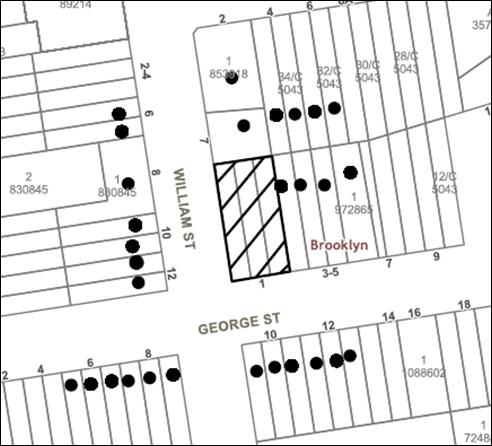
|
NOTIFICATION PLAN |
|||
|
• PROPERTIES NOTIFIED
|
X SUBMISSIONS RECEIVED |
PROPERTY SUBJECT OF DEVELOPMENT |
|
5.2 Public Agencies
The development application was referred to the following Agencies for comment:
5.2.1 Rural Fire Service
The site is bushfire prone land and as such, Council referred the application to the NSW Rural Fire Services (RFS) seeking general terms of approval for the abovementioned development application in accordance with Section 4.46 of the Environmental Planning and Assessment Act 1979.
The RFS provided a response, which is to be deemed a bush fire safety authority as required under Section 100B of the Rural Fires Act 1997 and subject to suitable conditions if consent is to be granted.
6. THE PUBLIC INTEREST
Section 4.15(1)(e) of the Act requires Council to consider “the public interest”.
The public interest is an overarching requirement, which includes the consideration of the matters discussed in this report. Implicit to the public interest is the achievement of future built outcomes adequately responding to and respecting the future desired outcomes expressed in environmental planning instruments and development control plans.
The proposed residential subdivision is contrary to Council’s planning controls. Accordingly, it is considered that the proposed development would not be in the public interest.
CONCLUSION
The proposal is for subdivision of three undersized allotment into two undersized allotments. The existing dwelling is proposed to be retained on Lot 1.
Given the constraints of proposed Lot 2, the applicant has failed to demonstrate an appropriate dwelling with the required car parking and a useable private open space would be able to be accommodated on the new lot.
The development does not meet the desired outcomes of Council’s planning controls and is unsatisfactory having regard to the matters for consideration under Section 4.15C of the Environmental Planning and Assessment Act 1979.
Having regard to the circumstances of the case, refusal of the application is recommended.
Note: At the time of the completion of this planning report, no persons have made a Political Donations Disclosure Statement pursuant to Section 10.4 of the Environmental Planning and Assessment Act 1979 in respect of the subject planning application.
RESPONSIBLE OFFICER
The officer responsible for the preparation of this Report is Caroline Maeshian who can be contacted on 9847 6760.
|
Cassandra Williams Team Leader - Major Applications Planning Division |
Rod Pickles Manager - Development Assessment Planning Division |
|
1.⇨ |
Locality Plan |
|
|
|
2.⇨ |
Survey Plan |
|
|
|
3.⇨ |
Subdivision Plan |
|
|
|
4.⇨ |
Building Envelope plan |
|
|
|
5.⇨ |
Clause 4.6 variation |
|
|
|
6.⇨ |
Pre and Post Development 100YR ARI Flood Extent Plans |
|
|
File Reference: DA/897/2017
Document Number: D07481451
SCHEDULE 1
1. The proposal is unsatisfactory in respect to Section 4.15(1)(a)(i) of the Environmental Planning and Assessment Act 1979 as the development does not comply with the development standards of Clause 4.1 (Minimum subdivision lot size) of the Hornsby Local Environmental Plan 2013.
2. The proposal is unsatisfactory in respect to Section 4.15(1)(a)(i) of the Environmental Planning and Assessment Act 1979 as the Clause 4.6 variation is not considered well founded and is not supported.
3. The proposal is unsatisfactory in respect to Section 4.15(1)(a)(i) of the Environmental Planning and Assessment Act 1979 as the development does not comply with the development standards of Clause 6.3 (Flood Planning) of the Hornsby Local Environmental Plan 2013.
4. In accordance with Section 4.15(1)(a)(iii) of the Environmental Planning and Assessment Act 1979, the proposal does not comply with the desired outcome and the prescriptive measures of Hornsby Development Control Plan 2013 (HDCP) as follows:
a) The proposal does not comply with the prescriptive measures within Part 1C.3.2 Flooding of the HDCP referring the overland flow path design.
b) The proposal does not comply with Clause 6.3 (Flood Planning) of the HDCP.
c) The proposal does not comply with the Lot Size and Lot Shape prescriptive measure within Part 6.2.1 of the HDCP.
d) The proposal does not comply with the Setbacks prescriptive measure within Part 6.2.1(h) of the HDCP.
e) The proposal does not comply with the Private Open Space requirements within Part 6.2.1 of the HDCP.
f) The proposal does not comply with the Car Parking prescriptive measure within Part 6.2.1(f) of the HDCP as two car parking spaces have not been indicated behind the building line on proposed Lot 2.
5. The proposal is unsatisfactory in respect to Section 4.15(1)(b) of the Environmental Planning and Assessment Act 1979 as the development of a future two storey dwelling on Lot 2 would likely result in overlooking and loss of privacy to neighbouring residential properties at Nos. 3 to 5 George Street as well as the private open space area of existing dwelling on proposed Lot 1.
6. The proposal is unsatisfactory in respect to Section 4.15(1)(a)(i) of the Environmental Planning and Assessment Act 1979 as the development does not comply with the development standards of Clause 6.3 (Flood Planning) of the Hornsby Local Environmental Plan 2013.
7. In accordance with Section 4.15(1)(c) of the Environmental Planning and Assessment Act 1979, it is considered that the site is not suitable for the proposed development.
8. Pursuant to the provisions of Section 4.15(1)(d)(e) of the Environmental Planning and Assessment Act 1979, it is considered that the proposed development would not be in the public interest.


