BUSINESS PAPER
Local Planning Panel meeting
Wednesday 1 May 2019
at 6:30pm
BUSINESS PAPER
Local Planning Panel meeting
Wednesday 1 May 2019
at 6:30pm
Hornsby Shire Council Table of Contents
Page 1
GENERAL BUSINESS
Local Planning Panel
Item 1 LPP3/19 Development Application - Construction of a 59 place child care centre - 53 - 55 Oakleigh Avenue, Thornleigh..................................................................................................... 1
Item 2 LPP9/19 Development Application - Construction of a one Storey and two Storey Industrial Building comprising 32 Industrial Units and 44 Self-Storage Units, Strata Subdivision and landscaping - 50A Duffy Avenue Thornleigh........................................................................................... 28
Item 3 LPP8/19 Further Report - Seniors Living Development Comprising 15 Independent Units - Nos. 95-97 Copeland Road and No. 14 Hull Road, Beecroft......................................................... 79
LPP Report No. LPP3/19
Local Planning Panel
Date of Meeting: 1/05/2019
1 DEVELOPMENT APPLICATION - CONSTRUCTION OF A 59 PLACE CHILD CARE CENTRE - 53 - 55 OAKLEIGH AVENUE, THORNLEIGH
EXECUTIVE SUMMARY
|
DA No: |
DA/1111/2017 (Lodged on 12 October 2017) |
|
Description: |
Demolition of a dwelling house and construction of a two storey 59 place child care centre with basement car parking and associated landscaping |
|
Property: |
Lot A DP 411012, Nos 53 – 55 Oakleigh Avenue, Thornleigh |
|
Applicant: |
Ekon Pty Ltd |
|
Owner: |
Mr Tian Yong Liu and Wei Ying Jiang |
|
Estimated Value: |
$1,546,530 |
|
Ward: |
B |
· The application involves demolition of an existing dwelling and construction of a two storey 59 place childcare centre with basement car parking and associated landscaping.
· The proposal does not comply with the outdoor unencumbered space requirements of the State Environmental Planning Policy (Educational Establishments and Child Care Facilities) 2017.
· The proposal does not comply with the Hornsby Local Environmental Plan 2013 and the Hornsby Development Control Plan 2013 with respect to noise, streetscape impacts and open space.
· The application is required to be determined by the Hornsby Shire Council Local Planning Panel as more than 10 submissions were received.
· 75 submissions have been received in respect of the application including a petition of 60 signatures objecting the proposal.
· It is recommended that the application be refused.
|
THAT Development Application No. 1111/2017 for demolition of a dwelling and construction of a 59 place childcare centre at No.53 – 55 Oakleigh Avenue, Thornleigh be refused pursuant to Section 4.16(3) of the Environmental Planning and Assessment Act 1979 subject to the reasons detailed in Schedule 1 of LPP Report No. LPP3/19. |
BACKGROUND
On 16 November 2017 Council requested additional information in the form of a revised Statement of Environmental Effects addressing the State Environmental Planning Policy (Educational Establishments and Child Care Facilities) 2017. The letter from Council also requested a revised car park design to eliminate vehicle and pedestrian conflict in the basement.
On 15 March 2018 Council requested an amended acoustic report to be submitted with revised noise criteria of 5dBA above background noise consistent with Council’s noise guideline criteria. The letter also requested revised acoustic fence heights to comply with this noise criterion.
On 6 April 2018, an addendum to the acoustic letter (4 April 2018) was prepared by Day Design and submitted to Council which stated that the time of outdoor play would be restricted to up to 2 hours per day and hence comply with the noise criteria allowance of “10dB + background noise”. With this criterion the acoustic fencing heights were said to be acceptable by Day Design acoustic consultants.
On 6 April 2018, an amended Statement of Environmental Effects was also submitted to Council.
On 30 May 2018 Council requested the car park design be revised to include a 1 metre clearance wall from car space No.15 in line with Australian Standard 2890. The letter also requested a detailed kitchen plan.
On 3 July 2018 Council requested that the car park be re-designed to eliminate vehicle and pedestrian conflict in the basement.
On 17 August 2018, an email response was submitted by the applicant’s Traffic engineer in reference to the basement car park design. No amended plans were submitted.
On 22 November 2018, a meeting was held with Council officers and the applicant to discuss remaining issues with the proposal. The issues raised by Council included the non-compliant outdoor play area, the non-compliant eastern side setback at the basement level and the lack of safe pedestrian access in the basement.
In the meeting Council raised further concerns with the height of the acoustic wall along the prominent corner frontage proposed at a height of 2.4 metres along the northern front boundary, 1.8 metres on the western boundary, 3 metres high along the entrance to the basement and 2.7 metres high on the southern boundary. Council requested that the height of the acoustic walls be lowered.
On 3 January 2019, amended plans (dated 3 January 2019) were received showing a revised basement layout to introduce a pedestrian walkway along the southern end of the basement. The number of children was reduced by 1 to equate to 58 children and the outdoor play area was re-designed and a “quiet” play area introduced in the south-east corner of the site.
The elevation plans showed that the acoustic walls were reduced to a height of 1.8m along the northern boundary, 1.8m along the western boundary, 2.4m along the entrance to the basement and 2.4 metres on the southern boundary.
On 5 February 2019, Council raised concerns in an email stating that the proposal for 58 children still did not meet the outdoor play area requirement as per the SEPP. The email also listed Council’s remaining concerns including; non-compliance with the side setback of the basement level insufficient space for deep soil landscaping, height of acoustic fencing, construction material of the fence, the impact of the fence on trees to be retained and the absence of an operational management plan.
On 1 March 2019, the applicant submitted revised plans, an operation management plan, an amended Environmental Noise Assessment (15 February 2019) by Day Design. An email letter from the applicant’s arborist was also supplied to support the construction methodology of the acoustic fence on trees to be retained. The revised plans also showed that two access ramps were deleted within the outdoor play area and as such the number of child places at the centre was increased from 58 to 59 places. A landscape plan was not provided with the revised plans.
Council requested a review of the Environmental Noise Assessment by an independent acoustic consultant. The results of that assessment are discussed in detail in the body of the report.
The latest architectural plans ‘Rev B’ dated 18 February 2019 are subject of this assessment.
SITE
The 966m2 site is located on the corner of Oakleigh Avenue and Nicholson Avenue Thornleigh. The site is legally described as Lot 2 DP 411012 and contains a single storey dwelling house.
The site has a primary frontage to Nicholson Avenue of 25 metres and secondary frontage to Oakleigh Avenue of 30 metres. The site has a fall of 4 metres to the north-western street corner of the site. The site contains a number of trees both exotic and significant located on the site and on Council’s road reserve.
The site is not burdened by any easements or restrictions and is not bushfire prone land.
The area is characterised by low density, two storey residences. The Thornleigh West Public School is located approximately 300 metres from the site.
PROPOSAL
The application proposes a two storey child care centre for 59 children and basement car parking. The application also proposes the demolition of the existing dwelling on the site.
The basement car park would comprise of 15 car spaces including two disabled parking spaces. The basement also includes a lift, emergency exit stairwell, and a pedestrian dedicated walk-way along the western and southern walls of the basement.
The ground floor of the childcare centre would comprise internal lift access, internal foyer and office, two cot rooms, nappy change area, two bathrooms, kitchen and storage area. There would be two large indoor play areas within the ground floor of the childcare centre which would be separated by the internal foyer.
The indoor play area would be connected to the outdoor play area which features two covered verandas, one which would feature soft rubber flooring and the other hard flooring. The verandas would be connected via two accessibility ramps down to a soft grassed area which would include a sand pit.
The first floor would comprise a staff room, laundry, two bathrooms, lobby area, fire stairs and lift access.
The child care centre would be accessed via Oakleigh Avenue.
The proposal would also include front and side boundary fencing which would act as an acoustic barrier between 1.8 metres to a maximum 2.4 metres in height.
The proposed operating hours of the centre are 7:00am – 6:00pm Monday to Friday (excluding public holidays).
The 59 child places would include the following mix of age groups:
· 0-2 years: 20 places;
· 2-3 years: 19 places;
· 3-5 years: 20 places.
The centre would be run by 12 staff members. No signage is proposed as part of this application. Nine trees would be removed to accommodate the development.
ASSESSMENT
The development application has been assessed having regard to ‘A Metropolis of Three Cities’, the ‘North District Plan’ and the matters for consideration prescribed under Section 4.15 of the Environmental Planning and Assessment Act 1979 (the Act). The following issues have been identified for further consideration.
1. STRATEGIC CONTEXT
1.1 Greater Sydney Region Plan - A Metropolis of Three Cities and North District Plan
A Metropolis of Three Cities – the Greater Sydney Region Plan has been prepared by the NSW State Government to guide land use planning decisions for the next 40 years (to 2056). The Plan sets a strategy and actions for accommodating Sydney’s future population growth and identifies key targets such as dwelling numbers, infrastructure planning, liability, sustainability and productivity.
Part 3 of the strategy relates to “Infrastructure and Collaboration” and a key objective is to provide services and infrastructure to meet communities’ changing needs. The strategy anticipates the number of infants aged between 0-4 years are projected to increase by 85,000 between 2016 and 2036 and as a consequence the number of early education and child care facilities will need to increase.
Further, the strategy cites changing demographics will affect the types and distribution of services required in neighbourhoods. The location of the proposed childcare centre would be accessible for nearby residents.
The North District Plan provides a 20-year plan to manage growth and achieve the 40-year vision, while enhancing Greater Sydney’s liveability, productivity and sustainability into the future. It is a guide for implementing A Metropolis of Three Cities - the Greater Sydney Region Plan at a District level and is a bridge between regional and local planning.
Over the next 20 years to 2036, projections show an expected increase of 6,150 children aged 4 years and under. The identified challenge for Hornsby Shire will be to provide additional child care places for young children. The proposed child care centre would be consistent with the objectives of the strategy by providing 59 additional child care places.
2. STATUTORY CONTROLS
Section 4.15(1)(a) requires Council to consider “any relevant environmental planning instruments, draft environmental planning instruments, development control plans, planning agreements and regulations”.
2.1 Hornsby Local Environmental Plan 2013
The proposed development has been assessed having regard to the provisions of the Hornsby Local Environmental Plan 2013 (HLEP).
2.1.1 Zoning of Land and Permissibility
The subject land is zoned R2 (Low Density Residential) under the HLEP. The objectives of the zone are:
· To provide for the housing needs of the community within a low density residential environment.
· To enable other land uses that provide facilities or services to meet the day to day needs of residents.
The proposed development is defined as a “centre-based child care facility” and is permissible in the zone with Council’s consent.
2.1.2 Height of Buildings
Clause 4.3 of the HLEP provides that the height of a building on any land should not exceed the maximum height shown for the land on the Height of Buildings Map. The maximum permissible height for the subject site is 8.5 metres. The proposal would have a maximum height of 8.2 metres which complies with this requirement.
2.1.3 Heritage Conservation
Clause 5.10 of the HLEP sets out heritage conservation provisions for Hornsby Shire. The site does not include a heritage item and is not located in a heritage conservation area. Accordingly, no further assessment regarding heritage is necessary.
2.1.4 Earthworks
Clause 6.2 of the HLEP notes that consent is required for proposed earthworks on site. Before granting consent for earthworks, Council is required to assess the impacts of the works on adjoining properties, drainage patterns and soil stability of the locality.
An assessment is provided below in accordance with Clause 6.2 of the HLEP.
(a) The likely disruption of, or any detrimental effect on, drainage patterns and soil stability in the locality of the development.
Comment: The proposed earthworks are unlikely to have any detrimental effect on the drainage patterns or soil stability in the locality given it would still allow stormwater drainage at an acceptable grade to the existing Council stormwater infrastructure within Nicholson Avenue.
(b) The effect of the development on the likely future use or redevelopment of the land.
Comment: The earthworks would not likely restrict future use or redevelopment of the land.
(c) The quality of the fill or the soil to be excavated, or both.
Comment: There would be a maximum 2 metres depth of excavation to create the basement level. No details have been provided in the submitted Waste Management Plan regarding the excavated material, quantity and disposal method.
(d) The effect of the development on the existing and likely amenity of adjoining properties.
Comment: The basement level is proposed 1.2 to 2 metres from the eastern, rear boundary and 2 metres from the southern side boundary. The impact of excavation on adjoining properties is unknown.
(e) The source of any fill material and the destination of any excavated material.
Comment: No details have been provided regarding the use or disposal of excavated material removed from the site.
(f) The likelihood of disturbing relics.
Comment: Council records do not indicate that any relics are likely to occur on site.
(g) The proximity to, and potential for adverse impacts on, any waterway, drinking water catchment or environmentally sensitive area.
Comment: The site is not located in close proximity to any significant catchment or environmentally sensitive area.
(h) Any appropriate measures proposed to avoid, minimise or mitigate the impacts of the development.
Comment: A sediment and erosion control plan was not provided with the application.
Whilst the earthworks may not cause significant impacts to the surrounding natural and built environment in terms of drainage patterns, adequate details have not been provided in order to assess the degree of impact construction works would have for the basement level and adjoining land stability.
Accordingly, the development does not comply with Clause 6.2(3)(h) of the HLEP which requires Council to consider if appropriate measures are proposed in order to minimise the impact of the development.
2.2 State Environmental Planning Policy (Vegetation in Non-Rural Areas) 2017
State Environmental Planning Policy (Vegetation in Non-Rural Areas) 2017 (Vegetation SEPP) commenced 25 August 2017 and aims to protect the biodiversity and amenity values of trees within non-rural areas of the state. Part 3 of the Vegetation SEPP states that a development control plan may make a declaration in any manner relating to species, size, location and presence of vegetation. Accordingly, Part 1B.6.1 of the Hornsby Development Control Plan 2013 (HDCP) prescribes works that can be undertaken with or without consent to trees.
Submissions raised concerns over the loss of mature Turpentine’s trees on the site and on Council’s road reserve. Submissions also raised concerns over the impact of the tree loss on the overall appearance of the streetscape character.
Tree Removal
An Arboricultural Impact Assessment (AIA) prepared by Susan Stratton was submitted with the application. The submitted arborist report determined that 8 trees would be removed to facilitate the development. Council’s tree assessment determined that a total of 9 trees numbered 1, 2, 3, 6, 8, 9, 13, 14 and 14A as shown on the Tree Location Plan within the AIA would require removal. Of these trees proposed for removal, trees No. 13, 14 and 14A are identified as Oleander shrubs on Council’s road reserve and have low landscape significance.
Tree 6 identified as a Turpentine species is determined as being in poor condition and is proposed for removal. This tree has sufficient structural defects to warrant removal and replacement on the site with the same species.
Tree 1 identified as a Norfolk Pine now meets Councils criteria for being individually significant. The tree is visually prominent in the immediate area and identified as having a high retention value in the AIA however it suggests it is not viable to retain this tree. Whilst the loss of this tree is not ideal if the application was to be approved replacement planting would be requested to compensate for the loss.
Trees 2, 3, 9, 14 and 14A have been determined in the AIA as having low to very low retention value. Council’s Tree Management Team concurs with this conclusion however tree Nos.14 and 14A are public trees. Loss of tree Nos. 14 and 14A both Oleander shrubs is considered acceptable with replacement planting elsewhere on the nature strip to offset the loss should the application be approved.
Tree 9 identified as a Macadamia tree has been assessed in the AIA to have high retention value. The tree is within the footprint of the proposed building marked for removal. Removal and replacement of this tree is considered acceptable with appropriate replacement planting should the application be approved.
Tree Preservation and Acoustic Fence
Council raised concerns over the installation of the acoustic walls and potential impact on trees to be retained along the front boundaries.
An email dated 7 February 2019 was provided by Susan Stratton Landscape Architect which noted that trees 4, 5, 7, 10, 11, 12, 15 and 16 located on the site or adjacent land would be impacted by the installation of the acoustic wall. The email states that there would be incursion into the Tree Protection Zones (TPZ) of these trees, some greater than 10%. Whilst this would be the case the email states that the acoustic fence would be in appearance and material to that of a Colorbond fence requiring posts every 2.4 metres with a solid panel to a height of 2.4 metres installed between the posts. This panel would be located on grade. As suggested in the AIA by Susan Stratton, the digging of the holes for the posts within the TPZ would be hand dug and supervised by an AQF Level 5 project arborist
As noted in the Acoustic report the proposed “sound barrier wall” would be constructed of either a lapped and capped timber or masonry base which differs to the suggested “Colorbond” fencing. The acoustic report does not suggest the construction methodology of the base of the acoustic fence. Council cannot adequately ascertain how the proposed wall would be constructed and is not satisfied that with the construction of the fence the health of these trees would not be impacted.
Footpath
Council requires a footpath to be installed on both street frontages as a condition of consent if the application was to be approved. This would allow for safe pedestrian access to the entrance of the centre. Where this footpath transects the TPZ of trees on the nature strip as shown in the AIA, it is recommended to be constructed using hand tools only without the use of heavy machinery. The footpath is recommended to be built on existing grade with no excavation, constructed using asphalt or bitumen with a maximum clearance from the trees to be retained. Council is unable to make a full assessment on the impact of the footpath on trees within Council’s nature strip due to lack of information on the location of this footpath.
Council considers that the application does not contain sufficient information in order to undertake an appropriate assessment and therefore does not comply with the objectives of the Vegetation SEPP.
2.3 State Environmental Planning Policy No. 55 Remediation of Land
The application has been assessed against the requirements of State Environmental Planning Policy No. 55 – Remediation of Land under which consent must not be granted to the carrying out of any development on land unless the consent authority has considered whether the land is contaminated or requires remediation for the proposed use.
Should the land be contaminated Council must be satisfied that the land is suitable in a contaminated state for the proposed use. If the land requires remediation to be undertaken to make the land suitable for the proposed use, Council must be satisfied that the land will be remediated before the land is used for that purpose.
An examination of Council’s records and a site inspection indicates that the site was and is currently used for residential purposes.
Accordingly, no further assessment under SEPP 55 is required.
2.4 Sydney Regional Environmental Plan No. 20 – Hawkesbury – Nepean River
The site is located within the catchment of the Hawkesbury Nepean River. Part 2 of this Plan contains general planning considerations and strategies requiring Council to consider the impacts of development on water quality, aquaculture, recreation and tourism.
The application has not considered sediment and erosions control measures. As a result the proposal is assessed as unsatisfactory in this regard.
2.5 State Environmental Planning Policy (Educational Establishments and Childcare Facilities) 2017
State Environmental Planning Policy (Educational Establishments and Childcare Facilities) 2017 (Education SEPP) commenced on 1 September 2017.
Clause 23 of the SEPP states that before determining a development application, the consent authority must take into consideration any applicable provisions of the Child Care Planning Guideline 2017 (CCPG), in relation to the proposed development.
The CCPG will generally take precedence over the HDCP with the exception of building height, side and rear setbacks and car parking rates. An assessment of the application against the relevant parts in the guideline being Part 1.3 Planning objectives, Part 2 Design quality principles, Part 3 Matters for consideration and Part 4 Applying the National Regulations to development proposals is provided below:
· What are the planning objectives
The planning objectives contained within Part 1.3 of the CCPG include requirements that child care facilities are compatible with the existing streetscape, context and neighbouring land uses and that they seek to minimise adverse impacts of development on adjoining properties and the neighbourhood.
As per the discussion provided in response to Part 3 of the CCPG, the proposal is considered contrary to these objectives as the development would create visual and acoustic conflict and not be consistent with the existing streetscape.
· Design quality principles
As per the discussion provided in response to Part 3 of the CCPG, the proposal is considered contrary to the design quality principles of Part 2 in relation to built form, landscaping, amenity and noise.
· Site selection and location
Generally, Council raises no objections to the site location in respect to Section 3.1 of the CCPG.
Child care centres are a permissible land use within the R2 low density residential zone. Whilst the site is not directly located near public transportation nodes, it is located on a corner of two local roads and near a primary school. The site is not bushfire or floor prone, does not adjoin a state road and is not within close proximity to incompatible development. The site is not located within the vicinity of any known heavy or hazardous industries, waste depots, service stations or the like.
· Local, character, streetscape and the public domain interface
It is considered that the proposal does not meet the objectives of Section 3.2 of the CCPG due to inconsistent appearance of the acoustic walls along the northern, eastern and western boundary in the locality.
The Environmental Noise Assessment report prepared by Day Design proposes “outdoor sound barrier walls” along each of the boundaries constructed from masonry, glass or polycarbonate sheeting. The wall is proposed at a height of 2.4 metres long the eastern elevation leading to the basement, 2.4 metres along the northern frontage, 1.8 metres along the western and 2.4 along a portion of the southern boundary.
The application proposes a combination of materials for the base of the wall being either masonry or lapped and capped timber and 0.3 metres of polycarbonate sheeting on top to create the overall height of sound barrier wall.
Given the site is a prominent corner allotment Council considers that the sound barrier wall would not be in keeping with the residential streetscape and is considered out of character. Properties in close proximity to the site within Oakleigh and Nicholson Avenue are generally characterised by larger landscaped frontages with no front fence present. The adjacent property at No.21 Nicholson Avenue features a small white picket style fence of no more than 1.2 metres in height. No.27 Nicholson Avenue has 1.8 metres green colorbond fence for the side boundary that fronts Nicholson Avenue.
The proposed height of the sound barrier wall would be out of character with other structures in the locality. The materials and finishes of the wall are undetermined.
The façade of the center would utilise concrete rendering as well as grey, charcoal and cream paints for the façade. The proposed materials and finishes of the center would not be out of character with other buildings in the locality.
· Building orientation, envelope and design
The design and orientation of the child care centre results in unacceptable noise and amenity impacts to adjoining properties that could be avoided with a better design and a reduced number of children, in this regard the proposal does not comply with Section 3.3 of the CCPG.
Whilst the indoor and outdoor play areas are suitably located the overall design of the building would have a detrimental impact on the streetscape character of the area.
The proposal is not considered to meet Objective C15 of the CCPG as it the design of the outdoor play area and subsequent acoustic wall does not respond to the neighbourhood character.
· Landscaping
The objectives of Part 3.4 CCPG include providing landscaping that contributes to the streetscape and amenity. Council considers that the proposal does not comply with these objectives as landscaping is not proposed along the entire perimeter of the outdoor play space.
The application proposes the removal of 9 trees. The proposal does not propose any replacement planting on the site to offset the removal of trees.
Whilst the basement level is generally setback a minimum of 2 metres from the side and rear boundary which would allow for deep soil planting, sufficient landscaping in the form of a detailed landscape plan has not been provided with the application.
The emergency exit stairs leading from the basement car park would be 1.2 metres from the eastern boundary which would reduce the ability to provide deep soil landscaping in this location.
Further, Part 3.4 Landscaping of the CCPG states in part:
C18. Appropriate planting should be provided along the boundary integrated with fencing. Screen planting should not be included in calculation of unencumbered outdoor space.
An amended landscape plan was not provided with this application. Therefore this component of the CCPG could not be adequately assessed.
· Visual and Acoustic Privacy and 3.6 Noise and air pollution
The proposal is not considered acceptable in regard to visual and acoustic privacy.
As noted the application proposes “outdoor sound barrier walls” along each of the boundaries of varying materials. The wall is proposed at a height of 2.4 metres long the eastern elevation leading to the basement, 2.4 metres along the northern frontage, 1.8 metres along the western and 2.4 metres along a portion of the southern boundary.
Whilst the outdoor play area is concentrated away from adjoining neighbours, the sound generated from 59 children outdoor is determined to exceed the acceptable noise criteria. The Environmental Noise Assessment report was accompanied by the amended plans which showed acoustic wall heights along the northern, eastern, southern and western boundaries of the outdoor play area between 1.8 to 2.4 metres high along the northern and western boundaries of the outdoor play area.
As noted in the report by Day Design, despite the height of the acoustic walls, the child care centre would result in exceedances of 4dB, 2dB and 5dB from the western, northern and southern boundaries of the outdoor play area, respectively.
Council raised concerns with the findings in the acoustic report and subsequent acoustic wall heights surrounding the development. Council engaged Renzo & Tonin Acoustic Consultants to undertake an independent review of the applicant’s acoustic report which raised issues with the submitted information and proposal design. The findings are discussed in detail under Section 2.8.8 below.
Furthermore, the location of the outdoor play area is elevated above the street front and secondary frontage of the site which contributes to the overall bulk and scale of the child care centre which is naturally located higher than other properties across the street. The difference in level would also contribute to elevated noise levels experienced by adjoining neighbours.
Given the natural ground level of the outdoor play area would be located over 1 metre higher than the Council verge, this creates detrimental acoustic and amenity impacts for the nearest residential receivers.
The proposal is not considered to meet the objectives of the CCPG relating to acoustic privacy.
· Hours of operation
No objections are raised to the proposed hours of operation as they are consistent with Objective C29 of the CCPG which limits hours of operation between 7am to 6pm on weekdays.
· Traffic, parking and pedestrian circulation
The proposal provides for 15 car spaces in total within the basement car park which complies with the minimum car parking rates of 1 space per 4 children as prescribed in Objective C31.
Objective C1 of the CCPG encourages Council to consider the traffic and parking impacts on residential amenity. A Traffic and Parking Impact Assessment was provided with the application prepared by Hemanote Consutlants. Council’s Traffic branch raised no objections on traffic and parking grounds subject to conditions of consent if the application were to be approved.
In summary and as per the above comments, Council considers that the development fails to meet key objectives of Part 3 of the CCPG and cannot be supported.
The following table sets out the proposal’s compliance with the measures of Part 4 of the CCPG.
|
Child Care Planning Guideline 2017 – Part 4 |
|||
|
Control |
Proposal |
Requirement |
Compliance |
|
Unencumbered indoor space |
3.27m2 per child |
3.25m2 per child |
Yes |
|
Unencumbered outdoor space |
6.8m2 per child (400m2) |
7m2 per child |
No |
|
Storage - External - Internal |
0.1m2 per child 0.25m2 per child |
0.3m2 per child 0.2m2 per child |
No Yes |
|
On site laundry |
Provided on site |
Provided on site |
Yes |
|
Child toilet facilities |
Provided on site |
Provided on site |
Yes |
|
Administration space |
Provided on site |
Provided on site |
Yes |
|
Nappy change facilities |
Provided on site |
Provided on site |
Yes |
|
Solar Access for outdoor play |
30-60% solar access |
30-60% solar access |
Yes |
As detailed in the above table, the proposed development generally complies with Part 4 of the CCPG with the exception of unencumbered outdoor play area and outdoor storage.
The Guideline requires a minimum 413m2 of unencumbered outdoor play area for the 59 place child care centre. Part 4.9 Outdoor space requirements states that pathways, stairs or thoroughfares, car parking, storage sheds and other space not suitable for children is to be excluded from the calculation of outdoor play area. The proposal would have 408m2 of unencumbered outdoor play area which would be less than the required 413m2 (excluding stairs).
With regards to the outdoor storage areas there would be sufficient space on site to provide 0.3m2 (16.5m2) of storage space in addition to the required outdoor play space.
Clause 25 of the SEPP contains non-discretionary development standards. This prevents the consent authority from imposing more onerous standards or refusing an application on the basis that they have not been complied with. An assessment of the application against Clause 25 of the SEPP has been carried out below:
25 Centre-based child care—non-discretionary development standards
(a) location - the development may be located at any distance from an existing or proposed early childhood education and care facility;
Comment: There are no known child care facilities in close proximity to the site. There is however a primary school which is located 300 metres from the site.
(b) indoor or outdoor space
(i) For development to which clause 107 (indoor unencumbered space requirements) or 108 (outdoor unencumbered space requirements) of the Education and Care Services National Regulations applies—the unencumbered area of indoor space and the unencumbered area of outdoor space for the development complies with the requirements of those clauses, or
(ii) For development to which clause 28 (unencumbered indoor space and useable outdoor play space) of the Children (Education and Care Services) Supplementary Provisions Regulation 2012 applies—the development complies with the indoor space requirements or the useable outdoor play space requirements in that clause;
Comment: The regulations require a minimum of 3.25m2 of unencumbered indoor play area per child and the proposal complies with this requirement. The regulations require a minimum of 7m2 of unencumbered outdoor play area per child. In this instance the development does not comply with this requirement and is discussed in detail above and under Part 2.5 of this report.
(c) Site area, site coverage and site dimensions—the development may be located on a site of any size, cover any part of the site and have any length of street frontage or any allotment depth;
Comment: The site is a rectangular shape and has a site area of 966m2 and is considered acceptable.
(d) Colour of building materials or shade structures—the development may be of any colour or colour scheme unless it is a heritage item or in a heritage conservation area,
Comment: The proposed colour scheme is consistent with the surrounding residential area.
(e) Design - the development satisfies the design criteria in the Child Care Planning Guideline.
Comment: The design of the development generally complies with the requirements of the Guidelines.
The proposed centre-based childcare centre would not comply with the outdoor space provision with the SEPP and is assessed as unsatisfactory.
2.6 Children (Education and Care Services) Supplementary Provisions Regulation 2012
NSW Education and Communities regulates the licensing and operation of child care centres in accordance with the above Regulation. Clause 28 of the Regulation provides for the functional space requirements for child care centre premises. The following table sets out the proposal’s compliance with the Regulation:
|
Control |
Proposal |
Compliance |
|
Consultation Room |
Staff room / Foyer area |
Yes |
|
Respite Staff Room |
Staff room |
Yes |
|
Sleeping Room 0-2 yr |
Cot Rooms |
Yes |
|
Min 3.25m2 Indoor Play Space per child |
3.27m2 per child |
Yes |
|
Min 7.0m2 Outdoor Play Space per child |
6.8m2 per child |
No |
|
Max 40 places 0-2 year old |
Maximum of 20 places |
Yes |
|
Laundry |
Laundry |
Yes |
|
Separate Sink Craft Area |
Two craft sink areas |
Yes |
|
Food Preparation Facilities |
Kitchen |
Yes |
|
Toilets and Washing Facilities |
Four bathrooms / separate toilets for children for staff |
Yes |
|
Nappy Change Facilities |
Nappy Change Room |
Yes |
|
Storage Facilities |
Storerooms |
Yes |
As per the above table the proposal would meet NSW Education and Communities regulatory space requirements for the operation of a child care centre, except for minimum outdoor play area.
If approval were recommended, a condition would be included requiring outdoor play space be adequately shaded in accordance with The Shade Handbook, published by the New South Wales Cancer Council in 2008 prior to the issue of the Occupation Certificate.
The ‘Staff to Child Ratio’ requirements within the Regulation indicate that at least 12 staff members would be required for this facility. If approval were recommended, a condition would be included requiring compliance with the provisions of the Children (Education and Care Services) Supplementary Provisions Regulations 2012, in this regard.
2.7 Section 3.42 Environmental Planning and Assessment Act, 1979 - Purpose and Status of Development Control Plans
Section 3.42 of the Environmental Planning and Assessment Act, 1979 states that a DCP provision will have no effect if it prevents or unreasonably restricts development that is otherwise permitted and complies with the development standards in relevant Local Environmental Plans and State Environmental Planning Policies.
The principal purpose of a development control plan is to provide guidance on the aims of any environmental planning instrument that applies to the development; facilitate development that is permissible under any such instrument; and achieve the objectives of land zones. The provisions contained in a DCP are not statutory requirements and are for guidance purposes only. Consent authorities have flexibility to consider innovative solutions when assessing development proposals, to assist achieve good planning outcomes.
2.8 Hornsby Development Control Plan 2013
The proposed development has been assessed having regard to the relevant desired outcomes and prescriptive requirements within the Hornsby Development Control Plan 2013 (HDCP). The following table sets out the proposal’s compliance with the prescriptive requirements of the Plan:
|
Hornsby Development Control Plan 2013 |
|||
|
Control |
Proposal |
Requirement |
Compliance |
|
Site Area |
966m2 |
N/A |
N/A |
|
Floor Area |
383m2 |
430m2 |
Yes |
|
Site Coverage |
31% |
40% |
Yes |
|
Height |
8.2m |
8.5m |
Yes |
|
No. storeys |
2 storeys + basement |
max. 2 storeys |
Yes |
|
Number of Children |
59 |
60 |
Yes |
|
Recreation Space |
|
|
|
|
- indoor |
3.27m2
|
3.25m2 per child
|
Yes |
|
- outdoor |
6.8m2 |
7m2 per child |
No |
|
Landscaping |
39% (376m2) |
40% (386m2) |
Yes |
|
Car Parking (1 per 4 children) |
15 spaces (including 2 disabled spaces) |
15 spaces |
Yes |
|
Setbacks |
|
|
|
|
- Front |
6m |
6m |
Yes |
|
- Secondary frontage (north) |
5.3m |
3m |
Yes |
|
- Side (south) |
|
|
|
|
Ground floor |
2m |
2m |
Yes |
|
First floor |
2m |
2m |
Yes |
|
- Rear (east) |
|
|
|
|
Ground floor |
3m |
3m |
Yes |
|
First floor |
7.6m |
8m |
No |
As detailed in the above table, the proposed development complies with the above prescriptive requirements within the HDCP. Matters of non-compliances are detailed below, as well as a brief discussion on compliance with relevant desired outcomes.
2.8.1 Site Requirements
The HDCP provides selection criteria that aim to encourage the location of community land uses on sites with the lowest potential social and environmental impacts. The proposed development is located within a low density residential area within the Hornsby Shire.
Submissions have been received objecting to the location and site suitability of the child care centre within a residential zone and located on the corner of Oakleigh and Nicholson Avenue.
The HDCP provides suggestions that community uses should not be located on battle-axe allotments, in a portion of a street ending in a cul-de-sac and separated from intensive offensive or hazardous land uses. The HDCP also suggests that child care centres should be located within walking distances (i.e. 400m) to public transport, schools and other community uses.
Whilst the site is not located adjacent to a park, it is a corner lot and not located at the end of a cul-de-sac, or on a battle-axe allotment and is separate from intensive, offensive and hazard land uses. Furthermore the site is located within approximately 400 metres of a local public school and within walking distance of a bus stop.
Furthermore, the site is not identified as bushfire or flood prone and therefore is not considered to have any significant environmental constraints. Being located in a residential zone, the child care centre would service the population of the Hornsby catchment.
Whilst the site has potential to be suitable for a child care centre however the current proposal does not comply with a number of prescriptive and desired outcomes under the HDCP including noise, tree preservation, setbacks and streetscape amenity.
As a result the development does not contribute to the desired urban design outcomes for the zone and is not suitable in this regard.
2.8.2 Scale
Table 7.1.2(a) of the HDCP notes that scale controls for child care centres located within the R2 – Low Density Zone should be consistent with Part 3.1 relating to dwelling houses.
Submissions have been received regarding concerns over the bulk and scale of the development within the locality. The development would generally comply with the numerical requirements of Part 3.1 in the HDCP regarding height, floor area roof design, site coverage and landscaping.
2.8.3 Setbacks
Table 7.1.3(a) of the HDCP notes that setbacks for dwelling house to child care centre conversions within an R2 – Low Density Residential Zone should be assessed in accordance with Part 3.1 controls. Section 7.1.4 of the HDCP requires in residential areas, that car parking should be visually recessive and preferably located at basement level to maintain the landscaped setting. An assessment in accordance with these controls is provided below:
Side boundaries
The HDCP requires a 2m setback for buildings. The centre would comply with this prescriptive measure at basement, ground and first floor.
Rear boundary
The HDCP requires a 3m setback from the rear boundary for buildings. The basement car park is 2 metres from the rear boundary which would not comply with this requirement. Despite the 1 metre variation there would be capacity for deep soil planting within the 2 metre setback. Part of the emergency exit stairwell wall adjacent to the driveway ramp would be located 1.2 metres from the rear boundary. Re-designing the basement car park to relocate the emergency exit stairs should be considered to provide sufficient width for the landscaping along the entire eastern boundary.
The HDCP requires an 8 metre rear setback for the first floor level of the development. In this instance the variation of 0.4 metres is considered minor in nature and would not result in any amenity impacts.
In summary, the setback encroachment of the basement stairs would not be acceptable as it would not provide sufficient width for landscaping along the eastern boundary of the site.
2.8.4 Transport and Parking
Submissions have been received regarding concerns over pedestrian and vehicle safety and increased traffic congestion on the surrounding local streets.
The proposed child care centre includes 15 off-street car spaces at the basement level which compiles with the HDCP requirement of 1 space per 4 children.
The applicant submitted a Traffic and Parking Impact Assessment prepared by Hemanote Consultants and concludes that the proposed basement would comply with relevant Australian Standards.
A parking survey was carried out by Hemanote Consultants in Oakleigh Avenue and Nicholson Avenue near the subject site during typical weekdays in order to determine the availability of on-street parking spaces. The survey was undertaken on a weekday during the morning peak period (7.00am to 9.00am) and afternoon period (3.00pm to 6.00pm) considering the proposed hours of operation of the centre and peak traffic times. The survey determined that on-street parking spaces in the immediate vicinity (Oakleigh, Nicholson and Goodlands Avenue) were underutilised throughout the survey periods as a result of residential properties having their own off-street parking facilities.
The report determined that the proposed centre would not have a major impact on the current traffic network in the immediate streets. Based on the RMS Guide to Traffic Generating Development – 2002 the peak period for vehicle trips for the centre in the AM would be 47 and PM peak period being 41. The vehicle trips would be staggered across the peak times and therefore would not result in an unacceptable level of traffic congestion.
The traffic situation on the Oakleigh and Nicholson Avenue intersection is described in the report as “free flowing traffic” which would not result in unacceptable traffic with the increase in vehicle trips. Councils Traffic Branch supports the conclusions within the Traffic and Parking Impact Assessment however raises concerns over the design of the pick-up/set down area within the basement. The applicant was requested to amend the pedestrian path so that pedestrian and vehicle conflicts were eliminated. This was addressed in the latest amendment to the plans and Council raises no further objection.
Council considers the application is acceptable with respect to traffic and parking.
2.8.5 Open Space
The proposal complies with the requirements of Clause 28 (Space requirements) of the Children (Education and Care Services) Supplementary Provisions Regulation 2012 and the CCPG. The indoor play areas include unencumbered play space. The outdoor play area comprises unencumbered open space suitable for the purpose built centre. The proposed outdoor play area is useable and accessible by children of all age groups and disabilities. However as discussed at Part 2.5 of this report the number of places proposed does not comply with Clause 28 outdoor space requirements of the regulations or the CCPG.
The HDCP provides that outdoor play areas should be located away from properties to limit conflict with the neighbouring properties. In this instance the proposal achieves that outcome however the outdoor space requirement as per the HDCP requires 7m2 of outdoor area per child in the same manner as the CCPG. As a result the proposal does not comply with this requirement.
2.8.6 Privacy and Security
The eastern and southern boundaries of the site adjoin residential properties.
The proposed centre would be a double storey dwelling and would include a 1.8 to 2.4 metre high acoustic fencing surrounding outdoor play areas. The first floor level would comprise an indoor play area that would have windows mostly facing the street. The remaining first floor level windows serve ‘non-active’ or non-habitable rooms.
As a result there would be minimal privacy or security issues anticipated with the proposal.
2.8.7 Sunlight and Ventilation
The submitted shadow diagrams indicate that the proposed development would allow adjoining properties at No.2 Nicholson Avenue and No.51 Oakleigh Avenue to receive more than 50% sunlight access to their private open space during 9am to 3pm. The proposal is assessed as satisfactory in this regard.
2.8.8 Noise and Vibrations
Submissions have been received objecting to the proposal based on noise emissions of the outdoor play area on adjacent residential development. Further concerns were raised about the mechanical plant machinery and traffic noise emitted from the premises.
In accordance with the provision of Part 1C.2.5 of the HDCP, the applicant has submitted an Environmental Noise Assessment report dated 15 February 2019 prepared by Day Design Pty Ltd detailing predicted noise levels of the centre. The acoustic report was accompanied by the amended plans which showed acoustic wall heights along the northern, eastern, southern and western boundaries of the outdoor play area between 1.8 to 2.4 metres high along the boundaries of the outdoor play area.
As noted in the report by Day Design noise from the child care centre would result in exceedances of 4dB, 2dB and 5dB along the western, northern and southern boundaries of the outdoor play area, respectively.
Council’s raised concerns with the findings in the acoustic report and subsequent acoustic wall heights surrounding the development. An independent acoustic review was undertaken by Renzo and Tonin dated 10 April 2019 which also raised the following issues with the submitted information and proposed design. The findings of the independent review are discussed below:
Logging of background noise
· The review found that the logging completed for ambient and background noise levels were deemed insufficient. The early morning background noise level for both ground and first floor levels were not reported. A lack of noise logging was undertaken at the front of the site to measure and establish the existing road traffic noise level.
· No noise criteria for assessment of the cumulative impact from all other noise sources and on road traffic was established for the early morning period of 6:30am to 7:00am as per Section 7.0 External Noise Impact on Children of the Association of Australian Acoustical Consultants (AAAC) Guideline for Child care Centre Acoustic Assessment. For the cumulative noise impact from all other noise sources, the measured background noise levels should have been reported.
Predicted traffic and car park noise
· The prediction methodology for the on - road traffic is not presented. It is not clear whether the start-stop traffic at the intersection has been considered or not. It is also not clear where the vehicles are entering from and exiting the driveway to (east or west) and at what percentage; however, it is not expected that all vehicles will be travelling from and to one direction. It is noted that the noise criteria for on road traffic are for total noise; however, since there is no noise logging at the front of the site and no existing traffic count, the existing road traffic noise contribution cannot be quantified. In addition, external noise impact from road traffic on children within the outdoor play areas cannot be assessed.
· It is not clear whether cars driving up the driveway ramp has been considered in the assessment as this would normally result in a higher source noise level.
Mechanical noise
· It is not clear what acoustic treatment is proposed for the mechanical plant to achieve the predicted noise levels; however, it is understood that a detailed analysis should be carried out once the mechanical plant selection is finalised.
Outdoor Play Area
· The acoustic assessment by Day Design assumes the noise criteria allowance of “10dB + background noise” for outdoor play times limited to 2 hours per day.
· The predicted exceedance of up to 5dB is not considered acceptable. It is important to note that taking the noise criterion of 10dB + background means the measured noise is in fact 15 dB above the measured background noise level and therefore, would be considered quite excessive even if limited to 2 hours per day.
Recommendations:
Potential solutions are recommended to achieve noise compliance based on Day Design’s predicted noise levels are listed below along with Council’s comment:
· Reduce the amount of children, which could mean a reduction to 19 children out of 60 (5dB reduction).
Comment: This would require a re-design of the entire proposal and would be impractical for the operation of the child care centre business.
· Lower the ground heights and floor finish levels of the outdoor play areas;
Comment: Lowering the floor levels would require an entire re-design of the proposal including a greater amount of excavation to accommodate the basement level.
· Partially cover the outdoor play areas with pergolas or the like;
Comment: This would result in further visual impacts to the streetscape and character of the area.
· Provide higher sound barrier walls for the elevated external play areas (as they are setback further from the boundaries) and limit the older children within these areas;
Comment: Council would not support an increase in height of the acoustic walls. As discussed in detail in Section 2.5 of this report the height and location of the walls surrounding the outdoor area would result in detrimental impacts to the visual amenity of the area and streetscape.
· Re-design of the proposal with the outdoor play areas to be located in the centre of the building
Comment: This would result in other unacceptable bulk and scale issues.
The application is considered to have detrimental visual and acoustic impact on adjoining residential receivers and the streetscape. The proposal is assessed as unsatisfactory with regards to noise.
2.8.9 Waste Management
The application includes a waste management plan which details demolition waste disposal and on-going management of waste.
The application proposes a bin storage area in the north-eastern corner of the site to be collected on a weekly basis by the Council’s landfill and recycling service.
Notwithstanding, it has been assessed that a more comprehensive plan should be provided should the application be approved.
The application is considered unsatisfactory in this regard.
2.8.10 Signage
The applicant has advised that no signage is proposed as part of this application.
2.9 Section 7.12 Contributions Plans
Hornsby Shire Council Section 94A Contributions Plan 2014 – 2024 applies to the development as the estimated costs of works is greater than $100,000. Should the application be approved, an appropriate condition of consent is recommended requiring the payment of a contribution in accordance with the Plan.
3. ENVIRONMENTAL IMPACTS
Section 4.15(1)(b) of the Act requires Council to consider “the likely impacts of that development, including environmental impacts on both the natural and built environments, and social and economic impacts in the locality”.
3.1 Natural Environment
3.1.1 Tree and Vegetation Preservation
Part 1B.6.1 of the HDCP prescribes works that can be undertaken with or without consent relating to trees. A detailed discussion regarding trees is provided in Section 2.2 of this report.
3.1.2 Landscaping
The application would comply with the minimum required landscaped area of 40% in the HDCP. Notwithstanding, there is no minimum required landscaped area contained within the CCPG and therefore this control has no effect. However, Council considers that a more appropriately designed centre could incorporate more landscaping and deep soil planting areas as discussed in Section 2.2 of this report.
Furthermore the proposal does not comply with the fencing controls for Dwelling Houses as prescribed in Part 3.1 of the HDCP which details that front fences should not be more than 1.2 metres. The proposal does not comply in this regard.
3.1.3 Stormwater
The application is supported by a stormwater concept plan prepared by Rise Consulting Engineers. The plan includes details of a pump out system for the basement and for all stormwater to be drained to Council’s street drainage system within Nicholson Street via an above ground on-site detention system.
Generally, no objections are raised in this regard subject to conditions should the application be approved.
3.2 Built Environment
The proposal is considered to have a negative impact on the surrounding built environment as the proposal would not provide sufficient setbacks, deep soil planning, create visual and acoustic conflict and not be consistent with the existing streetscape.
3.3 Social Impacts
The proposed 59 places child care in the locality is considered to be a positive social contribution to the wider local community. However, Council considers that the proposal would have a detrimental impact to the streetscape and amenity of surrounding development in the locality as described in Section 2.5 of this report.
3.4 Economic Impacts
The proposal would have a minor positive impact on the local economy by generating an increase in demand for local services.
4. SITE SUITABILITY
Section 4.15(1)(c) of the Act requires Council to consider “the suitability of the site for the development”.
The subject site has not been identified as bushfire prone or flood prone land. The site is considered to be capable of accommodating a child care centre. Notwithstanding, the scale of the proposed development is not considered consistent with the capability of the site.
5. PUBLIC PARTICIPATION
Section 4.15(1)(d) of the Act requires Council to consider “any submissions made in accordance with this Act”.
5.1 Community Consultation
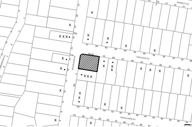
The proposed development was placed on public exhibition and was notified to adjoining and nearby landowners between 23 October 2017 and 9 November 2017 in accordance with the Notification and Exhibition requirements of the HDCP. During this period, Council received 75 submissions and a petition with 60 signatures.
The map below illustrates the location of those nearby landowners who made a submission that are in close proximity to the development site.
|
|
|||
|
• PROPERTIES NOTIFIED
|
X SUBMISSIONS RECEIVED |
PROPERTY SUBJECT OF DEVELOPMENT |
|
|
47 SUBMISSIONS RECEIVED OUT OF MAP RANGE |
|||
Many submissions received were electronic with no residential address attached to the submission.
1 submission was received in support of the development.
75 submissions objected to the development, and a petition of 60 signatures were provided generally on the grounds that the development would result in:
Unacceptable increase in traffic and traffic safety
Comment: The proposal was accompanied by a Traffic and Parking report. A further discussion is provided in Section 2.1.1 of this report.
Unacceptable off and on street car parking
Comment: The proposal complies with Council’s numerical standards for car parking which takes into account child numbers and staff. Accordingly there is no requirement to provide on-street parking.
No objections are raised in regard to parking. A further discussion is provided in Section 2.1.1 of this report.
Unacceptable noise impacts from the centre
Comment: Council considers that the submitted amended acoustic report does not satisfactorily address potential acoustic concerns for surrounding residential land uses. The submitted acoustic report acknowledges that the centre would be likely to marginally exceed the recommended noise criteria for outdoor play areas for residential receivers.
The independent review concluded that the predicted noise levels do not comply and would cause detrimental impact to the residential amenity.
A further discussion is provided in Section 2.8.8 of this report.
Unacceptable impact on the character of the street
Comment: Council considers the proposed acoustic wall would be out of character with the existing streetscape.
A further discussion is provided in Section 2.5 of this report.
An overdevelopment of the site/ excessive bulk and scale
Comment: The proposal would comply with the maximum height allowance of 8.5m, floor area and setback requirement. However the acoustic wall surrounding the site would add to the overall bulk and scale of the development.
A further discussion is provided in Section 2.5 and Section 2.8 of this report.
Unacceptable Pedestrian Safety
Comment: The parking assessment provided concludes that the proposal would be compliant with relevant Australian Standards regarding car parking spaces. It is also recommended by Council that a pedestrian path be constructed along the street frontages to allow for safe access into the centre. No objections are raised in this regard. However the pedestrian path may conflict with the existing trees on Councils road reserve.
There are existing child care centres within the vicinity of the site
Comment: The child care centre can be located at any distance from existing or proposed childhood education and care facility in accordance with Clause 25(a) of the Childcare SEPP. No objections are raised in this regard.
The development would cause overshadowing
Comment: Council considers that the development would not result in significant overshadowing of the private open space of adjoining properties No. 2 Nicholson and No.51 Oakleigh Avenue. A further discussion is provided in Section 2.8 of this report.
The location is not acceptable for a child care centre
Comment: Council considers that the location of the centre is generally acceptable with respect to Part 3.1 of the CCPG.
A further discussion is provided in Section 2.2 of this report.
Unacceptable location of the outdoor play areas
Comment: Council considers that the location of the outdoor play area, given the number of children, would result in amenity and acoustic conflict for adjoining properties.
A further discussion is provided in Section 2.2 of this report.
Unacceptable maximum number of children
Comment: The CCPG does not limit the maximum number of children for a child care centre. Notwithstanding, Council considers that a reduction in children could result in a building of smaller scale, with lower acoustic walls more appropriately suited to the site context.
The development would result in the removal of significant trees
Comment: The development would result in the removal of up to 9 trees. Of these a turpentine tree would be removed. Council would accept the removal of this tree subject to replacement planting of the same species on the site. A revised landscape plan would be required to show the location of the replacement Turpentine.
A further discussion is provided in Section 2.4 of this report.
The submitted documents provide conflicting and not enough information
Comment: Council considers that the submitted documentation is not sufficient, specifically there is conflicting information regarding the preservation of trees, lack of detail and errors within the acoustic report, elevation plans, no traffic assessment and lack of information regarding earthworks and site remediation.
Unacceptable construction impacts including traffic and noise
Comment: A Construction Traffic Management Plan has not been provided with the application to address traffic impacts during the construction of the development.
This information was not provided and an appropriate assessment was unable to be undertaken.
The acoustic fencing being more than 1.8m
Comment: Amended plans indicate the acoustic boundary fencing to be between 1.8m to 2.4 metres high which a 300mm polycarbonate extension would be provided on the boundaries of the outdoor play area.
Further discussion on this is found at Section 2.8.8 of this report.
5.2 Public Agencies
The development application was not referred to any Public Agencies for comment.
6. THE PUBLIC INTEREST
Section 4.15(1)(e) of the Act requires Council to consider “the public interest”.
The public interest is an overarching requirement, which includes the consideration of the matters discussed in this report. Implicit to the public interest is the achievement of future built outcomes adequately responding to and respecting the future desired outcomes expressed in environmental planning instruments and development control plans.
The proposed child care centre is contrary to Council’s planning controls, the Child Care Planning Guideline 2017 and does not contain sufficient information. Accordingly, it is considered that the proposed development would not be in the public interest.
CONCLUSION
The application proposes demolition of existing structures and construction of a 59 place purpose built child care centre. The centre would be two storeys with a basement car park comprising 15 spaces.
The proposal is contrary to the planning objectives within Part 1.3 of the Childcare Planning Guideline 2017 in that the proposal is not compatible within the existing streetscape and the proposal does not adequately minimise adverse impacts on adjoining properties and the neighbourhood. The proposal is contrary to the design principles of Part 2 in relation to visual built form and amenity. The proposal is contrary to the Part 3 considerations of the guideline with respect to Part 3.2 Local character, streetscape and the public domain interface, Part 3.3 Building orientation, envelope and design, Part 3.4 Landscaping, Part 3.5 Visual and acoustic privacy and Part 3.6 Noise and pollution.
The proposal is contrary to local planning controls and does not comply with the HDCP prescriptive measures for landscaping, outdoor play area, tree preservation and noise.
75 submissions have been received by Council objecting to the proposal. More than 10 of the submissions received are unique in respect to the concerns raised regarding the proposal. The Local Planning Panel is the determining authority for the application.
The application is recommended for refusal.
Note: At the time of the completion of this planning report, no persons have made a Political Donations Disclosure Statement pursuant to Section 10.4 of the Environmental Planning and Assessment Act 1979 in respect of the subject planning application.
RESPONSIBLE OFFICER
The officer responsible for the preparation of this Report is Jasmin Blazevic.
|
Cassandra Williams Team Leader - Major Applications Planning and Compliance Division |
Rod Pickles Manager - Development Assessment Planning and Compliance Division |
|
1.⇨ |
Locality Map |
|
|
|
2.⇨ |
Site Plan |
|
|
|
3.⇨ |
Floor Plans |
|
|
|
4.⇨ |
Elevations and Sections |
|
|
|
5.⇨ |
Shadow Plan |
|
|
File Reference: DA/1111/2017
Document Number: D07601980
Schedule 1
1. In accordance with Section 4.15(1)(a)(i) of the Environmental Planning and Assessment Act 1979, the proposal does not comply with Clause 23 of State Environmental Planning Policy (Educational Establishments and Childcare Facilities) 2017 and the Child Care Planning Guideline 2017 as:
1.1 The proposal is contrary to the planning objectives within Part 1.3 of the Guideline in that the proposal is not compatible within the existing streetscape and the proposal does not adequately minimise adverse impacts on adjoining properties and the neighbourhood.
1.2 The proposal is contrary to the design principles of Part 2 of the Guideline in relation to built form, landscaping and amenity.
1.3 The proposal is contrary to the Part 3 considerations of the guideline with respect to Part 3.2 Local Character, Streetscape and the public domain interface, Part 3.3 Building Orientation, Envelope and Design, Part 3.4 Landscaping, Part 3.5 Visual and Acoustic Privacy and Part 3.6 Noise and Pollution.
1.4 The proposal is contrary to Part 4 of the Guideline in respect to the provision of minimum outdoor play area and storage.
2. The proposed development would exceed acceptable noise levels as prescribed in the NSW Environment Protection Authorities (EPA) Noise Policy for Industry (NPFI), 2017.
3. In accordance with Section 4.15(1)(a)(i) of the Environmental Planning and Assessment Act 1979, the proposal contains insufficient information in order for an assessment to be undertaken in accordance with the State Environmental Planning Policy (Vegetation in Non-Rural Areas) 2017.
4. In accordance with Section 4.15(1)(a)(i) of the Environmental Planning and Assessment Act 1979, the proposal contains insufficient information in order for an assessment to be undertaken in accordance with Clause 6.2 Earthworks of the Hornsby Local Environmental Plan 2013.
5. Pursuant to Section 4.15(1)(b) of the Environmental Planning and Assessment Act 1979, the development would require acoustic fencing that would have unacceptable visual impacts on the streetscape and character of the area.
6. Pursuant to Section 4.15(1)(b) of the Environmental Planning and Assessment Act 1979, the development would result in an adverse environmental and amenity impact on the built environment as the proposal would not provide sufficient landscaping and deep soil planting.
7. In accordance with Section 4.15(1)(a)(iii) of the Environmental Planning and Assessment Act 1979, the proposal does not comply with the desired outcomes or the prescriptive measures of the Hornsby Development Control Plan 2013 in respect to Part 7.1.3 Setbacks, 7.1.4 Landscaping and Part 7.1.5 Open Space.
8. Pursuant to Section 4.15(1)(e) of the Environmental Planning and Assessment Act 1979, the development would not be in the public interest as the proposal is contrary to the local planning controls.
LPP Report No. LPP9/19
Local Planning Panel
Date of Meeting: 1/05/2019
![]() 2 DEVELOPMENT APPLICATION - CONSTRUCTION OF A ONE
STOREY AND TWO STOREY INDUSTRIAL BUILDING COMPRISING 32 INDUSTRIAL UNITS AND 44
SELF-STORAGE UNITS, STRATA SUBDIVISION AND LANDSCAPING - 50A DUFFY AVENUE
THORNLEIGH
2 DEVELOPMENT APPLICATION - CONSTRUCTION OF A ONE
STOREY AND TWO STOREY INDUSTRIAL BUILDING COMPRISING 32 INDUSTRIAL UNITS AND 44
SELF-STORAGE UNITS, STRATA SUBDIVISION AND LANDSCAPING - 50A DUFFY AVENUE
THORNLEIGH
EXECUTIVE SUMMARY
|
DA No: |
DA/619/2018(Lodged on 2 July 2018) |
|
Description: |
Construction of a one storey and two storey industrial building comprising 32 industrial units and 44 self-storage units, strata subdivision and landscaping |
|
Property: |
Lot 2 DP 211095, No. 50A Duffy Avenue |
|
Applicant: |
Dedico Development Services |
|
Owner: |
NCI Holdings Pty Ltd |
|
Estimated Value: |
$10,371,583 |
|
Ward: |
B |
· The application involves construction of a one storey and two storey industrial building comprising 32 industrial units and 44 self-storage units as well as strata subdivision and landscaping at the southern portion of No. 50A Duffy Avenue Thornleigh.
· The proposed development generally complies with the requirements of the relevant environmental planning instruments and the Hornsby Development Control Plan 2013 with the exception of the maximum building height. The applicant has made a submission in support of a variation to this development standard in accordance with Clause 4.6 of the HLEP. The request is considered well founded.
· 20 unique submissions and a petition with 27 signatures have been received objecting to the proposal.
· The application is required to be determined by the Hornsby Local Planning Panel as 10 or more unique submissions have been received.
· It is recommended that the application be approved.
|
THAT the Hornsby Local Planning Panel assume the concurrence of the Secretary of the Department of Planning and Environment pursuant to Clause 4.6 of the Hornsby Local Environmental Plan 2013 and approve Development Application No. DA/619/2018 for the construction of a one storey and two storey industrial building comprising 32 industrial units and 44 self-storage units, strata subdivision and landscaping at Lot 2 DP 211095, No. 50A Duffy Avenue, Thornleigh subject to the conditions of consent detailed in Schedule 1 of Report No. LPP9/19 |
BACKGROUND
The site has historically been used for farming and agricultural purposes. Council records indicate industrial development occurring on the site from 1959. The most recent use of the land was for the manufacture of metal packaging. There is no current land use.
In February 2014, the applicant wrote to Council seeking support for the re-zoning of the site to medium density housing. On 21 February 2014, Council wrote to the applicant and advised that it would not support in principle the re-zoning of the subject site for residential use.
On 10 July 2018, Complying Development Certificate No. CDP/663/2018 was issued for the partial demolition of an existing warehouse and administration building at the rear of the site. These works have commenced on site.
On 19 December 2019, the Hornsby Local Planning Panel resolved to approve DA/510/2018 for the Torrens title subdivision of one lot into six as a staged development subject to the following additional conditions:
1. Trees Nos. 36, 39 and 42- 45 within the front setback area to be retained.
2. The stormwater system be accommodated within the Sefton Road reserve to facilitate the retention of the trees within the front setback area.
3. The 5 metre wide landscape strip at the rear of proposed Lots 1 - 4 be incorporated within proposed Lot 5.
application history
On 2 July 2018, the subject application was lodged.
On 2 August 2018, Council requested information regarding stormwater dispersal and stormwater treatment. On 6 August 2018, the requested information was submitted to Council.
On 22 August 2018, Council held a meeting with the applicant at Council’s offices to discuss the progress of the application. Council at this meeting requested the height of the proposal be lowered, additional open space be provided and more details of landscaping be provided. On 14 September 2018, amended plans were submitted to Council including a more detailed landscape plan, a lower pitched roof and reduced ceiling heights to lower the overall height by 0.98m. The amended plans were accompanied by a revised Clause 4.6 variation.
On 7 September 2018, Council requested more detailed information regarding the proposed hours of operation and vehicle access. On 13 September 2018, the requested information was submitted to Council.
On 13 November 2018, Council requested additional information regarding waste and rigid vehicle access to the site. On 15 November 2018, the requested information was submitted to Council.
On 30 January 2019, Council requested amendments to the submitted acoustic report, more details of proposed earthworks, further details regarding land contamination and a construction management plan comprising an environmental management plan and construction traffic management plan. On 20 February 2019, the requested information was submitted to Council.
On 8 March 2019, Council requested revisions to the construction management plan. On 15 March 2019, the requested information was submitted to Council.
On 7 March, Council requested additional separation between the outdoor eating area and the southern adjoining residential developments in the form of landscaping. On 27 March 2019, a revised landscape plan was submitted to Council with additional landscaping setbacks.
On 2 April 2019, Council requested additional details regarding boundary fencing. On 4 April 2019, the requested information was submitted to Council.
On 10 April 2019, Council held discussions with the applicant who agreed in principle to the following conditions of consent; modifications to include a privacy screen on the western elevation of the first floor car park, deletion of two western facing first floor windows, fixed louvers for Unit No. 32 and restricted hours of access to the self-storage units to between 6am-10pm Monday to Sunday.
THE SITE
The 20,240m2 site is located on the southern side of Sefton Road Thornleigh and is irregular in shape.
Current vehicle access to the site is from Sefton Road and from a private road known as Whitecroft Place which is accessed from Duffy Avenue.
The Sefton Road frontage comprises a car park with rows of planted vegetation and an industrial warehouse. The southern portion of the site is currently vacant with the exception of an Ausgrid substation.
The site falls from the southern boundary towards Sefton Road at the front. The north-western portion of the site is bushfire prone.
The site is surrounded by a mixture of land uses with industrial to the east, medium density residential to the west and low density residential to the north and south.
The northern portion of the site fronting Sefton Road is proposed for subdivision under the approved DA/510/2018. The rear of the site would is identified on the approved subdivision plan as “Lot 7” (under Stage 2) with an area of 7,831m2 however is identified in the subject application as “Lot 6”.
Proposed Lot 6 would benefit from a right of carriageway, easement for services and an easement to drain water variable width. Lot 6 would be burdened by a right of carriageway, easement for services and an easement for electricity purposes.
Proposal
The development would occur at the southern portion of the site known as Lot 6.
The application proposes the construction of a one storey and two storey industrial building comprising 32 industrial units and 44 self-storage units with 19 mezzanine office, car parking as well as strata subdivision and landscaping.
The 44 self-storage units would occupy the ground floor and would have a gross floor area of 1,156m2. Vehicle drop off areas would be provided in front of each unit with a dedicated vehicle turning area located within the building. There is no separate car parking provided for the self-storage units given the type of use proposed. The applicant proposes 24 hour access to the self-storage units.
The 32 industrial units would occupy both buildings and internal include ancillary office mezzanine areas with a total gross floor area of 4,167m2. A total of 62 car parking spaces are proposed. A communal open space is proposed at the rear of the site for the use of the occupants of the industrial units. No specific uses are proposed for the industrial units and would be subject to future applications. Whilst no specific business identification signage is proposed as part of this application, signage area is anticipated above each individual warehouse along the north-east elevation subject to future approval.
Vehicle access to the site during construction and operation is proposed exclusively from Sefton Road via common driveway adjacent to the western boundary of the site.
Seven trees would be removed as part of the development. A total of 30 trees and 190 shrubs are proposed to be planted.
1. STRATEGIC CONTEXT
1.1 Greater Sydney Region Plan - A Metropolis of Three Cities and North District Plan
A Metropolis of Three Cities – the Greater Sydney Region Plan has been prepared by the NSW State Government to guide land use planning decisions for the next 40 years (to 2056). The North District Plan is a guide for implementing A Metropolis of Three Cities - the Greater Sydney Region Plan at a District level and is a bridge between regional and local planning.
The plans set strategy and actions for accommodating Sydney’s future population growth and identifies key targets such as dwelling numbers, infrastructure planning, liability, sustainability and productivity. An important vision of the strategy involves managing and maintaining industrial land close to centres and transport in order to ensure critical services are available to support businesses and residents.
Part 5 of the Metropolis of Three Cities relates to “Productivity” and a key objective is to ensure industrial and urban services land is planned, retained and managed. It defines a light industry as a “wide range of business that service other business and populations. Include warehousing, freight and logistics, construction and building supplies, and domestic storage”. The strategy notes that light industry should be located on mixed lot sizes depending on the sizes and needs of the business as well as being located close to surrounding residential and commercial community they directly serve.
The development would allow for a range of industrial units with varying uses and would be located close to surrounding medium and low density residential as well as commercial and general industrial land uses.
The development is considered consistent with A Metropolis of Three Cities and the North District Plan, by retaining industrial land and enabling further development that would serve a wide range of uses to support a growing population.
2. STATUTORY CONTROLS
Section 4.15(1)(a) requires Council to consider “any relevant environmental planning instruments, draft environmental planning instruments, development control plans, planning agreements and regulations”.
2.1 Hornsby Local Environmental Plan 2013
The proposed development has been assessed having regard to the provisions of the Hornsby Local Environmental Plan 2013 (HLEP).
2.1.1 Zoning of Land and Permissibility
The subject land is zoned IN1 General Industrial under the HLEP. The objectives of the zone are:
· To provide a wide range of industrial and warehouse land uses.
· To encourage employment opportunities.
· To minimise any adverse effect of industry on other land uses.
· To support and protect industrial land for industrial uses.
· To permit other land uses that provide facilities or services to meet the day-to-day needs of workers in the area.
The proposed development is defined as ‘Light industry’ and ‘Self storage units’. The HLEP defines the uses as follows:
Light industry means a building or place used to carry out an industrial activity that does not interfere with the amenity of the neighbourhood by reason of noise, vibration, smell, fumes, smoke, vapour, steam, soot, ash, dust, waste water, waste products, grit or oil, or otherwise.
Self-storage units means premises that consist of individual enclosed compartments for storing goods or materials (other than hazardous or offensive goods or materials).
Both uses are permissible in the zone with Council’s consent. The development is considered consistent with the objectives of the zone as it would allow a wide range of industrial land uses, encourage employment opportunities and maintain land for industrial uses.
2.1.2 Height of Buildings
In accordance with Clause 4.3 of the HLEP, the site has a maximum building height of 10.5m.
The original application proposed a maximum building height of 12.53m. In response to concerns raise by Council, amended plans were submitted reducing the height to 11.55m. The proposed height does not comply with 10.5m height limit and is discussed further under Section 2.1.4 of this report.
2.1.3 Floor Space Ratio
In accordance with Clause 4.4 of the HLEP, the maximum floor space ratio (FSR) for the site is 1:1.
The development would add an additional gross floor area (GFA) of 5,372m2 to the existing industrial building on site with a GFA of 3,670m2. Accordingly the maximum FSR of the site would be 0.44.7:1 and complies with the HLEP.
Following the registration of the plan of subdivision approved under DA/510/2018, the proposed lot would have a maximum FSR of 0.68.6:1 and would comply.
2.1.4 Exceptions to Development Standards
The application has been assessed against the requirements of Clause 4.6 of the HLEP. This clause provides flexibility in the application of the development standards in circumstances where strict compliance with those standards would, in any particular case, be unreasonable or unnecessary or tend to hinder the attainment of the objectives of the zone.
The proposed development at its highest point exceeds the maximum building height development standard prescribed under Clause 4.3 of the HLEP by 1.05m, or 10%. The non-compliant area is limited to the upper roof of Unit Nos. 17-32 within the two storey building within centre of the site
The objective of the Height of buildings control is to permit building heights that are appropriate for the site constraints, development potential and infrastructure capacity of the locality.
The applicant has made a submission in support of a variation to Council’s development standards in accordance with Clause 4.6 of the HLEP. The applicant states the proposed variation is considered to be consistent with the objectives of the control and is justified as follows:
1. Objectives of the Clause 4.3 Height of Buildings Standard under HLEP 2013
A key determination of the appropriateness of a Clause 4.6 Variation to a development standard is the proposed development’s compliance with the underlying objectives and purpose of that development standard. Indeed, Wehbe v Pittwater Council recognized this as one of the ways in which a variation to development standards might be justification. In Four2Five Pty Ltd v Ashfield Council, it was found that the proponent must demonstrate compliance with these objectives.
Therefore, while the site is subject to a specified numerical control for building height, the objectives and underlying purpose behind the development standard are basic issues for consideration in the development assessment process.
The objectives of Clause 4.3 under the HLEP 2013 are as follows:
(a) To permit a height of buildings that is appropriate for the site constraints, development potential and infrastructure capacity of the locality.
The height of the proposed development would be in keeping with the surrounding built form elements of the IN1 General Industrial zone, as identified with the vast diversity of general industries present directly east from the site.
2. Objectives of the Zone
The site is currently zoned IN1 General Industry under HLEP 2013. The proposed development is consistent with the following IN1 zone objectives:
· To provide a wide range of industrial and warehouse land uses.
· To encourage employment opportunities.
· To minimise any adverse effect of industry on other land uses.
· To support and protect industrial land for industrial uses.
· To permit other land uses that provide facilities or services to meet the day-to-day needs of workers in the area.
The proposed development would provide further industrial and warehouse land uses which would encourage employment opportunities for the local community and greater area.
3. Establishing if the Development Standard is Unreasonable or Unnecessary
Subclause 4.6(3)(a) and the judgement in Four2Five Pty Ltd v Ashfield Council emphasised the need for the proponent to demonstrate how the relevant development standard is unreasonable or unnecessary in the circumstances.
The proposed development is consistent with the existing (and desired) character of the site and the surrounding area. The proposed contravention of the development standard will not result in any built amenity impacts such as view loss or privacy loss or increased overshadowing.
The proposed exceedance of the building height will retain compatibility with the surrounding development and the environmental planning framework in terms of visual appearance, and adverse environmental impacts as the proposed height non-compliance relates to works undertaken on the portion of the site with the lowest RL level.
No adverse environmental impacts onto the surrounding environment have been identified.
The abovementioned justifications are considered valid and in this instance the proposed Clause 4.6 Variation is considered to be acceptable. The proposed development represents a more efficient use of the site. The objectives of the relevant clause and IN1 General Industrial zone would be upheld as a result of the proposed development.
4. Sufficient Environmental Planning Grounds to Grounds to Justify Contravening the Development Standard
The variation to the development standard for height of buildings is considered well founded in this instance as:
· The proposed development is consistent with the underlying objective or purpose of the standard as demonstrated in Section 4.1;
· The proposed contravention of the development standard results from the gradient of the landform, contravening the building height provision by 1.05m, pursuant to Clause 4.3 of the HLEP 2013. In this regard, no adverse environmental impacts with regard to excessive bulk and scale, overshadowing, loss of views or privacy due to the physical composition would occur to surrounding sites.
· The proposed development will remain compatible with General Industrial land uses in light of the above; and
· Compliance with the remaining development standards applicable to the site is achieved.
5. Public Interest
As outlined in Section 2.2, Four2Five Pty Ltd v Ashfield Council emphasised that it is for the proponent to demonstrate that the proposed non-compliance with the development standard is in the public interest. Subclause 4.6(4)(a)(ii) requires the proposed development be in the public interest because it is consistent with the objectives of the standard and the objectives for development within the zone in which the development is proposed to be carried out.
Sections 1 and 2 have already demonstrated how the proposed development is consistent with the objectives of both Clause 4.3 and the IN1 zone under the HLEP 2013.
In Lane Cove Council v Orca Partners Management Pty Ltd (No 2) [2015] NSWLEC 52, Sheahan J referred to the question of public interest with respect to planning matters as a consideration of whether the public advantages of the proposed development outweigh the public disadvantages of the proposed development.
The public advantages of the proposed development are as follows:
· Attracting a greater number and diversity of industrial uses into the locality;
· Contribute positively to the industrial character of the general industrial zone; and
· Enabling an opportunity for increased employment due to increased industrial and storage units.
There are no significant public disadvantages which would result from the proposed development. The proposed development is therefore considered to be justified on public interest grounds.
6. Public Benefit in Maintaining the Clause 4.3 Height of Buildings Control
Given that strict compliance with the Clause 4.3 building height control would result in the proposal not being able to provide additional industrial units which encourage job growth in the local community and the provision of vital service, there is no genuine public benefit in maintaining this strict building height control in the context of the proposed development.
7. Summary
For the reasons outlined above, it is considered that the variation to Clause 4.3 of HLEP is well-founded in this instance and is appropriate in the circumstances. Furthermore, the Variation request is considered to be well founded for the following reasons as outlined in Clause 4.6 of the HLEP, Four2Five Pty Ltd v Ashfield Council and Wehbe v Pittwater Council:
· Compliance with the development standard is unreasonable and unnecessary in the circumstances;
· There are sufficient environmental planning grounds to justify contravening the development standard;
· The development is in the public interest;
· The development is consistent with the objectives of the particular standard;
· The development is consistent with the objectives for development within the zone;
· The objectives of the standard are achieved notwithstanding the non-compliance with the standard; and
· The public benefit in maintaining strict compliance with the development standard would be negligible.
Overall, it is considered that the proposed Clause 4.6 Variation to the maximum building height control is entirely appropriate and can be clearly justified having regard to the matters listed within HLEP Clause 4.6.
The State Government’s Guidelines on varying development standards recommend considering the provisions of Clause 4.6 of the HLEP and the ‘five part test’ established by the Land and Environment Court as follows:
1. the objectives of the standard are achieved notwithstanding non-compliance with the standard;
2. the underlying objective or purpose of the standard is not relevant to the development and therefore compliance is unnecessary;
3. the underlying object of purpose would be defeated or thwarted if compliance was required and therefore compliance is unreasonable;
4. the development standard has been virtually abandoned or destroyed by the council’s own actions in granting consents departing from the standard and hence compliance with the standard is unnecessary and unreasonable;
5. the compliance with development standard is unreasonable or inappropriate due to existing use of land and current environmental character of the particular parcel of land. That is, the particular parcel of land should not have been included in the zone.
The applicant’s submission to vary the maximum building height development standard is generally considered well founded.
The underlying objective of the height of buildings development standard is still considered relevant to the proposal. However, 100% compliance in this circumstance is considered both unreasonable and unnecessary because:
· The maximum building height is exceeded as the centre of the site has been previously excavated by 1 to 3m to provide a level building platform of RL 172. It is noted that the standard instrument Local Environmental Plan requires the building to be measured from the existing ground level, not the natural ground level. If the site had not been previously excavated, the building would be generally compliant with height. Further, the western side of the site has not been previously excavated to the same extent. Therefore when viewed from the adjoining western residential areas or the driveway it would appear at a compliant 10.5m height;
· Whilst a section of the two storey building exceeds the maximum height by 1.05m, a large portion development is under the height limit. Further, the overall proposal is significantly under the maximum FSR and provides building setbacks in excess of HDCP guidelines. Accordingly, the bulk and scale of the development is considered appropriate for the site;
· The height non-compliance would be limited to the roof form of the building and would not be perceptible when viewed from Sefton Road given it would be located behind a large industrial warehouse building; and
· The height non-compliance would not cause significant adverse impacts to surrounding properties in terms of overshadowing, visual impacts or view loss. The non-compliant area would be setback 135m from Sefton Road and approximately 23m from the nearest residential dwelling while being separated by an access road and existing vegetation.
The proposal demonstrates sufficient environmental planning grounds to justify contravening the height of buildings development standard for the following reasons:
· The development has predominantly designed to conform to existing site conditions with the two storey building component located within the level centre of the site and the single storey component located at the high point nearest to residential receivers;
· Relocating the two storey component of the development to the rear or the site would result in greater overshadowing and a larger amenity impact to residential developments to the south; and
· The overall proposal is significantly under the maximum FSR permitted and provides building setbacks in excess of HDCP guidelines. Accordingly, the siting and scale of the buildings are is considered appropriate for the subject site.
The development is considered to meet the objectives of the maximum height of buildings development standard and the IN1 general industrial zone for the following reasons:
· The development as a whole generally conforms to the existing topography of the site and provides adequate separation in accordance with local controls from sensitive development;
· The buildings maximum height of RL183.55 is generally comparable to adjacent industrial development to the east at RL180.08 and lower than the residential development to the south at RL 185.88. Further, at its peak the building would only be 3m higher than the existing warehouse building on site to the north, despite being located at a higher elevation; and
· The development provides for the orderly and economic use of the land whilst providing a wide range of industrial units to encourage local employment.
It is considered that the proposal satisfies the Land and Environment Court’s parameters for a well-founded objection to depart from a development standard. Additionally, the proposal would not set an unacceptable precedent for the precinct, taking into account that the excess height is limited to the roof form and on a previously excavated portion of an undulating site.
It is considered that the applicant’s written submission has satisfactorily addressed the relevant matters under Clause 4.6 of the HLEP and as such the proposal’s non-compliance with the height development standard is considered acceptable. The contravention of the development standard does not raise any matter of significance for State and regional environmental planning, and there is no public benefit in strictly maintaining the development standard in this case.
Based on this assessment, it is considered that compliance with the development standard would be unreasonable and unnecessary in the circumstances of the case. Accordingly, the Clause 4.6 submission is supported.
2.1.5 Heritage Conservation
Clause 5.10 of the HLEP sets out heritage conservation provisions for Hornsby Shire. The site does not include a heritage item and is not located in a heritage conservation area. Accordingly, no further assessment regarding heritage is necessary.
2.1.6 Earthworks
Clause 6.2 of the HLEP states that consent is required for proposed earthworks on site. Before granting consent for earthworks, Council is required to assess the impacts of the works on adjoining properties, drainage patterns and soil stability of the locality.
The application is supported by a bulk earthworks cut and fill plan prepared by Northrop. The plan indicates that 3,348m3 of cut and 1,323m3 of fill would be required to construct the development. The application notes that no fill would be brought onto the site to facilitate the development.
An assessment is provided below in accordance with Clause 6.2 of the HLEP.
(a) The likely disruption of, or any detrimental effect on, drainage patterns and soil stability in the locality of the development.
Comment: The proposed earthworks are unlikely to have any detrimental effect on the drainage patterns or soil stability in the locality given the existing patterns of the site are being maintained with a downward slope to the northern boundary.
The construction of an on-site stormwater detention system together with water quality treatment will ensure that stormwater runoff for the development would maintain pre-existing flows to the piped stormwater system in Sefton Road.
(b) The effect of the development on the likely future use or redevelopment of the land.
Comment: The earthworks would not likely restrict future use or redevelopment of the land.
(c) The quality of the fill or the soil to be excavated, or both.
Comment: Conditions are recommended that all excavated material removed from the site must be classified by a suitably qualified person and disposed of at an approved waste management facility. Conditions of consent are also recommended that no fill be imported onto the site.
(d) The effect of the development on the existing and likely amenity of adjoining properties.
Comment: Minor cut and fill is proposed adjoining the western boundary of the site in order to re-grade the driveway to provide Ausgrid with access to the rear of the site to an existing substation. No substantial amenity impacts are anticipated from these earthworks given the submitted plans indicate all required earthworks would be between 0-0.5m in height. It is noted that existing canopy trees, proposed vegetation and a boundary fence would separate the driveway from the western residential developments. Further, Conditions of consent are recommended requiring a dilapidation report to be prepared prior to works for properties immediacy adjoining earthworks.
(e) The source of any fill material and the destination of any excavated material.
Comment: Conditions are recommended that all excavated material removed from the site must be classified by a suitably qualified person and disposed of at an approved waste management facility. Conditions of consent are also recommended that no fill be imported onto the site.
(f) The likelihood of disturbing relics.
Comment: Council records do not indicate that any relics are likely to occur on site.
(g) The proximity to, and potential for adverse impacts on, any waterway, drinking water catchment or environmentally sensitive area.
Comment: The site is not located within close proximity to any natural watercourse, drinking water catchment or environmentally sensitive area.
(h) Any appropriate measures proposed to avoid, minimise or mitigate the impacts of the development.
Comment: Conditions are recommended that sediment and erosion controls be in place prior to the commencement of any works and that any retaining walls be designed and certified by a suitably qualified engineer.
In summary, the proposal is considered acceptable in regard to Clause 6.2 of the HLEP.
2.2 State Environmental Planning Policy No 55 – Remediation of Land
State Environmental Planning Policy No. 55 (SEPP 55) requires that Council must not consent to the carrying out of any development on land unless it has considered whether the land is contaminated or requires remediation for the proposed use.
The proposal includes a contamination report, detailed site investigation report and a remedial action plan. The submitted information identifies the presence of an underground storage tank in close proximity to the development.
An assessment of contamination and the submitted documentation was undertaken as part of Council’s assessment of DA/510/2018 for the subdivision of one lot into six. Conditions Nos. 1-5 of DA/510/2018 require a NSW Environmental Protection Authority accredited Site Auditor be engaged and for remediation works including the removal of an underground storage tank and removal of asbestos fragments within the garden beds in the northern portion of the site. Condition No. 6 requires a Site Audit Statement (SAS) be issued certifying that the whole site is suitable for future industrial land use.
The application proposes works to commence for DA/619/2018 once the underground storage tank has been removed, prior to a SAS being issued for the whole of the site. Council raises concerns with this approach given that the northern portion of the site (where asbestos fragments are located) is nominated in the submitted construction management plan as the waste storage and unloading area. Accordingly, Council recommends that a SAS be issued for the whole site prior to works commencing.
Subject to a condition requiring the submission of a site wide SAS stating that the site is suitable for the proposed use as a deferred commencement application is considered satisfactory in regard to SEPP 55.
2.3 State Environmental Planning Policy (Vegetation in Non-Rural Areas) 2017
State Environmental Planning Policy (Vegetation in Non-Rural Areas) 2017 (Vegetation SEPP) commenced 25 August 2017 and aims to protect the biodiversity and amenity values of trees within non-rural areas of the state.
Part 3, Clause 9(2) of the Vegetation SEPP states that a Development Control Plan may make a declaration in any manner relating to species, size, location and presence of vegetation. Accordingly, Part 1B.6.1 of the Hornsby Development Control Plan 2013 (HDCP) prescribes works that can be undertaken with or without consent to trees and objectives for tree preservation.
Part 3.1.2 of this report provides an assessment in accordance with Part 1B.6.1 of the HDCP
2.4 Sydney Regional Environmental Plan No. 20 – Hawkesbury – Nepean River
The site is located within the catchment of the Hawkesbury Nepean River. Part 2 of this Plan contains general planning considerations and strategies requiring Council to consider the impacts of development on water quality, aquaculture, recreation and tourism.
Subject to the implementation of sediment and erosion control measures and stormwater management to protect water quality, the proposal would comply with the requirements of the Policy.
2.5 Section 3.42 Environmental Planning and Assessment Act 1979 - Purpose and Status of Development Control Plans
Section 3.42 of the Environmental Planning and Assessment Act 1979 states that a DCP provision will have no effect if it prevents or unreasonably restricts development that is otherwise permitted and complies with the development standards in relevant Local Environmental Plans and State Environmental Planning Policies.
The principal purpose of a development control plan is to provide guidance on the aims of any environmental planning instrument that applies to the development; facilitate development that is permissible under any such instrument; and achieve the objectives of land zones. The provisions contained in a DCP are not statutory requirements and are for guidance purposes only. Consent authorities have flexibility to consider innovative solutions when assessing development proposals, to assist achieve good planning outcomes.
2.6 Hornsby Development Control Plan 2013
The proposed development has been assessed having regard to the relevant desired outcomes and prescriptive requirements within the Hornsby Development Control Plan 2013 (HDCP). The following table sets out the proposal’s compliance with the prescriptive requirements of the Plan:
|
Hornsby Development Control Plan 2013 |
|||
|
Control |
Proposal |
Requirement |
Compliance |
|
Site Area |
20,240m2 |
N/A |
N/A |
|
Gross Floor Area |
Existing – 3,670m2 Proposed – 5,372m2 Total – 8,993m2 |
N/A |
N/A |
|
Floor Space Ratio |
0.44.7:1 |
1:1 |
Yes |
|
Ancillary office space |
Combined: 15.7% Unit 24: 40.88% |
Max 30% |
Yes No |
|
Height |
2 storeys – 11.55m |
2 storeys – 10.5m |
No |
|
Front Setback (Sefton Road) |
120m |
5m |
Yes |
|
Side Setback (East) |
1m |
0m |
Yes |
|
Side Setback (West) |
9.5m |
5m |
Yes |
|
Rear Setback (South) |
6m building |
5m |
Yes |
|
Driveway Setback (Western boundary) |
0m-1.6m (existing) |
2m |
No |
|
Driveway Setback (Southern boundary) |
5.2m |
2m |
Yes |
|
Car Parking |
62 spaces |
42 spaces |
Yes |
|
Employee Outdoor Area |
114m2 |
84m2 (1m2 per 50m2 GFA) |
Yes |
As detailed in the above table, the proposed development generally complies with the prescriptive requirements within the HDCP with the exception of height, the mezzanine floor area of Unit 24 and the driveway setback. The matters of non-compliance are detailed below, as well as a brief discussion on compliance with relevant desired outcomes.
2.6.1 Scale
As discussed in Section 2.1.4 of the report, the roof line of the building exceeds the maximum 10.5 metre building height by 10% (1.05m).
Council acknowledges that the point of encroachment is limited to the roof portion of the two storey building given the centre of the site has previously been excavated. When considered on balance, the proposed variation to the height control would not cause any overshadowing or amenity impacts to adjoining properties given the non-compliant height would not be perceptible when viewed from adjoining properties or Sefton Road.
Accordingly, the proposed height exceedance is considered satisfactory in respect to the built form of the surrounding industrial and residential environment.
The proposal would comply with other scale requirements of the HDCP including maximum floor space ratio and maximum number of storeys.
2.6.2 Setbacks
Table 5.1.2(a) of the HDCP prescribes that 0m setbacks apply to an industrial site where adjoining another industrial site and 5m setback applies where adjoining sensitive development.
The proposed buildings would comply with all setback controls and no objections are raised in this regard as per the table in Section 2.6 of this report.
Part 5.1.2(d) of the HDCP notes that driveways up to 8m wide with deep soil verges of at least 2m are able to encroach into a 5m setback where adjoining sensitive development. The driveway would be less than 8m in width, however it would be set back between 0m-1.6m from the western boundary and therefore does not strictly comply with this control.
In assessing this non-compliance, the western boundary of the site has historically been utilised for vehicle access and when originally constructed did not require any separation given the western adjoining property was only zoned from industrial to residential purposes circa 2000.
Council supports this non-compliance for the following reasons:
· The driveway location is existing;
· The location of the approved access handle from Sefton Road and the existing industrial warehouse restricts the driveway to the western boundary. Relocating the driveway further away from the boundary would result in substantial earthworks given the western portion of the site maintains the existing ground level and the centre of the site has previously been excavated;
· The majority of the driveway would be located 1.6m from the side boundary which allows sufficient landscaping separation as specified in the submitted landscape plan;
· Where the driveway is located with a 0m setback, adjoining residential dwellings are separated by existing vegetation and Allamanda Way. The closet residential dwelling at this point is approximately 17m away from the driveway which provides adequate separation;
· There is existing vegetation and large trees on the eastern side of Allamanda Way which provides additional landscape screening in addition to the 1.6m on the subject site; and
· The submitted acoustic report anticipates full compliance with noise criteria can be achieved for adjoining residential receivers.
2.6.3 Ancillary Office Area
Part 5.1.1(e) of the HDCP states that the maximum floor space permitted to be constructed/utilised for ancillary office purposes is 30% of the gross floor area within an individual premise. Unit 24 would have an ancillary office area of 40% the gross floor area of the industrial unit and would not comply with this measure.
The intent of this prescriptive measure is to ensure that industrial warehouses are the primary development with offices an ancillary component. This is due to individual offices being prohibited within the subject industrial zone and to ensure that offices are not sub-let for office business purposes only. Given that that the only pedestrian entry to the ancillary office of Unit 24 would be via the internal staircase, it is anticipated that this office area would be used in conjunction with the warehouse unit which meets the intent of the control. Accordingly, no objections are raised in this regard.
Additionally, Council notes that the overall ancillary office to warehouse ratio is 15.7% which is substantially lower than the 30% HDCP control.
2.6.4 Vehicle Access and Parking
A Traffic Assessment Report (TAR) was submitted with the proposal prepared by Terraffoc Pty Ltd and notes that operational access to the site is to be limited via Sefton Road only. An assessment regarding parking, traffic and access is provided below.
Traffic
In assessing the traffic impact of the self-storage units, neither the HDCP nor the RMS Guide to Traffic Generating Developments 2002 incorporates a land use traffic generation rate for self-storage developments. The TAR references surveys from other similar self-storage facilities provides a traffic generation of 1 vehicle trip per hour (vtph) per 300m2 for both the peak AM and PM periods. This gives an estimated 4 vtph for both peak periods.
In regard to the proposed industrial units, The RMS Guide to Traffic Generating Developments 2002 provides a peak hour traffic generation of 1 trip per 100m2 of GFA for factories and 1 trip per 40m2 for offices. The RMS guide also notes that if an office component is less than 20% of the total GFA the higher rate of calculation is not warranted. This gives an estimated 42 vtph for both peak periods.
Based on these calculations, a total of 46 vtph for peak periods is predicted for the development. The assessment concludes that the surrounding road networks have capacity for this increase in traffic generation.
Council’s traffic assessment raised no objections to the proposal on traffic grounds based on the estimated increase in vehicle trips.
Parking - Industrial Units
The proposed 32 industrial units would rely on 62 spaces. Additionally each unit would contain a dedicated loading area of 6.4m x 3.5m.
The HDCP has a parking requirement of 1 space per 100m2 of GFA for an industrial development and 1 space per 40m2 of GFA for ancillary office areas. The proposed industrial units have a total GFA of 4,175m2 comprising 3,610m2 (86.5%) of industrial floor area (including loading docks) and 565m2 (13.5%) of mezzanine office floor space. As the overall office component is less than 20% of the total floor area, only the industrial car parking rate is applied. Application of the HDCP parking rates yields a parking requirement of 42 spaces. The industrial unit component of the development complies with this requirement with the provision of 62 spaces.
The application also includes strata subdivision of each unit. In accordance with the HDCP car parking rates, a condition is recommended that each unit is allocated car parking rates based on the parking requirements of the HDCP.
In addition to car parking, bicycle parking is applied at 1 space per 1,000m2 for GFA for industrial developments. Accordingly, a condition is recommended that the approved plans be amended to include a bicycle rack for at least 5 bicycles.
Parking - Self-Storage
The proposed 44 self-storage units on the ground floor would have direct vehicle access via a 5.8m wide two way aisle system located within the building. This would allow those accessing the units to park directly outside the unit when unloading/loading. The storage area contains a turning bay to enable forward entry and exit.
The submitted TAR includes the following regarding parking:
· Neither Council’s Development Control Plan nor the RMS’s “Guide to Traffic Generating Developments” (October 2002) incorporate a parking requirement specifically for self-storage developments.
· As the internal access aisles of the proposed development are 5.8m wide, a vehicle parked adjacent to a storage unit does not restrict traffic flow through the facility. To that end, the provision of dedicated owner or visitor parking spaces are not considered warranted for this component of the development.
No objections are raised to the proposed unloading areas for the self-storage area given there is a 20 space oversupply of parking for the industrial units and that vehicles accessing the self-storage units would not likely be parking for a substantial period of time.
Access
Vehicle access to the site would be via the existing right of way from Sefton Road.
Section 5.1.6 of the HDCP prescribes that “each industrial unit/premises should have access to a loading and unloading area on-site” and “where a development consists of multiple industrial units, at least 1 communal loading area that is capable of accommodating an articulated vehicle should be provided on-site”.
In response to Part 5.1.6 of the HDCP, each industrial unit is provided with a loading area on the ground floor measuring 6.4m x 3.5m and therefore a communal unloading area is not required. The design and size of these loading areas is considered appropriate for the site given each unit is of modest size. Swept paths have been provided showing that a medium rigid vehicle (MRV) could service each unit and exit in a forward direction. According, the proposed development would provide adequate vehicle access.
2.6.5 Open Space
The provision of outdoor space is recommended under Part 5.1.4 of the HDCP. The application proposes a 114m2 outdoor space within the south-western corner of the site. An assessment is provided below in accordance with the HDCP.
a. An outdoor eating and sitting area should be provided on-site at a rate of 1m2 per employee, with a minimum total area of 10m2 and a minimum dimension of 2 metres.
Comment: The outdoor open space is provided at a rate of 1m2 per employee (1m2 per 50m2 GFA) with a minimum dimension of 2m
b. On-site communal areas should incorporate green space where possible.
Comment: Amended plans include vegetation surrounding the outdoor area with a 2m setback to the southern boundary in compliance with the HDCP.
c. Communal seating and lunch gathering areas should be shaded in summer and have protected sunny areas in winter.
Comment: The open space area would be shaded by existing trees and proposed shrubs and is considered acceptable in this regard.
d. Where an outdoor space cannot be accommodated on-site, an internal eating/sitting area is to be provided.
Comment: An external common area has been provided and is generally considered easily accessible via a ramp. Notwithstanding, it is anticipated that majority of industrial units would also provide internal eating/sitting areas at a future fitout stage.
2.6.6 Waste
The submitted waste management plan (WMP) states that each industrial unit would use its own bins to suit their own requirements. Council accepts that this is an acceptable arrangement.
The WMP states that the waste collection vehicle would be a medium rigid vehicle (MRV) and would collect bins from outside each unit from the car park. Turning paths have been provided that demonstrate manoeuvring for the MRV. Council notes that Part 1C.2.3 of the HDCP encourages new developments to be designed for heavy rigid vehicles (HRV), however on balance accepts that it will be possible to find waste collection service providers with medium rigid trucks.
In order to ensure amenity for neighbouring residential areas and that waste vehicles can easily access the site, the following conditions are recommended:
· Waste collections be confined to 7AM to 8PM;
· Design certificates and detailed plans confirming compliance with Australian Standards relating to off-street commercial vehicles and garage collection areas; and
· A design certificate and detailed plans confirming that the waste can be directly collected from every industrial unit be submitted with any Construction Certificate application.
Subject to conditions, the proposal is considered satisfactory in regard to waste collection.
2.6.7 Noise and Vibration
Part 1C.2.5 of the HDCP applies to the development and aims to attenuate noise as best as possible to minimise disturbance to surrounding sensitive land uses. The site is located within an industrial precinct and adjacent to residential zones to the south and west.
Council’s original assessment of the application raised concerns with the submitted acoustic assessment, prepared by NG Child & Associates. Concerns were raised with inaccurate information, grammatical errors and lack of information regarding sleep disturbance.
Accordingly, an amended acoustic report (15 March 2019) and a boundary fencing report (4 April 2019) was submitted and forms the basis of Council’s assessment. The reports present an acoustic assessment of the proposed industrial and self-storage development in accordance with relevant acoustic and vibration requirements. The reports conclude that the acoustic impacts of the development on nearby commercial and residential receivers has been assessed for daytime, evening and night-time periods, and found to comply with relevant guidelines and protocols including the Noise Policy for Industry (NPI) 2017 (formerly the NSW Industrial Noise Policy 2000) and the Hornsby Shire Council Noise Guideline. The assessment included the impacts of traffic noise, noise generated by plant and equipment, night time noise and potential sleep disturbance and makes the following recommendations:
Roof/Ceiling: Acoustic insulation installed between the roof of the development and the Level 1 mezzanine on the southern and western sides of the development to provide acoustic protection for residential receivers.
Fencing: That vegetation planting is included as per the submitted landscape plan. The acoustic report also notes that a solid 2.1m high boundary fence (colorbond or equivalent) would be sufficient for noise attenuation for the proposed use.
Notwithstanding, the boundary fencing report (4 April 2019) notes that the site is currently surrounded by 2.4m high lap and cap timber fence and recommends this be maintained and replaced where gaps in the fence currently exist.
Plant and equipment: All plant and equipment be installed so that acoustic noise emissions are less than 5 dBA above existing background sound levels.
Certification: That certification be provided validating the performance of plant and equipment and acoustic treatment prior to the issue of a Construction and Occupation Certificate.
Council’s environmental compliance assessment of the amended acoustic report generally concurs with its findings. Notwithstanding, the following concerns and conditions are recommended:
· Standard hours of operation (7am-7pm Monday to Saturday) as listed within Schedule 8 of State Environmental Planning Policy (Exempt and Complying Development Codes) 2008 be applied to the 32 light industrial units;
· Council raises concerns with the proposed 24 hour access to the self-storage facility due to potential amenity impacts on adjoining residential properties. As per Part 1C.2.5(h) of the HDCP reasonable hours of operation including deliveries should be used to further limit potential noise impacts. Accordingly, Council recommends time restrictions be placed on access to the self-storage to between 7am-10pm daily. Council also notes that unlike a commercially operated self-storage facility, the proposed units would be strata titled and individually owned. Therefore, the anticipated level of use is less than that of a commercial facility and access to 10pm is considered reasonable in this circumstance;
· Acoustic certification be provided from a qualified acoustic consultant prior to the issue of a construction certificate certifying that all plant and mechanical equipment will have not have an acoustic impact of greater than 5dBA above RBL at any property boundary;
· Certification be provided that the current and proposed 2.4m high lapped and capped timber fence is in good order with no defects or gaps present;
· Acoustical certification be provided from a qualified acoustic consultant prior to an Occupation Certificate certifying that all acoustic works have been completed in accordance with the recommendations contained within the revised Noise assessment prepared by NG Child & Associates and the fencing report;
· Operational conditions requiring all noise generated by the proposed development must be attenuated to prevent levels of noise being emitted to adjacent premises which possess tonal, beating and similar characteristics or which exceeds background noise levels by more than 5dB(A); and
· Any modifications required to existing boundary fencing be at the cost of the developer.
Subject to conditions, the proposal is considered satisfactory in regard to the objectives of Part 1C.2.5 of the HDCP.
2.7 Section 7.11 Contributions Plans
Hornsby Shire Council Section 94A Contributions Plan 2014 – 2024 applies to the development as the estimated costs of works is greater than $100,000. Should the application be approved, an appropriate condition of consent is recommended requiring the payment of a contribution in accordance with the Plan.
3. ENVIRONMENTAL IMPACTS
Section 4.15(1)(b) of the Act requires Council to consider “the likely impacts of that development, including environmental impacts on both the natural and built environments, and social and economic impacts in the locality”.
3.1 Natural Environment
3.1.1 Stormwater Management
The proposed stormwater drainage system includes a stormwater detention system and water quality control facility to achieve the HDCP urban stormwater quality targets. The proposed system is designed for a 1 in 100 year storm.
The proposed stormwater drainage system would drain to an existing stormwater drainage easement on the subject site which drains via gravity to a Council piped stormwater system in Sefton Road.
Subject to recommended conditions, the proposal is acceptable in respect to the HDCP desired outcomes for stormwater management to protect waterways and maintain environmental flows.
3.1.2 Tree and Vegetation Preservation
Part 1B.6.1 of the HDCP relates to tree preservation and prescribes the applicable approval process for tree work or removal. The proposal would necessitate the removal of the following 7 trees located within and adjacent to the building footprint as follows:
Tree 92: Liquidambar styraciflua (American sweetgum) located adjacent to the rear boundary of the site adjacent to the building footprint.
Tree 93: Cedrus deodara (deodar cedar) located within the building footprint.
Tree 94: Araucaria cunninghamii (hoop pine) located adjacent to the building footprint.
Tree 95: Juniperus chinensis “Keteleeri” (Chinese jupiter) located within the proposed building footprint.
Tree 96: (dead) located adjacent to the building footprint.
Tree 97: Schefflera actinophylla (umbrella tree) located within the building footprint.
Tree 98: Acer palmatum (Japanese maple) located within the building footprint.
No objections are raised to their removal given they are not considered locally significant trees, they are not visible from the public domain and sufficient replacement planting is proposed. The replacement planting includes 30 trees characteristic of the Blue-Gum High Forest including; Angophora costata (Sydney red gum), Backhousia myrtifolia (grey myrtle), Elaeocarpus reticulatus (Blueberry Ash) and Eucalyptus saligna (Sydney blue gum).
Council’s tree assessment recommends the following conditions in order to protect retained trees on site:
· A project arborist be appointed to the project to provide monitoring, certification and guidance throughout all works in accordance with the Australian Standard AS 4970-2009 - Protection of Trees on Development Sites.
· Tree protection fencing, trunk protection and ground protection measures be implemented;
· Tree protection zones be maintained.
· Services which enter the TPZ of any trees be undertaken by tree sensitive construction techniques such as directional drilling or manual excavation.
3.1.3 Landscaping
Part 5.1.3 of the HDCP relates to landscaping. A discussion is provided below in regard to the relevant prescriptive measures of Part 7.1.4 of the HDCP.
a. Landscaping should be included in building setback areas to complement the appearance of the building.
Comment: Landscaping in the form of canopy trees and shrubs is proposed on the eastern, western and southern boundaries and no objections are raised in this regard.
b. A minimum of 50% of the required setback area to all public roads should be landscaped area. This landscaping is to extend along the full length of each street frontage (other than a vehicle entry/exit driveway).
Comment: N/A - no street frontage.
c. Setbacks from sensitive areas should be fully landscaped. Where landscaping is required for screening, landscaping should include species that will grow to the height of the building.
Comment: The site has setbacks to sensitive land uses on the southern and western boundaries.
In regard to the southern boundary, a 5m southern building setback enables significant canopy trees to be planted that would exceed the height of the proposed buildings. No objections are raised in this regard.
In regard to the western boundary, the 5m building setback is predominately occupied by the existing and proposed driveway and only a 1.6m landscape strip can be provided. Shrubs are proposed in this landscape strip however would not grow to the height of the proposed buildings. Notwithstanding, existing vegetation on the boundary of the site exceeds the height of the proposed buildings and would highly limit views to the new development.
In summary, the proposal is considered satisfactory in regard to landscaping provisions of the HDCP.
3.2 Built Environment
3.2.1 Built Form
The built form of the proposed 1-2 storey buildings are considered satisfactory in respect to the surrounding industrial and residential environment. The scale of the buildings and proposed setbacks would not result in significant overshadowing or amenity impacts to adjoining properties
3.2.2 Privacy
It is noted that no privacy provisions under the HDCP apply to the site as it is located within an industrial precinct. Notwithstanding, Clause 4.15(1)(b) of the Act requires consideration to the likely impacts of the development on the built environment as well as potential social impacts. An assessment regarding the adjacent southern and western residential properties is provided below.
No substantial privacy impacts are anticipated to the southern residential complex given the following:
· The proposed adjoining building would be single storey;
· A compliant building setback of 5m is proposed;
· A 2.4m fence borders the site; and
· Substantial vegetation and tree planting is proposed within the 5m setback.
Notwithstanding, the tiled patios serving Unit No. 15 and 16 would be located up to 2m above the existing ground level and have the potential for overlooking while proposed vegetation screening is growing. Accordingly, conditions are recommended that the approved plans be amended to include a privacy screen.
No substantial privacy concerns are raised for the western residential complex given the proposed side boundary setback of 9.5m, the 2.4m fence height and existing large trees that provides a visual barrier. Notwithstanding, privacy concerns could be increased if the vegetation is ever lost. Accordingly, conditions of consent are recommended that the approved plans be amended as follows:
· An increase in the first floor balustrade surrounding the car park to 2m in height on the western elevation;
· The deletion of the two western facing windows serving the office of Unit No. 24; and
· Fixed louver screens to Unit No. 32.
Subject to conditions, the privacy impact of the proposal is not considered to have a detrimental impact on the built environment or a substantial social impact.
3.2.3 Sunlight Access
Part 5.1.5 of the HDCP encourages development that provides reasonable sunlight to sensitive areas.
Council calculations based on the submitted plans indicate that the development would not restrict 50% of the principle private open space of adjoining residences on the southern and western elevations to less than 2 hours on winter solstice. Accordingly, the application is considered compliant with the provision of Part 5.1.5(b) of the HDCP and meets the objectives of the control.
3.2.4 Construction Impacts
In response to concerns raised with construction movements given the scale of the development (5,323m2 of GFA and 3,348m3 of excavation), Council requested a Construction Management Plan (CMP), Construction Traffic Management Plan (CTMP) and Environmental Management Plan (EMP).
The submitted CMP (revision 5) includes details surrounding the mitigation measures and management procedures for the proposed development. Specifically, it details erosion control measures, hours of operation, environmental and regulatory responsibilities, complaints handling, and communication and assigns key responsibilities. Council raises no objections to the content of the CMP subject to conditions requiring its enforcement during construction.
The submitted CTMP (revision 1e) estimates the traffic generation associated with construction activities of the proposal to be similar or lower than that of existing traffic associated with the historical operation of the NCI (National Canning Industries) factory on site. The CTMP notes the following details of importance:
· All vehicle movements for works under DA/619/2018 shall use Sefton Road for access. There will be no construction trucks accessing the site via Whitecroft Place;
· All trucks will be able to enter and leave the site in a forward manner;
· No trucks are to queue on Sefton Road or any surrounding streets;
· All construction vehicle parking will be on site;
· Erosion and sediment control is to be established;
· Work hours are to be limited to between 7am and 5pm Monday to Saturday; and
· Truck movements would likely be 30 (2 per trip) on a typical day and 70 on concrete poor days.
Council raises no objections to the content of the CTMP subject to conditions requiring its enforcement during construction.
The submitted EMP (revision 4) details site specific controls relating to licencing, permits, site training, communication, incidents and emergencies as well as corrective and preventative actions. Council raises no objections to the content of the EMP subject to conditions requiring its enforcement during construction.
3.3 Social Impacts
The social impacts of the development on the local and broader community have been considered with specific reference to the potential employment generation within the site.
There would be a number of multiplier effects that the development would provide throughout the local and regional economies. These multiplier effects would result from the sourcing of goods and services from suppliers to businesses within the complex as well as the increased consumption generated by the increase of employment in the area.
3.3.1 Crime Prevention
Part 1C.2.7 of the HDCP encourages development designed to reduce crime risk and minimise opportunities for crime.
The NSW Department of Planning’s Crime Prevention and the Assessment of Development Applications notes a formal risk assessment is needed for any development that is likely to create a risk of crime and include examples of shopping centres, transport interchanges, large scale residential development or development of public places. Whilst the development does not fall under that category, Part 1C.2.7 of the HDCP does apply as the development is for a new industrial complex.
The amended Statement of Environmental Effects (SEE) (September 2018), prepared by Willow tree Planning includes an assessment against the four principles of crime prevention through environmental design (CPTED). An assessment is as follows:
· Principle 1 – Surveillance
The HDCP encourages development designed to provide clear sight lines between public and private places, effective lighting of public places and appropriate landscaping.
The SEE argues that the development would orientate active areas such as office areas and building entrances towards the existing accessway of the site and include low-lying landscaping and external lighting.
Subject to the all lighting being designed and installed as not to cause nuisance to the amenity of adjoining properties the proposal would comply with Australian Standard AS 4282 – Control of the Obtrusive Effects of Outdoor Lighting. Further, conditions are recommended that lighting outside operating hours be sensor security lighting only and not permanent lighting.
· Principle 2 – Access Control
The HDCP encourages physical or symbolic barriers and restrict movement to clearly defined public spaces.
The SEE notes that the site would be secured by physical fencing and access gates as well as direction signage for vehicles car parking and pedestrian paths.
No objections are raised in this regard. It is noted that the site would also have a single entry/exit point from Sefton Road.
· Principle 3 - Territorial Reinforcement
The HDCP encourages design elements that contribute to the creation of a sense of space of public spaces.
The application mentions that security controlled entrances to the site and building would emphasise separation between the public and private domain and that well maintained landscape design would indicate the development is well-used and cared for to reduce criminal activity. No objections are raised in this regard.
· Principle 4 - Space Management
The HDCP encourages the creation of a CPTED report, however it is noted that a formal report is not required given the size of the development.
The SEE states that pathways and planter boxes would be maintained by a landscape contractor and continuous repairs would discourage vandalism. No objections are raised in this regard.
In summary, Council considers that the development is unlikely to result in the creation of spaces that constitute a substantial crime risk. Further, it is considered that the limiting of operating hours of the self-storage units, the developments orientation toward the front of the site and the proposed landscaping meet the 4 principles of crime prevention.
4. SITE SUITABILITY
Section 4.15(1)(c) of the Act requires Council to consider “the suitability of the site for the development”.
4.1 Bushfire Risk
The north-western corner of the site is mapped as being bushfire prone. Notwithstanding, the subject portion of the site in which the development is proposed is not mapped as bushfire prone.
The application is supported by a bushfire assessment report, prepared by Australian Bushfire Consulting Services which recommends the site be maintained as an Asset Protection Zone / Inner Protection Area as detailed in the NSW Rural Fire Service’s document ‘Standards for Asset Protection Zones’ and Appendix 2 and 5 of Planning for Bushfire Protection 2006. Conditions are recommend in this regard.
5. PUBLIC PARTICIPATION
Section 4.15(1)(d) of the Act requires Council to consider “any submissions made in accordance with this Act”.
5.1 Community Consultation
The proposed development was placed on public exhibition and was notified to adjoining and nearby landowners between 3 July 2019 and 3 August 2018 in accordance with the Notification and Exhibition requirements of the HDCP. During this period, Council received 1 submission.
The application was further notified between 14 August 2018 and 31 August 2018. During this period, Council received 1 additional submission.
A further 18 submissions and a petition with 27 signatures have been received since this period.
The map below illustrates the location of those nearby landowners who made a submission that are in close proximity to the development site.
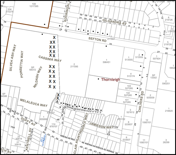

|
NOTIFICATION PLAN |
|||
|
• PROPERTIES NOTIFIED
|
X SUBMISSIONS RECEIVED |
PROPERTY SUBJECT OF DEVELOPMENT |
|
20 Submissions and a petition with 27 signatures objected to the development, generally on the grounds that the development would result in:
· Unacceptable traffic and parking impacts including vehicle access from Whitecroft Place and Wild Ash Way
Comment: Submissions received raises concerns with the following; increased vehicle traffic, concerns with vehicles accessing the site from Whitecroft Place and Wild Ash Way.
In response to these concerns, the traffic and parking assessment submitted with the application projects an acceptable level of traffic increase resulting from the future development of the site with regard to the existing traffic network. Council’s traffic assessment raises no objections in this regard.
Further, parking rates on site are provided in accordance with Council’s controls. Operational and construction vehicle access to the site is proposed exclusively from Sefton Road and not from Whitecroft Place. Conditions are recommended in this regard. This matter has been further addressed in Section 2.6.4 of this report.
Submissions also note that boom gates should be installed on Wild Ash Way and that security should be provided on Whitecroft Place once vehicle access is stopped.
In response to these concerns, Council cannot reasonably enforce the installation of boom gates on adjoining properties as it does not substantially relate to the development proposal. Further, Council records indicate that Whitecroft Place is on two separate titles with different ownership that have not been included in this development proposal.
· Unacceptable driveway width and turning areas for the self-storage units
Comment: The 5.8m driveway width is considered acceptable given the anticipated levels of use. The width would allow a vehicle to overtake a parked vehicle. The turning areas are designed to comply with Australian Standard AS/NZS2890.1 and would allow vehicles to exit in a forward direction. This matter has been further addressed in Section 2.6.4 of this report.
· Unacceptable noise impact and mitigation measures
Comment: The submitted acoustic report anticipates full compliance with noise criteria can be archived for adjoining residential receivers. Further, conditions of consent are recommended that all acoustic mitigation measures be certified prior to occupation. This matter has been further addressed in Section 2.6.7 of this report.
A submission also notes that a single strata manager may not be able to respond to multiple or after hour noise complaints for the facility. Noise complaints can be lodged with Council’s Compliance Branch for investigation. For urgent noise problems the police could be contacted.
· Removal of the existing boundary fence and proposed colorbond/timber fence
Comment: The boundary fencing report (04/04/2019) submitted with the application indicates that a chain wire fence and netting currently exists for two sections on the western boundary of the site. The report recommends that the chain wire fence and netting be replaced with a 2.4m high lapped and capped timber fence to match the existing boundary fence. Conditions of consent are recommended in this regard.
The revised acoustic report, prepared by NG Child & Associates recommends that at least a 2.1m high Colorbond fence or equivalent be provided on the elevations adjoining residential areas in order to provide sufficient noise attenuation. The proposed and existing 2.4m lapped and capped timber fence exceeds these recommendations given the additional height.
A submission notes that an acoustic fire rated wall should be provided on all elevations adjacent to residential areas. Given the existing and proposed 2.4m lapped and capped timber fence exceeds acoustic recommendations, Council cannot reasonably request a higher wall.
Further, given the proposed minimum building separation of approximately 23m to the west and 17m to the south, a fire rated wall is not considered necessary. Council notes that the submitted BCA compliance capability report, prepared by Vic Lilli & Partners Pty Ltd concludes that the buildings themselves would comply with fire ratings specified in relevant Austrian Standards.
· Unacceptable hours of operation for the self-storage units
Comment: Conditions received raised objections to 24/7 access to the self-storage units and recommend limiting hours of access.
In response to this concern, Part 1C.2.5(h) of the HDCP prescribes that in addition to physical noise mitigation measures, reasonable hours of operation should apply to development in proximity to noise sensitive locations. Accordingly, Council raises objections to 24/7 access to the self-storage units. Conditions are recommend that access to the self-storage units be limited to between 7am-10pm daily. This matter has been further addressed in Section 2.6.7 of this report.
· Lack of security and inadequate crime prevention
Comment: Council considers that the development is unlikely to result in the creation of spaces that constitute a substantial crime risk. This matter has been further addressed in Section 3.4.1 of this report.
· Unacceptable removal of trees
Comment: The application proposes the removal of seven trees to facilitate the development. No trees would be removed located adjacent to the western boundary adjoining the Wild Ash residential complex. These trees listed for removal include a non-locally indigenous sweet-gum, liquidambar, deodar cedar, hoop pine, umbrella tree, Japanese maple and a dead tree.
The proposal includes planting of 30 locally native trees and is considered to sufficiently offset the loss of the 7 trees.
· Additional landscaping should be provided
Comment: A submission received notes that additional landscaping in the form of planter boxes should be provided surrounding the upper level carpark to provide aesthetic treatment and acoustic attenuation. A submission also notes that landscaping should be provided prior to works commencing.
In response to these submissions, a 2m high wall surrounding the upper level carpark on the western elevation is recommended as a condition of consent to limit any potential overlooking and reduce noise. The 2m wall would obstruct any views to proposed planter box planting. Further, planter boxes in this area would reduce turning areas for vehicles. Council also notes that planting landscaping prior to works commencing might result in damage to trees. Therefore a condition is recommended that all landscaping works be completed prior to occupation.
This matter is further discussed in Section 3.1.3 of this report.
· No plan of management for the self-storage units
Comment: Council considers that the limiting of operating hours of the self-storage units would negate the need for a plan of management. It is noted that the units would be individually owned unlike a commercial storage facility and accessed via a gated entry with a pass. No operational staffing is required. Additionally, a plan of management is not a required document as per the Hornsby Council submission guideline and Schedule 1 of the Environmental Planning and Assessment Regulation 2000.
· Unacceptable setbacks and driveway location
Comment: The proposed buildings would comply with all required boundary setbacks as per the HDCP. The driveway would be located 0m-1.6m from the western boundary and is considered satisfactory in regard to the specific circumstances of the development. This matter has been further addressed in Section 2.6.2 of this report.
· Unacceptable location of outdoor open space
Comment: The provision of an outdoor eating and sitting area is a recommendation under Part 5.1.5 of the HDCP. In order to address concerns raised, Council requested additional separation between the open space and residential dwellings to the south. Amended landscape plans (revision D) have included 2m of landscape separation between the outdoor area and the closest residential boundary.
· Potential light impact
Submissions received raise concerns with the lighting impact of the proposal.
In response to this concern, conditions are recommended that a certificate be obtained before occupation confirming that all lighting has been installed as not to cause nuisance to the amenity of adjoining land in accordance with Australian Standard AS 4282 – Control of the Obtrusive Effects of Outdoor Lighting. Additionally, conditions are recommended that only senor lighting be used outside of operating hours and angled inwards.
Further, it is noted that existing landscape provides a visual separation between the proposed buildings and dwellings to the west.
· Future use of light industrial units
Comment: Submissions have been received raising concerns about the potential future use of the industrial units and seek clarification.
In response to these concerns, conditions of consent are recommend limiting the use of the industrial units to “light industry” exclusively with standard operating hours of 7am-7pm Monday to Saturday. Alternative uses would require separate development consent.
It is noted that Council cannot reasonably place restrictions on future development that may be permissible in that zone with consent.
· Unacceptable overshadowing
Comment: The proposal is considered compliant with the solar access provisions of the HDCP and would maintain reasonable solar access to adjoining residential properties. No unreasonable overshadowing is anticipated for the western adjoining residential complex given the closest dwelling would be 23m from the proposed buildings. This matter has been further addressed in Section 3.2.3 of this report.
· Unacceptable privacy impact
Comment: The proposal is considered to provide a reasonable level of privacy to adjoining properties subject to conditions of consent requiring the deletion of western facing first floor windows and a privacy screening for the car park and patios of Units 15 and 16. This matter has been further addressed in Section 3.2.2 of this report.
· Unacceptable scale of development including height
Comment: The proposed buildings would comply with all relevant scale and setback requirements of the HDCP the HLEP including minimum boundary setbacks, maximum number of storeys and maximum floor space ratio with the exception of height.
Council acknowledges that the 10.5m height encroachment is limited to the roof portion of the two storey building given the centre of the site has previously been excavated. This matter has been further addressed in Section 2.1.4 of this report.
· Unacceptable construction impacts on amenity and health
In response to these concerns, Council requested a Construction Management Plan (CMP), Construction Traffic Management Plan (CTMP) and Environmental Management Plan (EMP).
Council considers that the content of these plans are sufficient and have included recommended conditions that they be complied with throughout the duration of works. This matter has been further addressed in Section 3.2.4 of this report.
· Lack of neighbour notification
Council notified the application in accordance with Part 1B.5 of the Hornsby Development Control Plan 2013 between 3 July 2018 and 3 August 2018. For Strata lots, written notice is directed to the owners corporation and not individual lots.
In response to submissions noting that notification letters were not received by some neighbours, Council re-notified the application between 14 August 2018 and 31 August 2018 and sent letters to specific strata properties on Sefton Road, Wild Ash, Cassinia and Silver Ash Way.
It is noted that Council continued to accept submissions outside the formal notification period.
· Lack of assessment from the Roads and Maritime Services (RMS)
Comment: The application does not meet the criteria for referral to the RMS pursuant to Schedule 3 of State Environmental Planning Policy (Infrastructure) 2007.
· Reduced property values
The application is required to be assessed in accordance with the matters of consideration listed within Clause 4.1.5 of the Environmental Planning and Assessment Act 1979. Council cannot object to development based on property value.
· A dilapidation report should be provided
Comment: A submission notes that dilapidation and vibration reports should be provided for all adjoining residential properties due to concerns with demolition and construction works.
Council notes that the subject development application does not propose demolition works.
In response to this concern, conditions of consent are recommended that a dilapidation report be prepared for the southern and eastern adjacent properties closest to where excavation works are proposed. This condition is recommended prior to works commencing.
5.2 Public Agencies
The development application was not referred to any Public Agencies for comment.
6. THE PUBLIC INTEREST
Section 4.15(1)(e) of the Act requires Council to consider “the public interest”.
The public interest is an overarching requirement, which includes the consideration of the matters discussed in this report. Implicit to the public interest is the achievement of future built outcomes adequately responding to and respecting the future desired outcomes expressed in environmental planning instruments and development control plans.
The application is considered to have satisfactorily addressed Council’s and relevant agencies’ criteria and would provide a development outcome that, on balance, would result in a positive impact for the community. Accordingly, it is considered that the approval of the proposed development would be in the public interest.
CONCLUSION AND STATEMENT OF REASONS
The application seeks consent for the construction of a one storey and two storey industrial building comprising 32 industrial units and 44 self-storage units as well as strata subdivision and landscaping.
A total of 20 submissions and a petition have been received objecting to the proposal generally on grounds of traffic, hours of operation, noise, hours of operation and scale.
The proposal generally complies with the relevant provisions Hornsby Local Environmental Plan 2013 and the Hornsby Development Control Plan 2013 with the exception of the maximum height of buildings development standard. The applicant has made a submission in support of a variation to this development standard in accordance with Clause 4.6 of the HLEP. The request is considered well founded.
Conditions are recommended to minimise disruption to residential amenity.
Accordingly, the proposed development is recommended for approval.
The reasons for this recommendation are:
· The proposed development generally complies with the requirements of the relevant environmental planning instruments and the Hornsby Development Control Plan 2013 with the exception of the maximum building height. The applicant has made a submission in support of a variation to this development standard in accordance with Clause 4.6 of the HLEP. The request is considered well founded.
· The proposed development does not create unreasonable environmental impacts to adjoining development with regard to visual bulk, overshadowing, solar access, amenity or privacy impacts.
· The development is considered consistent with the State Government’s “A Metropolis of Three Cities” and “North District Plan”, by retaining industrial land and enabling further development that would serve a wide range of uses to support a growing population.
· The development is considered to provide suitable landscaping and replacement tree planting for trees loss under the subject application and DA/510/2018.
Note: At the time of the completion of this planning report, no persons have made a Political Donations Disclosure Statement pursuant to Section 10.4 of the Environmental Planning and Assessment Act 1979 in respect of the subject planning application.
RESPONSIBLE OFFICER
The officer responsible for the preparation of this Report is Stephen Dobbs.
Attachments:
1. Locality Plan
2. Site Plan
3. Photomontage
4. Floor Plans
5. Elevations and Sections
6. Landscape Plan
|
Rod Pickles Manager - Development Assessment Planning and Compliance Division |
Cassandra Williams Team Leader - Major Applications Planning and Compliance Division |
|
1.⇨ |
Locality Plan |
|
|
|
2.⇨ |
Site Plan |
|
|
|
3.⇨ |
Landscape Plans |
|
|
|
4.⇨ |
Floor Plans |
|
|
|
5.⇨ |
Elevations and Sections |
|
|
|
6.⇨ |
Photomontage |
|
|
File Reference: DA/619/2018
Document Number: D07624796
SCHEDULE 1
GENERAL CONDITIONS
The conditions of consent within this notice of determination have been applied to ensure that the use of the land and/or building is carried out in such a manner that is consistent with the aims and objectives of the relevant legislation, planning instruments and council policies affecting the land and does not disrupt the amenity of the neighbourhood or impact upon the environment.
Note: For the purpose of this consent, the term ‘applicant’ means any person who has the authority to act on or the benefit of the development consent.
Note: For the purpose of this consent, any reference to an Act, Regulation, Australian Standard or publication by a public authority shall be taken to mean the gazetted Act or Regulation, or adopted Australian Standard or publication as in force on the date that the application for a construction certificate is made.
1. Deferred Commencement
a) Pursuant to Section 4.16(3) of the Environmental Planning and Assessment Act 1979, this consent does not operate until a Site Audit Statement issued by a NSW EPA accredited Site Auditor and Accompanying Site Audit Report is submitted to Council and the Principal Certifying Authority following remediation of the site as required under DA/510/2018. The Site Audit Statement must certify that the site is suitable for the proposed use.
b) Such information must be submitted within 36 months of the date of this notice.
Upon Council’s written satisfaction of the above information, the following conditions of development consent apply:
2. Approved Plans and Supporting Documentation
The development must be carried out in accordance with the plans and documentation listed below and endorsed with Council’s stamp, except where amended by Council and/or other conditions of this consent:
|
Plan No. |
Plan Title |
Drawn by |
Dated |
Council Reference |
|
18123 – Rev E (DA102) |
Roof Plan |
SBA Architects |
31/08/2018 |
|
|
18123 – Rev M (DA203) |
Lot 6 Lower Level Ground Floor Plan |
SBA Architects |
14/08/2018 |
|
|
18123 – Rev L (DA204) |
Lot 6 Lower Level Mezz Floor Plan |
SBA Architects |
14/08/2018 |
|
|
18123 – Rev P (DA205) |
Lot 6 Upper Level Ground Floor Plan |
SBA Architects |
31/08/2018 |
|
|
18123 – Rev P (DA206) |
Lot 6 Upper Level Mezz Floor Plan |
SBA Architects |
31/08/2018 |
|
|
18123 – Rev G (DA205) |
Lot 6 Upper Level Ground Floor Plan |
SBA Architects |
14/08/2018 |
|
|
18123 – Rev H (DA301) |
Lot 6 North Elevations |
SBA Architects |
31/08/2018 |
|
|
18123 – Rev G (DA302) |
Lot 6 South Elevations |
SBA Architects |
31/08/2018 |
|
|
18123 – Rev G (DA303) |
Lot 6 East & West Elevations |
SBA Architects |
31/08/2018 |
|
|
18123 – Rev N (DA305) |
Lot 6 Sections |
SBA Architects |
08/04/2019 |
|
|
Document Title |
Prepared by |
Dated |
Council Reference |
|
Revised Acoustic Report (CA/18/142-3003) |
NG Child & Associates |
15/03/2019 |
D07640630 |
|
Acoustic Considerations – Boundary Fencing Self-Storage & Industrial Unit Development |
NG Child & Associates |
04/04/2019 |
D07648459 |
|
Construction Management Plan (188191‐04_CMP_Rev5 ) |
R T Benbow |
15/03/2019 |
D07640630 |
|
Construction Traffic Management Plan (A18159688A Version 1e) |
Motion Traffic Engineers |
03/2019 |
D07640630 |
|
Environmental Management Plan (188191 04_EMP_Rev4) |
R T Benbow |
15/03/2019 |
D07640630 |
|
Landscape Plans (1114 L-01-L06- RevD) |
Sitedesign+Studios |
26/03/2019 |
D07642094 |
|
Civil Engineering Stormwater Management Report (181029) |
Northrop |
03/07/2018 |
D07498731 |
|
Stormwater Concept Plans (181029) |
Northrop |
04/07/2018 |
D07553676 |
|
Arboricultural Impact Assessment Report |
Jacksons Nature Works |
28/05/2018 |
D07477114 |
|
Operational Site Waste Minimisation and Management Plan |
Foresight Environmental |
27/06/2018 |
D07477107 |
|
Accessibility Review Report (8155) |
ABE Consulting |
28/06/2018 |
D07477107 |
|
Geotechnical Investigations (31499Zrpt) |
JK Geotechnics |
04/06/2018 |
D07477124 |
|
Bush Fire Assessment Report (18-141) |
Australian Bushfire Consulting Services |
18/06/2018 |
D07477117 |
3. Amendment of Plans
a) To comply with Councils requirement in terms of privacy and bicycle parking, the approved plans are to be amended as follows:
i) The “Lot 6 East & West Elevations” plan, prepared by SBA Architects, dated 31/08/2018 must be amended to delete the two first floor windows serving Unit No. 24 on the western elevation.
ii) The “Lot 6 East & West Elevations” plan, prepared by SBA Architects, dated 31/08/2018 must be amended to include a 2m high balustrade for the car park on the western elevation.
iii) The “Lot 6 East & West Elevations” plan, prepared by SBA Architects, dated 31/08/2018 must be amended to reference fixed louvers for the window serving Unit No, 32. The louver screen must have no individual openings more than 50mm wide and have a total of all openings less than 30% of the surface area of the screen.
iv) The “Lot 6 East & West Elevations” plan, prepared by SBA Architects, dated 31/08/2018, The “Lot 6 South Elevations” plan, dated 31/08/2018 and “Lot 6 Upper Level Ground Floor Plan”, dated 14/08/2018 must be amended to include a (1.7 to 2.2) metre high privacy screen at the rear of Unit No. 15 and 16 as marked in red. The screen must have no individual openings more than 30mm wide and have a total of all openings less than 30% of the surface area of the screen.
v) The architectural plans, prepared by SBA Architects, dated 14/08/2018-31/08/2018 must to be amended to include parking spaces for at least 5 bicycles.
b) These amended plans must be submitted with the application for the Construction Certificate.
4. Compliance with requirements of Site Audit Statement
Any requirements as conditions by the NSW EPA Site Audit Statement as per Condition No. 1 must be complied with throughout the construction and operation phase of the development.
5. Appointment of a Project Arborist
a) A project arborist with AQF Level 5 qualifications must be appointed to provide monitoring and certification throughout the construction period.
b) Details of the appointed project arborist must be submitted to Council and the PCA for registration with the application for the construction certificate.
6. Removal of Trees
a) This development consent permits the removal of trees numbered 92, 93, 94, 95, 96, 97 and 98 as identified on page 14 of Annexure B contained in the Arboricultural Impact Assessment submitted by Jacksons Nature Works 29/5/2018.
Note: The removal of any other trees from the site requires separate approval by Council in accordance with Part 1B.6 Tree and Vegetation Preservation of the Hornsby Development Control Plan, 2013 (HDCP).
7. Construction Certificate
a) A construction certificate must be approved by either Council or a Private Certifying Authority (PCA) prior to the commencement of any works on the site approved under this development consent.
b) The plans submitted with the application for the construction certificate must not be inconsistent with the plans approved under this development consent.
8. Section 7.12 Development Contributions
a) In accordance with Section 4.17(1) of the Environmental Planning and Assessment Act, 1979 and the Hornsby Shire Council Section 94A Development Contributions Plan 2014 - 2024, $103,715.80 must be paid towards the provision, extension or augmentation of public amenities or public services, based on development costs of $10,371,583.
b) The value of this contribution is current as at 3 April 2019. If this contribution is not paid within the financial quarter that this condition was generated, the contribution payable will be adjusted in accordance with the provisions of the Hornsby Shire Council Section 94 Development Contributions Plan and the amount payable will be calculated at the time of payment in the following manner:
$CPY = $CDC x CPIPY
CPIDC
Where:
$CPY is the amount of the contribution at the date of Payment
$CDC is the amount of the contribution as set out in this Development Consent
CPIPY is the latest release of the Consumer Price Index (Sydney – All Groups) at the date of Payment as published by the ABS.
CPIDC is the Consumer Price Index (Sydney – All Groups) for the financial quarter at the date applicable in this Development Consent Condition.
· c) The monetary contributions must be paid to Council:
(i) prior to the issue of the Subdivision Certificate where the development is for subdivision; or
(ii) prior to the issue of the first Construction Certificate where the development is for building work; or
(iii) prior to issue of the Subdivision Certificate or first Construction Certificate, whichever occurs first, where the development involves both subdivision and building work; or
(iv) prior to the works commencing where the development does not require a Construction Certificate or Subdivision Certificate.
Note: It is the professional responsibility of the Principal Certifying Authority to ensure that the monetary contributions have been paid to Council in accordance with the above timeframes.
Council’s S94A Development Contributions Plan may be viewed at www.hornsby.nsw.gov.au or a copy may be inspected at Council’s Administration Centre during normal business hours.
REQUIREMENTS PRIOR TO THE ISSUE OF A CONSTRUCTION CERTIFICATE
All approved building work must be carried out in accordance with the relevant requirements of the Building Code of Australia.
10. Sydney Water – Approval
This application must be submitted to Sydney Water for approval to determine whether the development would affect any Sydney Water infrastructure, and whether further requirements are to be met.
Note: Building plan approvals can be obtained online via Sydney Water Tap inTM through www.sydneywater.com.au under the Building and Development tab.
11. Stormwater Drainage
The stormwater drainage system for the development must be designed for an average recurrence interval (ARI) of 20 years and be gravity drained via an on-site detention and water quality treatment facility in accordance with the following requirements:
a) Connected directly to a constructed inter allotment stormwater drainage line.
b) Be designed by a Chartered Professional Civil/ Hydraulic Engineer of the Institution of Engineers, Australia
12. On Site Stormwater Detention
An on-site stormwater detention system must be designed by a chartered civil engineer and constructed in accordance with the following requirements:
a) Storage capacity to accommodate volume shall not be less 93 cubic metres and a maximum discharge of 247 litres per second.
b) Have a surcharge/inspection grate located directly above the outlet. Discharge from the detention system to be controlled via 1 metre length of pipe, not less than 50 millimetres diameter or via a stainless plate with sharply drilled orifice bolted over the face of the outlet discharging into a larger diameter pipe capable of carrying the design flow to an approved Council system.
c) Where above ground system is proposed and the average depth is greater than 0.3 metres, a ‘pool type’ safety fence and warning signs to be installed
d) Not be constructed in a location that would impact upon the visual or recreational amenity of residents.
e) An overflow/escape path shall be incorporated in the design.
13. Water Quality Treatment System
a) Stormwater discharging from the development site is to be treated to achieve the quality specified in Council’s Development Control Plan 2012 (table 1C.1.2(b) Urban Stormwater Quality Targets) and constructed in accordance with plans drawn by Northrop Consulting Engineers, Drawings DA14.01 and DA14.1, Revision 2, contained in Council document number D07553676.
b) Prior to occupation of the premises, a Chartered Civil/Hydraulic Engineer of the Institution of Engineers, Australia is to certify that works have been completed in accordance with the approved construction plan and the measures will achieve the targets specified in the condition.
14. Retaining Walls
To ensure the stability of the site, structural details of all required retaining walls must be submitted with the application of the Construction Certificate.
15. Road Dilapidation Report
Submit a dilapidation report to the Principal Certifying Authority detailing the condition of the surrounding roads and infrastructure. The report must document and provide photographs that clearly depict any existing damage to the road, kerb, gutter, footpath, driveways, street trees, street signs or any other Council assets in the vicinity of the development.
A ‘Dilapidation Report’ is to be prepared by a ‘chartered structural engineer’ detailing the structural condition of the following adjoining property’s before the commencement of works:
a) Lot 32 SP 71169, No. 12 Allamanda Way, Thornleigh;
b) Lot 41 SP 71169, No. 13 Allamanda Way, Thornleigh;
c) Lot 42 SP 71169, No. 16 Allamanda Way, Thornleigh;
d) Lot 33 DP 270192, No. 28 Livingstone Way Thornleigh;
e) Lot 34 DP 270192, No. 30 Livingstone Way Thornleigh;
f) Lot 35 DP 270192, No. 32 Livingstone Way Thornleigh;
g) Lot 36 DP 270192, No. 34 Livingstone Way Thornleigh;
h) Lot 18 DP 270192, No. 36 Livingstone Way Thornleigh; and
i) Lot 19 DP 270192, No. 38 Livingstone Way Thornleigh.
17. Waste Management Details
a) A design certificate and detailed plans are to accompany any Construction Certificate application, which demonstrate that each industrial light industrial unit has a bin storage area including the following requirements:
i) The floor is to be constructed of concrete at least 75mm thick and adequately graded to drain to a Sydney Water approved drainage fitting;
ii) The floor must be finished so that it is non-slip, sealed and impervious, and has a smooth and even surface covered at all intersections;
iii) The wall(s) must be finished with smooth faced non-absorbent material capable of being cleaned;
iv) The unit is to be provided with artificial light controllable within the room and adequate ventilation;
v) The unit is to be provided with an adequate supply of hot and cold water mixed through a centralised mixing valve with hose cock.
vi) The doors are to be robust and lockable, with a door opening of no less than 2m.
b) The access way (including ramp, vehicle turning areas, and site entry/exit) to be used by waste collection vehicles, must be designed in compliance with Australian Standard AS2890.2-2002 Parking Facilities Part 2: Off-street Commercial Vehicle Facilities for medium rigid vehicles.
Note: AS2890.2-2002 includes a maximum gradient of 1:6.5 for forward travel and 1:8 for reverse travel, a minimum vertical clearance of 4.5 m. These dimensions do not include wall thickness, support columns, ventilation shafts etc which must be added.
c) A design certificate and detailed plans are to accompany the Construction Certificate application that confirms that the waste can be directly collected from every industrial unit as detailed in the Waste Management Report. The design certificate is to specifically confirm that the:
i) Waste collection vehicle is able to access each industrial unit, adequately manoeuvre into position, load bins and exit the site
ii) Vertical clearance of 4.5m is provided along the route of travel to/from external entry/exit points to collection area
iii) The waste collection vehicle must be able to manoeuvre with limited need for reversing
iv) The grades of entry/exit must not exceed the maximum grades of AS2890.2 for a medium rigid vehicle
v) The floor of the basement has been designed to carry the load of the vehicle.
d) A Waste Management Plan Section One – Demolition Stage and Section Three – Construction Stage, covering the scope of this project and including the following details, is required to be submitted and approved by Council prior to the issue of a Construction Certificate at Waste@hornsby.nsw.gov.au and must include the following:
i) An estimate of the types and volumes of waste and recyclables to be generated;
ii) A site plan showing sorting and storage areas for demolition and construction waste and the vehicle access to these areas;
iii) How excavation, demolition and construction waste materials will be reused or recycled and where residual wastes will be disposed;
iv) The total percentage (by weight) of demolition and construction waste that will be reused or recycled.
Note: the site(s) to which the waste materials are taken must be legally able to accept those wastes.
18. Certification of Traffic Engineer
Prior to the issue of a Construction Certificate, a Certificate from an appropriate qualified Traffic Engineer is to be submitted to the Principal Certifying Authority (PCA) certifying that the parking modules and loading areas comply with AS 2890.1 Off-street car parking 2004 and AS 2890.2 Off-street commercial vehicle facilities 2002 .
REQUIREMENTS PRIOR TO THE COMMENCEMENT OF ANY WORKS
19. Erection of Construction Sign
a) A sign must be erected in a prominent position on any site on which any approved work is being carried out:
i) Showing the name, address and telephone number of the principal certifying authority for the work;
ii) Showing the name of the principal contractor (if any) for any demolition or building work and a telephone number on which that person may be contacted outside working hours; and
iii) Stating that unauthorised entry to the work site is prohibited.
b) The sign is to be maintained while the approved work is being carried out and must be removed when the work has been completed.
20. Protection of Adjoining Areas
A temporary hoarding, fence or awning must be erected between the work site and adjoining lands before the works begin and must be kept in place until after the completion of the works if the works:
a) Could cause a danger, obstruction or inconvenience to pedestrian or vehicular traffic;
b) Could cause damage to adjoining lands by falling objects; and/or
c) Involve the enclosure of a public place or part of a public place.
Note: Notwithstanding the above, Council’s separate written approval is required prior to the erection of any structure or other obstruction on public land.
a) To provide a safe and hygienic workplace, toilet facilities must be available or be installed at the works site before works begin and must be maintained until the works are completed at a ratio of one toilet for every 20 persons employed at the site.
b) Each toilet must:
i) be a standard flushing toilet connected to a public sewer; or
ii) be a temporary chemical closet approved under the Local Government Act 1993; or
iii) have an on-site effluent disposal system approved under the Local Government Act 1993.
22. Erosion and Sediment Control
To protect the water quality of the downstream environment, erosion and sediment control measures must be provided and maintained throughout the construction period in accordance with the manual ‘Soils and Construction 2004 (Bluebook)’, the approved plans, Council specifications and to the satisfaction of the principal certifying authority. The erosion and sediment control devices must remain in place until the site has been stabilised and revegetated.
Note: On the spot penalties may be issued for any non-compliance with this requirement without any further notification or warning.
23. Installation of Tree Protection Fencing
a) Tree protection fencing must be erected around trees numbered 8, 15, 16, 17, 19, 20, 21 as specified in the submitted Arboricultural Impact Assessment provided by Jacksons Nature Works, dated 28/5/2018 at a distance of no less than 3m except where in conflict with re-grading of the existing driveway where permission is sort from the project arborist.
b) All tree protection measures for the trees to be retained must have the protection measures for the ground, trunk and canopy installed in accordance with the relevant requirements of Australian Standard AS 4970-2009 - “Protection of Trees on Development Sites” .
24. Protection Certification
To ensure that all tree protection measures are correctly installed, a certificate from the appointed project arborist must be submitted to the Principal Certifying Authority confirming compliance with the tree protection requirements of this consent.
25. Garbage receptacle
a) To ensure appropriate construction site waste management and to avoid injury to wildlife a garbage receptacle must be provided at the work site before works begin and must be maintained until all works are completed.
a) The garbage receptacle must have a tight fitting lid and be suitable for the reception of food scraps and papers.
b) The receptacle lid must be kept closed at all times, other than when garbage is being deposited.
c) Food scraps must be placed in the garbage receptacle and not in demolition and construction waste bins.
REQUIREMENTS DURING CONSTRUCTION
All works on site, including demolition and earth works, must only occur between 7am and 5pm Monday to Saturday.
No work is to be undertaken on Sundays or public holidays.
27. Compliance with Environmental Management
The Council approved Environmental Management Plan, as specified in Condition 2, must be complied with for the duration of works, unless otherwise approved by Council.
28. Compliance with Construction Management Plan
The Council approved Construction Management Plan, as specified in Condition 2, must be complied with for the duration of works, unless otherwise approved by Council.
29. Compliance with Construction Traffic Management Plan and Vehicle Access
a) The Council approved Construction Traffic Management Plan, as specified in Condition 2, must be complied with for the duration of works, unless otherwise approved by Council.
b) Construction vehicle access to the site is to be limited to Sefton Road only.
30. Maintaining Tree protections zones
To ensure tree health, the Tree Protection Zone of all trees to be retained must be maintained in accordance with section 4.6 requirements of Australian Standard AS 4970-2009 - “Protection of Trees on Development Sites” and condition No. 22 of this consent.
31. Building materials and Site Waste
The filling or stockpiling of building materials, the parking of vehicles or plant, the disposal of cement slurry, waste water or other contaminants must be located outside the tree protection zones as prescribed in the submitted Arboricultural Impact Assessment provided by Jacksons Nature Works, dated 28/5/2018.
32. Environmental Management
To prevent sediment run-off, excessive dust, noise or odour emanating from the site during the construction, the site must be managed in accordance with the publication ‘Managing Urban Stormwater – Landcom (March 2004) and the Protection of the Environment Operations Act 1997.
33. Works near trees certification
a) The project arborist must submit to the principal certifying authority a certificate that the works have been carried out in compliance with the approved plans and specifications for tree protection.
b) Certification should include a statement of site attendance, the condition of the retained trees, details of any deviations from the approved tree protection measures and their impacts on trees.
Note: Copies of monitoring documentation may be required by the PCA and/or Council.
34. Street Sweeping
a) To protect the surrounding environment, street sweeping must be undertaken following sediment tracking from the site along 50a Duffy Avenue on Sefton Road, Thornleigh during works and until the site is established.
b) The street cleaning services must undertake a street ‘scrub and dry’ method of service and not a dry sweeping service that may cause sediment tracking to spread or cause a dust nuisance.
To ensure that the public reserve is kept in a clean, tidy and safe condition during construction works, no building materials, waste, machinery or related matter is to be stored on the road or footpath.
36. Disturbance of Existing Site
During construction works, the existing ground levels of open space areas and natural landscape features, including natural rock-outcrops, vegetation, soil and watercourses must not be altered unless otherwise nominated on the approved plans.
37. Maintenance of public footpaths
Public footpaths must be maintained for the duration of works to ensure they are free of trip hazards, displacements, breaks or debris to enable pedestrians to travel along the footpath safely.
38. Excavated Material
All excavated material removed from the site must be classified by a suitably qualified person in accordance with the Department of Environment, Climate Change and Water NSW Waste Classification Guidelines and Protection of the Environment Operations (Waste) Regulation 2014 prior to disposal to an approved waste management facility and be reported to the principal certifying authority prior to the issue of an Occupation Certificate.
39. Landfill
This development consent does not permit the importation of any fill material, inclusive of fill for the purposes of structural and engineering construction, to the site. Any fill material required to be imported to the site requires separate approval from Council.
40. Survey Report
A report(s) must be prepared by a registered surveyor and submitted to the principal certifying authority:
a) Prior to the pouring of concrete at each level of the building certifying that:
i) The building, retaining walls and the like have been correctly positioned on the site; and
ii) The finished floor level(s) are in accordance with the approved plans.
iii) Confirming that the waste collection vehicle turning area complies with Australian Standard AS2890.1 – 2004 and AS20890.2 – 2002 for medium rigid vehicles (MRV).
41. Waste Management Details
Requirements of the approved Waste Management Plan shall be complied with during all site preparation works, demolition and throughout all construction works. When implementing the Waste Management Plan, the developer is to ensure:
a) The disposal of any demolition and construction waste must be undertaken in accordance with the requirements of the Protection of Environment Operations Act 1997.
b) All waste on site is to be stored, handled and disposed of in such a manner as to not create air pollution, offensive noise or pollution of land and water as defined by the Protection of Environment Operations Act 1997.
c) Generation, storage, treatment and disposal of hazardous waste is conducted in accordance with the relevant waste legislation administered by the EPA and relevant Occupational Health and Safety legislation administered by WorkCover NSW.
d) All waste generated (including excavated materials) which cannot be reused or recycled must be transported to a facility which can lawfully accept it.
e) All materials and resources that are to be stored on site during construction works are contained on the site. The provisions of the Protection of Environment Operations Act 1997 must be complied with when placing/stock piling loose material, disposal of concrete waste or activities which have potential to pollute drains and water courses.
f) The storage of waste and recycling containers must be within the boundaries of the development site at all times. Public footways and roads must not be used for the storage of any waste and must be kept clear of obstructions during all construction works.
g) Additionally written records of the following items must be maintained during the removal of any waste from the site and such information submitted to the Principal Certifying Authority within fourteen days of the date of completion of the works:
i) The identity of the person removing the waste.
ii) The waste carrier vehicle registration.
iii) Date and time of waste collection.
iv) A description of the waste (type of waste and estimated quantity).
v) Details of the site to which the waste is to be taken.
vi) The corresponding tip docket/receipt from the site to which the waste is transferred (noting date and time of delivery, description (type and quantity) of waste).
vii) Whether the waste is expected to be reused, recycled or go to landfill.
Note: In accordance with the Protection of the Environment Operations Act 1997, the definition of waste includes any unwanted substance, regardless of whether it is reused, recycled or disposed to landfill.
REQUIREMENTS PRIOR TO THE ISSUE OF AN OCCUPATION OR SUBDIVISION CERTIFICATE
Note: For the purpose of this consent, a reference to ‘occupation certificate’ shall not be taken to mean an ‘interim occupation certificate’ unless otherwise stated.
42. Unit Numbering
All units are to be numbered consecutively commencing at No.1. The strata plan lot number is to coincide with the unit number, e.g Unit 1 = Lot 1. The allocated of unit numbering must be authorised by Council prior to the numbering of each units in the development.
43. Car Parking Allocation
To ensure that future uses have an appropriate allocation of car parking, all light industrial units must have the minimum number of car parking spaces allocated to them as per the following table.
|
Unit No. |
Minimum number of spaces |
|
1 |
2 |
|
2-8 |
2 each |
|
9 |
2 |
|
10 |
2 |
|
11-13 |
2 each |
|
14-16 |
2 each |
|
17-21 |
1 each |
|
22-23 |
2 each |
|
24 |
4 |
|
25-31 |
2 each |
|
32 |
2 |
44. Damage to Council Assets
To protect public property and infrastructure, any damage caused to Council’s assets as a result of the construction or demolition of the development must be rectified by the applicant in accordance with Council’s Civil Works Specifications. Rectification works must be undertaken prior to the issue of an Occupation Certificate, or sooner, as directed by Council.
A works-as-executed plan(s) must be prepared by a registered surveyor and submitted to Council for completed on-site detention and water quality treatment systems. The plan(s) must be accompanied by a certificate from a registered surveyor certifying that all pipelines and associated structures lie wholly within any relevant easements.
The following matter(s) must be nominated on the plan of subdivision under s88B of the Conveyancing Act, 1919:
a) The creation of an appropriate "Positive Covenant" and "Restriction as to User" over the constructed on-site detention and water quality treatment systems and outlet works, within the lots in favour of Council in accordance with Council’s prescribed wording. The position of the on-site detention system and water quality treatment system is to be clearly indicated on the title.
b) To register the positive covenant and the restriction on the use of land, “works-as-executed” details of the on-site-detention system and water quality treatment system must be submitted verifying that the required storage and discharge rates and water quality treatment measures have been constructed in accordance with the design requirements. The details must show the invert levels of the on- site system together with pipe sizes and grades and details of water quality treatment system. Any variations to the approved plans must be shown in red on the “works-as-executed” plan and supported by calculations
c) The positive covenant for the water quality treatment system must contain a maintenance schedule.
47. Completion of Works and Compliance Certificate
All engineering works identified in this consent are to be completed and a Compliance Certificate issued prior to the release of an Occupation Certificate or Subdivision Certificate whichever occurs first.
48. Acoustic Treatment and Certification
a) 2.4m high lap and cap timber fencing must be installed in accordance with the recommendations of Acoustic Considerations – Boundary Fencing report prepared by NG Child & Associates dated 04/04/2019.
b) Certification be provided that all fencing on the southern and western elevations is in good order with no defects or gaps present.
c) Acoustic treatment must be installed for the proposed development in accordance with the recommendations contained within the Revised Acoustic Report, prepared by NG Child & Associates dated 15/03/2019 with the exception of colorbond boundary fencing.
d) Certification must be provided that all plant and mechanical equipment will not have an acoustic impact of greater than 5dBA above RBL at the eastern, western and southern property boundary.
e) On completion of all works and prior to the issue of an Occupation Certificate, the certifier is to be provided with a certificate from a qualified acoustic consultant certifying that all required acoustic works have been completed.
49. Completion of Landscaping
A certificate must be submitted to the PCA by a practicing landscape architect, horticulturalist or person with similar qualifications and experience certifying that all required landscaping works have been satisfactorily completed in accordance with the approved landscape plans.
Note: Advice on suitable species for landscaping can be obtained from Council’s planting guide ‘Indigenous Plants for the Bushland Shire’, available at www.hornsby.nsw.gov.au.
50. Final Certification Arborist
a) The Project supervisor must submit to the principal certifying authority all relevant certificates with the application for the occupation certificate stating compliance with all the conditions of this consent.
b) The Project arborist must submit to the principal certifying authority a certificate that all the completed works have been carried out in compliance with the approved plans and specifications for tree protection.
c) Certification must include a statement of overall site attendance, the condition of the retained trees, details of any deviations from the approved tree protection measures and their impacts on trees.
Note: Copies of monitoring documentation may be required.
51. Retaining Walls
All retaining walls must be constructed as part of the development and prior to the issue of an Occupation Certificate.
A survey of the finished access way (including ramp, waste collection vehicle turning area, loading bay and site entry/exit) to be used by MRV waste collection vehicle, must be carried out by a registered surveyor and submitted to the principal certifying authority. The survey is to include dimensions, gradients and vertical clearance. Written confirmation must be submitted to the Principal certifying authority from a qualified Traffic Engineer, that this survey confirms the finished access way within the waste collection vehicle turning path was designed and constructed in compliance with Australian Standard AS2890.2-2002 Parking Facilities Part 2: Off-street Commercial Vehicle Facilities for Medium rigid vehicles.
53. External Lighting
a) To protect the amenity of adjacent premises, all lighting on the site must be controlled as to not cause a nuisance to other residences in the area. Flashing, moving or intermittent lights or signs are prohibited.
b) All external lighting must be designed and installed in accordance with Australian Standard AS 4282 – Control of the Obtrusive Effects of Outdoor Lighting.
c) Lighting outside approved hours of operation must be sensor security lighting only and angled internally at a low level.
d) Certification of compliance with this Standard must be obtained from a suitably qualified person and submitted to the PCA with the application for the Construction Certificate.
54. Preservation of Survey Marks
A certificate by a Registered Surveyor must be submitted to the Principal Certifying Authority, certifying that there has been no removal, damage, destruction, displacement or defacing of the existing survey marks in the vicinity of the proposed development or otherwise the re-establishment of damaged, removed or displaced survey marks has been undertaken in accordance with the Surveyor General’s Direction No.11 – “Preservation of Survey Infrastructure”.
OPERATIONAL CONDITIONS
55. Use of Premises
a) Light Industrial Unit Nos. 1 to 32 approved under this consent shall be used for ‘light industry’ purposes and not for any other purpose without Council’s separate written consent.
b) Lower Level Storage Unit Nos. 1 to 44 approved under this consent shall be used for ‘self-storage unit’ purposes and not for any other purpose without Council’s separate written consent.
56. Hours of Operation – Light Industrial Units
The hours of operation of the premise are restricted to those times listed below:
Monday to Saturday 7am to 7pm
Sunday & Public Holidays No work
57. Hours of Operation – Self Storage Units
The hours of operation of the premise are restricted to those times listed below:
Monday to Sunday 7am to 10pm
58. Noise
All noise generated by the proposed development must be attenuated to prevent levels of noise being emitted to adjacent premises which possess tonal, beating and similar characteristics or which exceeds background noise levels by more than 5dB(A).
a) Lighting outside approved hours of operation must be sensor security lighting only and angled internally at a low level.
b) Flashing, moving or intermittent lights or signs are prohibited.
60. Waste Management
The waste management on site must be in accordance with the following requirements:
a) All commercial tenant(s) must keep written evidence on site of a valid contract with a licensed waste contractor(s) for the regular collection and disposal of the waste and recyclables that are generated on site.
b) All commercial tenant(s) must have a sufficient number of bins to contain the volume of waste and recycling expected to be generated between collection services.
c) Waste collection services must not take place between 8PM and 7AM weekdays or 8PM and 8AM on weekends and public holidays.
d) A Work, Health & Safety (WHS) risk assessment is to be carried out by a suitably qualified person with qualifications in Work, Health & Safety Legislation with specific regard to waste management. The recommendations of the WHS Risk Assessment are to be implemented as required.
e) The management plan for the industrial units and the storage units must specifically include the management of waste generated on site, litter and dumped rubbish. The site management/owners corporation must be responsible for the prompt removal of litter and dumped rubbish.
Note: In accordance with the Protection of the Environment Operations Act 1997, the definition of waste includes any unwanted substance, regardless of whether it is reused, recycled or disposed to landfill.
61. Asset Protection Zone
All grounds within the subject property are to be maintained as an Asset Protection Zone / Inner Protection Area as detailed in the NSW Rural Fire Service’s document ‘Standards for Asset Protection Zones’ and Appendix 2 and 5 of Planning for Bushfire Protection 2006.
62. Car Parking and Vehicle Access
All car parking must be constructed and operated in accordance with Australian Standard AS/NZS 2890.1:2004 – Off-street car parking and Australian Standard AS 2890.2:2002 – Off-street commercial vehicle facilities and the following requirements:
a) All parking areas and driveways are to be sealed to an all-weather standard, line marked and signposted;
b) Car parking, loading and manoeuvring areas to be used solely for nominated purposes;
c) Vehicles awaiting loading, unloading or servicing shall be parked on site and not on adjacent or nearby public roads;
d) All vehicular entry on to the site and egress from the site shall be made in a forward direction.
e) Access to the self-storage units and industrial units is to be from Sefton Road, access is not to be available via Whitcroft Place
f) Any proposed landscaping and/or fencing must not restrict sight distance to pedestrians and cyclists travelling along the footpath.
g) Any marked visitor parking spaces are not to be used by tenants/owners as storage or parking spaces.
h) All parking for people with disabilities is to comply with AS/NZS 2890.6:2009 Off-street parking for people with disabilities.
63. Fire Safety Statement - Annual
On at least one occasion in every 12 month period following the date of the first ‘Fire Safety Certificate’ issued for the property, the owner must provide Council with an annual ‘Fire Safety Certificate’ to each essential service installed in the building.
- END OF CONDITIONS -
ADVISORY NOTES
The following information is provided for your assistance to ensure compliance with the Environmental Planning and Assessment Act, 1979, Environmental Planning and Assessment Regulation 2000, other relevant legislation and Council’s policies and specifications. This information does not form part of the conditions of development consent pursuant to Section 4.17 of the Act.
Environmental Planning and Assessment Act 1979 Requirements
The Environmental Planning and Assessment Act 1979 requires:
· The issue of a construction certificate prior to the commencement of any works. Enquiries can be made to Council’s Customer Services Branch on 9847 6760.
· A principal certifying authority to be nominated and Council notified of that appointment prior to the commencement of any works.
· Council to be given at least two days written notice prior to the commencement of any works.
· Mandatory inspections of nominated stages of the construction inspected.
· An occupation certificate to be issued before occupying any building or commencing the use of the land.
Long Service Levy
In accordance with Section 34 of the Building and Construction Industry Long Service Payments Act 1986, a ‘Long Service Levy’ must be paid to the Long Service Payments Corporation or Hornsby Council.
Note: The rate of the Long Service Levy is 0.35% of the total cost of the work.
Note: Hornsby Council requires the payment of the Long Service Levy prior to the issue of a construction certificate.
Tree and Vegetation Preservation
A person must not ringbark, cut down, top, lop, remove, injure or wilfully destroy any tree or other vegetation protected under the Hornsby Development Control Plan 2013 without the authority conferred by a development consent or a permit granted by Council.
Notes: A tree is defined as a long lived, woody perennial plant with one or relatively few main stems with the potential to grow to a height greater than three metres (3M). (HDCP 1B.6.1.c).
Tree protection measures and distances are determined using the Australian Standard AS 4970:2009, “Protection of Trees on Development Sites”.
Fines may be imposed for non-compliance with the Hornsby Development Control Plan 2013.
Disability Discrimination Act 1992
The applicant’s attention is drawn to the existence of the Disability Discrimination Act 1992. A construction certificate is required to be obtained for the proposed building/s, which will provide consideration under the Building Code of Australia, however, the development may not comply with the requirements of the Disability Discrimination Act 1992. This is the sole responsibility of the applicant.
Tenancy Fit-Out – Separate DA Required
This consent does not permit the fit-out of individual tenancies. A separate development application is required for the fit-out of individual tenancies prior to the occupation of the building.
Advertising Signage – Separate DA Required
This consent does not permit the erection or display of any advertising signs. Most advertising signs or structures require development consent. Applicants should make separate enquiries with Council prior to erecting or displaying any advertising signage.
Subdivision Certificate Requirements
A subdivision certificate application is required to be lodged with Council containing the following information:
· A surveyor’s certificate certifying that all structures within the subject land comply with the development consent in regard to the setbacks from the new boundaries.
· A surveyor’s certificate certifying that all services, drainage lines or access are located wholly within the property boundaries. Where services encroach over the new boundaries, easements are to be created.
· Certification that the requirements of relevant utility authorities have been met.
· A surveyor’s certificate certifying finished ground levels are in accordance with the approved plans.
Note: Council will not issue a subdivision certificate until all conditions of the development consent have been completed.
Note: At the present time Hornsby Shire Council is the only authority that can be appointed as a PCA for subdivision works within the Shire.
Fees and Charges – Subdivision
All fees payable to Council as part of any construction, compliance or subdivision certificate or inspection associated with the development (including the registration of privately issued certificates) are required to be paid in full prior to the issue of the subdivision certificate. Any additional Council inspections beyond the scope of any compliance certificate required to verify compliance with the terms of this consent will be charged at the individual inspection rate nominated in Council's Fees and Charges Schedule.
Should asbestos or asbestos products be encountered during demolition or construction works, you are advised to seek advice and information prior to disturbing this material. It is recommended that a contractor holding an asbestos-handling permit (issued by SafeWork NSW) be engaged to manage the proper handling of this material. Further information regarding the safe handling and removal of asbestos can be found at:
Alternatively, telephone the SafeWork NSW Asbestos and Demolition Team on 8260 5885.
Dial Before You Dig
Prior to commencing any works, the applicant is encouraged to contact Dial Before You Dig on 1100 or www.dialbeforeyoudig.com.au for free information on potential underground pipes and cables within the vicinity of the development site.
Telecommunications Act 1997 (Commonwealth)
If you are aware of any works or proposed works which may affect or impact on Telstra’s assets in any way, you are required to contact: Telstra’s Network Integrity Team on Phone Number 1800810443.
LPP Report No. LPP8/19
Local Planning Panel
Date of Meeting: 1/05/2019
3 FURTHER REPORT - SENIORS LIVING DEVELOPMENT COMPRISING 15 INDEPENDENT UNITS - NOS. 95-97 COPELAND ROAD AND NO. 14 HULL ROAD, BEECROFT
EXECUTIVE SUMMARY
|
DA No: |
DA/1277/2017 (Lodged on 17 November 2017) |
|
Description: |
Demolition of one existing dwelling and construction of a Seniors Living development comprising 15 independent living units and including adaptive use of an existing dwelling |
|
Property: |
Lot 5 DP 4898, Lot 6 DP 4898, Lot 1 DP 958045 and Lot 1 DP 4898, Nos 95-97 Copeland Road and No. 14 Hull Road, Beecroft |
|
Applicant: |
Graham Selig C/- Ian Glendinning Planning Pty Ltd |
|
Owner: |
Caxton Property Development Pty Ltd |
|
Estimated Value: |
$7.5m |
|
Ward: |
C |
· The application involves demolition of one existing dwelling and associated structures, adaptive reuse of an existing dwelling house and construction of a seniors living development.
· On 28 November 2018 the Local Planning Panel deferred the application to enable the applicant to redesign the proposal.
· On 17 January 2019 the applicant submitted amended plans reducing the height of Building A to two storeys and the number of independent living units from 16 to 15 units and retaining additional trees.
· Eight submissions have been received in response to the amended plans.
· It is recommended that the application be approved.
|
THAT Development Application No. DA/1277/2017 for demolition of one existing dwelling and associated structures, adaptive reuse of an existing dwelling and construction of a Seniors Living development comprising 15 self-contained dwellings at Lot 5 DP 4898, Lot 6 DP 4898, Lot 1 DP 958045 and Lot 1 DP 4898, Nos 95-97 Copeland Road and No. 14 Hull Road, Beecroft be approved subject to the conditions of consent detailed in Schedule 1 of LPP Report No. 8/19. |
BACKGROUND
On 17 November 2017 the subject application was lodged for demolition of one existing dwelling and construction of a Seniors Living development comprising 16 independent living units and including adaptive use of an existing dwelling.
On 28 November 2018 the Local Planning Panel considered Report No. LPP34/18 for demolition of the existing dwelling house at Nos. 95 – 97 Copeland Road, alterations and adaptive reuse of the existing dwelling on No. 14 Hull Road and construction of a Seniors Living development comprising 16 self-care dwellings and including adaptive reuse of the existing dwelling house at No. 14 Hull Road, Beecroft. The Panel’s consideration and resolution were as follows.
The Panel considered the matters raised by the objectors at the meeting including the loss of tree canopy, building height, amenity, heritage, over-development of the site, car parking and traffic safety.
The Panel resolved to defer consideration of the development application in the present form to enable the applicant to redesign the proposal, giving consideration to the following:
1. Maximising the preservation of trees on the site, especially trees No. 10, 11, 12, 14, 30, 31 and 34.
2. Reducing the bulk and scale of Building A, including a reduction in height to comply with the two storey maximum height development standard under SEPP Seniors Living.
On 17 January 2019 the applicant submitted amended plans reducing the height of Building A to two storeys and the number of independent living units from 16 to 15 units and retaining existing trees Nos. 10 and 31 together with trees Nos. 19, 19.1, 20, 20.1, 36, 70, 83.1, 84.1 and transplanting trees Nos. 27, 49 and 53, which were previously proposed for removal. Trees 11, 12, 14 and 30 are proposed to be removed.
SITE
The site, comprising four existing allotments, is L-shaped with a 21m frontage to the eastern side of Hull Road, a 41m frontage to the northern side of Copeland Road and has an area of 5,060m2.
The Hull Road section of the site comprises one allotment with an area of 1,348m2 and includes an existing single storey Edwardian period dwelling house. The house is derelict. The allotment is clear of significant trees and vegetation and has an average gradient of 7% to the Hull Road frontage.
The Copeland Road section of the site comprises three allotments with a combined area of 3,712m2 and an average gradient of 10% to the Copeland Road frontage. One of the lots is a residue land locked parcel with an area of 303.5m2 (Lot 1 DP 958045). An existing Edwardian period dwelling house with carport, ancillary structures and a rear tennis court is located on the site. The existing dwelling house is built over two of the allotments and is accessed via an existing driveway off Copeland Road. The house includes a large garden and established trees.
The site is located within the Beecroft/Cheltenham Heritage Conservation Area (HCA) under Schedule 5 (Environmental Heritage) of the Hornsby Local Environmental Plan 2013 (HLEP). The site is also located in the vicinity of heritage items of local significance listed under the provisions of Schedule 5 (Heritage Items) of the HLEP, at No. 51 Hannah Street and at No. 106 Copeland Road, Beecroft. The subject site includes a mature garden with original plantings and canopy trees.
The surrounding development consists of low scale, one and two storey dwelling-houses on large suburban lots and featuring well-established gardens. A multi dwelling housing development adjoins the north eastern corner of the site.
The site is located approximately 1 kilometre west of Beecroft Railway Station and shopping centre. The site is within walking distance of bus stops (140m) on Hannah Street, providing public transport connection between Beecroft and Castle Hill (Route 651).
PROPOSAL
The proposal involves demolition of the existing dwelling house at Nos. 95 – 97 Copeland Road, alterations and adaptive reuse of the existing dwelling on No. 14 Hull Road and construction of a Seniors Living development comprising 15 self-care dwellings and including adaptive reuse of the existing dwelling house at No. 14 Hull Road, Beecroft.
The proposed dwellings comprise 12 x 2-bedroom plus study dwellings and 3 x 2-bedroom dwellings.
The proposed development would comprise the following:
· A two storey residential flat building (Building B) containing 3 x 2 bedroom + study dwellings (Units 13, 14, 15 and 16) at the Copeland Road frontage of the site.
· A two storey residential flat building (Building A) at the rear of Building B containing 2 x 2 bedroom dwellings and 4 x 2 bedroom + study dwellings (Units 7, 8, 9, 10, 11 and 12).
· A basement car park with access off Copeland Road, 2 x lifts to Buildings A and B and including 10 car parking spaces and 6 visitor parking spaces.
· A row of single and two storey villas including 2 detached dwellings and 4 semi-detached dwellings containing a 1 x 2 bedroom dwelling (Unit 1) and 5 x 2 bedroom + study dwellings (Units 2, 3, 4, 5 and 6). The dwellings include attached garages accessed by a common driveway off Hull Road.
· The proposal includes alterations and additions to the existing dwelling house at No. 14 Hull Road, Beecroft for adaptive reuse for Seniors Living (Unit 1).
Further to the Local Planning Panel’s consideration and resolution on the 28 November 2018 the proposed development has been amended as noted on the submitted plans and as follows:
1. Deletion of Unit 7 at Building A Level 1 with amendment to the roof form reducing the height of the building to two storey.
2. Minor amendment to Unit 8 increasing the floor area from 127.4m2 to 131.2m2.
3. Minor amendment to Unit 11 increasing the floor area from 128.7m2 to 131.0m2.
4. Windows western elevation dining and kitchen area of Unit 10 and dining area of Unit 13 changed to highlight windows with 1.5m sill height.
5. Residential storage areas added replacing section of void above the basement carpark.
6. Basement area reduced by approximately 76.5m2.
7. Driveway design including bin storage area revised at the Copeland Road frontage.
8. Entry footpath from Copeland Road to Building B revised with increased setback to western boundary to provide additional landscaping.
9. Unit 15 Building B front balcony length reduced from 9m to 7m.
10. Additional trees retained including Trees Nos. 10, 19, 19.1, 20, 20.1, 31, 36, 70, 83.1, 84.1 and transplanting of Trees Nos. 27, 49 and 53.
11. Driveway design amended to retain Tree No. 36.
12. Amendments to area calculations for floor space, landscaping and deep soil.
ASSESSMENT
The development application has been assessed having regard to the matters for consideration prescribed under Section 4.15 of the Environmental Planning and Assessment Act 1979 (the Act). The following issues have been identified for further consideration.
1. STRATEGIC CONTEXT
1.1 Greater Sydney Region Plan - A Metropolis of Three Cities and North District Plan
The Greater Sydney Region Plan - A Metropolis of Three Cities has been prepared by the NSW State Government to guide land use planning decisions for the next 40 years (to 2056). The Plan sets a strategy and actions for accommodating Sydney’s future population growth and identifies dwelling targets to ensure supply meets demand. The Plan also identifies that the most suitable areas for new housing are in locations close to jobs, public transport, community facilities and services.
The NSW Government will use the subregional planning process to define objectives and set goals for job creation, housing supply and choice in each subregion. Hornsby Shire has been grouped with Hunters Hill, Ku-ring-gai, Lane Cove, Mosman, North Sydney, Ryde, Northern Beaches and Willoughby to form the North District. The Greater Sydney Commission has released the North District Plan which includes priorities and actions for Northern District for the next 20 years. The identified challenge for Hornsby Shire will be to provide an additional 4,350 dwellings by 2021 with further strategic supply targets to be identified to deliver 97,000 additional dwellings in the North District by 2036.
The proposed development would be consistent with the Greater Sydney Region Plan - A Metropolis of Three Cities and the North District Plan, by contributing to increased housing options for seniors in meeting the dwelling targets for the region.
2. STATUTORY CONTROLS
Section 4.15(1)(a) of the Act requires Council to consider “any relevant environmental planning instruments, draft environmental planning instruments, development control plans, planning agreements and regulations”.
2.1 Hornsby Local Environmental Plan 2013
The proposed development has been assessed having regard to the provisions of the Hornsby Local Environmental Plan 2013 (HLEP).
2.1.1 Zoning of Land and Permissibility
The subject land is zoned R2 Low Density Residential under the HLEP. The objectives of the zone are:
· To provide for the housing needs of the community within a low density residential environment.
· To enable other land uses that provides facilities or services to meet the day to day needs of residents.
The proposed development is defined as ‘seniors housing’ under the HLEP and is prohibited in the R2 Low Density Residential zone. Notwithstanding, the proposal is permitted pursuant to Clause 4 of State Environmental Planning Policy (Housing for Seniors or People with a Disability) 2004 (SEPP Seniors Living) where land is zoned for urban purposes and where residential development is permitted. The provisions of SEPP Seniors Living prevail to the extent of any inconsistency with the HLEP.
2.1.2 Height of Buildings
Clause 4.3 of the HLEP provides that the height of a building on any land should not exceed the maximum height shown for the land on the Height of Buildings Map. The maximum permissible height for the subject site is 8.5m.
The proposed Seniors Living development would have a maximum building height of 9.5m. Notwithstanding, the proposed development complies with the maximum 8m height standard of the SEPP Seniors Living which is measured from the topmost ceiling to ground level.
The provisions of SEPP Seniors Living prevail to the extent of the inconsistency with the HLEP.
2.1.3 Exceptions to Development Standards
The application has been assessed against the requirements of Clause 4.6 of the HLEP. This clause provides flexibility in the application of the development standards in circumstances where strict compliance with those standards would, in any particular case, be unreasonable or unnecessary or tender to hinder the attainment of the objectives of the zone.
The proposal as amended now complies with the applicable development standards pursuant to SEPP Seniors Living.
2.1.4 Heritage Conservation
Clause 5.10 of the HLEP sets out heritage conservation provisions for Hornsby Shire.
The property is located within the Beecroft-Cheltenham Plateau Precinct of the Beecroft/Cheltenham Heritage Conservation Area (HCA) listed under Schedule 5 of the HLEP.
The property is also located within the vicinity of heritage item No. 109, an Inter-war Californian Bungalow built c1915 at No. 51 Hannah Street, Beecroft, and heritage item No. 77, a late Federation bungalow at No. 106 Copeland Road, Beecroft.
The application is accompanied by a Heritage Impact Statement which is supported in respect to the proposed alterations and additions and adaptive reuse of the existing dwelling house at No. 14 Hull Road, Beecroft for seniors housing. The Edwardian period house is in poor condition and the front brick fence has been partially demolished.
The existing dwelling house is a contributory item to the heritage conservation area. The proposed adaptive reuse of the house would include alterations and additions, materials and finishes appropriate to the dwelling period and would maintain the Hull Road heritage streetscape.
The proposed front fencing of the Hull Road frontage is a Federation style 1.2m high picket fence with red brick base matching the existing house. The proposed fence is acceptable in the heritage streetscape.
The submitted Heritage Impact Statement states that the proposal would have a negligible impact on the heritage listed item at No. 51 Hannah Street (No. 109) as the existing tennis court located at the common boundary would provide sufficient separation. Further, the site is sufficiently separated from the heritage item at No. 106 Copeland Road (Item No. 77) to negate any impact on the heritage significance of that item. The submitted statement is supported in respect to the heritage items in the vicinity of the site.
The proposal involves the demolition of the existing dwelling house at Nos. 95-97 Copeland Road, Beecroft. The proposed demolition was the subject of the previous assessment of DA/1641/2014 approved for demolition of the house and subdivision into four lots. In the previous assessment Council’s heritage consultant made the following comments:
PHYSICAL DESCRIPTION
95-97 Beecroft Road is a large, single storey, Edwardian period house in the Federation Arts and Crafts style set on a very large block to the north side of the street. The house is in rendered masonry (likely face brick originally) with a hipped and gabled, terracotta title roof. There are projecting gables to the front and sides with a wrap around, former verandah (now infilled) to the front and sides. There is a gablet to the rear with a verandah (later addition) on masonry pier.
The house has been heavily modified and has a large, later addition to the rear. The side verandahs have been infilled and it appears that the central gable has been altered to form a verandah to the front.
The site has a large garden to the front with a curved drive that spills to the front around a curved retaining wall. The main entrance is to the east with an inset porch that was formerly part of the verandah and there is a wide, well planted garden to this side with a series of stone edged planters and steps.
The drive leads to a modern carport to the west with a rendered masonry outbuilding beyond. There is a raised garden at the rear with a tennis court at the rear boundary.
The gardens are heavily planted with mature trees, mainly to the perimeter, that are mainly exotics including Celtis, Camphor Lauel, Jacarandas, Pines and Palms. There is a large English Oak to the centre of the front garden.
DEMOLITION
The current house on the site has been heavily modified to the point where its original detail is not legible. No objection is raised to its demolition in heritage terms. The carport and rear garage are utilitarian structures of no merit and no objection is raised to their removal.
Council’s initial assessment of the proposed development raised concerns the development would impact on the heritage streetscape of Copeland Road, Beecroft due to the encroachment on the existing building line, loss of existing sandstone front fence and the loss of existing tree canopy.
In response, the applicant has amended the proposal as follows:
Increasing the front setback of Building A (Copeland Road) to 12.5m-14m with additional articulation to the front façade;
· Retention of a significant tree (Tree No. 34 – Quercus robur, English Oak) within the Copeland Road frontage and a tree within the adjoining property to the east (Tree No. 81 – Cinnamomum camphora, Camphor Laurel) to maintain the existing tree canopy when viewed from the street;
· Additional replacement planting to replace the loss of tree canopy on the site;
· Deletion of proposed retaining walls and terraces along the eastern boundary, maintaining the natural slope and providing additional deep soil zone;
· Restoration of the sandstone wall along the Copeland Road frontage; and
· Construction of a brick front fence on the Hull Road frontage maintaining the heritage streetscape.
Council’s assessment of the impacts of the amended proposal on the heritage values of the HCA and the adjoining heritage listed items concludes as follows:
· The proposed materials and finishes being predominantly face brick walls and roof tiles would complement the existing character of the established buildings within the HCA;
· The overall design, through fenestration, articulation, façade form, materials and finishes would present a new development in keeping with the existing streetscape and heritage values of the precinct;
· The proposed front setback generally complies with the variety of front setbacks along the Copeland Road streetscape and would complement the large front setbacks of the immediate adjoining buildings.
Given the merits of the proposal as above together with the amendments now proposed to improve the overall landscape setting within the site and to complement the streetscape, the proposal is assessed as satisfactory with regard with Clause 5.10 of the HLEP.
Refer also to discussion in Section 3.1.1 of this report.
2.1.5 Earthworks
Clause 6.2 of the HLEP states that consent is required for proposed earthworks on site. Before granting consent for earthworks, Council is required to assess the impacts of the works on adjoining properties, drainage patterns and soil stability of the locality.
The site adjoins residential properties to its northern, eastern and western sides. The proposal would require bulk earthworks to level the site and excavation works up to a depth of 5.5m below ground, to accommodate the single level basement. The proposal is supported by a Geotechnical Assessment Report which includes recommendations regarding construction of foundations, excavation works, ongoing monitoring of groundwater inflows, dilapidation surveys and vibration control techniques and monitoring requirements.
A condition is recommended for implementation of the Geotechnical Assessment Report recommendations. A condition is also recommended for the preparation of dilapidation reports for adjoining properties prior to the issue of a construction certificate.
Subject to recommended conditions the proposed earthworks are satisfactory in respect to Clause 6.2 of the HLEP.
2.2 State Environmental Planning Policy No. 55 – Remediation of Land
The application has been assessed against the requirements of State Environmental Planning Policy No. 55 (SEPP 55). This Policy provides State-wide planning controls requiring that consent must not be granted to the carrying out of development on land unless it has considered whether the land is contaminated or requires remediation for the proposed use.
A search of Council’s records and aerial images reveals that the property has been used exclusively for residential purposes with no record of any site contamination. Given this, the site would be suitable for the proposed use and no further assessment in relation to SEPP 55 is required.
It is also noted that due to the age of the existing dwelling house and the associated outbuildings, there is potential for the existing buildings to contain asbestos. Accordingly, conditions of consent are recommended requiring all asbestos to be safely removed from the site.
2.3 State Environmental Planning Policy (Building Sustainability Index: BASIX) 2004
The application has been assessed against the requirements of State Environmental Planning Policy (Building Sustainability Index: BASIX) 2004. The proposal includes a BASIX Certificate for the proposed dwellings and is considered to be satisfactory.
2.4 State Environmental Planning Policy (Housing for Seniors or People with a Disability) 2004
The State Environmental Planning Policy (Housing for Seniors or People with a Disability) 2004 (SEPP Seniors Living) is the prevailing planning instrument for the development of housing for aged and disabled persons in NSW and provides for hostels, residential care facilities (nursing homes) self-contained dwellings and multi-storey buildings, primarily on land zoned for urban purposes.
SEPP Seniors Living includes land use planning provisions, design principles, development standards and criteria specific to meet the housing needs of aged and disabled people.
On 28 February 2019 SEPP Seniors Living was amended to include Clause No. 4A as follows:
4A Land to which Policy applies—heritage conservation areas in Greater Sydney Region
(1) This Policy does not apply to land in the Greater Sydney Region if an environmental planning instrument identifies the land as being within a heritage conservation area.
(2) This Policy continues to apply to development on land referred to in subclause (1) if:
(a) The relevant development application was lodged before the commencement of this clause, or
(b) The relevant development application was lodged after the commencement of this clause but the development application relies on a site compatibility certificate and the application for that certificate was lodged before the commencement of this clause.
(3) A site compatibility certificate may be issued for land referred to in subclause (1) after the commencement of this clause if the application for that certificate was lodged before the commencement of this clause.
(4) This clause ceases to have effect on 1 July 2020.
The subject land is within the Beecroft-Cheltenham Heritage Conservation Area listed under Schedule 5 of the HLEP. The development application (DA/1277/2017) was lodged before the commencement of Clause 4A. The Policy therefore continues to apply pursuant to Clause 4A(2)(a).
2.4.1 Clause 13 – Self Contained Dwellings
Pursuant to Clause 13 the proposal is defined as ‘in-fill self-care housing’ as follows:
In this Policy, in-fill self-care housing is seniors housing on land zoned primarily for urban purposes that consists of 2 or more self-contained dwellings where none of the following services are provided on site as part of the development: meals, cleaning services, personal care, nursing care
Pursuant to Clause 40, the proposed development complies with the SEPP Seniors Living development standards for site size, site frontage and building height.
Pursuant to Clause 18, a condition is recommended for a Positive Covenant on the title of the proposed development restricting occupation to seniors or people with a disability.
2.4.2 Clause 26 – Location and Access to Facilities
The SEPP Seniors Living includes mandatory standards for accessibility and useability of self-contained dwellings to ensure wheelchair accessibility throughout the development and to a public road. Mandatory standards also apply for access to public transport, medical services and shops.
The proposed development is designed for residents of Building A, Building B and the proposed villas to have accessible access to the Hull Road frontage.
The applicant submitted an Access Report prepared by Lindsay Perry Access, which includes a detailed assessment of the subject site and the proposed development, concerning compliance with the mandatory standards. Beecroft Railway Station and shops are located at a distance of approximately 1km from the site. A bus service operates on Hannah Street (bus route 635) with connection to Castle Hill and Beecroft Railway Station. The bus stop is approximately 220m from the Hull Road frontage of the site.
The gradient of the footpath on Copeland Road is too steep for access to the Hannah Street bus stop for compliance with Clause 26(3) of SEPP Seniors Living.
In order to provide accessible path of travel from the Hull Road frontage of the site to the bus stops on Hannah Street, the proposal includes the following:
· Re-grading and reconstruction of the existing footpath between the Hull Road frontage of the site and relocation and upgrading of the bus stop on the southern side of Hannah Street;
· Construction of kerb ramps on both sides of Hannah Street to provide suitable crossing provision;
· Construction of a footpath on the northern side of Hannah Street connecting to the bus stop with the pedestrian refuge crossing near the intersection with Hull Road; and
· Reconstruction of the pedestrian refuge in Hannah Street at the Hull Road intersection.
Council’s access consultant peer reviewed the submitted Access Report and supports the proposed upgrading works for compliant access. Appropriate conditions are recommended for construction of the proposed civil works in accordance with Council’s design requirements.
Subject to recommended conditions the proposed Seniors Living development would have compliant access to shops and services pursuant to Clause 26 of the Policy.
2.4.3 Clause 30 – Site Analysis
The application includes a Site Analysis plan in accordance with the requirements of SEPP Seniors Living. The proposal is assessed as satisfactory in this regard.
2.4.4 Clause 31 – Design of In-Fill Self-Care Housing
In determining a development application for in-fill self-care housing, a consent authority must take into consideration the provisions of Seniors Living Policy: Urban Design Guideline for Infill Development published by the Department of Planning and Environment.
The merits of the proposal in meeting the SEPP Seniors Living design principles and the Seniors Living Policy Urban Design Guidelines for Infill Development (The Guidelines) are discussed in the following sections of this report.
2.4.5 Clause 33 – Neighbourhood Amenity and Streetscape
2.4.5.1 Streetscape
The site is elevated to the northern side of Copeland Road and to the eastern side of Hull Road. The existing house is set well back (40m) from the road with trees and shrubs within the front setback.
The streetscape of the northern side of Copeland Road is characterised by large two storey brick and tile dwelling houses. The more recent dwelling houses adjacent to the western side boundary are set back approximately 13m; the front setback area is mainly dominated by paved surface areas for shared vehicle access off a single driveway. The streetscape east of the site is characterised by canopy trees on the vacant adjoining lot and large brick and tile dwelling houses with similar front setbacks.
The large number of canopy trees together with the existing sandstone front wall along the frontage of the subject site and the existing dwelling houses contribute to the heritage streetscape. The streetscape of the lower southern side of Copeland Road is characterised by the tree canopy and brick and tile dwelling houses. The pattern of development on the southern side of the street includes more recent battle-axe subdivisions.
The Hull Road streetscape forms a more uniform streetscape with no infill battle-axe development and features Federation and Inter-war dwelling houses.
Refer also to discussion regarding the heritage streetscape in Section 2.1.4.
The Guidelines provide the following objectives in relation to streetscape impacts:
· To minimise impacts on the existing streetscape and enhance its desirable characteristics;
· To ensure that new development, including the built form, front and side setbacks, trees, planting and front fences, is designed and scaled appropriately in relation to the existing streetscape;
· To minimise dominance of driveways and car park entries in the streetscape; and
· To provide a high level activation and passive surveillance to the street.
The Guidelines state that the visual bulk of a building, as viewed from the street should be reduced by breaking up the building mass, allow breaks in rows of attached dwellings and avoid uninterrupted building facades.
Having regard to the above objectives and the established streetscape, the proposed development would provide an appropriate relationship with the established streetscapes of Copeland Road and Hull Road for the following reasons:
· The development proposes a two storey built form fronting Copeland Road, which is consistent with the existing dwelling houses on the western side (Nos. 93A and 93B Copeland Road);
· The proposed ridge height of Building B (RL143.3) fronting Copeland Road would be less than the existing house at No 93A Copeland Road (RL144.06);
· Building B would be well articulated to break the resultant building mass and reduce the overall bulk and scale as perceived from the street;
· The proposed 12m-13m setback of Building B from the Copeland Road frontage is consistent with the front setback of the existing adjoining dwelling house;
· The proposed landscaping of the 3m setbacks of the proposed driveway and the pedestrian access together with proposed landscaping along the frontage, restoration of the front sandstone wall and retention of Trees Nos 10, 31 and 34, would maintain the landscaped character of the Copeland Road streetscape.
· Due to the existing topography of the site and the existing dwellings on the western side of the site, the two storey built form would blend with the existing character of the area;
· The proposal respects the settings of Hull Road by proposing to retain the existing contributory dwelling house;
· The proposed cluster of villa style dwellings at the rear of 14 Hull Road would not detract from the existing streetscape; and
· The proposed fencing would complement the proposal and the Hull Road streetscape.
The proposed development is satisfactory in achieving The Guidelines streetscape design objectives.
2.4.5.2 Neighbourhood Amenity
The Guidelines design objectives to minimise impacts on residential amenity of neighbours are:
· To minimise impacts on the privacy and amenity of existing neighbouring dwellings;
· To minimise overshadowing of existing dwellings and private open space by new dwellings;
· To retain neighbours’ views and outlook to existing mature planting and tree canopy;
· To reduce the apparent bulk of development and its impact on neighbouring properties; and
· To provide adequate building separation.
The impact of the proposed buildings on neighbourhood amenity is discussed below, having regard to the above objectives:
a) Northern Boundary
The proposed Seniors Living development includes 6 villa style dwellings along the northern boundary. Three of the dwellings include attic space with dormer windows at the southern elevation. The north-facing private open space areas for Units 2, 3, 4, 5 and 6 would adjoin the neighbouring dwellings rear yards, two of which include tennis courts.
The submitted landscape plan includes sufficient screen planting along the northern boundary to address and maintain neighbourhood privacy and amenity.
The proposed villa dwellings would not detract from existing views or result in overshadowing of neighbouring residents and would maintain a low density residential environment.
The proposed accesway off Hull Road servicing the proposed villa dwellings includes 1.0m-1.5m wide landscaping along the southern boundary with the adjoining dwelling house fronting Hull Road.
Conditions are recommended for the proposed landscaping to be maintained and for installation of 1.8m high lapped and capped timber paling fencing on all boundaries, to ensure neighbourhood amenity and privacy and to mitigate the operation of the proposed driveway.
b) Eastern Boundary
The proposed driveway off Copeland Road for access to the basement carpark beneath Building A and Building B has a setback of 3m from the eastern side boundary.
Building A is setback >16.5m and Building B is setback 4.69m (gnd flr) and 11.275m (1st flr) from the eastern side boundary.
The proposed setbacks to the eastern boundary are acceptable in moderating the bulk and scale of Building A and Building B in relation to neighbouring properties. The proposed setbacks provide for adequate landscaping to maintain residential privacy and amenity.
The proposal would retain significant canopy trees Nos. 31, 34 and 81 which contribute to the visual amenity of the neighbourhood and the streetscape.
c) Western Boundary
The existing dwelling house fronting Copeland Road adjoining the western boundary is elevated to the site.
Proposed Building A is setback 4.0m from the western boundary and Building B is setback 3.0m. The proposed buildings would have a minimum separation of 8m.
In terms of bulk, scale and building height proposed Building A and Building B would be consistent with the adjoining dwelling on the western boundary. The proposed setbacks would provide for adequate landscaping to ensure that the privacy of the neighbouring residents is maintained.
The proposed pedestrian entry and lobby for Building B is below existing ground level on the western boundary and would not detract from adjoining residential amenity. The proposed living and dining room windows at the western elevation of Unit 15 (Building B) would be screened by 1.8m high fencing and landscaping along the western boundary and are acceptable for neighbourhood privacy.
Building A kitchen and dining room windows at the western elevation of Unit 10 and the dining room window at the western elevation of Unit 13 are highlight windows with a minimum sill height of 1.5m and are acceptable for neighbourhood privacy.
The proposed development is considered acceptable in meeting The Guidelines design objectives for neighbourhood amenity.
2.4.6 Clause 34 - Visual and Acoustic Privacy
The proposed development is designed to minimise interface with neighbouring residents in accordance with the design principle of Clause 34 as follows:
(a) Appropriate site planning, the location and design of windows and balconies, the use of screening devices and landscaping, and
(b) Ensuring acceptable noise levels in bedrooms of new dwellings by locating them away from driveways, parking areas and paths.
The design principle is achieved through living and private open space areas of the proposed villa units at ground level and screening by fencing and landscaping. The living and private open space areas of the Building A and Building B units are oriented internally to the site or to the Copeland Road street frontage and accordingly achieve the design principle.
The proposed driveway off Copeland Road and the driveway off Hull Road are setback from the side boundaries to enable landscaping and would not detract from the amenity of existing and future residents.
Subject to recommended conditions for fencing, landscaping the proposal is satisfactory in respect to visual and acoustic privacy.
2.4.7 Clause 35 – Solar Access and Design for Climate
The site benefits from the long axis to the northern boundary but has a southerly aspect to the Copeland Road frontage. The proposed development is designed to achieve compliance with the Clause 35 design principle to:
(a) Ensure adequate daylight to the main living areas of neighbours in the vicinity and residents and adequate sunlight to substantial areas of private open space, and
(b) Involve site planning, dwelling design and landscaping that reduces energy use and makes the best practicable use of natural ventilation, solar heating and lighting by locating the windows of living and dining areas in a northerly direction.
The design principle is achieved through the proposed building layout and design for solar access with regard to the site aspects. Proposed Building A and Building B would result in some overshadowing of adjoining private open space areas on 22nd June, but would not result in more than 50% of the adjoining open space areas being overshadowed and is acceptable regarding solar access to neighbouring residents, in accordance with Council’s criteria for dwelling houses.
The application also demonstrates that 75% of the proposed dwellings would receive solar access for 3 hours between 9am and 3pm 22nd June in accordance with Clause 50 of SEPP Seniors Living.
The proposal is assessed as satisfactory in addressing the design principle of Clause 35.
2.4.8 Clause 36 – Stormwater
The proposed stormwater drainage system is designed for connection to Council’s stormwater drainage system in Hull Road and in Copeland Road.
The proposed stormwater drainage system incorporates water quality treatment and on-site detention (OSD) in accordance with Council’s civil works specification and Water Sensitive Urban Design Strategy.
The proposed OSD is located at the frontage within the proposed driveway. A condition is recommended for the OSD to be designed clear of the Tree Protection Zones of trees to be retained.
Subject to recommended conditions the proposal is satisfactory in addressing the requirement of Clause 36.
2.4.9 Clause 37 – Crime Prevention
The access way design, pedestrian linkages and orientation of dwellings ensures casual surveillance of the development and separation of public and private areas. The application is assessed as satisfactory in this regard.
2.4.10 Clause 38 – Accessibility
The development remains fully accessible with the internal and outdoor layouts satisfying the applicable standards of the Building Code of Australia and the Disability Discrimination Act 1992. The matter is assessed in detail in Section 2.4.2 of this report.
2.4.11 Clause 39 – Waste Management
Adequate waste storage and collection facilities are available on the site. The 15 self-contained dwellings would require 5 x 240 litre garbage bins that would be serviced twice weekly plus 5 x 240 litre recycling bins serviced weekly.
The applicant submits that the proposed development incorporates the following on-going waste management measures:
· One common bin room at the basement to service Buildings A and B;
· Two common external bin storage areas to cater for Units 1 – 6;
· The bin storage areas are proposed on the southern boundary and between Units 5 and 6; and
· Bin holding areas and bulky waste storage areas are allocated within 2m from the front boundaries on Hull Road and Copeland Road.
The bin storage areas are within accessible distances of the dwellings. No stairs or steps are proposed in the bin carting routes. The bin storage areas are conveniently located for residents use and include sufficient space for all the required bins plus aisle space to access and manoeuvre the bins.
A site caretaker will be required to transfer the bins between the storage areas and the holding areas for collection services at the Copeland Road and Hull Road frontages of the site.
The bin holding area at the Hull Road frontage will need to house 2 x 240 litre garbage bins and 2 x 240 litre recycling bins.
The bin holding area at the Copeland Road frontage will need to house 3 x 240 litre garbage bins and 3 x 240 litre recycling bins. A condition is recommended for the bin holding area to be amended to house 6 x 240 litre bins.
Subject to recommended conditions the proposed waste management system is satisfactory.
2.4.12 Clause 40 – Development Standards
The proposed development site complies with the minimum 1,000m2 site area development standard and the minimum 20m site frontage development standard, pursuant to Clause 40(2), (3).
Clause 40 (4) specifies height requirements in the subject zone where residential flat buildings are not permitted as follows:
(4) Height in zones where residential flat buildings are not permitted:
a) The height of all buildings in the proposed development must be 8 metres or less, and
b) A building that is adjacent to a boundary of the site (being the site, not only of that particular development, but also of any other associated development to which this Policy applies) must be not more than 2 storeys in height, and
c) A building located in the rear 25% area of the site must not exceed 1 storey in height.
Height is defined in SEPP Seniors Living as follows:
Height in relation to a building, means the distance measured vertically from any point on the ceiling of the topmost floor of the building to the ground level immediately below that point.
Ground level means the level of the site before development is carried out pursuant to this Policy.
The proposed development as amended complies subclauses a), b) and c) of Clause 40(4) and meets the height development standard.
2.4.13 Clause 41 – Standards Regarding Accessibility and Useability
This clause requires developments to comply with development standards contained within Schedule 3 of SEPP Seniors Living to ensure an adequate level of access for people with disabilities. The application includes a Disability Access report that addresses the controls. Compliance with the controls is discussed below.
|
Item |
Provision |
Compliance |
Comments |
|
2(1), (2) and (3) |
Wheelchair Access 100% of the units must have wheelchair access by a continuous path of travel to an adjoining public road and to common areas.
Site gradient should be less than 1:10 or If the whole of the site does not have a gradient of less than 1:10: (a) the percentage of dwellings that must have wheelchair access must equal the proportion of the site that has a gradient of less than 1:10, or 50%, whichever is the greater, and (b) the wheelchair access provided must be by a continuous accessible path of travel (within the meaning of AS 1428.1) to an adjoining public road or an internal road or a driveway that is accessible to all residents |
Yes
Yes |
The levels are designed to provide a continuous accessible path from the units to the internal driveway and public road. Lifts/ramps are provided for the two storey buildings. The access report certifies that gradients for all parts of the development are suitable for wheelchair access.
Slope – Less than 1:10. The basement level for Buildings A, B would connect to the pedestrian pathway providing access to the Hull Road frontage. The access report certifies that all gradients are suitable for wheelchair access and complies with Clause 2(1), (2) and (3). |
|
3 |
Security Pathway lighting |
Yes |
Security Pathway lighting provided. |
|
4 |
Letterboxes |
Yes |
To be provided at the entry point. |
|
5 |
Private Car Accommodation If car parking (not being car parking for employees) is provided: · car paces must comply with AS2890, and · 5% of total number must be designed to enable width to be increased to 3.8 metres. · Garage with power operated doors |
Yes |
The plans and the Access Report demonstrate that all parking spaces comply with AS2890.6 and Item 5
|
|
6 |
Accessible Entry Every entry must comply with AS4299. |
Yes |
The Access Report advises that the units comply. Compliance can be enforced via conditions of consent. |
|
7 |
Interior: General Widths of internal corridors and circulation at internal doorways must comply with AS1428.1. |
Yes |
The Access Report advises that the units comply with AS1428.1. Compliance can be enforced via conditions of consent |
|
8 |
Bedroom One bedroom to accommodate a wardrobe and queen-size bed and a clear area of at least 1200mm at the foot of the bed and 1000mm wide beside the bed and the wall. |
Yes |
The Access Report advises that the units comply with AS1428.1. Compliance can be enforced via conditions of consent |
|
9 |
Bathroom At least 1 bathroom to comply with AS1428.1 |
Yes |
The Access Report advises that the units comply with AS1428.1. Compliance can be enforced via conditions of consent |
|
10 |
Toilet Provide a visitable toilet per AS4299. |
Yes |
The Access Report advises that the units comply. Compliance can be enforced via conditions of consent |
|
11, 12 and 13 |
Surface Finishes, Door Hardware, Ancillary Items Slip resistance surfaces. |
Yes |
Compliance can be enforced via conditions of consent |
|
15 |
Living Room and Dining Room Circulation space per AS4299. |
Yes |
The Access Report advises that the units comply. Compliance can be enforced via conditions of consent |
|
16 and 17 |
Kitchen and Access Circulation space per Cl.4.5.2 of AS4299. Width of door approaches of 1200mm |
Yes |
The Access Report advises that the units comply. Compliance can be enforced via conditions of consent |
|
18 |
Lifts Lifts in multi-storey buildings |
Yes |
Lifts are proposed for Buildings A and B |
|
19 |
Laundry Width of door approach to be 1200mm Clear space in front of appliances of 1300mm. |
Yes |
Compliance can be enforced via conditions of consent |
|
20 |
Storage for Linen Linen cupboard per AS4299 |
Yes |
Compliance can be enforced via conditions of consent |
|
21 |
Garbage A garbage storage area must be provided in an accessible location. |
Yes |
Garbage storage areas are provided at accessible locations. |
A consent condition is recommended for compliance with the access and useability standards pursuant to Clause 41 and Schedule 3 of SEPP Seniors Living.
2.4.14 Clause 50 – Standards That Cannot be Used to Refuse Development Consent for Self-Contained Dwellings
The SEPP Seniors Living includes non-discretionary development standards whereby compliance cannot be used to refuse development consent. The following table sets out the proposal’s compliance with these standards.
|
Clause |
Control |
Proposal |
Requirement |
Comment |
|
50(a) |
Building Height |
8m/ 2 storey |
8m/ 2 storeys |
Yes |
|
50(b) |
Density and Scale |
0.49:1 |
0.5:1 |
Yes |
|
50(c) |
Landscaped Area |
42.6% |
30% |
Yes |
|
50(d) |
Deep Soil Percentage |
24.7% |
15% |
Yes |
|
|
Deep soil at the rear |
Not provided at the rear |
<2/3 |
No |
|
|
Minimum dimension |
3m |
3m |
Yes |
|
50(e) |
Solar Access |
73% |
70% |
Yes |
|
50(f) |
Private open Space |
|
|
|
|
|
Ground level units |
15m2 |
15m2 (min) |
Yes |
|
|
Minimum dimension |
3m |
3m |
Yes |
|
|
Upper level units |
>10m2 |
10m2 (min) |
Yes |
|
|
Minimum dimension upper level |
2m |
2m |
Yes |
|
50(h) |
No. of car spaces (minimum of 0.5 car spaces per bedroom) |
15 for residents |
15 (30 bedrooms) |
Yes |
2.4.14.1 Building Height
The proposed development as amended complies with the maximum building height as discussed in Section 2.4.12.
2.4.14.2 Solar Access
The proposal would result in 11 of the 15 dwellings (73%) receiving adequate sunlight between 9am and 3pm during Winter Solstice which satisfies Clause 50(e) of SEPP Seniors Living.
2.4.14.3 Landscaping and Deep Soil Zones
The proposed landscaping has been revised in response to the deferral of the application by the Panel to maximise the preservation of trees especially trees No. 10, 11, 12, 14, 30, 31 and 34.
The revised landscaping plan would remove trees Nos. 11, 12, 14 and 30. The applicant submits that trees No. 11 Acer palmatum (Japanese Maple), No. 12 Pittosporum undulatum (Sweet Pittosporum) and No. 30 Unidentified Deciduous Species, would be impacted by the proposed reconstruction of the existing sandstone wall at the frontage. The applicant submits that Tree No. 14 Citharexylum spinosum (Fiddlewood) would be removed for proposed Building B which is designed with regard to Tree No. 34 Quercus robur (English Oak) which is a significant tree in the heritage streetscape.
Notwithstanding the proposed removal of trees Nos. 11, 12, 14 and 30 the amended landscaping plan would retain additional trees and is acceptable in contributing to the landscaped character of the area with regard to the following amendments.
· Trees No. 31 – Cypress (Juniperus sp), No. 10 – Crabapple (Malus sp) and No. 36 – Camellia (Camellia japonica) are now retained together with Tree No. 34 – English Oak (Quercus robur) and Tree No. 81 – Camphor laurel (Cinnamomum camphora) at the frontage of the site in Copeland Road.
· Tree No. 49 and Tree 53 – Cotton Palm (Washingtonia robusta) are proposed for transplanting adjacent to the Copeland Road pedestrian entry pathway. Tree No. 27 – Japanese Maple (Acer palmatum) for transplanting to replace Tree No. 11 - Japanese Maple (Acer palmatum) proposed for removal due to poor form and reconstruction of the front sandstone wall.
· Additional tree planting in the Copeland Road frontage including a canopy tree – Smooth-barked Apple (Angophora costata) and seven sub-canopy trees – Weeping Lilly pilly (Waterhousia Green Avenue), Sour Gum (Nyssa sylvatica) and Crepe Myrtle (Lagerstroemia Natchez).
· Retention of existing shrubs along the western boundary including Trees Nos. T19, T19.1, T20 and T20.1 (Camelia sasanquas) and T70 – Blueberry Ash (Elaeocarpus reticulatus).
· Retention of existing shrubs along the eastern boundary including Trees Nos. T83.1, T84.1, T84.2 and T84.3 (Camelia sasanquas) and additional plantings to screen the proposed driveway including five x Blueberry Ash (Elaeocarpus reticulatus), two x Turpentine (Syncarpia glomulifera), one x Smooth-barked Apple (Angophora costata).
· Additional tree planting of a Smooth-barked Apple (Angophora costata) in the Hull Road frontage.
The proposed landscaping includes a wide variety of shrubs and groundcovers which complete the structured layering of canopy trees and sub-canopy trees. The proposed landscaping would complement the proposed built form and contribute to the amenity of residents.
The proposed landscaping together with the restoration of the existing sandstone wall along the Copeland Road front boundary of the site, would enable key landscape elements of the existing streetscape to be maintained.
The proposal does not provide 2/3rds of the deep soil landscaped area with the rear part of the site. The non-compliance is acceptable with regard to the configuration of the site with two street frontages and the greater setback and landscaped area at the Copeland Road frontage which is satisfactory in maintaining the significance of the Beecroft-Cheltenham Heritage Conservation Area.
The proposed communal open space areas located centrally and at the frontage, promote social interaction and provide useable meeting and resting places for residents.
Subject to recommended conditions for implementation of tree protection measures and continued maintenance of the landscaping, the proposal is satisfactory in respect to Clause 50(d).
2.4.14.4 Private Open Space
The private open space areas comply with the requirements of Clause 50(f) of SEPP Seniors Living. The proposed courtyards, ground floor terraces and upper level balconies are considered appropriate for the respective units in respect to dwelling size, aspect, access off living areas, privacy and amenity.
2.5 Sydney Regional Environmental Plan (Sydney Harbour Catchment) 2005
The application has been assessed against the requirements of Sydney Regional Environmental Plan (Sydney Harbour Catchment) 2005. This Policy provides general planning considerations and strategies to ensure that the catchment, foreshores, waterways and islands of Sydney Harbour are recognised, protected, enhanced and maintained.
Subject to the implementation of installation of sediment and erosion control measures and stormwater management to protect water quality, the proposal would address the requirements to protect the Sydney Harbour Catchment.
2.6 Section 3.42 Environmental Planning and Assessment Act, 1979 - Purpose and Status of Development Control Plans
Section 3.42 of the Environmental Planning and Assessment Act 1979 states that a DCP provision will have no effect if it prevents or unreasonably restricts development that is otherwise permitted and complies with the development standards in relevant Local Environmental Plans and State Environmental Planning Policies.
The principal purpose of a development control plan is to provide guidance on the aims of any environmental planning instrument that applies to the development; facilitate development that is permissible under any such instrument; and achieve the objectives of land zones. The provisions contained in a DCP are not statutory requirements and are for guidance purposes only. Consent authorities have flexibility to consider innovative solutions when assessing development proposals, to assist achieve good planning outcomes.
2.7 Hornsby Development Control Plan 2013
As discussed in Section 2.1 of this report, the proposed development is prohibited within the R2 Low Density Residential zone pursuant to the HLEP. Accordingly, the HDCP provisions would not apply to this development.
Notwithstanding, the HDCP provisions are a guide for implementation of appropriate measures to address trees protection, stormwater drainage and civil works, which are discussed in Section 3 of this report.
2.8 Section 7.11 Contributions Plans
Hornsby Shire Council Section 94 Contributions Plan 2014-2024 applies to the proposed seniors living development comprising 15 self-care dwellings.
The site includes two existing dwellings on four existing lots. Three of the lots comprise the site of the existing dwelling house at Nos. 95-97 Copeland Road. Lot 5 and Lot 6 DP 4898 each have an area of 1,722m2. Lot 1 DP 958045 has an area of 269.4m2 and is a land locked parcel and would not accommodate a dwelling house in accordance with the HDCP.
A credit therefore applies for 3 of the existing lots.
3. ENVIRONMENTAL IMPACTS
Section 4.15(1) (b) of the Act requires Council to consider “the likely impacts of that development, including environmental impacts on both the natural and built environments, and social and economic impacts in the locality”.
3.1 Natural Environment
3.1.1 Tree and Vegetation Preservation
The subject site and adjoining land contains exotic, native and locally occurring tree species. The submitted Arboricultural Impact Assessment dated 14 January 2019 lists a total of 91 trees. Trees numbered 14, 34, 60, 61, 62, 76, 77, 79 and 81 are identified as having high landscape significance.
The proposal would necessitate the removal of 56 trees within the site and two trees within the road reserve. Significant trees No. 14 (Citharexylum spinosum – Fiddlewood), No. 60 (Celtis sp. – Hackberry), No. 61 (Jacaranda mimosifolia - Jacaranda), and No. 62 (Acer negundo – Box Elder) would be removed.
The proposal includes the transplanting of 3 trees, No. 27 (Acer palmatum – Japanese Maple) and Nos. 49 and 53 (Washingtonia robusta – Cotton Palm) to the Copeland Road frontage of the site.
The majority of the trees to be removed are exotic species comprising mature garden plantings within the landscaped grounds of the existing house fronting Copeland Road. Much of the existing tree canopy would be removed by the proposal. The established garden contributes to the heritage streetscape as discussed in Section 2.1.4.
The proposal would retain significant tree No. 34 (Quercus robur – English Oak) located in the Copeland Road street frontage and tree No. 81 (Cinnamomum camphora – Camphor Laurel) located midway on the eastern boundary. Also retained, on adjoining land at No. 99 Copeland Road, are significant trees No. 76 (Nyssa sylvatica – Tupelo), No. 77 (Quercus palustris – Pin Oak), and No. 79 (Liquidambar styraciflua – Sweet Gum).
Appropriate conditions are recommended for protection of the trees to be retained.
The submitted landscape plan includes deep soil areas for planting of eight locally indigenous canopy trees including Angophora costata – Smooth barked Apple Gum, Banksia intergrifolia – Coast Banksia and Syncarpia glomulifera – Turpentine, which range in height from 15m-25m.
The landscape plan includes 15 locally indigenous sub-canopy trees including Alphitonia excels – Red Ash, Elaeocarpus reticulatus – Blueberry Ash and Tristaniopsis cultivar – Water Gum, which range in height from 5m-8m. The plan also includes 63 exotic and native trees ranging in height from 2m-13m and including 26 deciduous trees.
Subject to recommended conditions the submitted landscape plan is acceptable and would provide a balanced outcome for replacement of the tree canopy that would be lost by the proposal.
3.1.2 Stormwater Management
The matter is discussed in Section 2.4.8 of this report.
3.2 Built Environment
3.2.1 Built Form
The proposed development as amended is generally consistent with the maximum 8.5m building height applicable to the low density residential area under Council’s planning controls. Proposed Building A and Building B are two storey and of comparable bulk and scale with recently constructed two storey dwelling houses in Beecroft. The proposed single and two storey villa dwellings are consistent in scale with adjoining dwelling houses. The proposal has regard to the low density character of the area and is considered satisfactory in contributing to the built form of the area.
3.2.2 Traffic
The site has a frontage to Copeland Road, which is an unclassified regional road connecting Pennant Hills Road and Beecroft Road. Unrestricted kerbside parking is allowed on both sides of this road at this location including the frontage of the site. Hull Road is a local road with no parking restrictions on either side of the carriageway.
A Traffic and Parking Impact Assessment submitted with the proposal estimates the traffic generation from the existing site and proposed development using RMS traffic generation rates. The net increase in traffic generation due to the proposed development is estimated to be 4.4 vehicle trips per hour in the AM and PM peak hours. The projected increase in traffic generation would not detract from the efficiency of the local road network.
The proposed vehicular access to the proposed villa dwellings is off Hull Road and the proposed vehicular access to the basement car park of Building A and Building B is off Copeland Road. The existing vehicle crossing in Copeland Road would be relocated to align the proposed driveway with the southern side boundary. Council’s engineering assessment concludes that the width of the driveway is satisfactory to enable vehicles to pass and enter and leave the site in a forward direction.
Council’s engineering assessment of the traffic impacts of the development concludes that the proposed development would not adversely impact on the on-going operation of the local road network. Conditions of consent are recommended requiring the preparation of a Construction Traffic Management Plan and a Pedestrian Access Management Plan. It is considered that the impact of the proposal on the local traffic network and pedestrian safety during construction works can be suitably mitigated via implementation of the recommended conditions and the provision of suitable work zones in consultation with Council.
3.3 Social Impacts
The development would make a positive social contribution to the local community by providing housing for older persons and persons with disabilities.
3.4 Economic Impacts
The proposal would have a minor positive impact on the local economy in conjunction with other residential type development in the locality by generating an increase in demand for local services.
4. SITE SUITABILITY
Section 4.15(1) (c) of the Act requires Council to consider “the suitability of the site for the development”.
The subject site has not been identified as bushfire prone or flood prone land. The site is located in an area in close proximity to shops, medical services and public transport and has the capability to accommodate the proposed development.
5. PUBLIC PARTICIPATION
Section 4.15(1) (d) of the Act requires Council to consider “any submissions made in accordance with this Act”.
5.1 Community Consultation
The original proposal received 32 submissions objecting to the development.
The amended application was placed on public exhibition and was notified to adjoining and nearby landowners and to previous respondents, between 17 January and 1 February 2019, in accordance with the Notification and Exhibition requirements of the HDCP. During this period, Council received 8 submissions including a submission from the Beecroft-Cheltenham Civic Trust. The map below illustrates the location of those nearby landowners who made a submission that are in close proximity to the development site.
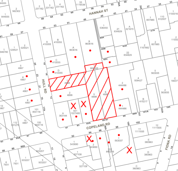
|
NOTIFICATION PLAN |
|||
|
• PROPERTIES NOTIFIED
|
X SUBMISSIONS RECEIVED |
PROPERTY SUBJECT OF DEVELOPMENT |
|
|
4 SUBMISSIONS RECEIVED OUT OF MAP RANGE |
|||
Eight submissions objected to the amended development application. The grounds of objection are addressed as follows:
5.1.1 Tree Preservation
The submissions raised concerns the amended proposal should retain more trees to maintain the existing streetscape in Copeland Road.
The amended proposal includes a revised landscape plan which would retain key elements in the Copeland Road streetscape. Refer to discussion in Section 2.4.14.3 and Section 3.1.1
5.1.2 Bulk and Scale
The submissions raised concerns the amended proposal does not sufficiently reduce the bulk and scale of Building B and that the proposal is not compatible with a low density residential area.
The proposed development as amended has regard to the surrounding built form, predominant building line, building height and setbacks in complying with the applicable development standards in accordance with SEPP Seniors Living. Refer to discussion in Section 2.4.5 and Section 2.4.14.
5.1.3 Vehicular Access
The submissions raised concerns vehicular access should be off Hull Road to maintain the Copeland Road streetscape.
The proposed accessway off Copeland Road would be designed for pier and beam construction to protect existing trees to be retained. The existing sandstone wall along the frontage is to be reconstructed for the proposed location of the accessway along the eastern side boundary of the site. The proposed vehicular access is satisfactory in regard to the heritage streetscape. Refer to discussion in Section 2.1.4.
5.1.4 Cumulative Impact
The submission from the Beecroft-Cheltenham Civic Trust raised concern the proposal would result in an adverse cumulative impact on the heritage conservation area.
The concern involves the house and land adjoining at Nos. 99-101 Copeland Road, which are of the same period in Beecroft’s early development as the subject property, being redeveloped for seniors housing.
Any redevelopment of the adjoining land would be subject to a development application and assessment pursuant to Section 5.15 of the Act. In this regard it is noted the recent amendment to the SEPP Seniors Living would prevent development pursuant to the Policy on the adjoining land until 1 July 2020. The amendment is to enable Council’s strategic planning review to consider the application of the Policy in heritage conservation areas.
5.1.5 Clause 33 SEPP Seniors Living
The submission from the Beecroft-Cheltenham Civic Trust raised concern the proposal does not satisfy the intent of Clause 33 of SEPP Seniors Living.
An assessment of the proposal pursuant to Clause 33 is addressed in Section 2.4.5 of this report.
5.1.6 Landscaping
The submissions raised concerns the proposed landscaping would not allow sufficient space for canopy trees to grow.
The proposal has been amended to provide a better growing environment for Trees Nos. 34 and 81 and improved deep soil area at the Copeland Road frontage. There is insufficient area provided for a number of proposed canopy trees. A condition is recommended for suitable replacement planting.
5.2 Public Agencies
The development application was not referred to any Public Agencies for comment.
6. THE PUBLIC INTEREST
Section 4.15(1) (e) of the Act requires Council to consider “the public interest”.
The public interest is an overarching requirement, which includes the consideration of the matters discussed in this report. Implicit to the public interest is the achievement of future built outcomes adequately responding to and respecting the future desired outcomes expressed in environmental planning instruments and development control plans.
The application is considered to have satisfactorily addressed Council’s and relevant agencies’ criteria and would provide a development outcome that, on balance, would result in a positive impact for the community. Accordingly, it is considered that the approval of the proposed development would be in the public interest.
CONCLUSION
The application as amended proposes demolition of one existing dwelling and construction of a Seniors Living development comprising 15 independent living units and including adaptive use an existing dwelling.
The application was amended following deferral by the Panel on 28 November 2018, to enable the applicant to amend the proposal to reduce bulk and scale of Building B and to retain existing trees.
The amended proposal reduces the height of Building B to two storey. The change in proposed built form has better regard to the residential character of the area. The amended landscaping plan retains additional trees and is more responsive in design to the existing landscape elements in the heritage streetscape.
The proposed development complies with the design principles and the development standards pursuant to State Environmental Planning Policy (Housing for Seniors or People with a Disability) 2004.
The proposal is assessed as satisfactory with regard to the matters for consideration pursuant to Section 4.15 of the Environmental Planning and Assessment Act 1979, subject to recommended conditions.
Council received 8 submissions in response to the amended proposal.
Having regard to the circumstances of the case, approval of the application is recommended.
Note: At the time of the completion of this planning report, no persons have made a Political Donations Disclosure Statement pursuant to Section 10.4 of the Environmental Planning and Assessment Act 1979 in respect of the subject planning application.
RESPONSIBLE OFFICER
The officer responsible for the preparation of this report is Garry Mahony, Senior Town Planner.
|
Cassandra Williams Team Leader - Major Applications Planning and Compliance Division |
Rod Pickles Manager - Development Assessment Planning and Compliance Division |
|
1.⇨ |
Locality Map |
|
|
|
2.⇨ |
Survey Plan |
|
|
|
3.⇨ |
Tree Plans |
|
|
|
4.⇨ |
Tree Protection Plans |
|
|
|
5.⇨ |
Floor Plans |
|
|
|
6.⇨ |
Elevations and Sections |
|
|
|
7.⇨ |
Landscape Calculation Sheets |
|
|
File Reference: DA/1277/2017
Document Number: D07618522
SCHEDULE 1
GENERAL CONDITIONS
The conditions of consent within this notice of determination have been applied to ensure that the use of the land and/or building is carried out in such a manner that is consistent with the aims and objectives of the relevant legislation, planning instruments and council policies affecting the land and does not disrupt the amenity of the neighbourhood or impact upon the environment.
Note: For the purpose of this consent, the term ‘applicant’ means any person who has the authority to act on or the benefit of the development consent.
Note: For the purpose of this consent, any reference to an Act, Regulation, Australian Standard or publication by a public authority shall be taken to mean the gazetted Act or Regulation, or adopted Australian Standard or publication as in force on the date that the application for a construction certificate is made.
1. Approved Plans and Supporting Documentation
The development must be carried out in accordance with the plans and documentation listed below and endorsed with Council’s stamp, except where amended by Council and/or other conditions of this consent:
|
Plan No. |
Plan Title |
Drawn by |
Dated |
Council Reference |
|
DA001 Issue A |
Demolition Plan |
PBD Architects |
2017.11.17 |
|
|
DA100 Issue E |
Lower Ground Floor Plan (Copeland Road) |
PBD Architects |
2018.12.17 |
|
|
DA101 Issue D |
Upper Ground Floor Plan (Copeland Road) |
PBD Architects |
2018.12.17 |
|
|
DA102 Issue E |
Ground Floor Plan (Hull Road) |
PBD Architects |
2018.12.17 |
|
|
DA103 Issue D |
Level 1 |
PBD Architects |
2018.12.17 |
|
|
DA104 Issue D |
Roof Plan |
PBD Architects |
2018.12.17 |
|
|
DA110 Issue C |
Unit 01 Details |
PBD Architects |
2018.07.19 |
|
|
DA200 Issue D |
Elevations Sheet 1 |
PBD Architects |
2018.12.17 |
|
|
DA201 Issue E |
Elevations Sheet 2 |
PBD Architects |
2018.12.17 |
|
|
DA300 Issue C |
Sections |
PBD Architects |
2018.12.17 |
|
|
DA400 Issue A |
Schedule Of External Finishes |
PBD Architects |
2017.11.17 |
|
|
DA700 Issue A |
Concept Hull Road Fence Design |
PBD Architects |
2018.06.19 |
|
|
DAL01K Amdt K |
Hull Rd Landscape Plan |
Jane Britt Design |
14/01/19 |
|
|
DAL02M Amdt M |
Upper & First Floor Copeland Road Landscape Plan And Schedule |
Jane Britt Design |
14/01/19 |
|
|
DAL03L Amdt L |
Lower Copeland Rd Landscape Plan |
Jane Britt Design |
14/01/19 |
|
|
DAL04B Amdt B |
Specification & Details |
Jane Britt Design |
17/11/17 |
|
|
043-17C-DA-1001 Issue E |
Cover Sheet, Locality Plan and Index Sheet |
Craig & Rhodes |
02.10.18 |
|
|
043-17C-DA-1101 Issue E |
Proposed Footpath Reconstruction Plan |
Craig & Rhodes |
02.10.18 |
|
|
043-17C-DA-1201 Issue E |
Proposed Footpath Longitudinal Sections |
Craig & Rhodes |
02.10.18 |
|
|
043-17C-DA-1301 Issue E |
Bus Stop Detail |
Craig & Rhodes |
02.10.18 |
|
Supporting Documentation
|
Document Title |
Prepared by |
Dated |
Council Reference |
|
Arboricultural Impact Assessment |
Footprint Green |
14 January 2019 |
D07595595 |
|
Tree Protection Plan |
Footprint Green |
11 April 2019 |
D07654070 |
|
Stormwater Management Report |
Craig & Rhodes |
6 March 2018 |
D07412252 |
|
Disability Access Report |
Lindsay Perry Access |
13 Nov 2017 |
D07339588 |
|
Disability Access Report |
Lindsay Perry Access |
9 March 2018 |
D07412235 |
|
Traffic & Parking Assessment Report |
Varga Traffic Planning Pty Ltd |
17 Nov 2017 |
D07339707 |
|
BASIX Certificate No. 879828M_02 |
Efficient Living |
17 Nov 2017 |
D07339591 |
|
Heritage Impact Statement (D07412248) |
Urbis |
19 Feb 2018 |
D07412248 |
|
Geotechnical Investigation - Part 1 Geotechnical Investigation - Part 2 |
JK Geotechnics JK Geotechnics |
13 Nov 2017 13 Nov 2017 |
D07339593 D07339594 |
|
Waste Management Plan |
Ian Glendinning Pty Ltd |
17.11.2017 |
D07339587 |
2. Removal of Existing Trees
a) This development consent permits the removal of trees numbered 2-7, 9, 11-18, 21-26, 28-30, 32-33, 35, 37-48, 50-52, 54-69 and the transplanting of trees numbered 27, 49 and 53, as identified in the Arboricultural Impact Assessment prepared by Footprint Green dated 14 January 2019.
b) The removal of any other trees requires separate approval in accordance with the Tree and Vegetation Chapter 1B.6 Hornsby Development Control Plan 2013 (HDCP).
a) To comply with Councils requirement in terms of privacy, the approved plans are to be amended as follows:
i) The balconies of Units 9 and 11 are to include privacy screening at the side elevations to existing adjoining properties to prevent overlooking of neighbouring residents.
ii) The privacy screens must have no individual openings more than 30mm wide and have a total of all openings less than 30% of the surface area of the screen.
iii) The landscape plan Drawing No. DAL01K Amdt K prepared by Britt Design is to be amended to replace Syncarpia glomulifera (Turpentine) x 2 located along the southern side of driveway off Hull Road and Angophora costata (Sydney Red Gum) x 1 located at the driveway end off Hull Road, with suitable species capable of reaching maturity in the proposed garden space.
b) The existing front sandstone wall and driveway return at the new vehicular crossing must be reconstructed using the same stone as existing. The details of the wall and its foundation are to be submitted with the Construction Certificate application.
c) These amended plans must be submitted with the application for the Construction Certificate.
3. Construction Certificate
a) A Construction Certificate is required to be approved by Council or a Private Certifying Authority prior to the commencement of any works under this consent.
b) A separate Construction Certificate must be obtained from Council for all works within the public road reserve under S138 of the Roads Act.
c) A separate Construction Certificate must be obtained from Council for all works within drainage easements vested in Council.
d) The Construction Certificate plans must not be inconsistent with the Development Consent plans.
4. Section 7.11 Development Contributions
a) In accordance with Section 4.17(1) of the Environmental Planning and Assessment Act 1979 and the Hornsby Shire Council Section 94 Development Contributions Plan 2014-2024, the following monetary contributions must be paid to Council to cater for the increased demand for community infrastructure resulting from the development:
|
Description |
Contribution (4) |
|
Roads |
$10,366.50 |
|
Open Space and Recreation |
$98,838.05 |
|
Community Facilities |
$37,996.21 |
|
Plan Preparation and Administration |
$318.84 |
|
TOTAL |
$147,519.60 |
Being for 15 Seniors Living Units and including a credit for three existing allotments.
b) The value of this contribution is current as at 12 March 2018. If the contribution is not paid within the financial quarter that this condition was generated, the contribution payable will be adjusted in accordance with the provisions of the Hornsby Shire Council Section 94 Development Contributions Plan and the amount payable will be calculated at the time of payment in the following manner:
$CPY = $CDC x CPIPY
CPIDC
Where:
$CPY is the amount of the contribution at the date of Payment
$CDC is the amount of the contribution as set out in this Development Consent
CPIPY is the latest release of the Consumer Price Index (Sydney – All Groups) at the date of Payment as published by the ABS.
CPIDC is the Consumer Price Index (Sydney – All Groups) for the financial quarter at the date applicable in this Development Consent Condition.
c) The monetary contribution must be paid to Council:
i) Prior to the issue of the Subdivision Certificate where the development is for subdivision; or
ii) Prior to the issue of the first Construction Certificate where the development is for building work; or
iii) Prior to issue of the Subdivision Certificate or first Construction Certificate, whichever occurs first, where the development involves both subdivision and building work; or
iv) Prior to the works commencing where the development does not require a Construction Certificate or Subdivision Certificate.
Note: It is the professional responsibility of the Principal Certifying Authority to ensure that the monetary contributions have been paid to Council in accordance with the above timeframes.
Council’s Development Contributions Plan may be viewed at www.hornsby.nsw.gov.au or a copy may be inspected at Council’s Administration Centre during normal business hours.
REQUIREMENTS PRIOR TO THE ISSUE OF A CONSTRUCTION CERTIFICATE
5. Building Code of Australia
All approved building work must be carried out in accordance with the relevant requirements of the Building Code of Australia.
6. Contract of Insurance (Residential Building Work)
Where residential building work for which the Home Building Act 1989 requires there to be a contract of insurance in force in accordance with Part 6 of that Act, this contract of insurance must be in force before any building work authorised to be carried out by the consent commences.
7. Notification of Home Building Act 1989 Requirements
Residential building work within the meaning of the Home Building Act 1989 must not be carried out unless the principal certifying authority for the development to which the work relates (not being Council) has given Council written notice of the following information:
a) In the case of work for which a principal contractor is required to be appointed:
i) The name and licence number of the principal contractor; and
ii) The name of the insurer by which the work is insured under Part 6 of that Act.
b) In the case of work to be done by an owner-builder:
i) The name of the owner-builder; and
ii) If the owner-builder is required to hold an owner-builder’s permit under that Act, the number of the owner-builder’s permit.
Note: If arrangements for doing the residential building work are changed while the work is in progress so that the information notified becomes out of date, further work must not be carried out unless the principal certifying authority for the development to which the work relates (not being Council) has given Council written notification of the updated information.
The applicant must submit written evidence of the following service provider requirements:
a) Ausgrid (formerly Energy Australia) – a letter of consent demonstrating that satisfactory arrangements have been made to service the proposed development.
b) Telstra - a letter of consent demonstrating that satisfactory arrangements have been made to service the proposed development.
9. Sydney Water – Approval
This application must be submitted to Sydney Water for approval to determine whether the development would affect any Sydney Water infrastructure, and whether further requirements are to be met.
Note: Building plan approvals can be obtained online via Sydney Water Tap inTM through www.sydneywater.com.au under the Building and Development tab.
10. Dilapidation Report
A ‘Dilapidation Report’ is to be prepared by a ‘chartered structural engineer’ detailing the structural condition of the following adjoining properties.
· Lot 931 DP 1027485, No. 93A Copeland Road, Beecroft
· Lot 2 DP 444486, No. 99A Copeland Road, Beecroft
· Lot 2 DP 4898, No. 12 Hull Road, Beecroft
· Lot 73 DP 862024, No. 45C Hannah Street, Beecroft
11. Excavation
A detailed geotechnical assessment of the site by a chartered structural engineer is to be undertaken for the design of the basement excavation and support, groundwater drainage, basement and foundation design, in accordance with the recommendations within Part 4 of the Geotechnical Assessment prepared by J K Geotechnics dated 13 November 2017.
12. Seniors Living Housing
The details of the approved units designed in accordance with the standards under Schedule 3 of State Environmental Planning Policy (Housing for Seniors or People with a Disability) 2004 must be provided with the Construction Certificate Plans.
13. Traffic Control Plan
A Traffic Control Plan (TCP) must be prepared by a qualified traffic controller in accordance with the Roads & Traffic Authority’s Traffic Control at Worksites Manual 1998 and Australian Standard 1742.3 for all work on a public road. The Traffic Management Plan shall be submitted and approved by Council’s Manager Traffic and Road Safety prior to the issue of a construction certificate. The TCP must detail the following:
a) Arrangements for public notification of the works;
b) Temporary construction signage;
c) Permanent post-construction signage;
d) Vehicle movement plans;
e) Traffic management plans; and
f) Pedestrian and cyclist access/safety.
14. Identification of Survey Marks
A registered surveyor must identify all survey marks in the vicinity of the proposed development. Any survey marks required to be removed or displaced as a result of the proposed development shall be undertaken by a registered surveyor in accordance with Section 24 (1) of the Surveying and Spatial Information Act 2002 and following the Surveyor General’s Directions No.11 – "Preservation of Survey Infrastructure".
15. Internal Driveway/Vehicular Areas
The driveway and parking areas on site must be designed, constructed and a Construction Certificate issued in accordance with Australian Standards AS2890.1, AS2890.2, AS3727 and the following requirements:-
a) Design levels at the front boundary shall be obtained from Council via separate Applications to Council’s Crossing Engineer for Crossing Levels;
b) Design levels at the front boundary be obtained from Council for the design of the internal driveway longitudinal sections;
c) The driveways be a rigid pavement;
d) The driveway grade must not exceed the AS2890.1 or AS2890.2 maximums for the largest vehicle required to traverse the driveway, and transitions for changes of grade must not exceed the maximum grade changes prescribed by AS2890.2;
e) The driveway pavement be a minimum 3 metres wide, 0.15 metres thick reinforced concrete with SL82 steel reinforcing fabric and a 0.15 metre sub-base;
f) The pavement have a kerb to one side and a one-way cross fall with a minimum gradient of 2 percent with kerb inlet pits provided on grade and at low points;
g) Retaining walls required to support the carriageway and the compaction of all fill batters to be in accordance with the requirements of a chartered structural engineer;
h) The provision of safety rails where there is a level difference more than 0.3 metres and a 1:4 batter cannot be achieved;
i) Turning areas to service the proposed parking modules in accordance with Australian Standards AS 2890.1 to ensure vehicles can enter and leave the site in a forward direction; and
j) Construction of pedestrian accessways designed to help prevent slip and fall shall be designed and constructed with access driveways. Pedestrian grades steeper than 12.5% shall be provided with surface texturing, brushing or cleats to satisfy Class V : R11 ramps in accordance with Australian Standards AS 4586-2004 Clause 5.2.
16. Vehicular Crossings
A separate application under the Local Government Act 1993 and the Roads Act 1993 must be submitted to Council for the installation of a new vehicular crossing and the removal of the redundant crossing. The vehicular crossing must be constructed in accordance with Council’s Civil Works Design 2005 and the following requirements;-
a) Design levels at the front boundary must be obtained from Council, via applications for Crossing Levels, for the design on the internal driveways;
b) Any redundant crossings must be replaced with integral kerb and gutter in accordance with Council standards;
c) The footway area must be restored by turfing; and
d) Approval must be obtained from all relevant utility providers that all necessary adjustment works be undertaken to accommodate a Crossing.
Note: An application for a vehicular crossing can only be made to one of Council’s Authorised Vehicular Crossing Contractors, or be the subject of a Subdivisions Construction Certificate to Council as Roads Authority. You are otherwise advised to contact Council on 02 9847 6940 to obtain a list of contractors.
17. On Site Stormwater Detention
An on-site stormwater detention system must be designed by a chartered civil engineer and constructed in accordance with the following requirements:-
a) Have a capacity of not less than 50 cubic metres, and a maximum discharge (when full) of 80 litres per second;
b) Have a surcharge/inspection grate located directly above the outlet;
c) Discharge from the detention system must be controlled via 1 metre length of pipe, not less than 50 millimetres diameter or via a stainless plate with sharply drilled orifice bolted over the face of the outlet discharging into a larger diameter pipe capable of carrying the design flow to an approved Council system;
d) Not be constructed in a location that would impact upon the visual or recreational amenity of residents.
18. Water Quality Treatment Systems and Drainage Connection
The stormwater drainage system for the development must be designed in accordance with Council’s Civil Works – Design and Construction Specification and the following requirements:
a) The internal drainage system shall be designed and constructed to convey the 20 year Average recurrence interval storm and provide water quality treatment systems designed by a suitably accredited person in accordance with HDCP2013 Section 1C.1.2.i;
b) The roof and stormwater drainage system from any building proposed to remain shall be connected to the proposed internal drainage system;
c) The outlet for the internal drainage system shall be connected to a Council-controlled drainage system with the following requirements:-
i) A separate Application must be made to Council for ‘Approval To Connect Stormwater Drainage Outlet To Council’s System’ with all fees paid, prior to connecting to Council’s drainage system;
ii) The connection to Council’s drainage pit or pipeline in accordance with Councils Design Standard Drawing No. 6 must be inspected by a Council Engineer from Council’s Planning Division;
Note: An inspection booking can be made by calling Council on 9847 6760 quoting the Application reference number commencing SD;
iii) Connection to Council’s drainage system shall include design and construction of Council’s standard kerb inlet within Council’s Road in accordance with Council’s Design and Construction Specification. The Applicant’s Engineer must prepare the design of system including location of proposed work in the plan. Three (3) copies of the plan shall be submitted with lodgement and payment of the Application;
iv) A Traffic Control Plan (TCP) must be prepared by a qualified traffic controller in accordance with the Roads & Traffic Authority’s Traffic Control at Worksites Manual 1998 and Australian Standard AS1742.3 for all work on a public road. Three copies of the Traffic Management Plan shall be submitted with lodgement of the Application prior to Council’s approval. The TCP must detail the following:
a. Arrangements for public notification of the works;
b. Where a drainage connection is proposed within a Classified Road, a copy of the relevant Road Occupation License approved by the Traffic Management Centre with dates and times of proposed Occupations;
c. Temporary construction signage;
d. Vehicle movement plans;
e. Traffic management plans; and
f. Pedestrian and cyclist access/safety.
v) Where public assets and utilities are impacted by proposed works, the Applicant shall relocate or reconstruct the asset or utility in accordance with the relevant standard at the Applicant’s cost;
vi) Prior to the issue of an Occupation Certificate a Compliance Certificate must be obtained from Hornsby Council for the connection to Council’s drainage system.
Note: A certificate from a chartered civil engineer together with a works as executed design plan must be submitted to the Principal Certifying Authority and Hornsby Council to demonstrate the satisfaction of this condition.
19. Access and Mobility in Public Road
All works approved under this consent must be designed in accordance with Council’s Civil Works Design and Construction Specification and the following requirements:
a) Consultation be undertaken with Council’s Traffic & Road Safety Branch for design and approval of proposed accessible pedestrian refuges, medians, splitter islands, bus stops, signage and accessible footpaths between Hull Road and Hannah Street;
b) The design of the proposed pedestrian facilities shall be submitted to Council’s Traffic & Road Safety Branch for approval by Council’s Local Traffic Committee (LTC) prior to lodging construction applications for same with Hornsby Council;
c) The pedestrian facilities shall be designed and constructed generally in accordance with DA-approved accessibility plans;
d) Pursuant to Section 138 Roads Act 1993, a Subdivisions Construction Certificate (SCC) shall be lodged with Hornsby Council after LTC Consent and assessment and compliance inspection quotations have been provided by Council;
e) The plans must be prepared by a chartered Engineer and include all plans and specifications for the proposed works. Plans shall include details of adjustment works on any existing road asset and adjustment to any utilities necessary by the works in accordance with that utility’s guidelines; and
f) Prior to the issue of an Occupation Certificate a Compliance Certificate must be obtained from Hornsby Council for the above works.
20. Construction Management Plan (CMP)
To assist in the protection of the public, the environment and Council’s assets, a separate Construction Management Plan must be prepared by a suitably qualified environmental consultant in consultation with a qualified traffic engineer, and submitted to Council’s Compliance Team at compliance@hornsby.nsw.gov.au, according to the following requirements:
a) The CMP must detail the contact information for developers, builder, private certifier and any emergency details during and outside work hours.
b) The plan must include a Construction Traffic Management Plan (CTMP) including the following:
i) Truck movements to and from the site, including the routes used, swept path diagrams entering and exiting the site and implemented traffic control;
ii) Survey plan showing site sheds, concrete pump location, crane location and existing survey marks;
iii) Work Zones, Road Openings, Road Closures, Crane Permits and Road Occupancy licenses, or any intentions to obtain such approvals; and
iv) Safe pedestrian management details including during local school and commuter hours where the footpath is heavily frequented.
c) The plan must also include a Construction Waste Management Plan detailing the following:
i) Details of the importation or excavation of soil and fill, the classification of the fill, disposal methods and authorised disposal depots that will be used for the fill;
ii) Asbestos management requirement and procedures for removal and disposal from the site in accordance with AS 2601–2001 – ‘The Demolition of Structures’, and the Protection of the Environment Operations (Waste) Regulation 2005;
iii) General construction waste details including construction waste skip bin locations and litter management for workers.
d) Management of stormwater disposal from the detention basin or basement throughout all development phases in accordance with the ANZECC Guidelines trigger values for the area.
e) Sediment and Erosion control including during rainfall events and site plans showing entry to or exits from the site, all in accordance with the ‘Soils and Construction 2004 (Bluebook)’.
f) Air quality management on site, including dust suppression measures during demolition and construction.
g) Details on the general operating procedures to manage environmental risk throughout all stages of works on the site;
h) To ensure Council assets are maintained throughout the development, a detailed survey plan showing existing survey marks, vehicle entry, footpath and hoarding (fencing) locations; and
i) Noise and vibration control information to address any noise nuisances such as rock sawing or breaking, the mitigation methods implemented and how complaints will be managed or prevented.
21. Appointment of a Project Arborist
a) A project arborist with AQF Level 5 qualifications must be appointed to provide monitoring and certification throughout the construction period.
b) Details of the appointed project arborist must be submitted to Council and the PCA for registration with the application for the construction certificate.
22. Road Works
A detail design drawing for the proposed median crossing in accordance with RMS Technical Directions, Austroads Guidelines and in consultation with Council’s Traffic and Road Safety Branch is to be provided. The drawing is to include notes on removal of redundant line markings, show proposed delineation lines and signs, including BUS ZONE signs for the existing bus stops. The drawing is also to show how access from the footpath on the south side of Hannah Street to the median crossing island and bus stop is to be achieved.
23. Bus Stops
A detailed design of the bus stops is to be provided to Council’s Traffic and Road Safety Branch so that the proposed conversion of the bus stops to bus zones can be considered by the Hornsby Local Traffic Committee after Public Consultation with affected residents.
24. Waste Management Details
The following waste management requirements must be complied with:
a) For the bin storage room at the basement level:
i) The bin storage room must be accessible by persons with a disability after the garbage bins and recycling bins are installed (that is, have a 1.55m wide access aisle and no stacking of bins 2 or more deep); and
ii) Have door(s) wide enough and positioned so that the 240L bins can fit through; and
iii) Be located no more than 50m walking distance from each dwelling making use of this bin storage room. The walking path from each accessible/adaptable dwelling to the bin storage room must be an accessible path of travel. The walking path from each dwelling to the bin storage room must not include the public footpath, that is must be wholly within the site.
Note: a 240 L recycling bin is 600mm wide by 750mm deep; allow for 75mm for ease of movement around the bin to avoid damage to walls etc from scraping. The door must be wide enough and positioned such that all the bins can fit through. Every bin must be able to be accessed (no stacking of bins two or more deep).
b) For the bin hold areas at the ground level:
i) The bin holding areas must be screened on 3 sides only; and
ii) There must be no step between the bin holding area and the driveway; and
iii) The bin holding area must be at the same level as the driveway; and
iv) The bin carting route from the bin holding area to the nearest street must not exceed a gradient of 1:20 (Note: AS2890.1 requires the first 6m of driveway to have a gradient not exceeding 1:20); and
v) Screening to a height of no less than 1.2 m should be provided.
c) The bin carting route from the waste collection/bin holding area to the truck parking location on the street must not include any steps.
d) A Waste Management Plan Section One – Demolition Stage and Section Three – Construction Stage, covering the scope of this project and including the following details, is required to be submitted to Council’s Waste Management Branch:
i) An estimate of the types and volumes of waste and recyclables to be generated;
ii) A site plan showing sorting and storage areas for demolition and construction waste and the vehicle access to these areas;
iii) How excavation, demolition and construction waste materials will be reused or recycled and where residual wastes will be disposed; and
iv) The total percentage (by weight) of demolition and construction waste that will be reused or recycled.
Note: the site(s) to which the waste materials are taken must be legally able to accept those wastes.
REQUIREMENTS PRIOR TO THE COMMENCEMENT OF ANY WORKS
25. Erection of Construction Sign
a) A sign must be erected in a prominent position on any site on which any approved work is being carried out:
i) Showing the name, address and telephone number of the principal certifying authority for the work;
ii) Showing the name of the principal contractor (if any) for any demolition or building work and a telephone number on which that person may be contacted outside working hours; and
iii) Stating that unauthorised entry to the work site is prohibited.
b) The sign is to be maintained while the approved work is being carried out and must be removed when the work has been completed.
26. Protection of Adjoining Areas
A temporary hoarding, fence or awning must be erected between the work site and adjoining lands before the works begin and must be kept in place until after the completion of the works if the works:
a) Could cause a danger, obstruction or inconvenience to pedestrian or vehicular traffic;
b) Could cause damage to adjoining lands by falling objects; and/or
c) Involve the enclosure of a public place or part of a public place.
Have been identified as requiring a temporary hoarding, fence or awning within the Council approved Construction Management Plan (CMP).
Note: Notwithstanding the above, Council’s separate written approval is required prior to the erection of any structure or other obstruction on public land.
27. Toilet Facilities
a) To provide a safe and hygienic workplace, toilet facilities must be available or be installed at the works site before works begin and must be maintained until the works are completed at a ratio of one toilet for every 20 persons employed at the site.
b) Each toilet must:
i) Be a standard flushing toilet connected to a public sewer; or
ii) Be a temporary chemical closet approved under the Local Government Act 1993; or
iii) Have an on-site effluent disposal system approved under the Local Government Act 1993.
28. Erosion and Sediment Control
To protect the water quality of the downstream environment, erosion and sediment control measures must be provided and maintained throughout the construction period in accordance with the manual ‘Soils and Construction 2004 (Bluebook)’, the approved plans, Council specifications and to the satisfaction of the principal certifying authority. The erosion and sediment control devices must remain in place until the site has been stabilised and revegetated.
Note: On the spot penalties may be issued for any non-compliance with this requirement without any further notification or warning.
29. Tree Protection Measurement Requirements
a) Trees to be retained listed in the Tree Protection Plan prepared by Footprint Green dated 11/04/19 must have tree protection measures for the ground, trunk and canopy installed in by the project arborist;
b) As part of the demolition works the placement of tree protection fencing for trees to be retained must be in accordance with the amended demolition tree protection plans on provided by Footprint Green (TRIM:D07654070).
c) As part of the Construction works the placement of tree protection fencing for trees to be retained must be in accordance with the Tree Protection Plan prepared by Footprint Green dated 11/04/2019 (TRIM:D07654070).
d) Tree protection fencing for the trees to be retained must be installed by the project arborist and consist of 1.8m high temporary fencing panels installed in accordance with AS4687-2007 - Temporary Fencing and Hoarding Standards.
e) The protection fencing must have shade cloth or similar attached to reduce transport of dust, particulates and liquids from entering the tree protection zone.
i) Tree Protection fencing must have identifying signs attached, with the lettering complying with AS1319 – Safety Signs for the Occupational Environment.
f) All installation of tree protection fencing must be supervised and certified by the project arborist.
30. Tree Trunk and Branch Protection
a) Tree crown protection measures are required for tree numbered 8, 34 and must be installed by the project arborist;
b) Must be applied in accordance with the relevant requirements section 3.3.6 Crown protection of Australian Standard AS 4970-2009 - Protection of Trees on Development Sites;
c) The circumference of the trunk and or branches must be wrapped in hessian or similar material to provide cushioning for the installation of timber planks (50 x100mm or similar); and
d) Timber planks must be spaced at 100mm intervals and must be attached using adjustable ratchet straps.
31. Tree Protection Zone – Ground Protection
a) All tree protection zones must have a layer of wood-chip mulch at a depth of between 150mm and 300mm that complies with the relevant requirements of Australian Standard AS 4454 – Composts, Soil Conditioners and Mulches installed prior to works commencing.
b) Where fencing cannot be installed inside the TPZ the wood-chip must be covered with a layer of geotextile fabric and rumble boards to allow for small plant movement and/or placement of storage of material.
32. Installation of Designated Haulage Roads
Designated access paths and haulage roads must be installed in accordance with the relevant requirements of Australian Standard AS 4970-2009 - “Protection of Trees on Development Sites”.
33. Protection Certification
To ensure that all tree protection measures are correctly installed, a certificate from the appointed project arborist must be submitted to the Principal Certifying Authority confirming compliance with the tree protection requirements of this consent.
REQUIREMENTS DURING CONSTRUCTION
34. Construction Work Hours
All works on site, including demolition and earth works, must only occur between 7am and 5pm Monday to Saturday.
No work is to be undertaken on Sundays or public holidays.
35. Demolition
To protect the surrounding environment, all demolition work must be carried out in accordance with Australian Standard AS2601-2001 – The Demolition of Structures and the following requirements:
a) Demolition material must be disposed of to an authorised recycling and/or waste disposal site and/or in accordance with an approved waste management plan; and
b) Demolition works, where asbestos material is being removed, must be undertaken by a contractor that holds an appropriate licence issued by SafeWork NSW in accordance with the Work Health and Safety Regulation 2017 and be appropriately transported and disposed of in accordance with the Protection of the Environment Operations (Waste) Regulation 2014; and
c) On construction sites where any building contain asbestos material, a standard commercially manufactured sign containing the words ‘DANGER ASBESTOS REMOVAL IN PROGRESS’ and measuring not less than 400mm x 300mm must be displayed in a prominent position visible from the street.
36. Environmental Management
To prevent sediment run-off, excessive dust, noise or odour emanating from the site during the construction, the site must be managed in accordance with the publication ‘Managing Urban Stormwater – Landcom (March 2004) and the Protection of the Environment Operations Act 1997.
37. Street Sweeping
To protect the surrounding environment, street sweeping must be undertaken following sediment tracking from the site along the site frontage of Copeland Road and Hull Road during works and until the site is established.
The street cleaning services must undertake a street ‘scrub and dry’ method of service and not a dry sweeping service that may cause sediment tracking to spread or cause a dust nuisance.
38. Prohibited Actions Within the Fenced Tree Protection Zone Area
a) In accordance with the AS4970-2009 – Protection of Trees on Development Sites, the following activities are prohibited within the fenced area of TPZ:
i) Soil cut or fill including excavation and trenching;
ii) Soil cultivation, disturbance or compaction;
iii) Stockpiling storage or mixing of materials;
iv) The parking, storing, washing and repairing of tools, equipment and machinery;
v) The disposal of liquids and refuelling;
vi) The disposal of building materials;
vii) The siting of offices or sheds; and
viii) Any action leading to the impact on tree health or structure.
39. Works Near Trees
a) No consent is granted for any works within the Structural Root Zone of trees identified by blue numbering on the Tree Protection Plan prepared by Footprint Green dated 11/04/2019.
b) To maintain tree health and condition for trees to be retained, the appointed project arborist must monitor and record any and all necessary remedial actions required.
c) The maintenance and monitoring of all tree protection techniques must be recorded by the appointed project arborist during the period of construction for submission with the application for the occupation certificate.
40. Maintaining Tree Protection Zones
The Tree Protection Zone must be maintained by the project arborist in accordance with section 4.6 requirements of Australian Standard AS 4970-2009 - “Protection of Trees on Development Sites”
41. Works Within Tree Protection Zones
a) All root pruning must be undertaken in accordance with the relevant requirements of Australian Standard AS 4970-2009 - Protection of Trees on Development Sites - Sections 3.3.4, 4.5.4 and 4.5.5.
b) Driveway/concrete slabs works must comply with the following requirements.
i) The removal of the existing driveway must be undertaken manually using small hand held plant such as jackhammer.
ii) To minimise soil compaction within the Tree Protection Zone/structural root zone of trees to be retained, the replacement driveway must be built above grade using sensitive construction techniques such as piers or screw pilings consistent with the relevant requirements of Australian Standard AS 4970-2009 “Protection of Trees on Development Sites” .
c) Where the building footprint enters or transects the Tree Protection Zone of tree numbered 34 on the approved plans, sensitive construction techniques such as screw pilings or piers, cantilevered or suspended slab design must be employed to create a 100mm clearance above existing soil grade.
Note: To minimise soil compaction where the root zone is reactive clay, sensitive construction techniques such as localized pier and beam (bridged) screw pile footings or root and soil moisture control barriers may be appropriate.
d) Excavations associated with the basement and building footprint and within the Tree Protection Zone of trees numbered 34 and 81 must be supervised by the project arborist and initially undertaken manually to a depth of 1.000 metre to locate roots and allow for cutting in accordance with the relevant requirements of Australian Standard AS 4970-2009 - Protection of Trees on Development Sites.
e) Excavations for the installation of the driveway piers in the Tree Protection Zone of trees numbered 31, 34, 76 and 81 on the approved plans not associated with installation of services must be supervised by the project arborist and initially undertaken manually to a depth of 1.000 metre to locate roots and allow for cutting in accordance with the relevant requirements of Australian Standard AS 4970-2009 -Protection of Trees on Development Sites.
f) Grade Changes are permissible outside the Structural Root Zone in the form of fill in conjunction with piers or other sensitive methods of construction. All fill used must be consistent with Australian Standards “Soils for Landscaping and Garden Use” AS4419-2003.
g) To minimise impacts within the Tree Protection Zone (TPZ) of trees to be retained the installation of services must be undertaken as follows:
i) The project arborist must monitor the installation of any underground services which enter or transect the tree protection zone.
ii) The installation of any underground services which either enter or transect the designated TPZ must utilise sensitive methods such as directional drilling.
h) Where scaffolding is required it must be erected outside the TPZ and in accordance with AS 4970-2009 section 4.5.6.
42. Building Materials and Site Waste
The filling or stockpiling of building materials, the parking of vehicles or plant, the disposal of cement slurry, waste water or other contaminants must be located outside the tree protection zones as prescribed in the conditions of this consent.
43. Works Near Trees Certification
a) The project arborist must submit to the principal certifying authority a certificate that all works have been carried out in compliance with the approved plans and conditions or specifications for tree protection.
b) Certification should include a statement of site attendance, the condition of retained trees, details of any deviations from the approved tree protection measures and their impacts on trees.
Note: Copies of monitoring documentation may be required by the PCA and/or Council.
44. Council Property
To ensure that the public reserve is kept in a clean, tidy and safe condition during construction works, no building materials, waste, machinery or related matter is to be stored on the road or footpath.
45. Landfill
Landfill must be constructed in accordance with Council’s ‘Construction Specification 2005’ and the following requirements:
a) Prior to fill material being imported to the site, a certificate shall be obtained from a suitably qualified environmental consultant confirming the fill wholly consists of Virgin Excavated Natural Material (VENM) as defined in Schedule 1 of the Protection of the Environment Operations Act 1997 or material approved under the Department of Environment and Climate Change’s general resource recovery exemption.
b) A compaction certificate is to be obtained from a suitably qualified geotechnical engineer verifying that the specified compaction requirements have been met.
c) These certificates must be included with the application for an occupation certificate.
46. Excavated Material
All excavated material removed from the site must be classified by a suitably qualified person in accordance with the Department of Environment, Climate Change and Water NSW Waste Classification Guidelines and Protection of the Environment Operations (Waste) Regulation 2014 prior to disposal to an approved waste management facility and be reported to the principal certifying authority prior to the issue of an Occupation Certificate.
47. Survey Report
A report(s) must be prepared by a registered surveyor and submitted to the principal certifying authority:
a) Prior to the pouring of concrete at each level of the building certifying that:
i) The building, retaining walls and the like have been correctly positioned on the site; and
ii) The finished floor level(s) are in accordance with the approved plans.
48. Waste Management
Waste management during the demolition and construction phase of the development must be undertaken in accordance with the approved Waste Management Plan. Additionally written records of the following items must be maintained during the removal of any waste from the site and such information submitted to the Principal Certifying Authority within fourteen days of the date of completion of the works:
a) The identity of the person removing the waste;
b) The waste carrier vehicle registration;
c) Date and time of waste collection;
d) A description of the waste (type of waste and estimated quantity);
e) Details of the site to which the waste is to be taken;
f) The corresponding tip docket/receipt from the site to which the waste is transferred (noting date and time of delivery, description (type and quantity) of waste); and
g) Whether the waste is expected to be reused, recycled or go to landfill.
Note: In accordance with the Protection of the Environment Operations Act 1997, the definition of waste includes any unwanted substance, regardless of whether it is reused, recycled or disposed to landfill.
49. Construction Management Plan
The development must be carried out in accordance with the approved Construction Management Plan.
50. Traffic Control Plan
The development must be carried out in accordance with the approved Traffic Control Plan.
51. Maintenance of public footpaths
Public footpaths must be maintained for the duration of works to ensure they are free of trip hazards, displacements, breaks or debris to enable pedestrians to travel along the footpath safely.
REQUIREMENTS PRIOR TO THE ISSUE OF AN OCCUPATION CERTIFICATE
Note: For the purpose of this consent, a reference to ‘occupation certificate’ shall not be taken to mean an ‘interim occupation certificate’ unless otherwise stated.
52. Fulfilment of BASIX Commitments
The applicant must demonstrate the fulfilment of BASIX commitments pertaining to the development.
53. Sydney Water – s73 Certificate
A s73 Certificate must be obtained from Sydney Water and submitted to the PCA.
Note: Sydney Water requires that s73 applications are to be made through an authorised Sydney Water Servicing Coordinator. Refer to www.sydneywater.com.au or telephone 13 20 92 for assistance.
54. Damage to Council Assets
To protect public property and infrastructure, any damage caused to public assets as a result of the construction or demolition of the development must be rectified by the applicant in accordance with Council’s Civil Works Specifications. Rectification works must be undertaken prior to the issue of an Occupation Certificate, or sooner, as directed by Council.
a) Rectification of any public asset shall only be by Application to Hornsby Council with a Subdivision Construction Certificate (SCC). Council’s quoted assessment and compliance fees shall be paid with lodgement of the Application;
b) Prior to the issue of an Occupation Certificate a Compliance Certificate must be obtained from Hornsby Council for satisfactory completion the above works.
55. Preservation of Survey Marks
A certificate by a Registered Surveyor must be submitted to the Principal Certifying Authority, certifying that there has been no removal, damage, destruction, displacement or defacing of the existing survey marks in the vicinity of the proposed development or otherwise the re-establishment of damaged, removed or displaced survey marks has been undertaken in accordance with the Surveyor General’s Direction No.11 – “Preservation of Survey Infrastructure”.
56. Consolidation of Allotments
All allotments the subject of this consent must be consolidated into one allotment.
Notes:
· The applicant is recommended to submit the plan of subdivision to consolidate allotments to the NSW Land Registry Services at least 4-6 weeks prior to seeking an occupation certificate.
· For efficiency, the consolidation plan may also be considered by Council for addition of on-site detention, water quality requirements and waste collection easements, etc, prior to registration.
· The consolidation plan must be provided with a primary and alternative Street Number by Hornsby Council in accordance with the Australian Standard and Section 162 Roads Act 1993.
57. Certification of WSUD Facilities
Prior to the issue of an Occupation Certificate a certificate from a Civil Engineer is to be obtained stating that the WSUD facilities have been constructed and will meet the water quality targets as specified in the Hornsby Shire Councils DCP. A copy of the Certification shall be submitted to the Principal Certifying Authority and Hornsby Council prior to consideration of the Occupation Certificate.
58. Works as Executed Plan
A works-as-executed plan(s) must be prepared by a registered surveyor and submitted to the Principal Certifying Authority and Hornsby Council for all completed road constructions and assets, public drainage systems, internal driveways, internal drainage and water quality facilities, and on-site detention systems.
59. Creation of Easements
The following matter(s) must be nominated on the plan of subdivision under s88 of the Conveyancing Act 1919.
a) The creation of an appropriate "Positive Covenant" and "Restriction as to User" over the constructed on-site detention/retention and water quality treatment systems and outlet works, within the lot in favour of Council in accordance with Council’s prescribed wording. The position of the on-site detention and water quality treatment system is to be clearly indicated on the title;
b) To register the OSD easement, the restriction on the use of land “works-as-executed” details of the on-site-detention system must be submitted verifying that the required storage and discharge rates have been constructed in accordance with the design requirements. The details must show the invert levels of the on-site system together with pipe sizes and grades. Any variations to the approved plans must be shown in red on the “works-as-executed” plan and supported by calculations;
c) Creation of an easement for waste collection in accordance with Council’s prescribed wording.
Note: Council must be nominated as the authority to release, vary or modify any easement, restriction or covenant.
60. Unit Numbering
All units are to be numbered consecutively commencing at No.1. The strata plan lot number is to coincide with the unit number, e.g. Unit 1 = Lot 1. The allocated of unit numbering must be authorised by Council prior to the numbering of each units in the development.
61. Completion of Landscaping
A certificate must be submitted to the PCA by a practicing landscape architect, horticulturalist or person with similar qualifications and experience certifying that all required landscaping works have been satisfactorily completed in accordance with the approved landscape plans.
Note: Advice on suitable species for landscaping can be obtained from Council’s planting guide ‘Indigenous Plants for the Bushland Shire’, available at www.hornsby.nsw.gov.au.
62. Final Certification Project Arborist
a) The AQF 5 Project arborist must submit to the principal certifying authority a certificate that states the following:
i) All the tree protection requirements comply with the tree protection plan;
ii) All completed works have been carried out in compliance with the conditions of consent and approved plans;
iii) Dates and times and reasons for site attendance;
iv) The post development condition of the health for the tree to be retained;
v) Details necessary work to maintain tree health;
vi) Details of tree protection zone maintenance; and
vii) Tree replacements meet NATSPEC guidelines and the approved landscape plan.
Note: Copies of monitoring documentation may be requested throughout DA process.
63. Waste Management Details
The following waste management requirements must be complied with:
a) Prior to an Occupation Certificate being issued or the use commencing, whichever is earlier, the Principal Certifying Authority must obtain Council’s approval of the waste and recycling management facilities provided in the development and ensure arrangements are in place for domestic waste collection by Council.
Note: Waste and recycling management facilities includes everything required for on-going waste management on the site. For example the bin storage areas, bulky waste storage area, bin collection area, waste collection vehicle access, doors wide enough to fit the bin through, accessibility, bin carting route etc.
b) The bin storage room at the basement level must include water or a hose for cleaning, graded floors with drainage to sewer, sealed and impervious surface, robust door(s), adequate lighting and ventilation.
c) A report must be prepared by an appropriately qualified person, certifying the following:
i) A comparison of the estimated quantities of each waste type against the actual quantities of each waste type.
Note: Explanations of any deviations to the approved Waste Management Plan is required to be included in this report
ii) That at least 60% of the waste generated during the demolition and construction phase of the development was reused or recycled.
Note: If the 60% diversion from landfill cannot be achieved in the Construction Stage, the Report is to include the reasons why this occurred and certify that appropriate work practices were employed to implement the approved Waste Management Plan. The Report must be based on documentary evidence such as tipping dockets/receipts from recycling depots, transfer stations and landfills, audits of procedures etc. which are to be attached to the report.
iii) All waste was taken to site(s) that were lawfully permitted to accept that waste.
d) Each unit must be provided with an indoor waste/recycling cupboard for the interim storage of waste with two separate 15-20 litre containers, one each for general waste and recyclable materials.
e) There must be a bulky waste storage area of at least 8 square metres at the ground level near the Copeland Road bin holding area and near the Hull Road bin holding area.
f) The bin storage room at the basement level and the bin storage areas at the ground level must be accessible by persons with a disability while comfortably housing all of the required bins.
g) The motorised bin carting equipment to safely cart the bins around the site must be provided.
h) Space must be provided for either individual compost containers for each unit or a communal compost container.
Note: The location of the compost containers should have regard for potential amenity impacts.
i) The bin carting routes must be devoid of any steps.
Note: Ramps between different levels are acceptable
64. Site Caretaker - Waste Management
The waste management on site must be in accordance with the following requirements:
a) A site caretaker must be employed and be responsible for moving bins where and when necessary, washing bins and maintaining waste storage areas, managing the communal composting area, managing the bulky item storage area, arranging the prompt removal of dumped rubbish, ensuring the recycling bins are free of contamination (which includes but is not limited to garbage, plastic bags, clothing, etc.) and ensuring all residents are informed of the use of the waste management system. The site caretaker must be employed for a sufficient number of hours each week to allow all waste management responsibilities to be carried out to a satisfactory standard.
b) Bins must not be permanently stored in the ground level waste collection/bin holding area.
Note: bins are to be placed in the holding area the day before the collection day, then returned to the basement bin storage room promptly after servicing.
65. Provision for National Broadband Network (NBN)
Provision must be made for fibre ready passive infrastructure (pits and pipes) generally in accordance with NBN Co's pit and pipe installation guidelines to service the proposed development. A certificate from NBN Co or Telstra must be submitted to the PCA that the fibre optic cabling provided for the development complies with MDU Building Design Guides for Development.
a) The exact location, design and costing for the erection of boundary fencing are to be the subject of negotiation and agreement in accordance with the relevant requirements of the Dividing Fences Act 1991.
b) Lapped and Capped Timber Fencing must be erected along all property boundaries behind the front building alignment to a height of 1.8 metres.
Note: Alternative fencing may be erected subject to the written consent of the adjoining property owner(s).
67. Restriction on Occupation – Housing for Seniors or People with a Disability
A restriction as to user must be created under s88B of the Conveyancing Act 1919 and registered, requiring the dwellings approved under this consent to be solely used for the accommodation of:
a) Seniors (55+ age) or people with a disability;
b) People who live within the same household as seniors or people with a disability; and
c) Staff employed to assist the administration and provision of services to housing provided under State Environmental Planning Policy (Housing for Seniors or People with a Disability) 2004.
Note: The restriction must nominate Council as the authority to release, vary or modify the restriction.
68. External Lighting
a) To protect the amenity of adjacent premises, all external lighting must be designed and installed in accordance with Australian Standard AS 4282 – Control of the Obtrusive Effects of Outdoor Lighting.
b) Certification of compliance with this Standard must be obtained from a suitably qualified person and submitted to the PCA with the application for the Construction Certificate.
A works-as-executed plan(s) must be prepared by a registered surveyor and submitted to Council for completed road pavement, kerb & gutter, public drainage systems, driveways and on-site detention system. The plan(s) must be accompanied by a certificate from a registered surveyor certifying that all pipelines and associated structures lie wholly within any relevant easements.
70. Median Crossing
The median crossing in Hannah Street is to be constructed in accordance with the approved detail design plans.
OPERATIONAL CONDITIONS
71. Car Parking
All car parking must be constructed and operated in accordance with Australian Standard AS/NZS 2890.1:2004 – Off-street car parking and Australian Standard AS 2890.2:2002 – Off-street commercial vehicle facilities and the following requirements.
a) All parking areas and driveways are to be sealed to an all-weather standard, line marked and signposted;
b) Car parking, loading and manoeuvring areas to be used solely for nominated purposes;
c) Vehicles awaiting loading, unloading or servicing shall be parked on site and not on adjacent or nearby public roads;
d) All vehicular entry on to the site and egress from the site shall be made in a forward direction.
e) Any proposed landscaping and/or fencing must not restrict sight distance to pedestrians and cyclists travelling along the footpath.
f) Residential parking spaces are to be secure spaces with access controlled by card or numeric pad.
g) Visitors including visitors of the villa units off Hull Road must be able to access the visitor parking spaces in the basement car park at all times.
h) All parking for people with disabilities is to comply with AS/NZS 2890.6:2009 Off-street parking for people with disabilities.
72. Landscape Establishment
The landscape works must be maintained into the future to ensure the establishment and successful growth of plant material to meet the intent of the landscape design. This must include but not be limited to watering, weeding, replacement of failed plant material and promoting the growth of plants through standard industry practices.
73. Fire Safety Statement - Annual
On at least one occasion in every 12 month period following the date of the first ‘Fire Safety Certificate’ issued for the property, the owner must provide Council with an annual ‘Fire Safety Certificate’ to each essential service installed in the building.
- END OF CONDITIONS –
ADVISORY NOTES
The following information is provided for your assistance to ensure compliance with the Environmental Planning and Assessment Act, 1979, Environmental Planning and Assessment Regulation 2000, other relevant legislation and Council’s policies and specifications. This information does not form part of the conditions of development consent pursuant to Section 4.17 of the Act.
Environmental Planning and Assessment Act 1979 Requirements
The Environmental Planning and Assessment Act 1979 requires:
· The issue of a construction certificate prior to the commencement of any works. Enquiries can be made to Council’s Customer Services Branch on 9847 6760.
· A principal certifying authority to be nominated and Council notified of that appointment prior to the commencement of any works.
· Council to be given at least two days written notice prior to the commencement of any works.
· Mandatory inspections of nominated stages of the construction inspected.
· An occupation certificate to be issued before occupying any building or commencing the use of the land.
Long Service Levy
In accordance with Section 34 of the Building and Construction Industry Long Service Payments Act 1986, a ‘Long Service Levy’ must be paid to the Long Service Payments Corporation or Hornsby Council.
Note: The rate of the Long Service Levy is 0.35% of the total cost of the work.
Note: Hornsby Council requires the payment of the Long Service Levy prior to the issue of a construction certificate.
Tree and Vegetation Preservation
A person must not ringbark, cut down, top, lop, remove, injure or wilfully destroy any tree or other vegetation protected under the Hornsby Development Control Plan 2013 without the authority conferred by a development consent or a permit granted by Council.
Notes: A tree is defined as a long lived, woody perennial plant with one or relatively few main stems with the potential to grow to a height greater than three metres (3M). (HDCP 1B.6.1.c).
Tree protection measures and distances are determined using the Australian Standard AS 4970:2009, “Protection of Trees on Development Sites”.
Fines may be imposed for non-compliance with the Hornsby Development Control Plan 2013.
Dial Before You Dig
Prior to commencing any works, the applicant is encouraged to contact Dial Before You Dig on 1100 or www.dialbeforeyoudig.com.au for free information on potential underground pipes and cables within the vicinity of the development site.
Telecommunications Act 1997 (Commonwealth)
If you are aware of any works or proposed works which may affect or impact on Telstra’s assets in any way, you are required to contact: Telstra’s Network Integrity Team on Phone Number 1800810443.
Asbestos Warning
Should asbestos or asbestos products be encountered during demolition or construction works, you are advised to seek advice and information prior to disturbing this material. It is recommended that a contractor holding an asbestos-handling permit (issued by SafeWork NSW) be engaged to manage the proper handling of this material. Further information regarding the safe handling and removal of asbestos can be found at:
Alternatively, telephone the SafeWork NSW Asbestos and Demolition Team on 8260 5885.