
BUSINESS PAPER
Local Planning Panel meeting
Wednesday 28 September 2022
at 4:00pm
BUSINESS PAPER
Local Planning Panel meeting
Wednesday 28 September 2022
at 4:00pm
Hornsby Shire Council Table of Contents
Page 0
GENERAL BUSINESS
Local Planning Panel
Item 1 LPP52/22 DA/628/2022 - Demolition of the Existing Dwelling and Torrens Title Subdivision of 1 Lot into 2 and Construction of a Dwelling on each Lot - 82 Boronia Place, Cheltenham... 1
Item 2 LPP54/22 DA/1287/2021 - Alterations and Additions to a Dwelling House - 4 Bridge Street, Brooklyn................................................................................................................... 32
LPP Report No. LPP52/22
Local Planning Panel
Date of Meeting: 28/09/2022
1 DA/628/2022 - DEMOLITION OF THE EXISTING DWELLING AND TORRENS TITLE SUBDIVISION OF 1 LOT INTO 2 AND CONSTRUCTION OF A DWELLING ON EACH LOT - 82 BORONIA PLACE, CHELTENHAM
EXECUTIVE SUMMARY
|
DA No: |
DA/628/2022 (Lodged on 21 June 2022) |
|
Description: |
Demolition of the existing dwelling and Torrens title subdivision of one lot into two and the construction of a two storey dwelling house on each lot |
|
Property: |
Lot 12 DP 16855, No. 82 Boronia Place, Cheltenham |
|
Applicant: |
Minto Planning Services Pty Ltd |
|
Owner: |
Mrs Ruwanie Inoka Gunasena & Mr Seetharam Bhat |
|
Estimated Value: |
$1,744,600 |
|
Ward: |
C Ward |
· The proposed development does not comply with the Hornsby Local Environmental Plan 2013 and the Hornsby Development Control Plan 2013.
· The proposal does not comply with the minimum subdivision lot size development standard in Clause 4.1 of the Hornsby Local Environmental Plan 2013. The applicant has made a submission in accordance with Clause 4.6 ‘Exceptions to development standards’ of the Hornsby Local Environmental Plan 2013 to contravene the minimum subdivision lot size development standard. The submission is not considered well founded and is not supported.
· A total of 15 submissions have been received in respect of the application.
· The application is required to be determined by the Hornsby Local Planning Panel as 10 or more unique submissions were received by way of objection.
· It is recommended that the application be refused.
|
THAT Development Application No. DA/628/2022 for the demolition of the existing dwelling and Torrens title subdivision of one lot into two and the construction of a two storey dwelling house on each lot at Lot 12 DP 16855, No. 82 Boronia Place Cheltenham be refused for the reasons detailed in Schedule 1 of LPP Report No. LPP52/22. |
BACKGROUND
On 19 May 2017, Development Application No. DA/69/2017 was refused on the following grounds:
1. Pursuant to Section 79C(1)(a)(i) of the Environmental Planning and Assessment Act 1979 as the development does not satisfy the Clause 4.1 Minimum Subdivision Lot Size, Clause 4.6 Exceptions to development standard, Clause 5.9 which aims to preserve the amenity of the area through the preservation of trees and Clause 5.10 Heritage Conservation which aims to conserve the environmental heritage of Hornsby Shire of the Hornsby Local Environmental Plan 2013.
2. The proposal is unsatisfactory in respect to Section 79C(1)(a)(iii) of the Environmental Planning and Assessment Act 1979 as the development does not meet the prescriptive measures of Part 6.2.1 Lot size and Part 1.B.6.2 Vegetation Preservation of the Hornsby Development Control Plan 2013.
3. The proposed development is Pursuant to Section 79C(1)(b) and (e) of the Environmental Planning and Assessment Act 1979, the development would not be in the public interest as the proposal would have a detrimental impact on the natural environment, is contrary to the local planning controls and would set an undesirable precedent for minimum lot sizes within the Residential R2 Low density residential zone.
4. The proposed development would be inconsistent with the objectives of the minimum allotment size for the R2 Low Density Residential Zone.
5. The Clause 4.6 variation does not demonstrate environmental planning grounds to justify contravening the development standard particular to the subject site.
6. The Clause 4.6 variation does not demonstrate that compliance with the development standard is unreasonable or unnecessary in the circumstances of the case.
On 15 November 2017, a Class 1 Appeal against the refusal of Development Application No. DA/69/2017 was lodged with the NSW Land and Environment Court.
On 30 April 2018, a conciliation conference was held in these proceedings. The revised “without prejudice” plans and further information provided by the applicant prior to the conciliation conference were discussed at length during the conciliation conference. The applicant was informed that the amended plans and information did not address any of Council’s contentions, and that all contentions remained in dispute, namely:
1. Inadequate minimum subdivision lot size.
2. Adverse impact on streetscape and character as a result of the inadequate lot size and future dwellings to be proposed on the site.
3. Concerns in relation to the ability to build an additional dwelling on proposed Lot 2 and undertake alterations to the dwelling on Lot 1 with sufficient amenity afforded to the residents of those dwellings and without adversely impacting on surrounding existing residences.
4. Impacts on the heritage conservation area as a result of the inadequate lot size, proposed future dwelling and tree removal.
5. Adverse environmental impacts associated with proposed tree removal.
At the conclusion of the conciliation the applicant sought additional time to provide further information for Council’s consideration.
On 7 May 2018, a Notice of Discontinuance was filed by the applicant with the NSW Land and Environment Court to discontinue the appeal.
On 28 February 2019, Development Application (DA/139/2019) was lodged with Council for the Torrens title subdivision of one lot into two lots (Lot 1: 614.3m2 & Lot 2: 537.5m2), alterations and additions to the existing dwelling house on proposed Lot 1, and the construction of a two-storey dwelling house on proposed Lot 2.
On 28 August 2019, the Hornsby Local Planning Panel resolved to refuse Development Application No. DA/139/2019 on the following grounds:
1. The proposed development is unsatisfactory in respect to Section 4.15(1)(a)(i) of the Environmental Planning and Assessment Act 1979 with regard to the Hornsby Local Environmental Plan 2013 as follows:
1.1 The proposal would result in an undersized allotment and is unacceptable with respect to Clause 4.1 ‘Minimum Subdivision Lot Size’ of the HLEP.
1.2 Insufficient information has been provided to determine the height of the proposed dwelling house on Lot 2 and thus the proposal is unacceptable with respect to Clause 4.3 ‘Height of Buildings’ of the HLEP.
1.3 The proposal is unacceptable with regard to Clause 4.6 ‘Exceptions to development standards’ of the HLEP as the submitted justification to vary the ‘Minimum Subdivision Lot Size’ development standard is not well founded.
1.4 The proposal would significantly reduce the capacity for a ‘garden setting’ to be created on the subject site would be out of character with the Heritage Conservation Area and is unacceptable with respect to Clause 5.10 ‘Heritage Conservation’ of the HLEP.
1.5 The proposed development is contrary to the zone objectives of the R2 Low Density Residential Zone of the HLEP.
2. The proposed development is unsatisfactory in respect to Section 4.15(1)(a)(i) of the Environmental Planning and Assessment Act 1979 with regard to State Environmental Planning Policy (Vegetation in Non-Rural Areas) 2017 as ten trees would be removed to facilitate the development and numerous trees proposed to be retained would be detrimentally impacted by the development.
3. In accordance with Section 4.15(1)(a)(iii) of the Environmental Planning and Assessment Act 1979, the proposal does not comply with the desired outcome and the prescriptive measures of Hornsby Development Control Plan 2013 (HDCP) as follows:
3.1 The proposal does not comply with the ‘Tree and Vegetation Preservation’ prescriptive measures within Parts 1B.6.1(a) (i) (j) and (k) of the HDCP as ten trees would be removed to facilitate the development and trees proposed to be retained would be detrimentally impacted by the development.
3.2 The proposal does not comply with the ‘Landscaping’ prescriptive measures within Parts 1C.2.9(a) and (b) and Part 3.1.3(e) of the HDCP as the undersized lot is not capable of providing for appropriate replacement canopy trees.
3.3 The proposal does not comply with the ‘Setbacks’ prescriptive measure within Part 3.1.2(a) of the HDCP with regard to the side and rear setbacks of the proposed alterations and additions to the dwelling on Lot 1.
3.4 The proposal does not comply with the ‘Privacy’ prescriptive measures within Parts 3.1.6(a) (b) and (d) of the HDCP as the upper floor balcony of the dwelling on Lot 1 and the first-floor windows to the eastern elevation of the dwelling on Lot 2 would result in overlooking into adjacent properties.
3.5 The proposal does not comply with the ‘Sunlight Access’ prescriptive measure within Part 3.1.5(a) of the HDCP as the open space on Lot 2 would not receive adequate sunlight.
3.6 The proposal does not comply with the ‘Residential Land Subdivision’ prescriptive measure within Parts 6.2.1(a) and (c) of the HDCP as proposed Lot 2 would be undersized and does not adequately address the site constraints.
3.7 The proposal does not comply with the ‘Heritage’ prescriptive measure within Parts 9.3.1(a)(d)(f) and 9.3.3(a)(c)(d) and 9.3.5(b) of the HDCP as the proposed development would be out of character with the values of the Heritage Conservation Area with regard to vegetation preservation and lot size.
4. In accordance with Section 4.15(1)(c) of Environmental Planning and Assessment Act 1979, it is considered that the site is not suitable for the proposed development.
5. Pursuant to the provisions of Section 4.15(1)(b) and (e) of Environmental Planning and Assessment Act 1979, it is considered that the proposed development would not be in the public interest and would result in undesirable environmental impacts.
On 21 June 2022, the subject Development Application (DA/628/2022) was lodged for demolition of existing structures and Torrens Title subdivision of one lot into two and the construction of a two storey dwelling house on each allotment.
SITE
The site is described as Lot 12 DP 16855, No. 82 Boronia Place, Cheltenham.
The site has a 15.6m street frontage to Boronia Place and a 15.24m street frontage to Castle Howard Road. The site is generally regular in shape with an area of 1151.8m2. The site includes an existing part two storey dwelling house with detached carport. The site also includes a number of locally indigenous and exotic trees. The site experiences a 12m fall towards Castle Howard Road and has a distinct rock escarpment that runs through the centre of the site.
The site is within the Beecroft-Cheltenham Plateau Precinct of the Beecroft-Cheltenham Heritage Conservation Area, listed under Schedule 5 of Hornsby Local Environmental Plan 2013 (HLEP).
The site adjoins heritage listed street trees along Castle Howard Road listed as item No. 69 under Schedule 5 of the HLEP.
The site is mapped as bushfire prone at its southern portion.
Surrounding development in Boronia Place and Castle Howard Road is characterised by predominantly single storey dwellings from the Inter and Post War periods. Large domestic gardens amongst mature trees and remnant tree forest communities combine to create the area’s characteristic landscape. The land is typically sloping and includes bluffs and rock outcrops.
PROPOSAL
The application seeks approval for the demolition of the existing dwelling house and Torrens Title subdivision of the existing allotment into two Torrens title lots and the construction of a two storey dwelling house on each allotment.
· Proposed Lot 1 would have an area of 577.2m2 and would have a 15.69m frontage to Boronia Place to the north.
· Proposed Lot 2 would have an area of 574.6m2 and would have a 14.24m frontage to Howard Castle Road.
The dwelling house at Lot 1 would contain an entry, lounge, guest, laundry, WC, family room, dining room, kitchen, pantry together with a double garage and alfresco area at the ground floor level and four bedrooms and a water closet at the first floor level.
The proposed dwelling house on Lot 2 would contain an entry, rumpus, bar, three bedrooms (Bed 3 with an ensuite) and a bathroom together with a double garage at the lower floor level and a living room, dining room, kitchen, pantry, laundry, WC and two bedrooms with ensuites (Bed 1 with a walk-in robe) at the upper floor.
Vehicular access to the dwelling house on Lot 2 would be via a proposed driveway and vehicular crossing located approximately to the centre of the Castle Howard Road frontage.
Stormwater from each allotment is proposed to be drained to the street drainage system in Castle Howard Road via a proposed 1m wide drainage easement located along the western side boundary of proposed Lot 2. The drainage easement and associated 150mm diameter pipe are to be provided as part of the proposed subdivision works.
The proposal includes landscaping of the site in accordance with the Landscape Plan prepared by Iscape Landscape Architecture.
Five trees are proposed to be removed to facilitate the proposed development.
ASSESSMENT
The development application has been assessed having regard to the Greater Sydney Region Plan - A Metropolis of Three Cities, the North District Plan and the matters for consideration prescribed under Section 4.15 of the Environmental Planning and Assessment Act 1979 (the Act). The following issues have been identified for further consideration.
1. STRATEGIC CONTEXT
1.1 Greater Sydney Region Plan - A Metropolis of Three Cities and North District Plan
The Greater Sydney Region Plan - A Metropolis of Three Cities has been prepared by the NSW State Government to guide land use planning decisions for the next 40 years (to 2056). The Plan sets a strategy and actions for accommodating Sydney’s future population growth and identifies dwelling targets to ensure supply meets demand. The Plan also identifies that the most suitable areas for new housing are in locations close to jobs, public transport, community facilities and services.
The NSW Government will use the subregional planning process to define objectives and set goals for job creation, housing supply and choice in each subregion. Hornsby Shire has been grouped with Hunters Hill, Ku-ring-gai, Lane Cove, Mosman, North Sydney, Ryde, Northern Beaches and Willoughby to form the North District. The Greater Sydney Commission has released the North District Plan which includes priorities and actions for Northern District for the next 20 years. The identified challenge for Hornsby Shire will be to provide an additional 4,350 dwellings by 2021 with further strategic supply targets to be identified to deliver 97,000 additional dwellings in the North District by 2036.
Whilst the proposed development would be consistent with Greater Sydney Region Plan - A Metropolis of Three Cities and the North District Plan, by providing housing choice in the locality, the applicant has failed to demonstrate that the undersized allotments combined with the large building footprint would allow for replacement canopy trees on the site, posing a detrimental impact to the values of the Beecroft Cheltenham Heritage Conservation Area (HCA) and setting an undesirable precedent for additional undersized allotments in the HCA.
2. STATUTORY CONTROLS
Section 4.15(1)(a) requires Council to consider “any relevant environmental planning instruments, draft environmental planning instruments, development control plans, planning agreements and regulations”.
2.1 Hornsby Local Environmental Plan 2013
The proposed development has been assessed having regard to the provisions of the Hornsby Local Environmental Plan 2013 (HLEP).
2.1.1 Zoning of Land and Permissibility
The subject land is zoned R2 Low density residential under the HLEP. The objectives of the R2 zone are:
· To provide for the housing needs of the community within a low-density residential environment.
· To enable other land uses that provide facilities or services to meet the day to day needs of residents.
The proposed development is defined as “subdivision” and “dwelling house” and is permissible in the zone with Council’s consent. The proposal would pose a detrimental amenity impact to adjacent properties as a result of the undersized allotment and is not consistent with the objectives of the zone.
2.1.2 Minimum Subdivision Lot Size
Submissions have been received raising concerns that the proposed subdivision does not comply with the minimum lot size requirements of the HLEP and would set an undesirable precedent.
Clause 4.1 of the HLEP prescribes that the minimum subdivision lot size is not to be less than the minimum size shown for the land on the Minimum Lot Size Map, which is 600m2.
The proposed subdivision would result in Lot 1 having an area of 577.2m2 and Lot 2 having an area of 574.6m2. Proposed Lot 1 would result in a 3.87% contravention to the minimum lot size requirement, while Lot 2 would result in a 4.3% contravention.
The application is accompanied by a submission pursuant to Clause 4.6 of the HLEP to contravene the minimum 600m2 allotment size development standard, which is discussed below in Section 2.1.4 of this report.
2.1.3 Height of Buildings
Clause 4.3 of the HLEP provides that the height of a building on any land should not exceed the maximum height shown for the land on the Height of Buildings Map. The maximum permissible height for the subject site is 8.5m. The maximum height of the proposed dwellings is 7.8m and complies with this provision.
2.1.4 Exceptions to Development Standards
A submission has been received raising concerns that the justification provided within the applicant’s Clause 4.6 request are unfounded.
The application has been assessed against the requirements of Clause 4.6 of the HLEP. This clause provides flexibility in the application of the development standards in circumstances where strict compliance with those standards would, in any particular case, be unreasonable or unnecessary or tender to hinder the attainment of the objectives of the zone.
Clause 4.1 of the HLEP prescribes that the minimum subdivision lot size is not to be less than the minimum size shown for the land on the Minimum Lot Size Map, which is 600m2. The proposed subdivision would result in Lot 1 having an area of 577.2m2 and Lot 2 having an area of 574.6m2. Proposed Lot 1 would result in a 3.87% contravention to the minimum lot size requirement, while Lot 2 would result in a 4.3% contravention.
The objectives of Clause 4.1 Minimum Subdivision Lot Size of the HLEP are as follows:
(a) to provide for the subdivision of land at a density that is appropriate for the site constraints, development potential and infrastructure capacity of the land,
(b) to ensure that lots are of a sufficient size to accommodate development.
The applicant has made a submission in support of the contravention to the development standard in accordance with Clause 4.6 of the HLEP. Clause 4.6 provides that development consent must not be granted for development that contravenes a development standard unless the consent authority has considered a written request from the applicant that seeks to justify the contravention of the development standard by demonstrating:
(a) That compliance with the development standard is unreasonable or unnecessary in the circumstances of the case, and
(b) That there are sufficient environmental planning grounds to justify contravening the development standard.
Council must be satisfied that the written request provided by the applicant under Clause 4.6 addresses both the unreasonable and unnecessary test and demonstrates sufficient environmental planning grounds to justify contravening the development standard. These matters are discussed below.
2.1.4.1 Unreasonable or Unnecessary Clause 4.6(3)(a)
There are five common methods by which an applicant can demonstrate that compliance with a development standard is unreasonable or unnecessary in the circumstances of the development. Initially proposed for objections under clause 6 of SEPP 1 in the decision of Wehbe v Pittwater Council [2007] NSWLEC 827 Pearson C summarised and applied these methods to written requests made under Clause 4.6 in Four2Five Pty Ltd v Ashfield Council [2015] NSWLEC 1009 [61-62]. These five methods are generally as follows:
· The objectives of the development standard are achieved notwithstanding non-compliance with the standard.
· The underlying objective or purpose is not relevant to the development.
· That the objective would be defeated or thwarted if compliance was required.
· That the development standard has been virtually abandoned or destroyed by the Council’s own actions in departing from the standard.
· The zoning of the land is unreasonable or inappropriate.
It is not required to demonstrate that a development meets multiple methods as listed above, and the satisfaction of one can be adequate to demonstrate that the development standard is unreasonable or unnecessary.
The written request prepared by Minto Planning Services dated June 2022 provides an assessment of the proposal with respect to the development standard sought to be contravened. The request argues that:
· The proposed subdivision will provide for the provision of an additional parcel of land capable of supporting an additional dwelling as demonstrated by the proposed dwelling designs and which are considered to be commensurate with dwellings in the locality and the surrounding character.
· The non-compliance is considered minor given that Proposed Lot 1 results in shortfall of 23m2 or 3.8% and Proposed Lot 2 results in a shortfall of 25.5m2 or 4.25%.
· The subject land has an area of 1,151.8m2 with the existing surrounding properties comprising a variety of allotment shapes and sizes and which are typically significantly smaller than the subject site.
· The subject site is located within a locality which includes a number of allotments having an area of less than 600m2. Such allotments exist at 30D Castle Howard Road (452m2), 20A Lyne Road (469m2), 22 Lyne Road (509m2), 17A Lyne Road (497m2), 1C Redmill Close (432m2), 1D Redmill Close (447m2), 1B Redmill Close (488m2), 25 Old Beecroft Road (463m2), 25A Old Beecroft Road (510m2), 31 Old Beecroft Road (471m2), 33 Old Beecroft Road (456m2), 39,41,43 Sutherland Road (under 600m2), 20 Old Beecroft Road (363m2), 20 Old Beecroft Road (363m2), 20A Old Beecroft Road (542m2), 28A Old Beecroft Road (315m2).
· The proposed subdivision as a result of the proposed lot sizes and two street frontages is considered to result in development which is consistent with the prevailing subdivision pattern of the locality.
· The subject land having two street frontages is clearly suited to subdivision into two parcels of land having lot sizes that better reflect the surrounding subdivision pattern.
· The proposed allotments are both considered capable of supporting development as demonstrated by the architectural plans which comply with the requirements of the Council for a dwelling house.
· Each of the allotments resulting from the proposed subdivision is capable of being provided with vehicular access in accordance with the requirements of Council and the applicable Australian Standards.
· The proposed subdivision will not in my opinion result in any unreasonable impacts upon adjoining properties or the streetscape.
With reference to the reasoning provided by the applicant above, Council objects to the conclusion that the proposed subdivision meet the objectives of Clause 4.1. In reaching this conclusion the following points are noted:
· It is considered that the proposed development would be contrary to the objectives of Clause 4.6 of the HLEP as there are insufficient environmental planning grounds to justify contravening the development standard and the proposal is not in the public interest.
· Approval of the application would result in an undesirable precedent for similar undersized allotments in the Beecroft-Cheltenham Heritage Conservation Area.
· The proposed subdivision would result in Lot 2 containing approximately 180m2 of land to the northern side of the existing rock escarpment, elevated a minimum of 2.29m above the existing natural ground level on Lot 2. As evidenced on the submitted Long Section (Dwg No. DA-16), the proposed dwelling house on Lot 2 (lower lot) would be partially constructed above the rock escarpment and requires substantial excavation to this significant landscape feature. The application has not appropriately addressed the site constraints and rather seeks to excavate a landscape feature which positively contributes to the HCA. Council considers the most rational location of a common boundary between two subdivided allotments would be at the location of the rock escarpment, enabling the preservation of the rock escarpment landscape feature and providing distinct natural separation of the allotments.
· Council does not support the argument that because dwellings can be erected on smaller allotments it is therefore appropriate to contravene the minimum allotment size. The minimum 600m2 allotment size is specific to the Beecroft Cheltenham HCA which is designed to ensure that the significant natural features of the conservation area such as the landscaped setting can be retained while allowing for the construction of dwelling houses.
· The adjacent properties at Nos. 38, 40 and 42 Lyne Road, Nos. 8 and 10 Castle Howard Road and No. 80 Boronia Place have lot sizes of 878.9m2, 834.7m2, 695.6m2, 790.4m2, 695.6m2 and 765.1m2, respectively.
· Proposed Lot 1 would have an area of 577.2m2 and Lot 2 an area of 574.6m2 and would be significantly smaller than the adjoining lots.
· The example undersized subdivisions in the vicinity referred to in the applicant’s submission were approved under Sydney Regional Environmental Plan No. 12 Dual Occupancy (SREP12) and State Environmental Planning Policy No. 25 Residential Allotment Sizes (SEPP25) which applied to Hornsby Shire between 1988 and 2014. The then Minister for Urban Affairs and Planning subsequently repealed the right to separate titles on dual occupancy developments. However, despite the repeal of SREP12 and SEPP25, the subdivision of dual occupancies with reduced lot sizes was still permissible under the Hornsby Shire Local Environmental Plan 1994 (HSLEP) until December 1995. On 15 December 1995, to bring the HSLEP in line with State Government policies, HSLEP (Amendment No. 8) was gazetted to preclude the subdivision of multi-unit housing developments where proposed allotment sizes were less than the minimum area per allotment under Clause 14 Density development standard, which was 600m2 for this site. In September 2013, the current HLEP was gazetted which maintained a minimum allotment size of 600m2 in the surrounding HCA and prohibited ‘multi-unit housing’ and ‘dual occupancies’ within the R2 Low Density Residential zone. The example undersized allotments referred to in the applicant’s submission were approved prior to the gazettal of the HLEP, and consequently, prior to the in-force development standards under Clause 4.1 and the provisions under Clause 4.6 of the HLEP.
· In this regard, the above examples cannot be provided as justification for precedence for the creation of undersized allotments in the Hornsby Shire.
· Concerns are raised that the undersized allotments combined with the large building footprint would restrict the appropriate siting of large replacement canopy trees on the site, posing a detrimental impact to the treed landscape setting and values of the Beecroft Cheltenham HCA. In addition, the proposed development would result in non-compliances with respect to privacy to adjoining properties. The sizable dwelling houses would result in the removal of 5 trees.
· The property at No. 74 Boronia Place, 40m to the west of the subject site, has an area of 1366m2 with a 15m wide frontage to Boronia Place and a 20m frontage to Castle Howard Road and forms part of the subdivision pattern. Similarly, No. 78 Boronia Place is a battle-axe allotment with frontages to Boronia Place and Castle Howard Road. The subject site is not an exception to the prevailing subdivision pattern in the vicinity.
· The proposed subdivision would result in a density on Lot 2 which is not in keeping with the predominantly single storey residential character of the Beecroft-Cheltenham HCA. Adjacent and nearby properties to the subject site comprise large lot sizes with established garden settings. Additionally, the proposed undersized allotment would significantly reduce the capacity for a ‘garden setting’ to be created on the subject site, and the proposal in this regard would be out of character with the Heritage Conservation Area and the character of Boronia Place and Castle Howard Road.
· The site constraints include vegetation, a rock escarpment and the landscaped garden setting of the HCA. It is considered that lot sizes greater than 600m2 would better correspond to the site constraints and are inherently suited to maintaining the ‘garden setting’ and canopy cover expected in the Beecroft-Cheltenham HCA.
· Approval of the application would not be in the public’s interest or of public benefit as the undersized allotment would result in an undesirable precedent for similar undersized allotments in the locality. The proposal is contrary to the values and character of the Beecroft Cheltenham Heritage Conservation Area, which is synonymous with large allotments with abundant vegetation and tree canopy cover.
For the reasons outlined above, it is considered that the written request to contravene the minimum subdivision lot size development standard inadequately demonstrates that the objectives of the minimum subdivision lot size development standard contained within Clause 4.1 of the HLEP are achieved, notwithstanding non-compliance with the standard.
2.1.4.2 Environmental Planning Grounds - Clause 4.6(3)(b)
In addition to demonstrating that compliance is unreasonable or unnecessary, Clause 4.6(3)(b) requires that there are sufficient environmental planning grounds to justify contravening the development standard. In demonstrating that sufficient environmental planning grounds exist it must be demonstrated that the planning grounds are particular to the circumstances of the development on the subject site (summarised from Four2Five Pty Ltd v Ashfield Council [2015] NSWLEC 1009 [60].
The applicant provided the following planning grounds for the contravention of the development standard:
· The proposal will provide for the orderly and economic development of land through the creation of an additional parcel of land which will increase housing supply within the locality.
· The subject land has an area of 1,151.8m2 which is larger than the area of adjoining and nearby allotments.
· The subject land as a result of its lot size and two street frontages is inconsistent with the dominant subdivision pattern of the locality.
· The subject land having two street frontages is clearly suited to subdivision into two parcels of land having lot sizes that better reflect the surrounding subdivision pattern.
· The subdivision will allow for the retention of all significant trees located upon the site.
· The proposed allotments are both considered capable of supporting development as demonstrated by the architectural plans which comply with the requirements of the Council for a dwelling house.
Council considers that the environmental planning grounds stated within the written request are insufficient with respect to Clause 4.6(3)(b) and that the stated grounds are specific to the proposed development and the circumstances of the development site. It is therefore considered that the written request does not demonstrate compliance with the clause and is unacceptable in this regard.
In demonstrating the unreasonable and unnecessary test, the applicant provided insufficient environmental planning grounds with respect to the site and the surrounding constraints.
Council is therefore not satisfied that Clause 4.6(3)(b) of the HLEP is adequately addressed.
2.1.4.3 Public Interest and Clause 4.6(4)
Clause 4.6(4) states that development consent must not be granted for development that contravenes a development standard unless:
(a) The consent authority is satisfied that:
(i) The applicant’s written request has adequately addressed the matters required to be demonstrated by subclause (3), and
(ii) The proposed development will be in the public interest because it is consistent with the objectives of the particular standard and the objectives for development within the zone in which the development is proposed to be carried out, and
(b) The concurrence of the Planning Secretary has been obtained.
With regard to part (a)(i), the written request is considered to inadequately address the matter required to be demonstrated as outlined above.
With regard to part (a)(ii), the proposed development is not considered to be in the public interest because it is inconsistent with the objectives of the particular standard and the objectives for development within the zone in which the development is proposed to be carried out.
· The development contravenes a numerical standard by greater than 10%.
· The variation is to a non-numerical standard.
Local Planning Panels constituted under the Environmental Planning and Assessment Act 1979 exercise consent authority functions on behalf of a Council and are not delegates of Council.
2.1.5 Heritage Conservation
Submissions have been received on heritage grounds raising concerns that:
· The proposed subdivision does not comply with the minimum lot size requirements of the HLEP and would set an undesirable precedent.
· The proposed development would be setback close the boundary with No. 40 Lyne Road and is out of character within the HCA.
· The proposed development is out of character in the HCA.
· The proposed dwelling houses are of a modern design and would not be compatible with the HCA.
· The Beecroft Cheltenham Civic Trust has raised concerns with regard to the creation of undersized lots, reduction of curtilage, public interest and subdivision pattern.
Clause 5.10 of the HLEP sets out heritage conservation provisions for Hornsby Shire.
The site is located within the Beecroft-Cheltenham Plateau Precinct of the Beecroft Cheltenham Heritage Conservation Area listed under Part 2 of Schedule 5 of the HLEP. The rear boundary of the site is adjacent to Castle Howard Road - Roadside Street Trees, identified as a local heritage item (Landscape Item No. 69) in Schedule 5 (Environmental Heritage) of the HLEP. While the listing only applies to the public domain, the heritage listing sheet notes that remnant trees and core bushland have been retained in the public verges and adjoining private gardens.
The application has been supported by a Heritage Impact Statement (HIS) prepared by Weir Phillips Heritage and Planning dated May 2022.
The precinct is characterised by well-articulated and predominantly single storey buildings from the Victorian, Federation and Inter-War periods, large domestic gardens amongst mature trees and remnant native tree forest communities.
Table 9.3.6(a) of the HDCP identifies those buildings from the Victorian, Federation, Edwardian and Interwar periods should be retained in the Precinct.
The subject property slopes considerably to the rear and has two street frontages. The primary frontage is to Boronia Place and the secondary rear boundary frontage is to Castle Howard Road, which fronts the Gullies Precinct of the Beecroft Cheltenham HCA. A 1960s freestanding single storey face brick dwelling with a tiled hipped roof is set well-back from the Boronia Place boundary, however, the lot size provides for a smaller front garden and a larger rear yard. The rear of the lot is undeveloped and contains some mature trees near or on the Castle Howard Road boundary.
Both the Boronia Place and the Castle Howard Road streetscapes contains a mix of mid-late twentieth century single and part two storey dwellings of varying styles, materials and street setbacks. Most of the dwellings are atypical of the identified heritage character of the Beecroft-Cheltenham Plateau Precinct HCA.
Demolition
The HIS by Weir Phillips submitted with the application identifies that the 1960s brick veneer dwelling on the lot has been modified and extended over time, with the façade painted white and the roof tiles painted grey. Due the alterations to the exterior of the dwelling, the HIS concludes that the building is no longer representative of 1960s and that it is of little contributary value to the streetscape and wider HCA.
As the dwelling is not of the period or style that should be retained in the Precinct, has no identified individual merit, and does not contribute to the character of the streetscape or values of the HCA, no heritage concerns are raised by Council to its proposed demolition.
Proposed Subdivision
The HDCP requires subdivisions to retain the characteristic subdivision pattern of the precinct and to prevent intrusive developments that would result in uncharacteristic changes to the subdivision pattern. New lots should also be capable of development that is compatible with the established character of the HCA.
Historically, the pattern of subdivision along Lyne Road, Boronia Avenue and Castle Howard Road is a mix of single and double frontage allotments. Albeit having a double frontage, the subject site (Lot 12 DP 16855) is irregular and smaller in shape and has not been subdivided to date due to being numerically undersized in comparison to the adjacent allotments. The existing minimum size allotment within DP16855 is approximately 700m2, with the majority being 800m2 or over.
Undersized allotments would be incompatible with the established character of the HCA in accordance with the heritage policies of the HDCP.
Additionally, replacement planting within the front and rear setbacks would be difficult to accommodate replacement canopy trees given the small size of the allotments. The proposed undersized subdivision would significantly reduce the capacity for a ‘garden setting’ to be created on the subject site, and the proposal in this regard would be out of character with the Heritage Conservation Area and the character of Castle Howard Road.
Dwelling - Proposed Lot 1
The proposed new face brick and tiled hipped roof dwelling that would face Boronia Place reflects the built form character of the area and is generally consistent with other dwellings in the street. Due to its downslope location the double garage within the building envelope would not be obtrusive and the proposed neutral/grey exterior palette is recessive and appropriate. There are no heritage concerns with the form, design detail, location or materials of the proposed dwelling.
The landscape plan indicates that the current single width strip driveway would be removed and replaced largely in the same location with a double width full surface driveway. This is accepted as retaining a single strip driveway to a double garage is not feasible and the pavers on the existing driveway indicate that it is not original.
Dwelling - Proposed Lot 2
The proposed new two storey dwelling that would face Castle Howard Road would not be out of character in the streetscape as Castle Howard Road reflects a mix of late twentieth century single and part two storey dwellings of varying styles, materials and street set-backs and is atypical of the identified heritage character of the HCA as a whole. As it would be below and to the rear of the new dwelling facing Boronia Place it would not be visible from the Boronia Place public domain. The proposed neutral/grey exterior palette is recessive and appropriate and while a flat metal roof is proposed, the height of the dwelling indicates that the roof would not be visible from the street, and it is accepted. There are no heritage concerns with the form, design detail, location or materials of the proposed dwelling.
Similarly, there are no concerns on heritage grounds to the proposed driveway forward of the front building line of the new dwelling. Driveways along Castle Howard Road are of a variety of forms and materials and key trees along the boundary with Castle Howard Road will be retained.
Heritage in the Vicinity
The proposal would have no adverse heritage impact on Castle Howard Road - Roadside Street Trees, local heritage item (Landscape Item No. 69).
Summary
The creation of undersized allotments would not be in keeping with the garden setting character and values of the Beecroft-Cheltenham HCA and would set an undesirable precedent in the Shire. The undersized allotment combined with large building footprints would restrict the appropriate siting of large replacement canopy trees on the site.
2.1.6 Earthworks
Clause 6.2 of the HLEP states that consent is required for proposed earthworks on site. Before granting consent for earthworks, Council is required to assess the impacts of the works on adjoining properties, drainage patterns and soil stability of the locality.
The proposed development would require a maximum fill of 700mm to facilitate the construction of the dwelling houses. Council has assessed that excavation to a depth of 2.2m would be required to facilitate the sub-floor area of the dwelling on Lot 2. In the instance that the application was to be approved, a condition would be recommended requiring that only Virgin Excavated Natural Material (VENM) be imported to the site and that all excavated material be delivered to an approved waste management facility and be reported to the principal certifying authority prior to the issue of an Occupation Certificate.
The proposed earthworks would not detrimentally impact the surrounding natural and built environment with regard to drainage patterns and soil stability of the locality.
The proposal complies with Clause 6.2(3) of the HLEP and is considered acceptable in this regard.
2.2 State Environmental Planning Policy (Biodiversity and Conservation) 2021
The application has been assessed against the requirements of chapter 2 and 10 of State Environmental Planning Policy (Biodiversity and Conservation) 2021.
2.2.1 Chapter 2 Vegetation in Non-Rural Areas
Chapter 2 of this policy aims to protect the biodiversity and amenity values of trees within non-rural areas of the state.
Part 2.3 of the policy states that a development control plan may make a declaration in any manner relating to species, size, location and presence of vegetation. Accordingly, Part 1B.6.1 of the HDCP prescribes works that can be undertaken with or without consent to trees and objectives for tree preservation.
Section 2.6.7 of this report provides an assessment in accordance with Part 1B.6.1 of the HDCP.
2.2.2 Chapter 10 Sydney Harbour Catchment
The plan addresses matters related to biodiversity, ecology and environment protection; public access to, and use of, foreshores and waterways; maintenance of a working harbour; interrelationship of waterway and foreshore uses; foreshore and waterways scenic quality; maintenance, protection and enhancement of views and boat storage facilities.
Subject to the implementation of sediment and erosion control measures and stormwater management to protect water quality, the proposal would have minimal potential to impact on the Sydney Harbour Catchment and would comply with the requirements of chapter 10 of the Biodiversity and Conservation SEPP.
2.3 State Environmental Planning Policy (Building Sustainability Index: BASIX) 2004
The application has been assessed against the requirements of State Environmental Planning Policy (BASIX) 2004 which seeks to encourage sustainable residential development.
The proposal includes a BASIX certificate in accordance with the requirements of the SEPP including the list of commitments to be complied with at the construction stage and during the use of the premises. The BASIX certificate achieves the minimum scores for thermal comfort, water and energy.
The proposal is acceptable in this regard.
2.4 State Environmental Planning Policy (Resilience and Hazards) 2021
2.4.1 Chapter 4 Remediation of Land
Should the land be contaminated, Council must be satisfied that the land is suitable in a contaminated state for the proposed use. If the land requires remediation to be undertaken to make the land suitable for the proposed use, Council must be satisfied that the land will be remediated before the land is used for that purpose.
An examination of Council’s records and aerial photography has determined that the site has been historically used for residential purposes. It is not likely that the site has experienced any significant contamination, and further assessment under chapter 4 of the Resilience and Hazards SEPP is not required.
2.5 Section 3.42 Environmental Planning and Assessment Act 1979 - Purpose and Status of Development Control Plans
Section 3.42 of the Environmental Planning and Assessment Act 1979 states that a DCP provision will have no effect if it prevents or unreasonably restricts development that is otherwise permitted and complies with the development standards in relevant Local Environmental Plans and State Environmental Planning Policies.
The principal purpose of a development control plan is to provide guidance on the aims of any environmental planning instrument that applies to the development; facilitate development that is permissible under any such instrument; and achieve the objectives of land zones. The provisions contained in a DCP are not statutory requirements and are for guidance purposes only. Consent authorities have flexibility to consider innovative solutions when assessing development proposals, to assist achieve good planning outcomes.
2.6 Hornsby Development Control Plan 2013
The proposed development has been assessed having regard to the relevant desired outcomes and prescriptive requirements within the Hornsby Development Control Plan 2013 (HDCP). The following table sets out the proposal’s compliance with the prescriptive requirements of the Plan:
Subdivision of one lot into two:
|
HDCP - Part 6 Subdivision |
|||
|
Control |
Proposal |
Requirement |
Complies |
|
Site Area |
1,151.8m2 |
N/A |
N/A |
|
Lot Area |
|
|
|
|
- Lot 1 |
577.2m2 |
600m2 |
No |
|
- Lot 2 |
574.6m2 |
600m2 |
No |
|
Minimum Lot Width |
|
|
|
|
- Lot 1 |
15.24m |
15m |
Yes |
|
- Lot 2 |
15.24m |
15m |
Yes |
Proposed dwelling house on proposed Lot 1
|
HDCP - Part 3.1 Dwelling Houses |
|||
|
Control |
Proposal |
Requirement |
Complies |
|
Dwelling House height |
7.8m |
8.5m |
Yes |
|
No. Storeys |
2 storeys |
max. 2 + attic |
Yes |
|
Site Coverage |
35% |
50% |
Yes |
|
Floor Area |
329m2 |
330m2 |
Yes |
|
Setbacks |
|
|
|
|
- Front |
6.3m |
6m |
Yes |
|
- Side (west) |
|
|
|
|
Ground Floor |
900mm |
900mm |
Yes |
|
First Floor |
2.5m |
1.5m |
Yes |
|
- Side (east) |
|
|
|
|
Ground Floor |
912mm |
900mm |
Yes |
|
First Floor |
1.5m |
1.5m |
Yes |
|
- Rear
|
|
|
|
|
Ground Floor |
5.15m |
3m |
Yes |
|
First Floor |
8.2m |
8m |
Yes |
|
Landscaped Area (% of lot size) |
38% |
20% |
Yes |
|
Private Open Space |
|
|
|
|
- minimum area |
>24m2 |
24m2 |
Yes |
|
- minimum dimension |
>3m |
3m |
Yes |
|
Car Parking |
2 spaces |
2 spaces |
Yes |
Proposed dwelling house on proposed Lot 2
|
HDCP - Part 3.1 Dwelling Houses |
|||
|
Control |
Proposal |
Requirement |
Complies |
|
Dwelling House height |
7.6m |
8.5m |
Yes |
|
No. Storeys |
2 storeys |
max. 2 + attic |
Yes |
|
Site Coverage |
32% |
50% |
Yes |
|
Floor Area |
329m2 |
330m2 |
Yes |
|
Setbacks |
|
|
|
|
- Front |
11.3m |
6m |
Yes |
|
- Side (west) |
|
|
|
|
Ground Floor |
1.5m |
900mm |
Yes |
|
First Floor |
1.5m |
1.5m |
Yes |
|
- Side (east) |
|
|
|
|
Ground Floor |
1.5m |
900mm |
Yes |
|
First Floor |
1.5m |
1.5m |
Yes |
|
- Rear
|
|
|
|
|
Ground Floor |
11.3m |
3m |
Yes |
|
First Floor |
9.3m |
8m |
Yes |
|
Landscaped Area (% of lot size) |
38% |
20% |
Yes |
|
Private Open Space |
|
|
|
|
- minimum area |
>24m2 |
24m2 |
Yes |
|
- minimum dimension |
>3m |
3m |
Yes |
|
Car Parking |
2 spaces |
2 spaces |
Yes |
As detailed in the above tables, the proposed development complies with the prescriptive measures within Parts 3.1 and 6 the HDCP, with the exception of the allotment size of proposed Lots 1 and 2. A brief discussion on compliance with relevant performance requirements and Part 1C General Controls is provided below.
2.6.1 Lot Size
The proposed subdivision would result in the creation of two undersized lots, with proposed Lot 1 having an area of 577.2m2 and Lot 2 having an area of 574.6m2. The proposal would not comply with the HDCP requirement for 600m2 minimum lot sizes in this regard.
Sections 2.1.2 and 2.1.4 of this report address this non-compliance.
2.6.2 Subdivision Design
The desired outcome of Part 6.1.1(a) of the HDCP promotes “subdivision design that provides usable allotments that relate to site conditions”.
The prescriptive measure of Part 6.2.1(c) of the HDCP stipulates that “the size of the proposed lot may need to be greater than the area prescribed in the table above in order to achieve the minimum setbacks required from significant landscape features or to address site constraints”.
The subject site includes a natural landscape feature in the form of a rock escarpment that divides the site into distinct northern and southern portions. The top of the escarpment has a ground level of RL 89.00 and the bottom of the rock platform is approximately at RL 86.71, representing a height of 2.29m. Council has calculated that the escarpment achieves an average gradient of 65%.
The proposed subdivision would result in Lot 2 containing approximately 180m2 of land to the northern side of the escarpment, elevated a minimum of 2.29m above the existing natural ground level on Lot 2. As evidenced on the submitted Long Section (Dwg No. DA-16), the proposed dwelling house on Lot 2 (lower lot) would be partially constructed above the rock escarpment and requires substantial excavation to this significant landscape feature. The application has not demonstrated that the proposal appropriately addresses the site constraints and rather seeks to encroach into and excavate a significant landscape feature which positively contributes to the HCA.
In accordance with the prescriptive requirements of the HDCP, consideration is to be given by the applicant whether the size of proposed lots need to be greater than 600m2 in order to achieve the minimum setbacks required from the landscape feature. Council considers the most rational location of a common boundary between two subdivided allotments would be at the location of the rock escarpment, enabling the preservation of this landscape feature and providing distinct natural separation of the allotments. Notwithstanding, Council estimates that any potential subdivision utilising the rock escarpment as the alignment for a common boundary would result in an allotment fronting Howard Castle Road with an approximate lot size of 394m2 which would be a significant contravention of the minimum lot size requirement of the HLEP. As discussed under Section 2.1.4 of this report, there is no precent for undersized allotments in the immediate vicinity.
In summary, the proposal has not addressed or sought to retain the natural landscape feature on the site.
The proposal is deemed unacceptable having regard to the desired outcome of Part 6.1.1(a) and the prescriptive measure of Part 6.2.1(c) of the HDCP.
2.6.3 Heritage
Section 2.1.5 of this report addresses heritage.
2.6.4 Stormwater Management
A submission has been received raising concerns that the development would encourage additional overland flows through the site onto adjoining properties.
Council’s development engineers have raised concerns that the submitted Stormwater Plan prepared by ACOR Consultants (Dwg D3) proposes an inter-allotment drainage system along the western boundary of proposed Lot 2 and is inconsistent with the submitted Subdivision Plan by Fortey & Grant Architects which has it located along the eastern boundary. In addition, Council’s stormwater assessment has determined that the proposed inter-allotment drainage system includes a gradient greater than 20% and cannot be supported. The system is to be designed with a maximum grade 1 in 5 (20%) in accordance with Australian Standards AS 3500.3.
Council has not requested the submission of additional information/ amended plans to address the above concerns given that significant overarching concerns have been raised with regard to the proposed lot sizes and the associated heritage impacts.
Accordingly, insufficient information has been submitted to undertake a comprehensive assessment with regard to stormwater management.
The proposal is deemed unaccepted having regard to the stormwater management provisions of the HDCP.
2.6.5 Sunlight Access
A submission has been received raising concerns that the proposed development would result in substantial overshadowing to the rear yard of No. 2 Castle Howard Road.
The HDCP requires that on 22 June, 50 percent of the required principal private open space on any adjoining property should receive 3 hours of unobstructed sunlight access between 9am and 3pm.
The principal private open space of all adjoining properties would receive a minimum of 3 hours of unobstructed sunlight access between 9am and 3pm on 22 June, including No. 2 Castle Howard Road and complies with the prescriptive measure of the HDCP.
The proposal meets the desired outcomes of Part 3.1.5 Sunlight Access of the HDCP and is considered acceptable.
2.6.6 Privacy
Submissions have been received on privacy grounds raising concerns that:
· The proposed dwelling house on Lot 1 would encourage overlooking from the family room and main bedroom to the rear yard and pool area of the adjoining property at No. 40 Lyne Road.
· The proposed dwelling on Lot 2 would overlook the rear yard and pool area of No. 2 Castle Howard Road.
· The proposed dwellings would facilitate overlooking into the rear yards of many of the adjoining properties, including Nos. 38, 40, 42 and 44 Lyne Road.
An assessment of the privacy impacts of the proposed dwellings is provided below.
2.6.6.1 Lot 1 Dwelling House
The rear alfresco would be setback 1.92m to the eastern side boundary and does not include a privacy screen along the eastern side elevation. Given that the alfresco (RL 93.05) would be elevated 1 metre above the private open space and swimming pool area of the adjoining property at No. 40 Lyne Road (RL 92.00) concerns are raised regarding privacy impacts to adjoining properties.
The prescriptive measure of Part 3.1.6(a) of the HDCP requires that living and entertaining areas of dwelling houses oriented towards the private open space of the dwelling house and not side boundaries. The dwelling house on Lot 1 includes a courtyard orientated and directly adjacent to the eastern side boundary and is considered to pose amenity impacts to the adjoining properties at Nos. 38 and 40 Lyne Road.
With regard to the internal areas of the dwelling house on Lot 1, Council has assessed that the ground floor family room would have a finished floor level of RL 93.22 and would be elevated above the existing natural ground level (RL 92.00) of the adjoining pool area of the adjoining property to the east at No. 40 Lyne Road. Full sized windows (WG.06 and WG.07) have been proposed along the eastern elevation and would result in potential overlooking into the adjoining open space.
Council raises no privacy concerns to the expansive windows along the eastern elevation (WG0.4 and W1.01) given their setback of 5.4m to the eastern boundary and as they serve a first-floor void and a ground floor corridor. Similarly, no concerns are raised by Council to overlooking from the first floor windows given that the windows serve passively used rooms in the form of bedrooms and ensuites in addition to complying with the setback requirements of the HDCP.
2.6.6.2 Lot 2 Dwelling House
The proposed terrace and living room to the eastern side of the upper floor level would have a finished floor level of RL 90.13. The existing natural ground level of the adjoining property at No. 42 Lyne Road is RL 89.40 at its nearest point. The proposed terrace and living room would be elevated approximately 730mm above the adjoining ground level of the adjacent property and would encourage overlooking from the full-sized windows. The HDCP requires that terraces and entertaining areas be appropriately screened when located greater than 600mm above existing ground level.
Council raises no concerns with regard to overlooking from the upper floor window WG.11 along the eastern elevation as it serves an ensuite. In addition, no privacy concerns are raised by Council with respect to WG.10 along the eastern side elevation at the upper floor level as the window would be setback 5.8m from the side boundary and serves internal stairs.
The proposed kitchen to the western side of the upper floor level would have finished floor level of RL 90.13. The existing natural ground level of the adjoining property at No. 8 Castle Howard Road is RL 89.04 at its nearest point. The proposed kitchen would be elevated approximately 1.1m above the adjoining ground level of the adjacent property. It is noted that the kitchen window complies with the setback requirements of the HDCP and would face the external façade of the adjoining dwelling. No privacy concerns are raised in this regard.
On balance, the use of the east-facing alfresco, courtyard and family room of the dwelling on proposed Lot 1 and the proposed terrace and living room to the eastern side of the upper floor level of the dwelling on proposed Lot 2 does not meet the desired outcomes of Part 3.1.6 Privacy of the HDCP and is considered unacceptable.
2.6.7 Tree and Vegetation Preservation
Submissions have been received on tree and vegetation preservation grounds raising concerns that:
· A number of trees adjacent to the Castle Howard Road frontage may be impacted by the proposed driveway and easement.
· Of the seven trees proposed for removal under the previous Development Application (DA/139/2019), only one tree remains (tree No. 9 under the current DA).
· Prominent trees have been removed from the site after the previous Development Application was refused (DA/139/2019), particularly at the location of the dwelling house on the Castle Howard Road lot.
The application has been accompanied by an Arboricultural Impact Assessment (AIA) prepared by Jacksons Nature Works, dated 1 May 2022.
All trees on the site are protected pursuant to Clause 1B.6.1(a) of the HDCP given that the site is located within a Heritage Conservation Area.
2.6.7.1 Tree Removal
As indicated in the submitted AIA, five trees are proposed to be removed to facilitate the construction of the dwelling house on Lot 1 and the stormwater infrastructure, indicated as tree Nos. 1 (Mediterranean Cypress), 1A (Thuja), 2 (Leighton Green Conifer), 5 (Liquidambar) and 6 (glaucous cotoneaster). The application also proposes the transplant tree No. 3 within the site (Japanese maple).
The AIA has assessed the five trees proposed to be removed as having a ‘low’ retention value/ landscape significance. Notwithstanding the retention value of these trees, Council’s tree management team have determined that the removal of these trees could be largely avoided through design amendments to the proposed dwelling house on Lot 1. It is considered by Council that the property has alternate locations which does not result in the removal of trees within the subject property.
As discussed under Section 2.1.5 of this report, the site upon completion of the proposed works would not contain sufficient area for appropriate replanting to offset the tree removal required for the proposed development. Replacement canopy trees are considered essential in maintaining the character of the Beecroft-Cheltenham Plateau Precinct of the Beecroft Cheltenham HCA which contains large domestic gardens amongst mature trees and remnant native tree forest communities. The area constraints are predominantly as a result of the proposal not meeting the minimum lot size as described in the HLEP.
2.6.7.2 Tree Retention
With the regard to the impact of the development on trees to be retained on-site and adjacent sites, Council’s tree assessment concurs with the conclusions of the submitted AIA that the proposed development would not pose a detrimental impact to the Tree Protection Zone of trees proposed to be retained, subject to the implementation of appropriate tree protection measures.
2.6.8 Landscaping
The application proposes the planting of the following trees with expected mature heights of 3m on proposed Lots 1 and 2:
· 10 x Heath Banksia trees (within rear setback of Lot 2 and within front setback of Lot 1).
· 11 x Dwarf Lilli Pilli trees (within eastern side setback).
In addition, various shrubs/groundcovers have been proposed on both proposed Lots 1 and 2.
The replacement trees within the frontage of Lot 2 would have a maximum expected mature height of 2m and would not provide adequate replacement canopy cover to the site and streetscape. To ensure the property continues to contribute to the treed landscape setting and values of the HCA, the planting of larger canopy trees forward of the front building line of the new dwelling is required.
Concerns are raised that the undersized allotment combined with the large building footprint would restrict the appropriate siting of larger canopy trees on the site, which is inconsistent with the character of the area.
Further, the NSW Rural Fire Service (RFS) requirement for the property to be maintained as an inner protection area will also reduce the effectiveness and density of landscaping on the site.
2.7 Section 7.11 Contributions Plans
Hornsby Shire Council Section 7.11 Contributions Plan 2020-2030 applies to the development as it would result in an additional allotment. In the instance that the consent authority was minded to approve the development, the requirement for a monetary Section 7.11 contribution would be imposed as a condition of consent.
3. ENVIRONMENTAL IMPACTS
Section 4.15(1)(b) of the Act requires Council to consider “the likely impacts of that development, including environmental impacts on both the natural and built environments, and social and economic impacts in the locality”.
3.1 Social Impacts
The proposal would have a detrimental social impact as the creation of undersized allotments would not be in keeping with the HCA and would set an undesirable precedent in the Shire.
3.2 Economic Impacts
The proposal would have a minor positive impact on the local economy in conjunction with other new low-density residential development in the locality by generating an increase in demand for local services.
4. SITE SUITABILITY
Section 4.15(1)(c) of the Act requires Council to consider “the suitability of the site for the development”.
The creation of undersized allotments would not in keeping with the character and values of the Beecroft-Cheltenham HCA and would set an undesirable precedent in the Shire. The undersized allotments combined with the large building footprint would restrict the appropriate siting of large replacement canopy trees on the site.
The site is considered unsuitable for the proposed development.
5. PUBLIC PARTICIPATION
Section 4.15(1)(d) of the Act requires Council to consider “any submissions made in accordance with this Act”.
5.1 Community Consultation
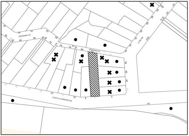
The proposed development was placed on public exhibition and was notified to adjoining and nearby landowners between 22 June 2022 to 14 July 2022 in accordance with the Hornsby Community Engagement Plan. During this period, Council received 15 submissions. The map below illustrates the location of those nearby landowners who made a submission that are in close proximity to the development site.
|
NOTIFICATION PLAN |
|||
|
• PROPERTIES NOTIFIED |
X SUBMISSIONS RECEIVED |
|
|
|
6 SUBMISSIONS RECEIVED OUT OF MAP RANGE (INCLUDING FROM THE BEECROFT CHELTENHAM CIVIC TRUST) |
|||
Fifteen submissions objected to the development, generally on the following grounds:
· The proposed subdivision does not comply with the minimum lot size requirements of the HLEP and would set an undesirable precedent.
· The justification provided within the applicant’s Clause 4.6 request are unfounded.
· Prominent trees have been removed from the site after the previous Development Application was refused (DA/139/2019), particularly at the location of the dwelling house on the Castle Howard Road lot.
· The notification sign was incorrectly affixed along the front boundary of the property.
· Boronia Avenue is narrow and poses a safety risk to pedestrians and vehicles alike as a result of construction vehicles.
· A number of trees adjacent to the Castle Howard Road frontage may be impacted by the proposed driveway and easement.
· Removal of vegetation would pose a detrimental impact to fauna habitat.
· The site is flood prone and the proposal may affect the water table.
· The site is steep and the development would encourage additional overland flows through the site onto adjoining properties.
· The proposed development would be setback close the boundary with No. 40 Lyne Road and is out of character within the HCA.
· The proposed dwelling house on Lot 1 would encourage overlooking from the family room and main bedroom to the rear yard and pool area of the adjoining property at No. 40 Lyne Road.
· The proposed dwelling on Lot 2 would overlook the rear yard and pool area of No. 2 Castle Howard Road.
· Health impacts to an immune compromised occupant of an adjoining property.
· A reduction in land values in the vicinity.
· The proposed development is out of character of the HCA
· The proposed development would result in a decline in the views to vegetation available within the vicinity.
· The proposed dwellings would facilitate overlooking into the rear yards of many of the adjoining properties.
· The Beecroft Cheltenham Civic Trust has raised concerns with regard to the creation of undersized lots, reduction of curtilage, public interest and subdivision pattern.
· Incorrect statements and discrepancies within submitted documents.
· The entertaining areas of the proposed dwelling house on Lot 2 would generate excessive noise to the adjoining property at No. 42 Lyne Road.
· Of the seven trees proposed for removal under the previous Development Application (DA/139/2019), only one tree remains (tree No. 9 under the current DA).
The merits of the matters raised in community submissions have been addressed in the body of the report with the exception of the following:
5.1.1 Notification Sign
A submission has been received raising concerns that the notification sign was incorrectly affixed along the front boundary of the property.
Council has received photographic evidence of the notification sign erected at the front of the Boronia Place frontage in accordance with the Hornsby Community Engagement Plan.
5.1.2 Traffic
A submission has been received raising concerns that the proposed development would result in additional vehicular traffic movement along Castle Howard Road.
As two car parking spaces have been proposed on Lot 2, it is anticipated that two vehicle movements would occur in the morning and two movements in the evening. Accordingly, the proposed development would not pose an unreasonable impact to traffic along Castle Howard Road and is considered acceptable.
5.1.3 Overland Flow and Water Table
A submission has been received raising concerns that the site is flood prone and the proposal may affect the water table.
In addressing this submission, the site is not mapped as a ‘flood planning area’ under the HLEP flood maps or in Council’s 2021 flood maps. The proposed earthworks are consistent with low density residential development and Council’s requirements (with the exception of the excavation into the rock escarpment) and there is no evidence available to Council that the proposal would negatively affect the water table.
5.1.4 Loss of Fauna
Submissions have been received raising concerns that the proposed removal of vegetation would result in the loss of native fauna, including the threatened Powerful Owl.
It is considered that the removal of trees from the site would have a minor detrimental impact to native fauna. Nonetheless, the loss of habitat is insignificant given the close proximity of nature reserves including Lane Cove National Park and Lyne Road Reserve.
5.1.5 Health Impacts
A submission has been received raising concerns that the proposed construction works would pose health impacts to an immune compromised occupant of an adjoining property.
Council acknowledges that during construction works, dust and other particulates may become airborne and affect adjacent properties. In the instance that the development were to be approved, conditions would be recommended requiring the installation of sediment control fencing to minimise this issue.
5.1.6 Land Values
A submission has been received raising concerns that the development would result in a reduction in land values in the vicinity.
In addressing this submission, the impact of development on adjoining land values is not a matter for consideration under Section 4.15 of the Environmental Planning and Assessment Act 1979.
5.1.7 Interruption of Views
A submission has been received raising concerns that the proposed development would result in a reduction in the available views to vegetation within the vicinity.
In addressing these concerns, it is acknowledged that residents in the vicinity currently enjoy uninterrupted views of the rear of the subject site. The HDCP requires that a development allow for reasonable sharing of ‘significant’ views, including water views and iconic views. Although the vegetation contributes to the amenity of the area, the removal of these trees would not impact upon any ‘significant’ views and is considered acceptable in this regard.
5.1.8 Errors in Submitted Documents
Submissions have been received raising concerns that there are numerous errors and incorrect statements in the submitted documents, including the Statement of Environmental Effects and Clause 4.6 Variation.
In addressing these concerns, it is acknowledged that these documents have been prepared on behalf of the applicant and do not express Council’s views.
5.1.9 Noise
A submission has been received raising concerns that the entertaining areas of the proposed dwelling house on Lot 2 would generate excessive noise to the adjoining property at No. 42 Lyne Road.
The proposed development would be setback in accordance with the side boundary setback requirements of the HDCP. While the proposed dwelling houses would pose a detrimental privacy impact to adjoining properties to the east (discussed under Section 2.6.6), the proposal complies with the noise and vibration requirements of the HDCP and Protection of the Environment Operations Act 1997.
5.2 Public Agencies
The development application was referred to the following Agencies for comment:
5.2.1 Rural Fire Service
The site is bushfire prone. Accordingly, the proposed development constitutes ‘integrated development’ subject to approval of the NSW Rural Fire Service for the issue of General Terms of Approval under Division 4.8 of the Environmental Planning and Assessment Act 1979 and a Bush Fire Safety Authority pursuant to Section 100B of the Rural Fires Act 1997.
A Bushfire Assessment prepared by Building Code & Bushfire Hazard Solutions accompanied the application, which was subsequently referred to the NSW Rural Fire Service (RFS) for comment regarding bushfire protection.
The RFS raised no concerns with the proposed development and provided General Terms of Approval and a Bush Fire Safety Authority, subject to conditions including the establishment of an Asset Protection Zone and the requirement that the proposed dwelling houses be constructed in accordance with the BAL12.5 and BAL-29 requirements of Australian Standard AS3959-2019 'Construction of buildings in bush fire-prone areas.
6. THE PUBLIC INTEREST
Section 4.15(1)(e) of the Act requires Council to consider “the public interest”.
The public interest is an overarching requirement, which includes the consideration of the matters discussed in this report. Implicit to the public interest is the achievement of future built outcomes adequately responding to and respecting the future desired outcomes expressed in environmental planning instruments and development control plans.
The application fails to satisfactorily address Council’s criteria and would provide a development outcome that, on balance, would result in a negative impact for the community. Refusal of the proposal would be in the public interest.
CONCLUSION
The application proposes the demolition of the existing dwelling house and Torrens title subdivision of one lot into two and construction of a two-storey dwelling house on each allotment.
The development does not meet the desired outcomes of Council’s planning controls and is unsatisfactory having regard to the matters for consideration under Section 4.15 of the Environmental Planning and Assessment Act 1979.
Council received 15 submissions during the public notification period. The matters raised have been addressed in the body of the report.
Having regard to the circumstances of the case, refusal of the application is recommended.
The reasons for this decision are:
· The request under Clause 4.6 of Hornsby Local Environmental Plan 2013 to contravene the minimum lot size development standard is not well founded. Strict compliance with the development standard is considered reasonable and necessary in the circumstances of the case and insufficient environmental planning grounds have been submitted to justify the contravention to the development standard.
· The proposed development creates unreasonable environmental impacts to adjoining development with regard to heritage conservation, tree preservation, privacy and amenity impacts, lot size, subdivision pattern and stormwater management.
· The proposed development does not comply with the requirements of the relevant environmental planning instruments and the Hornsby Development Control Plan 2013.
Note: At the time of the completion of this planning report, no persons have made a Political Donations Disclosure Statement pursuant to Section 10.4 of the Environmental Planning and Assessment Act 1979 in respect of the subject planning application.
RESPONSIBLE OFFICER
The officer responsible for the preparation of this report is Thomas Dales.
|
Cassandra Williams Major Development Manager - Development Assessments Planning and Compliance Division |
Rod Pickles Manager - Development Assessments Planning and Compliance Division |
|
Locality Plan |
|
|
|
|
Clause 4.6 |
|
|
|
|
Survey Plan |
|
|
|
|
Subdivision & Architectural Plans |
|
|
|
|
Landscape Plan |
|
|
File Reference: DA/628/2022
Document Number: D08475615
REASONS FOR REFUSAL
1. The proposed development is unsatisfactory in respect to Section 4.15(1)(a)(i) of the Environmental Planning and Assessment Act 1979 with regard to the Hornsby Local Environmental Plan 2013 as follows:
1.1 The proposal would result in an undersized allotment and is unacceptable with respect to Clause 4.1 ‘Minimum Subdivision Lot Size’ of the Hornsby Local Environmental Plan 2013.
1.2 The proposal is unacceptable with regard to Clause 4.6 ‘Exceptions to development standards’ of the Hornsby Local Environmental Plan 2013 as the submitted justification to vary the ‘Minimum Subdivision Lot Size’ development standard is not well founded.
1.3 The proposal would significantly reduce the capacity for a ‘garden setting’ to be created on the subject site would be out of character with the Heritage Conservation Area and is unacceptable with respect to Clause 5.10 ‘Heritage Conservation’ of the Hornsby Local Environmental Plan 2013.
1.4 The proposed development is contrary to the zone objectives of the R2 Low Density Residential Zone of the Hornsby Local Environmental Plan 2013.
2. The proposed development is unsatisfactory in respect to Section 4.15(1)(a)(i) of the Environmental Planning and Assessment Act 1979 with regard to State Environmental Planning Policy (Biodiversity and Conservation) 2021 as five trees would be removed to facilitate the development.
3. In accordance with Section 4.15(1)(a)(iii) of the Environmental Planning and Assessment Act 1979, the proposal does not comply with the desired outcome and the prescriptive measures of Hornsby Development Control Plan 2013 as follows:
3.1 The proposal does not comply with the ‘Tree and Vegetation Preservation’ prescriptive measures within Parts 1B.6.1(a) (i) and (j) of the Hornsby Development Control Plan 2013 as five trees would be removed to facilitate the development and trees proposed to be retained would be detrimentally impacted by the development.
3.2 The proposal does not comply with the ‘Stormwater Management’ prescriptive measures within Part 1C.1.2(c) of the Hornsby Development Control Plan 2013 as the gradient of the proposed inter-allotment drainage system cannot be supported by Council and inconsistencies exist between the location of the stormwater easement on the Subdivision Plan and the Stormwater Plans.
3.3 The proposal does not comply with the ‘Landscaping’ prescriptive measures within Parts 1C.2.9(a) and (b) of the Hornsby Development Control Plan 2013 as the undersized lots are not capable of providing for appropriate replacement canopy trees.
3.4 The proposal does not comply with the ‘Privacy’ prescriptive measures within Parts 3.1.6(a), (b), (c) and (d) of the Hornsby Development Control Plan 2013 as use of the east-facing alfresco, courtyard and family room of the dwelling on Lot 1 and the terrace and living room of the dwelling on Lot 2 would result in overlooking into adjacent properties.
3.5 The proposal does not comply with the ‘Residential Land Subdivision’ desired outcomes under Parts 6.1.1(a) and (b) and the prescriptive measures within Parts 6.2.1(a) and (c) of the Hornsby Development Control Plan 2013 as the proposed Lots would be undersized and do not adequately address the site constraints including the rock escarpment and the heritage values of the Beecroft-Cheltenham Heritage Conservation Area.
3.6 The proposal does not comply with the ‘Heritage’ prescriptive measure within Parts 9.3.1(a) and (d); 9.3.3(a); and 9.3.5(a)and (b) of the Hornsby Development Control Plan 2013 as the proposed development would be out of character with the values of the Heritage Conservation Area with regard to garden setting and lot size.
4. In accordance with Section 4.15(1)(c) of the Environmental Planning and Assessment Act 1979, it is considered that the site is not suitable for the proposed development.
5. In accordance with Section 4.15(1)(b) and (e) of the Environmental Planning and Assessment Act 1979, it is considered that the proposed development would not be in the public interest and would result in undesirable environmental impacts.
- END OF REASONS FOR REFUSAL -
LPP Report No. LPP54/22
Local Planning Panel
Date of Meeting: 28/09/2022
2 DA/1287/2021 - ALTERATIONS AND ADDITIONS TO A DWELLING HOUSE - 4 BRIDGE STREET, BROOKLYN
EXECUTIVE SUMMARY
|
DA No: |
DA/1287/2021 (Lodged on 1 December 2021) |
|
Description: |
Alterations and additions to a dwelling house |
|
Property: |
Lot C DP 346888, No. 4 Bridge Street, Brooklyn |
|
Applicant: |
Building Approval Solutions |
|
Owner: |
Ms Sylvia Veronica Lebowski & Mr Ian Charles Cameron |
|
Estimated Value: |
$428,884 |
|
Ward: |
A Ward |
· The application involves alterations and additions to a dwelling house.
· A total of 15 submissions have been received in respect of the application.
· The application is required to be determined by the Hornsby Council Local Planning Panel as 10 or more unique submissions were received by way of objection.
· It is recommended that the application be approved.
|
THAT Development Application No. DA/1287/2021 for alterations and additions to a dwelling house at Lot C DP 346888, No. 4 Bridge Street, Brooklyn be approved, subject to the conditions of consent detailed in Schedule 1 of LPP Report No. LPP54/22. |
SITE
The site comprises a 1625m2 allotment that currently contains a dwelling house and detached garage.
The rear portion of the site is vegetated with remnant native bushland. The site is steeply sloping, with exposed rock faces and cliff areas. The site has a fall of 12m towards the northeast.
The site is bushfire prone, with a Bushfire Attack Level (BAL) of BAL 29 applicable to the proposed development.
The site is not burdened or benefitted by any easements or restrictions.
The rear of the site is flood prone, with a north-western portion located within the remnant bushland being affected.
The site is identified as potentially containing Class 5 Acid Sulphate Soils.
Heritage item No. 202, a dwelling house at No. 19 Bridge Street, Brooklyn is located to the east of the site.
PROPOSAL
The proposal seeks consent for alterations and additions to a dwelling house comprising the following works:
· A rear extension to the existing dwelling, comprising a study, laundry, bathroom, library and combined kitchen/ living/ dining area.
· A rear building wing, which would be accessed via a turret containing a spiral staircase. The rear building wing would comprise two bedrooms with ensuites and walk in robes.
· Four decks would be proposed on the site, with decks accessed via internal living areas. Decks would be elevated above natural ground level and exploit views to the north of the site.
One tree would be removed to support the proposed works.
ASSESSMENT
The development application has been assessed having regard to the Greater Sydney Region Plan - A Metropolis of Three Cities, the North District Plan and the matters for consideration prescribed under Section 4.15 of the Environmental Planning and Assessment Act 1979 (the Act). The following issues have been identified for further consideration.
1. STRATEGIC CONTEXT
1.1 Greater Sydney Region Plan - A Metropolis of Three Cities and North District Plan
The Greater Sydney Region Plan - A Metropolis of Three Cities has been prepared by the NSW State Government to guide land use planning decisions for the next 40 years (to 2056). The Plan sets a strategy and actions for accommodating Sydney’s future population growth and identifies dwelling targets to ensure supply meets demand. The Plan also identifies that the most suitable areas for new housing are in locations close to jobs, public transport, community facilities and services.
The NSW Government will use the subregional planning process to define objectives and set goals for job creation, housing supply and choice in each subregion. Hornsby Shire has been grouped with Hunters Hill, Ku-ring-gai, Lane Cove, Mosman, North Sydney, Ryde, Northern Beaches and Willoughby to form the North District. The Greater Sydney Commission has released the North District Plan which includes priorities and actions for Northern District for the next 20 years. The identified challenge for Hornsby Shire will be to provide an additional 4,350 dwellings by 2021 with further strategic supply targets to be identified to deliver 97,000 additional dwellings in the North District by 2036.
The proposed development would be consistent with the Greater Sydney Region Plan - A Metropolis of Three Cities and the North District Plan, by contributing to achieving the dwelling targets for the region.
2. STATUTORY CONTROLS
Section 4.15(1)(a) requires Council to consider “any relevant environmental planning instruments, draft environmental planning instruments, development control plans, planning agreements and regulations”.
2.1 Hornsby Local Environmental Plan 2013
The proposed development has been assessed having regard to the provisions of the Hornsby Local Environmental Plan 2013 (HLEP).
2.1.1 Zoning of Land and Permissibility
The subject land is zoned R2 Low density residential under the HLEP. The objectives of the R2 zone are:
· To provide for the housing needs of the community within a low-density residential environment.
· To enable other land uses that provide facilities or services to meet the day to day needs of residents.
The proposed development is defined as ‘dwelling house’ and is permissible in the R2 zone with Council’s consent.
2.1.2 Height of Buildings
Clause 4.3 of the HLEP provides that the height of a building on any land should not exceed the maximum height shown for the land on the Height of Buildings Map. The maximum permissible height for the subject site is 8.5m. The proposal has a maximum height of 5.3m and complies with this provision.
2.1.3 Heritage Conservation
Clause 5.10 of the HLEP sets out heritage conservation provisions for Hornsby Shire. The site does not include a heritage item and is not located in a heritage conservation area. However, Heritage item No. 202, a dwelling house at No. 19 Bridge Street, Brooklyn is located to the east of the site.
A discussion regarding the proposed development as it relates to heritage settings is provided in Section 2.8.6 of this report. The proposed development is located within the visual catchment of several heritage items located on the eastern side of Bridge Street. As outlined in Part 2.6 and 2.8.6 of this report, subject to a condition of development consent requiring new works located prominently on the hillslope to be of a recessive colour scheme, the proposed development would have an acceptable impact on the settings of heritage items in the vicinity.
2.1.4 Flooding Planning
Clause 5.21 of the HLEP applies to the proposal as Council’s 2010 Overland Flow Study identified that the site is subject to flooding during the 1/100 years ARI storm event. Clause 5.21(2) states:
2) Development consent must not be granted to development on land the consent authority considers to be within the flood planning area unless the consent authority is satisfied the development—
(a) is compatible with the flood function and behaviour on the land, and
(b) will not adversely affect flood behaviour in a way that results in detrimental increases in the potential flood affectation of other development or properties, and
(c) will not adversely affect the safe occupation and efficient evacuation of people or exceed the capacity of existing evacuation routes for the surrounding area in the event of a flood, and
(d) incorporates appropriate measures to manage risk to life in the event of a flood, and
(e) will not adversely affect the environment or cause avoidable erosion, siltation, destruction of riparian vegetation or a reduction in the stability of river banks or watercourses.
Further, to Clause 5.21(2) of the HLEP, the prescriptive measure of Part 1C.3.2(b) of the Hornsby Development Control Plan 2013 (HDCP) states that “the overland flow path should not be built upon and should have minimal planting. Development is required to demonstrate that any overland flow is maintained for 1 in 100 year average recurrence interval (ARI) flood”.
The development application was supported by a Flood Study, prepared by GRC Hydro (Job No. 200050), dated 19 October 2021. The report stated:
“Modelling assessment shows that while a flowpath passes through the lot via a natural gully. However, the portion of the site proposed for development is 3m above the flowpath’s equivalent flood levels and some 30 metres to the east. There is therefore no potential for flood affectation at the dwelling in the design event, and development will have no impact on flooding within the lot or on adjacent lots.”
Council’s review of the Flood Risk Management Plan Report raises no objections to the proposed development and it is considered that the development is consistent with the requirements of Clause 5.219(2) of the HLEP.
2.1.5 Acid Sulfate Soils
The objective of Clause 6.1 Acid Sulfate Soils (ASS) of the HLEP is to ensure that development does not disturb, expose or drain acid sulfate soils and cause environmental damage.
Clause 6.1(2) provides that development consent must be granted under this clause for a range of works in Class 1 to 5 ASS. The site contains land identified as Class 5 ASS.
Clause 6.1(3) provides that development consent must not be granted under this clause for the carrying out of works unless an acid sulfate soils management plan has been prepared for the proposed works in accordance with the Acid Sulfate Soils Manual and has been provided to the consent authority.
Notwithstanding, Clause 6.1(4) states that despite subclause (2), development consent is not required under this clause for the carrying out of works if—
(a) a preliminary assessment of the proposed works prepared in accordance with the Acid Sulfate Soils Manual indicates that an acid sulfate soils management plan is not required for the works, and
(b) the preliminary assessment has been provided to the consent authority and the consent authority has confirmed the assessment by notice in writing to the person proposing to carry out the works.
The proposed development was supported by a Geotechnical Assessment report (Ref: 5893-G1 Rev2), prepared by Assetgeoenviro, dated 18 October 2021. The application was also supported by a Preliminary Acid Sulfate Soil Assessment (Ref: 5983-G3) prepared by Assetgeoenviro, dated 28 November 2021. The report noted:
“… We consider the risk of acid sulfate soils being encountered at the site to be very low. No further investigation of acid sulfate soils is required, and an Acid Sulfate Soil Management Plan is not required.”
Council’s review of the proposed development raises no objections to the recommendations of the report, subject to the imposition of conditions of development consent recommended in Schedule 1 of this report.
2.1.6 Earthworks
Clause 6.2 of the HLEP states that consent is required for proposed earthworks on site. Before granting consent for earthworks, Council is required to assess the impacts of the works on adjoining properties, drainage patterns and soil stability of the locality.
In addition to Clause 6.2, the desired outcome of Part 1C.1.4 Earthworks and Slope of the HDCP is for “Development that is designed to respect the natural landform characteristics and protects the stability of land”, “Development that limits landform modification to maintain the amenity of adjoining properties and streetscape character”.
Council’s assessment of the proposed works and excavation concludes that earthworks would be limited to benching of existing bedrock and earthworks that are required for the establishment of footings. An assessment of the required earthworks was undertaken by Assetgeoenviro dated 12 October 2021. Following amendments to reduce the floor level of the proposal, an addendum report was issued by Assetgeoenviro on 23 August 2022.
The geotechnical assessment undertaken by Assetgeoenviro provided recommended conditions of development consent in Section 5 of the report which are included as recommended conditions of development consent in schedule 1 of this report. An assessment of the matters for consideration contained within Clause 6.2(3) of the HLEP is provided in the table below.
|
Matter for Consideration |
Comment |
|
a) The likely disruption of, or any detrimental effect on, drainage patterns and soil stability in the locality of the development |
The proposed excavation on site would have negligible impact on any drainage patterns in the locality. Soil stability would be unimpacted upon completion of the proposed works, subject to the impositions of conditions recommended in Schedule 1 of this report. |
|
b) The effect of the development on the likely future use or redevelopment of the land |
The proposed excavation would have negligible impact on the future use or re-development of land. |
|
c) The quality of the fill or the soil to be excavated, or both |
Appropriate conditions are recommended in Schedule 1 of this report for the classification of all excavated material prior to disposal off site. Any material imported to the site will be conditioned to comprise of virgin excavated natural material only. |
|
d) The effect of the development on the existing and likely amenity of adjoining properties |
Amenity impacts as a result of the excavation would largely be defined to the construction period. Appropriate conditions of development consent are recommended in Schedule 1 of this report to control amenity impacts during construction. Post construction, during the buildings operation phase, negligible impacts are expected as a result of the proposed excavation. |
|
e) The source of any fill material and the destination of any excavated material |
Appropriate conditions are recommended in Schedule 1 of this report for the classification of all excavated material prior to disposal off site. Any material imported to the site will be conditioned to comprise of virgin excavated natural material only. |
|
f) The likelihood of disturbing relics |
Council has no records that would indicate that relics are likely to be discovered on the subject site. The majority of the excavation is located within bedrock. |
|
g) The proximity to, and potential for adverse impacts on, any waterway, drinking water catchment or environmentally sensitive area |
Subject to the establishment of sediment and erosion control devices prior to works, it is not expected that the earthworks would have any impacts on sensitive areas. Appropriate conditions are recommended in Schedule 1 of this report. |
|
h) Any appropriate measures proposed to avoid, minimise or mitigate the impacts of the development |
Appropriate measures to avoid, minimise and mitigate the impacts of the excavation are recommended as conditions in Schedule 1 of this report. |
Council’s review of the geotechnical report as it relates to Clause 6.2 of the HLEP and Part 1C.1.4 of the HDCP considers that the proposed earthworks would be appropriate for the site, subject to the recommended conditions in Schedule 1.
2.2 Adopted State Environmental Planning Policies
On 1 March 2022, the following State Environmental Planning Policies (SEPPS) were gazetted.
· State Environmental Planning Policy (Primary Production) 2021
· State Environmental Planning Policy (Resources and Energy) 2021
· State Environmental Planning Policy (Resilience and Hazards) 2021
· State Environmental Planning Policy (Industry and Employment) 2021
· State Environmental Planning Policy (Transport and Infrastructure) 2021
· State Environmental Planning Policy (Biodiversity and Conservation) 2021
· State Environmental Planning Policy (Planning Systems) 2021
· State Environmental Planning Policy (Precincts - Eastern Harbour City) 2021
These SEPPs now form matters for consideration under Section 4.15 of the Environmental Planning and Assessment Act 1979. However general savings provisions apply to development applications that have been made but not yet determined, on or before the commencement date.
As this development application was lodged on 21 December 2021, this development application is considered to have been made prior to the commencement date of the SEPPs. The existing legislation in force at time of lodgement of the development application, prevails to be extent of any inconsistency.
Notwithstanding, the approval of the development application would not adversely affect the objectives of the newly adopted SEPPs and is considered to be consistent with this policy.
2.3 State Environmental Planning Policy No. 55 Remediation of Land
The application has been assessed against the requirements of State Environmental Planning Policy No. 55 Remediation of Land (SEPP 55) under which consent must not be granted to the carrying out of any development on land unless the consent authority has considered whether the land is contaminated or requires remediation for the proposed use.
Should the land be contaminated, Council must be satisfied that the land is suitable in a contaminated state for the proposed use. If the land requires remediation to be undertaken to make the land suitable for the proposed use, Council must be satisfied that the land will be remediated before the land is used for that purpose.
An examination of Council’s records and aerial photography has determined that the site has been historically used for residential purposes. It is not likely that the site has experienced any significant contamination, and further assessment under SEPP 55 is not required.
2.4 State Environmental Planning Policy (Building Sustainability Index: BASIX) 2004
2.5 State Environmental Planning Policy (Vegetation in Non-Rural Areas) 2017
The application has been assessed against the requirements of State Environmental Planning Policy (Vegetation in Non-Rural Areas) 2017 (Vegetation SEPP). This Policy seeks to protect the biodiversity values of trees and other vegetation in non-rural areas of the State, and to preserve the amenity of non-rural areas of the State through the preservation of trees and other vegetation.
Part 3 of the Vegetation SEPP states that a development control plan may make a declaration in any manner relating to species, size, location and presence of vegetation. Accordingly, Part 1B.6.1 of the Hornsby Development Control Plan 2013 (HDCP) prescribes works that can be undertaken with or without consent to trees.
The application proposes to remove one tree. This matter is addressed further in Sections 2.6 and 2.8 of this report.
2.6 Sydney Regional Environmental Plan No. 20 Hawkesbury-Nepean River
The site is located within the catchment of the Hawkesbury Nepean River. Part 2 of this Plan contains general planning considerations and strategies requiring Council to consider the impacts of development on water quality, aquaculture, recreation and tourism.
“Riverine Scenic Quality” the specific planning policy listed in Part 2 Section 6(7) relevantly provides that a consent authority must “Consider the siting, setback, orientation, size, bulk and scale of and the use of unobtrusive, non-reflective material on any proposed building or work, the need to retain existing vegetation, especially along river banks, slopes visible from the river and its banks and along the skyline, and the need to carry out new planting of trees, and shrubs, particularly locally indigenous plants” and that the consent authority should “Consider opportunities to improve riverine scenic quality”
In addressing this component, it is noted that the proposed development would remove a visually prominent native tree from the hillside and replace this tree with a lightly coloured building extension. The tree to be removed provides a screening function to dwellings along the slope as demonstrated in Figure 1 below.
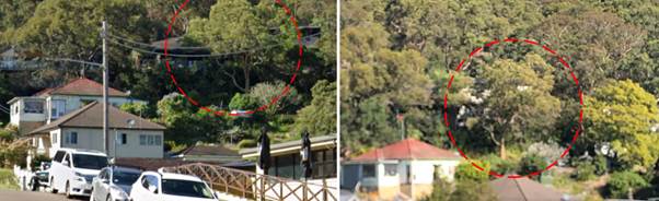
Figure 1: Views to site from corner of Bridge Street and Brooklyn Road (left) and corner of Karoola Street and William Street (right). Tree to be removed shown in red circle.
Council’s arboricultural assessment of the tree to be removed identifies that the tree is not worthy of being a development constraint due to its location on a rock shelf and exposed roots on the northern side of the tree presenting as potential structural issues.
However, the tree does assist in lessening the visual impact of the existing dwelling higher on the hillslope. The combined loss of this tree and introduction of a “surfmist” predominately white and light coloured building extension will degrade the established visual catchment which is dominated by native vegetation with housing interspaced in the established canopy.
Council considers that in order to ensure that the overall visual impact of the proposed development is lessened, it is appropriate that the external finishes of the upper proposed building section and the entire roof be visually recessive colour.
Council considers that the imposition of a condition of development consent requiring that an amended recessive tone colour scheme be approved by Council prior to the issue of a construction certificate to better integrate the proposed building modifications into the established visual catchment.
Subject to the imposition of this condition, it is considered that the proposal would comply with the requirements of the Policy.
2.7 Section 3.42 Environmental Planning and Assessment Act 1979 - Purpose and Status of Development Control Plans
Section 3.42 of the Environmental Planning and Assessment Act 1979 states that a DCP provision will have no effect if it prevents or unreasonably restricts development that is otherwise permitted and complies with the development standards in relevant Local Environmental Plans and State Environmental Planning Policies.
The principal purpose of a development control plan is to provide guidance on the aims of any environmental planning instrument that applies to the development; facilitate development that is permissible under any such instrument; and achieve the objectives of land zones. The provisions contained in a DCP are not statutory requirements and are for guidance purposes only. Consent authorities have flexibility to consider innovative solutions when assessing development proposals, to assist achieve good planning outcomes.
2.8 Hornsby Development Control Plan 2013
The proposed development has been assessed having regard to the relevant desired outcomes and prescriptive requirements within the Hornsby Development Control Plan 2013 (HDCP). The following table sets out the proposal’s compliance with the prescriptive requirements of the Plan:
|
HDCP - Part 3.1 Dwelling Houses |
|||
|
Control |
Proposal |
Requirement |
Complies |
|
Site Area |
1625m2 |
N/A |
N/A |
|
Building Height |
5.3m |
8.5m |
Yes |
|
No. storeys |
1 |
max. 2 + attic |
Yes |
|
Site Coverage |
13% |
30% |
Yes |
|
Floor Area |
209m2 |
430m2 |
Yes |
|
Setbacks |
|
|
|
|
- Front (existing) |
3m |
6m |
No - existing |
|
- Northern Side |
3.4m |
900mm |
Yes |
|
- Southern Side |
900mm |
900mm |
Yes |
|
- Rear |
>10m |
3m |
Yes |
|
Landscaped Area (% of lot size) |
>50% |
45% |
Yes |
|
Private Open Space |
|
|
|
|
- minimum area |
>24m2 |
24m2 |
Yes |
|
- minimum dimension |
>3m |
3m |
Yes |
|
Car Parking |
1 space |
2 spaces |
No |
As detailed in the above table, the proposed development complies with the prescriptive measures within the HDCP with the exception of car parking and front setback. A brief discussion on compliance with relevant performance requirements and Part 1C General Controls is provided below.
2.8.1 Scale
The scale of the development is compliant with Council’s controls and considered to be of an acceptable form with respect to the constraints of the site. It is considered that bulk and scale of the proposed development is compatible with the surrounding low density residential environment and that the development complies with the desired outcomes of Part 3.1.1 Scale of the HDCP.
2.8.2 Setbacks
The proposed development would comply with side and rear setback requirements. It is noted that the existing dwelling does not comply with the front setback requirement of 6m. This is an existing non-compliance, and none of the proposed works would exacerbate the existing setback non-compliance. The east and north facing balcony over the garage area would be setback at more than 6m.
2.8.3 Sunlight Access
The desired outcomes of Part 3.1.5 Sunlight Access of the HDCP is that “Dwelling houses are designed to provide solar access to open space areas” and that “Development is designed to provide reasonable sunlight to adjacent properties” with the prescriptive measure that states:
“On 22 June, 50 percent of the required principal private open space on any adjoining property should receive 3 hours of unobstructed sunlight access between 9am and 3pm.”
The proposed development would cast shadows to the south, which would impact on the adjoining southern properties being No. 6 and 8 Bridge Street.
Prevailing topography of the area places both No. 6 and 8 Bridge Street at a higher elevation. Shadows cast by the proposed development would not impact on the principal private open space of either No. 6 or 8 as the principle private open space for No. 8 is located to the south eastern side of the dwelling and the principle private open space of No. 6 is located at an elevated first floor level in the form of a 54m2 balcony.
The proposal therefore complies with the desired outcomes of Part 3.1.5 Sunlight Access of the HDCP and is considered acceptable.
2.8.4 Privacy
The desired outcome of Part 3.1.6 Privacy of the HDCP is for “Development that is designed to provide reasonable privacy to adjacent properties” with the prescriptive measure that:
Decks and the like that need to be located more than 600mm above existing ground should not face a window of another habitable room, balcony or private open space of another dwelling located within 9 metres of the proposed deck unless appropriately screened
Living and entertaining areas of dwelling houses should be located on the ground floor and oriented towards the private open space of the dwelling house and not side boundaries”.
The proposed development seeks to locate decks above 600mm of existing ground level, and orient those decks towards the northern side boundary, which is non-compliant with the requirements of the HDCP.
The orientation of balconies and living spaces towards the northern side boundary is designed to achieve northerly views towards Hawkesbury River, as shown below.
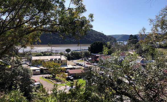
Figure 2: Views towards Hawkesbury River from the general vicinity of the proposed development.
However, the proposed development could potentially allow for overlooking into the rear private open space of the adjoining northern property, being No. 2 Bridge Street. The existing and proposed situation is shown in Figure 3 below.
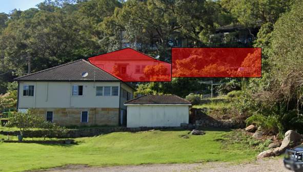
Figure 3: The development site, shown highlighted in red, with indicative building extension shown in red (approximate, not to scale). No. 2 Bridge Street is shown in the foreground.
The existing slope between No.2 and No.4 Bridge Street places No.4 at approximately 3m above the rear private open space (POS) area of No.2. Because of the existing topography, views into the POS of No.2 would be achieved via looking below the horizontal from the proposed deck areas. It is clear from the intent of the supplied plans that views are sought beyond No.2 to the Hawkesbury River to the north, and the design has not been created to exploit any views towards No.2 itself.
All proposed deck areas would be located within 9m of the adjoining POS.
It is considered that the provision of opaque balustrading would assist in preventing views down into the POS of No.2. Consequently, in order to establish and maintain a reasonable level of privacy between the development site and adjoining residential development, a condition of development consent is recommended in Schedule 1 of this report for amended plans to be provided showing opaque balustrading prior to the issue of a construction certificate.
Subject to the imposition of this condition, it is considered that the proposed development would comply with the desired outcomes of Part 3.1.6 Privacy of the HDCP.
With regard to privacy impacts to adjoining southern neighbours, it is considered that the proposed works are located substantially lower than adjoining southern properties and would therefore generate negligible privacy impacts.
2.8.5 Vehicular Access and Parking
Part 1C.2.1 of the HDCP prescribes that dwelling houses containing three or more bedrooms should provide two car parking spaces. The proposed development provides for a single parking space, which equates to a shortfall of one space.
The applicant relevantly provided that to provide an additional car parking space on site would require significant excavation of bedrock, as the site has shallow soils and is underlain by bedrock and large detached rock pieces. This opinion was supported by the Geotechnical report by Assetgeoenviro.
The applicant informally parks a further vehicle in front of the existing single car garage, in what is the road reserve. As shown below in Figure 4.
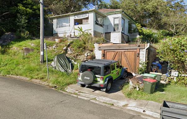
Figure 4: Informal parking space in front of single car garage (green Jeep).
Council notes that the parking of a vehicle in the front of the existing garage and/ or within the road reserve is not uncommon for the Brooklyn area, with examples along Brooklyn Road, Peat Street, Karoola Street and George Street.
The shortfall of one car space on site is considered to be acceptable as parking would be available within the general vicinity of the subject site along Bridge, William and George Streets.
2.8.6 Heritage
Part 9.4.1 Development in the Vicinity of Heritage Items and Heritage Conservation Areas provides the desired outcome that: “New work that is sympathetic to the heritage significance of nearby heritage items, or adjoining heritage conservation area, and their settings.”
The proposed development is located within the visual catchment of several heritage items located on the eastern side of Bridge Street. As outlined in Part 2.6 of this report, subject to a condition of development consent requiring new works located prominently on the hillslope to be of a recessive colour scheme, the proposed development would have an acceptable impact on the settings of heritage items in the vicinity.
2.8.7 Tree Preservation
The development would require removal one tree, identified in the supplied Arboricultural Impact Assessment Report, prepared by Chad Shakeshaft, dated 15/10/2020. A number of trees would be located in the vicinity of the proposed development which would require the installation of tree protection measures during construction. Subject to the imposition of conditions, including tree protection measures and replacement planting, no objections are raised.
2.9 Views
The desired outcome of Part 3.1.8 Design Details of the HDCP is to encourage “development compatible with a low density residential environment that complements the zone objectives” with the prescriptive measure that:
“Development should allow for the reasonable sharing of significant views, including water views and iconic views in particular:
· Views that have not already been obscured,
· Views from front and rear boundaries whilst in a standing position, and
· Views from living and entertainment areas (including kitchens)”
and;
“Development should allow for the reasonable sharing of significant views by:
· Appropriately siting the building,
· Appropriately designing the bulk of the building,
· Using open materials for balustrades on balconies and decks, and/or
· New landscaping comprising of light, open foliage.”
The proposed development is designed to provide views towards the north of Hawkesbury River. In doing so, the proposed design is to place a section of the building extension on an elevated portion of the site, adjacent to the southern side boundary. The placement of the western building wing in this location has the potential to impact on views enjoyed by the adjoining southern property, being No. 8 Bridge Street.
No. 8 Bridge Street comprises a two storey dwelling house which has been designed to exploit the northern aspect and views towards Hawkesbury River and Long Island. Views are primarily obtained from the first floor balcony which adjoining the internal living space of the dwelling house and can be seen in Figure 5 below.
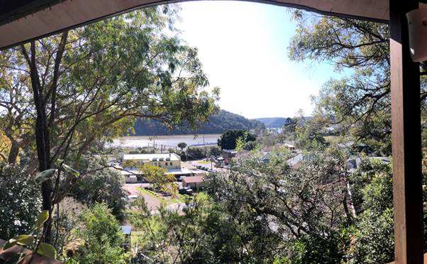
Figure 5: View from 1st floor balcony of No. 8 Bridge Street towards the Hawkesbury River and Long Island.
Views from the lower level of No. 8 Bridge Street are not substantive and are terminated by existing vegetation. Views from the lower level are considered to be pre-obscured and are accessed via an internal bedroom and a lower rumpus type room. Figure 6 below demonstrates the lower level and existing vegetation.
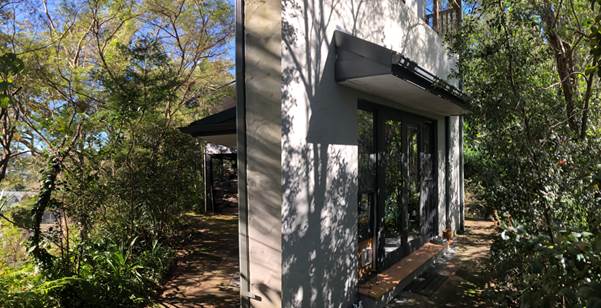 Figure 6:
Existing vegetation obscuring lower level views from No. 8 Bridge Street (Left)
and north facing bedroom window (right).
Figure 6:
Existing vegetation obscuring lower level views from No. 8 Bridge Street (Left)
and north facing bedroom window (right).
The finished floor level of the first floor balcony is shown as RL 25.46 on a survey plan, prepared by Hammond Smeallie and Co, dated August 2015 as provided by the owner of No. 8 Bridge Street.
The proposed ridge height of the western building extension is shown as RL 24.275 which places the whole of the western building extension below the finished floor level of the adjoining balcony. Consequently, the proposed development would not impact on views enjoyed from this balcony from either a seated or standing position.
A condition of development consent is recommended in Schedule 1 of this report for the obtainment of certification of floor and ridge levels by a qualified surveyor prior to occupation certificate.
2.10 Section 7.12 Contributions Plans
Hornsby Shire Council Section 7.12 Contributions Plan 2019-2029 applies to the development as the estimated costs of works is greater than $100,000. Should the application be approved, an appropriate condition of consent is recommended requiring the payment of a contribution in accordance with the Plan.
3. ENVIRONMENTAL IMPACTS
Section 4.15(1)(b) of the Act requires Council to consider “the likely impacts of that development, including environmental impacts on both the natural and built environments, and social and economic impacts in the locality”.
3.1 Natural Environment
3.1.1 Tree and Vegetation Preservation
The proposed development would necessitate the removal of 1 tree from the site, as discussed in the body of this report. A condition of development consent has been recommended for the replacement planting of two native trees to maintain local canopy cover.
3.1.2 Stormwater Management
The proposed development seeks to drain stormwater to the Council street drainage system at Bridge Street. No objections are raised to this proposed method of stormwater disposal subject to the conditions of development consent recommended in Schedule 1 of this report.
3.2 Built Environment
3.2.1 Built Form
As described in the body of this report, the proposed built form is considered acceptable, subject to the imposition of conditions of consent recommended in Schedule 1 of this report.
3.2.2 Traffic
Council’s assessment of the traffic impacts of the development concludes that the proposal would have negligible impact on traffic.
3.3 Social Impacts
The residential development would improve housing choice in the locality by providing a range of house hold types. This is consistent with Council’s Housing Strategy which identifies the need to provide a mix of housing options to meet future demographic needs in Hornsby Shire.
3.4 Economic Impacts
The proposal would have a minor positive impact on the local economy in conjunction with other new low density residential development in the locality by generating an increase in demand for local services.
4. SITE SUITABILITY
Section 4.15(1)(c) of the Act requires Council to consider “the suitability of the site for the development”.
The subject site has not been identified as bushfire and flood prone land. The site is considered to be capable of accommodating the proposed development. The scale of the proposed development is consistent with the capability of the site and is considered acceptable.
4.1 Flooding
As discussed in the body of this report, the proposed development would be located clear of the portion of the site that is affected by overland flooding.
4.2 Bushfire Risk
The land is identified as being subject to bushfire risk with the supplied Bush Fire Assessment Report, prepared by Australian Bushfire Consulting Services detailing that bushfire prone vegetation at the rear of the site would necessitate construction to BAL 29 standards for the proposed development. Existing asset protection zones (APZs) on the site would not require alteration. Appropriate conditions of development consent have been recommended.
5. PUBLIC PARTICIPATION
Section 4.15(1)(d) of the Act requires Council to consider “any submissions made in accordance with this Act”.
5.1 Community Consultation
The proposed development was placed on public exhibition and was notified to adjoining and nearby landowners between 3 December 2021 and 24 January 2022 in accordance with the Hornsby Community Engagement Plan. During this period, Council received 7 submissions. On 8 June 2022 the applicant submitted amended plans in response to a request for information sent by Council. The amendments to the plans reduced the overall height of the semi-detached building portion and reconfigured the layout. After the receipt of amended plans, on 11 July 2022 Council renotified the application to adjoining property owners. Two weeks were initially provided however some adjoining owners and submitters indicated that they did not receive the renotification letters. Council provided an extension to submitters until 5 August 2022 to send in submissions. A further 8 submissions were received during the second round of notification.
A map detail properties notified during the submission period, as well as submissions received is provided below.
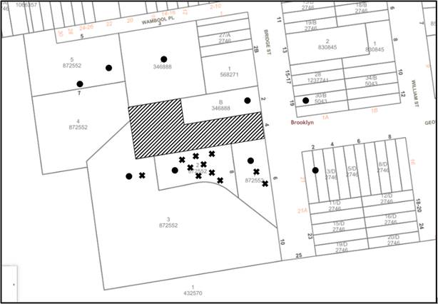
|
NOTIFICATION PLAN |
|||
|
• PROPERTIES NOTIFIED |
X SUBMISSIONS RECEIVED |
|
|
|
4 SUBMISSIONS RECEIVED OUT OF MAP RANGE |
|||
15 submissions objected to the development, generally on the grounds that the development would result in:
· View Loss
· Sunlight Access
· Setbacks
· Privacy
· Visual Impact of the Structure
· Bulk and scale impacts
· Tree Removal
· Excavation / Slope Impacts
· Impacts on Sydney Water Sewerage Lines
· Inaccuracies in Statement of Environmental Effects
· Excessive Fire Places
· Retaining wall at boundary not detailed
· Overshadowing
· Asbestos Removal
· Concerns that western wing will be used as short term rental accommodation
· Privacy Impacts
· Construction Impacts
· 4 Bridge Street applied for a liquor licence
· Visual prominence of the structure and impact of the works on heritage items in the vicinity
The merits of the matters raised in community submissions have been addressed in the body of the report with the exception of the following:
5.1.1 Liquor Licence - 4 Bridge Street
Submissions raised concerns that the premises at No. 4 Bridge Street applied for a liquor licence. This matter is not relevant to the proposed development application for alterations and additions to a dwelling house. Liquor licences are able to applied for home occupations involving the online sales of liquor.
5.1.2 Use of the dwelling for short term rental accommodation
Submissions raised concerns that the premises at No. 4 Bridge Street may be used for short term rental accommodation. This matter is not related to the proposed development application for alterations and additions to a dwelling house. If the applicant sought to change the use of the premise, this would have to occur under a separate application.
5.1.3 Construction impacts
Submissions raised concerns that the construction on site may block vehicular access along Bridge Street and/ or construction materials or machinery may be stored in the road reserve.
Appropriate conditions of consent have been recommended in Schedule 1 of this report to control construction impacts.
5.1.4 Asbestos Removal
Submissions raised concerns regarding potential demolition and removal of asbestos related products on site. Appropriate conditions of consent are recommended in Schedule 1 of this report for demolition involving asbestos related products to be undertaken by a licenced contractor.
5.1.5 Boundary Retaining Wall
Submissions raised concerns regarding an existing boundary retaining wall on site. The proposed development does not seek to amend any existing retaining walls and would not change the load bearing capacity of any retaining walls as the foundation would primarily be located in bedrock. The retaining wall of concern is located on the southern site boundary and retains upslope land on 6 and 8 Bridge Street.
5.1.6 Fire Places
Submissions raised concerns regarding the proposed solid combustion fireplaces shown on the proposed plans.
In addressing these concerns, it is noted that Council does not have any planning requirements preventing or limiting the number of solid combustion heaters that may be installed in the home.
Conditions of development consent are recommended in Schedule 1 of this report for the installation of the solid combustion fire places to ensure that the installation complies the relevant requirements of the National Construction Code and Australian Standard AS 2918:2001 Domestic solid fuel burning appliances.
5.1.7 Inaccuracies in the supplied statement of environmental effects
Submissions raised concerns regarding inconsistencies in the supplied Statement of Environmental Effects. Council is satisfied that the information provided in the SEE is sufficient to enable a planning assessment of the proposed works to be undertaken in accordance with the requirements of the relevant planning legislation and polices.
5.1.8 Impacts on existing Sydney Water sewerage infrastructure
Submissions raised concerns regarding impacts of the proposed development on existing sewerage infrastructure that is located in adjoining properties 6 and 8 Bridge Street.
Conditions of development consent have been recommended to ensure that the applicant is sent to Sydney water for the agency’s requirements prior to the issue of a construction certificate.
5.2 Public Agencies
The development application was not referred to any Public Agencies for comment.
6. THE PUBLIC INTEREST
Section 4.15(1)(e) of the Act requires Council to consider “the public interest”.
The public interest is an overarching requirement, which includes the consideration of the matters discussed in this report. Implicit to the public interest is the achievement of future built outcomes adequately responding to and respecting the future desired outcomes expressed in environmental planning instruments and development control plans.
The application is considered to have satisfactorily addressed Council’s criteria and would provide a development outcome that, on balance, would result in a positive impact for the community. Accordingly, it is considered that the approval of the proposed development would be in the public interest.
CONCLUSION
The application proposes alterations and additions to a dwelling house.
The development generally meets the desired outcomes of Council’s planning controls and is satisfactory having regard to the matters for consideration under Section 4.15 of the Environmental Planning and Assessment Act 1979.
Council received fifteen submissions during the public notification period. The matters raised have been addressed in the body of the report.
Having regard to the circumstances of the case, approval of the application is recommended.
The reasons for this decision are:
· The proposed development complies with the requirements of the relevant environmental planning instruments and the Hornsby Development Control Plan 2013.
· The proposed development does not create unreasonable environmental impacts to adjoining development with regard to visual bulk, solar access, amenity or privacy, subject to the conditions recommended in Schedule 1 of this report.
Note: At the time of the completion of this planning report, no persons have made a Political Donations Disclosure Statement pursuant to Section 10.4 of the Environmental Planning and Assessment Act 1979 in respect of the subject planning application.
RESPONSIBLE OFFICER
The officer responsible for the preparation of this report is Ben Jones.
|
Cassandra Williams Major Development Manager - Development Assessments Planning and Compliance Division |
Rod Pickles Manager - Development Assessments Planning and Compliance Division |
|
Locality Plan |
|
|
|
|
Architectural Plans |
|
|
|
|
Shadow Diagrams |
|
|
File Reference: DA/1287/2021
Document Number: D08478076
SCHEDULE 1
GENERAL CONDITIONS
The conditions of consent within this notice of determination have been applied to ensure that the use of the land and/or building is carried out in such a manner that is consistent with the aims and objectives of the relevant legislation, planning instruments and council policies affecting the land and does not disrupt the amenity of the neighbourhood or impact upon the environment.
Note: For the purpose of this consent, the term ‘applicant’ means any person who has the authority to act on or the benefit of the development consent.
Note: For the purpose of this consent, any reference to an Act, Regulation, Australian Standard or publication by a public authority shall be taken to mean the gazetted Act or Regulation, or adopted Australian Standard or publication as in force on the date that the application for a construction certificate is made.
1. Approved Plans and Supporting Documentation
The development must be carried out in accordance with the plans and documentation listed below and endorsed with Council’s stamp, except where amended by Council and/or other conditions of this consent:
Approved Plans
|
10. Plan No. |
11. Plan Title |
12. Drawn by |
13. Dated |
14. Council Reference |
|
15. Notes – 2 |
16. Finishes Detail |
17. TZ Design |
18. Undated |
19. |
|
20. 259-01 Revision P |
21. Ground Floor Plan - Existing |
22. TZ Design |
23. 08.03.17 |
24. |
|
25. 259-02 Revision P |
26. Ground Floor Plan - Proposed |
27. TZ Design |
28. 08.03.17 |
29. |
|
30. 259-03 Revision P |
31. Roof Plan - Proposed |
32. TZ Design |
33. 08.03.17 |
34. |
|
35. 259-04 Revision P |
36. Site Plan |
37. TZ Design |
38. 08.03.17 |
39. |
|
40. 259-05 Revision P |
41. Elevations |
42. TZ Design |
43. 08.03.17 |
44. |
|
45. 259-06 Revision P |
46. Elevations |
47. TZ Design |
48. 08.03.17 |
49. |
|
50. 259-07 Revision P |
51. Sections |
52. TZ Design |
53. 08.03.17 |
54. |
|
55. 259-08 Revision P |
56. Sections |
57. TZ Design |
58. 08.03.17 |
59. |
|
60. 259-09 Revision P |
61. Site Plan - Detail |
62. TZ Design |
63. 08.03.17 |
64. |
|
65. 259-10 Revision P |
66. Landscape Plan |
67. TZ Design |
68. 08.03.17 |
69. |
|
70. SW03 |
71. Stormwater Plan and Details |
72. Prime Engineering Consultants |
73. 11.11.2021 |
74. |
Supporting Documentation
|
75. Document Title |
76. Prepared by |
77. Dated |
78. Council Reference |
|
79. BASIX Certificate No. A292167 |
80. TZ Design |
81. 7/9/2021 |
82. D08307493 |
|
83. Arboricultural Impact Assessment |
84. Chad Shakeshaft |
85. 15/10/2020 |
86. D08307492 |
|
87. Geotechnical Assessment |
88. AssetGeoEnviro |
89. 12/10/2021 |
90. D08307477 |
|
91. Geotechnical Assessment - Addendum |
92. AssetGeoEnviro |
93. 23/08/2021 |
94. D08491645 |
|
95. Bush Fire Assessment Report |
96. Australian Bush Fire Consulting Services |
97. 14/10/2021 |
98. D08307494 |
|
99. Waste Management Plan |
100. Building Approval Solutions |
- |
101. D08307491 |
a) To comply with Council’s requirement in terms of reducing the visual impact of the prominent western building wing and ensuring a reasonable level of privacy is established and maintained, the approved plans are to be amended as follows:
i) The finishes detail plan and approved plans are to be updated to show the western building wing in dark recessive tones to reduce the visual impact of the structures. Whites and light greys are not permitted. The portion of the building that is subject to this condition includes the entire turret and western building wing, as indicated bubbled in red on the approved elevation plan 259-05 Rev P prepared by TZ Design.
ii) All north facing balustrades as indicated in red on the approved elevation plan 259-05 Rev P prepared by TZ Design are to be opaque to reduce privacy impacts to the adjoining No. 2 Bridge Street (Lot B DP 346888). If an opaque material is not preferred, balustrading can be finished with a screen having no individual openings more than 30mm wide and have a total of all openings less than 30% of the surface area of the screen. All balustrades requiring privacy devices must have the opaque/ privacy screen treatment installed from the finished floor level to the top of the handrail.
b) These amended plans must be submitted with the application for the Construction Certificate.
3. Construction Certificate
a) A Construction Certificate is required to be approved by Council or a Private Certifying Authority prior to the commencement of any construction works under this consent.
b) The Construction Certificate plans must be consistent with the Development Consent plans.
4. Section 7.12 Development Contributions
a) In accordance with Section 4.17(1) of the Environmental Planning and Assessment Act 1979 and the Hornsby Shire Council Section 7.12 Development Contributions Plan 2019-2029, $4,288.85 must be paid towards the provision, extension or augmentation of public amenities or public services, based on development costs of $428,884.
b) The value of this contribution is current as of 13 September 2022 If the contributions are not paid within the financial quarter that this consent is granted, the contributions payable will be adjusted in accordance with the provisions of the Hornsby Shire Council Section 7.12 Development Contributions Plan and the amount payable will be calculated at the time of payment in the following manner:
|
$CPY |
= |
|
|
$CDC x CPIPY |
|
|
|
|
|
CPIDC |
Where:
$CPY is the amount of the contribution at the date of Payment.
$CDC is the amount of the contribution as set out in this Development Consent.
CPIPY is the latest release of the Consumer Price Index (Sydney – All Groups) at the date of Payment as published by the ABS.
CPIDC is the Consumer Price Index (Sydney – All Groups) for the financial quarter at the date of this Development Consent.
c) The monetary contributions shall be paid to Council:
(i) Prior to the issue of the Subdivision Certificate where the development is for subdivision.
(ii) Prior to the issue of the first Construction Certificate where the development is for building work.
(iii) Prior to issue of the Subdivision Certificate or first Construction Certificate, whichever occurs first, where the development involves both subdivision and building work.
(iv) Prior to the works commencing where the development does not require a Construction Certificate or Subdivision Certificate.
Note: It is the professional responsibility of the Principal Certifying Authority to ensure that the monetary contributions have been paid to Council in accordance with the above timeframes.
Note: In accordance with Ministerial Directions, the payment of contribution fees for development with a cost of works of over $10 million can be deferred to prior to Occupation Certificate.
Note: The Hornsby Shire Council Section 7.12 Development Contributions Plan may be viewed at www.hornsby.nsw.gov.au or a copy may be inspected at Council’s Administration Centre during normal business hours.
5. Domestic Solid Fuel Burning Appliances
a) The fire place and chimney/flue must be installed in accordance the requirements of the National Construction Code.
b) The domestic solid-fuel heater must comply with the Protection of the Environment Operations (Clean Air) Regulation 2010 and Australian Standard AS4013-1992 Domestic solid fuel burning appliances - Method for determination of flue gas emission.
102. REQUIREMENTS PRIOR TO THE ISSUE OF A CONSTRUCTION CERTIFICATE
Detailed plans, specifications and supporting information is required to be submitted to the certifying authority detailing how the proposed building work achieves compliance with the National Construction Code - Building Code of Australia. All building work must be carried out in accordance with the requirements of the National Construction Code - Building Code of Australia.
7. Contract of Insurance (Residential Building Work)
Where residential building work for which the Home Building Act 1989 requires there to be a contract of insurance in force in accordance with Part 6 of that Act, this contract of insurance must be in force before any building work authorised to be carried out by the consent commences.
8. Notification of Home Building Act 1989 Requirements
Residential building work within the meaning of the Home Building Act 1989 must not be carried out unless the principal certifying authority for the development to which the work relates (not being Council) has given Council written notice of the following information:
a) In the case of work for which a principal contractor is required to be appointed:
i) The name and licence number of the principal contractor; and
ii) The name of the insurer by which the work is insured under Part 6 of that Act.
b) In the case of work to be done by an owner-builder:
i) The name of the owner-builder; and
ii) If the owner-builder is required to hold an owner-builder’s permit under that Act, the number of the owner-builder’s permit.
Note: If arrangements for doing the residential building work are changed while the work is in progress so that the information notified becomes out of date, further work must not be carried out unless the principal certifying authority for the development to which the work relates (not being Council) has given Council written notification of the updated information.
9. Sydney Water – Approval
This application must be submitted to Sydney Water for approval to determine whether the development would affect any Sydney Water infrastructure, and whether further requirements are to be met.
Note: Building plan approvals can be obtained online via Sydney Water Tap inTM through www.sydneywater.com.au under the Building and Development tab.
a) Prior to the commencement of any works on site, the applicant must submit for approval by the Principal Certifying Authority (with a copy forwarded to Council) a ‘Dilapidation Report’ detailing the structural condition of the adjoining properties:
i) Lot 2 DP 872552, No. 8 Bridge Street Brooklyn
b) The report must include a photographic survey of the adjoining properties detailing their physical condition, both internally and externally, including such items as walls, ceilings, roof, structural members and other similar items. The report must be completed by a chartered structural/geotechnical. A copy of the dilapidation report must be submitted to Council.
c) In the event access to adjoining allotments for the completion of a dilapidation survey is denied, the applicant must demonstrate in writing that all reasonable steps have been taken to advise the adjoining allotment owners of the benefit of this survey and details of failure to gain consent for access to the satisfaction of the Principle Certifying Authority.
Note: This documentation is for record keeping purposes only and can be made available to an applicant or affected property owner should it be requested to resolve any dispute over damage to adjoining properties arising from works. It is in the applicant’s and adjoining owner’s interest for it to be as detailed as possible
11. Design and Construction - Bushfire Attack Category
New construction must comply with the current Australian Standard AS3959 ‘Construction of Buildings in Bush Fire-prone Areas’ Section 3 and 7. (BAL 29), the recommendations of the Bush Fire Assessment Report and Planning for Bushfire Protection 2019.
Note: Further information concerning planning for bush fire protection can be found at: www.rfs.nsw.gov.au.
12. Design and Construction - Geotechnical Certification
To ensure site stability, prior to the issue of a construction certificate, all footings and proposed excavations works must be designed and certified by a practicing Geotechnical Engineer. Copies of Certification documents must be provided to the PCA with the application for the construction certificate.
13. Identification of Survey Marks
A registered surveyor must identify all survey marks in the vicinity of the proposed development. Any survey marks required to be removed or displaced as a result of the proposed development shall be undertaken by a registered surveyor in accordance with Section 24(1) of the Surveying and Spatial Information Act 2002 and following the Surveyor General’s Directions No.11 Preservation of Survey Infrastructure.
14. Stormwater Drainage
a) The stormwater drainage system for the development must be designed for an average recurrence interval (ARI) of 20 years and be gravity drained in generally in accordance with the approved stormwater concept plans and be connected directly to Council’s Street Drainage System.
b) The stormwater drainage system must be designed by a qualified hydraulic engineer.
15. Appointment of a Project Arborist
a) To ensure the trees that must be retained are protected, a project arborist with AQF Level 5 qualifications must be appointed to assist in ensuring compliance with the conditions of consent and provide monitoring reports as specified by the conditions of consent.
b) Details of the appointed project arborist must be submitted to Council and the PCA with the application for the construction certificate/subdivision works certificate.
103. REQUIREMENTS PRIOR TO THE COMMENCEMENT OF ANY WORKS
16. Erection of Construction Sign
a) A sign must be erected in a prominent position on any site on which any approved work is being carried out:
i) Showing the name, address and telephone number of the principal certifying authority for the work.
ii) Showing the name of the principal contractor (if any) for any demolition or building work and a telephone number on which that person may be contacted outside working hours.
iii) Stating that unauthorised entry to the work site is prohibited.
b) The sign is to be maintained while the approved work is being carried out and must be removed when the work has been completed.
17. Protection of Adjoining Areas
A temporary hoarding, fence or awning must be erected between the work site and adjoining lands before the works begin and must be kept in place until after the completion of the works if the works:
a) Could cause a danger, obstruction or inconvenience to pedestrian or vehicular traffic.
b) Could cause damage to adjoining lands by falling objects.
c) Involve the enclosure of a public place or part of a public place.
d) Have been identified as requiring a temporary hoarding, fence or awning within the Council approved Construction Management Plan (CMP).
Note: Notwithstanding the above, Council’s separate written approval is required prior to the erection of any structure or other obstruction on public land.
a) To provide a safe and hygienic workplace, toilet facilities must be available or be installed at the works site before works begin and must be maintained until the works are completed at a ratio of one toilet for every 20 persons employed at the site.
b) Each toilet must:
i) Be a standard flushing toilet connected to a public sewer.
ii) Be a temporary chemical closet approved under the Local Government Act 1993.
iii) Have an on-site effluent disposal system approved under the Local Government Act 1993.
19. Erosion and Sediment Control
To protect the water quality of the downstream environment, erosion and sediment control measures must be provided and maintained throughout the construction period in accordance with the manual ‘Soils and Construction 2004 (Bluebook)’, the approved plans, Council specifications and to the satisfaction of the principal certifying authority. The erosion and sediment control devices must remain in place until the site has been stabilised and revegetated.
Note: On the spot penalties may be issued for any non-compliance with this requirement without any further notification or warning.
20. Installation of Tree Protection Measures
a) Trees to be retained in the vicinity of the proposed works must have tree protection measures for the ground, trunk and canopy installed by the project arborist for the duration of demolition and construction works:
b) Tree protection fencing for the trees to be retained must be installed by the engaged AQF 5 project arborist and consist of 1.8m high temporary fencing panels installed in accordance with Australian Standard AS4687-2007 Temporary fencing and hoardings.
c) The installation of all required tree protection fencing must include shade cloth attached to the fencing to reduce transport of dust, particulates and liquids from entering the tree protection zone.
d) The circumference of the trunk(s) must be wrapped in hessian material to provide cushioning for the installation of timber planks.
e) Timber planks (50 x100mm) must be spaced at 100mm intervals and must be attached using adjustable ratchet straps.
21. Bushfire Management – Protection Zones
At the commencement of building works the property must be managed as an Inner Protection Area (IPA) to the distances outlined within the supplied Bush Fire Assessment Report, prepared by Australian Bush Fire Consulting Services, dated 14/10/2021 and Appendix 4 of Planning for Bush Fire Protection 2019 and the NSW Rural Fire Service’s document Standards for asset protection zones.
Note: Further information concerning planning for bush fire protection can be found at: www.rfs.nsw.gov.au.
Note: No trees are permitted to be removed under this condition. No Trees are required to be removed to satisfy the IPA requirements.
104. REQUIREMENTS DURING DEMOLITION AND CONSTRUCTION
All works on site, including demolition and earth works, must only occur between 7am and 5pm Monday to Saturday.
No work is to be undertaken on Sundays or public holidays.
23. Demolition
To protect the surrounding environment, all demolition work must be carried out in accordance with Australian Standard AS2601-2001 Demolition of structures and the following requirements:
a) Demolition material must be disposed of to an authorised recycling and/or waste disposal site and/or in accordance with an approved waste management plan.
b) Demolition works, where asbestos material is being removed, must be undertaken by a contractor that holds an appropriate licence issued by SafeWork NSW in accordance with the Work Health and Safety Regulation 2017 and be appropriately transported and disposed of in accordance with the Protection of the Environment Operations (Waste) Regulation 2014.
c) On construction sites where any building contain asbestos material, a standard commercially manufactured sign containing the words ‘DANGER ASBESTOS REMOVAL IN PROGRESS’ and measuring not less than 400mm x 300mm must be displayed in a prominent position visible from the street.
24. Environmental Management
To prevent sediment run-off, excessive dust, noise or odour emanating from the site during the construction, the site must be managed in accordance with the publication ‘Managing Urban Stormwater – Landcom (March 2004) and the Protection of the Environment Operations Act 1997.
To ensure site stability excavations works are to be designed and overseen by a suitably qualified geotechnical engineer. Excavation and foundation works must be carried out in accordance with the recommendations contained in Section 5 of the Geotechnical Assessment Report, prepared by AssetGeoEnvrio, dated 12 October 2021 (Ref 5893-G1 Rev 2)
26. Council Property
To ensure that the public reserve is kept in a clean, tidy and safe condition during construction works, no building materials, waste, machinery or related matter is to be stored on the road or footpath.
27. Disturbance of Existing Site
During construction works, the existing ground levels of open space areas and natural landscape features, including natural rock-outcrops, vegetation, soil and watercourses must not be altered unless otherwise nominated on the approved plans.
28. Landfill not Permitted
The importation of fill material associated with earthworks, or structural or engineering works, is not permitted as part of this consent.
29. Excavated Material
All excavated material removed from the site must be classified by a suitably qualified environmental consultant in accordance with the NSW Environment Protection Authority’s Waste Classification Guidelines and Protection of the Environment Operations (Waste) Regulation 2014 prior to disposal to a licensed waste management facility. Tipping dockets for the total volume of excavated material that are received from the licensed waste management facility must be provided to the principal certifying authority prior to the issue of an Occupation Certificate.
30. Survey Report
A report(s) must be prepared by a registered surveyor and submitted to the principal certifying authority:
a) Prior to finishing of each level of the building certifying that:
i) The building, retaining walls and the like have been correctly positioned on the site.
ii) The finished floor level(s) are in accordance with the approved plans.
b) The ridge heights are equal to or lower than the approved ridge height shown on the approved plans.
31. Maintenance of public footpaths
Public footpaths must be maintained for the duration of works to ensure they are free of trip hazards, displacements, breaks or debris to enable pedestrians to travel along the footpath safely.
32. Acid Sulfate Soils
a) Should acid sulfate soils be encountered during construction works, Council is to be notified immediately.
b) An Acid Sulfate Soil Management Plan, written in accordance with the NSW Acid Sulfate Soil Manual 1998, is to be submitted to Council for approval and implementation.
33. Prohibited Actions within the Fenced Tree Protection Zone
The following activities are prohibited within the approved fenced tree protection zones unless otherwise approved by Council:
a) Soil cutting or filling, including excavation and trenching.
b) Soil cultivation, disturbance or compaction.
c) Stockpiling storage or mixing of materials.
d) The parking, storing, washing and repairing of tools, equipment and machinery.
e) The disposal of liquids and refuelling.
f) The disposal of building materials.
g) The siting of offices or sheds.
h) Any action leading to the impact on tree health or structure.
34. Maintaining the Health of Trees Approved for Retention
The appointed project arborist must monitor and record any and all necessary actions required to maintain tree health and condition for all trees.
35. Maintaining Tree Protection Measures
Tree Protection Measures must be maintained by the project arborist in accordance with of this consent for the duration of works.
36. Approved Works within Tree Protection Zone Incursions
a) Where tree root pruning is required for the installation of piers, driveway or underground services, the pruning must be overseen by the AQF 5 project arborist and must be undertaken as follows:
i) Using sharp secateurs, pruners, handsaws or chainsaws with the final cut being clean.
ii) The maximum diameter of roots permitted to be cut is << mm>>.
b) Where the building footprint enters or transects the Tree Protection Zones of trees to be retained, sensitive construction techniques in the form of screw pilings or piers, cantilevered or suspended slab design must be employed to create a 100mm clearance above existing soil grade.
c) Approved excavations within the Tree Protection Zone of trees to be retained numbered not associated with installation of services must be undertaken as follows:
i) Excavations associated with building footprint and within the Tree Protection Zone of trees must be overseen by the AQF 5 project arborist for the first 1m undertaken manually to locate roots and allow for pruning.
d) No changes of grade within the Tree Protection Zone of trees to be retained is permitted unless specifically nominated on the approved plans.
e) To minimise impacts within the Tree Protection Zone (TPZ) of trees, the installation of services that intersect any TPZ must be undertaken as follows:
i) The AQF 5 project arborist must be present to oversee the installation of any underground services which enter or transect the tree protection.
ii) The installation of any underground services which either enter or transect the designated TPZ must utilise directional drilling only
OR
iii) The installation of any underground services which either enter or transect the designated TPZ must be undertaken manually.
iv) For manually excavated trenches the AQF 5 project arborist must designate roots to be retained. Manual excavation may include the use of pneumatic and hydraulic tools.
f) Where scaffolding is required, ground protection must be installed beneath the scaffolding in the following order:
i) Installation of a 100mm deep layer of woodchip.
ii) Installation of geotextile fabric ground covering.
iii) Installation of scaffold boarding above the woodchip and geotextile fabric.
37. Unexpected Finds
Should the presence of asbestos or soil contamination, not recognised during the application process be identified during any stage of works, the applicant must immediately notify the PCA and Council.
105. REQUIREMENTS PRIOR TO THE ISSUE OF AN OCCUPATION CERTIFICATE
38. Fulfilment of BASIX Commitments
The applicant must demonstrate the fulfilment of BASIX commitments pertaining to the development.
39. Domestic Solid Fuel Burning Appliance Installation
Certification must be submitted to Council on prior to issue of the Occupation Certificate stating that the installation was completed by an appropriately experienced and qualified person in accordance with the National Construction Code and Australian Standard AS2918:2001 Domestic Solid Fuel Burning Appliances - Installation.
40. Replacement Tree Requirements
a) The trees approved for removal under this consent, must be offset through replacement planting of a minimum of 2 trees.
b) All replacement plantings must be species selected from the ‘Trees Indigenous to Hornsby Shire (as of 1 September 2011)’ document available for viewing on the Hornsby Council’s website http://www.hornsby.nsw.gov.au/environment/flora-and-fauna/tree-management/indigenous-trees
c) The location and size of tree replacement planting must comply with the following:
i) All replacement trees must be located in either the front or rear setbacks and planted 4 metres or greater from the foundation walls of the approved development.
ii) The pot size of the replacement trees must be a minimum 45 litres.
iii) All replacement trees must be a minimum of 3 metres in height.
iv) All replacement trees must have the potential to reach a mature height greater than 10 metres.
41. Final Certification
The AQF 5 Project arborist must submit to the Principal Certifying Authority a certificate that includes the following:
a) All tree protection requirements complied with the as approved tree protection plan for the duration of demolition and/or construction works.
b) All completed works relating to tree protection and maintenance have been carried out in compliance with the conditions of consent and approved plans.
c) Dates, times and reasons for all site attendance.
d) All works undertaken to maintain the health of retained trees.
e) Details of tree protection zone maintenance for the duration of works.
Note: Copies of monitoring documentation may be requested throughout the development works.
42. Asbestos Clearance Certificate
Should any asbestos be encountered during demolition or construction works, a licenced asbestos assessor is required to provide a Clearance Certificate to the Certifier prior to the issue of an Occupation Certificate, certifying that the asbestos has been removed and appropriately disposed of, and the site is now suitable for its approved use.
43. Damage to Council Assets
To protect public property and infrastructure, any damage caused to Council’s assets as a result of the construction or demolition of the development must be rectified by the applicant in accordance with AUS-SPEC Specifications (www.hornsby.nsw.gov.au/property/build/aus-spec-terms-and-conditions. Rectification works must be undertaken prior to the issue of an Occupation Certificate, or sooner, as directed by Council.
44. Smoke Alarms - Dwelling Additions
To warn the occupants of the development in the event of a fire, hard wired and interconnected smoke alarms (interconnected where there is a requirement for more than one smoke alarm) shall be provided to all building levels of the existing building and proposed additions in accordance with the requirements of the National Construction Code - Building Code of Australia and Australian Standard AS3786-2014 Smoke Alarms.
45. Installation of Privacy Devices
All privacy devices required to be installed by this consent, must be erected prior to issue of an occupation certificate.
46. Preservation of Survey Marks
A certificate by a Registered Surveyor must be submitted to the Principal Certifying Authority, certifying that there has been no removal, damage, destruction, displacement or defacing of the existing survey marks in the vicinity of the proposed development or otherwise the re-establishment of damaged, removed or displaced survey marks has been undertaken in accordance with the Surveyor General’s Direction No.11 Preservation of Survey Infrastructure.
OPERATIONAL CONDITIONS
47. Use of Premises
The development approved under this consent shall be used as a single dwelling house and not for any other purpose without Council’s separate written consent.
- END OF CONDITIONS -
ADVISORY NOTES
The following information is provided for your assistance to ensure compliance with the Environmental Planning and Assessment Act 1979, Environmental Planning and Assessment Regulation 2000, other relevant legislation and Council’s policies and specifications. This information does not form part of the conditions of development consent pursuant to Section 4.17 of the Act.
Environmental Planning and Assessment Act 1979 Requirements
The Environmental Planning and Assessment Act 1979 requires:
· The issue of a construction certificate prior to the commencement of any works. Enquiries can be made to Council’s Customer Services Branch on 9847 6760.
· A principal certifying authority to be nominated and Council notified of that appointment prior to the commencement of any works.
· Council to be given at least two days written notice prior to the commencement of any works.
· Mandatory inspections of nominated stages of the construction inspected.
· An occupation certificate to be issued before occupying any building or commencing the use of the land.
Long Service Levy
In accordance with Section 34 of the Building and Construction Industry Long Service Payments Act 1986, a ‘Long Service Levy’ must be paid to the Long Service Payments Corporation or Hornsby Council.
Note: The rate of the Long Service Levy is 0.35% of the total cost of the work.
Note: Hornsby Council requires the payment of the Long Service Levy prior to the issue of a construction certificate.
Tree and Vegetation Preservation
Hornsby Development Control Plan 2013 Tree and Vegetation Preservation provisions have been developed under Council’s authorities contained in State Environmental Planning Policy (Vegetation in Non-Rural Areas) 2017 and the Environmental Planning and Assessment Act 1979.
In accordance with these provisions a person must not cut down, fell, uproot, kill, poison, ringbark, burn or otherwise destroy the vegetation, lop or otherwise remove a substantial part of the trees or vegetation to which any such development control plan applies without the authority conferred by a development consent or a permit granted by Council.
Fines may be imposed for non-compliance with the Hornsby Development Control Plan 2013.
Note: A tree is defined as a long lived, woody perennial plant with one or relatively few main stems with the potential to grow to a height greater than three metres (3m). (HDCP 1B.6.1.c).
The land upon which the subject building is to be constructed may be affected by restrictive covenants. Council issues this approval without enquiry as to whether any restrictive covenant affecting the land would be breached by the construction of the building, the subject of this consent. Applicants must rely on their own enquiries as to whether or not the building breaches any such covenant.
Prior to commencing any works, the applicant is encouraged to contact Dial Before You Dig on 1100 or www.dialbeforeyoudig.com.au for free information on potential underground pipes and cables within the vicinity of the development site.
Telecommunications Act 1997 (Commonwealth)
If you are aware of any works or proposed works which may affect or impact on Telstra’s assets in any way, you are required to contact: Telstra’s Network Integrity Team on Phone Number 1800810443.
Should asbestos or asbestos products be encountered during demolition or construction works, you are advised to seek advice and information prior to disturbing this material. It is recommended that a contractor holding an asbestos-handling permit (issued by SafeWork NSW) be engaged to manage the proper handling of this material. Further information regarding the safe handling and removal of asbestos can be found at:

